
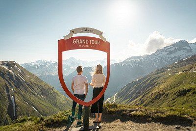
Switzerland is a stunning, versatile travel destination with so much to offer campers. The Grand Tour of Switzerland demonstrates this impressively along 1,643 km where you'll be able to discover five Alpine passes, 13 UNESCO World Heritage Sites and 22 lakes. Freeontour presents the best places, attractions and camping options for your next Swiss adventure.
What is the Grand Tour of Switzerland?
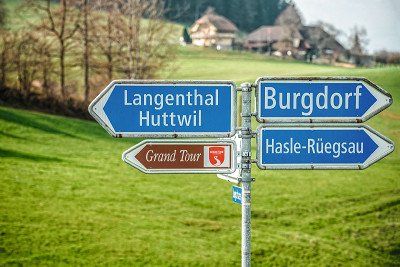
The Grand Tour of Switzerland is a circular tour of Switzerland in 25 stages. It was developed by the Switzerland Tourism organisation to promote the most scenic routes in the country, which they have also marked with signposts along the way. Accordingly, this road trip is not so much about the destination, but rather about travelling itself. You'll rarely see a motorway, instead it's a leisurely, winding journey through valleys and over mountains from north to south and back again. To avoid closed passes – winter closure or snowfall – the best time for a trip around Switzerland is between May/June and October. If you start in Zurich, you'll first go past Lake Constance to Appenzell and St Moritz, then to Lugano, Zermatt and Lausanne in the south and finally to Neuchâtel and Bern. But you can also set off from Basel, from where it's about 165 km to Neuchâtel.
You should, ideally, plan at least eight days for the entire journey by car to make sure that you have enough time for sightseeing, hiking or cycling. At least ten days are recommended if you are doing the tour in a motorhome due to the longer travel times. If you only have a week, expect to drive an average of six hours per day, maybe only managing half the tour and taking the motorway back. Freeontour presents the tour for campervans and motorhomes in eight stages, which should be spread over ten or more days depending on your interests and activities. You'll experience more than 2,000 metres in altitude when you consider that the highest point of the Grand Tour is the Furka Pass at 2,429 m above sea level and the lowest point Lake Maggiore at 193 m above sea level.
Alpine passes and motorhome restrictions along the Grand Tour
The Grand Tour of Switzerland goes over five Alpine passes that are at least 2,000 m above sea level:
1. Flüela Pass
Length: 27 km, max. gradient: 10%, usually closed in winter from January to April/May, no restrictions for motorhomes, bypass: Vereina car shuttle station from Klosters Selfranga to Sagliains
2. Julier Pass
Length: 16 km, max. gradient: 12%, accessible all year round (winter equipment is compulsory in the winter months), no restrictions for motorhomes
3. San Bernardino Pass
Length: 17 km, max. gradient: 9.7%, usually closed in winter from November to May, max. vehicle width: 2.30 m, max. weight: 18 t, bypass: San Bernardino Tunnel (vignette required) from Hinterrhein to San Bernardino. Please note: in the summer of 2023, the tunnel will be closed occasionally at night during the week due to renovation work
4. Gotthard Pass (Tremola)
Length: 24 km, max. gradient: 9%, usually closed in winter from October/November to May, the old Tremola road is only accessible for vehicles up to 3.5 t, bypass: new pass road (A2) or the Gotthard Road Tunnel from Airolo to Göschenen
5. Furka Pass
Length: 29 km, max. gradient: 11%, usually closed in winter from October/November to May/June, bypass: car train from Realp to Oberwald
Vehicles heavier than 3.5 t face one more restriction on the Grand Tour of Switzerland from Treyvaux to La Roche. They can take the alternative route via Serbache.
An overview of the stages
Stage #1: From Zurich to Appenzell, approx. 150 km
Stage #2: From Appenzell to St Moritz, approx. 160 km
Stage #3: From St Moritz to Bellinzona, approx. 160 km
Stage #4: From Bellinzona to Zermatt, approx. 196 km
Stage #5: From Täsch/Zermatt to Lausanne, approx. 175 km
Stage #6: From Lausanne to Neuchâtel, approx. 165 km
Stage #7: From Neuchâtel to Bern, approx. 240 km
Stage #8: From Bern to Zurich, approx. 320 km
Stage #1: From Zurich to Appenzell, approx. 150 km
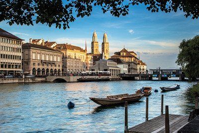
Zurich is a business hub, university city and trendy town all in one. It lies at the northern end of Lake Zurich and on the Limmat River. Its landmark is the Grossmünster – built around 1100, it was the starting point of the Reformation led by Ulrich Zwingli. Ulrich, actually Huldrych Zwingli, was the Martin Luther of Switzerland, a radical reformer whose theses paved the way for the Swiss Reformation. It's only a few metres from the Grossmünster to the Fraumünster church with the world-famous Chagall windows. Also worth seeing is the Kunsthaus, the largest art museum in Switzerland, which houses one of the largest art collections in Switzerland. The main shopping street is Bahnhofstrasse, known for its exclusive shops, jewellers and banks.
You can explore Lake Zurich either on an excursion boat or in one of the many Badis, as the locals affectionately call their public swimming baths. What else is a must when in Zurich? The classic: Züri-Gschnätzlets (ragout).
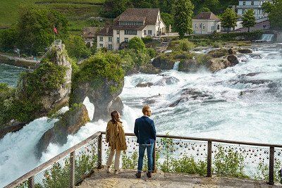
Stopover at the Rhine Falls
The route then continues for around 40 kilometres through the Zurich area to the Rhine Falls, the largest waterfall in Europe. Several hundred cubic metres of water thunder down 23 metres every second across a width of 150 metres. You can experience the waterfall close up by standing on a platform, some of which protrude over the Rhine. The best way to get there is via Laufen Castle where an interactive exhibition at the visitor centre provides a lot of interesting information on the Rhine Falls. The new adventure trail with a dual lift system and the Belvedere Trail make the Rhine Falls easy to access. The large P4 car park at the waterfall is suitable for motorhomes and you can park there for up to 17 hours. It's not too far from here to the banks of the Rhine where the many excursion boats can either ferry you to the other bank or take you on a small trip to the Rhine Falls. If you feel like walking, you can also hike for about one hour across the bridge to the observation platform at the Rhine Falls. Our tip: if you want to avoid the crowds, it's best to come early in the morning or late in the afternoon.
There are more motorhome pitches about one kilometre away outside of Neuhausen with supply and disposal facilities.
Along the shore of Lake Constance to St Gallen
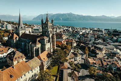
The road from Neuhausen will take you along the shore of Lake Constance to St Gallen, the historic city of books and textiles. The city's landmark is the St Gallen Abbey District with its Baroque cathedral and impressive library, which is a UNESCO World Heritage Site and houses 170,000 books. 50,000 of these are on display in the beautiful Baroque hall where you can also admire the 2,700-year-old Egyptian mummy of Schepenese.
Activities in Appenzell
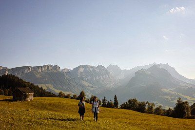
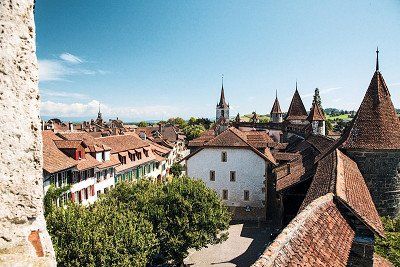
After experiencing so much culture and history, it makes a welcome change to end the day in rural Appenzell, which is incidentally the smallest Swiss canton with around 7,000 inhabitants. You can stroll through small streets with ornate houses in the car-free centre of the village of Appenzell. And when you venture out of the village and suddenly find yourself surrounded by massive rock formations rising 2,500 metres and more, you might just start wondering how it's even possible that hilly landscapes can change into the rocky Alpine world here so abruptly like nowhere else.
Appenzell has a particularly dense network of hiking trails, including adventure trails such as the barefoot trail near Gonten, a nature adventure trail and the chapel circular hiking trails. You can take the cable car from Wasserauen to the Ebenalp (1,644 m) and then hike for about 15 minutes to the wild chapel caves (Wildkirchli) clinging dramatically on to the rocks. Even more spectacular is the location of the Berggasthaus Aescher guesthouse, depicted thousands of times on postcards. The Ebenalp is also the starting point for hikes to the summit of the Säntis. However, if you don't want to sweat too much, take the suspension railway from Schwägalp up to the Säntis. Appenzell is perfect for a day of activities if you aren't pressed for time.
Campsites and RV parks in Appenzell
There are two campsites in Appenzell: Camping Jakobsbad and Camping Eischen. Or you could spend the night at one of the various RV parks in the region, e.g. at Gasthaus Rössli, on Brauereiplatz, in Appenzell-Schlatt near Zistlis or in Wasserauen on Schwendetalstraße.
Stage #2: From Appenzell to St Moritz, approx. 160 km
You'll come upon an impressive illustration of the formation of the Alps on the road from Appenzell to St Moritz – the UNESCO World Heritage Swiss Tectonic Arena Sardona between the Murgsee lake, Pizol mountain and Martin's Hole near Elm, where layers of rock have piled up high over millions and millions of years. Glaciers, wind and weather have shaped the top layer of the valleys, uncovering evidence of the continental plate shift. What makes it so unique is that the mountains are upside down, i.e. the mountain peaks that are visible today are actually older than the underlying rock, whereas it's usually the opposite.
A flying visit to Maienfeld, the Heidi Village
Maienfeld is a must for Heidi fans. The Heidi Village has a Heidi Trail that will take you through the idyllic mountain landscape to the Heidi House and the Heidi Alp. In fact, it was here in Maienfeld that the poet Johanna Spyri (1827-1901) was inspired by the landscape to write her children's classic book Heidi.
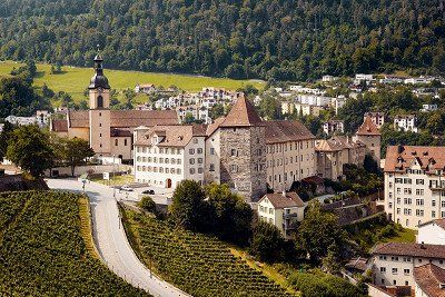
History stroll through the oldest city in Switzerland
After visiting Heidi's world in Maienfeld, we continue to Chur, with its 5,000-year history making it the oldest city in Switzerland. Stroll through the car-free Old Town with its winding streets and historic buildings surrounded by imposing mountains. Red signs guide you through the city, pointing the way to the most beautiful sights, squares and alleys. Make sure you visit the Bishop's Palace, the Cathedral of the Assumption of the Virgin Mary and as many of the restored buildings in the Old Town as you can.
If you have some time to spare, go on a trip with the Glacier Express, operated by the Rhaetian Railway, from Chur and discover the spectacular railway line through the Swiss mountains, which are a UNESCO World Heritage Site. This will give you a completely different view of the landscape than travelling by motorhome alone. It's also worth seeing the Swiss Grand Canyon: a gorge in the Anterior Rhine Valley created 10,000 years ago when 100 billion cubic metres of rock thundered down into the valley. The Rhine Gorge boasts a raging river and steep white walls. Down in the gorge, gentle sandbanks alternate between wild rapids. But you'll also find tranquil lakes, rare birds and even orchids in this small paradise. The gorge can easily be explored on foot, by bike, on the water and by public transport.
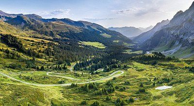
Over the Flüela Pass to St Moritz
The Grand Tour of Switzerland now goes over the Flüela Pass to St Moritz via Davos and Klosters. 27 kilometres full of bends and fascinating mountain panoramas await you, therefore expect the journey to take a little longer. The destination of this stage is St Moritz in the Upper Engadine – the site of two Olympic Winter Games and a summer health resort thanks to its mineral springs. Today, St Moritz is primarily known as a luxurious holiday spot for the global upper-class. Gourmet temples, luxury hotels and international congresses have put St Moritz on the map. Sights such as the leaning tower, remains of the Saint Mauritius Church from around 1500 or the Segantini Museum offer a change from luxury and the jet set. The Ludains artificial ice rink is also open to ice skaters throughout the summer, and there are 17 climbing gardens with different levels of difficulty for climbing enthusiasts. Relax at the end of the day by taking a leisurely stroll along the lake and enjoying the panorama.
Campsites and RV parks near St Moritz
The St Moritz campsite lies at 1,800 m above sea level. It usually opens in mid-May and has a designated area for motorhomes at the Caravan Village. You can park overnight in the Via Sela car park, but it has no water, electricity or disposal facilities. There are motorhome pitches in Rona and in Dinvei Stierva, both around 30 km from St Moritz.
Stage #3: From St Moritz to Bellinzona, approx. 160 km
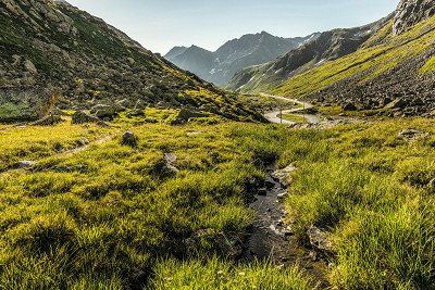
This stage of the Grand Tour takes you to Mediterranean climes and includes two Alpine passes, which is why you could also think about splitting this stage into two days and staying somewhere overnight roughly halfway. It starts at the Julier Pass, just after Lake Silvaplana on the wide lake plateau of the Upper Engadin. You'll have completed most of the ascents and serpentine roads by the time you get to the ski resort of Bivio. The road is consistently wider than 5 metres and manageable for motorhomes.
Make a stop at Parc Ela behind the pass road. It's the largest nature park in Switzerland and perfect for hiking. Discover rugged mountain ranges, steep gorges and hilly mountain meadows on foot or by mountain bike. This region also has an exciting mix of cultures as it's the only canton with three official languages – German, Romansh and Italian.
Along the Hinterrhein River and over the San Bernardino Pass
The journey continues on a country road, past the turn-off down into Albula Valley to Thusis and then along the Hinterrhein River to Andeer. Shortly after Andeer, a serpentine road takes you into the Rofla Gorge where you can visit a waterfall and rock gallery. Road 13 will take you along the Hinterrhein to the village of Sufers and past Crestawald Fortress on to Splügen and Nufenen. The ascent to the San Bernardino Pass, which connects the Hinterrhein Valley with Ticino, begins just behind the Hinterrhein. In general, motorhomes shouldn't have any problems using the pass road, but there are a few narrow hairpin bends, which is why overtaking is prohibited on that section of the route.
Embrace la dolce vita in Bellinzona
After two Alpine passes and what feels like never-ending serpentine roads, the day ends with some dolce vita in Bellinzona. Not only can you enjoy some espresso and ice cream on the traffic-calmed Piazza Collegiata, but also beautiful Renaissance buildings and a market at the weekend. The capital of Ticino lies like a funnel in the narrow valley where a number of passes converge. The main attractions in Bellinzona are three recently restored castles: Castelgrande, Montebello and Sasso Corbaro were built to control access to the Alpine passes as well as the trade in goods to and from the Gotthard Pass.
Leave your car or motorhome at the campsite or RV park and you'll appreciate the comfortable ride in the small tourist train from the Old Town of Bellinzona to Castello Montebello and Castello di Sasso Corbaro. You can hop on and off at the most important sights and historic places along the way. The round trip takes about an hour. You can buy tickets either at the train station just before the train departs or at the Bellinzona Tourist Office.
Where to stay in Bellinzona
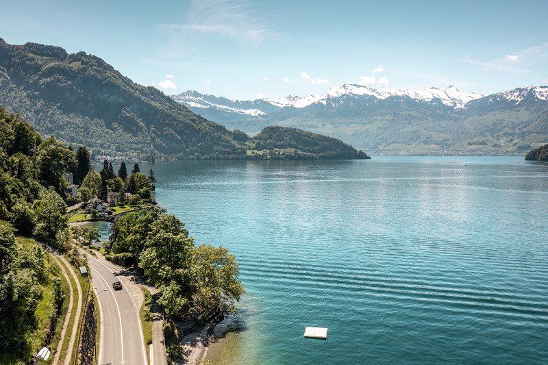
You can spend the night in Bellinzona at the Camping Bellinzona campsite on the banks of the Ticino River or at the RV park on Via Brunari, both of which are within walking distance of the Old Town. If you drive about 20 km further south towards Locarno or Vira, you can also spend the night right by Lake Maggiore.
Stage #4: From Bellinzona to Zermatt, approx. 196 km
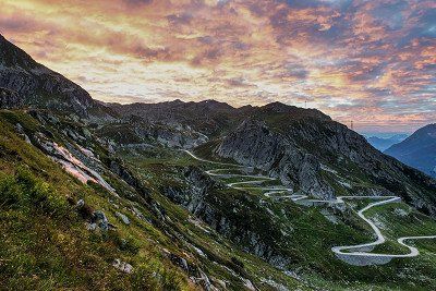
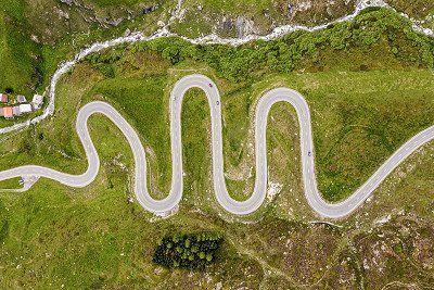
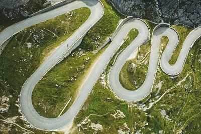
We now get to the stage of the Grand Tour of Switzerland with the most hairpin bends. The Tremola winds its way from Airolo up to the Gotthard Pass. The most spectacular section of the tour is where this road climbs 300 metres in altitude over four kilometres with 24 hairpin bends, which even have their own names. Considered to be the longest monument in Switzerland, this road is, however, only accessible for motorhomes up to 3.5 t. If your motorhome is heavier, you'll have to use the new pass road or the Gotthard Tunnel – or treat yourself to a ride in the post coach, still pulled up the Tremola by five horses. Book in advance as it's very popular. Today, the Gotthard Pass and the Gotthard Tunnel are the most important north-south connections. In 1882, the famous Gotthard Rail Tunnel – and with it the Gotthard railway – was opened, followed almost 100 years later by the A2 motorway tunnel.
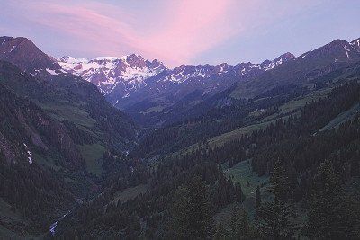
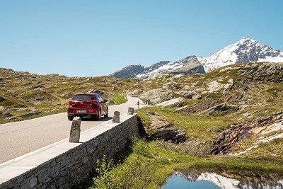
The Furka Pass and Rhône Glacier
The old Gotthard Pass road meets the new A2 pass road just before Hospental. If you've had enough bends for the day, choose a campsite or RV park in the area around Hospental or Andermatt and enjoy the mountain panorama either by hiking or relaxing for the rest of the day. But there's one more Alpine pass waiting for you on your way to Zermatt: the Furka Pass. It's the last major Alpine pass on the Grand Tour of Switzerland. Between Realp and Oberwald, it connects the Urseren Valley (canton of Uri) with the district of Goms (canton of Valais). You can access the end of the Rhône Glacier on the west side of the pass from the 19th-century Hotel Belvédère, which has been closed since 2015. If you park your motorhome at the former hotel, you first have to walk about 200 metres before arriving at the entrance to an ice grotto with a 100-metre-long ice tunnel that is drilled anew every year. The panorama platform offers a fascinating view of the glacier. Incidentally, a new glacial lake is being formed at the end of the glacier between the melting front of the Rhône Glacier and a striking rock ledge, which will also be given its own panorama platform in the next few years.
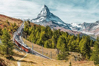
Zermatt and the Matterhorn panorama
On to the next highlight of the Grand Tour of Switzerland: the Matterhorn. This huge, pyramid-shaped mountain is considered to be the most photographed mountain in the world, with its characteristic, unmistakable shape bearing responsibility for this claim to fame. In the shadow of this giant lies the small, car-free town of Zermatt, which can only be reached on foot, by mountain bike or by train from Täsch. The last campsites before Zermatt are also in Täsch. Another option is to leave your motorhome or campervan on one of the outdoor parking spaces at the Matterhorn Terminal Täsch, from where there is a regular shuttle train service to Zermatt. You can choose which type of mountain railway you want to take from Zermatt to get the best view of the Matterhorn, e.g. from the Klein Matterhorn (Matterhorn Glacier Paradise). You can take a cable car from Zermatt to the mountain station at 3,820 m above sea level, the highest cable car station in the Alps. Other observation points include the Gornergrat or the Rothorn. The first electric rack railway in Switzerland takes about 30 minutes to get to the Gornergrat from Zermatt. The viewing platform is open all year round.
Where to stay in Zermatt
You can spend the night with all the usual comforts at the Camping Alphubel campsite in Täsch. There's also an RV park at Taxi Christophe.
Stage #5: From Täsch/Zermatt to Lausanne, approx. 175 km
After so many Alpine passes and high peaks on the first part of the tour, culture and relaxation are now on the agenda. Starting in Visp, the route goes west through the Rhône Valley (canton of Valais) along the Rhône the entire time. The first stop before Lake Geneva is the small town of Saint-Maurice. It lies on a very narrow part of the Rhône, which is why the Romans settled here. The oldest abbey in Switzerland was founded here around 515 AD and houses one of the oldest church treasures in Europe – a must on your itinerary.
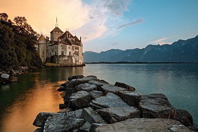
Chillon Castle on Lake Geneva
We continue along the Rhône to Lake Geneva where the next historic highlight awaits. Chillon Castle lies on a rock on the shore of Lake Geneva near Veytaux. For almost four centuries, Chillon was the home and profitable customs station of the Counts of Savoy. More than 400,000 visitors a year come to Chillon Castle to see its murals from the 14th century, the underground vaults, formal great halls and the original bedroom from the Bernese period. The entire complex consists of 25 buildings and three courtyards protected by two ring walls. So plan some time here for a sightseeing break and preferably reserve tickets in advance to avoid having to stand in a long queue.
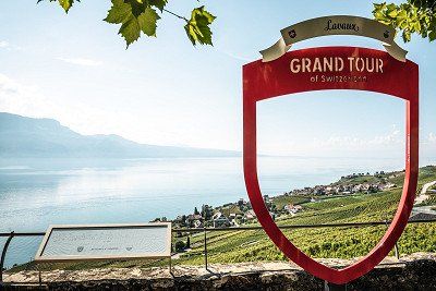
Lavaux Vineyard Terraces, a World Heritage Site
Just before Lausanne you'll pass by the Lavaux Vineyard Terraces, a UNESCO World Heritage Site, with magnificent views of the surrounding area. The first terraces were laid out by monks on the steep slopes of Lake Geneva as early as the 11th century. This wine-growing region stretches over 40 kilometres, making it one of the largest wine-producing regions in Switzerland. You can explore it comfortably in the blue and yellow Train des Vignes, a tourist train that winds its way from Vevey through the vines up to Puidoux-Chexbres. You can taste what grows here in the small towns: practically every cellar offers wine tastings. Narrow streets and typical winegrowers' houses dominate villages such as Saint-Saphorin with the Auberge de l'Onde brasserie. And to really acquire a taste for it, visit one of the charming inns – after preferably parking your motorhome at Camping de la Pichette or Camping de Moratel.
Sightseeing and culture in Lausanne
The second largest city on Lake Geneva, Lausanne is best known as the headquarters of the International Olympic Committee. The Savoy Alps rise impressively on the French shores opposite. The beautiful Old Town is mainly car-free and the only Swiss city to have a metro. The medieval town centre is full of small alleys with cafés and boutiques, overtowered by the cathedral in the middle. After all, Lausanne was a diocese for more than 1,000 years. Also worth seeing are the Mediterranean-style parks, the art district and magnificent palace hotels such as the Hôtel de l'Angleterre where Lord Byron once stayed. If you want to try some local cuisine, Papet Vaudois (leeks and potatoes with sausages) is a popular regional speciality.
Where to stay in Lausanne
The Camping de Vidy campsite is located very centrally and also offers motorhome pitches in the outdoor area for anyone passing through. It's a great base for exploring most sights on foot or by bike. The TCS Camping Morges campsite lies directly on Lake Geneva and is about eleven kilometres from Lausanne.
Stage #6: From Lausanne to Neuchâtel, approx. 165 km
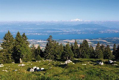
We continue from Lake Geneva into the hilly landscape of the Jura Vaudois Nature Park, which stretches from the La Dôle summit to the medieval monastery town of Romainmôtier. In the park you'll find the Orbe and Nozon Gorges, the Jura crest between Col de la Givrine and Col du Mollendruz mountain passes/Dent de Vaulion mountain, the southern foot of the Jura, the Mont Risoux massif and the Vallée de Joux. Lonely forests, mystical moors, rugged karst rocks, clearings and pasture landscapes surrounded by typical dry stone walls with the equally typical chalets (alpine huts) offer a lot of space for hikers and mountain bikers. If you want to be physically active, you'll be spoiled for choice. And even if you just want to make a quick stop with your motorhome, you'll frequently be able to enjoy sweeping panoramas from the Jura mountains and the southern foot of the Jura over Lake Geneva to the highest Alps.
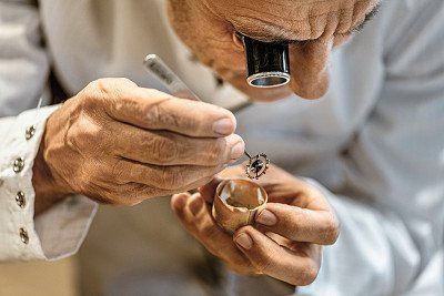
Watchmaking in the Vallée de Joux
The Vallée de Joux lies at an altitude of about 1,000 m in the north of the Jura Vaudois Nature Park. It's a small world of its own, nestled along with Lac de Joux and a long watchmaking tradition between two Jura mountains. You can enjoy a fantastic panorama from Mont Tendre – at 1,679 m the highest peak in the Swiss Jura – over Lake Geneva and the Savoy Alps to the Bernese Oberland. The Lac de Joux at 1,000 m altitude is the largest body of water in the Jura massif. A regional railway line runs along the lake and through pine forests and Jura moorland from Vallorbe to Le Sentier and Le Brassus – two villages that have been the centre of the Swiss watch industry for almost 300 years and worth visiting, if only to admire this handicraft.
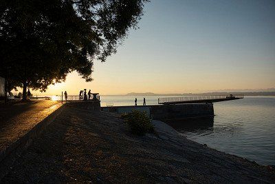
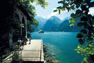
Relaxing at Lake Neuchâtel
38 km long and 8 km wide, Lake Neuchâtel is the largest lake in Switzerland. And on its northwestern shore lies the largest city in the region – Neuchâtel, known for its yellow sandstone buildings. The medieval town centre has many cafés and restaurants, shopping opportunities, theatres and museums, while the beach promenade is perfect for taking a stroll. The city's landmarks, visible from afar, include the Castle and the Collegiate church, a Gothic reformed church from the Middle Ages. The Laténium is the largest archaeological museum in Switzerland, with more than 50,000 years of regional history on display. You should also visit the Place des Halles (Market Place) and the L'Hôtel de Ville (Town Hall). If you're interested in art and literature, head to the Centre Dürrenmatt where the permanent exhibition showcases the paintings of the writer Friedrich Dürrenmatt in relation to his literary works.
Camping and parking in Neuchâtel
Vineyards dominate the northern shore of the lake. There are campsites outside of Neuchâtel, roughly 15 minutes from the city, e.g. Camping Paradis-Plage in Colombier to the west of Neuchatel or Camping La Tène to the east at the foot of the Chaumont mountain and right by Lake Neuchâtel. There are motorhome pitches at Euro-Relais at the port of Saint-Blaise and just outside of Neuchâtel above the city at the Hotel-Restaurant La Croisée in Boudevilliers.
Stage #7: From Neuchâtel to Bern, approx. 240 km
This is the stage where Switzerland shows its abundance of water and medieval buildings. The route goes from Lake Neuchâtel to Lake Murten, Lake Schiffenen, Lake of Gruyère, Lake Thun, Lake Brienz and finally along the Aare to the capital Bern. But our first stopover is at the small, medieval town of Murten on the southeastern shore of the lake of the same name. Located on the border between German-speaking and French-speaking Switzerland, this city has retained its original character with its picturesque Old Town streets, cosy arcades and wonderful lakeside promenade. After a stroll through the city, why not take to the lake – you can even go on a trip through canals to Lake Neuchâtel and Lake Biel. If you're feeling active, there are 170 km of bike trails and 90 km of slopes for inline skaters to take advantage of. A popular bike tour around Lake Murten takes a good two hours. And if that's not enough, you can admire tropical plants and animals in the Papiliorama and Nocturama gardens nearby.
The Gothic period and Middle Ages in Fribourg and Gruyères
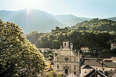
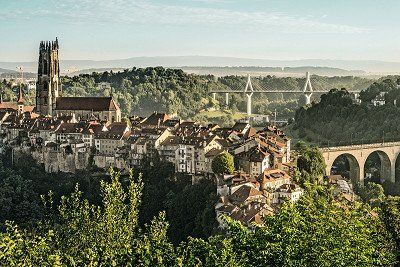
If you want to surround yourself with amazing medieval architecture, head to Fribourg. It's one of the largest medieval cities in Switzerland and you'll find more than 200 unique Gothic façades from the 15th century in its Old Town. The most impressive building, however, is the Cathedral of Fribourg with its beautiful stained glass windows and 74-metre-high tower, from which you can enjoy a beautiful panoramic view. An old funicular railway will take you from the Neuveville district (Lower Town) to the pedestrianised areas in the Upper Town.
The town of Gruyères doesn't seem to have changed since the Middle Ages. The fortified Castle of Gruyères from the 13th century alone is impressive with its magnificent exhibitions, knight's hall, towers, battlements, defensive walls, garden and stunning panorama of the foothills of the Alps. And the small, car-free town itself offers one photo spot after another, after which you can treat yourself to a delicious cheese fondue or another cheese speciality for lunch.
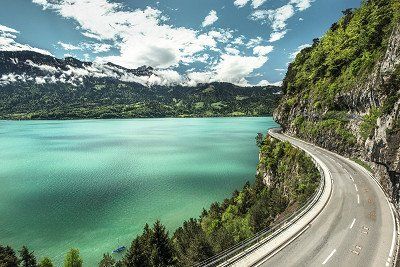
A scenic road and the St Beatus Caves on Lake Thun
We continune from Gruyères via Zweisimmen to Spiez on Lake Thun where fantastic panoramas on the journey along the lakeside road await you. Make sure your camera is always within reach. Another highlight: high above Lake Thun near Interlaken lies a unique cave system in the St Beatus Caves. A well-developed and illuminated path lets you explore about one kilometre of the Niederhorn massif with stalactites and stalagmites formed over millions of years. There's also a cave museum that you can visit. The temperature is a constant 8-10 °C all year round, so make sure you take a warm jacket with you. There's paid parking near the bus stop close to the St Beatus Caves. If you're staying nearby, it's best to take the 21 bus to the St Beatus Caves (Beatushöhlen) stop. Then it's just a short walk through the forest and across some bridges before you can start taking photos of a waterfall from inside the cave.
A medieval finale in Bern
Founded in 1191, the capital Bern is the final stop of this stage. You'll find miles of arcades, Renaissance fountains with statues, a cathedral, largely preserved sandstone façades and a unique roofscape here. This town is one of the greatest testimonies to medieval town planning in Europe and a positive example of how a medieval urban structure can be preserved and yet adapted to also serve contemporary needs and functions.
Campsites near Bern
You can stay at the TCS Camping Bern Eymatt campsite or at the more centrally located Camping Eichholz campsite.
Stage #8: From Bern to Zurich, approx. 320 km
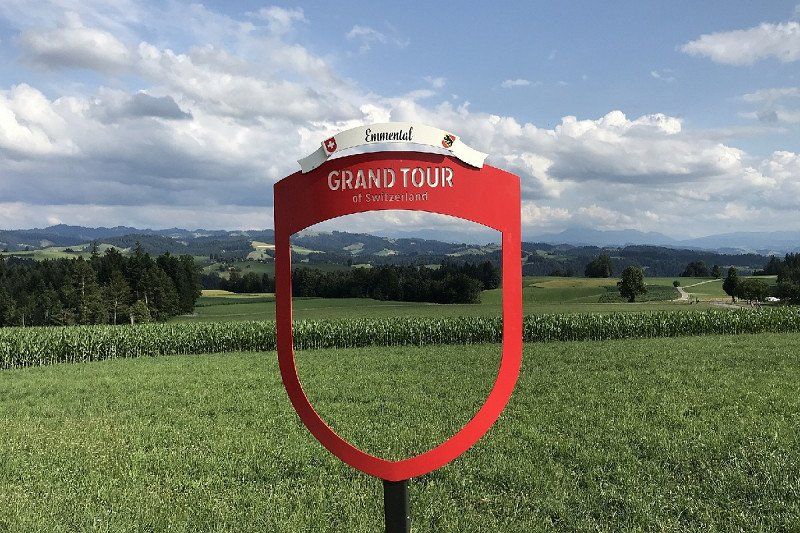
The world-famous Emmental Valley is a must on any trip across Switzerland – as is the cheese produced there. Many tourists like to visit the dairy centre with cheesemaking demonstrations. If it's too crowded, you can stop off at any of the villages and towns along the road through the Emmental Valley and treat yourself to some delicious cheese. The tour continues through the Emmental Valley and then through Entlebuch, a UNESCO Biosphere Reserve, which has amazing huge moor landscapes, rugged karst fields and wild mountain streams. If you want to stretch your legs, choose one of the numerous hiking trails and go for it. Or you can drive a little further until just before Seengen and visit Hallwyl Castle, one of the most beautiful moated castles in Switzerland whose imposing castle complex is spread over three islands on Lake Hallwil.
Stopover in Lucerne on Lake Lucerne
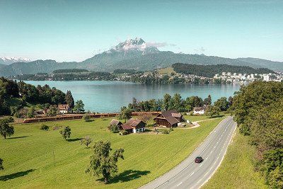
Or you can continue straight on to the town of Lucerne on Lake Lucerne. This city is regarded as the gateway to Central Switzerland and has so much to offer that you could easily spend several days here exploring it all. A popular photo spot is the covered, medieval Chapel Bridge with gable paintings, which is considered to be one of the oldest covered wooden bridges in Europe. Another landmark is the Musegg Wall (Museggmauer), which apart from one tower has been preserved in its original fortified form. Moreover, historic houses decorated with frescoes in the car-free Old Town surround picturesque squares such as the Weinmarkt (Wine Market). The dying lion, carved into a rock in a small park to commemorate the Swiss Guards who fell in the Tuileries Palace in Paris in 1792, is one of Switzerland's most famous monuments. And stretching 112 m, the Bourbaki Panorama in Lucerne is one of the few surviving monumental circular panoramic paintings in the world.
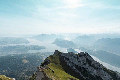
We don't want to forget Lucerne's local mountain, the Pilatus, which can offer a panoramic view of 73 Alpine peaks when the weather's good. You can get to the mountain from Lucerne by gondola and cable car or from Alpnachstad by the steepest cog railway in the world. So you can tour the area by paddle steamer, cog railway, cable car and bus, and even combine any of these options with a hike – it might just be a good idea to plan more time here to enjoy as many modes of transport as possible.
Campsites near Lucerne
You can spend the night at the Camping International Lido Luzern campsite or at the TCS Camping Luzern campsite in Horw.
Swiss Myths – The Rütli Meadow and Tell Chapel
Two of the best-known Swiss tourist attractions can be found right at the end of the Grand Tour of Switzerland. You could also think about taking an excursion boat from Lucerne to get there, therefore, avoiding the stress of looking for a parking space as well as not having to take the not-so-cheap car ferry from Gersau to Beckenried where a motorhome with just one person costs as much as CHF 30. Anyway, our next stopover is at Rütliwiese (Rütli Meadow). This takes us back to the founding of Switzerland because this is where the oath of allegiance forming the Swiss Confederation is said to have been taken in 1291. A one-hour hike on the Swiss Path will take you from Seelisberg to the Rütli Meadow; you'll need to be somewhat fit as the trail is steep and strenuous.
The last stop on the Grand Tour of Switzerland is the Tell Chapel near Sisikon, which was built in 1879/80 and is decorated with four magnificent frescoes by the painter Ernst Stückelberg from Basel. The frescoes depict the Rütli Oath, the Shooting of the Apple, Tell's Leap and Gessler's Death in Hohle Gasse. The chapel here on Lake Uri marks the site where William Tell is said to have leapt out of Gessler's boat to save himself from the bailiff. You can get to the Tell Chapel by boat or on foot from the car park at Hotel Tellsplatte.
Incidentally, the largest glockenspiel in Switzerland can be found above the Tell Chapel where it chimes on the hour, heralding the end of our Grand Tour of Switzerland as our journey now takes us back to Zurich where our trip started.