Unfortunately, we don't support your browser (Internet Explorer) anymore, some functionalities could not work. Click here to get information on how to upgrade your browser.
Public
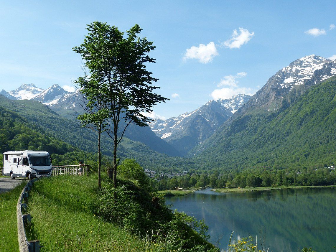
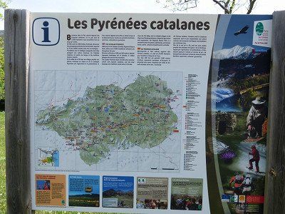
Across the Pyrenees
Straight through the Pyrenees.
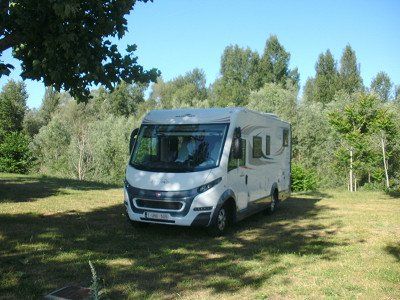
For the next 3 weeks we will do all the well-known Pyrenees cols this time, by bike.... on the back of the camper.
From the green north side on the Atlantic Ocean to the rugged south side in Spain to end at the Mediterranean Sea at the other foot of the Pyrenees.
Legendary impressive mountains, changing landscapes, and picturesque villages await us during our Campervan trip through this French-Spanish mountain range.
This description was automatically translated from Dutch using Google Translate and may not be completely accurate.
Show in original language (Dutch)

monfran
Route info
1740 Kilometres
22 Days
40 Waypoints
Vehicle info
Add own vehicle
Copy route and test with own vehicle
Travelogue
Day 1
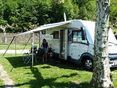
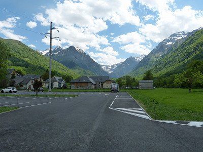
Surroundings Niort 719km - Prahecq Parking Municipal - 0€ free electricity
Sunday 8 May we drove to near Niort with an overnight stay at the 'Aire Municipal pour camping cars' of Prahecq.
Computer said : Arrival 4:30 pm, 29°, 716 km, consumption 11.1 L/100 km, average 91 km/h, travel time 7:50 hours.
Sunday 8 May we drove to near Niort with an overnight stay at the 'Aire Municipal pour camping cars' of Prahecq.
Computer said : Arrival 4:30 pm, 29°, 716 km, consumption 11.1 L/100 km, average 91 km/h, travel time 7:50 hours.

01 Prahecq - Parking Municipal
31 Rue du Chateau, 79230 Prahecq, Frankrijk
Surroundings Niort 719km - Prahecq Parking Municipal - 0€ free electricity
Sunday 8 May we drove to near Niort with an overnight stay at the 'Aire Municipal pour camping cars' of Prahecq.
Computer said : Arrival 4:30 pm, 29°, 716 km, consumption 11.1 L/100 km, average 91 km/h, travel time 7:50 hours.
Sunday 8 May we drove to near Niort with an overnight stay at the 'Aire Municipal pour camping cars' of Prahecq.
Computer said : Arrival 4:30 pm, 29°, 716 km, consumption 11.1 L/100 km, average 91 km/h, travel time 7:50 hours.
Day 2
Monday 9 May on to Saint-Jean-Pied-de Port, the foot of the Pyrenees .
Computer said : Arrival 3:15 pm, 29°, 427 km, consumption 12L/100km, average 79km/h, travel time 5:20 hours.
Computer said : Arrival 3:15 pm, 29°, 427 km, consumption 12L/100km, average 79km/h, travel time 5:20 hours.
64220, St Jean Pied De Port, France
Monday 9 May on to Saint-Jean-Pied-de Port, the foot of the Pyrenees .
Computer said : Arrival 3:15 pm, 29°, 427 km, consumption 12L/100km, average 79km/h, travel time 5:20 hours.
Computer said : Arrival 3:15 pm, 29°, 427 km, consumption 12L/100km, average 79km/h, travel time 5:20 hours.
Day 3
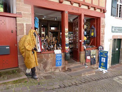
Bezoek Saint-Jean-Pied-de-Port
Show in list
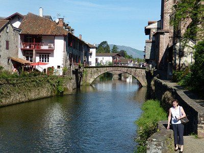
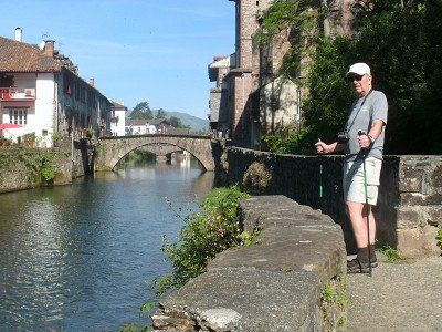
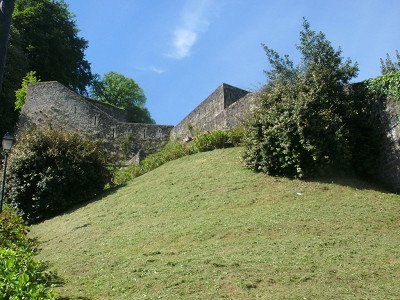
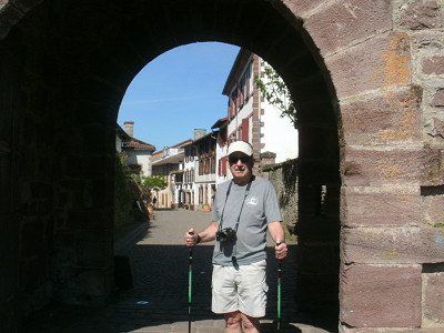
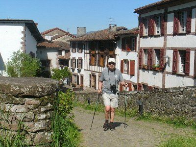
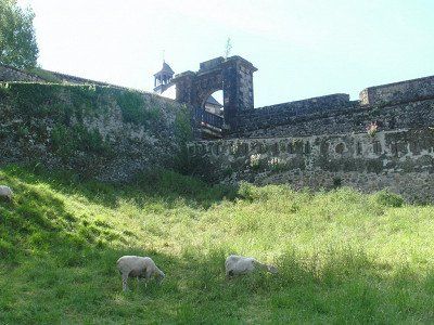
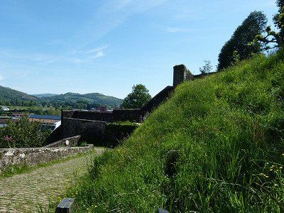
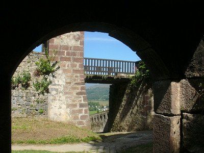
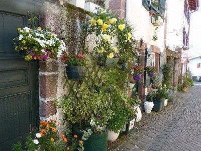
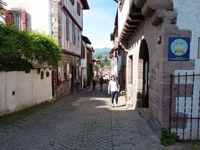
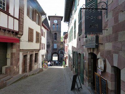
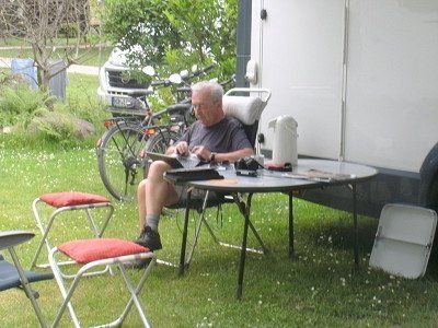
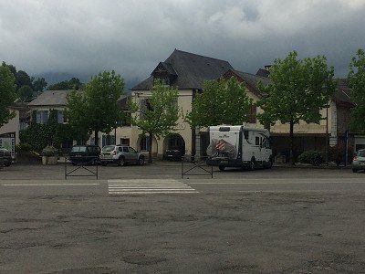
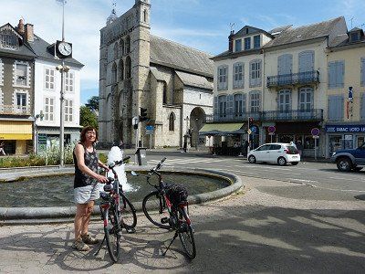
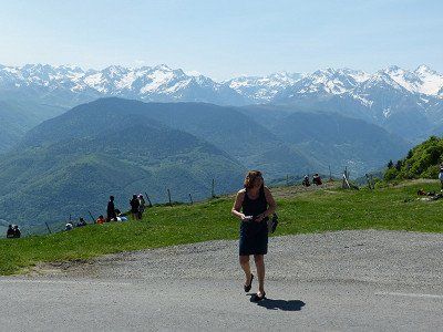
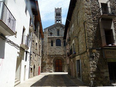
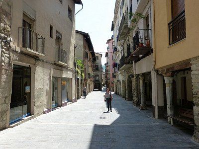
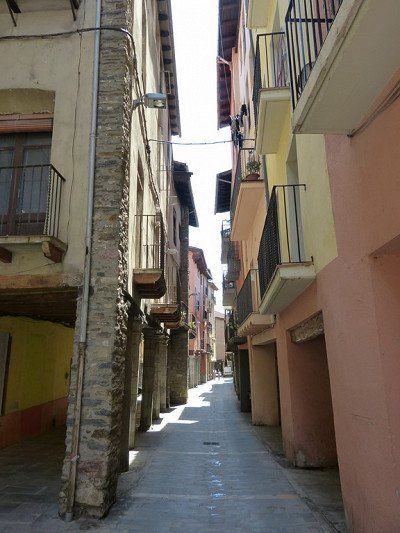
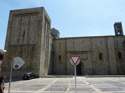
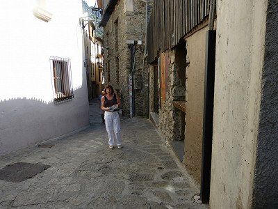
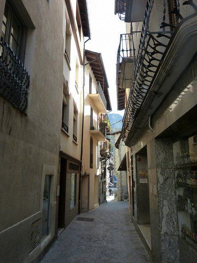
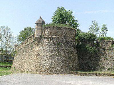
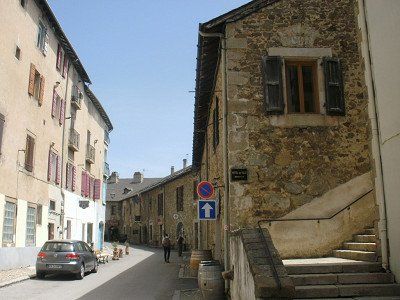
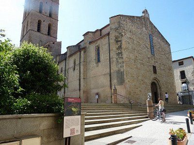
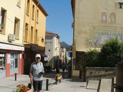
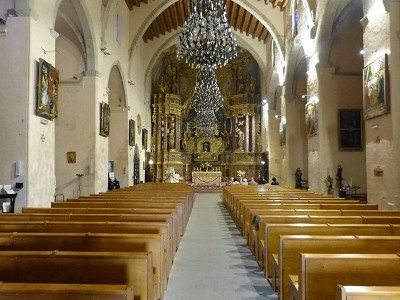
Tuesday May 10. Stay in Sain-Jean-Pied-de-Port . A picturesque fortified town on the pass road that leads over the Pyrenees to Spain. The 16th century town has traditionally been a crossroads of the main routes to Santiago de Compostela . The city is walled and has an old fortress, Citadel, fortified in the 17th century by who other than Vauban. It is not even a meter flat here, not to say very steep. So we would make a tour with the tourist train. Departure at 11am. We already knew that from our visit to the Tourist Office the day before. Sorry, the train is not running today! 'Un problème de chaffeur, demain', the madam now said. So Manana. It is only 8 km from Spain here. Hence maybe. Then an attempt on foot to the Citadel. Until halfway on a couch. Too many stairs for me. Not for Mama.
visit Saint-Jean-Pied-de-Port. The area around is very suitable for walking or cycling, but there are a few slopes.
There is the possibility to drive through the city with a tourist train past all the sights and to the fortress above. Departure from Place du Genéral De Gaulle opposite the town hall, approximately € 6.00 pp Location station
43°09'47.3"N 1°14'14.7"W
Saint-Jean-Pied-de-Port / Nouvelle-Aquitaine /
Bezoek Saint-Jean-Pied-de-Port
Tuesday May 10. Stay in Sain-Jean-Pied-de-Port . A picturesque fortified town on the pass road that leads over the Pyrenees to Spain. The 16th century town has traditionally been a crossroads of the main routes to Santiago de Compostela . The city is walled and has an old fortress, Citadel, fortified in the 17th century by who other than Vauban. It is not even a meter flat here, not to say very steep. So we would make a tour with the tourist train. Departure at 11am. We already knew that from our visit to the Tourist Office the day before. Sorry, the train is not running today! 'Un problème de chaffeur, demain', the madam now said. So Manana. It is only 8 km from Spain here. Hence maybe. Then an attempt on foot to the Citadel. Until halfway on a couch. Too many stairs for me. Not for Mama.
visit Saint-Jean-Pied-de-Port. The area around is very suitable for walking or cycling, but there are a few slopes.
There is the possibility to drive through the city with a tourist train past all the sights and to the fortress above. Departure from Place du Genéral De Gaulle opposite the town hall, approximately € 6.00 pp Location station
43°09'47.3"N 1°14'14.7"W
Saint-Jean-Pied-de-Port / Nouvelle-Aquitaine /
visit Saint-Jean-Pied-de-Port. The area around is very suitable for walking or cycling, but there are a few slopes.
There is the possibility to drive through the city with a tourist train past all the sights and to the fortress above. Departure from Place du Genéral De Gaulle opposite the town hall, approximately € 6.00 pp Location station
43°09'47.3"N 1°14'14.7"W
Saint-Jean-Pied-de-Port / Nouvelle-Aquitaine /
Day 4
04 verplaatsing naar Oloron-Sainte-Marie --Aire Municipale
26-, 32 N134, 64400 Oloron-Sainte-Marie, Frankrijk
Show in list
Show on map
Computer said : Arrival 12:15, 19°, 71 km, consumption 9.9 L/100km, average 38 km/h, travel time 2:00 hours. Short trip from Saint-Jean-Pied-de-Port to Oloron-Sainte -Marie.
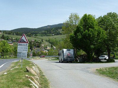
Discover the green Pyrenees, yellow routes départementales and past rural villages with bilingual signs. Those in Basque are unpronounceable. Always with traffic brakes and max 30km signs.
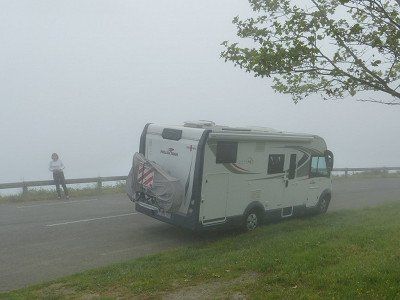
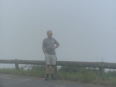
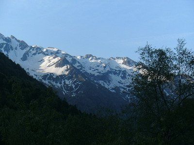
The Col d'Osquich after 15 km we did completely in the fog. Probably left too early. Sleep longer in the future.
Because 2 hours later blue sky and 26° in Oloron-Sainte-Marie.
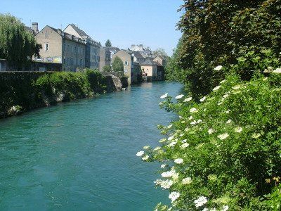
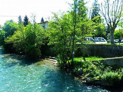
Relax in the shade of the 'Aire pour camping cars' in the center of the town in a park along the mountain river.
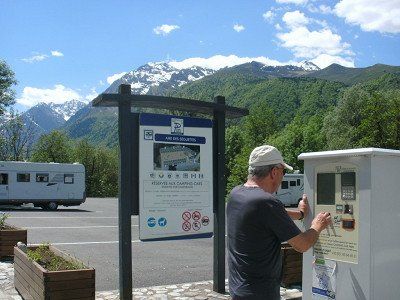
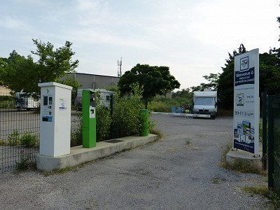
Free, but electricity has to be paid for with a €3 token for 55 minutes and can be purchased at the Tourist Office. Too much effort for us. We can do without.

04 verplaatsing naar Oloron-Sainte-Marie --Aire Municipale
26-, 32 N134, 64400 Oloron-Sainte-Marie, Frankrijk
Computer said : Arrival 12:15, 19°, 71 km, consumption 9.9 L/100km, average 38 km/h, travel time 2:00 hours. Short trip from Saint-Jean-Pied-de-Port to Oloron-Sainte -Marie.
Discover the green Pyrenees, yellow routes départementales and past rural villages with bilingual signs. Those in Basque are unpronounceable. Always with traffic brakes and max 30km signs.
The Col d'Osquich after 15 km we did completely in the fog. Probably left too early. Sleep longer in the future.
Because 2 hours later blue sky and 26° in Oloron-Sainte-Marie.
Relax in the shade of the 'Aire pour camping cars' in the center of the town in a park along the mountain river.
Free, but electricity has to be paid for with a €3 token for 55 minutes and can be purchased at the Tourist Office. Too much effort for us. We can do without.
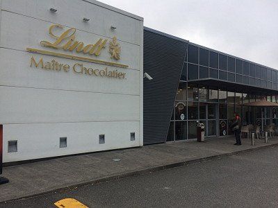
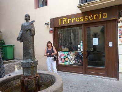
04 Chocolaterie LINDT - Oloron-Sainte-Marie
4 Av. Mal de Lattre de Tassigny, 64400 Oloron-Sainte-Marie, Frankrijk
Show in list
Show on map
We couldn't pass up a visit to this Chocolaterie.
Certainly not with such a large parking lot in front of the door.
Certainly not with such a large parking lot in front of the door.
04 Chocolaterie LINDT - Oloron-Sainte-Marie
4 Av. Mal de Lattre de Tassigny, 64400 Oloron-Sainte-Marie, Frankrijk
We couldn't pass up a visit to this Chocolaterie.
Certainly not with such a large parking lot in front of the door.
Certainly not with such a large parking lot in front of the door.
Day 5
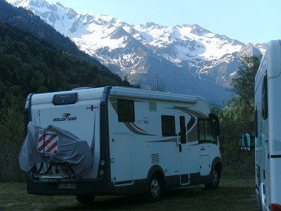
05 Aire de Camping-Car d'Artouste - Laruns,
19 D431, 64440 Laruns, Frankrijk
Show in list
Show on map
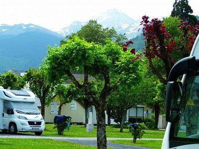
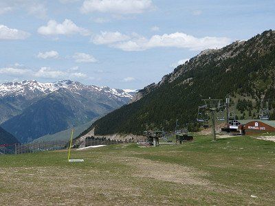
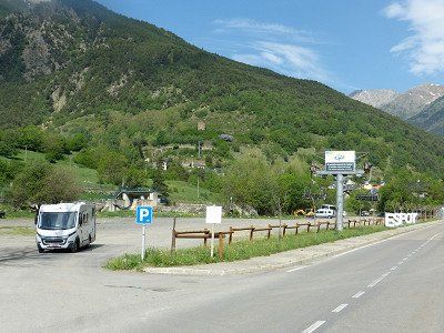
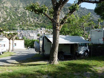
Aire de Camping-Car d'Artouste - on the Lac de Fabrèges reservoir - near the ski lift and Petit Train d'Artouste [June to September] - quiet at night - center and shops 200m
free - no electricity
Laruns – Thursday, May 12, 2022
Computer said : Arrival 12:30, altitude 1263m, 25°, 60 km, consumption 14.4 l /100km, average 33 km/h, travel time 1:50 hours.
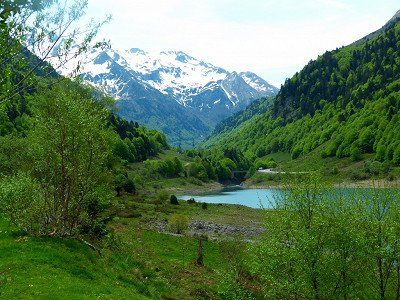
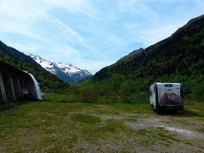
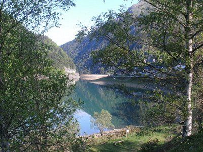
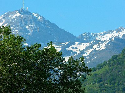
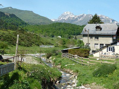
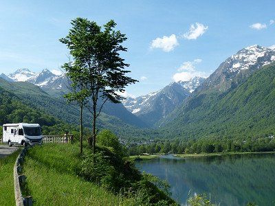
Short drive to Laruns, in the Col d'Aubisque area . Actually 20 km higher up towards Spain into the mountains to a reservoir with ski center and cable lifts to the station of Le Petit Train d'Artouste. That train takes 50 minutes to the highest reservoir in Europe (1997m).
Unfortunately, the elevators were not working, the train was not running. It's still dead season until May 22.
'It is what it is' said someone from Merchtem!
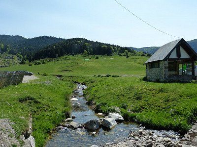
Fortunately a sunny day in a beautiful setting. Beautiful place on the edge of the reservoir, surrounded by peaks of about 2000m. Complete tranquility. A Dutch neighbour. No traffic on the road. Who would come here now?
free - no electricity
Laruns – Thursday, May 12, 2022
Computer said : Arrival 12:30, altitude 1263m, 25°, 60 km, consumption 14.4 l /100km, average 33 km/h, travel time 1:50 hours.
Short drive to Laruns, in the Col d'Aubisque area . Actually 20 km higher up towards Spain into the mountains to a reservoir with ski center and cable lifts to the station of Le Petit Train d'Artouste. That train takes 50 minutes to the highest reservoir in Europe (1997m).
Unfortunately, the elevators were not working, the train was not running. It's still dead season until May 22.
'It is what it is' said someone from Merchtem!
Fortunately a sunny day in a beautiful setting. Beautiful place on the edge of the reservoir, surrounded by peaks of about 2000m. Complete tranquility. A Dutch neighbour. No traffic on the road. Who would come here now?


05 Aire de Camping-Car d'Artouste - Laruns,
19 D431, 64440 Laruns, Frankrijk
Aire de Camping-Car d'Artouste - on the Lac de Fabrèges reservoir - near the ski lift and Petit Train d'Artouste [June to September] - quiet at night - center and shops 200m
free - no electricity
Laruns – Thursday, May 12, 2022
Computer said : Arrival 12:30, altitude 1263m, 25°, 60 km, consumption 14.4 l /100km, average 33 km/h, travel time 1:50 hours.
Short drive to Laruns, in the Col d'Aubisque area . Actually 20 km higher up towards Spain into the mountains to a reservoir with ski center and cable lifts to the station of Le Petit Train d'Artouste. That train takes 50 minutes to the highest reservoir in Europe (1997m).
Unfortunately, the elevators were not working, the train was not running. It's still dead season until May 22.
'It is what it is' said someone from Merchtem!
Fortunately a sunny day in a beautiful setting. Beautiful place on the edge of the reservoir, surrounded by peaks of about 2000m. Complete tranquility. A Dutch neighbour. No traffic on the road. Who would come here now?
Day 6
Verplaatsing naar Lourdes
Show in list
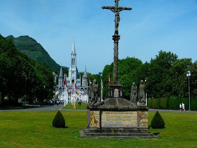
Lourdes – Friday May 13 and Saturday May 14. Across the Pyrenees 08 May 2022 - 29 May 2022
Friday, May 13, 2022, Bruges-Capbis-Mifaget, France
Computer said : Arrival 12:15, altitude 422m, 22°, 74 km, consumption 7.8 l /100km, average 35 km/h, travel time 2:06 hours.
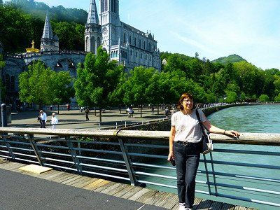
Short drive from upland Laruns descending to Lourdes .
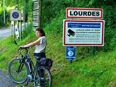
The town in the Pyrenees that we only knew from our childhood through the stories and photo books of our parents and grandparents who experienced their very first trip abroad in a hotel. For a pilgrimage and accompanied by a Cheers, this was already allowed in the last century. After the devotion and the candle procession, the trips to the surrounding Cols were also nicely included. The Madonna of Lourdes would have wanted it that way, our vicar said approvingly.
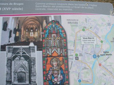
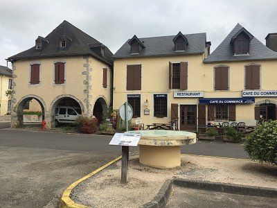
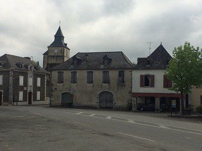
Our intention was to get to the top of the Col d'Aubisque and the Col de Soulor, but the road was 'Fermé'. Not thought of when preparing at home. Not enough snow melted yet? Or 'dead season'? So out of necessity another less difficult way. Along 'Bruges'. That town really exists here. Even one with a spacious village square to stop for a while.
The campsite is located about 3 km outside the town of Lourdes and is fairly busy. Would they also go to the candle procession?
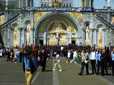
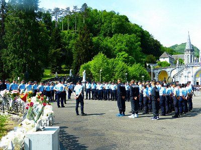
Normally there is a shuttle bus to the Sanctuaires, we were told. Not right now because there is an International Military pilgrimage and the van is not allowed to drive due to a risk of terrorist attacks.
So we cycle to Lourdes. Also many steps with the bike in hand, because either you are not allowed, or it is too steep. And it is also burning hot. The military is indeed present en masse. In their best uniforms, polished copper and ironed trousers. All of Nato is here. The Russians have been warned.
Friday, May 13, 2022, Bruges-Capbis-Mifaget, France
Computer said : Arrival 12:15, altitude 422m, 22°, 74 km, consumption 7.8 l /100km, average 35 km/h, travel time 2:06 hours.
Short drive from upland Laruns descending to Lourdes .
The town in the Pyrenees that we only knew from our childhood through the stories and photo books of our parents and grandparents who experienced their very first trip abroad in a hotel. For a pilgrimage and accompanied by a Cheers, this was already allowed in the last century. After the devotion and the candle procession, the trips to the surrounding Cols were also nicely included. The Madonna of Lourdes would have wanted it that way, our vicar said approvingly.
Our intention was to get to the top of the Col d'Aubisque and the Col de Soulor, but the road was 'Fermé'. Not thought of when preparing at home. Not enough snow melted yet? Or 'dead season'? So out of necessity another less difficult way. Along 'Bruges'. That town really exists here. Even one with a spacious village square to stop for a while.
The campsite is located about 3 km outside the town of Lourdes and is fairly busy. Would they also go to the candle procession?
Normally there is a shuttle bus to the Sanctuaires, we were told. Not right now because there is an International Military pilgrimage and the van is not allowed to drive due to a risk of terrorist attacks.
So we cycle to Lourdes. Also many steps with the bike in hand, because either you are not allowed, or it is too steep. And it is also burning hot. The military is indeed present en masse. In their best uniforms, polished copper and ironed trousers. All of Nato is here. The Russians have been warned.

Verplaatsing naar Lourdes
Lourdes – Friday May 13 and Saturday May 14. Across the Pyrenees 08 May 2022 - 29 May 2022
Friday, May 13, 2022, Bruges-Capbis-Mifaget, France
Computer said : Arrival 12:15, altitude 422m, 22°, 74 km, consumption 7.8 l /100km, average 35 km/h, travel time 2:06 hours.
Short drive from upland Laruns descending to Lourdes .
The town in the Pyrenees that we only knew from our childhood through the stories and photo books of our parents and grandparents who experienced their very first trip abroad in a hotel. For a pilgrimage and accompanied by a Cheers, this was already allowed in the last century. After the devotion and the candle procession, the trips to the surrounding Cols were also nicely included. The Madonna of Lourdes would have wanted it that way, our vicar said approvingly.
Our intention was to get to the top of the Col d'Aubisque and the Col de Soulor, but the road was 'Fermé'. Not thought of when preparing at home. Not enough snow melted yet? Or 'dead season'? So out of necessity another less difficult way. Along 'Bruges'. That town really exists here. Even one with a spacious village square to stop for a while.
The campsite is located about 3 km outside the town of Lourdes and is fairly busy. Would they also go to the candle procession?
Normally there is a shuttle bus to the Sanctuaires, we were told. Not right now because there is an International Military pilgrimage and the van is not allowed to drive due to a risk of terrorist attacks.
So we cycle to Lourdes. Also many steps with the bike in hand, because either you are not allowed, or it is too steep. And it is also burning hot. The military is indeed present en masse. In their best uniforms, polished copper and ironed trousers. All of Nato is here. The Russians have been warned.
Stopover in Bruges
Bruges-Capbis-Mifaget, Frankrijk
64800 Bruges-Capbis-Mifaget, Frankrijk
Stopover in Bruges
Camping de la Foret
flat and shady terrain - shop - bar - restaurant - heated swimming pool - bread service - sanctuary 1.5 km - center 4 km
€ 14.85 • 1 Apr. until 1 Nov. 2 persons per night incl. tax ACSI - Campingcard, ACSI - Campingcard
Current (10A)
flat and shady terrain - shop - bar - restaurant - heated swimming pool - bread service - sanctuary 1.5 km - center 4 km
€ 14.85 • 1 Apr. until 1 Nov. 2 persons per night incl. tax ACSI - Campingcard, ACSI - Campingcard
Current (10A)
06 Camping de la Forêt - Lourdes
Rte de la Forêt, 65100 Lourdes, Frankrijk
Camping de la Foret
flat and shady terrain - shop - bar - restaurant - heated swimming pool - bread service - sanctuary 1.5 km - center 4 km
€ 14.85 • 1 Apr. until 1 Nov. 2 persons per night incl. tax ACSI - Campingcard, ACSI - Campingcard
Current (10A)
flat and shady terrain - shop - bar - restaurant - heated swimming pool - bread service - sanctuary 1.5 km - center 4 km
€ 14.85 • 1 Apr. until 1 Nov. 2 persons per night incl. tax ACSI - Campingcard, ACSI - Campingcard
Current (10A)
Day 7
Day 8
Verplaatsing naar Bagnères-de-Bigore
Show in list
Bagnères-De-Bigorre – Sunday and Monday 15 & 16 May 2022
Computer said : Arrival 12:30, altitude 540m, 30°, 26 km, consumption 12.8 l /100km, average 24 km/h, travel time 1:03 hours.
Ultra short ride over relatively flat terrain. From one village to another . Maximum allowed speed, 30km/h.
The plan was to go over the Col du Tourmalet which would take much more time. But that Col is also closed until the end of this month.
The plan for tomorrow Monday was to drive from here to La Mongie and to get there with 2 closed gondolas to the top of the Pic-du-Midi-de-Bigorre (2877m). We can save ourselves the trouble, because there it is 'Fermeture annuelle de 9mai – 31mai'.
I should have known, but as a lowlander I didn't think about it. It is now clear to me why people ride the Giro and not the Tour in this period.
So we stay here in Bagnères-de-Bigorre and enjoy summer temperatures and a beautiful view of the Pic-du-Midi. We also have some reading books.

Verplaatsing naar Bagnères-de-Bigore
Bagnères-De-Bigorre – Sunday and Monday 15 & 16 May 2022
Computer said : Arrival 12:30, altitude 540m, 30°, 26 km, consumption 12.8 l /100km, average 24 km/h, travel time 1:03 hours.
Ultra short ride over relatively flat terrain. From one village to another . Maximum allowed speed, 30km/h.
The plan was to go over the Col du Tourmalet which would take much more time. But that Col is also closed until the end of this month.
The plan for tomorrow Monday was to drive from here to La Mongie and to get there with 2 closed gondolas to the top of the Pic-du-Midi-de-Bigorre (2877m). We can save ourselves the trouble, because there it is 'Fermeture annuelle de 9mai – 31mai'.
I should have known, but as a lowlander I didn't think about it. It is now clear to me why people ride the Giro and not the Tour in this period.
So we stay here in Bagnères-de-Bigorre and enjoy summer temperatures and a beautiful view of the Pic-du-Midi. We also have some reading books.
Computer said : Arrival 12:30, altitude 540m, 30°, 26 km, consumption 12.8 l /100km, average 24 km/h, travel time 1:03 hours.
Ultra short ride over relatively flat terrain. From one village to another . Maximum allowed speed, 30km/h.
The plan was to go over the Col du Tourmalet which would take much more time. But that Col is also closed until the end of this month.
The plan for tomorrow Monday was to drive from here to La Mongie and to get there with 2 closed gondolas to the top of the Pic-du-Midi-de-Bigorre (2877m). We can save ourselves the trouble, because there it is 'Fermeture annuelle de 9mai – 31mai'.
I should have known, but as a lowlander I didn't think about it. It is now clear to me why people ride the Giro and not the Tour in this period.
So we stay here in Bagnères-de-Bigorre and enjoy summer temperatures and a beautiful view of the Pic-du-Midi. We also have some reading books.
Camping Les Fruitiers : Very neat campsite for little money. 1 km walk from city center. Sanitary excellent.
€14.18 • 15 Apr. until 31 Oct. 2 persons per night incl. tax - Electricity (6A)
€14.18 • 15 Apr. until 31 Oct. 2 persons per night incl. tax - Electricity (6A)
65200, Bagnères de Bigorre, France
Camping Les Fruitiers : Very neat campsite for little money. 1 km walk from city center. Sanitary excellent.
€14.18 • 15 Apr. until 31 Oct. 2 persons per night incl. tax - Electricity (6A)
€14.18 • 15 Apr. until 31 Oct. 2 persons per night incl. tax - Electricity (6A)
Day 9
Verblijfdag Bagnères-de-Bigorre
Show in list
Day of stay Bagnères-De-Bigorre
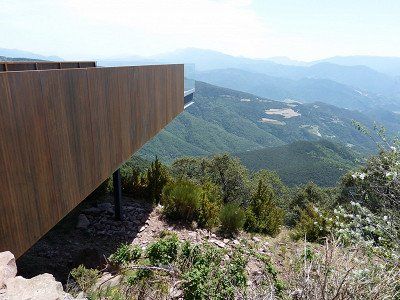
About this day - With clear weather it is definitely recommended to visit the Pic duMidi in La Mongie. An observatory is located on the peak, where you can enjoy a beautiful view
About this day - With clear weather it is definitely recommended to visit the Pic duMidi in La Mongie. An observatory is located on the peak, where you can enjoy a beautiful view
Verblijfdag Bagnères-de-Bigorre
Day of stay Bagnères-De-Bigorre
About this day - With clear weather it is definitely recommended to visit the Pic duMidi in La Mongie. An observatory is located on the peak, where you can enjoy a beautiful view
About this day - With clear weather it is definitely recommended to visit the Pic duMidi in La Mongie. An observatory is located on the peak, where you can enjoy a beautiful view
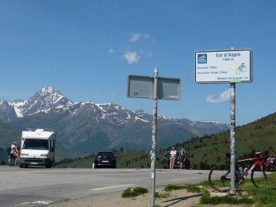
09 Col d'Aspin
65240 Aspin-Aure, Frankrijk
09 Arreau, Frankrijk
lieu dit le plas, D929, 65240 Arreau, Frankrijk
Day 10
Verplaatsing naar Loudenvielle
Show in list
Today a beautiful and not too long route that includes the Col d'Aspin and leads you through the beautiful valley of the Louron to Loudenvielle.
Loudenvielle – Tuesday, May 17, 2022 Aspin-Aure, France
Computer said : Arrival 14:00, altitude 960m, 32°, 58 km, consumption 14.7 l /100km, average 26 km/h, travel time 2:13 hours.
Spicy ride over the Col d'Aspin .
Loudenvielle is a small town in the Hautes Pyrénées with a Carrefour supermarket, some restaurants and wellness. Judging by the huge almost empty public car parks, they expect quite a few people here in the ski season. Now only a few paragliders fly between the mountains. We passed a beautiful mountain lake close by, but missed the only photo stop. Turning right with 7m is not so obvious here. We are finally at a Wellness Sport Campsite for which the specified coordinates were incorrect and therefore resulted in additional search work. The Aire de camping car from Loudenvielle was so modern and automatic that you could not register with a Belgian mobile phone number +32, so you could not pay. and consequently the barrier remained closed.
To the bewilderment of the helpful Frenchmen who rushed to help. You could choose a language, French, German, English, Dutch, etc., but then you got a menu with pre-programmed fixed country codes: Français +33, Dutch +31, etc …. Belgian is not a language and therefore no country code +32 is possible. Oops...... Drive on to a campsite.


Verplaatsing naar Loudenvielle
Today a beautiful and not too long route that includes the Col d'Aspin and leads you through the beautiful valley of the Louron to Loudenvielle.
Loudenvielle – Tuesday, May 17, 2022 Aspin-Aure, France
Computer said : Arrival 14:00, altitude 960m, 32°, 58 km, consumption 14.7 l /100km, average 26 km/h, travel time 2:13 hours.
Spicy ride over the Col d'Aspin .
Loudenvielle is a small town in the Hautes Pyrénées with a Carrefour supermarket, some restaurants and wellness. Judging by the huge almost empty public car parks, they expect quite a few people here in the ski season. Now only a few paragliders fly between the mountains. We passed a beautiful mountain lake close by, but missed the only photo stop. Turning right with 7m is not so obvious here. We are finally at a Wellness Sport Campsite for which the specified coordinates were incorrect and therefore resulted in additional search work. The Aire de camping car from Loudenvielle was so modern and automatic that you could not register with a Belgian mobile phone number +32, so you could not pay. and consequently the barrier remained closed.
To the bewilderment of the helpful Frenchmen who rushed to help. You could choose a language, French, German, English, Dutch, etc., but then you got a menu with pre-programmed fixed country codes: Français +33, Dutch +31, etc …. Belgian is not a language and therefore no country code +32 is possible. Oops...... Drive on to a campsite.
Loudenvielle – Tuesday, May 17, 2022 Aspin-Aure, France
Computer said : Arrival 14:00, altitude 960m, 32°, 58 km, consumption 14.7 l /100km, average 26 km/h, travel time 2:13 hours.
Spicy ride over the Col d'Aspin .
Loudenvielle is a small town in the Hautes Pyrénées with a Carrefour supermarket, some restaurants and wellness. Judging by the huge almost empty public car parks, they expect quite a few people here in the ski season. Now only a few paragliders fly between the mountains. We passed a beautiful mountain lake close by, but missed the only photo stop. Turning right with 7m is not so obvious here. We are finally at a Wellness Sport Campsite for which the specified coordinates were incorrect and therefore resulted in additional search work. The Aire de camping car from Loudenvielle was so modern and automatic that you could not register with a Belgian mobile phone number +32, so you could not pay. and consequently the barrier remained closed.
To the bewilderment of the helpful Frenchmen who rushed to help. You could choose a language, French, German, English, Dutch, etc., but then you got a menu with pre-programmed fixed country codes: Français +33, Dutch +31, etc …. Belgian is not a language and therefore no country code +32 is possible. Oops...... Drive on to a campsite.
10 Aire de Camping-Car Park Loudenvielle
35 Chem. du Hourgade, 65510 Loudenvielle, Frankrijk
Show in list
Show on map
€13.70 • 1 Jan. until 31 Dec. 2 persons per night incl. tax 25pl
Current (6A) Free, Wifi free
Current (6A) Free, Wifi free
10 Aire de Camping-Car Park Loudenvielle
35 Chem. du Hourgade, 65510 Loudenvielle, Frankrijk
€13.70 • 1 Jan. until 31 Dec. 2 persons per night incl. tax 25pl
Current (6A) Free, Wifi free
Current (6A) Free, Wifi free
spacious terraced campsite in the Vallée de Louron, near a lake and large center with thermal baths - bread service - center 200m
€ 24.10 • 1 Apr. until 14 Oct. 2 persons per night incl. tax CCI - Camping Card International, ACSI - Campingcard
Current (10A)
65510, Loudenvielle, France
spacious terraced campsite in the Vallée de Louron, near a lake and large center with thermal baths - bread service - center 200m
€ 24.10 • 1 Apr. until 14 Oct. 2 persons per night incl. tax CCI - Camping Card International, ACSI - Campingcard
Current (10A)
Day 11
Verplaatsing naar Espot
Show in list
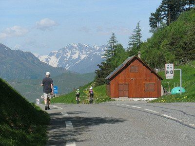
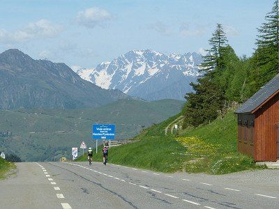
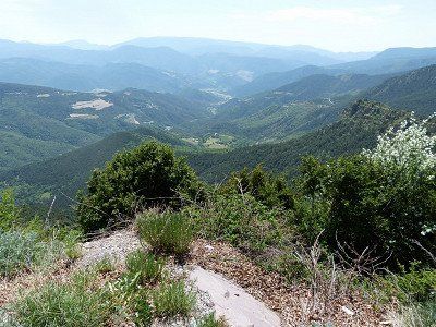
To get to your destination in Espot you will first have to conquer 3 cols, the last of which is a tough one, but on relatively wide roads that take you to an altitude of 2072m. Today is 'the day of the 100 hairpin bends' and you can enjoy the imposing mountain landscape, especially in good weather.
Espot is a ski resort in northwestern Catalonia, in the province of Lleida.
Espot (Spain) – Wednesday, May 18, 2022
Computer said : Arrival 4:30 pm, altitude 1388m, 30°, 134.3 km, consumption 14.0 l /100km, average 30 km/h, travel time 4:27 hours.
Escot is a winter sports resort with shops, terraces and hotels in the Spanish Pyrenees. Normally 400 inhabitants on an area of 97km2 located in the vicinity of a National Park with steep peaks of almost 3000m.
Today we almost did our Queen's ride crossing 3 mountain passes .
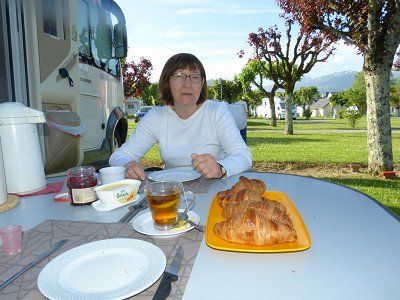
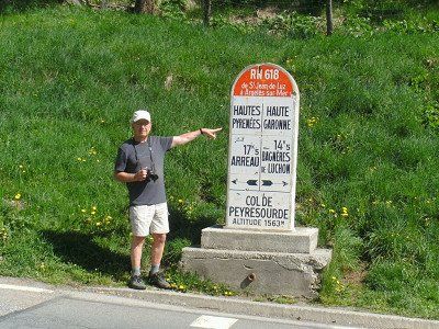
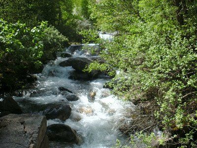
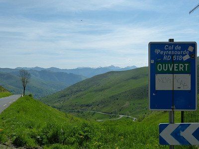
The Col de Peyresourde (1569m), the Col du Portillon (1293m) on the border with Spain, and the Port de la Bonaigua (2072m). Fortunately clear weather and therefore impressive landscapes seen. The plan was to stay here one day longer, but Motorhomes are not too welcome in the small town and the campsites that are already open are too far and too steep uphill from the center. We are here in pure nature next to the splashing violence of a mountain river. We have to bake our croissants for tomorrow morning again. Electricity is available and the WiFi is perfect, sanitary facilities are new and clean. The Spanish manager did not understand our Spanish, but he did understand our English through his translation computer. He is also good at math. For his daily price we were on the French side of the Pyrenees for 2 days in a comparatively luxurious campsite.
Espot is a ski resort in northwestern Catalonia, in the province of Lleida.
Espot (Spain) – Wednesday, May 18, 2022
Computer said : Arrival 4:30 pm, altitude 1388m, 30°, 134.3 km, consumption 14.0 l /100km, average 30 km/h, travel time 4:27 hours.
Escot is a winter sports resort with shops, terraces and hotels in the Spanish Pyrenees. Normally 400 inhabitants on an area of 97km2 located in the vicinity of a National Park with steep peaks of almost 3000m.
Today we almost did our Queen's ride crossing 3 mountain passes .
The Col de Peyresourde (1569m), the Col du Portillon (1293m) on the border with Spain, and the Port de la Bonaigua (2072m). Fortunately clear weather and therefore impressive landscapes seen. The plan was to stay here one day longer, but Motorhomes are not too welcome in the small town and the campsites that are already open are too far and too steep uphill from the center. We are here in pure nature next to the splashing violence of a mountain river. We have to bake our croissants for tomorrow morning again. Electricity is available and the WiFi is perfect, sanitary facilities are new and clean. The Spanish manager did not understand our Spanish, but he did understand our English through his translation computer. He is also good at math. For his daily price we were on the French side of the Pyrenees for 2 days in a comparatively luxurious campsite.
Verplaatsing naar Espot
To get to your destination in Espot you will first have to conquer 3 cols, the last of which is a tough one, but on relatively wide roads that take you to an altitude of 2072m. Today is 'the day of the 100 hairpin bends' and you can enjoy the imposing mountain landscape, especially in good weather.
Espot is a ski resort in northwestern Catalonia, in the province of Lleida.
Espot (Spain) – Wednesday, May 18, 2022
Computer said : Arrival 4:30 pm, altitude 1388m, 30°, 134.3 km, consumption 14.0 l /100km, average 30 km/h, travel time 4:27 hours.
Escot is a winter sports resort with shops, terraces and hotels in the Spanish Pyrenees. Normally 400 inhabitants on an area of 97km2 located in the vicinity of a National Park with steep peaks of almost 3000m.
Today we almost did our Queen's ride crossing 3 mountain passes .
The Col de Peyresourde (1569m), the Col du Portillon (1293m) on the border with Spain, and the Port de la Bonaigua (2072m). Fortunately clear weather and therefore impressive landscapes seen. The plan was to stay here one day longer, but Motorhomes are not too welcome in the small town and the campsites that are already open are too far and too steep uphill from the center. We are here in pure nature next to the splashing violence of a mountain river. We have to bake our croissants for tomorrow morning again. Electricity is available and the WiFi is perfect, sanitary facilities are new and clean. The Spanish manager did not understand our Spanish, but he did understand our English through his translation computer. He is also good at math. For his daily price we were on the French side of the Pyrenees for 2 days in a comparatively luxurious campsite.
11 Cp1 parkeer 1 Bagnères-de-Luchon,
8 Rue de Badech, 31110 Bagnères-de-Luchon, Frankrijk
Show in list
Show on map
11 Cp1 parkeer 1 Bagnères-de-Luchon,
8 Rue de Badech, 31110 Bagnères-de-Luchon, Frankrijk
11 Cp2 Parkeer: Pierre Baysse, Saint-Mamet, Frankrijk
Rue Pierre Baysse, 31110 Saint-Mamet, Frankrijk
Show in list
Show on map
11 Cp2 Parkeer: Pierre Baysse, Saint-Mamet, Frankrijk
Rue Pierre Baysse, 31110 Saint-Mamet, Frankrijk
€ 24.40 • 1 Jun. until 30 Sep. persons per night incl. tax
Camping la Mola, Ctra Espot LV-5004, km.5, 25597, Espot, Spain
€ 24.40 • 1 Jun. until 30 Sep. persons per night incl. tax
11 Parking La Seu d'Urgell, Spanje
Avinguda del Camí Ral de Cerdanya, 8, 25700 La Seu d'Urgell, Lérida, Spanje
Show in list
Show on map
11 Parking La Seu d'Urgell, Spanje
Avinguda del Camí Ral de Cerdanya, 8, 25700 La Seu d'Urgell, Lérida, Spanje
Day 12
Verblijfsdag in Espot
Show in list
Today is an excellent time to take a rest day. There is also an option to visit Aigüestortes National Park from Espot. In the village there is a station for the off-road vehicles that can take you into the park.
Verblijfsdag in Espot
Today is an excellent time to take a rest day. There is also an option to visit Aigüestortes National Park from Espot. In the village there is a station for the off-road vehicles that can take you into the park.
Day 13
Verplaatsing naar Andorra-La-Vella
Show in list
Andorra La Vella – Thursday, May 19, 2022
Computer said : Arrival 3:30 pm, altitude 999m, 32°, 107.1 km, consumption 10.9 l /100km, average 30 km/h, travel time 3:20 hours.
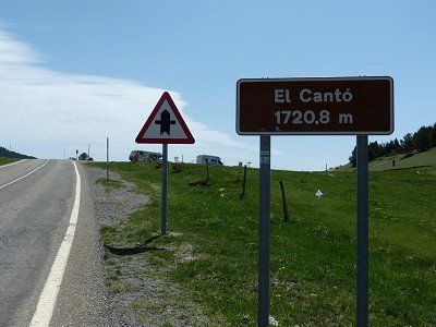
Today we drove to the mountain state of Andorra on a beautiful route on the south side of the Pyrenees . It was a tough ride on wider Spanish roads through a Pyrenean landscape with beautiful views, especially in this clear weather. After the town of Sort we got slopes up to about 1300m altitude and again a lot of curves, with El Canto at 1720m as the top.
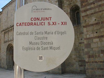
On the way we stopped in the historic center of the mountain town of 'La Seu d'Urgell' and wanted to visit the Romanesque Cathedral of the 12th century. Unfortunately closed between 13.00 and 16.00. Then just stroll through the medieval streets around the Cathedral. Still worth stopping.
It took some getting used to the heavy traffic and stopping twice at customs posts when entering Andorra. It would therefore be much cheaper here than in EU countries. The diesel is priced here at €1.60. We can only dream of that.
Computer said : Arrival 3:30 pm, altitude 999m, 32°, 107.1 km, consumption 10.9 l /100km, average 30 km/h, travel time 3:20 hours.
Today we drove to the mountain state of Andorra on a beautiful route on the south side of the Pyrenees . It was a tough ride on wider Spanish roads through a Pyrenean landscape with beautiful views, especially in this clear weather. After the town of Sort we got slopes up to about 1300m altitude and again a lot of curves, with El Canto at 1720m as the top.
On the way we stopped in the historic center of the mountain town of 'La Seu d'Urgell' and wanted to visit the Romanesque Cathedral of the 12th century. Unfortunately closed between 13.00 and 16.00. Then just stroll through the medieval streets around the Cathedral. Still worth stopping.
It took some getting used to the heavy traffic and stopping twice at customs posts when entering Andorra. It would therefore be much cheaper here than in EU countries. The diesel is priced here at €1.60. We can only dream of that.
Verplaatsing naar Andorra-La-Vella
Andorra La Vella – Thursday, May 19, 2022
Computer said : Arrival 3:30 pm, altitude 999m, 32°, 107.1 km, consumption 10.9 l /100km, average 30 km/h, travel time 3:20 hours.
Today we drove to the mountain state of Andorra on a beautiful route on the south side of the Pyrenees . It was a tough ride on wider Spanish roads through a Pyrenean landscape with beautiful views, especially in this clear weather. After the town of Sort we got slopes up to about 1300m altitude and again a lot of curves, with El Canto at 1720m as the top.
On the way we stopped in the historic center of the mountain town of 'La Seu d'Urgell' and wanted to visit the Romanesque Cathedral of the 12th century. Unfortunately closed between 13.00 and 16.00. Then just stroll through the medieval streets around the Cathedral. Still worth stopping.
It took some getting used to the heavy traffic and stopping twice at customs posts when entering Andorra. It would therefore be much cheaper here than in EU countries. The diesel is priced here at €1.60. We can only dream of that.
campsite in a small village - with ACSI card 10% discount for cash payment - center 2 km
€26.25 • 1 Jan. until 31 Dec. 2 persons per night incl. tax
Current (10A)
€26.25 • 1 Jan. until 31 Dec. 2 persons per night incl. tax
Current (10A)
Avenue de Salou, 500, Andorra la Vella, Andorra
campsite in a small village - with ACSI card 10% discount for cash payment - center 2 km
€26.25 • 1 Jan. until 31 Dec. 2 persons per night incl. tax
Current (10A)
€26.25 • 1 Jan. until 31 Dec. 2 persons per night incl. tax
Current (10A)
Day 14
Verblijfsdag Andorra-La-Vella
Show in list
Andorra-La-Vella – Saturday, May 21, 2022
Yesterday Friday rest day.
Today Saturday visit to the old city center, the Bari Antic in Catalan.
La Vella is the one and only town of this principality, sandwiched for several kilometers between steep riverside slopes and a busy road.
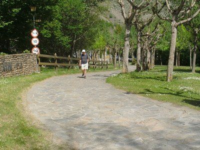
Armed with a city map and my walking sticks, we started early (9:00 am), to be sure to be back before the midday heat. First a bit along that busy road, up to the 3 lifts, where fortunately elderly people like us are hoisted up to the old center.
Narrow streets, artificial squares with parking spaces at the bottom. Shops everywhere. Further down the road mega shopping malls. Supposedly tax free. Especially booze, tobacco and fragrances. Who buys all that? We came for the culture. And for postcards and stamps.
That went very wrong, but the rest of that story is private.
Yesterday Friday rest day.
Today Saturday visit to the old city center, the Bari Antic in Catalan.
La Vella is the one and only town of this principality, sandwiched for several kilometers between steep riverside slopes and a busy road.
Armed with a city map and my walking sticks, we started early (9:00 am), to be sure to be back before the midday heat. First a bit along that busy road, up to the 3 lifts, where fortunately elderly people like us are hoisted up to the old center.
Narrow streets, artificial squares with parking spaces at the bottom. Shops everywhere. Further down the road mega shopping malls. Supposedly tax free. Especially booze, tobacco and fragrances. Who buys all that? We came for the culture. And for postcards and stamps.
That went very wrong, but the rest of that story is private.


Verblijfsdag Andorra-La-Vella
Andorra-La-Vella – Saturday, May 21, 2022
Yesterday Friday rest day.
Today Saturday visit to the old city center, the Bari Antic in Catalan.
La Vella is the one and only town of this principality, sandwiched for several kilometers between steep riverside slopes and a busy road.
Armed with a city map and my walking sticks, we started early (9:00 am), to be sure to be back before the midday heat. First a bit along that busy road, up to the 3 lifts, where fortunately elderly people like us are hoisted up to the old center.
Narrow streets, artificial squares with parking spaces at the bottom. Shops everywhere. Further down the road mega shopping malls. Supposedly tax free. Especially booze, tobacco and fragrances. Who buys all that? We came for the culture. And for postcards and stamps.
That went very wrong, but the rest of that story is private.
Day 15
Verplaatsing naar Vinça
Show in list
Vinça – Sunday, May 22, 2022
Computer said : Arrival 2:40 pm, altitude 250m, 28°, 125.1 km, consumption 9.4 l /100km, average 37 km/h, travel time 3:18 hours.
Another beautiful route today, from +Andorra to Vinça+ at the foot of Mont Canigou, through the south side of the French-Catalan Pyrenees.
Along places we had never heard of, outside of Font-Romeu, and maybe Prades too. Apart from first climbing to 1850m and 2 expensive tunnels through even higher passes, it mainly went downhill in 2nd gear, provided that additional braking was done in the corners. Still beautiful those Pyrenees landscapes that we are now leaving.
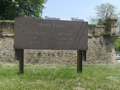
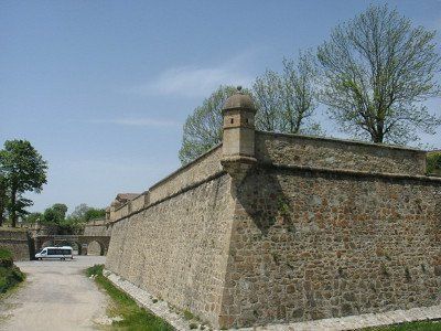
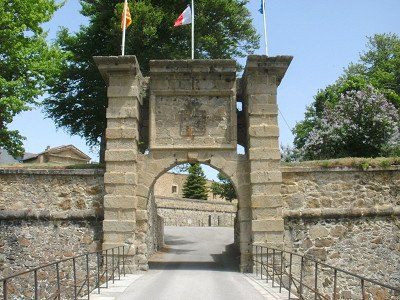
En route a lunch stop in Mont-Louis, the highest fortified town in France (1600m), built by who else than Vauban by order of Louis XIV in the 17th century. It still stands untouched.
Computer said : Arrival 2:40 pm, altitude 250m, 28°, 125.1 km, consumption 9.4 l /100km, average 37 km/h, travel time 3:18 hours.
Another beautiful route today, from +Andorra to Vinça+ at the foot of Mont Canigou, through the south side of the French-Catalan Pyrenees.
Along places we had never heard of, outside of Font-Romeu, and maybe Prades too. Apart from first climbing to 1850m and 2 expensive tunnels through even higher passes, it mainly went downhill in 2nd gear, provided that additional braking was done in the corners. Still beautiful those Pyrenees landscapes that we are now leaving.
En route a lunch stop in Mont-Louis, the highest fortified town in France (1600m), built by who else than Vauban by order of Louis XIV in the 17th century. It still stands untouched.
Verplaatsing naar Vinça
Vinça – Sunday, May 22, 2022
Computer said : Arrival 2:40 pm, altitude 250m, 28°, 125.1 km, consumption 9.4 l /100km, average 37 km/h, travel time 3:18 hours.
Another beautiful route today, from +Andorra to Vinça+ at the foot of Mont Canigou, through the south side of the French-Catalan Pyrenees.
Along places we had never heard of, outside of Font-Romeu, and maybe Prades too. Apart from first climbing to 1850m and 2 expensive tunnels through even higher passes, it mainly went downhill in 2nd gear, provided that additional braking was done in the corners. Still beautiful those Pyrenees landscapes that we are now leaving.
En route a lunch stop in Mont-Louis, the highest fortified town in France (1600m), built by who else than Vauban by order of Louis XIV in the 17th century. It still stands untouched.
15 Port d'Envalira, Andorra
Port d'Envalira, 2, AD200 Pas de la Casa, Andorra
Show in list
Show on map
15 Port d'Envalira, Andorra
Port d'Envalira, 2, AD200 Pas de la Casa, Andorra
15 Four Solaire Odeillo-Via
7 Rue du Four Solaire, 66120 Font-Romeu-Odeillo-Via, Frankrijk
Show in list
Show on map
15 Four Solaire Odeillo-Via
7 Rue du Four Solaire, 66120 Font-Romeu-Odeillo-Via, Frankrijk
15 Aire Camping-Car Park Vinça, Frankrijk
27 Imp. Camp del Roc, 66320 Vinça, Frankrijk
Show in list
Show on map
€12.55 • 1 Jan. until 31 Dec. 2 persons per night incl. tax
Current (6A) 36pl
Current (6A) 36pl
15 Aire Camping-Car Park Vinça, Frankrijk
27 Imp. Camp del Roc, 66320 Vinça, Frankrijk
€12.55 • 1 Jan. until 31 Dec. 2 persons per night incl. tax
Current (6A) 36pl
Current (6A) 36pl
Day 16
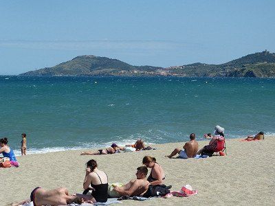
Verplaatsing Argeles-sur-Mer
Show in list
Argeles-sur-Mer – Monday, May 23, 2022
Computer said : Arrival 12:00, altitude 001m, 29°, 61.1 km, consumption 8.9 l /100km, average 47 km/h, travel time 1:17 hours.
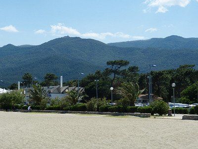
Ultra short drive from Vinça to Argeles-sur-Mer, pleasant seaside resort on the Mediterranean beyond Le Boulou near Perpignan .
This ends our tour 'Across the Pyrenees''.
We had beautiful weather every day. Even way too hot for the time of year. The weather forecasts for the next few days point to some cooling. Can we feel normal again?
Argeles-sur-Mer - Tuesday, May 24, 2022 - RAIN all day . - Reading books.
Argeles-sur-Mer- Wednesday, May 25, 2022 – cold and windy. It didn't have to cool down that much!
Argeles-sur-Mer - Thursday, May 26, 2022 - Sunny, blue sky and wind force 6. We would not have wished for that much wind now. To get nervous. Also from the people who walk around here in this seaside resort. So today is 'Ascension', also for the French with an extended weekend. We hadn't counted on that.
Staying here for another day tomorrow and then Saturday we leave for home in 2 days.
Computer said : Arrival 12:00, altitude 001m, 29°, 61.1 km, consumption 8.9 l /100km, average 47 km/h, travel time 1:17 hours.
Ultra short drive from Vinça to Argeles-sur-Mer, pleasant seaside resort on the Mediterranean beyond Le Boulou near Perpignan .
This ends our tour 'Across the Pyrenees''.
We had beautiful weather every day. Even way too hot for the time of year. The weather forecasts for the next few days point to some cooling. Can we feel normal again?
Argeles-sur-Mer - Tuesday, May 24, 2022 - RAIN all day . - Reading books.
Argeles-sur-Mer- Wednesday, May 25, 2022 – cold and windy. It didn't have to cool down that much!
Argeles-sur-Mer - Thursday, May 26, 2022 - Sunny, blue sky and wind force 6. We would not have wished for that much wind now. To get nervous. Also from the people who walk around here in this seaside resort. So today is 'Ascension', also for the French with an extended weekend. We hadn't counted on that.
Staying here for another day tomorrow and then Saturday we leave for home in 2 days.
Verplaatsing Argeles-sur-Mer
Argeles-sur-Mer – Monday, May 23, 2022
Computer said : Arrival 12:00, altitude 001m, 29°, 61.1 km, consumption 8.9 l /100km, average 47 km/h, travel time 1:17 hours.
Ultra short drive from Vinça to Argeles-sur-Mer, pleasant seaside resort on the Mediterranean beyond Le Boulou near Perpignan .
This ends our tour 'Across the Pyrenees''.
We had beautiful weather every day. Even way too hot for the time of year. The weather forecasts for the next few days point to some cooling. Can we feel normal again?
Argeles-sur-Mer - Tuesday, May 24, 2022 - RAIN all day . - Reading books.
Argeles-sur-Mer- Wednesday, May 25, 2022 – cold and windy. It didn't have to cool down that much!
Argeles-sur-Mer - Thursday, May 26, 2022 - Sunny, blue sky and wind force 6. We would not have wished for that much wind now. To get nervous. Also from the people who walk around here in this seaside resort. So today is 'Ascension', also for the French with an extended weekend. We hadn't counted on that.
Staying here for another day tomorrow and then Saturday we leave for home in 2 days.
16 Camping Les Pins Argeles
Plage des Pins, 405 Av. du Tech, 66700 Argelès-sur-Mer, Frankrijk
Show in list
Show on map
€29.72 • 8 Apr. until 7 Oct. 2 persons per night incl. tax
ACSI - Campingcard - Current (6A)
16 Camping Les Pins Argeles
Plage des Pins, 405 Av. du Tech, 66700 Argelès-sur-Mer, Frankrijk
€29.72 • 8 Apr. until 7 Oct. 2 persons per night incl. tax
ACSI - Campingcard - Current (6A)
Day 17
Day 18
Day 19
Day 20
Day 21
Terug naar Huis - 1e reisdag tot +- Bourges (630km)
Show in list
On the way home -
Saturday, May 28, 2022, Bruère-Allichamps, France
Overnight in Bruère-Allichamps, small town 30 km south of Bourges.
Accessible along small roads from the A71. In local leaflets it is indicated as the center of France. There are also two notable historic buildings: the Priory and a Cistercian Abbey, founded in 1136. But that's for another time. It was a long drive mainly on highways, and sturdy 'bouchons'.Computer said : Arrival 6:45pm, 26°, altitude 141m, distance 601.5km, consumption 11.9L/100km, average 67km/h, driving time 8:50h. Sunday 29/05/2022, ride home, with strong 'bouchons' again Computer said : Arrival 7:40 pm, 11°, altitude 68m, distance 597.2km, consumption 10.9L/100km, average 62km/h, driving time 9:31am .
Terug naar Huis - 1e reisdag tot +- Bourges (630km)
On the way home -
Saturday, May 28, 2022, Bruère-Allichamps, France
Overnight in Bruère-Allichamps, small town 30 km south of Bourges.
Accessible along small roads from the A71. In local leaflets it is indicated as the center of France. There are also two notable historic buildings: the Priory and a Cistercian Abbey, founded in 1136. But that's for another time. It was a long drive mainly on highways, and sturdy 'bouchons'.Computer said : Arrival 6:45pm, 26°, altitude 141m, distance 601.5km, consumption 11.9L/100km, average 67km/h, driving time 8:50h. Sunday 29/05/2022, ride home, with strong 'bouchons' again Computer said : Arrival 7:40 pm, 11°, altitude 68m, distance 597.2km, consumption 10.9L/100km, average 62km/h, driving time 9:31am .
Saturday, May 28, 2022, Bruère-Allichamps, France
Overnight in Bruère-Allichamps, small town 30 km south of Bourges.
Accessible along small roads from the A71. In local leaflets it is indicated as the center of France. There are also two notable historic buildings: the Priory and a Cistercian Abbey, founded in 1136. But that's for another time. It was a long drive mainly on highways, and sturdy 'bouchons'.Computer said : Arrival 6:45pm, 26°, altitude 141m, distance 601.5km, consumption 11.9L/100km, average 67km/h, driving time 8:50h. Sunday 29/05/2022, ride home, with strong 'bouchons' again Computer said : Arrival 7:40 pm, 11°, altitude 68m, distance 597.2km, consumption 10.9L/100km, average 62km/h, driving time 9:31am .
Day 22
https://www.campingcarpark.com/en_GB/stay/stopover-site-motorhome/centre-val-de-loire/18-cher/bruere-allichamps
18200, Bruere Allichamps, France
https://www.campingcarpark.com/en_GB/stay/stopover-site-motorhome/centre-val-de-loire/18-cher/bruere-allichamps
Terug naar huis 2de Reisdag ( +- 570km)
Show in list
Terug naar huis 2de Reisdag ( +- 570km)
Route
Show newest first
Day 1
01 Prahecq - Parking Municipal
- 46.2628 -0.3466
- 46° 15' 46" N 0° 20' 47.7" W
31 Rue du Chateau, 79230 Prahecq, Frankrijk
View travel report
Show on map
Day 2
428,6 km
4 hrs. 15 min.
Day 3
Bezoek Saint-Jean-Pied-de-Port
Dinsdag 10 mei. Verblijf in Sain-Jean-Pied-de-Port. Een schilderachtig vestingstadje aan de pasweg die over de Pyreneeën naar Spanje voert. Het 16e eeuws stadje is van oudsher een kruispunt van de belangrijkste routes naar Santiago de Compostella . De stad is ommuurd en heeft een oude vesting, Citadel, versterkt in de 17e eeuw door wie anders dan Vauban.Het is hier verder geen meter vlak, om niet te zeggen zeer steil. We zouden dus een rondrit maken met het toeristisch treintje. Vertrek om 11uur. Dat wisten we al van ons bezoek aan de Toeristische dienst de dag er voor. Spijtig, het treintje rijdt vandaag niet ! 'Un problème de chaffeur, demain', zei de madam nu. Manaña dus. Het is hier maar 8 km van Spanje. Vandaar misschien. Dan maar een poging te voet aar de Citadel. Tot halfweg op een bank. Te veel trappen voor mij. Niet voor Bomma.
bezoek Saint-Jean-Pied-de-Port. Het gebied rondom is zeer geschikt om te wandelen of te fietsen, maar er zitten wel een paar hellinkjes in.
De mogelijkheid bestaat om met een toeristentreintje door de stad te rijden langs alle bezienswaardigheden en naar de vesting boven. Vertrek vanaf Place du Genéral De Gaulle tegenover het stadhuis, circa € 6,- p.p.Locatie station
43°09'47.3"N 1°14'14.7"W
Saint-Jean-Pied-de-Port / Nouvelle-Aquitaine /
View travel report
Day 4
76,9 km
1 hrs. 6 min.
04 verplaatsing naar Oloron-Sainte-Marie --Aire Municipale
- 43.184 -0.6087
- 43° 11' 2.4" N 0° 36' 31.4" W
26-, 32 N134, 64400 Oloron-Sainte-Marie, Frankrijk
View travel report
Show on map
1,7 km
2 min.
04 Chocolaterie LINDT - Oloron-Sainte-Marie
- 43.1914 -0.6183
- 43° 11' 28.9" N 0° 37' 5.9" W
4 Av. Mal de Lattre de Tassigny, 64400 Oloron-Sainte-Marie, Frankrijk
View travel report
Show on map
Day 5
54,7 km
58 min.
05 Aire de Camping-Car d'Artouste - Laruns,
- 42.8751 -0.3943
- 42° 52' 30.3" N 0° 23' 39.5" W
19 D431, 64440 Laruns, Frankrijk
View travel report
Show on map
Day 6
Verplaatsing naar Lourdes
Lourdes– vrijdag 13 mei en zaterdag 14 mei. Dwars door de Pyreneeën 08 mei 2022 - 29 mei 2022
vrijdag 13 mei 2022, Bruges-Capbis-Mifaget, Frankrijk
Computer zei : Aankomst 12:15u, hoogte 422m, 22°, 74 km, verbruik 7,8 l /100km, gemiddeld 35 km/u, reisduur 2:06 uur.
Korte rit van het hooggelegen Laruns afdalend naar Lourdes.
Het plaatsje in de Pyreneeën dat we van in onze jeugd slechts kenden uit de verhalen en de fotoboeken van onze ouders en grootouders die hier hun allereerste reis op hotel naar het buitenland meemaakten. Voor een bedevaart en onder begeleiding van een Proost mocht dat dan al in vorige eeuw. Na de devotie en de kaarsjesprocessie werden de uitstappen naar de rondliggende Cols dan ook mooi meegenomen. De Madonna van Lourdes had dat zo gewild zei onze onderpastoor goedkeurend.
Onze bedoeling was dan ook om nu ook eens boven op de Col d'Aubisque en de Col de Soulor te geraken, maar de weg was 'Fermé'. Niet aan gedacht bij de voorbereiding thuis. Nog niet voldoende sneeuw gesmolten ? Of toch 'dood seizoen' ? Dus uit noodzaak andere minder moeilijke weg. Langs 'Bruges'. Echt dat stadje bestaat hier. Zelfs een met een ruim dorpsplein om even te stoppen.
De camping ligt een 3-tal km buiten het stadje Lourdes en is toch wel redelijk bezet. Zouden die ook naar de kaarsjesprocessie gaan ?
Normaal rijdt er een shuttelbusje naar de Sanctuaires vertelde men ons. Nu even niet want er is een Internationale Militaire bedevaart en het busje mag niet rijden wegens een risico op terreuraanslagen.
Dus wij met de fiets naar Lourdes. Ook veel stappen met de fiets aan de hand, want ofwel mag je niet, ofwel is het te steil. En het is ook brandend heet. De militairen zijn inderdaad massaal aanwezig. In hun beste uniformen, opgeblonken koper en broeken gestreken. De hele Nato is hier. De Russen wezen verwittigd.
View travel report
44,9 km
46 min.
Bruges-Capbis-Mifaget, Frankrijk
- 43.121 -0.3043
- 43° 7' 15.6" N 0° 18' 15.4" W
64800 Bruges-Capbis-Mifaget, Frankrijk
View travel report
Show on map
25,9 km
25 min.
06 Camping de la Forêt - Lourdes
- 43.0957 -0.0757
- 43° 5' 44.6" N 0° 4' 32.7" W
Rte de la Forêt, 65100 Lourdes, Frankrijk
View travel report
Show on map
Day 7
Verblijf in Lourdes
Day 8
Verplaatsing naar Bagnères-de-Bigore
Bagnères-De-Bigorre – Zondag en Maandag 15 & 16 mei 2022
Computer zei : Aankomst 12:30u, hoogte 540m, 30°, 26 km, verbruik 12,8 l /100km, gemiddeld 24 km/u, reisduur 1:03 uur.
Ultra korte rit over relatief vlak terrein. Van het ene dorpje door het andere. Maximum toegelaten snelheid, 30km/u.
Het plan was om over de Col du Tourmalet te gaan hetgeen veel meer tijd zou nemen. Maar die Col is dus ook nog dicht tot einde van deze maand.
Het plan voor morgen maandag was om van hieruit tot La Mongie te rijden en daar met 2 gesloten gondels tot boven op de Pic-du-Midi-de-Bigorre (2877m) te geraken. We kunnen ons de moeite besparen, want daar is het 'Fermeture annuelle de 9mai – 31mai'.
Ik had het kunnen weten, maar als lagelander dacht ik er niet aan. Het is me nu wel duidelijk waarom men in deze periode de Giro rijdt en niet de Tour.
We blijven dus rustig zitten hier in Bagnères-de-Bigorre en genieten al van zomerse temperaturen en een prachtig uitzicht op die Pic-du-Midi. We hebben ook nog wat leesboeken bij.
View travel report
24,9 km
27 min.
Day 9
Verblijfdag Bagnères-de-Bigorre
Verblijfsdag Bagnères-De-Bigorre
Over deze dag - Met helder weer is het zeker een aanrader om een bezoek te brengen aan de Pic duMidi in La Mongie. Op de piek is een observatorium gevestigd, waar je van een prachtiguitzicht kan genieten
Over deze dag - Met helder weer is het zeker een aanrader om een bezoek te brengen aan de Pic duMidi in La Mongie. Op de piek is een observatorium gevestigd, waar je van een prachtiguitzicht kan genieten
View travel report
25,5 km
25 min.
09 Col d'Aspin
- 42.9422 0.3272
- 42° 56' 32.1" N 0° 19' 37.9" E
65240 Aspin-Aure, Frankrijk
Show on map
12,7 km
14 min.
09 Arreau, Frankrijk
- 42.9043 0.3557
- 42° 54' 15.4" N 0° 21' 20.7" E
lieu dit le plas, D929, 65240 Arreau, Frankrijk
Show on map
Day 10
Verplaatsing naar Loudenvielle
Vandaag een mooie en niet al te lange route die onder meer over de Col d'Aspin voerten je via het mooie dal van de Louron naar Loudenvielle leidt.
Loudenvielle – dinsdag 17 mei 2022 Aspin-Aure, Frankrijk
Computer zei : Aankomst 14:00u, hoogte 960m, 32°, 58 km, verbruik 14,7 l /100km, gemiddeld 26 km/u, reisduur 2:13 uur.
Pittige rit over de Col d'Aspin.
Loudenvielle is een klein plaatsje in de Hautes Pyrénées met een Carrefour supermarkt, wat restaurants en wellness. Getuige de enorme bijna lege openbare parkings verwachten ze hier in het ski-seizoen redelijk wat volk. Nu vliegen er enkel een paar parapentes tussen de bergen.We passeerden een mooi bergmeer hier vlak bij, maar misten de enige stopplaats voor een foto. Rechtsomkeer met 7m is hier niet zo vanzelfsprekend. We staan uiteindelijk op een Wellness Sport Camping waarvoor de opgegeven coordinaten niet klopten en dus bijkomend zoekwerk opleverde.De voorziene Aire de camping car van Loudenvielle was zo modern automatisch dat je er met een Belgisch GSM nummer +32 niet kon registreren, dus niet kon betalen en bijgevolg de slagboom dicht bleef.
Tot verbijstering van hulpvaardige toegesnelde Fransen. Je kon wel een taal kiezen, Frans, Duits, Engels, Nederlands, enz, maar dan kreeg men een menu met voorgeprogrammeerde vaste landencodes: Français +33, Nederlands +31, etc …. Belgisch is geen taal en bijgevolg geen landcode +32 mogelijk. Oeps...... Rij maar door naar een camping.
View travel report
15,3 km
15 min.
10 Aire de Camping-Car Park Loudenvielle
- 42.8016 0.411
- 42° 48' 5.8" N 0° 24' 39.5" E
35 Chem. du Hourgade, 65510 Loudenvielle, Frankrijk
View travel report
Show on map
0,9 km
1 min.
Day 11
Verplaatsing naar Espot
Om op de plaats van bestemming in Espot te komen zul je eerst 3 cols moeten bedwingen waarvan de laatste een pittige, maar wel over relatief brede wegen die je tot op 2072m hoogte brengen. Vandaag is 'de dag van de 100 haarspeldbochten' enkun je vooral bij mooi weer genieten van het imposante berglandschap.
Espot is een wintersportplaats in het noordwesten van Catalonië, in de provincie Lerida.
Espot (Spanje) – Woensdag 18 mei 2022
Computer zei : Aankomst 16:30u, hoogte 1388m, 30°, 134,3 km, verbruik 14,0 l /100km, gemiddeld 30 km/u, reisduur 4:27 uur.
Escot is een wintersportplaats met winkeltjes, terrassen en hotels in de Spaanse Pyreneeën. Normaal 400 inwoners op een oppervlakte van 97km2 gelegen in de nabijheid van een Nationaal Park met steile bergtoppen tot bijna 3000m.
Vandaag deden we zowat onze Koninginnerit met het oversteken van 3 bergpassen.
De Col de Peyresourde (1569m), de Col du Portillon (1293m) op de grens met Spanje, en de Port de la Bonaigua (2072m). Gelukkig helder weer en dus imposante landschappen gezien.Het plan was om hier een dag langer te blijven, maar in het kleine stadje zijn Motorhomes niet al te welkom en de campings die al open zijn liggen te ver en te steil bergop van het centrum. We zitten hier dan wel in puur natuur naast het klaterend geweld van een bergriviertje. Onze croissants voor morgenvroeg moeten we dan weeral zelf bakken. Stroom is aanwezig en de wifi perfect, sanitair is nieuw en schoon. De Spaanse uitbater verstond ons Spaans niet, maar wel ons Engels langs zijn vertaalcomputer. Hij kan ook goed rekenen. Voor zijn dagprijs stonden we aan de Franse kant van de Pyreneeën 2 dagen op een in vergelijking luxecamping.
View travel report
25,7 km
27 min.
11 Cp1 parkeer 1 Bagnères-de-Luchon,
- 42.795 0.5983
- 42° 47' 42" N 0° 35' 53.9" E
8 Rue de Badech, 31110 Bagnères-de-Luchon, Frankrijk
Show on map
2,1 km
3 min.
11 Cp2 Parkeer: Pierre Baysse, Saint-Mamet, Frankrijk
- 42.7853 0.6043
- 42° 47' 7.1" N 0° 36' 15.3" E
Rue Pierre Baysse, 31110 Saint-Mamet, Frankrijk
Show on map
90,2 km
1 hrs. 44 min.
89,3 km
1 hrs. 34 min.
11 Parking La Seu d'Urgell, Spanje
- 42.3589 1.4646
- 42° 21' 31.9" N 1° 27' 52.4" E
Avinguda del Camí Ral de Cerdanya, 8, 25700 La Seu d'Urgell, Lérida, Spanje
Show on map
Day 12
Verblijfsdag in Espot
Vandaag is een uitstekend moment om een rustdag in te lassen. Er is ook eenmogelijkheid om het Nationale park Aigüestortes te bezoeken vanuit Espot. In het dorpis een standplaats van de terreinwagens die je het park in kunnen brengen.
View travel report
Day 13
Verplaatsing naar Andorra-La-Vella
Andorra La Vella – Donderdag 19 mei 2022
Computer zei : Aankomst 15:30u, hoogte 999m, 32°, 107,1 km, verbruik 10,9 l /100km, gemiddeld 30 km/u, reisduur 3:20 uur.
Vandaag reden we naar het bergstaatje Andorra over een mooie route aan de zuidkant van de Pyreneeën. Het was een stevige rit op bredere Spaanse wegen door een Pyreneeën-landschap met prachtige uitzichten, zeker bij dit helder weer. Na het stadje Sort kregen we hellingen tot ca. 1300m hoogte en weer veel bochtenwerk, met El Canto op 1720m als top.
Onderweg stopten we in het historisch centrum van het bergstadje 'La Seu d’Urgell' en wilden we de Romaanse Kathedraal van de 12e eeuw bezoeken. Spijtig gesloten tussen 13.00u en 16.00u. Dan maar wat kuieren door de middeleeuwse straatjes rondom de Kathedraal. Toch het stoppen waard.
Het was wel terug wennen aan het druk verkeer en het 2 keer stoppen aan douaneposten bij het binnenrijden van Andorra. Het zou hier dan ook veel goedkoper zijn dan in EU landen. De diesel staat hier wel aangeprijsd aan €1.60. Daar kunnen wij alleen nog maar van dromen.
View travel report
20,7 km
22 min.
Day 14
Verblijfsdag Andorra-La-Vella
Andorra-La-Vella – Zaterdag 21 mei 2022
Gisteren vrijdag rustdag.
Vandaag zaterdag bezoek aan het oude stadscentrum, de Bari Antic in het Catalaans.
La Vella is de enige echte stad van dit prinsdom, over enkele km's ingeklemd tussen steile hellingen langs de rivier en een drukke baan.
Gewapend met een stadsplannetje en mijn walking sticks begonnen we er eens vroeg aan (9:00u), om voor de middaghitte zeker terug te zijn. Eerst een stuk langs die drukke weg, tot aan de 3 liften, waar gelukkig ouderen zoals wij tot in het oude centrum omhoog worden gehesen.
Smalle straatjes, kunstmatige pleintjes met onderaan parkings. Overal winkels. Verderop langs de baan mega koopcentra. Zogenaamd belastingsvrij. Vooral drank, tabak en geurtjes. Wie koopt dat allemaal ? Wij kwamen voor de cultuur. En voor postkaarten en zegels.
Dat liep zeer mis, maar de rest van dat verhaal is privé.
View travel report
Day 15
Verplaatsing naar Vinça
Vinça – Zondag 22 mei 2022
Computer zei : Aankomst 14:40u, hoogte 250m, 28°, 125,1 km, verbruik 9,4 l /100km, gemiddeld 37 km/u, reisduur 3:18 uur.
Vandaag weer een mooie route, van +Andorra naar Vinça+ aan de voet van de Mont Canigou, door de zuidkant van de Frans-Catalaanse Pyreneeën.
Langs plaatsjes waar we nog nooit van gehoord hadden, buiten Font-Romeu, en misschien ook Prades. Behalve eerst nog stijgen naar 1850m en 2 prijzige tunnels door nog hogere passen, ging het hoofdzakelijk bergaf in 2de versnelling mits nog bijremmen in het bochtenwerk. Toch mooi die Pyreneeën-landschappen die we nu aan het verlaten zijn.
Onderweg een lunch-stop in Mont-Louis, de hoogst gelegen vestingstad van Frankrijk (1600m), gebouwd door wie anders dan Vauban in opdracht van Louis XIV in de 17 eeuw. Het staat er nog altijd on-ingenomen.
View travel report
28,8 km
33 min.
15 Port d'Envalira, Andorra
- 42.5403 1.7189
- 42° 32' 25" N 1° 43' 8.1" E
Port d'Envalira, 2, AD200 Pas de la Casa, Andorra
Show on map
50,9 km
58 min.
15 Four Solaire Odeillo-Via
- 42.4942 2.0323
- 42° 29' 39.1" N 2° 1' 56.3" E
7 Rue du Four Solaire, 66120 Font-Romeu-Odeillo-Via, Frankrijk
Show on map
55,2 km
1 hrs. 1 min.
15 Aire Camping-Car Park Vinça, Frankrijk
- 42.6495 2.5318
- 42° 38' 58.2" N 2° 31' 54.6" E
27 Imp. Camp del Roc, 66320 Vinça, Frankrijk
View travel report
Show on map
Day 16
Verplaatsing Argeles-sur-Mer
Argeles-sur-Mer – Maandag 23 mei 2022
Computer zei : Aankomst 12:00u, hoogte 001m, 29°, 61,1 km, verbruik 8,9 l /100km, gemiddeld 47 km/u, reisduur 1:17 uur.
Ultra korte rit van Vinça naar Argeles-sur-Mer, gezellige badplaats aan de Middellandse Zee voorbij Le Boulou in de buurt van Perpignan.
Daarmee eindigt onze tocht 'Dwars door de Pyreneeën''.
We hadden alle dagen schitterend weer. Zelfs veel te warm voor de tijd van het jaar. De weersvoorspellingen voor de volgende dagen wijzen op wat afkoeling. Kunnen we ons weer wat normaal voelen.
Argeles-sur-Mer- Dinsdag 24 mei 2022 – REGEN heel de dag. – Boeken lezen.
Argeles-sur-Mer- Woensdag 25 mei 2022 – koud en wind. Zo veel moest het nu ook nIet afkoelen !
Argeles-sur-Mer- Donderdag 26 mei 2022 – Zonnig, blauwe hemel en windkracht 6. Zo veel wind hadden we nu ook niet gewenst. Om nerveus van te worden. Ook van het volk dat hier in dit badplaatsje rondloopt. Het is vandaag dus 'Ascension', ook voor de Fransen met een verlengd week-end. Daar hadden wij niet op gerekend.
Morgen nog een dagje blijven hier en dan zaterdag vertrekken we in 2 dagen naar huis.
View travel report
60,9 km
49 min.
16 Camping Les Pins Argeles
- 42.5558 3.0422
- 42° 33' 20.9" N 3° 2' 31.9" E
Plage des Pins, 405 Av. du Tech, 66700 Argelès-sur-Mer, Frankrijk
View travel report
Show on map
Day 17
Verblijf Argeles-sur-Mer
Day 18
Verblijf Argeles-sur-Mer
Day 19
Verblijf Argeles-sur-Mer
Day 20
Verblijf Argeles-sur-Mer
Day 21
Terug naar Huis - 1e reisdag tot +- Bourges (630km)
Onderweg naar Huis -
zaterdag 28 mei 2022, Bruère-Allichamps, Frankrijk
Overnachting in Bruère-Allichamps, klein plaatsje op een 30km ten zuiden van Bourges.
Te bereiken langs kleine wegen vanop de A71. In lokale folders wordt het als middelpunt van Frankrijk aangegeven. Tevens zijn er twee opmerkelijke historische gebouwen: de Priorij en een Cisterciënzer Abdij, gesticht in 1136. Maar dat is voor een andere keer.Het was een lange rit hoofdzakelijk over snelwegen, en stevige 'bouchons'.Computer zei : Aankomst 18:45u, 26°, hoogte 141m, afstand 601.5km, verbruik 11.9L/100km, gemiddeld 67km/u, rijtijd 8:50u.Zondag 29/05/2022, rit tot thuis, met weeral stevige 'bouchons'Computer zei : Aankomst 19:40u, 11°, hoogte 68m, afstand 597.2km, verbruik 10.9L/100km, gemiddeld 62km/u, rijtijd 9:31u.
View travel report
Day 22
604,6 km
5 hrs. 53 min.
Terug naar huis 2de Reisdag ( +- 570km)
Travelogue
Day 1
Surroundings Niort 719km - Prahecq Parking Municipal - 0€ free electricity
Sunday 8 May we drove to near Niort with an overnight stay at the 'Aire Municipal pour camping cars' of Prahecq.
Computer said : Arrival 4:30 pm, 29°, 716 km, consumption 11.1 L/100 km, average 91 km/h, travel time 7:50 hours.
Sunday 8 May we drove to near Niort with an overnight stay at the 'Aire Municipal pour camping cars' of Prahecq.
Computer said : Arrival 4:30 pm, 29°, 716 km, consumption 11.1 L/100 km, average 91 km/h, travel time 7:50 hours.
01 Prahecq - Parking Municipal
31 Rue du Chateau, 79230 Prahecq, Frankrijk
Surroundings Niort 719km - Prahecq Parking Municipal - 0€ free electricity
Sunday 8 May we drove to near Niort with an overnight stay at the 'Aire Municipal pour camping cars' of Prahecq.
Computer said : Arrival 4:30 pm, 29°, 716 km, consumption 11.1 L/100 km, average 91 km/h, travel time 7:50 hours.
Sunday 8 May we drove to near Niort with an overnight stay at the 'Aire Municipal pour camping cars' of Prahecq.
Computer said : Arrival 4:30 pm, 29°, 716 km, consumption 11.1 L/100 km, average 91 km/h, travel time 7:50 hours.
Day 2
Monday 9 May on to Saint-Jean-Pied-de Port, the foot of the Pyrenees .
Computer said : Arrival 3:15 pm, 29°, 427 km, consumption 12L/100km, average 79km/h, travel time 5:20 hours.
Computer said : Arrival 3:15 pm, 29°, 427 km, consumption 12L/100km, average 79km/h, travel time 5:20 hours.
64220, St Jean Pied De Port, France
Monday 9 May on to Saint-Jean-Pied-de Port, the foot of the Pyrenees .
Computer said : Arrival 3:15 pm, 29°, 427 km, consumption 12L/100km, average 79km/h, travel time 5:20 hours.
Computer said : Arrival 3:15 pm, 29°, 427 km, consumption 12L/100km, average 79km/h, travel time 5:20 hours.
Day 3
Bezoek Saint-Jean-Pied-de-Port
Show in list
Tuesday May 10. Stay in Sain-Jean-Pied-de-Port . A picturesque fortified town on the pass road that leads over the Pyrenees to Spain. The 16th century town has traditionally been a crossroads of the main routes to Santiago de Compostela . The city is walled and has an old fortress, Citadel, fortified in the 17th century by who other than Vauban. It is not even a meter flat here, not to say very steep. So we would make a tour with the tourist train. Departure at 11am. We already knew that from our visit to the Tourist Office the day before. Sorry, the train is not running today! 'Un problème de chaffeur, demain', the madam now said. So Manana. It is only 8 km from Spain here. Hence maybe. Then an attempt on foot to the Citadel. Until halfway on a couch. Too many stairs for me. Not for Mama.
visit Saint-Jean-Pied-de-Port. The area around is very suitable for walking or cycling, but there are a few slopes.
There is the possibility to drive through the city with a tourist train past all the sights and to the fortress above. Departure from Place du Genéral De Gaulle opposite the town hall, approximately € 6.00 pp Location station
43°09'47.3"N 1°14'14.7"W
Saint-Jean-Pied-de-Port / Nouvelle-Aquitaine /
visit Saint-Jean-Pied-de-Port. The area around is very suitable for walking or cycling, but there are a few slopes.
There is the possibility to drive through the city with a tourist train past all the sights and to the fortress above. Departure from Place du Genéral De Gaulle opposite the town hall, approximately € 6.00 pp Location station
43°09'47.3"N 1°14'14.7"W
Saint-Jean-Pied-de-Port / Nouvelle-Aquitaine /
Bezoek Saint-Jean-Pied-de-Port
Tuesday May 10. Stay in Sain-Jean-Pied-de-Port . A picturesque fortified town on the pass road that leads over the Pyrenees to Spain. The 16th century town has traditionally been a crossroads of the main routes to Santiago de Compostela . The city is walled and has an old fortress, Citadel, fortified in the 17th century by who other than Vauban. It is not even a meter flat here, not to say very steep. So we would make a tour with the tourist train. Departure at 11am. We already knew that from our visit to the Tourist Office the day before. Sorry, the train is not running today! 'Un problème de chaffeur, demain', the madam now said. So Manana. It is only 8 km from Spain here. Hence maybe. Then an attempt on foot to the Citadel. Until halfway on a couch. Too many stairs for me. Not for Mama.
visit Saint-Jean-Pied-de-Port. The area around is very suitable for walking or cycling, but there are a few slopes.
There is the possibility to drive through the city with a tourist train past all the sights and to the fortress above. Departure from Place du Genéral De Gaulle opposite the town hall, approximately € 6.00 pp Location station
43°09'47.3"N 1°14'14.7"W
Saint-Jean-Pied-de-Port / Nouvelle-Aquitaine /
visit Saint-Jean-Pied-de-Port. The area around is very suitable for walking or cycling, but there are a few slopes.
There is the possibility to drive through the city with a tourist train past all the sights and to the fortress above. Departure from Place du Genéral De Gaulle opposite the town hall, approximately € 6.00 pp Location station
43°09'47.3"N 1°14'14.7"W
Saint-Jean-Pied-de-Port / Nouvelle-Aquitaine /
Day 4
04 verplaatsing naar Oloron-Sainte-Marie --Aire Municipale
26-, 32 N134, 64400 Oloron-Sainte-Marie, Frankrijk
Show in list
Show on map
Computer said : Arrival 12:15, 19°, 71 km, consumption 9.9 L/100km, average 38 km/h, travel time 2:00 hours. Short trip from Saint-Jean-Pied-de-Port to Oloron-Sainte -Marie.
Discover the green Pyrenees, yellow routes départementales and past rural villages with bilingual signs. Those in Basque are unpronounceable. Always with traffic brakes and max 30km signs.
The Col d'Osquich after 15 km we did completely in the fog. Probably left too early. Sleep longer in the future.
Because 2 hours later blue sky and 26° in Oloron-Sainte-Marie.
Relax in the shade of the 'Aire pour camping cars' in the center of the town in a park along the mountain river.
Free, but electricity has to be paid for with a €3 token for 55 minutes and can be purchased at the Tourist Office. Too much effort for us. We can do without.
04 verplaatsing naar Oloron-Sainte-Marie --Aire Municipale
26-, 32 N134, 64400 Oloron-Sainte-Marie, Frankrijk
Computer said : Arrival 12:15, 19°, 71 km, consumption 9.9 L/100km, average 38 km/h, travel time 2:00 hours. Short trip from Saint-Jean-Pied-de-Port to Oloron-Sainte -Marie.
Discover the green Pyrenees, yellow routes départementales and past rural villages with bilingual signs. Those in Basque are unpronounceable. Always with traffic brakes and max 30km signs.
The Col d'Osquich after 15 km we did completely in the fog. Probably left too early. Sleep longer in the future.
Because 2 hours later blue sky and 26° in Oloron-Sainte-Marie.
Relax in the shade of the 'Aire pour camping cars' in the center of the town in a park along the mountain river.
Free, but electricity has to be paid for with a €3 token for 55 minutes and can be purchased at the Tourist Office. Too much effort for us. We can do without.
04 Chocolaterie LINDT - Oloron-Sainte-Marie
4 Av. Mal de Lattre de Tassigny, 64400 Oloron-Sainte-Marie, Frankrijk
Show in list
Show on map
We couldn't pass up a visit to this Chocolaterie.
Certainly not with such a large parking lot in front of the door.
Certainly not with such a large parking lot in front of the door.
04 Chocolaterie LINDT - Oloron-Sainte-Marie
4 Av. Mal de Lattre de Tassigny, 64400 Oloron-Sainte-Marie, Frankrijk
We couldn't pass up a visit to this Chocolaterie.
Certainly not with such a large parking lot in front of the door.
Certainly not with such a large parking lot in front of the door.
Day 5
05 Aire de Camping-Car d'Artouste - Laruns,
19 D431, 64440 Laruns, Frankrijk
Show in list
Show on map
Aire de Camping-Car d'Artouste - on the Lac de Fabrèges reservoir - near the ski lift and Petit Train d'Artouste [June to September] - quiet at night - center and shops 200m
free - no electricity
Laruns – Thursday, May 12, 2022
Computer said : Arrival 12:30, altitude 1263m, 25°, 60 km, consumption 14.4 l /100km, average 33 km/h, travel time 1:50 hours.
Short drive to Laruns, in the Col d'Aubisque area . Actually 20 km higher up towards Spain into the mountains to a reservoir with ski center and cable lifts to the station of Le Petit Train d'Artouste. That train takes 50 minutes to the highest reservoir in Europe (1997m).
Unfortunately, the elevators were not working, the train was not running. It's still dead season until May 22.
'It is what it is' said someone from Merchtem!
Fortunately a sunny day in a beautiful setting. Beautiful place on the edge of the reservoir, surrounded by peaks of about 2000m. Complete tranquility. A Dutch neighbour. No traffic on the road. Who would come here now?
free - no electricity
Laruns – Thursday, May 12, 2022
Computer said : Arrival 12:30, altitude 1263m, 25°, 60 km, consumption 14.4 l /100km, average 33 km/h, travel time 1:50 hours.
Short drive to Laruns, in the Col d'Aubisque area . Actually 20 km higher up towards Spain into the mountains to a reservoir with ski center and cable lifts to the station of Le Petit Train d'Artouste. That train takes 50 minutes to the highest reservoir in Europe (1997m).
Unfortunately, the elevators were not working, the train was not running. It's still dead season until May 22.
'It is what it is' said someone from Merchtem!
Fortunately a sunny day in a beautiful setting. Beautiful place on the edge of the reservoir, surrounded by peaks of about 2000m. Complete tranquility. A Dutch neighbour. No traffic on the road. Who would come here now?
05 Aire de Camping-Car d'Artouste - Laruns,
19 D431, 64440 Laruns, Frankrijk
Aire de Camping-Car d'Artouste - on the Lac de Fabrèges reservoir - near the ski lift and Petit Train d'Artouste [June to September] - quiet at night - center and shops 200m
free - no electricity
Laruns – Thursday, May 12, 2022
Computer said : Arrival 12:30, altitude 1263m, 25°, 60 km, consumption 14.4 l /100km, average 33 km/h, travel time 1:50 hours.
Short drive to Laruns, in the Col d'Aubisque area . Actually 20 km higher up towards Spain into the mountains to a reservoir with ski center and cable lifts to the station of Le Petit Train d'Artouste. That train takes 50 minutes to the highest reservoir in Europe (1997m).
Unfortunately, the elevators were not working, the train was not running. It's still dead season until May 22.
'It is what it is' said someone from Merchtem!
Fortunately a sunny day in a beautiful setting. Beautiful place on the edge of the reservoir, surrounded by peaks of about 2000m. Complete tranquility. A Dutch neighbour. No traffic on the road. Who would come here now?
free - no electricity
Laruns – Thursday, May 12, 2022
Computer said : Arrival 12:30, altitude 1263m, 25°, 60 km, consumption 14.4 l /100km, average 33 km/h, travel time 1:50 hours.
Short drive to Laruns, in the Col d'Aubisque area . Actually 20 km higher up towards Spain into the mountains to a reservoir with ski center and cable lifts to the station of Le Petit Train d'Artouste. That train takes 50 minutes to the highest reservoir in Europe (1997m).
Unfortunately, the elevators were not working, the train was not running. It's still dead season until May 22.
'It is what it is' said someone from Merchtem!
Fortunately a sunny day in a beautiful setting. Beautiful place on the edge of the reservoir, surrounded by peaks of about 2000m. Complete tranquility. A Dutch neighbour. No traffic on the road. Who would come here now?
Day 6
Verplaatsing naar Lourdes
Show in list
Lourdes – Friday May 13 and Saturday May 14. Across the Pyrenees 08 May 2022 - 29 May 2022
Friday, May 13, 2022, Bruges-Capbis-Mifaget, France
Computer said : Arrival 12:15, altitude 422m, 22°, 74 km, consumption 7.8 l /100km, average 35 km/h, travel time 2:06 hours.
Short drive from upland Laruns descending to Lourdes .
The town in the Pyrenees that we only knew from our childhood through the stories and photo books of our parents and grandparents who experienced their very first trip abroad in a hotel. For a pilgrimage and accompanied by a Cheers, this was already allowed in the last century. After the devotion and the candle procession, the trips to the surrounding Cols were also nicely included. The Madonna of Lourdes would have wanted it that way, our vicar said approvingly.
Our intention was to get to the top of the Col d'Aubisque and the Col de Soulor, but the road was 'Fermé'. Not thought of when preparing at home. Not enough snow melted yet? Or 'dead season'? So out of necessity another less difficult way. Along 'Bruges'. That town really exists here. Even one with a spacious village square to stop for a while.
The campsite is located about 3 km outside the town of Lourdes and is fairly busy. Would they also go to the candle procession?
Normally there is a shuttle bus to the Sanctuaires, we were told. Not right now because there is an International Military pilgrimage and the van is not allowed to drive due to a risk of terrorist attacks.
So we cycle to Lourdes. Also many steps with the bike in hand, because either you are not allowed, or it is too steep. And it is also burning hot. The military is indeed present en masse. In their best uniforms, polished copper and ironed trousers. All of Nato is here. The Russians have been warned.
Friday, May 13, 2022, Bruges-Capbis-Mifaget, France
Computer said : Arrival 12:15, altitude 422m, 22°, 74 km, consumption 7.8 l /100km, average 35 km/h, travel time 2:06 hours.
Short drive from upland Laruns descending to Lourdes .
The town in the Pyrenees that we only knew from our childhood through the stories and photo books of our parents and grandparents who experienced their very first trip abroad in a hotel. For a pilgrimage and accompanied by a Cheers, this was already allowed in the last century. After the devotion and the candle procession, the trips to the surrounding Cols were also nicely included. The Madonna of Lourdes would have wanted it that way, our vicar said approvingly.
Our intention was to get to the top of the Col d'Aubisque and the Col de Soulor, but the road was 'Fermé'. Not thought of when preparing at home. Not enough snow melted yet? Or 'dead season'? So out of necessity another less difficult way. Along 'Bruges'. That town really exists here. Even one with a spacious village square to stop for a while.
The campsite is located about 3 km outside the town of Lourdes and is fairly busy. Would they also go to the candle procession?
Normally there is a shuttle bus to the Sanctuaires, we were told. Not right now because there is an International Military pilgrimage and the van is not allowed to drive due to a risk of terrorist attacks.
So we cycle to Lourdes. Also many steps with the bike in hand, because either you are not allowed, or it is too steep. And it is also burning hot. The military is indeed present en masse. In their best uniforms, polished copper and ironed trousers. All of Nato is here. The Russians have been warned.
Verplaatsing naar Lourdes
Lourdes – Friday May 13 and Saturday May 14. Across the Pyrenees 08 May 2022 - 29 May 2022
Friday, May 13, 2022, Bruges-Capbis-Mifaget, France
Computer said : Arrival 12:15, altitude 422m, 22°, 74 km, consumption 7.8 l /100km, average 35 km/h, travel time 2:06 hours.
Short drive from upland Laruns descending to Lourdes .
The town in the Pyrenees that we only knew from our childhood through the stories and photo books of our parents and grandparents who experienced their very first trip abroad in a hotel. For a pilgrimage and accompanied by a Cheers, this was already allowed in the last century. After the devotion and the candle procession, the trips to the surrounding Cols were also nicely included. The Madonna of Lourdes would have wanted it that way, our vicar said approvingly.
Our intention was to get to the top of the Col d'Aubisque and the Col de Soulor, but the road was 'Fermé'. Not thought of when preparing at home. Not enough snow melted yet? Or 'dead season'? So out of necessity another less difficult way. Along 'Bruges'. That town really exists here. Even one with a spacious village square to stop for a while.
The campsite is located about 3 km outside the town of Lourdes and is fairly busy. Would they also go to the candle procession?
Normally there is a shuttle bus to the Sanctuaires, we were told. Not right now because there is an International Military pilgrimage and the van is not allowed to drive due to a risk of terrorist attacks.
So we cycle to Lourdes. Also many steps with the bike in hand, because either you are not allowed, or it is too steep. And it is also burning hot. The military is indeed present en masse. In their best uniforms, polished copper and ironed trousers. All of Nato is here. The Russians have been warned.
Friday, May 13, 2022, Bruges-Capbis-Mifaget, France
Computer said : Arrival 12:15, altitude 422m, 22°, 74 km, consumption 7.8 l /100km, average 35 km/h, travel time 2:06 hours.
Short drive from upland Laruns descending to Lourdes .
The town in the Pyrenees that we only knew from our childhood through the stories and photo books of our parents and grandparents who experienced their very first trip abroad in a hotel. For a pilgrimage and accompanied by a Cheers, this was already allowed in the last century. After the devotion and the candle procession, the trips to the surrounding Cols were also nicely included. The Madonna of Lourdes would have wanted it that way, our vicar said approvingly.
Our intention was to get to the top of the Col d'Aubisque and the Col de Soulor, but the road was 'Fermé'. Not thought of when preparing at home. Not enough snow melted yet? Or 'dead season'? So out of necessity another less difficult way. Along 'Bruges'. That town really exists here. Even one with a spacious village square to stop for a while.
The campsite is located about 3 km outside the town of Lourdes and is fairly busy. Would they also go to the candle procession?
Normally there is a shuttle bus to the Sanctuaires, we were told. Not right now because there is an International Military pilgrimage and the van is not allowed to drive due to a risk of terrorist attacks.
So we cycle to Lourdes. Also many steps with the bike in hand, because either you are not allowed, or it is too steep. And it is also burning hot. The military is indeed present en masse. In their best uniforms, polished copper and ironed trousers. All of Nato is here. The Russians have been warned.
Stopover in Bruges
Bruges-Capbis-Mifaget, Frankrijk
64800 Bruges-Capbis-Mifaget, Frankrijk
Stopover in Bruges
Camping de la Foret
flat and shady terrain - shop - bar - restaurant - heated swimming pool - bread service - sanctuary 1.5 km - center 4 km
€ 14.85 • 1 Apr. until 1 Nov. 2 persons per night incl. tax ACSI - Campingcard, ACSI - Campingcard
Current (10A)
flat and shady terrain - shop - bar - restaurant - heated swimming pool - bread service - sanctuary 1.5 km - center 4 km
€ 14.85 • 1 Apr. until 1 Nov. 2 persons per night incl. tax ACSI - Campingcard, ACSI - Campingcard
Current (10A)
06 Camping de la Forêt - Lourdes
Rte de la Forêt, 65100 Lourdes, Frankrijk
Camping de la Foret
flat and shady terrain - shop - bar - restaurant - heated swimming pool - bread service - sanctuary 1.5 km - center 4 km
€ 14.85 • 1 Apr. until 1 Nov. 2 persons per night incl. tax ACSI - Campingcard, ACSI - Campingcard
Current (10A)
flat and shady terrain - shop - bar - restaurant - heated swimming pool - bread service - sanctuary 1.5 km - center 4 km
€ 14.85 • 1 Apr. until 1 Nov. 2 persons per night incl. tax ACSI - Campingcard, ACSI - Campingcard
Current (10A)
Day 7
Day 8
Verplaatsing naar Bagnères-de-Bigore
Show in list
Bagnères-De-Bigorre – Sunday and Monday 15 & 16 May 2022
Computer said : Arrival 12:30, altitude 540m, 30°, 26 km, consumption 12.8 l /100km, average 24 km/h, travel time 1:03 hours.
Ultra short ride over relatively flat terrain. From one village to another . Maximum allowed speed, 30km/h.
The plan was to go over the Col du Tourmalet which would take much more time. But that Col is also closed until the end of this month.
The plan for tomorrow Monday was to drive from here to La Mongie and to get there with 2 closed gondolas to the top of the Pic-du-Midi-de-Bigorre (2877m). We can save ourselves the trouble, because there it is 'Fermeture annuelle de 9mai – 31mai'.
I should have known, but as a lowlander I didn't think about it. It is now clear to me why people ride the Giro and not the Tour in this period.
So we stay here in Bagnères-de-Bigorre and enjoy summer temperatures and a beautiful view of the Pic-du-Midi. We also have some reading books.
Computer said : Arrival 12:30, altitude 540m, 30°, 26 km, consumption 12.8 l /100km, average 24 km/h, travel time 1:03 hours.
Ultra short ride over relatively flat terrain. From one village to another . Maximum allowed speed, 30km/h.
The plan was to go over the Col du Tourmalet which would take much more time. But that Col is also closed until the end of this month.
The plan for tomorrow Monday was to drive from here to La Mongie and to get there with 2 closed gondolas to the top of the Pic-du-Midi-de-Bigorre (2877m). We can save ourselves the trouble, because there it is 'Fermeture annuelle de 9mai – 31mai'.
I should have known, but as a lowlander I didn't think about it. It is now clear to me why people ride the Giro and not the Tour in this period.
So we stay here in Bagnères-de-Bigorre and enjoy summer temperatures and a beautiful view of the Pic-du-Midi. We also have some reading books.
Verplaatsing naar Bagnères-de-Bigore
Bagnères-De-Bigorre – Sunday and Monday 15 & 16 May 2022
Computer said : Arrival 12:30, altitude 540m, 30°, 26 km, consumption 12.8 l /100km, average 24 km/h, travel time 1:03 hours.
Ultra short ride over relatively flat terrain. From one village to another . Maximum allowed speed, 30km/h.
The plan was to go over the Col du Tourmalet which would take much more time. But that Col is also closed until the end of this month.
The plan for tomorrow Monday was to drive from here to La Mongie and to get there with 2 closed gondolas to the top of the Pic-du-Midi-de-Bigorre (2877m). We can save ourselves the trouble, because there it is 'Fermeture annuelle de 9mai – 31mai'.
I should have known, but as a lowlander I didn't think about it. It is now clear to me why people ride the Giro and not the Tour in this period.
So we stay here in Bagnères-de-Bigorre and enjoy summer temperatures and a beautiful view of the Pic-du-Midi. We also have some reading books.
Computer said : Arrival 12:30, altitude 540m, 30°, 26 km, consumption 12.8 l /100km, average 24 km/h, travel time 1:03 hours.
Ultra short ride over relatively flat terrain. From one village to another . Maximum allowed speed, 30km/h.
The plan was to go over the Col du Tourmalet which would take much more time. But that Col is also closed until the end of this month.
The plan for tomorrow Monday was to drive from here to La Mongie and to get there with 2 closed gondolas to the top of the Pic-du-Midi-de-Bigorre (2877m). We can save ourselves the trouble, because there it is 'Fermeture annuelle de 9mai – 31mai'.
I should have known, but as a lowlander I didn't think about it. It is now clear to me why people ride the Giro and not the Tour in this period.
So we stay here in Bagnères-de-Bigorre and enjoy summer temperatures and a beautiful view of the Pic-du-Midi. We also have some reading books.
Camping Les Fruitiers : Very neat campsite for little money. 1 km walk from city center. Sanitary excellent.
€14.18 • 15 Apr. until 31 Oct. 2 persons per night incl. tax - Electricity (6A)
€14.18 • 15 Apr. until 31 Oct. 2 persons per night incl. tax - Electricity (6A)
65200, Bagnères de Bigorre, France
Camping Les Fruitiers : Very neat campsite for little money. 1 km walk from city center. Sanitary excellent.
€14.18 • 15 Apr. until 31 Oct. 2 persons per night incl. tax - Electricity (6A)
€14.18 • 15 Apr. until 31 Oct. 2 persons per night incl. tax - Electricity (6A)
Day 9
Verblijfdag Bagnères-de-Bigorre
Show in list
Day of stay Bagnères-De-Bigorre
About this day - With clear weather it is definitely recommended to visit the Pic duMidi in La Mongie. An observatory is located on the peak, where you can enjoy a beautiful view
About this day - With clear weather it is definitely recommended to visit the Pic duMidi in La Mongie. An observatory is located on the peak, where you can enjoy a beautiful view
Verblijfdag Bagnères-de-Bigorre
Day of stay Bagnères-De-Bigorre
About this day - With clear weather it is definitely recommended to visit the Pic duMidi in La Mongie. An observatory is located on the peak, where you can enjoy a beautiful view
About this day - With clear weather it is definitely recommended to visit the Pic duMidi in La Mongie. An observatory is located on the peak, where you can enjoy a beautiful view
09 Col d'Aspin
65240 Aspin-Aure, Frankrijk
09 Arreau, Frankrijk
lieu dit le plas, D929, 65240 Arreau, Frankrijk
Day 10
Verplaatsing naar Loudenvielle
Show in list
Today a beautiful and not too long route that includes the Col d'Aspin and leads you through the beautiful valley of the Louron to Loudenvielle.
Loudenvielle – Tuesday, May 17, 2022 Aspin-Aure, France
Computer said : Arrival 14:00, altitude 960m, 32°, 58 km, consumption 14.7 l /100km, average 26 km/h, travel time 2:13 hours.
Spicy ride over the Col d'Aspin .
Loudenvielle is a small town in the Hautes Pyrénées with a Carrefour supermarket, some restaurants and wellness. Judging by the huge almost empty public car parks, they expect quite a few people here in the ski season. Now only a few paragliders fly between the mountains. We passed a beautiful mountain lake close by, but missed the only photo stop. Turning right with 7m is not so obvious here. We are finally at a Wellness Sport Campsite for which the specified coordinates were incorrect and therefore resulted in additional search work. The Aire de camping car from Loudenvielle was so modern and automatic that you could not register with a Belgian mobile phone number +32, so you could not pay. and consequently the barrier remained closed.
To the bewilderment of the helpful Frenchmen who rushed to help. You could choose a language, French, German, English, Dutch, etc., but then you got a menu with pre-programmed fixed country codes: Français +33, Dutch +31, etc …. Belgian is not a language and therefore no country code +32 is possible. Oops...... Drive on to a campsite.
Loudenvielle – Tuesday, May 17, 2022 Aspin-Aure, France
Computer said : Arrival 14:00, altitude 960m, 32°, 58 km, consumption 14.7 l /100km, average 26 km/h, travel time 2:13 hours.
Spicy ride over the Col d'Aspin .
Loudenvielle is a small town in the Hautes Pyrénées with a Carrefour supermarket, some restaurants and wellness. Judging by the huge almost empty public car parks, they expect quite a few people here in the ski season. Now only a few paragliders fly between the mountains. We passed a beautiful mountain lake close by, but missed the only photo stop. Turning right with 7m is not so obvious here. We are finally at a Wellness Sport Campsite for which the specified coordinates were incorrect and therefore resulted in additional search work. The Aire de camping car from Loudenvielle was so modern and automatic that you could not register with a Belgian mobile phone number +32, so you could not pay. and consequently the barrier remained closed.
To the bewilderment of the helpful Frenchmen who rushed to help. You could choose a language, French, German, English, Dutch, etc., but then you got a menu with pre-programmed fixed country codes: Français +33, Dutch +31, etc …. Belgian is not a language and therefore no country code +32 is possible. Oops...... Drive on to a campsite.
Verplaatsing naar Loudenvielle
Today a beautiful and not too long route that includes the Col d'Aspin and leads you through the beautiful valley of the Louron to Loudenvielle.
Loudenvielle – Tuesday, May 17, 2022 Aspin-Aure, France
Computer said : Arrival 14:00, altitude 960m, 32°, 58 km, consumption 14.7 l /100km, average 26 km/h, travel time 2:13 hours.
Spicy ride over the Col d'Aspin .
Loudenvielle is a small town in the Hautes Pyrénées with a Carrefour supermarket, some restaurants and wellness. Judging by the huge almost empty public car parks, they expect quite a few people here in the ski season. Now only a few paragliders fly between the mountains. We passed a beautiful mountain lake close by, but missed the only photo stop. Turning right with 7m is not so obvious here. We are finally at a Wellness Sport Campsite for which the specified coordinates were incorrect and therefore resulted in additional search work. The Aire de camping car from Loudenvielle was so modern and automatic that you could not register with a Belgian mobile phone number +32, so you could not pay. and consequently the barrier remained closed.
To the bewilderment of the helpful Frenchmen who rushed to help. You could choose a language, French, German, English, Dutch, etc., but then you got a menu with pre-programmed fixed country codes: Français +33, Dutch +31, etc …. Belgian is not a language and therefore no country code +32 is possible. Oops...... Drive on to a campsite.
Loudenvielle – Tuesday, May 17, 2022 Aspin-Aure, France
Computer said : Arrival 14:00, altitude 960m, 32°, 58 km, consumption 14.7 l /100km, average 26 km/h, travel time 2:13 hours.
Spicy ride over the Col d'Aspin .
Loudenvielle is a small town in the Hautes Pyrénées with a Carrefour supermarket, some restaurants and wellness. Judging by the huge almost empty public car parks, they expect quite a few people here in the ski season. Now only a few paragliders fly between the mountains. We passed a beautiful mountain lake close by, but missed the only photo stop. Turning right with 7m is not so obvious here. We are finally at a Wellness Sport Campsite for which the specified coordinates were incorrect and therefore resulted in additional search work. The Aire de camping car from Loudenvielle was so modern and automatic that you could not register with a Belgian mobile phone number +32, so you could not pay. and consequently the barrier remained closed.
To the bewilderment of the helpful Frenchmen who rushed to help. You could choose a language, French, German, English, Dutch, etc., but then you got a menu with pre-programmed fixed country codes: Français +33, Dutch +31, etc …. Belgian is not a language and therefore no country code +32 is possible. Oops...... Drive on to a campsite.
10 Aire de Camping-Car Park Loudenvielle
35 Chem. du Hourgade, 65510 Loudenvielle, Frankrijk
Show in list
Show on map
€13.70 • 1 Jan. until 31 Dec. 2 persons per night incl. tax 25pl
Current (6A) Free, Wifi free
Current (6A) Free, Wifi free
10 Aire de Camping-Car Park Loudenvielle
35 Chem. du Hourgade, 65510 Loudenvielle, Frankrijk
€13.70 • 1 Jan. until 31 Dec. 2 persons per night incl. tax 25pl
Current (6A) Free, Wifi free
Current (6A) Free, Wifi free
spacious terraced campsite in the Vallée de Louron, near a lake and large center with thermal baths - bread service - center 200m
€ 24.10 • 1 Apr. until 14 Oct. 2 persons per night incl. tax CCI - Camping Card International, ACSI - Campingcard
Current (10A)
65510, Loudenvielle, France
spacious terraced campsite in the Vallée de Louron, near a lake and large center with thermal baths - bread service - center 200m
€ 24.10 • 1 Apr. until 14 Oct. 2 persons per night incl. tax CCI - Camping Card International, ACSI - Campingcard
Current (10A)
Day 11
Verplaatsing naar Espot
Show in list
To get to your destination in Espot you will first have to conquer 3 cols, the last of which is a tough one, but on relatively wide roads that take you to an altitude of 2072m. Today is 'the day of the 100 hairpin bends' and you can enjoy the imposing mountain landscape, especially in good weather.
Espot is a ski resort in northwestern Catalonia, in the province of Lleida.
Espot (Spain) – Wednesday, May 18, 2022
Computer said : Arrival 4:30 pm, altitude 1388m, 30°, 134.3 km, consumption 14.0 l /100km, average 30 km/h, travel time 4:27 hours.
Escot is a winter sports resort with shops, terraces and hotels in the Spanish Pyrenees. Normally 400 inhabitants on an area of 97km2 located in the vicinity of a National Park with steep peaks of almost 3000m.
Today we almost did our Queen's ride crossing 3 mountain passes .
The Col de Peyresourde (1569m), the Col du Portillon (1293m) on the border with Spain, and the Port de la Bonaigua (2072m). Fortunately clear weather and therefore impressive landscapes seen. The plan was to stay here one day longer, but Motorhomes are not too welcome in the small town and the campsites that are already open are too far and too steep uphill from the center. We are here in pure nature next to the splashing violence of a mountain river. We have to bake our croissants for tomorrow morning again. Electricity is available and the WiFi is perfect, sanitary facilities are new and clean. The Spanish manager did not understand our Spanish, but he did understand our English through his translation computer. He is also good at math. For his daily price we were on the French side of the Pyrenees for 2 days in a comparatively luxurious campsite.
Espot is a ski resort in northwestern Catalonia, in the province of Lleida.
Espot (Spain) – Wednesday, May 18, 2022
Computer said : Arrival 4:30 pm, altitude 1388m, 30°, 134.3 km, consumption 14.0 l /100km, average 30 km/h, travel time 4:27 hours.
Escot is a winter sports resort with shops, terraces and hotels in the Spanish Pyrenees. Normally 400 inhabitants on an area of 97km2 located in the vicinity of a National Park with steep peaks of almost 3000m.
Today we almost did our Queen's ride crossing 3 mountain passes .
The Col de Peyresourde (1569m), the Col du Portillon (1293m) on the border with Spain, and the Port de la Bonaigua (2072m). Fortunately clear weather and therefore impressive landscapes seen. The plan was to stay here one day longer, but Motorhomes are not too welcome in the small town and the campsites that are already open are too far and too steep uphill from the center. We are here in pure nature next to the splashing violence of a mountain river. We have to bake our croissants for tomorrow morning again. Electricity is available and the WiFi is perfect, sanitary facilities are new and clean. The Spanish manager did not understand our Spanish, but he did understand our English through his translation computer. He is also good at math. For his daily price we were on the French side of the Pyrenees for 2 days in a comparatively luxurious campsite.
Verplaatsing naar Espot
To get to your destination in Espot you will first have to conquer 3 cols, the last of which is a tough one, but on relatively wide roads that take you to an altitude of 2072m. Today is 'the day of the 100 hairpin bends' and you can enjoy the imposing mountain landscape, especially in good weather.
Espot is a ski resort in northwestern Catalonia, in the province of Lleida.
Espot (Spain) – Wednesday, May 18, 2022
Computer said : Arrival 4:30 pm, altitude 1388m, 30°, 134.3 km, consumption 14.0 l /100km, average 30 km/h, travel time 4:27 hours.
Escot is a winter sports resort with shops, terraces and hotels in the Spanish Pyrenees. Normally 400 inhabitants on an area of 97km2 located in the vicinity of a National Park with steep peaks of almost 3000m.
Today we almost did our Queen's ride crossing 3 mountain passes .
The Col de Peyresourde (1569m), the Col du Portillon (1293m) on the border with Spain, and the Port de la Bonaigua (2072m). Fortunately clear weather and therefore impressive landscapes seen. The plan was to stay here one day longer, but Motorhomes are not too welcome in the small town and the campsites that are already open are too far and too steep uphill from the center. We are here in pure nature next to the splashing violence of a mountain river. We have to bake our croissants for tomorrow morning again. Electricity is available and the WiFi is perfect, sanitary facilities are new and clean. The Spanish manager did not understand our Spanish, but he did understand our English through his translation computer. He is also good at math. For his daily price we were on the French side of the Pyrenees for 2 days in a comparatively luxurious campsite.
Espot is a ski resort in northwestern Catalonia, in the province of Lleida.
Espot (Spain) – Wednesday, May 18, 2022
Computer said : Arrival 4:30 pm, altitude 1388m, 30°, 134.3 km, consumption 14.0 l /100km, average 30 km/h, travel time 4:27 hours.
Escot is a winter sports resort with shops, terraces and hotels in the Spanish Pyrenees. Normally 400 inhabitants on an area of 97km2 located in the vicinity of a National Park with steep peaks of almost 3000m.
Today we almost did our Queen's ride crossing 3 mountain passes .
The Col de Peyresourde (1569m), the Col du Portillon (1293m) on the border with Spain, and the Port de la Bonaigua (2072m). Fortunately clear weather and therefore impressive landscapes seen. The plan was to stay here one day longer, but Motorhomes are not too welcome in the small town and the campsites that are already open are too far and too steep uphill from the center. We are here in pure nature next to the splashing violence of a mountain river. We have to bake our croissants for tomorrow morning again. Electricity is available and the WiFi is perfect, sanitary facilities are new and clean. The Spanish manager did not understand our Spanish, but he did understand our English through his translation computer. He is also good at math. For his daily price we were on the French side of the Pyrenees for 2 days in a comparatively luxurious campsite.
11 Cp1 parkeer 1 Bagnères-de-Luchon,
8 Rue de Badech, 31110 Bagnères-de-Luchon, Frankrijk
Show in list
Show on map
11 Cp1 parkeer 1 Bagnères-de-Luchon,
8 Rue de Badech, 31110 Bagnères-de-Luchon, Frankrijk
11 Cp2 Parkeer: Pierre Baysse, Saint-Mamet, Frankrijk
Rue Pierre Baysse, 31110 Saint-Mamet, Frankrijk
Show in list
Show on map
11 Cp2 Parkeer: Pierre Baysse, Saint-Mamet, Frankrijk
Rue Pierre Baysse, 31110 Saint-Mamet, Frankrijk
€ 24.40 • 1 Jun. until 30 Sep. persons per night incl. tax
Camping la Mola, Ctra Espot LV-5004, km.5, 25597, Espot, Spain
€ 24.40 • 1 Jun. until 30 Sep. persons per night incl. tax
11 Parking La Seu d'Urgell, Spanje
Avinguda del Camí Ral de Cerdanya, 8, 25700 La Seu d'Urgell, Lérida, Spanje
Show in list
Show on map
11 Parking La Seu d'Urgell, Spanje
Avinguda del Camí Ral de Cerdanya, 8, 25700 La Seu d'Urgell, Lérida, Spanje
Day 12
Verblijfsdag in Espot
Show in list
Today is an excellent time to take a rest day. There is also an option to visit Aigüestortes National Park from Espot. In the village there is a station for the off-road vehicles that can take you into the park.
Verblijfsdag in Espot
Today is an excellent time to take a rest day. There is also an option to visit Aigüestortes National Park from Espot. In the village there is a station for the off-road vehicles that can take you into the park.
Day 13
Verplaatsing naar Andorra-La-Vella
Show in list
Andorra La Vella – Thursday, May 19, 2022
Computer said : Arrival 3:30 pm, altitude 999m, 32°, 107.1 km, consumption 10.9 l /100km, average 30 km/h, travel time 3:20 hours.
Today we drove to the mountain state of Andorra on a beautiful route on the south side of the Pyrenees . It was a tough ride on wider Spanish roads through a Pyrenean landscape with beautiful views, especially in this clear weather. After the town of Sort we got slopes up to about 1300m altitude and again a lot of curves, with El Canto at 1720m as the top.
On the way we stopped in the historic center of the mountain town of 'La Seu d'Urgell' and wanted to visit the Romanesque Cathedral of the 12th century. Unfortunately closed between 13.00 and 16.00. Then just stroll through the medieval streets around the Cathedral. Still worth stopping.
It took some getting used to the heavy traffic and stopping twice at customs posts when entering Andorra. It would therefore be much cheaper here than in EU countries. The diesel is priced here at €1.60. We can only dream of that.
Verplaatsing naar Andorra-La-Vella
Andorra La Vella – Thursday, May 19, 2022
Computer said : Arrival 3:30 pm, altitude 999m, 32°, 107.1 km, consumption 10.9 l /100km, average 30 km/h, travel time 3:20 hours.
Today we drove to the mountain state of Andorra on a beautiful route on the south side of the Pyrenees . It was a tough ride on wider Spanish roads through a Pyrenean landscape with beautiful views, especially in this clear weather. After the town of Sort we got slopes up to about 1300m altitude and again a lot of curves, with El Canto at 1720m as the top.
On the way we stopped in the historic center of the mountain town of 'La Seu d'Urgell' and wanted to visit the Romanesque Cathedral of the 12th century. Unfortunately closed between 13.00 and 16.00. Then just stroll through the medieval streets around the Cathedral. Still worth stopping.
It took some getting used to the heavy traffic and stopping twice at customs posts when entering Andorra. It would therefore be much cheaper here than in EU countries. The diesel is priced here at €1.60. We can only dream of that.
Computer said : Arrival 3:30 pm, altitude 999m, 32°, 107.1 km, consumption 10.9 l /100km, average 30 km/h, travel time 3:20 hours.
Today we drove to the mountain state of Andorra on a beautiful route on the south side of the Pyrenees . It was a tough ride on wider Spanish roads through a Pyrenean landscape with beautiful views, especially in this clear weather. After the town of Sort we got slopes up to about 1300m altitude and again a lot of curves, with El Canto at 1720m as the top.
On the way we stopped in the historic center of the mountain town of 'La Seu d'Urgell' and wanted to visit the Romanesque Cathedral of the 12th century. Unfortunately closed between 13.00 and 16.00. Then just stroll through the medieval streets around the Cathedral. Still worth stopping.
It took some getting used to the heavy traffic and stopping twice at customs posts when entering Andorra. It would therefore be much cheaper here than in EU countries. The diesel is priced here at €1.60. We can only dream of that.
campsite in a small village - with ACSI card 10% discount for cash payment - center 2 km
€26.25 • 1 Jan. until 31 Dec. 2 persons per night incl. tax
Current (10A)
€26.25 • 1 Jan. until 31 Dec. 2 persons per night incl. tax
Current (10A)
Avenue de Salou, 500, Andorra la Vella, Andorra
campsite in a small village - with ACSI card 10% discount for cash payment - center 2 km
€26.25 • 1 Jan. until 31 Dec. 2 persons per night incl. tax
Current (10A)
€26.25 • 1 Jan. until 31 Dec. 2 persons per night incl. tax
Current (10A)
Day 14
Verblijfsdag Andorra-La-Vella
Show in list
Andorra-La-Vella – Saturday, May 21, 2022
Yesterday Friday rest day.
Today Saturday visit to the old city center, the Bari Antic in Catalan.
La Vella is the one and only town of this principality, sandwiched for several kilometers between steep riverside slopes and a busy road.
Armed with a city map and my walking sticks, we started early (9:00 am), to be sure to be back before the midday heat. First a bit along that busy road, up to the 3 lifts, where fortunately elderly people like us are hoisted up to the old center.
Narrow streets, artificial squares with parking spaces at the bottom. Shops everywhere. Further down the road mega shopping malls. Supposedly tax free. Especially booze, tobacco and fragrances. Who buys all that? We came for the culture. And for postcards and stamps.
That went very wrong, but the rest of that story is private.
Verblijfsdag Andorra-La-Vella
Andorra-La-Vella – Saturday, May 21, 2022
Yesterday Friday rest day.
Today Saturday visit to the old city center, the Bari Antic in Catalan.
La Vella is the one and only town of this principality, sandwiched for several kilometers between steep riverside slopes and a busy road.
Armed with a city map and my walking sticks, we started early (9:00 am), to be sure to be back before the midday heat. First a bit along that busy road, up to the 3 lifts, where fortunately elderly people like us are hoisted up to the old center.
Narrow streets, artificial squares with parking spaces at the bottom. Shops everywhere. Further down the road mega shopping malls. Supposedly tax free. Especially booze, tobacco and fragrances. Who buys all that? We came for the culture. And for postcards and stamps.
That went very wrong, but the rest of that story is private.
Yesterday Friday rest day.
Today Saturday visit to the old city center, the Bari Antic in Catalan.
La Vella is the one and only town of this principality, sandwiched for several kilometers between steep riverside slopes and a busy road.
Armed with a city map and my walking sticks, we started early (9:00 am), to be sure to be back before the midday heat. First a bit along that busy road, up to the 3 lifts, where fortunately elderly people like us are hoisted up to the old center.
Narrow streets, artificial squares with parking spaces at the bottom. Shops everywhere. Further down the road mega shopping malls. Supposedly tax free. Especially booze, tobacco and fragrances. Who buys all that? We came for the culture. And for postcards and stamps.
That went very wrong, but the rest of that story is private.
Day 15
Verplaatsing naar Vinça
Show in list
Vinça – Sunday, May 22, 2022
Computer said : Arrival 2:40 pm, altitude 250m, 28°, 125.1 km, consumption 9.4 l /100km, average 37 km/h, travel time 3:18 hours.
Another beautiful route today, from +Andorra to Vinça+ at the foot of Mont Canigou, through the south side of the French-Catalan Pyrenees.
Along places we had never heard of, outside of Font-Romeu, and maybe Prades too. Apart from first climbing to 1850m and 2 expensive tunnels through even higher passes, it mainly went downhill in 2nd gear, provided that additional braking was done in the corners. Still beautiful those Pyrenees landscapes that we are now leaving.
En route a lunch stop in Mont-Louis, the highest fortified town in France (1600m), built by who else than Vauban by order of Louis XIV in the 17th century. It still stands untouched.
Computer said : Arrival 2:40 pm, altitude 250m, 28°, 125.1 km, consumption 9.4 l /100km, average 37 km/h, travel time 3:18 hours.
Another beautiful route today, from +Andorra to Vinça+ at the foot of Mont Canigou, through the south side of the French-Catalan Pyrenees.
Along places we had never heard of, outside of Font-Romeu, and maybe Prades too. Apart from first climbing to 1850m and 2 expensive tunnels through even higher passes, it mainly went downhill in 2nd gear, provided that additional braking was done in the corners. Still beautiful those Pyrenees landscapes that we are now leaving.
En route a lunch stop in Mont-Louis, the highest fortified town in France (1600m), built by who else than Vauban by order of Louis XIV in the 17th century. It still stands untouched.
Verplaatsing naar Vinça
Vinça – Sunday, May 22, 2022
Computer said : Arrival 2:40 pm, altitude 250m, 28°, 125.1 km, consumption 9.4 l /100km, average 37 km/h, travel time 3:18 hours.
Another beautiful route today, from +Andorra to Vinça+ at the foot of Mont Canigou, through the south side of the French-Catalan Pyrenees.
Along places we had never heard of, outside of Font-Romeu, and maybe Prades too. Apart from first climbing to 1850m and 2 expensive tunnels through even higher passes, it mainly went downhill in 2nd gear, provided that additional braking was done in the corners. Still beautiful those Pyrenees landscapes that we are now leaving.
En route a lunch stop in Mont-Louis, the highest fortified town in France (1600m), built by who else than Vauban by order of Louis XIV in the 17th century. It still stands untouched.
Computer said : Arrival 2:40 pm, altitude 250m, 28°, 125.1 km, consumption 9.4 l /100km, average 37 km/h, travel time 3:18 hours.
Another beautiful route today, from +Andorra to Vinça+ at the foot of Mont Canigou, through the south side of the French-Catalan Pyrenees.
Along places we had never heard of, outside of Font-Romeu, and maybe Prades too. Apart from first climbing to 1850m and 2 expensive tunnels through even higher passes, it mainly went downhill in 2nd gear, provided that additional braking was done in the corners. Still beautiful those Pyrenees landscapes that we are now leaving.
En route a lunch stop in Mont-Louis, the highest fortified town in France (1600m), built by who else than Vauban by order of Louis XIV in the 17th century. It still stands untouched.
15 Port d'Envalira, Andorra
Port d'Envalira, 2, AD200 Pas de la Casa, Andorra
Show in list
Show on map
15 Port d'Envalira, Andorra
Port d'Envalira, 2, AD200 Pas de la Casa, Andorra
15 Four Solaire Odeillo-Via
7 Rue du Four Solaire, 66120 Font-Romeu-Odeillo-Via, Frankrijk
Show in list
Show on map
15 Four Solaire Odeillo-Via
7 Rue du Four Solaire, 66120 Font-Romeu-Odeillo-Via, Frankrijk
15 Aire Camping-Car Park Vinça, Frankrijk
27 Imp. Camp del Roc, 66320 Vinça, Frankrijk
Show in list
Show on map
€12.55 • 1 Jan. until 31 Dec. 2 persons per night incl. tax
Current (6A) 36pl
Current (6A) 36pl
15 Aire Camping-Car Park Vinça, Frankrijk
27 Imp. Camp del Roc, 66320 Vinça, Frankrijk
€12.55 • 1 Jan. until 31 Dec. 2 persons per night incl. tax
Current (6A) 36pl
Current (6A) 36pl
Day 16
Verplaatsing Argeles-sur-Mer
Show in list
Argeles-sur-Mer – Monday, May 23, 2022
Computer said : Arrival 12:00, altitude 001m, 29°, 61.1 km, consumption 8.9 l /100km, average 47 km/h, travel time 1:17 hours.
Ultra short drive from Vinça to Argeles-sur-Mer, pleasant seaside resort on the Mediterranean beyond Le Boulou near Perpignan .
This ends our tour 'Across the Pyrenees''.
We had beautiful weather every day. Even way too hot for the time of year. The weather forecasts for the next few days point to some cooling. Can we feel normal again?
Argeles-sur-Mer - Tuesday, May 24, 2022 - RAIN all day . - Reading books.
Argeles-sur-Mer- Wednesday, May 25, 2022 – cold and windy. It didn't have to cool down that much!
Argeles-sur-Mer - Thursday, May 26, 2022 - Sunny, blue sky and wind force 6. We would not have wished for that much wind now. To get nervous. Also from the people who walk around here in this seaside resort. So today is 'Ascension', also for the French with an extended weekend. We hadn't counted on that.
Staying here for another day tomorrow and then Saturday we leave for home in 2 days.
Computer said : Arrival 12:00, altitude 001m, 29°, 61.1 km, consumption 8.9 l /100km, average 47 km/h, travel time 1:17 hours.
Ultra short drive from Vinça to Argeles-sur-Mer, pleasant seaside resort on the Mediterranean beyond Le Boulou near Perpignan .
This ends our tour 'Across the Pyrenees''.
We had beautiful weather every day. Even way too hot for the time of year. The weather forecasts for the next few days point to some cooling. Can we feel normal again?
Argeles-sur-Mer - Tuesday, May 24, 2022 - RAIN all day . - Reading books.
Argeles-sur-Mer- Wednesday, May 25, 2022 – cold and windy. It didn't have to cool down that much!
Argeles-sur-Mer - Thursday, May 26, 2022 - Sunny, blue sky and wind force 6. We would not have wished for that much wind now. To get nervous. Also from the people who walk around here in this seaside resort. So today is 'Ascension', also for the French with an extended weekend. We hadn't counted on that.
Staying here for another day tomorrow and then Saturday we leave for home in 2 days.
Verplaatsing Argeles-sur-Mer
Argeles-sur-Mer – Monday, May 23, 2022
Computer said : Arrival 12:00, altitude 001m, 29°, 61.1 km, consumption 8.9 l /100km, average 47 km/h, travel time 1:17 hours.
Ultra short drive from Vinça to Argeles-sur-Mer, pleasant seaside resort on the Mediterranean beyond Le Boulou near Perpignan .
This ends our tour 'Across the Pyrenees''.
We had beautiful weather every day. Even way too hot for the time of year. The weather forecasts for the next few days point to some cooling. Can we feel normal again?
Argeles-sur-Mer - Tuesday, May 24, 2022 - RAIN all day . - Reading books.
Argeles-sur-Mer- Wednesday, May 25, 2022 – cold and windy. It didn't have to cool down that much!
Argeles-sur-Mer - Thursday, May 26, 2022 - Sunny, blue sky and wind force 6. We would not have wished for that much wind now. To get nervous. Also from the people who walk around here in this seaside resort. So today is 'Ascension', also for the French with an extended weekend. We hadn't counted on that.
Staying here for another day tomorrow and then Saturday we leave for home in 2 days.
Computer said : Arrival 12:00, altitude 001m, 29°, 61.1 km, consumption 8.9 l /100km, average 47 km/h, travel time 1:17 hours.
Ultra short drive from Vinça to Argeles-sur-Mer, pleasant seaside resort on the Mediterranean beyond Le Boulou near Perpignan .
This ends our tour 'Across the Pyrenees''.
We had beautiful weather every day. Even way too hot for the time of year. The weather forecasts for the next few days point to some cooling. Can we feel normal again?
Argeles-sur-Mer - Tuesday, May 24, 2022 - RAIN all day . - Reading books.
Argeles-sur-Mer- Wednesday, May 25, 2022 – cold and windy. It didn't have to cool down that much!
Argeles-sur-Mer - Thursday, May 26, 2022 - Sunny, blue sky and wind force 6. We would not have wished for that much wind now. To get nervous. Also from the people who walk around here in this seaside resort. So today is 'Ascension', also for the French with an extended weekend. We hadn't counted on that.
Staying here for another day tomorrow and then Saturday we leave for home in 2 days.
16 Camping Les Pins Argeles
Plage des Pins, 405 Av. du Tech, 66700 Argelès-sur-Mer, Frankrijk
Show in list
Show on map
€29.72 • 8 Apr. until 7 Oct. 2 persons per night incl. tax
ACSI - Campingcard - Current (6A)
16 Camping Les Pins Argeles
Plage des Pins, 405 Av. du Tech, 66700 Argelès-sur-Mer, Frankrijk
€29.72 • 8 Apr. until 7 Oct. 2 persons per night incl. tax
ACSI - Campingcard - Current (6A)
Day 17
Day 18
Day 19
Day 20
Day 21
Terug naar Huis - 1e reisdag tot +- Bourges (630km)
Show in list
On the way home -
Saturday, May 28, 2022, Bruère-Allichamps, France
Overnight in Bruère-Allichamps, small town 30 km south of Bourges.
Accessible along small roads from the A71. In local leaflets it is indicated as the center of France. There are also two notable historic buildings: the Priory and a Cistercian Abbey, founded in 1136. But that's for another time. It was a long drive mainly on highways, and sturdy 'bouchons'.Computer said : Arrival 6:45pm, 26°, altitude 141m, distance 601.5km, consumption 11.9L/100km, average 67km/h, driving time 8:50h. Sunday 29/05/2022, ride home, with strong 'bouchons' again Computer said : Arrival 7:40 pm, 11°, altitude 68m, distance 597.2km, consumption 10.9L/100km, average 62km/h, driving time 9:31am .
Saturday, May 28, 2022, Bruère-Allichamps, France
Overnight in Bruère-Allichamps, small town 30 km south of Bourges.
Accessible along small roads from the A71. In local leaflets it is indicated as the center of France. There are also two notable historic buildings: the Priory and a Cistercian Abbey, founded in 1136. But that's for another time. It was a long drive mainly on highways, and sturdy 'bouchons'.Computer said : Arrival 6:45pm, 26°, altitude 141m, distance 601.5km, consumption 11.9L/100km, average 67km/h, driving time 8:50h. Sunday 29/05/2022, ride home, with strong 'bouchons' again Computer said : Arrival 7:40 pm, 11°, altitude 68m, distance 597.2km, consumption 10.9L/100km, average 62km/h, driving time 9:31am .
Terug naar Huis - 1e reisdag tot +- Bourges (630km)
On the way home -
Saturday, May 28, 2022, Bruère-Allichamps, France
Overnight in Bruère-Allichamps, small town 30 km south of Bourges.
Accessible along small roads from the A71. In local leaflets it is indicated as the center of France. There are also two notable historic buildings: the Priory and a Cistercian Abbey, founded in 1136. But that's for another time. It was a long drive mainly on highways, and sturdy 'bouchons'.Computer said : Arrival 6:45pm, 26°, altitude 141m, distance 601.5km, consumption 11.9L/100km, average 67km/h, driving time 8:50h. Sunday 29/05/2022, ride home, with strong 'bouchons' again Computer said : Arrival 7:40 pm, 11°, altitude 68m, distance 597.2km, consumption 10.9L/100km, average 62km/h, driving time 9:31am .
Saturday, May 28, 2022, Bruère-Allichamps, France
Overnight in Bruère-Allichamps, small town 30 km south of Bourges.
Accessible along small roads from the A71. In local leaflets it is indicated as the center of France. There are also two notable historic buildings: the Priory and a Cistercian Abbey, founded in 1136. But that's for another time. It was a long drive mainly on highways, and sturdy 'bouchons'.Computer said : Arrival 6:45pm, 26°, altitude 141m, distance 601.5km, consumption 11.9L/100km, average 67km/h, driving time 8:50h. Sunday 29/05/2022, ride home, with strong 'bouchons' again Computer said : Arrival 7:40 pm, 11°, altitude 68m, distance 597.2km, consumption 10.9L/100km, average 62km/h, driving time 9:31am .
Day 22
https://www.campingcarpark.com/en_GB/stay/stopover-site-motorhome/centre-val-de-loire/18-cher/bruere-allichamps
18200, Bruere Allichamps, France
https://www.campingcarpark.com/en_GB/stay/stopover-site-motorhome/centre-val-de-loire/18-cher/bruere-allichamps
Terug naar huis 2de Reisdag ( +- 570km)
Show in list
Terug naar huis 2de Reisdag ( +- 570km)
Comments (3)
Comments from Freeontour users
Vielen Dank für die schönen Urlaubserinnerungen. Eure Route ist sehr schön ausgesucht, wenn ihr nicht... Also, ich spreche aus Erfahrungen mehrerer Pyrenäenlängsquerungen: Die Reisezeit ist definitiv nicht optimal gewesen. Dabei beziehe ich dies nicht auf die CP. Ich bevorzuge SP und ! Freistehen. Aber in den Pyrenäen ist es ebenso wie in den Alpen: DIE PÄSSE HABEN NOCH ZU. Die besten Highlights bekommt ihr nicht zu sehen. Den Cirque de Gavarnie, die Pont d'Espagne, den Lac de Gaube, den Lac d'Ô, u.s.w. Die Sonnenöfen habt ihr ja gesehen. Wobei ich den von 1948 in Mont Louis am beeindruckendsten fand und den Temis am aktuellsten.
Also kann ich nur empfehlen, wenn euch das Pyrenäenfieber erwischt hat, dann fahrt noch mal im September diese Tour. Eine Übernachtung z.B. auf dem Col d'Aubisque zwischen Geiern und Wildpferden oder oberhalb des Cirque du Gavarnie ist nicht zu toppen.
L.G. Miesimo
Dank voor het advies. U heeft gelijk. Deze reis door de Pyreneeën doet men beter in het najaar. In het voorjaar zijn de meeste hoge passen nog gesloten. Daar was ik mij niet van bewust en kon ik inderdaad niet de hoogste passen doen. Volgende keer beter.
Vriendelijke groeten.
Es passt perfekt. Dieses Jahr wollen wir, nach einer Woche an der Costa Brava, über die Pyrenäen an der Atlantik Küste zurück nach Deutschland. Die Anregungen werden wir mit Sicherheit berücksichtigen.
Wensen jullie veel plezier en een leuke tocht door de Pyreneeën.
Wij hebben deZe reis ook net gemaakt maar deze links en stapjes met coördinatoren waren handiger geweest! Wat een mooi handig overzicht! Route hadden we bij campercontact gekocht en moesten nog alles zelf uitzoeken. Jammer dat ik dit nu pas vind! Maar dank