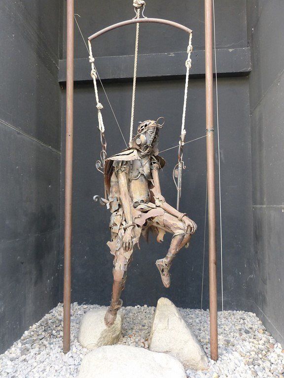
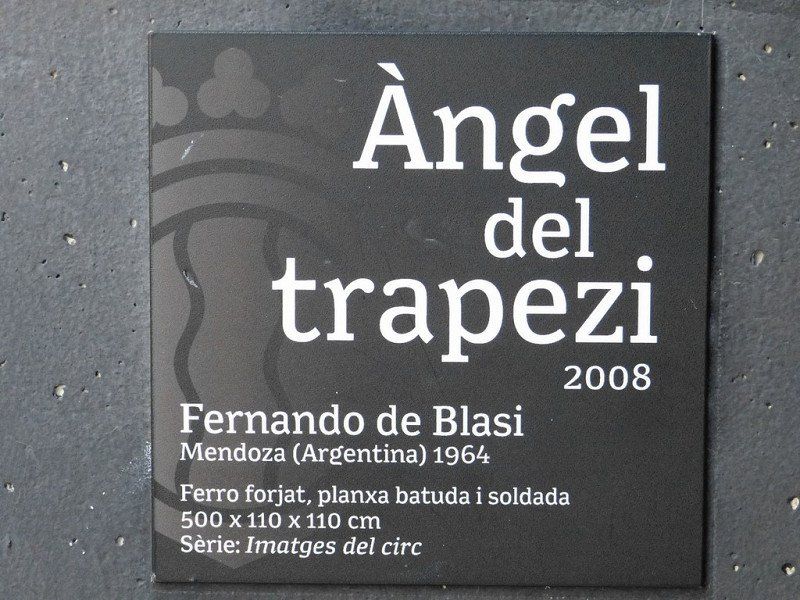
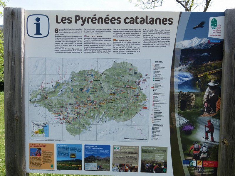
Straight through the Pyrenees.
For the next 3 weeks we will do all the well-known Pyrenees cols this time, by bike.... on the back of the camper.
From the green north side on the Atlantic Ocean to the rugged south side in Spain to end at the Mediterranean Sea at the other foot of the Pyrenees.
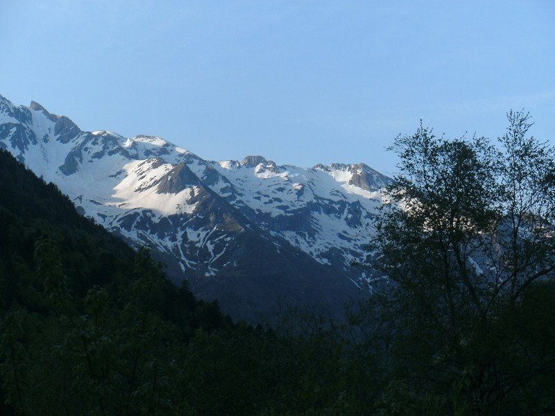
Legendary impressive mountains, changing landscapes, and picturesque villages await us during our Campervan trip through this French-Spanish mountain range.
Day
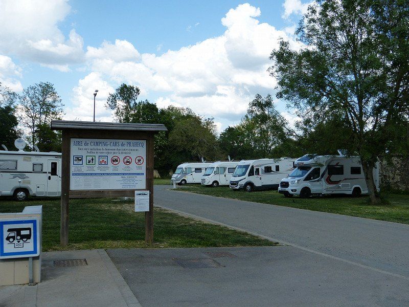
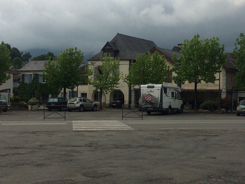
01 Prahecq - Parking Municipal
Surroundings Niort 719km - Prahecq Parking Municipal - 0€ free electricity
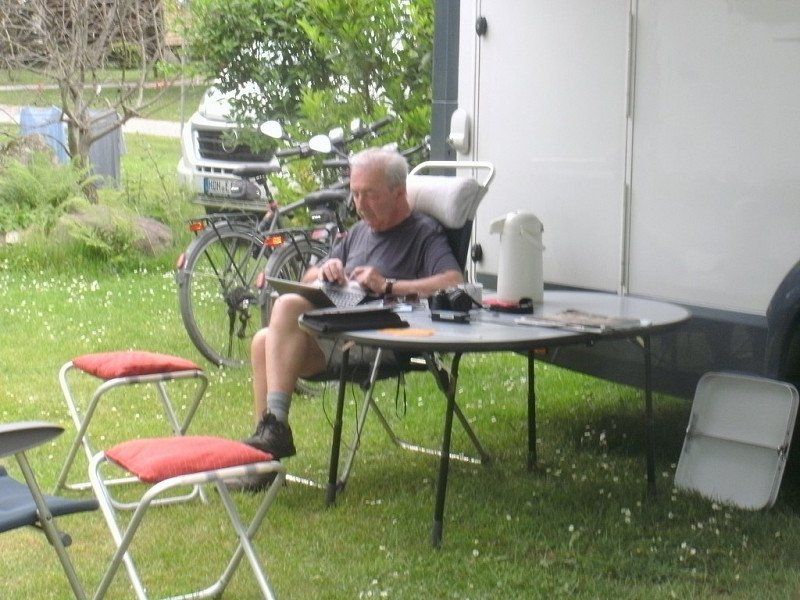
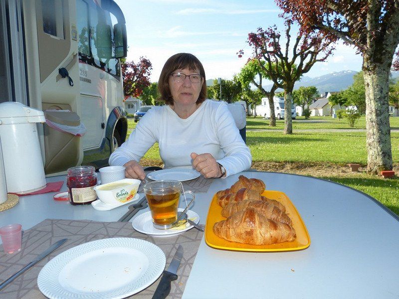
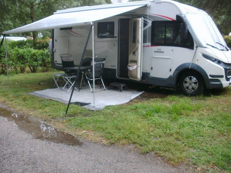
Sunday 8 May we drove to near Niort with an overnight stay at the 'Aire Municipal pour camping cars' of Prahecq.
Computer said : Arrival 4:30 pm, 29°, 716 km, consumption 11.1 L/100 km, average 91 km/h, travel time 7:50 hours.
31 Rue du Chateau, 79230 Prahecq, Frankrijk
46° 15' 46" N 0° 20' 47.7" W
46.2627841 -0.3465919
• Head toward Rue des Écoles on Rue du Château. Go for 118 m.
• Turn left onto Rue du Pont Picard (D125). Go for 188 m.
• Continue on D125. Go for 1.0 km.
• Continue on Lieu-dit Chiron Charreau (D125). Go for 78 m.
• Continue on D125. Go for 3.4 km.
• Continue on Rue de l'Ille (D125). Go for 135 m.
• Turn left onto Avenue de Limoges (D125). Go for 620 m.
• Continue on D125. Go for 1.9 km.
• Take the 4th exit from roundabout toward Saintes/Poitiers/Angers/Nantes. Go for 192 m.
• Take ramp onto A10 (L'Aquitaine) toward Bordeaux/Saintes. Go for 174 km.
• Take exit 1 toward Toulouse/Bayonne/Bassin d'Arcachon/Bordeaux/Périgueux onto N230 (Rocade de Bordeaux). Go for 19.8 km.
• Take exit 15 toward Saint Sébastien/Bayonne/Mont de Marsan/Bassin d'Arcachon onto A63. Go for 179 km.
• Take exit 5 toward Anglet/St Jean P. de Port/Cambo les Bains/Ustaritz/Bayonne-St Léon onto D932 (Avenue du 8 Mai 1945). Go for 665 m.
• Pass 4 roundabouts and continue on Route de Kapito Harri (D932). Go for 7.6 km.
• Take the 2nd exit from Giratoire de Kapito Harri roundabout onto Route de Belharitza (D932) toward Ustaritz/Cambo/St Jean Pied de Port/Espelette/Ainhoa/Dancharia. Go for 1.6 km.
• Take the 2nd exit from roundabout onto Route de Belharitza (D932). Go for 881 m.
• Take the 3rd exit from roundabout onto D932 toward Cambo/St Jean Pied de Port. Go for 1.9 km.
• Take the 3rd exit from roundabout onto D932 toward Cambo/Arnage. Go for 4.3 km.
• Take the 1st exit from roundabout onto D918 toward St Jean Pied de Port/Itxassou. Go for 971 m.
• Pass 2 roundabouts and continue on D918. Go for 29.9 km.
• Turn right onto Place Floquet (D301). Go for 53 m.
• Turn left onto Rue de la Fontaine. Go for 89 m.
• Continue on Chemin de la Liberté. Go for 104 m.
• Turn left onto Avenue du Fronton (VC8). Go for 27 m.
• Arrive at Avenue du Fronton (VC8). Your destination is on the right.
☍
428,6 km
(4 hrs. 1 min.)
Day
Camping Municipal De Plaza-berri
Monday 9 May on to Saint-Jean-Pied-de Port, the foot of the Pyrenees .
Computer said : Arrival 3:15 pm, 29°, 427 km, consumption 12L/100km, average 79km/h, travel time 5:20 hours.
64220, St Jean Pied De Port, France
43° 9' 39.6" N 1° 14' 11.8" W
43.1610000 -1.2366000
• Head toward Chemin de la Liberté on Avenue du Fronton (VC8). Go for 27 m.
• Continue on Avenue de Fronton (VC8). Go for 153 m.
• Continue on Rue Zuharpeta. Go for 106 m.
• Turn right onto Rue Zuharpeta (D301). Go for 92 m.
• Turn right onto Place Floquet (D933). Go for 615 m.
• Take the 2nd exit from roundabout onto Avenue du Jaï-Alaï (D933) toward Pau/St Palais/Mauléon/Ispoure/St Jean le Vieux/Château d'Iholdy. Go for 2.7 km.
• Take the 2nd exit from roundabout onto D933 toward Pau/St Palais. Go for 12.1 km.
• Take the 2nd exit from roundabout onto Route de Saint-Palais (D933) toward Pau/Ostabat/St Palais/Salies de Béarn. Go for 8.6 km.
• Continue on D302. Go for 211 m.
• Continue on D933. Go for 4.7 km.
• Take the 2nd exit from roundabout onto D933 toward A64/Pau. Go for 1.7 km.
• Take the 1st exit from roundabout onto Route de Mauléon (D11) toward Mauléon. Go for 8.9 km.
• Take the 2nd exit from roundabout onto D115. Go for 555 m.
• Continue on Lieu-dit Jaureguiberria (D115). Go for 135 m.
• Continue on D115. Go for 546 m.
• Continue on Lieu-dit Saubidet (D115). Go for 100 m.
• Continue on D115. Go for 268 m.
• Continue on Lieu-dit Oyhençabal (D115). Go for 92 m.
• Continue on D115. Go for 2.1 km.
• Continue on Lieu-dit Brousset (D115). Go for 89 m.
• Continue on D115. Go for 92 m.
• Continue on Lieu-dit Barrère (D115). Go for 197 m.
• Continue on D115. Go for 1.1 km.
• Turn slightly left onto D244. Go for 112 m.
• Continue toward D115. Go for 35 m.
• Continue on Route de Navarre (D115). Go for 159 m.
• Continue on Lieu-dit Bisqueys (D115). Go for 1.6 km.
• Continue on Route de Navarre (D115). Go for 3.3 km.
• Continue on Route de Charre (D115). Go for 3.2 km.
• Take the 2nd exit from roundabout onto Côte de Baure (D115). Go for 173 m.
• Continue on D115. Go for 107 m.
• Continue on Lieu-dit Sahorès (D115). Go for 119 m.
• Continue on D115. Go for 507 m.
• Take the 1st exit from roundabout onto Route de Bayonne (D936) toward Mauléon/Oloron/Sus/Eglise de l'Hôpital-Saint-Blaise/Orthez/Navarrenx/Mourenx. Go for 1.1 km.
• Take the 2nd exit from roundabout onto Route d'Oloron (D936) toward Oloron/Sus. Go for 8.7 km.
• Take the 3rd exit from roundabout onto D936 toward Oloron. Go for 5.2 km.
• Pass 2 roundabouts and continue on Avenue du Maréchal de Lattre de Tassigny (D936). Go for 5.9 km.
• Take the 3rd exit from Rond-Point Sainte-Barbe roundabout onto Avenue Charles et Henri Moureu. Go for 450 m.
• Turn sharp right onto Rue Carrérot (N134). Go for 71 m.
• Take the 2nd exit from roundabout onto Rue Carrérot (N134). Go for 965 m.
• Arrive at Rue Adoue (N134). Your destination is on the left.
☍
76,9 km
(1 hrs. 4 min.)
Day
Bezoek Saint-Jean-Pied-de-Port
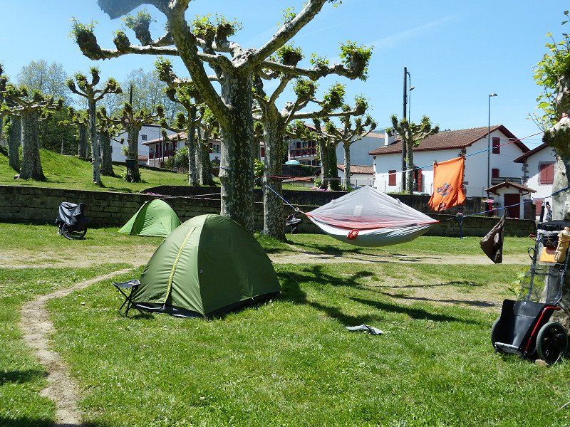
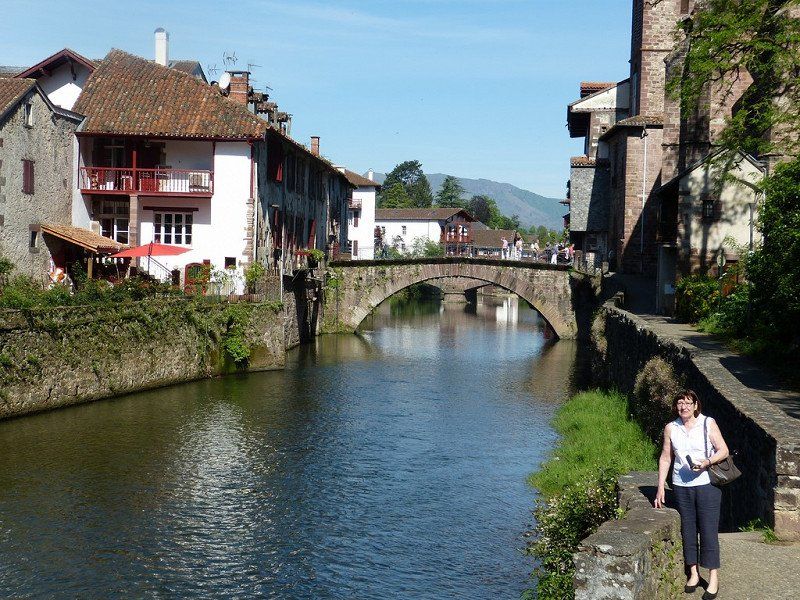
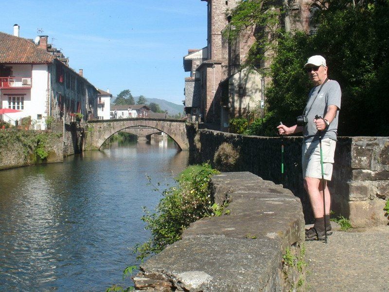
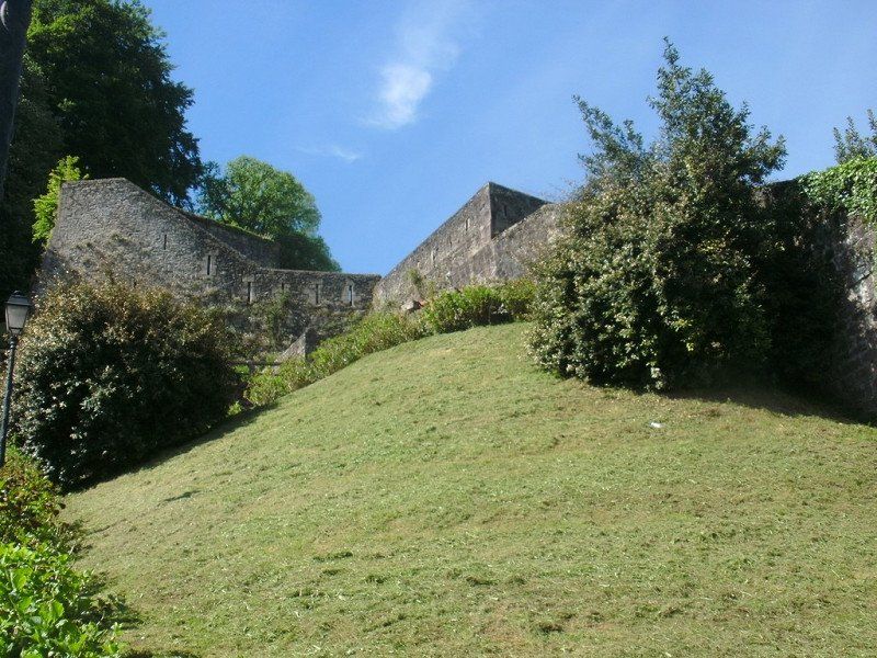
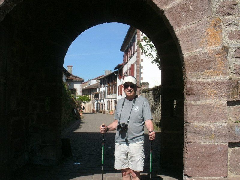
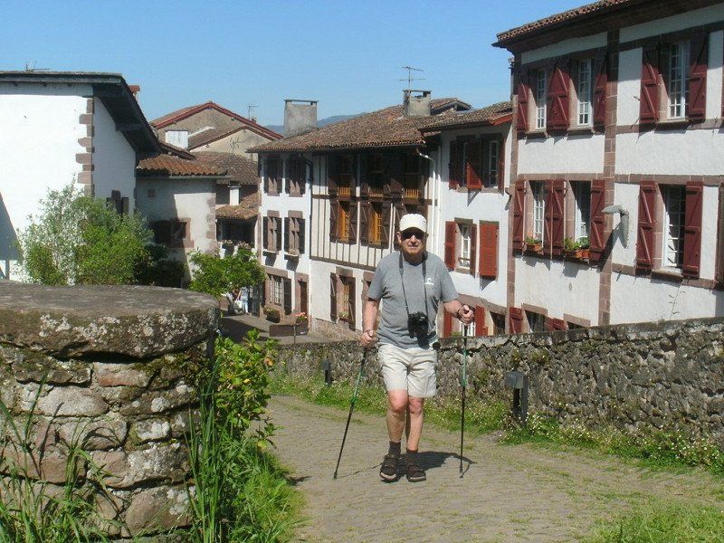
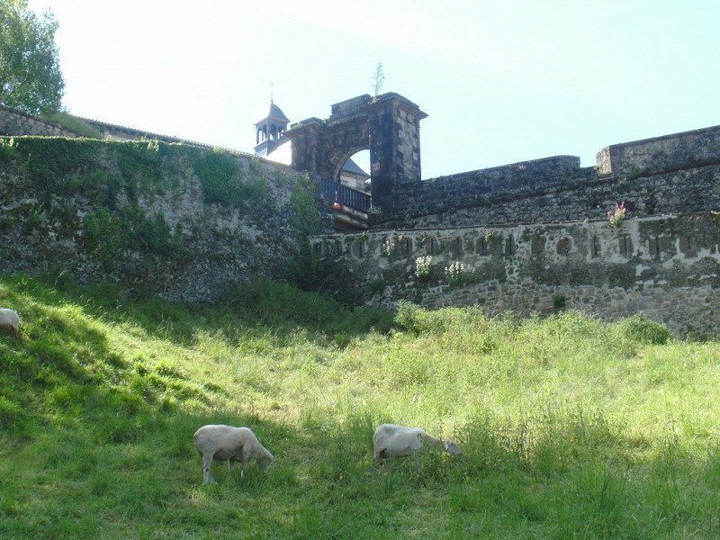
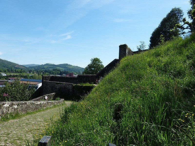
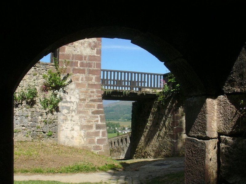
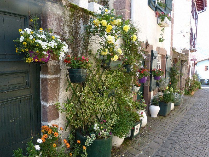
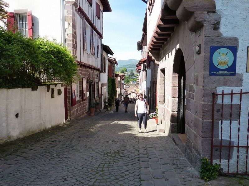
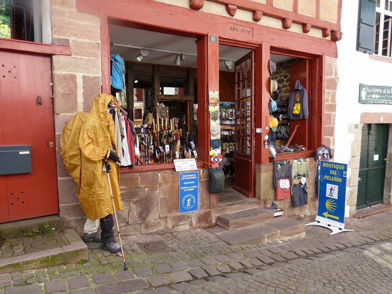
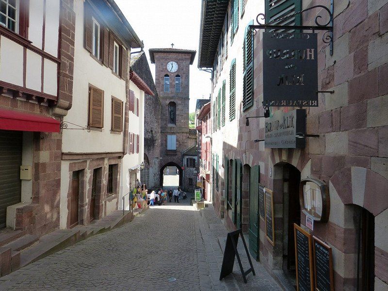
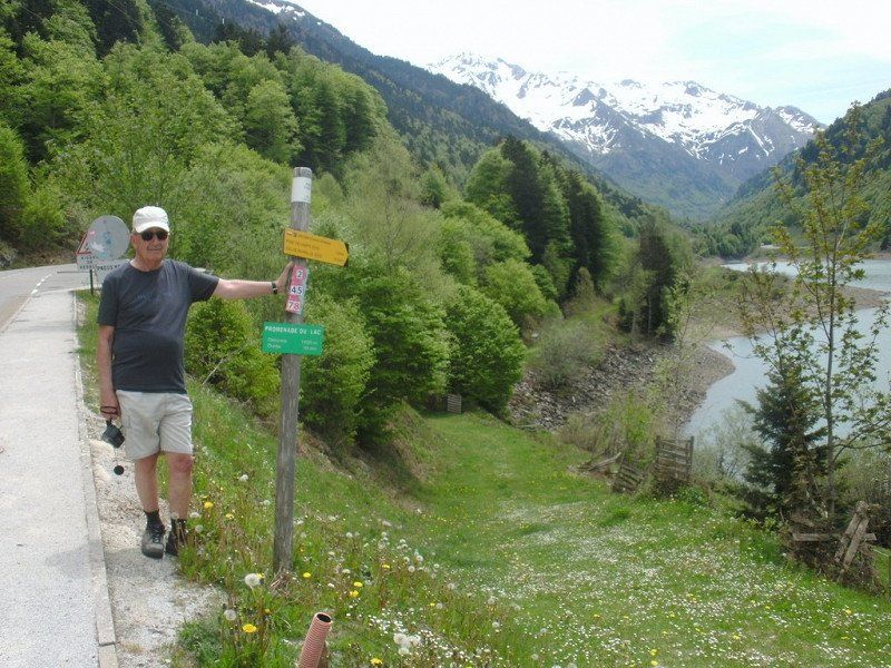
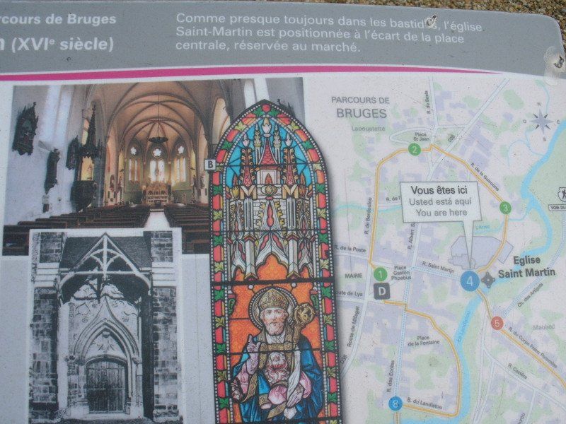
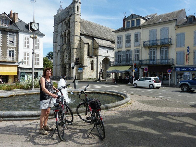
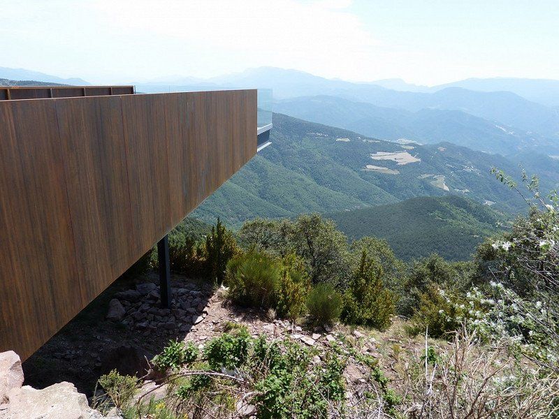
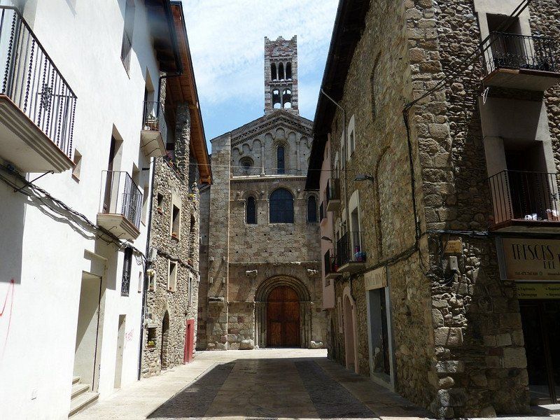
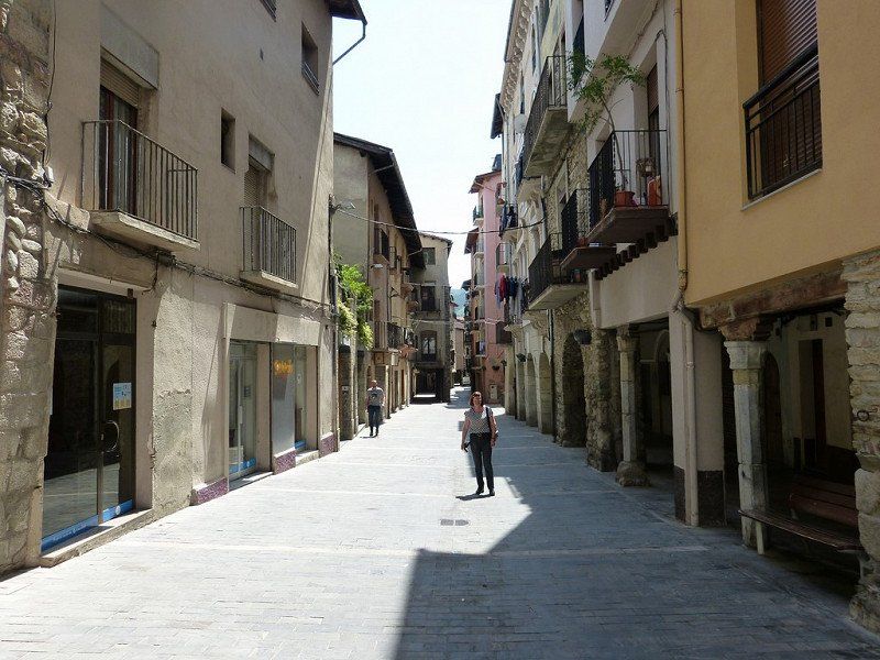
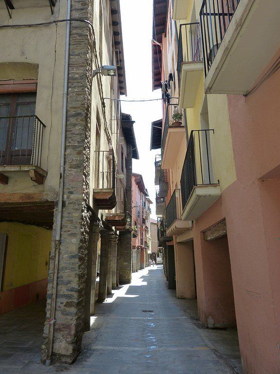
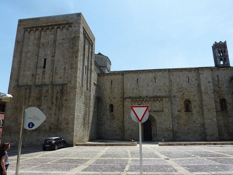
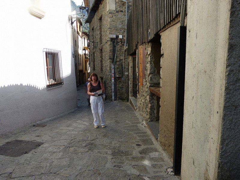
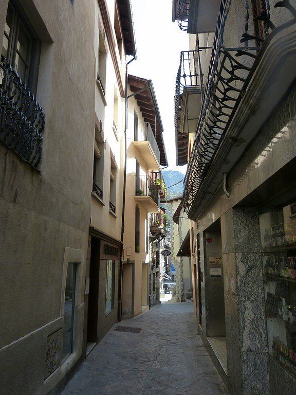
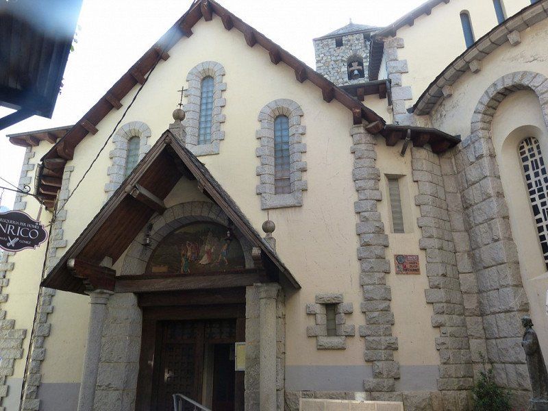
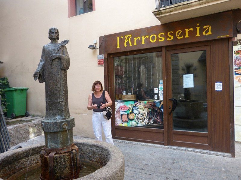
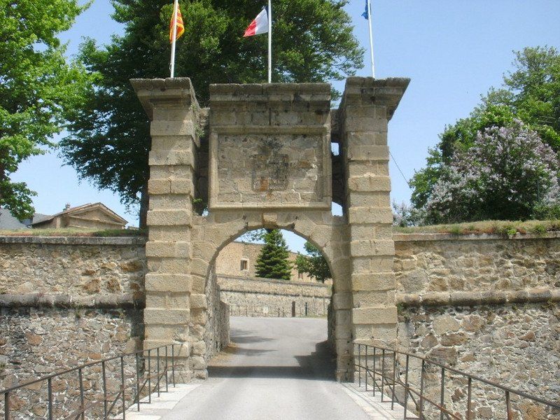
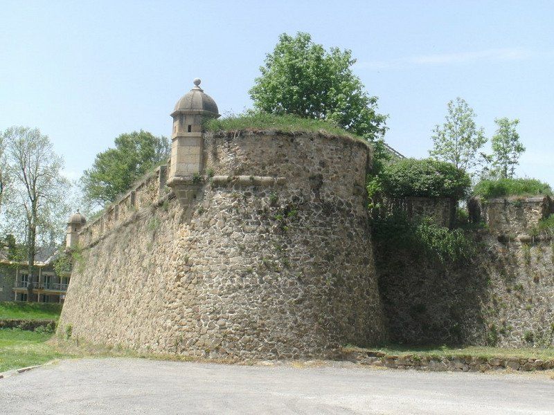
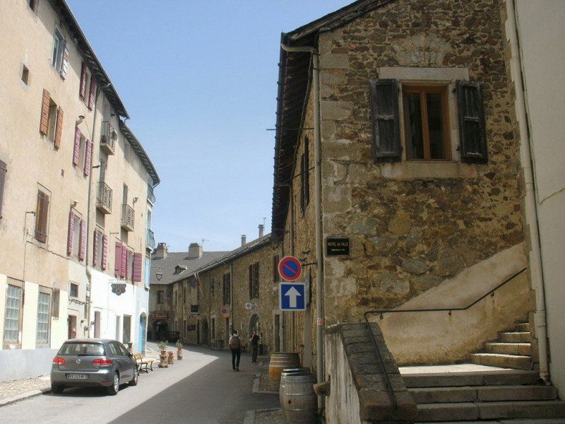
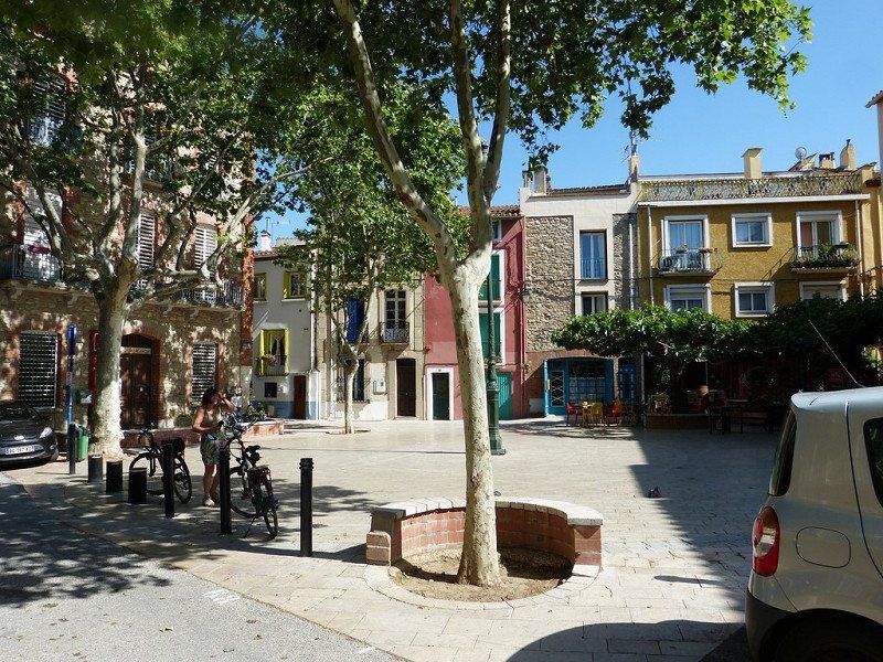
Tuesday May 10. Stay in Sain-Jean-Pied-de-Port . A picturesque fortified town on the pass road that leads over the Pyrenees to Spain. The 16th century town has traditionally been a crossroads of the main routes to Santiago de Compostela . The city is walled and has an old fortress, Citadel, fortified in the 17th century by who other than Vauban. It is not even a meter flat here, not to say very steep. So we would make a tour with the tourist train. Departure at 11am. We already knew that from our visit to the Tourist Office the day before. Sorry, the train is not running today! 'Un problème de chaffeur, demain', the madam now said. So Manana. It is only 8 km from Spain here. Hence maybe. Then an attempt on foot to the Citadel. Until halfway on a couch. Too many stairs for me. Not for Mama.
visit Saint-Jean-Pied-de-Port. The area around is very suitable for walking or cycling, but there are a few slopes.
There is the possibility to drive through the city with a tourist train past all the sights and to the fortress above. Departure from Place du Genéral De Gaulle opposite the town hall, approximately € 6.00 pp Location station
43°09'47.3"N 1°14'14.7"W
Saint-Jean-Pied-de-Port / Nouvelle-Aquitaine /
Day
04 verplaatsing naar Oloron-Sainte-Marie --Aire Municipale
Computer said : Arrival 12:15, 19°, 71 km, consumption 9.9 L/100km, average 38 km/h, travel time 2:00 hours. Short trip from Saint-Jean-Pied-de-Port to Oloron-Sainte -Marie.
Discover the green Pyrenees, yellow routes départementales and past rural villages with bilingual signs. Those in Basque are unpronounceable. Always with traffic brakes and max 30km signs.
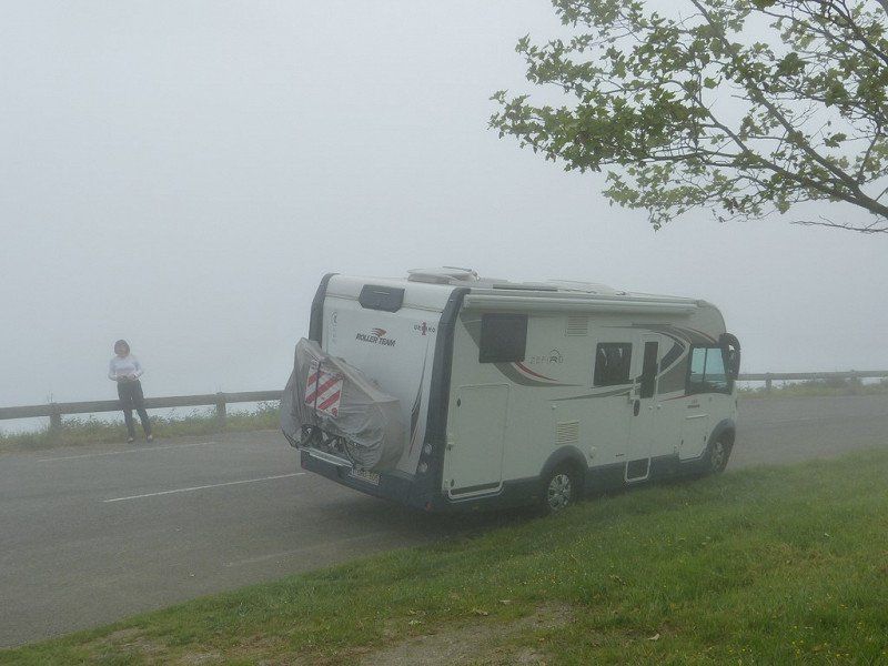
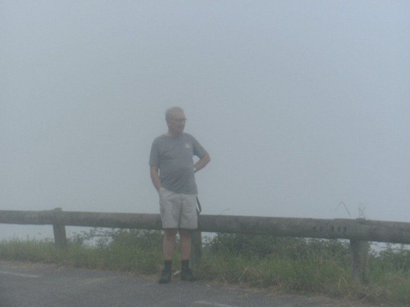
The Col d'Osquich after 15 km we did completely in the fog. Probably left too early. Sleep longer in the future.
Because 2 hours later blue sky and 26° in Oloron-Sainte-Marie.
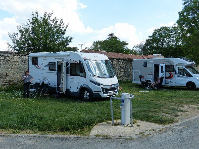
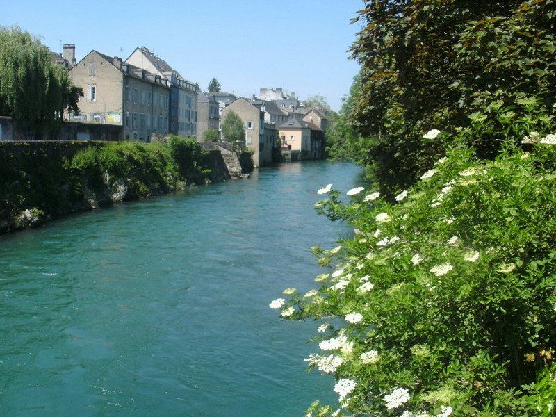
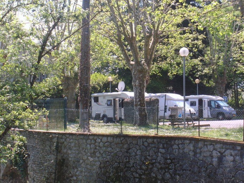
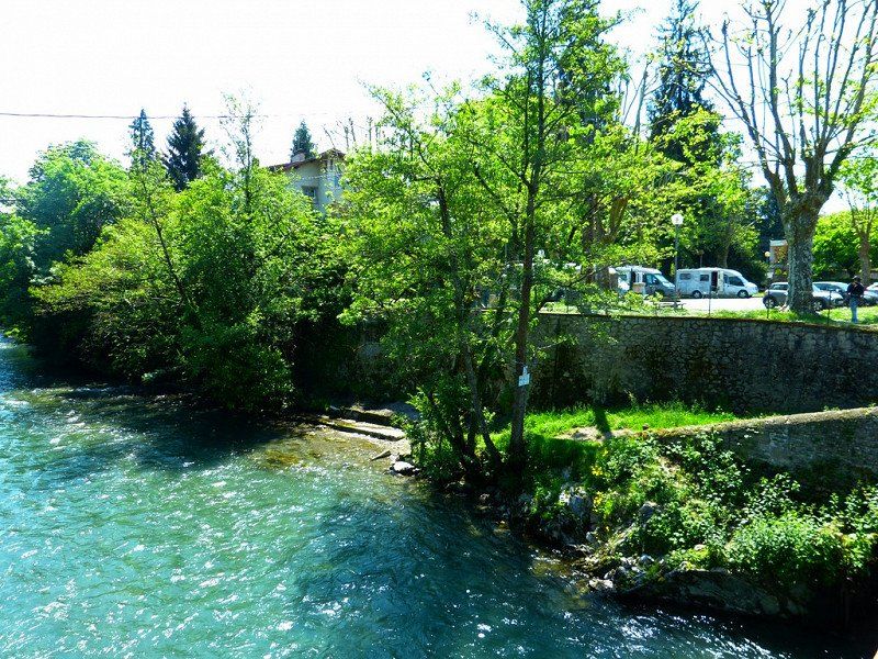
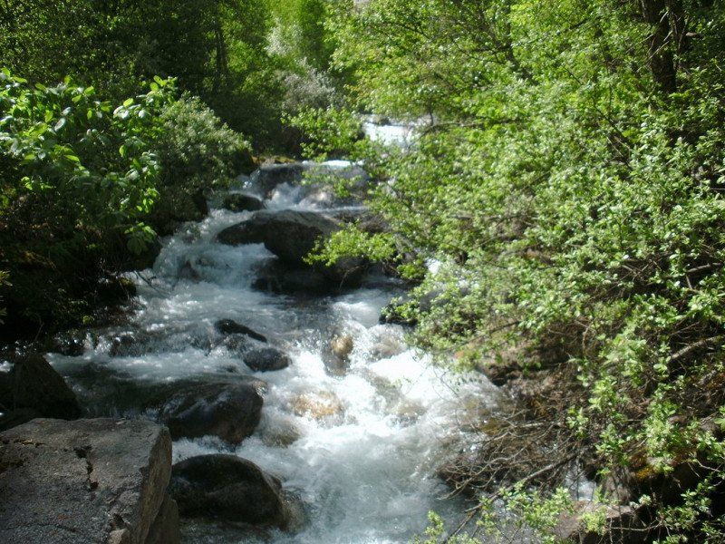
Relax in the shade of the 'Aire pour camping cars' in the center of the town in a park along the mountain river.
Free, but electricity has to be paid for with a €3 token for 55 minutes and can be purchased at the Tourist Office. Too much effort for us. We can do without.
26-, 32 N134, 64400 Oloron-Sainte-Marie, Frankrijk
43° 11' 2.4" N 0° 36' 31.4" W
43.1839883 -0.6087313
• Head toward Rue de la Hourquette on Rue Adoue (N134). Go for 949 m.
• Take the 2nd exit from roundabout onto Rue Carrérot (N134). Go for 83 m.
• Take the 3rd exit from Rond-Point Lahaderne roundabout onto Avenue Charles et Henri Moureu. Go for 483 m.
• Take the 1st exit from Rond-Point Sainte-Barbe roundabout onto Avenue du Maréchal de Lattre de Tassigny (D936). Go for 134 m.
• Arrive at Avenue du Maréchal de Lattre de Tassigny (D936). Your destination is on the left.
☍
1,6 km
( 2 min.)
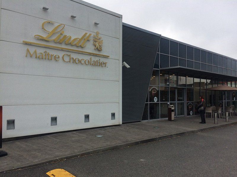
04 Chocolaterie LINDT - Oloron-Sainte-Marie
We couldn't pass up a visit to this Chocolaterie.
Certainly not with such a large parking lot in front of the door.
4 Av. Mal de Lattre de Tassigny, 64400 Oloron-Sainte-Marie, Frankrijk
43° 11' 28.9" N 0° 37' 5.9" W
43.1913508 -0.6183064
• Head northwest on Avenue du Maréchal de Lattre de Tassigny (D936). Go for 46 m.
• Take the 4th exit from Rond-Point Rozan de Mazilly roundabout onto Avenue du Maréchal de Lattre de Tassigny (D936) toward Centre Ville/Ste Marie. Go for 252 m.
• Take the 3rd exit from Rond-Point Sainte-Barbe roundabout onto Avenue Charles et Henri Moureu. Go for 472 m.
• Take the 2nd exit from Rond-Point Lahaderne roundabout onto Avenue de la Gare. Go for 223 m.
• Take the 1st exit from Rond-Point des Médaillés Militaires roundabout onto Avenue Sadi Carnot. Go for 312 m.
• Continue on Pont Sainte-Claire (N134). Go for 149 m.
• Continue on Place Léon Mendiondou (N134). Go for 28 m.
• Continue on Rue Justice (N134). Go for 163 m.
• Continue on Place de la Résistance (N134). Go for 45 m.
• Continue on N134. Go for 40 m.
• Turn slightly right onto Rue Jeliote (N134). Go for 285 m.
• Continue on Rue Pierre de Jeliote (N134). Go for 426 m.
• Continue on Route de Pau (N134). Go for 844 m.
• Take the 1st exit from roundabout onto Route de Pau (N134) toward Pau/A64-A65/Gan/Arudy. Go for 4.7 km.
• Take the 1st exit from roundabout onto D920 toward Laruns/Arudy/Ogeu/Herrère. Go for 96 m.
• Turn left onto Route de Pau (D920). Go for 12.2 km.
• Pass 3 roundabouts and continue on D920. Go for 2.4 km.
• Take the 1st exit from roundabout onto D934. Go for 2.9 km.
• Take the 3rd exit from roundabout onto D934. Go for 2.6 km.
• Take the 3rd exit from roundabout onto D934. Go for 1.5 km.
• Take the 3rd exit from roundabout onto D934. Go for 4.4 km.
• Take the 2nd exit from Place de la Mairie roundabout onto Rue Barthèque. Go for 221 m.
• Turn left onto Rue de Versailles. Go for 119 m.
• Turn left onto Rue du Foirail. Go for 81 m.
• Turn right onto Rue du Port (D934). Go for 19.2 km.
• Turn left onto D431. Go for 943 m.
• Arrive at D431. Your destination is on the left.
☍
54,7 km
( 58 min.)
Day
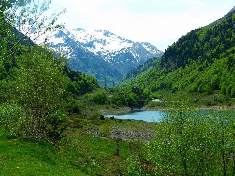
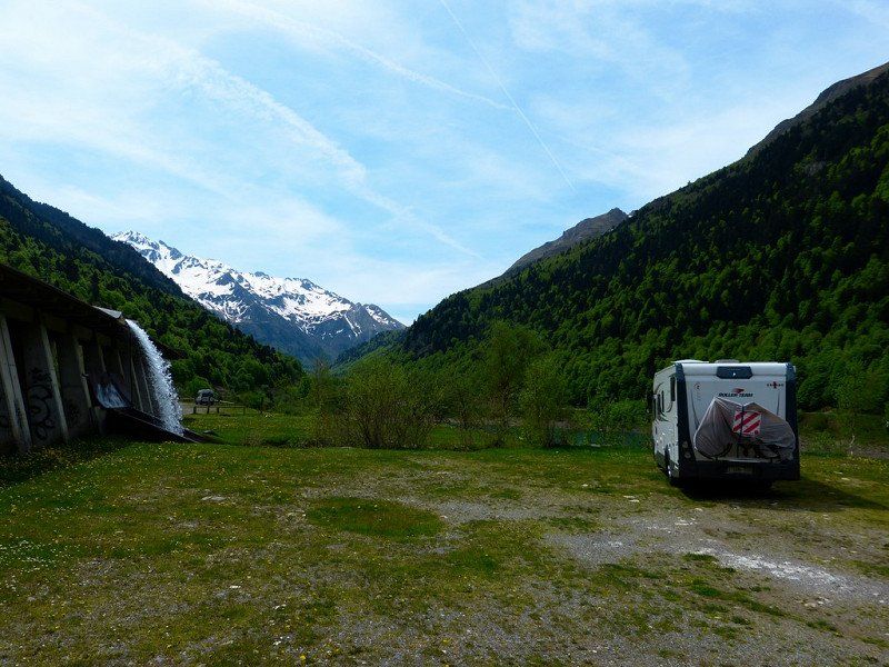
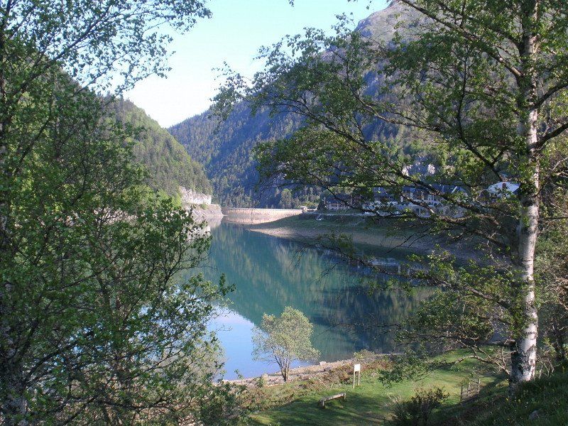
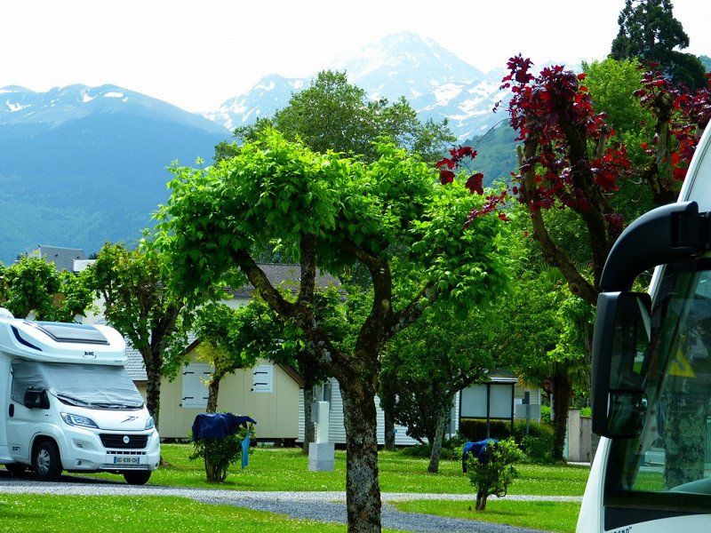
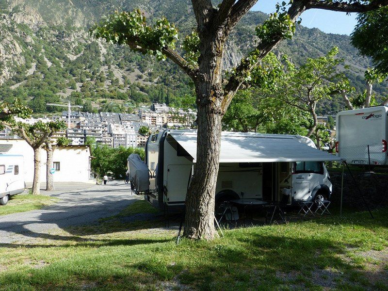
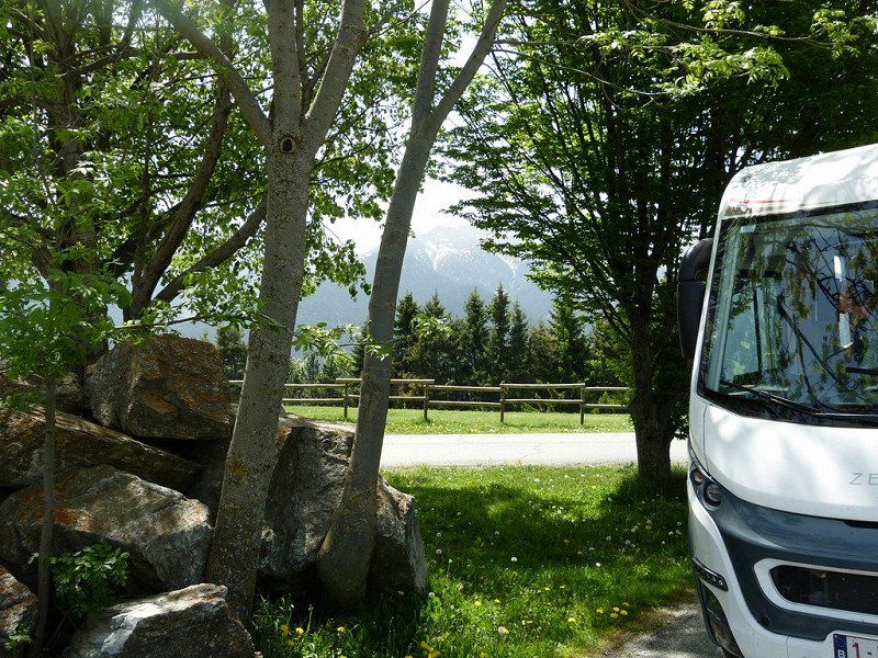
05 Aire de Camping-Car d'Artouste - Laruns,
Aire de Camping-Car d'Artouste - on the Lac de Fabrèges reservoir - near the ski lift and Petit Train d'Artouste [June to September] - quiet at night - center and shops 200m
free - no electricity
Laruns – Thursday, May 12, 2022
Computer said : Arrival 12:30, altitude 1263m, 25°, 60 km, consumption 14.4 l /100km, average 33 km/h, travel time 1:50 hours.
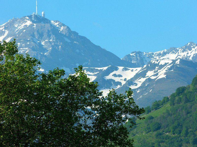
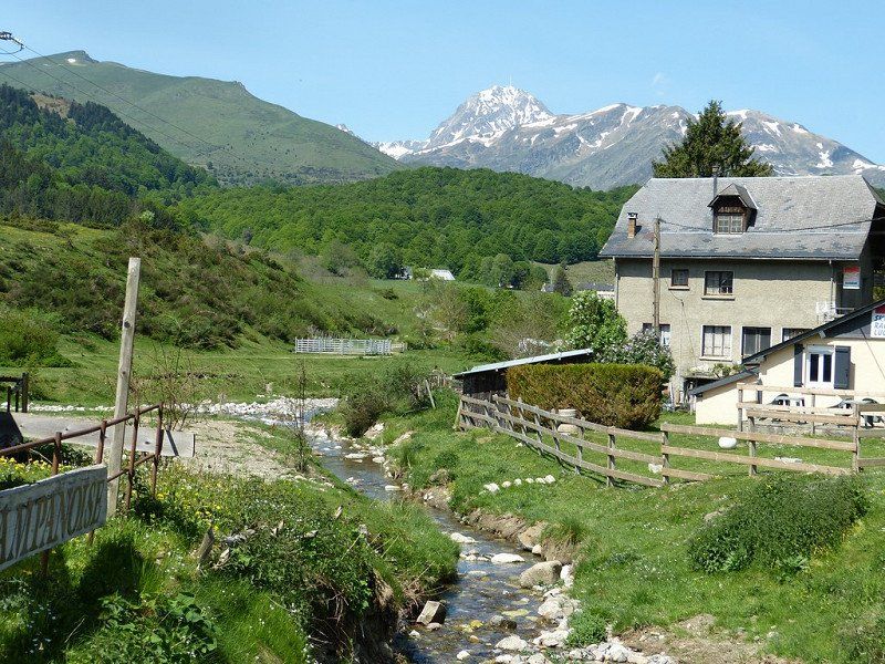
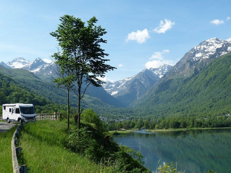
Short drive to Laruns, in the Col d'Aubisque area . Actually 20 km higher up towards Spain into the mountains to a reservoir with ski center and cable lifts to the station of Le Petit Train d'Artouste. That train takes 50 minutes to the highest reservoir in Europe (1997m).
Unfortunately, the elevators were not working, the train was not running. It's still dead season until May 22.
'It is what it is' said someone from Merchtem!
Fortunately a sunny day in a beautiful setting. Beautiful place on the edge of the reservoir, surrounded by peaks of about 2000m. Complete tranquility. A Dutch neighbour. No traffic on the road. Who would come here now?
19 D431, 64440 Laruns, Frankrijk
42° 52' 30.3" N 0° 23' 39.5" W
42.8750861 -0.3943113
• Head south on D431. Go for 943 m.
• Turn right onto D934. Go for 19.5 km.
• Take the 2nd exit from Place de la Mairie roundabout onto Avenue de la Gare (D934). Go for 4.4 km.
• Take the 3rd exit from roundabout onto D934. Go for 1.5 km.
• Take the 2nd exit from roundabout onto D934. Go for 2.6 km.
• Take the 3rd exit from roundabout onto Lieu-dit Lahet (D934). Go for 2.9 km.
• Take the 1st exit from roundabout onto D934. Go for 132 m.
• Take the 2nd exit from roundabout onto Route d'Ossau (D934). Go for 202 m.
• Turn right onto Place Clemenceau (D35). Go for 12.2 km.
• Turn right onto Chemin du Stade. Go for 291 m.
• Turn right onto Route de Capbis. Go for 375 m.
• Arrive at Route de Capbis.
☍
44,9 km
( 49 min.)
Day
Verplaatsing naar Lourdes
Lourdes – Friday May 13 and Saturday May 14. Across the Pyrenees 08 May 2022 - 29 May 2022
Friday, May 13, 2022, Bruges-Capbis-Mifaget, France
Computer said : Arrival 12:15, altitude 422m, 22°, 74 km, consumption 7.8 l /100km, average 35 km/h, travel time 2:06 hours.
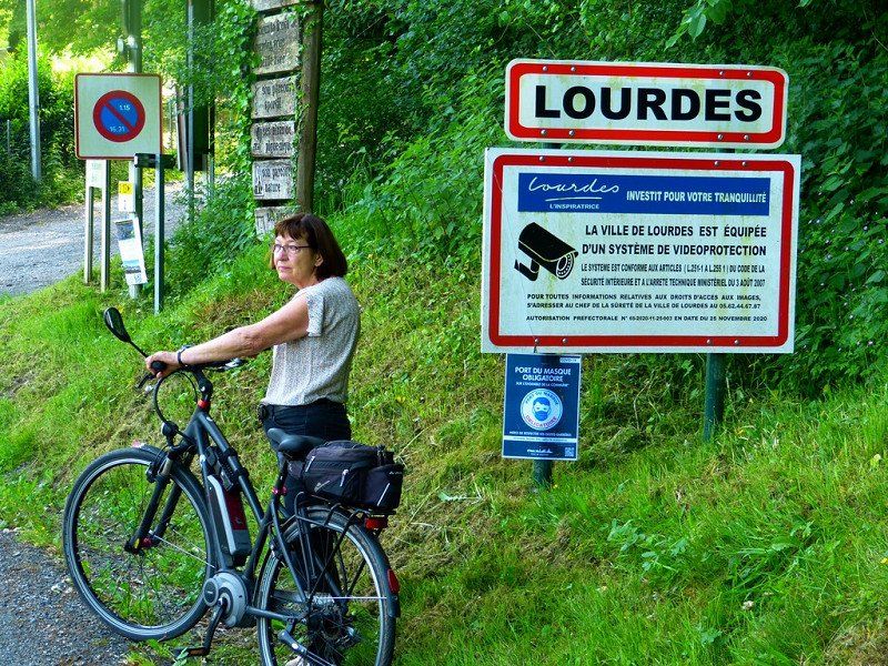
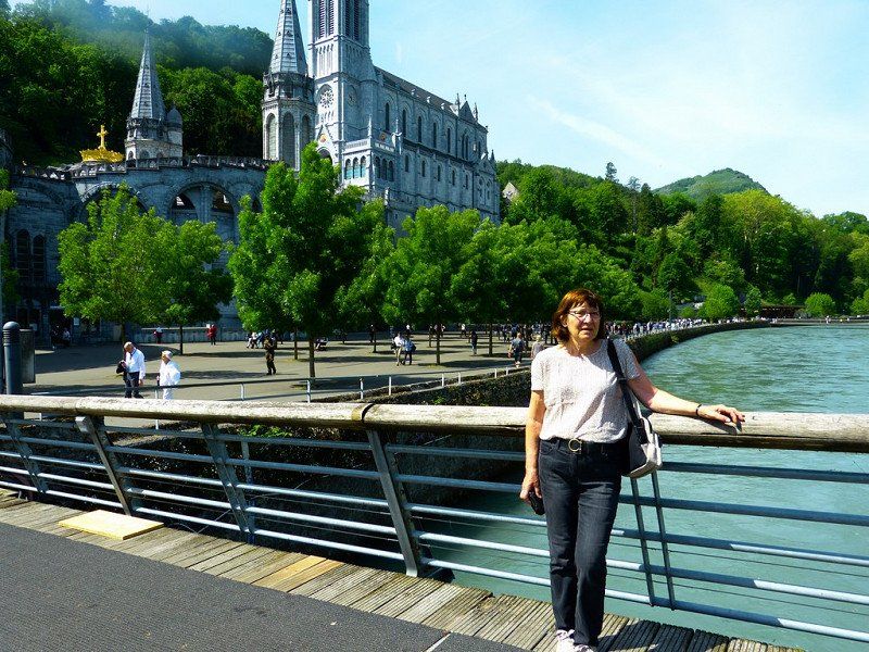
Short drive from upland Laruns descending to Lourdes .
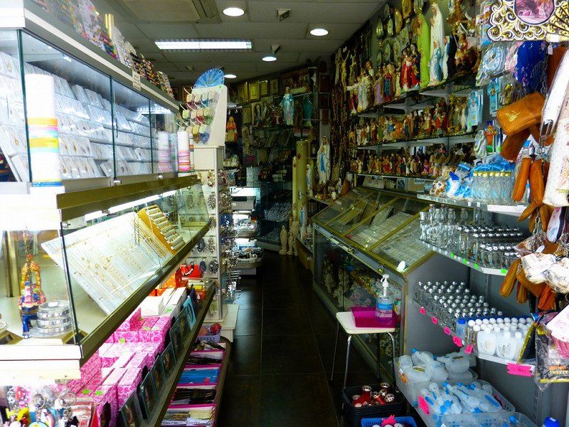
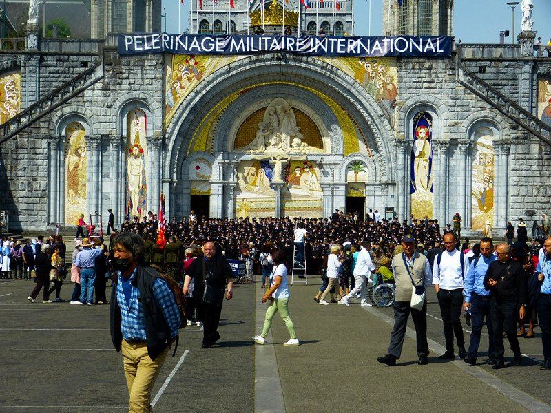
The town in the Pyrenees that we only knew from our childhood through the stories and photo books of our parents and grandparents who experienced their very first trip abroad in a hotel. For a pilgrimage and accompanied by a Cheers, this was already allowed in the last century. After the devotion and the candle procession, the trips to the surrounding Cols were also nicely included. The Madonna of Lourdes would have wanted it that way, our vicar said approvingly.
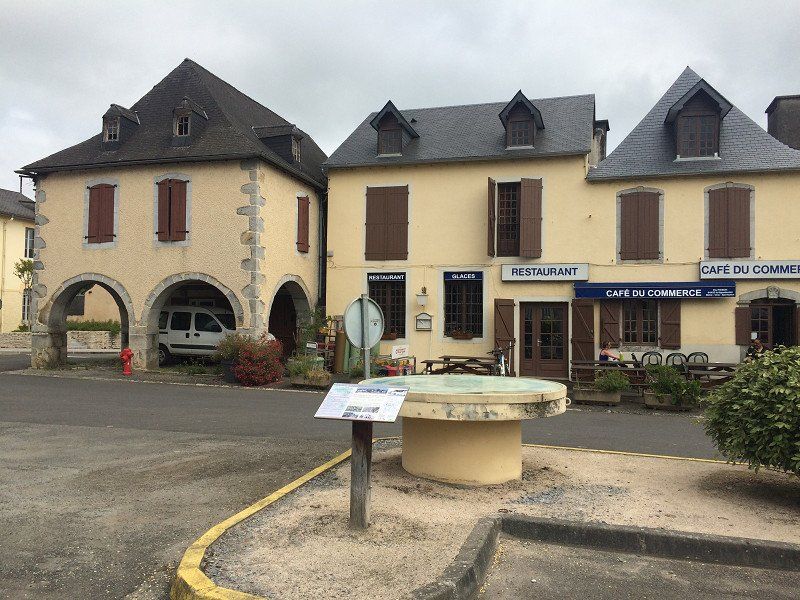
Our intention was to get to the top of the Col d'Aubisque and the Col de Soulor, but the road was 'Fermé'. Not thought of when preparing at home. Not enough snow melted yet? Or 'dead season'? So out of necessity another less difficult way. Along 'Bruges'. That town really exists here. Even one with a spacious village square to stop for a while.
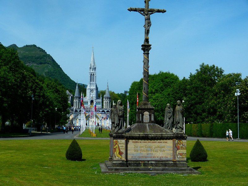
The campsite is located about 3 km outside the town of Lourdes and is fairly busy. Would they also go to the candle procession?
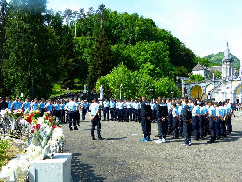
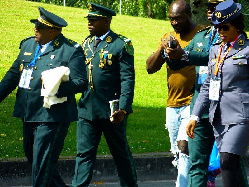
Normally there is a shuttle bus to the Sanctuaires, we were told. Not right now because there is an International Military pilgrimage and the van is not allowed to drive due to a risk of terrorist attacks.
So we cycle to Lourdes. Also many steps with the bike in hand, because either you are not allowed, or it is too steep. And it is also burning hot. The military is indeed present en masse. In their best uniforms, polished copper and ironed trousers. All of Nato is here. The Russians have been warned.
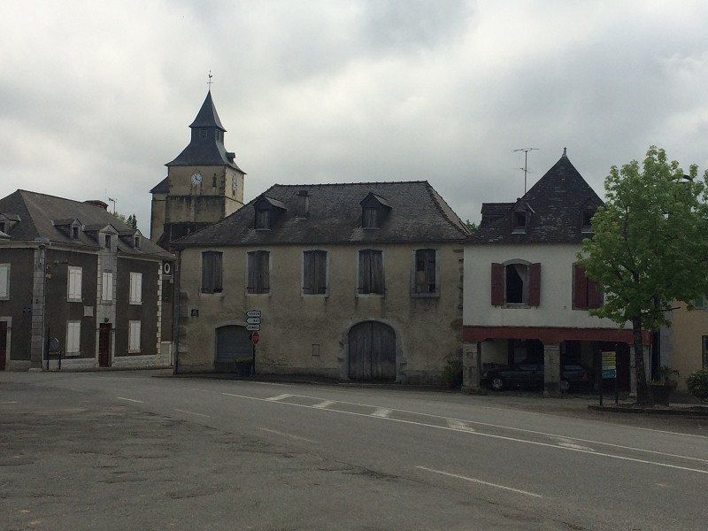
Bruges-Capbis-Mifaget, Frankrijk
Stopover in Bruges
64800 Bruges-Capbis-Mifaget, Frankrijk
43° 7' 15.6" N 0° 18' 15.4" W
43.1210077 -0.3042778
• Head toward Chemin de Soulié on Route de Capbis. Go for 375 m.
• Continue on Rue des Écoles. Go for 211 m.
• Continue on Place Gaston Phoebus. Go for 50 m.
• Turn right onto Rue Albert de Saleza (D35). Go for 4.5 km.
• Take the 2nd exit from roundabout onto Rue de la Bastide (D35). Go for 3.0 km.
• Turn right onto Avenue du Pic du Midi (D937). Go for 15.7 km.
• Continue on Route de Pau. Go for 906 m.
• Turn right onto Route de Batsurguère. Go for 593 m.
• Turn right onto Route de Batsurguère (D13). Go for 545 m.
• Turn right. Go for 11 m.
• Arrive at your destination on the right.
☍
25,9 km
( 27 min.)
06 Camping de la Forêt - Lourdes
Camping de la Foret
flat and shady terrain - shop - bar - restaurant - heated swimming pool - bread service - sanctuary 1.5 km - center 4 km
€ 14.85 • 1 Apr. until 1 Nov. 2 persons per night incl. tax ACSI - Campingcard, ACSI - Campingcard
Current (10A)
Rte de la Forêt, 65100 Lourdes, Frankrijk
43° 5' 44.6" N 0° 4' 32.7" W
43.0957184 -0.0757456
• Head toward Route de Batsurguère. Go for 11 m.
• Turn left onto Route de Batsurguère (D13). Go for 545 m.
• Turn left onto Route de Batsurguère. Go for 593 m.
• Turn right onto Route de Pau. Go for 1.2 km.
• Continue on Rue de Pau. Go for 626 m.
• Take the 2nd exit from Rond-Point Michel Crauste roundabout onto Avenue de la Gare. Go for 638 m.
• Continue on Avenue de Sarsan. Go for 695 m.
• Turn right onto Avenue Victor Hugo. Go for 500 m.
• Take the 3rd exit from roundabout onto D937. Go for 373 m.
• Take the 1st exit from roundabout onto Route de Bagnères (D937). Go for 13.0 km.
• Turn right onto Lieu-dit La Salie (D935). Go for 4.1 km.
• Turn left onto Rue de l'Adour (D26). Go for 405 m.
• Continue on Route d'Ordizan (D26). Go for 69 m.
• Turn right onto Route de la Serre Devant (D8). Go for 98 m.
• Continue on Route de la Plaine (D8). Go for 1.7 km.
• Take the 2nd exit from roundabout onto Rue Pierre Latécoère (D8). Go for 485 m.
• Arrive at Rue Pierre Latécoère (D8). Your destination is on the left.
☍
24,9 km
( 30 min.)
Day
Day
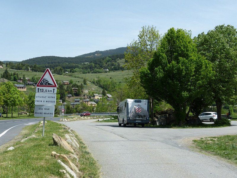
Verplaatsing naar Bagnères-de-Bigore
Bagnères-De-Bigorre – Sunday and Monday 15 & 16 May 2022
Computer said : Arrival 12:30, altitude 540m, 30°, 26 km, consumption 12.8 l /100km, average 24 km/h, travel time 1:03 hours.
Ultra short ride over relatively flat terrain. From one village to another . Maximum allowed speed, 30km/h.
The plan was to go over the Col du Tourmalet which would take much more time. But that Col is also closed until the end of this month.
The plan for tomorrow Monday was to drive from here to La Mongie and to get there with 2 closed gondolas to the top of the Pic-du-Midi-de-Bigorre (2877m). We can save ourselves the trouble, because there it is 'Fermeture annuelle de 9mai – 31mai'.
I should have known, but as a lowlander I didn't think about it. It is now clear to me why people ride the Giro and not the Tour in this period.
So we stay here in Bagnères-de-Bigorre and enjoy summer temperatures and a beautiful view of the Pic-du-Midi. We also have some reading books.
08 Camping Les Fruitiers
Camping Les Fruitiers : Very neat campsite for little money. 1 km walk from city center. Sanitary excellent.
€14.18 • 15 Apr. until 31 Oct. 2 persons per night incl. tax - Electricity (6A)
65200, Bagnères de Bigorre, France
43° 4' 18.1" N 0° 9' 23.4" E
43.0717000 0.1565000
• Head south on Rue Pierre Latécoère (D8). Go for 162 m.
• Take the 2nd exit from roundabout onto Rue du Général de Gaulle (D938). Go for 584 m.
• Turn left onto Allées Jean Jaurès. Go for 577 m.
• Turn right onto Rue Émilien Frossard. Go for 83 m.
• Take the 2nd exit from roundabout onto Avenue du Maquis de Payolle (D935). Go for 11.2 km.
• Continue on Route du Col d'Aspin (D918). Go for 12.8 km.
• Turn right. Go for 13 m.
• Arrive at your destination on the right.
☍
25,4 km
( 30 min.)
Day
Verblijfdag Bagnères-de-Bigorre
Day of stay Bagnères-De-Bigorre
About this day - With clear weather it is definitely recommended to visit the Pic duMidi in La Mongie. An observatory is located on the peak, where you can enjoy a beautiful view
09 Col d'Aspin
65240 Aspin-Aure, Frankrijk
42° 56' 32.1" N 0° 19' 37.9" E
42.9422399 0.3271973
• Head toward Col d'Aspin. Go for 13 m.
• Turn right onto Col d'Aspin (D918). Go for 12.0 km.
• Turn right onto Route des Lacs (D929). Go for 685 m.
• Arrive at Route des Lacs (D929). Your destination is on the left.
☍
12,7 km
( 17 min.)
09 Arreau, Frankrijk
lieu dit le plas, D929, 65240 Arreau, Frankrijk
42° 54' 15.4" N 0° 21' 20.7" E
42.9042652 0.3557436
• Head southwest on Route des Lacs (D929). Go for 1.1 km.
• Take the 2nd exit from roundabout onto D919. Go for 1.1 km.
• Continue on D618. Go for 7.5 km.
• Take the 1st exit from roundabout onto D25. Go for 1.7 km.
• Continue on Lieu-dit Villembits (D25). Go for 109 m.
• Continue on D25. Go for 961 m.
• Continue on Route du Louron (D25). Go for 497 m.
• Continue on D25. Go for 409 m.
• Turn left onto D325. Go for 454 m.
• Turn right onto D25. Go for 437 m.
• Continue on Route d'Aranvielle (D25). Go for 539 m.
• Continue on Lieu-dit Aranvielle (D25). Go for 23 m.
• Continue on D25. Go for 7 m.
• Continue on Lieu-dit Aranvielle (D25). Go for 163 m.
• Continue on D25. Go for 349 m.
• Arrive at D25. Your destination is on the right.
☍
15,3 km
( 16 min.)
Day
Verplaatsing naar Loudenvielle
Today a beautiful and not too long route that includes the Col d'Aspin and leads you through the beautiful valley of the Louron to Loudenvielle.
Loudenvielle – Tuesday, May 17, 2022 Aspin-Aure, France
Computer said : Arrival 14:00, altitude 960m, 32°, 58 km, consumption 14.7 l /100km, average 26 km/h, travel time 2:13 hours.
Spicy ride over the Col d'Aspin .
Loudenvielle is a small town in the Hautes Pyrénées with a Carrefour supermarket, some restaurants and wellness. Judging by the huge almost empty public car parks, they expect quite a few people here in the ski season. Now only a few paragliders fly between the mountains. We passed a beautiful mountain lake close by, but missed the only photo stop. Turning right with 7m is not so obvious here. We are finally at a Wellness Sport Campsite for which the specified coordinates were incorrect and therefore resulted in additional search work. The Aire de camping car from Loudenvielle was so modern and automatic that you could not register with a Belgian mobile phone number +32, so you could not pay. and consequently the barrier remained closed.
To the bewilderment of the helpful Frenchmen who rushed to help. You could choose a language, French, German, English, Dutch, etc., but then you got a menu with pre-programmed fixed country codes: Français +33, Dutch +31, etc …. Belgian is not a language and therefore no country code +32 is possible. Oops...... Drive on to a campsite.
10 Aire de Camping-Car Park Loudenvielle
€13.70 • 1 Jan. until 31 Dec. 2 persons per night incl. tax 25pl
Current (6A) Free, Wifi free
35 Chem. du Hourgade, 65510 Loudenvielle, Frankrijk
42° 48' 5.8" N 0° 24' 39.5" E
42.8016154 0.4109756
• Head south on D25. Go for 25 m.
• Continue on Chemin du Hourgade (D25). Go for 231 m.
• Turn right onto Chemin de Rioutor (D25). Go for 366 m.
• Continue on Chemin de la Mainette (D25). Go for 202 m.
• Turn left onto Chemin de la Mainette. Go for 37 m.
• Arrive at Chemin de la Mainette. Your destination is on the right.
☍
0,9 km
( 2 min.)
10 Camping Pene Blanche
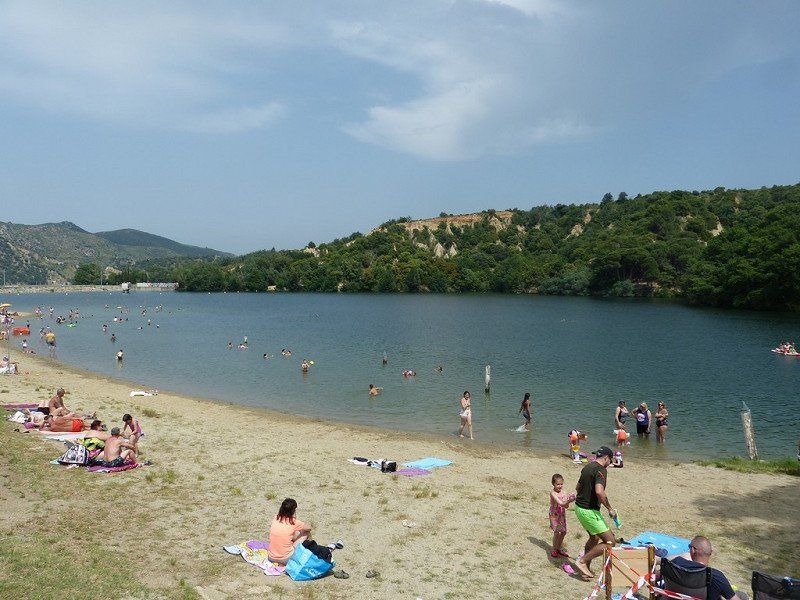
spacious terraced campsite in the Vallée de Louron, near a lake and large center with thermal baths - bread service - center 200m
€ 24.10 • 1 Apr. until 14 Oct. 2 persons per night incl. tax CCI - Camping Card International, ACSI - Campingcard
Current (10A)
65510, Loudenvielle, France
42° 47' 46.7" N 0° 24' 23" E
42.7963000 0.4064000
• Head northeast on Chemin de la Mainette. Go for 37 m.
• Turn right onto Chemin de la Mainette (D25). Go for 202 m.
• Continue on Chemin de Rioutor (D25). Go for 366 m.
• Continue on Chemin du Hourgade (D25). Go for 231 m.
• Continue on D25. Go for 374 m.
• Continue on Lieu-dit Aranvielle (D25). Go for 163 m.
• Continue on D25. Go for 7 m.
• Continue on Lieu-dit Aranvielle (D25). Go for 23 m.
• Continue on Route d'Aranvielle (D25). Go for 539 m.
• Continue on D25. Go for 437 m.
• Turn right onto Route du Camou (D25). Go for 772 m.
• Continue on D25. Go for 1.1 km.
• Turn right onto D618. Go for 20.9 km.
• Take the 2nd exit from Avenue du Maréchal Foch roundabout onto Rue Alexandre Fleming (D125). Go for 202 m.
• Turn right onto Boulevard Charles de Gaulle. Go for 41 m.
• Turn left onto Rue Alexandre Prat. Go for 147 m.
• Turn slightly left onto Rue Jean Mermoz. Go for 19 m.
• Arrive at Rue Jean Mermoz. Your destination is on the left.
☍
25,6 km
( 32 min.)
Day
Verplaatsing naar Espot
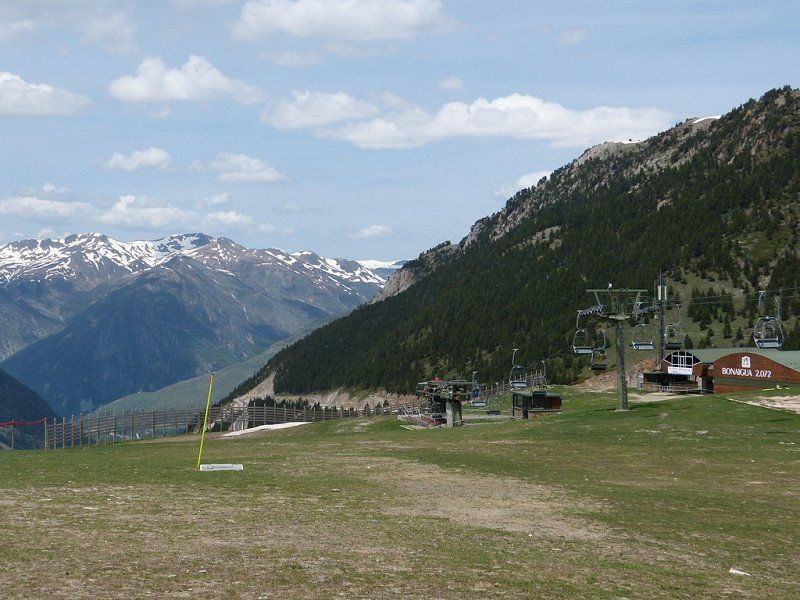
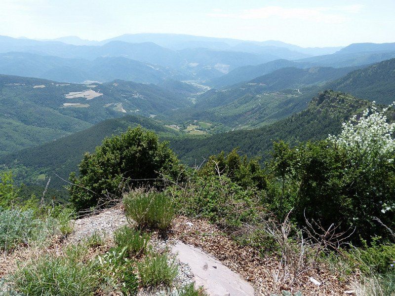
To get to your destination in Espot you will first have to conquer 3 cols, the last of which is a tough one, but on relatively wide roads that take you to an altitude of 2072m. Today is 'the day of the 100 hairpin bends' and you can enjoy the imposing mountain landscape, especially in good weather.
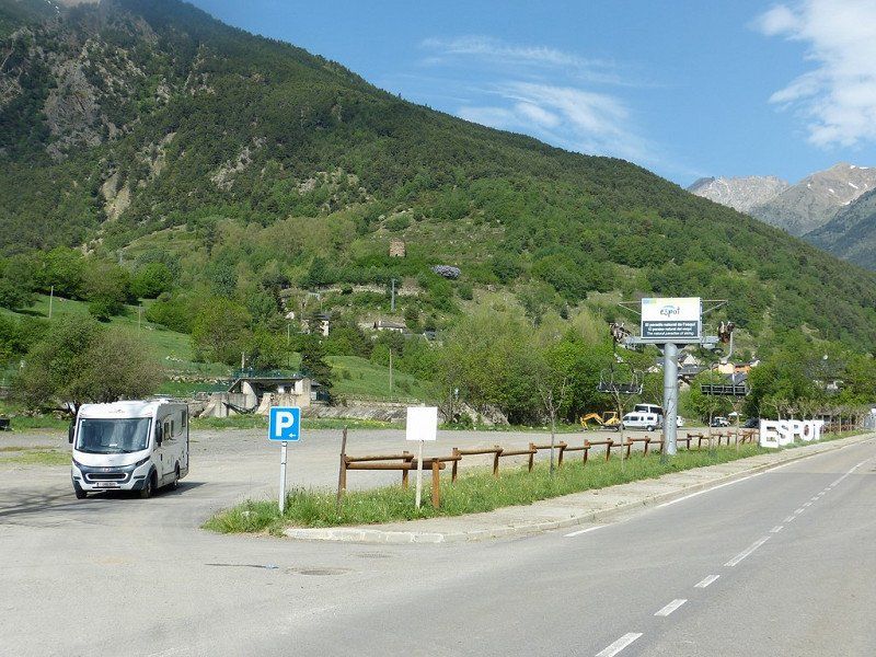
Espot is a ski resort in northwestern Catalonia, in the province of Lleida.
Espot (Spain) – Wednesday, May 18, 2022
Computer said : Arrival 4:30 pm, altitude 1388m, 30°, 134.3 km, consumption 14.0 l /100km, average 30 km/h, travel time 4:27 hours.
Escot is a winter sports resort with shops, terraces and hotels in the Spanish Pyrenees. Normally 400 inhabitants on an area of 97km2 located in the vicinity of a National Park with steep peaks of almost 3000m.
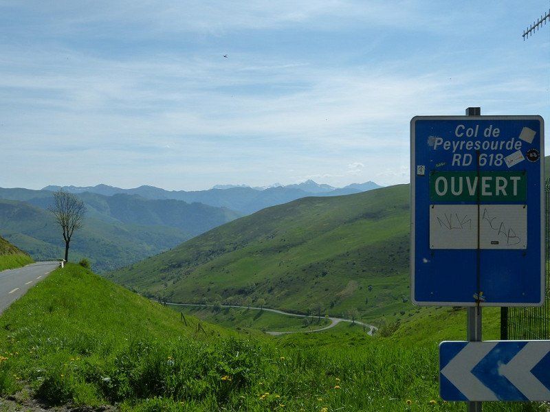
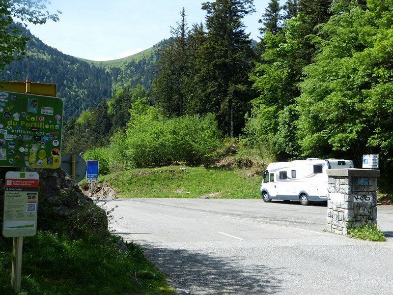
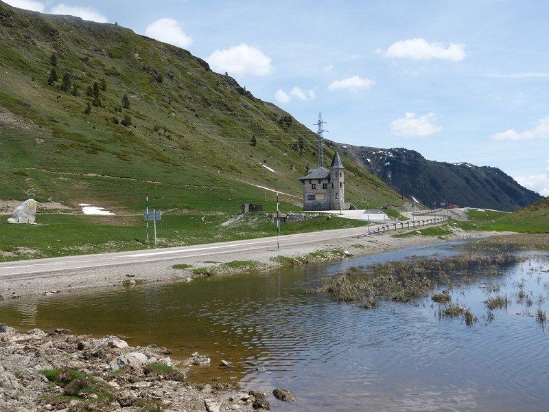
Today we almost did our Queen's ride crossing 3 mountain passes .
The Col de Peyresourde (1569m), the Col du Portillon (1293m) on the border with Spain, and the Port de la Bonaigua (2072m). Fortunately clear weather and therefore impressive landscapes seen. The plan was to stay here one day longer, but Motorhomes are not too welcome in the small town and the campsites that are already open are too far and too steep uphill from the center. We are here in pure nature next to the splashing violence of a mountain river. We have to bake our croissants for tomorrow morning again. Electricity is available and the WiFi is perfect, sanitary facilities are new and clean. The Spanish manager did not understand our Spanish, but he did understand our English through his translation computer. He is also good at math. For his daily price we were on the French side of the Pyrenees for 2 days in a comparatively luxurious campsite.
11 Cp1 parkeer 1 Bagnères-de-Luchon,
8 Rue de Badech, 31110 Bagnères-de-Luchon, Frankrijk
42° 47' 42" N 0° 35' 53.9" E
42.7949929 0.5983122
• Head toward Rue Alexandre Prat on Rue Jean Mermoz. Go for 169 m.
• Turn left onto Boulevard Charles de Gaulle. Go for 379 m.
• Take the 2nd exit from roundabout onto Avenue Alexandre Dumas (D27 C). Go for 198 m.
• Continue on Avenue du Bois Chantant (D27 C). Go for 606 m.
• Turn right onto Route de Bonnegarde (D27). Go for 489 m.
• Continue on Rue Pierre Baysse (D27). Go for 260 m.
• Arrive at Rue Pierre Baysse (D27).
☍
2,1 km
( 3 min.)
11 Cp2 Parkeer: Pierre Baysse, Saint-Mamet, Frankrijk
Rue Pierre Baysse, 31110 Saint-Mamet, Frankrijk
42° 47' 7.1" N 0° 36' 15.3" E
42.7853000 0.6042530
• Head toward Allée des Loisirs on Rue Pierre Baysse (D27). Go for 309 m.
• Turn left onto Avenue du Portillon (D27). Go for 672 m.
• Turn left onto Avenue des Pyrénées (D618). Go for 8.1 km.
• Continue on Coll d'Eth Portilhon (N-141). Go for 8.2 km.
• Take the 1st exit from roundabout onto Carretera de Tortosa a França (N-230). Go for 9.2 km.
• Pass 3 roundabouts and continue on Avinguda Alcalde Calbetó Barra (N-230). Go for 6.0 km.
• Take the 3rd exit from roundabout onto Avinguda Castiero (C-28) toward Esterri d'Àneu/Sort/Espitau. Go for 895 m.
• Continue toward Carretera d'Esterri d'Àneu a Vielha/C-28. Go for 36 m.
• Turn right onto Carretera d'Esterri d'Àneu a Vielha (C-28). Go for 326 m.
• Pass 6 roundabouts and continue on C-28. Go for 8.5 km.
• Take the 3rd exit from roundabout onto C-28. Go for 3.6 km.
• Take the 2nd exit from roundabout onto Carretera Deth Port (C-28). Go for 29.3 km.
• Continue on C-13. Go for 3.7 km.
• Turn sharp right onto LV-5004. Go for 6.8 km.
• Continue on Carrer Carretera (LV-5004). Go for 475 m.
• Continue on LV-5004. Go for 14 m.
• Turn right onto Carrer Carrerons. Go for 21 m.
• Turn left onto Carrer Barranc Solau. Go for 59 m.
• Continue on Carrer Barranc Solau. Go for 42 m.
• Continue toward Carretera de Sant Maurici/LV-5004. Go for 214 m.
• Turn right onto Carretera de Sant Maurici (LV-5004). Go for 85 m.
• Turn left onto Carretera de Sant Maurici (LV-5004). Go for 12 m.
• Turn slightly left onto Carretera l'Estació d'Esquí Superespot. Go for 160 m.
• Keep right onto Carretera l'Estació d'Esquí Superespot. Go for 335 m.
• Turn slightly left onto Carretera l'Estació d'Esquí Superespot. Go for 1.3 km.
• Turn slightly left. Go for 110 m.
• Turn left. Go for 1.4 km.
• Continue straight ahead. Go for 269 m.
• Arrive at your destination.
☍
90,2 km
(1 hrs. 56 min.)
11 Camping la Mola, Espot,
€ 24.40 • 1 Jun. until 30 Sep. persons per night incl. tax
Camping la Mola, Ctra Espot LV-5004, km.5, 25597, Espot, Spain
42° 34' 5.7" N 1° 6' 37.1" E
42.5682500 1.1103000
• Head southwest. Go for 2.9 km.
• Continue on Carretera l'Estació d'Esquí Superespot. Go for 597 m.
• Turn slightly right onto Carretera de Sant Maurici (LV-5004). Go for 349 m.
• Turn slightly left onto Plaça Doctor Benavent (LV-5004). Go for 32 m.
• Continue on Plaça Sant Martí (LV-5004). Go for 17 m.
• Turn right onto LV-5004. Go for 14 m.
• Continue on Carrer Carretera (LV-5004). Go for 475 m.
• Continue on LV-5004. Go for 6.3 km.
• Turn slightly left onto LV-5004. Go for 510 m.
• Turn right onto C-13. Go for 25.2 km.
• Take the 2nd exit from roundabout onto Avinguda de la Generalitat de Catalunya (C-13). Go for 964 m.
• Turn left onto Carrer Agustí Muxi i Monroset (N-260). Go for 44.6 km.
• Take the 2nd exit from roundabout onto Carrer de la Carretera d'Adrall (N-260) toward La Seu d'Urgell/Andorra la Vella. Go for 5.4 km.
• Take the 3rd exit from roundabout onto N-260. Go for 515 m.
• Take the 2nd exit from roundabout onto N-260. Go for 228 m.
• Keep right onto Avinguda Valira (N-260a). Go for 71 m.
• Pass 2 roundabouts and continue on Avinguda de Guillem Graell (N-260a). Go for 753 m.
• Turn right onto Avinguda d'Ausiàs March. Go for 196 m.
• Turn right onto Camí Ral de la Cerdanya. Go for 9 m.
• Turn left. Go for 39 m.
• Arrive at your destination on the left.
☍
89,3 km
(1 hrs. 42 min.)
11 Parking La Seu d'Urgell, Spanje
Avinguda del Camí Ral de Cerdanya, 8, 25700 La Seu d'Urgell, Lérida, Spanje
42° 21' 31.9" N 1° 27' 52.4" E
42.3588575 1.4645564
• Head south. Go for 31 m.
• Turn right. Go for 20 m.
• Turn right. Go for 52 m.
• Turn right. Go for 20 m.
• Turn left toward Camí Ral de la Cerdanya. Go for 18 m.
• Turn right onto Camí Ral de la Cerdanya. Go for 166 m.
• Turn left onto Avinguda de Joanot Martorell. Go for 168 m.
• Turn right onto Carretera de Puigcerdà a Sort (N-260a). Go for 205 m.
• Continue on N-260. Go for 237 m.
• Take the 3rd exit from roundabout onto N-260 toward Centre Ciutat la Seu d'Urgell/Andorra la Vella. Go for 1.3 km.
• Keep right toward Andorra. Go for 163 m.
• Continue on Carretera de la Seu d'Urgell a Andorra (N-145). Go for 7.7 km.
• Take the 2nd exit from roundabout onto N-145 toward Andorra la Vella. Go for 685 m.
• Keep right toward N-145. Go for 341 m.
• Continue on N-145. Go for 408 m.
• Continue on Carretera d'Espanya (CG1). Go for 126 m.
• Pass 6 roundabouts and continue on Carretera d'Espanya. Go for 3.4 km.
• Continue on Avinguda Francesc Cairat toward Andorra la Vella. Go for 652 m.
• Take the 3rd exit from roundabout onto Túnel de la Tàpia toward França/Andorra la Vella. Go for 1.1 km.
• Continue toward Prat de la Tresa/CG1. Go for 19 m.
• Take the 1st exit from roundabout onto Prat de la Tresa (CG1) toward França/Andorra la Vella. Go for 880 m.
• Turn right onto CG1 toward França. Go for 105 m.
• Pass 3 roundabouts and continue on Avinguda de Salou (CG1). Go for 3.0 km.
• Turn right. Go for 49 m.
• Arrive at your destination on the right.
☍
20,7 km
( 24 min.)
Day
Verblijfsdag in Espot
Today is an excellent time to take a rest day. There is also an option to visit Aigüestortes National Park from Espot. In the village there is a station for the off-road vehicles that can take you into the park.
Day
Verplaatsing naar Andorra-La-Vella
Andorra La Vella – Thursday, May 19, 2022
Computer said : Arrival 3:30 pm, altitude 999m, 32°, 107.1 km, consumption 10.9 l /100km, average 30 km/h, travel time 3:20 hours.
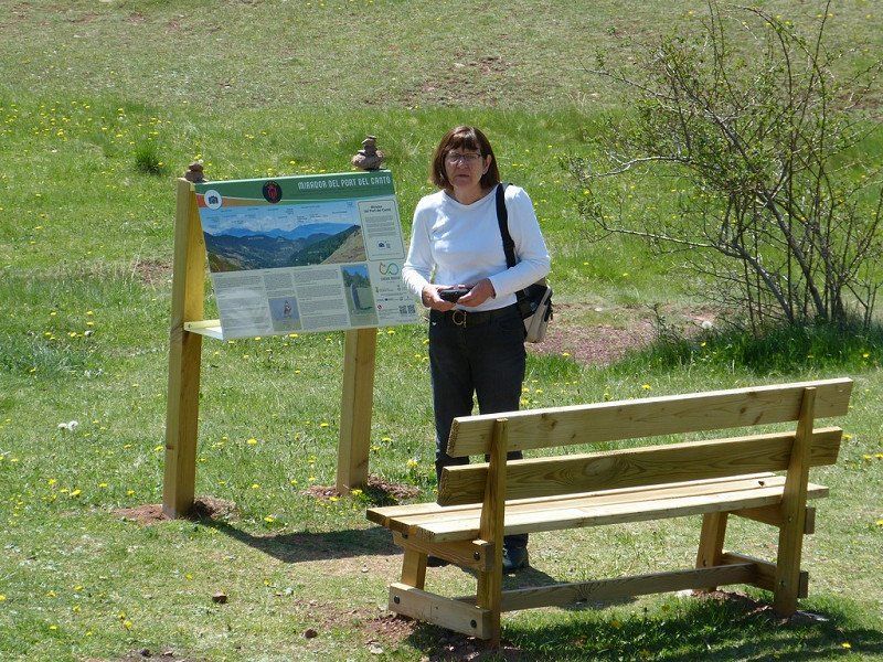
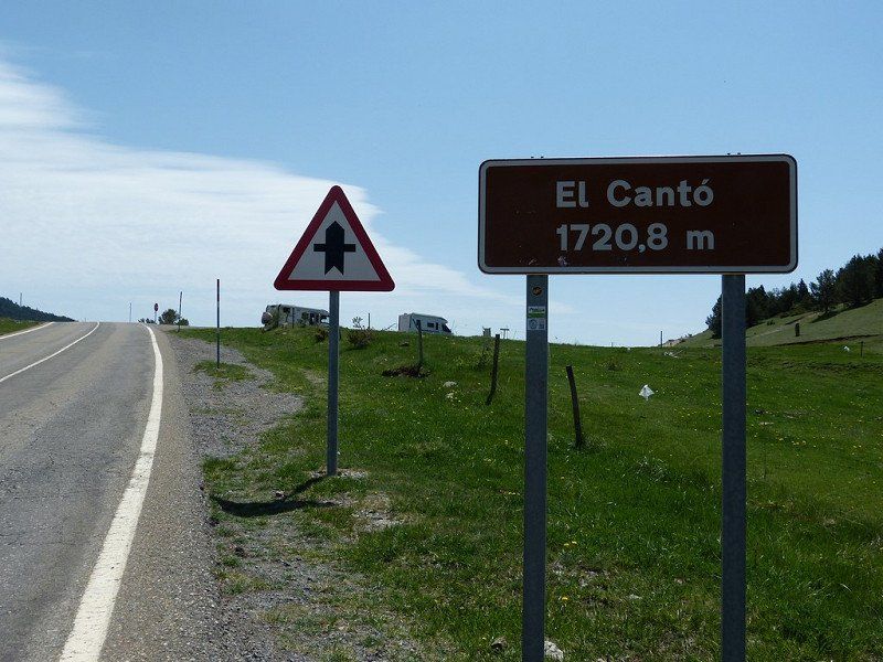
Today we drove to the mountain state of Andorra on a beautiful route on the south side of the Pyrenees . It was a tough ride on wider Spanish roads through a Pyrenean landscape with beautiful views, especially in this clear weather. After the town of Sort we got slopes up to about 1300m altitude and again a lot of curves, with El Canto at 1720m as the top.
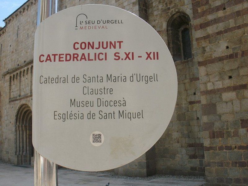
On the way we stopped in the historic center of the mountain town of 'La Seu d'Urgell' and wanted to visit the Romanesque Cathedral of the 12th century. Unfortunately closed between 13.00 and 16.00. Then just stroll through the medieval streets around the Cathedral. Still worth stopping.
It took some getting used to the heavy traffic and stopping twice at customs posts when entering Andorra. It would therefore be much cheaper here than in EU countries. The diesel is priced here at €1.60. We can only dream of that.
13 Camping Valira
campsite in a small village - with ACSI card 10% discount for cash payment - center 2 km
€26.25 • 1 Jan. until 31 Dec. 2 persons per night incl. tax
Current (10A)
Avenue de Salou, 500, Andorra la Vella, Andorra
42° 30' 8" N 1° 30' 54" E
42.5022200 1.5150000
• Head northwest. Go for 49 m.
• Turn right onto Avinguda de Salou (CG1). Go for 411 m.
• Take the 3rd exit from roundabout onto Avinguda de Tarragona (CG1) toward França/Escaldes-Engordany/Ordino/La Massana. Go for 283 m.
• Take the 1st exit from roundabout onto Avinguda de Tarragona (CG1) toward França/Escaldes-Engordany/Ordino/La Massana. Go for 465 m.
• Pass 5 roundabouts and continue on Carretera d'Engolasters (CG2). Go for 2.2 km.
• Turn left onto Avinguda del Pont de la Tosca (CG2). Go for 848 m.
• Pass 2 roundabouts and continue on Avinguda Coprincep Episcopal (CG2). Go for 1.9 km.
• Take the 1st exit from roundabout onto Carretera Nou Vial (CG2) toward França/Canillo. Go for 776 m.
• Take the 1st exit from roundabout onto Carretera Nou Vial (CG2) toward França/Canillo. Go for 499 m.
• Keep right toward Avinguda de François Mitterrand/CG2. Go for 104 m.
• Continue on Avinguda de François Mitterrand (CG2). Go for 256 m.
• Pass 5 roundabouts and continue on Plaça de l'Areny (CG2). Go for 4.6 km.
• Take the 3rd exit from roundabout onto Avinguda Sant Joan de Caselles (CG2) toward França. Go for 3.2 km.
• Pass 3 roundabouts and continue on CG2. Go for 7.6 km.
• Keep left onto CG2 toward Pas de la Casa/França/CS-280/Grau Roig. Go for 227 m.
• Take the 2nd exit from roundabout onto CG2 toward França/Pas de la Casa. Go for 5.4 km.
• Continue on Port d'Envalira (CG2). Go for 40 m.
• Arrive at Port d'Envalira (CG2). Your destination is on the right.
☍
28,8 km
( 37 min.)
Day
Verblijfsdag Andorra-La-Vella
Andorra-La-Vella – Saturday, May 21, 2022
Yesterday Friday rest day.
Today Saturday visit to the old city center, the Bari Antic in Catalan.
La Vella is the one and only town of this principality, sandwiched for several kilometers between steep riverside slopes and a busy road.
Armed with a city map and my walking sticks, we started early (9:00 am), to be sure to be back before the midday heat. First a bit along that busy road, up to the 3 lifts, where fortunately elderly people like us are hoisted up to the old center.
Narrow streets, artificial squares with parking spaces at the bottom. Shops everywhere. Further down the road mega shopping malls. Supposedly tax free. Especially booze, tobacco and fragrances. Who buys all that? We came for the culture. And for postcards and stamps.
That went very wrong, but the rest of that story is private.
Day
Verplaatsing naar Vinça
Vinça – Sunday, May 22, 2022
Computer said : Arrival 2:40 pm, altitude 250m, 28°, 125.1 km, consumption 9.4 l /100km, average 37 km/h, travel time 3:18 hours.
Another beautiful route today, from +Andorra to Vinça+ at the foot of Mont Canigou, through the south side of the French-Catalan Pyrenees.
Along places we had never heard of, outside of Font-Romeu, and maybe Prades too. Apart from first climbing to 1850m and 2 expensive tunnels through even higher passes, it mainly went downhill in 2nd gear, provided that additional braking was done in the corners. Still beautiful those Pyrenees landscapes that we are now leaving.
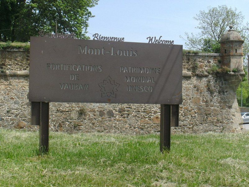
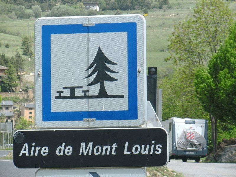
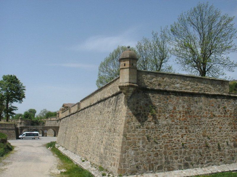
En route a lunch stop in Mont-Louis, the highest fortified town in France (1600m), built by who else than Vauban by order of Louis XIV in the 17th century. It still stands untouched.
15 Port d'Envalira, Andorra
Port d'Envalira, 2, AD200 Pas de la Casa, Andorra
42° 32' 25" N 1° 43' 8.1" E
42.5402732 1.7189259
• Head southeast on Port d'Envalira (CG2). Go for 32 m.
• Continue on CG2. Go for 22 m.
• Continue on Port d'Envalira (CG2). Go for 831 m.
• Continue on CG2. Go for 31 m.
• Continue on Port d'Envalira (CG2). Go for 160 m.
• Continue on CG2. Go for 2.9 km.
• Take the 2nd exit from roundabout onto CG2. Go for 789 m.
• Continue on Avinguda del Consell General (CG2). Go for 39 m.
• Pass 2 roundabouts and continue on Avinguda del Consell General (CG2). Go for 405 m.
• Continue on CG2. Go for 24 m.
• Continue on N22. Go for 4 m.
• Continue on Lieu-dit Las Bailletas (N22). Go for 600 m.
• Take the 1st exit from roundabout onto N22 toward Toulouse/Foix/Perpignan/L'Hospitalet/Porté-Puymorens. Go for 5.0 km.
• Turn right onto N320 toward Barcelone/Perpignan/Bourg-Madame/Porte-Puymorens/Col de Puymorens. Go for 10.7 km.
• Turn left onto N20 toward Perpignan/Barcelone/Porta/Bourg Madame/Font-Romeu. Go for 15.7 km.
• Turn left onto D618 toward Font-Romeu/Angoustrine-Villeneuve des Escaldes/Dorres. Go for 2.5 km.
• Pass 2 roundabouts and continue on Route de l'Andorre (D618). Go for 8.8 km.
• Take the 4th exit from Rond-Point de l'Orri roundabout onto D618. Go for 1.2 km.
• Continue on Route d'Égat (D618). Go for 382 m.
• Take the 1st exit from roundabout onto Avenue Professeur Félix Trombe (D29). Go for 446 m.
• Turn right onto Rue du Four Solaire. Go for 284 m.
• Arrive at Rue du Four Solaire. Your destination is on the right.
☍
50,9 km
(1 hrs. 1 min.)
15 Four Solaire Odeillo-Via
7 Rue du Four Solaire, 66120 Font-Romeu-Odeillo-Via, Frankrijk
42° 29' 39.1" N 2° 1' 56.3" E
42.4941947 2.0323069
• Head east on Rue du Four Solaire. Go for 284 m.
• Turn right onto D29. Go for 3.1 km.
• Turn left onto D66. Go for 5.6 km.
• Take the 1st exit from roundabout onto Route Nationale (D66) toward Perpignan/Prades/Mont-Louis. Go for 11.6 km.
• Keep left onto D66. Go for 17.9 km.
• Take the 2nd exit from roundabout onto D66 toward Perpignan/Ria-Sirach/Prades. Go for 5.9 km.
• Take the 2nd exit from Rond-Point de l'Europe roundabout onto D66 toward Perpignan/Marquixanes/Ille S/Têt. Go for 976 m.
• Take the 3rd exit from roundabout onto D66 toward Perpignan/Marquixanes/Ille S/Têt. Go for 998 m.
• Take the 3rd exit from Rond-Point du Canigou roundabout onto Route de Marquixanes (D66) toward Perpignan/Marquixanes/Ille S/Têt. Go for 8.3 km.
• Take the 1st exit from roundabout onto D13 G. Go for 214 m.
• Take the 4th exit from roundabout onto Lieu-dit Creux Escasade. Go for 145 m.
• Continue on Route du Lac. Go for 80 m.
• Turn left onto Route du Lac. Go for 66 m.
• Arrive at Route du Lac. Your destination is on the left.
☍
55,2 km
(1 hrs. )
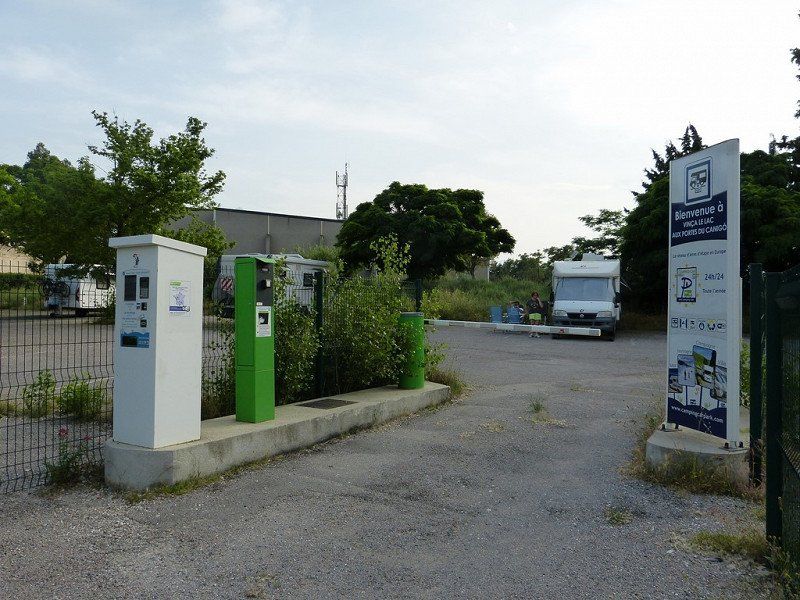
15 Aire Camping-Car Park Vinça, Frankrijk
€12.55 • 1 Jan. until 31 Dec. 2 persons per night incl. tax
Current (6A) 36pl
27 Imp. Camp del Roc, 66320 Vinça, Frankrijk
42° 38' 58.2" N 2° 31' 54.6" E
42.6494995 2.5318364
• Head northeast on Route du Lac. Go for 73 m.
• Turn right onto Route du Lac. Go for 32 m.
• Turn right onto Route du Lac. Go for 174 m.
• Continue on Lieu-dit Creux Escasade. Go for 96 m.
• Take the 1st exit from roundabout onto D13 G. Go for 220 m.
• Take the 1st exit from roundabout onto Route Nationale 116 (D66). Go for 2.8 km.
• Pass 3 roundabouts. Go for 27.6 km.
• Continue on Rocade Saint-Charles (D900 A). Go for 153 m.
• Take the 2nd exit from Rond-Point de Copenhague roundabout onto Rocade Saint-Charles (D900 A) toward A9/Gérone. Go for 2.6 km.
• Continue on D900 A toward Gérone/Thuir/Le Boulou/Argelès S/Mer. Go for 113 m.
• Take the 1st exit from Rond-Point de l'Euro-Méditerranée roundabout onto Camí de la Sal (D612 A) toward Gérone/Thuir/Le Boulou/Argelès S/Mer. Go for 169 m.
• Turn right toward Gérone/Le Boulou/Argelès S/Mer/Moulin à Vent. Go for 151 m.
• Continue on D900 A. Go for 478 m.
• Keep right toward Gérone/Argelès sur Mer/Le Boulou/Moulin à Vent. Go for 294 m.
• Continue on D900. Go for 1.1 km.
• Turn right onto Rocade Sud (D900) toward Argelès sur Mer/Le Boulou. Go for 637 m.
• Take the 2nd exit from Rond-Point du Serrat-d'en-Vaquer roundabout onto Rocade Sud (D900) toward Gérone/Le Boulou/Argelès S/Mer/Moulin à Vent/Porte d'Espagne. Go for 868 m.
• Continue on D914. Go for 914 m.
• Take the 2nd exit from Rond-Point Del Mas Rous roundabout onto D914 toward Argelès S/Mer/Elne/St Cyprien. Go for 978 m.
• Continue toward Argelès S/Mer/Elne/St Cyprien. Go for 38 m.
• Take the 2nd exit from roundabout onto D914 toward Argelès S/Mer/Elne/St Cyprien. Go for 15.7 km.
• Take ramp toward Argelès S/Mer/Taxo d'Amont/Taxo d'Availl. Go for 193 m.
• Take the 5th exit from roundabout onto D114. Go for 361 m.
• Take the 2nd exit from roundabout onto Chemin de Nèguebous (C2). Go for 1.9 km.
• Take the 2nd exit from roundabout onto Chemin de Nèguebous (C2). Go for 262 m.
• Take the 4th exit from Rond-Point de Pujol roundabout onto Avenue de la Retirada (C4). Go for 1.9 km.
• Turn right toward Avenue du Tech/D81. Go for 168 m.
• Continue on Avenue du Tech (D81). Go for 120 m.
• Take the 2nd exit from Rond-Point Joie et Lumière roundabout onto Avenue du Tech (D81). Go for 935 m.
• Turn right. Go for 26 m.
• Arrive at your destination.
☍
60,9 km
( 48 min.)
Day
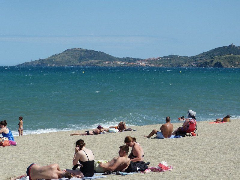
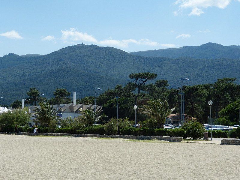
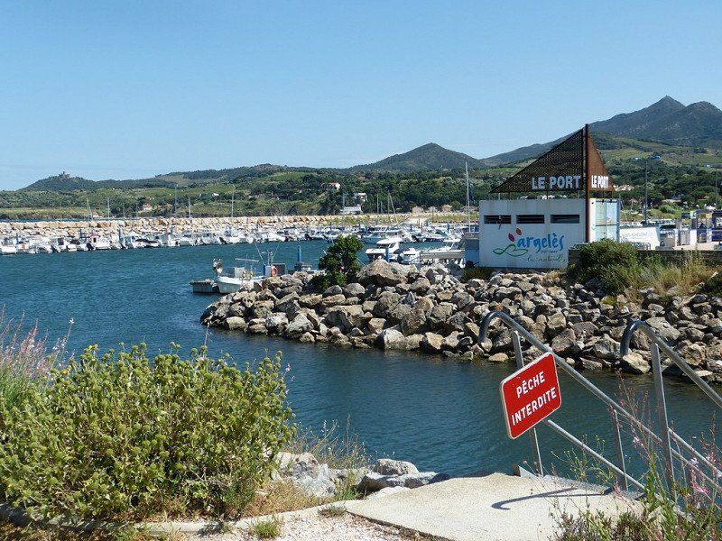
Verplaatsing Argeles-sur-Mer
Argeles-sur-Mer – Monday, May 23, 2022
Computer said : Arrival 12:00, altitude 001m, 29°, 61.1 km, consumption 8.9 l /100km, average 47 km/h, travel time 1:17 hours.
Ultra short drive from Vinça to Argeles-sur-Mer, pleasant seaside resort on the Mediterranean beyond Le Boulou near Perpignan .
This ends our tour 'Across the Pyrenees''.
We had beautiful weather every day. Even way too hot for the time of year. The weather forecasts for the next few days point to some cooling. Can we feel normal again?
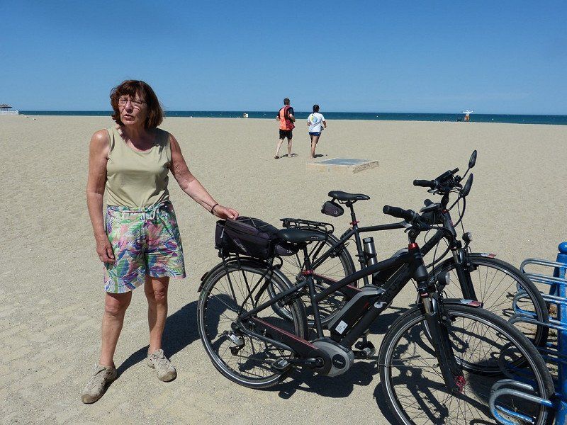
Argeles-sur-Mer - Tuesday, May 24, 2022 - RAIN all day . - Reading books.
Argeles-sur-Mer- Wednesday, May 25, 2022 – cold and windy. It didn't have to cool down that much!
Argeles-sur-Mer - Thursday, May 26, 2022 - Sunny, blue sky and wind force 6. We would not have wished for that much wind now. To get nervous. Also from the people who walk around here in this seaside resort. So today is 'Ascension', also for the French with an extended weekend. We hadn't counted on that.
Staying here for another day tomorrow and then Saturday we leave for home in 2 days.
16 Camping Les Pins Argeles
€29.72 • 8 Apr. until 7 Oct. 2 persons per night incl. tax
ACSI - Campingcard - Current (6A)
Plage des Pins, 405 Av. du Tech, 66700 Argelès-sur-Mer, Frankrijk
42° 33' 20.9" N 3° 2' 31.9" E
42.5558128 3.0421883
• Head toward Avenue du Tech. Go for 26 m.
• Turn left onto Avenue du Tech (D81). Go for 900 m.
• Take the 2nd exit from Rond-Point Joie et Lumière roundabout onto Avenue du Tech (D81). Go for 331 m.
• Turn left onto Avenue de la Retirada (C4). Go for 1.9 km.
• Take the 1st exit from Rond-Point de Pujol roundabout onto Chemin de Nèguebous (C2). Go for 228 m.
• Pass 2 roundabouts. Go for 2.2 km.
• Continue on D914. Go for 14.3 km.
• Keep left onto D914 toward A9/Porte d'Espagne/Gd St Charles. Go for 1.3 km.
• Pass 2 roundabouts and continue on D914. Go for 2.0 km.
• Continue on D900. Go for 771 m.
• Take the 2nd exit from Rond-Point du Serrat-d'en-Vaquer roundabout onto Rocade Sud (D900) toward A9/Narbonne/Andorre la V./Prades/Gd St Charles. Go for 479 m.
• Keep right toward A9/Andorre la V./Narbonne/Prades/Thuir/Gd St Charles. Go for 429 m.
• Continue on D900. Go for 1.1 km.
• Keep left onto D900 toward A9/Andorre la V./Prades/Thuir/Gd St Charles. Go for 113 m.
• Take the 2nd exit from roundabout onto D900 A toward D612 A/A9/Andorre la V./Prades/Thuir/Gd St Charles. Go for 761 m.
• Take the 3rd exit from Giratoire du Pont Trencat roundabout onto Camí de la Sal (D612 A) toward A9/Andorre la V./Narbonne/Perpignan-Centre/Prades/Gd St Charles. Go for 289 m.
• Take the 2nd exit from Rond-Point de l'Euro-Méditerranée roundabout toward Barcelone/Gérone/Le Boulou/Narbonne. Go for 361 m.
• Take ramp onto A9 (La Catalane) toward Toulouse/Narbonne. Go for 95.4 km.
• Take the exit toward Clermont-Fd/Millau/Béziers-Centre/Aéroport Béziers-Cap d'Agde onto A75. Go for 126 km.
• Take exit 44.1 toward Cahors/Meyrueis/Pont de Salars/Vézins de Lévézou/Aguessac/Gorges du Tarn. Go for 472 m.
• Turn left onto D29 toward Aguessac/Meyrueis/Gorges du Tarn/Gorges de la Jonte. Go for 5.3 km.
• Turn left onto D809. Go for 23.6 km.
• Take the 3rd exit from roundabout onto D809 toward Rodez/Laissac. Go for 8.8 km.
• Take the 2nd exit from roundabout toward La Canourgue/Marvejols/Clermont-Fd/Lonviala/La Tieule. Go for 173 m.
• Take left ramp onto A75 (La Méridienne) toward La Canourgue/Marvejols/Clermont-Fd. Go for 9.3 km.
• Take exit 40 toward St Laurent d'Olt/St Germain du Teil/La Canourgue/Banassac. Go for 367 m.
• Take the 2nd exit from roundabout onto D809. Go for 182 m.
• Pass 2 roundabouts and continue on D809. Go for 11.0 km.
• Turn left onto Lieu-dit Les Ajustons (D809). Go for 2.0 km.
• Pass 4 roundabouts and continue on Boulevard de Chambrun (D809). Go for 7.5 km.
• Take the 3rd exit from roundabout onto Boulevard Saint-Dominique (D809). Go for 474 m.
• Take the 3rd exit from Rond-Point Rhin et Danube roundabout onto Avenue Théophile Roussel (D809). Go for 672 m.
• Pass 4 roundabouts and continue on Route du Languedoc (D809). Go for 22.7 km.
• Turn left onto D809. Go for 6.7 km.
• Turn right onto Lieu-dit Pradels (D806) toward A75/(Clermont-Fd)/Rimeize/St-Alban. Go for 947 m.
• Turn left and take ramp onto A75 (La Méridienne) toward St Flour/Clermont-Fd. Go for 129 km.
• Continue on A71. Go for 23.1 km.
• Continue on A71 toward Paris/Montluçon/Vichy. Go for 114 km.
• Take exit 8 toward Châteauroux/St Amand-Md. Go for 812 m.
• Take the 3rd exit from roundabout onto D925 toward Bourges/Châteauroux/Lignières. Go for 1.5 km.
• Turn right onto Route des Cassons (D142). Go for 1.4 km.
• Continue on Lieu-dit Vignes de Nozieres (D142). Go for 198 m.
• Continue on D142. Go for 2.9 km.
• Continue on Lieu-dit La Gazonnerie (D142). Go for 108 m.
• Continue on D142. Go for 37 m.
• Continue on Route de Nozière (D142). Go for 594 m.
• Turn right onto Route de Bruère (D92). Go for 1.0 km.
• Continue on D92. Go for 130 m.
• Continue on Lieu-dit La Brosse (D92). Go for 1.7 km.
• Turn left onto Route d'Allichamps. Go for 316 m.
• Arrive at Route d'Allichamps. Your destination is on the right.
☍
625,7 km
(6 hrs. 9 min.)
Day
Day
Day
Day
Day
Terug naar Huis - 1e reisdag tot +- Bourges (630km)
On the way home -
Saturday, May 28, 2022, Bruère-Allichamps, France
Overnight in Bruère-Allichamps, small town 30 km south of Bourges.
Accessible along small roads from the A71. In local leaflets it is indicated as the center of France. There are also two notable historic buildings: the Priory and a Cistercian Abbey, founded in 1136. But that's for another time. It was a long drive mainly on highways, and sturdy 'bouchons'.Computer said : Arrival 6:45pm, 26°, altitude 141m, distance 601.5km, consumption 11.9L/100km, average 67km/h, driving time 8:50h. Sunday 29/05/2022, ride home, with strong 'bouchons' again Computer said : Arrival 7:40 pm, 11°, altitude 68m, distance 597.2km, consumption 10.9L/100km, average 62km/h, driving time 9:31am .
Day
Camping Municipal Les Platanes
https://www.campingcarpark.com/en_GB/stay/stopover-site-motorhome/centre-val-de-loire/18-cher/bruere-allichamps
18200, Bruere Allichamps, France
46° 46' 14.5" N 2° 25' 45.1" E
46.7707000 2.4292000
Terug naar huis 2de Reisdag ( +- 570km)