Unfortunately, we don't support your browser (Internet Explorer) anymore, some functionalities could not work. Click here to get information on how to upgrade your browser.
Finished
Public
We discover Norway
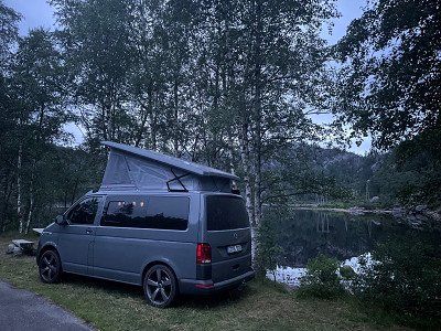
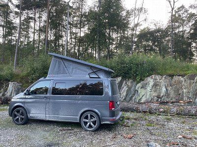
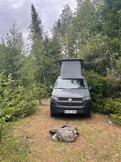
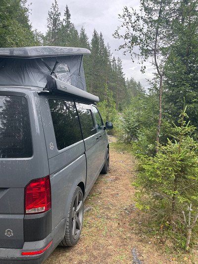
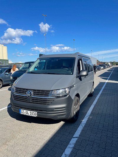
We take the ferry from Hirtshals🇩🇰 to Kristiansand🇳🇴. This is where our journey begins with ARTHUR, our Bulli 🚙.
Our route takes us all the way to Larvik (south of Oslo). From here you can take the ferry back to Hirtshals🇩🇰.
This description was automatically translated from German using Google Translate and may not be completely accurate.
Show in original language (German)

loeffel
Route info
1747 Kilometres
13 Days
48 Waypoints
Vehicle info
Add own vehicle
Copy route and test with own vehicle
Travelogue
Day 1
In Norway, you have to pay tolls for using the roads and many ferries.
The best way to register your vehicle is via ePass https://account.epass24.com/en/vehicleregistration/step1
and subsequently creates an ePass24 account with the same license plate number and data.
Another tip for all Bullis with limited space: leave your drinks (returnable bottles or deposit cans) in Germany. On the ferry you can buy cans of beer, cola, fanta, sprite and other great drinks at a reasonable price in the TaxFreeShop. Inexpensive means really cheap! We paid the equivalent of €0.42 for a can of Coca-Cola. You can't even get it cheaper on Amazon. You don't have to keep the cans, you can dispose of them in the garbage. On the way back we'll stock up for the next tours 🤭
Kristiansand (Fährterminal)
Vesterveien 21, 4613 Kristiansand, Norwegen
In Norway, you have to pay tolls for using the roads and many ferries.
The best way to register your vehicle is via ePass https://account.epass24.com/en/vehicleregistration/step1
and subsequently creates an ePass24 account with the same license plate number and data.
Another tip for all Bullis with limited space: leave your drinks (returnable bottles or deposit cans) in Germany. On the ferry you can buy cans of beer, cola, fanta, sprite and other great drinks at a reasonable price in the TaxFreeShop. Inexpensive means really cheap! We paid the equivalent of €0.42 for a can of Coca-Cola. You can't even get it cheaper on Amazon. You don't have to keep the cans, you can dispose of them in the garbage. On the way back we'll stock up for the next tours 🤭
The best way to register your vehicle is via ePass https://account.epass24.com/en/vehicleregistration/step1
and subsequently creates an ePass24 account with the same license plate number and data.
Another tip for all Bullis with limited space: leave your drinks (returnable bottles or deposit cans) in Germany. On the ferry you can buy cans of beer, cola, fanta, sprite and other great drinks at a reasonable price in the TaxFreeShop. Inexpensive means really cheap! We paid the equivalent of €0.42 for a can of Coca-Cola. You can't even get it cheaper on Amazon. You don't have to keep the cans, you can dispose of them in the garbage. On the way back we'll stock up for the next tours 🤭
Place to sleep at the Kristiansand bunker.
Am Bunker von Kristansand
Løkkeveien 41, 4616 Kristiansand, Norwegen
Place to sleep at the Kristiansand bunker.
Day 2
breakfast
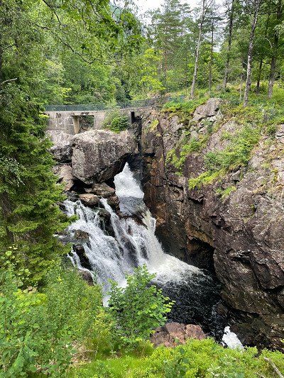
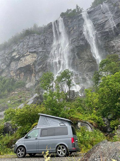
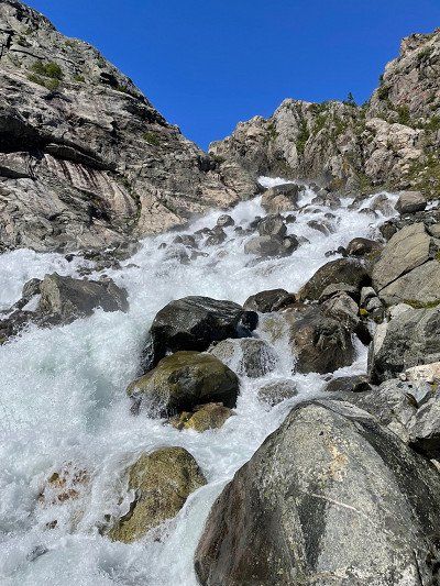
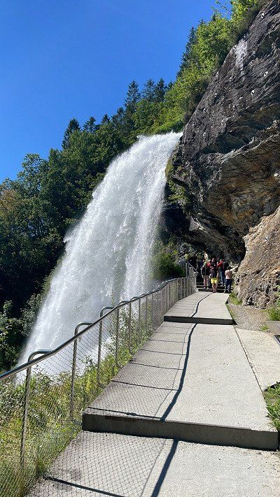
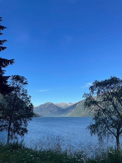
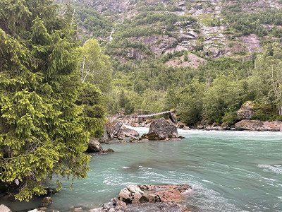
A breathtaking waterfall. Short way.
Kvåsfossen (Wasserfall)
Kvåsfossen, Lyngdal, Norwegen
A breathtaking waterfall. Short way.
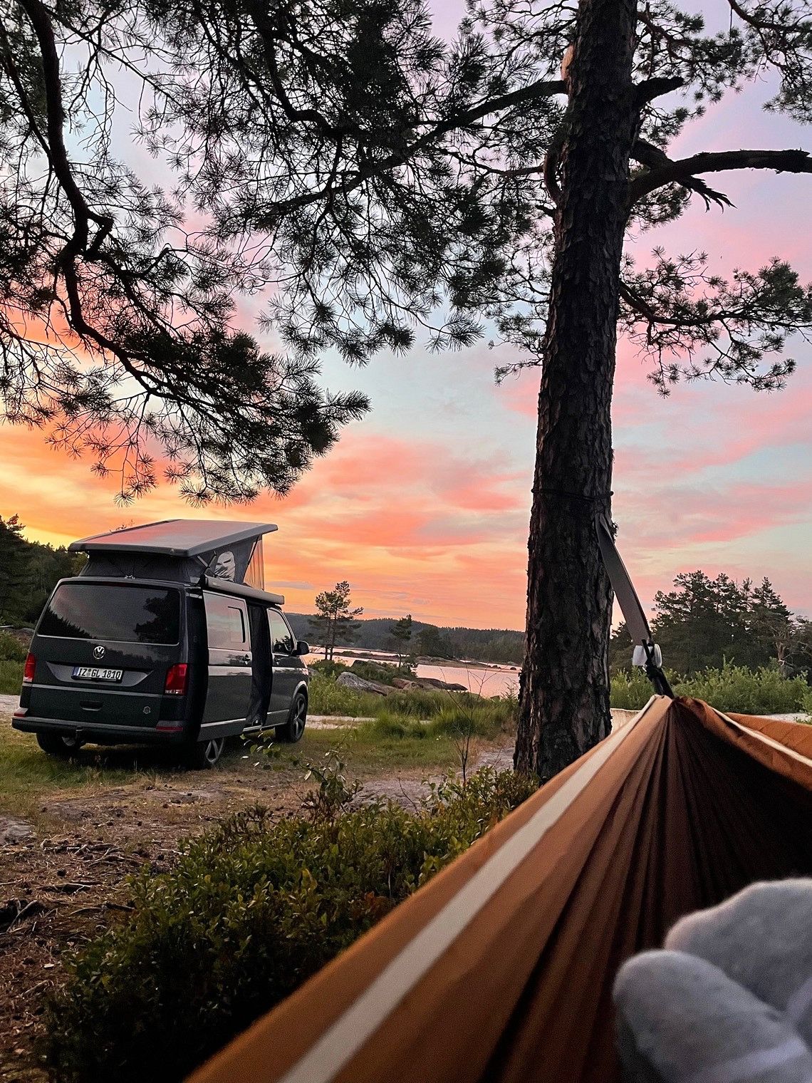
A great place, the hammock has also found its place here ☺️
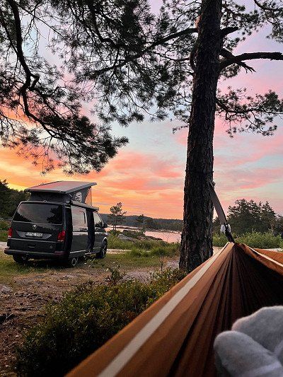
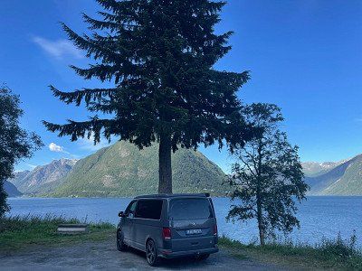
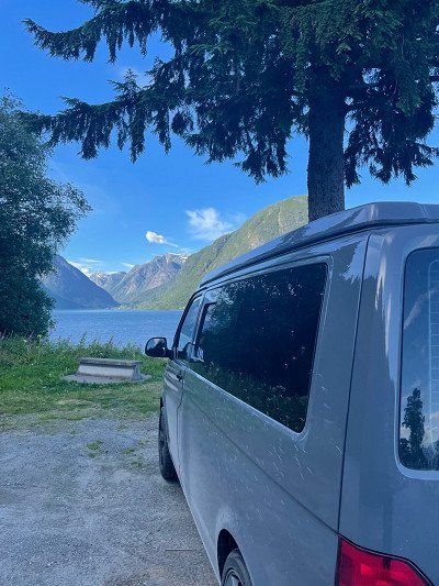
Hellevatnet (Konsmo)
Hellevannsveien
A great place, the hammock has also found its place here ☺️
Day 3
Nice place on a road with little traffic (not a single car at night) with garbage can and bench with table ⛰ before that you drive through Sirdal (Tonstad).
Sirdal
Viraksveien
Nice place on a road with little traffic (not a single car at night) with garbage can and bench with table ⛰ before that you drive through Sirdal (Tonstad).
Day 4
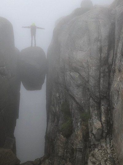
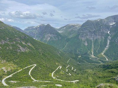
From Sirdal we continued to Kjerag. The Kjerag or Kiragg is a rocky plateau in the Norwegian municipality of Sandnes (Fylke Rogaland) on the Lysefjord.
Kjerag
Lysevegen
From Sirdal we continued to Kjerag. The Kjerag or Kiragg is a rocky plateau in the Norwegian municipality of Sandnes (Fylke Rogaland) on the Lysefjord.
Lysebotn is a town at the end of the Lysefjord in Sandnes Municipality in the Norwegian province of Rogaland. The place consists mainly of a power station, a ferry terminal and some tourist facilities - nothing else! Getting further is only possible via the ferry or you drive back the mountain pass.
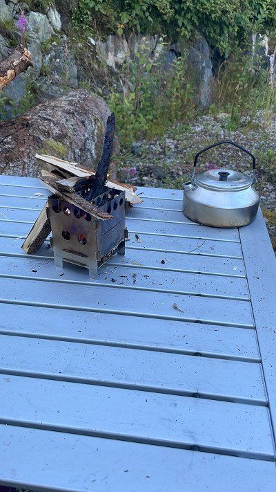
You can also camp here. We prefer a secluded place with a fireplace 🔥
You can also camp here. We prefer a secluded place with a fireplace 🔥
Lysebotn
Lyse
Lysebotn is a town at the end of the Lysefjord in Sandnes Municipality in the Norwegian province of Rogaland. The place consists mainly of a power station, a ferry terminal and some tourist facilities - nothing else! Getting further is only possible via the ferry or you drive back the mountain pass.
You can also camp here. We prefer a secluded place with a fireplace 🔥
You can also camp here. We prefer a secluded place with a fireplace 🔥
Day 5
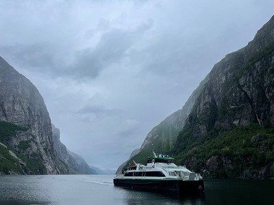
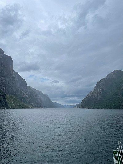
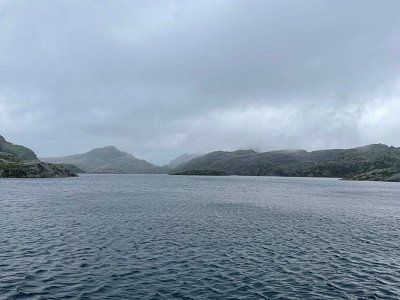
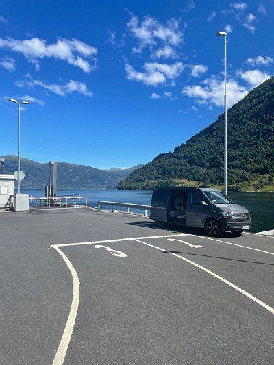
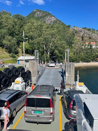
You can take the ferry from Lysebotn to the other tip of the fjord and get lots of great impressions of nature.
We take the ferry to Forsand.
We take the ferry to Forsand.
Hafen von Lysebotn
Lysebotn, Norwegen
You can take the ferry from Lysebotn to the other tip of the fjord and get lots of great impressions of nature.
We take the ferry to Forsand.
We take the ferry to Forsand.
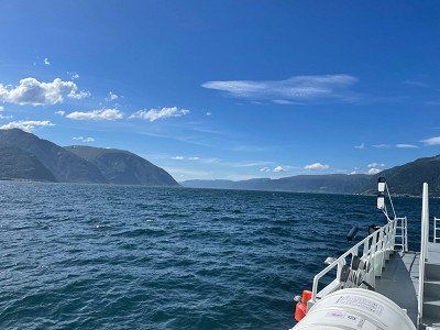
Auf dem Lysefjord
Lysefjord

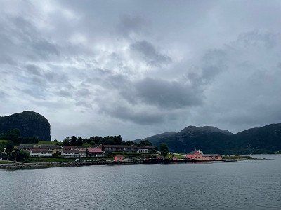
Arrived in Forsand, relaxation is the order of the day. There is also a gas station, a toilet and a COOP.
Hafen von Forsand
Bergevikvegen
Arrived in Forsand, relaxation is the order of the day. There is also a gas station, a toilet and a COOP.
A great place to just hang out a bit.
Entspannung nach der Fähre in Forsand
Bergevikvegen 31
A great place to just hang out a bit.
Day 6
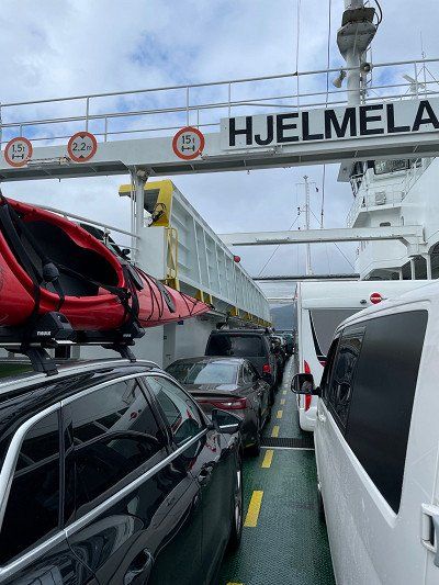
We stay on road 13 towards Røldal and cross the fjord by ferry.
In the harbor there is an Xextra (hardware store) and toilets. The hardware store even has suitable gas cartridges.
In the harbor there is an Xextra (hardware store) and toilets. The hardware store even has suitable gas cartridges.
Fährüberfahrt von Hjelmeland nach Nesvik
Hjelmeland
We stay on road 13 towards Røldal and cross the fjord by ferry.
In the harbor there is an Xextra (hardware store) and toilets. The hardware store even has suitable gas cartridges.
In the harbor there is an Xextra (hardware store) and toilets. The hardware store even has suitable gas cartridges.
There is a short rest here to use the toilets in the harbor kiosk.
Nesvik Hafen
Indre Ryfylkevegen 3
There is a short rest here to use the toilets in the harbor kiosk.
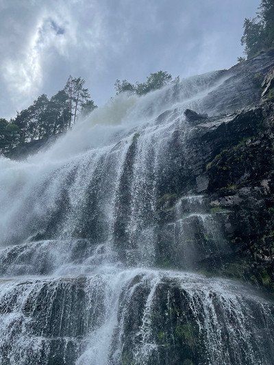
We spend the night directly under the waterfall. If you think it's raining here, you're wrong - the spray comes from the waterfall 😅
Hongavikfossen (Wasserfall) - Platz für die Nacht
Saudavegen
We spend the night directly under the waterfall. If you think it's raining here, you're wrong - the spray comes from the waterfall 😅
Day 7
With toilet and small souvenir shop. Don't be alarmed: the parking situation on site is hell 😅
Skarefossen (Wasserfall)
13
With toilet and small souvenir shop. Don't be alarmed: the parking situation on site is hell 😅
For the hike to the Trolltunga, the troll's tongue, (at least 20 km and 10 hours) you have to start early! Although our plan does not include a hike there, we also want to start the hike to the Buarbreen glacier as early as possible and have therefore looked for a parking space in the immediate vicinity.
Platz unterhalb des Buarbreen (Odda)
Strondsvegen 128–150
For the hike to the Trolltunga, the troll's tongue, (at least 20 km and 10 hours) you have to start early! Although our plan does not include a hike there, we also want to start the hike to the Buarbreen glacier as early as possible and have therefore looked for a parking space in the immediate vicinity.
Day 8
The parking lot costs €18.50 per day. In the back part you can stand super with the camper. From here we start our hike (5 hours) to the glacier.
Wanderparkplatz Buarbreen
5750 Odda, Norwegen
The parking lot costs €18.50 per day. In the back part you can stand super with the camper. From here we start our hike (5 hours) to the glacier.
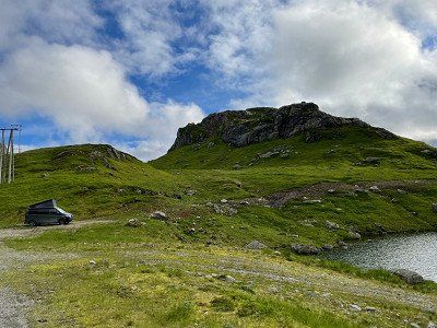
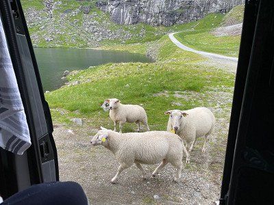
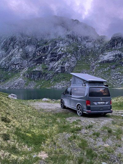
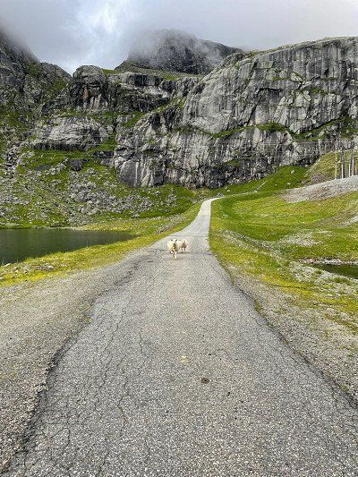
Our place for the night is above the tree line in the middle of solitude. Here there are only sheep, clear, ice-cold lakes and Statkraft hydroelectric power stations. For the night, however, a parking heater is required. At the end of July we only had three degrees Celsius here at night.

Auf dem Weg ins Jondal (Platz für die Nacht)
5476
Our place for the night is above the tree line in the middle of solitude. Here there are only sheep, clear, ice-cold lakes and Statkraft hydroelectric power stations. For the night, however, a parking heater is required. At the end of July we only had three degrees Celsius here at night.
Day 9
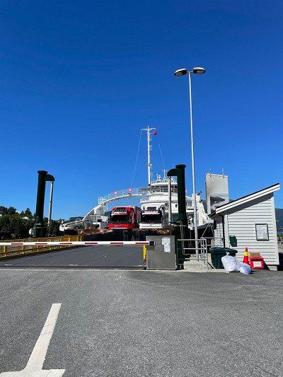
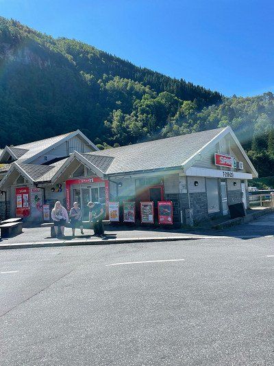
On our way to Bergen we pass the fjord by ferry. At the harbor there is a Spar and a toilet.
Jondal (Fährterminal)
550
On our way to Bergen we pass the fjord by ferry. At the harbor there is a Spar and a toilet.
Costs 100 NOK.
Tørvikbygd (Fährterminal)
Skutevik 16
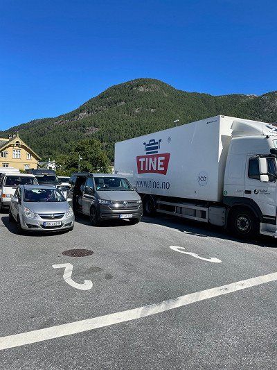
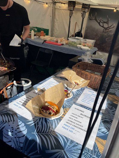
The market is a great place to eat a deer burger. This also costs "only" 120 NOK.
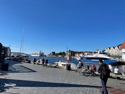
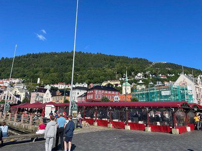
Hafen und Hanseviertel von Bergen
Torget
The market is a great place to eat a deer burger. This also costs "only" 120 NOK.
After a long search we finally found a nice pitch in the Osterfjorden region. Not so easy when most places are blocked with barriers or can only be reached by 4x4. Now we spend the night in a forest workplace with enough kindling for a fire 🔥.
Osterfjord
5913
After a long search we finally found a nice pitch in the Osterfjorden region. Not so easy when most places are blocked with barriers or can only be reached by 4x4. Now we spend the night in a forest workplace with enough kindling for a fire 🔥.
Day 10
We leave the E39 to drive through the mountains along the cliffs to Ortnevik. From here we take the ferry to Nordeide.
We stand backwards, because the ferry has to be driven on with the stern first.
Since only six cars fit on the ferry and you can't book them in advance, you have to be there early to be at the front of Line 1 😅 we spend the waiting time by the water and enjoying the sun ☀️
We stand backwards, because the ferry has to be driven on with the stern first.
Since only six cars fit on the ferry and you can't book them in advance, you have to be there early to be at the front of Line 1 😅 we spend the waiting time by the water and enjoying the sun ☀️
Ortnevik (Fährterminal)
Sørsidevegen
We leave the E39 to drive through the mountains along the cliffs to Ortnevik. From here we take the ferry to Nordeide.
We stand backwards, because the ferry has to be driven on with the stern first.
Since only six cars fit on the ferry and you can't book them in advance, you have to be there early to be at the front of Line 1 😅 we spend the waiting time by the water and enjoying the sun ☀️
We stand backwards, because the ferry has to be driven on with the stern first.
Since only six cars fit on the ferry and you can't book them in advance, you have to be there early to be at the front of Line 1 😅 we spend the waiting time by the water and enjoying the sun ☀️
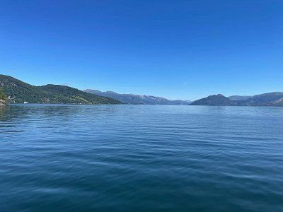
Finally a ferry that keeps what it promises. At full speed we go over the Sognefjord⛴
The ferry cannot be booked in advance and must be paid directly on deck. For 2 adults + Bulli = NOK 129.00. Really worth it!
The ferry cannot be booked in advance and must be paid directly on deck. For 2 adults + Bulli = NOK 129.00. Really worth it!
Auf dem Sognefjorden
Sognefjorden
Finally a ferry that keeps what it promises. At full speed we go over the Sognefjord⛴
The ferry cannot be booked in advance and must be paid directly on deck. For 2 adults + Bulli = NOK 129.00. Really worth it!
The ferry cannot be booked in advance and must be paid directly on deck. For 2 adults + Bulli = NOK 129.00. Really worth it!
A Norwegian gets the last seat on the ferry. Everyone else has to wait. For us it goes further ☺️
Hafen von Måren
Runnestøvegen
A Norwegian gets the last seat on the ferry. Everyone else has to wait. For us it goes further ☺️
Nordeide (Fährterminal)
Høyanger, Norwegen
Balestrand is a beautiful place with chic villas. There is also the possibility to dispose of waste water and fill up with fresh water - and it's even free of charge!
Balestrand (Frischwasser)
Sjøtunsvegen 8
Balestrand is a beautiful place with chic villas. There is also the possibility to dispose of waste water and fill up with fresh water - and it's even free of charge!
We're driving back onto Route 13, which we've followed before. Along the steep coast, between the mountains, we choose a pitch with a great view of the fjord and the countryside.
Even if the place is right on the street, it doesn't bother you much, because the street has very little traffic.
Even if the place is right on the street, it doesn't bother you much, because the street has very little traffic.
Dragsvik (Sognefjord)
Farnes
We're driving back onto Route 13, which we've followed before. Along the steep coast, between the mountains, we choose a pitch with a great view of the fjord and the countryside.
Even if the place is right on the street, it doesn't bother you much, because the street has very little traffic.
Even if the place is right on the street, it doesn't bother you much, because the street has very little traffic.
Day 11
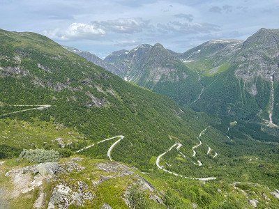
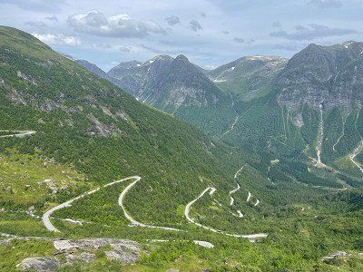
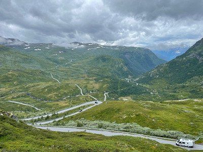
We continue to follow the 613 (13). Beautiful road with many hairpin bends
Aussichtspunkt
613
We continue to follow the 613 (13). Beautiful road with many hairpin bends
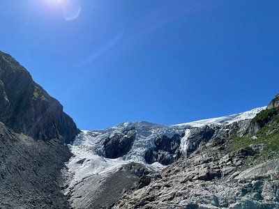
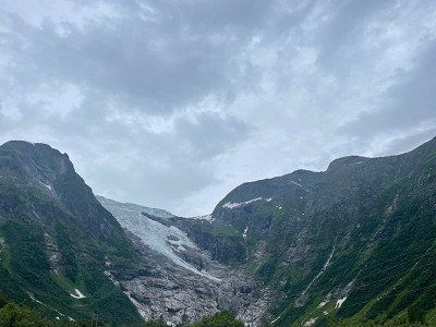
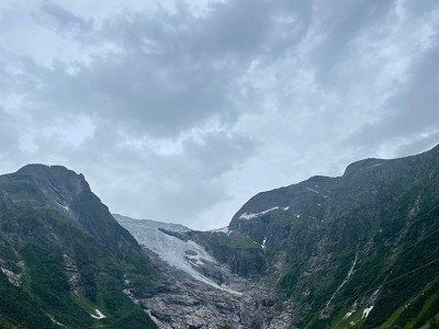
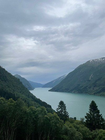
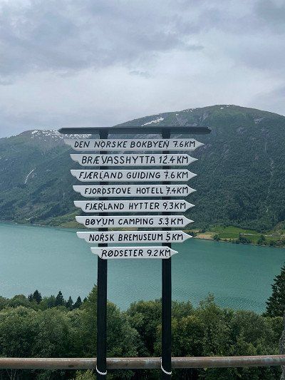
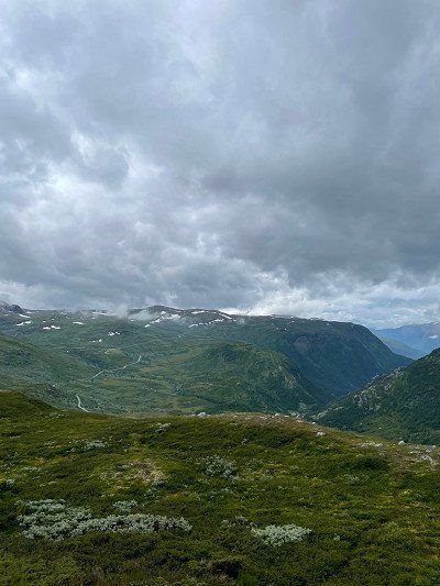
Meanwhile we follow the E5. There is beautiful nature with impressive glaciers. There is a glacier museum on the route.
Jostedalsbreen Nationalpark
Jostedalsbreen-Nationalpark
Meanwhile we follow the E5. There is beautiful nature with impressive glaciers. There is a glacier museum on the route.
No title available
Fagreggi, Sogndal, Vestland, Norwegen
In Sogndal we continue on Route 55.
Stedjevegen 10
In Sogndal we continue on Route 55.
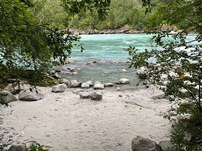
We spend the night at the rest area on the little-used 604. Directly on the other side, the river tears down into the valley.
So the first thing to do is bathe at the wonderful bathing area.
So the first thing to do is bathe at the wonderful bathing area.
Jostedalen
Jostedalsvegen
We spend the night at the rest area on the little-used 604. Directly on the other side, the river tears down into the valley.
So the first thing to do is bathe at the wonderful bathing area.
So the first thing to do is bathe at the wonderful bathing area.
Day 12
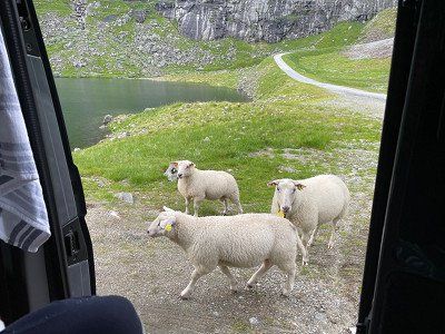
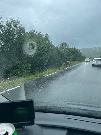
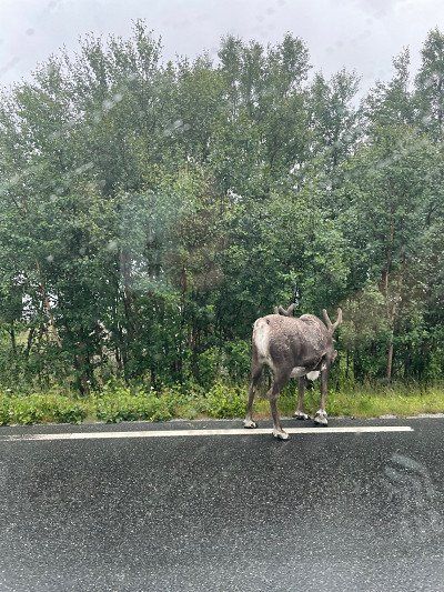
Although this is a registered animal, we are delighted to see a reindeer in the wild.

Rentiersichtung
Sjodalsvegen
Although this is a registered animal, we are delighted to see a reindeer in the wild.
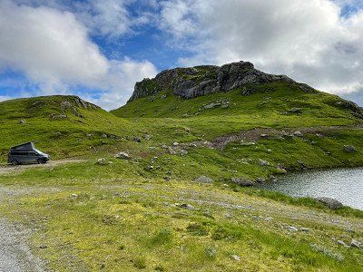
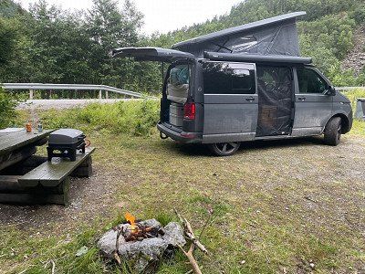
After the day was very rainy and we decided to sit in the van more and enjoy the scenery while driving, we have now found a great pitch for the night.
Volbufjorden (Platz für die Nacht)
2943
After the day was very rainy and we decided to sit in the van more and enjoy the scenery while driving, we have now found a great pitch for the night.
Day 13
Unfortunately we have to go back to Germany today. So we quickly rebooked the ferry and adjusted the route.
Normally we should continue on the 51 and then onto the 40 to Larvik.
Now we drove on the Autobahn.
We'll just buy a little something.
Normally we should continue on the 51 and then onto the 40 to Larvik.
Now we drove on the Autobahn.
We'll just buy a little something.
REMA 1000 - Larvik
Tjøllingveien 38
Unfortunately we have to go back to Germany today. So we quickly rebooked the ferry and adjusted the route.
Normally we should continue on the 51 and then onto the 40 to Larvik.
Now we drove on the Autobahn.
We'll just buy a little something.
Normally we should continue on the 51 and then onto the 40 to Larvik.
Now we drove on the Autobahn.
We'll just buy a little something.
We have arrived at the destination of our journey through Norway 👍 with the SuperSpeed 2 we go from Larvik 🇳🇴 back to Hirtshals 🇩🇰
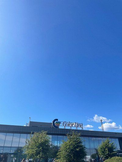
Color Line, Larvik (Fährterminal)
Revet
We have arrived at the destination of our journey through Norway 👍 with the SuperSpeed 2 we go from Larvik 🇳🇴 back to Hirtshals 🇩🇰
Route
Show newest first
Day 1
Kristiansand (Fährterminal)
- 58.1428 7.9829
- 58° 8' 34.2" N 7° 58' 58.4" E
Vesterveien 21, 4613 Kristiansand, Norwegen
View travel report
Show on map
2,5 km
6 min.
Am Bunker von Kristansand
- 58.1545 7.9687
- 58° 9' 16.2" N 7° 58' 7.5" E
Løkkeveien 41, 4616 Kristiansand, Norwegen
View travel report
Show on map
Day 2
49,9 km
44 min.
Frühstück am Wasser
- 58.2545 7.5193
- 58° 15' 16.1" N 7° 31' 9.4" E
Bekkedalen
View travel report
Show on map
27,5 km
31 min.
Kvåsfossen (Wasserfall)
- 58.2644 7.19
- 58° 15' 52" N 7° 11' 24" E
Kvåsfossen, Lyngdal, Norwegen
View travel report
Show on map
15,1 km
19 min.
Hellevatnet (Konsmo)
- 58.3122 7.3215
- 58° 18' 43.8" N 7° 19' 17.5" E
Hellevannsveien
View travel report
Show on map
Day 3
92,2 km
1 hrs. 29 min.
Day 4
77,9 km
1 hrs. 19 min.
8,6 km
14 min.
Day 5
1,9 km
3 min.
Hafen von Lysebotn
- 59.0554 6.6485
- 59° 3' 19.5" N 6° 38' 54.7" E
Lysebotn, Norwegen
View travel report
Show on map
13,9 km
51 min.
Auf dem Lysefjord
- 59.0232 6.4253
- 59° 1' 23.5" N 6° 25' 30.9" E
Lysefjord
Show on map
44,3 km
1 hrs. 38 min.
Auf dem Lysefjord
- 58.99 6.2313
- 58° 59' 24.1" N 6° 13' 52.8" E
Lysefjord
Show on map
17,9 km
28 min.
Hafen von Forsand
- 58.9014 6.0883
- 58° 54' 5.1" N 6° 5' 17.8" E
Bergevikvegen
View travel report
Show on map
0,3 km
Entspannung nach der Fähre in Forsand
- 58.9033 6.0918
- 58° 54' 11.7" N 6° 5' 30.4" E
Bergevikvegen 31
View travel report
Show on map
21,5 km
26 min.
Unser Platz im Nirgendwo
- 59.0362 6.0057
- 59° 2' 10.2" N 6° 0' 20.5" E
Barkastølvegen
Show on map
Day 6
45,8 km
43 min.
Fährüberfahrt von Hjelmeland nach Nesvik
- 59.2341 6.1652
- 59° 14' 2.9" N 6° 9' 54.8" E
Hjelmeland
View travel report
Show on map
0,0 km
Auf dem Hjelmelandsfjord
- 59.2406 6.1642
- 59° 14' 26" N 6° 9' 51" E
Hjelmelandsfjorden
Show on map
3,1 km
34 min.
Nesvik Hafen
- 59.2621 6.1589
- 59° 15' 43.4" N 6° 9' 32.1" E
Indre Ryfylkevegen 3
View travel report
Show on map
68,4 km
56 min.
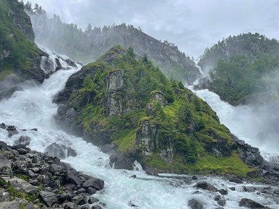
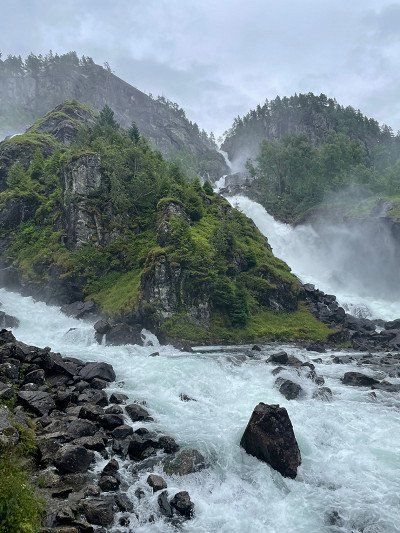
Svandalsfossen (Wasserfall)
- 59.6252 6.2904
- 59° 37' 30.7" N 6° 17' 25.3" E
Svandalsfoss, Sauda, Norwegen
Show on map
4,8 km
3 min.
Hongavikfossen (Wasserfall) - Platz für die Nacht
- 59.588 6.2948
- 59° 35' 17" N 6° 17' 41.2" E
Saudavegen
View travel report
Show on map
Day 7
36,4 km
41 min.
Toller Ausblick von der 520
- 59.7322 6.6289
- 59° 43' 56.1" N 6° 37' 44.1" E
Hellandsbygdvegen
Show on map
38,3 km
42 min.
Skarefossen (Wasserfall)
- 59.9653 6.5747
- 59° 57' 55.2" N 6° 34' 28.9" E
13
View travel report
Show on map
13,1 km
15 min.
Platz unterhalb des Buarbreen (Odda)
- 60.0402 6.5359
- 60° 2' 24.7" N 6° 32' 9.3" E
Strondsvegen 128–150
View travel report
Show on map
Day 8
3,9 km
8 min.
Wanderparkplatz Buarbreen
- 60.0447 6.4774
- 60° 2' 41" N 6° 28' 38.6" E
5750 Odda, Norwegen
View travel report
Show on map
39,5 km
1 hrs.
Auf dem Weg ins Jondal (Platz für die Nacht)
- 60.1881 6.381
- 60° 11' 17.1" N 6° 22' 51.4" E
5476
View travel report
Show on map
Day 9
28,3 km
41 min.
Jondal (Fährterminal)
- 60.2757 6.2517
- 60° 16' 32.6" N 6° 15' 6.3" E
550
View travel report
Show on map
1,0 km
2 min.
Fähre über den Hardangerfjorden
- 60.28 6.2335
- 60° 16' 47.8" N 6° 14' 0.5" E
Hardangerfjorden
View travel report
Show on map
6,2 km
40 min.
Tørvikbygd (Fährterminal)
- 60.3009 6.1717
- 60° 18' 3.1" N 6° 10' 18.2" E
Skutevik 16
Show on map
15,2 km
17 min.
Steinsdalsfossen (Wasserfall)
- 60.3705 6.1048
- 60° 22' 13.6" N 6° 6' 17.3" E
Rosselandsvegen 18
Show on map
72,2 km
1 hrs. 9 min.
Hafen und Hanseviertel von Bergen
- 60.3946 5.3246
- 60° 23' 40.4" N 5° 19' 28.4" E
Torget
View travel report
Show on map
44,9 km
46 min.
Day 10
101,0 km
2 hrs. 1 min.
Ortnevik (Fährterminal)
- 61.1131 6.1326
- 61° 6' 47.2" N 6° 7' 57.5" E
Sørsidevegen
View travel report
Show on map
6,5 km
40 min.
Auf dem Sognefjorden
- 61.137 6.0887
- 61° 8' 13.2" N 6° 5' 19.3" E
Sognefjorden
View travel report
Show on map
0,5 km
1 min.
Hafen von Måren
- 61.1492 6.075
- 61° 8' 57.2" N 6° 4' 30" E
Runnestøvegen
View travel report
Show on map
7,1 km
40 min.
Nordeide (Fährterminal)
- 61.1735 5.9867
- 61° 10' 24.6" N 5° 59' 12.3" E
Høyanger, Norwegen
Show on map
52,5 km
44 min.
Balestrand (Frischwasser)
- 61.202 6.5313
- 61° 12' 7.1" N 6° 31' 52.6" E
Sjøtunsvegen 8
View travel report
Show on map
13,4 km
15 min.
Dragsvik (Sognefjord)
- 61.2424 6.5548
- 61° 14' 32.8" N 6° 33' 17.3" E
Farnes
View travel report
Show on map
Day 11
24,3 km
27 min.
104,2 km
1 hrs. 36 min.
Jostedalsbreen Nationalpark
- 61.4922 6.692
- 61° 29' 32.1" N 6° 41' 31.1" E
Jostedalsbreen-Nationalpark
View travel report
Show on map
15,1 km
11 min.
Aussichtspunkt Fjærland
- 61.381 6.758
- 61° 22' 51.6" N 6° 45' 28.8" E
Fjærlandsvegen
Show on map
21,4 km
19 min.
No title available
- 61.2742 6.9584
- 61° 16' 27" N 6° 57' 30.2" E
Fagreggi, Sogndal, Vestland, Norwegen
Show on map
11,6 km
12 min.
41,4 km
44 min.
Jostedalen
- 61.4933 7.2706
- 61° 29' 35.7" N 7° 16' 14.3" E
Jostedalsvegen
View travel report
Show on map
Day 12
56,6 km
1 hrs. 6 min.
Nedre Oscarshaug - Sognefjell (Aussichtspunkt)
- 61.5082 7.8114
- 61° 30' 29.5" N 7° 48' 41" E
Sognefjellsvegen 6410
Show on map
11,7 km
12 min.
Blick auf den Gletscher von Jotunheimen
- 61.5589 7.9555
- 61° 33' 31.9" N 7° 57' 19.9" E
Sognefjellsvegen
Show on map
127,0 km
1 hrs. 44 min.
Rentiersichtung
- 61.513 8.8503
- 61° 30' 46.9" N 8° 51' 1" E
Sjodalsvegen
View travel report
Show on map
63,1 km
53 min.
Volbufjorden (Platz für die Nacht)
- 61.079 9.1115
- 61° 4' 44.4" N 9° 6' 41.2" E
2943
View travel report
Show on map
Day 13
293,8 km
3 hrs. 35 min.
REMA 1000 - Larvik
- 59.0454 10.061
- 59° 2' 43.3" N 10° 3' 39.7" E
Tjøllingveien 38
View travel report
Show on map
1,4 km
2 min.
Color Line, Larvik (Fährterminal)
- 59.0401 10.0487
- 59° 2' 24.2" N 10° 2' 55.4" E
Revet
View travel report
Show on map
Travelogue
Day 1
In Norway, you have to pay tolls for using the roads and many ferries.
The best way to register your vehicle is via ePass https://account.epass24.com/en/vehicleregistration/step1
and subsequently creates an ePass24 account with the same license plate number and data.
Another tip for all Bullis with limited space: leave your drinks (returnable bottles or deposit cans) in Germany. On the ferry you can buy cans of beer, cola, fanta, sprite and other great drinks at a reasonable price in the TaxFreeShop. Inexpensive means really cheap! We paid the equivalent of €0.42 for a can of Coca-Cola. You can't even get it cheaper on Amazon. You don't have to keep the cans, you can dispose of them in the garbage. On the way back we'll stock up for the next tours 🤭
The best way to register your vehicle is via ePass https://account.epass24.com/en/vehicleregistration/step1
and subsequently creates an ePass24 account with the same license plate number and data.
Another tip for all Bullis with limited space: leave your drinks (returnable bottles or deposit cans) in Germany. On the ferry you can buy cans of beer, cola, fanta, sprite and other great drinks at a reasonable price in the TaxFreeShop. Inexpensive means really cheap! We paid the equivalent of €0.42 for a can of Coca-Cola. You can't even get it cheaper on Amazon. You don't have to keep the cans, you can dispose of them in the garbage. On the way back we'll stock up for the next tours 🤭
Kristiansand (Fährterminal)
Vesterveien 21, 4613 Kristiansand, Norwegen
In Norway, you have to pay tolls for using the roads and many ferries.
The best way to register your vehicle is via ePass https://account.epass24.com/en/vehicleregistration/step1
and subsequently creates an ePass24 account with the same license plate number and data.
Another tip for all Bullis with limited space: leave your drinks (returnable bottles or deposit cans) in Germany. On the ferry you can buy cans of beer, cola, fanta, sprite and other great drinks at a reasonable price in the TaxFreeShop. Inexpensive means really cheap! We paid the equivalent of €0.42 for a can of Coca-Cola. You can't even get it cheaper on Amazon. You don't have to keep the cans, you can dispose of them in the garbage. On the way back we'll stock up for the next tours 🤭
The best way to register your vehicle is via ePass https://account.epass24.com/en/vehicleregistration/step1
and subsequently creates an ePass24 account with the same license plate number and data.
Another tip for all Bullis with limited space: leave your drinks (returnable bottles or deposit cans) in Germany. On the ferry you can buy cans of beer, cola, fanta, sprite and other great drinks at a reasonable price in the TaxFreeShop. Inexpensive means really cheap! We paid the equivalent of €0.42 for a can of Coca-Cola. You can't even get it cheaper on Amazon. You don't have to keep the cans, you can dispose of them in the garbage. On the way back we'll stock up for the next tours 🤭
Place to sleep at the Kristiansand bunker.
Am Bunker von Kristansand
Løkkeveien 41, 4616 Kristiansand, Norwegen
Place to sleep at the Kristiansand bunker.
Day 2
breakfast
A breathtaking waterfall. Short way.
Kvåsfossen (Wasserfall)
Kvåsfossen, Lyngdal, Norwegen
A breathtaking waterfall. Short way.
A great place, the hammock has also found its place here ☺️
Hellevatnet (Konsmo)
Hellevannsveien
A great place, the hammock has also found its place here ☺️
Day 3
Nice place on a road with little traffic (not a single car at night) with garbage can and bench with table ⛰ before that you drive through Sirdal (Tonstad).
Sirdal
Viraksveien
Nice place on a road with little traffic (not a single car at night) with garbage can and bench with table ⛰ before that you drive through Sirdal (Tonstad).
Day 4
From Sirdal we continued to Kjerag. The Kjerag or Kiragg is a rocky plateau in the Norwegian municipality of Sandnes (Fylke Rogaland) on the Lysefjord.
Kjerag
Lysevegen
From Sirdal we continued to Kjerag. The Kjerag or Kiragg is a rocky plateau in the Norwegian municipality of Sandnes (Fylke Rogaland) on the Lysefjord.
Lysebotn is a town at the end of the Lysefjord in Sandnes Municipality in the Norwegian province of Rogaland. The place consists mainly of a power station, a ferry terminal and some tourist facilities - nothing else! Getting further is only possible via the ferry or you drive back the mountain pass.
You can also camp here. We prefer a secluded place with a fireplace 🔥
You can also camp here. We prefer a secluded place with a fireplace 🔥
Lysebotn
Lyse
Lysebotn is a town at the end of the Lysefjord in Sandnes Municipality in the Norwegian province of Rogaland. The place consists mainly of a power station, a ferry terminal and some tourist facilities - nothing else! Getting further is only possible via the ferry or you drive back the mountain pass.
You can also camp here. We prefer a secluded place with a fireplace 🔥
You can also camp here. We prefer a secluded place with a fireplace 🔥
Day 5
You can take the ferry from Lysebotn to the other tip of the fjord and get lots of great impressions of nature.
We take the ferry to Forsand.
We take the ferry to Forsand.
Hafen von Lysebotn
Lysebotn, Norwegen
You can take the ferry from Lysebotn to the other tip of the fjord and get lots of great impressions of nature.
We take the ferry to Forsand.
We take the ferry to Forsand.
Auf dem Lysefjord
Lysefjord
Arrived in Forsand, relaxation is the order of the day. There is also a gas station, a toilet and a COOP.
Hafen von Forsand
Bergevikvegen
Arrived in Forsand, relaxation is the order of the day. There is also a gas station, a toilet and a COOP.
A great place to just hang out a bit.
Entspannung nach der Fähre in Forsand
Bergevikvegen 31
A great place to just hang out a bit.
Day 6
We stay on road 13 towards Røldal and cross the fjord by ferry.
In the harbor there is an Xextra (hardware store) and toilets. The hardware store even has suitable gas cartridges.
In the harbor there is an Xextra (hardware store) and toilets. The hardware store even has suitable gas cartridges.
Fährüberfahrt von Hjelmeland nach Nesvik
Hjelmeland
We stay on road 13 towards Røldal and cross the fjord by ferry.
In the harbor there is an Xextra (hardware store) and toilets. The hardware store even has suitable gas cartridges.
In the harbor there is an Xextra (hardware store) and toilets. The hardware store even has suitable gas cartridges.
There is a short rest here to use the toilets in the harbor kiosk.
Nesvik Hafen
Indre Ryfylkevegen 3
There is a short rest here to use the toilets in the harbor kiosk.
We spend the night directly under the waterfall. If you think it's raining here, you're wrong - the spray comes from the waterfall 😅
Hongavikfossen (Wasserfall) - Platz für die Nacht
Saudavegen
We spend the night directly under the waterfall. If you think it's raining here, you're wrong - the spray comes from the waterfall 😅
Day 7
With toilet and small souvenir shop. Don't be alarmed: the parking situation on site is hell 😅
Skarefossen (Wasserfall)
13
With toilet and small souvenir shop. Don't be alarmed: the parking situation on site is hell 😅
For the hike to the Trolltunga, the troll's tongue, (at least 20 km and 10 hours) you have to start early! Although our plan does not include a hike there, we also want to start the hike to the Buarbreen glacier as early as possible and have therefore looked for a parking space in the immediate vicinity.
Platz unterhalb des Buarbreen (Odda)
Strondsvegen 128–150
For the hike to the Trolltunga, the troll's tongue, (at least 20 km and 10 hours) you have to start early! Although our plan does not include a hike there, we also want to start the hike to the Buarbreen glacier as early as possible and have therefore looked for a parking space in the immediate vicinity.
Day 8
The parking lot costs €18.50 per day. In the back part you can stand super with the camper. From here we start our hike (5 hours) to the glacier.
Wanderparkplatz Buarbreen
5750 Odda, Norwegen
The parking lot costs €18.50 per day. In the back part you can stand super with the camper. From here we start our hike (5 hours) to the glacier.
Our place for the night is above the tree line in the middle of solitude. Here there are only sheep, clear, ice-cold lakes and Statkraft hydroelectric power stations. For the night, however, a parking heater is required. At the end of July we only had three degrees Celsius here at night.
Auf dem Weg ins Jondal (Platz für die Nacht)
5476
Our place for the night is above the tree line in the middle of solitude. Here there are only sheep, clear, ice-cold lakes and Statkraft hydroelectric power stations. For the night, however, a parking heater is required. At the end of July we only had three degrees Celsius here at night.
Day 9
On our way to Bergen we pass the fjord by ferry. At the harbor there is a Spar and a toilet.
Jondal (Fährterminal)
550
On our way to Bergen we pass the fjord by ferry. At the harbor there is a Spar and a toilet.
Costs 100 NOK.
Tørvikbygd (Fährterminal)
Skutevik 16
The market is a great place to eat a deer burger. This also costs "only" 120 NOK.
Hafen und Hanseviertel von Bergen
Torget
The market is a great place to eat a deer burger. This also costs "only" 120 NOK.
After a long search we finally found a nice pitch in the Osterfjorden region. Not so easy when most places are blocked with barriers or can only be reached by 4x4. Now we spend the night in a forest workplace with enough kindling for a fire 🔥.
Osterfjord
5913
After a long search we finally found a nice pitch in the Osterfjorden region. Not so easy when most places are blocked with barriers or can only be reached by 4x4. Now we spend the night in a forest workplace with enough kindling for a fire 🔥.
Day 10
We leave the E39 to drive through the mountains along the cliffs to Ortnevik. From here we take the ferry to Nordeide.
We stand backwards, because the ferry has to be driven on with the stern first.
Since only six cars fit on the ferry and you can't book them in advance, you have to be there early to be at the front of Line 1 😅 we spend the waiting time by the water and enjoying the sun ☀️
We stand backwards, because the ferry has to be driven on with the stern first.
Since only six cars fit on the ferry and you can't book them in advance, you have to be there early to be at the front of Line 1 😅 we spend the waiting time by the water and enjoying the sun ☀️
Ortnevik (Fährterminal)
Sørsidevegen
We leave the E39 to drive through the mountains along the cliffs to Ortnevik. From here we take the ferry to Nordeide.
We stand backwards, because the ferry has to be driven on with the stern first.
Since only six cars fit on the ferry and you can't book them in advance, you have to be there early to be at the front of Line 1 😅 we spend the waiting time by the water and enjoying the sun ☀️
We stand backwards, because the ferry has to be driven on with the stern first.
Since only six cars fit on the ferry and you can't book them in advance, you have to be there early to be at the front of Line 1 😅 we spend the waiting time by the water and enjoying the sun ☀️
Finally a ferry that keeps what it promises. At full speed we go over the Sognefjord⛴
The ferry cannot be booked in advance and must be paid directly on deck. For 2 adults + Bulli = NOK 129.00. Really worth it!
The ferry cannot be booked in advance and must be paid directly on deck. For 2 adults + Bulli = NOK 129.00. Really worth it!
Auf dem Sognefjorden
Sognefjorden
Finally a ferry that keeps what it promises. At full speed we go over the Sognefjord⛴
The ferry cannot be booked in advance and must be paid directly on deck. For 2 adults + Bulli = NOK 129.00. Really worth it!
The ferry cannot be booked in advance and must be paid directly on deck. For 2 adults + Bulli = NOK 129.00. Really worth it!
A Norwegian gets the last seat on the ferry. Everyone else has to wait. For us it goes further ☺️
Hafen von Måren
Runnestøvegen
A Norwegian gets the last seat on the ferry. Everyone else has to wait. For us it goes further ☺️
Nordeide (Fährterminal)
Høyanger, Norwegen
Balestrand is a beautiful place with chic villas. There is also the possibility to dispose of waste water and fill up with fresh water - and it's even free of charge!
Balestrand (Frischwasser)
Sjøtunsvegen 8
Balestrand is a beautiful place with chic villas. There is also the possibility to dispose of waste water and fill up with fresh water - and it's even free of charge!
We're driving back onto Route 13, which we've followed before. Along the steep coast, between the mountains, we choose a pitch with a great view of the fjord and the countryside.
Even if the place is right on the street, it doesn't bother you much, because the street has very little traffic.
Even if the place is right on the street, it doesn't bother you much, because the street has very little traffic.
Dragsvik (Sognefjord)
Farnes
We're driving back onto Route 13, which we've followed before. Along the steep coast, between the mountains, we choose a pitch with a great view of the fjord and the countryside.
Even if the place is right on the street, it doesn't bother you much, because the street has very little traffic.
Even if the place is right on the street, it doesn't bother you much, because the street has very little traffic.
Day 11
We continue to follow the 613 (13). Beautiful road with many hairpin bends
Aussichtspunkt
613
We continue to follow the 613 (13). Beautiful road with many hairpin bends
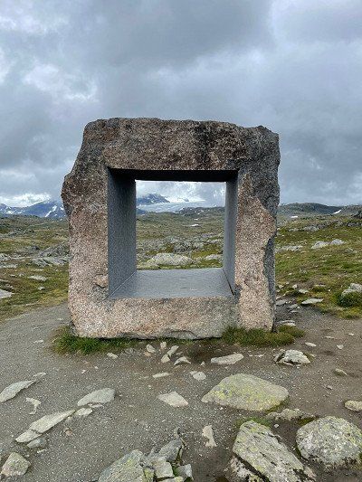
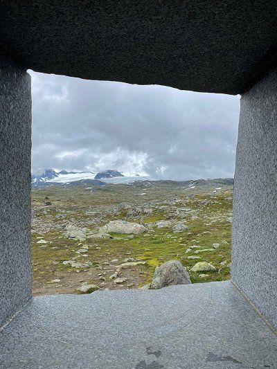
Meanwhile we follow the E5. There is beautiful nature with impressive glaciers. There is a glacier museum on the route.
Jostedalsbreen Nationalpark
Jostedalsbreen-Nationalpark
Meanwhile we follow the E5. There is beautiful nature with impressive glaciers. There is a glacier museum on the route.
No title available
Fagreggi, Sogndal, Vestland, Norwegen
In Sogndal we continue on Route 55.
Stedjevegen 10
In Sogndal we continue on Route 55.
We spend the night at the rest area on the little-used 604. Directly on the other side, the river tears down into the valley.
So the first thing to do is bathe at the wonderful bathing area.
So the first thing to do is bathe at the wonderful bathing area.
Jostedalen
Jostedalsvegen
We spend the night at the rest area on the little-used 604. Directly on the other side, the river tears down into the valley.
So the first thing to do is bathe at the wonderful bathing area.
So the first thing to do is bathe at the wonderful bathing area.
Day 12
Although this is a registered animal, we are delighted to see a reindeer in the wild.
Rentiersichtung
Sjodalsvegen
Although this is a registered animal, we are delighted to see a reindeer in the wild.
After the day was very rainy and we decided to sit in the van more and enjoy the scenery while driving, we have now found a great pitch for the night.
Volbufjorden (Platz für die Nacht)
2943
After the day was very rainy and we decided to sit in the van more and enjoy the scenery while driving, we have now found a great pitch for the night.
Day 13
Unfortunately we have to go back to Germany today. So we quickly rebooked the ferry and adjusted the route.
Normally we should continue on the 51 and then onto the 40 to Larvik.
Now we drove on the Autobahn.
We'll just buy a little something.
Normally we should continue on the 51 and then onto the 40 to Larvik.
Now we drove on the Autobahn.
We'll just buy a little something.
REMA 1000 - Larvik
Tjøllingveien 38
Unfortunately we have to go back to Germany today. So we quickly rebooked the ferry and adjusted the route.
Normally we should continue on the 51 and then onto the 40 to Larvik.
Now we drove on the Autobahn.
We'll just buy a little something.
Normally we should continue on the 51 and then onto the 40 to Larvik.
Now we drove on the Autobahn.
We'll just buy a little something.
We have arrived at the destination of our journey through Norway 👍 with the SuperSpeed 2 we go from Larvik 🇳🇴 back to Hirtshals 🇩🇰
Color Line, Larvik (Fährterminal)
Revet
We have arrived at the destination of our journey through Norway 👍 with the SuperSpeed 2 we go from Larvik 🇳🇴 back to Hirtshals 🇩🇰
Comments (3)
Comments from Freeontour users
Hallo, jetzt erst die Fragen gesehen.
wir waren im Sommer (Juli/August) 2022 dort. Das Wetter war typisch norwegisch. Sind wir aus Hamburg aber gewohnt :-D
Wettermäßig sieht es nach 2022 aus ;-)
Hi,
zu welcher Jahreszeit habt ihr die Tour gemacht?
Gruß
Ingo