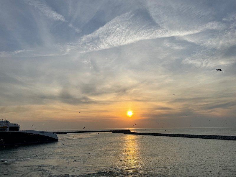
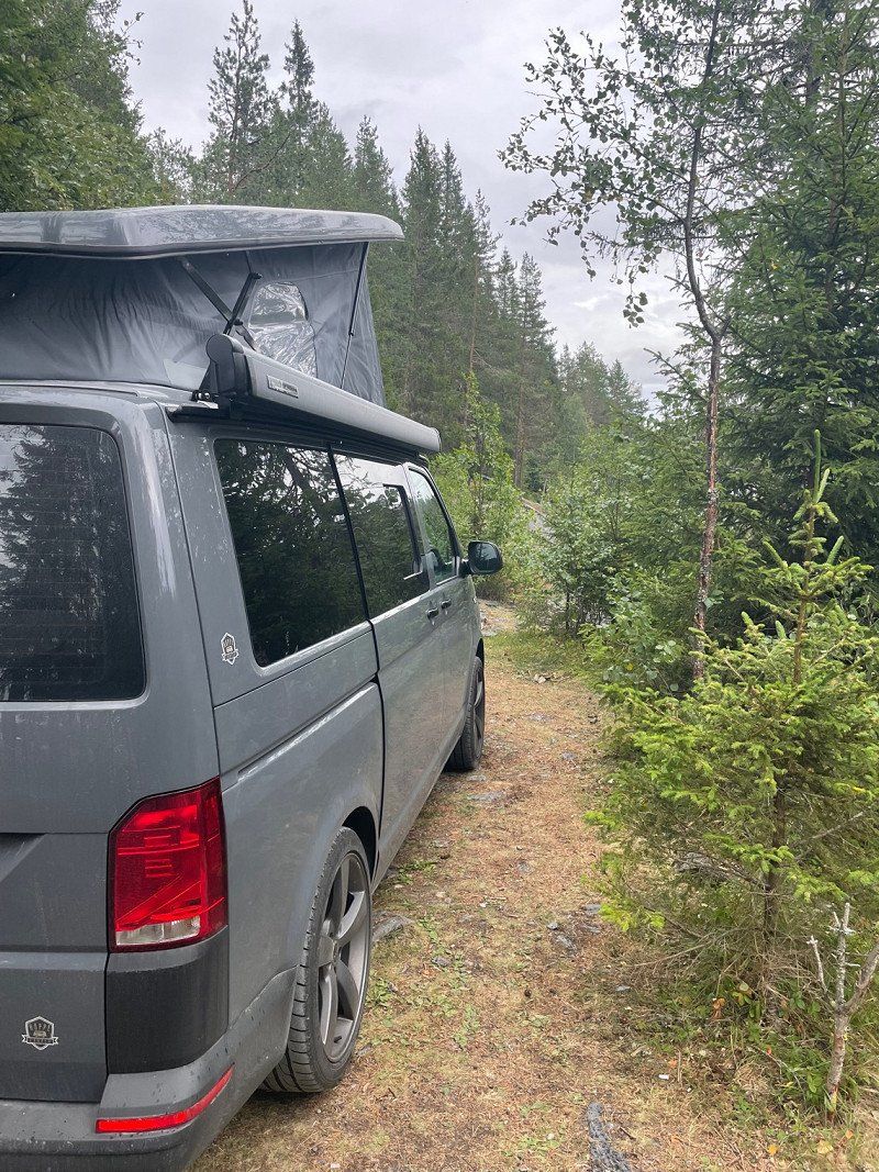
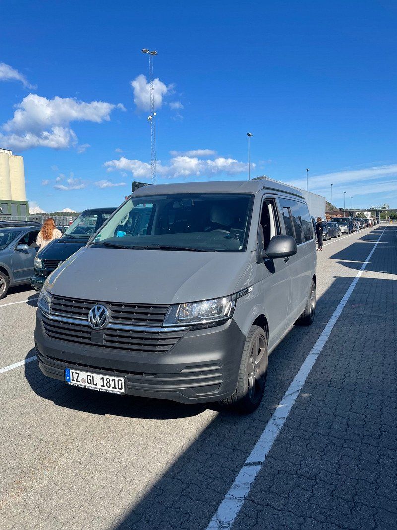
We take the ferry from Hirtshals🇩🇰 to Kristiansand🇳🇴. This is where our journey begins with ARTHUR, our Bulli 🚙.
Our route takes us all the way to Larvik (south of Oslo). From here you can take the ferry back to Hirtshals🇩🇰.
Day
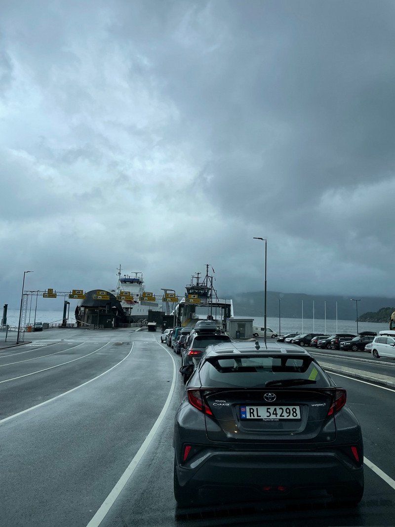
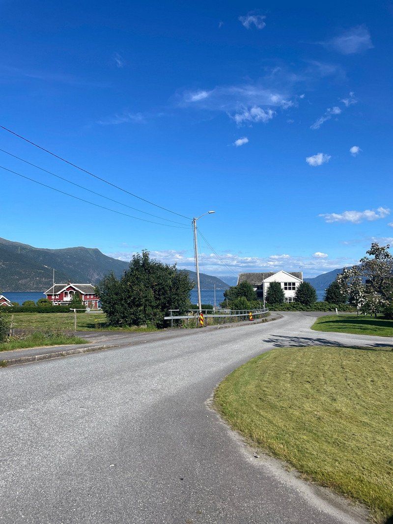
Kristiansand (Fährterminal)
In Norway, you have to pay tolls for using the roads and many ferries.
The best way to register your vehicle is via ePass https://account.epass24.com/en/vehicleregistration/step1
and subsequently creates an ePass24 account with the same license plate number and data.
Another tip for all Bullis with limited space: leave your drinks (returnable bottles or deposit cans) in Germany. On the ferry you can buy cans of beer, cola, fanta, sprite and other great drinks at a reasonable price in the TaxFreeShop. Inexpensive means really cheap! We paid the equivalent of €0.42 for a can of Coca-Cola. You can't even get it cheaper on Amazon. You don't have to keep the cans, you can dispose of them in the garbage. On the way back we'll stock up for the next tours 🤭
Vesterveien 21, 4613 Kristiansand, Norwegen
58° 8' 34.2" N 7° 58' 58.4" E
58.1428365 7.9828781
• Head northwest. Go for 530 m.
• Take the 1st exit from roundabout onto Vesterveien toward Oslo/E18/Evje/9/Sentrum. Go for 361 m.
• Take the 3rd exit from roundabout onto Setesdalsveien (9) toward Evje. Go for 870 m.
• Turn right onto Ravnedalsveien. Go for 292 m.
• Turn left onto Løkkeveien. Go for 355 m.
• Turn slightly right onto Løkkeveien. Go for 110 m.
• Arrive at Løkkeveien. Your destination is on the left.
☍
2,5 km
( 5 min.)
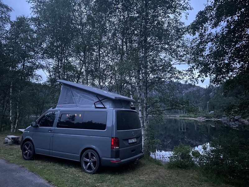
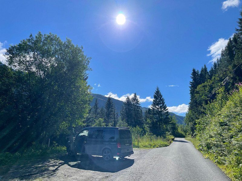
Am Bunker von Kristansand
Place to sleep at the Kristiansand bunker.
Løkkeveien 41, 4616 Kristiansand, Norwegen
58° 9' 16.2" N 7° 58' 7.5" E
58.1545081 7.9687488
• Head southwest on Løkkeveien. Go for 465 m.
• Turn right onto Ravnedalsveien. Go for 292 m.
• Turn left onto Setesdalsveien (9). Go for 820 m.
• Take the 1st exit from roundabout onto Vesterveien toward Stavanger/E39/Danmark. Go for 352 m.
• Take the 2nd exit from roundabout toward E39/Stavanger. Go for 158 m.
• Continue on Vesterveien. Go for 56 m.
• Take ramp onto Vesterveien (E39). Go for 1.9 km.
• Take the 2nd exit from roundabout onto Fidjebakken (E39). Go for 3.0 km.
• Take the exit. Go for 258 m.
• Take the 1st exit from roundabout onto Vesterveien (439). Go for 3.2 km.
• Turn right onto Songdalsvegen (461) toward Laudal/Hortemo/Nodeland. Go for 2.4 km.
• Take the 2nd exit from roundabout onto Songdalsvegen (461). Go for 28.8 km.
• Arrive at 461. Your destination is on the left.
☍
41,6 km
( 41 min.)
Day
Frühstück am Wasser
breakfast
Bekkedalen
58° 15' 16.1" N 7° 31' 9.4" E
58.2544833 7.5192776
• Head southwest on 461. Go for 76 m.
• Turn left onto Marnarveien (455). Go for 1.2 km.
• Turn right onto 461. Go for 25.6 km.
• Turn right onto 43. Go for 616 m.
• Turn left toward Fidjestøl. Go for 42 m.
• Arrive at your destination on the left.
☍
27,5 km
( 27 min.)
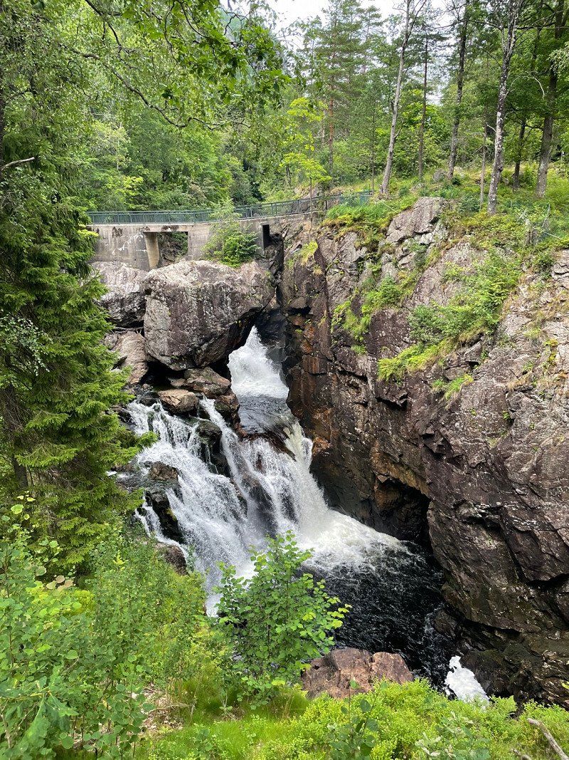
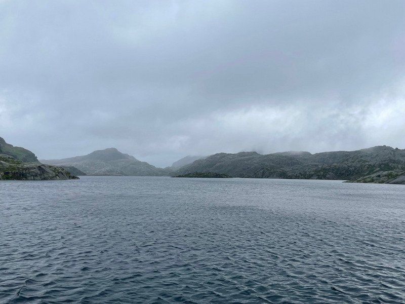
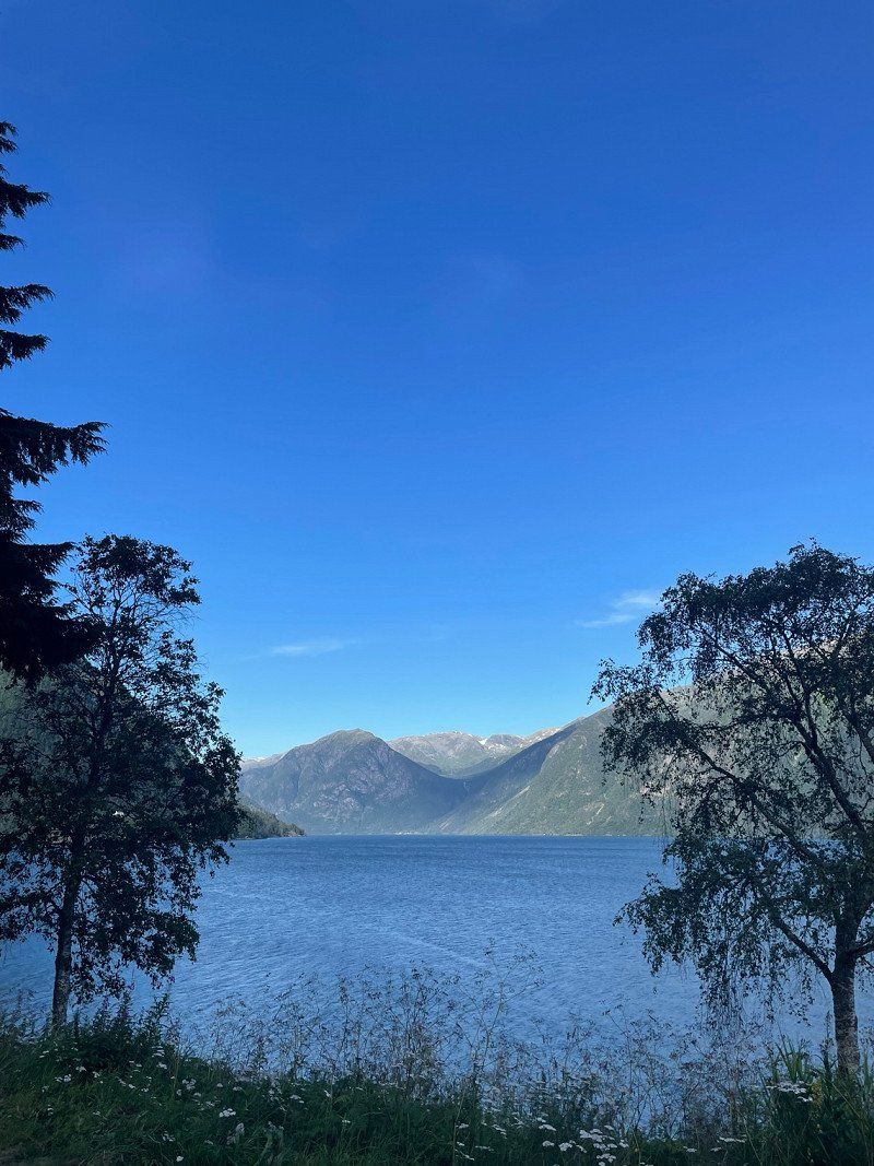
Kvåsfossen (Wasserfall)
A breathtaking waterfall. Short way.
Kvåsfossen, Lyngdal, Norwegen
58° 15' 52" N 7° 11' 24" E
58.2644454 7.1899987
• Head east. Go for 42 m.
• Turn right onto Kvåsveien (43). Go for 616 m.
• Turn left onto 461 toward Konsmo/Laudal. Go for 9.5 km.
• Turn left onto Hellevannsveien. Go for 1.6 km.
• Turn left toward Hellevannsveien. Go for 1.3 km.
• Continue on Hellevannsveien. Go for 2.1 km.
• Arrive at Hellevannsveien. Your destination is on the right.
☍
15,1 km
( 17 min.)
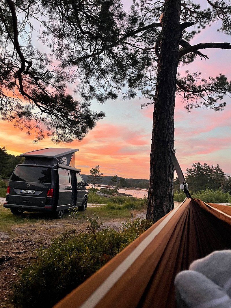
Hellevatnet (Konsmo)
A great place, the hammock has also found its place here ☺️
Hellevannsveien
58° 18' 43.8" N 7° 19' 17.5" E
58.3121706 7.3215388
• Head toward Røynesdalsveien on Hellevannsveien. Go for 2.5 km.
• Turn left onto Røynesdalsveien (4046). Go for 2.6 km.
• Turn left onto Naglestadveien (4045). Go for 263 m.
• Continue on Naglestad (4045). Go for 40 m.
• Continue on Naglestadveien (4045). Go for 4.4 km.
• Continue on 4045. Go for 91 m.
• Continue on Naglestadveien (4045). Go for 3.2 km.
• Turn right onto Lygnaveien (43). Go for 9.0 km.
• Turn left onto Eikenveien (42). Go for 10.8 km.
• Turn right onto Eikenveien (42). Go for 52.4 km.
• Turn left onto Viraksveien (4210). Go for 128 m.
• Keep right onto Viraksveien (4210). Go for 6.4 km.
• Continue on 4210. Go for 287 m.
• Turn left onto 4210. Go for 44 m.
• Arrive at 4210. Your destination is on the left.
☍
92,2 km
(1 hrs. 27 min.)
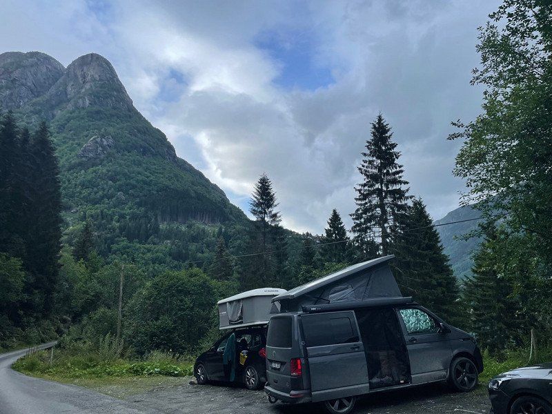
Day
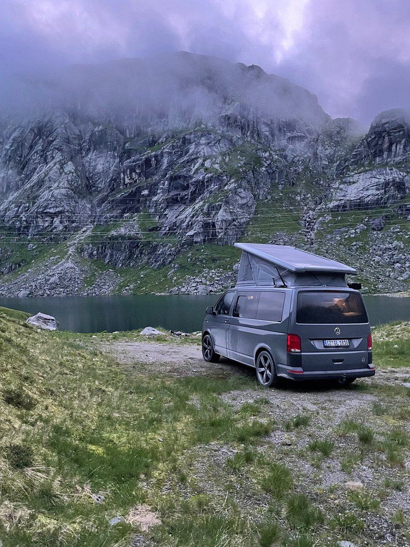
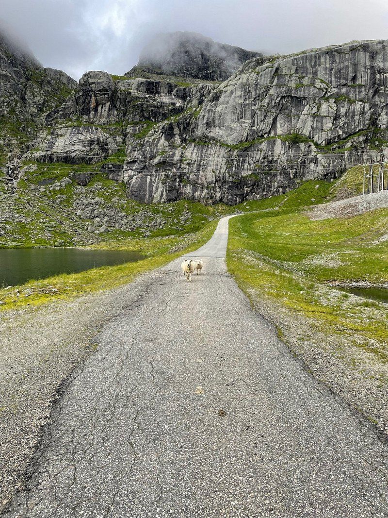
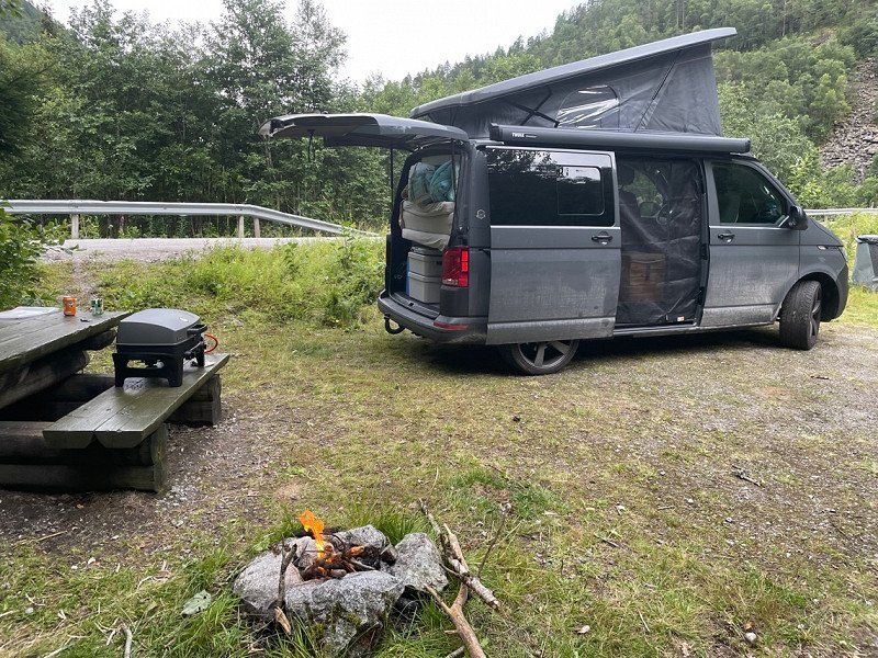
Sirdal
Nice place on a road with little traffic (not a single car at night) with garbage can and bench with table ⛰ before that you drive through Sirdal (Tonstad).
Viraksveien
58° 37' 9.8" N 6° 39' 43.1" E
58.6193828 6.6619726
• Head north on 4210. Go for 44 m.
• Turn right onto 4210. Go for 287 m.
• Continue on Viraksveien (4210). Go for 6.5 km.
• Turn right onto Sirdalsveien (42). Go for 1.2 km.
• Turn left onto Sirdalsveien (468). Go for 31.8 km.
• Pass 2 roundabouts and continue on Sirdalsveien (975). Go for 14.7 km.
• Turn left onto 4224. Go for 59 m.
• Continue on Lyseveien (4224). Go for 3.1 km.
• Continue on 4224. Go for 11.5 km.
• Continue on Lysevegen (4224). Go for 8.7 km.
• Turn right onto Lysevegen. Go for 7 m.
• Arrive at Lysevegen. Your destination is on the right.
☍
77,9 km
(1 hrs. 20 min.)
Day
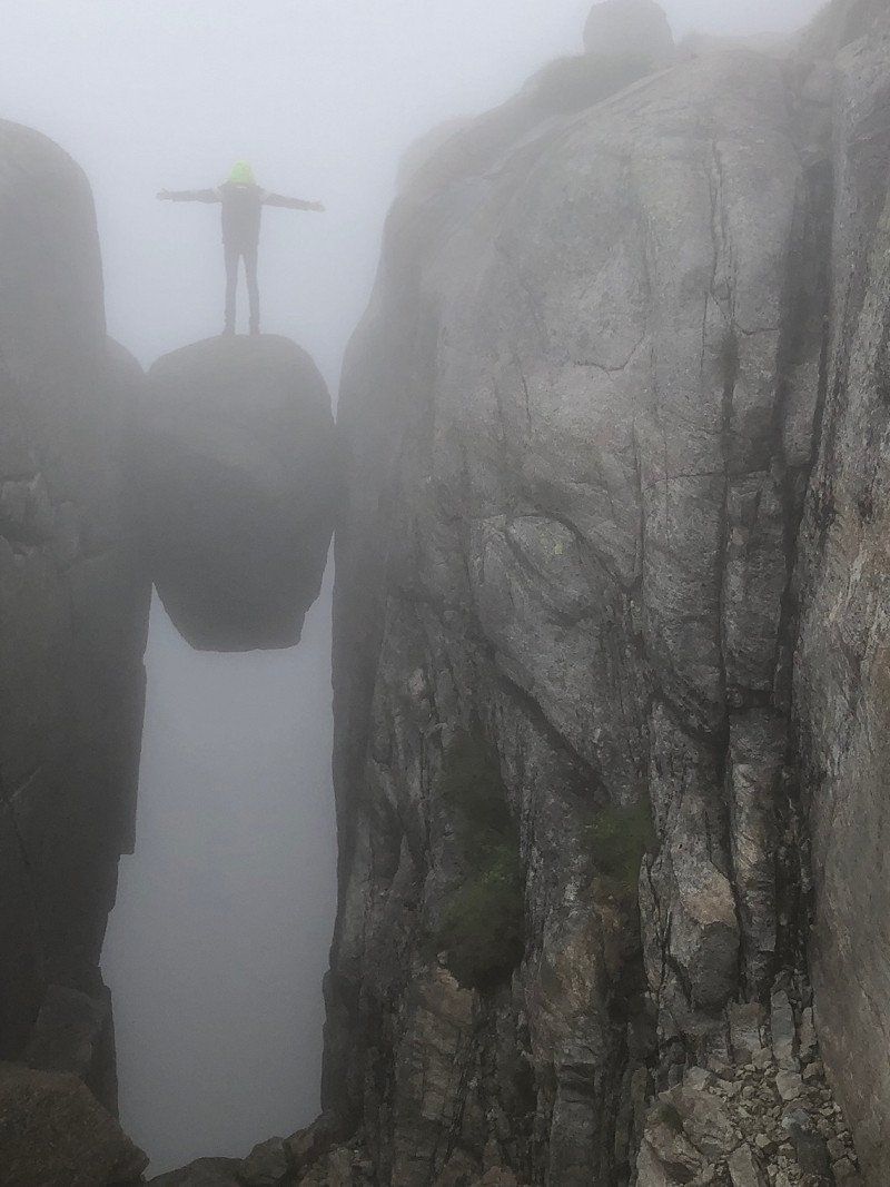
Kjerag
From Sirdal we continued to Kjerag. The Kjerag or Kiragg is a rocky plateau in the Norwegian municipality of Sandnes (Fylke Rogaland) on the Lysefjord.
Lysevegen
59° 1' 54.2" N 6° 39' 23.5" E
59.0317354 6.6565258
• Head southwest on Lysevegen. Go for 7 m.
• Turn right onto Lysevegen (4224). Go for 1.1 km.
• Continue on 4224. Go for 797 m.
• Turn right onto Lysevegen (4224). Go for 4.3 km.
• Continue on 4224. Go for 1.0 km.
• Continue on Lysevegen (4224). Go for 540 m.
• Turn right onto Nilsebuvegen. Go for 587 m.
• Turn right onto Lyse. Go for 114 m.
• Arrive at Lyse.
☍
8,6 km
( 14 min.)
Lysebotn
Lysebotn is a town at the end of the Lysefjord in Sandnes Municipality in the Norwegian province of Rogaland. The place consists mainly of a power station, a ferry terminal and some tourist facilities - nothing else! Getting further is only possible via the ferry or you drive back the mountain pass.
You can also camp here. We prefer a secluded place with a fireplace 🔥
Lyse
59° 3' 36.3" N 6° 40' 29.9" E
59.0600760 6.6749774
• Head toward Nilsebuvegen on Lyse. Go for 114 m.
• Turn left onto Nilsebuvegen. Go for 587 m.
• Turn right onto Lysevegen (4224). Go for 1.1 km.
• Turn right onto Kraftverksvegen. Go for 34 m.
• Turn left toward Kraftverksvegen. Go for 80 m.
• Continue on Kraftverksvegen. Go for 34 m.
• Arrive at Kraftverksvegen. Your destination is on the left.
☍
1,9 km
( 3 min.)
Day
Hafen von Lysebotn
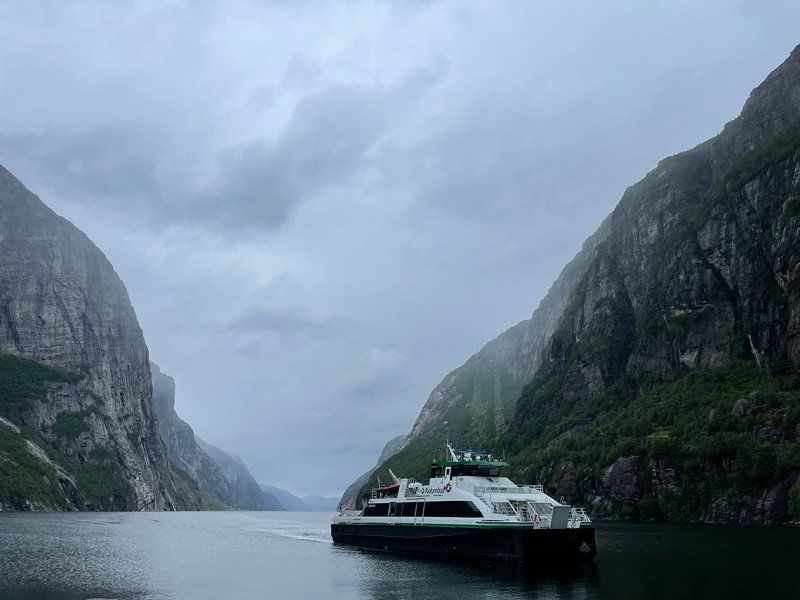
You can take the ferry from Lysebotn to the other tip of the fjord and get lots of great impressions of nature.
We take the ferry to Forsand.
Lysebotn, Norwegen
59° 3' 19.5" N 6° 38' 54.7" E
59.0554067 6.6485299
• Head west on Kraftverksvegen. Go for 159 m.
• Turn left onto Kraftverksvegen. Go for 54 m.
• Turn slightly left toward Lysevegen/4224. Go for 22 m.
• Turn sharp right onto Lysevegen (4224). Go for 15 m.
• Take the Lysebotn-Flørli Ferry. Stay on for 13.6 km.
• Head southwest.
• Arrive at your destination.
☍
13,9 km
( 51 min.)
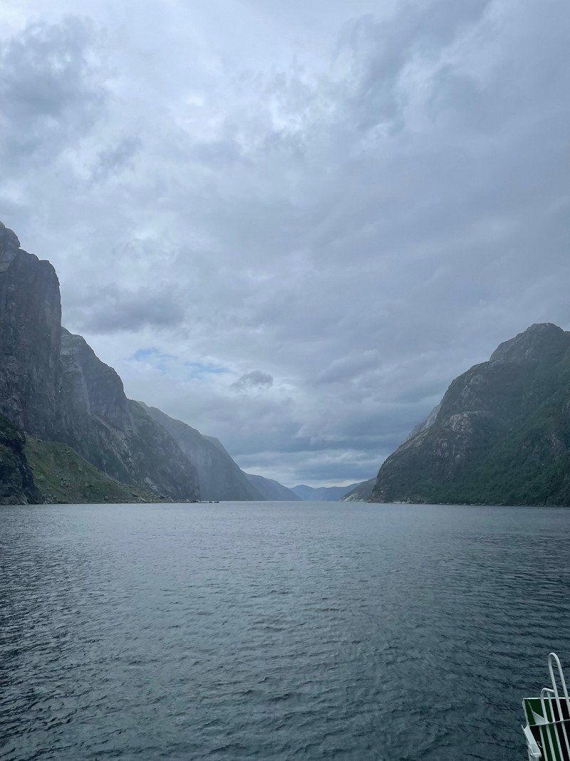
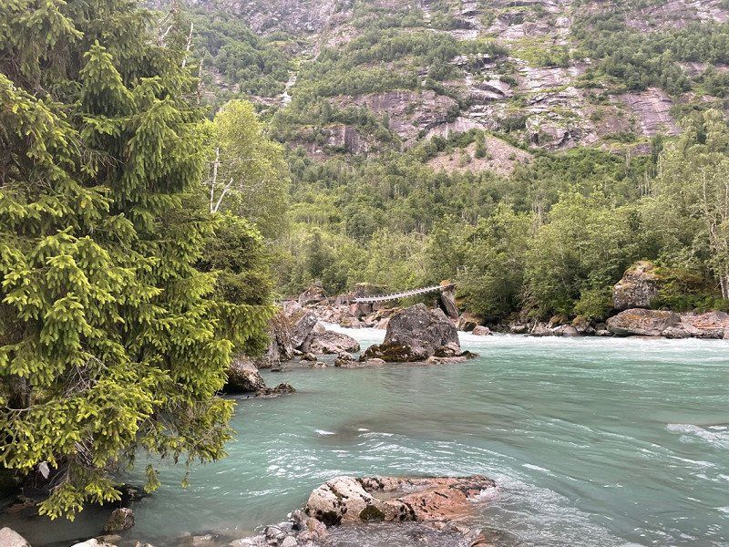
Auf dem Lysefjord
Lysefjord
59° 1' 23.5" N 6° 25' 30.9" E
59.0231967 6.4252605
• Head northeast.
• Take the Flørli-Songesand Ferry. Stay on for 6.6 km.
• Take the Songesand-Forsand Ferry. Stay on for 19.7 km.
• Head toward Bergevikvegen on Fossanvegen (4630). Go for 1.7 km.
• Take the 2nd exit from roundabout onto Fossanvegen (4630). Go for 1.7 km.
• Turn left onto Fossmorkvegen (4632). Go for 2.4 km.
• Continue on Fossmorkvegen (4632). Go for 6.7 km.
• Turn left onto Fossmorkvegen. Go for 4.4 km.
• Continue on Fossmorkvegen. Go for 985 m.
• Turn slightly left onto Fossmorkvegen. Go for 86 m.
• Turn left onto Fossmorkvegen. Go for 92 m.
• Arrive at Fossmorkvegen.
☍
44,3 km
(1 hrs. 35 min.)
Auf dem Lysefjord
Lysefjord
58° 59' 24.1" N 6° 13' 52.8" E
58.9900255 6.2313222
• Head southeast on Fossmorkvegen. Go for 14.6 km.
• Turn right onto Fossanvegen (4630). Go for 1.6 km.
• Take the 1st exit from roundabout onto Fossanvegen (4630). Go for 1.7 km.
• Turn right onto Bergevikvegen. Go for 16 m.
• Arrive at Bergevikvegen.
☍
17,9 km
( 25 min.)
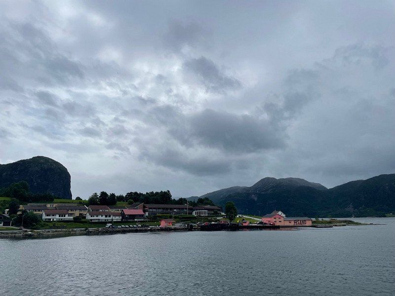
Hafen von Forsand
Arrived in Forsand, relaxation is the order of the day. There is also a gas station, a toilet and a COOP.
Bergevikvegen
58° 54' 5.1" N 6° 5' 17.8" E
58.9014064 6.0882863
• Head toward Øyren on Bergevikvegen. Go for 289 m.
• Arrive at Bergevikvegen. Your destination is on the left.
☍
0,3 km
( )
Entspannung nach der Fähre in Forsand
A great place to just hang out a bit.
Bergevikvegen 31
58° 54' 11.7" N 6° 5' 30.4" E
58.9032508 6.0917825
• Head northeast on Bergevikvegen. Go for 552 m.
• Continue on Bergevegen. Go for 339 m.
• Turn right toward Kyrkjevegen. Go for 31 m.
• Turn left onto Kyrkjevegen. Go for 252 m.
• Turn left onto Fossanvegen (4630). Go for 1.5 km.
• Continue on Liahammar Tunnelen (4630). Go for 265 m.
• Continue on Fossanvegen (4630). Go for 150 m.
• Continue on Lysefjordbrua (4630). Go for 485 m.
• Continue on Fossanvegen (4630). Go for 24 m.
• Continue on Ryfylkevegen (4630). Go for 18 m.
• Turn right onto Ryfylkevegen (523). Go for 12.8 km.
• Pass 2 roundabouts and continue on Ryfylkevegen (523). Go for 1.5 km.
• Turn right onto Fjellsvegen. Go for 87 m.
• Turn right onto Fjelltunvegen. Go for 183 m.
• Turn left onto Fjelltunvegen. Go for 406 m.
• Turn slightly left onto Fjelltunvegen. Go for 97 m.
• Continue on Fjelltunvegen. Go for 106 m.
• Continue on Gaupevegen. Go for 71 m.
• Turn left onto Gaupevegen. Go for 320 m.
• Continue toward Barkastølvegen. Go for 773 m.
• Turn left onto Barkastølvegen. Go for 1.6 km.
• Arrive at Barkastølvegen.
☍
21,5 km
( 28 min.)
Unser Platz im Nirgendwo
Barkastølvegen
59° 2' 10.2" N 6° 0' 20.5" E
59.0361548 6.0057068
• Head north on Barkastølvegen. Go for 197 m.
• Turn left onto Barkastølvegen. Go for 1.2 km.
• Turn right onto Hellandsheivegen (4646). Go for 2.9 km.
• Turn sharp right onto Tjøstheimsvegen (4654). Go for 3.8 km.
• Turn right onto Ryfylkevegen (13). Go for 37.5 km.
• Take the 2nd exit from roundabout onto 13. Go for 264 m.
• Arrive at 13. Your destination is on the left.
☍
45,8 km
( 47 min.)
Day
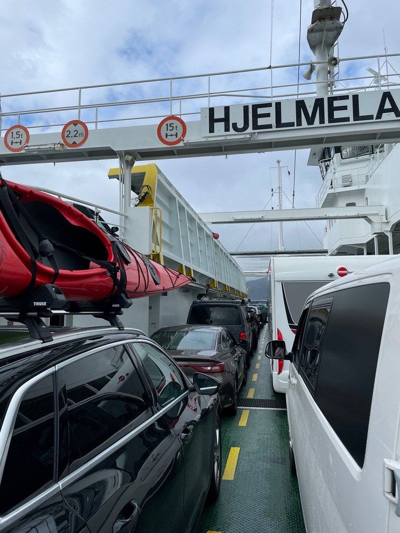
Fährüberfahrt von Hjelmeland nach Nesvik
We stay on road 13 towards Røldal and cross the fjord by ferry.
In the harbor there is an Xextra (hardware store) and toilets. The hardware store even has suitable gas cartridges.
Hjelmeland
59° 14' 2.9" N 6° 9' 54.8" E
59.2341394 6.1652343
• Head northwest on 13. Go for 5 m.
• Arrive at 13.
☍
0,0 km
( )
Auf dem Hjelmelandsfjord
Hjelmelandsfjorden
59° 14' 26" N 6° 9' 51" E
59.2405569 6.1641734
• Head northwest on 13.
• Take the Hjelmeland-Nesvik Ferry. Stay on for 3.1 km.
• Head northwest on Indre Ryfylkevegen (13). Go for 39 m.
• Arrive at Indre Ryfylkevegen (13). Your destination is on the right.
☍
3,1 km
( 34 min.)
Nesvik Hafen
There is a short rest here to use the toilets in the harbor kiosk.
Indre Ryfylkevegen 3
59° 15' 43.4" N 6° 9' 32.1" E
59.2620664 6.1589035
• Head northwest on Indre Ryfylkevegen (13). Go for 30.4 km.
• Turn left onto Indre Ryfylkevegen (517) toward Haugesund/46/Sauda/520/Jelsa. Go for 3.5 km.
• Continue on 46. Go for 13.6 km.
• Turn left onto 46. Go for 26 m.
• Turn right onto Saudavegen (520). Go for 20.9 km.
• Arrive at 520. Your destination is on the left.
☍
68,4 km
(1 hrs. 1 min.)
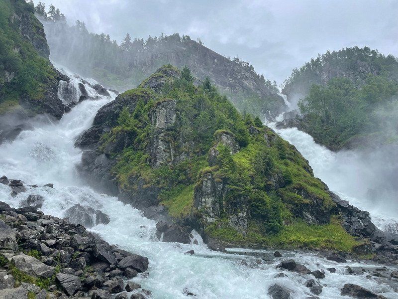
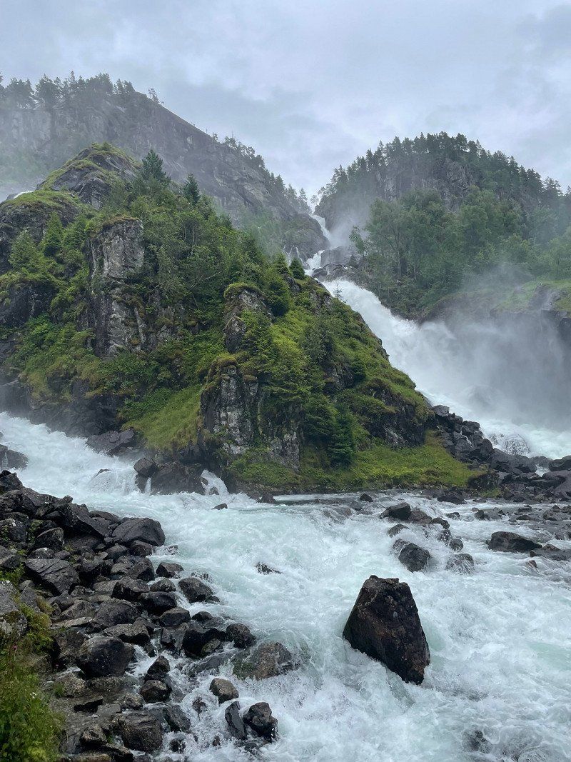
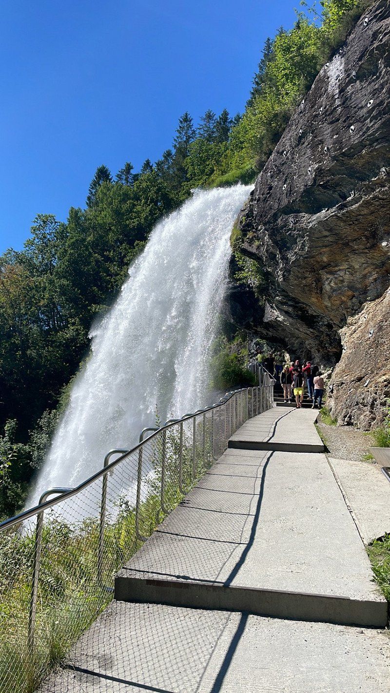
Svandalsfossen (Wasserfall)
Svandalsfoss, Sauda, Norwegen
59° 37' 30.7" N 6° 17' 25.3" E
59.6251808 6.2903635
• Head south on 520. Go for 4.8 km.
• Arrive at 520. Your destination is on the right.
☍
4,8 km
( 3 min.)
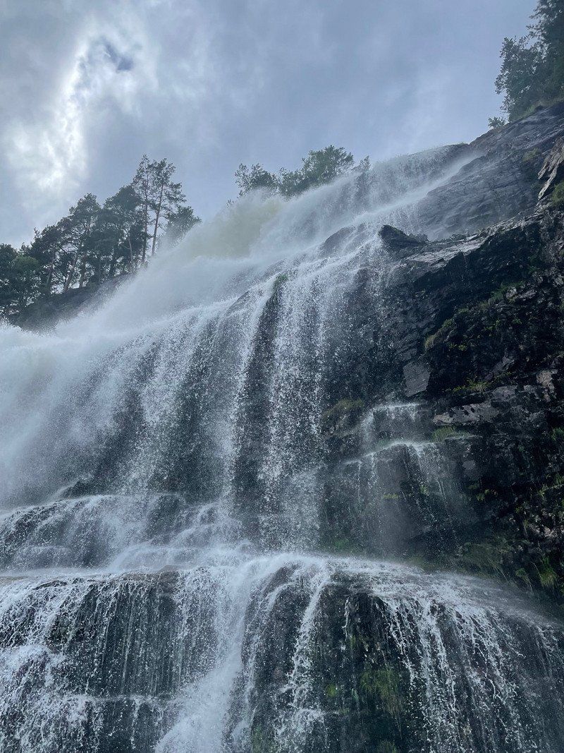
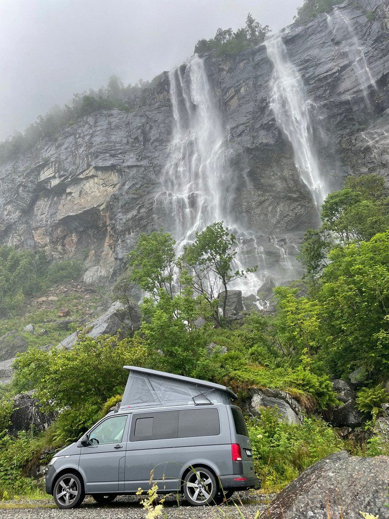
Hongavikfossen (Wasserfall) - Platz für die Nacht
We spend the night directly under the waterfall. If you think it's raining here, you're wrong - the spray comes from the waterfall 😅
Saudavegen
59° 35' 17" N 6° 17' 41.2" E
59.5880432 6.2947844
• Head toward Honganvik on 520. Go for 10.1 km.
• Continue toward 4728. Go for 30 m.
• Take the 3rd exit from roundabout onto Kyrkjegata (520). Go for 388 m.
• Turn right onto 520. Go for 25.9 km.
• Arrive at 520. Your destination is on the left.
☍
36,4 km
( 46 min.)
Day
Toller Ausblick von der 520
Hellandsbygdvegen
59° 43' 56.1" N 6° 37' 44.1" E
59.7322408 6.6289136
• Head northwest on 520. Go for 25.9 km.
• Turn left onto Kyrkjegata (520). Go for 369 m.
• Take the 1st exit from roundabout onto 520. Go for 57.8 km.
• Turn right onto 514. Go for 8.6 km.
• Turn right onto Dreganesvegen (E134) toward Oslo/Haukeligrend. Go for 65.1 km.
• Turn left onto 13 toward Brimnes/Odda/550/Utne/551/48/Rosendal. Go for 5.5 km.
• Arrive at 13. Your destination is on the right.
☍
163,1 km
(2 hrs. 40 min.)
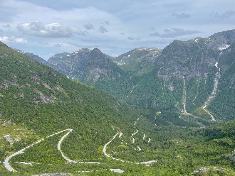
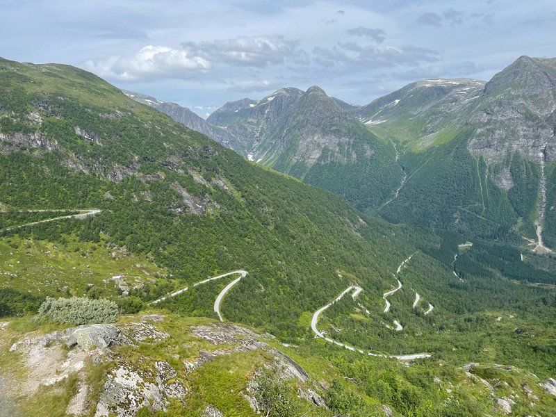
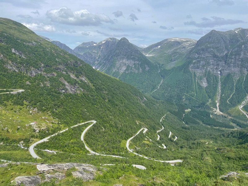
Skarefossen (Wasserfall)
With toilet and small souvenir shop. Don't be alarmed: the parking situation on site is hell 😅
13
59° 57' 55.2" N 6° 34' 28.9" E
59.9653421 6.5747025
• Head toward Grønsdal on 13. Go for 10.6 km.
• Turn left onto Jordalsvegen. Go for 129 m.
• Turn left onto Jordalsvegen. Go for 455 m.
• Turn left onto Jordalsvegen. Go for 62 m.
• Turn left onto Jordalsvegen. Go for 149 m.
• Turn left onto Jordalsvegen. Go for 1.2 km.
• Continue on Jordal. Go for 484 m.
• Arrive at your destination on the left.
☍
13,1 km
( 15 min.)
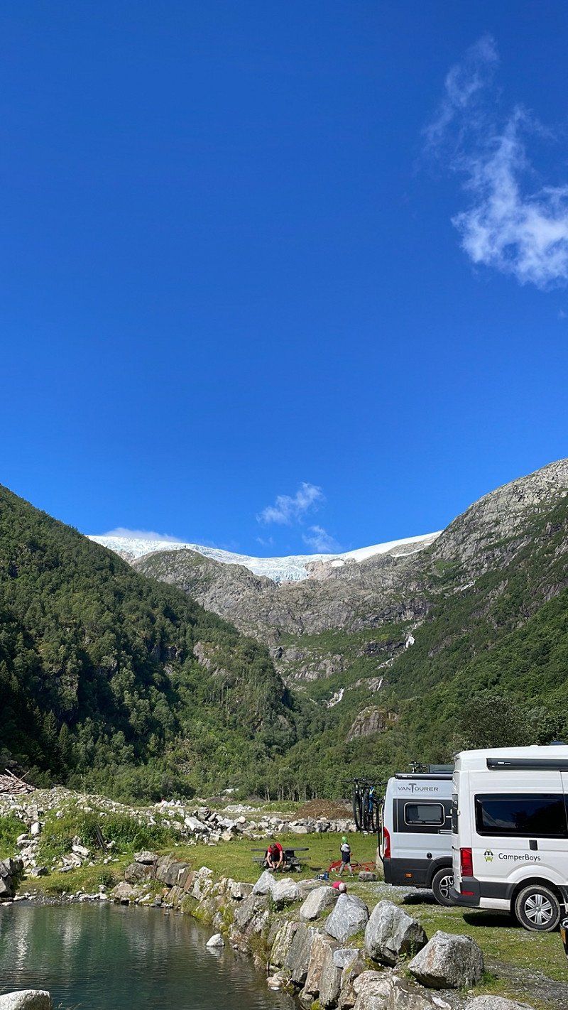
Platz unterhalb des Buarbreen (Odda)
For the hike to the Trolltunga, the troll's tongue, (at least 20 km and 10 hours) you have to start early! Although our plan does not include a hike there, we also want to start the hike to the Buarbreen glacier as early as possible and have therefore looked for a parking space in the immediate vicinity.
Strondsvegen 128–150
60° 2' 24.7" N 6° 32' 9.3" E
60.0401898 6.5359162
• Head northwest. Go for 409 m.
• Continue on Jordal. Go for 75 m.
• Turn left onto Buervegen. Go for 3.4 km.
• Arrive at your destination on the right.
☍
3,9 km
( 8 min.)
Day
Wanderparkplatz Buarbreen
The parking lot costs €18.50 per day. In the back part you can stand super with the camper. From here we start our hike (5 hours) to the glacier.
5750 Odda, Norwegen
60° 2' 41" N 6° 28' 38.6" E
60.0447165 6.4773859
• Head northeast. Go for 3.0 km.
• Continue on Buervegen. Go for 380 m.
• Turn left onto Jordalsvegen. Go for 1.2 km.
• Turn right onto Jordalsvegen. Go for 149 m.
• Turn right onto Jordalsvegen. Go for 62 m.
• Turn right onto Jordalsvegen. Go for 455 m.
• Turn right onto Jordalsvegen. Go for 134 m.
• Turn left onto Røldalsvegen (13). Go for 1.6 km.
• Take the 2nd exit from roundabout onto Opheimsgata (49). Go for 638 m.
• Take the 2nd exit from roundabout onto Eitrheimsvegen (49). Go for 2.7 km.
• Take the 2nd exit from roundabout onto 49. Go for 12.5 km.
• Turn right onto 49. Go for 62 m.
• Continue on Austrepollen (49). Go for 146 m.
• Continue on 49. Go for 292 m.
• Continue on Kamrygg (49). Go for 110 m.
• Continue on 49. Go for 4.8 km.
• Continue on Nordrepollen (49). Go for 122 m.
• Continue on 49. Go for 224 m.
• Turn left onto 5032. Go for 68 m.
• Turn right. Go for 10.8 km.
• Arrive at your destination on the right.
☍
39,5 km
(1 hrs. )
Auf dem Weg ins Jondal (Platz für die Nacht)
Our place for the night is above the tree line in the middle of solitude. Here there are only sheep, clear, ice-cold lakes and Statkraft hydroelectric power stations. For the night, however, a parking heater is required. At the end of July we only had three degrees Celsius here at night.
5476
60° 11' 17.1" N 6° 22' 51.4" E
60.1880851 6.3809522
• Head south. Go for 10.8 km.
• Turn left onto 5032. Go for 68 m.
• Turn left onto 49. Go for 250 m.
• Continue on Jondalstunnelen (49). Go for 10.1 km.
• Continue on 49. Go for 584 m.
• Continue on Torsnestunnelen (49). Go for 605 m.
• Continue on 49. Go for 386 m.
• Take the 1st exit from roundabout onto Belsnesvegen (49). Go for 5.4 km.
• Turn left onto 49. Go for 38 m.
• Arrive at 49.
☍
28,3 km
( 40 min.)
Day
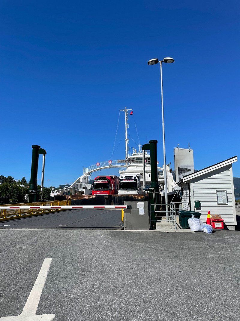
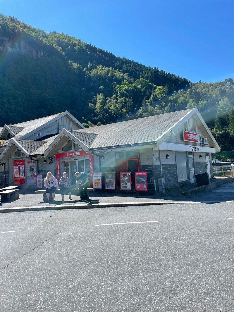
Jondal (Fährterminal)
On our way to Bergen we pass the fjord by ferry. At the harbor there is a Spar and a toilet.
550
60° 16' 32.6" N 6° 15' 6.3" E
60.2757163 6.2517410
• Head toward Jonavegen on 49. Go for 38 m.
• Turn right onto Belsnesvegen (49). Go for 589 m.
• Turn right onto Gamle Sætveitvegen. Go for 248 m.
• Turn right onto Gamle Sætveitvegen. Go for 99 m.
• Arrive at Gamle Sætveitvegen.
☍
1,0 km
( 2 min.)
Fähre über den Hardangerfjorden
Costs 100 NOK.
Hardangerfjorden
60° 16' 47.8" N 6° 14' 0.5" E
60.2799532 6.2334816
• Head southwest on Gamle Sætveitvegen. Go for 99 m.
• Turn left onto Gamle Sætveitvegen. Go for 248 m.
• Turn left onto Belsnesvegen (49). Go for 589 m.
• Turn left onto 49. Go for 98 m.
• Take the Jondal-Trøvikbygd Ferry. Stay on for 5.2 km.
• Head northwest on Tørvikbygdvegen (49). Go for 17 m.
• Arrive at Tørvikbygdvegen (49). Your destination is on the right.
☍
6,2 km
( 41 min.)
Tørvikbygd (Fährterminal)
Skutevik 16
60° 18' 3.1" N 6° 10' 18.2" E
60.3008703 6.1717270
• Head toward Skutevik on Tørvikbygdvegen (49). Go for 175 m.
• Turn right onto Tørvikbygdvegen (49). Go for 12.7 km.
• Turn left onto Steinsdalsvegen (49). Go for 69 m.
• Take the 1st exit from roundabout onto Steinsdalsvegen (49). Go for 2.2 km.
• Turn right onto Rosselandsvegen. Go for 76 m.
• Turn left onto Rosselandsvegen. Go for 22 m.
• Arrive at Rosselandsvegen. Your destination is on the right.
☍
15,2 km
( 17 min.)
Steinsdalsfossen (Wasserfall)
Rosselandsvegen 18
60° 22' 13.6" N 6° 6' 17.3" E
60.3704529 6.1048025
• Head west on Rosselandsvegen. Go for 62 m.
• Continue on Rosselandsvegen. Go for 142 m.
• Turn left toward Steinsdalsvegen/49. Go for 29 m.
• Turn right onto Steinsdalsvegen (49). Go for 4.8 km.
• Continue on 7. Go for 25 m.
• Continue on 49. Go for 20.6 km.
• Take the 1st exit from roundabout onto Samnangervegen (49) toward Bergen/E16. Go for 14.3 km.
• Take the 3rd exit from roundabout onto Hardangervegen (E16). Go for 9.7 km.
• Take the 1st exit from roundabout onto Arnavegen (E16) toward Bergen Nord/E39. Go for 581 m.
• Take the 2nd exit from roundabout onto Arnavegen (E16) toward E39/Bergen/Åsane. Go for 9.9 km.
• Take the 3rd exit from roundabout onto E16/E39 (Åsaneveien) toward Bergen. Go for 9.0 km.
• Take ramp onto Sandviksveien (585) toward Skolten/Sandviken. Go for 2.4 km.
• Continue on Slottsgaten (585). Go for 608 m.
• Turn right onto Strandkaien (5347). Go for 48 m.
• Arrive at Strandkaien (5347). Your destination is on the right.
☍
72,2 km
(1 hrs. 8 min.)
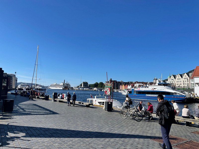
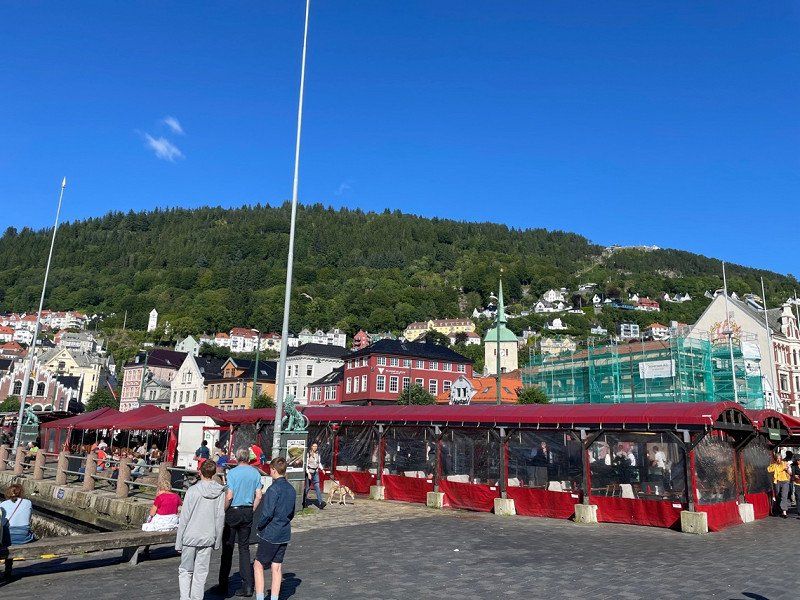
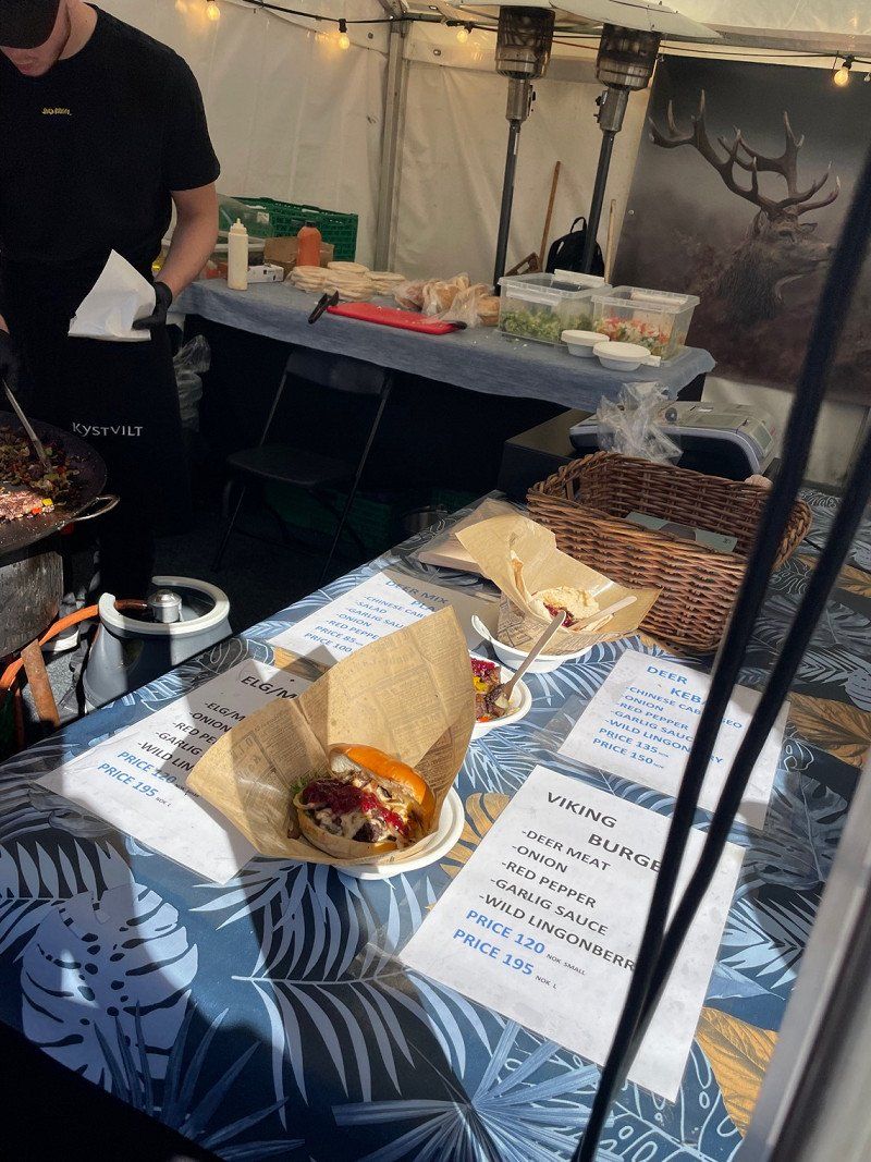
Hafen und Hanseviertel von Bergen
The market is a great place to eat a deer burger. This also costs "only" 120 NOK.
Torget
60° 23' 40.4" N 5° 19' 28.4" E
60.3945644 5.3245622
• Head toward Fortunen on Strandkaien (5347). Go for 240 m.
• Keep left onto Østre Murallmenningen (5347). Go for 119 m.
• Turn right onto Jon Smørs gate (5347). Go for 321 m.
• Turn right onto Komediebakken (5347). Go for 144 m.
• Turn left onto Nøstegaten (555). Go for 599 m.
• Keep right onto O. J. Brochs gate (5352) toward E16/E39/Møhlenpris/Terminal Dokken. Go for 169 m.
• Take the 2nd exit from roundabout onto Nygårdstunnelen (5347) toward E16/E39. Go for 1.1 km.
• Take left ramp onto Åsaneveien (E39) toward Åsane/Ferge Skolten. Go for 13.0 km.
• Continue on E39. Go for 13.7 km.
• Pass 2 roundabouts and continue on Osterfjordvegen (E39). Go for 446 m.
• Turn right onto Osterfjordvegen (E39). Go for 100 m.
• Take the 2nd exit from roundabout onto Osterfjordvegen (E39). Go for 143 m.
• Continue on Haugvegen (E39). Go for 14.1 km.
• Turn right toward Eknes/Hindenes. Go for 94 m.
• Continue on Hindenesvegen (5460). Go for 661 m.
• Arrive at Hindenesvegen (5460). Your destination is on the left.
☍
44,9 km
( 43 min.)
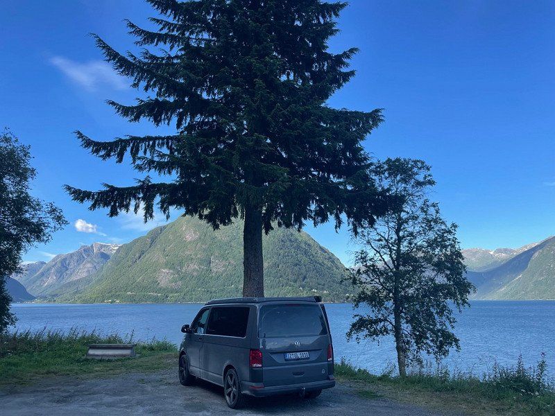
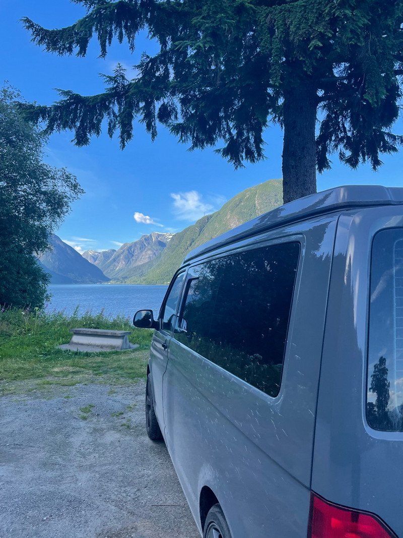
Osterfjord
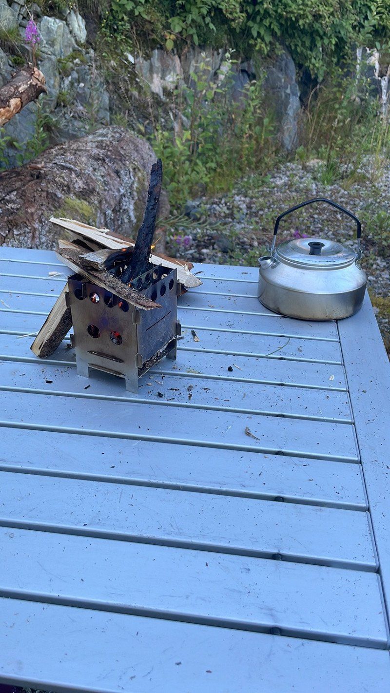
After a long search we finally found a nice pitch in the Osterfjorden region. Not so easy when most places are blocked with barriers or can only be reached by 4x4. Now we spend the night in a forest workplace with enough kindling for a fire 🔥.
5913
60° 37' 11.6" N 5° 25' 5.5" E
60.6199024 5.4181844
• Head toward Eidavegen on Hindenesvegen (5460). Go for 661 m.
• Continue toward Osterfjordvegen/E39. Go for 94 m.
• Turn right onto Osterfjordvegen (E39). Go for 40.4 km.
• Turn right onto Stordalsvegen (5442). Go for 15.1 km.
• Continue on 5442. Go for 16.7 km.
• Continue on Fjorden (5442). Go for 105 m.
• Continue on 5442. Go for 2.1 km.
• Continue on Sørsidevegen (5442). Go for 25.7 km.
• Turn sharp left onto 5442. Go for 51 m.
• Arrive at 5442. Your destination is on the left.
☍
101,0 km
(1 hrs. 54 min.)
Day
Ortnevik (Fährterminal)
We leave the E39 to drive through the mountains along the cliffs to Ortnevik. From here we take the ferry to Nordeide.
We stand backwards, because the ferry has to be driven on with the stern first.
Since only six cars fit on the ferry and you can't book them in advance, you have to be there early to be at the front of Line 1 😅 we spend the waiting time by the water and enjoying the sun ☀️
Sørsidevegen
61° 6' 47.2" N 6° 7' 57.5" E
61.1131225 6.1326339
• Head northeast on 5442.
• Take the Ornevik-Måren-Noreide Ferry. Stay on for 5.9 km.
• Head north on Runnestøvegen. Go for 44 m.
• Turn sharp right onto Kaptein Daaes veg. Go for 493 m.
• Arrive at Kaptein Daaes veg.
☍
6,5 km
( 40 min.)
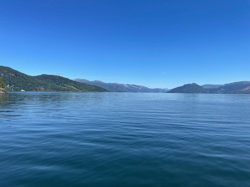
Auf dem Sognefjorden
Finally a ferry that keeps what it promises. At full speed we go over the Sognefjord⛴
The ferry cannot be booked in advance and must be paid directly on deck. For 2 adults + Bulli = NOK 129.00. Really worth it!
Sognefjorden
61° 8' 13.2" N 6° 5' 19.3" E
61.1369924 6.0887063
• Head toward Runnestøvegen on Kaptein Daaes veg. Go for 493 m.
• Turn sharp left onto Runnestøvegen. Go for 34 m.
• Arrive at Runnestøvegen.
☍
0,5 km
( 1 min.)
Hafen von Måren
A Norwegian gets the last seat on the ferry. Everyone else has to wait. For us it goes further ☺️
Runnestøvegen
61° 8' 57.2" N 6° 4' 30" E
61.1492139 6.0749911
• Head south on Runnestøvegen. Go for 10 m.
• Take the Ornevik-Måren-Noreide Ferry. Stay on for 7.1 km.
• Head west. Go for 35 m.
• Arrive at your destination on the right.
☍
7,1 km
( 40 min.)
Nordeide (Fährterminal)
Høyanger, Norwegen
61° 10' 24.6" N 5° 59' 12.3" E
61.1735000 5.9867400
• Head toward Kyrkjebøvegen. Go for 221 m.
• Turn right onto Kyrkjebøvegen (55). Go for 51.5 km.
• Turn right onto Kreklingevegen. Go for 93 m.
• Turn right toward Balavegen. Go for 14 m.
• Turn right onto Balavegen. Go for 419 m.
• Turn right onto Villavegen. Go for 63 m.
• Continue on Villavegen. Go for 110 m.
• Turn right onto Sjøtunsvegen. Go for 73 m.
• Arrive at Sjøtunsvegen. Your destination is on the left.
☍
52,5 km
( 42 min.)
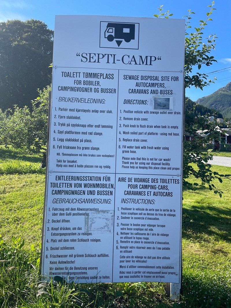
Balestrand (Frischwasser)
Balestrand is a beautiful place with chic villas. There is also the possibility to dispose of waste water and fill up with fresh water - and it's even free of charge!
Sjøtunsvegen 8
61° 12' 7.1" N 6° 31' 52.6" E
61.2019707 6.5312901
• Head toward Villavegen on Sjøtunsvegen. Go for 73 m.
• Turn left onto Villavegen. Go for 110 m.
• Continue on Villavegen. Go for 63 m.
• Turn left onto Balavegen. Go for 419 m.
• Turn left toward Kreklingevegen. Go for 14 m.
• Turn left onto Kreklingevegen. Go for 93 m.
• Turn right onto Balestrandvegen (55). Go for 9.4 km.
• Take the 2nd exit from Norafjordvegen roundabout onto 613 toward Førde. Go for 3.2 km.
• Arrive at 613.
☍
13,4 km
( 14 min.)
Dragsvik (Sognefjord)
We're driving back onto Route 13, which we've followed before. Along the steep coast, between the mountains, we choose a pitch with a great view of the fjord and the countryside.
Even if the place is right on the street, it doesn't bother you much, because the street has very little traffic.
Farnes
61° 14' 32.8" N 6° 33' 17.3" E
61.2424451 6.5548067
• Head toward Farnes on 613. Go for 24.3 km.
• Turn left onto Norafjordvegen. Go for 46 m.
• Arrive at Norafjordvegen. Your destination is on the left.
☍
24,3 km
( 23 min.)
Day
Aussichtspunkt
We continue to follow the 613 (13). Beautiful road with many hairpin bends
613
61° 21' 5.1" N 6° 31' 7" E
61.3514041 6.5186046
• Head south on Norafjordvegen. Go for 27 m.
• Turn left onto 613. Go for 24.7 km.
• Turn right onto 613. Go for 30.4 km.
• Turn right onto Jølstravegen (E39). Go for 32.2 km.
• Take the 1st exit from roundabout onto 5 toward Sogndal/Fjærland. Go for 16.9 km.
• Arrive at Fjærlandstunnelen (5). Your destination is on the left.
☍
104,2 km
(1 hrs. 27 min.)
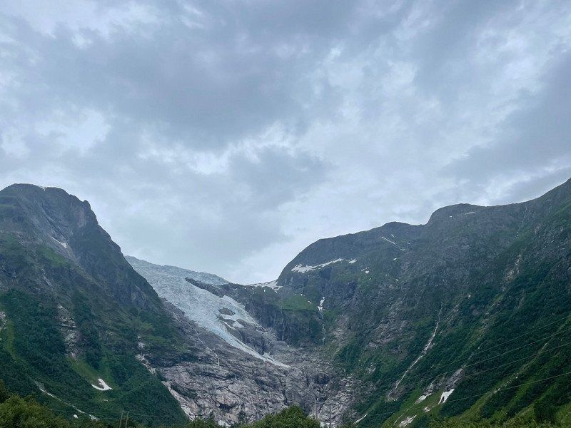
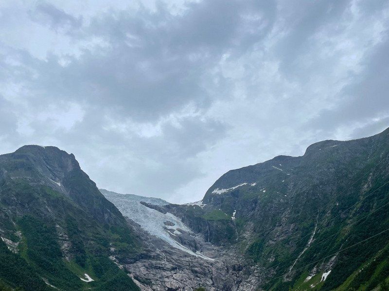
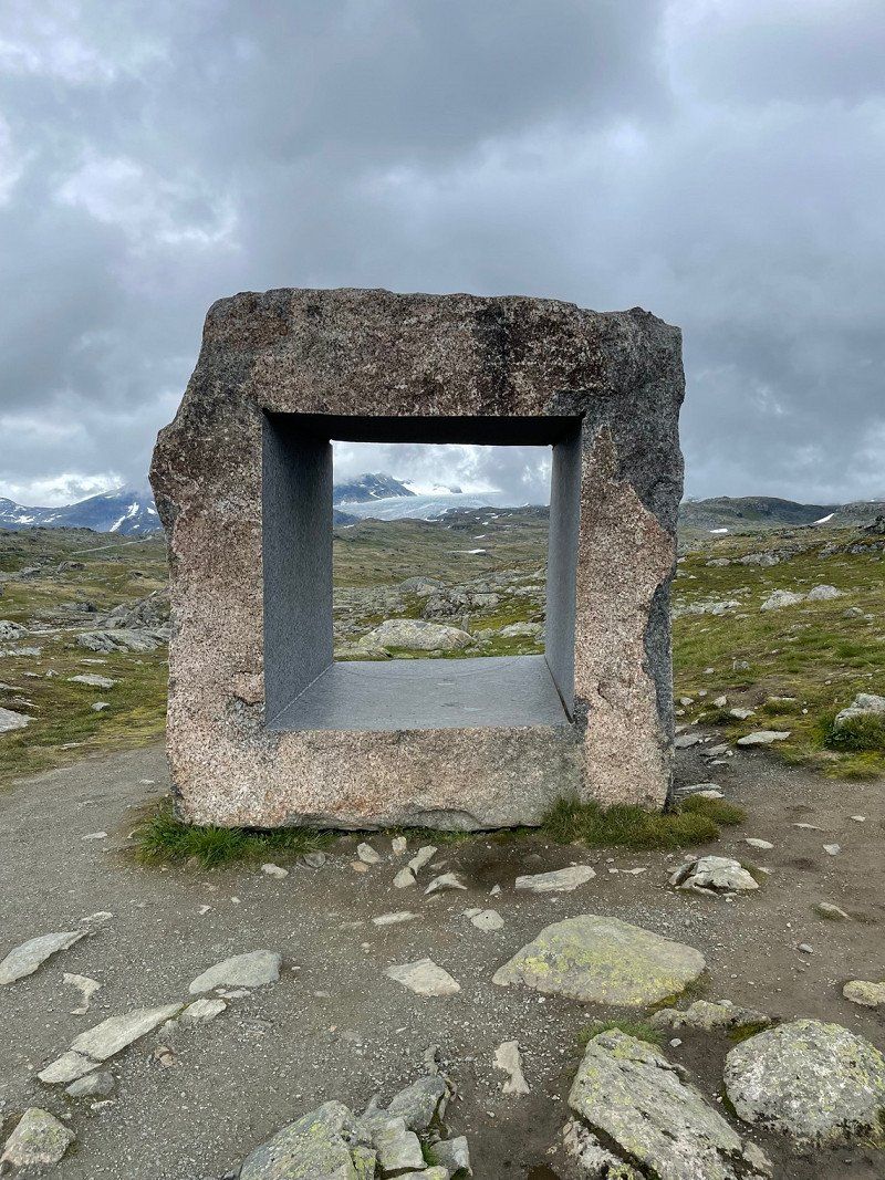
Jostedalsbreen Nationalpark
Meanwhile we follow the E5. There is beautiful nature with impressive glaciers. There is a glacier museum on the route.
Jostedalsbreen-Nationalpark
61° 29' 32.1" N 6° 41' 31.1" E
61.4922385 6.6919857
• Head southeast on Fjærlandstunnelen (5). Go for 15.0 km.
• Turn right onto Fjærlandsvegen. Go for 65 m.
• Arrive at your destination.
☍
15,1 km
( 11 min.)
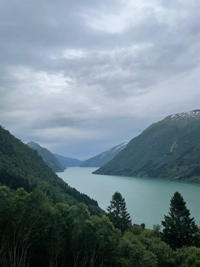
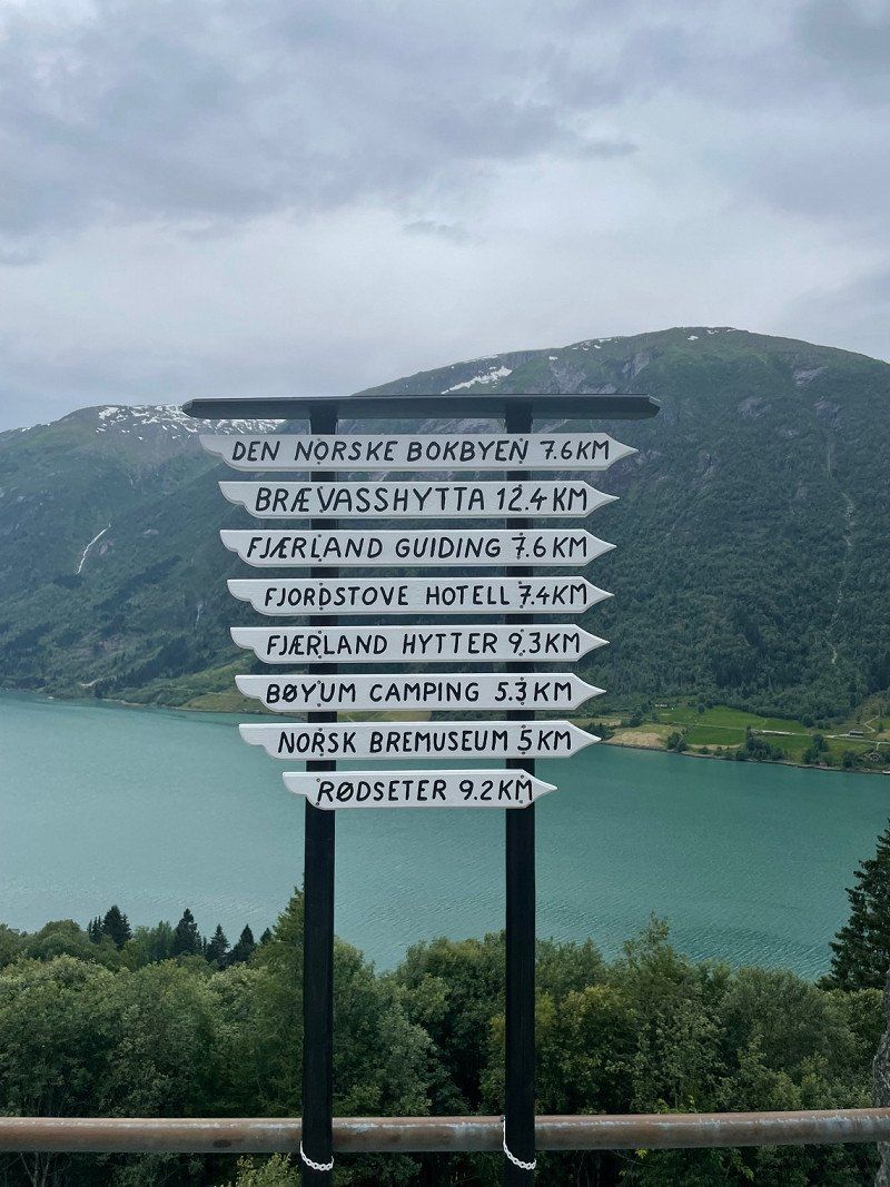
Aussichtspunkt Fjærland
Fjærlandsvegen
61° 22' 51.6" N 6° 45' 28.8" E
61.3809886 6.7580137
• Head toward Bjåstadvegen. Go for 24 m.
• Turn left toward 5. Go for 23 m.
• Turn right onto 5. Go for 19.5 km.
• Turn right onto Kollsetevegen. Go for 380 m.
• Continue on Kollsetevegen. Go for 161 m.
• Turn right onto Kollsetevegen. Go for 1.4 km.
• Arrive at Kollsetevegen.
☍
21,4 km
( 18 min.)
Fagreggi, Sogndal, Vestland, Norwegen
61° 16' 27" N 6° 57' 30.2" E
61.2741770 6.9583780
• Head southeast on Kollsetevegen. Go for 1.4 km.
• Turn left onto Kollsetevegen. Go for 541 m.
• Turn right onto 5. Go for 9.6 km.
• Take the 1st exit from roundabout onto Stedjevegen (13) toward Vadheim/Hella. Go for 65 m.
• Arrive at Stedjevegen (13).
☍
11,6 km
( 11 min.)
Stedjevegen 10
In Sogndal we continue on Route 55.
61° 13' 42.6" N 7° 5' 48.1" E
61.2284880 7.0967067
• Head north on Stedjevegen (13). Go for 54 m.
• Take the 2nd exit from roundabout onto Gravensteinsgata (5) toward E16/Lærdal/55/Lom. Go for 122 m.
• Pass 2 roundabouts and continue on Helgheimsvegen (5). Go for 1.2 km.
• Take the 2nd exit from roundabout onto 55 toward Lom. Go for 27.5 km.
• Turn left onto Jostedalsvegen (604) toward Jostedalen. Go for 12.4 km.
• Turn left. Go for 76 m.
• Arrive at your destination on the left.
☍
41,4 km
( 42 min.)
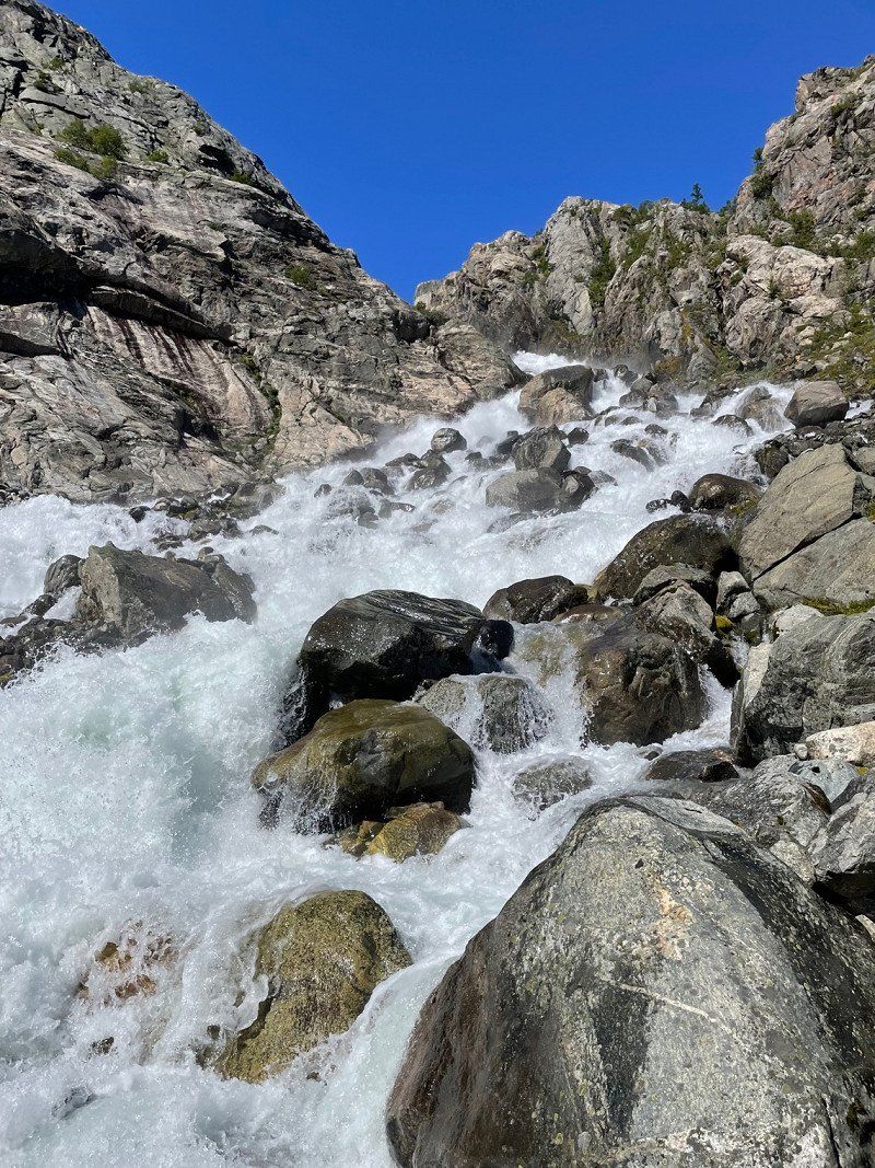
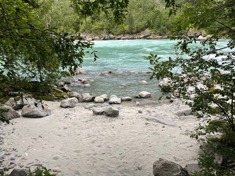
Jostedalen
We spend the night at the rest area on the little-used 604. Directly on the other side, the river tears down into the valley.
So the first thing to do is bathe at the wonderful bathing area.
Jostedalsvegen
61° 29' 35.7" N 7° 16' 14.3" E
61.4932518 7.2706276
• Head toward Jostedalsvegen. Go for 30 m.
• Turn sharp right onto Jostedalsvegen (604). Go for 12.5 km.
• Turn left onto Lustravegen (55). Go for 44.1 km.
• Arrive at 55.
☍
56,6 km
(1 hrs. 3 min.)
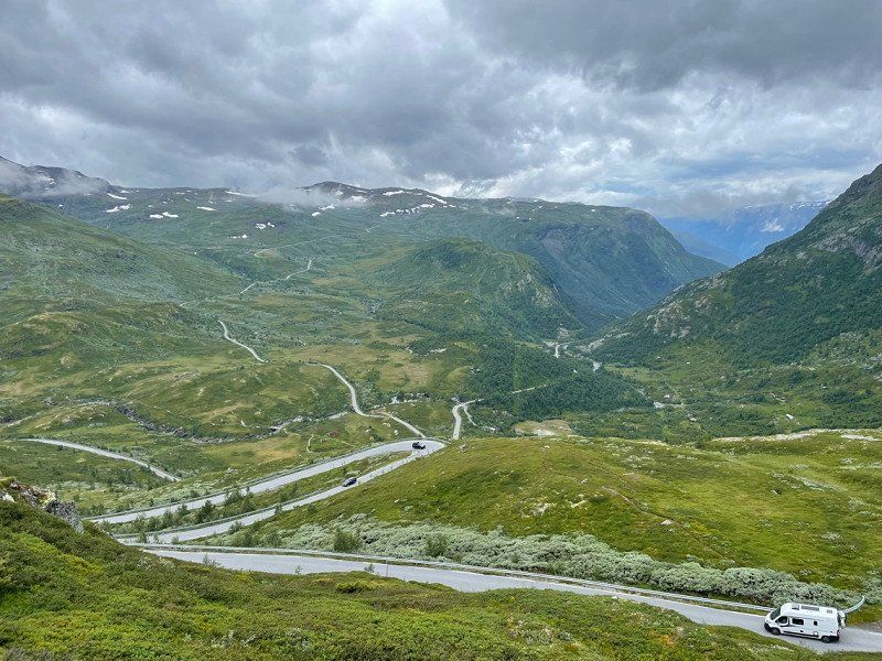
Day
Nedre Oscarshaug - Sognefjell (Aussichtspunkt)
Sognefjellsvegen 6410
61° 30' 29.5" N 7° 48' 41" E
61.5081842 7.8113895
• Head east on 55. Go for 11.7 km.
• Turn right. Go for 10 m.
• Arrive at your destination.
☍
11,7 km
( 11 min.)
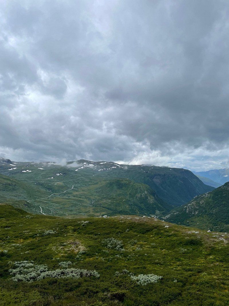
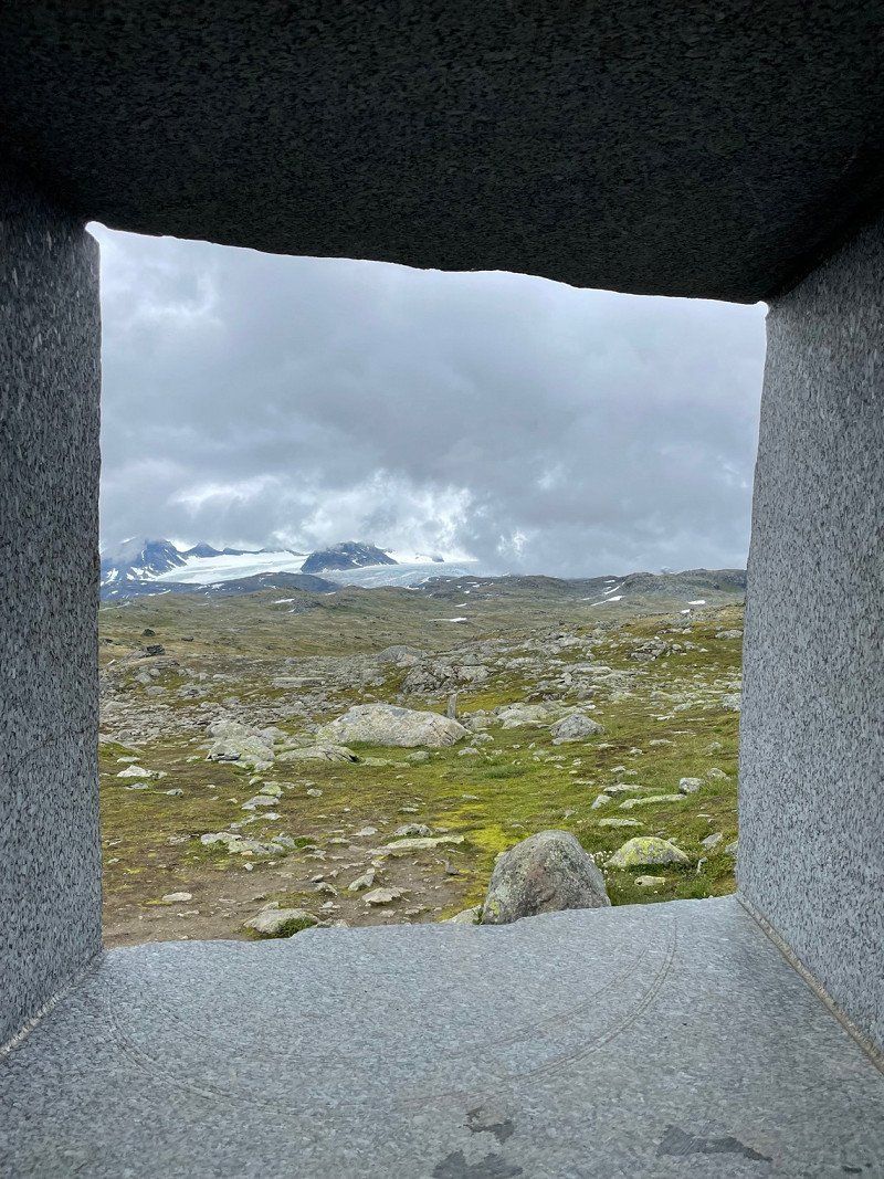
Blick auf den Gletscher von Jotunheimen
Sognefjellsvegen
61° 33' 31.9" N 7° 57' 19.9" E
61.5588585 7.9555199
• Head toward Sognefjellsvegen. Go for 10 m.
• Turn left onto Sognefjellsvegen (55). Go for 14.5 km.
• Turn left onto Tindevegen toward 53/Årdal. Go for 2.7 km.
• Turn slightly right onto Tindevegen. Go for 17.0 km.
• Keep right toward Fardalsvegen. Go for 685 m.
• Continue on Fardalsvegen. Go for 5.1 km.
• Continue on 5632. Go for 204 m.
• Continue on Fardalsvegen (5632). Go for 98 m.
• Continue on 5632. Go for 192 m.
• Continue on Åbøle (5632). Go for 100 m.
• Continue on 5632. Go for 102 m.
• Continue on Hagahaugen (5632). Go for 98 m.
• Continue on 5632. Go for 687 m.
• Continue on Fardalsvegen (5632). Go for 98 m.
• Continue on 5632. Go for 417 m.
• Continue on Fardalsvegen (5632). Go for 67 m.
• Continue on 5632. Go for 349 m.
• Continue on Fardalsvegen (5632). Go for 2.8 km.
• Continue on 5632. Go for 131 m.
• Continue on Øvstetunsvegen. Go for 32 m.
• Turn left onto Flotavegen. Go for 465 m.
• Continue on Storevegen. Go for 1.1 km.
• Turn slightly right onto Storevegen (5631). Go for 16 m.
• Turn left onto Tyinvegen (53). Go for 36.7 km.
• Turn left onto Tyinvegen (53). Go for 415 m.
• Turn right onto Tyinvegen (E16) toward Oslo/Fagernes. Go for 40.3 km.
• Turn left onto Riddarvegen (2510) toward 51/Beitostølen/Skammestein/Høre/Sentrum. Go for 2.3 km.
• Turn right onto Hørevegen (2510). Go for 2.1 km.
• Continue on Ellestadvegen (2510). Go for 19 m.
• Continue on Øygarden (2510). Go for 99 m.
• Turn left onto Eggeåsvegen (2508). Go for 5.4 km.
• Continue on 2508. Go for 358 m.
• Continue on Dalsvegen (2508). Go for 926 m.
• Continue on Ranisete (2508). Go for 141 m.
• Continue on Dalsvegen (2508). Go for 319 m.
• Continue on Skjel (2508). Go for 85 m.
• Continue on Dalsvegen (2508). Go for 741 m.
• Continue on Holun (2508). Go for 83 m.
• Continue on Dalsvegen (2508). Go for 2.9 km.
• Continue on Skøltevegen (2508). Go for 4.2 km.
• Turn left onto Bygdinvegen (51). Go for 42.5 km.
• Turn right. Go for 213 m.
• Keep right. Go for 15 m.
• Arrive at your destination on the right.
☍
186,7 km
(3 hrs. 10 min.)
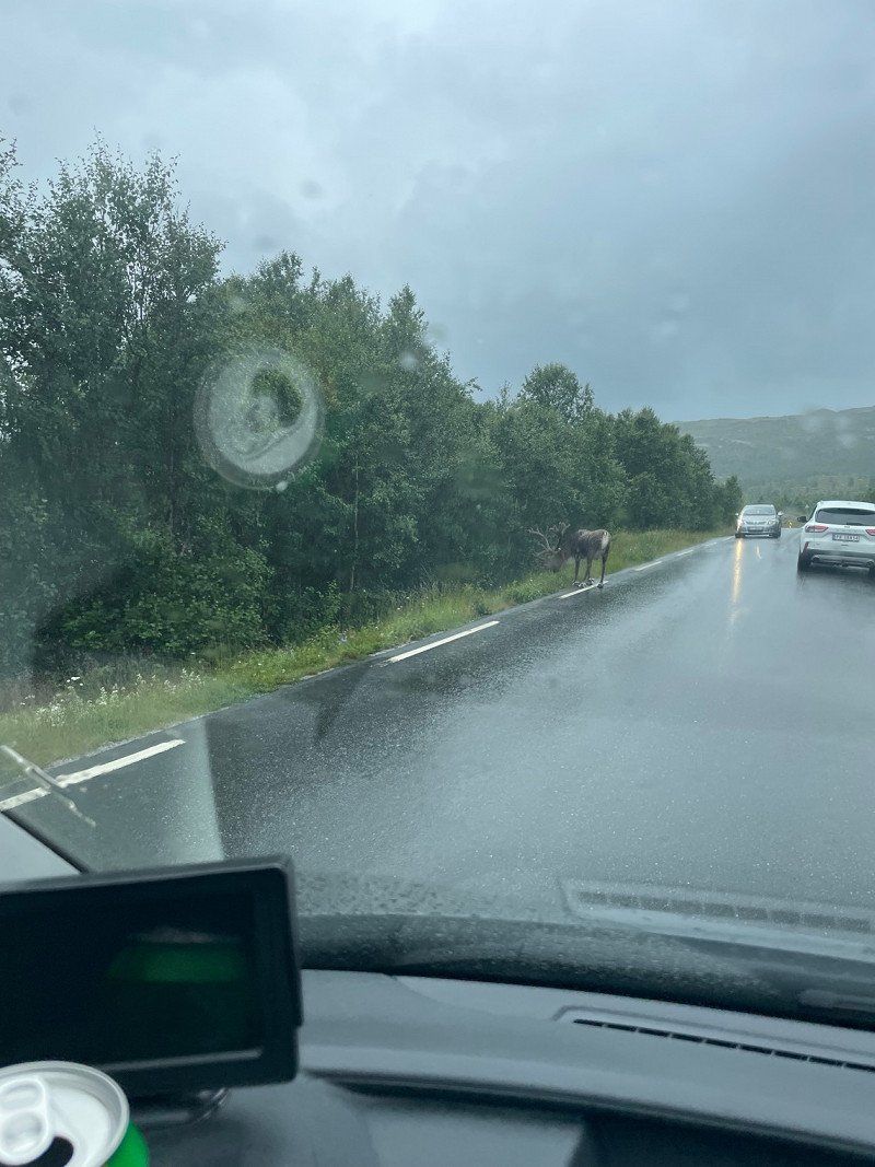
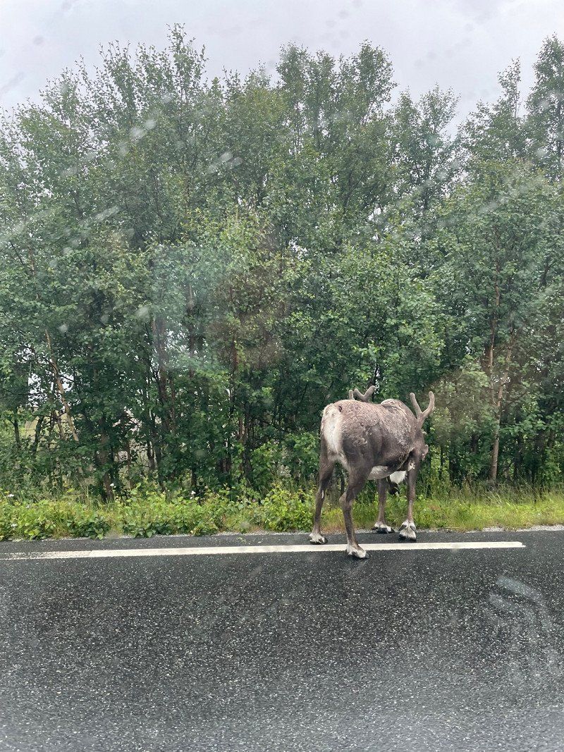
Rentiersichtung
Although this is a registered animal, we are delighted to see a reindeer in the wild.
Sjodalsvegen
61° 30' 46.9" N 8° 51' 1" E
61.5130364 8.8502822
• Head east. Go for 228 m.
• Turn left onto Sjodalsvegen (51). Go for 60.9 km.
• Turn right onto Vestsidevegen (2490). Go for 1.5 km.
• Turn right. Go for 523 m.
• Arrive at your destination.
☍
63,2 km
( 59 min.)
Volbufjorden (Platz für die Nacht)
After the day was very rainy and we decided to sit in the van more and enjoy the scenery while driving, we have now found a great pitch for the night.
2943
61° 4' 44.4" N 9° 6' 41.2" E
61.0790128 9.1114534
• Head toward Vestsidevegen. Go for 523 m.
• Turn left onto Vestsidevegen (2490). Go for 1.5 km.
• Turn right onto Bygdinvegen (51). Go for 12.2 km.
• Turn left onto Tyinvegen (E16). Go for 4.2 km.
• Pass 3 roundabouts and continue on Osloveien (E16). Go for 149 km.
• Take ramp onto Skarveien (285) toward Drammen. Go for 1.3 km.
• Take the 1st exit from roundabout onto Lierveien (285). Go for 20.8 km.
• Take the 3rd exit from roundabout onto Kirkelina (282). Go for 1.9 km.
• Take the 1st exit from roundabout onto Kirkelina (282). Go for 827 m.
• Take ramp onto E18 toward Drammen. Go for 96.3 km.
• Take exit 45 toward Kongsberg/Larvik Øst/Danmark. Go for 474 m.
• Take the 1st exit from roundabout onto Elveveien (40) toward Danmark/Larvik. Go for 351 m.
• Take the 2nd exit from roundabout onto Elveveien (40) toward Danmark/Larvik. Go for 4.4 km.
• Keep left toward Sentrum. Go for 35 m.
• Take the 3rd exit from roundabout onto Tjøllingveien (303) toward Sentrum. Go for 146 m.
• Turn left onto Lågaveien. Go for 60 m.
• Arrive at Lågaveien. Your destination is on the left.
☍
293,7 km
(3 hrs. 40 min.)
Day
REMA 1000 - Larvik
Unfortunately we have to go back to Germany today. So we quickly rebooked the ferry and adjusted the route.
Normally we should continue on the 51 and then onto the 40 to Larvik.
Now we drove on the Autobahn.
We'll just buy a little something.
Tjøllingveien 38
59° 2' 43.3" N 10° 3' 39.7" E
59.0453591 10.0610184
• Head toward Tjøllingveien on Lågaveien. Go for 60 m.
• Turn right onto Tjøllingveien (303). Go for 110 m.
• Take the 3rd exit from roundabout onto Elveveien (101). Go for 606 m.
• Continue on Elveveien (2984). Go for 86 m.
• Continue on Revet toward Revet Industriområde/Danmark. Go for 118 m.
• Keep left onto Revet. Go for 81 m.
• Take the 1st exit from roundabout onto Revet. Go for 304 m.
• Arrive at Revet. Your destination is on the right.
☍
1,4 km
( 3 min.)
Color Line, Larvik (Fährterminal)
We have arrived at the destination of our journey through Norway 👍 with the SuperSpeed 2 we go from Larvik 🇳🇴 back to Hirtshals 🇩🇰
Revet
59° 2' 24.2" N 10° 2' 55.4" E
59.0400571 10.0487309