Unfortunately, we don't support your browser (Internet Explorer) anymore, some functionalities could not work. Click here to get information on how to upgrade your browser.
From the Lower Rhine to the Lofoten and the fjords

Travelogue
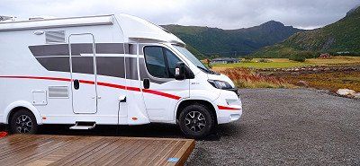
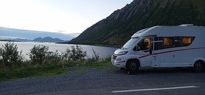
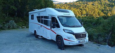
After a stress-free journey we reached our first stop in Sittensen. We got one of the 6 free parking spaces at the watermill. Very nice little town with half-timbered houses and green spaces. Ice cream parlor nearby with delicious ice cream. Later we had a kebab. Very warm, but still beautiful day. Good start to the tour.
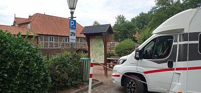
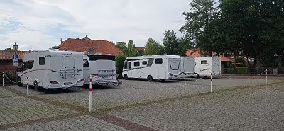
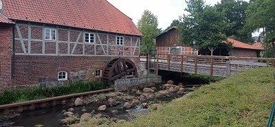

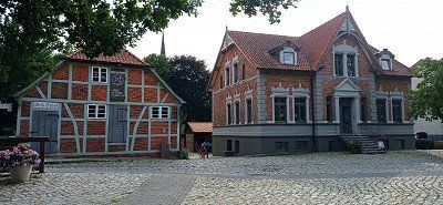

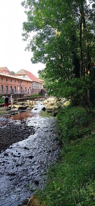
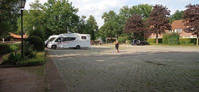
After a stress-free journey we reached our first stop in Sittensen. We got one of the 6 free parking spaces at the watermill. Very nice little town with half-timbered houses and green spaces. Ice cream parlor nearby with delicious ice cream. Later we had a kebab. Very warm, but still beautiful day. Good start to the tour.
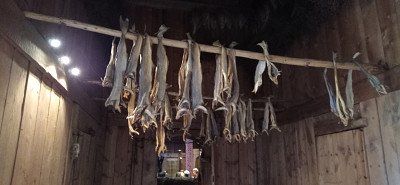
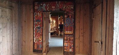
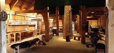
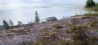
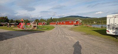
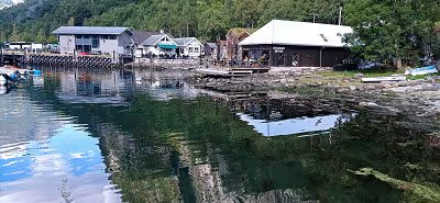
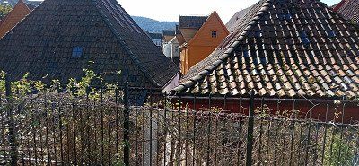
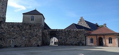
Parking at the Viking Museum Fyrkatvej directly at the former castle. You drive past the replica Viking village and get to the castle. The friendly lady at the till allowed us the standing time. We paid admission and visited the former Viking castle and the graves. In the evening we walked between two lakes to the Viking village and were able to visit it well, although it was already closed. Gorgeous area. In the evening we drank a glass of wine with a lady from Braunschweig. Later came 5 more mobile homes. At night we could use the toilet. Great.
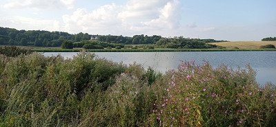
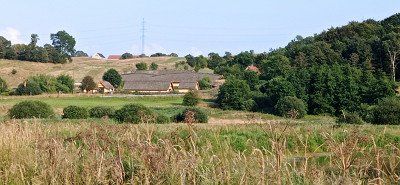
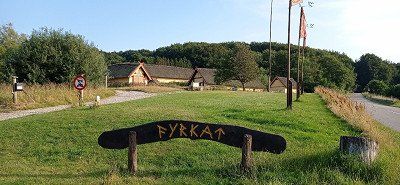
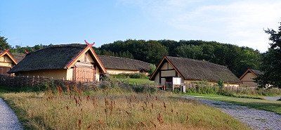
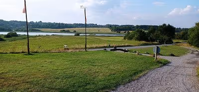
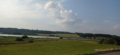
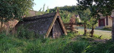
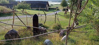
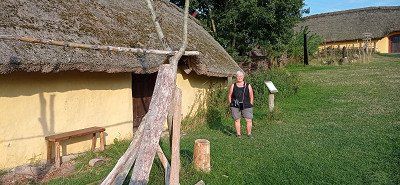
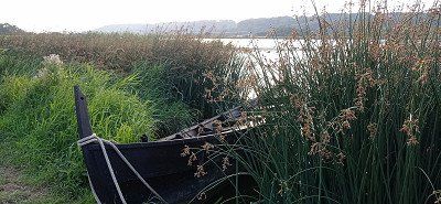
Parking at the Viking Museum Fyrkatvej directly at the former castle. You drive past the replica Viking village and get to the castle. The friendly lady at the till allowed us the standing time. We paid admission and visited the former Viking castle and the graves. In the evening we walked between two lakes to the Viking village and were able to visit it well, although it was already closed. Gorgeous area. In the evening we drank a glass of wine with a lady from Braunschweig. Later came 5 more mobile homes. At night we could use the toilet. Great.


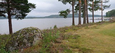
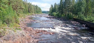
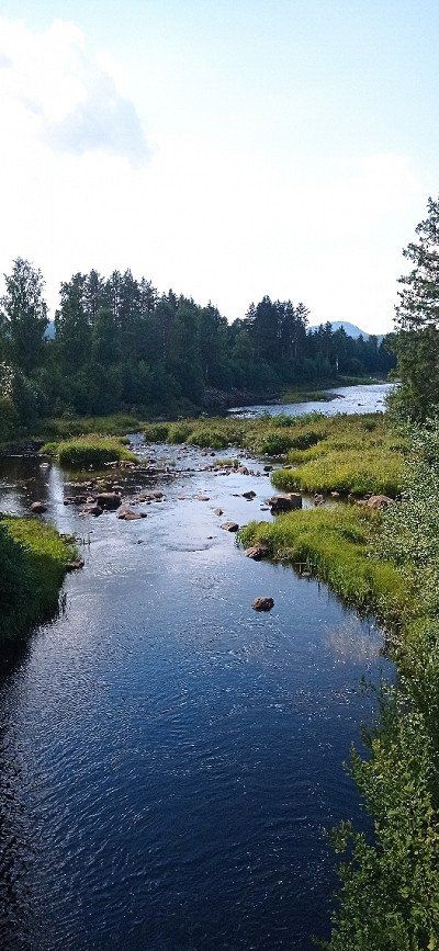
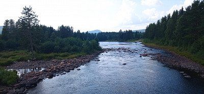
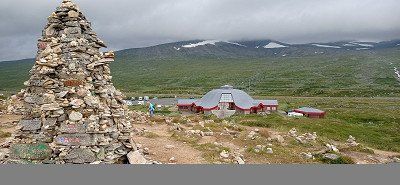
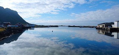
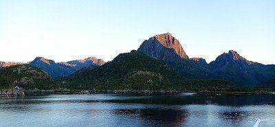
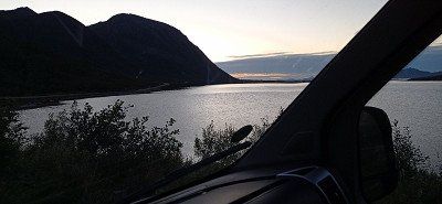
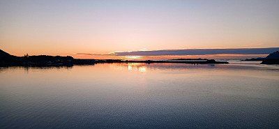
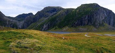
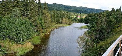
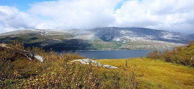
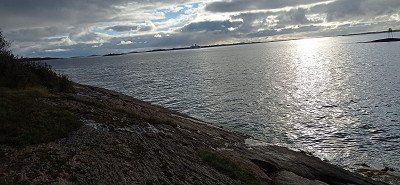
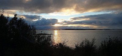
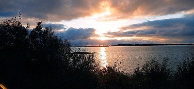
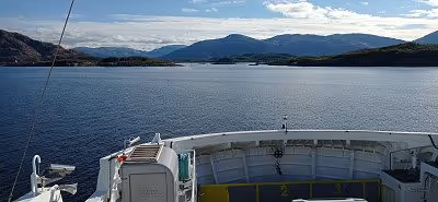
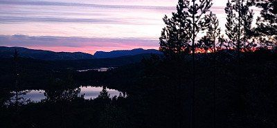
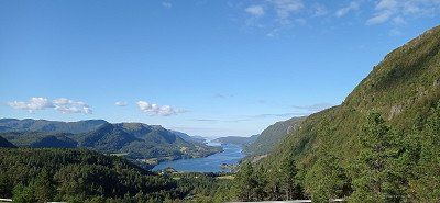
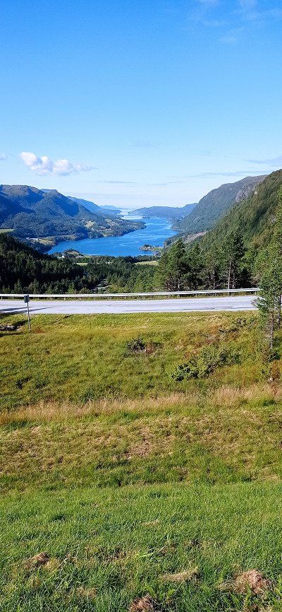
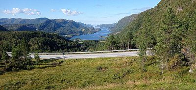
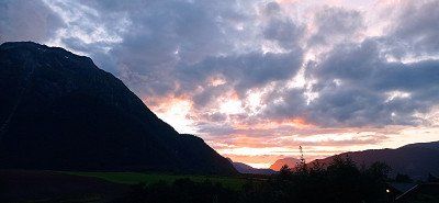
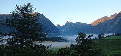
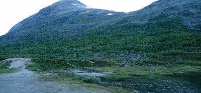
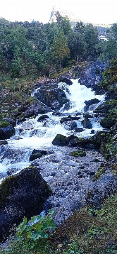
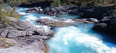
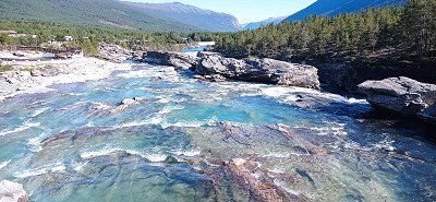
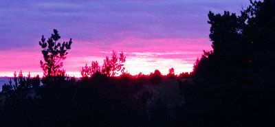
First we drove past the 28 at the Fermundensee. We touched the Fermundsmarka National Park with many beautiful lakes and rich in forest. We stopped in the UNESCO World Heritage town of Røros. An interesting place with its wooden houses blackened by copper quarrying. The place looks rustic but well-kept. And environmentally conscious with the grass-covered roofs. We enjoyed delicious cocoa and, for the first time, the cinnamon rolls known for Norway in a quaint little café. We paid parking fees, but unfortunately found out later that you could have parked for free at the museum of the old copper factory. From Røros we drove over the 30 along the river Gaula. We touched the foothills of the Forollhogna National Park with its mountain birch slopes. The vegetation there is covered with lichens. Everything shimmered bright green. On the way we were greeted by 4 reindeer and 1 moose. He came towards us on the road and then crossed. A snapshot succeeded. There are various farms and huts in the Gaudalental. Sheep often graze right next to the road. At Støren we drove onto the E6 and passed Trondheim and then the fjord of the same name. We stayed at Strindmoen campsite by Snåsvatnet. The campsite is simple but clean. An underpass leads to the lake, where we photographed a beautiful sunset. At the back of the site, a small waterfall rushes towards the lake. Despite the train and road, we slept well. The morning shower was okay too.
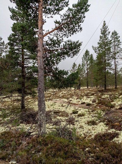
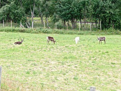
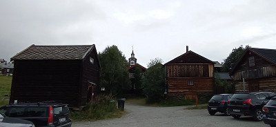
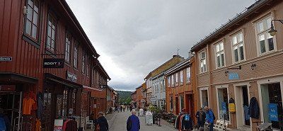
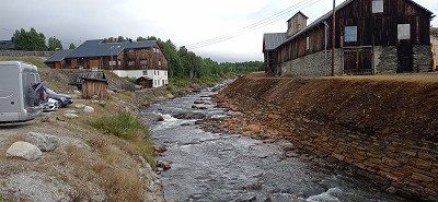

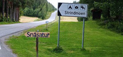
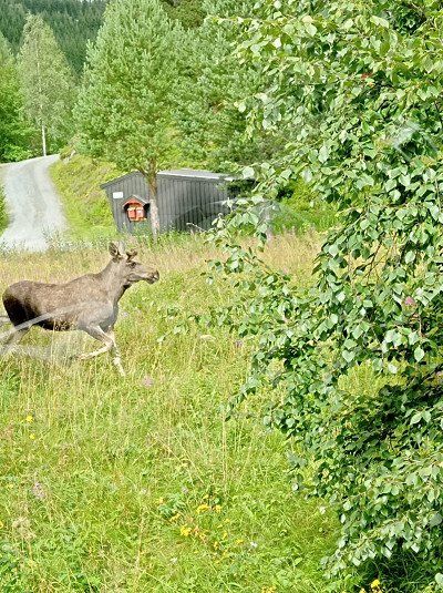
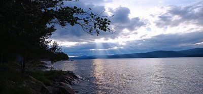
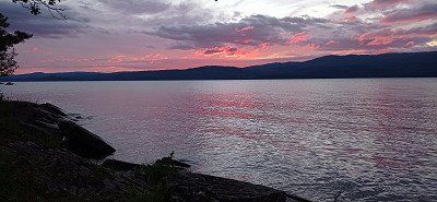
First we drove past the 28 at the Fermundensee. We touched the Fermundsmarka National Park with many beautiful lakes and rich in forest. We stopped in the UNESCO World Heritage town of Røros. An interesting place with its wooden houses blackened by copper quarrying. The place looks rustic but well-kept. And environmentally conscious with the grass-covered roofs. We enjoyed delicious cocoa and, for the first time, the cinnamon rolls known for Norway in a quaint little café. We paid parking fees, but unfortunately found out later that you could have parked for free at the museum of the old copper factory. From Røros we drove over the 30 along the river Gaula. We touched the foothills of the Forollhogna National Park with its mountain birch slopes. The vegetation there is covered with lichens. Everything shimmered bright green. On the way we were greeted by 4 reindeer and 1 moose. He came towards us on the road and then crossed. A snapshot succeeded. There are various farms and huts in the Gaudalental. Sheep often graze right next to the road. At Støren we drove onto the E6 and passed Trondheim and then the fjord of the same name. We stayed at Strindmoen campsite by Snåsvatnet. The campsite is simple but clean. An underpass leads to the lake, where we photographed a beautiful sunset. At the back of the site, a small waterfall rushes towards the lake. Despite the train and road, we slept well. The morning shower was okay too.


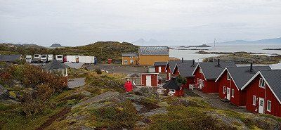
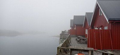

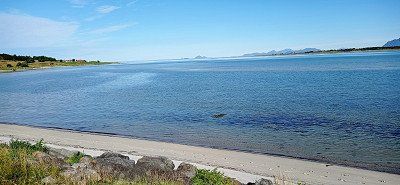
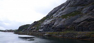
It was very windy during the day. So we parked the mobile home near the reception. Despite the wind and light rain, we hiked from the Sto pitch in the direction of Nyksund to the sandy beach of Skipssand. The Dronningruta hike is slightly difficult and not easy because of the damp paths, but it was fun. In the evening the storm increased. It got so violent that we drove off the site and parked the camper on the unpaved parking lot in front of it. There it was somewhat more protected by rocks in front of it. A little later other campers followed our example. Nevertheless, the storm tugged at our nerves all night. But everything went well.

It was very windy during the day. So we parked the mobile home near the reception. Despite the wind and light rain, we hiked from the Sto pitch in the direction of Nyksund to the sandy beach of Skipssand. The Dronningruta hike is slightly difficult and not easy because of the damp paths, but it was fun. In the evening the storm increased. It got so violent that we drove off the site and parked the camper on the unpaved parking lot in front of it. There it was somewhat more protected by rocks in front of it. A little later other campers followed our example. Nevertheless, the storm tugged at our nerves all night. But everything went well.
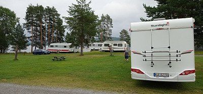
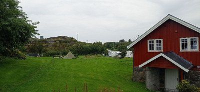
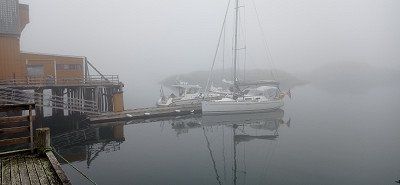
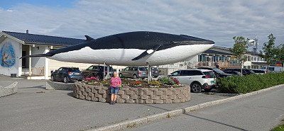
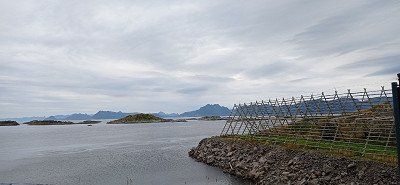
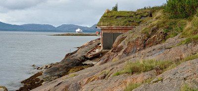
Two nights were enough for us at the square in Stø. Therefore, we accepted a somewhat longer journey and stayed for one night at the well-kept and idyllic Oppmyre Camping site near Myre with its exemplary equipped and clean sanitary facilities. Each camper pitch with a view of the fjord is assigned a wooden platform as a terrace. On Wednesday the sun was shining and we were finally able to take part in the whale safari. The sea was still rough. The pills offered by the organizer helped us. The team tried very hard and so we were able to experience Finn whales, sperm whales and killer whales in the wild. We saw several groups of orcas. The tour was rounded off with a sighting of some white-tailed eagles. Overall an impressive experience. Unfortunately, everyone wanted to take the best photo and make the most beautiful film, just like us, of course. That's why there was always a big crowd at the railing.
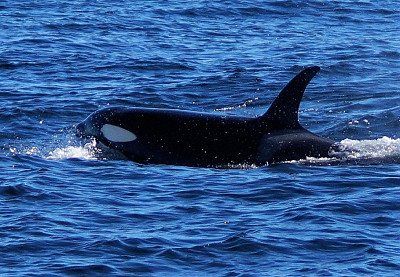
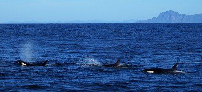

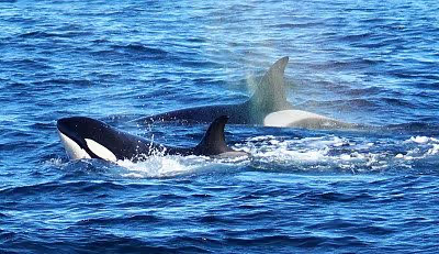
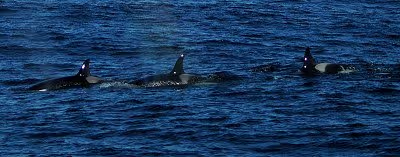
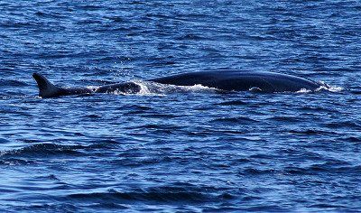
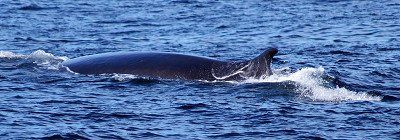
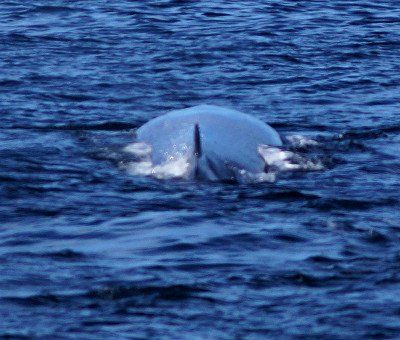
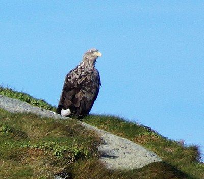
Two nights were enough for us at the square in Stø. Therefore, we accepted a somewhat longer journey and stayed for one night at the well-kept and idyllic Oppmyre Camping site near Myre with its exemplary equipped and clean sanitary facilities. Each camper pitch with a view of the fjord is assigned a wooden platform as a terrace. On Wednesday the sun was shining and we were finally able to take part in the whale safari. The sea was still rough. The pills offered by the organizer helped us. The team tried very hard and so we were able to experience Finn whales, sperm whales and killer whales in the wild. We saw several groups of orcas. The tour was rounded off with a sighting of some white-tailed eagles. Overall an impressive experience. Unfortunately, everyone wanted to take the best photo and make the most beautiful film, just like us, of course. That's why there was always a big crowd at the railing.

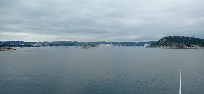
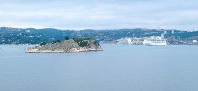
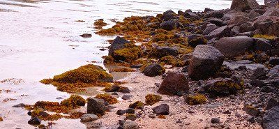
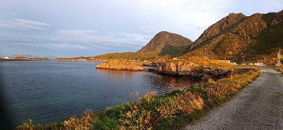
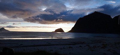
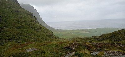
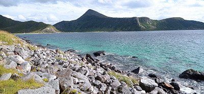
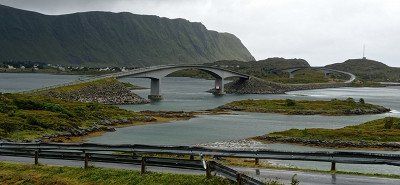
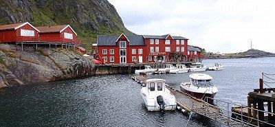
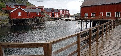
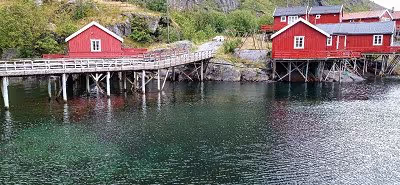
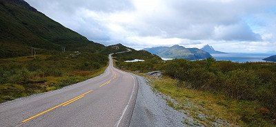
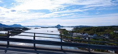
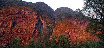
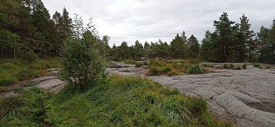
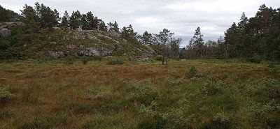
In the morning the sun shone from a deep blue sky. We drove on through a picture book landscape. The destination was the fishing village of Henningsvær. Passing a dream beach and high cliffs, we reached the parking lot in front of the bridge. 2 hours free parking time. So walk over the bridge and look at the place. Worth seeing in the port. We walked to the rorbuer, but it wasn't worth it. Back to the car, time was running out. At the parking lot there was already a check by the municipality. It was just enough. The goal was supposed to be Gimsøysand, but somehow we missed it. So we ended up in Eggum. The access to the nature reserve and the parking space can be reached through a gate. If you continue through it, you get to the kiosk below the tower built by the Germans during the war, now a ruin. In the kiosk you pay for the parking space and can use the toilet. We had a great view of the sea and hiked towards Unstad. Many sheep could be seen, some of which populated high cliffs. We took a look at the artwork Head. And there is also much else to see. At that time it was not crowded. In the evening the play of light is overwhelming.


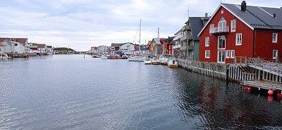
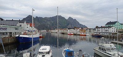
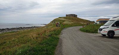

In the morning the sun shone from a deep blue sky. We drove on through a picture book landscape. The destination was the fishing village of Henningsvær. Passing a dream beach and high cliffs, we reached the parking lot in front of the bridge. 2 hours free parking time. So walk over the bridge and look at the place. Worth seeing in the port. We walked to the rorbuer, but it wasn't worth it. Back to the car, time was running out. At the parking lot there was already a check by the municipality. It was just enough. The goal was supposed to be Gimsøysand, but somehow we missed it. So we ended up in Eggum. The access to the nature reserve and the parking space can be reached through a gate. If you continue through it, you get to the kiosk below the tower built by the Germans during the war, now a ruin. In the kiosk you pay for the parking space and can use the toilet. We had a great view of the sea and hiked towards Unstad. Many sheep could be seen, some of which populated high cliffs. We took a look at the artwork Head. And there is also much else to see. At that time it was not crowded. In the evening the play of light is overwhelming.
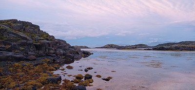
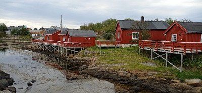
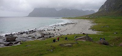
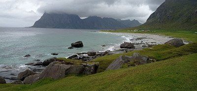
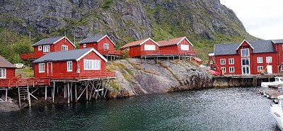
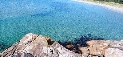
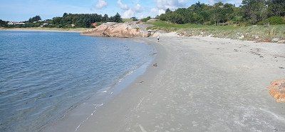
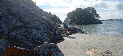
From Eggum we first drove to the Winking Museum near Borg. Interestingly presented and very suitable for some nice pictures. Then we got to Haukland Beach, a real dream beach. As previously read, we pulled onto a lawn in front of the beach after removing the driveway rope. As announced, it wasn't long before an older gentleman came to collect the money. There was no service, but the location encouraged us to stay 2 nights. A first walk on the beach let us experience wonderful views. And as before, our enthusiasm for nature increased in the evening.
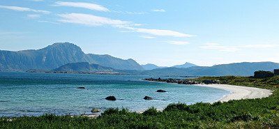
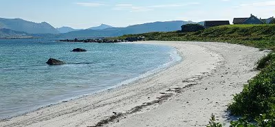

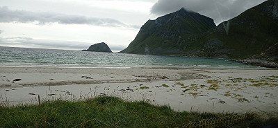
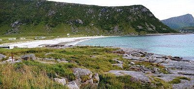
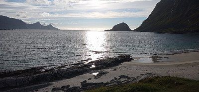
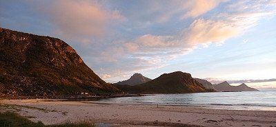
From Eggum we first drove to the Winking Museum near Borg. Interestingly presented and very suitable for some nice pictures. Then we got to Haukland Beach, a real dream beach. As previously read, we pulled onto a lawn in front of the beach after removing the driveway rope. As announced, it wasn't long before an older gentleman came to collect the money. There was no service, but the location encouraged us to stay 2 nights. A first walk on the beach let us experience wonderful views. And as before, our enthusiasm for nature increased in the evening.
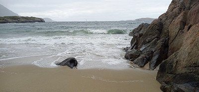
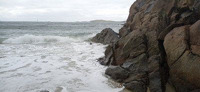
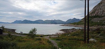
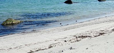
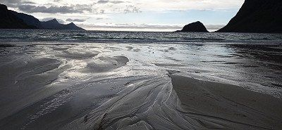
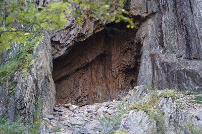
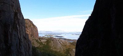
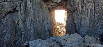
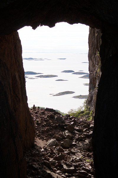
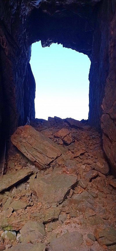
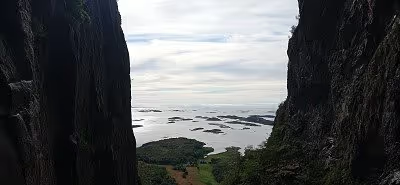
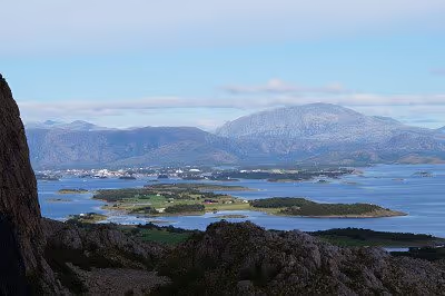
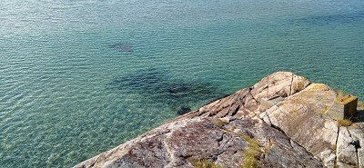
For the 27.8. we decided to hike to Uttakleiv Beach. We first chose the route over the mountain. It went up steeply and partly over larger steps and rocks. You should be sure-footed and have non-slip shoes. Because rain was announced, we also took weatherproof clothing with us, which was worth it. Above the ridge it started to rain and it stormed quite well too. We avoided the climb to Mannen and hiked down to Uttakleiv beach. We found shelter in a cave with a bench and took a break. The view of the also great beach cheered us up. When the weather improved, we went back via the Uttakleiv parking space around the mountain. Great motifs everywhere. In the evening we went to the parking space there for the purpose of disposal and supply. You can get to it through a tunnel. The road ends behind the beach. We had to pay double for taking in water. We felt that as a rip off, especially since no sign pointed out. Nevertheless, we experienced a wonderful evening on the Haukland beach when the weather was nice.
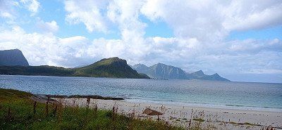
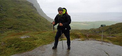
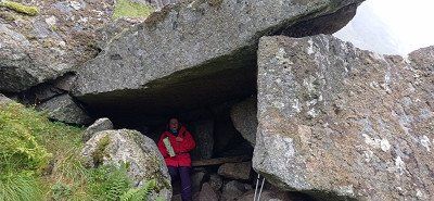
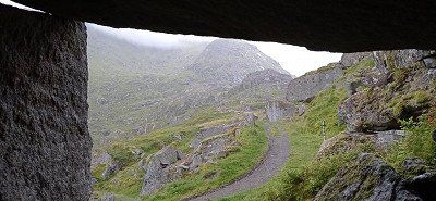
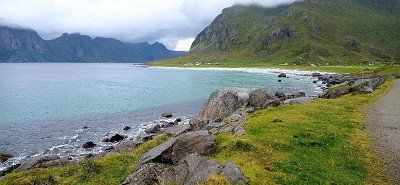
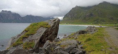
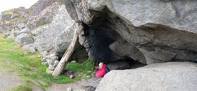
For the 27.8. we decided to hike to Uttakleiv Beach. We first chose the route over the mountain. It went up steeply and partly over larger steps and rocks. You should be sure-footed and have non-slip shoes. Because rain was announced, we also took weatherproof clothing with us, which was worth it. Above the ridge it started to rain and it stormed quite well too. We avoided the climb to Mannen and hiked down to Uttakleiv beach. We found shelter in a cave with a bench and took a break. The view of the also great beach cheered us up. When the weather improved, we went back via the Uttakleiv parking space around the mountain. Great motifs everywhere. In the evening we went to the parking space there for the purpose of disposal and supply. You can get to it through a tunnel. The road ends behind the beach. We had to pay double for taking in water. We felt that as a rip off, especially since no sign pointed out. Nevertheless, we experienced a wonderful evening on the Haukland beach when the weather was nice.
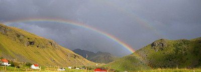

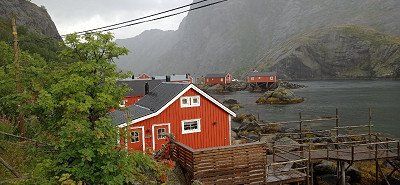
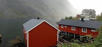
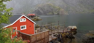
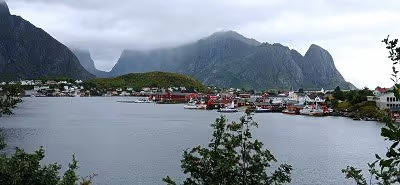
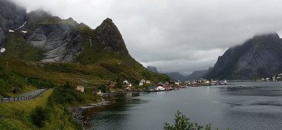
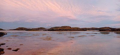
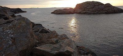
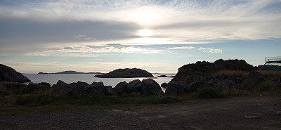
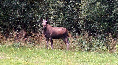
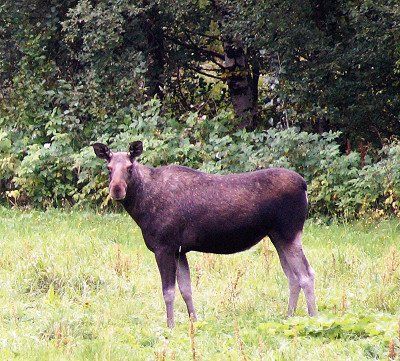
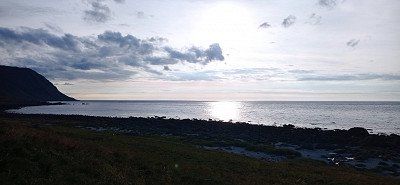
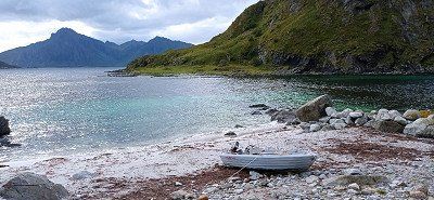
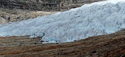
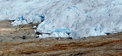
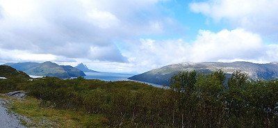
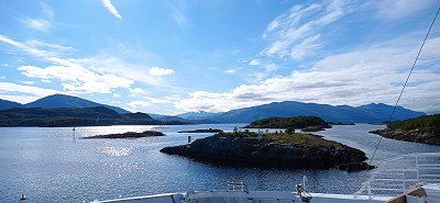
The Lofoten said goodbye to us with a beautiful rainbow 🌈 over Reine. The free disposal station there is really exemplary. Thanks for that. We took the Moskenes ferry to Bodø. From there we made a detour to Saltstraumen, the strongest tidal current in Europe, but found it not very spectacular, at least during our visit. Then we made kilometers and drove via Fauske and on the E36 towards Svartisengletscher. On the way, my wife spotted two mooses in a meadow. At Røssvoll a road led to the glacier. We parked in a forest parking lot in pretty much solitude. Only a Bulli with bikers parked nearby. The access road stretches. It is advisable to take the driveway to the pier. There are nice pitches there, but we didn't know that. Contrary to the announcement, the boat did not cross the lake in the last days of August. Hiking was announced for the next day...
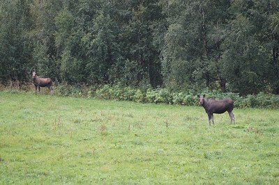
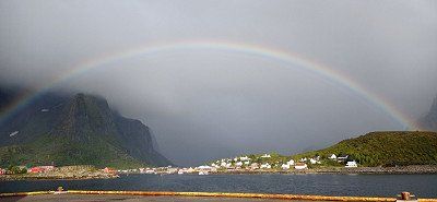
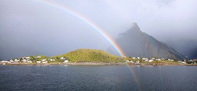
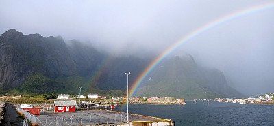

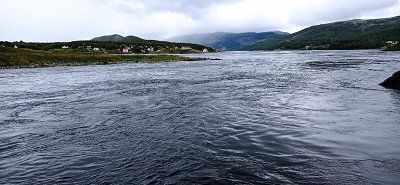
The Lofoten said goodbye to us with a beautiful rainbow 🌈 over Reine. The free disposal station there is really exemplary. Thanks for that. We took the Moskenes ferry to Bodø. From there we made a detour to Saltstraumen, the strongest tidal current in Europe, but found it not very spectacular, at least during our visit. Then we made kilometers and drove via Fauske and on the E36 towards Svartisengletscher. On the way, my wife spotted two mooses in a meadow. At Røssvoll a road led to the glacier. We parked in a forest parking lot in pretty much solitude. Only a Bulli with bikers parked nearby. The access road stretches. It is advisable to take the driveway to the pier. There are nice pitches there, but we didn't know that. Contrary to the announcement, the boat did not cross the lake in the last days of August. Hiking was announced for the next day...
In the morning the neighboring Bulli drove away. We ourselves wanted to go to the glacier and first walked 2 km along the access road. We got to the jetty, but found that it was closed. We also saw that this was the actual parking space. We had seen a machine on the access road where you could probably have paid for the parking time. As it was, it didn't cost us anything apart from Kraft... But the latter should still play a role. A sign in the deserted place pointed out that a path along the lake leads to the jetty and from there to the glacier. Distance 14 km there and back. Since my wife didn't trust herself, I wanted to go alone. The next moment, however, a van with a couple from Eschwege drove up. They also actually wanted to use the boat. Since it was no longer driving, we men decided to set off together. It then went constantly uphill and downhill, past ponds, through morass, over and under branches and was very exhausting. The women also hiked a bit along the lake. Already on the way there I found it very exhausting. As the path seemed unending, we finally got to the boat dock. Now there were still 3 kilometers over rock slabs and climbs. Then finally the glacier... Great to look at in its blue. My companion was very fit and ran all the way to the glacier. I myself took photos from a distance. I rested because the same difficult path had to be walked back. I honestly have to admit that I reached my limits during the hike. Several pauses for breath were necessary. I was grateful to my companion for being by my side. I made it back anyway, but was exhausted. I would probably not have visited the glacier alone and would have turned back. However, we also met young people who could manage this route well. At my age, however, I found it difficult. And our women were pretty exhausted too. We gratefully accepted the offer to ride in the van to our Womo. From the parking lot we only drove to Røssvoll, where we rested on the beautiful pitch.
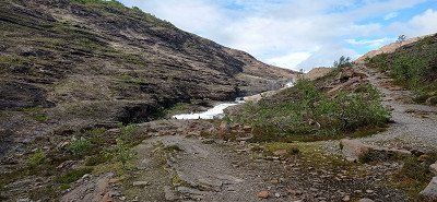
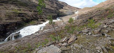

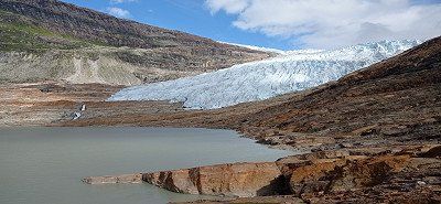
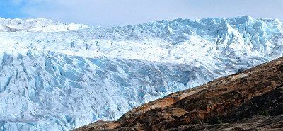
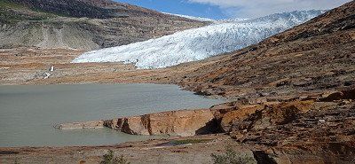
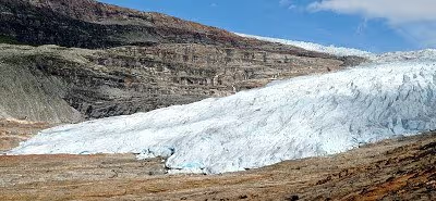
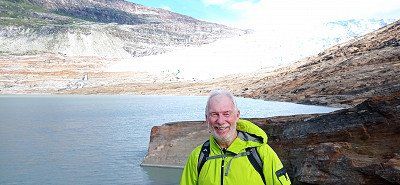
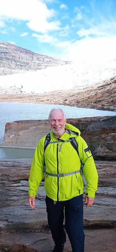
In the morning the neighboring Bulli drove away. We ourselves wanted to go to the glacier and first walked 2 km along the access road. We got to the jetty, but found that it was closed. We also saw that this was the actual parking space. We had seen a machine on the access road where you could probably have paid for the parking time. As it was, it didn't cost us anything apart from Kraft... But the latter should still play a role. A sign in the deserted place pointed out that a path along the lake leads to the jetty and from there to the glacier. Distance 14 km there and back. Since my wife didn't trust herself, I wanted to go alone. The next moment, however, a van with a couple from Eschwege drove up. They also actually wanted to use the boat. Since it was no longer driving, we men decided to set off together. It then went constantly uphill and downhill, past ponds, through morass, over and under branches and was very exhausting. The women also hiked a bit along the lake. Already on the way there I found it very exhausting. As the path seemed unending, we finally got to the boat dock. Now there were still 3 kilometers over rock slabs and climbs. Then finally the glacier... Great to look at in its blue. My companion was very fit and ran all the way to the glacier. I myself took photos from a distance. I rested because the same difficult path had to be walked back. I honestly have to admit that I reached my limits during the hike. Several pauses for breath were necessary. I was grateful to my companion for being by my side. I made it back anyway, but was exhausted. I would probably not have visited the glacier alone and would have turned back. However, we also met young people who could manage this route well. At my age, however, I found it difficult. And our women were pretty exhausted too. We gratefully accepted the offer to ride in the van to our Womo. From the parking lot we only drove to Røssvoll, where we rested on the beautiful pitch.
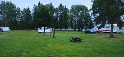
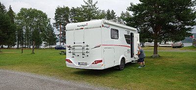
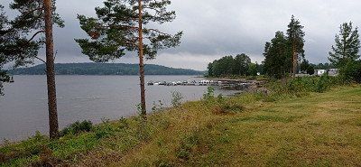
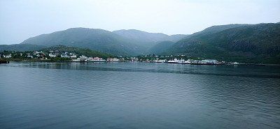
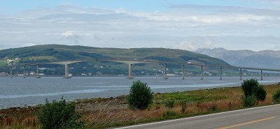
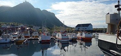
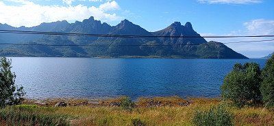
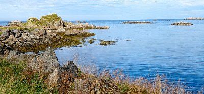
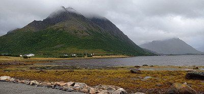
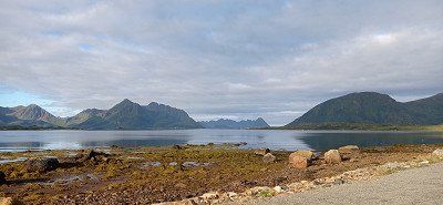
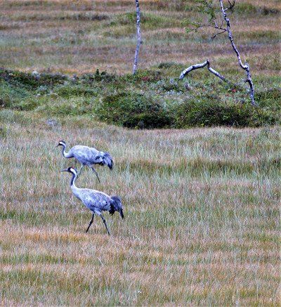
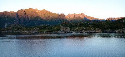
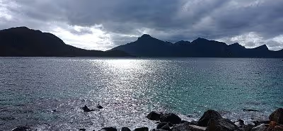
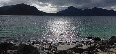
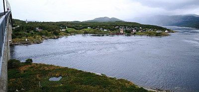
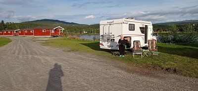
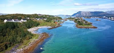
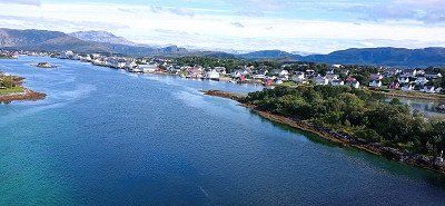
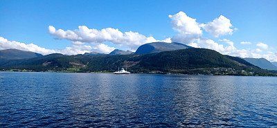
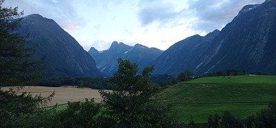
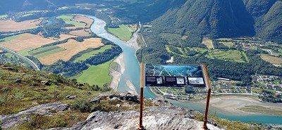
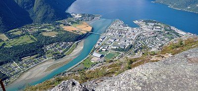
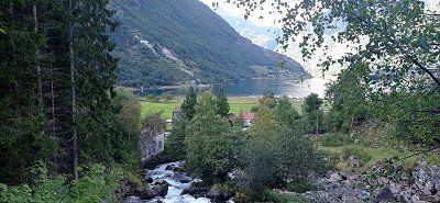
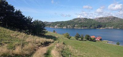
Røssvoll Camping is a nice site with good sanitary facilities. We were able to observe several cranes on a meadow across a small lake. On 08/31 we drove first to Mo i Rana, where we filled up gas. We wanted to avoid Trondheim with some construction sites and turned to the coast. The weather should get better there. From Nesna we took the ferry to Levang. From there it went on over the Helgelandsbrua. It leads across the Leirfjord and onto the island of Alsta. This island is dominated by the 1000m high mountains called the Seven Sisters. We chose a pitch directly opposite the mountains, Camping Sandnessjøen. In the evening the mountains were still clouded. However, the pitch right by the sea still allowed wonderful views.
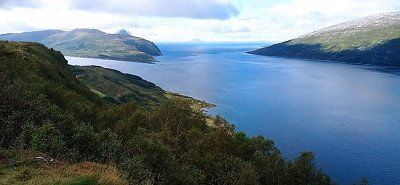
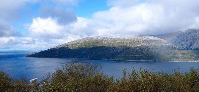
Røssvoll Camping is a nice site with good sanitary facilities. We were able to observe several cranes on a meadow across a small lake. On 08/31 we drove first to Mo i Rana, where we filled up gas. We wanted to avoid Trondheim with some construction sites and turned to the coast. The weather should get better there. From Nesna we took the ferry to Levang. From there it went on over the Helgelandsbrua. It leads across the Leirfjord and onto the island of Alsta. This island is dominated by the 1000m high mountains called the Seven Sisters. We chose a pitch directly opposite the mountains, Camping Sandnessjøen. In the evening the mountains were still clouded. However, the pitch right by the sea still allowed wonderful views.


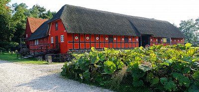
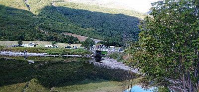
We drove back and took the turn onto the 680. We used the Tommervag - Seivika and Solsnes - Arfarnes ferries and drove past the Tingvollfjord. From there on to Andalsnes. On the way we particularly liked the island of Aure. Magnificent views. We were also particularly taken with the Stemshaus Kyrkje in its bright red. By the way, there is a well-kept toilet in the outbuilding that can be used by visitors. The evening at Camping Mjelva in Andalsnes turned into a red-orange dream. The mountains literally glowed. The campsite itself has everything you need. We had a beautiful view of the valley from the mountain.
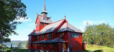
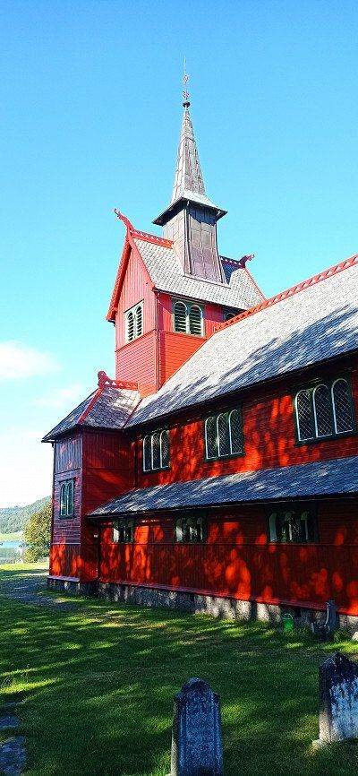
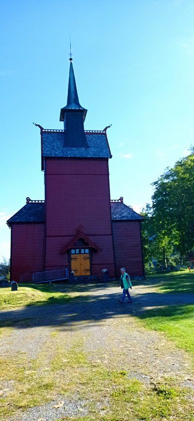
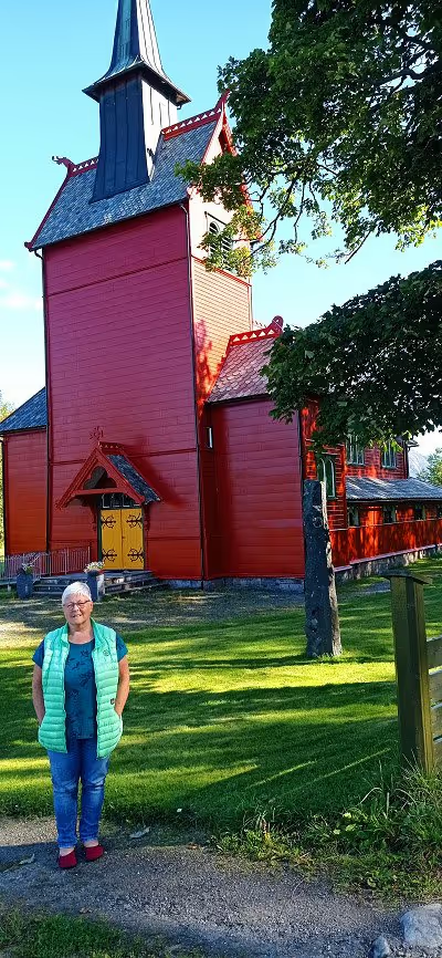
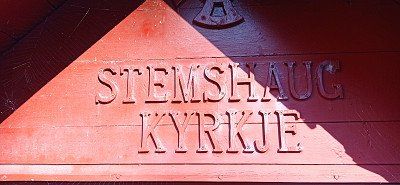

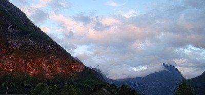
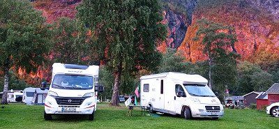
We drove back and took the turn onto the 680. We used the Tommervag - Seivika and Solsnes - Arfarnes ferries and drove past the Tingvollfjord. From there on to Andalsnes. On the way we particularly liked the island of Aure. Magnificent views. We were also particularly taken with the Stemshaus Kyrkje in its bright red. By the way, there is a well-kept toilet in the outbuilding that can be used by visitors. The evening at Camping Mjelva in Andalsnes turned into a red-orange dream. The mountains literally glowed. The campsite itself has everything you need. We had a beautiful view of the valley from the mountain.
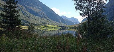
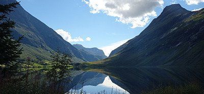
On Sunday morning we went to the Romsdalen gondola and booked the one-way trip up Mount Nesaksla. Before that, we went to the small chapel in a wagon on the platform and stopped for a moment. From the top of Nesaksla at 1679 m, there is an outstanding view of the mountaineering village, the Rauma River and the Isfjord. We wanted to walk down to the Rampestekken viewing platform. For my wife, the descent was difficult because of the steep and high steps, especially at the beginning. I wouldn't recommend the descent in wet weather. Especially in the first third below the summit, the descent was not entirely without danger from our point of view, especially since the climb runs directly on the slope. Nevertheless, we also made it to the platform. After a short wait we were able to go to the front, take great pictures and enjoy the view for a moment. Since it is heavily frequented by hikers as a platform, we only stayed there for a short time. After that it was a little easier downhill over steps and tree roots. Finally, a metal ramp showed us that we were approaching the starting point. We reached our mobile home just before the parking time expired. We continued our journey and had planned to drive over the Trollstigen for the day.
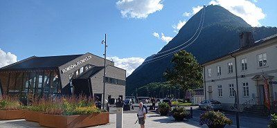


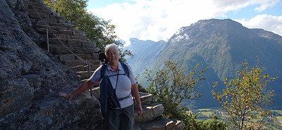

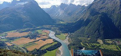
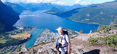
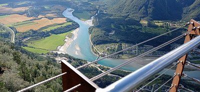
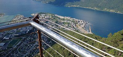
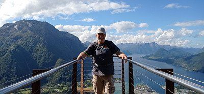
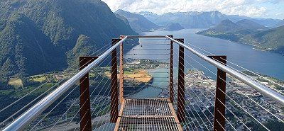
On Sunday morning we went to the Romsdalen gondola and booked the one-way trip up Mount Nesaksla. Before that, we went to the small chapel in a wagon on the platform and stopped for a moment. From the top of Nesaksla at 1679 m, there is an outstanding view of the mountaineering village, the Rauma River and the Isfjord. We wanted to walk down to the Rampestekken viewing platform. For my wife, the descent was difficult because of the steep and high steps, especially at the beginning. I wouldn't recommend the descent in wet weather. Especially in the first third below the summit, the descent was not entirely without danger from our point of view, especially since the climb runs directly on the slope. Nevertheless, we also made it to the platform. After a short wait we were able to go to the front, take great pictures and enjoy the view for a moment. Since it is heavily frequented by hikers as a platform, we only stayed there for a short time. After that it was a little easier downhill over steps and tree roots. Finally, a metal ramp showed us that we were approaching the starting point. We reached our mobile home just before the parking time expired. We continued our journey and had planned to drive over the Trollstigen for the day.
We drove through the valley from Andalsnes, past the Trollveggen wall. We stopped briefly in a parking lot in front of the Trollstigen driveway. The sight of the 12 hairpin bends running along the steep flank commanded our respect. Nevertheless, we dared the journey. With the camper it went steeply uphill through the 12 hairpin bends. Not without encountering oncoming vehicles, of course. Somehow our counterpart or we always found an alternative. The side view of the abyss is exciting. When we got there we parked in the parking lot. Buses also arrive there, whose users also want to go to the viewing platforms above the Trollstigen. Like them, we took beautiful photos and videos. Then we had released enough adrenaline for the day and looked for a nice parking lot in the fell of the Reinheimen National Park. We found what we were looking for at a small lake.
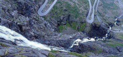
We drove through the valley from Andalsnes, past the Trollveggen wall. We stopped briefly in a parking lot in front of the Trollstigen driveway. The sight of the 12 hairpin bends running along the steep flank commanded our respect. Nevertheless, we dared the journey. With the camper it went steeply uphill through the 12 hairpin bends. Not without encountering oncoming vehicles, of course. Somehow our counterpart or we always found an alternative. The side view of the abyss is exciting. When we got there we parked in the parking lot. Buses also arrive there, whose users also want to go to the viewing platforms above the Trollstigen. Like them, we took beautiful photos and videos. Then we had released enough adrenaline for the day and looked for a nice parking lot in the fell of the Reinheimen National Park. We found what we were looking for at a small lake.
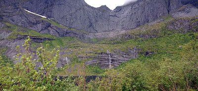
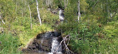
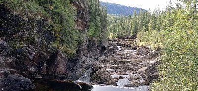
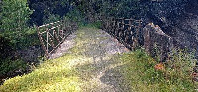
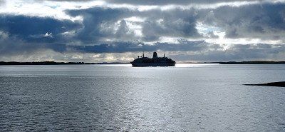
After spending the night in Reinheimen National Park, we continued towards Geiranger. We came to Gudbrands Juvet, a narrow gorge with a waterfall. Equally impressive is the metal path laid out by the Norwegians. Nearby a cafe, which is also approached by coaches. We just looked at the waterfall and drove on. We crossed the Storfjord with the ferry Linge - Eidsdal. On the 63 we passed the beautiful lake Eidsvatnet. Here the water is as smooth as glass and the surrounding mountains are reflected in it. Almost as impressive as the trip over the Trollstigen was the tour down to Geiranger with just as sharp curves and hairpin bends. We had to avoid a vantage point because it was covered with buses and other campers. However, we were able to enjoy great views of the Geirangerfjord during the trip. "Mein Schiff" with a smoking chimney can already be seen from afar. The valley was fogged. In the valley itself we then saw the huge Costa Diadema lying at anchor. In contrast, "Mein Schiff" still looked small. We continued through the village towards Vinje Caming above. There we quartered ourselves. In the course of visiting Geiranger, we met a large number of ship tourists. The place was quite busy. Still, we think it's worth seeing. There is a parking space directly on the lake in the village. Nicely located, but we prefer it a little off the beaten track. After delicious soft ice cream and shopping for stuffed trolls for the grandchildren, we took the hiking trail past the roaring waterfall back to the campsite. Vinje Camping has several straight pitches with electricity. Since we didn't need it, we stood on the grass. Despite our wedges, it wasn't easy to stand there straight. So the places with electricity are recommended...
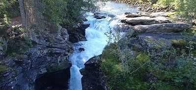
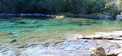
After spending the night in Reinheimen National Park, we continued towards Geiranger. We came to Gudbrands Juvet, a narrow gorge with a waterfall. Equally impressive is the metal path laid out by the Norwegians. Nearby a cafe, which is also approached by coaches. We just looked at the waterfall and drove on. We crossed the Storfjord with the ferry Linge - Eidsdal. On the 63 we passed the beautiful lake Eidsvatnet. Here the water is as smooth as glass and the surrounding mountains are reflected in it. Almost as impressive as the trip over the Trollstigen was the tour down to Geiranger with just as sharp curves and hairpin bends. We had to avoid a vantage point because it was covered with buses and other campers. However, we were able to enjoy great views of the Geirangerfjord during the trip. "Mein Schiff" with a smoking chimney can already be seen from afar. The valley was fogged. In the valley itself we then saw the huge Costa Diadema lying at anchor. In contrast, "Mein Schiff" still looked small. We continued through the village towards Vinje Caming above. There we quartered ourselves. In the course of visiting Geiranger, we met a large number of ship tourists. The place was quite busy. Still, we think it's worth seeing. There is a parking space directly on the lake in the village. Nicely located, but we prefer it a little off the beaten track. After delicious soft ice cream and shopping for stuffed trolls for the grandchildren, we took the hiking trail past the roaring waterfall back to the campsite. Vinje Camping has several straight pitches with electricity. Since we didn't need it, we stood on the grass. Despite our wedges, it wasn't easy to stand there straight. So the places with electricity are recommended...
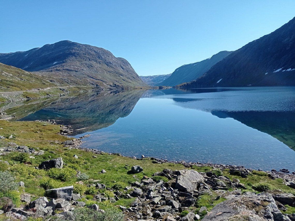
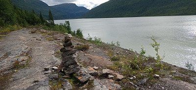
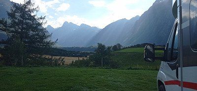
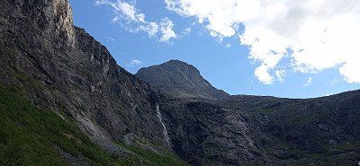
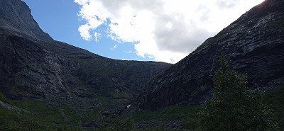
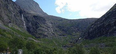
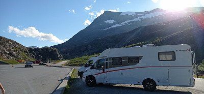
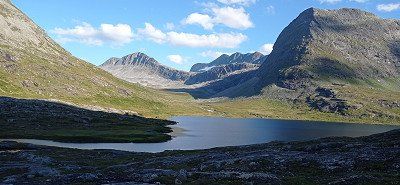
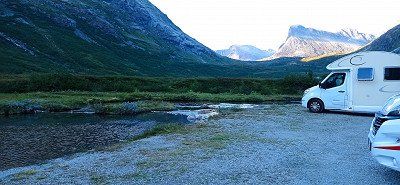
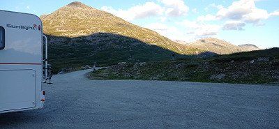
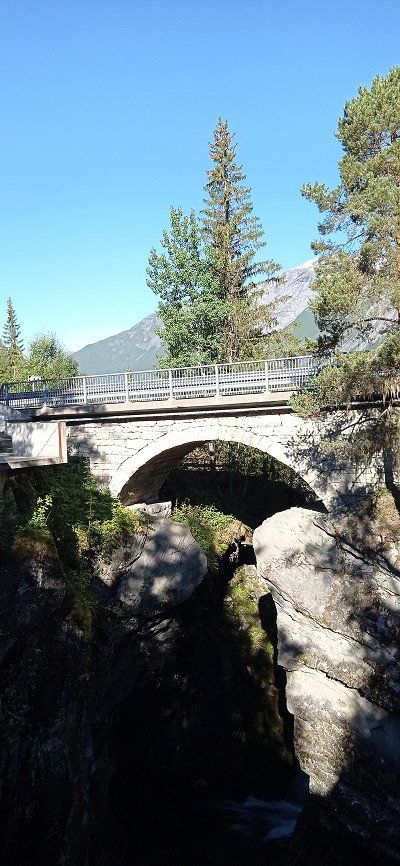
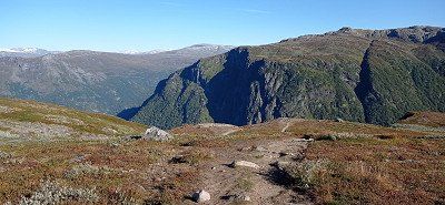
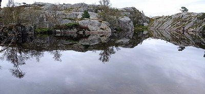
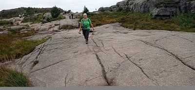
From Geiranger we first drove to the Dalsnibba viewpoint. The drive up is again narrow and winding. In addition, the ascent is subject to a fee. There is a larger car park at the top and the view of the Geirangerfjord is outstanding. There is the possibility to climb over stones and rocks a little way from the parking lot and take great photos. Then we drove the 15 via Grotli and past Lake Otta to the stave church in Lom. We visited the beautiful wooden church and then continued on the Sognefjell Road (55) through the high mountains of the Sognefjell in the Jotunheimen National Park, which are well worth seeing. We passed the hiker's hut Sognefjellshytta, near the Galdhopiggen. The high mountains left an impression on us, as the landscape there is of fascinating beauty. When we went downhill again, we spent the night in a lonely little parking lot by a small river on 55th Street.
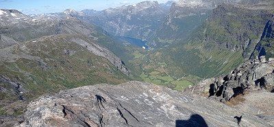
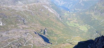
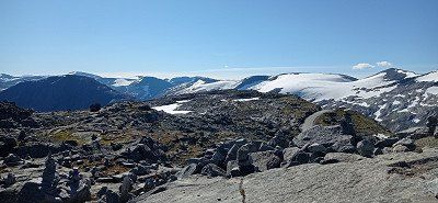
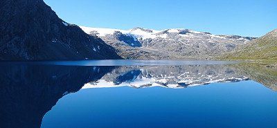
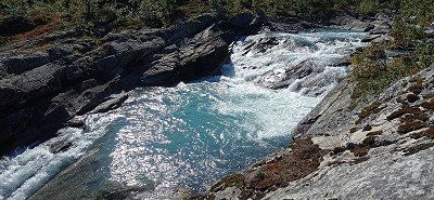
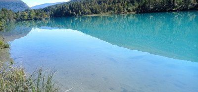
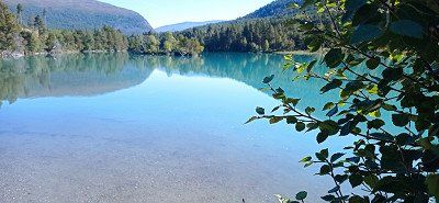
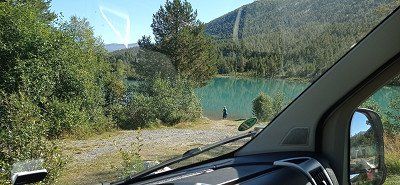
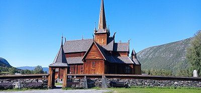
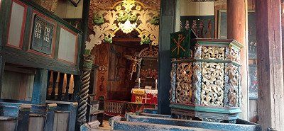
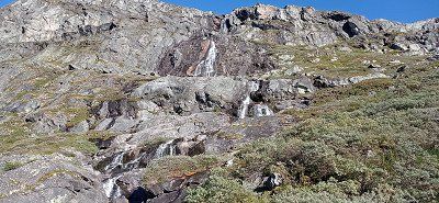
From Geiranger we first drove to the Dalsnibba viewpoint. The drive up is again narrow and winding. In addition, the ascent is subject to a fee. There is a larger car park at the top and the view of the Geirangerfjord is outstanding. There is the possibility to climb over stones and rocks a little way from the parking lot and take great photos. Then we drove the 15 via Grotli and past Lake Otta to the stave church in Lom. We visited the beautiful wooden church and then continued on the Sognefjell Road (55) through the high mountains of the Sognefjell in the Jotunheimen National Park, which are well worth seeing. We passed the hiker's hut Sognefjellshytta, near the Galdhopiggen. The high mountains left an impression on us, as the landscape there is of fascinating beauty. When we went downhill again, we spent the night in a lonely little parking lot by a small river on 55th Street.
We drove on 07.09. a bit back on the 55 and then drive onto the Tindevegen, a toll road. A mistake from our point of view, because the area is interspersed with power lines and pylons. All in all, this street didn't seem so attractive to us, of course we were a bit spoiled. In addition, the hairpin bends at the end and just before Øvre Årdal are extremely tight and stressful. A bit annoyed, we then drove on the 53, the 5 and the E16 towards Aurlandsfjord. The trip through the almost 25 km long Laerdals tunnel with its 3 colorfully lit "cathedrals" is definitely spectacular. The curves to the Stegastein vantage point are similarly tight and technically challenging, but have to be accepted for an enchanting view. When you get to the top, there is a lot going on. Now in September probably not as dramatic as in summer. But the platform offers a magnificent view over the Aurlandsfjord. You can also sit on the toilet and enjoy the view of the valley through a pane of glass. It's not everywhere either. Almost nothing went back. We were in a column of 5 when a car came towards us. Too narrow to pass, he had to reverse and got into a gully on the mountain, causing his vehicle to lift off in front. Ultimately, however, he managed to pull back to an alternative. Similar bottlenecks must always be expected. This was also the case on our trip to Nærøyfjorden Camping in Bakka. First a construction site, then through a narrow tunnel and further along a narrow path that doesn't seem to want to end. On the way almost nothing worked anymore because we met a herd of goats running free, which were also followed by two cars. Passing was only possible with mirrors folded in and maneuvering to the edge. Then a few more fears that there would be no more oncoming traffic, and you were there. The location of the course on the Nærøyfjord is overwhelming. You can rent boats and go hiking. The place does not offer disposal, but the sanitary facilities are great. We treated ourselves to sunbathing right on the fjord and enjoyed the view. Conclusion, the journey was exhausting, but it was worth it. In the evening we walk through the village and along the fjord. From here you can only go back, which is why we decide to leave as early as possible in the morning in order to have as little oncoming traffic as possible. We were able to dispose of it a short distance back at the gas station in Gudvangen.

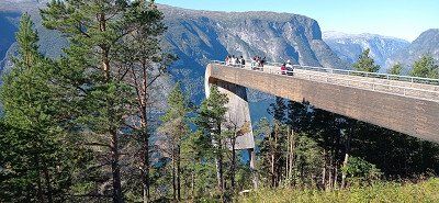
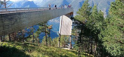
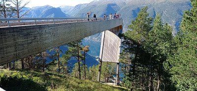
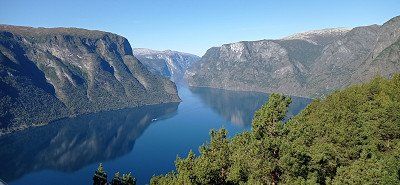
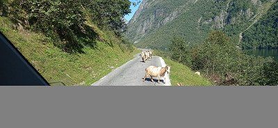
We drove on 07.09. a bit back on the 55 and then drive onto the Tindevegen, a toll road. A mistake from our point of view, because the area is interspersed with power lines and pylons. All in all, this street didn't seem so attractive to us, of course we were a bit spoiled. In addition, the hairpin bends at the end and just before Øvre Årdal are extremely tight and stressful. A bit annoyed, we then drove on the 53, the 5 and the E16 towards Aurlandsfjord. The trip through the almost 25 km long Laerdals tunnel with its 3 colorfully lit "cathedrals" is definitely spectacular. The curves to the Stegastein vantage point are similarly tight and technically challenging, but have to be accepted for an enchanting view. When you get to the top, there is a lot going on. Now in September probably not as dramatic as in summer. But the platform offers a magnificent view over the Aurlandsfjord. You can also sit on the toilet and enjoy the view of the valley through a pane of glass. It's not everywhere either. Almost nothing went back. We were in a column of 5 when a car came towards us. Too narrow to pass, he had to reverse and got into a gully on the mountain, causing his vehicle to lift off in front. Ultimately, however, he managed to pull back to an alternative. Similar bottlenecks must always be expected. This was also the case on our trip to Nærøyfjorden Camping in Bakka. First a construction site, then through a narrow tunnel and further along a narrow path that doesn't seem to want to end. On the way almost nothing worked anymore because we met a herd of goats running free, which were also followed by two cars. Passing was only possible with mirrors folded in and maneuvering to the edge. Then a few more fears that there would be no more oncoming traffic, and you were there. The location of the course on the Nærøyfjord is overwhelming. You can rent boats and go hiking. The place does not offer disposal, but the sanitary facilities are great. We treated ourselves to sunbathing right on the fjord and enjoyed the view. Conclusion, the journey was exhausting, but it was worth it. In the evening we walk through the village and along the fjord. From here you can only go back, which is why we decide to leave as early as possible in the morning in order to have as little oncoming traffic as possible. We were able to dispose of it a short distance back at the gas station in Gudvangen.
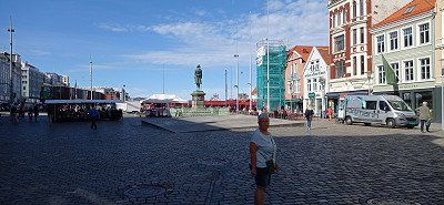
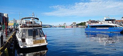
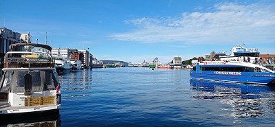
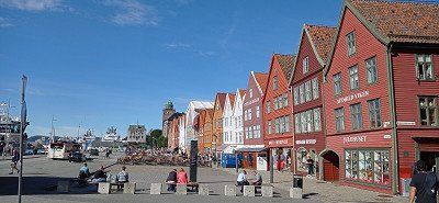
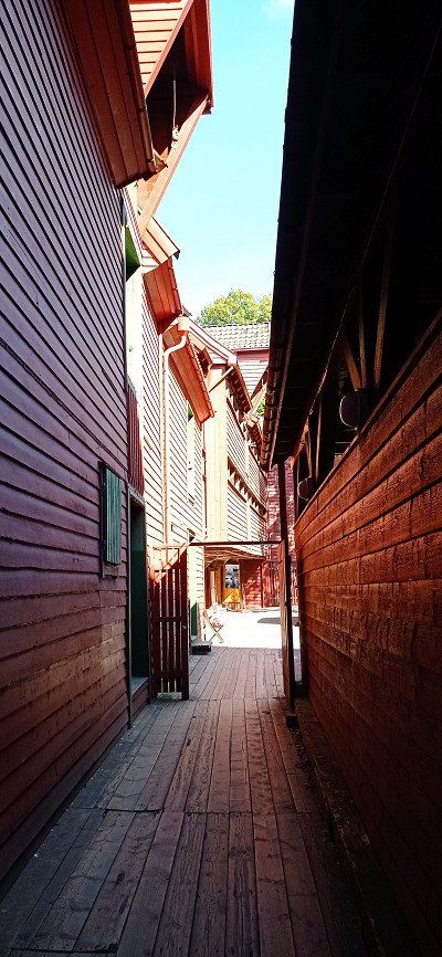
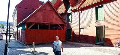

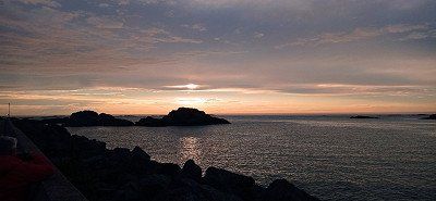
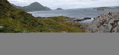
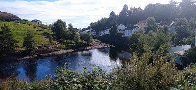
Contrary to our plan to hike the small troll tongue Himåkanå at Hindaråvåg, we decided to visit Starvanger. The reason was that not so good weather had been announced and we also wanted to turn to the Preikestolen as soon as possible. We actually wanted to leave Stavanger out, but that would have been a mistake afterwards. Because we really liked the city. We found the Gamle - old town quarter with the gray colored and flower-decorated small wooden houses particularly beautiful. The alley Øvre Holmegate with its colorful houses is also very inviting. Except for a small shower we were lucky and enjoyed the beautiful day. The Disney Magic in the harbor is also impressive with its water slides, which can be seen from the outside. The parking space at the port can be specified as an ideal starting point for a city tour. On the way to Preikestolen Camping we drove through the 14 km long Ryfylke - underwater tunnel for the first time. The evening at Camping Preikestolen, a huge area with everything you need, had a great sunset ready for us. There is a small path up a hill near and opposite the reception. Recommended for photographing a sunset.
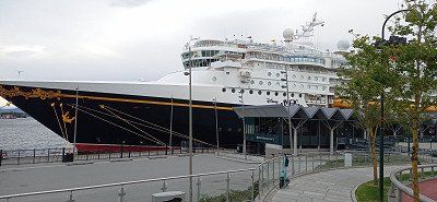
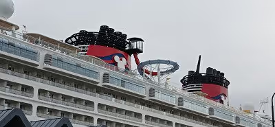
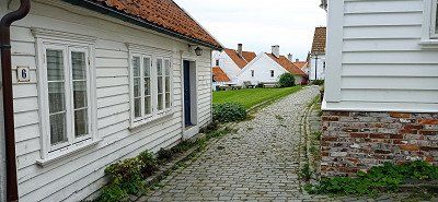
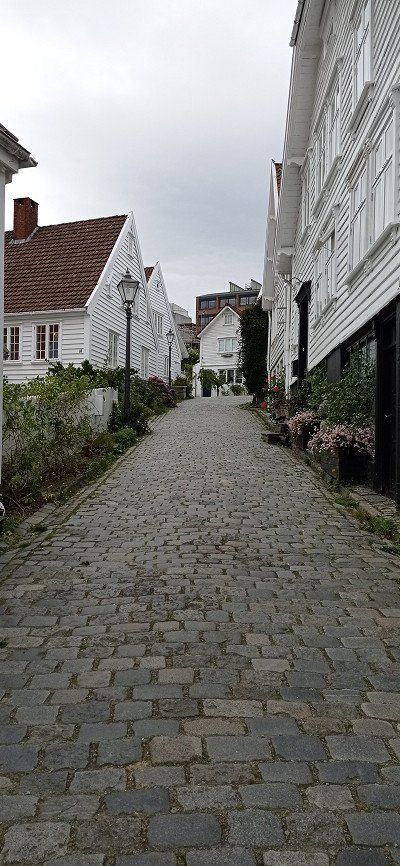
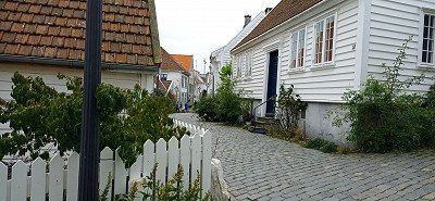
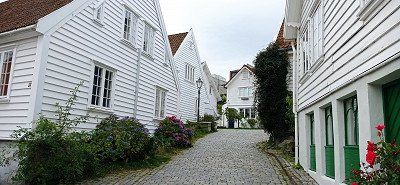
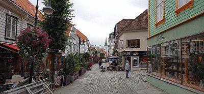
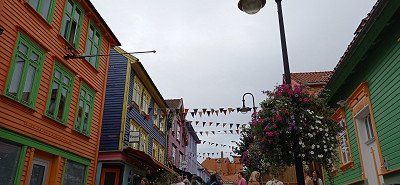
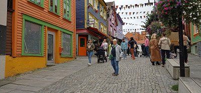
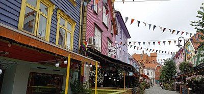
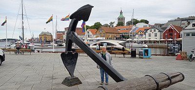
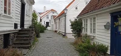
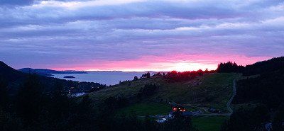
Contrary to our plan to hike the small troll tongue Himåkanå at Hindaråvåg, we decided to visit Starvanger. The reason was that not so good weather had been announced and we also wanted to turn to the Preikestolen as soon as possible. We actually wanted to leave Stavanger out, but that would have been a mistake afterwards. Because we really liked the city. We found the Gamle - old town quarter with the gray colored and flower-decorated small wooden houses particularly beautiful. The alley Øvre Holmegate with its colorful houses is also very inviting. Except for a small shower we were lucky and enjoyed the beautiful day. The Disney Magic in the harbor is also impressive with its water slides, which can be seen from the outside. The parking space at the port can be specified as an ideal starting point for a city tour. On the way to Preikestolen Camping we drove through the 14 km long Ryfylke - underwater tunnel for the first time. The evening at Camping Preikestolen, a huge area with everything you need, had a great sunset ready for us. There is a small path up a hill near and opposite the reception. Recommended for photographing a sunset.
After checking out of the campsite, we drove to the upper hiker's car park at Preikestolen. We paid the 250 NOK for the standing time and started hiking. Right at the beginning it went steeply uphill on an asphalt path. Not easy for my wife. Then continue over roots and stones to a first small stopover on a plateau with a viewpoint. It was almost like a mass migration, because many like us wanted to climb this highlight. And so it went for us, too, over footbridges that led over high moors to steeper climbs that ended on a rocky plateau. Small lakes could be admired almost at the top. Then the last climb past steep edges and you were there, at the place of longing Preikestolen. The daring had placed themselves directly on the cliff edge. We also quickly took a few "impressive" shots ourselves, in order to then have a little snack and drink break on one of the safe rocks nearby. The "pulpit" really offered a fantastic view of the Lysefjord lying deep in blue. And it was hard to resist the magic of that sheer chasm. Experienced hikers were drawn to the less frequented summit, which certainly offered other great views. But it was enough for us and we hiked back the same route. On the way we kept coming into contact with a very nice older couple from Switzerland. Simply likeable this couple and for us a nice incident on the edge. Pretty exhausted we arrived at the bottom and licked another ice cream from the kiosk. Then the journey went back through the more than 14 km long Ryfylk tunnel. The drive into the evening took us towards the lighthouse Lindesnes Fyr.

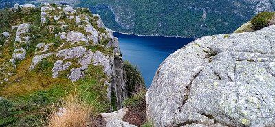
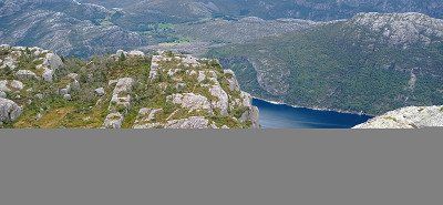
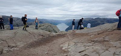
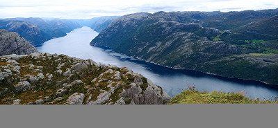
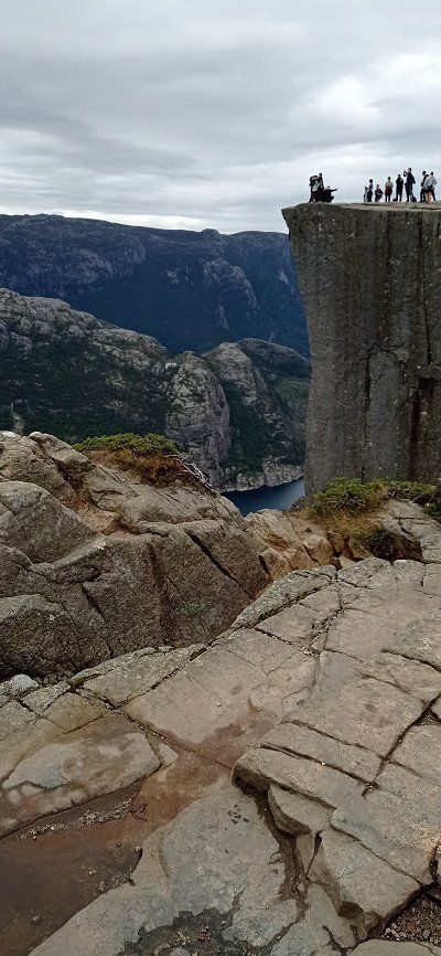
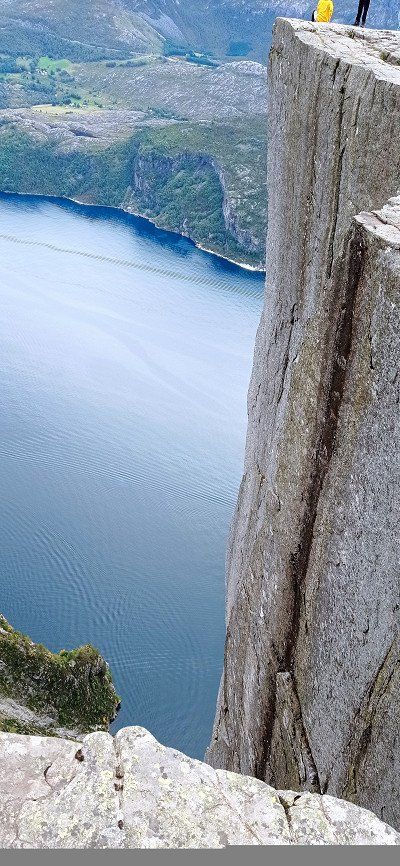
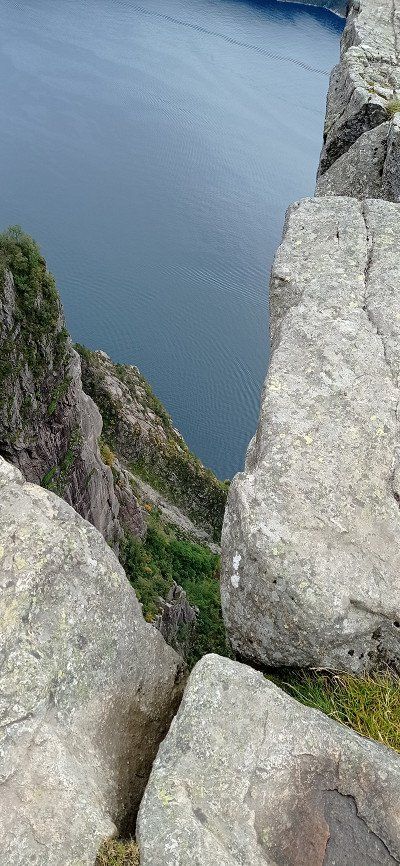
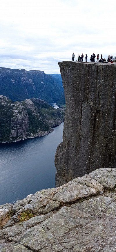

After checking out of the campsite, we drove to the upper hiker's car park at Preikestolen. We paid the 250 NOK for the standing time and started hiking. Right at the beginning it went steeply uphill on an asphalt path. Not easy for my wife. Then continue over roots and stones to a first small stopover on a plateau with a viewpoint. It was almost like a mass migration, because many like us wanted to climb this highlight. And so it went for us, too, over footbridges that led over high moors to steeper climbs that ended on a rocky plateau. Small lakes could be admired almost at the top. Then the last climb past steep edges and you were there, at the place of longing Preikestolen. The daring had placed themselves directly on the cliff edge. We also quickly took a few "impressive" shots ourselves, in order to then have a little snack and drink break on one of the safe rocks nearby. The "pulpit" really offered a fantastic view of the Lysefjord lying deep in blue. And it was hard to resist the magic of that sheer chasm. Experienced hikers were drawn to the less frequented summit, which certainly offered other great views. But it was enough for us and we hiked back the same route. On the way we kept coming into contact with a very nice older couple from Switzerland. Simply likeable this couple and for us a nice incident on the edge. Pretty exhausted we arrived at the bottom and licked another ice cream from the kiosk. Then the journey went back through the more than 14 km long Ryfylk tunnel. The drive into the evening took us towards the lighthouse Lindesnes Fyr.
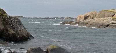
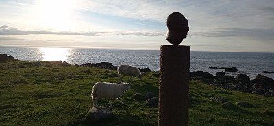
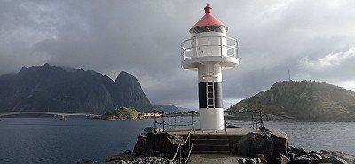
From Stavanger we wanted to slowly orientate ourselves in the direction of the Kristiansand ferry port, whereby the parking space at the lighthouse near Lindesnes should definitely be approached. We chose the route along the 44 and were able to experience a completely different landscape near Egersund due to the Magma Geopark there. The volcanic rock has created a huge landscape, characterized by massive rock formations. Towards evening we chose the beautiful parking lot at the Amphidromic Point Restplace with a clean toilet. There were 3 other mobile homes with us at the rest area. The view of the sea spoiled us again. An artist has positioned a stone statue on a rock. (Rock body sculpture) As in our case, the figure's gaze is directed towards the open sea. The lookout car park provides information on a board about the creation of the Geopark. Luckily, after an overnight stay, we decided to take the 44 back a bit to Egersund. Our destination, the wonderful Skadbergsanden beach, which seemed almost Caribbean to us. We walked along the well-tended beach for a while. In the summer it should be busy here, but now it was almost deserted. Even though time was running out, we still drove to the idyllic village of Sokndalstranden and visited this nice little place, which seemed a bit sleepy to us at the time. But then we went to the lighthouse Lindesnes Fyr. Luckily we were still able to admire the tower during the setting sun. There was something very romantic about the evening atmosphere. An AIDA ship passed in the distance. We had nice photos with us when it rained heavily after dark. It didn't bother us anymore. We had paid for the parking space at the machine on site and were able to use the toilet at the tourist point to the Lindesnes Fyr lighthouse. Disposal is possible free of charge on the return journey at the Servicepoint Spangereid in 2630 Spangereidveien.
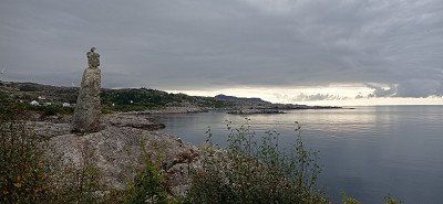
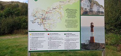
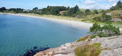
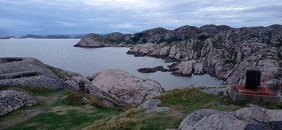
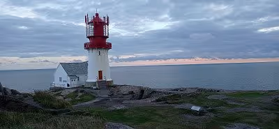
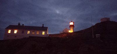
From Stavanger we wanted to slowly orientate ourselves in the direction of the Kristiansand ferry port, whereby the parking space at the lighthouse near Lindesnes should definitely be approached. We chose the route along the 44 and were able to experience a completely different landscape near Egersund due to the Magma Geopark there. The volcanic rock has created a huge landscape, characterized by massive rock formations. Towards evening we chose the beautiful parking lot at the Amphidromic Point Restplace with a clean toilet. There were 3 other mobile homes with us at the rest area. The view of the sea spoiled us again. An artist has positioned a stone statue on a rock. (Rock body sculpture) As in our case, the figure's gaze is directed towards the open sea. The lookout car park provides information on a board about the creation of the Geopark. Luckily, after an overnight stay, we decided to take the 44 back a bit to Egersund. Our destination, the wonderful Skadbergsanden beach, which seemed almost Caribbean to us. We walked along the well-tended beach for a while. In the summer it should be busy here, but now it was almost deserted. Even though time was running out, we still drove to the idyllic village of Sokndalstranden and visited this nice little place, which seemed a bit sleepy to us at the time. But then we went to the lighthouse Lindesnes Fyr. Luckily we were still able to admire the tower during the setting sun. There was something very romantic about the evening atmosphere. An AIDA ship passed in the distance. We had nice photos with us when it rained heavily after dark. It didn't bother us anymore. We had paid for the parking space at the machine on site and were able to use the toilet at the tourist point to the Lindesnes Fyr lighthouse. Disposal is possible free of charge on the return journey at the Servicepoint Spangereid in 2630 Spangereidveien.
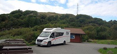
Wonderful memories of a great country remain. Norway has fascinated us from the very beginning and we know very well that this country has so many more natural beauties to offer. Someday maybe again...! In any case, the ferry pass (Ferjekort) and the transponder, in our case from BroBizz, are recommended and have proven their worth. At the ferries our number plate was scanned and that was it. Toll billing was also unproblematic. In a short time we were able to understand all the costs. A total of 14 campsites were visited in 32 days. We found the infrastructure at most campsites, waste disposal stations and rest areas to be very well organized and pleasant. The petrol station network was also well developed. It was helpful for us to use the relevant apps, including those from Statens Vegvesen, here Ferry Search and Traffic Info, as well as LPG Filling. In addition, the parking space searches via the respective app operator.
Wonderful memories of a great country remain. Norway has fascinated us from the very beginning and we know very well that this country has so many more natural beauties to offer. Someday maybe again...! In any case, the ferry pass (Ferjekort) and the transponder, in our case from BroBizz, are recommended and have proven their worth. At the ferries our number plate was scanned and that was it. Toll billing was also unproblematic. In a short time we were able to understand all the costs. A total of 14 campsites were visited in 32 days. We found the infrastructure at most campsites, waste disposal stations and rest areas to be very well organized and pleasant. The petrol station network was also well developed. It was helpful for us to use the relevant apps, including those from Statens Vegvesen, here Ferry Search and Traffic Info, as well as LPG Filling. In addition, the parking space searches via the respective app operator.
Route
Show newest first- 51.68 6.1566
- 51° 40' 47.9" N 6° 9' 23.6" E
- 53.2767 9.5067
- 53° 16' 36" N 9° 30' 24" E
- 53.2762 9.5072
- 53° 16' 34.5" N 9° 30' 26" E
- 56.6267 9.782
- 56° 37' 36.1" N 9° 46' 55.1" E
- 56.6249 9.7818
- 56° 37' 29.7" N 9° 46' 54.5" E
- 57.5942 9.9628
- 57° 35' 39.2" N 9° 57' 46.1" E
- 58.1428 7.9829
- 58° 8' 34.2" N 7° 58' 58.4" E
- 61.8901 12.0291
- 61° 53' 24.4" N 12° 1' 44.7" E
- 61.9111 11.7778
- 61° 54' 40" N 11° 46' 40" E
- 65.1009 13.3425
- 65° 6' 3.3" N 13° 20' 32.9" E
- 65.6237 13.2915
- 65° 37' 25.4" N 13° 17' 29.3" E
- 66.5524 15.3225
- 66° 33' 8.7" N 15° 19' 20.9" E
- 68.3098 15.6415
- 68° 18' 35.2" N 15° 38' 29.5" E
- 68.7065 15.4195
- 68° 42' 23.3" N 15° 25' 10" E
- 69.0193 15.1092
- 69° 1' 9.4" N 15° 6' 33.1" E
- 68.3946 14.5595
- 68° 23' 40.4" N 14° 33' 34.1" E
Am Morgen schien die Sonne von einem tiefblauen Himmel. Wir fuhren weiter durch eine Bilderbuchlandschaft. Ziel war der Fischerort Henningsvær. Vorbei an einem Traumstrand und an hohen Felswänden gelangten wir zum Parkplatz vor der Brücke. 2 Stunden freie Parkzeit. Also zu Fuß über die Brücke und den Ort angeschaut. Im Hafen sehenswert. Wir gingen bis zu den Rorbuer, was sich aber nicht lohnte. Zurück zum Auto wurde es mit der Zeit knapp. Am Parkplatz stand bereits eine Kontrolle der Kommune. Es reichte gerade. Ziel sollte Gimsøysand sein, was wir aber irgendwie verpassten. Also landeten wir in Eggum. Die Zufahrt zum Naturreservat und dem Stellplatz ist durch eine Toreinfahrt zu erreichen. Fährt man hindurch weiter, so gelangt man zum Kiosk unterhalb des von den Deutschen im Krieg errichteten Turmes, jetzt eine Ruine. Im Kiosk zahlt man den Stellplatz und kann das WC mitbenutzen. Wir hatten eine tolle Sicht auf das Meer und wanderten in Richtung Unstad. Viele Schafe waren zu sehen, die teilweise hohe Steilwände bevölkerten. Wir nahmen das Kunstwerk Head in Augenschein. Und auch sonst gibt es viel zu sehen. Zu dieser Zeit war es nicht überfüllt. Abends sind die Lichtspiele überwältigend.
- 68.1542 14.2073
- 68° 9' 15.1" N 14° 12' 26.1" E
- 68.308 13.6532
- 68° 18' 28.7" N 13° 39' 11.7" E
Von Eggum aus fuhren wir zuerst das Winkingermuseum bei Borg an. Interessant aufgemacht und für manch nettes Bild sehr geeignet. Danach gelangten wir zum Haukland Beach, einem wirklichen Traumstrand. Wie vorher gelesen, fuhren wir auf eine Wiese vor dem Strand, nachdem wir das Seil der Zufahrt entfernt hatten. Wie angekündigt, dauerte es nicht lange bis ein älterer Herr kassieren kam. Zwar gab es keinen Service, die Lage animierte uns aber zu 2 Nächten. Ein erster Spaziergang am Strand ließ uns herrliche Ansichten erfahren. Und wie schon vorher, steigerten sich unsere Begeisterung für die Natur am Abend.
- 68.1986 13.5287
- 68° 11' 55" N 13° 31' 43.4" E
Für den 27.8. nahmen wir uns die Wanderung zum Uttakleiv Beach vor. Wir wählten zuerst die Route über den Berg. Es ging steil hoch und teilweise über größere Stufen und Felsen. Trittsicher sollte man sein und rutschfeste Schuhe haben. Weil Regen angekündigt war, nahmen wir auch wetterfeste Kleidung mit, was sich dann auch lohnte. Oberhalb des Grates fing es an zu regnen und es stürmte auch ganz gut. Wir mieden die Steigung zum Mannen und wanderten bergab zum Uttakleiv-Strand. In einer Höhle mit Bank fanden wir Schutz und machten ein Päuschen. Der Blick auf den ebenfalls tollen Strand munterte uns auf. Zurück ging es bei Wetterbesserung über den Stellplatz Uttakleiv um den Berg herum. Überall tolle Motive. Am Abend suchten wir zwecks Ent- u. Versorgung den dortigen Stellplatz auf. Zu ihm gelangt man durch einen Tunnel. Die Straße endet hinter dem Strand. Wir mussten doppelt bezahlen, weil wir Wasser aufnahmen. Wir empfanden das als Nepp, zumal kein Schild darauf hinwies. Trotzdem erlebten wir bei schönem Wetter noch einen herrlichen Abend am Hauklandstrand.
- 68.211 13.5051
- 68° 12' 39.7" N 13° 30' 18.5" E
- 67.9324 13.0887
- 67° 55' 56.6" N 13° 5' 19.4" E
- 68.0353 13.3478
- 68° 2' 7.1" N 13° 20' 52.2" E
- 67.9324 13.0887
- 67° 55' 56.6" N 13° 5' 19.4" E
- 67.8806 12.9826
- 67° 52' 50" N 12° 58' 57.5" E
- 67.8959 13.039
- 67° 53' 45.3" N 13° 2' 20.3" E
Die Lofoten verabschiedeten sich von uns mit einem herrlichen Regenbogen 🌈 über Reine. Wirklich vorbildlich die dortige kostenfreie Entsorgungsstation. Dank dafür. Wir nahmen die Fähre Moskenes nach Bodø. Von dort machten wir einen Abstecher zum Saltstraumen, dem stärksten Gezeitenstrom Europas, fanden es aber zumindest bei unserer Besichtigung wenig spektakulär. Anschließend machten wir Kilometer und fuhren über Fauske und auf der E36 Richtung Svartisengletscher. Unterwegs entdeckte meine Frau zwei Elche auf einer Wiese. In Höhe Røssvoll führte eine Straße zum Gletscher. Wir parkten auf einem Waldparkplatz ziemlich in der Einsamkeit. Nur ein Bulli mit Bikern parkte in der Nähe. Die Zufahrtstraße zieht sich. Es empfiehlt sich die Zufahrt zur Anlegestelle zu nehmen. Dort gibt es schöne Stellplätze, was wir aber nicht wussten. Entgegen der Ankündigung fuhr das Boot in den letzten Augusttagen nicht mehr über den See. Wandern war also für den nächsten Tag angesagt...
- 66.4525 14.2475
- 66° 27' 9.1" N 14° 14' 51" E
- 66.4917 14.1955
- 66° 29' 30.1" N 14° 11' 43.7" E
Am Morgen fuhr der benachbarte Bulli davon. Wir selber wollten zum Gletscher und liefen erst einmal 2 km die Zufahrtsstraße entlang. Wir kamen zum Bootssteg, stellten dort aber fest, dass der Betrieb eingestellt war. Zudem sahen wir, dass hier der eigentliche Stellplatz war. Wir hatten an der Zufahrtsstraße einen Automaten gesehen, wo man wahrscheinlich die Stellzeit hätte bezahlen können. So aber kostete es außer Kraft für uns nichts...Letztere sollte aber noch eine Rolle spielen. Ein Schild wies an dem menschenleeren Ort daraufhin, dass ein Pfad am See entlang zur Anlegestelle und von dort weiter zum Gletscher führt. Strecke 14 km hin u. zurück. Da meine Frau sich das nicht zutraute, wollte ich allein gehen. Im nächsten Moment fuhr jedoch ein Van mit einem Ehepaar aus Eschwege vor. Auch diese wollten eigentlich das Boot nutzen. Da es nicht mehr fuhr, entschlossen wir Männer, uns zusammen auf den Weg zu machen. Es ging dann ständig bergauf und bergab, vorbei an Tümpeln, durch Morast, über und unter Ästen hinweg und war sehr kraftraubend. Die Frauen wanderten auch ein Stück den See entlang. Bereits auf dem Hinweg fand ich es sehr anstrengend. Als der Weg nicht aufzuhören schien, gelangten wir endlich zu der Anlegestelle des Bootes. Nun waren es noch 3 Kilometer über Felsplatten und Anstiege. Dann endlich der Gletscher...Toll anzusehen in seinem Blau. Mein Begleiter war sehr fit und lief bis zum Gletscher. Ich selber machte Fotos aus der Distanz. Ich ruhte mich aus, denn der gleiche schwere Weg musste zurück gegangen werden. Ich muss ehrlich gestehen, dass ich bei der Wanderung an meine Grenzen stieß. Mehrere Atempausen waren notwendig. Ich war meinem Begleiter dankbar, dass er an meiner Seite war. Dennoch schaffte auch ich es zurück, war aber fix und fertig. Allein hätte ich vermutlich den Gletscher nicht aufgesucht und wäre umgekehrt. Allerdings trafen wir auch junge Leute, die diese Strecke gut bewältigen konnten. In meinem Alter allerdings fand ich es schwierig. Und auch unsere Frauen war ziemlich geschafft. Dankbar nahmen wir das Angebot an, in dem Van bis zu unserem Womo mitzufahren. Vom Parkplatz aus fuhren wir dann nur noch bis Røssvoll, wo wir auf dem schönen Stellplatz ausruhten.
- 66.3572 14.3228
- 66° 21' 25.8" N 14° 19' 22.1" E
- 65.9525 12.462
- 65° 57' 9.1" N 12° 27' 43.3" E
- 65.822 12.4302
- 65° 49' 19.2" N 12° 25' 48.8" E
- 65.7125 12.4589
- 65° 42' 45.2" N 12° 27' 32.2" E
- 65.5782 12.3914
- 65° 34' 41.4" N 12° 23' 29" E
- 65.5837 12.302
- 65° 35' 1.4" N 12° 18' 7.4" E
- 65.2162 12.0414
- 65° 12' 58.3" N 12° 2' 28.9" E
- 65.1827 12.1136
- 65° 10' 57.7" N 12° 6' 48.9" E
- 65.4652 12.1899
- 65° 27' 54.6" N 12° 11' 23.7" E
- 65.4777 12.2146
- 65° 28' 39.6" N 12° 12' 52.6" E
- 65.0817 12.0812
- 65° 4' 54.2" N 12° 4' 52.5" E
- 63.5095 10.1382
- 63° 30' 34.3" N 10° 8' 17.4" E
- 63.4511 10.2016
- 63° 27' 4" N 10° 12' 5.6" E
- 63.1375 8.4941
- 63° 8' 14.9" N 8° 29' 38.8" E
- 63.1532 7.9549
- 63° 9' 11.4" N 7° 57' 17.7" E
- 63.1118 7.8702
- 63° 6' 42.5" N 7° 52' 12.6" E
- 62.6848 7.4647
- 62° 41' 5.3" N 7° 27' 53.1" E
- 62.6637 7.5048
- 62° 39' 49.5" N 7° 30' 17.5" E
Wir fuhren zurück und nahmen den Abzweig auf die 680. Wir nutzten die Fähren Tommervag - Seivika und Solsnes - Arfarnes und fuhren vorbei am Tingvollfjord. Von dort weiter bis Andalsnes. Unterwegs gefiel uns die Insel Aure besonders gut. Herrliche Aussichten. Uns hatte es auch die Stemshaus Kyrkje in ihrem leuchtenden Rot besonders angetan. Übrigens mit gepflegtem, für Besucher nutzbarem WC im Nebengebäude. Der Abend auf dem Camping Mjelva in Andalsnes wurde ein Traum in Rotorange. Die Berge leuchteten förmlich. Der Campingplatz selber hat alles was man braucht. Wir hatten vom Berg aus einen schönen Blick ins Tal.
- 62.5449 7.7213
- 62° 32' 41.8" N 7° 43' 16.8" E
- 62.5677 7.6912
- 62° 34' 3.7" N 7° 41' 28.5" E
Am Sonntagmorgen fuhren wir zur Romsdalengondel und buchten die einfache Fahrt auf den Berg Nesaksla. Zuvor suchten wir die kleine Kapelle in einem Waggon am Bahnsteig auf und hielten kurz inne. Von der Spitze des Nesaksla auf 1679 m Höhe hat man einen überragenden Blick auf das Bergsteigerdorf, den Fluss Rauma und den Isfjord. Zu Fuß wollten wir zur Aussichtsplattform Rampestekken absteigen. Für meine Frau war der Abstieg wegen der steilen und hohen Stufen besonders zu Beginn beschwerlich. Bei nassem Wetter würde ich den Abstieg jedenfalls nicht empfehlen. Besonders im ersten Drittel unterhalb des Gipfels gestaltete sich der Abstieg aus unserer Sicht nicht ganz ungefährlich, zumal der Stieg direkt am Hang verläuft. Dennoch schafften auch wir es bis zur Plattform. Nach kurzer Wartezeit konnten wir nach vorne gehen, tolle Bilder machen und kurz die Aussicht genießen. Da als Plattform stark von Wanderern frequentiert, hielten wir uns dort nur kurz auf. Danach ging es etwas leichter über Treppenstufen und Baumwurzeln bergab. Zum Schluss zeigte uns eine Metallrampe, dass wir uns dem Ausgangspunkt näherten. Gerade vor Ablauf der Parkzeit erreichten wir unser Wohnmobil. Wir setzten unsere Fahrt fort und hatten uns für den Tag noch die Fahrt über den Trollstigen vorgenommen.
- 62.4549 7.666
- 62° 27' 17.7" N 7° 39' 57.5" E
Wir fuhren von Andalsnes aus durchs Tal, vorbei an der Wand Trollveggen. Auf einem Parkplatz vor der Auffahrt Trollstigen hielten wir kurz an. Der Anblick auf die an der steilen Flanke verlaufenden 12 Kehren nötigte uns gehörigen Respekt ab. Dennoch wagten wir die Fahrt. Mit dem Wohnmobil ging es durch die 12 Kehren steil bergauf. Natürlich nicht ohne auf entgegen kommende Fahrzeuge zu treffen. Irgendwie fanden unser Gegenüber oder wir immer eine Ausweichmöglichkeit. Der Blick seitlich zum Abgrund ist schon spannend. Oben angekommen parkten wir am Parkplatz. Dort kommen auch Busse an, deren Nutzer ebenfalls zu den Aussichtsplattformen oberhalb des Trollstigen wollen. Wie sie auch, machten wir schöne Fotos und Videos. Dann hatten wir für den Tag genug Adrenalin ausgestoßen und suchten im Fjell des Reinheimen Nationalparks einen schönen Parkplatz. An einem kleinen See wurden wir fündig.
- 62.0951 7.2183
- 62° 5' 42.2" N 7° 13' 5.9" E
Nach der Übernachtung im Reinheimen Nationalpark fuhren wir weiter Richtung Geiranger. Wir gelangten zum Gudbrands Juvet, einer engen Schlucht mit Wasserfall. Ebenso beeindruckend der von den Norwegern angelegte Metallpfad. In der Nähe ein Cafe, welches auch von Reisebussen angefahren wird. Wir sahen uns nur den Wasserfall an und fuhren weiter. Mit der Fähre Linge - Eidsdal überquerten wir den Storfjord. Auf der 63 passierten wir den wunderschönen See Eidsvatnet. Hier ist das Wasser spiegelglatt und die umliegenden Berge bilden sich darin ab. Fast genauso eindrucksvoll wie die Fahrt über den Trollstigen gestaltete sich die Tour hinunter nach Geiranger mit ebenso scharfen Kurven und Kehren. Einen Aussichtspunkt mussten wir meiden, da dieser mit Bussen und anderen Womos eingedeckt war. Allerdings konnten wir auch schon während der Fahrt tolle Ausblicke auf den Geirangerfjord genießen. Unten von weitem schon erkennbar "Mein Schiff" mit qualmendem Schornstein. Das Tal wurde vernebelt. Im Tal selber sahen wir dann die riesige Costa Diadema vor Anker liegen. Dagegen nahm sich "Mein Schiff" noch klein aus. Wir fuhren durchs Dorf weiter in Richtung des oberhalb gelegenen Vinje Camings. Dort quartierten wir uns ein. Im Zuge der Besichtigung Geirangers trafen wir auf eine Vielzahl von Schiffstouristen. Der Ort war recht voll. Dennoch finden wir ihn sehenswert. Im Ort gibt es direkt am See einen Stellplatz. Schön gelegen, wir bevorzugen es aber etwas abseits. Nach leckerem Softeis und Einkauf von Stofftrollen für die Enkel ging es über den Wanderweg vorbei an dem tosenden Wasserfall zurück zum Platz. Vinje Camping hat mehrere gerade Stellplätze mit Strom, Da wir diesen nicht benötigten, standen wir auf der Wiese. Trotz unserer Keile war es aber nicht leicht, dort gerade zu stehen. Also sind eher die Stromplätze zu empfehlen...
- 61.8398 8.5662
- 61° 50' 23.2" N 8° 33' 58.4" E
- 61.565 7.9979
- 61° 33' 54.1" N 7° 59' 52.4" E
- 61.5044 7.8127
- 61° 30' 15.7" N 7° 48' 45.5" E
Von Geiranger aus fuhren wir zuerst zum Aussichtspunkt Dalsnibba. Die Fahrt hinauf ist wieder eng und kurvenreich. Zudem ist die Auffahrt gebührenpflichtig. Oben befindet sich ein größerer Parkplatz und die Aussicht auf den Geirangerfjord ist überragend. Es besteht die Möglichkeit über Steine und Felsen etwas weg vom Parkplatz zu klettern und tolle Fotos zu machen. Anschließend fuhren wir die 15 über Grotli und vorbei am See Otta zur Stabkirche nach Lom. Wir besichtigten die wunderschöne Holzkirche und fuhren dann weiter über die Sognefjell Road (55) durchs sehenswerte Hochgebirge des Sognefjells im Jotunheimen Nationalpark. Dabei passierten wir die Wanderhütte Sognefjellshytta, Nähe des Galdhopiggen. Das Hochgebirge hinterließ bei uns Eindruck, ist die Landschaft dort doch von faszinierender Schönheit. Als es wieder talwärts ging, nächtigten wir auf einem einsamen kleinen Parkplatz an einem kleinen Fluss auf der 55.
- 61.3883 7.7236
- 61° 23' 18" N 7° 43' 25" E
- 60.9083 7.2125
- 60° 54' 29.8" N 7° 12' 45.1" E
- 60.9181 6.8695
- 60° 55' 5.1" N 6° 52' 10.1" E
Wir fuhren am 07.09. ein Stückchen die 55 zurück um dann auf den Tindevegen zu fahren, einer gebührenpflichtigen Passtrasse. Aus unserer Sicht ein Fehler, denn die Gegend ist mit Stromleitungen und Masten durchsetzt. Insgesamt erschien uns, natürlich schon leicht verwöhnt, diese Straße nicht so attraktiv. Zudem sind die Haarnadelkurven am Ende und kurz vor Øvre Årdal äußerst eng und stressig. Etwas genervt fuhren wir dann über die 53, die 5 und die E16 Richtung Aurlandsfjord. Spektakulär auf jeden Fall die Fahrt durch den fast 25 km langen Laerdalstunnel mit seinen 3 in bunten Farben erleuchteten "Kathedralen". Die Kurven zum Aussichtspunkt Stegastein sind ähnlich eng und fahrtechnisch nicht ohne, müssen aber für eine bezaubernde Aussicht in Kauf genommen werden. Oben angekommen ist viel los. Jetzt im September wahrscheinlich noch nicht so dramatisch wie im Sommer. Die Plattform bietet aber einen grandiosen Blick über den Aurlandsfjord. Zudem kann man auf der Toilette sitzend den Blick durch eine Glasscheibe ins Tal genießen. Gibt es auch nicht überall. Zurück ging fast nichts mehr. Wir befanden uns in einer 5er Kolonne, als uns ein Pkw entgegen kam. Zu eng zum Passieren musste er zurücksetzen, geriet am Berg in eine Rinne, so dass sein Fahrzeug nach vorne abhob. Letztendlich gelang es ihm aber bis zu einer Ausweichmöglichkeit zurückzusetzen. Mit ähnlichen Engpässen muss immer gerechnet werden. So auch bei unserer Fahrt zum Nærøyfjorden Camping in Bakka. Erst eine Baustelle, dann durch einen schmalen Tunnel und weiter über einen schmalen Weg, der gefühlt nicht enden will. Unterwegs ging fast nichts mehr, weil uns eine freilaufende Ziegenherde begegnete, der zudem zwei Pkw folgten. Nur mit Spiegel einklappen und rangieren bis an den Rand war ein Passieren möglich. Danach noch ein paarmal Bangen, dass kein Gegenverkehr mehr kommt, und man war da. Überwältigend die Lage des Platzes am Nærøyfjord. Man kann Boote mieten und Wanderungen unternehmen. Entsorgung bietet der Platz nicht, die Sanitäranlagen sind jedoch prima. Wir gönnten uns ein Sonnenbad direkt am Fjord und genossen den Ausblick. Fazit, die Anfahrt war anstrengend, hat sich aber gelohnt. Abends spazieren wir noch durchs Dorf und entlang des Fjords. Von hier aus kann man nur noch zurück, weshalb wir beschließen, am Morgen möglichst früh wieder zu fahren, um möglichst wenig Gegenverkehr zu haben. Entsorgen konnten wir ein kurzes Stück zurück an der Tankstelle in Gudvangen.
- 60.835 6.6807
- 60° 50' 6" N 6° 40' 50.5" E
- 60.6296 6.4222
- 60° 37' 46.4" N 6° 25' 19.7" E
- 60.3913 5.3221
- 60° 23' 28.5" N 5° 19' 19.4" E
- 58.9776 5.7208
- 58° 58' 39.3" N 5° 43' 14.9" E
- 58.9989 6.0925
- 58° 59' 56" N 6° 5' 32.9" E
- 58.9978 6.1373
- 58° 59' 52.1" N 6° 8' 14.3" E
- 58.3828 6.0568
- 58° 22' 57.9" N 6° 3' 24.5" E
- 58.4601 5.9142
- 58° 27' 36.3" N 5° 54' 51.1" E
- 58.3249 6.2862
- 58° 19' 29.8" N 6° 17' 10.2" E
- 57.9825 7.0467
- 57° 58' 57" N 7° 2' 48.3" E
- 58.0461 7.1541
- 58° 2' 45.8" N 7° 9' 14.9" E
- 58.1428 7.9829
- 58° 8' 34.2" N 7° 58' 58.4" E
- 57.5942 9.9628
- 57° 35' 39.2" N 9° 57' 46.1" E
- 57.275 9.9522
- 57° 16' 30" N 9° 57' 7.8" E
Zurück bleiben wunderschöne Erinnerungen an ein tolles Land. Uns hat Norwegen von Anfang an in seinen Bann gezogen und wir wissen genau, dass dieses Land noch so wahnsinnig viele weitere Schönheiten der Natur zu bieten hat. Irgendwann also vielleicht wieder...! Empfehlenswert und bewährt haben sich auf jeden Fall der Fährenpass (Ferjekort) und der Transponder, in unserem Fall von BroBizz. An den Fähren wurde unser Kennzeichen gescannt und das war es. Auch die Mautabrechnung war unproblematisch. In kurzer Zeit konnten wir alle Kosten nachvollziehen. Insgesamt 14 Campingplätze in 32 Tagen wurden angefahren. Die Infrastruktur an den meisten Campingplätzen, Entsorgungsstationen und Rastplätzen empfanden wir sehr gut organisiert und angenehm. Auch das Tankstellennetz war gut ausgebaut. Hilfreich war für uns die Nutzung der einschlägigen Apps, u.a. von Statens Vegvesen, hier Ferry Search und Traffic Info, sowie LPG Filling. Dazu die Stellplatzsuchen über die jeweiligen App-Betreiber.
- 53.2762 9.5072
- 53° 16' 34.5" N 9° 30' 26" E
Travelogue
After a stress-free journey we reached our first stop in Sittensen. We got one of the 6 free parking spaces at the watermill. Very nice little town with half-timbered houses and green spaces. Ice cream parlor nearby with delicious ice cream. Later we had a kebab. Very warm, but still beautiful day. Good start to the tour.
After a stress-free journey we reached our first stop in Sittensen. We got one of the 6 free parking spaces at the watermill. Very nice little town with half-timbered houses and green spaces. Ice cream parlor nearby with delicious ice cream. Later we had a kebab. Very warm, but still beautiful day. Good start to the tour.
Parking at the Viking Museum Fyrkatvej directly at the former castle. You drive past the replica Viking village and get to the castle. The friendly lady at the till allowed us the standing time. We paid admission and visited the former Viking castle and the graves. In the evening we walked between two lakes to the Viking village and were able to visit it well, although it was already closed. Gorgeous area. In the evening we drank a glass of wine with a lady from Braunschweig. Later came 5 more mobile homes. At night we could use the toilet. Great.
Parking at the Viking Museum Fyrkatvej directly at the former castle. You drive past the replica Viking village and get to the castle. The friendly lady at the till allowed us the standing time. We paid admission and visited the former Viking castle and the graves. In the evening we walked between two lakes to the Viking village and were able to visit it well, although it was already closed. Gorgeous area. In the evening we drank a glass of wine with a lady from Braunschweig. Later came 5 more mobile homes. At night we could use the toilet. Great.
First we drove past the 28 at the Fermundensee. We touched the Fermundsmarka National Park with many beautiful lakes and rich in forest. We stopped in the UNESCO World Heritage town of Røros. An interesting place with its wooden houses blackened by copper quarrying. The place looks rustic but well-kept. And environmentally conscious with the grass-covered roofs. We enjoyed delicious cocoa and, for the first time, the cinnamon rolls known for Norway in a quaint little café. We paid parking fees, but unfortunately found out later that you could have parked for free at the museum of the old copper factory. From Røros we drove over the 30 along the river Gaula. We touched the foothills of the Forollhogna National Park with its mountain birch slopes. The vegetation there is covered with lichens. Everything shimmered bright green. On the way we were greeted by 4 reindeer and 1 moose. He came towards us on the road and then crossed. A snapshot succeeded. There are various farms and huts in the Gaudalental. Sheep often graze right next to the road. At Støren we drove onto the E6 and passed Trondheim and then the fjord of the same name. We stayed at Strindmoen campsite by Snåsvatnet. The campsite is simple but clean. An underpass leads to the lake, where we photographed a beautiful sunset. At the back of the site, a small waterfall rushes towards the lake. Despite the train and road, we slept well. The morning shower was okay too.
First we drove past the 28 at the Fermundensee. We touched the Fermundsmarka National Park with many beautiful lakes and rich in forest. We stopped in the UNESCO World Heritage town of Røros. An interesting place with its wooden houses blackened by copper quarrying. The place looks rustic but well-kept. And environmentally conscious with the grass-covered roofs. We enjoyed delicious cocoa and, for the first time, the cinnamon rolls known for Norway in a quaint little café. We paid parking fees, but unfortunately found out later that you could have parked for free at the museum of the old copper factory. From Røros we drove over the 30 along the river Gaula. We touched the foothills of the Forollhogna National Park with its mountain birch slopes. The vegetation there is covered with lichens. Everything shimmered bright green. On the way we were greeted by 4 reindeer and 1 moose. He came towards us on the road and then crossed. A snapshot succeeded. There are various farms and huts in the Gaudalental. Sheep often graze right next to the road. At Støren we drove onto the E6 and passed Trondheim and then the fjord of the same name. We stayed at Strindmoen campsite by Snåsvatnet. The campsite is simple but clean. An underpass leads to the lake, where we photographed a beautiful sunset. At the back of the site, a small waterfall rushes towards the lake. Despite the train and road, we slept well. The morning shower was okay too.
It was very windy during the day. So we parked the mobile home near the reception. Despite the wind and light rain, we hiked from the Sto pitch in the direction of Nyksund to the sandy beach of Skipssand. The Dronningruta hike is slightly difficult and not easy because of the damp paths, but it was fun. In the evening the storm increased. It got so violent that we drove off the site and parked the camper on the unpaved parking lot in front of it. There it was somewhat more protected by rocks in front of it. A little later other campers followed our example. Nevertheless, the storm tugged at our nerves all night. But everything went well.
It was very windy during the day. So we parked the mobile home near the reception. Despite the wind and light rain, we hiked from the Sto pitch in the direction of Nyksund to the sandy beach of Skipssand. The Dronningruta hike is slightly difficult and not easy because of the damp paths, but it was fun. In the evening the storm increased. It got so violent that we drove off the site and parked the camper on the unpaved parking lot in front of it. There it was somewhat more protected by rocks in front of it. A little later other campers followed our example. Nevertheless, the storm tugged at our nerves all night. But everything went well.
Two nights were enough for us at the square in Stø. Therefore, we accepted a somewhat longer journey and stayed for one night at the well-kept and idyllic Oppmyre Camping site near Myre with its exemplary equipped and clean sanitary facilities. Each camper pitch with a view of the fjord is assigned a wooden platform as a terrace. On Wednesday the sun was shining and we were finally able to take part in the whale safari. The sea was still rough. The pills offered by the organizer helped us. The team tried very hard and so we were able to experience Finn whales, sperm whales and killer whales in the wild. We saw several groups of orcas. The tour was rounded off with a sighting of some white-tailed eagles. Overall an impressive experience. Unfortunately, everyone wanted to take the best photo and make the most beautiful film, just like us, of course. That's why there was always a big crowd at the railing.
Two nights were enough for us at the square in Stø. Therefore, we accepted a somewhat longer journey and stayed for one night at the well-kept and idyllic Oppmyre Camping site near Myre with its exemplary equipped and clean sanitary facilities. Each camper pitch with a view of the fjord is assigned a wooden platform as a terrace. On Wednesday the sun was shining and we were finally able to take part in the whale safari. The sea was still rough. The pills offered by the organizer helped us. The team tried very hard and so we were able to experience Finn whales, sperm whales and killer whales in the wild. We saw several groups of orcas. The tour was rounded off with a sighting of some white-tailed eagles. Overall an impressive experience. Unfortunately, everyone wanted to take the best photo and make the most beautiful film, just like us, of course. That's why there was always a big crowd at the railing.
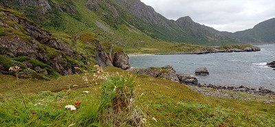
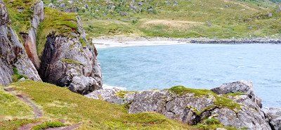
In the morning the sun shone from a deep blue sky. We drove on through a picture book landscape. The destination was the fishing village of Henningsvær. Passing a dream beach and high cliffs, we reached the parking lot in front of the bridge. 2 hours free parking time. So walk over the bridge and look at the place. Worth seeing in the port. We walked to the rorbuer, but it wasn't worth it. Back to the car, time was running out. At the parking lot there was already a check by the municipality. It was just enough. The goal was supposed to be Gimsøysand, but somehow we missed it. So we ended up in Eggum. The access to the nature reserve and the parking space can be reached through a gate. If you continue through it, you get to the kiosk below the tower built by the Germans during the war, now a ruin. In the kiosk you pay for the parking space and can use the toilet. We had a great view of the sea and hiked towards Unstad. Many sheep could be seen, some of which populated high cliffs. We took a look at the artwork Head. And there is also much else to see. At that time it was not crowded. In the evening the play of light is overwhelming.
In the morning the sun shone from a deep blue sky. We drove on through a picture book landscape. The destination was the fishing village of Henningsvær. Passing a dream beach and high cliffs, we reached the parking lot in front of the bridge. 2 hours free parking time. So walk over the bridge and look at the place. Worth seeing in the port. We walked to the rorbuer, but it wasn't worth it. Back to the car, time was running out. At the parking lot there was already a check by the municipality. It was just enough. The goal was supposed to be Gimsøysand, but somehow we missed it. So we ended up in Eggum. The access to the nature reserve and the parking space can be reached through a gate. If you continue through it, you get to the kiosk below the tower built by the Germans during the war, now a ruin. In the kiosk you pay for the parking space and can use the toilet. We had a great view of the sea and hiked towards Unstad. Many sheep could be seen, some of which populated high cliffs. We took a look at the artwork Head. And there is also much else to see. At that time it was not crowded. In the evening the play of light is overwhelming.
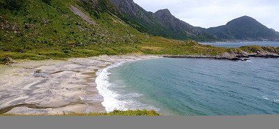
From Eggum we first drove to the Winking Museum near Borg. Interestingly presented and very suitable for some nice pictures. Then we got to Haukland Beach, a real dream beach. As previously read, we pulled onto a lawn in front of the beach after removing the driveway rope. As announced, it wasn't long before an older gentleman came to collect the money. There was no service, but the location encouraged us to stay 2 nights. A first walk on the beach let us experience wonderful views. And as before, our enthusiasm for nature increased in the evening.
From Eggum we first drove to the Winking Museum near Borg. Interestingly presented and very suitable for some nice pictures. Then we got to Haukland Beach, a real dream beach. As previously read, we pulled onto a lawn in front of the beach after removing the driveway rope. As announced, it wasn't long before an older gentleman came to collect the money. There was no service, but the location encouraged us to stay 2 nights. A first walk on the beach let us experience wonderful views. And as before, our enthusiasm for nature increased in the evening.
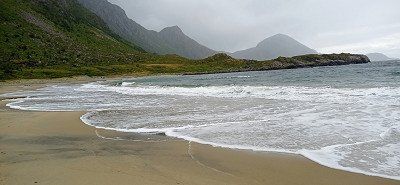
For the 27.8. we decided to hike to Uttakleiv Beach. We first chose the route over the mountain. It went up steeply and partly over larger steps and rocks. You should be sure-footed and have non-slip shoes. Because rain was announced, we also took weatherproof clothing with us, which was worth it. Above the ridge it started to rain and it stormed quite well too. We avoided the climb to Mannen and hiked down to Uttakleiv beach. We found shelter in a cave with a bench and took a break. The view of the also great beach cheered us up. When the weather improved, we went back via the Uttakleiv parking space around the mountain. Great motifs everywhere. In the evening we went to the parking space there for the purpose of disposal and supply. You can get to it through a tunnel. The road ends behind the beach. We had to pay double for taking in water. We felt that as a rip off, especially since no sign pointed out. Nevertheless, we experienced a wonderful evening on the Haukland beach when the weather was nice.
For the 27.8. we decided to hike to Uttakleiv Beach. We first chose the route over the mountain. It went up steeply and partly over larger steps and rocks. You should be sure-footed and have non-slip shoes. Because rain was announced, we also took weatherproof clothing with us, which was worth it. Above the ridge it started to rain and it stormed quite well too. We avoided the climb to Mannen and hiked down to Uttakleiv beach. We found shelter in a cave with a bench and took a break. The view of the also great beach cheered us up. When the weather improved, we went back via the Uttakleiv parking space around the mountain. Great motifs everywhere. In the evening we went to the parking space there for the purpose of disposal and supply. You can get to it through a tunnel. The road ends behind the beach. We had to pay double for taking in water. We felt that as a rip off, especially since no sign pointed out. Nevertheless, we experienced a wonderful evening on the Haukland beach when the weather was nice.
The Lofoten said goodbye to us with a beautiful rainbow 🌈 over Reine. The free disposal station there is really exemplary. Thanks for that. We took the Moskenes ferry to Bodø. From there we made a detour to Saltstraumen, the strongest tidal current in Europe, but found it not very spectacular, at least during our visit. Then we made kilometers and drove via Fauske and on the E36 towards Svartisengletscher. On the way, my wife spotted two mooses in a meadow. At Røssvoll a road led to the glacier. We parked in a forest parking lot in pretty much solitude. Only a Bulli with bikers parked nearby. The access road stretches. It is advisable to take the driveway to the pier. There are nice pitches there, but we didn't know that. Contrary to the announcement, the boat did not cross the lake in the last days of August. Hiking was announced for the next day...
The Lofoten said goodbye to us with a beautiful rainbow 🌈 over Reine. The free disposal station there is really exemplary. Thanks for that. We took the Moskenes ferry to Bodø. From there we made a detour to Saltstraumen, the strongest tidal current in Europe, but found it not very spectacular, at least during our visit. Then we made kilometers and drove via Fauske and on the E36 towards Svartisengletscher. On the way, my wife spotted two mooses in a meadow. At Røssvoll a road led to the glacier. We parked in a forest parking lot in pretty much solitude. Only a Bulli with bikers parked nearby. The access road stretches. It is advisable to take the driveway to the pier. There are nice pitches there, but we didn't know that. Contrary to the announcement, the boat did not cross the lake in the last days of August. Hiking was announced for the next day...
In the morning the neighboring Bulli drove away. We ourselves wanted to go to the glacier and first walked 2 km along the access road. We got to the jetty, but found that it was closed. We also saw that this was the actual parking space. We had seen a machine on the access road where you could probably have paid for the parking time. As it was, it didn't cost us anything apart from Kraft... But the latter should still play a role. A sign in the deserted place pointed out that a path along the lake leads to the jetty and from there to the glacier. Distance 14 km there and back. Since my wife didn't trust herself, I wanted to go alone. The next moment, however, a van with a couple from Eschwege drove up. They also actually wanted to use the boat. Since it was no longer driving, we men decided to set off together. It then went constantly uphill and downhill, past ponds, through morass, over and under branches and was very exhausting. The women also hiked a bit along the lake. Already on the way there I found it very exhausting. As the path seemed unending, we finally got to the boat dock. Now there were still 3 kilometers over rock slabs and climbs. Then finally the glacier... Great to look at in its blue. My companion was very fit and ran all the way to the glacier. I myself took photos from a distance. I rested because the same difficult path had to be walked back. I honestly have to admit that I reached my limits during the hike. Several pauses for breath were necessary. I was grateful to my companion for being by my side. I made it back anyway, but was exhausted. I would probably not have visited the glacier alone and would have turned back. However, we also met young people who could manage this route well. At my age, however, I found it difficult. And our women were pretty exhausted too. We gratefully accepted the offer to ride in the van to our Womo. From the parking lot we only drove to Røssvoll, where we rested on the beautiful pitch.
In the morning the neighboring Bulli drove away. We ourselves wanted to go to the glacier and first walked 2 km along the access road. We got to the jetty, but found that it was closed. We also saw that this was the actual parking space. We had seen a machine on the access road where you could probably have paid for the parking time. As it was, it didn't cost us anything apart from Kraft... But the latter should still play a role. A sign in the deserted place pointed out that a path along the lake leads to the jetty and from there to the glacier. Distance 14 km there and back. Since my wife didn't trust herself, I wanted to go alone. The next moment, however, a van with a couple from Eschwege drove up. They also actually wanted to use the boat. Since it was no longer driving, we men decided to set off together. It then went constantly uphill and downhill, past ponds, through morass, over and under branches and was very exhausting. The women also hiked a bit along the lake. Already on the way there I found it very exhausting. As the path seemed unending, we finally got to the boat dock. Now there were still 3 kilometers over rock slabs and climbs. Then finally the glacier... Great to look at in its blue. My companion was very fit and ran all the way to the glacier. I myself took photos from a distance. I rested because the same difficult path had to be walked back. I honestly have to admit that I reached my limits during the hike. Several pauses for breath were necessary. I was grateful to my companion for being by my side. I made it back anyway, but was exhausted. I would probably not have visited the glacier alone and would have turned back. However, we also met young people who could manage this route well. At my age, however, I found it difficult. And our women were pretty exhausted too. We gratefully accepted the offer to ride in the van to our Womo. From the parking lot we only drove to Røssvoll, where we rested on the beautiful pitch.
Røssvoll Camping is a nice site with good sanitary facilities. We were able to observe several cranes on a meadow across a small lake. On 08/31 we drove first to Mo i Rana, where we filled up gas. We wanted to avoid Trondheim with some construction sites and turned to the coast. The weather should get better there. From Nesna we took the ferry to Levang. From there it went on over the Helgelandsbrua. It leads across the Leirfjord and onto the island of Alsta. This island is dominated by the 1000m high mountains called the Seven Sisters. We chose a pitch directly opposite the mountains, Camping Sandnessjøen. In the evening the mountains were still clouded. However, the pitch right by the sea still allowed wonderful views.
Røssvoll Camping is a nice site with good sanitary facilities. We were able to observe several cranes on a meadow across a small lake. On 08/31 we drove first to Mo i Rana, where we filled up gas. We wanted to avoid Trondheim with some construction sites and turned to the coast. The weather should get better there. From Nesna we took the ferry to Levang. From there it went on over the Helgelandsbrua. It leads across the Leirfjord and onto the island of Alsta. This island is dominated by the 1000m high mountains called the Seven Sisters. We chose a pitch directly opposite the mountains, Camping Sandnessjøen. In the evening the mountains were still clouded. However, the pitch right by the sea still allowed wonderful views.
We drove back and took the turn onto the 680. We used the Tommervag - Seivika and Solsnes - Arfarnes ferries and drove past the Tingvollfjord. From there on to Andalsnes. On the way we particularly liked the island of Aure. Magnificent views. We were also particularly taken with the Stemshaus Kyrkje in its bright red. By the way, there is a well-kept toilet in the outbuilding that can be used by visitors. The evening at Camping Mjelva in Andalsnes turned into a red-orange dream. The mountains literally glowed. The campsite itself has everything you need. We had a beautiful view of the valley from the mountain.
We drove back and took the turn onto the 680. We used the Tommervag - Seivika and Solsnes - Arfarnes ferries and drove past the Tingvollfjord. From there on to Andalsnes. On the way we particularly liked the island of Aure. Magnificent views. We were also particularly taken with the Stemshaus Kyrkje in its bright red. By the way, there is a well-kept toilet in the outbuilding that can be used by visitors. The evening at Camping Mjelva in Andalsnes turned into a red-orange dream. The mountains literally glowed. The campsite itself has everything you need. We had a beautiful view of the valley from the mountain.
On Sunday morning we went to the Romsdalen gondola and booked the one-way trip up Mount Nesaksla. Before that, we went to the small chapel in a wagon on the platform and stopped for a moment. From the top of Nesaksla at 1679 m, there is an outstanding view of the mountaineering village, the Rauma River and the Isfjord. We wanted to walk down to the Rampestekken viewing platform. For my wife, the descent was difficult because of the steep and high steps, especially at the beginning. I wouldn't recommend the descent in wet weather. Especially in the first third below the summit, the descent was not entirely without danger from our point of view, especially since the climb runs directly on the slope. Nevertheless, we also made it to the platform. After a short wait we were able to go to the front, take great pictures and enjoy the view for a moment. Since it is heavily frequented by hikers as a platform, we only stayed there for a short time. After that it was a little easier downhill over steps and tree roots. Finally, a metal ramp showed us that we were approaching the starting point. We reached our mobile home just before the parking time expired. We continued our journey and had planned to drive over the Trollstigen for the day.
On Sunday morning we went to the Romsdalen gondola and booked the one-way trip up Mount Nesaksla. Before that, we went to the small chapel in a wagon on the platform and stopped for a moment. From the top of Nesaksla at 1679 m, there is an outstanding view of the mountaineering village, the Rauma River and the Isfjord. We wanted to walk down to the Rampestekken viewing platform. For my wife, the descent was difficult because of the steep and high steps, especially at the beginning. I wouldn't recommend the descent in wet weather. Especially in the first third below the summit, the descent was not entirely without danger from our point of view, especially since the climb runs directly on the slope. Nevertheless, we also made it to the platform. After a short wait we were able to go to the front, take great pictures and enjoy the view for a moment. Since it is heavily frequented by hikers as a platform, we only stayed there for a short time. After that it was a little easier downhill over steps and tree roots. Finally, a metal ramp showed us that we were approaching the starting point. We reached our mobile home just before the parking time expired. We continued our journey and had planned to drive over the Trollstigen for the day.
We drove through the valley from Andalsnes, past the Trollveggen wall. We stopped briefly in a parking lot in front of the Trollstigen driveway. The sight of the 12 hairpin bends running along the steep flank commanded our respect. Nevertheless, we dared the journey. With the camper it went steeply uphill through the 12 hairpin bends. Not without encountering oncoming vehicles, of course. Somehow our counterpart or we always found an alternative. The side view of the abyss is exciting. When we got there we parked in the parking lot. Buses also arrive there, whose users also want to go to the viewing platforms above the Trollstigen. Like them, we took beautiful photos and videos. Then we had released enough adrenaline for the day and looked for a nice parking lot in the fell of the Reinheimen National Park. We found what we were looking for at a small lake.
We drove through the valley from Andalsnes, past the Trollveggen wall. We stopped briefly in a parking lot in front of the Trollstigen driveway. The sight of the 12 hairpin bends running along the steep flank commanded our respect. Nevertheless, we dared the journey. With the camper it went steeply uphill through the 12 hairpin bends. Not without encountering oncoming vehicles, of course. Somehow our counterpart or we always found an alternative. The side view of the abyss is exciting. When we got there we parked in the parking lot. Buses also arrive there, whose users also want to go to the viewing platforms above the Trollstigen. Like them, we took beautiful photos and videos. Then we had released enough adrenaline for the day and looked for a nice parking lot in the fell of the Reinheimen National Park. We found what we were looking for at a small lake.
After spending the night in Reinheimen National Park, we continued towards Geiranger. We came to Gudbrands Juvet, a narrow gorge with a waterfall. Equally impressive is the metal path laid out by the Norwegians. Nearby a cafe, which is also approached by coaches. We just looked at the waterfall and drove on. We crossed the Storfjord with the ferry Linge - Eidsdal. On the 63 we passed the beautiful lake Eidsvatnet. Here the water is as smooth as glass and the surrounding mountains are reflected in it. Almost as impressive as the trip over the Trollstigen was the tour down to Geiranger with just as sharp curves and hairpin bends. We had to avoid a vantage point because it was covered with buses and other campers. However, we were able to enjoy great views of the Geirangerfjord during the trip. "Mein Schiff" with a smoking chimney can already be seen from afar. The valley was fogged. In the valley itself we then saw the huge Costa Diadema lying at anchor. In contrast, "Mein Schiff" still looked small. We continued through the village towards Vinje Caming above. There we quartered ourselves. In the course of visiting Geiranger, we met a large number of ship tourists. The place was quite busy. Still, we think it's worth seeing. There is a parking space directly on the lake in the village. Nicely located, but we prefer it a little off the beaten track. After delicious soft ice cream and shopping for stuffed trolls for the grandchildren, we took the hiking trail past the roaring waterfall back to the campsite. Vinje Camping has several straight pitches with electricity. Since we didn't need it, we stood on the grass. Despite our wedges, it wasn't easy to stand there straight. So the places with electricity are recommended...
After spending the night in Reinheimen National Park, we continued towards Geiranger. We came to Gudbrands Juvet, a narrow gorge with a waterfall. Equally impressive is the metal path laid out by the Norwegians. Nearby a cafe, which is also approached by coaches. We just looked at the waterfall and drove on. We crossed the Storfjord with the ferry Linge - Eidsdal. On the 63 we passed the beautiful lake Eidsvatnet. Here the water is as smooth as glass and the surrounding mountains are reflected in it. Almost as impressive as the trip over the Trollstigen was the tour down to Geiranger with just as sharp curves and hairpin bends. We had to avoid a vantage point because it was covered with buses and other campers. However, we were able to enjoy great views of the Geirangerfjord during the trip. "Mein Schiff" with a smoking chimney can already be seen from afar. The valley was fogged. In the valley itself we then saw the huge Costa Diadema lying at anchor. In contrast, "Mein Schiff" still looked small. We continued through the village towards Vinje Caming above. There we quartered ourselves. In the course of visiting Geiranger, we met a large number of ship tourists. The place was quite busy. Still, we think it's worth seeing. There is a parking space directly on the lake in the village. Nicely located, but we prefer it a little off the beaten track. After delicious soft ice cream and shopping for stuffed trolls for the grandchildren, we took the hiking trail past the roaring waterfall back to the campsite. Vinje Camping has several straight pitches with electricity. Since we didn't need it, we stood on the grass. Despite our wedges, it wasn't easy to stand there straight. So the places with electricity are recommended...
From Geiranger we first drove to the Dalsnibba viewpoint. The drive up is again narrow and winding. In addition, the ascent is subject to a fee. There is a larger car park at the top and the view of the Geirangerfjord is outstanding. There is the possibility to climb over stones and rocks a little way from the parking lot and take great photos. Then we drove the 15 via Grotli and past Lake Otta to the stave church in Lom. We visited the beautiful wooden church and then continued on the Sognefjell Road (55) through the high mountains of the Sognefjell in the Jotunheimen National Park, which are well worth seeing. We passed the hiker's hut Sognefjellshytta, near the Galdhopiggen. The high mountains left an impression on us, as the landscape there is of fascinating beauty. When we went downhill again, we spent the night in a lonely little parking lot by a small river on 55th Street.
From Geiranger we first drove to the Dalsnibba viewpoint. The drive up is again narrow and winding. In addition, the ascent is subject to a fee. There is a larger car park at the top and the view of the Geirangerfjord is outstanding. There is the possibility to climb over stones and rocks a little way from the parking lot and take great photos. Then we drove the 15 via Grotli and past Lake Otta to the stave church in Lom. We visited the beautiful wooden church and then continued on the Sognefjell Road (55) through the high mountains of the Sognefjell in the Jotunheimen National Park, which are well worth seeing. We passed the hiker's hut Sognefjellshytta, near the Galdhopiggen. The high mountains left an impression on us, as the landscape there is of fascinating beauty. When we went downhill again, we spent the night in a lonely little parking lot by a small river on 55th Street.
We drove on 07.09. a bit back on the 55 and then drive onto the Tindevegen, a toll road. A mistake from our point of view, because the area is interspersed with power lines and pylons. All in all, this street didn't seem so attractive to us, of course we were a bit spoiled. In addition, the hairpin bends at the end and just before Øvre Årdal are extremely tight and stressful. A bit annoyed, we then drove on the 53, the 5 and the E16 towards Aurlandsfjord. The trip through the almost 25 km long Laerdals tunnel with its 3 colorfully lit "cathedrals" is definitely spectacular. The curves to the Stegastein vantage point are similarly tight and technically challenging, but have to be accepted for an enchanting view. When you get to the top, there is a lot going on. Now in September probably not as dramatic as in summer. But the platform offers a magnificent view over the Aurlandsfjord. You can also sit on the toilet and enjoy the view of the valley through a pane of glass. It's not everywhere either. Almost nothing went back. We were in a column of 5 when a car came towards us. Too narrow to pass, he had to reverse and got into a gully on the mountain, causing his vehicle to lift off in front. Ultimately, however, he managed to pull back to an alternative. Similar bottlenecks must always be expected. This was also the case on our trip to Nærøyfjorden Camping in Bakka. First a construction site, then through a narrow tunnel and further along a narrow path that doesn't seem to want to end. On the way almost nothing worked anymore because we met a herd of goats running free, which were also followed by two cars. Passing was only possible with mirrors folded in and maneuvering to the edge. Then a few more fears that there would be no more oncoming traffic, and you were there. The location of the course on the Nærøyfjord is overwhelming. You can rent boats and go hiking. The place does not offer disposal, but the sanitary facilities are great. We treated ourselves to sunbathing right on the fjord and enjoyed the view. Conclusion, the journey was exhausting, but it was worth it. In the evening we walk through the village and along the fjord. From here you can only go back, which is why we decide to leave as early as possible in the morning in order to have as little oncoming traffic as possible. We were able to dispose of it a short distance back at the gas station in Gudvangen.
We drove on 07.09. a bit back on the 55 and then drive onto the Tindevegen, a toll road. A mistake from our point of view, because the area is interspersed with power lines and pylons. All in all, this street didn't seem so attractive to us, of course we were a bit spoiled. In addition, the hairpin bends at the end and just before Øvre Årdal are extremely tight and stressful. A bit annoyed, we then drove on the 53, the 5 and the E16 towards Aurlandsfjord. The trip through the almost 25 km long Laerdals tunnel with its 3 colorfully lit "cathedrals" is definitely spectacular. The curves to the Stegastein vantage point are similarly tight and technically challenging, but have to be accepted for an enchanting view. When you get to the top, there is a lot going on. Now in September probably not as dramatic as in summer. But the platform offers a magnificent view over the Aurlandsfjord. You can also sit on the toilet and enjoy the view of the valley through a pane of glass. It's not everywhere either. Almost nothing went back. We were in a column of 5 when a car came towards us. Too narrow to pass, he had to reverse and got into a gully on the mountain, causing his vehicle to lift off in front. Ultimately, however, he managed to pull back to an alternative. Similar bottlenecks must always be expected. This was also the case on our trip to Nærøyfjorden Camping in Bakka. First a construction site, then through a narrow tunnel and further along a narrow path that doesn't seem to want to end. On the way almost nothing worked anymore because we met a herd of goats running free, which were also followed by two cars. Passing was only possible with mirrors folded in and maneuvering to the edge. Then a few more fears that there would be no more oncoming traffic, and you were there. The location of the course on the Nærøyfjord is overwhelming. You can rent boats and go hiking. The place does not offer disposal, but the sanitary facilities are great. We treated ourselves to sunbathing right on the fjord and enjoyed the view. Conclusion, the journey was exhausting, but it was worth it. In the evening we walk through the village and along the fjord. From here you can only go back, which is why we decide to leave as early as possible in the morning in order to have as little oncoming traffic as possible. We were able to dispose of it a short distance back at the gas station in Gudvangen.
Contrary to our plan to hike the small troll tongue Himåkanå at Hindaråvåg, we decided to visit Starvanger. The reason was that not so good weather had been announced and we also wanted to turn to the Preikestolen as soon as possible. We actually wanted to leave Stavanger out, but that would have been a mistake afterwards. Because we really liked the city. We found the Gamle - old town quarter with the gray colored and flower-decorated small wooden houses particularly beautiful. The alley Øvre Holmegate with its colorful houses is also very inviting. Except for a small shower we were lucky and enjoyed the beautiful day. The Disney Magic in the harbor is also impressive with its water slides, which can be seen from the outside. The parking space at the port can be specified as an ideal starting point for a city tour. On the way to Preikestolen Camping we drove through the 14 km long Ryfylke - underwater tunnel for the first time. The evening at Camping Preikestolen, a huge area with everything you need, had a great sunset ready for us. There is a small path up a hill near and opposite the reception. Recommended for photographing a sunset.
Contrary to our plan to hike the small troll tongue Himåkanå at Hindaråvåg, we decided to visit Starvanger. The reason was that not so good weather had been announced and we also wanted to turn to the Preikestolen as soon as possible. We actually wanted to leave Stavanger out, but that would have been a mistake afterwards. Because we really liked the city. We found the Gamle - old town quarter with the gray colored and flower-decorated small wooden houses particularly beautiful. The alley Øvre Holmegate with its colorful houses is also very inviting. Except for a small shower we were lucky and enjoyed the beautiful day. The Disney Magic in the harbor is also impressive with its water slides, which can be seen from the outside. The parking space at the port can be specified as an ideal starting point for a city tour. On the way to Preikestolen Camping we drove through the 14 km long Ryfylke - underwater tunnel for the first time. The evening at Camping Preikestolen, a huge area with everything you need, had a great sunset ready for us. There is a small path up a hill near and opposite the reception. Recommended for photographing a sunset.
After checking out of the campsite, we drove to the upper hiker's car park at Preikestolen. We paid the 250 NOK for the standing time and started hiking. Right at the beginning it went steeply uphill on an asphalt path. Not easy for my wife. Then continue over roots and stones to a first small stopover on a plateau with a viewpoint. It was almost like a mass migration, because many like us wanted to climb this highlight. And so it went for us, too, over footbridges that led over high moors to steeper climbs that ended on a rocky plateau. Small lakes could be admired almost at the top. Then the last climb past steep edges and you were there, at the place of longing Preikestolen. The daring had placed themselves directly on the cliff edge. We also quickly took a few "impressive" shots ourselves, in order to then have a little snack and drink break on one of the safe rocks nearby. The "pulpit" really offered a fantastic view of the Lysefjord lying deep in blue. And it was hard to resist the magic of that sheer chasm. Experienced hikers were drawn to the less frequented summit, which certainly offered other great views. But it was enough for us and we hiked back the same route. On the way we kept coming into contact with a very nice older couple from Switzerland. Simply likeable this couple and for us a nice incident on the edge. Pretty exhausted we arrived at the bottom and licked another ice cream from the kiosk. Then the journey went back through the more than 14 km long Ryfylk tunnel. The drive into the evening took us towards the lighthouse Lindesnes Fyr.
After checking out of the campsite, we drove to the upper hiker's car park at Preikestolen. We paid the 250 NOK for the standing time and started hiking. Right at the beginning it went steeply uphill on an asphalt path. Not easy for my wife. Then continue over roots and stones to a first small stopover on a plateau with a viewpoint. It was almost like a mass migration, because many like us wanted to climb this highlight. And so it went for us, too, over footbridges that led over high moors to steeper climbs that ended on a rocky plateau. Small lakes could be admired almost at the top. Then the last climb past steep edges and you were there, at the place of longing Preikestolen. The daring had placed themselves directly on the cliff edge. We also quickly took a few "impressive" shots ourselves, in order to then have a little snack and drink break on one of the safe rocks nearby. The "pulpit" really offered a fantastic view of the Lysefjord lying deep in blue. And it was hard to resist the magic of that sheer chasm. Experienced hikers were drawn to the less frequented summit, which certainly offered other great views. But it was enough for us and we hiked back the same route. On the way we kept coming into contact with a very nice older couple from Switzerland. Simply likeable this couple and for us a nice incident on the edge. Pretty exhausted we arrived at the bottom and licked another ice cream from the kiosk. Then the journey went back through the more than 14 km long Ryfylk tunnel. The drive into the evening took us towards the lighthouse Lindesnes Fyr.
From Stavanger we wanted to slowly orientate ourselves in the direction of the Kristiansand ferry port, whereby the parking space at the lighthouse near Lindesnes should definitely be approached. We chose the route along the 44 and were able to experience a completely different landscape near Egersund due to the Magma Geopark there. The volcanic rock has created a huge landscape, characterized by massive rock formations. Towards evening we chose the beautiful parking lot at the Amphidromic Point Restplace with a clean toilet. There were 3 other mobile homes with us at the rest area. The view of the sea spoiled us again. An artist has positioned a stone statue on a rock. (Rock body sculpture) As in our case, the figure's gaze is directed towards the open sea. The lookout car park provides information on a board about the creation of the Geopark. Luckily, after an overnight stay, we decided to take the 44 back a bit to Egersund. Our destination, the wonderful Skadbergsanden beach, which seemed almost Caribbean to us. We walked along the well-tended beach for a while. In the summer it should be busy here, but now it was almost deserted. Even though time was running out, we still drove to the idyllic village of Sokndalstranden and visited this nice little place, which seemed a bit sleepy to us at the time. But then we went to the lighthouse Lindesnes Fyr. Luckily we were still able to admire the tower during the setting sun. There was something very romantic about the evening atmosphere. An AIDA ship passed in the distance. We had nice photos with us when it rained heavily after dark. It didn't bother us anymore. We had paid for the parking space at the machine on site and were able to use the toilet at the tourist point to the Lindesnes Fyr lighthouse. Disposal is possible free of charge on the return journey at the Servicepoint Spangereid in 2630 Spangereidveien.
From Stavanger we wanted to slowly orientate ourselves in the direction of the Kristiansand ferry port, whereby the parking space at the lighthouse near Lindesnes should definitely be approached. We chose the route along the 44 and were able to experience a completely different landscape near Egersund due to the Magma Geopark there. The volcanic rock has created a huge landscape, characterized by massive rock formations. Towards evening we chose the beautiful parking lot at the Amphidromic Point Restplace with a clean toilet. There were 3 other mobile homes with us at the rest area. The view of the sea spoiled us again. An artist has positioned a stone statue on a rock. (Rock body sculpture) As in our case, the figure's gaze is directed towards the open sea. The lookout car park provides information on a board about the creation of the Geopark. Luckily, after an overnight stay, we decided to take the 44 back a bit to Egersund. Our destination, the wonderful Skadbergsanden beach, which seemed almost Caribbean to us. We walked along the well-tended beach for a while. In the summer it should be busy here, but now it was almost deserted. Even though time was running out, we still drove to the idyllic village of Sokndalstranden and visited this nice little place, which seemed a bit sleepy to us at the time. But then we went to the lighthouse Lindesnes Fyr. Luckily we were still able to admire the tower during the setting sun. There was something very romantic about the evening atmosphere. An AIDA ship passed in the distance. We had nice photos with us when it rained heavily after dark. It didn't bother us anymore. We had paid for the parking space at the machine on site and were able to use the toilet at the tourist point to the Lindesnes Fyr lighthouse. Disposal is possible free of charge on the return journey at the Servicepoint Spangereid in 2630 Spangereidveien.
Wonderful memories of a great country remain. Norway has fascinated us from the very beginning and we know very well that this country has so many more natural beauties to offer. Someday maybe again...! In any case, the ferry pass (Ferjekort) and the transponder, in our case from BroBizz, are recommended and have proven their worth. At the ferries our number plate was scanned and that was it. Toll billing was also unproblematic. In a short time we were able to understand all the costs. A total of 14 campsites were visited in 32 days. We found the infrastructure at most campsites, waste disposal stations and rest areas to be very well organized and pleasant. The petrol station network was also well developed. It was helpful for us to use the relevant apps, including those from Statens Vegvesen, here Ferry Search and Traffic Info, as well as LPG Filling. In addition, the parking space searches via the respective app operator.
Wonderful memories of a great country remain. Norway has fascinated us from the very beginning and we know very well that this country has so many more natural beauties to offer. Someday maybe again...! In any case, the ferry pass (Ferjekort) and the transponder, in our case from BroBizz, are recommended and have proven their worth. At the ferries our number plate was scanned and that was it. Toll billing was also unproblematic. In a short time we were able to understand all the costs. A total of 14 campsites were visited in 32 days. We found the infrastructure at most campsites, waste disposal stations and rest areas to be very well organized and pleasant. The petrol station network was also well developed. It was helpful for us to use the relevant apps, including those from Statens Vegvesen, here Ferry Search and Traffic Info, as well as LPG Filling. In addition, the parking space searches via the respective app operator.
Comments (5)
Comments from Freeontour users
sorry, ihr seid ja schon zurück, ich dachte, ihr plant die Route erst :-))
Ja leider, trotzdem danke
Hallo, ich würde noch die Atlantikstraße von Vevang nach Karvag (oder umgekehrt) einbauen, eine spektakuläre Strecke
Ganz toller Bericht der sich mit unseren Erfahrung bezüglich Mittel- und Südnorwegen deckt. Eine kleine Anmerkung für alle, die Norwegen zum ersten Mal bereisen möchten: Wir haben auf unserer 5 wöchigen Norwegen-Tour nur mit Kreditkarte bezahlt, auch in Bussen des ÖPNV, auf Camping-/Stellplätzen, für Warmwasser in der Dusche und beim Bäcker für die Zimtschnecken. Einzig in Stavanger gab es Probleme im Stadtbus, weil das Netz ausgefallen war. Dort durften wir kostenlos Bus fahren.
Vom Camping Bratland in Bergen kommt ohne Reservierung direkt vom Campingplatz mit dem Linienbus und der Straßenbahn in 25 Minuten ins Zentrum von Bergen.
Norwegen ist ein sehr schönes Land!
Herzliche Grüße aus Konz
Maria und Franz-Josef
Hallo, vielen Dank euch für den netten Kommentar. Und auch für die guten Ergänzungen. Schön, wenn man so positive Erinnerungen teilen kann.
Ein schöner Bericht von der Tour.
Liebe Grüße aus Nettetal
Martina & Frank
aspaltoldies.de
Vielen Dank und liebe Grüße in die Fast-Nachbarschaft. Freut uns sehr.
Super Bericht - vielen Dank dafür - wir haben im Mai/Juni 2022 fast die gleiche Rundreise gemacht und waren auch einmal mehr überwältigt von diesem
phantastischen Land - steht auch auf FreeonTour - weiterhin gute Fahrt
Herzlichen Dank, sehr nett. Hat uns sehr gefreut und allzeit gute Fahrt.