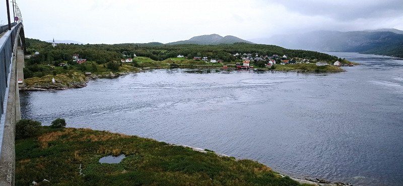
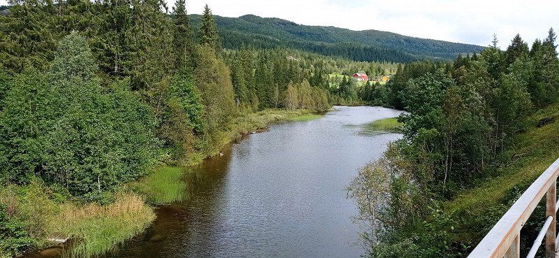
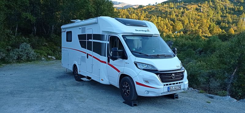
Start on 08/14/22 in Goch. Via the A1 to the first stopover in Sittensen.
Day
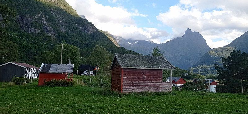
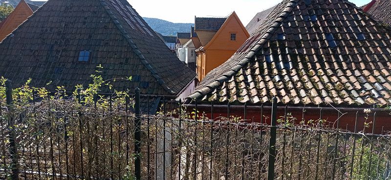
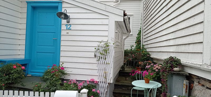
Goch, Deutschland
47574 Goch, Deutschland
51° 40' 47.9" N 6° 9' 23.6" E
51.6799840 6.1565522
• Head northeast on Reiscopstraße. Go for 238 m.
• Turn slightly right onto Gerberstraße. Go for 32 m.
• Take the 1st exit from roundabout onto Bahnhofsplatz. Go for 144 m.
• Turn left onto An der Post toward Rees/A52/Kalkar/Krankenhaus. Go for 106 m.
• Continue on Kalkarer Straße. Go for 686 m.
• Turn right onto Ostring (B67). Go for 2.9 km.
• Take ramp onto A57 toward Köln. Go for 35.7 km.
• Take exit 8 toward Dortmund/Oberhausen onto A42. Go for 19.0 km.
• Take exit 8 toward Arnheim/Hannover onto A3. Go for 6.3 km.
• Continue on A2 toward Hannover/Emden/Dreieck/Bottrop. Go for 10.8 km.
• Take exit 5 toward Gladbeck/Marl. Go for 970 m.
• Continue on Essener Straße (B224). Go for 23.2 km.
• Take the exit toward Münster onto A43. Go for 41.4 km.
• Take exit 2 toward Bremen/Münster-Nord onto A1 (Hansalinie). Go for 227 km.
• Take exit 47 toward Sittensen. Go for 404 m.
• Turn left onto Stader Straße (L130) toward Sittensen/Scheeßel. Go for 205 m.
• Take the 2nd exit from roundabout onto Stader Straße (L130) toward Scheeßel. Go for 1.4 km.
• Turn left onto Am Markt. Go for 65 m.
• Continue on Mühlenstraße. Go for 56 m.
• Arrive at Mühlenstraße. Your destination is on the right.
☍
370,3 km
(3 hrs. 25 min.)
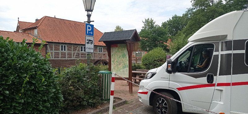
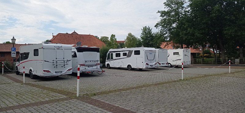
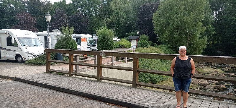
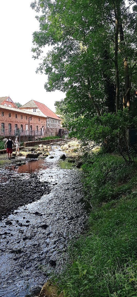
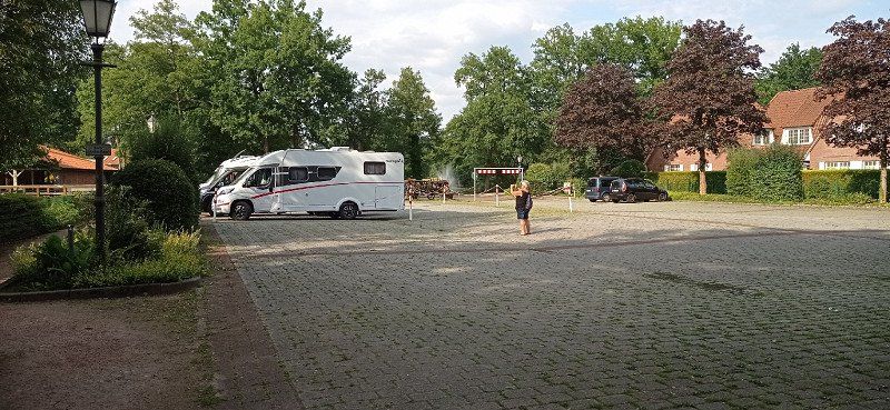
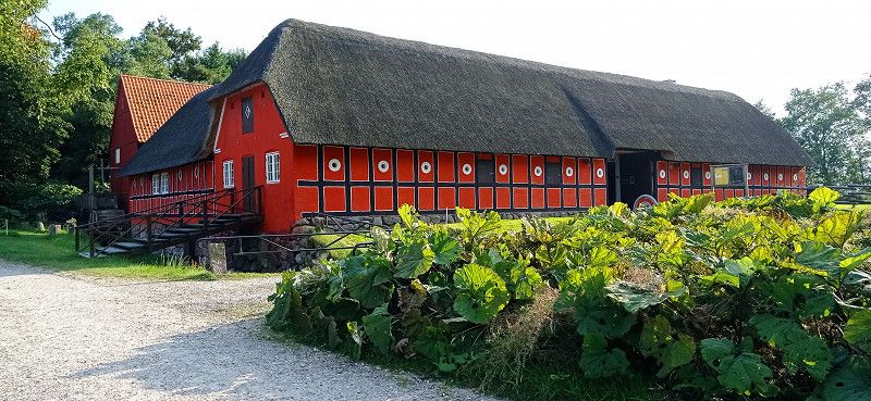
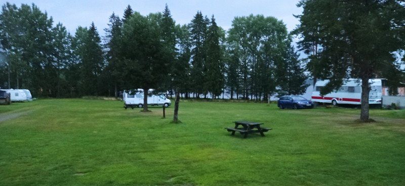
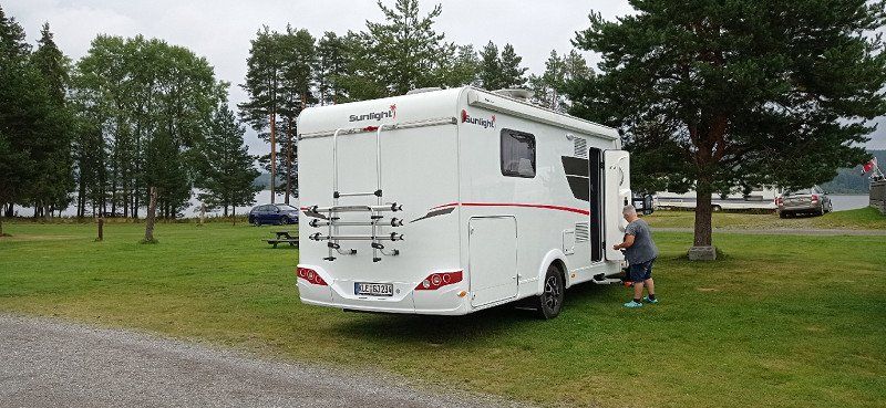
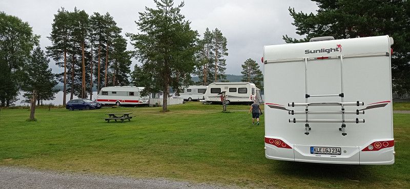
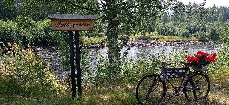
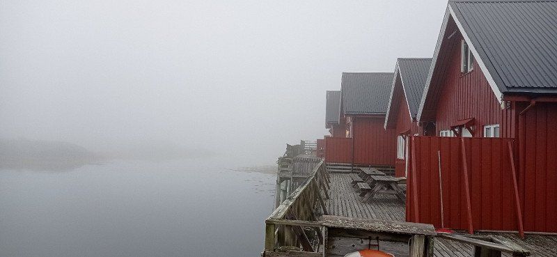
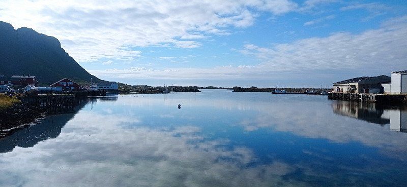
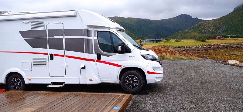
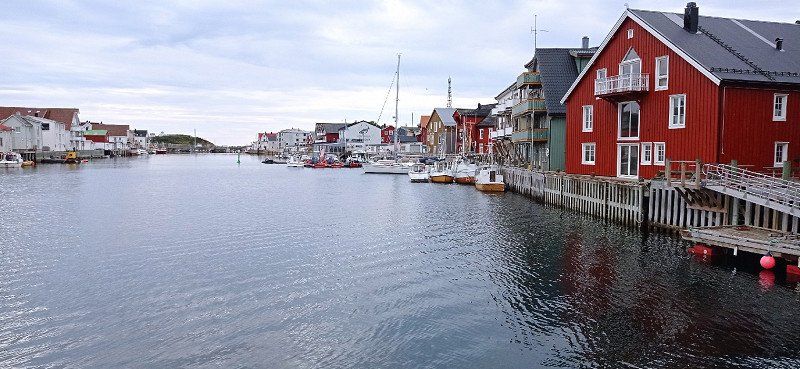
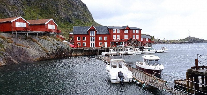
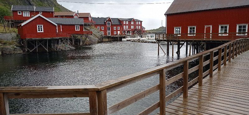
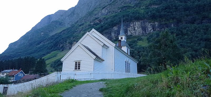
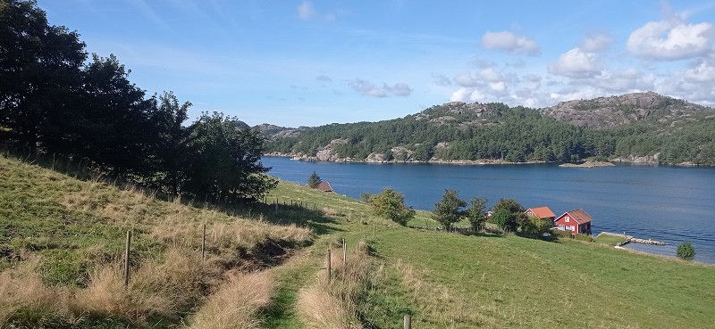
Stellplatz bei der Wassermühle
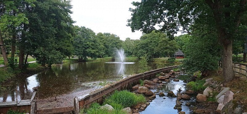
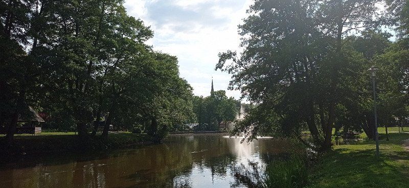
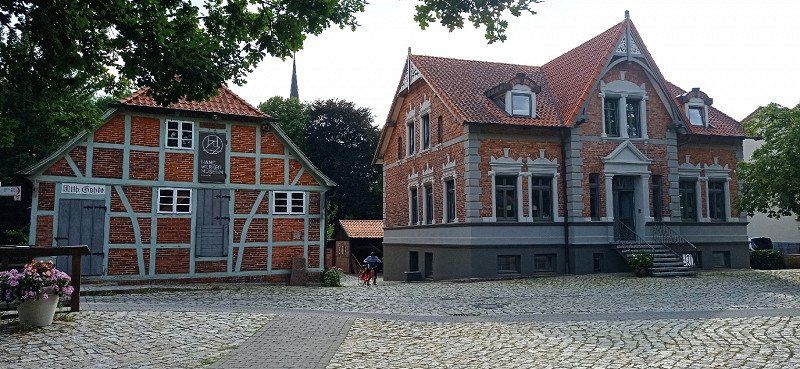
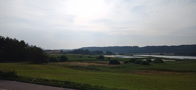
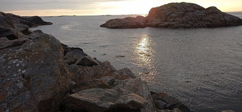
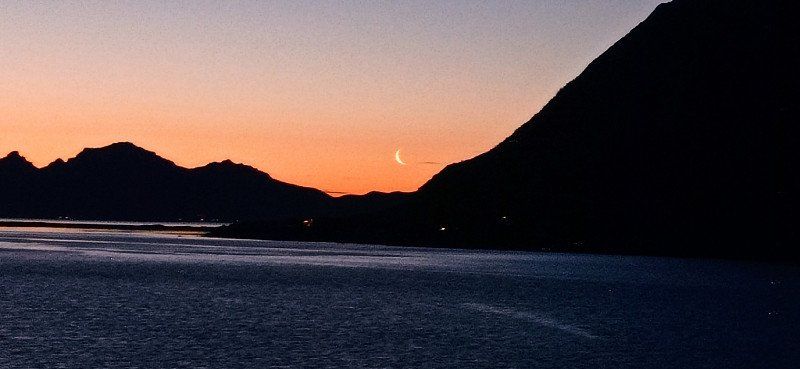
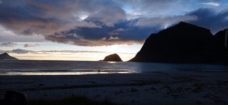
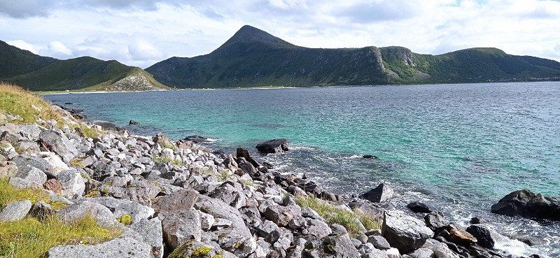
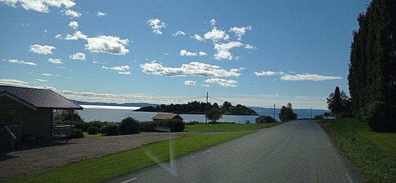
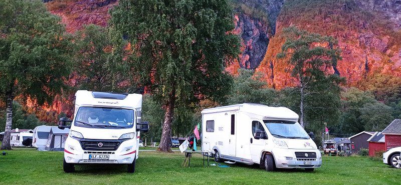
After a stress-free journey we reached our first stop in Sittensen. We got one of the 6 free parking spaces at the watermill. Very nice little town with half-timbered houses and green spaces. Ice cream parlor nearby with delicious ice cream. Later we had a kebab. Very warm, but still beautiful day. Good start to the tour.
Mühlenstraße, 27419, Sittensen, Deutschland
53° 16' 36" N 9° 30' 24" E
53.2766667 9.5066667
• Head southeast on Mühlenstraße. Go for 64 m.
• Turn right. Go for 39 m.
• Turn right. Go for 19 m.
• Arrive at your destination on the right.
☍
0,1 km
( )
Wohnmobilstellplatz Sittensen, Sittensen, Deutschland
27419 Sittensen, Deutschland
53° 16' 34.5" N 9° 30' 26" E
53.2762383 9.5072194
• Head east. Go for 19 m.
• Turn left toward Mühlenstraße. Go for 39 m.
• Turn left onto Mühlenstraße. Go for 120 m.
• Continue on Am Markt. Go for 65 m.
• Turn right onto Am Markt (L130). Go for 1.3 km.
• Take the 2nd exit from roundabout onto Stader Straße (L130) toward Horneburg. Go for 213 m.
• Take ramp onto A1 toward Hamburg. Go for 25.0 km.
• Take exit 43 toward Flensburg/Kiel/Hamburg-West/Tötensen/Flughafen onto A261 (Buchholzer Dreieck). Go for 10.3 km.
• Continue on A7. Go for 11.6 km.
• Keep right onto A7. Go for 159 km.
• Continue on E45 (Sønderjyske Motorvej). Go for 89.5 km.
• Keep left onto E45 (Kolding) toward Århus/Vejle. Go for 140 km.
• Take exit 37 toward Handest/Hobro S. Go for 421 m.
• Turn right onto Randersvej (180) toward Hobro. Go for 2.6 km.
• Take the 1st exit from roundabout onto Randersvej (180/555) toward Mariager/Hobro. Go for 3.5 km.
• Turn left onto Markedsgade. Go for 142 m.
• Turn left onto Sønder Alle. Go for 314 m.
• Turn left onto Onsildgade. Go for 197 m.
• Turn left onto Vester Alle. Go for 345 m.
• Continue on Fyrkatvej. Go for 743 m.
• Arrive at Fyrkatvej.
☍
445,2 km
(4 hrs. 27 min.)
Day
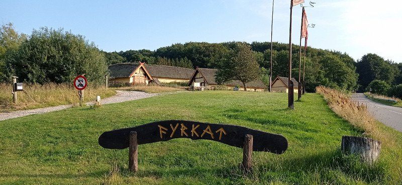
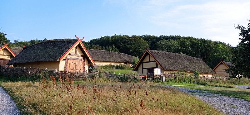
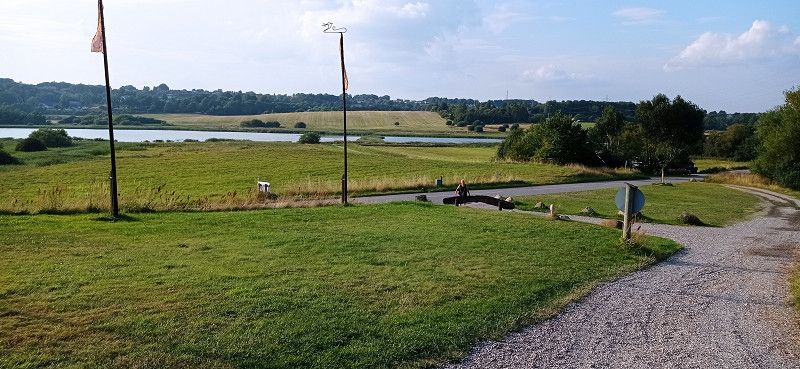
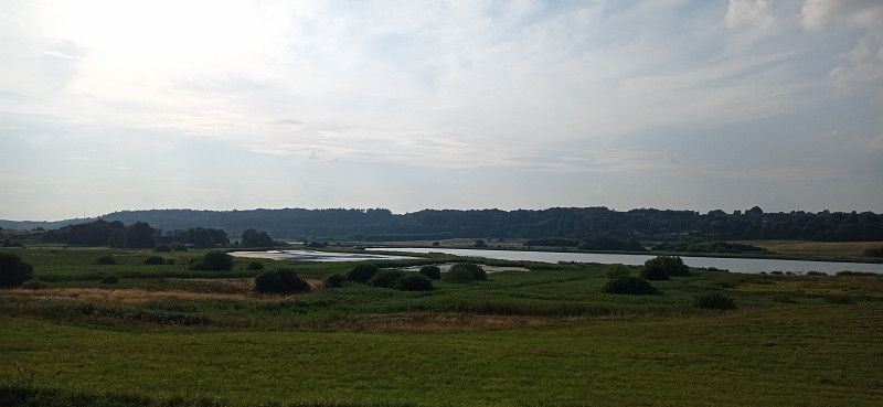
Fyrkatvej
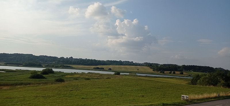
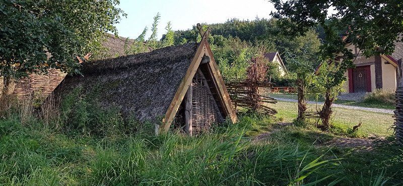
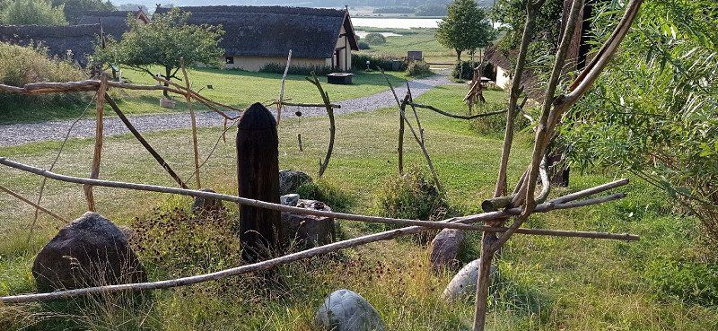
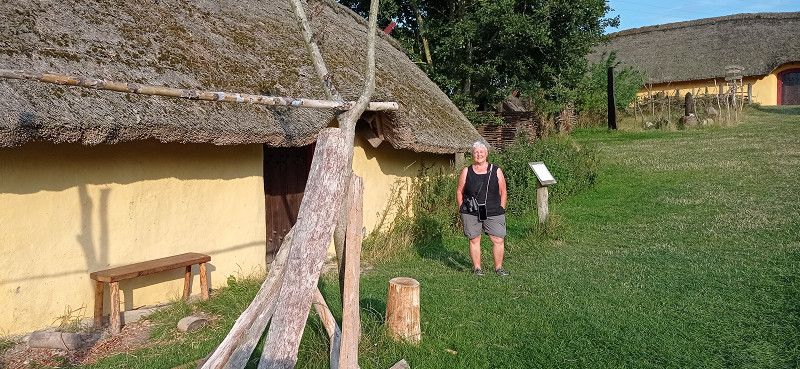
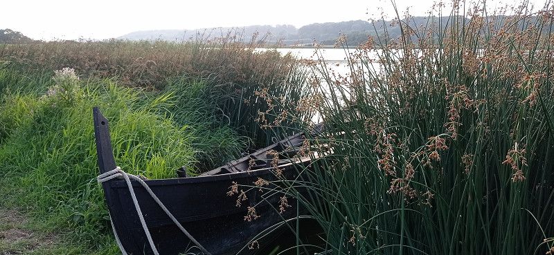
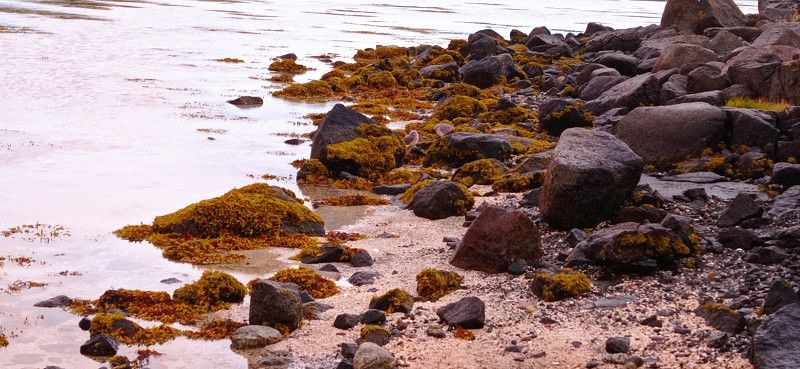
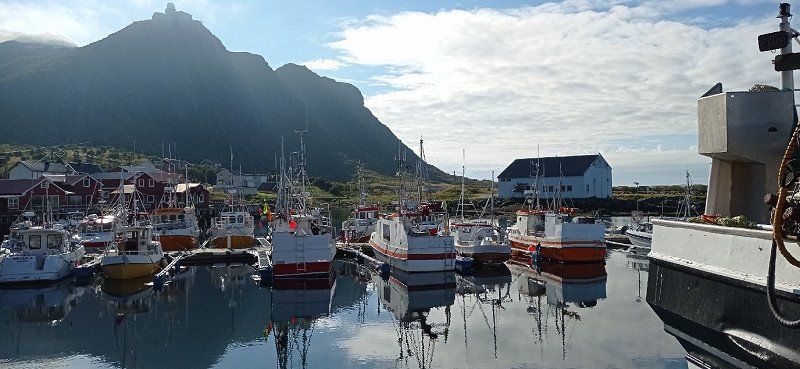
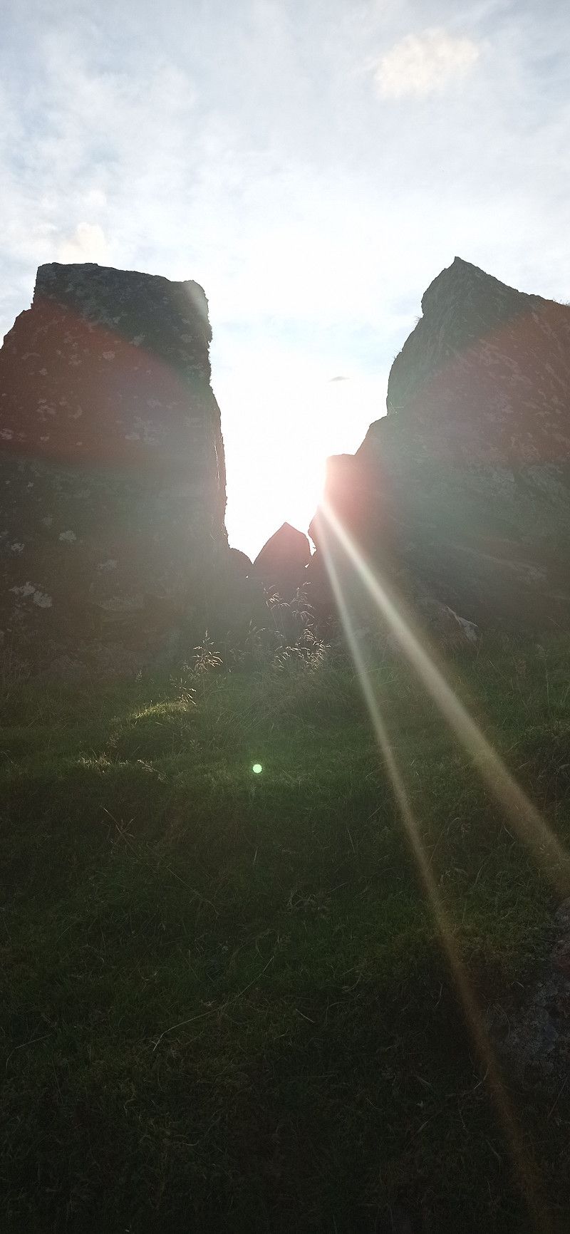
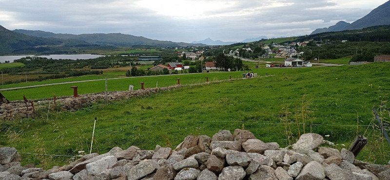
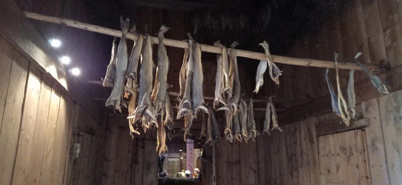
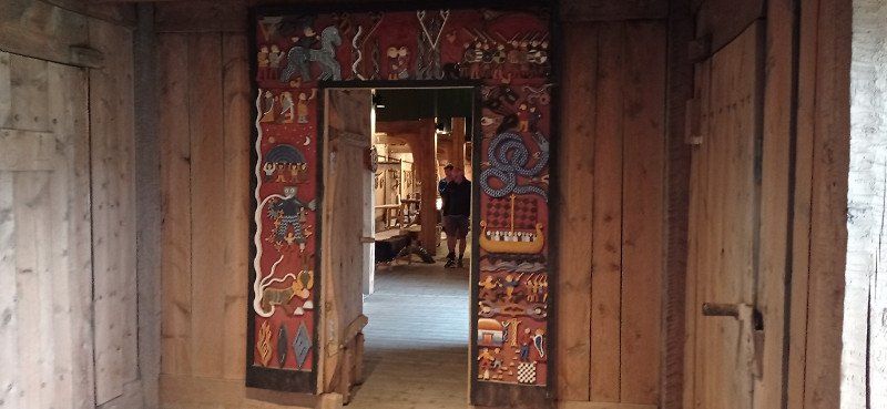
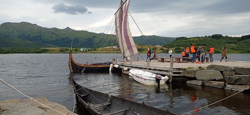
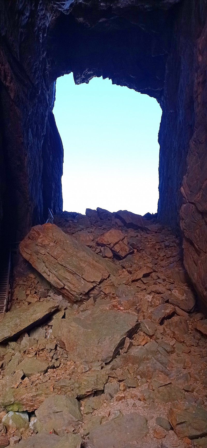
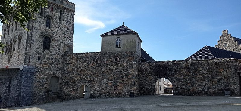
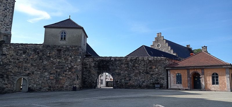
Parking at the Viking Museum Fyrkatvej directly at the former castle. You drive past the replica Viking village and get to the castle. The friendly lady at the till allowed us the standing time. We paid admission and visited the former Viking castle and the graves. In the evening we walked between two lakes to the Viking village and were able to visit it well, although it was already closed. Gorgeous area. In the evening we drank a glass of wine with a lady from Braunschweig. Later came 5 more mobile homes. At night we could use the toilet. Great.
Hobro, Dänemark
56° 37' 36.1" N 9° 46' 55.1" E
56.6266886 9.7819820
• Head south on Fyrkatvej. Go for 201 m.
• Turn left onto Fyrkatvej. Go for 35 m.
• Arrive at Fyrkatvej. Your destination is on the left.
☍
0,2 km
( )
Vikingemuseet Fyrkat, Fyrkatvej, Hobro, Dänemark
Fyrkatvej 37B, 9500 Hobro, Dänemark
56° 37' 29.7" N 9° 46' 54.5" E
56.6249090 9.7817960
• Head northwest on Fyrkatvej. Go for 35 m.
• Turn right onto Fyrkatvej. Go for 944 m.
• Continue on Vester Alle. Go for 544 m.
• Turn slightly left onto Vestergade. Go for 368 m.
• Continue on Havnegade. Go for 265 m.
• Turn left onto Brogade (180). Go for 2.0 km.
• Take the 2nd exit from roundabout onto Nordre Ringvej (541) toward Nørager/29/Aalborg/E45. Go for 4.2 km.
• Turn right and take ramp onto E45 (Nordjyske Motorvej) toward Aalborg. Go for 52.9 km.
• Keep right onto E39 (Vendsyssel) toward Hirtshals/Hjørring/Brønderslev/Høvejen/Thisted. Go for 57.6 km.
• Take the 2nd exit from roundabout onto Aalborgvej (E39) toward Hirtshals. Go for 2.3 km.
• Take the 2nd exit from roundabout onto Aalborgvej (E39) toward Hirtshals/Havn. Go for 1.4 km.
• Take ramp onto Jyllandsgade toward Color Line/Terminal/Centrum. Go for 639 m.
• Turn right onto Jyllandsgade. Go for 44 m.
• Continue on Norgeskajen. Go for 379 m.
• Turn right onto Auktionskajen. Go for 24 m.
• Arrive at Auktionskajen. Your destination is on the right.
☍
123,6 km
(1 hrs. 18 min.)
Day
Hirtshals Havn, Norgeskajen, Hirtshals, Dänemark
Norgeskajen 11, 9850 Hirtshals, Dänemark
57° 35' 39.2" N 9° 57' 46.1" E
57.5942361 9.9628099
• Head southeast on Auktionskajen. Go for 24 m.
• Turn left onto Norgeskajen. Go for 379 m.
• Continue on Jyllandsgade. Go for 44 m.
• Turn left onto Jyllandsgade. Go for 324 m.
• Take ramp onto Aalborgvej (E39). Go for 573 m.
• Turn left onto Willemoesvej toward Østhavn. Go for 93 m.
• Turn left onto Willemoesvej toward Hirtshals/Color Line. Go for 23 m.
• Turn right toward Hirtshals/Color Line. Go for 5 m.
• Continue on Willemoesvej toward Hirtshals/Color Line. Go for 26 m.
• Turn left onto Willemoesvej toward Hirtshals/Color Line. Go for 114 m.
• Turn right onto Willemoesvej toward Hirtshals/Color Line. Go for 86 m.
• Turn right onto Aalborgvej (E39) toward Hirtshals/Color Line. Go for 274 m.
• Keep left onto E39 toward Color Line/Check-in. Go for 783 m.
• Take the Hirtshals-Kristiansand Ferry. Stay on for 139 km.
• Head northwest. Go for 76 m.
• Arrive at your destination on the left.
☍
141,7 km
(4 hrs. 6 min.)
Kristiansand ferjeterminal, Vesterveien, Kristiansand, Norwegen
Vesterveien 21, 4613 Kristiansand, Norwegen
58° 8' 34.2" N 7° 58' 58.4" E
58.1428365 7.9828781
• Head northwest. Go for 530 m.
• Take the 1st exit from roundabout onto Vesterveien toward Oslo/E18/Evje/9/Sentrum. Go for 361 m.
• Take the 2nd exit from roundabout onto E18 toward Oslo. Go for 101 km.
• Take the 2nd exit from roundabout onto Lindlandsveien (E18). Go for 61.0 km.
• Take ramp toward Heistad. Go for 189 m.
• Take the 2nd exit from roundabout. Go for 379 m.
• Take the 1st exit from roundabout onto E18. Go for 13.0 km.
• Turn right. Go for 621 m.
• Continue toward E18. Go for 38 m.
• Take the 2nd exit from roundabout onto E18 toward Oslo. Go for 110 km.
• Keep right toward Fosskolltunnelen. Go for 225 m.
• Continue on Fosskolltunnelen. Go for 540 m.
• Continue toward E18. Go for 163 m.
• Continue on E18. Go for 33.9 km.
• Keep left onto Operatunnelen (190) toward E6/Trondheim/Gardermoen. Go for 3.2 km.
• Keep left onto Strømsveien (190) toward E6/Trondheim/Gardermoen Lufthavn/Ring 3/4/Sinsen/163/Stovner. Go for 2.5 km.
• Continue on E6. Go for 26.7 km.
• Take exit 48 toward Kongsvinger onto E16 (Kongsvingervegen). Go for 617 m.
• Pass 6 roundabouts and continue on Oslovegen (E16). Go for 37.6 km.
• Take the 3rd exit from roundabout onto Nord-Odalsvegen (24) toward Hamar/Sand. Go for 12.5 km.
• Turn right. Go for 28 m.
• Turn right toward Nord-Odalsvegen. Go for 59 m.
• Turn left onto Nord-Odalsvegen. Go for 83 m.
• Arrive at Nord-Odalsvegen. Your destination is on the right.
☍
405,3 km
(4 hrs. 33 min.)
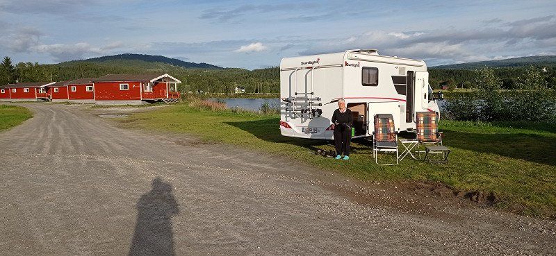
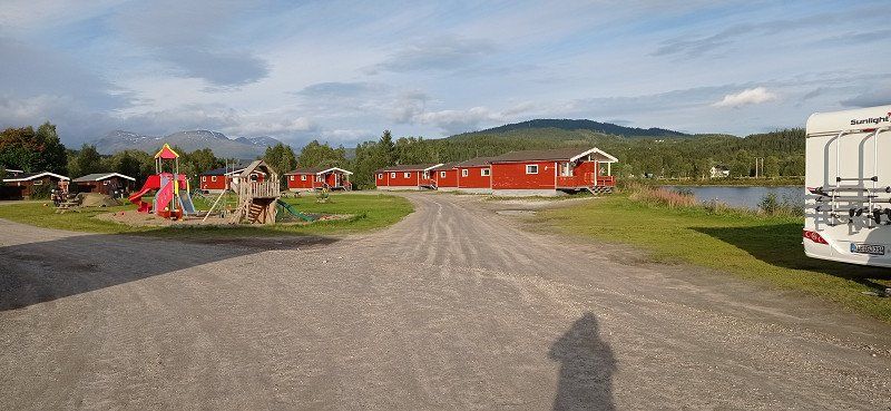
Songnabben Camping
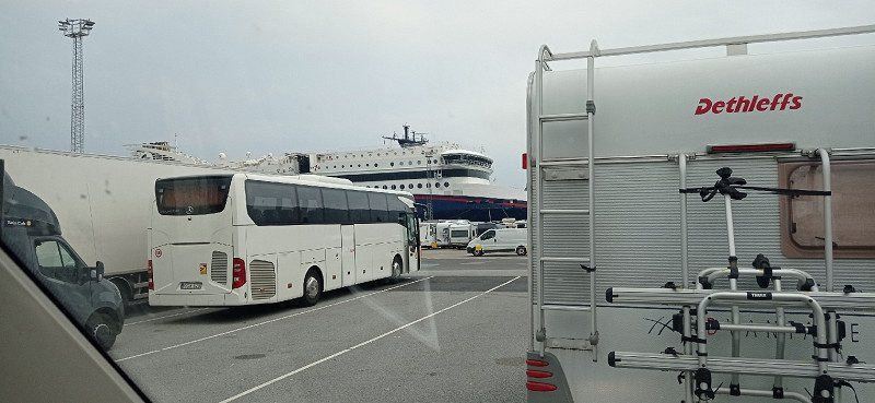
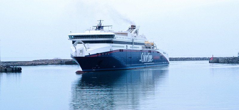
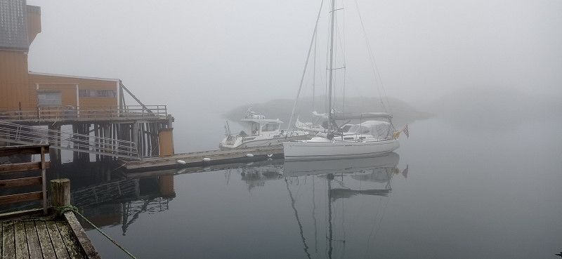
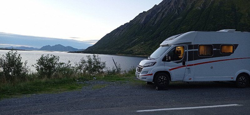
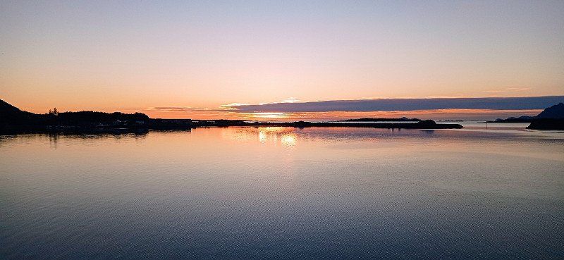
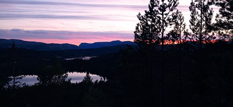
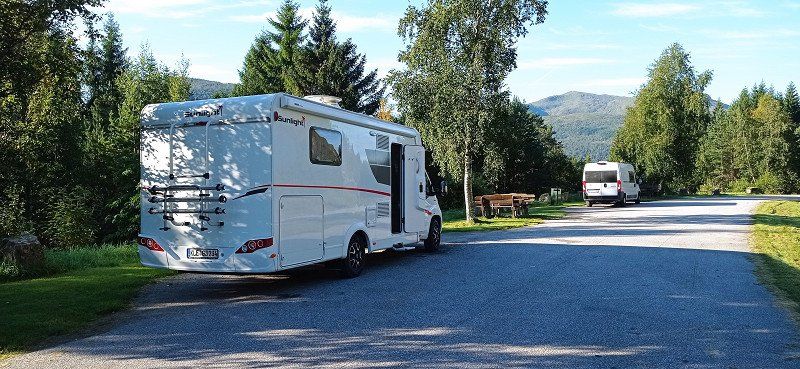
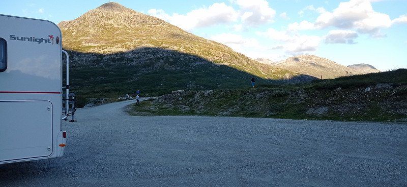
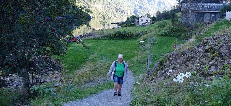
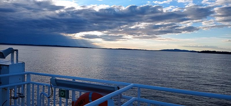
After the nice stop in Hobro we left at 9am. We arrived at the Hirtshals ferry on time. The check-in went without any problems. We stood third in front of the ship. During the quiet three-hour journey, we enjoyed the great Color Line buffet. After arriving in Kristiansand, we quickly got on the highway towards Oslo. Busy traffic in Oslo. Therefore, we wanted to leave the city behind and, contrary to our previous plan, drove to the Songnabben campsite. There we were lucky at the barrier because a young lady just drove up and checked in. We had a quiet night by the beautiful lake.
2100, Skarnes, Norwegen
60° 21' 27" N 11° 35' 59" E
60.3575000 11.5997200
• Head southwest on Nord-Odalsvegen. Go for 83 m.
• Turn right. Go for 59 m.
• Turn left toward Nord-Odalsvegen/24. Go for 28 m.
• Turn right onto Nord-Odalsvegen (24). Go for 48.5 km.
• Turn right onto Plogjons veg (1900). Go for 1.0 km.
• Continue on Sandmoen (1900). Go for 155 m.
• Continue on Plogjons veg (1900). Go for 949 m.
• Turn right and take ramp onto 3 toward Elverum. Go for 25.5 km.
• Turn right toward 25/2/Trysil/Elverum/Kongsvinger. Go for 534 m.
• Take the 1st exit from roundabout onto 25 toward 2. Go for 642 m.
• Pass 3 roundabouts and continue on Trysilvegen (25). Go for 65.8 km.
• Continue on 26 toward Trysil. Go for 78.6 km.
• Arrive at Engerdalsveien (26). Your destination is on the right.
☍
221,8 km
(2 hrs. 42 min.)
Day
Engerdal
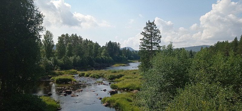
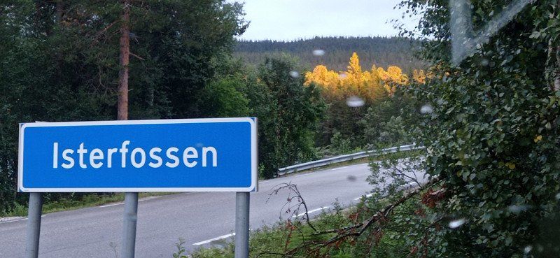
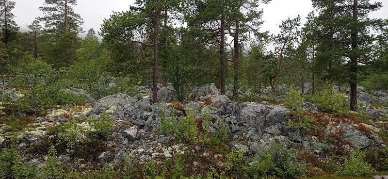
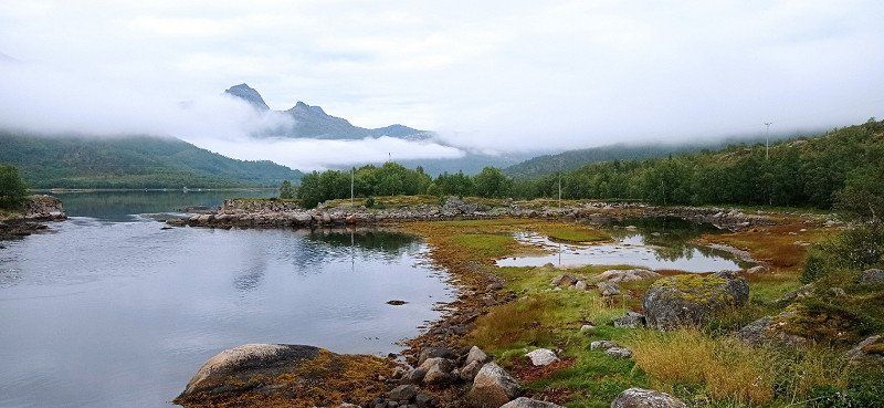
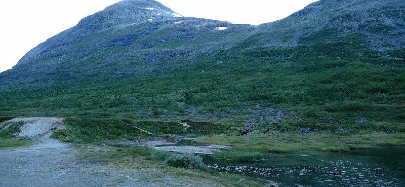
After the refreshing shower we left the campsite at around 10 a.m. and headed towards Kongsvinger. We drove on the 205 and 202 through the forest and lake area of Finnskogen. Quite lonely roads led us via Filsa and Elverum to Engerdal. There we stopped at the Rasteplaats Isterfossen. After great weather during the day it turned to rain. We treated 3 young NL canoeists to a hot coffee. They slept under a tarpaulin. They spend a week canoeing on Isterfossen. The place is on the street, but it was quiet at night. A second camper was parked next to us.
Engerdal, Norwegen
61° 53' 24.4" N 12° 1' 44.7" E
61.8901205 12.0290953
• Head north on Engerdalsveien (26). Go for 16.4 km.
• Arrive at Kopparleden (26). Your destination is on the right.
☍
16,4 km
( 12 min.)
Isterfossen Rasteplass, Sømådalen, Norwegen
Engerdal, Norwegen
61° 54' 40" N 11° 46' 40" E
61.9111109 11.7777779
• Head northwest on Kopparleden (26). Go for 24.6 km.
• Turn right onto Kopparleden (28) toward Røros/30/Os. Go for 61.4 km.
• Take the 1st exit from roundabout onto Rørosveien (30). Go for 12.4 km.
• Take the 2nd exit from roundabout onto Osloveien (30) toward Trondheim/Sentrum. Go for 7.5 km.
• Turn right onto Vintervollveien (564) toward Glåmos. Go for 44 m.
• Continue on Vintervollveien (6536). Go for 4.8 km.
• Continue on 6536. Go for 254 m.
• Turn right onto Aursundveien (561). Go for 5.5 km.
• Continue on Naustervoll Øvre (561). Go for 124 m.
• Continue on Aursundveien (6532). Go for 5.0 km.
• Continue on Stenbudalen (561). Go for 103 m.
• Continue on Aursundveien (6532). Go for 760 m.
• Continue on Nyhus (561). Go for 74 m.
• Continue on Aursundveien (6532). Go for 7.6 km.
• Continue on Storsletta (561). Go for 90 m.
• Continue on Aursundveien (6532). Go for 562 m.
• Continue on 6532. Go for 319 m.
• Continue on Aursundveien (6532). Go for 1.2 km.
• Turn left onto Ridalsveien (705). Go for 134 km.
• Turn left onto Woldsethbakken (705). Go for 31 m.
• Take ramp. Go for 116 m.
• Continue on 950. Go for 406 m.
• Continue toward 705. Go for 34 m.
• Take the 2nd exit from roundabout onto 950. Go for 355 m.
• Take the 4th exit from roundabout. Go for 285 m.
• Take ramp onto Værnestunnelen (E6). Go for 1.8 km.
• Pass 4 roundabouts and continue on Riksvegen (E6). Go for 22.5 km.
• Take the 1st exit from roundabout onto Breivegen (E6). Go for 2.8 km.
• Turn right toward Gamle Kongeveg Sør/6854. Go for 387 m.
• Take the 1st exit from roundabout onto Gamle Kongeveg Sør (6854). Go for 1.3 km.
• Continue on Gamle Kongeveg Sør (6854). Go for 3.8 km.
• Continue on 6854. Go for 227 m.
• Continue on 79. Go for 73 m.
• Continue on 6854. Go for 54 m.
• Continue on Kirkaunbakken (6854). Go for 22 m.
• Continue on Gamle E6 (6854). Go for 176 m.
• Turn left onto Eknesvegen (6856). Go for 940 m.
• Turn right and take ramp onto E6 toward E6 N. Go for 8.9 km.
• Pass 2 roundabouts and continue on Mulelia (E6). Go for 44.9 km.
• Take the 1st exit from roundabout onto 762 toward Ogndal/759/Henning/Sentrum. Go for 220 m.
• Take the 2nd exit from roundabout onto 762. Go for 410 m.
• Continue on Kongens gate (762). Go for 473 m.
• Continue on Kongens gate. Go for 1.0 km.
• Turn right toward Byavegen/763. Go for 33 m.
• Continue on Byavegen (763). Go for 3.8 km.
• Turn left onto Stodvegen (763). Go for 33.3 km.
• Arrive at Sørsivegen (763).
☍
394,9 km
(5 hrs. 20 min.)
Day
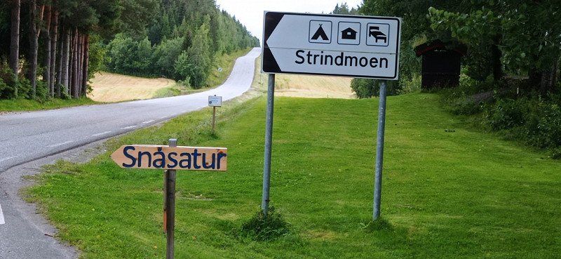
Strindmo Gård Camping
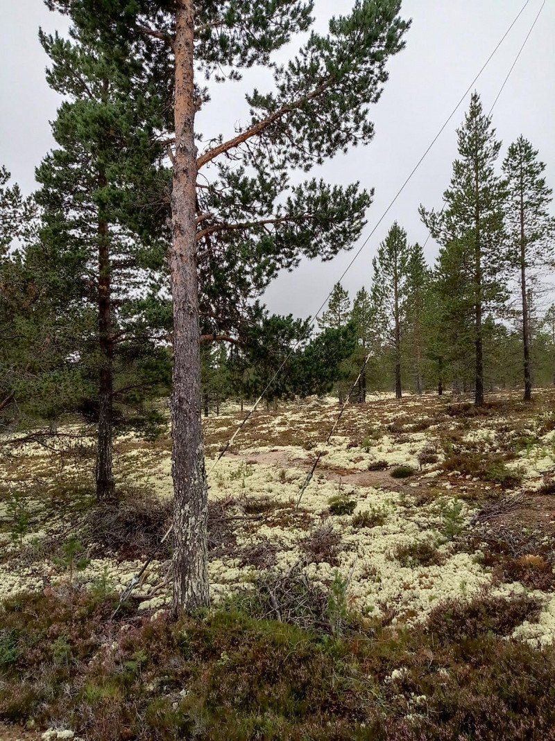
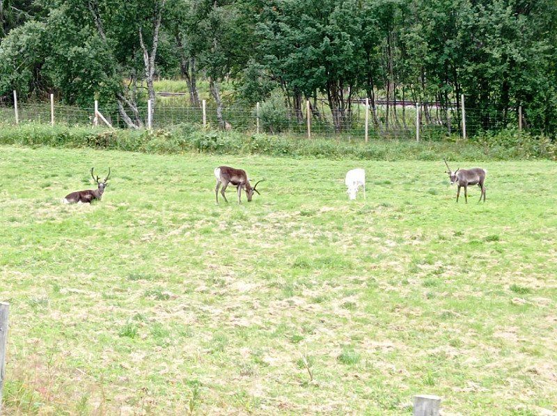
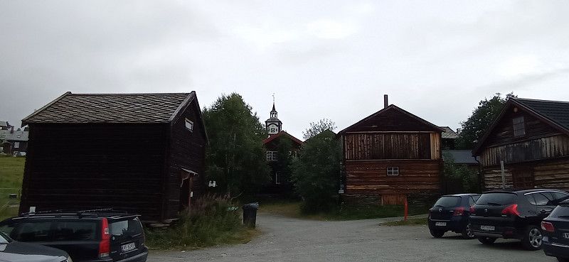
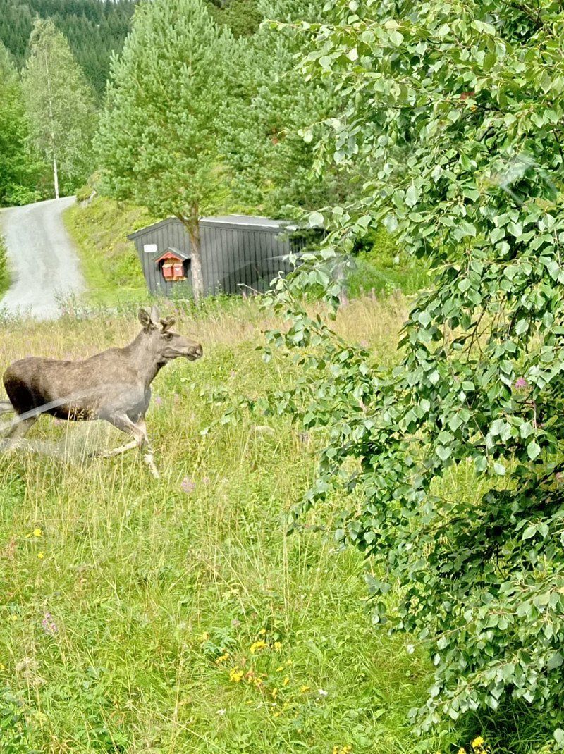
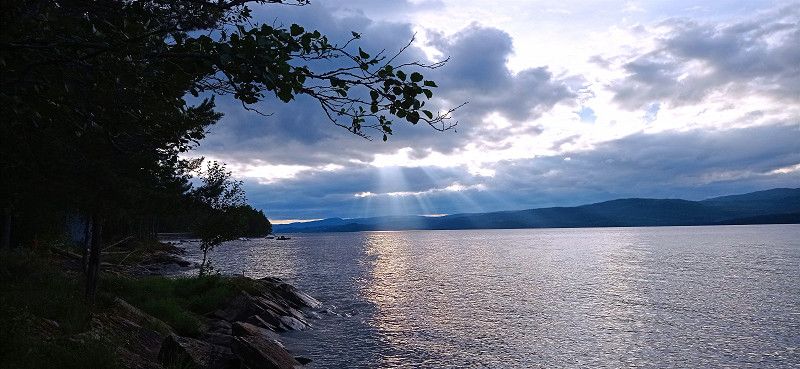
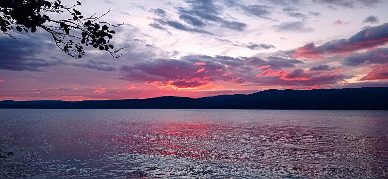
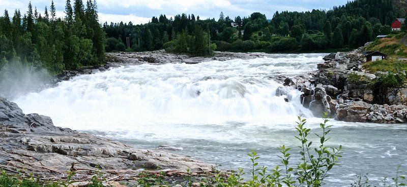
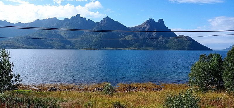
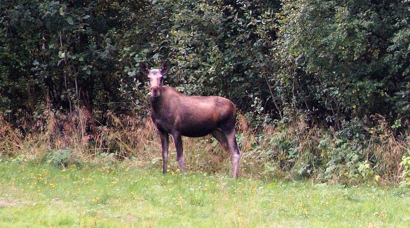
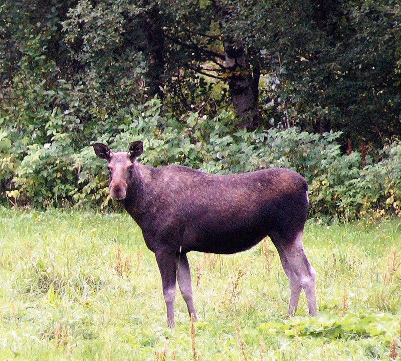
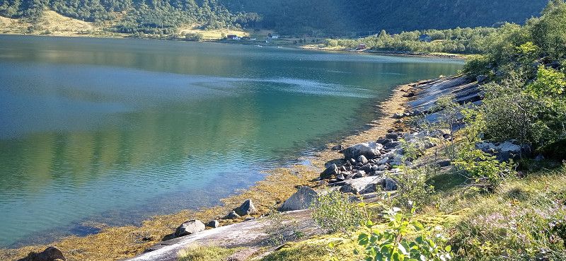
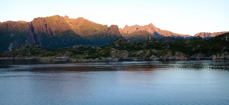
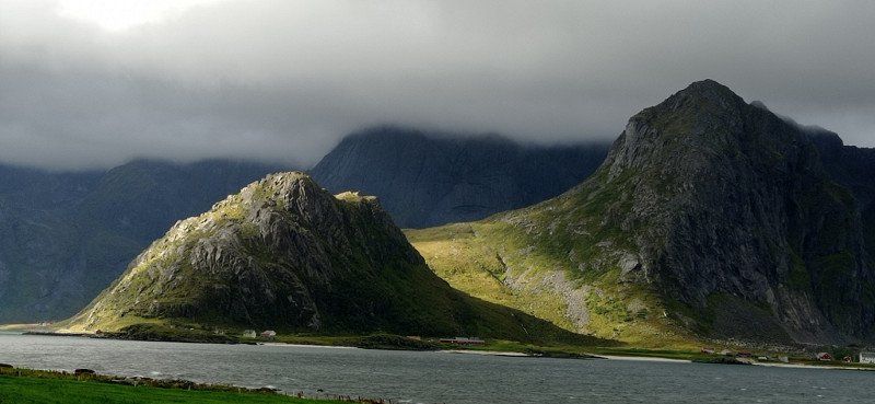
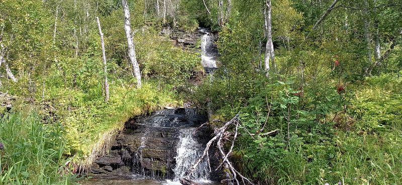
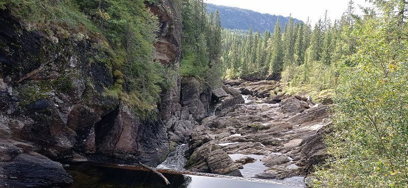
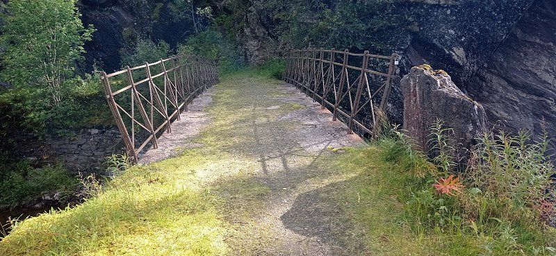
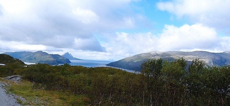
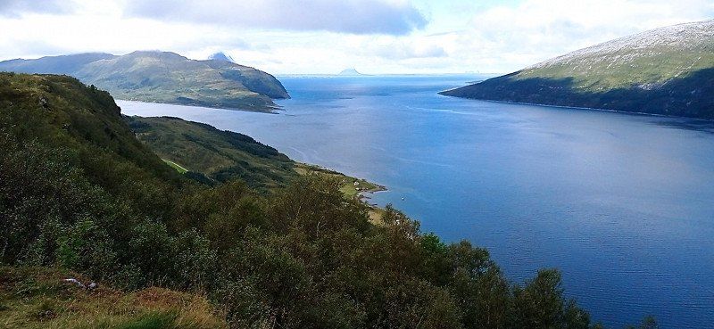
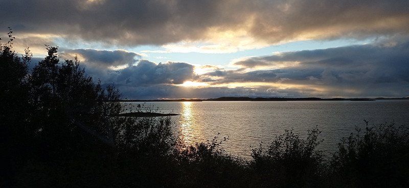
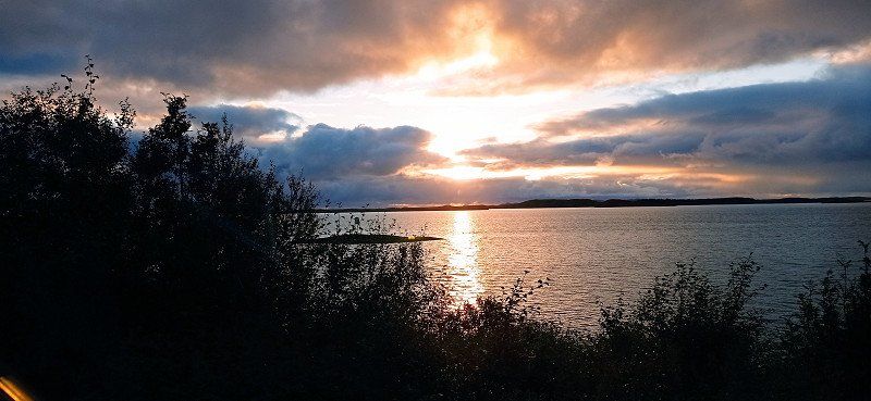
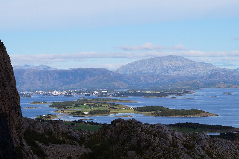
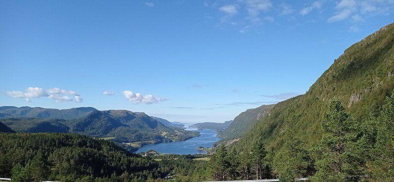
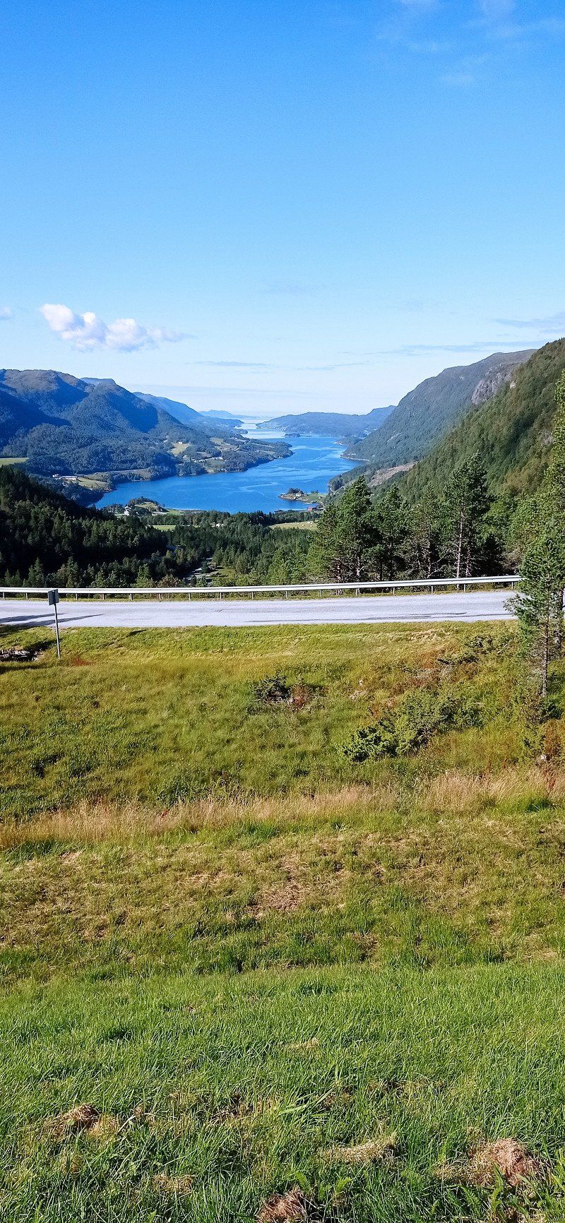
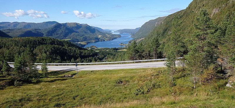
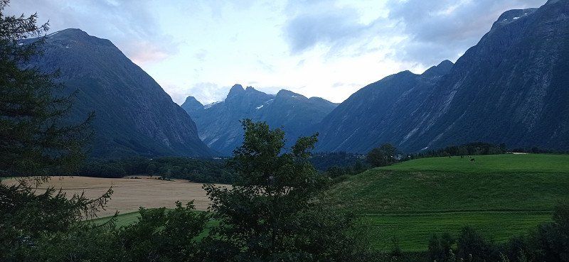
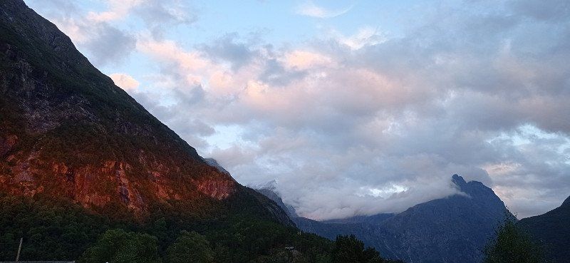
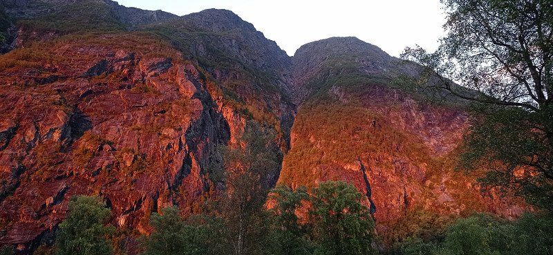
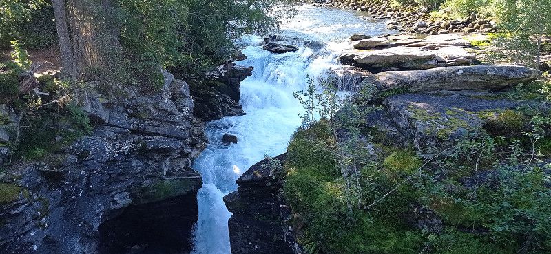
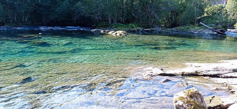
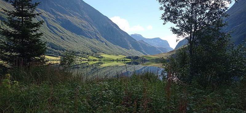
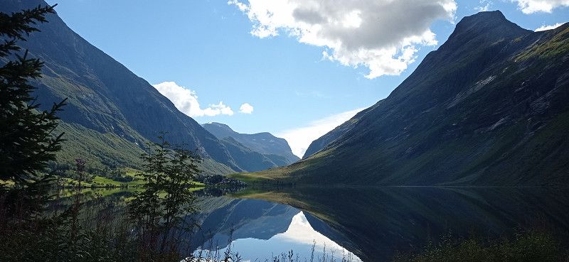
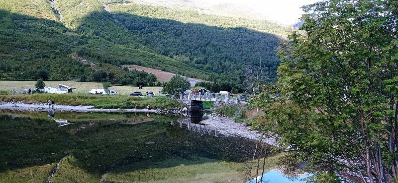
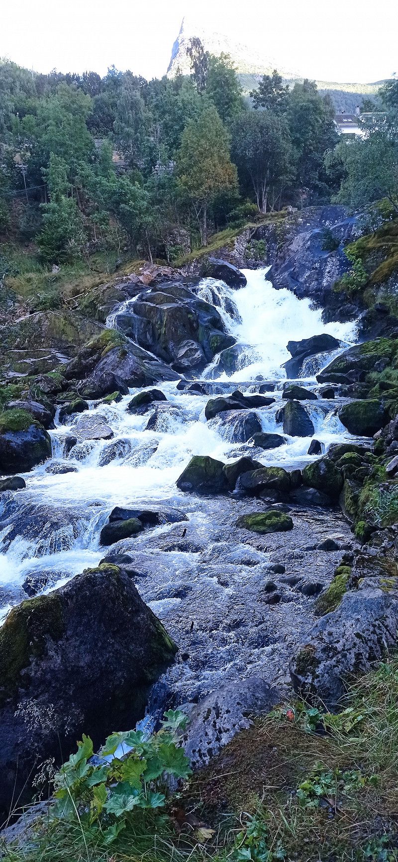
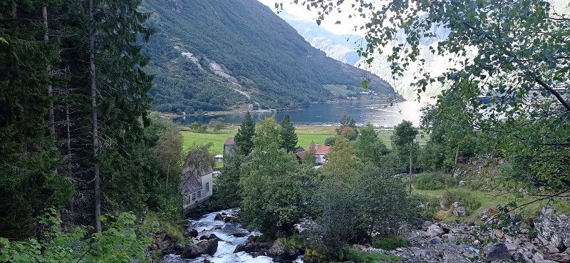
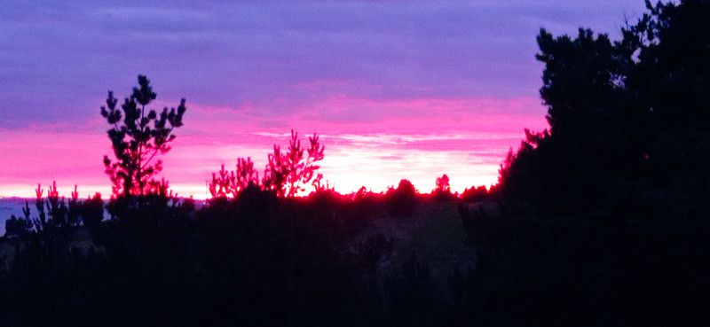
First we drove past the 28 at the Fermundensee. We touched the Fermundsmarka National Park with many beautiful lakes and rich in forest. We stopped in the UNESCO World Heritage town of Røros. An interesting place with its wooden houses blackened by copper quarrying. The place looks rustic but well-kept. And environmentally conscious with the grass-covered roofs. We enjoyed delicious cocoa and, for the first time, the cinnamon rolls known for Norway in a quaint little café. We paid parking fees, but unfortunately found out later that you could have parked for free at the museum of the old copper factory. From Røros we drove over the 30 along the river Gaula. We touched the foothills of the Forollhogna National Park with its mountain birch slopes. The vegetation there is covered with lichens. Everything shimmered bright green. On the way we were greeted by 4 reindeer and 1 moose. He came towards us on the road and then crossed. A snapshot succeeded. There are various farms and huts in the Gaudalental. Sheep often graze right next to the road. At Støren we drove onto the E6 and passed Trondheim and then the fjord of the same name. We stayed at Strindmoen campsite by Snåsvatnet. The campsite is simple but clean. An underpass leads to the lake, where we photographed a beautiful sunset. At the back of the site, a small waterfall rushes towards the lake. Despite the train and road, we slept well. The morning shower was okay too.
Strindmo, 7760, Snåsa, Norwegen
64° 10' 22" N 12° 5' 45" E
64.1727700 12.0958300
• Head toward Austmoen on Sørsivegen (763). Go for 20.5 km.
• Turn right onto 7008. Go for 212 m.
• Continue on Elverheim (7008). Go for 125 m.
• Continue on 7008. Go for 5.0 km.
• Turn right onto Heiavegen (E6). Go for 116 km.
• Arrive at Majavassvegen (E6). Your destination is on the right.
☍
141,7 km
(1 hrs. 54 min.)
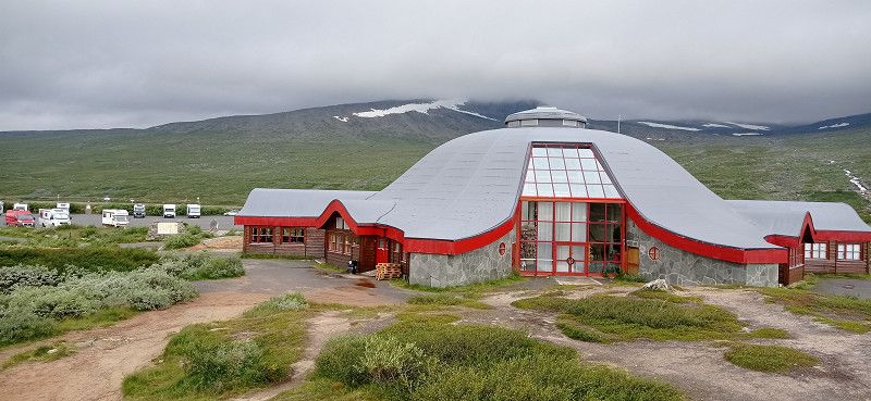
Day
Artic Circle Center A6
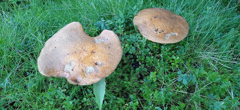
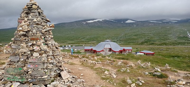
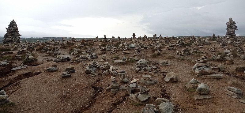
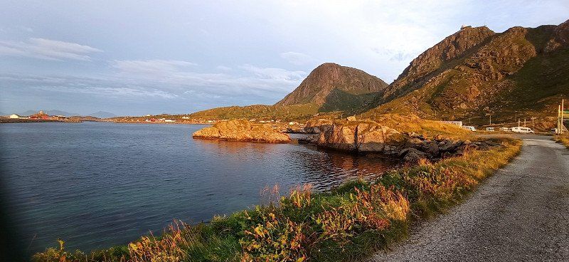
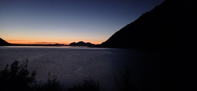
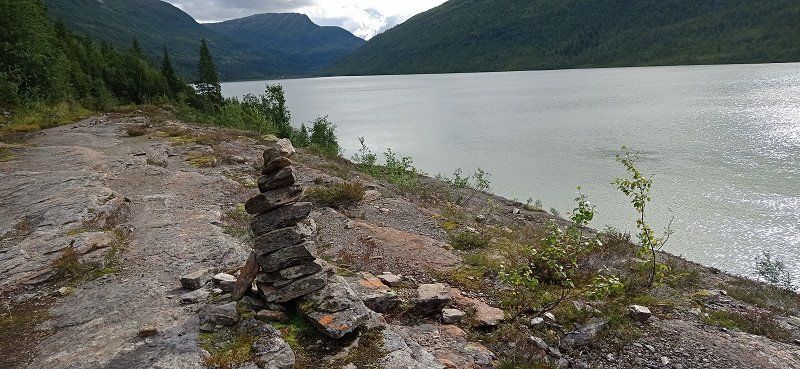
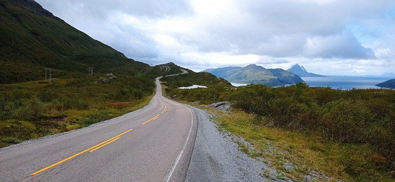
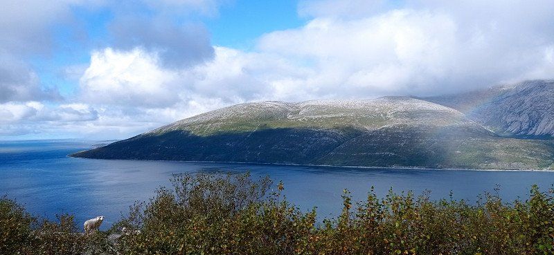
From Snåsa we drove along the lake to the E6. At Larksforsen we took a break and visited the wide waterfall there. Of course we took photos at the gateway to Nordland. (Trøndelag near Trofors) There we met a group of German bus tourists with whom we talked briefly. We stayed in a parking lot just before the center of the Arctic Circle. There was a small hut with a toilet. A small access road led from the parking lot to the Ranelva River. There were many mushrooms growing there, but we didn't touch them. Another Womo and a truck were parked next to us. A little further is a parking space directly at the Artic Center. There at the Arctic Circle we visited the monuments and the cairns. It wasn't very crowded in the morning, but according to the location it was already quite cool.
Nordlandsporten, E6, Trofors, Norwegen
E6 111, 8680 Trofors, Norwegen
65° 6' 3.3" N 13° 20' 32.9" E
65.1009274 13.3424851
• Head north on Majavassvegen (E6). Go for 63.9 km.
• Turn left toward Laksforsvegen. Go for 188 m.
• Continue on Laksforsvegen. Go for 482 m.
• Arrive at Laksforsvegen. Your destination is on the left.
☍
64,5 km
( 47 min.)
Laksforsen, Trofors, Norwegen
Laksforsen, Grane, Norwegen
65° 37' 25.4" N 13° 17' 29.3" E
65.6237251 13.2914796
• Head south on Laksforsvegen. Go for 670 m.
• Turn left onto E6. Go for 27.7 km.
• Take the 1st exit from roundabout onto E6 toward Narvik. Go for 1.2 km.
• Take the 1st exit from roundabout onto Vollanvegen (E6) toward Narvik. Go for 4.3 km.
• Pass 2 roundabouts and continue on E6. Go for 79.5 km.
• Take the 1st exit from roundabout onto E6 toward Narvik. Go for 747 m.
• Pass 5 roundabouts and continue on Selforsveien (E6). Go for 2.7 km.
• Take the 1st exit from roundabout onto Saltfjellveien (E6) toward Narvik. Go for 77.9 km.
• Turn right. Go for 324 m.
• Turn left. Go for 30 m.
• Arrive at your destination on the right.
☍
195,1 km
(2 hrs. 31 min.)
Arctic Circle Center, Saltfjellveien, Storforshei, Norwegen
Saltfjellveien 1850, 8630 Storforshei, Norwegen
66° 33' 8.7" N 15° 19' 20.9" E
66.5524207 15.3224647
• Head northwest. Go for 38 m.
• Turn left. Go for 78 m.
• Turn right toward Saltfjellveien/E6. Go for 284 m.
• Turn right onto Saltfjellveien (E6). Go for 95.3 km.
• Take the 1st exit from roundabout onto Storgaten (E6) toward Narvik. Go for 416 m.
• Take the 1st exit from roundabout onto Follaveien (E6) toward Narvik. Go for 117 km.
• Take the 2nd exit from roundabout onto E6. Go for 46.7 km.
• Turn left onto 85 toward E10/Ferge Lødingen/Ferge Å i Lofoten. Go for 257 m.
• Take the Bognes-Lødingen Ferry. Stay on for 23.3 km.
• Head toward Sjøvegen on 85. Go for 312 m.
• Turn right onto 85. Go for 2.0 km.
• Turn left onto Kong Olavs vei (E10). Go for 7.0 km.
• Turn left onto Vestbygdvegen (837). Go for 5.3 km.
• Turn right onto Vestbygdvegen (837). Go for 22.4 km.
• Turn left onto Offersøyvegen (7544). Go for 2.5 km.
• Arrive at Offersøyvegen (7544).
☍
322,8 km
(5 hrs. 28 min.)
Day
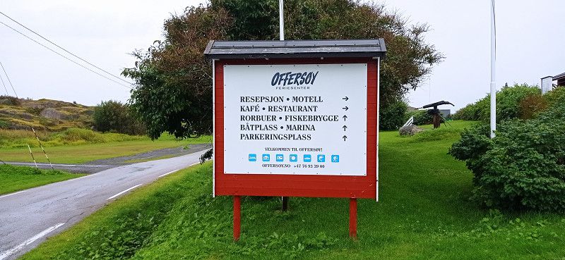
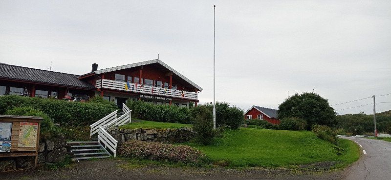
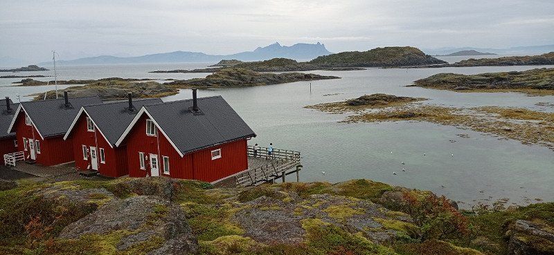
Offersøy
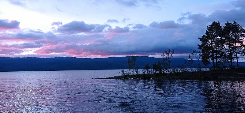
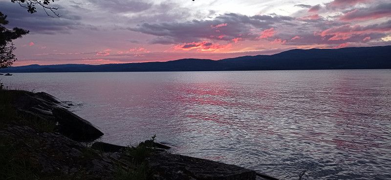
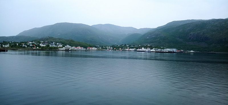
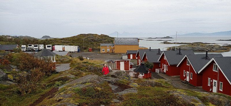
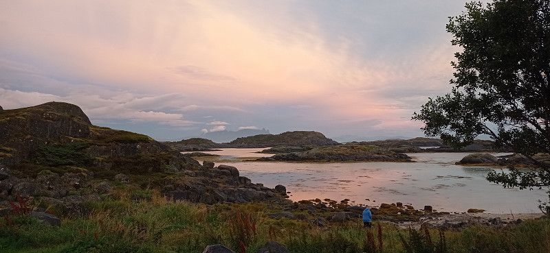
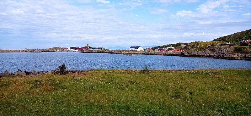
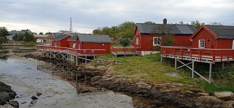
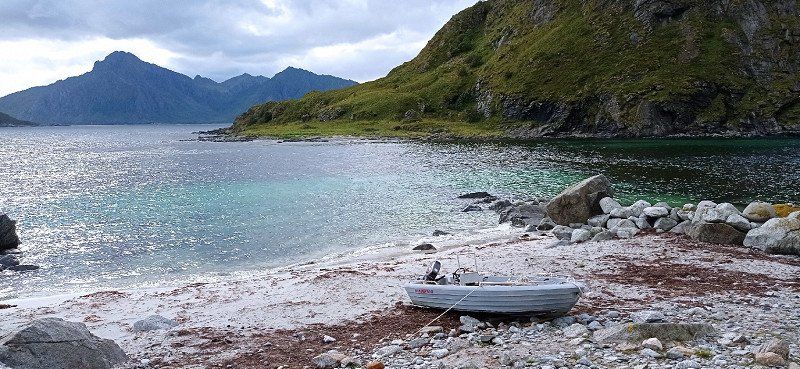
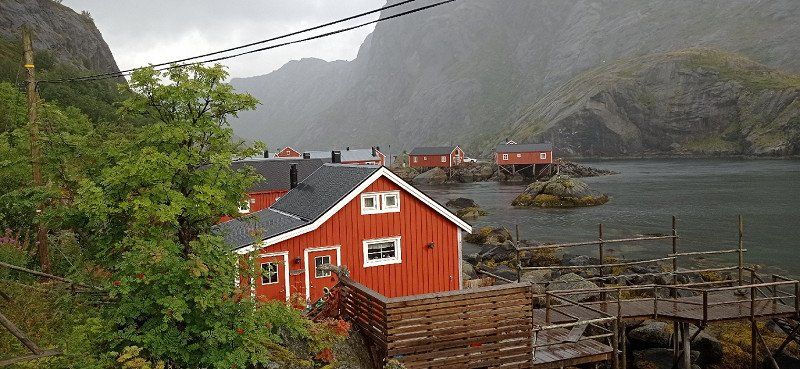
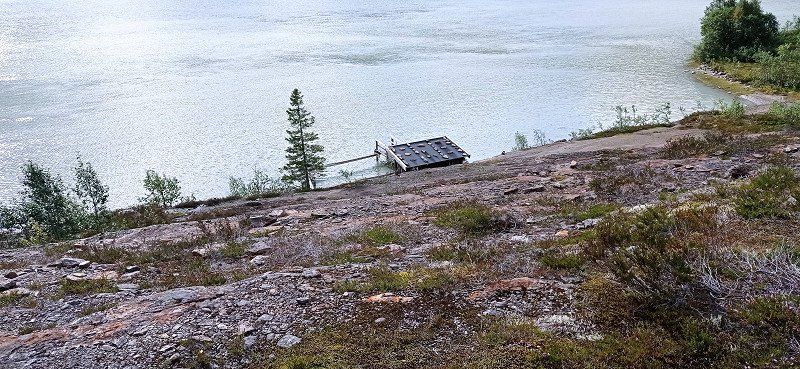
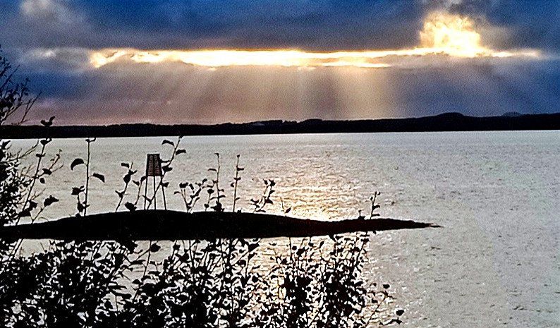
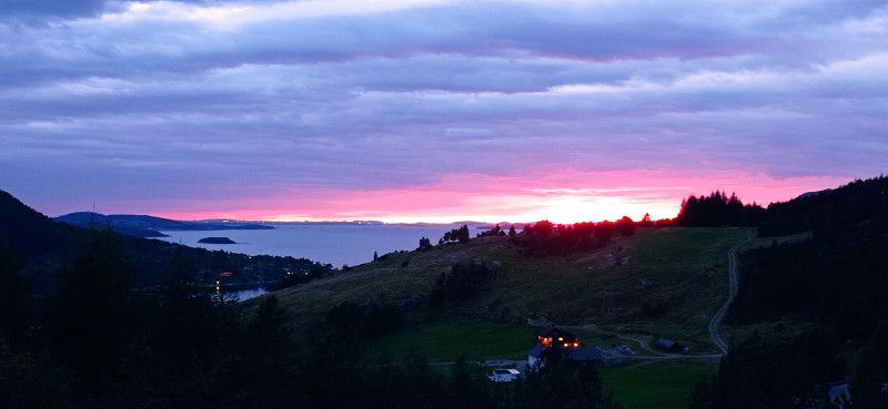
We took the Bognes - Lodingen ferry and then made a detour to the Offersøy holiday center on the island of Hinnøya off the Lofoten. We looked for a parking space and registered. The grass field was heavily sodden and provided with an electricity connection. If we had done without electricity, a great pitch a little further down by the sea would have been a better choice. The view from there is just beautiful. The red fisherman's huts belonging to the complex also blend wonderfully into the landscape. We stayed here for one night and enjoyed the sunset.
Norwegen
68° 18' 35.6" N 15° 38' 31.7" E
68.3098899 15.6421297
• Head northwest on Offersøyvegen (7544). Go for 39 m.
• Turn sharp left onto Offersøyvegen. Go for 35 m.
• Arrive at Offersøyvegen. Your destination is on the right.
☍
0,1 km
( )
Offersøy Feriesenter AS, Vestbygd, Norwegen
Offersøy, 8412 Vestbygd, Norwegen
68° 18' 35.2" N 15° 38' 29.5" E
68.3097720 15.6415270
• Head north on Offersøyvegen. Go for 35 m.
• Turn slightly left onto Offersøyvegen (7544). Go for 2.4 km.
• Turn right onto Vestbygdvegen (7542). Go for 6.6 km.
• Continue on Vestbygdvegen (837). Go for 165 m.
• Turn slightly left onto Vestbygdvegen (837). Go for 14.9 km.
• Turn slightly right onto Vestbygdvegen (837). Go for 632 m.
• Continue toward Vestbygdvegen/837. Go for 24 m.
• Turn right onto Vestbygdvegen (837). Go for 5.3 km.
• Turn left onto Kanstadvegen (E10). Go for 11.1 km.
• Take the 2nd exit from roundabout onto Våtvollveien (85). Go for 14.4 km.
• Turn left onto Kong Olavs vei (85). Go for 14.3 km.
• Continue on Strandveien (85). Go for 4.6 km.
• Turn left onto Kong Olavs vei (82). Go for 1.2 km.
• Take the 1st exit from roundabout onto Vesterålsgata (820). Go for 621 m.
• Continue on Vesterålsveien (820). Go for 14.3 km.
• Turn right onto 821. Go for 8.1 km.
• Continue on Åsen (821). Go for 71 m.
• Continue on 821. Go for 10.8 km.
• Continue on Sortlandsveien (821). Go for 2.9 km.
• Continue on 821. Go for 355 m.
• Continue on Storgata (821). Go for 633 m.
• Turn right onto Støveien (7668). Go for 418 m.
• Continue on 7668. Go for 5.1 km.
• Turn left onto 7668. Go for 2.4 km.
• Continue on 7668. Go for 5.2 km.
• Continue on 935. Go for 122 m.
• Continue on 7668. Go for 1.2 km.
• Turn slightly left toward Fiskeværsveien. Go for 137 m.
• Continue on Fiskeværsveien. Go for 715 m.
• Arrive at your destination on the left.
☍
128,9 km
(2 hrs. 25 min.)
Day
Stø Camping
In the morning fog lay over the Rorbuern. Always nice views along the way. Via the island of Hinnøya we went to the Sortlandsbrua bridge in the direction of Vesterålen. This bridge connects Hinnøya with Langøya in Vesterålen. The bridge at Sortland is impressive and offers a view of Sortland Sound. We drove past the Lifjorden to Stø. Destination whale watching. We first visited the Artic Whale Tours office but could not find anyone there until the evening. So we drove a little further to the parking lot. We had chosen a pitch right on the water. The place and the sanitary facilities are otherwise rather rustic and probably benefit from the proximity to the whale tours. In the evening we learned that a announced storm would not allow us to leave for the next two days. We decided to stay.
Myre, 8430, Norwegen
69° 1' 9.1" N 15° 6' 31.6" E
69.0192000 15.1087700
• Head south. Go for 237 m.
• Turn slightly right onto Fiskeværsveien. Go for 615 m.
• Turn slightly right onto 7668. Go for 431 m.
• Continue on 7668. Go for 764 m.
• Continue on 935. Go for 122 m.
• Continue on 7668. Go for 7.6 km.
• Turn right onto 7668. Go for 5.1 km.
• Continue on Støveien (7668). Go for 418 m.
• Turn left onto Storgata (821). Go for 633 m.
• Continue on 821. Go for 355 m.
• Continue on Sortlandsveien (821). Go for 2.9 km.
• Continue on 821. Go for 10.8 km.
• Continue on Åsen (821). Go for 71 m.
• Continue on 821. Go for 8.1 km.
• Turn left onto Vesterålsveien (820). Go for 14.3 km.
• Continue on Vesterålsgata (820). Go for 598 m.
• Take the 2nd exit from roundabout onto Kong Olavs vei (82). Go for 332 m.
• Arrive at Kong Olavs vei (82). Your destination is on the left.
☍
53,5 km
(1 hrs. 1 min.)
Sortlandsbrua, Sortland, Norwegen
68° 42' 23.3" N 15° 25' 10" E
68.7064723 15.4194517
• Head west on Kong Olavs vei (82). Go for 257 m.
• Take the 1st exit from roundabout onto Vesterålsgata (820). Go for 621 m.
• Continue on Vesterålsveien (820). Go for 14.3 km.
• Turn right onto 821. Go for 8.1 km.
• Continue on Åsen (821). Go for 71 m.
• Continue on 821. Go for 10.8 km.
• Continue on Sortlandsveien (821). Go for 2.9 km.
• Continue on 821. Go for 355 m.
• Continue on Storgata (821). Go for 633 m.
• Turn right onto Støveien (7668). Go for 418 m.
• Continue on 7668. Go for 5.1 km.
• Turn left onto 7668. Go for 2.4 km.
• Continue on 7668. Go for 5.2 km.
• Continue on 935. Go for 122 m.
• Continue on 7668. Go for 1.2 km.
• Turn slightly left toward Fiskeværsveien. Go for 137 m.
• Continue on Fiskeværsveien. Go for 715 m.
• Arrive at your destination on the right.
☍
53,5 km
(1 hrs. )
Day
Stø Camping, Fiskeværsveien, Stø, Norwegen
It was very windy during the day. So we parked the mobile home near the reception. Despite the wind and light rain, we hiked from the Sto pitch in the direction of Nyksund to the sandy beach of Skipssand. The Dronningruta hike is slightly difficult and not easy because of the damp paths, but it was fun. In the evening the storm increased. It got so violent that we drove off the site and parked the camper on the unpaved parking lot in front of it. There it was somewhat more protected by rocks in front of it. A little later other campers followed our example. Nevertheless, the storm tugged at our nerves all night. But everything went well.
Fiskeværsveien, 8438 Stø, Norwegen
69° 1' 9.4" N 15° 6' 33.1" E
69.0192873 15.1091908
• Head south. Go for 237 m.
• Turn slightly right onto Fiskeværsveien. Go for 615 m.
• Turn slightly right onto 7668. Go for 431 m.
• Continue on 7668. Go for 764 m.
• Continue on 935. Go for 122 m.
• Continue on 7668. Go for 7.6 km.
• Turn right onto 7668. Go for 5.1 km.
• Continue on Støveien (7668). Go for 418 m.
• Turn left onto Storgata (821). Go for 633 m.
• Continue on 821. Go for 355 m.
• Continue on Sortlandsveien (821). Go for 2.4 km.
• Turn right onto Oppmyreveien. Go for 458 m.
• Arrive at Oppmyreveien. Your destination is on the left.
☍
19,2 km
( 29 min.)
Day
Oppmyre Camping und Wal-Safari
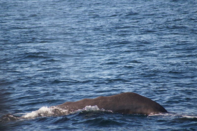
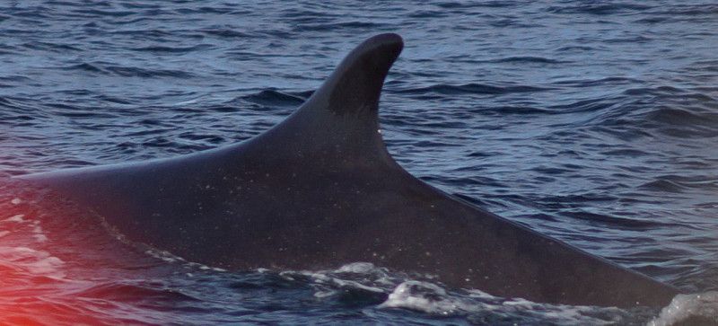
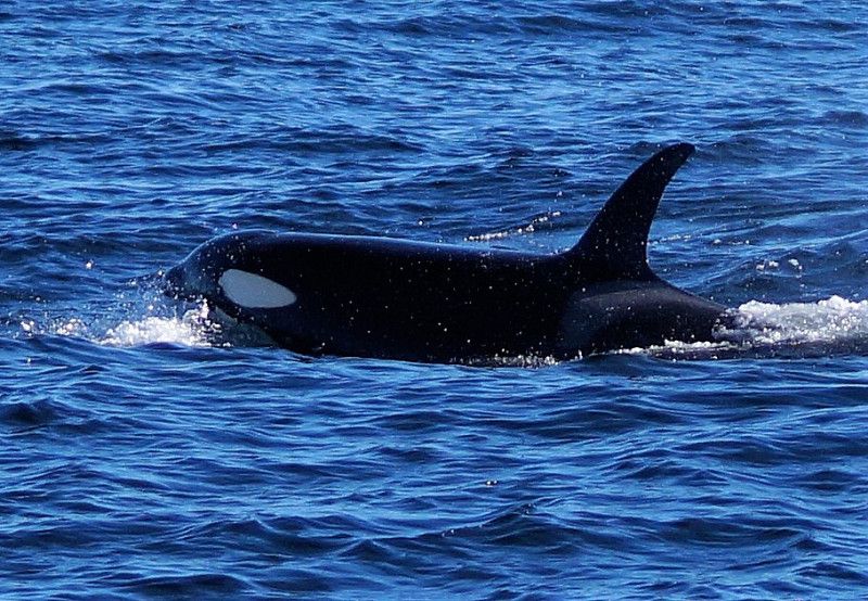
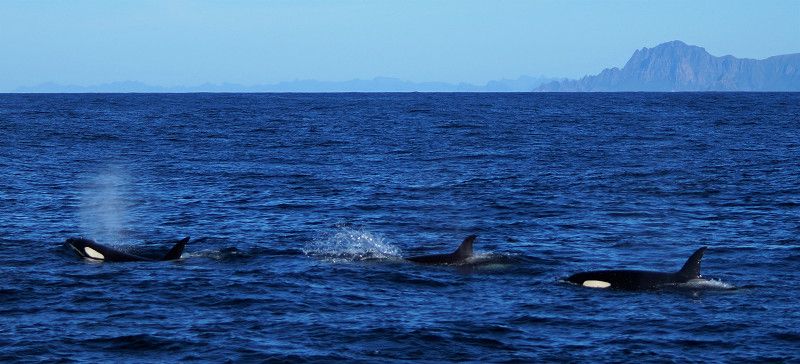
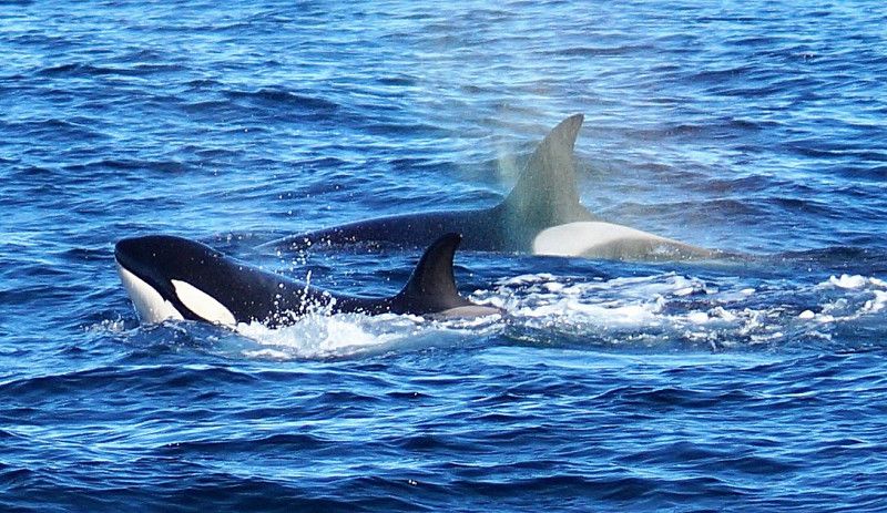
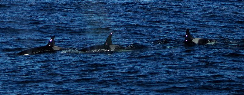
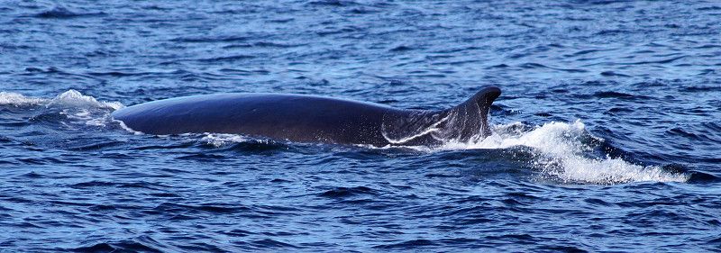
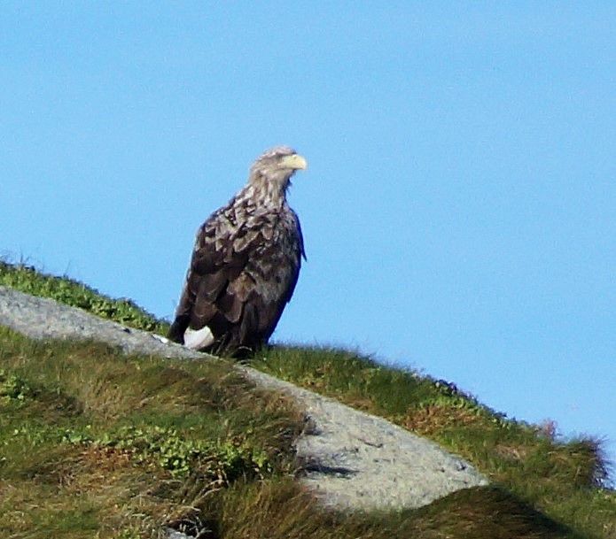
Two nights were enough for us at the square in Stø. Therefore, we accepted a somewhat longer journey and stayed for one night at the well-kept and idyllic Oppmyre Camping site near Myre with its exemplary equipped and clean sanitary facilities. Each camper pitch with a view of the fjord is assigned a wooden platform as a terrace. On Wednesday the sun was shining and we were finally able to take part in the whale safari. The sea was still rough. The pills offered by the organizer helped us. The team tried very hard and so we were able to experience Finn whales, sperm whales and killer whales in the wild. We saw several groups of orcas. The tour was rounded off with a sighting of some white-tailed eagles. Overall an impressive experience. Unfortunately, everyone wanted to take the best photo and make the most beautiful film, just like us, of course. That's why there was always a big crowd at the railing.
Oppmyreveien 53, 8430, Myre, Norway
68° 53' 32.9" N 15° 5' 7.9" E
68.8924800 15.0855200
• Head southeast on Oppmyreveien. Go for 458 m.
• Turn right onto Sortlandsveien (821). Go for 555 m.
• Continue on 821. Go for 10.8 km.
• Continue on Åsen (821). Go for 71 m.
• Continue on 821. Go for 8.1 km.
• Turn left onto Vesterålsveien (820). Go for 14.3 km.
• Continue on Vesterålsgata (820). Go for 598 m.
• Take the 2nd exit from roundabout onto Kong Olavs vei (82). Go for 1.2 km.
• Turn right onto Strandveien (85). Go for 4.6 km.
• Continue on Kong Olavs vei (85). Go for 14.3 km.
• Turn right onto Våtvollveien (85). Go for 14.3 km.
• Take the 1st exit from roundabout onto E10. Go for 48.1 km.
• Turn right onto Kong Olavs vei (82). Go for 1.2 km.
• Turn left onto Midnattsolveien (7638). Go for 5.8 km.
• Continue on Sellåter (7638). Go for 115 m.
• Continue on Midnattsolveien (7638). Go for 2.1 km.
• Continue on Morfjordneset (7638). Go for 102 m.
• Continue on Midnattsolveien (7638). Go for 1.6 km.
• Continue on 7638. Go for 12 m.
• Continue on Morfjorden (7638). Go for 75 m.
• Continue on Midnattsolveien (7638). Go for 1.6 km.
• Continue on 7638. Go for 16 m.
• Continue on Midnattsolveien (7638). Go for 3.3 km.
• Continue on 7638. Go for 16 m.
• Continue on Midnattsolveien (7638). Go for 501 m.
• Continue on Sommarhusstranda (7638). Go for 68 m.
• Continue on Midnattsolveien (7638). Go for 1.8 km.
• Continue on 7638. Go for 15 m.
• Continue on Midnattsolveien (7638). Go for 7.3 km.
• Continue on 7638. Go for 540 m.
• Arrive at 7638.
☍
143,6 km
(2 hrs. 3 min.)
Day
Parkbucht Mitnattsolveien Stronstad
On 8/24/22 we wanted to make up some time and drove for several hours. On the way we saw cranes and mooses. We took the Melbu ferry to Fiskebøl, leaving Vesterålen towards Lofoten. Towards evening we found a nice parking bay and enjoyed the sunset with a direct view of the Morfjord.
Midnattsolveien, Laukvik, Norwegen
Midnattsolveien, 8315 Laukvik, Norwegen
68° 23' 40.4" N 14° 33' 34.1" E
68.3945511 14.5594774
• Head west on 7638. Go for 976 m.
• Continue on Midnattsolveien (7638). Go for 3.7 km.
• Turn left onto Midnattsolveien (7638). Go for 8.2 km.
• Continue on 7638. Go for 13 m.
• Continue on Midnattsolveien (7638). Go for 9.0 km.
• Continue on Jordneset (7638). Go for 73 m.
• Continue on Midnattsolveien (7638). Go for 18 m.
• Turn sharp right onto Vestpollveien (E10). Go for 15.8 km.
• Take the 1st exit from roundabout onto Kong Olavs vei (E10). Go for 15.5 km.
• Turn left onto Henningsværveien (816). Go for 7.3 km.
• Turn slightly right onto Henningsværveien (816). Go for 109 m.
• Continue on Henningsværveien (816). Go for 245 m.
• Turn right onto Dreyers gate. Go for 30 m.
• Turn left onto Dreyers gate. Go for 292 m.
• Turn right onto Dreyers gate. Go for 265 m.
• Continue on Hellandsgata. Go for 500 m.
• Arrive at Hellandsgata.
☍
62,0 km
(1 hrs. 3 min.)
Day
Eggum, Stellplatz
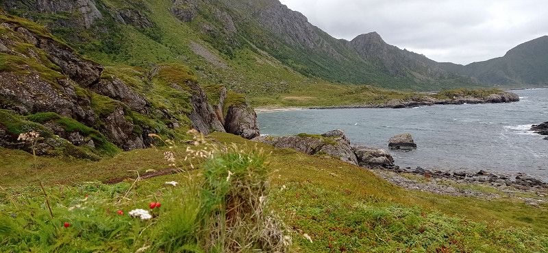
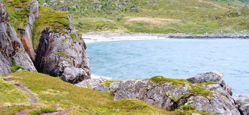
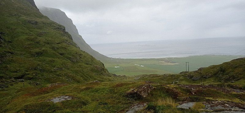
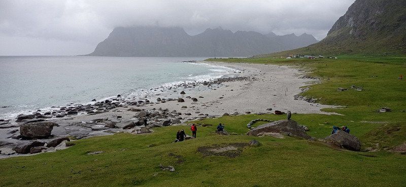
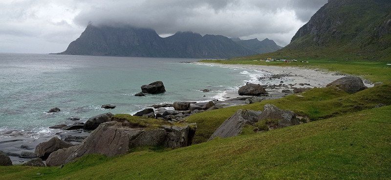
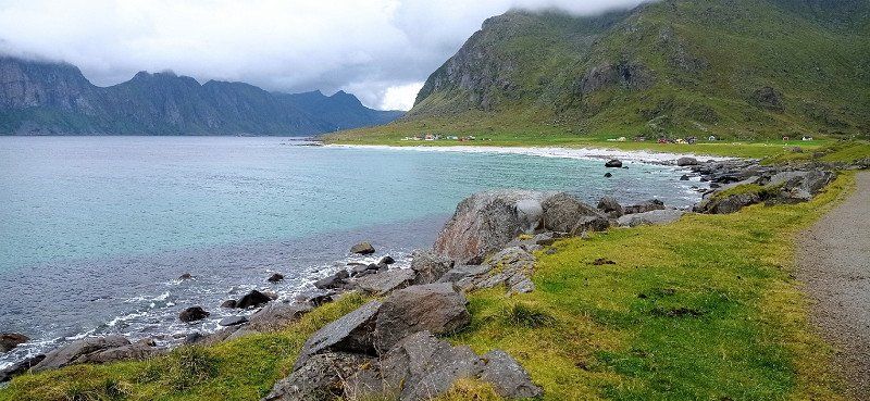
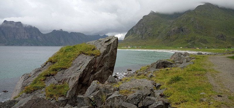
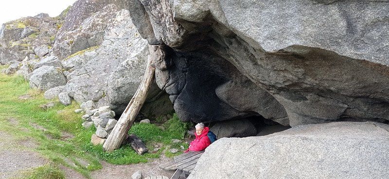
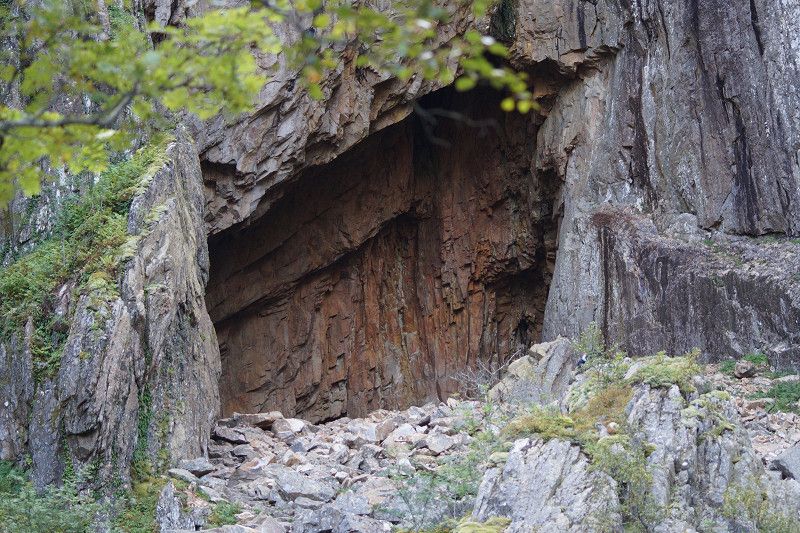
In the morning the sun shone from a deep blue sky. We drove on through a picture book landscape. The destination was the fishing village of Henningsvær. Passing a dream beach and high cliffs, we reached the parking lot in front of the bridge. 2 hours free parking time. So walk over the bridge and look at the place. Worth seeing in the port. We walked to the rorbuer, but it wasn't worth it. Back to the car, time was running out. At the parking lot there was already a check by the municipality. It was just enough. The goal was supposed to be Gimsøysand, but somehow we missed it. So we ended up in Eggum. The access to the nature reserve and the parking space can be reached through a gate. If you continue through it, you get to the kiosk below the tower built by the Germans during the war, now a ruin. In the kiosk you pay for the parking space and can use the toilet. We had a great view of the sea and hiked towards Unstad. Many sheep could be seen, some of which populated high cliffs. We took a look at the artwork Head. And there is also much else to see. At that time it was not crowded. In the evening the play of light is overwhelming.
Henningsvær, Norwegen
68° 9' 15.1" N 14° 12' 26.1" E
68.1541872 14.2072535
• Head toward Ole Juuls gate on Hellandsgata. Go for 500 m.
• Continue on Dreyers gate. Go for 340 m.
• Turn left onto Dreyers gate. Go for 17 m.
• Turn right onto Dreyers gate. Go for 226 m.
• Turn left onto Henningsværveien (816). Go for 7.7 km.
• Turn left onto Kong Olavs vei (E10). Go for 37.9 km.
• Turn right onto Hovdveien (7724). Go for 685 m.
• Turn left onto Eggumsveien (7724). Go for 1.6 km.
• Turn slightly right onto Eggumsveien (7724). Go for 1.5 km.
• Continue on Eggumsveien (7724). Go for 2.4 km.
• Turn left onto Eggumsveien (7724). Go for 2.7 km.
• Turn slightly left onto Eggumsveien (7724). Go for 1.5 km.
• Arrive at Eggumsveien. Your destination is on the right.
☍
57,1 km
(1 hrs. 4 min.)
Eggum rasteplass, Eggumsveien, Bøstad, Norwegen
Eggumsveien, 8360 Bøstad, Norwegen
68° 18' 28.7" N 13° 39' 11.7" E
68.3079647 13.6532485
• Head northeast on Eggumsveien. Go for 4.2 km.
• Turn right onto Eggumsveien (7724). Go for 5.5 km.
• Turn right onto Hovdveien (7724). Go for 685 m.
• Turn right onto Vikingveien (E10). Go for 10.2 km.
• Turn right onto Leiteveien (7606). Go for 821 m.
• Continue on Leiteveien (7606). Go for 737 m.
• Turn right onto Vikveien. Go for 26 m.
• Turn slightly left onto Vikveien. Go for 2.8 km.
• Turn right onto Uttakleivveien (7716). Go for 702 m.
• Continue on 7716. Go for 65 m.
• Turn left. Go for 205 m.
• Arrive at your destination on the left.
☍
26,0 km
( 35 min.)
Day
Hauklandstrand, Stellplatz Voegeveien
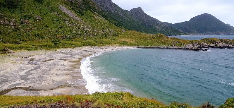
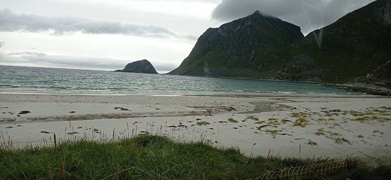
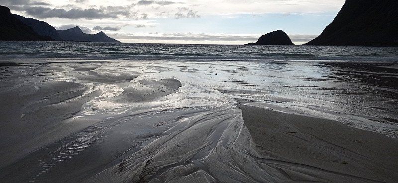
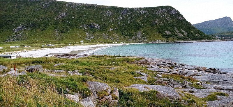
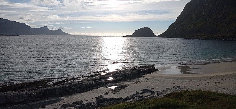
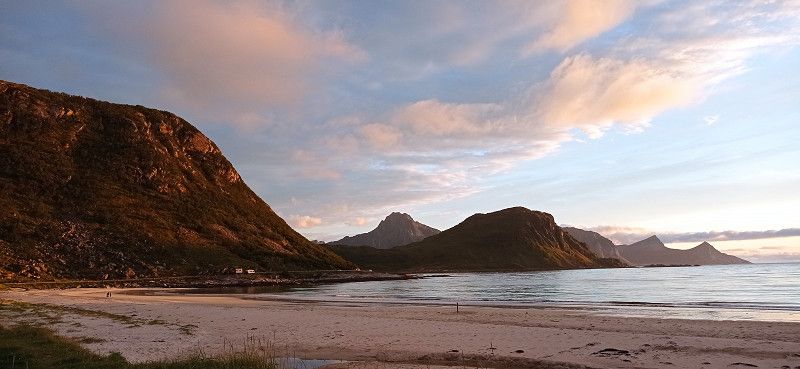
From Eggum we first drove to the Winking Museum near Borg. Interestingly presented and very suitable for some nice pictures. Then we got to Haukland Beach, a real dream beach. As previously read, we pulled onto a lawn in front of the beach after removing the driveway rope. As announced, it wasn't long before an older gentleman came to collect the money. There was no service, but the location encouraged us to stay 2 nights. A first walk on the beach let us experience wonderful views. And as before, our enthusiasm for nature increased in the evening.
Haukland Beach, Uttakleivveien, Leknes, Norwegen
Hauklandstranda, Uttakleivveien 200, 8370 Leknes, Norwegen
68° 11' 55" N 13° 31' 43.4" E
68.1986162 13.5287091
• Head northeast. Go for 205 m.
• Turn left onto 7716. Go for 1.2 km.
• Continue on Uttakleivveien (7716). Go for 349 m.
• Turn left onto Uttakleivveien. Go for 783 m.
• Arrive at Uttakleivveien.
☍
2,6 km
( 5 min.)
Day
Uttakleiv-Strand
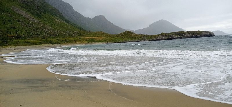
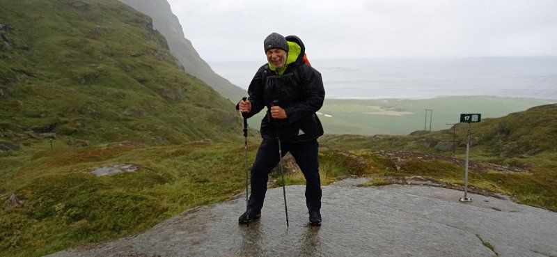
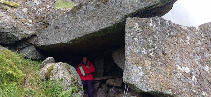
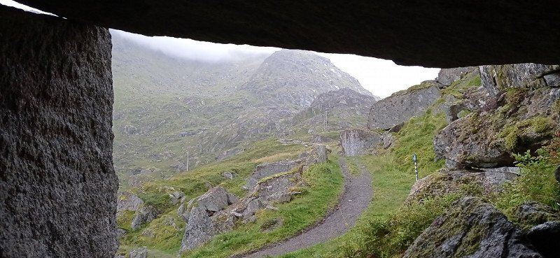
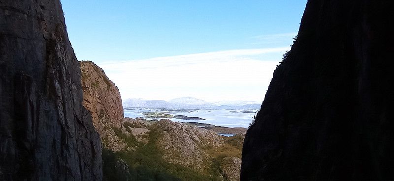
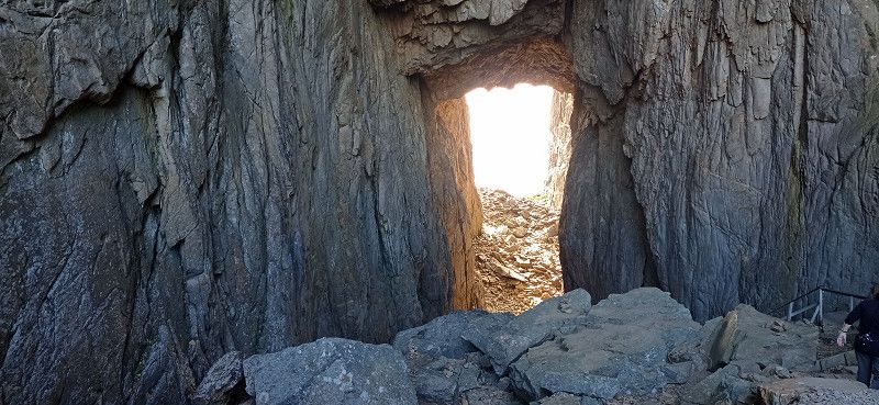
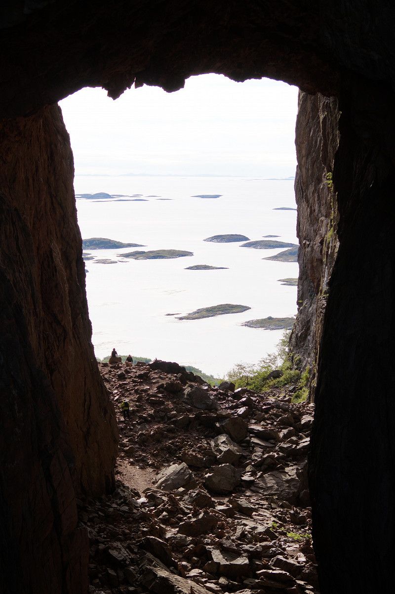
For the 27.8. we decided to hike to Uttakleiv Beach. We first chose the route over the mountain. It went up steeply and partly over larger steps and rocks. You should be sure-footed and have non-slip shoes. Because rain was announced, we also took weatherproof clothing with us, which was worth it. Above the ridge it started to rain and it stormed quite well too. We avoided the climb to Mannen and hiked down to Uttakleiv beach. We found shelter in a cave with a bench and took a break. The view of the also great beach cheered us up. When the weather improved, we went back via the Uttakleiv parking space around the mountain. Great motifs everywhere. In the evening we went to the parking space there for the purpose of disposal and supply. You can get to it through a tunnel. The road ends behind the beach. We had to pay double for taking in water. We felt that as a rip off, especially since no sign pointed out. Nevertheless, we experienced a wonderful evening on the Haukland beach when the weather was nice.
Uttakleiv strand, Uttakleivveien, Leknes, Norwegen
Uttakleiv strand, Uttakleivveien 238, 8370 Leknes, Norwegen
68° 12' 39.7" N 13° 30' 18.5" E
68.2110253 13.5051300
• Head east on Uttakleivveien. Go for 783 m.
• Turn right onto Uttakleivveien (7716). Go for 349 m.
• Continue on 7716. Go for 1.3 km.
• Continue on Uttakleivveien (7716). Go for 702 m.
• Continue on Voieveien (7716). Go for 4.7 km.
• Turn right onto Offersøyveien (7716). Go for 2.5 km.
• Turn right onto Flesveien (E10). Go for 50.3 km.
• Turn left toward Reineveien. Go for 161 m.
• Continue on Reineveien. Go for 469 m.
• Arrive at Reineveien.
☍
61,2 km
(1 hrs. 3 min.)
Day
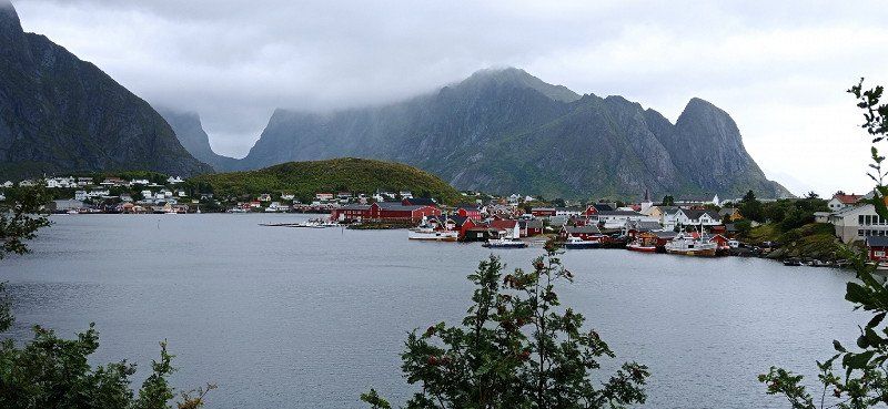
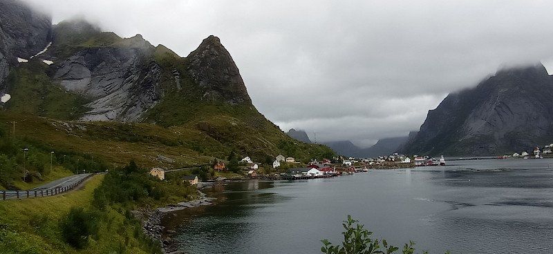
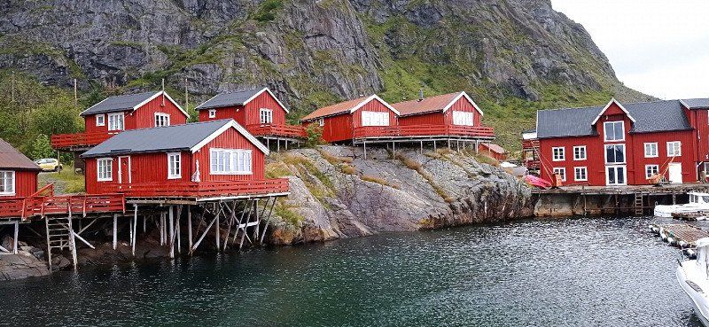
Nusfjord/ Reine / Å
Actually, we had planned the hike to Kvalvika Beach. We had already passed the two bridges at Fredvang when it was so overcast that only continuous rain was to be expected. We then decided to drive to Nusfjord and then to Reine and Å. The drive to Nusfjord is spectacular in itself, as the route leads along a steep wall. Several small waterfalls trickle down steeply. In between the fjord. Because of the rain, we only took Nusfjord with us in passing. Then we drove via Reine to the village of Å. There we tried the famous cinnamon rolls and met a couple from Straelen, a neighboring town of our home town, at the parking lot. We were greeted nicely. Å is nice to look at. On the way back we found a nice parking spot on the main road overlooking the water.
Norwegen
67° 55' 56.6" N 13° 5' 19.4" E
67.9323866 13.0887329
• Head toward Idrettsveien on Reineveien. Go for 630 m.
• Turn right onto Kong Olavs vei (E10). Go for 34.7 km.
• Turn right onto Nusfjordveien (7596). Go for 6.2 km.
• Arrive at Nusfjordveien (7596). Your destination is on the right.
☍
41,5 km
( 43 min.)
Nusfjord, Norwegen
68° 2' 7.1" N 13° 20' 52.2" E
68.0353165 13.3478451
• Head south on Nusfjordveien (7596).
• Turn right onto Nusfjordveien (7596). Go for 12 m.
• Continue on Nusfjordveien. Go for 69 m.
• Turn right onto Nusfjordveien. Go for 94 m.
• Turn left onto Nusfjordveien (7596). Go for 6.1 km.
• Turn left onto Flakstadveien (E10). Go for 34.7 km.
• Turn left toward Reineveien. Go for 161 m.
• Continue on Reineveien. Go for 469 m.
• Arrive at Reineveien.
☍
41,6 km
( 44 min.)
Reine, Norwegen
67° 55' 56.6" N 13° 5' 19.4" E
67.9323866 13.0887329
• Head toward Idrettsveien on Reineveien. Go for 630 m.
• Turn left onto Kong Olavs vei (E10). Go for 4.0 km.
• Continue on Moskenesveien (E10). Go for 3.3 km.
• Continue on Kong Olavs vei (E10). Go for 207 m.
• Continue on Moskenesveien (E10). Go for 1.1 km.
• Turn left onto Å-veien. Go for 198 m.
• Arrive at Å-veien.
☍
9,3 km
( 14 min.)
Å, Norwegen
Å i Lofoten, Norwegen
67° 52' 50" N 12° 58' 57.5" E
67.8805614 12.9826433
• Head north on Å-veien. Go for 198 m.
• Turn right onto Kong Olavs vei (E10). Go for 185 m.
• Turn slightly left onto Kong Olavs vei (E10). Go for 870 m.
• Continue on Kong Olavs vei (E10). Go for 207 m.
• Continue on Moskenesveien (E10). Go for 1.9 km.
• Turn right. Go for 30 m.
• Turn slightly left. Go for 80 m.
• Turn right. Go for 177 m.
• Arrive at your destination on the right.
☍
3,7 km
( 7 min.)
Day
Moskenes Fergen Bodø, Moskenes - Værøy, Sørvågen, Norwegen
Moskenes - Værøy, 8392 Sørvågen, Norwegen
67° 53' 45.3" N 13° 2' 20.3" E
67.8959287 13.0389704
• Head southwest. Go for 195 m.
• Turn left toward Moskenesveien/E10. Go for 70 m.
• Turn right onto Moskenesveien (E10). Go for 1.3 km.
• Turn right onto Birger Eriksens vei (E10). Go for 388 m.
• Turn right onto Birger Eriksens vei (E10). Go for 127 m.
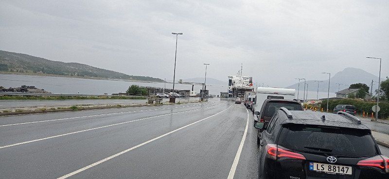
• Take the Moskenes-Bodø Ferry. Stay on for 96.9 km.
• Head east on Terminalveien (80). Go for 271 m.
• Turn right onto Terminalveien (80). Go for 32 m.
• Turn right onto Terminalveien (80). Go for 30 m.
• Take the 1st exit from roundabout onto Jernbaneveien (80). Go for 482 m.
• Take the 2nd exit from roundabout onto Jernbaneveien (80). Go for 145 m.
• Take the 3rd exit from roundabout onto Sjøgata (80). Go for 589 m.
• Pass 11 roundabouts and continue on Storgaten (E6). Go for 216 km.
• Turn right onto 811. Go for 419 m.
• Take the 1st exit from roundabout onto Røvassdalveien (353). Go for 6.9 km.
• Turn left onto Svartisdalveien (353). Go for 771 m.
• Turn right onto Svartisdalveien. Go for 4.9 km.
• Arrive at Svartisdalveien.
☍
329,9 km
(6 hrs. 17 min.)
Svartisengletscher
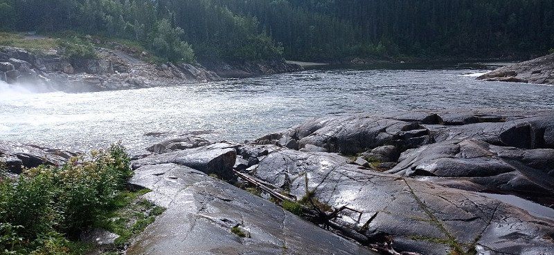
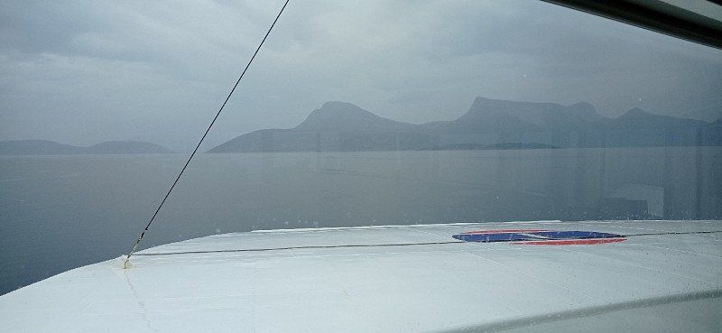
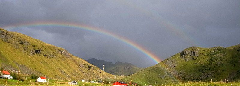
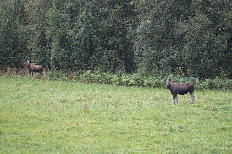
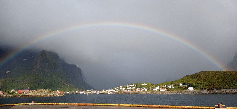
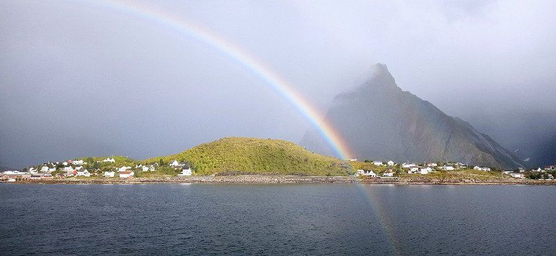
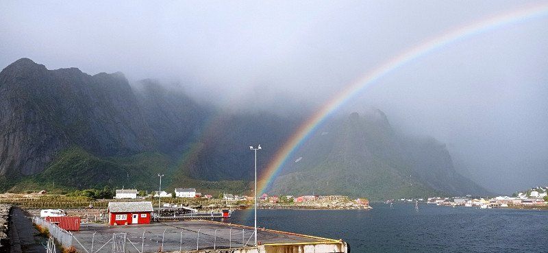
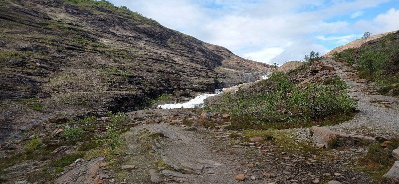
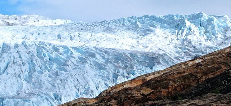
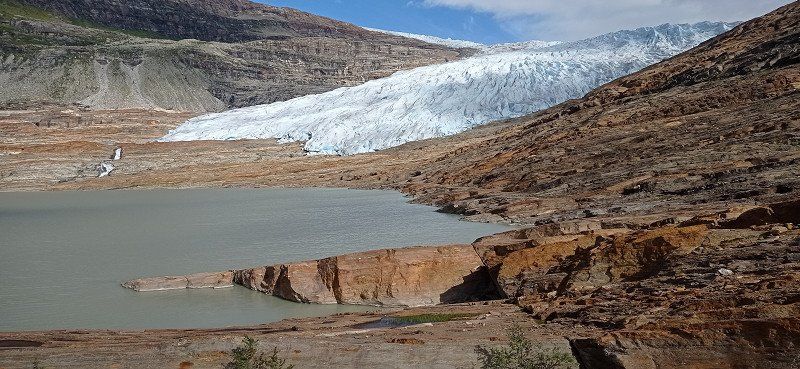
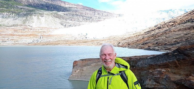
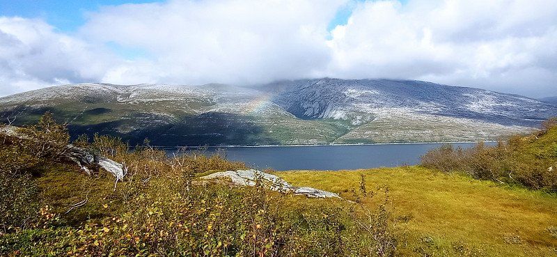
The Lofoten said goodbye to us with a beautiful rainbow 🌈 over Reine. The free disposal station there is really exemplary. Thanks for that. We took the Moskenes ferry to Bodø. From there we made a detour to Saltstraumen, the strongest tidal current in Europe, but found it not very spectacular, at least during our visit. Then we made kilometers and drove via Fauske and on the E36 towards Svartisengletscher. On the way, my wife spotted two mooses in a meadow. At Røssvoll a road led to the glacier. We parked in a forest parking lot in pretty much solitude. Only a Bulli with bikers parked nearby. The access road stretches. It is advisable to take the driveway to the pier. There are nice pitches there, but we didn't know that. Contrary to the announcement, the boat did not cross the lake in the last days of August. Hiking was announced for the next day...
Svartisdalveien, Skonseng, Norwegen
Svartisdalveien, 8615 Skonseng, Norwegen
66° 27' 9.1" N 14° 14' 51" E
66.4525302 14.2474925
• Head toward Sørmoen on Svartisdalveien. Go for 721 m.
• Turn left onto Svartisdalveien. Go for 3.1 km.
• Turn left onto Svartisdalveien. Go for 1.3 km.
• Continue on Svartisdalveien. Go for 578 m.
• Arrive at Svartisdalveien. Your destination is on the left.
☍
5,8 km
( 9 min.)
Svartisen Rana, Svartisvatnet, Skonseng, Norwegen
Svartisvatnet, 8615 Skonseng, Norwegen
66° 29' 30.1" N 14° 11' 43.7" E
66.4916984 14.1954606
• Head southeast on Svartisdalveien. Go for 1.3 km.
• Continue on Svartisdalveien. Go for 625 m.
• Turn right onto Svartisdalveien. Go for 3.1 km.
• Turn right onto Svartisdalveien. Go for 5.7 km.
• Turn left onto Svartisdalveien (353). Go for 771 m.
• Turn right onto Røvassdalveien (353). Go for 6.9 km.
• Take the 3rd exit from roundabout onto 811. Go for 459 m.
• Turn right onto E6. Go for 828 m.
• Turn left onto Røvassdalveien (353). Go for 364 m.
• Turn right onto Saltfjellveien. Go for 118 m.
• Turn left. Go for 64 m.
• Arrive at your destination on the left.
☍
20,2 km
( 30 min.)
Day
Wanderung zum Svartisengletscher
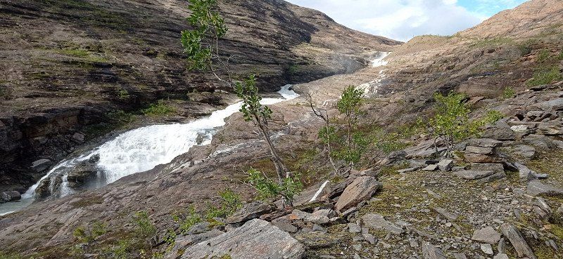
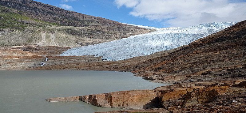
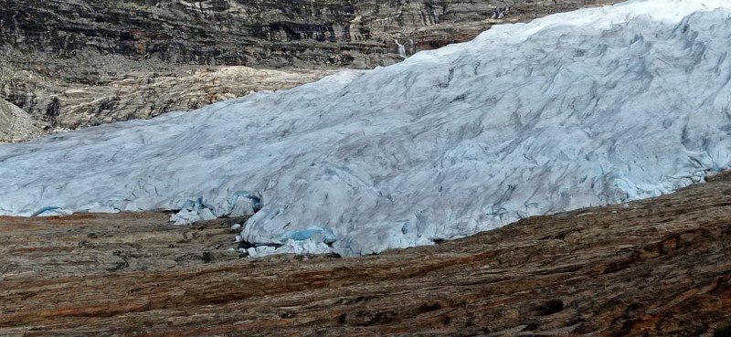
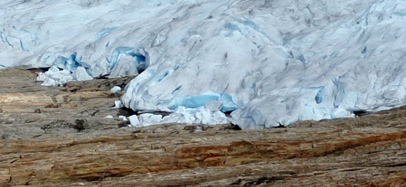
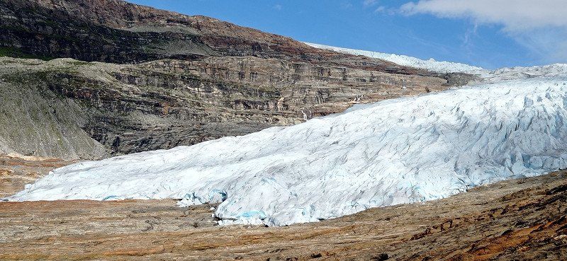
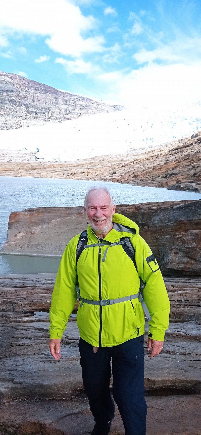
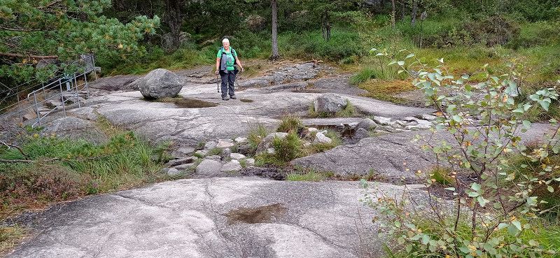
In the morning the neighboring Bulli drove away. We ourselves wanted to go to the glacier and first walked 2 km along the access road. We got to the jetty, but found that it was closed. We also saw that this was the actual parking space. We had seen a machine on the access road where you could probably have paid for the parking time. As it was, it didn't cost us anything apart from Kraft... But the latter should still play a role. A sign in the deserted place pointed out that a path along the lake leads to the jetty and from there to the glacier. Distance 14 km there and back. Since my wife didn't trust herself, I wanted to go alone. The next moment, however, a van with a couple from Eschwege drove up. They also actually wanted to use the boat. Since it was no longer driving, we men decided to set off together. It then went constantly uphill and downhill, past ponds, through morass, over and under branches and was very exhausting. The women also hiked a bit along the lake. Already on the way there I found it very exhausting. As the path seemed unending, we finally got to the boat dock. Now there were still 3 kilometers over rock slabs and climbs. Then finally the glacier... Great to look at in its blue. My companion was very fit and ran all the way to the glacier. I myself took photos from a distance. I rested because the same difficult path had to be walked back. I honestly have to admit that I reached my limits during the hike. Several pauses for breath were necessary. I was grateful to my companion for being by my side. I made it back anyway, but was exhausted. I would probably not have visited the glacier alone and would have turned back. However, we also met young people who could manage this route well. At my age, however, I found it difficult. And our women were pretty exhausted too. We gratefully accepted the offer to ride in the van to our Womo. From the parking lot we only drove to Røssvoll, where we rested on the beautiful pitch.
Day
Røssvoll Camping, Saltfjellveien, Skonseng, Norwegen
Saltfjellveien, Skonseng, Norwegen
66° 21' 25.8" N 14° 19' 22.1" E
66.3571584 14.3228134
• Head toward Saltfjellveien. Go for 64 m.
• Turn right onto Saltfjellveien. Go for 118 m.
• Turn left onto Røvassdalveien (353). Go for 364 m.
• Turn left onto E6. Go for 9.4 km.
• Take the 2nd exit from roundabout onto Selforsveien (E6) toward Mo i Rana. Go for 265 m.
• Pass 5 roundabouts and continue on Svortdalen (E6). Go for 3.2 km.
• Take the 4th exit from roundabout onto E6 toward Trondheim. Go for 116 m.
• Take the 1st exit from roundabout onto E6 toward Trondheim. Go for 59.7 km.
• Turn right onto Ømmervassvegen (78). Go for 8.5 km.
• Turn right onto 78 toward Sandnessjøen. Go for 16.2 km.
• Turn left onto 17 toward Steinkjer/Brønnøysund. Go for 22.8 km.
• Take the 2nd exit from roundabout onto Søvikveien (17). Go for 10.9 km.
• Turn right. Go for 204 m.
• Arrive at your destination.
☍
131,8 km
(1 hrs. 52 min.)
Day
Sandnessjøen Camping AS, Søvikveien, Sandnessjøen, Norwegen
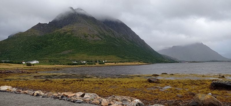
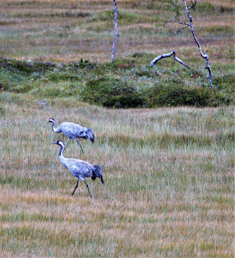
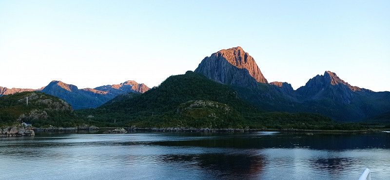
Røssvoll Camping is a nice site with good sanitary facilities. We were able to observe several cranes on a meadow across a small lake. On 08/31 we drove first to Mo i Rana, where we filled up gas. We wanted to avoid Trondheim with some construction sites and turned to the coast. The weather should get better there. From Nesna we took the ferry to Levang. From there it went on over the Helgelandsbrua. It leads across the Leirfjord and onto the island of Alsta. This island is dominated by the 1000m high mountains called the Seven Sisters. We chose a pitch directly opposite the mountains, Camping Sandnessjøen. In the evening the mountains were still clouded. However, the pitch right by the sea still allowed wonderful views.
Søvikveien 359, 8804 Sandnessjøen, Norwegen
65° 57' 9.1" N 12° 27' 43.3" E
65.9525151 12.4620257
• Head southeast. Go for 204 m.
• Turn right onto Søvikveien (17). Go for 26.9 km.
• Arrive at Tjøttaveien (17). Your destination is on the left.
☍
27,1 km
( 23 min.)
Day
Tjøtta ferjekai, Sekundær Fylkesvei 17, Tjøtta, Norwegen
Fv17, 8860 Tjøtta, Norwegen
65° 49' 19.2" N 12° 25' 48.8" E
65.8219994 12.4302266
• Head southeast on Tjøttaveien (17). Go for 16 m.
• Take the Tjøtta-Forvik Ferry. Stay on for 15.4 km.
• Head toward Forvikveien on 17. Go for 329 m.
• Arrive at 17. Your destination is on the right.
☍
15,7 km
( 54 min.)
Forvik ferjekai, Sekundær Fylkesvei 17, Vevelstad, Norwegen
Fv17 1, 8976 Vevelstad, Norwegen
65° 42' 45.2" N 12° 27' 32.2" E
65.7125446 12.4589457
• Head toward Vistnesveien on 17. Go for 16.7 km.
• Arrive at 17. Your destination is on the left.
☍
16,7 km
( 15 min.)
Andalsvågen ferjekai, Vevelstad, Akershus, Norwegen
8976 Vevelstad, Akershus, Norwegen
65° 34' 41.4" N 12° 23' 29" E
65.5781785 12.3913785
• Head east on 17.
• Take the Anddalsvåg-Horn Ferry. Stay on for 5.1 km.
• Head southwest on 17. Go for 39 m.
• Turn sharp right onto 17. Go for 39 m.
• Arrive at 17.
☍
5,2 km
( 38 min.)
Horn ferjekai, Sekundær Fylkesvei 17, Brønnøysund, Norwegen
Fv17 170, 8900 Brønnøysund, Norwegen
65° 35' 1.4" N 12° 18' 7.4" E
65.5837258 12.3020452
• Head south on 17. Go for 11.0 km.
• Turn left onto Mosheim (17). Go for 46.9 km.
• Arrive at 17. Your destination is on the left.
☍
57,8 km
( 52 min.)
Vennesund ferjekai, Sekundær Fylkesvei 17, Sømna, Norwegen
Fv17 450, 8920 Sømna, Norwegen
65° 12' 58.3" N 12° 2' 28.9" E
65.2162001 12.0413719
• Head northwest on 17. Go for 11 m.
• Take the Vennesund-Holm Ferry. Stay on for 5.6 km.
• Head north on Holmsveien (17). Go for 45 m.
• Turn right onto Holmsveien. Go for 32 m.
• Arrive at Holmsveien. Your destination is on the right.
☍
5,7 km
( 38 min.)
Holm ferjekai, Sekundær Fylkesvei 17, Bindalseidet, Norwegen
Fv17 150, 7982 Bindalseidet, Norwegen
65° 10' 57.7" N 12° 6' 48.9" E
65.1826873 12.1135811
• Head north on Holmsveien. Go for 32 m.
• Turn left onto Holmsveien (17). Go for 45 m.
• Take the Holm-Vennesund Ferry. Stay on for 5.6 km.
• Head toward Kystveien on 17. Go for 46.9 km.
• Continue on 76. Go for 505 m.
• Continue on Russesletta (76). Go for 183 m.
• Continue on Sømnaveien (76). Go for 245 m.
• Continue on 76. Go for 983 m.
• Continue on Sømnaveien (76). Go for 1.1 km.
• Continue on Storgata (54). Go for 711 m.
• Continue on Storgata. Go for 102 m.
• Turn right onto E. Olsens gate. Go for 77 m.
• Turn left onto Masterberggata. Go for 752 m.
• Turn right onto Bryggeveien. Go for 209 m.
• Turn right onto 54. Go for 749 m.
• Arrive at 54. Your destination is on the right.
☍
58,2 km
(1 hrs. 32 min.)
Brønnøysund Bridge, Brønnøysund, Norwegen
65° 27' 54.6" N 12° 11' 23.7" E
65.4651753 12.1899041
• Head toward Biskopholmen on 54. Go for 749 m.
• Turn left onto Bryggeveien. Go for 209 m.
• Turn left onto Masterberggata. Go for 453 m.
• Turn right onto Kapteinveien. Go for 54 m.
• Turn left onto Ytre Høgåsvei. Go for 404 m.
• Continue on Havnegata. Go for 941 m.
• Turn slightly left onto Torghattens gate. Go for 141 m.
• Arrive at Torghattens gate. Your destination is on the right.
☍
3,0 km
( 7 min.)
Torghattens gate, Brønnøysund, Norwegen
65° 28' 39.6" N 12° 12' 52.6" E
65.4776685 12.2146070
• Head toward Havnegata on Torghattens gate. Go for 141 m.
• Turn left onto Havnegata. Go for 119 m.
• Turn left onto Sømnaveien (76). Go for 883 m.
• Continue on 76. Go for 983 m.
• Continue on Sømnaveien (76). Go for 245 m.
• Continue on Russesletta (76). Go for 183 m.
• Continue on 76. Go for 505 m.
• Continue on Mosheim (17). Go for 46.9 km.
• Take the Vennesund-Holm Ferry. Stay on for 5.6 km.
• Head north on Holmsveien (17). Go for 17.9 km.
• Arrive at Holmsveien (17).
☍
73,4 km
(1 hrs. 40 min.)
Hjelmstigvatnet, Bindalseidet, Norwegen
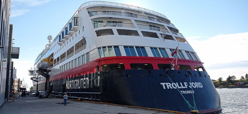
The next day, the 7 sisters showed their sunny side. After purchasing two Norwegian sweaters from the campsite operator, we use 3 ferry connections: Tjøtta - Forvik / Andalsvåg - Horn / Vennesund - Holm. Our goal: The famous rock hole Torghatten. We drove over the bridge at Brønnøysund. From this there was a wonderful view of the green shimmering water and the harbor. In the distance we could already see the mountain. We parked below and hiked up to the huge rock hole. The climb is doable, but caution is advised on the last few meters. Then the great view through the giant gate. I climbed through the hole to the other side. Then it went back again. After various photos, we drove to the port, where we took a look at the Hurtigruten ship. Then we drove a while to the hiker's parking lot in front of Heilhornet, near Hjelmstigvatnet. We spent the night there.
Hjelmstigvatnet, Bindal, Norwegen
65° 4' 54.2" N 12° 4' 52.5" E
65.0817116 12.0812423
• Head south on Holmsveien (17). Go for 23.3 km.
• Turn left onto Foldavegen (17) toward Steinkjer/Namsos. Go for 53.9 km.
• Turn left onto 775. Go for 13.9 km.
• Turn right onto E6 toward Trondheim/Grong. Go for 77.3 km.
• Turn right onto Røseggvegen (6992). Go for 336 m.
• Turn left onto Røseggvegen (6992). Go for 4.4 km.
• Turn right onto Namsosvegen (17). Go for 7.2 km.
• Turn left onto Sundbygdvegen (720). Go for 5.8 km.
• Turn left onto Malmvegen (720). Go for 70.7 km.
• Turn left onto 155. Go for 1.8 km.
• Turn left onto 715. Go for 16.9 km.
• Continue on Rørvikveien (715). Go for 6.3 km.
• Turn sharp left onto Riksvei 715 (715). Go for 369 m.
• Arrive at Riksvei 715 (715). Your destination is on the left.
☍
282,3 km
(3 hrs. 42 min.)
Day
Rørvik ferjekai, Stadsbygd, Norwegen
Indre Fosen, Norwegen
63° 30' 34.3" N 10° 8' 17.4" E
63.5095180 10.1381630
• Head east on Riksvei 715 (715). Go for 100 m.
• Take the Rørvik-Flakk Ferry. Stay on for 7.1 km.
• Head southwest on 715. Go for 142 m.
• Arrive at 715. Your destination is on the left.
☍
7,4 km
( 41 min.)
Flakk ferjekai, Trondheim, Norwegen
Trondheim, Norwegen
63° 27' 4" N 10° 12' 5.6" E
63.4511049 10.2015529
• Head southwest on 715. Go for 918 m.
• Turn right onto Bynesveien (707). Go for 21.2 km.
• Take the 1st exit from roundabout onto 707. Go for 323 m.
• Take the 1st exit from roundabout onto E39 toward Ålesund/Orkanger. Go for 26.7 km.
• Take the 1st exit from roundabout onto E39 toward Ålesund/710/714/Orkanger. Go for 120 m.
• Pass 3 roundabouts and continue on E39. Go for 2.9 km.
• Turn left onto E39 toward Ålesund/Frøya/714/Hitra. Go for 46.6 km.
• Turn left onto Vinjefjordsveien (E39) toward Ålesund/Kristiansund/Vinjeøra. Go for 30.6 km.
• Turn left onto E39. Go for 2.0 km.
• Arrive at Valsøyfjordvegen (E39). Your destination is on the right.
☍
131,3 km
(1 hrs. 46 min.)
Valsøyfjorden, Norwegen
We drove to Trondheim via Namsos. With the ferry Rørvik - Flakk we crossed the Trondheimfjord and then drove towards Orkanger. We avoided closures near Trondheim. At Valsøyfjorden we parked overnight at a rest area. In the evening, a neighbor knocked and announced that there had been a landslide 10 km away. The rest of the road is closed. Helicopters overhead and rescue vehicles showed that there had been an accident. Later we heard that people had to be rescued. Fortunately, 6 people could be rescued alive from a house, as we found out the next day. For us the plan changed because we couldn't take the ferry Hennset - Arasvika as planned.
Valsøyfjord, Norwegen
63° 8' 14.9" N 8° 29' 38.8" E
63.1374730 8.4941066
• Head west on Valsøyfjordvegen (E39). Go for 3.3 km.
• Turn right onto 682 toward Aure/Arasvika. Go for 219 m.
• Take the Hennset-Arasvika Ferry. Stay on for 3.1 km.
• Head toward Arasvikvegen on 682. Go for 13.0 km.
• Turn left onto Tømmervågvegen (680). Go for 14.8 km.
• Turn slightly right onto Tømmervågvegen (680). Go for 17.4 km.
• Arrive at Tømmervågvegen (680). Your destination is on the right.
☍
51,9 km
(1 hrs. 15 min.)
Day
Tømmervåg Ferjekai, Primær Fylkesvei 680, Tustna, Norwegen
Fv680, 6590 Tustna, Norwegen
63° 9' 11.4" N 7° 57' 17.7" E
63.1531789 7.9549297
• Head southwest on Tømmervågvegen (680). Go for 67 m.
• Take the Tømmervåg-Seivika Ferry. Stay on for 6.9 km.
• Head west on Seivikveien (680). Go for 11 m.
• Arrive at Seivikveien (680).
☍
7,0 km
( 40 min.)
Seivika ferjekai, Kristiansund, Norwegen
Kristiansund, Norwegen
63° 6' 42.5" N 7° 52' 12.6" E
63.1118050 7.8701620
• Head toward Omsaveien on Seivikveien (680). Go for 3.3 km.
• Turn left onto Nordmørsveien (70). Go for 1.6 km.
• Turn right onto Freikollveien (70). Go for 16.4 km.
• Take the 1st exit from roundabout onto E39. Go for 41.4 km.
• Take the 2nd exit from roundabout onto Fannefjordsvegen (E39) toward Ålesund/Molde. Go for 937 m.
• Take the 2nd exit from roundabout onto Skålavegen (64) toward Åndalsnes/Bolsøya. Go for 17.5 km.
• Arrive at 64.
☍
81,1 km
(1 hrs. 11 min.)
Sølsnes Ferjekai, Riksveg 64, Skåla, Norwegen
Riksveg 64, 6456 Skåla, Norwegen
62° 41' 5.3" N 7° 27' 53.1" E
62.6848142 7.4647396
• Head east on 64. Go for 5 m.
• Take the Sølsnes-Åfarnes Ferry. Stay on for 3.2 km.
• Head south on 64. Go for 39 m.
• Arrive at Nordsidevegen (64).
☍
3,2 km
( 35 min.)
Åfarnes Fergekai, Primær Fylkesvei 64, Åfarnes, Norwegen
Fv64 371, 6360 Åfarnes, Norwegen
62° 39' 49.5" N 7° 30' 17.5" E
62.6637444 7.5048493
• Head toward Langfjordsstranda on Nordsidevegen (64). Go for 320 m.
• Turn right onto Nordsidevegen (64). Go for 31.9 km.
• Take the 3rd exit from roundabout onto Nordsidevegen (64). Go for 672 m.
• Turn left onto Romsdalsvegen (E136). Go for 3.3 km.
• Turn right toward Mjelva. Go for 100 m.
• Turn right onto Gamle Romsdalsvegen. Go for 630 m.
• Turn left. Go for 21 m.
• Turn right. Go for 30 m.
• Arrive at your destination.
☍
37,0 km
( 33 min.)
Fahrt über die herrliche Insel Aure
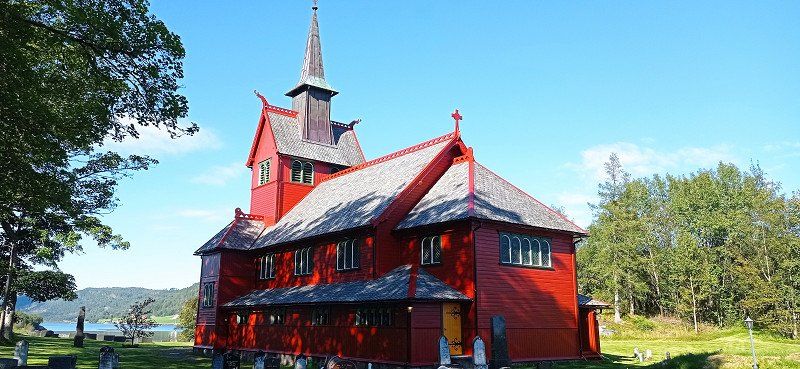
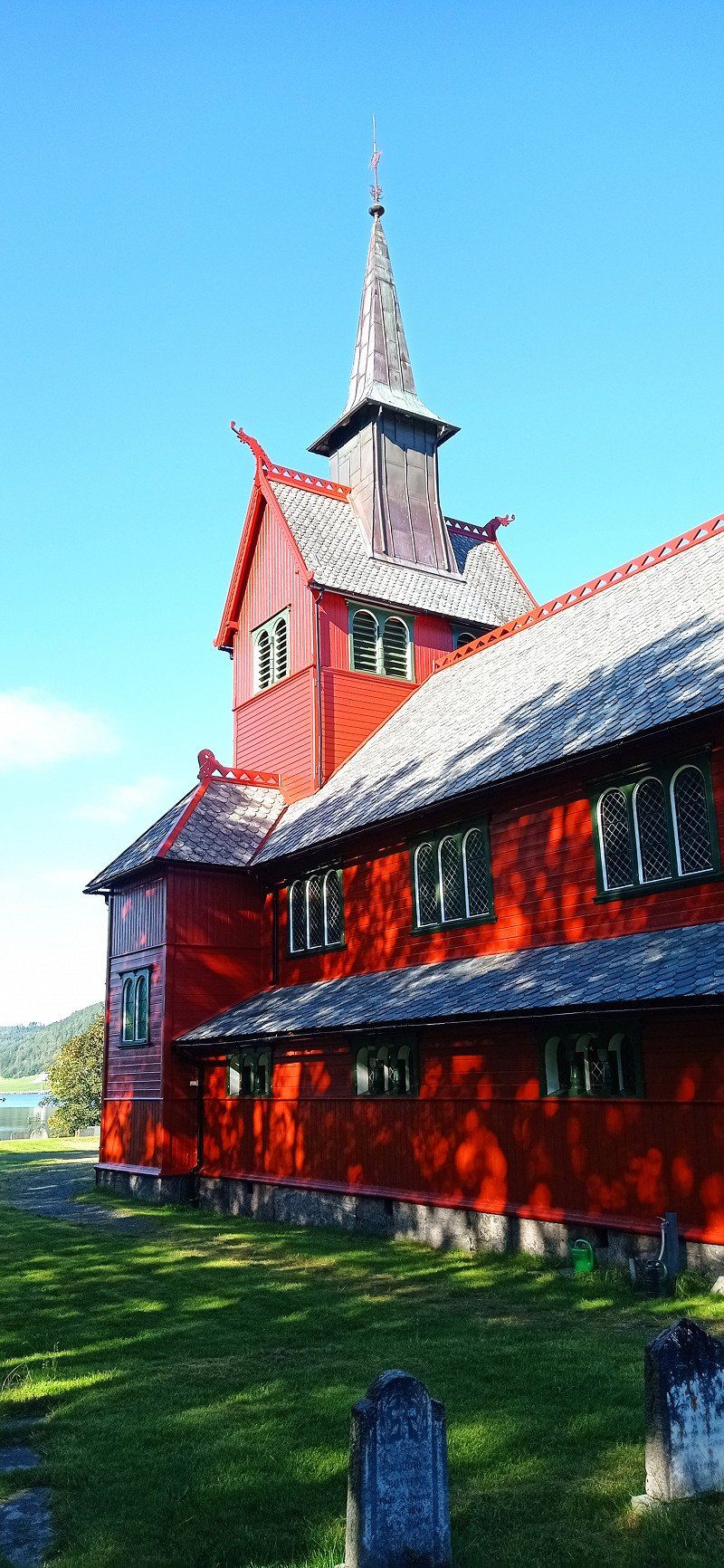
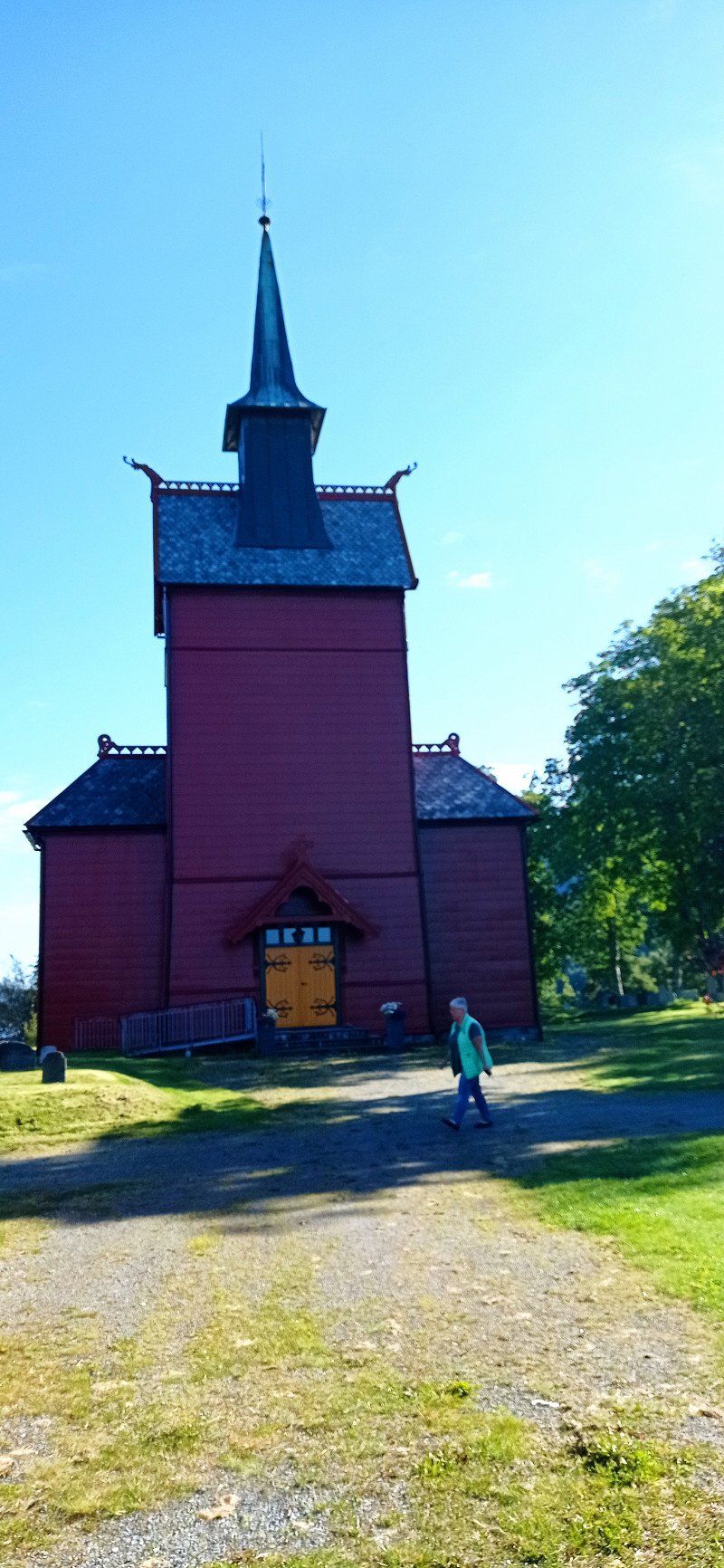
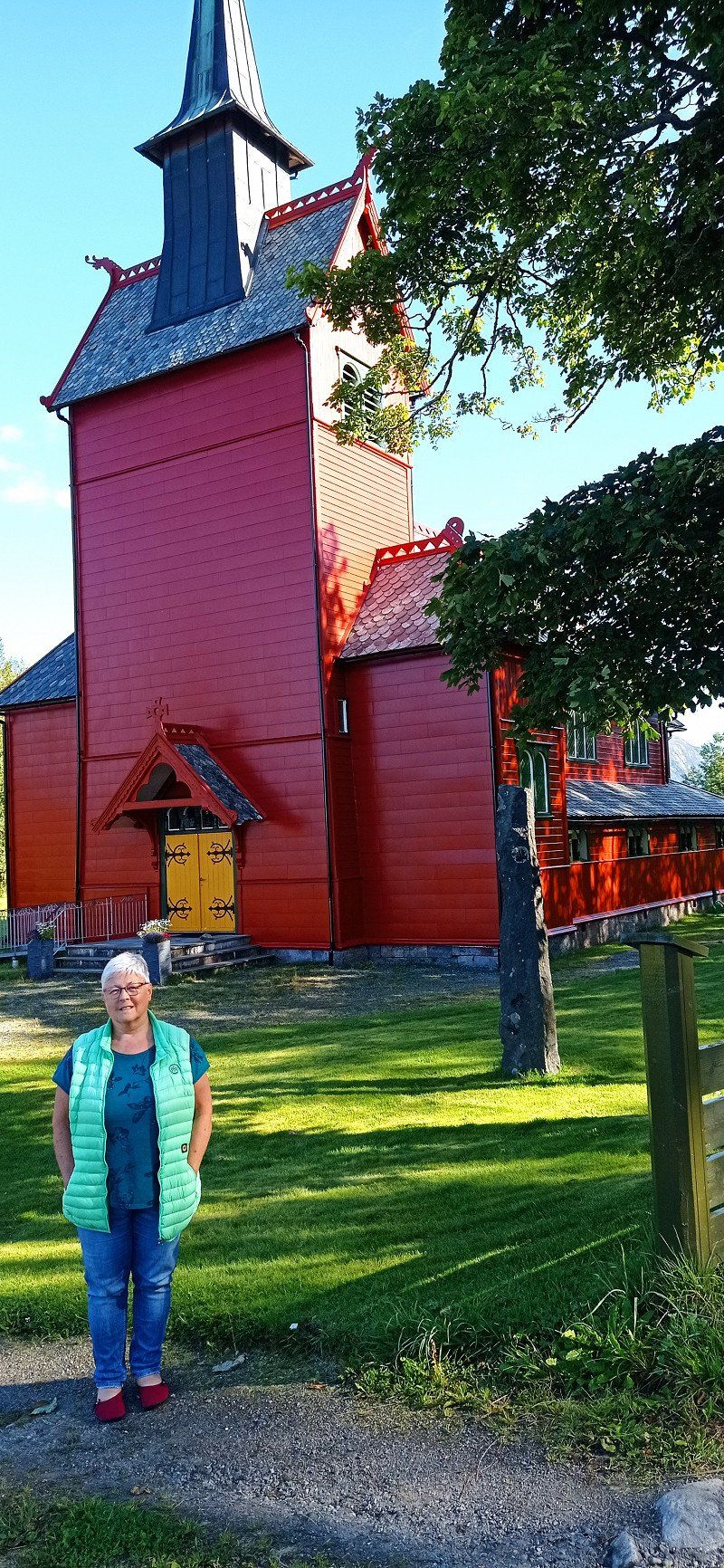
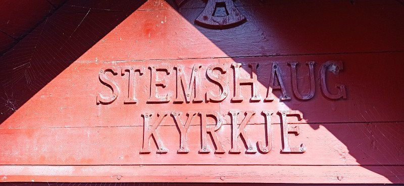
We drove back and took the turn onto the 680. We used the Tommervag - Seivika and Solsnes - Arfarnes ferries and drove past the Tingvollfjord. From there on to Andalsnes. On the way we particularly liked the island of Aure. Magnificent views. We were also particularly taken with the Stemshaus Kyrkje in its bright red. By the way, there is a well-kept toilet in the outbuilding that can be used by visitors. The evening at Camping Mjelva in Andalsnes turned into a red-orange dream. The mountains literally glowed. The campsite itself has everything you need. We had a beautiful view of the valley from the mountain.
Mjelva Camping og Hytter, Gamle Romsdalsvegen, Åndalsnes, Norwegen
Gamle Romsdalsvegen 342, 6300 Åndalsnes, Norwegen
62° 32' 41.8" N 7° 43' 16.8" E
62.5449346 7.7213264
• Head southeast. Go for 30 m.
• Turn left toward Gamle Romsdalsvegen. Go for 21 m.
• Turn right onto Gamle Romsdalsvegen. Go for 630 m.
• Turn left toward Romsdalsvegen/E136. Go for 100 m.
• Turn left onto Romsdalsvegen (E136). Go for 3.3 km.
• Turn right onto 64 toward Molde/Sentrum. Go for 624 m.
• Take the 3rd exit from roundabout onto Romsdalsvegen (64). Go for 661 m.
• Turn right onto Jernbanegata (64). Go for 88 m.
• Turn left onto Havnegata. Go for 39 m.
• Turn right onto Jernbanegata. Go for 131 m.
• Arrive at Jernbanegata. Your destination is on the left.
☍
5,6 km
( 8 min.)
Day
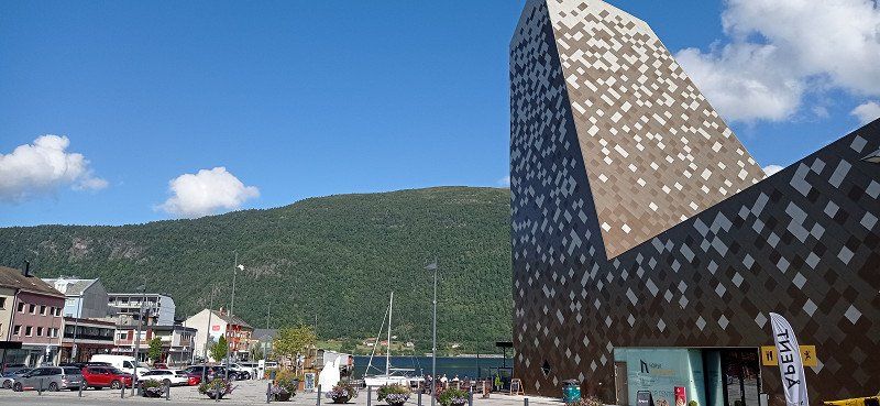
Romsdalsgondolen, Jernbanegata, Åndalsnes, Norwegen
Jernbanegata 1, 6300 Åndalsnes, Norwegen
62° 34' 3.7" N 7° 41' 28.5" E
62.5676988 7.6912427
• Head west on Jernbanegata. Go for 131 m.
• Turn left onto Havnegata. Go for 39 m.
• Turn right onto Jernbanegata (64). Go for 88 m.
• Turn left onto Romsdalsvegen (64). Go for 618 m.
• Take the 2nd exit from roundabout onto Nordsidevegen (64). Go for 652 m.
• Continue on Sørsidevegen (E136). Go for 43.3 km.
• Take the 2nd exit from roundabout onto Brastadstranda (E39) toward Ålesund. Go for 21.5 km.
• Turn left onto Giskemovegen (522). Go for 176 m.
• Continue on Valgermo (522). Go for 97 m.
• Continue on Giskemovegen (522). Go for 142 m.
• Continue on 522. Go for 43 m.
• Continue on Giskemovegen (522). Go for 1.0 km.
• Turn left onto Storfjordvegen (650). Go for 43.0 km.
• Turn left onto 63. Go for 35.1 km.
• Arrive at Isterdalsvegen (63). Your destination is on the right.
☍
146,0 km
(2 hrs. 16 min.)
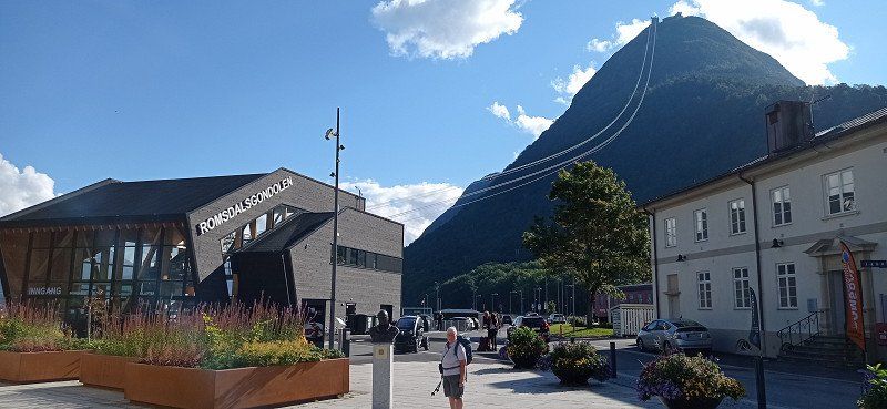
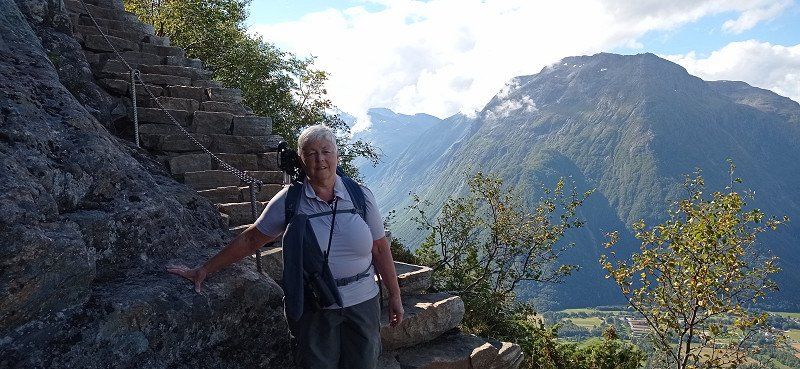
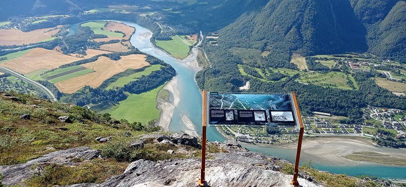
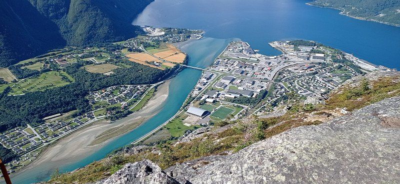
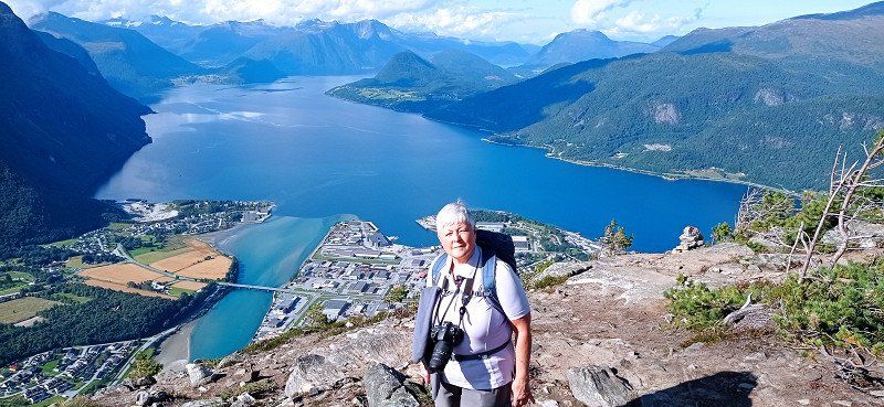
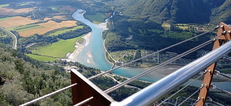
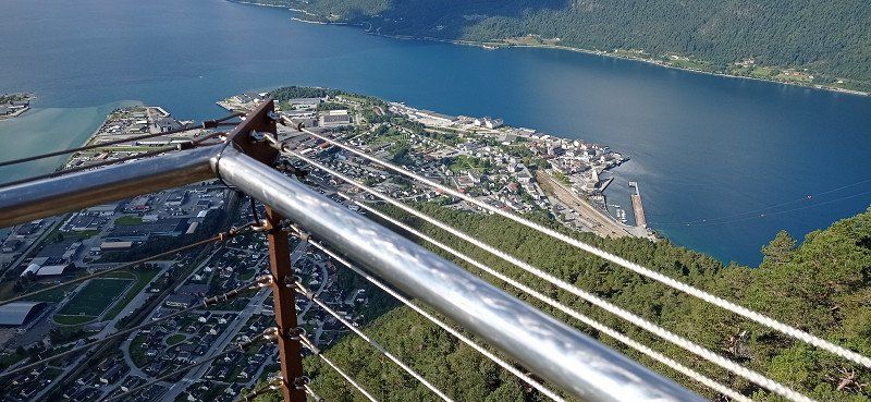
Wanderung Nesaksla
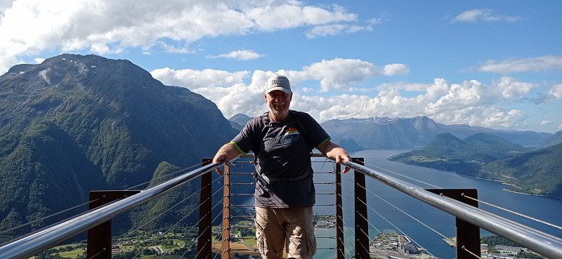
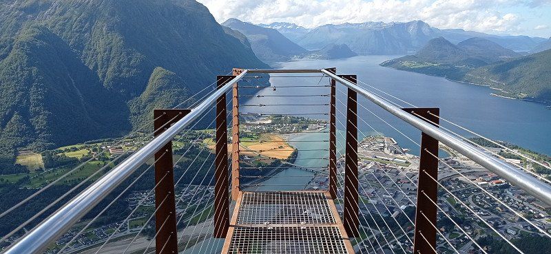
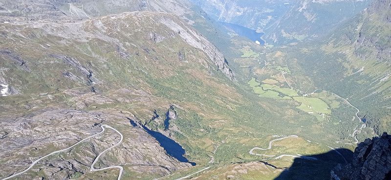
On Sunday morning we went to the Romsdalen gondola and booked the one-way trip up Mount Nesaksla. Before that, we went to the small chapel in a wagon on the platform and stopped for a moment. From the top of Nesaksla at 1679 m, there is an outstanding view of the mountaineering village, the Rauma River and the Isfjord. We wanted to walk down to the Rampestekken viewing platform. For my wife, the descent was difficult because of the steep and high steps, especially at the beginning. I wouldn't recommend the descent in wet weather. Especially in the first third below the summit, the descent was not entirely without danger from our point of view, especially since the climb runs directly on the slope. Nevertheless, we also made it to the platform. After a short wait we were able to go to the front, take great pictures and enjoy the view for a moment. Since it is heavily frequented by hikers as a platform, we only stayed there for a short time. After that it was a little easier downhill over steps and tree roots. Finally, a metal ramp showed us that we were approaching the starting point. We reached our mobile home just before the parking time expired. We continued our journey and had planned to drive over the Trollstigen for the day.
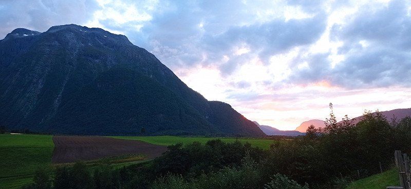
Trollstigen, Åndalsnes, Norwegen
Trollstigen, 6300 Åndalsnes, Norwegen
62° 27' 17.7" N 7° 39' 57.5" E
62.4549066 7.6659830
• Head southwest on Isterdalsvegen (63). Go for 35.1 km.
• Turn right onto 63. Go for 4.3 km.
• Turn left onto 63. Go for 156 m.
• Take the Linge-Eidsdal Ferry. Stay on for 2.6 km.
• Head toward Ytterdalsgata on 63. Go for 11.8 km.
• Turn right onto Indreeidstunnelen (63). Go for 5.2 km.
• Turn right onto Ørnevegen (63) toward Geiranger. Go for 9.6 km.
• Turn left. Go for 26 m.
• Arrive at your destination on the left.
☍
68,8 km
(1 hrs. 51 min.)
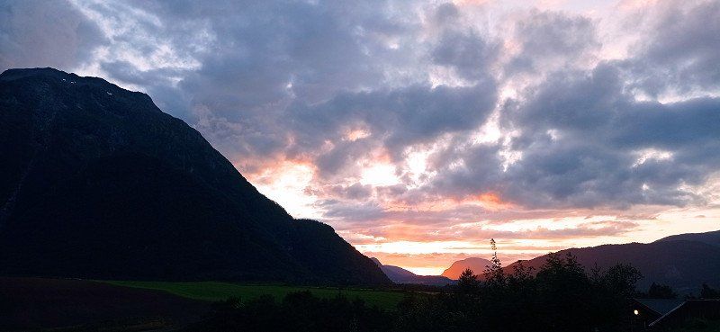
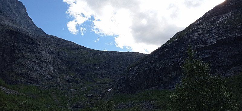
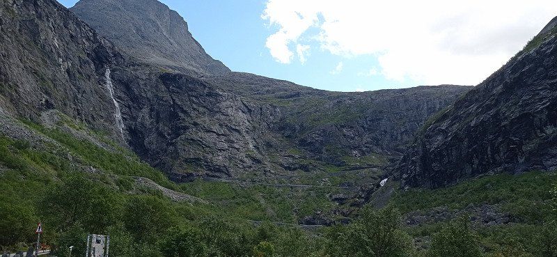
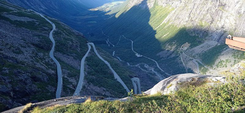
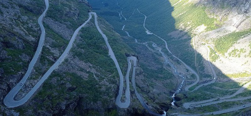
Fahrt Trollstigen
We drove through the valley from Andalsnes, past the Trollveggen wall. We stopped briefly in a parking lot in front of the Trollstigen driveway. The sight of the 12 hairpin bends running along the steep flank commanded our respect. Nevertheless, we dared the journey. With the camper it went steeply uphill through the 12 hairpin bends. Not without encountering oncoming vehicles, of course. Somehow our counterpart or we always found an alternative. The side view of the abyss is exciting. When we got there we parked in the parking lot. Buses also arrive there, whose users also want to go to the viewing platforms above the Trollstigen. Like them, we took beautiful photos and videos. Then we had released enough adrenaline for the day and looked for a nice parking lot in the fell of the Reinheimen National Park. We found what we were looking for at a small lake.
Day
Vinje Camping, Geirangervegen, Geiranger, Norwegen
Geirangervegen 146, 6216 Geiranger, Norwegen
62° 5' 42.2" N 7° 13' 5.9" E
62.0950660 7.2183190
• Head south. Go for 26 m.
• Turn right onto Geirangervegen (63). Go for 1.6 km.
• Turn left onto 63. Go for 119 m.
• Take the Geiranger-Hellesylt Ferry. Stay on for 20.1 km.
• Head toward Hellesyltvegen on 60. Go for 578 m.
• Turn right onto Hellesyltvegen (60). Go for 878 m.
• Turn left onto Langedalsvegen (60). Go for 25.0 km.
• Turn left onto E39 toward Bergen/Stryn/60. Go for 8.3 km.
• Turn left onto Nordfjordvegen (15) toward Stryn. Go for 15.8 km.
• Take the 2nd exit from roundabout onto Tonningsgata (15) toward Otta. Go for 124 km.
• Turn left. Go for 23 m.
• Turn right toward Bergomsvegen. Go for 13 m.
• Turn slightly left onto Bergomsvegen. Go for 55 m.
• Turn slightly right toward Bergomsvegen. Go for 12 m.
• Turn slightly left onto Bergomsvegen. Go for 43 m.
• Arrive at Bergomsvegen. Your destination is on the left.
☍
196,2 km
(3 hrs. 42 min.)
Die Fahrt nach Geiranger
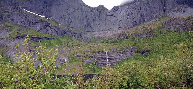
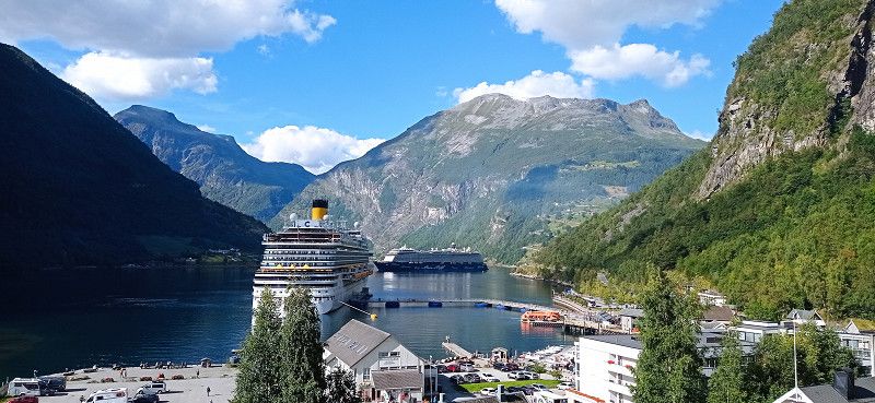
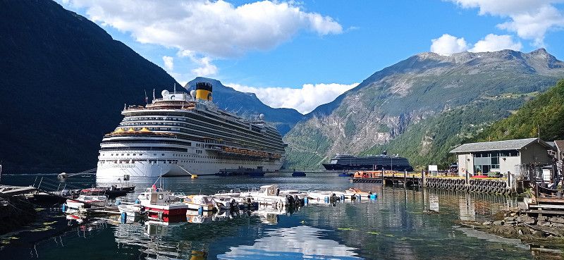
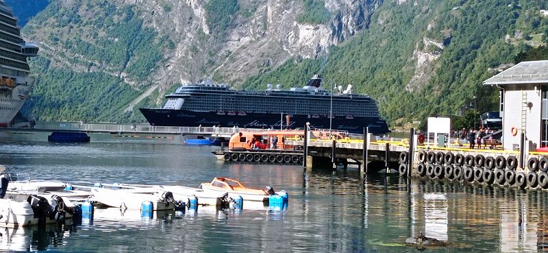
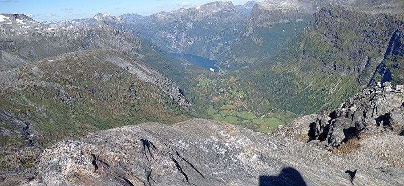
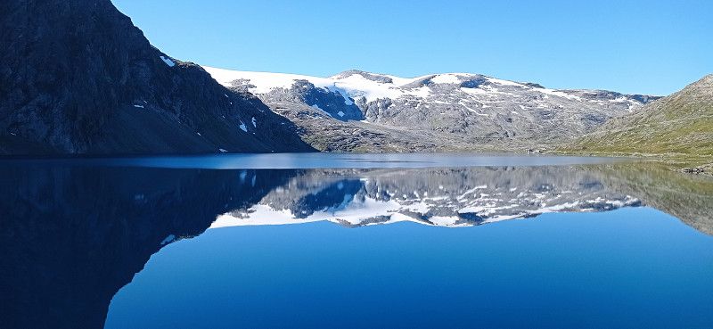
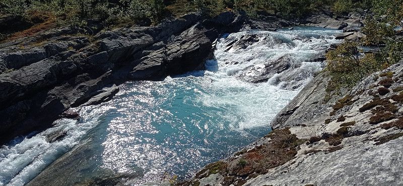
After spending the night in Reinheimen National Park, we continued towards Geiranger. We came to Gudbrands Juvet, a narrow gorge with a waterfall. Equally impressive is the metal path laid out by the Norwegians. Nearby a cafe, which is also approached by coaches. We just looked at the waterfall and drove on. We crossed the Storfjord with the ferry Linge - Eidsdal. On the 63 we passed the beautiful lake Eidsvatnet. Here the water is as smooth as glass and the surrounding mountains are reflected in it. Almost as impressive as the trip over the Trollstigen was the tour down to Geiranger with just as sharp curves and hairpin bends. We had to avoid a vantage point because it was covered with buses and other campers. However, we were able to enjoy great views of the Geirangerfjord during the trip. "Mein Schiff" with a smoking chimney can already be seen from afar. The valley was fogged. In the valley itself we then saw the huge Costa Diadema lying at anchor. In contrast, "Mein Schiff" still looked small. We continued through the village towards Vinje Caming above. There we quartered ourselves. In the course of visiting Geiranger, we met a large number of ship tourists. The place was quite busy. Still, we think it's worth seeing. There is a parking space directly on the lake in the village. Nicely located, but we prefer it a little off the beaten track. After delicious soft ice cream and shopping for stuffed trolls for the grandchildren, we took the hiking trail past the roaring waterfall back to the campsite. Vinje Camping has several straight pitches with electricity. Since we didn't need it, we stood on the grass. Despite our wedges, it wasn't easy to stand there straight. So the places with electricity are recommended...
Day
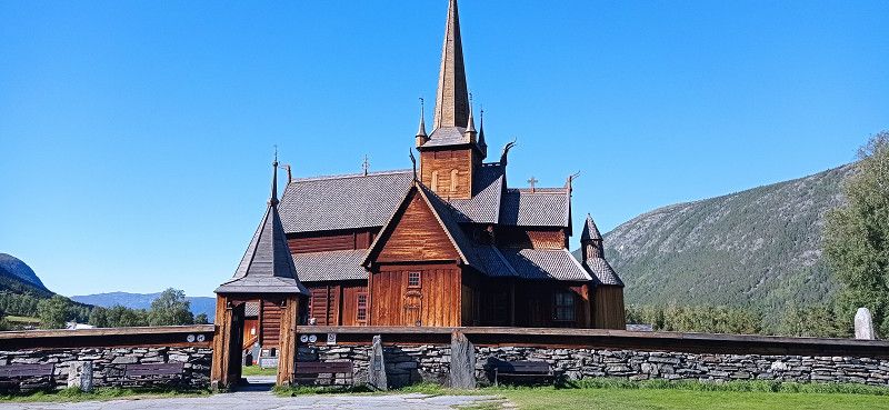
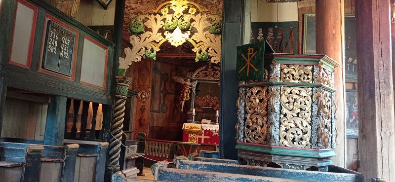
Lom stavkyrkje, Bergomsvegen, Lom, Norwegen
Bergomsvegen 1, 2686 Lom, Norwegen
61° 50' 23.2" N 8° 33' 58.4" E
61.8397837 8.5662196
• Head south on Bergomsvegen. Go for 43 m.
• Turn slightly right toward Bergomsvegen. Go for 12 m.
• Turn right onto Bergomsvegen. Go for 15 m.
• Turn left onto Bergomsvegen. Go for 79 m.
• Turn left onto Bergomsvegen (15). Go for 114 m.
• Take the 1st exit from roundabout onto Sognefjellsvegen (55) toward Sogndal. Go for 21.9 km.
• Turn right onto Bøverdalsvegen (2642). Go for 5.4 km.
• Continue on 2642. Go for 849 m.
• Continue on Bøverdalsvegen. Go for 1.6 km.
• Turn left onto Bøverdalsvegen. Go for 6.0 km.
• Turn slightly left onto Bøverdalsvegen. Go for 485 m.
• Turn slightly right onto Bøverdalsvegen. Go for 193 m.
• Turn right onto Bøverdalsvegen. Go for 992 m.
• Turn left onto Burmavegen. Go for 1.8 km.
• Turn right onto Sognefjellsvegen (55). Go for 15.4 km.
• Arrive at Sognefjellsvegen (55). Your destination is on the left.
☍
54,8 km
(1 hrs. 8 min.)
Sognefjellshytta, Sognefjellsvegen, Bøverdalen, Norwegen
Sognefjellsvegen 4974, 2687 Bøverdalen, Norwegen
61° 33' 54.1" N 7° 59' 52.4" E
61.5650219 7.9979018
• Head west on Sognefjellsvegen (55). Go for 15.6 km.
• Arrive at 55. Your destination is on the right.
☍
15,6 km
( 16 min.)
Sognefjellsvegen (Rv 55), Fortun, Norwegen
Sognefjellsvegen - The National Tourist Route, Luster Municipality, Norwegen
61° 30' 15.7" N 7° 48' 45.5" E
61.5043551 7.8126525
• Head northeast on 55. Go for 1.4 km.
• Turn left onto Tindevegen toward 53/Årdal. Go for 2.7 km.
• Turn slightly right onto Tindevegen. Go for 16.1 km.
• Arrive at Tindevegen.
☍
20,3 km
( 37 min.)
Stabkirche Lom und Sognefjell
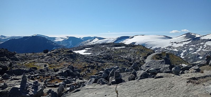
From Geiranger we first drove to the Dalsnibba viewpoint. The drive up is again narrow and winding. In addition, the ascent is subject to a fee. There is a larger car park at the top and the view of the Geirangerfjord is outstanding. There is the possibility to climb over stones and rocks a little way from the parking lot and take great photos. Then we drove the 15 via Grotli and past Lake Otta to the stave church in Lom. We visited the beautiful wooden church and then continued on the Sognefjell Road (55) through the high mountains of the Sognefjell in the Jotunheimen National Park, which are well worth seeing. We passed the hiker's hut Sognefjellshytta, near the Galdhopiggen. The high mountains left an impression on us, as the landscape there is of fascinating beauty. When we went downhill again, we spent the night in a lonely little parking lot by a small river on 55th Street.
Day
Tindevegen, Øvre Årdal, Norwegen
Tindevegen, 6884 Øvre Årdal, Norwegen
61° 23' 18" N 7° 43' 25" E
61.3883455 7.7236242
• Head south on Tindevegen. Go for 859 m.
• Keep right toward Fardalsvegen. Go for 685 m.
• Continue on Fardalsvegen. Go for 5.1 km.
• Continue on 5632. Go for 204 m.
• Continue on Fardalsvegen (5632). Go for 98 m.
• Continue on 5632. Go for 192 m.
• Continue on Åbøle (5632). Go for 100 m.
• Continue on 5632. Go for 102 m.
• Continue on Hagahaugen (5632). Go for 98 m.
• Continue on 5632. Go for 687 m.
• Continue on Fardalsvegen (5632). Go for 98 m.
• Continue on 5632. Go for 417 m.
• Continue on Fardalsvegen (5632). Go for 67 m.
• Continue on 5632. Go for 349 m.
• Continue on Fardalsvegen (5632). Go for 2.8 km.
• Continue on 5632. Go for 131 m.
• Continue on Øvstetunsvegen. Go for 32 m.
• Turn left onto Flotavegen. Go for 465 m.
• Continue on Storevegen. Go for 1.1 km.
• Turn slightly right onto Storevegen (5631). Go for 16 m.
• Turn right onto Årdalsvegen (53). Go for 11.6 km.
• Take the 3rd exit from roundabout onto Lægreidsvegen (53). Go for 23.1 km.
• Turn left onto 5. Go for 7.3 km.
• Take the 2nd exit from roundabout onto Fodnesvegen (5) toward E16. Go for 227 m.
• Take the 2nd exit from roundabout onto 5 toward E16/Oslo/Bergen/Aurland. Go for 6.8 km.
• Take the 1st exit from roundabout onto E16 toward Bergen/Aurland. Go for 25.1 km.
• Take the 1st exit from roundabout toward Sentrum. Go for 43 m.
• Continue on Skulevegen (5627). Go for 1.5 km.
• Turn right onto Øvregata. Go for 162 m.
• Continue on Bjørgavegen (5627). Go for 1.7 km.
• Continue on Kvam (5627). Go for 96 m.
• Continue on Bjørgavegen (5627). Go for 6.2 km.
• Arrive at Bjørgavegen (5627). Your destination is on the right.
☍
97,4 km
(1 hrs. 40 min.)
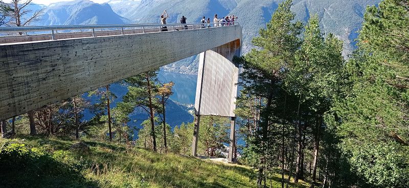
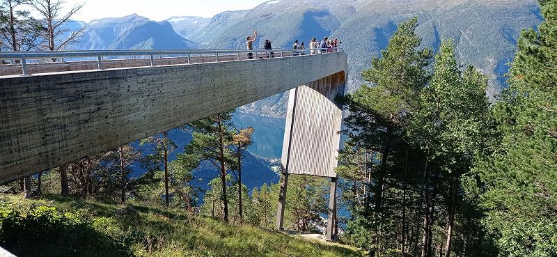
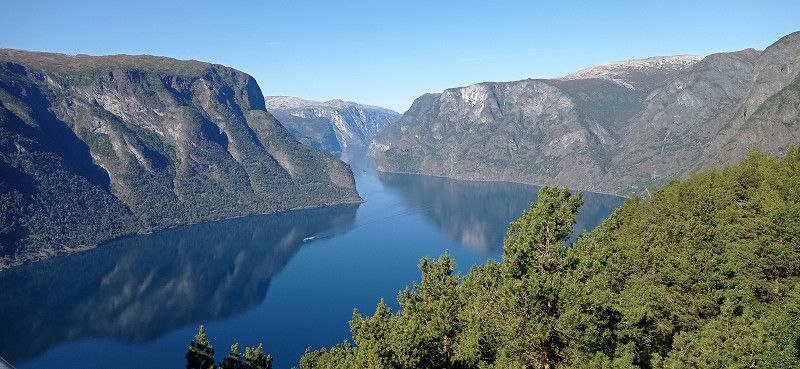
Stegastein- LOOKOUT, Aurland, Norwegen
60° 54' 29.8" N 7° 12' 45.1" E
60.9082803 7.2125244
• Head northwest on Bjørgavegen (5627). Go for 6.2 km.
• Continue on Kvam (5627). Go for 96 m.
• Continue on Bjørgavegen (5627). Go for 1.7 km.
• Turn right onto Bjørgavegen (5627). Go for 7 m.
• Continue on Vangen (5627). Go for 93 m.
• Continue on Bjørgavegen (5627). Go for 20 m.
• Continue on Vangen (5627). Go for 26 m.
• Continue on Bjørgavegen (5627). Go for 14 m.
• Turn left onto Vangen (5627). Go for 69 m.
• Continue on Skulevegen (5627). Go for 1.6 km.
• Take the 1st exit from roundabout onto E16 toward Bergen/Voss. Go for 27.8 km.
• Turn right onto Gudvangatunnelen (5623). Go for 431 m.
• Turn left onto Gudvangen (5623). Go for 4.3 km.
• Continue on Bakkavegen. Go for 380 m.
• Arrive at Bakkavegen. Your destination is on the right.
☍
42,7 km
( 52 min.)
Nærøyfjorden Camping, Bakkavegen, Gudvangen, Norwegen
Bakkavegen 35, 5747 Gudvangen, Norwegen
60° 55' 5.1" N 6° 52' 10.1" E
60.9180924 6.8694723
• Head south on Bakkavegen. Go for 380 m.
• Continue on Gudvangen (5623). Go for 4.3 km.
• Continue on Gudvangatunnelen (5623). Go for 431 m.
• Turn right onto Nærøydalen (E16). Go for 9.4 km.
• Turn left onto Kjenesvegen. Go for 1.9 km.
• Continue on Stalheimsvegen. Go for 142 m.
• Arrive at Stalheimsvegen. Your destination is on the left.
☍
16,5 km
( 20 min.)
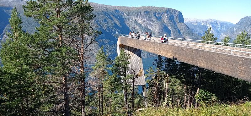
Stegastein, Aurlandsfjord, Nærøyfjord
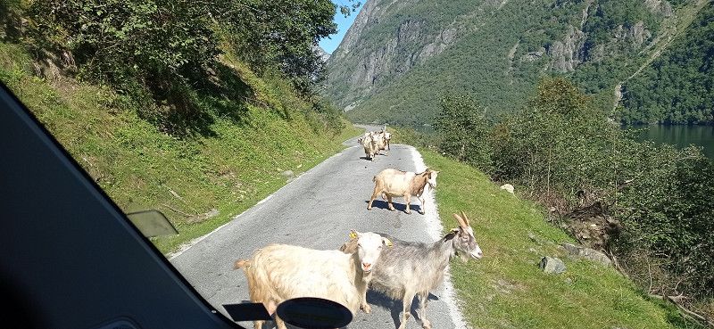
We drove on 07.09. a bit back on the 55 and then drive onto the Tindevegen, a toll road. A mistake from our point of view, because the area is interspersed with power lines and pylons. All in all, this street didn't seem so attractive to us, of course we were a bit spoiled. In addition, the hairpin bends at the end and just before Øvre Årdal are extremely tight and stressful. A bit annoyed, we then drove on the 53, the 5 and the E16 towards Aurlandsfjord. The trip through the almost 25 km long Laerdals tunnel with its 3 colorfully lit "cathedrals" is definitely spectacular. The curves to the Stegastein vantage point are similarly tight and technically challenging, but have to be accepted for an enchanting view. When you get to the top, there is a lot going on. Now in September probably not as dramatic as in summer. But the platform offers a magnificent view over the Aurlandsfjord. You can also sit on the toilet and enjoy the view of the valley through a pane of glass. It's not everywhere either. Almost nothing went back. We were in a column of 5 when a car came towards us. Too narrow to pass, he had to reverse and got into a gully on the mountain, causing his vehicle to lift off in front. Ultimately, however, he managed to pull back to an alternative. Similar bottlenecks must always be expected. This was also the case on our trip to Nærøyfjorden Camping in Bakka. First a construction site, then through a narrow tunnel and further along a narrow path that doesn't seem to want to end. On the way almost nothing worked anymore because we met a herd of goats running free, which were also followed by two cars. Passing was only possible with mirrors folded in and maneuvering to the edge. Then a few more fears that there would be no more oncoming traffic, and you were there. The location of the course on the Nærøyfjord is overwhelming. You can rent boats and go hiking. The place does not offer disposal, but the sanitary facilities are great. We treated ourselves to sunbathing right on the fjord and enjoyed the view. Conclusion, the journey was exhausting, but it was worth it. In the evening we walk through the village and along the fjord. From here you can only go back, which is why we decide to leave as early as possible in the morning in order to have as little oncoming traffic as possible. We were able to dispose of it a short distance back at the gas station in Gudvangen.
Day
Stalheim, Norwegen
60° 50' 6" N 6° 40' 50.5" E
60.8349995 6.6806998
• Head south on Stalheimsvegen. Go for 1.3 km.
• Turn right onto Haugsvikvegen (E16). Go for 13.2 km.
• Pass 5 roundabouts and continue on Strandavegen (E16). Go for 19.5 km.
• Turn right onto Strandavegen (E16). Go for 1.2 km.
• Continue on Vangsgata (E16). Go for 49 m.
• Turn right onto Vangsgata. Go for 57 m.
• Turn right onto Bonangergata. Go for 31 m.
• Turn left onto Bonangergata. Go for 33 m.
• Arrive at Bonangergata. Your destination is on the right.
☍
35,3 km
( 34 min.)
Vossevangen, Norwegen
60° 37' 46.4" N 6° 25' 19.7" E
60.6295624 6.4221512
• Head toward Skulegata on Bonangergata. Go for 180 m.
• Turn slightly right onto Skulegata. Go for 12 m.
• Turn left onto Vangsgata (5402). Go for 74 m.
• Turn right onto Vangsgata (5402). Go for 195 m.
• Turn right onto Uttrågata (E16). Go for 840 m.
• Take the 2nd exit from roundabout onto Evangervegen (E16). Go for 65.7 km.
• Take the 2nd exit from roundabout onto Hardangervegen (E16) toward Bergen. Go for 9.7 km.
• Take the 1st exit from roundabout onto Arnavegen (E16) toward Bergen Nord/E39. Go for 581 m.
• Take the 2nd exit from roundabout onto Arnavegen (E16) toward E39/Bergen/Åsane. Go for 9.9 km.
• Take the 3rd exit from roundabout onto E16/E39 (Åsaneveien) toward Bergen. Go for 12.9 km.
• Keep left toward Sentrum. Go for 128 m.
• Take left ramp onto Fjøsangerveien toward Sentrum. Go for 821 m.
• Turn left onto Fjøsangerveien toward E39/E16/Åsane/E39N/Sentrum. Go for 27 m.
• Continue on Strømgaten. Go for 79 m.
• Turn right onto Lars Hilles gate. Go for 339 m.
• Continue on Foreningsgaten. Go for 73 m.
• Continue on Vaskerelven (5334). Go for 123 m.
• Turn right onto Vaskerelvsmauet. Go for 24 m.
• Arrive at Vaskerelvsmauet. Your destination is on the right.
☍
101,7 km
(1 hrs. 27 min.)
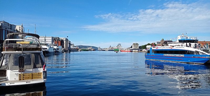
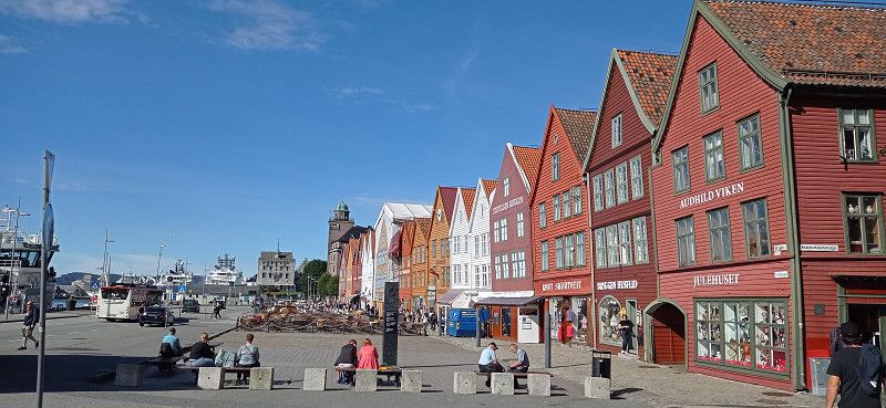
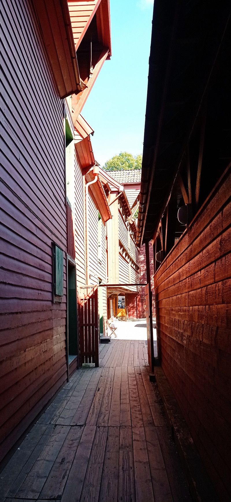
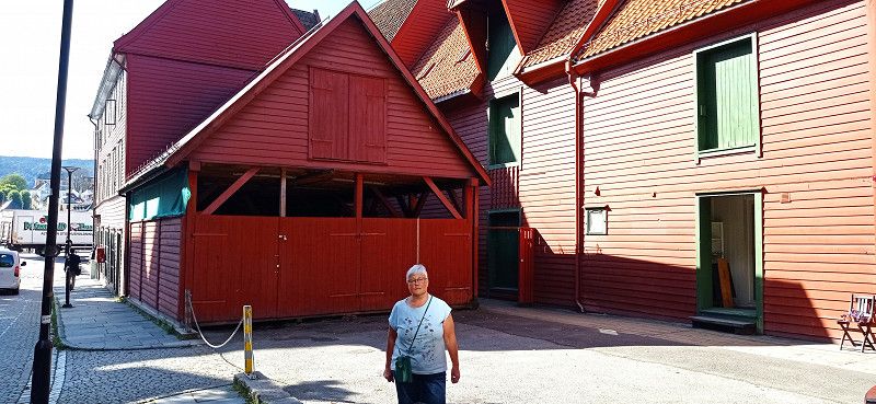
Bergen, Norwegen
60° 23' 28.5" N 5° 19' 19.4" E
60.3912628 5.3220544
• Head toward Vaskerelven on Vaskerelvsmauet. Go for 24 m.
• Turn right onto Vaskerelven (5334). Go for 92 m.
• Continue on Engen (5334). Go for 133 m.
• Turn left onto Teatergaten (5347). Go for 85 m.
• Turn right onto Komediebakken (5347). Go for 144 m.
• Turn left onto Nøstegaten (555). Go for 599 m.
• Keep right onto O. J. Brochs gate (5352) toward E16/E39/Møhlenpris/Terminal Dokken. Go for 169 m.
• Take the 2nd exit from roundabout onto Nygårdstunnelen (5347) toward E16/E39. Go for 1.1 km.
• Take ramp onto Fjøsangerveien (E39) toward Stavanger. Go for 3.2 km.
• Pass 2 roundabouts and continue on E39 (Halhjemsvegen). Go for 26.5 km.
• Keep right onto Halhjemsvegen (E39) toward Stavanger. Go for 383 m.
• Take the Halhjem-Sandvikvåg Ferry. Stay on for 21.5 km.
• Head toward Sandvikvegen on E39. Go for 28.4 km.
• Keep right toward E39. Go for 306 m.
• Continue on E39. Go for 45.2 km.
• Take ramp onto Grindafjordvegen (E39/E134) toward Stavanger/Haugesund. Go for 4.7 km.
• Take the 2nd exit from roundabout onto Grindafjordvegen (E39/E134). Go for 1.2 km.
• Take the 3rd exit from roundabout onto Tysværvegen (E39) toward Stavanger. Go for 13.3 km.
• Take the 2nd exit from roundabout onto Tysværvegen (E39). Go for 19.9 km.
• Take the Arsvågen-Mortavika Ferry. Stay on for 9.2 km.
• Head south on E39. Go for 24.4 km.
• Pass 2 roundabouts and continue on Ytre Ringvei Vest (E39). Go for 2.9 km.
• Take ramp toward Indre Tasta. Go for 252 m.
• Take the 3rd exit from roundabout onto Randabergveien (4570). Go for 347 m.
• Take the 1st exit from roundabout onto Randabergveien (4570). Go for 1.4 km.
• Take the 2nd exit from roundabout onto Tanke Svilands gate (4570). Go for 759 m.
• Take the 3rd exit from roundabout onto Løkkeveien (4584). Go for 246 m.
• Take the 2nd exit from roundabout onto Uelandsgate (426). Go for 65 m.
• Take the 2nd exit from roundabout onto Sandvigå. Go for 91 m.
• Continue on Bjergsted Terrasse. Go for 54 m.
• Continue on Sandvigå. Go for 51 m.
• Continue on Sandvigå. Go for 207 m.
• Arrive at Sandvigå. Your destination is on the left.
☍
206,8 km
(4 hrs. 15 min.)
Besichtigung Bergen
Our plan works, we leave early and get to Gudvangen without any problems. From there it goes via Stalheim and Vossevangen towards Bergen. In Bergen we park a bit outside, but free of charge. We had previously passed Bratland Camping. There is a tram stop nearby and only after downloading an app can we pay for the trip. About 4 euros. But we can easily get into the city and visit the old town of Brygge with an artistic flair. We try a reindeer sausage and of course the obligatory soft ice cream. In the harbor we notice a great truck tattoo from the Vikings series. After a walk through Bergenhus Fortress, we used the Fløybahn for a nice view of the city. We are lucky, because the otherwise rainy city shows us from its most beautiful side. We used the rest of the day to drive to Stavanger. We take the Halhjem - Sanvikvåg ferry and follow the E39. Towards evening it was time to look for a parking space. Right on the E39 we find a reasonably quiet corner and spend the night.
Day
Sandvigå Bobilparkering, Stavanger, Norwegen
Contrary to our plan to hike the small troll tongue Himåkanå at Hindaråvåg, we decided to visit Starvanger. The reason was that not so good weather had been announced and we also wanted to turn to the Preikestolen as soon as possible. We actually wanted to leave Stavanger out, but that would have been a mistake afterwards. Because we really liked the city. We found the Gamle - old town quarter with the gray colored and flower-decorated small wooden houses particularly beautiful. The alley Øvre Holmegate with its colorful houses is also very inviting. Except for a small shower we were lucky and enjoyed the beautiful day. The Disney Magic in the harbor is also impressive with its water slides, which can be seen from the outside. The parking space at the port can be specified as an ideal starting point for a city tour. On the way to Preikestolen Camping we drove through the 14 km long Ryfylke - underwater tunnel for the first time. The evening at Camping Preikestolen, a huge area with everything you need, had a great sunset ready for us. There is a small path up a hill near and opposite the reception. Recommended for photographing a sunset.
Stavanger, Norwegen
58° 58' 39.3" N 5° 43' 14.9" E
58.9775805 5.7208139
• Head toward Bjergsted on Sandvigå. Go for 258 m.
• Continue on Bjergsted Terrasse. Go for 54 m.
• Continue on Sandvigå. Go for 68 m.
• Take the 1st exit from roundabout onto Uelandsgate (426). Go for 55 m.
• Take the 2nd exit from roundabout onto Løkkeveien (4584). Go for 226 m.
• Take the 2nd exit from roundabout onto Løkkeveien (4570). Go for 923 m.
• Take the 1st exit from roundabout onto Madlaveien (441). Go for 425 m.
• Take the 2nd exit from roundabout onto Motorveien toward 510/Kristiansand/Sandnes/Lufthavn Sola. Go for 197 m.
• Take the 2nd exit from roundabout onto Motorveien. Go for 275 m.
• Take the 2nd exit from roundabout onto Hundvågtunnelen (13). Go for 6.3 km.
• Take the 1st exit from roundabout onto Ryfylketunnelen (13). Go for 14.9 km.
• Take the 1st exit from roundabout onto Ryfylkevegen (13). Go for 115 m.
• Pass 3 roundabouts and continue on Ryfylkevegen (523). Go for 10.9 km.
• Turn left onto Preikestolvegen (4642). Go for 934 m.
• Turn right onto Preikestolvegen. Go for 64 m.
• Turn left onto Preikestolvegen. Go for 41 m.
• Arrive at Preikestolvegen. Your destination is on the left.
☍
35,8 km
( 35 min.)
Day
Preikestolen camping AS, Preikestolvegen, Jørpeland, Norwegen
Preikestolvegen 97, 4100 Jørpeland, Norwegen
58° 59' 56" N 6° 5' 32.9" E
58.9989005 6.0924644
• Head east on Preikestolvegen. Go for 80 m.
• Turn left onto Preikestolvegen. Go for 113 m.
• Turn right onto Preikestolvegen. Go for 19 m.
• Turn right onto Preikestolvegen (4642). Go for 3.1 km.
• Arrive at Preikestolvegen (4642). Your destination is on the right.
☍
3,3 km
( 4 min.)
Preikestolen - Upper parking, Jørpeland, Norwegen
After checking out of the campsite, we drove to the upper hiker's car park at Preikestolen. We paid the 250 NOK for the standing time and started hiking. Right at the beginning it went steeply uphill on an asphalt path. Not easy for my wife. Then continue over roots and stones to a first small stopover on a plateau with a viewpoint. It was almost like a mass migration, because many like us wanted to climb this highlight. And so it went for us, too, over footbridges that led over high moors to steeper climbs that ended on a rocky plateau. Small lakes could be admired almost at the top. Then the last climb past steep edges and you were there, at the place of longing Preikestolen. The daring had placed themselves directly on the cliff edge. We also quickly took a few "impressive" shots ourselves, in order to then have a little snack and drink break on one of the safe rocks nearby. The "pulpit" really offered a fantastic view of the Lysefjord lying deep in blue. And it was hard to resist the magic of that sheer chasm. Experienced hikers were drawn to the less frequented summit, which certainly offered other great views. But it was enough for us and we hiked back the same route. On the way we kept coming into contact with a very nice older couple from Switzerland. Simply likeable this couple and for us a nice incident on the edge. Pretty exhausted we arrived at the bottom and licked another ice cream from the kiosk. Then the journey went back through the more than 14 km long Ryfylk tunnel. The drive into the evening took us towards the lighthouse Lindesnes Fyr.
Strand, Norwegen
58° 59' 52.1" N 6° 8' 14.3" E
58.9977922 6.1373109
• Head toward Mosli on Preikestolvegen (4642). Go for 4.0 km.
• Turn right onto Ryfylkevegen (523). Go for 3.7 km.
• Pass 3 roundabouts and continue on Ryfylkevegen (13). Go for 7.3 km.
• Take the 2nd exit from roundabout onto 13. Go for 15.0 km.
• Take the 2nd exit from roundabout onto Hundvågtunnelen (13). Go for 6.0 km.
• Continue on E39 (Eiganestunnelen). Go for 25.7 km.
• Pass 3 roundabouts and continue on Sandnesveien (E39). Go for 31.0 km.
• Turn right onto Tengesdalsvegen (4296). Go for 1.8 km.
• Continue on Apeland (4296). Go for 651 m.
• Continue on Tengesdalsvegen (4296). Go for 4.9 km.
• Continue on Bjerkreimsveien (4296). Go for 4.9 km.
• Turn left onto Jærveien (44). Go for 2.4 km.
• Take the 3rd exit from roundabout onto Eigerøyveien (44). Go for 95 m.
• Take the 2nd exit from roundabout onto Eigerøyveien (44). Go for 59 m.
• Take the 1st exit from roundabout onto Jernbaneveien (44). Go for 190 m.
• Pass 4 roundabouts and continue on Jernbaneveien (44). Go for 1.1 km.
• Take the 1st exit from roundabout onto Mosbekk plass (44). Go for 8.6 km.
• Arrive at Sokndalsveien (44). Your destination is on the right.
☍
117,4 km
(1 hrs. 45 min.)
Day
Amphidromic point restplace, Sokndalsveien, Egersund, Norwegen
Sokndalsveien 55, 4370 Egersund, Norwegen
58° 22' 57.9" N 6° 3' 24.5" E
58.3827636 6.0568118
• Head west on Sokndalsveien (44). Go for 8.6 km.
• Take the 3rd exit from roundabout onto Bøckmans gate (44). Go for 373 m.
• Pass 4 roundabouts and continue on Jernbaneveien (44). Go for 979 m.
• Take the 3rd exit from roundabout onto Eigerøyveien (44). Go for 66 m.
• Pass 2 roundabouts and continue on Eigerøyveien (502). Go for 1.7 km.
• Take the 1st exit from roundabout onto Ytstebrødveien (4286). Go for 3.6 km.
• Turn right onto Skadbergstrondveien. Go for 442 m.
• Turn right onto Skadbergstrondveien. Go for 41 m.
• Arrive at Skadbergstrondveien. Your destination is on the right.
☍
15,7 km
( 24 min.)
Skadbergstronda, Egersund, Norwegen
Skadbergstronda, Eigersund, Norwegen
58° 27' 36.3" N 5° 54' 51.1" E
58.4600763 5.9142048
• Head west on Skadbergstrondveien. Go for 77 m.
• Turn left onto Skadbergstrondveien. Go for 554 m.
• Turn left onto Ytstebrødveien (4286). Go for 3.6 km.
• Take the 2nd exit from roundabout onto Eigerøyveien (502). Go for 1.6 km.
• Turn right toward Eigerøyveien/502. Go for 7 m.
• Turn left toward Eigerøyveien/502. Go for 17 m.
• Pass 2 roundabouts and continue on Eigerøyveien (44). Go for 140 m.
• Take the 1st exit from roundabout onto Jernbaneveien (44). Go for 190 m.
• Pass 4 roundabouts and continue on Jernbaneveien (44). Go for 1.1 km.
• Take the 1st exit from roundabout onto Mosbekk plass (44). Go for 26.1 km.
• Turn right onto Gamleveien (4246) toward Rekefjord/Sentrum. Go for 81 m.
• Continue on Tørneskogsveien (4246). Go for 544 m.
• Turn left onto Strandaveien (4248). Go for 1.8 km.
• Arrive at Strandaveien (4248). Your destination is on the left.
☍
35,8 km
( 44 min.)
Sogndalstrand, Norwegen
58° 19' 29.8" N 6° 17' 10.2" E
58.3249449 6.2861650
• Head toward Kjellandsveien on Strandaveien (4248). Go for 1.8 km.
• Turn right onto Tørneskogsveien (4246). Go for 544 m.
• Continue on Gamleveien (4246). Go for 53 m.
• Turn sharp right onto Sokndalsveien (44). Go for 748 m.
• Take the 2nd exit from roundabout onto Åna-Sira veien (44). Go for 37.7 km.
• Take the 2nd exit from roundabout onto E39 toward Kristiansand. Go for 27.8 km.
• Turn right onto E39. Go for 6.3 km.
• Turn right onto 464. Go for 1.9 km.
• Turn left onto Utsiktsveien (464). Go for 933 m.
• Continue on Grøndokktunet. Go for 133 m.
• Turn left onto Alleen (4084). Go for 236 m.
• Turn right onto Agnefestveien (4078). Go for 1.6 km.
• Turn left onto Rosnesveien (4078). Go for 1.2 km.
• Turn left onto Jåsundveien (4078). Go for 7.2 km.
• Continue on 4078. Go for 4 m.
• Continue on Jåsundveien (4078). Go for 2.3 km.
• Continue on Lindalsveien (4078). Go for 4.2 km.
• Turn right onto Spangereidveien (460). Go for 243 m.
• Take the 2nd exit from roundabout onto Lindesnesveien (460). Go for 269 m.
• Take the 2nd exit from roundabout onto Lindesnesveien (460). Go for 2.7 km.
• Turn slightly left onto Lindesnesveien (460). Go for 5.2 km.
• Turn left onto 460. Go for 22 m.
• Continue on Lindesnesveien (460). Go for 2.0 km.
• Continue on 460. Go for 4 m.
• Continue on Lindesnesveien (460). Go for 1.5 km.
• Arrive at Lindesnesveien. Your destination is on the left.
☍
106,6 km
(2 hrs. 11 min.)
Lindesnes fyr, Lindesnesveien, Lindesnes, Norwegen
From Stavanger we wanted to slowly orientate ourselves in the direction of the Kristiansand ferry port, whereby the parking space at the lighthouse near Lindesnes should definitely be approached. We chose the route along the 44 and were able to experience a completely different landscape near Egersund due to the Magma Geopark there. The volcanic rock has created a huge landscape, characterized by massive rock formations. Towards evening we chose the beautiful parking lot at the Amphidromic Point Restplace with a clean toilet. There were 3 other mobile homes with us at the rest area. The view of the sea spoiled us again. An artist has positioned a stone statue on a rock. (Rock body sculpture) As in our case, the figure's gaze is directed towards the open sea. The lookout car park provides information on a board about the creation of the Geopark. Luckily, after an overnight stay, we decided to take the 44 back a bit to Egersund. Our destination, the wonderful Skadbergsanden beach, which seemed almost Caribbean to us. We walked along the well-tended beach for a while. In the summer it should be busy here, but now it was almost deserted. Even though time was running out, we still drove to the idyllic village of Sokndalstranden and visited this nice little place, which seemed a bit sleepy to us at the time. But then we went to the lighthouse Lindesnes Fyr. Luckily we were still able to admire the tower during the setting sun. There was something very romantic about the evening atmosphere. An AIDA ship passed in the distance. We had nice photos with us when it rained heavily after dark. It didn't bother us anymore. We had paid for the parking space at the machine on site and were able to use the toilet at the tourist point to the Lindesnes Fyr lighthouse. Disposal is possible free of charge on the return journey at the Servicepoint Spangereid in 2630 Spangereidveien.
Lindesnesveien 1139, 4521 Lindesnes, Norwegen
57° 58' 57" N 7° 2' 48.3" E
57.9824995 7.0467484
• Head southeast on Lindesnesveien. Go for 1.5 km.
• Continue on 460. Go for 4 m.
• Continue on Lindesnesveien (460). Go for 2.0 km.
• Continue on 460. Go for 22 m.
• Continue on Lindesnesveien (460). Go for 2.0 km.
• Turn slightly right onto Lindesnesveien (460). Go for 5.9 km.
• Take the 2nd exit from roundabout onto Lindesnesveien (460). Go for 259 m.
• Take the 2nd exit from roundabout onto Spangereidveien (460). Go for 666 m.
• Arrive at Spangereidveien (460).
☍
12,4 km
( 20 min.)
Spangereidveien 2630, Spangereid, Norwegen
Spangereidveien 2630, 4521 Spangereid, Norwegen
58° 2' 45.8" N 7° 9' 14.9" E
58.0460624 7.1541262
• Head east on Spangereidveien (460). Go for 14.9 km.
• Take the 1st exit from roundabout onto Smibakken (460). Go for 230 m.
• Turn right onto Peder Claussøns vei (460). Go for 216 m.
• Continue on 460. Go for 262 m.
• Take the 3rd exit from roundabout onto Mandalsveien (E39). Go for 12.9 km.
• Pass 2 roundabouts and continue on E39. Go for 4.9 km.
• Take the 2nd exit from roundabout onto E39 toward Kristiansand. Go for 28.1 km.
• Take the 2nd exit from roundabout onto Fidjebakken (E39). Go for 1.9 km.
• Take ramp onto Vesterveien toward E39/Danmark. Go for 388 m.
• Take the 1st exit from roundabout onto Vesterveien toward E39/Danmark. Go for 172 m.
• Turn sharp right. Go for 371 m.
• Arrive at your destination on the right.
☍
64,4 km
( 57 min.)
Day
Kristiansand ferjeterminal, Vesterveien, Kristiansand, Norwegen
On the way to Kristiansand we were able to admire again the earth movements that Norway is doing to make the traffic on the E39 smoother. We reached the ferry port early via detours. Once again we enjoyed the service and food from Color Line and arrived back in Denmark (Hirtshals) on time. For the night we had chosen the Brønderslev car park, 2 Stenberggade, which also offers free chemical disposal. Very suitable for an overnight stay. Several mobile homes stayed here overnight.
Vesterveien 21, 4613 Kristiansand, Norwegen
58° 8' 34.2" N 7° 58' 58.4" E
58.1428365 7.9828781
• Head southeast. Go for 76 m.
• Take the Kristiansand-Hirtshals Ferry. Stay on for 139 km.
• Head southeast on E39. Go for 1.1 km.
• Turn left onto Willemoesvej toward Østhavn. Go for 93 m.
• Turn left onto Willemoesvej toward Hirtshals/Color Line. Go for 23 m.
• Turn right toward Hirtshals/Color Line. Go for 5 m.
• Continue on Willemoesvej toward Hirtshals/Color Line. Go for 26 m.
• Turn left onto Willemoesvej toward Hirtshals/Color Line. Go for 114 m.
• Turn right onto Willemoesvej toward Hirtshals/Color Line. Go for 86 m.
• Turn right onto Aalborgvej (E39) toward Hirtshals/Color Line. Go for 274 m.
• Take ramp onto Jyllandsgade toward Color Line/Terminal/Centrum. Go for 639 m.
• Turn right onto Jyllandsgade. Go for 44 m.
• Continue on Norgeskajen. Go for 379 m.
• Turn right onto Auktionskajen. Go for 24 m.
• Arrive at Auktionskajen. Your destination is on the right.
☍
141,8 km
(4 hrs. 5 min.)
Hirtshals Havn, Norgeskajen, Hirtshals, Dänemark
Norgeskajen 11, 9850 Hirtshals, Dänemark
57° 35' 39.2" N 9° 57' 46.1" E
57.5942361 9.9628099
• Head southeast on Auktionskajen. Go for 24 m.
• Turn left onto Norgeskajen. Go for 379 m.
• Continue on Jyllandsgade. Go for 44 m.
• Turn left onto Jyllandsgade. Go for 324 m.
• Take ramp onto Aalborgvej (E39). Go for 1.6 km.
• Take the 3rd exit from roundabout onto Aalborgvej (E39) toward Aalborg/Skagen/597. Go for 2.3 km.
• Take the 2nd exit from roundabout onto E39 (Hirtshalsmotorvejen) toward Aalborg. Go for 33.9 km.
• Take exit 6 toward Brønderslev C. Go for 479 m.
• Turn slightly right onto Jerslevvej (585) toward 190/Brønderslev. Go for 1.2 km.
• Take the 1st exit from roundabout onto Hjørringvej (190). Go for 392 m.
• Turn left onto Markedsvej. Go for 879 m.
• Take the 2nd exit from roundabout onto Markedsvej. Go for 294 m.
• Turn left onto Stenberggade. Go for 211 m.
• Arrive at Stenberggade. Your destination is on the left.
☍
42,0 km
( 28 min.)
Stenberggade, Brønderslev, Dänemark
Stenberggade, 9700 Brønderslev, Dänemark
57° 16' 30" N 9° 57' 7.8" E
57.2749942 9.9521577
• Head southwest on Stenberggade.
• Turn left onto Stenberggade. Go for 52 m.
• Turn left onto Frederiksgade. Go for 210 m.
• Turn right onto Markedsvej. Go for 213 m.
• Take the 2nd exit from roundabout onto Markedsvej. Go for 893 m.
• Turn right onto Hjørringvej (190). Go for 379 m.
• Take the 3rd exit from roundabout onto Jerslevvej (585). Go for 1.3 km.
• Turn right and take ramp onto E39 (Hirtshalsmotorvejen) toward Aalborg. Go for 22.7 km.
• Continue on Vendsyssel. Go for 196 m.
• Continue on E45 (Vendsyssel). Go for 212 km.
• Continue on E45 (Sønderjyske Motorvej) toward Flensborg. Go for 83.2 km.
• Continue on A7. Go for 156 km.
• Keep left onto A7. Go for 14.7 km.
• Keep right onto A261 (Autobahndreieck Hamburg-Südwest) toward Bremen/Tötensen. Go for 9.0 km.
• Take exit 4 toward Osnabrück/Bremen/Rade onto A1. Go for 25.7 km.
• Take exit 47 toward Scheeßel/Sittensen. Go for 339 m.
• Turn left onto Stader Straße (L130) toward Scheeßel/Sittensen. Go for 473 m.
• Take the 2nd exit from roundabout onto Stader Straße (L130) toward Scheeßel. Go for 1.4 km.
• Turn left onto Am Markt. Go for 65 m.
• Continue on Mühlenstraße. Go for 120 m.
• Turn right. Go for 39 m.
• Turn right. Go for 19 m.
• Arrive at your destination on the right.
☍
528,7 km
(5 hrs. 7 min.)
Day
Letzte Station Sittensen und unser Fazit
As on the way there, we used the beautiful and free parking space in Sittensen. We ate locally and went for an evening walk. In the morning we went home.
Wonderful memories of a great country remain. Norway has fascinated us from the very beginning and we know very well that this country has so many more natural beauties to offer. Someday maybe again...! In any case, the ferry pass (Ferjekort) and the transponder, in our case from BroBizz, are recommended and have proven their worth. At the ferries our number plate was scanned and that was it. Toll billing was also unproblematic. In a short time we were able to understand all the costs. A total of 14 campsites were visited in 32 days. We found the infrastructure at most campsites, waste disposal stations and rest areas to be very well organized and pleasant. The petrol station network was also well developed. It was helpful for us to use the relevant apps, including those from Statens Vegvesen, here Ferry Search and Traffic Info, as well as LPG Filling. In addition, the parking space searches via the respective app operator.
Wohnmobilstellplatz Sittensen, Sittensen, Deutschland
27419 Sittensen, Deutschland
53° 16' 34.5" N 9° 30' 26" E
53.2762383 9.5072194