Unfortunately, we don't support your browser (Internet Explorer) anymore, some functionalities could not work. Click here to get information on how to upgrade your browser.
South Tyrol tour June 2022

Travelogue
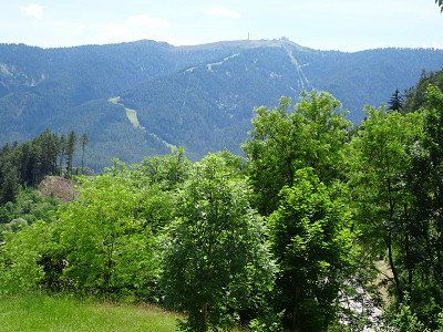
We chose the route over the Engadine and the Ofen Pass. Instead of driving over the Flüela Pass, we decided to load through the Vereina Tunnel, which not only saves time but also avoids the many curves. There will still be enough curves in South Tyrol.
The route leads from Saglains via Zernez and the Ofenpass (lunch), through the Münstertal and the Vinschgau past Meran to Bozen.
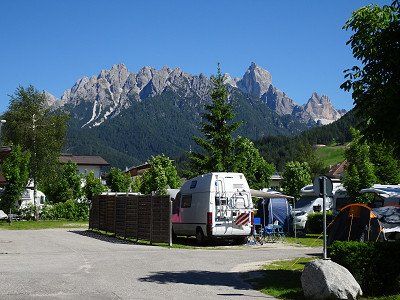
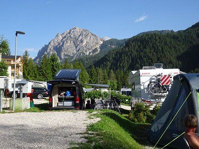
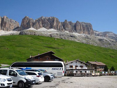
The parking space offers space for approx. 20 vehicles.
The cost is €1 per hour between 8:00 a.m. and 7:00 p.m.
Electricity is available and costs €0.25 per hour (24 hours/day).
We first wanted to book a spot at Camping Mossbauer, but the spot was fully booked. The Steiner square in Leifers had already put up a notice stating that it was fully occupied.
The parking space was an emergency solution with the advantage of the bus stop right next to it with direct buses to Bolzano train station. The disadvantage is the noise from the street and train line and the lack of shade.
We take the bus into town. A day ticket costs €4.-. But after inserting the €4, the machine on the bus reports that no day tickets are available and keeps the €4 without even issuing a ticket. The driver couldn't do anything, but took us (2 people) with him to the train station.
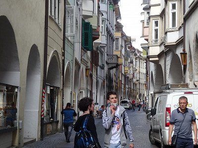
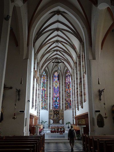
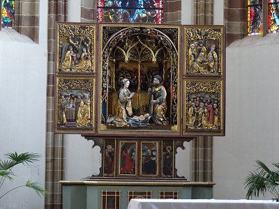
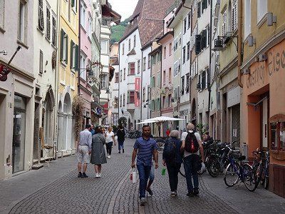
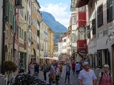
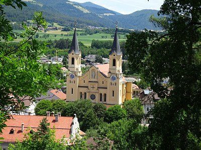
We started the city tour at Bolzano Cathedral, then went to Waltherplatz, Mustergasse and to the fruit and vegetable market.
Actually we would have visited the Archaeological Museum, where Ötzi is on display. Well, it was Monday and Ötzi had his day off.
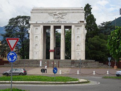
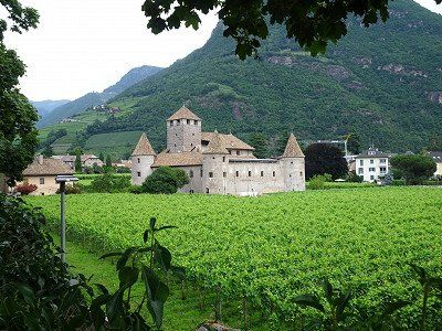
We went over the Talfer Bridge to the victory monument, which was fenced off and therefore not accessible. We followed the Talfer river north to Maretsch Castle. However, this cannot be visited.
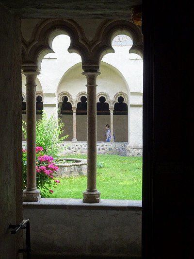
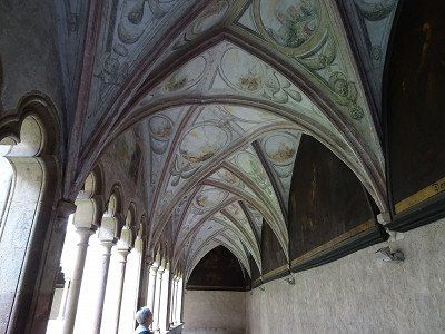
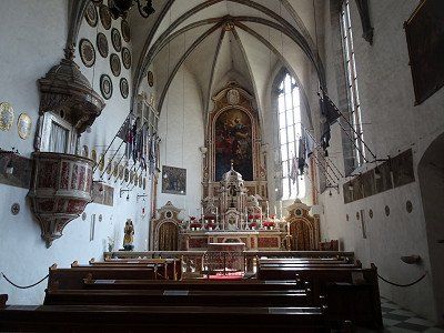
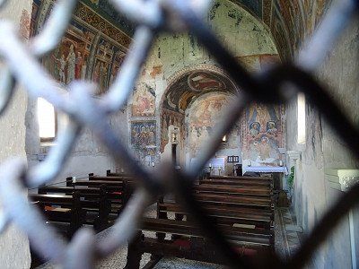
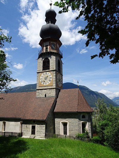
The next pivot point was the Franciscan monastery with the beautiful cloister. We were very impressed by the architectural design of the cloister ceiling, as it is unique. The Deutschhauskirche and the Church of St. Johann in the village are also worth seeing.
Towards the city center we chose Batzlhäuslgasse and immediately discovered Bazlhäusl, a recommended restaurant with a beautiful inner courtyard.
Since it was still too early for lunch, we walked along Bindergasse and bought a few little things.
We take the bus into town. A day ticket costs €4.-. But after inserting the €4, the machine on the bus reports that no day tickets are available and keeps the €4 without even issuing a ticket. The driver couldn't do anything, but took us (2 people) with him to the train station.
We started the city tour at Bolzano Cathedral, then went to Waltherplatz, Mustergasse and to the fruit and vegetable market.
Actually we would have visited the Archaeological Museum, where Ötzi is on display. Well, it was Monday and Ötzi had his day off.
We went over the Talfer Bridge to the victory monument, which was fenced off and therefore not accessible. We followed the Talfer river north to Maretsch Castle. However, this cannot be visited.
The next pivot point was the Franciscan monastery with the beautiful cloister. We were very impressed by the architectural design of the cloister ceiling, as it is unique. The Deutschhauskirche and the Church of St. Johann in the village are also worth seeing.
Towards the city center we chose Batzlhäuslgasse and immediately discovered Bazlhäusl, a recommended restaurant with a beautiful inner courtyard.
Since it was still too early for lunch, we walked along Bindergasse and bought a few little things.
We were lucky on the Rittnerbahn. The monthly inspection is scheduled for the afternoon, from shortly after our trip up the mountain until the evening. So we will reach Oberbozen without any problems and then take the bus down to the valley.
From Oberbozen we used the narrow-gauge railway to Klobenstein. As later investigations confirmed, the compositions traveled on the Appenzeller Railway route from St. Gallen to Trogen until a few years ago.
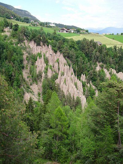
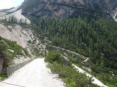
After a hike along the road we reached the earth pyramids, which are really impressive to look at. Attention, it is advisable to hurry up for your visits, in 1000 years the whole thing will certainly look completely different.


We were lucky on the Rittnerbahn. The monthly inspection is scheduled for the afternoon, from shortly after our trip up the mountain until the evening. So we will reach Oberbozen without any problems and then take the bus down to the valley.
From Oberbozen we used the narrow-gauge railway to Klobenstein. As later investigations confirmed, the compositions traveled on the Appenzeller Railway route from St. Gallen to Trogen until a few years ago.
After a hike along the road we reached the earth pyramids, which are really impressive to look at. Attention, it is advisable to hurry up for your visits, in 1000 years the whole thing will certainly look completely different.
We actually wanted to spend a few days in Seis/Seiser Alm. But here too, all places are fully booked. I therefore reserved a place for 4 nights in Dobbiaco by phone so that we would have really safe accommodation options.
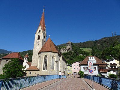
We are now going straight to Klausen.
There are two parking areas in Klausen. In the south there are rather small parking spaces, in the north there is a large parking lot that even has fields for buses.
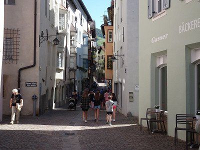
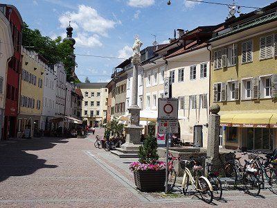
At the tourist information center we get the guide to buildings worth seeing and walk around them. The city essentially consists of one main street and in some places
still from a side street. The main street is very picturesque. A stay of 1..2 hours is definitely worth it.

We actually wanted to spend a few days in Seis/Seiser Alm. But here too, all places are fully booked. I therefore reserved a place for 4 nights in Dobbiaco by phone so that we would have really safe accommodation options.
We are now going straight to Klausen.
There are two parking areas in Klausen. In the south there are rather small parking spaces, in the north there is a large parking lot that even has fields for buses.
At the tourist information center we get the guide to buildings worth seeing and walk around them. The city essentially consists of one main street and in some places
still from a side street. The main street is very picturesque. A stay of 1..2 hours is definitely worth it.
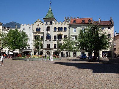
As always, when visiting cities, there is the question of a suitable parking space for the motorhome. In Brixen we parked the motorhome in the parking lot 46.70625, 11.65045. We found one last place on the edge in a kind of wasteland. From here we hiked to the center, which starts around 1 km north.
The following places were on our sightseeing tour
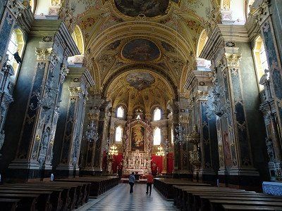
The baroque cathedral square with the cathedral and the cloister
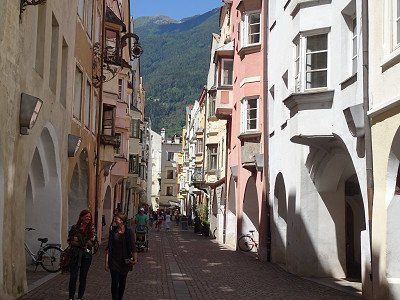
The old town and Stagels on the other side of the river
The Great Lauben (lunch)
For the way back we chose the hiking trail along the Eisack River

As always, when visiting cities, there is the question of a suitable parking space for the motorhome. In Brixen we parked the motorhome in the parking lot 46.70625, 11.65045. We found one last place on the edge in a kind of wasteland. From here we hiked to the center, which starts around 1 km north.
The following places were on our sightseeing tour
The baroque cathedral square with the cathedral and the cloister
The old town and Stagels on the other side of the river
The Great Lauben (lunch)
For the way back we chose the hiking trail along the Eisack River
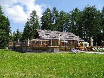
A nice place with friendly staff and very good sanitary facilities. The bus stop is right in front of the campsite.
A nice place with friendly staff and very good sanitary facilities. The bus stop is right in front of the campsite.
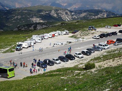
From Dobbiaco, bus 444 runs almost every hour via Misurina to the Auronzo hut. The return journey costs €16 per person. This is cheaper than driving up there in a car.
From Dobbiaco, bus 444 runs almost every hour via Misurina to the Auronzo hut. The return journey costs €16 per person. This is cheaper than driving up there in a car.
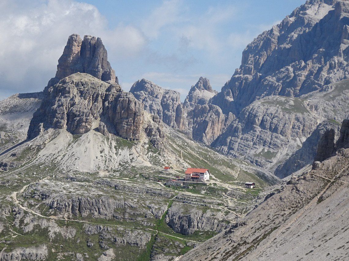
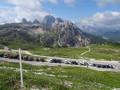
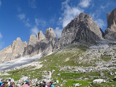
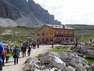
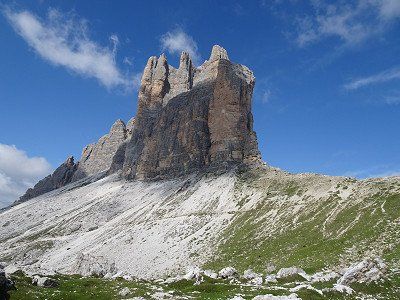
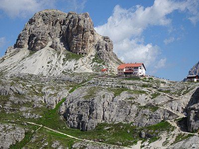
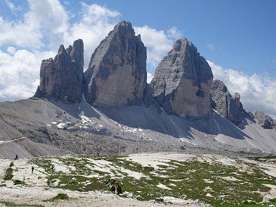
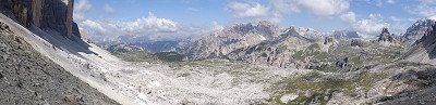
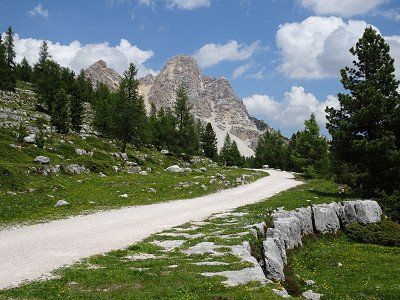
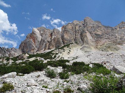
Hike around the Three Peaks. First to the Dreizinnenhütte (still closed) then to the Lange Alm-Hütte, which is open.
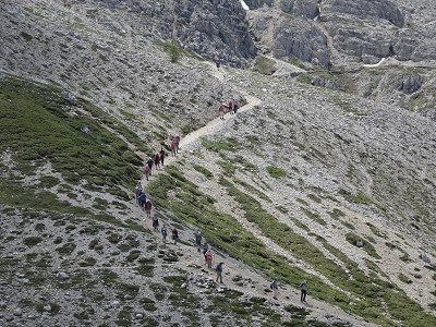
Be careful, if you think you're hiking alone around the Three Peaks, you'll have to prove yourself wrong. It feels like 1000 people walk around the mountains every day!!
The circumnavigation is not difficult. Nevertheless, good shoes and the usual equipment for mountain hikes are recommended.
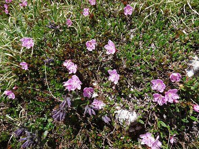
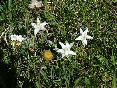
We enjoyed the hike despite the many people and if you pay attention to little things along the way, you can discover many different types of flowers.


Hike around the Three Peaks. First to the Dreizinnenhütte (still closed) then to the Lange Alm-Hütte, which is open.
Be careful, if you think you're hiking alone around the Three Peaks, you'll have to prove yourself wrong. It feels like 1000 people walk around the mountains every day!!
The circumnavigation is not difficult. Nevertheless, good shoes and the usual equipment for mountain hikes are recommended.
We enjoyed the hike despite the many people and if you pay attention to little things along the way, you can discover many different types of flowers.
A cycle path leads from Dobbiaco to Bruneck (30 km) directly from the campsite. Anyone who thinks that the height difference of 300 meters down to Bruneck is continuous is wrong. In between there are impressive climbs.
The last kilometers of the route partly lead through tunnels and, as if out of nowhere, you find yourself in the center of Bruneck.
Brunico is also worth seeing. The old town in particular is worth a visit.
You can get a good map of the city from the tourism organization and there are toilets opposite.
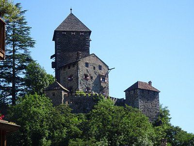
We start the tour at the Ursuline Church, then up the Stadtgasse to the Ragentor. Behind the Ragentor we take the climb to Bruneck Castle. From the castle you can enjoy a beautiful view over Bruneck and Kronplatz.
Brunico is also worth seeing. The old town in particular is worth a visit.
You can get a good map of the city from the tourism organization and there are toilets opposite.
We start the tour at the Ursuline Church, then up the Stadtgasse to the Ragentor. Behind the Ragentor we take the climb to Bruneck Castle. From the castle you can enjoy a beautiful view over Bruneck and Kronplatz.
In order to experience a different perspective of the Dolomites, we are moving our location just a few kilometers to St. Vigil.
I have reserved the space at Camping Al Plan in advance.
In order to experience a different perspective of the Dolomites, we are moving our location just a few kilometers to St. Vigil.
I have reserved the space at Camping Al Plan in advance.
The site is modern and for the first time in our camping history we saw in the sanitary track that the shower cubicles were divided into two by a glass door to prevent our shoes from getting wet.
The terracing was created artificially and does not allow pegs to penetrate into the ground. Otherwise, the place offers a great view and the staff is friendly and helpful.
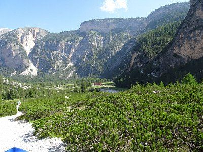
A worthwhile walk from Camping Al Plan to Chalk Lake. A restaurant shortens the waiting time for the bus until the return journey.
A worthwhile walk from Camping Al Plan to Chalk Lake. A restaurant shortens the waiting time for the bus until the return journey.
There is a bus to Pederü every hour from the visitor center at the campsite.
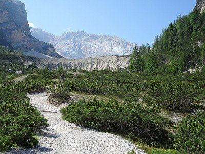
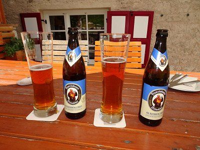
From Pederü we climb up to the Lavarella hut. The height difference of a good 500 m wouldn't actually matter to us. But the sun beats mercilessly into the valley basin and you think you're walking in an oven. After a good 2 hours the destination is reached and it's worth a wheat beer and enough food. Now all that's left to do is descend.

There is a bus to Pederü every hour from the visitor center at the campsite.
From Pederü we climb up to the Lavarella hut. The height difference of a good 500 m wouldn't actually matter to us. But the sun beats mercilessly into the valley basin and you think you're walking in an oven. After a good 2 hours the destination is reached and it's worth a wheat beer and enough food. Now all that's left to do is descend.
After yesterday's hike, we want to take it easy. The bus from the center of St. Vigil takes you to the Furcla Pass. From there a steep path leads up to the hut.
If you want, you can choose the route for the descent. However, this is almost as steep as the footpath.
Return by bus. This also runs every hour.
From St. Vigil the journey takes us first down into the valley and then down the valley in a southerly direction to Badia and Corvara.
From Corvara the road climbs to the Campolongo Pass and offers a great view of the Dolomite peaks in the first bends.
From St. Vigil the journey takes us first down into the valley and then down the valley in a southerly direction to Badia and Corvara.
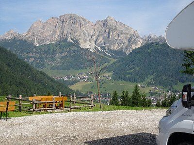
From Corvara the road climbs to the Campolongo Pass and offers a great view of the Dolomite peaks in the first bends.
The Pordoi Pass seems to be made exclusively for cyclists. Where elsewhere most cyclists are found on e-bikes, here the majority are on racing bikes. Some of them cycle confidently, others with red faces.
We drive up in the motorhome and have to see how we can get space between the cyclists.
At the top the view is phenomenal. You can see all the way to the Marmolada, which hit the headlines a good week later due to a glacier collapse. The cable car to Sass Pordoi is also spectacular.
After the inns were either closed everywhere or there were no parking spaces available for mobile homes, Viktor's Imbiss came in handy. With its huge parking space behind the house and its immense catering capacity, the restaurant is ideal for motorhome drivers.
After the inns were either closed everywhere or there were no parking spaces available for mobile homes, Viktor's Imbiss came in handy. With its huge parking space behind the house and its immense catering capacity, the restaurant is ideal for motorhome drivers.
We reach the campsite and hope for a place within the campsite. We didn't make a reservation. We get a good place for one night.
Since it is very hot, we are in the lake after a short time and can refresh ourselves. Getting in amongst 50cm long carp takes some getting used to. But they leave you alone.
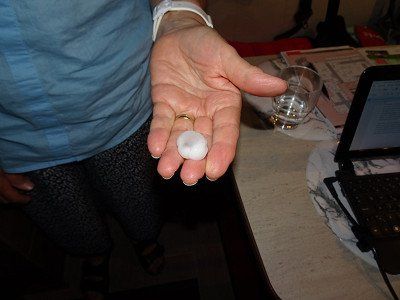
In the evening, several thunderstorms broke out and hailstones the diameter of one or even two euro coins thundered onto campers and tents.
Luckily no one was hurt, but a tent next to us was destroyed.
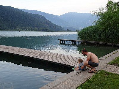
We reach the campsite and hope for a place within the campsite. We didn't make a reservation. We get a good place for one night.
Since it is very hot, we are in the lake after a short time and can refresh ourselves. Getting in amongst 50cm long carp takes some getting used to. But they leave you alone.
In the evening, several thunderstorms broke out and hailstones the diameter of one or even two euro coins thundered onto campers and tents.
Luckily no one was hurt, but a tent next to us was destroyed.
The return journey takes place again through the Vintschgau.
Attention: Glurns can only be bypassed to the west with motorhomes. It is not possible to drive through with motorhomes due to the narrow and low gates. However, Glorenza is certainly worth a stop for a visit.
The return journey takes place again through the Vintschgau.
Attention: Glurns can only be bypassed to the west with motorhomes. It is not possible to drive through with motorhomes due to the narrow and low gates. However, Glorenza is certainly worth a stop for a visit.
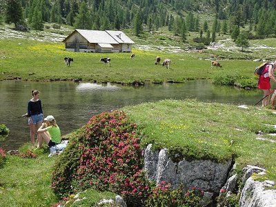
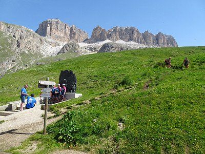
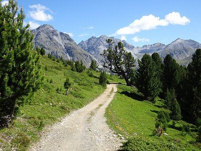
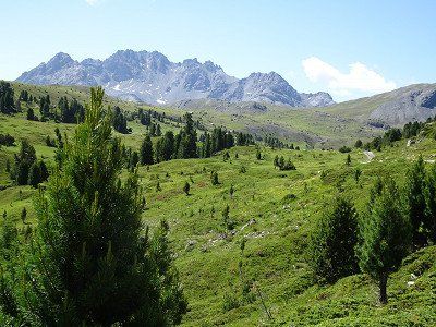
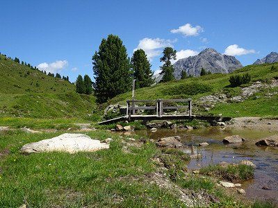
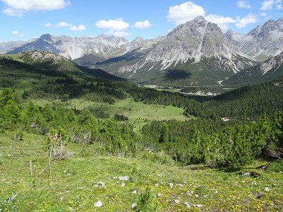
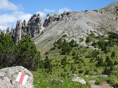
From Zernez we went on another hike. First we took the post bus from Zernez train station to the Buffalora stop. This is the last stop before the Ofen Pass.
From here a wonderful hiking trail leads over the Alp Buffalora to the plateau of Döss de las Plattas. The climb is almost done.
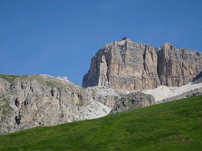
In an easterly direction, after circling the Dolomite massif Il Jalet, you reach the Ofen Pass with its restaurant.
Instead of taking the bus back, we extended the hike with a direct descent to Buffalora and got on the post bus there.

From Zernez we went on another hike. First we took the post bus from Zernez train station to the Buffalora stop. This is the last stop before the Ofen Pass.
From here a wonderful hiking trail leads over the Alp Buffalora to the plateau of Döss de las Plattas. The climb is almost done.
In an easterly direction, after circling the Dolomite massif Il Jalet, you reach the Ofen Pass with its restaurant.
Instead of taking the bus back, we extended the hike with a direct descent to Buffalora and got on the post bus there.
Route
Show newest first- 47.3769 8.5417
- 47° 22' 36.8" N 8° 32' 30.1" E
Wir wählten die Route über das Engadin und den Ofenpass. Statt über den Flüelapass zu fahren, entschieden wir uns für den Verlad durch den Vereinatunnel, der nicht nur Zeit spart, sondern auch die vielen Kurven unterfährt. Kurven wird es im Südtirol dann noch genug geben.
Die Route führt ab Saglains über Zernez und den Ofenpass (Mittagessen), durchs Münstertal und das Vinschgau an Meran vorbei bis nach Bozen.
- 46.4723 11.3365
- 46° 28' 20.1" N 11° 20' 11.4" E
Wir fahren mit dem Bus in die Stadt. Eine Tageskarte kostet €4.-. Doch der Automat im Bus meldet nach Einwurf der € 4.-, dass keine Tageskarten verfügbar seien und behält die € 4.-, ohne auch nur ein Ticket auszugeben. Der Fahrer konnte nichts ausrichten, nahm uns (2 Personen) jedoch mit zum Bahnhof.
Die Stadtbesichtigung begannen wir beim Bozner Dom, dann gings über den Waltherplatz, die Mustergasse und zum Obst- und Gemüsemarkt.
Eigentlich hätten wir jetzt das Archäologische Museum besucht, wo Ötzi ausgestellt ist. Nun, es war Montag und Ötzi hatte seinen freien Tag.
Über die Talferbrücke ging es zum Siegerdenkmal, das aber eingezäunt und deshalb nicht zugänglich war. Dem Fluss Talfer nach ging es nördlich bis zum Schloss Maretsch. Dieses kann jedoch nicht besichtigt werden.
Nächster Angelpunkt war das Franziskanerkloster mit dem wunderschönen Kreuzgang. Die architektonische Gestaltung der Kreuzgangdecke beeindruckte uns sehr, ist diese doch einzigartig. Die Deutschhauskirche und die Kirche St. Johann im Dorf sind ebenfalls sehenswert.
Richtung Stadtzentrum wählten wir die Batzlhäuslgasse und entdeckten gleich das Bazlhäusl, ein empfehlenswertes Restaurant mit schönem Innenhof.
Da es noch zu früh war für das Mittagessen bewanderten wir noch die Bindergasse und kauften noch einige Kleinigkeiten ein.
Auf der Rittnerbahn hatten wir Glück. Am Nachmittag ist auf die Zeit kurz nach unserer Bergfahrt bis am Abend die monatliche Revision angesagt. Wir werden also Oberbozen problemlos erreichen und danach mit dem Bus talwärts fahren.
Ab Oberbozen benützten wir die Schmalspurbahn nach Klobenstein. Wie spätere Abklärungen bestätigten, fuhren die Kompositionen bis vor wenigen Jahren auf der Strecke der Appenzellerbahnen von St. Gallen nach Trogen.
Nach einer Wanderung entlang der Strasse erreichten wir die Erdpyramiden, die wirklich eindrücklich zu betrachten sind. Achtung Beeilung für Eure Besuche ist ampfohlen, in 1000 Jahren sieht das ganze sicher ganz anders aus.
- 46.4726 11.3374
- 46° 28' 21.2" N 11° 20' 14.5" E
- 46.64 11.5662
- 46° 38' 24" N 11° 33' 58.4" E
- 46.7177 11.6572
- 46° 43' 3.7" N 11° 39' 26.1" E
Von Toblach aus fährt fast stündliche der Bus 444 über Misurina zur Auronzo-Hütte. Pro Person kostet die Hin- und Rückfahrt € 16.-. Das ist günstiger als mit einem PW dort hoch zu fahren.
Wanderung rund um die Drei Zinnen. Zuerst zur Dreizinnenhütte (noch geschlossen) danach zur Lange Alm-Hütte, die geöffnet hat.
Achtung, wer meint er wandere alleine um die Drei Zinnen, wird sich eines besseren belehren müssen. Gefühlte 1000 Personen umrunden die Berge täglich!!
Die Umrundung ist nicht beschwerlich. Trotzdem ist gutes Schuhwerk und die übliche Ausrüstung für Bergwanderungen empfohlen.
Wir haben die Wanderung trotz der vielen Leute genossen und wer auf Kleinigkeiten am Wegrand achtet, kann viele Blumen unterschiedlichster Arten entdecken.
Von Toblach nach Bruneck (30 Km) führt ein Radweg direkt ab Campingplatz. Wer meint, dass die Höhendifferenz von 300 Meter hinab nach Bruneck kontinuierlich von statten geht, irrt. Zwischendurch gibt es stattliche Aufstiege.
Die letzten Kilometer der Strecke führen teilweise durch Tunnels und wie aus dem Nichts steht man im Zentrum von Bruneck.
Auch Bruneck ist sehenswert. Insbesondere die Altstadt ist einen Besuch wert.
Bei der Tourismusorganisation erhält man einen guten Stadtplan und vis à vis gibt es noch Toiletten.
Die
Besichtigung beginnen wir bei der Ursulinenkirche, dann die Stadtgasse
hinauf bis zum Ragentor. Hinter dem Ragentor nehmen wir den Anstieg zum
Schloss Bruneck. Vom Schloss aus geniesst man einen schönen Blick über Bruneck und zum Kronplatz.
Um noch einen anderen Gesichtswinkel der Dolomiten zu erleben verlegen wir unseren Standor nur wenige Kilometer nach St. Vigil.
Den Platz auf dem Camping Al Plan hae ich vorreserviert.
Ein lohnender Spaziergang vom Camping Al Plan zum Kreidesee. Ein Restaurant verkürzt die Wartezeit auf den Bus bis zur Rückfahrt.
Ab dem Besucherzentrum beim Camping fährt stündlich ein Bus nach Pederü.
Ab Pederü steigen wir hoch zur Lavarellahütte. Die Höhendifferenz von gut 500 m würde uns eigentlich nichts ausmachen. Aber die Sonne brennt unerbärmlich in den Talkessel inein und man meint, man wandere in einem Backofen. Nach gut 2 h ist das Ziel erreicht und es lohnt ein Weizenbier und genügend Verpflegung. Jetzt muss nur noch der Abstieg vollbracht werden.
Nach der gestrigen Wanderung, wollen wir uns etwas schonen. Mit dem Bus ab dem Zentrum von St. Vigil geht es auf den Furcla-Pass. Von dort führt ein steiler Weg hoch zur Hütte.
Wer will, kann für den Abstieg die Fahrstrasse wählen. Diese ist jedoch fast gleich steil, wie der Fussweg.
Rückfahrt wieder mit dem Bus. Auch dieser fährt stündlich.
- 46.5526 11.8743
- 46° 33' 9.3" N 11° 52' 27.4" E
- 46.4972 11.8738
- 46° 29' 49.8" N 11° 52' 25.6" E
- 46.4878 11.814
- 46° 29' 16.2" N 11° 48' 50.6" E
- 46.3547 11.2831
- 46° 21' 16.9" N 11° 16' 59.3" E
Die Rückfahrt erfolgt wiederum durch das Vintschgau.
Achtung: Glurns kann mit Wohnmobilen nur westlich umfahren werden. Eine Durchfahrt ist aufgrund der schmalen und niedrigen Tordurchfahrten mit Womos nicht möglich. Sicher ist Glurns jedoch einen Stopp für eine Besichtigung wert.
Von Zernez aus unternahmen wir noch eine Wanderung. Zuerst fuhren wir mit dem Postauto ab Bahnhof Zernez nach der Haltestelle Buffalora. Dies ist die letzte Haltestelle vor der Ofen-Passhöhe.
Von hier führt ein wunderbarer Wanderweg über die Alp Buffalora zur Hochebene von Döss de las Plattas. Damit ist der Aufstieg schon fast geschafft.
In östlicher Richtung erreicht man nach der Umrundung des Dolomit-Massivs Il Jalet den Ofenpass mit seinem Restaurant.
Statt mit dem Bus wieder zurückzufahren, eerweiterten wir die Wanderung mit dem direkten Abstieg nach Buffalora und bestiegen dort das Postauto.
- 47.3769 8.5417
- 47° 22' 36.8" N 8° 32' 30.1" E
Travelogue
We chose the route over the Engadine and the Ofen Pass. Instead of driving over the Flüela Pass, we decided to load through the Vereina Tunnel, which not only saves time but also avoids the many curves. There will still be enough curves in South Tyrol.
The route leads from Saglains via Zernez and the Ofenpass (lunch), through the Münstertal and the Vinschgau past Meran to Bozen.
The parking space offers space for approx. 20 vehicles.
The cost is €1 per hour between 8:00 a.m. and 7:00 p.m.
Electricity is available and costs €0.25 per hour (24 hours/day).
We first wanted to book a spot at Camping Mossbauer, but the spot was fully booked. The Steiner square in Leifers had already put up a notice stating that it was fully occupied.
The parking space was an emergency solution with the advantage of the bus stop right next to it with direct buses to Bolzano train station. The disadvantage is the noise from the street and train line and the lack of shade.
We take the bus into town. A day ticket costs €4.-. But after inserting the €4, the machine on the bus reports that no day tickets are available and keeps the €4 without even issuing a ticket. The driver couldn't do anything, but took us (2 people) with him to the train station.
We started the city tour at Bolzano Cathedral, then went to Waltherplatz, Mustergasse and to the fruit and vegetable market.
Actually we would have visited the Archaeological Museum, where Ötzi is on display. Well, it was Monday and Ötzi had his day off.
We went over the Talfer Bridge to the victory monument, which was fenced off and therefore not accessible. We followed the Talfer river north to Maretsch Castle. However, this cannot be visited.
The next pivot point was the Franciscan monastery with the beautiful cloister. We were very impressed by the architectural design of the cloister ceiling, as it is unique. The Deutschhauskirche and the Church of St. Johann in the village are also worth seeing.
Towards the city center we chose Batzlhäuslgasse and immediately discovered Bazlhäusl, a recommended restaurant with a beautiful inner courtyard.
Since it was still too early for lunch, we walked along Bindergasse and bought a few little things.
We were lucky on the Rittnerbahn. The monthly inspection is scheduled for the afternoon, from shortly after our trip up the mountain until the evening. So we will reach Oberbozen without any problems and then take the bus down to the valley.
From Oberbozen we used the narrow-gauge railway to Klobenstein. As later investigations confirmed, the compositions traveled on the Appenzeller Railway route from St. Gallen to Trogen until a few years ago.
After a hike along the road we reached the earth pyramids, which are really impressive to look at. Attention, it is advisable to hurry up for your visits, in 1000 years the whole thing will certainly look completely different.
We actually wanted to spend a few days in Seis/Seiser Alm. But here too, all places are fully booked. I therefore reserved a place for 4 nights in Dobbiaco by phone so that we would have really safe accommodation options.
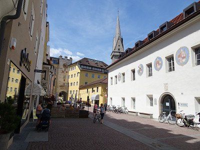
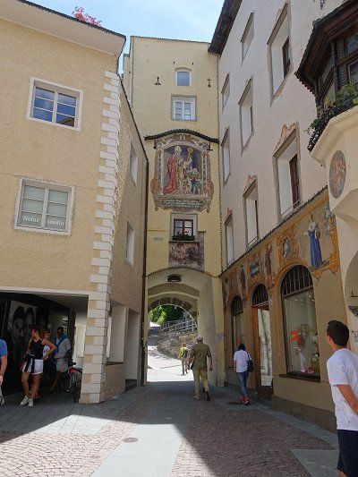
We are now going straight to Klausen.
There are two parking areas in Klausen. In the south there are rather small parking spaces, in the north there is a large parking lot that even has fields for buses.
At the tourist information center we get the guide to buildings worth seeing and walk around them. The city essentially consists of one main street and in some places
still from a side street. The main street is very picturesque. A stay of 1..2 hours is definitely worth it.
We actually wanted to spend a few days in Seis/Seiser Alm. But here too, all places are fully booked. I therefore reserved a place for 4 nights in Dobbiaco by phone so that we would have really safe accommodation options.
We are now going straight to Klausen.
There are two parking areas in Klausen. In the south there are rather small parking spaces, in the north there is a large parking lot that even has fields for buses.
At the tourist information center we get the guide to buildings worth seeing and walk around them. The city essentially consists of one main street and in some places
still from a side street. The main street is very picturesque. A stay of 1..2 hours is definitely worth it.
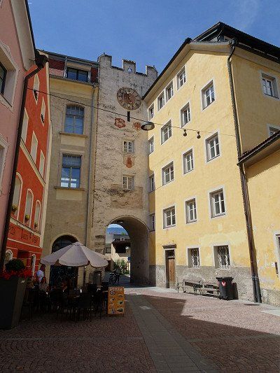
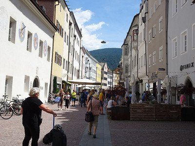
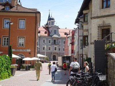
As always, when visiting cities, there is the question of a suitable parking space for the motorhome. In Brixen we parked the motorhome in the parking lot 46.70625, 11.65045. We found one last place on the edge in a kind of wasteland. From here we hiked to the center, which starts around 1 km north.
The following places were on our sightseeing tour
The baroque cathedral square with the cathedral and the cloister
The old town and Stagels on the other side of the river
The Great Lauben (lunch)
For the way back we chose the hiking trail along the Eisack River
A nice place with friendly staff and very good sanitary facilities. The bus stop is right in front of the campsite.
A nice place with friendly staff and very good sanitary facilities. The bus stop is right in front of the campsite.
From Dobbiaco, bus 444 runs almost every hour via Misurina to the Auronzo hut. The return journey costs €16 per person. This is cheaper than driving up there in a car.
From Dobbiaco, bus 444 runs almost every hour via Misurina to the Auronzo hut. The return journey costs €16 per person. This is cheaper than driving up there in a car.
Hike around the Three Peaks. First to the Dreizinnenhütte (still closed) then to the Lange Alm-Hütte, which is open.
Be careful, if you think you're hiking alone around the Three Peaks, you'll have to prove yourself wrong. It feels like 1000 people walk around the mountains every day!!
The circumnavigation is not difficult. Nevertheless, good shoes and the usual equipment for mountain hikes are recommended.
We enjoyed the hike despite the many people and if you pay attention to little things along the way, you can discover many different types of flowers.
A cycle path leads from Dobbiaco to Bruneck (30 km) directly from the campsite. Anyone who thinks that the height difference of 300 meters down to Bruneck is continuous is wrong. In between there are impressive climbs.
The last kilometers of the route partly lead through tunnels and, as if out of nowhere, you find yourself in the center of Bruneck.
Brunico is also worth seeing. The old town in particular is worth a visit.
You can get a good map of the city from the tourism organization and there are toilets opposite.
We start the tour at the Ursuline Church, then up the Stadtgasse to the Ragentor. Behind the Ragentor we take the climb to Bruneck Castle. From the castle you can enjoy a beautiful view over Bruneck and Kronplatz.
In order to experience a different perspective of the Dolomites, we are moving our location just a few kilometers to St. Vigil.
I have reserved the space at Camping Al Plan in advance.
In order to experience a different perspective of the Dolomites, we are moving our location just a few kilometers to St. Vigil.
I have reserved the space at Camping Al Plan in advance.
The site is modern and for the first time in our camping history we saw in the sanitary track that the shower cubicles were divided into two by a glass door to prevent our shoes from getting wet.
The terracing was created artificially and does not allow pegs to penetrate into the ground. Otherwise, the place offers a great view and the staff is friendly and helpful.
A worthwhile walk from Camping Al Plan to Chalk Lake. A restaurant shortens the waiting time for the bus until the return journey.
A worthwhile walk from Camping Al Plan to Chalk Lake. A restaurant shortens the waiting time for the bus until the return journey.
There is a bus to Pederü every hour from the visitor center at the campsite.
From Pederü we climb up to the Lavarella hut. The height difference of a good 500 m wouldn't actually matter to us. But the sun beats mercilessly into the valley basin and you think you're walking in an oven. After a good 2 hours the destination is reached and it's worth a wheat beer and enough food. Now all that's left to do is descend.
After yesterday's hike, we want to take it easy. The bus from the center of St. Vigil takes you to the Furcla Pass. From there a steep path leads up to the hut.
If you want, you can choose the route for the descent. However, this is almost as steep as the footpath.
Return by bus. This also runs every hour.
From St. Vigil the journey takes us first down into the valley and then down the valley in a southerly direction to Badia and Corvara.
From Corvara the road climbs to the Campolongo Pass and offers a great view of the Dolomite peaks in the first bends.
From St. Vigil the journey takes us first down into the valley and then down the valley in a southerly direction to Badia and Corvara.
From Corvara the road climbs to the Campolongo Pass and offers a great view of the Dolomite peaks in the first bends.
The Pordoi Pass seems to be made exclusively for cyclists. Where elsewhere most cyclists are found on e-bikes, here the majority are on racing bikes. Some of them cycle confidently, others with red faces.
We drive up in the motorhome and have to see how we can get space between the cyclists.
At the top the view is phenomenal. You can see all the way to the Marmolada, which hit the headlines a good week later due to a glacier collapse. The cable car to Sass Pordoi is also spectacular.
After the inns were either closed everywhere or there were no parking spaces available for mobile homes, Viktor's Imbiss came in handy. With its huge parking space behind the house and its immense catering capacity, the restaurant is ideal for motorhome drivers.
After the inns were either closed everywhere or there were no parking spaces available for mobile homes, Viktor's Imbiss came in handy. With its huge parking space behind the house and its immense catering capacity, the restaurant is ideal for motorhome drivers.
We reach the campsite and hope for a place within the campsite. We didn't make a reservation. We get a good place for one night.
Since it is very hot, we are in the lake after a short time and can refresh ourselves. Getting in amongst 50cm long carp takes some getting used to. But they leave you alone.
In the evening, several thunderstorms broke out and hailstones the diameter of one or even two euro coins thundered onto campers and tents.
Luckily no one was hurt, but a tent next to us was destroyed.
The return journey takes place again through the Vintschgau.
Attention: Glurns can only be bypassed to the west with motorhomes. It is not possible to drive through with motorhomes due to the narrow and low gates. However, Glorenza is certainly worth a stop for a visit.
The return journey takes place again through the Vintschgau.
Attention: Glurns can only be bypassed to the west with motorhomes. It is not possible to drive through with motorhomes due to the narrow and low gates. However, Glorenza is certainly worth a stop for a visit.
From Zernez we went on another hike. First we took the post bus from Zernez train station to the Buffalora stop. This is the last stop before the Ofen Pass.
From here a wonderful hiking trail leads over the Alp Buffalora to the plateau of Döss de las Plattas. The climb is almost done.
In an easterly direction, after circling the Dolomite massif Il Jalet, you reach the Ofen Pass with its restaurant.
Instead of taking the bus back, we extended the hike with a direct descent to Buffalora and got on the post bus there.
Comments (0)
Comments from Freeontour users