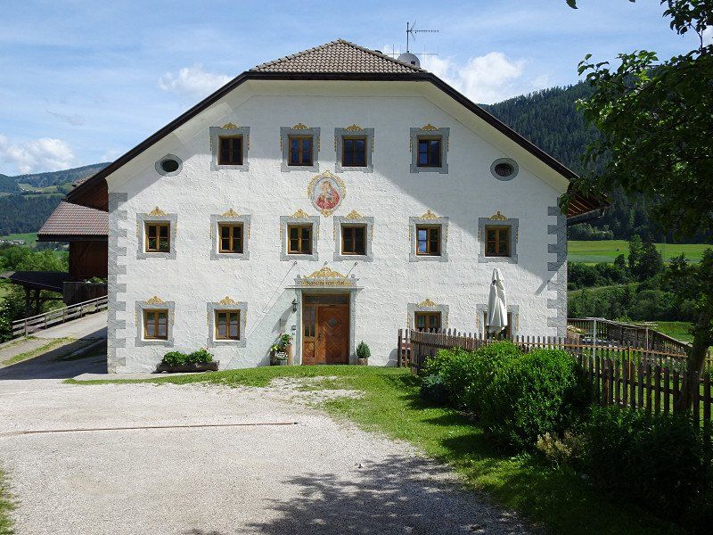
We were already planning a tour through South Tyrol in 2019. This intention was abruptly stopped by Corona in spring 2020. Instead of going on a trip in 2020, we tried to only leave the apartment if absolutely necessary. Nevertheless, we hoped that we could at least go on holiday in the motorhome nearby, which only happened towards the summer. However, South Tyrol had to wait due to the different travel restrictions. There was nothing in 2021 either. That's when the Delta variant appeared, followed by Omicron in the fall. In June 2022 the time had come and the journey could begin. What we didn't take into account was that Corpus Christi will be celebrated in Catholic regions in the first week and that many will probably build a bridge and be out and about in their motorhomes.
Day
Zürich, Schweiz
47° 22' 36.8" N 8° 32' 30.1" E
47.3768866 8.5416940
• Head toward Bahnhofquai on Bahnhofplatz. Go for 10 m.
• Turn left onto Bahnhofquai. Go for 159 m.
• Keep right onto Walchebrücke. Go for 87 m.
• Turn left onto Neumühlequai. Go for 524 m.
• Turn left onto Wasserwerkstrasse. Go for 287 m.
• Keep right onto Milchbucktunnel (A1L) toward Winterthur/Schaffhausen/Flughafen. Go for 5.1 km.
• Continue on A1/A4. Go for 19.9 km.
• Continue on A1 toward St. Gallen/Kreuzlingen/Winterthur-Ohringen. Go for 82.9 km.
• Continue on A13. Go for 1.2 km.
• Continue on A13. Go for 5.3 km.
• Take exit 3 toward Widnau/Diepoldsau/Heerbrugg. Go for 184 m.
• Take the 4th exit from roundabout onto Diepoldsauerstrasse. Go for 371 m.
• Take the 2nd exit from roundabout onto Diepoldsauerstrasse. Go for 434 m.
• Continue on Tramstrasse. Go for 613 m.
• Continue on Hohenemserstrasse. Go for 1.5 km.
• Continue on Diepoldsauer Straße (L46). Go for 394 m.
• Take the 1st exit from roundabout onto A14 (Rheintal Autobahn) toward Innsbruck/Feldkirch. Go for 39.2 km.
• Continue on Arlberg Schnellstraße (S16). Go for 61.7 km.
• Continue on A12 (Inntal Autobahn). Go for 67.8 km.
• Keep right onto A13 (Knoten Innsbruck-Wilten) toward E45/Bozen/Brenner/Innsbruck-Süd. Go for 33.5 km.
• Continue on A22 (Autostrada del Brennero). Go for 85.0 km.
• Take the exit toward Bolzano Sud/Bozen Süd/Aeroporto/Flughafen/Bolzano Centro/Bozen Zentrum/S. Genesio/Val d'Ega/val Sarentino/Renon/Jenesien/Sarntal/Eggental/Ritten onto Via Evangelista Torricelli. Go for 2.0 km.
• Turn right toward Trento/SS12/Via A. Volta/A. Volta Str/Aeroporto/Flughafen. Go for 36 m.
• Turn right onto Via Alessandro Volta toward Aeroporto/Flughafen/Trento. Go for 227 m.
• Pass 2 roundabouts and continue on Via Alessandro Volta. Go for 799 m.
• Turn right onto Via Claudia Augusta. Go for 121 m.
• Continue on Via Maso della Pieve. Go for 625 m.
• Turn right onto Via Maso della Pieve. Go for 79 m.
• Arrive at Via Maso della Pieve. Your destination is on the right.
☍
410,0 km
(4 hrs. 18 min.)
Strecke Zürich - Bozen
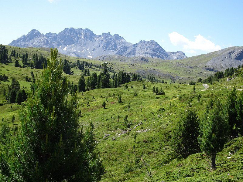
We chose the route over the Engadine and the Ofen Pass. Instead of driving over the Flüela Pass, we decided to load through the Vereina Tunnel, which not only saves time but also avoids the many curves. There will still be enough curves in South Tyrol.
The route leads from Saglains via Zernez and the Ofenpass (lunch), through the Münstertal and the Vinschgau past Meran to Bozen.
Bozen, Stellplatz beim Friedhof
The parking space offers space for approx. 20 vehicles.
The cost is €1 per hour between 8:00 a.m. and 7:00 p.m.
Electricity is available and costs €0.25 per hour (24 hours/day).
We first wanted to book a spot at Camping Mossbauer, but the spot was fully booked. The Steiner square in Leifers had already put up a notice stating that it was fully occupied.
The parking space was an emergency solution with the advantage of the bus stop right next to it with direct buses to Bolzano train station. The disadvantage is the noise from the street and train line and the lack of shade.
Pfarrhofstraße, 8b, 39100 Bozen, Autonome Provinz Bozen - Südtirol, Italien
46° 28' 20.1" N 11° 20' 11.4" E
46.4722528 11.3365121
• Head east on Via Maso della Pieve. Go for 79 m.
• Turn left onto Via Maso della Pieve. Go for 67 m.
• Arrive at Via Maso della Pieve. Your destination is on the left.
☍
0,1 km
( )
Day
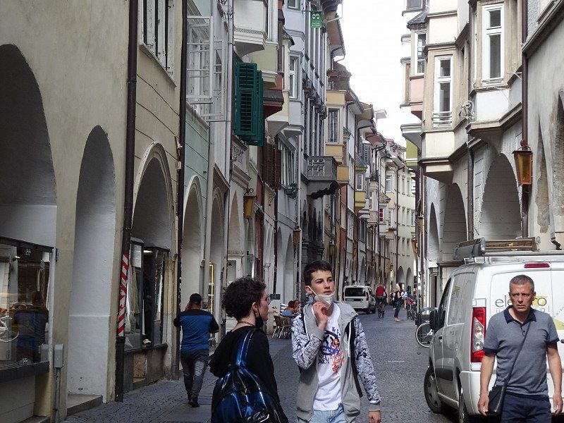
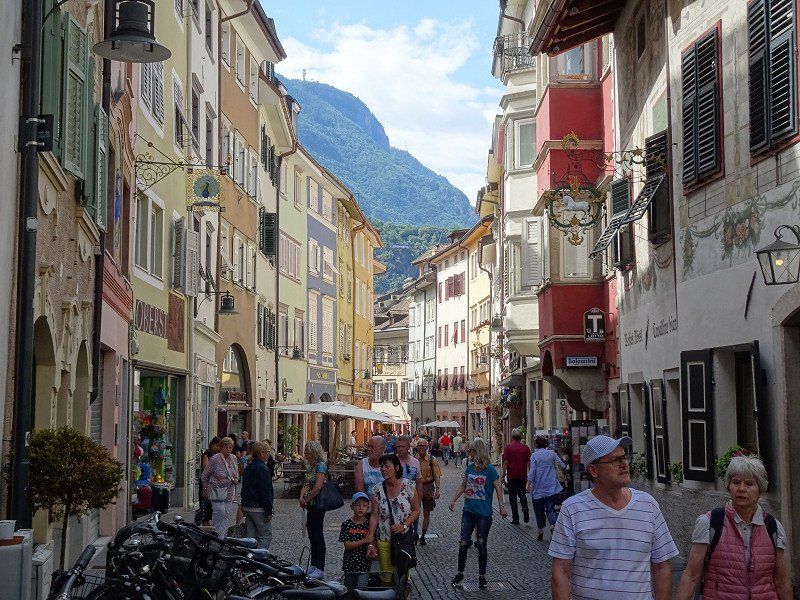
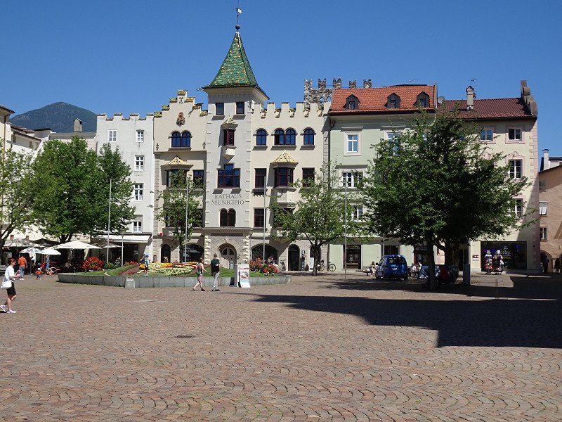
Stadtbesichtigung Bozen
We take the bus into town. A day ticket costs €4.-. But after inserting the €4, the machine on the bus reports that no day tickets are available and keeps the €4 without even issuing a ticket. The driver couldn't do anything, but took us (2 people) with him to the train station.
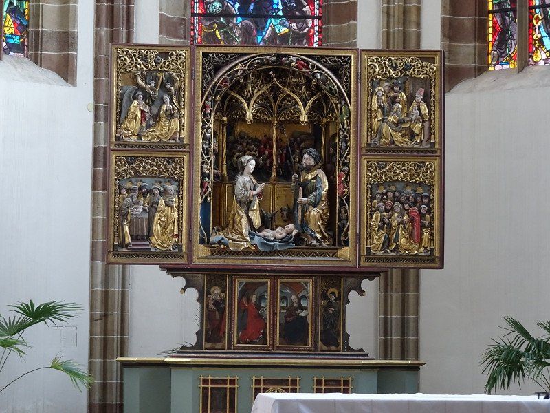
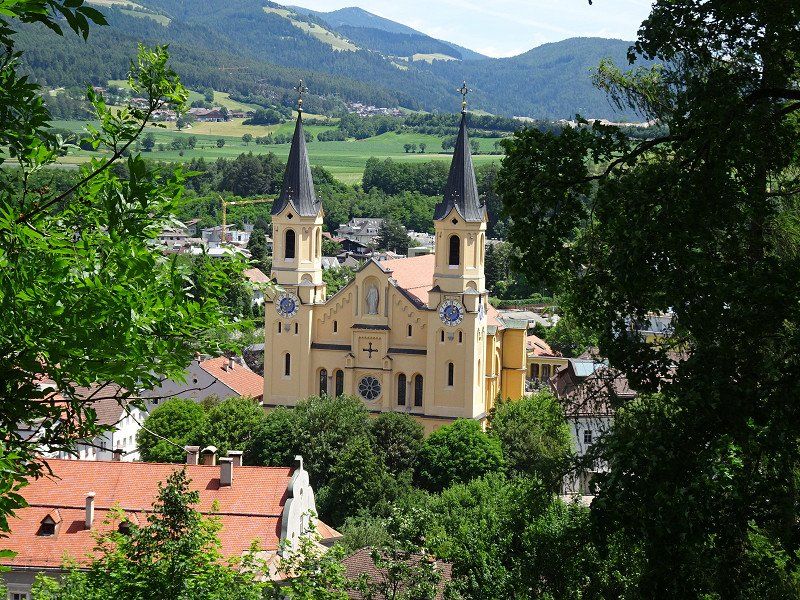
We started the city tour at Bolzano Cathedral, then went to Waltherplatz, Mustergasse and to the fruit and vegetable market.
Actually we would have visited the Archaeological Museum, where Ötzi is on display. Well, it was Monday and Ötzi had his day off.
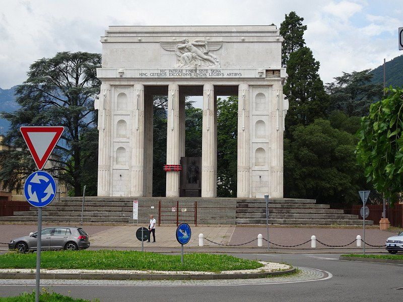
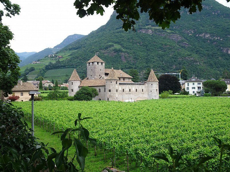
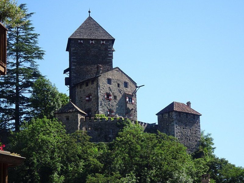
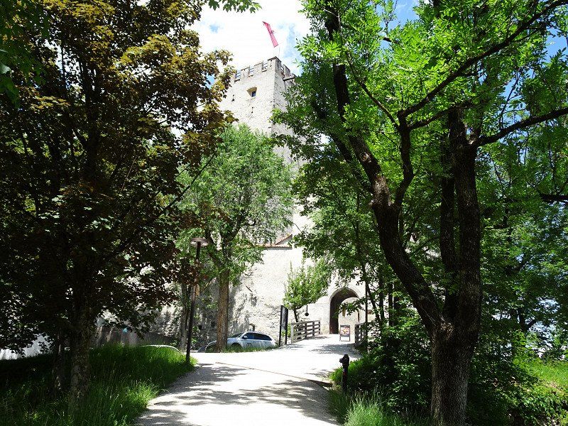
We went over the Talfer Bridge to the victory monument, which was fenced off and therefore not accessible. We followed the Talfer river north to Maretsch Castle. However, this cannot be visited.
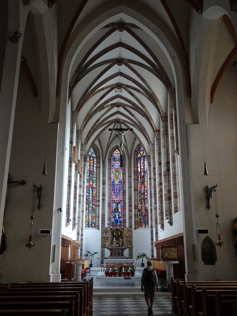
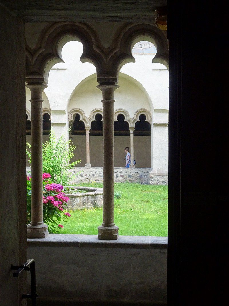
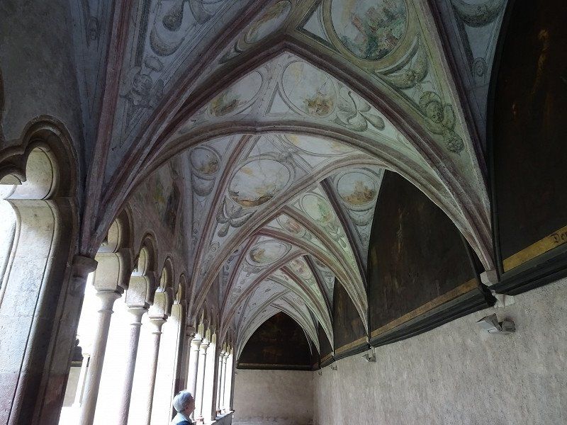
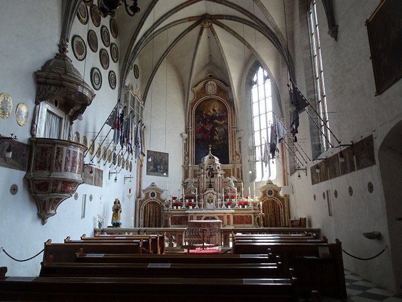
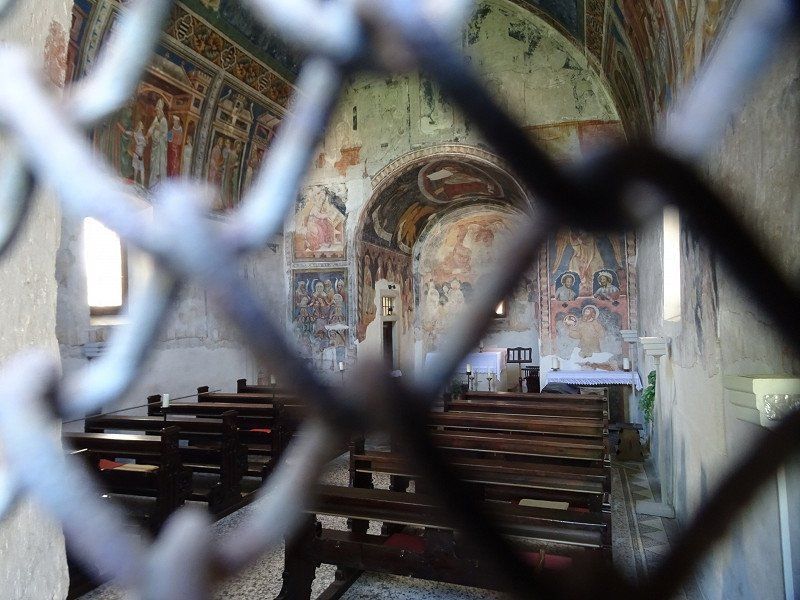
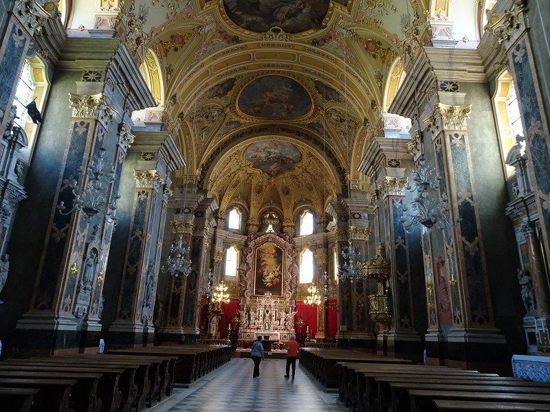
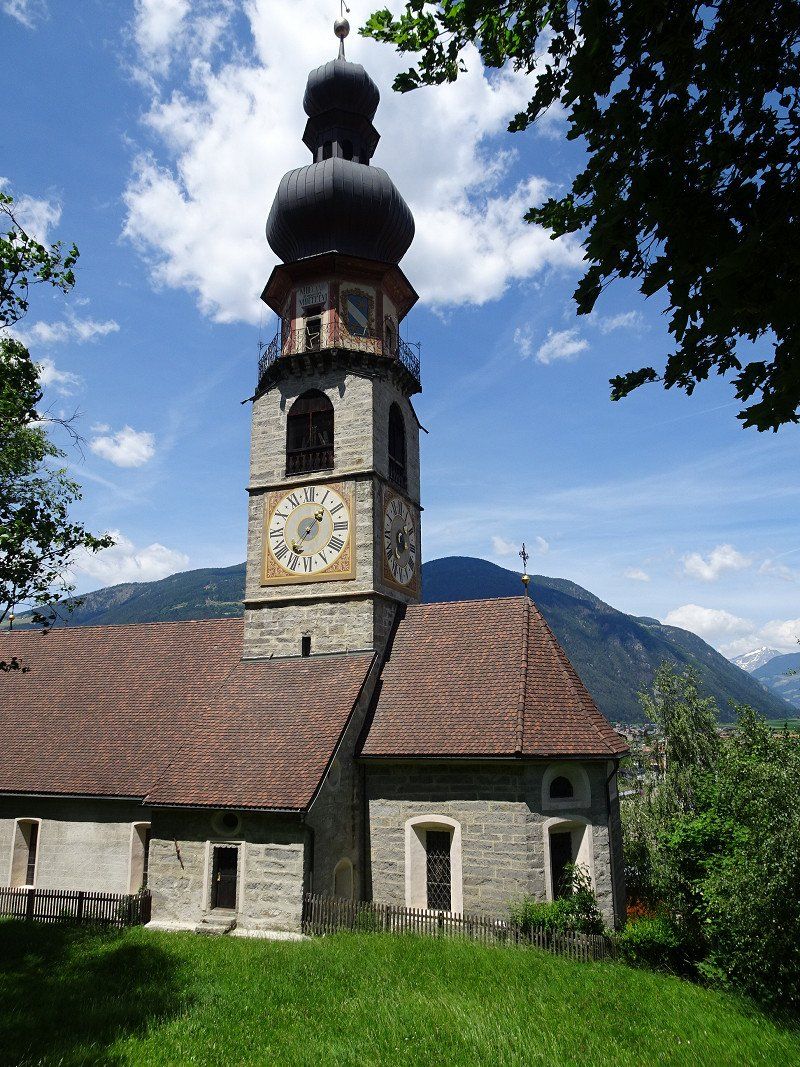
The next pivot point was the Franciscan monastery with the beautiful cloister. We were very impressed by the architectural design of the cloister ceiling, as it is unique. The Deutschhauskirche and the Church of St. Johann in the village are also worth seeing.
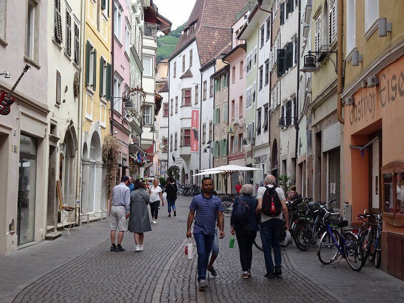
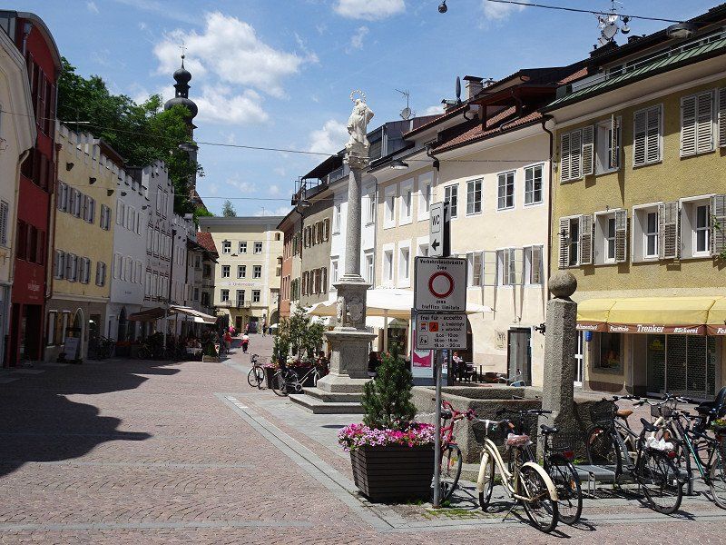
Towards the city center we chose Batzlhäuslgasse and immediately discovered Bazlhäusl, a recommended restaurant with a beautiful inner courtyard.
Since it was still too early for lunch, we walked along Bindergasse and bought a few little things.
After lunch we went to the Rittnerbahn and drove up to Oberbozen.
Ausflug auf den Ritten
We were lucky on the Rittnerbahn. The monthly inspection is scheduled for the afternoon, from shortly after our trip up the mountain until the evening. So we will reach Oberbozen without any problems and then take the bus down to the valley.
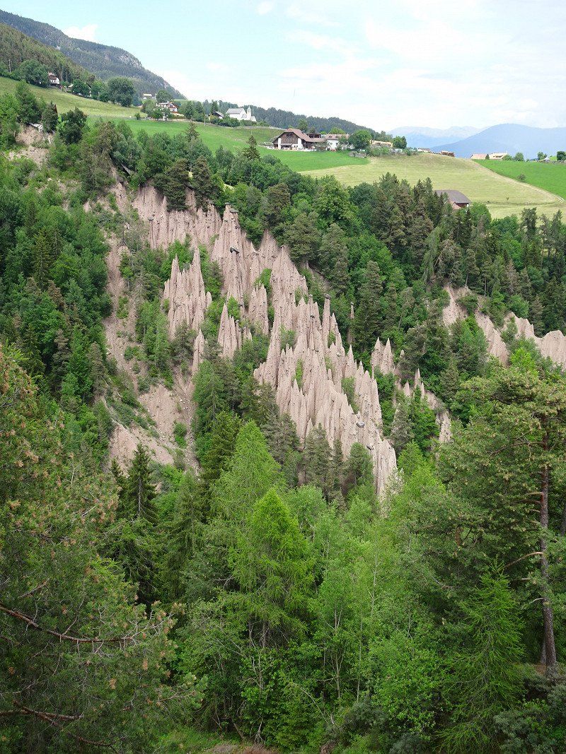
From Oberbozen we used the narrow-gauge railway to Klobenstein. As later investigations confirmed, the compositions traveled on the Appenzeller Railway route from St. Gallen to Trogen until a few years ago.
After a hike along the road we reached the earth pyramids, which are really impressive to look at. Attention, it is advisable to hurry up for your visits, in 1000 years the whole thing will certainly look completely different.
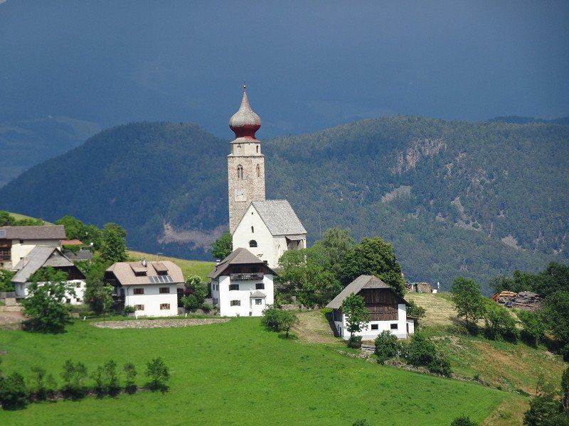
From the Maria Saal pilgrimage church we took the bus back down to the valley (24 turning plates!!) and back to the parking space. The bus from Maria Saal runs every hour.
Bozen, Stellplatz beim Friedhof
39100 Bozen, Autonome Provinz Bozen - Südtirol, Italien
46° 28' 21.2" N 11° 20' 14.5" E
46.4725532 11.3373629
• Head north on Via Maso della Pieve. Go for 558 m.
• Continue on Via Claudia Augusta. Go for 121 m.
• Turn left onto Via Alessandro Volta. Go for 341 m.
• Pass 2 roundabouts and continue on Via Alessandro Volta. Go for 655 m.
• Turn right toward Via Werner von Siemens. Go for 14 m.
• Turn right onto Via Werner von Siemens toward Brennero/A22/Brenner/Centro/Gries Zentrum/Via Resia/Reschenstr. Go for 425 m.
• Turn left onto Via Augusto Righi toward A22/Trento/Modena/Merano/Meran/Via Resia/Reschenstr. Go for 310 m.
• Continue on Via Arginale. Go for 883 m.
• Keep left onto Lungoisarco Sinistro toward Trento-Modena. Go for 149 m.
• Take left ramp onto A22 (Autostrada del Brennero) toward Brennero/Brenner. Go for 32.7 km.
• Take the exit toward Chiusa-Val Gardena/Klausen-Gröden. Go for 1.0 km.
• Take the 3rd exit from roundabout onto Gries (SS242dir) toward Lajen/Laion/Zona Industriale Neidegg. Go for 904 m.
• Turn right onto Via Gries toward Klausen/Chiusa. Go for 374 m.
• Turn right toward Via Stazione. Go for 40 m.
• Turn left onto Via Stazione. Go for 347 m.
• Turn right onto Ponte Sant'Andrea. Go for 23 m.
• Arrive at Ponte Sant'Andrea. Your destination is on the left.
☍
38,9 km
( 31 min.)
Day
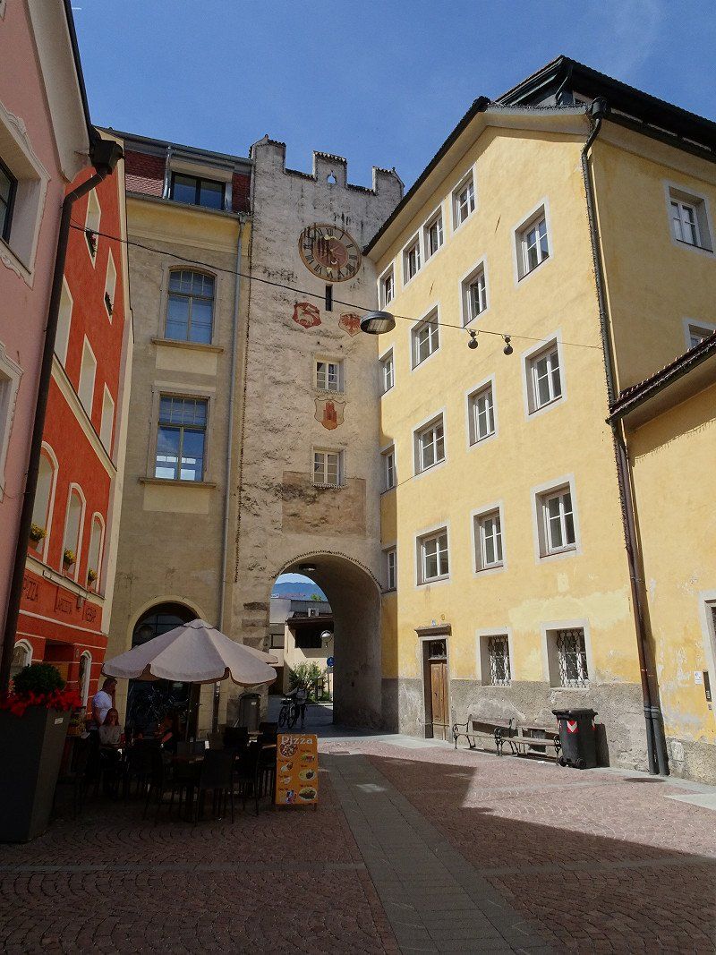
Klausen, Autonome Provinz Bozen - Südtirol, Italien
We actually wanted to spend a few days in Seis/Seiser Alm. But here too, all places are fully booked. I therefore reserved a place for 4 nights in Dobbiaco by phone so that we would have really safe accommodation options.
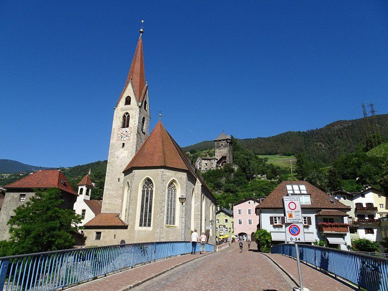
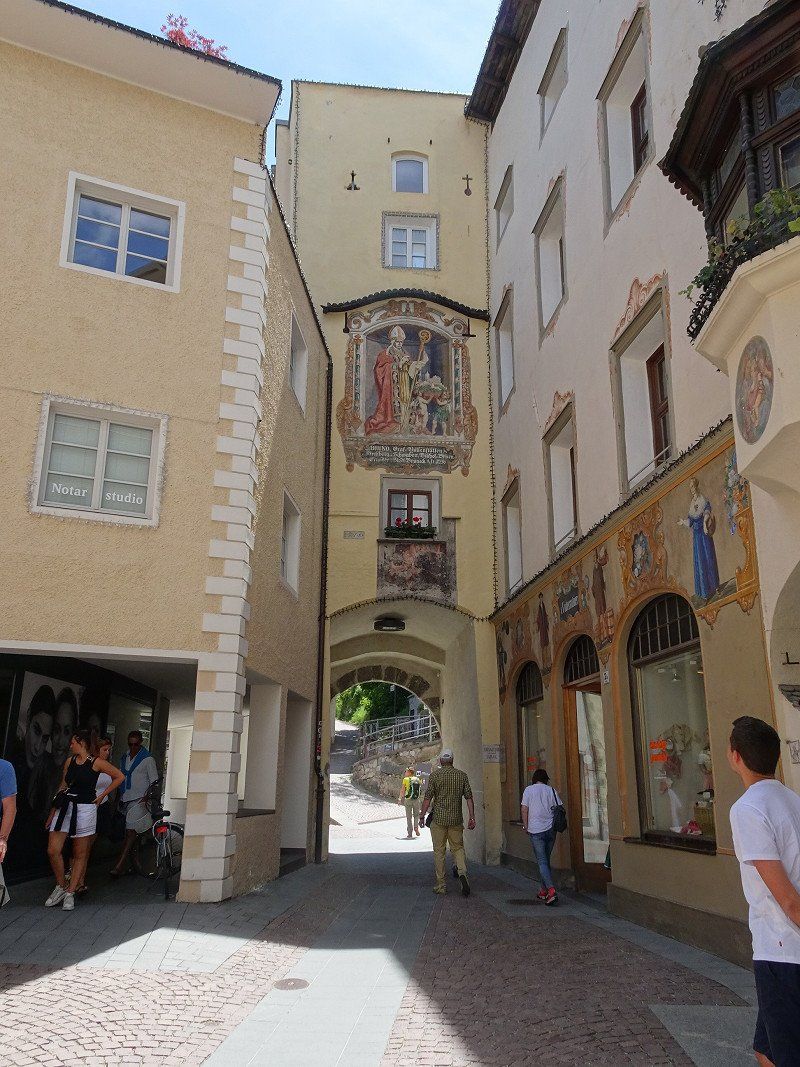
We are now going straight to Klausen.
There are two parking areas in Klausen. In the south there are rather small parking spaces, in the north there is a large parking lot that even has fields for buses.
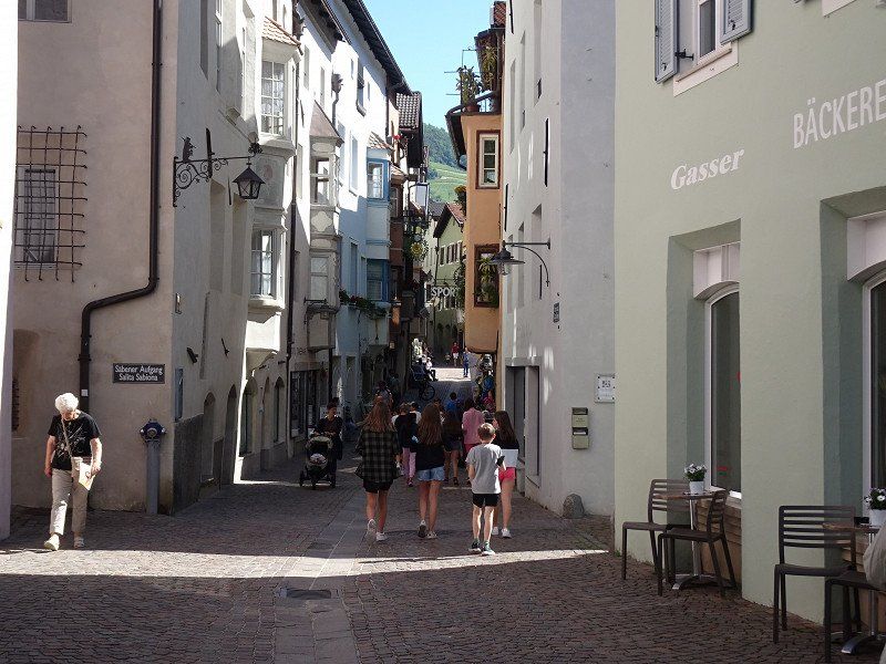
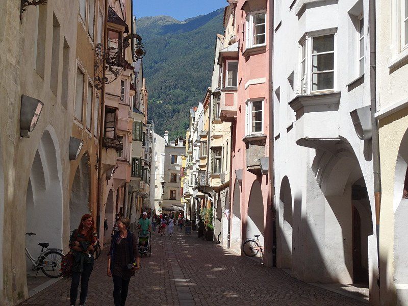
At the tourist information center we get the guide to buildings worth seeing and walk around them. The city essentially consists of one main street and in some places
still from a side street. The main street is very picturesque. A stay of 1..2 hours is definitely worth it.
39043 Klausen, Autonome Provinz Bozen - Südtirol, Italien
46° 38' 24" N 11° 33' 58.4" E
46.6399956 11.5662110
• Head toward Piazza Sant'Andrea on Ponte Sant'Andrea. Go for 23 m.
• Turn left onto Via Stazione. Go for 347 m.
• Turn right toward Via Gries. Go for 40 m.
• Turn left onto Via Gries. Go for 374 m.
• Turn left onto Strada Statale di Val Gardena e Passo Sella (SS242dir). Go for 848 m.
• Continue toward Strada Statale di Val Gardena e Passo Sella/SS242dir. Go for 23 m.
• Take the 3rd exit from roundabout onto Strada Statale di Val Gardena e Passo Sella (SS242dir) toward Brixen/Bressanone/Bozen/Bolzano. Go for 311 m.
• Take the 1st exit from roundabout onto Strada Statale dell'Abetone e del Brennero (SS12). Go for 5.5 km.
• Take the 1st exit from roundabout onto Strada Statale dell'Abetone e del Brennero (SS12) toward Brenner/Brennero. Go for 2.9 km.
• Take the 3rd exit from roundabout onto Strada Statale dell'Abetone e del Brennero (SS12) toward Brixen/Bressanone/Brenner/Brennero. Go for 1.8 km.
• Take the 2nd exit from roundabout toward Brixen Mitte/Bressanone Centro/Centro/Ospedale. Go for 437 m.
• Continue on Via Dante Alighieri. Go for 97 m.
• Take the 1st exit from roundabout toward Centro/St. Andrä/S. Andrea/Feldthurns/Velturno/Lüsen/Luson/Plose. Go for 59 m.
• Turn right onto Via Roma. Go for 204 m.
• Continue on Via Bastioni Maggiori. Go for 229 m.
• Arrive at Via Bastioni Maggiori. Your destination is on the left.
☍
13,2 km
( 16 min.)
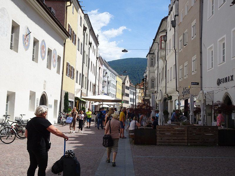
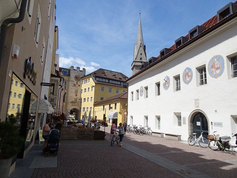
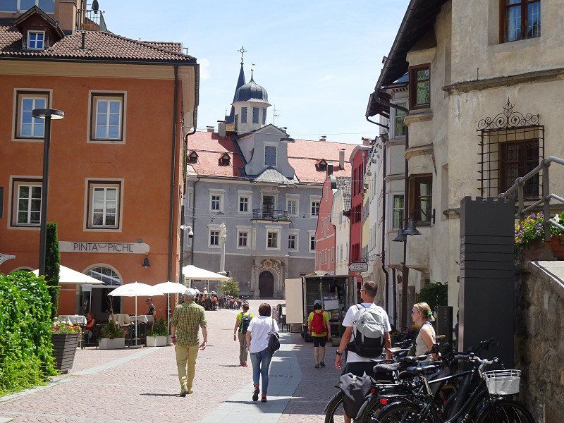
Brixen, Autonome Provinz Bozen - Südtirol, Italien
As always, when visiting cities, there is the question of a suitable parking space for the motorhome. In Brixen we parked the motorhome in the parking lot 46.70625, 11.65045. We found one last place on the edge in a kind of wasteland. From here we hiked to the center, which starts around 1 km north.
The following places were on our sightseeing tour
The Hofburg with the Herrengarten
The baroque cathedral square with the cathedral and the cloister
The old town and Stagels on the other side of the river
The Great Lauben (lunch)
For the way back we chose the hiking trail along the Eisack River
39042 Brixen, Autonome Provinz Bozen - Südtirol, Italien
46° 43' 3.7" N 11° 39' 26.1" E
46.7177048 11.6572436
• Head east on Via Bastioni Maggiori.
• Turn right onto Via Torre Bianca. Go for 77 m.
• Turn right onto Piazza Parrocchia. Go for 66 m.
• Turn slightly right onto Passaggio Portici. Go for 62 m.
• Turn left onto Via Bastioni Maggiori. Go for 185 m.
• Continue on Via Roma. Go for 204 m.
• Turn right. Go for 29 m.
• Take the 2nd exit from roundabout toward A22/Bozen/Bolzano/SS41/Brenner/Brennero/SS44/Pustertal/val Pusteria. Go for 43 m.
• Continue on Via Dante Alighieri. Go for 477 m.
• Take the 2nd exit from roundabout onto Strada Statale dell'Abetone e del Brennero (SS12) toward Brenner/A22/Brennero/Vahrn/Varna/Pustertal/val Pusteria. Go for 1.4 km.
• Take the 2nd exit from roundabout. Go for 1.4 km.
• Continue toward Strada Statale dell'Abetone e del Brennero/SS12. Go for 23 m.
• Take the 2nd exit from roundabout onto Strada Statale dell'Abetone e del Brennero (SS12). Go for 1.9 km.
• Take the 2nd exit from roundabout onto Strada Statale dell'Abetone e del Brennero (SS12). Go for 451 m.
• Take ramp toward Autobahn/Autostrada/A22/Bruneck/Brunico/SS49. Go for 501 m.
• Keep right onto Strada Statale della Pusteria (SS49bis) toward Natz-Schabs/Naz-Sciaves/Bruneck/Brunico/Toblach/Dobbiaco/Innichen/S. Candido. Go for 766 m.
• Take the 2nd exit from roundabout onto Strada Statale della Pusteria (SS49bis) toward Innichen/S. Candido/Bruneck/Brunico. Go for 8.5 km.
• Continue on Strada Statale della Pusteria (SS49) toward Bruneck/Brunico/Innichen/S. Candido/Lodenwelt/Obervintl/Vandoies di Sopra. Go for 34.2 km.
• Take the 1st exit from roundabout onto Via Principale (SS49) toward Welsberg Zentrum/Monguelfo Centro/Innichen/San Candido. Go for 3.9 km.
• Take the 2nd exit from roundabout onto Strada Statale della Pusteria (SS49) toward Innichen/San Candido. Go for 5.4 km.
• Turn left onto Strada Comunale Dobbiaco-Monterota toward Niederdorf/Villabassa. Go for 595 m.
• Turn right. Go for 46 m.
• Arrive at your destination on the right.
☍
60,2 km
(1 hrs. 1 min.)
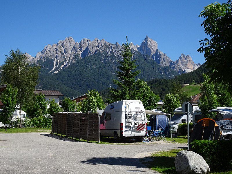
Camping Olympia
A nice place with friendly staff and very good sanitary facilities. The bus stop is right in front of the campsite.
Camping 1, 39034, Toblach, Italy
46° 44' 5" N 12° 11' 40" E
46.7347200 12.1944400
• Head north.
• Arrive at your destination on the right.
☍
Distance not available
(Duration not available)
Day
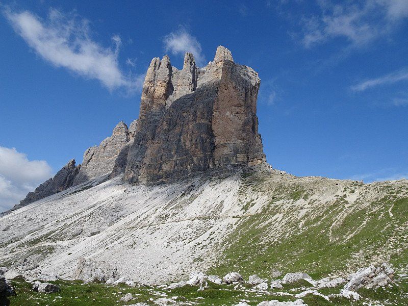
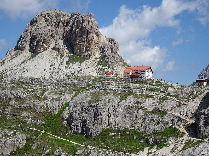
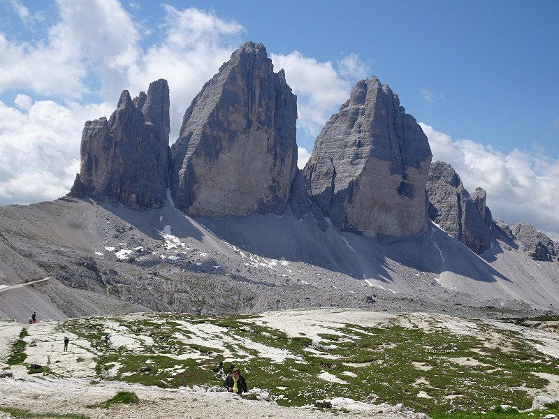
Toblach, Ausgangsort für Busfahrten nach den Drei Zinnen
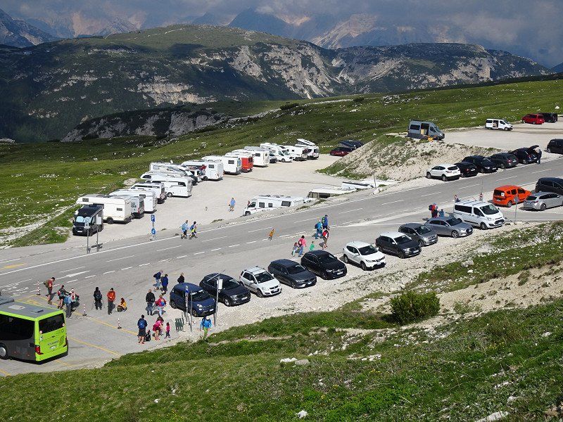
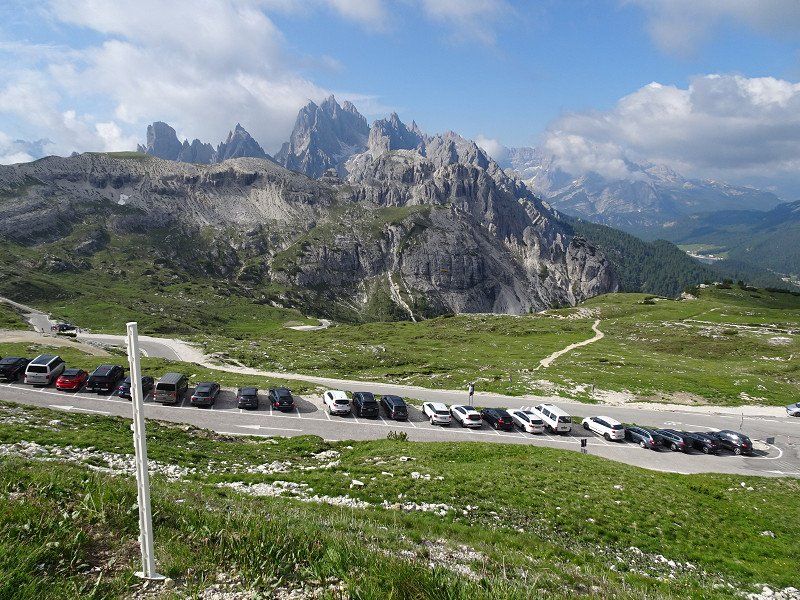
From Dobbiaco, bus 444 runs almost every hour via Misurina to the Auronzo hut. The return journey costs €16 per person. This is cheaper than driving up there in a car.
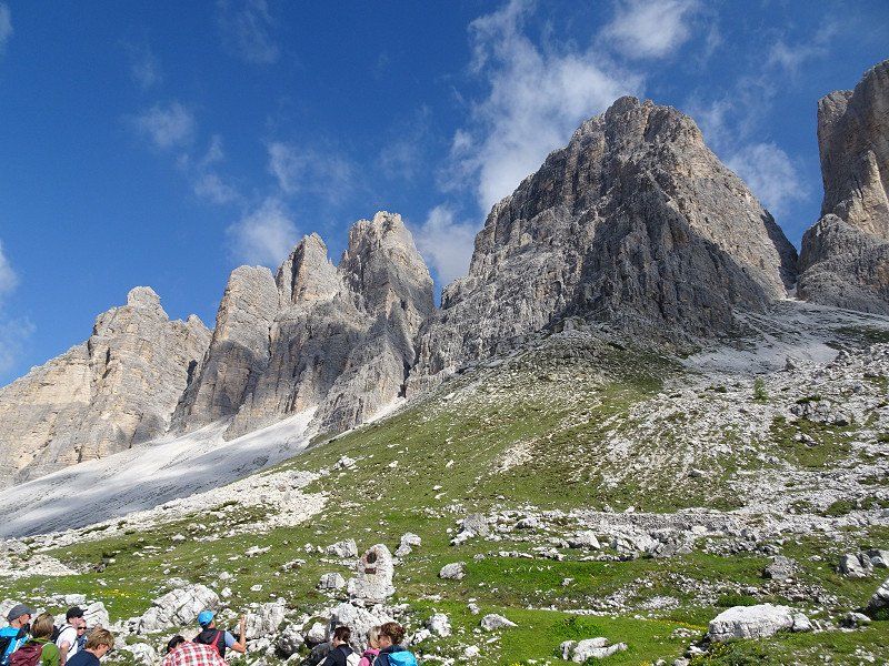
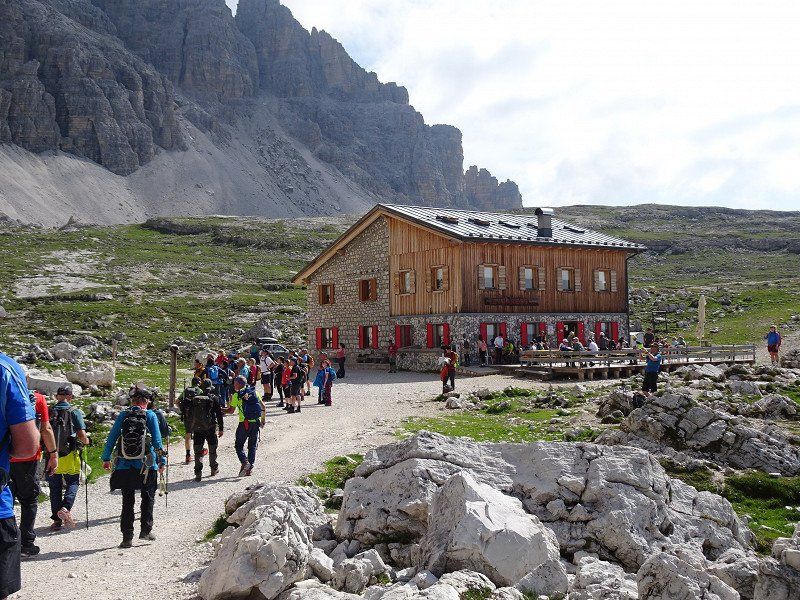
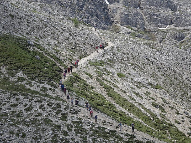
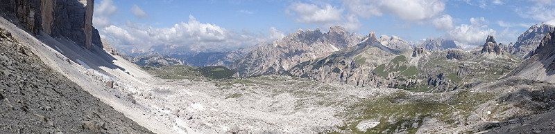
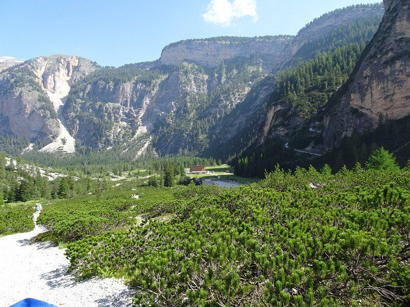
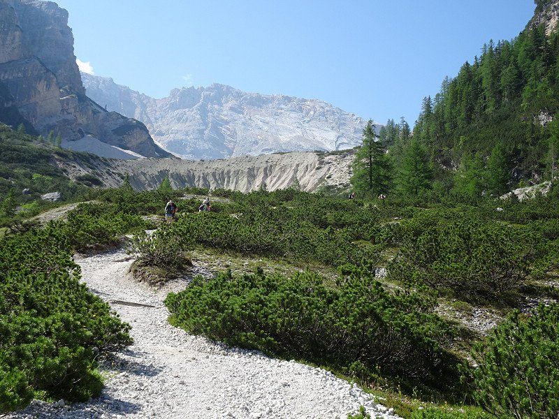
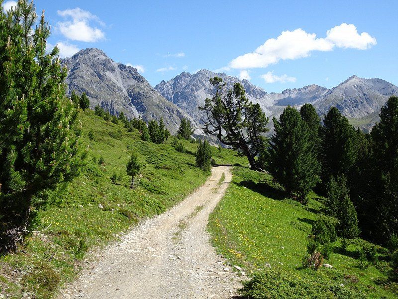
Wanderung um die Drei Zinnen
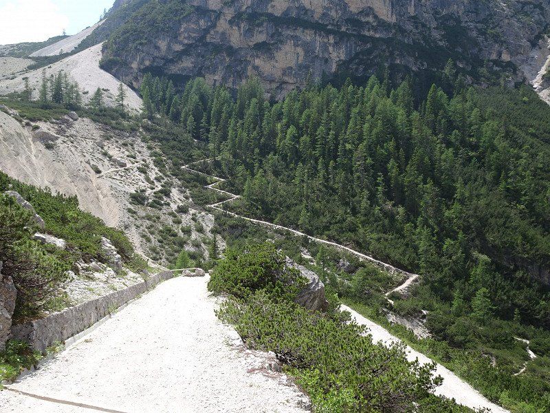
Hike around the Three Peaks. First to the Dreizinnenhütte (still closed) then to the Lange Alm-Hütte, which is open.
Be careful, if you think you're hiking alone around the Three Peaks, you'll have to prove yourself wrong. It feels like 1000 people walk around the mountains every day!!
The circumnavigation is not difficult. Nevertheless, good shoes and the usual equipment for mountain hikes are recommended.
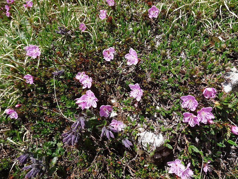
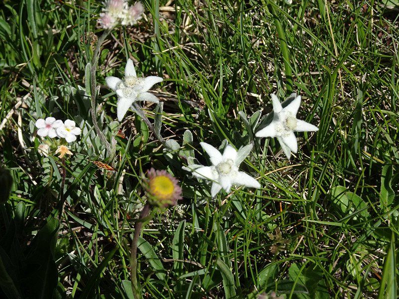
We enjoyed the hike despite the many people and if you pay attention to little things along the way, you can discover many different types of flowers.
Camping Olympia
Camping 1, 39034, Toblach, Italy
46° 44' 5" N 12° 11' 40" E
46.7347200 12.1944400
• Head north.
• Arrive at your destination on the right.
☍
Distance not available
(Duration not available)
Day
Camping Olympia
Camping 1, 39034, Toblach, Italy
46° 44' 5" N 12° 11' 40" E
46.7347200 12.1944400
• Head north.
• Arrive at your destination on the right.
☍
Distance not available
(Duration not available)
Day
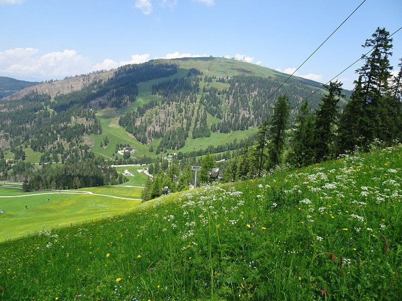
Velotour Pustertal
A cycle path leads from Dobbiaco to Bruneck (30 km) directly from the campsite. Anyone who thinks that the height difference of 300 meters down to Bruneck is continuous is wrong. In between there are impressive climbs.
The last kilometers of the route partly lead through tunnels and, as if out of nowhere, you find yourself in the center of Bruneck.
Bruneck
Brunico is also worth seeing. The old town in particular is worth a visit.
You can get a good map of the city from the tourism organization and there are toilets opposite.
We start the tour at the Ursuline Church, then up the Stadtgasse to the Ragentor. Behind the Ragentor we take the climb to Bruneck Castle. From the castle you can enjoy a beautiful view over Bruneck and Kronplatz.
The train is recommended for the way back to Camping Olympia. The train station is only a few hundred meters away from the Tourist Information. Trains to Dobbiaco leave every 30 minutes. We got off at Niederdorf train station and cycled the rest of the way to the campsite. It would also be possible to take the train to Dobbiaco and cycle back to the campsite.
Camping Olympia
Camping 1, 39034, Toblach, Italy
46° 44' 5" N 12° 11' 40" E
46.7347200 12.1944400
• Head toward Camping. Go for 46 m.
• Turn left onto Camping. Go for 595 m.
• Turn right onto Strada Statale della Pusteria (SS49). Go for 5.3 km.
• Keep right toward Strada Statale della Pusteria/SS49. Go for 236 m.
• Continue on Strada Statale della Pusteria (SS49). Go for 3.7 km.
• Take the 3rd exit from roundabout onto Strada Statale della Pusteria (SS49) toward Autobahn/Autostrada/A22/Bruneck/Brunico. Go for 18.6 km.
• Turn left onto Via San Martino toward St.Lorenzen/S. Lorenzo di S./St.Vigil in E./S. Vigilio di M./Corvara. Go for 1.2 km.
• Continue on Floronzo (SP178). Go for 142 m.
• Keep right toward Strada Statale di Val Badia/SS244. Go for 31 m.
• Turn right onto Strada Statale di Val Badia (SS244). Go for 8.0 km.
• Turn left onto Strada Longega (SP43). Go for 3.9 km.
• Turn right onto Strada Catarina Lanz. Go for 607 m.
• Turn right onto Strada Catarina Lanz. Go for 315 m.
• Turn left onto Strada Catarina Lanz. Go for 170 m.
• Turn right. Go for 33 m.
• Arrive at your destination.
☍
42,9 km
( 46 min.)
Day
Verlegung nach St. Vigil in Enneberg
In order to experience a different perspective of the Dolomites, we are moving our location just a few kilometers to St. Vigil.
I have reserved the space at Camping Al Plan in advance.
Camping AL PLAN - Dolomites
The site is modern and for the first time in our camping history we saw in the sanitary track that the shower cubicles were divided into two by a glass door to prevent our shoes from getting wet.
The terracing was created artificially and does not allow pegs to penetrate into the ground. Otherwise, the place offers a great view and the staff is friendly and helpful.
Via Catarina Lanz 63, 39030, S. Vigilio di Marebbe, Italy
46° 41' 41" N 11° 56' 18" E
46.6947200 11.9383300
• Head south.
• Arrive at your destination.
☍
Distance not available
(Duration not available)
Spaziergang zum Kreidesee
A worthwhile walk from Camping Al Plan to Chalk Lake. A restaurant shortens the waiting time for the bus until the return journey.
Day
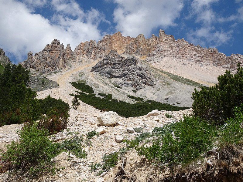
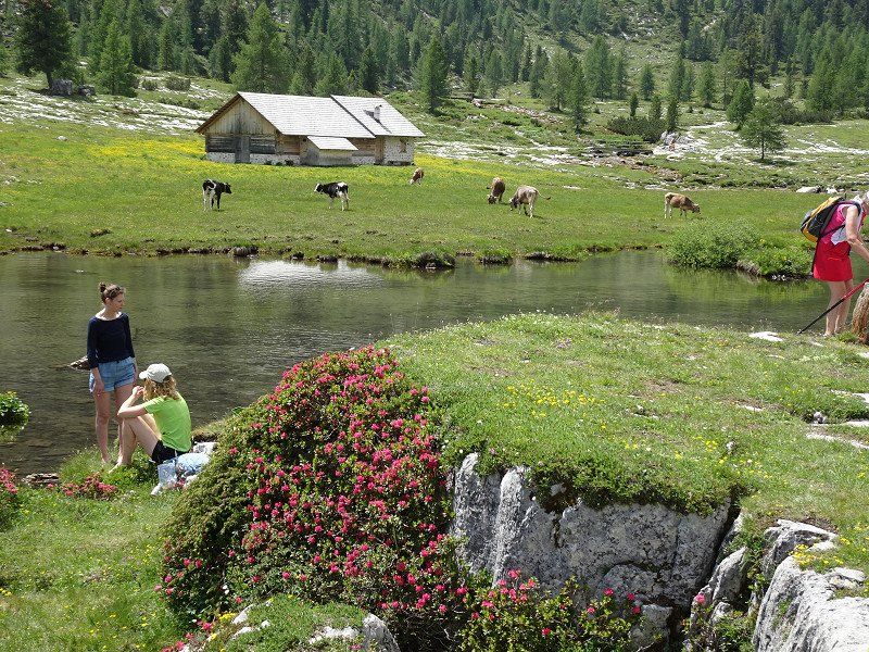
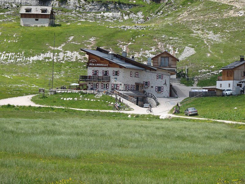
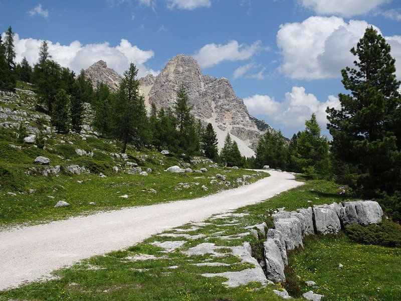
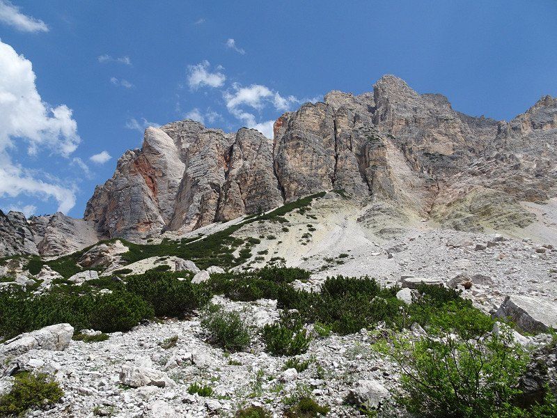
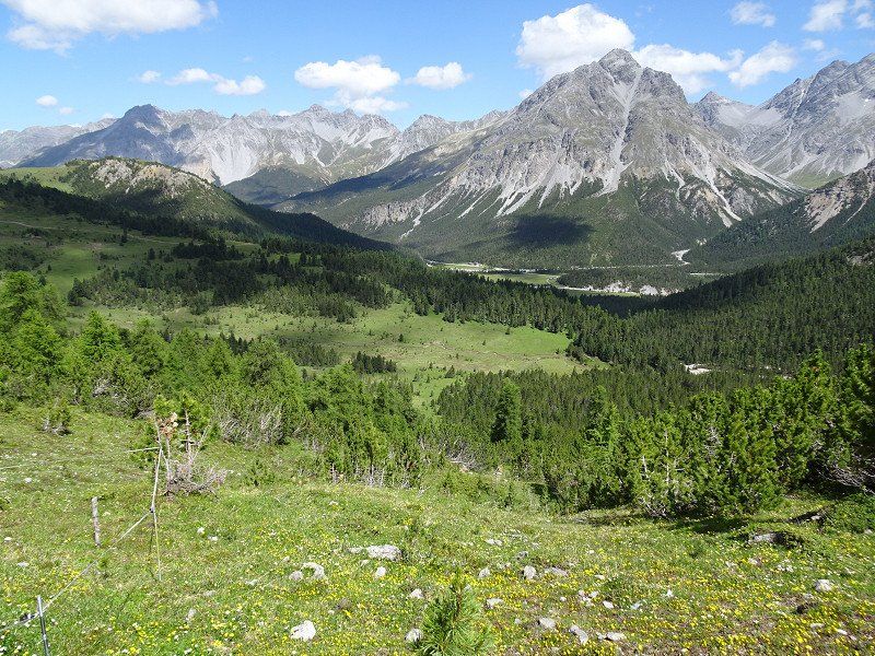
Wanderung im Naturpark Fanes
There is a bus to Pederü every hour from the visitor center at the campsite.
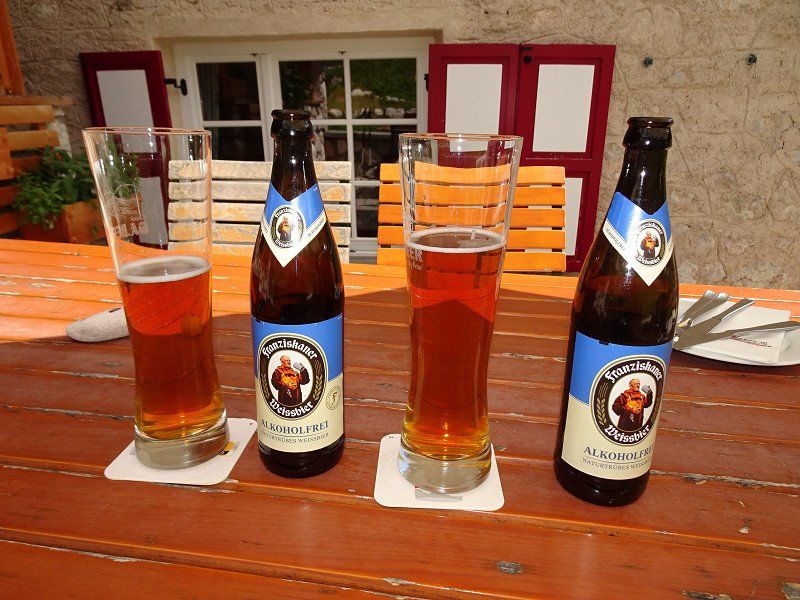
From Pederü we climb up to the Lavarella hut. The height difference of a good 500 m wouldn't actually matter to us. But the sun beats mercilessly into the valley basin and you think you're walking in an oven. After a good 2 hours the destination is reached and it's worth a wheat beer and enough food. Now all that's left to do is descend.
Camping AL PLAN - Dolomites
Via Catarina Lanz 63, 39030, S. Vigilio di Marebbe, Italy
46° 41' 41" N 11° 56' 18" E
46.6947200 11.9383300
• Head south.
• Arrive at your destination.
☍
Distance not available
(Duration not available)
Day
Wanderung zur Hütte Ücia Pico Bre
After yesterday's hike, we want to take it easy. The bus from the center of St. Vigil takes you to the Furcla Pass. From there a steep path leads up to the hut.
If you want, you can choose the route for the descent. However, this is almost as steep as the footpath.
Return by bus. This also runs every hour.
Camping AL PLAN - Dolomites
Via Catarina Lanz 63, 39030, S. Vigilio di Marebbe, Italy
46° 41' 41" N 11° 56' 18" E
46.6947200 11.9383300
• Head toward Strada Catarina Lanz. Go for 33 m.
• Turn right onto Strada Catarina Lanz. Go for 97 m.
• Turn left onto Strada Paracia. Go for 235 m.
• Turn slightly left onto Strada Paracia. Go for 214 m.
• Turn left onto Strada al Plan Dessora. Go for 207 m.
• Continue on Strada Plazores. Go for 101 m.
• Turn right onto Strada Plazores. Go for 430 m.
• Turn left onto Strada Provinciale Passo Furcia (SP43). Go for 230 m.
• Turn right onto Strada Provinciale Passo Furcia (SP43). Go for 4.0 km.
• Turn left onto Strada Longega (SS244). Go for 5.0 km.
• Pass 2 roundabouts and continue on Strada Colz (SS244). Go for 17.9 km.
• Arrive at Strada Col Alt (SS244). Your destination is on the right.
☍
28,4 km
( 38 min.)
Day
Corvara in Badia, Autonome Provinz Bozen - Südtirol, Italien
From St. Vigil the journey takes us first down into the valley and then down the valley in a southerly direction to Badia and Corvara.
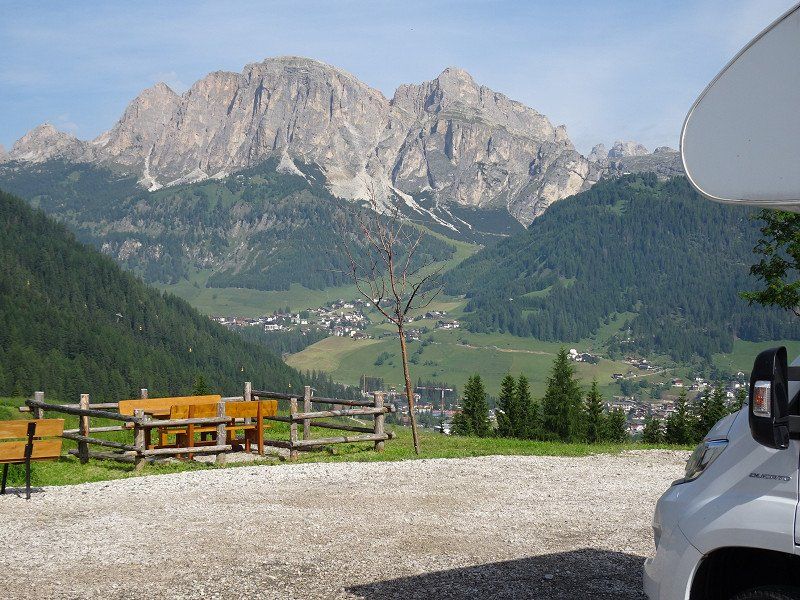
From Corvara the road climbs to the Campolongo Pass and offers a great view of the Dolomite peaks in the first bends.
39033 Kurfar, Autonome Provinz Bozen - Südtirol, Italien
46° 33' 9.3" N 11° 52' 27.4" E
46.5525905 11.8742745
• Head southwest on Strada Col Alt (SS244). Go for 12 m.
• Take the 2nd exit from roundabout onto Strada Col Alt (SS244). Go for 5.3 km.
• Continue on Via Passo Campolongo (SP244). Go for 4.7 km.
• Turn right. Go for 30 m.
• Turn slightly right toward Via Boè-Arabba. Go for 42 m.
• Turn slightly left onto Via Boè-Arabba. Go for 40 m.
• Arrive at Via Boè-Arabba. Your destination is on the right.
☍
10,1 km
( 15 min.)
Arabba, Belluno, Italien
32020 Arabba, Belluno, Italien
46° 29' 49.8" N 11° 52' 25.6" E
46.4971670 11.8737721
• Head southeast on Via Boè-Arabba.
• Turn right onto Strada Regionale delle Dolomiti (SR48). Go for 8.9 km.
• Turn right. Go for 70 m.
• Arrive at your destination on the left.
☍
9,0 km
( 15 min.)
Pordoijoch, Belluno, Italien
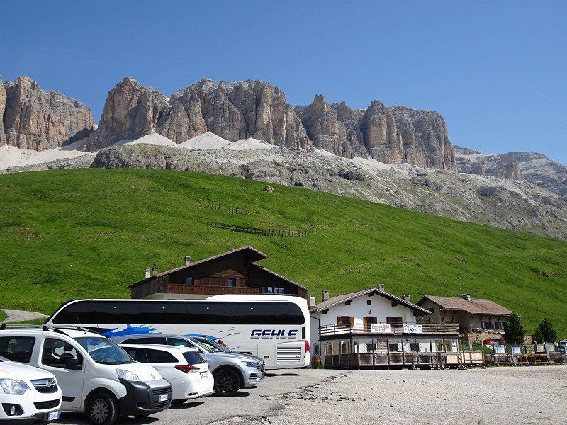
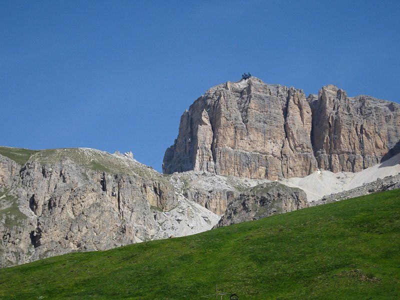
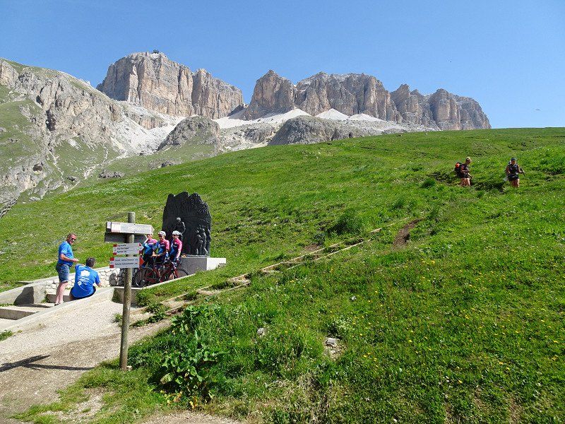
The Pordoi Pass seems to be made exclusively for cyclists. Where elsewhere most cyclists are found on e-bikes, here the majority are on racing bikes. Some of them cycle confidently, others with red faces.
We drive up in the motorhome and have to see how we can get space between the cyclists.
At the top the view is phenomenal. You can see all the way to the Marmolada, which hit the headlines a good week later due to a glacier collapse. The cable car to Sass Pordoi is also spectacular.
32020 Pordoijoch, Belluno, Italien
46° 29' 16.2" N 11° 48' 50.6" E
46.4878340 11.8140476
• Head toward Passo Pordoi. Go for 70 m.
• Turn left onto Passo Pordoi (SR48). Go for 9.1 km.
• Take the 3rd exit from roundabout onto Via Colesel (SP244) toward Corvara. Go for 4.8 km.
• Continue on Strada Statale di Val Badia (SS244). Go for 5.2 km.
• Take the 2nd exit from roundabout onto Strada Col Alt (SS243) toward Calfosch/Kolfuschg/Colfosco. Go for 14.8 km.
• Turn right onto Strada Plan de Gralba (SS242). Go for 7.9 km.
• Take the 2nd exit from roundabout onto Streda de Gherdëina (SS242) toward Autobahn/Autostrada/A22/Bozen/Bolzano/St. Ulrich/Ortisei. Go for 4.5 km.
• Take the 2nd exit from roundabout onto Streda Tresval (SS242) toward Urtijei Vest/St. Ulrich Ost/Ortisei Ovest. Go for 663 m.
• Continue toward Streda Tresval/SS242. Go for 18 m.
• Take the 2nd exit from roundabout onto Streda Tresval (SS242) toward Bozen/Bolzano/Brenner/Brennero/Autobahn/Autostrada/A22. Go for 3.2 km.
• Pass 2 roundabouts and continue on Strada Statale di Val Gardena e Passo Sella (SS242). Go for 9.4 km.
• Turn left onto Strada Statale dell'Abetone e del Brennero (SS12) toward Modena/A22/Bozen/Bolzano. Go for 17.3 km.
• Take ramp onto A22 (Autostrada del Brennero) toward Autobahn/Autostrada/Modena/Verona. Go for 24.8 km.
• Take the exit toward Egna/Ora/Termeno/Neumarkt/Auer/Tramin. Go for 1.6 km.
• Take the 2nd exit from roundabout onto Strada Provinciale Autostrada-Termeno (SP16) toward Neumarkt/Egna/Auer/Ora/Magreid/Magrè/Trento. Go for 607 m.
• Take the 1st exit from roundabout onto Strada Statale dell'Abetone e del Brennero (SS12) toward Auer/Ora/Montan/Montagna/Bozen/Bolzano/Cavalese. Go for 643 m.
• Take ramp onto Strada Provinciale Laimburg (SP62racc) toward Auer Zentrum/Ora Centro/Kaltern A.D.W./Caldaro S.S.D.V. Go for 1.2 km.
• Turn left onto Strada Provinciale Laimburg (SP62racc). Go for 503 m.
• Take the 3rd exit from roundabout onto Strada Provinciale Ora (SP127). Go for 1.3 km.
• Arrive at Strada Provinciale Ora (SP127). Your destination is on the left.
☍
107,7 km
(2 hrs. 8 min.)
Viktor's Imbiss
After the inns were either closed everywhere or there were no parking spaces available for mobile homes, Viktor's Imbiss came in handy. With its huge parking space behind the house and its immense catering capacity, the restaurant is ideal for motorhome drivers.
Gmund 11 - Località Monte 11, 39051, 39051 Vadena BZ, Italien
46° 21' 16.9" N 11° 16' 59.3" E
46.3546907 11.2831332
• Head toward Caldaro-Ora on Strada Provinciale Ora (SP127). Go for 1.7 km.
• Take the 1st exit from roundabout onto Strada Provinciale Caldaro-Roverè della Luna (SP14) toward Kaltern/Caldaro. Go for 2.0 km.
• Take the 1st exit from roundabout onto Strada Provinciale Caldaro-Roverè della Luna (SP14). Go for 2.7 km.
• Turn right onto Località San Giuseppe al Lago. Go for 108 m.
• Turn right onto Località San Giuseppe al Lago. Go for 317 m.
• Turn left onto Località San Giuseppe al Lago. Go for 38 m.
• Turn slightly right. Go for 20 m.
• Continue straight ahead. Go for 104 m.
• Arrive at your destination on the left.
☍
7,0 km
( 7 min.)
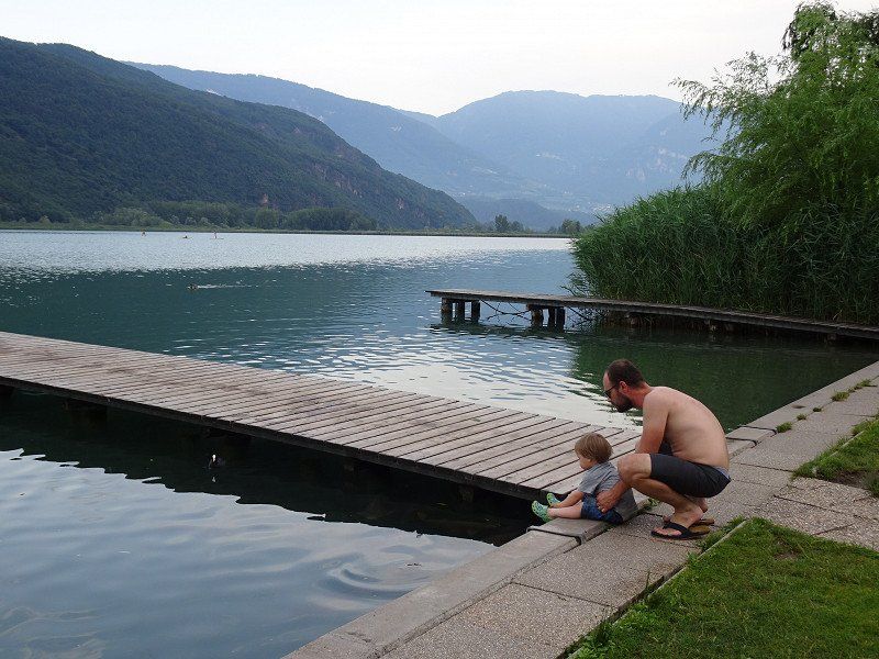
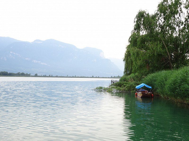
Camping Gretl am See
We reach the campsite and hope for a place within the campsite. We didn't make a reservation. We get a good place for one night.
Since it is very hot, we are in the lake after a short time and can refresh ourselves. Getting in amongst 50cm long carp takes some getting used to. But they leave you alone.
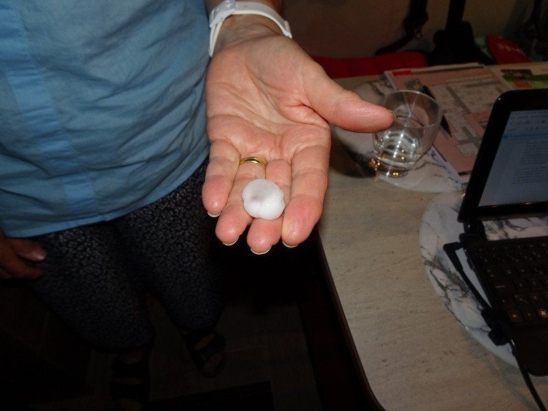
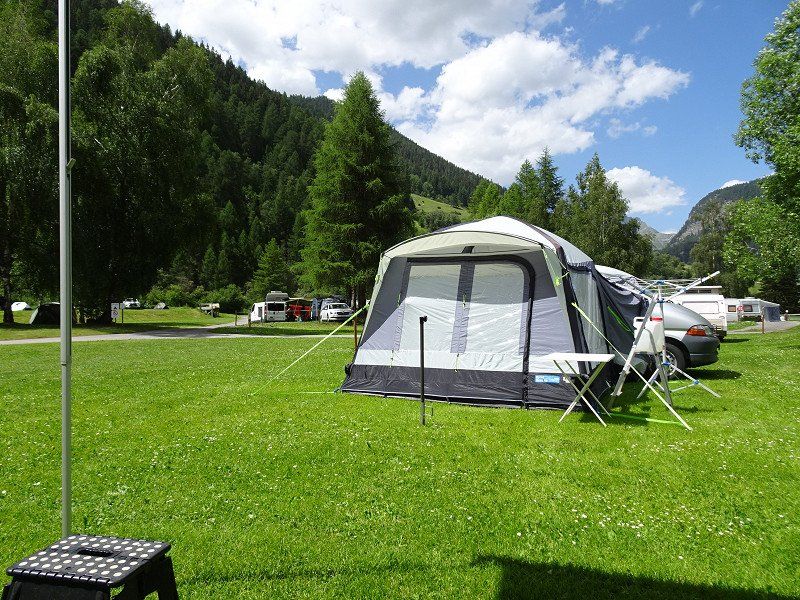
In the evening, several thunderstorms broke out and hailstones the diameter of one or even two euro coins thundered onto campers and tents.
Luckily no one was hurt, but a tent next to us was destroyed.
Weinstraße 18, 39052, Kaltern, Italy
46° 22' 57" N 11° 15' 29" E
46.3825000 11.2580600
• Head north. Go for 124 m.
• Turn right onto Località San Giuseppe al Lago. Go for 146 m.
• Turn left onto Località San Giuseppe al Lago. Go for 217 m.
• Turn left onto Località San Giuseppe al Lago. Go for 108 m.
• Turn right onto Strada Provinciale Caldaro-Roverè della Luna (SP14). Go for 2.4 km.
• Pass 3 roundabouts and continue on Strada Provinciale Caldaro-Roverè della Luna (SP14). Go for 10.2 km.
• Turn left and take ramp onto MeBo (SS38) toward Terlan/Terlano/Meran/Merano. Go for 29.7 km.
• Take the 2nd exit from roundabout onto Via Venosta (SS38). Go for 6.0 km.
• Take the 2nd exit from roundabout. Go for 57 m.
• Continue on Strada Statale dello Stelvio (SS38). Go for 12.5 km.
• Pass 7 roundabouts and continue on Strada Statale del Passo Resia (SS40). Go for 26.6 km.
• Turn left onto Via Glorenza (SS41) toward Glurns/Glorenza/Taufers/Tubre. Go for 12.2 km.
• Continue on Cunfin (28). Go for 40.0 km.
• Turn left onto Via Sura (27). Go for 766 m.
• Turn sharp right onto Madinas. Go for 102 m.
• Turn left onto Madinas. Go for 97 m.
• Turn right onto Cul. Go for 162 m.
• Arrive at Cul. Your destination is on the right.
☍
141,4 km
(2 hrs. 18 min.)
Day
Rückfahrt in die Schweiz
The return journey takes place again through the Vintschgau.
Attention: Glurns can only be bypassed to the west with motorhomes. It is not possible to drive through with motorhomes due to the narrow and low gates. However, Glorenza is certainly worth a stop for a visit.
Camping Cul
Madinas s/n, 7530, Zernez, Switzerland
46° 41' 51.3" N 10° 5' 13" E
46.6975800 10.0869400
• Head northwest on Cul.
• Arrive at Cul. Your destination is on the right.
☍
Distance not available
(Duration not available)
Day
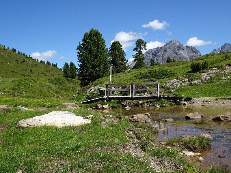
Wanderung von Buffalora zum Ofenpass und wieder zurück
From Zernez we went on another hike. First we took the post bus from Zernez train station to the Buffalora stop. This is the last stop before the Ofen Pass.
From here a wonderful hiking trail leads over the Alp Buffalora to the plateau of Döss de las Plattas. The climb is almost done.
In an easterly direction, after circling the Dolomite massif Il Jalet, you reach the Ofen Pass with its restaurant.
Instead of taking the bus back, we extended the hike with a direct descent to Buffalora and got on the post bus there.
Camping Cul
Madinas s/n, 7530, Zernez, Switzerland
46° 41' 51.3" N 10° 5' 13" E
46.6975800 10.0869400
• Head toward Sur Crusch on Cul. Go for 162 m.
• Turn left onto Madinas. Go for 97 m.
• Turn right onto Madinas. Go for 102 m.
• Turn sharp left onto 27. Go for 6.9 km.
• Turn left onto Grava (28). Go for 25.8 km.
• Turn right onto Sandstrasse (28). Go for 51 m.
• Turn right onto Bahnhofstrasse (28). Go for 14.7 km.
• Pass 2 roundabouts and continue on 28. Go for 26.6 km.
• Continue on Karlihof. Go for 492 m.
• Continue on Ragazerstrasse (3/13). Go for 404 m.
• Take ramp onto A13 toward Zürich/St. Margrethen. Go for 10.1 km.
• Continue on A3 toward Zürich/Sargans. Go for 89.0 km.
• Continue on A3W (Zürich-Süd) toward Zürich-City/Brunau. Go for 3.5 km.
• Continue on Manessestrasse (4). Go for 225 m.
• Keep right onto Manessestrasse (3) toward Chur/Rapperswil. Go for 132 m.
• Turn left onto Stauffacherquai. Go for 346 m.
• Continue on Stauffacherquai. Go for 247 m.
• Continue on Kasernenstrasse. Go for 433 m.
• Turn right onto Gessnerbrücke. Go for 51 m.
• Continue on Usteribrücke. Go for 80 m.
• Continue on Usteristrasse. Go for 297 m.
• Continue on Bahnhofplatz. Go for 219 m.
• Arrive at Bahnhofplatz.
☍
179,9 km
(2 hrs. 16 min.)
Day
Zürich, Schweiz
47° 22' 36.8" N 8° 32' 30.1" E
47.3768866 8.5416940