Unfortunately, we don't support your browser (Internet Explorer) anymore, some functionalities could not work. Click here to get information on how to upgrade your browser.
Napoleon route

Travelogue
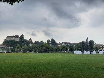
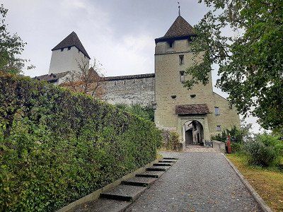
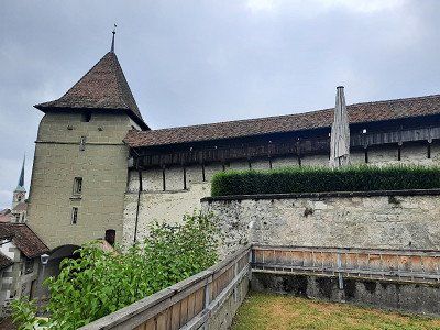
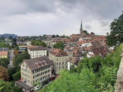
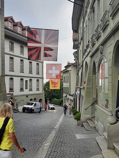
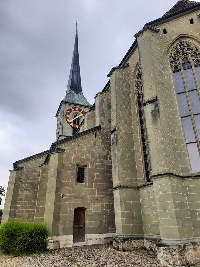
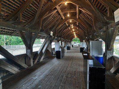
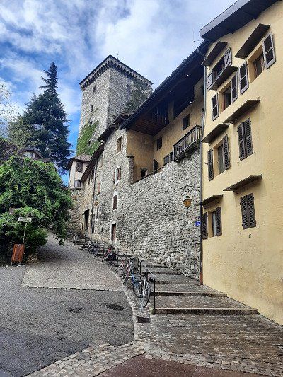
The journey went via Waldshut-Tiengen and Brugg to Burgdorf. When we arrived at the parking lot at the Schützenhaus, it started to rain. We used this time for our coffee break. It was only a short rain shower after which the castle and the town were visited.
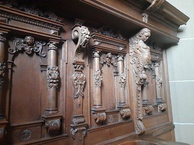
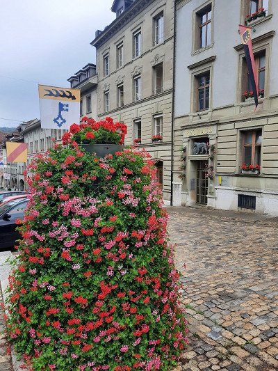
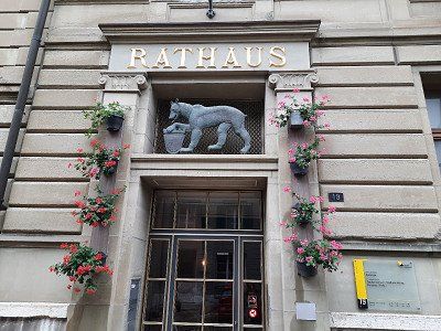
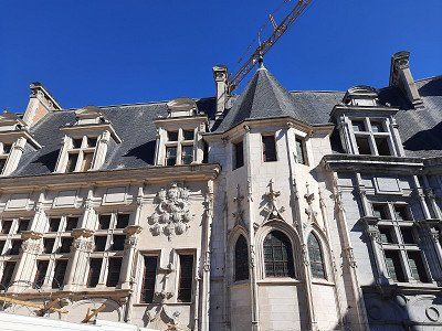
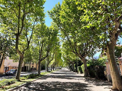
It was the Zähringer family who built a castle on a rocky outcrop on the left bank of the Emmen. Burgdorf Castle is now the city's landmark. Burgdorf is surrounded by the Emme, which flows around the town in a wide arc to the east. Burgdorf is also called the "Gateway to the Emmental".


The journey went via Waldshut-Tiengen and Brugg to Burgdorf. When we arrived at the parking lot at the Schützenhaus, it started to rain. We used this time for our coffee break. It was only a short rain shower after which the castle and the town were visited.
It was the Zähringer family who built a castle on a rocky outcrop on the left bank of the Emmen. Burgdorf Castle is now the city's landmark. Burgdorf is surrounded by the Emme, which flows around the town in a wide arc to the east. Burgdorf is also called the "Gateway to the Emmental".
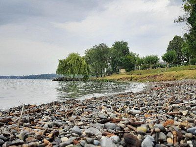
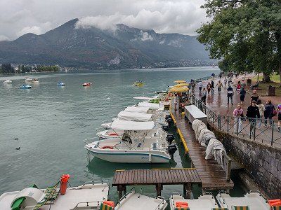
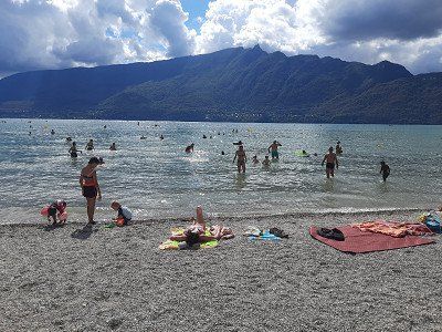
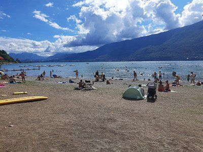
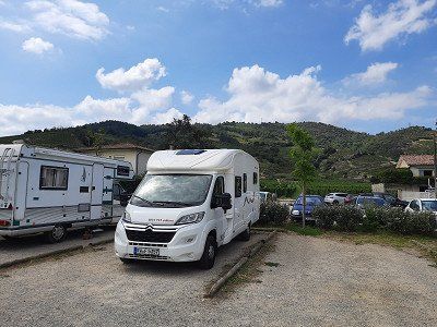
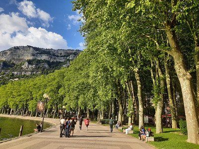
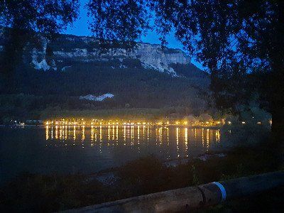
The village of Anthy-sur-Léman is slightly elevated above the southern shore of Lake Geneva. The approach to the parking space was a little difficult due to construction sites. We found a small place with 6 places, on which only one camper was standing. (From 6 p.m. to 8 a.m. free of charge) From the square you had a view of the lake in which Irmgard immediately went swimming. We ended the day with a walk along the lake shore and through the village.
The night was very quiet, we had slept well, it had rained occasionally during the night. In the morning before 8 a.m. we started our onward journey.
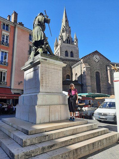
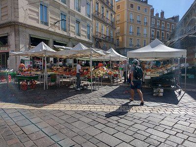
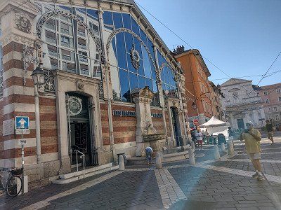
The pitch that was approached was occupied, we were not the only mobile home that drove to the place at this time. Quickly emptied the toilet cassette and tried again to find a parking space. It was Saturday and accordingly the traffic in the city was on the move. In addition, our GPS sent us twice in the wrong direction. One must not lose hope and we found a parking space at the top of Annecy Cathedral, where there were already many mobile homes. We stood directly under the church tower. We also made our way to the old town on foot. Annecy is known as the "Venice of the Alps" and the crystal-clear Lac d'Annecy with the pretty plane tree promenade on the north bank has a lot to do with it. It invades the old town with two major watercourses, the artificial Canal du Vassé and the branching Thiou river. The result is quays adorned with flowers, a river island with the 900-year-old Palais de l'île, and bridges and jetties.
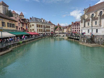
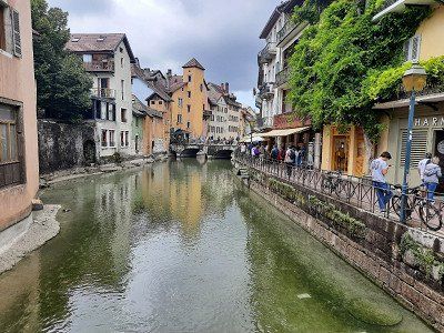
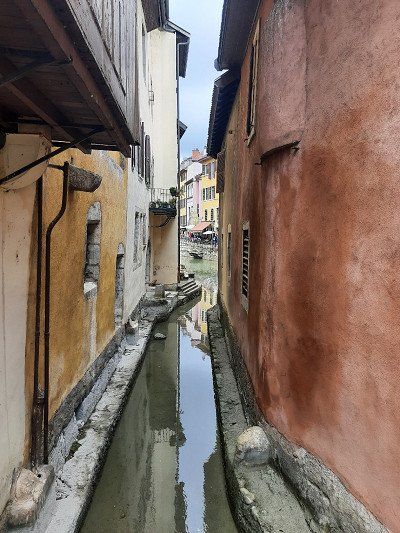
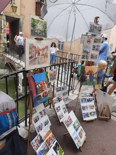
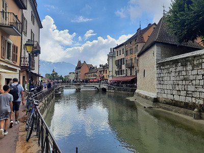
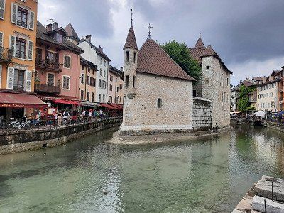

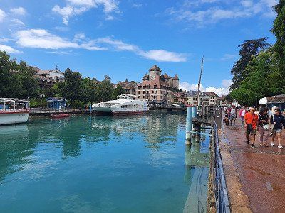
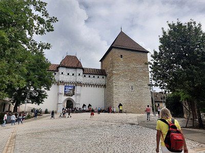
The pitch that was approached was occupied, we were not the only mobile home that drove to the place at this time. Quickly emptied the toilet cassette and tried again to find a parking space. It was Saturday and accordingly the traffic in the city was on the move. In addition, our GPS sent us twice in the wrong direction. One must not lose hope and we found a parking space at the top of Annecy Cathedral, where there were already many mobile homes. We stood directly under the church tower. We also made our way to the old town on foot. Annecy is known as the "Venice of the Alps" and the crystal-clear Lac d'Annecy with the pretty plane tree promenade on the north bank has a lot to do with it. It invades the old town with two major watercourses, the artificial Canal du Vassé and the branching Thiou river. The result is quays adorned with flowers, a river island with the 900-year-old Palais de l'île, and bridges and jetties.
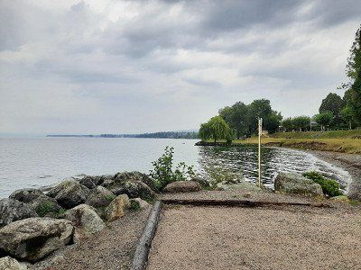
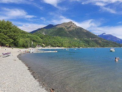
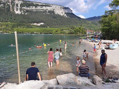
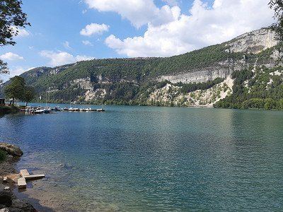
Made a swim stop. The city used to be a well-visited spa town. We were able to park the mobile home in the parking lot by the lake. The lake has a pebble beach and the water level is quite shallow, you have to go far into the lake to swim. We didn't stay long and continued to Grenoble.
Made a swim stop. The city used to be a well-visited spa town. We were able to park the mobile home in the parking lot by the lake. The lake has a pebble beach and the water level is quite shallow, you have to go far into the lake to swim. We didn't stay long and continued to Grenoble.
We had primarily chosen Grenoble as a place to stay overnight. On the way to Grenoble we saw areas where there were forest fires. We reached the campsite with a little detour, just before the campsite the road was closed and I followed the instructions on the navigation system, it would have been easier if I had followed the detour signs.
The size of the campsite was okay. We did nothing more that day. The campsite was a 50 minute walk from the old town.The night was quiet and the next morning we got out of bed early, we still wanted to visit the old town of Grenoble in the morning. It was a sightseeing tour on time, we had to leave the site at 12 noon.
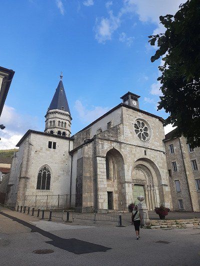
We headed towards the old town with a view of the Fort de la Bastille (19th century), which lies on a ledge below the confluence of the Drac and Isère.
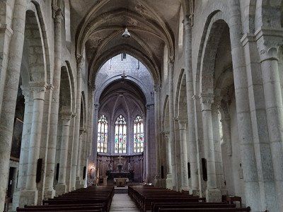
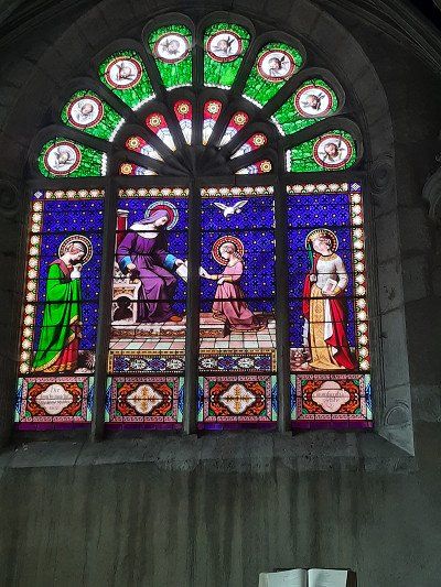
The Cathedral of Notre-Dame. A massive 11C square tower directly above the entrance portal is the focal point of the five-nave cathedral, whose origins date back to the 10C.
Ancien Palais Palace: The Old Palace was built at the beginning of the 16th century as the Parliament of Savoy (Ancien Palais du Parlement dauphinois) and has been rebuilt and expanded several times.
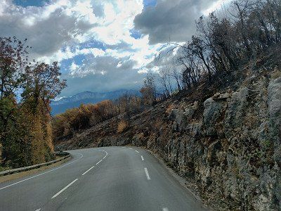
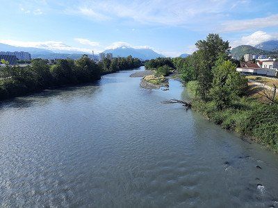

We had primarily chosen Grenoble as a place to stay overnight. On the way to Grenoble we saw areas where there were forest fires. We reached the campsite with a little detour, just before the campsite the road was closed and I followed the instructions on the navigation system, it would have been easier if I had followed the detour signs.
The size of the campsite was okay. We did nothing more that day. The campsite was a 50 minute walk from the old town.The night was quiet and the next morning we got out of bed early, we still wanted to visit the old town of Grenoble in the morning. It was a sightseeing tour on time, we had to leave the site at 12 noon.
We headed towards the old town with a view of the Fort de la Bastille (19th century), which lies on a ledge below the confluence of the Drac and Isère.
The Cathedral of Notre-Dame. A massive 11C square tower directly above the entrance portal is the focal point of the five-nave cathedral, whose origins date back to the 10C.
Ancien Palais Palace: The Old Palace was built at the beginning of the 16th century as the Parliament of Savoy (Ancien Palais du Parlement dauphinois) and has been rebuilt and expanded several times.
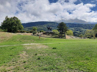
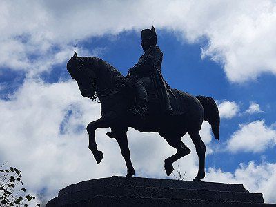
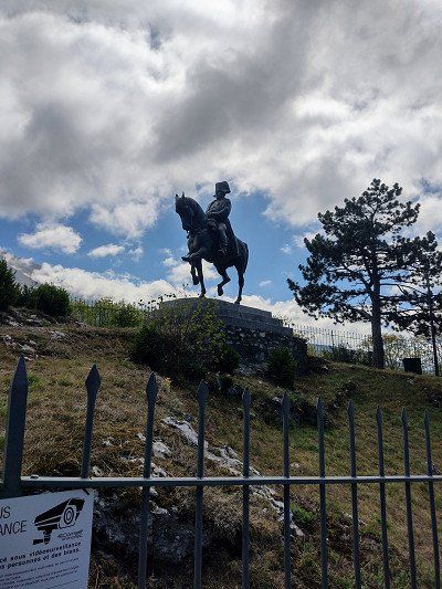
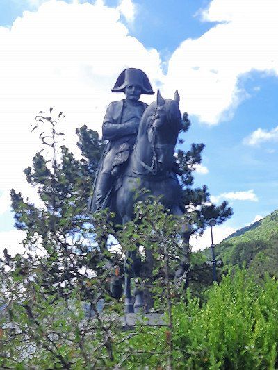
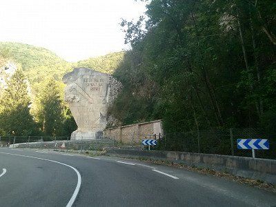
On the way to La Mure we passed the small village of Laffrey.
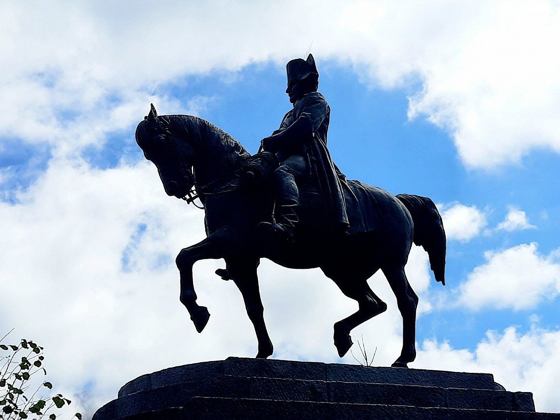
Napoleon's troops and those of his opponents met here. Here Napoleon is said to have won over enemy troops with a courageous speech. Napoleon allegedly entered the royal troops with the words "If among you soldiers there is one who wants to kill his emperor, here I am!" opposite to. After some hesitation, shouts of "Vive l'Empereur - long live the Emperor" - made it clear that the opponents were joining Napoleon's troops.
A large equestrian statue of Napoléon commemorates this episode.
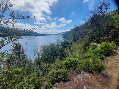
Four lakes can be seen near Laffrey on the high plateau, the Grand Lac de Laffrey being the largest of them.
On the way to La Mure we passed the small village of Laffrey.
Napoleon's troops and those of his opponents met here. Here Napoleon is said to have won over enemy troops with a courageous speech. Napoleon allegedly entered the royal troops with the words "If among you soldiers there is one who wants to kill his emperor, here I am!" opposite to. After some hesitation, shouts of "Vive l'Empereur - long live the Emperor" - made it clear that the opponents were joining Napoleon's troops.
A large equestrian statue of Napoléon commemorates this episode.
Four lakes can be seen near Laffrey on the high plateau, the Grand Lac de Laffrey being the largest of them.
Next, La Mure is traversed. The village is the terminus of the Chemin de fer de la Mure narrow-gauge railway, which runs from La Mure in countless hairpin bends and tunnels down to the SNCF train station at Saint-Georges-de-Commiers. We stopped at La Mure on the Napoleon Road, in the heart of the Matheysin Plateau, 800 meters above sea level. We parked in the parking lot at the tourist center in front of the city, where there was also the opportunity to ride the historical railway. There were several interesting buildings to see in downtown La Mure. The imposing town hall, the clock tower, the old market and the Chateau Herbelon.
After our tour and coffee break, we continued our journey, but not through the old town but used the developed bypass road, from which one can enjoy a sweeping view of the rising Alpine scenery.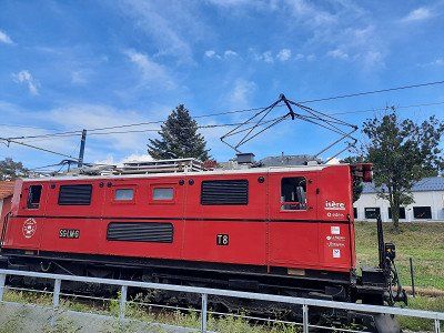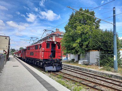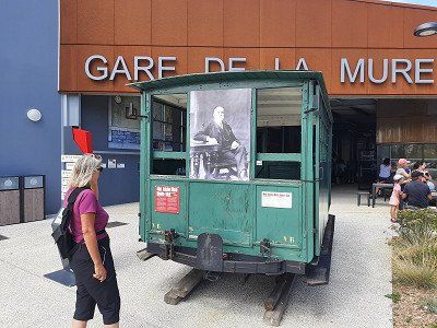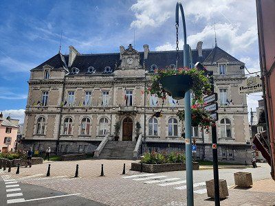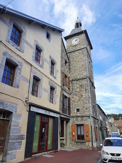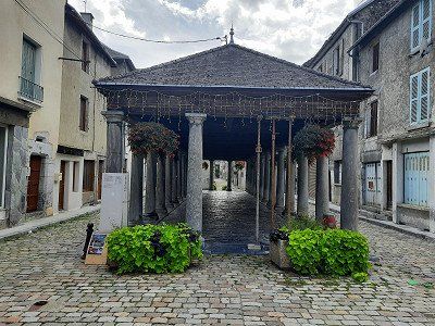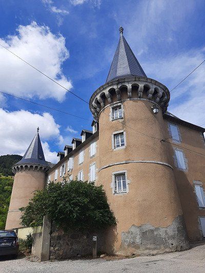
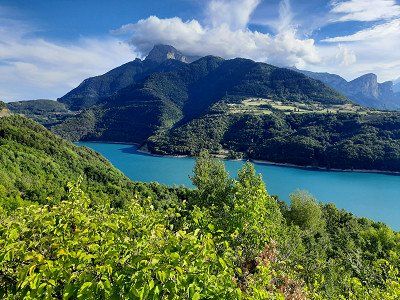
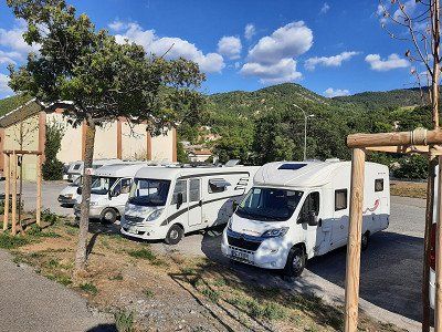
The access to the lake was on a narrow road that can only be driven in one direction. The entrance to the campsite has a tight curve, which we would not have been able to drive without maneuvering. At first it was said that the campsite was occupied, you had to register in advance. Suddenly it worked and we got a beautiful parking space on the water. The campsite's terrain is sloping but the pitches are reasonably level. The sanitary facilities are not a luxury. Irmgard then immediately went swimming in the lake, the water temperature was estimated at 21°C.
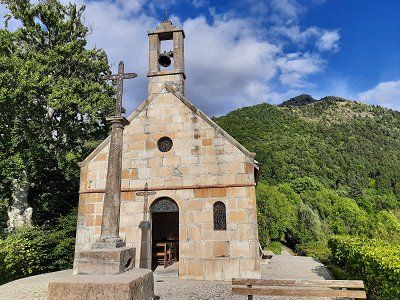
Towards evening we went for a long walk to the village of Corps with the Saint Roch chapel, from which we had a beautiful view of the lake (Lac du Sautet). The footpath ran steeply uphill through oak and beech forest, there and back it was about 7 km on the same path.After dinner we sat outside and enjoyed the lake with the surrounding mountains.
The night got cooler, we are at 1000 m above sea level.
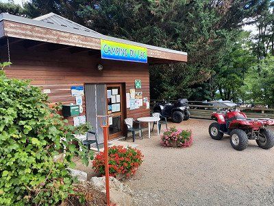
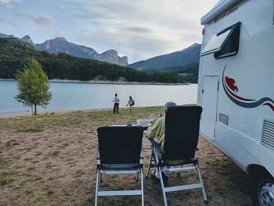
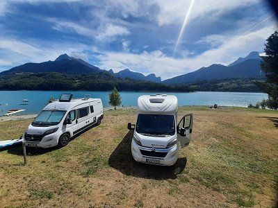

The access to the lake was on a narrow road that can only be driven in one direction. The entrance to the campsite has a tight curve, which we would not have been able to drive without maneuvering. At first it was said that the campsite was occupied, you had to register in advance. Suddenly it worked and we got a beautiful parking space on the water. The campsite's terrain is sloping but the pitches are reasonably level. The sanitary facilities are not a luxury. Irmgard then immediately went swimming in the lake, the water temperature was estimated at 21°C.
Towards evening we went for a long walk to the village of Corps with the Saint Roch chapel, from which we had a beautiful view of the lake (Lac du Sautet). The footpath ran steeply uphill through oak and beech forest, there and back it was about 7 km on the same path.After dinner we sat outside and enjoyed the lake with the surrounding mountains.
The night got cooler, we are at 1000 m above sea level.
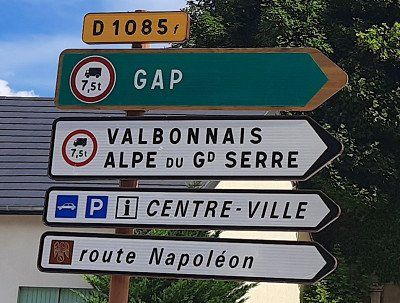
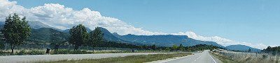
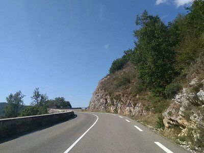
A photo stop is a must on the way to GAP.
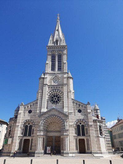
At the indoor pool was the designated parking space (free of charge). We had to walk to the city center on a two-kilometer-long avenue. The many trees donated a little shade, so that the great heat was bearable.
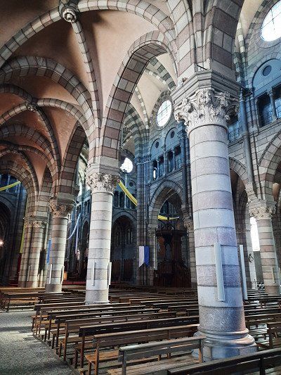
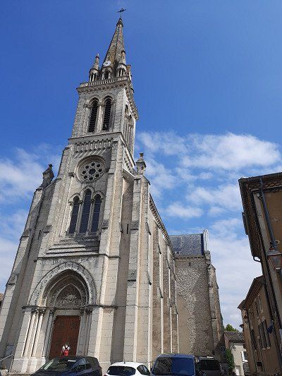
There isn't much historical architecture to see in the city. There was a wealth of interesting things to see in the streets. The city's medieval cathedral began to collapse in the 19th century, so a neo-Gothic replacement was built in its place and completed in 1904.
Napoleon spent the night of March 5, 1815 here on his way from Elba exile to Paris, just before the Hundred Days.
He chose this detour through GAP; because this city, in contrast to the cities in the Rhone Valley, remained loyal to him rather than to the French kings.

A photo stop is a must on the way to GAP.
At the indoor pool was the designated parking space (free of charge). We had to walk to the city center on a two-kilometer-long avenue. The many trees donated a little shade, so that the great heat was bearable.
There isn't much historical architecture to see in the city. There was a wealth of interesting things to see in the streets. The city's medieval cathedral began to collapse in the 19th century, so a neo-Gothic replacement was built in its place and completed in 1904.
Napoleon spent the night of March 5, 1815 here on his way from Elba exile to Paris, just before the Hundred Days.
He chose this detour through GAP; because this city, in contrast to the cities in the Rhone Valley, remained loyal to him rather than to the French kings.
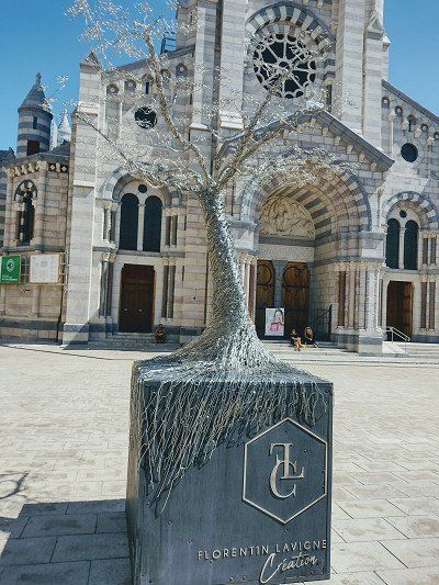
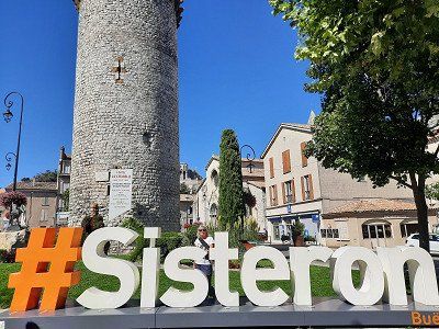
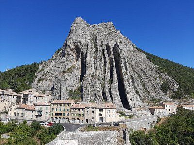
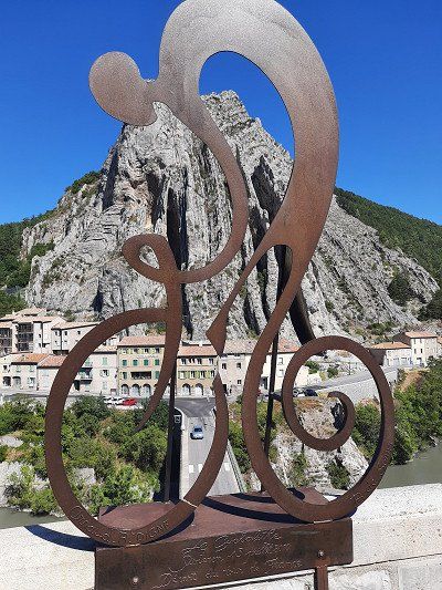
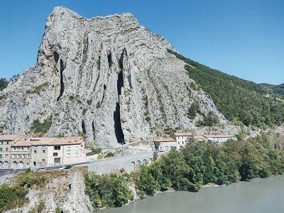
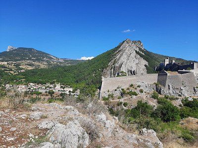
Napoleon passed through the town of Sisteron on his famous return from exile on Elba.
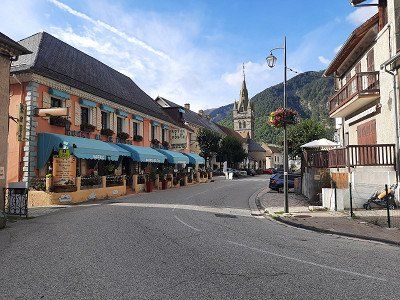
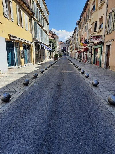
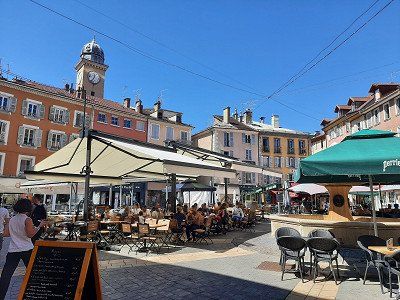
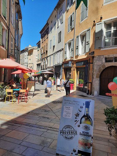
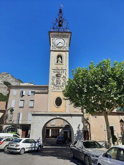
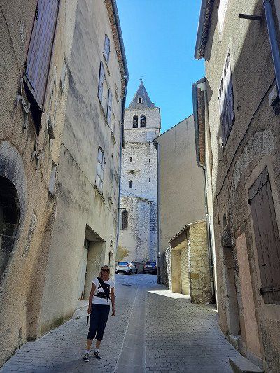
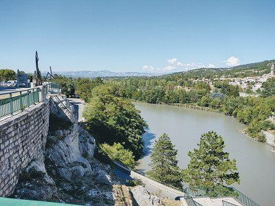
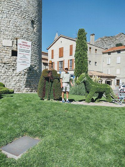
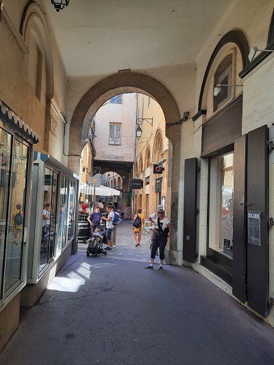
Sisteron is the gateway to Provence and a small tourist town. Already at the entrance to the city there were crowds of people, the parking space right at the entrance was occupied. The second variant was the parking space at the cemetery, to which we could not find the access road. By chance we saw a parking lot where there was also a mobile home, to which we stood. It was only a few minutes to the old town. The old town of Sisteron which is picturesque with narrow streets lined with old houses and an abundance of fountains. Notable monuments include the bell tower and the 12th-century Notre-Dame Cathedral. After visiting the old town, the citadel on the rocky hillside, originally from the 11th century, is worth a visit. During our walk on the viewing rock, we also saw the parking space at the cemetery where two campers were parked. The access to the parking space looked more difficult for us, the narrow streets are easy to drive on.
Napoleon passed through the town of Sisteron on his famous return from exile on Elba.
Sisteron is the gateway to Provence and a small tourist town. Already at the entrance to the city there were crowds of people, the parking space right at the entrance was occupied. The second variant was the parking space at the cemetery, to which we could not find the access road. By chance we saw a parking lot where there was also a mobile home, to which we stood. It was only a few minutes to the old town. The old town of Sisteron which is picturesque with narrow streets lined with old houses and an abundance of fountains. Notable monuments include the bell tower and the 12th-century Notre-Dame Cathedral. After visiting the old town, the citadel on the rocky hillside, originally from the 11th century, is worth a visit. During our walk on the viewing rock, we also saw the parking space at the cemetery where two campers were parked. The access to the parking space looked more difficult for us, the narrow streets are easy to drive on.
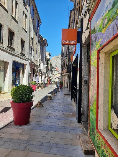
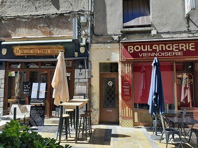
Before our stage destination in Dingle les Bains we went shopping at the discounter. When we arrived at the parking space, there were two WoMos, then the mobile homes came one after the other. We arrived in time to get a seat. It was oppressively hot 34°C. First we lowered all the blinds on the sunny side. It was too hot to go to the old town. After dinner we went for a walk to the old town. A nice bike and footpath led along the Bléone river to the town about 10 minutes walk. The streets of the old town were deserted, only a few people were sitting in a small restaurant or bar.
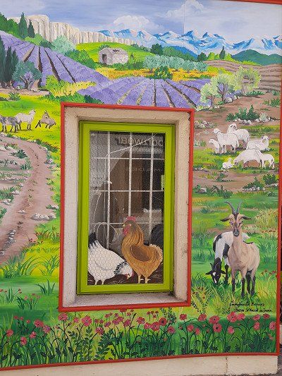
The Notre-Dame-du-Bourg cathedral in Romanesque style from the 11th to the 13th centuries. Saint-Jerôme Cathedral is a more recent construction and is a 15th-16th century Gothic building. Century (although the facade was rebuilt in the 19th century). Cathedral with a beautiful portal was already closed. Dingle les Bains is the self-proclaimed capital of lavender. Especially between the end of June and mid-August you can experience the landscape in the fragrant purple of the medicinal plant. Then we went back to the WoMo, where we enjoyed the evening outside in a mild breeze.


Before our stage destination in Dingle les Bains we went shopping at the discounter. When we arrived at the parking space, there were two WoMos, then the mobile homes came one after the other. We arrived in time to get a seat. It was oppressively hot 34°C. First we lowered all the blinds on the sunny side. It was too hot to go to the old town. After dinner we went for a walk to the old town. A nice bike and footpath led along the Bléone river to the town about 10 minutes walk. The streets of the old town were deserted, only a few people were sitting in a small restaurant or bar.
The Notre-Dame-du-Bourg cathedral in Romanesque style from the 11th to the 13th centuries. Saint-Jerôme Cathedral is a more recent construction and is a 15th-16th century Gothic building. Century (although the facade was rebuilt in the 19th century). Cathedral with a beautiful portal was already closed. Dingle les Bains is the self-proclaimed capital of lavender. Especially between the end of June and mid-August you can experience the landscape in the fragrant purple of the medicinal plant. Then we went back to the WoMo, where we enjoyed the evening outside in a mild breeze.
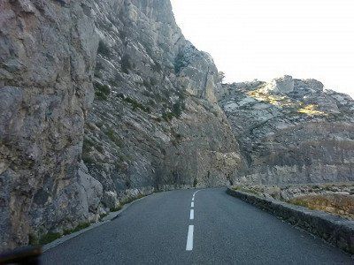
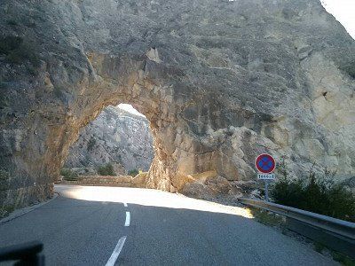
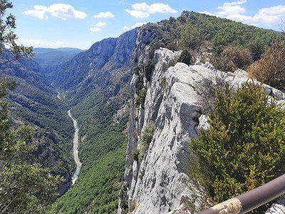
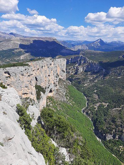
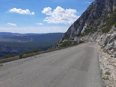
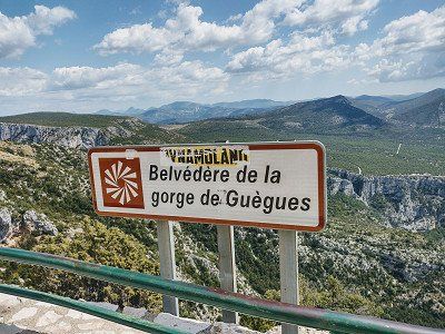
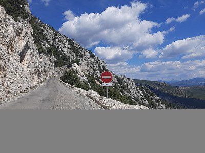
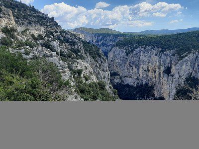
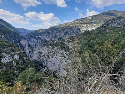
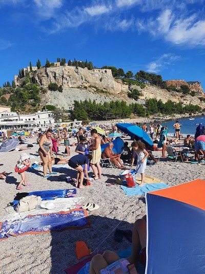
In Castellane we went into the Verdon Gorge.
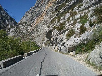
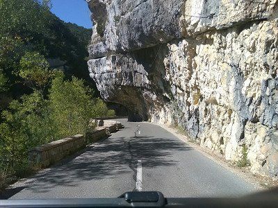
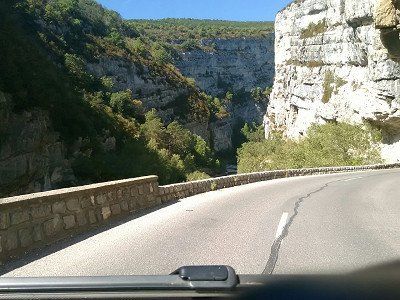
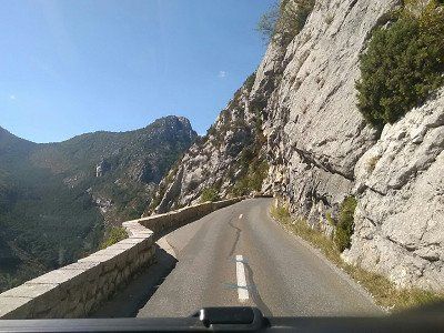
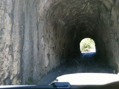
In Castellane we went into the Verdon Gorge.
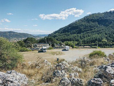
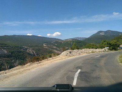
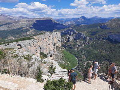
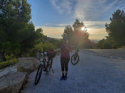
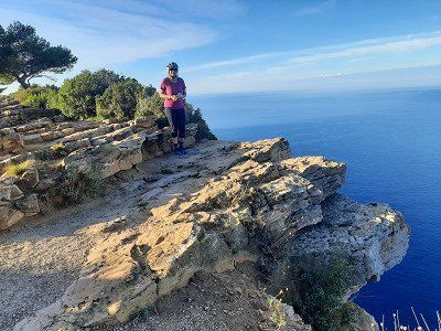
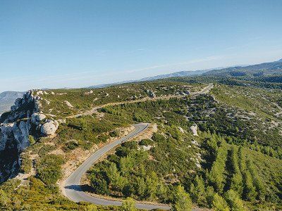
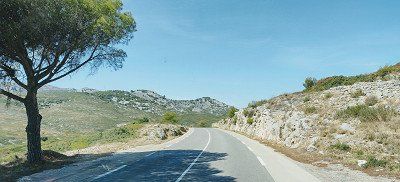
The campsite was today's destination. From there we could cycle the Route des Cretes. The Route des Cretes can be traveled by car, mobile home or by bicycle. We decide to go on a bike tour in order to be able to fully enjoy this great landscape.
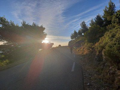
Shortly after the village of Palud sur Verdon, this legendary route branches off to the right and winds its way up the mountain, curve after curve. The weather is kind to us, white blue skies and a cool breeze give us an incomparable bike tour. We were comfortably on the road for about 2.5 hours - about until we returned to the mobile home.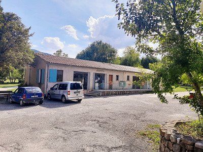
The campsite was today's destination. From there we could cycle the Route des Cretes. The Route des Cretes can be traveled by car, mobile home or by bicycle. We decide to go on a bike tour in order to be able to fully enjoy this great landscape.
Shortly after the village of Palud sur Verdon, this legendary route branches off to the right and winds its way up the mountain, curve after curve. The weather is kind to us, white blue skies and a cool breeze give us an incomparable bike tour. We were comfortably on the road for about 2.5 hours - about until we returned to the mobile home.Today we explore a real masterpiece of road construction with the bike "the Route des Cretes" D23, which was only built in 1973 at a higher altitude, even up to 1300 m as a tourist road.
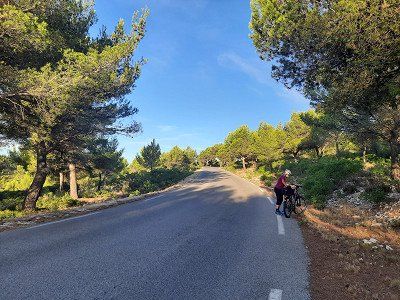
Attention , the D23 is only passable in a clockwise direction (one-way street) .
Enjoying the many views from the numerous vantage points was no problem with the bike, in contrast to the cars, which hardly had a parking space to make a stop.
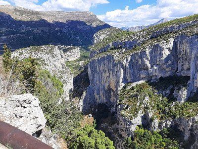
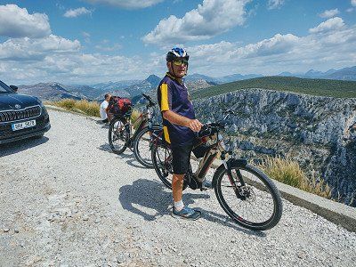
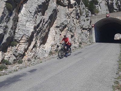
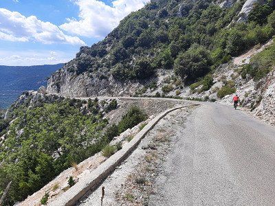
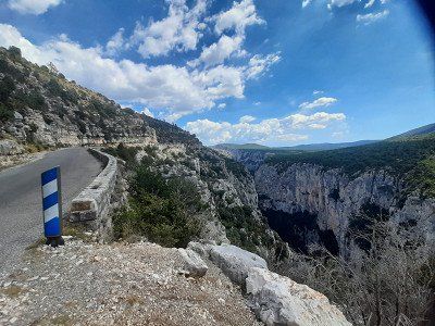
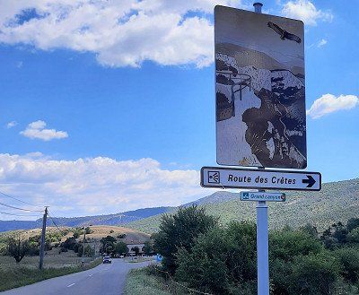
Today we explore a real masterpiece of road construction with the bike "the Route des Cretes" D23, which was only built in 1973 at a higher altitude, even up to 1300 m as a tourist road.
Attention , the D23 is only passable in a clockwise direction (one-way street) .
Enjoying the many views from the numerous vantage points was no problem with the bike, in contrast to the cars, which hardly had a parking space to make a stop.
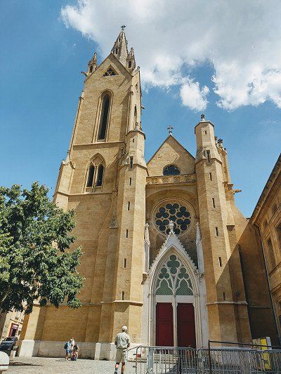
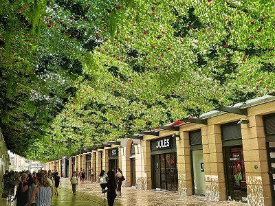
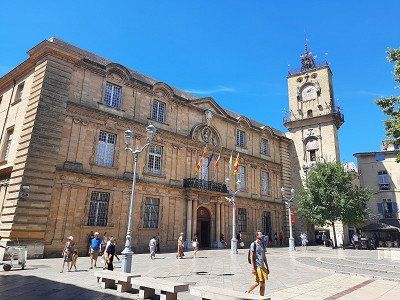
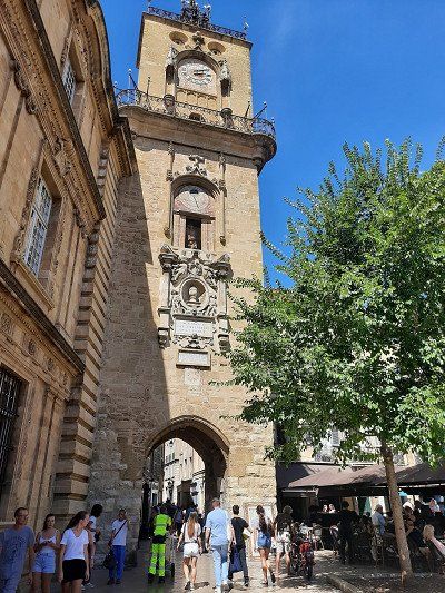
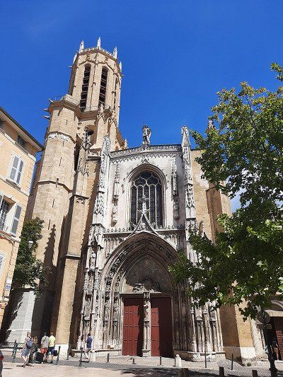
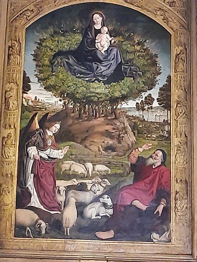
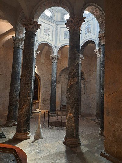
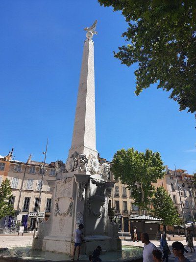
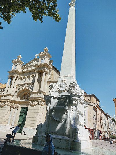
Approached the paid parking lot at the cemetery (GPS: 43.52281, 5.46136), we weren't the only camper that parked here. We were lucky with the parking fee, the ticket machine was broken. Going downtown was only a 15 minute walk. We came to a well-kept Provençal old town. Really lively, many restaurants. But fewer real sights. A beautiful fountain at the beginning of the promenade "Fontaine de La Rotonde".
The imposing Cathédrale St - Sauveur with its late Gothic west facade was rebuilt over centuries and was another focal point through the old town. The Cloître St - Sauveur cloister with arcades and double columns was built around 1170.The town hall and elegant city palace frame the square in the center of the old town. The Tour de l'Horloge clock tower, built in 1505, crowned by a filigree bell cage with gallery. The astronomical clock with personifications of the four seasons dates from the 17th century.
The enormous heat that day made us end our visit to the city early.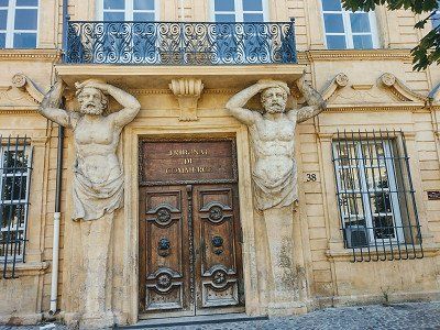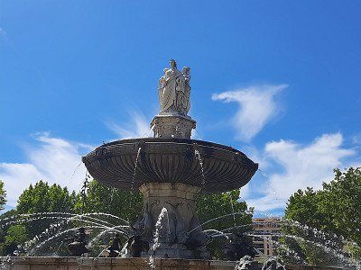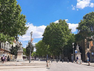
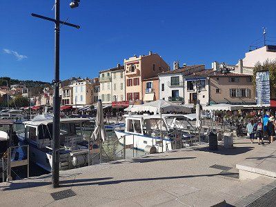
In Cassis we drove to the campsite where we could stay for the night (Gps;43.21349, 5.53781). The place was big enough, with pebbles. We used the power connection to charge our e-bike batteries. The fridge was malfunctioning when we came back from our bathing stay, the display showed the error code I10 (voltage not in the 200-260 volt range). The main thing was that the batteries were charged, the refrigerator continued to run on gas.
A walk through the small streets dominated by a castle is part of a visit to Cassis. The medieval fortress dates from the 17th - 19th centuries and was used as a military fort. The castle is now privately owned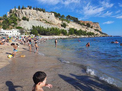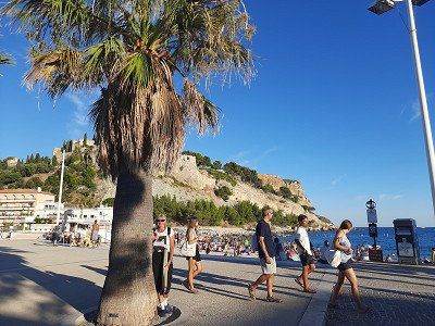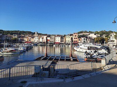
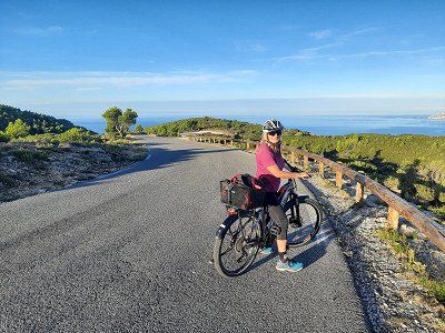
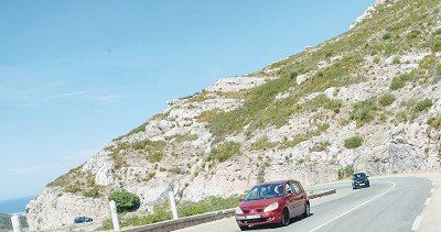
The Route des Crêtes, the 15 km ridge road (coastal road)
is simply fantastic! It rises from sea level within a few kilometers to almost 400 m.
Fascinating view from the rocks to the sea and to the islands in front of Marseille.
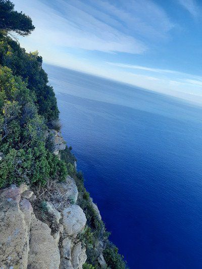
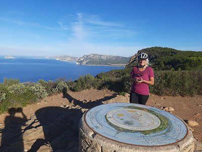
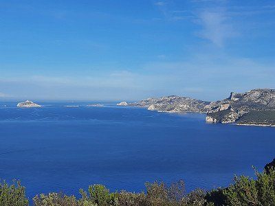
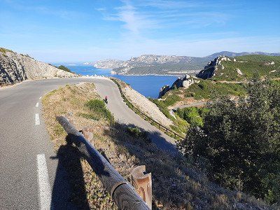
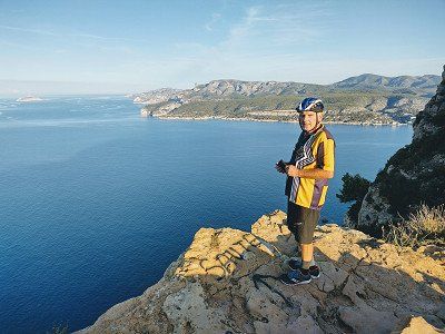
The Route des Crêtes, the 15 km ridge road (coastal road)
is simply fantastic! It rises from sea level within a few kilometers to almost 400 m.
Fascinating view from the rocks to the sea and to the islands in front of Marseille.
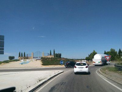
High above Cassis, the road (D559) runs from Cassis to Marseille, through the Calanques National Park. On the way you can enjoy very nice views and landscapes in the white limestone.
High above Cassis, the road (D559) runs from Cassis to Marseille, through the Calanques National Park. On the way you can enjoy very nice views and landscapes in the white limestone.
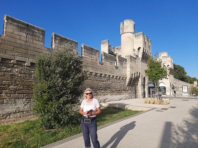
Pitch in Avignon approached Gps: 43.95608, 4.8002, was pretty empty. Chargeable. The course is on the Rhone Island.
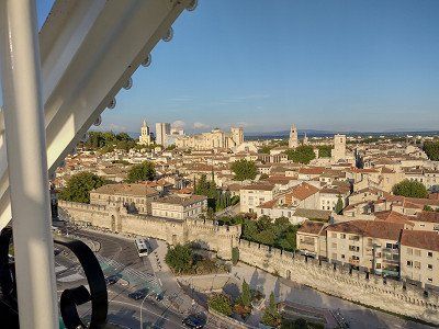
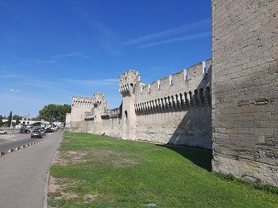
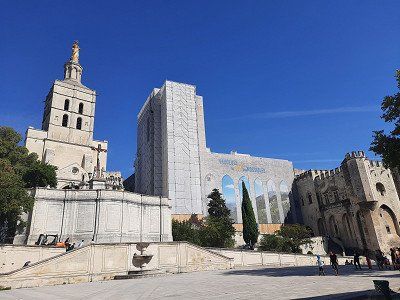
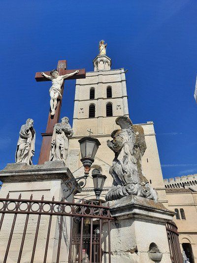
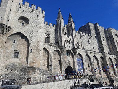
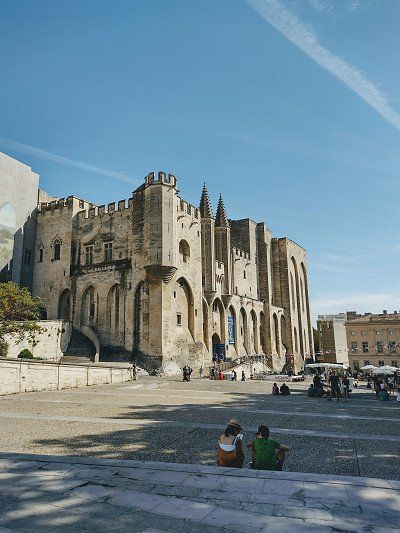
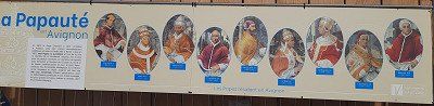
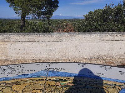
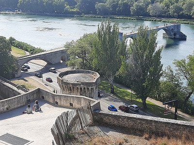
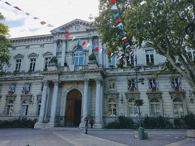
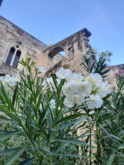
Tour of the old townOur RV park was the starting point for a tour of the city center. Crossing the Rhone, we had our first glimpse of the papal city with its stunning four kilometer long city fortifications (city walls) and the Avignon Bridge. The Saint-Bénézet bridge is the symbol of the city of Avignon. With only part of the bridge remaining today, it is hard to imagine that for a time it was the only legal route of communication between the Kingdom of France and the Papal States. We skipped the bridge and headed towards the Place de l'Horloge, which was only a stone's throw away. In the center of this old Avignon square stands the Town Hall, which was first fitted with a clock in the 15th century. Avignon became a haven for the popes in the 14th century. In the papal palace, seven heads of the church resided one after the other, which we came across on our tour. Next to it is the Basilique Saint-Pierre. This 14th-century church is rightly considered by many to be Avignon's most beautiful church. Its Gothic style and facades of intricately carved stone. We then visited the Jardin des Doms and strolled through the enchanting park while the Avignon Bridge lay at our feet. We were amazed when we also saw Mont Ventoux. The giant with the white dome proudly looms over the hilly landscape of Avignon.
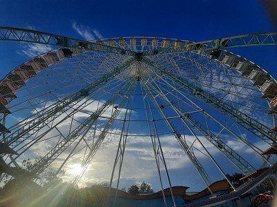
We ended the tour with the main shopping street and went back to the mobile home outside the city fortifications. The culmination of the day was the ride on the Ferris wheel, from which we could see the papal city from above.

Pitch in Avignon approached Gps: 43.95608, 4.8002, was pretty empty. Chargeable. The course is on the Rhone Island.
Tour of the old townOur RV park was the starting point for a tour of the city center. Crossing the Rhone, we had our first glimpse of the papal city with its stunning four kilometer long city fortifications (city walls) and the Avignon Bridge. The Saint-Bénézet bridge is the symbol of the city of Avignon. With only part of the bridge remaining today, it is hard to imagine that for a time it was the only legal route of communication between the Kingdom of France and the Papal States. We skipped the bridge and headed towards the Place de l'Horloge, which was only a stone's throw away. In the center of this old Avignon square stands the Town Hall, which was first fitted with a clock in the 15th century. Avignon became a haven for the popes in the 14th century. In the papal palace, seven heads of the church resided one after the other, which we came across on our tour. Next to it is the Basilique Saint-Pierre. This 14th-century church is rightly considered by many to be Avignon's most beautiful church. Its Gothic style and facades of intricately carved stone. We then visited the Jardin des Doms and strolled through the enchanting park while the Avignon Bridge lay at our feet. We were amazed when we also saw Mont Ventoux. The giant with the white dome proudly looms over the hilly landscape of Avignon.
We ended the tour with the main shopping street and went back to the mobile home outside the city fortifications. The culmination of the day was the ride on the Ferris wheel, from which we could see the papal city from above.
Parked in the parking lot Gps:43.8962, 5.2963, which is also designated for RVs. Fee 3.-€
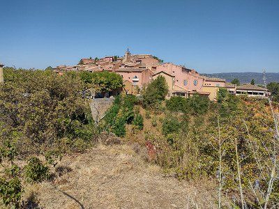
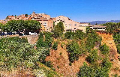
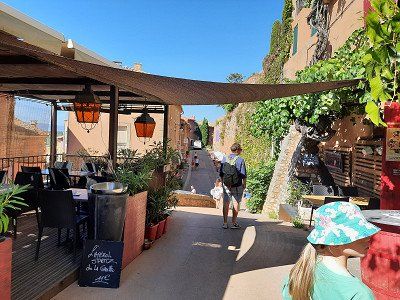
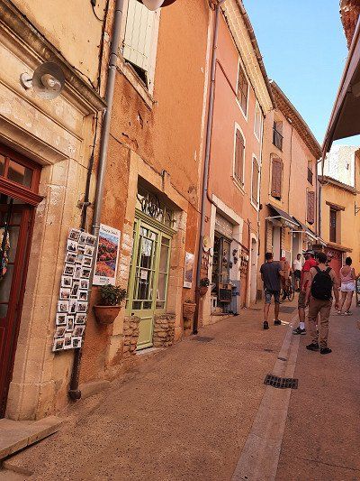
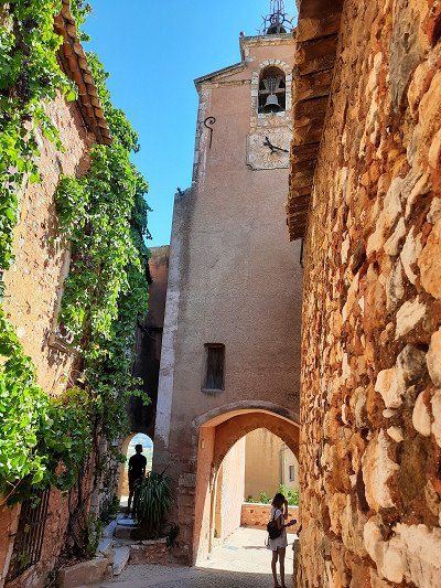
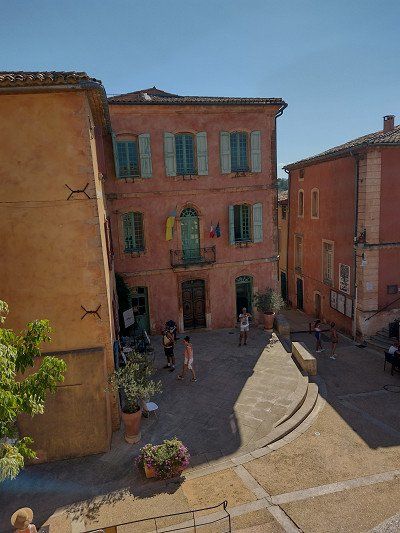
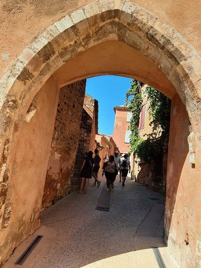
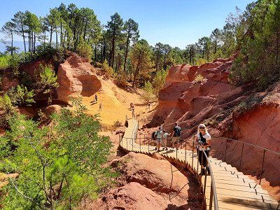
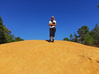
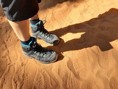
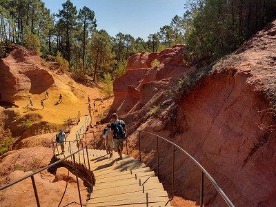
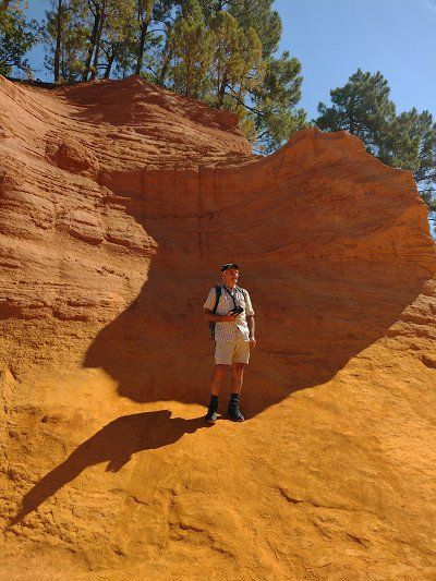
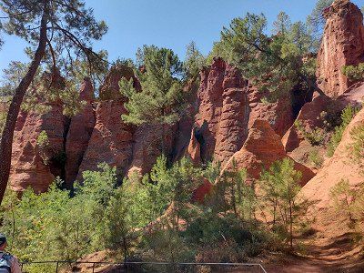
A hike to the ocher rocks was on our journey today. The 2.5 hour hike that was planned went in the direction of the ocher museum and in the hinterland of Roussillon to individual ocher rocks. Because of the extreme heat (32°C) we chose the shorter version of the hike at the ocher museum, which also led to the well-known rocks shown in the pictures. First we made a tour through the streets of Roussillon in the hustle and bustle of the many tourists, then we went to the ocher rocks. Admission €3. The ocher rocks made a beautiful picture with their different ocher colors. After the tour of the rock formations, the soles of the shoes were stained with the ocher sand that was no longer easy to remove.
After returning to the WoMo we drove off straight away, it was too hot for us to take a break, meanwhile the temperature had risen to 34°C around noon.

Parked in the parking lot Gps:43.8962, 5.2963, which is also designated for RVs. Fee 3.-€
A hike to the ocher rocks was on our journey today. The 2.5 hour hike that was planned went in the direction of the ocher museum and in the hinterland of Roussillon to individual ocher rocks. Because of the extreme heat (32°C) we chose the shorter version of the hike at the ocher museum, which also led to the well-known rocks shown in the pictures. First we made a tour through the streets of Roussillon in the hustle and bustle of the many tourists, then we went to the ocher rocks. Admission €3. The ocher rocks made a beautiful picture with their different ocher colors. After the tour of the rock formations, the soles of the shoes were stained with the ocher sand that was no longer easy to remove.
After returning to the WoMo we drove off straight away, it was too hot for us to take a break, meanwhile the temperature had risen to 34°C around noon.
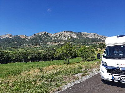
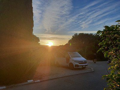
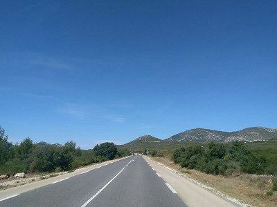
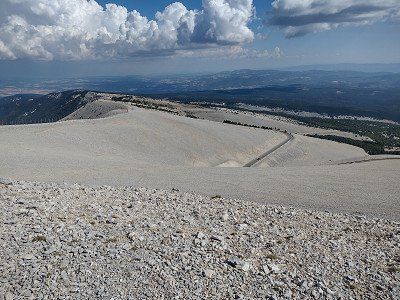
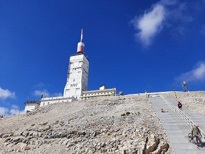
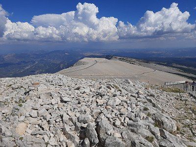
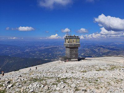
"Le Mont Ventoux" (1910 m) the sacred mountain is a myth, the summit road is often a stage of the Tour de France, the panoramic view over Provence was unfortunately not that great today. In the most beautiful sunshine - and a clear view of the summit, we found a parking lot, where we also stay overnight. The gravel place with some large stones is free and sloping. Towards the late afternoon, the parking lot emptied and we made a change of place on which our camper was leveler. But the sacred mountain of Provence soon made its mark as Mons Ventosus (lat. "windy mountain").
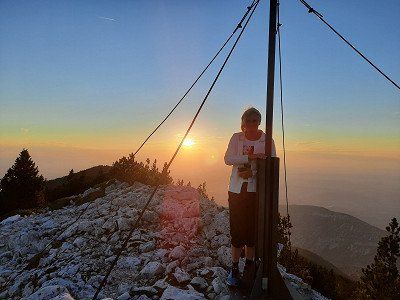
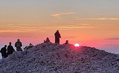
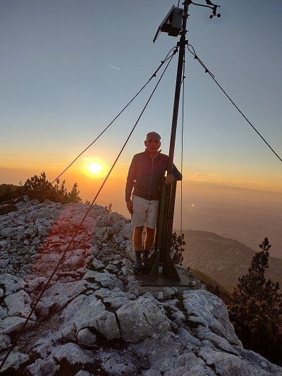
The sunset was gorgeous, a starry sky that you don't get to see every day and the silence at night with the sunrise over Le Mont Ventoux the next morning.
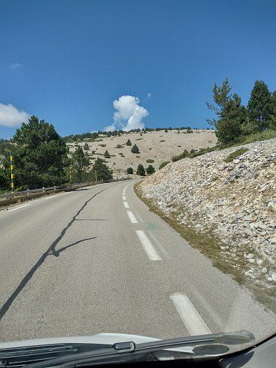
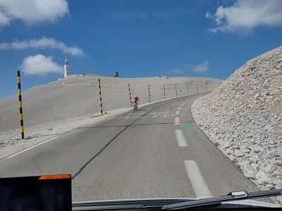
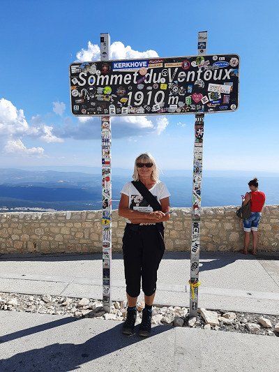
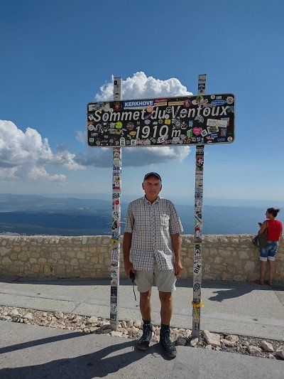
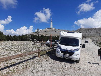
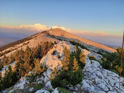
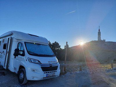
"Le Mont Ventoux" (1910 m) the sacred mountain is a myth, the summit road is often a stage of the Tour de France, the panoramic view over Provence was unfortunately not that great today. In the most beautiful sunshine - and a clear view of the summit, we found a parking lot, where we also stay overnight. The gravel place with some large stones is free and sloping. Towards the late afternoon, the parking lot emptied and we made a change of place on which our camper was leveler. But the sacred mountain of Provence soon made its mark as Mons Ventosus (lat. "windy mountain").
The sunset was gorgeous, a starry sky that you don't get to see every day and the silence at night with the sunrise over Le Mont Ventoux the next morning.
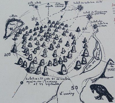
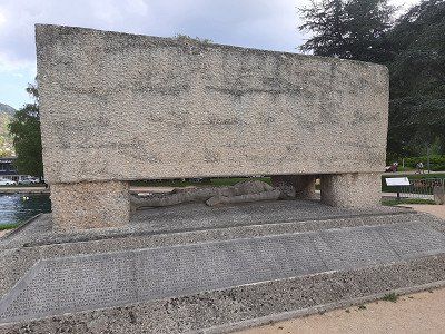
On leaving Vaison-la-Romaine, on the left, there are 81 fascinating menhirs. 81 stones are set, 9 of which bear the names of European cities of culture: Reykjavik, Bergen, Helsinki, Prague, Kraków, Bologna, Avignon and Saint Jacques - de - Compostela. Each is engraved with a verse from a poet from that city. And on the 72 remaining stones, a poem is engraved every June 21st, so this work is universal. Nothing has been improvised, the stones are not randomly laid, but respect the golden numbers and algorithmic measurements. If the sphinx appears, she will help solve the riddle, she has the bust and head of a woman, a good body and eagle wings.
This site, made up of 81 large granite stones, is all inscribed with the inscription of poems and messages in memory of those who died after the terrible flooding of the L'Ouvéze river campsite on September 22, 1992. A place of remembrance. These stones erected by heaven have since invited to meditate in a garden where the alchemy of numbers creates a unique space of its kind.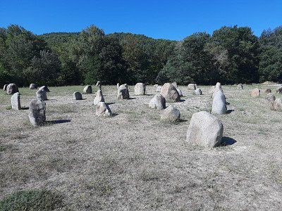
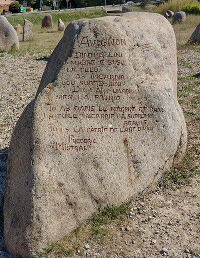
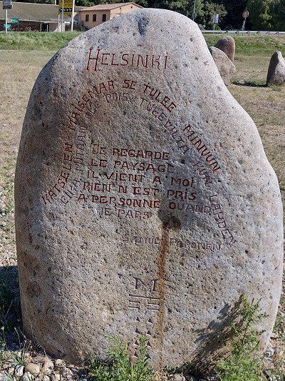
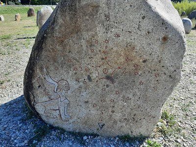
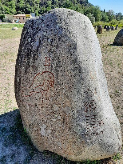
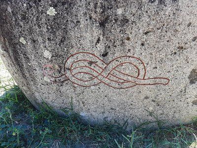
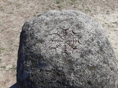
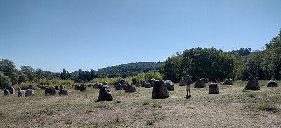
On leaving Vaison-la-Romaine, on the left, there are 81 fascinating menhirs. 81 stones are set, 9 of which bear the names of European cities of culture: Reykjavik, Bergen, Helsinki, Prague, Kraków, Bologna, Avignon and Saint Jacques - de - Compostela. Each is engraved with a verse from a poet from that city. And on the 72 remaining stones, a poem is engraved every June 21st, so this work is universal. Nothing has been improvised, the stones are not randomly laid, but respect the golden numbers and algorithmic measurements. If the sphinx appears, she will help solve the riddle, she has the bust and head of a woman, a good body and eagle wings.
This site, made up of 81 large granite stones, is all inscribed with the inscription of poems and messages in memory of those who died after the terrible flooding of the L'Ouvéze river campsite on September 22, 1992. A place of remembrance. These stones erected by heaven have since invited to meditate in a garden where the alchemy of numbers creates a unique space of its kind.We had chosen the pitch as a place to stay, Gps: 44.96011, 4.8473 because there is no pitch in Valence.
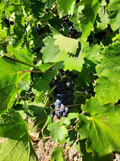
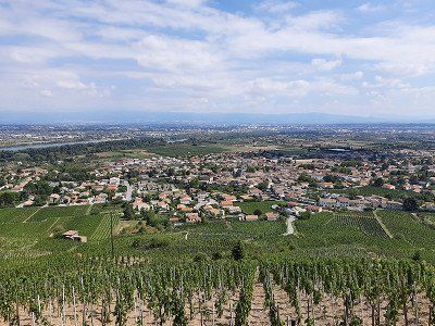
The plan was to explore Valence from the square. When we saw the Cornas wine region, we decided to go on a vineyard hike instead of visiting Valence.
The municipality of Cornas on the Rhône gives its name to the Cornas wine-growing region.
We had chosen the pitch as a place to stay, Gps: 44.96011, 4.8473 because there is no pitch in Valence.
The plan was to explore Valence from the square. When we saw the Cornas wine region, we decided to go on a vineyard hike instead of visiting Valence.
The municipality of Cornas on the Rhône gives its name to the Cornas wine-growing region.
The municipality of Cornas on the Rhône gives its name to the Cornas wine-growing region.
Syrah is the only permitted grape variety.
When young, the wines are quite tart and rich in tannins; they should be stored for at least 3 years. Very good wines from an excellent vintage only show their full potential after 15 years.
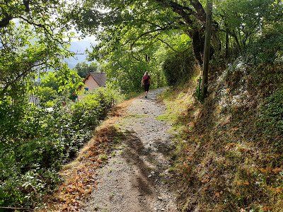
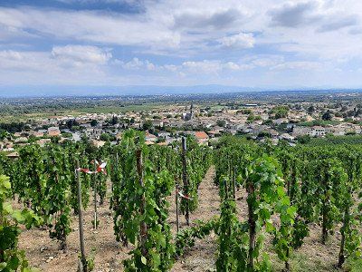
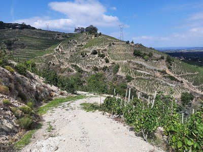
The area between the hills is traversed by 11 streams, which often mark the boundaries of the individual layers. On the way through the vineyards, it was always up and down.
We followed a marker that we believed would lead us through the wine-growing region. Often the markings were missing at the forks in the path and a while later on the path there was again the sign that showed us the direction of the path.
In the end we came to a dead end, we didn't want to go back, so we had to descend a very steep hillside to a stream, along which a path led to the village.
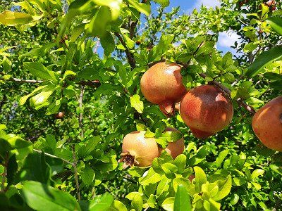
Pomegranates by the wayside
The municipality of Cornas on the Rhône gives its name to the Cornas wine-growing region.
Syrah is the only permitted grape variety.
When young, the wines are quite tart and rich in tannins; they should be stored for at least 3 years. Very good wines from an excellent vintage only show their full potential after 15 years.
The area between the hills is traversed by 11 streams, which often mark the boundaries of the individual layers. On the way through the vineyards, it was always up and down.
We followed a marker that we believed would lead us through the wine-growing region. Often the markings were missing at the forks in the path and a while later on the path there was again the sign that showed us the direction of the path.
In the end we came to a dead end, we didn't want to go back, so we had to descend a very steep hillside to a stream, along which a path led to the village.
Pomegranates by the wayside
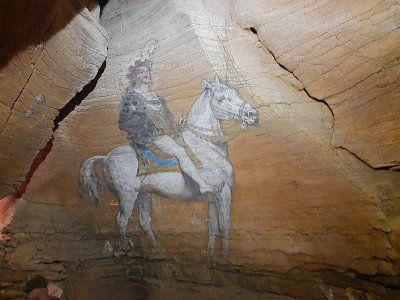
Natural, narrow labyrinths, through which one had to squeeze oneself during the tour, an underground lake, an amphitheater of small pools, stalagmites, stalactites form the landscape of the cave. The cave can be visited since 1807, revealing its history and secrets in the 1,000 meters of underground galleries.
It was very cool inside, which was nice in this hot weather.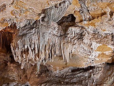


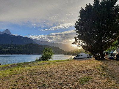
Surrounded by high limestone mountains, Lake Nantua is a 141-hectare glacial lake fed by numerous springs. The deep water (45m) shines in colors between blue and dark green. The parking space was right on the water, which was well occupied and there was still a free space for us. The €10 fee will be collected by an official the following day between 8 a.m. and 9 a.m.
Immediately after our arrival we went for a swim in the beautiful lake.
In the late afternoon we explored the town, which is not far from the lake. An almost deserted city and hardly any people on the street during our foray through the town. Pass the deportee memorial 'Tombeau de pierre' (stone grave) depicting a reclining figure (le Gisant). A symbol for the mass deaths in the Nazi era in 1943.
Visit of the Saint-Michel abbey church, with its main altar decorated with marble angels, the famous painting by Eugène Delacroix showing the martyrdom of Saint Sebastian, the Saint Anne chapel is a Gothic jewel of the abbey church with some Renaissance details and the 19th century organ by Nicolas-Antoine Lété.
Route
Show newest first- 48.2079 8.7537
- 48° 12' 28.6" N 8° 45' 13.4" E
- 46.3551 6.4269
- 46° 21' 18.5" N 6° 25' 36.7" E
- 45.6923 5.909
- 45° 41' 32.4" N 5° 54' 32.4" E
- 45.1885 5.7245
- 45° 11' 18.7" N 5° 43' 28.3" E
- 45.0246 5.7727
- 45° 1' 28.6" N 5° 46' 21.5" E
- 44.9065 5.7845
- 44° 54' 23.5" N 5° 47' 4.3" E
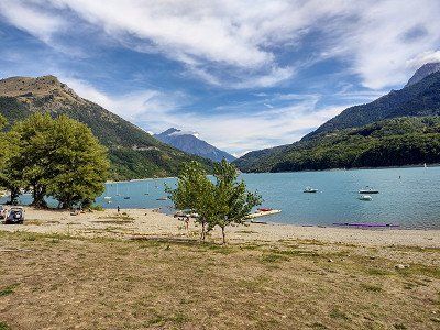
- 44.5596 6.0798
- 44° 33' 34.7" N 6° 4' 47.1" E
- 44.1947 5.9432
- 44° 11' 41" N 5° 56' 35.5" E
- 44.0794 6.2619
- 44° 4' 46" N 6° 15' 43" E
- 43.7993 6.4024
- 43° 47' 57.3" N 6° 24' 8.5" E
- 43.7795 6.3418
- 43° 46' 46.2" N 6° 20' 30.6" E
Ein wirkliches Meisterwerk des Straßenbaus erkunden wir heute mit dem Rad "die Route des Cretes" D23, die erst 1973 in größerer Höhe sogar bis 1300 m als Touristenstraße erstellt wurde.
Achtung die D23 ist nur in Uhrzeigerrichtung befahrbar (Einbahnstraße).
Die vielen Ausblicke der zahlreichen Aussichtspunkte zu genießen, war mit dem Rad kein Problem im Gegensatz zu den Autos die kaum eine Parkplatz hatten um einen Stopp einzulegen.
- 43.5297 5.4474
- 43° 31' 47.1" N 5° 26' 50.7" E
- 43.2151 5.5371
- 43° 12' 54.5" N 5° 32' 13.6" E
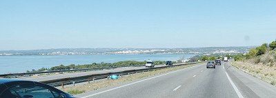
Die Route des Crêtes, die 15 km lange Kammstraße (Küstenstraße)
ist einfach fantastisch! Sie steigt von Meeresspiegelhöhe innerhalb weniger Kilometer bis auf knapp 400 m an.
Faszinierender Blick von den Felsen auf das Meer und bis zu den Inseln vor Marseille.
Hoch über Cassis führt die Straße (D559) von Cassis nach Marseille, durch den Nationalpark Calanques. Auf der Fahrt genießt man sehr schöne Aussichten und Landschaften im weißen Kalkstein.
- 43.9493 4.8055
- 43° 56' 57.5" N 4° 48' 19.9" E
- 43.9023 5.2929
- 43° 54' 8.3" N 5° 17' 34.6" E
- 44.1741 5.2722
- 44° 10' 26.6" N 5° 16' 19.8" E
- 44.241 5.0752
- 44° 14' 27.5" N 5° 4' 30.7" E
- 44.9637 4.8474
- 44° 57' 49.4" N 4° 50' 50.6" E
Die Gemeinde Cornas an der Rhône gibt dem Weinbaugebiet
Cornas ihren Namen.
Syrah ist die einzige zugelassene Rebsorte.
Die Weine sind in ihrer Jugend recht herb und gerbstoffreich; sie sollten
mindestens 3 Jahre gelagert werden. Sehr gute Weine eines
hervorragenden Jahrgangs zeigen erst nach 15 Jahren ihre ganze Fülle.
Das Gebiet zwischen den Hügeln wird von 11 Bächen durchzogen, die häufig die
Grenzen der einzelnen Lagen markieren. Auf dem Weg durch die Weinberge ging es
dementsprechend immer rauf und runter.
Wir folgten einer Markierung mit der wir glaubten sie führt uns durch das
Weinbaugebiet. Oft fehlte die Markierung an den Weggabelungen und eine Zeit
später des Weges gab es wieder das Zeichen, dass uns die Wegrichtung zeigte.
Zum Schluß gerieten wir in eine Sackgasse, zurück wollten wir nicht gehen,
somit mussten wir einen sehr steilen Rebhang zu einem Bachlauf absteigen, an
dem entlang ein Weg ins Ort führte.
Granatäpfel am Wegesrand
- 45.8518 5.3373
- 45° 51' 6.5" N 5° 20' 14.4" E
- 45.5256 4.8743
- 45° 31' 32.1" N 4° 52' 27.6" E
- 46.0806 5.4649
- 46° 4' 50" N 5° 27' 53.6" E
- 46.1534 5.6078
- 46° 9' 12.3" N 5° 36' 27.9" E
- 48.1653 8.6285
- 48° 9' 54.9" N 8° 37' 42.4" E
Travelogue
The journey went via Waldshut-Tiengen and Brugg to Burgdorf. When we arrived at the parking lot at the Schützenhaus, it started to rain. We used this time for our coffee break. It was only a short rain shower after which the castle and the town were visited.
It was the Zähringer family who built a castle on a rocky outcrop on the left bank of the Emmen. Burgdorf Castle is now the city's landmark. Burgdorf is surrounded by the Emme, which flows around the town in a wide arc to the east. Burgdorf is also called the "Gateway to the Emmental".
The village of Anthy-sur-Léman is slightly elevated above the southern shore of Lake Geneva. The approach to the parking space was a little difficult due to construction sites. We found a small place with 6 places, on which only one camper was standing. (From 6 p.m. to 8 a.m. free of charge) From the square you had a view of the lake in which Irmgard immediately went swimming. We ended the day with a walk along the lake shore and through the village.
The night was very quiet, we had slept well, it had rained occasionally during the night. In the morning before 8 a.m. we started our onward journey.
The pitch that was approached was occupied, we were not the only mobile home that drove to the place at this time. Quickly emptied the toilet cassette and tried again to find a parking space. It was Saturday and accordingly the traffic in the city was on the move. In addition, our GPS sent us twice in the wrong direction. One must not lose hope and we found a parking space at the top of Annecy Cathedral, where there were already many mobile homes. We stood directly under the church tower. We also made our way to the old town on foot. Annecy is known as the "Venice of the Alps" and the crystal-clear Lac d'Annecy with the pretty plane tree promenade on the north bank has a lot to do with it. It invades the old town with two major watercourses, the artificial Canal du Vassé and the branching Thiou river. The result is quays adorned with flowers, a river island with the 900-year-old Palais de l'île, and bridges and jetties.
The pitch that was approached was occupied, we were not the only mobile home that drove to the place at this time. Quickly emptied the toilet cassette and tried again to find a parking space. It was Saturday and accordingly the traffic in the city was on the move. In addition, our GPS sent us twice in the wrong direction. One must not lose hope and we found a parking space at the top of Annecy Cathedral, where there were already many mobile homes. We stood directly under the church tower. We also made our way to the old town on foot. Annecy is known as the "Venice of the Alps" and the crystal-clear Lac d'Annecy with the pretty plane tree promenade on the north bank has a lot to do with it. It invades the old town with two major watercourses, the artificial Canal du Vassé and the branching Thiou river. The result is quays adorned with flowers, a river island with the 900-year-old Palais de l'île, and bridges and jetties.
Made a swim stop. The city used to be a well-visited spa town. We were able to park the mobile home in the parking lot by the lake. The lake has a pebble beach and the water level is quite shallow, you have to go far into the lake to swim. We didn't stay long and continued to Grenoble.
Made a swim stop. The city used to be a well-visited spa town. We were able to park the mobile home in the parking lot by the lake. The lake has a pebble beach and the water level is quite shallow, you have to go far into the lake to swim. We didn't stay long and continued to Grenoble.
We had primarily chosen Grenoble as a place to stay overnight. On the way to Grenoble we saw areas where there were forest fires. We reached the campsite with a little detour, just before the campsite the road was closed and I followed the instructions on the navigation system, it would have been easier if I had followed the detour signs.
The size of the campsite was okay. We did nothing more that day. The campsite was a 50 minute walk from the old town.The night was quiet and the next morning we got out of bed early, we still wanted to visit the old town of Grenoble in the morning. It was a sightseeing tour on time, we had to leave the site at 12 noon.
We headed towards the old town with a view of the Fort de la Bastille (19th century), which lies on a ledge below the confluence of the Drac and Isère.
The Cathedral of Notre-Dame. A massive 11C square tower directly above the entrance portal is the focal point of the five-nave cathedral, whose origins date back to the 10C.
Ancien Palais Palace: The Old Palace was built at the beginning of the 16th century as the Parliament of Savoy (Ancien Palais du Parlement dauphinois) and has been rebuilt and expanded several times.
On the way to La Mure we passed the small village of Laffrey.
Napoleon's troops and those of his opponents met here. Here Napoleon is said to have won over enemy troops with a courageous speech. Napoleon allegedly entered the royal troops with the words "If among you soldiers there is one who wants to kill his emperor, here I am!" opposite to. After some hesitation, shouts of "Vive l'Empereur - long live the Emperor" - made it clear that the opponents were joining Napoleon's troops.
A large equestrian statue of Napoléon commemorates this episode.
Four lakes can be seen near Laffrey on the high plateau, the Grand Lac de Laffrey being the largest of them.
Next, La Mure is traversed. The village is the terminus of the Chemin de fer de la Mure narrow-gauge railway, which runs from La Mure in countless hairpin bends and tunnels down to the SNCF train station at Saint-Georges-de-Commiers. We stopped at La Mure on the Napoleon Road, in the heart of the Matheysin Plateau, 800 meters above sea level. We parked in the parking lot at the tourist center in front of the city, where there was also the opportunity to ride the historical railway. There were several interesting buildings to see in downtown La Mure. The imposing town hall, the clock tower, the old market and the Chateau Herbelon.
After our tour and coffee break, we continued our journey, but not through the old town but used the developed bypass road, from which one can enjoy a sweeping view of the rising Alpine scenery.
The access to the lake was on a narrow road that can only be driven in one direction. The entrance to the campsite has a tight curve, which we would not have been able to drive without maneuvering. At first it was said that the campsite was occupied, you had to register in advance. Suddenly it worked and we got a beautiful parking space on the water. The campsite's terrain is sloping but the pitches are reasonably level. The sanitary facilities are not a luxury. Irmgard then immediately went swimming in the lake, the water temperature was estimated at 21°C.
Towards evening we went for a long walk to the village of Corps with the Saint Roch chapel, from which we had a beautiful view of the lake (Lac du Sautet). The footpath ran steeply uphill through oak and beech forest, there and back it was about 7 km on the same path.After dinner we sat outside and enjoyed the lake with the surrounding mountains.
The night got cooler, we are at 1000 m above sea level.
A photo stop is a must on the way to GAP.
At the indoor pool was the designated parking space (free of charge). We had to walk to the city center on a two-kilometer-long avenue. The many trees donated a little shade, so that the great heat was bearable.
There isn't much historical architecture to see in the city. There was a wealth of interesting things to see in the streets. The city's medieval cathedral began to collapse in the 19th century, so a neo-Gothic replacement was built in its place and completed in 1904.
Napoleon spent the night of March 5, 1815 here on his way from Elba exile to Paris, just before the Hundred Days.
He chose this detour through GAP; because this city, in contrast to the cities in the Rhone Valley, remained loyal to him rather than to the French kings.
Napoleon passed through the town of Sisteron on his famous return from exile on Elba.
Sisteron is the gateway to Provence and a small tourist town. Already at the entrance to the city there were crowds of people, the parking space right at the entrance was occupied. The second variant was the parking space at the cemetery, to which we could not find the access road. By chance we saw a parking lot where there was also a mobile home, to which we stood. It was only a few minutes to the old town. The old town of Sisteron which is picturesque with narrow streets lined with old houses and an abundance of fountains. Notable monuments include the bell tower and the 12th-century Notre-Dame Cathedral. After visiting the old town, the citadel on the rocky hillside, originally from the 11th century, is worth a visit. During our walk on the viewing rock, we also saw the parking space at the cemetery where two campers were parked. The access to the parking space looked more difficult for us, the narrow streets are easy to drive on.
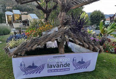
Before our stage destination in Dingle les Bains we went shopping at the discounter. When we arrived at the parking space, there were two WoMos, then the mobile homes came one after the other. We arrived in time to get a seat. It was oppressively hot 34°C. First we lowered all the blinds on the sunny side. It was too hot to go to the old town. After dinner we went for a walk to the old town. A nice bike and footpath led along the Bléone river to the town about 10 minutes walk. The streets of the old town were deserted, only a few people were sitting in a small restaurant or bar.
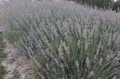
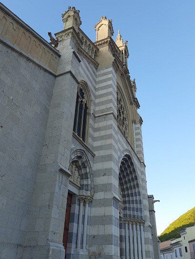
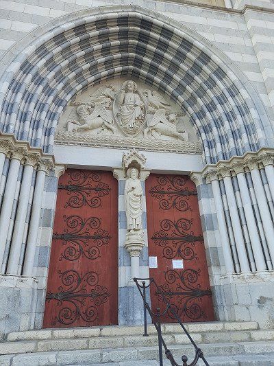
The Notre-Dame-du-Bourg cathedral in Romanesque style from the 11th to the 13th centuries. Saint-Jerôme Cathedral is a more recent construction and is a 15th-16th century Gothic building. Century (although the facade was rebuilt in the 19th century). Cathedral with a beautiful portal was already closed. Dingle les Bains is the self-proclaimed capital of lavender. Especially between the end of June and mid-August you can experience the landscape in the fragrant purple of the medicinal plant. Then we went back to the WoMo, where we enjoyed the evening outside in a mild breeze.
Before our stage destination in Dingle les Bains we went shopping at the discounter. When we arrived at the parking space, there were two WoMos, then the mobile homes came one after the other. We arrived in time to get a seat. It was oppressively hot 34°C. First we lowered all the blinds on the sunny side. It was too hot to go to the old town. After dinner we went for a walk to the old town. A nice bike and footpath led along the Bléone river to the town about 10 minutes walk. The streets of the old town were deserted, only a few people were sitting in a small restaurant or bar.
The Notre-Dame-du-Bourg cathedral in Romanesque style from the 11th to the 13th centuries. Saint-Jerôme Cathedral is a more recent construction and is a 15th-16th century Gothic building. Century (although the facade was rebuilt in the 19th century). Cathedral with a beautiful portal was already closed. Dingle les Bains is the self-proclaimed capital of lavender. Especially between the end of June and mid-August you can experience the landscape in the fragrant purple of the medicinal plant. Then we went back to the WoMo, where we enjoyed the evening outside in a mild breeze.
In Castellane we went into the Verdon Gorge.
In Castellane we went into the Verdon Gorge.
The campsite was today's destination. From there we could cycle the Route des Cretes. The Route des Cretes can be traveled by car, mobile home or by bicycle. We decide to go on a bike tour in order to be able to fully enjoy this great landscape.
Shortly after the village of Palud sur Verdon, this legendary route branches off to the right and winds its way up the mountain, curve after curve. The weather is kind to us, white blue skies and a cool breeze give us an incomparable bike tour. We were comfortably on the road for about 2.5 hours - about until we returned to the mobile home. The campsite was today's destination. From there we could cycle the Route des Cretes. The Route des Cretes can be traveled by car, mobile home or by bicycle. We decide to go on a bike tour in order to be able to fully enjoy this great landscape.
Shortly after the village of Palud sur Verdon, this legendary route branches off to the right and winds its way up the mountain, curve after curve. The weather is kind to us, white blue skies and a cool breeze give us an incomparable bike tour. We were comfortably on the road for about 2.5 hours - about until we returned to the mobile home.Today we explore a real masterpiece of road construction with the bike "the Route des Cretes" D23, which was only built in 1973 at a higher altitude, even up to 1300 m as a tourist road.
Attention , the D23 is only passable in a clockwise direction (one-way street) .
Enjoying the many views from the numerous vantage points was no problem with the bike, in contrast to the cars, which hardly had a parking space to make a stop.
Today we explore a real masterpiece of road construction with the bike "the Route des Cretes" D23, which was only built in 1973 at a higher altitude, even up to 1300 m as a tourist road.
Attention , the D23 is only passable in a clockwise direction (one-way street) .
Enjoying the many views from the numerous vantage points was no problem with the bike, in contrast to the cars, which hardly had a parking space to make a stop.
Approached the paid parking lot at the cemetery (GPS: 43.52281, 5.46136), we weren't the only camper that parked here. We were lucky with the parking fee, the ticket machine was broken. Going downtown was only a 15 minute walk. We came to a well-kept Provençal old town. Really lively, many restaurants. But fewer real sights. A beautiful fountain at the beginning of the promenade "Fontaine de La Rotonde".
The imposing Cathédrale St - Sauveur with its late Gothic west facade was rebuilt over centuries and was another focal point through the old town. The Cloître St - Sauveur cloister with arcades and double columns was built around 1170.The town hall and elegant city palace frame the square in the center of the old town. The Tour de l'Horloge clock tower, built in 1505, crowned by a filigree bell cage with gallery. The astronomical clock with personifications of the four seasons dates from the 17th century.
The enormous heat that day made us end our visit to the city early.
In Cassis we drove to the campsite where we could stay for the night (Gps;43.21349, 5.53781). The place was big enough, with pebbles. We used the power connection to charge our e-bike batteries. The fridge was malfunctioning when we came back from our bathing stay, the display showed the error code I10 (voltage not in the 200-260 volt range). The main thing was that the batteries were charged, the refrigerator continued to run on gas.
A walk through the small streets dominated by a castle is part of a visit to Cassis. The medieval fortress dates from the 17th - 19th centuries and was used as a military fort. The castle is now privately owned
The Route des Crêtes, the 15 km ridge road (coastal road)
is simply fantastic! It rises from sea level within a few kilometers to almost 400 m.
Fascinating view from the rocks to the sea and to the islands in front of Marseille.
The Route des Crêtes, the 15 km ridge road (coastal road)
is simply fantastic! It rises from sea level within a few kilometers to almost 400 m.
Fascinating view from the rocks to the sea and to the islands in front of Marseille.
High above Cassis, the road (D559) runs from Cassis to Marseille, through the Calanques National Park. On the way you can enjoy very nice views and landscapes in the white limestone.
High above Cassis, the road (D559) runs from Cassis to Marseille, through the Calanques National Park. On the way you can enjoy very nice views and landscapes in the white limestone.
Pitch in Avignon approached Gps: 43.95608, 4.8002, was pretty empty. Chargeable. The course is on the Rhone Island.
Tour of the old townOur RV park was the starting point for a tour of the city center. Crossing the Rhone, we had our first glimpse of the papal city with its stunning four kilometer long city fortifications (city walls) and the Avignon Bridge. The Saint-Bénézet bridge is the symbol of the city of Avignon. With only part of the bridge remaining today, it is hard to imagine that for a time it was the only legal route of communication between the Kingdom of France and the Papal States. We skipped the bridge and headed towards the Place de l'Horloge, which was only a stone's throw away. In the center of this old Avignon square stands the Town Hall, which was first fitted with a clock in the 15th century. Avignon became a haven for the popes in the 14th century. In the papal palace, seven heads of the church resided one after the other, which we came across on our tour. Next to it is the Basilique Saint-Pierre. This 14th-century church is rightly considered by many to be Avignon's most beautiful church. Its Gothic style and facades of intricately carved stone. We then visited the Jardin des Doms and strolled through the enchanting park while the Avignon Bridge lay at our feet. We were amazed when we also saw Mont Ventoux. The giant with the white dome proudly looms over the hilly landscape of Avignon.
We ended the tour with the main shopping street and went back to the mobile home outside the city fortifications. The culmination of the day was the ride on the Ferris wheel, from which we could see the papal city from above.
Parked in the parking lot Gps:43.8962, 5.2963, which is also designated for RVs. Fee 3.-€
A hike to the ocher rocks was on our journey today. The 2.5 hour hike that was planned went in the direction of the ocher museum and in the hinterland of Roussillon to individual ocher rocks. Because of the extreme heat (32°C) we chose the shorter version of the hike at the ocher museum, which also led to the well-known rocks shown in the pictures. First we made a tour through the streets of Roussillon in the hustle and bustle of the many tourists, then we went to the ocher rocks. Admission €3. The ocher rocks made a beautiful picture with their different ocher colors. After the tour of the rock formations, the soles of the shoes were stained with the ocher sand that was no longer easy to remove.
After returning to the WoMo we drove off straight away, it was too hot for us to take a break, meanwhile the temperature had risen to 34°C around noon.
"Le Mont Ventoux" (1910 m) the sacred mountain is a myth, the summit road is often a stage of the Tour de France, the panoramic view over Provence was unfortunately not that great today. In the most beautiful sunshine - and a clear view of the summit, we found a parking lot, where we also stay overnight. The gravel place with some large stones is free and sloping. Towards the late afternoon, the parking lot emptied and we made a change of place on which our camper was leveler. But the sacred mountain of Provence soon made its mark as Mons Ventosus (lat. "windy mountain").
The sunset was gorgeous, a starry sky that you don't get to see every day and the silence at night with the sunrise over Le Mont Ventoux the next morning.
On leaving Vaison-la-Romaine, on the left, there are 81 fascinating menhirs. 81 stones are set, 9 of which bear the names of European cities of culture: Reykjavik, Bergen, Helsinki, Prague, Kraków, Bologna, Avignon and Saint Jacques - de - Compostela. Each is engraved with a verse from a poet from that city. And on the 72 remaining stones, a poem is engraved every June 21st, so this work is universal. Nothing has been improvised, the stones are not randomly laid, but respect the golden numbers and algorithmic measurements. If the sphinx appears, she will help solve the riddle, she has the bust and head of a woman, a good body and eagle wings.
This site, made up of 81 large granite stones, is all inscribed with the inscription of poems and messages in memory of those who died after the terrible flooding of the L'Ouvéze river campsite on September 22, 1992. A place of remembrance. These stones erected by heaven have since invited to meditate in a garden where the alchemy of numbers creates a unique space of its kind. On leaving Vaison-la-Romaine, on the left, there are 81 fascinating menhirs. 81 stones are set, 9 of which bear the names of European cities of culture: Reykjavik, Bergen, Helsinki, Prague, Kraków, Bologna, Avignon and Saint Jacques - de - Compostela. Each is engraved with a verse from a poet from that city. And on the 72 remaining stones, a poem is engraved every June 21st, so this work is universal. Nothing has been improvised, the stones are not randomly laid, but respect the golden numbers and algorithmic measurements. If the sphinx appears, she will help solve the riddle, she has the bust and head of a woman, a good body and eagle wings.
This site, made up of 81 large granite stones, is all inscribed with the inscription of poems and messages in memory of those who died after the terrible flooding of the L'Ouvéze river campsite on September 22, 1992. A place of remembrance. These stones erected by heaven have since invited to meditate in a garden where the alchemy of numbers creates a unique space of its kind.We had chosen the pitch as a place to stay, Gps: 44.96011, 4.8473 because there is no pitch in Valence.
The plan was to explore Valence from the square. When we saw the Cornas wine region, we decided to go on a vineyard hike instead of visiting Valence.
The municipality of Cornas on the Rhône gives its name to the Cornas wine-growing region.
We had chosen the pitch as a place to stay, Gps: 44.96011, 4.8473 because there is no pitch in Valence.
The plan was to explore Valence from the square. When we saw the Cornas wine region, we decided to go on a vineyard hike instead of visiting Valence.
The municipality of Cornas on the Rhône gives its name to the Cornas wine-growing region.
The municipality of Cornas on the Rhône gives its name to the Cornas wine-growing region.
Syrah is the only permitted grape variety.
When young, the wines are quite tart and rich in tannins; they should be stored for at least 3 years. Very good wines from an excellent vintage only show their full potential after 15 years.
The area between the hills is traversed by 11 streams, which often mark the boundaries of the individual layers. On the way through the vineyards, it was always up and down.
We followed a marker that we believed would lead us through the wine-growing region. Often the markings were missing at the forks in the path and a while later on the path there was again the sign that showed us the direction of the path.
In the end we came to a dead end, we didn't want to go back, so we had to descend a very steep hillside to a stream, along which a path led to the village.
Pomegranates by the wayside
Natural, narrow labyrinths, through which one had to squeeze oneself during the tour, an underground lake, an amphitheater of small pools, stalagmites, stalactites form the landscape of the cave. The cave can be visited since 1807, revealing its history and secrets in the 1,000 meters of underground galleries.
It was very cool inside, which was nice in this hot weather.
Surrounded by high limestone mountains, Lake Nantua is a 141-hectare glacial lake fed by numerous springs. The deep water (45m) shines in colors between blue and dark green. The parking space was right on the water, which was well occupied and there was still a free space for us. The €10 fee will be collected by an official the following day between 8 a.m. and 9 a.m.
Immediately after our arrival we went for a swim in the beautiful lake.
In the late afternoon we explored the town, which is not far from the lake. An almost deserted city and hardly any people on the street during our foray through the town. Pass the deportee memorial 'Tombeau de pierre' (stone grave) depicting a reclining figure (le Gisant). A symbol for the mass deaths in the Nazi era in 1943.
Visit of the Saint-Michel abbey church, with its main altar decorated with marble angels, the famous painting by Eugène Delacroix showing the martyrdom of Saint Sebastian, the Saint Anne chapel is a Gothic jewel of the abbey church with some Renaissance details and the 19th century organ by Nicolas-Antoine Lété.
Comments (0)
Comments from Freeontour users