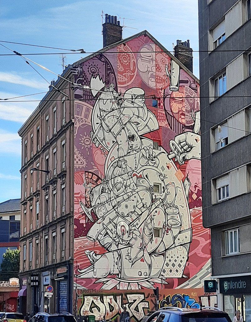
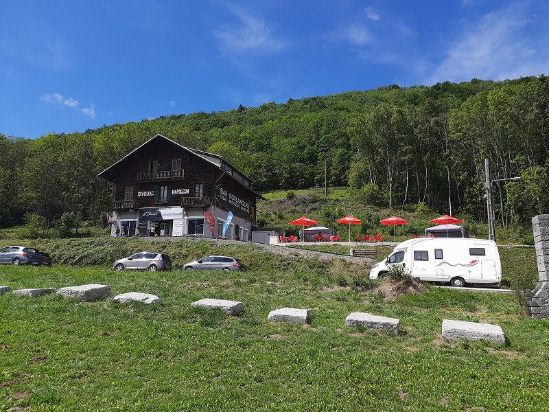
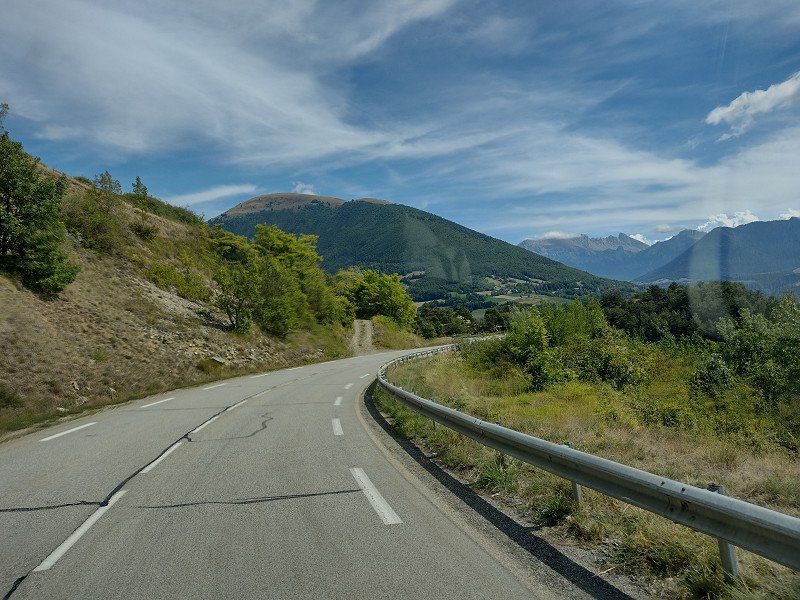
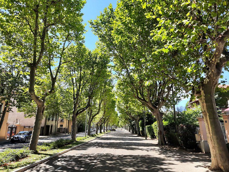
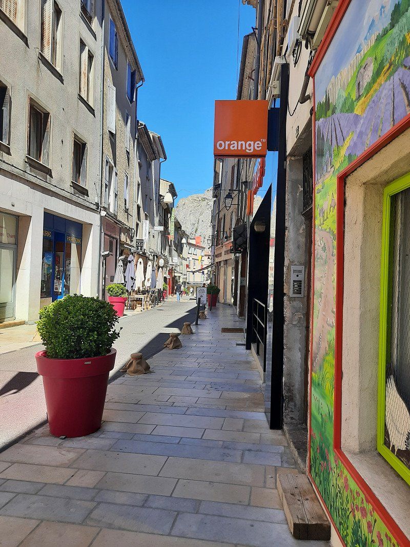
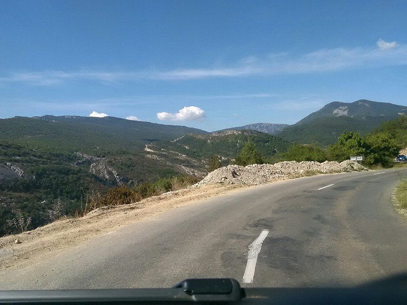
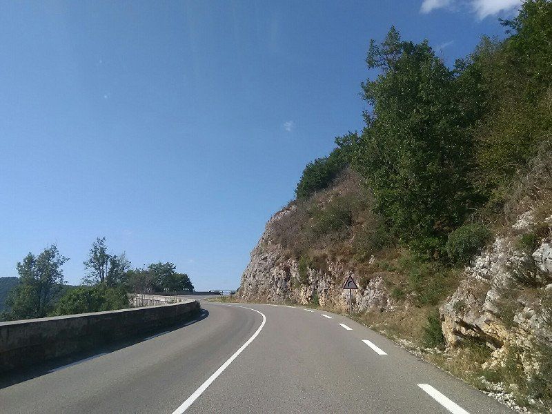
The Route Napoleon took us through many picturesque landscapes, lakes and towns to Castellane on well-developed roads. At Castellane we left the N85 and continued to Provence.
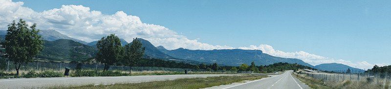
We drove 2300 km over beautiful mountains, the Le Mont Ventoux, bathed in beautiful lakes, marveled at the Grand Canyon du Verdon, visited beautiful places (cities) and always discovered a lot of new things.
In 1814 Napoleon was exiled to the island of Elba. He returned the following year with a handful of followers, a small army of about 1,200 soldiers, and a plan to overthrow the newly restored monarchy under King Louis XVIII. back from exile.
Day
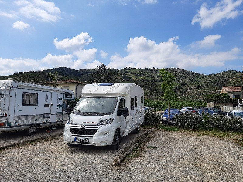
Rottweiler Straße
Schömberg, Deutschland
48° 12' 28.6" N 8° 45' 13.4" E
48.2079494 8.7537212
• Head toward Moos on Rottweiler Straße (B27). Go for 12.0 km.
• Take the 2nd exit from roundabout onto B27 toward Tuttlingen/Schramberg/Villingen-Schwenningen/Rottweil/B14/Stadtmitte/Gewerbegebiet Neckartal/Gewerbegebiet Saline/Süd/Gewerbegebiet Zimmern o.R. Go for 364 m.
• Take the 1st exit from roundabout onto B27 toward Rottweil/Schramberg/B14. Go for 321 m.
• Continue on B14 toward Tuttlingen/Villingen-Schwenningen/Rottweil-West/Gewerbegebiet Saline/Süd/Krankenhaus/B27. Go for 49 m.
• Take left ramp toward Tuttlingen/Villingen-Schwenningen/Rottweil-West/Gewerbegebiet Saline/Süd/Krankenhaus/B27. Go for 568 m.
• Continue on B14. Go for 5.2 km.
• Take ramp onto B27 toward A81/Villingen-Schwenningen/Deißlingen. Go for 16.3 km.
• Continue toward Schaffhausen/Donaueschingen/Bad Dürrheim. Go for 57 m.
• Turn slightly left onto B27/B33. Go for 23.4 km.
• Take the 2nd exit from roundabout onto Schaffhauser Straße (B27) toward Schaffhausen/Waldshut-Tiengen/Gewerbegebiet Vogelherd. Go for 213 m.
• Turn right onto Waldshuter Straße (L214) toward Fützen/Epfenhofen/Gewerbegebiet Vogelherd. Go for 758 m.
• Take the 2nd exit from roundabout onto Waldshuter Straße (L214). Go for 326 m.
• Continue on L214. Go for 1.6 km.
• Take ramp onto B314 toward Waldshut-Tiengen. Go for 27.9 km.
• Take the 1st exit from roundabout onto A98 toward Schaffhausen/B34/Klettgau. Go for 343 m.
• Continue on B34. Go for 2.8 km.
• Turn right onto L162 toward Zurzach/Küssaberg. Go for 5.1 km.
• Take the 2nd exit from roundabout onto Zurzacher Straße (L162). Go for 592 m.
• Continue toward Zürcherstrasse. Go for 59 m.
• Continue on Zürcherstrasse. Go for 27 m.
• Turn right onto Zürcherstrasse. Go for 176 m.
• Turn left onto Ostumfahrung Zurzach. Go for 720 m.
• Continue on Bruggerstrasse. Go for 1.6 km.
• Continue on Zurzibergstrasse. Go for 1.4 km.
• Take the 2nd exit from roundabout onto Zurzibergstrasse. Go for 544 m.
• Turn right onto Staltig. Go for 225 m.
• Continue on Steig. Go for 262 m.
• Continue on Würenlingerstrasse. Go for 2.9 km.
• Continue on Tegerfelderstrasse. Go for 1.4 km.
• Continue on Breitenstrasse. Go for 860 m.
• Continue on Siggenthalerstrasse. Go for 180 m.
• Take the 2nd exit from roundabout onto Siggenthalerstrasse. Go for 699 m.
• Turn left onto Döttingerstrasse (5). Go for 386 m.
• Turn right onto Stillistrasse (5) toward Bern/Luzern/Aarau/Brugg/Hard. Go for 2.8 km.
• Take the 2nd exit from roundabout onto Zurzacherstrasse (5). Go for 2.0 km.
• Turn left onto Aarauerstrasse (3/5). Go for 491 m.
• Turn left onto Badenerstrasse (3). Go for 201 m.
• Take the 2nd exit from roundabout onto Zürcherstrasse (3). Go for 440 m.
• Take the 1st exit from roundabout onto Hauserstrasse. Go for 631 m.
• Take the 2nd exit from roundabout onto Hauserstrasse. Go for 521 m.
• Take the 2nd exit from roundabout onto Zubringer Hausen. Go for 278 m.
• Take ramp onto Zubringer Hausen. Go for 2.0 km.
• Continue on Lenzburgerstrasse. Go for 3.4 km.
• Take the 3rd exit from roundabout onto A1 toward Bern. Go for 37.2 km.
• Continue on A1 (Härkingen) toward E25/Lausanne/Bern/Biel/Bienne/Oensingen. Go for 35.1 km.
• Take exit 39 toward Kirchberg/Alchenflüh/Langnau i.E./Burgdorf. Go for 912 m.
• Pass 6 roundabouts and continue on Gotthelfstrasse (23). Go for 5.0 km.
• Turn right onto Metzgergasse. Go for 6 m.
• Turn slightly right onto Metzgergasse. Go for 286 m.
• Turn right onto Technikumstrasse. Go for 20 m.
• Turn slightly right onto Staldenstrasse. Go for 78 m.
• Continue on Hohengasse. Go for 129 m.
• Arrive at Hohengasse.
☍
200,8 km
(2 hrs. 29 min.)
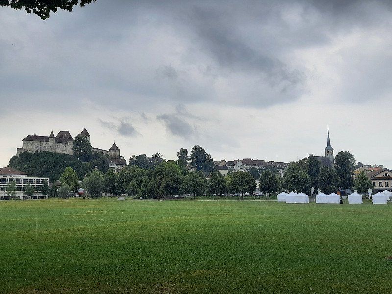
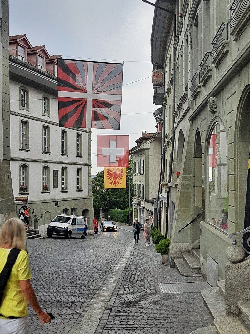
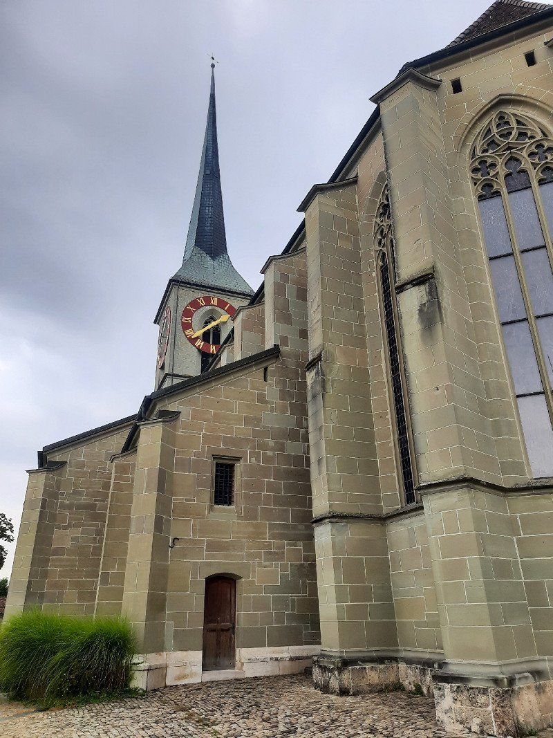
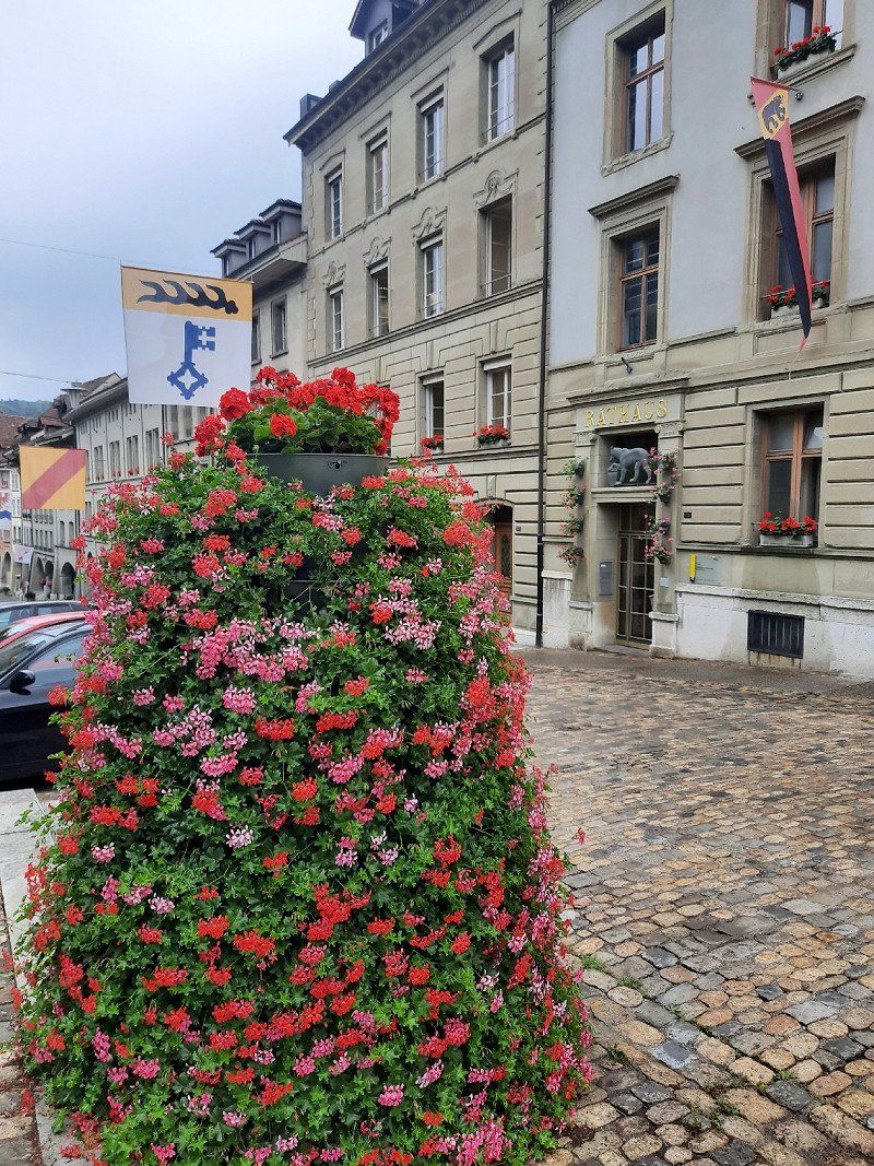
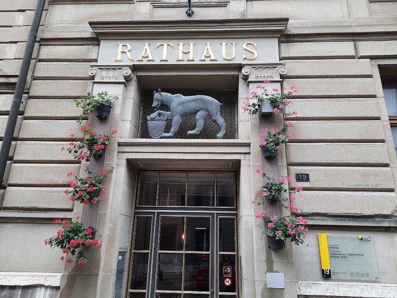
Burgdorf
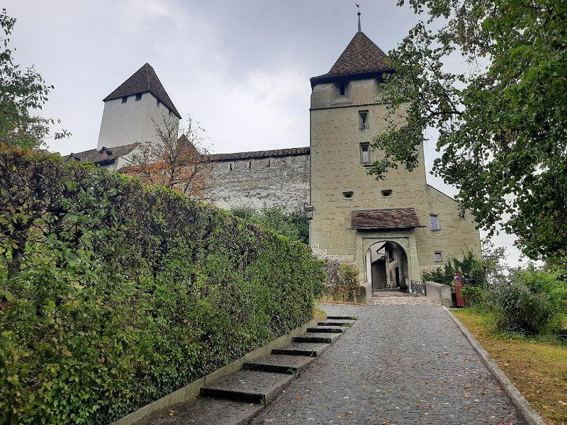
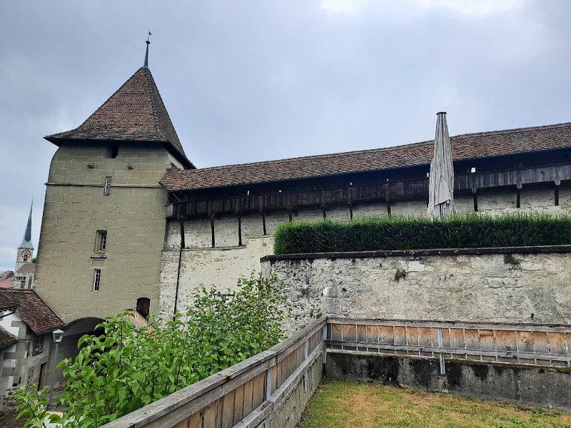
The journey went via Waldshut-Tiengen and Brugg to Burgdorf. When we arrived at the parking lot at the Schützenhaus, it started to rain. We used this time for our coffee break. It was only a short rain shower after which the castle and the town were visited.
It was the Zähringer family who built a castle on a rocky outcrop on the left bank of the Emmen. Burgdorf Castle is now the city's landmark. Burgdorf is surrounded by the Emme, which flows around the town in a wide arc to the east. Burgdorf is also called the "Gateway to the Emmental".
We were lucky with the weather. It was dry the time we were out and about in Burgdorf, and it only started raining again shortly before we arrived in the mobile home when we returned.
Schweiz
47° 3' 21.4" N 7° 37' 38" E
47.0559357 7.6272243
• Head toward Schlossgässli on Hohengasse. Go for 5 m.
• Continue on Rütschelengasse. Go for 170 m.
• Turn left onto Emmentalstrasse (23). Go for 604 m.
• Take the 2nd exit from roundabout onto Wynigenstrasse (23). Go for 387 m.
• Pass 6 roundabouts. Go for 4.8 km.
• Keep left toward Lausanne/Interlaken/Bern. Go for 213 m.
• Take ramp onto A1 toward Lausanne/Interlaken/Bern. Go for 15.5 km.
• Take the exit toward Lausanne/Fribourg/Neuchâtel/Bern-Neufeld onto A1 (Wankdorf). Go for 5.0 km.
• Take exit 34 toward Vevey/Fribourg/Bern-Bümpliz onto A12. Go for 78.4 km.
• Take the left exit toward Simplon/Gd-St-Bernard/Martigny/Montreux onto A9 (Autoroute du Léman). Go for 13.7 km.
• Take exit 16 toward Evian. Go for 351 m.
• Turn left onto 9. Go for 486 m.
• Take the 2nd exit from roundabout onto 9 toward Evian/Martigny/Aigle. Go for 529 m.
• Take the 3rd exit from roundabout onto 144 toward Le Bouveret. Go for 2.1 km.
• Take the 2nd exit from roundabout onto 144 toward Evian/Monthey. Go for 2.3 km.
• Take the 1st exit from roundabout onto Route Cantonale (21) toward Evian/St-Gingolph. Go for 556 m.
• Turn right onto Route de la Charrière toward La Praille. Go for 233 m.
• Turn left onto Le Parcours. Go for 120 m.
• Continue on Chemin du Canal. Go for 1.7 km.
• Turn left toward Route des Iles. Go for 39 m.
• Turn right onto Route des Iles. Go for 100 m.
• Continue on Route des Iles. Go for 896 m.
• Turn slightly left onto Route de la Lanche. Go for 417 m.
• Take the 1st exit from roundabout onto Route Cantonale (21) toward Evian/St-Gingolph. Go for 4.7 km.
• Continue on N5. Go for 15 m.
• Continue on D1005. Go for 16.7 km.
• Pass 5 roundabouts and continue on Avenue de la Rive (D1005). Go for 7.9 km.
• Take the 2nd exit from roundabout onto D1005 toward Annecy/Genève/Annemasse/Sciez. Go for 6.8 km.
• Take ramp onto Route de Margencel (D133) toward Margencel/Anthy S/Léman/Z.A.E. Espace Léman. Go for 444 m.
• Take the 2nd exit from roundabout onto Route de Margencel (D133). Go for 313 m.
• Take the 3rd exit from Croisée d'Anthy roundabout onto Route de la Croisée d'Anthy (D33). Go for 717 m.
• Turn left onto Rue des Longettes (D33). Go for 408 m.
• Continue on Rue des Fontaines (D33). Go for 56 m.
• Turn left onto Rue de l'Église. Go for 47 m.
• Turn left onto Rue de la Mairie. Go for 23 m.
• Arrive at Rue de la Mairie. Your destination is on the left.
☍
166,7 km
(2 hrs. 2 min.)
Anthy-sur-Léman
After Anthy-sur-Léman, the journey continued on the D1005 along the southern shore of Lake Geneva. In St. Gingolph we crossed the Swiss/France border.
The village of Anthy-sur-Léman is slightly elevated above the southern shore of Lake Geneva. The approach to the parking space was a little difficult due to construction sites. We found a small place with 6 places, on which only one camper was standing. (From 6 p.m. to 8 a.m. free of charge) From the square you had a view of the lake in which Irmgard immediately went swimming. We ended the day with a walk along the lake shore and through the village.
The night was very quiet, we had slept well, it had rained occasionally during the night. In the morning before 8 a.m. we started our onward journey.
Frankreich
46° 21' 18.5" N 6° 25' 36.7" E
46.3551430 6.4268590
• Head toward Impasse du Pré Vernes on Rue de la Mairie. Go for 96 m.
• Turn right onto Rue de la Rogère. Go for 186 m.
• Turn left onto Rue des Fontaines (D33). Go for 223 m.
• Continue on D33. Go for 45 m.
• Continue on Route de Séchex (D33). Go for 1.4 km.
• Turn left onto Rue de Séchex (D233). Go for 564 m.
• Turn right onto Route de Genève (D1005). Go for 3.7 km.
• Pass 2 roundabouts and continue on Route Nationale (D1005). Go for 6.2 km.
• Turn left onto Avenue des Voirons (D1206) toward Annemasse/Lyon/Paris. Go for 1.1 km.
• Pass 3 roundabouts and continue on Route de Machilly (D1206). Go for 10.9 km.
• Take ramp toward D903/A40/Chamonix-Mt B./Annecy/Cranves-Sales. Go for 711 m.
• Continue on D903. Go for 6.7 km.
• Keep right onto D903 toward A40/Annecy/Chamonix-Mt Blanc/La Roche S/F. Go for 1.2 km.
• Keep left onto Route d'Annecy (D903) toward Annecy/Chamonix/Mt Blanc/La Roche S/F. Go for 239 m.
• Take ramp onto A40 (Autoroute Blanche) toward Milan/Chamonix/Mt Blanc/Annecy. Go for 2.4 km.
• Take the exit toward Lyon/Grenoble/Annecy/La Roche S/Foron onto A410. Go for 26.1 km.
• Continue on A41. Go for 5.8 km.
• Take exit 17 toward Annecy-Nord/Annecy/Annecy le Vieux/Aéroport Meythet. Go for 1.1 km.
• Keep left. Go for 15 m.
• Continue toward Annecy/Annecy le Vieux/Thônes/Centre Hospitalier/P+R/Aéroport. Go for 34 m.
• Take the 2nd exit from roundabout onto D908 B toward Annecy/Thônes. Go for 117 m.
• Take the 4th exit from roundabout onto Voie de Metz (D3508) toward Annecy/Annecy-le-Vx. Go for 1.1 km.
• Keep left onto Voie de Metz (D1201) toward Annecy-Centre/Annecy-le-Vieux/Thônes/Parc des Glaisins. Go for 393 m.
• Keep left onto Voie de Metz (D1201) toward Annecy-Centre/Thônes. Go for 552 m.
• Continue on Avenue de Brogny. Go for 1.9 km.
• Take the 3rd exit from roundabout onto Rue Jean Jaurès. Go for 564 m.
• Turn right onto Avenue d'Albigny (D909). Go for 160 m.
• Turn left onto Quai Eustache Chappuis (D1508). Go for 178 m.
• Turn left onto Esplanade de l'Hôtel de Ville. Go for 157 m.
• Turn right. Go for 16 m.
• Arrive at your destination on the right.
☍
73,8 km
( 56 min.)
Day
Annecy
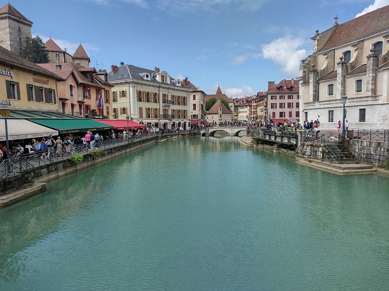
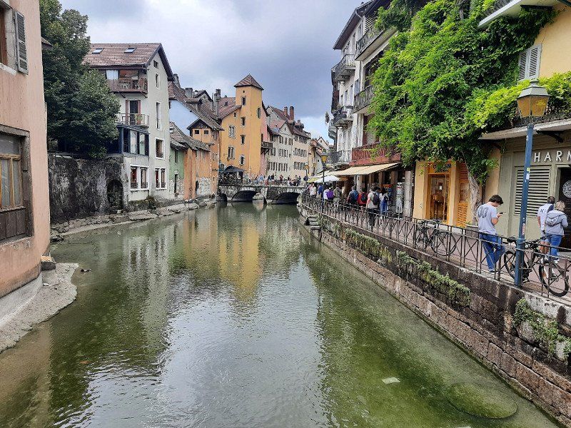
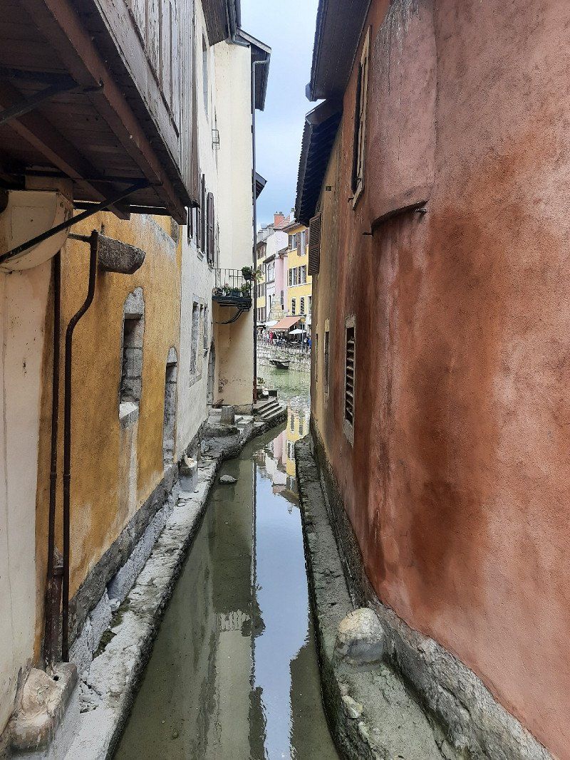
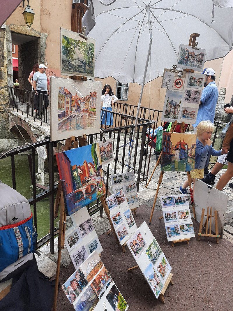
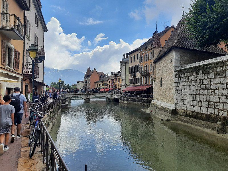
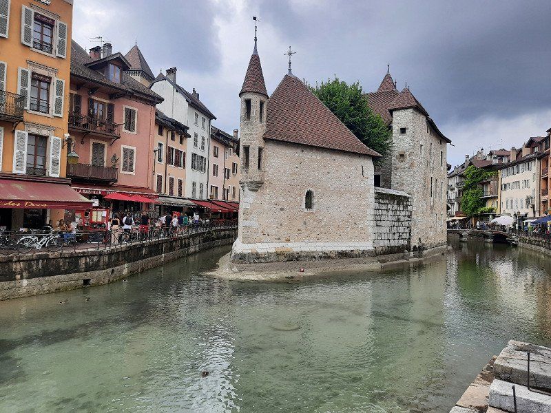
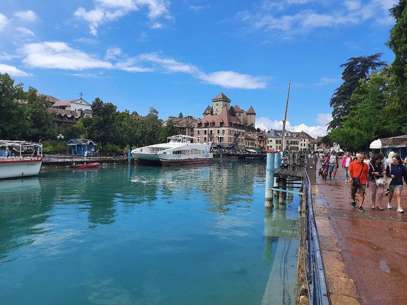
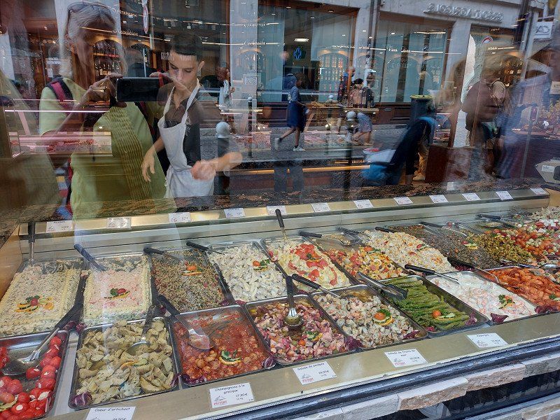
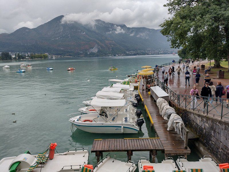
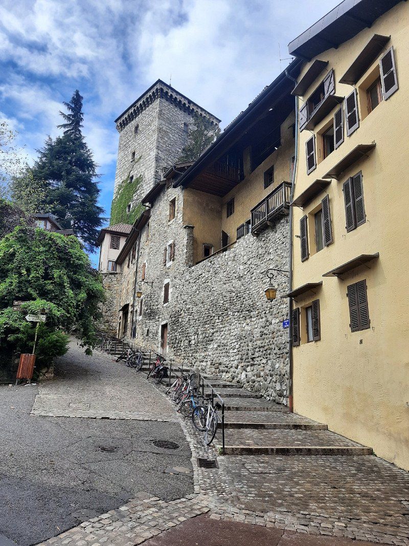
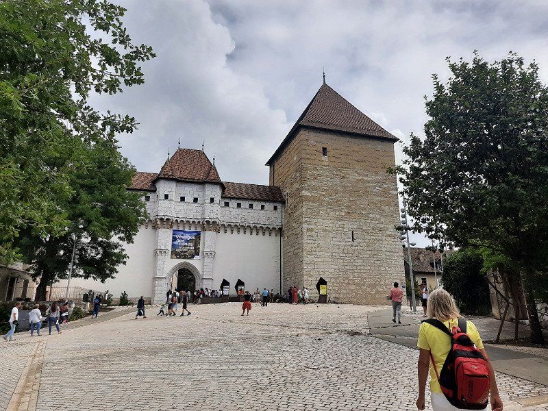
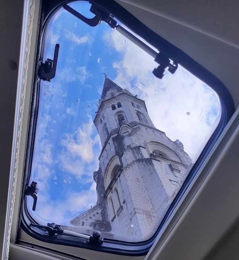
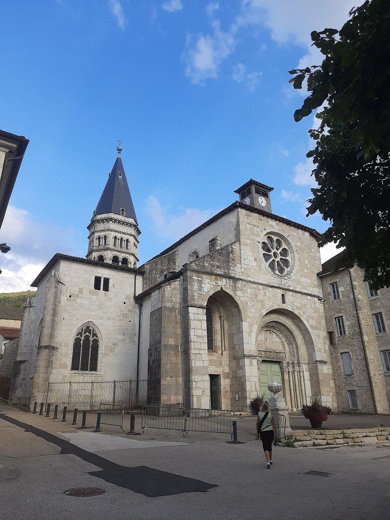
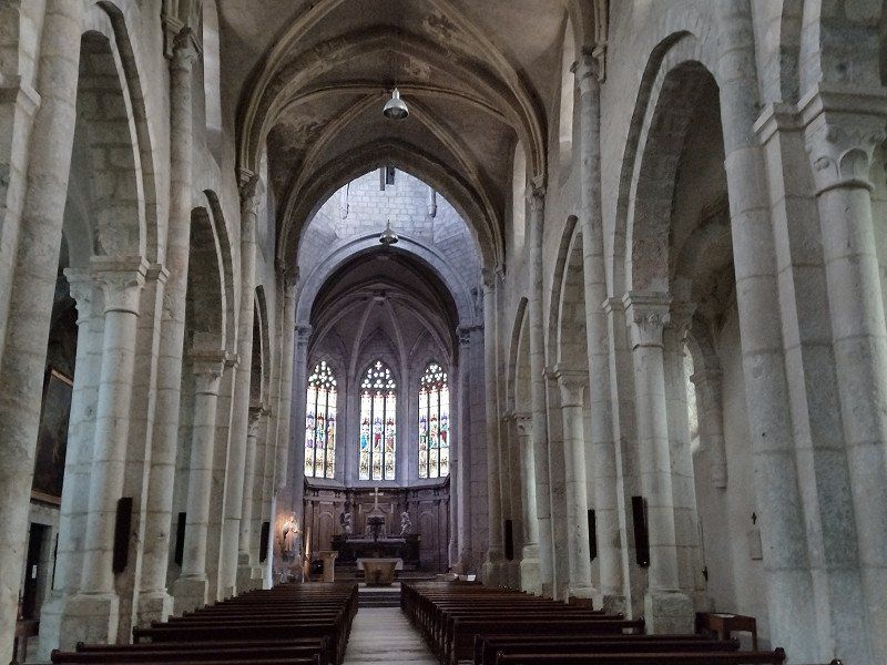
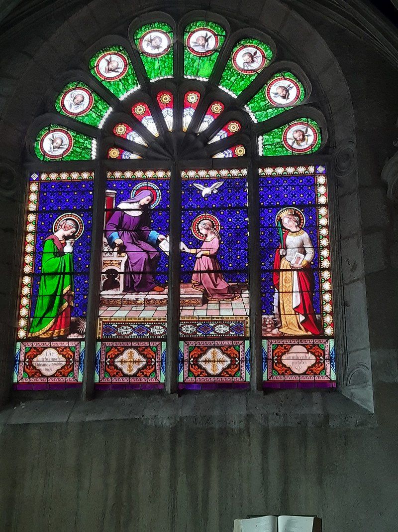
The pitch that was approached was occupied, we were not the only mobile home that drove to the place at this time. Quickly emptied the toilet cassette and tried again to find a parking space. It was Saturday and accordingly the traffic in the city was on the move. In addition, our GPS sent us twice in the wrong direction. One must not lose hope and we found a parking space at the top of Annecy Cathedral, where there were already many mobile homes. We stood directly under the church tower. We also made our way to the old town on foot. Annecy is known as the "Venice of the Alps" and the crystal-clear Lac d'Annecy with the pretty plane tree promenade on the north bank has a lot to do with it. It invades the old town with two major watercourses, the artificial Canal du Vassé and the branching Thiou river. The result is quays adorned with flowers, a river island with the 900-year-old Palais de l'île, and bridges and jetties.
Frankreich
45° 53' 56.7" N 6° 7' 46.3" E
45.8990887 6.1295411
• Head east. Go for 16 m.
• Turn left onto Esplanade de l'Hôtel de Ville. Go for 157 m.
• Turn left onto Quai Eustache Chappuis (D1508). Go for 418 m.
• Take the 1st exit from roundabout onto Avenue du Tresum toward Thônes/Le Château/Z.I. de Vovray. Go for 351 m.
• Turn sharp right onto Boulevard de la Corniche. Go for 263 m.
• Take the 2nd exit from Place du Paradis roundabout onto Avenue du Crêt du Maure toward Vieille Ville/Loverchy-les Balmettes. Go for 420 m.
• Turn right onto Avenue Lucien Boschetti toward Thônes. Go for 236 m.
• Continue on Avenue du Rhône (D5) toward Seynod. Go for 289 m.
• Take the 3rd exit from roundabout onto Avenue de Chambéry (D1201) toward Chambéry. Go for 672 m.
• Take the 1st exit from Rond-Point de la Croisée roundabout onto D3508 toward Bourg en B./Meythet/Thônes. Go for 1.3 km.
• Take ramp onto A41 toward Lyon/Chambéry. Go for 26.4 km.
• Take exit 14 toward Grésy S/Aix/Aix les Bains-Mont Revard. Go for 642 m.
• Take the 2nd exit from roundabout toward Aix les Bains/Grésy S/Aix/Parc du Massif des Bauges. Go for 124 m.
• Take the 3rd exit from roundabout onto Route des Baugés (D911) toward Aix les Bains/Chambéry. Go for 476 m.
• Take the 2nd exit from roundabout onto Route des Baugés (D911). Go for 107 m.
• Take the 3rd exit from roundabout onto Route de l'Albanais (D1201). Go for 1.7 km.
• Take the 2nd exit from roundabout onto Avenue Franklin Roosevelt (D1201) toward Chambéry/A41/Centre Ville. Go for 569 m.
• Take the 4th exit from Carrefour des Hôpitaux roundabout onto Avenue Maréchal de Lattre de Tassigny (D1201) toward Chambéry/A41/Lyon/Bourg en Bresse/Belley. Go for 194 m.
• Take the 2nd exit from Boulevard Maréchal de Lattre de Tassigny roundabout onto Avenue d'Alsace-Lorraine (D991) toward Le Revard/Centre Ville. Go for 195 m.
• Take the 2nd exit from roundabout onto Avenue d'Alsace-Lorraine (D991). Go for 255 m.
• Arrive at Avenue d'Alsace-Lorraine (D991). Your destination is on the right.
☍
34,8 km
( 27 min.)
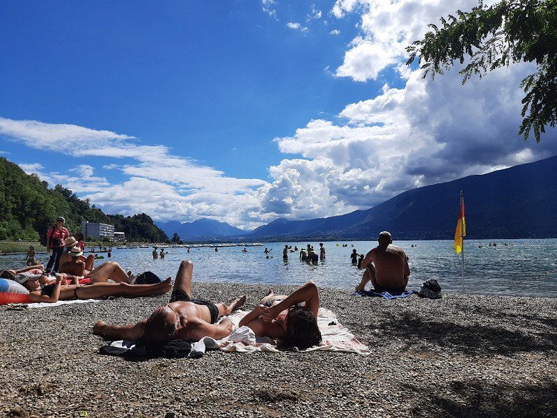
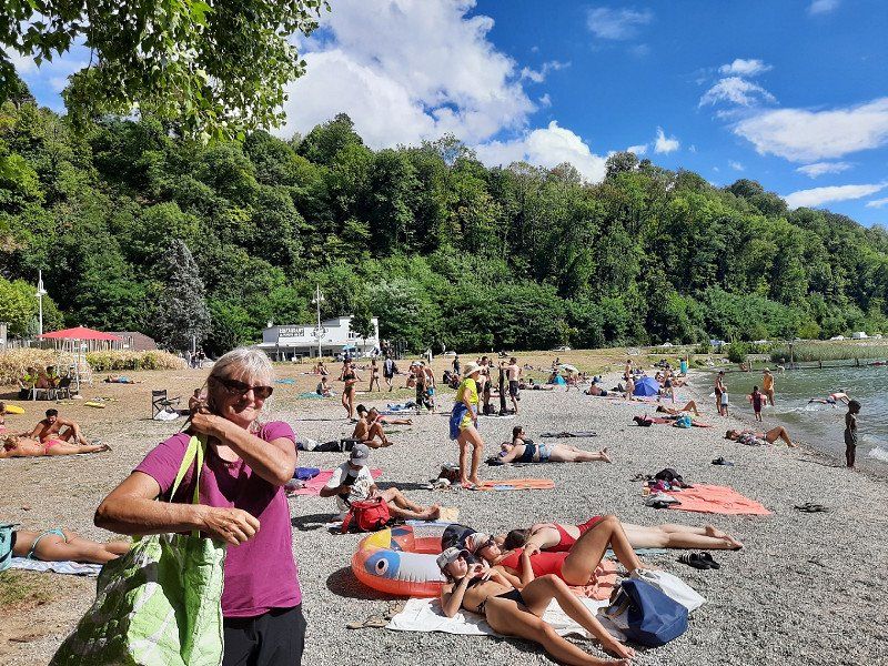
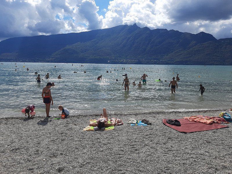
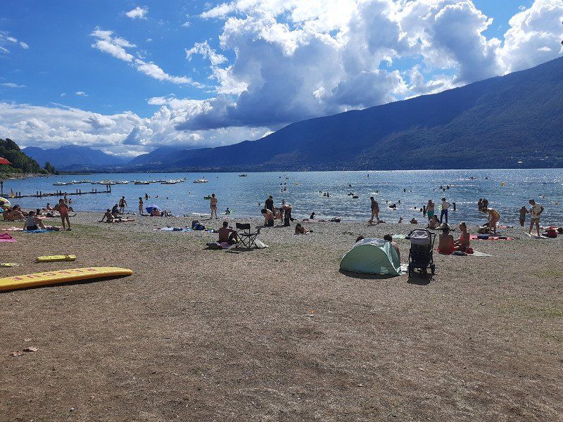
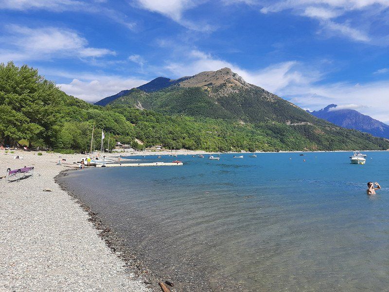
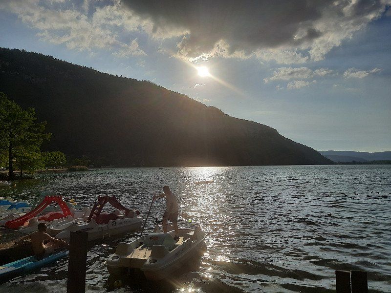
Aix-les-Bains
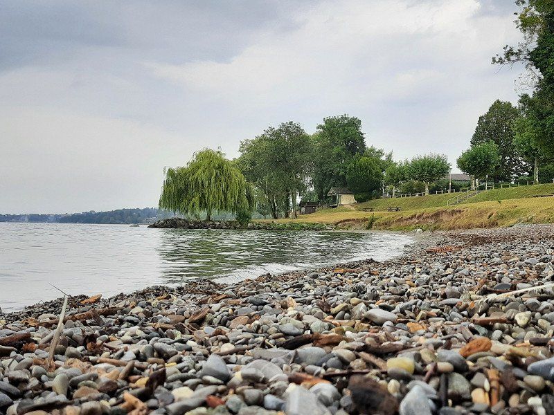
Made a swim stop. The city used to be a well-visited spa town. We were able to park the mobile home in the parking lot by the lake. The lake has a pebble beach and the water level is quite shallow, you have to go far into the lake to swim. We didn't stay long and continued to Grenoble.
Frankreich
45° 41' 32.4" N 5° 54' 32.4" E
45.6923410 5.9089980
• Head south on Avenue d'Alsace-Lorraine (D991). Go for 54 m.
• Take the 4th exit from roundabout onto Avenue d'Alsace-Lorraine (D991). Go for 342 m.
• Take the 3rd exit from roundabout onto Avenue d'Alsace-Lorraine (D991). Go for 136 m.
• Take the 3rd exit from Boulevard Maréchal de Lattre de Tassigny roundabout onto Boulevard Maréchal de Lattre de Tassigny (D1201) toward Chambéry/A41/Lyon/Bourg en Bresse/Belley/Aéroport Chambéry-Aix. Go for 606 m.
• Take the 2nd exit from Carrefour Lamartine roundabout onto Boulevard Jean Charcot (D1201) toward Chambéry/Lyon/Bourg en Bresse/Belley/Aéroport Chambéry-Aix. Go for 357 m.
• Take the 4th exit from Carrefour du Lac roundabout onto Boulevard Jean Charcot (D1201) toward Chambéry/Lyon/Bourg en B./Tresserve. Go for 846 m.
• Pass 7 roundabouts and continue on Route d'Aix (D1201). Go for 16.4 km.
• Keep left onto A43. Go for 10.2 km.
• Keep left onto A41 toward Grenoble. Go for 41.0 km.
• Continue on Carrefour de l'Europe. Go for 41 m.
• Continue on D1090 toward Grenoble-Centre/La Tronche-Sablons/Hopital Nord. Go for 2.7 km.
• Turn right onto Boulevard Maréchal Lyautey (D5) toward Centre Ville. Go for 279 m.
• Turn left onto Rue Hoche. Go for 296 m.
• Turn right onto Boulevard Gambetta (D523). Go for 418 m.
• Turn right onto Rue Vauban. Go for 77 m.
• Turn right onto Place Victor Hugo. Go for 34 m.
• Arrive at Place Victor Hugo. Your destination is on the left.
☍
73,7 km
( 50 min.)
Grenoble, 45.16668,05.69768
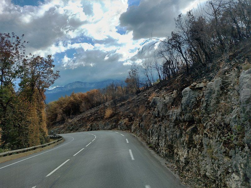
We had primarily chosen Grenoble as a place to stay overnight. On the way to Grenoble we saw areas where there were forest fires. We reached the campsite with a little detour, just before the campsite the road was closed and I followed the instructions on the navigation system, it would have been easier if I had followed the detour signs.
The size of the campsite was okay. We did nothing more that day. The campsite was a 50 minute walk from the old town.
The night was quiet and the next morning we got out of bed early, we still wanted to visit the old town of Grenoble in the morning. It was a sightseeing tour on time, we had to leave the site at 12 noon.
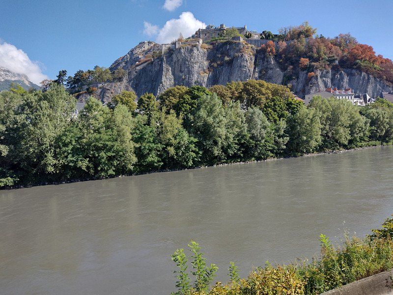
We headed towards the old town with a view of the Fort de la Bastille (19th century), which lies on a ledge below the confluence of the Drac and Isère.
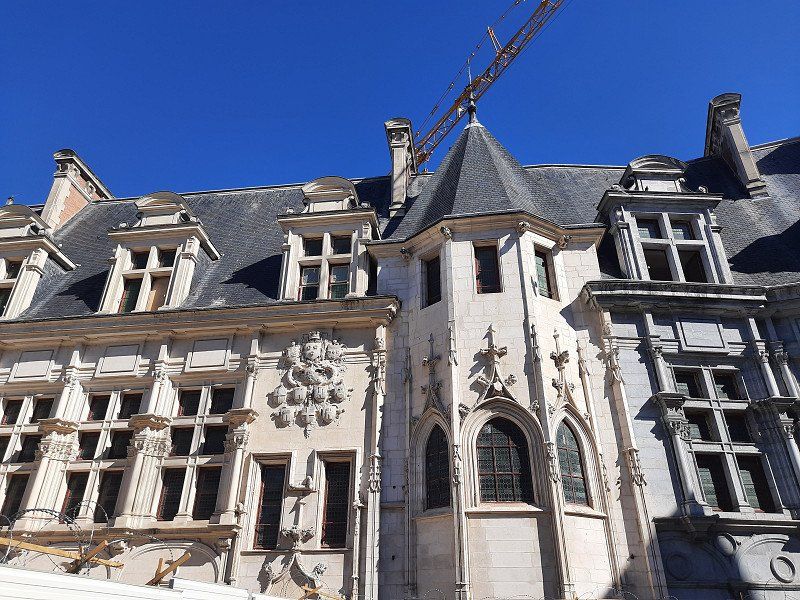
The Cathedral of Notre-Dame. A massive 11C square tower directly above the entrance portal is the focal point of the five-nave cathedral, whose origins date back to the 10C.
Ancien Palais Palace: The Old Palace was built at the beginning of the 16th century as the Parliament of Savoy (Ancien Palais du Parlement dauphinois) and has been rebuilt and expanded several times.
Grenoble, Frankreich
45° 11' 18.7" N 5° 43' 28.3" E
45.1885290 5.7245240
• Head toward Rue Béranger on Place Victor Hugo. Go for 22 m.
• Continue on Rue Lamartine. Go for 55 m.
• Turn right onto Cours La Fontaine (D5). Go for 468 m.
• Continue on Cours Berriat (D106). Go for 733 m.
• Turn left onto Place Firmin Gautier. Go for 36 m.
• Turn right onto Rue du Vercors (D106). Go for 423 m.
• Continue on Rue du Vercors (D106). Go for 303 m.
• Turn left and take ramp onto A480 toward Gap/Sisteron/Rocade Sud/Chambéry. Go for 7.1 km.
• Take exit 8 toward Gap/Briançon/Vizille/Stations de l'Oisans onto N85. Go for 3.9 km.
• Take the 2nd exit from roundabout onto N85 toward Gap/Briançon/Vizille. Go for 1.7 km.
• Keep left onto N85 toward Gap/Briançon/Vizille/La Mure/Stations de l'Oisans. Go for 3.5 km.
• Turn right onto N85. Go for 471 m.
• Take ramp toward Gap/Vizille-Centre/N.D. de Mésage-Haut/Laffrey/La Mure. Go for 229 m.
• Turn right onto Route Napoléon (N85) toward Gap/La Mure/Laffrey/N.D. de Mésage-Haut. Go for 7.0 km.
• Turn sharp right onto Lieu-dit Les Baumes (D113) toward St Jean de Vaulx/Notre Dame de Vaulx/La Motte d'Aveillans. Go for 190 m.
• Continue on D113. Go for 29 m.
• Arrive at D113. Your destination is on the right.
☍
26,2 km
( 27 min.)
Day
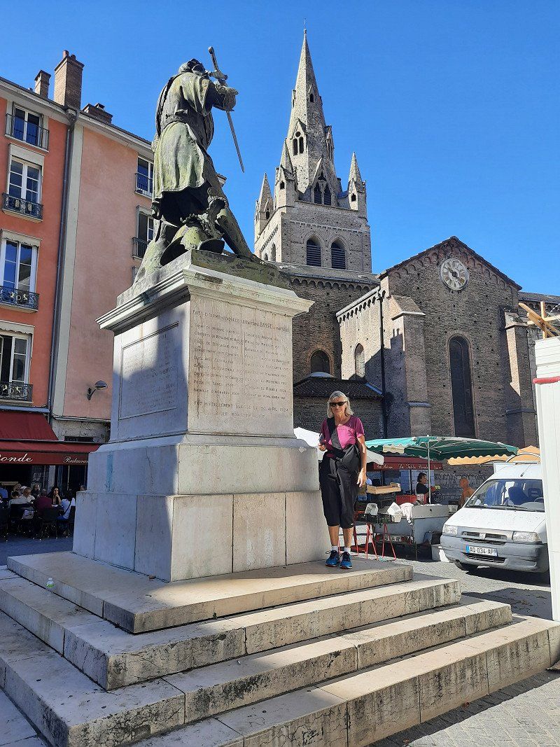
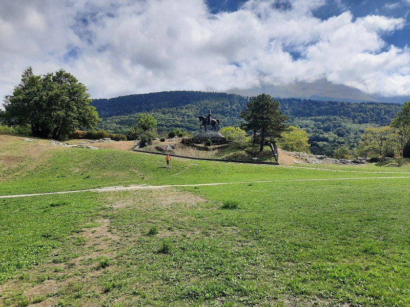
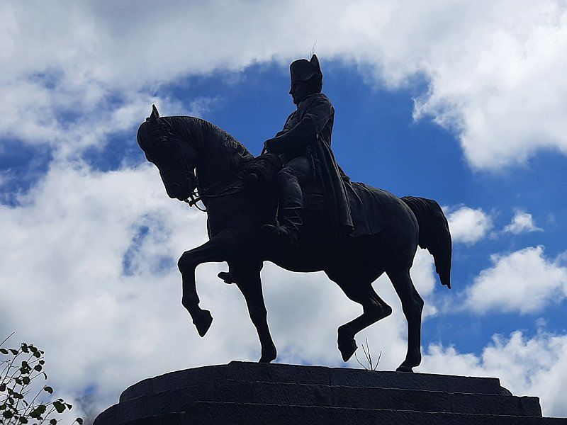
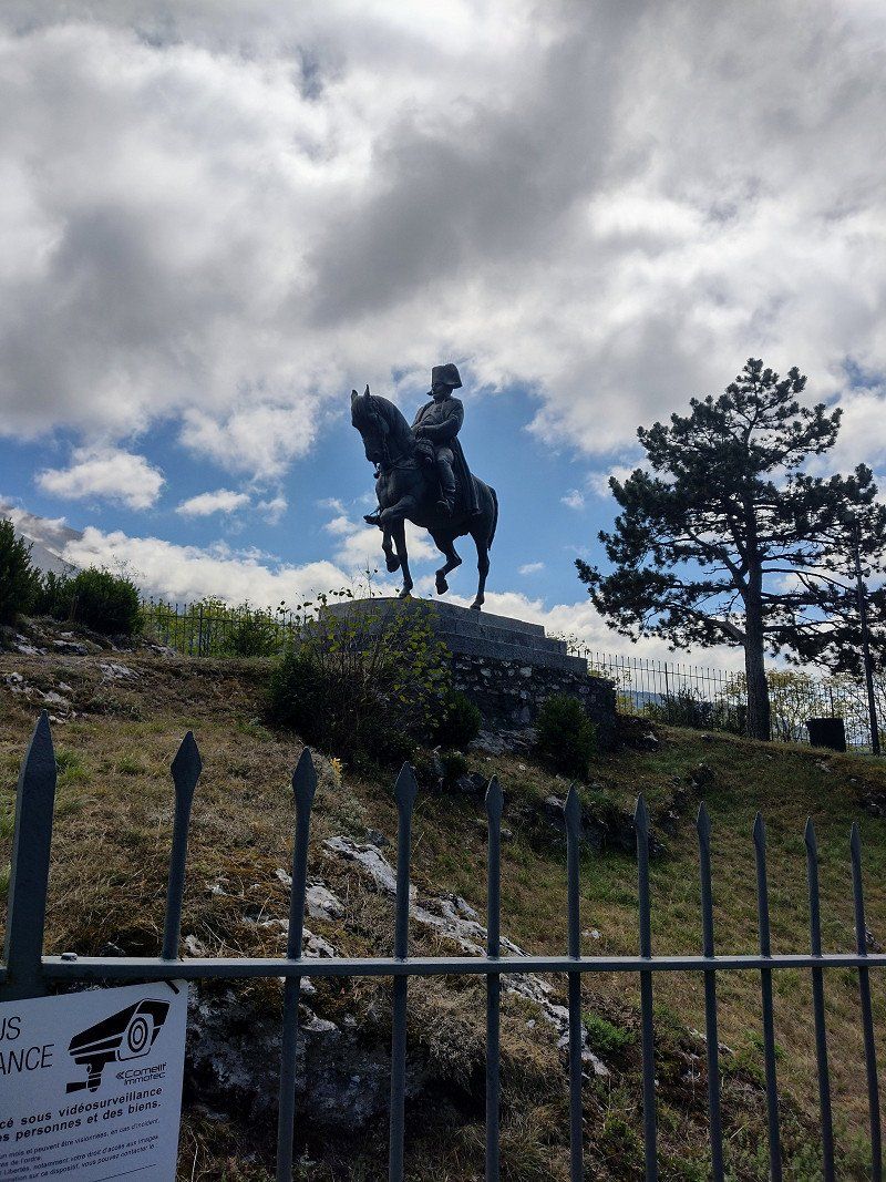
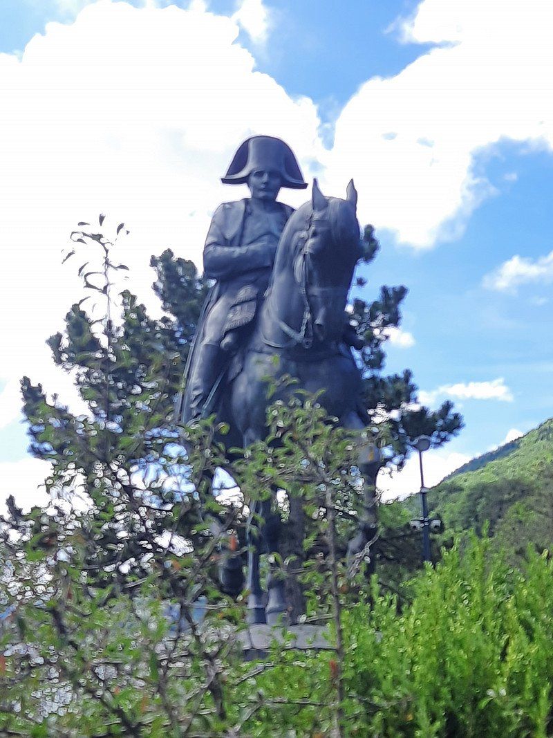
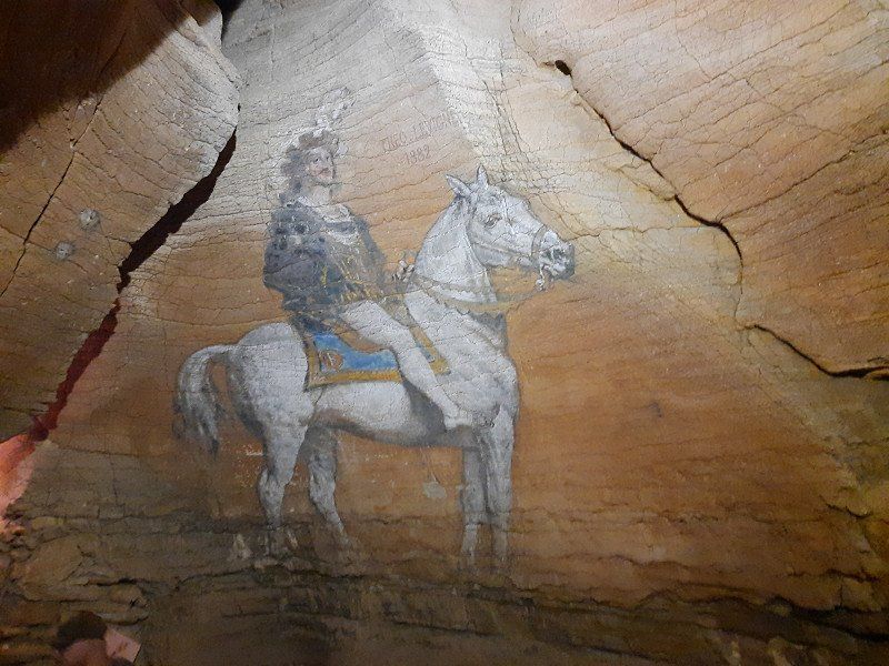
Napoleon Denkmal in Laffrey 45.01825, 5.77498
On the way to La Mure we passed the small village of Laffrey.
Napoleon's troops and those of his opponents met here. Here Napoleon is said to have won over enemy troops with a courageous speech. Napoleon allegedly entered the royal troops with the words "If among you soldiers there is one who wants to kill his emperor, here I am!" opposite to. After some hesitation, shouts of "Vive l'Empereur - long live the Emperor" - made it clear that the opponents were joining Napoleon's troops.
A large equestrian statue of Napoléon commemorates this episode.
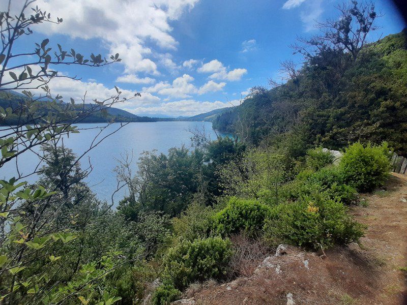
Four lakes can be seen near Laffrey on the high plateau, the Grand Lac de Laffrey being the largest of them.
38220 Laffrey, Frankreich
45° 1' 28.6" N 5° 46' 21.5" E
45.0246030 5.7726520
• Head toward Route Napoléon on D113. Go for 29 m.
• Continue on Lieu-dit Les Baumes (D113). Go for 190 m.
• Turn right onto Route Napoléon (N85). Go for 7.3 km.
• Pass 3 roundabouts and continue on Avenue du 22 Août 1944 (N85). Go for 4.5 km.
• Take the 3rd exit from roundabout onto Avenue du 22 Août 1944 (N85) toward Gap/La Mure. Go for 1.2 km.
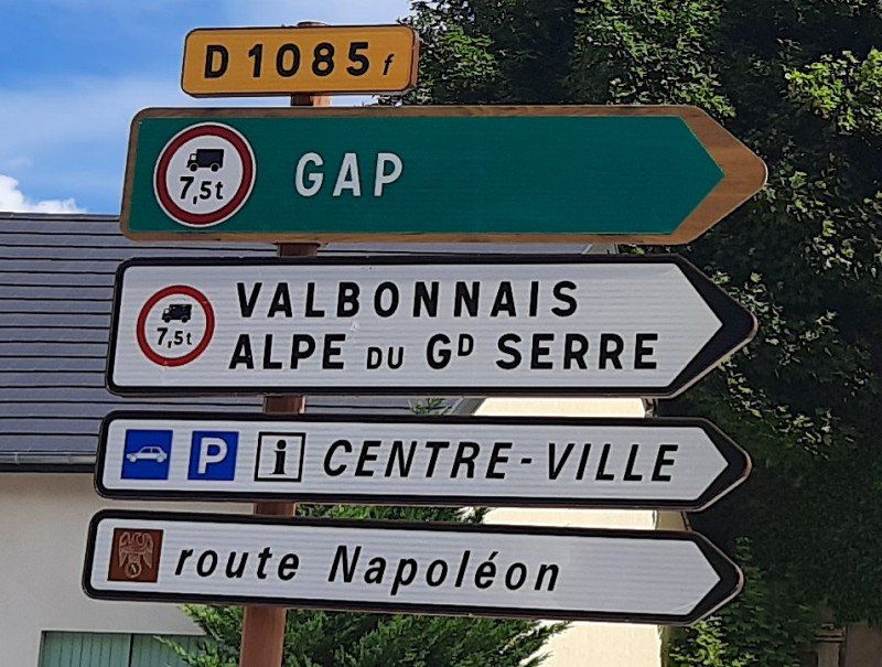
• Take the 2nd exit from roundabout onto Rue Jean Jaurès (D1085 F) toward N85/Gap/Valbonnais/Alpe du Gd Serre. Go for 450 m.
• Turn right onto Rue Croix Blanche. Go for 29 m.
• Turn right. Go for 31 m.
• Arrive at your destination on the right.
☍
13,7 km
( 13 min.)
La Mure 44.91048, 5.78304
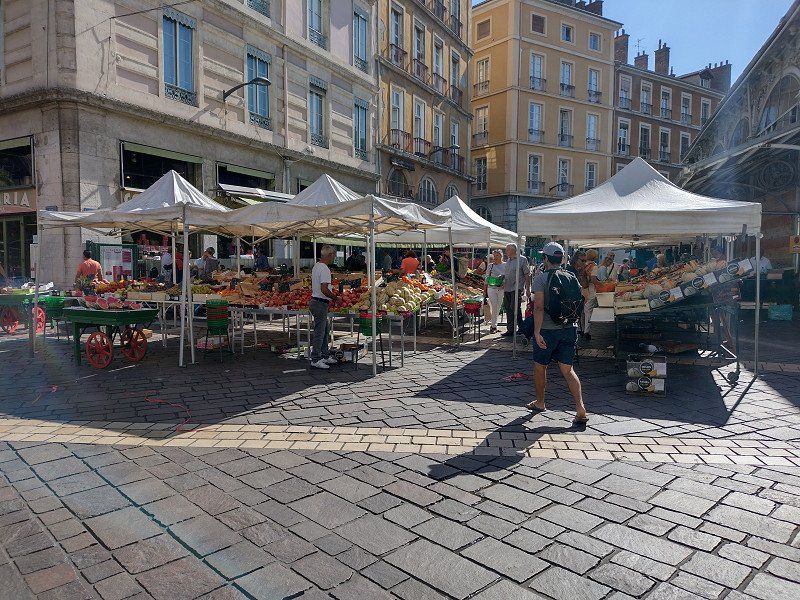
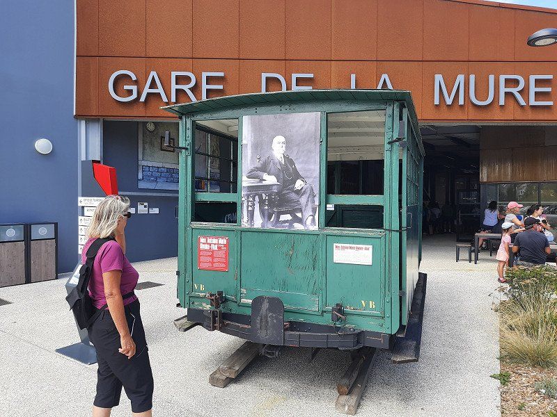
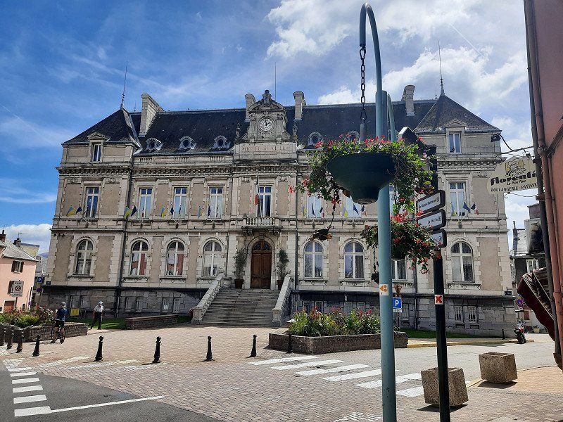
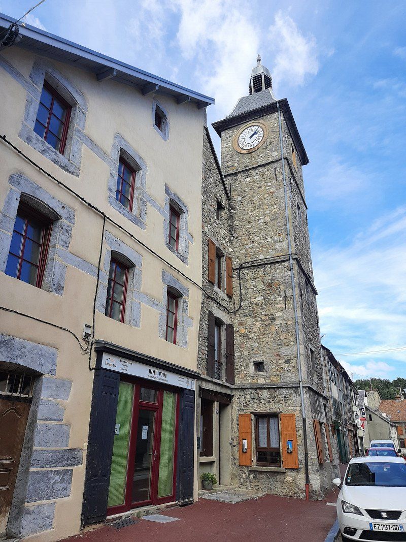
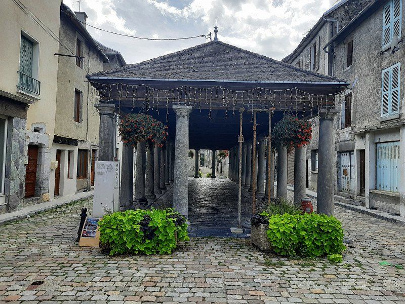
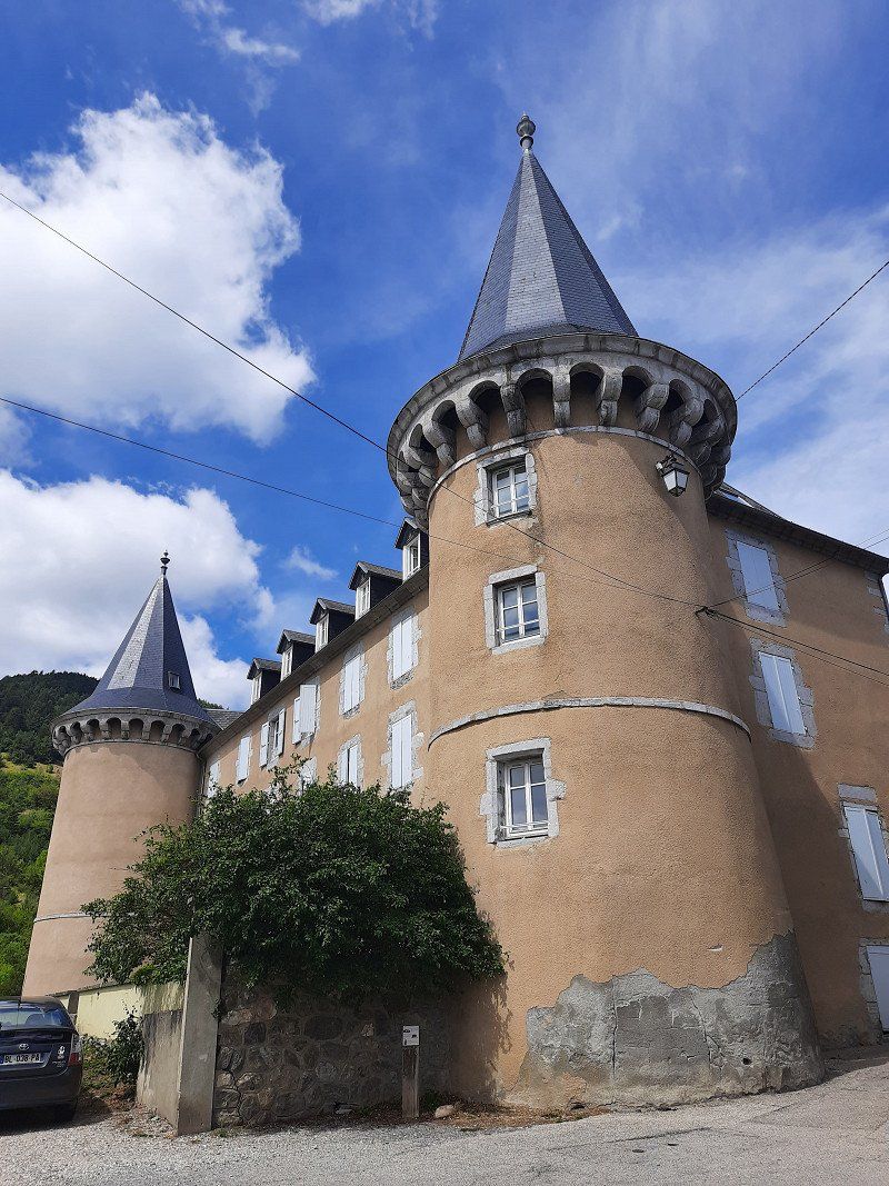
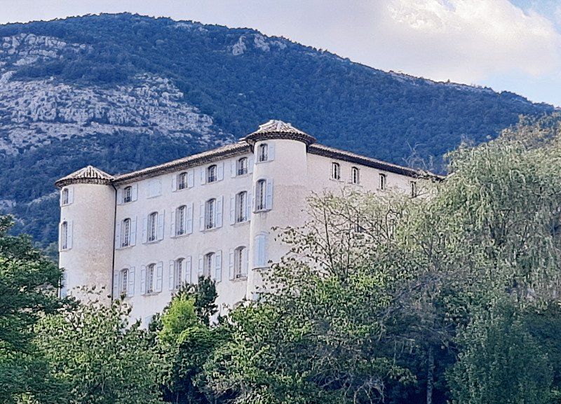
Next, La Mure is traversed. The village is the terminus of the Chemin de fer de la Mure narrow-gauge railway, which runs from La Mure in countless hairpin bends and tunnels down to the SNCF train station at Saint-Georges-de-Commiers. We stopped at La Mure on the Napoleon Road, in the heart of the Matheysin Plateau, 800 meters above sea level. We parked in the parking lot at the tourist center in front of the city, where there was also the opportunity to ride the historical railway. There were several interesting buildings to see in downtown La Mure. The imposing town hall, the clock tower, the old market and the Chateau Herbelon.
After our tour and coffee break, we continued our journey, but not through the old town but used the developed bypass road, from which one can enjoy a sweeping view of the rising Alpine scenery.
Frankreich
44° 54' 23.5" N 5° 47' 4.3" E
44.9065210 5.7845280
• Head toward Rue Croix Blanche. Go for 31 m.
• Turn left onto Rue Croix Blanche. Go for 29 m.
• Turn right onto Rue du Breuil (D1085 F). Go for 356 m.
• Turn left onto Rue des Alpes (D1085 F). Go for 1.1 km.
• Take the 2nd exit from roundabout onto Route Napoléon (N85) toward Gap/Mens/Corps/N.D. de la Salette/Pont de Ponsonnas. Go for 22.8 km.
• Turn right onto Rue de la Paix (D537) toward Pellafol/Superdévoluy/Via Ferrata. Go for 2.5 km.
• Turn left. Go for 706 m.
• Keep right. Go for 73 m.
• Arrive at your destination on the right.
☍
27,7 km
( 30 min.)
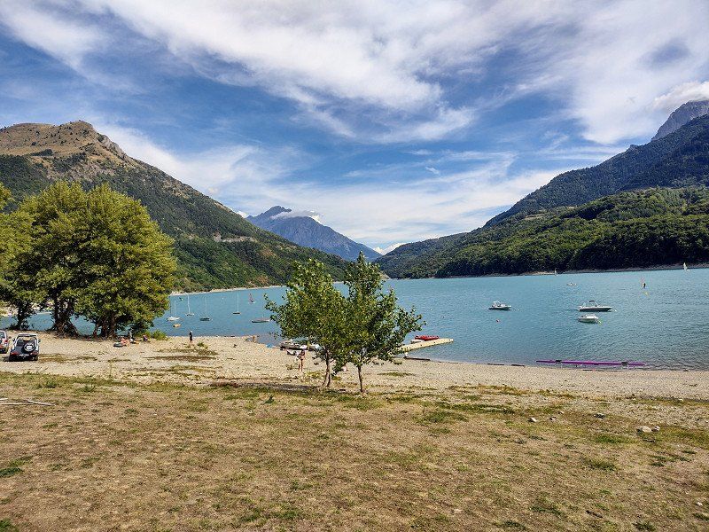
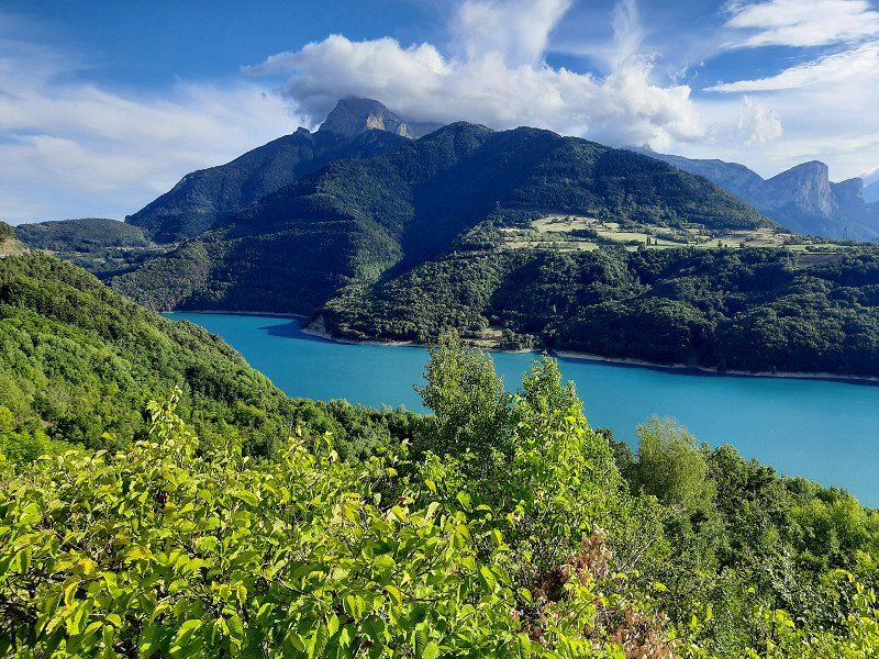
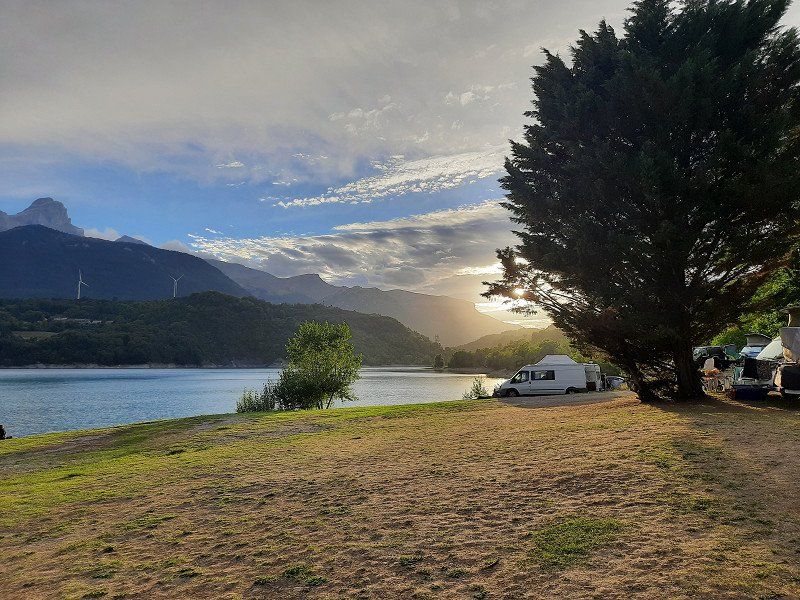
Camping Lac Du Sautet 44.81614, 5.92793
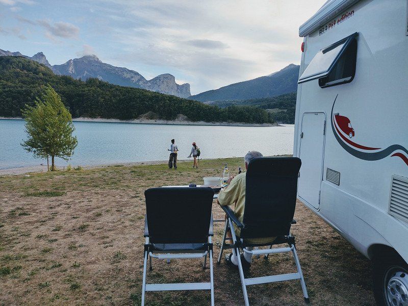
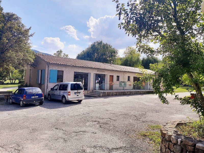
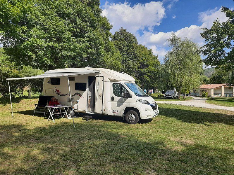
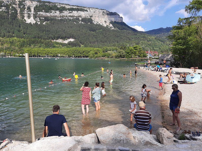
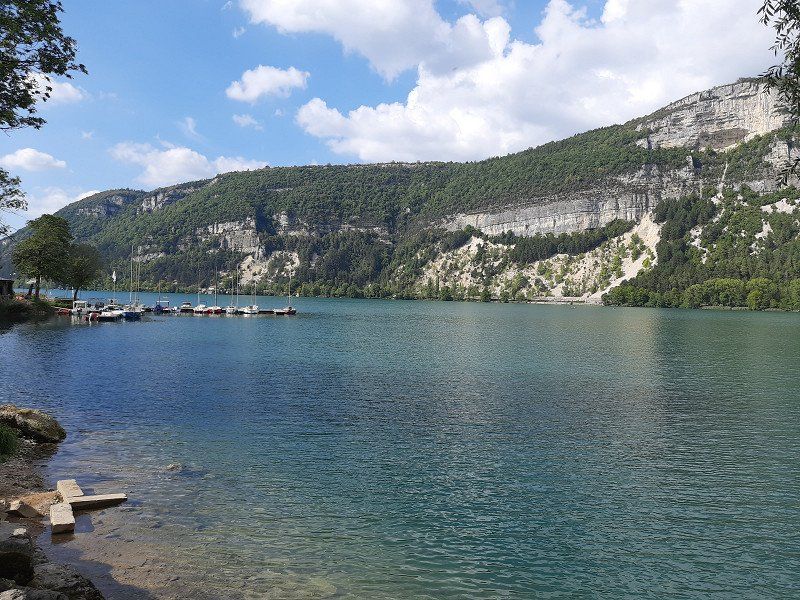
The access to the lake was on a narrow road that can only be driven in one direction. The entrance to the campsite has a tight curve, which we would not have been able to drive without maneuvering. At first it was said that the campsite was occupied, you had to register in advance. Suddenly it worked and we got a beautiful parking space on the water. The campsite's terrain is sloping but the pitches are reasonably level. The sanitary facilities are not a luxury. Irmgard then immediately went swimming in the lake, the water temperature was estimated at 21°C.
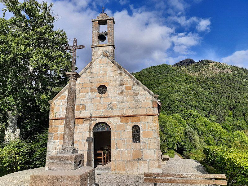
Towards evening we went for a long walk to the village of Corps with the Saint Roch chapel, from which we had a beautiful view of the lake (Lac du Sautet). The footpath ran steeply uphill through oak and beech forest, there and back it was about 7 km on the same path.
After dinner we sat outside and enjoyed the lake with the surrounding mountains.
The night got cooler, we are at 1000 m above sea level.
Sous les chenêts, 38970, Corps, France
44° 48' 59.4" N 5° 55' 40.6" E
44.8165100 5.9279500
• Head northwest. Go for 779 m.
• Turn right onto D537. Go for 2.5 km.
• Turn right onto Place aux Herbes (N85). Go for 24.3 km.
• Take the 2nd exit from roundabout onto Route de Gap (N85) toward Gap/Col Bayard/Laye. Go for 13.1 km.
• Take the 1st exit from Rond-Point de Varsie roundabout onto Route Napoléon (N85). Go for 2.1 km.
• Take the 1st exit from roundabout onto Avenue Commandant Dumont (N85). Go for 213 m.
• Take the 1st exit from roundabout onto Cours Ladoucette (N85) toward A51/Sisteron/Valence/Barcelonnette/Centre Ville. Go for 164 m.
• Take the 1st exit from Place Ladoucette roundabout onto Rue Faure du Serre (D994). Go for 436 m.
• Turn left onto Rue de la Charité. Go for 89 m.
• Turn left onto Rue Pasteur. Go for 133 m.
• Turn right onto Rue Philis de La Charce. Go for 34 m.
• Turn left onto Rue du Four Neuf. Go for 25 m.
• Arrive at Rue du Four Neuf. Your destination is on the right.
☍
43,8 km
( 45 min.)
Day
GAP 44.54239, 6.0612
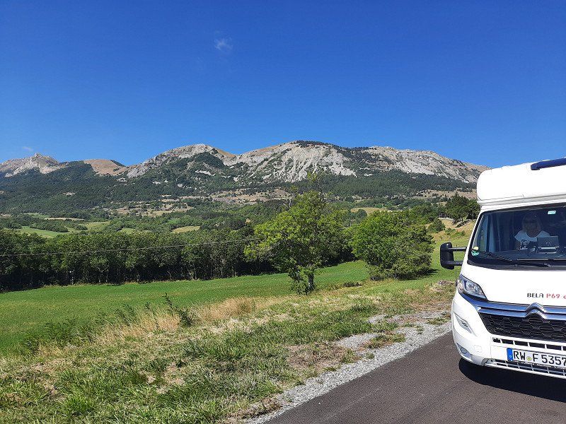
A photo stop is a must on the way to GAP.
At the indoor pool was the designated parking space (free of charge). We had to walk to the city center on a two-kilometer-long avenue. The many trees donated a little shade, so that the great heat was bearable.
There isn't much historical architecture to see in the city. There was a wealth of interesting things to see in the streets. The city's medieval cathedral began to collapse in the 19th century, so a neo-Gothic replacement was built in its place and completed in 1904.
Napoleon spent the night of March 5, 1815 here on his way from Elba exile to Paris, just before the Hundred Days.
He chose this detour through GAP; because this city, in contrast to the cities in the Rhone Valley, remained loyal to him rather than to the French kings.
Frankreich
44° 33' 34.7" N 6° 4' 47.1" E
44.5596380 6.0797580
• Head toward Rue Philis de La Charce on Rue du Four Neuf. Go for 60 m.
• Turn right onto Rue de l'Imprimerie. Go for 109 m.
• Turn left onto Rue Jean Eymar. Go for 178 m.
• Continue on Lieu-dit Grand Charrière. Go for 44 m.
• Continue on Square Jean Moulin. Go for 16 m.
• Turn left onto Boulevard Général de Gaulle. Go for 209 m.
• Continue on Cours Frédéric Mistral. Go for 270 m.
• Continue on Avenue Jean Jaurès (N85). Go for 181 m.
• Pass 2 roundabouts and continue on Avenue François Mitterrand (N85). Go for 2.6 km.
• Keep left onto Avenue de Provence (N85). Go for 3.4 km.
• Take the 2nd exit from roundabout onto Route Napoléon (N85) toward A51/Aix en Pce/Sisteron/Tallard/Chateauvieux. Go for 6.0 km.
• Take the 3rd exit from roundabout onto Avenue de l'Aérodrome (N85) toward A51/Aix en Pce/Sisteron/La Saulce. Go for 1.1 km.
• Take the 1st exit from roundabout onto Avenue de l'Aérodrome (N85) toward A51/Sisteron/Digne les Bains/Aix en Pce. Go for 812 m.
• Take the 4th exit from roundabout onto A51 (Autoroute du Val de Durance) toward Sisteron/Digne les Bains/Aix en Pce/Marseille. Go for 29.8 km.
• Take exit 23 toward Sisteron onto E712. Go for 565 m.
• Take the 4th exit from roundabout onto Route de Gap (D4085) toward Digne les Bains/Sisteron-Centre/Aix en Pce/Ribiers. Go for 3.8 km.
• Pass 2 roundabouts and continue on Avenue de la Libération (D4085). Go for 887 m.
• Arrive at Avenue de la Libération (D4085). Your destination is on the right.
☍
50,0 km
( 39 min.)
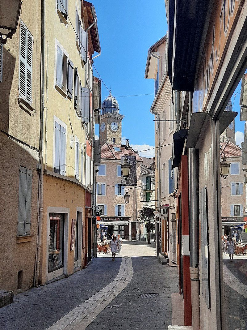
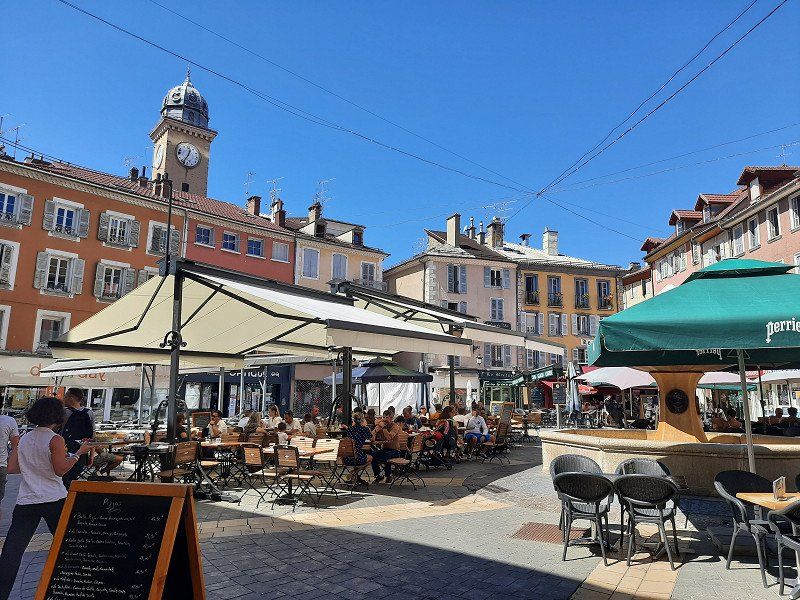
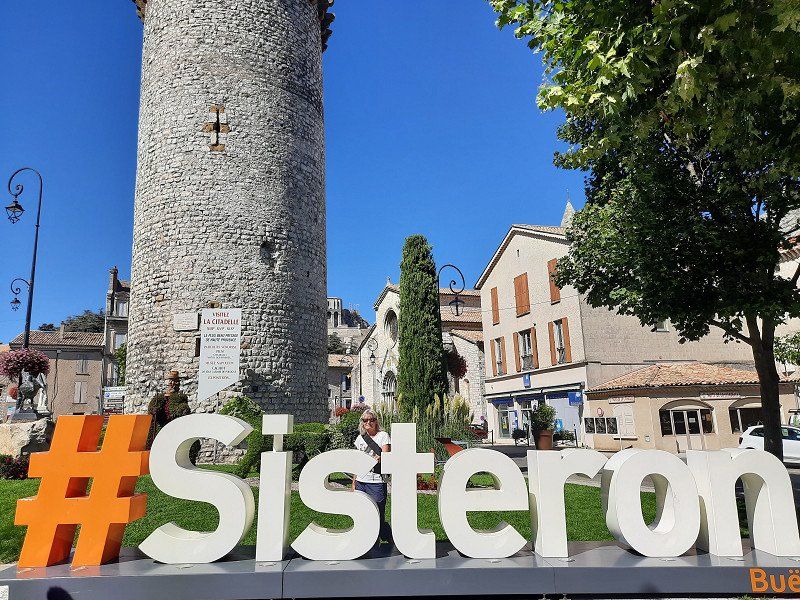
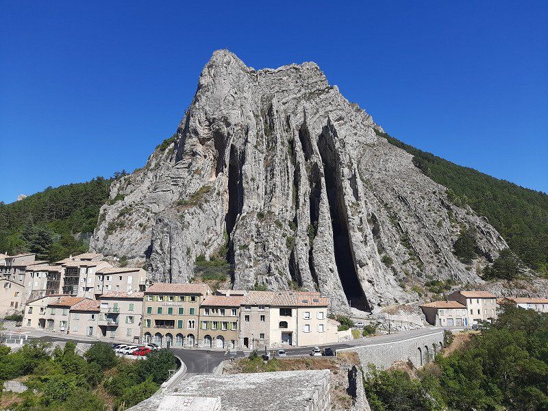
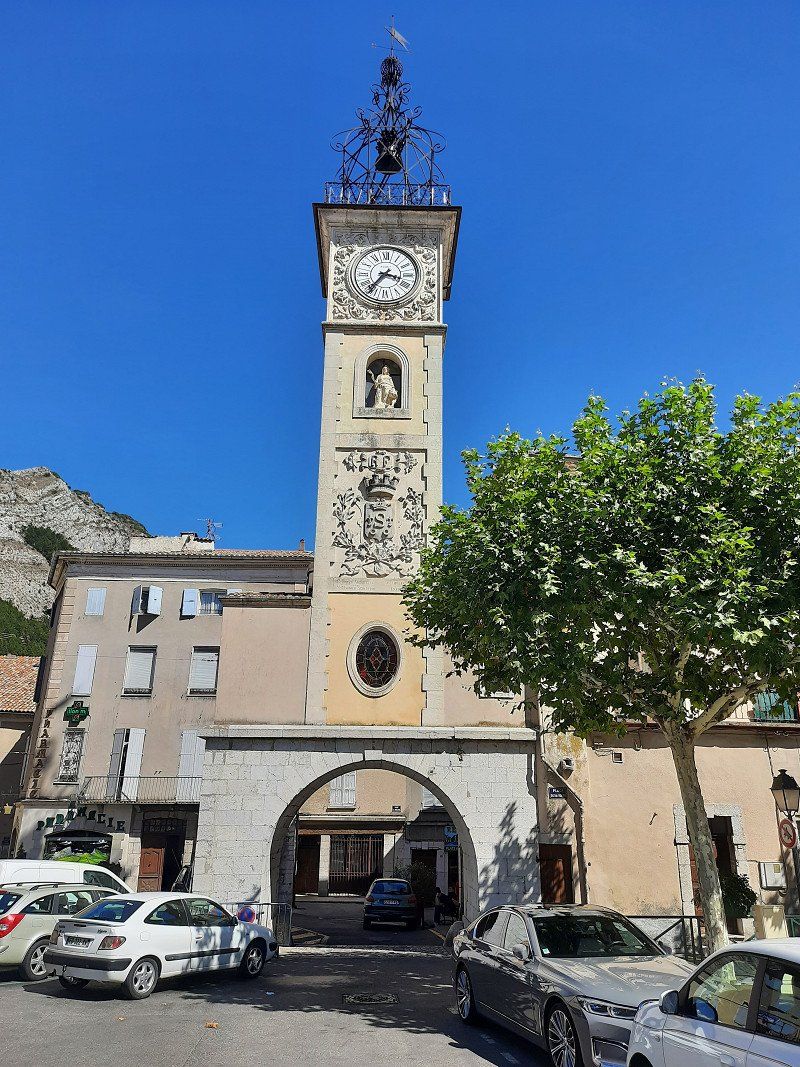
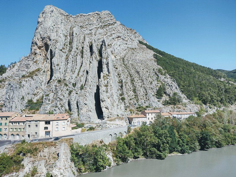
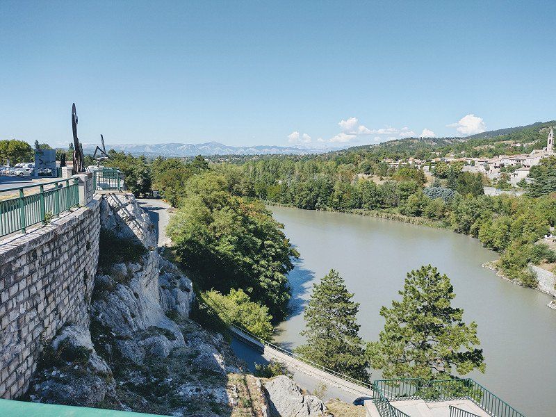
Sisteron 44.19695, 5.93779
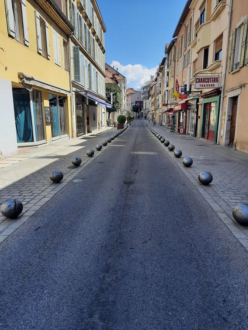
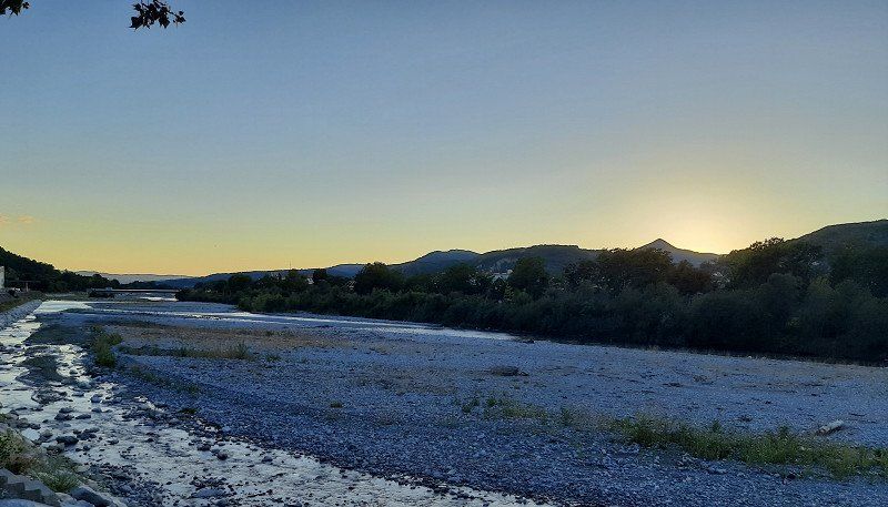
Getting to Sisteron was easy, exclusively on the N85, which has been upgraded to a dual carriageway. Sisteron is situated on a gorge in the mountains on the Durance. You only had to drive through the towns at a moderate speed, often at 30 km/h.
Napoleon passed through the town of Sisteron on his famous return from exile on Elba.
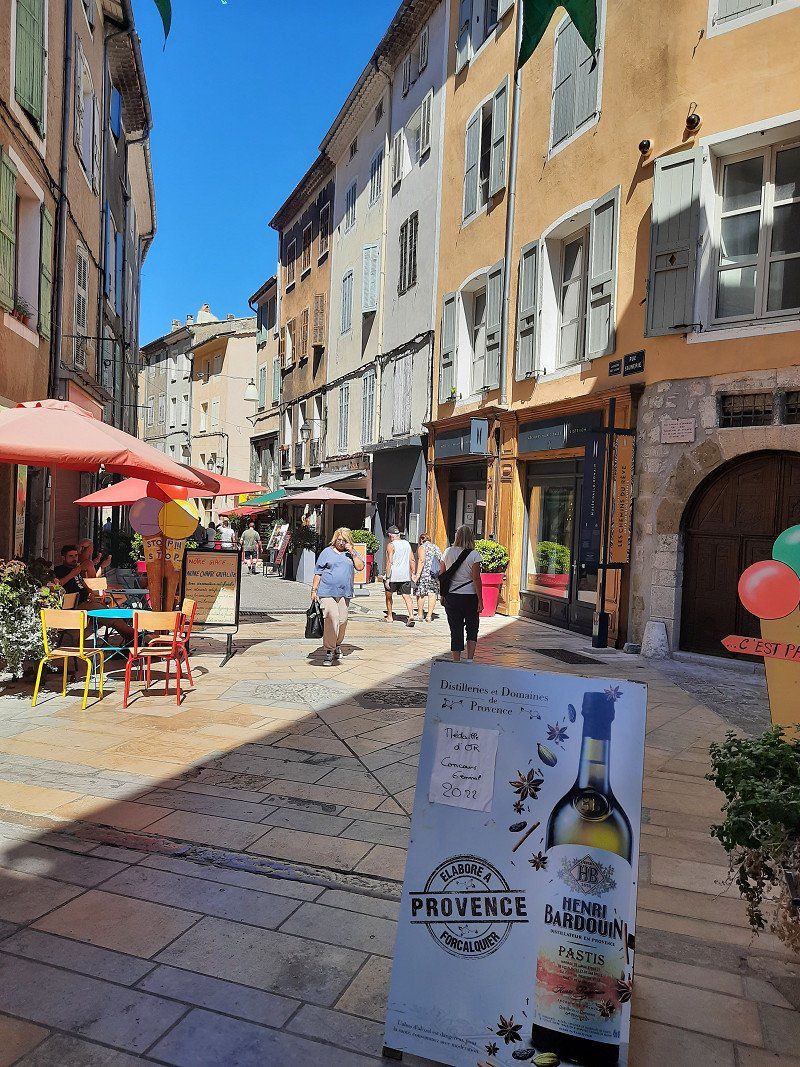
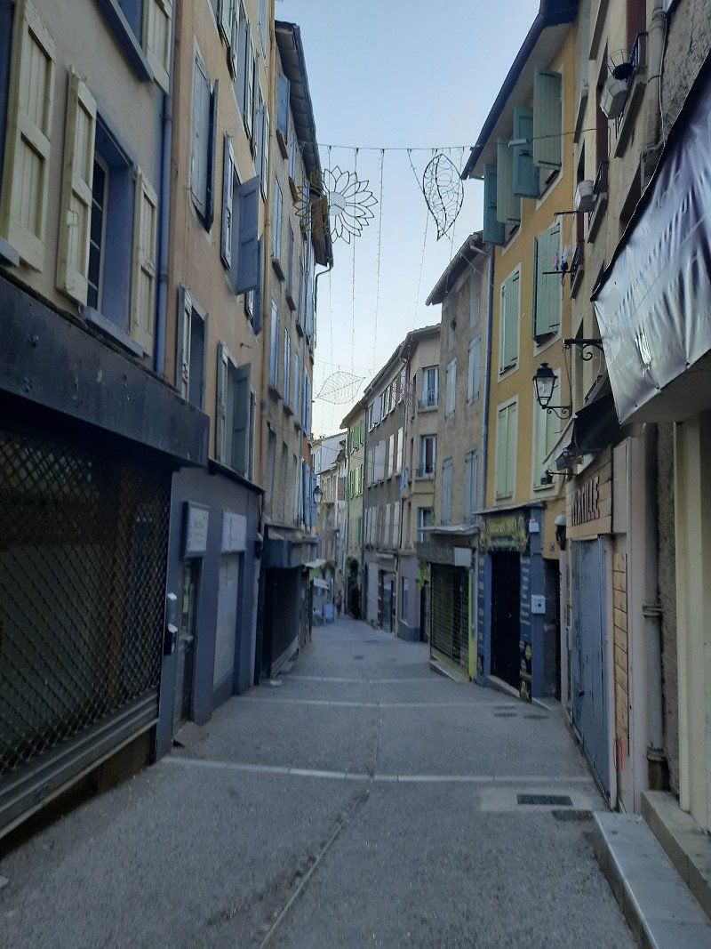
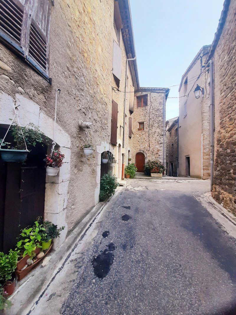
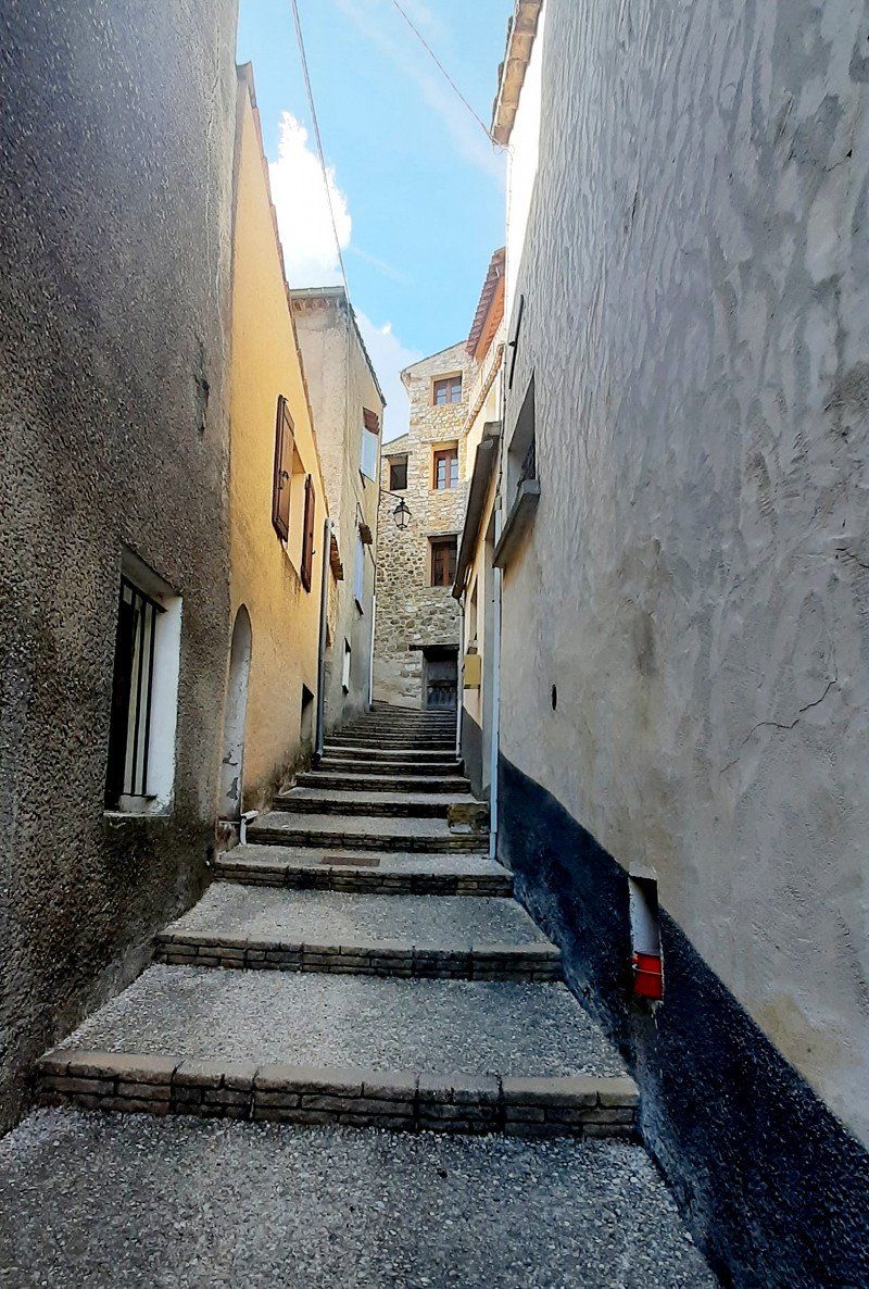
Sisteron is the gateway to Provence and a small tourist town. Already at the entrance to the city there were crowds of people, the parking space right at the entrance was occupied. The second variant was the parking space at the cemetery, to which we could not find the access road. By chance we saw a parking lot where there was also a mobile home, to which we stood. It was only a few minutes to the old town. The old town of Sisteron which is picturesque with narrow streets lined with old houses and an abundance of fountains. Notable monuments include the bell tower and the 12th-century Notre-Dame Cathedral. After visiting the old town, the citadel on the rocky hillside, originally from the 11th century, is worth a visit. During our walk on the viewing rock, we also saw the parking space at the cemetery where two campers were parked. The access to the parking space looked more difficult for us, the narrow streets are easy to drive on.
04200 Sisteron, Frankreich
44° 11' 41" N 5° 56' 35.5" E
44.1947130 5.9431910
• Head toward Rue des Cordeliers on Avenue de la Libération (D4085). Go for 2.5 km.
• Pass 3 roundabouts and continue on Route de Nice (N85). Go for 17.9 km.
• Take the 3rd exit from roundabout onto Route Napoléon (N85) toward Digne les Bains/Nice/Mallemoisson. Go for 7.2 km.
• Take the 1st exit from roundabout onto Avenue du Général de Gaulle (N85). Go for 2.1 km.
• Pass 3 roundabouts and continue on N85. Go for 6.8 km.
• Take the 2nd exit from roundabout onto Avenue Simone Pellissier (N1085) toward Barcelonnette/Centre Ville. Go for 1.2 km.
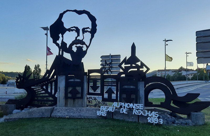
• Take the 1st exit from Giratoire des Insurgés de 1851 roundabout onto Pont Beau de Rochas. Go for 142 m.
• Keep left onto Boulevard Gambetta. Go for 221 m.
• Take the 1st exit from Rond-Point du 11 Novembre 1918 roundabout onto Boulevard Thiers (D20). Go for 247 m.
• Continue on Avenue du 8 Mai 1945 (D20). Go for 218 m.
• Take the 2nd exit from Rond-Point de la 1ère Armée Française roundabout onto Avenue du 8 Mai 1945 (D20). Go for 571 m.
• Continue on Boulevard du 8 Mai 1945 (D20). Go for 1.6 km.
• Turn right onto Avenue des Thermes (D20). Go for 605 m.
• Arrive at Avenue des Thermes (D20). Your destination is on the right.
☍
41,2 km
( 43 min.)
Digne-les-Bains 44.08287, 6.22138
Before our stage destination in Dingle les Bains we went shopping at the discounter. When we arrived at the parking space, there were two WoMos, then the mobile homes came one after the other. We arrived in time to get a seat. It was oppressively hot 34°C. First we lowered all the blinds on the sunny side. It was too hot to go to the old town. After dinner we went for a walk to the old town. A nice bike and footpath led along the Bléone river to the town about 10 minutes walk. The streets of the old town were deserted, only a few people were sitting in a small restaurant or bar.
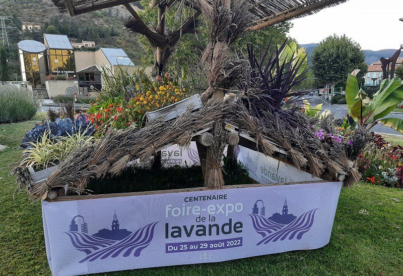
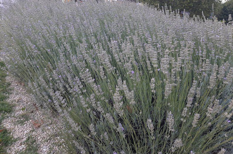
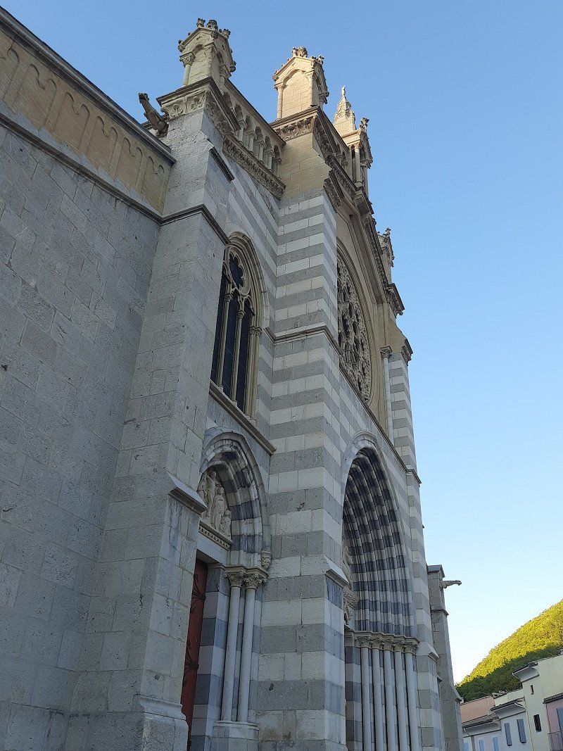
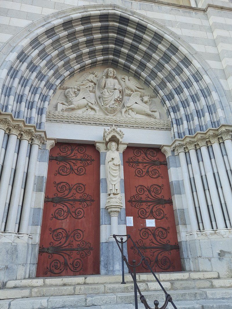
The Notre-Dame-du-Bourg cathedral in Romanesque style from the 11th to the 13th centuries. Saint-Jerôme Cathedral is a more recent construction and is a 15th-16th century Gothic building. Century (although the facade was rebuilt in the 19th century). Cathedral with a beautiful portal was already closed. Dingle les Bains is the self-proclaimed capital of lavender. Especially between the end of June and mid-August you can experience the landscape in the fragrant purple of the medicinal plant. Then we went back to the WoMo, where we enjoyed the evening outside in a mild breeze.
Avenue des Thermes, 04000, Digne-les-Bains, France
44° 4' 46" N 6° 15' 43" E
44.0794444 6.2619444
• Head northwest on Avenue des Thermes (D20). Go for 2.1 km.
• Continue on Avenue du 8 Mai 1945 (D20). Go for 540 m.
• Take the 2nd exit from Rond-Point de la 1ère Armée Française roundabout onto Avenue du 8 Mai 1945 (D20). Go for 255 m.
• Continue on Boulevard Thiers (D20). Go for 219 m.
• Take the 3rd exit from Rond-Point du 11 Novembre 1918 roundabout onto Grand Pont. Go for 427 m.
• Take the 2nd exit from Giratoire des Insurgés de 1851 roundabout onto Avenue Simone Pellissier (N1085). Go for 1.2 km.
• Take the 3rd exit from roundabout onto N85 toward Nice/Barrême. Go for 560 m.
• Take the 3rd exit from Rond-Point René Vieto roundabout onto Route Napoléon (N85) toward Nice/Grasse/Cannes/Barrême. Go for 8.8 km.
• Turn right toward Mézel/Riez/Moustiers St M./Châteauredon. Go for 59 m.
• Turn right onto D907. Go for 1.5 km.
• Take the 2nd exit from roundabout onto D907. Go for 12.0 km.
• Continue on D953. Go for 8.5 km.
• Turn left onto Route de Moustiers (D56). Go for 216 m.
• Continue on D56. Go for 2.4 km.
• Continue on Lieu-dit Grenouillet (D56). Go for 98 m.
• Continue on D56. Go for 2.4 km.
• Turn left onto D952. Go for 6.9 km.
• Turn right onto Chemin de la Maladrerie. Go for 411 m.
• Turn left onto Chemin de la Maladrerie. Go for 23 m.
• Turn slightly left onto Chemin de la Maladrerie. Go for 322 m.
• Turn slightly right onto Avenue de Lérins. Go for 212 m.
• Turn left. Go for 157 m.
• Turn right. Go for 237 m.
• Turn right toward Lieu-dit Saint-Maurin. Go for 9.0 km.
• Continue on Lieu-dit Saint-Maurin. Go for 4.3 km.
• Turn slightly right onto D123. Go for 285 m.
• Continue on Lieu-dit Le Plan (D123). Go for 54 m.
• Continue on D123. Go for 438 m.
• Turn sharp left onto Lieu-dit Coni. Go for 909 m.
• Continue on Lieu-dit le moulin. Go for 1.2 km.
• Continue on Lieu-dit Les Fabres. Go for 129 m.
• Continue on Lieu-dit Le Ponsonnet. Go for 603 m.
• Turn right onto D17. Go for 6.0 km.
• Turn left onto D317. Go for 407 m.
• Continue on Lieu-dit La Tieye (D317). Go for 124 m.
• Continue on D317. Go for 312 m.
• Continue on Lieu-dit La Terrasse (D317). Go for 59 m.
• Continue on Grande Rue (D317). Go for 95 m.
• Arrive at your destination on the left.
☍
73,4 km
(1 hrs. 54 min.)
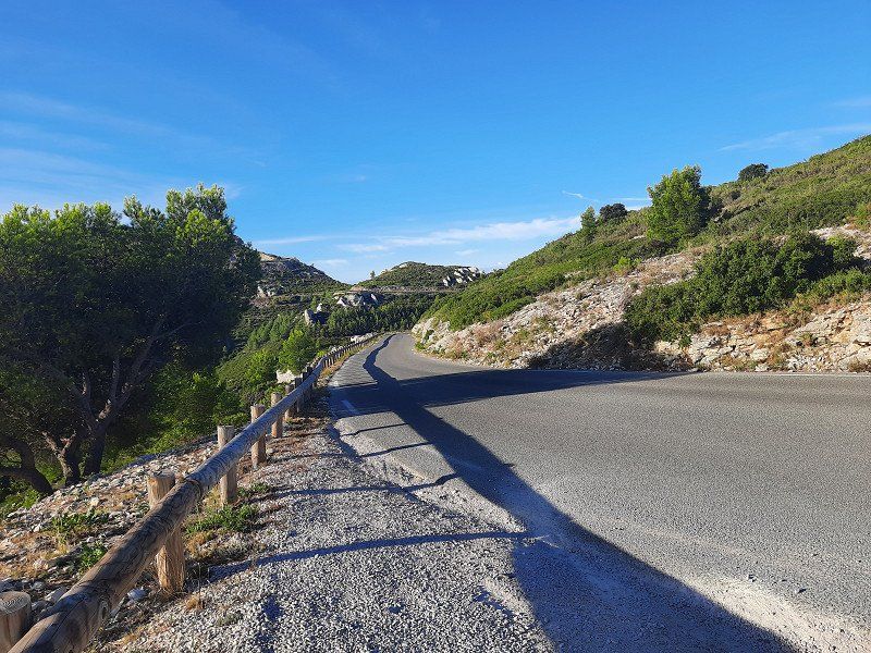
Über das Gebirge "Clue de Taulann"
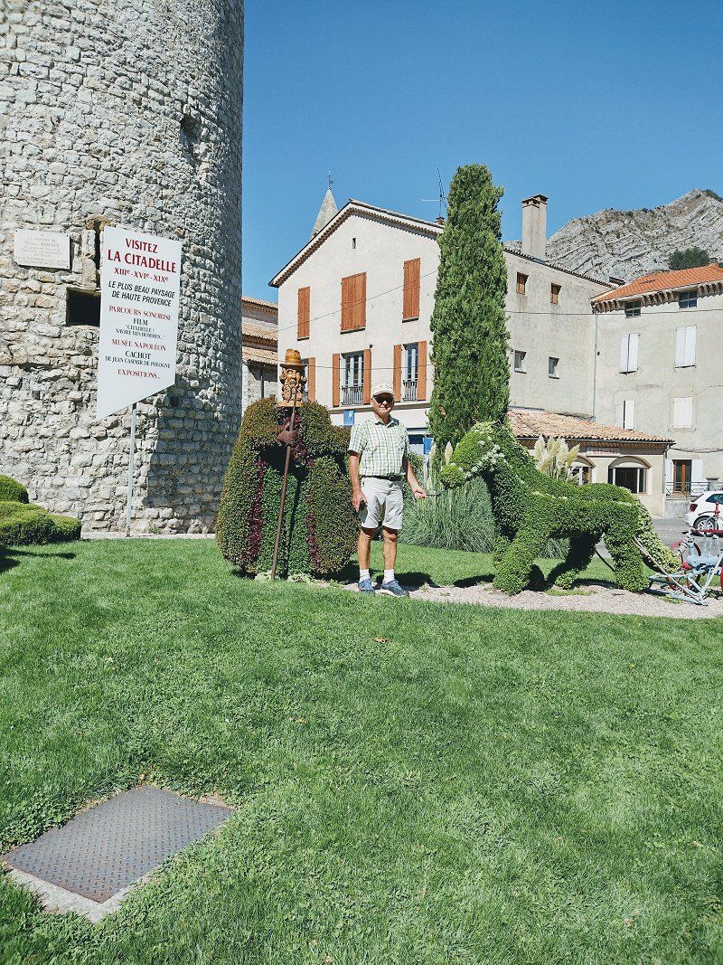
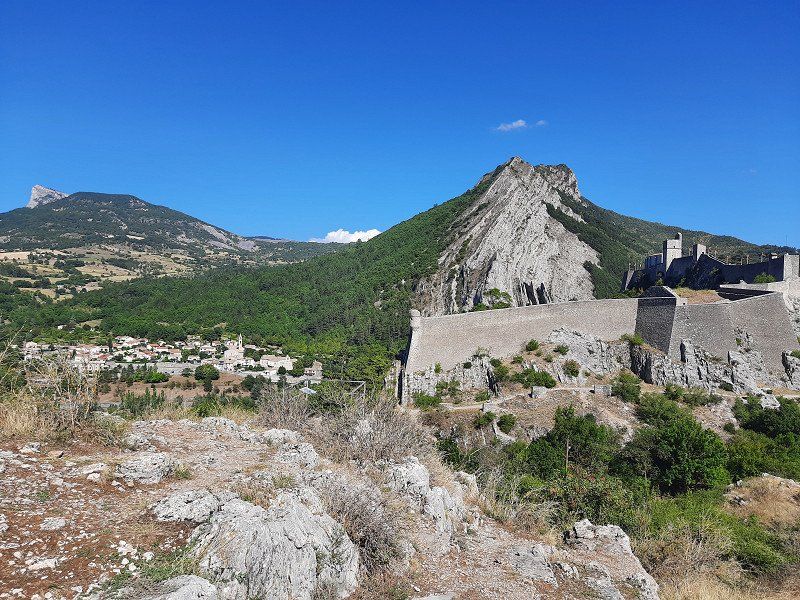
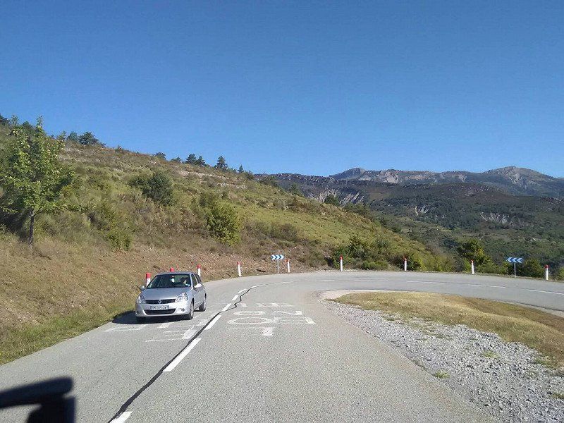
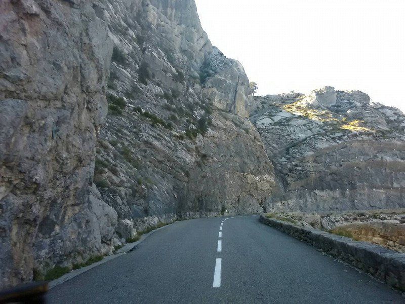
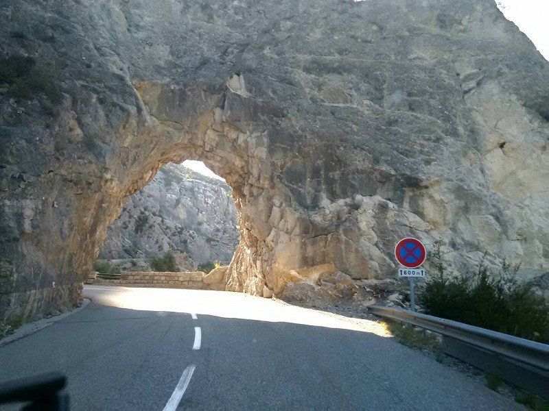
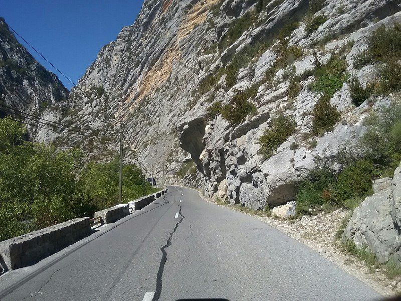
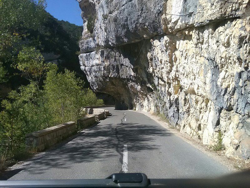
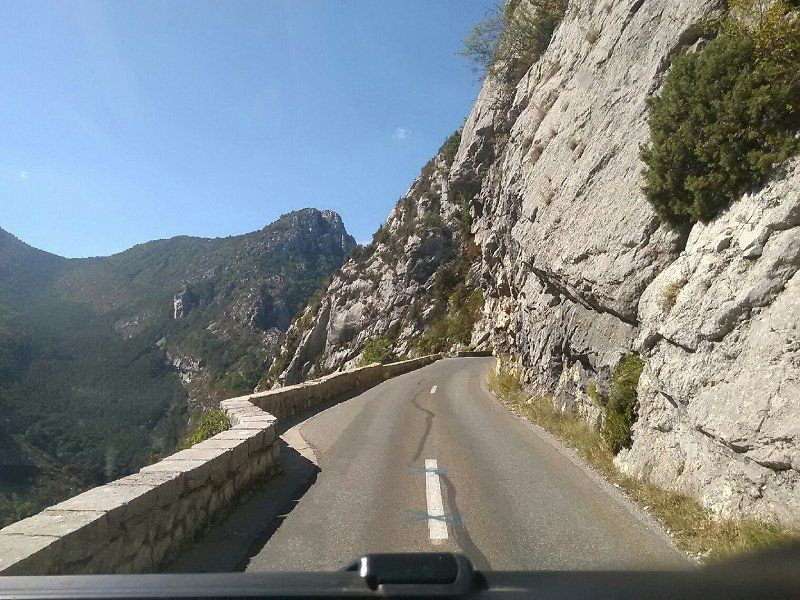
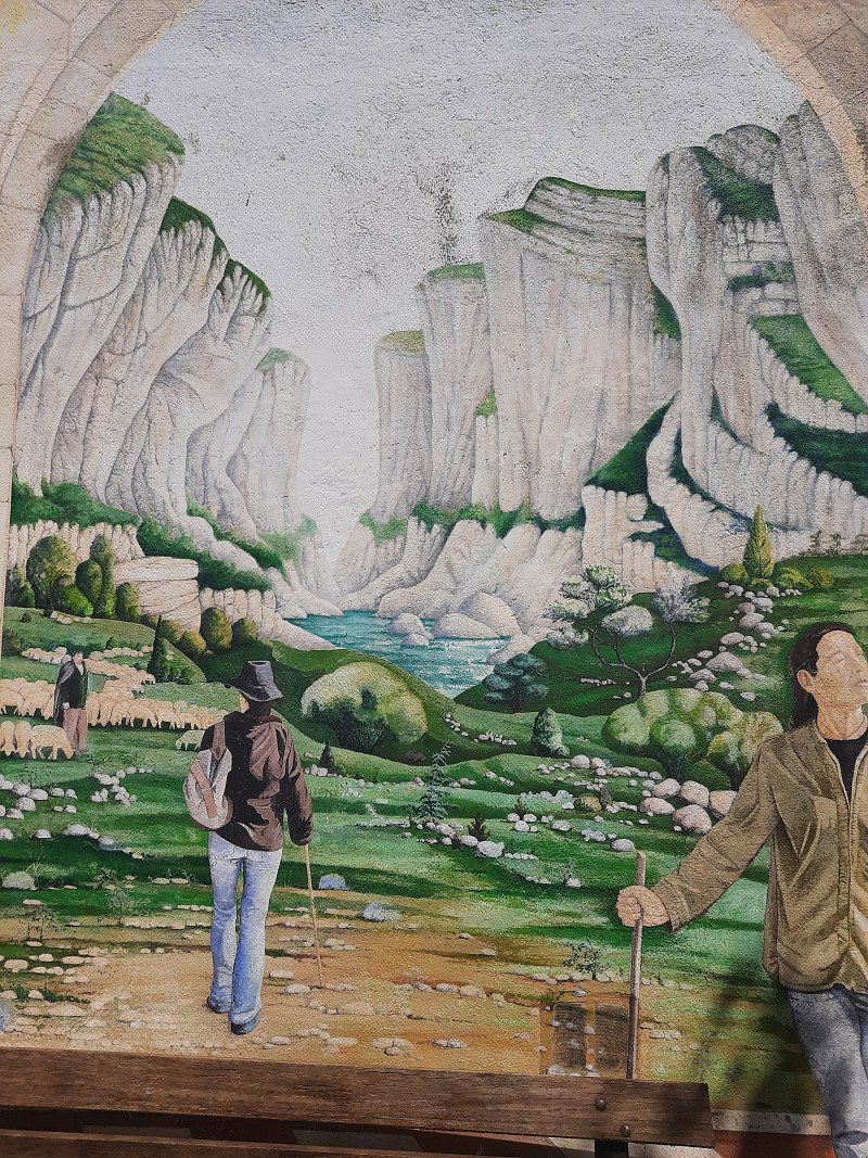
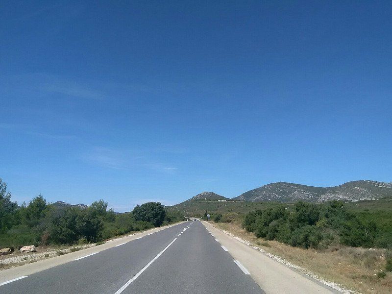
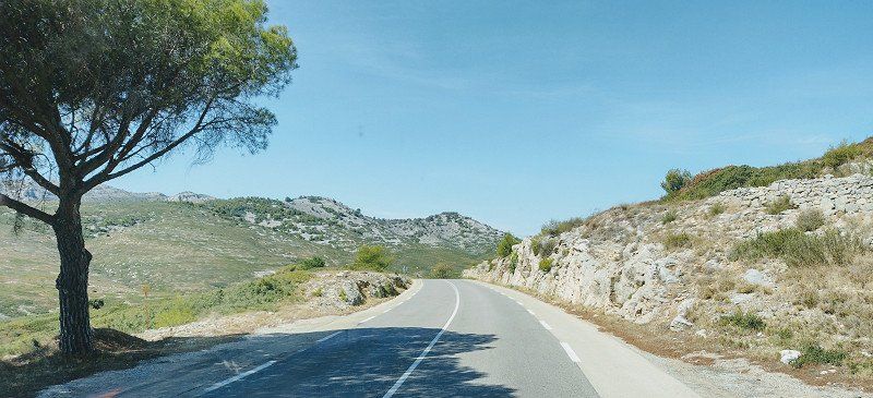
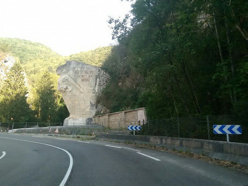
Located north of Castellane, this pass is part of the Route Napoleon. A special highlight of this route is the Clue de Taulanne to Castellane . Fantastically beautiful, it's a pity that you can't make a photo stop.
Day
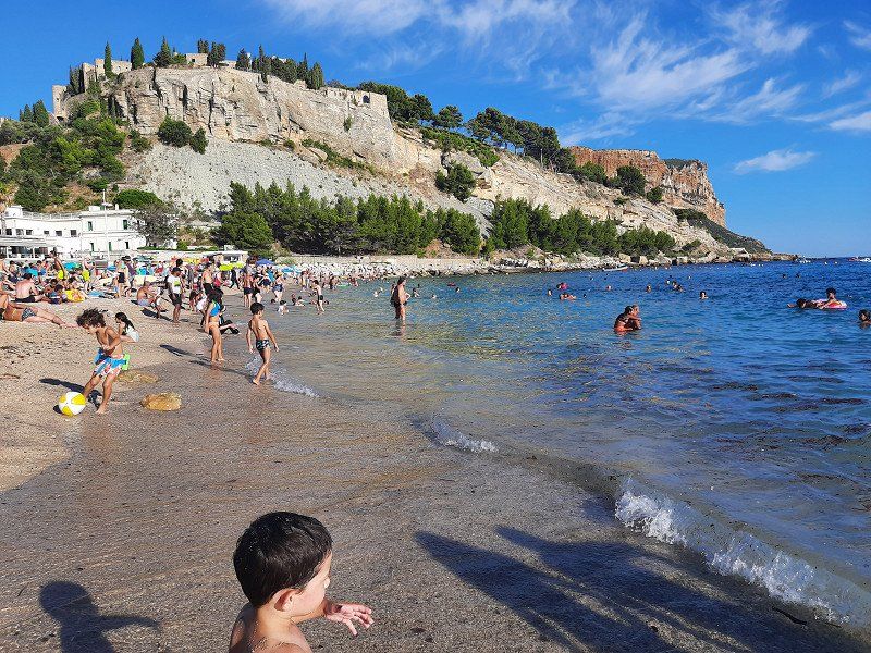
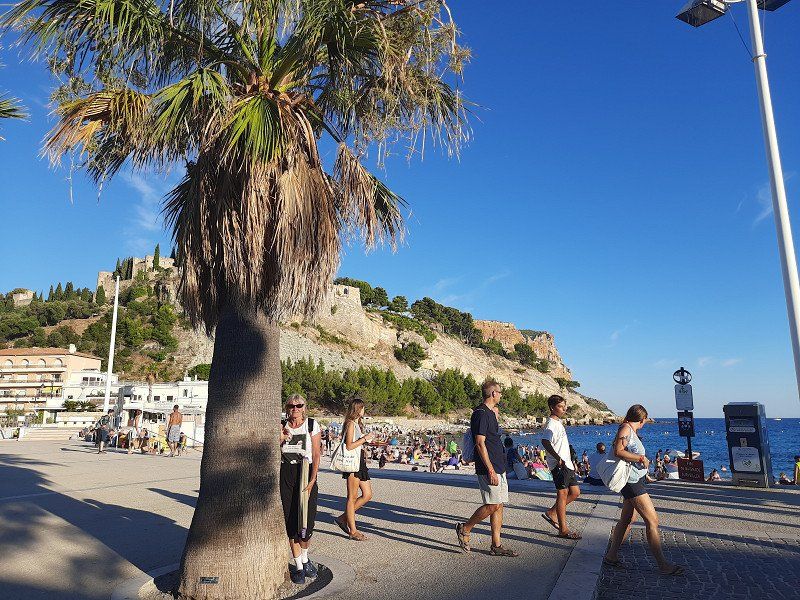
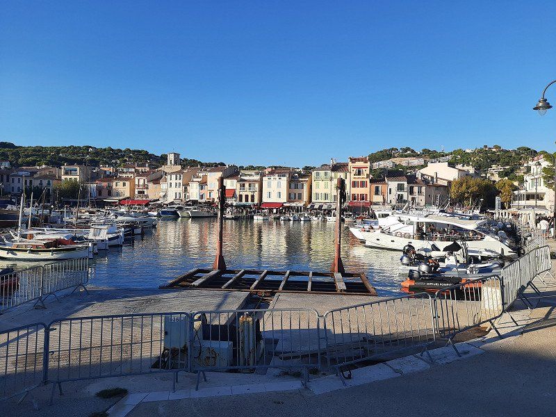
Castellane
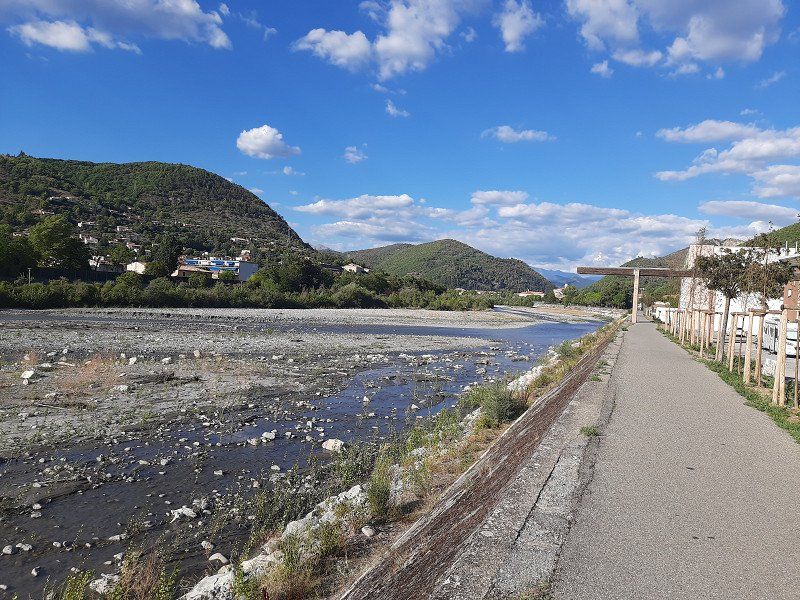
In Castellane we went into the Verdon Gorge.
04120, Frankreich
43° 47' 57.3" N 6° 24' 8.5" E
43.7992530 6.4023510
• Head toward Rue la Ville. Go for 32 m.
• Continue on Grande Rue (D317). Go for 63 m.
• Continue on Lieu-dit La Terrasse (D317). Go for 59 m.
• Continue on D317. Go for 312 m.
• Continue on Lieu-dit La Tieye (D317). Go for 124 m.
• Continue on D317. Go for 407 m.
• Turn right onto D17. Go for 6.0 km.
• Turn left onto Lieu-dit Le Ponsonnet. Go for 603 m.
• Continue on Lieu-dit Les Fabres. Go for 1.2 km.
• Continue on Lieu-dit le moulin. Go for 90 m.
• Continue on Lieu-dit Coni. Go for 909 m.
• Continue on D123. Go for 2.6 km.
• Continue on Lieu-dit Le Brec (D123). Go for 76 m.
• Continue on Lieu-dit Coni (D123). Go for 333 m.
• Turn slightly left onto Lieu-dit Le Vignal. Go for 271 m.
• Continue toward Lieu-dit Le Village la Palud. Go for 92 m.
• Turn slightly left onto Lieu-dit Le Village la Palud. Go for 9 m.
• Continue on Lieu-dit Le Village la Palud. Go for 187 m.
• Turn slightly right onto Lieu-dit Le Village la Palud. Go for 124 m.
• Turn right onto Lieu-dit Le Village la Palud. Go for 76 m.
• Arrive at Lieu-dit Le Village la Palud. Your destination is on the left.
☍
13,6 km
( 32 min.)
La Palud-sur-Verdon
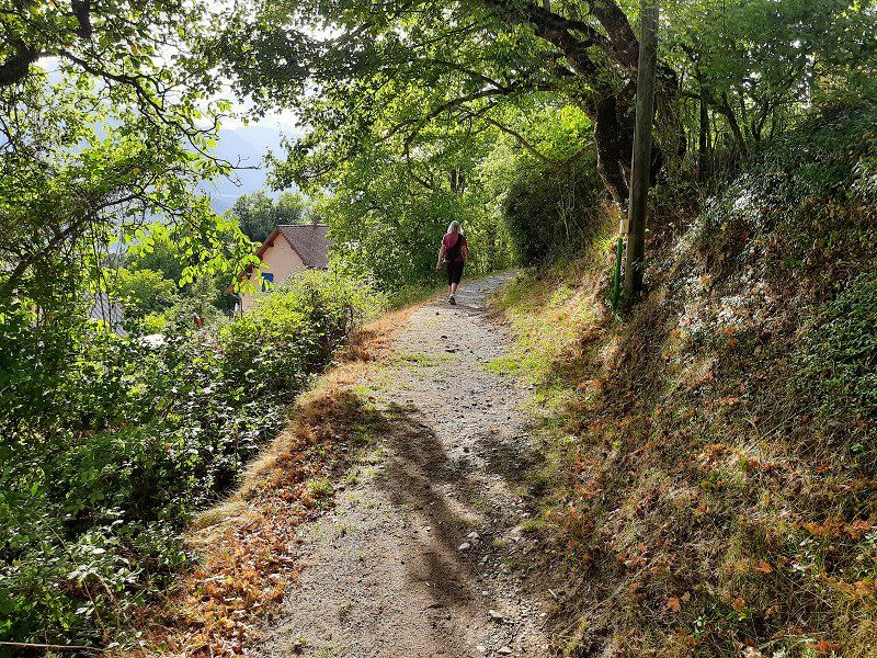
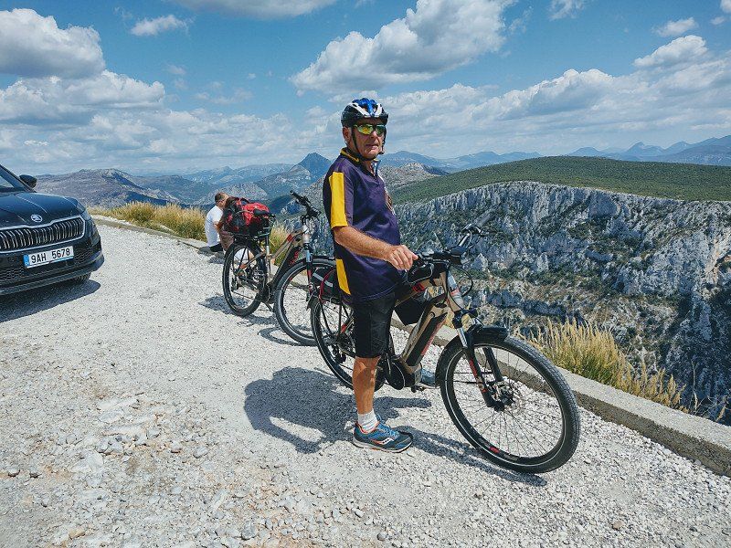
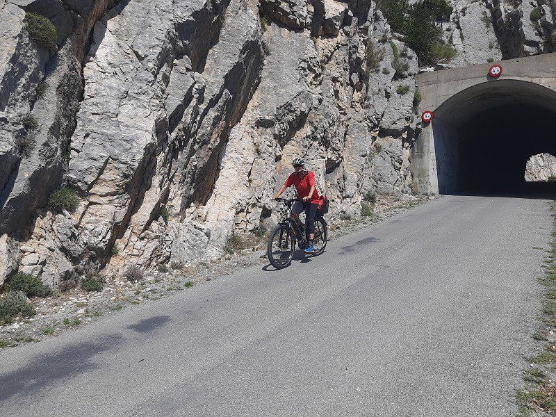
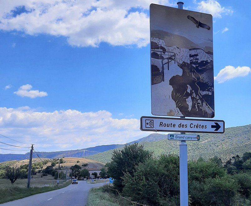
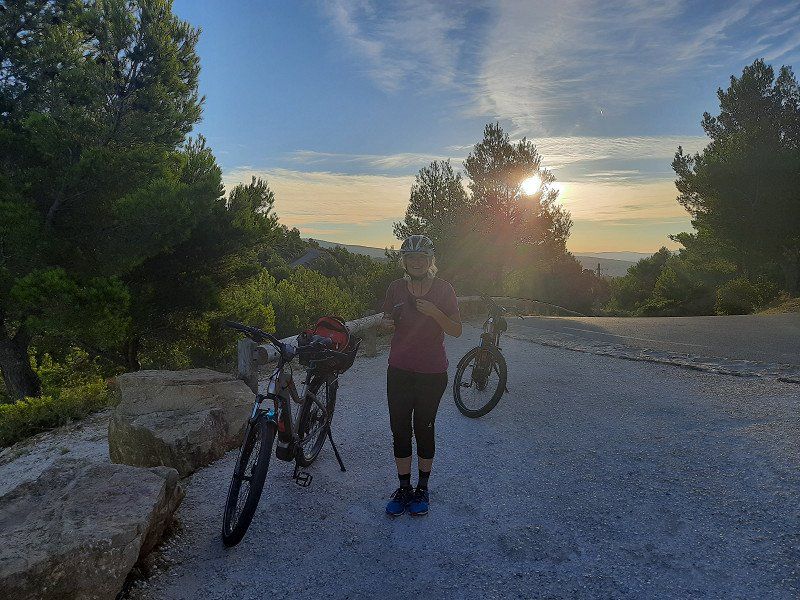
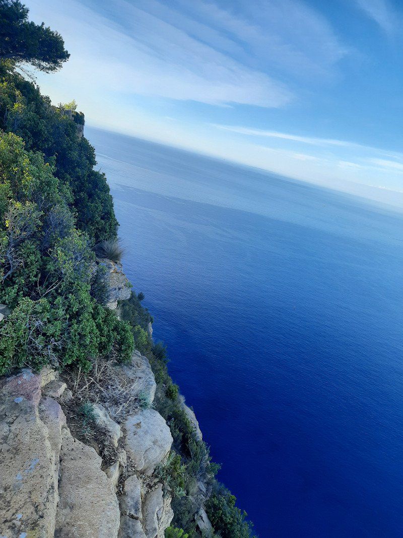
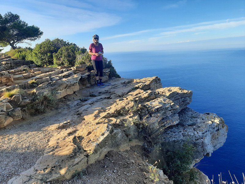
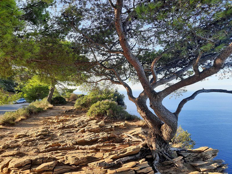
The campsite was today's destination. From there we could cycle the Route des Cretes. The Route des Cretes can be traveled by car, mobile home or by bicycle. We decide to go on a bike tour in order to be able to fully enjoy this great landscape.
Shortly after the village of Palud sur Verdon, this legendary route branches off to the right and winds its way up the mountain, curve after curve. The weather is kind to us, white blue skies and a cool breeze give us an incomparable bike tour. We were comfortably on the road for about 2.5 hours - about until we returned to the mobile home.
Frankreich
43° 46' 46.2" N 6° 20' 30.6" E
43.7794979 6.3418440
• Head southeast on Lieu-dit Le Village la Palud. Go for 76 m.
• Turn left onto Lieu-dit Le Village la Palud. Go for 320 m.
• Turn slightly right toward Lieu-dit Le Vignal. Go for 92 m.
• Continue on Lieu-dit Le Vignal. Go for 271 m.
• Turn slightly right onto Lieu-dit Coni (D123). Go for 333 m.
• Continue on Lieu-dit Le Brec (D123). Go for 76 m.
• Continue on D123. Go for 2.6 km.
• Keep left onto D123. Go for 438 m.
• Continue on Lieu-dit Le Plan (D123). Go for 54 m.
• Continue on D123. Go for 285 m.
• Turn slightly left toward Lieu-dit Saint-Maurin. Go for 3.6 km.
• Continue on Lieu-dit Saint-Maurin. Go for 5.9 km.
• Turn left. Go for 3.8 km.
• Turn left. Go for 237 m.
• Turn left toward Avenue de Lérins. Go for 157 m.
• Turn left onto Avenue de Lérins. Go for 274 m.
• Take the 1st exit from roundabout onto D952. Go for 694 m.
• Take the 2nd exit from roundabout onto D952. Go for 7.1 km.
• Turn right onto D56. Go for 2.4 km.
• Continue on Lieu-dit Grenouillet (D56). Go for 98 m.
• Continue on D56. Go for 2.4 km.
• Continue on Route de Moustiers (D56). Go for 216 m.
• Turn right onto Route de Digne (D953). Go for 4.0 km.
• Turn left onto D8. Go for 3.9 km.
• Continue on Lieu-dit Petit Telle (D8). Go for 193 m.
• Continue on D8. Go for 2.8 km.
• Continue on Lieu-dit Les Logissons (D8). Go for 1.1 km.
• Continue on D8. Go for 1.4 km.
• Continue on Route de Digne (D8). Go for 4.0 km.
• Turn right onto D15. Go for 693 m.
• Turn slightly right onto Route d'Oraison (D15). Go for 554 m.
• Turn left onto D6 A. Go for 1.4 km.
• Turn right onto Route de Manosque (D6). Go for 12.9 km.
• Take the 2nd exit from roundabout onto Route de la Durance (D907). Go for 1.3 km.
• Take the 2nd exit from roundabout onto Route de la Durance (D907). Go for 700 m.
• Take the 3rd exit from Rond-Point des Grandes Terres roundabout onto A51 (Autoroute du Val de Durance) toward Marseille/Aix en Pce. Go for 51.7 km.
• Take ramp onto Avenue Maréchal de Lattre de Tassigny (D7 N) toward Aix-Centre/Aix-Pontier. Go for 1.5 km.
• Turn left onto Rue Célony. Go for 346 m.
• Turn right onto Rue Van Loo. Go for 112 m.
• Turn slightly left onto Rue des Cordeliers. Go for 29 m.
• Turn left onto Rue de la Treille. Go for 31 m.
• Turn right onto Rue des Muletiers. Go for 78 m.
• Continue on Rue des Cardeurs. Go for 49 m.
• Arrive at Rue des Cardeurs.
☍
120,1 km
(2 hrs. 5 min.)
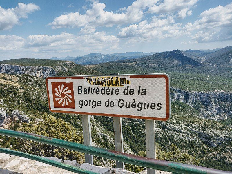
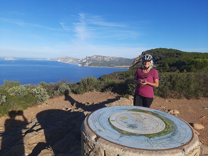
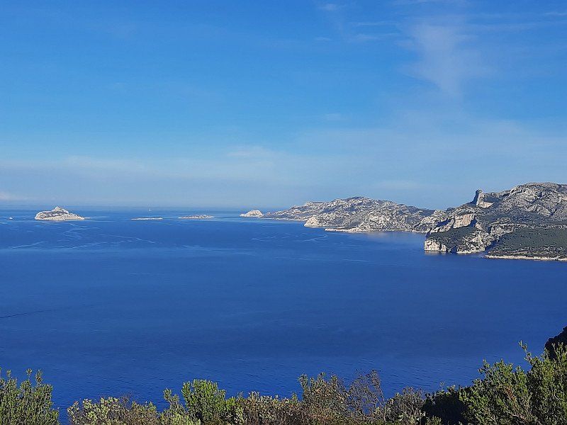
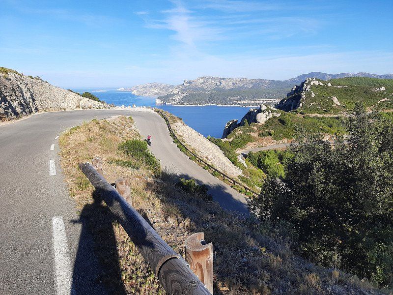
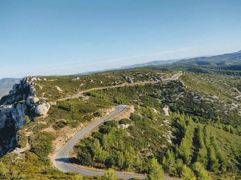
"Die Route des Cretes" Verdonschlucht auf der D23 mit dem Rad erkundet
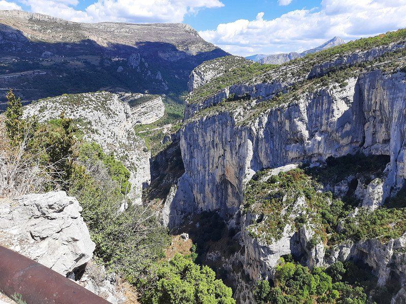
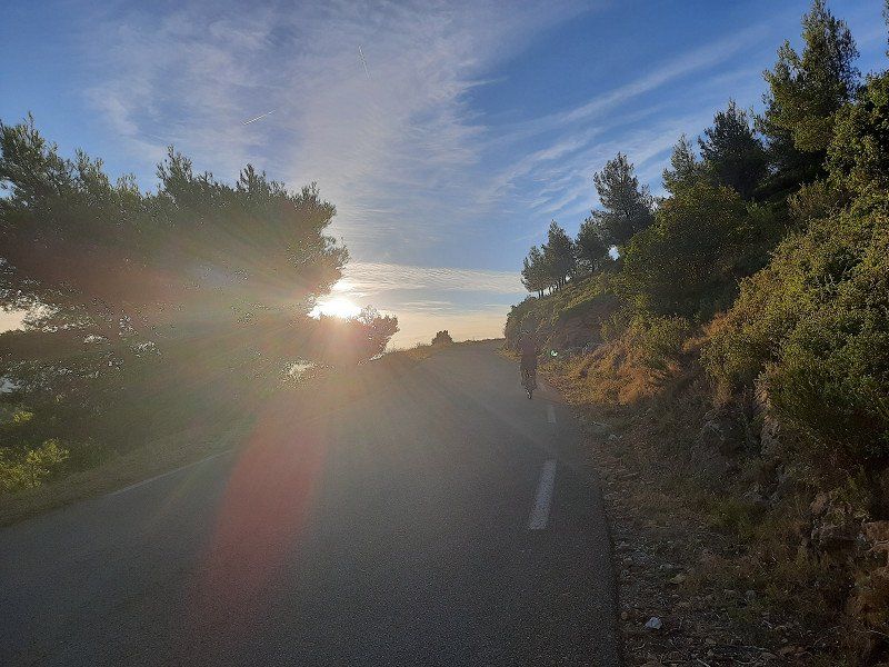
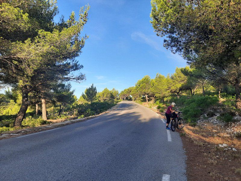
Today we explore a real masterpiece of road construction with the bike "the Route des Cretes" D23, which was only built in 1973 at a higher altitude, even up to 1300 m as a tourist road.
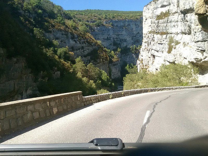
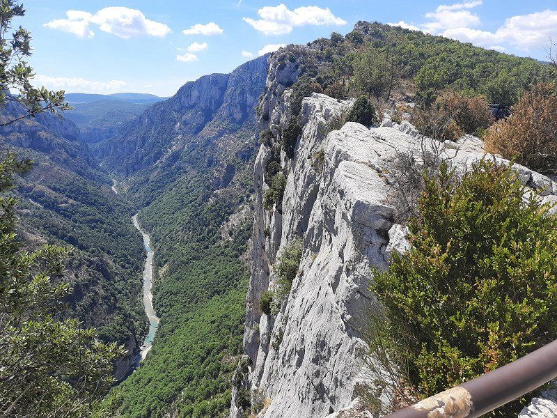
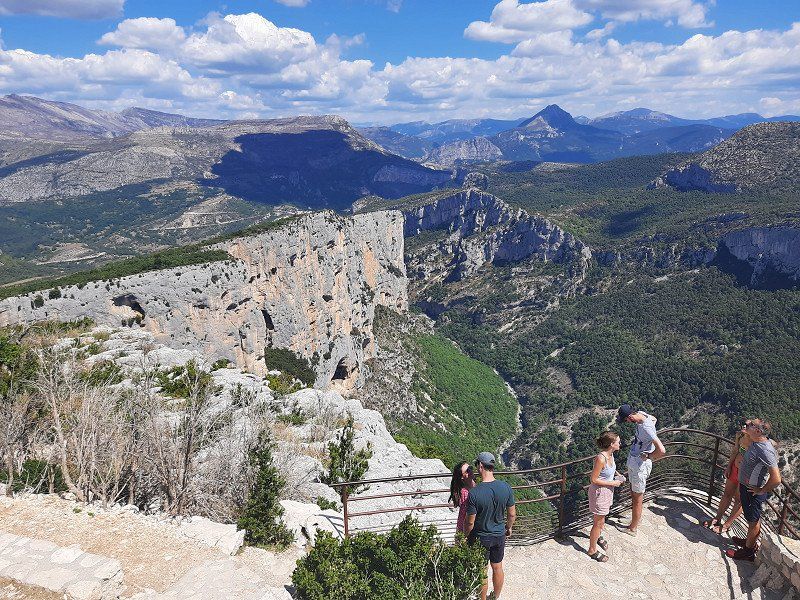
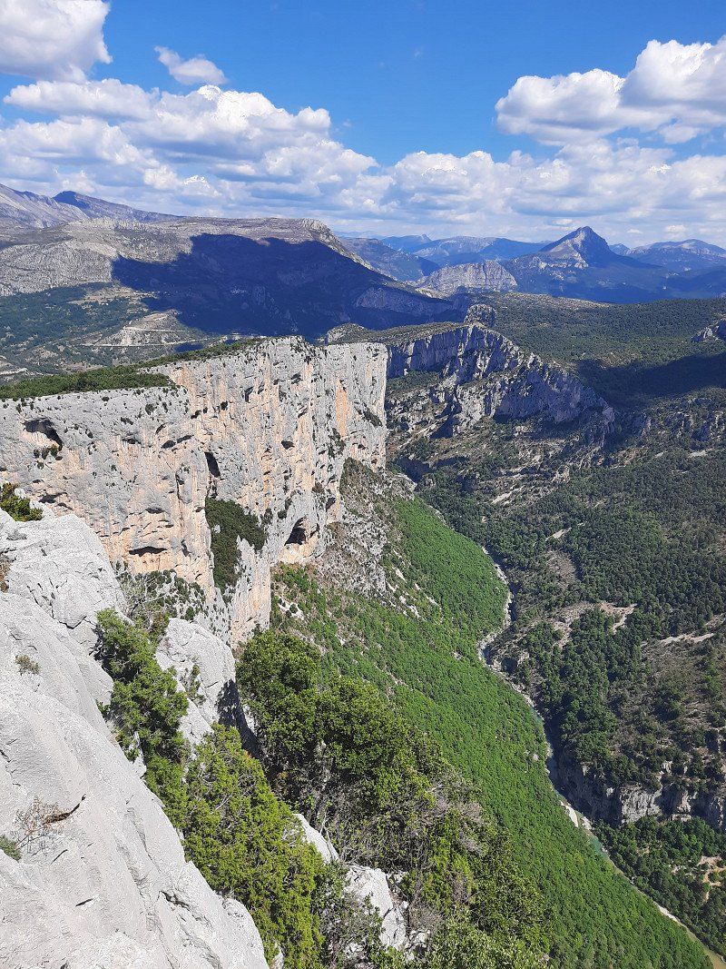
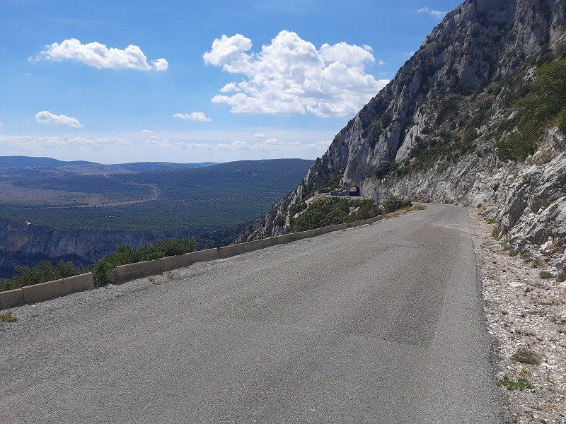
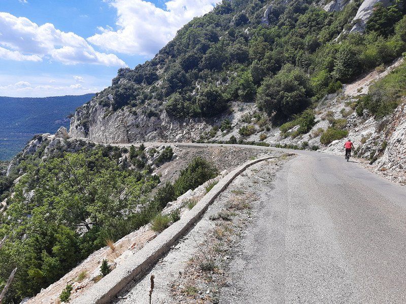
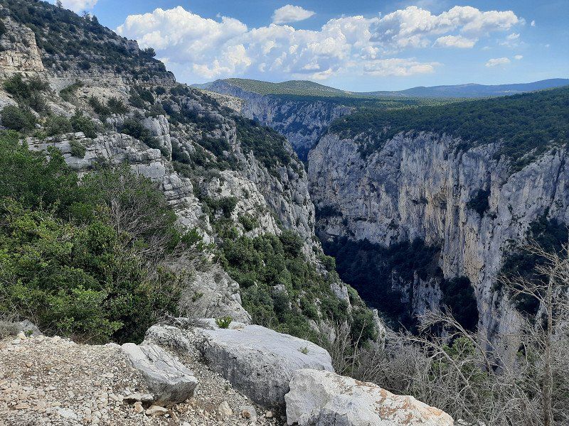
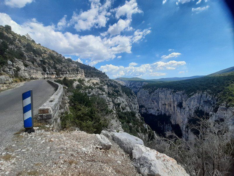
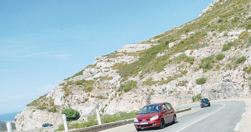
The Route des Cretes (The D23 road “Crest Line Route”) is a 24km circuit that packs a punch. Long stretches of it lead directly along the edge of the Grand Canyon du Verdon, the largest gorge in Europe. Many spectacular viewpoints. The river has carved a narrow gorge through the limestone massif for a good 20 km. Vertical walls up to 300 m deep can be admired here at the numerous vantage points. The wild river has dug itself up to 700 m deep into the ancient limestone.
Attention , the D23 is only passable in a clockwise direction (one-way street) .
Enjoying the many views from the numerous vantage points was no problem with the bike, in contrast to the cars, which hardly had a parking space to make a stop.
Day
Das Tor zur Provance
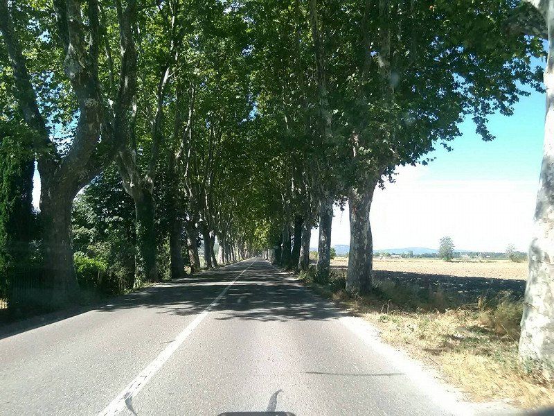
On the way on beautiful long avenues
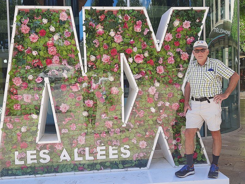
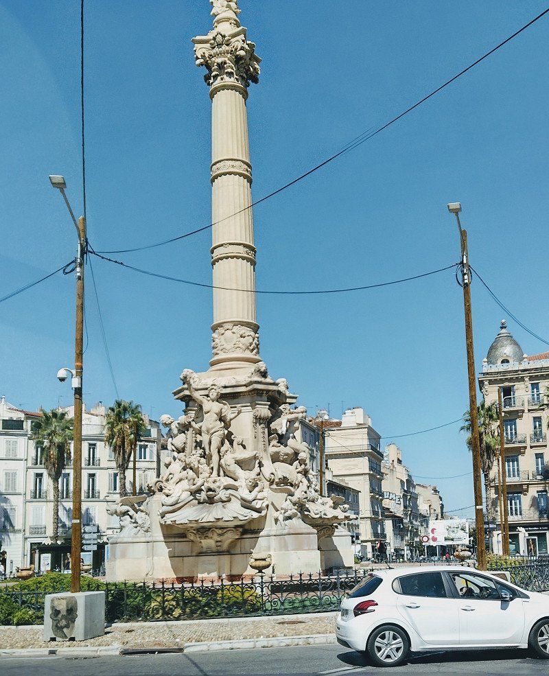
Aix-en-Provence 43.52281, 5.46136
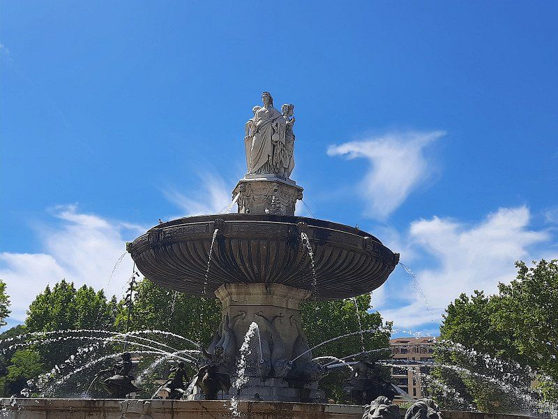
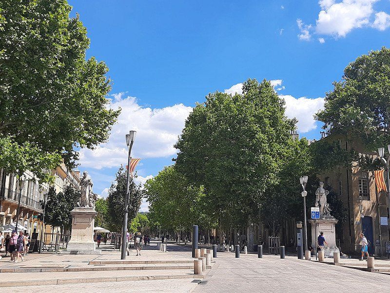
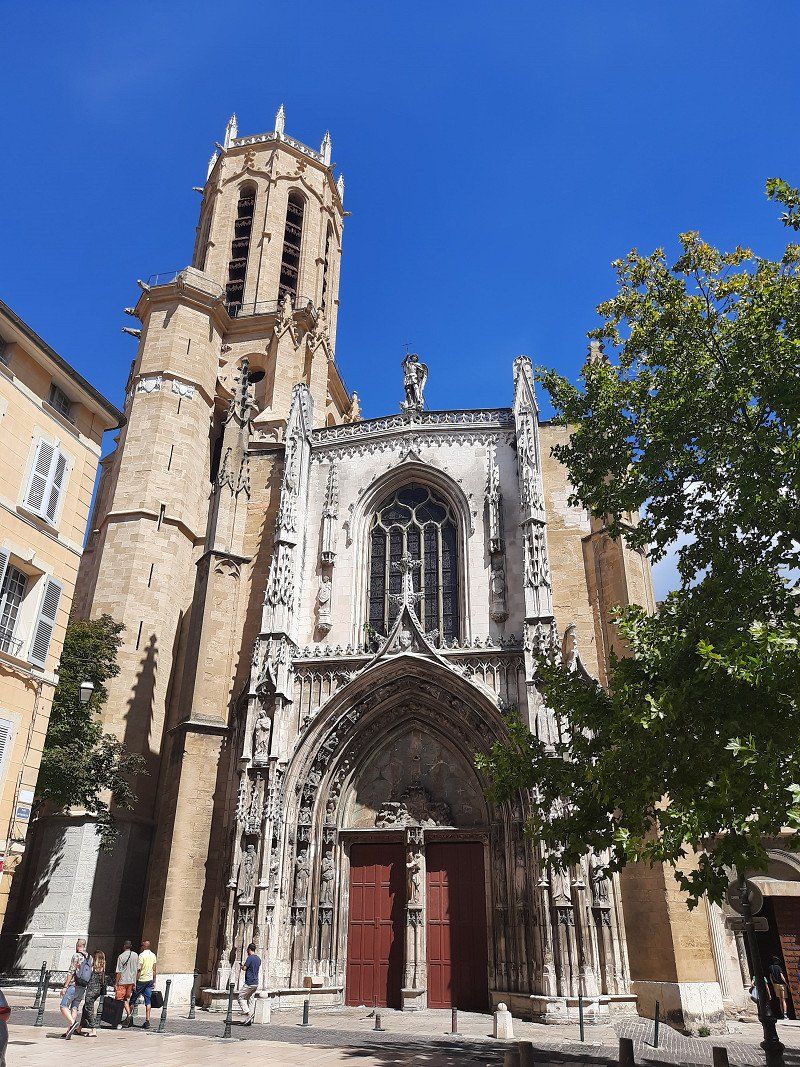
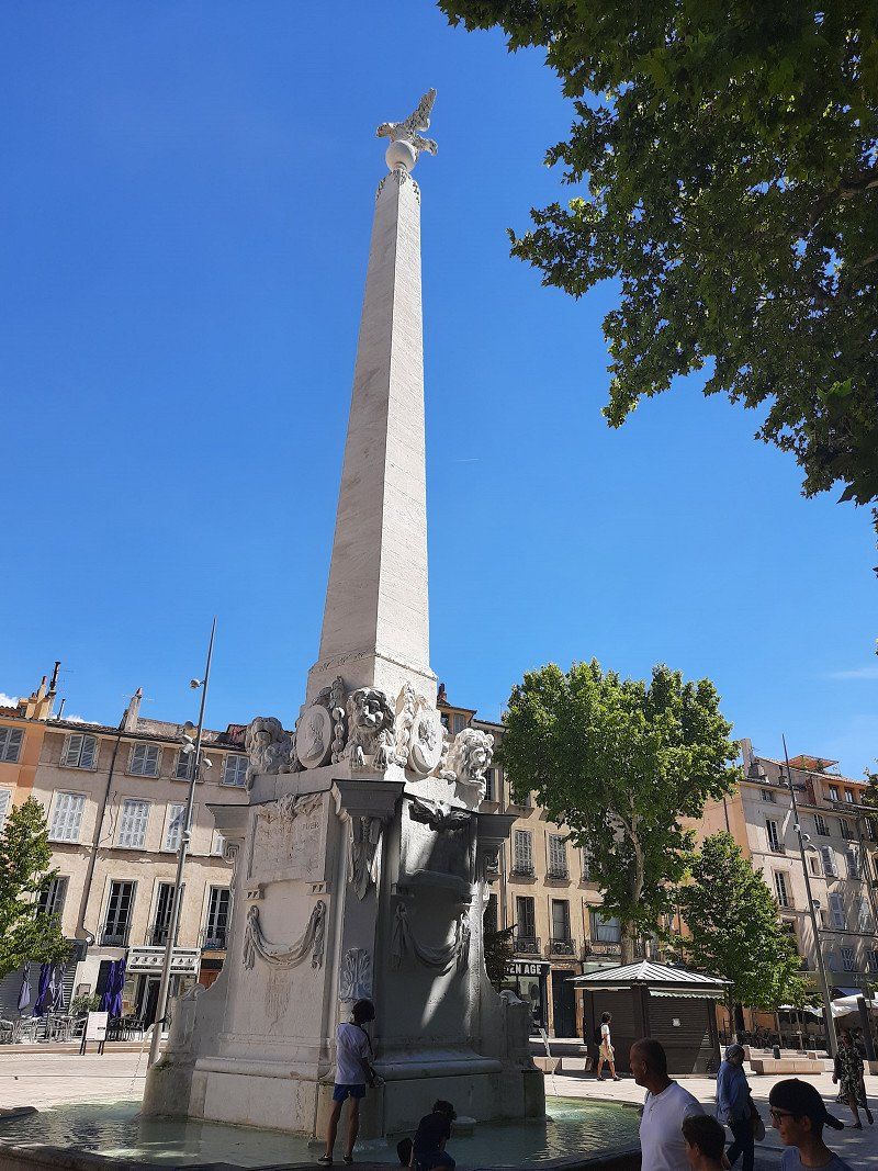
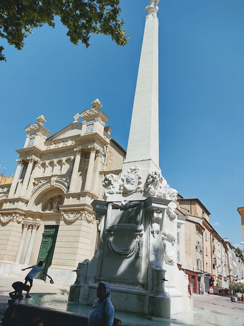
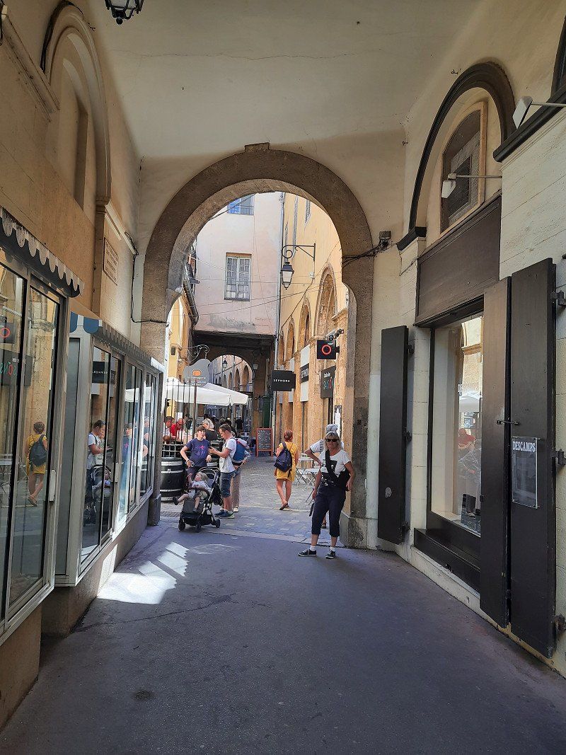
Approached the paid parking lot at the cemetery (GPS: 43.52281, 5.46136), we weren't the only camper that parked here. We were lucky with the parking fee, the ticket machine was broken. Going downtown was only a 15 minute walk. We came to a well-kept Provençal old town. Really lively, many restaurants. But fewer real sights. A beautiful fountain at the beginning of the promenade "Fontaine de La Rotonde".
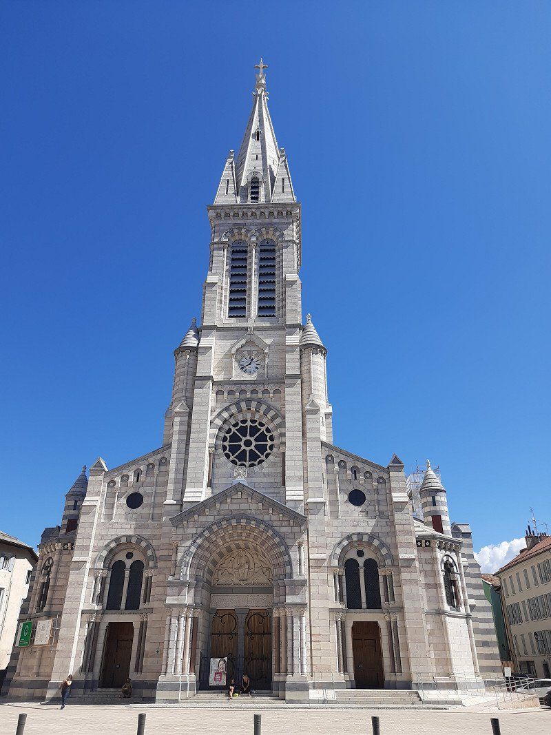
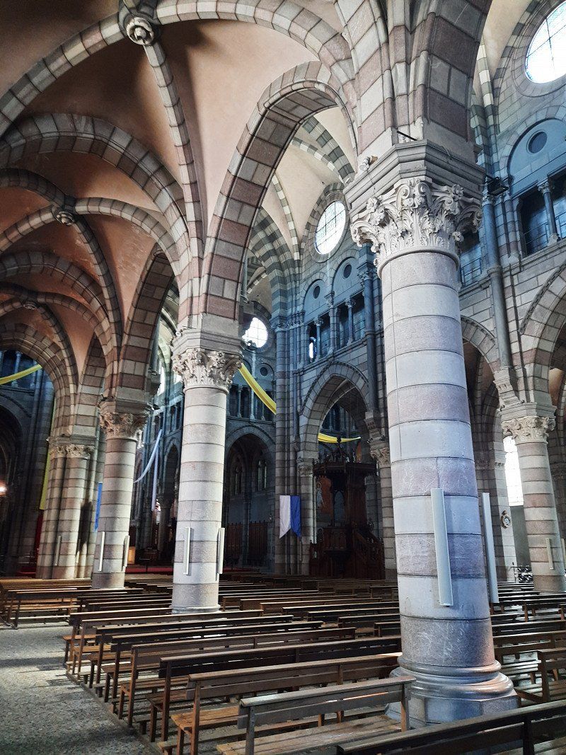
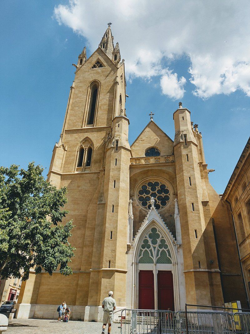
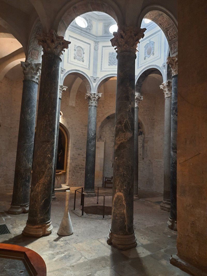
The imposing Cathédrale St - Sauveur with its late Gothic west facade was rebuilt over centuries and was another focal point through the old town. The Cloître St - Sauveur cloister with arcades and double columns was built around 1170.
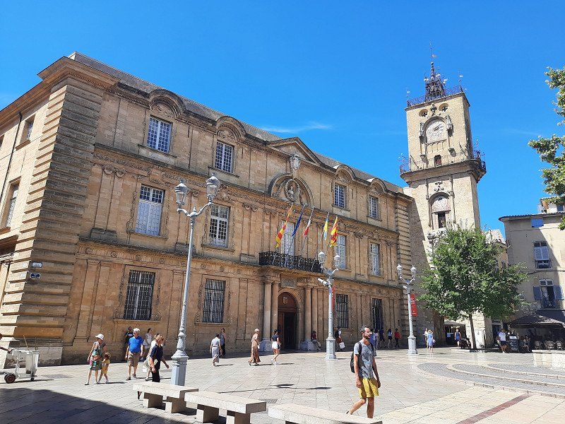
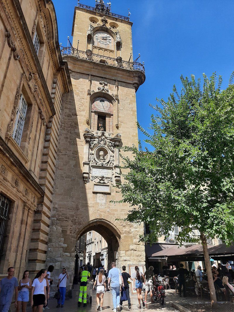
The town hall and elegant city palace frame the square in the center of the old town. The Tour de l'Horloge clock tower, built in 1505, crowned by a filigree bell cage with gallery. The astronomical clock with personifications of the four seasons dates from the 17th century.
The enormous heat that day made us end our visit to the city early.
Aix-en-Provence, Frankreich
43° 31' 47.1" N 5° 26' 50.7" E
43.5297420 5.4474270
• Head east on Rue des Cardeurs.
• Turn left onto Rue du Cancel. Go for 116 m.
• Turn left onto Rue du Bon-Pasteur. Go for 25 m.
• Turn right onto Rue des Étuves. Go for 103 m.
• Turn right onto Rue des Étuves. Go for 86 m.
• Continue on Rue des Guerriers. Go for 22 m.
• Turn slightly left toward Rue des Guerriers. Go for 27 m.
• Continue on Rue des Guerriers. Go for 8 m.
• Turn left onto Boulevard Jean Jaurès (D10). Go for 601 m.
• Turn left onto Avenue Maréchal de Lattre de Tassigny (D10). Go for 140 m.
• Turn right onto Cours des Minimes (D10) toward Jas de Bouffan. Go for 232 m.
• Continue on Route de Galice (D64). Go for 789 m.
• Turn right and take ramp onto A51 (Rocade Ouest) toward Marseille/Aéroport Marignane/Les Milles/Gardanne/Fréjus/St Raphaël/Gare Aix T.G.V. Go for 851 m.
• Take the exit toward Nice/Toulon/Aix-Pont de l'Arc/Lyon/Avignon/Salon de Pce onto A8 (La Provençale). Go for 13.1 km.
• Take the exit toward Toulon/Aubagne onto A52. Go for 20.5 km.
• Keep right onto A52 (Échangeur du Pont de l'Étoile) toward Toulon/Aubagne-les Passons/Z.I. les Paluds. Go for 5.0 km.
• Continue on A50. Go for 6.1 km.
• Take exit 8 toward Cassis. Go for 613 m.
• Continue on D559 A. Go for 87 m.
• Take the 1st exit from roundabout onto Route Pierre Imbert (D559) toward Cassis. Go for 3.0 km.
• Take the 2nd exit from roundabout onto Route Pierre Imbert. Go for 339 m.
• Take the 3rd exit from roundabout onto Avenue de Provence. Go for 370 m.
• Take the 1st exit from roundabout onto Avenue du 11 Novembre 1918. Go for 337 m.
• Take the 2nd exit from roundabout onto Avenue Joseph Liautaud. Go for 102 m.
• Continue on Corniche Paul Vence. Go for 93 m.
• Take the 2nd exit from roundabout onto Avenue Jules Ferry. Go for 265 m.
• Continue on Avenue Docteur Emmanuel Agostini. Go for 172 m.
• Turn right onto Rue du Général Bonaparte. Go for 72 m.
• Turn right onto Rue du Docteur Séverin Icard. Go for 34 m.
• Turn left onto Rue Michel Arnaud. Go for 58 m.
• Turn right onto Rue Thérèse Rastit. Go for 87 m.
• Arrive at Rue Thérèse Rastit. Your destination is on the left.
☍
53,3 km
( 42 min.)
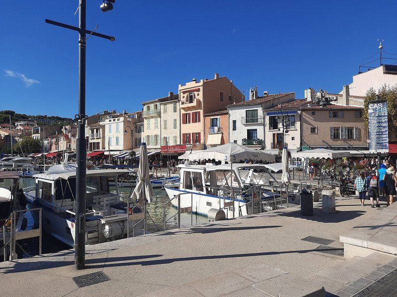
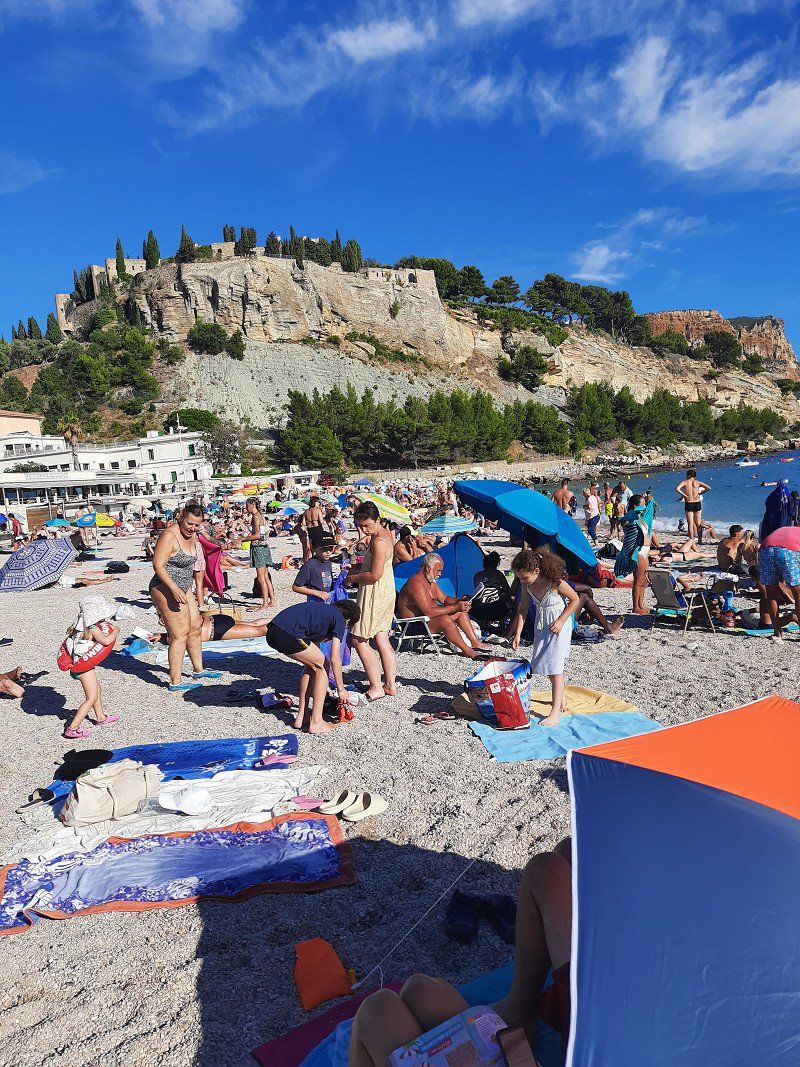
Cassis Gps: 43.21349, 5.53781
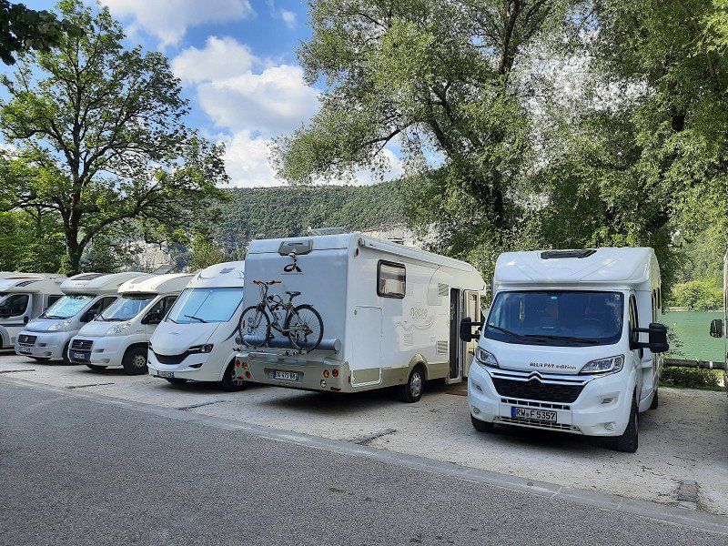
In Cassis we drove to the campsite where we could stay for the night (Gps;43.21349, 5.53781). The place was big enough, with pebbles. We used the power connection to charge our e-bike batteries. The fridge was malfunctioning when we came back from our bathing stay, the display showed the error code I10 (voltage not in the 200-260 volt range). The main thing was that the batteries were charged, the refrigerator continued to run on gas.
A walk through the small streets dominated by a castle is part of a visit to Cassis. The medieval fortress dates from the 17th - 19th centuries and was used as a military fort. The castle is now privately owned
The port of Cassis is very pretty to look at, a small beach with fine pebbles is right next door. But everything was very crowded, there was almost no place to lay out the towels. The water was pleasantly warm to swim in for a long time.
13260 Cassis, Frankreich
43° 12' 54.5" N 5° 32' 13.6" E
43.2151340 5.5371200
• Head northwest on Rue Thérèse Rastit.
• Turn right onto Rue Frédéric Mistral. Go for 37 m.
• Turn right onto Rue Jules Simon. Go for 76 m.
• Turn left onto Rue de Belloy. Go for 102 m.
• Turn right onto Avenue Docteur Emmanuel Agostini. Go for 95 m.
• Turn left onto Avenue Victor Hugo. Go for 49 m.
• Turn slightly right onto Rue de La Ciotat. Go for 305 m.
• Take the 3rd exit from roundabout onto Avenue de Provence. Go for 368 m.
• Take the 1st exit from roundabout onto Route Pierre Imbert. Go for 318 m.
• Take the 1st exit from roundabout onto Route Pierre Imbert (D559). Go for 3.0 km.
• Take the 2nd exit from roundabout onto D559 A toward A50/Marseille/Aubagne/Roquefort la Ble/Carnoux en Pce. Go for 783 m.
• Take left ramp onto A50 toward Aubagne/Marseille/Aix en Pce. Go for 6.5 km.
• Keep right onto A52 toward Lyon/Nice/Aix en Pce/Aubagne. Go for 25.0 km.
• Take the left exit toward Lyon/Aix en Pce onto A8 (La Provençale). Go for 31.2 km.
• Continue on A7 (Autoroute du Soleil). Go for 57.0 km.
• Take exit 23 toward Carpentras/Avignon-Nord/Le Pontet/Sorgues/Vedène. Go for 1.1 km.
• Keep left toward Avignon/Le Pontet. Go for 53 m.
• Take the 4th exit from roundabout onto Route de Carpentras (D225) toward Avignon/Le Pontet. Go for 2.8 km.
• Continue on D907. Go for 1.9 km.
• Take ramp onto D225 toward Avignon-Centre. Go for 2.4 km.
• Take ramp onto Boulevard Saint-Lazare toward Pont d'Avignon St Bénezet. Go for 466 m.
• Continue on Boulevard du Quai de la Ligne. Go for 516 m.
• Continue on Boulevard du Rhône. Go for 325 m.
• Keep right onto Boulevard du Rhône. Go for 195 m.
• Continue on Allée de l'Oulle. Go for 329 m.
• Keep left onto Allée de l'Oulle toward A9/Nîmes. Go for 56 m.
• Turn sharp left onto Boulevard Saint-Dominique. Go for 133 m.
• Turn right onto Porte Saint-Dominique. Go for 27 m.
• Turn slightly left onto Rue Victor Hugo. Go for 249 m.
• Turn right onto Rue Joseph Vernet. Go for 398 m.
• Turn left onto Rue de la République. Go for 393 m.
• Turn left onto Place de l'Horloge. Go for 17 m.
• Turn right onto Place de l'Horloge. Go for 31 m.
• Turn left onto Rue Félicien David. Go for 14 m.
• Arrive at Rue Félicien David. Your destination is on the right.
☍
136,2 km
(1 hrs. 26 min.)
Day
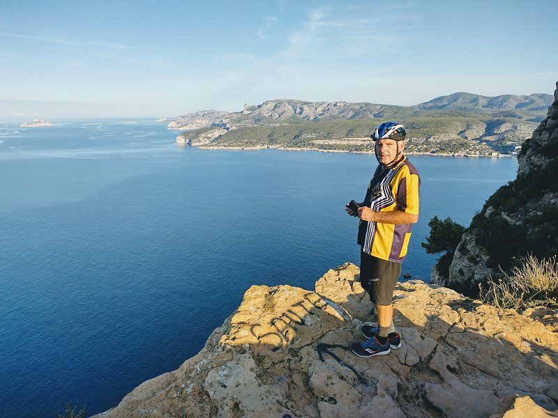
Route de Cretes Cassis Sonnenaufgangstour
Early in the morning at six the alarm clock rang for the sunrise bike tour .
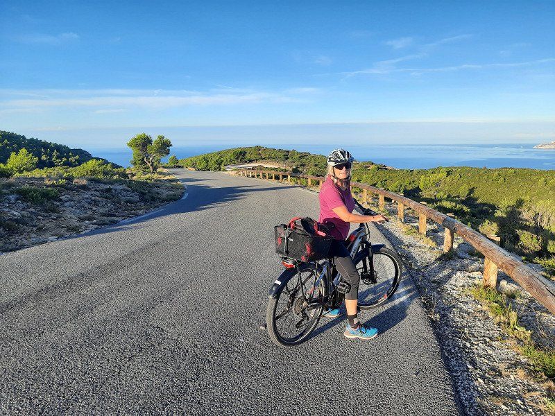
The Route des Crêtes, the 15 km ridge road (coastal road)
is simply fantastic! It rises from sea level within a few kilometers to almost 400 m.
Fascinating view from the rocks to the sea and to the islands in front of Marseille.
Aussichtsstraße bei Cassis
High above Cassis, the road (D559) runs from Cassis to Marseille, through the Calanques National Park. On the way you can enjoy very nice views and landscapes in the white limestone.
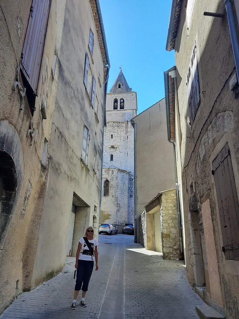
Avignon
Pitch in Avignon approached Gps: 43.95608, 4.8002, was pretty empty. Chargeable. The course is on the Rhone Island.
Tour of the old town
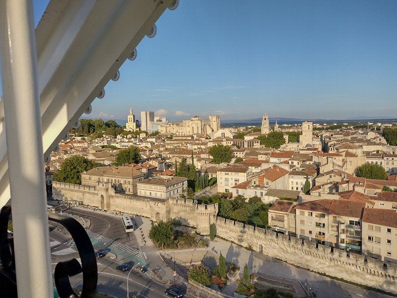
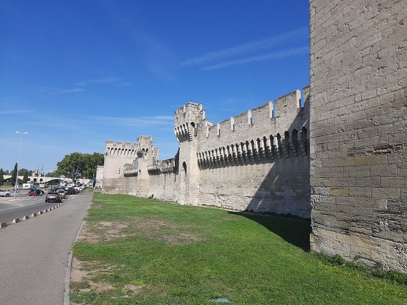
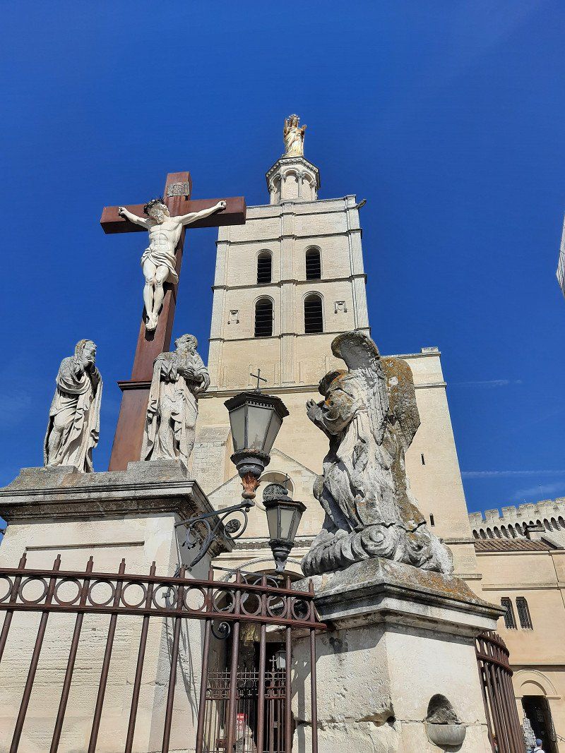
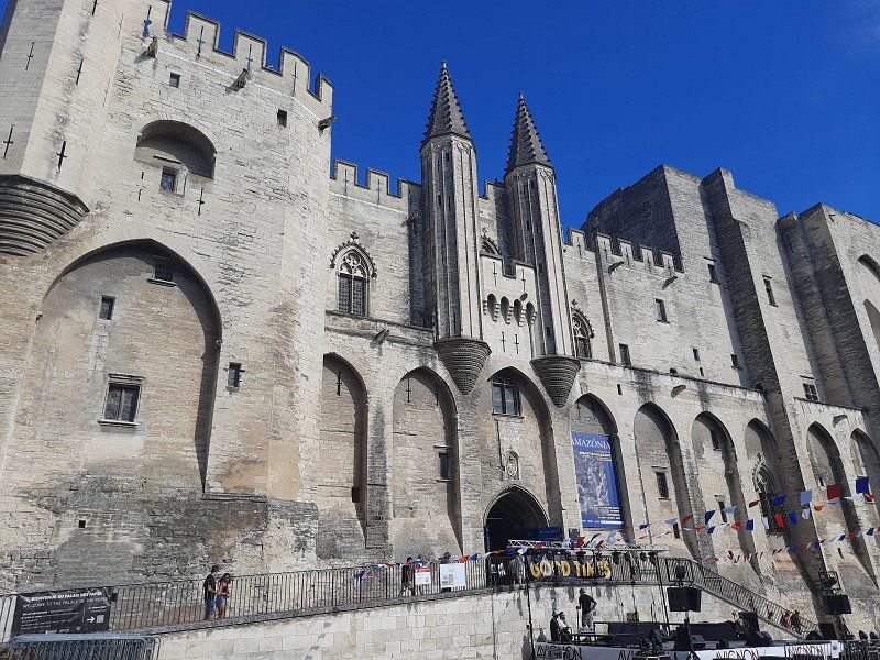
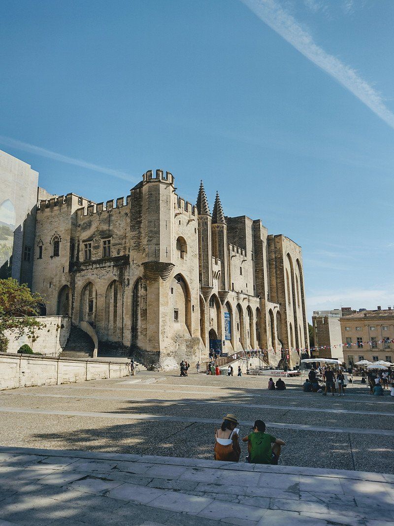
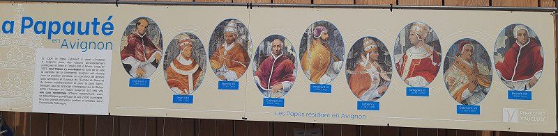
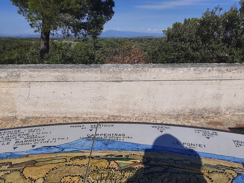
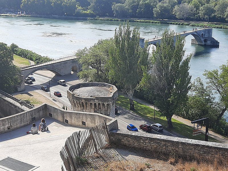
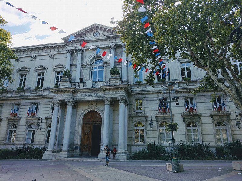
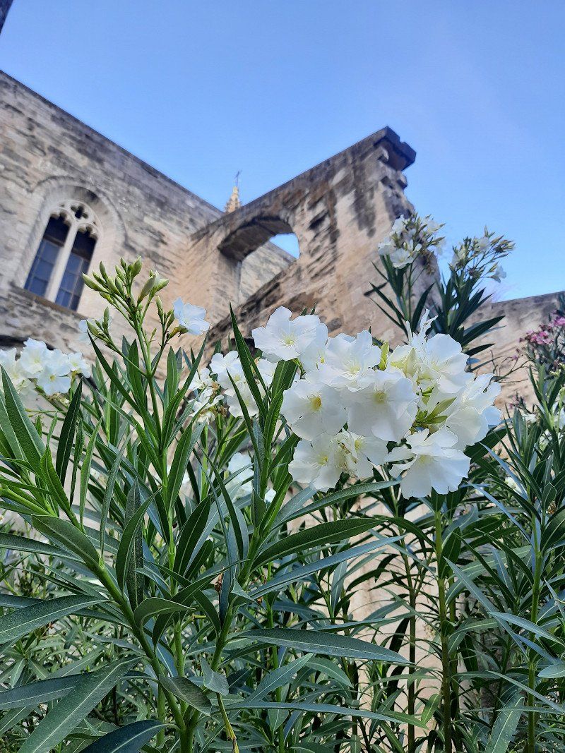
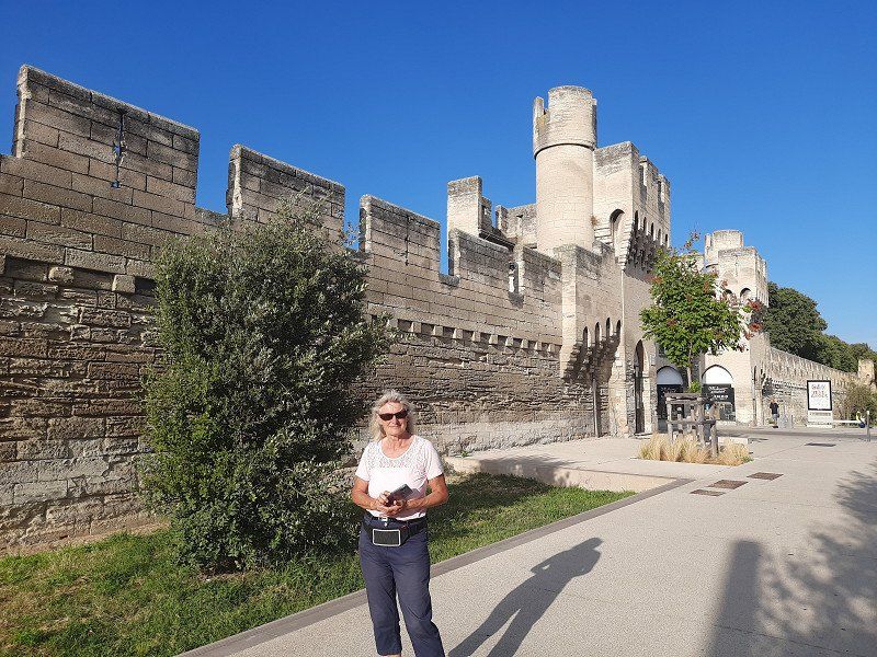
Our RV park was the starting point for a tour of the city center. Crossing the Rhone, we had our first glimpse of the papal city with its stunning four kilometer long city fortifications (city walls) and the Avignon Bridge. The Saint-Bénézet bridge is the symbol of the city of Avignon. With only part of the bridge remaining today, it is hard to imagine that for a time it was the only legal route of communication between the Kingdom of France and the Papal States. We skipped the bridge and headed towards the Place de l'Horloge, which was only a stone's throw away. In the center of this old Avignon square stands the Town Hall, which was first fitted with a clock in the 15th century. Avignon became a haven for the popes in the 14th century. In the papal palace, seven heads of the church resided one after the other, which we came across on our tour. Next to it is the Basilique Saint-Pierre. This 14th-century church is rightly considered by many to be Avignon's most beautiful church. Its Gothic style and facades of intricately carved stone. We then visited the Jardin des Doms and strolled through the enchanting park while the Avignon Bridge lay at our feet. We were amazed when we also saw Mont Ventoux. The giant with the white dome proudly looms over the hilly landscape of Avignon.
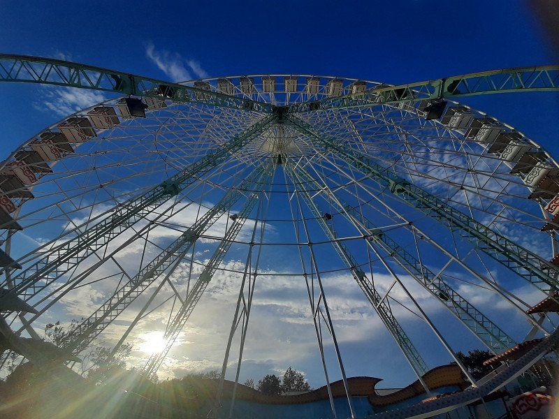
We ended the tour with the main shopping street and went back to the mobile home outside the city fortifications. The culmination of the day was the ride on the Ferris wheel, from which we could see the papal city from above.
Avignon, Frankreich
43° 56' 57.5" N 4° 48' 19.9" E
43.9493170 4.8055280
• Head toward Passage Agricol Moureau on Rue Félicien David. Go for 48 m.
• Turn right onto Rue Racine. Go for 138 m.
• Continue on Place de la Madeleine. Go for 16 m.
• Turn left onto Place de la Madeleine. Go for 169 m.
• Turn slightly left onto Rue du Rempart du Rhône. Go for 78 m.
• Turn right onto Porte de l'Oulle. Go for 9 m.
• Turn slightly right onto Boulevard du Rhône. Go for 26 m.
• Turn slightly right onto Boulevard du Rhône. Go for 406 m.
• Continue on Quai Joël Bameule. Go for 516 m.
• Continue on Boulevard Saint-Lazare. Go for 306 m.
• Keep left onto Boulevard du Quai Saint-Lazare. Go for 399 m.
• Continue on Place Saint-Lazare. Go for 148 m.
• Turn right onto Boulevard Limbert. Go for 164 m.
• Turn left onto Avenue de la Folie. Go for 802 m.
• Take the 2nd exit from roundabout onto Avenue de la Folie. Go for 610 m.
• Take the 1st exit from roundabout onto Rocade Charles de Gaulle (D907) toward Aix en Pce/Nîmes/La Rocade. Go for 1.5 km.
• Turn left onto Avenue Pierre Semard (D907) toward Aéroport Avignon/Cavaillon/A7/Aix en Pce. Go for 1.4 km.
• Take the 2nd exit from roundabout onto Route de Marseille (N7) toward A7/Cavaillon/Salon/Aix en Pce/Aéroport Cantarel. Go for 2.7 km.
• Pass 2 roundabouts and continue on Route de Marseille (N7). Go for 4.4 km.
• Keep right onto Route de Marseille (D900). Go for 259 m.
• Keep right onto Route de Cavaillon (D900). Go for 7.6 km.
• Pass 2 roundabouts and continue on Chemin de Romieu (D900). Go for 5.0 km.
• Take the 3rd exit from roundabout onto Chemin de Romieu (D900). Go for 1.2 km.
• Pass 2 roundabouts and continue on Route d'Avignon (D900). Go for 3.6 km.
• Take the 4th exit from roundabout onto D15 toward Cabrière/Gorde. Go for 564 m.
• Continue on Lieu-dit Les Rouges (D15). Go for 184 m.
• Continue on D15. Go for 281 m.
• Continue on Ancienne Route de Gordes (D15). Go for 1.1 km.
• Take the 2nd exit from roundabout onto Ancienne Route de Gordes (D15). Go for 1.1 km.
• Continue on Route de Cavaillon à Saint-Saturnin-lès-Apt (D2). Go for 3.8 km.
• Take the 1st exit from roundabout onto Route de Cavaillon à Saint-Saturnin-lès-Apt (D2) toward St Saturnin/Les Apt/Joucas/Roussillon/Sault. Go for 7.0 km.
• Turn right onto Voie de Joucas à Roussillon (D102). Go for 2.0 km.
• Turn left onto Route de Gordes (D169). Go for 1.1 km.
• Continue on Route de Gordes à Roussillon (D169). Go for 71 m.
• Turn right onto Rue des Bourgades. Go for 185 m.
• Turn slightly left onto Rue des Bourgades. Go for 89 m.
• Turn left onto Rue de l'Arcade. Go for 18 m.
• Arrive at Rue de l'Arcade. Your destination is on the right.
☍
49,0 km
( 55 min.)
Day
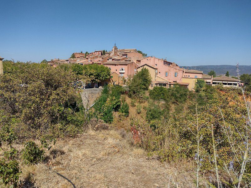
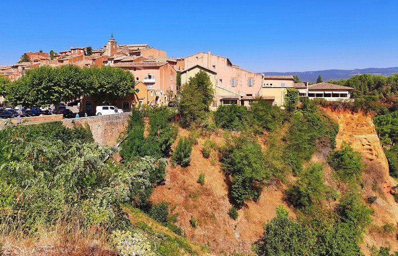
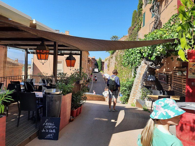
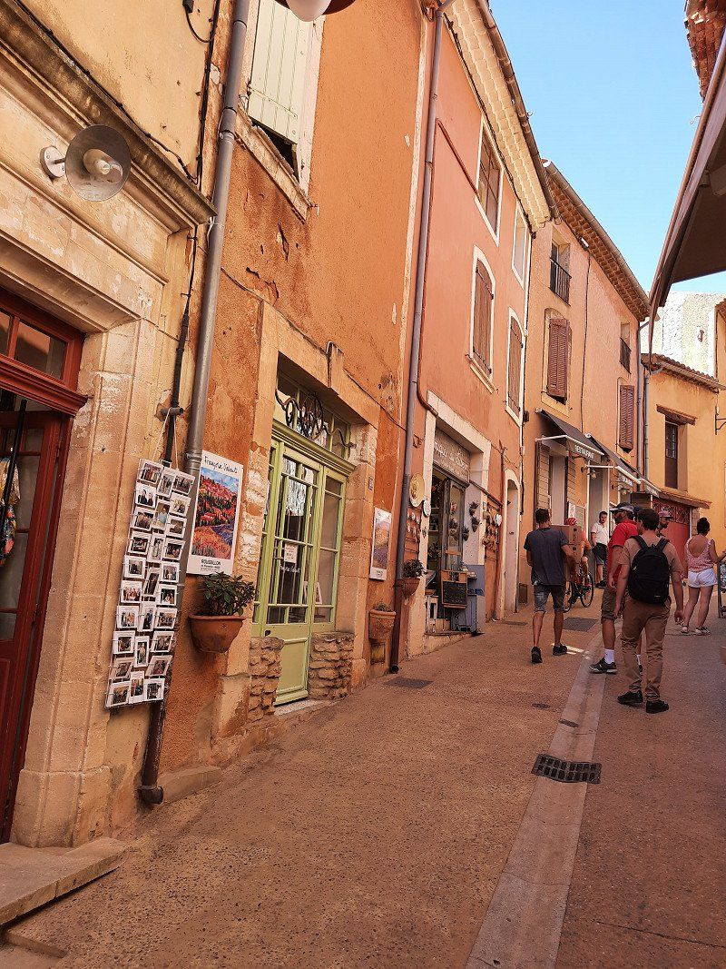
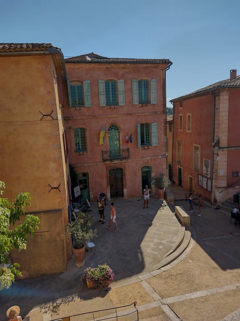
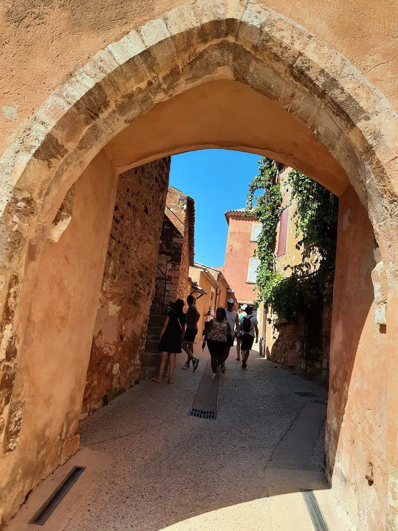
Roussillon
Roussillon, this beautiful village shines in all shades of ocher.
Parked in the parking lot Gps:43.8962, 5.2963, which is also designated for RVs. Fee 3.-€
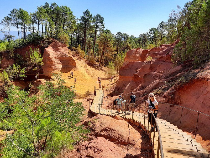
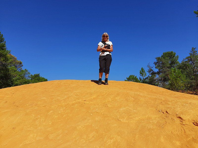
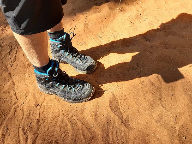
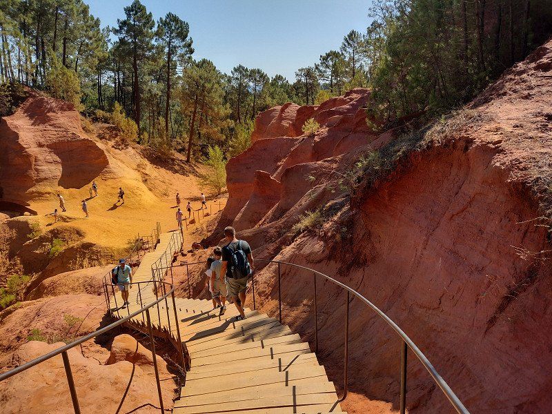
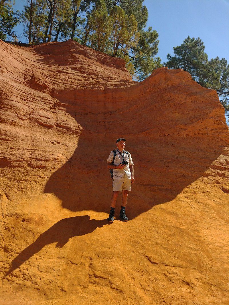
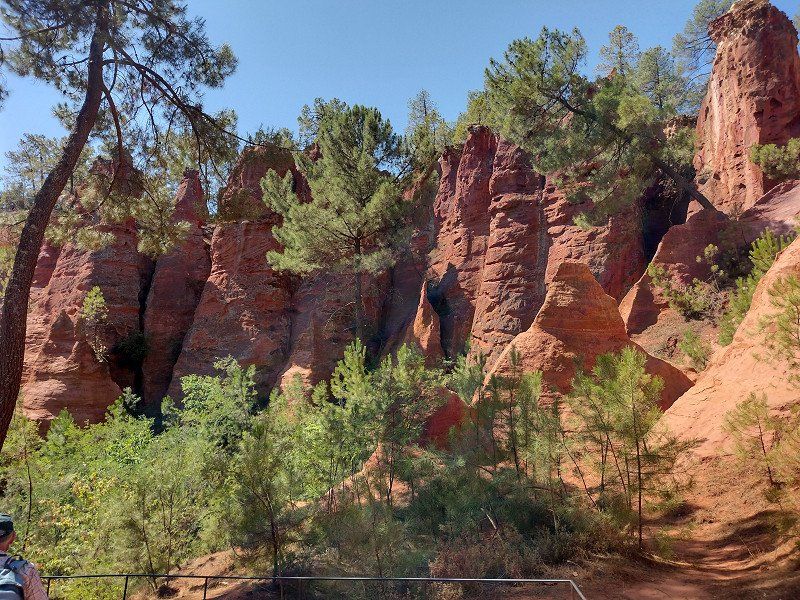
A hike to the ocher rocks was on our journey today. The 2.5 hour hike that was planned went in the direction of the ocher museum and in the hinterland of Roussillon to individual ocher rocks. Because of the extreme heat (32°C) we chose the shorter version of the hike at the ocher museum, which also led to the well-known rocks shown in the pictures. First we made a tour through the streets of Roussillon in the hustle and bustle of the many tourists, then we went to the ocher rocks. Admission €3. The ocher rocks made a beautiful picture with their different ocher colors. After the tour of the rock formations, the soles of the shoes were stained with the ocher sand that was no longer easy to remove.
After returning to the WoMo we drove off straight away, it was too hot for us to take a break, meanwhile the temperature had risen to 34°C around noon.
84220 Roussillon, Frankreich
43° 54' 8.3" N 5° 17' 34.6" E
43.9022930 5.2929360
• Head toward Rue des Bourgades on Rue de l'Arcade. Go for 18 m.
• Turn left onto Rue des Bourgades. Go for 54 m.
• Turn right onto Place du Pasquier. Go for 48 m.
• Turn left onto Place de la Poste (D105). Go for 236 m.
• Take the 1st exit from roundabout onto Route de Saint-Michel (D227). Go for 72 m.
• Turn right onto Route de Saint-Saturnin (D227). Go for 1.4 km.
• Continue on Voie de Roussillon à Saint-Saturnin-d'Apt (D227). Go for 2.8 km.
• Continue on Route de Roussillon (D227). Go for 1.4 km.
• Turn right onto D2. Go for 3.5 km.
• Turn sharp left onto Route de Sault (D943). Go for 316 m.
• Turn right onto Route de Sarraud (D230). Go for 1.5 km.
• Continue on D230. Go for 991 m.
• Continue on Lieu-dit Les Tambours (D230). Go for 100 m.
• Continue on D230. Go for 3.4 km.
• Continue on Lieu-dit Les Lazarins (D230). Go for 102 m.
• Continue on D230. Go for 1.8 km.
• Continue on Lieu-dit Pradoulie (D230). Go for 111 m.
• Continue on D230. Go for 1.3 km.
• Continue on Col de la Liguière (D230). Go for 84 m.
• Continue on D230. Go for 1.7 km.
• Continue on Lieu-dit Sarraud (D230). Go for 311 m.
• Continue on D230. Go for 558 m.
• Continue on Lieu-dit La Cabane (D230). Go for 116 m.
• Continue on D230. Go for 2.0 km.
• Continue on Route de Sarraud (D230). Go for 739 m.
• Turn right onto D943. Go for 6.6 km.
• Turn right onto Route de Carpentras (D942) toward Sault/Le Mt Ventoux/St Christol d'Albion. Go for 552 m.
• Turn left onto Route de la Lavande (D942) toward Sault/Le Mt Ventoux/Hôpital. Go for 540 m.
• Continue on Rue de la République (D164). Go for 260 m.
• Keep right onto D942 toward Aurel/Montbrun. Go for 10.3 km.
• Turn left onto D72. Go for 4.4 km.
• Continue on D40. Go for 597 m.
• Turn left onto D40. Go for 1.4 km.
• Continue on Lieu-dit Veux (D40). Go for 159 m.
• Continue on D40. Go for 2.8 km.
• Turn left onto D164 TER toward D164 T/La Frache/Les Bernards. Go for 196 m.
• Continue on Lieu-dit Le Mouret (D164 TER). Go for 104 m.
• Continue on D164 TER. Go for 157 m.
• Continue on Lieu-dit La Frache (D164 TER). Go for 214 m.
• Turn slightly left onto D164 TER. Go for 196 m.
• Turn left onto Lieu-dit Les Bernard. Go for 647 m.
• Turn slightly right. Go for 3.8 km.
• Turn left toward Lieu-dit Le Contrat. Go for 4.6 km.
• Turn right onto Lieu-dit Le Contrat. Go for 87 m.
• Continue on D164 A. Go for 529 m.
• Turn right onto Lieu-dit Mont Serein. Go for 49 m.
• Turn right onto Lieu-dit Mont Serein. Go for 255 m.
• Turn right onto Lieu-dit Mont Serein. Go for 49 m.
• Turn slightly right onto D164 A. Go for 1.0 km.
• Take the 2nd exit from roundabout onto D164 A. Go for 389 m.
• Continue on Lieu-dit Bergerie de l'Avocat (D164 A). Go for 102 m.
• Continue on D164 A. Go for 164 m.
• Take the 2nd exit from roundabout onto D974. Go for 5.2 km.
• Turn right. Go for 44 m.
• Arrive at your destination on the left.
☍
70,0 km
(1 hrs. 36 min.)
Beaumont-du-Ventoux, Frankreich
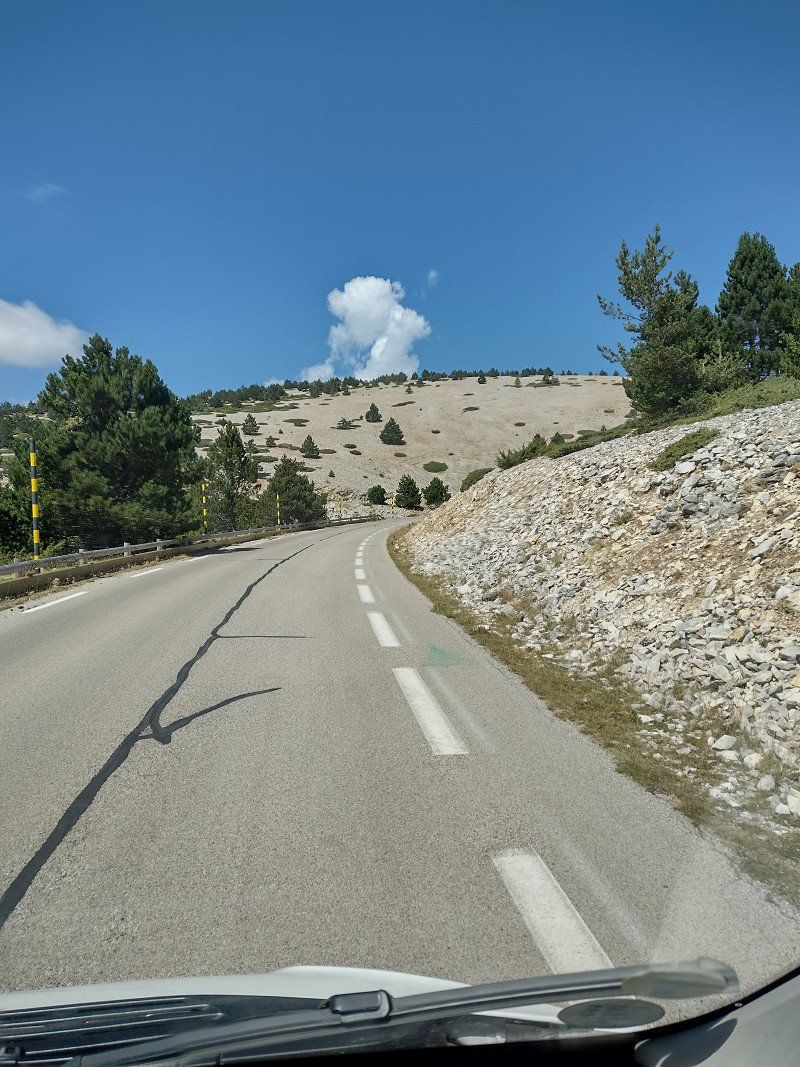
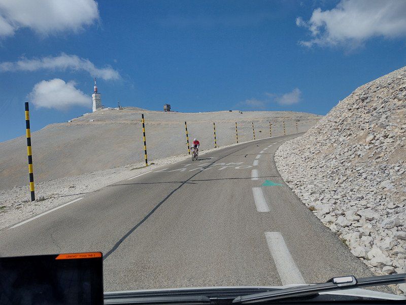
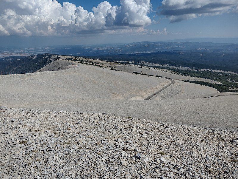
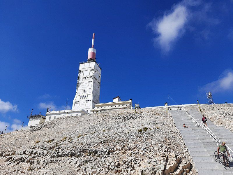
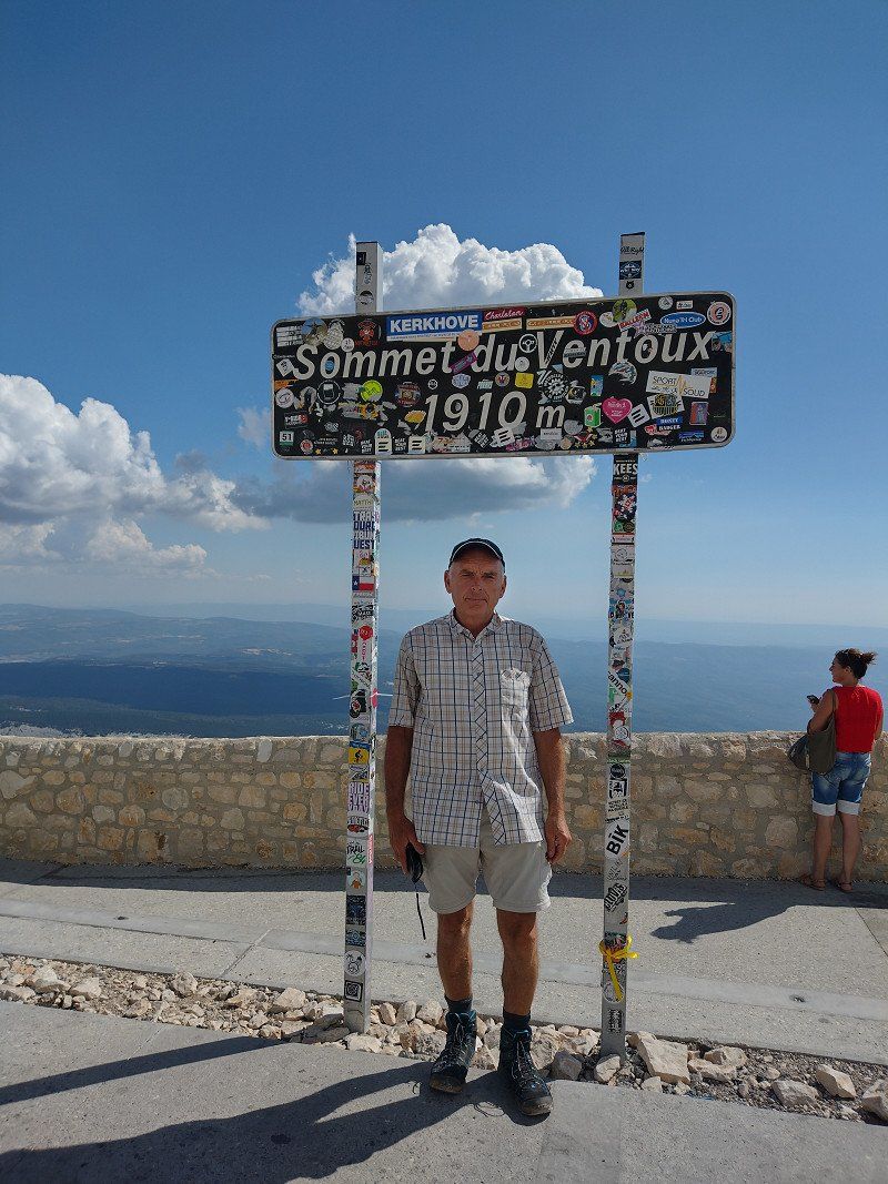
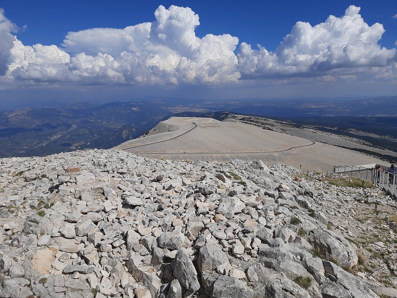
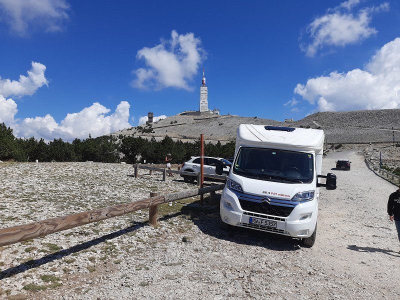
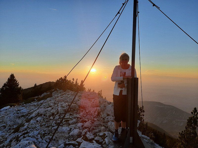
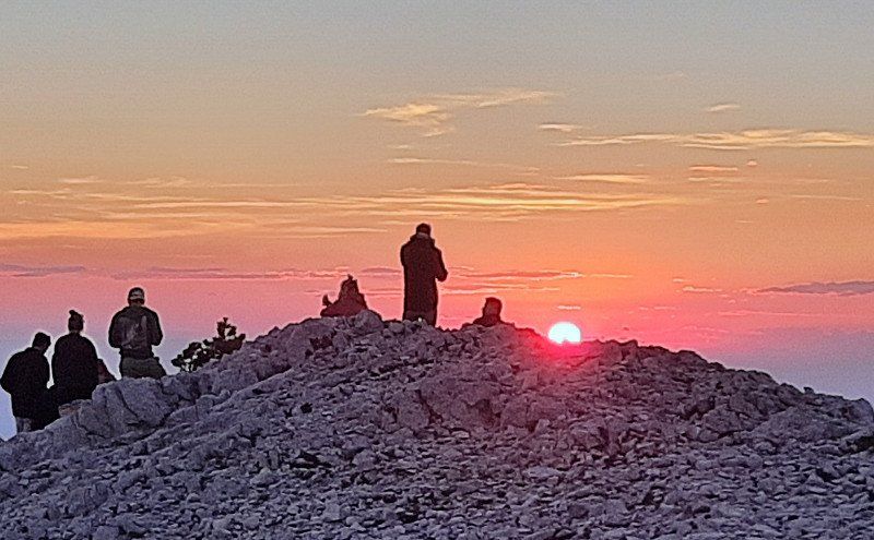
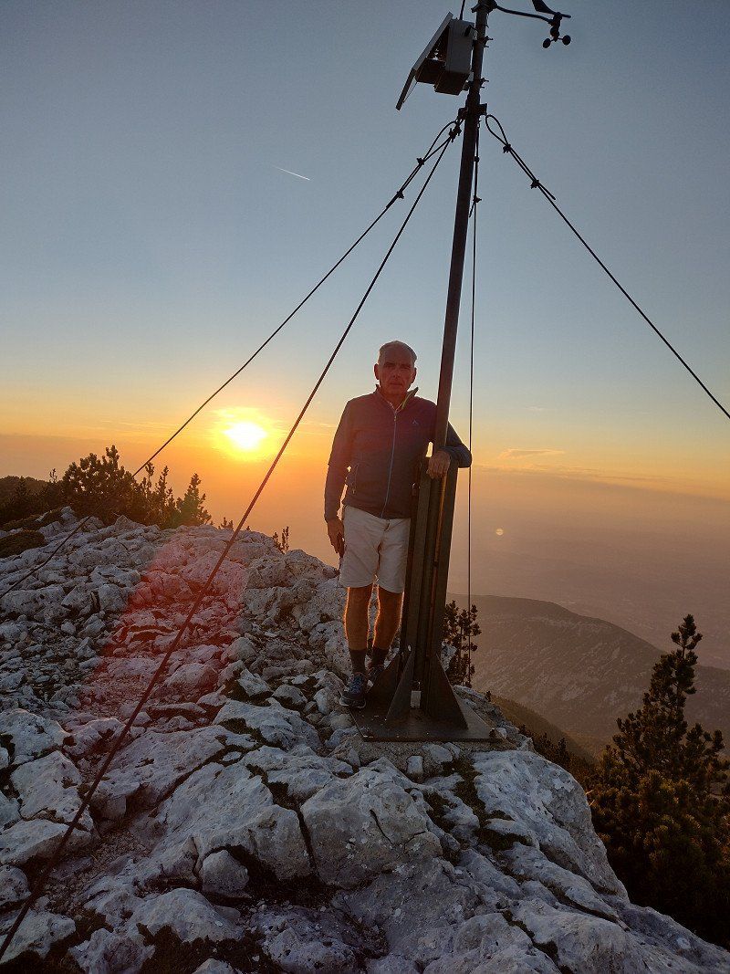
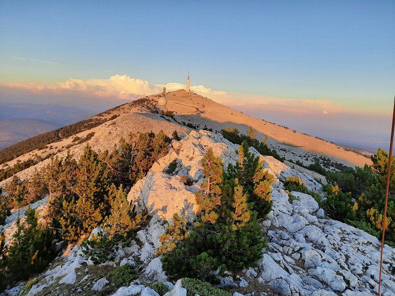
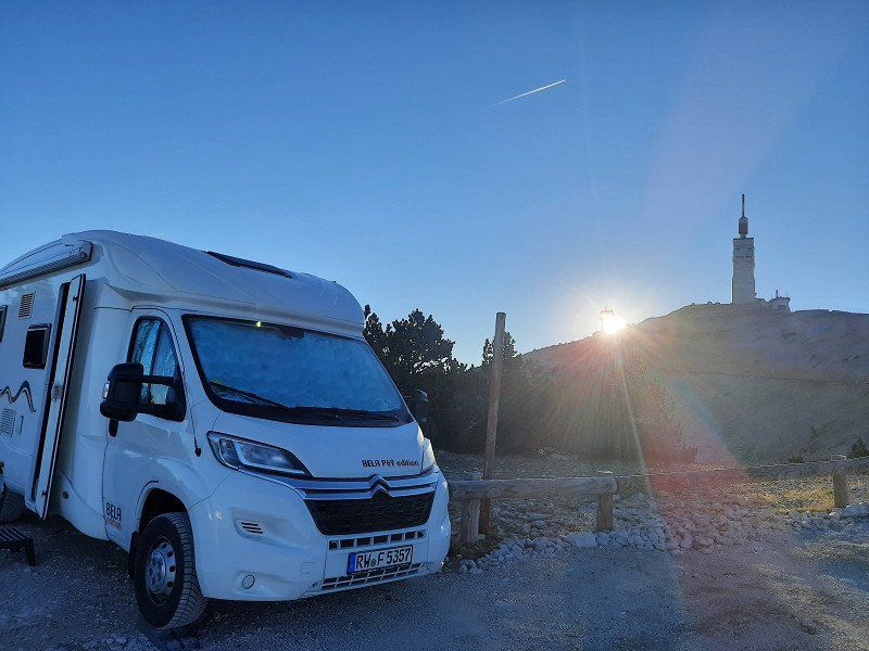
"Le Mont Ventoux" (1910 m) the sacred mountain is a myth, the summit road is often a stage of the Tour de France, the panoramic view over Provence was unfortunately not that great today. In the most beautiful sunshine - and a clear view of the summit, we found a parking lot, where we also stay overnight. The gravel place with some large stones is free and sloping. Towards the late afternoon, the parking lot emptied and we made a change of place on which our camper was leveler. But the sacred mountain of Provence soon made its mark as Mons Ventosus (lat. "windy mountain").
The sunset was gorgeous, a starry sky that you don't get to see every day and the silence at night with the sunrise over Le Mont Ventoux the next morning.
57FC+JVF Beaumont-du-Ventoux, Frankreich
44° 10' 26.6" N 5° 16' 19.8" E
44.1740556 5.2721643
• Head southeast. Go for 44 m.
• Turn left onto D974. Go for 5.1 km.
• Take the 1st exit from roundabout onto D164 A. Go for 180 m.
• Continue on Lieu-dit Bergerie de l'Avocat (D164 A). Go for 102 m.
• Continue on D164 A. Go for 354 m.
• Take the 1st exit from roundabout onto D164 A. Go for 1.1 km.
• Turn slightly left onto Lieu-dit Mont Serein. Go for 49 m.
• Turn right onto Lieu-dit Mont Serein. Go for 255 m.
• Turn right onto Lieu-dit Mont Serein. Go for 49 m.
• Turn left onto D164 A. Go for 529 m.
• Continue on Lieu-dit Le Contrat. Go for 87 m.
• Turn left. Go for 4.6 km.
• Turn right toward Lieu-dit Les Bernard. Go for 4.3 km.
• Continue on Lieu-dit Les Bernard. Go for 64 m.
• Turn right onto D164 TER. Go for 196 m.
• Turn slightly right onto Lieu-dit La Frache (D164 TER). Go for 214 m.
• Continue on D164 TER. Go for 157 m.
• Continue on Lieu-dit Le Mouret (D164 TER). Go for 104 m.
• Continue on D164 TER. Go for 196 m.
• Turn left onto D40. Go for 3.1 km.
• Continue on Lieu-dit Le Grand Ribas (D40). Go for 79 m.
• Continue on D40. Go for 1.8 km.
• Continue on Rue de la Mairie (D40). Go for 129 m.
• Continue on Grande Rue (D40). Go for 190 m.
• Continue on Rue de la Mairie (D40). Go for 116 m.
• Continue on D40. Go for 489 m.
• Continue on Route de Montbrun (D40). Go for 8.9 km.
• Turn left onto Route de Carpentras (D5). Go for 1.3 km.
• Continue on D13. Go for 2.8 km.
• Take the 2nd exit from roundabout onto Avenue des Princes d'Orange (D13). Go for 717 m.
• Take the 1st exit from roundabout onto D54. Go for 3.1 km.
• Take the 1st exit from roundabout onto Route de Malaucène (D938) toward Gap/Vaison la Romaine. Go for 1.4 km.
• Take the 2nd exit from roundabout onto Quai Maréchal Foch. Go for 1.7 km.
• Turn right onto Pont Romain. Go for 28 m.
• Continue on Grand'Rue. Go for 33 m.
• Continue on Quai Paul Gontard. Go for 83 m.
• Continue on Quai Paul Gontard. Go for 106 m.
• Turn right onto Rue Jean Jaurès. Go for 116 m.
• Turn right onto Avenue Jules Ferry. Go for 72 m.
• Turn right onto Grande Rue. Go for 32 m.
• Turn left onto Rue de la République. Go for 60 m.
• Continue on Place Montfort. Go for 20 m.
• Arrive at Place Montfort.
☍
44,0 km
(1 hrs. 8 min.)
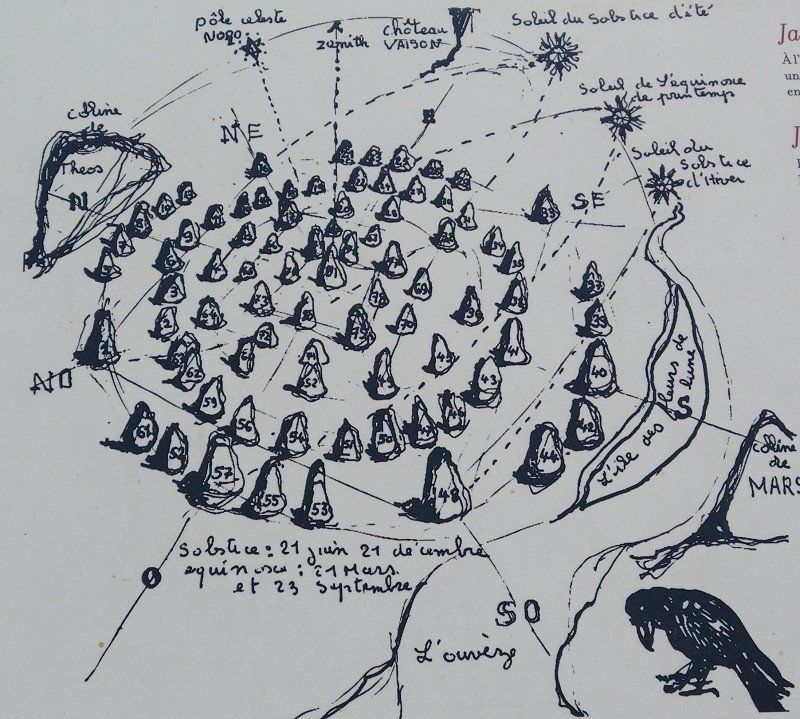
Vaison-la-Romaine Steinkreis
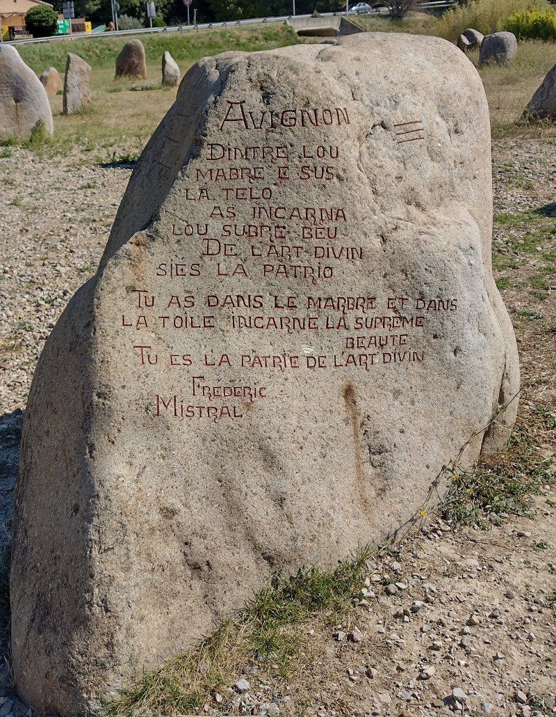
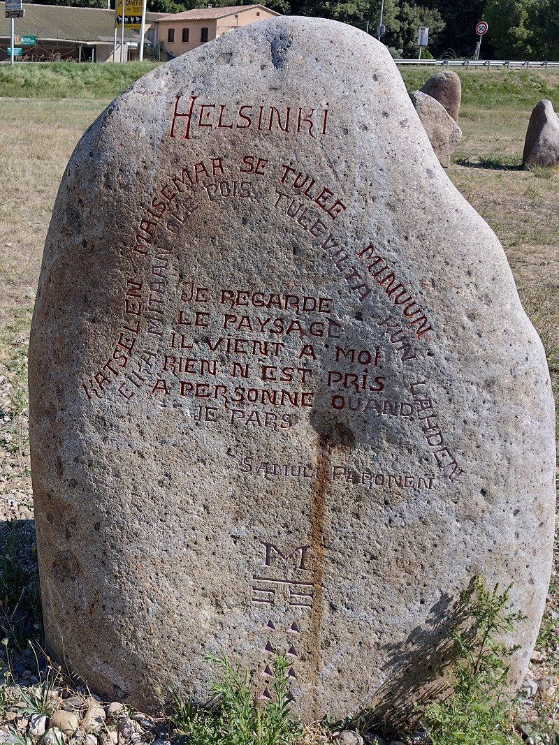
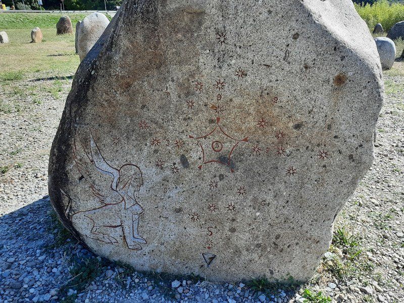
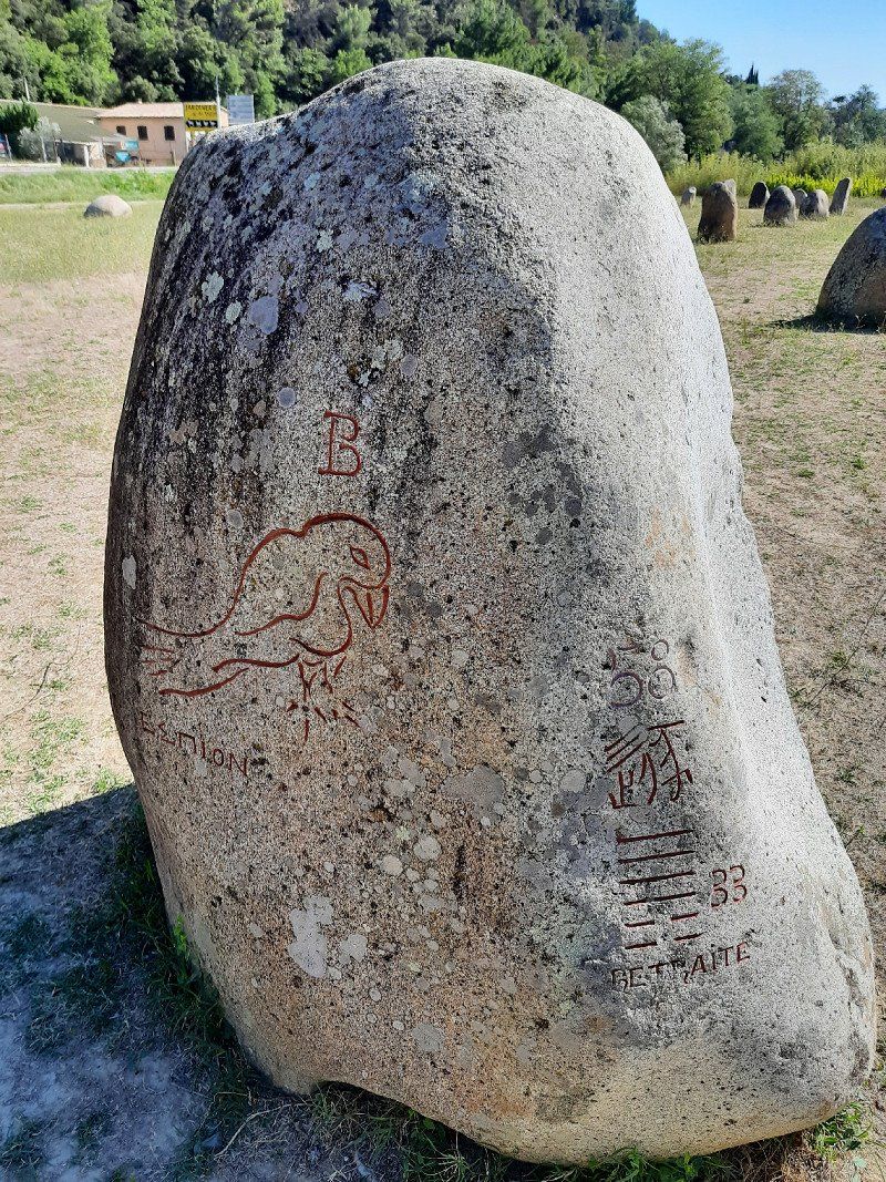
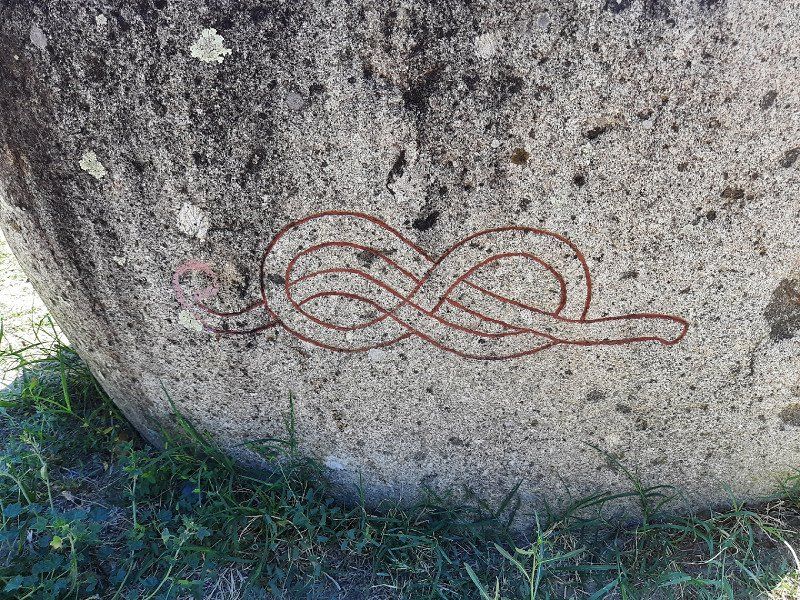
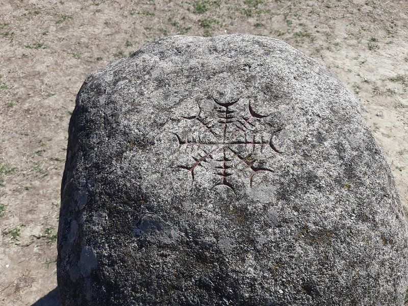
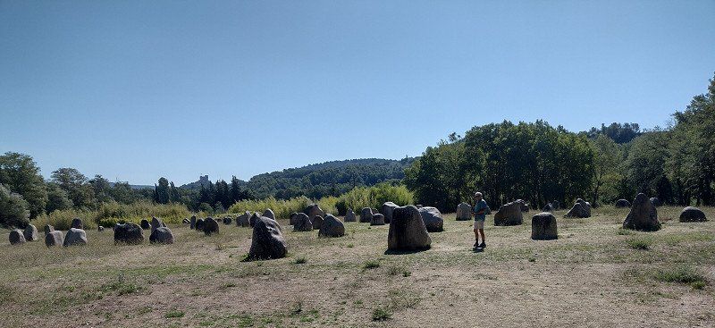
On leaving Vaison-la-Romaine, on the left, there are 81 fascinating menhirs. 81 stones are set, 9 of which bear the names of European cities of culture: Reykjavik, Bergen, Helsinki, Prague, Kraków, Bologna, Avignon and Saint Jacques - de - Compostela. Each is engraved with a verse from a poet from that city. And on the 72 remaining stones, a poem is engraved every June 21st, so this work is universal. Nothing has been improvised, the stones are not randomly laid, but respect the golden numbers and algorithmic measurements. If the sphinx appears, she will help solve the riddle, she has the bust and head of a woman, a good body and eagle wings.
This site, made up of 81 large granite stones, is all inscribed with the inscription of poems and messages in memory of those who died after the terrible flooding of the L'Ouvéze river campsite on September 22, 1992. A place of remembrance. These stones erected by heaven have since invited to meditate in a garden where the alchemy of numbers creates a unique space of its kind.
84110 Vaison-la-Romaine, Frankreich
44° 14' 27.5" N 5° 4' 30.7" E
44.2409680 5.0751980
• Head east on Place Montfort. Go for 57 m.
• Turn left onto Rue du Maquis. Go for 84 m.
• Turn left onto Cours Taulignan. Go for 202 m.
• Turn right onto Avenue Général de Gaulle (D51). Go for 346 m.
• Take the 4th exit from roundabout onto Avenue de Saint-Quenin (D975) toward A7/A9/Valréas/Bollène/Orange/Avignon/Villedieu. Go for 2.7 km.
• Take the 2nd exit from roundabout onto Route d'Orange (D975) toward A7/Roaix. Go for 2.0 km.
• Take the 1st exit from roundabout onto D20. Go for 5.3 km.
• Take the 2nd exit from roundabout onto D20 toward A7/Valréas/Bollène. Go for 1.2 km.
• Take the 3rd exit from roundabout onto D94 toward Orange/Tulette/Bollène/Visan/Valréas. Go for 10.1 km.
• Pass 2 roundabouts and continue on Avenue des Côtes du Rhône (D94). Go for 3.2 km.
• Continue on Route de Rochegude (D117). Go for 100 m.
• Take the 1st exit from roundabout onto D94. Go for 2.8 km.
• Continue on D994. Go for 3.6 km.
• Take the 1st exit from roundabout onto Avenue Salvador Allende (D8) toward A7/Pierrelatte/St Paul/Pont St Esprit. Go for 1.7 km.
• Take the 2nd exit from Rond-Point des Portes de Provence roundabout toward Lyon/Montélimar/Marseille/Nîmes/Orange. Go for 164 m.
• Take ramp onto A7 (Autoroute du Soleil) toward Montélimar/Valence/Lyon. Go for 72.9 km.
• Take exit 15 toward Genève/Chambéry/Grenoble/Romans/Valence onto E713 (Échangeur de Valence-Sud). Go for 634 m.
• Take ramp toward Valence-Centre/Le Puy en Velay/Portes lès Valence/Z.I. Porte lès Valence/Z.I. La Motte. Go for 226 m.
• Take the 1st exit from roundabout onto N7 toward Privas/Le Puy en Velay/Montélimar/Guilherand-Granges/L'Épervière/Z.I. La Motte/Z.I. de Portes lès V. Go for 291 m.
• Take the 2nd exit from roundabout onto D534 N toward Privas/Le Puy en Velay/Guilherand-Granges. Go for 600 m.
• Take the 2nd exit from roundabout onto Le Pont des Lônes (D534 N) toward Privas/Le Puy en Velay/St Péray/Soyons/Guilherand-Granges. Go for 2.1 km.
• Take the 2nd exit from roundabout onto D96 toward Le Puy/Privas/La Voulte S/Rhône/St Péray/Soyons. Go for 462 m.
• Take the 2nd exit from roundabout onto Rue Gustave Eiffel toward Tournon S/R./St Péray. Go for 458 m.
• Pass 2 roundabouts and continue on Rue Gustave Eiffel. Go for 1.3 km.
• Take the 3rd exit from roundabout onto Rue Gustave Eiffel toward Le Puy. Go for 664 m.
• Take the 3rd exit from roundabout onto Avenue de Gross Umstadt (D533) toward Le Puy. Go for 389 m.
• Take the 1st exit from roundabout onto Avenue du 8 Mai (D86) toward Le Puy/St Agrève/Lamastre/Tournon S/Rhône/Centre Ville. Go for 486 m.
• Take the 2nd exit from Carrefour de la Libération roundabout onto Avenue du 11 Novembre (D86) toward Tournon S/Rhône. Go for 1.8 km.
• Turn left onto Grande Rue. Go for 436 m.
• Continue on Place de l'Église. Go for 16 m.
• Arrive at Place de l'Église. Your destination is on the left.
☍
116,5 km
(1 hrs. 21 min.)
Day
Cornas
We had chosen the pitch as a place to stay, Gps: 44.96011, 4.8473 because there is no pitch in Valence.
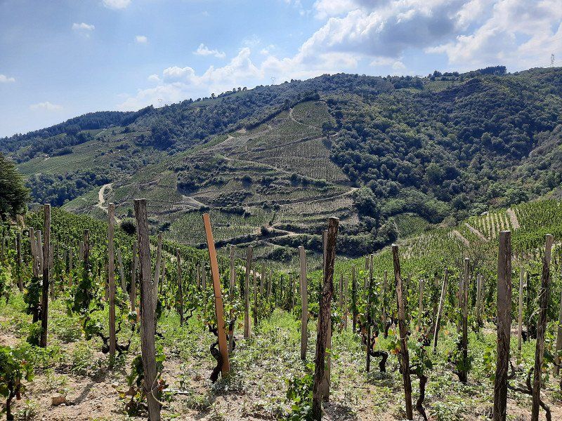
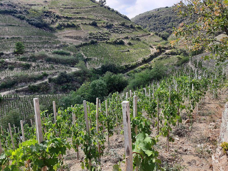
The plan was to explore Valence from the square. When we saw the Cornas wine region, we decided to go on a vineyard hike instead of visiting Valence.
The municipality of Cornas on the Rhône gives its name to the Cornas wine-growing region.
07130 Cornas, Frankreich
44° 57' 49.4" N 4° 50' 50.6" E
44.9637330 4.8473920
• Head toward Rue des Bouviers on Place de l'Église. Go for 199 m.
• Turn right onto Rue des Acacias. Go for 86 m.
• Turn left onto Avenue du Colonel Rousset (D86). Go for 9.5 km.
• Take the 3rd exit from roundabout onto D86. Go for 607 m.
• Take the 2nd exit from roundabout onto Avenue de Nîmes (D86). Go for 375 m.
• Continue toward Avenue de Nîmes/D86. Go for 35 m.
• Take the 2nd exit from roundabout onto Avenue de Nîmes (D86). Go for 332 m.
• Take the 3rd exit from roundabout toward A7/Tain l'Hermitage. Go for 64 m.
• Continue on Avenue de Nîmes (D86). Go for 1.2 km.
• Take the 2nd exit from roundabout onto Pont Gustave Toursier (D95). Go for 428 m.
• Turn right onto Avenue du Président Franklin Roosevelt (N7). Go for 121 m.
• Turn left onto Rue Albert Nicolas (D241) toward Larnage/Route des Belvédères. Go for 176 m.
• Take the 1st exit from roundabout onto Avenue Jules Nadi (D532 A). Go for 579 m.
• Continue on Avenue du Vercors et de la Résistance (D532 A). Go for 590 m.
• Pass 2 roundabouts and continue on Avenue du Vercors et de la Résistance (D532 A). Go for 482 m.
• Take the 2nd exit from roundabout toward A7/St Étienne/Lyon/Marseille/Valence. Go for 257 m.
• Take the 1st exit from roundabout. Go for 138 m.
• Take ramp onto A7 (Autoroute du Soleil) toward St Étienne/Lyon. Go for 65.0 km.
• Take the exit toward Strasbourg/Paris/Grenoble/Lyon-Est onto A46. Go for 22.1 km.
• Continue on Rocade Est (N346). Go for 196 m.
• Keep left onto Rocade Est (N346) toward Paris/Genève. Go for 4.4 km.
• Take ramp onto D302 toward Pont de Chéruy/Pusignan/Z.I. Meyzieu. Go for 2.7 km.
• Pass 2 roundabouts and continue on D302. Go for 2.6 km.
• Turn right onto D302. Go for 3.0 km.
• Take the 2nd exit from roundabout onto Route de Villette (C7). Go for 676 m.
• Take the 3rd exit from roundabout onto D332 toward A432 (Genève)/Pont de Chéruy/Charvieu-Ch/Chavanoz/Villette d'A/A42/Genève/Bourg en B./Lyon/Villette d'Anthon. Go for 179 m.
• Take the 2nd exit from roundabout onto D517 toward Pont de Chéruy/Charvieu-Ch/Chavanoz/Villette d'Anthon. Go for 2.5 km.
• Take the 2nd exit from roundabout onto D517 toward Pont de Chéruy/Charvieu-Ch. Go for 3.0 km.
• Take the 3rd exit from roundabout onto Route de Lyon (D517). Go for 890 m.
• Pass 2 roundabouts and continue on Route de Lyon (D517). Go for 3.3 km.
• Take the 3rd exit from roundabout onto Route de la Balme (D65 B). Go for 1.2 km.
• Take the 2nd exit from roundabout onto Rue de la Girine (D65 B). Go for 4.1 km.
• Take the 3rd exit from roundabout onto D65. Go for 5.8 km.
• Take the 2nd exit from roundabout onto D65. Go for 4.2 km.
• Turn right onto D65 toward Les Grottes de la Balme. Go for 68 m.
• Continue on Route de Crémieu (D65). Go for 1.2 km.
• Continue on Cour Badière (D65). Go for 55 m.
• Turn right onto Route de Lagnieu (D65). Go for 65 m.
• Turn right onto Rue des Grottes. Go for 23 m.
• Arrive at Rue des Grottes. Your destination is on the right.
☍
142,4 km
(1 hrs. 37 min.)
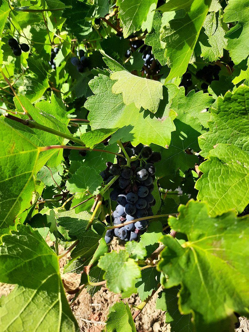
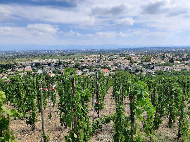
Bericht Weinbergwanderung
The municipality of Cornas on the Rhône gives its name to the Cornas wine-growing region.
Syrah is the only permitted grape variety.
When young, the wines are quite tart and rich in tannins; they should be stored for at least 3 years. Very good wines from an excellent vintage only show their full potential after 15 years.
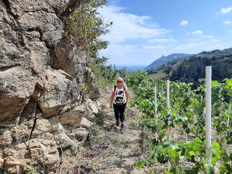
The area between the hills is traversed by 11 streams, which often mark the boundaries of the individual layers. On the way through the vineyards, it was always up and down.
We followed a marker that we believed would lead us through the wine-growing region. Often the markings were missing at the forks in the path and a while later on the path there was again the sign that showed us the direction of the path.
In the end we came to a dead end, we didn't want to go back, so we had to descend a very steep hillside to a stream, along which a path led to the village.
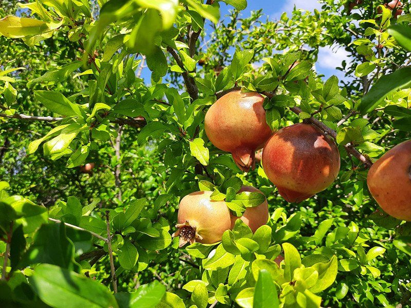
Pomegranates by the wayside
Day
La Balme-les-Grottes Gps: 45.85198, 5.33782
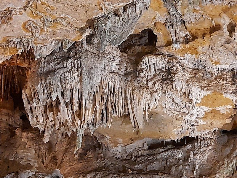
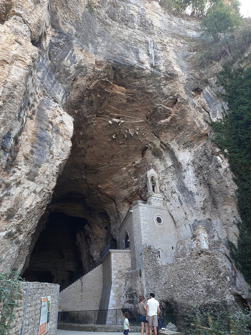
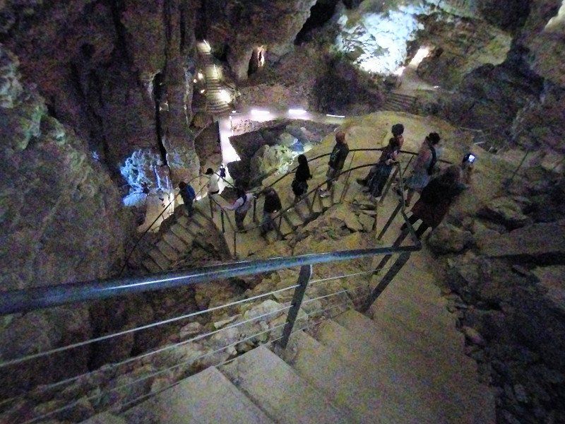
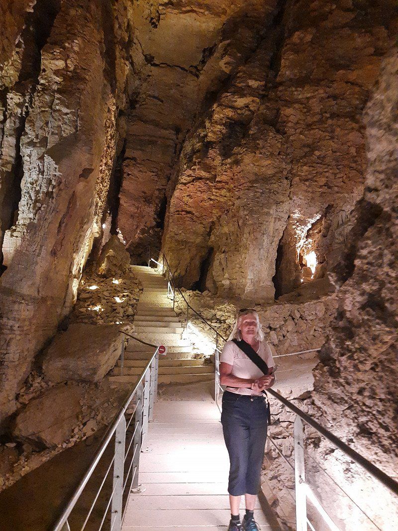
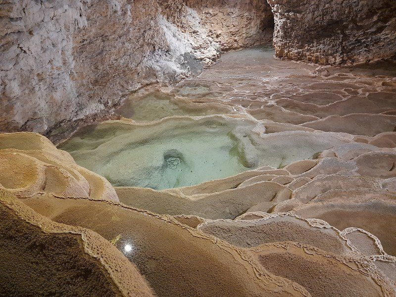
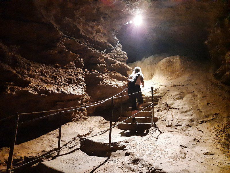
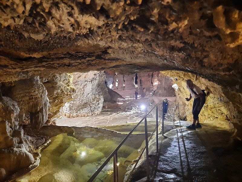
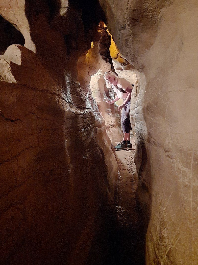
We stopped at La Balme le Grotte on the way to our today's destination for this visit of the cave. The Grotte de la Balme is one of the "Seven Wonders of the Dauphiné", it is the largest cave in Europe.
Natural, narrow labyrinths, through which one had to squeeze oneself during the tour, an underground lake, an amphitheater of small pools, stalagmites, stalactites form the landscape of the cave. The cave can be visited since 1807, revealing its history and secrets in the 1,000 meters of underground galleries.
It was very cool inside, which was nice in this hot weather.
38390 La Balme-les-Grottes, Frankreich
45° 51' 6.5" N 5° 20' 14.4" E
45.8518020 5.3373460
• Head east on Rue des Grottes. Go for 33 m.
• Turn right onto Place Laurent Clerc. Go for 23 m.
• Continue on Chemin La Vie de Saint-Pierre. Go for 115 m.
• Turn slightly right onto Montée de l'Église. Go for 85 m.
• Turn left onto Route de Crémieu (D65). Go for 429 m.
• Keep right onto Route de Crémieu (D65). Go for 745 m.
• Turn left onto D65 I. Go for 62 m.
• Continue on D65. Go for 4.2 km.
• Take the 2nd exit from roundabout onto Grande Rue du Moulin d'Avaux (D65). Go for 5.8 km.
• Take the 1st exit from roundabout onto D65 B. Go for 4.0 km.
• Take the 3rd exit from roundabout onto Route de Malaval (D18 D). Go for 1.4 km.
• Take the 2nd exit from roundabout onto D517. Go for 1.9 km.
• Take the 1st exit from roundabout onto D75. Go for 1.2 km.
• Take the 3rd exit from roundabout onto D75. Go for 3.6 km.
• Take the 2nd exit from roundabout onto Route de Vienne (D75). Go for 7.6 km.
• Pass 2 roundabouts and continue on D75. Go for 1.5 km.
• Take the 2nd exit from roundabout onto D75 toward A43/Chambéry/Grenoble/Vienne/Heyrieux/St Quentin Fallavier. Go for 1.5 km.
• Take the 2nd exit from roundabout onto D75 toward Vienne/Heyrieux. Go for 995 m.
• Take the 2nd exit from roundabout onto Route de Vienne (D75) toward St Jean de Bournay/Diémoz. Go for 3.4 km.
• Take the 3rd exit from roundabout onto Route de Cremieu (D75) toward A7/Vienne/St Georges d'Espéranche. Go for 3.7 km.
• Pass 2 roundabouts and continue on D75. Go for 11.4 km.
• Turn right onto Route de Cancanne (D75) toward Cancane/Z.A. de la Prairie/Z.A.Des Tannerie/Z.A. de Remoulon/Vienne-Lafayette. Go for 2.3 km.
• Take the 2nd exit from roundabout onto Route de Cancanne (D75). Go for 636 m.
• Continue on Rue Lafayette (D75). Go for 1.4 km.
• Continue on Place Louis Revol (D502). Go for 104 m.
• Continue on Rue Victor Faugier (D502). Go for 454 m.
• Turn left onto Rue Rabelais. Go for 351 m.
• Turn left onto Rue Rabelais. Go for 9 m.
• Continue on D41. Go for 346 m.
• Turn right onto Rue Henri Jacquier. Go for 112 m.
• Turn right onto Place de Miremont. Go for 56 m.
• Continue on Rue Ponsard. Go for 79 m.
• Turn left onto Rue Joseph Brenier. Go for 62 m.
• Turn right onto Place Charles de Gaulle. Go for 25 m.
• Turn right onto Place Charles de Gaulle. Go for 46 m.
• Arrive at Place Charles de Gaulle. Your destination is on the left.
☍
59,6 km
( 56 min.)
Vienne
Frankreich
45° 31' 32.1" N 4° 52' 27.6" E
45.5255870 4.8743390
• Head south on Place Charles de Gaulle. Go for 46 m.
• Turn left onto Place Charles de Gaulle. Go for 25 m.
• Turn right onto Rue Joseph Brenier. Go for 121 m.
• Turn left onto Rue de Bourgogne. Go for 93 m.
• Turn right onto Place Saint-Maurice. Go for 79 m.
• Continue on Square Missak Manouchian. Go for 26 m.
• Turn right onto Quai Jean Jaurès (N7). Go for 1.2 km.
• Continue on Boulevard du Rhône Nord (D1407). Go for 2.2 km.
• Take ramp onto A7 (Autoroute du Soleil). Go for 19.0 km.
• Take the exit toward Genève/Grenoble/St Fons onto D383 (Boulevard Pierre Sémard). Go for 2.7 km.
• Keep right onto D383 toward Paris/Genève/Grenoble/Chambéry/Périphérique/Porte du Moulin à Vent. Go for 814 m.
• Keep left onto Boulevard Laurent Bonnevay (D383) toward Chambéry/Grenoble/Bourg/Genève/Paris/Vénissieux/Villeurbanne. Go for 3.4 km.
• Keep left onto Boulevard Laurent Bonnevay (D383) toward Bourg/Genève/Paris/Villeurbanne/Bron-Centre. Go for 2.5 km.
• Keep left onto Boulevard Laurent Bonnevay (D383) toward Bourg/Genève/Paris/Lyon-Centre/Villeurbanne-Centre. Go for 4.5 km.
• Take ramp onto A42 (Pont de Croix Luizet) toward Genève/Rocade Est. Go for 3.2 km.
• Take the left exit toward Paris/Genève/Bourg en B./Aéroport Saint Exupéry onto A42/A46. Go for 1.1 km.
• Take the exit toward Bourg en B./Genève/Strasbourg/Aéroport Saint-Exupéry onto A42. Go for 45.7 km.
• Take exit 9 toward Pont d'Ain. Go for 842 m.
• Take the 1st exit from roundabout onto Rue du 1er Septembre 1944 (D984). Go for 558 m.
• Turn right onto Rue Brillat-Savarin (D1075) toward Grenoble/Chambéry/Genève/Oyonnax/Ambérieu en B. Go for 1.0 km.
• Take the 2nd exit from roundabout onto D1084 toward Annecy/Genève/Oyonnax/Hauteville-L./Poncin/Jujurieux/St Jean le Vieux. Go for 433 m.
• Take the 2nd exit from roundabout onto D1084 toward Annecy/Genève/Oyonnax/Hauteville-L./Poncin/Jujurieux/St Jean le V. Go for 12.6 km.
• Turn left onto D11 toward Cerdon. Go for 785 m.
• Continue on Rue du 12 Juillet 1944 (D11). Go for 475 m.
• Continue on Rue du Maquis (D11). Go for 59 m.
• Turn left onto Rue de la Californie. Go for 14 m.
• Turn left onto Place de la Mairie. Go for 18 m.
• Arrive at Place de la Mairie. Your destination is on the right.
☍
103,3 km
(1 hrs. 7 min.)
Cerdon
Frankreich
46° 4' 50" N 5° 27' 53.6" E
46.0805630 5.4649000
• Head toward Rue du Maquis on Place de la Mairie. Go for 21 m.
• Turn left onto Rue du Maquis (D11). Go for 29 m.
• Continue on Rue de la Grand'Côte (D11). Go for 507 m.
• Continue on D11. Go for 4.0 km.
• Continue on D11 H. Go for 164 m.
• Continue on Lieu-dit La Levée (D11 H). Go for 98 m.
• Continue on D11 H. Go for 699 m.
• Turn left onto D1084. Go for 6.0 km.
• Take the 3rd exit from roundabout onto Grand'Rue (D1084). Go for 4.1 km.
• Take the 1st exit from roundabout onto Route de Lyon (D1084). Go for 740 m.
• Take the 1st exit from Place de la Cluse roundabout onto Rue des Savoies (D1084) toward Annecy/Genève/Bellegarde S/V./Nantua. Go for 2.8 km.
• Take the 2nd exit from roundabout onto Rue Docteur Émile Mercier (D1084) toward Centre Ville/Abbatiale St Michel. Go for 593 m.
• Turn left onto Place d'Armes (D1084 B) toward A40 (Mâcon)/Lyon/Bourg en B./Centre Ville. Go for 72 m.
• Turn slightly right onto Rue Alphonse Baudin. Go for 120 m.
• Turn slightly left onto Rue du 8 Mai 1945. Go for 52 m.
• Arrive at Rue du 8 Mai 1945. Your destination is on the left.
☍
20,0 km
( 21 min.)
Nantua Gps:46.15487, 5.59704
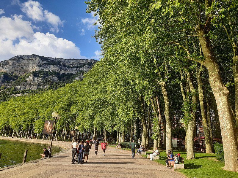
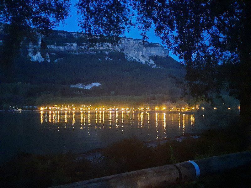
We chose and discovered this lake as the last stop on our trip. A very clean lake and beautiful mountains.
Surrounded by high limestone mountains, Lake Nantua is a 141-hectare glacial lake fed by numerous springs. The deep water (45m) shines in colors between blue and dark green. The parking space was right on the water, which was well occupied and there was still a free space for us. The €10 fee will be collected by an official the following day between 8 a.m. and 9 a.m.
Immediately after our arrival we went for a swim in the beautiful lake.
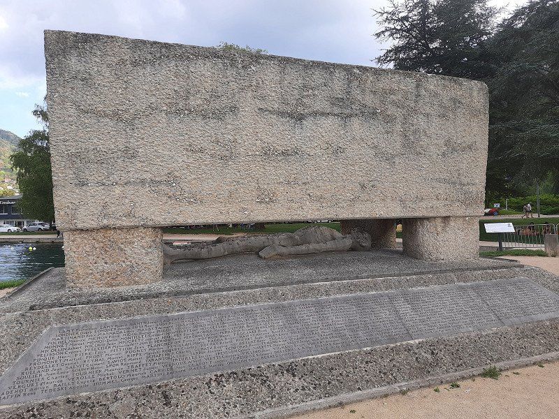
In the late afternoon we explored the town, which is not far from the lake. An almost deserted city and hardly any people on the street during our foray through the town. Pass the deportee memorial 'Tombeau de pierre' (stone grave) depicting a reclining figure (le Gisant). A symbol for the mass deaths in the Nazi era in 1943.
Visit of the Saint-Michel abbey church, with its main altar decorated with marble angels, the famous painting by Eugène Delacroix showing the martyrdom of Saint Sebastian, the Saint Anne chapel is a Gothic jewel of the abbey church with some Renaissance details and the 19th century organ by Nicolas-Antoine Lété.
Nantua, Frankreich
46° 9' 12.3" N 5° 36' 27.9" E
46.1534050 5.6077620
• Head toward Rue du Maquis on Rue du 8 Mai 1945. Go for 86 m.
• Continue on Rue du Maquis. Go for 22 m.
• Turn right onto D74 D. Go for 143 m.
• Continue on Route d'Apremont (D74 D). Go for 300 m.
• Turn right onto Ruelle de la Corniche (D74). Go for 430 m.
• Continue on D74. Go for 19 m.
• Turn left onto Route de Genève (D1084) toward A40. Go for 5.0 km.
• Turn left toward A40/E21/Paris/Lyon/Annecy/Genève. Go for 165 m.
• Take ramp onto A40 toward Milan/Annecy/Genève. Go for 48.3 km.
• Take the exit toward Lausanne/Aéroport Cointrin/Genève-Centre onto A41. Go for 3.0 km.
• Continue on A1. Go for 64.4 km.
• Take the exit toward Bern/Neuchâtel/Simplon/Gd-St-Bernard/Lausanne-Nord/Lausanne-Crissier onto A1 (Ecublens). Go for 21.7 km.
• Continue on A1 toward Bern/Neuchâtel/Yverdon. Go for 81.0 km.
• Take the left exit toward Zürich/Basel/Biel/Bienne onto A1/A6. Go for 6.0 km.
• Continue on A1. Go for 44.6 km.
• Take exit 45 toward E35/Basel/Egerkingen onto A2. Go for 28.4 km.
• Take exit 9 toward Zürich/Rheinfelden onto A3. Go for 19.3 km.
• Take exit 16 toward Eiken/Stein/Säckingen/Laufenburg/Industriegebiet Rütti (Eiken). Go for 914 m.
• Take the 2nd exit from roundabout onto 7 toward Industriegebiet Rütti (Eiken)/Schaffhausen/Laufenburg. Go for 2.7 km.
• Take the 1st exit from roundabout onto 7 toward Schaffhausen/Bad Zurzach/Koblenz/Laufenburg. Go for 4.6 km.
• Pass 2 roundabouts and continue on Landstrasse (7). Go for 15.3 km.
• Turn left onto Bahnhofstrasse (5) toward Bad Zurzach/Waldshut/Schaffhausen/Winterthur/7/Koblenz-Dorf. Go for 467 m.
• Take the 2nd exit from roundabout onto Bahnhofstrasse (7) toward Schaffhausen/Winterthur/Bad Zurzach/Waldshut. Go for 232 m.
• Turn left onto Rheinbrückerstrasse toward Deutschland/Waldshut. Go for 82 m.
• Continue on Rheinbrückenstraße. Go for 158 m.
• Turn right toward Schaffhausen/Tiengen. Go for 75 m.
• Continue on Konstanzer Straße (B34). Go for 1.4 km.
• Take the 1st exit from roundabout onto Konstanzer Straße (B34) toward Schaffhausen/Tiengen. Go for 1.3 km.
• Take ramp onto A98 toward Stuttgart/A81/Singen/Schaffhausen/Lauchringen. Go for 5.9 km.
• Take ramp toward Singen/Wutöschingen. Go for 254 m.
• Take the 2nd exit from roundabout onto B314 toward Singen/Wutöschingen. Go for 25.5 km.
• Turn right onto Außer Ort toward Beggingen (CH)/Achdorf/Fützen. Go for 314 m.
• Continue on Singener Straße. Go for 906 m.
• Continue on K5754. Go for 870 m.
• Continue on L214. Go for 1.7 km.
• Continue on Waldshuter Straße (L214). Go for 269 m.
• Take the 1st exit from roundabout onto Waldshuter Straße (L214). Go for 787 m.
• Turn left onto Schaffhauser Straße (B27) toward Villingen-Schwenningen/Donaueschingen. Go for 184 m.
• Take the 2nd exit from roundabout onto B27 toward Villingen-Schwenningen/Donaueschingen. Go for 23.3 km.
• Keep right onto B27. Go for 16.3 km.
• Take the 2nd exit from roundabout toward Rottweil-Süd/Stadtmitte/Gewerbegebiet Saline/Süd. Go for 95 m.
• Continue on Tuttlinger Straße. Go for 1.9 km.
• Continue on Königstraße. Go for 619 m.
• Take the 1st exit from roundabout onto Königstraße. Go for 476 m.
• Arrive at Königstraße. Your destination is on the right.
☍
429,5 km
(4 hrs. 23 min.)
Day
Rottweil, Deutschland
48° 9' 54.9" N 8° 37' 42.4" E
48.1652577 8.6284530