Unfortunately, we don't support your browser (Internet Explorer) anymore, some functionalities could not work. Click here to get information on how to upgrade your browser.
Discover Brittany: Our tour in autumn 2022

Travelogue
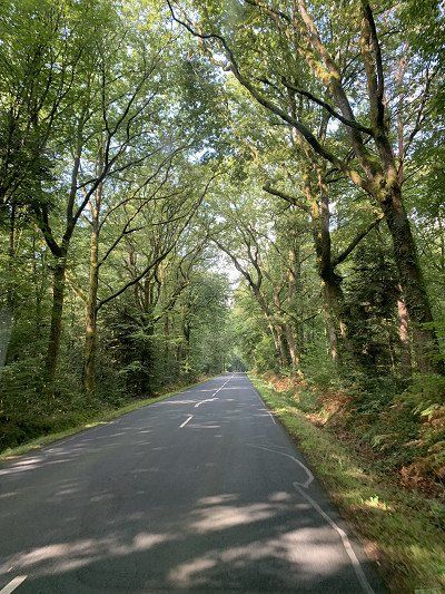
Today is Monday, September 12, 2022, and we're finally starting our Brittany tour. It's expected to be warm again, like late summer, before the clouds roll in from the west.
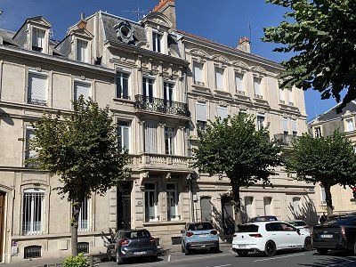
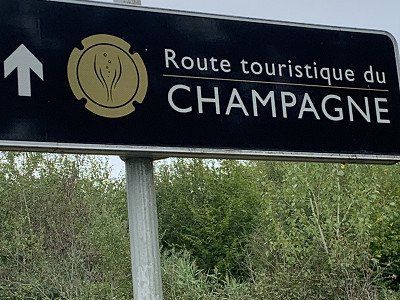
Our first stop is Reims in Champagne – 380 km from home. We've organized a Bip & Go box for the motorway so we can drive through the Télépeage lanes without waiting.
Today on the first day we take the A4 Strasbourg - Paris and turn off in Reims.
Today is Monday, September 12, 2022, and we're finally starting our Brittany tour. It's expected to be warm again, like late summer, before the clouds roll in from the west.
Our first stop is Reims in Champagne – 380 km from home. We've organized a Bip & Go box for the motorway so we can drive through the Télépeage lanes without waiting.
Today on the first day we take the A4 Strasbourg - Paris and turn off in Reims.
The official parking space in Reims is somewhat hidden behind a youth hostel.
Alternatively, 2 places in the Promobil app:
Aire de Camping Car Leo Lagrange N 49 14' 39.8'' E 4 1' 35.8''
Aire de Camping Cars N 49 15' 0.0'' E 4 1' 18.0''
At the Centre Sportif Leo Lagrange we find a parking space without any infrastructure but free of charge.
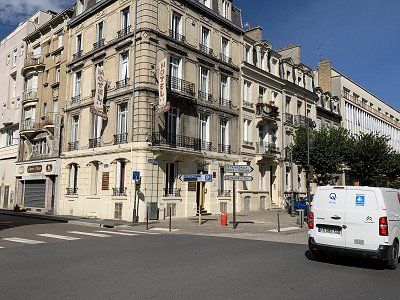
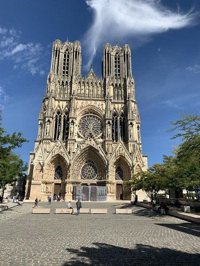
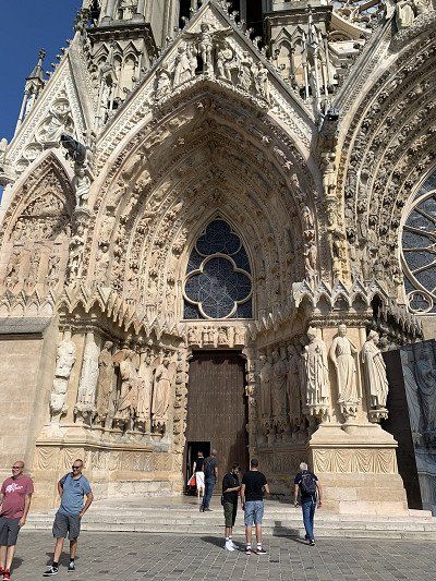
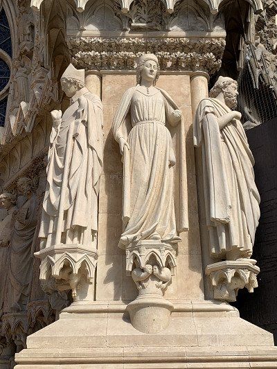
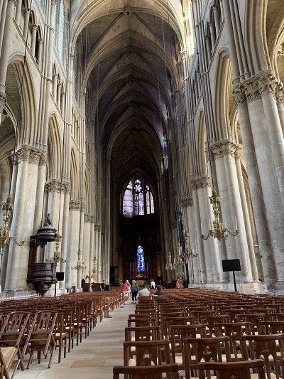
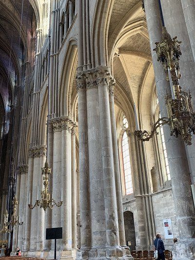
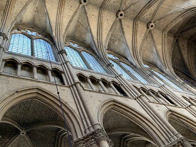
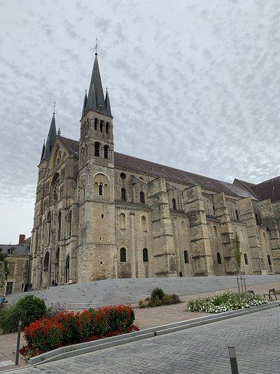
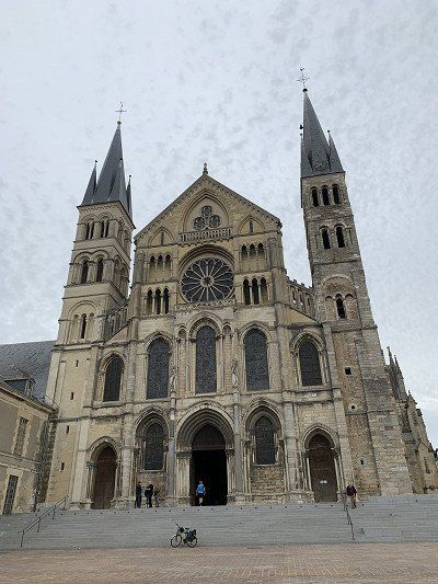
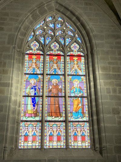
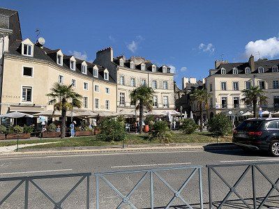
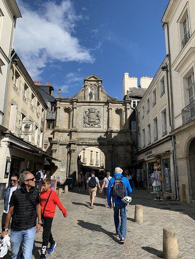
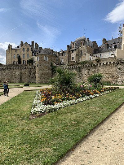
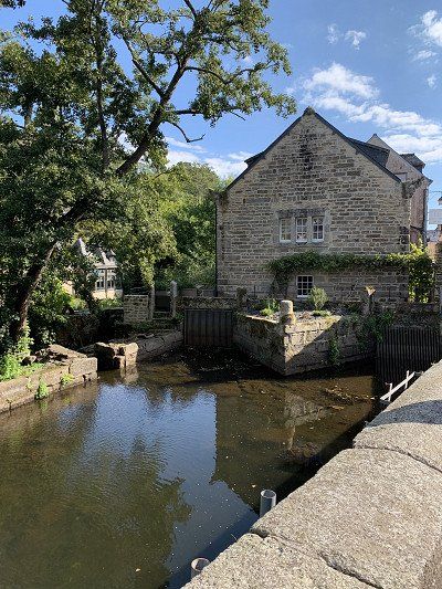
We arrive at 2 p.m. and after a short break, we cross the bridge to the Cathedral of Notre Dame de Reims - a UNESCO World Heritage Site - and the coronation church of the French kings.
Unfortunately, the tower is only open on weekends, so you won't be able to enjoy the view.
Notre-Dame de Reims Cathedral is considered one of the most architecturally significant Gothic churches in France. With around one million visitors a year, it is one of the main attractions of Champagne. According to the legend created by Archbishop Hincmar of Reims, towards the end of the 5th century, St. Remigius, as Bishop of Reims, baptized the Frankish king Clovis I and anointed him with oil sent down from heaven. From this, the Archbishop of Reims derived the right to crown and anoint every new king of France in his cathedral. As the coronation church of almost all French kings, the cathedral symbolized the close bond between monarchy and church. Since the Third Republic enforced the separation of church and state, Reims Cathedral has also symbolized the French nation. Wikipedia
Directly opposite is the Palais du Tau, the archbishop's palace. The building was constructed between 1498 and 1509 on the site of a Gallo-Roman villa. The villa survived until the 6th or 7th century and was later converted into a Carolingian royal palace. The kings of France spent the night before their coronation at Notre-Dame de Reims in this building. Before the coronation ceremony, the future king was dressed there, and after the ceremony, a banquet was held in the palace's Salle du Tau, which features an oversized 15th-century fireplace. Wikipedia
Unfortunately, we have to admit that Monday is not a good day for sightseeing. Neither the Palais du Tau nor the Boulingrin market hall nor the Champagne cellar showroom are open.
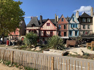
The tourist information office is directly opposite the cathedral.
There you can get the leaflet “ Art Deco in Reims ” with a map and information about the most beautiful Art Deco buildings.
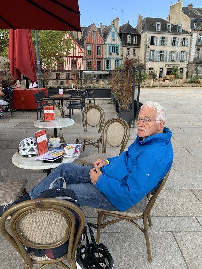
We sit comfortably in front of a bistro near the cathedral where we naturally pay the appropriate surcharge for wine and beer.
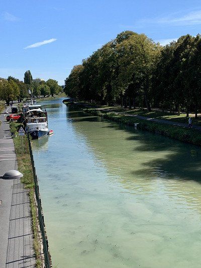
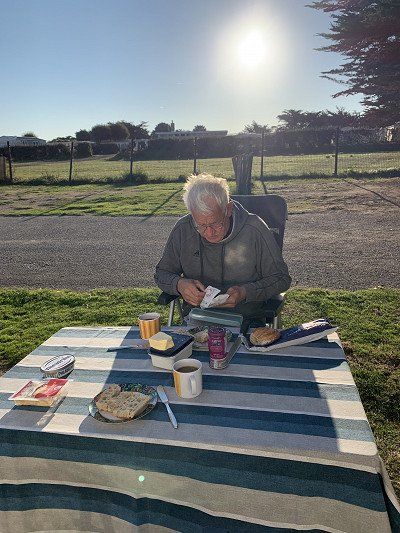
The day is sunny and still warm at 25 degrees - as my husband's knee problems are starting to make themselves felt again, we walk slowly along the canal to the campsite and enjoy the rest of the day with baguette with ham and cheese

The official parking space in Reims is somewhat hidden behind a youth hostel.
Alternatively, 2 places in the Promobil app:
Aire de Camping Car Leo Lagrange N 49 14' 39.8'' E 4 1' 35.8''
Aire de Camping Cars N 49 15' 0.0'' E 4 1' 18.0''
At the Centre Sportif Leo Lagrange we find a parking space without any infrastructure but free of charge.
We arrive at 2 p.m. and after a short break, we cross the bridge to the Cathedral of Notre Dame de Reims - a UNESCO World Heritage Site - and the coronation church of the French kings.
Unfortunately, the tower is only open on weekends, so you won't be able to enjoy the view.
Notre-Dame de Reims Cathedral is considered one of the most architecturally significant Gothic churches in France. With around one million visitors a year, it is one of the main attractions of Champagne. According to the legend created by Archbishop Hincmar of Reims, towards the end of the 5th century, St. Remigius, as Bishop of Reims, baptized the Frankish king Clovis I and anointed him with oil sent down from heaven. From this, the Archbishop of Reims derived the right to crown and anoint every new king of France in his cathedral. As the coronation church of almost all French kings, the cathedral symbolized the close bond between monarchy and church. Since the Third Republic enforced the separation of church and state, Reims Cathedral has also symbolized the French nation. Wikipedia
Directly opposite is the Palais du Tau, the archbishop's palace. The building was constructed between 1498 and 1509 on the site of a Gallo-Roman villa. The villa survived until the 6th or 7th century and was later converted into a Carolingian royal palace. The kings of France spent the night before their coronation at Notre-Dame de Reims in this building. Before the coronation ceremony, the future king was dressed there, and after the ceremony, a banquet was held in the palace's Salle du Tau, which features an oversized 15th-century fireplace. Wikipedia
Unfortunately, we have to admit that Monday is not a good day for sightseeing. Neither the Palais du Tau nor the Boulingrin market hall nor the Champagne cellar showroom are open.
The tourist information office is directly opposite the cathedral.
There you can get the leaflet “ Art Deco in Reims ” with a map and information about the most beautiful Art Deco buildings.
We sit comfortably in front of a bistro near the cathedral where we naturally pay the appropriate surcharge for wine and beer.
The day is sunny and still warm at 25 degrees - as my husband's knee problems are starting to make themselves felt again, we walk slowly along the canal to the campsite and enjoy the rest of the day with baguette with ham and cheese
The night at the stadium or Centre Sportif Leo Lagrange was relatively loud, as the
Main road is very close and can be heard well.
After a quick wash and breakfast, we want to take a look at the Basilique St. Remis, which is a few meters away, but in vain - we can't find a parking space and since there are police everywhere, I can only take two quick photos of the exterior view - then we continue towards Epernay
We initially wanted to spend the night here, but then decided to drive to Chartres:
Camping d'Epernay
avenue de Cumières
51200 / Epernay
ACSI campsite
Actually we wanted to go to the winery
Moët & Chandon
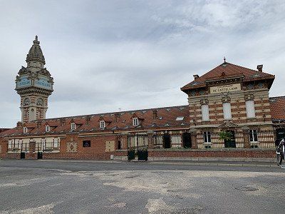
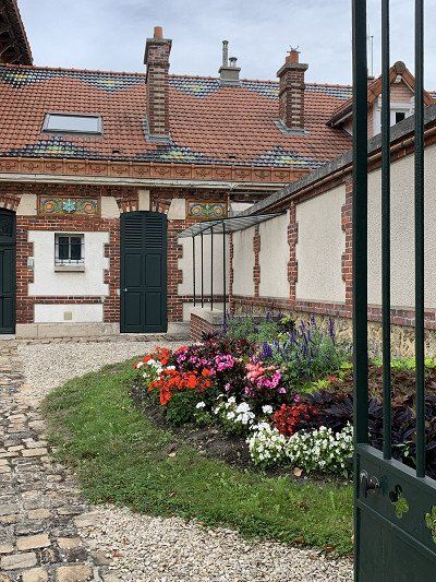
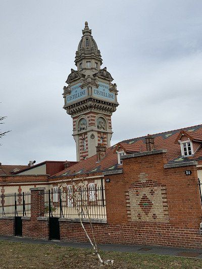
20 AVENUE DE CHAMPAGNE but here too there was no space for our motorhome and so we drove on to the visitor parking lot of the Champagne de Castellane and parked our vehicle there.
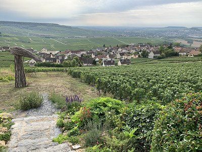
The Avenue de Champagne in Epernay, which has been on the UNESCO World Heritage List since 2015, is a must for anyone visiting Epernay.
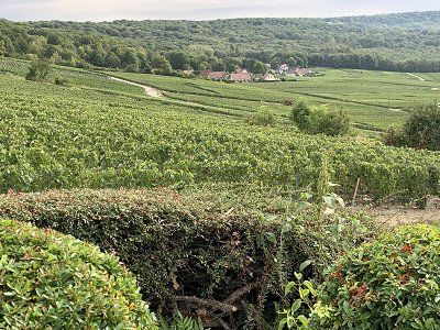
The scenery is so beautiful. On both sides of this long avenue, a remarkable architectural ensemble is set. Cobbled courtyards, elaborate facades, and even landscaped gardens—all these magnificent details tell a little about the history of Champagne during the heyday of the first champagne trading houses.
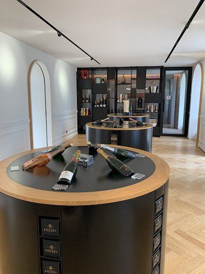
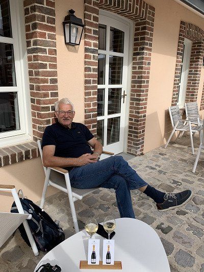
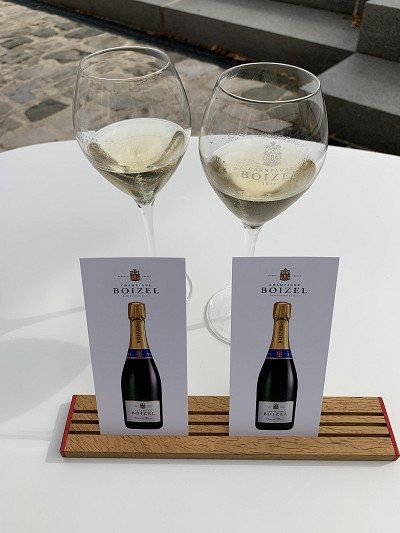
Of course, you have to treat yourself to a glass of champagne here—and price shouldn't be an issue. At Boizel, we're drinking a Blanc de Blanc Champagne of outstanding quality, but at €12 for 10 cl. The wine is aged and shaken for four years before it can be sold as champagne. Boizel's grapes grow only in the vineyards of Epernay, and the estate has been farmed for six generations—very impressive.
We initially wanted to spend the night here, but then decided to drive to Chartres:
Camping d'Epernay
avenue de Cumières
51200 / Epernay
ACSI campsite
Actually we wanted to go to the winery
Moët & Chandon
20 AVENUE DE CHAMPAGNE but here too there was no space for our motorhome and so we drove on to the visitor parking lot of the Champagne de Castellane and parked our vehicle there.
The Avenue de Champagne in Epernay, which has been on the UNESCO World Heritage List since 2015, is a must for anyone visiting Epernay.
The scenery is so beautiful. On both sides of this long avenue, a remarkable architectural ensemble is set. Cobbled courtyards, elaborate facades, and even landscaped gardens—all these magnificent details tell a little about the history of Champagne during the heyday of the first champagne trading houses.
Of course, you have to treat yourself to a glass of champagne here—and price shouldn't be an issue. At Boizel, we're drinking a Blanc de Blanc Champagne of outstanding quality, but at €12 for 10 cl. The wine is aged and shaken for four years before it can be sold as champagne. Boizel's grapes grow only in the vineyards of Epernay, and the estate has been farmed for six generations—very impressive.
From Epernay we continue on the D3 and D1 to Chateau Thierry, on the motorway past Paris to Chartres - the next hot spot on our way to Brittany.
We actually wanted to sleep at the campsite but we discovered that the city operates a free parking space - in the Rue de Launay, however, without electricity and infrastructure
Free parking for 25 mobile homes on the outskirts of Chartres. The site is located near a river. The site is mostly flat and partially shaded. It has a gravel surface with a gravel lawn and a meadow. The town center is within walking distance. Dogs are included in the overnight rate. Water and electricity are not available in winter.
Latitude 48° 25′ 59″ N
Longitude 1° 29′ 53″ E
Rue de Launay,
28000 Chartres
Phone: +33 237234000
contact@ville-chartres.fr
There is also a beautiful cycle path along the L'Eure to the cathedral
The coordinates of the campsite we did not use:
- Camping les Bords de l'Eure
- 9, rue de Launay
- FR - 28000 Chartres/Eure
Telephone +332 37 28 79 43
Email: camping-roussel-chartres@wanadoo.fr
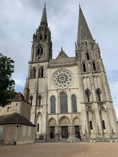
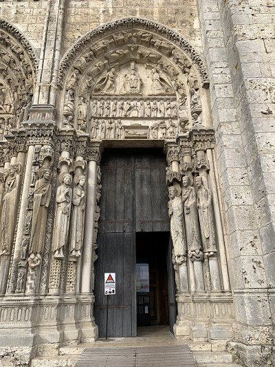
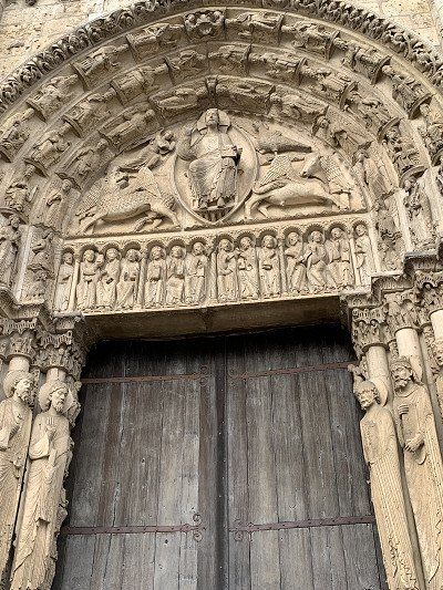
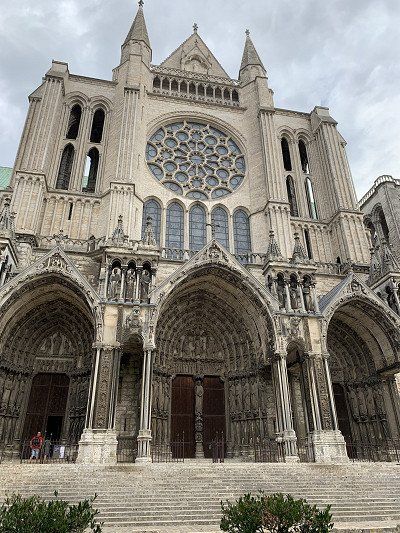
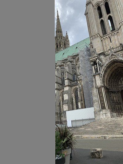
We cycle along the Eure River to Chartres Cathedral, also a World Heritage Site.
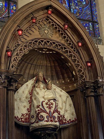
Notre-Dame de Chartres Cathedral is the "archetype" of the High Gothic cathedral and the seat of the bishop of the Roman Catholic diocese of Chartres. In 876, Charles the Bald consecrated a church there and donated a holy relic to the sanctuary, the tunic known as the Sancta Camisia, which the Virgin Mary is said to have worn when the Archangel Gabriel promised the birth of Jesus. Today, a cloth of this tunic, approximately 30 x 30 cm in size, can be seen in the cathedral. The current Gothic reconstruction began shortly after 1194 and lasted until 1260. The construction is over 130 meters long and 64 meters wide. The cathedral was added to the UNESCO World Heritage List in 1979. The sculptor Auguste Rodin called it the Acropolis of France. Wikipedia
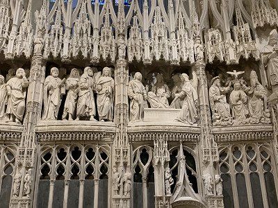
The cathedral impresses with its sheer size, the many magnificent stained glass windows and, even more so, with a surrounding relief in the interior - an incredible masterpiece depicting the life of Mary.
We actually wanted to eat in the old town of Chartes but unfortunately couldn't find a suitable restaurant, so we bought two baguettes and a bacon pie with mozzarella in a boulangerie - and then it started to rain - so we quickly got on our bikes and headed back to the camper.
We sleep very well at the campsite - even though the night is still oppressively warm and we have to sleep with the window open - the road is not very busy.
We cycle along the Eure River to Chartres Cathedral, also a World Heritage Site.
Notre-Dame de Chartres Cathedral is the "archetype" of the High Gothic cathedral and the seat of the bishop of the Roman Catholic diocese of Chartres. In 876, Charles the Bald consecrated a church there and donated a holy relic to the sanctuary, the tunic known as the Sancta Camisia, which the Virgin Mary is said to have worn when the Archangel Gabriel promised the birth of Jesus. Today, a cloth of this tunic, approximately 30 x 30 cm in size, can be seen in the cathedral. The current Gothic reconstruction began shortly after 1194 and lasted until 1260. The construction is over 130 meters long and 64 meters wide. The cathedral was added to the UNESCO World Heritage List in 1979. The sculptor Auguste Rodin called it the Acropolis of France. Wikipedia
The cathedral impresses with its sheer size, the many magnificent stained glass windows and, even more so, with a surrounding relief in the interior - an incredible masterpiece depicting the life of Mary.
We actually wanted to eat in the old town of Chartes but unfortunately couldn't find a suitable restaurant, so we bought two baguettes and a bacon pie with mozzarella in a boulangerie - and then it started to rain - so we quickly got on our bikes and headed back to the camper.
We sleep very well at the campsite - even though the night is still oppressively warm and we have to sleep with the window open - the road is not very busy.
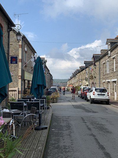
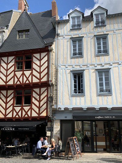
After a hearty breakfast, we set off toward Vitré, the gateway to Brittany. We want to avoid highways and travel exclusively on national and country roads, crossing the Sarthe & Orne departments and the fertile landscapes of the Perche Regional Nature Park via Sillé-le-Guillaume and Evron to Vitré, where we arrive in sunshine and 24 degrees Celsius.
The Camping Municipal de Vitré
Boulevard des Roches 109,
35500 Vitré
N 48 6' 36.2'' E 111' 52.4''
is municipally owned and is located about 2.5 km from the city center.
Located in the Saint-Étienne complex (Route d'Argentré-du-Plessis), the 3-star municipal campsite is open from March 1 to December 15. Built on a former shooting range, this campsite with its unusual architecture is located in a wooded, peaceful setting—it offers everything you need, and we paid €16.20 per night. It's green and full of flowers, plants, and trees, and our pitch, No. 13, is huge.
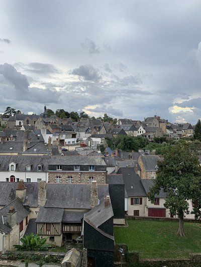
The old town of Vitré is easily accessible by bike via cycle paths, and we can visit some highlights before it starts to rain:
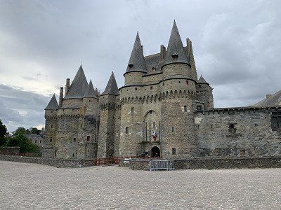
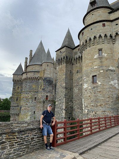
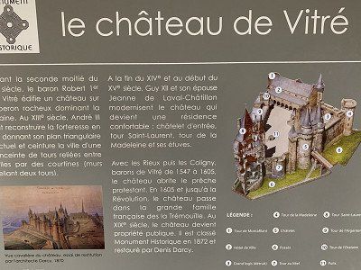
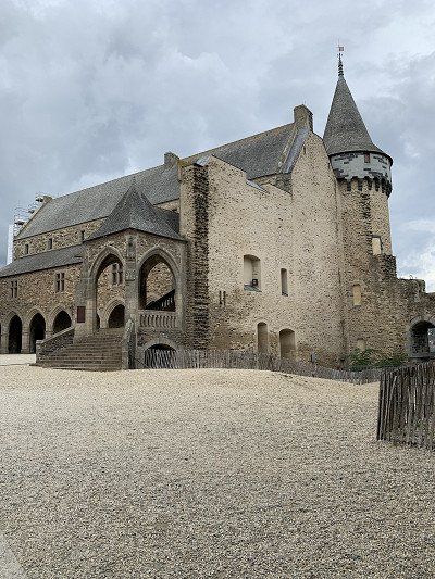
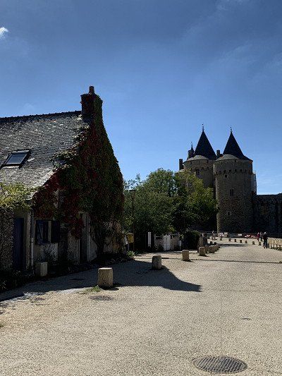
Chateau de Vitré – perched on a rock above the city. Unfortunately, the museum was already closed.
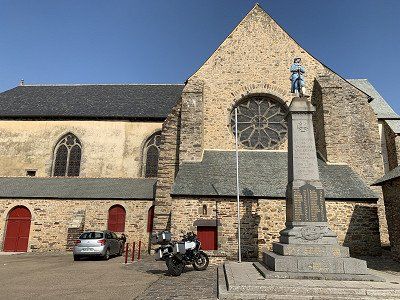
The Church of Our Lady of Vitré
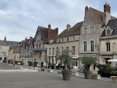
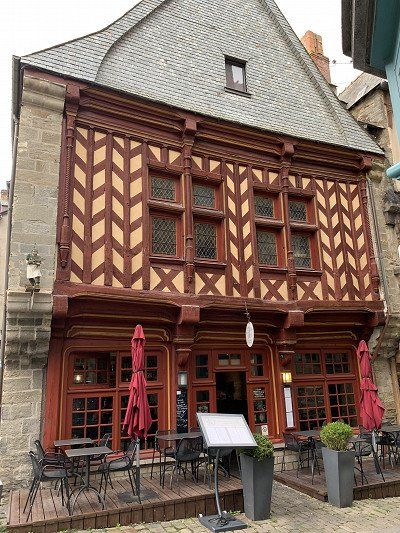
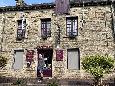
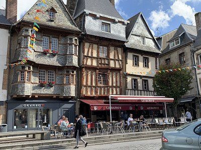
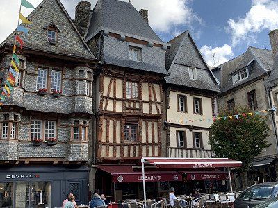
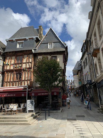
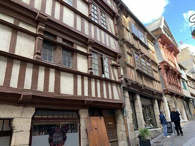
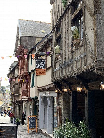
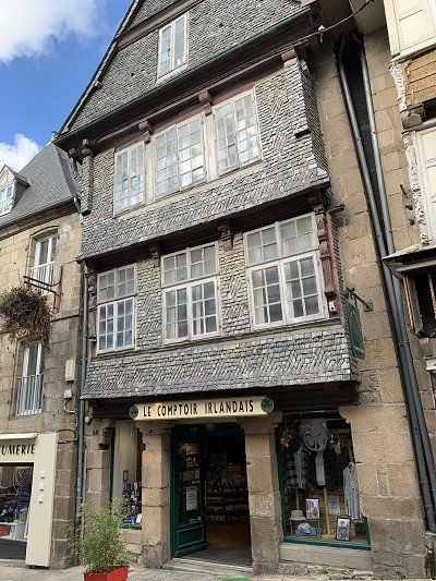
Medieval city center with Rue Baudrairie and the historic houses of the old town
La Gare de Vitré, designed by Victor Lenoir, the architect of the Gare de Montparnasse in Paris
La Place de Gaulle where we had an Aperol Spritz and an aperitif at the Bistro Odorico to escape the worst of the rain.
In the heart of the Portes de Bretagne, an important trading and commercial center in the Middle Ages, Vitré is a small medieval town , now classified as a "City of Art and History".
After a hearty breakfast, we set off toward Vitré, the gateway to Brittany. We want to avoid highways and travel exclusively on national and country roads, crossing the Sarthe & Orne departments and the fertile landscapes of the Perche Regional Nature Park via Sillé-le-Guillaume and Evron to Vitré, where we arrive in sunshine and 24 degrees Celsius.
The Camping Municipal de Vitré
Boulevard des Roches 109,
35500 Vitré
N 48 6' 36.2'' E 111' 52.4''
is municipally owned and is located about 2.5 km from the city center.
Located in the Saint-Étienne complex (Route d'Argentré-du-Plessis), the 3-star municipal campsite is open from March 1 to December 15. Built on a former shooting range, this campsite with its unusual architecture is located in a wooded, peaceful setting—it offers everything you need, and we paid €16.20 per night. It's green and full of flowers, plants, and trees, and our pitch, No. 13, is huge.
The old town of Vitré is easily accessible by bike via cycle paths, and we can visit some highlights before it starts to rain:
Chateau de Vitré – perched on a rock above the city. Unfortunately, the museum was already closed.
The Church of Our Lady of Vitré
Medieval city center with Rue Baudrairie and the historic houses of the old town
La Gare de Vitré, designed by Victor Lenoir, the architect of the Gare de Montparnasse in Paris
La Place de Gaulle where we had an Aperol Spritz and an aperitif at the Bistro Odorico to escape the worst of the rain.
In the heart of the Portes de Bretagne, an important trading and commercial center in the Middle Ages, Vitré is a small medieval town , now classified as a "City of Art and History".
Our plan was to drive to the capital of Brittany and
Rue du professor Maurice Audin
35700 Rennes
GPS: 48° 08' 08.5'' N -1° 38' 44.5'' W
Telephone number: +33 299 369 122
Online: www.camping-rennes.com
The C3 bus stop is about 500 meters from the campsite.
Well-equipped cycle path - 6 km to the city center
to stay overnight.
However, we decided against visiting Rennes at short notice, as we needed some nature after Reims, Chartres, and Vitré. Rennes certainly offers many sights, but we'll have to save those for our next visit to Brittany.
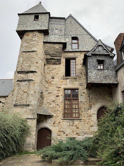
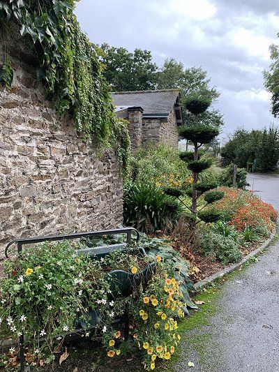
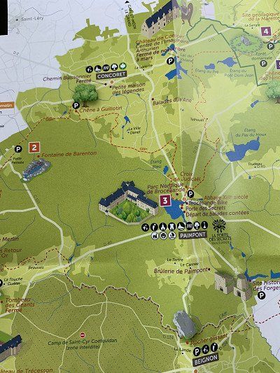
We leave the Vitré campsite late and follow the national road to the Abbaye de Paimpont to pay homage to the Broceliade forest.
Nestled between lakes and heathland, this forest is crisscrossed by a hundred circular trails, perfect for beautiful hikes retracing the legends of King Arthur and Merlin the Wizard. The century-old oaks are populated by goblins, Comper Castle is inhabited by the Fairy Viviane, and magical water flows from the Barenton fountain.
See also https://www.bretagne-reisen.de...
Be sure to get a map for the forest tour at the Abbaye de Paimpont Tourist Office -
There may also be a cycling map there -
All the legendary places here in Broceliande are easily accessible by motorhome. The trails are well-maintained and signposted, and there are plenty of parking spaces.
The Tomb of Merlin
The Fountain of Joy
Barenton Fountain
Val sans Retour
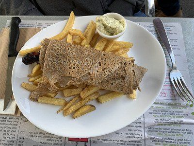
Unfortunately, my husband's knee pain has returned, so we have to cancel our planned walk in the forest and instead go to the restaurant l'Abbaye for dinner. For the first time, we try the fantastic Breton buckwheat pancakes—galette with merguez or saucisse—and, of course, the Breton cider.
There is also a campsite here for overnight stays, but we continue towards Vannes:
Paimpont Municipal Camping
2 rue du chevalier Lancelot du Lac
35380 Paimpont
48° 01' 30.2'' N -2° 10' 19'' W
Telephone number: +33 299 078 916
On the web: www.camping-paimpont-broceliande.com
We leave the Vitré campsite late and follow the national road to the Abbaye de Paimpont to pay homage to the Broceliade forest.
Nestled between lakes and heathland, this forest is crisscrossed by a hundred circular trails, perfect for beautiful hikes retracing the legends of King Arthur and Merlin the Wizard. The century-old oaks are populated by goblins, Comper Castle is inhabited by the Fairy Viviane, and magical water flows from the Barenton fountain.
See also https://www.bretagne-reisen.de...
Be sure to get a map for the forest tour at the Abbaye de Paimpont Tourist Office -
There may also be a cycling map there -
All the legendary places here in Broceliande are easily accessible by motorhome. The trails are well-maintained and signposted, and there are plenty of parking spaces.
The Tomb of Merlin
The Fountain of Joy
Barenton Fountain
Val sans Retour
Unfortunately, my husband's knee pain has returned, so we have to cancel our planned walk in the forest and instead go to the restaurant l'Abbaye for dinner. For the first time, we try the fantastic Breton buckwheat pancakes—galette with merguez or saucisse—and, of course, the Breton cider.
There is also a campsite here for overnight stays, but we continue towards Vannes:
Paimpont Municipal Camping
2 rue du chevalier Lancelot du Lac
35380 Paimpont
48° 01' 30.2'' N -2° 10' 19'' W
Telephone number: +33 299 078 916
On the web: www.camping-paimpont-broceliande.com
188 Avenue du Maréchal Juin
56000 Vannes
GPS: 47° 37' 59.7'' N -2° 46' 42.2'' W
Telephone number: 02 97 63 13 88
Online: en.flowercampings.com
188 Avenue du Maréchal Juin
56000 Vannes
GPS: 47° 37' 59.7'' N -2° 46' 42.2'' W
Telephone number: 02 97 63 13 88
Online: en.flowercampings.com
The planned campsite Le Conleau is unfortunately fully booked, but in the neighboring town of Séné we find a spacious place to stay for one night at the Camping Le Moulin de Cantizac for €22.10.
There is a cheaper pitch next door, but we want to use the showers, so we stay at the campsite.
The site is about 3 km from Vannes and we are considering going there by bike and leaving the RV behind.
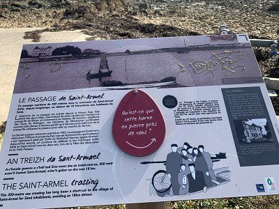
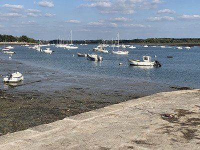
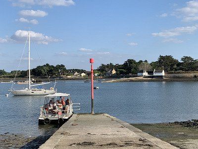
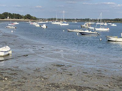
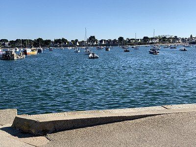
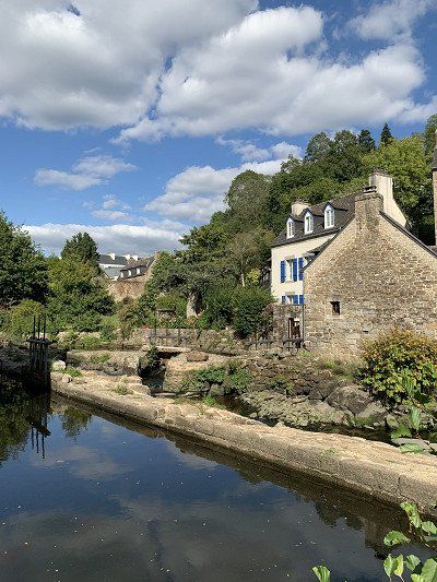
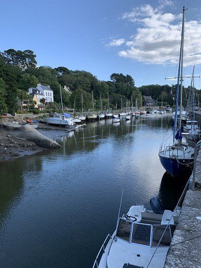
This evening we drove along small streets through residential areas to the Gulf of Morbihan, or rather to the Passage de Saint Armel. This 200-meter-long passage, thanks to the regular ferry service to the island of Saint Armel, reduces the time required for a circumnavigation by at least 60 minutes.
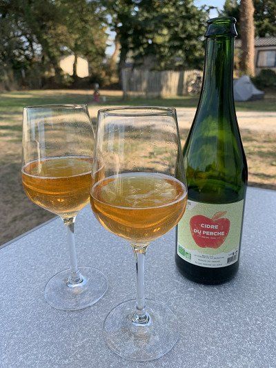
In the evening we tap our cider from the Perche region - it tastes wonderful.
The planned campsite Le Conleau is unfortunately fully booked, but in the neighboring town of Séné we find a spacious place to stay for one night at the Camping Le Moulin de Cantizac for €22.10.
There is a cheaper pitch next door, but we want to use the showers, so we stay at the campsite.
The site is about 3 km from Vannes and we are considering going there by bike and leaving the RV behind.
This evening we drove along small streets through residential areas to the Gulf of Morbihan, or rather to the Passage de Saint Armel. This 200-meter-long passage, thanks to the regular ferry service to the island of Saint Armel, reduces the time required for a circumnavigation by at least 60 minutes.
In the evening we tap our cider from the Perche region - it tastes wonderful.
We decided to stay at the campsite for another day and take it easy.
It's very easy to get to Vannes by bike. The bike path leads straight to the harbor. We leave our e-bikes – safely secured – in a bike parking area. They're just a hindrance in the narrow streets of the old town, as we already found out in Vitré.
There is also an easy route by bike to Vannes - on Komoot - approx. 40 km - h 140 m
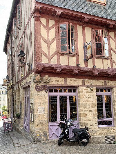
Vannes – a journey back in time to the Middle Ages and a flagship of Brittany
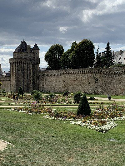
Anyone walking through the historic city center of Vannes might think they were strolling through an open-air museum. This small French town on the Gulf of Morbihan exudes history at every corner and is a showcase of medieval Brittany. The Gothic Saint-Pierre Cathedral rises at its center, surrounded by a maze of cobblestone streets lined with pretty half-timbered houses and elegant townhouses. Sections of the former city walls and gates have been preserved, and French gardens at the rear invite you to stroll.
We get a city map from the tourist office in the harbor and follow Route 1 from Place Gambetta through the Porte Sint Vincent into the old town
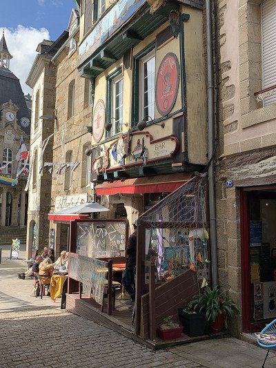
Beyond the gate, 17th-century buildings crowd the street. Around the Place des Lices, town villas and half-timbered houses stand side by side. The facades are brightly colored, giving the rows of houses a particularly cheerful appearance. The Place des Lices also houses the market halls, which offer a great selection, but unfortunately, they're only open until 2 p.m., and we can't leave the delicacies in our backpacks all day.
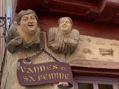
Particularly famous is the house on Place Valencia with the residents 'Vannes et sa femme'
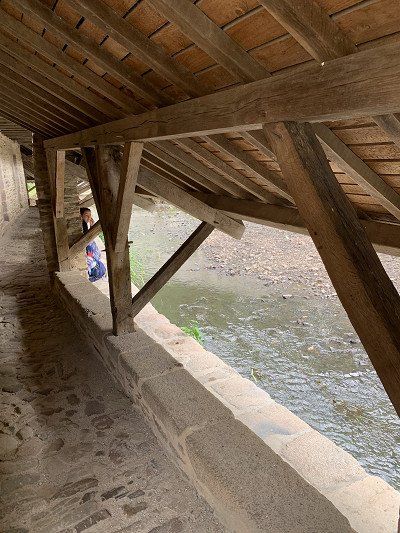
From the Porte Prison, you reach the Garenne Promenade, which runs along the city walls, built in the 13th century. Towers and gates follow one another in remarkable harmony; below them lie beautiful French gardens. Public washhouses with long slate roofs belonging to the forts lean over the Marle River.
We decided to stay at the campsite for another day and take it easy.
It's very easy to get to Vannes by bike. The bike path leads straight to the harbor. We leave our e-bikes – safely secured – in a bike parking area. They're just a hindrance in the narrow streets of the old town, as we already found out in Vitré.
There is also an easy route by bike to Vannes - on Komoot - approx. 40 km - h 140 m
Vannes – a journey back in time to the Middle Ages and a flagship of Brittany
Anyone walking through the historic city center of Vannes might think they were strolling through an open-air museum. This small French town on the Gulf of Morbihan exudes history at every corner and is a showcase of medieval Brittany. The Gothic Saint-Pierre Cathedral rises at its center, surrounded by a maze of cobblestone streets lined with pretty half-timbered houses and elegant townhouses. Sections of the former city walls and gates have been preserved, and French gardens at the rear invite you to stroll.
We get a city map from the tourist office in the harbor and follow Route 1 from Place Gambetta through the Porte Sint Vincent into the old town
Beyond the gate, 17th-century buildings crowd the street. Around the Place des Lices, town villas and half-timbered houses stand side by side. The facades are brightly colored, giving the rows of houses a particularly cheerful appearance. The Place des Lices also houses the market halls, which offer a great selection, but unfortunately, they're only open until 2 p.m., and we can't leave the delicacies in our backpacks all day.
Particularly famous is the house on Place Valencia with the residents 'Vannes et sa femme'
From the Porte Prison, you reach the Garenne Promenade, which runs along the city walls, built in the 13th century. Towers and gates follow one another in remarkable harmony; below them lie beautiful French gardens. Public washhouses with long slate roofs belonging to the forts lean over the Marle River.
As already mentioned, Vannes is a small, attractive medieval town and a visit there is highly recommended.
We buy two more Breton specialties in a boulangerie: very sweet and high in calories: Sablé framboise and Konign Aman - each bakery has its own recipe for these.
After we return to the campsite, the weather is still nice—albeit windy, but we still ride our bikes the 6 km to the Presqu'île de Conleau. It's wonderful here, and we relax with a Breton beer. Tomorrow we'll continue towards Port Navalo.
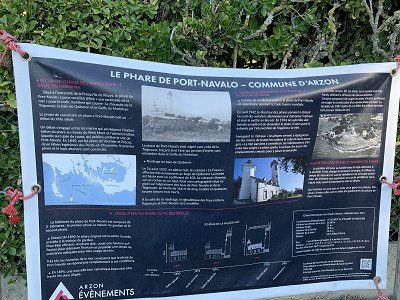
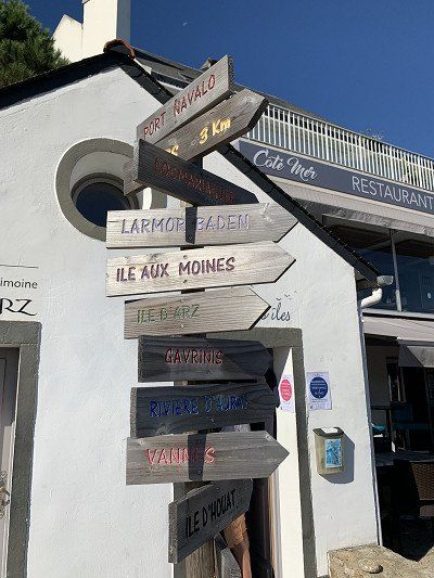
We set off on September 17, 2022, in sunny weather towards Port Navalo/Arzon and, oh wonder - we also find a wonderful, free parking space on the side of the road in Arzon.
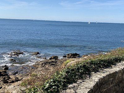
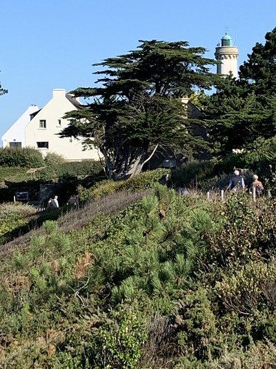
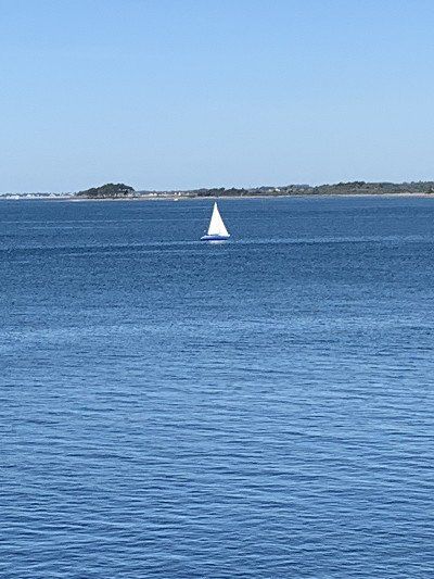
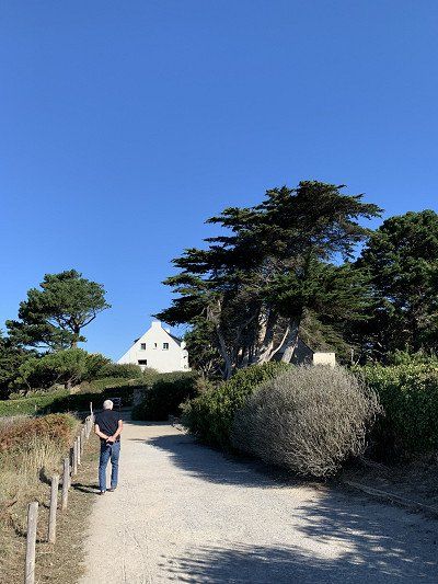
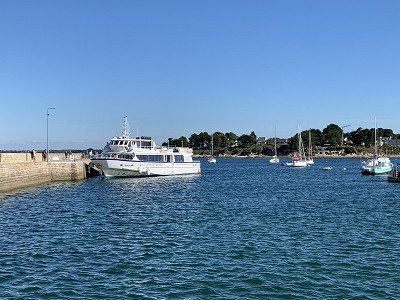
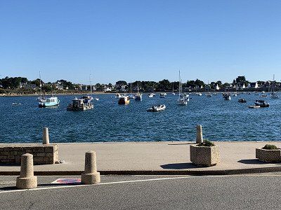
Our walk along the coast with wonderful views takes us to the lighthouse, which unfortunately cannot be visited, and further to Port Navalo where the excursion boats depart for the islands.
The Gulf of Morbihan is the highlight of southern Brittany. This "little sea" entices with its diverse landscapes, beautiful coastal paths, and medieval towns. The islands off the coast are also worth a visit. Above all, the Île aux Moines , accessible by boat, whose small villages with their flower-filled alleys are perfect for strolling. Unfortunately, we can't take the ferry due to time constraints – the islands are a paradise for cyclists, which we would have loved to try.
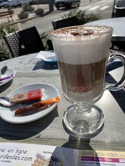
Instead, we enjoy a delicious cappuccino in a bar at the harbor and
then walk back to the motorhome.

We set off on September 17, 2022, in sunny weather towards Port Navalo/Arzon and, oh wonder - we also find a wonderful, free parking space on the side of the road in Arzon.
Our walk along the coast with wonderful views takes us to the lighthouse, which unfortunately cannot be visited, and further to Port Navalo where the excursion boats depart for the islands.
The Gulf of Morbihan is the highlight of southern Brittany. This "little sea" entices with its diverse landscapes, beautiful coastal paths, and medieval towns. The islands off the coast are also worth a visit. Above all, the Île aux Moines , accessible by boat, whose small villages with their flower-filled alleys are perfect for strolling. Unfortunately, we can't take the ferry due to time constraints – the islands are a paradise for cyclists, which we would have loved to try.
Instead, we enjoy a delicious cappuccino in a bar at the harbor and
then walk back to the motorhome.
We continue towards Sarzeau where we first buy some specialties at a large Super U, before driving to Suscinio, the summer residence of the Dukes of Brittany.
What a surprise - a huge parking lot for motorhomes - spacious and free - can also be used for an overnight stay but for us it is definitely still too early.
Parts of the castle are being renovated and are covered in scaffolding, so we take a few photos of the exterior and decide to move on - but not before we've treated ourselves to a small lunch of Forestière meat pâté and Moules St. Jacques rillettes.
Suscinio Castle
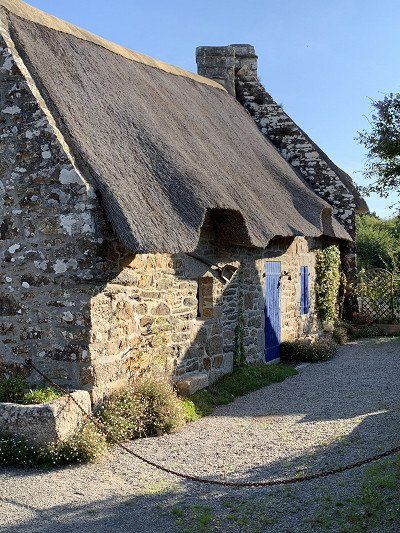
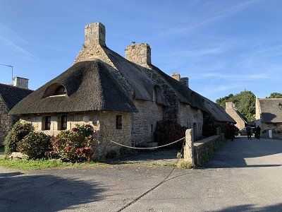
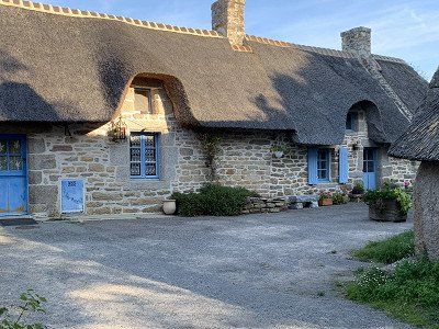
The houses near the castle are thatched and nestle idyllically into the landscape.
We continue towards Sarzeau where we first buy some specialties at a large Super U, before driving to Suscinio, the summer residence of the Dukes of Brittany.
What a surprise - a huge parking lot for motorhomes - spacious and free - can also be used for an overnight stay but for us it is definitely still too early.
Parts of the castle are being renovated and are covered in scaffolding, so we take a few photos of the exterior and decide to move on - but not before we've treated ourselves to a small lunch of Forestière meat pâté and Moules St. Jacques rillettes.
Suscinio Castle
The houses near the castle are thatched and nestle idyllically into the landscape.
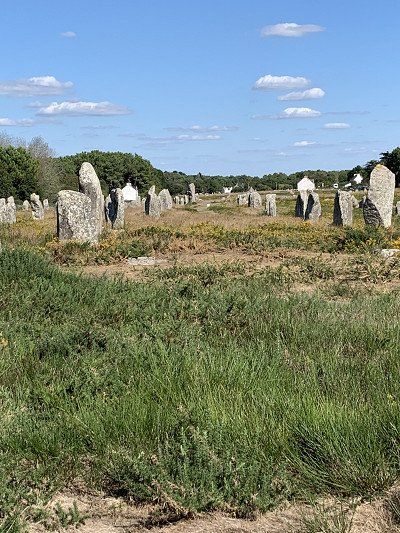
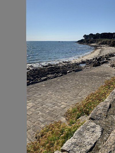
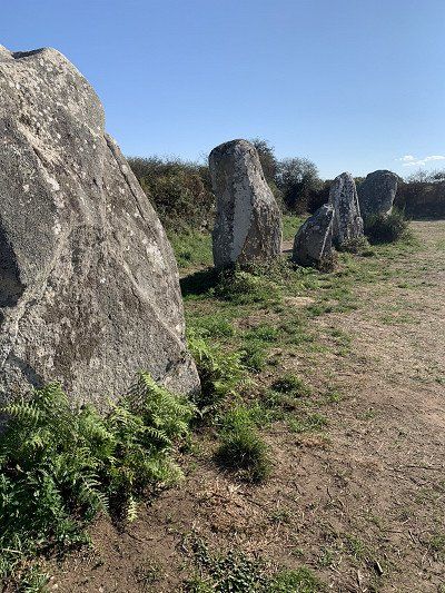
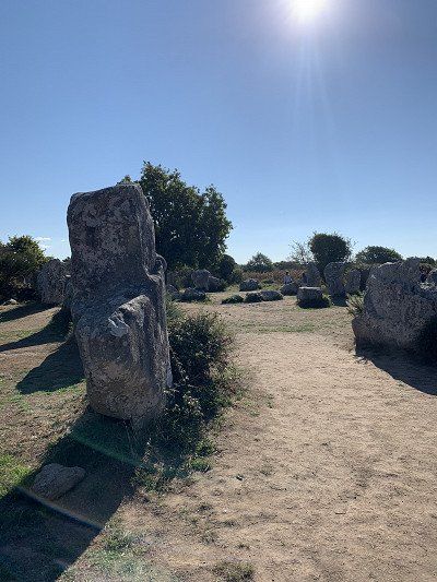
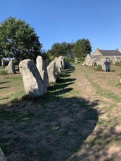
We continue towards Carnac - the center of megalithic culture in Brittany.
With luck, we find a parking space at the Maison des Mégalithes. This information center, opposite the Ménec stone field, attempts to shed light on the meaning of these arrangements. Today, it is assumed that the stones served as sacred burial sites, but this has not yet been proven.
The 7,000-year-old Carnac stone rows are known worldwide as a testament to European prehistory. What's special about the Carnac megaliths is their incredible arrangement in evenly spaced rows. These stone rows alone comprise approximately 3,000 menhirs and stretch for almost 4 km.
Since there are no more parking spaces in Carnac and the planned campsite is already closed (a big wedding is taking place here today), we continue on to Trinité sur Mer.
We're in luck with this campsite. It's a 4-star site with beach access, open only today and then closing for the winter starting Monday, September 19. A friend recommended this place to us.
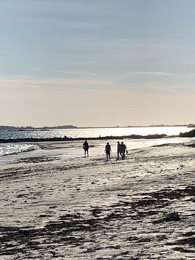
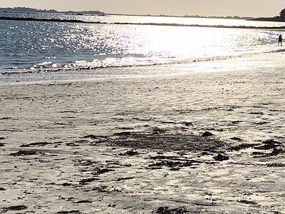
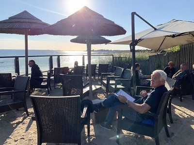
The beach is wonderful and the sunset, which we enjoy on the terrace of the restaurant 'Aux Terasses de la Plage', is breathtaking.
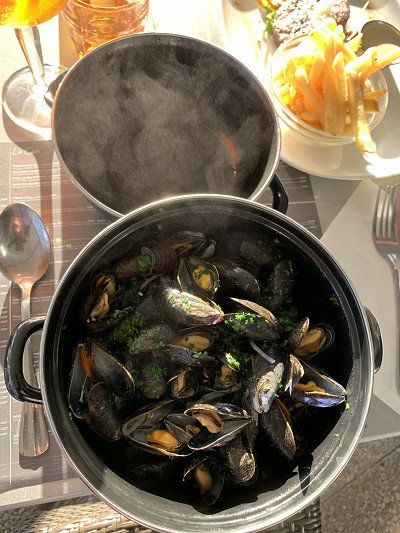
I finally get my Moules Marinière with fries, but my husband is extremely disappointed, not to say disgusted, with his Andouilles Grillées . This is a dish for the daring. We didn't know what was on the plate, but we later found out. This French specialty is made exclusively from the intestines and offal of animals—either pork, beef, or lamb—and tastes accordingly spicy and takes some getting used to. Now that we know this, we'll be giving this particular dish a wide berth.
We're in luck with this campsite. It's a 4-star site with beach access, open only today and then closing for the winter starting Monday, September 19. A friend recommended this place to us.
The beach is wonderful and the sunset, which we enjoy on the terrace of the restaurant 'Aux Terasses de la Plage', is breathtaking.
I finally get my Moules Marinière with fries, but my husband is extremely disappointed, not to say disgusted, with his Andouilles Grillées . This is a dish for the daring. We didn't know what was on the plate, but we later found out. This French specialty is made exclusively from the intestines and offal of animals—either pork, beef, or lamb—and tastes accordingly spicy and takes some getting used to. Now that we know this, we'll be giving this particular dish a wide berth.
Today is Sunday, September 18, 2022 and it is expected to be another sunny day although the temperature will still be quite cool in the morning, 20 degrees is expected.
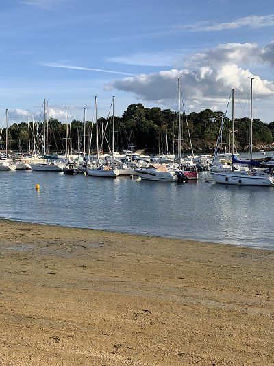
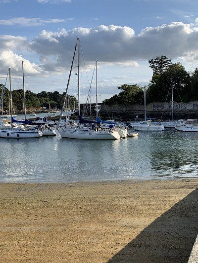
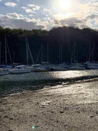
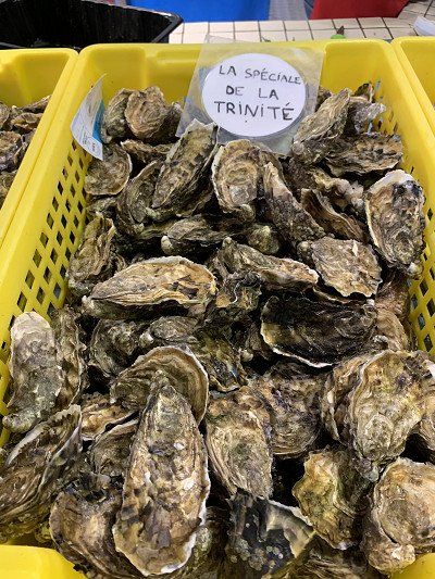
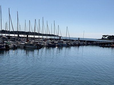
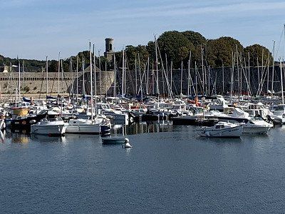
After leaving the campsite, we drive to the small town of Trinité-sur-Mer and visit the marina, the Criée fish market, and the 1 km-long harbor promenade. A specialty of Trinité-sur-Mer are the oysters sold here.
We'll quickly pick up something sweet for our afternoon coffee at a boulangerie, then continue on to the Quiberon Peninsula, which juts 14 km into the Atlantic. Our plan is to explore the island by bike.
Today is Sunday, September 18, 2022 and it is expected to be another sunny day although the temperature will still be quite cool in the morning, 20 degrees is expected.
After leaving the campsite, we drive to the small town of Trinité-sur-Mer and visit the marina, the Criée fish market, and the 1 km-long harbor promenade. A specialty of Trinité-sur-Mer are the oysters sold here.
We'll quickly pick up something sweet for our afternoon coffee at a boulangerie, then continue on to the Quiberon Peninsula, which juts 14 km into the Atlantic. Our plan is to explore the island by bike.
Yes, we want to explore Quiberon by bike, but first we need a place to park our RV. The Aire de St. Pierre seems to no longer exist—in any case, we can't find it.
We're lucky and find what we're looking for on the Cote Sauvauge. In Kerné, a few kilometers from the main town of Quiberon (2km), there's space for 150 campervans – unfortunately without electricity, but the back part is very quiet. There's also direct access to the bike paths across the island. For €9.55, we're very secure and can saddle up our bikes after the obligatory afternoon coffee.
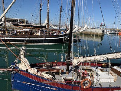
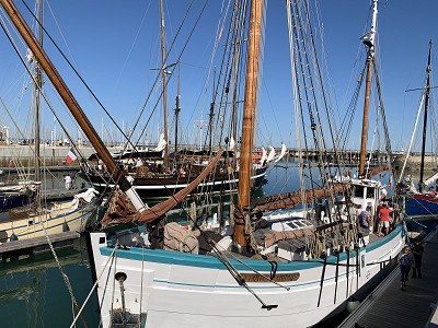
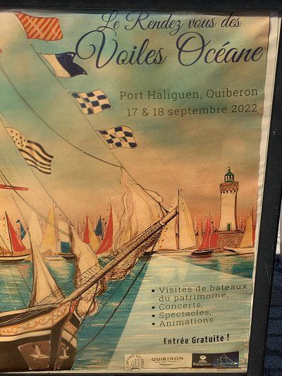
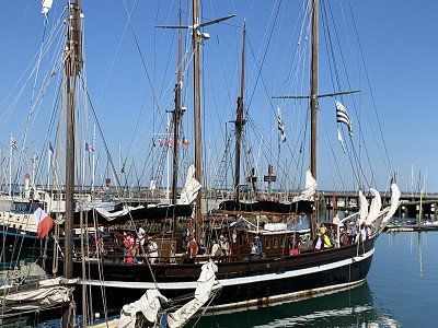
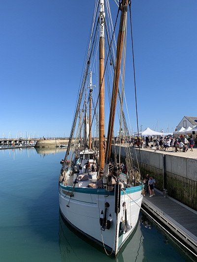
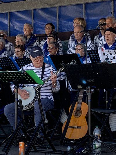
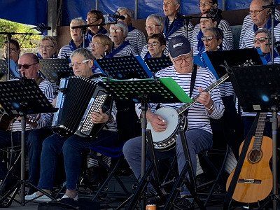
We walk along the scenic Côte Sauvage to Château Turpault, then on to the Pointe du Conguel and into the beautiful harbor of Port Haliguen, where today - on Heritage Day - we are surprised by old sailing ships and a Breton shanty choir - and all this in glorious sunshine - it is a pure joy to watch the festivities.
Yes, we want to explore Quiberon by bike, but first we need a place to park our RV. The Aire de St. Pierre seems to no longer exist—in any case, we can't find it.
We're lucky and find what we're looking for on the Cote Sauvauge. In Kerné, a few kilometers from the main town of Quiberon (2km), there's space for 150 campervans – unfortunately without electricity, but the back part is very quiet. There's also direct access to the bike paths across the island. For €9.55, we're very secure and can saddle up our bikes after the obligatory afternoon coffee.
We walk along the scenic Côte Sauvage to Château Turpault, then on to the Pointe du Conguel and into the beautiful harbor of Port Haliguen, where today - on Heritage Day - we are surprised by old sailing ships and a Breton shanty choir - and all this in glorious sunshine - it is a pure joy to watch the festivities.
This morning we are again relatively late, but because of the sunny weather we can have breakfast outside and enjoy the rising sun.
Only at 10.30 am we leave the quiet parking area and drive towards Erdeven where we visit the second largest collection of menhirs on the roadside - it is
about the megalithic site of Kerzerho and its stone giants.
Today we want to travel a little further – via Plouhinec to Port Louis, where we'll visit the marina and the citadel. It was occupied by the Nazis during World War II – 69 French resistance fighters were killed here. There's a museum dedicated to these terrible events, but it's closed now.
Today we want to travel a little further – via Plouhinec to Port Louis, where we'll visit the marina and the citadel. It was occupied by the Nazis during World War II – 69 French resistance fighters were killed here. There's a museum dedicated to these terrible events, but it's closed now.
Pont Aven - is a tranquil town on the Aven River, which became world famous through the painter Paul Gaughin, who lived here for several years before emigrating to Tahiti.
Towards the end of the 19th century, Gauguin had his eye on the leafy little town on the banks of the Aven River. The rich colors and special light of Pont-Aven subsequently captivated other artists such as Emile Bernard, Paul Sérusier, and Maxime Maufra, who eventually founded the Pont-Aven School. To explore the places that so inspired the painters, take a walk along the windmill, the laundry, over the stone bridges, and into the Bois d'Amour.
The parking situation in Pont Aven isn't ideal for motorhomes, but after a long search, we find the Camping Car Park 4 Vents on Rue Luis Lomenech, which is owned by Etap. We first have to buy an Etap card for €5 before we can access the site—but this card is valid for all Etap sites in France, making it a small investment that's well worth it.
We're very happy with our location, as we can walk to the small town with its many galleries exhibiting wonderful pictures and paintings. Unfortunately, these are beyond our budget, and we can't afford this art – 1,800 euros per picture – oh la la.
Our walk takes us towards the harbor - very tranquil - and we are happy to have found a bistro where we order an aperitif before strolling back to the campsite and preparing our dinner.
For the first time on the trip we look for a satellite for our TV reception and see for a few minutes the impressive funeral of the English Queen Elizabeth I
We slept peacefully and safely at the campsite. By evening, the site was packed with motorhomes from all over Europe.
Today we leave Pont Aven and continue towards Nevez in 18 degrees and sunny weather.
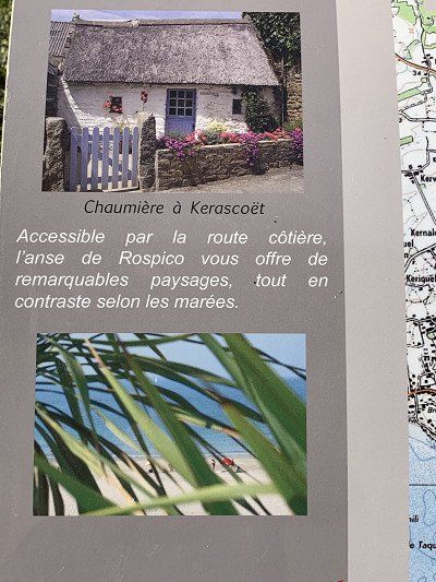
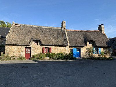
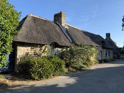
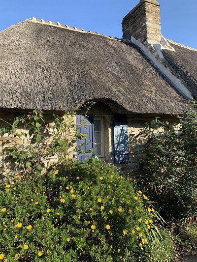
Here we want to visit a picture-book village 'par excellence': the village with thatched houses Kerascoët This village has been faithfully rebuilt and renovated and is a true feast for the eyes.
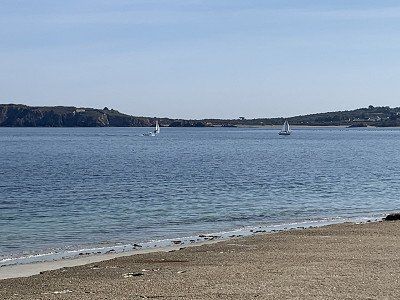
Nearby is Plage Tahiti, one of the most beautiful beaches in Brittany. From the village of Kervaillet, there is direct access to the vast white sandy beach "Tahiti-Raguenez" off the islands of Groix and Glénans.
Today we leave Pont Aven and continue towards Nevez in 18 degrees and sunny weather.
Here we want to visit a picture-book village 'par excellence': the village with thatched houses Kerascoët This village has been faithfully rebuilt and renovated and is a true feast for the eyes.
Nearby is Plage Tahiti, one of the most beautiful beaches in Brittany. From the village of Kervaillet, there is direct access to the vast white sandy beach "Tahiti-Raguenez" off the islands of Groix and Glénans.
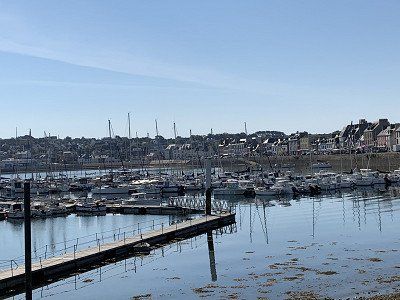
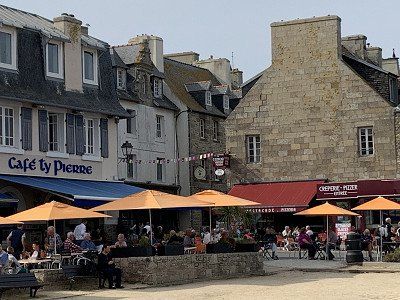
Concarneau is one of the most visited attractions in Brittany.
We are lucky and find a parking space on the street at Boulevard Kathérine Wily, so we can ride our bikes into the old town.
We were fascinated by the Ville Close with its thick 14th-century city walls, the vibrant harbor life with more than 200 fishing boats, and Rue Vauban—a cobbled street lined with many restaurants, bistros, and small shops. Not to mention the beautiful fountain in the middle of the market square.
Of course we have to take a little break from our short walk on the city walls - this place is so wonderful - touristy but also Breton.
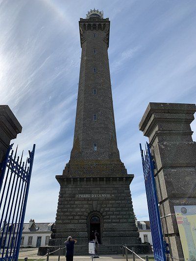
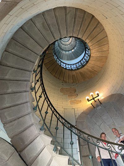
Our next destination is the Phare du Eckmühl on the coast with an impressive staircase and over 300 steps, which offers a magnificent view of the sea and the Bigouden landscape.
Unfortunately, we couldn't find a parking space in Pont L'Abbé to visit the Bigouden Museum with its traditional costumes and Bigouden caps, which I would have been very interested in.
But I visit the staircase of the Phare du Eckmühl for 3 euros and only climb 170 steps before my fear of heights kicks in.
The Phare d'Eckmühl can be climbed via 307 steps - absolutely worth seeing
There is a parking lot but you are not allowed to stay overnight there
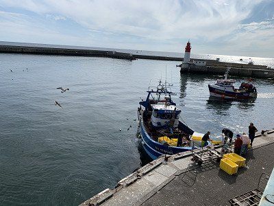
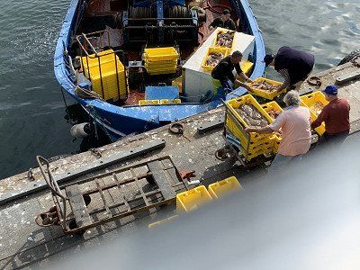
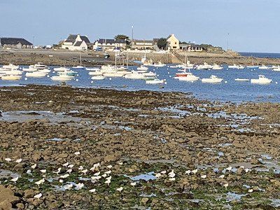
And then we continue to Le Guilvinec - here the fishing boats and fishing trawlers arrive from 4.15 p.m. in the afternoon and land at the harbor quay under the observation of the tourists from the panoramic terrace.
You can also book a guided tour of the Haliotika fish auction hall, but we watch the spectacle from the terrace. It's just a shame we can't find a restaurant serving fish or shellfish at this time of day.
We actually wanted to spend the night at the Aire de Camping Car at the harbor - a parking lot for 40 motorhomes - Rue Jacques de Thezac - electricity for a fee - but lo and behold: this place no longer exists.
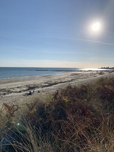
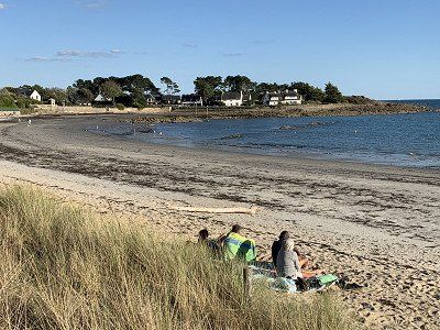
In this area there are wonderful beaches like those in the South Seas - we briefly visited one of them and would have liked to stay, but unfortunately there was a sign prohibiting camping vehicles.
So we have to find another place to stay overnight. We stop at three campsites, but unfortunately, they're already closed, so we're happy to find a spot at Les Genets Flower Camping in Penmarch.
With 19 degrees and sunny weather we can eat outside, which really feels like vacation.
And then we continue to Le Guilvinec - here the fishing boats and fishing trawlers arrive from 4.15 p.m. in the afternoon and land at the harbor quay under the observation of the tourists from the panoramic terrace.
You can also book a guided tour of the Haliotika fish auction hall, but we watch the spectacle from the terrace. It's just a shame we can't find a restaurant serving fish or shellfish at this time of day.
We actually wanted to spend the night at the Aire de Camping Car at the harbor - a parking lot for 40 motorhomes - Rue Jacques de Thezac - electricity for a fee - but lo and behold: this place no longer exists.
In this area there are wonderful beaches like those in the South Seas - we briefly visited one of them and would have liked to stay, but unfortunately there was a sign prohibiting camping vehicles.
So we have to find another place to stay overnight. We stop at three campsites, but unfortunately, they're already closed, so we're happy to find a spot at Les Genets Flower Camping in Penmarch.
With 19 degrees and sunny weather we can eat outside, which really feels like vacation.
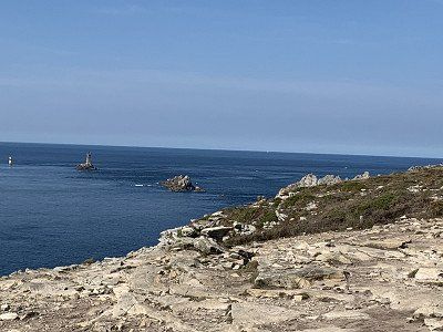
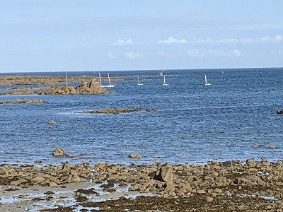
The next morning at 9.30 a.m. we continue towards Pointe du Raz - the westernmost point of France on the Atlantic - after that there is only the Atlantic Ocean and ....... America.
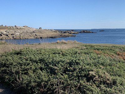
The short hike along the coast offers magnificent views and panoramas. The Pointe du Raz, classified as a "Grand Site de France," stands approximately 70 meters high. Carved by wind and waves, it alone is worth the trip to this region. Opposite it stands the square lighthouse on the islet of La Vieille, commissioned in 1887 and automated in 1995. In addition to untamed cliffs and an emerald-green sea, you can admire views of the island of Sein and, on a clear day, the Ar Men lighthouse.
The cape is also home to many birds, including the famous black-headed gull. Protected since 1996, the Pointe du Raz preserves the ecosystem of these species.
The next morning at 9.30 a.m. we continue towards Pointe du Raz - the westernmost point of France on the Atlantic - after that there is only the Atlantic Ocean and ....... America.
The short hike along the coast offers magnificent views and panoramas. The Pointe du Raz, classified as a "Grand Site de France," stands approximately 70 meters high. Carved by wind and waves, it alone is worth the trip to this region. Opposite it stands the square lighthouse on the islet of La Vieille, commissioned in 1887 and automated in 1995. In addition to untamed cliffs and an emerald-green sea, you can admire views of the island of Sein and, on a clear day, the Ar Men lighthouse.
The cape is also home to many birds, including the famous black-headed gull. Protected since 1996, the Pointe du Raz preserves the ecosystem of these species.
After a cappuccino in the Pointe du Raz center, we continue about 85 km to Camaret sur Mer, where we head for the parking space. Since we're early, we actually manage to snag one for 10 euros per night. We found it in the Promobil app:
Paid parking for 75 mobile homes. Mostly level ground. Gravel surface. Fresh water, electricity, greywater disposal, chemical toilet disposal. Dogs allowed.
We're in a good spot and certainly not far from the hiking trails, so I take a short walk to the stone circle in front of the campsite - called the Alignements de Lagatjar - and the coastal path, which offers fantastic views in the evening sun.
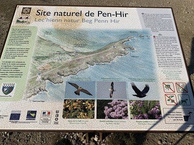
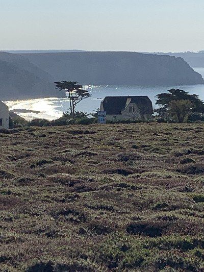
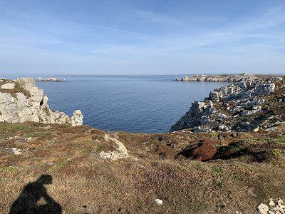
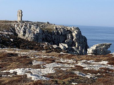
The next morning, we set off along the coastal path to the viewpoint at Pen Hir. The weather is still good, although it's a bit cooler in the mornings and evenings—but when the sun shines, it's still 20 degrees.
The Pointe de Penhir on the Crozon peninsula is, along with the Pointe du Raz and Cap Fréhel, one of Brittany's greatest natural attractions. It towers a dizzying 70 meters above the sea, adorned with a "pea pile" of smaller rocky monstrosities.
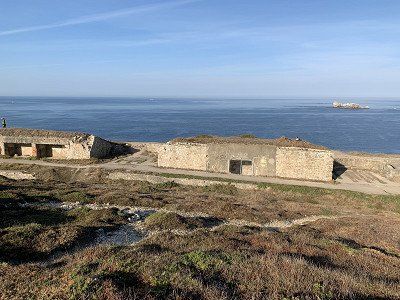
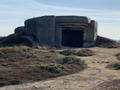
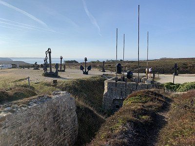
The path to Pen Hir again offers breathtaking views of the sea that make you stand still - the remaining bunkers are witnesses to the Battle of the Atlantic - the associated museum can be visited but we want to continue to the stone cross where the fallen soldiers are remembered.
It's sunny and warm, and even the wind from the Atlantic is only a gentle breeze - after about 2 hours we're back at the campsite and packing up to continue on towards Camaret sur Mer.
After a cappuccino in the Pointe du Raz center, we continue about 85 km to Camaret sur Mer, where we head for the parking space. Since we're early, we actually manage to snag one for 10 euros per night. We found it in the Promobil app:
Paid parking for 75 mobile homes. Mostly level ground. Gravel surface. Fresh water, electricity, greywater disposal, chemical toilet disposal. Dogs allowed.
We're in a good spot and certainly not far from the hiking trails, so I take a short walk to the stone circle in front of the campsite - called the Alignements de Lagatjar - and the coastal path, which offers fantastic views in the evening sun.
The next morning, we set off along the coastal path to the viewpoint at Pen Hir. The weather is still good, although it's a bit cooler in the mornings and evenings—but when the sun shines, it's still 20 degrees.
The Pointe de Penhir on the Crozon peninsula is, along with the Pointe du Raz and Cap Fréhel, one of Brittany's greatest natural attractions. It towers a dizzying 70 meters above the sea, adorned with a "pea pile" of smaller rocky monstrosities.
The path to Pen Hir again offers breathtaking views of the sea that make you stand still - the remaining bunkers are witnesses to the Battle of the Atlantic - the associated museum can be visited but we want to continue to the stone cross where the fallen soldiers are remembered.
It's sunny and warm, and even the wind from the Atlantic is only a gentle breeze - after about 2 hours we're back at the campsite and packing up to continue on towards Camaret sur Mer.
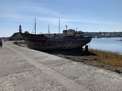
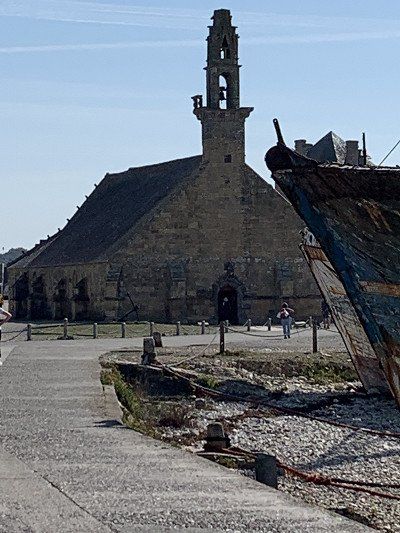
Unfortunately, we can't find a parking space, so we park with the cars and I make my way to the ship graveyard and the small Rocamadour chapel.
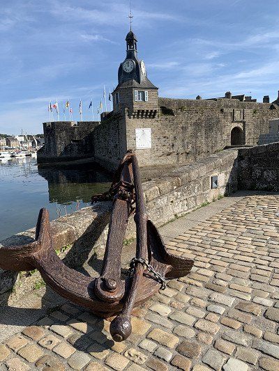
In the far west of the peninsula, Camaret is a typical harbor town, perfect for strolling along its lively quays lined with colorful houses. The Notre-Dame de Rocamadour Chapel on the pier is famous for the ship models placed there as votive offerings. The path continues to the Vauban Tower, also known as the "Golden Tower" because of its ochre color. Now a UNESCO World Heritage Site, it once protected the Camaret moat and the narrow entrance to Brest harbor. The sailors' cemetery, where the outlines of boats are depicted on the graves, has a romantic feel.
As expected, we get into trouble, and a police officer asks us, firmly but politely, to leave the site with our motorhome – which, of course, we do immediately and without complaint. We were actually planning on getting something to eat here in the harbor, but that's already taken care of, and we're off toward Crozon.
On the way there is a wonderful beach that I absolutely have to photograph - then we drive on to the city center where we actually find a parking space and also a restaurant but unfortunately the service is so unfriendly that we leave.
We had originally planned to visit the port town of Bret as well as the towns of Plougonvelin, Plouarzel, and Plouescat. However, we now realize that time is running out and are forced to cut our tour short.
Unfortunately, we can't find a parking space, so we park with the cars and I make my way to the ship graveyard and the small Rocamadour chapel.
In the far west of the peninsula, Camaret is a typical harbor town, perfect for strolling along its lively quays lined with colorful houses. The Notre-Dame de Rocamadour Chapel on the pier is famous for the ship models placed there as votive offerings. The path continues to the Vauban Tower, also known as the "Golden Tower" because of its ochre color. Now a UNESCO World Heritage Site, it once protected the Camaret moat and the narrow entrance to Brest harbor. The sailors' cemetery, where the outlines of boats are depicted on the graves, has a romantic feel.
As expected, we get into trouble, and a police officer asks us, firmly but politely, to leave the site with our motorhome – which, of course, we do immediately and without complaint. We were actually planning on getting something to eat here in the harbor, but that's already taken care of, and we're off toward Crozon.
On the way there is a wonderful beach that I absolutely have to photograph - then we drive on to the city center where we actually find a parking space and also a restaurant but unfortunately the service is so unfriendly that we leave.
We had originally planned to visit the port town of Bret as well as the towns of Plougonvelin, Plouarzel, and Plouescat. However, we now realize that time is running out and are forced to cut our tour short.
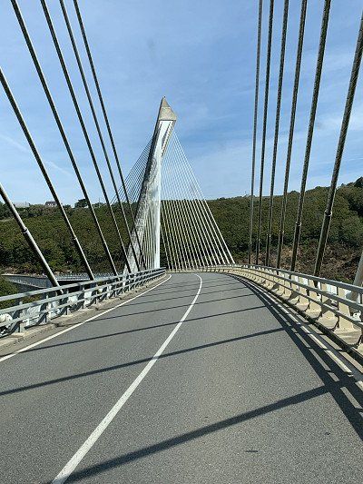
- On the way to Roscoff - the center of the onion in France - we pass the Pont de Terenez - the bridge has a curved road that leads over the estuary of the Aulne and connects the Presqu'île de Crozon peninsula with the Finistère department. It spans the Aulne between Argol and Rosnoën in the Parc naturel régional d'Armorique nature park.
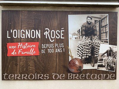
Roscoff is known for its vegetable cultivation - onions, artichokes and other vegetables - as well as its ferry port to the Ile de Batz and destinations in England such as Plymouth
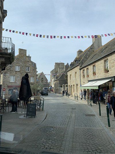
We find a parking space for our Kernchenmobil on the side of the road and can start a stroll through the town. The town is manageable. There are several bistros at the harbor, so we treat ourselves to a cappuccino. Then we stroll leisurely through the streets.
- The Mary Stuart House (listed monument)
- The old harbor, built of granite in the 17th century
- The Fortified House (Maison Forte, 16th century) and the Watchtower (late 16th century)
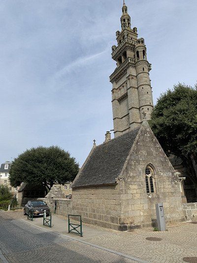
- The fully restored church of Notre-Dame-de-Croas-Batz with its colorful decoration, ossuary and enclosure
- The granite houses built by wealthy shipowners and merchants in the 16th century (ornate dormers, cellar entrances, elaborately designed gargoyles, etc.)
- The six listed buildings
- The rock chapel of Sainte-Barbe (17th century)
Roscoff is a municipality with 3,489 inhabitants, has a historic town center, and was a pioneering thalassotherapy center in the 19th century due to its mild maritime climate. It is an important ferry port for travelers to Great Britain and the Île de Batz. Wikipedia.
Roscoff's history begins in the Roskogoz district. In the Middle Ages, this was merely an outlying port of Saint-Pol-de-Léon. A 15th-century Calvary still bears witness to the village. The silting of the port and repeated attacks by the English prompted the Roscovites to settle further north, where the old port is today. From there, the town grew, expanding ever further east. The Pointe de Bloscon, near the Chapel of Sainte-Barbe, was fortified in the 18th century.
Bike tour on Komoot
Center historique de Roscoff – Chemin littoral à Jugant Loop from RoscoffEasy00:53 15.4 km 17.3 km/h 50 m 50 m
Slept at the car park on Rue du Pont, Henvic. Beautiful grounds, laid out in a circle with spacious pitches. Barely occupied.
Cloth trade, salt trade, timber trade—in the 19th century, even onions were exported to England! In the historic center, everything recalls the wealth associated with maritime trade, from the church surrounded by a garden to the magnificent granite houses, from the boats carved in stone to the small lighthouses in the old harbor. The spirit of corsairs, smugglers, and merchants still hangs over the elaborately decorated entrances to the cellars along the streets or the waterfront.
In 1899, France's very first thalassotherapy center opened in Roscoff, where Dr. Bagot treated rheumatic diseases. The center's success continues to this day. In addition to the Roscoff Marine Biology Center (Station Biologique de Roscoff), a research center renowned throughout Europe, businesses for harvesting and processing algae developed. Today, the town is one of the largest algae production centers in Finistère.
The old town and harbor of Roscoff on a long morning stroll. In my opinion, one of the most historically interesting places of the trip so far. Gathered many wonderful impressions. A three-course Breton lunch with Merluc at the Café au Port is highly recommended. Roscoff is a municipality with 3,489 inhabitants, has a historic town center, and was a leading center of thalassotherapy in the 19th century due to its mild maritime climate. It is an important ferry port for travelers to Great Britain and the Île de Batz. Wikipedia.
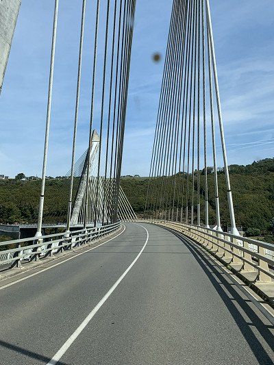
- On the way to Roscoff - the center of the onion in France - we pass the Pont de Terenez - the bridge has a curved road that leads over the estuary of the Aulne and connects the Presqu'île de Crozon peninsula with the Finistère department. It spans the Aulne between Argol and Rosnoën in the Parc naturel régional d'Armorique nature park.
Roscoff is known for its vegetable cultivation - onions, artichokes and other vegetables - as well as its ferry port to the Ile de Batz and destinations in England such as Plymouth
We find a parking space for our Kernchenmobil on the side of the road and can start a stroll through the town. The town is manageable. There are several bistros at the harbor, so we treat ourselves to a cappuccino. Then we stroll leisurely through the streets.
- The Mary Stuart House (listed monument)
- The old harbor, built of granite in the 17th century
- The Fortified House (Maison Forte, 16th century) and the Watchtower (late 16th century)
- The fully restored church of Notre-Dame-de-Croas-Batz with its colorful decoration, ossuary and enclosure
- The granite houses built by wealthy shipowners and merchants in the 16th century (ornate dormers, cellar entrances, elaborately designed gargoyles, etc.)
- The six listed buildings
- The rock chapel of Sainte-Barbe (17th century)
Roscoff is a municipality with 3,489 inhabitants, has a historic town center, and was a pioneering thalassotherapy center in the 19th century due to its mild maritime climate. It is an important ferry port for travelers to Great Britain and the Île de Batz. Wikipedia.
Roscoff's history begins in the Roskogoz district. In the Middle Ages, this was merely an outlying port of Saint-Pol-de-Léon. A 15th-century Calvary still bears witness to the village. The silting of the port and repeated attacks by the English prompted the Roscovites to settle further north, where the old port is today. From there, the town grew, expanding ever further east. The Pointe de Bloscon, near the Chapel of Sainte-Barbe, was fortified in the 18th century.
Bike tour on Komoot
Center historique de Roscoff – Chemin littoral à Jugant Loop from RoscoffEasy00:53 15.4 km 17.3 km/h 50 m 50 m
Slept at the car park on Rue du Pont, Henvic. Beautiful grounds, laid out in a circle with spacious pitches. Barely occupied.
Cloth trade, salt trade, timber trade—in the 19th century, even onions were exported to England! In the historic center, everything recalls the wealth associated with maritime trade, from the church surrounded by a garden to the magnificent granite houses, from the boats carved in stone to the small lighthouses in the old harbor. The spirit of corsairs, smugglers, and merchants still hangs over the elaborately decorated entrances to the cellars along the streets or the waterfront.
In 1899, France's very first thalassotherapy center opened in Roscoff, where Dr. Bagot treated rheumatic diseases. The center's success continues to this day. In addition to the Roscoff Marine Biology Center (Station Biologique de Roscoff), a research center renowned throughout Europe, businesses for harvesting and processing algae developed. Today, the town is one of the largest algae production centers in Finistère.
The old town and harbor of Roscoff on a long morning stroll. In my opinion, one of the most historically interesting places of the trip so far. Gathered many wonderful impressions. A three-course Breton lunch with Merluc at the Café au Port is highly recommended. Roscoff is a municipality with 3,489 inhabitants, has a historic town center, and was a leading center of thalassotherapy in the 19th century due to its mild maritime climate. It is an important ferry port for travelers to Great Britain and the Île de Batz. Wikipedia.
Since the French eat dinner relatively late, after our stroll through the city we head to the chosen parking spot right by the bay.
It's high tide, and a few boats are bobbing around. The spot is free but lacks any infrastructure.
Route du Laber
29680 Roscoff
48° 42' 44''N -3° 59' 57''W
Telephone number: 0033/298611213
Online: www.roscoff-tourisme.com
We manage to find a spot and relax in the RV before riding our bikes through the outlying residential areas into the city.
The first restaurant is already fully booked, but the Hotel Les Arcades still has a nice table for two. I'll have my favorite dish—St. Jacques mussels and prawns—and Walter's spaghetti marinière.
The hotel's dining room is located directly on the water and has a large window front - it's a very pleasant place to sit, allowing us to end the evening with good conversation.
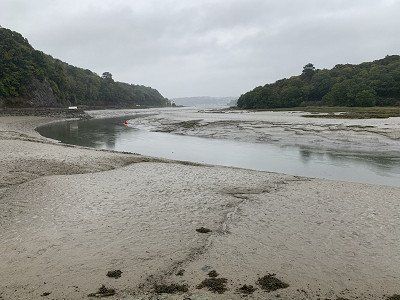
Back at the RV we notice that it is low tide and the lagoon is completely dry - also very impressive.
Since the French eat dinner relatively late, after our stroll through the city we head to the chosen parking spot right by the bay.
It's high tide, and a few boats are bobbing around. The spot is free but lacks any infrastructure.
Route du Laber
29680 Roscoff
48° 42' 44''N -3° 59' 57''W
Telephone number: 0033/298611213
Online: www.roscoff-tourisme.com
We manage to find a spot and relax in the RV before riding our bikes through the outlying residential areas into the city.
The first restaurant is already fully booked, but the Hotel Les Arcades still has a nice table for two. I'll have my favorite dish—St. Jacques mussels and prawns—and Walter's spaghetti marinière.
The hotel's dining room is located directly on the water and has a large window front - it's a very pleasant place to sit, allowing us to end the evening with good conversation.
Back at the RV we notice that it is low tide and the lagoon is completely dry - also very impressive.
It is Friday, September 23, 2022, and last night there were already signs that the weather would change - in fact, it rained heavily all night, so we slept in.
But then the wanderlust got the better of us, and after a leisurely breakfast, we set off toward St. Pol de Leon, where I wanted to see the two churches – the Cathedrale de Saint Pol and the Chapelle Notre Dame de Kreisker with its tall spire. However, the weather thwarted my plans – it continued to rain, and we couldn't find a parking space, so we decided to abandon our plan and change our plans.
So on to Carantec -
In the early 20th century, this seaside resort was a popular destination for everyone. With its beautiful estates and magnificent buildings, it was one of the most popular on the coast. Today, the resort has a more family-friendly feel. The sheltered beaches are ideal for trying new water sports or diving.
In this weather, however, even the most beautiful beach is desolate, so we continue on to see the town of Morlaix.
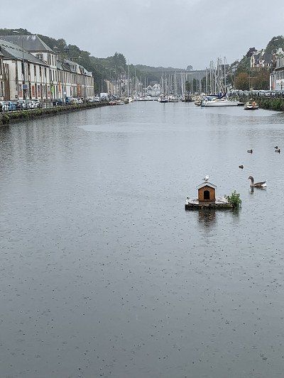
We take the so-called Corniche on the Rivière de Morlaix.
The 58-meter-high Morlaix Viaduct, which serves as the second level of the Paris-Brest railway line, can be seen from afar. Despite the pouring rain, we climbed the steep path to the first pedestrian level with umbrellas – and were rewarded with an impressive view of the narrow streets, the Saint Molaine Church, and the marina.
The viaduct marks the boundary between the 16th-17th century heritage and the 18th century. The port, once a center of maritime trade, is lined with buildings with austere facades built around 1730.
Unfortunately, we can't visit the market, which only takes place on Saturdays, but we still appreciate the charm of the half-timbered houses. At the pleasant restaurant Les Terasses, we order a plat du jour—calamres with rice—and a Breton cheese platter.
In the meantime it has stopped raining and we continue towards Plougasnou and later a little inland to Loquemeau
Here we find a campsite directly on the coast for 15 euros -
Unfortunately, the sanitary facilities are very old and not clean, so we prefer not to shower here.
Otherwise, the surroundings are somewhat desolate, and there's nothing else to see. A bit desolate—but maybe that was due to the low clouds—the sun didn't show up, and we spent the rest of the day in the RV.
It was cold and windy last night, but it didn't rain again. After a hearty breakfast, we headed off toward Lannion after refueling and disposing of supplies.
Lannion is a small town on the Côte d'Amor, which boasts a pretty town center and very old medieval houses with lots of floral decorations (4 stars).
We immediately find a parking space outside the town and stroll through the narrow streets before continuing on to the Pointe de Bihit near Trégastel.
At the Pointe de Bihit in Trébeurden, there is a free car park where motorhomes can also park - however, we don't know if you are allowed to stay overnight there - we didn't try.
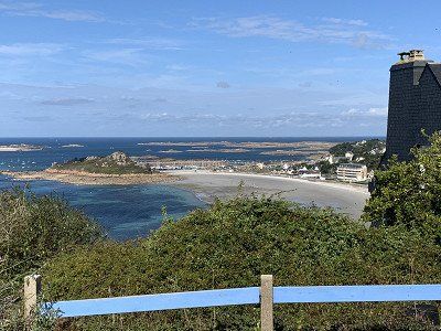
From this vantage point, I had a wonderful view of the Côte de Granite. The weather was kind to us again: the sun was shining and the Atlantic shimmered in all shades of blue. The white houses and the golden beach were simply beautiful. We didn't really want to leave, but we had to see more of this beautiful spot.
At the Pointe de Bihit in Trébeurden, there is a free car park where motorhomes can also park - however, we don't know if you are allowed to stay overnight there - we didn't try.
From this vantage point, I had a wonderful view of the Côte de Granite. The weather was kind to us again: the sun was shining and the Atlantic shimmered in all shades of blue. The white houses and the golden beach were simply beautiful. We didn't really want to leave, but we had to see more of this beautiful spot.
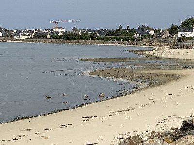
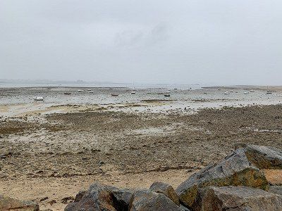
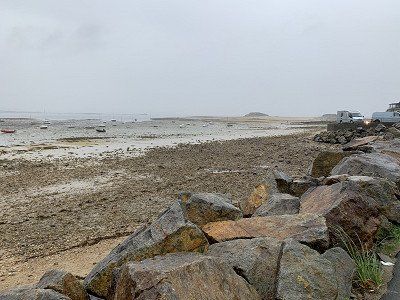
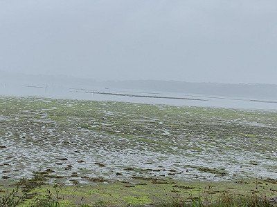
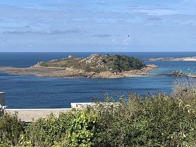
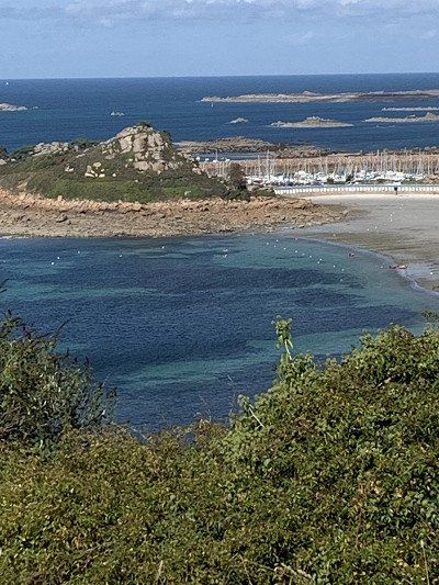
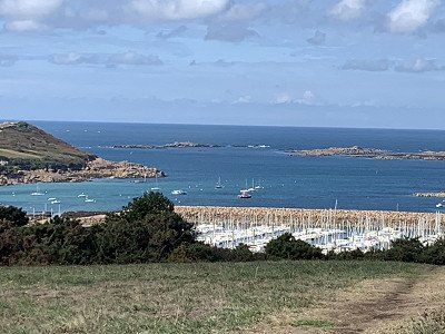
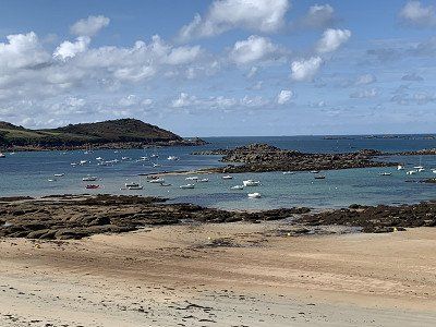
The Ile Grande - a bird sanctuary is our next destination - barely 6 km from Trebeurden.
We drive to the Porte Sanctuary - but the bay is subject to the tides and since it is low tide the boats lie abandoned on the sand
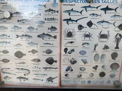
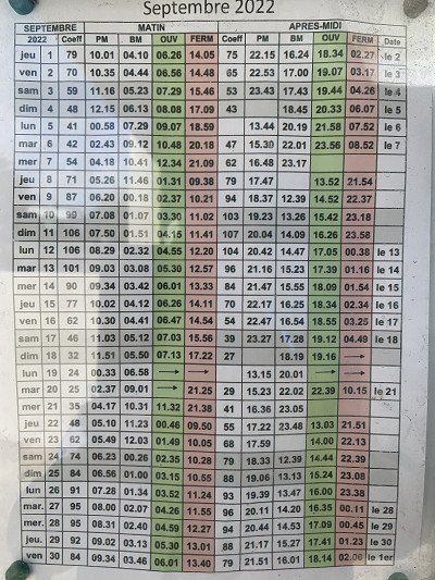
In a kind of reception hall we find the tide calendar as well as the poster with the creatures that can be fished and caught here.
Everything is very quiet and tranquil here but we should find a place for the night ..........


The Ile Grande - a bird sanctuary is our next destination - barely 6 km from Trebeurden.
We drive to the Porte Sanctuary - but the bay is subject to the tides and since it is low tide the boats lie abandoned on the sand
In a kind of reception hall we find the tide calendar as well as the poster with the creatures that can be fished and caught here.
Everything is very quiet and tranquil here but we should find a place for the night ..........
We found a campsite at Plage de Trestraou between Ploumanach and Perros Guirec on the Pink Granite Coast.
Domaine de Trestraou
Trestraou Beach
89, Avenue du Casino
22700 Perros-Guirec
Open from April to the end of September, it offers pitches for caravans and motorhomes, as well as chalets and bungalows. A wonderful campsite. The sanitary facilities are clean, and the beach promenade is a 5-minute walk away. Unfortunately, at €29, the site is one of the most expensive on our trip—but we're staying anyway, as we plan to go hiking along the Granite Rose Coast tomorrow.
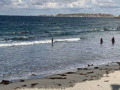
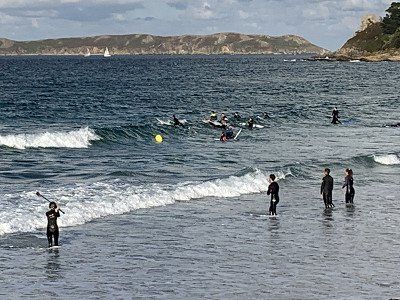
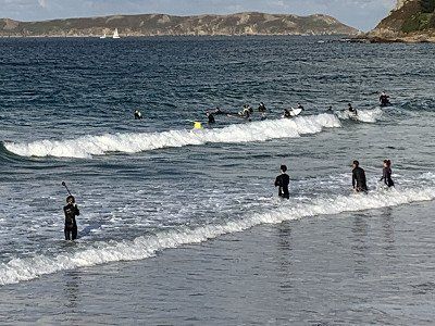
After a short rest, we head toward the beach and promenade. We find it around the corner and watch a surf school practicing with its beginners how to get on and stay on their surfboards. It's windy and chilly, and I shiver at the thought of plunging into the waves in a wetsuit.
Instead, we stroll along the waterfront promenade, where the restaurants tempt us with their delicious offerings. Finally, we decide on a pizzeria that also serves mussels. Pizza Chef for my husband, and more mussels for me. It's a great restaurant, and we feel very comfortable here.
The walk back to the campsite doesn't take long, and since we have electricity, we can once again watch the news from home.


We found a campsite at Plage de Trestraou between Ploumanach and Perros Guirec on the Pink Granite Coast.
Domaine de Trestraou
Trestraou Beach
89, Avenue du Casino
22700 Perros-Guirec
Open from April to the end of September, it offers pitches for caravans and motorhomes, as well as chalets and bungalows. A wonderful campsite. The sanitary facilities are clean, and the beach promenade is a 5-minute walk away. Unfortunately, at €29, the site is one of the most expensive on our trip—but we're staying anyway, as we plan to go hiking along the Granite Rose Coast tomorrow.
After a short rest, we head toward the beach and promenade. We find it around the corner and watch a surf school practicing with its beginners how to get on and stay on their surfboards. It's windy and chilly, and I shiver at the thought of plunging into the waves in a wetsuit.
Instead, we stroll along the waterfront promenade, where the restaurants tempt us with their delicious offerings. Finally, we decide on a pizzeria that also serves mussels. Pizza Chef for my husband, and more mussels for me. It's a great restaurant, and we feel very comfortable here.
The walk back to the campsite doesn't take long, and since we have electricity, we can once again watch the news from home.
The Pink Granite Coast is a stretch of coast in northern Brittany between Trébeurden and Paimbol. It is a tourist attraction due to its bizarre rock formations of reddish granite, especially around Perros-Guirec. The pink granite formed 300 million years ago in the Upper Carboniferous during the Variscan Orgenesis, a phase of mountain building resulting from the collision of the ancient continents Gondwana and Laurussia, as well as several microplates. These are best viewed on the old customs path from Perros-Guirec to Ploumanac'h . The granite owes its characteristic color to its hematite and alkali feldspar content. Wikipedia.
Today, September 25th, we're not moving on yet—we can decide until 6 p.m. whether we want to stay another night or continue on. After breakfast, we'll set off at 10 a.m. toward the 'Chemin de Douaniers,' the customs path from Perros Guirec to Ploumenach.
A wonderful hike awaits us with magnificent views. Although it rained a little during the night, this morning the sky is clear and the granite boulders glow pink. Bizarre rock formations are reminiscent of animals like a turtle. You can't get enough of the pink rocks, the light-dark and green-blue sea, and the ancient trees in front of the Breton country houses and estates.
We walk to the Maison Littoral, which offers an exhibition on geology, and the Ploumanach Lighthouse, called Mean Ruz, on the Côte d'Armor. The work of architects Henry Auffret and Joel Hardion, its interior features beautiful mosaics by Odorico. Fifteen meters high, it offers breathtaking views of the castle of Costaérès, the island of Renote, and the Sept-Îles archipelago. Unfortunately, the gate is closed, and we cannot visit the lighthouse.
Perros, or Pen-Ros (pink peak) in Breton, is a true peninsula, alternating between rocky outcrops and fine sandy beaches. It's not only a popular seaside resort and a natural destination recognized for its commitment to sustainable development, but also ideal for water sports for both beginners and experienced sailors. The historic center features stylish villas in typical seaside architecture, as well as the Church of Saint-Jacques, one of the few examples of Romanesque architecture in Brittany. From the harbor, you can take a trip to the archipelago of the Seven Islands (Sept Iles), one of the largest bird sanctuaries in France.
We turn around at the Mean Ruz lighthouse, walk back to the RV, shower, and pack up. I pick up a brochure – this place would also be a nice spot for a family holiday in the chalets.
At 4 p.m. we set off towards Plougrescant under cloudy skies but with more and more sunny spells and 18 degrees.
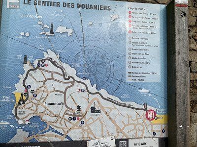
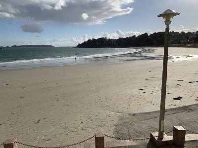
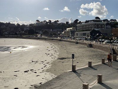
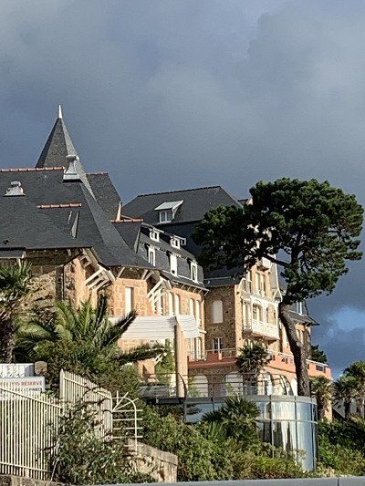
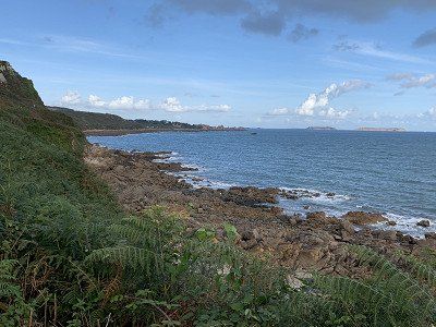
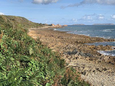
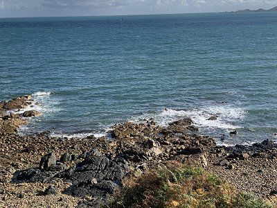
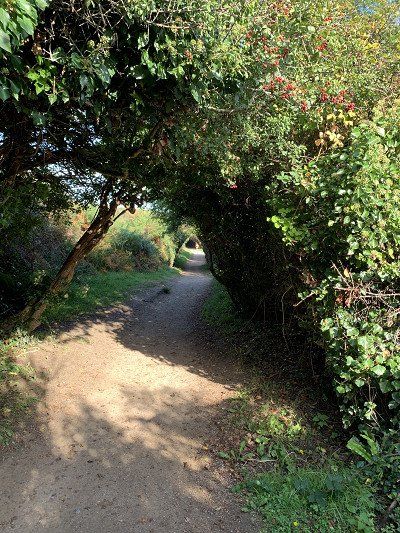
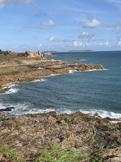
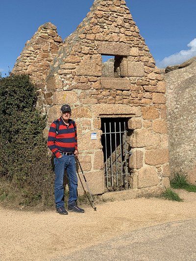
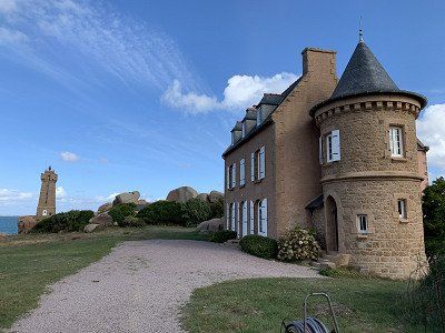
In Plougrescant, Le Gouffre awaits us - the house between the rocks -
I would say that this house is one of the most photographed buildings in Brittany - a symbol of the Pink Granite Coast and loved by all tourists.
Le Gouffre (the sea gullet) is located in a nature reserve but still offers a large parking lot for cars and camper vans, so there is nothing to stop you from taking a short hike.
The nature and the views here are wonderful, and since we travel in the off-season, we are not overwhelmed by crowds of tourists.
Every now and then we see small beaches between the rocks - an idyll that we will certainly never forget.
After this short visit, we actually wanted to go to the Paimpol campsite, but near Treguier we saw some motorhomes parked by the river and since there was still space, we stopped at this idyllic spot.
And finally, we can photograph one of the large artichoke fields. In France, artichoke dishes are offered far more often than in Germany—because here they are truly fresh from the field.
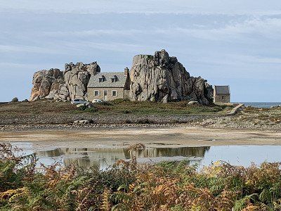
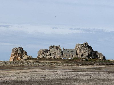
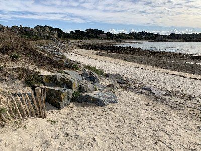
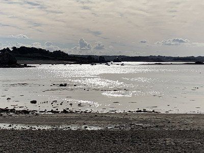
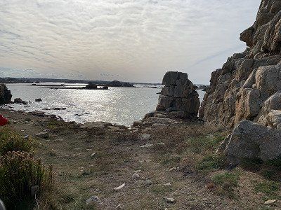
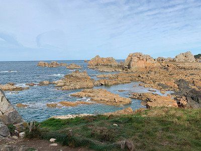
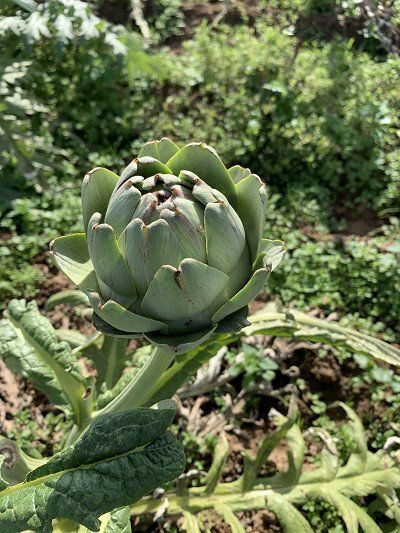
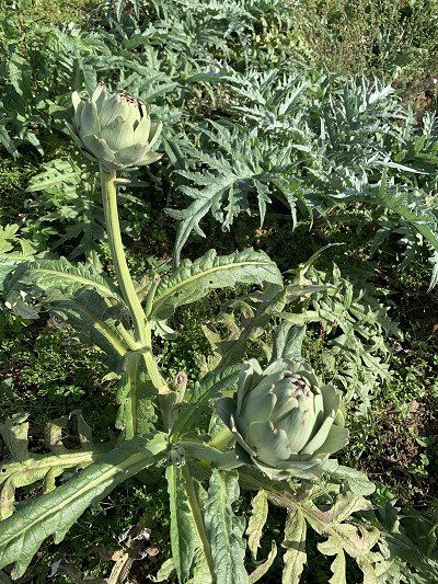
As I said, we actually wanted to go to Paimpol, but now we are standing on the banks of the Jaudy river with other motorhome owners.
It is still early in the day, so we want to explore the town.
A steep path leads to St. Tugdual's Cathedral and its old, historic half-timbered houses. In the 6th century, the Gallic monk Tugdual anchored in the Val Trécor. He founded a monastery that led to the creation of the town of Tréguier, a place marked by land, sea, and religion. Ordained bishop, Tugdual became one of the seven founding saints of Brittany, and Tréguier became one of the seven stations on the Breton pilgrimage "Tro Breiz."
The half-timbered buildings in this town, classified as a "Cité de Caractère" (particularly beautiful and typical), date back to the 15th and 16th centuries. On the Place du Martray, in Rue Renan, and the Saint-Yves alley, the half-timbered houses and bay windows invite you to gaze upwards again and again.
After our stroll, we feel like fast food, so we order two takeaway kebabs, which we enjoy in our RV by the river before this day draws to a close. The river flows lazily—we've never heard its name, Jaudy.
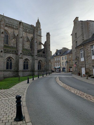
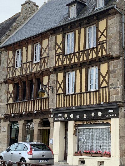
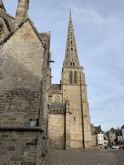
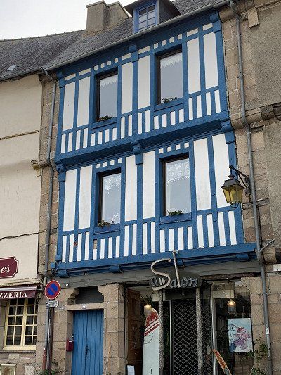
It rained and stormed heavily last night - the motorhome really shook at times.
It is a cloudy Monday morning and it is supposed to continue raining heavily.
I really wanted to see the Abbaye de Beaufort - it's a monastery ruin with a tremendous view, but when we arrived at the parking lot we couldn't see anything - everything had disappeared in the rain and especially in the fog.
In this weather, even I don't get out and, disappointed, we continue on to Pointe de Plouha.
We spend 30 minutes searching for this viewpoint along narrow, dreary paths, only to realize that we actually can't see much. Then we discuss our next steps. We don't need to aim for Cap de Frehel in this weather—it'll be too stormy and foggy there anyway. So we decide to head straight to Saint Malo.
On our next visit to Brittany, we might have the opportunity to visit these cliffs, which are also located on the GR 34 – the Customs Road. Yes – we're sure we'll visit this part of Brittany again, because we didn't get to see everything that interested us.
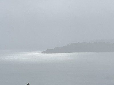
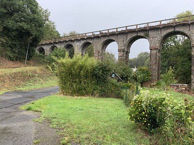
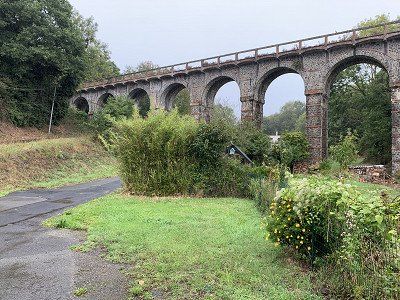
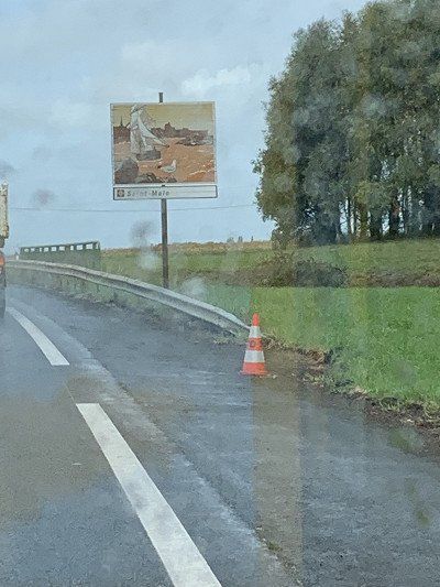
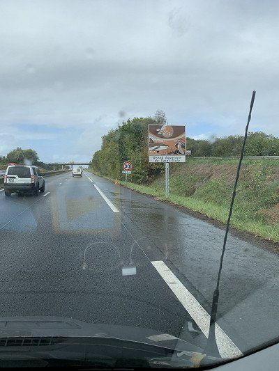
The Cité d'Aleth campsite is located directly across from Saint Malo's old town, Intro Muros. At least the rain has stopped—it's now just a light drizzle.
After arriving at the campsite and driving onto our plot with a view of Saint Malo, we take the bikes off the bike rack and get ready for a city tour.
Thick, windproof jackets are essential, as the wind blows across the bay at hurricane force of over 40 km/h. At times, it's difficult to ride the bikes to withstand the sideways gusts. But we manage and arrive in St. Malo.
The next morning I take a closer look at the bay where the campsite is located - very idyllic and, if the weather is good, probably also wonderfully beautiful, while today it is simply beautiful.
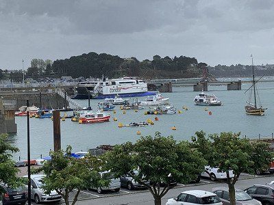
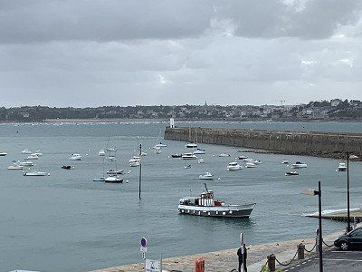
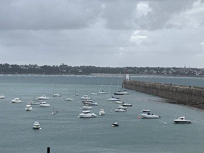
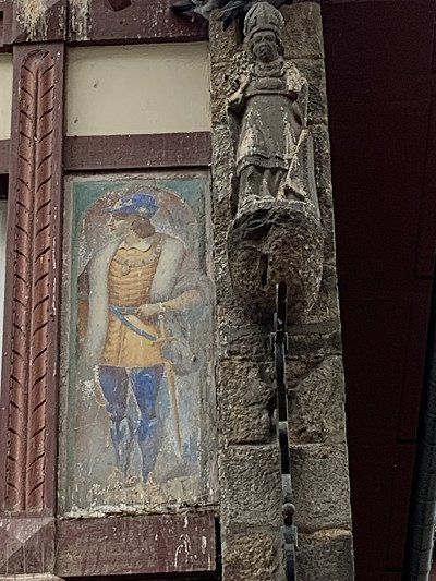
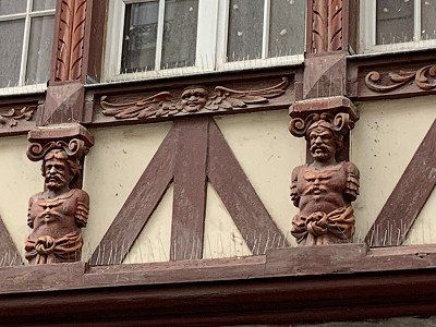
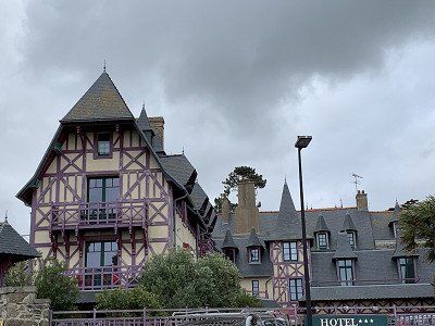
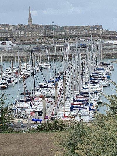
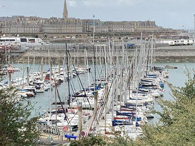
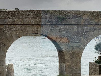
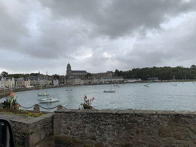
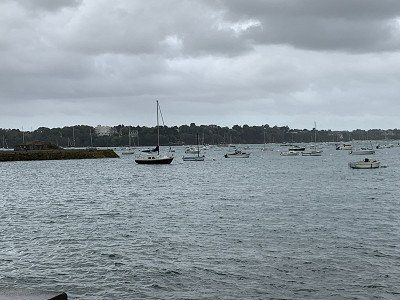
First, I pick up a city map from the Tourist Office, and then we board a small tourist train for €7 each to get an overview of the city. Headphones provide commentary in German, giving us our first impression of the pirate city.
The historic old town, which is perfect for exploring on foot, is surrounded by the sea on three sides and has popular city beaches that invite you to swim. The tides here are very pronounced, with a difference of up to 12 meters between high and low tide.
The French town, located on the Côte d'Émeraude (Emerald Coast), was heavily damaged in World War II and is proud of its past as a "corsair's den" and a defiant, fortified fortress. It is one of France's most visited tourist destinations. From the watchtowers, you have a view of the Breton town, the harbor, and the coast. Those who climb to the top of the tower will enter the History and Local History Museum, where the town is presented through documents, ship models, paintings, and weapons.
Once back, we walk from the St. Vincent Gate on the city wall to the kite surfers' beaches, where today's weather is giving them a boost. Protected behind the thick walls, the wind is more bearable than expected. We have fantastic views from above.
In one of the many small souvenir shops, I buy a large poster of the city view – our souvenir from Brittany as a reminder of this beautiful tour.
The way back - about 2.5 km to the campsite - is much more pleasant to drive and after a pasta dish with a good white wine, my husband watches the football match Germany vs. England and I go to sleep
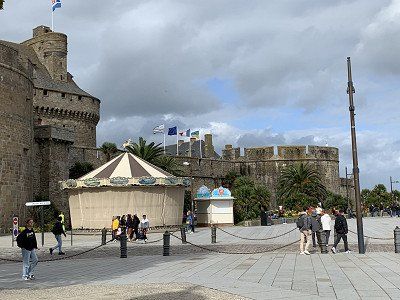
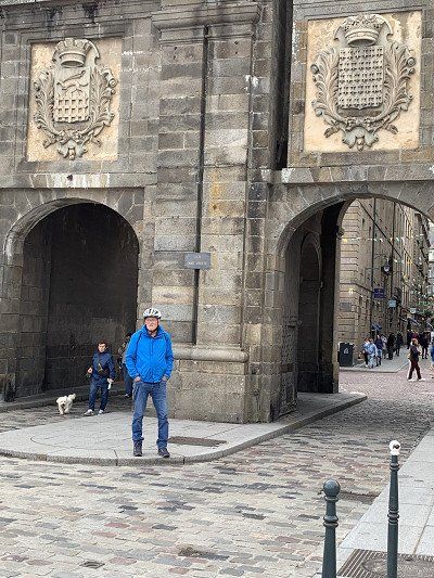
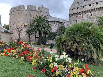
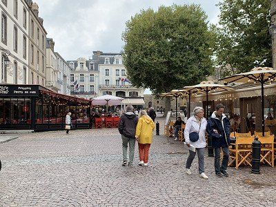
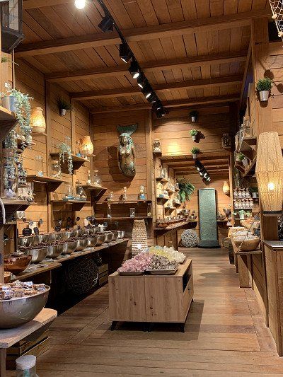
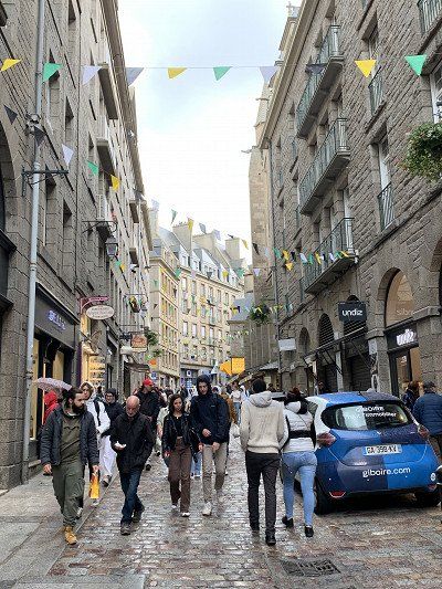
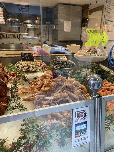
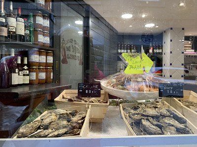
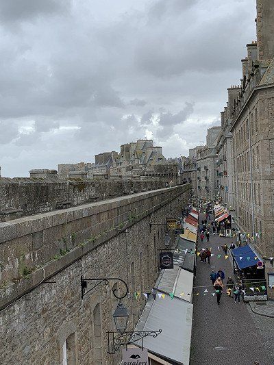
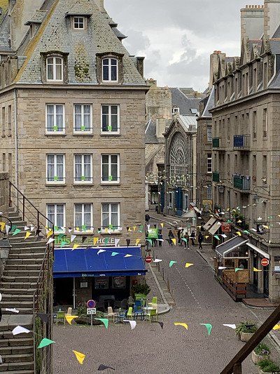
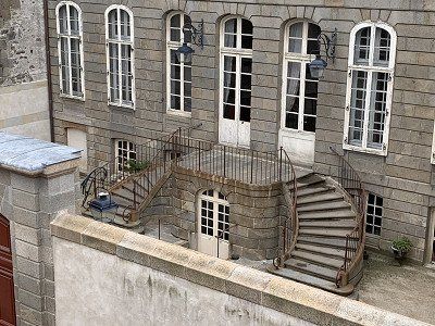
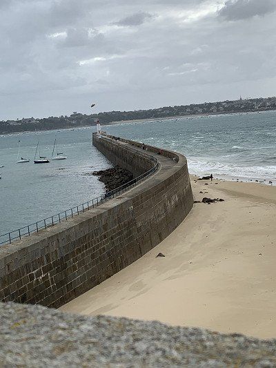
After a stormy night in St. Malo, we continue on - now heading home.
From Saint-Malo to Cancale, cliffs plunging into the sea alternate with beautiful sandy beaches framed by rocky outcrops. The Pointe du Grouin is an ideal rocky promontory for overlooking the Côte d'Emeraude (Emerald Coast).
Cancale is located about ten kilometers east of Saint-Malo and is also known as the oyster capital of Brittany. At the harbor, you can sit on thousands of empty oyster shells. The lower part of the town, "La Houle," is also very close to the sea, unlike the higher-lying district known as La Ville Haute. Here you'll find a selection of fish restaurants, a sandy beach, and many hotels and vacation apartments offering wonderful views of the sea.
The motorhome parking area in Cancale is tucked away outside the town at the first roundabout. N 48° 40.170 W 001° 51.920. Water and waste disposal, electricity in some spots, €10.00. However, it's 500 m downhill to the harbor.
We desperately search for a parking space in the harbor or on the promenade—no chance—everything is cordoned off to a 2-meter distance or has a no-parking zone for campers. Finally, we park the little camper a little off to the side of the road and hope we don't get a ticket.
We walk to the harbor and look for oyster stands. We find them at the Marché des Huitres – very reasonably priced oysters with lemons are offered in trays of 7, 12, or 24. I've been dying to try an oyster, but maybe it's still too early – the sight of the sloppy mass makes me lose my courage – shame on me!
The harbor is very idyllic on the bay, but we are too early - all the bistros and restaurants are still closed.
On our way along the coast toward Mont St. Michel, we pass several oyster vendors – perhaps next time. We leave our travel area via Dol de Bretagne – welcome to Normandy – and soon we'll see them again: the white cattle of Normandy. At a Super U, we buy some cider to take home. Then we continue toward Caen and later onto the motorway toward Paris.
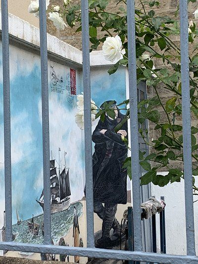
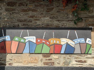
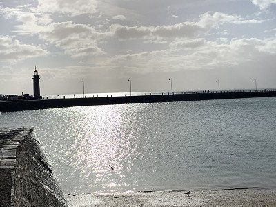
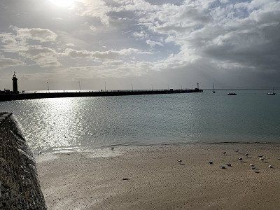
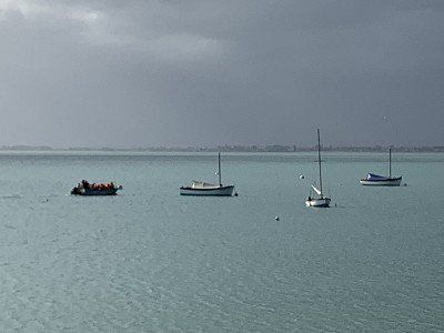
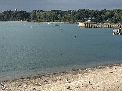
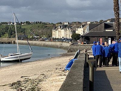
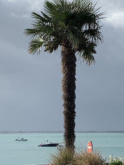
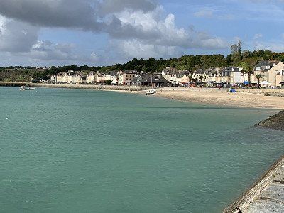
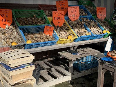
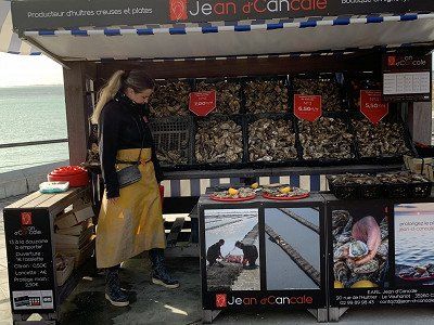
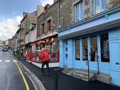
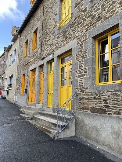
N 49 4' 23.0'' E 1 31' 46.0''
Free parking for 15 RVs - barrier closes at 9 p.m. - no water or sewage disposal or other infrastructure - directly adjacent to the gardens - great for viewing early in the morning. You can buy an e-ticket.
Here you can stand safely and relaxed and visit the 'Maison et le Jardin de Claude Monet' in peace.
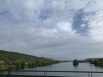
Giverny lies almost exactly between Paris and Rouen on the banks of the Seine. It's actually a small, idyllic village in the Eure department with just under 500 inhabitants: Norman half-timbered houses, narrow streets, and plenty of greenery. That's true! From April to early November, that changes, when thousands of tourists flock to see Claude Monet's beautiful garden every day.
In 1883, he rented a house in Giverny and laid out an ornamental garden behind it. In 1890, he bought this house and the adjoining property. In 1893, he expanded his garden to include another plot of land on the River Epte. Using a branch of the Epte, he created the Water Garden (French: jardin d'eau), better known as Monet's water lily pond with the Japanese bridge. Numerous paintings are taken from here, including the vision of the enormous painting of the water lilies now on display in the Tuileries Gardens in Paris.
I'm overwhelmed by the garden's autumn colors and take photos like crazy. Many gardeners give the enormous garden—actually two gardens—a different look in every season, and Monet spent happy times here when he wasn't plagued by self-doubt and depression.
The rooms of the 'Maison' have also been lovingly restored and, in addition to many paintings, display his passion for collecting Japanese woodcuts. I'm so impressed that I even buy the book 'Monet in Giverny' for 9 euros.
Inspired by all the beautiful views, I head back to the motorhome. I've finally found this wonderful treasure after driving past it on two trips to Normandy.
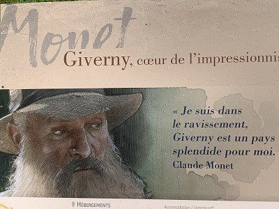
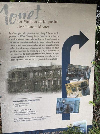
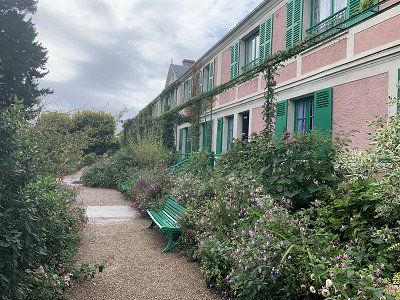
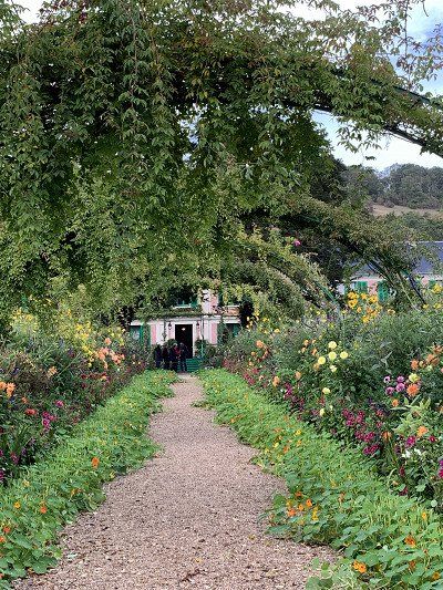
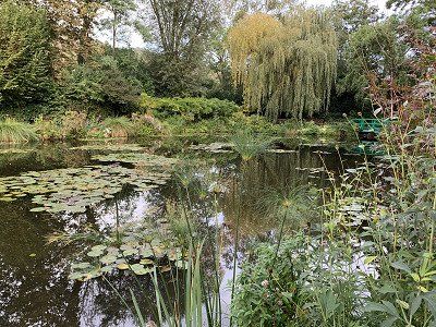
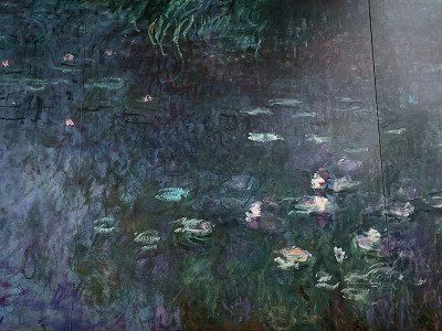
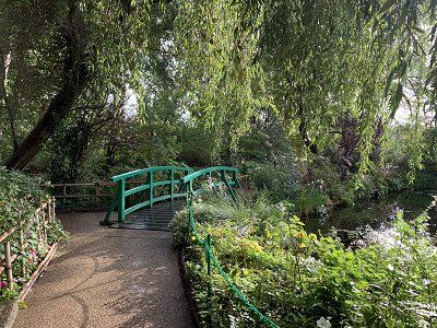
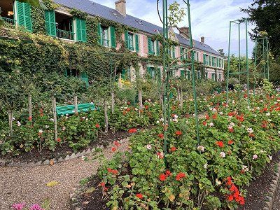
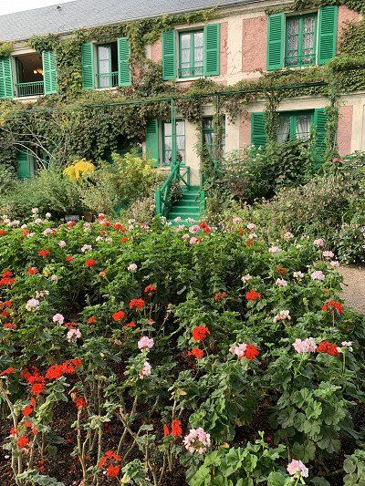
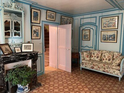
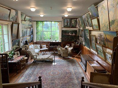
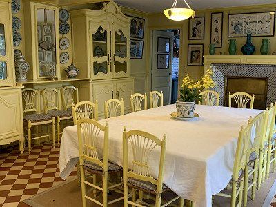
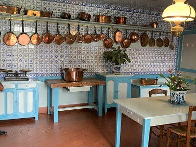
Well rested, this day begins in Giverny at 8 a.m. The first buses—I count 10 of them—are already pulling into the parking lot, and I'm glad I was able to visit the museum yesterday evening.
Today, there's only one thing on the agenda: driving day – about 400 km past Paris toward Nancy. At first, everything goes well, but then the navigation system reports a delay of 103 minutes. We quickly look for an alternative and drive along the national highway through endless pastures and grain fields.
We wanted to see Nancy, but what a disappointment! The parking space, although right in the center, is completely full, not to mention overcrowded. The conditions are chaotic, but there's no alternative, so our only option is to continue toward Metz.
I find a parking space on Promobil in Pont à Mousson on the Moselle. It also looks full, but we find a spot in the back section 2 and decide to stay and have dinner in the restaurant. I wanted to eat fish again, but of course, I'm spoiled by the fresh specialties in Brittany.
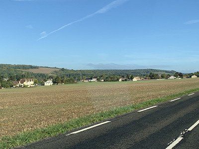
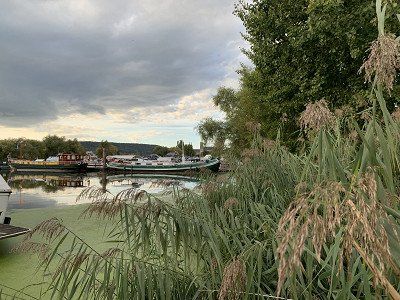
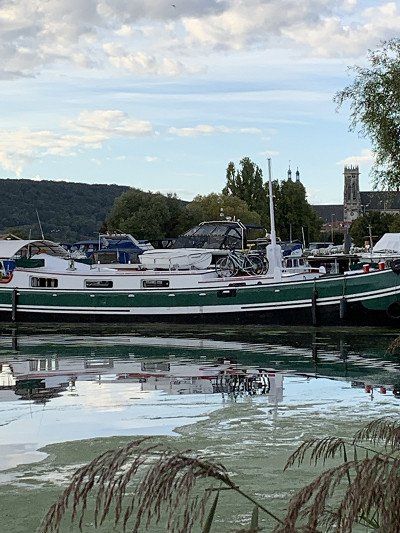
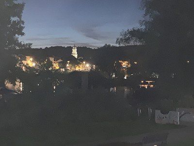
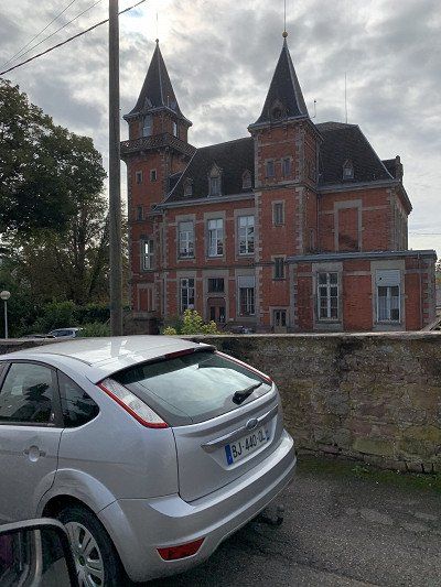
We drive home toll-free—that is, without using the highway—via Saverne, the gateway to Alsace. A short trip here would also be worthwhile—the area is very charming. As we cross the Rhine near Gambsheim, we can already see the Black Forest hills that are our home.
Conclusion: The Brittany trip was wonderful – we drove 3,000 km – and saw and experienced a lot. We'll have to come back when we get the chance to explore the regions we had to skip due to time constraints.
After the trip is before the trip!!!
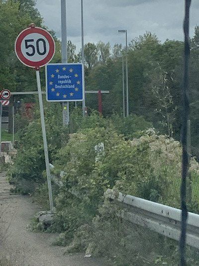
Route
Show newest first- 48.576 8.1706
- 48° 34' 33.7" N 8° 10' 14" E
Die Nacht am Stadion bzw. Centre Sportif Leo Lagrange war relativ laut, da die
Hauptverkehrsstraße sehr nah und gut zu hören ist.
Nach Katzenwäsche und Frühstück - wollen wir uns in einigen Metern die Basilique St. Remis noch anschauen - aber vergebens - wir finden keinen Parkplatz und da überall Polizei steht, kann ich nur zwei schnelle Fotos von der Aussenansicht machen - dann fahren wir weiter in Richtung Epernay
- 48.4439 1.489
- 48° 26' 37.9" N 1° 29' 20.4" E
- 48.1247 -1.2154
- 48° 7' 29.1" N 1° 12' 55.5" W
- 48.0251 -2.1719
- 48° 1' 30.2" N 2° 10' 19" W
- 47.6333 -2.7784
- 47° 37' 59.7" N 2° 46' 42.2" W
- 47.6568 -2.7579
- 47° 39' 24.3" N 2° 45' 28.4" W
Vannes ist wie gesagt eine kleine, attraktive mittelalterliche Stadt und ein Besuch dort unbedingt zu empfehlen.
Wir kaufen in einer Boulangerie noch zwei weitere bretonische Spezialitäten: sehr süß und kalorienreich: Sablé framboise und Konign Aman - jeder Bäckerei hat hierfür sein eigenes Rezept.
Nachdem wir auf den Campingplatz zurück kommen ist das Wetter immer noch schön - zwar windig aber wir fahren trotzdem mit unseren Rädern die 6 km zur Presqu'Ile de Conleau- hier ist es wunderbar und wir relaxen bei einem bretonischen Bier. Morgen geht es weiter Richtung Port Navalo.
- 47.5472 -2.9158
- 47° 32' 49.9" N 2° 54' 56.9" W
- 47.5277 -2.7685
- 47° 31' 39.7" N 2° 46' 6.5" W
- 47.5847 -3.0778
- 47° 35' 4.9" N 3° 4' 40" W
- 47.5847 -3.0274
- 47° 35' 5" N 3° 1' 38.7" W
- 47.6155 -3.1544
- 47° 36' 55.6" N 3° 9' 15.9" W
- 47.7084 -3.3563
- 47° 42' 30.2" N 3° 21' 22.8" W
- 47.8564 -3.7446
- 47° 51' 22.9" N 3° 44' 40.7" W
- 47.792 -3.8081
- 47° 47' 31.3" N 3° 48' 29.1" W
- 47.8728 -3.9207
- 47° 52' 22.2" N 3° 55' 14.6" W
- 47.7982 -4.3728
- 47° 47' 53.5" N 4° 22' 22" W
- 47.7948 -4.2821
- 47° 47' 41.2" N 4° 16' 55.5" W
- 48.0375 -4.7164
- 48° 2' 15" N 4° 42' 59" W
- 48.2739 -4.6086
- 48° 16' 26" N 4° 36' 31" W
- 48.2758 -4.5971
- 48° 16' 33" N 4° 35' 49.6" W
- 48.7286 -3.9817
- 48° 43' 43" N 3° 58' 54.1" W
- 48.7121 -3.9992
- 48° 42' 43.5" N 3° 59' 57.1" W
- 48.5776 -3.8282
- 48° 34' 39.4" N 3° 49' 41.6" W
- 48.7246 -3.5819
- 48° 43' 28.6" N 3° 34' 54.9" W
- 48.7321 -3.4591
- 48° 43' 55.5" N 3° 27' 32.9" W
- 48.7581 -3.5829
- 48° 45' 29.2" N 3° 34' 58.4" W
- 48.8003 -3.5728
- 48° 48' 1" N 3° 34' 22" W
- 48.8168 -3.4549
- 48° 49' 0.3" N 3° 27' 17.7" W
- 48.833 -3.4808
- 48° 49' 58.9" N 3° 28' 50.8" W
- 48.8668 -3.2377
- 48° 52' 0.5" N 3° 14' 15.8" W
- 48.7875 -3.2308
- 48° 47' 15.2" N 3° 13' 50.8" W
- 48.6759 -2.9322
- 48° 40' 33.1" N 2° 55' 55.7" W
- 49.0756 1.5342
- 49° 4' 32.1" N 1° 32' 3" E
- 48.902 6.0626
- 48° 54' 7.1" N 6° 3' 45.3" E
- 48.576 8.1706
- 48° 34' 33.7" N 8° 10' 14" E
Travelogue
Today is Monday, September 12, 2022, and we're finally starting our Brittany tour. It's expected to be warm again, like late summer, before the clouds roll in from the west.
Our first stop is Reims in Champagne – 380 km from home. We've organized a Bip & Go box for the motorway so we can drive through the Télépeage lanes without waiting.
Today on the first day we take the A4 Strasbourg - Paris and turn off in Reims.
The official parking space in Reims is somewhat hidden behind a youth hostel.
Alternatively, 2 places in the Promobil app:
Aire de Camping Car Leo Lagrange N 49 14' 39.8'' E 4 1' 35.8''
Aire de Camping Cars N 49 15' 0.0'' E 4 1' 18.0''
At the Centre Sportif Leo Lagrange we find a parking space without any infrastructure but free of charge.
We arrive at 2 p.m. and after a short break, we cross the bridge to the Cathedral of Notre Dame de Reims - a UNESCO World Heritage Site - and the coronation church of the French kings.
Unfortunately, the tower is only open on weekends, so you won't be able to enjoy the view.
Notre-Dame de Reims Cathedral is considered one of the most architecturally significant Gothic churches in France. With around one million visitors a year, it is one of the main attractions of Champagne. According to the legend created by Archbishop Hincmar of Reims, towards the end of the 5th century, St. Remigius, as Bishop of Reims, baptized the Frankish king Clovis I and anointed him with oil sent down from heaven. From this, the Archbishop of Reims derived the right to crown and anoint every new king of France in his cathedral. As the coronation church of almost all French kings, the cathedral symbolized the close bond between monarchy and church. Since the Third Republic enforced the separation of church and state, Reims Cathedral has also symbolized the French nation. Wikipedia
Directly opposite is the Palais du Tau, the archbishop's palace. The building was constructed between 1498 and 1509 on the site of a Gallo-Roman villa. The villa survived until the 6th or 7th century and was later converted into a Carolingian royal palace. The kings of France spent the night before their coronation at Notre-Dame de Reims in this building. Before the coronation ceremony, the future king was dressed there, and after the ceremony, a banquet was held in the palace's Salle du Tau, which features an oversized 15th-century fireplace. Wikipedia
Unfortunately, we have to admit that Monday is not a good day for sightseeing. Neither the Palais du Tau nor the Boulingrin market hall nor the Champagne cellar showroom are open.
The tourist information office is directly opposite the cathedral.
There you can get the leaflet “ Art Deco in Reims ” with a map and information about the most beautiful Art Deco buildings.
We sit comfortably in front of a bistro near the cathedral where we naturally pay the appropriate surcharge for wine and beer.
The day is sunny and still warm at 25 degrees - as my husband's knee problems are starting to make themselves felt again, we walk slowly along the canal to the campsite and enjoy the rest of the day with baguette with ham and cheese
The night at the stadium or Centre Sportif Leo Lagrange was relatively loud, as the
Main road is very close and can be heard well.
After a quick wash and breakfast, we want to take a look at the Basilique St. Remis, which is a few meters away, but in vain - we can't find a parking space and since there are police everywhere, I can only take two quick photos of the exterior view - then we continue towards Epernay
We initially wanted to spend the night here, but then decided to drive to Chartres:
Camping d'Epernay
avenue de Cumières
51200 / Epernay
ACSI campsite
Actually we wanted to go to the winery
Moët & Chandon
20 AVENUE DE CHAMPAGNE but here too there was no space for our motorhome and so we drove on to the visitor parking lot of the Champagne de Castellane and parked our vehicle there.
The Avenue de Champagne in Epernay, which has been on the UNESCO World Heritage List since 2015, is a must for anyone visiting Epernay.
The scenery is so beautiful. On both sides of this long avenue, a remarkable architectural ensemble is set. Cobbled courtyards, elaborate facades, and even landscaped gardens—all these magnificent details tell a little about the history of Champagne during the heyday of the first champagne trading houses.
Of course, you have to treat yourself to a glass of champagne here—and price shouldn't be an issue. At Boizel, we're drinking a Blanc de Blanc Champagne of outstanding quality, but at €12 for 10 cl. The wine is aged and shaken for four years before it can be sold as champagne. Boizel's grapes grow only in the vineyards of Epernay, and the estate has been farmed for six generations—very impressive.
From Epernay we continue on the D3 and D1 to Chateau Thierry, on the motorway past Paris to Chartres - the next hot spot on our way to Brittany.
We actually wanted to sleep at the campsite but we discovered that the city operates a free parking space - in the Rue de Launay, however, without electricity and infrastructure
Free parking for 25 mobile homes on the outskirts of Chartres. The site is located near a river. The site is mostly flat and partially shaded. It has a gravel surface with a gravel lawn and a meadow. The town center is within walking distance. Dogs are included in the overnight rate. Water and electricity are not available in winter.
Latitude 48° 25′ 59″ N
Longitude 1° 29′ 53″ E
Rue de Launay,
28000 Chartres
Phone: +33 237234000
contact@ville-chartres.fr
There is also a beautiful cycle path along the L'Eure to the cathedral
The coordinates of the campsite we did not use:
- Camping les Bords de l'Eure
- 9, rue de Launay
- FR - 28000 Chartres/Eure
Telephone +332 37 28 79 43
Email: camping-roussel-chartres@wanadoo.fr
We cycle along the Eure River to Chartres Cathedral, also a World Heritage Site.
Notre-Dame de Chartres Cathedral is the "archetype" of the High Gothic cathedral and the seat of the bishop of the Roman Catholic diocese of Chartres. In 876, Charles the Bald consecrated a church there and donated a holy relic to the sanctuary, the tunic known as the Sancta Camisia, which the Virgin Mary is said to have worn when the Archangel Gabriel promised the birth of Jesus. Today, a cloth of this tunic, approximately 30 x 30 cm in size, can be seen in the cathedral. The current Gothic reconstruction began shortly after 1194 and lasted until 1260. The construction is over 130 meters long and 64 meters wide. The cathedral was added to the UNESCO World Heritage List in 1979. The sculptor Auguste Rodin called it the Acropolis of France. Wikipedia
The cathedral impresses with its sheer size, the many magnificent stained glass windows and, even more so, with a surrounding relief in the interior - an incredible masterpiece depicting the life of Mary.
We actually wanted to eat in the old town of Chartes but unfortunately couldn't find a suitable restaurant, so we bought two baguettes and a bacon pie with mozzarella in a boulangerie - and then it started to rain - so we quickly got on our bikes and headed back to the camper.
We sleep very well at the campsite - even though the night is still oppressively warm and we have to sleep with the window open - the road is not very busy.
After a hearty breakfast, we set off toward Vitré, the gateway to Brittany. We want to avoid highways and travel exclusively on national and country roads, crossing the Sarthe & Orne departments and the fertile landscapes of the Perche Regional Nature Park via Sillé-le-Guillaume and Evron to Vitré, where we arrive in sunshine and 24 degrees Celsius.
The Camping Municipal de Vitré
Boulevard des Roches 109,
35500 Vitré
N 48 6' 36.2'' E 111' 52.4''
is municipally owned and is located about 2.5 km from the city center.
Located in the Saint-Étienne complex (Route d'Argentré-du-Plessis), the 3-star municipal campsite is open from March 1 to December 15. Built on a former shooting range, this campsite with its unusual architecture is located in a wooded, peaceful setting—it offers everything you need, and we paid €16.20 per night. It's green and full of flowers, plants, and trees, and our pitch, No. 13, is huge.
The old town of Vitré is easily accessible by bike via cycle paths, and we can visit some highlights before it starts to rain:
Chateau de Vitré – perched on a rock above the city. Unfortunately, the museum was already closed.
The Church of Our Lady of Vitré
Medieval city center with Rue Baudrairie and the historic houses of the old town
La Gare de Vitré, designed by Victor Lenoir, the architect of the Gare de Montparnasse in Paris
La Place de Gaulle where we had an Aperol Spritz and an aperitif at the Bistro Odorico to escape the worst of the rain.
In the heart of the Portes de Bretagne, an important trading and commercial center in the Middle Ages, Vitré is a small medieval town , now classified as a "City of Art and History".
Our plan was to drive to the capital of Brittany and
Rue du professor Maurice Audin
35700 Rennes
GPS: 48° 08' 08.5'' N -1° 38' 44.5'' W
Telephone number: +33 299 369 122
Online: www.camping-rennes.com
The C3 bus stop is about 500 meters from the campsite.
Well-equipped cycle path - 6 km to the city center
to stay overnight.
However, we decided against visiting Rennes at short notice, as we needed some nature after Reims, Chartres, and Vitré. Rennes certainly offers many sights, but we'll have to save those for our next visit to Brittany.
We leave the Vitré campsite late and follow the national road to the Abbaye de Paimpont to pay homage to the Broceliade forest.
Nestled between lakes and heathland, this forest is crisscrossed by a hundred circular trails, perfect for beautiful hikes retracing the legends of King Arthur and Merlin the Wizard. The century-old oaks are populated by goblins, Comper Castle is inhabited by the Fairy Viviane, and magical water flows from the Barenton fountain.
See also https://www.bretagne-reisen.de...
Be sure to get a map for the forest tour at the Abbaye de Paimpont Tourist Office -
There may also be a cycling map there -
All the legendary places here in Broceliande are easily accessible by motorhome. The trails are well-maintained and signposted, and there are plenty of parking spaces.
The Tomb of Merlin
The Fountain of Joy
Barenton Fountain
Val sans Retour
Unfortunately, my husband's knee pain has returned, so we have to cancel our planned walk in the forest and instead go to the restaurant l'Abbaye for dinner. For the first time, we try the fantastic Breton buckwheat pancakes—galette with merguez or saucisse—and, of course, the Breton cider.
There is also a campsite here for overnight stays, but we continue towards Vannes:
Paimpont Municipal Camping
2 rue du chevalier Lancelot du Lac
35380 Paimpont
48° 01' 30.2'' N -2° 10' 19'' W
Telephone number: +33 299 078 916
On the web: www.camping-paimpont-broceliande.com
188 Avenue du Maréchal Juin
56000 Vannes
GPS: 47° 37' 59.7'' N -2° 46' 42.2'' W
Telephone number: 02 97 63 13 88
Online: en.flowercampings.com
188 Avenue du Maréchal Juin
56000 Vannes
GPS: 47° 37' 59.7'' N -2° 46' 42.2'' W
Telephone number: 02 97 63 13 88
Online: en.flowercampings.com
The planned campsite Le Conleau is unfortunately fully booked, but in the neighboring town of Séné we find a spacious place to stay for one night at the Camping Le Moulin de Cantizac for €22.10.
There is a cheaper pitch next door, but we want to use the showers, so we stay at the campsite.
The site is about 3 km from Vannes and we are considering going there by bike and leaving the RV behind.
This evening we drove along small streets through residential areas to the Gulf of Morbihan, or rather to the Passage de Saint Armel. This 200-meter-long passage, thanks to the regular ferry service to the island of Saint Armel, reduces the time required for a circumnavigation by at least 60 minutes.
In the evening we tap our cider from the Perche region - it tastes wonderful.
We decided to stay at the campsite for another day and take it easy.
It's very easy to get to Vannes by bike. The bike path leads straight to the harbor. We leave our e-bikes – safely secured – in a bike parking area. They're just a hindrance in the narrow streets of the old town, as we already found out in Vitré.
There is also an easy route by bike to Vannes - on Komoot - approx. 40 km - h 140 m
Vannes – a journey back in time to the Middle Ages and a flagship of Brittany
Anyone walking through the historic city center of Vannes might think they were strolling through an open-air museum. This small French town on the Gulf of Morbihan exudes history at every corner and is a showcase of medieval Brittany. The Gothic Saint-Pierre Cathedral rises at its center, surrounded by a maze of cobblestone streets lined with pretty half-timbered houses and elegant townhouses. Sections of the former city walls and gates have been preserved, and French gardens at the rear invite you to stroll.
We get a city map from the tourist office in the harbor and follow Route 1 from Place Gambetta through the Porte Sint Vincent into the old town
Beyond the gate, 17th-century buildings crowd the street. Around the Place des Lices, town villas and half-timbered houses stand side by side. The facades are brightly colored, giving the rows of houses a particularly cheerful appearance. The Place des Lices also houses the market halls, which offer a great selection, but unfortunately, they're only open until 2 p.m., and we can't leave the delicacies in our backpacks all day.
Particularly famous is the house on Place Valencia with the residents 'Vannes et sa femme'
From the Porte Prison, you reach the Garenne Promenade, which runs along the city walls, built in the 13th century. Towers and gates follow one another in remarkable harmony; below them lie beautiful French gardens. Public washhouses with long slate roofs belonging to the forts lean over the Marle River.
As already mentioned, Vannes is a small, attractive medieval town and a visit there is highly recommended.
We buy two more Breton specialties in a boulangerie: very sweet and high in calories: Sablé framboise and Konign Aman - each bakery has its own recipe for these.
After we return to the campsite, the weather is still nice—albeit windy, but we still ride our bikes the 6 km to the Presqu'île de Conleau. It's wonderful here, and we relax with a Breton beer. Tomorrow we'll continue towards Port Navalo.
We set off on September 17, 2022, in sunny weather towards Port Navalo/Arzon and, oh wonder - we also find a wonderful, free parking space on the side of the road in Arzon.
Our walk along the coast with wonderful views takes us to the lighthouse, which unfortunately cannot be visited, and further to Port Navalo where the excursion boats depart for the islands.
The Gulf of Morbihan is the highlight of southern Brittany. This "little sea" entices with its diverse landscapes, beautiful coastal paths, and medieval towns. The islands off the coast are also worth a visit. Above all, the Île aux Moines , accessible by boat, whose small villages with their flower-filled alleys are perfect for strolling. Unfortunately, we can't take the ferry due to time constraints – the islands are a paradise for cyclists, which we would have loved to try.
Instead, we enjoy a delicious cappuccino in a bar at the harbor and
then walk back to the motorhome.
We continue towards Sarzeau where we first buy some specialties at a large Super U, before driving to Suscinio, the summer residence of the Dukes of Brittany.
What a surprise - a huge parking lot for motorhomes - spacious and free - can also be used for an overnight stay but for us it is definitely still too early.
Parts of the castle are being renovated and are covered in scaffolding, so we take a few photos of the exterior and decide to move on - but not before we've treated ourselves to a small lunch of Forestière meat pâté and Moules St. Jacques rillettes.
Suscinio Castle
The houses near the castle are thatched and nestle idyllically into the landscape.
We continue towards Carnac - the center of megalithic culture in Brittany.
With luck, we find a parking space at the Maison des Mégalithes. This information center, opposite the Ménec stone field, attempts to shed light on the meaning of these arrangements. Today, it is assumed that the stones served as sacred burial sites, but this has not yet been proven.
The 7,000-year-old Carnac stone rows are known worldwide as a testament to European prehistory. What's special about the Carnac megaliths is their incredible arrangement in evenly spaced rows. These stone rows alone comprise approximately 3,000 menhirs and stretch for almost 4 km.
Since there are no more parking spaces in Carnac and the planned campsite is already closed (a big wedding is taking place here today), we continue on to Trinité sur Mer.
We're in luck with this campsite. It's a 4-star site with beach access, open only today and then closing for the winter starting Monday, September 19. A friend recommended this place to us.
The beach is wonderful and the sunset, which we enjoy on the terrace of the restaurant 'Aux Terasses de la Plage', is breathtaking.
I finally get my Moules Marinière with fries, but my husband is extremely disappointed, not to say disgusted, with his Andouilles Grillées . This is a dish for the daring. We didn't know what was on the plate, but we later found out. This French specialty is made exclusively from the intestines and offal of animals—either pork, beef, or lamb—and tastes accordingly spicy and takes some getting used to. Now that we know this, we'll be giving this particular dish a wide berth.
Today is Sunday, September 18, 2022 and it is expected to be another sunny day although the temperature will still be quite cool in the morning, 20 degrees is expected.
After leaving the campsite, we drive to the small town of Trinité-sur-Mer and visit the marina, the Criée fish market, and the 1 km-long harbor promenade. A specialty of Trinité-sur-Mer are the oysters sold here.
We'll quickly pick up something sweet for our afternoon coffee at a boulangerie, then continue on to the Quiberon Peninsula, which juts 14 km into the Atlantic. Our plan is to explore the island by bike.
Yes, we want to explore Quiberon by bike, but first we need a place to park our RV. The Aire de St. Pierre seems to no longer exist—in any case, we can't find it.
We're lucky and find what we're looking for on the Cote Sauvauge. In Kerné, a few kilometers from the main town of Quiberon (2km), there's space for 150 campervans – unfortunately without electricity, but the back part is very quiet. There's also direct access to the bike paths across the island. For €9.55, we're very secure and can saddle up our bikes after the obligatory afternoon coffee.
We walk along the scenic Côte Sauvage to Château Turpault, then on to the Pointe du Conguel and into the beautiful harbor of Port Haliguen, where today - on Heritage Day - we are surprised by old sailing ships and a Breton shanty choir - and all this in glorious sunshine - it is a pure joy to watch the festivities.
This morning we are again relatively late, but because of the sunny weather we can have breakfast outside and enjoy the rising sun.
Only at 10.30 am we leave the quiet parking area and drive towards Erdeven where we visit the second largest collection of menhirs on the roadside - it is
about the megalithic site of Kerzerho and its stone giants.
Today we want to travel a little further – via Plouhinec to Port Louis, where we'll visit the marina and the citadel. It was occupied by the Nazis during World War II – 69 French resistance fighters were killed here. There's a museum dedicated to these terrible events, but it's closed now.
Today we want to travel a little further – via Plouhinec to Port Louis, where we'll visit the marina and the citadel. It was occupied by the Nazis during World War II – 69 French resistance fighters were killed here. There's a museum dedicated to these terrible events, but it's closed now.
Pont Aven - is a tranquil town on the Aven River, which became world famous through the painter Paul Gaughin, who lived here for several years before emigrating to Tahiti.
Towards the end of the 19th century, Gauguin had his eye on the leafy little town on the banks of the Aven River. The rich colors and special light of Pont-Aven subsequently captivated other artists such as Emile Bernard, Paul Sérusier, and Maxime Maufra, who eventually founded the Pont-Aven School. To explore the places that so inspired the painters, take a walk along the windmill, the laundry, over the stone bridges, and into the Bois d'Amour.
The parking situation in Pont Aven isn't ideal for motorhomes, but after a long search, we find the Camping Car Park 4 Vents on Rue Luis Lomenech, which is owned by Etap. We first have to buy an Etap card for €5 before we can access the site—but this card is valid for all Etap sites in France, making it a small investment that's well worth it.
We're very happy with our location, as we can walk to the small town with its many galleries exhibiting wonderful pictures and paintings. Unfortunately, these are beyond our budget, and we can't afford this art – 1,800 euros per picture – oh la la.
Our walk takes us towards the harbor - very tranquil - and we are happy to have found a bistro where we order an aperitif before strolling back to the campsite and preparing our dinner.
For the first time on the trip we look for a satellite for our TV reception and see for a few minutes the impressive funeral of the English Queen Elizabeth I
We slept peacefully and safely at the campsite. By evening, the site was packed with motorhomes from all over Europe.
Today we leave Pont Aven and continue towards Nevez in 18 degrees and sunny weather.
Here we want to visit a picture-book village 'par excellence': the village with thatched houses Kerascoët This village has been faithfully rebuilt and renovated and is a true feast for the eyes.
Nearby is Plage Tahiti, one of the most beautiful beaches in Brittany. From the village of Kervaillet, there is direct access to the vast white sandy beach "Tahiti-Raguenez" off the islands of Groix and Glénans.
Concarneau is one of the most visited attractions in Brittany.
We are lucky and find a parking space on the street at Boulevard Kathérine Wily, so we can ride our bikes into the old town.
We were fascinated by the Ville Close with its thick 14th-century city walls, the vibrant harbor life with more than 200 fishing boats, and Rue Vauban—a cobbled street lined with many restaurants, bistros, and small shops. Not to mention the beautiful fountain in the middle of the market square.
Of course we have to take a little break from our short walk on the city walls - this place is so wonderful - touristy but also Breton.
Our next destination is the Phare du Eckmühl on the coast with an impressive staircase and over 300 steps, which offers a magnificent view of the sea and the Bigouden landscape.
Unfortunately, we couldn't find a parking space in Pont L'Abbé to visit the Bigouden Museum with its traditional costumes and Bigouden caps, which I would have been very interested in.
But I visit the staircase of the Phare du Eckmühl for 3 euros and only climb 170 steps before my fear of heights kicks in.
The Phare d'Eckmühl can be climbed via 307 steps - absolutely worth seeing
There is a parking lot but you are not allowed to stay overnight there
And then we continue to Le Guilvinec - here the fishing boats and fishing trawlers arrive from 4.15 p.m. in the afternoon and land at the harbor quay under the observation of the tourists from the panoramic terrace.
You can also book a guided tour of the Haliotika fish auction hall, but we watch the spectacle from the terrace. It's just a shame we can't find a restaurant serving fish or shellfish at this time of day.
We actually wanted to spend the night at the Aire de Camping Car at the harbor - a parking lot for 40 motorhomes - Rue Jacques de Thezac - electricity for a fee - but lo and behold: this place no longer exists.
In this area there are wonderful beaches like those in the South Seas - we briefly visited one of them and would have liked to stay, but unfortunately there was a sign prohibiting camping vehicles.
So we have to find another place to stay overnight. We stop at three campsites, but unfortunately, they're already closed, so we're happy to find a spot at Les Genets Flower Camping in Penmarch.
With 19 degrees and sunny weather we can eat outside, which really feels like vacation.
The next morning at 9.30 a.m. we continue towards Pointe du Raz - the westernmost point of France on the Atlantic - after that there is only the Atlantic Ocean and ....... America.
The short hike along the coast offers magnificent views and panoramas. The Pointe du Raz, classified as a "Grand Site de France," stands approximately 70 meters high. Carved by wind and waves, it alone is worth the trip to this region. Opposite it stands the square lighthouse on the islet of La Vieille, commissioned in 1887 and automated in 1995. In addition to untamed cliffs and an emerald-green sea, you can admire views of the island of Sein and, on a clear day, the Ar Men lighthouse.
The cape is also home to many birds, including the famous black-headed gull. Protected since 1996, the Pointe du Raz preserves the ecosystem of these species.
After a cappuccino in the Pointe du Raz center, we continue about 85 km to Camaret sur Mer, where we head for the parking space. Since we're early, we actually manage to snag one for 10 euros per night. We found it in the Promobil app:
Paid parking for 75 mobile homes. Mostly level ground. Gravel surface. Fresh water, electricity, greywater disposal, chemical toilet disposal. Dogs allowed.
We're in a good spot and certainly not far from the hiking trails, so I take a short walk to the stone circle in front of the campsite - called the Alignements de Lagatjar - and the coastal path, which offers fantastic views in the evening sun.
The next morning, we set off along the coastal path to the viewpoint at Pen Hir. The weather is still good, although it's a bit cooler in the mornings and evenings—but when the sun shines, it's still 20 degrees.
The Pointe de Penhir on the Crozon peninsula is, along with the Pointe du Raz and Cap Fréhel, one of Brittany's greatest natural attractions. It towers a dizzying 70 meters above the sea, adorned with a "pea pile" of smaller rocky monstrosities.
The path to Pen Hir again offers breathtaking views of the sea that make you stand still - the remaining bunkers are witnesses to the Battle of the Atlantic - the associated museum can be visited but we want to continue to the stone cross where the fallen soldiers are remembered.
It's sunny and warm, and even the wind from the Atlantic is only a gentle breeze - after about 2 hours we're back at the campsite and packing up to continue on towards Camaret sur Mer.
Unfortunately, we can't find a parking space, so we park with the cars and I make my way to the ship graveyard and the small Rocamadour chapel.
In the far west of the peninsula, Camaret is a typical harbor town, perfect for strolling along its lively quays lined with colorful houses. The Notre-Dame de Rocamadour Chapel on the pier is famous for the ship models placed there as votive offerings. The path continues to the Vauban Tower, also known as the "Golden Tower" because of its ochre color. Now a UNESCO World Heritage Site, it once protected the Camaret moat and the narrow entrance to Brest harbor. The sailors' cemetery, where the outlines of boats are depicted on the graves, has a romantic feel.
As expected, we get into trouble, and a police officer asks us, firmly but politely, to leave the site with our motorhome – which, of course, we do immediately and without complaint. We were actually planning on getting something to eat here in the harbor, but that's already taken care of, and we're off toward Crozon.
On the way there is a wonderful beach that I absolutely have to photograph - then we drive on to the city center where we actually find a parking space and also a restaurant but unfortunately the service is so unfriendly that we leave.
We had originally planned to visit the port town of Bret as well as the towns of Plougonvelin, Plouarzel, and Plouescat. However, we now realize that time is running out and are forced to cut our tour short.
- On the way to Roscoff - the center of the onion in France - we pass the Pont de Terenez - the bridge has a curved road that leads over the estuary of the Aulne and connects the Presqu'île de Crozon peninsula with the Finistère department. It spans the Aulne between Argol and Rosnoën in the Parc naturel régional d'Armorique nature park.
Roscoff is known for its vegetable cultivation - onions, artichokes and other vegetables - as well as its ferry port to the Ile de Batz and destinations in England such as Plymouth
We find a parking space for our Kernchenmobil on the side of the road and can start a stroll through the town. The town is manageable. There are several bistros at the harbor, so we treat ourselves to a cappuccino. Then we stroll leisurely through the streets.
- The Mary Stuart House (listed monument)
- The old harbor, built of granite in the 17th century
- The Fortified House (Maison Forte, 16th century) and the Watchtower (late 16th century)
- The fully restored church of Notre-Dame-de-Croas-Batz with its colorful decoration, ossuary and enclosure
- The granite houses built by wealthy shipowners and merchants in the 16th century (ornate dormers, cellar entrances, elaborately designed gargoyles, etc.)
- The six listed buildings
- The rock chapel of Sainte-Barbe (17th century)
Roscoff is a municipality with 3,489 inhabitants, has a historic town center, and was a pioneering thalassotherapy center in the 19th century due to its mild maritime climate. It is an important ferry port for travelers to Great Britain and the Île de Batz. Wikipedia.
Roscoff's history begins in the Roskogoz district. In the Middle Ages, this was merely an outlying port of Saint-Pol-de-Léon. A 15th-century Calvary still bears witness to the village. The silting of the port and repeated attacks by the English prompted the Roscovites to settle further north, where the old port is today. From there, the town grew, expanding ever further east. The Pointe de Bloscon, near the Chapel of Sainte-Barbe, was fortified in the 18th century.
Bike tour on Komoot
Center historique de Roscoff – Chemin littoral à Jugant Loop from RoscoffEasy00:53 15.4 km 17.3 km/h 50 m 50 m
Slept at the car park on Rue du Pont, Henvic. Beautiful grounds, laid out in a circle with spacious pitches. Barely occupied.
Cloth trade, salt trade, timber trade—in the 19th century, even onions were exported to England! In the historic center, everything recalls the wealth associated with maritime trade, from the church surrounded by a garden to the magnificent granite houses, from the boats carved in stone to the small lighthouses in the old harbor. The spirit of corsairs, smugglers, and merchants still hangs over the elaborately decorated entrances to the cellars along the streets or the waterfront.
In 1899, France's very first thalassotherapy center opened in Roscoff, where Dr. Bagot treated rheumatic diseases. The center's success continues to this day. In addition to the Roscoff Marine Biology Center (Station Biologique de Roscoff), a research center renowned throughout Europe, businesses for harvesting and processing algae developed. Today, the town is one of the largest algae production centers in Finistère.
The old town and harbor of Roscoff on a long morning stroll. In my opinion, one of the most historically interesting places of the trip so far. Gathered many wonderful impressions. A three-course Breton lunch with Merluc at the Café au Port is highly recommended. Roscoff is a municipality with 3,489 inhabitants, has a historic town center, and was a leading center of thalassotherapy in the 19th century due to its mild maritime climate. It is an important ferry port for travelers to Great Britain and the Île de Batz. Wikipedia.
Since the French eat dinner relatively late, after our stroll through the city we head to the chosen parking spot right by the bay.
It's high tide, and a few boats are bobbing around. The spot is free but lacks any infrastructure.
Route du Laber
29680 Roscoff
48° 42' 44''N -3° 59' 57''W
Telephone number: 0033/298611213
Online: www.roscoff-tourisme.com
We manage to find a spot and relax in the RV before riding our bikes through the outlying residential areas into the city.
The first restaurant is already fully booked, but the Hotel Les Arcades still has a nice table for two. I'll have my favorite dish—St. Jacques mussels and prawns—and Walter's spaghetti marinière.
The hotel's dining room is located directly on the water and has a large window front - it's a very pleasant place to sit, allowing us to end the evening with good conversation.
Back at the RV we notice that it is low tide and the lagoon is completely dry - also very impressive.
It is Friday, September 23, 2022, and last night there were already signs that the weather would change - in fact, it rained heavily all night, so we slept in.
But then the wanderlust got the better of us, and after a leisurely breakfast, we set off toward St. Pol de Leon, where I wanted to see the two churches – the Cathedrale de Saint Pol and the Chapelle Notre Dame de Kreisker with its tall spire. However, the weather thwarted my plans – it continued to rain, and we couldn't find a parking space, so we decided to abandon our plan and change our plans.
So on to Carantec -
In the early 20th century, this seaside resort was a popular destination for everyone. With its beautiful estates and magnificent buildings, it was one of the most popular on the coast. Today, the resort has a more family-friendly feel. The sheltered beaches are ideal for trying new water sports or diving.
In this weather, however, even the most beautiful beach is desolate, so we continue on to see the town of Morlaix.
We take the so-called Corniche on the Rivière de Morlaix.
The 58-meter-high Morlaix Viaduct, which serves as the second level of the Paris-Brest railway line, can be seen from afar. Despite the pouring rain, we climbed the steep path to the first pedestrian level with umbrellas – and were rewarded with an impressive view of the narrow streets, the Saint Molaine Church, and the marina.
The viaduct marks the boundary between the 16th-17th century heritage and the 18th century. The port, once a center of maritime trade, is lined with buildings with austere facades built around 1730.
Unfortunately, we can't visit the market, which only takes place on Saturdays, but we still appreciate the charm of the half-timbered houses. At the pleasant restaurant Les Terasses, we order a plat du jour—calamres with rice—and a Breton cheese platter.
In the meantime it has stopped raining and we continue towards Plougasnou and later a little inland to Loquemeau
Here we find a campsite directly on the coast for 15 euros -
Unfortunately, the sanitary facilities are very old and not clean, so we prefer not to shower here.
Otherwise, the surroundings are somewhat desolate, and there's nothing else to see. A bit desolate—but maybe that was due to the low clouds—the sun didn't show up, and we spent the rest of the day in the RV.
It was cold and windy last night, but it didn't rain again. After a hearty breakfast, we headed off toward Lannion after refueling and disposing of supplies.
Lannion is a small town on the Côte d'Amor, which boasts a pretty town center and very old medieval houses with lots of floral decorations (4 stars).
We immediately find a parking space outside the town and stroll through the narrow streets before continuing on to the Pointe de Bihit near Trégastel.
At the Pointe de Bihit in Trébeurden, there is a free car park where motorhomes can also park - however, we don't know if you are allowed to stay overnight there - we didn't try.
From this vantage point, I had a wonderful view of the Côte de Granite. The weather was kind to us again: the sun was shining and the Atlantic shimmered in all shades of blue. The white houses and the golden beach were simply beautiful. We didn't really want to leave, but we had to see more of this beautiful spot.
The Ile Grande - a bird sanctuary is our next destination - barely 6 km from Trebeurden.
We drive to the Porte Sanctuary - but the bay is subject to the tides and since it is low tide the boats lie abandoned on the sand
In a kind of reception hall we find the tide calendar as well as the poster with the creatures that can be fished and caught here.
Everything is very quiet and tranquil here but we should find a place for the night ..........
We found a campsite at Plage de Trestraou between Ploumanach and Perros Guirec on the Pink Granite Coast.
Domaine de Trestraou
Trestraou Beach
89, Avenue du Casino
22700 Perros-Guirec
Open from April to the end of September, it offers pitches for caravans and motorhomes, as well as chalets and bungalows. A wonderful campsite. The sanitary facilities are clean, and the beach promenade is a 5-minute walk away. Unfortunately, at €29, the site is one of the most expensive on our trip—but we're staying anyway, as we plan to go hiking along the Granite Rose Coast tomorrow.
After a short rest, we head toward the beach and promenade. We find it around the corner and watch a surf school practicing with its beginners how to get on and stay on their surfboards. It's windy and chilly, and I shiver at the thought of plunging into the waves in a wetsuit.
Instead, we stroll along the waterfront promenade, where the restaurants tempt us with their delicious offerings. Finally, we decide on a pizzeria that also serves mussels. Pizza Chef for my husband, and more mussels for me. It's a great restaurant, and we feel very comfortable here.
The walk back to the campsite doesn't take long, and since we have electricity, we can once again watch the news from home.
The Pink Granite Coast is a stretch of coast in northern Brittany between Trébeurden and Paimbol. It is a tourist attraction due to its bizarre rock formations of reddish granite, especially around Perros-Guirec. The pink granite formed 300 million years ago in the Upper Carboniferous during the Variscan Orgenesis, a phase of mountain building resulting from the collision of the ancient continents Gondwana and Laurussia, as well as several microplates. These are best viewed on the old customs path from Perros-Guirec to Ploumanac'h . The granite owes its characteristic color to its hematite and alkali feldspar content. Wikipedia.
Today, September 25th, we're not moving on yet—we can decide until 6 p.m. whether we want to stay another night or continue on. After breakfast, we'll set off at 10 a.m. toward the 'Chemin de Douaniers,' the customs path from Perros Guirec to Ploumenach.
A wonderful hike awaits us with magnificent views. Although it rained a little during the night, this morning the sky is clear and the granite boulders glow pink. Bizarre rock formations are reminiscent of animals like a turtle. You can't get enough of the pink rocks, the light-dark and green-blue sea, and the ancient trees in front of the Breton country houses and estates.
We walk to the Maison Littoral, which offers an exhibition on geology, and the Ploumanach Lighthouse, called Mean Ruz, on the Côte d'Armor. The work of architects Henry Auffret and Joel Hardion, its interior features beautiful mosaics by Odorico. Fifteen meters high, it offers breathtaking views of the castle of Costaérès, the island of Renote, and the Sept-Îles archipelago. Unfortunately, the gate is closed, and we cannot visit the lighthouse.
Perros, or Pen-Ros (pink peak) in Breton, is a true peninsula, alternating between rocky outcrops and fine sandy beaches. It's not only a popular seaside resort and a natural destination recognized for its commitment to sustainable development, but also ideal for water sports for both beginners and experienced sailors. The historic center features stylish villas in typical seaside architecture, as well as the Church of Saint-Jacques, one of the few examples of Romanesque architecture in Brittany. From the harbor, you can take a trip to the archipelago of the Seven Islands (Sept Iles), one of the largest bird sanctuaries in France.
We turn around at the Mean Ruz lighthouse, walk back to the RV, shower, and pack up. I pick up a brochure – this place would also be a nice spot for a family holiday in the chalets.
At 4 p.m. we set off towards Plougrescant under cloudy skies but with more and more sunny spells and 18 degrees.
In Plougrescant, Le Gouffre awaits us - the house between the rocks -
I would say that this house is one of the most photographed buildings in Brittany - a symbol of the Pink Granite Coast and loved by all tourists.
Le Gouffre (the sea gullet) is located in a nature reserve but still offers a large parking lot for cars and camper vans, so there is nothing to stop you from taking a short hike.
The nature and the views here are wonderful, and since we travel in the off-season, we are not overwhelmed by crowds of tourists.
Every now and then we see small beaches between the rocks - an idyll that we will certainly never forget.
After this short visit, we actually wanted to go to the Paimpol campsite, but near Treguier we saw some motorhomes parked by the river and since there was still space, we stopped at this idyllic spot.
And finally, we can photograph one of the large artichoke fields. In France, artichoke dishes are offered far more often than in Germany—because here they are truly fresh from the field.
As I said, we actually wanted to go to Paimpol, but now we are standing on the banks of the Jaudy river with other motorhome owners.
It is still early in the day, so we want to explore the town.
A steep path leads to St. Tugdual's Cathedral and its old, historic half-timbered houses. In the 6th century, the Gallic monk Tugdual anchored in the Val Trécor. He founded a monastery that led to the creation of the town of Tréguier, a place marked by land, sea, and religion. Ordained bishop, Tugdual became one of the seven founding saints of Brittany, and Tréguier became one of the seven stations on the Breton pilgrimage "Tro Breiz."
The half-timbered buildings in this town, classified as a "Cité de Caractère" (particularly beautiful and typical), date back to the 15th and 16th centuries. On the Place du Martray, in Rue Renan, and the Saint-Yves alley, the half-timbered houses and bay windows invite you to gaze upwards again and again.
After our stroll, we feel like fast food, so we order two takeaway kebabs, which we enjoy in our RV by the river before this day draws to a close. The river flows lazily—we've never heard its name, Jaudy.
It rained and stormed heavily last night - the motorhome really shook at times.
It is a cloudy Monday morning and it is supposed to continue raining heavily.
I really wanted to see the Abbaye de Beaufort - it's a monastery ruin with a tremendous view, but when we arrived at the parking lot we couldn't see anything - everything had disappeared in the rain and especially in the fog.
In this weather, even I don't get out and, disappointed, we continue on to Pointe de Plouha.
We spend 30 minutes searching for this viewpoint along narrow, dreary paths, only to realize that we actually can't see much. Then we discuss our next steps. We don't need to aim for Cap de Frehel in this weather—it'll be too stormy and foggy there anyway. So we decide to head straight to Saint Malo.
On our next visit to Brittany, we might have the opportunity to visit these cliffs, which are also located on the GR 34 – the Customs Road. Yes – we're sure we'll visit this part of Brittany again, because we didn't get to see everything that interested us.
The Cité d'Aleth campsite is located directly across from Saint Malo's old town, Intro Muros. At least the rain has stopped—it's now just a light drizzle.
After arriving at the campsite and driving onto our plot with a view of Saint Malo, we take the bikes off the bike rack and get ready for a city tour.
Thick, windproof jackets are essential, as the wind blows across the bay at hurricane force of over 40 km/h. At times, it's difficult to ride the bikes to withstand the sideways gusts. But we manage and arrive in St. Malo.
The next morning I take a closer look at the bay where the campsite is located - very idyllic and, if the weather is good, probably also wonderfully beautiful, while today it is simply beautiful.
First, I pick up a city map from the Tourist Office, and then we board a small tourist train for €7 each to get an overview of the city. Headphones provide commentary in German, giving us our first impression of the pirate city.
The historic old town, which is perfect for exploring on foot, is surrounded by the sea on three sides and has popular city beaches that invite you to swim. The tides here are very pronounced, with a difference of up to 12 meters between high and low tide.
The French town, located on the Côte d'Émeraude (Emerald Coast), was heavily damaged in World War II and is proud of its past as a "corsair's den" and a defiant, fortified fortress. It is one of France's most visited tourist destinations. From the watchtowers, you have a view of the Breton town, the harbor, and the coast. Those who climb to the top of the tower will enter the History and Local History Museum, where the town is presented through documents, ship models, paintings, and weapons.
Once back, we walk from the St. Vincent Gate on the city wall to the kite surfers' beaches, where today's weather is giving them a boost. Protected behind the thick walls, the wind is more bearable than expected. We have fantastic views from above.
In one of the many small souvenir shops, I buy a large poster of the city view – our souvenir from Brittany as a reminder of this beautiful tour.
The way back - about 2.5 km to the campsite - is much more pleasant to drive and after a pasta dish with a good white wine, my husband watches the football match Germany vs. England and I go to sleep
After a stormy night in St. Malo, we continue on - now heading home.
From Saint-Malo to Cancale, cliffs plunging into the sea alternate with beautiful sandy beaches framed by rocky outcrops. The Pointe du Grouin is an ideal rocky promontory for overlooking the Côte d'Emeraude (Emerald Coast).
Cancale is located about ten kilometers east of Saint-Malo and is also known as the oyster capital of Brittany. At the harbor, you can sit on thousands of empty oyster shells. The lower part of the town, "La Houle," is also very close to the sea, unlike the higher-lying district known as La Ville Haute. Here you'll find a selection of fish restaurants, a sandy beach, and many hotels and vacation apartments offering wonderful views of the sea.
The motorhome parking area in Cancale is tucked away outside the town at the first roundabout. N 48° 40.170 W 001° 51.920. Water and waste disposal, electricity in some spots, €10.00. However, it's 500 m downhill to the harbor.
We desperately search for a parking space in the harbor or on the promenade—no chance—everything is cordoned off to a 2-meter distance or has a no-parking zone for campers. Finally, we park the little camper a little off to the side of the road and hope we don't get a ticket.
We walk to the harbor and look for oyster stands. We find them at the Marché des Huitres – very reasonably priced oysters with lemons are offered in trays of 7, 12, or 24. I've been dying to try an oyster, but maybe it's still too early – the sight of the sloppy mass makes me lose my courage – shame on me!
The harbor is very idyllic on the bay, but we are too early - all the bistros and restaurants are still closed.
On our way along the coast toward Mont St. Michel, we pass several oyster vendors – perhaps next time. We leave our travel area via Dol de Bretagne – welcome to Normandy – and soon we'll see them again: the white cattle of Normandy. At a Super U, we buy some cider to take home. Then we continue toward Caen and later onto the motorway toward Paris.
N 49 4' 23.0'' E 1 31' 46.0''
Free parking for 15 RVs - barrier closes at 9 p.m. - no water or sewage disposal or other infrastructure - directly adjacent to the gardens - great for viewing early in the morning. You can buy an e-ticket.
Here you can stand safely and relaxed and visit the 'Maison et le Jardin de Claude Monet' in peace.
Giverny lies almost exactly between Paris and Rouen on the banks of the Seine. It's actually a small, idyllic village in the Eure department with just under 500 inhabitants: Norman half-timbered houses, narrow streets, and plenty of greenery. That's true! From April to early November, that changes, when thousands of tourists flock to see Claude Monet's beautiful garden every day.
In 1883, he rented a house in Giverny and laid out an ornamental garden behind it. In 1890, he bought this house and the adjoining property. In 1893, he expanded his garden to include another plot of land on the River Epte. Using a branch of the Epte, he created the Water Garden (French: jardin d'eau), better known as Monet's water lily pond with the Japanese bridge. Numerous paintings are taken from here, including the vision of the enormous painting of the water lilies now on display in the Tuileries Gardens in Paris.
I'm overwhelmed by the garden's autumn colors and take photos like crazy. Many gardeners give the enormous garden—actually two gardens—a different look in every season, and Monet spent happy times here when he wasn't plagued by self-doubt and depression.
The rooms of the 'Maison' have also been lovingly restored and, in addition to many paintings, display his passion for collecting Japanese woodcuts. I'm so impressed that I even buy the book 'Monet in Giverny' for 9 euros.
Inspired by all the beautiful views, I head back to the motorhome. I've finally found this wonderful treasure after driving past it on two trips to Normandy.
Well rested, this day begins in Giverny at 8 a.m. The first buses—I count 10 of them—are already pulling into the parking lot, and I'm glad I was able to visit the museum yesterday evening.
Today, there's only one thing on the agenda: driving day – about 400 km past Paris toward Nancy. At first, everything goes well, but then the navigation system reports a delay of 103 minutes. We quickly look for an alternative and drive along the national highway through endless pastures and grain fields.
We wanted to see Nancy, but what a disappointment! The parking space, although right in the center, is completely full, not to mention overcrowded. The conditions are chaotic, but there's no alternative, so our only option is to continue toward Metz.
I find a parking space on Promobil in Pont à Mousson on the Moselle. It also looks full, but we find a spot in the back section 2 and decide to stay and have dinner in the restaurant. I wanted to eat fish again, but of course, I'm spoiled by the fresh specialties in Brittany.
We drive home toll-free—that is, without using the highway—via Saverne, the gateway to Alsace. A short trip here would also be worthwhile—the area is very charming. As we cross the Rhine near Gambsheim, we can already see the Black Forest hills that are our home.
Conclusion: The Brittany trip was wonderful – we drove 3,000 km – and saw and experienced a lot. We'll have to come back when we get the chance to explore the regions we had to skip due to time constraints.
After the trip is before the trip!!!
Comments (...)
Comments from Freeontour users