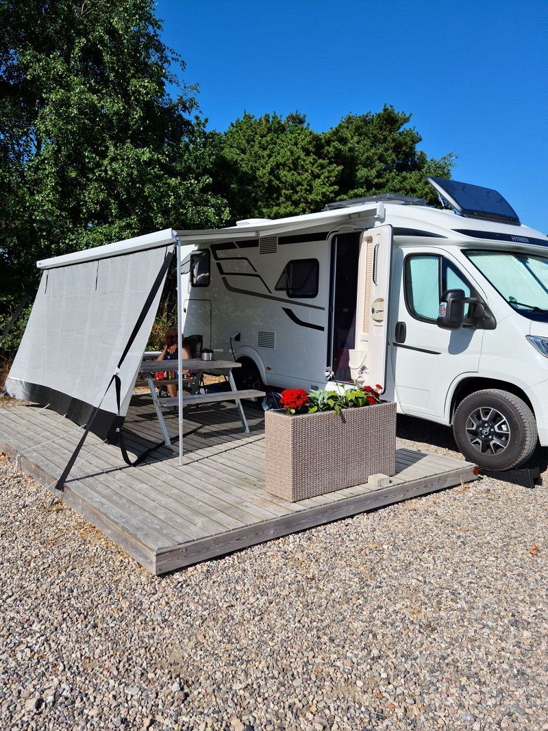
This trip lasted from June 30th to July 23rd. We went along the North Sea up to Skagen and back to Germany via Aarhus and Copenhagen
Day
Nauort
Westerwaldkreis, Rheinland-Pfalz, Deutschland
50° 27' 56.9" N 7° 37' 33.5" E
50.4658027 7.6259789
• Head toward Schulstraße on Hauptstraße (L306). Go for 2.5 km.
• Turn right onto Isenburger Straße (K90). Go for 630 m.
• Continue on Stromberger Straße (K115). Go for 2.7 km.
• Turn left onto Saynwaldstraße (K115). Go for 207 m.
• Turn right onto Hauptstraße (B413). Go for 6.5 km.
• Turn left onto L266 toward Köln/A3/Frankfurt/Neuwied/Gierenderhöhe. Go for 1.7 km.
• Turn left onto L258 toward Köln/Frankfurt/Neuwied/Dierdorf. Go for 203 m.
• Take the 2nd exit from roundabout onto A3 toward Köln. Go for 68.4 km.
• Continue on A3. Go for 10.1 km.
• Take exit 23 toward Dortmund onto A1. Go for 375 km.
• Take exit 43 toward Flensburg/Kiel/Hamburg-West/Tötensen/Flughafen onto A261 (Buchholzer Dreieck). Go for 10.3 km.
• Continue on A7. Go for 11.6 km.
• Keep left onto A7. Go for 94.4 km.
• Take exit 9 toward Rendsburg-Mitte onto A210. Go for 3.8 km.
• Continue on B202. Go for 2.8 km.
• Take ramp onto Zum Hafen (L255) toward Emkendorf/Osterrönfeld/Messe. Go for 754 m.
• Take the 3rd exit from roundabout onto Grüner Kamp (K27). Go for 687 m.
• Turn right onto Albert-Betz-Straße. Go for 82 m.
• Turn slightly left onto Am Kamp-Kanal. Go for 26 m.
• Turn right onto Am Kamp-Kanal. Go for 107 m.
• Arrive at Am Kamp-Kanal. Your destination is on the right.
☍
592,8 km
(5 hrs. 42 min.)
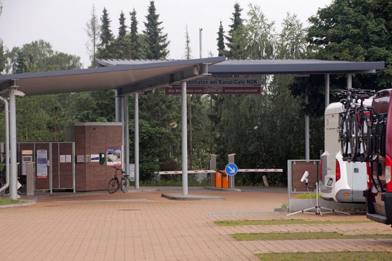
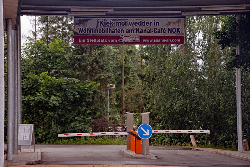
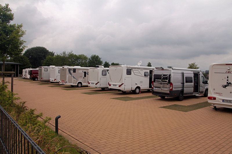
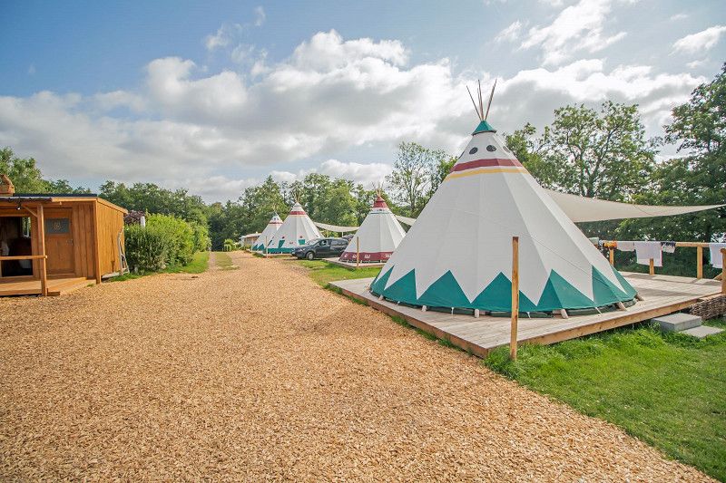
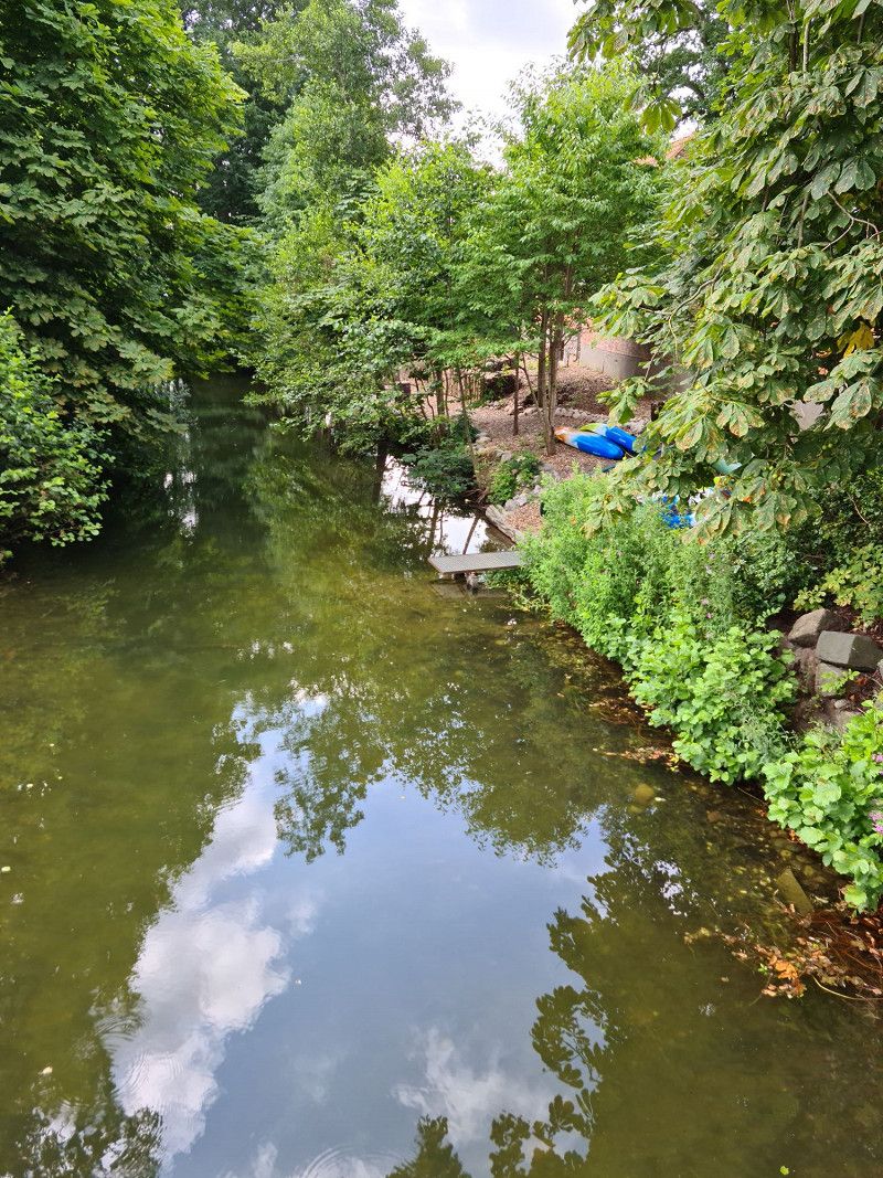
Wohnmobilhafen am Kanal-Café
Parking space is directly on the NOK and has 33 parking spaces. Supply and disposal possible, showers and sanitary facilities available, you can have breakfast, lunch and dinner in the cafe
Am Kamp-Kanal 1, Osterrönfeld, Rendsburg-Eckernförde, Schleswig-Holstein, Deutschland
54° 17' 25.2" N 9° 40' 15.2" E
54.2903408 9.6708781
• Head southwest on Am Kamp-Kanal. Go for 107 m.
• Turn left onto Am Kamp-Kanal. Go for 26 m.
• Turn slightly right onto Albert-Betz-Straße. Go for 82 m.
• Turn left onto Grüner Kamp (K27). Go for 594 m.
• Take the 1st exit from roundabout onto Zum Hafen (L255). Go for 898 m.
• Turn right and take ramp onto B202. Go for 3.3 km.
• Continue on A210. Go for 2.3 km.
• Take exit 3 toward Flensburg onto A7. Go for 65.0 km.
• Continue on E45 (Sønderjyske Motorvej). Go for 89.5 km.
• Keep left onto E45 (Kolding) toward Århus/Vejle. Go for 23.2 km.
• Keep right onto 13/18 (Midtjyske Motorvej) toward Viborg/Herning. Go for 11.6 km.
• Continue on 18 (Midtjyske Motorvej) toward Herning. Go for 15.8 km.
• Continue on 18 (Midtjyske Motorvej) toward Herning. Go for 18.4 km.
• Continue on 18 (Midtjyske Motorvej). Go for 19.8 km.
• Continue on 12/18 (Midtjyske Motorvej) toward Viborg/Holstebro/Herning N-Ø. Go for 3.5 km.
• Continue on 18 (Midtjyske Motorvej) toward Holstebro. Go for 41.7 km.
• Take the 2nd exit from roundabout onto Nordre Ringvej (O2). Go for 978 m.
• Take the 1st exit from roundabout onto Nordre Ringvej. Go for 2.5 km.
• Take the 1st exit from roundabout onto Vilhelmsborgvej (521). Go for 4.7 km.
• Take the 2nd exit from roundabout onto Vilhelmsborgvej (521). Go for 14.2 km.
• Turn right onto Ringkøbingvej (28). Go for 6.9 km.
• Turn left onto Lemvigvej (513). Go for 4.8 km.
• Keep right onto Thyborønvej (181). Go for 16.8 km.
• Continue on Harboørevej. Go for 1.3 km.
• Turn left onto Jagtvej. Go for 572 m.
• Turn left onto Vesterhavsgade. Go for 738 m.
• Turn left onto Idrætsvej. Go for 148 m.
• Turn left. Go for 76 m.
• Arrive at your destination on the right.
☍
349,4 km
(3 hrs. 37 min.)
Day
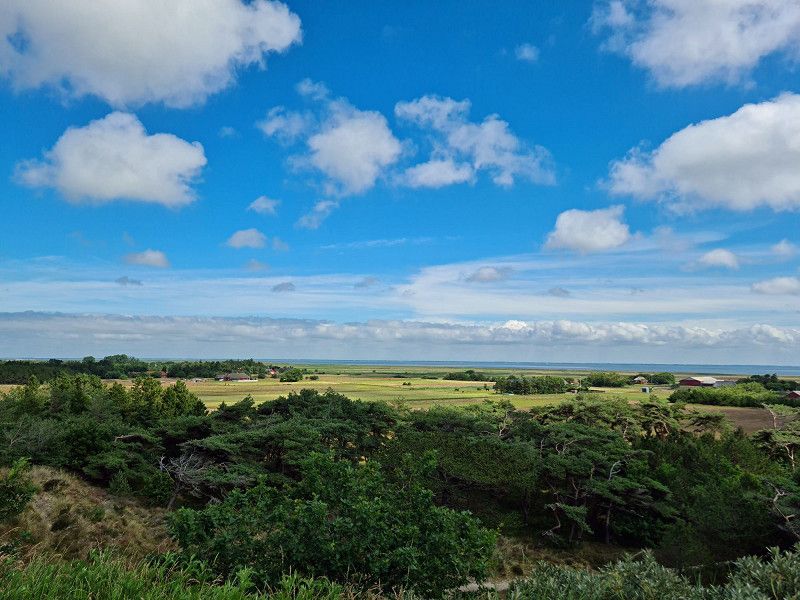
Römö
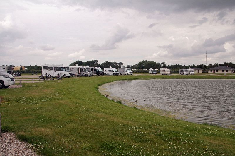
The second stop was on Römö. Here we were at the Oasen parking space
Day
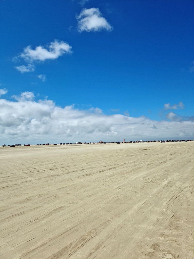
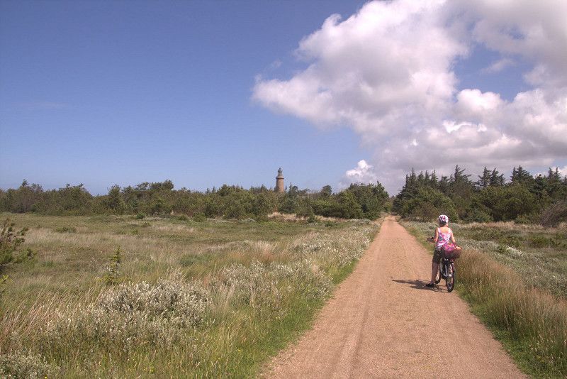
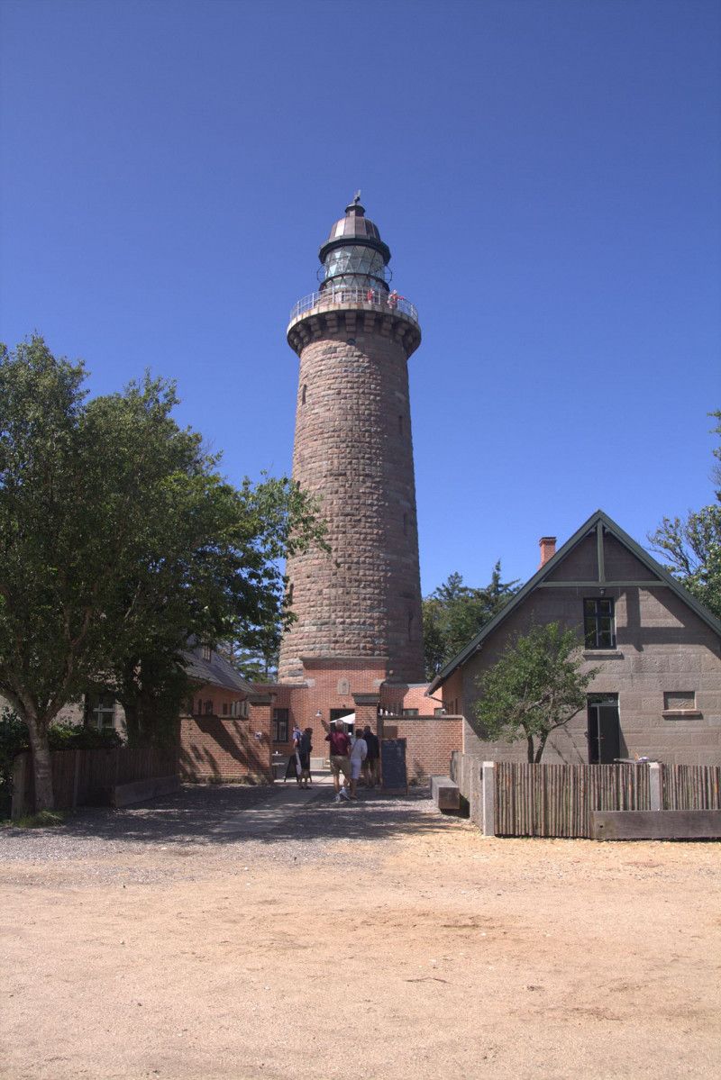
Fahrradtour auf Römö
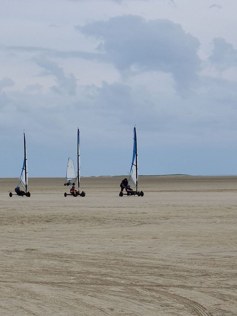
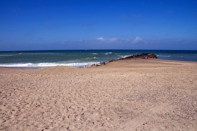
The island was explored by bike. The km-long and wide sandy beach can also be accessed by vehicle, but you should not deviate from the route, otherwise you will end up on the soft sand...
Day
Thyborøn
Kirkegaardsvej, Thyborøn, Region Mitteljütland, Dänemark
56° 41' 41.8" N 8° 12' 23.4" E
56.6949393 8.2064887
• Head toward Idrætsvej. Go for 76 m.
• Turn right onto Idrætsvej. Go for 148 m.
• Turn right onto Vesterhavsgade. Go for 620 m.
• Turn right onto Fanøvej. Go for 201 m.
• Turn right onto Jagtvej. Go for 472 m.
• Turn right onto Harboørevej. Go for 1.3 km.
• Turn left onto Harboørevej (181). Go for 227 m.
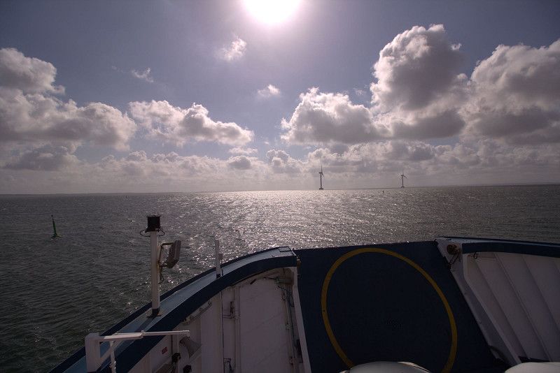
• Take the Thyborøn-Agger Ferry. Stay on for 2.3 km.
• Head northwest on Aggervej (181). Go for 12.9 km.
• Turn left onto Vestervigvej (181/527). Go for 793 m.
• Turn left onto Kystvejen (181). Go for 15.6 km.
• Turn left toward Istrupvej. Go for 1.2 km.
• Turn left onto Istrupvej. Go for 208 m.
• Arrive at Istrupvej.
☍
36,0 km
(1 hrs. 6 min.)
Thyboron
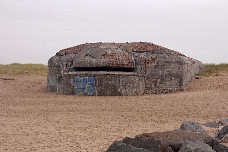
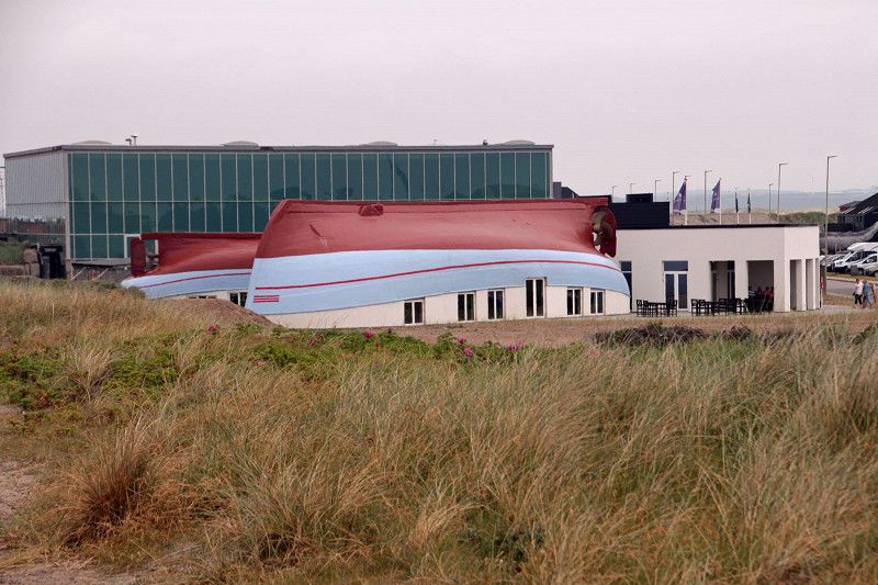
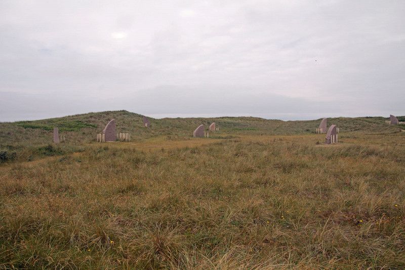
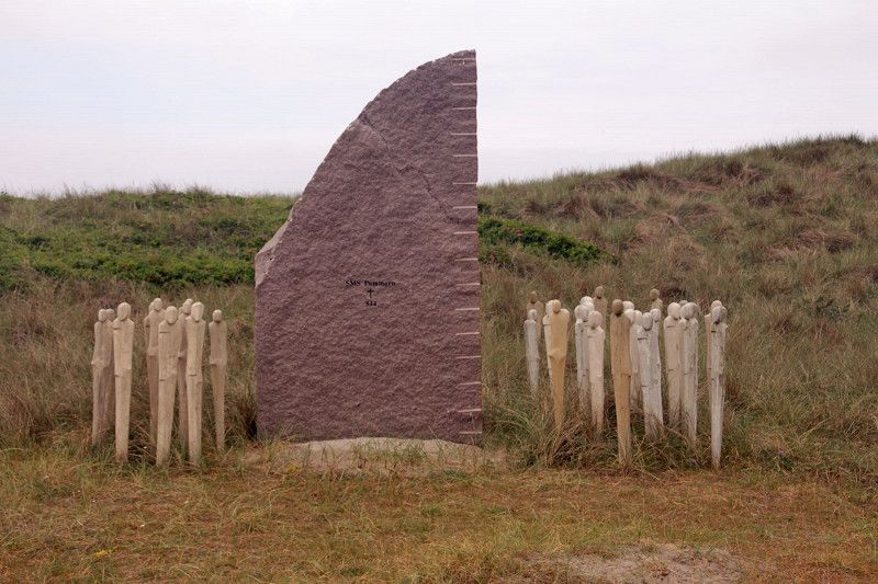
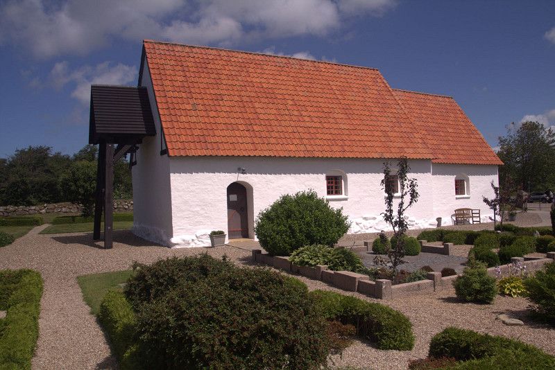
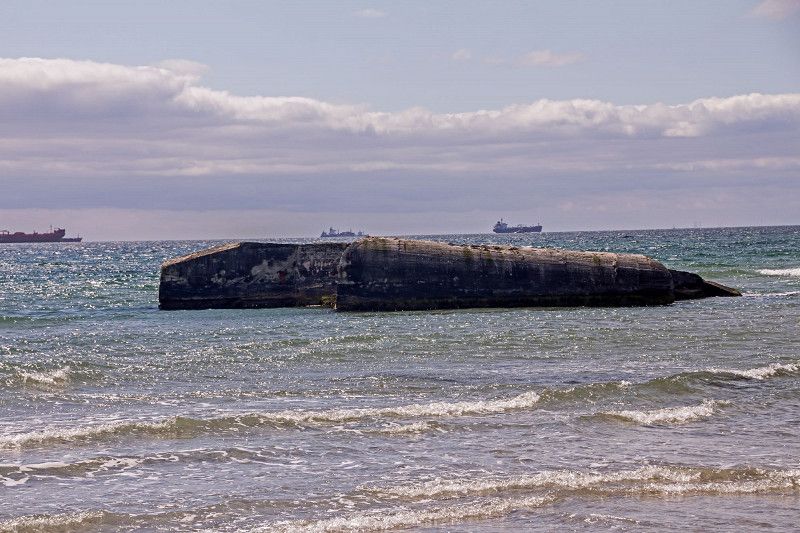
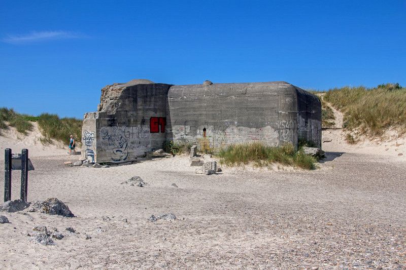
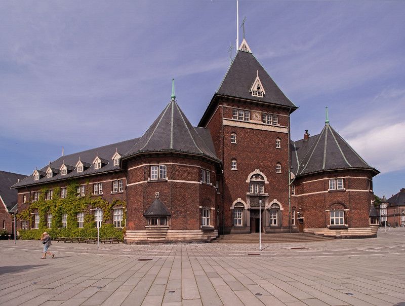
Thyboron is a small town. Here is the Sea War Museum, a reminder of the Battle of the Skagerrak and several bunkers on the Atlantic Wall.
Day
Nationalpark Thy
Dänemark
56° 54' 27.8" N 8° 21' 38.3" E
56.9077251 8.3606262
• Head north on Istrupvej. Go for 208 m.
• Turn right toward Kystvejen/181. Go for 1.2 km.
• Turn right onto Kystvejen (181). Go for 15.6 km.
• Turn right onto Vestervigvej (181/527). Go for 774 m.
• Continue on Klostergade (527). Go for 10.7 km.
• Turn right onto Oddesundvej (11) toward Holstebro/Struer. Go for 24.8 km.
• Turn right onto Østerbrogade (565) toward Lemvig/Nr. Nissum. Go for 16.1 km.
• Turn right onto Østerbjerg (513). Go for 999 m.
• Turn left onto Enghavevej (513). Go for 6.3 km.
• Keep left onto Lemvigvej (513). Go for 209 m.
• Continue on Vandborgvej (181). Go for 4.0 km.
• Turn right onto Gåskærvej. Go for 3.3 km.
• Turn left onto Brændgårdvej. Go for 435 m.
• Turn right onto Juelsgårdvej. Go for 1.5 km.
• Turn right onto Vesterhavsgade. Go for 274 m.
• Turn left onto Transvej. Go for 174 m.
• Turn right onto Fyrvej. Go for 1.2 km.
• Turn left onto Fyrvej. Go for 99 m.
• Arrive at Fyrvej. Your destination is on the right.
☍
87,9 km
(1 hrs. 23 min.)
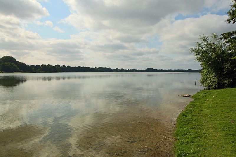
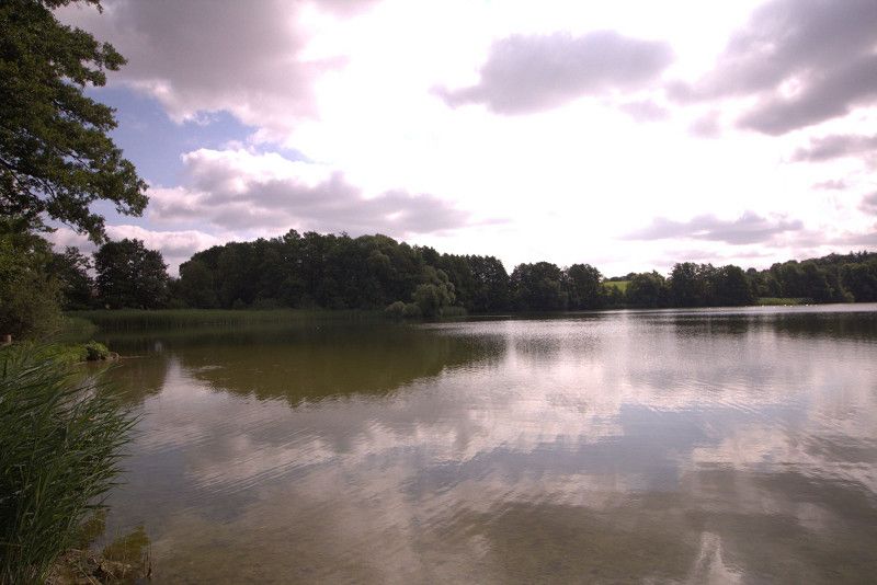
Nationalpark Thy
We spent the next few days in the area. We took the ferry across the Limfjord to the Thy National Park
Day
Bovbjerg Fyr
Fyrvej, Lemvig Kommune, Region Mitteljütland, Dänemark
56° 30' 47.5" N 8° 7' 10.9" E
56.5131821 8.1196807
• Head west on Fyrvej. Go for 99 m.
• Turn right onto Fyrvej. Go for 1.2 km.
• Turn left onto Transvej. Go for 174 m.
• Turn right onto Vesterhavsgade. Go for 250 m.
• Turn left onto Juelsgårdvej. Go for 1.5 km.
• Turn left onto Brændgårdvej. Go for 435 m.
• Turn right onto Gåskærvej. Go for 3.3 km.
• Turn left onto Vandborgvej (181). Go for 4.0 km.
• Continue on Lemvigvej (513). Go for 6.5 km.
• Turn right onto Østergade (513). Go for 999 m.
• Turn left onto Nissumvej (565). Go for 16.1 km.
• Turn left onto Oddesundvej (11) toward Thisted. Go for 54.8 km.
• Pass 3 roundabouts and continue on Aalborgvej (11/29). Go for 46.1 km.
• Continue on Bygholmvejlevej (11) toward Aabybro/Aalborg. Go for 9.3 km.
• Turn left onto Mellemmøllevej toward Tranum/Lerup K. Go for 841 m.
• Continue on Bonderupvej. Go for 2.0 km.
• Turn right onto Hjortdalvej. Go for 3.5 km.
• Take the 2nd exit from roundabout onto Dybdalsvej. Go for 951 m.
• Continue on Drosselvej. Go for 12 m.
• Continue on Dybdalsvej. Go for 1.3 km.
• Continue on Tranum Engevej. Go for 5.0 km.
• Take the 3rd exit from roundabout onto Udholmvej. Go for 3.8 km.
• Continue on Halvrimmenvej. Go for 933 m.
• Turn right onto Rødhusvej. Go for 6.4 km.
• Turn right onto Brogaardsgade. Go for 590 m.
• Turn left onto Omfartsvejen (55). Go for 5.9 km.
• Pass 4 roundabouts and continue on Løkkensvej (55). Go for 16.8 km.
• Continue on Løkkensvej (55) toward Hjørring. Go for 4.8 km.
• Turn left onto Lønstrupvej toward Lønstrup/Nr. Rubjerg. Go for 4.1 km.
• Continue on Rubjergvej. Go for 2.3 km.
• Turn left. Go for 22 m.
• Turn left. Go for 65 m.
• Arrive at your destination.
☍
204,0 km
(2 hrs. 55 min.)
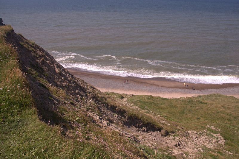
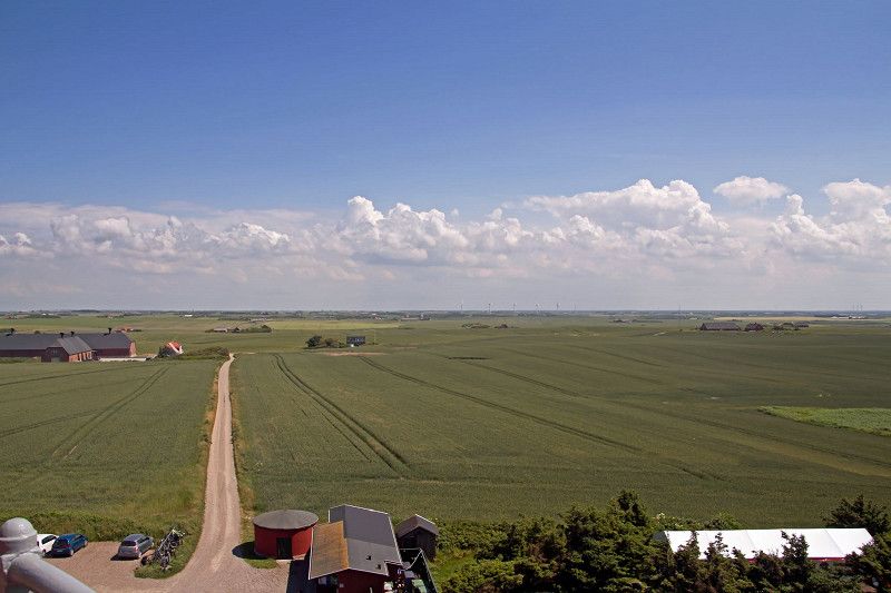
Bovbjerg Fyr
We cycled to the Bovbjerg Fyr lighthouse. Very beautiful lighthouse, located directly on the cliffs.
Day
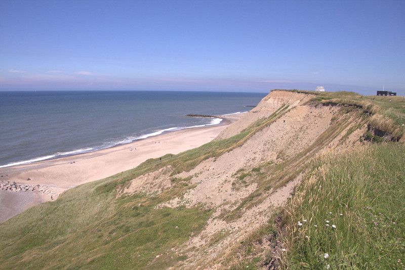
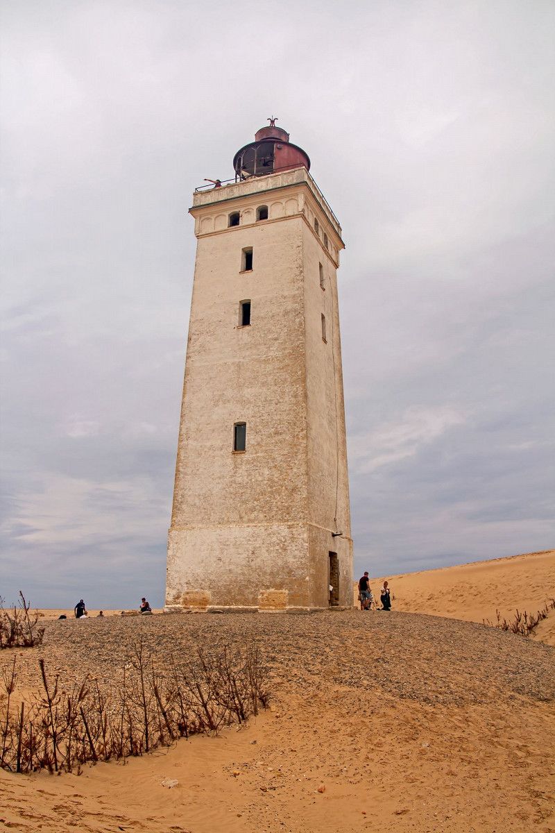
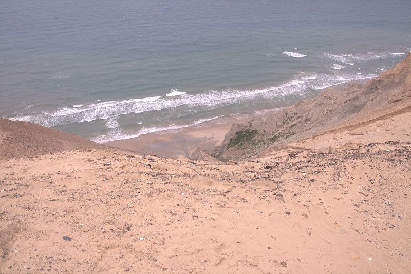
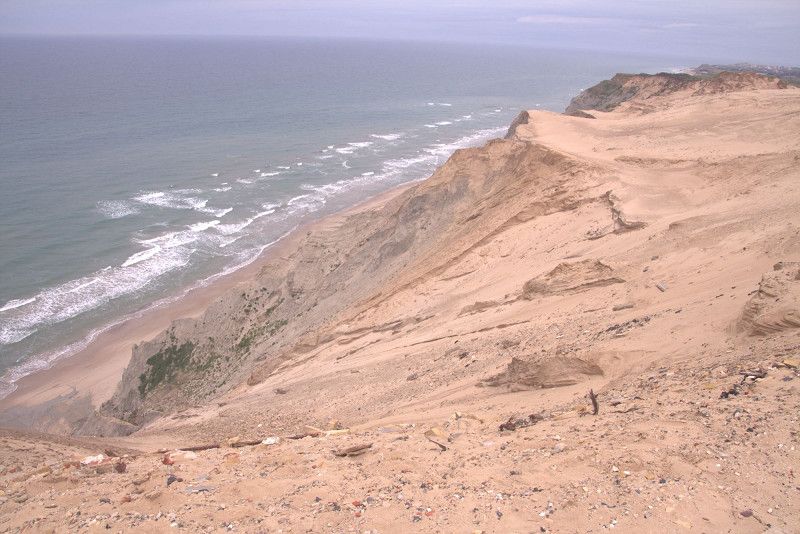
Rubjerg Knude Leuchtturm
Years ago, the lighthouse was pushed hydraulically from the cliffs inland to prevent it from falling.
Fyrvejen, Hjørring Kommune, Region Nordjütland, Dänemark
57° 26' 56.6" N 9° 46' 31.8" E
57.4490487 9.7754877
• Head toward Rubjergvej. Go for 65 m.
• Turn right toward Rubjergvej. Go for 22 m.
• Turn left onto Rubjergvej. Go for 2.0 km.
• Turn right onto Strandvejen. Go for 562 m.
• Continue on Lønstrupvej. Go for 1.5 km.
• Turn left onto Skallerupvej. Go for 8.4 km.
• Turn left onto Krustrupvej (55) toward Hirtshals. Go for 801 m.
• Turn right onto Vellingshøjvej toward 190. Go for 3.5 km.
• Take the 3rd exit from roundabout onto Ringvejen (190). Go for 3.4 km.
• Take the 1st exit from roundabout onto Ramsvej toward Hirtshals/E39/Bjergby/Mygdal/Odden. Go for 163 m.
• Continue on Skagen Landevej. Go for 61 m.
• Turn left and take ramp onto E39 (Hirtshalsmotorvejen) toward Hirtshals/Skagen. Go for 6.1 km.
• Take the 1st exit from roundabout onto Tverstedvej (597) toward Skagen/Tversted. Go for 10.6 km.
• Take the 2nd exit from roundabout onto Skagensvej (597). Go for 15.4 km.
• Take the 3rd exit from roundabout onto Ålbækvej (40). Go for 6.4 km.
• Take the 2nd exit from roundabout onto Ålbækvej (40). Go for 9.3 km.
• Continue on Frederikshavnsvej (40). Go for 1.7 km.
• Take the 2nd exit from roundabout onto Kattegatvej. Go for 651 m.
• Turn left onto Buttervej. Go for 365 m.
• Take the 2nd exit from roundabout onto Bøjlevejen. Go for 2.7 km.
• Turn right onto Bøjlevejen. Go for 101 m.
• Continue on Bøjlevejen. Go for 146 m.
• Arrive at Bøjlevejen. Your destination is on the right.
☍
73,9 km
(1 hrs. 4 min.)
Poul Eeg Camping
Nordstjernevej, Skagen, Region Nordjütland, Dänemark
57° 44' 5.5" N 10° 36' 1.2" E
57.7348586 10.6003268
• Head east on Bøjlevejen. Go for 247 m.
• Turn left onto Bøjlevejen. Go for 2.7 km.
• Take the 3rd exit from roundabout onto Buttervej. Go for 430 m.
• Turn right onto Kattegatvej. Go for 562 m.
• Take the 1st exit from roundabout onto Frederikshavnsvej (40). Go for 10.9 km.
• Take the 2nd exit from roundabout onto Ålbækvej (40). Go for 6.4 km.
• Take the 1st exit from roundabout onto Hirtshalsvej (597). Go for 15.3 km.
• Take the 2nd exit from roundabout onto Skagensvej (597). Go for 10.6 km.
• Take the 3rd exit from roundabout onto E39 (Hirtshalsmotorvejen) toward Aalborg. Go for 57.1 km.
• Continue on Vendsyssel. Go for 196 m.
• Continue on E45 (Vendsyssel). Go for 113 km.
• Take the exit toward Lufthavn/Grenaa/Hospital Skejby/Århus N/180 onto 15 (Djurslandmotorvejen). Go for 3.0 km.
• Take ramp toward Skejby/Færge Århus N/Hospital. Go for 884 m.
• Continue on Søftenvej. Go for 3.8 km.
• Continue on Randersvej toward O1/Centrum. Go for 1.3 km.
• Continue on Nørrebrogade (O1) toward Centrum. Go for 1.5 km.
• Turn right onto Kystvejen (O1). Go for 3.5 km.
• Turn right onto Oddervej. Go for 1.6 km.
• Turn left onto Grumstolsvej. Go for 1.3 km.
• Turn left onto Hørhavevej. Go for 227 m.
• Turn right onto Ørneredevej. Go for 403 m.
• Arrive at Ørneredevej. Your destination is on the left.
☍
235,4 km
(2 hrs. 34 min.)
Day
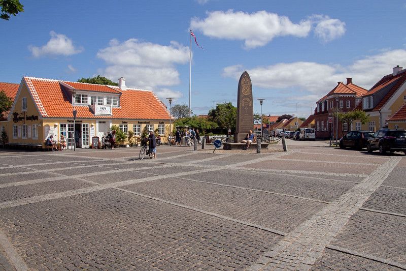
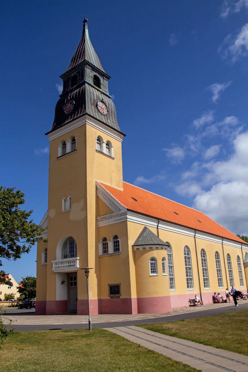
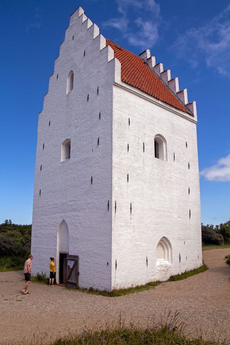
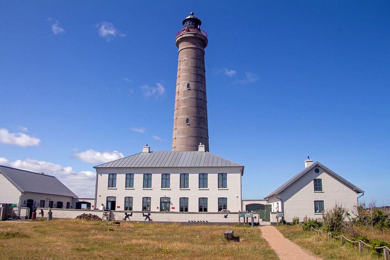
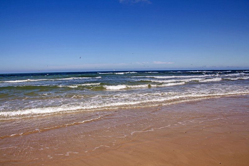
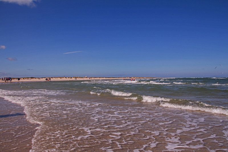
Skagen
This is where the North and Baltic Seas meet. A small, beautiful place with long dunes
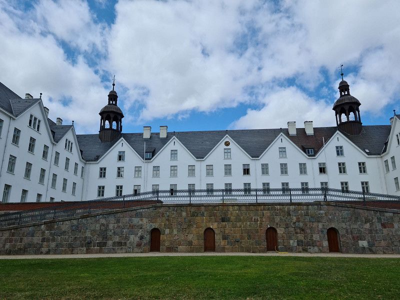
Day
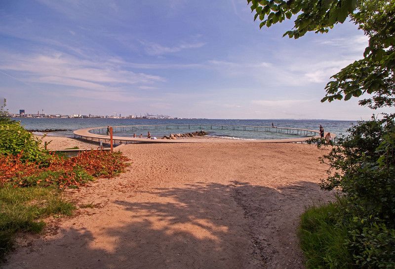
DCU-Camping Aarhus - Blommehaven
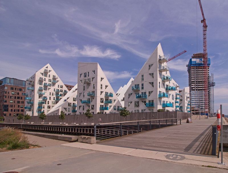
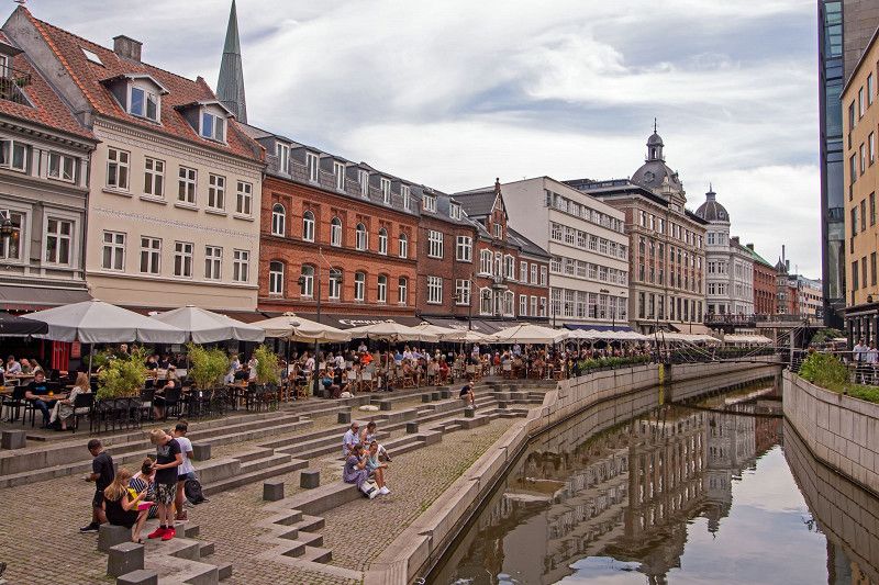
We stayed 2 nights in Aarhus, Blommehaven campsite. From there a cycle path leads directly to the center. Aarhus is a former European cultural capital and the second largest city in Denmark. The city is easy to explore by bike or on foot. The campsite is large and a public road divides it in half. The beach on site is pebbly and not nice, so you have to go a little further.
Ørneredevej 35, 8270, Højbjerg, Denmark
56° 6' 38" N 10° 13' 56" E
56.1105600 10.2322200
• Head northwest on Ørneredevej. Go for 403 m.
• Turn left onto Hørhavevej. Go for 227 m.
• Turn right onto Grumstolsvej. Go for 1.3 km.
• Turn right onto Oddervej. Go for 1.6 km.
• Turn left onto Strandvejen. Go for 1.5 km.
• Turn left onto Marselis Boulevard (O1). Go for 895 m.
• Continue on Marselis Boulevard toward E45/170/180. Go for 1.3 km.
• Continue on Åhavevej. Go for 907 m.
• Keep left onto 501 (Århus Syd Motorvejen). Go for 9.9 km.
• Continue on E45 (Østjyske Motorvej). Go for 67.2 km.
• Keep left onto E20 (Skærup) toward Odense/Fredericia. Go for 210 km.
• Take the exit toward E55/Helsingør/København N onto E47 (Motorring 3). Go for 5.0 km.
• Take exit 24 toward Roskildevej/Glostrup/Frederiksberg. Go for 724 m.
• Turn right onto Roskildevej (156) toward Brøndbyvester/Rødovre/Frederiksberg/København. Go for 655 m.
• Turn slightly left toward Roskildevej/156. Go for 81 m.
• Turn slightly left onto Korsdalsvej. Go for 182 m.
• Turn left onto Korsdalsvej. Go for 85 m.
• Arrive at Korsdalsvej. Your destination is on the left.
☍
301,6 km
(2 hrs. 56 min.)
Day
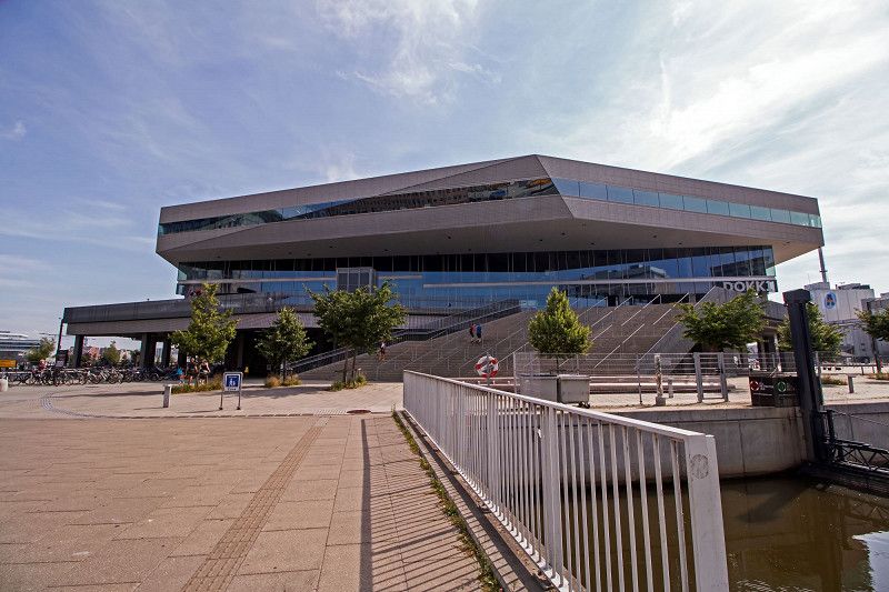
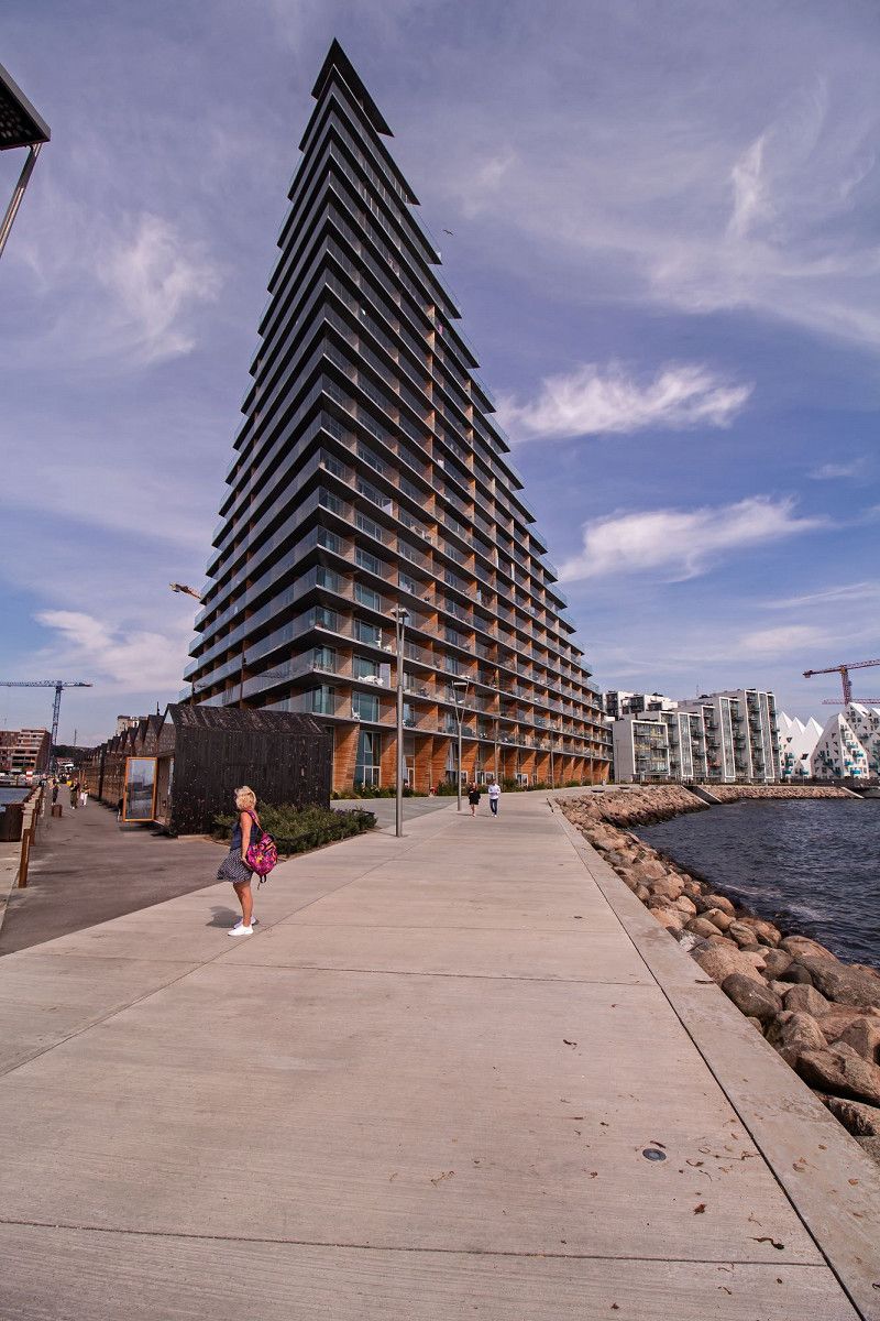
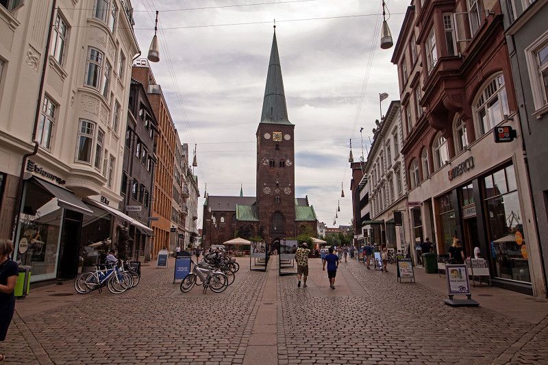
Aarhus
Aarhus is the second largest city in Denmark and the largest on the mainland
Day
DCU-Camping København - Absalon
Korsdalsvej 132, 2610, Rødovre, Denmark
55° 40' 15" N 12° 26' 2" E
55.6708300 12.4338900
• Head east on Korsdalsvej. Go for 85 m.
• Turn right onto Korsdalsvej. Go for 127 m.
• Turn right onto Roskildevej (156). Go for 1.0 km.
• Turn right and take ramp onto E47 (Motorring 3) toward Rødby/E55/E20/Lufthavn. Go for 4.2 km.
• Take the exit toward Odense/Rødby/Gedser onto E20/E47 (Køge Bugt Motorvejen). Go for 26.4 km.
• Keep left onto E20 (Køge Vest) toward Odense. Go for 174 km.
• Keep left onto E20 (Fredericia) toward Esbjerg/E45s/Kolding/Flensborg. Go for 15.5 km.
• Take exit 64 toward Esbjerg onto E20 (Kolding Vest). Go for 27.0 km.
• Take exit 69 toward Brørup. Go for 423 m.
• Turn left onto Vejlevej (417) toward Ribe/Brørup. Go for 301 m.
• Take the 2nd exit from roundabout onto Vejlevej (417). Go for 342 m.
• Take the 2nd exit from roundabout onto Nørregade (417). Go for 1.9 km.
• Continue on Søndergade (417). Go for 563 m.
• Continue on Ribevej (417). Go for 4.2 km.
• Turn right onto Kongeåvej (32). Go for 17.8 km.
• Take the 2nd exit from roundabout onto Koldingvej (32) toward Ribe/11/24. Go for 267 m.
• Take the 3rd exit from roundabout onto Varde Hovedvej (11/24) toward Aabenraa/Tønder/Ribe. Go for 1.8 km.
• Turn right onto Farupvej toward Farup. Go for 452 m.
• Turn right onto Farupvej. Go for 154 m.
• Turn left onto Farupvej. Go for 74 m.
• Turn left onto Farupvej. Go for 50 m.
• Arrive at Farupvej. Your destination is on the right.
☍
276,9 km
(2 hrs. 41 min.)
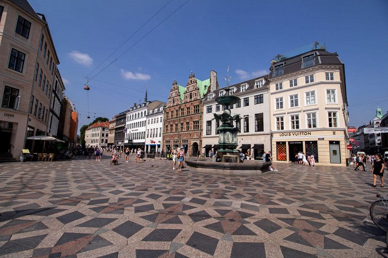
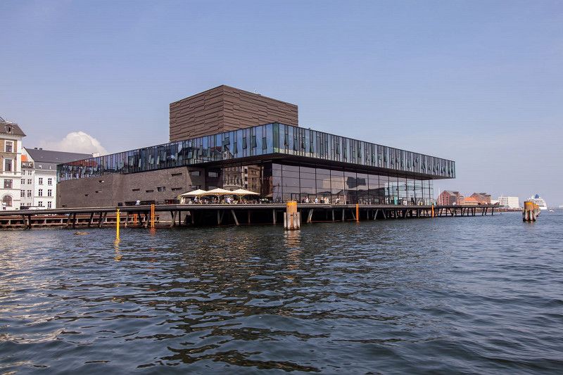
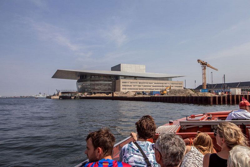
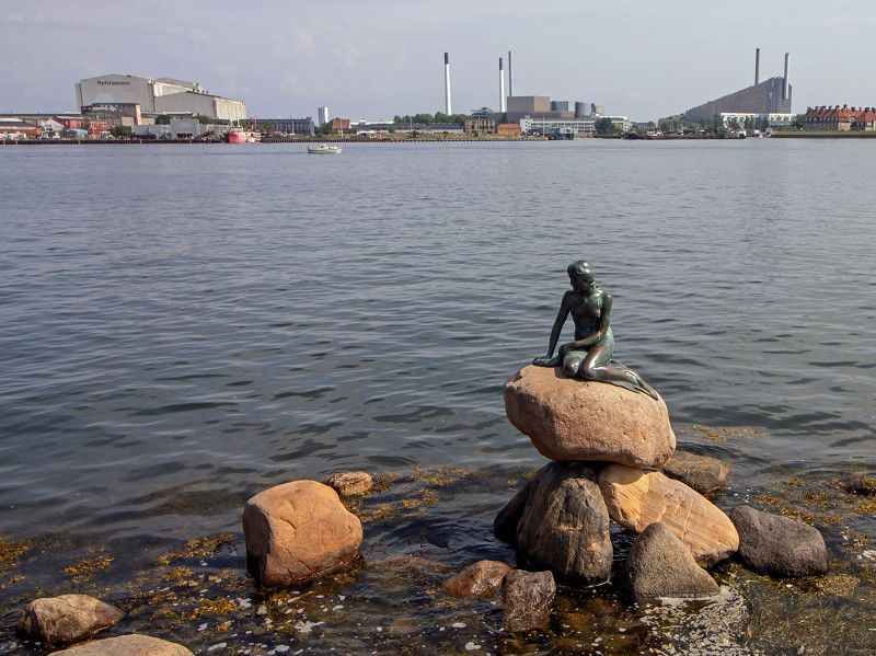
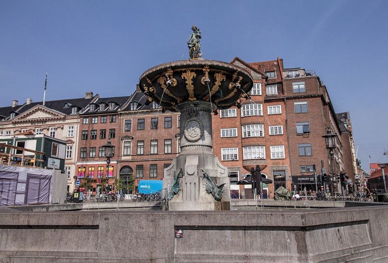
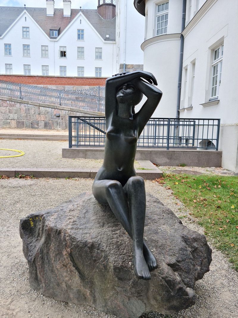
Kopenhagen
"Days of city sightseeing in Copenhagen. The harbor tour is recommended
Day
Ribe Camping
Farupvej 2, 6760, Ribe, Denmark
55° 20' 29" N 8° 45' 54" E
55.3413900 8.7650000
• Head north on Farupvej. Go for 50 m.
• Turn right onto Farupvej. Go for 74 m.
• Turn right onto Farupvej. Go for 154 m.
• Turn left onto Farupvej. Go for 452 m.
• Turn right onto Trojelsvej (11/24). Go for 224 m.
• Turn right onto Ringvejen (11/24) toward Tønder/Aabenraa. Go for 2.5 km.
• Take the 2nd exit from roundabout onto Haderslevvej (24) toward Haderslev/Ribe/Flensborg/179/Aabenraa. Go for 383 m.
• Take the 2nd exit from roundabout onto Haderslevvej (24) toward Aabenraa/Haderslev/Flensborg/179. Go for 2.1 km.
• Turn right onto Toftlundvej (179). Go for 14.6 km.
• Take the 2nd exit from roundabout onto Højrupvej (179). Go for 9.6 km.
• Take the 3rd exit from roundabout onto Bovvej (175/179) toward Flensborg/Agerskov. Go for 7.8 km.
• Pass 2 roundabouts and continue on Bovvej (175/179). Go for 7.9 km.
• Take the 3rd exit from roundabout onto Hellevadvej (429). Go for 7.7 km.
• Take the 1st exit from roundabout onto Ribevej (24) toward Aabenraa/E45/Rødekro Ø. Go for 1.6 km.
• Take the 1st exit from roundabout toward Sønderborg/41/Flensborg. Go for 98 m.
• Take ramp onto E45 (Sønderjyske Motorvej). Go for 30.3 km.
• Continue on A7. Go for 83.2 km.
• Take exit 11 toward Plön/Bordesholm. Go for 303 m.
• Turn left onto L49 toward Plön/Bordesholm. Go for 19.0 km.
• Turn right onto K43 toward Stolpe. Go for 3.8 km.
• Continue on Bahnhofstraße (K43). Go for 204 m.
• Continue on Wankendorfer Straße (K43). Go for 1.4 km.
• Continue on Kirchtor (K43). Go for 530 m.
• Continue on Röterberg (K43). Go for 240 m.
• Continue on Bornhöveder Landstraße (K43). Go for 163 m.
• Turn left onto Plöner Straße (K14). Go for 820 m.
• Continue on K14. Go for 112 m.
• Continue on Perdöl (K14). Go for 3.3 km.
• Continue on Dorfstraße. Go for 60 m.
• Turn right toward Perdöler Mühle. Go for 371 m.
• Turn slightly right onto Perdöler Mühle. Go for 40 m.
• Arrive at Perdöler Mühle. Your destination is on the left.
☍
199,1 km
(2 hrs. 10 min.)
Day
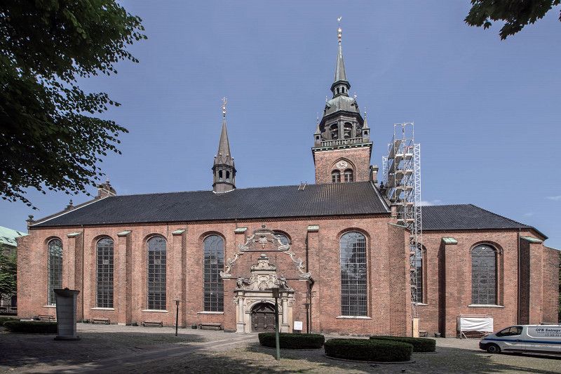
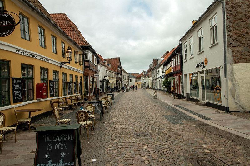
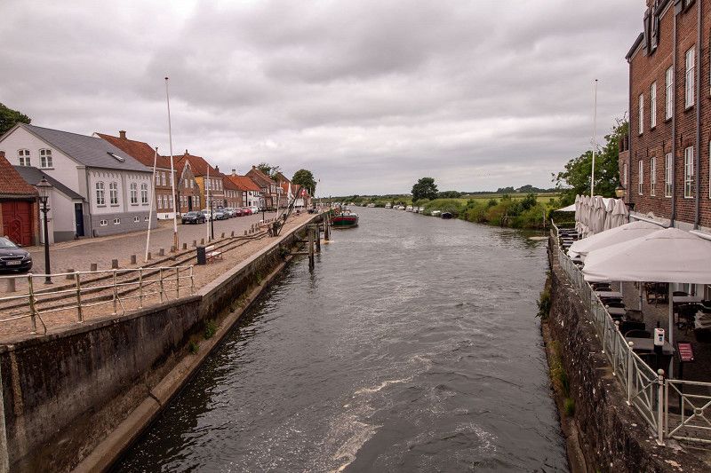
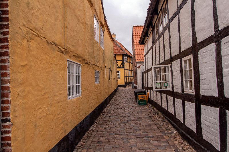
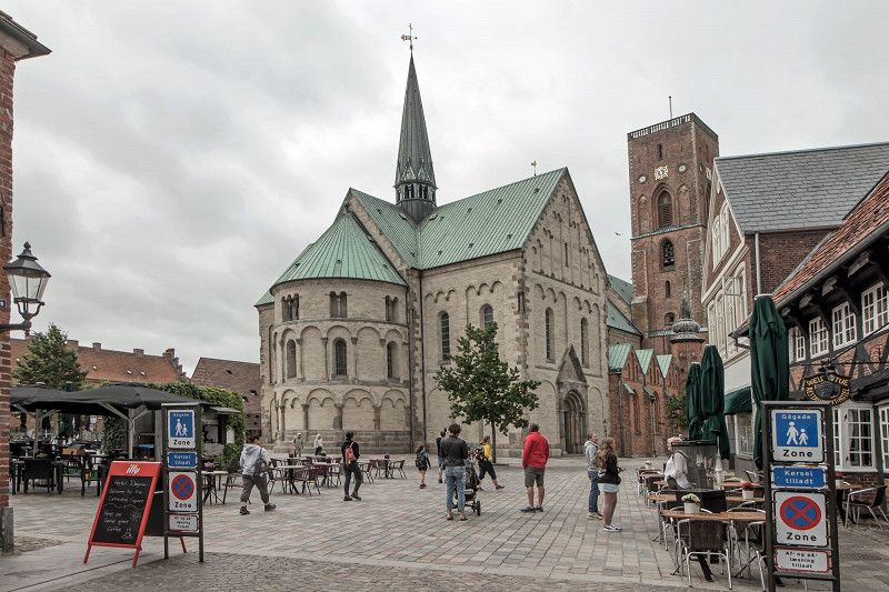
Ribe
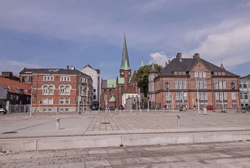
Ribe is the oldest town in Denmark
Day
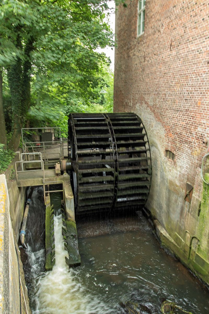
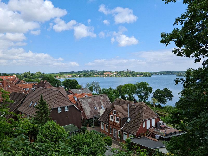
Perdoeler Muehle
The Perdoehler Mühle campsite is located almost 15km southwest of Plön. From here you can quickly reach Plön by bike or car
Perdöler Mühle, Belau, Plön, Schleswig-Holstein, Deutschland
54° 6' 39.6" N 10° 15' 1.4" E
54.1109987 10.2504014
• Head toward Dorfstraße on Perdöler Mühle. Go for 411 m.
• Turn left onto Dorfstraße. Go for 60 m.
• Continue on Perdöl (K14). Go for 3.3 km.
• Continue on K14. Go for 112 m.
• Continue on Plöner Straße (K14). Go for 820 m.
• Turn right onto Bornhöveder Landstraße (K43). Go for 163 m.
• Continue on Röterberg (K43). Go for 240 m.
• Continue on Kirchtor (K43). Go for 530 m.
• Continue on Wankendorfer Straße (K43). Go for 344 m.
• Turn right and take ramp onto A21 toward Kiel/Bad Segeberg. Go for 49.3 km.
• Take exit 19 toward Bremen/Hannover/Hamburg/Ahrensburg onto A1. Go for 32.6 km.
• Take the left exit toward Bremen/Hannover/HH-Stillhorn onto A1. Go for 15.2 km.
• Continue on Horster Dreieck toward Hannover/Seevetal-Ramelsloh/A7. Go for 1.7 km.
• Continue on A7. Go for 106 km.
• Keep right onto A352 (Dreieck Hannover-Nord) toward Dortmund/Flughafen/Hannover-Nord. Go for 18.1 km.
• Continue on A2. Go for 180 km.
• Take exit 16 toward Köln/Frankfurt a.M./Flughafen Dortmund onto A1. Go for 87.5 km.
• Take exit 98 toward Frankfurt a.M./Flughafen Köln/Leverkusen onto A3. Go for 14.7 km.
• Continue on A3 toward Frankfurt a.M. Go for 65.2 km.
• Take exit 37 toward Dierdorf/Hachenburg/Herschbach/B413/Neuwied/Anhausen. Go for 453 m.
• Turn right onto L258 toward Neuwied/Anhausen. Go for 365 m.
• Take the 3rd exit from roundabout onto L258 toward Gierenderhöhe/Puderbach/Kleinmaischeid/Dernbach/B413. Go for 274 m.
• Turn right onto L266 toward Isenburg/Kleinmaischeid/B413. Go for 1.7 km.
• Turn right onto B413 toward Koblenz/Bendorf/Kleinmaischeid. Go for 6.5 km.
• Turn left onto Saynwaldstraße (K115) toward Stromberg. Go for 207 m.
• Turn right onto Stromberger Straße (K115). Go for 2.7 km.
• Continue on Isenburger Straße (K90). Go for 630 m.
• Turn left onto Westerwaldstraße (L306). Go for 2.5 km.
• Arrive at Hauptstraße (L306). Your destination is on the right.
☍
591,4 km
(5 hrs. 38 min.)
Day
Day
Nauort
Westerwaldkreis, Rheinland-Pfalz, Deutschland
50° 27' 56.9" N 7° 37' 33.5" E
50.4658027 7.6259789