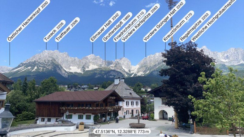
Our first big trip across the Alps, to the filming locations of the Bergdoktor, visiting friends in Linz and across the Dolomites (Sexten) to Lake Garda and back. In order to save tolls in Austria, we deliberately did not take the usual routes and avoided the Brenner Pass: therefore Tauern Pass, Katschberg, Kreuzberg Pass and back via Reschen Pass and Fern Pass. Detailed travel report at: https://www.wolke7ontour.de
Day
Kissing, Deutschland
48° 18' 9.7" N 10° 58' 21.4" E
48.3027069 10.9726090
• Head north on Fichtenstraße. Go for 33 m.
• Turn right onto Tannenstraße. Go for 198 m.
• Continue on Albert-Schweitzer-Straße. Go for 411 m.
• Turn left onto Albert-Einstein-Straße. Go for 94 m.
• Turn right onto Pestalozzistraße. Go for 35 m.
• Turn right onto Bahnhofstraße. Go for 1.1 km.
• Turn left onto Bachgasse (AIC12) toward Friedberg/Ottmaring. Go for 37 m.
• Continue on Hauptstraße (AIC12). Go for 105 m.
• Turn right onto Hörmannsberger Straße. Go for 2.2 km.
• Continue on Kissinger Straße. Go for 283 m.
• Continue on Kissinger Straße. Go for 658 m.
• Turn left onto Rieder Straße (St2052) toward Ried. Go for 1.1 km.
• Take the 2nd exit from roundabout onto Hörmannsberger Straße (St2052). Go for 769 m.
• Turn right onto Hauptstraße (St2052). Go for 9.9 km.
• Take the 3rd exit from roundabout onto St2052. Go for 2.2 km.
• Turn right onto Augsburger Straße (St2051). Go for 226 m.
• Take the 2nd exit from roundabout onto Hauptstraße (St2051). Go for 817 m.
• Take the 3rd exit from roundabout onto A8 toward München. Go for 13.3 km.
• Take exit 78 toward Dachau. Go for 939 m.
• Continue on B471. Go for 8.3 km.
• Take ramp onto Münchner Straße (B304) toward München/Karlsfeld. Go for 4.6 km.
• Take ramp onto A99 toward Salzburg/Messe/ICM/Nürnberg/Flughafen München/Arena. Go for 39.8 km.
• Take exit 21 toward Salzburg/Innsbruck onto A8. Go for 22.5 km.
• Take exit 98 toward Weyarn/Bayrischzell/Schliersee/Miesbach. Go for 272 m.
• Turn right onto Münchener Straße (St2873) toward Bayrischzell/Schliersee/Miesbach/Weyarn. Go for 322 m.
• Take the 2nd exit from roundabout onto Münchener Straße (St2073). Go for 8.6 km.
• Take the 1st exit from roundabout onto B472 toward Bayrischzell/B307/Schliersee/Hausham/Bad Tölz/Tegernsee/Gewerbegebiet Miesbach-Ost/Krankenhaus. Go for 619 m.
• Turn right onto Rosenheimer Straße toward Stadtmitte. Go for 335 m.
• Continue on Stadtplatz. Go for 108 m.
• Continue on Ledererstraße. Go for 172 m.
• Turn left onto Frühlingstraße. Go for 132 m.
• Turn left onto Marienplatz. Go for 14 m.
• Turn slightly left onto Pfarrgasse. Go for 69 m.
• Arrive at Pfarrgasse. Your destination is on the left.
☍
120,2 km
(1 hrs. 36 min.)
Miesbach, Deutschland
83714 Miesbach, Deutschland
47° 47' 23.9" N 11° 49' 59.8" E
47.7899777 11.8332675
• Head toward Marienplatz on Pfarrgasse. Go for 69 m.
• Turn slightly right onto Marienplatz. Go for 14 m.
• Turn right onto Frühlingstraße. Go for 132 m.
• Turn right onto Ledererstraße. Go for 172 m.
• Continue on Stadtplatz. Go for 108 m.
• Continue on Rosenheimer Straße. Go for 305 m.
• Turn right onto Bayrischzeller Straße (B472). Go for 1.4 km.
• Continue on B307. Go for 1.7 km.
• Take the 1st exit from roundabout onto B307. Go for 901 m.
• Take ramp onto Industriestraße (B307) toward Bayrischzell/Schliersee. Go for 19.0 km.
• Turn right onto Tiroler Straße (St2075). Go for 7.1 km.
• Continue on Thierseestraße (L37). Go for 11.1 km.
• Arrive at Vorderthiersee (L37). Your destination is on the right.
☍
42,1 km
( 42 min.)
Thiersee, Österreich
6335 Thiersee, Österreich
47° 35' 39.2" N 12° 7' 4.5" E
47.5942258 12.1179298
• Head southeast on Vorderthiersee (L37). Go for 6.2 km.
• Turn right onto Schubertstraße (B175). Go for 83 m.
• Pass 3 roundabouts and continue on Salurner Straße (B171). Go for 1.7 km.
• Take the 3rd exit from roundabout onto Salurner Straße (B171). Go for 213 m.
• Take the 3rd exit from roundabout onto Eibergstraße (B173). Go for 617 m.
• Take the 2nd exit from roundabout onto Eibergstraße (B173) toward Kitzbühel/St.Johann i.T. Go for 7.1 km.
• Turn right. Go for 25 m.
• Turn left toward Pölven. Go for 33 m.
• Continue on Pölven. Go for 1.6 km.
• Continue on Dorfbichl. Go for 85 m.
• Turn right onto Dorfbichl. Go for 193 m.
• Arrive at Dorfbichl. Your destination is on the left.
☍
17,9 km
( 23 min.)
Camping Franzlhof
Dorfbichl 37, 6306, Söll, Österreich
47° 30' 30.9" N 12° 11' 18.2" E
47.5085800 12.1883800
• Head east on Dorfbichl. Go for 193 m.
• Turn right onto Dorfbichl. Go for 151 m.
• Continue on Dorfbichl. Go for 326 m.
• Turn left onto Wies. Go for 32 m.
• Continue on Dorf. Go for 324 m.
• Take the 2nd exit from roundabout onto Stampfanger. Go for 1.1 km.
• Turn slightly left toward Bromberg. Go for 25 m.
• Continue on Bromberg. Go for 410 m.
• Continue on Bromberg. Go for 313 m.
• Continue on Bromberg. Go for 637 m.
• Turn left onto Bromberg. Go for 153 m.
• Turn slightly right onto Bromberg. Go for 741 m.
• Arrive at Bromberg. Your destination is on the left.
☍
4,5 km
( 10 min.)
Day
Köpfing (Gruberhof), Bromberg, Söll, Österreich
Bromberg 6, 6306 Söll, Österreich
47° 29' 38" N 12° 12' 28.4" E
47.4938752 12.2078829
• Head southeast on Bromberg. Go for 894 m.
• Turn right onto Bromberg. Go for 1.3 km.
• Continue on Bromberg. Go for 86 m.
• Turn slightly right onto Stampfanger. Go for 1.1 km.
• Take the 1st exit from roundabout onto Dorf (B178) toward Sankt Johann in Tirol/Kufstein/A12/München. Go for 4.9 km.
• Turn right toward L207/Scheffau. Go for 215 m.
• Turn left onto Schwarzach toward St. Johann i. T./B178/Scheffau/L207. Go for 17 m.
• Turn right onto Schwarzach. Go for 145 m.
• Continue on Blaiken. Go for 99 m.
• Turn left onto Am Trattenbach (L207) toward Scheffau. Go for 1.6 km.
• Continue on Gaisberg (L207). Go for 747 m.
• Turn slightly right onto Scheffau am Wilden Kaiser (L207). Go for 899 m.
• Continue on Hinterstein (L207). Go for 2.2 km.
• Arrive at Hinterstein (L207).
☍
14,2 km
( 24 min.)
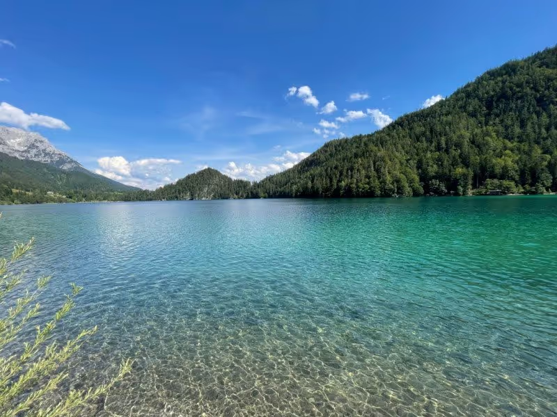
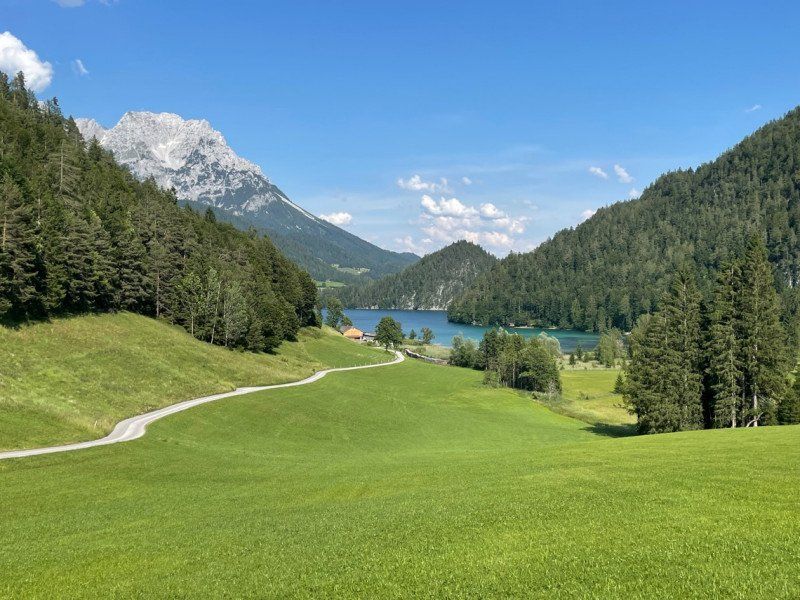
Hintersteiner See, Österreich
Hintersteiner See, 6351, Österreich
47° 32' 26.4" N 12° 12' 52.6" E
47.5406559 12.2146068
• Head northeast on Hinterstein (L207). Go for 2.2 km.
• Continue on Scheffau am Wilden Kaiser (L207). Go for 899 m.
• Turn slightly left onto Gaisberg (L207). Go for 249 m.
• Turn slightly right onto Gaisberg (L207). Go for 498 m.
• Continue on Scheffau am Wilden Kaiser (L207). Go for 1.6 km.
• Turn right onto Blaiken toward B178/Wörgl/Scheffau. Go for 99 m.
• Continue on Schwarzach. Go for 145 m.
• Continue on Blaiken. Go for 4.9 km.
• Take ramp toward Söll. Go for 212 m.
• Take the 1st exit from roundabout onto Dorf. Go for 336 m.
• Continue on Wies. Go for 32 m.
• Turn right onto Dorfbichl. Go for 154 m.
• Turn slightly left onto Dorfbichl. Go for 323 m.
• Turn left onto Dorfbichl. Go for 193 m.
• Arrive at Dorfbichl. Your destination is on the left.
☍
11,8 km
( 19 min.)
Camping Franzlhof
Dorfbichl 37, 6306, Söll, Österreich
47° 30' 30.9" N 12° 11' 18.2" E
47.5085800 12.1883800
• Head east on Dorfbichl. Go for 193 m.
• Turn right onto Dorfbichl. Go for 151 m.
• Continue on Dorfbichl. Go for 326 m.
• Turn left onto Wies. Go for 32 m.
• Continue on Dorf. Go for 324 m.
• Take the 3rd exit from roundabout onto Dorf (B178) toward Sankt Johann in Tirol/Kufstein/A12/München. Go for 8.7 km.
• Take ramp toward Ellmau. Go for 193 m.
• Take the 1st exit from roundabout. Go for 47 m.
• Turn left onto Dorf. Go for 182 m.
• Turn right onto Dorf. Go for 154 m.
• Turn right onto Austraße. Go for 138 m.
• Turn right onto Austraße. Go for 443 m.
• Turn slightly right onto Austraße. Go for 172 m.
• Continue on Faistenbichl. Go for 358 m.
• Arrive at Faistenbichl. Your destination is on the right.
☍
11,5 km
( 14 min.)
Day
Bergdoktorhaus - Bergdoktorpraxis, Faistenbichl, Ellmau, Österreich
Faistenbichl 15, 6352 Ellmau, Österreich
47° 30' 45.1" N 12° 17' 24.2" E
47.5125416 12.2900600
• Head east on Faistenbichl. Go for 249 m.
• Turn slightly left onto Faistenbichl. Go for 109 m.
• Continue on Austraße. Go for 615 m.
• Turn left onto Austraße. Go for 138 m.
• Turn left onto Dorf. Go for 154 m.
• Turn right onto Dorf. Go for 722 m.
• Take ramp onto Loferer Straße (B178). Go for 1.3 km.
• Turn right and take ramp toward Going am Wilden Kaiser/Stanglwirt. Go for 46 m.
• Continue on Dorfstraße. Go for 162 m.
• Turn left onto Dorfstraße. Go for 107 m.
• Turn right onto Kirchplatz. Go for 44 m.
• Arrive at Kirchplatz. Your destination is on the right.
☍
3,6 km
( 6 min.)
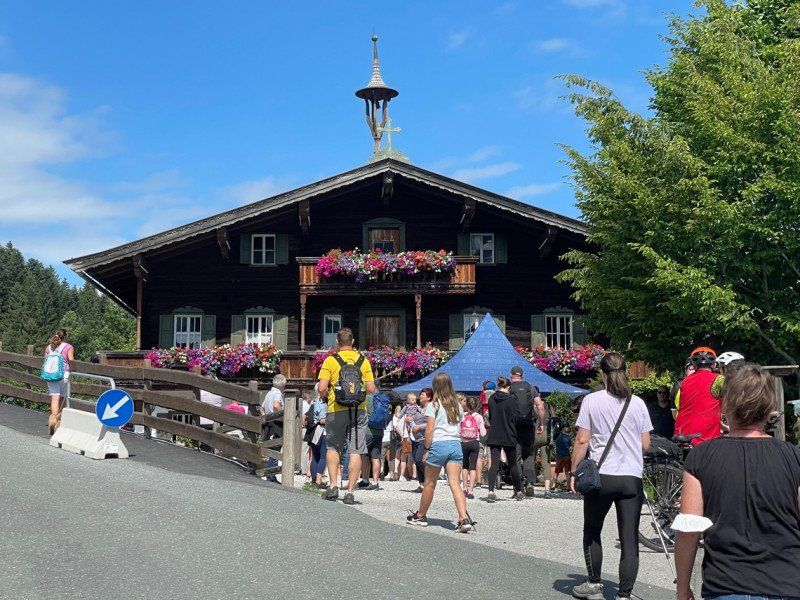
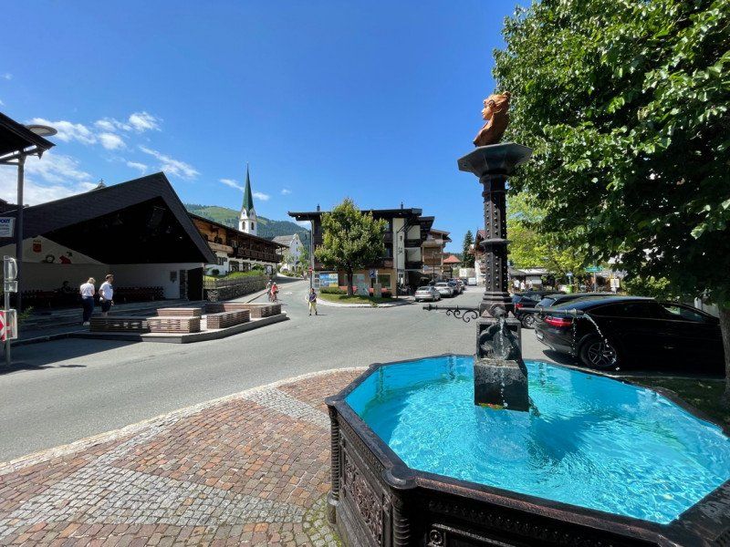
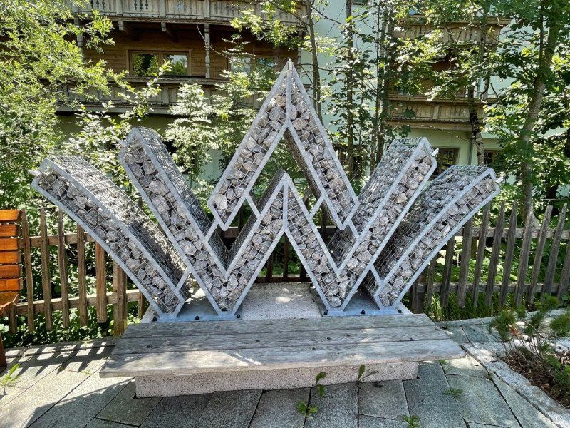
Bergdoktor Apotheke / Pfarramt, Kirchplatz, Going am Wilden Kaiser, Österreich
Kirchpl. 1/7, 6353 Going am Wilden Kaiser, Österreich
47° 30' 51.2" N 12° 19' 43.2" E
47.5142264 12.3286547
• Head south on Kirchplatz. Go for 41 m.
• Turn right onto Going am Wilden Kaiser. Go for 43 m.
• Turn slightly right onto Dorfstraße. Go for 62 m.
• Turn slightly left onto Dorfstraße. Go for 162 m.
• Turn left onto Dorfstraße toward Innsbruck/A12/Kufstein. Go for 93 m.
• Continue on Rettweg. Go for 84 m.
• Turn left and take ramp. Go for 36 m.
• Turn right onto Innsbrucker Straße (B178) toward Wörgl/A12/Innsbruck/Kufstein. Go for 10.7 km.
• Take ramp toward Söll. Go for 212 m.
• Take the 1st exit from roundabout onto Dorf. Go for 336 m.
• Continue on Wies. Go for 32 m.
• Turn right onto Dorfbichl. Go for 154 m.
• Turn slightly left onto Dorfbichl. Go for 323 m.
• Turn left onto Dorfbichl. Go for 193 m.
• Arrive at Dorfbichl. Your destination is on the left.
☍
12,5 km
( 13 min.)
Camping Franzlhof
Dorfbichl 37, 6306, Söll, Österreich
47° 30' 30.9" N 12° 11' 18.2" E
47.5085800 12.1883800
• Head west on Dorfbichl.
• Arrive at Dorfbichl. Your destination is on the left.
☍
Distance not available
(Duration not available)
Day
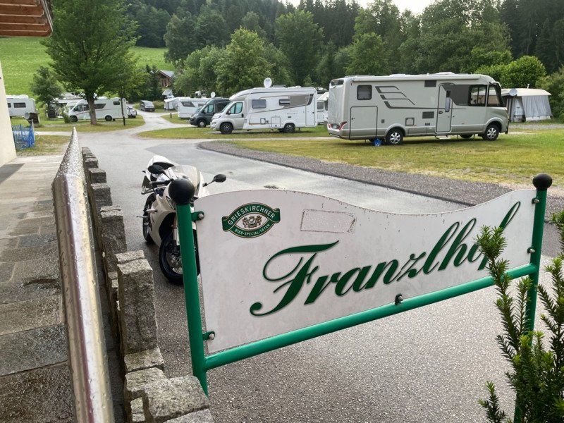
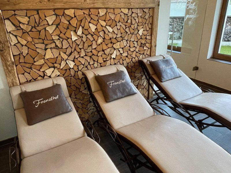
Camping Franzlhof
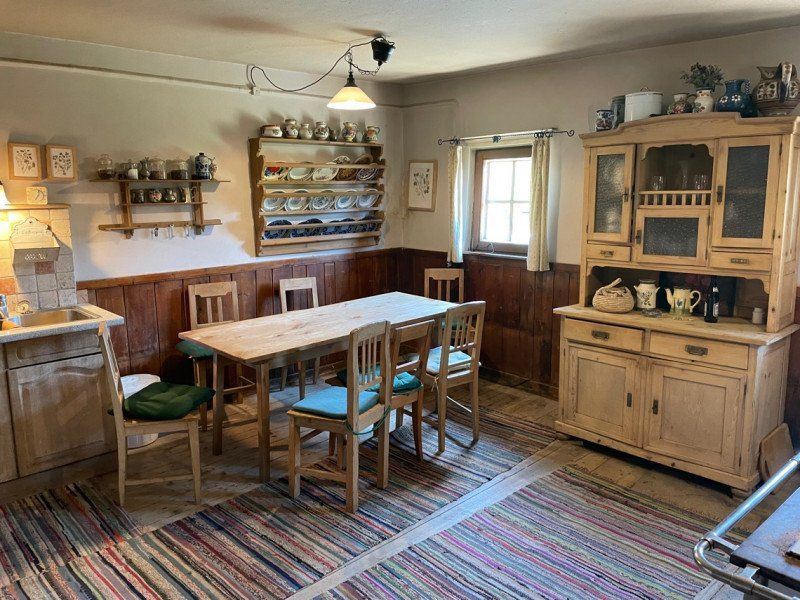
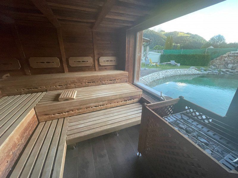
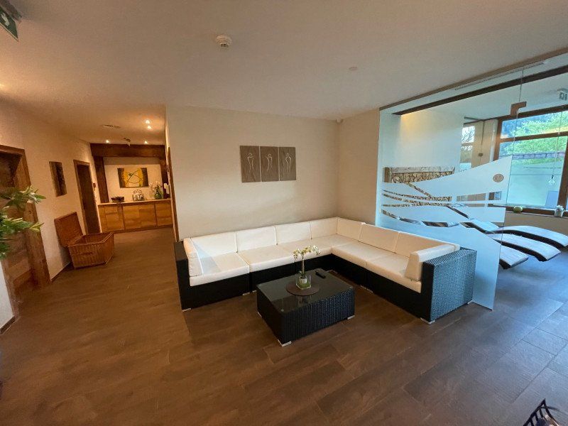
A rainy day brought us to stay in the beautiful wellness area of the Franzlhof
Dorfbichl 37, 6306, Söll, Österreich
47° 30' 30.9" N 12° 11' 18.2" E
47.5085800 12.1883800
• Head east on Dorfbichl. Go for 193 m.
• Turn right onto Dorfbichl. Go for 151 m.
• Continue on Dorfbichl. Go for 326 m.
• Turn left onto Wies. Go for 32 m.
• Continue on Dorf. Go for 324 m.
• Take the 3rd exit from roundabout onto Dorf (B178) toward Sankt Johann in Tirol/Kufstein/A12/München. Go for 41.8 km.
• Take ramp onto Loferer Straße (B178) toward Salzburg/Bad Reichenhall. Go for 9.4 km.
• Take ramp toward Unken. Go for 447 m.
• Continue on Unken. Go for 433 m.
• Turn left onto Unken (L251). Go for 50 m.
• Arrive at Unken (L251). Your destination is on the left.
☍
53,2 km
( 46 min.)
Day
Unken, Österreich
5091 Unken, Österreich
47° 38' 59.8" N 12° 43' 47.2" E
47.6499560 12.7297799
• Head west on Unken (L251). Go for 44 m.
• Turn right onto Niederland. Go for 65 m.
• Turn right onto Niederland. Go for 53 m.
• Turn left onto Unken (L251). Go for 31 m.
• Turn left onto Niederland (L251). Go for 1.8 km.
• Continue on Heutalstraße (L251). Go for 119 m.
• Turn left onto Heutalstraße (L251) toward Salzburg. Go for 270 m.
• Turn right onto Loferer Straße (B178) toward Salzburg/Bad Reichenhall. Go for 648 m.
• Continue on B21. Go for 6.9 km.
• Keep left onto B21 toward Salzburg/Bad Reichenhall. Go for 7.1 km.
• Take ramp toward Berchtesgaden/Zentrum. Go for 155 m.
• Take the 1st exit from roundabout onto Reichenbachstraße (B20) toward Berchtesgaden/Bayerisch Gmain/Zentrum. Go for 250 m.
• Turn left onto Innsbrucker Straße. Go for 560 m.
• Continue on Wittelsbacherstraße. Go for 435 m.
• Continue on Bahnhofstraße. Go for 207 m.
• Turn left. Go for 15 m.
• Arrive at your destination on the left.
☍
18,6 km
( 19 min.)
Bad Reichenhall, Deutschland
83435 Bad Reichenhall, Deutschland
47° 43' 49.2" N 12° 52' 53.7" E
47.7303361 12.8815880
• Head northwest.
• Turn left toward Bahnhofstraße. Go for 30 m.
• Turn sharp left onto Bahnhofstraße. Go for 93 m.
• Continue on Bahnhofplatz. Go for 1.2 km.
• Take ramp onto Salzburger Straße (B20/B21). Go for 1.1 km.
• Take ramp onto B20 toward München/A8/Salzburg/Passau/Burghausen/Freilassing. Go for 2.8 km.
• Take the 2nd exit from roundabout onto B20 toward A8/München/Salzburg/Passau/Burghausen/Freilassing/Piding-Dorf. Go for 132 m.
• Take ramp onto A8 toward Salzburg. Go for 3.0 km.
• Continue on A1 (West Autobahn). Go for 127 km.
• Take exit 174 toward Traun/Flughafen/B139. Go for 134 m.
• Continue on Wiener Straße. Go for 388 m.
• Continue on Ritzlhofstraße (L1392) toward Salzburg/A1/Passau/A25/Pucking/Traun/Haid/Nettingsdorf. Go for 196 m.
• Turn left onto Kremstalstraße (B139) toward Bad Hall/Neuhofen/Nettingsdorf. Go for 730 m.
• Take the 2nd exit from roundabout onto Kremstalstraße (B139). Go for 533 m.
• Take the 2nd exit from roundabout onto Schellingstraße (L1375). Go for 837 m.
• Take the 2nd exit from roundabout onto Nettingsdorfer Straße (L1375). Go for 2.0 km.
• Turn right onto Nöstlbachstraße. Go for 239 m.
• Continue on Nöstlbachstraße. Go for 42 m.
• Continue on Nöstlbachstraße. Go for 251 m.
• Turn right onto Reiherweg. Go for 184 m.
• Arrive at Reiherweg.
☍
140,7 km
(1 hrs. 21 min.)
Nöstlbach, Österreich
4502 Nöstlbach, Österreich
48° 9' 59.1" N 14° 14' 43.2" E
48.1664300 14.2453400
• Head northwest on Reiherweg. Go for 111 m.
• Turn left onto Reiherweg. Go for 64 m.
• Continue on Schwanenweg. Go for 125 m.
• Turn right onto Nöstlbachstraße. Go for 427 m.
• Continue on Weißenberg. Go for 334 m.
• Turn right onto Weißenberg. Go for 201 m.
• Turn right onto Kremstalstraße (B139). Go for 1.9 km.
• Take the 2nd exit from roundabout onto Kremstalstraße (B139). Go for 523 m.
• Take the 1st exit from roundabout onto Kremstalstraße (B139). Go for 265 m.
• Turn right onto Wiener Straße. Go for 999 m.
• Take ramp onto A1 (West Autobahn) toward Wien/Linz. Go for 4.2 km.
• Take the exit toward Praha/Freistadt/Linz onto A7 (Mühlkreis Autobahn). Go for 6.8 km.
• Take the left exit toward Linz-Zentrum/Bahnhof onto B139 (Kremstalstraße). Go for 2.1 km.
• Keep left onto Waldeggstraße (B139) toward Passau/Rohrbach. Go for 1.5 km.
• Turn right onto Klammstraße. Go for 188 m.
• Continue on Promenade. Go for 257 m.
• Continue on Taubenmarkt. Go for 235 m.
• Continue on Dametzstraße. Go for 200 m.
• Arrive at Dametzstraße. Your destination is on the right.
☍
20,4 km
( 20 min.)
Day
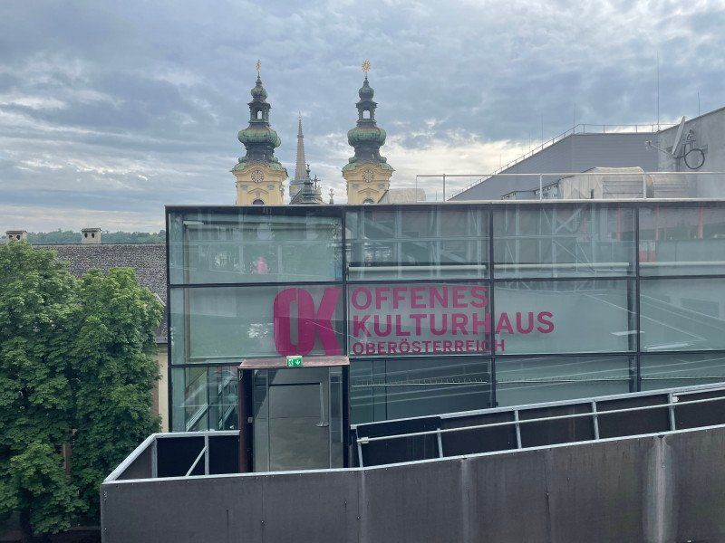
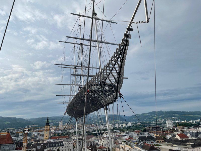
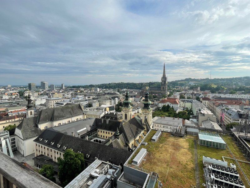
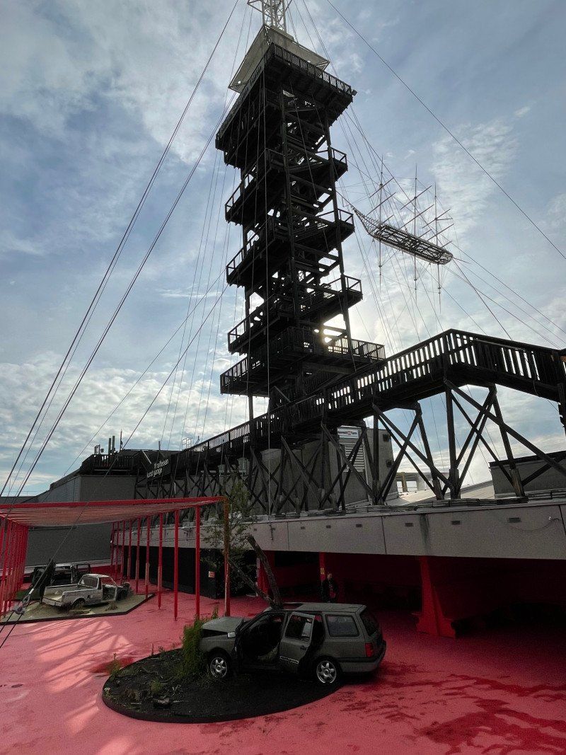
Höhenrausch 2021, OK-Platz, Linz, Österreich
an exhibition over the roofs of Linz
OK-Platz 1, 4020 Linz, Österreich
48° 18' 11.3" N 14° 17' 26.5" E
48.3031361 14.2906931
• Head south on Dametzstraße. Go for 319 m.
• Continue on Hessenplatz. Go for 97 m.
• Continue on Humboldtstraße. Go for 550 m.
• Continue on Friedhofstraße. Go for 152 m.
• Continue on Lenaustraße. Go for 533 m.
• Turn slightly right onto Makartstraße. Go for 548 m.
• Continue on Wankmüllerhofstraße (B1b). Go for 241 m.
• Take left ramp onto A7 (Mühlkreis Autobahn) toward Wien/Salzburg. Go for 7.1 km.
• Take the exit toward E60/E552/Salzburg/Graz/Passau/Wels/Ansfelden onto A1 (West Autobahn). Go for 4.4 km.
• Take exit 174 toward Traun/B139. Go for 154 m.
• Continue on Danubiaplatz. Go for 57 m.
• Continue on Salzburger Straße. Go for 566 m.
• Turn left onto Kremstalstraße (B139) toward Bad Hall/Kremstal/Salzburg/A1/Graz/Passau/A25/Wels/Neuhofen/Haid Center. Go for 1.9 km.
• Take the 2nd exit from roundabout onto Kremstalstraße (B139). Go for 533 m.
• Take the 2nd exit from roundabout onto Schellingstraße (L1375). Go for 837 m.
• Take the 2nd exit from roundabout onto Nettingsdorfer Straße (L1375). Go for 2.0 km.
• Turn right onto Nöstlbachstraße. Go for 239 m.
• Continue on Nöstlbachstraße. Go for 42 m.
• Continue on Nöstlbachstraße. Go for 251 m.
• Turn right onto Reiherweg. Go for 184 m.
• Arrive at Reiherweg.
☍
20,6 km
( 20 min.)
Nöstlbach, Österreich
4502 Nöstlbach, Österreich
48° 9' 59.1" N 14° 14' 43.2" E
48.1664300 14.2453400
• Head southeast on Reiherweg. Go for 184 m.
• Turn left onto Nöstlbachstraße. Go for 532 m.
• Turn right onto Linzer Straße (L1375). Go for 2.6 km.
• Take the 2nd exit from roundabout onto Bauernfeldstraße (L1375). Go for 491 m.
• Turn left onto Steyrerstraße (L1372). Go for 3.1 km.
• Take the 2nd exit from roundabout onto Schiedlberger Straße (L1372). Go for 10.6 km.
• Turn left onto Voralpenstraße (B122). Go for 1.6 km.
• Turn right toward Graz/A9/Molln/Grünburg/Steinbach a. d. St./Aschach a. d. St. Go for 107 m.
• Continue on Steyrtalstraße (B140). Go for 22.9 km.
• Turn right onto Steyrdurchbruch. Go for 69 m.
• Arrive at Steyrdurchbruch.
☍
42,2 km
( 35 min.)
Day
Day
Steyrdurchbruch, Österreich
47° 52' 5.8" N 14° 12' 6.6" E
47.8682674 14.2018450
• Head southeast on Steyrdurchbruch. Go for 69 m.
• Turn right onto Steyrdurchbruch (B140). Go for 3.3 km.
• Turn left onto Pyhrnpassstraße (B138) toward A9/Graz/Linz/Passau/Wels/Liezen/Windischgarsten. Go for 904 m.
• Turn left and take ramp onto A9 (Pyhrn Autobahn) toward Graz. Go for 28.9 km.
• Take exit 57 toward Spital am Pyhrn/Windischgarsten/Spital a. P. Go for 653 m.
• Turn right onto Pyhrn (B138). Go for 13.6 km.
• Turn right onto Hauptplatz. Go for 22 m.
• Arrive at Hauptplatz. Your destination is on the right.
☍
47,3 km
( 32 min.)
Liezen, Österreich
47° 34' 2.7" N 14° 14' 35.3" E
47.5674100 14.2431500
• Head west on Hauptplatz. Go for 226 m.
• Take the 1st exit from roundabout onto Döllacher Straße. Go for 234 m.
• Turn left onto Ausseer Straße. Go for 1.5 km.
• Turn right onto Salzburger Straße (B320). Go for 66.4 km.
• Keep left onto Ennstalstraße (B320) toward Villach/B99/Obertauern/Tamsweg. Go for 371 m.
• Turn right and take ramp onto Katschberg Straße (B99). Go for 1.1 km.
• Take the 2nd exit from roundabout onto Tauernstraße (B99) toward Villach/Obertauern. Go for 19.2 km.
• Arrive at Obertauern (B99). Your destination is on the left.
☍
89,0 km
(1 hrs. 4 min.)
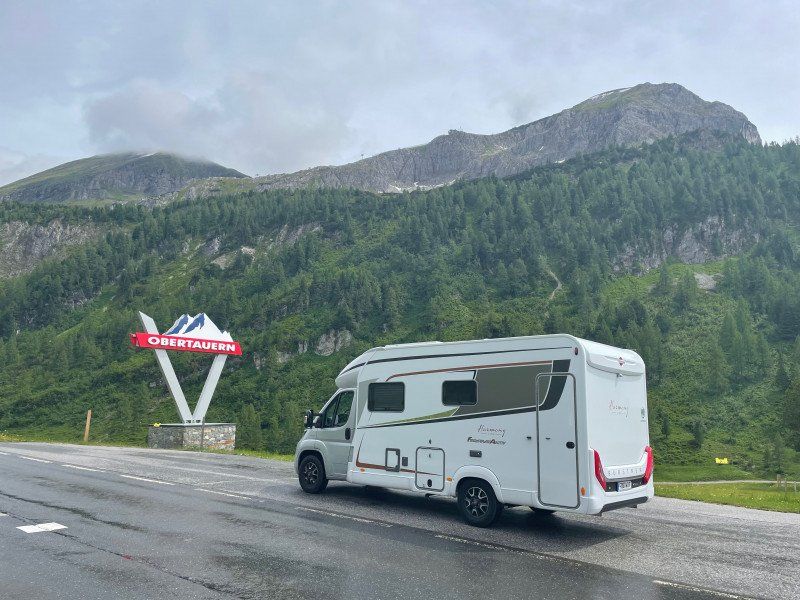
Obertauern, Österreich
5562 Obertauern, Österreich
47° 15' 6.2" N 13° 32' 49.9" E
47.2517317 13.5471809
• Head east on Obertauern (B99). Go for 3.9 km.
• Keep right onto Katschberg Straße (B99). Go for 13.8 km.
• Take ramp onto Katschberg Straße (B99) toward A10/Salzburg/Villach/St.Michael/Lg./Mauterndorf. Go for 10.0 km.
• Take the 2nd exit from roundabout onto Katschberg Straße (B99) toward Villach/Katschberg. Go for 5.4 km.
• Arrive at Katschberg (B99). Your destination is on the right.
☍
33,1 km
( 25 min.)
Katschberghöhe, Österreich
5582 Katschberghöhe, Österreich
47° 3' 33.4" N 13° 36' 55.5" E
47.0592700 13.6154300
• Head southeast on Katschberg (B99). Go for 5.0 km.
• Turn left and take ramp onto A10 (Tauern Autobahn) toward Villach. Go for 25.7 km.
• Take exit 139 toward B100/B106/Lienz/Lendorf onto A10 (Tauern Autobahn). Go for 4.5 km.
• Take the exit toward Lienz/Glocknerstraße onto B100 (Lendorf). Go for 60.6 km.
• Take the 2nd exit from roundabout onto Kärntner Straße (B100) toward Lienz/B108/Sillian. Go for 3.5 km.
• Take the 4th exit from roundabout onto Pustertaler Straße (B100) toward Bozen/Sillian. Go for 33.8 km.
• Continue on Via Bolzano (SS49). Go for 6.6 km.
• Turn left onto Via Duca Tassilo toward Innichen/San Candido/Innichen Zentrum/S. Candido Centro. Go for 252 m.
• Turn left onto Via Duca Tassilo. Go for 188 m.
• Turn left onto Via Freising. Go for 291 m.
• Turn right onto Mercato Vecchio. Go for 541 m.
• Turn left onto Strada Statale Carnica (SS52). Go for 12.2 km.
• Turn left onto Via San Giuseppe. Go for 108 m.
• Turn left. Go for 43 m.
• Arrive at your destination.
☍
153,2 km
(2 hrs. )
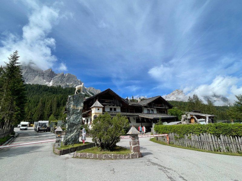
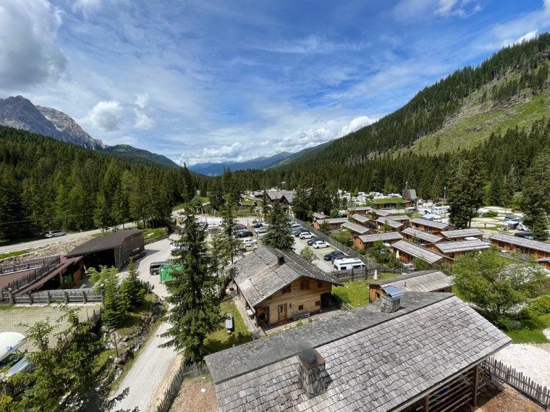
Caravan Park Sexten
St. Josefstr. 54, 39030, Sexten, Italien
46° 40' 7" N 12° 23' 58" E
46.6686100 12.3994400
• Head northwest.
• Turn right. Go for 34 m.
• Turn right. Go for 42 m.
• Turn right toward Via San Giuseppe. Go for 38 m.
• Continue on Via San Giuseppe. Go for 108 m.
• Turn left onto Strada Statale Carnica (SS52). Go for 12.0 km.
• Turn right onto Via La Carlina. Go for 120 m.
• Turn left onto Borgata Ponte Padola. Go for 158 m.
• Turn right onto Via Milano (SP532). Go for 12.8 km.
• Continue on Via Piave (SR48). Go for 2.0 km.
• Arrive at Via Giosuè Carducci (SR48). Your destination is on the left.
☍
27,3 km
( 32 min.)
Day
Day
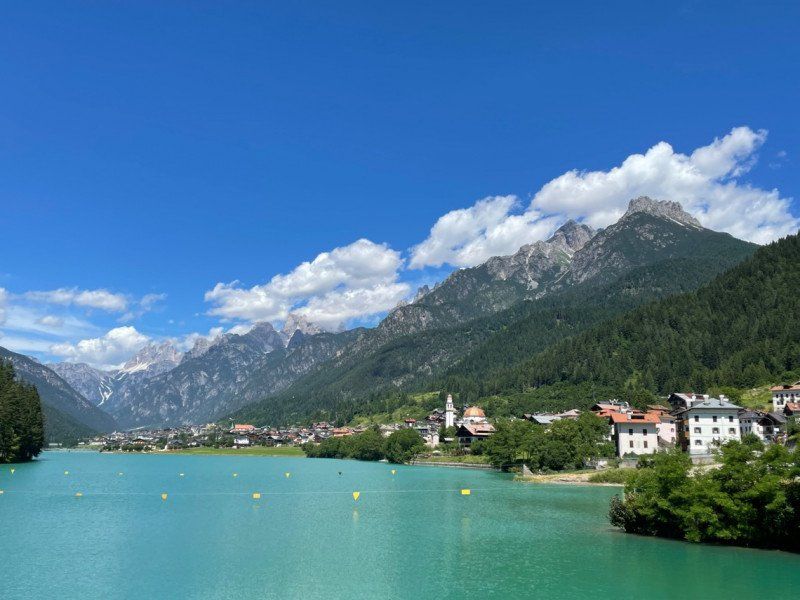
Auronzo di Cadore, Belluno, Italien
32041 Auronzo, Province of Belluno, Italien
46° 33' 7.2" N 12° 26' 7.7" E
46.5520115 12.4354814
• Head west on Via Giosuè Carducci (SR48).
• Turn right onto Via Giosuè Carducci. Go for 34 m.
• Turn right onto Via Riva da Corte. Go for 78 m.
• Turn left onto Piazza Vigo (SR48). Go for 352 m.
• Turn right onto Via Corte (SR48). Go for 7.8 km.
• Take the 1st exit from roundabout onto Strada Statale di Alemagna (SS51bis) toward Venezia/A27/Belluno/Cortina/Tai di C. Go for 9.5 km.
• Take the 3rd exit from roundabout onto Strada Statale di Alemagna (SS51bis) toward Autostrada/A27/Cortina/Belluno. Go for 2.3 km.
• Keep left toward Cortina/Tai di Cadore/Dobbiaco. Go for 31 m.
• Turn slightly left onto Strada Statale di Alemagna (SS51bis). Go for 259 m.
• Keep right onto Via Belluno (SS51bis) toward A27/Venezia/Belluno. Go for 24.9 km.
• Take the 2nd exit from roundabout onto Strada Statale di Alemagna (SS51). Go for 1.9 km.
• Keep left onto Strada Statale di Alemagna (SS51) toward Ponte nelle Alpi/Belluno Nord. Go for 1.6 km.
• Take the 2nd exit from roundabout onto Strada Statale di Alemagna (SS51). Go for 1.6 km.
• Take the 1st exit from roundabout onto Viale Dolomiti (SR50) toward Belluno Nord/Centro/Trento/Feltre/Agordo. Go for 620 m.
• Take the 2nd exit from roundabout onto Viale Dolomiti (SR50). Go for 2.9 km.
• Continue on Via Tiziano Vecellio. Go for 1.6 km.
• Continue on Via Vittorio Veneto. Go for 453 m.
• Pass 3 roundabouts and continue on Via Vittorio Veneto. Go for 1.6 km.
• Turn left onto Via Simon da Cusighe. Go for 11 m.
• Take the 1st exit from roundabout onto Via Simon da Cusighe. Go for 61 m.
• Turn right onto Via Aristide Gabelli. Go for 301 m.
• Continue on Via Attilio Tissi. Go for 3 m.
• Arrive at Via Attilio Tissi. Your destination is on the right.
☍
58,1 km
( 55 min.)
Belluno, Italien
32100 Belluno, Italien
46° 8' 32.9" N 12° 13' 0.2" E
46.1424635 12.2167088
• Head south on Via Attilio Tissi. Go for 177 m.
• Turn right onto Viale Giuseppe Fantuzzi toward Agordo/Feltre/Cortina. Go for 280 m.
• Take the 3rd exit from roundabout onto Via Internati e Deportati toward Ospedale/Feltre/Trento. Go for 591 m.
• Continue on Viale Europa. Go for 259 m.
• Pass 5 roundabouts and continue on Viale dei Tigli (SR50). Go for 22.1 km.
• Continue toward Trento/Feltre. Go for 39 m.
• Take the 1st exit from roundabout toward Feltre/Trento. Go for 47 m.
• Continue on Strada Regionale del Grappa e Passo Rolle (SR50). Go for 2.0 km.
• Pass 7 roundabouts and continue on Via Culiada (SR50). Go for 10.0 km.
• Keep left onto Strada Regionale del Grappa e Passo Rolle (SR50) toward Trento/Bassano. Go for 275 m.
• Take the 1st exit from roundabout onto SS50bis/Var toward Bassano/Trento/Vicenza/Fonzaso Centro/Zona Industriale Fonzaso. Go for 2.3 km.
• Continue on Strada Statale del Grappa e del Passo Rolle (SS50bis). Go for 9.0 km.
• Take ramp onto Strada Statale della Valsugana (SS47) toward Trento/Brennero/SS12. Go for 59.6 km.
• Keep left onto Tangenziale Ovest (SS47) toward Aeroporto/Centro/Brennero-Modena/A22/Bolzano-Verona. Go for 1.0 km.
• Keep left onto Strada Statale dell'Abetone e del Brennero (SS12) toward Verona-Riva del Garda/Aeroporto/Trento Centro/Modena/A22. Go for 2.1 km.
• Take ramp toward Brennero-Modena/A22/Riva del Garda/SS45bis. Go for 281 m.
• Keep right toward A22/Modena. Go for 309 m.
• Take left ramp onto A22 (Autostrada del Brennero) toward Modena/Verona. Go for 30.3 km.
• Take the exit toward Rovereto Sud/Lago di Garda Nord. Go for 1.3 km.
• Take the 4th exit from roundabout toward Mori/Riva D/G/Arco. Go for 306 m.
• Continue on SS240. Go for 6.2 km.
• Pass 2 roundabouts and continue on Strada Rivana (SS240). Go for 5.1 km.
• Take the 4th exit from roundabout onto Strada Statale di Loppio e Val di Ledro (SS240) toward Torbole/Riva del Garda. Go for 2.0 km.
• Take the 1st exit from roundabout onto Via Giacomo Matteotti (SS240) toward Arco/SS249/Limone S/G./SS45. Go for 160 m.
• Make a U-Turn onto Via Giacomo Matteotti (SS240). Go for 162 m.
• Take the 1st exit from roundabout onto Via Giacomo Matteotti (SS249) toward Malcesine/Verona. Go for 5.5 km.
• Continue on Strada Regionale Gardesana Orientale (SR249). Go for 5.3 km.
• Arrive at Via Gardesana (SR249).
☍
166,7 km
(2 hrs. 21 min.)
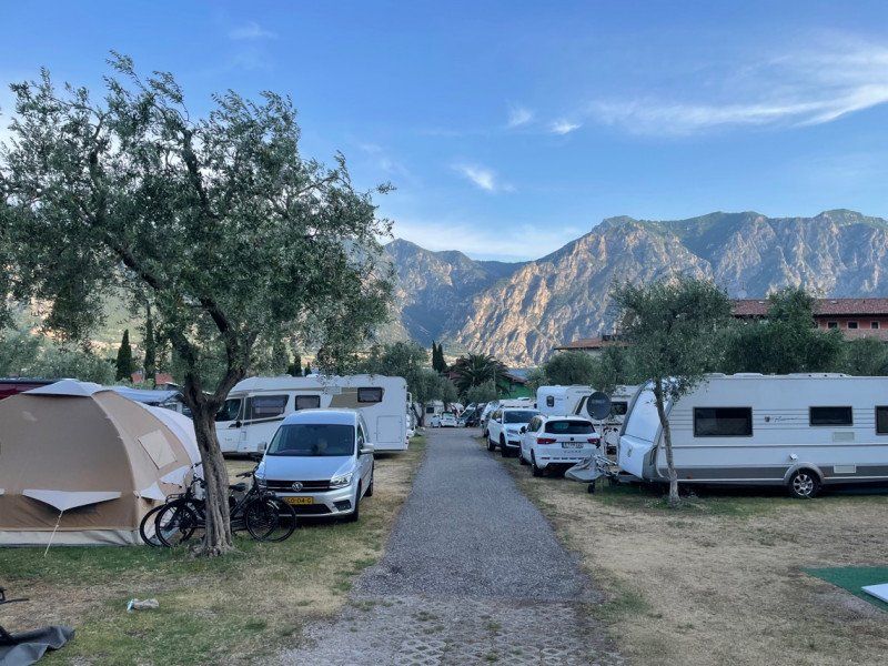
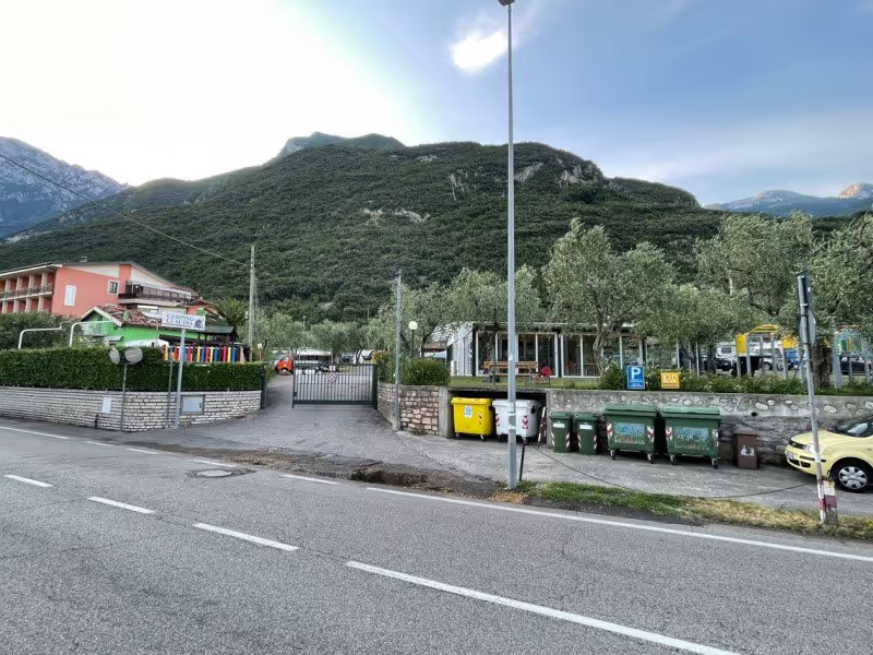
Camping Claudia
Gardesana 394, 37018, Malcesine, Italien
45° 47' 19.5" N 10° 49' 25.3" E
45.7887400 10.8236900
• Head northeast on Via Gardesana (SR249). Go for 5.3 km.
• Continue on Strada Statale Gardesana Orientale (SS249). Go for 5.5 km.
• Take the 2nd exit from roundabout onto Via Giacomo Matteotti (SS240) toward Riva D/G./Arco/SS249/Limone S/G./SS45. Go for 786 m.
• Take the 2nd exit from roundabout onto Via Gardesana (SS240). Go for 1.2 km.
• Turn right onto Via Brione. Go for 1.1 km.
• Continue on Via Sant'Alessandro. Go for 772 m.
• Take the 2nd exit from roundabout onto Via Maso Belli (SP118). Go for 580 m.
• Continue on Via San Giorgio (SP118). Go for 472 m.
• Turn right onto Via Monte Brione toward Grotta. Go for 412 m.
• Turn slightly right onto Via Monte Brione. Go for 63 m.
• Arrive at Via Monte Brione. Your destination is on the left.
☍
16,2 km
( 20 min.)
Day
Ristorante "Alla Grotta", Via Monte Brione, Arco, Trentino, Italien
Via Monte Brione, 5, 38062 Arco TN, Italien
45° 53' 41.5" N 10° 52' 13.1" E
45.8948750 10.8703005
• Head northeast on Via Monte Brione. Go for 151 m.
• Turn right onto Via Isce. Go for 193 m.
• Continue on Via San Giorgio. Go for 437 m.
• Turn left toward Via Sabbioni. Go for 36 m.
• Turn right onto Via Sabbioni. Go for 311 m.
• Turn right onto Via Linfano (SS249). Go for 2.5 km.
• Take the 3rd exit from roundabout onto Via Gardesana (SS240) toward Torbole Centro/Autostrada/A22/Rovereto/Verona. Go for 801 m.
• Take the 1st exit from roundabout onto Via Giacomo Matteotti (SS249) toward Malcesine/Verona. Go for 5.5 km.
• Continue on Strada Regionale Gardesana Orientale (SR249). Go for 5.3 km.
• Arrive at Via Gardesana (SR249).
☍
15,3 km
( 19 min.)
Camping Claudia
Gardesana 394, 37018, Malcesine, Italien
45° 47' 19.5" N 10° 49' 25.3" E
45.7887400 10.8236900
• Head southwest on Via Gardesana (SR249). Go for 2.8 km.
• Take the 2nd exit from roundabout onto Via Gardesana (SR249). Go for 180 m.
• Arrive at Via Gardesana (SR249). Your destination is on the right.
☍
3,0 km
( 4 min.)
Day
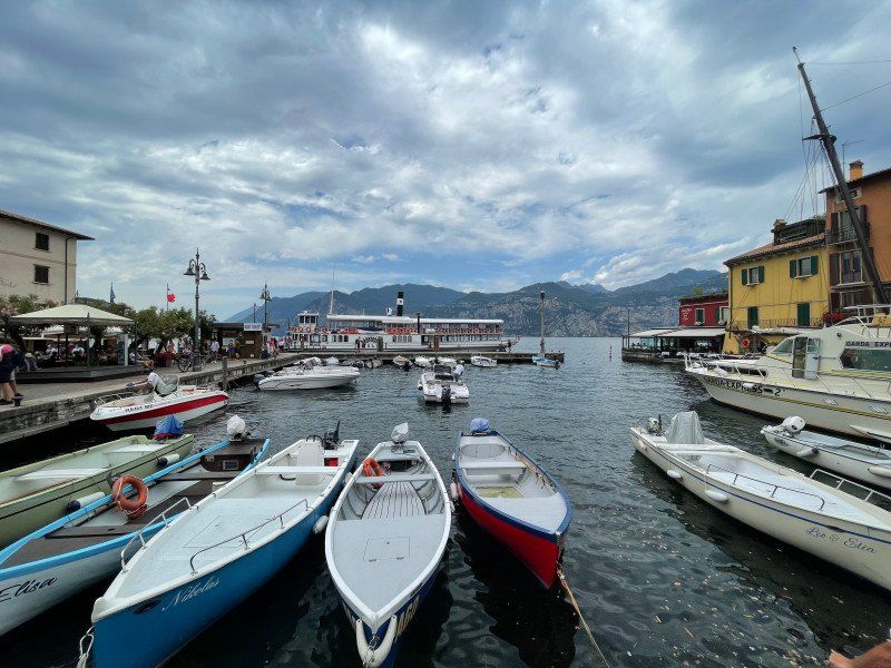
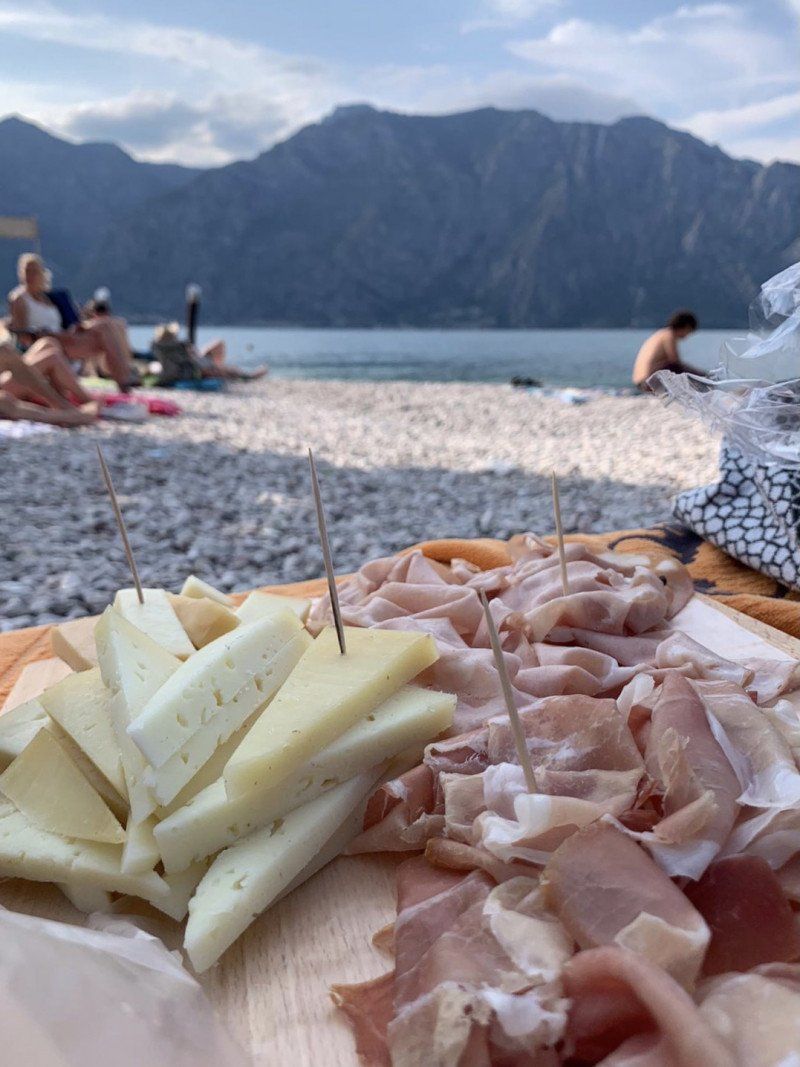
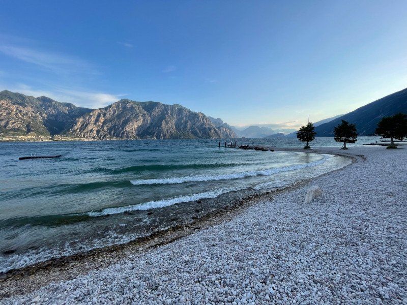
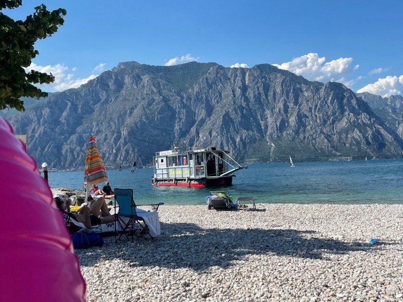
Malcesine, Verona, Italien
37018 Malcesine, VR, Italien
45° 45' 51.2" N 10° 48' 36.3" E
45.7642335 10.8100928
• Head southwest on Via Gardesana (SR249). Go for 6 m.
• Take the 4th exit from roundabout onto Via Gardesana (SR249) toward Brennero/A22/Riva del Garda. Go for 234 m.
• Take the 2nd exit from roundabout onto Via Gardesana (SR249). Go for 2.8 km.
• Arrive at Via Gardesana (SR249).
☍
3,0 km
( 4 min.)
Camping Claudia
Gardesana 394, 37018, Malcesine, Italien
45° 47' 19.5" N 10° 49' 25.3" E
45.7887400 10.8236900
• Head southwest on Via Gardesana (SR249). Go for 2.8 km.
• Take the 2nd exit from roundabout onto Via Gardesana (SR249). Go for 186 m.
• Take the 1st exit from roundabout onto Corso Giuseppe Garibaldi toward Centro. Go for 171 m.
• Turn slightly right onto Vicolo Casella. Go for 60 m.
• Turn left onto Via Casella. Go for 50 m.
• Turn left onto Piazza Magenta. Go for 21 m.
• Arrive at Piazza Magenta. Your destination is on the left.
☍
3,3 km
( 5 min.)
Taverna Dei Capitani, Vicolo Porto Vecchio, Malcesine, Verona, Italien
Vicolo Porto Vecchio, 5, 37018 Malcesine VR, Italien
45° 45' 53.1" N 10° 48' 26.9" E
45.7647472 10.8074596
• Head north on Piazza Magenta. Go for 21 m.
• Turn right onto Via Casella. Go for 50 m.
• Turn right onto Vicolo Casella. Go for 60 m.
• Turn slightly left onto Corso Giuseppe Garibaldi. Go for 136 m.
• Turn slightly right toward Via Gardesana/SR249. Go for 31 m.
• Take the 3rd exit from roundabout onto Via Gardesana (SR249) toward Brennero/A22/Riva del Garda. Go for 209 m.
• Take the 2nd exit from roundabout onto Via Gardesana (SR249). Go for 2.8 km.
• Arrive at Via Gardesana (SR249).
☍
3,3 km
( 5 min.)
Camping Claudia
Gardesana 394, 37018, Malcesine, Italien
45° 47' 19.5" N 10° 49' 25.3" E
45.7887400 10.8236900
• Head northeast on Via Gardesana (SR249). Go for 5.3 km.
• Continue on Strada Statale Gardesana Orientale (SS249). Go for 5.5 km.
• Take the 2nd exit from roundabout onto Via Giacomo Matteotti (SS240) toward Riva D/G./Arco/SS249/Limone S/G./SS45. Go for 786 m.
• Take the 1st exit from roundabout onto Via Linfano (SS249). Go for 3.8 km.
• Continue toward Trento/SS45bis/Roverto/SS240/Nago. Go for 54 m.
• Take the 1st exit from roundabout onto SP118 toward Nago/SS240dir/Dro/SS45bis/Mori/SS240/Trento. Go for 1.5 km.
• Take the 2nd exit from roundabout toward Trento Centro/A22/Dro/SS45bis/Trento. Go for 1.1 km.
• Take the 2nd exit from roundabout onto Viale Arciprete Francesco Santoni (SS45bis) toward Dro/Trento. Go for 2.0 km.
• Pass 6 roundabouts and continue on Via Nazionale (SS45bis). Go for 19.4 km.
• Arrive at Strada Statale Gardesana Occidentale (SS45bis).
☍
39,4 km
( 44 min.)
Day
Vezzano, Trentino, Italien
38070 Vezzano, Trentino, Italien
46° 4' 48.8" N 11° 0' 5.1" E
46.0802175 11.0014092
• Head east on Strada Statale Gardesana Occidentale (SS45bis). Go for 11.1 km.
• Turn right toward Brennero/A22/Modena/Bolzano-Padova/Trento Centro/Ospedale Trento Sud/Aeroporto/Verona/Vela. Go for 200 m.
• Keep left toward Arco-Riva D/G/Bolzano/Padova. Go for 78 m.
• Turn left toward Autostrada/A22/Arco-Riva D/G/Verona. Go for 114 m.
• Keep right toward A22/Modena. Go for 309 m.
• Take ramp onto A22 (Autostrada del Brennero) toward Brennero/Bolzano. Go for 34.4 km.
• Take the exit toward Egna/Ora/Termeno/Neumarkt/Auer/Tramin. Go for 977 m.
• Take the 1st exit from roundabout onto Strada Provinciale Autostrada-Termeno (SP16) toward Trami/Termeno/Kurtatsch/Cortaccia/Kaltern/Caldaro/Industriegebiet am Bahnhof/Industriegebiet Obere Insel/Zona Industriale Isola di Sopra. Go for 1.4 km.
• Take the 1st exit from roundabout onto Strada Provinciale Autostrada-Termeno (SP16) toward Trami/Termeno/Kurtatsch/Cortaccia/Kaltern/Caldaro. Go for 1.0 km.
• Take the 1st exit from roundabout onto Strada Provinciale Caldaro-Roverè della Luna (SP14) toward Kaltern/Caldaro. Go for 2.5 km.
• Pass 2 roundabouts and continue on Strada Provinciale Caldaro-Roverè della Luna (SP14). Go for 3.6 km.
• Turn right onto Località San Giuseppe al Lago. Go for 24 m.
• Turn slightly left onto Località San Giuseppe al Lago. Go for 15 m.
• Continue on Località San Giuseppe al Lago. Go for 53 m.
• Continue on Via Spiegel. Go for 537 m.
• Turn right onto Località San Giuseppe al Lago. Go for 90 m.
• Turn right onto Località San Giuseppe al Lago. Go for 82 m.
• Arrive at Località San Giuseppe al Lago.
☍
56,4 km
( 42 min.)
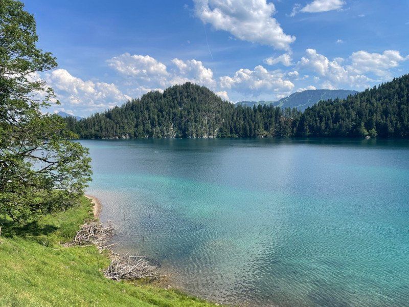
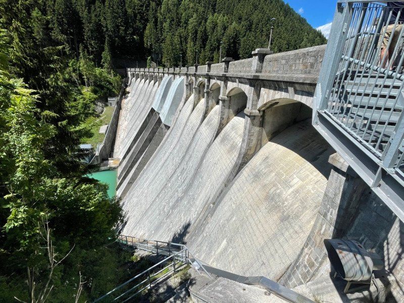
Kalterer See, Kaltern, Südtirol, Italien
Kalterer See, 39052 Kaltern, Südtirol, Italien
46° 22' 45.6" N 11° 15' 46.3" E
46.3793434 11.2628648
• Head west on Località San Giuseppe al Lago. Go for 82 m.
• Turn left onto Località San Giuseppe al Lago. Go for 90 m.
• Turn left onto Via Spiegel. Go for 537 m.
• Continue on Località San Giuseppe al Lago. Go for 53 m.
• Continue on Località San Giuseppe al Lago. Go for 15 m.
• Turn slightly right onto Località San Giuseppe al Lago. Go for 24 m.
• Turn right onto Strada Provinciale Caldaro-Roverè della Luna (SP14). Go for 3.6 km.
• Pass 3 roundabouts and continue on Strada Provinciale Caldaro-Roverè della Luna (SP14). Go for 10.2 km.
• Turn left and take ramp onto MeBo (SS38) toward Terlan/Terlano/Meran/Merano. Go for 29.7 km.
• Take the 2nd exit from roundabout onto Via Venosta (SS38). Go for 6.0 km.
• Take the 2nd exit from roundabout. Go for 57 m.
• Continue on Strada Statale dello Stelvio (SS38). Go for 12.5 km.
• Pass 8 roundabouts and continue on Strada Statale del Passo Resia (SS40). Go for 42.5 km.
• Turn left onto Via della Chiesa. Go for 97 m.
• Arrive at Via della Chiesa. Your destination is on the left.
☍
105,6 km
(1 hrs. 44 min.)
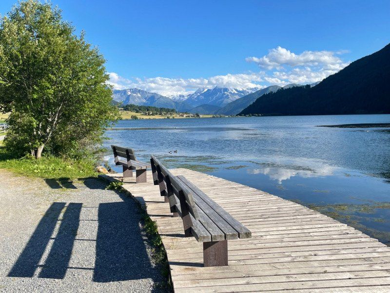
Camping Zum See
Kirchgasse 26, 39027, St. Valentin auf der Haide, Italien
46° 45' 52.3" N 10° 31' 57.1" E
46.7645400 10.5325400
• Head toward Via Campitello on Via della Chiesa. Go for 325 m.
• Turn slightly right onto Via della Chiesa. Go for 69 m.
• Turn left onto Strada Statale del Passo Resia (SS40). Go for 10.4 km.
• Continue on Reschenpass (B180). Go for 46.6 km.
• Take ramp onto A12 (Inntal Autobahn) toward Innsbruck/Mils-Schönwies. Go for 8.6 km.
• Take exit 136 toward Mils/Bregenz/Imst/B171/Mils Schönwies. Go for 619 m.
• Take the 1st exit from roundabout onto Tiroler Straße (B171) toward Imst. Go for 4.5 km.
• Take the 4th exit from roundabout onto Mieminger Straße (B189) toward Reutte/Garmisch/Fernpass. Go for 1.6 km.
• Keep right toward Reutte/Garmisch. Go for 96 m.
• Continue on Mieminger Straße (B189). Go for 10.0 km.
• Take left ramp onto Fernpassstraße (B179). Go for 10.5 km.
• Arrive at Fernpass (B179). Your destination is on the right.
☍
93,2 km
(1 hrs. 26 min.)
Day
Fernpaß, Österreich
6465 Fernpaß, Österreich
47° 21' 43.5" N 10° 49' 51.9" E
47.3620878 10.8310741
• Head northeast on Fernpass (B179). Go for 37.3 km.
• Take ramp toward Vils/Augsburg/Pfronten. Go for 217 m.
• Take the 1st exit from roundabout onto Weißhausstraße (L396) toward Augsburg/Füssen/Pinswang. Go for 2.7 km.
• Continue on Tiroler Straße (B17). Go for 2.1 km.
• Turn right onto Füssener Straße (B17) toward München/Augsburg/Schwangau/Königsschlösser. Go for 2.6 km.
• Arrive at Münchener Straße (B17). Your destination is on the left.
☍
44,9 km
( 42 min.)
Schwangau, Deutschland
87645 Schwangau, Deutschland
47° 34' 40.3" N 10° 44' 17.9" E
47.5778534 10.7383052
• Head northeast on Münchener Straße (B17). Go for 29.2 km.
• Continue on Füssener Straße. Go for 1.3 km.
• Continue on Obere Straße. Go for 155 m.
• Turn left onto Schongauer Straße. Go for 99 m.
• Take the 3rd exit from roundabout onto Schongauer Straße toward Birkland/Herzogsägmühle/Schongau. Go for 945 m.
• Continue on Schongauer Straße. Go for 446 m.
• Continue on Peitinger Straße. Go for 1.1 km.
• Take the 1st exit from roundabout onto Peitinger Straße (St2014). Go for 318 m.
• Continue on Bahnhofstraße. Go for 110 m.
• Turn right onto Bahnhofstraße (St2014). Go for 540 m.
• Turn left onto Bahnhofstraße (St2014). Go for 444 m.
• Arrive at Bahnhofstraße (St2014). Your destination is on the right.
☍
34,7 km
( 34 min.)
Schongau, Deutschland
47° 48' 54.1" N 10° 53' 39.5" E
47.8150246 10.8942968
• Head southwest on Bahnhofstraße (St2014).
• Turn right onto Altenstadter Straße (St2014). Go for 1.0 km.
• Turn right onto Franz-Josef-Strauß-Straße (St2014). Go for 508 m.
• Turn right and take ramp onto B17 toward Augsburg/Landsberg. Go for 26.7 km.
• Take the 3rd exit from roundabout onto B17 toward Augsburg. Go for 24.6 km.
• Take ramp toward Königsbrunn-Süd/Bobingen/Mering. Go for 258 m.
• Take the 1st exit from roundabout onto Bobinger Straße (St2380). Go for 4.3 km.
• Take the 1st exit from roundabout onto Meringer Straße (St2380) toward Mering. Go for 5.2 km.
• Turn left onto B2. Go for 4.0 km.
• Turn right onto Mittlerer Weg. Go for 194 m.
• Continue on Schulstraße. Go for 438 m.
• Turn left onto Fichtenstraße. Go for 67 m.
• Arrive at Fichtenstraße. Your destination is on the right.
☍
67,2 km
( 50 min.)
Kissing, Deutschland
48° 18' 9.7" N 10° 58' 21.4" E
48.3027069 10.9726090