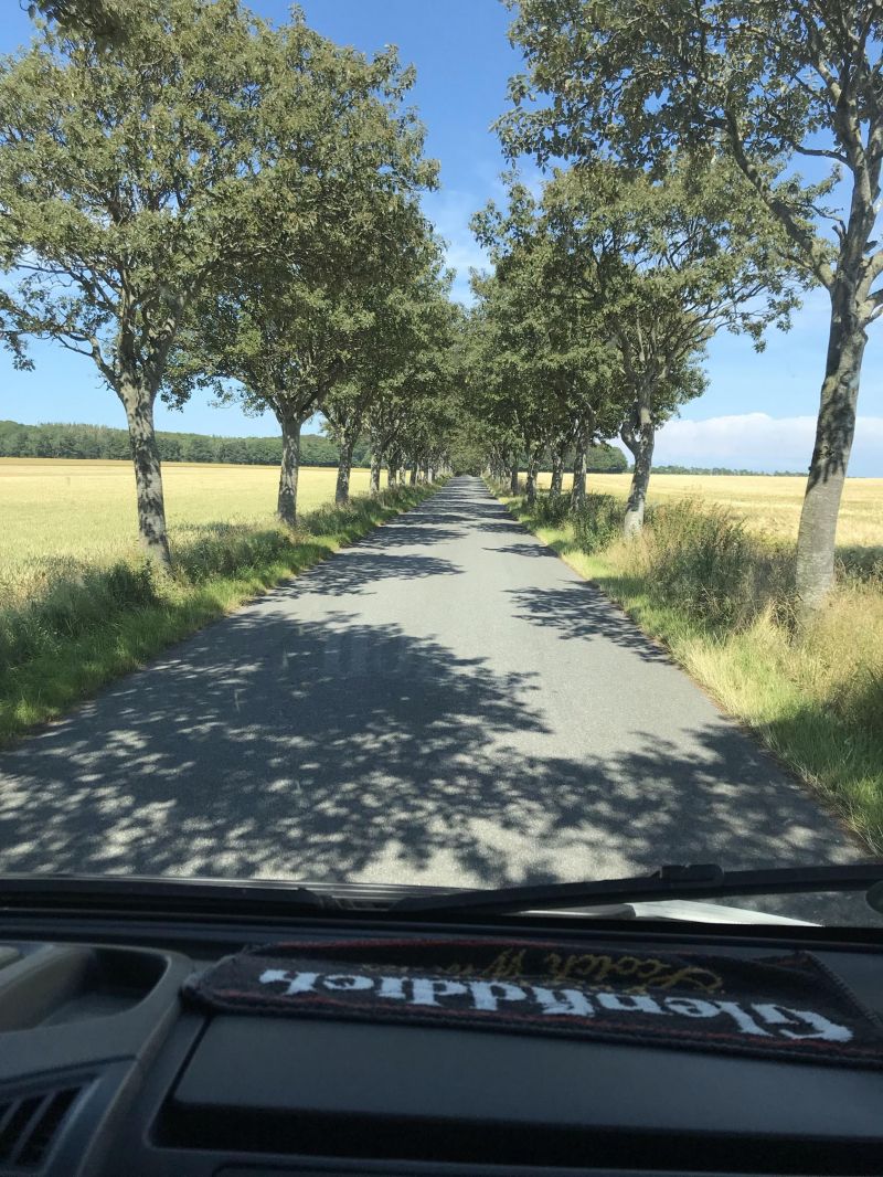
Day
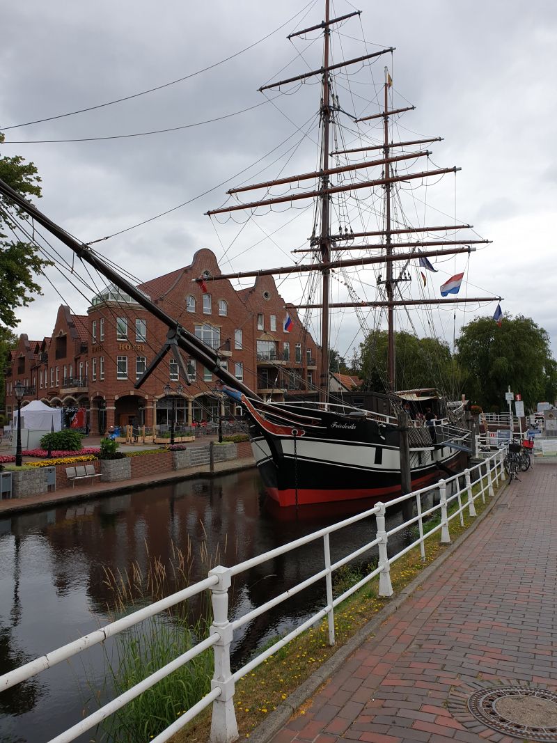
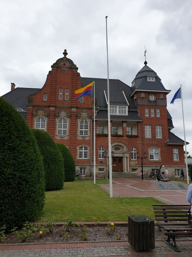
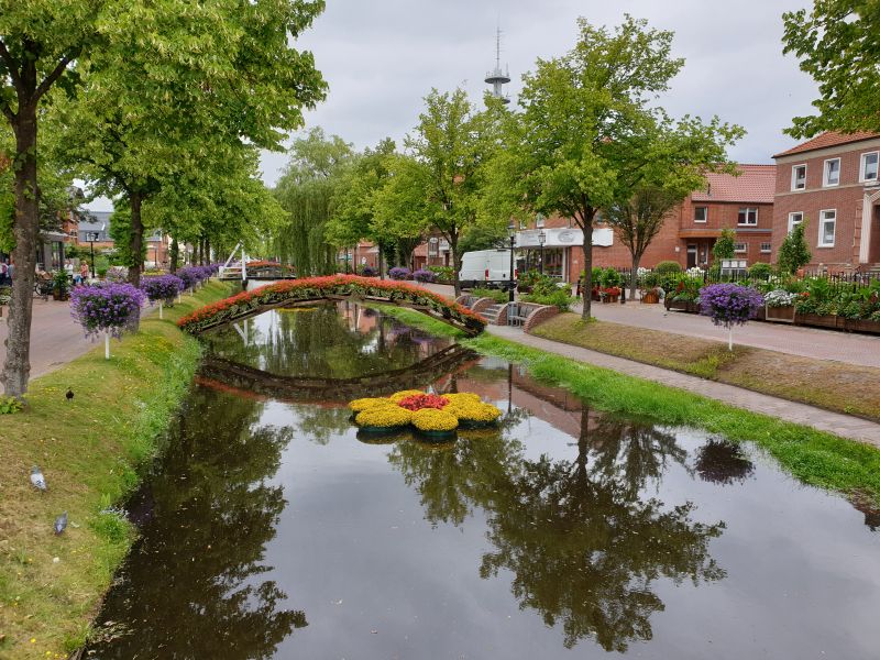
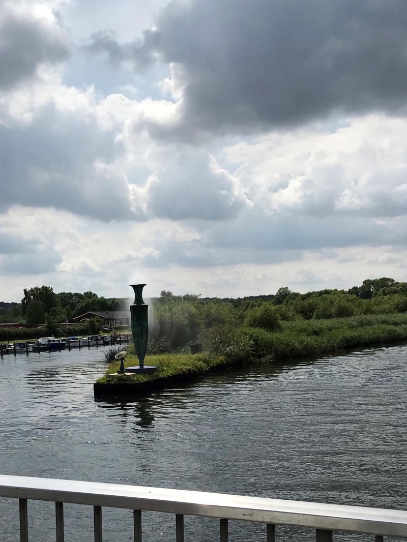
Papenburg, Deutschland
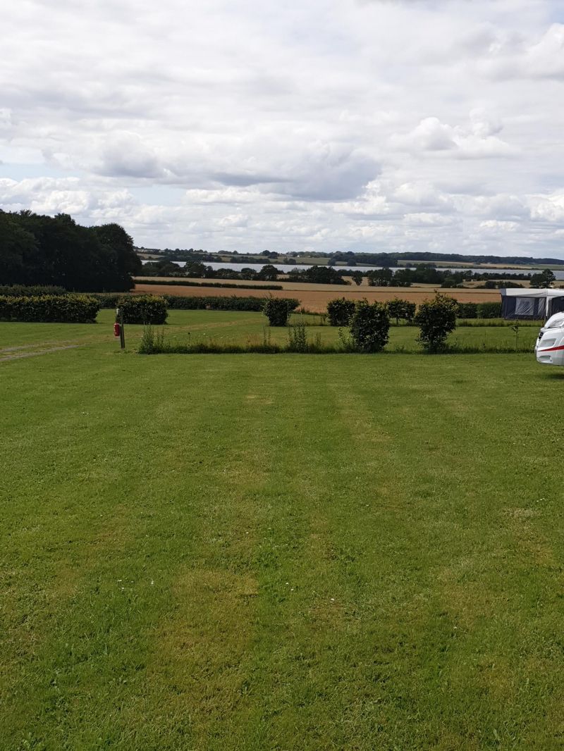
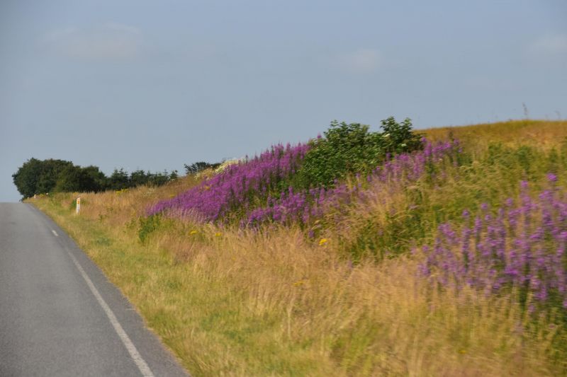
Large parking space on the outskirts of the city center at the Red Cross Hospital, but without WoMo infrastructure. Nice place with lots of flowers.
Rathausstraße 11, 26871, Papenburg, Deutschland
53° 4' 36" N 7° 23' 33" E
53.0766667 7.3925000
• Head toward Am Stadtpark. Go for 16 m.
• Turn right onto Am Stadtpark. Go for 125 m.
• Turn left toward Hauptkanal rechts. Go for 17 m.
• Turn right onto Hauptkanal rechts. Go for 99 m.
• Turn right onto Hauptkanal rechts. Go for 51 m.
• Turn right onto Rathausstraße. Go for 285 m.
• Turn right onto Meppener Straße (B70) toward Leer. Go for 11.8 km.
• Take the 2nd exit from roundabout onto Leerer Straße (B70) toward Leer/Gewerbegebiet Ihrhove Nord I. Go for 6.5 km.
• Continue on Papenburger Straße (B70) toward A28/A31/Emden/Bunde/Gewerbegebiete Ost/West/Nord. Go for 1.4 km.
• Turn right onto Hauptstraße (B436) toward Oldenburg/Aurich. Go for 5.8 km.
• Turn right and take ramp onto A28 toward Oldenburg. Go for 51.2 km.
• Take the exit toward Bremen/Osnabrück/Oldenburg-Haarentor/Oldenburg-Zentrum onto A28. Go for 38.6 km.
• Take the exit toward Bremen/Delmenhorst-Stickgras onto B75 (Oldenburger Straße). Go for 8.5 km.
• Take ramp toward Weserstadion/Neustadt/Gewerbegebiet Airport-Stadt. Go for 44 m.
• Keep left onto Duckwitzstraße. Go for 184 m.
• Continue on Duckwitzstraße. Go for 449 m.
• Turn right onto Richard-Dunkel-Straße. Go for 588 m.
• Turn left onto Flughafendamm. Go for 310 m.
• Continue on Friedrich-Ebert-Straße. Go for 1.4 km.
• Continue on Wilhelm-Kaisen-Brücke. Go for 90 m.
• Continue on Wilhelm-Kaisen-Brücke. Go for 87 m.
• Turn right onto Franziuseck. Go for 59 m.
• Continue on Werderstraße. Go for 754 m.
• Continue on Kuhhirtenweg. Go for 471 m.
• Arrive at Kuhhirtenweg. Your destination is on the right.
☍
128,8 km
(1 hrs. 29 min.)
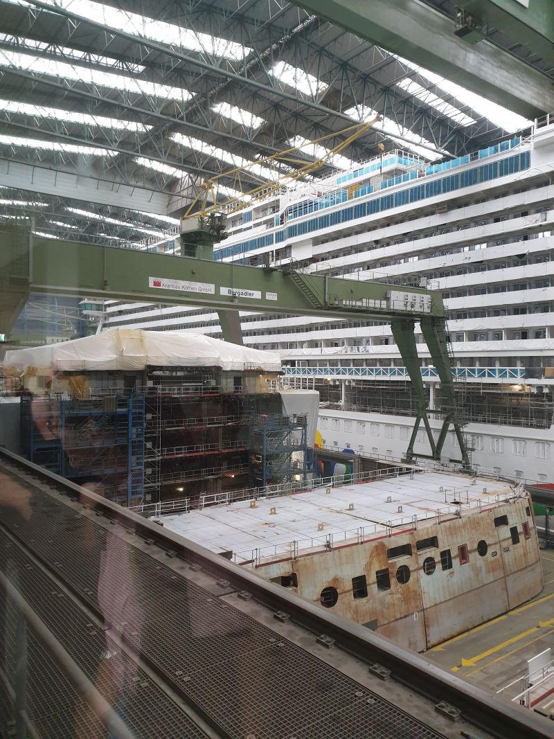
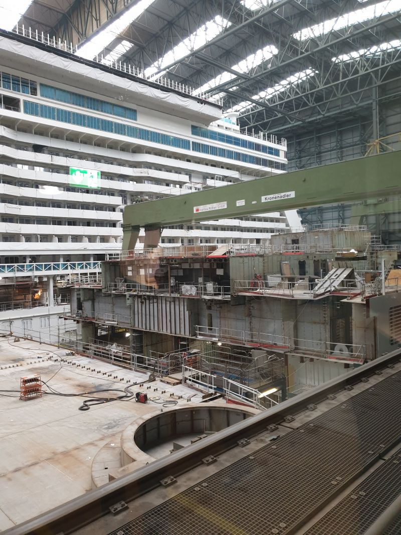
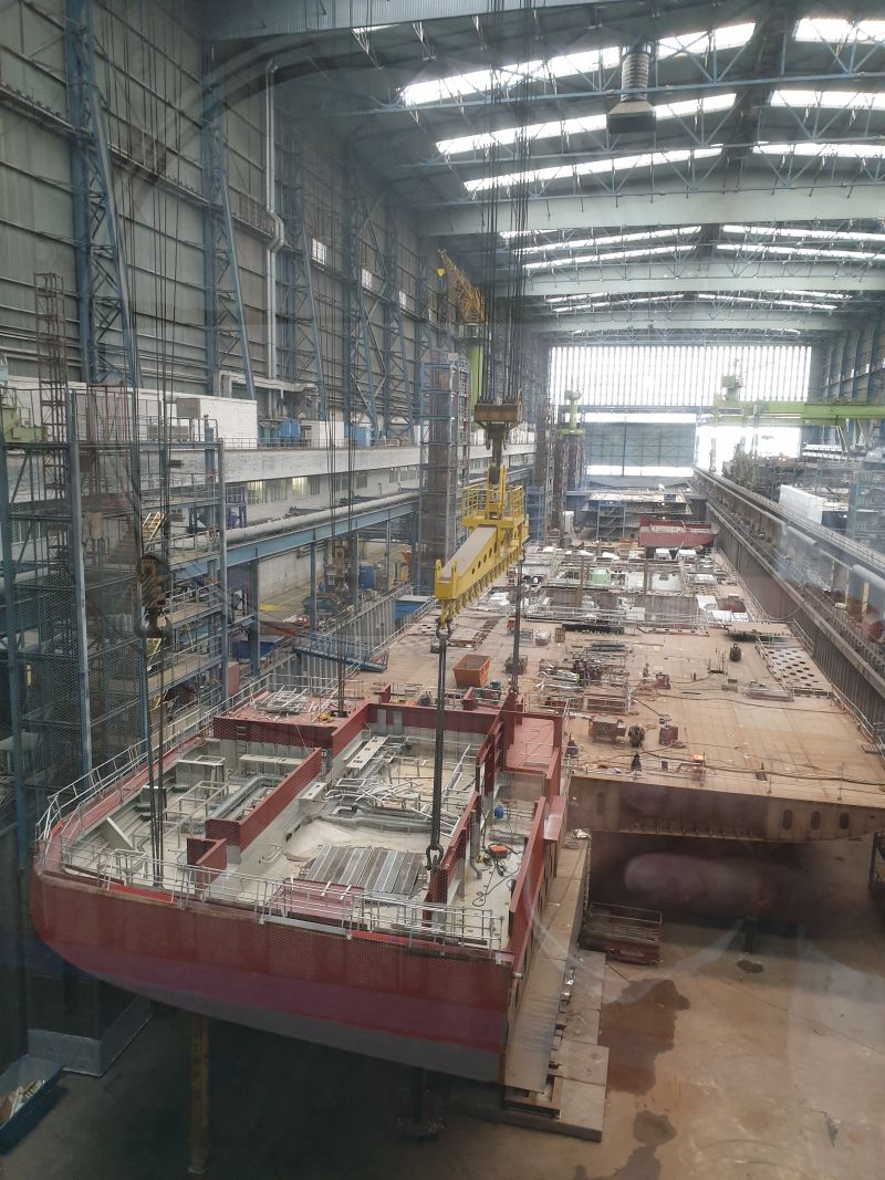
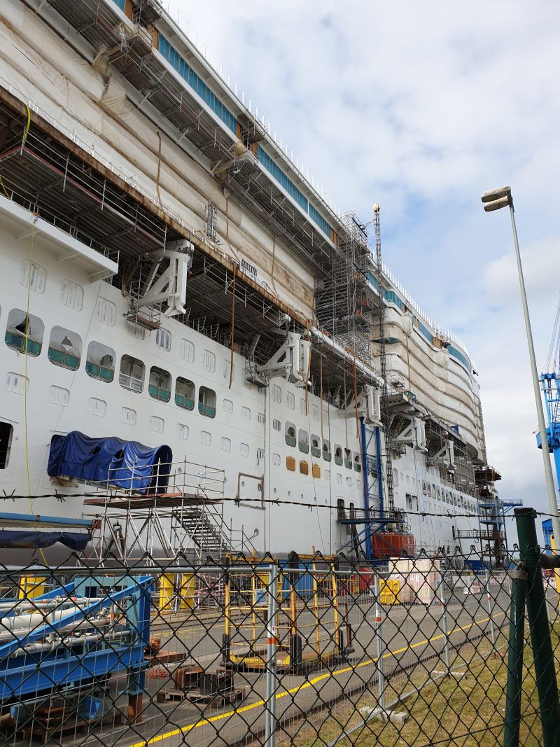
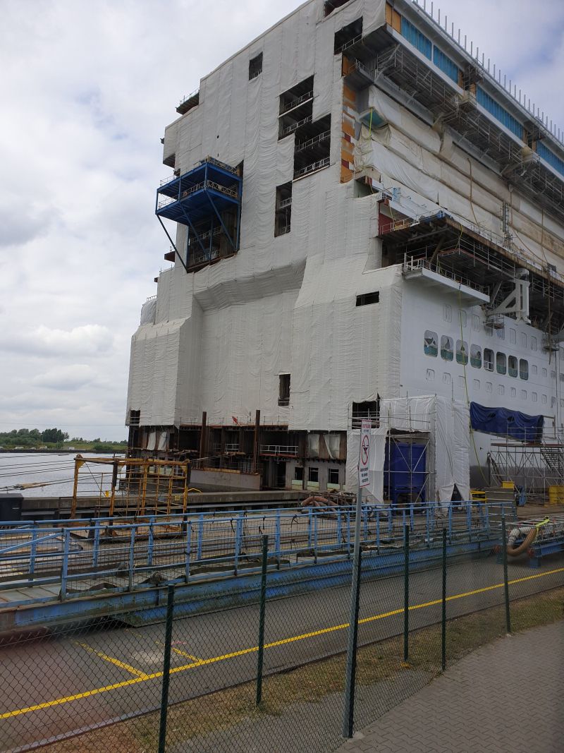
Besuch der Meyer-Werft
Just huge! This is where the biggest cruise ships are built! Sightseeing tour €13.50
Day
Bremen, Stellplatz Am Kuhhirten, Deutschland
Kuhhirtenweg, 28201, Bremen, Deutschland
53° 3' 54" N 8° 49' 7" E
53.0650000 8.8186111
• Head toward Strandweg on Kuhhirtenweg. Go for 471 m.
• Continue on Werderstraße. Go for 754 m.
• Continue on Franziuseck. Go for 59 m.
• Turn right onto Wilhelm-Kaisen-Brücke. Go for 157 m.
• Turn right onto Tiefer. Go for 324 m.
• Keep right onto Osterdeich. Go for 3.1 km.
• Continue on Hastedter Osterdeich toward A1/Hamburg/Hannover/Rotenburg/Sebaldsbrück/Hemelingen. Go for 994 m.
• Turn left toward Hamburg-Osnabrück/Rotenburg/Sebaldsbrück/Weserhafen/Hemelingen. Go for 27 m.
• Turn slightly left onto Malerstraße. Go for 262 m.
• Turn right onto Pfalzburger Straße. Go for 848 m.
• Keep left onto Autobahnzubringer Hemelingen toward A1/Mahndorf/Arbergen. Go for 2.5 km.
• Take ramp onto A1 toward Hamburg/Hannover. Go for 79.8 km.
• Take exit 43 toward Flensburg/Kiel/Hamburg-West/Tötensen/Flughafen onto A261 (Buchholzer Dreieck). Go for 10.3 km.
• Continue on A7. Go for 11.6 km.
• Keep right onto A7. Go for 150 km.
• Take exit 3 toward Kappeln/Glücksburg/Flensburg onto B200. Go for 13.0 km.
• Take ramp toward Wassersleben. Go for 178 m.
• Turn right toward Wassersleben/K81. Go for 53 m.
• Turn right onto Wassersleben (K81). Go for 280 m.
• Turn right onto Forsteck. Go for 25 m.
• Arrive at Forsteck. Your destination is on the left.
☍
274,3 km
(2 hrs. 44 min.)
Day
Flensburger Förde: Harrislee bei Flensburg, Deutschland
Parking lot at the Flensburg Fjord. Bakery and "Greek" next door. No infrastructure, but free and quiet.
Wassersleben, 24955 Harrislee, Deutschland
54° 49' 42.9" N 9° 25' 2.7" E
54.8285887 9.4174189
• Head toward Wassersleben on Forsteck. Go for 25 m.
• Turn left onto Wassersleben (K81). Go for 348 m.
• Take ramp onto B200. Go for 1.1 km.
• Continue on Flensborgvej (170). Go for 1.2 km.
• Turn right onto Sønderborgvej (401) toward Sønderborg/8/Gråsten. Go for 23.1 km.
• Take the 1st exit from roundabout onto Flensborg Landevej. Go for 2.4 km.
• Continue on Dybbøl Banke. Go for 671 m.
• Turn left onto Dybbøl Banke. Go for 59 m.
• Turn right onto Dybbøl Banke. Go for 63 m.
• Arrive at Dybbøl Banke. Your destination is on the right.
☍
29,0 km
( 28 min.)
Day
Historiecenter Dybbøl Banke
Dybbøl Banke 16, 6400 Sønderborg, Dänemark
54° 54' 23.8" N 9° 45' 13.7" E
54.9066196 9.7537994
• Head west on Dybbøl Banke. Go for 63 m.
• Turn left onto Dybbøl Banke. Go for 59 m.
• Turn left onto Dybbøl Banke. Go for 504 m.
• Continue on Dybbølgade. Go for 1.4 km.
• Continue on Kong Chr. D. X S Bro. Go for 398 m.
• Continue on Løkken. Go for 445 m.
• Turn right onto Rønhaveplads. Go for 58 m.
• Turn left onto Rønhavegade. Go for 75 m.
• Arrive at Rønhavegade. Your destination is on the left.
☍
3,0 km
( 6 min.)
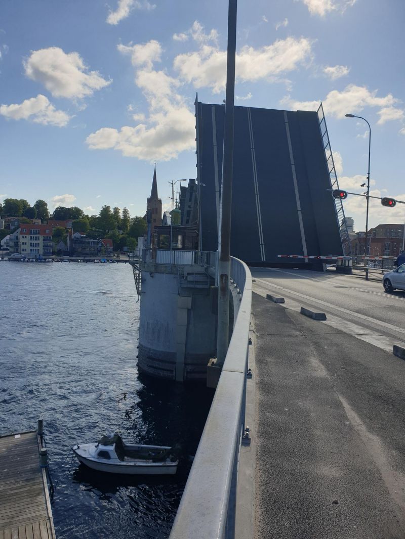
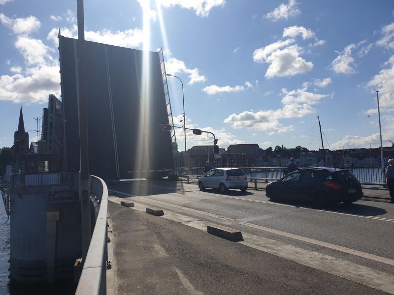
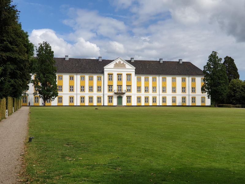
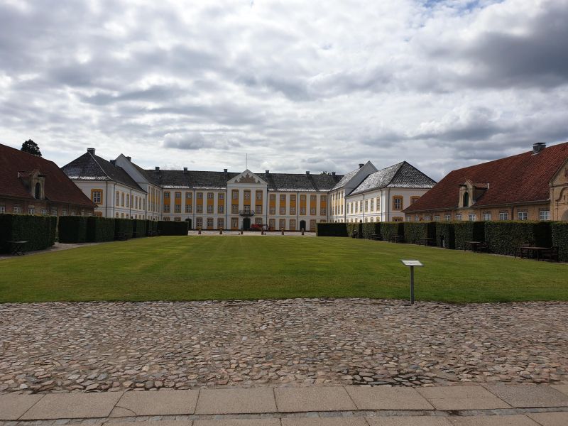
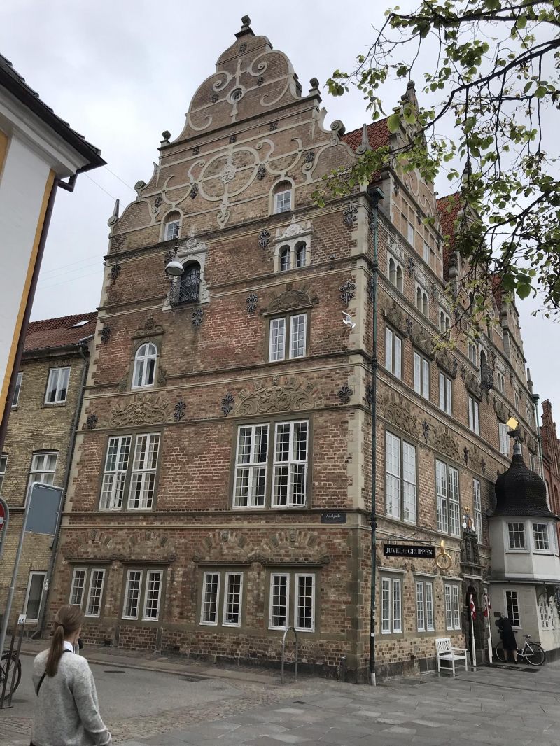
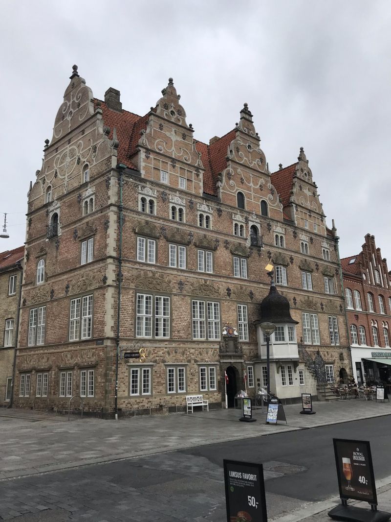
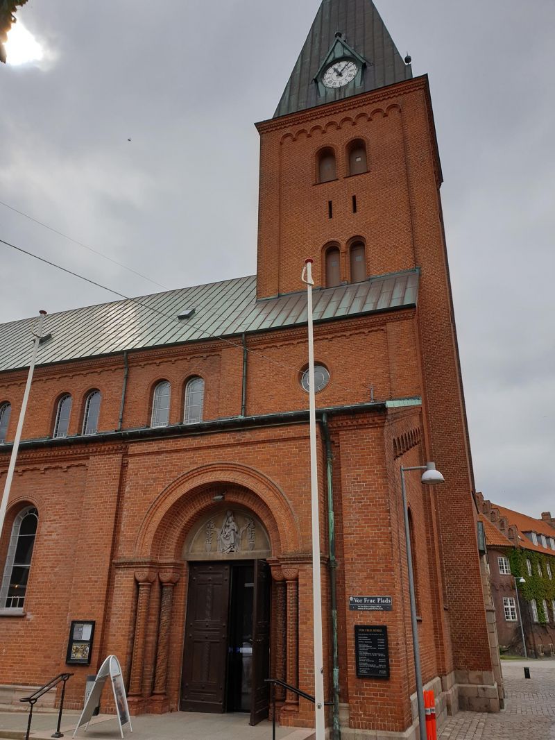
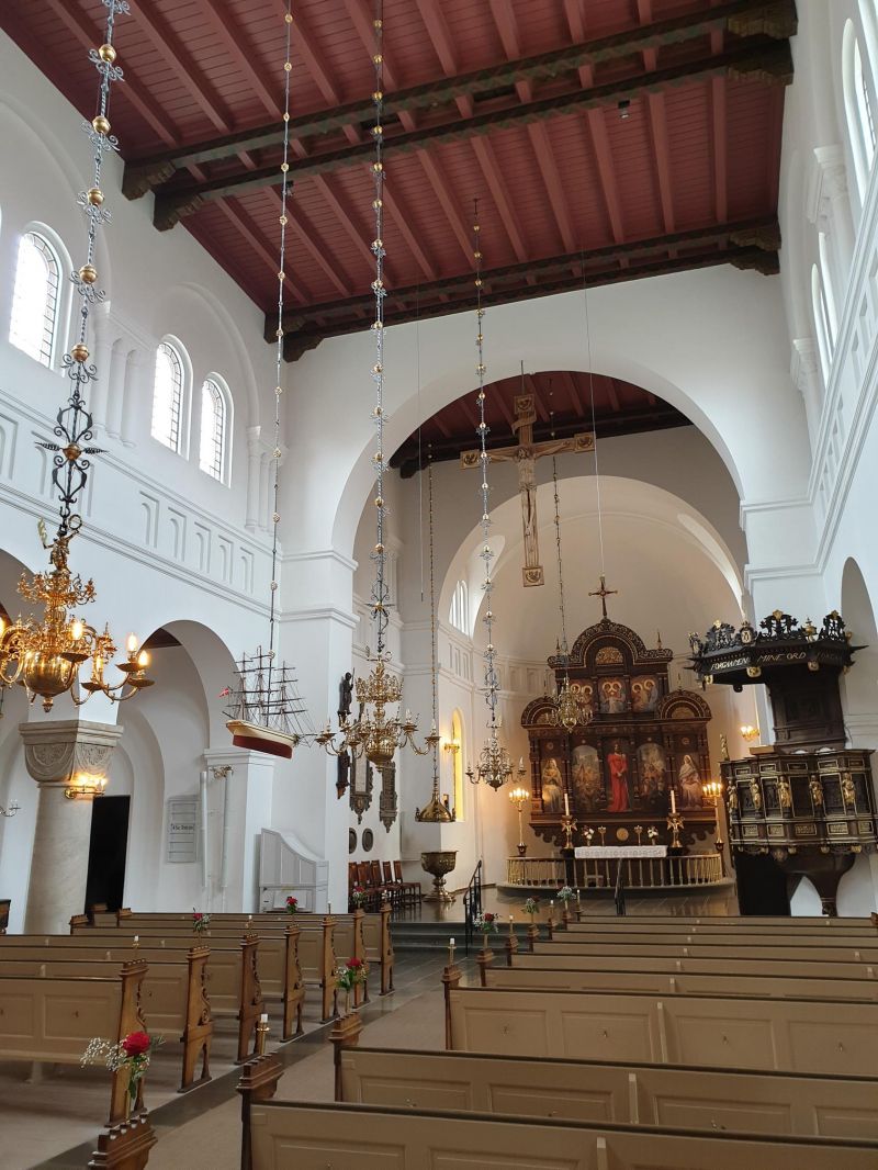
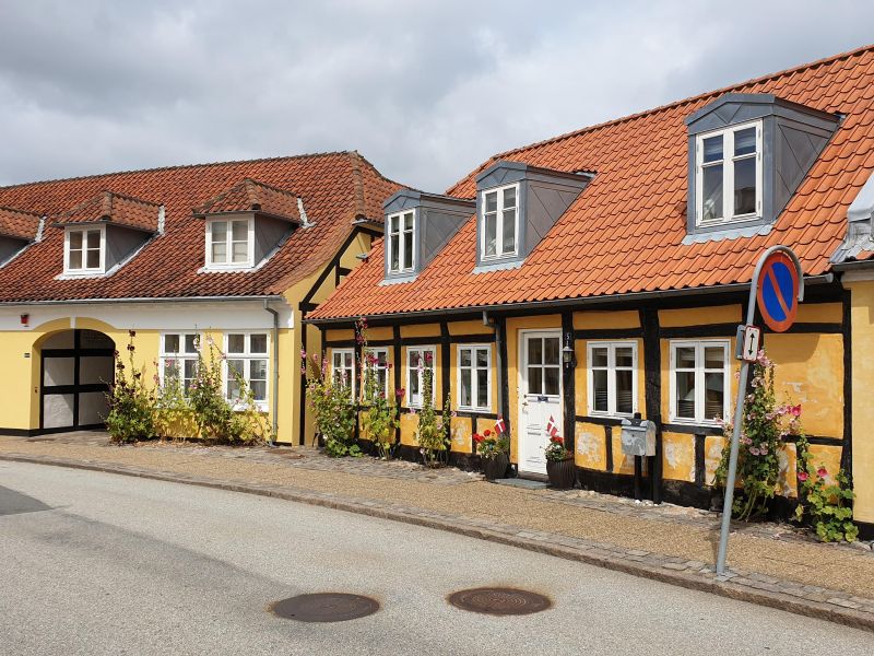
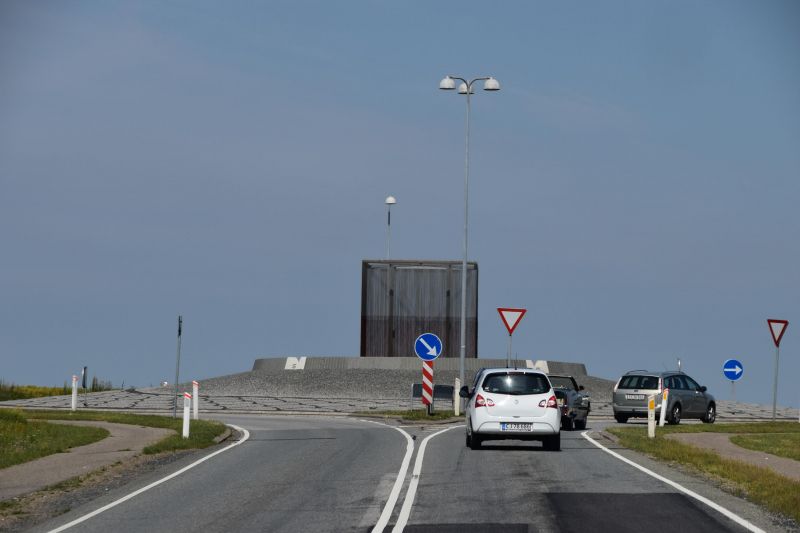
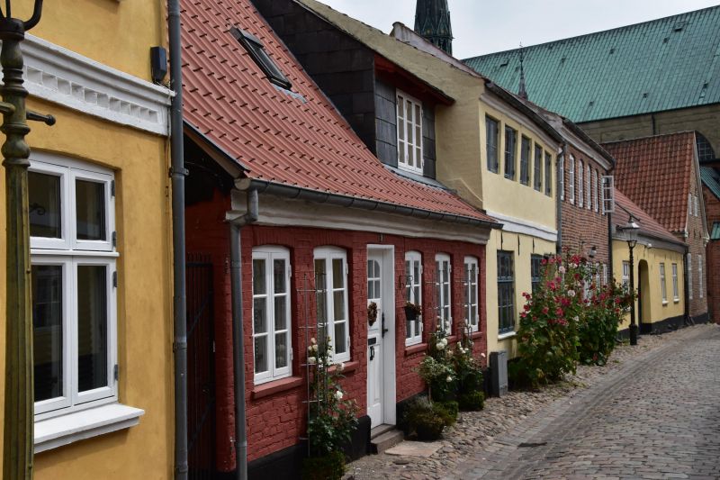
Sønderborg, Dänemark
Modern place with a castle on the fjord. Lift bridge for the large sailing ships.
6400 Sonderburg, Dänemark
54° 54' 49.7" N 9° 47' 31.8" E
54.9138110 9.7921780
• Head toward Rønhaveplads on Rønhavegade. Go for 75 m.
• Turn right onto Rønhaveplads. Go for 58 m.
• Turn right onto Lerbjerg. Go for 396 m.
• Turn left onto Alsgade. Go for 980 m.
• Continue on Augustenborg Landevej. Go for 1.9 km.
• Take the 2nd exit from roundabout onto Augustenborg Landevej. Go for 724 m.
• Take the 1st exit from roundabout onto Omfartsvejen (8/405) toward Fynshav/Nordborg. Go for 2.4 km.
• Take ramp toward Augustenborg. Go for 270 m.
• Continue on Langdel. Go for 284 m.
• Turn right onto Langdel. Go for 119 m.
• Continue on Banegårdsgade. Go for 403 m.
• Turn left onto Storegade. Go for 444 m.
• Continue on Osbækvej. Go for 29 m.
• Turn left onto Palævej. Go for 482 m.
• Turn left onto Ny Stavensbøl. Go for 329 m.
• Arrive at Ny Stavensbøl. Your destination is on the left.
☍
8,9 km
( 13 min.)
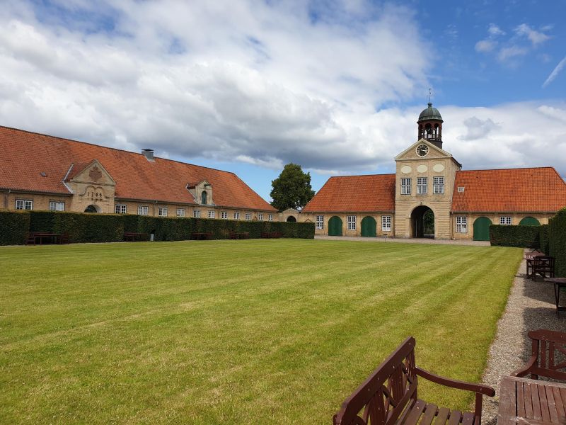
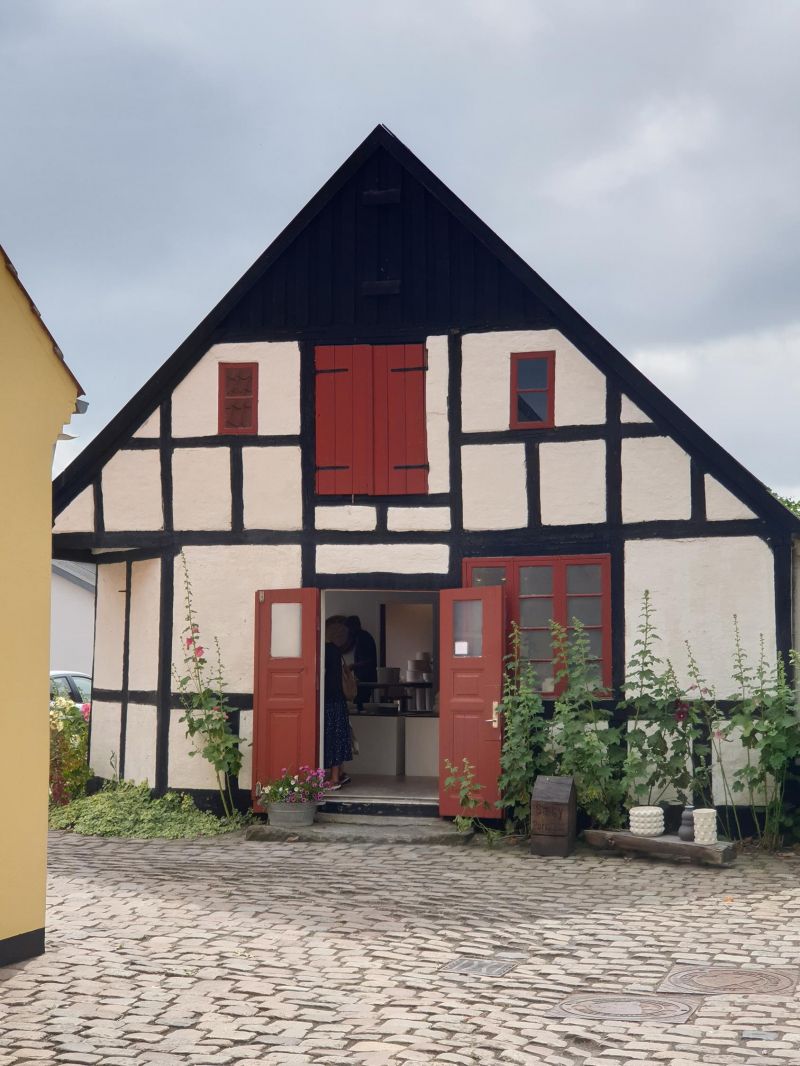
Hertugbyens Camping, Ny Stavensbøl, Augustenborg, Dänemark
Privately run small campsite on the island of Als, directly on the Baltic Sea, 152 DKK. Short walk to Augustenborg Castle.
Ny Stavensbøl 1, 6440 Augustenborg, Dänemark
54° 56' 48.6" N 9° 51' 16.4" E
54.9468400 9.8545610
• Head toward Augustenborg Skov on Ny Stavensbøl. Go for 329 m.
• Turn right onto Palævej. Go for 482 m.
• Turn right onto Osbækvej. Go for 29 m.
• Continue on Storegade. Go for 444 m.
• Turn right onto Banegårdsgade. Go for 403 m.
• Continue on Langdel. Go for 334 m.
• Take ramp onto Omfartsvejen (8/405). Go for 2.5 km.
• Pass 2 roundabouts and continue on 8/405. Go for 5.9 km.
• Take ramp toward Felsted/Sønderborg V. Go for 398 m.
• Take the 1st exit from roundabout onto Aabenraavej (41) toward Felsted. Go for 582 m.
• Take the 1st exit from roundabout onto Aabenraavej (41). Go for 4.7 km.
• Pass 2 roundabouts and continue on Aabenraavej (41). Go for 11.9 km.
• Turn left onto Sønderborgvej. Go for 271 m.
• Arrive at Sønderborgvej.
☍
28,3 km
( 26 min.)
Day
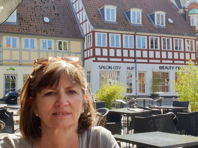
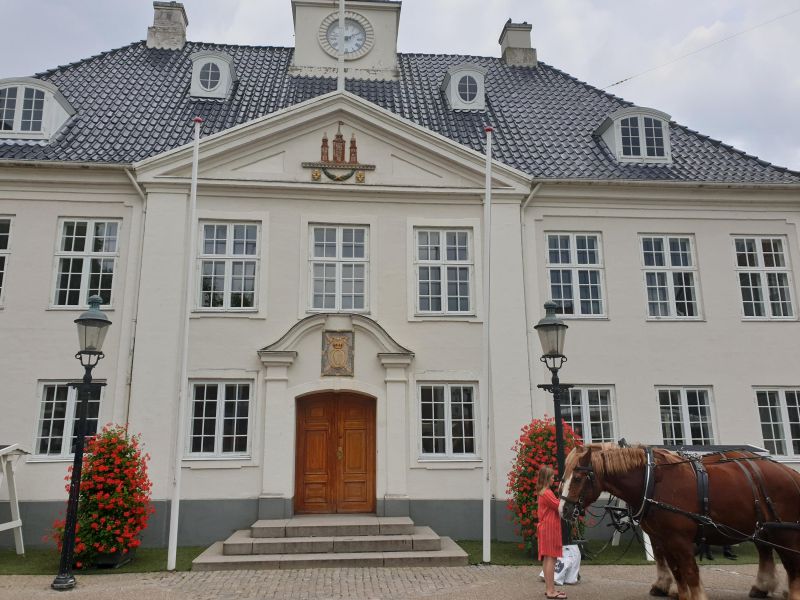
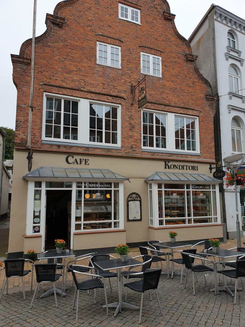
Aabenraa, Dänemark
Sønderborgvej 168B, 6200 Aabenraa, Dänemark
54° 58' 56.9" N 9° 31' 57" E
54.9824832 9.5324936
• Head northwest on Sønderborgvej. Go for 271 m.
• Turn left onto Sønderborgvej (41). Go for 2.2 km.
• Take the 2nd exit from roundabout onto Sønderborgvej (41). Go for 4.2 km.
• Continue on Sønderborgvej (41). Go for 1.7 km.
• Take the 2nd exit from roundabout onto Sønderborgvej (41) toward Ribe/E45/Kolding. Go for 2.9 km.
• Take ramp onto E45 (Sønderjyske Motorvej) toward Kolding. Go for 53.6 km.
• Take exit 65A toward Havn onto 25 (Tankedalsvej). Go for 2.4 km.
• Turn right onto Vonsildvej (170) toward Haderslev/Christiansfeld/S3-S4-S5. Go for 835 m.
• Arrive at Vonsildvej (170). Your destination is on the left.
☍
68,0 km
( 43 min.)
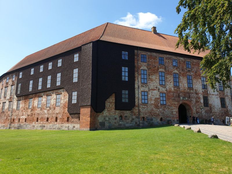
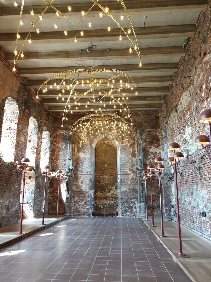
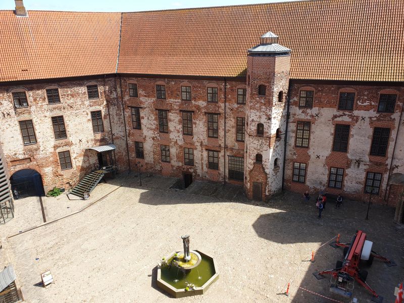
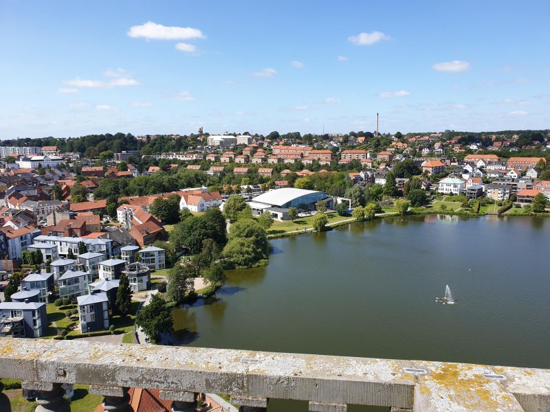
Dancamps Kolding, Vonsildvej, Kolding, Dänemark
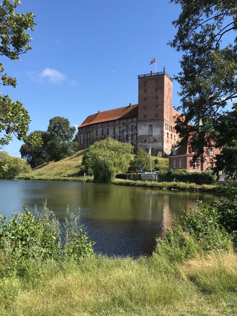
Kolding: culture, old town and Koldinghus Castle.
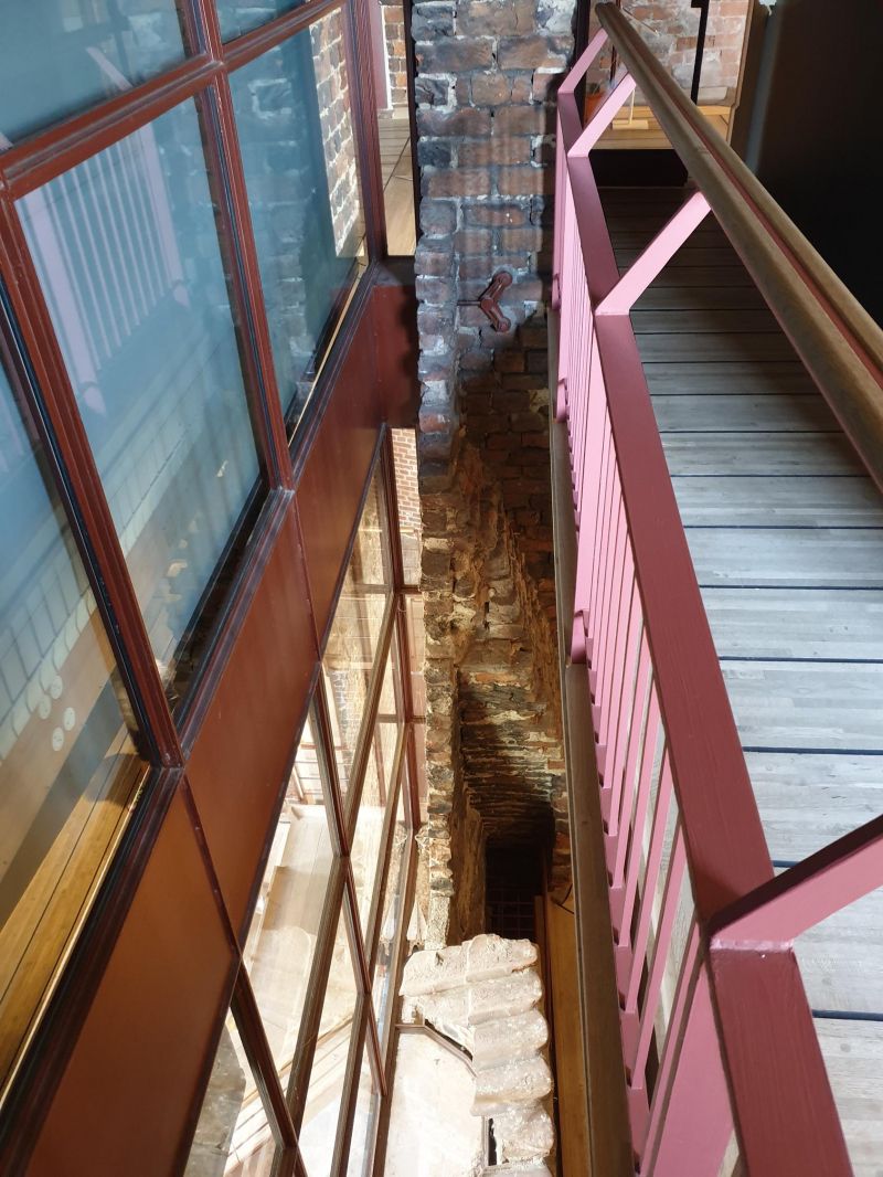
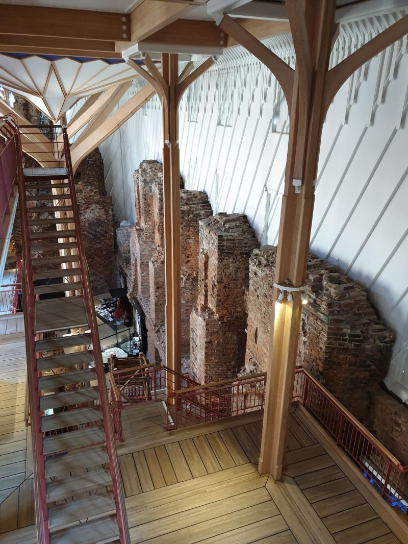
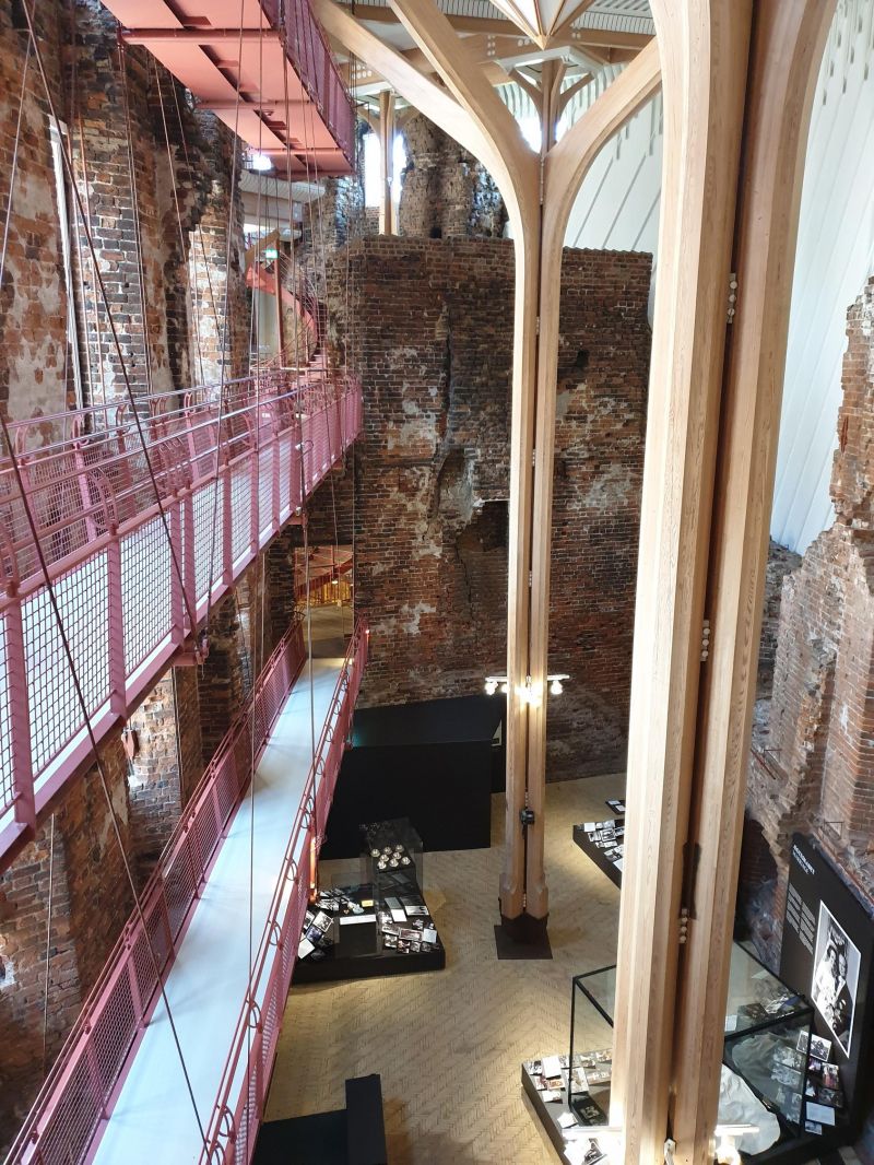
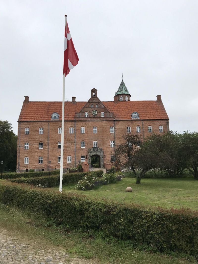
Koldinghus was built as a fortress in the 13th century and after the great fire in 1808 it was only in the 20th century. been restored in a very modern way. Unique large wooden pillars in the castle support metal platforms for visitors without touching the old masonry.
Camping site Dancamps Kolding: transit site with electricity and sanitary facilities, 329 DKK
Vonsildvej 19, 6000 Kolding, Dänemark
55° 27' 47.6" N 9° 28' 23.5" E
55.4632297 9.4731908
• Head toward Ambolten on Vonsildvej (170). Go for 835 m.
• Turn left onto Tankedalsvej (25). Go for 2.0 km.
• Take ramp onto E45 (Sønderjyske Motorvej) toward Aarhus/Odense/E20. Go for 13.1 km.
• Keep left onto E45 (Kolding) toward Århus/Vejle. Go for 75.6 km.
• Keep right onto 501 (Aarhus Syd) toward Aarhus C - S/Havn. Go for 9.5 km.
• Continue on Åhavevej. Go for 925 m.
• Continue on Marselis Boulevard. Go for 1.9 km.
• Keep right onto Marselis Boulevard (O1) toward Sjællands Odde. Go for 238 m.
• Turn right onto Strandvejen. Go for 280 m.
• Turn left onto Sumatravej. Go for 37 m.
• Turn right onto Marselisborg Havnevej. Go for 184 m.
• Turn right onto Marselisborg Havnevej. Go for 15 m.
• Turn left onto Marselisborg Havnevej. Go for 56 m.
• Turn right onto Marselisborg Havnevej. Go for 20 m.
• Arrive at Marselisborg Havnevej. Your destination is on the left.
☍
104,6 km
(1 hrs. 10 min.)
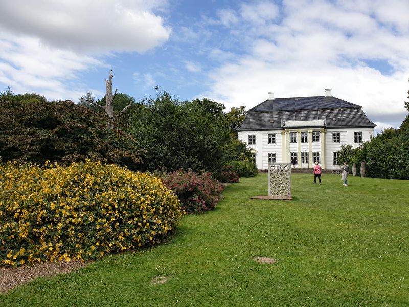
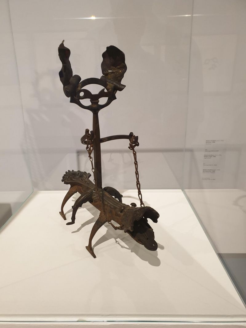
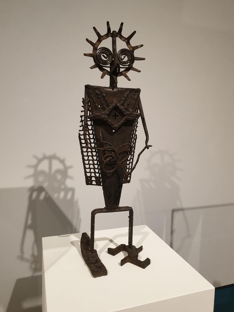
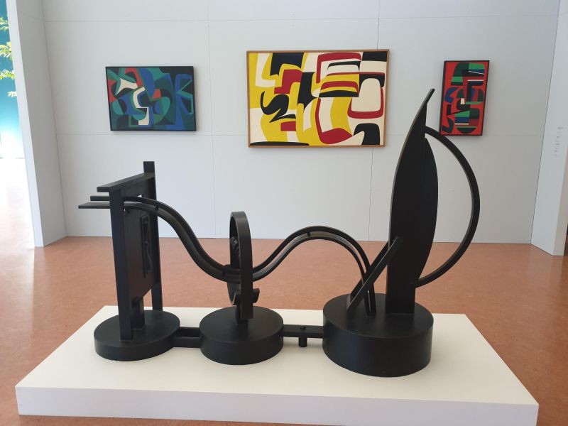
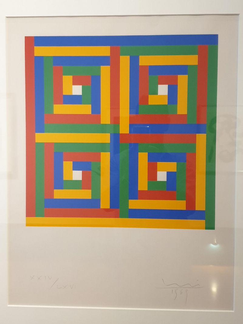
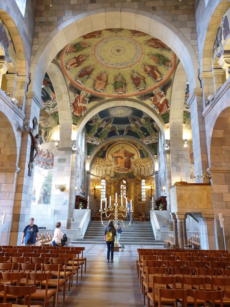
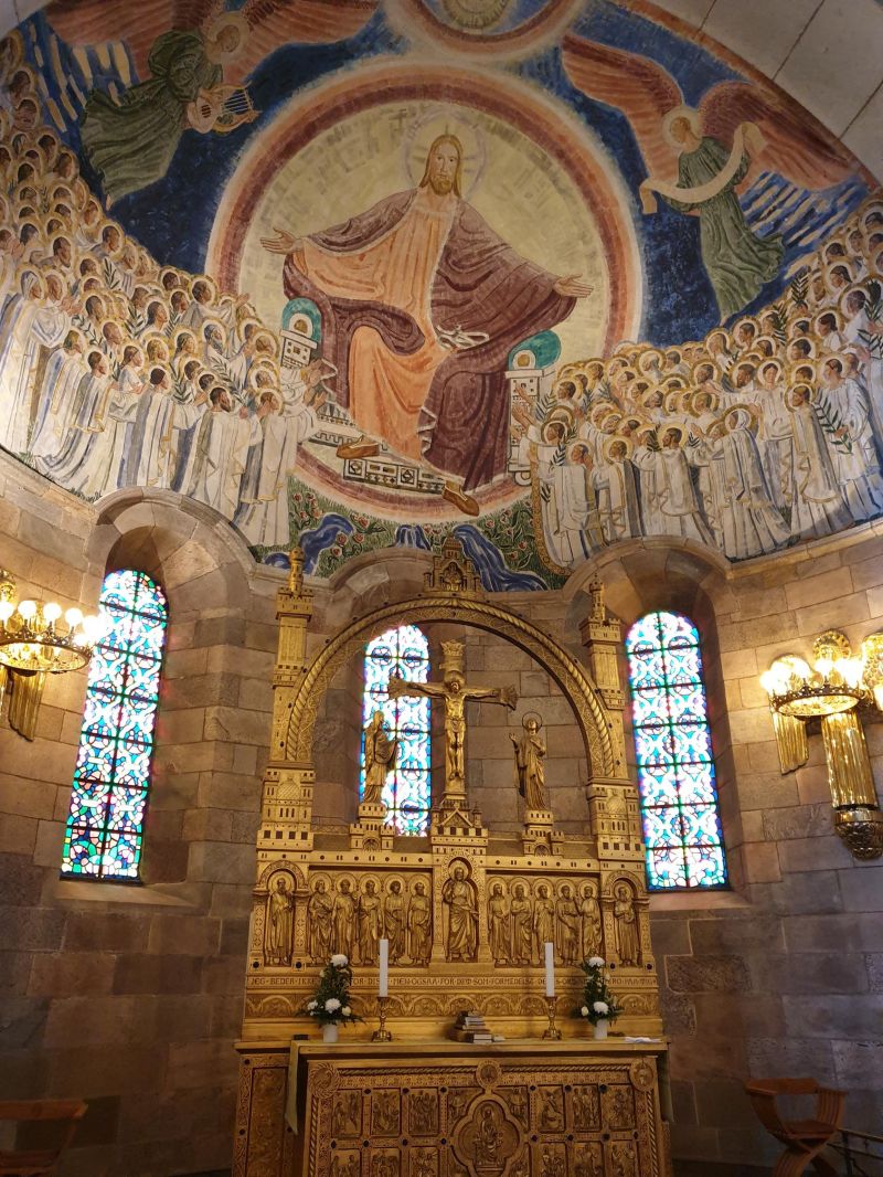
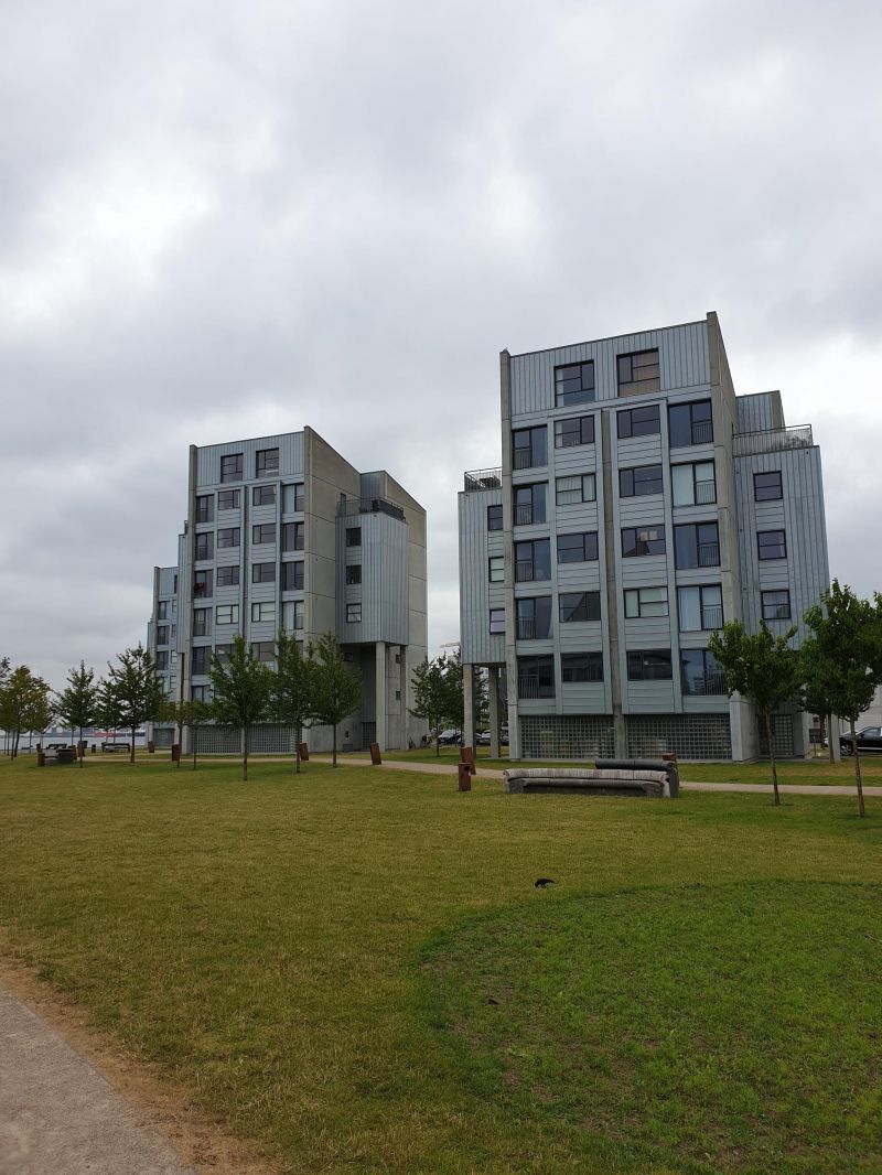
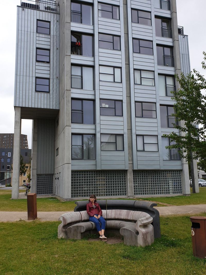
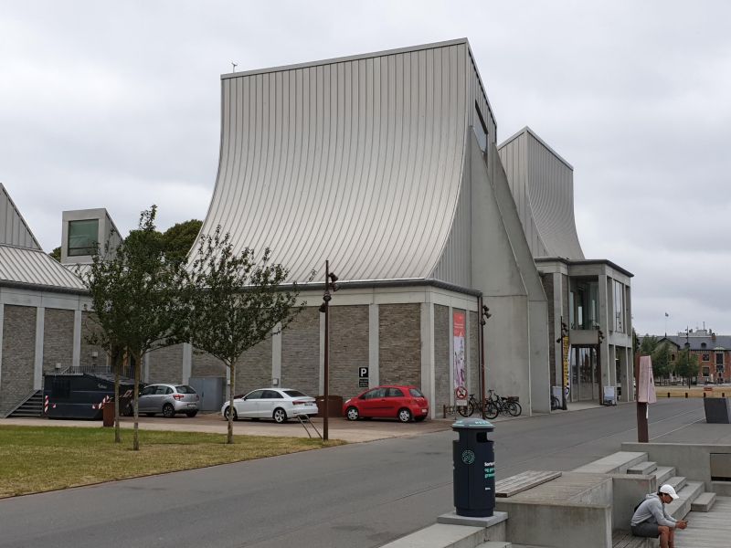
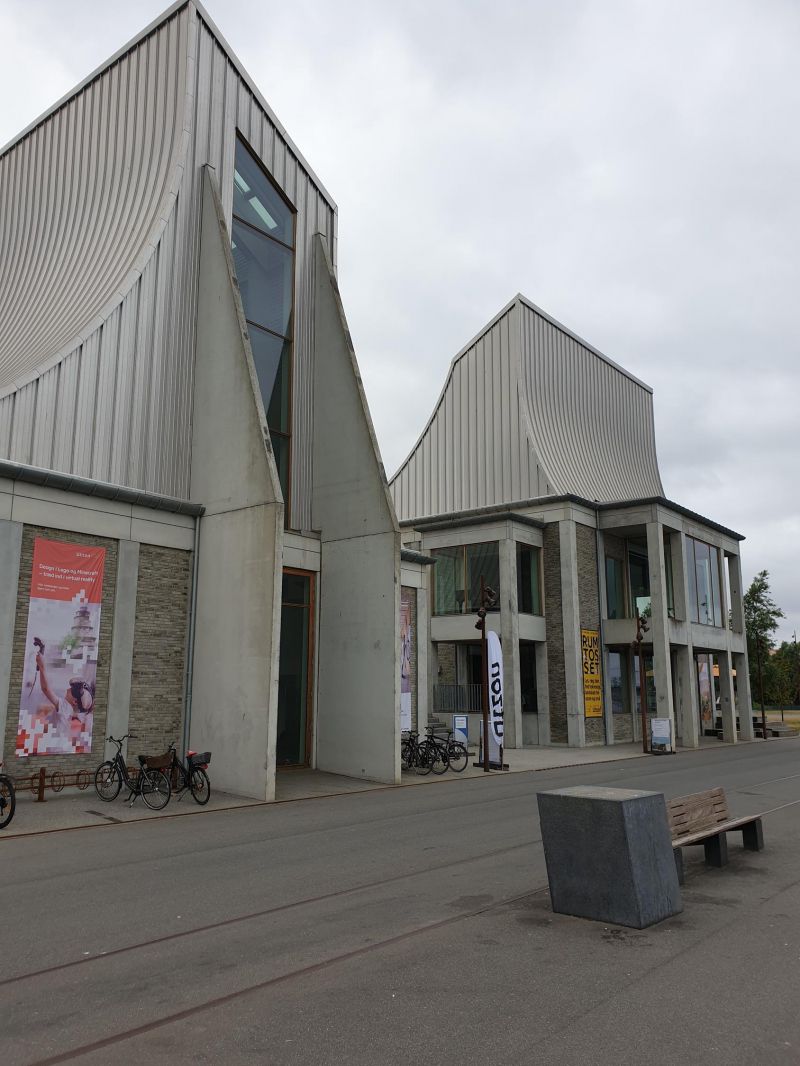
Kulturforum Würth Kolding Dänemark
The Würth Collection has a showroom in the north of Kolding. currently Exhibition of works by Robert Jacobsen: Friends
Day
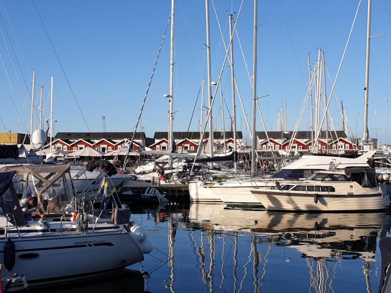
Aarhus, Dänemark - Parkplatz am Yachthafen Marselisborg
Grosser Parkplatz vor dem Yachthafen. Übernachten nicht verboten. Offizieller Stellplatz im Hafengebiet gleich nebenan.
Marselisborg Havnevej 4, 8000 Aarhus, Dänemark
56° 8' 20.7" N 10° 12' 39.3" E
56.1390737 10.2109070
• Head south on Marselisborg Havnevej.
• Turn right onto Marselisborg Havnevej. Go for 50 m.
• Turn right onto Marselisborg Havnevej. Go for 22 m.
• Turn left onto Marselisborg Havnevej. Go for 8 m.
• Turn right onto Marselisborg Havnevej. Go for 15 m.
• Turn left onto Marselisborg Havnevej. Go for 184 m.
• Turn left onto Sumatravej. Go for 37 m.
• Turn right onto Strandvejen. Go for 319 m.
• Turn left onto Marselis Boulevard (O1). Go for 895 m.
• Continue on Marselis Boulevard toward E45/170/180. Go for 1.3 km.
• Continue on Åhavevej. Go for 906 m.
• Take ramp onto Viby Ringvej (O2) toward Århus V-N. Go for 2.4 km.
• Turn left onto Silkeborgvej (15/195) toward Brabrand/E45. Go for 2.9 km.
• Continue on Silkeborgvej (15/195). Go for 1.5 km.
• Take the 1st exit from roundabout onto Silkeborgvej (15) toward Silkeborg/E45/Årslev. Go for 166 m.
• Keep left onto Silkeborgvej (15) toward Herning/Silkeborg/Aalborg/E45/Kolding. Go for 27.6 km.
• Take exit 26 toward Hårup/Sejs-Svejbæk. Go for 658 m.
• Turn left toward Borgdalsvej. Go for 65 m.
• Continue on Borgdalsvej. Go for 248 m.
• Turn right onto Borgdalsvej. Go for 1.8 km.
• Turn left onto Borgdalsvej. Go for 44 m.
• Turn slightly right onto Borgdalsvej. Go for 50 m.
• Turn right onto Borgdalsvej. Go for 69 m.
• Arrive at Borgdalsvej. Your destination is on the left.
☍
41,2 km
( 33 min.)
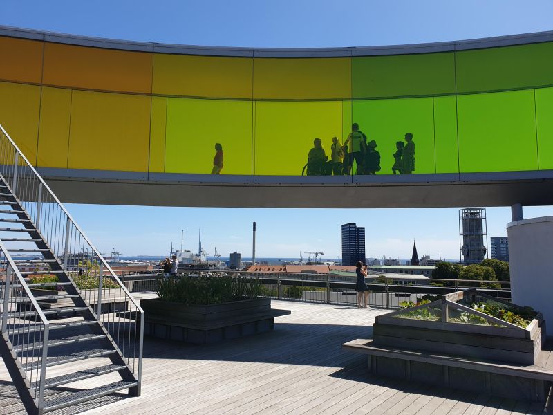
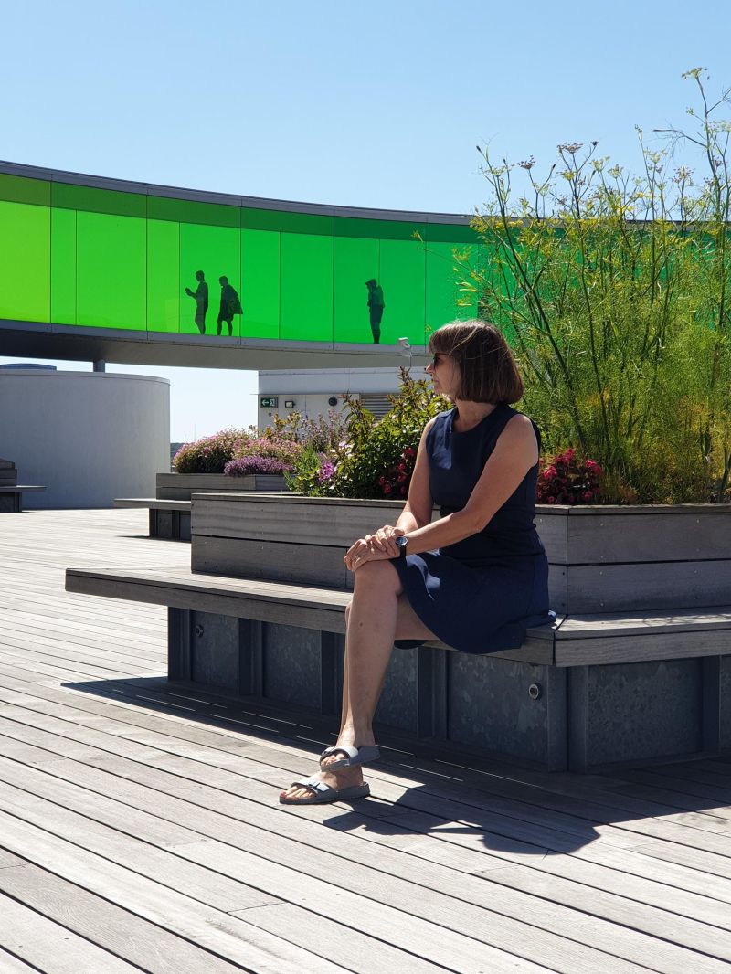
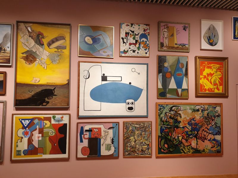
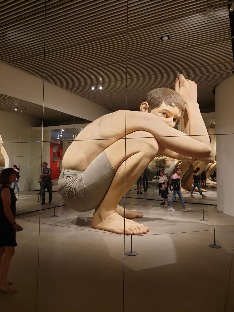
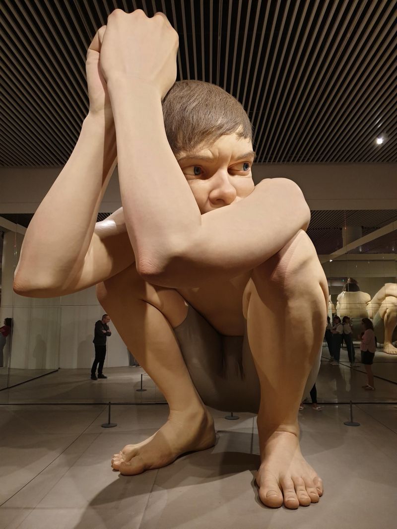
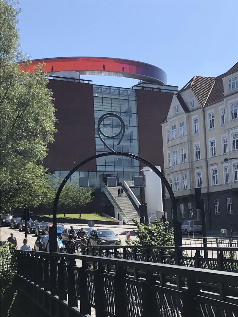
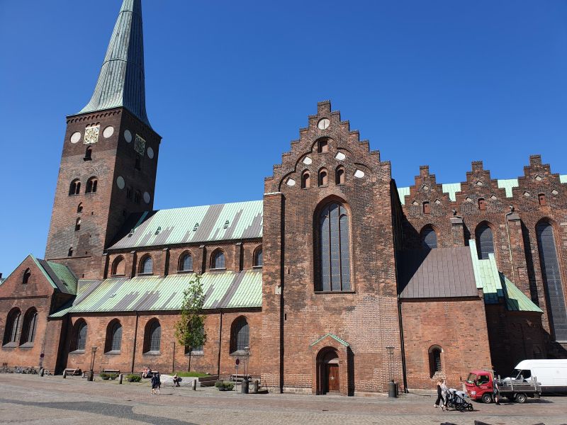
Aarhus, Dänemark
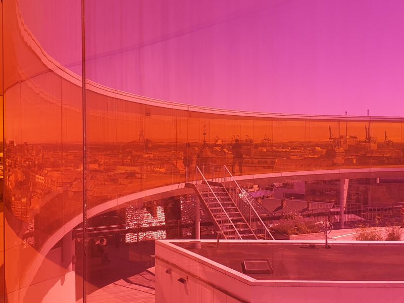
ARoS Aarhus Art Museum with exhibitions of modern artists and artists from Skagen. In the rainbow panorama by Olafur Eliasson on the roof of the museum you can enjoy a panoramic view over the entire city.
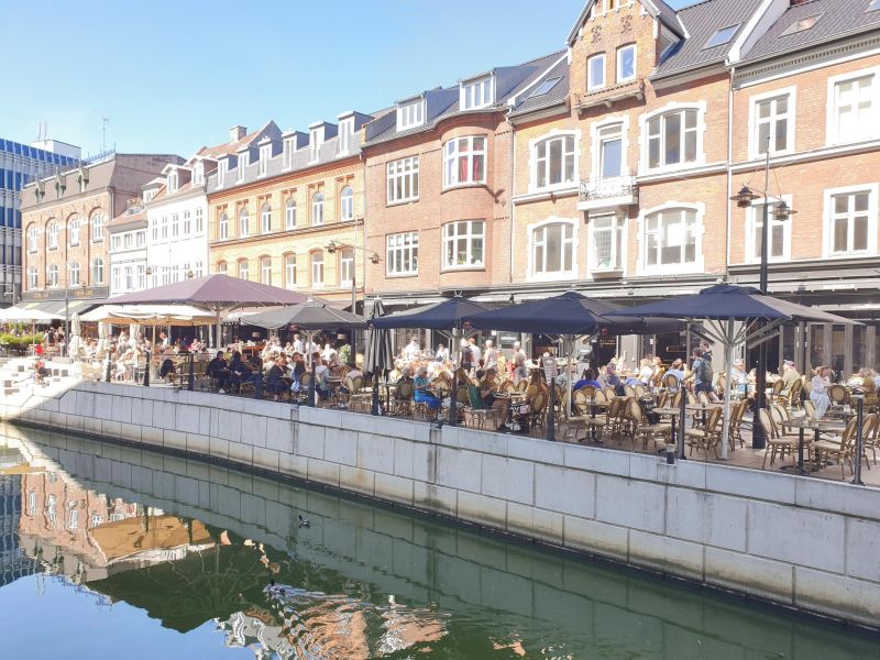
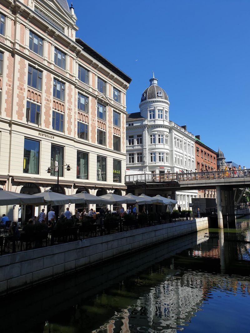
Aarhus is the second largest city in Denmark. Very lively with cafes and restaurants on the river bank and in the harbour. Also influenced by the many students.
Day
Sejs Bakker Camping, Silkeborg
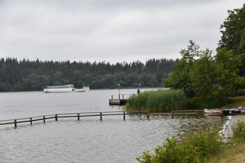
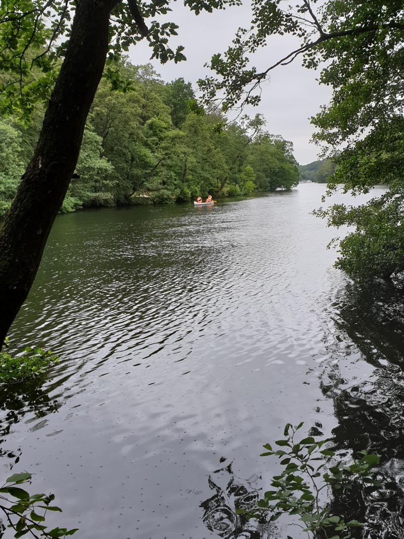
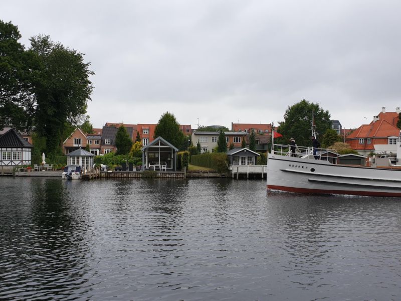
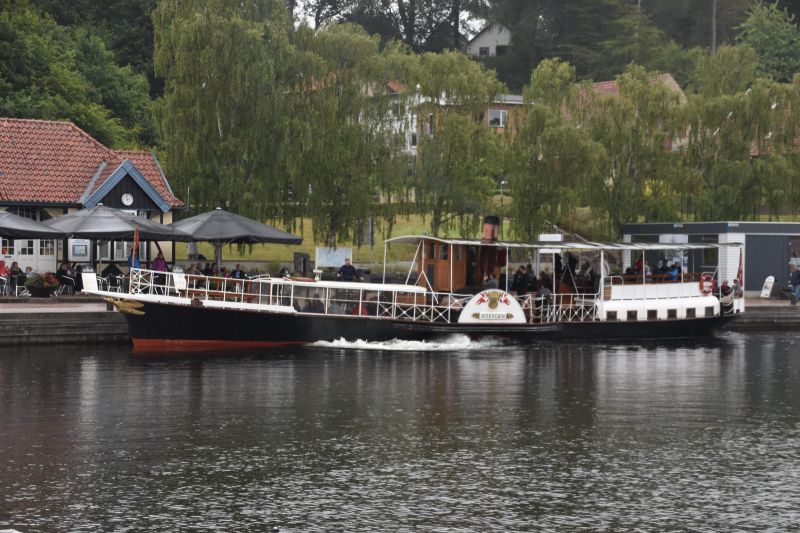
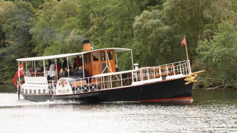
Hike along Brassø lake and river to Silkeborg. On the Silkeborg lakes and the Gudenå river is Hjejlen, the world's oldest original coal-fired paddle steamer still in operation.
A natural "highlight" is the Himmelberg, which juts out into the landscape at 147 m and can be seen from afar on land and water.
Camping site with pitches separated by hedges and trees: 270 DKK
Borgdalsvej 15-17, 8600, Silkeborg, Dänemark
56° 8' 24" N 9° 37' 18.1" E
56.1400000 9.6217000
• Head north on Borgdalsvej. Go for 69 m.
• Turn left onto Borgdalsvej. Go for 94 m.
• Turn right onto Borgdalsvej. Go for 1.8 km.
• Turn right toward Borgdalsvej. Go for 63 m.
• Keep left onto Borgdalsvej. Go for 271 m.
• Turn left toward Silkeborgmotorvejen/15. Go for 43 m.
• Turn right and take ramp onto 15 (Silkeborgmotorvejen) toward 195. Go for 10.1 km.
• Take exit 30 toward Silkeborg N/Horsens/Viborg/Kjellerup. Go for 421 m.
• Turn left onto Viborgvej (52). Go for 6.5 km.
• Continue on Kjellerupvej (52) toward Viborg/Kjellerup. Go for 5.0 km.
• Pass 2 roundabouts and continue on Kjellerupvej (52). Go for 11.5 km.
• Take the 1st exit from roundabout toward 26/Viborg/Sdr. Rind. Go for 281 m.
• Take ramp onto Århusvej (26) toward Viborg. Go for 5.8 km.
• Take the 1st exit from roundabout onto Vejlevej (13/26) toward Viborg/Skive/16. Go for 788 m.
• Take ramp toward Viborg C. Go for 432 m.
• Take the 1st exit from roundabout onto Indre Ringvej toward Viborg C. Go for 2.0 km.
• Turn right onto Jegstrupvej. Go for 234 m.
• Turn right onto Skottenborg. Go for 168 m.
• Turn right onto Skovgaardsvej. Go for 204 m.
• Turn right onto A. S. Ørsteds Vej. Go for 129 m.
• Arrive at A. S. Ørsteds Vej. Your destination is on the right.
☍
45,7 km
( 40 min.)
Silkeborg
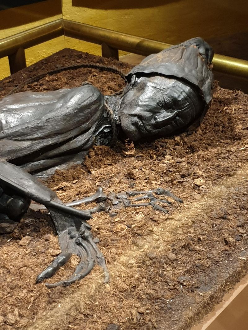
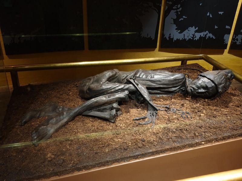
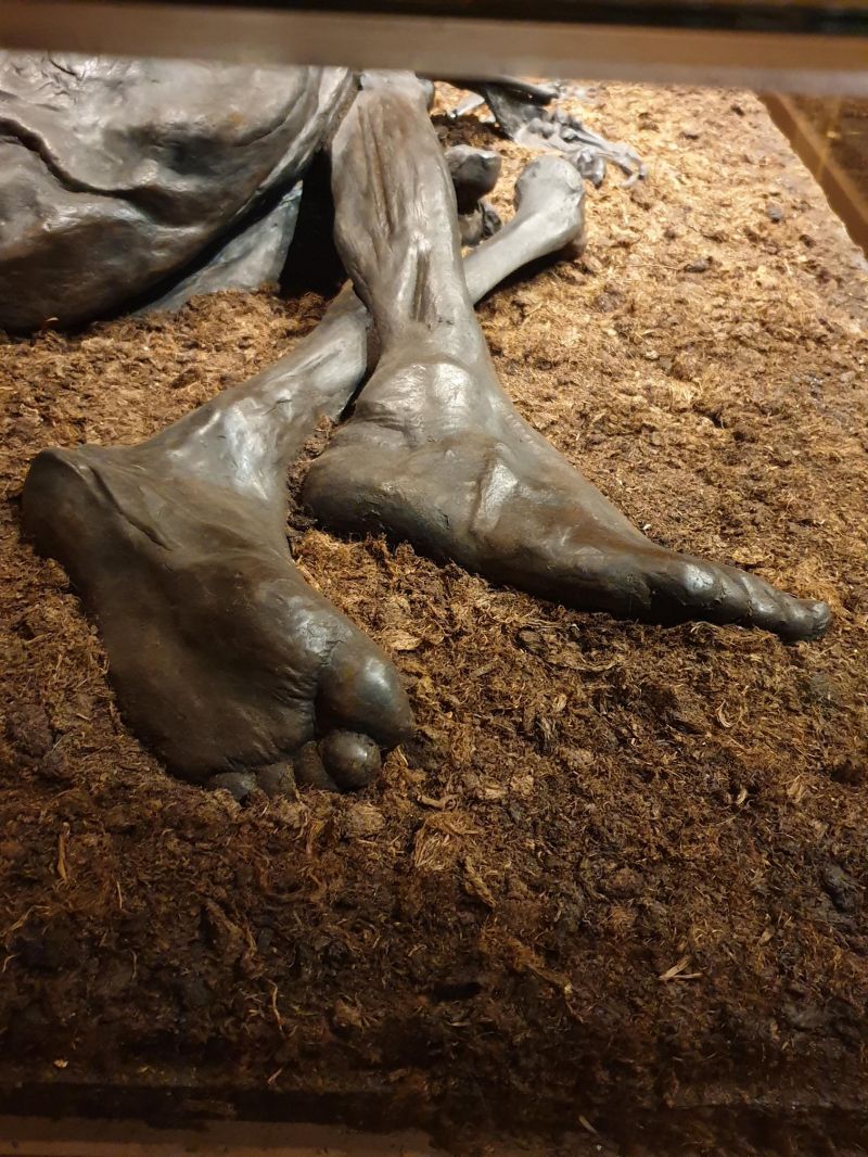
Silkeborg is located in the middle of the lake district in Midtjylland. The main attraction is the Silkeborg Museum "Hovedgården". It is located in the city's oldest building from 1767. The archaeological exhibition focuses on the Iron Age. Of outstanding importance is the Tollundman, a bog body from the 3rd or 4th century BC. BC, which was found in 1950 near Silkeborg while cutting peat.
Day
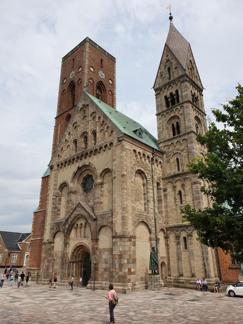
Viborg, Dänemark
Viborg is the old capital of Denmark and one of Denmark's oldest cities, dating back to ancient and Viking times. Until 1655, the Danish kings were paid homage to after their appointment in Viborg.
Viborg Domkirke: With its two striking towers and unique frescoes, Viborg Cathedral is the city's classic landmark. It was built in the 12th century, but after several violent fires, only the old crypt has survived from the original building - today's "Romanesque" church with modern paintings was built later. It is considered the largest granite church in the world.
8800 Viborg, Dänemark
56° 27' 7.3" N 9° 23' 46.8" E
56.4520270 9.3963471
• Head toward Christian Erichsøns Vej on A. S. Ørsteds Vej. Go for 110 m.
• Turn right onto Fredensgade. Go for 231 m.
• Turn right onto Jegstrupvej. Go for 81 m.
• Turn left onto Kirkebækvej. Go for 258 m.
• Turn right onto Haveforeningen Haveselskabet 1936 toward 13/Aalborg/16/Randers/26/Skive. Go for 1.7 km.
• Continue on Aalborgvej toward Aalborg/13/Skive/26/Randers/16. Go for 901 m.
• Continue toward Randers/Viborg Ø. Go for 31 m.
• Take the 1st exit from roundabout onto Nordre Ringvej (16) toward Randers/Viborg Ø. Go for 1.8 km.
• Pass 6 roundabouts and continue on Viborgvej (16). Go for 37.8 km.
• Turn left onto Vestervold (O1) toward Mariager. Go for 262 m.
• Turn right onto Søren Møllers Gade. Go for 78 m.
• Continue on Lille Voldgade. Go for 17 m.
• Turn slightly left onto Lille Voldgade. Go for 126 m.
• Turn slightly right onto Østervold. Go for 297 m.
• Turn right onto Slotsgade. Go for 63 m.
• Turn slightly right onto Rådhusstræde. Go for 83 m.
• Turn left onto Torvegade. Go for 9 m.
• Arrive at Torvegade. Your destination is on the right.
☍
43,8 km
( 45 min.)
Randers, Dänemark
Randers is a city with narrow medieval streets and a lot of shopping tourists. It is at the end of the 30 kilometer long Randers Fjord. From the Gudenå River, Denmark's longest watercourse, significant amounts of fresh water flow into the narrow fjord, especially when the water in the Kattegat is low. During floods, however, the fresh water flow is stopped by the salt water penetrating from the outside. This leads to a different population of freshwater and saltwater fish.
Here is also the top attraction Randers Regnskov: under the huge domed roofs you can experience the rainforests of the three continents South America, Asia and Africa.
56° 27' 38.1" N 10° 2' 11.5" E
56.4605840 10.0365390
• Head south on Torvegade. Go for 83 m.
• Turn left onto Sanct Mortens Gade. Go for 71 m.
• Continue on Burschesgade. Go for 85 m.
• Turn right onto Burschesgade. Go for 40 m.
• Turn left onto Dytmærsken. Go for 68 m.
• Turn right onto Østervold. Go for 93 m.
• Turn right toward Havnegade/O1. Go for 86 m.
• Turn right onto Havnegade (O1). Go for 210 m.
• Turn left onto Randersbro (180) toward 16Ø/21Ø/Sydhavn/E45/180S. Go for 277 m.
• Turn left onto Grenåvej toward 16ø/21ø/Sydhavn. Go for 2.5 km.
• Turn slightly right and take ramp onto Grenåvej. Go for 3.7 km.
• Take ramp onto Motortrafikvejen (16/21). Go for 3.4 km.
• Take the 2nd exit from roundabout onto Grenåvej (16) toward Grenaa. Go for 6.6 km.
• Take the 2nd exit from roundabout onto Randersvej (16) toward Grenaa. Go for 35.2 km.
• Turn left onto Nordre Kattegatvej. Go for 5.5 km.
• Take the 3rd exit from roundabout. Go for 143 m.
• Continue on Stensmarkvej. Go for 3.6 km.
• Arrive at Stensmarkvej.
☍
61,6 km
( 58 min.)
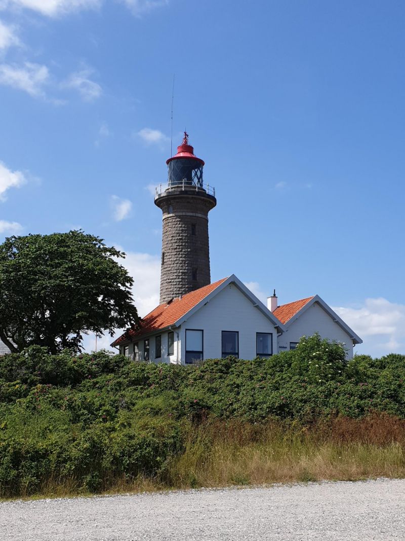
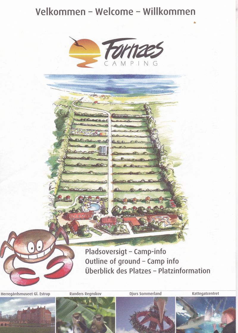
Fornæs Camping, Stensmarkvej, Grenaa, Dänemark
Beautiful campsite on the Baltic Sea; unfortunately only pebble beach. Fornaes Fyr Lighthouse is only 5 minutes away.
Stensmarkvej 36, 8500 Grenå, Dänemark
56° 27' 13.7" N 10° 56' 24.7" E
56.4538047 10.9401942
• Head southeast on Stensmarkvej. Go for 3.3 km.
• Turn slightly right onto Stensmarkvej. Go for 375 m.
• Take the 2nd exit from roundabout onto Kattegatvej. Go for 490 m.
• Turn left onto Kattegatvej. Go for 1.6 km.
• Turn right onto Strandgade. Go for 280 m.
• Continue on Havnevej. Go for 1.4 km.
• Turn left onto Hornsleths Allé. Go for 268 m.
• Turn right onto Dunhammervej. Go for 40 m.
• Arrive at Dunhammervej. Your destination is on the right.
☍
7,7 km
( 11 min.)
Day
Grenaa, Dänemark
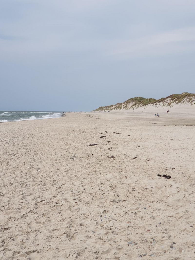
Typical tourist place, but nice pedestrian area and very nice sandy beach.
8500 Grenaa, Dänemark
56° 24' 42.5" N 10° 53' 41.7" E
56.4118080 10.8949190
• Head toward Engdalen on Dunhammervej. Go for 47 m.
• Turn right onto Engdalen. Go for 291 m.
• Turn left onto Havnevej. Go for 223 m.
• Continue on Østerbrogade. Go for 209 m.
• Take the 2nd exit from roundabout onto Østerbrogade. Go for 288 m.
• Continue on Østergade. Go for 185 m.
• Take the 1st exit from roundabout onto Rosengade. Go for 205 m.
• Turn left onto Bredgade. Go for 57 m.
• Continue on Markedsgade. Go for 614 m.
• Continue on Aksel H. Hansens Plads. Go for 70 m.
• Turn right onto Bavnehøjvej. Go for 1.1 km.
• Turn right onto Mellemstrupvej. Go for 92 m.
• Turn left onto Tyvhøjvej. Go for 663 m.
• Turn left onto Nordre Kattegatvej. Go for 51 m.
• Turn right onto Tyvhøjvej. Go for 749 m.
• Continue on Grenaavej. Go for 4.5 km.
• Turn left onto Grenaavej. Go for 821 m.
• Turn right onto Grenaavej. Go for 1.2 km.
• Continue on Hestehavevej. Go for 737 m.
• Turn right onto Maria Hjerte Engen. Go for 221 m.
• Arrive at Maria Hjerte Engen. Your destination is on the right.
☍
12,3 km
( 16 min.)
Day
Sostrup Slot, Grenaa, Dänemark
Sostrup Slot, 8500 Grenå, Dänemark
56° 29' 45" N 10° 49' 25" E
56.4958330 10.8236110
• Head toward Hestehavevej on Maria Hjerte Engen. Go for 221 m.
• Turn right onto Hestehavevej. Go for 114 m.
• Turn left onto Rødeled Vej. Go for 290 m.
• Continue on Præstevej. Go for 4.9 km.
• Continue on Hemmed Kirkevej. Go for 87 m.
• Turn left onto Hemmedvej. Go for 2.3 km.
• Turn right onto Glesborg Bygade. Go for 167 m.
• Turn left onto Laenvej. Go for 433 m.
• Take the 1st exit from roundabout onto Kastbjergvej (547). Go for 9.2 km.
• Take the 2nd exit from roundabout onto Kastbjergvej (547). Go for 9.7 km.
• Turn right onto Voer Færgevej. Go for 5.1 km.
• Continue on Hevringvej. Go for 3.5 km.
• Turn right onto Storegade. Go for 276 m.
• Turn right onto Rougsøvej (531). Go for 13.2 km.
• Arrive at Rougsøvej (531). Your destination is on the left.
☍
49,4 km
( 49 min.)
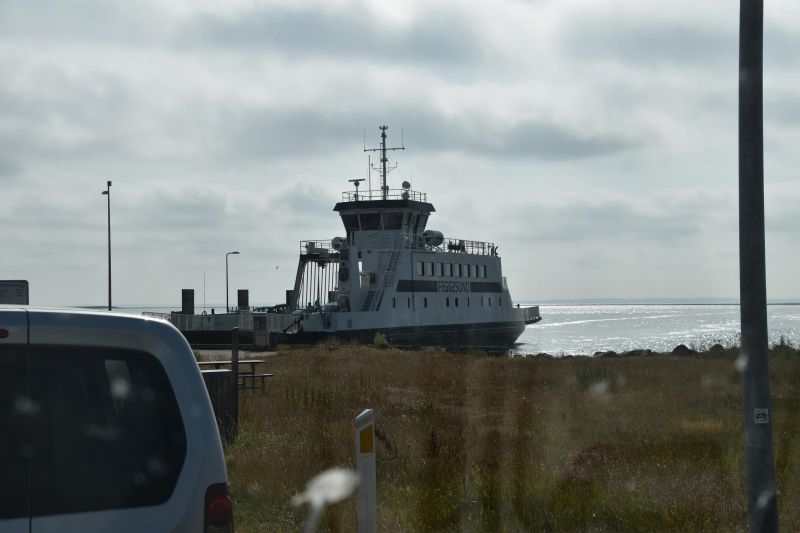
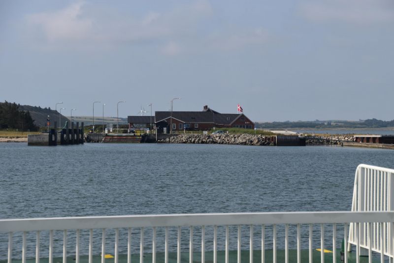
Fähre Udbyhoj bei Ørsted, Dänemark
Einzige Kabelfähre Dänemarks.
Rougsøvej 277A, 8950 Ørsted, Dänemark
56° 36' 20.8" N 10° 18' 9.1" E
56.6057722 10.3025410
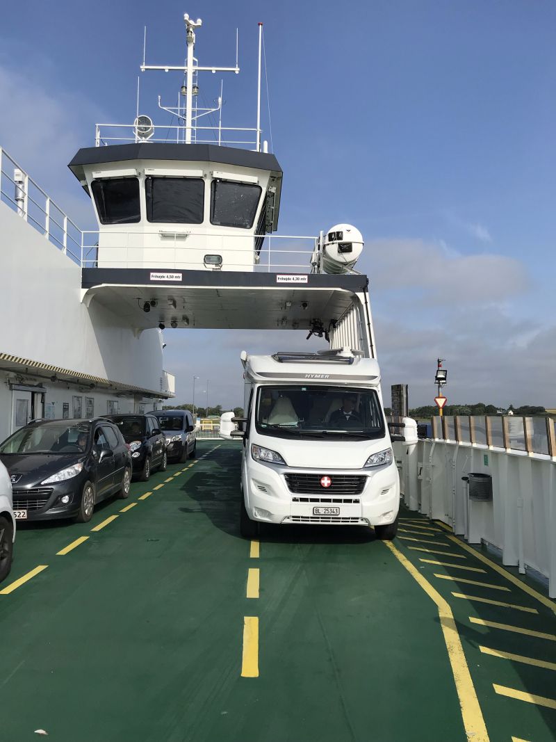
• Head northwest on Rougsøvej (531). Go for 140 m.
• Take the Udbyhøj-Udbyhøj Vasehuse Ferry. Stay on for 284 m.
• Head northwest on Færgevej (531). Go for 1.6 km.
• Turn left onto Udbyhøjvej (531). Go for 3.0 km.
• Turn right onto Kronborgvej (531). Go for 3.3 km.
• Turn right onto Møgelvangsvej. Go for 201 m.
• Continue on Trudsholmvej. Go for 3.6 km.
• Turn left onto Vesterbro. Go for 799 m.
• Turn right onto Landevejen (507). Go for 7.6 km.
• Take the 1st exit from roundabout onto Randersvej (507). Go for 716 m.
• Take the 1st exit from roundabout onto Alsvej (541). Go for 161 m.
• Pass 3 roundabouts and continue on Alsvej (541). Go for 10.1 km.
• Continue on Hadsundvej (541). Go for 2.0 km.
• Continue on Øster Hurupvej (541). Go for 1.8 km.
• Continue on Kystvejen (541). Go for 3.7 km.
• Turn right onto Gammel Krovej. Go for 126 m.
• Turn left onto Kongensvej. Go for 77 m.
• Turn right onto Novostien. Go for 112 m.
• Arrive at Novostien. Your destination is on the right.
☍
39,3 km
(1 hrs. 9 min.)
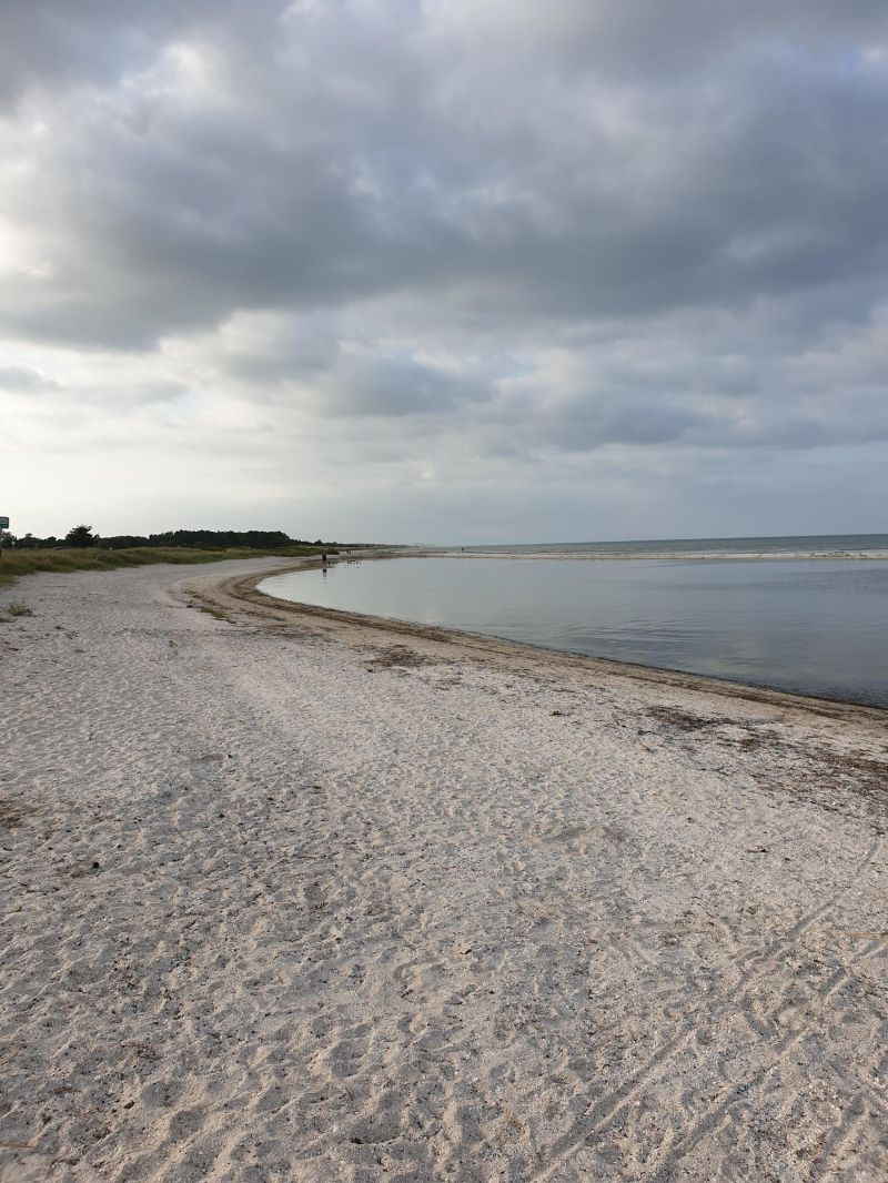
Øster Hurup Strand ved havnen, Hadsund Sogn, Dänemark
Parking space directly at the marina (150 DKK). Place is pure tourist rip-off, but good ice cream parlor.
Øster Hurup Strand bei der Hafen, 9560 Hadsund Sogn, Dänemark
56° 48' 10.9" N 10° 16' 32.4" E
56.8030286 10.2756604
• Head toward Kongensvej on Novostien. Go for 112 m.
• Turn slightly right onto Kongensvej. Go for 18 m.
• Turn left onto Novovej. Go for 171 m.
• Turn right onto Kystvejen (541). Go for 718 m.
• Continue on Dokkedalvej (541). Go for 5.3 km.
• Continue on Kystvej (541). Go for 12.1 km.
• Turn left onto Egensevej (595). Go for 17.8 km.
• Turn right onto Tranholmvej. Go for 557 m.
• Turn left onto Humlebakken. Go for 3.5 km.
• Turn right onto Hadsundvej. Go for 1.3 km.
• Continue on Østerbro. Go for 21 m.
• Continue on Skibsbyggerivej. Go for 240 m.
• Turn left onto Nyhavnsgade. Go for 331 m.
• Keep right onto Nyhavnsgade. Go for 375 m.
• Continue on Nyhavnsgade (O1). Go for 599 m.
• Continue on Slotspladsen (O1). Go for 247 m.
• Continue on Strandvejen (O1). Go for 117 m.
• Turn left onto Ved Stranden. Go for 61 m.
• Turn left onto Ved Stranden. Go for 120 m.
• Turn slightly right onto Østerågade. Go for 143 m.
• Arrive at Østerågade. Your destination is on the left.
☍
43,7 km
( 43 min.)
Day
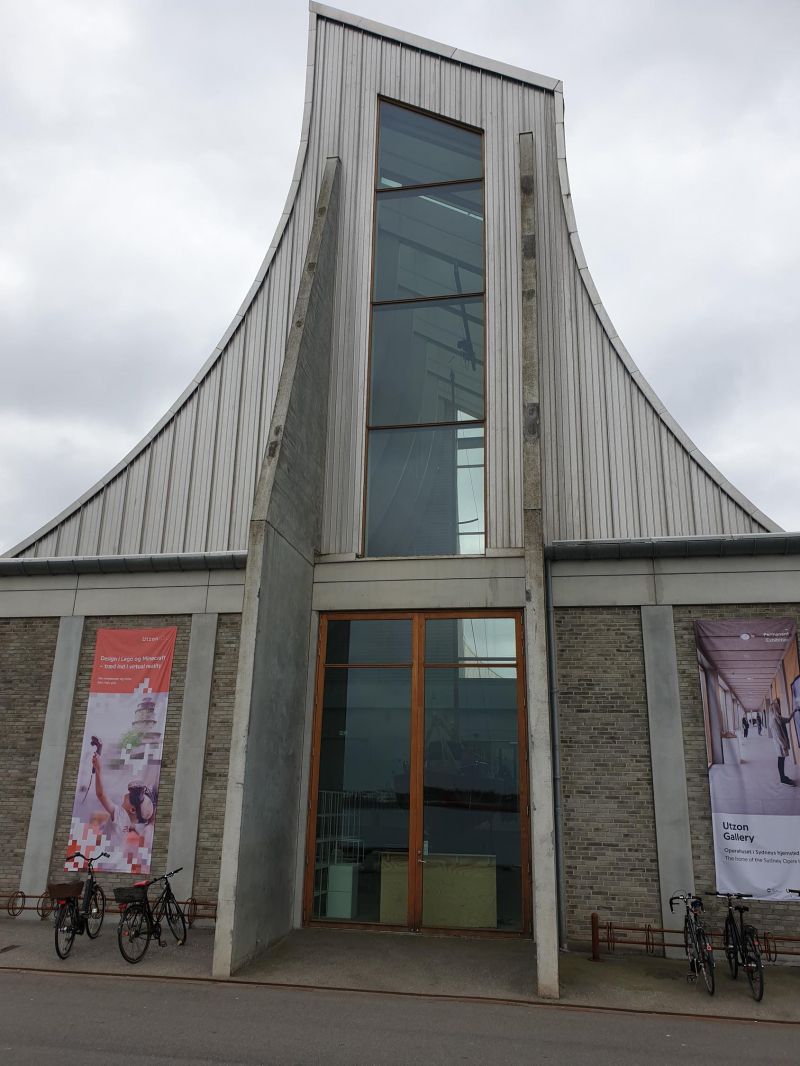
Aalborg, Dänemark
Aalborg is the fourth largest city in Denmark with a large old town.
Aalborg in North Jutland has one major attraction: the Utzon Center on the rediscovered harbor front on the Limfjord is a 2,400 square meter spectacular multifunctional building with exhibition rooms, an architectural library, a large auditorium for concerts and conferences and an archive with drawings and designs by the Danish architect legend Jørn Utzon, who also designed the Sydney Opera.
57° 2' 55.8" N 9° 55' 18.3" E
57.0488195 9.9217470
• Head toward Lille Kongensgade on Østerågade. Go for 143 m.
• Turn slightly left onto Ved Stranden. Go for 268 m.
• Continue on Borgergade. Go for 113 m.
• Turn right onto Vesterbro (O1). Go for 741 m.
• Keep right onto Østerbrogade (180) toward E39/E45/Havn/Centrum. Go for 1.3 km.
• Keep left onto Hjørringvej (180) toward Vodskov/Hirtshals/E39/Frederikshavn/E45. Go for 78 m.
• Continue on Hjørringvej (180). Go for 777 m.
• Turn right onto Sundsholmen toward Fr Havn/E45/Hirtshals/E39/Løkken/55. Go for 435 m.
• Take ramp onto E45 (Nordjyske Motorvej) toward Frederikshavn/Hirtshals/E39/Løkken/55. Go for 42.9 km.
• Take exit 13 toward Sæby S/Syvsten. Go for 579 m.
• Take the 2nd exit from roundabout onto Ålborgvej (180/541) toward Sæby/Hals. Go for 2.0 km.
• Take the 2nd exit from roundabout onto Ålborgvej (180). Go for 1.7 km.
• Take the 1st exit from roundabout onto Sønder Ringvej. Go for 665 m.
• Take the 2nd exit from roundabout onto Sønder Ringvej. Go for 257 m.
• Turn left onto Christian Pedersensvej. Go for 176 m.
• Arrive at Christian Pedersensvej. Your destination is on the left.
☍
52,2 km
( 35 min.)
Sæby, Dänemark
Sæby is considered the epitome of dreamy Danish small town idyll and is at the same time an attractive holiday resort with direct access to the wide, child-friendly beach on the east coast. Here you can experience an urban ambience steeped in history with old but well-preserved houses, promenades, market squares and cobbled streets.
9300 Sæby, Dänemark
57° 19' 51.1" N 10° 30' 59.9" E
57.3308698 10.5166277
• Head north on Christian Pedersensvej. Go for 59 m.
• Turn left onto Kappelhavevej. Go for 207 m.
• Turn right onto Kappelhavevej. Go for 54 m.
• Continue on Toldbodvej. Go for 123 m.
• Continue on H. Nielsens Plads. Go for 95 m.
• Continue on P. Lunds Vej. Go for 400 m.
• Turn left onto Skovalleen. Go for 79 m.
• Turn right onto Skovalleen. Go for 21 m.
• Turn right onto Ålborgvej (180). Go for 690 m.
• Take the 3rd exit from roundabout onto Frederikshavnsvej (180). Go for 4.2 km.
• Take ramp onto E45 (Europavej) toward Frederikshavn. Go for 6.5 km.
• Continue on Havnepladsen (35/40). Go for 1.7 km.
• Continue on Skagensvej (40) toward Skagen. Go for 1.9 km.
• Pass 6 roundabouts and continue on Ålbækvej (40). Go for 34.2 km.
• Continue on Frederikshavnsvej (40). Go for 24 m.
• Turn right onto Flagbakkevej. Go for 315 m.
• Arrive at Flagbakkevej. Your destination is on the left.
☍
50,5 km
( 44 min.)
Skagen Camping
On the way north.
Skagen Camping: 5km south of Skagen, large site with more than 400 rather small pitches, swimming pool, 294 DKK
Flagbakkevej 55, 9990, Skagen, Dänemark
57° 43' 10.6" N 10° 32' 32.3" E
57.7196000 10.5423000
• Head west on Flagbakkevej. Go for 315 m.
• Turn right onto Frederikshavnsvej (40). Go for 1.7 km.
• Take the 2nd exit from roundabout onto Kattegatvej. Go for 651 m.
• Turn left onto Buttervej. Go for 365 m.
• Take the 2nd exit from roundabout onto Bøjlevejen. Go for 3.3 km.
• Take the 2nd exit from roundabout onto Fyrvej (40). Go for 1.8 km.
• Take the 1st exit from roundabout onto Åkandevej. Go for 134 m.
• Arrive at Åkandevej.
☍
8,3 km
( 10 min.)
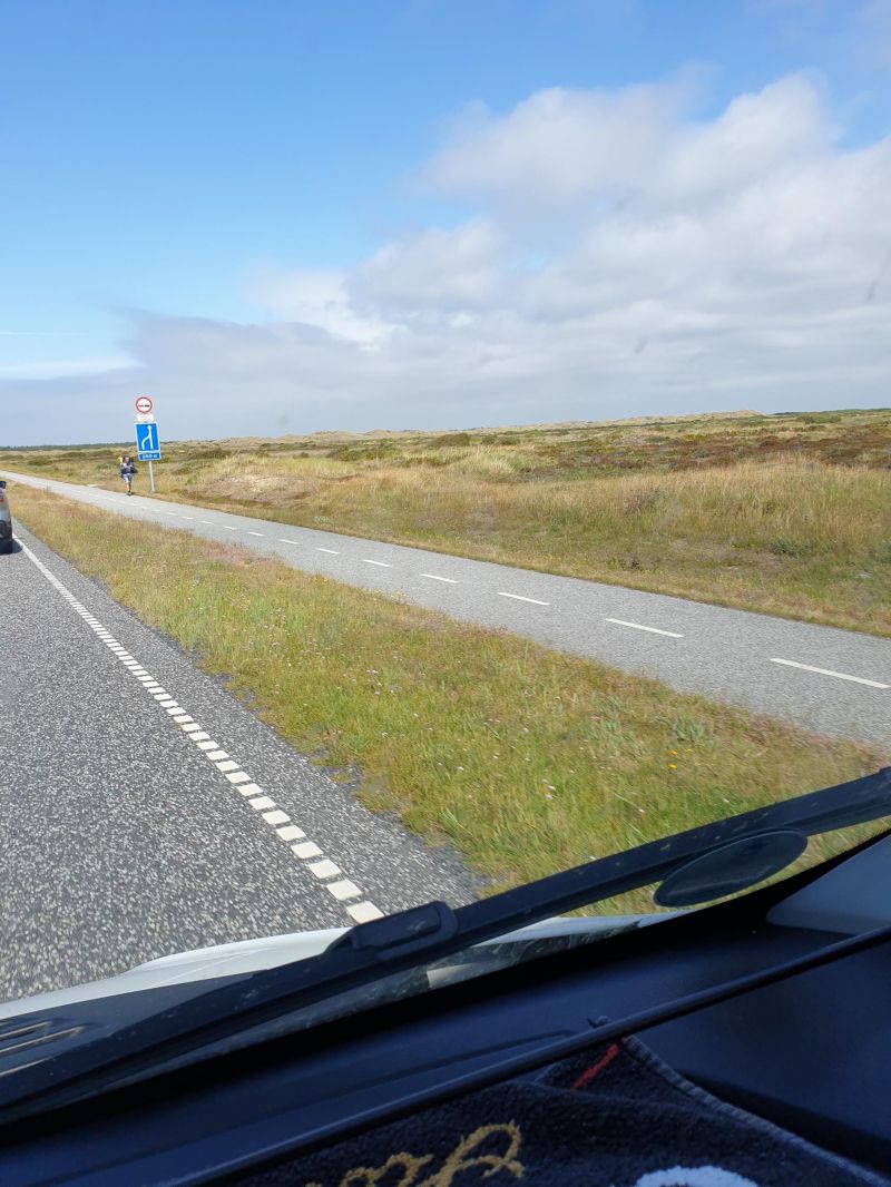
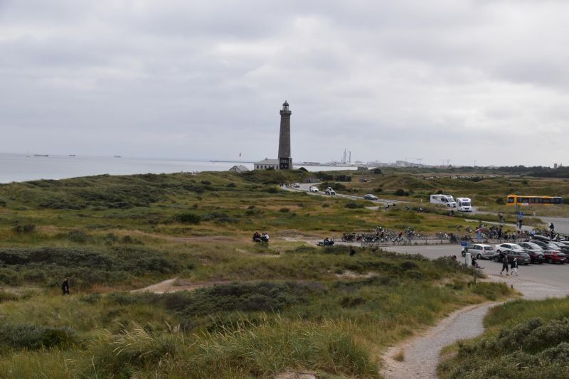
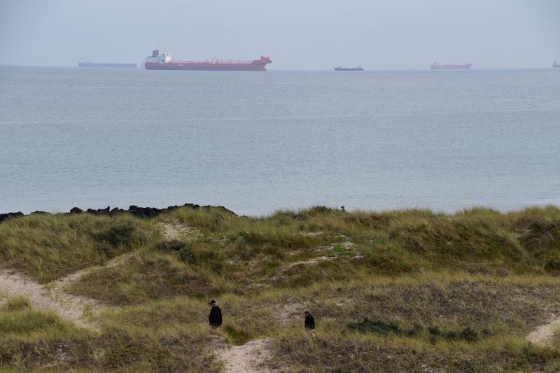
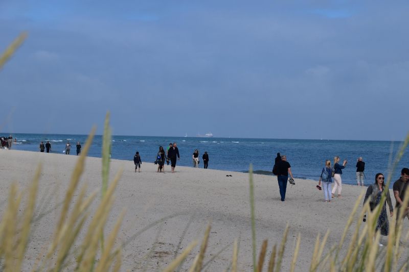
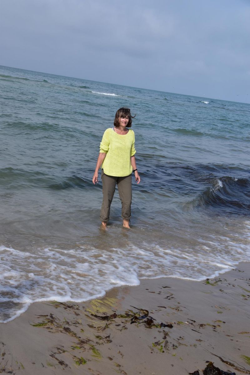
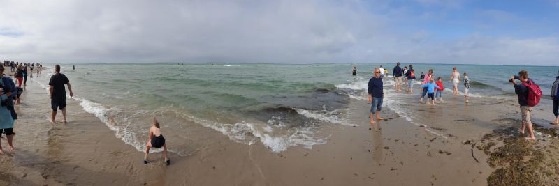
Grenen, Skagen, Dänemark
Northern tip of Denmark:
Skagerrak (North Sea) and Kattegat (Baltic Sea) meet at the northern long sandy beach of Grenen. Attention: thousands of tourists make a pilgrimage here! So do we.
Grenen, 9990 Skagen, Dänemark
57° 44' 37" N 10° 38' 43" E
57.7436111 10.6452779
• Head toward Fyrvej on Åkandevej. Go for 89 m.
• Take the 2nd exit from roundabout onto Fyrvej (40). Go for 1.8 km.
• Take the 1st exit from roundabout onto Bøjlevejen. Go for 3.3 km.
• Take the 3rd exit from roundabout onto Buttervej. Go for 430 m.
• Turn right onto Kattegatvej. Go for 562 m.
• Take the 1st exit from roundabout onto Frederikshavnsvej (40). Go for 10.9 km.
• Take the 1st exit from roundabout onto Kandestedvej. Go for 3.0 km.
• Turn left onto Milevejen. Go for 8 m.
• Continue on Råbjerg Mile Vej. Go for 666 m.
• Arrive at Råbjerg Mile Vej.
☍
20,8 km
( 22 min.)
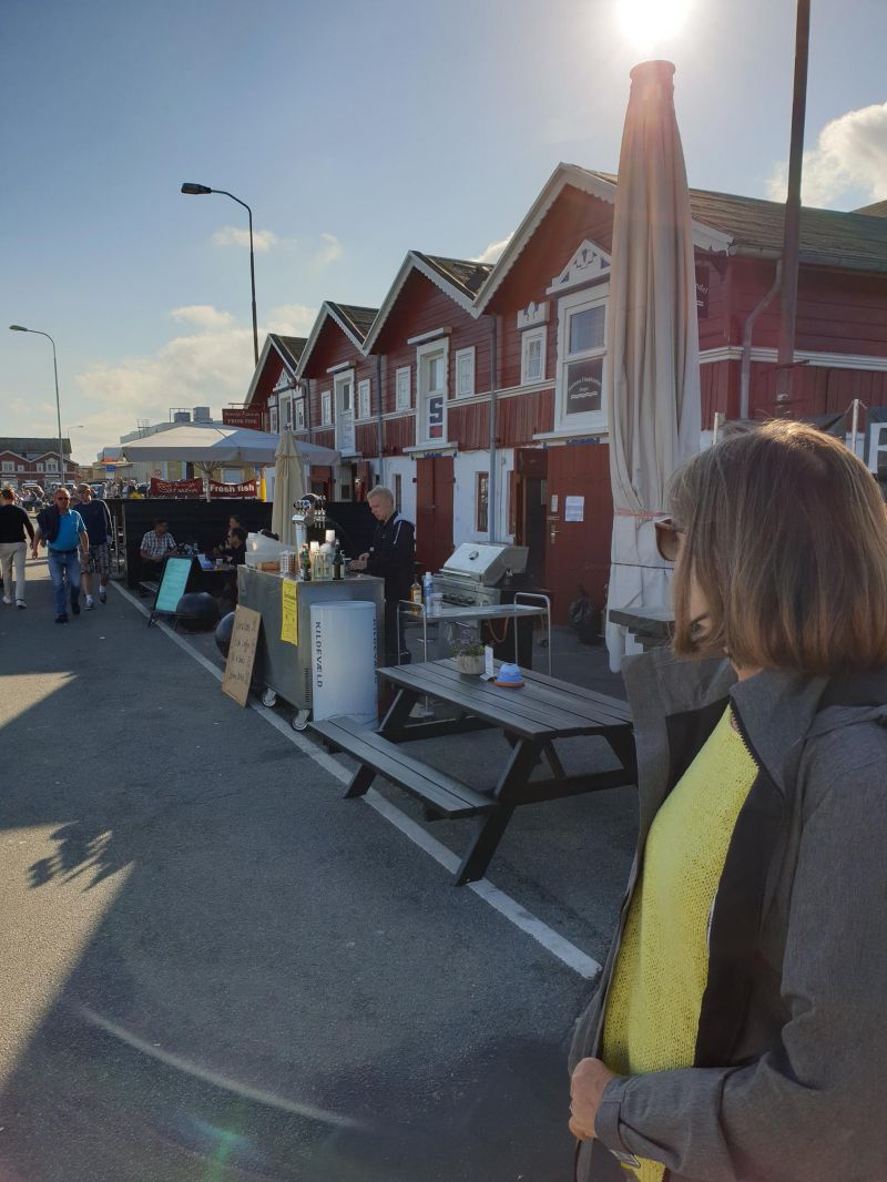
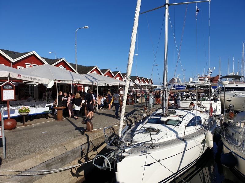
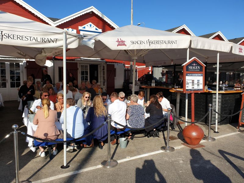
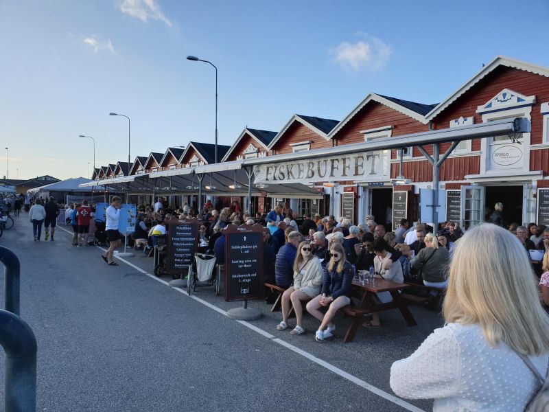
Skagen, Dänemark
Skagen is the northernmost town in Denmark. The important port city, which is also a well-visited seaside resort, is located on the northern tip of Jutland.
Day
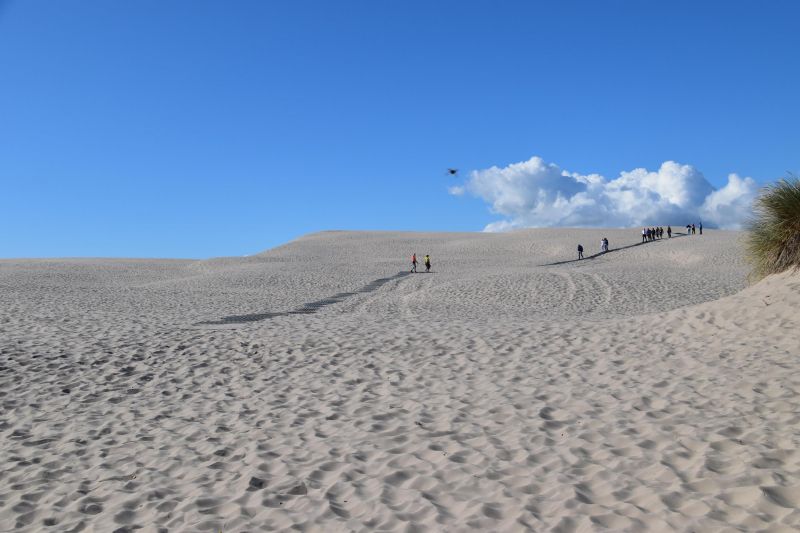
Råbjerg Mile, bei Skagen, Dänemark
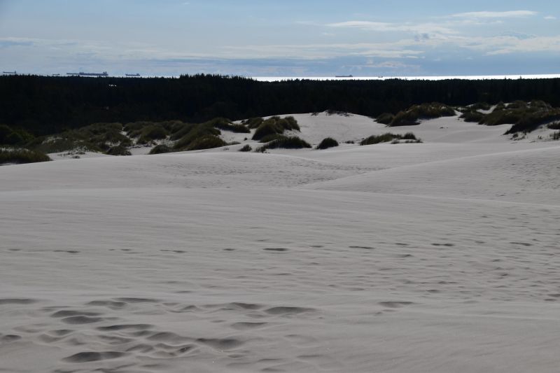
Råbjerg Mile is a shifting dune on the northern tip of Jutland. The sand masses reach heights of more than 40 meters and cover an area of about 120 ha. Due to the prevailing westerly winds, the sand moves in an easterly direction towards the Kattegat. Each year, the dune moves back an average of 15 meters. It is estimated that Råbjerg Mile will reach the 3.5 km distant road to Skagen around the year 2130 and will disappear into the Baltic Sea after another 30 years.
Råbjerg Mile Vej, 9990 Skagen, Dänemark
57° 38' 53.5" N 10° 24' 21.3" E
57.6481856 10.4059115
• Head northwest on Råbjerg Mile Vej. Go for 666 m.
• Continue on Milevejen. Go for 8 m.
• Turn right onto Kandestedvej. Go for 3.0 km.
• Take the 1st exit from roundabout onto Ålbækvej (40). Go for 6.3 km.
• Take the 1st exit from roundabout onto Hirtshalsvej (597). Go for 15.3 km.
• Take the 2nd exit from roundabout onto Skagensvej (597). Go for 10.6 km.
• Take the 1st exit from roundabout onto Aalborgvej (E39) toward Hirtshals. Go for 2.2 km.
• Take the 3rd exit from roundabout onto Dalsagervej (55) toward Tornby/Hirtshals S. Go for 184 m.
• Turn right onto Søndergade toward Hirtshals C. Go for 1.0 km.
• Take the 1st exit from roundabout onto Margrethevej. Go for 774 m.
• Turn right onto Lillehedenvej. Go for 93 m.
• Arrive at Lillehedenvej. Your destination is on the right.
☍
40,2 km
( 34 min.)
Hirtshals, Dänemark
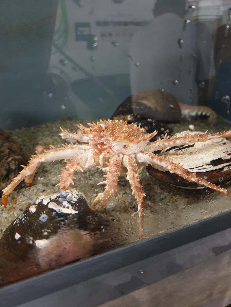
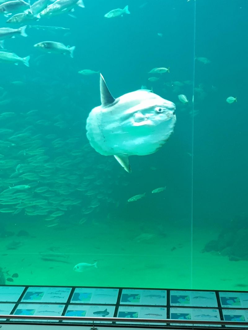
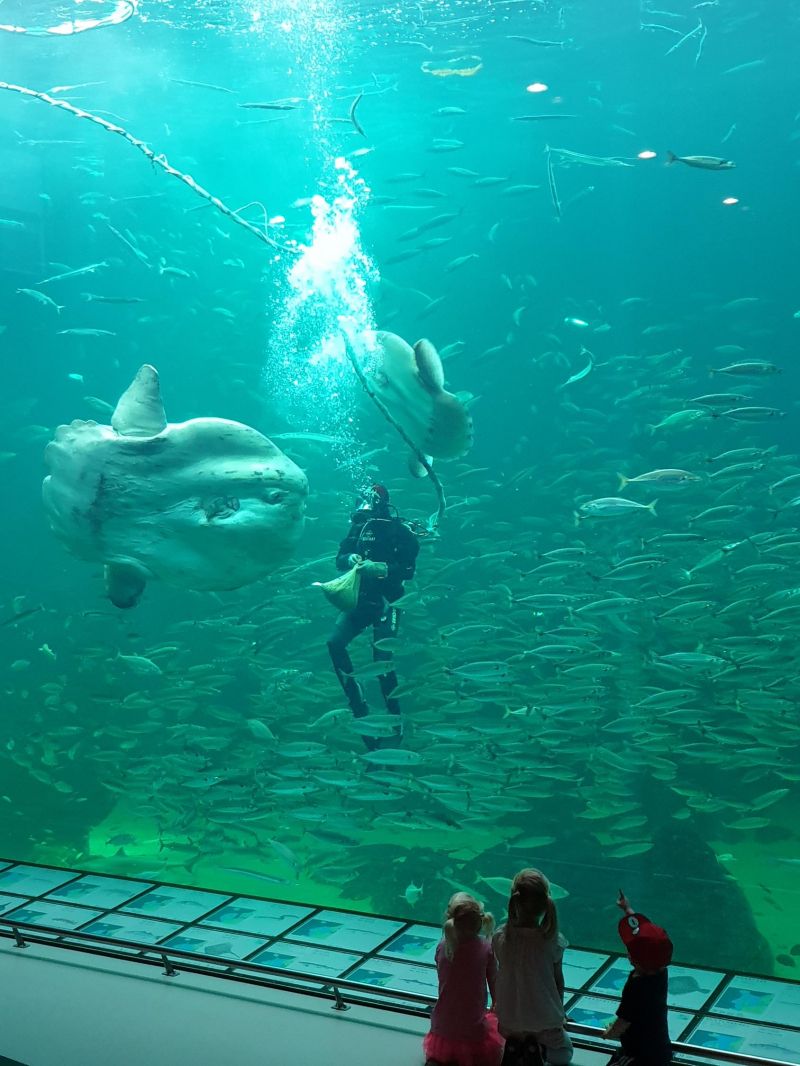
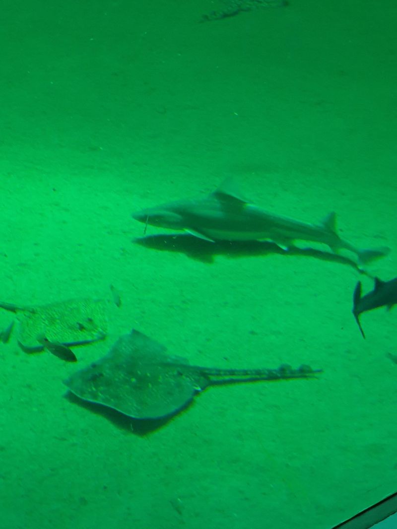
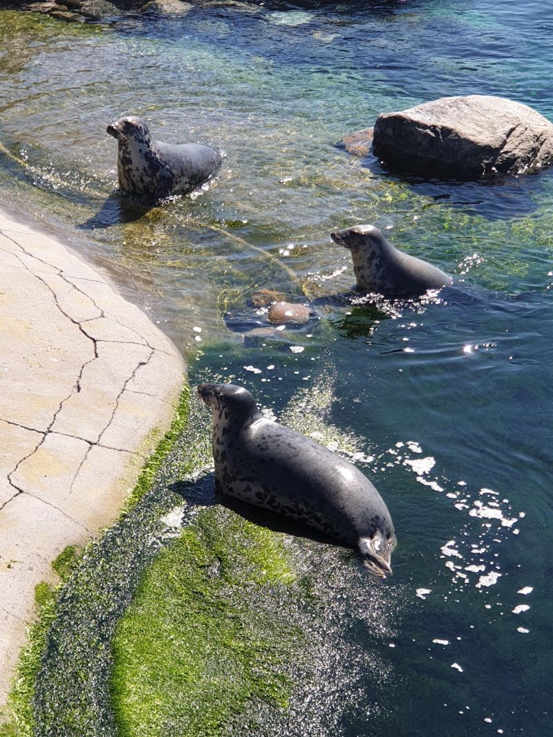
The largest seawater aquarium in Europe is in Hirtshals: Oceanarium. The main attraction of the aquarium is a huge, 5m high tank in which whole schools of fish and 2 sunfish live.
9850 Hirtshals, Dänemark
57° 35' 13" N 9° 58' 0.6" E
57.5869530 9.9668379
• Head east on Lillehedenvej. Go for 25 m.
• Turn left onto Damsvej. Go for 111 m.
• Turn left onto Østergade. Go for 133 m.
• Take the 1st exit from roundabout onto Margrethevej. Go for 193 m.
• Continue on Jørgen Fibigersgade. Go for 64 m.
• Take the 4th exit from roundabout onto Jyllandsgade. Go for 385 m.
• Take the 3rd exit from roundabout onto Hovedvejen. Go for 13.0 km.
• Turn right onto Skallerupvej toward Skallerup Klit/Lønstrup/Sønderlev. Go for 8.4 km.
• Turn right onto Lønstrupvej. Go for 1.5 km.
• Continue on Strandvejen. Go for 562 m.
• Turn left onto Rubjergvej. Go for 300 m.
• Arrive at Rubjergvej. Your destination is on the right.
☍
24,7 km
( 25 min.)
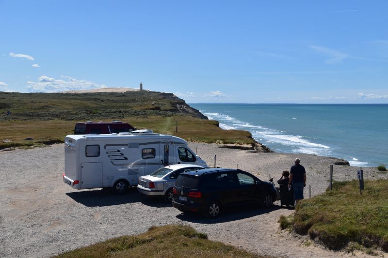
Mårup Kirke, Rubjergvej, Lønstrup, Dänemark
Mårup is a former church site in Lønstrup, located directly at Jammerbugten on the North Sea. The cliffs of Lønstrup Klint are 12 km long. Due to erosion, parts of the coast are constantly being eroded. To prevent the church from falling into the sea, it was demolished in 2007. The cemetery still exists, but the graves will soon fall into the sea.
A small parking lot is located directly at the cliff. Overnight stays are not prohibited and are used extensively. No infrastructure available.
9800 Lønstrup, Dänemark
57° 27' 59" N 9° 47' 49.3" E
57.4663850 9.7970310
• Head toward Nordsøvej on Rubjergvej. Go for 4.0 km.
• Continue on Lønstrupvej. Go for 4.1 km.
• Turn right onto Løkkensvej (55) toward Løkken. Go for 5.8 km.
• Pass 4 roundabouts and continue on Omfartsvejen (55). Go for 24.3 km.
• Turn right onto Gammel Landevej. Go for 1.3 km.
• Continue on Sandmosevej. Go for 17 m.
• Continue on Gammel Landevej. Go for 1.2 km.
• Take the 1st exit from roundabout onto Tranumvej. Go for 4.8 km.
• Continue on Tranum Engevej. Go for 2.1 km.
• Take the 2nd exit from roundabout onto Tranum Engevej. Go for 5.0 km.
• Continue on Dybdalsvej. Go for 1.3 km.
• Continue on Drosselvej. Go for 12 m.
• Continue on Dybdalsvej. Go for 898 m.
• Take the 2nd exit from roundabout onto Hjortdalvej. Go for 3.5 km.
• Turn left onto Bonderupvej. Go for 2.0 km.
• Continue on Mellemmøllevej. Go for 792 m.
• Turn right onto Ålborgvej (11). Go for 27.2 km.
• Turn left onto Amtoftvej (581) toward Nykøbing/Feggesund. Go for 4.5 km.
• Turn left onto Gårdbækvej. Go for 63 m.
• Arrive at Gårdbækvej. Your destination is on the left.
☍
92,9 km
(1 hrs. 14 min.)
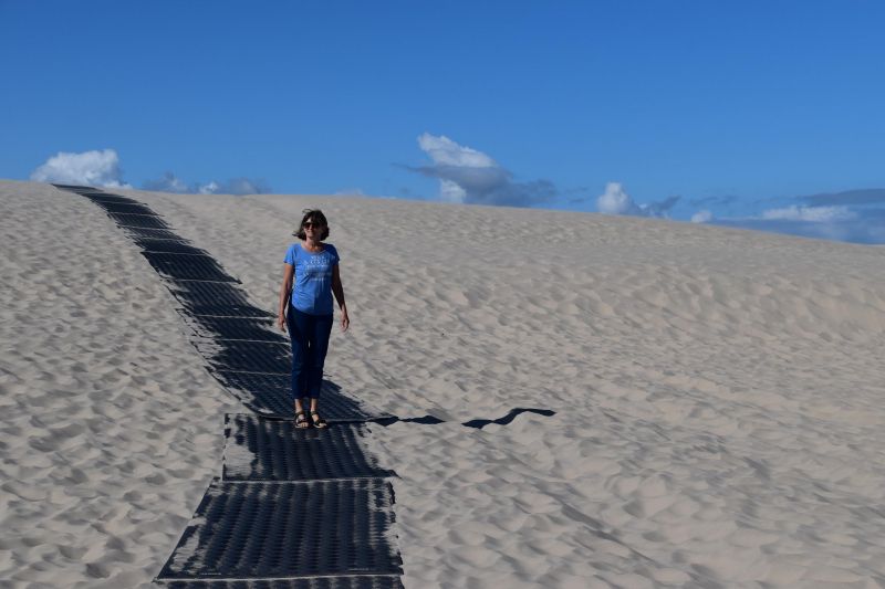
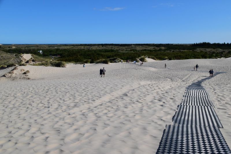
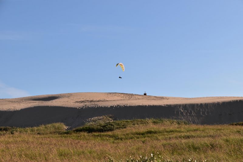
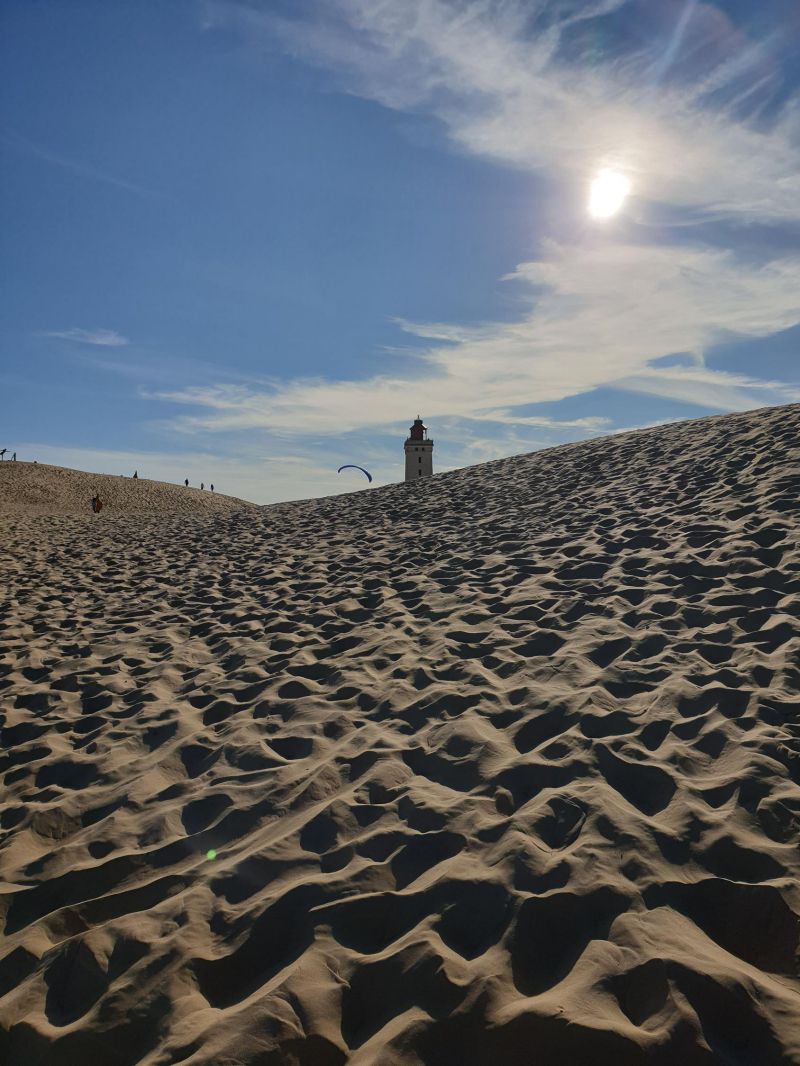
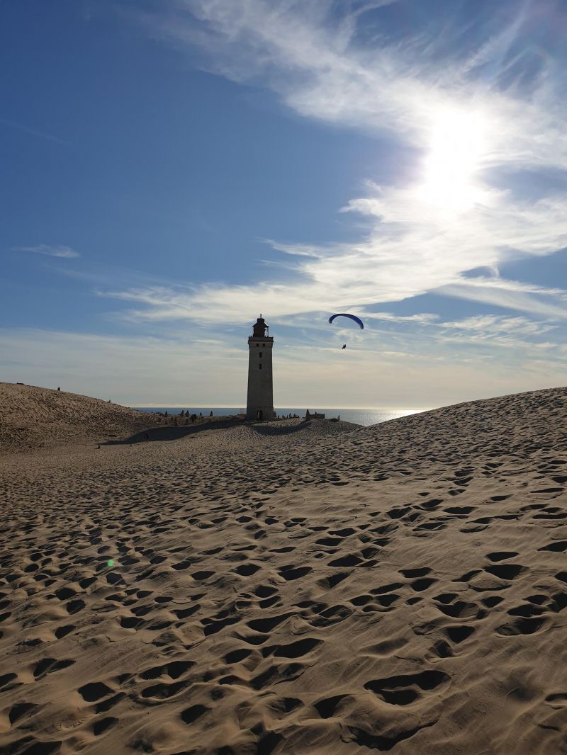
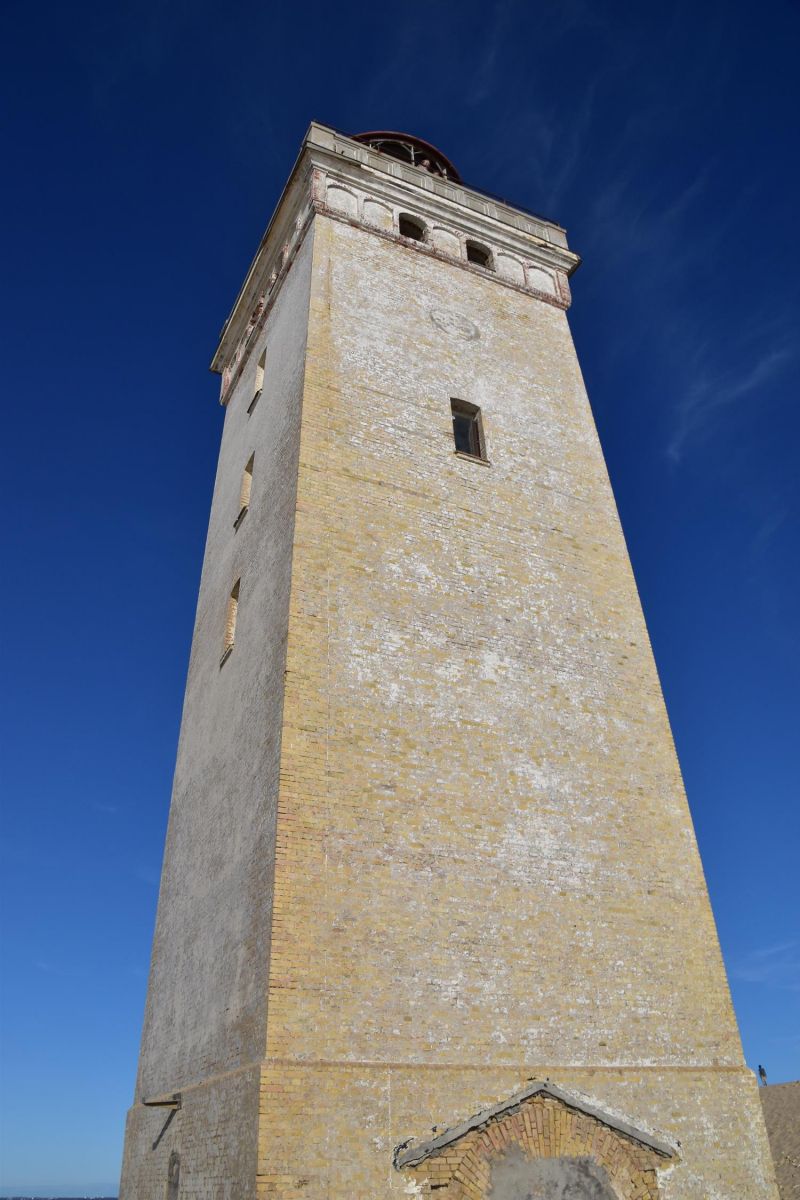
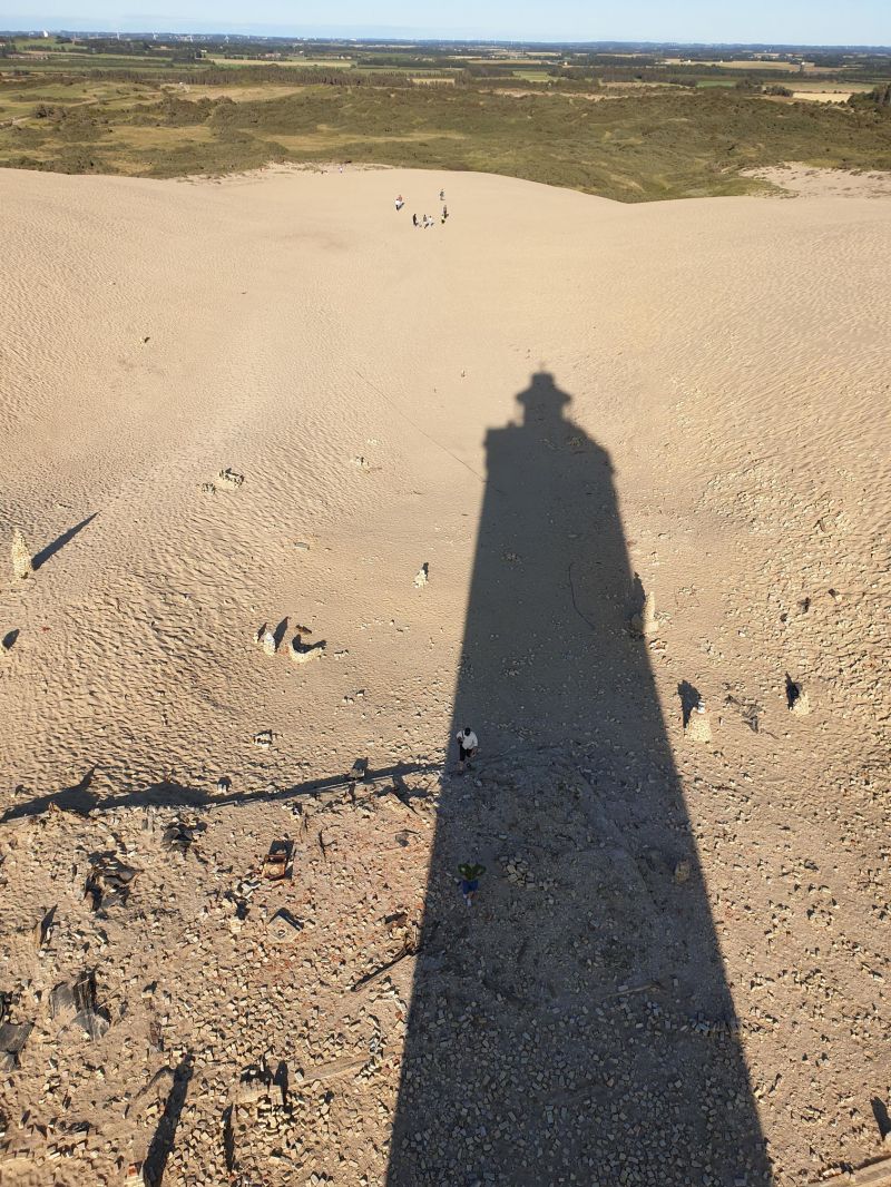
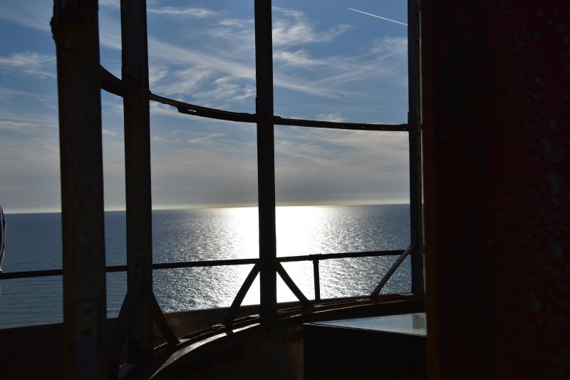
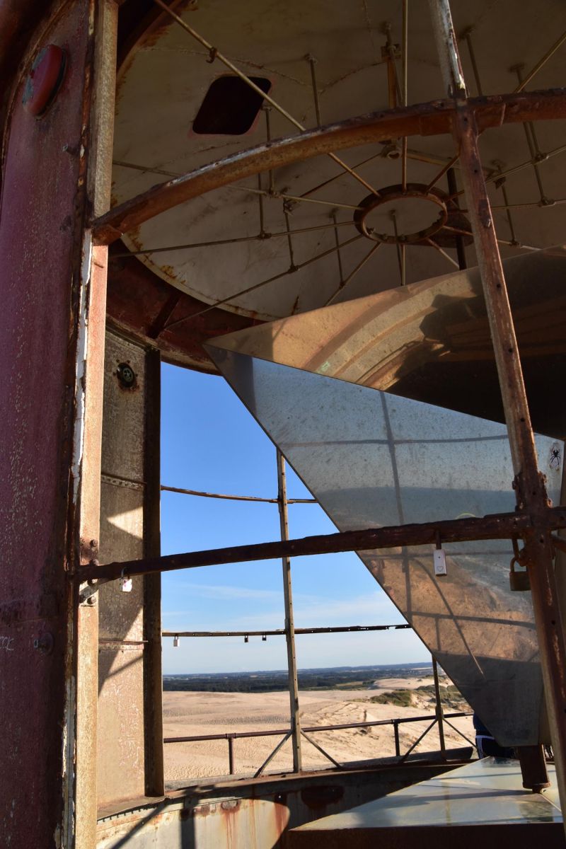
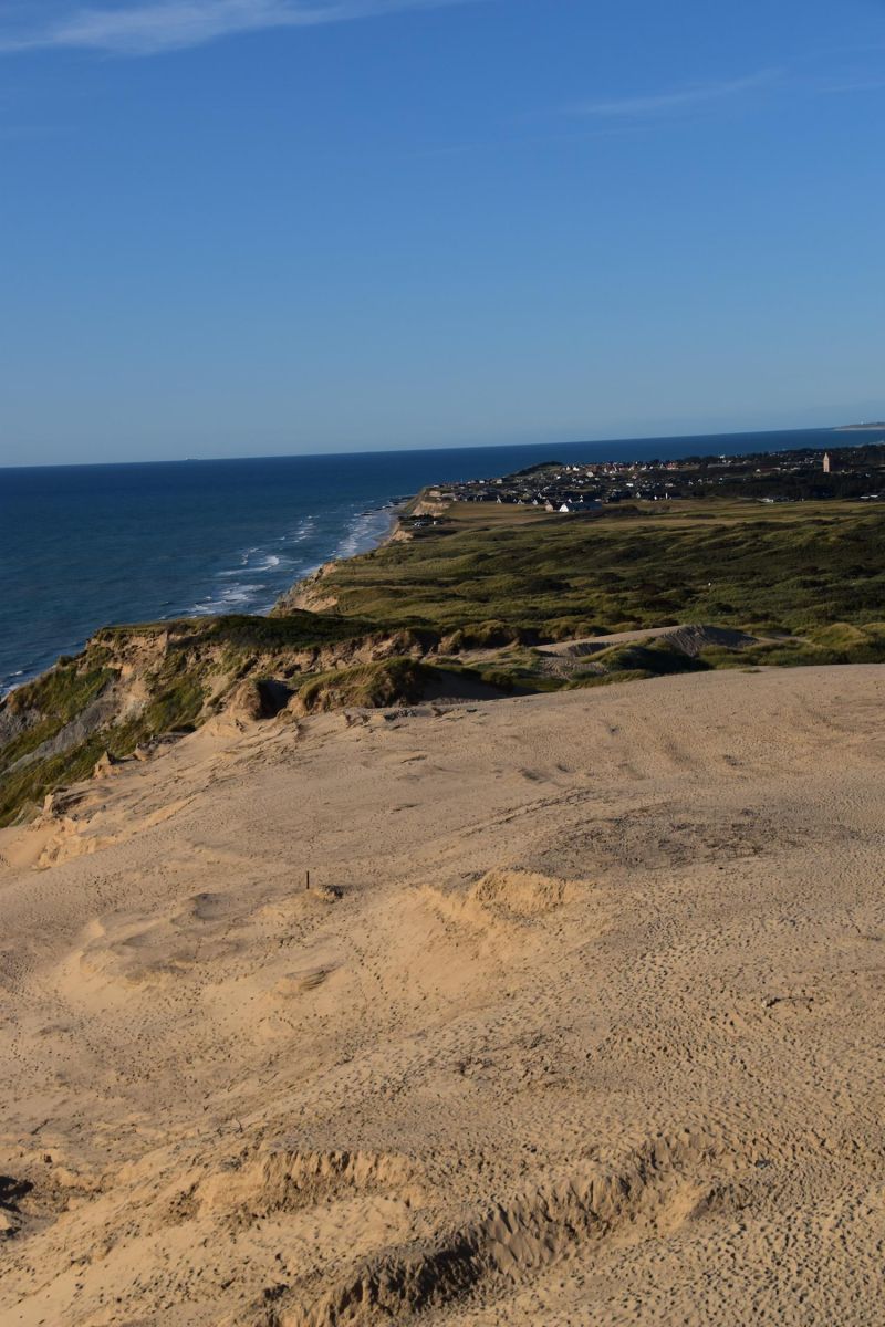
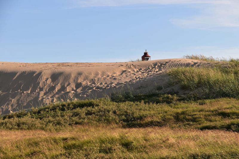
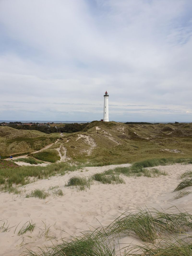
Rubjerg Knude zwischen Lønstrup und Løkken, Dänemark
An absolute highlight of our tour of Denmark!!
The walk to the 90m high sand dune with the old lighthouse is definitely worth it and an event in itself. Arrived at the lighthouse you can see the remains of the houses that were buried here by the shifting dune. The tower itself had also almost completely disappeared, but the sand has now uncovered it.
The view of the cliffs is beautiful too! A strong wind is blowing, which almost knocks you out, but that's (luckily) part of the coast! And cliff surfers take advantage of the strong updraft and glide along the coast directly above our heads.
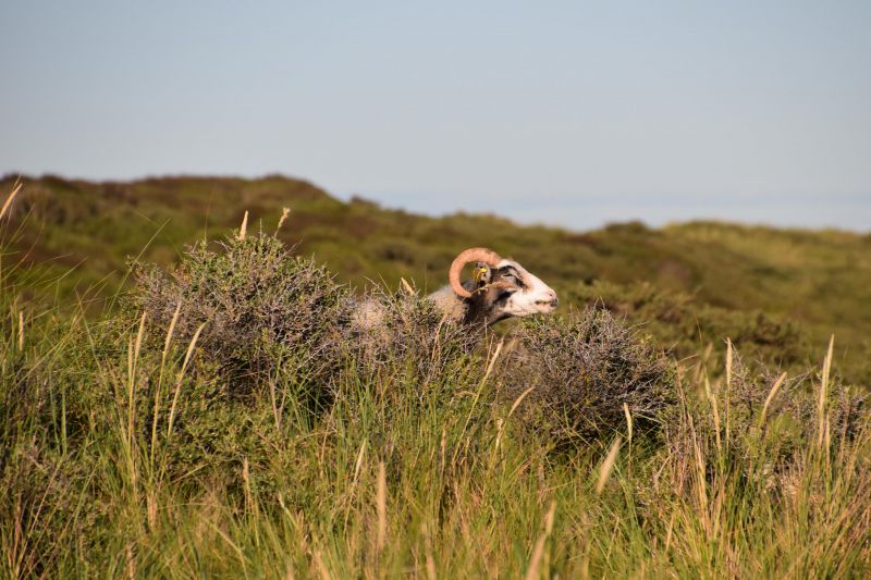
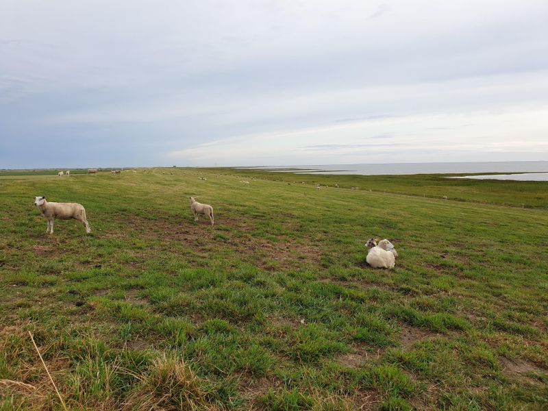
On the way there it is worth taking a look at the sheep resting under the crooked trees - a beautiful picture!
Day
Amtoft Havn, Gårdbækvej, Vesløs, Dänemark
Gårdbækvej 2, 7742 Vesløs, Dänemark
57° 0' 23" N 8° 56' 28" E
57.0064000 8.9411220
• Head northwest on Gårdbækvej. Go for 63 m.
• Turn left onto Amtoftvej (581). Go for 3.8 km.
• Take the Feggesund Nord-Feggesund Syd Ferry. Stay on for 917 m.
• Head south on 581. Go for 5 m.
• Arrive at 581.
☍
4,8 km
( 34 min.)
Day
Feggesund Havn, Nykøbing Mors, Dänemark
Feggesund ferry to Mors Island.
581,7900, 7900 Nykøbing Mors, Dänemark
56° 58' 29.6" N 8° 55' 19.4" E
56.9748762 8.9220603
• Head south on 581. Go for 20.2 km.
• Turn right onto Nørrebro (581). Go for 1.4 km.
• Turn left onto Vildsundvej (26) toward Nykøbing. Go for 22.1 km.
• Pass 3 roundabouts and continue on Nørre Boulevard. Go for 9.3 km.
• Continue on Ågade. Go for 630 m.
• Arrive at Ågade. Your destination is on the left.
☍
53,6 km
( 39 min.)
Skive, Dänemark
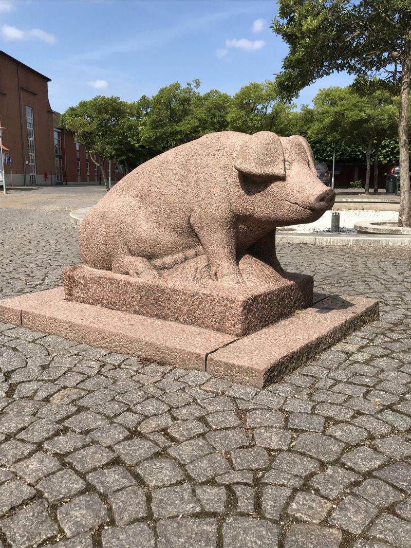
In Skive, tops aren't just tops. You are art. They are the 11 stars of Skive. Jacob Jensen has his design workshop here in Skive and created these sculptures. All sculptures stand in a granite compass rose.
7800 Skive, Dänemark
56° 33' 54.4" N 9° 1' 51.3" E
56.5651232 9.0309083
• Head toward Søndre Boulevard on Ågade. Go for 3 m.
• Turn right onto Østertorv. Go for 100 m.
• Continue on Slotsgade. Go for 94 m.
• Continue on Tværgade. Go for 134 m.
• Continue on Reberbanen. Go for 286 m.
• Continue on Møllegade. Go for 242 m.
• Continue on Holstebrovej. Go for 969 m.
• Take the 2nd exit from roundabout onto Holstebrovej. Go for 166 m.
• Take the 3rd exit from roundabout onto Herningvej (26/34) toward Skive/Herning. Go for 2.3 km.
• Take the 1st exit from roundabout onto Herningvej (34) toward Herning. Go for 9.6 km.
• Turn right onto Hjelmvej toward Sevel. Go for 3.7 km.
• Continue on Søgårdvej. Go for 2.2 km.
• Turn left onto Djeldvej. Go for 3.7 km.
• Continue on Skavevej. Go for 2.5 km.
• Continue on Sevelvej. Go for 1.7 km.
• Turn right onto Viborgvej (16) toward Holstebro. Go for 6.8 km.
• Pass 4 roundabouts and continue on Viborgvej (16/185). Go for 5.1 km.
• Turn left onto Ringvejen (11/16). Go for 1.8 km.
• Continue on Ringvejen (11/16). Go for 1.2 km.
• Continue on Ringvejen (16) toward Ringkøbing. Go for 29.7 km.
• Take the 2nd exit from roundabout onto Holstebrovej (16/28) toward Ringkøbing/Skjern. Go for 8.2 km.
• Continue on Holstebrovej (16). Go for 2.3 km.
• Take the 1st exit from roundabout onto Vestre Ringvej (15). Go for 2.5 km.
• Take the 1st exit from roundabout onto Søndervig Landevej (15). Go for 3.4 km.
• Take the 2nd exit from roundabout onto Søndervig Landevej (15). Go for 3.6 km.
• Take the 3rd exit from roundabout onto Holmsland Klitvej (181). Go for 9.0 km.
• Turn right onto Holmsland Klitvej. Go for 139 m.
• Arrive at Holmsland Klitvej. Your destination is on the left.
☍
101,3 km
(1 hrs. 23 min.)
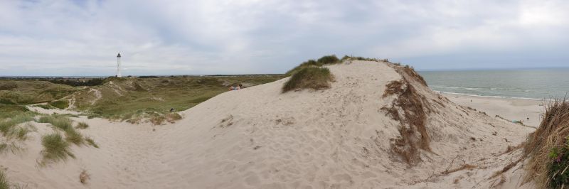
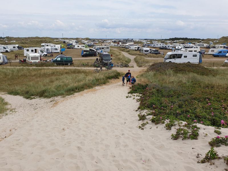
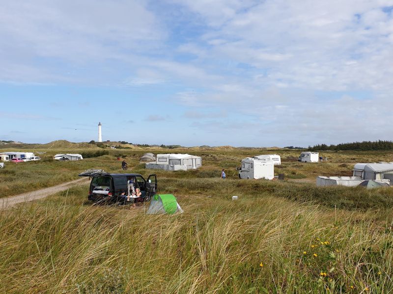
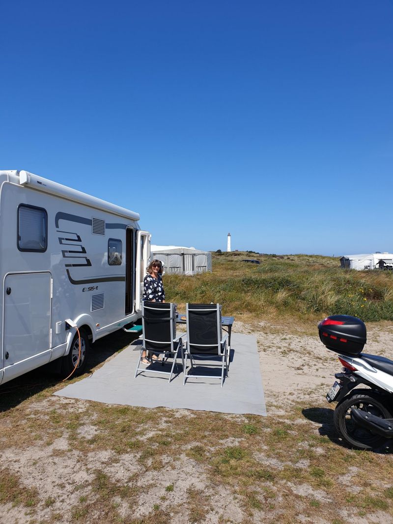
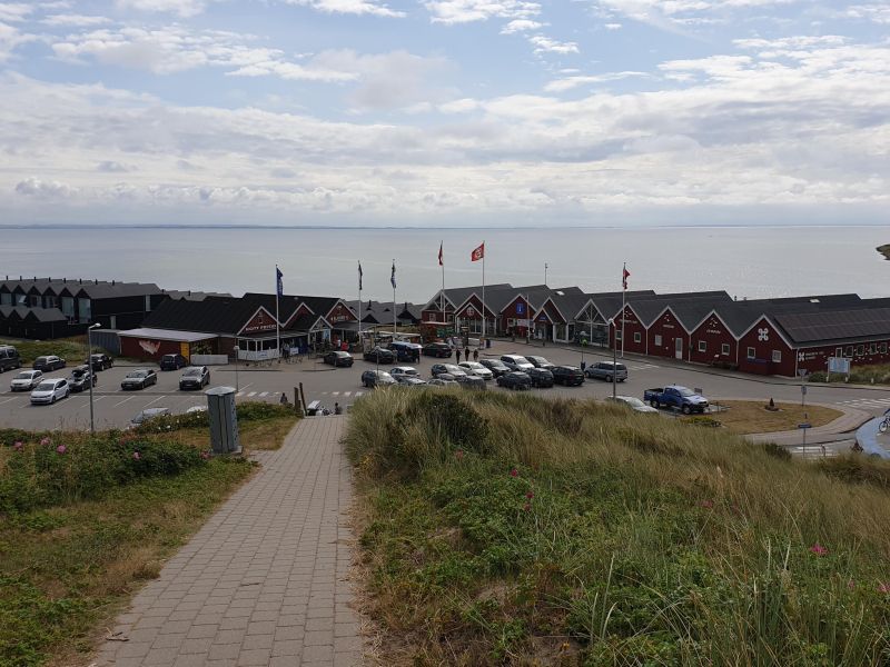
Nørre Lyngvig Camping, Hvide Sande, Dänemark
Excellent campsite located directly in the dunes with very modern sanitary facilities (200 DKK). From the WoMo view of the lighthouse Lyngvig Fyr. Long sandy beach behind the big dune.
Holmsland Klitvej 81, 6960, Hvide Sande, Dänemark
56° 2' 30.5" N 8° 6' 55.8" E
56.0418000 8.1155000
• Head east on Holmsland Klitvej. Go for 139 m.
• Turn right onto Holmsland Klitvej (181). Go for 2.3 km.
• Pass 6 roundabouts and continue on Vestre Landevej (181/431). Go for 53.4 km.
• Turn right onto Nordre Boulevard (431). Go for 2.5 km.
• Take the 2nd exit from roundabout onto Søndermarksvej (475). Go for 2.4 km.
• Turn right onto Ribevej. Go for 919 m.
• Continue on Ribevej (11) toward E20/Ribe. Go for 10.3 km.
• Take the 2nd exit from roundabout onto 11/191 toward Ribe/Esbjerg/Tjæreborg. Go for 3.9 km.
• Continue on Ålbæk Hovedvej (11) toward Ribe/Bramming. Go for 3.8 km.
• Pass 2 roundabouts and continue on Varde Hovedvej (11/24). Go for 17.6 km.
• Keep left onto Ringvejen (11/24). Go for 185 m.
• Take the 2nd exit from roundabout onto Plantagevej toward Ribe C. Go for 416 m.
• Take the 1st exit from roundabout onto Nørremarksvej. Go for 183 m.
• Continue on Rosen Alle. Go for 330 m.
• Turn left onto Tangevej. Go for 417 m.
• Turn right onto Bøge Alle. Go for 175 m.
• Turn right onto Bøge Alle. Go for 99 m.
• Turn right onto Kastanie Alle. Go for 54 m.
• Arrive at Kastanie Alle. Your destination is on the left.
☍
99,2 km
(1 hrs. 24 min.)
Day
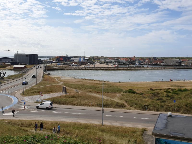
Hvide Sande, Dänemark
Port city on the west coast of Denmark on the Holmsland Klit Spit at the intersection between the North Sea and Ringkøbing Fjord.
Day
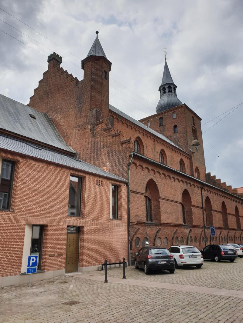
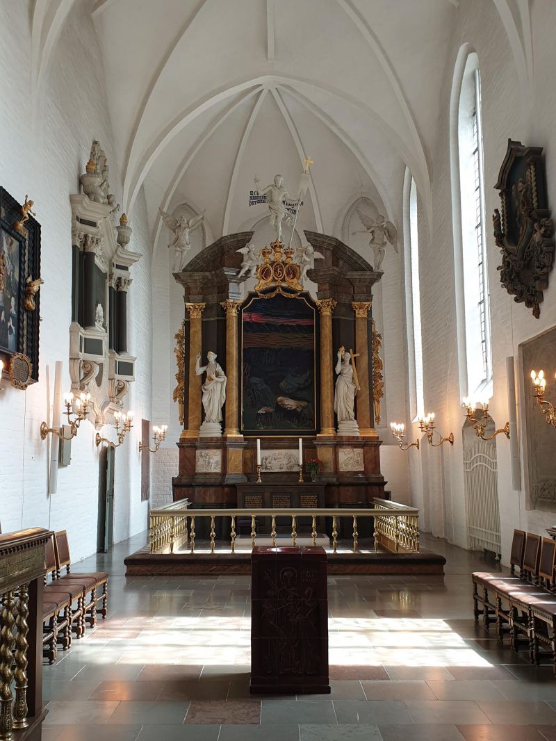
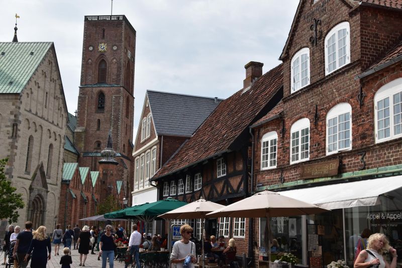
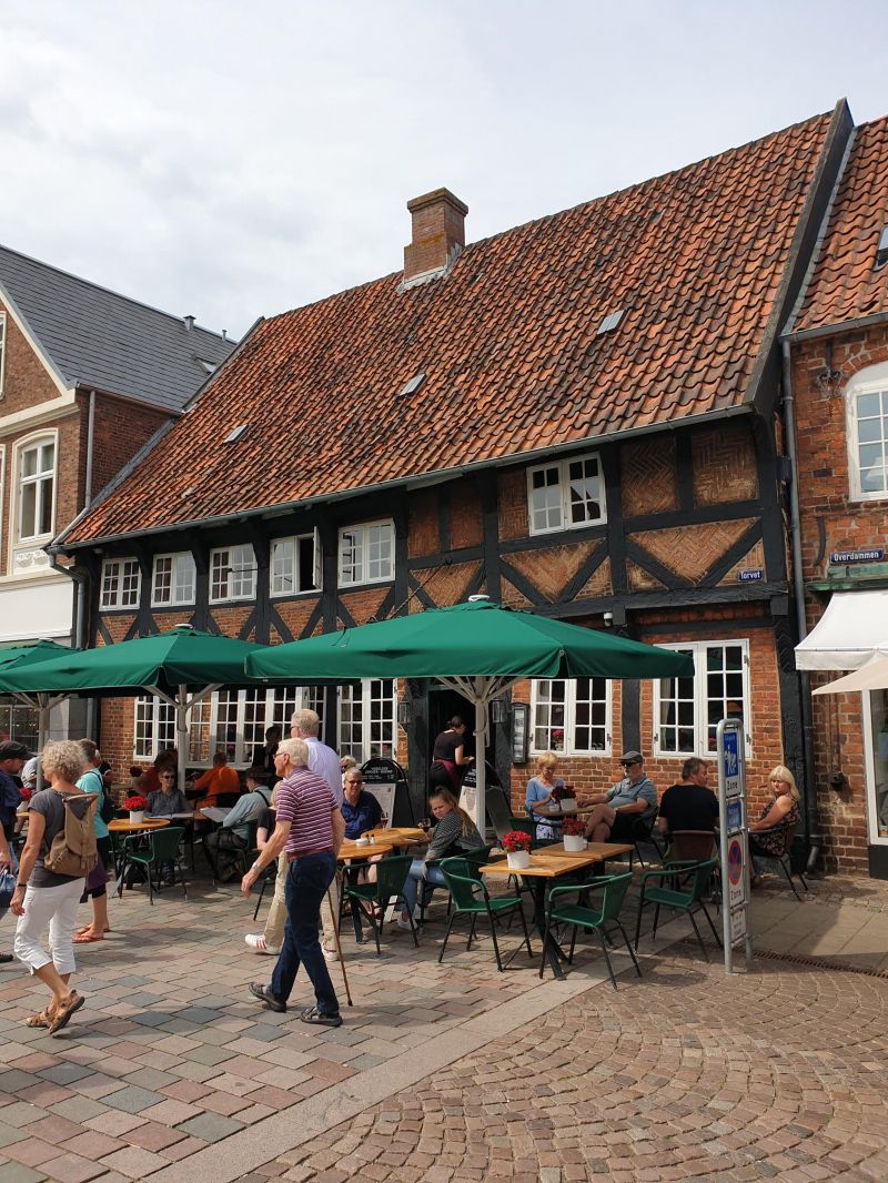
Ribe, Dänemark
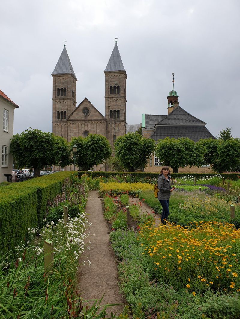
Ribe is the oldest town in Denmark and dates back to the 10th century. the most important trading center in the north, due to the good harbor and the navigable river. Ribe is known for its well-preserved old town with the Romanesque cathedral, which was later extended in the Gothic style, and the late-Gothic town hall.
6760 Ribe, Dänemark
55° 19' 37" N 8° 46' 28.8" E
55.3269360 8.7746650
• Head toward Bøge Alle on Kastanie Alle. Go for 229 m.
• Turn right onto Kastanie Alle. Go for 112 m.
• Turn right onto Kastanie Alle. Go for 175 m.
• Turn left onto Tangevej. Go for 133 m.
• Turn left onto Rosen Alle. Go for 60 m.
• Take the 2nd exit from roundabout onto Dagmarsgade. Go for 175 m.
• Turn left onto Kurveholmen. Go for 242 m.
• Continue on Brorsonsvej. Go for 196 m.
• Continue on Hundegade. Go for 274 m.
• Continue on Haulundvej. Go for 203 m.
• Take the 2nd exit from roundabout onto Haulundvej. Go for 156 m.
• Take the 1st exit from roundabout onto Haderslevvej (24) toward Esbjerg/Ribe N/Varde/11/Tønder. Go for 318 m.
• Take the 2nd exit from roundabout onto Tøndervej (11) toward Tønder/Rømø. Go for 665 m.
• Take the 2nd exit from roundabout onto Tøndervej (11) toward Tønder/Rømø. Go for 17.2 km.
• Take the 1st exit from roundabout onto Rømøvej (175) toward Rømø. Go for 3.8 km.
• Turn left onto Kystvej (419). Go for 9.3 km.
• Turn left onto Byvej. Go for 994 m.
• Turn right onto Højervej. Go for 495 m.
• Continue on Ballum Hede. Go for 878 m.
• Continue on Skast. Go for 3.4 km.
• Continue on Duborgvej. Go for 2.5 km.
• Continue on Højervej (419). Go for 4.1 km.
• Turn right onto Emmerlevvej. Go for 2.3 km.
• Continue on Emmerlev Klev. Go for 153 m.
• Turn left onto Vadehavsvej. Go for 27 m.
• Arrive at Vadehavsvej. Your destination is on the right.
☍
48,2 km
( 43 min.)
Vadehavs Camping, Højer, Dänemark
Spacious pitch with gravel/grass plots, 125 DKK electricity incl.
Emmerlev Klev 1, 6280, Højer, Dänemark
54° 59' 12.8" N 8° 39' 43.9" E
54.9869000 8.6622000
• Head toward Emmerlev Klev on Vadehavsvej. Go for 27 m.
• Turn right onto Emmerlev Klev. Go for 153 m.
• Continue on Emmerlevvej. Go for 2.3 km.
• Turn right onto Højervej (419). Go for 1.9 km.
• Take the 3rd exit from roundabout onto Tøndervej (419). Go for 9.6 km.
• Take the 2nd exit from roundabout onto Nordre Landevej (419). Go for 1.3 km.
• Turn right onto Leosalle. Go for 682 m.
• Turn right onto Ingridsvej. Go for 53 m.
• Turn left onto Violvej. Go for 102 m.
• Arrive at Violvej. Your destination is on the right.
☍
16,2 km
( 15 min.)
Day
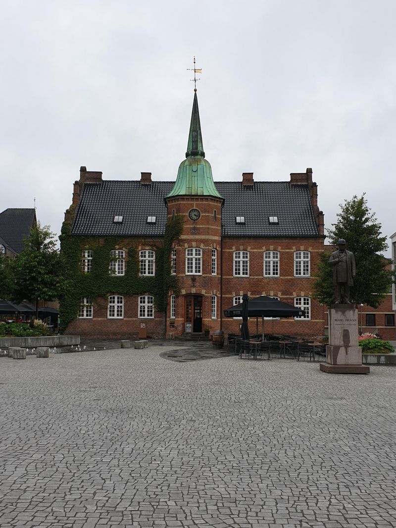
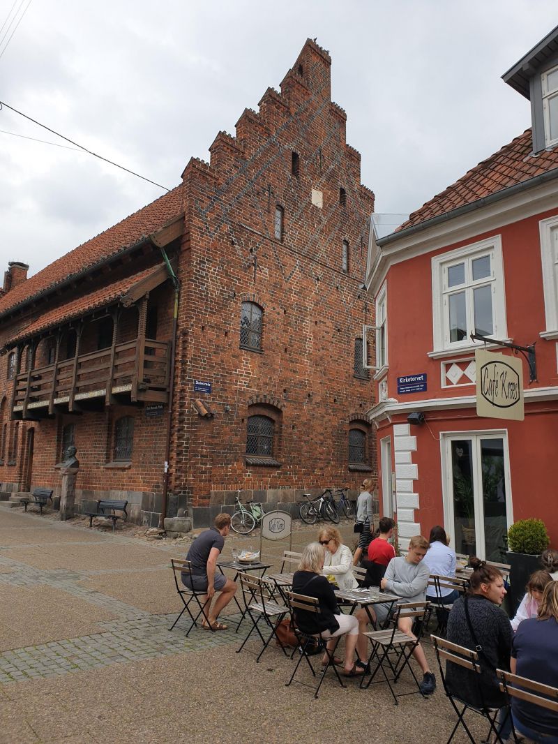
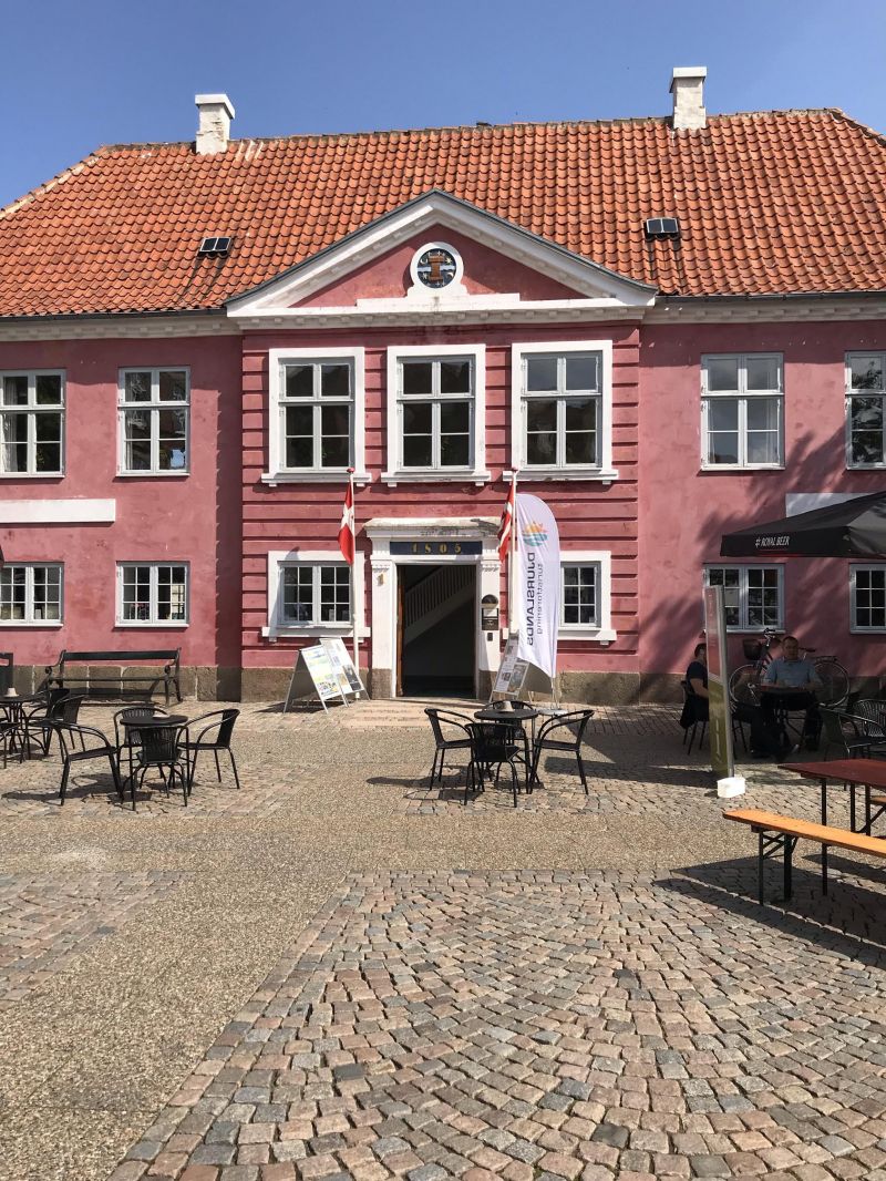
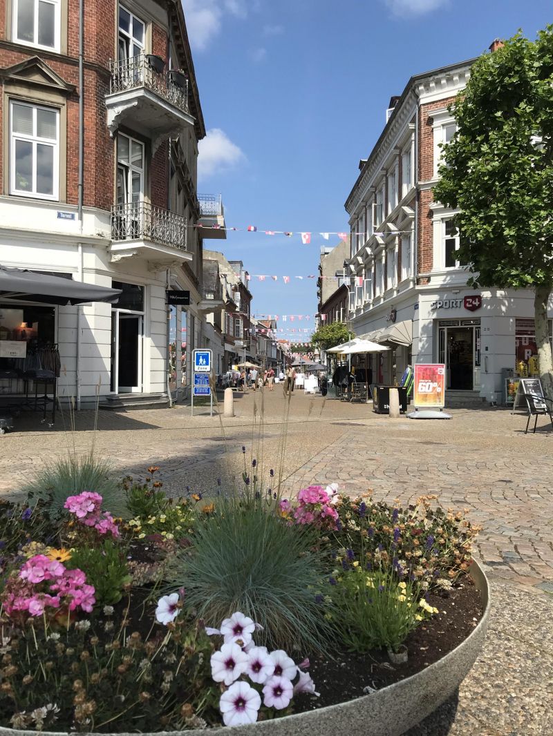
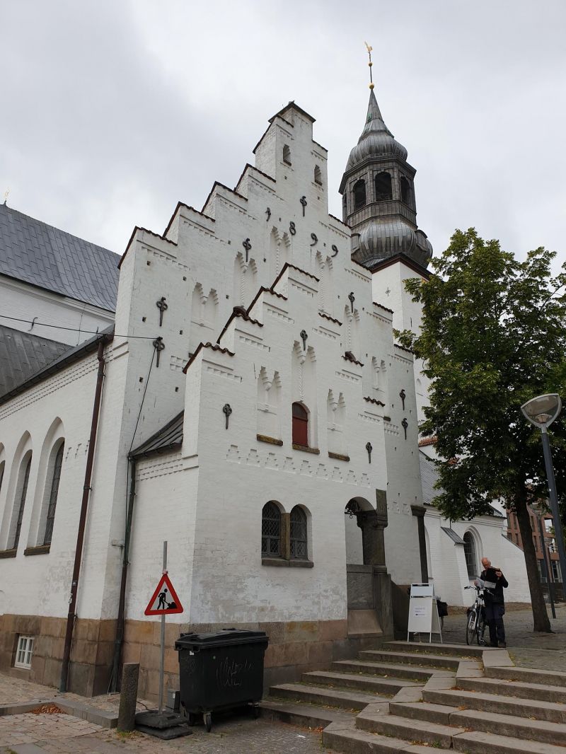
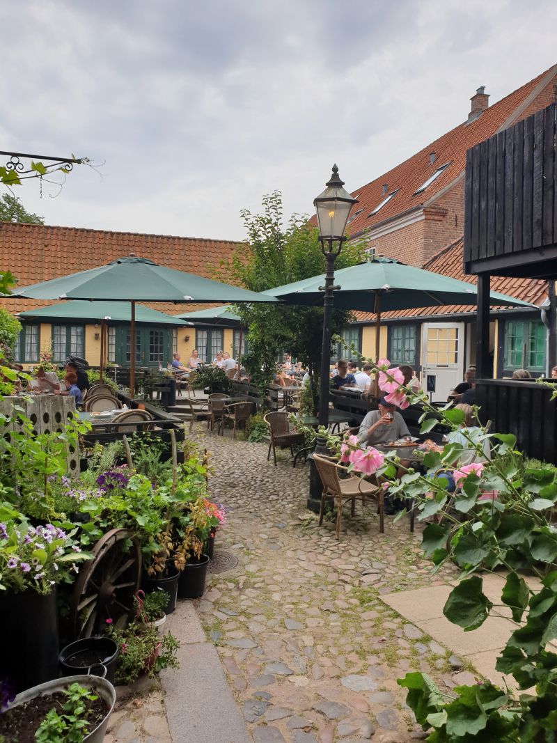
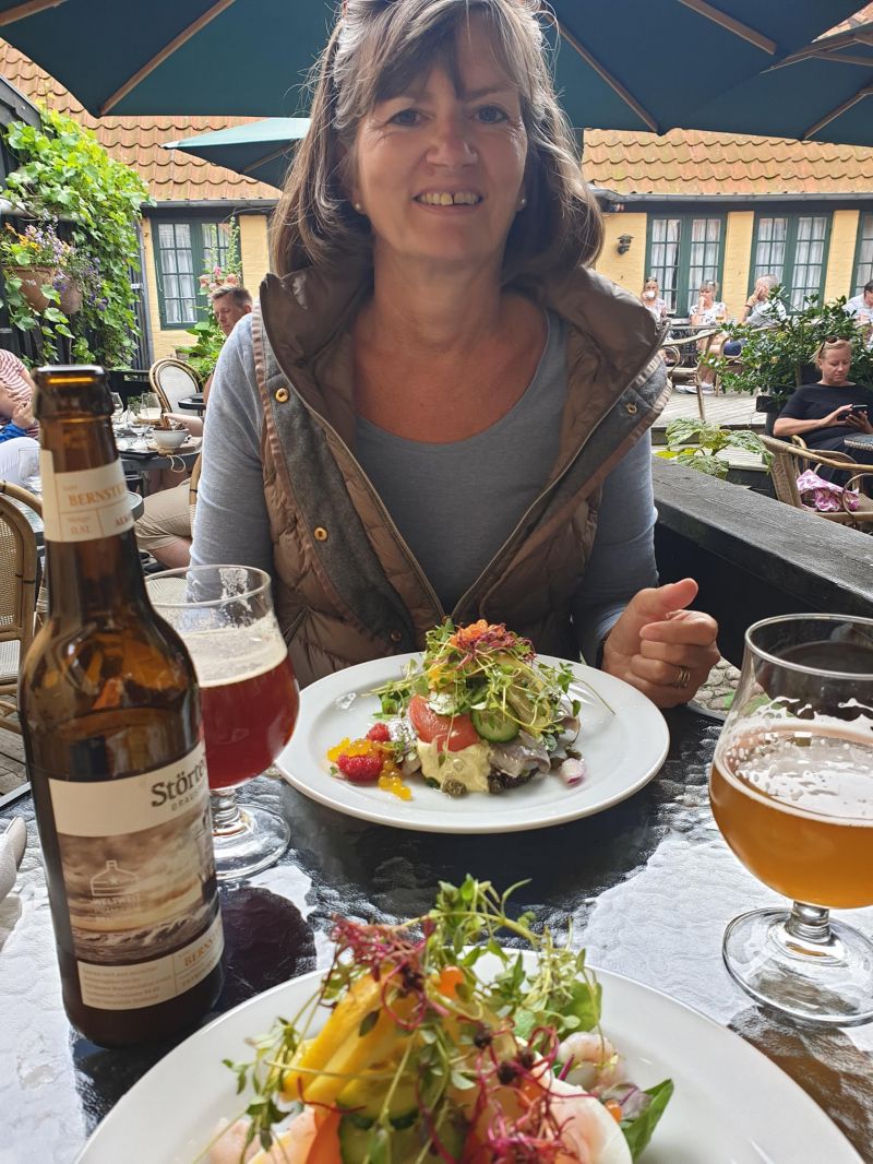
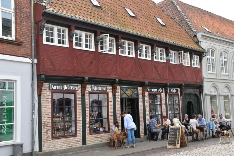
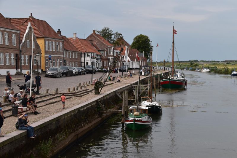
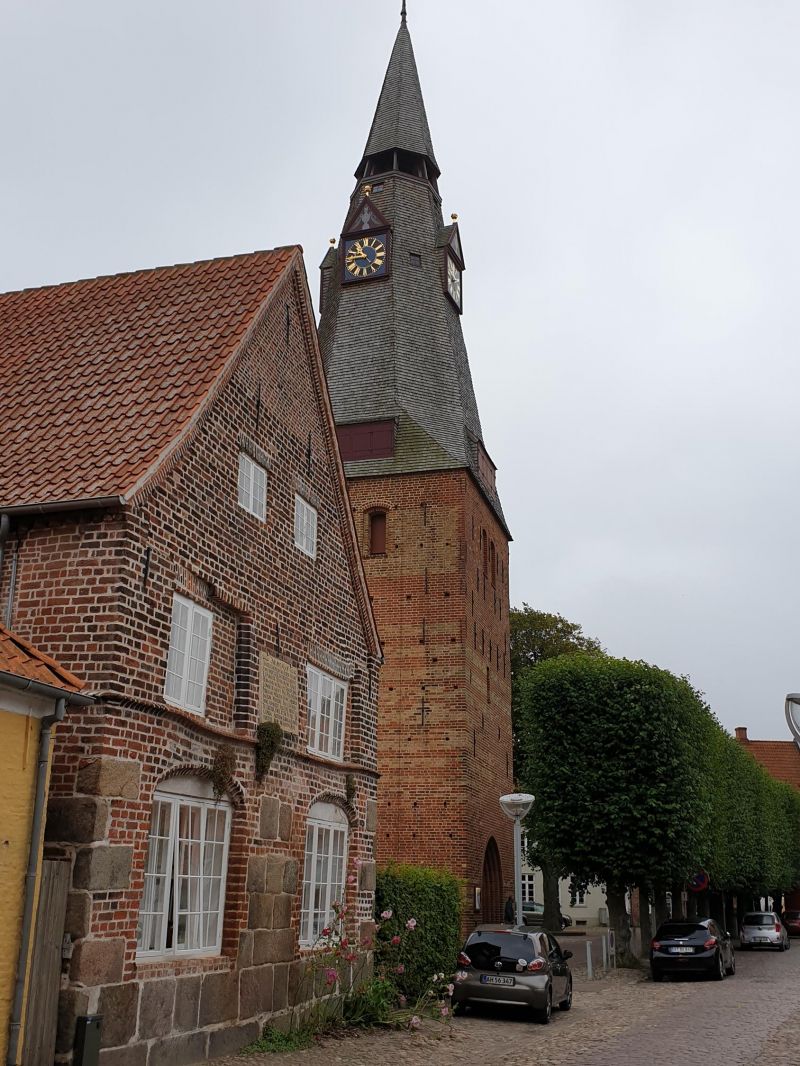
Tønder, Dänemark
Tønder is one of the oldest towns on the land bridge between the North Sea and the Baltic Sea and is located directly on the border with Germany. It was already known in Flensburg as a port in 1017. In the Middle Ages it was one of the few harbors on the west coast of Schleswig. The ship in the city coat of arms bears witness to this today.
6270 Tondern, Dänemark
54° 56' 22.6" N 8° 51' 51.9" E
54.9396150 8.8644170