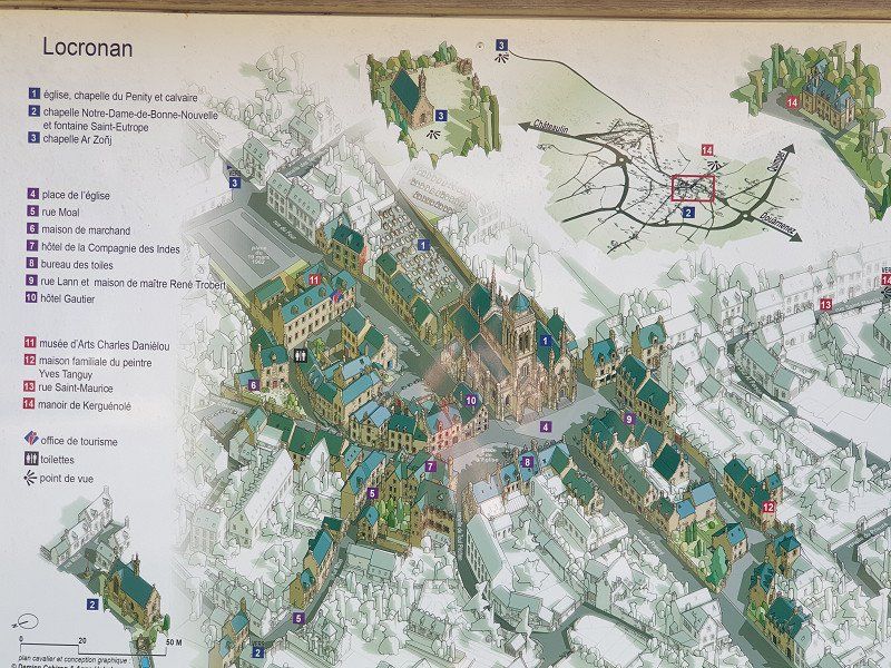
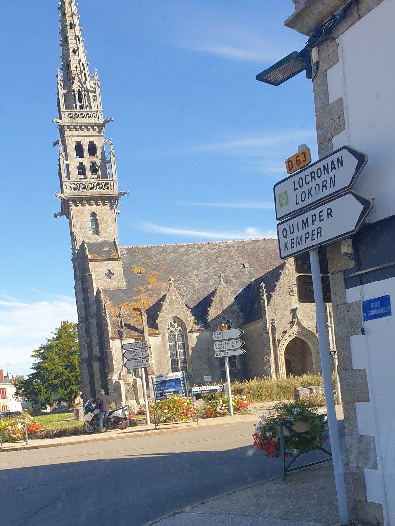
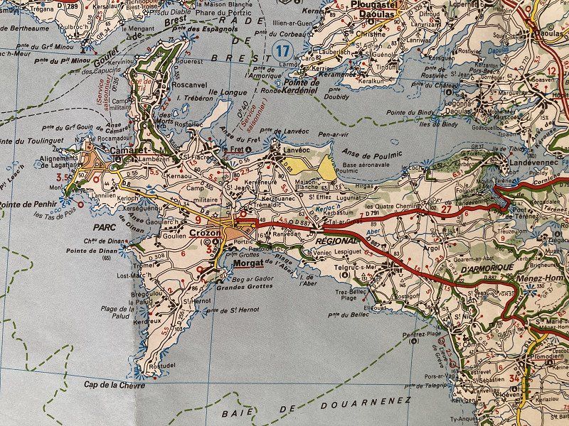
From 30.6.2022 to 18.7. 2 1/2 week trip via Orléans to southern Brittany to Golfe du Morbihan, Auray, Quiberon peninsula, Carnac megaliths, Quimperlé, Pont Aven, Concarneau, to the Phare Eckmühl, Locronan, to the Crozon peninsula and to the north coast Roskoff and finally to the rocky coast "Granit Rose".
Day
Sissach, Schweiz
4450 Sissach, Schweiz
47° 27' 51.8" N 7° 48' 38.4" E
47.4643945 7.8106610
• Head toward Rheinfelderstrasse on Hauptstrasse. Go for 839 m.
• Continue on Netzenstrasse. Go for 176 m.
• Take the 2nd exit from roundabout onto Netzenstrasse. Go for 103 m.
• Take the 3rd exit from roundabout onto A22 toward Liestal/Luzern/Bern/Zürich/Basel. Go for 91 m.
• Take ramp onto A2 toward Zürich/Basel. Go for 22.0 km.
• Keep right onto A3 (Basel-Kleinhüningen) toward Mulhouse/EuroAirport/Basel-Kleinhüningen/Lörrach/Weil am Rhein. Go for 3.8 km.
• Continue on A35. Go for 25.5 km.
• Take the left exit toward Strasbourg/Colmar/Freiburg onto A36 (La Comtoise). Go for 4.3 km.
• Keep left onto A36 (La Comtoise) toward Paris/Lyon/Guebwiller. Go for 223 km.
• Take the exit onto A31. Go for 4.2 km.
• Take the exit toward Paris/Auxerre/Beaune-St Nicolas onto A6 (Autoroute du Soleil). Go for 150 km.
• Take exit 19 toward Joigny/Migennes/Monéteau/Z.A. Macherin. Go for 1.1 km.
• Take the 3rd exit from Rond-Point de l'Europe roundabout onto Avenue de l'Europe (D319) toward Monéteau. Go for 319 m.
• Take the 1st exit from roundabout onto Avenue de l'Europe (D319). Go for 441 m.
• Turn left onto Avenue de Paris (D319). Go for 1.2 km.
• Take the 2nd exit from roundabout onto Rue de Sommeville (D158). Go for 681 m.
• Continue on Place de la Mairie (D158). Go for 63 m.
• Turn left onto Rue d'Auxerre (D84). Go for 193 m.
• Turn left onto Rue de l'Abreuvoir. Go for 139 m.
• Turn left onto Rue de l'Abreuvoir. Go for 82 m.
• Continue on Rue de Gurgy. Go for 70 m.
• Continue on Rue de Gurgy. Go for 340 m.
• Turn slightly right onto Rue de Gurgy. Go for 234 m.
• Continue on Chemin de Monéteau. Go for 364 m.
• Continue on Chemin Rural de Gurgy à Monéteau. Go for 71 m.
• Continue on Route de Monéteau. Go for 436 m.
• Turn right onto Quai des Fontaines. Go for 1.1 km.
• Arrive at Quai des Fontaines. Your destination is on the right.
☍
441,4 km
(3 hrs. 56 min.)
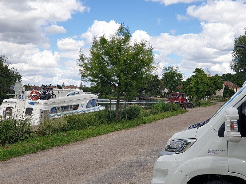
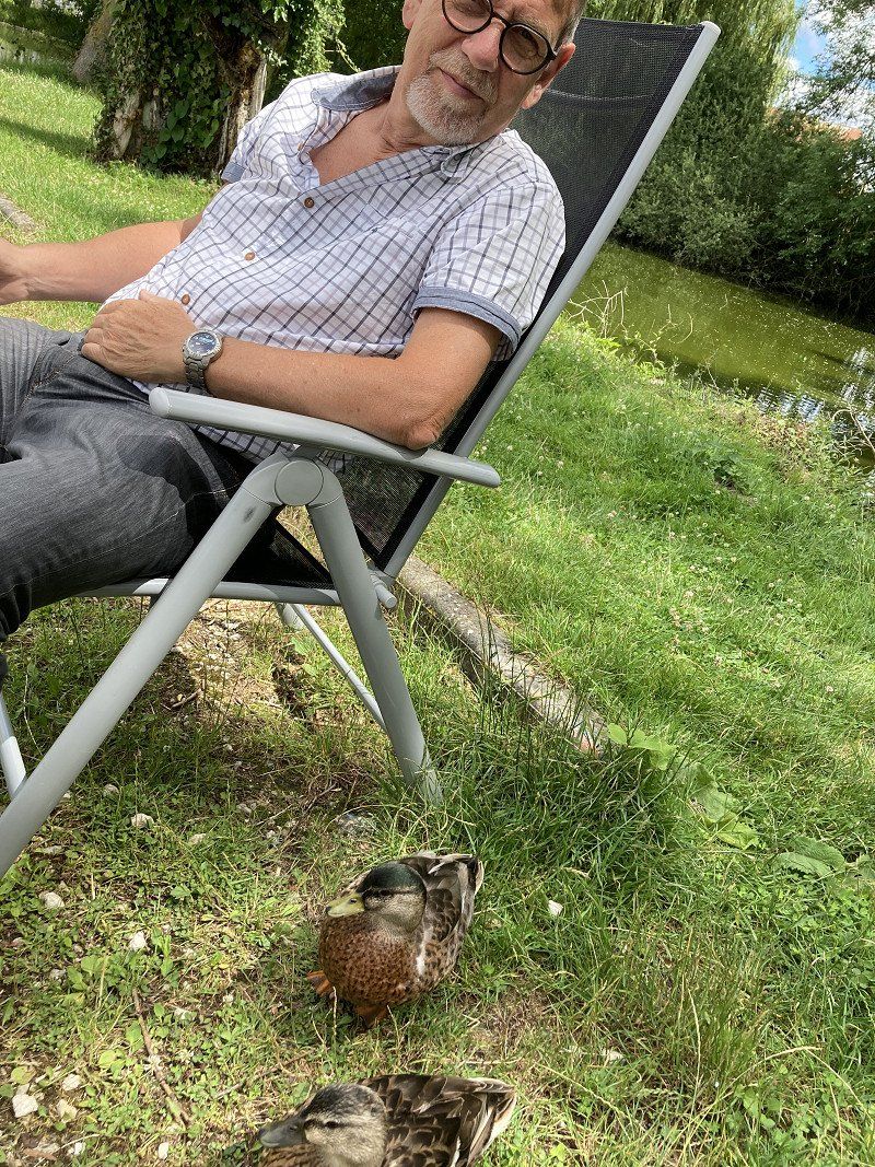
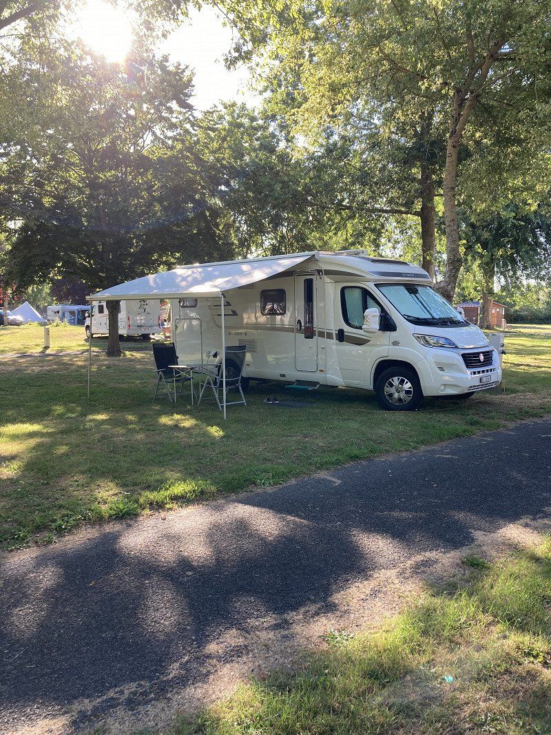
Aire Service de Camping-cars Gurgy - Stellplatz direkt an der Yonne
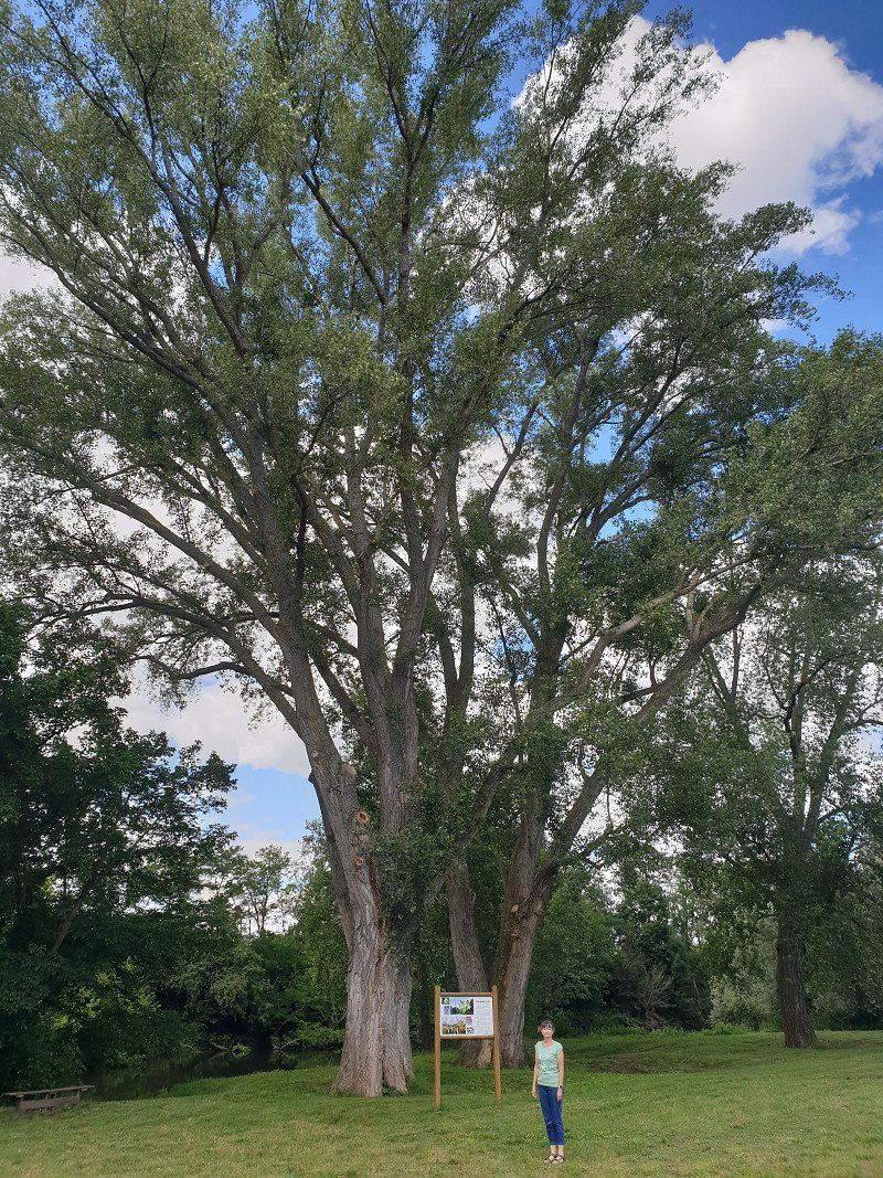
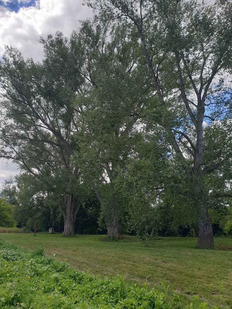
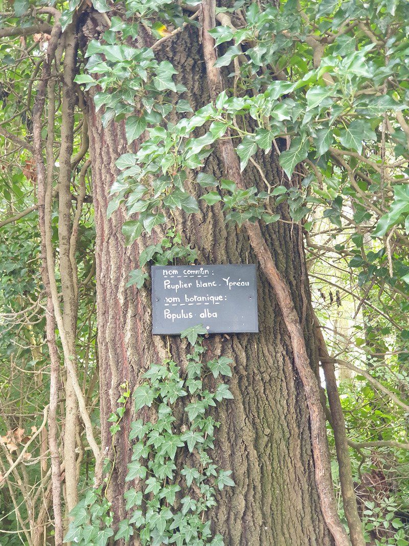
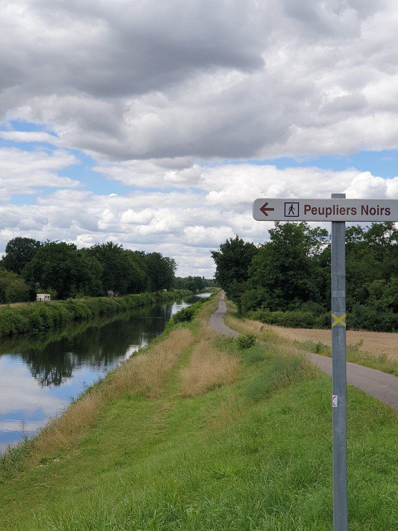
Very idyllic SP in Gurgy (near Auxerre) on the Yonne River, used by both campers and boat tourists. Duck families visit us several times at the WoMo. €11.00/night including electricity.
Walk to the Peupliers Noirs (huge black poplars).
Rue du Halage, 89250, Gurgy, France
47° 51' 48" N 3° 33' 13" E
47.8633333 3.5536111
• Head southwest on Quai des Fontaines. Go for 1.1 km.
• Turn left toward Route de Monéteau. Go for 59 m.
• Continue on Route de Monéteau. Go for 377 m.
• Continue on Chemin Rural de Gurgy à Monéteau. Go for 71 m.
• Continue on Chemin de Monéteau. Go for 364 m.
• Continue on Rue de Gurgy. Go for 644 m.
• Continue on Rue de l'Abreuvoir. Go for 82 m.
• Turn right onto Rue de l'Abreuvoir. Go for 139 m.
• Turn right onto Rue de Seignelay (D84). Go for 193 m.
• Turn right onto Place de la Mairie (D158). Go for 63 m.
• Continue on Rue de Sommeville (D158). Go for 663 m.
• Take the 1st exit from roundabout onto Avenue de Paris (D319). Go for 1.3 km.
• Turn sharp right onto Avenue de l'Europe (D319). Go for 401 m.
• Take the 2nd exit from roundabout onto Avenue de l'Europe (D319). Go for 209 m.
• Take the 2nd exit from Rond-Point de l'Europe roundabout onto A6 (Autoroute du Soleil) toward Sens/Montargis/Paris. Go for 41.1 km.
• Take the exit toward Orléans/Montargis onto A19. Go for 102 km.
• Continue toward Bordeaux/Orléans. Go for 464 m.
• Take the exit onto A10 (L'Aquitaine). Go for 10.2 km.
• Take exit 14 toward Fleury les Aubrais/Saran/Orléans-Nord onto D2701. Go for 4.4 km.
• Turn right onto Rue Nationale (D2020). Go for 66 m.
• Take the 3rd exit from roundabout onto Rue André Dessaux (D2020). Go for 1.7 km.
• Pass 2 roundabouts and continue on Avenue de Paris (D2020). Go for 2.1 km.
• Turn slightly right. Go for 22 m.
• Turn left toward Boulevard Alexandre Martin. Go for 27 m.
• Take ramp onto Boulevard Alexandre Martin. Go for 486 m.
• Turn slightly right onto Place Halma Grand toward Centre Ville/Cathédrale/Musée des Beaux Arts. Go for 218 m.
• Turn right onto Rue Paul Fourche. Go for 43 m.
• Arrive at Rue Paul Fourche. Your destination is on the left.
☍
168,1 km
(1 hrs. 36 min.)
Day
Orléans (Park & Ride "Jules Verne", kostenlos)
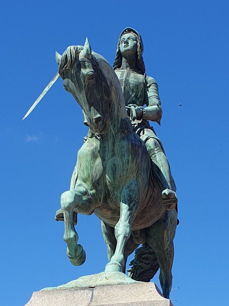
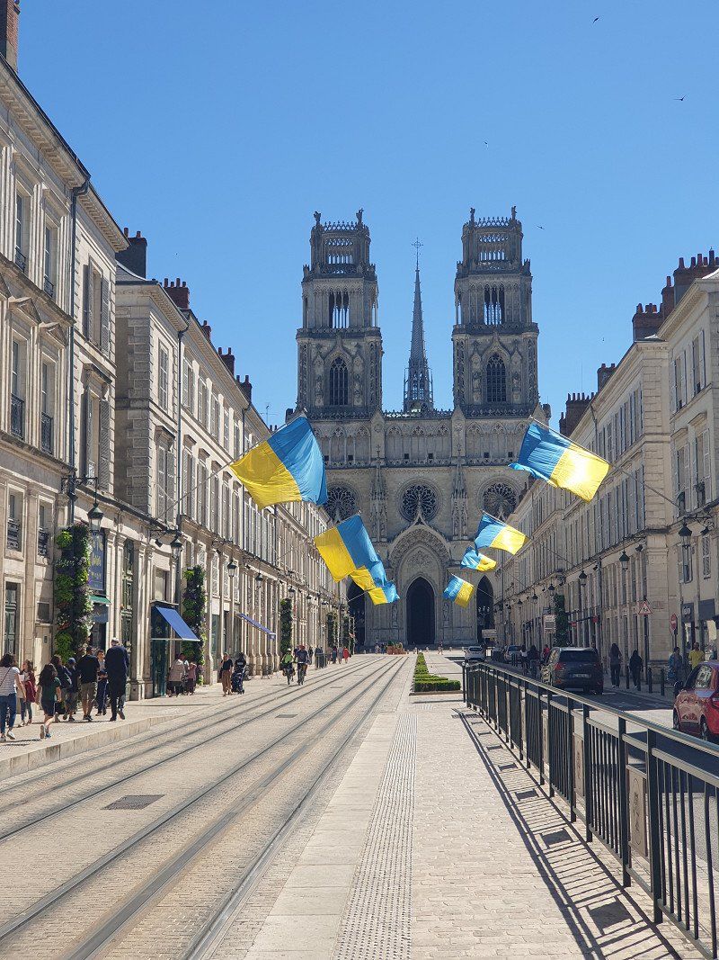
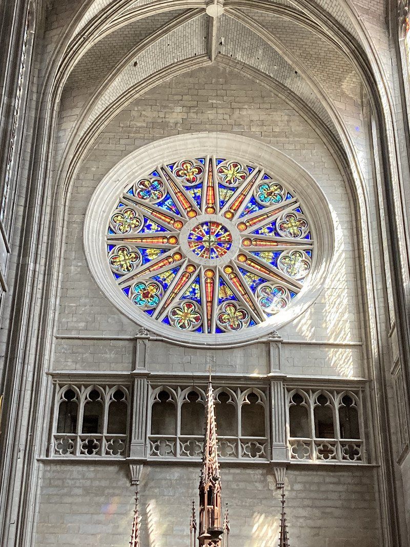
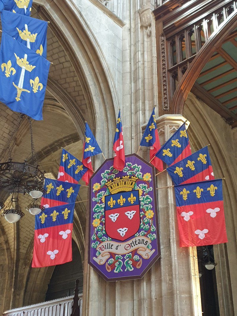
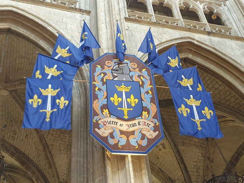
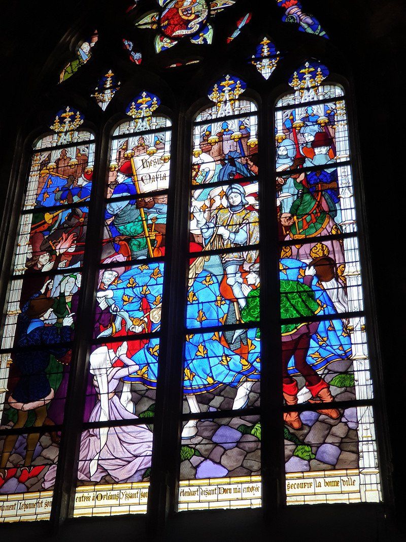
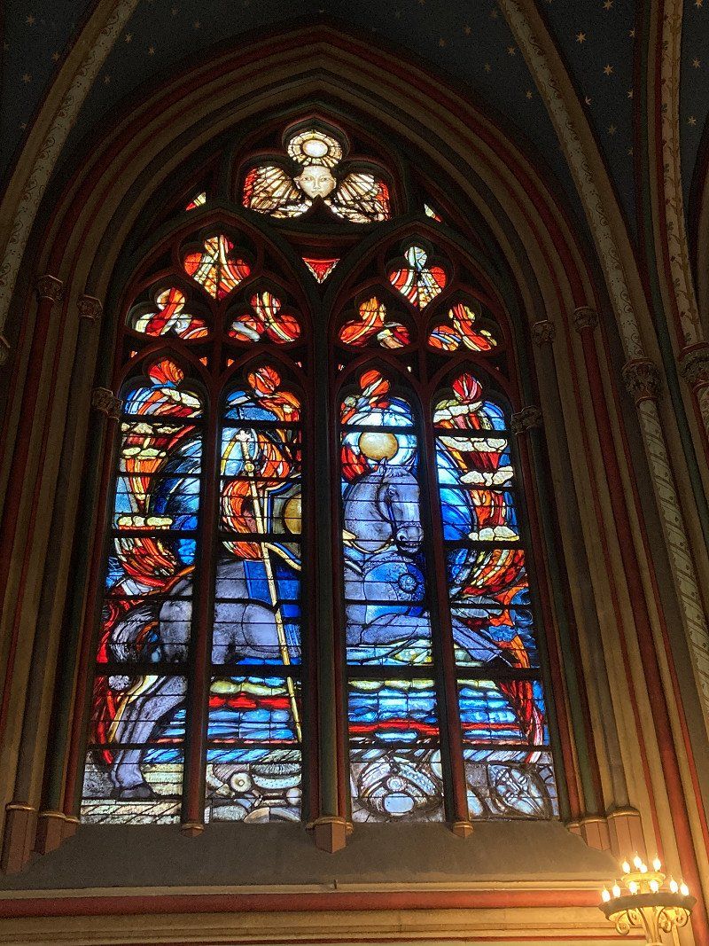
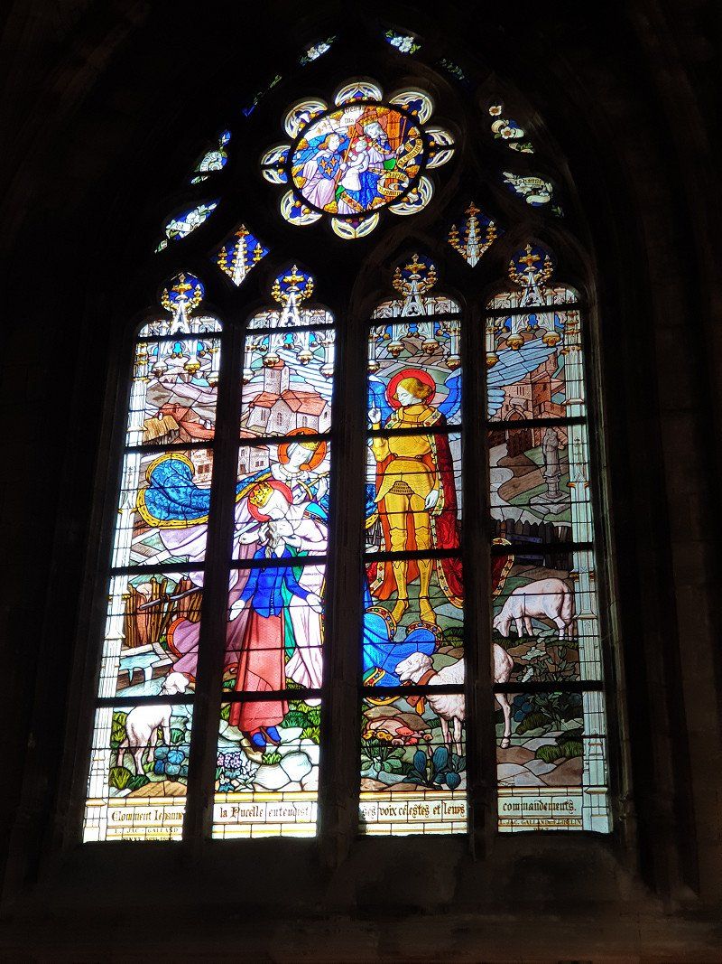
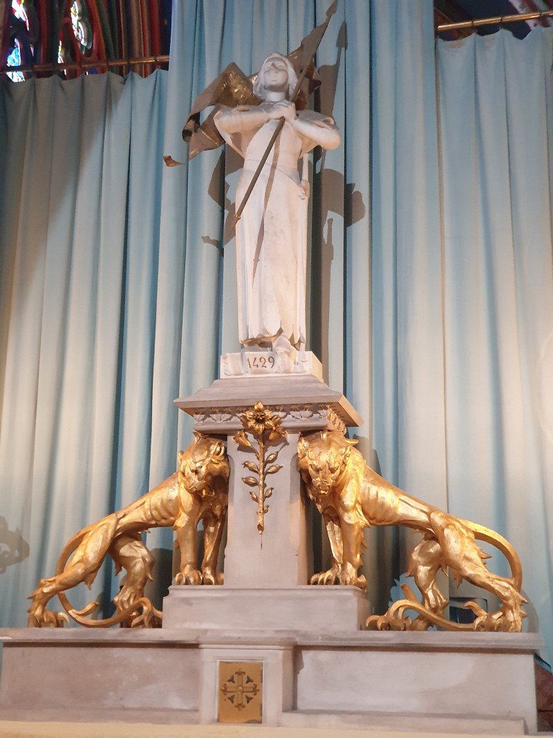
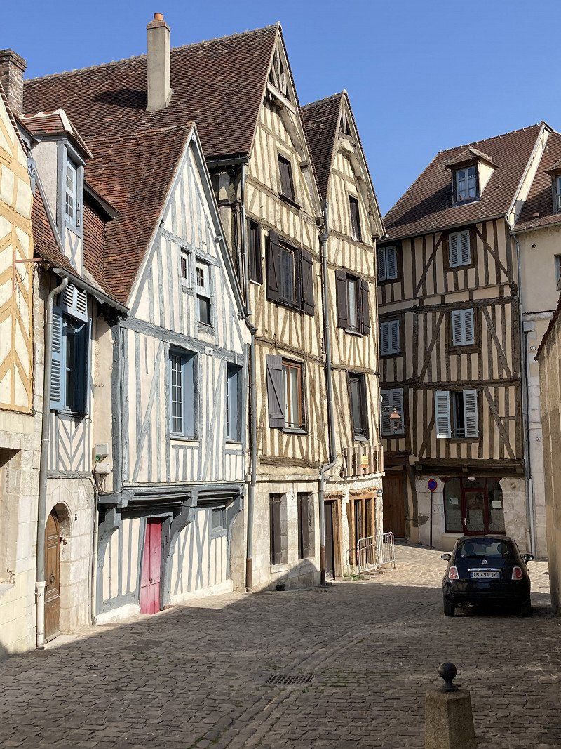
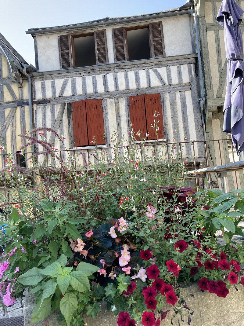
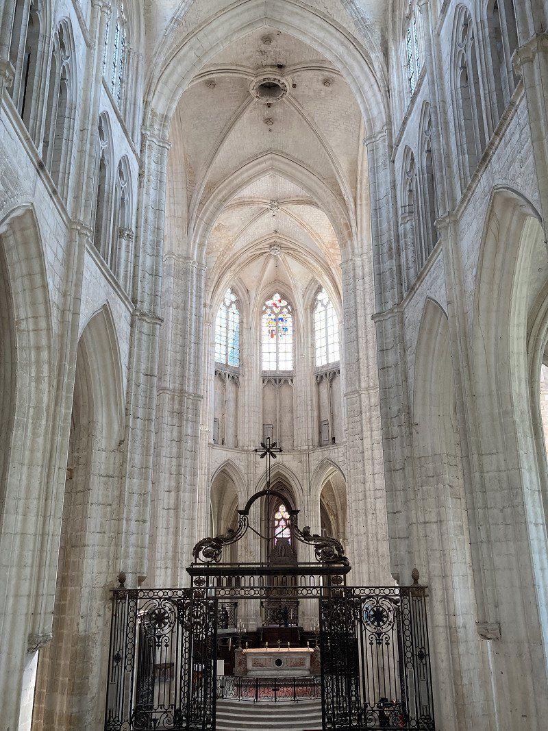
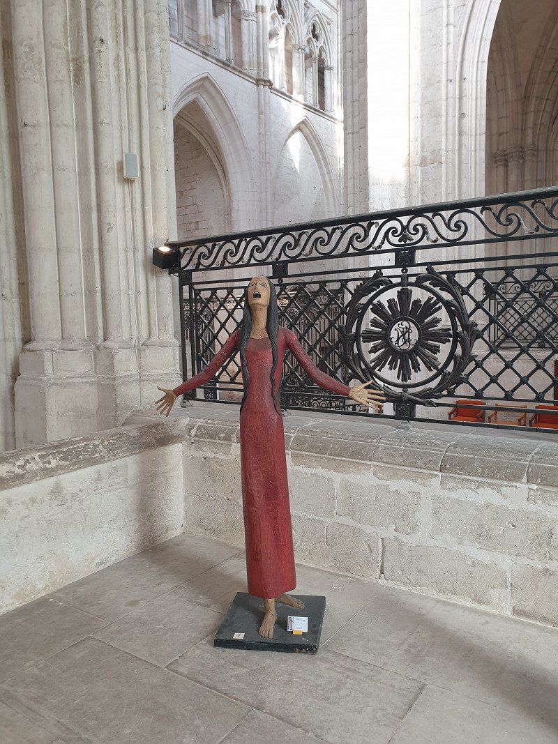
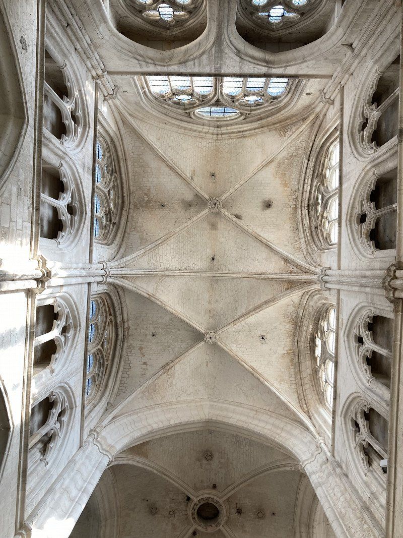
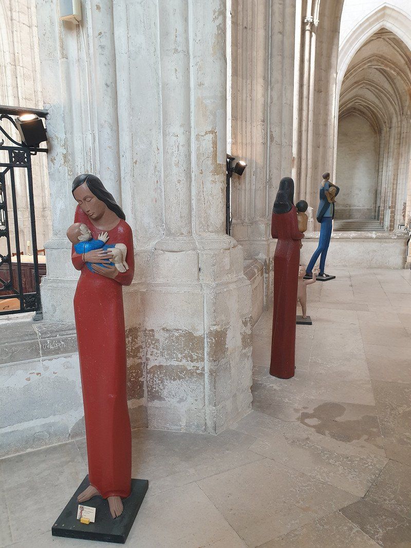
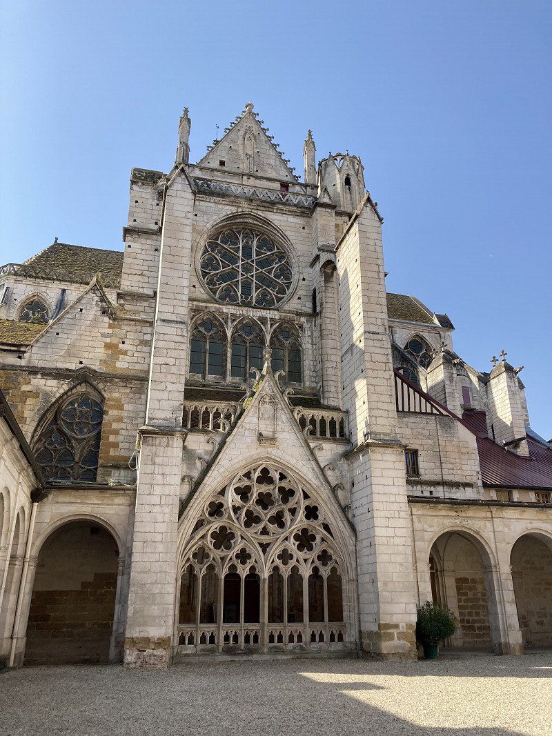
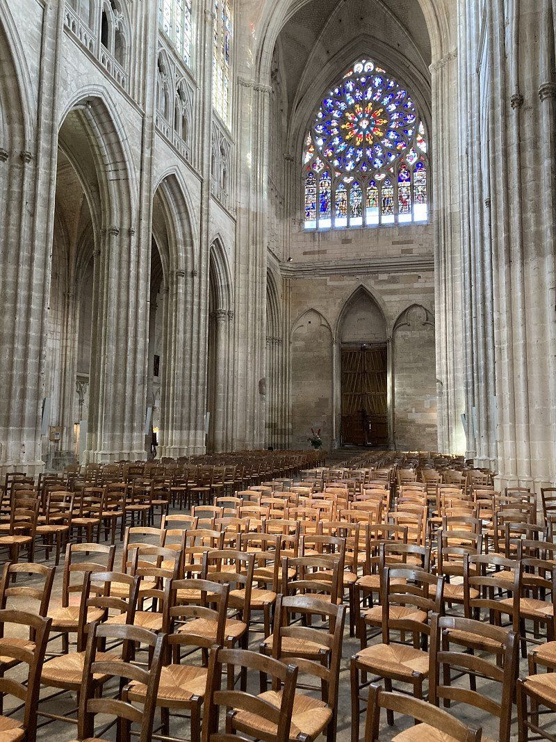
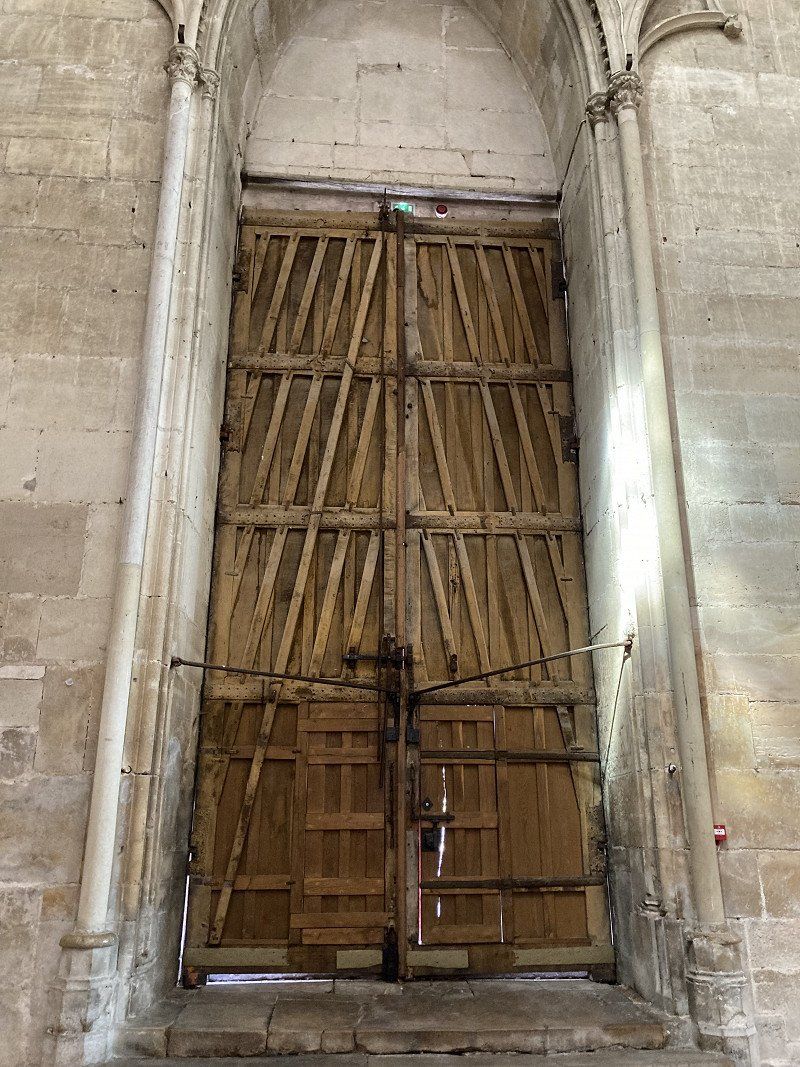
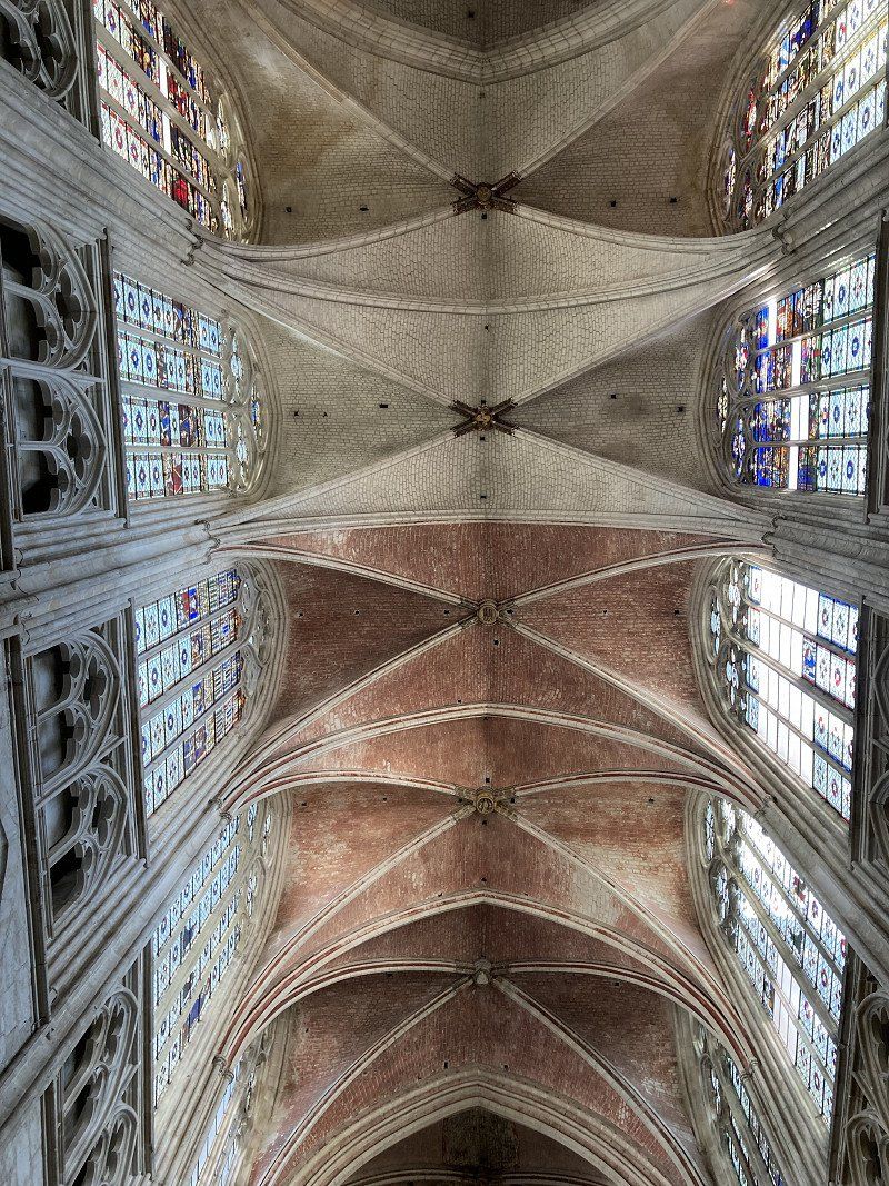
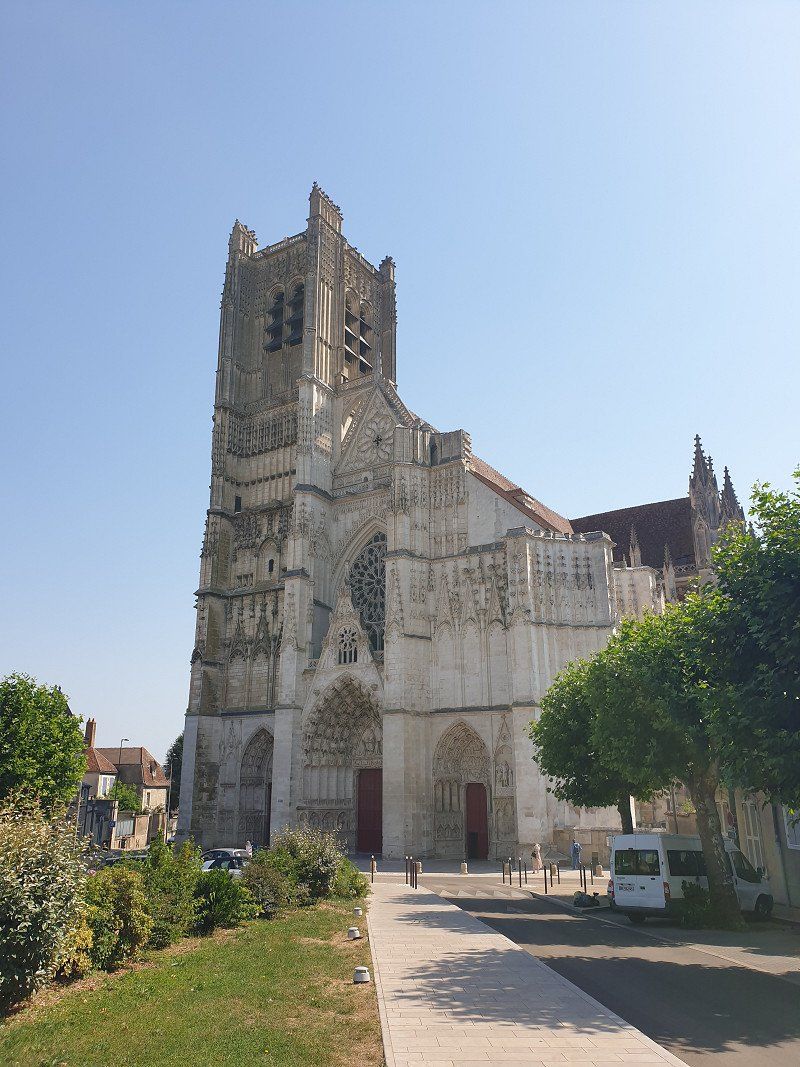
We take the tram to the city center in comfort. In the central square stands a bronze statue of Joan of Arc , with whom this city is closely linked. We stroll through the old town and along the Jeanne d'Arc boulevard directly to the Sainte-Croix cathedral , a masterpiece of Gothic architecture. Inside we see the windows with stained glass depicting the life of Joan of Arc.
Orléans, Frankreich
47° 54' 10.7" N 1° 54' 33.3" E
47.9029640 1.9092510
• Head toward Rue Théophile Chollet on Rue Paul Fourche. Go for 41 m.
• Keep left onto Rue d'Escures. Go for 227 m.
• Continue on Place du Martroi. Go for 81 m.
• Turn left onto Place du Martroi. Go for 44 m.
• Continue on Rue Charles Sanglier. Go for 89 m.
• Turn right onto Rue Jeanne d'Arc. Go for 118 m.
• Turn left onto Place du Général de Gaulle. Go for 58 m.
• Continue on Rue du Cheval Rouge. Go for 199 m.
• Continue on Rue Gabriel Templier. Go for 110 m.
• Turn right onto Quai Cypierre (D2152). Go for 2.2 km.
• Turn slightly left onto Avenue Georges Clemenceau (D2152) toward Blois/Paris/Vierzon/La Chapelle St Min/Beaugency/Parc d'Activité d'Ingre-St Jean de la R. Go for 1.5 km.
• Turn right onto Avenue Georges Pompidou toward Paris/Blois/Vierzon. Go for 399 m.
• Take the 3rd exit from roundabout toward Paris/Blois/Vierzon/Orléans-la Source/Montargis. Go for 355 m.
• Take ramp onto Échangeur d'Orléans-Centre (A71) toward E5/Bordeaux/Paris/Blois/Orléans-Nord. Go for 553 m.
• Take ramp onto A10 (L'Aquitaine) toward Bordeaux/Blois. Go for 109 km.
• Take the exit toward Amboise/St Pierre des C./C.H.U. Clocheville/C.H.U. Bretonneau/C.H.U. Trousseau onto Avenue Georges Pompidou. Go for 463 m.
• Take the 2nd exit from Carrefour des Français Libres roundabout onto Avenue André Malraux (D751) toward Angers/Tours-Nord/C.H.U. Bretonneau/C.H.U. Clocheville. Go for 1.6 km.
• Take the 3rd exit from Rond-Point des Mariniers roundabout onto Rue de Constantine. Go for 193 m.
• Continue on Rue Marceau. Go for 99 m.
• Arrive at Rue Marceau. Your destination is on the left.
☍
117,6 km
(1 hrs. 9 min.)
Tours
Tours, Frankreich
47° 23' 38.9" N 0° 41' 5.4" E
47.3941440 0.6848400
• Head toward Rue des Halles on Rue Marceau. Go for 68 m.
• Turn right onto Rue des Halles. Go for 348 m.
• Continue on Place des Halles. Go for 126 m.
• Turn right onto Rue de la Victoire. Go for 330 m.
• Take the 3rd exit from roundabout onto Rue des Tanneurs (D751). Go for 2.8 km.
• Take ramp onto D37 toward Poitiers/A10/A85/Saumur/Vierzon/Châteauroux/Tours-Sud/Joué-les-Tours. Go for 5.3 km.
• Take ramp onto D751 toward A85/(Angers)/Saumur/Ballan-Miré/Chinon. Go for 7.2 km.
• Take ramp onto A85 toward Nantes/Angers/Saumur. Go for 90.2 km.
• Continue toward Nantes/Angers. Go for 212 m.
• Take the exit onto A11 (L'Océane). Go for 41.2 km.
• Take exit 19 toward Beaupréau/Chalonnes S/Loire onto Échangeur de Saint-Germain-des-Prés. Go for 1.1 km.
• Take the 3rd exit from roundabout onto D15 toward St Germain-des-Prés/Montjean S/ L./Chalonnes S/ L./Beaupréau/Château de Serrant. Go for 2.4 km.
• Take the 2nd exit from roundabout onto D723 toward Nantes/Champtocé S/L./Varades/Ancenis/Montjean S/L./Beaupréau. Go for 1.2 km.
• Pass 4 roundabouts and continue on Rue du Général de Gaulle (D723). Go for 14.1 km.
• Take the 3rd exit from roundabout onto Rue du Général de Gaulle (D723). Go for 549 m.
• Turn left onto Place de la Victoire (D752) toward St Pierre/Montlimart/St Florent le V. Go for 2.5 km.
• Turn left onto Lieu-dit La Maison Neuve-St-Florent-le-Vieil. Go for 52 m.
• Continue on Île Batailleuse. Go for 54 m.
• Arrive at Île Batailleuse. Your destination is on the right.
☍
169,7 km
(1 hrs. 40 min.)
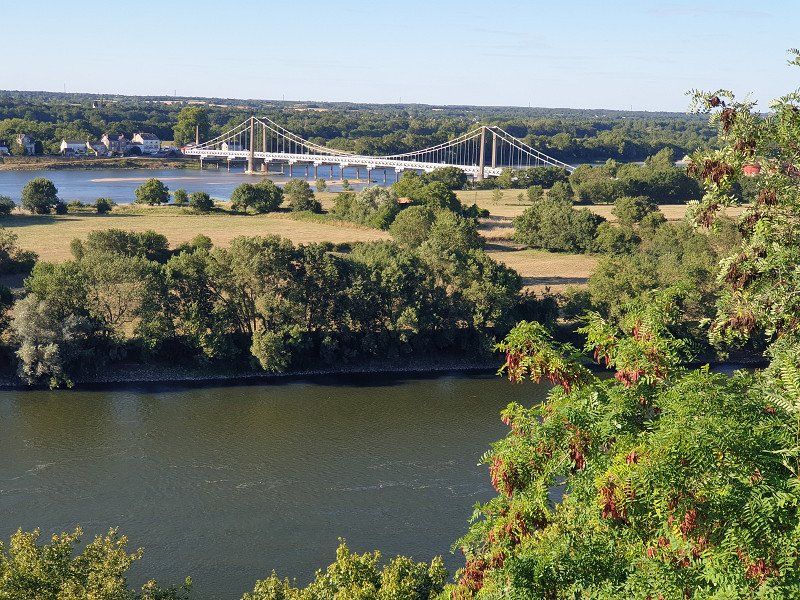
Camping L'ile Batailleuse (€20/Nacht)
Located on an island in the Loire. Spacious pitches under tall trees. We notice the many backpackers on foot or by bike (respect!).
44370, Varades, France
47° 22' 1.6" N 1° 0' 46.8" W
47.3671000 -1.0130000
• Head southwest on Île Batailleuse. Go for 54 m.
• Continue on Lieu-dit La Maison Neuve-St-Florent-le-Vieil. Go for 52 m.
• Turn right onto D752. Go for 2.5 km.
• Turn left onto Place Sainte-Jeanne d'Arc (D723) toward Nantes/Ancenis/Les Arcades. Go for 497 m.
• Take the 3rd exit from roundabout onto Rue du Maréchal Foch (D723) toward Nantes/Ancenis/St Herblon/Anetz. Go for 5.7 km.
• Take the 2nd exit from roundabout onto Route d'Ancenis (D723) toward Nantes. Go for 5.3 km.
• Take the 1st exit from Rond-Point Émile Raguin roundabout onto D923 toward A11/Nantes/Laval. Go for 1.3 km.
• Pass 2 roundabouts and continue on D923. Go for 1.7 km.
• Take ramp toward Nantes/Angers. Go for 218 m.
• Take the 1st exit from roundabout onto D923 toward Laval. Go for 877 m.
• Take the 2nd exit from Rond-Point d'Angers roundabout onto D923 toward Nantes/Laval/St Mars la Jaille/Candé/Segré/Châteaubriant. Go for 376 m.
• Take the 3rd exit from Rond-Point de Nantes roundabout onto A11 (L'Océane) toward Nantes. Go for 33.1 km.
• Take exit 38 toward Bordeaux/Poitiers/Nantes-Nord onto N844 (Périphérique Est). Go for 1.3 km.
• Take ramp toward Nantes-Centre/Nantes-Nord/Porte de la Chapelle. Go for 262 m.
• Take the 2nd exit from roundabout onto Boulevard Martin Luther King toward Nantes-Centre/Petit Port/P+R Recteur Schmitt. Go for 789 m.
• Continue on Rue Henri Picherit. Go for 232 m.
• Take the 2nd exit from roundabout onto Boulevard Guy Mollet. Go for 361 m.
• Pass 2 roundabouts and continue on Boulevard Guy Mollet. Go for 681 m.
• Take the 2nd exit from Place du 8 Mai 1945 roundabout onto Boulevard du Petit Port. Go for 297 m.
• Take the 1st exit from roundabout onto Boulevard Gabriel Lauriol. Go for 1.0 km.
• Take the 1st exit from roundabout onto Boulevard des Frères de Goncourt toward St Herblain/Nantes-Ouest. Go for 219 m.
• Take the 2nd exit from Rond-Point de Rennes roundabout onto Rue Paul Bellamy toward Centre Ville. Go for 1.6 km.
• Take the 1st exit from roundabout toward Sud-Centre Ville/Est-Centre Ville. Go for 10 m.
• Take the 2nd exit from roundabout onto Rue Paul Bellamy toward Sud-Centre Ville/Est-Centre Ville. Go for 85 m.
• Continue on Place du Pont Morand. Go for 45 m.
• Take the 2nd exit from Place du Port Communeau roundabout onto Place du Port Communeau toward Sud-Centre Ville/C.H.U. Hôtel Dieu. Go for 76 m.
• Continue on Rue de Strasbourg. Go for 161 m.
• Turn right onto Place Saint-Jean. Go for 18 m.
• Arrive at Place Saint-Jean. Your destination is on the right.
☍
58,8 km
( 51 min.)
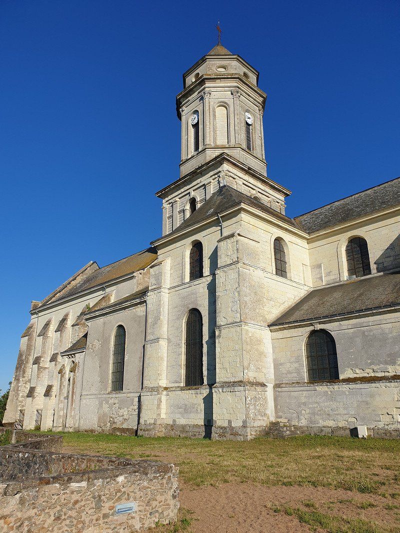
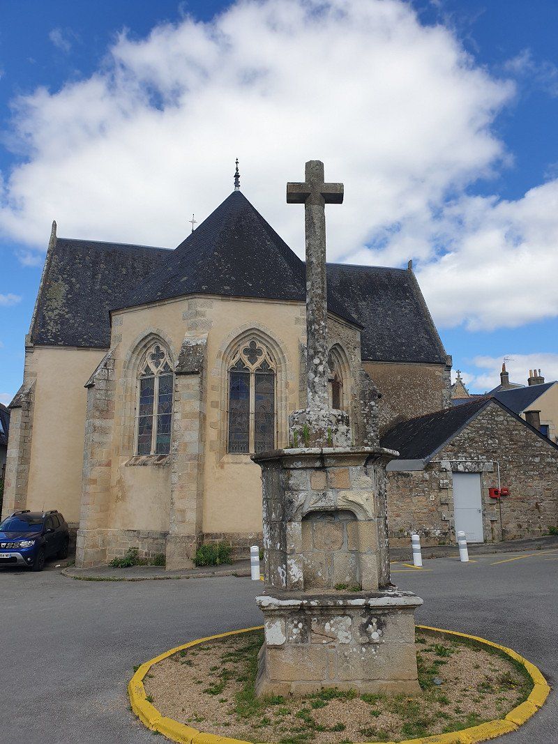
Saint-Florent-le-Vieil
Historical place with a monastery church on a hill above the Loire (beautiful view).
Day
Nantes
Nantes, Frankreich
47° 13' 6.1" N 1° 33' 13" W
47.2183710 -1.5536210
• Head southwest on Place Saint-Jean.
• Turn left onto Rue Saint-Vincent. Go for 51 m.
• Turn left onto Rue Général Leclerc de Hautecloque. Go for 40 m.
• Turn left onto Rue de Strasbourg. Go for 220 m.
• Continue on Place du Port Communeau. Go for 46 m.
• Take the 2nd exit from Place du Port Communeau roundabout onto Place du Pont Morand toward Nord-Centre Ville/Rennes/Place Bretagne/Marché de Talensac. Go for 75 m.
• Continue on Rue Paul Bellamy. Go for 73 m.
• Take the 1st exit from roundabout. Go for 9 m.
• Take the 2nd exit from roundabout onto Rue Paul Bellamy toward Rennes/Nantes-Nord. Go for 1.5 km.
• Take the 2nd exit from Rond-Point de Rennes roundabout onto Rond-Point de Rennes toward Porte de Rennes/Nantes-Nord. Go for 25 m.
• Take the 1st exit from Rond-Point de Rennes roundabout onto Boulevard Robert Schuman toward Nantes-Nord. Go for 335 m.
• Pass 4 roundabouts and continue on Boulevard Robert Schuman. Go for 1.4 km.
• Continue on Route de Rennes toward Rennes/Orvault/Pont du Cens. Go for 671 m.
• Pass 8 roundabouts and continue on Route de Rennes (N137). Go for 1.8 km.
• Take ramp onto A821/A844 (Périphérique Nord) toward Vannes/St Nazaire/Sautron. Go for 3.2 km.
• Continue on A82. Go for 1.6 km.
• Continue on N165. Go for 25.9 km.
• Keep left onto N165 toward Brest/Lorient/Vannes/Savenay-Nord. Go for 51.3 km.
• Take ramp toward Muzillac-Ouest/Ambon/Sarzeau/Damgan. Go for 320 m.
• Take the 3rd exit from Giratoire de Terre-Océan roundabout onto D20 toward Ambon/Damgan/Sarzeau. Go for 706 m.
• Pass 7 roundabouts and continue on Lieu-dit Le Clos Sapin (D20). Go for 16.5 km.
• Continue on D20. Go for 933 m.
• Take the 3rd exit from roundabout onto D780. Go for 5.2 km.
• Take the 2nd exit from Giratoire de Kergroës roundabout onto D780. Go for 144 m.
• Continue on Route de Port-Navalo (D780). Go for 410 m.
• Continue on D780. Go for 206 m.
• Take the 3rd exit from Giratoire de Kerollaire roundabout onto D198. Go for 331 m.
• Take the 2nd exit from Giratoire de Saint-Jacques roundabout onto Route de Saint-Gildas (D198). Go for 2.0 km.
• Continue on D198. Go for 18 m.
• Continue on Route de Sarzeau (D198). Go for 2.5 km.
• Take the 2nd exit from roundabout onto Rue Saint-Goustan (VC201). Go for 297 m.
• Turn left onto Chemin du Lavoir. Go for 63 m.
• Arrive at Chemin du Lavoir. Your destination is on the right.
☍
117,9 km
(1 hrs. 30 min.)
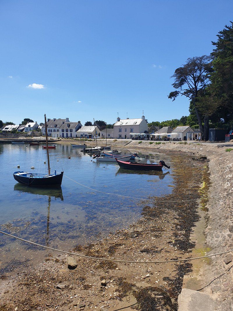
Campingplatz Gohvelin Saint-Gildas-de-Rhuys (€25/Nacht)
The campsite is in the village and only about 300m from a beach. Fairly large pitches on grass, sanitary OK, swimming pool. In the evenings, food trucks come to the CP: eg fine galettes.
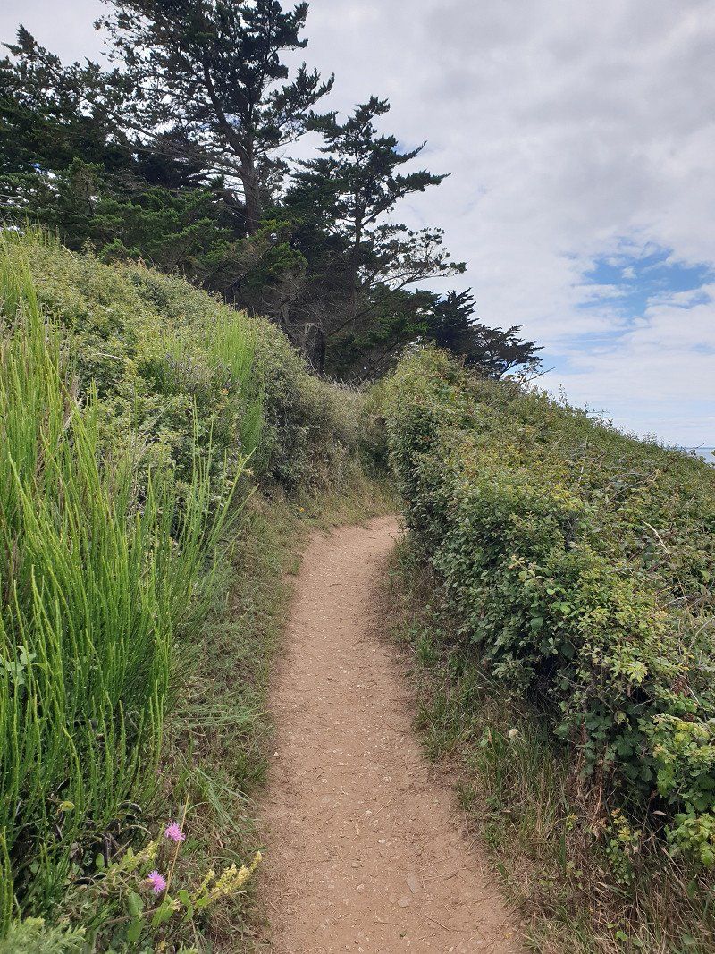
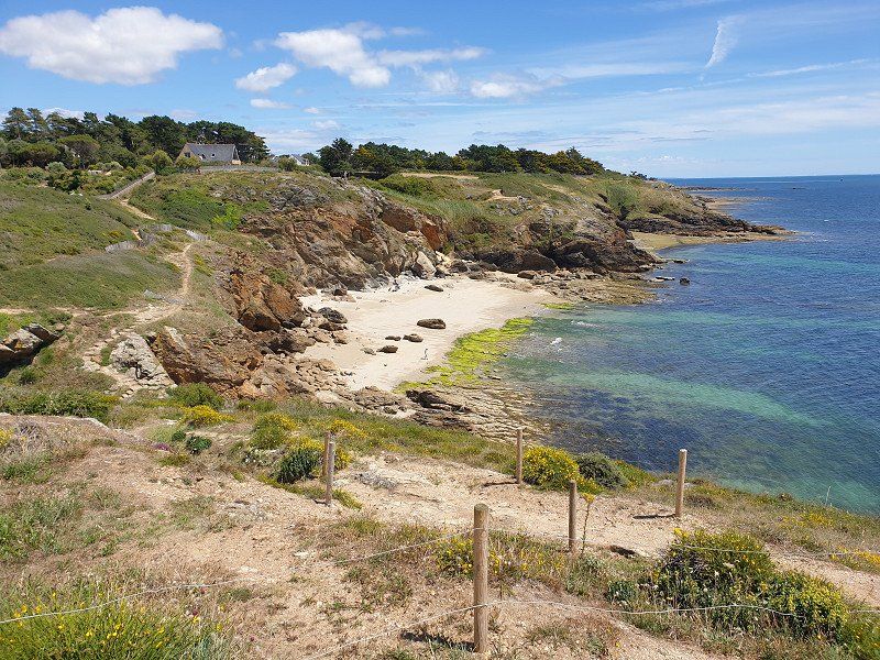
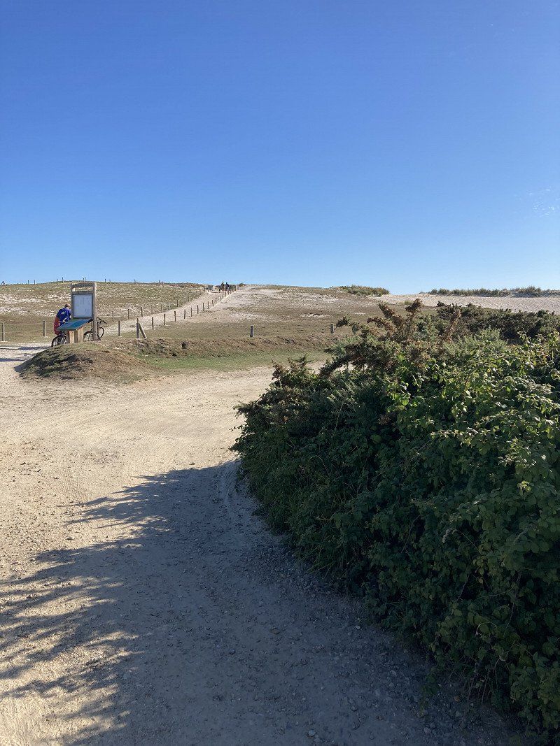
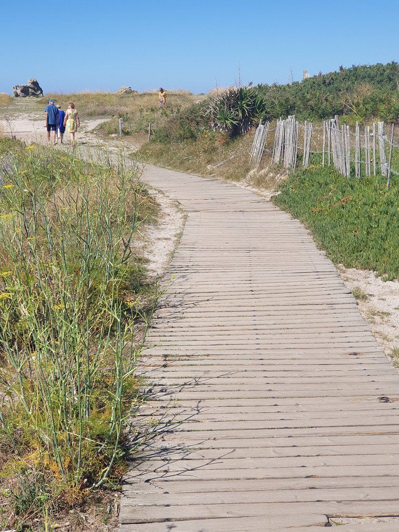
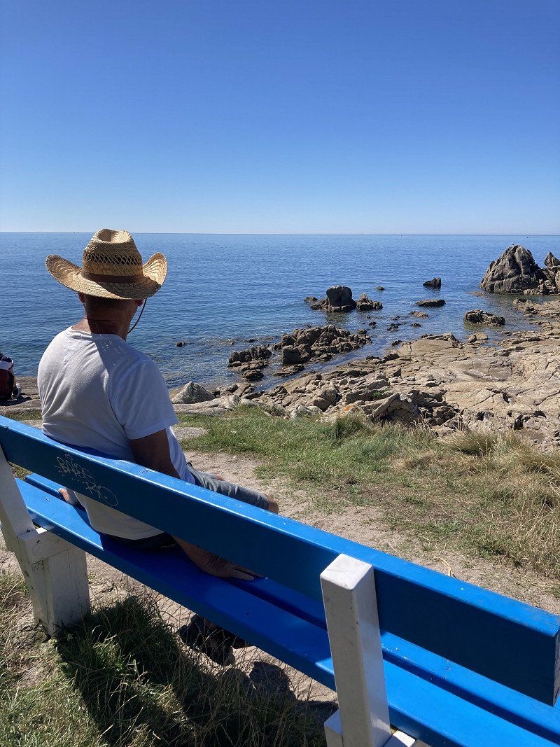
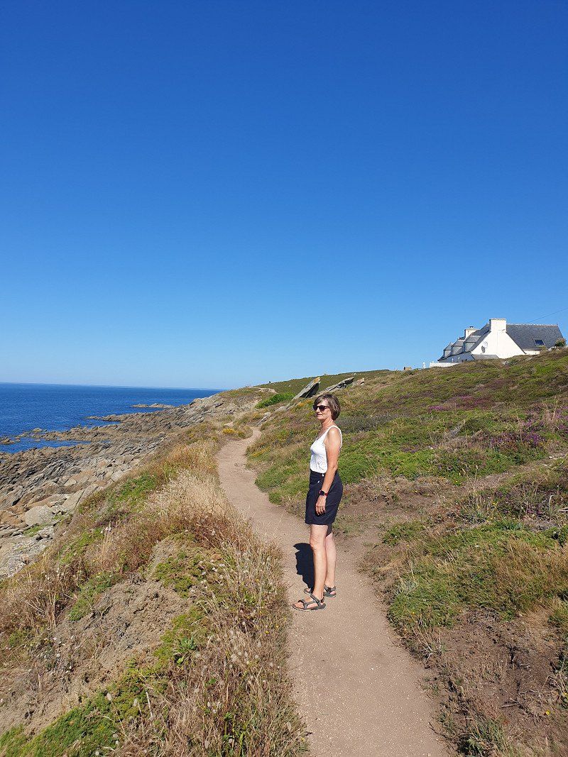
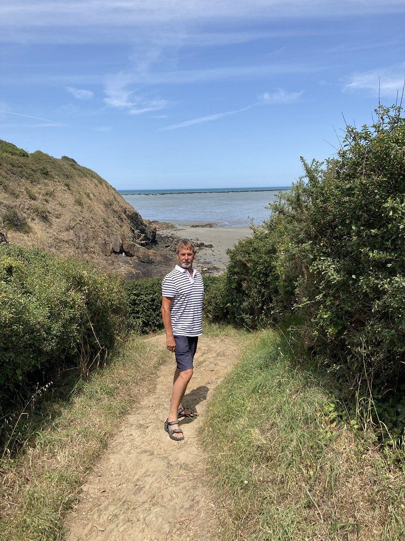
We went straight to the beach and hiked the GR34 coastal path from here for the first time. This is well signposted and stretches around the whole of Brittany.
Saint-Gildas-de-Rhuys, Frankreich
47° 30' 0.1" N 2° 50' 6.5" W
47.5000180 -2.8351479
• Head toward Rue Saint-Goustan on Chemin du Lavoir. Go for 63 m.
• Turn right onto Rue Saint-Goustan. Go for 272 m.
• Take the 2nd exit from roundabout onto Route de l'Ancienne Gare (D198). Go for 398 m.
• Take the 1st exit from roundabout onto Route d'Arzon (D198). Go for 42 m.
• Take the 2nd exit from roundabout onto Avenue Raymond Marcellin (D198). Go for 1.3 km.
• Take the 1st exit from roundabout onto Route d'Arzon (D198). Go for 2.0 km.
• Take the 3rd exit from roundabout onto D780. Go for 1.8 km.
• Continue on Lieu-dit Kerlanic (D780). Go for 72 m.
• Continue on D780. Go for 810 m.
• Continue on Route de Vannes à Port-Navalo (D780). Go for 91 m.
• Continue on D780. Go for 69 m.
• Take the 2nd exit from Rond-Point de Kerjouanno roundabout onto Boulevard de la Libération (D780). Go for 896 m.
• Take the 2nd exit from roundabout onto Boulevard de la Libération (D780). Go for 159 m.
• Take the 3rd exit from Rond-Point du Crouesty roundabout onto Boulevard de la Résistance (D780). Go for 237 m.
• Pass 4 roundabouts and continue on Boulevard de la Résistance (D780). Go for 1.5 km.
• Take the 2nd exit from Rond-Point du Toulassais roundabout onto Route de la Gare (D780). Go for 453 m.
• Arrive at Rue du Général de Gaulle. Your destination is on the left.
☍
10,1 km
( 14 min.)
Day
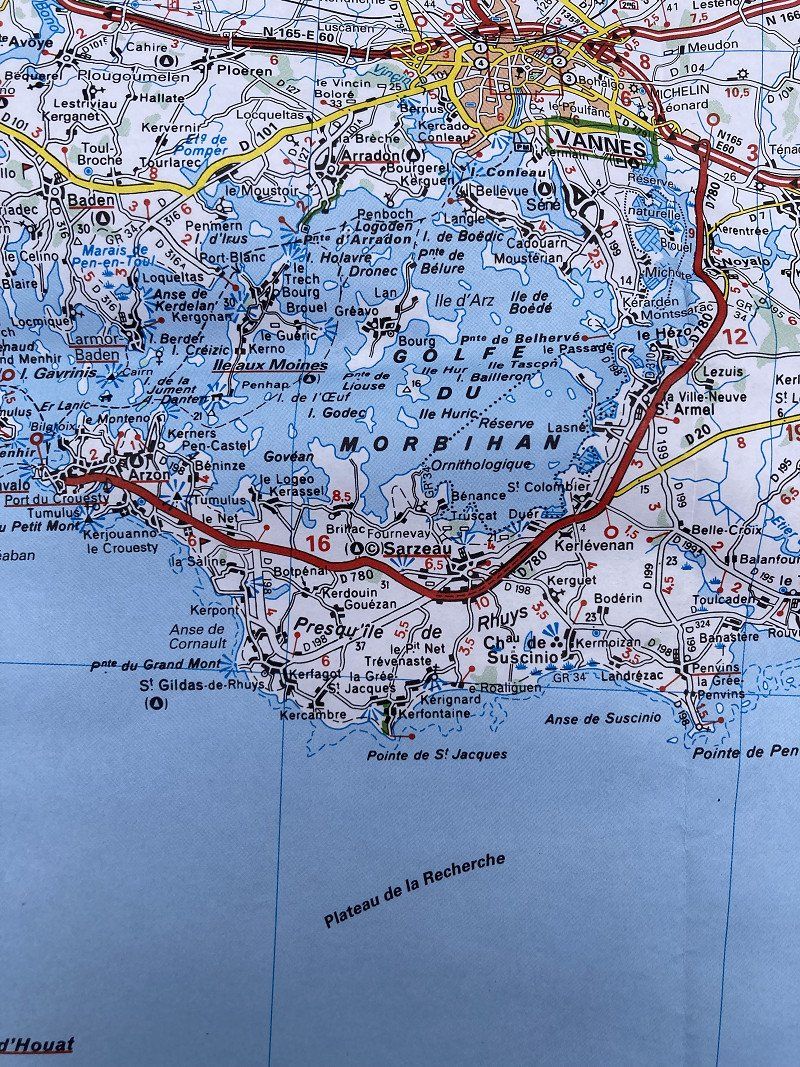
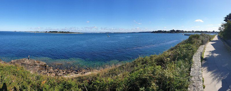
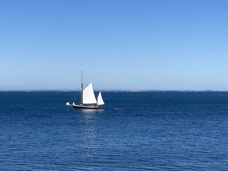
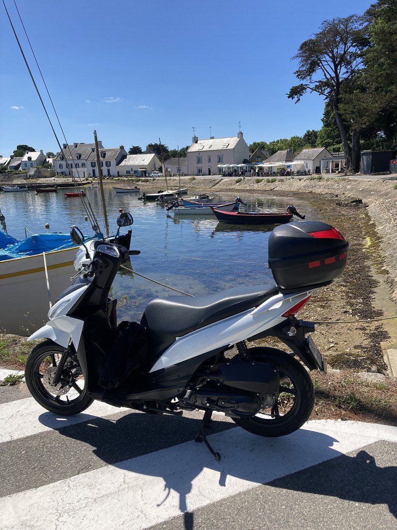
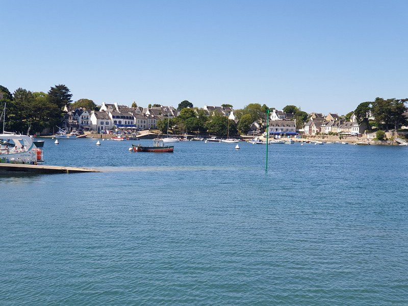
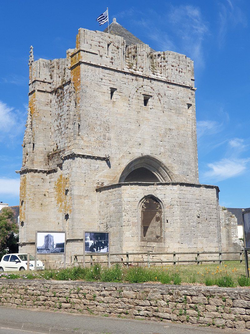
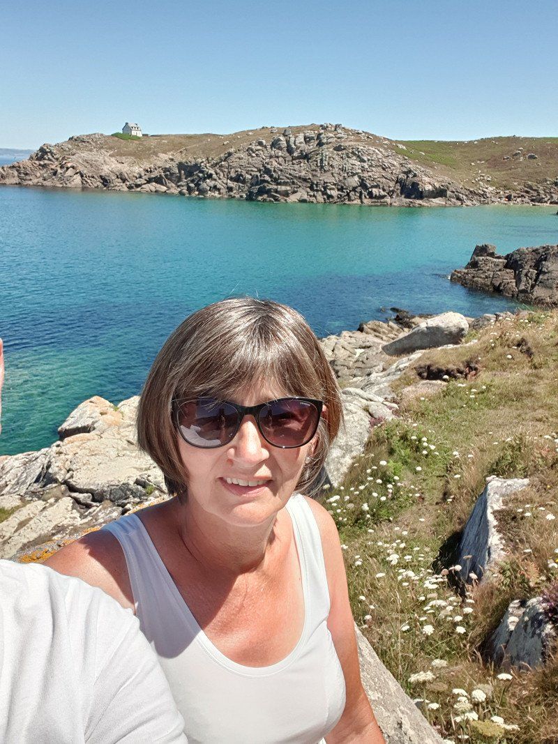
Port Navalo, Arzon
By scooter to Port Navalo. Here is the entrance from the Atlantic to the Gulf of Morbihan.
6,600 year old Neolithic tumulus on Petit Mont. 50m x 53m. Unfortunately, the Nazis converted it into a bunker during World War II.
Port Navalo, 56640 Arzon, Frankreich
47° 32' 49.9" N 2° 54' 56.9" W
47.5472040 -2.9158179
• Head northwest on Rue du Général de Gaulle. Go for 189 m.
• Turn left onto Rue du Phare. Go for 425 m.
• Turn right onto Rue du Général de Gaulle (D780). Go for 351 m.
• Take the 2nd exit from Rond-Point du Toulassais roundabout onto Boulevard de la Résistance (D780). Go for 317 m.
• Pass 4 roundabouts and continue on Boulevard de la Résistance (D780). Go for 1.3 km.
• Take the 1st exit from Rond-Point du Crouesty roundabout onto Boulevard de la Libération (D780). Go for 162 m.
• Take the 2nd exit from roundabout onto Boulevard de la Libération (D780). Go for 866 m.
• Take the 2nd exit from Rond-Point de Kerjouanno roundabout onto D780. Go for 129 m.
• Continue on Route de Vannes à Port-Navalo (D780). Go for 91 m.
• Continue on D780. Go for 810 m.
• Continue on Lieu-dit Kerlanic (D780). Go for 72 m.
• Continue on D780. Go for 1.7 km.
• Take the 4th exit from roundabout onto C. Go for 636 m.
• Turn right onto Route de Kermaillard. Go for 67 m.
• Turn right onto Chemin de Bon Abri. Go for 265 m.
• Continue on Lieu-dit Le Skal Hir. Go for 119 m.
• Turn right onto Route de Kermaillard (VC11). Go for 759 m.
• Take the 2nd exit from roundabout onto Rue du Port du Logéo (VC11). Go for 304 m.
• Turn left onto Quai des Voileries. Go for 93 m.
• Turn slightly left onto Quai des Voileries. Go for 176 m.
• Arrive at Impasse de la Pointe du Logéo. Your destination is on the right.
☍
8,8 km
( 15 min.)
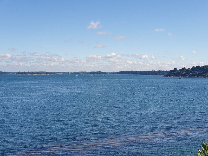
Port du Logéo, Sarzeau
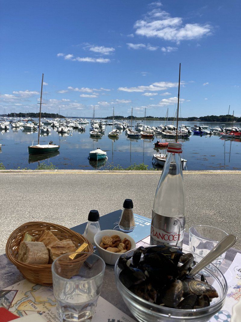
Great view of the Gulf of Morbihan with its islands and boats.
Ate delicious fish and moules in the "Petit Port" restaurant.
Logeo, 56370 Sarzeau, Frankreich
47° 32' 46.9" N 2° 50' 52.8" W
47.5463555 -2.8479980
• Head east on Impasse de la Pointe du Logéo. Go for 176 m.
• Turn slightly right onto Quai des Voileries. Go for 93 m.
• Turn right onto Rue du Port du Logéo. Go for 276 m.
• Take the 1st exit from roundabout onto Route de Kermaillard (VC11). Go for 1.3 km.
• Turn left onto C. Go for 484 m.
• Take the 3rd exit from roundabout onto Route d'Arzon (D198). Go for 2.1 km.
• Take the 3rd exit from roundabout onto Avenue Raymond Marcellin (D198). Go for 1.3 km.
• Take the 1st exit from roundabout onto Route d'Arzon (D198). Go for 40 m.
• Take the 2nd exit from roundabout onto Route de l'Ancienne Gare (D198). Go for 397 m.
• Take the 1st exit from roundabout onto Rue Saint-Goustan (VC201). Go for 283 m.
• Turn left onto Chemin du Lavoir. Go for 63 m.
• Arrive at Chemin du Lavoir. Your destination is on the right.
☍
6,4 km
( 11 min.)
Saint-Gildas-de-Rhuys
Saint-Gildas-de-Rhuys, Frankreich
47° 30' 0.1" N 2° 50' 6.5" W
47.5000180 -2.8351479
• Head toward Rue Saint-Goustan on Chemin du Lavoir. Go for 63 m.
• Turn right onto Rue Saint-Goustan. Go for 272 m.
• Take the 1st exit from roundabout onto Route de Sarzeau (D198). Go for 2.5 km.
• Continue on D198. Go for 18 m.
• Continue on Route de Saint-Gildas (D198). Go for 1.9 km.
• Take the 3rd exit from Giratoire de Saint-Jacques roundabout onto D198. Go for 309 m.
• Take the 1st exit from Giratoire de Kerollaire roundabout onto D780. Go for 247 m.
• Continue on Route de Port-Navalo (D780). Go for 410 m.
• Continue on D780. Go for 89 m.
• Take the 2nd exit from Giratoire de Kergroës roundabout onto D780. Go for 4.6 km.
• Keep left onto D780. Go for 611 m.
• Take the 3rd exit from roundabout onto D780. Go for 2.0 km.
• Take the 3rd exit from Giratoire du Clos Salomon roundabout onto D780. Go for 2.1 km.
• Pass 4 roundabouts and continue on D780. Go for 6.7 km.
• Take ramp onto N165. Go for 1.7 km.
• Keep left onto N165 toward Vannes-Centre/Lorient/Brest/Rennes. Go for 6.8 km.
• Keep left onto Rocade de Vannes (N165) toward Lorient/Brest/Vannes-Ouest/Arradon/Auray. Go for 14.2 km.
• Take ramp toward Ste Anne d'Auray/Le Bono/Pluneret/Auray-St Goustan. Go for 273 m.
• Take the 3rd exit from Rond-Point de Kergoho roundabout onto D765 toward Auray/Le Bono/Baden/Ste Anne d'Auray. Go for 768 m.
• Take the 3rd exit from Rond-Point du Branhoc roundabout onto D765. Go for 822 m.
• Take the 2nd exit from Rond-Point de la Terre Rouge roundabout onto Avenue Président Wilson. Go for 956 m.
• Turn right onto Place du Loch. Go for 57 m.
• Continue on Rue du Loc'h. Go for 42 m.
• Take the 1st exit from roundabout onto Rue du Jeu de Paume. Go for 162 m.
• Turn slightly right onto Rue du Jeu de Paume. Go for 44 m.
• Turn right onto Place de la République. Go for 10 m.
• Arrive at Place de la République. Your destination is on the left.
☍
47,8 km
( 40 min.)
Day
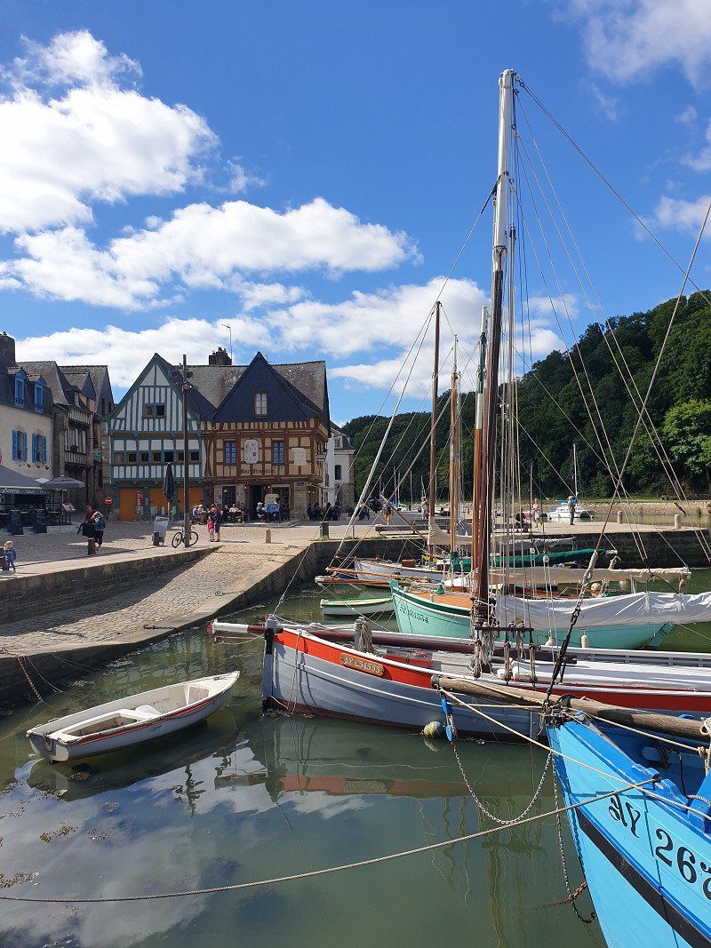
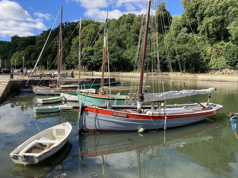
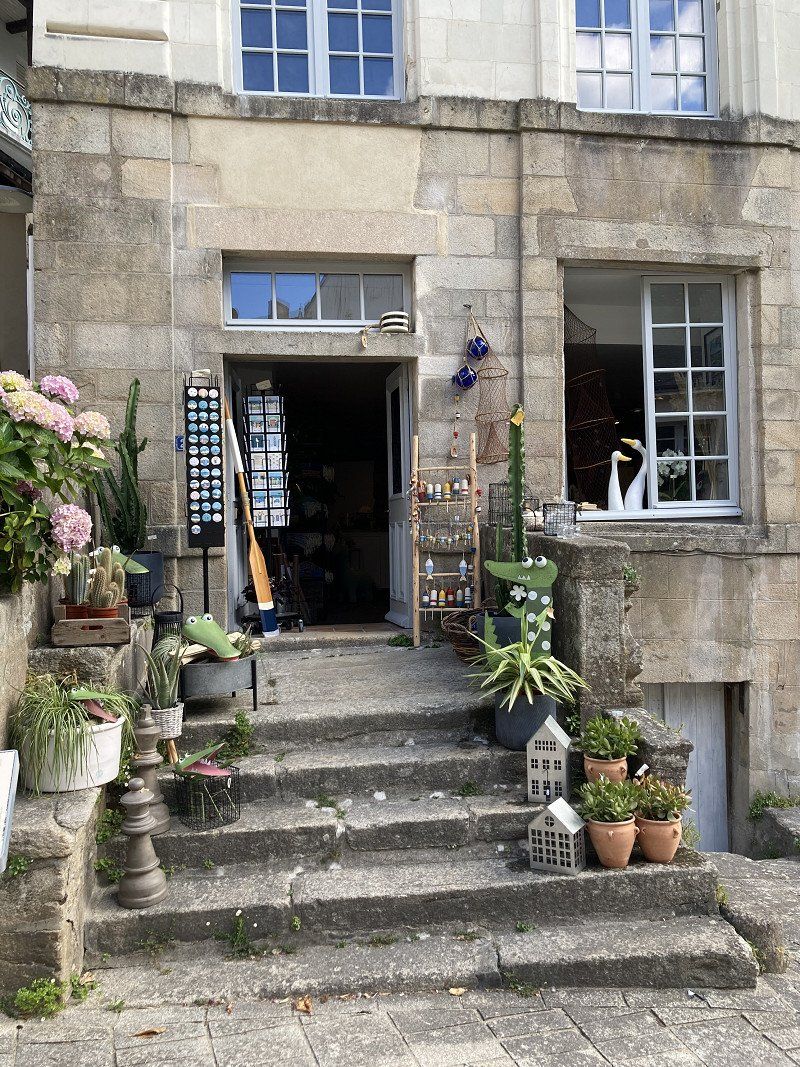
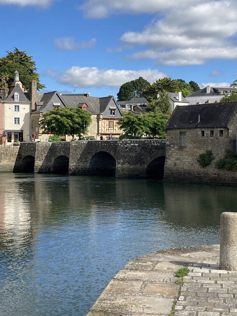
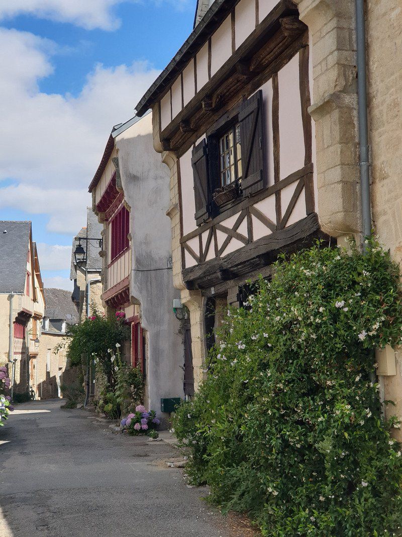
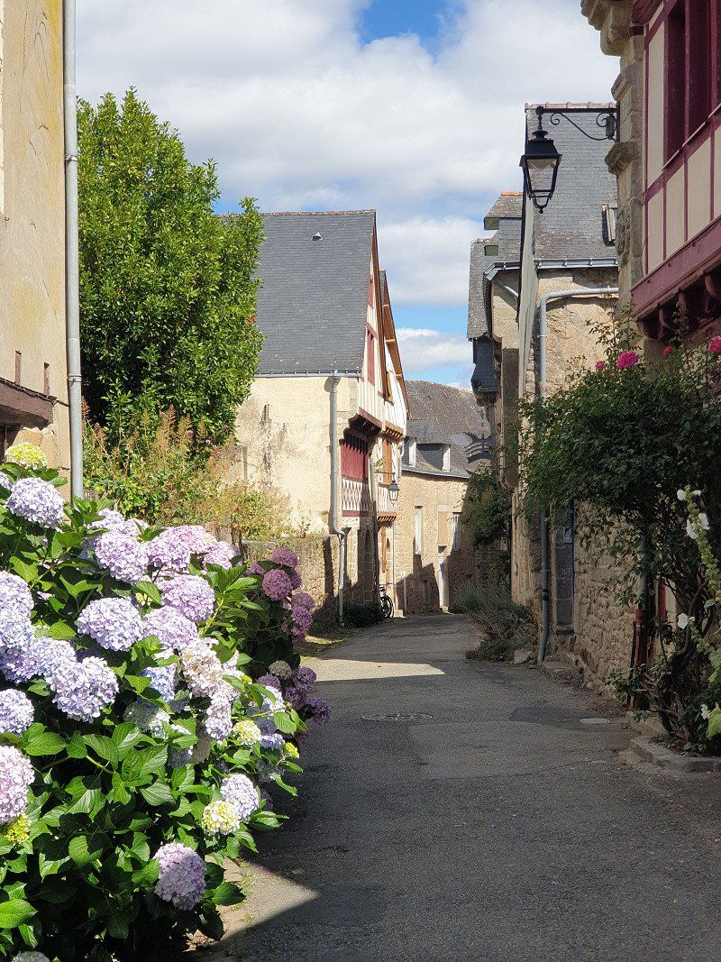
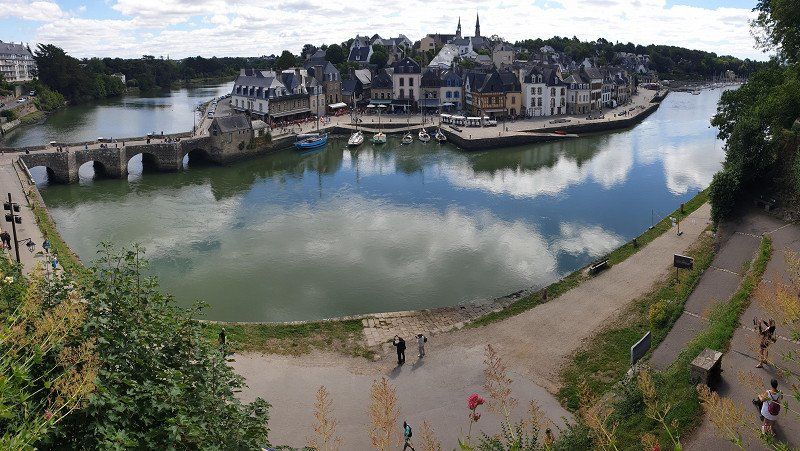
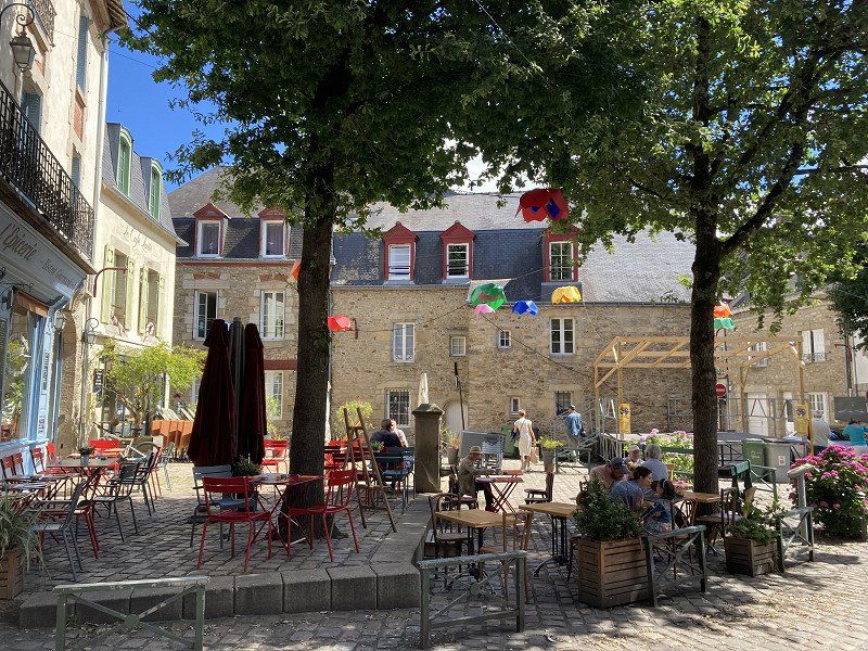
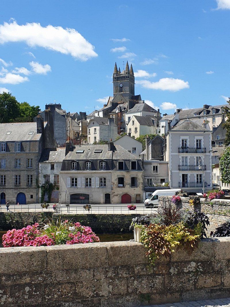
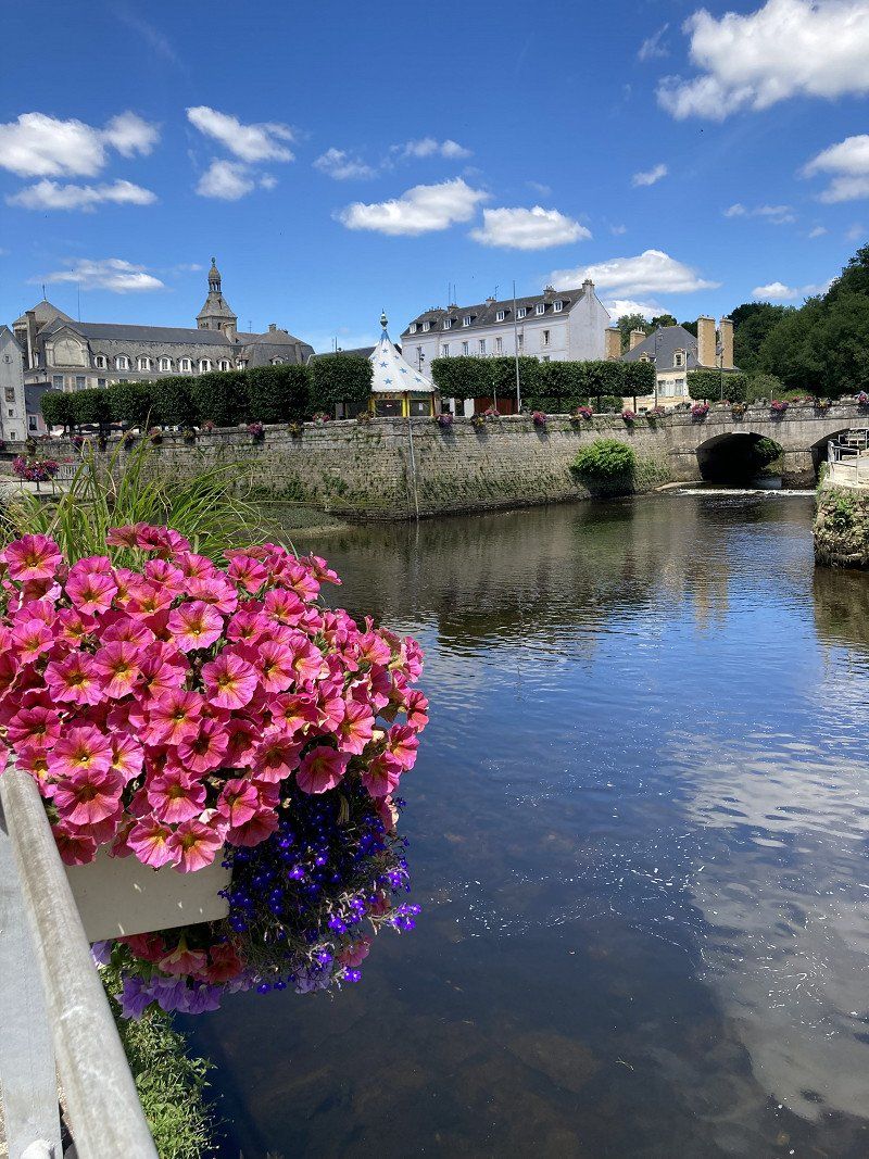
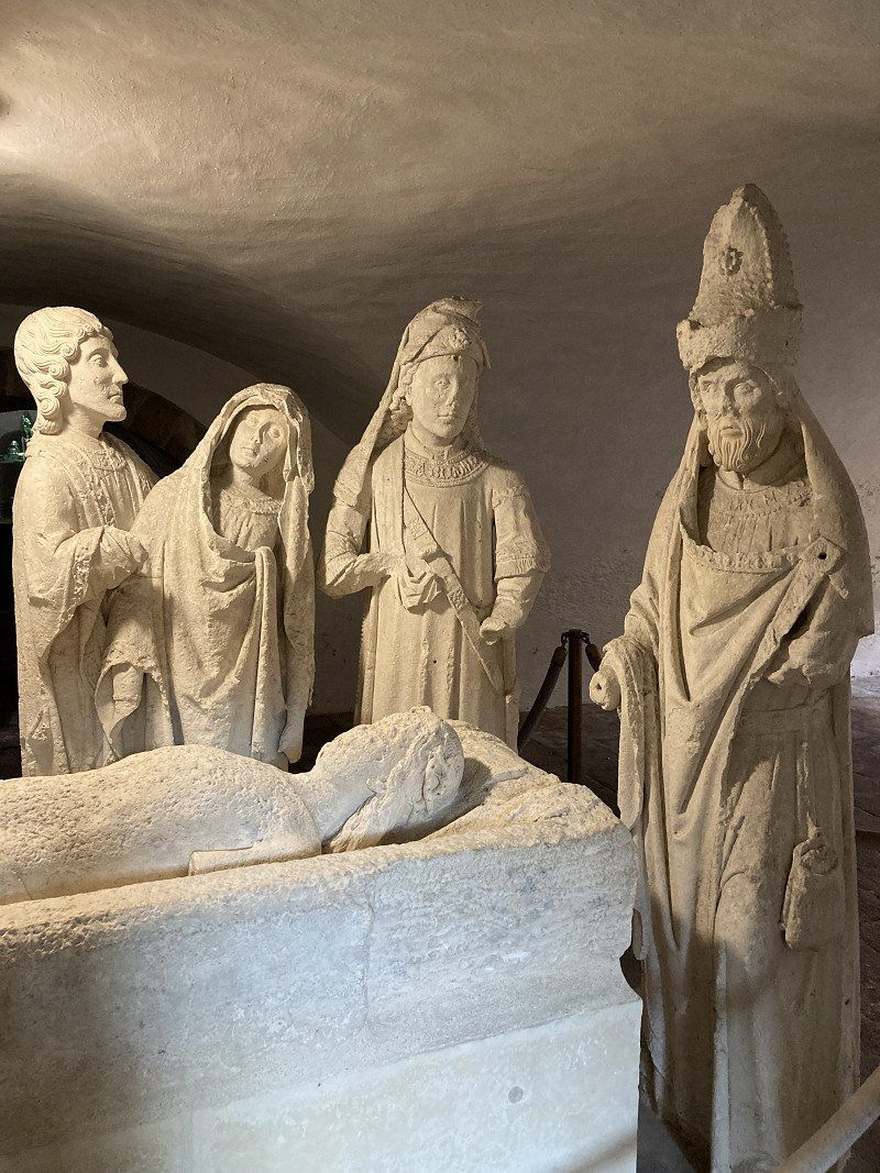
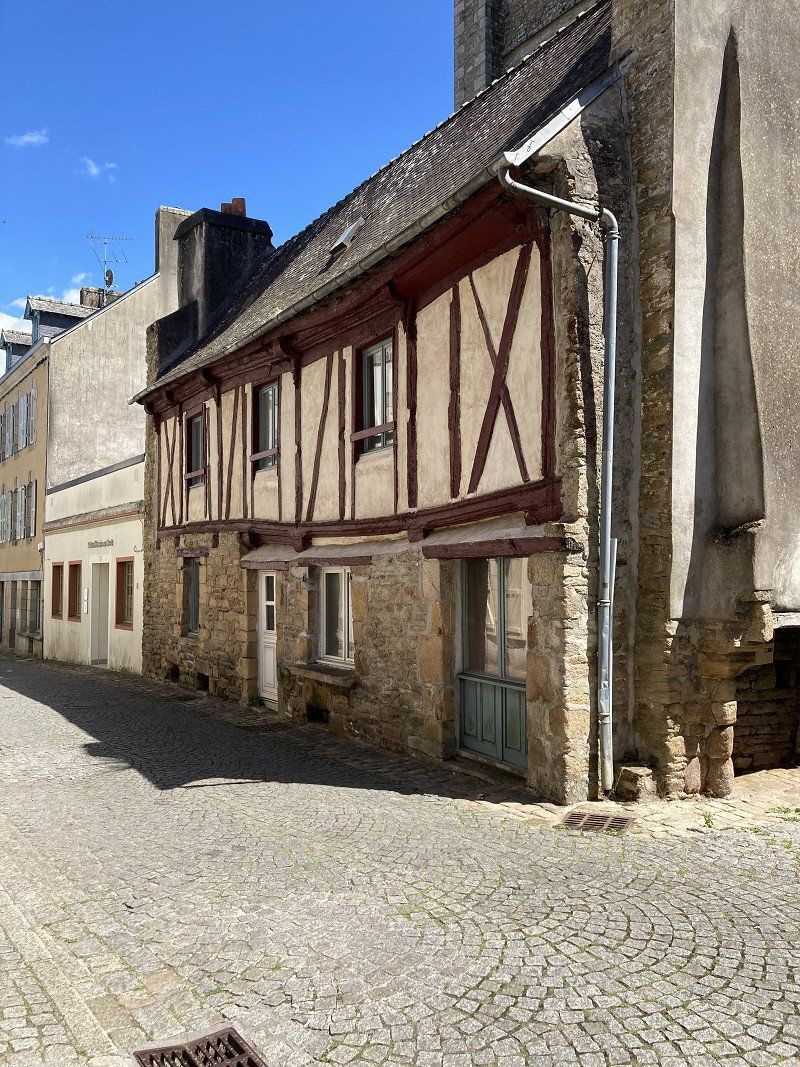
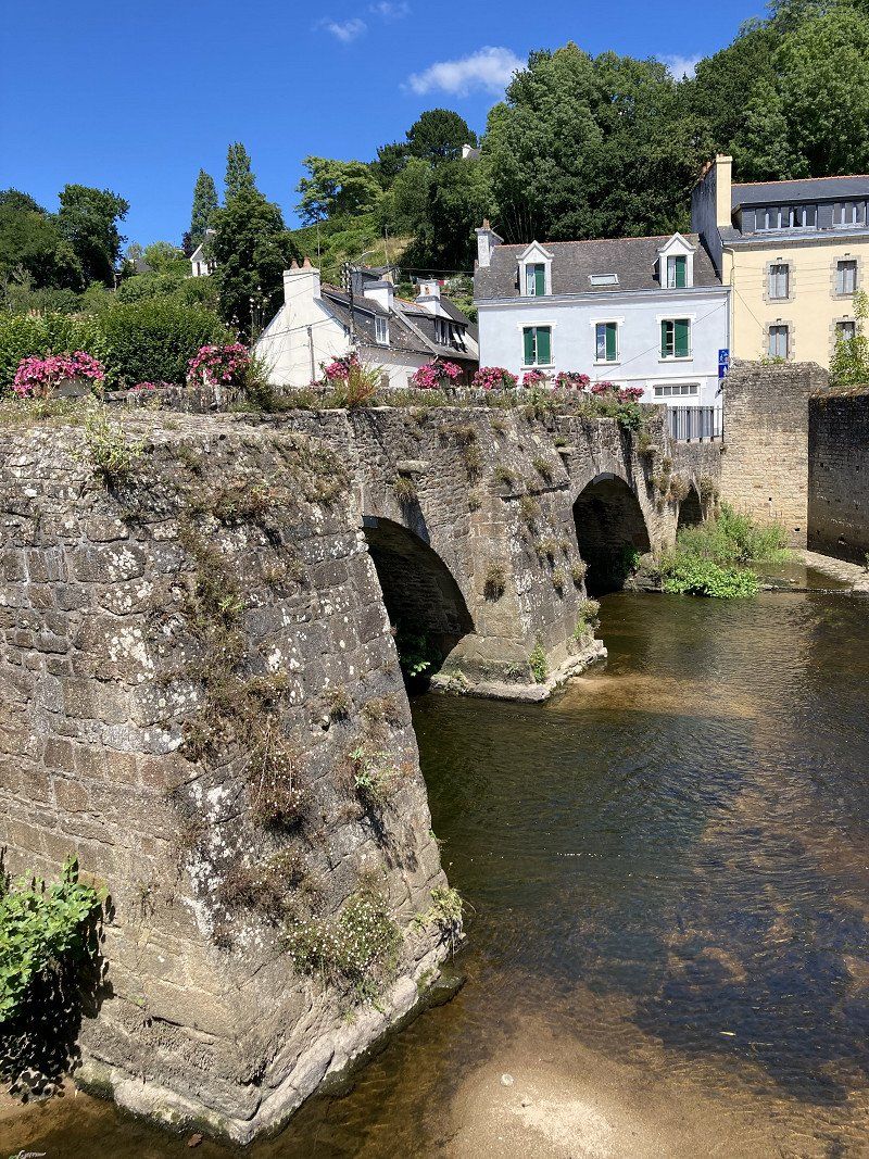
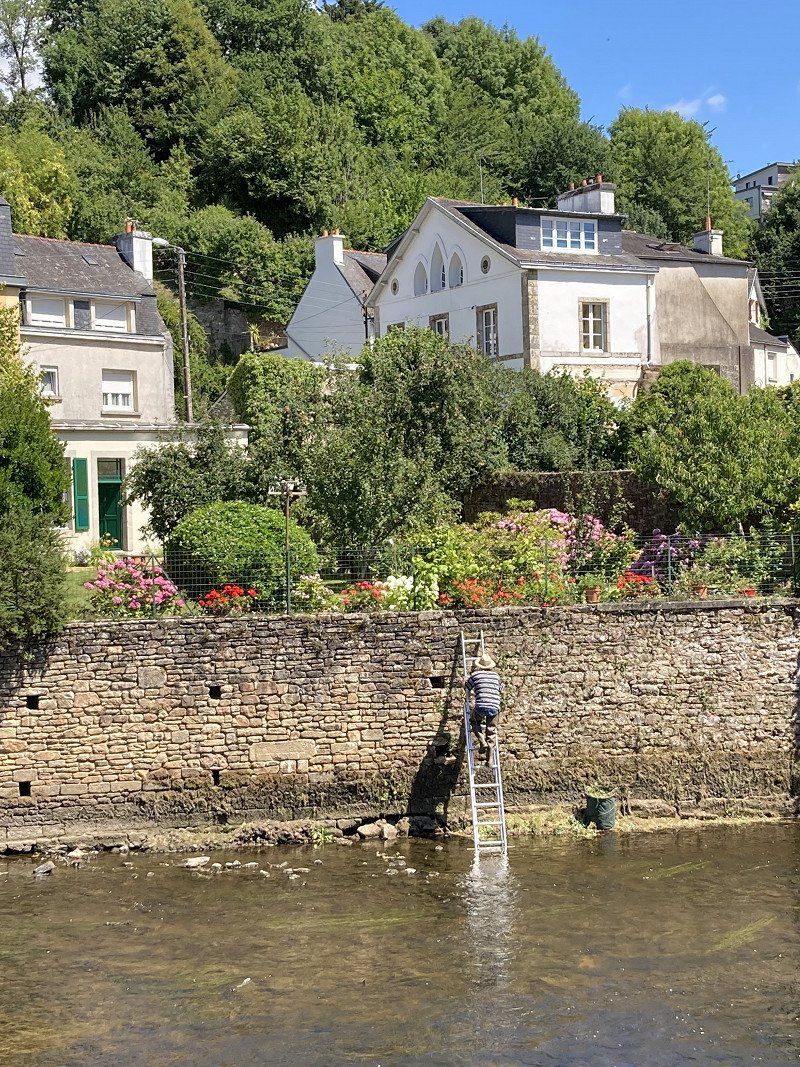
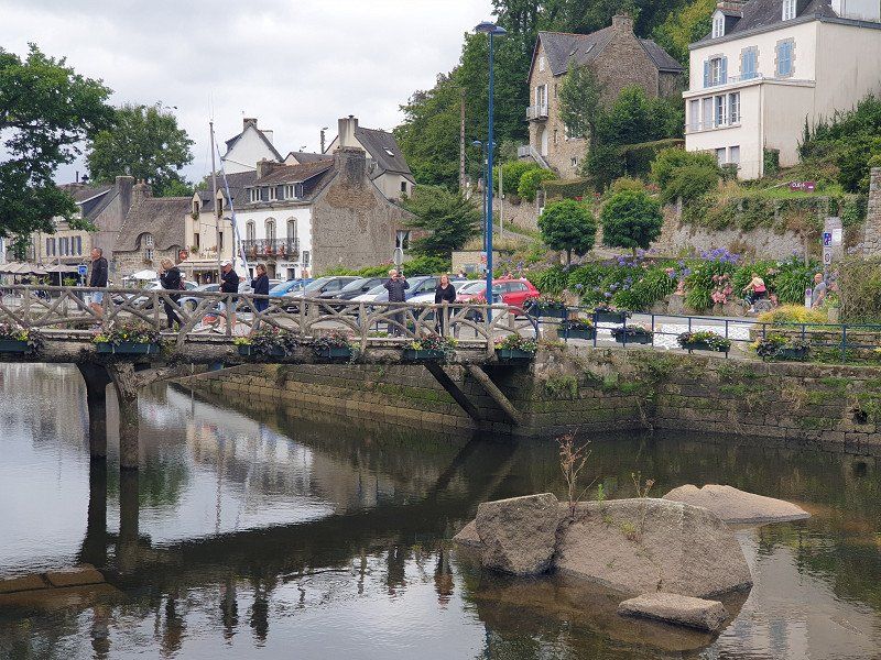
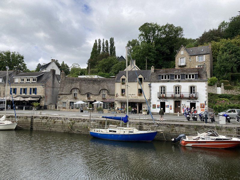
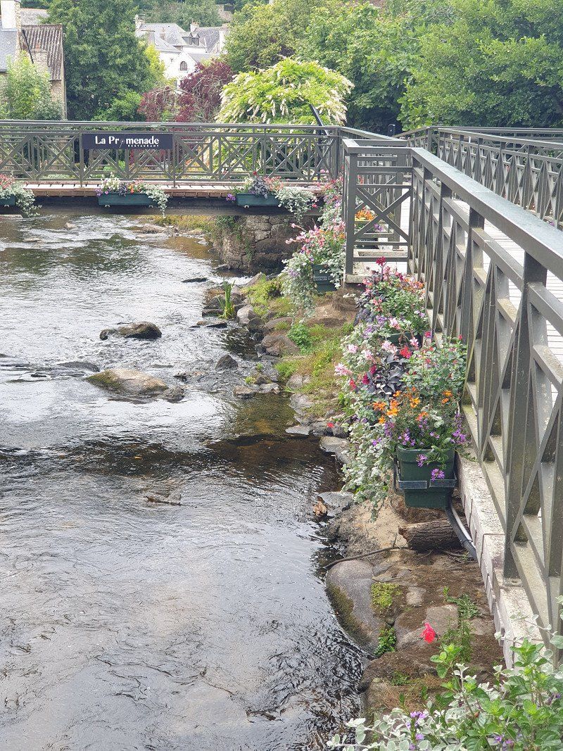
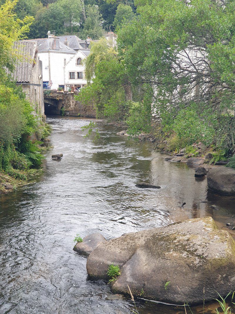
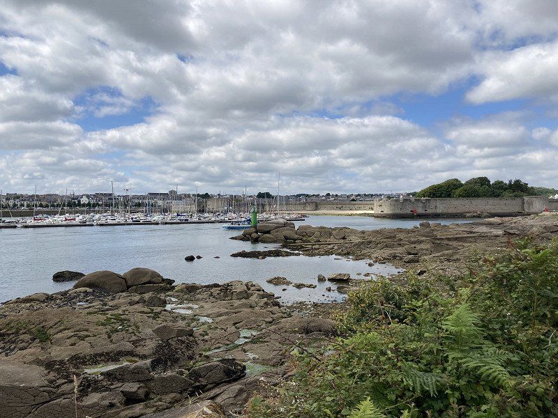
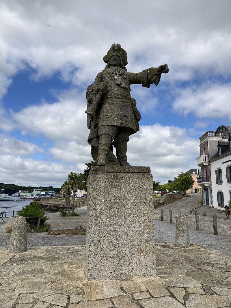
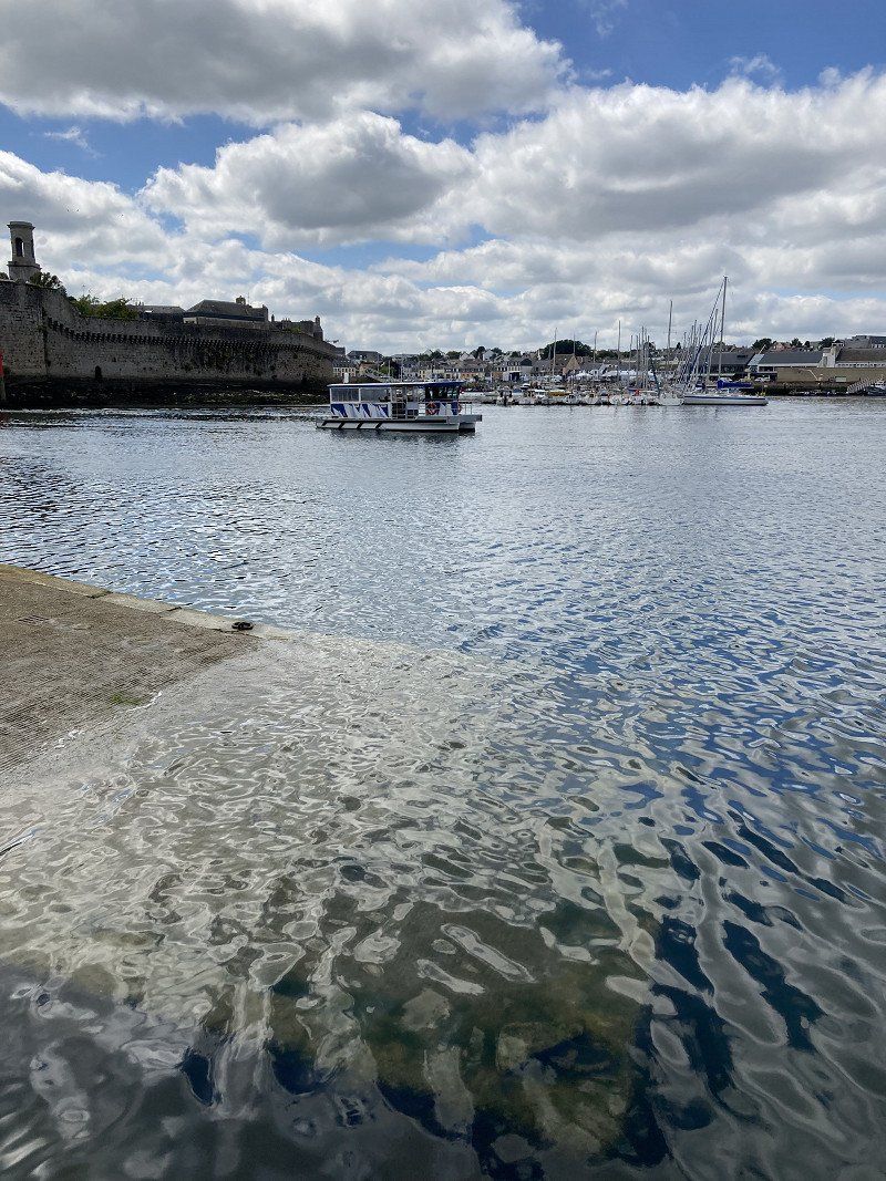
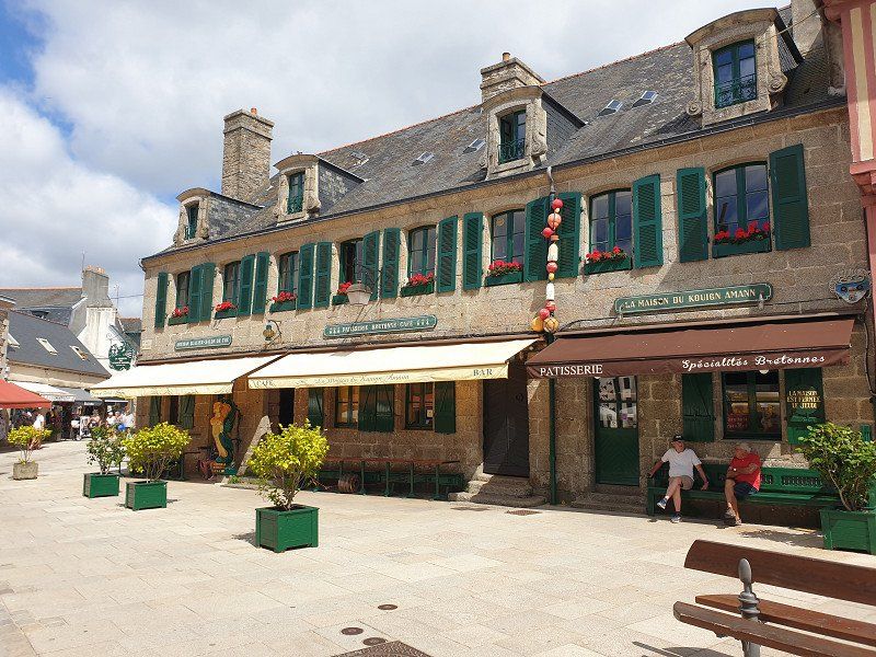
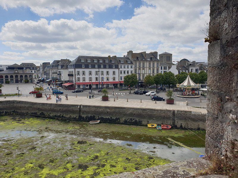
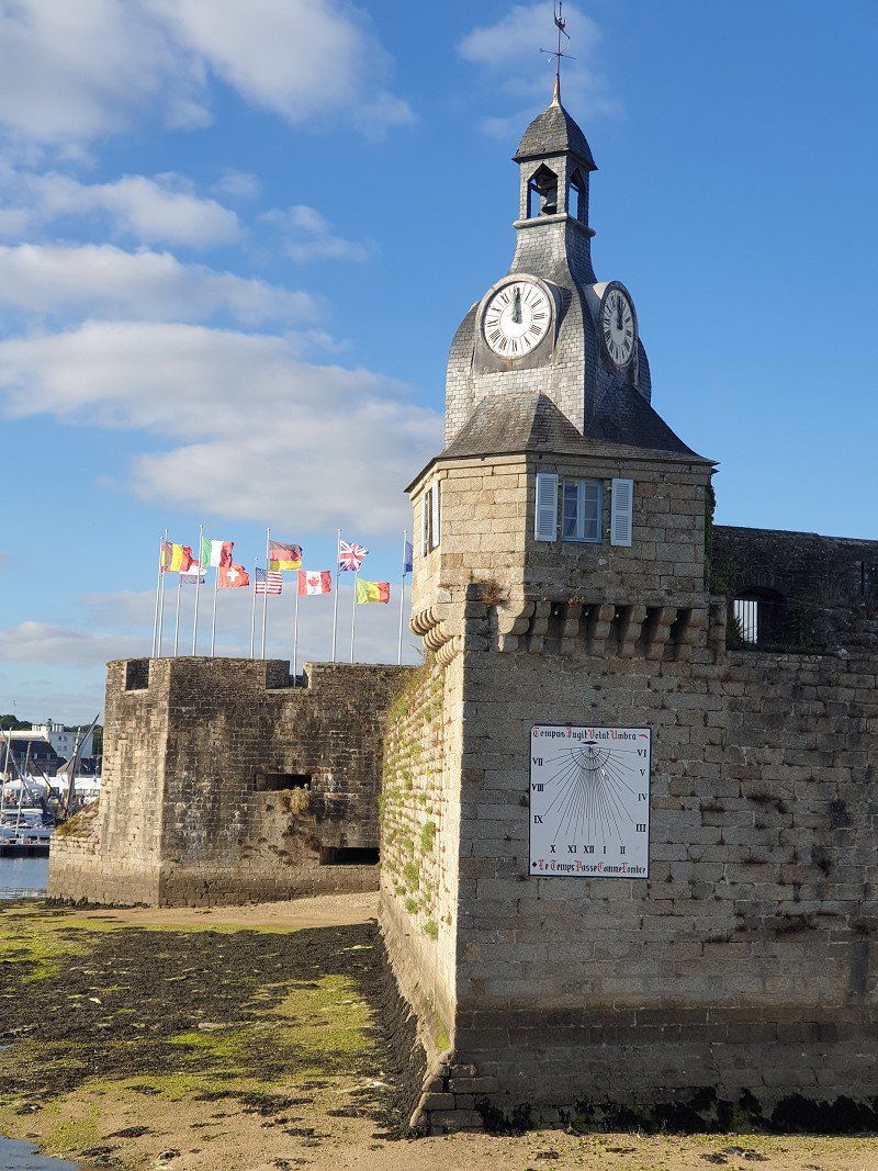
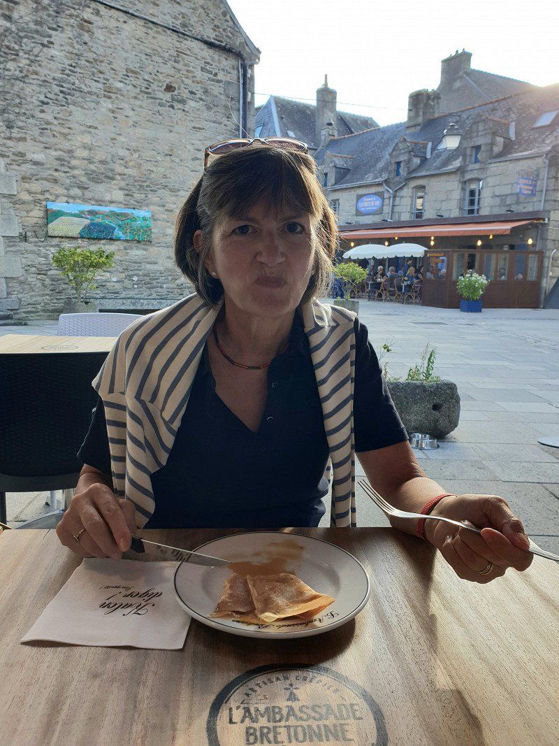
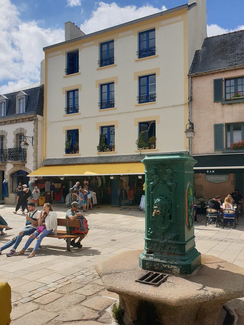
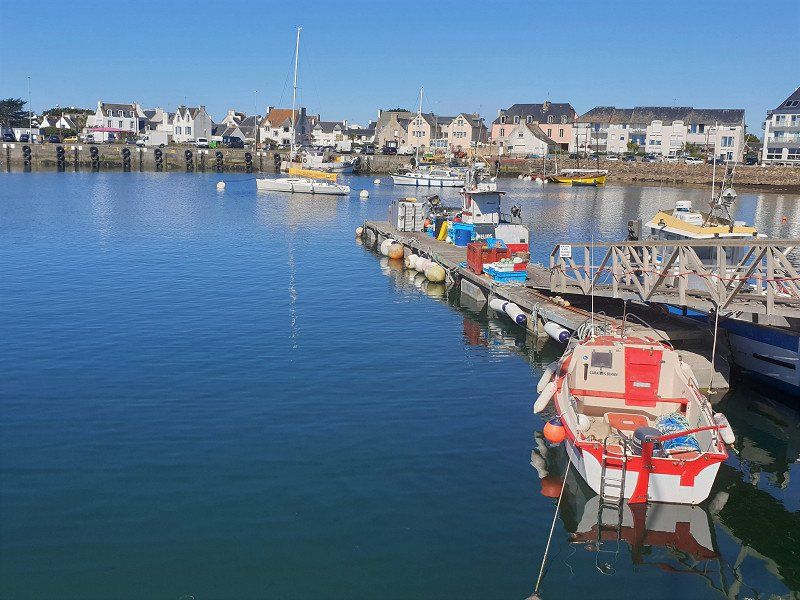
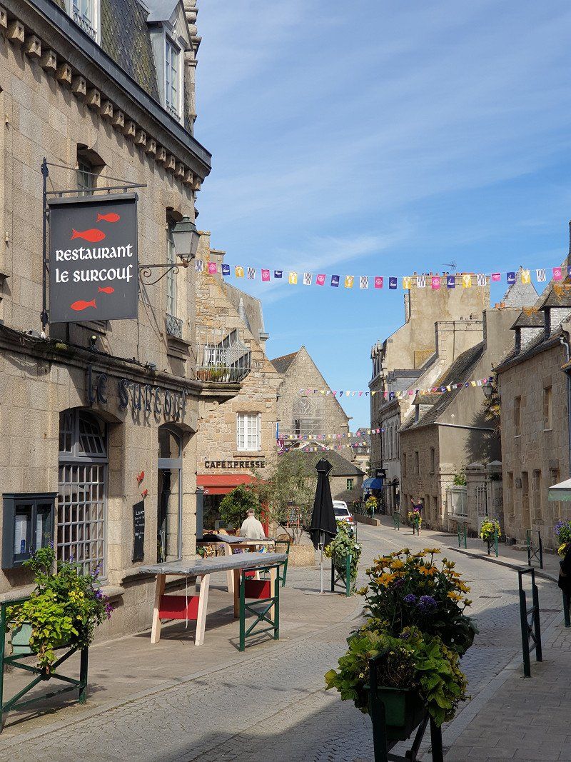
Auray
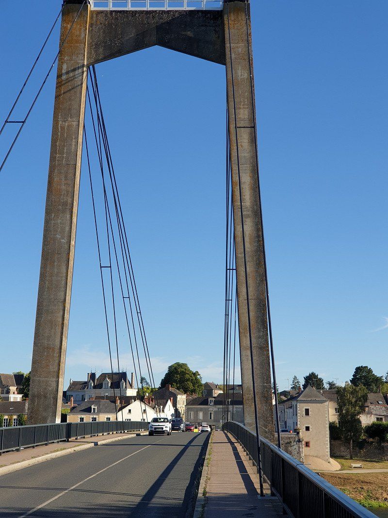
The old port of Saint-Goustan with its stone bridge and the old quarter is well worth seeing.
56400 Auray, Frankreich
47° 39' 59.4" N 2° 59' 1.6" W
47.6664910 -2.9837670
• Head east on Place de la République. Go for 89 m.
• Turn right onto Rue du Père Éternel (D28). Go for 1.4 km.
• Take the 1st exit from roundabout onto N165 toward Vannes/Lorient. Go for 2.3 km.
• Take ramp toward Quiberon/La Trinité S/ Mer/Carnac/Auray-Z.A. Go for 318 m.
• Take the 4th exit from Giratoire de Kerbois roundabout onto Route de Quiberon (D768) toward La Trinité S/ Mer/Carnac/Quiberon/Belle Île en Mer/Plouharnel/Z.A. de Toul-Garros. Go for 795 m.
• Take the 3rd exit from roundabout onto D768. Go for 934 m.
• Pass 3 roundabouts and continue on Lieu-dit Le Paradis (D768). Go for 7.1 km.
• Take the 3rd exit from roundabout onto D768. Go for 2.0 km.
• Take the 3rd exit from Rond-Point de l'Océan roundabout onto Avenue d'Auray (D768). Go for 255 m.
• Take the 4th exit from roundabout onto Avenue de l'Océan (D768). Go for 3.9 km.
• Take the 2nd exit from roundabout onto Route de Quiberon (D768). Go for 135 m.
• Take the 2nd exit from roundabout onto Route des Sables Blancs. Go for 813 m.
• Turn left. Go for 15 m.
• Arrive at your destination on the left.
☍
20,0 km
( 22 min.)
Camping Municipal Des Sables Blancs
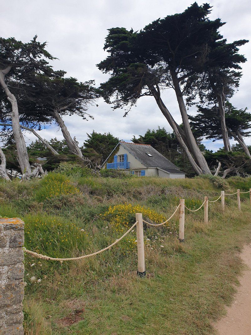
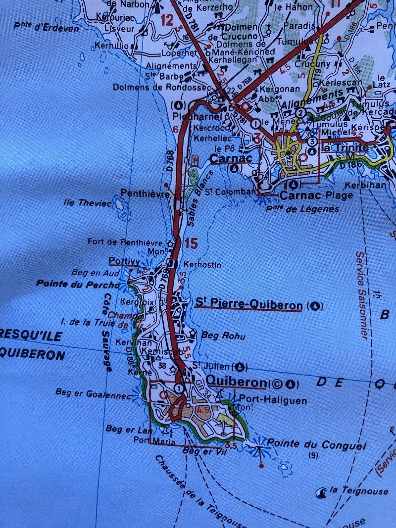
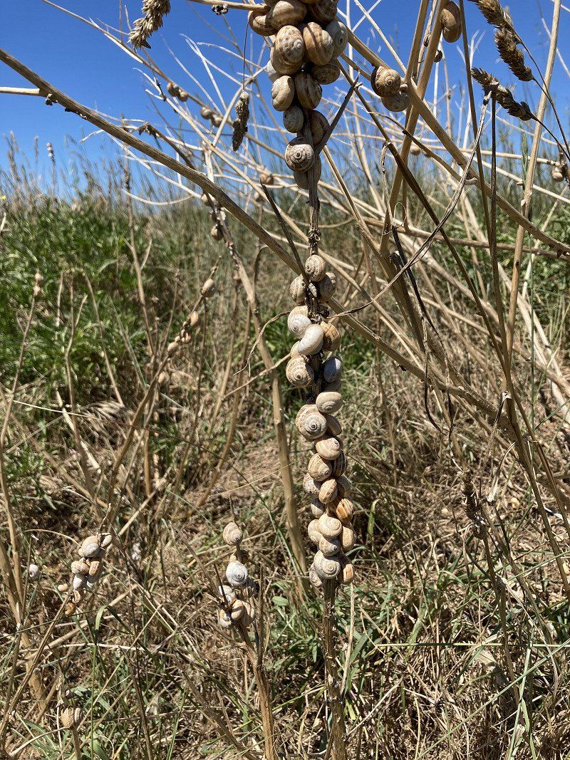
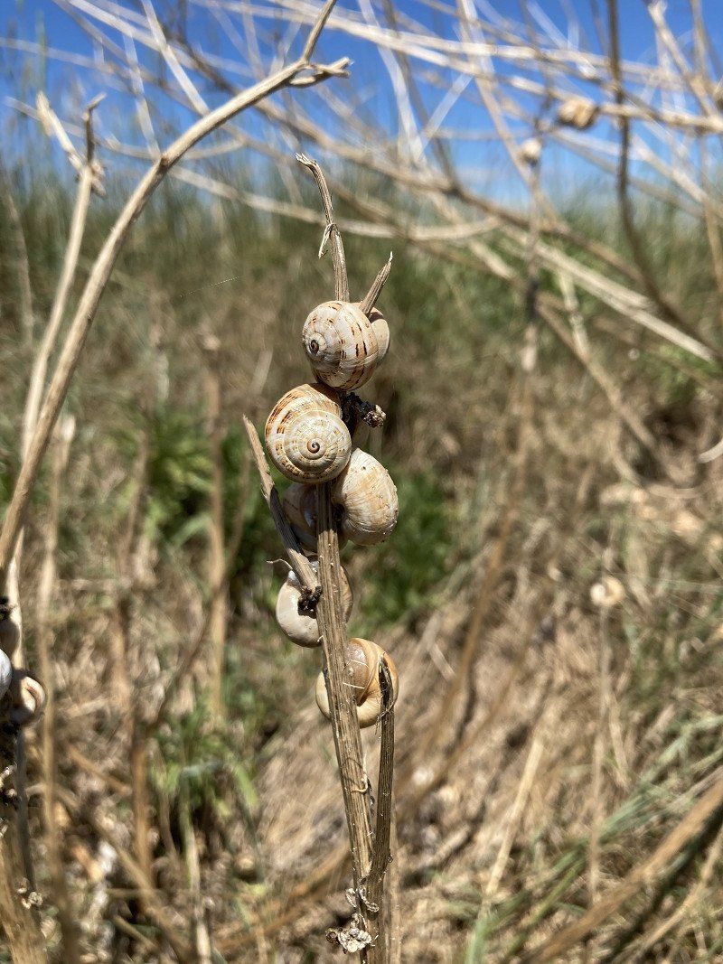
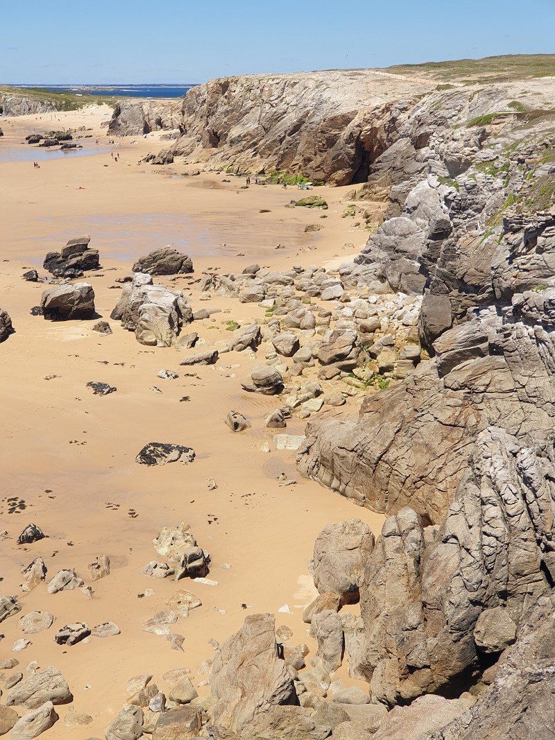
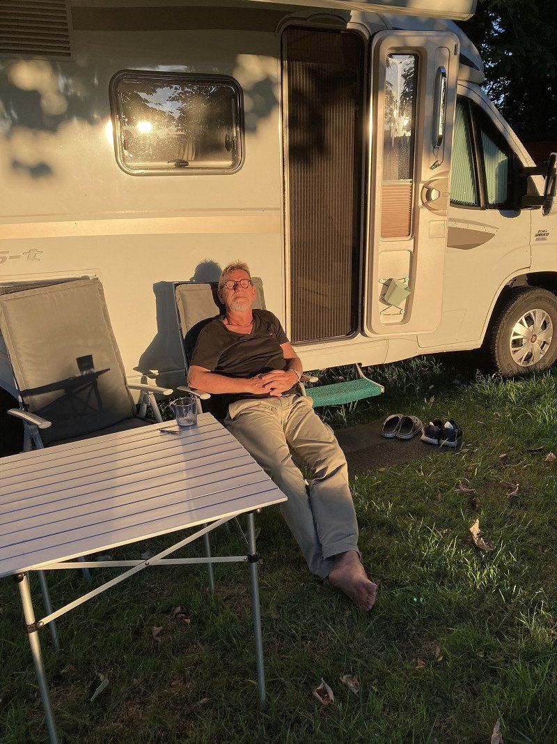
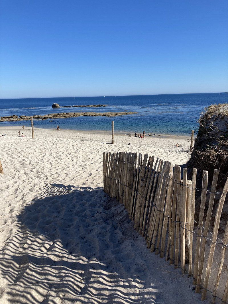
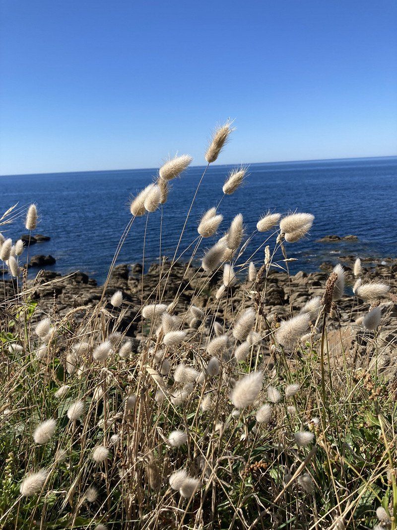
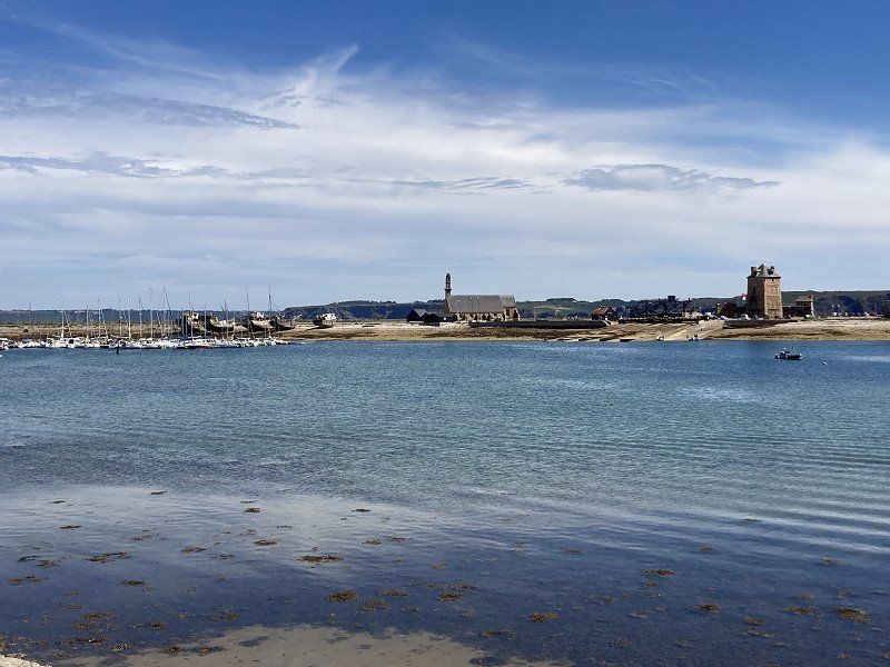
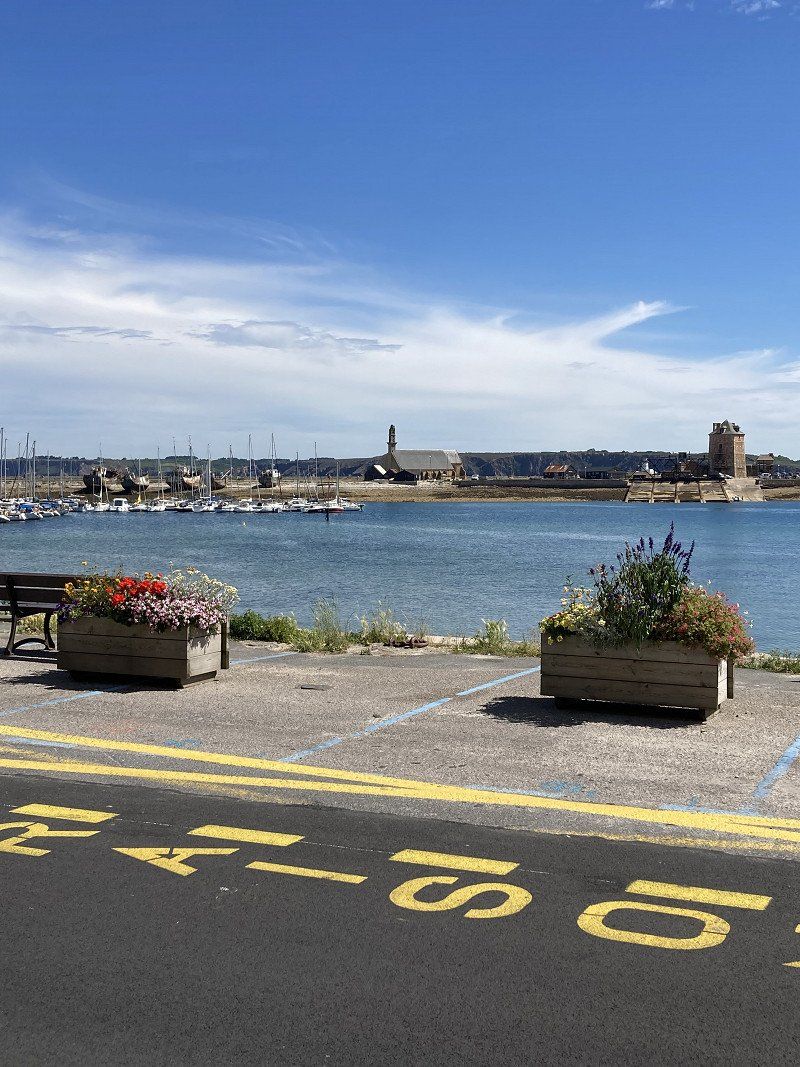
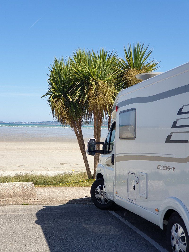
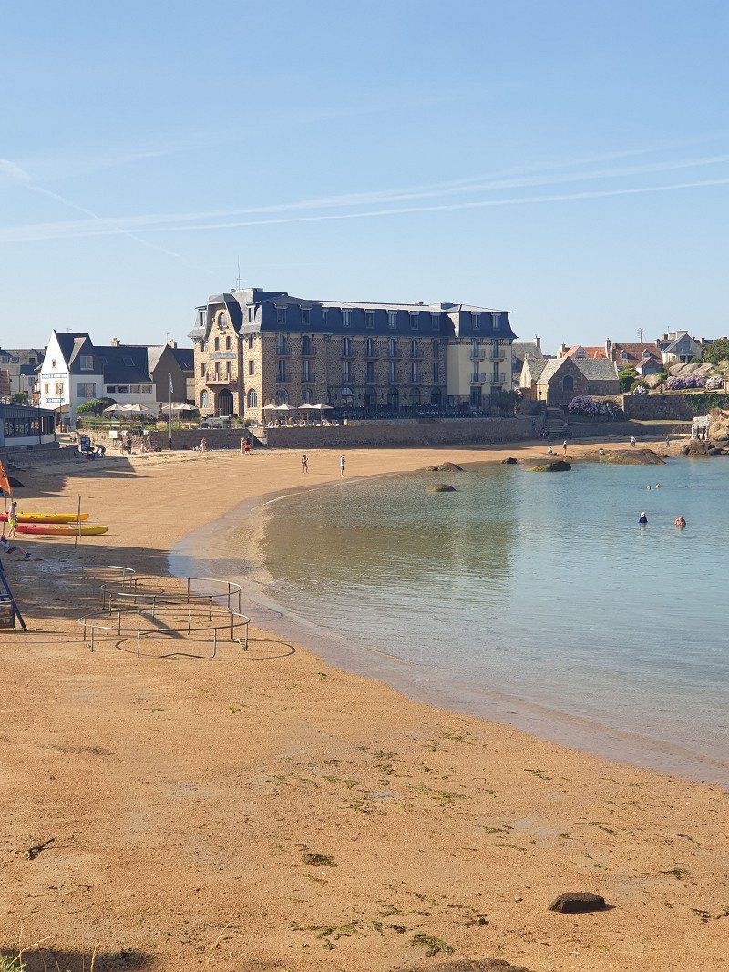
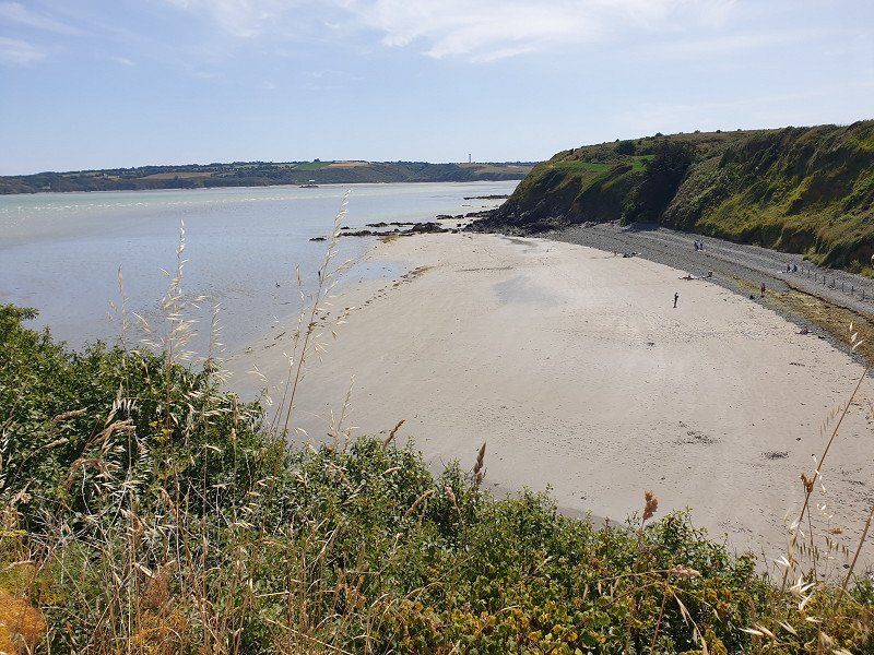
Continue south to the narrow peninsula of Quiberon . SP next to the CP (€11.90/night with electricity - sanitary facilities on the CP can be shared). A bay directly in front of us, where we watch the spectacle of the ebb and flow.
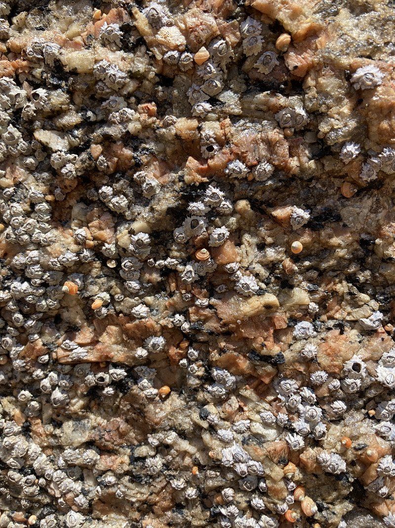
Strange: hundreds of snails stick to dried stalks.
56340, Plouharnel, France
47° 34' 19.2" N 3° 7' 34.3" W
47.5720000 -3.1262000
• Head west. Go for 15 m.
• Turn right onto Route des Sables Blancs. Go for 760 m.
• Take the 2nd exit from roundabout onto Route de Quiberon (D768). Go for 4.7 km.
• Take the 2nd exit from roundabout onto Rue de la Baie (D768). Go for 1.2 km.
• Take the 2nd exit from roundabout. Go for 25 m.
• Take the 1st exit from roundabout onto Avenue de Bretagne (D768). Go for 306 m.
• Pass 7 roundabouts and continue on Avenue du Général de Gaulle (D768). Go for 4.0 km.
• Take the 1st exit from roundabout onto Rue du Port de Pêche. Go for 551 m.
• Take the 3rd exit from roundabout onto Rue Victor Golvan. Go for 85 m.
• Take the 1st exit from roundabout onto Place du Varquez. Go for 141 m.
• Turn left onto Place du Varquez. Go for 79 m.
• Turn right. Go for 57 m.
• Turn left. Go for 12 m.
• Turn right. Go for 21 m.
• Arrive at your destination on the left.
☍
11,9 km
( 18 min.)
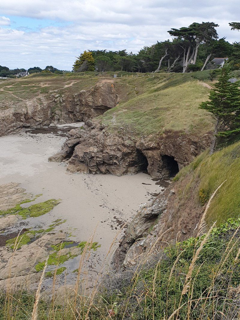
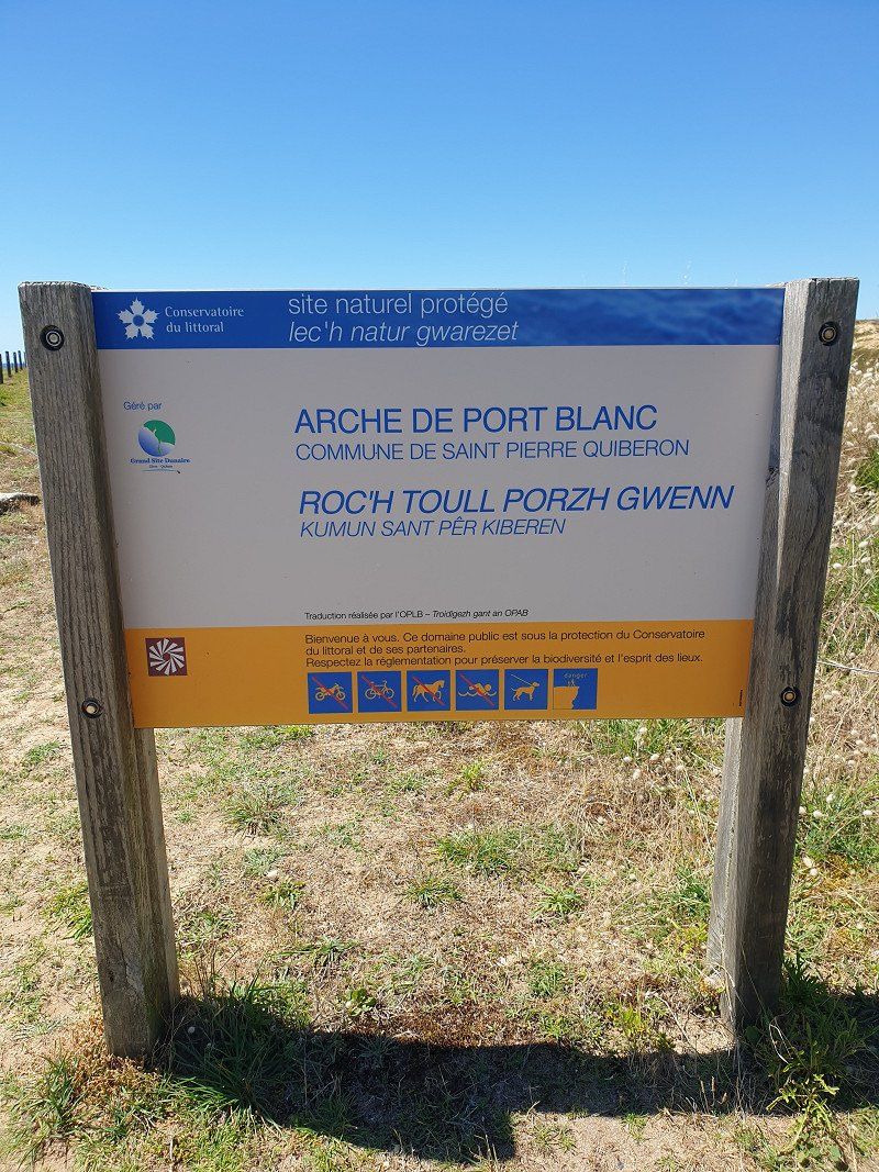
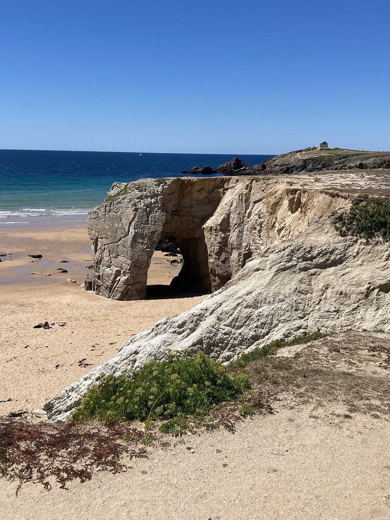
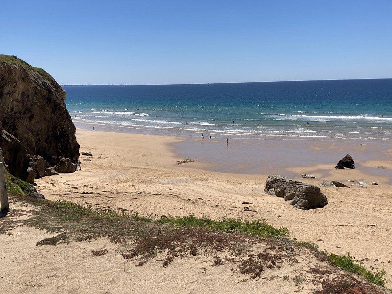
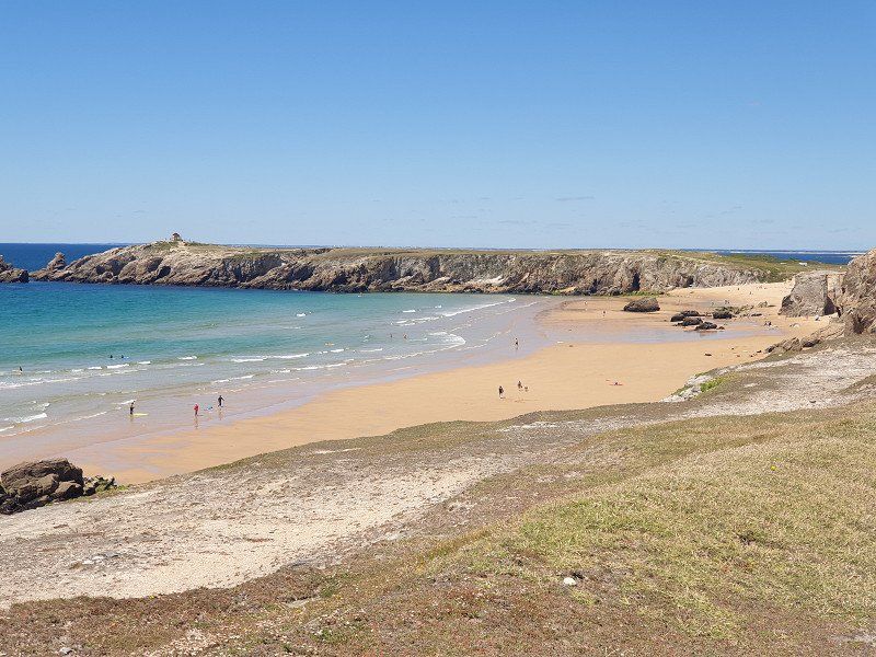
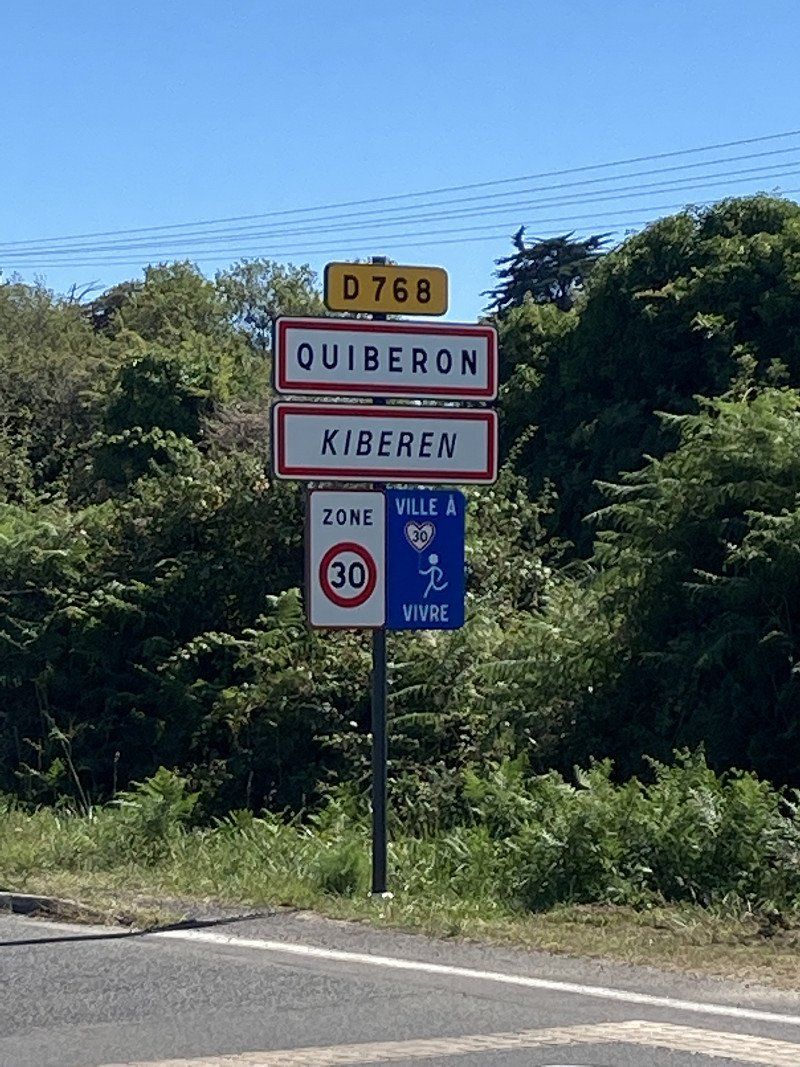
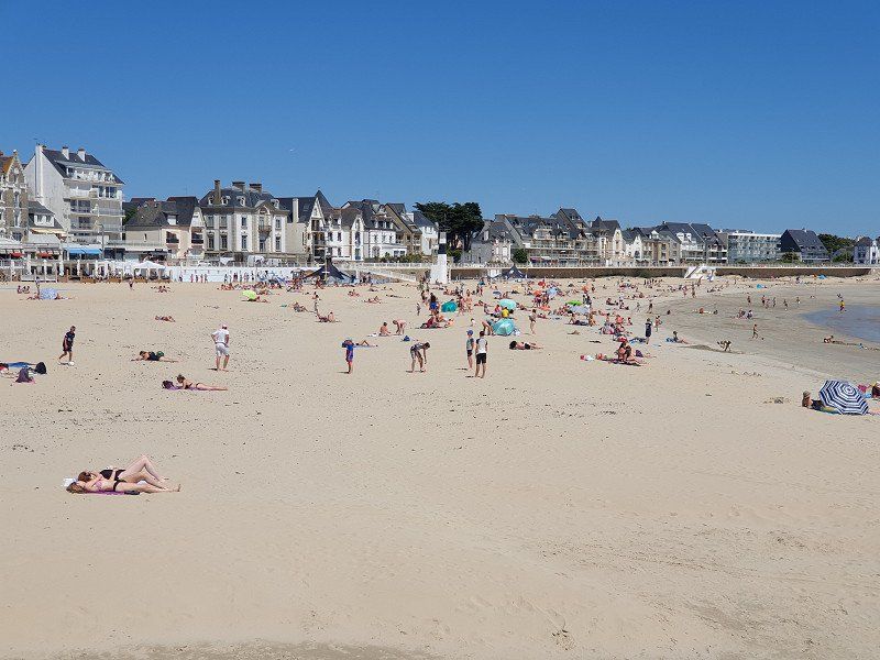
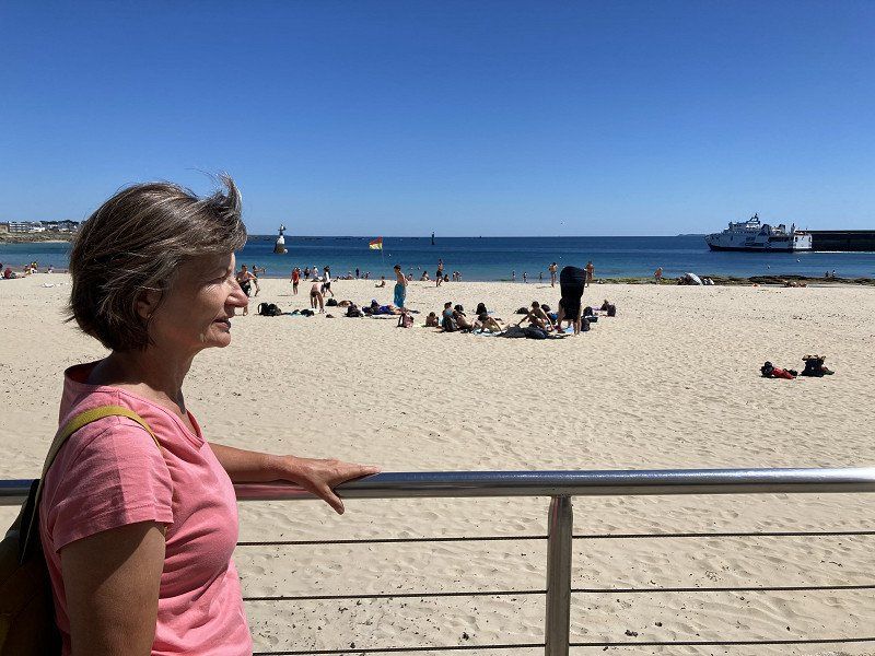
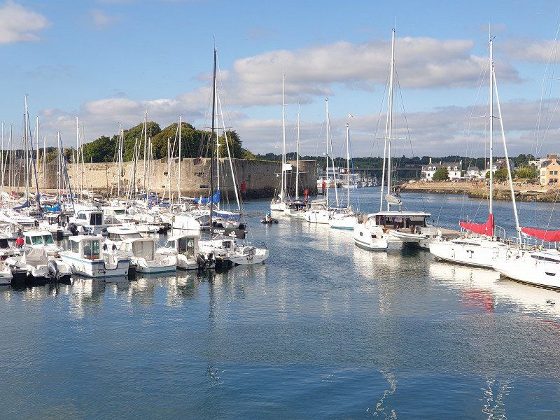
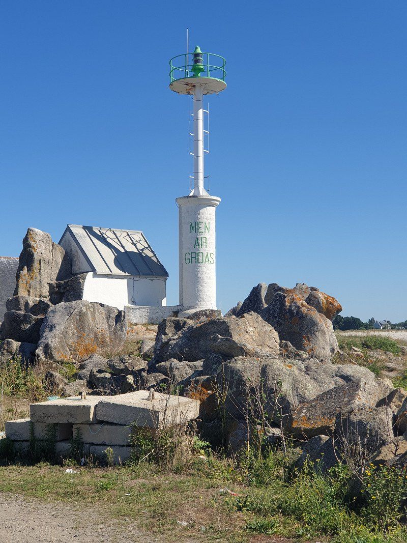
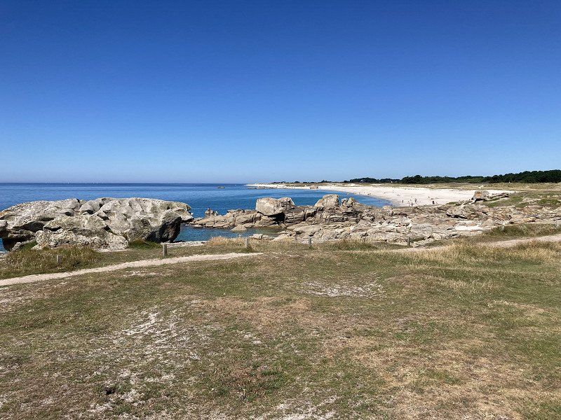
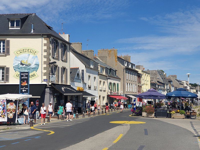
Quiberon
By motorbike/on foot along the Côte Sauvage coast to Quiberon town. Tourist place with harbor and large sandy beach.
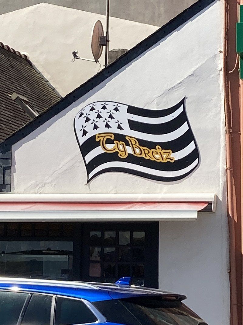
PS: in Brittany, signposts and information signs are written in French and Breton.
Quiberon, Frankreich
47° 28' 55.7" N 3° 7' 15.8" W
47.4821330 -3.1210530
• Head west. Go for 21 m.
• Turn left. Go for 12 m.
• Turn right toward Place du Varquez. Go for 57 m.
• Turn right onto Place du Varquez. Go for 102 m.
• Turn left onto Rue Victor Golvan. Go for 23 m.
• Take the 1st exit from roundabout onto Rue Victor Golvan. Go for 31 m.
• Turn right onto Rue du Lioric. Go for 63 m.
• Turn right onto Rue du Port de Pêche. Go for 453 m.
• Take the 2nd exit from roundabout onto Avenue du Général de Gaulle (D768). Go for 438 m.
• Pass 7 roundabouts and continue on Avenue de Bretagne (D768). Go for 3.9 km.
• Take the 2nd exit from roundabout. Go for 28 m.
• Take the 1st exit from roundabout onto Avenue de Saint-Pierre (D768). Go for 1.2 km.
• Pass 4 roundabouts and continue on Avenue de l'Océan (D768). Go for 8.9 km.
• Take the 1st exit from Rond-Point de l'Océan roundabout onto Route de Carnac (D781). Go for 2.0 km.
• Take the 2nd exit from roundabout onto Rue Saint-Cornely (D781). Go for 612 m.
• Take the 2nd exit from Carrefour Le Nilestrec roundabout onto Rue du Ménec (D196). Go for 218 m.
• Turn right onto Rue de Bellevue. Go for 462 m.
• Take the 2nd exit from roundabout onto Rue du Praden. Go for 80 m.
• Take the 1st exit from roundabout onto Rue de Poul Person. Go for 215 m.
• Take the 1st exit from roundabout onto Rue du Tumulus. Go for 120 m.
• Continue on Rue du Tumulus. Go for 41 m.
• Arrive at Rue du Tumulus. Your destination is on the right.
☍
18,9 km
( 28 min.)
Day
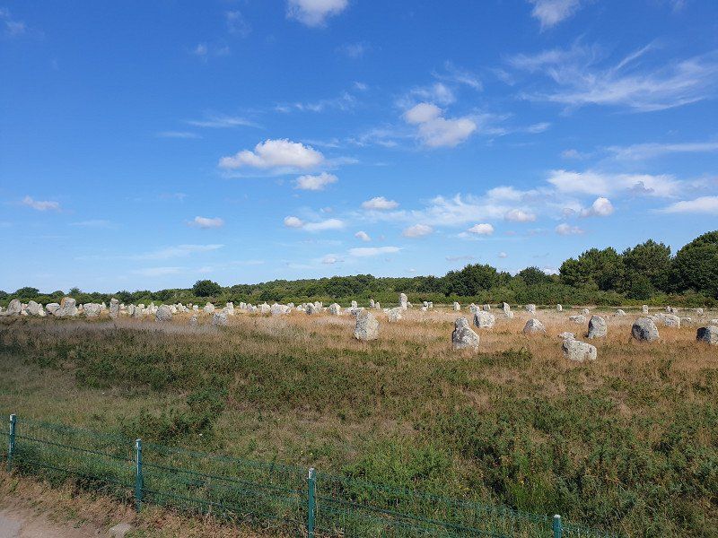
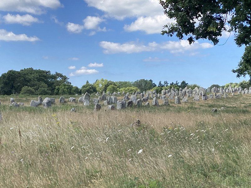
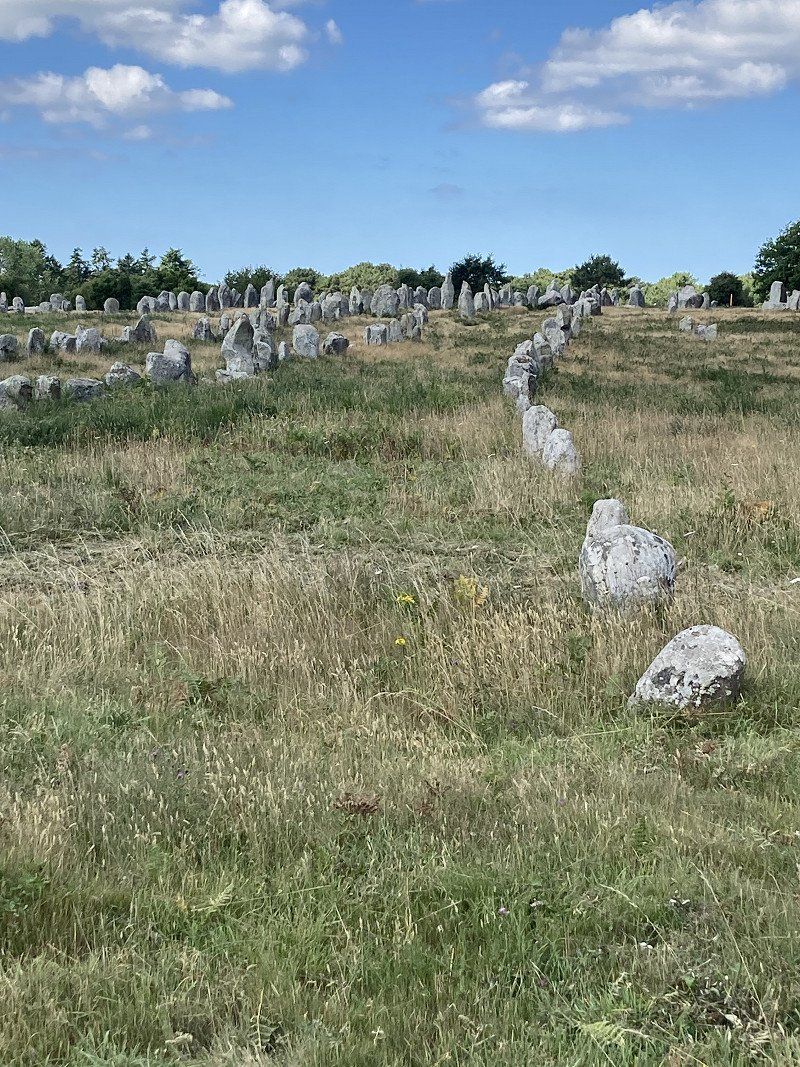
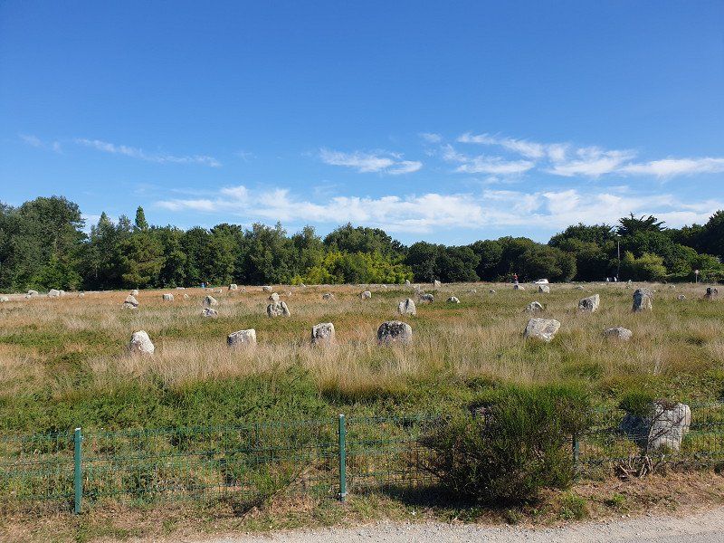
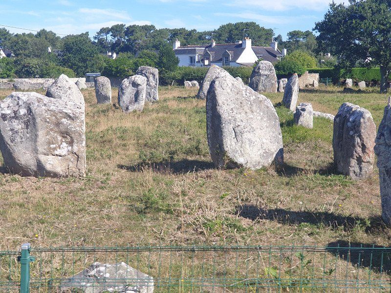
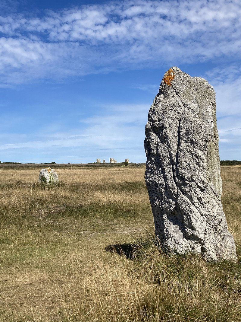
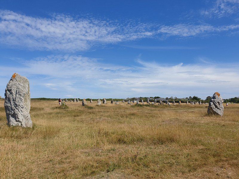
Carnac
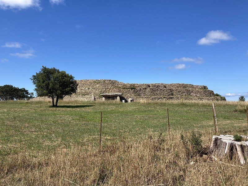
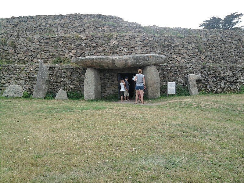
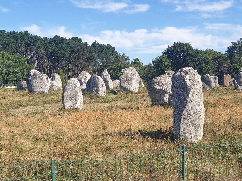
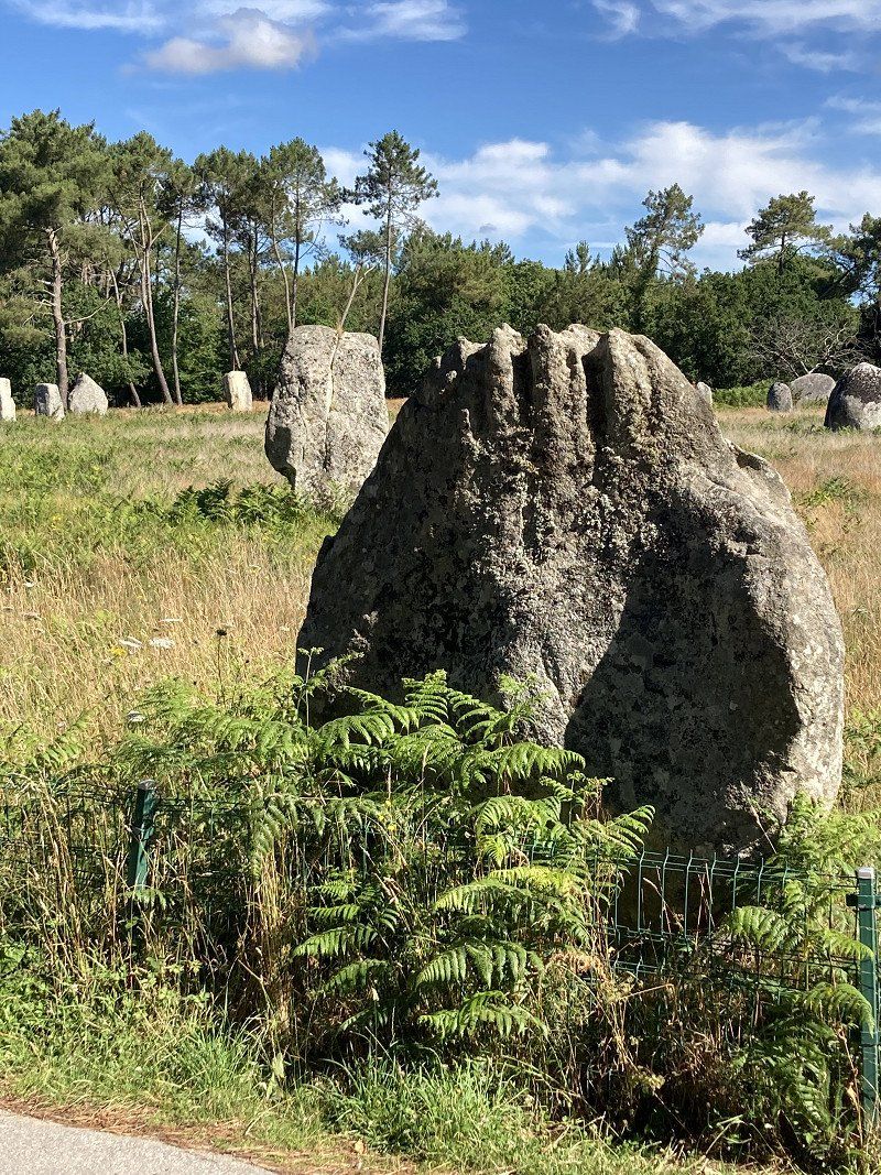
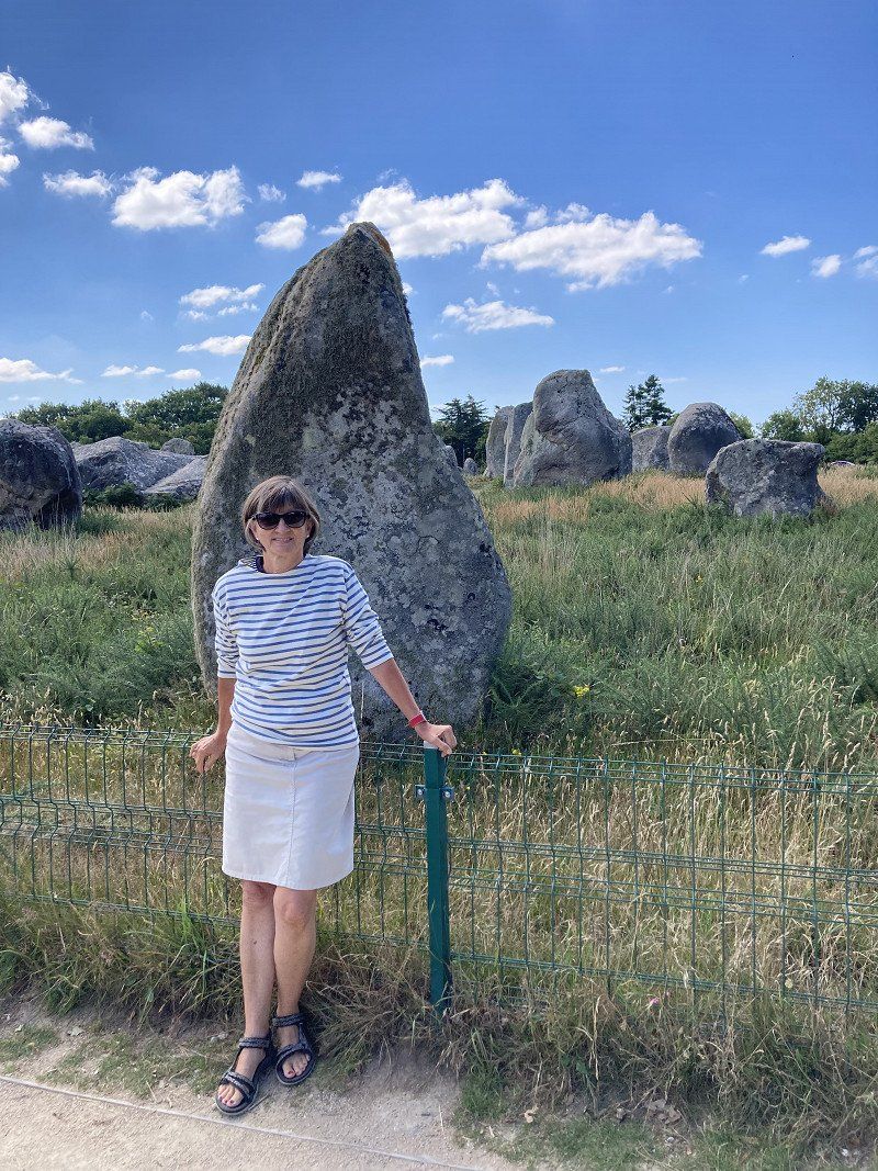
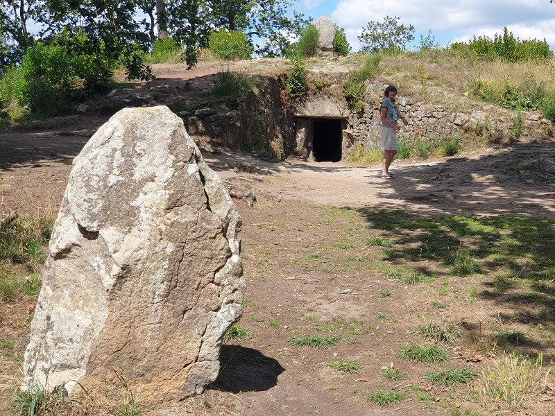
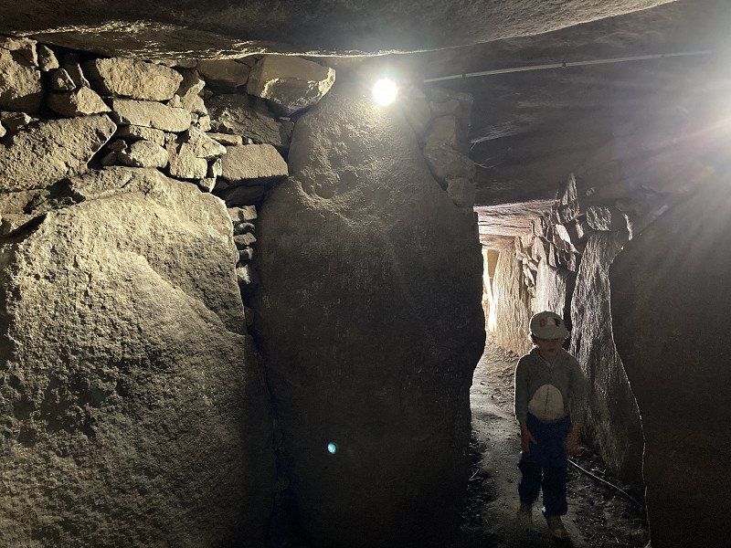
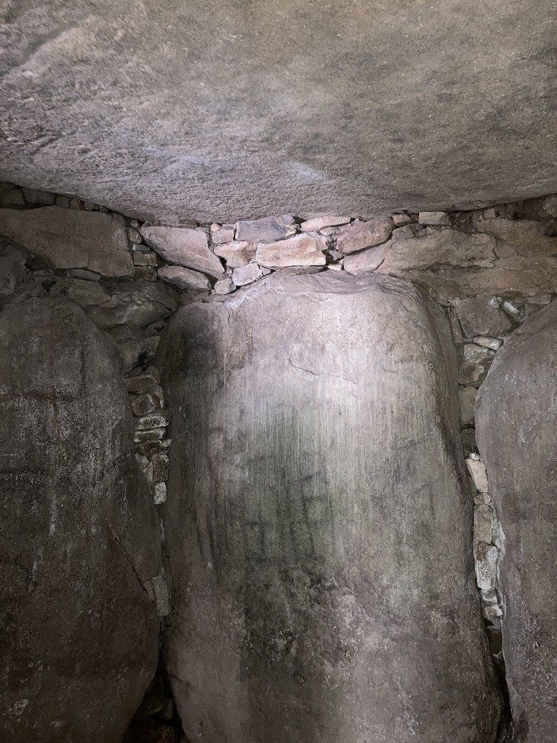
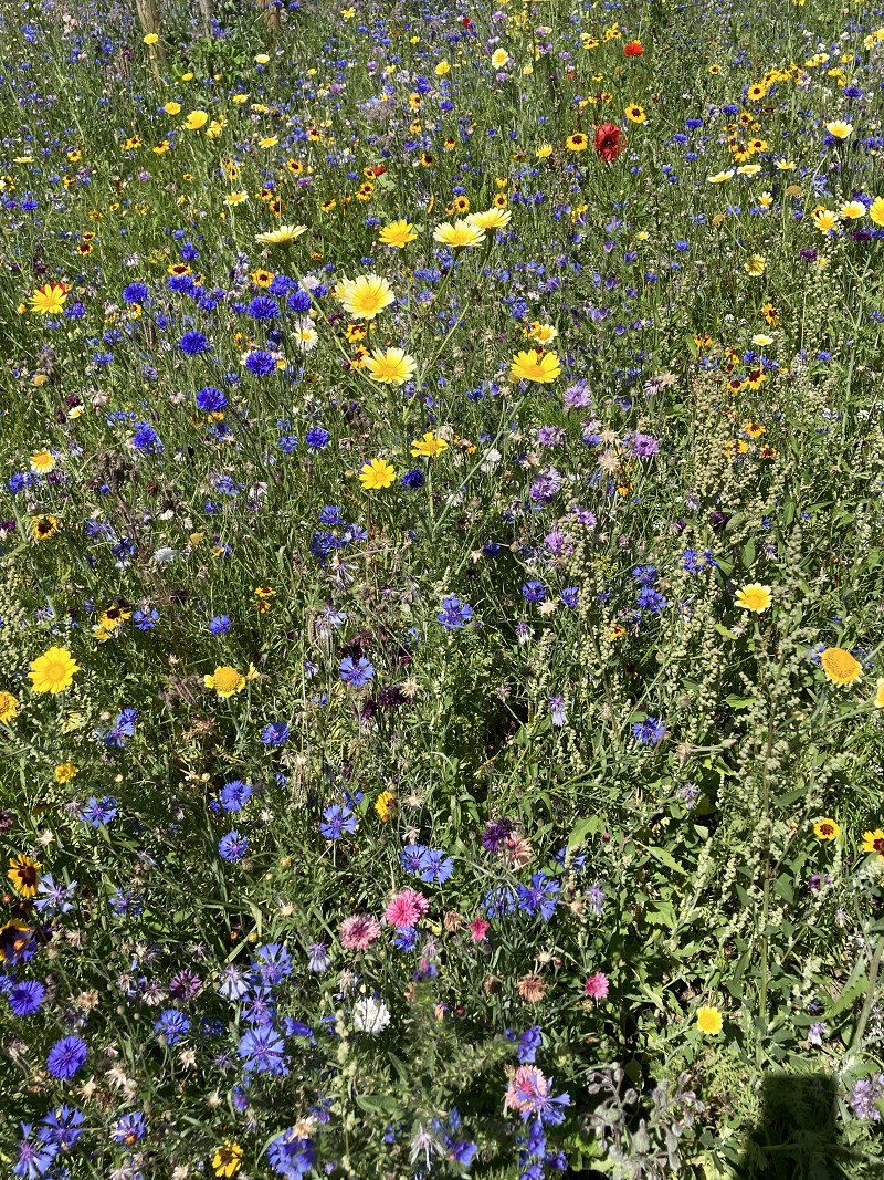
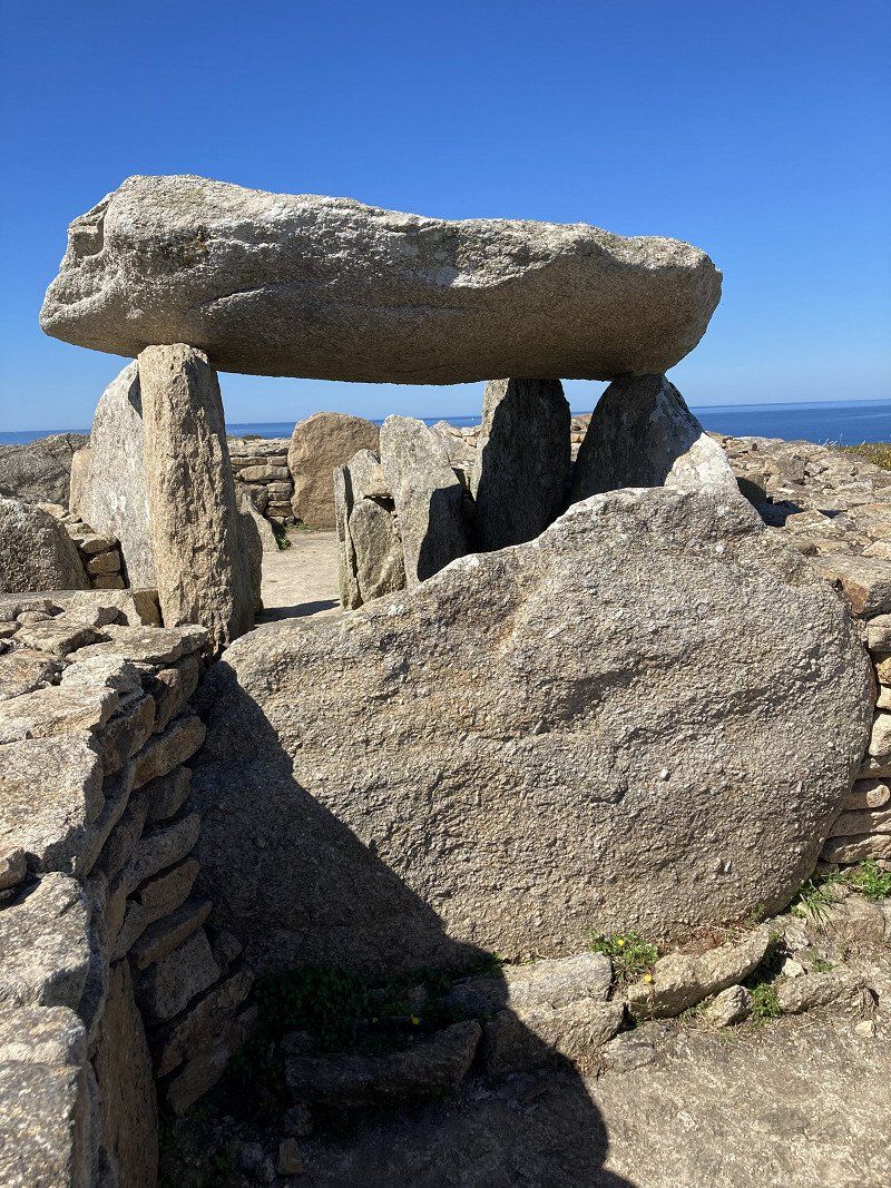
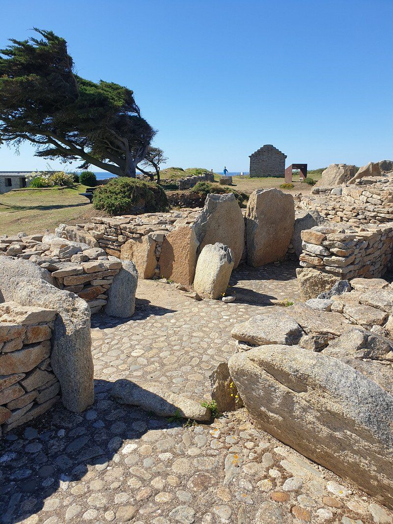
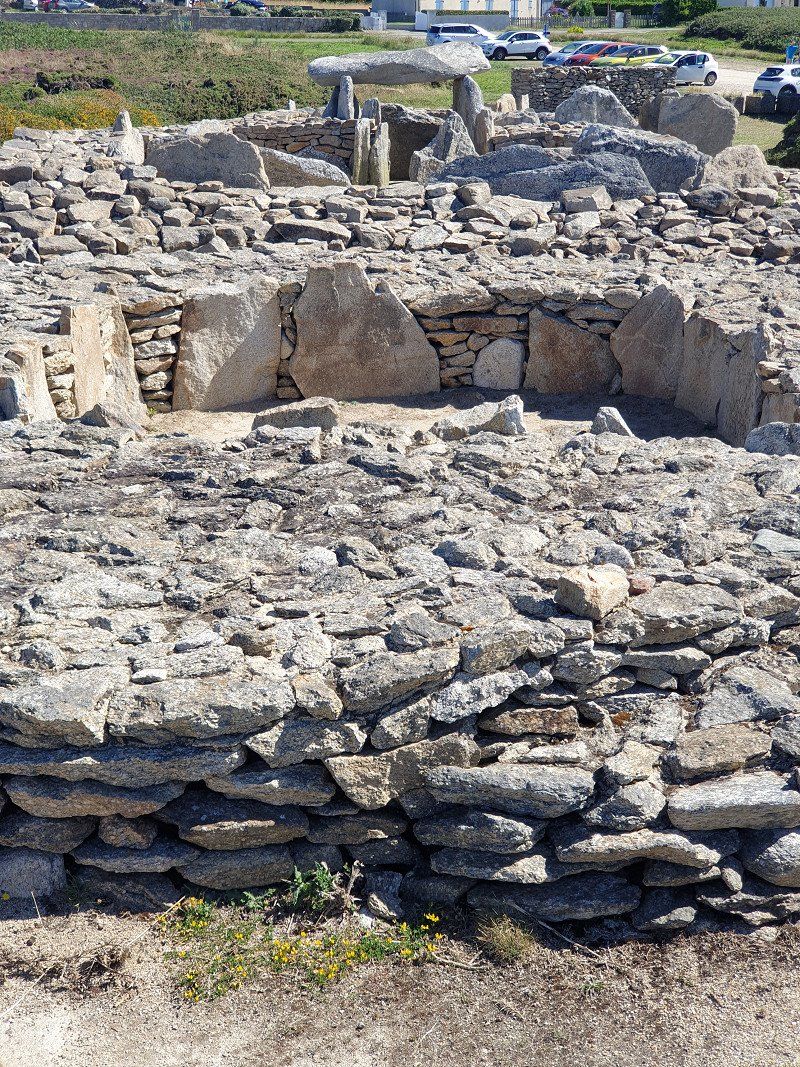
Visit to the Carnac megaliths . Driven for 50 minutes in an open-top bus along the miles of fields with 6,000-year-old menhirs; this crowd is unbelievably impressive! For example: Field Le Ménec : 1'050 stones in 11 rows of about 950m.
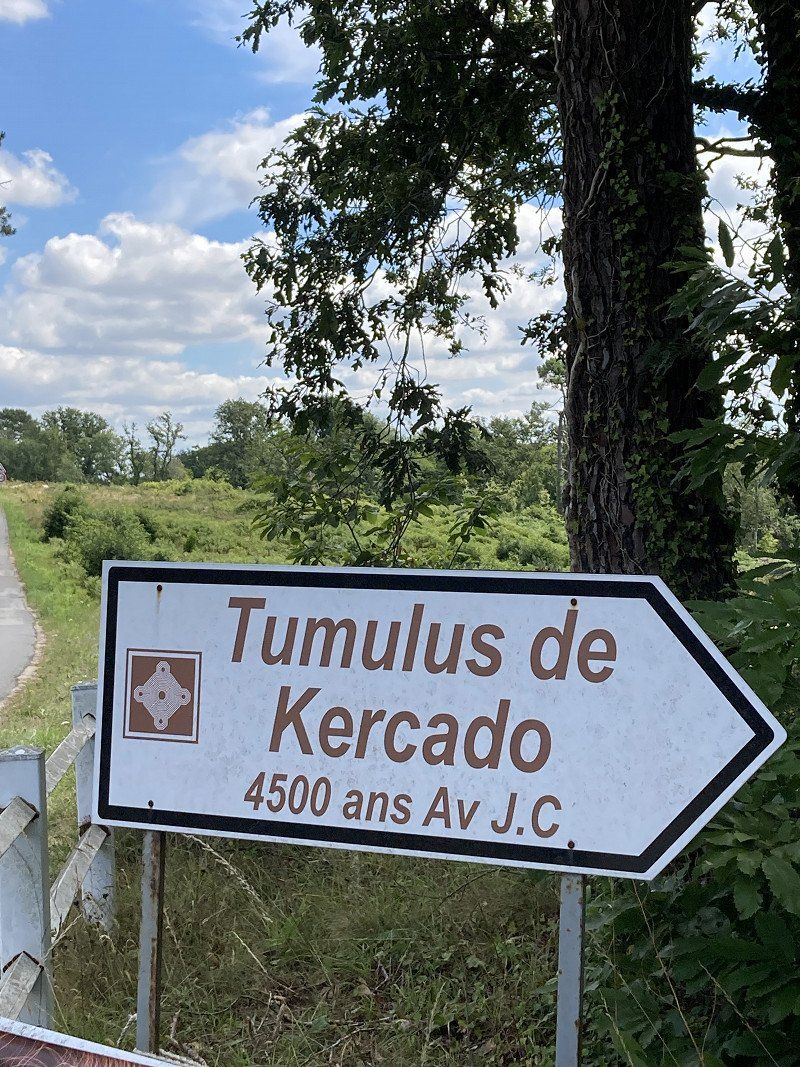
Later on foot hike to the dolmen grave Tumulus de Kercado.
56340 Carnac, Frankreich
47° 35' 4.9" N 3° 4' 40" W
47.5846930 -3.0777860
• Head toward Place du Marché on Rue du Tumulus. Go for 151 m.
• Take the 3rd exit from roundabout onto Rue de Poul Person. Go for 238 m.
• Take the 1st exit from roundabout onto Rue de Poul Person. Go for 78 m.
• Take the 2nd exit from roundabout onto Rue des Korrigans (D119). Go for 726 m.
• Pass 2 roundabouts and continue on Route du Purgatoire (D119). Go for 3.6 km.
• Keep right toward D768. Go for 280 m.
• Continue on D768. Go for 1.9 km.
• Pass 3 roundabouts and continue on D768. Go for 4.0 km.
• Take the 3rd exit from Giratoire de Kerbois roundabout onto N165 toward Pontivy/Lorient. Go for 33.1 km.
• Keep left onto Voie Express de Nantes à Brest (N165) toward Quimper/Brest/Quéven/Ploemeur/Quimperlé/Aéroport Lorient Lann-Bihoué. Go for 18.9 km.
• Take ramp toward Kergostiou/D16/Moëlan S/Mer/Clohars-Carnoët/Quimperlé-Centre. Go for 267 m.
• Turn right onto Rue de Croas-Chuz toward Quimperlé/Moëlan S/Mer/Clohars-Carnoët. Go for 15 m.
• Continue on Rue Samuel Billette. Go for 418 m.
• Take the 1st exit from roundabout onto Rue de Moélan (D16). Go for 235 m.
• Take the 1st exit from roundabout onto Rue de Moélan (D16). Go for 166 m.
• Take the 3rd exit from Giratoire de la Gare roundabout onto Boulevard de la Gare (D783). Go for 344 m.
• Turn right onto Rue de l'Hôpital Fremeur. Go for 13 m.
• Turn right onto Rue de l'Hôpital Fremeur. Go for 224 m.
• Continue on Place Saint-Michel. Go for 35 m.
• Turn left onto Place Saint-Michel. Go for 28 m.
• Turn right onto Place Saint-Michel. Go for 71 m.
• Turn left onto Rue Genot. Go for 86 m.
• Continue on Place des Écoles. Go for 34 m.
• Turn right onto Rue Bisson. Go for 103 m.
• Arrive at Rue Bisson. Your destination is on the right.
☍
65,0 km
( 46 min.)
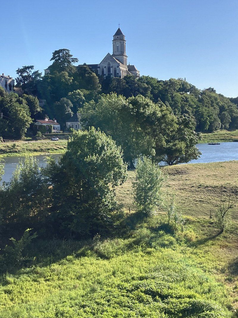
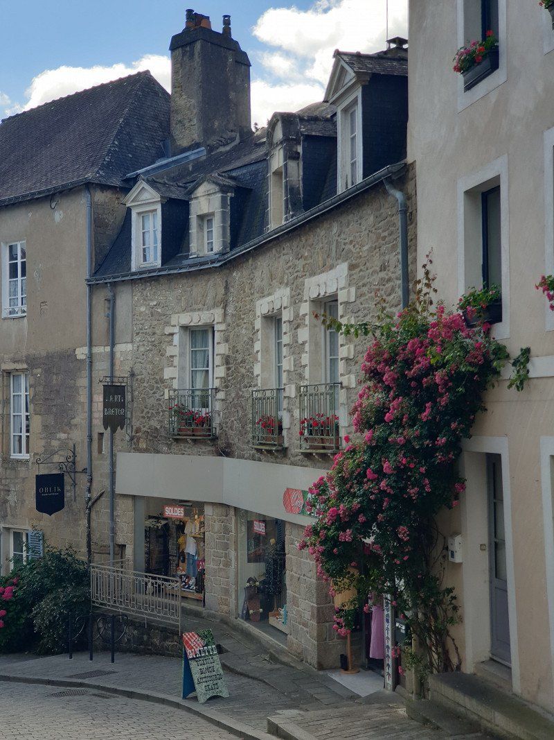
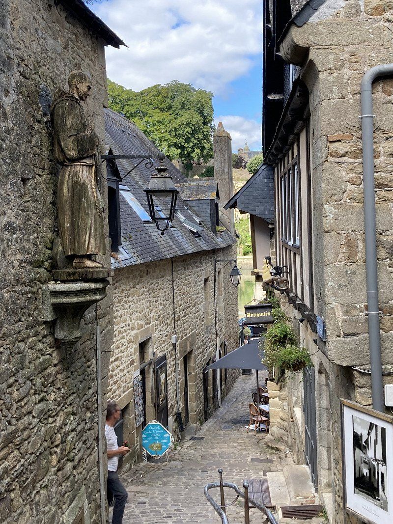
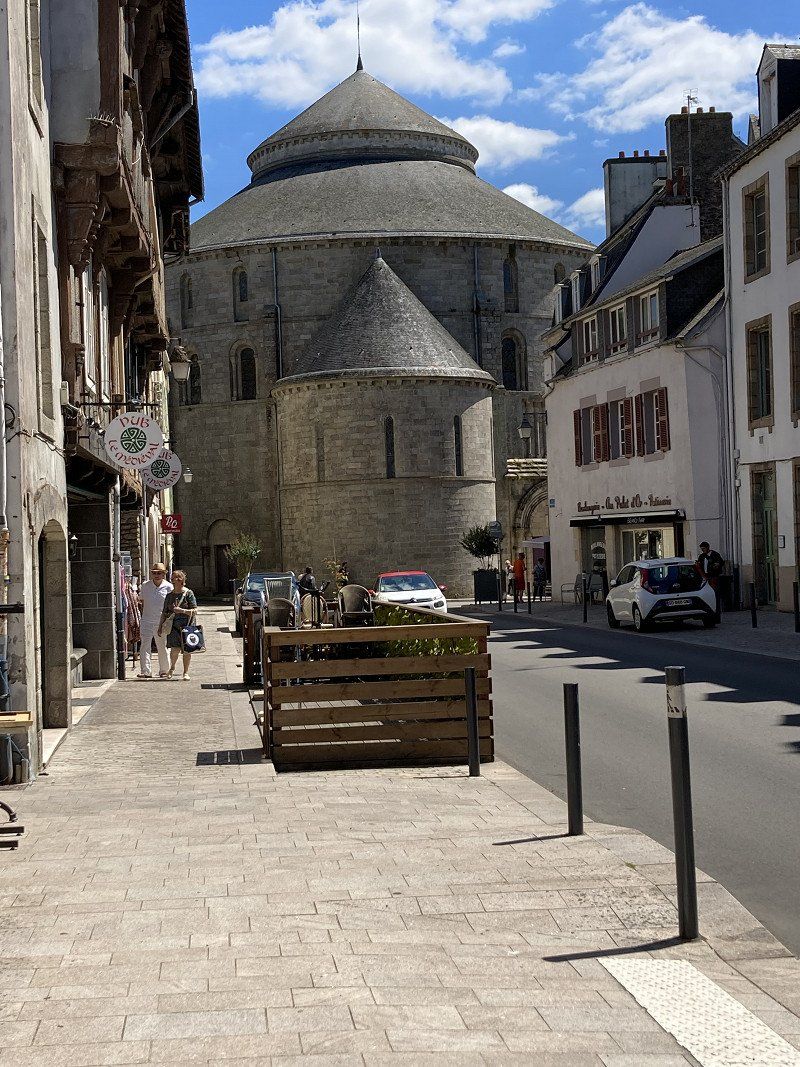
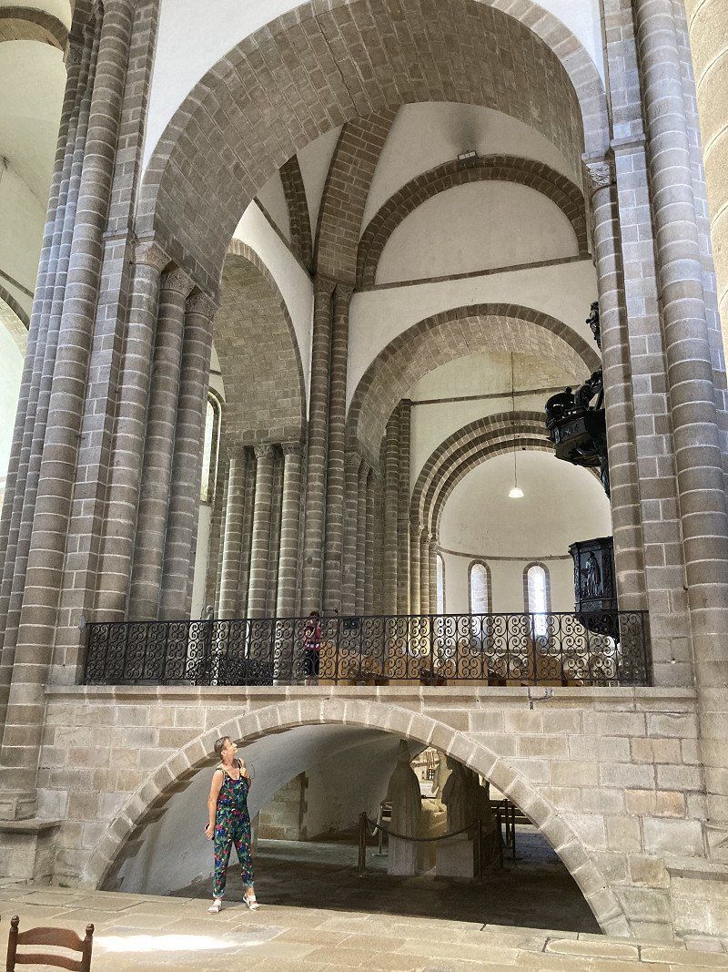
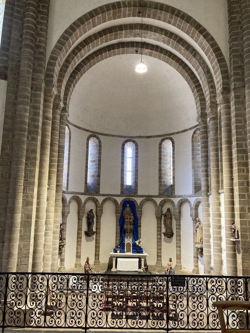
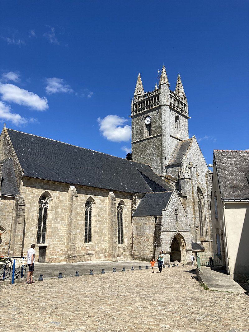
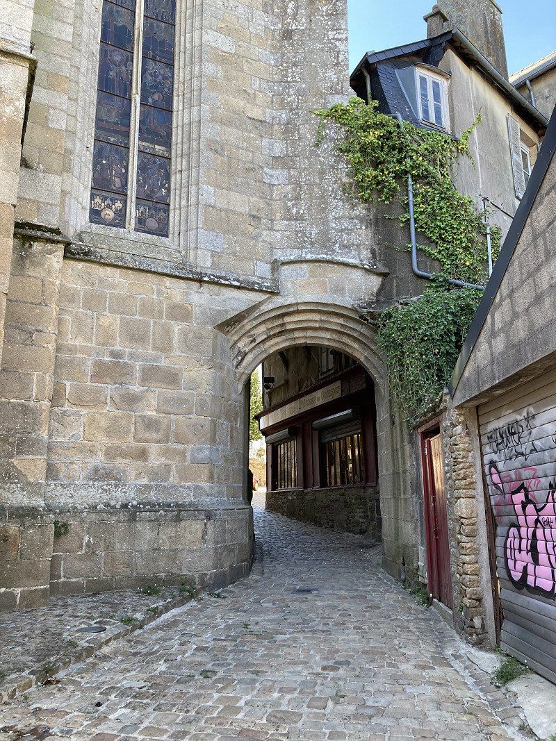
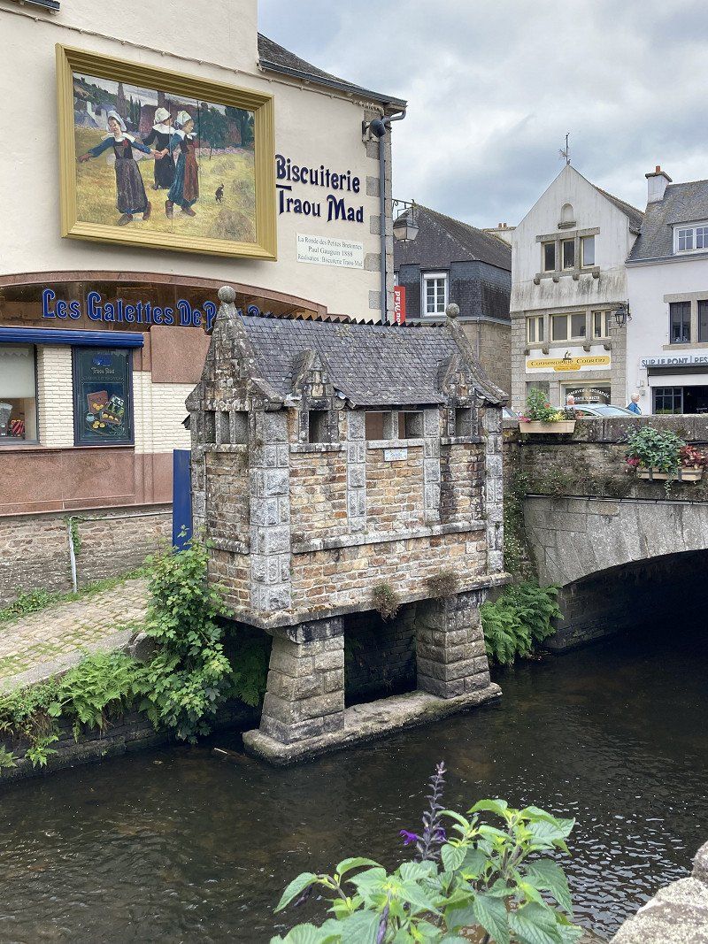
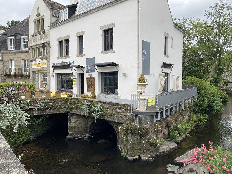
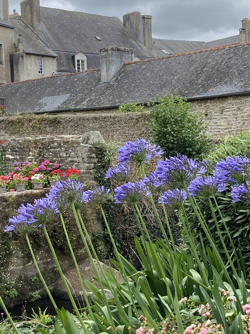
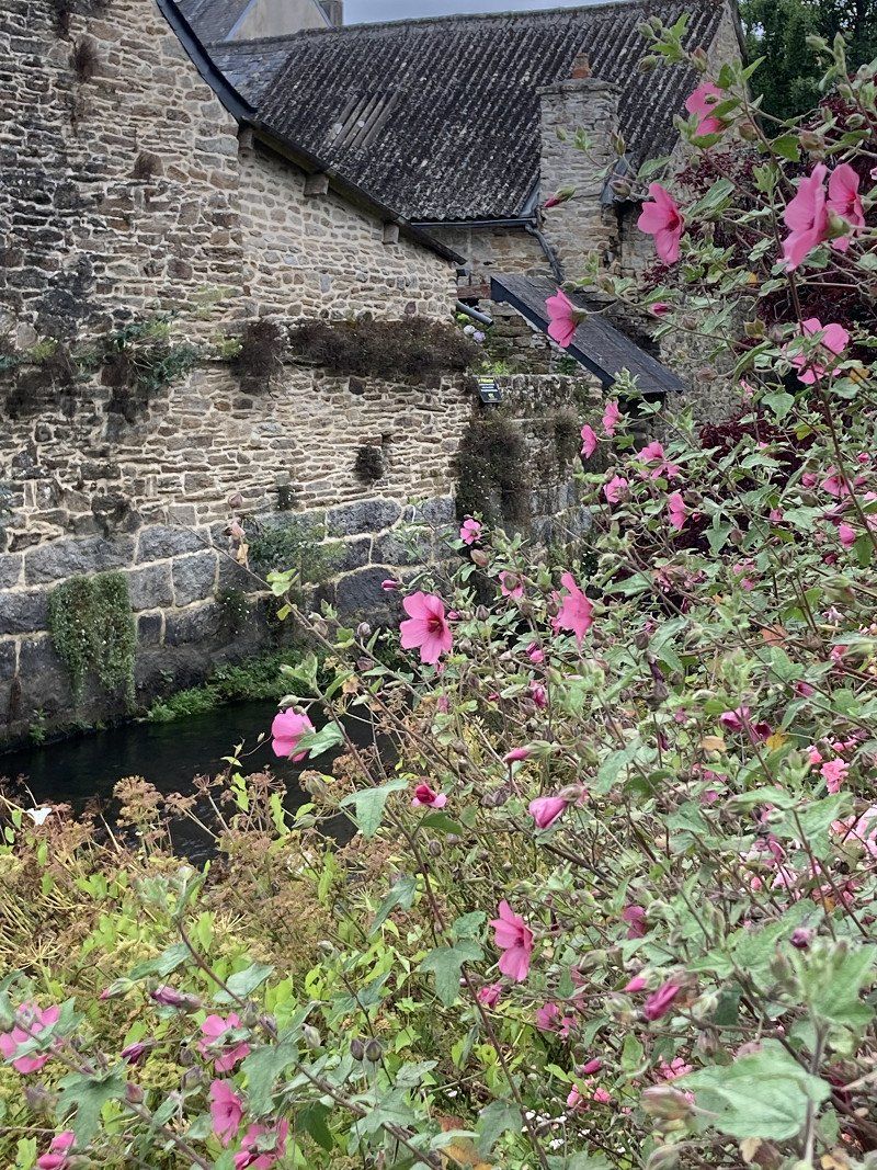
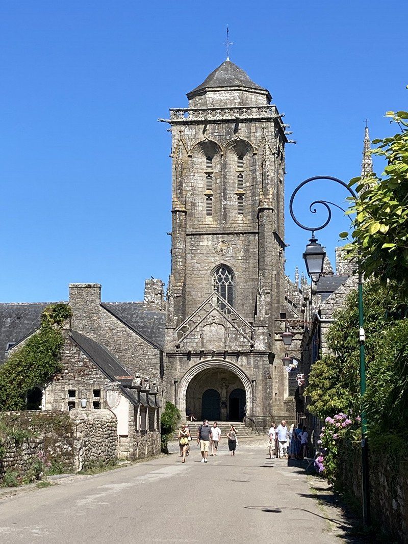
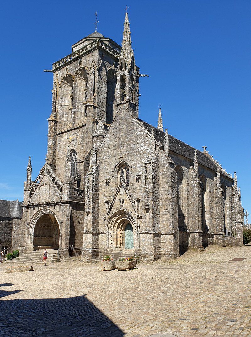
Quimperlé
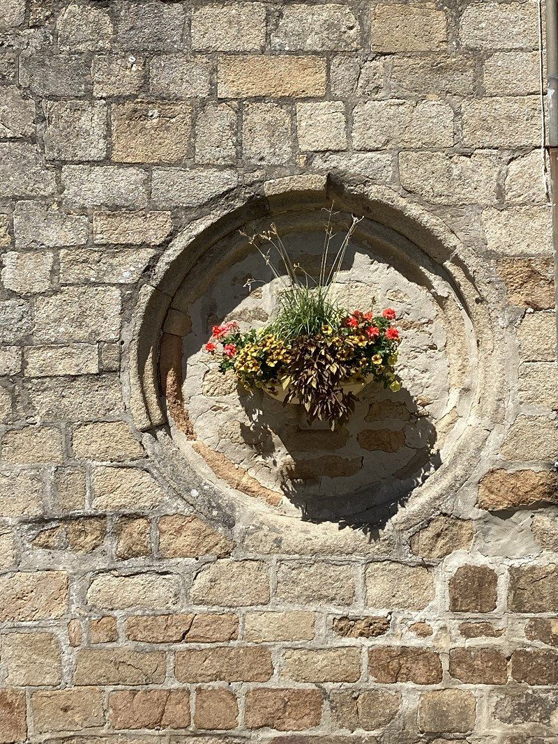
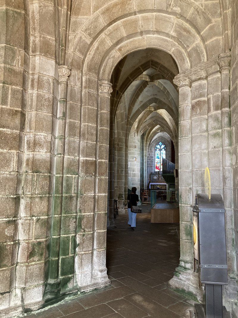
Old town at the confluence of the Ellé and Isole to form the Laïta. On a hill, the Saint Michel Cathedral . Below, the mighty Sainte-Croix abbey church . Everything is really spruced up with flowers.
The old market hall is also worth seeing (unfortunately closed today).
29300 Quimperlé, Frankreich
47° 52' 21.3" N 3° 32' 51.2" W
47.8725860 -3.5475460
• Head toward Rue Thiers on Rue Bisson. Go for 55 m.
• Turn right onto Rue Thiers (D783). Go for 110 m.
• Take the 2nd exit from roundabout onto Place Carnot (D765). Go for 136 m.
• Take the 1st exit from roundabout onto Rue de la Tour d'Auvergne (D49) toward D765/Quimper/Bannalec/Centre Hospitalier/Quartier St Michel. Go for 377 m.
• Turn left onto Rue du Viaduc (D49). Go for 203 m.
• Arrive at Rue du Viaduc (D49). Your destination is on the right.
☍
0,9 km
( 2 min.)
Aire de Camping-cars
Overnight on SP (fresh water and drain point). Meet very nice Belgians there (Luc, le Brasseur) who give lots of tips for Brittany.
Rue du Viaduc, 29300, Quimperlé, France
47° 52' 0" N 3° 32' 36" W
47.8666667 -3.5433333
• Head toward Boulevard de la Gare on Rue du Viaduc (D49). Go for 567 m.
• Take the 2nd exit from roundabout onto Rue de la Tour d'Auvergne (D765). Go for 142 m.
• Take the 2nd exit from roundabout onto Rue Thiers (D783). Go for 336 m.
• Take the 2nd exit from roundabout onto Rue de Pont-Aven (D6). Go for 280 m.
• Pass 3 roundabouts and continue on Rue de Pont-Aven (D783). Go for 2.4 km.
• Take the 3rd exit from Rond-Point Soweto roundabout onto D783 toward Nantes/Lorient/Riec S/Bélon/Baye/Le Trévoux/Kervidanou 1-2/Manoir de Kernault. Go for 502 m.
• Take the 3rd exit from Rond-Point Chicago roundabout onto Pôle Dactivités Kervidanou 2 (D783). Go for 1.3 km.
• Take the 2nd exit from roundabout onto Route de Quimperlé (D783). Go for 7.0 km.
• Take the 3rd exit from roundabout onto Rue de la Gare (D783). Go for 548 m.
• Take the 2nd exit from roundabout onto Rue Alain Berthou (D783). Go for 3.6 km.
• Turn left onto Route des Rivières. Go for 46 m.
• Turn right onto Rue Louis Lomenech. Go for 503 m.
• Turn left. Go for 54 m.
• Arrive at your destination on the right.
☍
17,3 km
( 23 min.)
Day
Pont-Aven, Stade Henri Sinquin (kostenpfl. Parkplatz)
Signposted parking space for mobile homes less than 5 minutes from the center.
Rue Louis Lomenech, 29930, Pont-Aven, France
47° 51' 13" N 3° 44' 37" W
47.8536111 -3.7436111
• Head northwest. Go for 10 m.
• Turn slightly right toward Rue Louis Lomenech. Go for 44 m.
• Turn left onto Rue Louis Lomenech. Go for 45 m.
• Turn left onto Rue Saint-Guénolé. Go for 80 m.
• Turn right onto Rue Saint-Guénolé. Go for 68 m.
• Turn left onto Rue Saint-Guénolé. Go for 282 m.
• Turn right onto Rue Auguste Brizeux. Go for 212 m.
• Turn left onto Place de l'Hôtel de Ville. Go for 25 m.
• Continue on Place Paul Gauguin (D783). Go for 59 m.
• Turn right onto Rue Émile Bernard (D783). Go for 1.1 km.
• Pass 2 roundabouts and continue on Rue de Trégunc (D783). Go for 7.2 km.
• Take the 1st exit from roundabout onto Place de la Mairie (D783). Go for 59 m.
• Take the 2nd exit from roundabout onto Place de la Mairie (D783). Go for 514 m.
• Pass 3 roundabouts and continue on Route de Concarneau (D783). Go for 2.5 km.
• Take the 2nd exit from Giratoire de Kerviniou roundabout onto Rue de Trégunc (D322). Go for 1.1 km.
• Take the 1st exit from roundabout onto Rue de Trégunc (D322). Go for 311 m.
• Turn left. Go for 128 m.
• Turn slightly right. Go for 98 m.
• Turn right. Go for 37 m.
• Arrive at your destination on the right.
☍
13,8 km
( 19 min.)
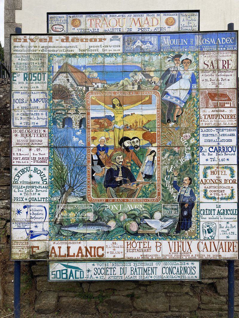
Pont Aven
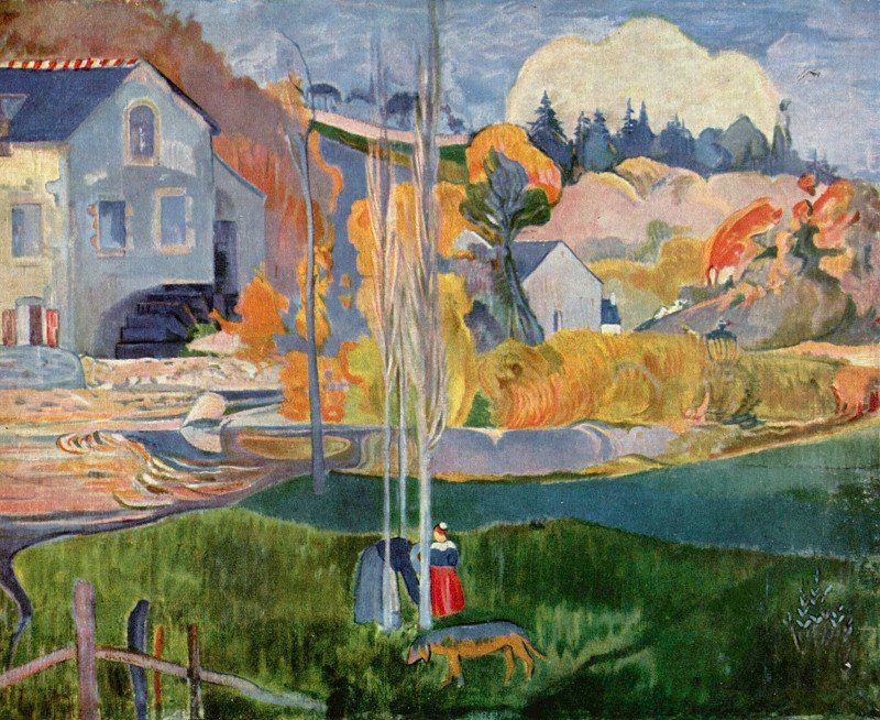
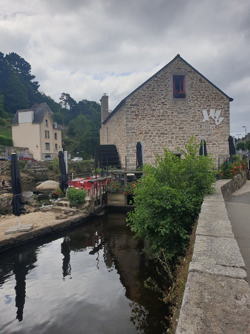
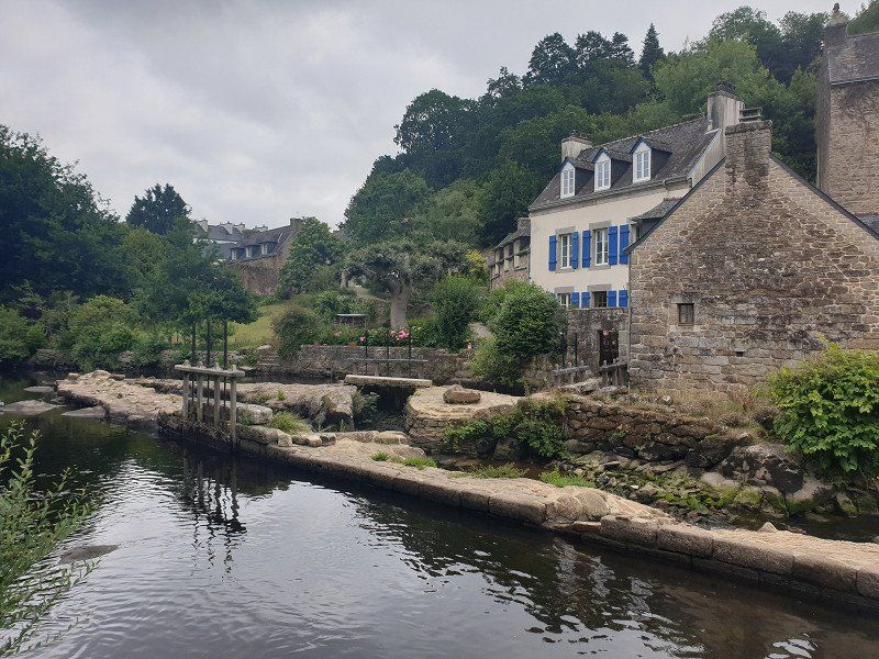
Artists' Village , where Paul Gauguin also lived and painted. Beautifully made flower-bedecked paths and footbridges along the River Aven to the small harbour.
Of course we (with many other tourists) also ended up at the David Mill, which was painted by Gauguin.
Camping du Moulin d’Aurore (€ 25.40)
Simply equipped CP with a large stock of trees and sufficient space. Direct access to the coastal hiking trail and approx. 300m to the bathing bay.
Enjoyed the evening sun in front of the WoMo until 10:20 p.m.!
Boulangerie just in front of the CP.
29900, Concarneau, France
47° 52' 2" N 3° 54' 21.8" W
47.8672300 -3.9060500
• Head northeast. Go for 143 m.
• Turn slightly left toward Rue de Trégunc/D322. Go for 87 m.
• Turn left onto Rue de Trégunc (D322). Go for 316 m.
• Take the 2nd exit from roundabout onto Rue de Trégunc (D322). Go for 616 m.
• Continue on Rue de Penzance (D322). Go for 515 m.
• Turn left onto D783. Go for 309 m.
• Pass 4 roundabouts and continue on Rue de la Villeneuve (D783). Go for 2.6 km.
• Take the 3rd exit from Rond-Point Keramporiel roundabout onto Rue de Keramporiel (D783). Go for 2.7 km.
• Pass 2 roundabouts and continue on Lieu-dit Croas Avalou (D783). Go for 2.5 km.
• Take the 2nd exit from roundabout onto D44. Go for 1.7 km.
• Pass 4 roundabouts and continue on Cité de Ker Elo (D44). Go for 3.5 km.
• Take the 3rd exit from Rond-Point de Ker Elo Haut roundabout onto Route de Quimper (D45). Go for 577 m.
• Take the 2nd exit from Rond-Point de l'Odet roundabout onto Rue de l'Odet (D44). Go for 579 m.
• Take the 1st exit from roundabout onto Route de Bénodet (D44). Go for 103 m.
• Take the 3rd exit from roundabout onto Route de Bénodet (D44). Go for 548 m.
• Pass 7 roundabouts and continue on Avenue de Fouesnant (D44). Go for 6.4 km.
• Take the 4th exit from Giratoire de Penfoul roundabout onto Rue de Penfoul (D34). Go for 294 m.
• Take the 1st exit from Rond-Point Jean Charcot roundabout onto Avenue de la Mer (D34). Go for 208 m.
• Take the 1st exit from roundabout onto Avenue Bouilloux Lafont. Go for 46 m.
• Arrive at Avenue Bouilloux Lafont. Your destination is on the right.
☍
23,8 km
( 33 min.)
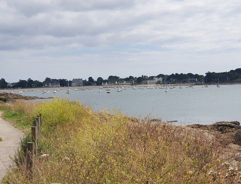
Concarneau
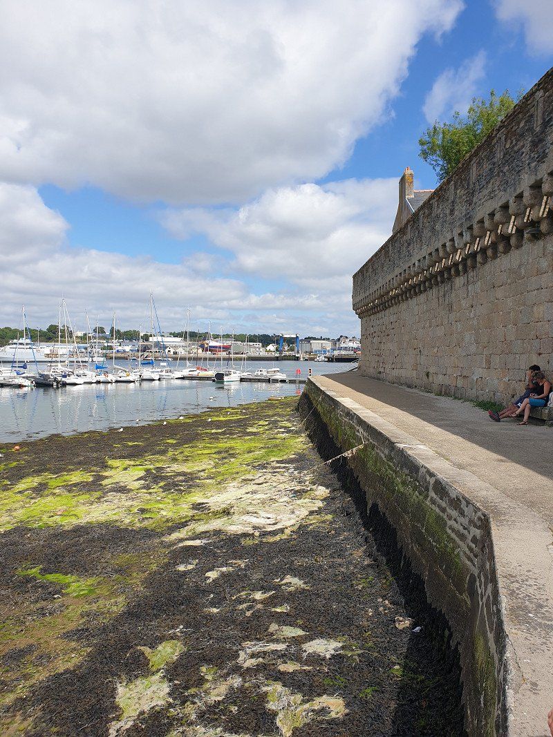
10 minutes on foot along the coastal path to the ferry to the island "Ville Close" : the old core of Concarneau, fortified with walls all around (touristy - but we are tourists too). In front of a huge leisure port.
One restaurant follows the next along the promenade. We also took the opportunity and once again ate wonderful fish.
Day
Bénodet (neuer WoMo-Stellplatz)
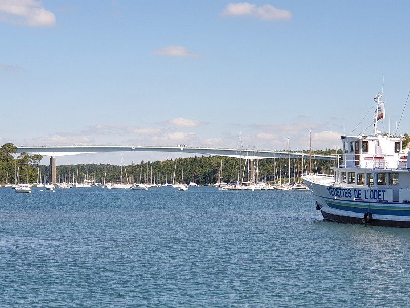
Fishing site at the mouth of the Odet (navigable as far as Quimper - we would have liked to go but were too late).
Passenger ferry to Île-Tudy.
29950 Bénodet, Frankreich
47° 52' 32" N 4° 6' 22.9" W
47.8755680 -4.1063729
• Head east on Avenue Bouilloux Lafont. Go for 21 m.
• Take the 3rd exit from roundabout onto Avenue de la Mer (D34). Go for 249 m.
• Take the 2nd exit from Rond-Point Jean Charcot roundabout onto Rue de Penfoul (D34). Go for 239 m.
• Take the 3rd exit from Giratoire de Penfoul roundabout onto Route de Quimper (D34). Go for 232 m.
• Take the 2nd exit from Giratoire de l'Odet roundabout onto D44. Go for 2.8 km.
• Pass 3 roundabouts and continue on Route de Pont-l'Abbé (D44). Go for 2.9 km.
• Take the 3rd exit from roundabout onto D44. Go for 3.7 km.
• Take the 3rd exit from Rond-Point de Kermaria roundabout onto D785. Go for 2.2 km.
• Take the 3rd exit from roundabout onto D785. Go for 1.1 km.
• Take the 2nd exit from roundabout onto D785. Go for 902 m.
• Take the 2nd exit from roundabout onto D2. Go for 743 m.
• Take the 1st exit from roundabout onto D2. Go for 751 m.
• Take the 1st exit from roundabout onto Route de Plobannalec (D102). Go for 256 m.
• Continue on Lieu-dit Botvellec (D102). Go for 112 m.
• Continue on Lieu-dit Ty Dans (D102). Go for 141 m.
• Continue on D102. Go for 432 m.
• Continue on Lieu-dit Croas Vert (D102). Go for 21 m.
• Continue on Lieu-dit Gorrelen (D102). Go for 78 m.
• Continue on Lieu-dit Kerluic (D102). Go for 837 m.
• Continue on Lieu-dit Kerorgant (D102). Go for 329 m.
• Continue on Lieu-dit Keroullé (D102). Go for 1.1 km.
• Take the 2nd exit from roundabout onto Rue de Lesconil (D102). Go for 606 m.
• Take the 2nd exit from roundabout onto Rue de Lesconil (D102). Go for 202 m.
• Continue on Lieu-dit Ty Mejou Kerandraon (D102). Go for 212 m.
• Continue on D102. Go for 93 m.
• Continue on Lieu-dit Pont-Plat (D102). Go for 576 m.
• Turn right onto Pont Plat. Go for 304 m.
• Turn left onto Route de Guerveur. Go for 395 m.
• Continue on Lieu-dit Guerveur. Go for 269 m.
• Take the 1st exit from roundabout onto Lieu-dit Kerlouarn. Go for 443 m.
• Continue on Lieu-dit Kersauz. Go for 305 m.
• Take the 2nd exit from roundabout onto Lieu-dit Kersauz. Go for 595 m.
• Continue on Lieu-dit Le Reun. Go for 329 m.
• Turn left onto Lieu-dit Squividan. Go for 157 m.
• Arrive at Lieu-dit Squividan. Your destination is on the right.
☍
23,7 km
( 27 min.)
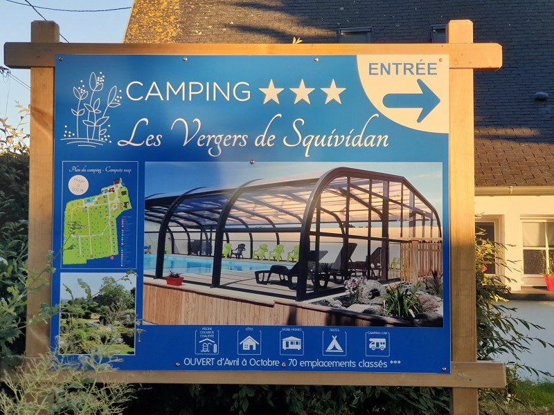
Camping Les Vergers De Squividan (€ 25/Nacht)
Lots of lawn, young trees, clean sanitary facilities, bread delivery service, very nice operator, covered swimming pool.
PS: we preferred the huge beach behind the dunes (about 800m away).
29730, Treffiagat, France
47° 47' 52.4" N 4° 14' 58.4" W
47.7978800 -4.2495600
• Head northwest on Lieu-dit Squividan. Go for 157 m.
• Turn left toward Rue de la Chapelle. Go for 69 m.
• Take the 2nd exit from roundabout onto Rue de la Chapelle. Go for 593 m.
• Continue on Rue de Kerléguer. Go for 555 m.
• Turn left onto Rue de la Vierge (D153). Go for 290 m.
• Take the 1st exit from roundabout onto Rue du Capitaine le Drezen (D153). Go for 448 m.
• Continue on Rue Albert Pochat (D153). Go for 236 m.
• Turn right onto D153. Go for 251 m.
• Take the 2nd exit from roundabout onto Rue Jean Baudry. Go for 407 m.
• Turn slightly right onto Rue du Général de Gaulle. Go for 160 m.
• Continue on Rue Danièle Casanova. Go for 130 m.
• Turn right onto Rue de la Palue. Go for 76 m.
• Turn right onto Quartier de Verdun. Go for 34 m.
• Arrive at Quartier de Verdun. Your destination is on the right.
☍
3,4 km
( 7 min.)
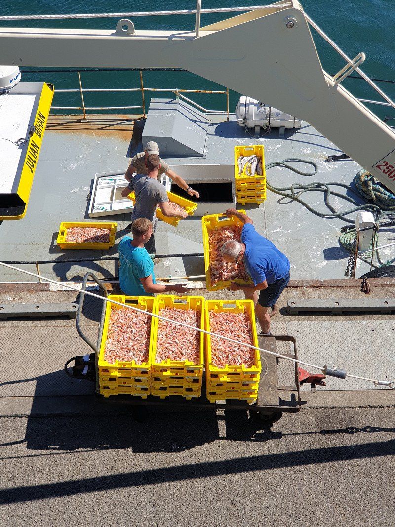
Guilvinec
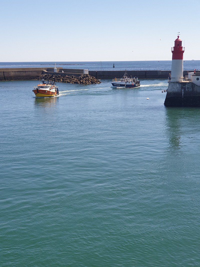
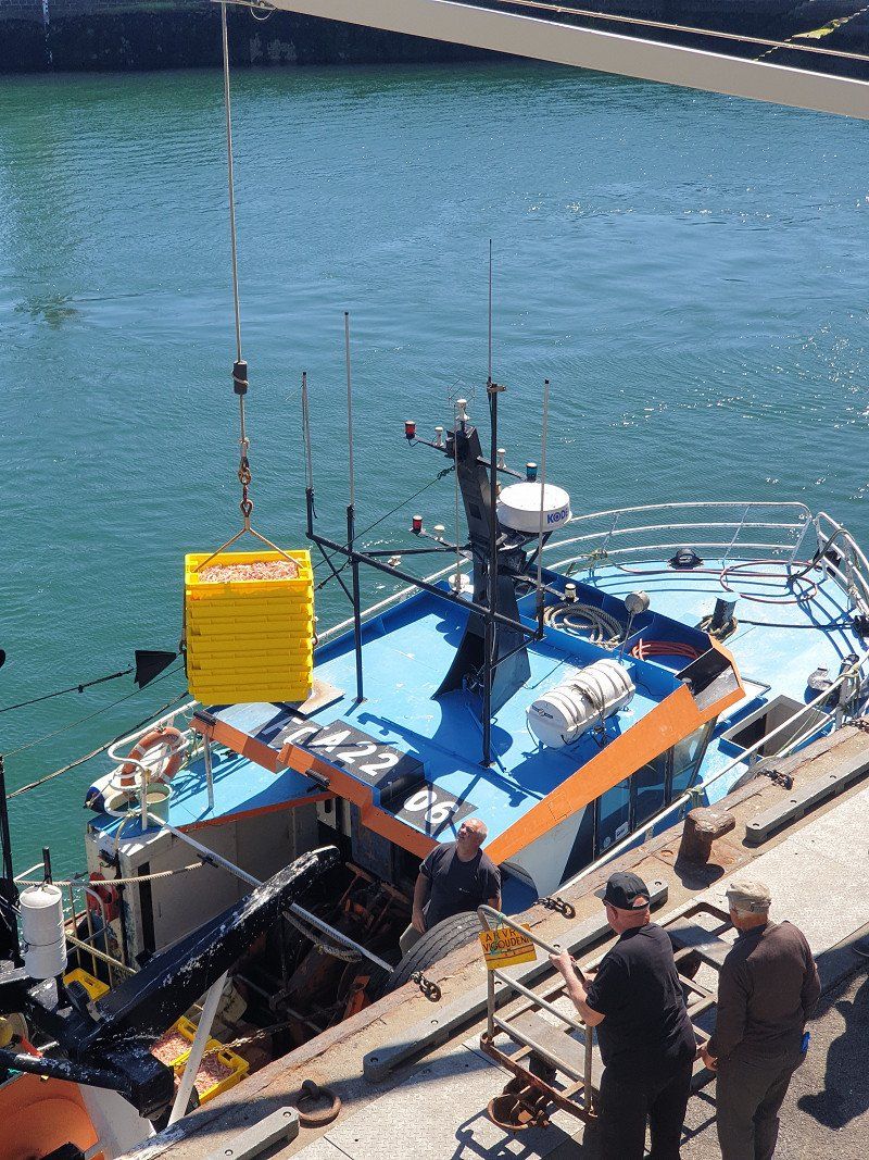
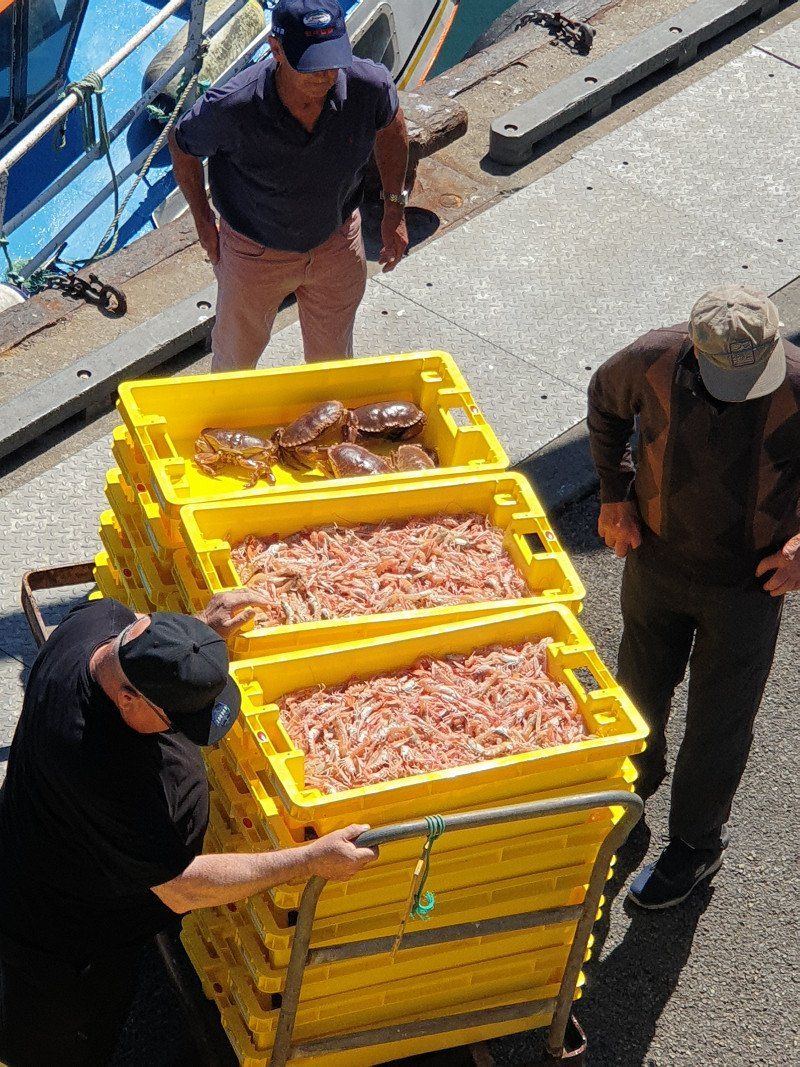
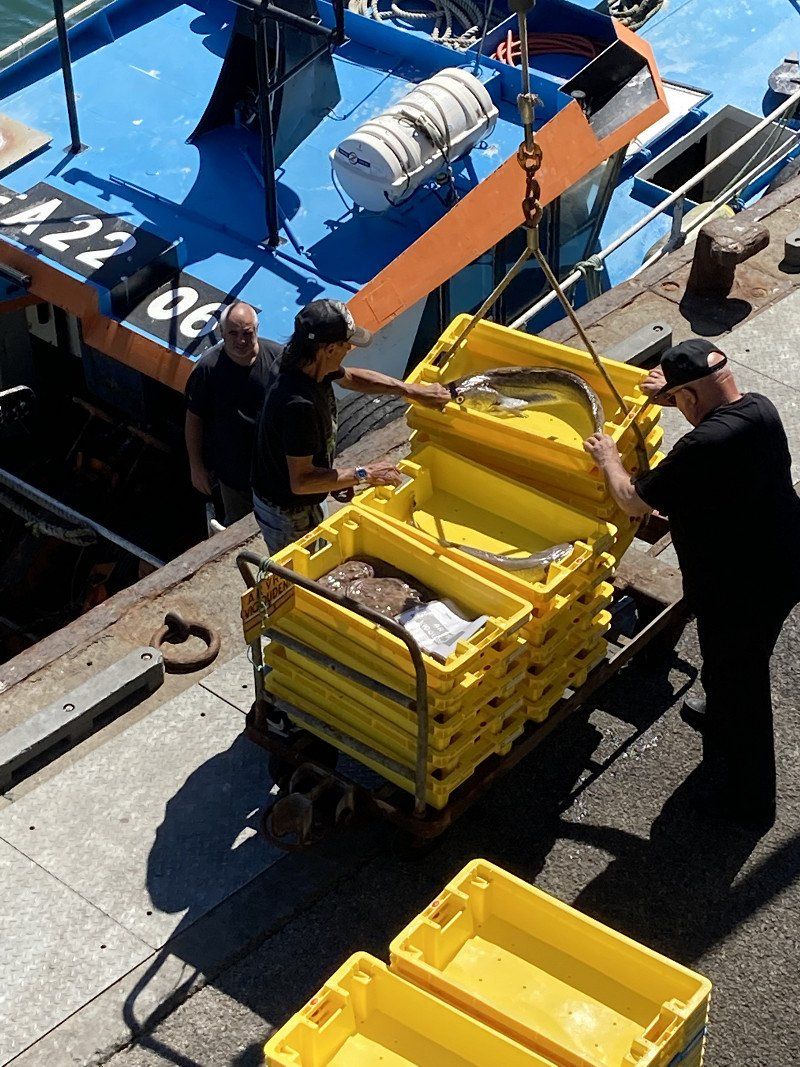
Punctually from 4:30 p.m., the fishing cutters drive into the harbor every 5 minutes and are unloaded here in chords. The fresh prawns (Norway lobster) and fish then go to the fish auction hall located directly at the harbour. On the other hand, they are later loaded onto trucks and taken to the customers.
29730 Guilvinec, Frankreich
47° 47' 50" N 4° 17' 2.7" W
47.7972130 -4.2840750
• Head toward Rue de la Palue on Quartier de Verdun. Go for 34 m.
• Turn right onto Rue de la Palue. Go for 243 m.
• Continue on Rue des Fusillés de Poulguen. Go for 263 m.
• Pass 3 roundabouts and continue on Rue des Fusillés de Poulguen. Go for 808 m.
• Continue on Route du Guilvinec. Go for 247 m.
• Continue on Hent Maner Ar Ster. Go for 892 m.
• Continue on Lieu-dit Stêr Poulguen. Go for 142 m.
• Continue on Chemin des Allemands. Go for 371 m.
• Continue on Hent Maner Ar Ster. Go for 506 m.
• Continue on Lieu-dit Le Manoir du Stêr. Go for 168 m.
• Continue on Rue de l'École de Voile. Go for 1.0 km.
• Continue on Rue de la Gare. Go for 551 m.
• Turn left onto Rue François Merrien (D785). Go for 446 m.
• Continue on Rue de la Marine (D785). Go for 907 m.
• Continue on Rue du Guesclin (D785). Go for 461 m.
• Continue on Rue Jules Verne (D785). Go for 438 m.
• Continue on Rue du Phare (D785). Go for 691 m.
• Take the 3rd exit from roundabout onto Rue du Phare. Go for 112 m.
• Arrive at Rue du Phare. Your destination is on the right.
☍
8,3 km
( 13 min.)
Day
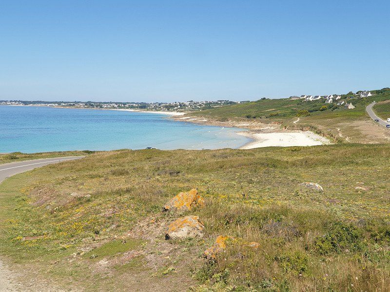
Lesconil
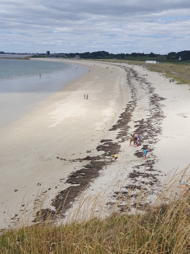
Short hike on the coastal path to Lesconil. On the way the finest sandy beach behind the dunes.
In the afternoon sunning on the beach.
Day
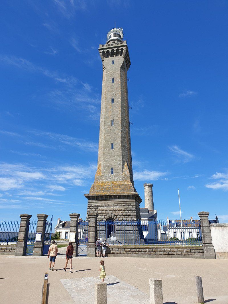
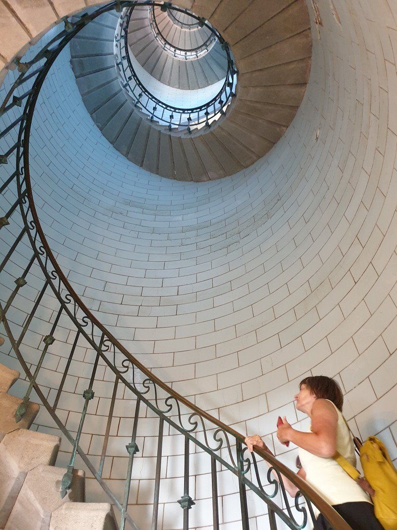
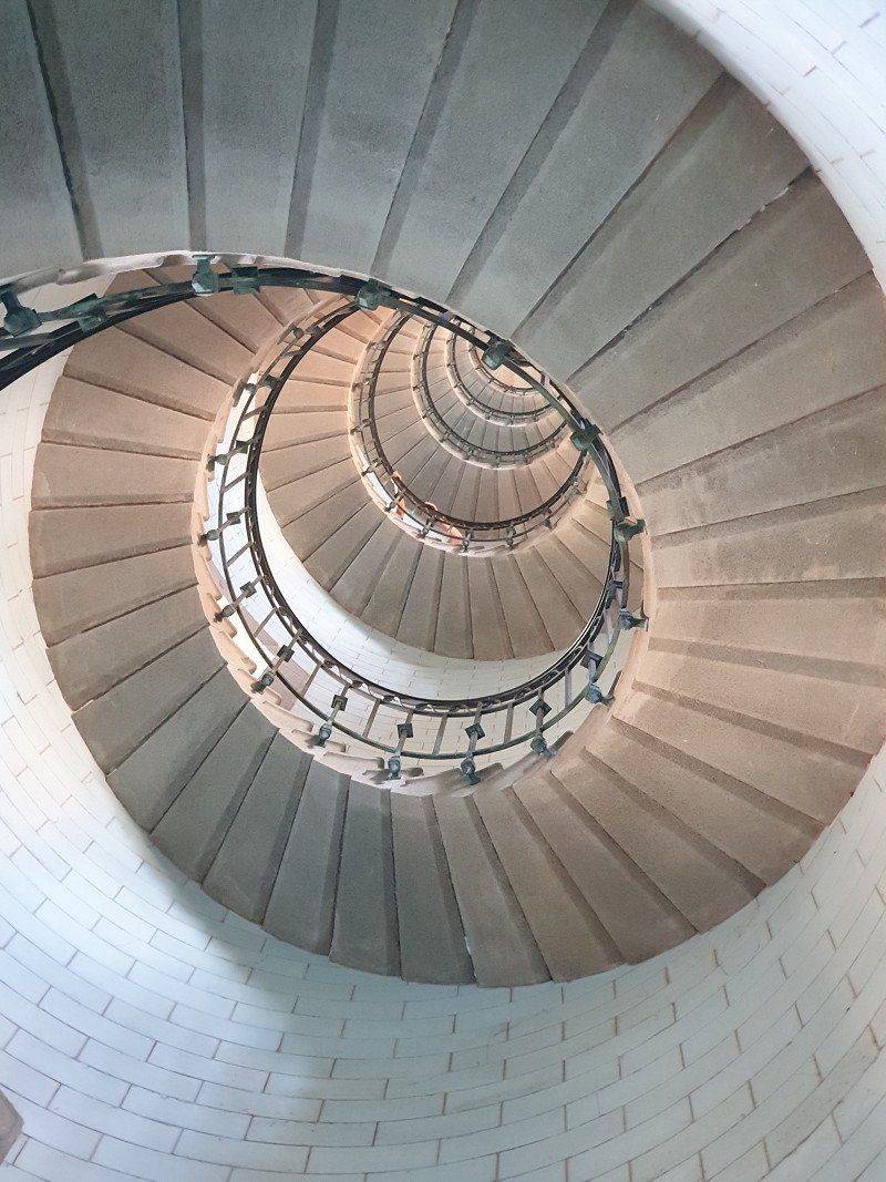
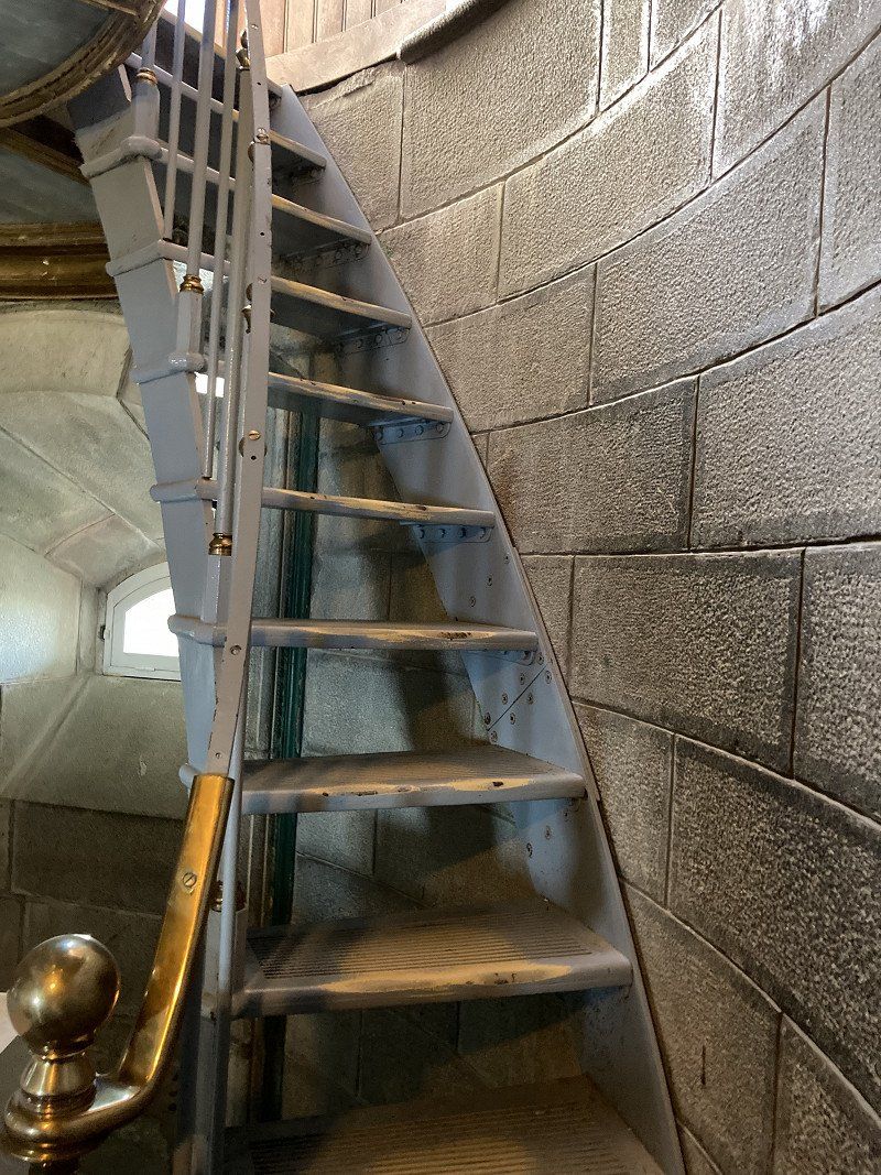
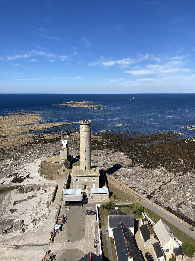
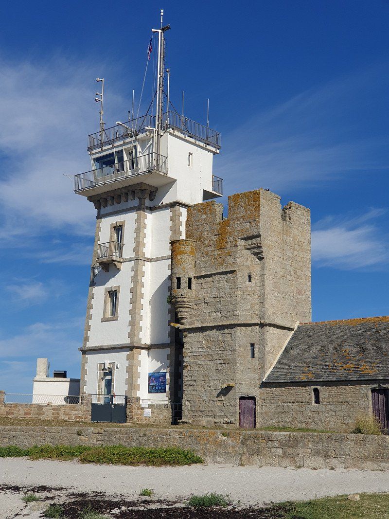
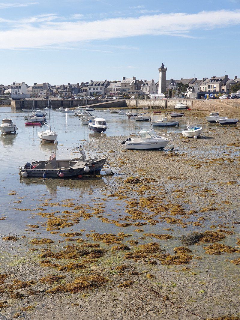
Phare d'Eckmühl, Place du Maréchal Davout, Penmarc'h
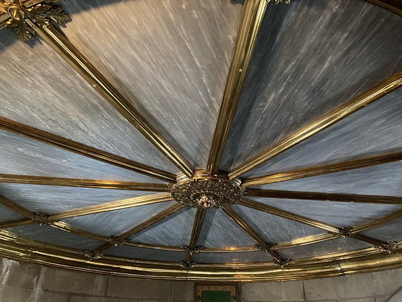
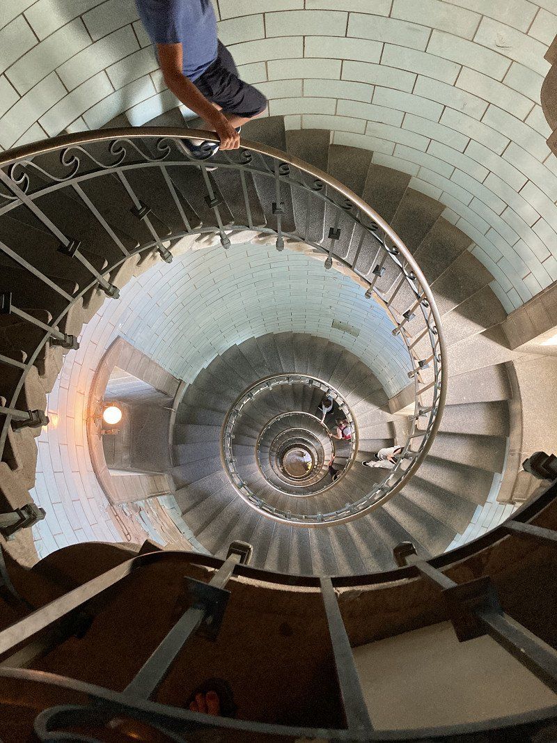
Went to Saint-Pierre by motorbike and climbed the 65m high Phare d'Eckmühl lighthouse over 307 steps. Interior lined with opaque glass tiles. Grandiose view of the village, the coast and other, smaller lighthouses.
Pl. du Maréchal Davout, 29760 Penmarc'h, Frankreich
47° 47' 53.5" N 4° 22' 22" W
47.7981899 -4.3727685
• Head toward Rue des Naufragés du 23 Mai 1925 on Rue du Phare. Go for 90 m.
• Continue on Rue des Naufragés 23 Mai 1925. Go for 34 m.
• Turn right onto Rue du Phare. Go for 170 m.
• Turn left onto Avenue du Schierling Eckmühl (D80). Go for 774 m.
• Continue on Rue de la Joie (D80). Go for 1.2 km.
• Turn right onto Rue Pierre Semard (D53). Go for 122 m.
• Turn left onto Rue Jean Jaurès. Go for 205 m.
• Turn right onto Rue Guy Môquet. Go for 56 m.
• Turn left onto Rue des Becassines. Go for 60 m.
• Turn left onto Rue des Becassines. Go for 73 m.
• Arrive at Rue des Becassines.
☍
2,8 km
( 5 min.)
Saint-Guénolé, Penmarc'h
Sant-Wennole, 29760 Penmarch, Frankreich
47° 49' 7.5" N 4° 22' 26.4" W
47.8187430 -4.3740030
• Head toward Rue des Marais on Rue des Becassines. Go for 47 m.
• Turn slightly right onto Rue Jean Jaurès. Go for 87 m.
• Turn right onto Rue Frédéric Joliot-Curie. Go for 359 m.
• Turn left onto Rue Frédéric Joliot-Curie. Go for 156 m.
• Turn left onto Rue Pierre Semard (D53). Go for 153 m.
• Continue on Rue des Primevères (D53). Go for 433 m.
• Continue on Route de Kerameil (D53). Go for 647 m.
• Continue on Route de Quelourn (D53). Go for 716 m.
• Continue on Avenue de Skibberéen (D53). Go for 611 m.
• Take the 2nd exit from roundabout onto Rue Edmond Michelet (D785). Go for 310 m.
• Take the 2nd exit from roundabout onto Rue Edmond Michelet (D785). Go for 218 m.
• Continue on Hent Prad Gouzien (D785). Go for 167 m.
• Continue on Route de Plomeur (D785). Go for 685 m.
• Take the 1st exit from roundabout onto Route de Loctudy (D53). Go for 2.4 km.
• Take the 3rd exit from roundabout onto Route de Plobannalec Pendreff (D53). Go for 1.7 km.
• Turn right onto D153. Go for 714 m.
• Continue on Rue du Vivier (D153). Go for 417 m.
• Continue on Avenue du 8 Mai 1945 (D153). Go for 97 m.
• Pass 2 roundabouts and continue on Avenue du 8 Mai 1945 (D153). Go for 1.2 km.
• Turn left onto Rue de Kerléguer. Go for 340 m.
• Continue on Rue de Kerléguer. Go for 215 m.
• Continue on Rue de la Chapelle. Go for 563 m.
• Take the 2nd exit from roundabout. Go for 88 m.
• Turn right onto Lieu-dit Squividan. Go for 157 m.
• Arrive at Lieu-dit Squividan. Your destination is on the right.
☍
12,5 km
( 16 min.)
Camping Les Vergers De Squividan
29730, Treffiagat, France
47° 47' 52.4" N 4° 14' 58.4" W
47.7978800 -4.2495600
• Head northwest on Lieu-dit Squividan. Go for 157 m.
• Turn left toward Rue de la Chapelle. Go for 69 m.
• Take the 2nd exit from roundabout onto Rue de la Chapelle. Go for 593 m.
• Continue on Rue de Kerléguer. Go for 555 m.
• Turn right onto Avenue du 8 Mai 1945 (D153). Go for 552 m.
• Pass 2 roundabouts and continue on Avenue du 8 Mai 1945 (D153). Go for 760 m.
• Continue on Rue du Vivier (D153). Go for 417 m.
• Continue on D153. Go for 714 m.
• Turn left onto D53. Go for 1.7 km.
• Take the 1st exit from roundabout onto D57. Go for 2.4 km.
• Take the 1st exit from roundabout onto Rue Louis Mehu (D785). Go for 393 m.
• Take the 3rd exit from roundabout onto Route de Saint-Jean Trolimon (D57). Go for 2.3 km.
• Take the 2nd exit from roundabout onto Hent Braz Kap-Kaval (D57). Go for 4.6 km.
• Turn left onto Rue Louis Hémon. Go for 378 m.
• Turn left onto Rue Louis Pasteur (D2). Go for 7.6 km.
• Take the 2nd exit from roundabout onto Rue de Pont l'Abbé (D2). Go for 7.4 km.
• Turn left onto Rue du Centre (D784). Go for 100 m.
• Turn left onto Chemin de la Corniche. Go for 1.3 km.
• Continue on Lieu-dit Pen Ar Pont. Go for 224 m.
• Continue on Lieu-dit Bellevue. Go for 534 m.
• Turn right onto Hent Prad Meur. Go for 85 m.
• Continue on Lieu-dit Le Gored. Go for 204 m.
• Continue on Lieu-dit Gored. Go for 178 m.
• Turn left onto Rue de l'Océan. Go for 671 m.
• Continue on Rue de Pors Poulhan. Go for 438 m.
• Continue on Lieu-dit Pors Poulhan. Go for 303 m.
• Turn left onto Rue de la Corniche. Go for 438 m.
• Turn left onto Rue de Menez Dregan. Go for 160 m.
• Arrive at Rue de Menez Dregan. Your destination is on the left.
☍
35,2 km
( 43 min.)
Day
Ménez Drégan, Plouhinec, Frankreich
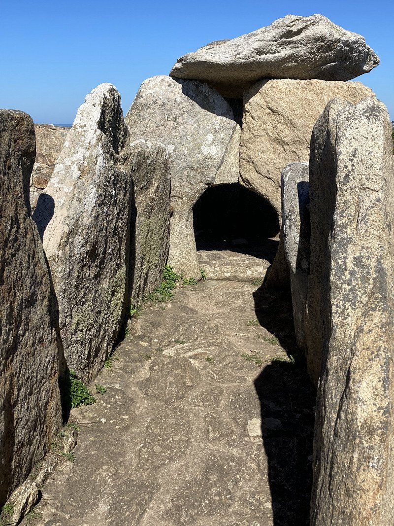
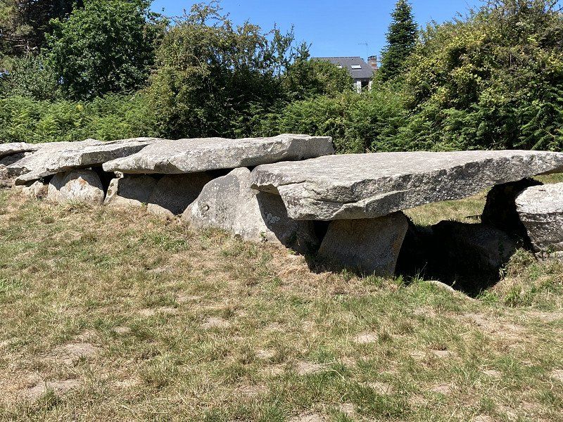
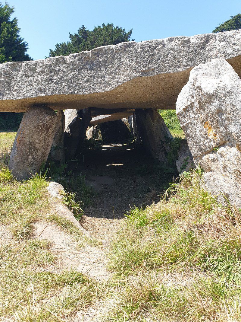
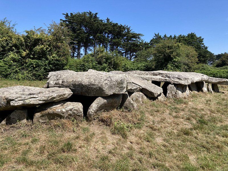
From the small port via the GR34 coastal footpath to Menez Dregan : huge dolmen tomb
Ménez Drégan, 29780 Plouhinec, Frankreich
47° 59' 9.1" N 4° 28' 12.2" W
47.9858700 -4.4700660
• Head north on Rue de Menez Dregan. Go for 160 m.
• Turn right onto Rue de la Corniche. Go for 438 m.
• Turn left toward Rue de Kerruc. Go for 294 m.
• Continue on Rue de Kerruc. Go for 95 m.
• Continue on Route de Kerruc. Go for 525 m.
• Continue on Route de Kerglogay. Go for 293 m.
• Continue on Lieu-dit Kerglogay. Go for 1.6 km.
• Continue on Rue Jean Guilliou. Go for 651 m.
• Turn right onto Rue du Général Leclerc (D784). Go for 1.9 km.
• Turn left onto Rue de Lambabu (D2). Go for 1.3 km.
• Continue on Route de Pont-Croix (D2). Go for 1.1 km.
• Continue on Lieu-dit Guernévez (D2). Go for 105 m.
• Continue on Route de Pont-Croix (D2). Go for 1.2 km.
• Continue on Rue Voltaire (D2). Go for 491 m.
• Continue on Rue du Goyen (D2). Go for 377 m.
• Turn sharp right onto Rue des Partisans. Go for 72 m.
• Turn slightly left onto Rue Victor Hugo. Go for 244 m.
• Turn right onto Rue de la Liberté (D765). Go for 240 m.
• Turn left onto Rue Marcel Pellay (C5). Go for 395 m.
• Turn left onto Rue du 19 Mars 1962 (C5). Go for 205 m.
• Take the 2nd exit from roundabout onto Rue du 19 Mars 1962 (C5). Go for 334 m.
• Continue on C5. Go for 39 m.
• Continue on Rue du 19 Mars 1962 (C5). Go for 755 m.
• Continue on C4. Go for 405 m.
• Continue on Lieu-dit Kernévez Vraz (C4). Go for 141 m.
• Continue on C4. Go for 145 m.
• Continue on Lieu-dit Kernévez Vihan (C4). Go for 91 m.
• Continue on Lieu-dit Coat Pin (C4). Go for 1.2 km.
• Turn right onto Rue Ann Avel Mor (D7). Go for 885 m.
• Turn left onto Route du Millier (D407). Go for 2.3 km.
• Arrive at Route du Millier (D407).
☍
18,0 km
( 22 min.)
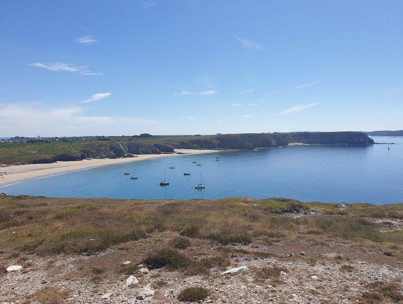
Pointe du Millier, Beuzec-Cap-Sizun
Crossed the next peninsula and hiked to the sea at the Pointe du Millier . Here you have a view of the next peninsula to the north: Crozon, Cap de la Chèvre.
Pointe du Millier, 29790 Beuzec-Cap-Sizun, Frankreich
48° 5' 55.6" N 4° 27' 57.6" W
48.0987889 -4.4660000
• Head southeast on Route du Millier (D407). Go for 238 m.
• Continue on Route du Millier (D407). Go for 2.1 km.
• Turn left onto Lieu-dit Coat Pin (D7). Go for 433 m.
• Continue on D7. Go for 128 m.
• Continue on Lieu-dit Kerbalannec Vihan (D7). Go for 89 m.
• Continue on D7. Go for 1.2 km.
• Continue on Lieu-dit Lestreux (D7). Go for 315 m.
• Continue on Lieu-dit Menez Tour (D7). Go for 308 m.
• Continue on D7. Go for 587 m.
• Continue on Route de Beuzec-Cap-Sizun (D7). Go for 271 m.
• Take the 3rd exit from roundabout onto Rue Abbé Conan (D7). Go for 354 m.
• Continue on Place de l'Église (D7). Go for 66 m.
• Continue on Rue Luc Robet (D7). Go for 318 m.
• Take the 2nd exit from roundabout onto Rue Luc Robet (D7). Go for 188 m.
• Continue on Route de Douarnenez (D7). Go for 291 m.
• Continue on D7. Go for 29 m.
• Continue on Route de Douarnenez (D7). Go for 3.0 km.
• Continue on D7. Go for 354 m.
• Continue on Route de Poulhan (D7). Go for 870 m.
• Take the 1st exit from roundabout onto Route de Poulhan (D7). Go for 185 m.
• Continue on Rue du Commandant Fernand (D7). Go for 263 m.
• Take the 1st exit from Rond-Point du Cornigou roundabout onto Boulevard Jean Moulin (D7 A). Go for 408 m.
• Pass 2 roundabouts and continue on Boulevard Jean Moulin (D7 A). Go for 1.4 km.
• Take the 3rd exit from roundabout onto Rue Étienne Kernours (D765). Go for 119 m.
• Pass 2 roundabouts and continue on Rue Étienne Kernours (D765). Go for 647 m.
• Turn left onto Route de Brest. Go for 610 m.
• Take the 2nd exit from Rond-Point de Bréhuel roundabout onto Route de Bréhuel (D7). Go for 350 m.
• Take the 2nd exit from roundabout onto Route de Bréhuel (D7). Go for 643 m.
• Turn right onto Route du Ris (D7). Go for 3.5 km.
• Take the 2nd exit from Giratoire de Kroas Hent Tro roundabout onto D7. Go for 3.9 km.
• Take the 2nd exit from Rond-Point de Rosancelin roundabout onto Chemin de Châteaulin. Go for 212 m.
• Continue straight ahead. Go for 26 m.
• Turn left. Go for 129 m.
• Arrive at your destination on the left.
☍
23,5 km
( 27 min.)
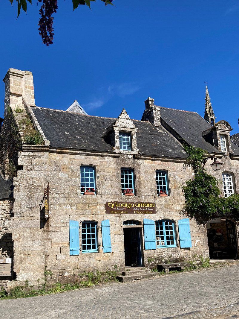
Locronan - Aire de Camping-cars (CCP € 11.50)
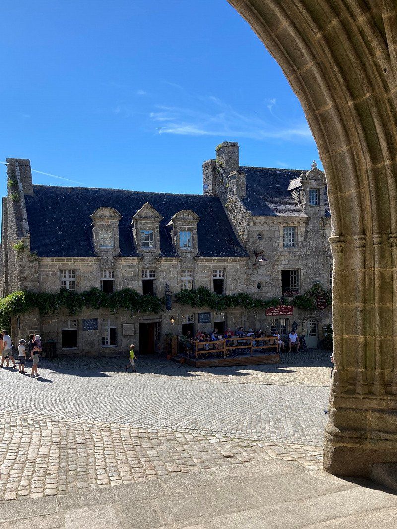
Medieval town: as if time stood still 150 years ago.
Just pretty stone houses, cobbled streets, no electric cables and neon signs. Ready for the next movie!
Rue du Prieuré, 29180, Locronan, France
48° 5' 54" N 4° 12' 43" W
48.0983333 -4.2119444
• Head south. Go for 43 m.
• Turn right toward Chemin de Châteaulin. Go for 82 m.
• Continue on Chemin de Châteaulin. Go for 131 m.
• Take the 1st exit from Rond-Point de Rosancelin roundabout onto Route de la Presqu'Île (D63). Go for 1.0 km.
• Pass 2 roundabouts and continue on Rue de la Presqu'Île (D63). Go for 6.3 km.
• Turn left onto Lieu-dit Toul Fil. Go for 64 m.
• Turn right toward Lieu-dit Kerherven. Go for 990 m.
• Continue on Lieu-dit Kerherven. Go for 289 m.
• Continue on Lieu-dit Roz al Len Huella. Go for 238 m.
• Continue on Lieu-dit Rozallen. Go for 246 m.
• Continue on Lieu-dit Penfont. Go for 378 m.
• Continue on Lieu-dit Kerlaouéret. Go for 179 m.
• Continue on Lieu-dit Lagonteniat. Go for 841 m.
• Take the 2nd exit from roundabout onto Route de Lestrevet. Go for 254 m.
• Continue on Lieu-dit Ménez Nonn. Go for 54 m.
• Continue on Lieu-dit Croaz Diben. Go for 136 m.
• Continue on Lieu-dit Kroas Diben. Go for 197 m.
• Continue on Lieu-dit Ty Gwen. Go for 113 m.
• Continue on Route de Lestrevet. Go for 175 m.
• Continue on Lieu-dit Keravel Ar Goulit. Go for 146 m.
• Continue on Route de Lestrevet. Go for 226 m.
• Continue on Lieu-dit Reluyen. Go for 121 m.
• Continue on Lieu-dit Lestrevet. Go for 825 m.
• Continue on Chemin d'Exploitation. Go for 438 m.
• Continue on Lieu-dit Lestrevet. Go for 432 m.
• Continue on C4. Go for 63 m.
• Continue on Chemin des Dunes (C4). Go for 1.4 km.
• Turn left onto Rue de la Presqu'Île (C3). Go for 836 m.
• Continue on C3. Go for 802 m.
• Continue on Lieu-dit Kerninet (C3). Go for 60 m.
• Continue on C3. Go for 166 m.
• Continue on Lieu-dit Tal Ar Groas. Go for 462 m.
• Continue on Lieu-dit Mez Meur. Go for 80 m.
• Continue on Lieu-dit Kergo. Go for 235 m.
• Continue on Lieu-dit Pen Ar Stang. Go for 1.3 km.
• Continue on C1. Go for 897 m.
• Turn left onto D887. Go for 6.6 km.
• Take the 3rd exit from roundabout onto Route de Crozon (D887). Go for 2.1 km.
• Pass 3 roundabouts and continue on Rue de Poulpatre (D887). Go for 3.0 km.
• Take the 2nd exit from roundabout onto Rue Jules Simon. Go for 295 m.
• Turn right onto Rue Graveran. Go for 44 m.
• Continue on Rue Alsace-Lorraine (D887). Go for 29 m.
• Arrive at Rue Alsace-Lorraine (D887). Your destination is on the right.
☍
32,3 km
( 35 min.)
Day
Crozon (SP CCP € 12.60)
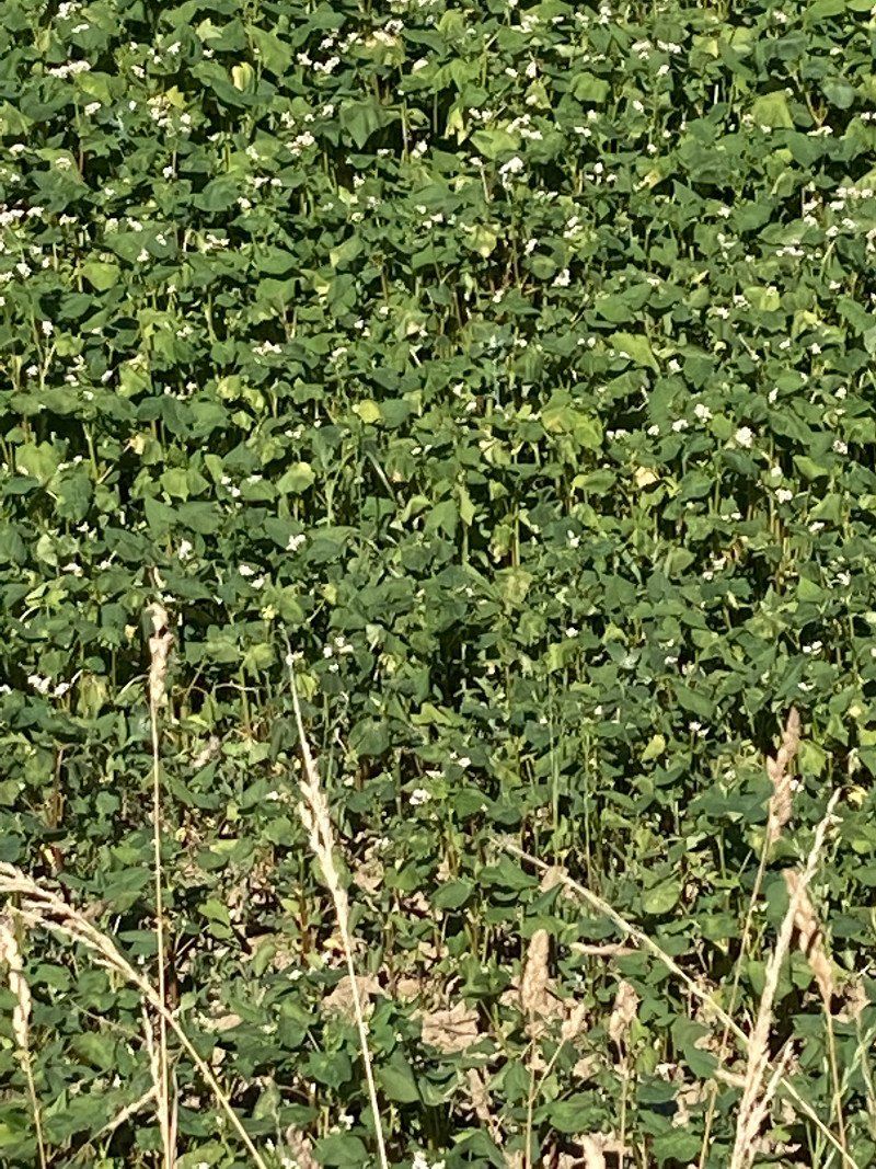
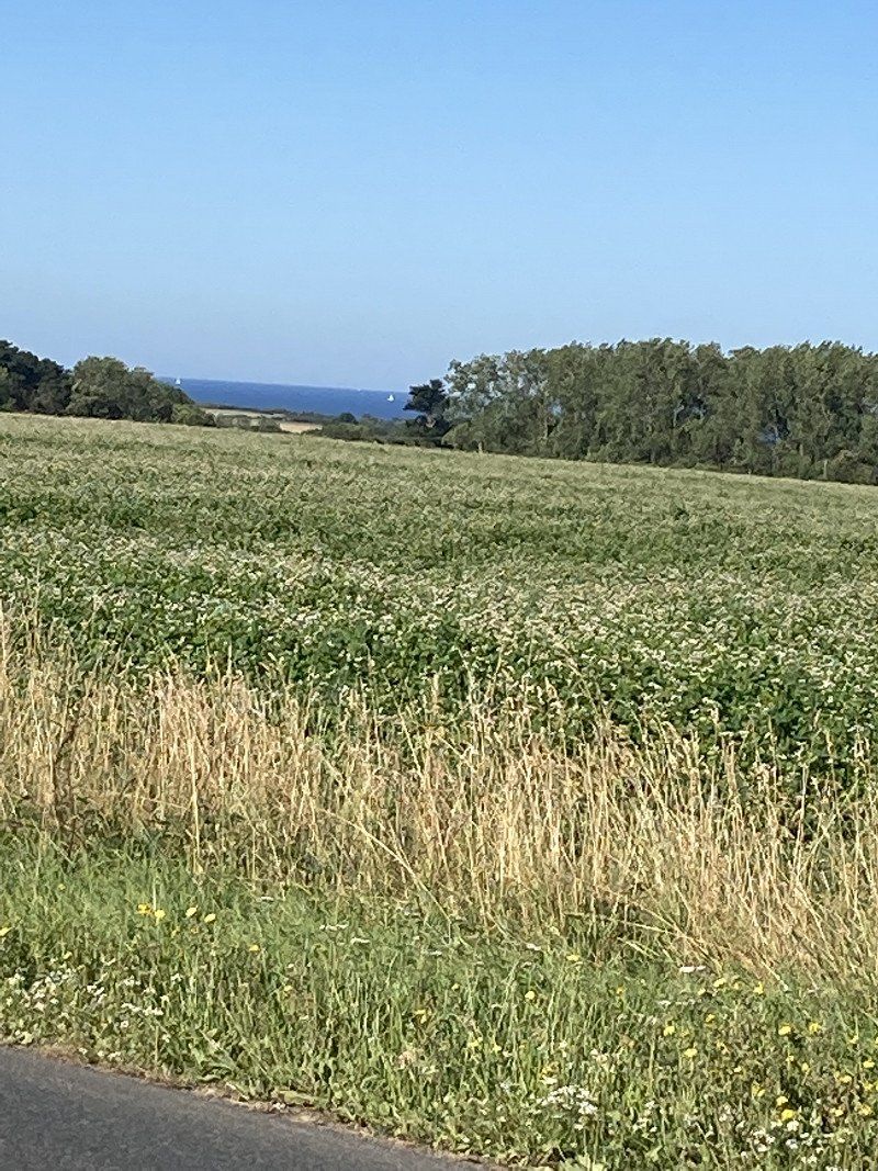
Impressions from the trip overland. Including fields with buckwheat.
29160 Crozon, Frankreich
48° 14' 46.7" N 4° 29' 22.4" W
48.2463060 -4.4895680
• Head west on Rue Alsace-Lorraine (D887). Go for 27 m.
• Turn right onto Rue de Reims (D155). Go for 101 m.
• Turn slightly left onto Rue de Reims (D155). Go for 35 m.
• Turn right onto Rue Charles Lévenèz (D155). Go for 118 m.
• Take the 3rd exit from roundabout onto Boulevard de Pralognan. Go for 718 m.
• Take the 2nd exit from roundabout onto Route de Camaret (D8). Go for 1.7 km.
• Continue on D8. Go for 3.1 km.
• Continue on Lieu-dit Kerloc'h (D8). Go for 1.4 km.
• Continue on Lieu-dit École de Kerloch (D8). Go for 1.2 km.
• Continue on Rue de Crozon (D8). Go for 163 m.
• Take the 3rd exit from roundabout onto Rue de Crozon (D8). Go for 294 m.
• Take the 2nd exit from roundabout onto Rue du Chanoine Bossënec (D8). Go for 373 m.
• Take the 2nd exit from roundabout onto Rue du Chanoine Bossënec (D8). Go for 92 m.
• Take the 3rd exit from roundabout onto Rue André Antoine (D8). Go for 228 m.
• Take the 4th exit from roundabout onto Rue André Antoine (D8). Go for 837 m.
• Turn left onto Rue Saint-Pol Roux (D8). Go for 87 m.
• Continue on D8. Go for 247 m.
• Continue on Lieu-dit Kerbonn (D8). Go for 148 m.
• Continue on Lieu-dit Le Fort (D8). Go for 143 m.
• Continue on D8. Go for 1.0 km.
• Continue on Lieu-dit Pointe de Pen Hir (D8). Go for 327 m.
• Arrive at Lieu-dit Pointe de Pen Hir (D8).
☍
12,4 km
( 16 min.)
Pointe de Pen-Hir, Camaret-sur-Mer
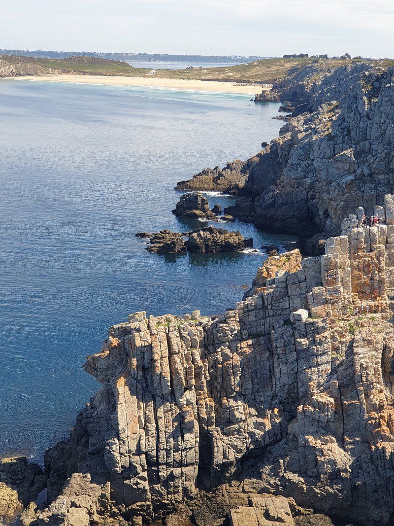
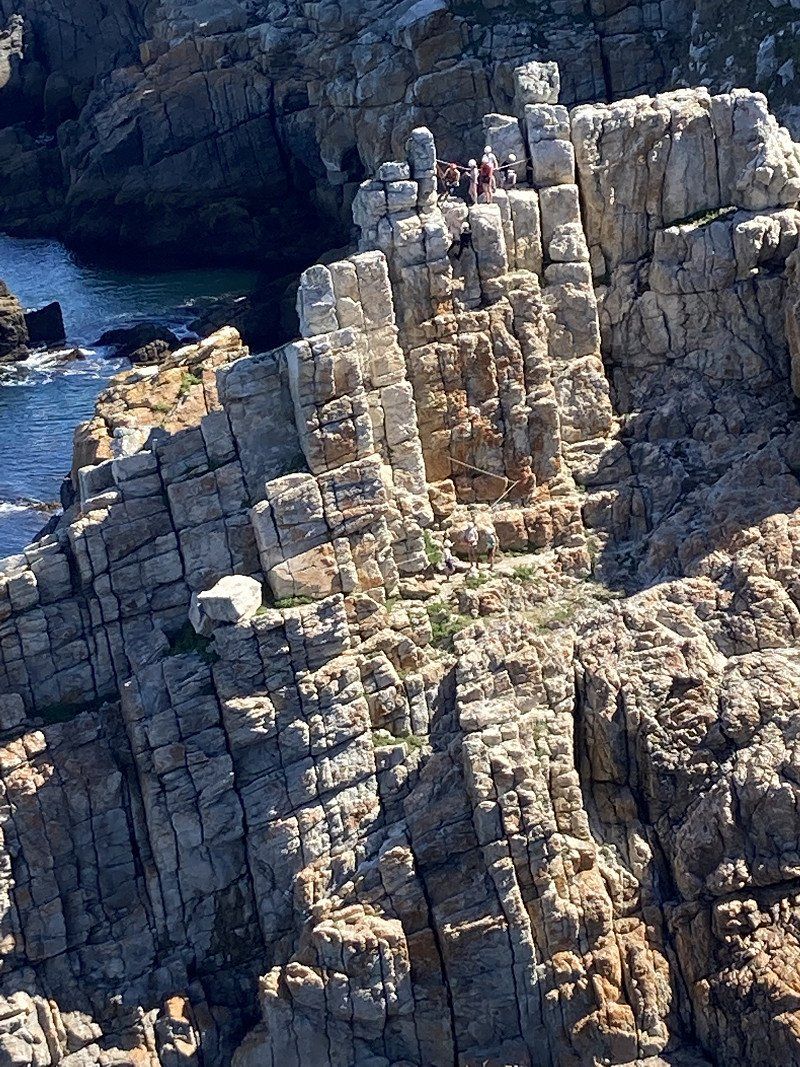
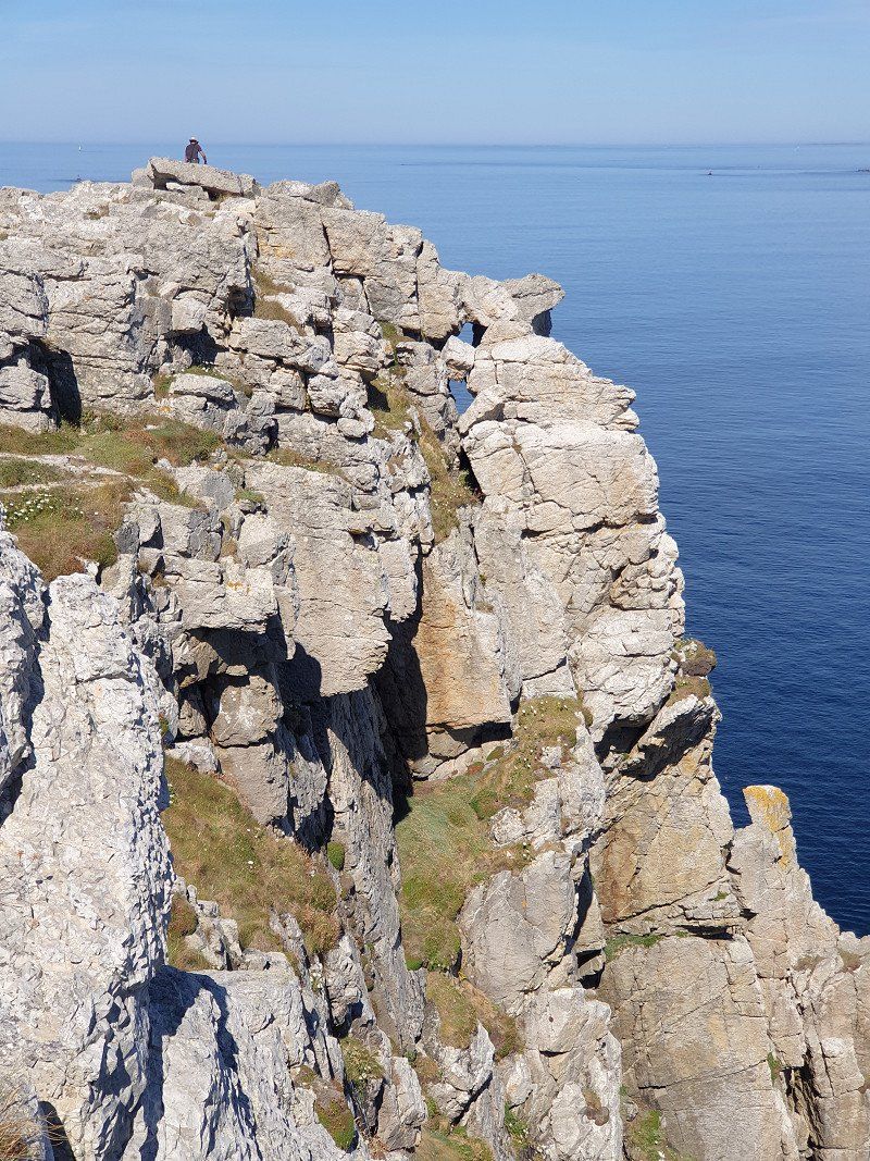
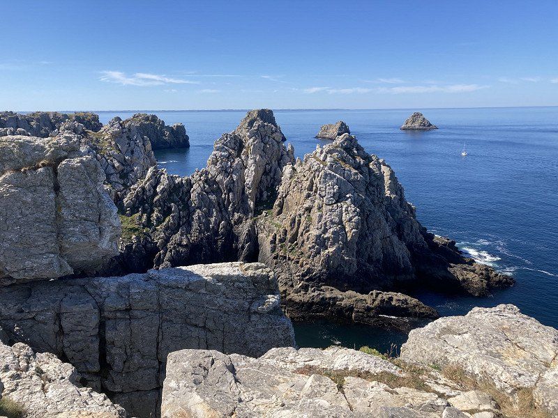
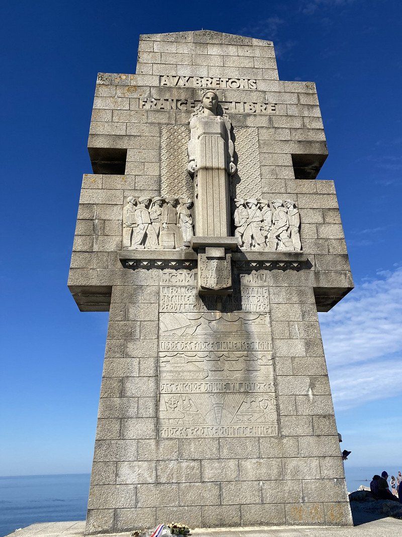
By motorbike to the 70m high cliffs at Pointe de Pen-Hir . Rugged, black granite rocks tower picturesquely in the sea.
Along the access road again a field with several rows of megalithic stones.
29570 Camaret-sur-Mer, Frankreich
48° 15' 12.9" N 4° 37' 22.4" W
48.2535908 -4.6228958
• Head toward Lieu-dit Pen Hir on Lieu-dit Pointe de Pen Hir (D8). Go for 327 m.
• Continue on D8. Go for 1.0 km.
• Continue on Lieu-dit Le Fort (D8). Go for 143 m.
• Continue on Lieu-dit Kerbonn (D8). Go for 148 m.
• Continue on D8. Go for 247 m.
• Continue on Rue Saint-Pol Roux (D8). Go for 87 m.
• Turn right onto Rue André Antoine (D8). Go for 798 m.
• Take the 4th exit from roundabout onto Rue du Roz. Go for 354 m.
• Turn left onto Place d'Estienne d'Orves. Go for 26 m.
• Continue on Rue Toussaint Le Garrec. Go for 44 m.
• Turn right onto Rue du Doué. Go for 30 m.
• Arrive at Rue du Doué. Your destination is on the left.
☍
3,2 km
( 7 min.)
Camaret-sur-Mer
A 600m long dam and the Tour Vauban protect the bay.
Camaret-sur-Mer, Frankreich
48° 16' 33" N 4° 35' 49.6" W
48.2758360 -4.5971140
• Head east on Rue du Doué. Go for 69 m.
• Turn left onto Rue du Pré. Go for 35 m.
• Turn right onto Rue Alsace-Lorraine. Go for 73 m.
• Turn right onto Place Charles de Gaulle. Go for 246 m.
• Continue on Rue des Quatre Vents (D8 A). Go for 365 m.
• Take the 3rd exit from roundabout onto Rue de Crozon (D8). Go for 291 m.
• Take the 4th exit from roundabout onto Route de Quélern (D355). Go for 2.4 km.
• Continue on Route de Quélern (D355). Go for 86 m.
• Continue on Lieu-dit Trez Rouz (D355). Go for 131 m.
• Continue on D355. Go for 1.4 km.
• Turn left onto D355. Go for 94 m.
• Continue on Lieu-dit Quelern en Haut (D355). Go for 172 m.
• Continue on D355. Go for 3.6 km.
• Continue on Lieu-dit Kerviniou (D355). Go for 943 m.
• Continue on D355. Go for 1.2 km.
• Continue on Lieu-dit Kergadiou (D355). Go for 114 m.
• Continue on D355. Go for 1.2 km.
• Continue on Route de la Pointe (D355). Go for 166 m.
• Arrive at Route de la Pointe (D355).
☍
12,5 km
( 16 min.)
Pointe des Espagnols, Roscanvel
To the north of Crozon, the Spaniards dug several artillery bastions into the rocks on the Brest Strait. Was expanded again and again and strengthened by Napoleon with a castle complex.
29570 Roscanvel, Frankreich
48° 20' 28.6" N 4° 32' 0.8" W
48.3412710 -4.5335637
• Head toward Route du Lez on Route de la Pointe (D355). Go for 2.7 km.
• Continue on Route de Pont-Scorff (D355). Go for 622 m.
• Continue on Rue du Port (D355). Go for 69 m.
• Continue on Place de l'Église (D355). Go for 53 m.
• Take the 3rd exit from roundabout onto Route de Quélern (D355). Go for 2.0 km.
• Continue on Lieu-dit Quélern (D355). Go for 188 m.
• Continue on D355. Go for 1.8 km.
• Continue on Lieu-dit Meznot (D355). Go for 102 m.
• Continue on D355. Go for 237 m.
• Keep right onto Lieu-dit Saint-Fiacre (D355). Go for 561 m.
• Continue on D355. Go for 218 m.
• Take the 2nd exit from roundabout onto D355. Go for 1.9 km.
• Continue on Lieu-dit Guenvenez (D355). Go for 78 m.
• Continue on D355. Go for 836 m.
• Turn left onto D155. Go for 1.1 km.
• Continue on Rue de la Rade (D155). Go for 119 m.
• Take the 1st exit from roundabout onto Rue de la Rade (D55). Go for 296 m.
• Continue on Lieu-dit Seveleder (D55). Go for 333 m.
• Continue on D55. Go for 233 m.
• Continue on Lieu-dit Coatrez (D55). Go for 38 m.
• Continue on Lieu-dit Koatrez (D55). Go for 1.1 km.
• Pass 3 roundabouts and continue on Rue du Frêt (D55). Go for 400 m.
• Continue on Rue de l'Aviation (D55). Go for 473 m.
• Take the 4th exit from roundabout onto Rue de Tal Ar Groas (D63). Go for 571 m.
• Continue on D63. Go for 395 m.
• Continue on Lieu-dit Kersimon (D63). Go for 684 m.
• Continue on Lieu-dit Guernigenet (D63). Go for 88 m.
• Continue on D63. Go for 476 m.
• Continue on Lieu-dit La Maison Blanche (D63). Go for 501 m.
• Continue on D63. Go for 739 m.
• Continue on Route de Lanvéoc (D63). Go for 1.7 km.
• Take the 4th exit from roundabout onto Route de Brest (D791). Go for 22.0 km.
• Turn left onto Cité du Docteur Bourhis. Go for 115 m.
• Take the 2nd exit from roundabout onto Rue de Modbury. Go for 101 m.
• Continue on Rue de la Grève. Go for 121 m.
• Turn right onto Rue de la Grève. Go for 157 m.
• Turn left onto Rue du Général de Gaulle (D770). Go for 1.4 km.
• Turn right onto D18. Go for 14.1 km.
• Take the 2nd exit from roundabout onto D18 A. Go for 793 m.
• Turn right onto Rue de l'Argoat (D764). Go for 67 m.
• Arrive at Rue de l'Argoat (D764). Your destination is on the left.
☍
59,5 km
( 56 min.)
Day
Sizun
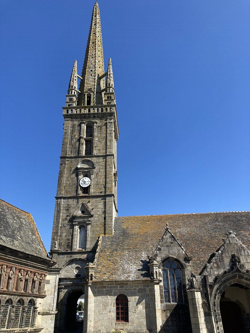
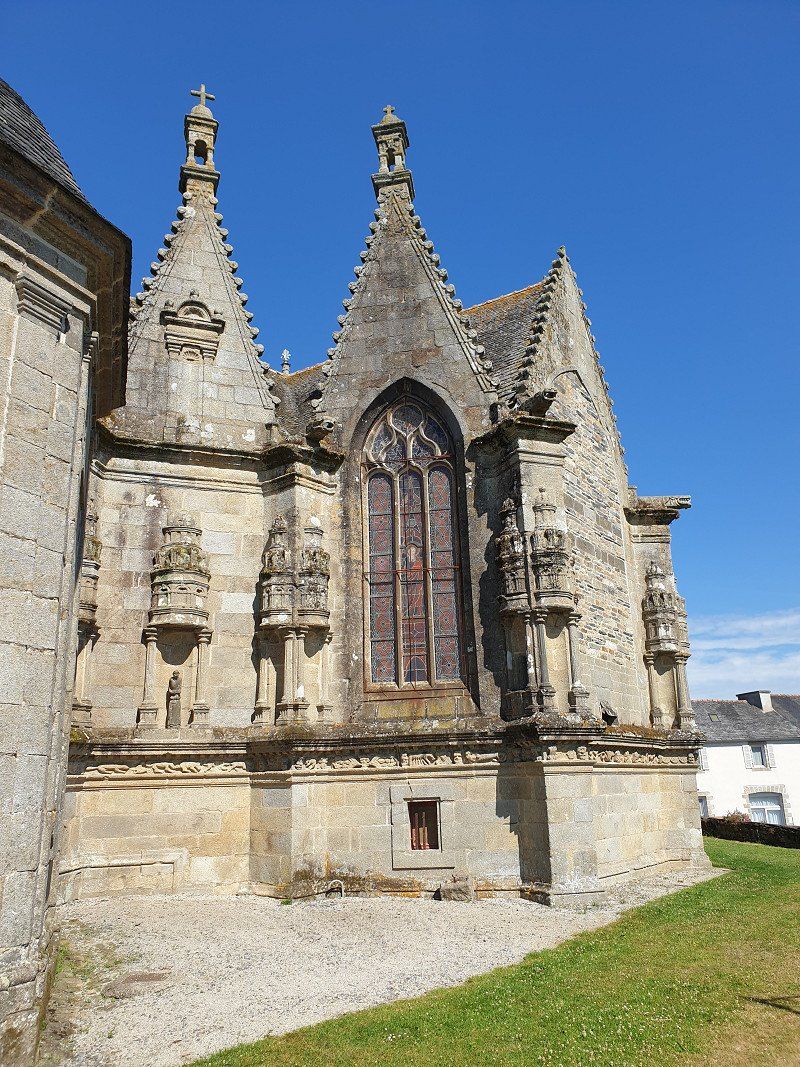
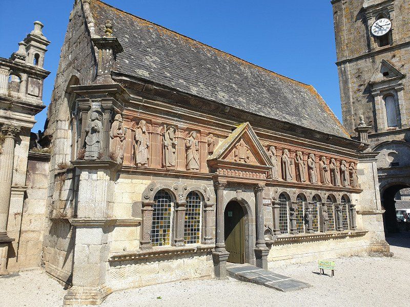
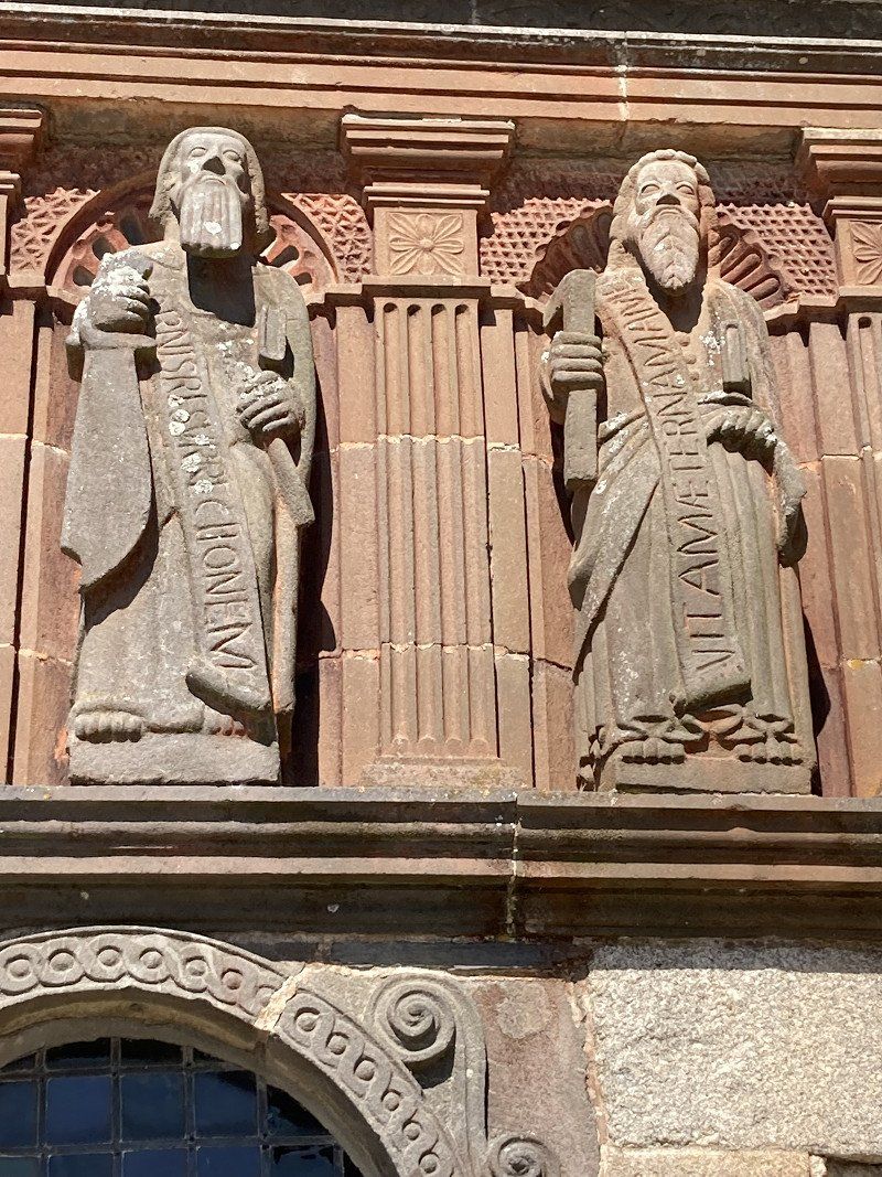
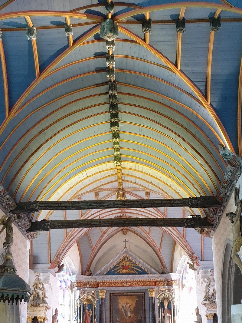
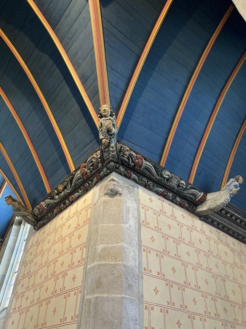
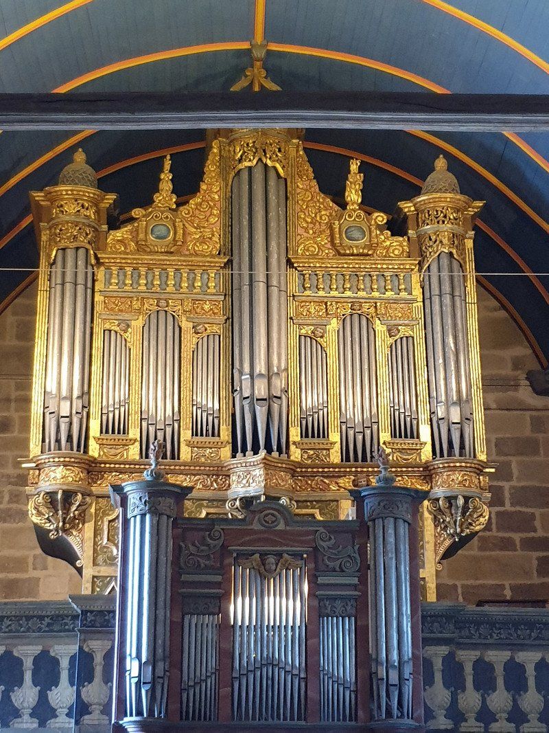
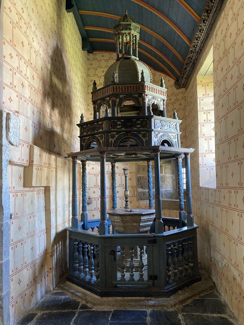
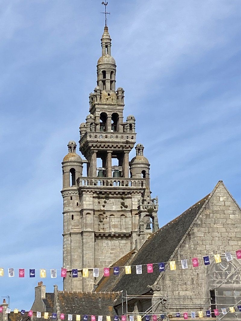
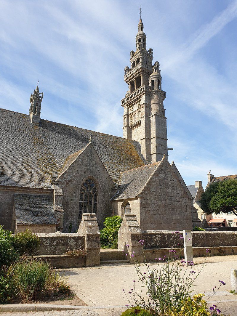
Beautiful group of churches with entrance gate, Saint-Suliau church (16th, 17th and 18th centuries) with its 56 meter high bell tower and an ossuary (1585) whose facade is decorated with statues of the 12 apostles.
29450 Sizun, Frankreich
48° 24' 20.9" N 4° 4' 39.2" W
48.4058060 -4.0775550
• Head toward Rue des Monts d'Arrée on Rue de l'Argoat (D764). Go for 44 m.
• Turn left onto Place Abbé Broc'h. Go for 67 m.
• Take the 1st exit from roundabout onto Rue du Docteur Corre. Go for 483 m.
• Continue on Route de Locmelar (VC1). Go for 218 m.
• Continue on Voie de Sizun à Landivisiau (VC1). Go for 2.6 km.
• Continue on C4. Go for 1.8 km.
• Continue on Route de Lanven (C4). Go for 190 m.
• Continue on Place Saint-Mélar (C4). Go for 49 m.
• Continue on Plasenn Sant Melar (C4). Go for 25 m.
• Continue on Route de l'Elorn (D30 A). Go for 549 m.
• Continue on D30 A. Go for 375 m.
• Continue on Lieu-dit le moulin Neuf (D30 A). Go for 106 m.
• Continue on Pont Neuf (D30 A). Go for 379 m.
• Turn right onto Pont Neuf (D30). Go for 3.4 km.
• Continue on D69. Go for 1.2 km.
• Pass 6 roundabouts and continue on D69. Go for 17.7 km.
• Take the 1st exit from roundabout onto Route de Brest à Saint-Pol-de-Léon (D788) toward Port Roscoff/St Pol de Léon. Go for 601 m.
• Turn left onto D69 toward Plougoulm/Santec/Cléder/Sibiril. Go for 292 m.
• Continue on Lieu-dit Ramblouch (D69). Go for 59 m.
• Continue on D69. Go for 461 m.
• Continue on Lieu-dit Pont Imiry (D69). Go for 73 m.
• Continue on D69. Go for 390 m.
• Continue on Lieu-dit Poul Ar Beillet (D69). Go for 92 m.
• Continue on D69. Go for 154 m.
• Continue on Lieu-dit Goariven (D69). Go for 193 m.
• Continue on Lieu-dit Le Bourg (D69). Go for 562 m.
• Continue on Rue du Prat Coulm (D69). Go for 44 m.
• Continue on Rue de Prat Coulm (D69). Go for 410 m.
• Continue on Rue de la Mer (D69). Go for 551 m.
• Turn right onto Rue de Santec (VC2). Go for 1.3 km.
• Continue on Lieu-dit Guerveur. Go for 184 m.
• Continue on Lieu-dit Pont Bihan. Go for 102 m.
• Continue on Rue de Verdun (VC3). Go for 384 m.
• Turn left onto Rue de la Fontaine (D75). Go for 255 m.
• Take the 1st exit from roundabout onto D75. Go for 443 m.
• Turn left onto Rue Croas An Dour (VC10). Go for 810 m.
• Turn left onto Rue de Mechouroux. Go for 234 m.
• Turn slightly right onto Rue de Kergunuec. Go for 287 m.
• Continue on Rue de Kergunuec. Go for 166 m.
• Continue on Rue de Kergunuec. Go for 433 m.
• Turn right onto Lieu-dit Beg Ar Billou. Go for 93 m.
• Turn right onto Lieu-dit Beg Ar Billou. Go for 22 m.
• Arrive at Lieu-dit Beg Ar Billou. Your destination is on the left.
☍
37,8 km
( 37 min.)
Camping municipal de Santec (CCP €12.50/Nacht)
29250, Santec, France
48° 42' 16.4" N 4° 2' 54.7" W
48.7045500 -4.0485400
• Head toward Rue de Kergunuec on Lieu-dit Beg Ar Billou. Go for 368 m.
• Turn left onto Rue de Kergunuec. Go for 224 m.
• Continue on Rue de Kergunuec. Go for 166 m.
• Continue on Rue de Kergunuec. Go for 287 m.
• Turn slightly left onto Rue de Mechouroux. Go for 234 m.
• Turn right onto Rue Croas An Dour (VC10). Go for 810 m.
• Turn right onto D75. Go for 419 m.
• Take the 3rd exit from roundabout onto Rue de la Fontaine (D75). Go for 310 m.
• Continue on Route du Dossen (D75). Go for 959 m.
• Continue on D75. Go for 160 m.
• Continue on Lieu-dit Kerellec (D75). Go for 68 m.
• Continue on D75. Go for 885 m.
• Continue on Lieu-dit Mechou Groas (D75). Go for 599 m.
• Take the 3rd exit from Giratoire de Kerjean roundabout onto D58 toward Port Roscoff. Go for 2.2 km.
• Take the 2nd exit from Rond-Point Barrière de la Croix roundabout onto Route de Lorient à Roscoff (D769) toward Port Roscoff/Île de Batz. Go for 660 m.
• Take the 3rd exit from Giratoire Bonne Nouvelle roundabout onto Rue du Pontigou (D769) toward Roscoff-Centre/Île de Batz. Go for 869 m.
• Continue on Rue Laennec (D769). Go for 512 m.
• Continue on Rue Albert de Mun (D769). Go for 404 m.
• Turn right onto Rue Célestin Séïté. Go for 216 m.
• Continue on Rue des Johnnies. Go for 125 m.
• Continue on Rue Gambetta. Go for 37 m.
• Turn right onto Quai Parmentier. Go for 37 m.
• Turn left onto Quai Charles de Gaulle. Go for 68 m.
• Turn left onto Quai Parmentier. Go for 58 m.
• Turn right onto Rue Amiral Réveillère. Go for 53 m.
• Turn left onto Rue Armand Rousseau. Go for 72 m.
• Arrive at Rue Armand Rousseau. Your destination is on the right.
☍
10,8 km
( 15 min.)
Day
Roscoff
Picturesque town with a harbour, a beautiful old town and a church with a strange tower.
Roscoff, Frankreich
48° 43' 34.3" N 3° 59' 7.2" W
48.7261990 -3.9853250
• Head toward Venelle An Iliz on Rue Armand Rousseau. Go for 20 m.
• Turn left onto Rue des Mogouerou. Go for 119 m.
• Turn right onto Rue Célestin Séïté. Go for 216 m.
• Turn left onto Rue Albert de Mun (D769). Go for 404 m.
• Continue on Rue Laennec (D769). Go for 512 m.
• Continue on Rue du Pontigou (D769). Go for 770 m.
• Take the 1st exit from Giratoire Bonne Nouvelle roundabout onto D769 toward St Pol de Léon/Morlaix/Brest. Go for 649 m.
• Take the 1st exit from Rond-Point Barrière de la Croix roundabout onto Voie de la Au Manoir de Keravel (D58) toward St Pol de Léon/Morlaix/Brest. Go for 2.1 km.
• Pass 3 roundabouts and continue on Route de Brest à Saint-Pol-de-Léon (D788). Go for 2.1 km.
• Take the 2nd exit from Rond-Point de Lesvestric roundabout onto D58 toward Morlaix/Carantec. Go for 1.7 km.
• Pass 2 roundabouts and continue on Route Départementale No58 (D58). Go for 13.9 km.
• Keep left onto D19. Go for 1.6 km.
• Take the 2nd exit from roundabout onto Route de Plouvorn (D19) toward Morlaix/St Martin des C. Go for 399 m.
• Take the 4th exit from Rond-Point du Puits roundabout onto N12 toward St Brieuc/Rennes. Go for 4.0 km.
• Take ramp toward Lannion/Lanmeur. Go for 405 m.
• Take the 1st exit from Rond-Point du 19 Mars 1962 roundabout onto D786 toward Lannion/Lanmeur/Z.A. la Boissière. Go for 263 m.
• Turn right onto D786 toward Lannion/Lanmeur/Aéroport Ploujean/Z.A. la Boissière. Go for 9.5 km.
• Pass 7 roundabouts and continue on Route de Morlaix (D786). Go for 22.5 km.
• Take the 4th exit from Rond-Point du Bel Air roundabout onto Boulevard Pierre Mendès France (D786) toward Lannion. Go for 1.9 km.
• Take the 2nd exit from roundabout onto Pont Viarmes (D786) toward Perros-Guirec. Go for 75 m.
• Take the 2nd exit from roundabout onto Quai du Maréchal Joffre (D788) toward Perros-Guirec/Trégastel/Pleumeur-Bodou/Trébeurden/Servel/Beg Leguer. Go for 770 m.
• Keep left onto Avenue de la Résistance (D788) toward Perros-Guirec/Trégastel/Aéroport. Go for 27 m.
• Continue on Avenue de la Résistance (D788). Go for 1.1 km.
• Take the 3rd exit from Rond-Point Armor roundabout onto Avenue de la Résistance (D788). Go for 762 m.
• Take the 6th exit from Rond-Point Pégase roundabout onto Avenue Pierre Marzin (D11). Go for 1.3 km.
• Pass 3 roundabouts and continue on Route de Lannion (D11). Go for 8.3 km.
• Take the 1st exit from roundabout onto Rue de Poul Palud (D788). Go for 968 m.
• Take the 2nd exit from roundabout onto Rue de Poul Palud (D788). Go for 522 m.
• Arrive at Rue de Poul Palud (D788). Your destination is on the right.
☍
76,9 km
(1 hrs. 10 min.)
Tourony Camping, Trégastel (€ 26.00/Nacht)
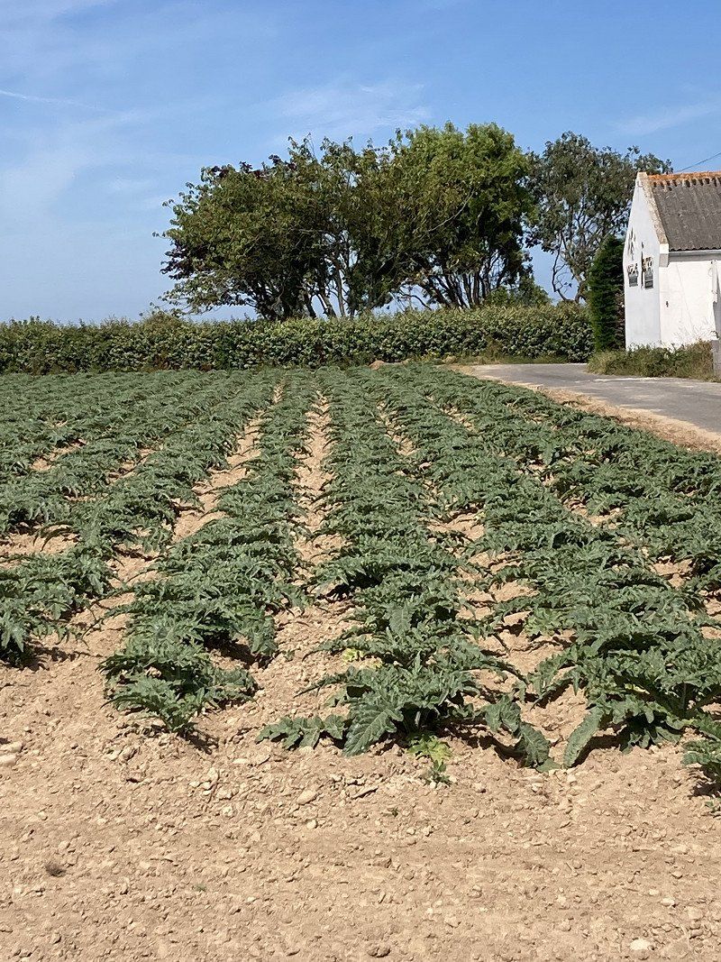
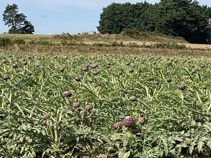
Drive along the coast. This time with artichoke fields.
Tourony Camping: small pitches, simple but clean sanitary facilities, barbecue and bar. About 10 minutes' walk to the beach.
22730, Trégastel, France
48° 49' 30.4" N 3° 29' 28.7" W
48.8251000 -3.4913000
• Head west on Rue de Poul Palud (D788). Go for 484 m.
• Pass 3 roundabouts and continue on Place Sainte-Anne (D788). Go for 1.6 km.
• Take the 3rd exit from roundabout onto Route de Trébeurden (D788). Go for 5.7 km.
• Turn right onto Rue de l'Île-Grande (D21). Go for 963 m.
• Continue on Rue du Pont (D21). Go for 469 m.
• Turn right onto Carrefour des Plages. Go for 23 m.
• Turn left onto Chemin de la Lande. Go for 30 m.
• Arrive at Chemin de la Lande. Your destination is on the right.
☍
9,3 km
( 12 min.)
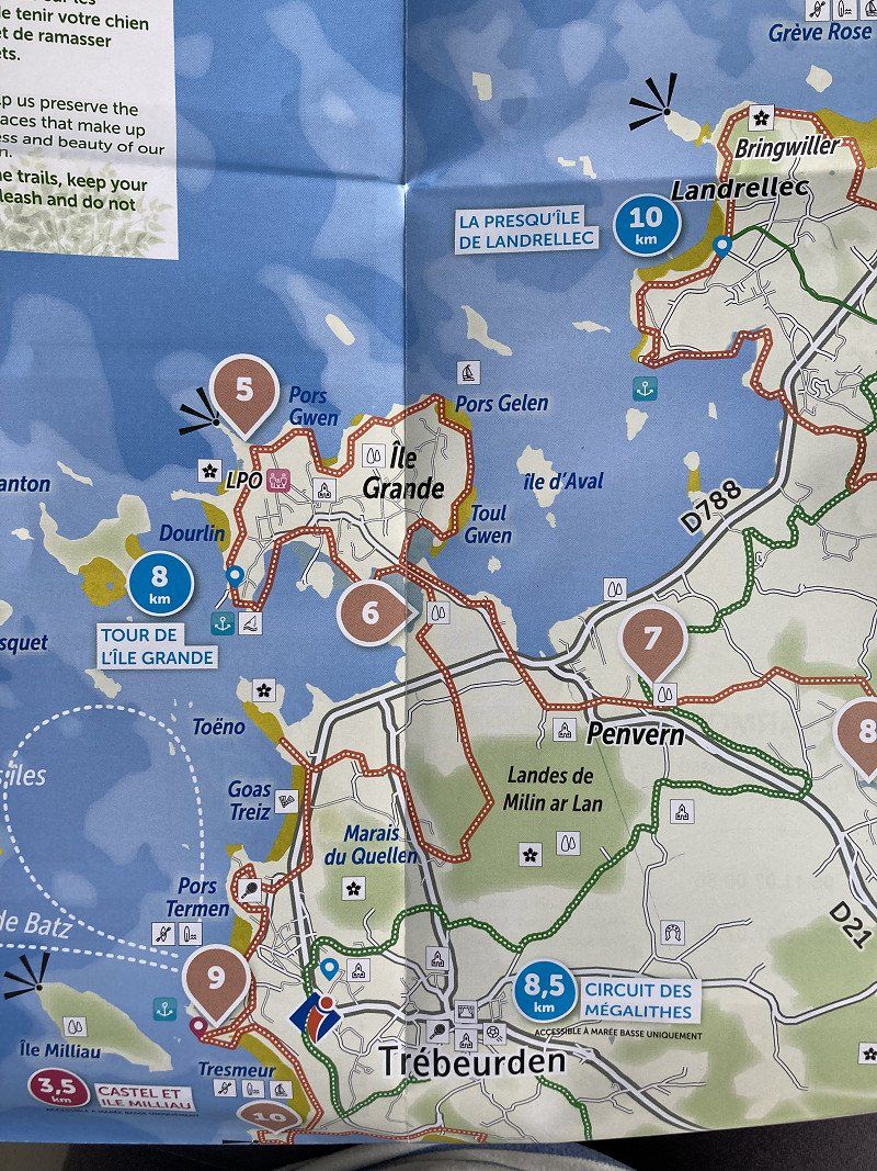
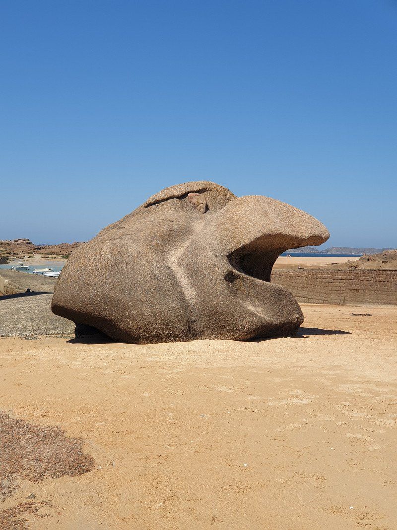
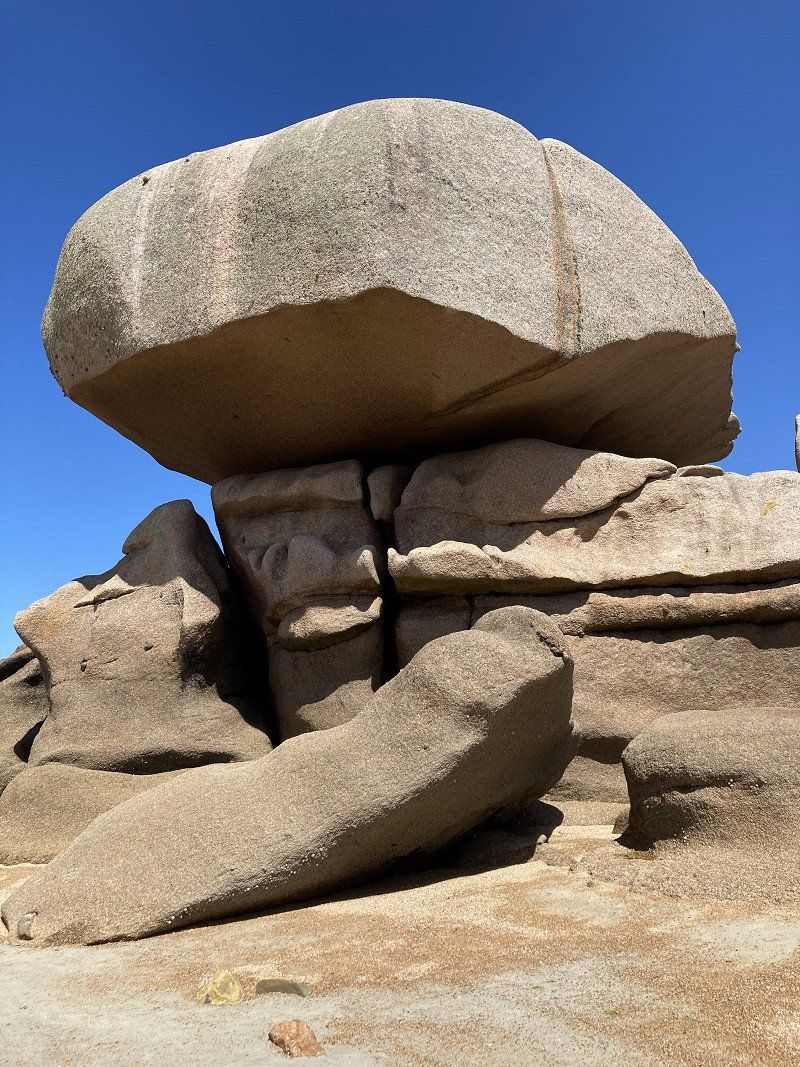
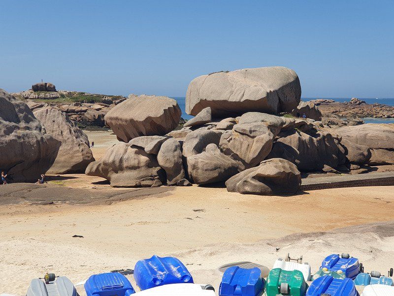
Day
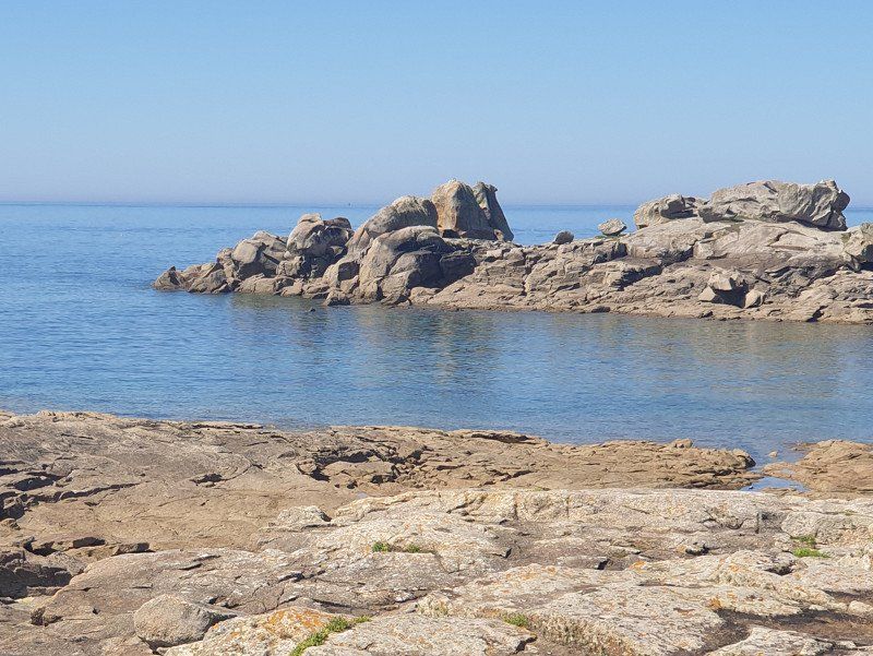
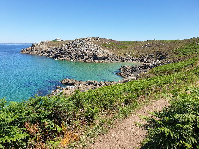
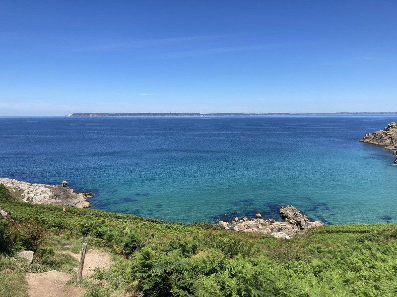
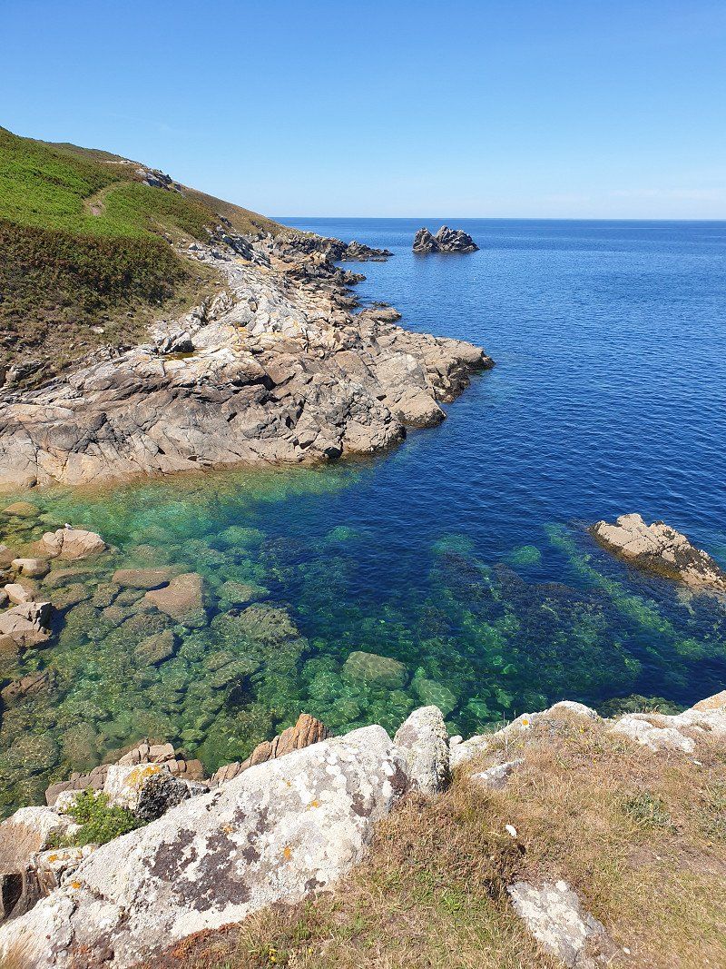
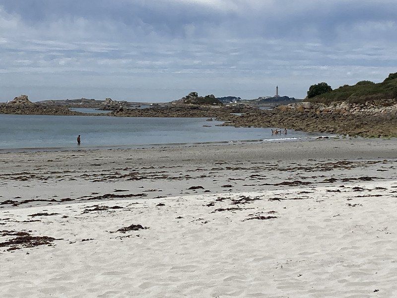
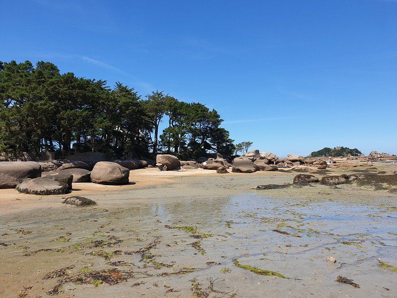
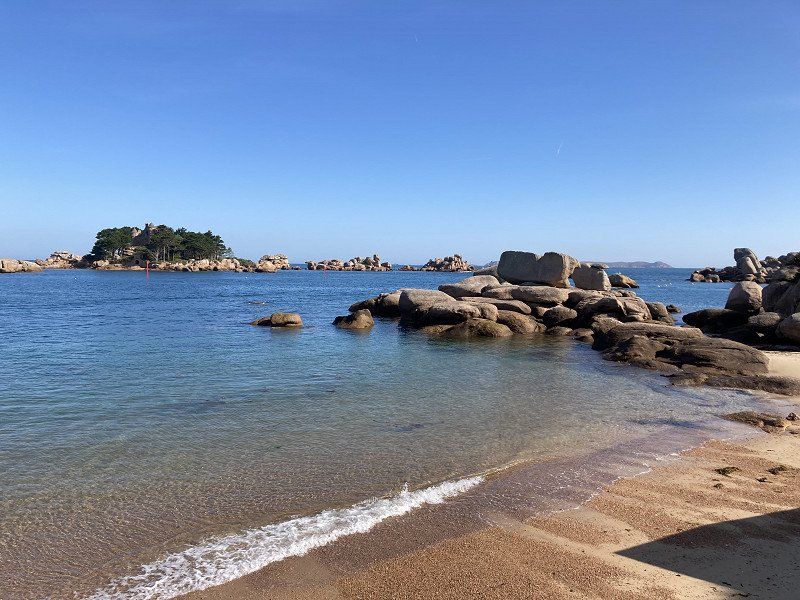
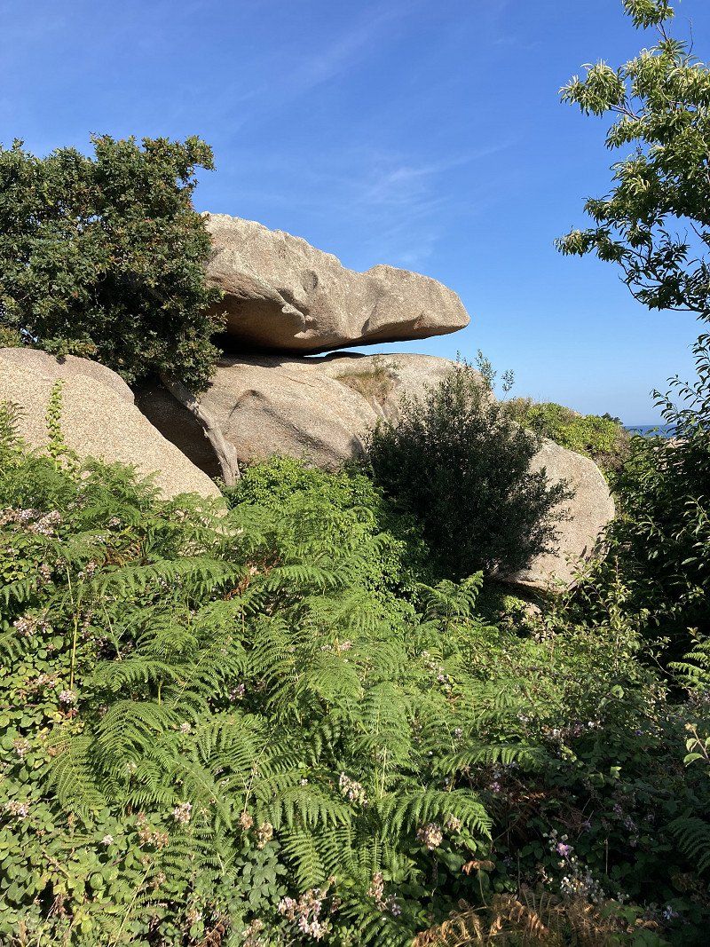
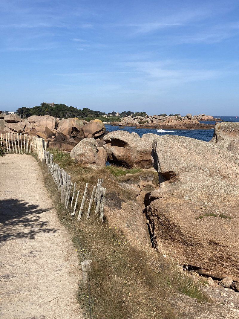
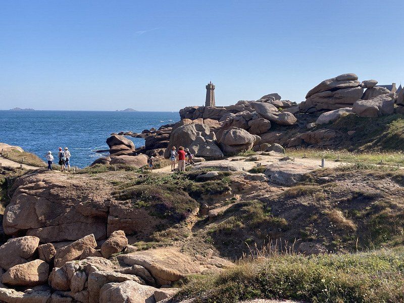
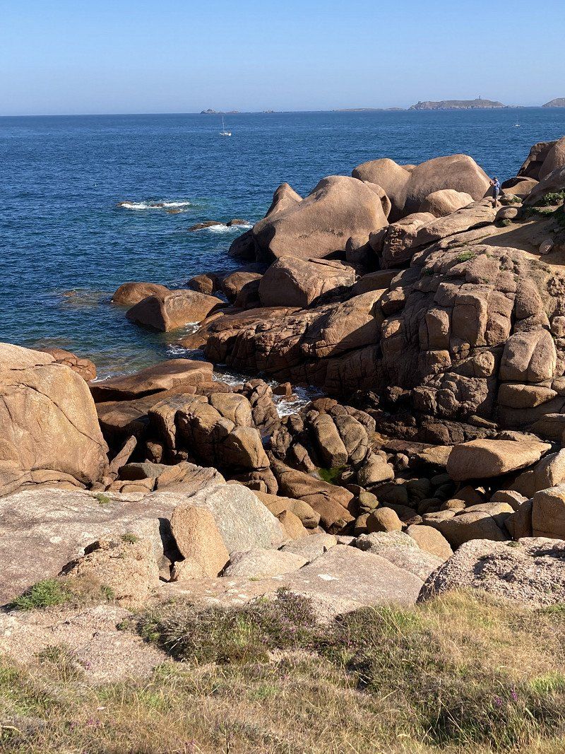
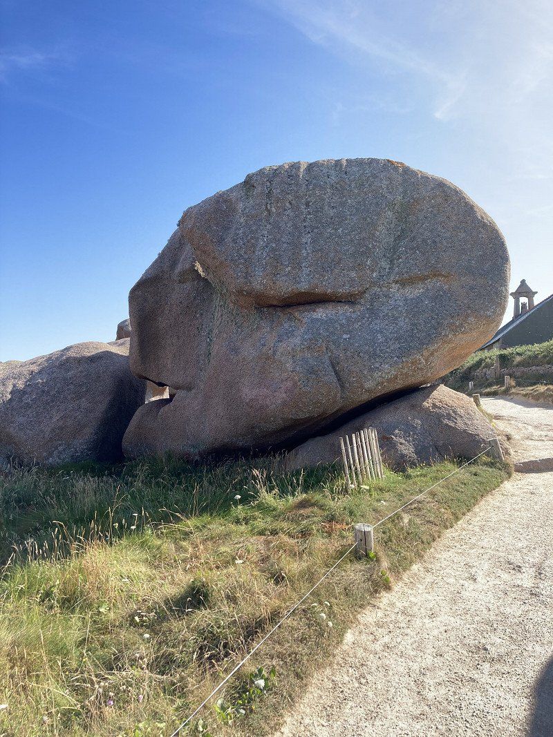
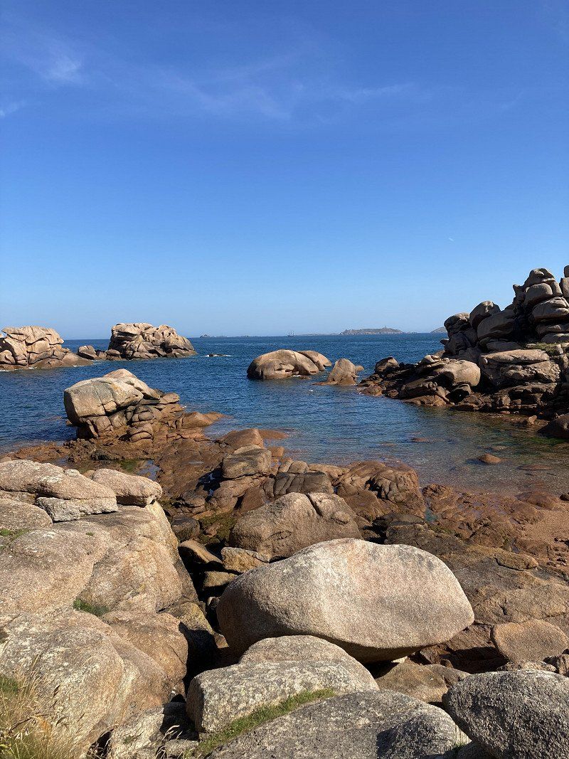
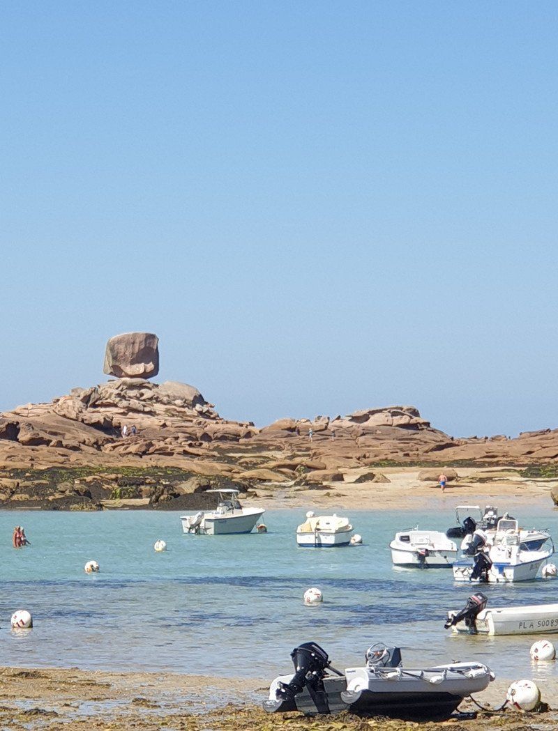
Küste "Granit Rose"
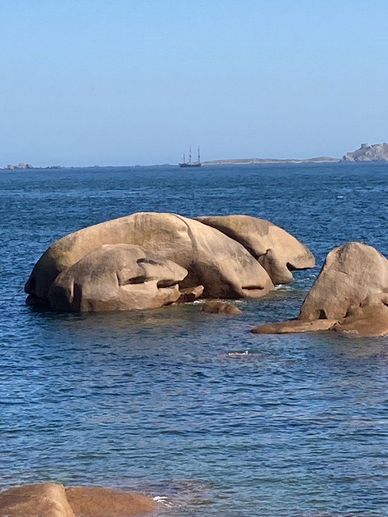
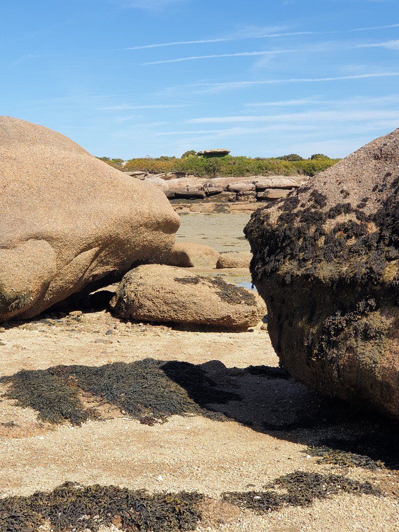
Hike to Ploumanac'h along the "Granit Rose" rocky coast . Huge rounded blocks of granite that were ejected as magma and all around the soft rock was eroded. Thousands of photo opportunities.
Île-Grande, Pleumeur-Bodou
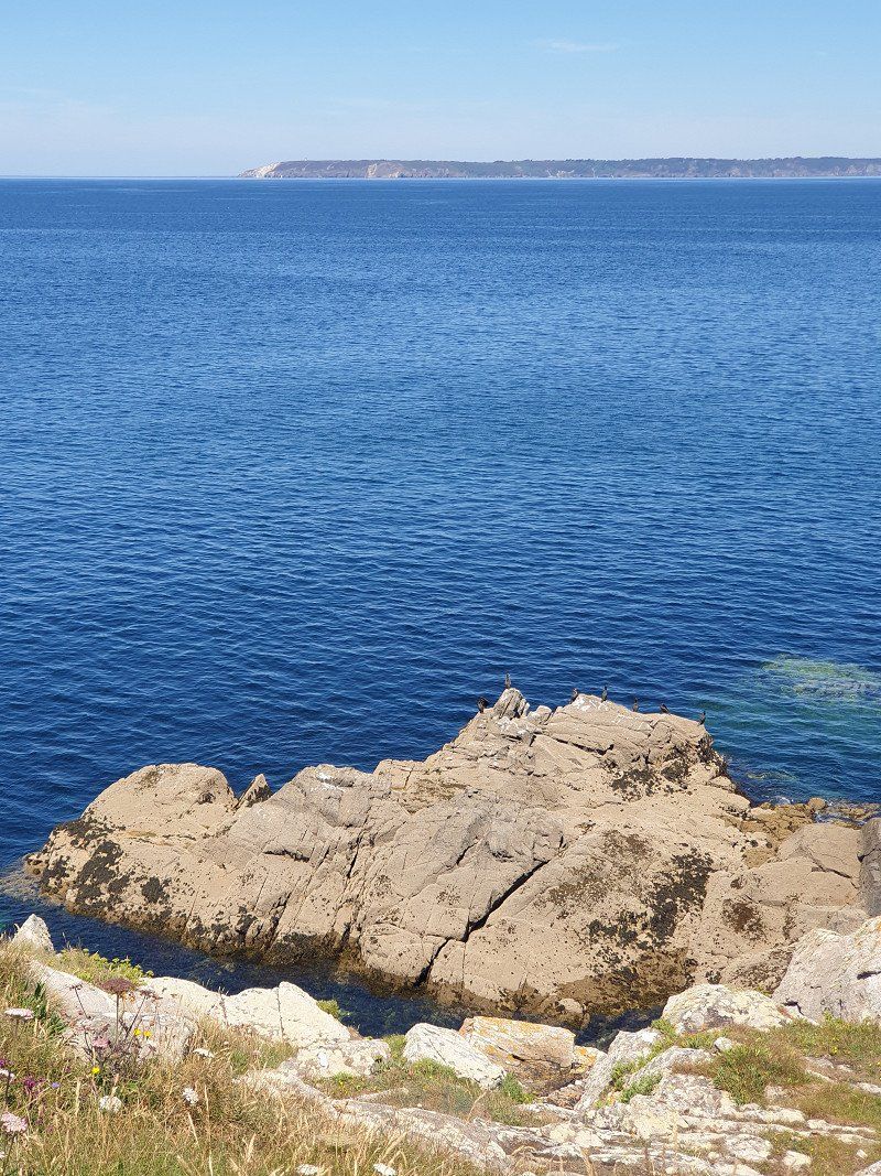
During the low tide, the mussel and crab hunters are out and about.
On the way again a megalithic tomb (14m long) discovered.
Île-Grande, 22560 Pleumeur-Bodou, Frankreich
48° 48' 1" N 3° 34' 22" W
48.8002778 -3.5727778
• Head toward Rue du Roi Arthur on Chemin de la Lande. Go for 30 m.
• Turn right onto Rue du Roi Arthur. Go for 23 m.
• Turn left onto Rue du Pont (D21). Go for 469 m.
• Continue on Rue de l'Île-Grande (D21). Go for 963 m.
• Turn left onto Corniche de Goas Treiz (D788). Go for 5.7 km.
• Pass 2 roundabouts and continue on Rue de Poul Palud (D788). Go for 565 m.
• Take the 3rd exit from roundabout onto Rue de Poul Palud (D788). Go for 985 m.
• Take the 2nd exit from roundabout onto Rue de Poul Palud (D788). Go for 522 m.
• Arrive at Rue de Poul Palud (D788). Your destination is on the right.
☍
9,3 km
( 12 min.)
Strand Coz Pors
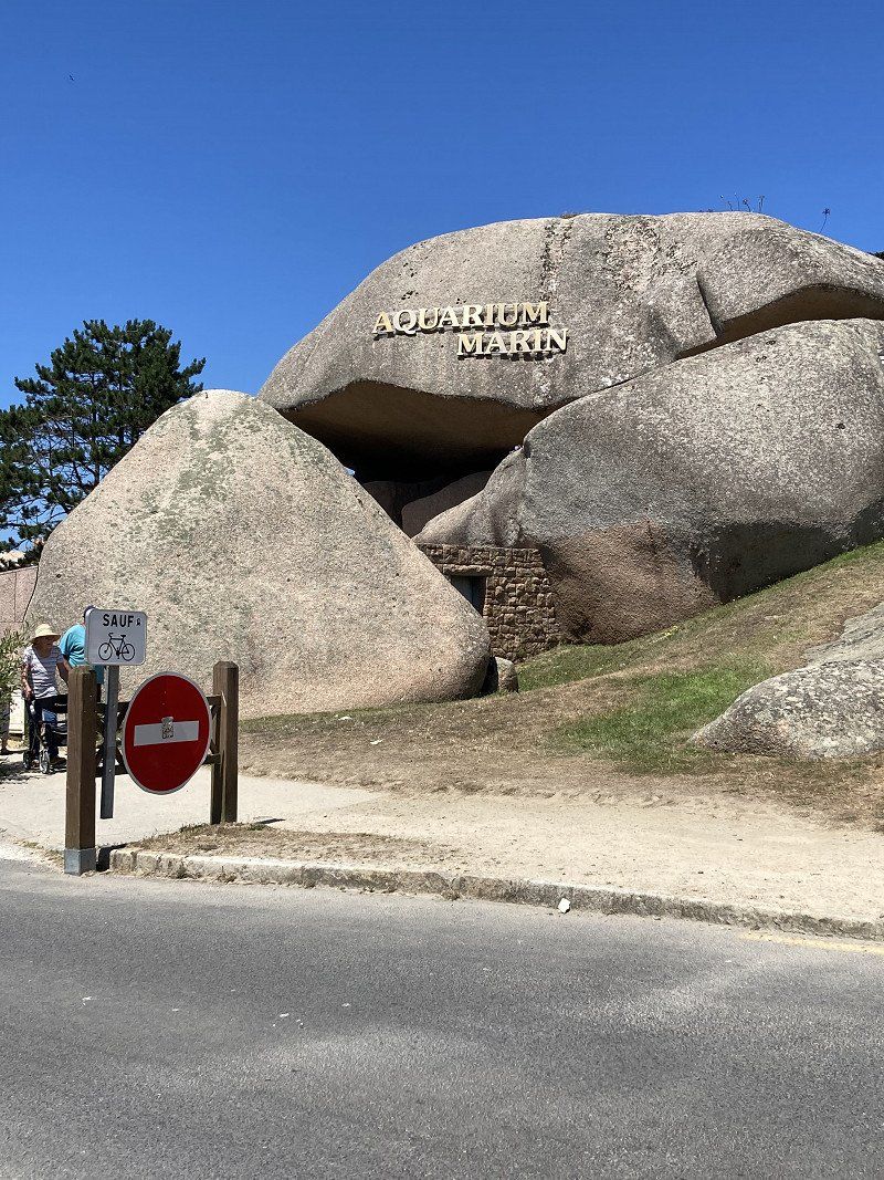
There is a sea aquarium, fine sandy beach and the craziest rock shapes.
22730, Trégastel, France
48° 49' 30.4" N 3° 29' 28.7" W
48.8251000 -3.4913000
• Head toward Chaussée du Port on Rue de Poul Palud (D788). Go for 863 m.
• Keep right onto Rue du Moulin. Go for 35 m.
• Continue on Rue Gabriel Vicaire. Go for 799 m.
• Turn slightly right onto Rue de la Chapelle. Go for 2.0 km.
• Turn right onto Route de Pleumeur-Bodou. Go for 442 m.
• Continue on Route de Pleumeur Bodou. Go for 29 m.
• Continue on Route de Pleumeur-Bodou. Go for 762 m.
• Continue on Route de Pleumeur Bodou. Go for 7 m.
• Continue on Route de Pleumeur-Bodou. Go for 139 m.
• Continue on Route de Perros-Guirec (D6). Go for 865 m.
• Take the 2nd exit from roundabout onto Route de Trégastel (D6). Go for 393 m.
• Keep left onto Route de Trégastel (D6). Go for 3.2 km.
• Take the 3rd exit from Rond-Point de l'Aéroport roundabout onto Avenue Pierre Marzin (D11). Go for 1.3 km.
• Take the 3rd exit from Rond-Point Pégase roundabout onto Rue Saint-Pierre. Go for 474 m.
• Take the 2nd exit from Rond-Point Saint-Pierre roundabout onto Rue Saint-Pierre. Go for 272 m.
• Take the 1st exit from Rond-Point du Rusquet roundabout onto D767. Go for 2.0 km.
• Take the 2nd exit from roundabout onto Route de Perros (D767). Go for 1.4 km.
• Take the 3rd exit from Rond-Point Kroafhent-Tro Boutilh roundabout onto Route de Guingamp (D767) toward St Brieuc/Guingamp/Caouënnec-Lanvézéac/Rospez/Buhulien. Go for 25.8 km.
• Take the 2nd exit from roundabout onto N12 toward St Brieuc/Guingamp-Centre. Go for 32.7 km.
• Take ramp onto Rue de Verdun (D786) toward St-Quay-Portrieux/Pordic/Plérin. Go for 738 m.
• Pass 2 roundabouts and continue on Vieille Côte de Gouët (D786). Go for 3.9 km.
• Take the 2nd exit from roundabout onto Rue des Trois Frères le Goff. Go for 344 m.
• Turn right onto Rue Saint-Jacques. Go for 19 m.
• Turn right onto Rue Quinquaine. Go for 88 m.
• Turn left onto Rue Pohel. Go for 82 m.
• Continue on Place du Général de Gaulle. Go for 43 m.
• Turn right. Go for 43 m.
• Arrive at your destination on the right.
☍
78,7 km
( 55 min.)
Day
Saint-Brieuc
22000 Saint-Brieuc, Frankreich
48° 30' 51" N 2° 45' 57" W
48.5141800 -2.7658350
• Head toward Place du Général de Gaulle. Go for 43 m.
• Turn right onto Place du Général de Gaulle. Go for 40 m.
• Turn left onto Place du Général de Gaulle. Go for 24 m.
• Turn right onto Rue Vicairie. Go for 37 m.
• Turn right onto Rue Vicairie. Go for 226 m.
• Take the 2nd exit from roundabout onto Rue du 71ème Regiment d'Infanterie. Go for 312 m.
• Continue on Place Salvador Allende. Go for 17 m.
• Continue on Rue du 71ème Regiment d'Infanterie. Go for 219 m.
• Continue on Rue du Combat-des-Trente. Go for 12 m.
• Take the 2nd exit from roundabout onto Rue du Combat-des-Trente. Go for 183 m.
• Take the 2nd exit from roundabout onto Boulevard Waldeck-Rousseau. Go for 258 m.
• Take the 1st exit from Place du 8 Mai 1945 roundabout onto Avenue d'Armor. Go for 269 m.
• Continue on Avenue Corneille. Go for 680 m.
• Take ramp onto Avenue de France (N12) toward Rennes/Dinan/Caen/Trégueux/Lamballe/Zone Industrielle. Go for 6.7 km.
• Take ramp onto Rue d'Armorique (D81) toward La Baie/Yffiniac/Hillion/Moncontour. Go for 332 m.
• Take the 4th exit from Rond-Point de la Bourdinière roundabout onto Rue d'Armorique (D81). Go for 364 m.
• Take the 3rd exit from Rond-Point de Wackersberg roundabout onto Rue de Penthièvre (D81). Go for 510 m.
• Take the 1st exit from roundabout onto Rue Monseigneur Le Mée (D712). Go for 306 m.
• Take the 1st exit from roundabout onto Rue Monseigneur Le Mée (D712). Go for 741 m.
• Take the 3rd exit from roundabout onto Rue de Licellion (D80). Go for 1.4 km.
• Continue on D80. Go for 1.8 km.
• Continue on Rue Bel-Orient (D80). Go for 86 m.
• Turn right onto Place Ballabio. Go for 98 m.
• Continue on Rue Olivier Provost. Go for 507 m.
• Continue on Route de Lermot. Go for 1.1 km.
• Turn slightly left onto Rue de Trégot. Go for 761 m.
• Continue on Rue de Trégot. Go for 77 m.
• Arrive at Rue de Trégot. Your destination is on the left.
☍
17,0 km
( 22 min.)
Aire municipal pour Camping-cars, Lermont
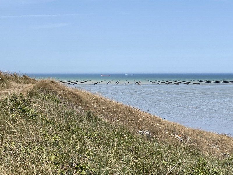
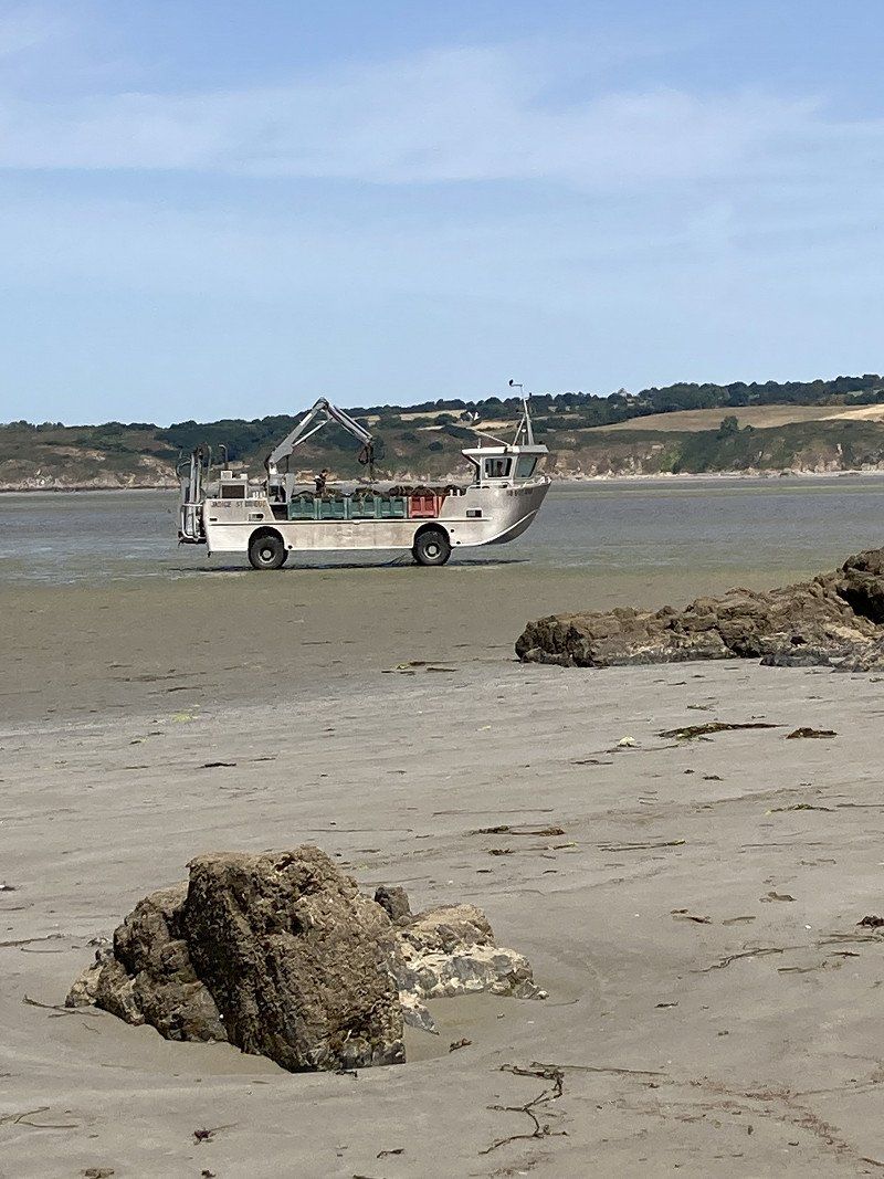
Free parking lot where overnight stays are allowed (but no camping chairs etc. outside). We're right on the cliffs.
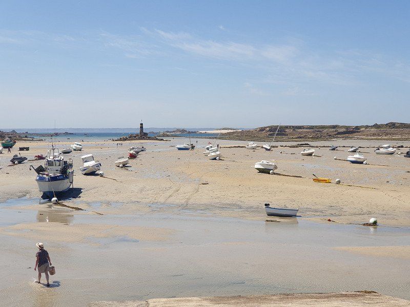
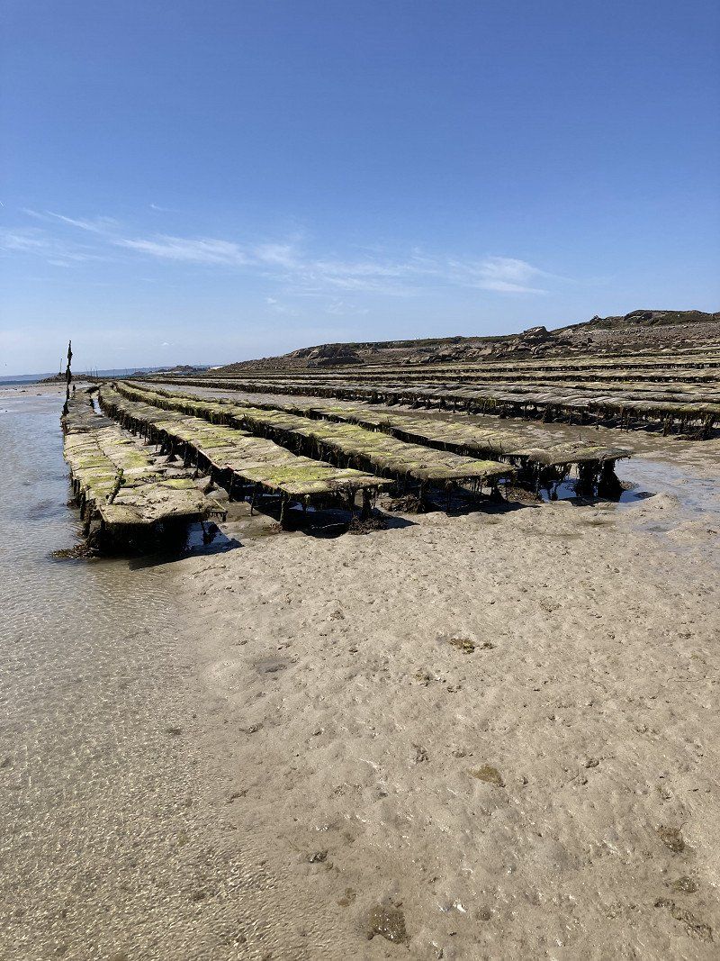
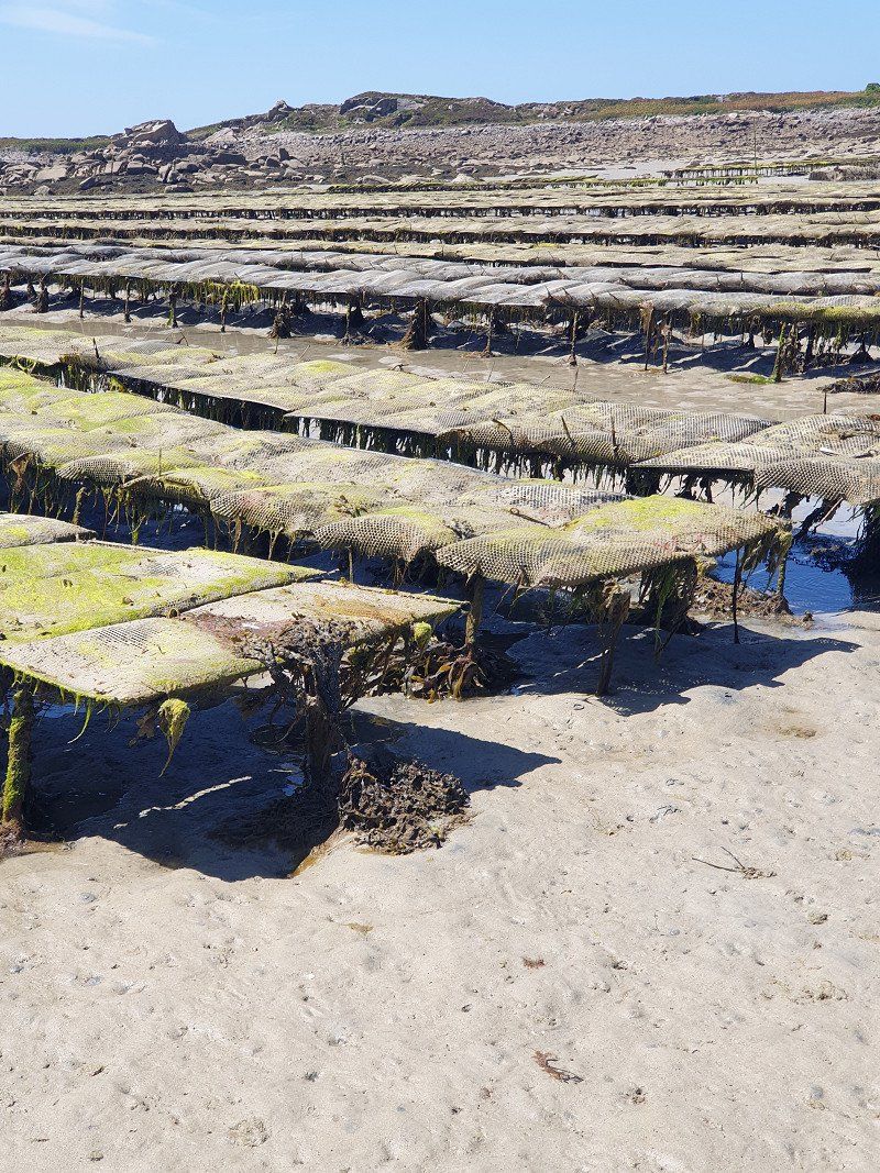
At low tide the sea is far, far out and the oyster beds are dry. We watch the farmers as they drive out in tractors and amphibious vehicles and harvest the oysters.
Rue de Tregot, 22120, Hillion, France
48° 31' 50" N 2° 39' 53" W
48.5305556 -2.6647222
• Head southwest on Rue de Trégot. Go for 522 m.
• Turn slightly right onto Route de Lermot. Go for 1.1 km.
• Continue on Rue Olivier Provost. Go for 309 m.
• Turn right onto Rue de la Gravelle. Go for 179 m.
• Turn slightly right onto Place de l'Église (D80). Go for 25 m.
• Turn slightly left onto Rue Bel-Orient (D80). Go for 43 m.
• Turn right onto Place Ballabio (D80). Go for 31 m.
• Continue on Rue Bel-Orient (D80). Go for 110 m.
• Continue on D80. Go for 1.8 km.
• Continue on Rue de Licellion (D80). Go for 1.3 km.
• Take the 3rd exit from roundabout onto Rue Monseigneur Le Mée (D712). Go for 172 m.
• Turn right onto Rue Louis Marteil (D80/D712). Go for 660 m.
• Continue on Rue de la Clôture (D80). Go for 681 m.
• Take the 1st exit from roundabout onto Avenue d'Armorique (D81). Go for 561 m.
• Turn right toward N12. Go for 362 m.
• Continue on N12. Go for 83.3 km.
• Keep left onto N12 toward Rocade Nord/Paris/Caen/Le Mans. Go for 1.9 km.
• Take ramp onto Rocade Ouest (N136). Go for 9.1 km.
• Keep left onto Rocade Est (N136) toward Le Mans/Thorigné-Fouillard. Go for 5.1 km.
• Take left ramp onto N157 toward Laval/Le Mans/Noyal S/V./Vitré. Go for 41.2 km.
• Keep left onto A81. Go for 93.3 km.
• Take the left exit toward Paris/Tours/A28/Alençon/Le Mans-Z.I. Nord onto A11 (L'Océane). Go for 150 km.
• Continue on A10 (L'Aquitaine). Go for 22.2 km.
• Take the exit toward A6/A4/Metz/Nancy/Évry/Linas/Montlhéry/Arpajon onto N104 (La Francilienne). Go for 17.9 km.
• Take left ramp onto N104. Go for 766 m.
• Keep right onto N104 toward A6/Lyon/Troyes/Metz/Nancy/Corbeil-Essonnes/Sénart. Go for 3.3 km.
• Take ramp onto A6 (Autoroute du Soleil) toward Fontainebleau/Lyon. Go for 126 km.
• Take exit 19 toward Auxerre/Monéteau/Z.A. Macherin. Go for 838 m.
• Take the 3rd exit from Rond-Point de l'Europe roundabout onto Avenue de l'Europe (D319) toward Monéteau. Go for 319 m.
• Take the 1st exit from roundabout onto Avenue de l'Europe (D319). Go for 441 m.
• Turn left onto Avenue de Paris (D319). Go for 1.2 km.
• Take the 2nd exit from roundabout onto Rue de Sommeville (D158). Go for 681 m.
• Continue on Place de la Mairie (D158). Go for 63 m.
• Turn left onto Rue d'Auxerre (D84). Go for 193 m.
• Turn left onto Rue de l'Abreuvoir. Go for 139 m.
• Turn left onto Rue de l'Abreuvoir. Go for 82 m.
• Continue on Rue de Gurgy. Go for 70 m.
• Continue on Rue de Gurgy. Go for 340 m.
• Turn slightly right onto Rue de Gurgy. Go for 234 m.
• Continue on Chemin de Monéteau. Go for 364 m.
• Continue on Chemin Rural de Gurgy à Monéteau. Go for 71 m.
• Continue on Route de Monéteau. Go for 436 m.
• Turn right onto Quai des Fontaines. Go for 1.1 km.
• Arrive at Quai des Fontaines. Your destination is on the right.
☍
568,9 km
(5 hrs. )
Day
Aire Service de Camping-cars
Rue du Halage, 89250, Gurgy, France
47° 51' 48" N 3° 33' 13" E
47.8633333 3.5536111
• Head southwest on Quai des Fontaines. Go for 1.1 km.
• Turn left toward Route de Monéteau. Go for 59 m.
• Continue on Route de Monéteau. Go for 377 m.
• Continue on Chemin Rural de Gurgy à Monéteau. Go for 71 m.
• Continue on Chemin de Monéteau. Go for 364 m.
• Continue on Rue de Gurgy. Go for 644 m.
• Turn slightly right onto Rue de Gurgy. Go for 228 m.
• Continue on Chemin de Halage. Go for 231 m.
• Turn right onto Rue d'Auxerre (D84). Go for 1.2 km.
• Take the 2nd exit from Rond-Point du 19 Mars 1962 roundabout onto Rue d'Auxerre (D84). Go for 1.8 km.
• Take the 2nd exit from roundabout onto Avenue Jean Mermoz (N77) toward Z.I. Champoulains/Auxerrexpo/Nevers/Auxerre Centre/Z.I. les Champoulains. Go for 870 m.
• Keep right onto Rue Denis Papin. Go for 399 m.
• Continue on Rue du Moulin du Président. Go for 1.0 km.
• Turn right onto Avenue Bourbotte. Go for 70 m.
• Take the 1st exit from roundabout onto Place Lamartine. Go for 250 m.
• Take the 4th exit from roundabout onto Quai de la Marine. Go for 260 m.
• Continue on Place Saint-Nicolas. Go for 17 m.
• Continue on Quai de la Marine. Go for 149 m.
• Arrive at Quai de la Marine. Your destination is on the right.
☍
9,2 km
( 14 min.)
Day
Auxerre
Very beautiful city on the Yonne. Marked tour through the old town with the 3 big churches.
Auxerre, Frankreich
47° 47' 53.5" N 3° 34' 25.6" E
47.7982020 3.5737810
• Head toward Rue Lebeuf on Quai de la Marine. Go for 34 m.
• Continue on Quai de la République. Go for 391 m.
• Turn left onto Pont Paul Bert (N151). Go for 109 m.
• Take the 2nd exit from roundabout onto Avenue Gambetta (D965). Go for 265 m.
• Turn right onto Avenue du Maréchal Juin (D965) toward A6 (Sud)/Chaumont/Dijon/Chalon S/Saône/Avallon. Go for 1.6 km.
• Take the 3rd exit from roundabout onto Route de Chablis (N65) toward A6/Dijon/Chalon S/S./Chaumont/Chablis/Tonnerre. Go for 4.8 km.
• Take the 2nd exit from roundabout onto A6 (Autoroute du Soleil) toward Lyon/Chalon S/S./Dijon. Go for 138 km.
• Take the exit toward A36/Besançon/Dijon onto A31. Go for 5.0 km.
• Take the exit toward Mulhouse/Besançon/Dole onto A36 (La Comtoise). Go for 164 km.
• Keep left onto A36 (La Comtoise) toward Strasbourg/Mulhouse/Belfort/Montbéliard. Go for 63.5 km.
• Take the exit toward Basel/Aéroport Euroairport onto Échangeur de Bâle-Mulhouse. Go for 1.5 km.
• Continue on A35. Go for 25.3 km.
• Continue on A3. Go for 16.0 km.
• Keep right onto A2 (Verzweigung Augst) toward Chiasso/Gotthard/Luzern/Bern/Arisdorf. Go for 9.4 km.
• Take exit 11 toward Sissach onto A22. Go for 707 m.
• Turn right onto Netzenstrasse. Go for 99 m.
• Take the 2nd exit from roundabout onto Netzenstrasse. Go for 204 m.
• Continue on Hauptstrasse. Go for 839 m.
• Arrive at Hauptstrasse. Your destination is on the left.
☍
431,2 km
(3 hrs. 44 min.)
Sissach, Schweiz
4450 Sissach, Schweiz
47° 27' 51.8" N 7° 48' 38.4" E
47.4643945 7.8106610