Travel focus: discover as much as possible in 8 weeks
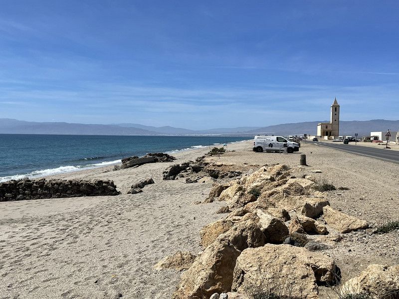
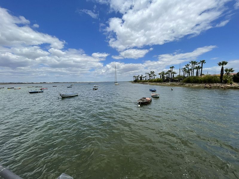
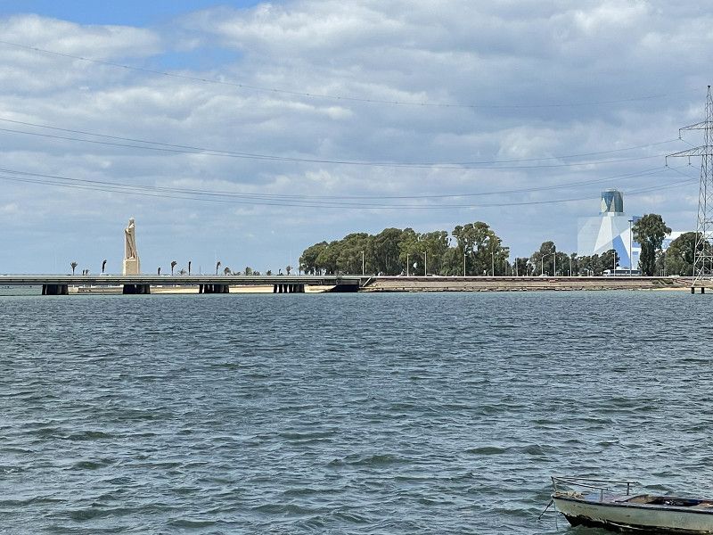
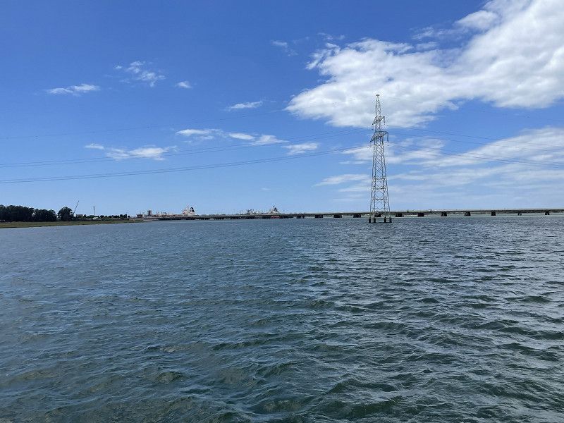
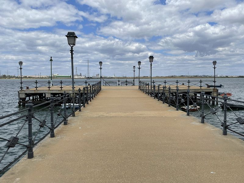
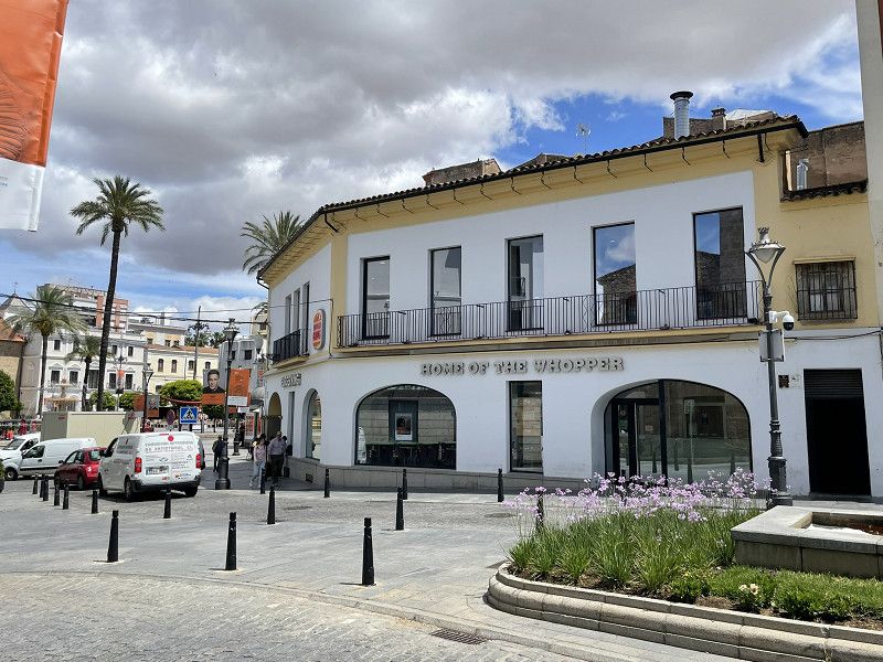
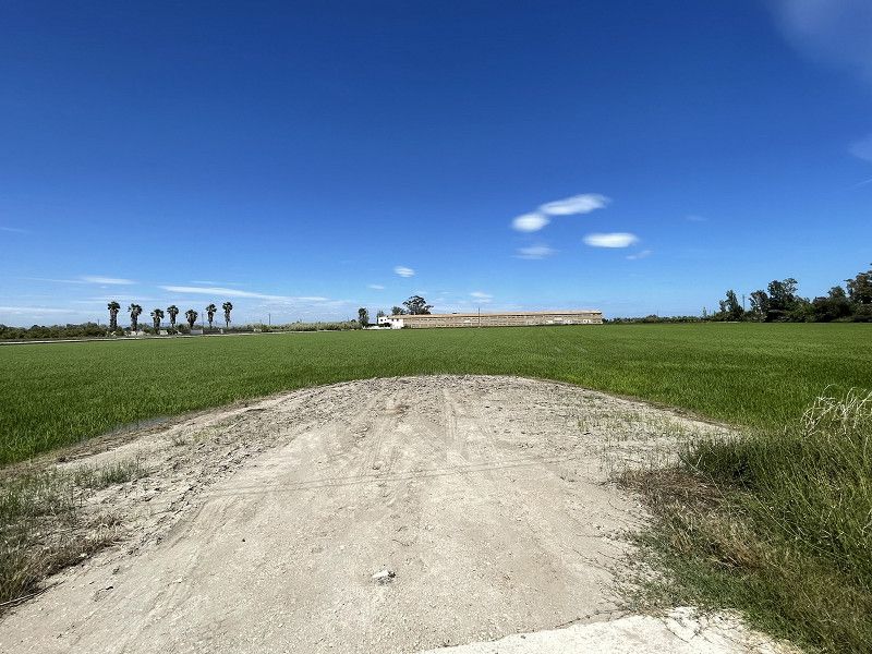
Crossing Switzerland and France as quickly as possible, then short stages along the Costa Brava, Costa Dorada, Costa del Azahar, Gulf of Valencia, Costa Blanca, Costa Calida, Costa des Sol, Costa de la Luz with a return journey through the interior of the country.
Day
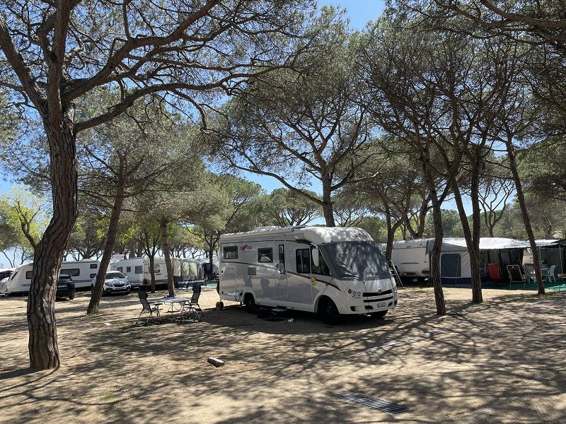
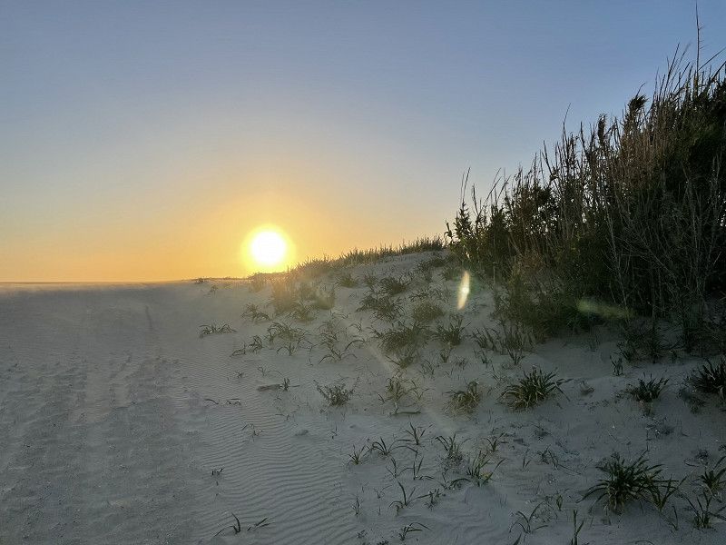
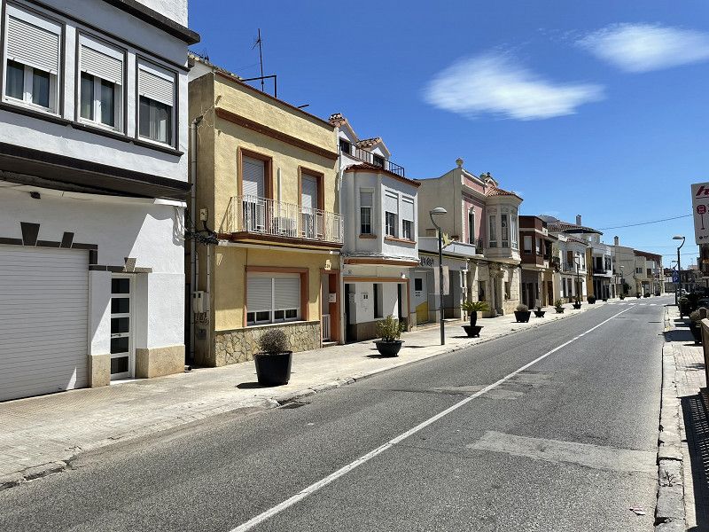
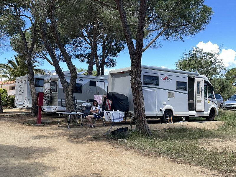
Grabs - Bursins
Werdenstrasse, Grabs, Wahlkreis Werdenberg, St. Gallen, Schweiz
47° 10' 57.2" N 9° 26' 39.9" E
47.1825595 9.4444280
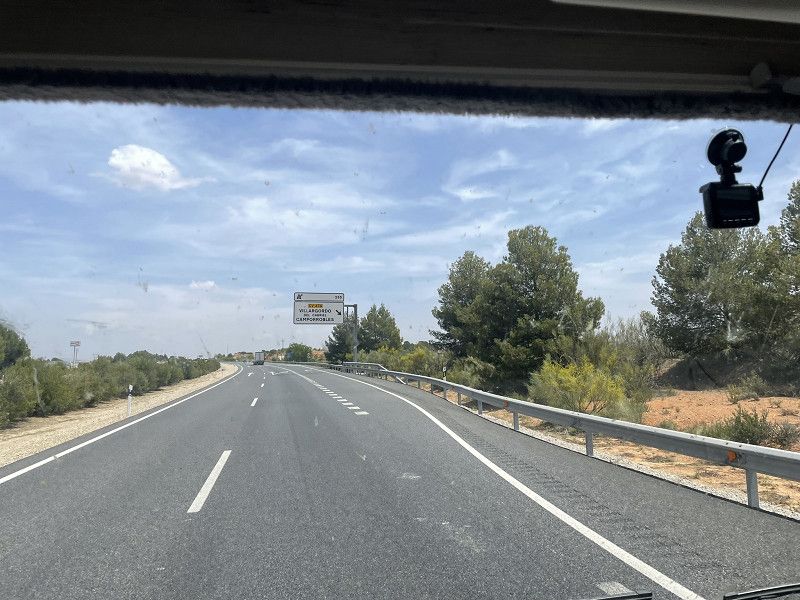
• Head toward Lindenweg on Werdenstrasse. Go for 2.0 km.
• Turn right onto Sankt Gallerstrasse (13). Go for 857 m.
• Take the 2nd exit from roundabout onto Langäulistrasse. Go for 739 m.
• Continue on Güterstrasse. Go for 130 m.
• Continue on Langäulistrasse. Go for 1.3 km.
• Continue straight ahead. Go for 63 m.
• Keep left toward A13. Go for 42 m.
• Take the 2nd exit from roundabout toward Chur/Zürich/Sargans. Go for 33 m.
• Take ramp onto A13. Go for 16.6 km.
• Take exit 11 toward Zürich/Sargans/Mels onto A3. Go for 88.8 km.
• Take exit 32 toward Flughafen/Bern/Basel/St. Gallen/Westring-Zürich onto A3. Go for 5.5 km.
• Take left exit 31 toward Bern/Basel/St. Gallen/Flughafen/Westring-Zürich onto A3/A4. Go for 10.0 km.
• Take the left exit toward Bern/Basel onto A1/A3. Go for 16.5 km.
• Continue on A1 (Verzweigung Birrfeld) toward Bern/Aarau/Mägenwil. Go for 40.6 km.
• Continue on A1 (Härkingen) toward E25/Lausanne/Bern/Biel/Bienne/Oensingen. Go for 50.8 km.
• Take the exit toward Lausanne/Fribourg/Neuchâtel/Bern-Neufeld onto A1 (Wankdorf). Go for 99.8 km.
• Continue on A1. Go for 2.7 km.
• Take the exit toward Genève onto A1. Go for 27.6 km.
• Take exit 12 toward Gland/Begnins. Go for 428 m.
• Turn left toward Avenue du Mont-Blanc. Go for 44 m.
• Continue on Avenue du Mont-Blanc. Go for 22 m.
• Take left ramp onto A1 toward Lausanne. Go for 3.7 km.
• Keep right. Go for 29 m.
• Keep left. Go for 147 m.
• Arrive at your destination on the left.
☍
368,4 km
(3 hrs. 24 min.)
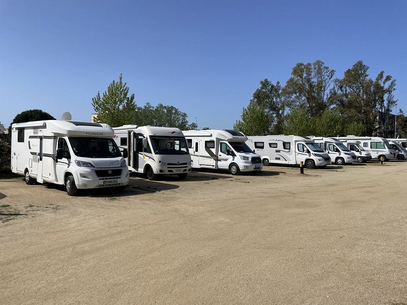
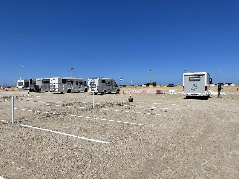
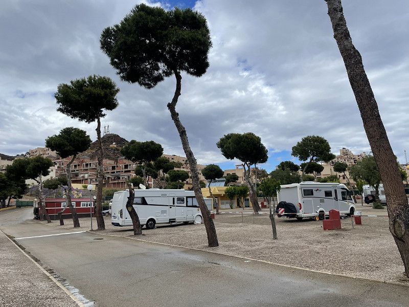
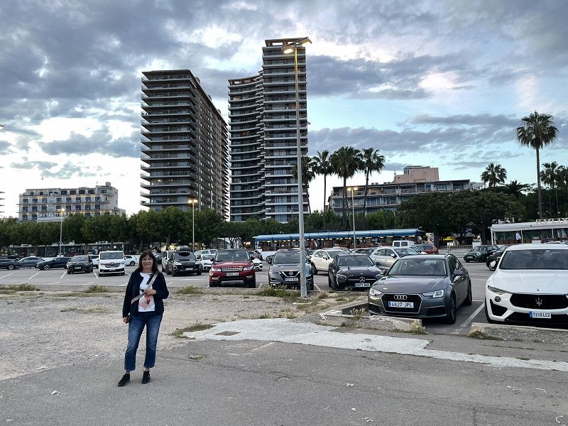
Grabs - Bütschwil - Bursins
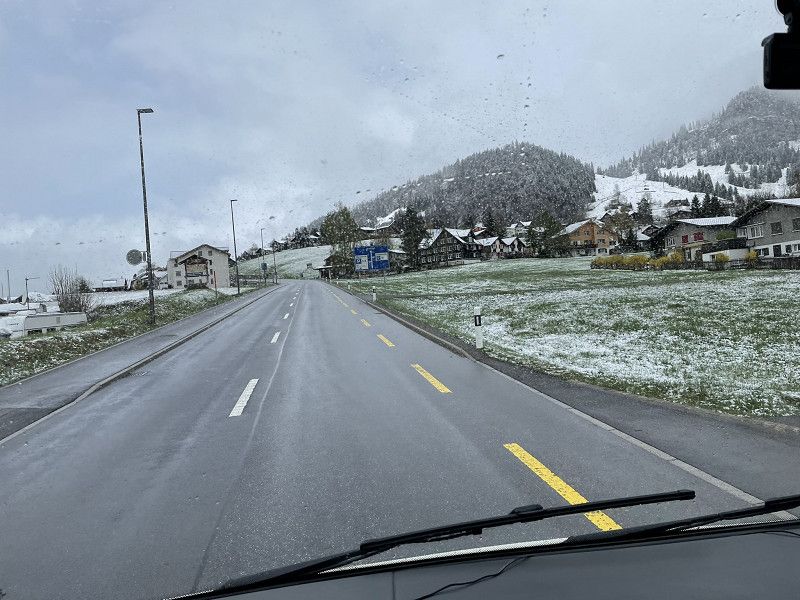
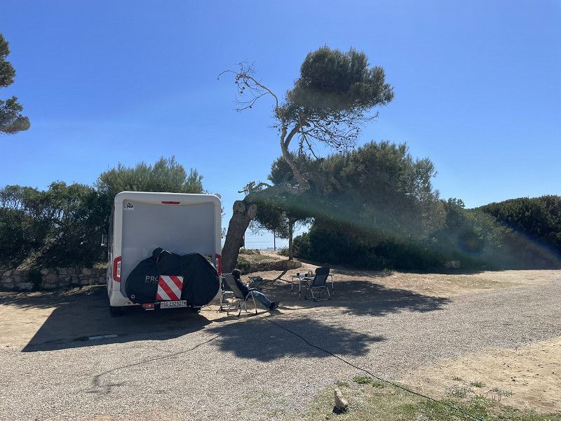
During the departure planned for 11 a.m. on 10.4.24 (in snowfall) we had to realize
that the refrigerator did not work "on gas".
So we had to visit the dealer and lose two hours of time. But he was able to help us...
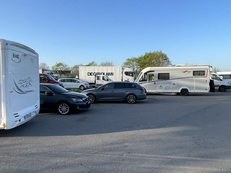
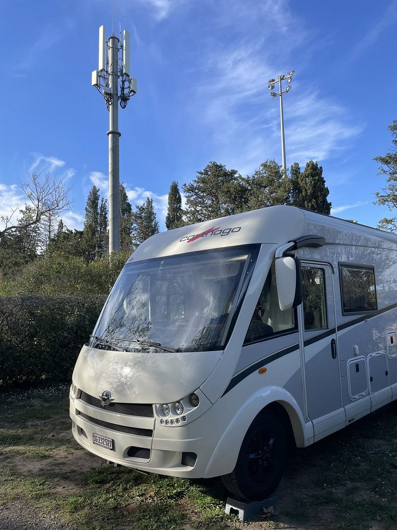
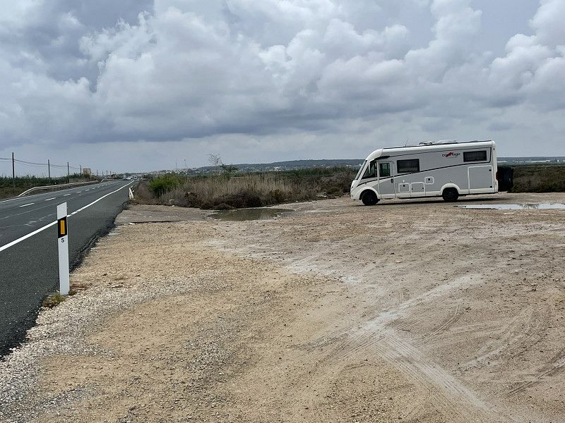
Unfortunately, we didn't get as far as planned on the first day and decided - as we were still in Switzerland - to spend the night at a motorway service station
Aire de La Cote, A1 Genf - Lausanne
District de Nyon, Waadt, Schweiz
46° 26' 43.1" N 6° 17' 50.5" E
46.4453136 6.2973725
• Head northeast. Go for 378 m.
• Continue on A1. Go for 2.8 km.
• Take exit 13 toward Gimel. Go for 357 m.
• Continue toward Mont s/Rolle/Gimel/Z. A. La Pièce. Go for 27 m.
• Turn left toward Mont s/Rolle/Gimel/Z. A. La Pièce. Go for 43 m.
• Continue on Route de la Vallée toward Mont s/Rolle/Gimel/Z. A. La Pièce. Go for 76 m.
• Turn left toward Genève. Go for 30 m.
• Take ramp onto A1 toward Genève. Go for 44.5 km.
• Continue on A41. Go for 71.5 km.
• Continue on A43. Go for 46.9 km.
• Take the exit toward Marseille/Valence/Grenoble onto A48. Go for 42.0 km.
• Take the exit toward Marseille/Valence onto A49. Go for 60.7 km.
• Continue on N532. Go for 10.6 km.
• Continue on E713. Go for 240 m.
• Continue on N7. Go for 9.5 km.
• Keep left onto E713 toward E15/A7/Marseille/Montélimar/Privas/Lyon. Go for 405 m.
• Keep left onto Échangeur de Valence-Sud (E713) toward Marseille/Avignon/Montélimar/Privas. Go for 153 m.
• Take ramp onto A7 (Autoroute du Soleil). Go for 93.0 km.
• Keep right onto A9 (Échangeur d'Orange) toward Barcelone/Toulouse/Montpellier/Nîmes. Go for 241 km.
• Take exit 41 toward Perpignan-Centre/Canet en Roussillon/Le Barcarès/Aéroport Rivesaltes onto D83. Go for 1.0 km.
• Take the 3rd exit from roundabout onto D83 toward Narbonne/Perpignan/Canet en Roussillon/Le Barcarès/Salses le Château/Aéroport Rivesaltes. Go for 167 m.
• Take ramp onto D900 toward Perpignan. Go for 1.1 km.
• Take ramp toward Rivesaltes-Centre. Go for 129 m.
• Continue on D614. Go for 396 m.
• Continue on Avenue de la Côte Vermeille (D614). Go for 878 m.
• Take the 3rd exit from roundabout onto Avenue Maréchal Juin. Go for 279 m.
• Take the 2nd exit from roundabout onto Avenue Maréchal Leclerc. Go for 169 m.
• Turn left onto Rue des Yvelines. Go for 77 m.
• Arrive at Rue des Yvelines.
☍
628,6 km
(5 hrs. 35 min.)
Day
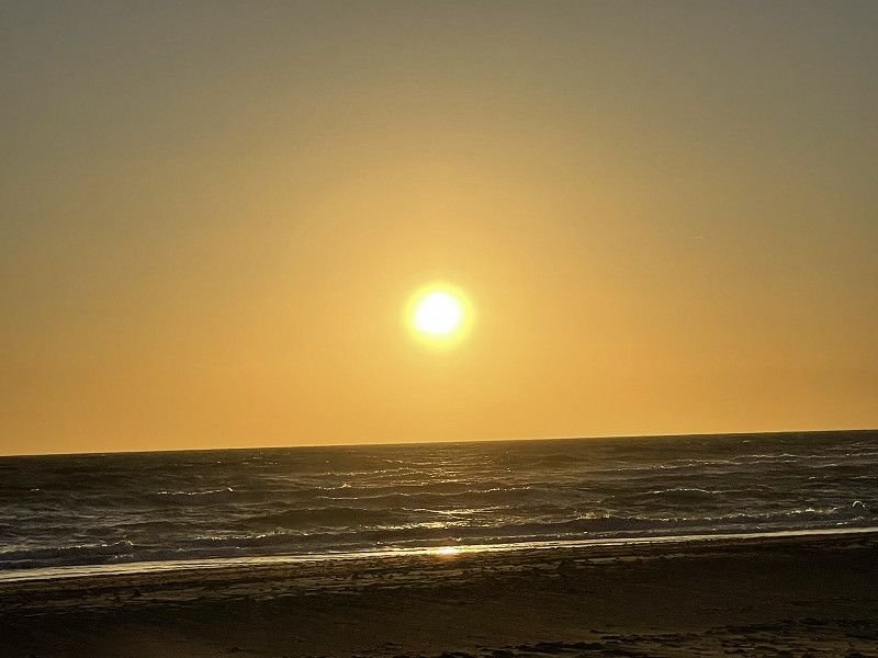
Rivesaltes F
Continue from the La Cote motorway service station in Bursins to the South of France, precisely at the Aires ANAS de Rivesaltes campsite. (very quiet, cheap but outdated sanitary facilities.
Worked well for one night.
Rue des Yvelines
Ostpyrenäen, Okzitanien, Frankreich
42° 46' 3.8" N 2° 52' 57" E
42.7677085 2.8824891
• Head toward Avenue Maréchal Leclerc on Rue des Yvelines. Go for 77 m.
• Turn right onto Avenue Maréchal Leclerc. Go for 140 m.
• Take the 2nd exit from roundabout onto Avenue Maréchal Juin. Go for 268 m.
• Take the 2nd exit from roundabout onto Avenue de la Côte Vermeille (D614). Go for 902 m.
• Continue on D614. Go for 398 m.
• Take ramp onto D900 toward Perpignan. Go for 8.1 km.
• Keep left onto D900 toward A9 (Gérone)/Gérone/Argelès sur Mer/Thuir. Go for 2.3 km.
• Take the 2nd exit from roundabout onto Rocade Ouest (D900) toward A9/Gérone/Argelès sur Mer/Thuir. Go for 931 m.
• Keep right onto Rocade Ouest toward A9/Thuir. Go for 172 m.
• Continue on D900 A. Go for 609 m.
• Take the 3rd exit from Giratoire du Pont Trencat roundabout onto Camí de la Sal (D612 A) toward A9/Andorre la V./Narbonne/Perpignan-Centre/Prades/Gd St Charles. Go for 289 m.
• Take the 2nd exit from Rond-Point de l'Euro-Méditerranée roundabout toward Barcelone/Gérone/Le Boulou/Narbonne. Go for 361 m.
• Take ramp onto A9 (La Catalane) toward Barcelone/Gérone/Le Boulou. Go for 25.7 km.
• Continue on AP-7 (Autopista de la Mediterrània). Go for 20.3 km.
• Take exit 3 toward Figueres N./Roses/Figueres/Girona/Barcelona/Olot/Ripoll. Go for 391 m.
• Take the 3rd exit from roundabout onto N-2 toward Figueres/Girona/Barcelona. Go for 5.4 km.
• Take ramp onto Carretera de Roses (C-260) toward Roses. Go for 1.6 km.
• Pass 2 roundabouts and continue on C-260. Go for 3.4 km.
• Take the 3rd exit from roundabout onto C-260 toward Castelló d'Empúries/Roses/Cadaqués. Go for 1.9 km.
• Take the 4th exit from roundabout onto C-260 toward Roses/Cadaqués. Go for 1.8 km.
• Take the 4th exit from roundabout onto C-260 toward Empuriabrava/Roses/Cadaqués. Go for 2.0 km.
• Pass 5 roundabouts and continue on Carretera de Besalú a Roses (C-260). Go for 5.5 km.
• Take the 3rd exit from roundabout onto Carretera de Besalú a Roses (C-260) toward Centre Ciutat. Go for 172 m.
• Arrive at Carretera de Besalú a Roses (C-260). Your destination is on the right.
☍
82,5 km
( 57 min.)
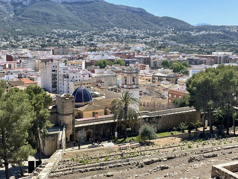
Day
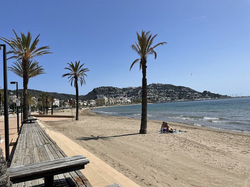
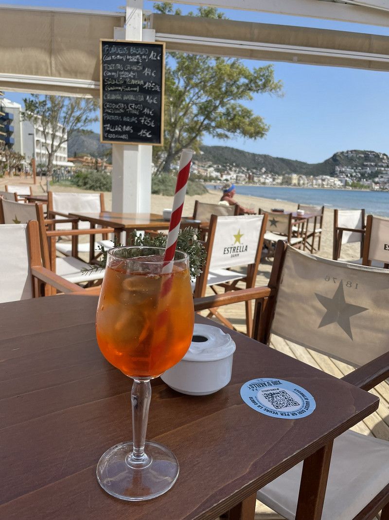
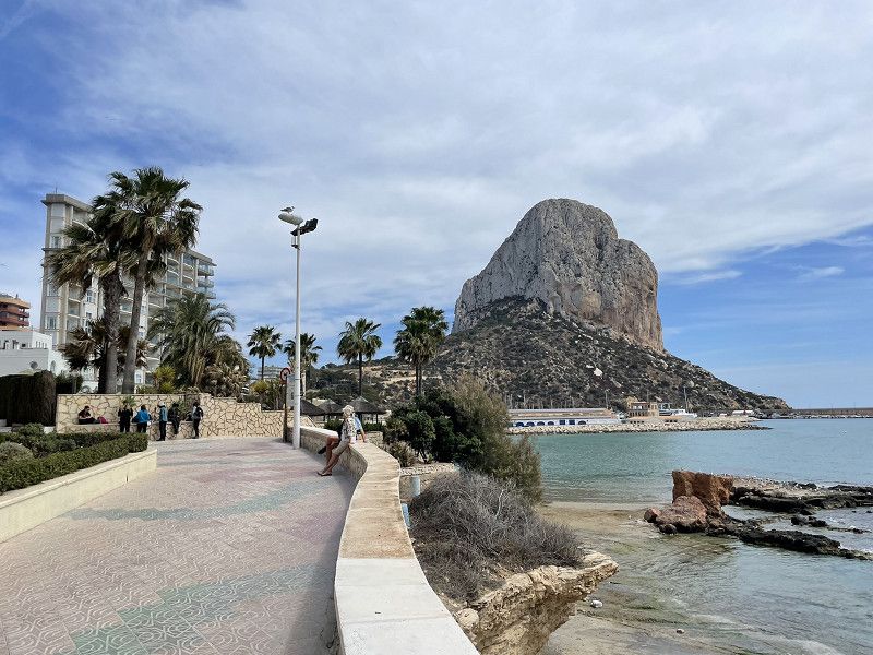
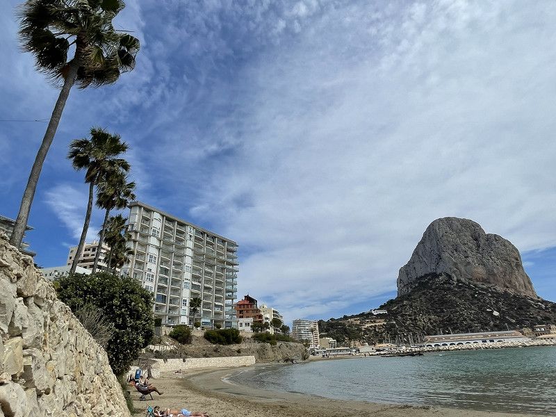
Roses SP
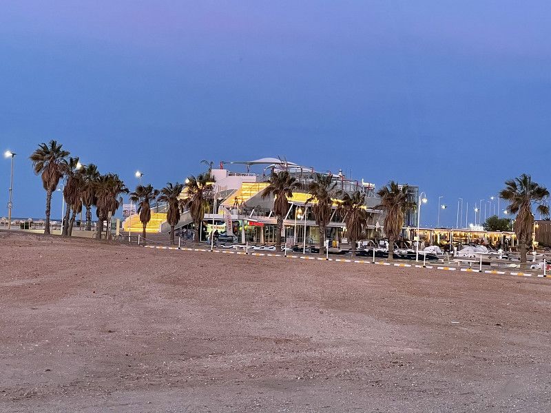
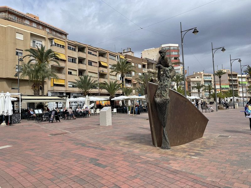
Continue across the Spanish border at La Jonquera
and immediately took the exit towards Roses.
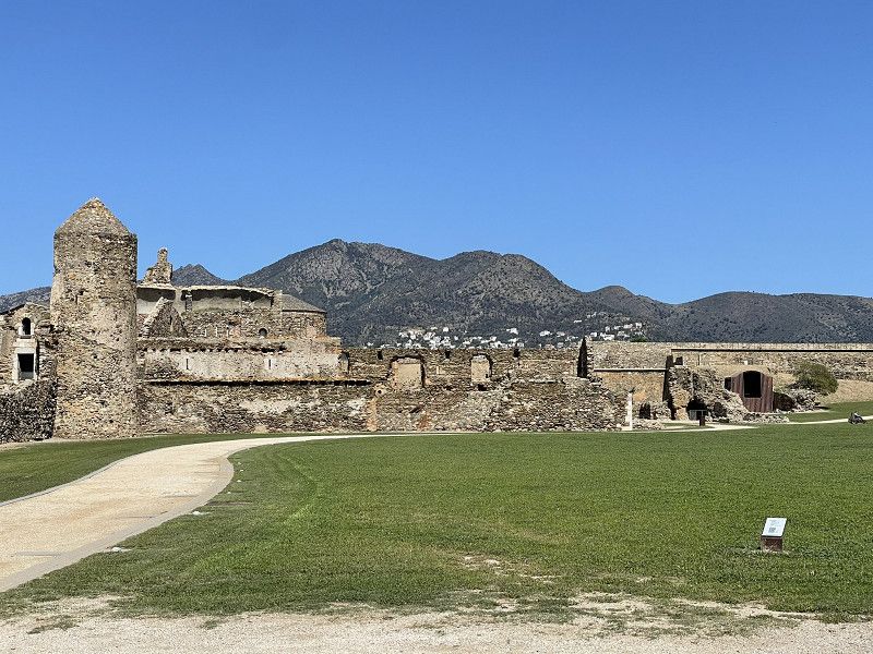
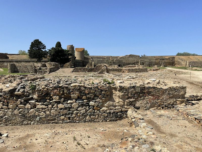
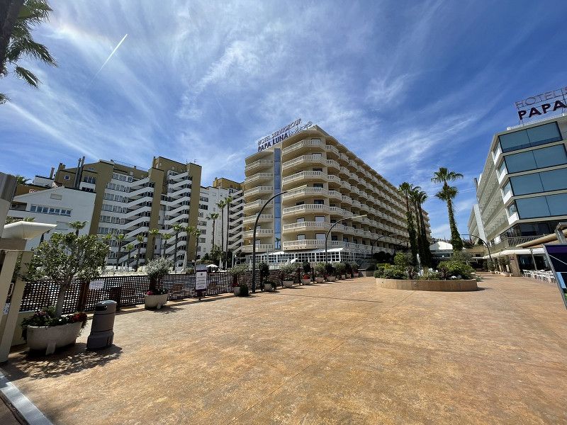
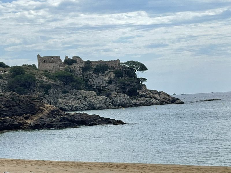
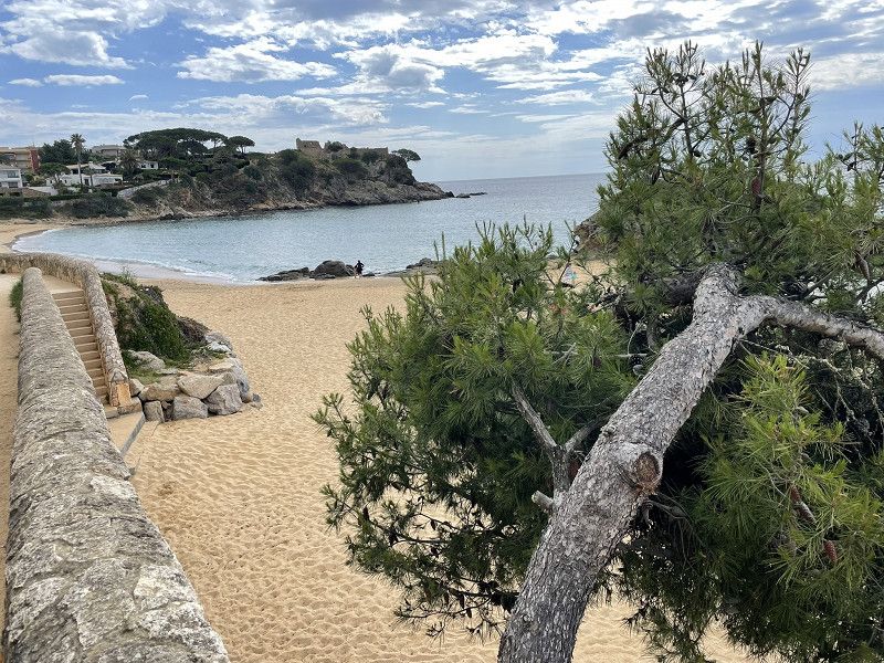
Autocaravaning Park Roses pitch. Arrived at 10:30 am and by 11 am the pitch was already full. Great location for visiting the fortress "La Cintadella", otherwise the pitch would not be our favorite (no shade, sanitary facilities so-so)
Afternoon: walk to the Citadella and the promenade for Aperol and tapas. Spain - here we come!
Autocaravaningpark Roses
Carrer del Port de Reig 65, roses, Oberampurien, Katalonien, Spanien
42° 16' 6.8" N 3° 9' 24.1" E
42.2685517 3.1566806
• Head toward Avinguda del Salatar on Carretera de Besalú a Roses (C-260). Go for 577 m.
• Take the 4th exit from roundabout onto Carretera de Besalú a Roses (C-260) toward Santa Margarida/Figueres/Girona/AP-7/N-2. Go for 787 m.
• Take the 2nd exit from roundabout onto Carretera de Besalú a Roses (C-260) toward AP-7/Figueres/Girona/Sta. Margarida. Go for 655 m.
• Take the 3rd exit from roundabout onto Carretera de Besalú a Roses (C-260) toward AP-7/Empuriabrava/Figueres/Girona. Go for 1.1 km.
• Pass 5 roundabouts and continue on C-260. Go for 7.4 km.
• Take the 4th exit from roundabout onto Carretera Castelló (GIV-6213) toward Fortià. Go for 2.8 km.
• Take the 2nd exit from roundabout onto GI-8594 toward Vilamalla. Go for 3.3 km.
• Take the 3rd exit from roundabout. Go for 169 m.
• Take the 1st exit from roundabout onto C-31 toward AP-7/Figueres/Empordà Internacional. Go for 1.8 km.
• Take the 2nd exit from roundabout onto C-31 toward Sta. Llogaia d'Àlguema/Figueres. Go for 812 m.
• Take the 2nd exit from roundabout onto N-2A toward AP-7/Girona/Barcelona. Go for 1.3 km.
• Take the 2nd exit from roundabout onto N-2A toward Girona. Go for 557 m.
• Take the 1st exit from roundabout toward Barcelona/Girona. Go for 891 m.
• Take left ramp onto AP-7 (Autopista de la Mediterrània) toward Girona/Barcelona. Go for 31.3 km.
• Take exit 6B toward Girona O./Sant Gregori. Go for 912 m.
• Take the 3rd exit from Rotonda de Domeny roundabout onto Carrer de Sant Gregori (GI-531) toward Girona. Go for 663 m.
• Turn right toward Carrer de la Riera Bullidors. Go for 117 m.
• Turn right onto Carrer de la Riera Bullidors. Go for 29 m.
• Arrive at Carrer de la Riera Bullidors. Your destination is on the right.
☍
55,2 km
( 42 min.)
Day
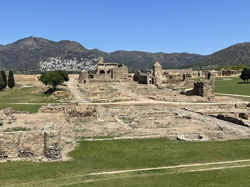
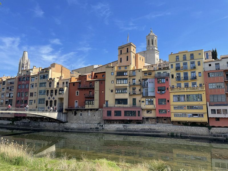
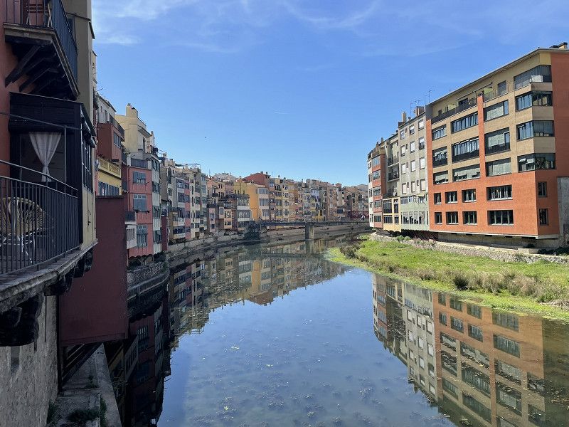
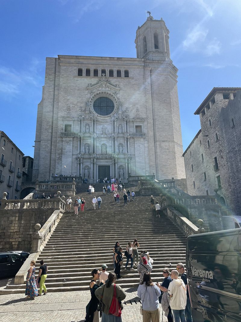
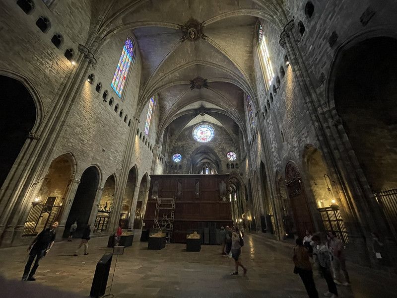
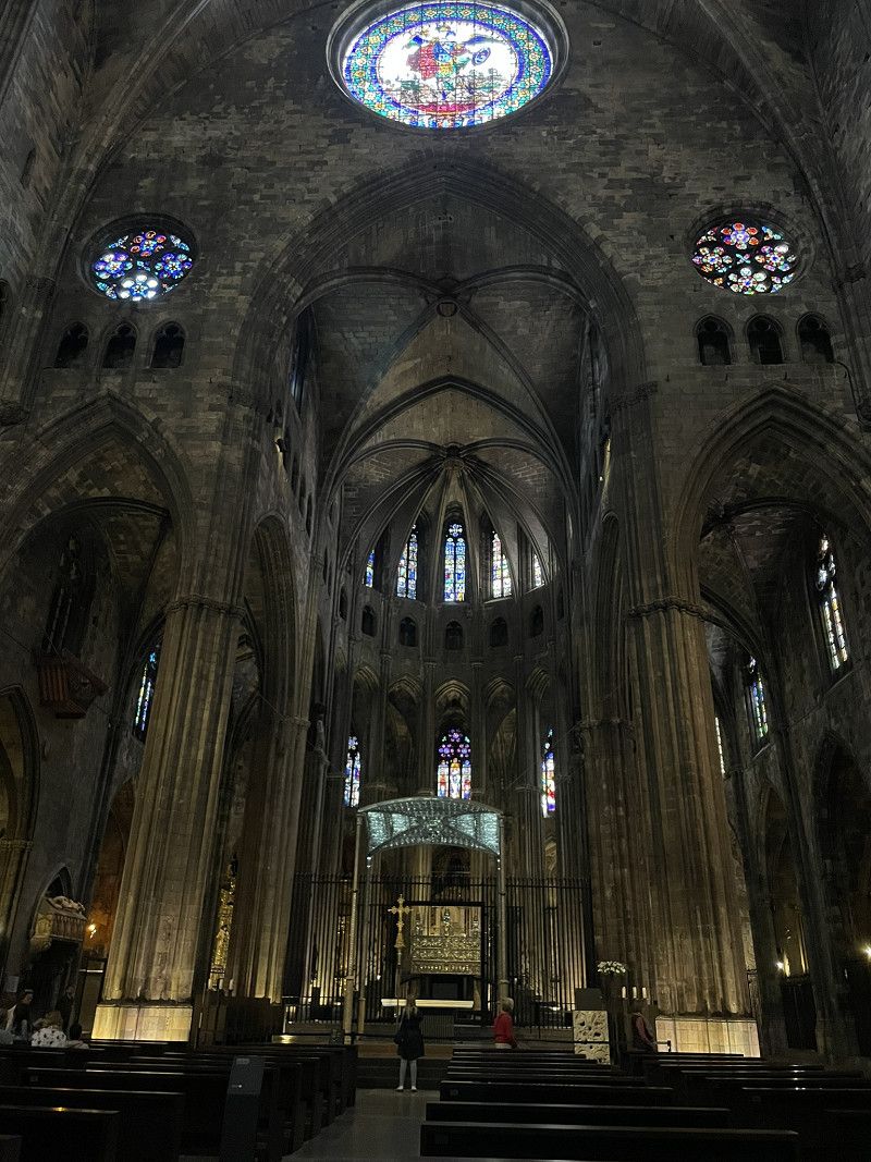
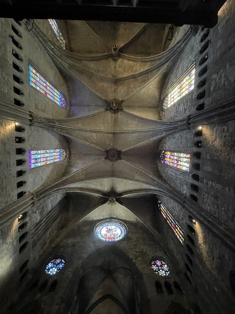
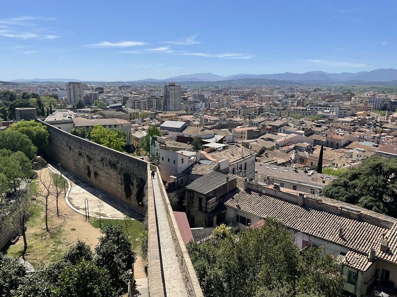
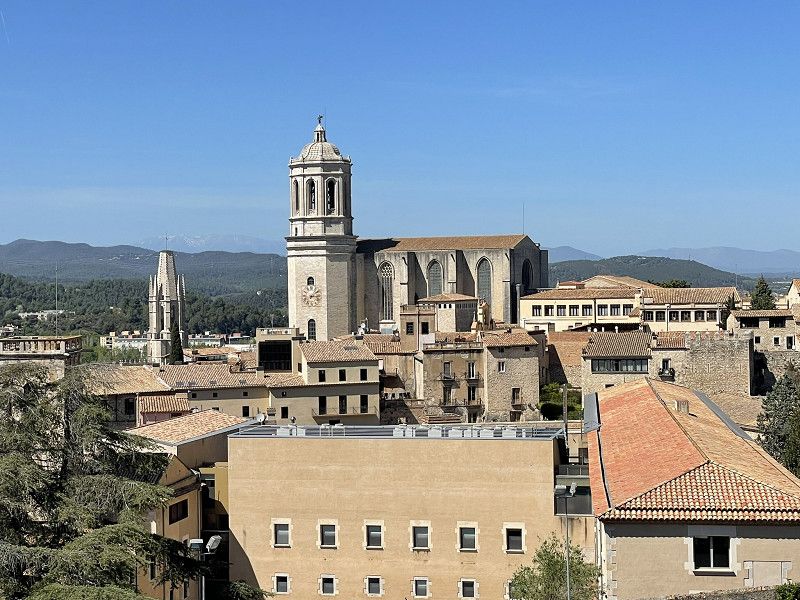
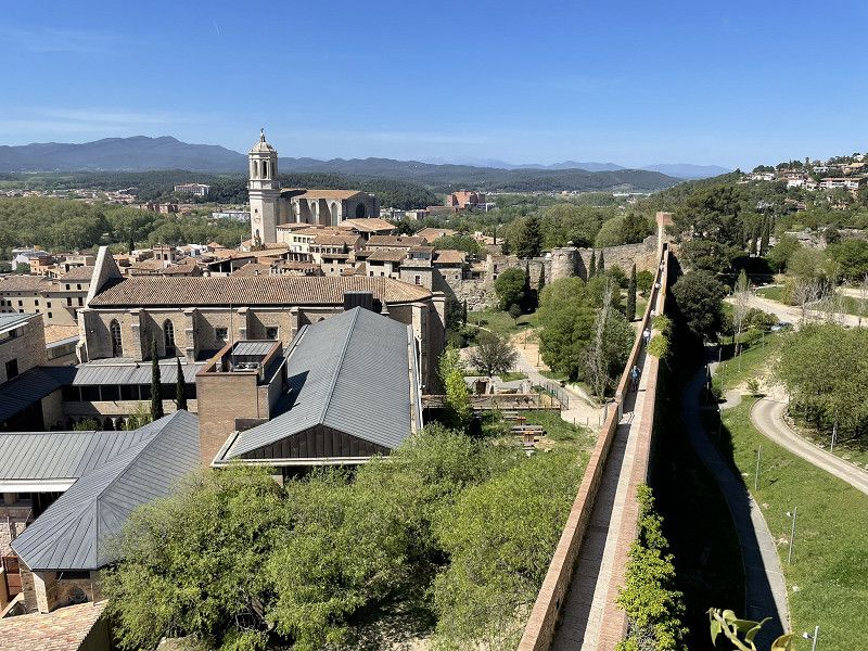
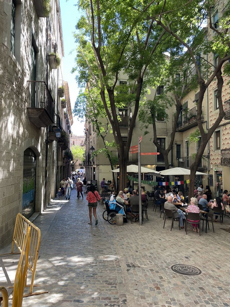
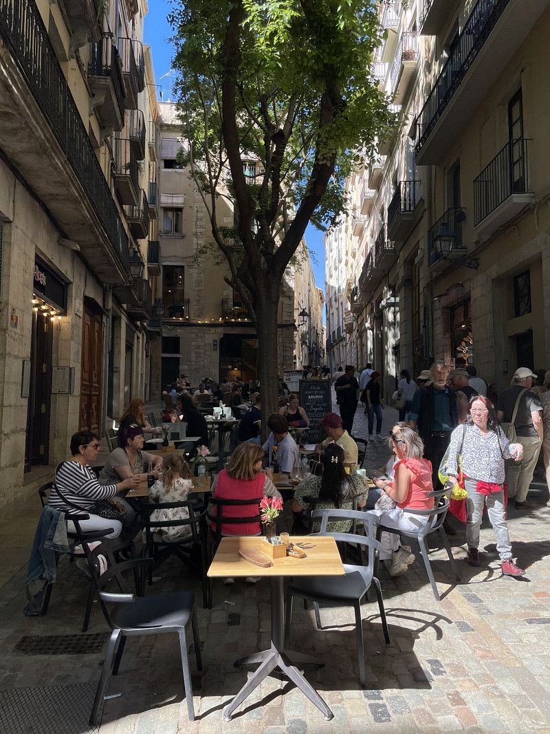
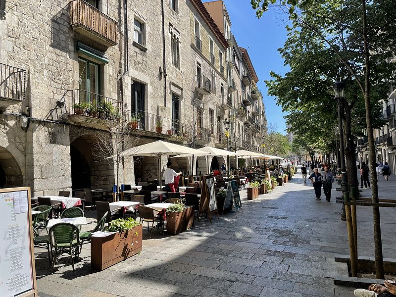
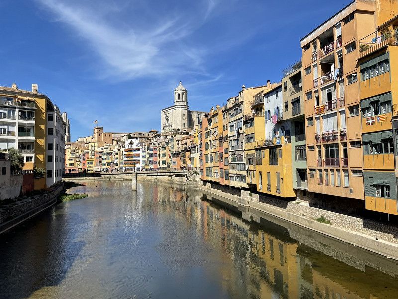
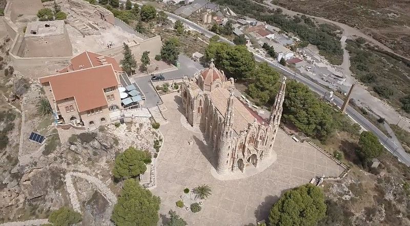
Girona
Unfortunately, our trip to the Dali Museum (Figueres) fell through because you would have had to reserve a ticket weeks in advance...
So we continued on to Girona, Parking VeyredaAutocaravanas (parking space next to the underground car park). The space was only about half full (probably because of the price of EUR 19 plus electricity). Toilet + toilet disposal in the underground car park.
BUT: Parking in a great location for sightseeing the city on foot.
Afternoon: Walk along the old city walls with towers, cathedral, Barri Vell district and ... tapas.
13.4.24 5 p.m.: 31 degrees C, and sleet at home
Area Autocaravanes Girona
Carrer Bullidors, 17007, Girona, Spain
41° 59' 26.1" N 2° 48' 6.6" E
41.9905929 2.8018231
• Head toward Carrer de Pere Rodeja i Ponsatí on Carrer de la Riera Bullidors. Go for 104 m.
• Turn left onto Carrer de Pere Rodeja i Ponsatí. Go for 45 m.
• Turn right onto Carrer de Roberto Bolaño Ávalos. Go for 404 m.
• Take the 1st exit from Rotonda de la Carretera Antiga d'Amer roundabout onto Carrer de Can Benet del Riu. Go for 114 m.
• Take the 3rd exit from Rotonda de Domeny roundabout onto AP-7 (Autopista de la Mediterrània) toward A-2/Barcelona. Go for 7.6 km.
• Take the exit toward Fornells de la Selva/Barcelona/N-2 onto A-2 (Autovia del Nordest). Go for 28.1 km.
• Take the 3rd exit from roundabout onto GI-600 toward Blanes. Go for 1.9 km.
• Pass 2 roundabouts and continue on Carretera de Tordera (GI-600). Go for 2.6 km.
• Take the 2nd exit from roundabout onto Avinguda d'Europa toward Blanes. Go for 252 m.
• Take the 2nd exit from roundabout onto Avinguda d'Europa. Go for 192 m.
• Take the 3rd exit from roundabout onto Avinguda d'Europa toward Blanes sud. Go for 178 m.
• Take the 2nd exit from roundabout onto Avinguda d'Europa toward Estación F.F.C.C/Platja de s'Abanell/Centre Urbà. Go for 125 m.
• Take the 3rd exit from Avinguda de l'Estació roundabout onto Avinguda d'Europa toward Centre Urbà. Go for 321 m.
• Take the 2nd exit from roundabout onto Avinguda d'Europa toward Platja de s'Abanell. Go for 740 m.
• Continue on Carrer de la Plantera. Go for 107 m.
• Take the 2nd exit from roundabout onto Carrer de Mallorca toward Veïnat els Pins. Go for 187 m.
• Continue on Avinguda del Mediterrani. Go for 103 m.
• Pass 2 roundabouts and continue on Avinguda del Mediterrani. Go for 281 m.
• Turn right onto Avinguda de la Vila de Madrid. Go for 814 m.
• Arrive at Avinguda de la Vila de Madrid. Your destination is on the left.
☍
44,2 km
( 38 min.)
Day
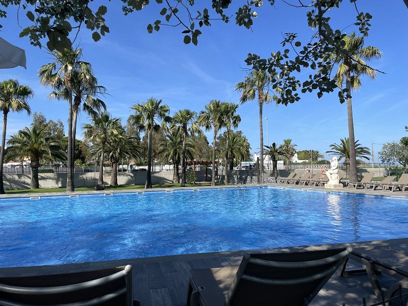
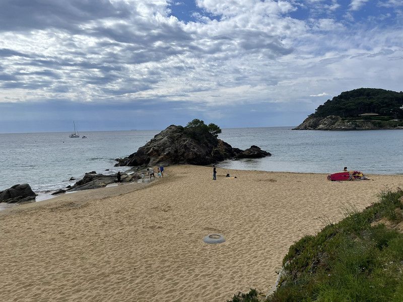
Blanes
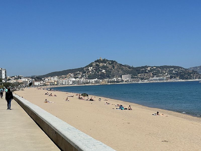
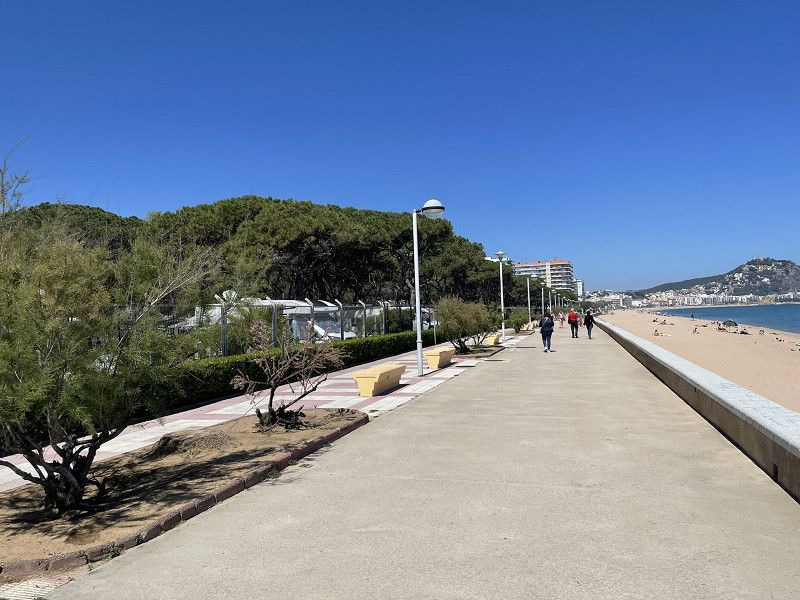
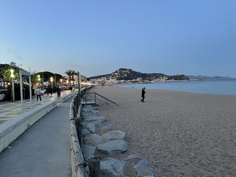
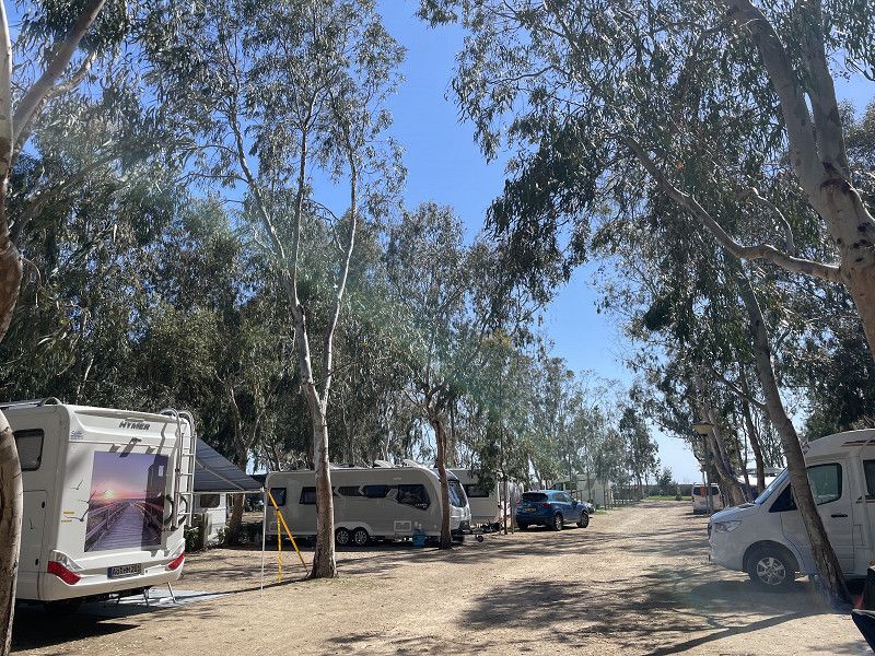
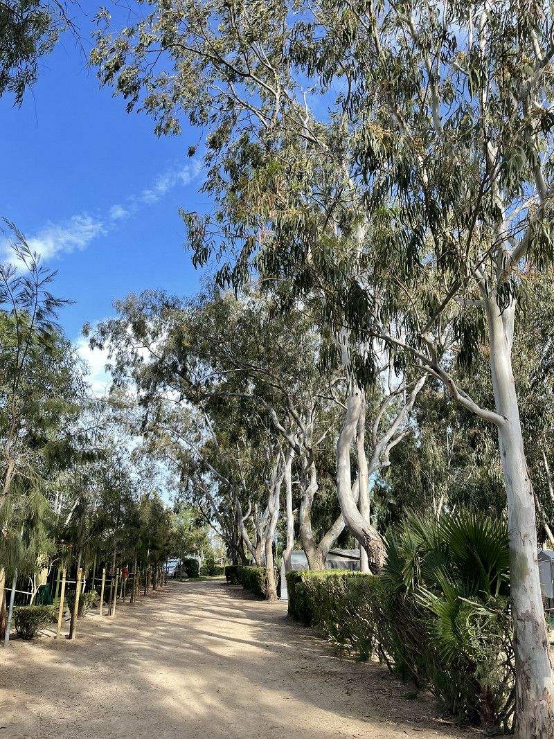
Continue to Blanes to the ACSI campsite Belle Terre.
Nice campsite by the sea or on the promenade.
Afternoon: Relax and short walk
Camping Bella Terra
Avda. Villa de Madrid 35-40, 17300, Blanes, Spain
41° 39' 30.6" N 2° 46' 45" E
41.6585100 2.7791700
• Head north on Avinguda de la Vila de Madrid. Go for 221 m.
• Turn right onto Carrer de Mercè Rodoreda. Go for 181 m.
• Turn left onto Passeig de s'Abanell. Go for 576 m.
• Turn left onto Avinguda del Mediterrani. Go for 276 m.
• Pass 2 roundabouts and continue on Avinguda del Mediterrani. Go for 250 m.
• Continue on Carrer de Mallorca. Go for 132 m.
• Take the 2nd exit from roundabout onto Carrer de la Plantera toward AP-7/C-32/N-2. Go for 167 m.
• Continue on Avinguda d'Europa. Go for 679 m.
• Take the 4th exit from roundabout onto Avinguda d'Europa toward AP-7/C-32/N-2. Go for 380 m.
• Pass 4 roundabouts and continue on Avinguda d'Europa. Go for 716 m.
• Take the 2nd exit from roundabout onto Carretera de Tordera (GI-600) toward Hostalric/Girona/Vic. Go for 404 m.
• Take the 2nd exit from roundabout onto Carretera de Tordera (GI-600) toward Tordera/Girona/Barcelona. Go for 2.2 km.
• Take the 3rd exit from roundabout onto C-32 toward Barcelona. Go for 50.4 km.
• Keep left onto B-20 toward Barcelona/Trinitat. Go for 9.2 km.
• Take the exit toward Girona/A-7/Terrassa/Manresa/C-58 onto B-10 (Ronda del Litoral). Go for 1.2 km.
• Continue on C-58. Go for 20.2 km.
• Continue on C-16. Go for 1.7 km.
• Take exit 23 toward B-40 onto C-58. Go for 16.6 km.
• Take left ramp toward Barcelona. Go for 605 m.
• Continue on C-55. Go for 1.4 km.
• Turn right onto Carrer Pont. Go for 51 m.
• Arrive at Carrer Pont. Your destination is on the left.
☍
107,4 km
(1 hrs. 16 min.)
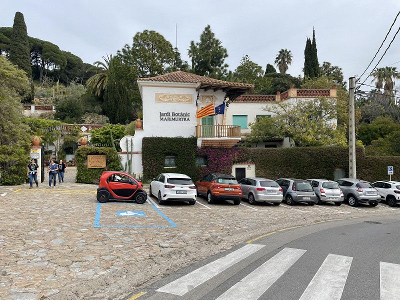
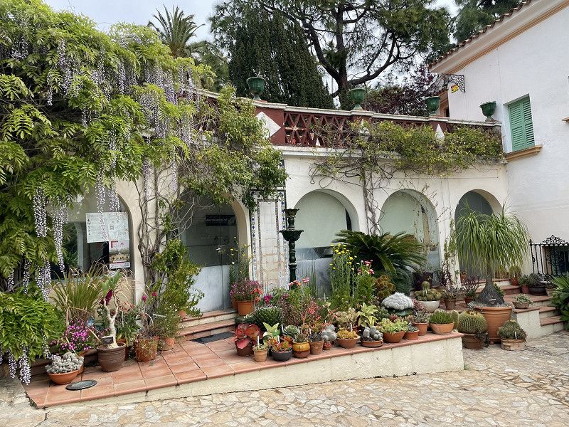
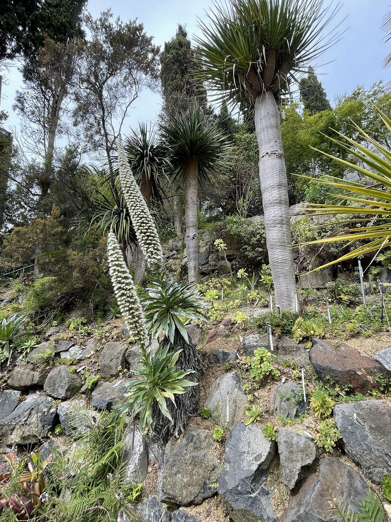
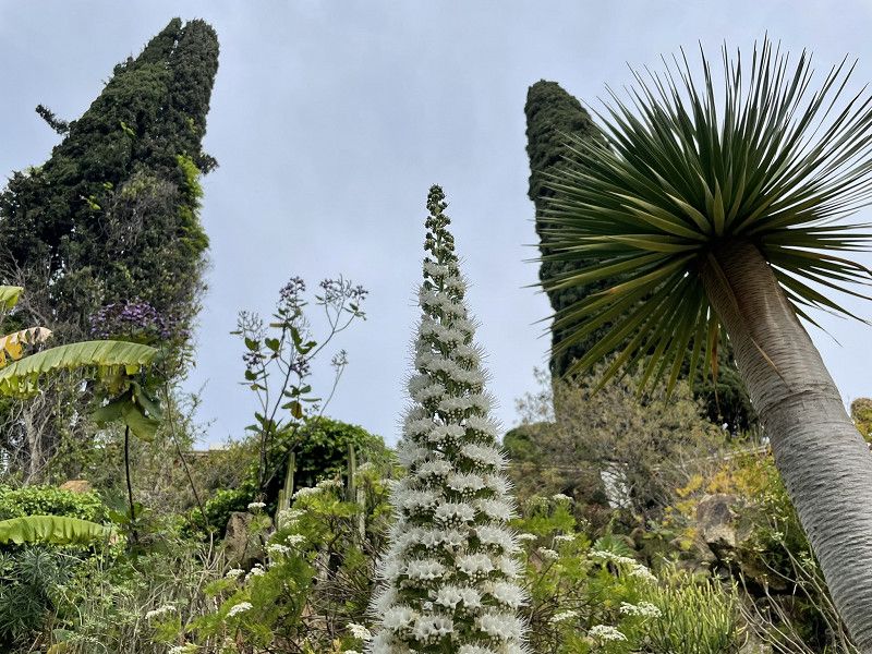
Day
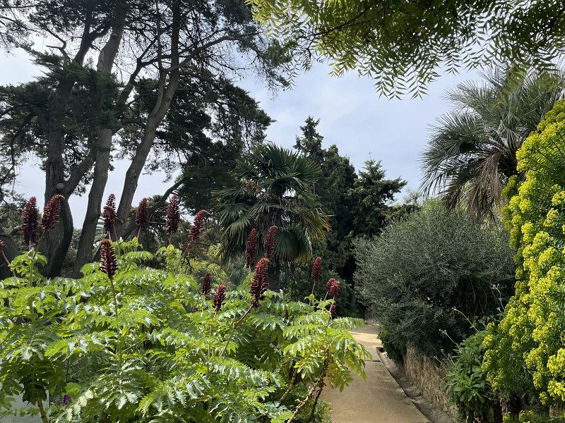
Blanes - Botanischer Garten
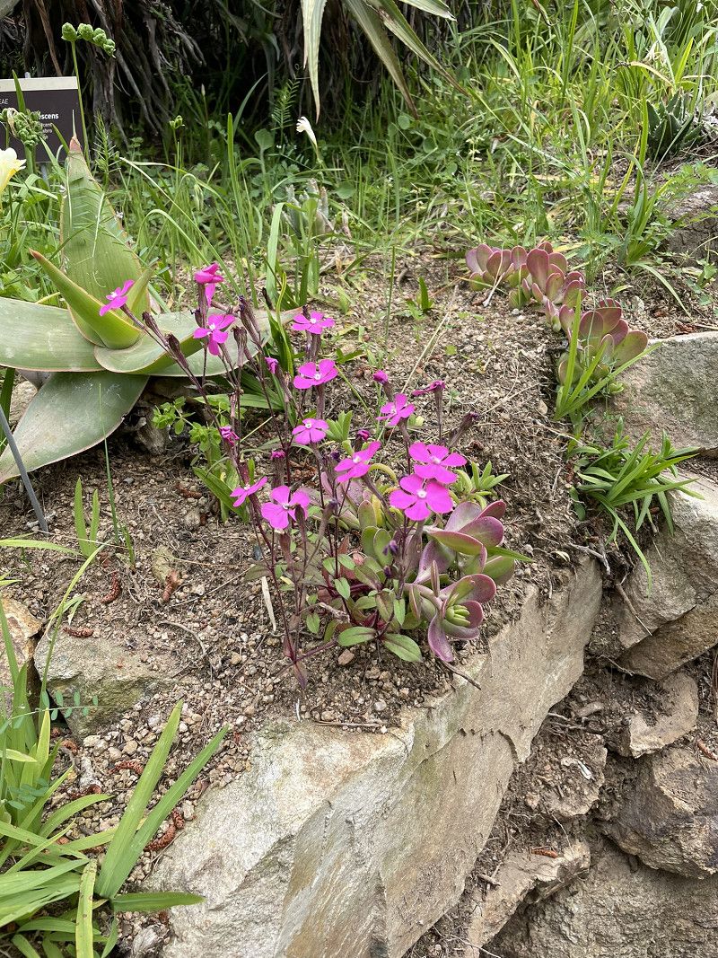
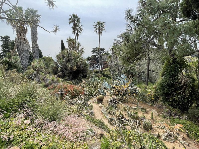
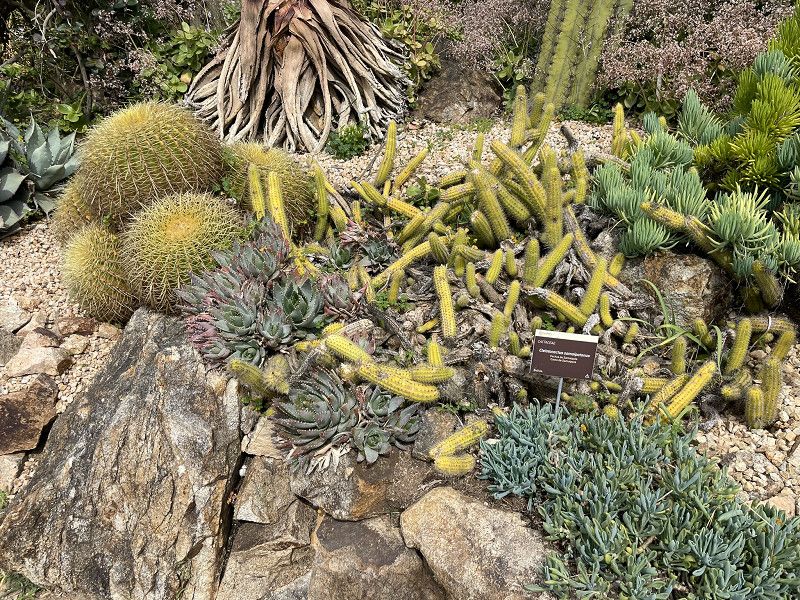
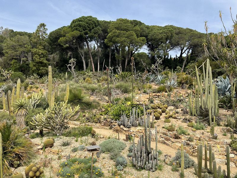
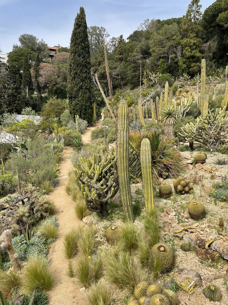
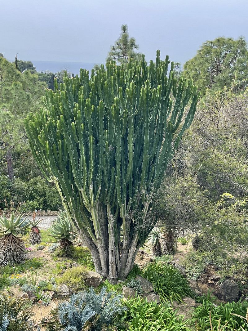
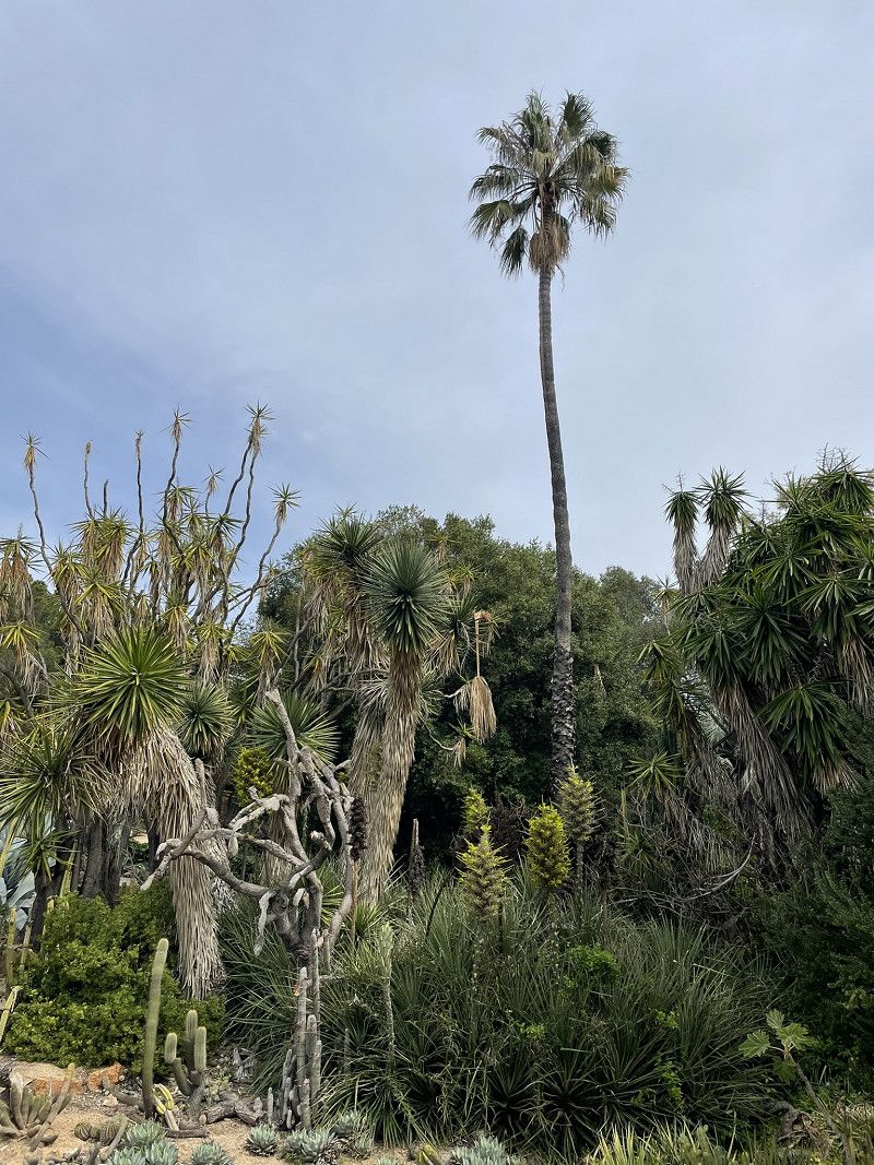
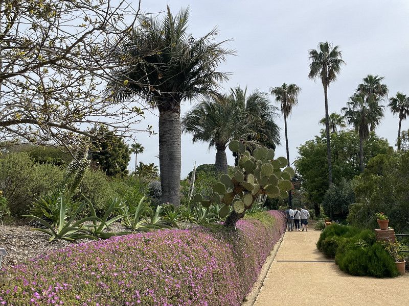
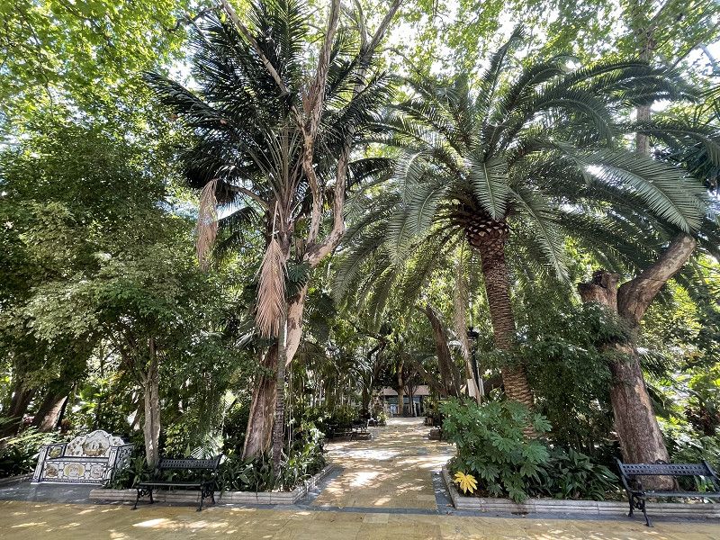
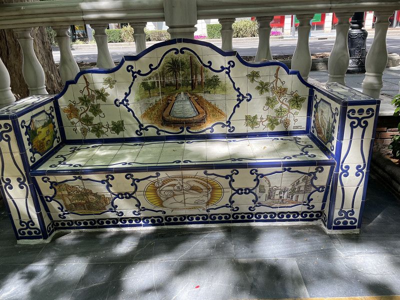
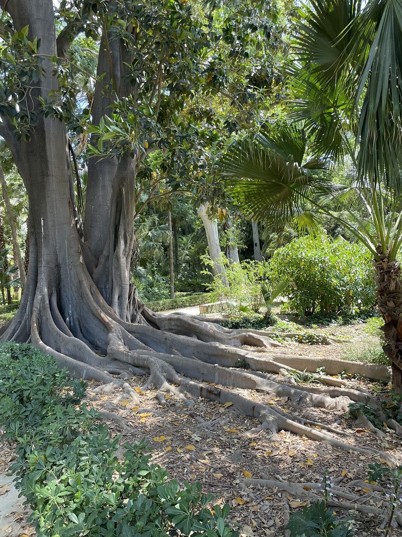
We cycled to the marina and parked the bikes there. We walked up to the Botanical Garden.
Note: at EUR 14 per person, the entrance fee doesn't seem cheap, but it's really worth it. The path leads through a very well-kept garden with an endless variety of plants. We couldn't stop being amazed. Highly recommended.
Day
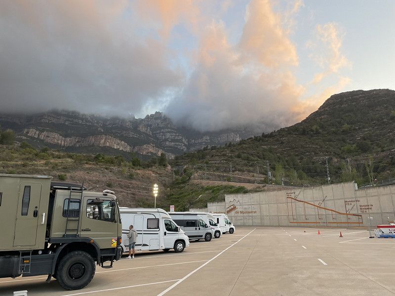
Monistrol de Montserrat
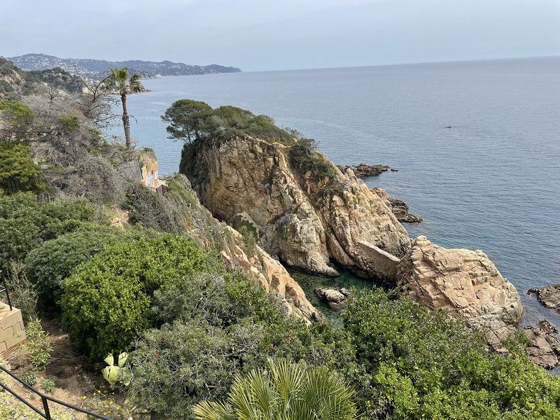
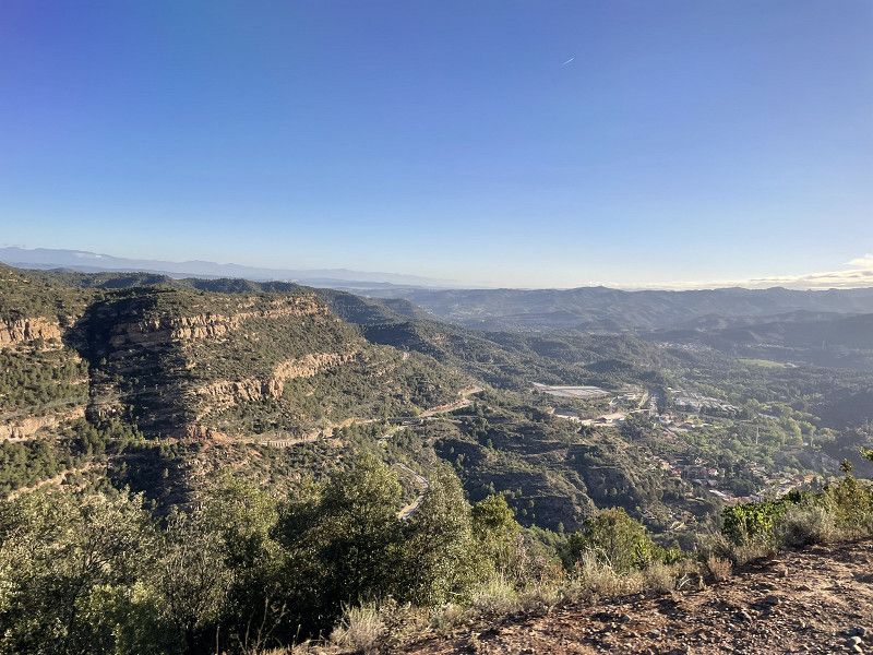
After waiting for the drizzle to stop, we drove (via a detour) inland to Monistrol.
Detour because we had to look for a pharmacy in Blanes and then visit the doctor later in Terrassa (near Monistrol) because of the risk of blood poisoning.
The road from Barcelona to Monistrol is one of the very few toll motorways (EUR 13.-)
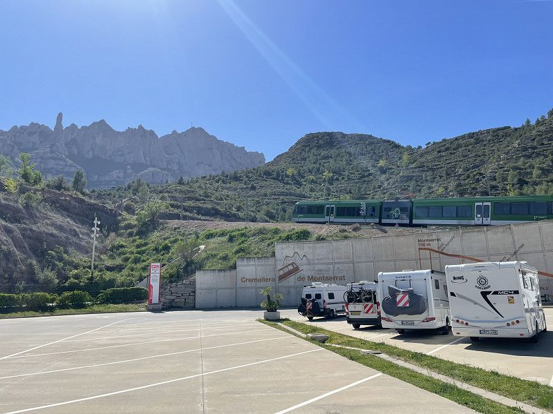
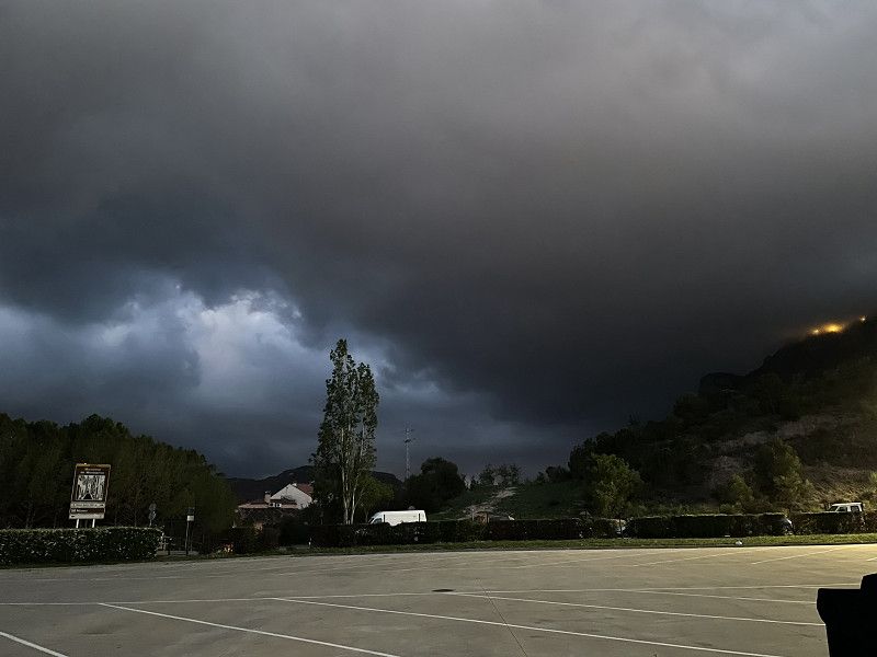
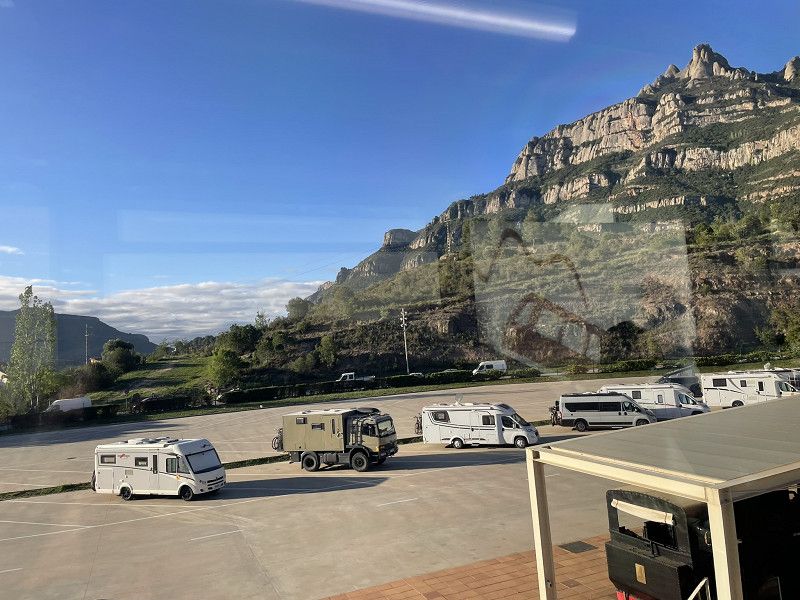
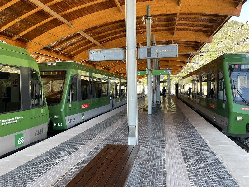
Arrival at the bus parking lot (free) of the cogwheel cable car to the monastery on Montserrat. Super quiet night with the privilege of taking the first train.
Monistrol de Montserrat
Bages, Katalonien, Spanien
41° 36' 37.8" N 1° 50' 43" E
41.6105028 1.8452698
• Head toward Carretera de Manresa a Bellver de Cerdanya on Carrer Pont. Go for 51 m.
• Turn right onto Carretera de Manresa a Bellver de Cerdanya (C-55). Go for 13.8 km.
• Take ramp onto A-2 (Autovia Lleida-Barcelona). Go for 1.2 km.
• Take exit 585 toward Martorell/E-15/AP-7/Tarragona onto N-2A. Go for 2.2 km.
• Keep right onto N-2A toward E-15/E-90/Lleida/AP-7/Tarragona/Barcelona/Girona/Capellades/B-224. Go for 2.7 km.
• Take ramp onto AP-7 (Autopista de la Mediterrània) toward Lleida/Tarragona. Go for 60.8 km.
• Take exit 32 toward Torredembarra/Altafulla. Go for 460 m.
• Take the 3rd exit from roundabout onto T-214 toward AP-7/Lleida/Torredembarra/Altafulla/Tarragona/Barcelona. Go for 226 m.
• Take the 1st exit from roundabout onto Carretera de Cádiz a Barcelona (N-340) toward Tarragona. Go for 4.5 km.
• Take ramp toward Altafulla/Tarragona. Go for 369 m.
• Take the 3rd exit from roundabout onto Carretera de Cádiz a Barcelona (N-340) toward Tarragona. Go for 3.1 km.
• Turn sharp left onto Camí Platja Llarga. Go for 229 m.
• Arrive at Camí Platja Llarga. Your destination is on the right.
☍
89,7 km
( 54 min.)
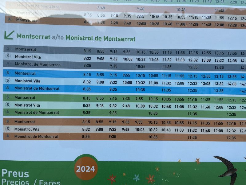
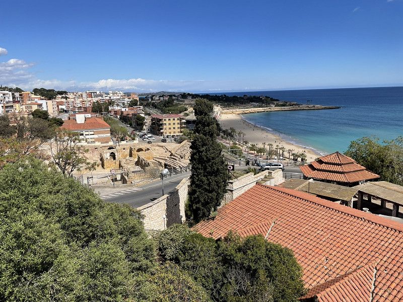
Day
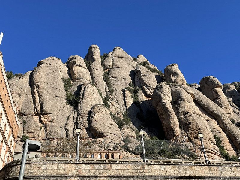
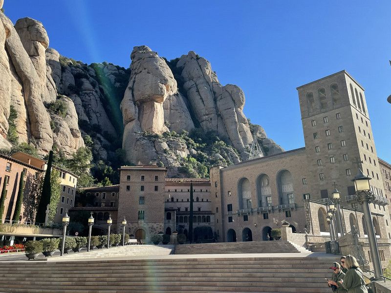
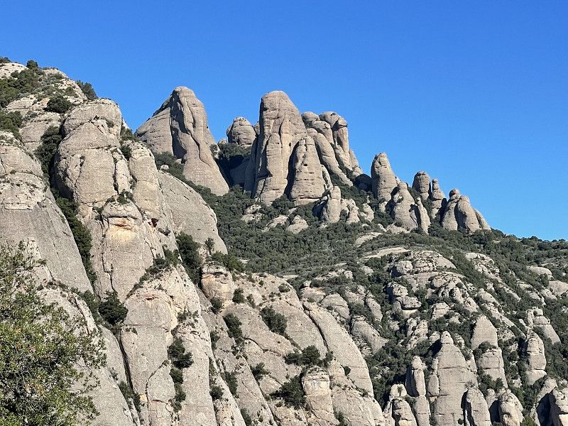
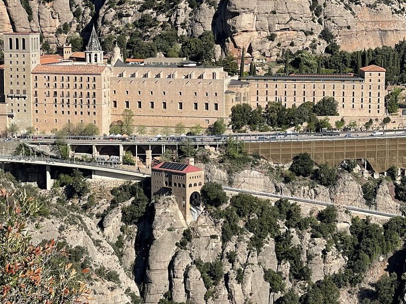
Montserrat - Tarragona
After a quiet night, we took the first train at 8:30 a.m. (journey time about 20 minutes, pensioners pay EUR 12 for a return trip). Very spectacular view and... Asians as far as the eye can see.
Hiked to the viewpoint at the cross. Skipped the train ride to St. Juan.
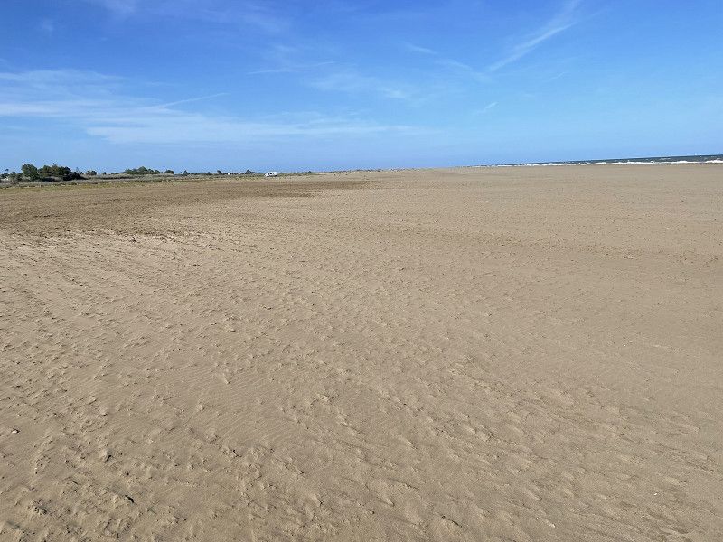
After lunch we continue to Tarragona, ACSI Camping Las Palmeras.
(great place with great infrastructure, great sandy beach)
Camping las Palmeras
Carretera N-340 km 1168, 43007, Tarragona, Spain
41° 7' 49.8" N 1° 18' 42.9" E
41.1304900 1.3119300
• Head south on Camí Platja Llarga.
• Arrive at Camí Platja Llarga. Your destination is on the right.
☍
Distance not available
(Duration not available)
Day
Camping las Palmeras
Carretera N-340 km 1168, 43007, Tarragona, Spain
41° 7' 49.8" N 1° 18' 42.9" E
41.1304900 1.3119300
• Head north on Camí Platja Llarga. Go for 194 m.
• Turn sharp right onto Carretera de Cádiz a Barcelona (N-340). Go for 2.8 km.
• Take ramp. Go for 249 m.
• Take the 5th exit from roundabout onto A-7 toward Tarragona/Castelló. Go for 21.1 km.
• Take exit 1152 toward Vila-Seca oest/E-15/Reus/C-14/Salou/Tarragona/Castelló onto AP-7 (Autopista de la Mediterrània). Go for 111 km.
• Take exit 43 toward Peníscola/Peñíscola/Benicarló. Go for 1.2 km.
• Turn right. Go for 24 m.
• Turn right. Go for 442 m.
• Turn left toward Avenida de la Estación/CV-141. Go for 600 m.
• Turn left onto Avenida de la Estación (CV-141). Go for 2.2 km.
• Take the 3rd exit from roundabout onto Avenida de la Cruz. Go for 526 m.
• Arrive at Avenida de la Cruz. Your destination is on the left.
☍
140,6 km
(1 hrs. 22 min.)
Day
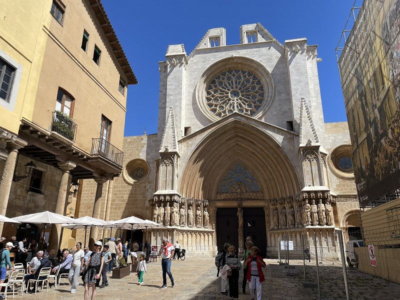
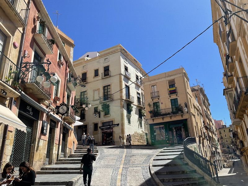
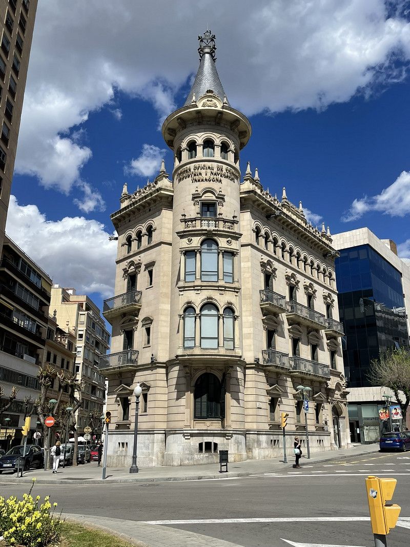
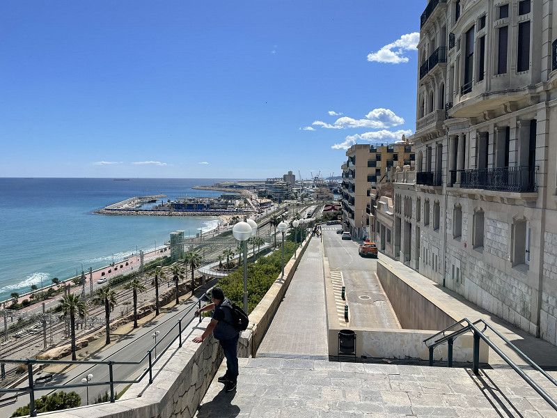
Taragona - Stadtbummel
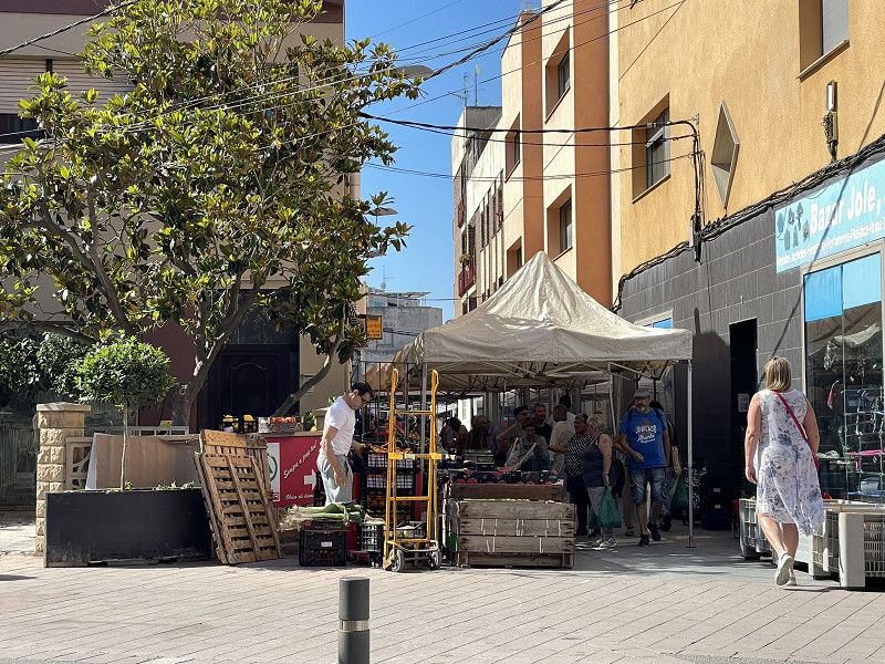
By bus (200 m from the campsite) for EUR 1.60 to the old town.
Visit to the amphitheater.
City tour with "The Yellow Train" was a total disaster. It was not worth the time and money! (hardly anything worth seeing, broken audio, no suspension)
Therefore, walk to the cathedral, through the Rambla Nova (pedestrian street) and through the
Old town.
Conclusion: Tarragona "didn't blow us away".
Day
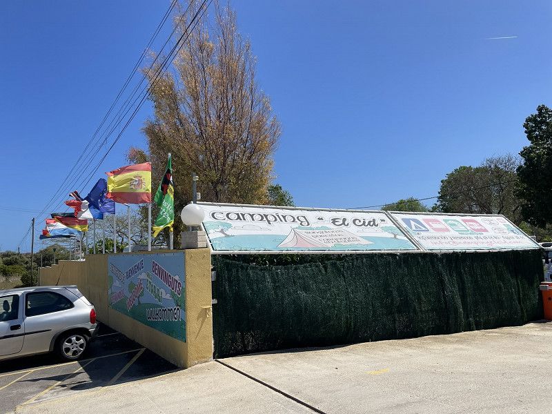
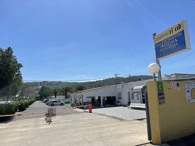
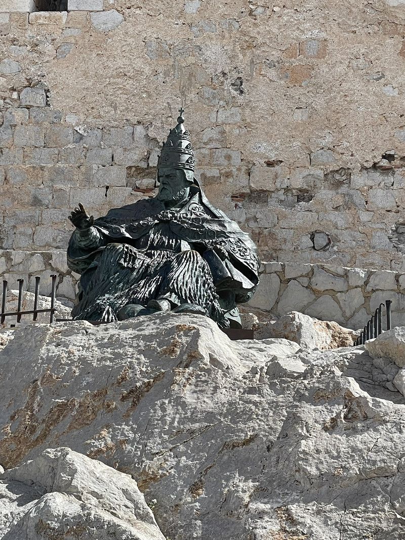
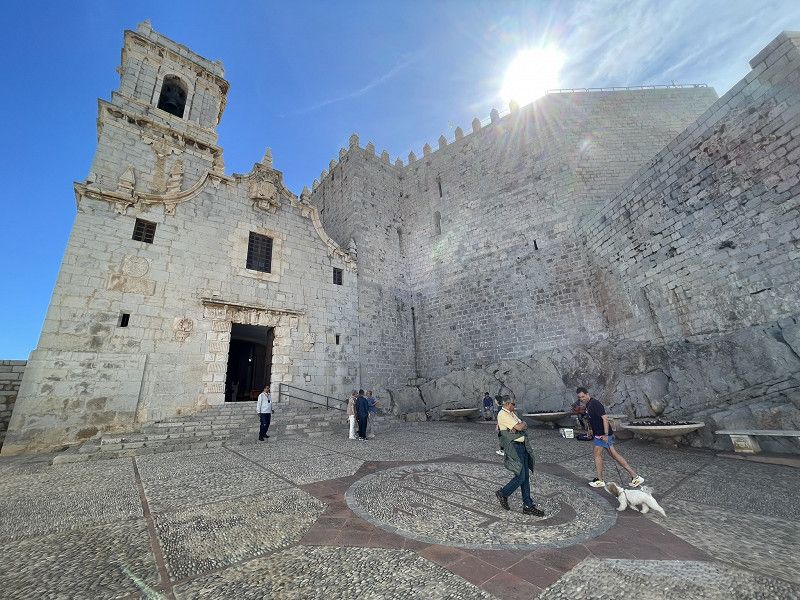
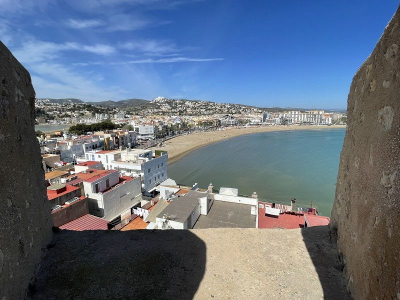
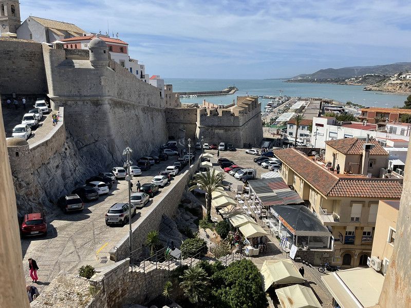
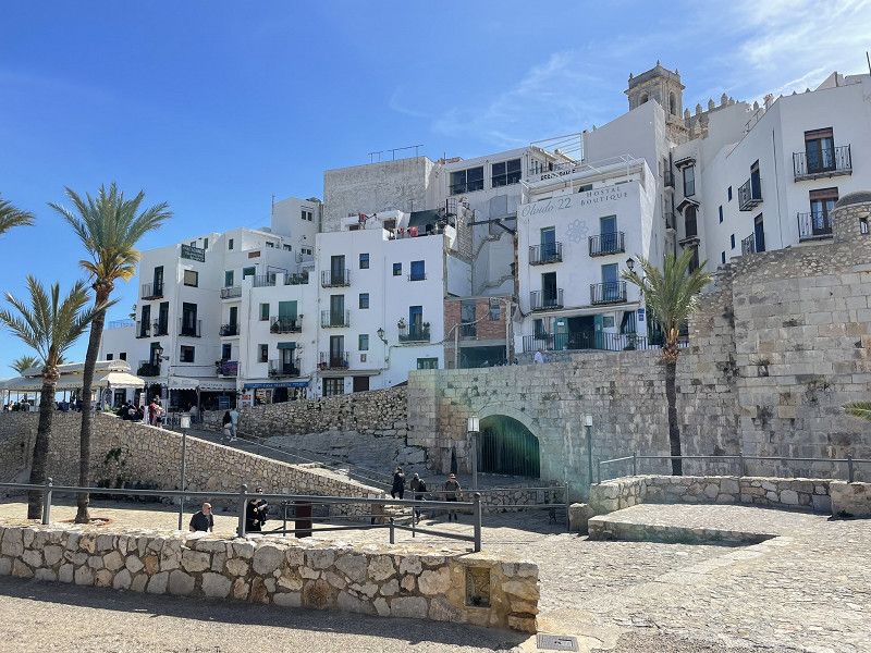
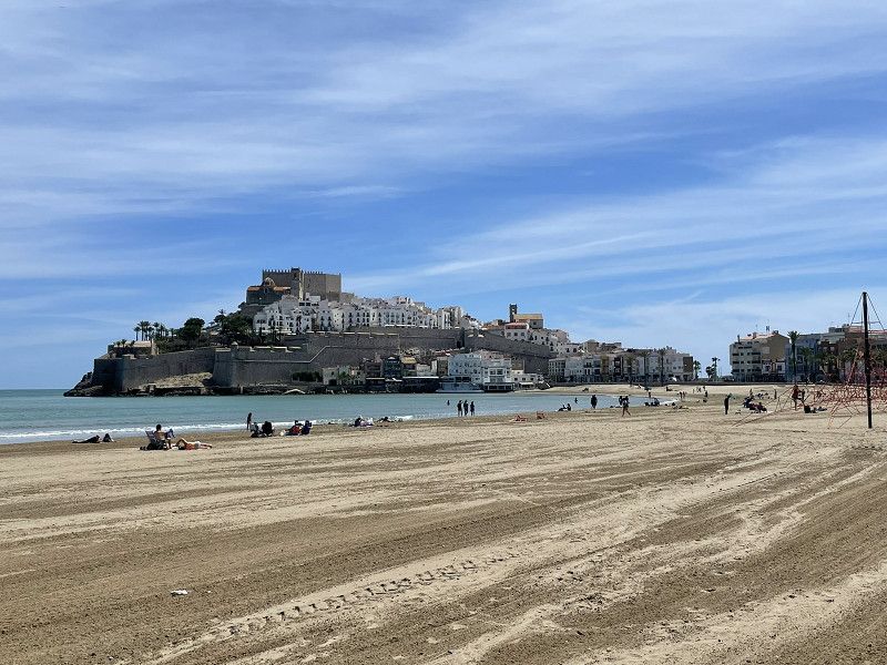
Peniscola
Continue to Peniscola, ACSI Camping El Cid. (small pitches, great WiFi, totally OK, good choice)
Short bike tour in the afternoon
Camping el Cid
Apdo. De Correos 83, 12598, Peñíscola, Spain
40° 22' 38" N 0° 23' 35" E
40.3772200 0.3930600
• Head west on Avenida de la Cruz. Go for 458 m.
• Take the 2nd exit from roundabout onto Avenida de la Estación (CV-141). Go for 3.5 km.
• Continue on CV-141 toward Sta. Magdalena de Pulpis/Castelló/Castellón. Go for 72 m.
• Take the 4th exit from roundabout onto N-340 toward Sta. Magdalena de Pulpis/Castellón. Go for 19.8 km.
• Take ramp toward Alcossebre. Go for 264 m.
• Take the 3rd exit from roundabout onto CV-142 toward Alcossebre. Go for 2.8 km.
• Take the 1st exit from roundabout onto CV-142 toward Alcossebre/Centro Urbano. Go for 1.3 km.
• Turn left onto Calle de Doña Violante de Hungría. Go for 365 m.
• Arrive at Calle de Doña Violante de Hungría. Your destination is on the left.
☍
28,5 km
( 23 min.)
Day
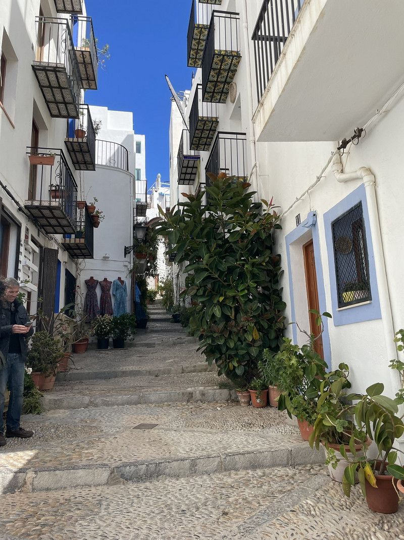
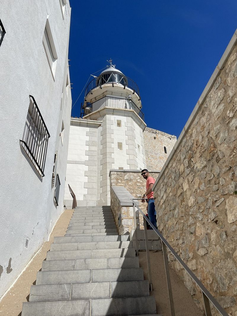
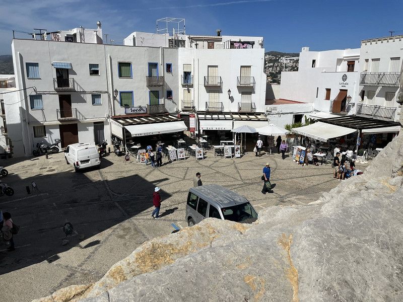
Peniscola
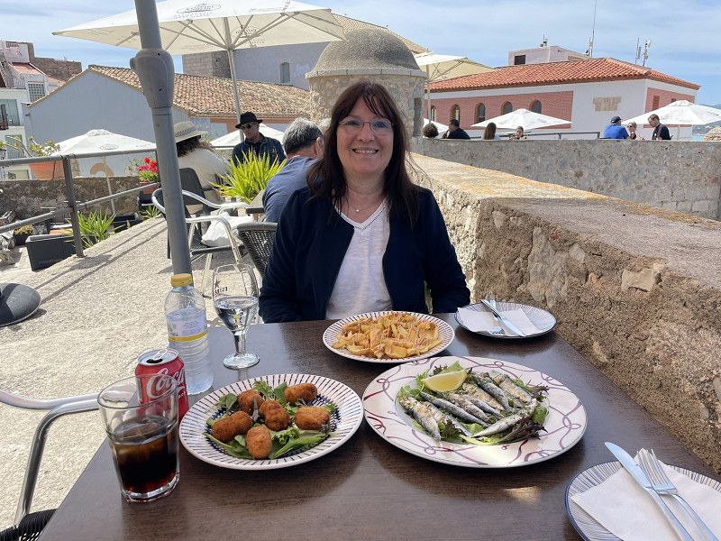
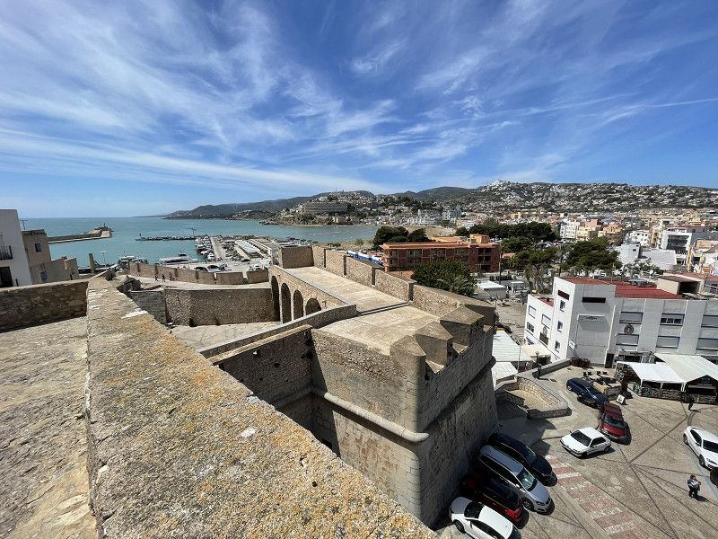
Bike tour to the old town, or to the rock with the castle
Everything is very touristy, but great photos are possible from the rock
Enjoyed tapas with a wonderful panorama on the city wall
Day
Alcossebre
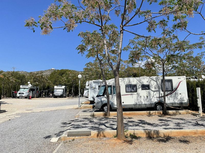
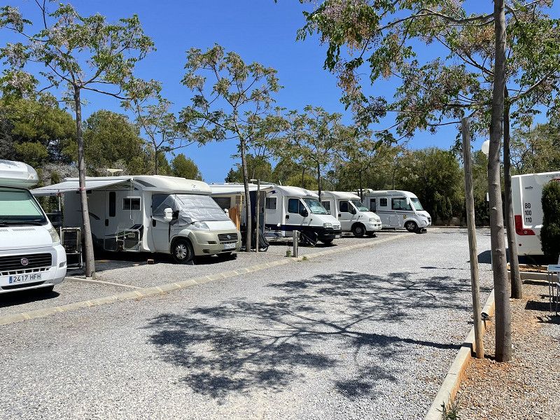
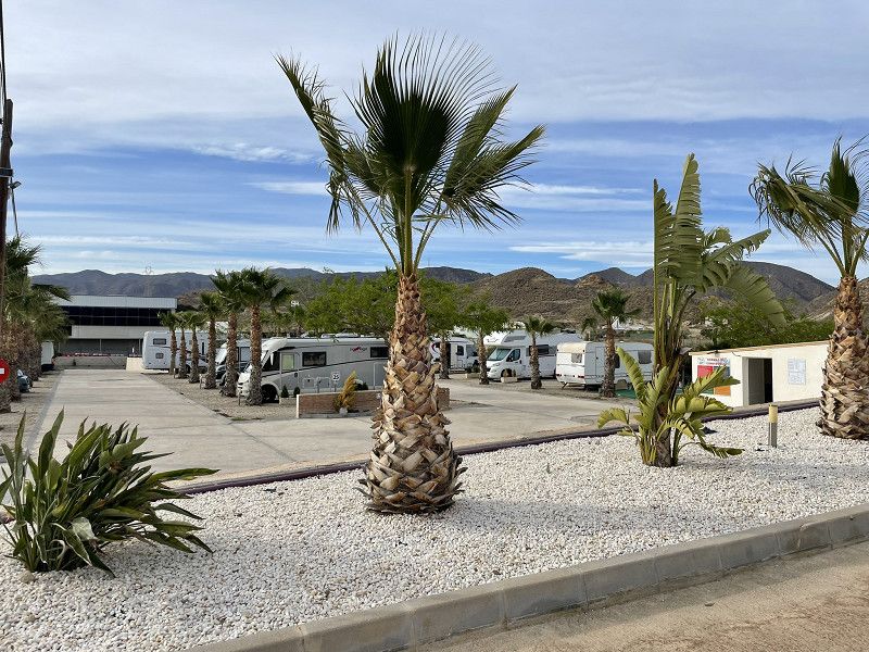
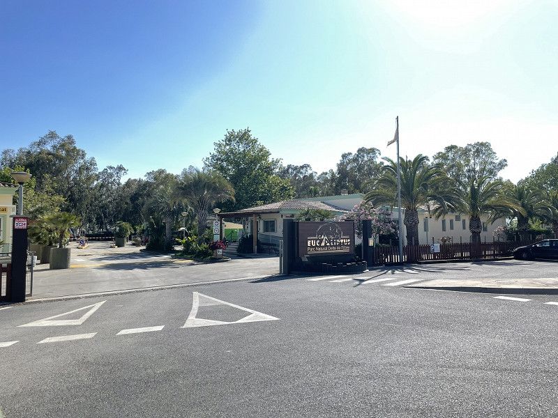
Continue to Alcossebre, Las Moreras parking space. Top-equipped parking space, free super WiFi, EUR 14 per night plus electricity.
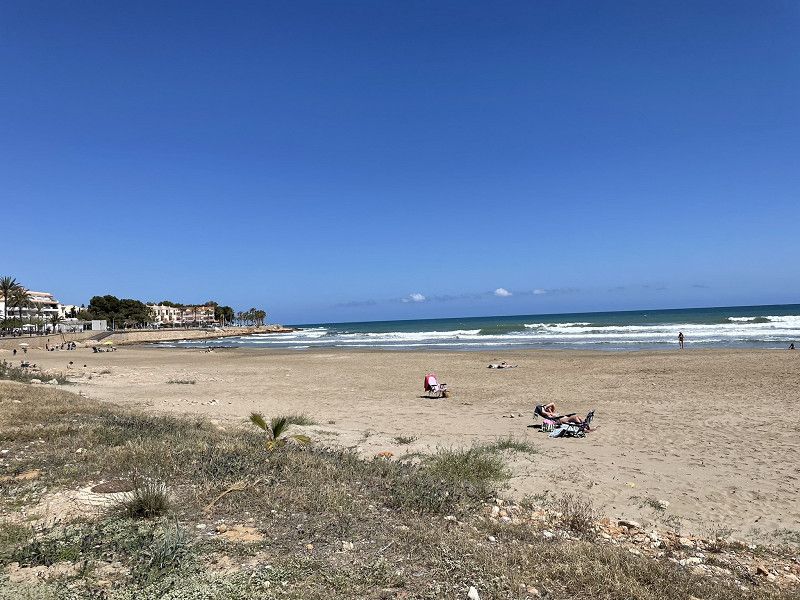
Afternoon walk to the beach promenade. Then enjoy the sun on the pitch and hear from the family that it's snowing at home :-(
Camper-Park Las Moreras
Carrer de na Violant d'Hongria, Alcalà de Xivert, Castelló / Castellón, Valencianische Gemeinschaft, Spanien
40° 14' 43.8" N 0° 16' 17.8" E
40.2455081 0.2716160
• Head toward Calle Irta on Calle de Doña Violante de Hungría. Go for 98 m.
• Turn right onto Calle Irta. Go for 184 m.
• Turn right onto Carretera Alcocebre (CV-142). Go for 306 m.
• Continue on CV-142. Go for 1.2 km.
• Take the 2nd exit from roundabout onto CV-142 toward A-7/N-340. Go for 646 m.
• Turn left toward Cap i Corb. Go for 1.6 km.
• Turn left onto N-340. Go for 2.2 km.
• Take ramp toward Benlloch/Aeroport/CV-10/Castelló/Castellón/Torrenostra. Go for 319 m.
• Take the 3rd exit from roundabout onto AP-7 (Autopista del Mediterráneo) toward Valencia. Go for 89.6 km.
• Continue on A-7 (Autovía del Mediterráneo). Go for 13.9 km.
• Take exit 321 toward Bétera. Go for 343 m.
• Take the 1st exit from roundabout onto CV-310 toward Bétera. Go for 2.0 km.
• Take the 2nd exit from roundabout onto CV-3106. Go for 392 m.
• Turn left. Go for 50 m.
• Turn right toward Calle Universo. Go for 185 m.
• Turn left onto Calle Universo. Go for 239 m.
• Turn right onto Calle Universo. Go for 14 m.
• Arrive at Calle Universo. Your destination is on the right.
☍
113,2 km
(1 hrs. 6 min.)
Day
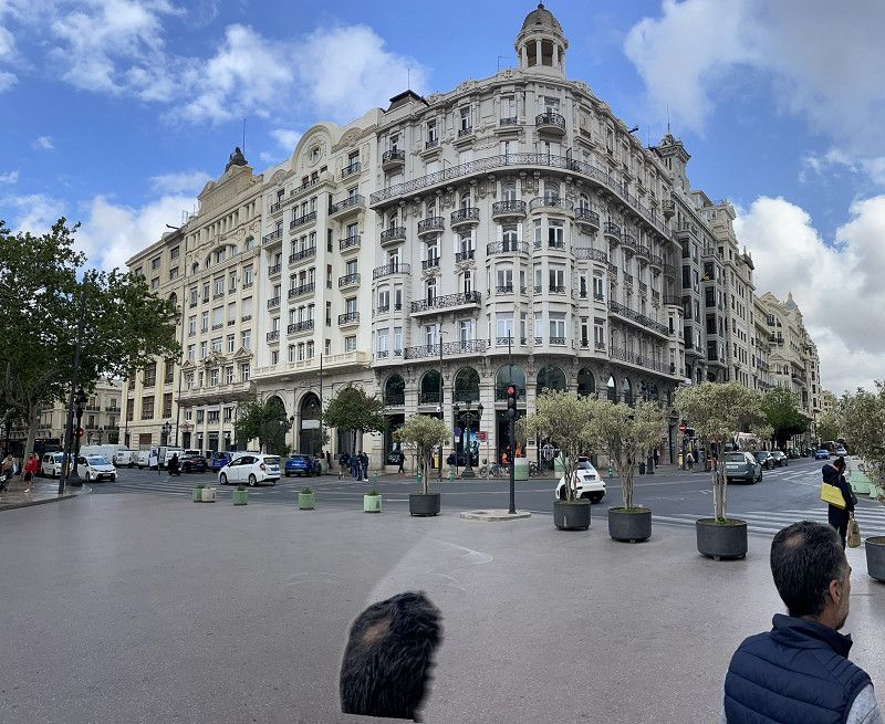
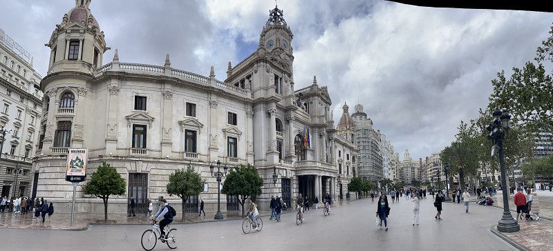
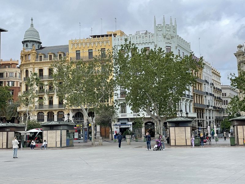
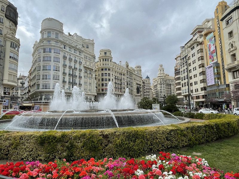
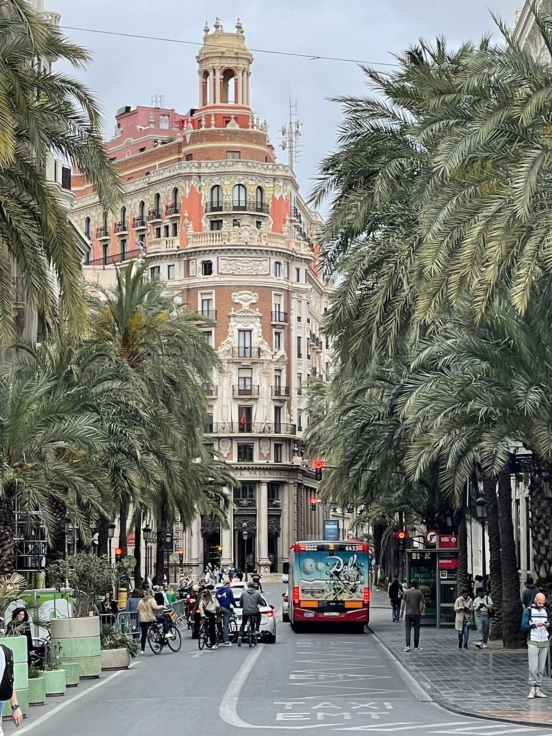
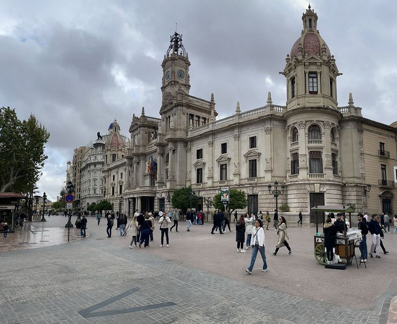
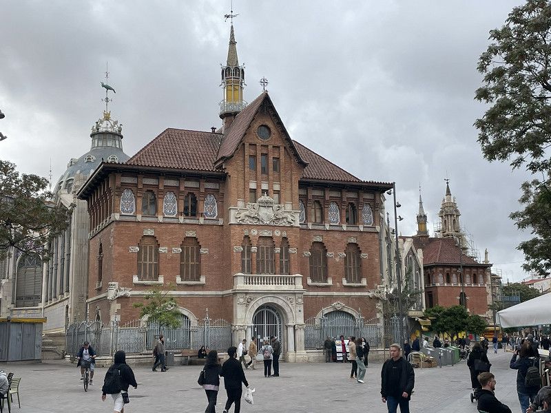
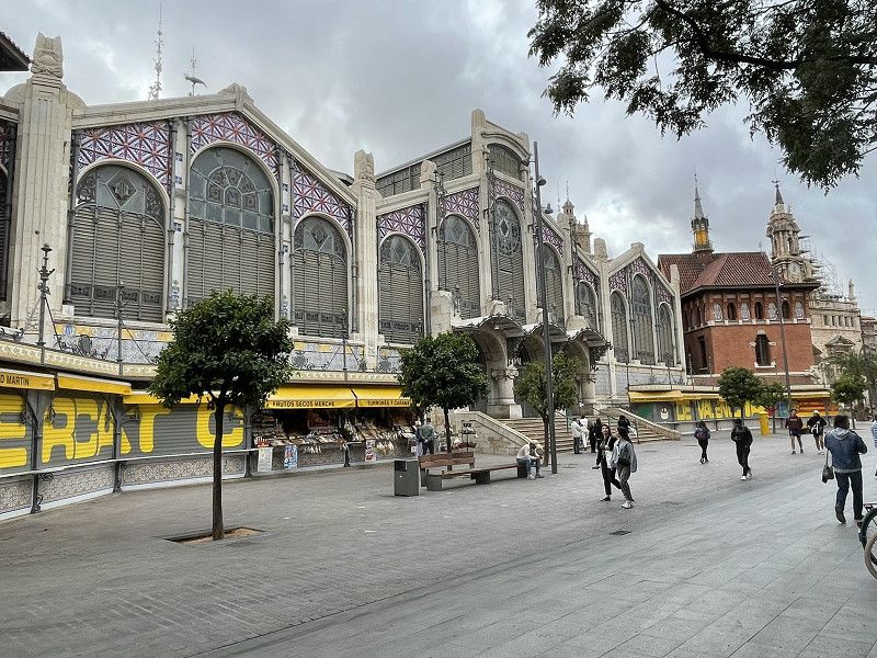
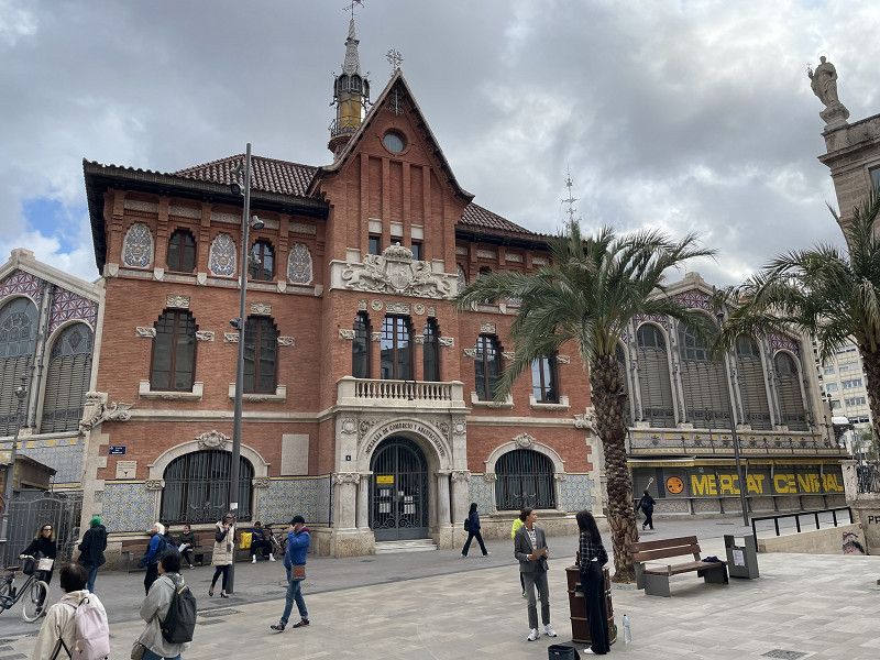
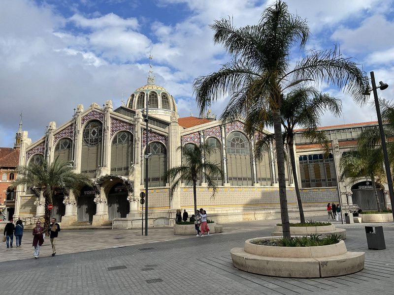
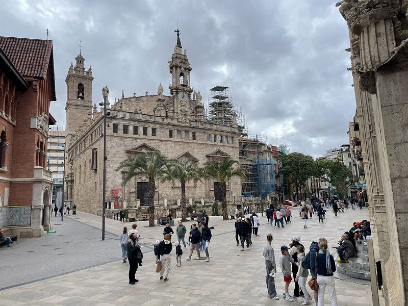
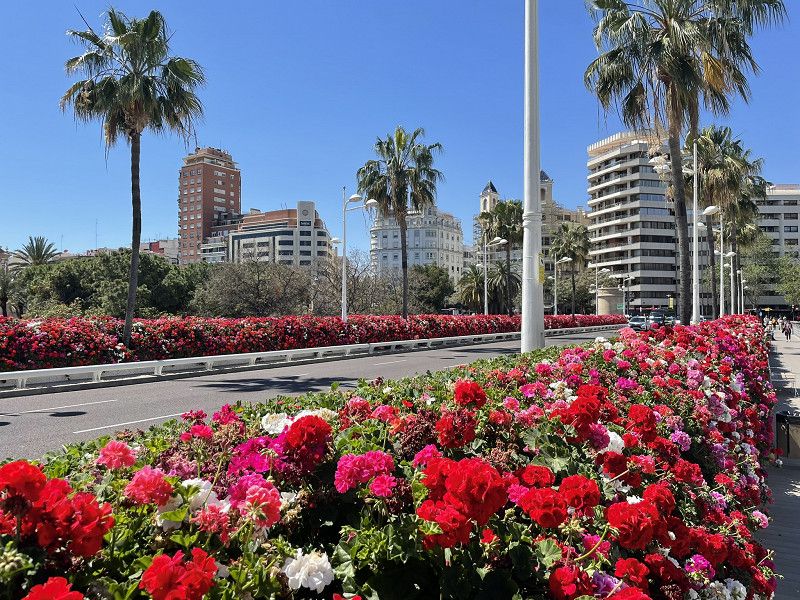
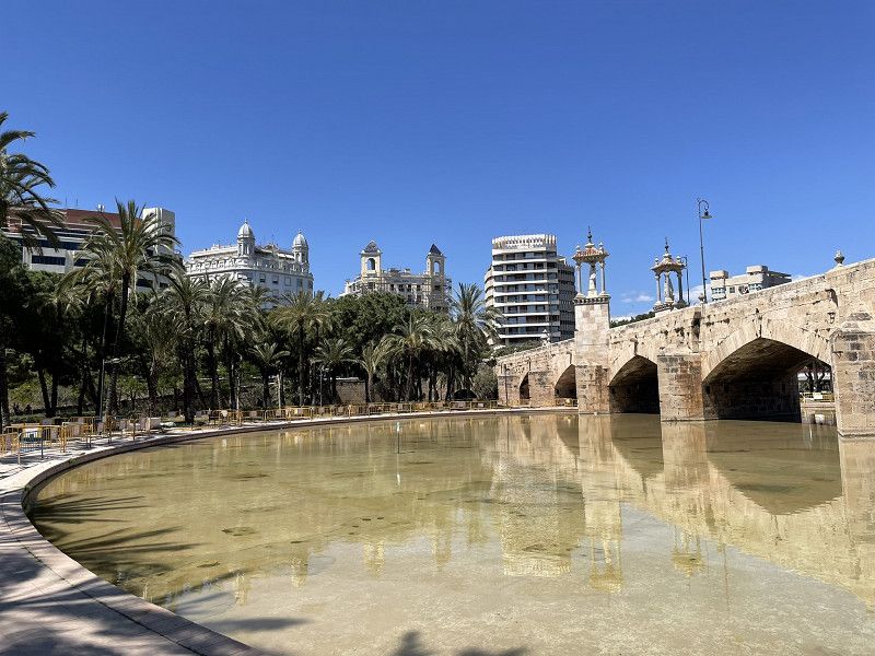
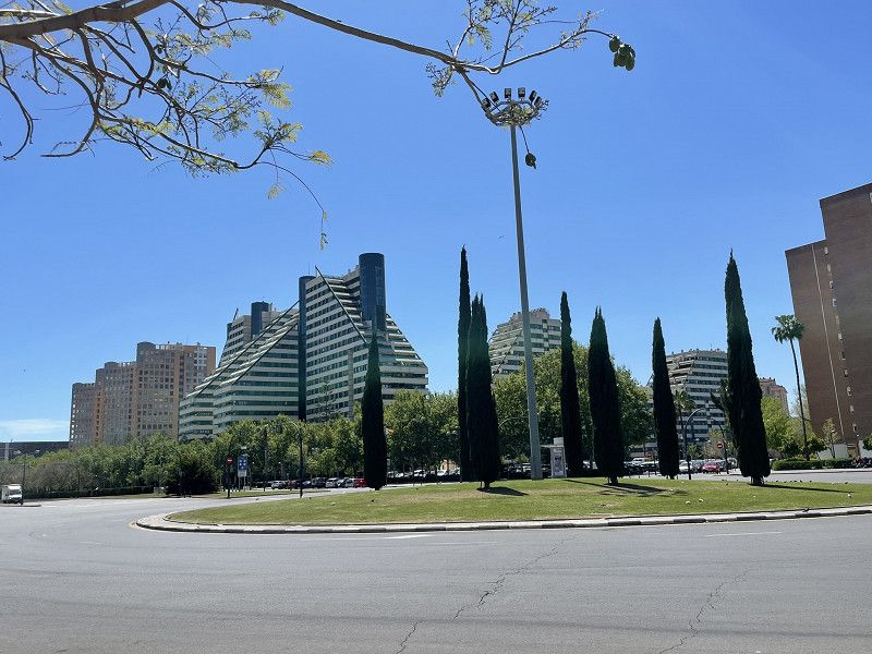
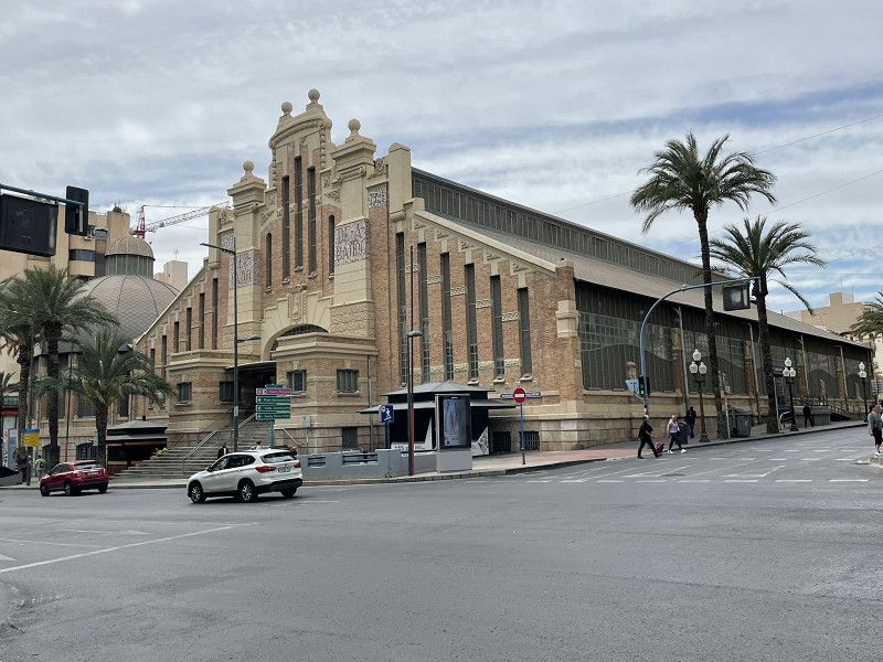
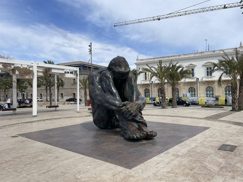
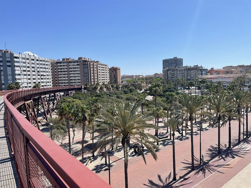
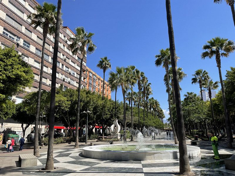
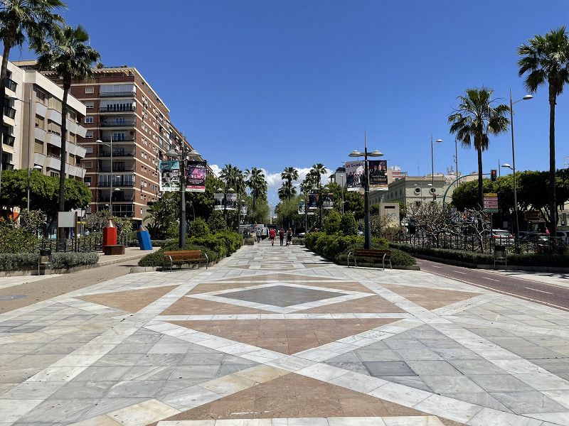
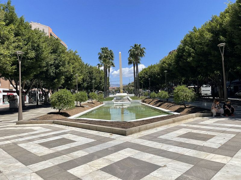
Valencia - Altstadt
Continue to Valencia, Valencia CamperPark parking space in the Bétera district.
Highly recommended SP with everything, including great WiFi. EUR 15.- plus electricity.
The Valencia Card is available at the SP for EUR 20. This includes the metro (10 minutes walk).
Afternoon: take the metro to Placa Espanya station, from there visit the old town and its impressive buildings.
Stroll and enjoy tapas.
Valencia Camper Park
Calle Universo, s/n, 46117, Bétera, Spain
39° 34' 46.5" N 0° 26' 42.3" W
39.5795940 -0.4450900
• Head southeast on Calle Universo. Go for 14 m.
• Turn left onto Calle Universo. Go for 239 m.
• Turn right. Go for 185 m.
• Turn left toward CV-3106. Go for 50 m.
• Turn right onto CV-3106. Go for 313 m.
• Take the 2nd exit from roundabout onto CV-310. Go for 2.0 km.
• Take the 2nd exit from roundabout toward Alicante. Go for 392 m.
• Continue on A-7 (Autovía del Mediterráneo). Go for 31.4 km.
• Keep left onto A-7 (Autopista del Mediterráneo) toward Alacant/Alicante/Gandia/A-38. Go for 244 m.
• Continue on AP-7 (Autopista del Mediterráneo). Go for 80.1 km.
• Take exit 62 toward Ondara. Go for 1.5 km.
• Keep left toward Hospital/Denia. Go for 486 m.
• Continue on CV-725. Go for 4.8 km.
• Pass 5 roundabouts and continue on Avenida de Valencia. Go for 2.0 km.
• Turn left onto Calle Abu Zeyan. Go for 187 m.
• Take the 2nd exit from Plaza Cholet roundabout onto Avenida de Miguel Hernández. Go for 856 m.
• Take the 2nd exit from Plaza Benidorm roundabout onto Plaza Benidorm. Go for 132 m.
• Take the 2nd exit from roundabout onto Escollera Norte. Go for 558 m.
• Arrive at your destination on the right.
☍
125,5 km
(1 hrs. 12 min.)
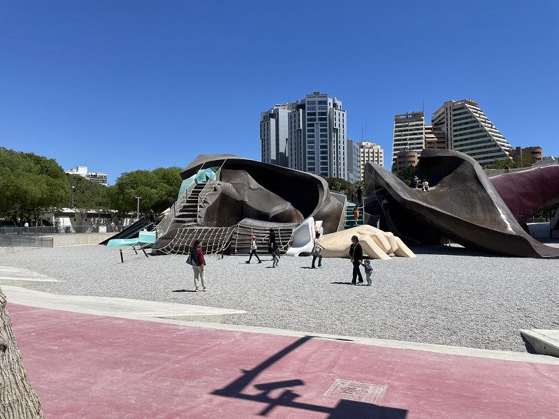
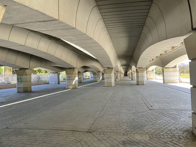
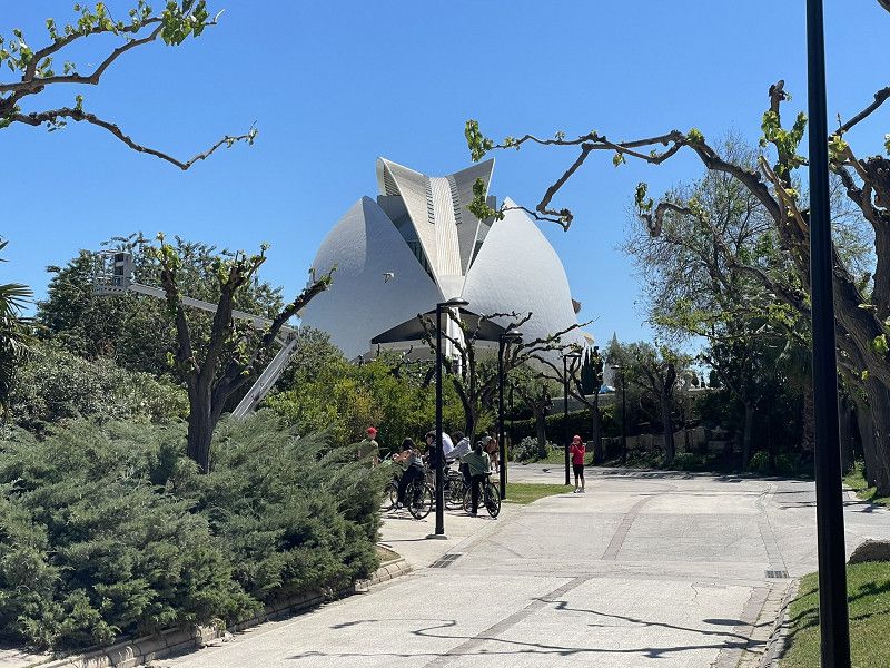
Day
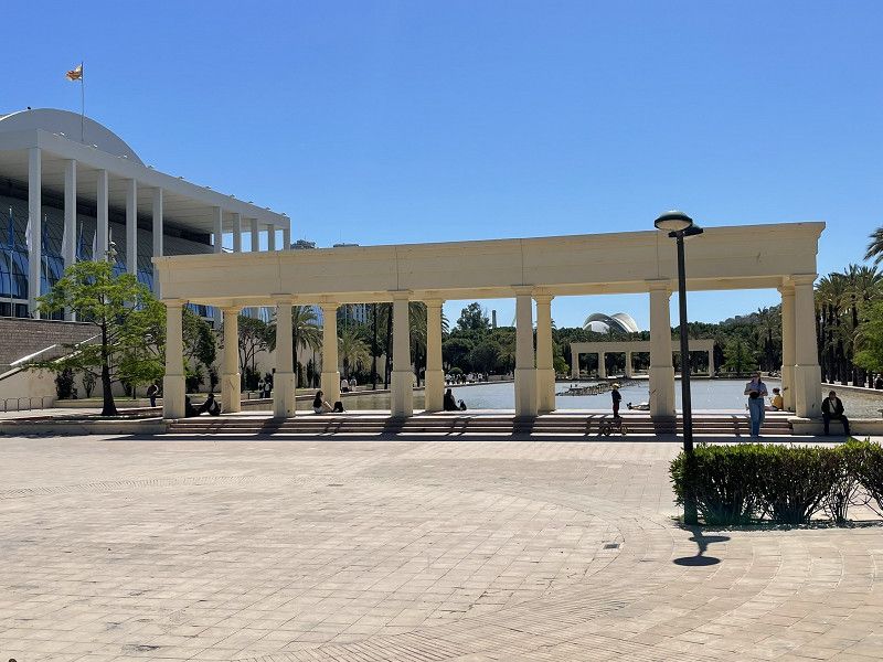
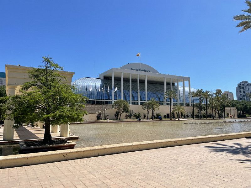
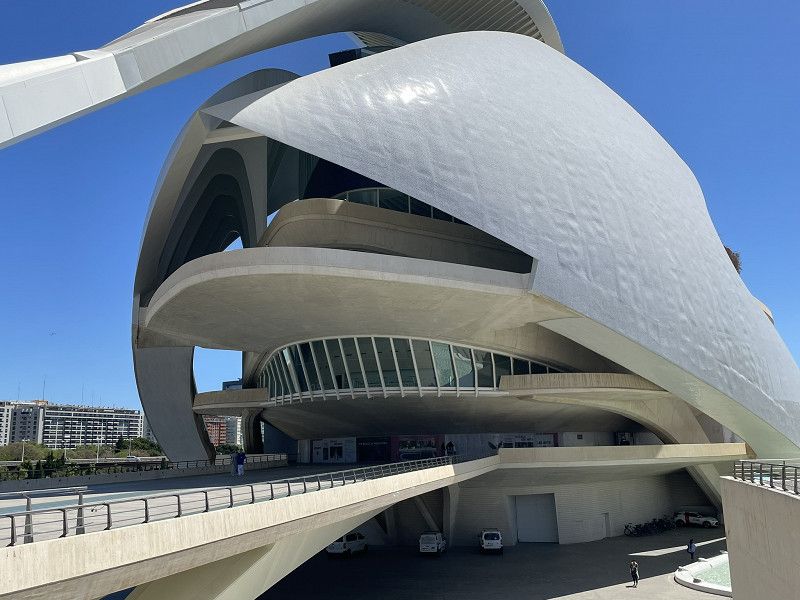
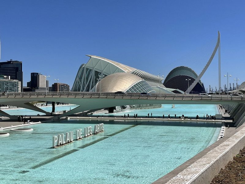
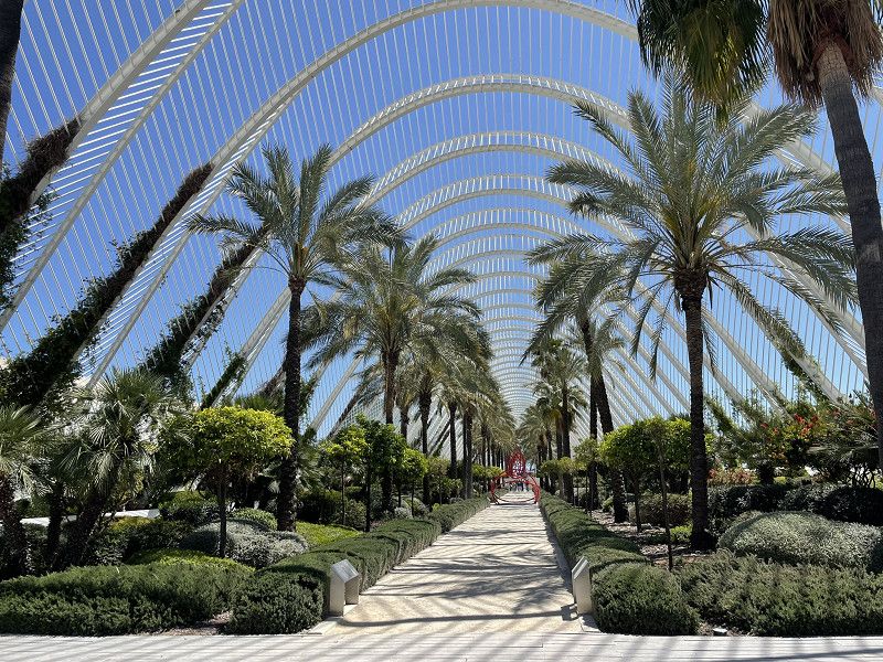
Valencia - Kunstbauten
Today we took the metro to Alameda station to explore the new town with its artistic buildings.
(given the long distances, we would have been better off taking the bikes) A kilometer-long footpath in the dried-up river bed to the buildings "Les arts" and "L'Hemisferic"
Fantastic footpaths and works of art on every street corner.
Day
Denia
Continue to Denia, parking at the sports marina. (huge paved area, very dusty) Top location, EUR 15.- without any service.
Hike to the castle hill (entrance fee for seniors EUR 2.-) and enjoy the wonderful panoramic view.
Otherwise, Denia (at this time of year) did not particularly convince us.
Dufour Yachts
Carretera de les Marines, Dénia, la Marina Alta, Valencianische Gemeinschaft, Spanien
38° 50' 45.9" N 0° 6' 46.3" E
38.8460877 0.1128532
• Head northwest. Go for 459 m.
• Continue on Escollera Norte. Go for 53 m.
• Take the 3rd exit from roundabout onto Calle Marinas y Valencia (CV-730). Go for 455 m.
• Take the 2nd exit from roundabout onto Calle Marinas y Valencia (CV-730). Go for 363 m.
• Take the 2nd exit from Plaza Oculista Buigues roundabout onto Calle Castillo de Olimbroi (CV-7340). Go for 328 m.
• Take the 2nd exit from roundabout onto Carretera de Denia-Jávea (CV-7340). Go for 617 m.
• Take the 3rd exit from roundabout onto Carretera de Denia-Jávea (CV-7340). Go for 8.2 km.
• Take the 2nd exit from roundabout onto Calle Virgen de los Ángeles. Go for 347 m.
• Continue on Calle Roques. Go for 52 m.
• Turn right onto Plaza Celestino Pons. Go for 48 m.
• Arrive at Plaza Celestino Pons. Your destination is on the left.
☍
10,9 km
( 17 min.)
Day
Xàbia / Jávea
la Marina Alta, Valencianische Gemeinschaft, Spanien
38° 47' 21.8" N 0° 9' 48" E
38.7893909 0.1633256
• Head toward Plaza Església on Plaza Celestino Pons. Go for 11 m.
• Turn right onto Calle Tossal de Dalt. Go for 22 m.
• Turn right onto Calle Tossal de Dalt. Go for 7 m.
• Continue on Calle Sor María Gallart. Go for 51 m.
• Turn right onto Calle Roques. Go for 23 m.
• Continue on Plaza Celestino Pons. Go for 6 m.
• Continue on Calle Roques. Go for 11 m.
• Turn left onto Calle Escola. Go for 58 m.
• Turn left onto Ronda Sur. Go for 19 m.
• Continue on Ronda Norte. Go for 170 m.
• Continue on Avenida Príncipe de Asturias. Go for 272 m.
• Continue on Plaza Convento. Go for 29 m.
• Continue on Calle Doctor Borrull. Go for 174 m.
• Take the 2nd exit from roundabout onto Avenida Ondara (CV-736). Go for 296 m.
• Turn right onto Avenida de Gata (CV-734). Go for 930 m.
• Take the 5th exit from roundabout toward Benitatxell. Go for 123 m.
• Continue on Carretera de Benitachell (CV-740) toward Benitatxell. Go for 1.0 km.
• Take the 2nd exit from roundabout onto Carretera de Benitachell (CV-740) toward Benitatxell. Go for 3.2 km.
• Continue on CV-737. Go for 649 m.
• Continue on Carretera de la Fuente (CV-737). Go for 1.0 km.
• Continue on Avenida de Lepanto (CV-737). Go for 301 m.
• Continue on Calle del Padre Plácido. Go for 320 m.
• Turn left onto Avenida de Alicante (CV-740). Go for 314 m.
• Continue on CV-740. Go for 1.5 km.
• Continue on Carretera Teulada-Benitaxell (CV-740). Go for 188 m.
• Continue on CV-740. Go for 1.4 km.
• Take the 2nd exit from Plaza Gabriel Miró roundabout onto Plaza Gabriel Miró (CV-740) toward Alacant/N-332/A-7/Valencia. Go for 1.0 km.
• Take the 2nd exit from roundabout onto Avenida de Europa (CV-740). Go for 113 m.
• Take the 3rd exit from roundabout onto CV-741 toward Benimarco. Go for 334 m.
• Continue on Carretera Teulada-Benimarco (CV-741). Go for 716 m.
• Continue on CV-741. Go for 618 m.
• Continue on Carretera Teulada-Benimarco (CV-741). Go for 382 m.
• Continue on CV-741. Go for 1.1 km.
• Continue on Carretera Teulada-Benimarco (CV-741). Go for 155 m.
• Turn right onto Carretera Teulada-Benimarco. Go for 213 m.
• Turn right onto CV-741. Go for 187 m.
• Turn left onto CV-745 toward Moraira/Calp. Go for 430 m.
• Continue on Carretera Fustera (CV-745). Go for 114 m.
• Continue on CV-745. Go for 10 m.
• Continue on Carretera Fustera (CV-745). Go for 328 m.
• Continue on Avenida de la Fustera (CV-745). Go for 415 m.
• Turn right onto Avenida de Pedramala (CV-745) toward Pedramala/CV-7471. Go for 1.4 km.
• Turn right onto Avenida de Pedramala. Go for 517 m.
• Continue on Camino Viejo Teulada. Go for 1.8 km.
• Pass 2 roundabouts and continue on Camino Viejo Teulada. Go for 984 m.
• Continue on Calle Ráfol. Go for 163 m.
• Continue on Avenida Casanova. Go for 502 m.
• Continue on Camino a Urbanització Colina del Sol. Go for 43 m.
• Continue on Avenida Casanova. Go for 11 m.
• Take the 3rd exit from roundabout onto Calle Pla Senieta. Go for 519 m.
• Take the 2nd exit from Calle Pla Senieta roundabout onto Avenida Rumanía. Go for 142 m.
• Turn right onto Calle Chipre. Go for 83 m.
• Take the 2nd exit from roundabout onto Calle Eslovenia. Go for 154 m.
• Arrive at Calle Eslovenia. Your destination is on the left.
☍
24,6 km
( 35 min.)
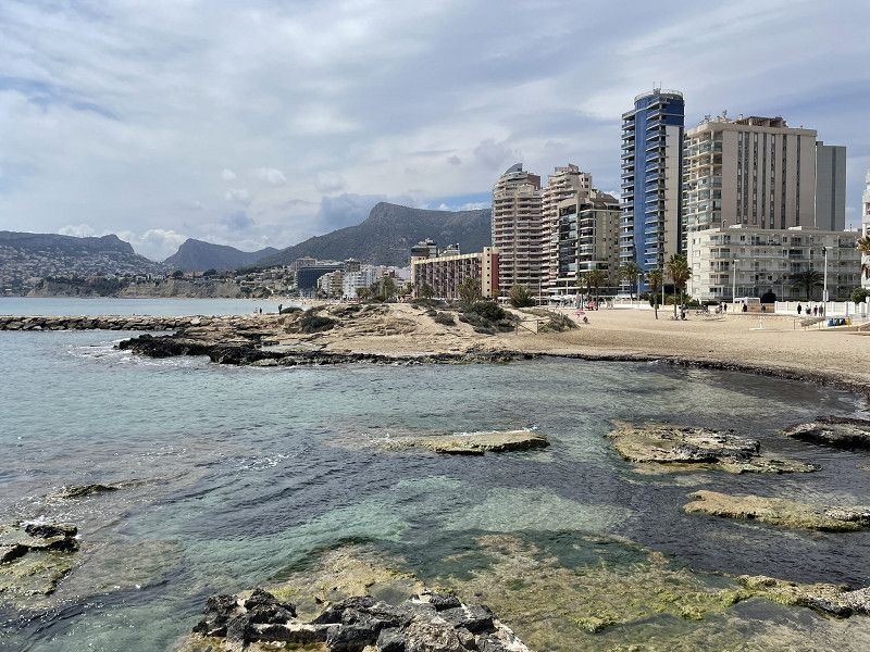
Xabia - Calpe
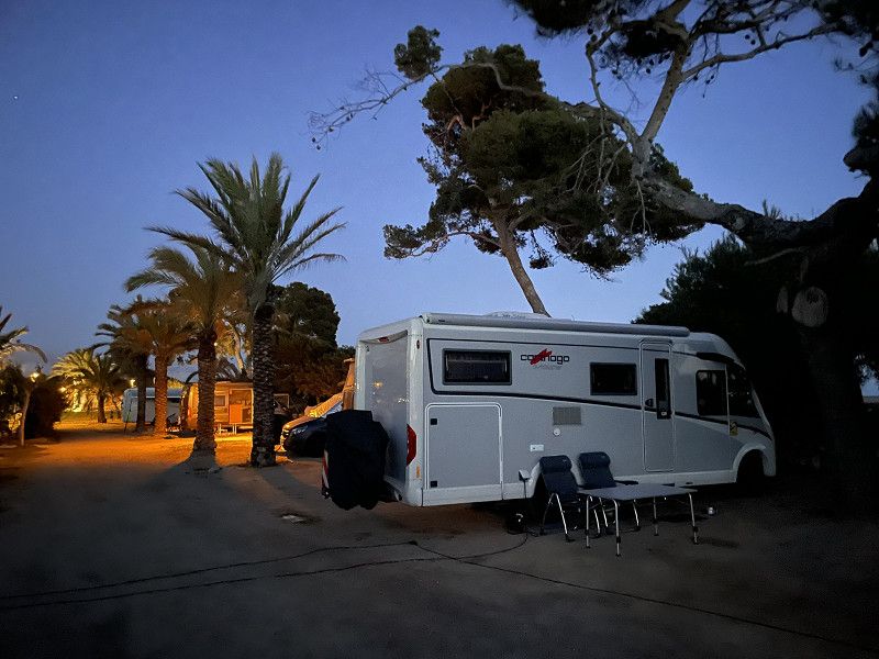
Continue along the beautiful coastal pass road to Xabia and Calpe.
Attention: this road is not suitable for long motorhomes as it is a real mountain pass. With our 7 m long baby Carthago it was still OK.
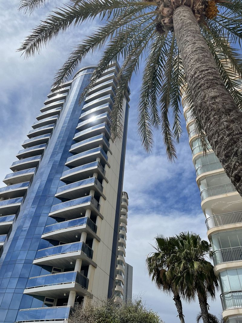
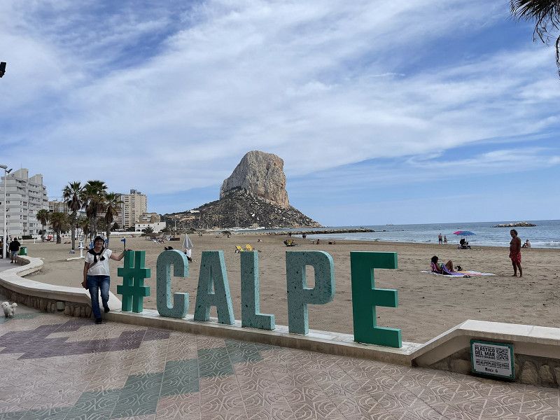
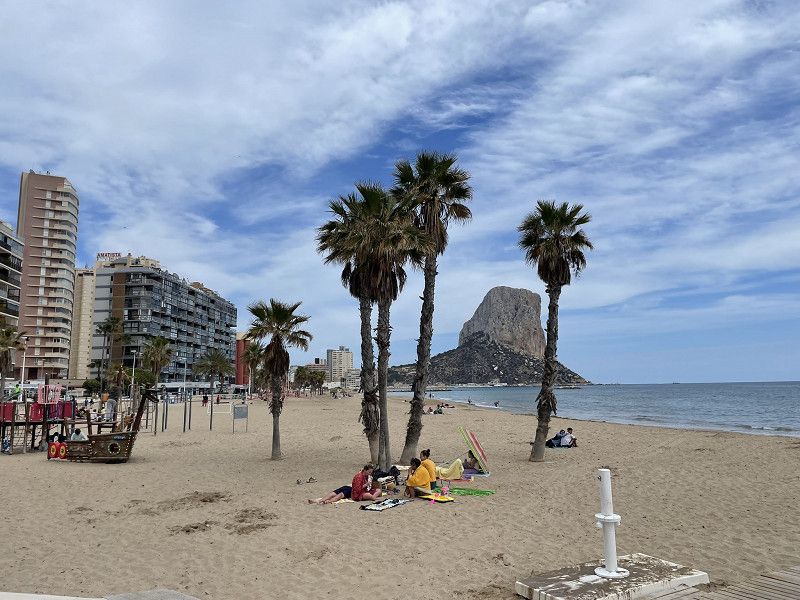
In Calpe at the CalpeMar campsite. Top location, right in the middle of town, clean, but very small pitches, price 36.- (ACSI only accepted for 3 nights or more (EUR 23.-))
Afternoon and evening: Walk to the promenade and the rock "Penon de Ifach"
Camping CalpeMar
C/Eslovenia 3, 03710, Calpe, Spain
38° 38' 41.5" N 0° 3' 21.6" E
38.6448700 0.0559900
• Head west on Calle Eslovenia. Go for 84 m.
• Take the 2nd exit from roundabout onto Calle Malta. Go for 143 m.
• Turn right onto Avenida de los Ejércitos Españoles (CV-746). Go for 81 m.
• Pass 2 roundabouts and continue on Avenida de los Ejércitos Españoles (CV-746). Go for 539 m.
• Take the 2nd exit from roundabout onto Avenida de la Diputación (CV-746). Go for 568 m.
• Pass 2 roundabouts and continue on Avenida de la Diputación (CV-746). Go for 630 m.
• Take left ramp onto N-332 toward Alacant/Alicante. Go for 7.2 km.
• Take ramp. Go for 2.1 km.
• Keep left toward Alicante/Alacant. Go for 30 m.
• Take ramp onto AP-7 (Autopista del Mediterráneo). Go for 36.7 km.
• Keep right onto AP-7 (Autovía del Mediterráneo) toward A-70/Alacant/Alicante/Murcia/Madrid. Go for 4.9 km.
• Continue on A-70 (Autovía del Mediterráneo). Go for 113 m.
• Take exit 1 toward N-332/El Campello. Go for 1.1 km.
• Take ramp toward Sant Joan d'Alacant/Alicante. Go for 499 m.
• Continue on Carretera de Valencia (N-332). Go for 343 m.
• Take the 2nd exit from roundabout onto Carretera de Valencia (N-332). Go for 936 m.
• Take the 3rd exit from roundabout onto Carretera de Valencia (N-332). Go for 764 m.
• Take the 1st exit from roundabout onto Avenida de la Diagonal. Go for 300 m.
• Continue on Calle Tomás Capelo. Go for 8 m.
• Turn right onto Calle La Ordana. Go for 117 m.
• Turn left onto Calle del Mercado. Go for 207 m.
• Continue on Calle Constancia de la Mora. Go for 78 m.
• Turn right onto Calle Clara Campoamor. Go for 98 m.
• Turn right toward Calle Pintor Manuel Baeza Gómez. Go for 80 m.
• Continue on Calle Pintor Manuel Baeza Gómez. Go for 60 m.
• Turn left onto Calle Mayor. Go for 133 m.
• Continue on Plaza España. Go for 10 m.
• Arrive at Plaza España. Your destination is on the right.
☍
57,8 km
( 42 min.)
Day
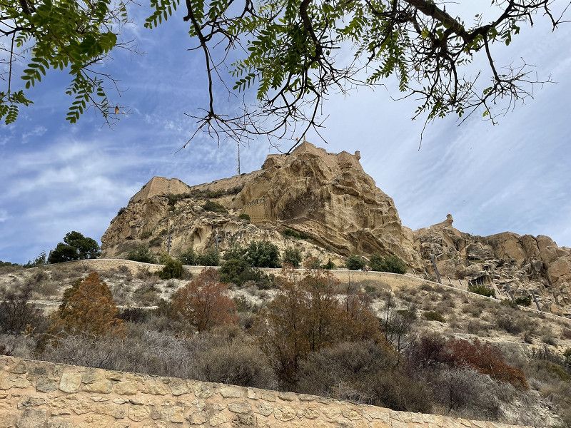
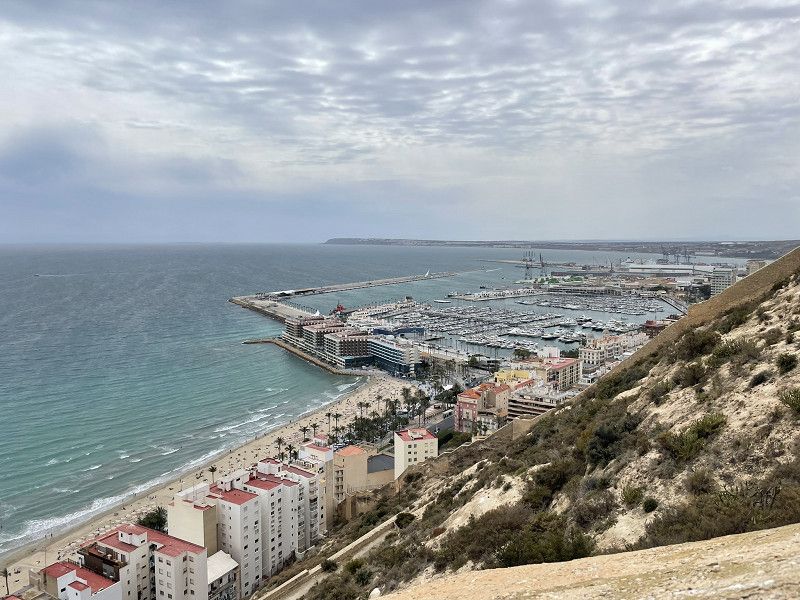
Alicante
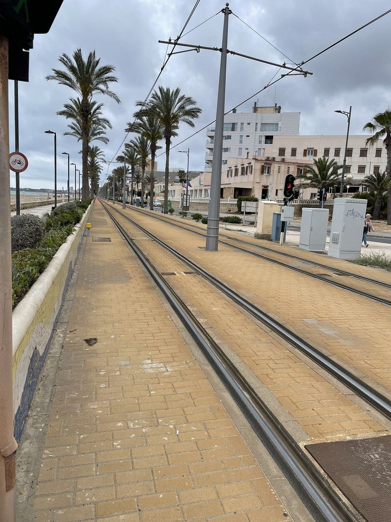
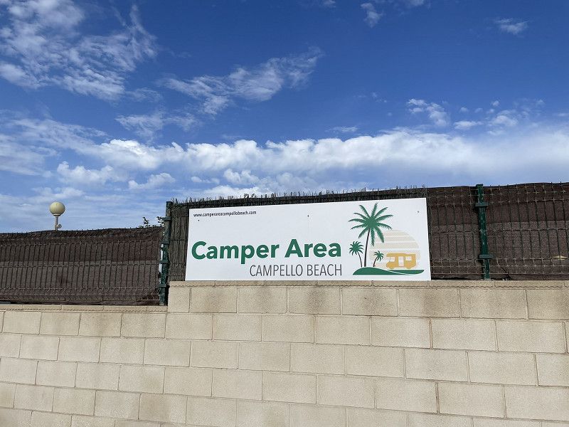
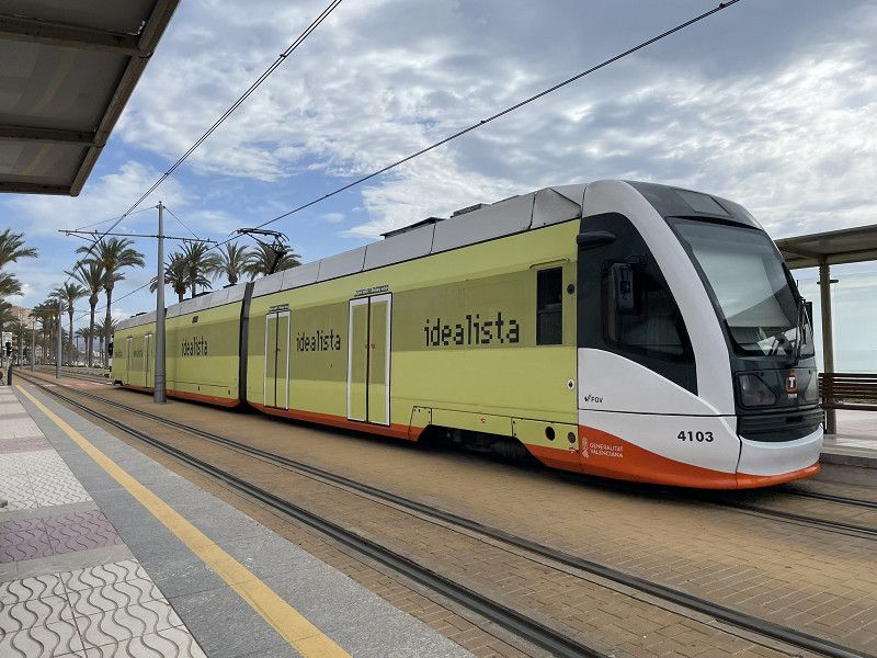
Continue to Alicante, parking space Camper Area Campello Beach, Playa de San Juan (EUR 14.- excl. electricity, large plots, great sanitary facilities, very friendly, great place!) 10 minutes to the tram station, 23 minutes drive to Alicante, 10 rides ticket approx. EUR 6.50, ticket card in the kiosk 10 minutes walk
Afternoon relaxation
Sant Joan d'Alacant
l'Alacantí, Valencianische Gemeinschaft, Spanien
38° 24' 5.1" N 0° 26' 9.6" W
38.4014162 -0.4359957
• Head toward Calle Cervantes on Plaza España. Go for 21 m.
• Continue on Calle Comandante Seva. Go for 122 m.
• Turn right onto Travesía Cervantes. Go for 82 m.
• Turn right onto Calle Azorín. Go for 118 m.
• Continue on Avenida de la Rambla. Go for 398 m.
• Take the 1st exit from Plaza José Sala roundabout onto Calle Mosén Pedro Mena. Go for 255 m.
• Take the 3rd exit from roundabout onto Avenida de Alicante. Go for 867 m.
• Continue on Calle Barranocet. Go for 12 m.
• Take the 3rd exit from Plaza de Santa Faz roundabout onto CV-821. Go for 101 m.
• Continue on Avenida del Hospital (CV-821). Go for 271 m.
• Take the 1st exit from roundabout onto Avenida de Denia (N-332). Go for 479 m.
• Take the 2nd exit from roundabout onto Avenida de Denia (N-332). Go for 1.0 km.
• Turn right toward Autovía del Mediterráneo/A-70. Go for 191 m.
• Take the 1st exit from roundabout onto A-70 (Autovía del Mediterráneo) toward Murcia/A-31/Madrid. Go for 24.1 km.
• Take exit 34 toward Elx/Elche onto EL-20 (Ronda Este de Elche). Go for 2.2 km.
• Take ramp toward Elche/CV-86/Elx/Ronda nord. Go for 280 m.
• Take the 1st exit from roundabout onto Ronda Norte toward Elche/CV-86/Elx/Ronda nord. Go for 702 m.
• Take the 2nd exit from roundabout onto Ronda Norte toward Elx. Go for 847 m.
• Take the 3rd exit from roundabout onto A-79. Go for 671 m.
• Take the 3rd exit from roundabout. Go for 149 m.
• Continue toward Partida Altabix. Go for 58 m.
• Continue on Partida Altabix. Go for 139 m.
• Take the 1st exit from roundabout. Go for 53 m.
• Continue on Partida Altabix. Go for 222 m.
• Turn left. Go for 29 m.
• Enter the roundabout. Go for 31 m.
• Arrive at your destination.
☍
33,4 km
( 26 min.)
Day
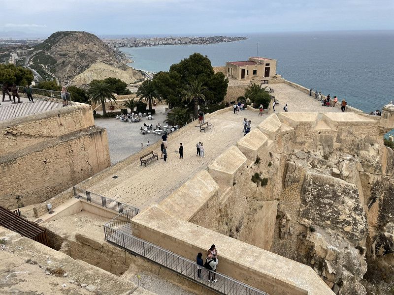
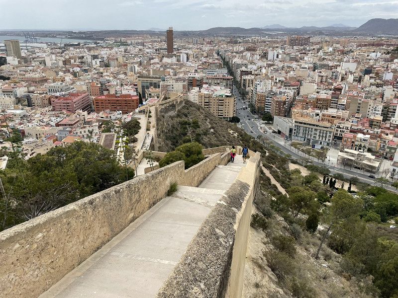
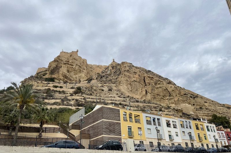
Alicante
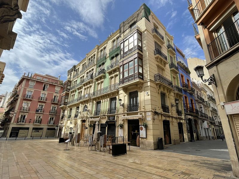
City tour, arrival by tram
Visit to the port, promenade with magical mosaic (Expanada de Espana), town hall, cathedral, castle hill (Sant Antoni) climbed with the Castel of Santa Barbara
Day
Elx - Elche
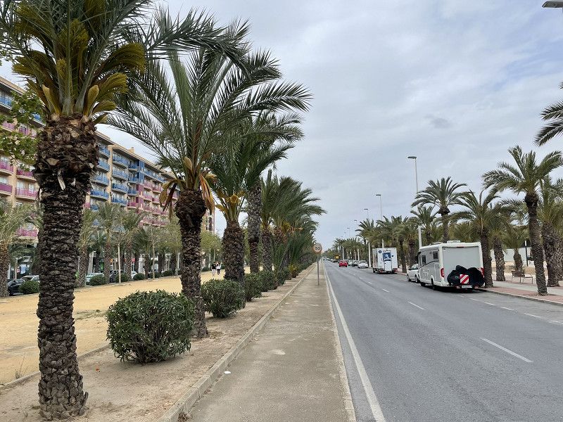
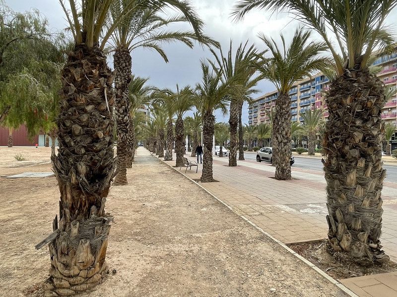
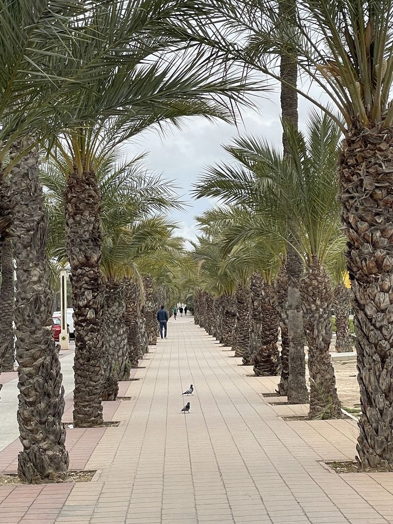
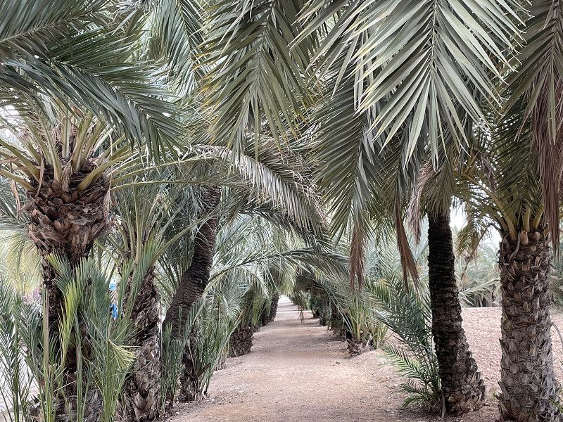
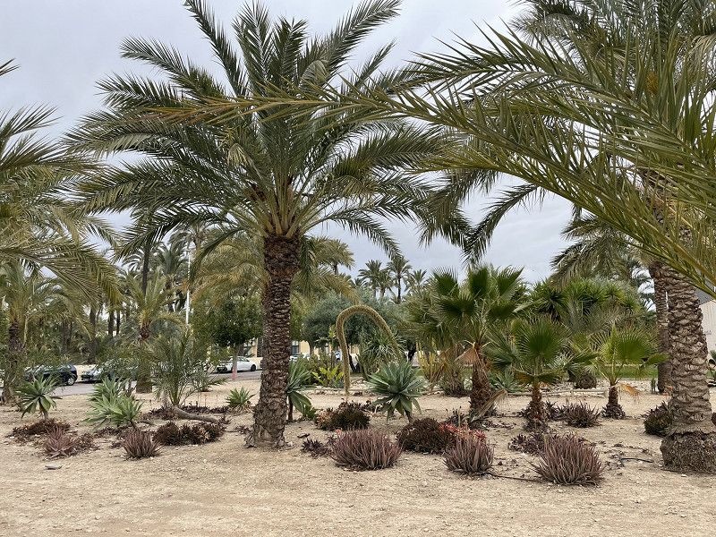
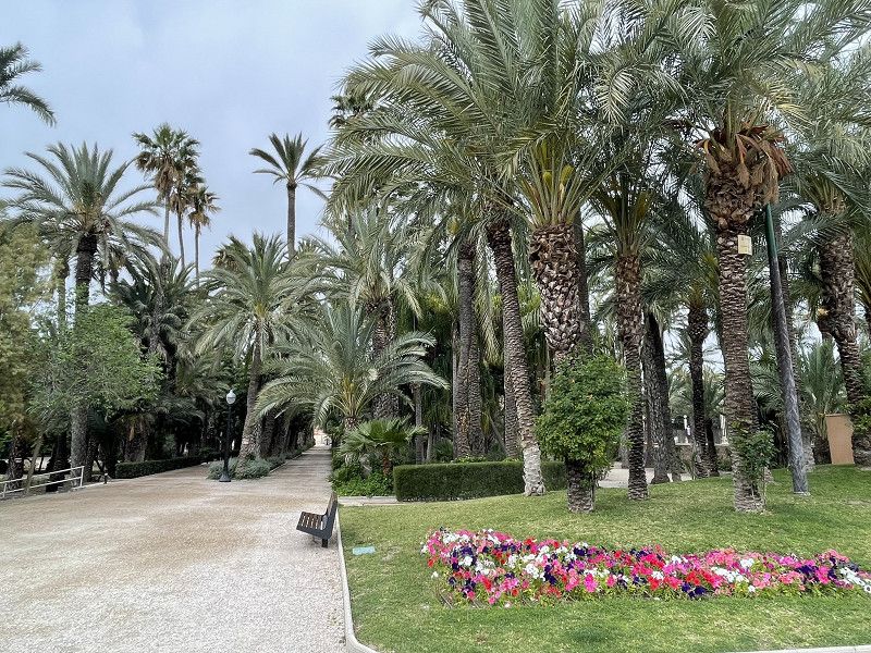
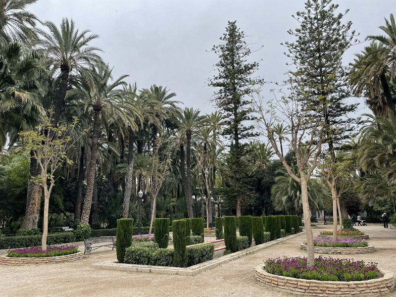
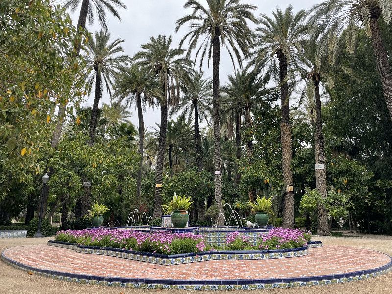
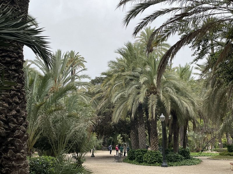
Trip to the palm city of Elx - a UNESCO World Heritage Site.
Motorhome parked for free along the Palmenallee (next to the university).
Walk along the gigantic palm avenue to the center, or rather to the special palm garden.
Universitat Miguel Hernández d'Elx (UMH)
Acceso Norte Universidad, Elx / Elche, el Baix Vinalopó, Valencianische Gemeinschaft, Spanien
38° 16' 37.1" N 0° 41' 23.8" W
38.2769777 -0.6899447
• Follow the roundabout. Go for 31 m.
• Take the 2nd exit from roundabout. Go for 29 m.
• Turn slightly left onto Partida Altabix. Go for 200 m.
• Turn right onto A-79. Go for 198 m.
• Take the 2nd exit from roundabout onto A-79. Go for 666 m.
• Take the 2nd exit from roundabout onto Ronda Norte toward CV-86/Alacant. Go for 856 m.
• Take the 2nd exit from roundabout onto Ronda Norte. Go for 779 m.
• Take the 3rd exit from roundabout onto Ronda Este de Elche (EL-20) toward Monforte del Cid/A-31/Madrid/E-15/A-7/Alacant/Alicante/Valencia. Go for 1.4 km.
• Keep left onto Ronda Este de Elche (EL-20) toward A-31/Monforte del Cid/Madrid/AP-7/Valencia. Go for 1.0 km.
• Continue on A-7 (Circunvalación de Alicante). Go for 6.5 km.
• Continue on A-31 (Autovía Alicante). Go for 6.8 km.
• Take exit 216 toward Novelda (Sur)/Agost/Novelda. Go for 516 m.
• Take the 3rd exit from roundabout onto CV-820 toward Novelda. Go for 132 m.
• Take the 1st exit from roundabout onto Avenida Jesús Navarro Jover (CV-820) toward Novelda. Go for 369 m.
• Take the 3rd exit from roundabout onto Avenida Jesús Navarro Jover (CV-820). Go for 350 m.
• Take the 3rd exit from roundabout onto Avenida Jesús Navarro Jover (CV-820). Go for 319 m.
• Continue on CV-820. Go for 29 m.
• Take the 3rd exit from roundabout onto Avenida Médico Enrique Sala. Go for 281 m.
• Take the 3rd exit from roundabout onto Avenida Pérez Galdós (N-325). Go for 245 m.
• Continue on N-325. Go for 44 m.
• Take the 1st exit from Plaza Juan XXIII roundabout onto N-325. Go for 42 m.
• Continue on Avenida de la Constitución (N-325). Go for 586 m.
• Pass 2 roundabouts and continue on Avenida de la Constitución (N-325). Go for 188 m.
• Turn right onto Calle Jaume II. Go for 252 m.
• Turn left onto Calle Argentina. Go for 43 m.
• Arrive at Calle Argentina. Your destination is on the right.
☍
21,8 km
( 19 min.)
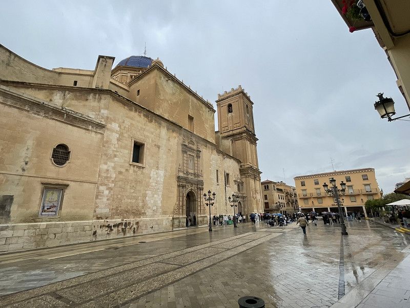
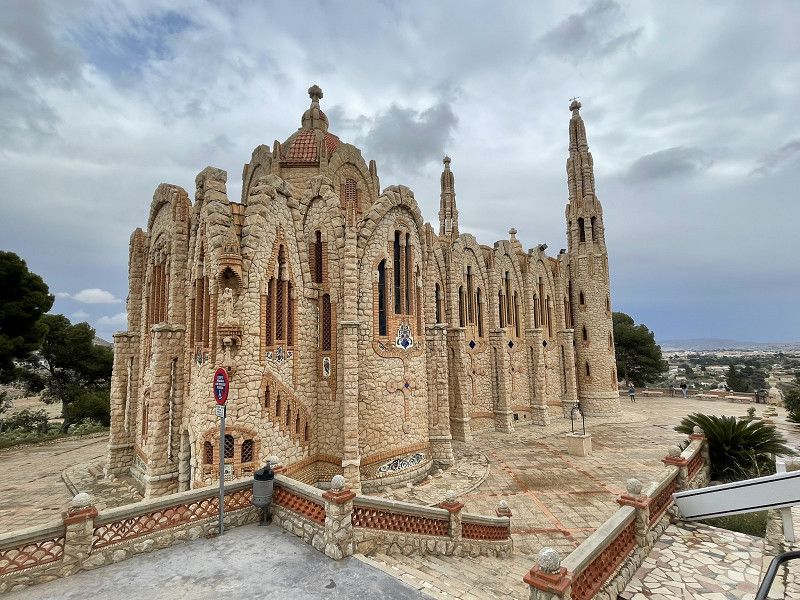
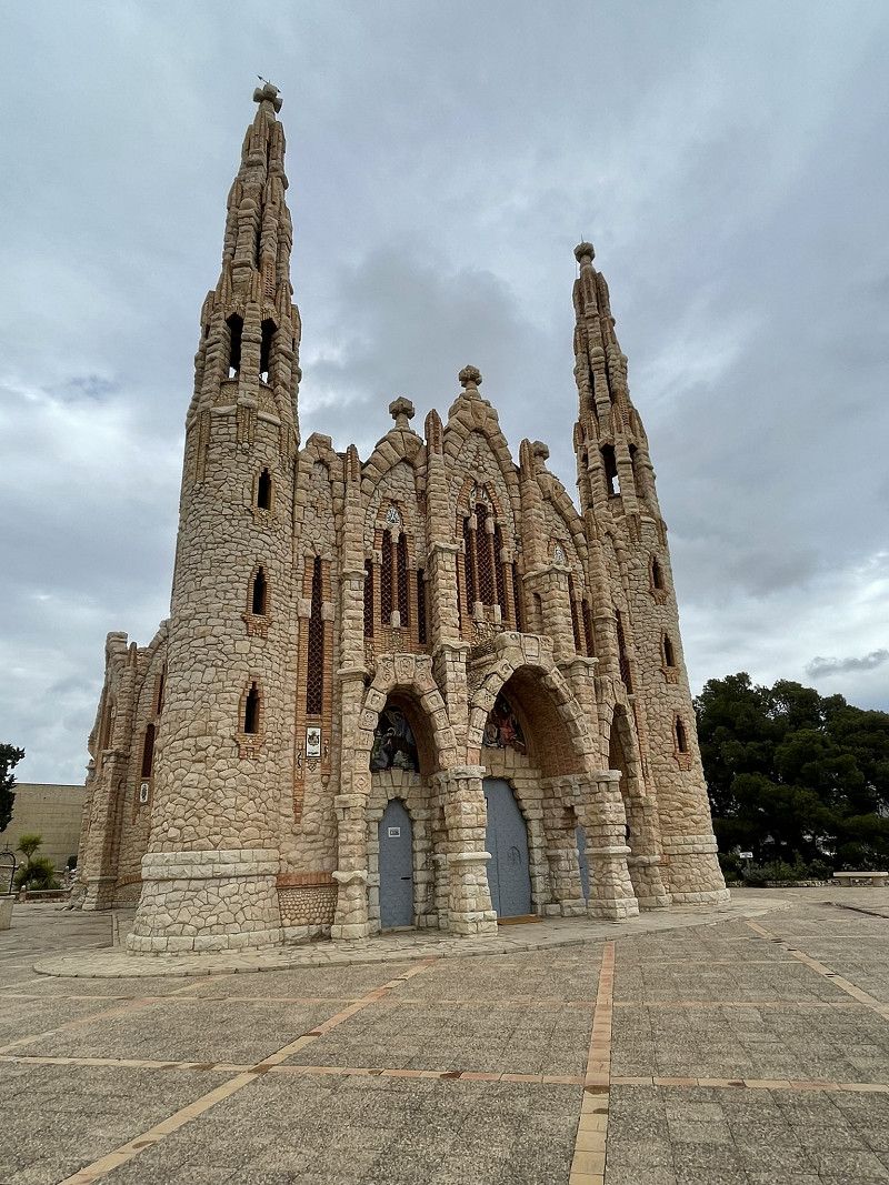
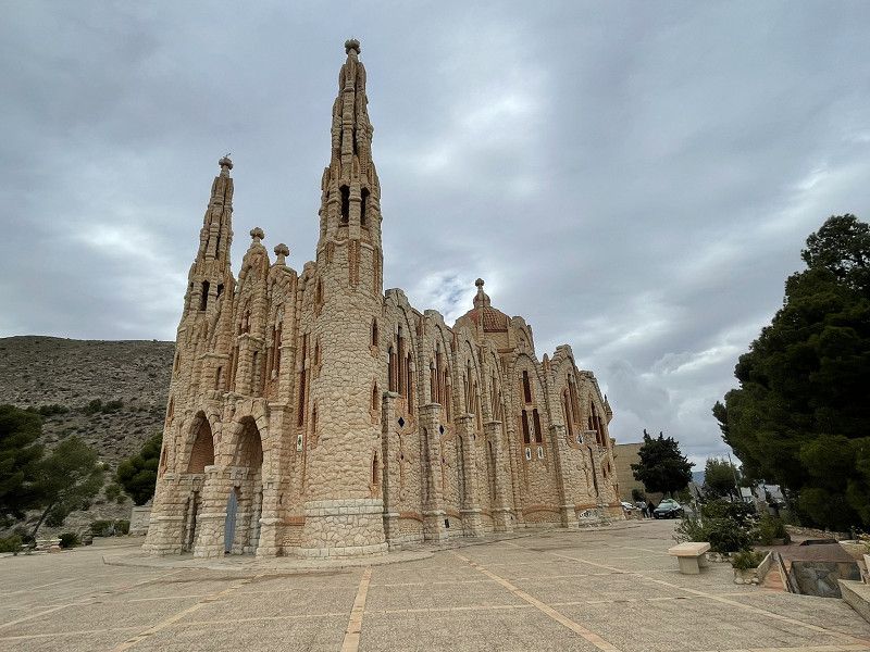
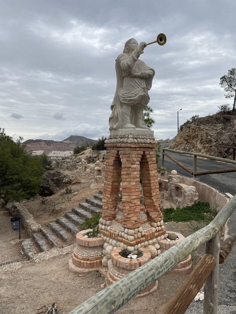
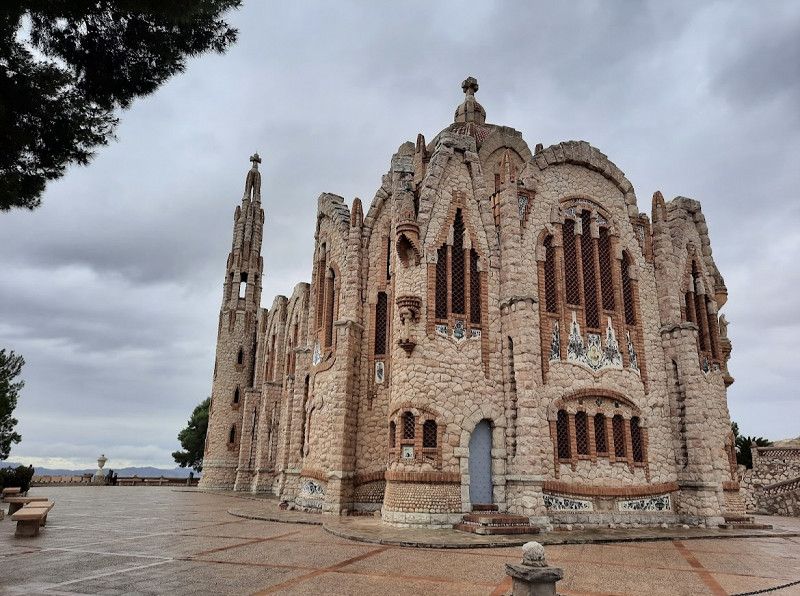
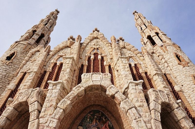
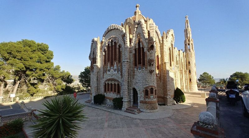
Novelda
Continue to Novelda, on the hill of the pilgrimage church of Santa Maria Magdalena (special architectural style)
Unfortunately, the church was not open at that exact time and we would have had to wait a few more hours.
Important: Check opening hours online (closed 2-5pm)
Return to "our" parking space in Alicante
Novelda
el Vinalopó Mitjà / El Vinalopó Medio, Valencianische Gemeinschaft, Spanien
38° 23' 3.2" N 0° 46' 2.7" W
38.3842144 -0.7674146
• Head toward Calle Santa Rosalía on Calle Argentina. Go for 113 m.
• Turn left onto Calle Santa Rosalía. Go for 237 m.
• Take the 1st exit from Plaza Pío XII roundabout onto Avenida de Elche (N-325). Go for 217 m.
• Turn left onto Avenida de los Reyes Católicos (N-325). Go for 694 m.
• Continue on N-325 toward A-31/Alacant/Alicante/Madrid. Go for 59 m.
• Take the 4th exit from roundabout onto Ronda Sureste de Novelda (CV-84) toward A-31/Alacant/Alicante/Madrid. Go for 1.3 km.
• Take the 3rd exit from roundabout onto CV-84. Go for 833 m.
• Take the 3rd exit from roundabout onto CV-84. Go for 814 m.
• Take the 2nd exit from roundabout. Go for 846 m.
• Continue straight ahead. Go for 54 m.
• Take the 3rd exit from roundabout toward Alicante. Go for 128 m.
• Take ramp onto A-31 (Autovía Alicante) toward Alicante. Go for 18.6 km.
• Take the exit toward Valencia onto A-70 (Autovía del Mediterráneo). Go for 11.1 km.
• Take exit 6 toward Alicante/Valencia/N-332. Go for 695 m.
• Take the 3rd exit from roundabout toward N-332/Valencia. Go for 318 m.
• Turn right onto Avenida de Denia (N-332). Go for 886 m.
• Take the 3rd exit from roundabout onto Avenida de Denia (N-332). Go for 595 m.
• Take the 3rd exit from roundabout onto Avenida del Hospital (CV-821). Go for 423 m.
• Continue on CV-821. Go for 23 m.
• Take the 1st exit from Plaza de Santa Faz roundabout onto Calle Barranocet. Go for 44 m.
• Continue on Avenida de Alicante. Go for 831 m.
• Take the 4th exit from roundabout onto Pasaje Climont. Go for 87 m.
• Turn right onto Calle El Quijote. Go for 135 m.
• Turn slightly left onto Calle Clara Campoamor. Go for 98 m.
• Turn right toward Calle Pintor Manuel Baeza Gómez. Go for 80 m.
• Continue on Calle Pintor Manuel Baeza Gómez. Go for 60 m.
• Turn left onto Calle Mayor. Go for 133 m.
• Continue on Plaza España. Go for 10 m.
• Arrive at Plaza España. Your destination is on the right.
☍
39,4 km
( 30 min.)
Sant Joan d'Alacant
l'Alacantí, Valencianische Gemeinschaft, Spanien
38° 24' 5.1" N 0° 26' 9.6" W
38.4014162 -0.4359957
• Head toward Calle Cervantes on Plaza España. Go for 21 m.
• Continue on Calle Comandante Seva. Go for 122 m.
• Turn right onto Travesía Cervantes. Go for 82 m.
• Turn right onto Calle Azorín. Go for 118 m.
• Continue on Avenida de la Rambla. Go for 398 m.
• Take the 1st exit from Plaza José Sala roundabout onto Calle Mosén Pedro Mena. Go for 255 m.
• Take the 3rd exit from roundabout onto Avenida de Alicante. Go for 867 m.
• Continue on Calle Barranocet. Go for 12 m.
• Take the 3rd exit from Plaza de Santa Faz roundabout onto CV-821. Go for 101 m.
• Continue on Avenida del Hospital (CV-821). Go for 271 m.
• Take the 1st exit from roundabout onto Avenida de Denia (N-332). Go for 479 m.
• Take the 2nd exit from roundabout onto Avenida de Denia (N-332). Go for 1.0 km.
• Turn right toward Autovía del Mediterráneo/A-70. Go for 191 m.
• Take the 1st exit from roundabout onto A-70 (Autovía del Mediterráneo) toward Murcia/A-31/Madrid. Go for 25.6 km.
• Continue on A-7 (Autovía del Mediterráneo). Go for 14.4 km.
• Keep right onto AP-7 (Autopista del Mediterráneo) toward Torrevieja/Cartagena. Go for 76.8 km.
• Continue on CT-32. Go for 6.8 km.
• Continue on A-30 (Autovía de Murcia). Go for 2.4 km.
• Continue on Calle Juan Muñoz Delgado. Go for 250 m.
• Continue on Paseo de Alfonso XIII. Go for 277 m.
• Take the 2nd exit from roundabout onto Paseo de Alfonso XIII toward Centro Ciudad/A-332/Mazarrón. Go for 1.2 km.
• Take the 1st exit from Plaza de España roundabout onto Alameda de San Antón. Go for 953 m.
• Take the 3rd exit from roundabout onto Calle Sebastián Feringán toward Mazarrón/N-332/Hospital Naval del Mediterráneo. Go for 707 m.
• Take the 3rd exit from roundabout onto Carretera de Tentegorra toward Mazarrón/Tentegorra. Go for 368 m.
• Turn slightly right. Go for 29 m.
• Arrive at your destination on the left.
☍
133,8 km
(1 hrs. 19 min.)
Day
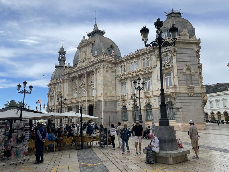
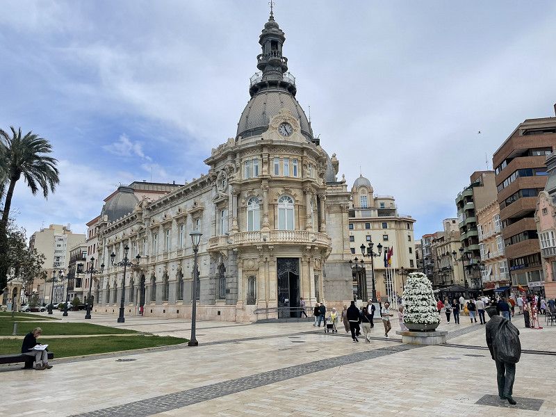
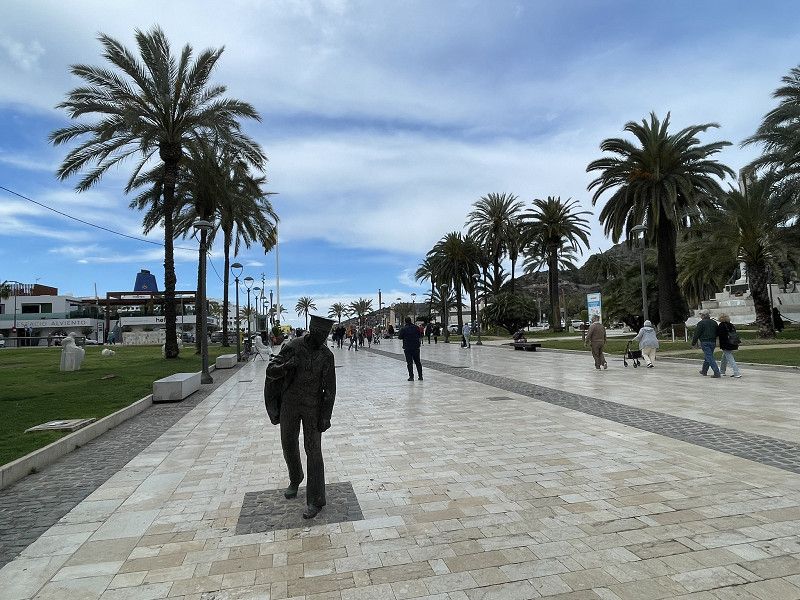
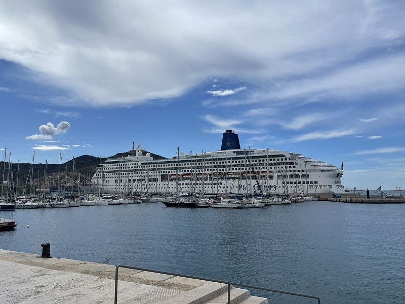
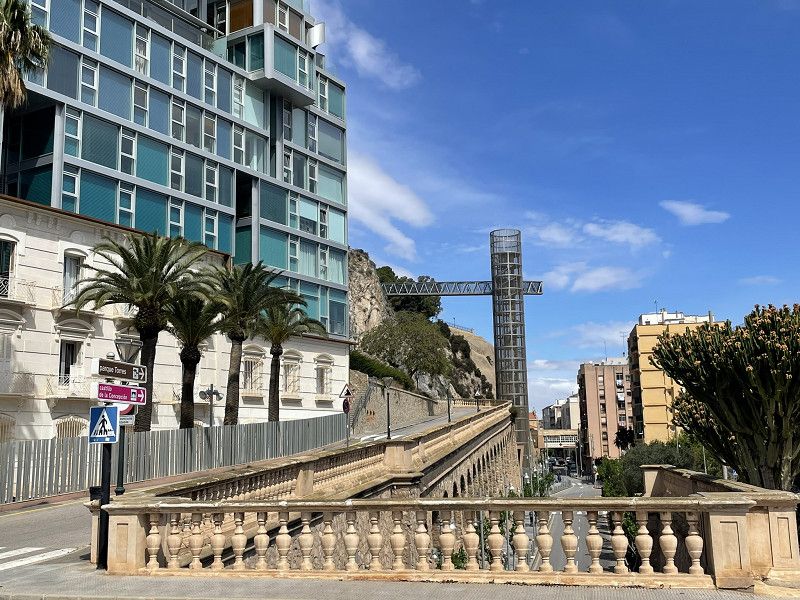
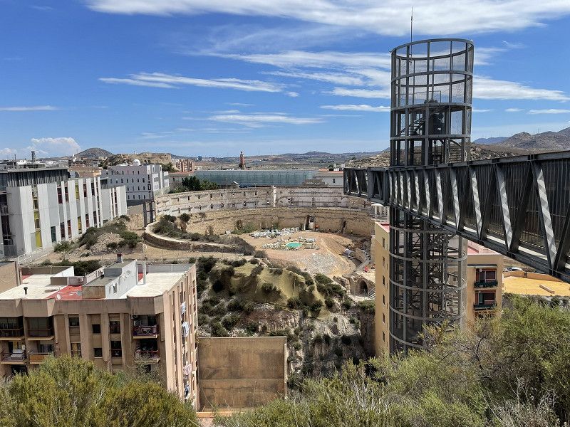
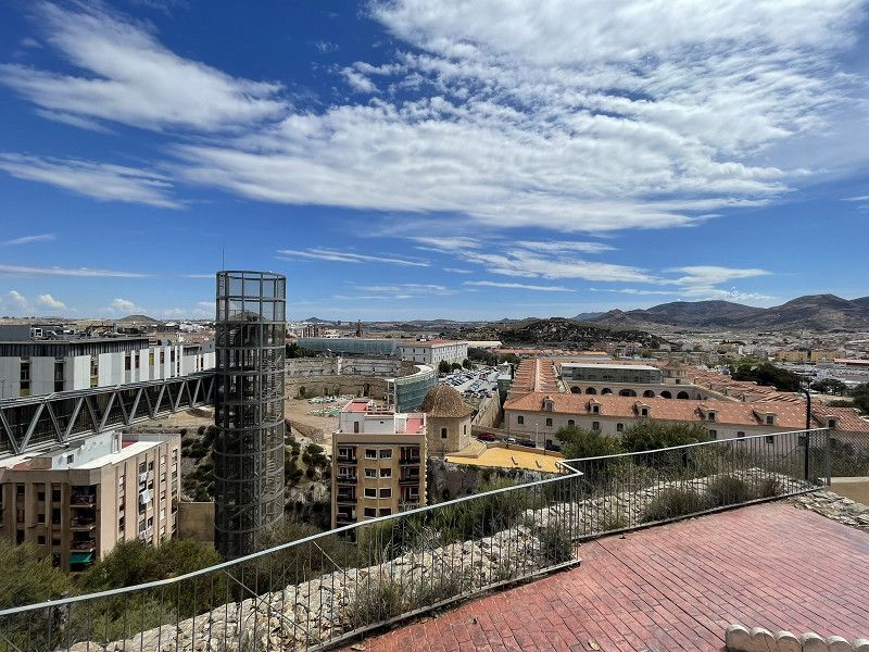
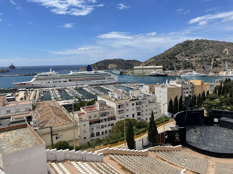
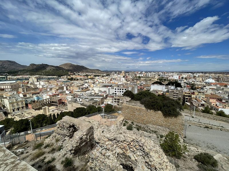
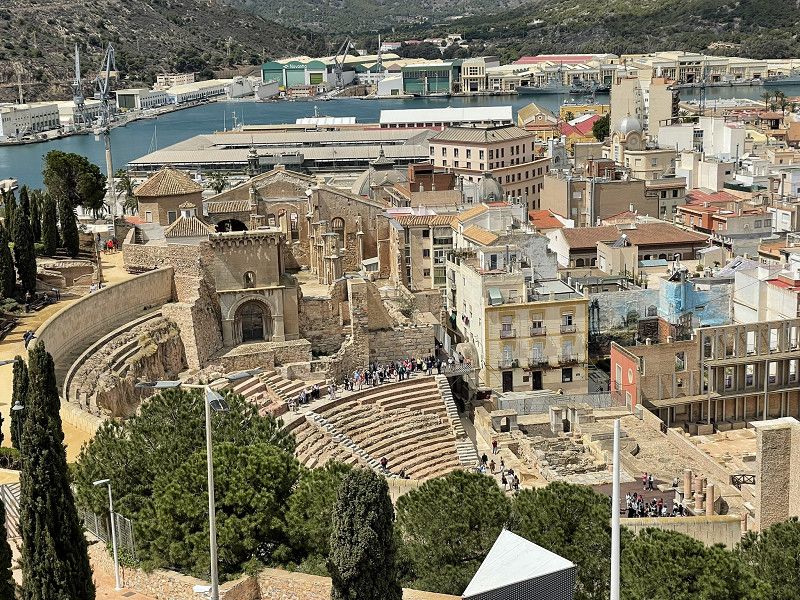
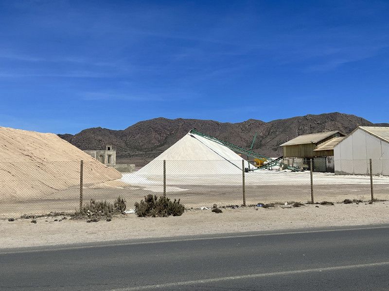
Cartagena
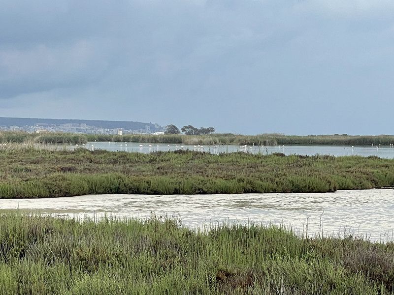
Continue via Las Marinas (salt pans, salt lakes, flamingos) to Torrevieja and Cartagena, parking space Area de Belmonte Plus = next to petrol station (ok for visiting the city, no sanitary facilities, but bread rolls and snacks within 20 m, EUR 12.- including electricity
(Unfortunately, due to the navigation system we were driving through the Pampas, there was no time for a city visit that day)
Área Autocaravanas Belmonte
Carretera de Tentegorra, Cartagena, Campo de Cartagena y Mar Menor, Region Murcia, Spanien
37° 36' 53.9" N 1° 0' 20.6" W
37.6149663 -1.0057120
• Head west. Go for 33 m.
• Turn left toward Carretera de Tentegorra. Go for 20 m.
• Turn right onto Carretera de Tentegorra. Go for 130 m.
• Take the 1st exit from roundabout onto Carretera de Tentegorra. Go for 193 m.
• Take the 1st exit from roundabout onto Pasaje Blases (N-332) toward Mazarrón. Go for 866 m.
• Take the 2nd exit from roundabout onto RM-332 toward Almería/Mazarrón. Go for 725 m.
• Take the 2nd exit from roundabout onto RM-332. Go for 798 m.
• Take the 2nd exit from roundabout toward E-15/AP-7/Mazarrón/Vera/Almería/Alicante. Go for 1.1 km.
• Take ramp onto AP-7 toward Mazarrón/Vera/Almería. Go for 30.6 km.
• Take exit 845 toward Mazarrón. Go for 1.0 km.
• Take the 3rd exit from roundabout onto D-4 toward Mazarrón. Go for 1.6 km.
• Continue on Calle Lorca (D-4). Go for 286 m.
• Take the 1st exit from roundabout onto Avenida de las Moreras toward Puerto/Mazarrón. Go for 450 m.
• Take the 4th exit from roundabout onto RM-332 toward N-332/Pto. de Mazarrón/Cartagena. Go for 1.1 km.
• Take the 1st exit from roundabout onto RM-332 toward N-332/Pto. de Mazarrón/Cartagena. Go for 2.2 km.
• Take the 3rd exit from roundabout onto RM-332 toward Cartagena/RM-D6/Bolnuevo/Puerto de Mazarrón/Pto. de Mazarrón. Go for 1.6 km.
• Take the 2nd exit from roundabout. Go for 200 m.
• Continue on Avenida Doctor Meca. Go for 203 m.
• Take the 1st exit from roundabout onto Avenida Doctor Meca toward Centro Ciudad Puerto de Mazarrón/Centro Urbano. Go for 797 m.
• Continue on Avenida de Tierno Galván. Go for 61 m.
• Take the 2nd exit from roundabout onto Avenida de Tierno Galván. Go for 70 m.
• Arrive at Avenida de Tierno Galván. Your destination is on the right.
☍
44,0 km
( 31 min.)
Day
Cartagena
Walk (25 min, there is also a bus every 30 min, 100 m from the parking space) to the city tour
Great pedestrian zone, harbor and (by elevator) up to the castle hill. Lunch in the pedestrian zone.
Day
Puerto de Mazarrón
Bajo Guadalentín, Region Murcia, Spanien
37° 33' 52" N 1° 15' 39.2" W
37.5644401 -1.2608910
• Head south on Avenida de Tierno Galván. Go for 139 m.
• Turn left onto Calle de la Revuelta. Go for 41 m.
• Turn right onto Calle de la Revuelta. Go for 102 m.
• Turn sharp right onto Avenida de Tierno Galván. Go for 201 m.
• Take the 1st exit from roundabout onto Avenida de Tierno Galván. Go for 82 m.
• Continue on Avenida Doctor Meca. Go for 751 m.
• Take the 3rd exit from roundabout onto Avenida Doctor Meca toward Mazarrón/RM-332. Go for 417 m.
• Take the 2nd exit from roundabout onto RM-332 toward Mazarrón. Go for 1.6 km.
• Take the 1st exit from roundabout onto RM-332 toward Mazarrón. Go for 2.3 km.
• Take the 1st exit from roundabout onto MU-603 toward Mazarrón/Centro Urbano. Go for 533 m.
• Continue on Avenida Constitución (MU-603). Go for 656 m.
• Arrive at Avenida Constitución (MU-603). Your destination is on the left.
☍
6,8 km
( 9 min.)
Mazarrón
Bajo Guadalentín, Region Murcia, Spanien
37° 35' 55.2" N 1° 18' 49.9" W
37.5986534 -1.3138511
• Head northwest on Avenida Constitución (MU-603). Go for 45 m.
• Turn left onto Calle del Pino. Go for 232 m.
• Continue on Calle del Pilar. Go for 60 m.
• Continue on Calle de la Boquera. Go for 300 m.
• Take the 1st exit from roundabout onto Calle Lorca (D-4) toward Almería. Go for 311 m.
• Continue on D-4. Go for 1.5 km.
• Take the 1st exit from roundabout onto AP-7 toward Vera/Almería. Go for 33.5 km.
• Take exit 878 toward Águilas. Go for 944 m.
• Take the 3rd exit from roundabout onto RM-D24 toward Águilas/Los Arejos. Go for 147 m.
• Take the 1st exit from roundabout onto RM-11 toward Águilas. Go for 3.9 km.
• Take the 4th exit from roundabout onto Vial de Circunvalación (RM-D14) toward Calabardina. Go for 1.4 km.
• Pass 2 roundabouts and continue on Vial de Circunvalación (RM-D14). Go for 2.3 km.
• Take the 3rd exit from roundabout onto RM-D14 toward Calabardina/Cabo Cope. Go for 366 m.
• Continue on RM-D14. Go for 451 m.
• Continue on Isla del Fraile (RM-D14). Go for 109 m.
• Continue on RM-D14. Go for 594 m.
• Turn left toward Calle Geranios. Go for 10 m.
• Turn left onto Calle Geranios. Go for 91 m.
• Turn slightly right onto Urbanización Los Geráneos. Go for 130 m.
• Turn slightly left onto Calle Geranios. Go for 52 m.
• Turn slightly right onto Urbanización Los Geráneos. Go for 24 m.
• Continue on Calle Geranios. Go for 226 m.
• Turn right. Go for 180 m.
• Arrive at your destination.
☍
46,8 km
( 33 min.)
Stellplatz Dümo Camperpark
Continue via Puerto de Mazzaron (walk to the beautiful marina) to Mazzaron (old ore mines, mining town in the interior) and further to Aguilas.
Pitch at Dümo Camperpark (EUR 15 plus EUR 2 for the shower plus EUR 2 for electricity). Nice (German-speaking) receptionist, large plots, good sanitary facilities, forget the WiFi! Not many campers.
Urb. Los Geráneos Águilas, 30880, Águilas, Spain
37° 25' 39" N 1° 33' 5" W
37.4275000 -1.5513800
• Head toward Calle Geranios. Go for 180 m.
• Turn left onto Calle Geranios. Go for 226 m.
• Continue on Urbanización Los Geráneos. Go for 24 m.
• Turn slightly left onto Calle Geranios. Go for 52 m.
• Turn slightly right onto Urbanización Los Geráneos. Go for 130 m.
• Turn slightly left onto Calle Geranios. Go for 91 m.
• Turn right toward RM-D14. Go for 10 m.
• Turn right onto RM-D14. Go for 594 m.
• Continue on Isla del Fraile (RM-D14). Go for 109 m.
• Continue on RM-D14. Go for 724 m.
• Take the 1st exit from roundabout onto Vial de Circunvalación (RM-D14) toward RM-11/Lorca/Murcia/AP-7/Vera/Cartagena. Go for 999 m.
• Pass 2 roundabouts and continue on Vial de Circunvalación (RM-D14). Go for 2.6 km.
• Take the 2nd exit from roundabout onto RM-11 toward N-332/E-15/Vera/AP-7/Almería/Cartagena/Lorca. Go for 3.5 km.
• Take the exit toward Vera/Almería/Cartagena. Go for 390 m.
• Take the 3rd exit from roundabout onto AP-7 toward Vera/Almería. Go for 34.4 km.
• Continue toward Autovía del Mediterráneo/A-7. Go for 502 m.
• Take the left exit toward Los Gallardos/Almería onto A-7 (Autovía del Mediterráneo). Go for 8.0 km.
• Take exit 704 toward Los Gallardos/Garrucha/A-370/Mojácar. Go for 314 m.
• Turn left onto N-340a toward E-15/A-7/Vera/Murcia/Los Gallardos/A-370/Garrucha/Turre/Mojácar. Go for 3.2 km.
• Turn left onto A-370 toward Garrucha/Turre/Mojácar. Go for 7.7 km.
• Turn right onto A-1203 toward Mojácar/AL-6113/Carboneras. Go for 3.4 km.
• Take the 1st exit from roundabout onto AL-6111 toward Centro Urbano/Mojácar/AL-6113. Go for 792 m.
• Take the 3rd exit from roundabout onto Avenida de Andalucía. Go for 262 m.
• Turn slightly right onto Cuesta de la Fuente. Go for 31 m.
• Turn slightly left onto Avenida de Encamp. Go for 273 m.
• Turn slightly left onto Avenida de Encamp. Go for 160 m.
• Turn slightly left onto Avenida de París. Go for 42 m.
• Turn left onto Calle Glorieta. Go for 28 m.
• Turn left onto Calle Glorieta. Go for 109 m.
• Turn right onto Calle Puntíca. Go for 179 m.
• Turn left onto Calle La Guardia. Go for 67 m.
• Arrive at Calle La Guardia. Your destination is on the right.
☍
69,0 km
( 49 min.)
Day
Mojacar
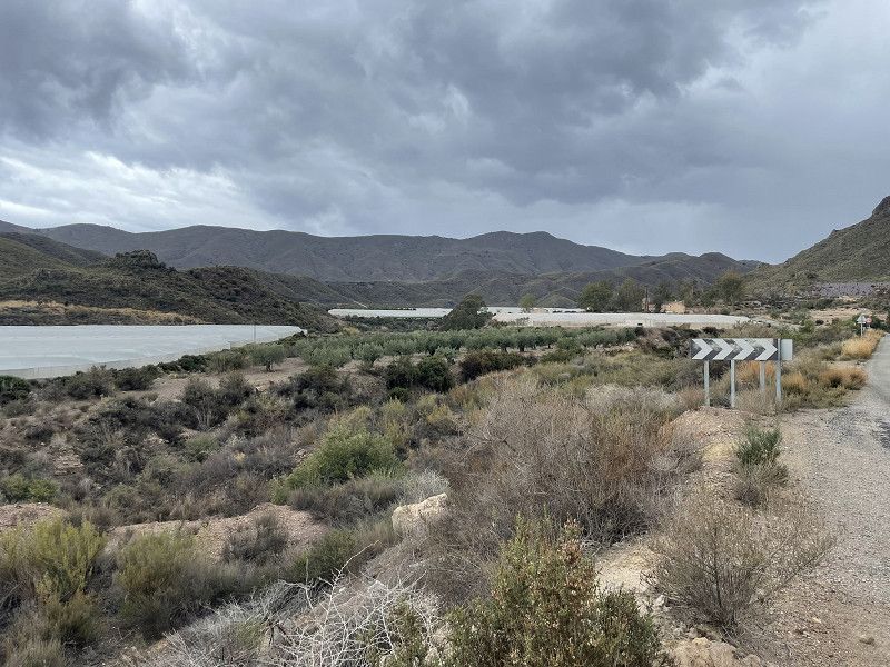
Continue along the beautiful coastal road
(there are chimneys from old smelting furnaces everywhere in the area),
Passes, magnificent mountains and arid areas.
Destination: the white mountain village of Mojacar. (large free parking lot in front of the town). Lunch in the small but excellent restaurant La Muralla (never had such a heavily topped pizza)
Continue on the beautiful coastal road to Carboneras, Camper Park Carboneras parking space. (EUR 10.- without electricity, sanitary facilities OK) very remote, but worth one night...
Mojácar
Almería, Andalusien, Spanien
37° 8' 24.8" N 1° 51' 3.6" W
37.1402087 -1.8510071
• Head toward Calle Arrabal on Calle La Guardia.
• Turn left onto Cuesta de la Fuente. Go for 38 m.
• Turn left onto Cuesta de la Fuente. Go for 82 m.
• Turn left onto Calle Embajadores. Go for 225 m.
• Turn slightly right onto Calle Glorieta. Go for 109 m.
• Turn right onto Calle Glorieta. Go for 28 m.
• Turn left onto Avenida de París. Go for 270 m.
• Continue on Calle Los Silos. Go for 46 m.
• Take the 2nd exit from roundabout onto Carretera de Subida al Campo de Fútbol. Go for 806 m.
• Take the 1st exit from roundabout onto AL-6111. Go for 1.3 km.
• Take the 3rd exit from roundabout onto AL-6111. Go for 789 m.
• Take the 2nd exit from roundabout onto AL-6113 toward Carboneras. Go for 1.1 km.
• Take the 1st exit from roundabout onto Paseo del Mediterráneo (AL-5107) toward Golf Macenas/Carboneras/AL-5105. Go for 452 m.
• Pass 3 roundabouts and continue on Paseo del Mediterráneo (AL-5107). Go for 2.2 km.
• Take the 3rd exit from roundabout onto Paseo del Mediterráneo (AL-5107) toward Sopalmo/Agua de Enmedio/Golf Macenas. Go for 3.6 km.
• Pass 4 roundabouts and continue on AL-5107. Go for 13.3 km.
• Take the 3rd exit from roundabout onto Avenida de Garrucha (AL-5107) toward Centro Urbano. Go for 771 m.
• Take the 2nd exit from roundabout onto Avenida del Mar (ALP-118) toward Castillo. Go for 36 m.
• Turn slightly right onto Calle Sorbas (ALP-118). Go for 82 m.
• Continue on Calle Sorbas (ALP-118). Go for 176 m.
• Turn left onto Calle Sorbas (ALP-118). Go for 10 m.
• Turn right onto Calle Sorbas (ALP-118). Go for 41 m.
• Turn slightly right onto Plaza del Castillo. Go for 30 m.
• Arrive at Plaza del Castillo. Your destination is on the left.
☍
25,4 km
( 35 min.)
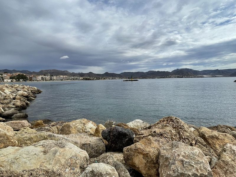
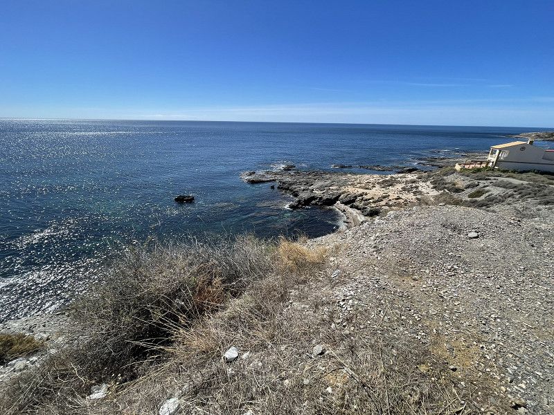
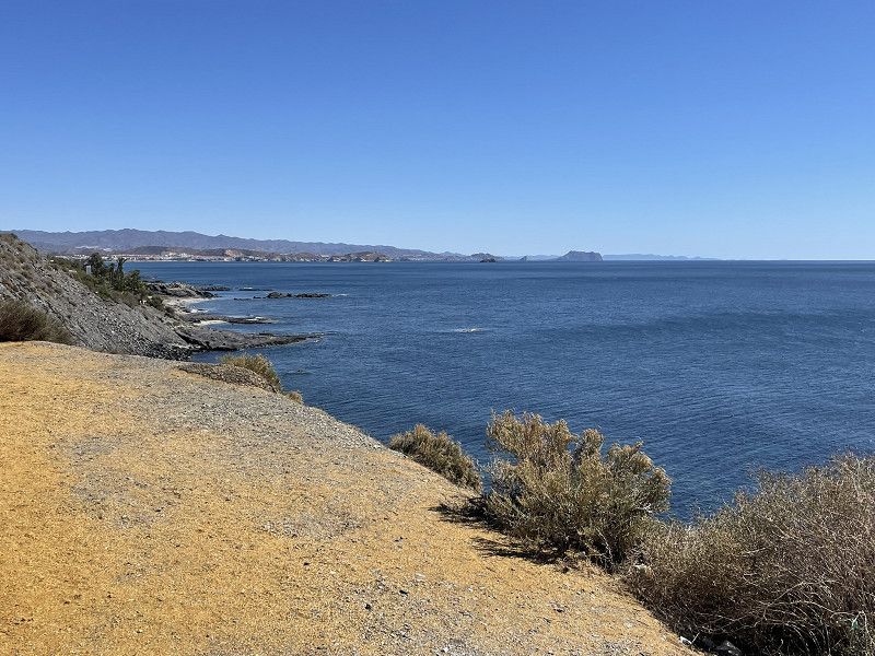
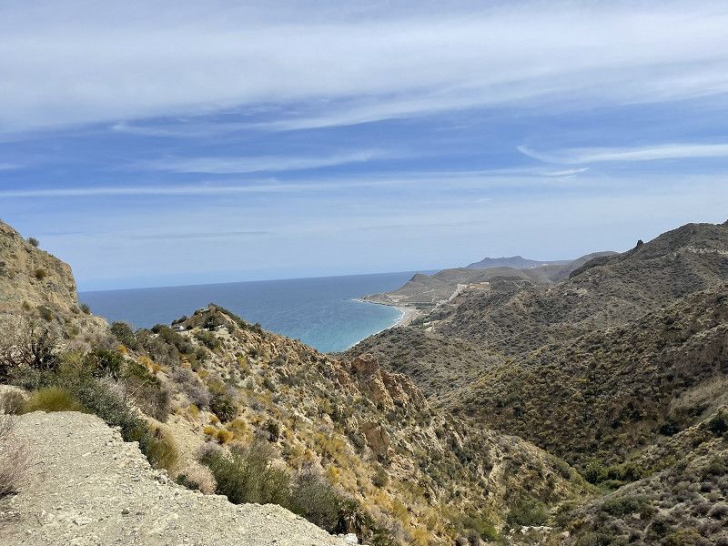
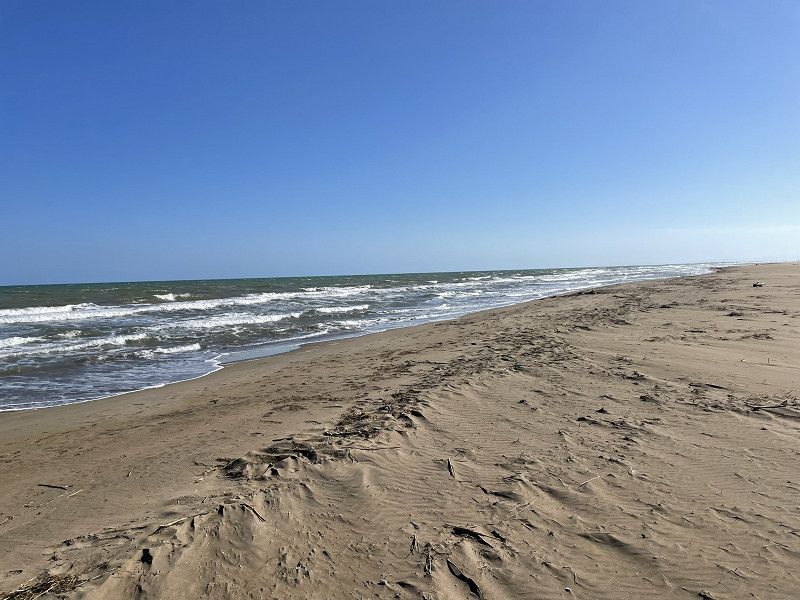
Carboneras
the drive along the coast is simply beautiful
Carboneras
Almería, Andalusien, Spanien
36° 59' 48.7" N 1° 53' 40.8" W
36.9968699 -1.8946552
• Head west on Plaza del Castillo. Go for 20 m.
• Turn left onto Plaza del Castillo. Go for 60 m.
• Turn right onto Calle del Mar (ALP-118). Go for 93 m.
• Turn slightly left onto Avenida de Faro de Mesa Roldán (AL-5107). Go for 486 m.
• Take the 3rd exit from roundabout onto Avenida de Faro de Mesa Roldán (AL-5107). Go for 326 m.
• Take the 2nd exit from Avenida de Faro de Mesa Roldán roundabout onto Avenida de Faro de Mesa Roldán (AL-5107) toward Almería/N-341. Go for 434 m.
• Keep right onto N-341 toward A-7/Almería. Go for 17.3 km.
• Take the 2nd exit from roundabout onto N-341 toward Almería/E-15/Murcia/A-7. Go for 173 m.
• Take the 4th exit from roundabout onto A-7 (Autovía del Mediterráneo) toward Níjar/Almería/Vera/Murcia. Go for 26.1 km.
• Take exit 762 toward Hospital/Retamar-El Toyo/AL-3115/Cabo de Gata onto N-344. Go for 4.5 km.
• Take the 2nd exit from roundabout onto Carretera Níjar-Retamar (N-344) toward Almería/AL-12. Go for 565 m.
• Take the 3rd exit from roundabout onto Carretera de Cabo de Gata (AL-3115) toward El Toyo/Plaza del Mar/Retamar/Cabo de Gata/San Jose. Go for 528 m.
• Take the 2nd exit from roundabout onto Carretera de Cabo de Gata (AL-3115). Go for 749 m.
• Take the 3rd exit from roundabout toward Cabo de Gata/San Jose. Go for 114 m.
• Continue on Carretera de Cabo de Gata (AL-3115). Go for 7.2 km.
• Take the 1st exit from roundabout onto Carretera de Cabo de Gata (AL-3115) toward Cabo de Gata. Go for 2.0 km.
• Continue on AL-3115. Go for 259 m.
• Continue on Carretera de Cabo de Gata (AL-3115). Go for 2.6 km.
• Continue on AL-3115. Go for 509 m.
• Take the 1st exit from roundabout onto Calle Mazarulleque. Go for 74 m.
• Turn left onto Calle Las Norias. Go for 47 m.
• Arrive at Calle Las Norias. Your destination is on the right.
☍
64,0 km
( 51 min.)
Day
Gabo de Gata
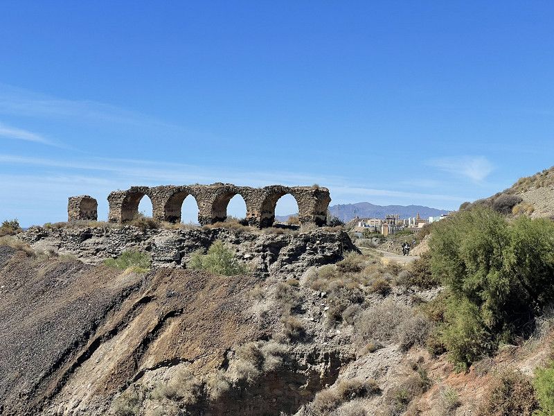
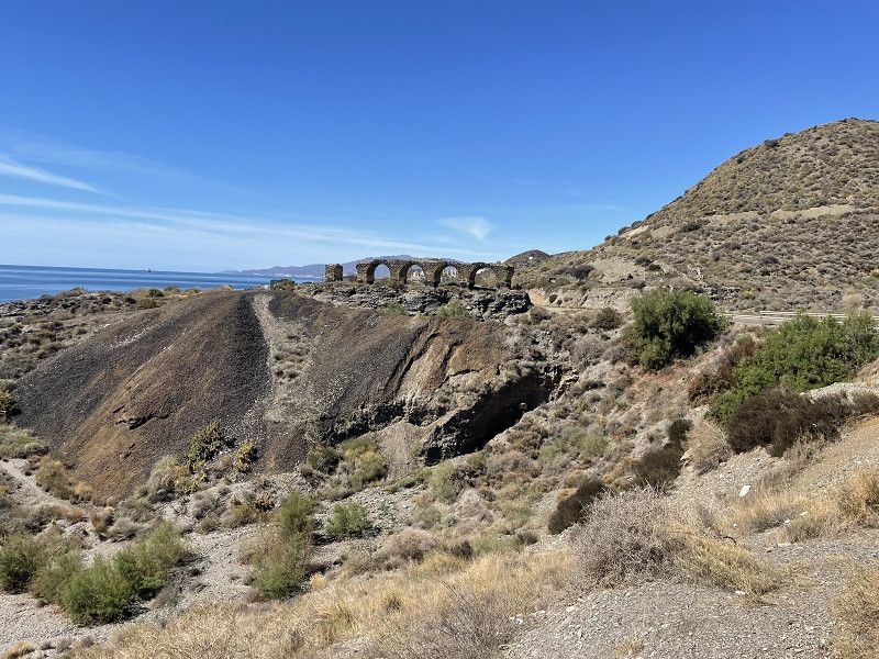
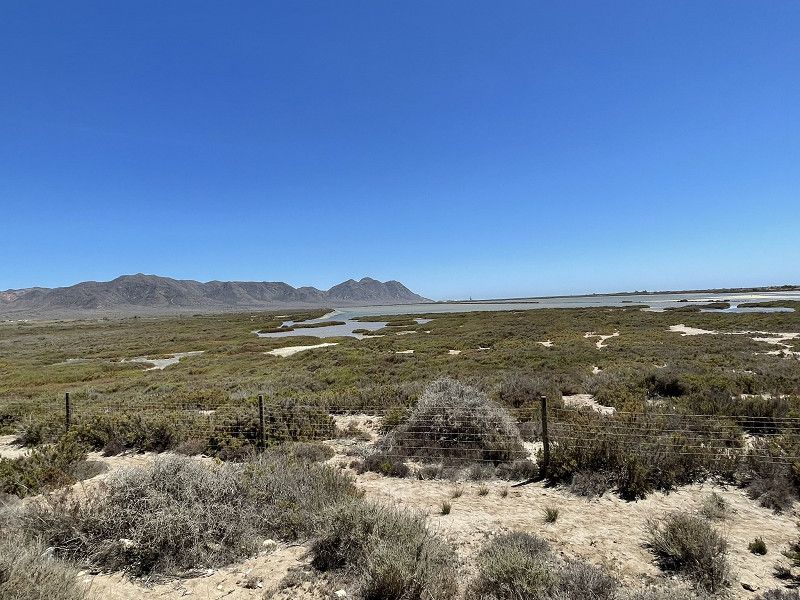
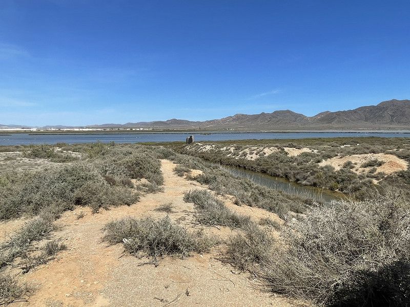
Continue on the A7 to Nijar, then head towards the Gabo de Gata Nature Park to the campsite of the same name. (EUR 23 plus electricity according to consumption)
Place with lots of birds (nature reserve), a pool and a small shop. Little shade.
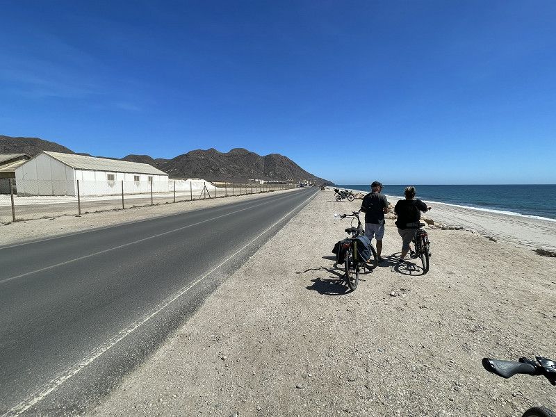
Afternoon bike ride to the sea and the small town of Gabo de Gata. Cycled along the coastal road, salt pans and flamingos
Cabo de Gata
Almería, Andalusien, Spanien
36° 46' 52.1" N 2° 14' 31.8" W
36.7811435 -2.2421768
• Head toward Calle Iglesia de Cabo de Gata on Calle Las Norias. Go for 44 m.
• Turn left onto Calle Iglesia de Cabo de Gata. Go for 7 m.
• Turn slightly right onto Calle Carretera. Go for 56 m.
• Take the 2nd exit from roundabout onto AL-3115. Go for 153 m.
• Keep right onto AL-3115. Go for 410 m.
• Continue on Carretera de Cabo de Gata (AL-3115). Go for 2.6 km.
• Continue on AL-3115. Go for 259 m.
• Continue on Carretera de Cabo de Gata (AL-3115). Go for 1.8 km.
• Turn left onto Carretera de Cabo de Gata (AL-3115). Go for 121 m.
• Take the 3rd exit from roundabout onto Carretera de Cabo de Gata (AL-3115) toward Almería. Go for 7.3 km.
• Take the 2nd exit from roundabout onto Carretera de Cabo de Gata (AL-3115) toward Hospital de Alta Resolución El Toyo/Almería/N-340a/AL-12. Go for 778 m.
• Take the 3rd exit from roundabout onto Carretera de Cabo de Gata (AL-3115). Go for 414 m.
• Take the 2nd exit from roundabout onto N-344 toward Almería/AL-12. Go for 690 m.
• Take the 3rd exit from roundabout onto N-344 toward Almería. Go for 2.3 km.
• Take the 1st exit from roundabout onto N-349 toward E-15/Almería/Murcia. Go for 2.1 km.
• Take the 2nd exit from roundabout toward E-15/A-7/A-92/Granada/Almería. Go for 172 m.
• Continue toward Autovía del Mediterráneo/A-7. Go for 41 m.
• Take the 4th exit from roundabout onto A-7 (Autovía del Mediterráneo) toward Almería/Ronda de Almería/A-92/Granada/Málaga. Go for 7.3 km.
• Take exit 777 toward Guadix/Granada. Go for 295 m.
• Take the 2nd exit from roundabout onto A-92 toward Guadix/Granada. Go for 16.8 km.
• Take exit 376 toward Tabernas. Go for 241 m.
• Take the 2nd exit from roundabout onto N-340a toward Tabernas. Go for 5.0 km.
• Turn right. Go for 1.4 km.
• Turn right. Go for 657 m.
• Arrive at your destination on the right.
☍
51,0 km
( 47 min.)
Day
Gabo de Gata - Ruhetag
Do laundry, relax, enough time to prepare a delicious lunch
In the evening we were invited to a fondue by friends (who we had arranged to meet at this campsite) - mmmh delicious.
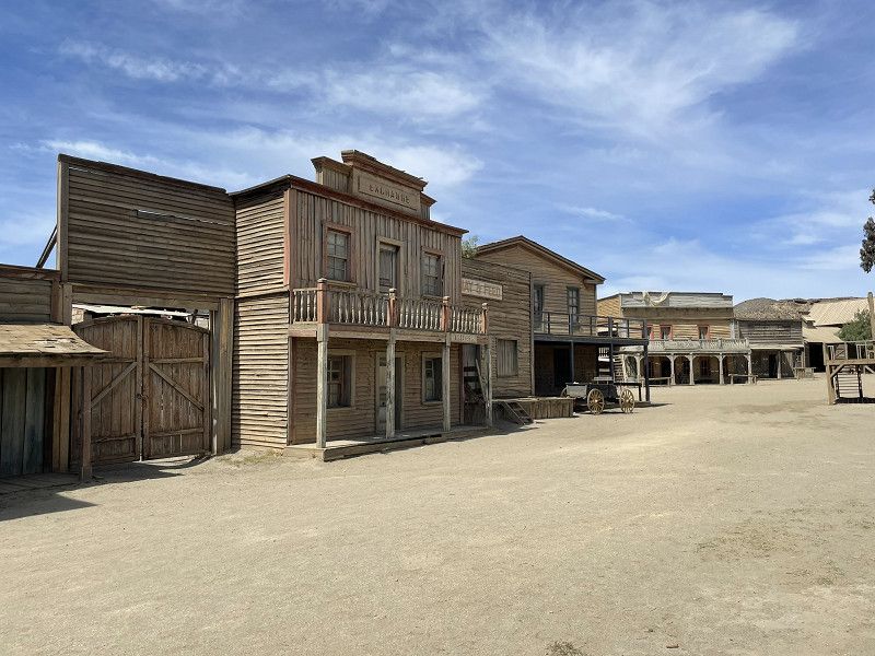
Day
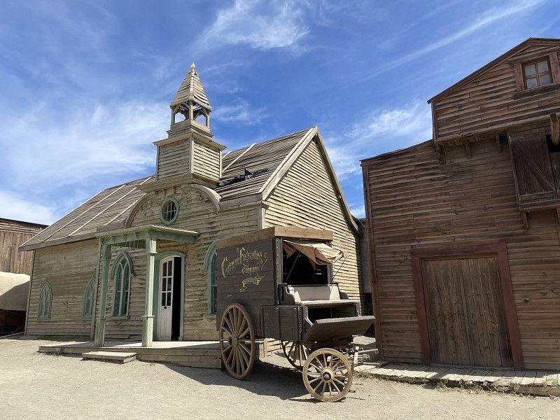
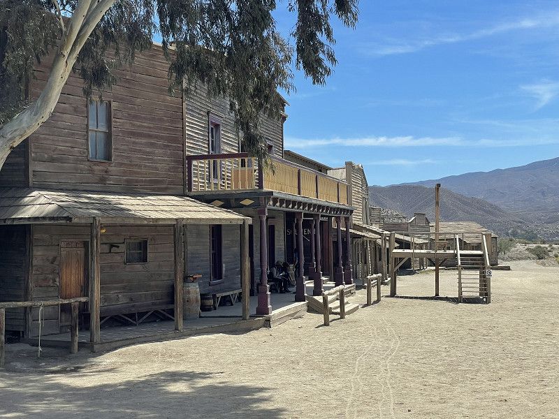
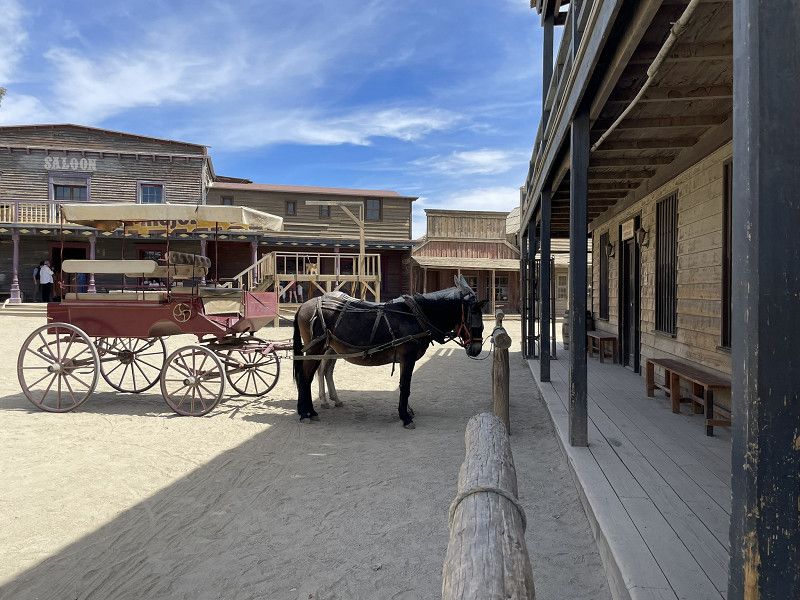
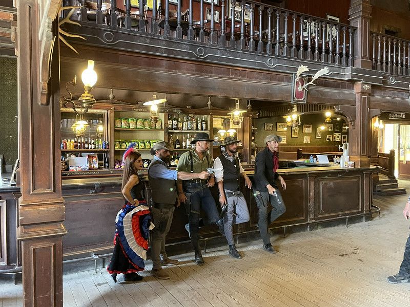
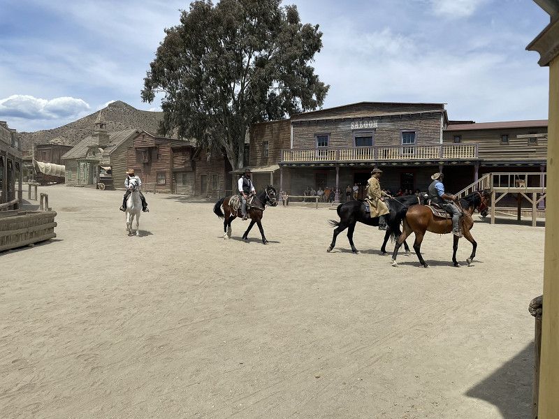
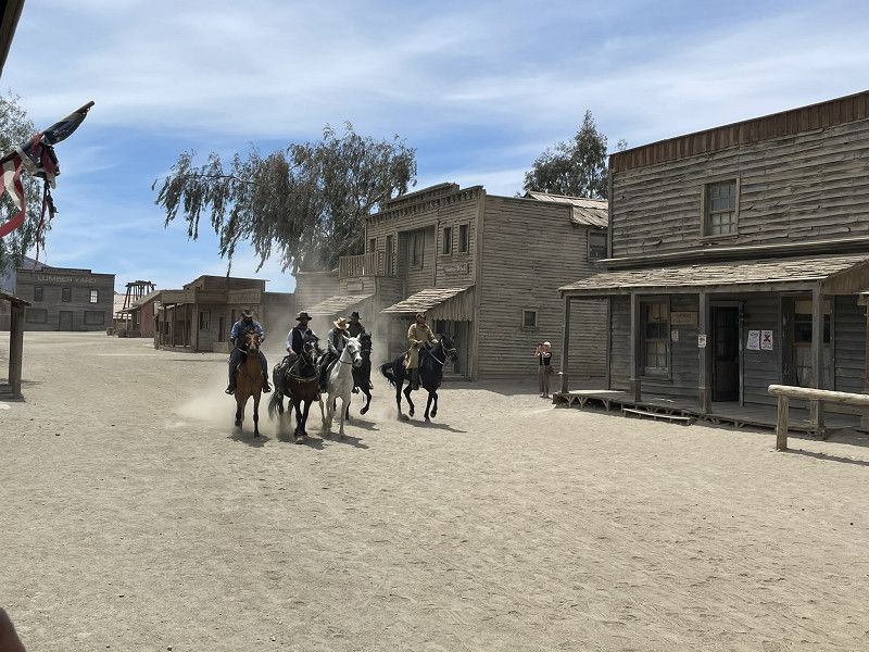
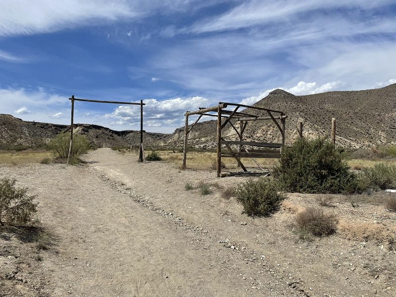
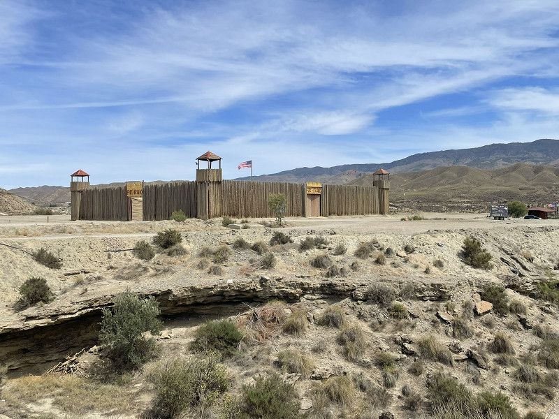
Tabernas - Fort Bravo
Third day with friends, trip to the desert and western town of Tabernas.
Destination: Fort Bravo with its own parking space. (Fortunately the parking space was * closed for a few days due to a private event) * because it was bone dry and not very inviting.
Visit to the film city Fort Bravo (with 4 performances per day)
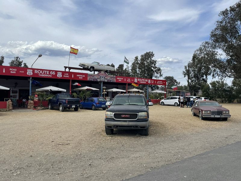
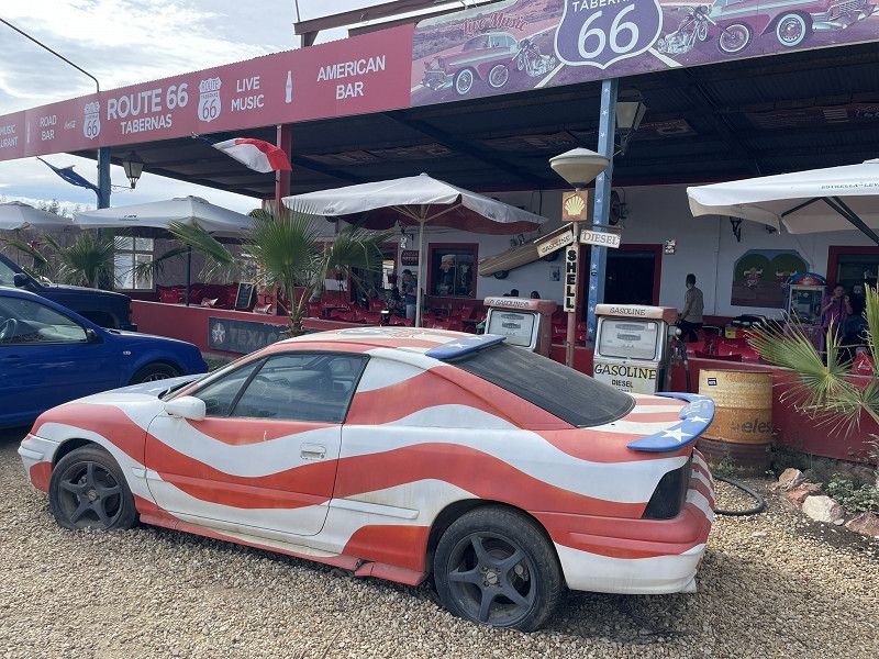
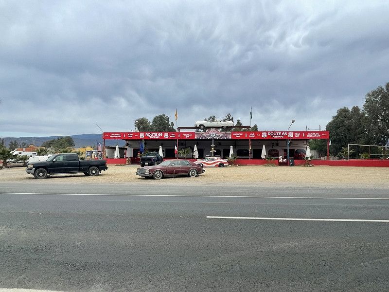
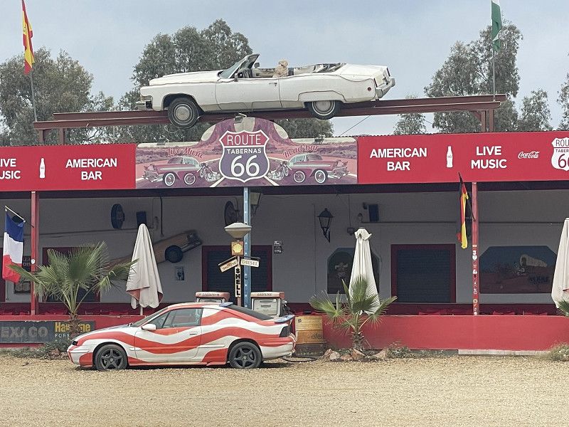
Short drive to the Route 66 parking spot nearby for the night. (EUR 10.-, doesn't work without electricity)
Very nice American-style street restaurant.
Fort Bravo
Texas Hollywood / Fort Bravo, Tabernas, Almería, Andalusien, Spanien
37° 2' 52.9" N 2° 25' 15.5" W
37.0480272 -2.4209645
• Head southeast. Go for 657 m.
• Turn left. Go for 1.2 km.
• Turn slightly left toward N-340a. Go for 216 m.
• Turn right onto N-340a. Go for 2.5 km.
• Keep left onto N-340a toward Sorbas/Murcia. Go for 2.9 km.
• Arrive at N-340a. Your destination is on the left.
☍
7,5 km
( 9 min.)
Route 66
Almería, Andalusien, Spanien
37° 4' 22.9" N 2° 21' 32.8" W
37.0730329 -2.3591025
• Head toward Camino del Marchalillo on N-340a. Go for 2.8 km.
• Keep left onto N-340a toward Almería. Go for 7.6 km.
• Take the 3rd exit from roundabout toward A-92/Almería. Go for 139 m.
• Take the 2nd exit from roundabout onto A-92 toward Almería. Go for 16.8 km.
• Take exit 392 toward Almería/Málaga/Viator/E-15/Aeropuerto/Murcia onto A-7 (Autovía del Mediterráneo). Go for 11.9 km.
• Take exit 790 toward Almería. Go for 142 m.
• Keep right toward Almería/Puerto. Go for 1.5 km.
• Take ramp onto Carretera de Málaga (N-340a). Go for 1.2 km.
• Take the 5th exit from roundabout onto Carretera de Málaga (N-340a) toward E-15/A-7/Málaga/Murcia/Aguadulce. Go for 1.0 km.
• Keep left onto N-340a toward Vía Litoral/Aguadulce. Go for 599 m.
• Take the 2nd exit from roundabout onto N-340a toward Aguadulce. Go for 2.3 km.
• Turn left. Go for 109 m.
• Arrive at your destination.
☍
46,1 km
( 30 min.)
Day
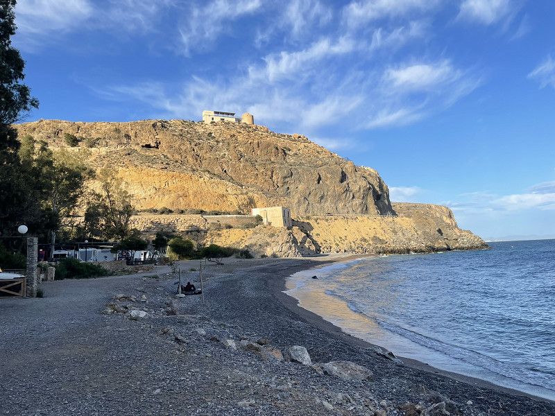
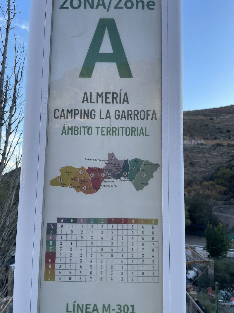
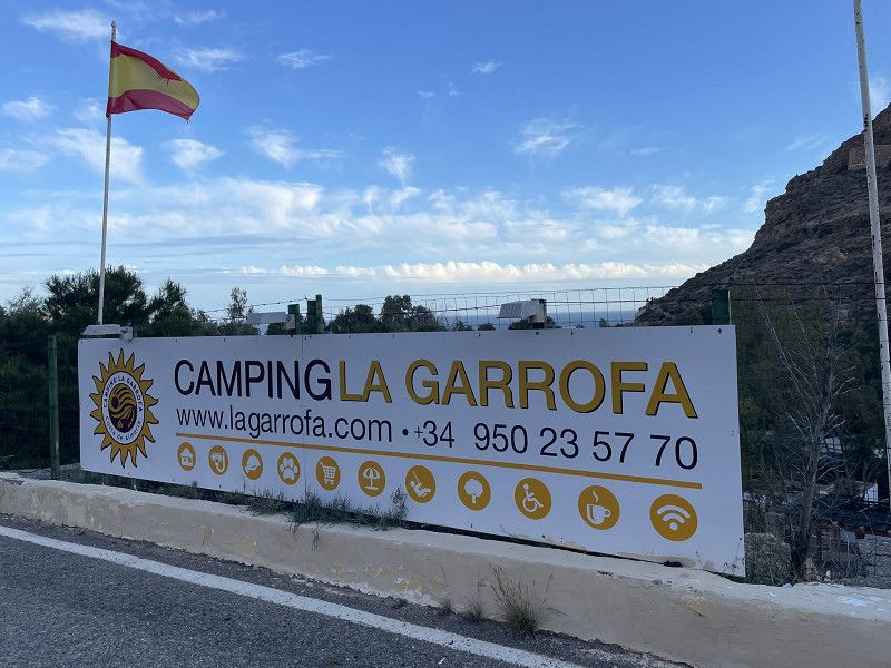
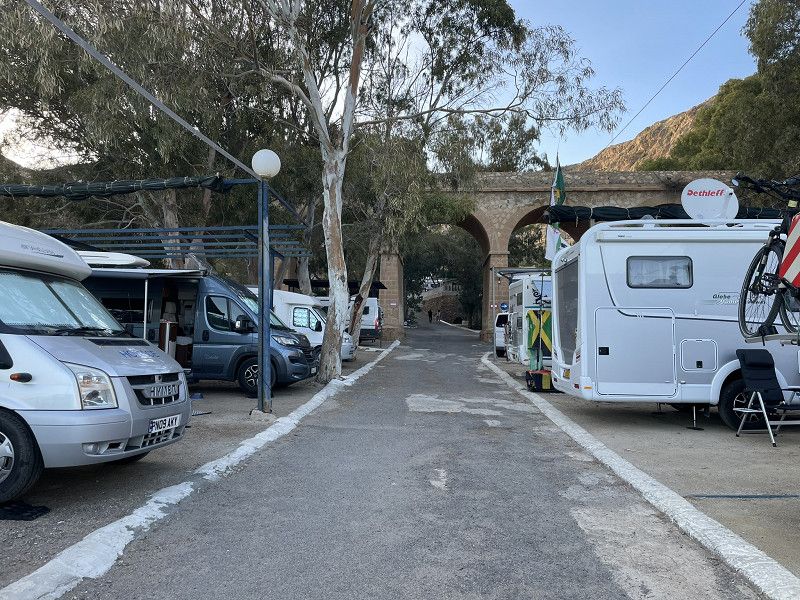
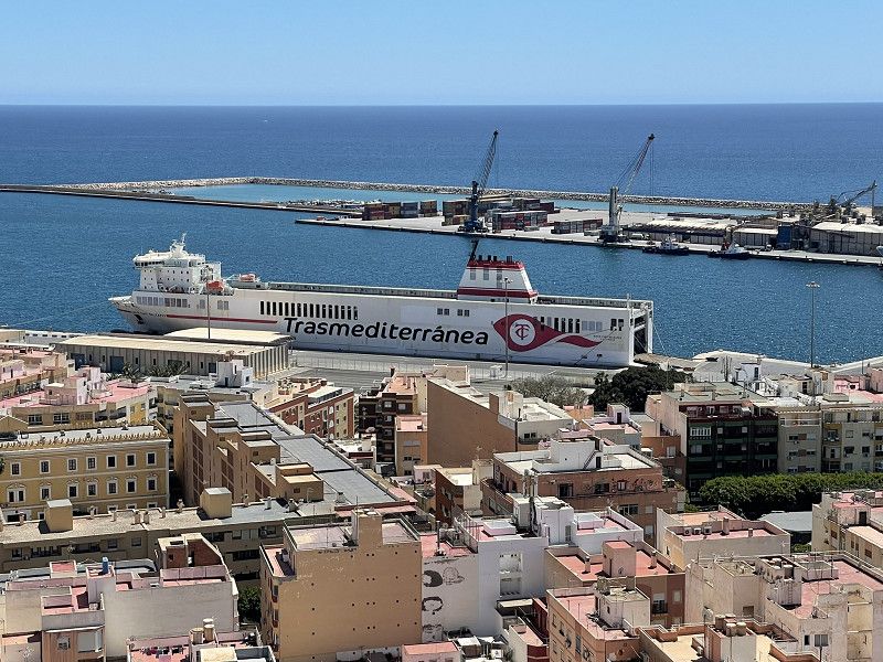
Almeria
Continue to Almeria, Camping La Garrofa (EUR 25 including everything) WiFi completely unusable, pitches far too small, even for our 7m camper. Our pitch smelled like a sewer. Absolutely not recommended to stay, only suitable for visiting Almeria.
Positive: great bus connection (in front of the campsite) to Almeria (only EUR 1.30)
Camping la Garrofa
Ctra. N-340 Km 435, 04002, Almería, Spain
36° 49' 35" N 2° 30' 59" W
36.8263800 -2.5163800
• Head southeast. Go for 109 m.
• Turn right onto N-340a. Go for 2.2 km.
• Take the 1st exit from roundabout onto N-340a toward Almería. Go for 1.5 km.
• Take the 5th exit from roundabout onto Carretera de Málaga (N-340a) toward E-15/A-7/Málaga/Murcia/Aguadulce. Go for 1.0 km.
• Take ramp toward E-15/A-7/Granada/A-92/Málaga/Murcia. Go for 1.8 km.
• Take the 2nd exit from roundabout toward Motril/Málaga. Go for 198 m.
• Continue on A-7 (Autovía del Mediterráneo). Go for 142 km.
• Take exit 293 toward Nerja/N-340a. Go for 389 m.
• Take the 3rd exit from roundabout onto MA-5105 toward Nerja/N-340a. Go for 184 m.
• Take the 1st exit from roundabout. Go for 386 m.
• Continue on Avenida Alcalde Antonio Villasclaras. Go for 193 m.
• Take the 3rd exit from roundabout onto Avenida Alcalde Antonio Villasclaras Rosas. Go for 365 m.
• Continue on Avenida Alcalde Antonio Villasclaras. Go for 61 m.
• Take the 2nd exit from roundabout. Go for 89 m.
• Continue on Avenida Alcalde Antonio Villasclaras. Go for 525 m.
• Take the 3rd exit from roundabout. Go for 171 m.
• Continue on Calle Carretera. Go for 14 m.
• Continue on Carretera Málaga. Go for 143 m.
• Take the 3rd exit from roundabout onto Carretera Málaga. Go for 92 m.
• Turn right onto Avenida Castilla Pérez. Go for 109 m.
• Arrive at Avenida Castilla Pérez. Your destination is on the left.
☍
151,3 km
(1 hrs. 24 min.)
Day
Almeria
by bus to sightseeing.
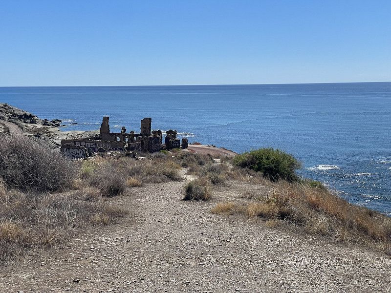
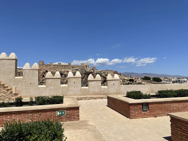
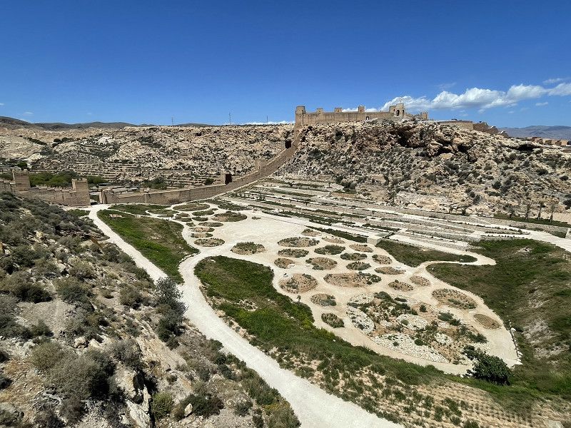
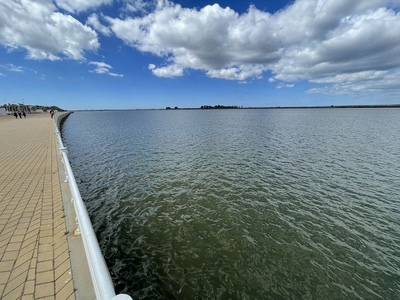
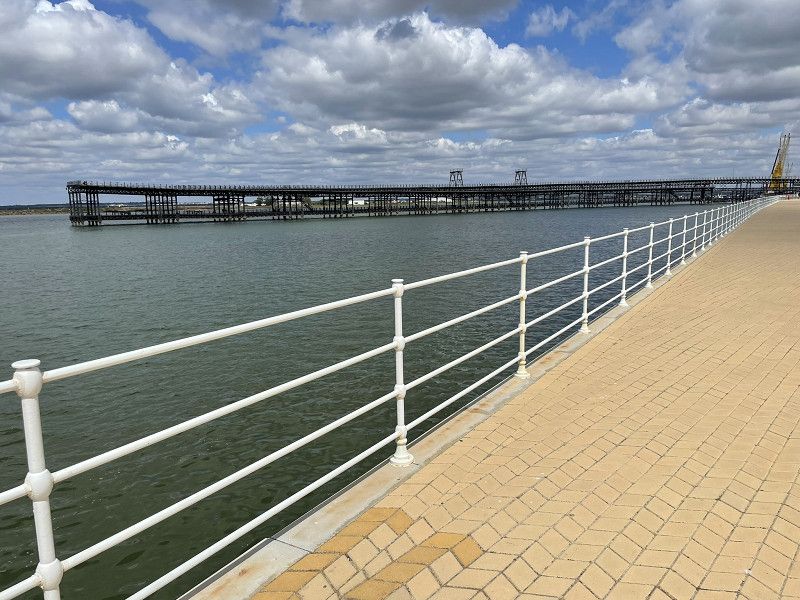
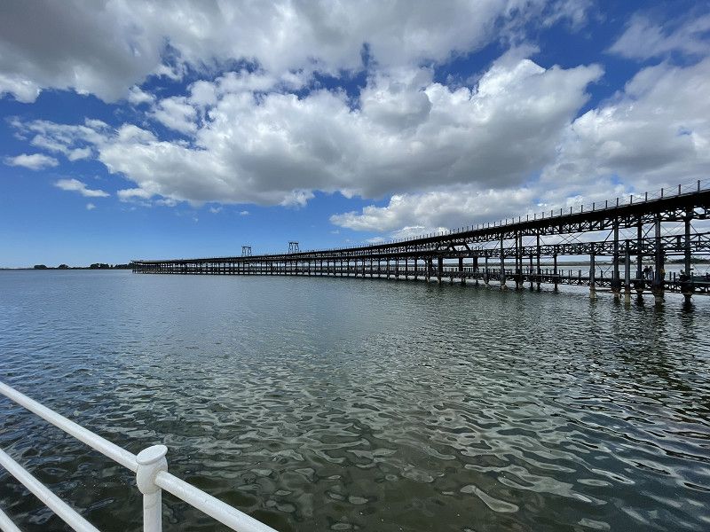
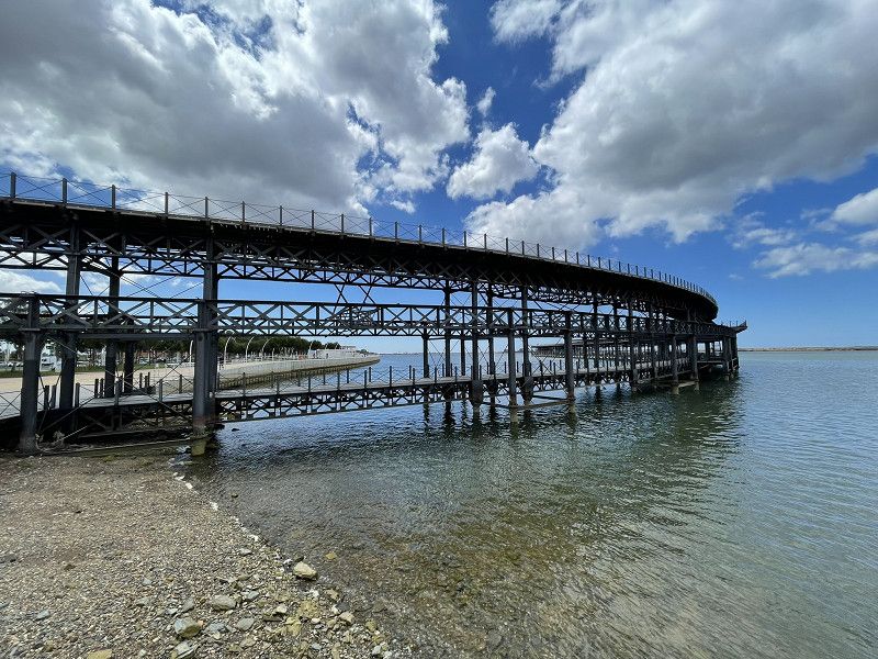
Visit to the steel monument (El Cable Ingles) at the harbor, ramble, climb to the Alcazaba fortress with a magnificent panoramic view (EU/CH free)
Note on Almeria: the area around Almeria is a complete disaster! Greenhouses as far as the eye can see, a complete disfigurement of nature.
Day
Nerja
along the coastal road to Nerja. Camper parked in a large bus parking lot at the entrance to the town. (Free, in season EUR 10.- per 24 hours) We were staying overnight with about 5 camper vans.
Visit the very touristy coastal town with the world-famous "Balcon de Europa". (Viewing platform above the sea)
Nerja
La Axarquía, Andalusien, Spanien
36° 44' 48.7" N 3° 52' 44.5" W
36.7468565 -3.8790164
• Head toward Plaza Las Terrazas on Avenida Castilla Pérez. Go for 69 m.
• Turn right onto Calle Almería. Go for 87 m.
• Turn slightly right onto Calle Antonio Ferrandis. Go for 57 m.
• Turn right onto Calle Antonio Ferrandis. Go for 117 m.
• Take the 4th exit from roundabout onto Carretera Málaga. Go for 194 m.
• Continue on Calle Carretera. Go for 109 m.
• Take the 2nd exit from roundabout. Go for 114 m.
• Continue on Avenida Alcalde Antonio Villasclaras. Go for 526 m.
• Take the 1st exit from roundabout. Go for 65 m.
• Continue on Avenida Alcalde Antonio Villasclaras. Go for 330 m.
• Continue on Avenida Alcalde Antonio Villasclaras Rosas. Go for 20 m.
• Take the 2nd exit from roundabout. Go for 208 m.
• Continue on Avenida Alcalde Antonio Villasclaras. Go for 372 m.
• Take the 2nd exit from roundabout onto MA-5105. Go for 155 m.
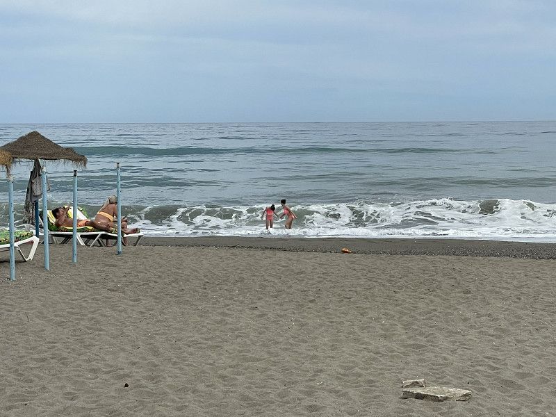
• Take the 2nd exit from roundabout onto A-7 (Autovía del Mediterráneo) toward Málaga. Go for 54.9 km.
• Keep right onto MA-20 toward Málaga/Aeropuerto. Go for 7.3 km.
• Take exit 5A toward Torremolinos onto MA-21. Go for 5.6 km.
• Turn right toward Málaga. Go for 49 m.
• Turn left onto Avenida Velázquez toward Málaga. Go for 65 m.
• Take ramp toward Málaga. Go for 98 m.
• Keep right onto Calle Loma del Paraíso. Go for 33 m.
• Turn right. Go for 27 m.
• Arrive at your destination on the right.
☍
70,6 km
( 46 min.)
Day
Torremolinos
since we were already in Malaga ...
we went to Torremolinos, Camping Torremolinos (EUR 27.- including everything)
Bike tour and inquiry in "our" hotel whether we can come and dance to live music in the evening
Evening: Dancing with Latino live music at Hotel XY
Camping Torremolinos
C/Loma Del Paraíso 2, 29620, Torremolinos, Spain
36° 38' 47.1" N 4° 29' 19" W
36.6464200 -4.4886200
• Head east. Go for 180 m.
• Turn slightly left onto Calle Sardinero. Go for 91 m.
• Turn slightly left onto Calle Sistema Ibérico. Go for 197 m.
• Continue straight ahead. Go for 409 m.
• Take the 2nd exit from roundabout toward MA-20/Algeciras/Málaga. Go for 577 m.
• Take the 4th exit from roundabout toward MA-20/Algeciras/Clínica Sta. Elena/Urbanización Los Álamos. Go for 289 m.
• Take left ramp onto MA-20 toward Torremolinos/Algeciras. Go for 1.3 km.
• Continue on AP-7. Go for 4.1 km.
• Continue on A-7 (Autovía del Mediterráneo). Go for 10.9 km.
• Keep left onto A-7 (Autopista del Mediterráneo) toward Marbella/Algeciras. Go for 1.8 km.
• Continue on AP-7 (Autopista del Mediterráneo). Go for 11.7 km.
• Take exit 200 toward Calahonda/A-7. Go for 1.1 km.
• Take the 3rd exit from roundabout onto Calle Adarves toward A-7. Go for 898 m.
• Continue on Calle Santa Teresa de Calahonda. Go for 231 m.
• Continue on Calle Adarves de Calypso. Go for 154 m.
• Continue on Calle Adarves. Go for 201 m.
• Take the 2nd exit from roundabout onto Avenida de España toward Marbella. Go for 121 m.
• Take ramp onto A-7 (Autovía del Mediterráneo) toward Marbella/Algeciras. Go for 8.3 km.
• Take the exit onto Calle Pino Carrasco. Go for 181 m.
• Arrive at Calle Pino Carrasco. Your destination is on the right.
☍
42,7 km
( 30 min.)
Day
Torremolinos
Visit to the tourist town of Torremolinos.
Gifts found for the grandchildren
Lesson learned: NEVER use an ATM to withdraw cash in a Spanish tourist destination. (Fees and the lousy exchange rate cost me 15%!!!)
Evening: went dancing again to Hotel XY
Day
Marbella
Continue to Marbella, Camping La Buganvilla (ACSI EUR 23.- incl.)
Walk to the beach for sunset, nightcap in the camping restaurant
Camping la Buganvilla
C.N.-340, 29600, Marbella, Spain
36° 30' 10" N 4° 48' 12" W
36.5027700 -4.8033300
• Head toward Autovía del Mediterráneo on Calle Pino Carrasco. Go for 132 m.
• Take ramp onto A-7 (Autovía del Mediterráneo). Go for 12.4 km.
• Keep left onto AP-7 (Autopista del Mediterráneo) toward Estepona/Algeciras. Go for 8.7 km.
• Keep right toward Autopista del Mediterráneo/AP-7. Go for 356 m.
• Continue on AP-7 (Autopista del Mediterráneo). Go for 15.5 km.
• Continue on A-7 (Autovía del Mediterráneo). Go for 2.4 km.
• Continue on AP-7 (Autopista del Mediterráneo). Go for 11.6 km.
• Keep right onto AP-7. Go for 10.2 km.
• Continue on A-7 (Autovía del Mediterráneo). Go for 24.5 km.
• Keep right onto N-340 toward E-15/A-7/Algeciras Centro Ciudad/Tarifa/Cádiz. Go for 1.3 km.
• Continue on A-7 (Autovía del Mediterráneo). Go for 4.3 km.
• Take exit 103. Go for 276 m.
• Take the 1st exit from roundabout onto N-340 toward Cadiz/Sevilla. Go for 338 m.
• Pass 2 roundabouts and continue on N-340. Go for 17.4 km.
• Take the 2nd exit from roundabout toward Tarifa. Go for 184 m.
• Continue on Carretera Cádiz-Málaga. Go for 277 m.
• Take the 2nd exit from roundabout onto Calle Amador de los Ríos. Go for 815 m.
• Continue on Avenida de Andalucía. Go for 331 m.
• Continue on Avenida de las Fuerzas Armadas. Go for 361 m.
• Turn right onto Calle Alcalde Juan Núñez. Go for 13 m.
• Arrive at Calle Alcalde Juan Núñez. Your destination is on the left.
☍
111,4 km
(1 hrs. 15 min.)
Day
Marbella
(Mother's Day) Quiet day with excursion (bus, EUR 1.40) to Marbella.
City tour, promenade, old town
Day
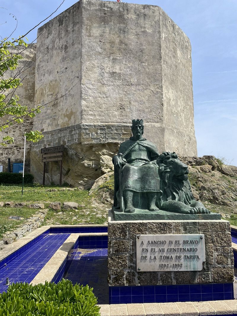
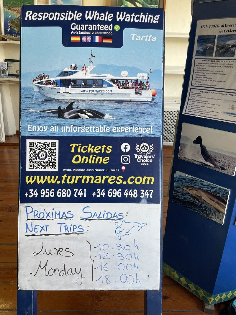
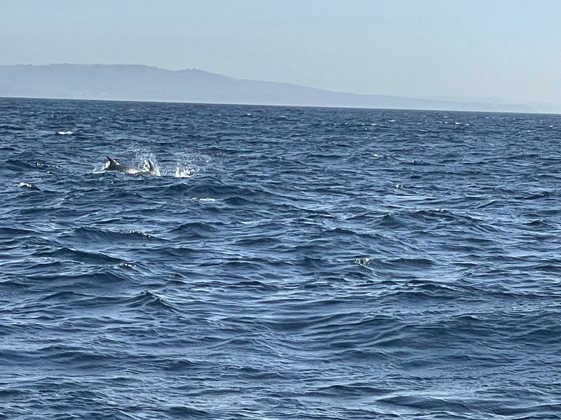
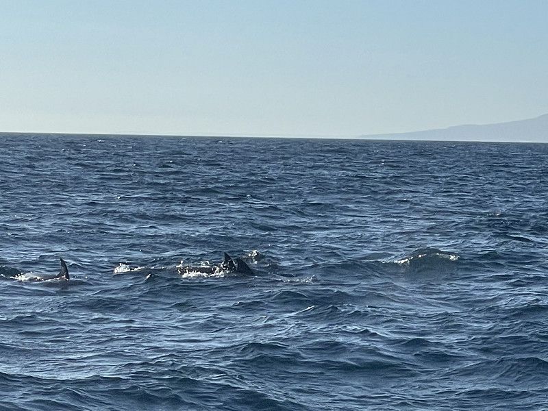
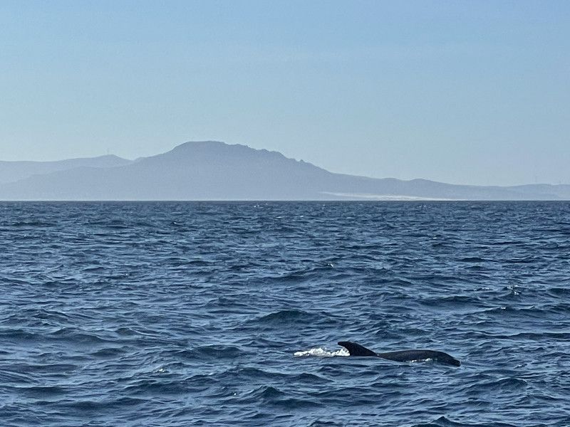
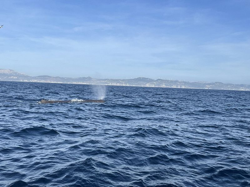
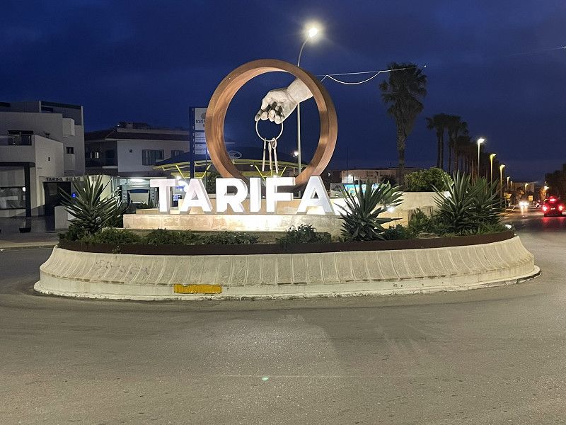
Tarifa
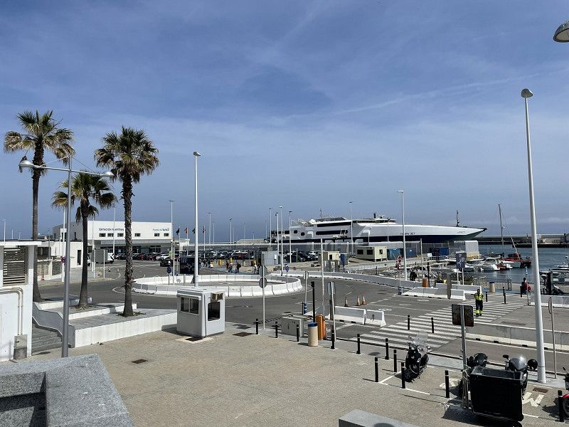
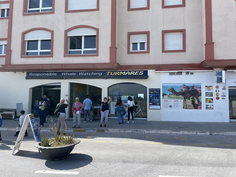
Continue to Tarifa - (free) bus parking at the top of the village entrance (near Lidl). Parking is OK (for parking and overnight stay), no infrastructure, only Lidl very close
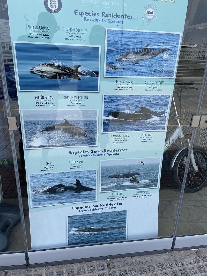
Walk to the harbor and inquire about whale watching. Luck:
"in an hour the last ship for the next 2 days leaves (because higher waves are forecast)"
EUR 45.- pp It was exciting and we saw many dolphins and also huge sperm whales
Puerto de Tarifa
Calle Alcalde Juan Núñez, Tarifa, Campo de Gibraltar, Andalusien, Spanien
36° 0' 34.7" N 5° 36' 21.9" W
36.0096478 -5.6060819
• Head southwest on Calle Alcalde Juan Núñez. Go for 144 m.
• Turn right toward Calle Glorieta de León. Go for 138 m.
• Turn right onto Calle Glorieta de León. Go for 122 m.
• Turn left onto Avenida de las Fuerzas Armadas. Go for 307 m.
• Continue on Avenida de Andalucía. Go for 331 m.
• Continue on Calle Amador de los Ríos. Go for 784 m.
• Take the 2nd exit from roundabout. Go for 50 m.
• Continue on Carretera Cádiz-Málaga. Go for 257 m.
• Keep left toward Vejer de la Frontera/Cádiz. Go for 61 m.
• Take the 2nd exit from roundabout onto N-340 toward Vejer de la Frontera/Cádiz. Go for 29.1 km.
• Turn left onto A-2227. Go for 10.3 km.
• Take the 2nd exit from roundabout. Go for 144 m.
• Continue on Calle Cachón. Go for 29 m.
• Turn left onto Calle María Luisa. Go for 69 m.
• Turn right onto Calle Sirena. Go for 60 m.
• Turn left onto Calle Almadraba. Go for 16 m.
• Turn right onto Calle Zarza. Go for 23 m.
• Turn left onto Paseo de Pradillo. Go for 26 m.
• Turn left onto Calle Jábega. Go for 7 m.
• Arrive at Calle Jábega. Your destination is on the left.
☍
42,0 km
( 39 min.)
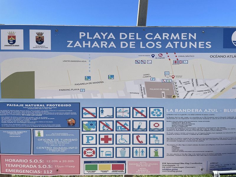
Day
Zahara de los Atunes
Stopover on the way to Vejer de la Frontera.
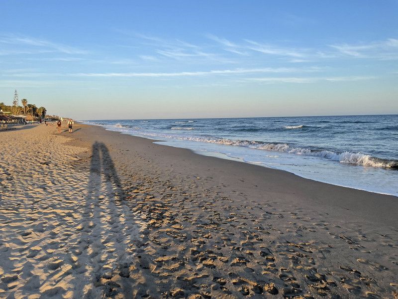
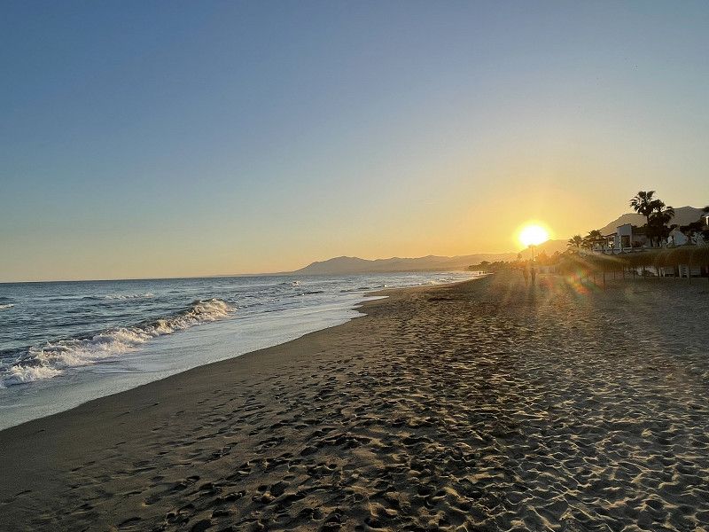
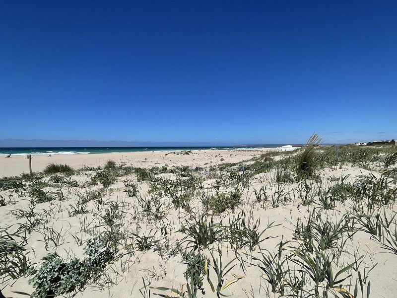
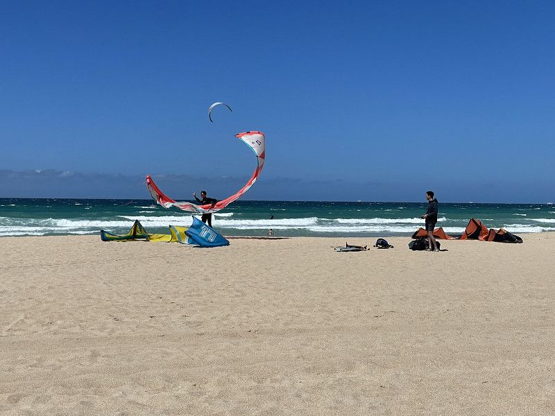
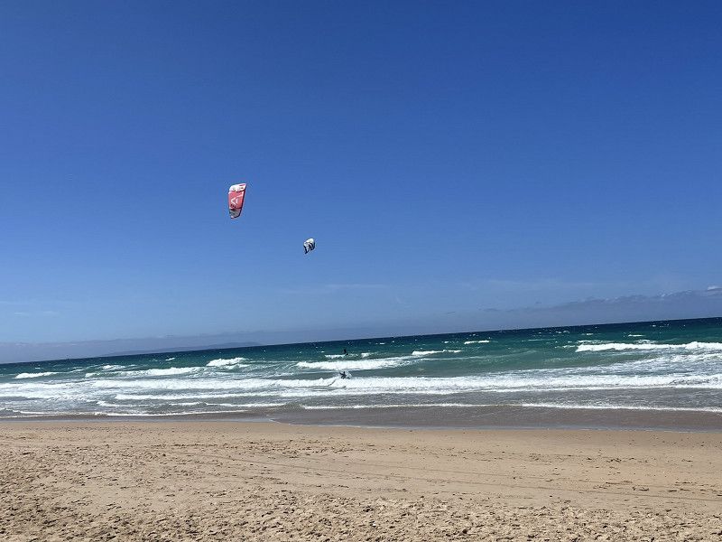
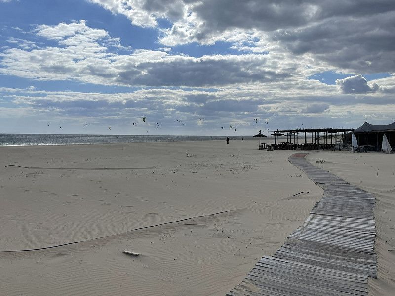
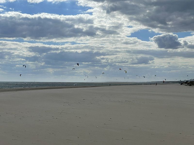
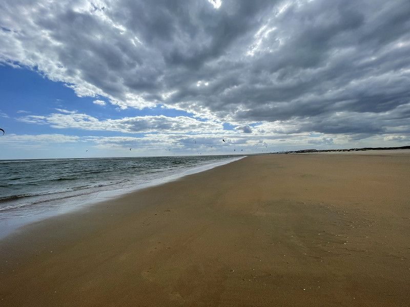
On the advice of a colleague, parking on the beach. Mecca for kite surfers. Unfortunately, due to the cool wind and small waves, there are only a few surfers. Huge sandy beach
Zahara de los Atunes
La Janda, Andalusien, Spanien
36° 8' 10" N 5° 50' 44.1" W
36.1361147 -5.8455940
• Head toward Paseo de Pradillo on Calle Jábega. Go for 7 m.
• Turn right onto Paseo de Pradillo. Go for 26 m.
• Turn left onto Calle Zarza. Go for 22 m.
• Turn right onto Calle Palacio de las Pilas. Go for 55 m.
• Continue on Plaza Tamarón. Go for 52 m.
• Continue on Calle Cachón. Go for 141 m.
• Take the 2nd exit from roundabout onto A-2231. Go for 9.6 km.
• Take the 2nd exit from roundabout onto Avenida Juan XXIII (A-2231). Go for 351 m.
• Take the 2nd exit from Plaza Reyes Católicos roundabout onto Alameda Francisco Rivera Paquirri (A-314). Go for 168 m.
• Take the 2nd exit from roundabout onto A-314. Go for 928 m.
• Take the 3rd exit from roundabout onto A-314. Go for 237 m.
• Take the 2nd exit from roundabout onto A-314. Go for 2.5 km.
• Continue on Rivera de la Oliva (A-314). Go for 59 m.
• Continue on A-314. Go for 216 m.
• Continue on A-314. Go for 376 m.
• Continue on Huerta del Pescadito (A-314). Go for 64 m.
• Continue on A-314. Go for 98 m.
• Continue on La Oliva (A-314). Go for 145 m.
• Continue on A-314. Go for 28 m.
• Continue on Ventorrillo de la Marina (A-314). Go for 92 m.
• Continue on A-314. Go for 1.6 km.
• Continue on Carretera a Barbate (A-314). Go for 494 m.
• Turn left onto CA-5203. Go for 1.4 km.
• Take the 2nd exit from roundabout onto CA-5203. Go for 916 m.
• Continue on Avenida de San Miguel. Go for 383 m.
• Turn left onto Avenida de Buenavista. Go for 345 m.
• Turn right onto Avenida de Andalucía. Go for 358 m.
• Turn right onto Calle San Ambrosio. Go for 167 m.
• Turn right onto Calle Rivas de Neira. Go for 32 m.
• Turn right onto Calle Bellido. Go for 49 m.
• Turn left onto Calle Padre Avelino. Go for 36 m.
• Turn right onto Calle Barrial. Go for 14 m.
• Arrive at Calle Barrial. Your destination is on the right.
☍
21,1 km
( 26 min.)
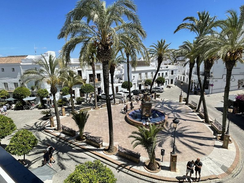
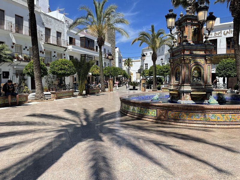
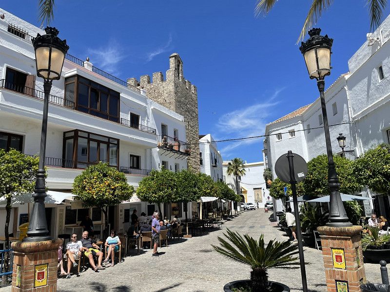
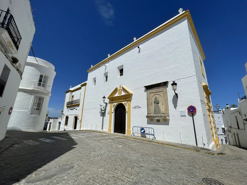
Vejer de la Frontera
Continue to Vejer de la Frontera, another white mountain village.
Parking at the village entrance.
Visit and overnight stay (free) in the parking lot
Vejer de la Frontera
La Janda, Andalusien, Spanien
36° 15' 7" N 5° 58' 1.4" W
36.2519370 -5.9670492
• Head toward Calle Santiago on Calle Barrial. Go for 30 m.
• Turn slightly left onto Calle Santiago. Go for 26 m.
• Turn left onto Calle Juan de Sevilla. Go for 98 m.
• Turn sharp right onto Calle Juan Belinque. Go for 65 m.
• Continue on Avenida de San Miguel. Go for 269 m.
• Turn right onto Avenida de Buenavista. Go for 345 m.
• Turn right onto Avenida de Andalucía. Go for 649 m.
• Turn left onto Calle Los Remedios. Go for 25 m.
• Take the 1st exit from roundabout onto Calle Los Remedios (A-2229). Go for 285 m.
• Continue on A-2229. Go for 1.7 km.
• Take the 2nd exit from roundabout toward La Muela/E-5/A-48/Cadiz/Algeciras. Go for 182 m.
• Take the 2nd exit from roundabout toward CA-4200/La Muela/E-5/Chiclana/Cádiz/A-48/Sevilla. Go for 189 m.
• Take the 3rd exit from roundabout onto A-48 (Autovía de la Costa de la Luz) toward Chiclana/Cadiz/Sevilla. Go for 36.6 km.
• Continue on CA-33. Go for 13.0 km.
• Continue on Avenida Periodista Beatriz Cienfuegos. Go for 229 m.
• Turn right onto Calle Zarza. Go for 20 m.
• Turn left onto Calle Benalup. Go for 14 m.
• Turn sharp left onto Avenida Periodista Beatriz Cienfuegos. Go for 237 m.
• Keep left onto Avenida Vía Augusta Julia. Go for 63 m.
• Arrive at Avenida Vía Augusta Julia.
☍
54,0 km
( 39 min.)
Day
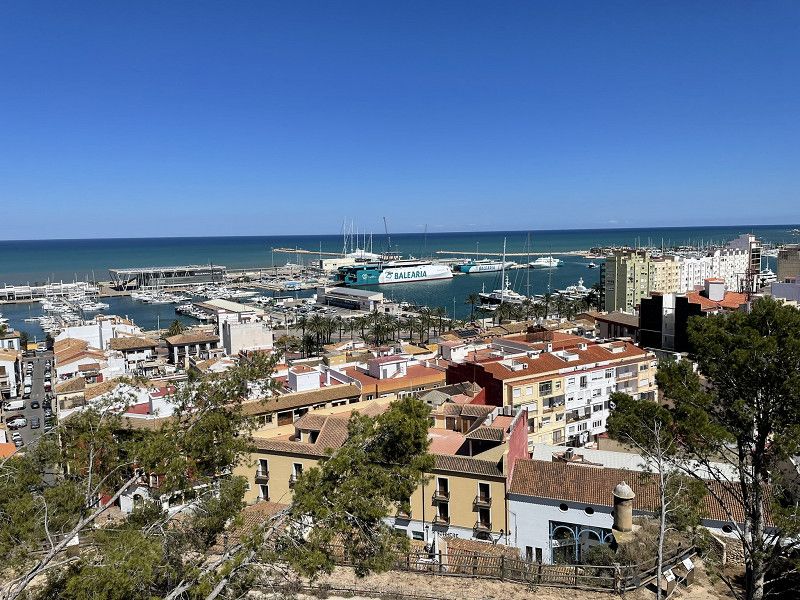
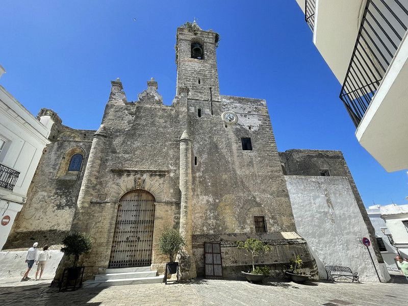
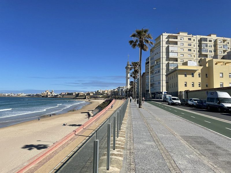
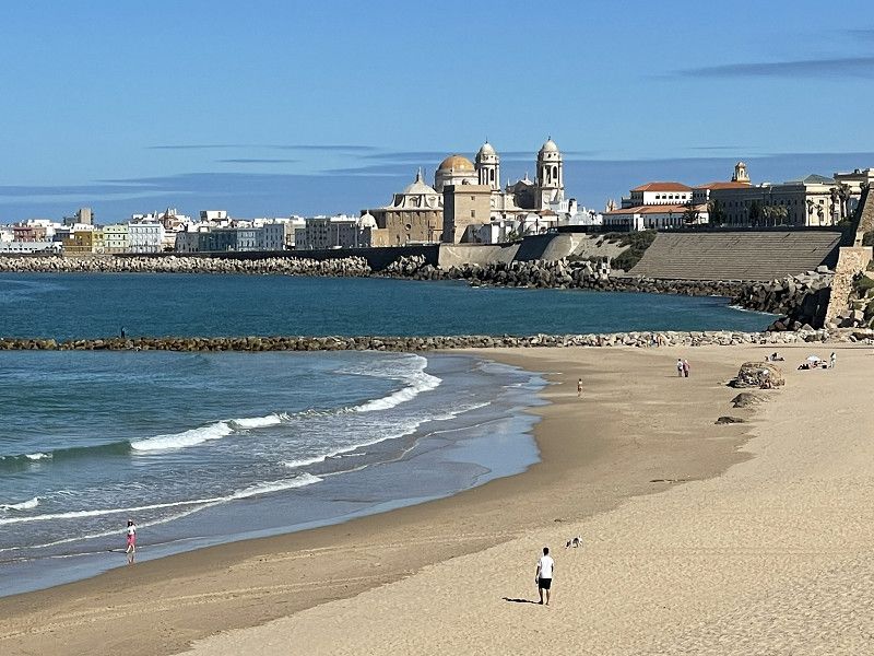
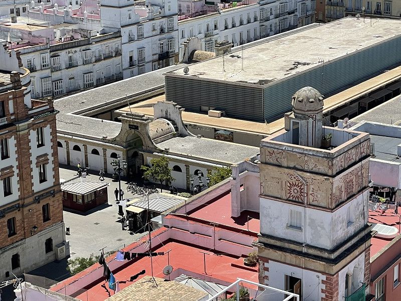
Cadiz
We continued on to Cadiz. As the access to the planned campsite "Playa las Dunas" was closed due to construction work, an odyssey through narrow streets with endless dangers of touching the balcony followed. Then we urgently needed to dispose of rubbish before we could park anywhere...
There are hardly any parking or camping sites in Cadiz. Therefore: drive to the Petronas petrol station (Avenida Alcalde Manuel de la Pinta) and dispose of your waste for EUR 5.
Overnight stay in a parking lot in the dunes (Avenida via Augusta Julia), free
Avenida Vía Augusta Julia
Bahía de Cádiz, Andalusien, Spanien
36° 29' 42.9" N 6° 16' 13.7" W
36.4952514 -6.2704858
• Head east on Avenida Vía Augusta Julia. Go for 50 m.
• Continue on Avenida Periodista Beatriz Cienfuegos. Go for 229 m.
• Turn right onto Calle Zarza. Go for 20 m.
• Turn left onto Calle Benalup. Go for 14 m.
• Turn sharp left onto Avenida Periodista Beatriz Cienfuegos. Go for 133 m.
• Keep left onto Ronda del Puente (CA-36). Go for 771 m.
• Continue on CA-36. Go for 895 m.
• Continue on Puente José León de Carranza (CA-36). Go for 1.5 km.
• Continue on CA-36. Go for 2.3 km.
• Continue on CA-35. Go for 2.4 km.
• Continue on AP-4 (Autopista del Sur). Go for 31 m.
• Take exit 105BA toward Pto. Sta. María/CA-32 onto N-4A. Go for 1.5 km.
• Continue on CA-32/CA-37 toward Jerez/Sevilla. Go for 2.3 km.
• Continue on CA-37. Go for 1.3 km.
• Take the exit onto A-4 (Autovía del Sur). Go for 10.9 km.
• Keep right onto A-4 (Autovía del Sur) toward Jerez (Sur)/N-4a. Go for 3.5 km.
• Take exit 640 toward Jerez de la Fra./Centro Ciudad/A-480/Sanlúcar/Chipiona/Rota/A-2078. Go for 298 m.
• Take the 3rd exit from roundabout toward Centro Ciudad. Go for 209 m.
• Continue on Calle Cuatro Caminos. Go for 329 m.
• Take the 2nd exit from roundabout onto Calle Alcubilla. Go for 169 m.
• Continue on Calle Puerto. Go for 350 m.
• Take the 2nd exit from roundabout onto Calle Puerto. Go for 78 m.
• Turn right onto Calle Conde de Bayona. Go for 44 m.
• Take the 1st exit from Calle Conde de Bayona roundabout onto Calle Conde de Bayona. Go for 87 m.
• Continue on Calle San Agustín. Go for 21 m.
• Turn right onto Calle Fate. Go for 72 m.
• Turn left onto Calle San Miguel. Go for 8 m.
• Turn right onto Calle San Pablo. Go for 37 m.
• Turn left onto Calle Caballeros. Go for 68 m.
• Arrive at Calle Caballeros. Your destination is on the right.
☍
29,6 km
( 25 min.)
Day
Cadiz
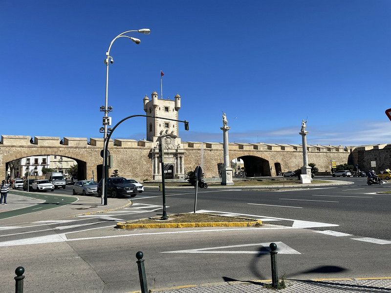
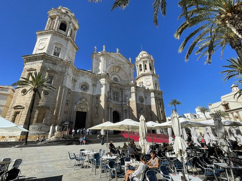
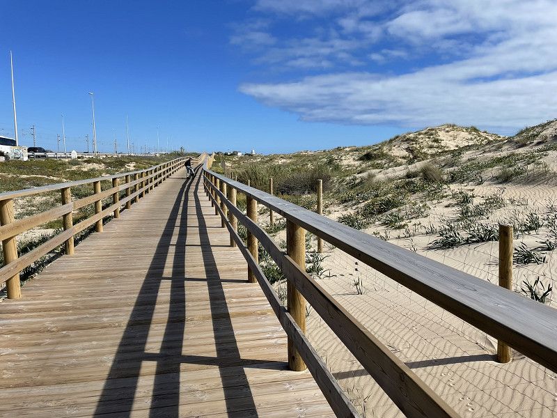
By bike on a beautiful cycle path along the dunes to Cadiz (approx. 10 km)
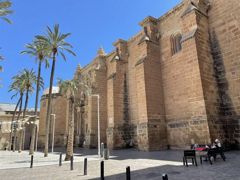
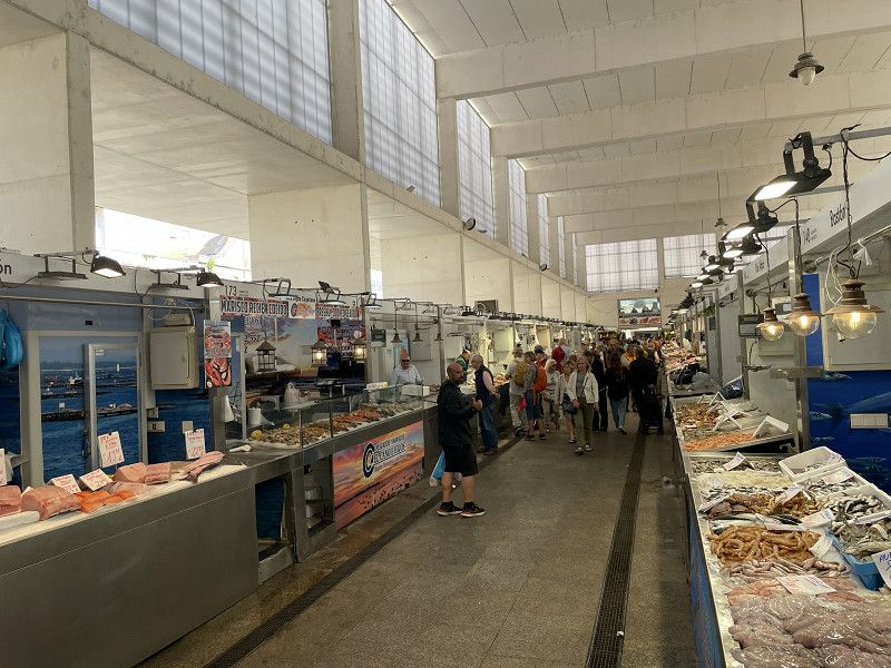
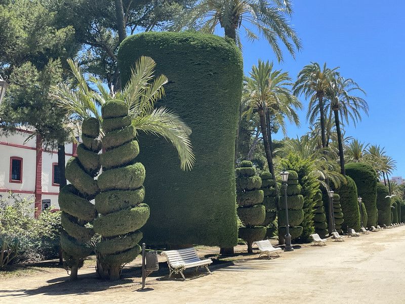
City tour, Cathedral, Mercado Central, Botanical Garden, Theater
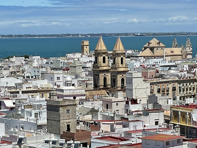
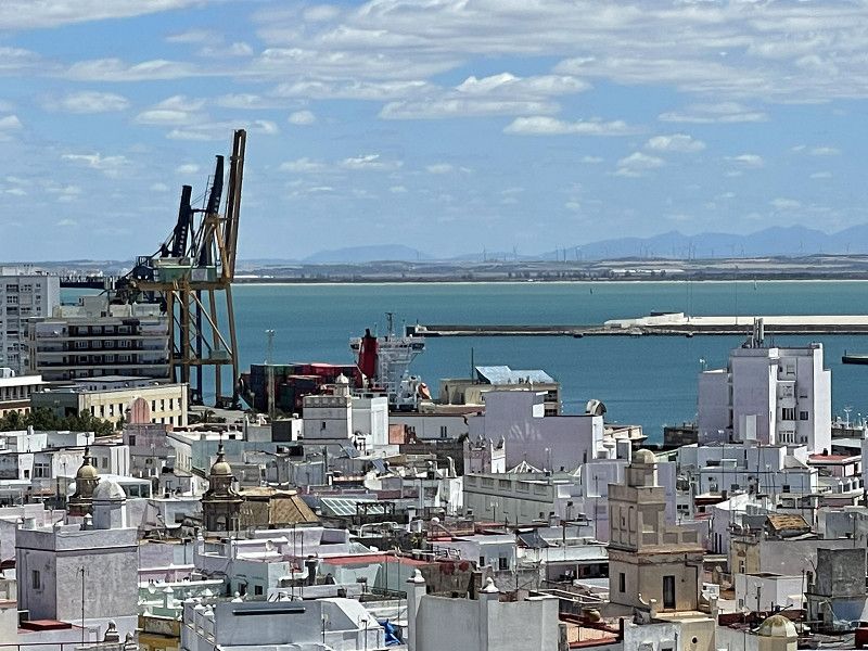
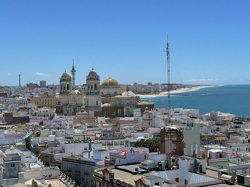
Climbed the Torre Tavira (entrance fee EUR 6.- seniors) and enjoyed the fantastic view, Santa Catalina Castle and walk to the fortress island of San Sebastian
Day
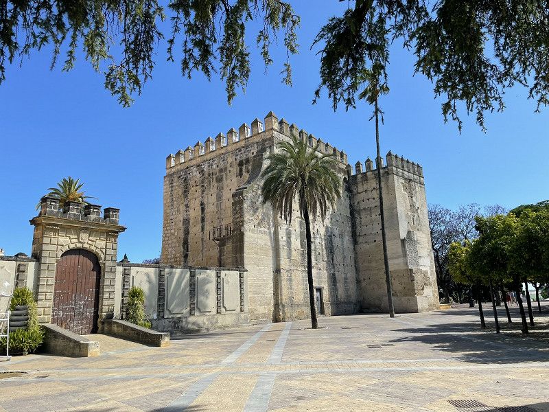
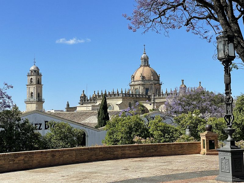
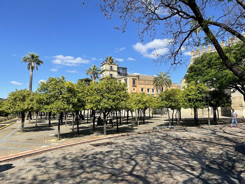
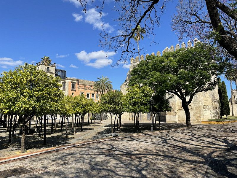
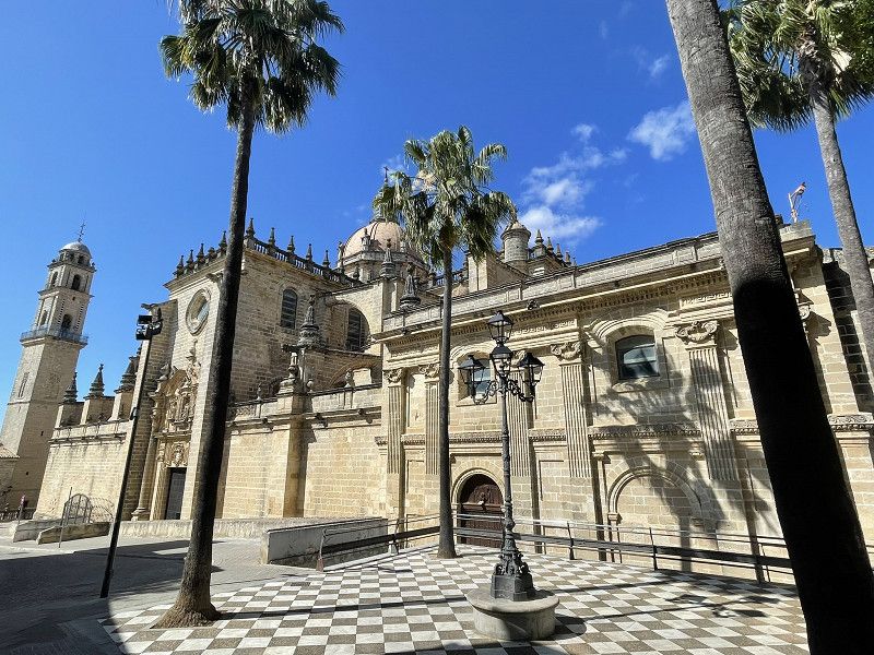
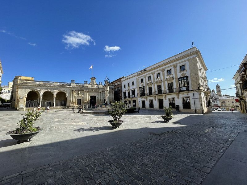
Jerez de la Frontera
Continue to Jerez, parking space La Morada del Sur (EUR 15.- including electricity)
Only 1 toilet per gender, but clean (also shower) Bus in front of the entrance (EUR 1.20 to the city center)
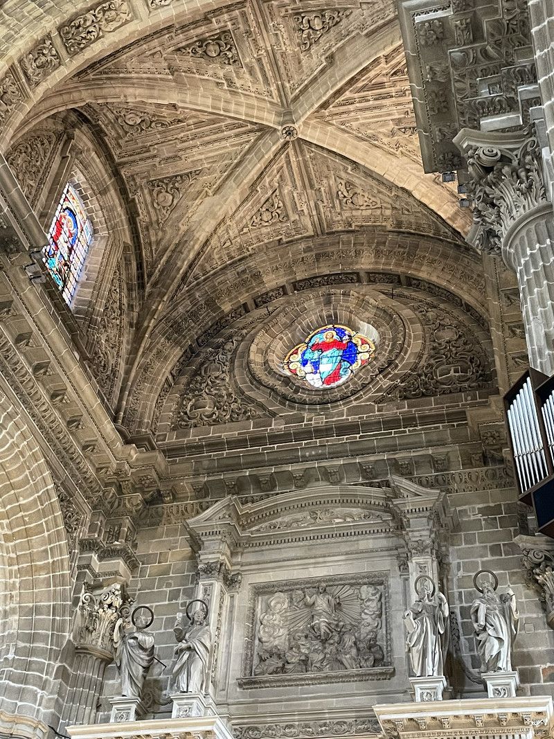
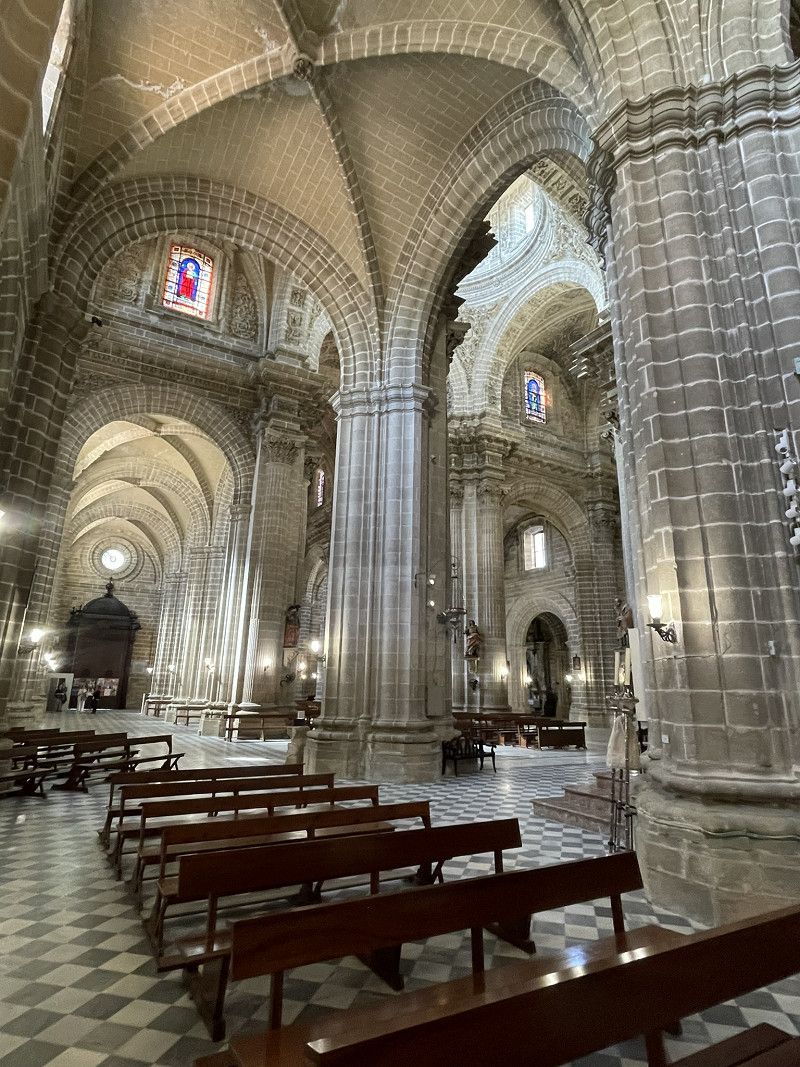
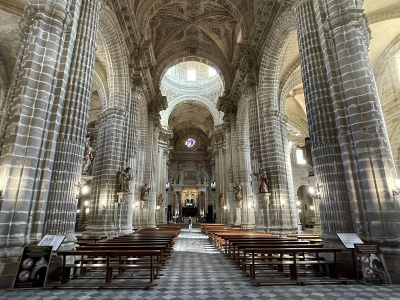
Afternoon/evening: city tour, unique cathedral!
Alcazar Castle was unfortunately closed for renovation
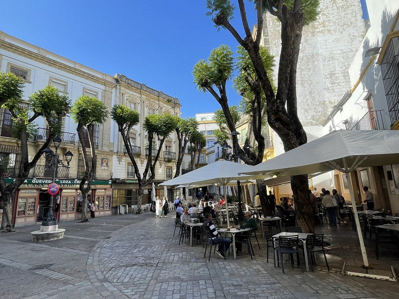
Dinner: Tapas in a street cafe
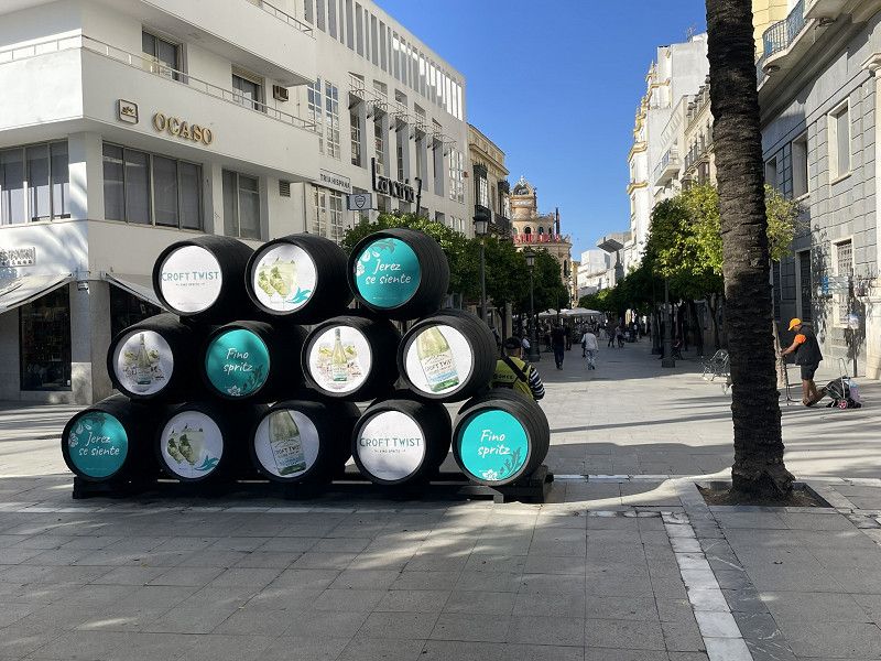
(Jerez also has an F1 race track and is known as the sherry metropolis, the cradle of flamenco)
La Morada del Sur, Jerez
Campiña de Jerez, Andalusien, Spanien
36° 40' 54.1" N 6° 8' 15.9" W
36.6816936 -6.1377402
• Head toward Calle San Pablo on Calle Caballeros. Go for 295 m.
• Turn left onto Calle Pedro Alonso. Go for 144 m.
• Turn right onto Calle Sol. Go for 442 m.
• Continue on Plaza Orellana. Go for 49 m.
• Continue on Calle Puerta del Sol. Go for 391 m.
• Continue on Calle Obispo Cirarda. Go for 379 m.
• Take the 3rd exit from roundabout onto Calle Obispo Cirarda. Go for 197 m.
• Take the 1st exit from roundabout onto Carretera Jerez-Algeciras (A-2004). Go for 999 m.
• Pass 3 roundabouts and continue on A-2004. Go for 3.1 km.
• Keep left onto A-381 toward Sevilla. Go for 173 m.
• Take left ramp onto AP-4 (Autopista del Sur) toward Sevilla. Go for 72.2 km.
• Continue on A-4 (Autopista del Sur). Go for 13.1 km.
• Take the exit toward E-1/Huelva/A-49/Mérida onto A-66 (Ronda Urbana Sur). Go for 2.9 km.
• Take exit 12. Go for 366 m.
• Take the 3rd exit from roundabout onto Carretera de la Esclusa toward Sevilla Centro Ciudad/Los Remedios. Go for 344 m.
• Take the 2nd exit from roundabout onto Calle José Delgado Brackenbury toward Los Remedios. Go for 572 m.
• Continue on Carretera de la Esclusa. Go for 11 m.
• Continue on Glorieta Avión Saeta. Go for 261 m.
• Turn right onto Carretera de la Esclusa. Go for 58 m.
• Continue on Calle José Delgado Brackenbury. Go for 16 m.
• Turn right onto Avenida Maestranza Aérea. Go for 698 m.
• Arrive at Avenida Maestranza Aérea. Your destination is on the right.
☍
96,6 km
(1 hrs. 3 min.)
Day
Sevilla
Continue to Seville - due to the lack of other places - to the Area de Autocaravanas parking space in the port area (Avenida Maestranza Aérea)
The SP has no shade, is dirty, has inadequate sanitary facilities and only a few power outlets. The SP is part of a huge car dealership that offers nothing to guests other than additional income. 45 minutes walk to the center or 15 minutes to the bus stop at Aldi. BUT positive: quiet at night and a good location for exploring Seville.
Avenida Maestranza Aérea
Sevilla, Andalusien, Spanien
37° 22' 2.9" N 6° 0' 21" W
37.3674807 -6.0058212
• Head toward Calle Carlos Haya Sexta on Avenida Maestranza Aérea. Go for 144 m.
• Turn left onto Calle Alfonso Orleáns y Borbón. Go for 121 m.
• Continue toward Avenida Juan Pablo II. Go for 58 m.
• Turn left onto Avenida Juan Pablo II. Go for 1.3 km.
• Take ramp onto Avenida Carlos III (N-630) toward Triana/La Cartuja. Go for 1.3 km.
• Turn right onto N-630 toward Sevilla Centro Ciudad/SE-30/Mérida/A-66/Huelva/A-49. Go for 366 m.
• Continue on Glorieta José Moya Sanabria. Go for 63 m.
• Turn left onto Avenida Expo 92 (N-630). Go for 848 m.
• Keep left onto A-49 (Autopista del V Centenario) toward Camas/Huelva/SE-30/Coria del Río/E-5/A-4/Cádiz/A-92/Granada. Go for 77.9 km.
• Keep left onto H-31 toward Huelva. Go for 6.3 km.
• Take exit 84A toward Huelva Norte/Punta Umbría onto H-30 (Ronda Norte). Go for 2.5 km.
• Take the 2nd exit from roundabout onto Paseo Marítimo toward Punta Umbría/A-497. Go for 753 m.
• Pass 2 roundabouts and continue on Paseo Marítimo. Go for 1.6 km.
• Take the 1st exit from roundabout onto A-497 (Carretera Puente de Punta Umbría) toward Punta Umbría. Go for 9.0 km.
• Take exit 9 toward El Portil/El Rompido onto A-5051. Go for 2.4 km.
• Continue on La Bota (A-5051) toward Punta Umbría. Go for 74 m.
• Take the 2nd exit from roundabout onto A-5050 toward Punta Umbría/Punta Umbría (Centro)/Salinas del Astur. Go for 360 m.
• Turn right. Go for 37 m.
• Arrive at your destination on the right.
☍
105,0 km
(1 hrs. 3 min.)
Day
Sevilla
(Whitsun Sunday) 45 min. walk (since no bus came for a long time ...)
to the center of Seville.
To the overview Hopp-on Hopp-off tour. (1h, EUR 26.-) Afterwards, visit the city, cathedral and the gigantic Plaza de Espana.
Athletic performance: 20300 steps. ;-)
Conclusion: Seville is really worth a visit!
Day
Huelva
Continue back to the sea to Huelva.
Camping Playa la Bota.
Nice campsite, unfortunately very "out of the way", 15 km from Huelva.
Bus connections are very sparse, but there is a huge sandy beach.
Camping Playa la Bota
Comarca Metropolitana de Huelva, Andalusien, Spanien
37° 12' 25.7" N 7° 1' 29.1" W
37.2071401 -7.0247439
• Head north. Go for 37 m.
• Turn right onto A-5050. Go for 100 m.
• Turn right. Go for 67 m.
• Make a U-Turn. Go for 67 m.
• Turn left onto A-5050. Go for 375 m.
• Take the 1st exit from roundabout onto La Bota (A-5051) toward A-497/Huelva. Go for 87 m.
• Continue on A-5051. Go for 853 m.
• Take ramp onto A-497 toward Huelva. Go for 10.3 km.
• Take the exit toward E-1/Sevilla/A-49. Go for 253 m.
• Take the 1st exit from roundabout onto Avenida Molino de la Vega. Go for 368 m.
• Take the 2nd exit from roundabout onto Avenida Molino de la Vega. Go for 186 m.
• Take the 2nd exit from roundabout onto Calle José Manuel Carrión toward La Rábida. Go for 251 m.
• Turn left onto Avenida de Hispanoamérica. Go for 798 m.
• Turn right. Go for 36 m.
• Arrive at your destination on the left.
☍
13,8 km
( 16 min.)
Day
Huelva - Muelle de Rio Tinto
Continue to Huelva to the historic ore loading ramp of the mining company Rio Tinto. Stroll along the pier.
Muelle de Levante
Comarca Metropolitana de Huelva, Andalusien, Spanien
37° 15' 10.8" N 6° 57' 32.3" W
37.2530112 -6.9589852
• Head toward Avenida de Hispanoamérica. Go for 36 m.
• Turn right onto Avenida de Hispanoamérica. Go for 246 m.
• Take the 1st exit from roundabout onto Avenida de Hispanoamérica. Go for 64 m.
• Continue on Avenida Francisco Montenegro. Go for 732 m.
• Take the 1st exit from roundabout onto Avenida Francisco Montenegro. Go for 326 m.
• Make a U-Turn at Avenida Francisco Montenegro. Go for 50 m.
• Turn right toward Calle Manuel de Falla. Go for 23 m.
• Continue on Calle Manuel de Falla. Go for 713 m.
• Continue on Calle Joaquín Turina. Go for 82 m.
• Continue toward La Rábida. Go for 35 m.
• Take the 1st exit from roundabout onto H-30 (Carretera de Ferrocarril) toward La Rábida. Go for 3.3 km.
• Take the 2nd exit from roundabout onto Carretera de Ferrocarril (H-30) toward Mazagón/La Rábida. Go for 164 m.
• Continue on N-442. Go for 2.4 km.
• Take the 3rd exit from roundabout onto A-5025 toward La Rábida. Go for 769 m.
• Take the 2nd exit from roundabout toward Palos de la Ftra./A-5025. Go for 680 m.
• Take the 2nd exit from roundabout onto HU-3201. Go for 268 m.
• Keep left onto HU-3201. Go for 252 m.
• Turn right. Go for 173 m.
• Arrive at your destination on the left.
☍
10,3 km
( 12 min.)
Museo Muelle de las Carabelas
The actual destination of Huelva was the Christopher Columbus Museum with the replica of his three ships.
Unfortunately, when we got to the entrance to the museum we discovered that it was closed for renovation. The staff were not even allowed to take an official look at the ships. All we could do was take pictures through gaps in the fence... A real disappointment.
Comarca Metropolitana de Huelva, Andalusien, Spanien
37° 12' 40.1" N 6° 55' 39.4" W
37.2111502 -6.9276128
• Head northeast. Go for 73 m.
• Turn right toward HU-3201. Go for 199 m.
• Turn left onto HU-3201. Go for 160 m.
• Continue on HU-3201. Go for 322 m.
• Take the 1st exit from roundabout. Go for 637 m.
• Take the 1st exit from roundabout onto A-5025 toward Huelva/N-442/Mazagón. Go for 620 m.
• Turn right onto N-442 toward Huelva. Go for 2.4 km.
• Continue on Carretera de Ferrocarril (H-30). Go for 47 m.
• Keep right onto Carretera de Ferrocarril (H-30). Go for 8.1 km.
• Take exit 10A toward Sevilla onto H-31. Go for 6.7 km.
• Continue on A-49 (Autopista del V Centenario). Go for 77.5 km.
• Keep right toward E-803/Mérida/A-66/Aeropuerto/E-5/Córdoba/A-4. Go for 302 m.
• Continue on SE-30. Go for 649 m.
• Continue on A-66. Go for 181 km.
• Take exit 626 toward Mérida Oeste. Go for 1.0 km.
• Take the 2nd exit from roundabout onto Carretera de Madrid-Badajoz (N-630) toward Mérida Centro. Go for 350 m.
• Take the 2nd exit from roundabout onto Carretera de Madrid-Badajoz (N-630). Go for 2.0 km.
• Keep left onto Avenida Reina Sofía (N-630). Go for 478 m.
• Take the 3rd exit from roundabout onto Avenida Reina Sofía (N-630). Go for 555 m.
• Take the 3rd exit from roundabout onto Calle Octavio Augusto. Go for 416 m.
• Take the 1st exit from Calle Cabo Verde roundabout onto Calle Cabo Verde. Go for 291 m.
• Turn left. Go for 20 m.
• Turn right. Go for 23 m.
• Turn left. Go for 49 m.
• Arrive at your destination on the left.
☍
283,5 km
(2 hrs. 34 min.)
Merida
After the disappointment in Huelva, we drove inland to the former Roman stronghold of Merida.
Parking lot with associated RV parking space Area Teatro Romano de Merida at Calle Cabo Verde 2
SP within a short distance to explore the old Roman sites. No shade, no sanitary facilities (EUR 12.- plus electricity 3.-)
Disadvantage: when the buses return late in the evening they leave the engine running for another 15-30 minutes.
Parking Teatro Romano
Parking space Calle Cabo Verde 2 Merida
Calle del teniente Flomesta, Mérida, Badajoz, Extremadura, Spanien
38° 55' 9.3" N 6° 20' 12.5" W
38.9192441 -6.3368109
• Head east. Go for 49 m.
• Turn right. Go for 23 m.
• Turn left toward Calle Cabo Verde. Go for 20 m.
• Turn right onto Calle Cabo Verde. Go for 271 m.
• Take the 3rd exit from Calle Cabo Verde roundabout onto Calle Octavio Augusto. Go for 380 m.
• Take the 3rd exit from roundabout onto Avenida Reina Sofía (N-630). Go for 314 m.
• Take the 2nd exit from roundabout onto Avenida Reina Sofía (N-630). Go for 872 m.
• Take the 3rd exit from roundabout onto Avenida Reina Sofía (N-5). Go for 483 m.
• Take the 2nd exit from roundabout onto N-5. Go for 5.5 km.
• Take ramp onto A-5 (Autovía de Extremadura) toward Madrid. Go for 17.1 km.
• Take exit 316 toward Ciudad Real onto N-430. Go for 20.6 km.
• Take the 3rd exit from roundabout onto N-430. Go for 123 km.
• Turn left onto CM-4103. Go for 18.0 km.
• Keep right toward Plaza de las Escuelas. Go for 22 m.
• Continue on Plaza de las Escuelas. Go for 57 m.
• Continue on Calle Escuelas. Go for 98 m.
• Continue on Travesía María Cristina. Go for 20 m.
• Continue on Plaza de las Escuelas. Go for 182 m.
• Turn sharp left onto Carretera a Navalpino toward Fontanarejo/Navalpino. Go for 446 m.
• Continue on CM-4103. Go for 11.3 km.
• Continue on Carretera Horcajo (CM-4103). Go for 3.0 km.
• Continue on CM-4103. Go for 13.7 km.
• Turn left onto CM-4106 toward Alcoba/Porzuna. Go for 64 m.
• Turn right onto Calle Real. Go for 75 m.
• Turn right. Go for 169 m.
• Turn left. Go for 7 m.
• Turn left. Go for 32 m.
• Arrive at your destination on the left.
☍
215,8 km
(2 hrs. 22 min.)
Day
Merida
Visit the Roman theater, the huge amphitheater, the circus (chariot racing track) and the aqueduct.
The bullring is also gigantic (from the outside).
We were fascinated by the enormous entertainment infrastructure that the Romans had built far from the coast and which is still very well preserved today.
Everything is easily accessible on foot.
Day
Horcajo de los Montes
Continue to Horcajo de los Montes, Camping Mirador de Cabaneros. (in the Cabaneros National Park) with ACSI EUR 23.- including everything
This very beautiful place was just a stopover for us on the way to Valencia.
Camping Mirador De Cabañeros
Parque Nacional de Cabañeros Horcajo de los Montes, 13110, Horcajo de los Montes, Spain
39° 19' 23.7" N 4° 39' 2.3" W
39.3232500 -4.6506300
• Head east. Go for 39 m.
• Turn right toward Calle Real. Go for 169 m.
• Turn left onto Calle Real. Go for 9 m.
• Turn right toward Calle Real Dedicada Doctor Enríquez/CM-4106. Go for 41 m.
• Turn right onto Calle Real Dedicada Doctor Enríquez (CM-4106). Go for 453 m.
• Continue on CM-4106 toward Porzuna/CM-403. Go for 441 m.
• Continue on Carretera de Ciudad Real (CM-4106) toward Porzuna/CM-403. Go for 787 m.
• Continue on CM-4106 toward Porzuna/CM-403. Go for 31 m.
• Take the 4th exit from roundabout onto CM-4106 toward Porzuna/CM-403. Go for 88 m.
• Continue on Carretera de Ciudad Real (CM-4106) toward Porzuna/CM-403. Go for 787 m.
• Continue on CM-4106 toward Porzuna/CM-403. Go for 441 m.
• Continue on Calle Real Dedicada Doctor Enríquez (CM-4106) toward Porzuna/CM-403. Go for 496 m.
• Continue on CM-4106 toward Porzuna/CM-403. Go for 17.7 km.
• Continue on Carretera Horcajo (CM-4106). Go for 260 m.
• Continue on CM-4106. Go for 17.6 km.
• Continue on Calle de la Independencia (CM-4106). Go for 569 m.
• Continue toward CM-4106. Go for 26 m.
• Take the 2nd exit from roundabout onto CM-4106 toward CM-4108/Porzuna/Ciudad Real. Go for 11.2 km.
• Take the 1st exit from roundabout onto CM-403. Go for 6.6 km.
• Take the 2nd exit from roundabout onto CM-403. Go for 24.3 km.
• Take the 2nd exit from roundabout onto Carretera de Porzuna (CM-403) toward Centro Urbano. Go for 748 m.
• Turn right onto Plaza Puerta de Santa María toward Aeropuerto. Go for 104 m.
• Turn left onto Ronda de Alarcos. Go for 43 m.
• Continue on Ronda de Santa María. Go for 1.0 km.
• Take the 2nd exit from roundabout onto Ronda de Toledo. Go for 664 m.
• Continue on Ronda de Calatrava toward Aeropuerto. Go for 705 m.
• Take the 3rd exit from roundabout onto Carretera de Carrión (N-420/N-430) toward A-43/Daimiel/Madrid. Go for 501 m.
• Take the 1st exit from roundabout onto Avenida Europa toward Aeropuerto. Go for 332 m.
• Take the 3rd exit from roundabout onto Calle de la Estación. Go for 139 m.
• Turn sharp left onto Avenida Europa. Go for 83 m.
• Turn right. Go for 23 m.
• Turn right. Go for 62 m.
• Arrive at your destination on the right.
☍
86,4 km
(1 hrs. 4 min.)
Day
Ciudad Real central
Avenida de Europa 1, Ciudad Real, Ciudad Real, Kastilien-La Mancha, Spanien
38° 59' 6.8" N 3° 54' 48.3" W
38.9852266 -3.9134225
• Head northwest. Go for 79 m.
• Turn right toward Avenida Europa. Go for 23 m.
• Turn right onto Avenida Europa. Go for 30 m.
• Turn right onto Avenida Europa. Go for 237 m.
• Pass 5 roundabouts and continue on Avenida de los Descubrimientos. Go for 2.2 km.
• Take the 1st exit from roundabout onto N-401. Go for 43.1 km.
• Turn right onto CM-4167 toward Urda. Go for 10.2 km.
• Take the 3rd exit from roundabout onto CM-4169. Go for 303 m.
• Continue on Carretera de Villarrubia (CM-4169). Go for 683 m.
• Turn right onto Carretera de la Estación (CM-4116). Go for 716 m.
• Continue on Carretera de Consuegra (CM-4116). Go for 3.4 km.
• Continue on CM-4116. Go for 6.9 km.
• Take the 2nd exit from roundabout onto Calle de la Independencia (CM-4054). Go for 1.5 km.
• Continue on Calle del Arco (CM-4054). Go for 168 m.
• Enter the roundabout. Go for 19 m.
• Arrive at your destination on the right.
☍
69,6 km
( 50 min.)
Consuegra - Don Quijote
We continued our journey (after a short visit to the market) via Ciudad Real (which didn't encourage us to stop) overland to Consuegra.
We drove up to the foot of the hill with the windmills and parked the motorhome in the large, dusty parking lot (to spend the night). All toilets closed, no infrastructure, no water.
Kampf gegen Windmühlen
The hill with the 12 historic windmills and the castle may have been the inspiration for the novelist Miguel de Cervantes to describe the hopeless struggle of Don Quixote.
Climb on foot (10 min) to photograph the windmills at sunset
Consuegra
Mancha Alta de Toledo, Kastilien-La Mancha, Spanien
39° 27' 39.3" N 3° 36' 25.5" W
39.4609180 -3.6070786
• Follow the roundabout. Go for 2 m.
• Take the 1st exit from roundabout onto Avenida Castilla La Mancha. Go for 272 m.
• Take the 2nd exit from roundabout onto Calle Turleque. Go for 98 m.
• Turn slightly right onto Calle de Tembleque. Go for 560 m.
• Turn right onto Carretera Toledo Alcázar (CM-4133). Go for 1.5 km.
• Continue on CM-4133. Go for 1.6 km.
• Take the 2nd exit from roundabout onto CM-42 (Autovía de los Viñedos) toward Alcázar de San Juan/Tomelloso/E-5/A-4. Go for 59.4 km.
• Continue on CM-42 (Autovía de los Viñedos). Go for 8.7 km.
• Take the left exit toward Villarrobledo/Albacete/Valencia onto A-43 (Autovía Extremadura-Comunidad Valenciana). Go for 81.0 km.
• Continue on A-3 (Autovía del Este). Go for 170 km.
• Take exit 351 toward Alacant/Alicante onto V-30. Go for 8.2 km.
• Take exit 1 toward Saler/Valencia-Este/Pinedo/El Saler/Sueca onto CV-500. Go for 4.6 km.
• Take the exit toward El Saler. Go for 1.0 km.
• Take the 1st exit from roundabout toward El Saler. Go for 66 m.
• Continue on Carrera del Río (CV-5010). Go for 287 m.
• Arrive at Carrera del Río (CV-5010). Your destination is on the left.
☍
337,0 km
(2 hrs. 49 min.)
Day
Valencia
Continue via Utiel (we wanted to stay, but we didn't like it) to Requena (we didn't like that either, just disposed of the waste and bought something at Lidl) to Valencia el Saler to the Camping Coll Vert (with ACSI EUR 17.- including electricity) very old sanitary facilities, OK for one night, otherwise not so great.
The whole route was lined with grain fields and towards Valenvia there were also vineyards. This had the disadvantage that we had to cross the flight of millions of bees, which completely stuck to the front of the vehicle and especially the windshield... :-(
Camping Valencia El Saler
Carrera del Riu 552, 46012, Valencia, Spain
39° 23' 9.6" N 0° 19' 51.6" W
39.3860000 -0.3310000
• Head south on Carrera del Río (CV-5010). Go for 32 m.
• Turn right. Go for 70 m.
• Turn right. Go for 25 m.
• Turn right. Go for 49 m.
• Turn right. Go for 24 m.
• Turn left toward Carrera del Río/CV-5010. Go for 19 m.
• Turn left onto Carrera del Río (CV-5010). Go for 360 m.
• Take the 3rd exit from roundabout onto CV-500 toward Valencia. Go for 5.2 km.
• Continue on V-15. Go for 3.4 km.
• Take the 1st exit from roundabout onto Calle del Alcalde Reig toward Centre Ciutat. Go for 614 m.
• Turn right onto Puente del Ángel Custodio toward Barcelona/Zaragoza/Saragossa/Palau de la Música. Go for 182 m.
• Take the 3rd exit from roundabout onto Calle Eduardo Boscá toward Castelló. Go for 485 m.
• Continue on Avenida Cardenal Benlloch toward V-21/Castelló/Barcelona/Teruel/Zaragoza. Go for 1.4 km.
• Keep right toward Castelló/Barcelona/Teruel/Zaragoza. Go for 9 m.
• Take left ramp onto V-21 toward Castelló/Barcelona/Teruel/Zaragoza. Go for 19.2 km.
• Continue on AP-7 (Autovía del Mediterráneo). Go for 114 km.
• Take exit 43 toward N-340/Peníscola/Peñíscola/Benicarló/Vinarós/Vinaròs/Tarragona. Go for 1.3 km.
• Take the 5th exit from roundabout onto N-340 toward Tarragona. Go for 22.4 km.
• Pass 2 roundabouts and continue on N-340. Go for 11.3 km.
• Take ramp onto Camí Salt toward Sant Carles de la Ràpita nord/St. Jaume d'Enveja. Go for 232 m.
• Turn left onto Camí Salt (TV-3406) toward Sant Carles de la Ràpita/Sant Jaume d'Enveja/IRTA. Go for 193 m.
• Continue on TV-3406. Go for 342 m.
• Take the 2nd exit from roundabout onto TV-3406 toward St. Jaume d'Enveja. Go for 9.9 km.
• Turn right onto TV-3405 toward Sant Jaume d'Enveja/Deltebre/els Muntells. Go for 1.7 km.
• Continue on Finca Iceberg (TV-3405). Go for 84 m.
• Continue on TV-3405. Go for 615 m.
• Pass 2 roundabouts. Go for 5.8 km.
• Arrive at your destination on the right.
☍
198,6 km
(1 hrs. 57 min.)
Day
Amposta - Ebro Delta
Continue to Amposta on the Ebro Delta to the Eucaliptus campsite. Very nice campsite with lots of shade from large eucalyptus trees. Nice, clean sanitary facilities, great pool and duck pond. Nice shop. Everything very well maintained. (ACSI EUR 22.- including everything, including WiFi)
Huge sandy beach!
Camping Eucaliptus
Platja Eucaliptus, 43870, Eucaliptus/Amposta, Spain
40° 39' 23" N 0° 46' 49" E
40.6563800 0.7802700
• Head west. Go for 37 m.
• Take the 3rd exit from roundabout onto TV-3405. Go for 5.7 km.
• Take the 2nd exit from roundabout onto TV-3405. Go for 663 m.
• Continue on Finca Iceberg (TV-3405). Go for 84 m.
• Continue on TV-3405. Go for 7.3 km.
• Continue toward TV-3405/AP-7/Amposta/St. Carles R. Go for 38 m.
• Turn left onto TV-3405. Go for 670 m.
• Take the 1st exit from roundabout onto Avinguda de Sant Jaume (TV-3405) toward Amposta/AP-7. Go for 1.1 km.
• Continue on TV-3403. Go for 19 m.
• Continue on Avinguda de Sant Jaume (TV-3405). Go for 2.5 km.
• Continue on TV-3405. Go for 96 m.
• Turn left toward l'Aldea/N-340/Tarragona. Go for 79 m.
• Take ramp onto N-340. Go for 1.5 km.
• Take ramp toward Amposta/TV-3454/Deltebre. Go for 504 m.
• Turn right onto TV-3454 toward Amposta. Go for 928 m.
• Turn right onto Carretera d'Amposta (N-340a) toward St. Carles de la Ràpita/Castelló. Go for 358 m.
• Take the 2nd exit from roundabout toward E-15/AP-7/Tarragona/Castelló. Go for 1.0 km.
• Take ramp onto AP-7 (Autopista de la Mediterrània) toward Barcelona. Go for 237 km.
• Take the exit toward Maçanet de la Selva/Sta. Coloma de Farners/Lloret de Mar/St. Feliu de Guíxols/Port Palamós/Sant Feliu de G./Lloret de M./Vidreres/Sils/Caldes de M./Palamós onto C-35. Go for 18.3 km.
• Continue on C-65. Go for 5.8 km.
• Continue on C-31 toward Palamós/Platja d'Aro/St. Feliu G. nord. Go for 15.9 km.
• Take exit 326 toward La Fosca/St. Joan P./Palamós Hospital. Go for 397 m.
• Take the 2nd exit from roundabout onto Carrer Àngel Guimerà toward Palamós/St. Joan de Palamós. Go for 537 m.
• Take the 3rd exit from roundabout toward Port de Palamós/Centre Urbà/Hospital/La Fosca/Marina Palamós. Go for 556 m.
• Take the 4th exit from roundabout onto Camí Vell de la Fosca. Go for 150 m.
• Turn left onto Camí de Cap de Planes. Go for 152 m.
• Turn left. Go for 72 m.
• Arrive at your destination on the left.
☍
301,9 km
(2 hrs. 53 min.)
Day
Amposta - Ruhetag
Rest day, waiting for friends to arrive
Day
Amposta - Deltebre
Cycling tour through the Ebro Delta, huge rice fields, powerful tractors
Women: Browsing the market in Deltebre
Men: patiently waiting in the shade in the restaurant
In search of something to eat, we stopped next to the boat dock in Deltebre. Conclusion: total rip-off for meat like a shoe sole and chips made from used oil.
Day
Palamos
Because of a lot of trucks the journey towards "home" was very strenuous.
By chance we ended up in Palamos, which turned out to be a beautiful place. Camping International Palamos (ACSI EUR 25.-) Great place. Restaurant, huge pool, nice sanitary facilities, everything very well maintained.
Evening: 25 min walk to the marina and waterfront promenade
Camping Internacional Palamós
Camí Cap de Planes s/n, 17230, Palamós, Spain
41° 51' 26.8" N 3° 8' 15.6" E
41.8574500 3.1376700
• Head north. Go for 60 m.
• Turn right toward Camí de Cap de Planes. Go for 122 m.
• Turn sharp left onto Camí de Cap de Planes. Go for 272 m.
• Pass 2 roundabouts and continue on Camí de Cap de Planes. Go for 420 m.
• Continue on Carretera La Fosca. Go for 195 m.
• Take the 2nd exit from roundabout onto Carretera La Fosca toward C31. Go for 613 m.
• Take the 2nd exit from roundabout onto C-31 toward Palafrugell. Go for 7.3 km.
• Take the 2nd exit from roundabout onto Carretera de Girona a Palamós (C-66) toward Girona. Go for 629 m.
• Pass 4 roundabouts and continue on C-66. Go for 7.7 km.
• Take the 1st exit from roundabout onto GI-644 toward Peratallada/Ullastret/Torroella de Montgrí. Go for 2.3 km.
• Take the 3rd exit from roundabout onto GI-644 toward Ullastret. Go for 2.5 km.
• Continue on Carretera de Vulpellac a Serra de Daró (GI-644). Go for 266 m.
• Take the 2nd exit from roundabout onto Carretera de Vulpellac a Serra de Daró (GI-644) toward Serra de Daró/Torroella de Montgrí/Poblat Ibèric. Go for 333 m.
• Continue on GI-644. Go for 2.3 km.
• Take the 2nd exit from roundabout onto GI-644 toward Girona/Serra de Daró. Go for 226 m.
• Continue on Carretera a Ullastret (GI-644). Go for 349 m.
• Turn left toward AP-7/Girona. Go for 45 m.
• Take the 3rd exit from roundabout onto Carretera a Ullastret (GI-643) toward AP-7/Girona/Banyoles. Go for 111 m.
• Continue on Carrer de Torroella (GI-643). Go for 20 m.
• Continue on GI-643. Go for 2.9 km.
• Continue on Carretera de Torroella de Montgrí a Parlavà (GI-643). Go for 299 m.
• Take the 1st exit from roundabout onto Carrer de la Salvetat (C-252) toward Figueres. Go for 4.5 km.
• Pass 2 roundabouts and continue on C-31. Go for 24.9 km.
• Take the 2nd exit from roundabout onto N-2A toward AP-7/Girona/Barcelona. Go for 1.3 km.
• Take the 2nd exit from roundabout onto N-2A toward Girona. Go for 557 m.
• Take the 1st exit from roundabout toward Barcelona/Girona. Go for 891 m.
• Take ramp onto AP-7 (Autopista de la Mediterrània) toward França/Francia. Go for 29.2 km.
• Continue on A9 (La Catalane). Go for 251 km.
• Take exit 23 toward Avignon. Go for 1.0 km.
• Take the 1st exit from roundabout onto N100 toward A7/Avignon. Go for 3.5 km.
• Pass 5 roundabouts and continue on N100. Go for 13.2 km.
• Take ramp onto Rue d'Aramon (D2) toward Beaucaire/Aramon/Villeneuve lez A./Font d'Irac. Go for 330 m.
• Turn left onto Rue d'Aramon (D2) toward Bagnols S/ Cèze/Nîmes/Villeneuve les A. Go for 818 m.
• Turn left toward Avignon. Go for 45 m.
• Turn right onto Avenue Général Leclerc (D900). Go for 377 m.
• Turn right toward Route de l'Islon/D228. Go for 189 m.
• Turn right and take ramp. Go for 121 m.
• Continue on Route de l'Islon (D228). Go for 697 m.
• Turn right. Go for 39 m.
• Arrive at your destination on the right.
☍
361,7 km
(3 hrs. 35 min.)
Day
Palamos
Walk (15 min) to the beautiful beach Platja de la Fosca, stroll to the castle, enjoy a drink on the promenade and stagger back to the camper ;-)
In the evening we marched again to Palamos and enjoyed the vibrant life (Saturday).
Day
Day
Avignon F
Continue your journey and stop before the last stage in Avignon, Aire de Camping-Car parking space. (Automatic, EUR 9 for 17 hours) Free electricity, as well as waste disposal and fresh water. Good walking distance (15 minutes) into the city.
Visit the old town, the Pope's Palace, the city walls and also the bridge.
Camping du Pont d'Avignon
10 chemin de la Barthelasse, 84000, Avignon, France
43° 57' 24" N 4° 48' 7.8" E
43.9566700 4.8021700
• Head southeast.
• Turn right. Go for 25 m.
• Turn right toward Chemin de la Barthelasse. Go for 12 m.
• Turn left onto Chemin de la Barthelasse. Go for 256 m.
• Turn right toward Route de l'Islon/D228. Go for 73 m.
• Turn left onto Route de l'Islon (D228). Go for 400 m.
• Turn left onto Rue Joseph Noël Clamon. Go for 225 m.
• Turn right onto Pont Édouard Daladier. Go for 379 m.
• Turn right toward Route d'Aramon/D2. Go for 92 m.
• Turn right onto Route d'Aramon (D2). Go for 617 m.
• Turn right toward A9/Bagnols S/C./Les Angles/Nîmes. Go for 114 m.
• Take left ramp onto N100. Go for 3.8 km.
• Take the 2nd exit from roundabout onto D6580 toward A9/(Orange)/Roquemaure/Pujaut. Go for 2.2 km.
• Pass 4 roundabouts and continue on D6580. Go for 6.3 km.
• Take the 3rd exit from roundabout onto Échangeur de Roquemaure. Go for 548 m.
• Take ramp onto A9 (La Languedocienne) toward Orange/Lyon. Go for 15.4 km.
• Continue on A7 (Autoroute du Soleil). Go for 92.5 km.
• Take exit 15 toward Genève/Chambéry/Grenoble/Romans/Valence onto E713 (Échangeur de Valence-Sud). Go for 708 m.
• Continue on N7. Go for 9.7 km.
• Continue on E713. Go for 168 m.
• Continue on N532. Go for 10.6 km.
• Keep left onto A49 toward Genève/Chambéry/Grenoble/Romans-Centre. Go for 60.6 km.
• Take the exit toward Voiron/Lyon/Chambéry/Genève onto A48. Go for 41.8 km.
• Take the exit toward Genève/Chambéry/La Tour du Pin onto A43. Go for 46.8 km.
• Continue on A41 toward Genève/Annecy/Aix les Bains. Go for 71.6 km.
• Continue on A1. Go for 64.4 km.
• Take the exit toward Bern/Neuchâtel/Simplon/Gd-St-Bernard/Lausanne-Nord/Lausanne-Crissier onto A1 (Ecublens). Go for 21.7 km.
• Continue on A1 toward Bern/Neuchâtel/Yverdon. Go for 81.0 km.
• Take the left exit toward Zürich/Basel/Biel/Bienne onto A1/A6. Go for 6.0 km.
• Continue on A1. Go for 53.8 km.
• Continue on A1 (Verzweigung Wiggertal) toward Zürich/Aarau/Oftringen/Zofingen. Go for 48.0 km.
• Take exit 59 toward Chur/Luzern/Westring-Zürich onto A3/A4. Go for 10.4 km.
• Take left exit 31 toward San Bernardino/Chur/Zürich-City onto A3. Go for 5.2 km.
• Take the exit toward San Bernardino/Chur onto A3. Go for 89.4 km.
• Take exit 11 toward St. Gallen/St. Margrethen/München/Feldkirch/Vaduz onto A13. Go for 16.7 km.
• Take exit 8 toward Buchs/Grabs/Spital onto 16. Go for 1.2 km.
• Keep left onto 16 toward Buchs/Grabs. Go for 41 m.
• Take the 1st exit from roundabout onto Fuchsbühelstrasse. Go for 1.4 km.
• Continue on Güterstrasse. Go for 130 m.
• Continue on Langäulistrasse. Go for 696 m.
• Take the 2nd exit from roundabout onto Sankt Gallerstrasse (13). Go for 618 m.
• Take the 1st exit from roundabout onto Städtli (16). Go for 2.1 km.
• Turn left onto Ranflühmattenweg. Go for 31 m.
• Arrive at Ranflühmattenweg. Your destination is on the left.
☍
767,6 km
(7 hrs. 19 min.)
Day
Rückfahrt nach Grabs CH
Return journey through the Rhone Valley, Geneva, Bern and home
Kilometers driven: 6500 km
Grabs
Wahlkreis Werdenberg, St. Gallen, Schweiz
47° 10' 54" N 9° 26' 40.7" E
47.1816557 9.4446312