The route of our motorhome trip through the southwest of the United States of America. A "little" 5,500 km from Los Angeles to San Francisco, against the clock, around the Grand Canyon.
Day
LAX Terminal #1
Na een vlucht van 10 uur kom je in de middag aan in Los Angeles. De douane duurt ook een flinke tijd tegenwoordig. Daarna gauw een taxi zoeken om ons naar het hotel te brengen.
Verenigde Staten
33° 56' 43" N 118° 24' 4.9" W
33.9452840 -118.4013640
• Head west on World Way N. Go for 28 m.
• Turn left onto East Way toward United United Express Building 7. Go for 117 m.
• Turn left onto Center Way. Go for 267 m.
• Continue on World Way. Go for 122 m.
• Turn right and take ramp onto S Sepulveda Blvd (CA-1 S) toward I-105. Go for 1.2 km.
• Take ramp onto I-105 E (Century Fwy). Go for 10.7 km.
• Take the exit toward Los Angeles onto I-110 N (Harbor Fwy). Go for 5.7 km.
• Keep left onto I-110 N (I-110 Express Ln). Go for 5.8 km.
• Take the exit. Go for 385 m.
• Turn right onto W Adams Blvd. Go for 577 m.
• Turn left onto S Main St. Go for 2.7 km.
• Turn right. Go for 25 m.
• Arrive at your destination on the left.
☍
27,7 km
( 25 min.)
Taxiritje LAX - Los Angeles City Centre
This taxi ride took about half an hour from the airport to "Downtown LA".
The Cecil Hotel
This hotel is bankrupt, there are probably better and better options to be found in "Downtown Los Angeles", if you already have something to look for there.
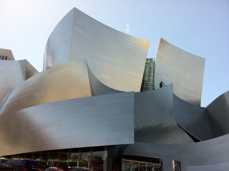
From here you can visit some things in the center. Such as the Walt Disney Concert Hall. After checking in at the hotel we were able to have lunch and stroll through the city.
640 S Main St, Los Angeles, CA 90014, Verenigde Staten
34° 2' 39.4" N 118° 15' 2.3" W
34.0442769 -118.2506304
• Head toward Werdin Pl. Go for 35 m.
• Turn right onto Werdin Pl. Go for 51 m.
• Turn right onto E 7th St. Go for 60 m.
• Turn right onto S Main St. Go for 1.2 km.
• Turn left onto W 1st St. Go for 252 m.
• Turn right onto N Broadway. Go for 603 m.
• Turn right and take ramp onto US-101 N (Santa Ana Fwy). Go for 13.3 km.
• Take exit 11B toward Universal Studios BL onto WC Fields Dr. Go for 640 m.
• Turn right onto Universal Studios Blvd. Go for 231 m.
• Turn right onto Doris Day Dr. Go for 122 m.
• Turn left onto Service Dr. Go for 221 m.
• Turn slightly left onto Kirk Douglas Dr. Go for 99 m.
• Turn slightly right onto Kirk Douglas Dr. Go for 22 m.
• Turn left onto Kirk Douglas Dr. Go for 224 m.
• Arrive at Kirk Douglas Dr. Your destination is on the left.
☍
17,1 km
( 19 min.)
Day
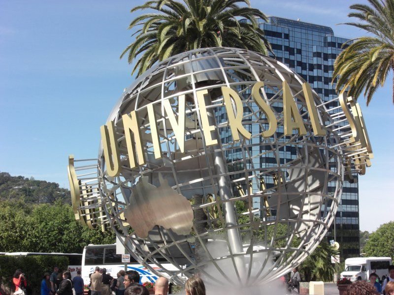
Universal Studios Hollywood
By metro you can quickly reach Universal Studios, next to it there is a shop, easy to get something to eat quickly.
100 Universal City Plaza, Universal City, CA 91608, Verenigde Staten
34° 8' 17.2" N 118° 21' 12.2" W
34.1381168 -118.3533783
• Head southeast on Kirk Douglas Dr. Go for 224 m.
• Turn right onto Kirk Douglas Dr. Go for 22 m.
• Turn slightly left onto Kirk Douglas Dr. Go for 99 m.
• Turn slightly right onto Service Dr. Go for 221 m.
• Turn right onto Doris Day Dr. Go for 8 m.
• Turn slightly right toward Universal Studios Blvd. Go for 124 m.
• Turn slightly left onto Universal Studios Blvd. Go for 417 m.
• Turn left and take ramp onto US-101 S (Hollywood Fwy). Go for 19.2 km.
• Continue on I-5 S (Santa Ana Fwy). Go for 19.6 km.
• Take exit 120 toward Rosecrans Ave. Go for 456 m.
• Turn right onto Rosecrans Ave. Go for 102 m.
• Turn left onto Bloomfield Ave. Go for 94 m.
• Turn left onto Firestone Blvd. Go for 473 m.
• Turn right. Go for 44 m.
• Turn left. Go for 64 m.
• Turn right. Go for 20 m.
• Arrive at your destination on the left.
☍
41,2 km
( 30 min.)
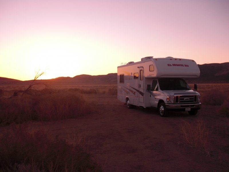
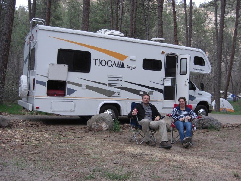
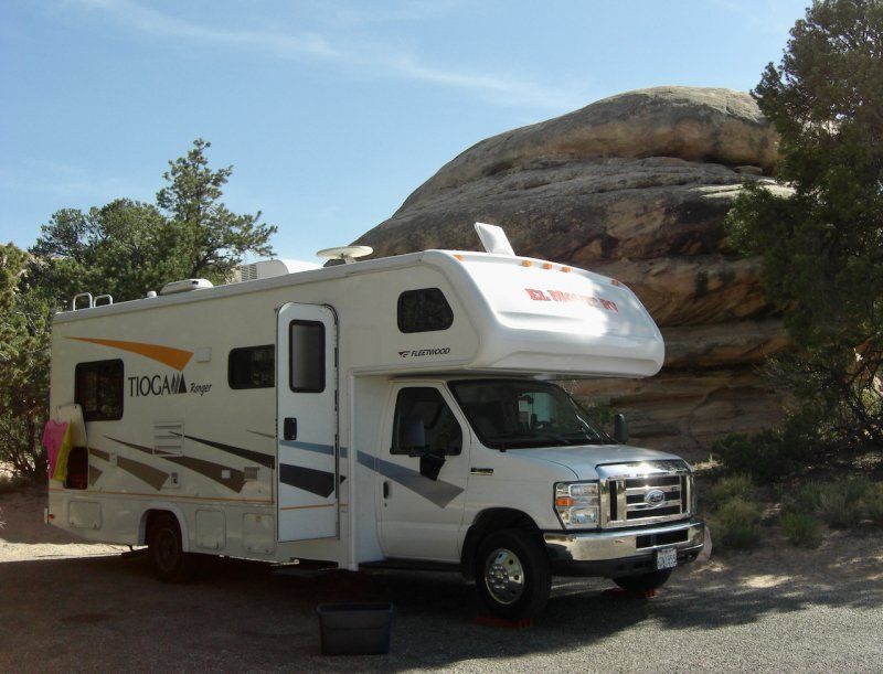
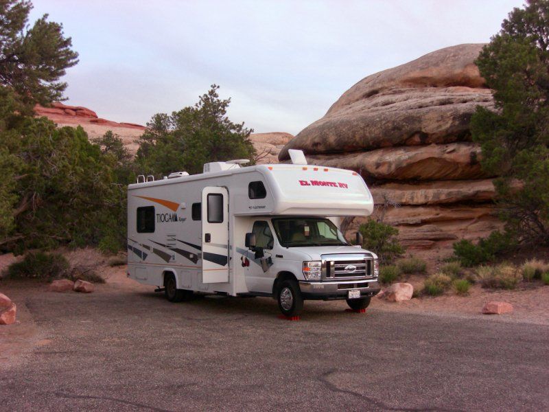
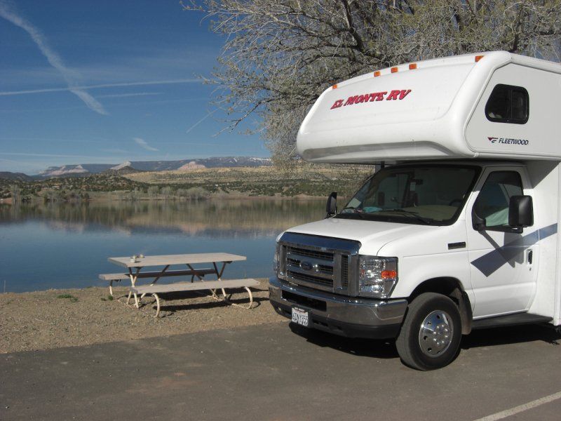
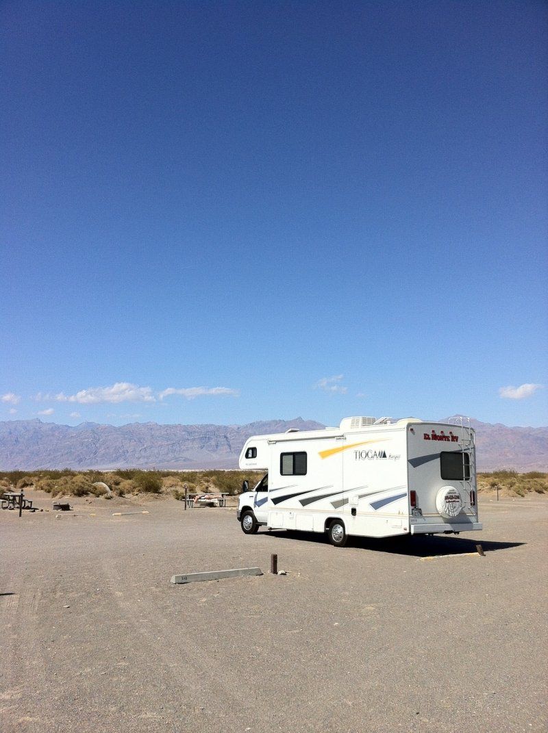
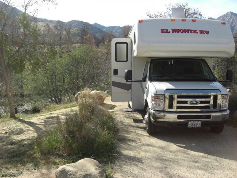
El Monte RV Rental Los Angeles
Vandaag pikten we ons rijdende appartement op van El Monte, een 24' met een ongevraagde "Slide-out". Het is wel handig om de RV goed te bekijken voordat je hem meeneemt, en alle (pietluttige) dingetjes aan te geven.
In ons geval hebben we gezien dat de slide-out aan de onderkant een centimeter uitgeschoven was, terwijl deze aan de bovenkant gewoon aansloot. "No Problem" werd gezegd, maar ik heb het wel laten aantekenen. Uiteindelijk bleek het een echt defect van de motorrem te zijn en ging bij een bocht de slide-out uitschuiven. Dit had een dag reparatie in Las Vegas tot gevolg.
12818 Firestone Blvd, Santa Fe Springs, CA 90670, Verenigde Staten
33° 53' 57.9" N 118° 3' 32.5" W
33.8994152 -118.0590241
• Head northeast. Go for 65 m.
• Turn left onto Firestone Blvd. Go for 514 m.
• Turn right onto Bloomfield Ave. Go for 50 m.
• Turn right onto Rosecrans Ave. Go for 118 m.
• Take ramp onto I-5 S (Santa Ana Fwy). Go for 8.2 km.
• Take exit 114B toward Riverside onto CA-91 E (Riverside Fwy). Go for 15.2 km.
• Keep left onto CA-91 E (CA-91 Express Lanes) toward CA-91 Express Toll Lanes. Go for 47.9 km.
• Take exit 63 toward 14th Street. Go for 418 m.
• Turn right onto 14th St. Go for 1.5 km.
• Continue on Martin Luther King Blvd. Go for 2.8 km.
• Turn right and take ramp onto I-215 S (Moreno Valley Fwy) toward CA-60 E/San Diego/Indio. Go for 4.3 km.
• Keep left onto CA-60 E (Moreno Valley Fwy) toward Indio. Go for 28.8 km.
• Take left ramp onto I-10 E (San Bernardino Fwy) toward CA-79. Go for 36.2 km.
• Take exit 117 toward 29 Palms/Yucca Valley/CA-62 onto CA-62 E (Twentynine Palms Hwy). Go for 36.0 km.
• Turn right onto Warren Vista Ave. Go for 656 m.
• Turn left onto Yucca Trl. Go for 1.4 km.
• Turn right onto Palomar Ave. Go for 3.2 km.
• Turn left onto Joshua Ln. Go for 1.4 km.
• Turn right onto San Marino Dr. Go for 102 m.
• Turn left onto Black Rock Canyon Rd. Go for 398 m.
• Turn right onto S Park Rd. Go for 206 m.
• Arrive at S Park Rd.
☍
189,4 km
(1 hrs. 51 min.)
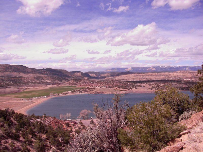
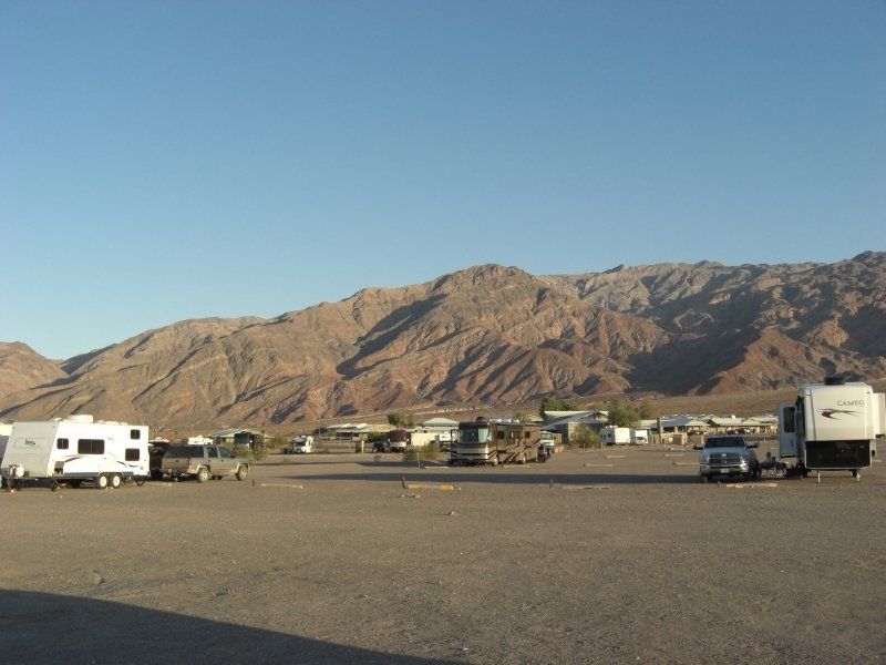
Black Rock Canyon Campground
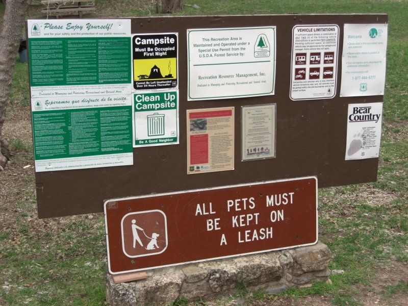
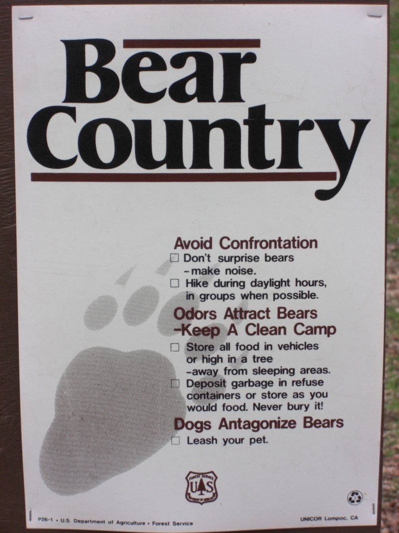
"Note to Self": On "Labor Day" the whole of America is free and goes camping, so all campsites are packed!
Similarly this campsite in Yoshua Tree National Park. As a result, we moved to a so-called BLM site (Office of Land Management).
During the drive to Yoshua Tree National Park it was very hot in the cabin, and there was a lot of noise. While you were sitting next to each other, you couldn't understand each other. Very strange, the air conditioning gave good cold air. But yes, if the El Monte mechanic does not cover the engine cover in the driver's cab, or does not cover it properly, then you are right inside the warm engine air. We closed this again ourselves along the highway and then the holiday could really continue!
9678 Black Rock Canyon Rd, Yucca Valley, CA 92284, Verenigde Staten
34° 4' 38" N 116° 23' 24.6" W
34.0772220 -116.3901710
• Head toward Black Rock Canyon Rd on S Park Rd. Go for 206 m.
• Turn right onto Black Rock Canyon Rd. Go for 405 m.
• Turn left. Go for 77 m.
• Turn left toward Black Rock Canyon Rd. Go for 161 m.
• Turn right onto Black Rock Canyon Rd. Go for 634 m.
• Turn right onto San Marino Dr. Go for 102 m.
• Turn left onto Joshua Ln. Go for 1.4 km.
• Turn right onto Palomar Ave. Go for 3.6 km.
• Continue on Avalon Ave. Go for 1.2 km.
• Turn right onto Twentynine Palms Hwy (CA-62). Go for 30.7 km.
• Arrive at Twentynine Palms Hwy (CA-62). Your destination is on the right.
☍
38,4 km
( 32 min.)
Twentynine Palms
There is a booklet, or a map, in the USA that lists BLM lands. This was told to us by one of the "Camp Hosts" of the campsite in Joshua Tree NP.
Twentynine Palms, Californië 92277, Verenigde Staten
34° 8' 8" N 116° 3' 15" W
34.1355582 -116.0541689
• Head toward Adobe Rd on Twentynine Palms Hwy (CA-62). Go for 57.0 km.
• Turn left toward N Indian Canyon Dr. Go for 167 m.
• Turn slightly left onto N Indian Canyon Dr. Go for 17.6 km.
• Turn right onto W San Rafael Rd. Go for 1.1 km.
• Continue on Tramway Rd. Go for 6.2 km.
• Arrive at Tramway Rd. Your destination is on the right.
☍
82,2 km
(1 hrs. 6 min.)
Day
Palm Springs Aerial Tramway
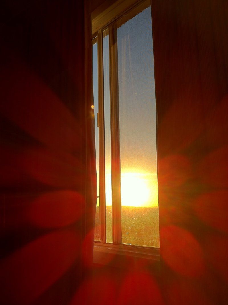
Het mooie van het wakker worden met jetlag is dat je tijd hebt om de zonsopgang te fotograveren. Helemaal gaaf als je met je camper in "the middle of nowhere" van een woestijn staat op BLM land in de buurt van Twentynine Palms.
1 Tram Way, Palm Springs, CA 92262, Verenigde Staten
33° 50' 13.6" N 116° 36' 51.1" W
33.8371187 -116.6141876
• Head southeast on Tramway Rd. Go for 325 m.
• Turn slightly right onto Tramway Rd. Go for 5.8 km.
• Turn right onto N Palm Canyon Dr (CA-111). Go for 1.9 km.
• Turn left onto E Vista Chino (CA-111). Go for 108 m.
• Turn right onto N Indian Canyon Dr toward Hospital. Go for 3.2 km.
• Turn right onto E Ramon Rd. Go for 43 m.
• Turn right. Go for 29 m.
• Arrive at your destination on the right.
☍
11,4 km
( 21 min.)
IHOP Palm Springs
You haven't really been to America if you haven't had breakfast at the International House of Pancakes.
471 S Indian Canyon Dr, Palm Springs, CA 92262, Verenigde Staten
33° 48' 58" N 116° 32' 45" W
33.8160977 -116.5458401
• Head north. Go for 24 m.
• Turn right toward S Indian Canyon Dr. Go for 45 m.
• Turn right onto S Indian Canyon Dr. Go for 61 m.
• Turn left onto E Ramon Rd. Go for 12.9 km.
• Take ramp onto I-10 E. Go for 182 km.
• Continue on I-10 E. Go for 694 m.
• Take exit 1 toward Ehrenberg/Parker. Go for 431 m.
• Take the 4th exit from roundabout onto Juneau Ave toward Poston Rd/I-10 W. Go for 824 m.
• Turn right onto Ehrenberg Rd toward Parker. Go for 4.3 km.
• Continue on Mohave Rd (CR-1). Go for 63.8 km.
• Turn left onto S Industrial Park Pl (AZ-95) toward Parker. Go for 1.6 km.
• Continue on California Ave toward CA-62/California. Go for 1.4 km.
• Continue on Aqueduct Rd (CA-62). Go for 651 m.
• Turn right onto Parker Dam Rd. Go for 12.4 km.
• Turn right. Go for 19 m.
• Arrive at your destination on the left.
☍
280,7 km
(2 hrs. 48 min.)
Crossroads Campground Empire Landings
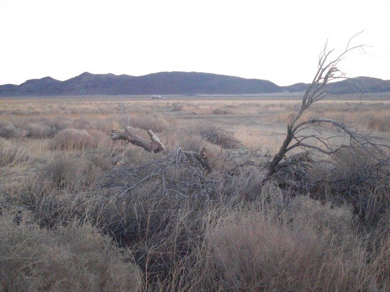
Near Parker we found a quiet spot in the desert sun, along the Colorado River. However, it is not so quiet in the evening, there is a lot of speedboats and the like with quite loud music.
Still tired enough to eventually fall deeply asleep. Tomorrow we continue towards historic Route 66.
52932-53214 Parker Dam Rd, Earp, CA 92242, Verenigde Staten
34° 13' 23.6" N 114° 12' 12.9" W
34.2232268 -114.2035782
• Head toward Parker Dam Rd. Go for 19 m.
• Turn right onto Parker Dam Rd. Go for 106 m.
• Keep right onto Parker Dam Rd. Go for 1.4 km.
• Turn slightly right onto Parker Dam Rd. Go for 11.7 km.
• Continue on Parker Dam Rd. Go for 1.4 km.
• Turn left onto AZ-95-SPUR. Go for 44 m.
• Turn left onto N Highway 95 (AZ-95). Go for 32.5 km.
• Turn right onto Acoma Blvd S. Go for 5.0 km.
• Turn right onto Smoketree Ave N. Go for 275 m.
• Turn right onto Mescal Loop. Go for 18 m.
• Arrive at Mescal Loop. Your destination is on the left.
☍
52,5 km
( 49 min.)
Day
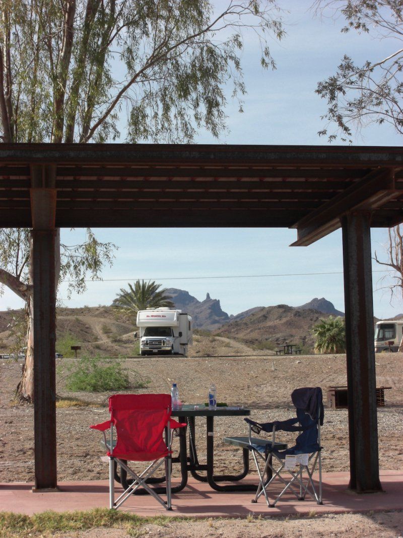
Lake Havasu City
Just refuel & shop, there is a large mall, so that will be possible there. The refrigerator and pantry full of stuff and on!
Lake Havasu City, Arizona, Verenigde Staten
34° 29' 2" N 114° 19' 20.8" W
34.4839010 -114.3224548
• Head toward Smoketree Ave N on Mescal Loop. Go for 18 m.
• Turn left onto Smoketree Ave N. Go for 275 m.
• Turn right onto Acoma Blvd N. Go for 3.4 km.
• Turn right onto AZ-95. Go for 28.4 km.
• Turn right and take ramp onto I-40 E (Purple Heart Trl). Go for 62.5 km.
• Take exit 48 toward US-93/AZ-68/Beale St/Las Vegas. Go for 422 m.
• Turn right onto W Beale St. Go for 460 m.
• Turn slightly right onto Ella's Pl. Go for 93 m.
• Turn left onto W Andy Devine Ave (AZ-66). Go for 284 m.
• Turn right. Go for 90 m.
• Turn left. Go for 25 m.
• Arrive at your destination on the right.
☍
95,9 km
( 59 min.)
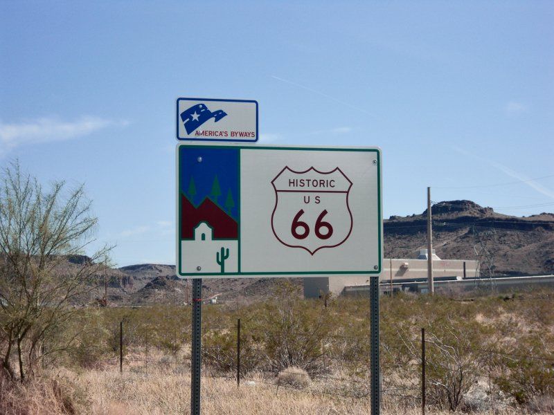
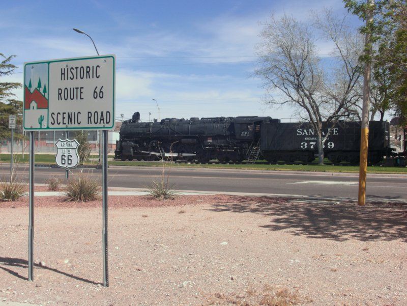
Kingman Visitor Center
When you drive into Kingman, there is a nice Visitors Center for the Historic Route 66. Good parking lot and nice long freight trains. There is also a typical 60s diner, cool for a hamburger with a milkshake!
120 W Andy Devine Ave, Kingman, AZ 86401, Verenigde Staten
35° 11' 20.5" N 114° 3' 31.2" W
35.1890240 -114.0586710
• Head south. Go for 20 m.
• Turn left. Go for 63 m.
• Turn left. Go for 21 m.
• Turn right toward E Andy Devine Ave/AZ-66. Go for 31 m.
• Turn right onto E Andy Devine Ave (AZ-66). Go for 101 km.
• Turn right onto Grand Canyon Caverns Rd. Go for 57 m.
• Turn left onto Grand Canyon Caverns Rd. Go for 20 m.
• Arrive at Grand Canyon Caverns Rd. Your destination is on the right.
☍
100,7 km
(1 hrs. 2 min.)
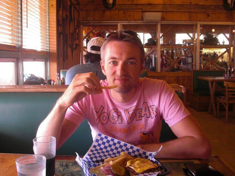
Grand Canyon Caverns Inn
Voor de meest vette hamburger kun je hier goed terecht. Net wat je nodig hebt als je op de Route 66 aan het touren bent.
115 Mile Marker AZ-66, Peach Springs, AZ 86434, Verenigde Staten
35° 31' 43.6" N 113° 13' 52.3" W
35.5287685 -113.2311806
• Head northwest on Grand Canyon Caverns Rd. Go for 20 m.
• Turn right onto Grand Canyon Caverns Rd. Go for 57 m.
• Turn right onto Historic US-66 (AZ-66 E). Go for 39.5 km.
• Turn left onto I-40-BL. Go for 1.9 km.
• Turn left and take ramp onto I-40 E (Purple Heart Trl). Go for 40.0 km.
• Take exit 146 toward AZ-89 S/Prescott. Go for 535 m.
• Turn right onto Granite Mountain Hotshots Memorial Hwy (AZ-89). Go for 52.1 km.
• Pass 7 roundabouts and continue on N AZ-89 (AZ-89 S). Go for 22.6 km.
• Continue toward N AZ-89/AZ-89. Go for 52 m.
• Take the 2nd exit from roundabout onto N AZ-89 (AZ-89). Go for 5.5 km.
• Take left ramp onto E Gurley St (AZ-89 N) toward Gurley St. Go for 2.4 km.
• Arrive at W Gurley St. Your destination is on the left.
☍
164,7 km
(1 hrs. 40 min.)
Whiskey Row
N Montezuma St, Prescott, AZ 86301, Verenigde Staten
34° 32' 30.7" N 112° 28' 12" W
34.5418706 -112.4700021
• Head toward S Montezuma St on W Gurley St. Go for 12 m.
• Turn right onto N Montezuma St (AZ-89). Go for 356 m.
• Turn right onto W Sheldon St (AZ-89). Go for 1.5 km.
• Turn left onto E Gurley St (AZ-89 N). Go for 369 m.
• Keep right onto AZ-69 S toward Prescott Valley/Phoenix. Go for 24.1 km.
• Turn left onto E Cherry Rd (AZ-169 N). Go for 24.3 km.
• Turn left and take ramp onto I-17 N (Arizona Veterans Hwy) toward Flagstaff. Go for 13.7 km.
• Take exit 287 toward Cottonwood. Go for 565 m.
• Turn left onto Camp Verde Bridgeport Hwy (AZ-260 W) toward Cottonwood/Jerome. Go for 893 m.
• Pass 7 roundabouts and continue on Camp Verde Bridgeport Hwy (AZ-260 W). Go for 19.1 km.
• Turn left onto S Main St (AZ-260) toward AZ-89A S. Go for 1.0 km.
• Continue on S Main St (AZ-260). Go for 2.2 km.
• Take the 1st exit from roundabout onto N 10th St. Go for 1.3 km.
• Keep right onto Dead Horse Ranch Rd. Go for 307 m.
• Arrive at Dead Horse Ranch Rd. Your destination is on the right.
☍
89,7 km
(1 hrs. 10 min.)
Dead Horse Ranch State Park
675 Dead Horse Ranch Rd, Cottonwood, AZ 86326, Verenigde Staten
34° 45' 14.1" N 112° 1' 9.9" W
34.7539250 -112.0194040
• Head west on Dead Horse Ranch Rd. Go for 245 m.
• Turn left onto N 10th St. Go for 1.4 km.
• Take the 3rd exit from roundabout onto N Main St (AZ-260). Go for 1.0 km.
• Arrive at S Main St (AZ-260). Your destination is on the right.
☍
2,7 km
( 5 min.)
Day
Cottonwood
Cottonwood, Arizona, Verenigde Staten
34° 44' 21.1" N 112° 0' 35.6" W
34.7391876 -112.0098791
• Head north on S Main St (AZ-260). Go for 39 m.
• Turn right onto E Mingus Ave. Go for 3.0 km.
• Turn left onto Dry Creek Scenic Rd (AZ-89A N). Go for 26.9 km.
• Pass 2 roundabouts and continue on N State Route 89A (AZ-89A N). Go for 433 m.
• Arrive at N State Route 89A (AZ-89A). Your destination is on the left.
☍
30,4 km
( 24 min.)
Starbucks
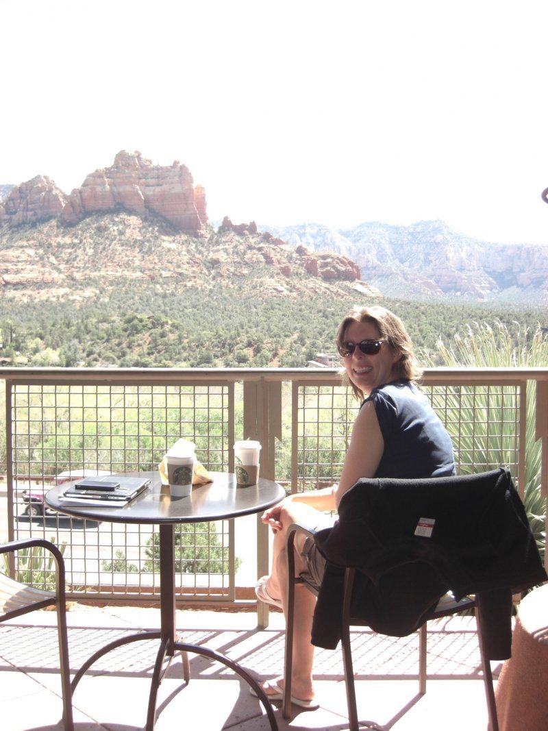
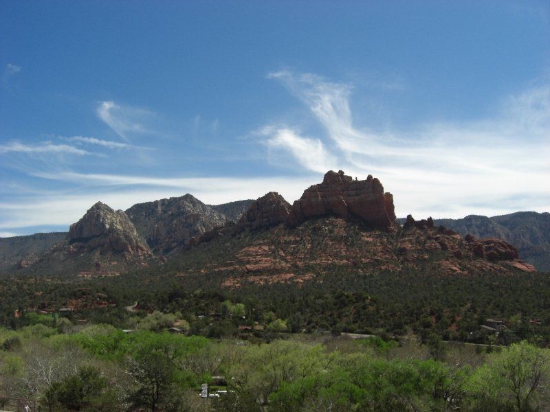
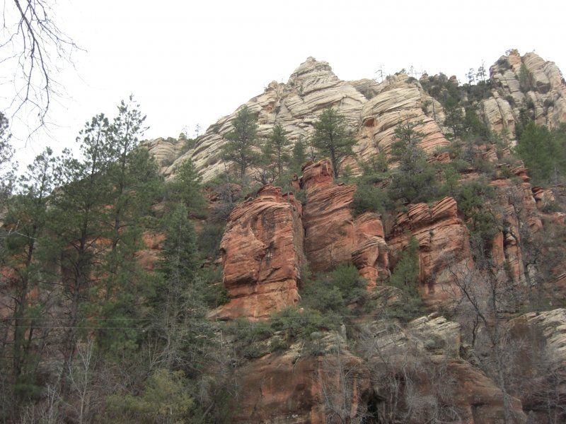
De Starbucks met het mooiste uitzicht over Sedona's Red Rocks. Helaas zonder Wifi. Ook hebben we in Sedona de "America the Beautifull" Nationale Parken-Pas gehaald. Met ongeveer $20 entree per nationaal park is dat zeker de moeite waard.
101 AZ-89A, Sedona, AZ 86336, Verenigde Staten
34° 52' 4.3" N 111° 45' 43" W
34.8678683 -111.7619513
• Head toward Forest Rd on N State Route 89A (AZ-89A). Go for 223 m.
• Take the 2nd exit from roundabout onto N State Route 89A (AZ-89A N). Go for 564 m.
• Take the 1st exit from roundabout onto N State Route 89A (AZ-89A N). Go for 17.8 km.
• Turn left onto Cave Springs Campground Rd. Go for 437 m.
• Turn slightly right onto Cave Springs Campground Rd. Go for 462 m.
• Turn slightly left onto Cave Springs Campground Rd. Go for 97 m.
• Continue on Forest Service 89D Rd. Go for 144 m.
• Arrive at Forest Service 89D Rd. Your destination is on the left.
☍
19,7 km
( 23 min.)
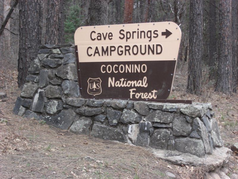
Cave Springs Campground
A beautiful state campground, just north of Sedona on beautiful route 86A is Cave Springs Campground. A few nice walks also start here that you can do shortly after arrival.
11345 AZ-89A, Sedona, AZ 86336, Verenigde Staten
34° 59' 46" N 111° 44' 21.7" W
34.9961011 -111.7393703
• Head northwest on Forest Service 89D Rd.
• Arrive at Forest Service 89D Rd. Your destination is on the left.
☍
Distance not available
(Duration not available)
Day
Cave Springs Campground
11345 AZ-89A, Sedona, AZ 86336, Verenigde Staten
34° 59' 46" N 111° 44' 21.7" W
34.9961011 -111.7393703
• Head northwest on Forest Service 89D Rd. Go for 231 m.
• Continue on Cave Springs Campground Rd. Go for 437 m.
• Turn left onto N State Route 89A (AZ-89A). Go for 20.9 km.
• Take the 1st exit from roundabout onto W John Wesley Powell Blvd toward JW Powell Blvd/Airport/I-17. Go for 102 m.
• Take the 2nd exit from roundabout onto W John Wesley Powell Blvd toward JW Powell Blvd. Go for 247 m.
• Turn left and take ramp onto I-17 N (Arizona Veterans Hwy). Go for 4.3 km.
• Take exit 340B toward Los Angeles onto I-40 W (Purple Heart Trl). Go for 47.6 km.
• Take exit 165 toward I-40-BL/AZ-64/Williams/Grand Canyon. Go for 627 m.
• Turn left onto I-40-BL toward Williams. Go for 506 m.
• Arrive at E Route 66 (I-40-BL). Your destination is on the left.
☍
74,9 km
( 48 min.)
Bearizona Wildlife Park
1500 Historic Rte 66, Williams, AZ 86046, Verenigde Staten
35° 15' 27.2" N 112° 9' 15.1" W
35.2575430 -112.1541880
• Head toward Bearizona Blvd on E Route 66 (I-40-BL). Go for 506 m.
• Continue on AZ-64. Go for 79.9 km.
• Pass 2 roundabouts and continue on AZ-64 N. Go for 8.1 km.
• Turn left onto Center Rd. Go for 706 m.
• Turn right onto Market Plaza Rd. Go for 1.4 km.
• Turn right onto Mather Campground Rd. Go for 409 m.
• Turn left onto Mather Campground Rd. Go for 213 m.
• Arrive at Mather Campground Rd. Your destination is on the right.
☍
91,3 km
( 59 min.)
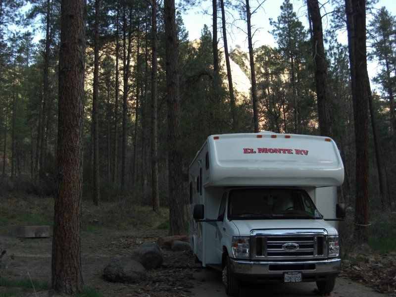
Mather Campground Pine Loop Camp 281 Grand Canyon
Actually the only campsite within walking distance of the Grand Canyon. Can be busy, so make a reservation. "We got lucky", and that in April...
281 Pine Loop, Grand Canyon Village, AZ 86023, Verenigde Staten
36° 3' 2.2" N 112° 7' 0.8" W
36.0506088 -112.1168810
• Head northeast on Mather Campground Rd.
• Arrive at Mather Campground Rd. Your destination is on the right.
☍
Distance not available
(Duration not available)
Day
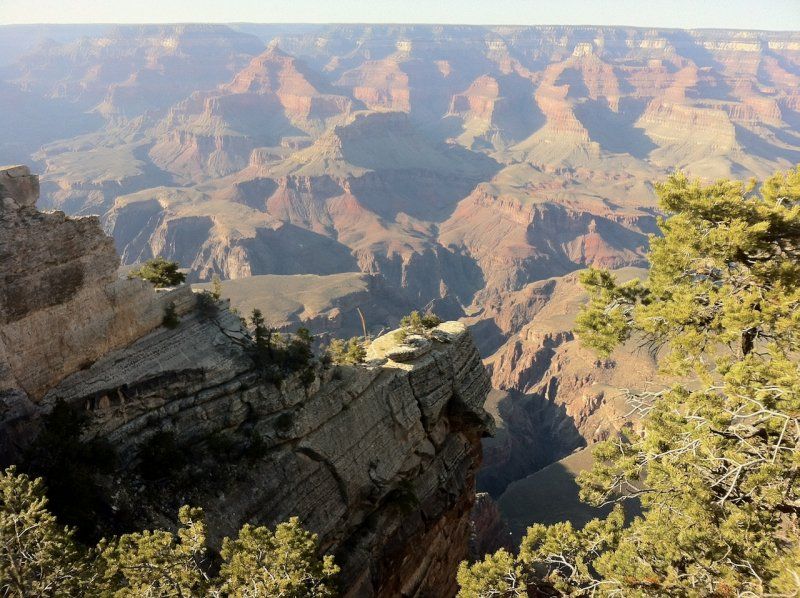
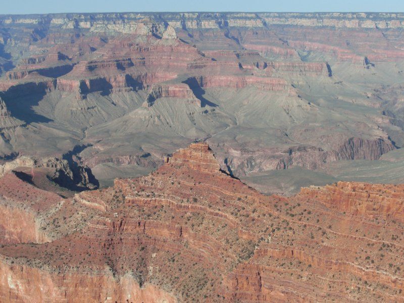
The Grand Canyon
Never skip it if you are in the area, or take a detour! You should have seen that one, right?
Day
Mather Campground Pine Loop Camp 281 Grand Canyon
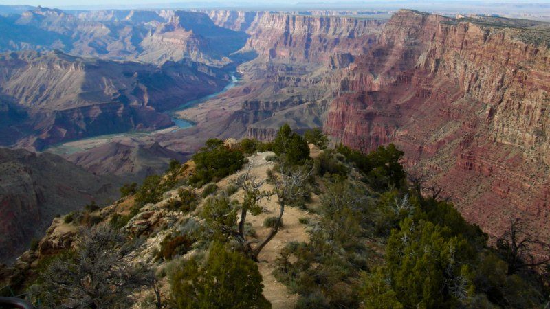
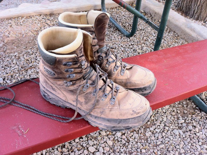
Early in the morning you can start the "Bright Angel Trail". Keep in mind that hiking in a Canyon can typically be classified differently than a hike up a mountain. For the way back, take double the time you took down as a guideline, the average mountain hiker knows this of course.
Still, we encountered quite a few "tourists" wearing bad footwear (slippers) and tired while they still had to walk about 4 hours back...
281 Pine Loop, Grand Canyon Village, AZ 86023, Verenigde Staten
36° 3' 2.2" N 112° 7' 0.8" W
36.0506088 -112.1168810
• Head southwest on Mather Campground Rd. Go for 213 m.
• Turn right onto Mather Campground Rd. Go for 409 m.
• Turn left onto Market Plaza Rd. Go for 1.4 km.
• Turn left onto Center Rd. Go for 692 m.
• Turn left onto S Entrance Rd (AZ-64 N). Go for 2.1 km.
• Turn right onto E Rim Dr (AZ-64). Go for 17.3 km.
• Turn right onto Grandview Rd. Go for 979 m.
• Continue on NF-310. Go for 1.3 km.
• Turn left onto NF-307. Go for 2.6 km.
• Turn right onto NF-307. Go for 3.7 km.
• Turn right onto NF-307. Go for 1.7 km.
• Turn left onto NF-2319. Go for 665 m.
• Turn left onto NF-231B. Go for 1.7 km.
• Turn slightly right onto NF-206H. Go for 5.0 km.
• Turn right onto NF-206. Go for 626 m.
• Turn left onto NF-205J. Go for 2.6 km.
• Turn right onto E Rim Dr (AZ-64). Go for 11.4 km.
• Turn right onto Old AZ-64 Access Rd. Go for 53 m.
• Turn left onto Old Highway 64. Go for 546 m.
• Turn right onto Gray Mountain Truck Trl. Go for 2.3 km.
• Continue on Gray Mountain Truck Trl (BIA-6150). Go for 22.9 km.
• Turn slightly right onto Gray Mountain Truck Trl (BIA-6150). Go for 4.3 km.
• Continue on BIA-6150. Go for 3.6 km.
• Continue on Gray Mountain Truck Trl (BIA-6150). Go for 962 m.
• Turn slightly right onto Black Mesa Pump Station Rd. Go for 3.3 km.
• Turn left onto Native American Veterans Hwy (US-89). Go for 13.1 km.
• Take the 2nd exit from roundabout onto Native American Veterans Hwy (US-89 N). Go for 25.1 km.
• Turn right onto Native American Women Veterans Hwy (US-160). Go for 80.8 km.
• Continue on Native American Women Veterans Hwy (US-160). Go for 122 km.
• Turn left onto US-191 toward AZ-12. Go for 8.2 km.
• Continue on US-191. Go for 34.3 km.
• Turn right onto Trail of the Ancients (US-191). Go for 48.4 km.
• Turn right onto E Center St (US-191). Go for 56.3 km.
• Turn left onto Highway 211 (UT-211). Go for 19.8 km.
• Arrive at Highway 211 (UT-211). Your destination is on the right.
☍
499,9 km
(6 hrs. 23 min.)
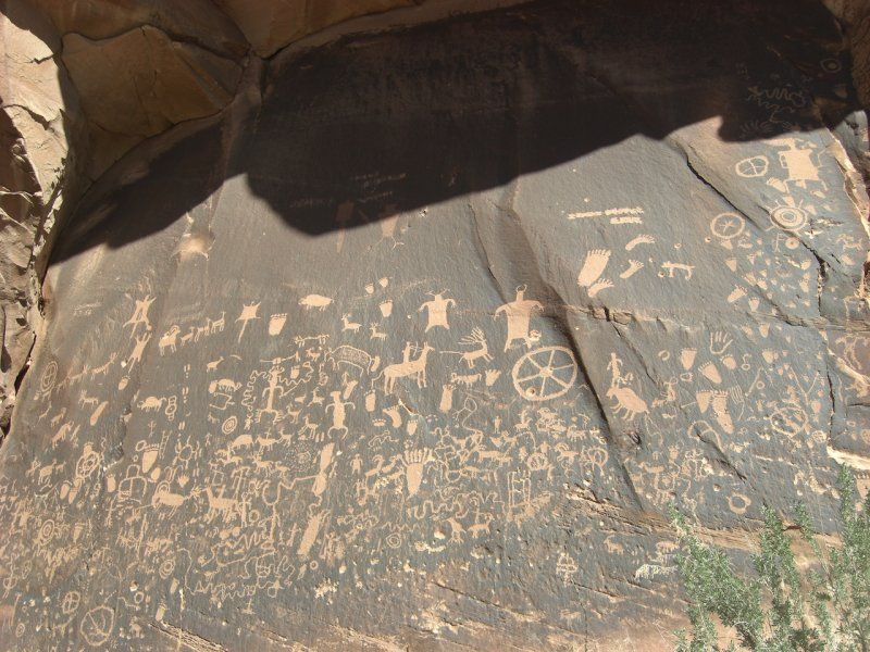
Newspaper Rock, Monticello
On the way to our campground in Canyonlands we passed "Newspaper Rock". So take a look!
UT-211, Monticello, UT 84535, Verenigde Staten
37° 59' 18.3" N 109° 31' 5.4" W
37.9884113 -109.5181789
• Head north on Highway 211 (UT-211). Go for 40.0 km.
• Turn left onto Squaw Flat Campground. Go for 424 m.
• Turn right onto Elephant Hill Rd. Go for 398 m.
• Turn slightly left. Go for 190 m.
• Turn right. Go for 94 m.
• Arrive at your destination on the right.
☍
41,1 km
( 46 min.)
Squaw Flat Campground
Utah 211, Moab, UT 84532, Verenigde Staten
38° 8' 54.5" N 109° 48' 7" W
38.1484794 -109.8019552
• Head southwest.
• Arrive at your destination on the right.
☍
Distance not available
(Duration not available)
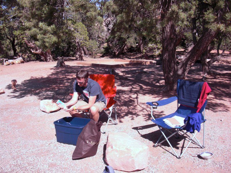
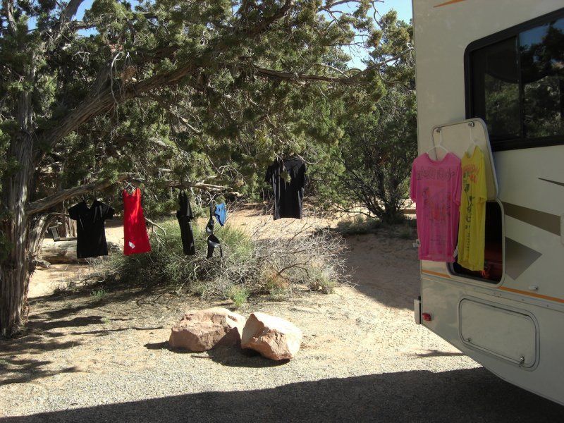
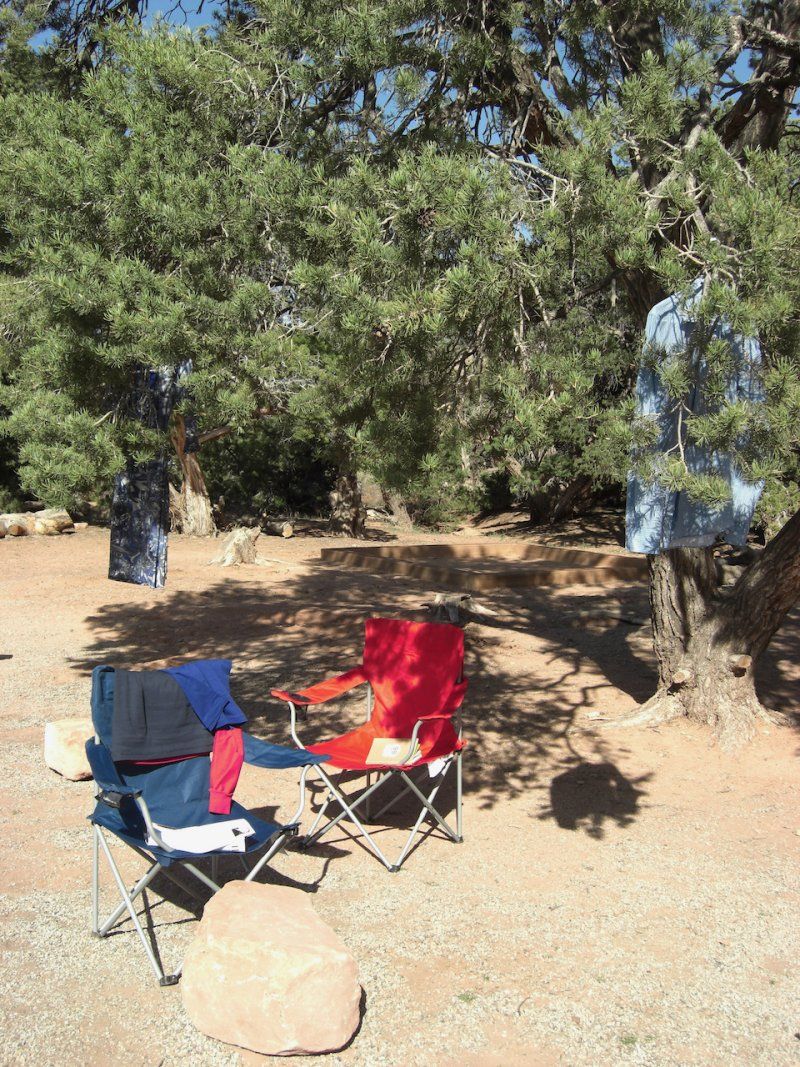
Campingwasje
The air in the desert is nice and dry, so it is a great place to do your holiday laundry.
Day
Squaw Flat Campground
Utah 211, Moab, UT 84532, Verenigde Staten
38° 8' 54.5" N 109° 48' 7" W
38.1484794 -109.8019552
• Head northeast. Go for 94 m.
• Turn left toward Elephant Hill Rd. Go for 190 m.
• Turn slightly right onto Elephant Hill Rd. Go for 398 m.
• Turn left onto Squaw Flat Campground. Go for 424 m.
• Turn right onto Canyonlands National Park (UT-211). Go for 59.8 km.
• Turn left onto US-191. Go for 63.0 km.
• Turn right onto Uranium Ave. Go for 159 m.
• Continue on Vo Tech. Go for 117 m.
• Arrive at Vo Tech.
☍
124,2 km
(2 hrs. 4 min.)
Canyonlands RV Resort & Campground
There is not much room for your RV in Moab itself, and so that we could go out for a nice meal, we parked the camper there for a night at an RV Resort with a swimming pool, in the village itself. Very easy, but a bit more expensive than you are used to in Europe.
555 S Main St, Moab, UT 84532, Verenigde Staten
38° 33' 52" N 109° 32' 53.7" W
38.5644532 -109.5482549
• Head east on Vo Tech.
• Arrive at Vo Tech.
☍
Distance not available
(Duration not available)
Day
Canyonlands RV Resort & Campground
555 S Main St, Moab, UT 84532, Verenigde Staten
38° 33' 52" N 109° 32' 53.7" W
38.5644532 -109.5482549
• Head west on Vo Tech. Go for 117 m.
• Turn right onto S 100 E. Go for 191 m.
• Turn left onto Grand Ave. Go for 181 m.
• Turn right onto S Main St (US-191). Go for 7.9 km.
• Turn right onto Arches Entrance Rd. Go for 805 m.
• Turn right. Go for 28 m.
• Turn left. Go for 528 m.
• Arrive at your destination on the right.
☍
9,8 km
( 11 min.)
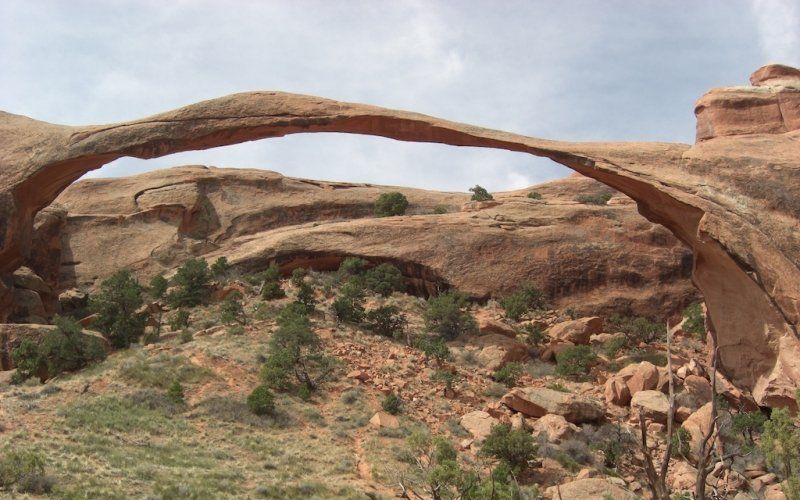
Arches National Park Visitor Center & Park Headquarters
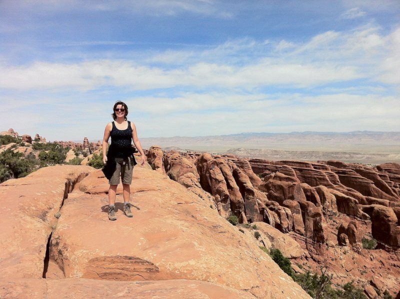
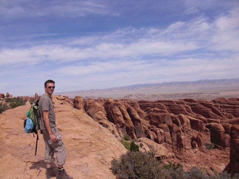
A bit burnt during our hike through Arches NP. Apply well. With a little insight you can climb a number of Arches. If you have no fear of heights and take it easy.
2180 US-191, Moab, UT 84532, Verenigde Staten
38° 36' 59.9" N 109° 37' 11.3" W
38.6166322 -109.6198056
• Head northeast. Go for 197 m.
• Turn right toward Arches Entrance Rd. Go for 30 m.
• Take the 2nd exit from roundabout onto Arches Entrance Rd. Go for 1.1 km.
• Turn right onto N Highway 191 (US-191). Go for 43.4 km.
• Turn left and take ramp onto I-70 W (Dinosaur Diamond Prehistoric Hwy) toward US-6 W/US-191 W. Go for 52.4 km.
• Take exit 149 toward UT-24 W/Hanksville. Go for 652 m.
• Turn left onto County Rd (UT-24). Go for 70.5 km.
• Turn right onto E 100 N (UT-24). Go for 75.8 km.
• Turn left onto S Highway 12 (UT-12). Go for 105 km.
• Turn right onto N Reservoir Rd. Go for 1.1 km.
• Arrive at N Reservoir Rd. Your destination is on the left.
☍
350,3 km
(3 hrs. 48 min.)
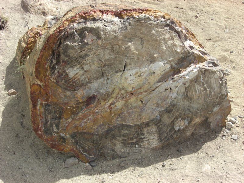
Escalante Petrified Forest
How we arrived here very late in the evening, after leaving Arches National Park, is a story in itself, but fortunately the Camphost had a beautiful place for us. Very nice to wake up next to a lake and then view some petrified tree trunks along a beautiful walking path to the viewpoint.
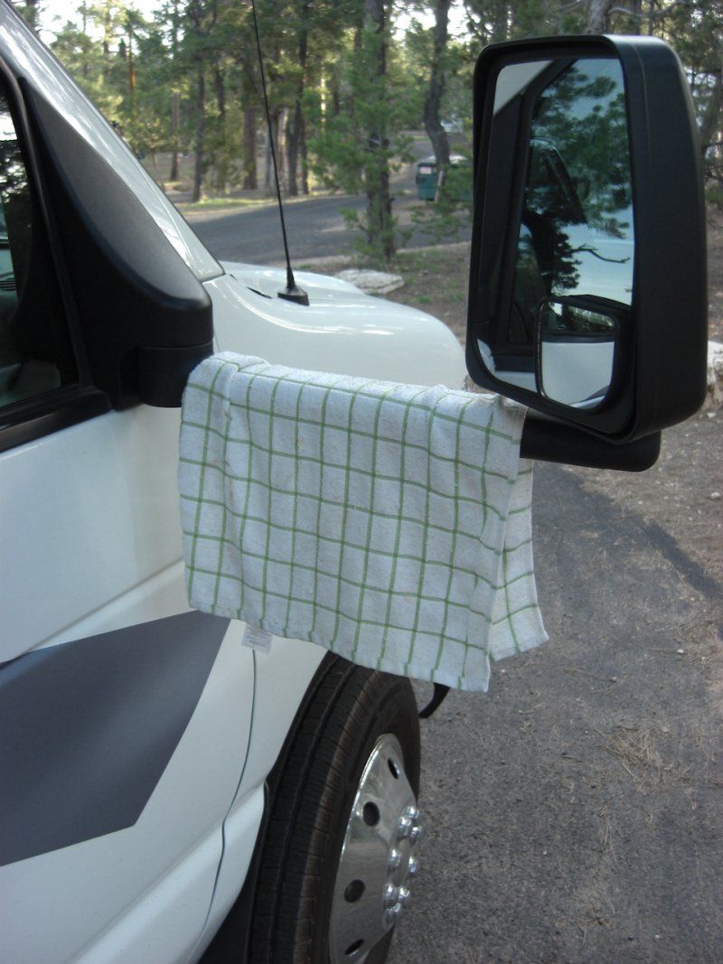
The camp host was also able to help me with a measured piece of wood to keep the slide-out retracted. Thanks, Bob!
710 North Reservoir, Escalante, UT 84726, Verenigde Staten
37° 47' 12" N 111° 37' 52.4" W
37.7866585 -111.6312164
• Head northwest on N Reservoir Rd.
• Arrive at N Reservoir Rd. Your destination is on the left.
☍
Distance not available
(Duration not available)
Day
Escalante Petrified Forest
710 North Reservoir, Escalante, UT 84726, Verenigde Staten
37° 47' 12" N 111° 37' 52.4" W
37.7866585 -111.6312164
• Head northwest on N Reservoir Rd. Go for 42 m.
• Turn right. Go for 41 m.
• Turn right toward N Reservoir Rd. Go for 78 m.
• Continue on N Reservoir Rd. Go for 1.1 km.
• Turn right onto W Highway 12 (UT-12). Go for 71.4 km.
• Take the 3rd exit from roundabout onto N Main St (UT-63) toward Bryce Canyon National Park. Go for 3.1 km.
• Continue on Highway 63 (UT-63). Go for 1.3 km.
• Continue on Main Park Rd (UT-63). Go for 3.9 km.
• Turn right onto Sunset Campground Rd. Go for 200 m.
• Turn left onto Sunset Campground Group Rd. Go for 60 m.
• Arrive at Sunset Campground Group Rd. Your destination is on the left.
☍
81,2 km
(1 hrs. 5 min.)
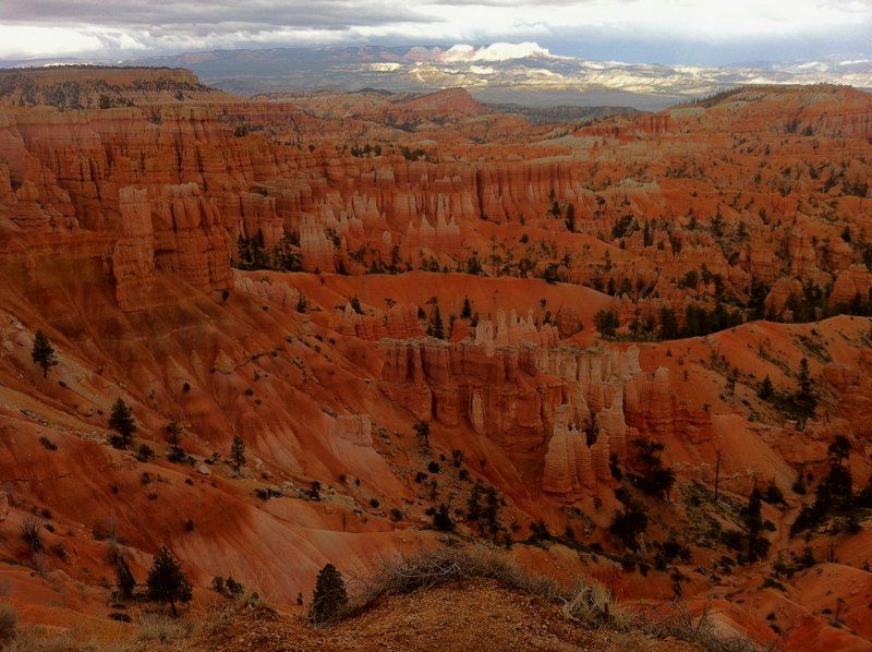
Sunset Campground, Bryce Canyon
Upon arrival, the campground was open again for the season that day. It had also become quite chilly. We knew that the other day, waking up in 20cm of snow... Cool!
Bryce Canyon, UT 84764, Verenigde Staten
37° 37' 19.5" N 112° 10' 24.5" W
37.6220720 -112.1734675
• Head southeast on Sunset Campground Group Rd.
• Arrive at Sunset Campground Group Rd. Your destination is on the left.
☍
Distance not available
(Duration not available)
Day
Sunset Campground Group Site
Bryce Canyon, UT 84764, Verenigde Staten
37° 37' 19.5" N 112° 10' 24.5" W
37.6220720 -112.1734675
• Head toward Sunset Campground Rd on Sunset Campground Group Rd. Go for 60 m.
• Turn right onto Sunset Campground Rd. Go for 200 m.
• Turn left onto Main Park Rd (UT-63). Go for 3.9 km.
• Continue on Highway 63 (UT-63). Go for 1.3 km.
• Continue on S Main St (UT-63). Go for 2.9 km.
• Take the 3rd exit from roundabout onto W Highway 12 (UT-12). Go for 21.9 km.
• Keep left onto E Highway 12 (UT-12) toward US-89 S. Go for 86 m.
• Turn left onto S Highway 89 (US-89). Go for 33.2 km.
• Continue on Mount Carmel Scenic Bywy (US-89). Go for 36.1 km.
• Keep right toward Zion Park Scenic Bywy/UT-9. Go for 238 m.
• Continue on Zion Park Scenic Bywy (UT-9). Go for 16.9 km.
• Take the 2nd exit from roundabout onto Zion Park Scenic Bywy (UT-9). Go for 21.6 km.
• Turn left. Go for 86 m.
• Turn right. Go for 64 m.
• Arrive at your destination on the left.
☍
138,6 km
(1 hrs. 57 min.)
Zion National Park - South Campground
Dalton Wash Rd, Virgin, UT 84779, Verenigde Staten
37° 12' 14.6" N 112° 59' 1" W
37.2040681 -112.9836118
• Head southwest.
• Arrive at your destination on the left.
☍
Distance not available
(Duration not available)
Day
Zion National Park - South Campground
Dalton Wash Rd, Virgin, UT 84779, Verenigde Staten
37° 12' 14.6" N 112° 59' 1" W
37.2040681 -112.9836118
• Head southwest.
• Arrive at your destination on the left.
☍
Distance not available
(Duration not available)
Day
Zion National Park - South Campground
Dalton Wash Rd, Virgin, UT 84779, Verenigde Staten
37° 12' 14.6" N 112° 59' 1" W
37.2040681 -112.9836118
• Head northeast. Go for 64 m.
• Turn left toward Zion Mount Carmel Hwy/UT-9. Go for 86 m.
• Turn left onto Zion Mount Carmel Hwy (UT-9). Go for 33.3 km.
• Turn left onto N State St (UT-9). Go for 19.8 km.
• Take ramp onto I-15 S (Zion Park Scenic Bywy) toward Las Vegas. Go for 26.1 km.
• Continue on I-15 S (Veterans Memorial Hwy). Go for 47.2 km.
• Continue on I-15 S. Go for 131 km.
• Keep left onto I-15 HOV Ln. Go for 2.5 km.
• Continue on I-15 S. Go for 20.0 km.
• Take exit 27 toward Southern Highlands Parkway/Southern Highlands Parkway South. Go for 917 m.
• Continue on St Rose Pkwy (NV-146 E). Go for 631 m.
• Turn right toward Las Vegas Blvd South. Go for 299 m.
• Turn right onto Las Vegas Blvd S. Go for 1.4 km.
• Turn right. Go for 75 m.
• Turn right. Go for 23 m.
• Arrive at your destination on the left.
☍
283,5 km
(2 hrs. 45 min.)
El Monte RV Rentals Las Vegas
Not that we really wanted to go to Las Vegas, but the slide-out of the camper really needed to be repaired. We had that done at the El Monte branch in Las Vegas.
13001 S Las Vegas Blvd, Henderson, NV 89044, Verenigde Staten
35° 57' 12.7" N 115° 10' 32.5" W
35.9535180 -115.1757070
• Head southwest. Go for 23 m.
• Turn left toward Las Vegas Blvd S. Go for 75 m.
• Turn left onto Las Vegas Blvd S. Go for 1.2 km.
• Turn slightly right toward St Rose Pkwy/NV-146 E. Go for 241 m.
• Continue on St Rose Pkwy (NV-146 E). Go for 9.1 km.
• Take ramp onto I-215 E (Bruce Woodbury Bltwy). Go for 7.3 km.
• Keep left onto W Lake Mead Pkwy (NV-564 E) toward NV-564/Lake Mead Pkwy. Go for 15.1 km.
• Turn left onto Northshore Rd (NV-147) toward Callville Bay/Echo Bay/Overton Beach/Overton. Go for 5.1 km.
• Continue on Northshore Rd. Go for 12.6 km.
• Turn right onto Callville Rd. Go for 5.9 km.
• Turn right onto Campground Rd. Go for 158 m.
• Turn right onto Campground Rd. Go for 281 m.
• Arrive at Campground Rd. Your destination is on the right.
☍
57,2 km
( 51 min.)
Callville Bay Park
The repair took too long to continue driving, so we visited Las Vegas and spent the night at a campground nearby and then started the journey fresh again.
Campground Rd, Overton, NV 89040, Verenigde Staten
36° 8' 19.1" N 114° 43' 38.8" W
36.1386459 -114.7274351
• Head northeast on Campground Rd. Go for 194 m.
• Turn right onto Campground Rd. Go for 22 m.
• Turn left onto Campground Rd. Go for 158 m.
• Turn right onto Callville Rd. Go for 280 m.
• Turn slightly left onto Callville Rd. Go for 214 m.
• Turn right. Go for 42 m.
• Turn right. Go for 24 m.
• Arrive at your destination on the left.
☍
0,9 km
( 3 min.)
Day
Callville Bay Resort & Marina
100 Callville Bay Rd, Overton, NV 89120, Verenigde Staten
36° 8' 31.9" N 114° 43' 18.4" W
36.1422029 -114.7217744
• Head southwest. Go for 23 m.
• Turn left toward Callville Rd. Go for 90 m.
• Turn left onto Callville Rd. Go for 6.3 km.
• Turn left onto Northshore Rd. Go for 12.6 km.
• Turn right onto E Lake Mead Blvd (NV-147). Go for 27.2 km.
• Take ramp onto I-15 S toward I-15 N/Salt Lake. Go for 2.4 km.
• Take exit 42 toward US-95 N/Reno onto I-11 N (Las Vegas Expy). Go for 27.0 km.
• Continue on US-95 N. Go for 161 km.
• Turn left onto W Main St (NV-374). Go for 20.6 km.
• Continue on Daylight Pass Rd. Go for 10.5 km.
• Keep right onto Daylight Pass Rd. Go for 10.8 km.
• Turn left onto North Hwy. Go for 946 m.
• Turn right onto Death Valley Scenic Bywy (CA-190). Go for 11.8 km.
• Turn sharp right onto Cottonwood Canyon Rd. Go for 101 m.
• Turn right. Go for 46 m.
• Arrive at your destination on the left.
☍
291,5 km
(3 hrs. 2 min.)
Stovepipe Wells Campground
Cottonwood Canyon Rd, California 92328, Verenigde Staten
36° 36' 26" N 117° 8' 51.9" W
36.6072111 -117.1477472
• Head northeast.
• Arrive at your destination on the left.
☍
Distance not available
(Duration not available)
Day
Stovepipe Wells Campground
Voordat het te heet word, later in het jaar, is het fantastisch kamperen midden in het centrum van Death Valley!
Cottonwood Canyon Rd, California 92328, Verenigde Staten
36° 36' 26" N 117° 8' 51.9" W
36.6072111 -117.1477472
• Head northeast. Go for 19 m.
• Turn right toward Death Valley Scenic Bywy/CA-190. Go for 80 m.
• Turn right onto Death Valley Scenic Bywy (CA-190). Go for 45.0 km.
• Turn left onto Panamint Valley Rd. Go for 22.4 km.
• Turn right onto Trona Wildrose Rd. Go for 46.0 km.
• Continue on Trona Rd. Go for 27.3 km.
• Continue on CA-178. Go for 11.1 km.
• Continue on E Ridgecrest Blvd (CA-178). Go for 4.0 km.
• Continue on W Ridgecrest Blvd. Go for 4.8 km.
• Turn right onto N Jacks Ranch Rd. Go for 3.3 km.
• Turn left onto Inyokern Rd (CA-178 W). Go for 14.8 km.
• Turn left onto Aerospace Hwy (CA-14 S/CA-178 W). Go for 4.7 km.
• Turn right onto Isabella Walker Pass Rd (CA-178 W) toward Weldon/Lake Isabella. Go for 52.2 km.
• Turn right onto Sierra Way. Go for 26.5 km.
• Continue on Mountain 99 Rd. Go for 241 m.
• Continue on Kern River Hwy. Go for 224 m.
• Turn left onto Headquarters C G. Go for 30 m.
• Arrive at Headquarters C G. Your destination is on the left.
☍
262,6 km
(2 hrs. 55 min.)
Headquarters Campground
Between Death Valley and Sequoia National Park there is a great little campground near Kernville along a small river to recover from the drive.
Sm99, Kernville, CA 93238, Verenigde Staten
35° 47' 46.4" N 118° 27' 0.3" W
35.7962086 -118.4500945
• Head southwest on Headquarters C G.
• Arrive at Headquarters C G. Your destination is on the left.
☍
Distance not available
(Duration not available)
Day
Headquarters Campground
Sm99, Kernville, CA 93238, Verenigde Staten
35° 47' 46.4" N 118° 27' 0.3" W
35.7962086 -118.4500945
• Head toward Kern River Hwy on Headquarters C G. Go for 30 m.
• Turn right onto Kern River Hwy. Go for 224 m.
• Continue on Mountain 99 Rd. Go for 241 m.
• Continue on Sierra Way. Go for 5.1 km.
• Turn right onto Kernville Rd. Go for 875 m.
• Continue on Burlando Rd. Go for 17.3 km.
• Turn right and take ramp onto CA-178 W (Highway 178). Go for 59.2 km.
• Take exit 6 toward Oswell St. Go for 364 m.
• Turn left onto Oswell St. Go for 348 m.
• Turn right onto Mall View Rd. Go for 642 m.
• Arrive at Mall View Rd. Your destination is on the right.
☍
84,3 km
(1 hrs. 4 min.)
East Hills Mall
Verenigde Staten
35° 23' 41.2" N 118° 57' 23.9" W
35.3947780 -118.9566480
• Head northeast on Mall View Rd. Go for 642 m.
• Turn left onto Oswell St. Go for 351 m.
• Turn left and take ramp onto CA-178 W (CHP Officer David W Manning Mem'l Fwy). Go for 5.3 km.
• Take exit 2A toward Golden State Avenue onto CA-204 N (Golden State Ave). Go for 4.5 km.
• Take ramp onto CA-99 N. Go for 110 km.
• Take exit 96 toward Visalia/Sequoia Nat'l Park/College of Sequoias/Dinuba onto CA-198 E (Avenue 296). Go for 1.8 km.
• Take exit 102 toward Plaza Drive. Go for 447 m.
• Turn left onto Plaza Dr (CR-J19 N). Go for 22.9 km.
• Take the 2nd exit from roundabout onto S Alta Ave (CR-J19). Go for 8.1 km.
• Turn right onto E Manning Ave (CR-J19). Go for 8.0 km.
• Turn left onto S Hills Valley Rd (CR-J19). Go for 15.9 km.
• Turn right onto E Kings Canyon Rd (CA-180). Go for 42.8 km.
• Turn left onto N Grove Trl. Go for 78 m.
• Arrive at N Grove Trl. Your destination is on the left.
☍
221,3 km
(2 hrs. 25 min.)
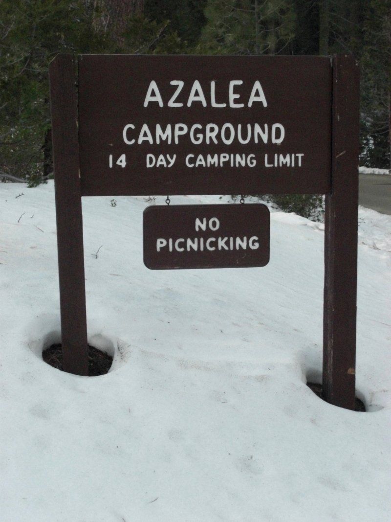
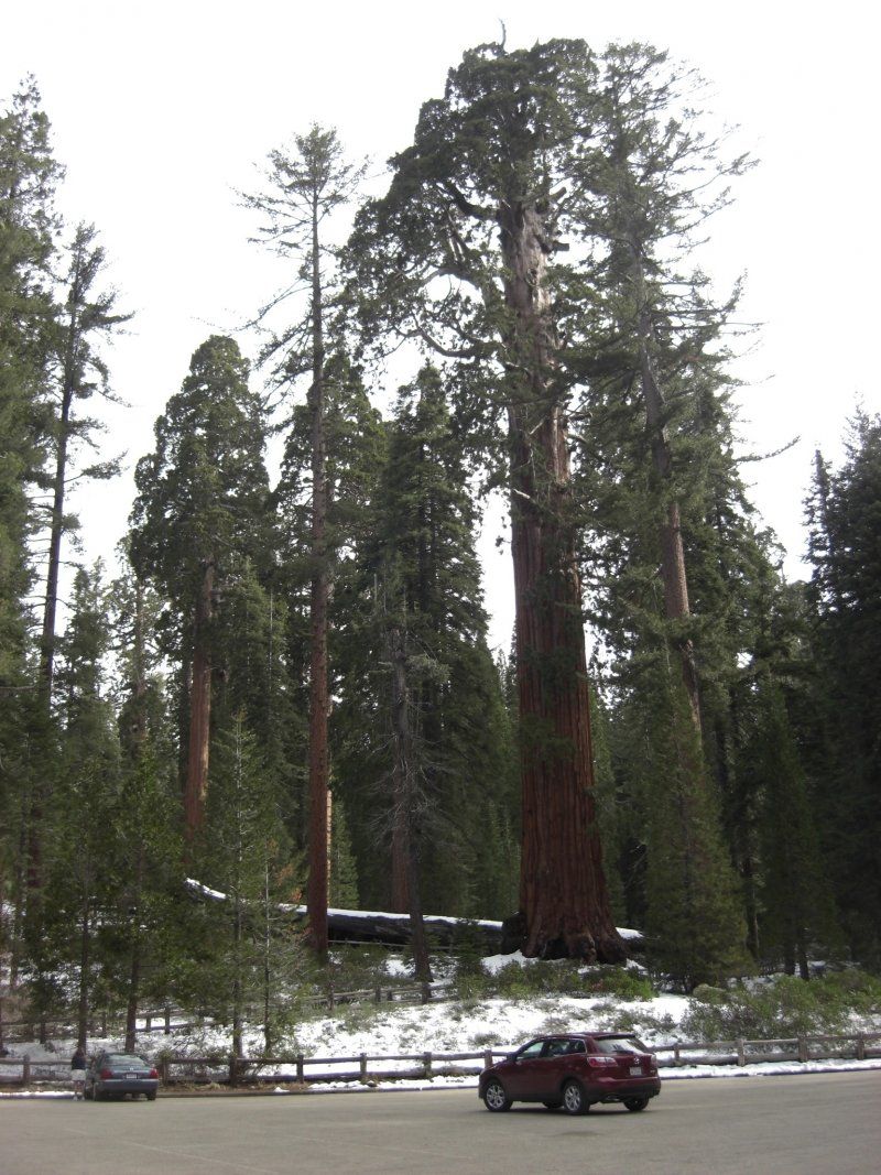
Azalea Campground
Seqouia National Park also has a number of beautiful state campgrounds, including Azalea. Even with snow, many people are even camping with a tent.
Grant Grove, CA 93633, Verenigde Staten
36° 44' 36.8" N 118° 57' 56.3" W
36.7435639 -118.9656278
• Head northwest on N Grove Trl.
• Arrive at N Grove Trl. Your destination is on the left.
☍
Distance not available
(Duration not available)
Day
Azalea Campground
Grant Grove, CA 93633, Verenigde Staten
36° 44' 36.8" N 118° 57' 56.3" W
36.7435639 -118.9656278
• Head toward Crystal Springs Rd on N Grove Trl. Go for 78 m.
• Turn right onto E Kings Canyon Rd (CA-180). Go for 87.1 km.
• Take exit 59 toward Yosemite onto CA-41 N (Yosemite Fwy). Go for 7.2 km.
• Take exit 132 toward Shaw Avenue/California State/University Fresno. Go for 431 m.
• Turn right onto E Shaw Ave. Go for 623 m.
• Turn right. Go for 78 m.
• Turn left. Go for 16 m.
• Turn left. Go for 83 m.
• Arrive at your destination on the right.
☍
95,6 km
(1 hrs. 8 min.)
The Cheesecake Factory
639 E Shaw Ave, Fresno, CA 93710, Verenigde Staten
36° 48' 28.9" N 119° 46' 34.8" W
36.8080220 -119.7763200
• Head west. Go for 83 m.
• Turn right. Go for 16 m.
• Turn right toward E Shaw Ave. Go for 78 m.
• Turn left onto E Shaw Ave. Go for 589 m.
• Take ramp onto CA-41 N (Yosemite Fwy). Go for 89.1 km.
• Continue on Wawona Rd. Go for 1.3 km.
• Take the 2nd exit from roundabout onto Wawona Rd toward Wawona/Yosemite Valley. Go for 9.1 km.
• Turn left. Go for 20 m.
• Arrive at your destination.
☍
100,3 km
(1 hrs. 14 min.)
Wawona Campground
California 95389, Verenigde Staten
37° 32' 41.1" N 119° 40' 21.4" W
37.5447479 -119.6726087
• Head southwest.
• Arrive at your destination.
☍
Distance not available
(Duration not available)
Day
Wawona Campground
California 95389, Verenigde Staten
37° 32' 41.1" N 119° 40' 21.4" W
37.5447479 -119.6726087
• Head toward Wawona Rd. Go for 20 m.
• Turn left onto Wawona Rd. Go for 32.9 km.
• Continue on Southside Dr. Go for 2.3 km.
• Keep right onto Southside Dr. Go for 6.0 km.
• Continue on Northside Dr. Go for 236 m.
• Continue on Happy Isles Loop Rd. Go for 380 m.
• Arrive at Happy Isles Loop Rd. Your destination is on the left.
☍
41,9 km
( 51 min.)
Upper Pines Campground
Verenigde Staten
37° 44' 17.3" N 119° 34' 1.2" W
37.7381340 -119.5669980
• Head south on Happy Isles Loop Rd.
• Arrive at Happy Isles Loop Rd. Your destination is on the left.
☍
Distance not available
(Duration not available)
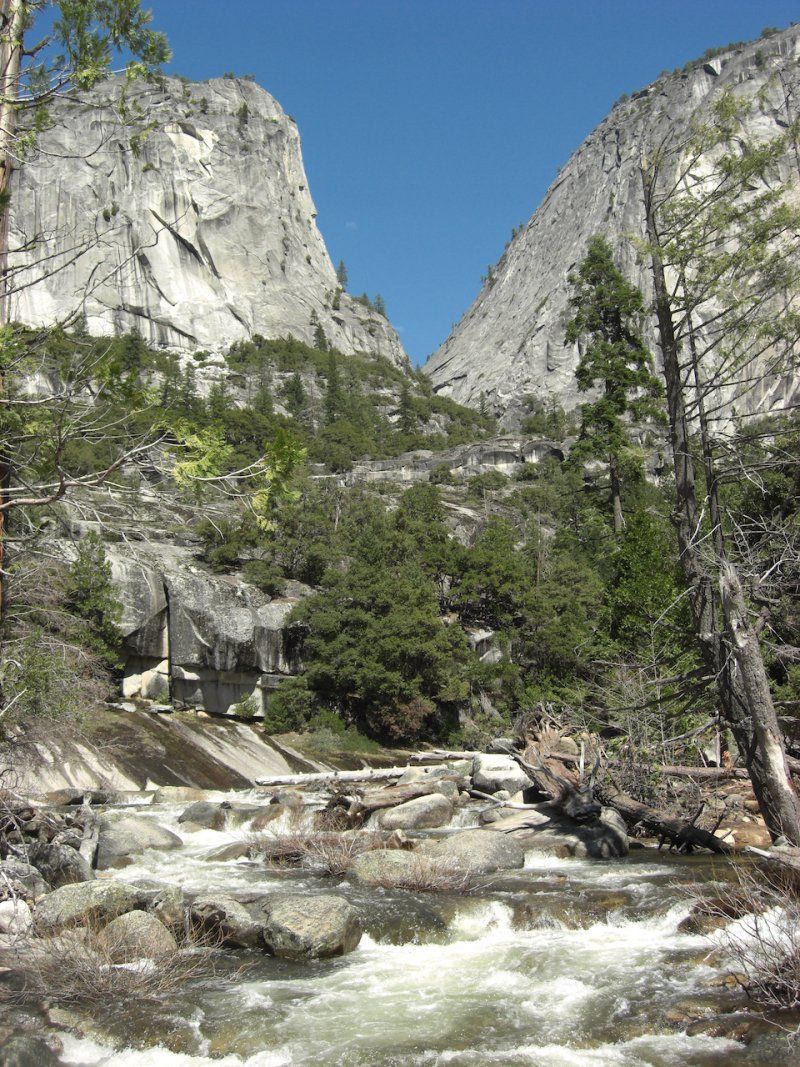
Uitzicht op Half Dome
Upper Pines Campground is in the valley, and has a beautiful view of Half Dome. It is a park where you have to make a reservation if you want a spot, everything is usually fully booked.
Day
Upper & Lower Yosemite Falls Hike
A "quiet" hike to start, except for the walk through the valley of course. Nice view of Half Dome.
Verenigde Staten
37° 44' 17.3" N 119° 34' 1.2" W
37.7381340 -119.5669980
• Head south on Happy Isles Loop Rd.
• Arrive at Happy Isles Loop Rd. Your destination is on the left.
☍
Distance not available
(Duration not available)
Day
Vernon & Nevada Falls Hike
Slightly more challenging is the hike to Nevada Falls, which can also be done from the Upper Pines Campground. It follows the John Muir Trail for a short distance.
Verenigde Staten
37° 44' 17.3" N 119° 34' 1.2" W
37.7381340 -119.5669980
• Head north on Happy Isles Loop Rd. Go for 380 m.
• Continue on Northside Dr. Go for 236 m.
• Turn right onto Northside Dr. Go for 1.2 km.
• Take the 2nd exit from roundabout. Go for 252 m.
• Turn left onto Yosemite Village Service Rd. Go for 37 m.
• Turn sharp right onto Northside Dr. Go for 8.9 km.
• Continue on El Portal Rd. Go for 1.4 km.
• Turn right onto Big Oak Flat Rd. Go for 66.0 km.
• Arrive at State Highway 120 (CA-120). Your destination is on the right.
☍
78,4 km
(1 hrs. 14 min.)
PJ's Café
Here we have eaten a delicious Thai emergency dish. According to Google, it no longer exists and is permanently closed. Unfortunately.
18827-18851 Main St, Groveland, CA 95321, Verenigde Staten
37° 50' 24.1" N 120° 13' 30" W
37.8400382 -120.2250034
• Head toward Ferretti Rd on State Highway 120 (CA-120). Go for 27.3 km.
• Keep left onto State Highway 120 (CA-120). Go for 5.6 km.
• Turn left onto State Highway 108 (CA-108/CA-120). Go for 40.4 km.
• Turn right onto N Yosemite Ave (CA-120) toward CR-J9/CR-J14. Go for 2.9 km.
• Turn right onto 26 Mile Rd (CR-J14). Go for 5.6 km.
• Turn right onto Woodward Reservoir Entry E71 Rd. Go for 874 m.
• Turn left onto Woodward Reservoir Entry E71 Rd. Go for 589 m.
• Arrive at Woodward Reservoir Entry E71 Rd.
☍
83,1 km
(1 hrs. 2 min.)
Woodward Reservoir Regional Park
14528 26 Mile Rd, Oakdale, CA 95361, Verenigde Staten
37° 50' 49.6" N 120° 52' 37.2" W
37.8471230 -120.8770060
• Head northwest on Woodward Reservoir Entry E71 Rd.
• Arrive at Woodward Reservoir Entry E71 Rd.
☍
Distance not available
(Duration not available)
Day
Woodward Reservoir Regional Park
14528 26 Mile Rd, Oakdale, CA 95361, Verenigde Staten
37° 50' 49.6" N 120° 52' 37.2" W
37.8471230 -120.8770060
• Head southeast on Woodward Reservoir Entry E71 Rd. Go for 589 m.
• Turn right onto Woodward Reservoir Entry E71 Rd. Go for 781 m.
• Turn left onto 26 Mile Rd (CR-J14). Go for 5.7 km.
• Turn right onto Lon Dale Rd (CA-120). Go for 29.2 km.
• Turn left and take ramp onto CA-99 S/CA-120 W. Go for 749 m.
• Take exit 241 toward San Francisco onto CA-120 W. Go for 10.1 km.
• Take the left exit toward San Francisco/Los Angeles onto I-5 S. Go for 3.8 km.
• Keep right toward I-205/San Francisco/I-580. Go for 715 m.
• Continue on I-205 W. Go for 11.0 km.
• Take exit 6 toward Naglee Rd/Grant Line Rd. Go for 551 m.
• Turn left onto N Naglee Rd. Go for 424 m.
• Turn right onto W Grant Line Rd (CR-J4 W). Go for 1.6 km.
• Turn right onto W Byron Rd (CR-J4). Go for 800 m.
• Take the 2nd exit from roundabout onto W Grant Line Rd toward Grant Line Rd West. Go for 3.5 km.
• Continue on W Grant Line Rd. Go for 3.8 km.
• Keep left onto Grant Line Rd toward Livermore. Go for 1.3 km.
• Keep right onto Altamont Pass Rd toward Altamont Pass Rd. Go for 12.9 km.
• Continue on Northfront Rd. Go for 307 m.
• Turn left and take ramp onto I-580 W. Go for 33.4 km.
• Take exit 36 toward Redwood Road. Go for 354 m.
• Turn left onto Redwood Rd. Go for 927 m.
• Continue on A St. Go for 1.5 km.
• Turn left onto Mission Blvd (CA-185 S). Go for 559 m.
• Turn right onto Jackson St (CA-92 W) toward I-880/CA-92. Go for 711 m.
• Keep left onto Jackson St (CA-92 W). Go for 22.9 km.
• Take exit 13B toward San Francisco onto US-101 N (Bayshore Fwy). Go for 13.5 km.
• Take exit 423B toward San Bruno/I-280 onto I-380 W. Go for 3.2 km.
• Take exit 5A toward San Francisco onto I-280 N (Junipero Serra Fwy). Go for 6.6 km.
• Take exit 47 toward Pacifica onto CA-1 S (Cabrillo Hwy). Go for 4.3 km.
• Take exit 507 toward Manor Drive/Palmetto Ave onto Palmetto Ave. Go for 952 m.
• Arrive at Palmetto Ave. Your destination is on the right.
☍
176,6 km
(2 hrs. 10 min.)
San Francisco RV Resort
700 Palmetto Ave, Pacifica, CA 94044, Verenigde Staten
37° 38' 46.4" N 122° 29' 32.2" W
37.6462320 -122.4922820
• Head southwest on Palmetto Ave.
• Arrive at Palmetto Ave. Your destination is on the right.
☍
Distance not available
(Duration not available)
Day
San Francisco RV Resort
700 Palmetto Ave, Pacifica, CA 94044, Verenigde Staten
37° 38' 46.4" N 122° 29' 32.2" W
37.6462320 -122.4922820
• Head southwest on Palmetto Ave.
• Arrive at Palmetto Ave. Your destination is on the right.
☍
Distance not available
(Duration not available)
Day
San Francisco RV Resort
700 Palmetto Ave, Pacifica, CA 94044, Verenigde Staten
37° 38' 46.4" N 122° 29' 32.2" W
37.6462320 -122.4922820
• Head southwest on Palmetto Ave.
• Arrive at Palmetto Ave. Your destination is on the right.
☍
Distance not available
(Duration not available)
Day
San Francisco RV Resort
700 Palmetto Ave, Pacifica, CA 94044, Verenigde Staten
37° 38' 46.4" N 122° 29' 32.2" W
37.6462320 -122.4922820
• Head southwest on Palmetto Ave.
• Arrive at Palmetto Ave. Your destination is on the right.
☍
Distance not available
(Duration not available)
Day
San Francisco RV Resort
700 Palmetto Ave, Pacifica, CA 94044, Verenigde Staten
37° 38' 46.4" N 122° 29' 32.2" W
37.6462320 -122.4922820
• Head northeast on Palmetto Ave. Go for 363 m.
• Turn right onto Manor Dr toward CA-1 N. Go for 52 m.
• Turn left onto Oceana Blvd toward CA-1 N. Go for 296 m.
• Take ramp onto CA-1 N (Cabrillo Hwy). Go for 3.7 km.
• Take exit 509B toward San Jose onto I-280 S (Junipero Serra Fwy). Go for 6.6 km.
• Take exit 43A toward I-380/SF Intl Airport/US-101 onto I-380 E. Go for 2.4 km.
• Take the exit onto US-101 S (Bayshore Fwy). Go for 13.8 km.
• Take exit 414B toward Hayward onto CA-92 E (J Arthur Younger Fwy). Go for 20.4 km.
• Keep left onto CA-92 E toward CA-92/Downtown Hayward. Go for 4.5 km.
• Continue on Foothill Blvd (CA-238 N). Go for 768 m.
• Turn right onto A St. Go for 1.2 km.
• Continue on Redwood Rd. Go for 797 m.
• Turn right and take ramp onto I-580 E (Arthur H Breed Fwy) toward I-580/Stockton. Go for 14.0 km.
• Take exit 45 toward Hopyard Rd/Dougherty Rd/DVC San Ramon Valley Campus. Go for 1.5 km.
• Turn left onto Dougherty Rd toward DVC San Ramon Valley Campus. Go for 591 m.
• Turn right onto Dublin Blvd. Go for 454 m.
• Turn right onto Scarlett Dr. Go for 391 m.
• Turn right onto Scarlett Ct. Go for 111 m.
• Turn right. Go for 124 m.
• Arrive at your destination on the left.
☍
71,8 km
( 54 min.)
El Monte RV Rentals
6301 Scarlett Ct, Dublin, CA 94568, Verenigde Staten
37° 42' 12.6" N 121° 54' 21.4" W
37.7034920 -121.9059464