Four weeks through various Balkan countries.
We've been enthusiastically following documentaries about the countries of southeastern Europe for some time now. It soon became clear that we should plan a route through unfamiliar regions in southern Croatia, Bosnia, Montenegro, North Macedonia, and Albania. We would return home via Bulgaria and Romania.
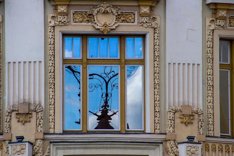
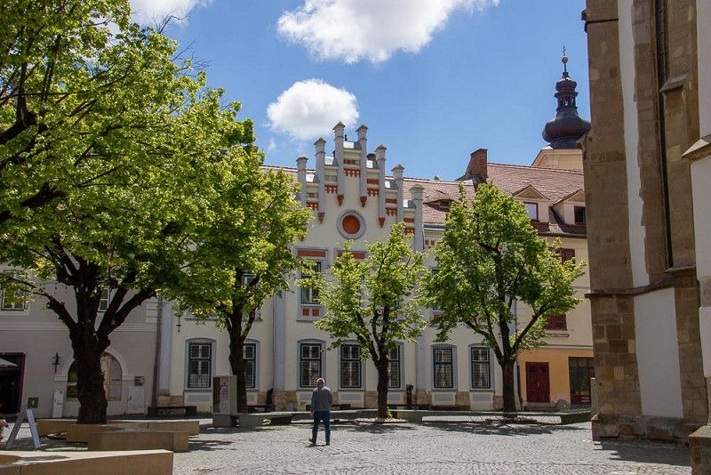
Oberwart
Easter Monday – The journey can begin
The RV is ready to go. We quickly reach Spielfeld on the motorway and, as we travel to Karlovac , we get acquainted with the different motorway toll systems. In Slovenia, we had already completed this process online at home. In Croatia , a ticket must be purchased at a ticket booth. The button is at a height that is difficult for the driver to reach, requiring a high level of acrobatic maneuverability.
The journey that day was stress-free and without complications. With the music muted on the radio commemorating the passing of Pope Francis, we relaxedly reached our destination at a campsite in Plitvice National Park.
Bezirk Oberwart, Burgenland, Österreich
47° 17' 10.1" N 16° 12' 44.7" E
47.2861513 16.2124214
• Head toward Hauptplatz on Ganghofergasse. Go for 169 m.
• Turn right onto Hauptplatz (B63). Go for 972 m.
• Turn right onto Unterwarter Straße (L269). Go for 335 m.
• Take the 3rd exit from roundabout onto Oberwarter Bundesstraße (B63a) toward Wien/A2/Graz/Gewerbegebiet Oberwart-Nord 1 u. 2/Gewerbegebiet Oberwart-West 1 u. 2/EO Einkaufszentrum. Go for 439 m.
• Take the 2nd exit from roundabout onto Oberwarter Bundesstraße (B63a). Go for 2.7 km.
• Take the 3rd exit from roundabout onto Grazer Straße (B50) toward Wien/A2/Graz/Slowenien/Güssing/Hartberg. Go for 2.6 km.
• Turn right onto Burgenland Bundesstraße (B50) toward Wien/A2/Graz/Hartberg/Markt Allhau. Go for 5.9 km.
• Keep left onto Anschlussstelle Lafnitztal Oberwart. Go for 153 m.
• Take ramp onto A2 (Süd Autobahn) toward Graz. Go for 76.0 km.
• Take exit 186 toward Spielfeld/Flughafen onto A9 (Pyhrn Autobahn). Go for 41.9 km.
• Continue on A1. Go for 25.5 km.
• Take exit 7 toward Zagreb/Ptuj/Aerodrom onto A4. Go for 34.8 km.
• Continue on A2. Go for 60.1 km.
• Continue on E59 (Autocesta Zagreb-Macelj). Go for 1.2 km.
• Continue on A3 (Autocesta Bregana-Zagreb-Lipovac). Go for 3.7 km.
• Take the exit toward Split/Rijeka onto A1 (Autocesta Bosiljevo-Split-Dubrov.). Go for 40.5 km.
• Take exit 4 toward Plitivčka jezera/D. Resa/Karlovac onto Čvor Karlovac. Go for 5.4 km.
• Keep left onto 1. Go for 68.9 km.
• Continue on 42 toward Split/Plitvička jezera. Go for 4.1 km.
• Turn left onto 429 toward Split/Zadar. Go for 2.4 km.
• Arrive at 429.
☍
377,7 km
(3 hrs. 49 min.)
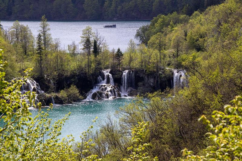
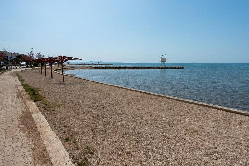
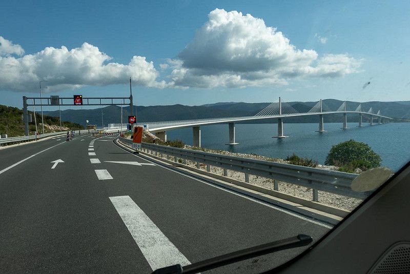
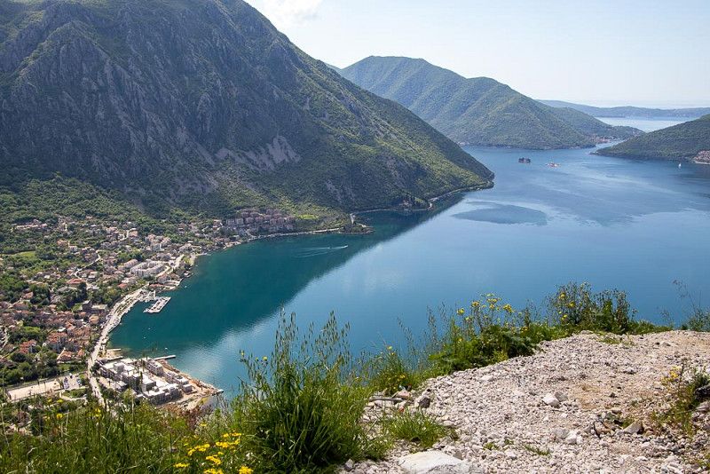
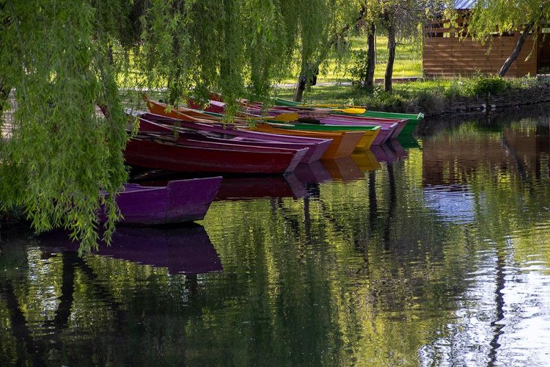
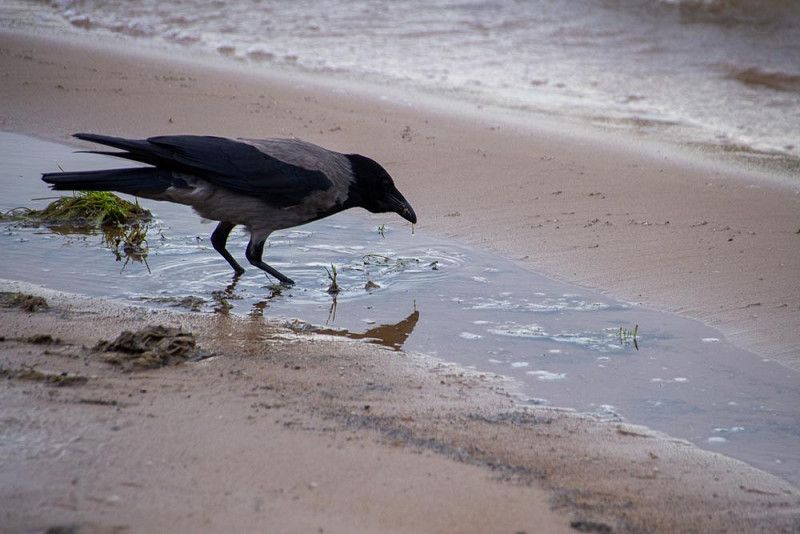
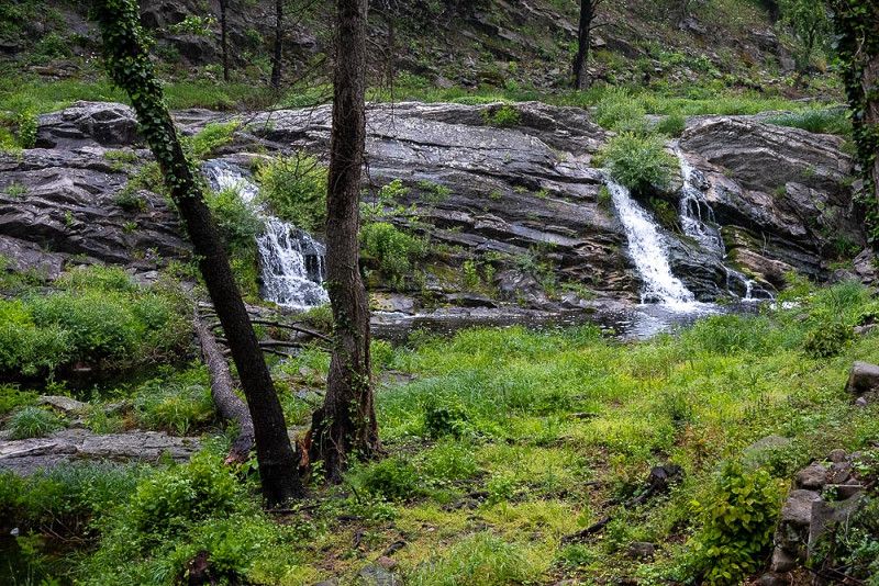
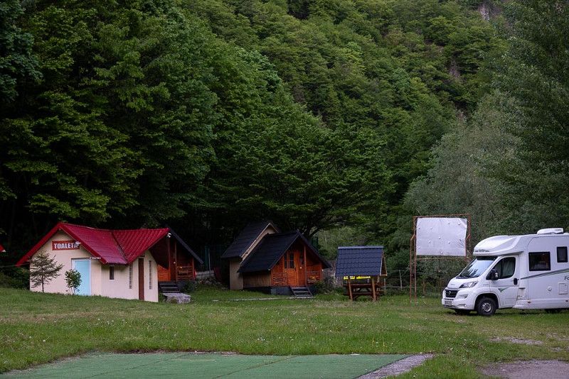
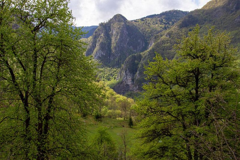
Nationalpark Plitvicer Seen
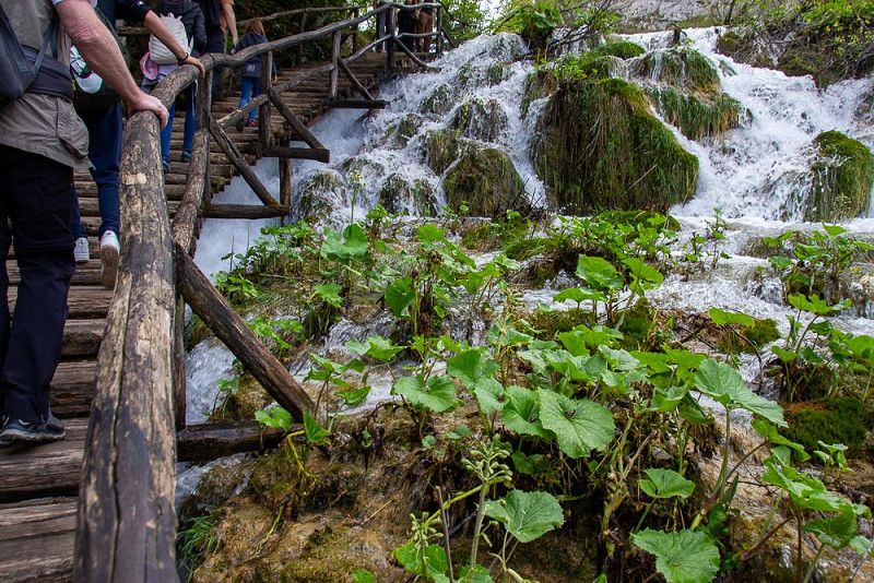
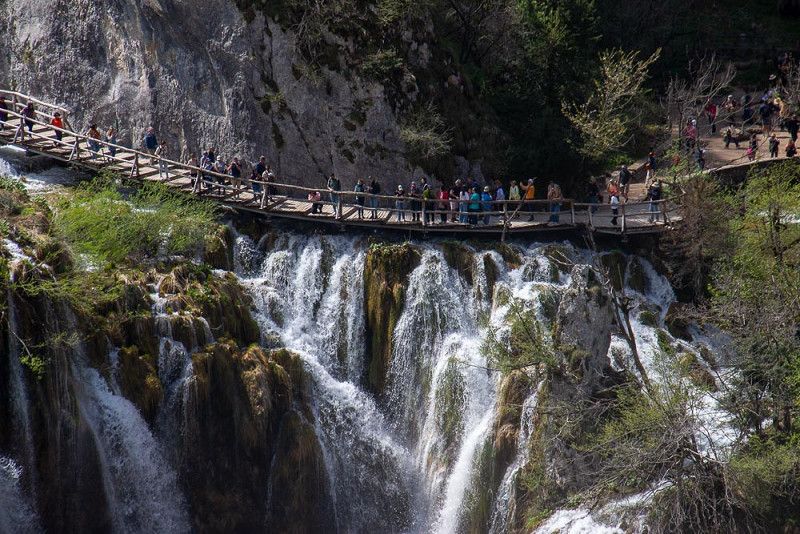
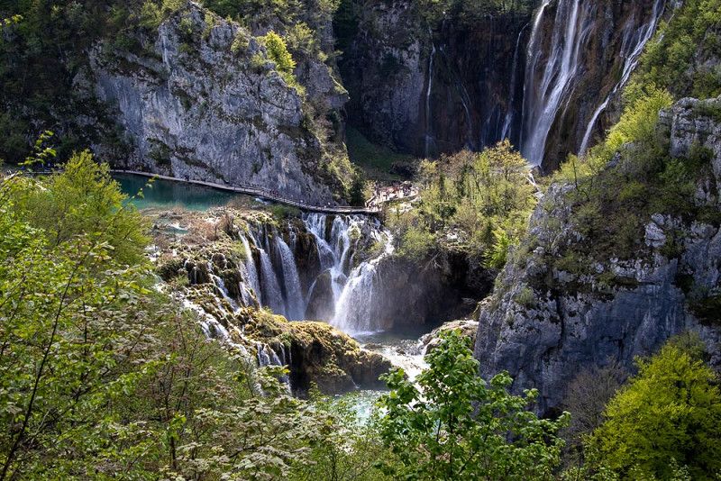
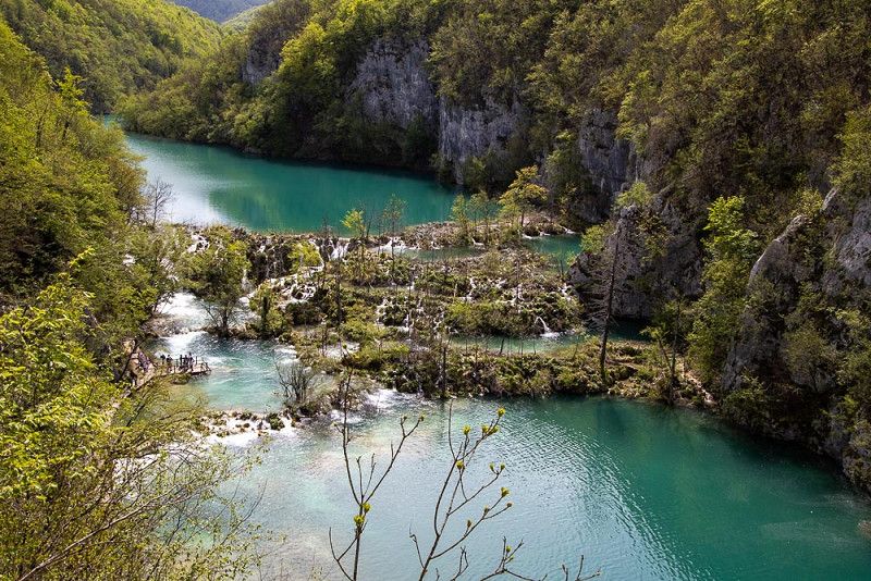
The Plitvice Lakes and the “Treasure in the Silver Lake”
The roaring waterfalls cascading over steep cliffs, the lakes and wild, romantic mountains provided the ideal backdrop for Karl May's film "Treasure of Silver Lake."
Back then, it was the two superheroes Winnetou and Old Shatterhand who lit up the landscape of the Plitvice Lakes on the big screen. Today, it is the colorful crowds who wind their way in orderly paths like a caterpillar over stairs and walkways towards the great waterfall in order to take the most cinematic selfie possible on their mobile phones for their followers.
The days of galloping horses are long gone. Today, it's dogs on leashes, trotting behind their owners with their heads hanging low because they're not allowed to swim in these protected waters.
D429, Korana, Lika-Senj County, Croatia
44° 55' 20.3" N 15° 36' 46.5" E
44.9222979 15.6129137
• Head southwest on 429. Go for 11.7 km.
• Continue on Prijeboj (1) toward Split/Zadar. Go for 11.2 km.
• Take the 2nd exit from roundabout onto Ulica Josipa Jovića (1) toward Split/Zadar. Go for 30.6 km.
• Keep left onto 522 toward Split. Go for 14.4 km.
• Take left ramp onto A1 (Autocesta Bosiljevo-Split-Dubrov.) toward Split/Zadar. Go for 49.6 km.
• Take exit 18 toward Nin. Go for 977 m.
• Turn left onto 8 toward Vir/Nin/Zadar. Go for 9.9 km.
• Turn right onto Ulica dr. Franje Tuđmana (6011) toward Vir/Nin. Go for 1.8 km.
• Continue on Ulica samostalne satnije Briševo (6011). Go for 4.6 km.
• Take the 2nd exit from roundabout onto 6011. Go for 176 m.
• Continue on Grusi (6011). Go for 103 m.
• Continue on 6011. Go for 354 m.
• Continue on Poljaci (6011). Go for 1.1 km.
• Continue on 6011. Go for 122 m.
• Continue on Žerava-istok (6011). Go for 695 m.
• Continue on Žerava (6011). Go for 786 m.
• Continue on 6011. Go for 2.7 km.
• Continue on Ninski Stanovi ulica I (6011). Go for 480 m.
• Continue on 6011. Go for 37 m.
• Continue on Ninski Stanovi ulica I (6011). Go for 96 m.
• Continue on 6011. Go for 188 m.
• Continue on Ninski Stanovi ulica I (6011). Go for 1.8 km.
• Continue on 6011. Go for 626 m.
• Continue on Kraljičin put (6011). Go for 515 m.
• Take the 2nd exit from roundabout onto Kraljičin put (6011). Go for 380 m.
• Take the 3rd exit from roundabout onto Zadarska ulica toward Zadar/Zaton. Go for 847 m.
• Turn right onto 306 toward Vir/Privlaka. Go for 357 m.
• Turn left onto Put Petra Zoranića. Go for 724 m.
• Arrive at Put Petra Zoranića. Your destination is on the left.
☍
146,7 km
(1 hrs. 47 min.)
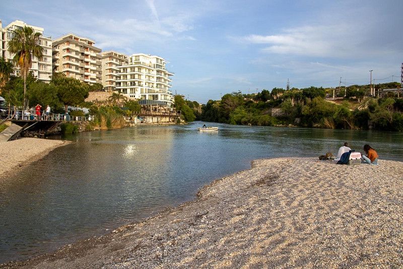
Zaton
Across the Dinaric Mountains to Zaton
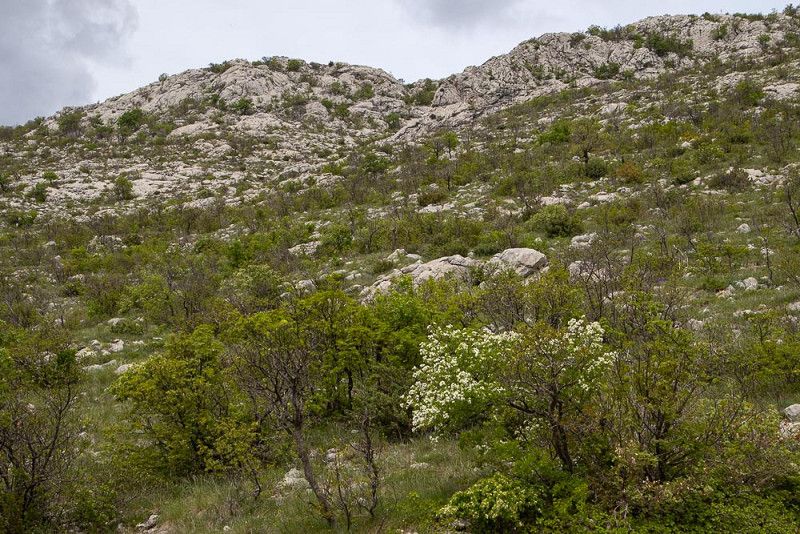
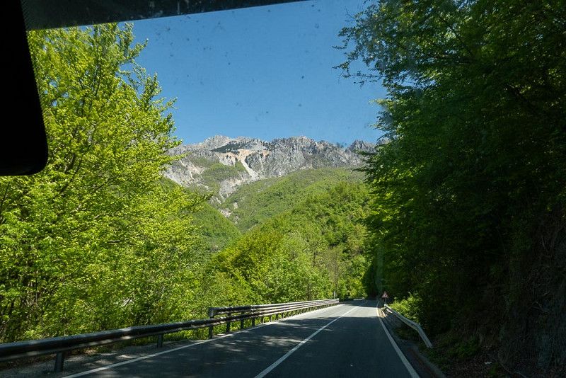
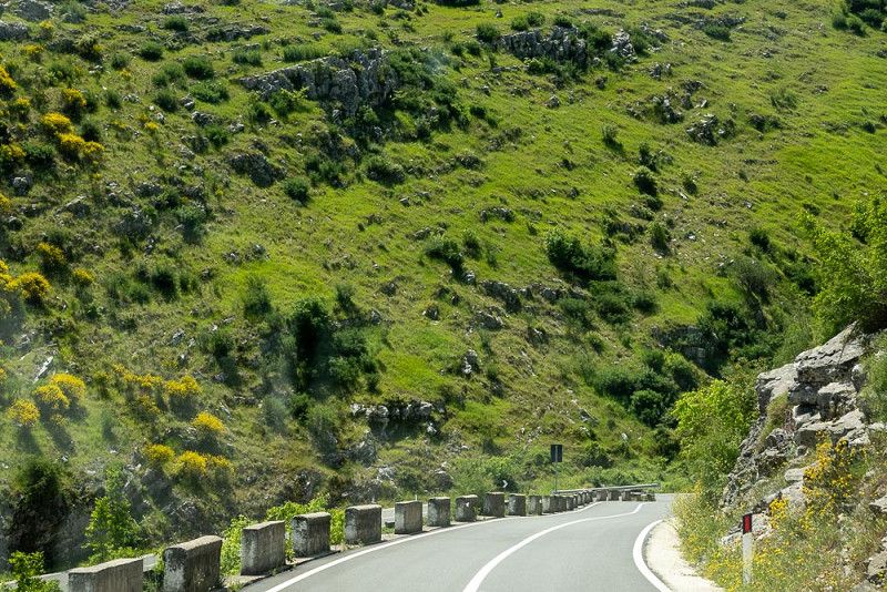
After driving through a pastel green forest we reach the karst massif of the Dinaric Mountains .
We wind our way up the mountain via switchbacks. To our right, rugged cliffs, and to our left, a view into the far distance of a prairie.
In my imagination, Winnetou, the charismatic Apache chief, appears on his horse, stands majestically on one of the huge rocks and then says his final goodbye with his typical greeting, pointing with his outstretched arm in the direction we are traveling.
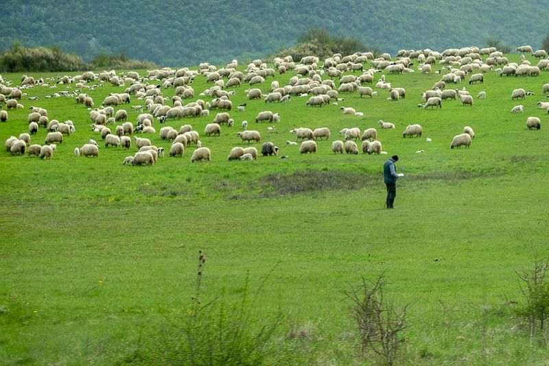
At the foot of the limestone massif, the barren meadow soils are constantly tormented by stones that scatter themselves uncontrollably. Sheep, the only animals that find this environment livable, blend in perfectly with the structure of this patchwork quilt.
We soon leave the mountainous region behind us and slowly approach the coast. After the strenuous drive, we're looking forward to meeting our friends in Zaton , who have invited us for a cozy afternoon with coffee and cake.
Put Petra Zoranića 14, 23232, Zaton/Nin, Croatia
44° 13' 47.4" N 15° 10' 22.6" E
44.2298400 15.1729400
• Head northeast on Put Petra Zoranića. Go for 724 m.
• Turn right onto 306. Go for 357 m.
• Turn left onto Zadarska ulica (6273) toward Nin. Go for 523 m.
• Continue on Zadarska ulica toward Vrsi/Centar. Go for 267 m.
• Take the 1st exit from roundabout onto Kraljičin put (6011). Go for 377 m.
• Take the 1st exit from roundabout onto Kraljičin put (6011) toward Zagreb/Rijeka/Zemunik. Go for 539 m.
• Continue on 6011. Go for 626 m.
• Continue on Ninski Stanovi ulica I (6011). Go for 1.8 km.
• Continue on 6011. Go for 188 m.
• Continue on Ninski Stanovi ulica I (6011). Go for 96 m.
• Continue on 6011. Go for 37 m.
• Continue on Ninski Stanovi ulica I (6011). Go for 480 m.
• Continue on 6011. Go for 2.7 km.
• Continue on Žerava (6011). Go for 786 m.
• Continue on Žerava-istok (6011). Go for 695 m.
• Continue on 6011. Go for 122 m.
• Continue on Poljaci (6011). Go for 1.1 km.
• Continue on 6011. Go for 354 m.
• Continue on Grusi (6011). Go for 103 m.
• Continue on 6011. Go for 129 m.
• Take the 2nd exit from roundabout onto Ulica samostalne satnije Briševo (6011) toward Zagreb/A1/Zemunik. Go for 4.6 km.
• Continue on Ulica dr. Franje Tuđmana (6011). Go for 2.7 km.
• Continue on Smoković (6011). Go for 2.4 km.
• Continue on 6011. Go for 410 m.
• Continue on Donji Zemunik ulica II (6011). Go for 235 m.
• Continue on 6011. Go for 64 m.
• Continue on Donji Zemunik ulica II (6011). Go for 2.4 km.
• Continue on Donji Zemunik ulica I (6011). Go for 71 m.
• Turn left onto Donji Zemunik ulica I (6040) toward Zagreb/Rijeka/Obrovac. Go for 1.5 km.
• Take ramp onto 424 toward Zagreb/Split. Go for 4.5 km.
• Take ramp onto A1 (Autocesta Bosiljevo-Split-Dubrov.) toward Split/Šibenik. Go for 213 km.
• Take exit 36 toward Dubrovnik/Ploče onto 425 (Čvor Ploče). Go for 15.4 km.
• Keep right toward Dubrovnik/Metković/8. Go for 802 m.
• Continue on 425. Go for 129 m.
• Turn right onto Jadranska magistrala (8). Go for 22.0 km.
• Keep left onto 674 toward Dubrovnik/O. Korčula/Ston. Go for 31.9 km.
• Continue on Jadranska magistrala (8). Go for 43.4 km.
• Turn left onto 420 toward Mokošica/Dubrovnik. Go for 1.0 km.
• Turn left toward Dubrovnik. Go for 20 m.
• Continue on 420. Go for 1.8 km.
• Take the 3rd exit from roundabout onto Obala pape Ivana Pavla II toward Centar/Lapad. Go for 238 m.
• Continue on Obala Stjepana Radića. Go for 303 m.
• Keep right onto Obala Stjepana Radića toward Centar/Lapad. Go for 428 m.
• Continue on Nikole Tesle. Go for 43 m.
• Continue toward Nikole Tesle. Go for 20 m.
• Continue on Nikole Tesle. Go for 231 m.
• Continue on Ulica od Batale. Go for 540 m.
• Turn right onto Ulica kralja Tomislava. Go for 338 m.
• Take the 1st exit from roundabout onto Ulica kralja Tomislava. Go for 68 m.
• Turn right onto Ulica Ive Dulčića. Go for 362 m.
• Turn right onto Ulica Riječka. Go for 93 m.
• Take the 3rd exit from roundabout onto Ulica Vatroslava Lisinskog. Go for 443 m.
• Arrive at Ulica Vatroslava Lisinskog. Your destination is on the right.
☍
363,7 km
(4 hrs. 1 min.)
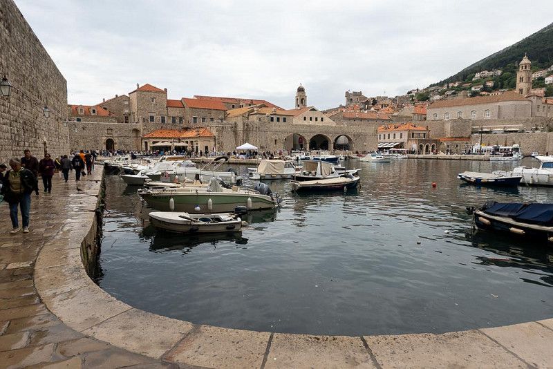
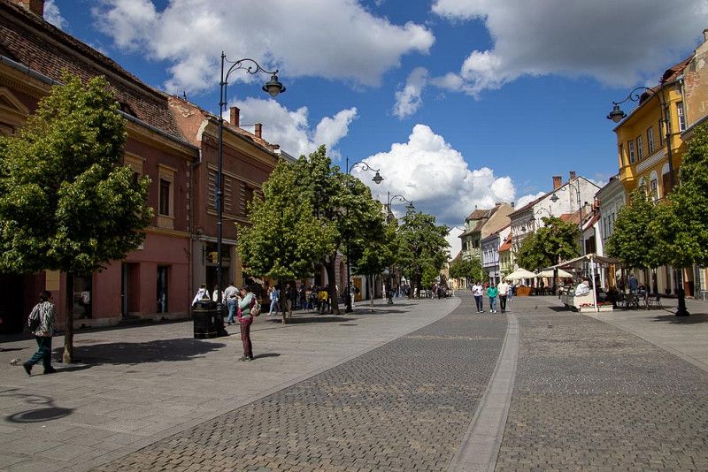
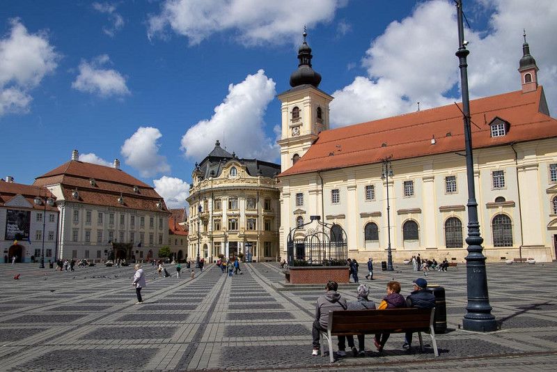
Dubrovnik
Journey from Zaton to Dubrovnik
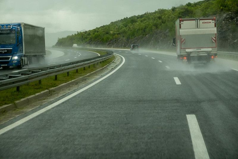
From Zaton we first head back through several villages at a snail's pace until we finally reach the motorway exit heading south via Split and many kilometres later to Dubrovnik .
We sit in our driver and passenger seats in a good mood, with the weather being decent, listening to the music provided by the local radio stations, which is sometimes interrupted by the news in Croatian, the meaning of which we cannot grasp at all.
Driving on the highway is always boring. But this time, there's something different. Halfway through, we encounter heavy rain with small hailstones. We slow down and dive right through the front. Soon, the sky clears, and the sun winks cheekily at us again. Fittingly, the radio announces: "I can see clearly now the rain is gone..."
Time for a break! We find inviting rest areas along the route that almost force us to stop. They offer food and coffee, as well as magnificent views of the sea and the bays that extend into the land.
Despite the long journey, we reach Dubrovnik with the feeling of having enjoyed the coast to the fullest.
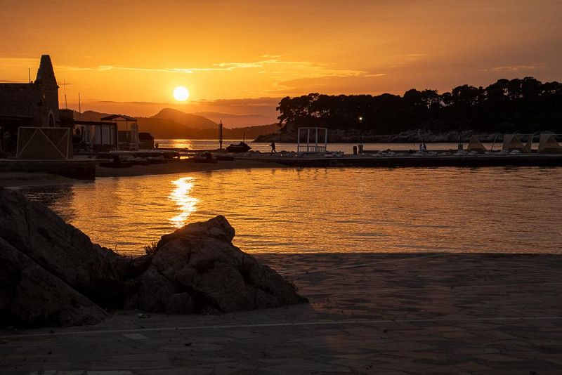
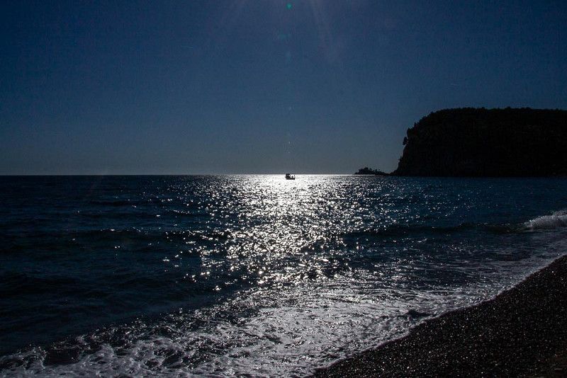
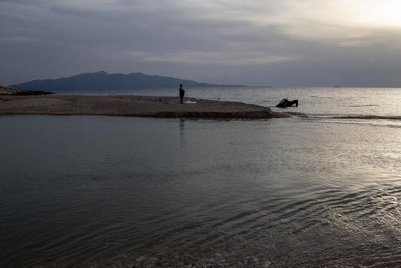
The ultimate end to the day is an evening stroll to the beach near our campsite. The sun bids farewell for the day as it slowly sinks into the sea.
Vatroslava Lisinskog 60, 20000, Dubrovnik, Croatia
42° 39' 43.3" N 18° 4' 13.2" E
42.6620300 18.0703400
• Head east on Ulica Vatroslava Lisinskog. Go for 412 m.
• Take the 1st exit from roundabout onto Ulica Riječka. Go for 107 m.
• Turn left onto Ulica Ive Dulčića. Go for 362 m.
• Turn left onto Ulica kralja Tomislava. Go for 34 m.
• Take the 1st exit from roundabout onto Ulica kralja Tomislava toward Split/Grad-Old City/Bolnica. Go for 429 m.
• Continue on Ulica Ive Vojnovića. Go for 1.3 km.
• Continue on Ulica Pera Čingrije. Go for 372 m.
• Continue on Splitski put toward Zračna luka. Go for 281 m.
• Turn right onto Ulica Vladimira Nazora toward Zračna luka. Go for 311 m.
• Keep left onto Ulica Vladimira Nazora toward Split/Cavtat/Zračna luka. Go for 49 m.
• Continue on Ulica Pera Bakića toward Split/Cavtat/Zračna luka. Go for 272 m.
• Take ramp onto Jadranska magistrala (8) toward Zračna luka/Čilipi/Cavtat. Go for 36.1 km.
• Continue on E-65/E-80. Go for 12.8 km.
• Take the 2nd exit from roundabout onto Ulica Narodnog Fronta (E-65/E-80) toward Budva/Kotor/Trajekt. Go for 10.4 km.
• Turn right onto Kamenari. Go for 59 m.
• Arrive at Kamenari. Your destination is on the left.
☍
63,4 km
(1 hrs. 21 min.)
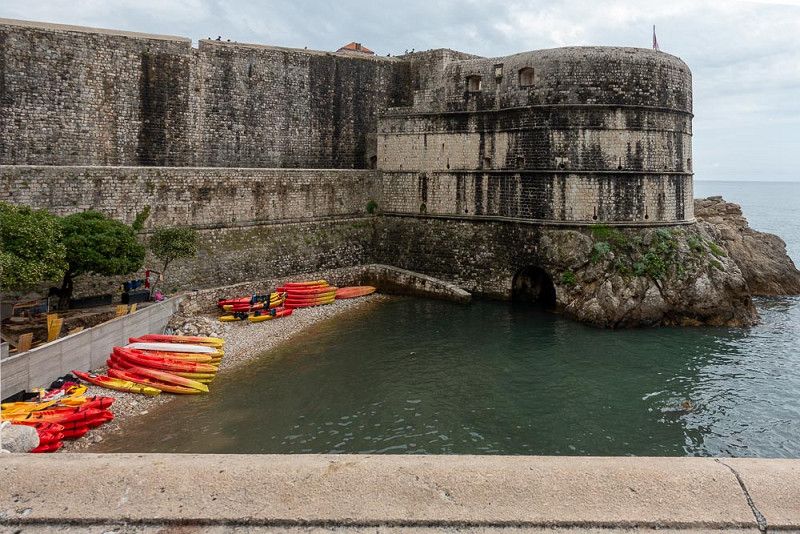
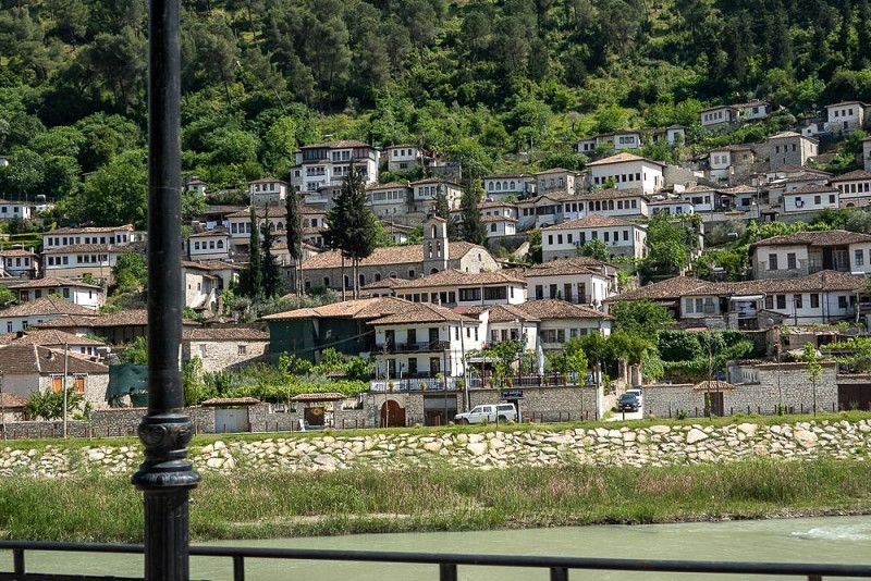
Die alte Dame
Dubrovnik – Visiting the old lady
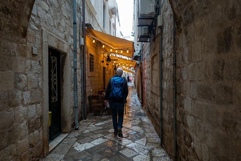
Our RV has found a good spot in a park-like setting, dotted with plenty of trees. The chirping of various bird species and the cooing of pigeons are so intense in the morning that I feel like I'm half asleep in the middle of an aviary.
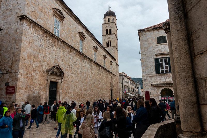
Dubrovnik is in a bad mood today, and I have the feeling that the city, and especially the old lady with her historic charm, has found some peace and quiet from the daily tourist stress in the thunderstorm. She welcomes visitors only after the rain and proudly presents numerous historic buildings, offering glimpses into her narrow streets, which, like the wrinkles on an old woman's face, give her appearance its characteristic features.
A stream of people of various nationalities flocks to marvel at this UNESCO World Heritage site . Many groups follow flag-waving tour guides who share their knowledge.
We, too, spend some time capturing images of the hustle and bustle in the alleys of this wonderful, yet overcrowded, old town. It's tiring, so we soon head home on foot to sit in the shade of the trees, listening to the birdsong and sipping our coffee.
Bijela
Across the border to Montenegro
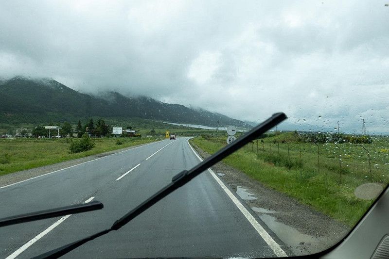
In the middle of a deep sleep, we are jolted awake by a violent thunderstorm. Loud roars of thunder crashing in rapid succession into the silent night, accompanied by lightning flashes overhead, shaking the earth and accompanied by torrents of rain pouring from the sky like waterfalls. Sleep is out of the question, but we lie safely wrapped up in our blankets and anxiously await the end of the spectacle.
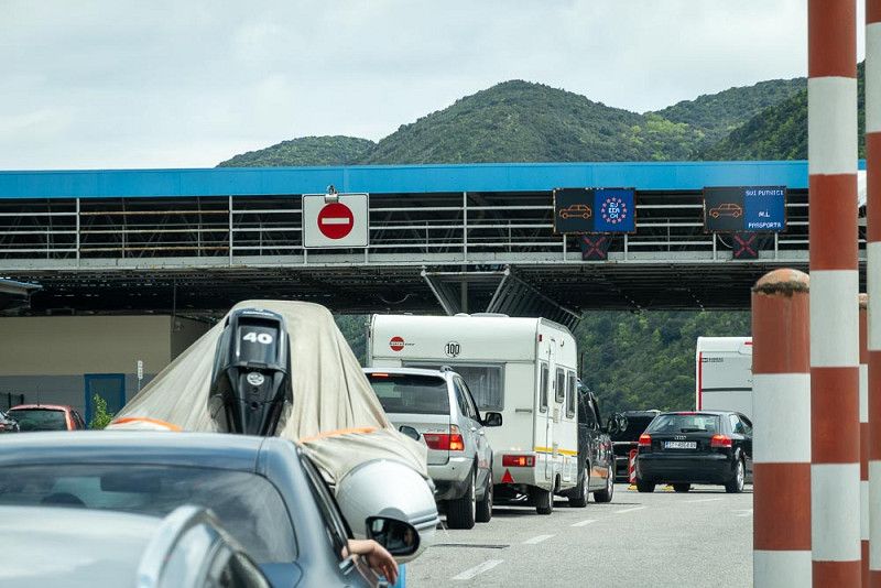
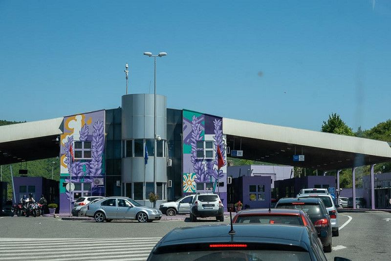
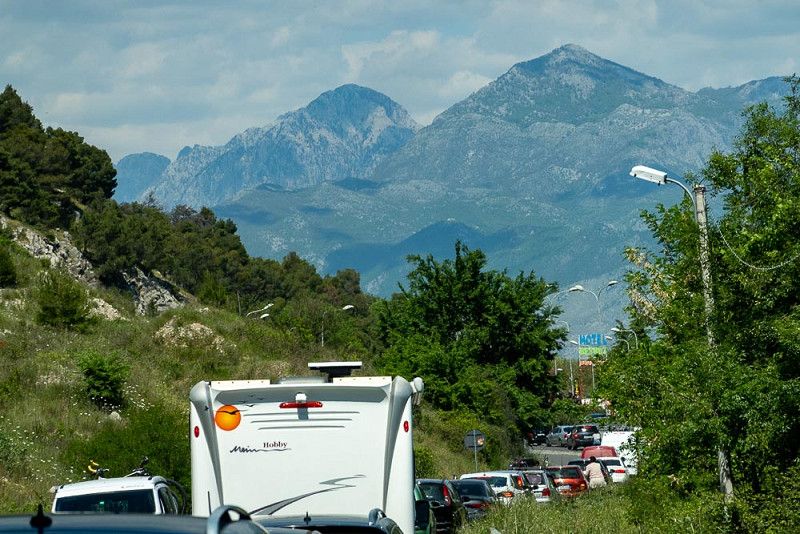
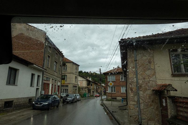
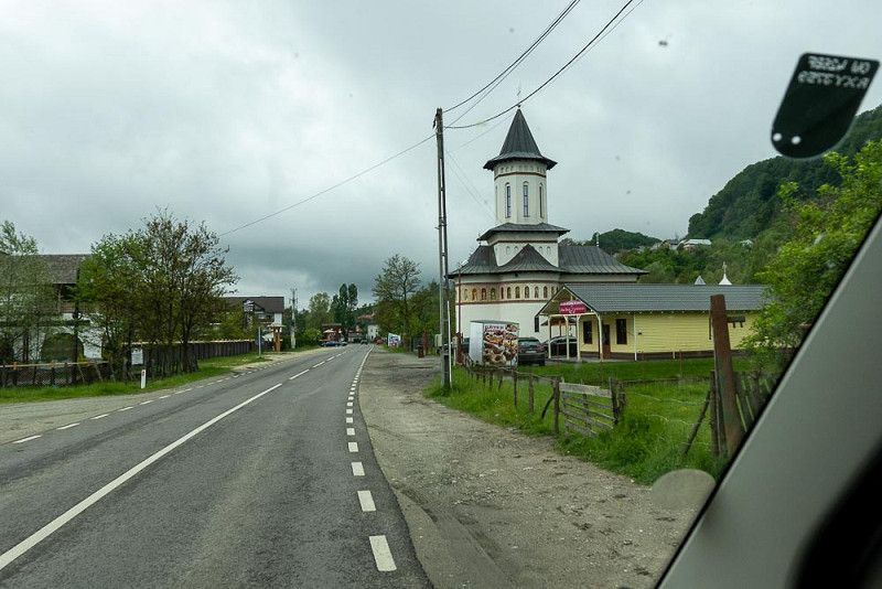
The day begins cloudy, the rain is over and we start the last section in Croatia to the border with Montenegro .
Due to a kilometer-long traffic jam, the one-and-a-half-hour journey according to the route planner turns into four. Border controls are meticulously enforced on both sides, but cause no problems.
The first thing we have to do right after the border is to adjust our cell phones for use in Montenegro, the second is to fill up the tank, and the third is to find the campsite in Bijela .
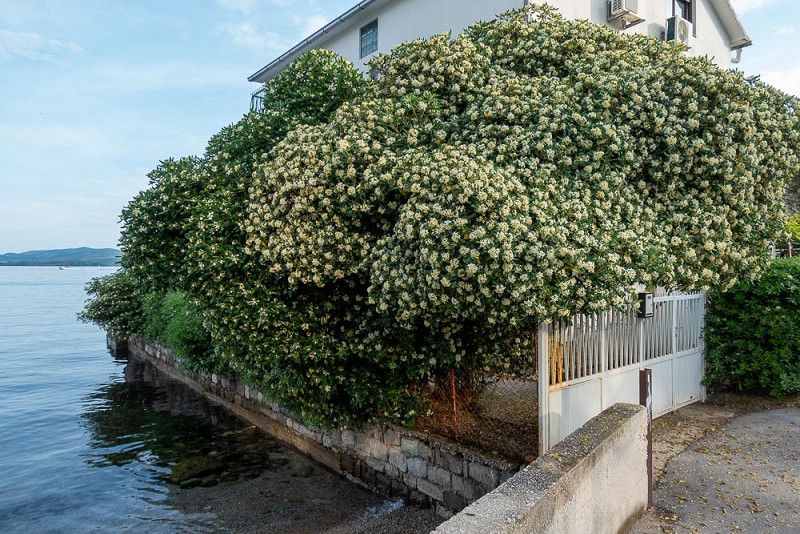
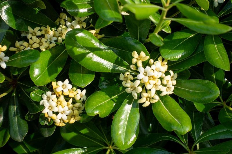
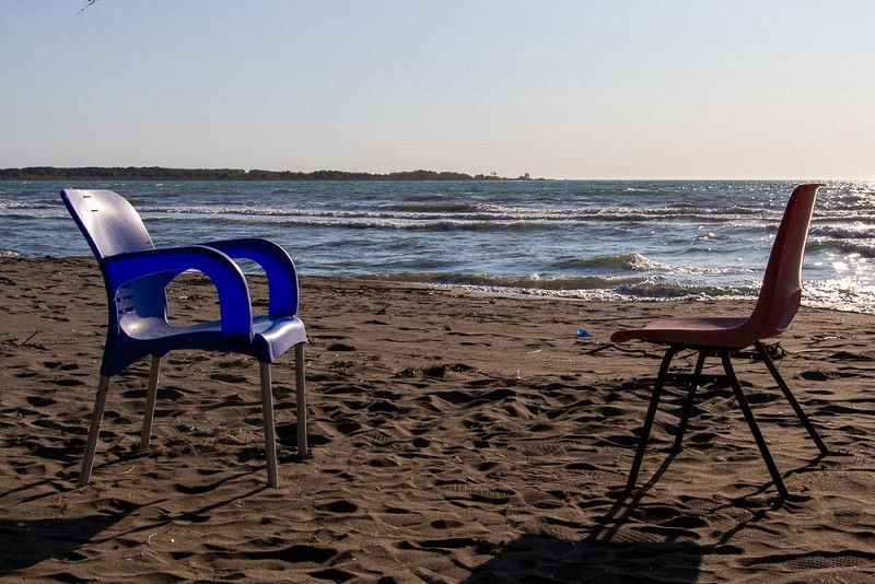
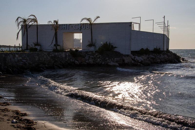
We completed all of the tasks quickly and after arriving we still had enough time to stroll along the beach promenade and let ourselves be enchanted by the intrusively sweet scent of the jasmine bushes.
Kamenari 6, 85343, Bijela, Montenegro
42° 27' 25.3" N 18° 39' 49.8" E
42.4570300 18.6638400
• Head northwest on Kamenari. Go for 59 m.
• Turn right onto Kamenari (E-65/E-80). Go for 1.8 km.
• Keep left onto Kamenari (E-65/E-80). Go for 6.4 km.
• Take the 2nd exit from roundabout onto M-4 toward Žabljak/Nikšić/Žabljak Nikšić. Go for 38.7 km.
• Keep right toward M-6. Go for 74 m.
• Continue on M-6. Go for 31.3 km.
• Turn left and take ramp onto E-762. Go for 17.1 km.
• Turn right toward Šavnik/Žabljak. Go for 13.0 km.
• Turn left onto R-5 toward Šavnik/Žabljak. Go for 26.1 km.
• Continue on Tunel Ivica. Go for 15.7 km.
• Turn right onto Narodnih heroja (R-5) toward Pljevlja/Mojkovac. Go for 20.9 km.
• Continue on R-4 toward Pljevlja. Go for 402 m.
• Turn right. Go for 12 m.
• Turn right. Go for 361 m.
• Arrive at your destination on the left.
☍
171,7 km
(2 hrs. 48 min.)
Durdevice Tara
The adventure can begin
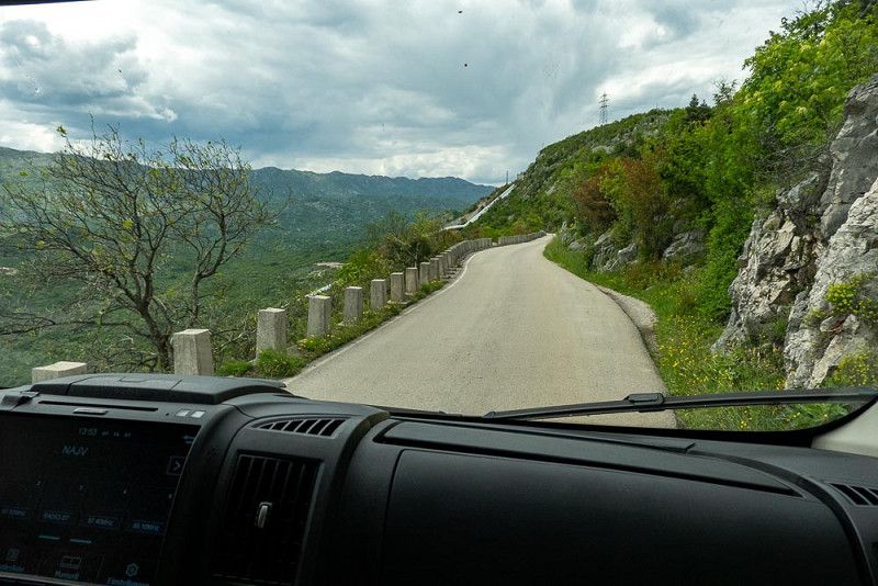
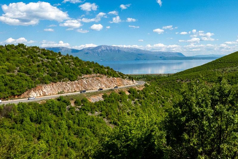
We take the panoramic road and leave the Bay of Kotor , heading into the mountains of Montenegro. We have plenty of time for sightseeing today. Like pearls on a string, photogenic motifs appear, and we're happy to stop to capture them as best as possible.
A parking lot, a market stall – we approach the products on display with curiosity. The farmer, a shrewd salesman, offers us a variety of cheeses to taste and manages to get us to pack not only honey but also other precious specialties. He's done a good deal with us, and we've lost a few euros.
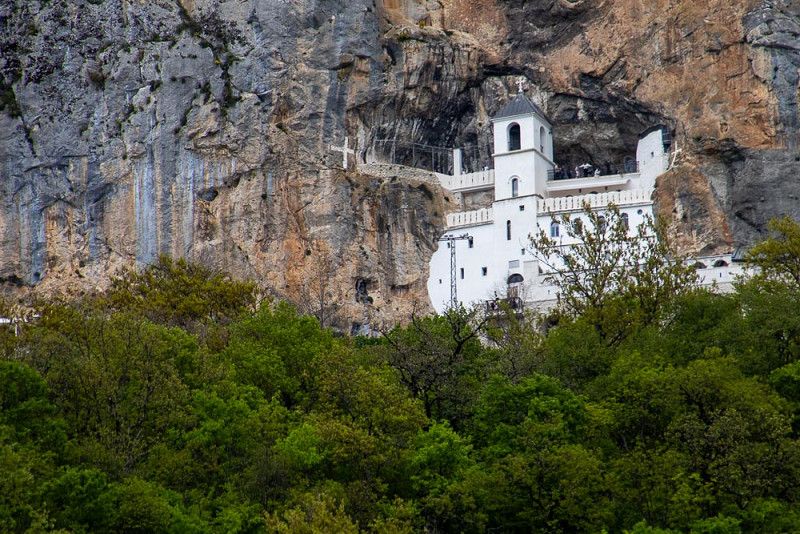
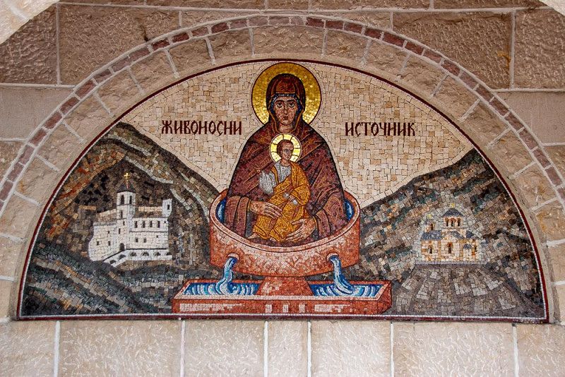
In Niksic we leave the main route for a detour to the Ostrog Monastery, a monastery built into the rock.
And that's where the adventure begins. The access road is narrow, tight, and winding, with bays to swerve from oncoming traffic. This is a real strain on my driver. But somehow we arrive at our destination and not only catch a glimpse of the impressive structure, but also a rewarding view back into the landscape, where the road we've been curving up winds smoothly all the way to the top.
Our destination is Zabljak in Durmitor National Park . We found a few campsites online, but unfortunately, there's no information about whether they're open or not. Following the navigation system, we end up on a narrow, steep gravel road, where we touch the side mirror and realize that none of the campsites are open. We have to keep going.
In Durdevice Tara we are luckier and we are the only RV here and have the entire sanitary area to ourselves.
84223, Djurdjevica Tara, Montenegro
43° 8' 56" N 19° 17' 59" E
43.1488900 19.2997200
• Head northwest. Go for 361 m.
• Turn left toward R-4. Go for 12 m.
• Turn left onto R-4. Go for 402 m.
• Turn left onto R-4 toward Mojkovac. Go for 41.7 km.
• Turn right. Go for 31 m.
• Arrive at your destination on the right.
☍
42,5 km
( 50 min.)
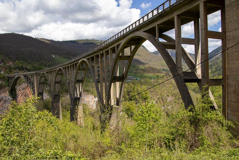
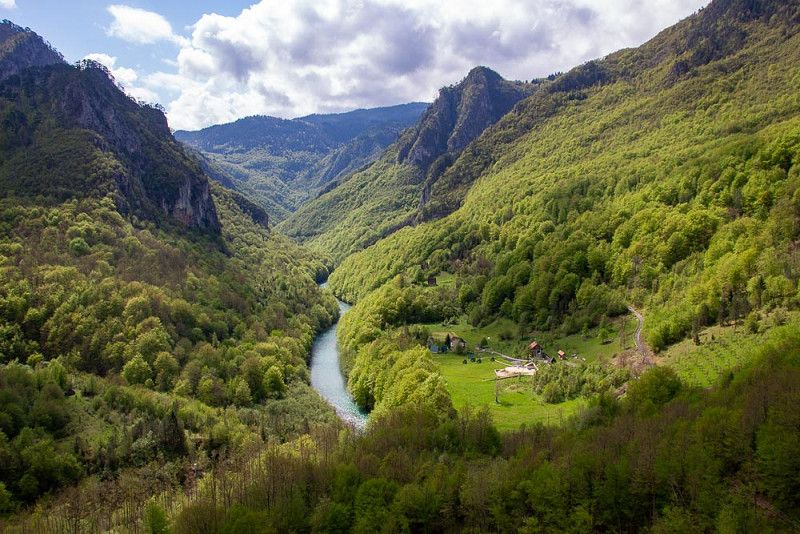
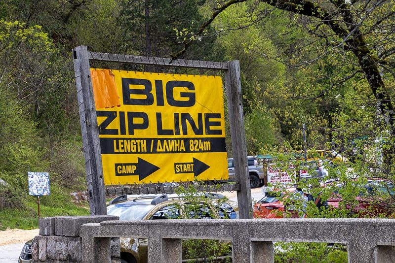
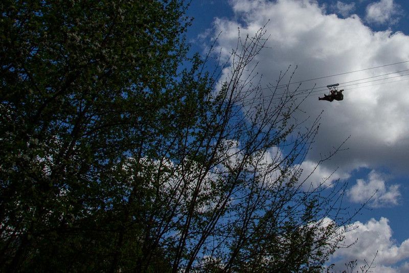
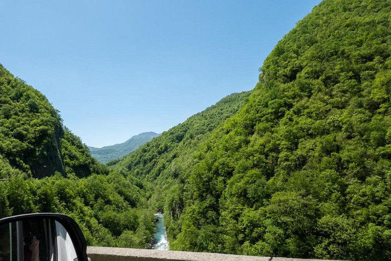
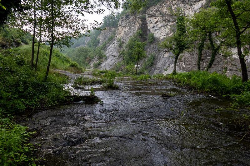
Taraschlucht
The Tara Gorge
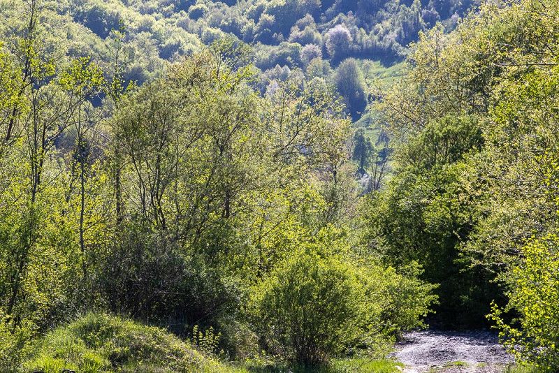
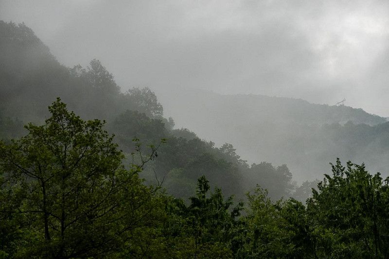
In the play of sun and clouds, the steep slopes of the gorge, painted with delicate green by spring, coquettishly glow toward us. Deeply carved into the depths, the turquoise Tara River meanders.
A monumental bridge connects the two banks and serves as a viewing platform for astonished onlookers and a tripod for cameras.
In order to offer a varied program, rafting tours and the thrill of a zip line are offered, and there is a constant buzzing and screaming over the valley as daredevils release their adrenaline on the journey from one side of the valley to the other.
Tara Resort - Camp Rabrenovic
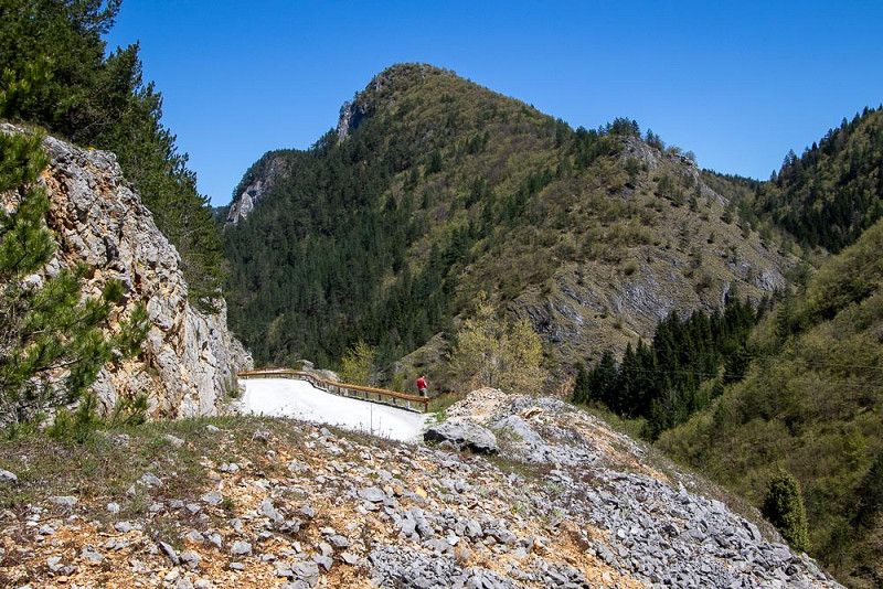
Uphill, downhill over Montenegro's mountains
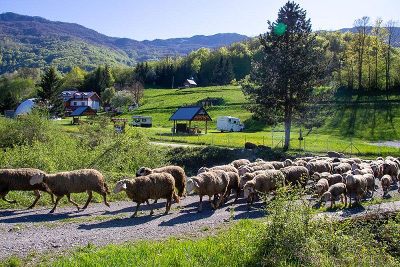
A roadblock on our planned route, which would have led parallel to the gorge, forces us to take a detour into the mountains via a side road to the north.
We curve the road uphill a few times, land on a plateau, and then curve downhill again.
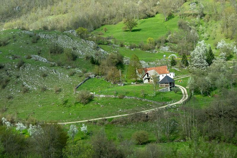
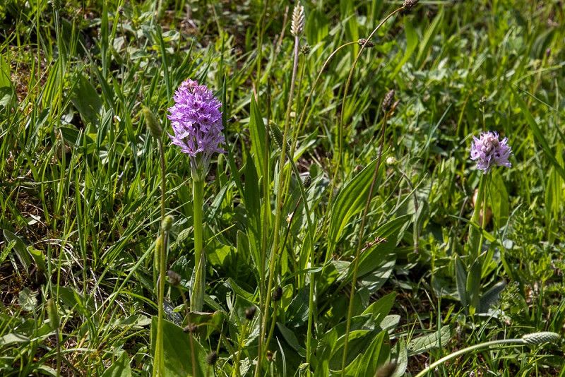
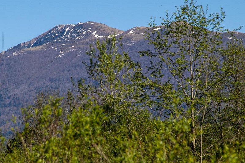
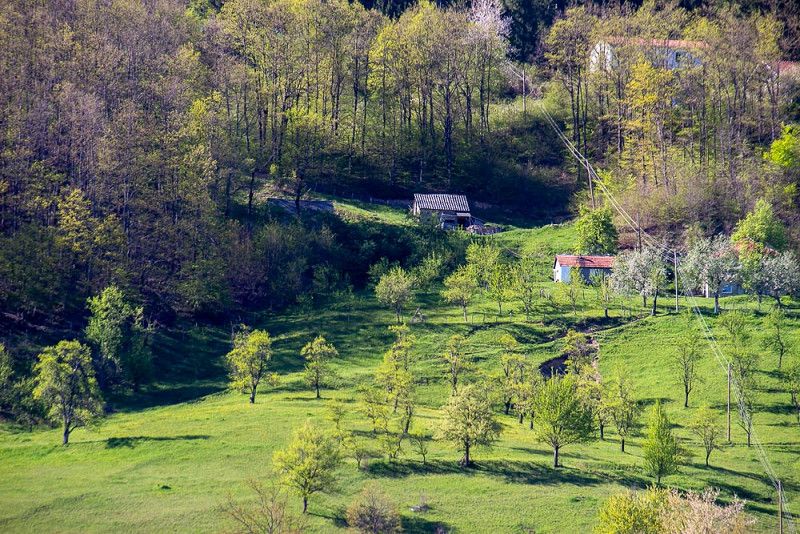
In retrospect: "Thank you so much!" We drive through a lovely landscape, its green dress dazzling in the sunlight. Blooming orchards arranged around isolated houses, grazing sheep, occasionally cows, and mountain peaks with small patches of snow in the distance, underscore this ambiance, which could inspire a painter to create a masterpiece.
This region is still untouched by tourism and, if possible, should not be exploited like other hotspots we have already experienced.
Today we check in at Camp Rabrenovic near Mojkovac and experience a quiet, well-kept place that we are happy to recommend.
Polja bb, 84205, Mojkovac, Montenegro
42° 58' 21.7" N 19° 32' 5.7" E
42.9727000 19.5349300
• Head south. Go for 99 m.
• Turn slightly left toward R-4. Go for 130 m.
• Turn right onto R-4. Go for 4.1 km.
• Turn right onto E-65/E-80 toward Podgorica. Go for 21.9 km.
• Turn left onto M-9 toward Podgorica/E 65/A 1/Mateševo. Go for 438 m.
• Turn right onto M-9 toward Podgorica/E 65/A 1/Mateševo. Go for 8.1 km.
• Turn right toward Matesevo/R-19. Go for 345 m.
• Continue on Matesevo (R-19). Go for 1.1 km.
• Turn left toward Bar/Podgorica. Go for 497 m.
• Take ramp onto Princeza Ksenija toward Bar/Podgorica. Go for 40.5 km.
• Take the 1st exit from roundabout onto Ulica 1. Proletarske brigade (E-65/E-80). Go for 4.4 km.
• Pass 2 roundabouts and continue on Bulevar Sarla de Gola (E-65/E-80/E-762). Go for 2.2 km.
• Turn right onto Bulevar Georgija Zukova (E-65/E-80/E-762) toward Tranzit. Go for 810 m.
• Take the 3rd exit from roundabout onto Ulica Zetskih vladara (E-65/E-80) toward Petrovac/Bar. Go for 3.1 km.
• Pass 4 roundabouts and continue on Mojanovici (E-65/E-80). Go for 6.2 km.
• Take the 2nd exit from roundabout onto E-65/E-80. Go for 3.4 km.
• Take the 1st exit from roundabout onto E-65/E-80. Go for 15.9 km.
• Turn left toward via tunel Sozina/Petrovac/Budva/Bar/Ulcinj. Go for 1.9 km.
• Continue on Ras. Go for 3.9 km.
• Continue on Tunel Sozina. Go for 6.3 km.
• Turn left onto E-851 toward Petrovac. Go for 8.9 km.
• Turn left onto Buljarica. Go for 157 m.
• Turn left onto Buljarica. Go for 51 m.
• Turn right onto Buljarica. Go for 45 m.
• Arrive at Buljarica. Your destination is on the left.
☍
134,4 km
(2 hrs. 2 min.)
Camping Maslina
Enjoyable trip back to the coast
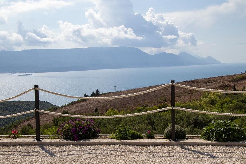
We set off in glorious weather and continued our journey along the panoramic road. After yesterday's experiences, we decided to skip the highway and truly enjoy the scenery one last time.
The entire scenery passing by exudes a calm serenity. The mountains and rocks appear soft and rounded thanks to their vegetation, even as they form steep gorges. This coziness is adorned by the pointed rock bands like the points of a crown.
How wonderful that there are always opportunities for a break along the road. In addition to the brief stops for photography, we enthusiastically take advantage of a coffee break. This ritual, accompanied by gentle ethno-pop music, literally sets my mind in motion.
Some time later, we get hungry for some solid food, so we devour it in a nice restaurant. We share a 40-dag mixed grill – intended for one person – between the two of us. It comes with a mixed salad. We couldn't even manage this portion between the two of us. It was delicious, and we're sure to be full until the next day.
This atmospheric day ends after a walk on the beach with processing the impressions in our heads and sorting the photographed images.
Buljarica bb, 85300, Buljarica, Montenegro
42° 11' 52.8" N 18° 57' 58.4" E
42.1980000 18.9662200
• Head north on Buljarica. Go for 45 m.
• Turn right onto Buljarica. Go for 264 m.
• Turn right onto Buljarica (E-851). Go for 16.0 km.
• Take the 1st exit from roundabout onto E-752/E-851. Go for 499 m.
• Take the 2nd exit from roundabout onto Bulevar Dinastije Petrovic (E-752/E-851). Go for 581 m.
• Take the 1st exit from roundabout onto Bulevar Dinastije Petrovic (E-752/E-851) toward Ulcinj. Go for 904 m.
• Continue on Bulevar Dinastije Petrovic (E-752/E-851) toward Trajekt/Ferry/Luka Bar/Port of Bar/Ulcinj/Skadar. Go for 558 m.
• Take the 3rd exit from roundabout onto E-752/E-851. Go for 1.2 km.
• Take the 2nd exit from roundabout onto E-752/E-851 toward Ulcinj. Go for 4.6 km.
• Turn left toward Sukobin/Ostros. Go for 736 m.
• Continue on Sveti Ivan. Go for 390 m.
• Turn right onto Sveti Ivan. Go for 906 m.
• Continue on Jankovici. Go for 932 m.
• Continue on Dobra Voda. Go for 2.8 km.
• Continue on Pecurice. Go for 4.3 km.
• Continue on Kamenicki Most. Go for 1.9 km.
• Continue on Krute. Go for 1.8 km.
• Continue on Krute. Go for 577 m.
• Take the 2nd exit from roundabout onto Krute (E-752/E-851) toward Vladimir. Go for 4.9 km.
• Continue on Vladimir (E-752/E-851) toward Sukobin. Go for 6.4 km.
• Continue on E851. Go for 12.1 km.
• Turn right onto Rruga Ura e Bunës (E851) toward Tirane/Shkoder/Pristina. Go for 395 m.
• Pass 2 roundabouts and continue on Rruga Fran Ivanaj (E762). Go for 35.1 km.
• Turn right onto Rruga Lezhë-Shëngjin (SH32) toward Shengjin. Go for 3.1 km.
• Turn left toward Rruga Lezhë-Shëngjin/SH32. Go for 1.5 km.
• Turn left onto Rruga Lezhë-Shëngjin (SH32). Go for 227 m.
• Continue on SH32. Go for 2.3 km.
• Arrive at SH32. Your destination is on the left.
☍
105,1 km
(2 hrs. 18 min.)
Demi Camping
Montenegro - Border - Albania
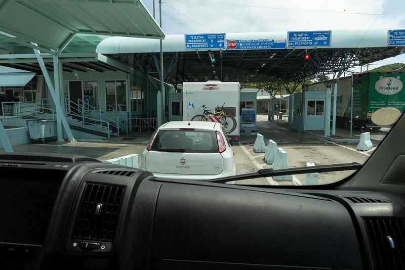
We drive a few more kilometers along the panoramic road until we reach the border crossing into Albania. We stand in line, show our passports, and are waved through to continue our journey. Thinking we've left Montenegro, we wait for the border guards, who must still allow us to enter Albania. We carefully look for a building that might be a border crossing. There's none in sight, not even a "Welcome to Albania" sign or anything similar. After a while, when we only see Albanian license plates, we realize that we've already entered the country, and that we've already passed through the first checkpoint. We hadn't imagined the border crossing would be so smooth.
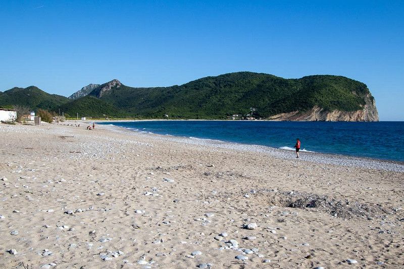
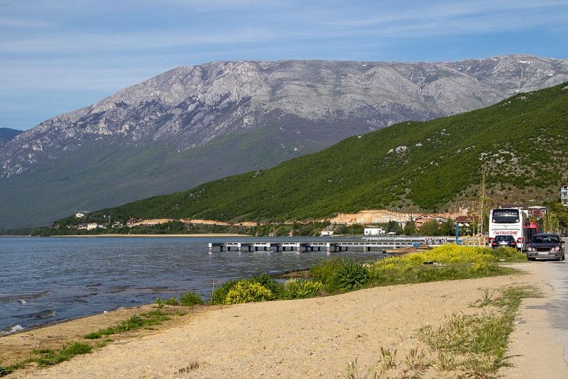
Our route takes us through Shkoder , where a massive traffic jam awaits us. Could it have been the police officers who were supposed to be controlling the roundabouts toward Durres who caused the jam? In any case, our destination is Shengjin . We drive into town to raid an ATM and print some lek. Then we head to the campsite, which surprises us with access to a secluded sandy beach.
Excited, we set out to explore. The beach is beautiful, the sound of the waves relaxing, but unfortunately, the debris is not entirely natural. The scenery is also marred by a few ruins that speak of a better time.
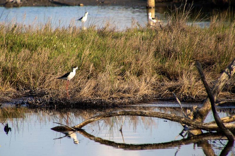
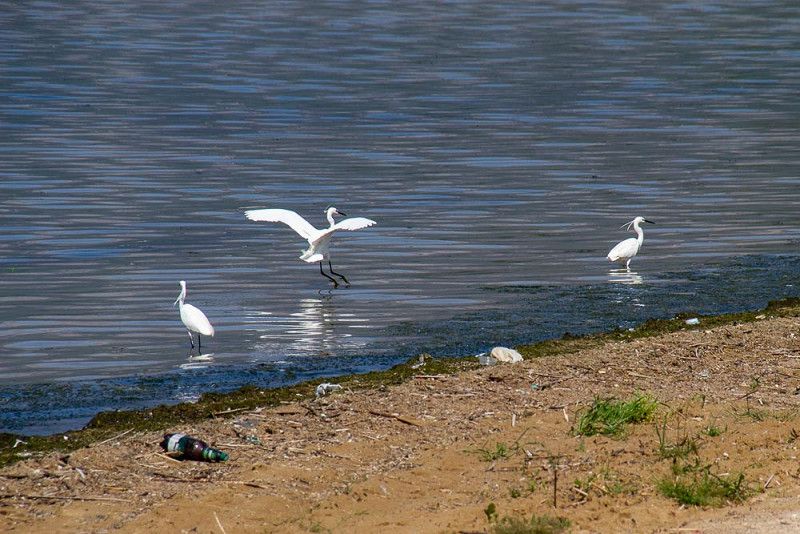
A lagoon stretches parallel to the beach behind our campsite, attempting to rectify this image of destruction. Here we find a true paradise, where quality breeding conditions are guaranteed for various bird species.
Kune, 4503, Shëngjin, Albania
41° 46' 23.9" N 19° 36' 9.5" E
41.7732967 19.6026382
• Head north on SH32. Go for 2.3 km.
• Continue on Rruga Lezhë-Shëngjin (SH32). Go for 227 m.
• Turn right toward Rruga Lezhë-Shëngjin/SH32. Go for 1.5 km.
• Turn right onto Rruga Lezhë-Shëngjin (SH32). Go for 2.5 km.
• Turn right. Go for 200 m.
• Turn left toward E762. Go for 542 m.
• Turn right onto E762. Go for 369 m.
• Take the 2nd exit from roundabout onto E762 toward Tirane/Durres/SH4. Go for 47.1 km.
• Take ramp onto SH2. Go for 8.6 km.
• Keep right toward Elbasan/Unaze e Madhe Jug/A3. Go for 172 m.
• Continue on Rruga Teodor Keko (E852). Go for 35.9 km.
• Take the 2nd exit from roundabout onto E852 toward Elbasan. Go for 768 m.
• Take the 4th exit from roundabout toward Qender Elbasan. Go for 2.4 km.
• Continue on Rruga Kadri Hoxha. Go for 2.1 km.
• Take the 2nd exit from roundabout onto Bulevardi Qemal Stafa. Go for 513 m.
• Take the 1st exit from roundabout. Go for 174 m.
• Take the 5th exit from roundabout onto Rruga 11 Nëntori. Go for 307 m.
• Take the 2nd exit from roundabout onto Rruga 11 Nëntori. Go for 834 m.
• Continue on Rruga Hasan Dine. Go for 419 m.
• Turn left onto Rruga Sedefqar Mehmet Bicakciu (E852). Go for 59.4 km.
• Continue on SH3 toward Greece/Pogradec/Korçe/Kapshtice. Go for 23.3 km.
• Pass 2 roundabouts and continue on Rruga Gani Budka (SH3). Go for 733 m.
• Turn left onto Rruga E Drilonit toward Tushemisht. Go for 2.5 km.
• Turn left toward SH64. Go for 290 m.
• Turn right onto SH64. Go for 1.2 km.
• Turn right. Go for 23 m.
• Arrive at your destination on the left.
☍
194,3 km
(3 hrs. 32 min.)
Camping Arbi
Departure to Lake Ohrid
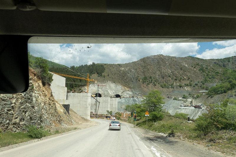
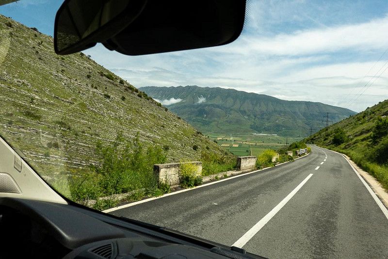
A leisurely breakfast outdoors, then our belongings are stowed away in a shock- and break-proof manner and the engine is started. We quickly leave the city of Tirana behind us and reach Elbasan , a winding mountain road that is being diligently improved.
We've been following a valley for a while, where an attractive stream with huge gravel banks appears repeatedly. Thirsty for coffee and a break, we head for a parking lot with a view, where we meet two French women who love to travel and spontaneously invite them for a coffee chat about the beauty of Albania and much more.
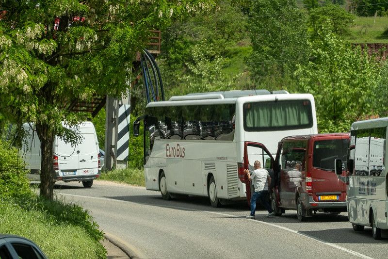
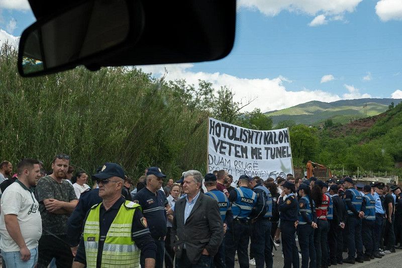
We continue on at a relaxed pace until we suddenly come to a stop. What happened? An accident? Everyone in the convoy is wondering. Impatient ones try to break the traffic jam by honking. It doesn't work. Others get out and stretch their legs, which was certainly more sensible.
At some point, the cars started moving, and then the cause became clear. In Librazhd , the road was blocked by protesters (against or for a nearly completed tunnel? – We have to translate the banner first).
A large number of police officers regulate our onward journey and we soon reach the pass, where we catch our first glimpse of Lake Ohrid on the descent.
An exciting, full day in Pogradec draws to a close. We take the opportunity to treat ourselves to a grilled trout in the campsite restaurant.
Drilon Street, 7301, Pogradec, Albania
40° 54' 4.5" N 20° 42' 35.5" E
40.9012500 20.7098700
• Head north. Go for 23 m.
• Turn right onto SH64. Go for 104 m.
• Turn right toward Rruga E Drilonit. Go for 3.5 km.
• Continue on Rruga E Drilonit. Go for 702 m.
• Turn right onto Rruga Gani Budka (SH3). Go for 239 m.
• Turn right onto Rruga Reshit Collaku (SH3) toward Qënder. Go for 411 m.
• Continue on Bulevardi Reshit Çollaku (SH3). Go for 791 m.
• Turn right onto Rruga Kajo Karafili (SH3). Go for 22.4 km.
• Continue on E852 toward Tirane/Elbasan. Go for 59.4 km.
• Turn right onto Rruga Hasan Dine toward Elbasan. Go for 458 m.
• Continue on Rruga 11 Nëntori. Go for 793 m.
• Take the 1st exit from roundabout onto Rruga 11 Nëntori. Go for 269 m.
• Take the 3rd exit from roundabout onto Rruga 11 Nëntori. Go for 757 m.
• Take the 2nd exit from roundabout toward Tirane/Durres/Rrogozhine/SH7. Go for 62 m.
• Continue on Rruga 11 Nëntori (E852) toward Tirane/Durres/Rrogozhine/SH7. Go for 3.7 km.
• Take the 3rd exit from roundabout onto SH7 toward Peqin/Rrogozhine/Durres. Go for 10.8 km.
• Turn left onto SH59 toward Cerrik. Go for 2.6 km.
• Continue on Rruga Nacionale (SH59). Go for 1.7 km.
• Turn right onto SH58. Go for 5.6 km.
• Continue on Liçaj (SH58). Go for 66 m.
• Continue on SH58. Go for 3.9 km.
• Continue straight ahead. Go for 783 m.
• Take the 2nd exit from roundabout. Go for 2.2 km.
• Continue on Katane. Go for 10.7 km.
• Turn left toward Elest. Go for 2.0 km.
• Continue on Elest. Go for 3.7 km.
• Continue on SH91. Go for 90 m.
• Take the 2nd exit from roundabout onto SH91. Go for 1.2 km.
• Take the 1st exit from roundabout. Go for 2.1 km.
• Continue on Rruga Kurtit. Go for 520 m.
• Continue on Rruga Naftetari. Go for 667 m.
• Take the 1st exit from roundabout onto SH91. Go for 3.2 km.
• Take the 1st exit from roundabout. Go for 1.5 km.
• Take the 2nd exit from roundabout onto SH72. Go for 672 m.
• Turn left. Go for 99 m.
• Arrive at your destination on the right.
☍
147,6 km
(3 hrs. 11 min.)
Ohrid-See
Lake Ohrid – a special attraction
The lake stretches lasciviously on its sofa amidst the mountains under a bright blue sky and allows egrets and great crested grebes to play on its banks.
We explore the small town of Pogradec on foot. Driving through it the day before, I noticed the alternating modern buildings and derelict buildings, with small cultivated fields struggling to survive in between.
This image is confirmed today as we walk along the waterfront promenade. It's not surprising that a crowing rooster is trying to attract attention, drowning out the chatter of the numerous walkers and the noise of children playing. We arrive in a park where trees provide cooling shade, where one restaurant after another beckons you to linger, offering parents the opportunity to enjoy their coffee in peace, because they can easily supervise their children in the playground.
The summer residence of former dictator Enver Hoxha is now a park crisscrossed by canals, open to the public. Countless visitors flock here to enjoy the beautiful weather.
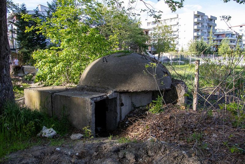
During our stay here in Pogradec , we felt warmly welcomed by the people. They have left behind the old days, of which only the ruins of bunkers remain, and, in our opinion, are striving with diligence and energy toward an economically secure future.
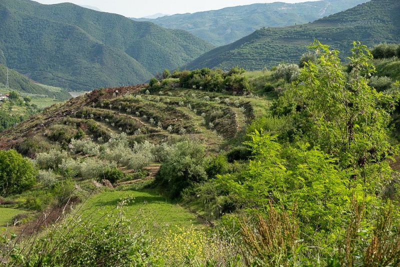
Albania Berat Caravan Camping
Across the vegetable garden
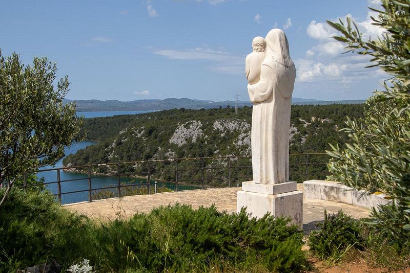
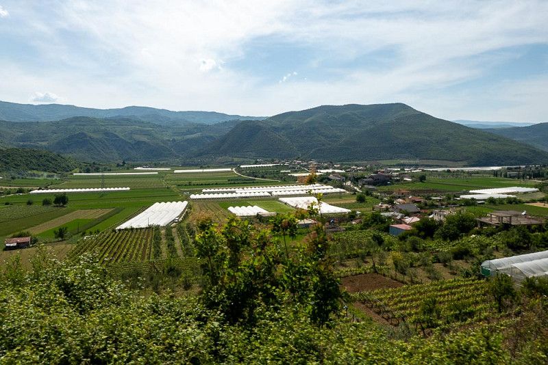
We're already familiar with the first part of today's stage. We reach Lushnje via the winding road, dotted with construction sites, and from there we enter a wide, sweeping valley, where the Osum River flows freely, until we reach Berat .
The soil here is very fertile and provides generous support for the arable land and the fruits that grow there, which are offered in an appetising array at the market stalls along the roadside (often in the middle of the roundabout).
We follow this valley for a long time, its slopes lined with olive tree plantations, whose rows draw a graphic pattern in the landscape and dress it with a trendy shade of olive.
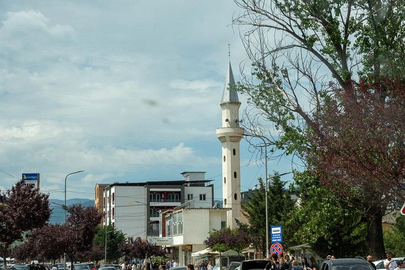
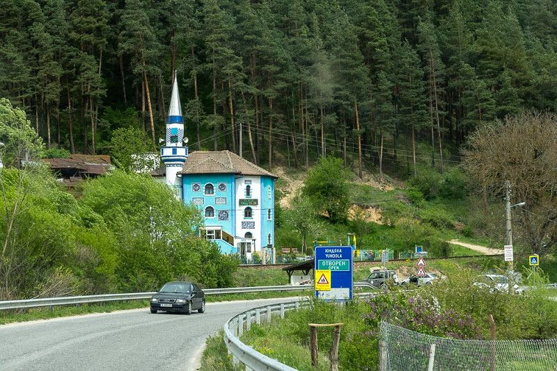
As you drive through towns, the pointed spires of the mosques rise into the sky like obelisks. A muezzin regularly calls the faithful to prayer via loudspeakers. I would have loved to hear this chant, but unfortunately, the opportunity never arose. Muslims, Orthodox Christians, and Catholic Christians seem to live side by side in this country in a spirit of tolerance.
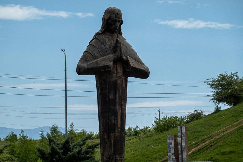
Today we give thanks for the blessing that the statue of the venerable Mother Theresa on the pass road to Elbasan has given us for our onward journey.
Rruga e Pashallis, 5007, Ura Vajgurore, Albania
40° 46' 42.6" N 19° 51' 28" E
40.7784900 19.8577800
• Head northeast. Go for 99 m.
• Turn left onto SH72. Go for 1.9 km.
• Take the 2nd exit from roundabout onto SH73. Go for 14.8 km.
• Take the 3rd exit from roundabout onto SH73 toward Fier. Go for 354 m.
• Take the 2nd exit from roundabout onto SH73. Go for 540 m.
• Take the 3rd exit from roundabout onto SH73. Go for 11.9 km.
• Continue on Plyk. Go for 2.8 km.
• Continue toward Rruga Naftetaret. Go for 36 m.
• Take the 3rd exit from roundabout onto Rruga Unaza Taulantia (SH8) toward Vlore. Go for 1.4 km.
• Take the 3rd exit from Sheshi Fitorja roundabout onto Rruga Aulona (E853) toward Vlore. Go for 2.7 km.
• Turn left toward Cakran. Go for 182 m.
• Continue on Drizë. Go for 9.9 km.
• Continue on Kreshpan. Go for 4.9 km.
• Turn right. Go for 119 m.
• Turn right toward E853. Go for 1.3 km.
• Turn left onto E853. Go for 57.0 km.
• Take the 2nd exit from roundabout onto E853 toward Gjirokaster/Kakavie/Sarande. Go for 19.5 km.
• Turn right toward Kardhiq/Prongji/F. Bardhe/Zhulat. Go for 645 m.
• Continue on Çepun. Go for 3.2 km.
• Continue on Kodër. Go for 19.6 km.
• Take the 1st exit from roundabout. Go for 6.4 km.
• Continue straight ahead. Go for 33 m.
• Take the 2nd exit from roundabout. Go for 3.6 km.
• Take the 2nd exit from roundabout onto Rruga Delvine Sarandë (SH78). Go for 5.7 km.
• Take the 1st exit from roundabout onto Rruga Skënderbeu (SH99) toward Sarande. Go for 1.0 km.
• Turn left onto SH98. Go for 373 m.
• Continue on Metoq (SH98). Go for 73 m.
• Continue on SH98. Go for 3.5 km.
• Turn right toward Çukë. Go for 299 m.
• Continue on Çukë. Go for 1.3 km.
• Turn right onto Rruga Butrinti (SH81). Go for 196 m.
• Turn left. Go for 279 m.
• Arrive at your destination on the left.
☍
175,7 km
(3 hrs. 11 min.)
Camping Ecuador
Nature worth protecting – Photogenic Vjosa
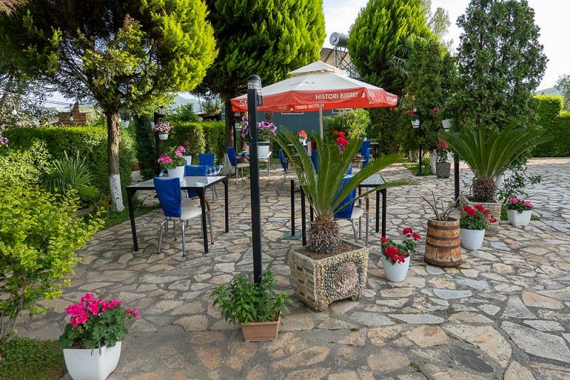
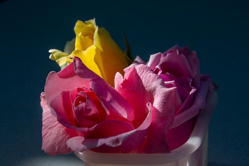
Upon our arrival at the family-run campsite yesterday, we were greeted so warmly and kindly by our campsite manager that it's hard to say goodbye today. It was truly special to be able to park our RV for the night in the well-kept garden, lovingly decorated with flowers. Almost every house we've passed is currently adorned with roses in full bloom. I love this sight and can hardly get enough of it.
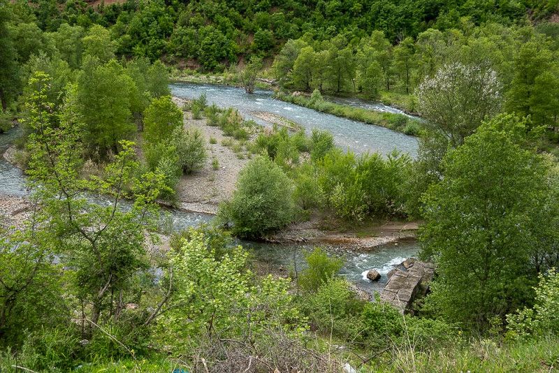
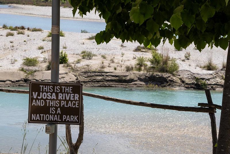
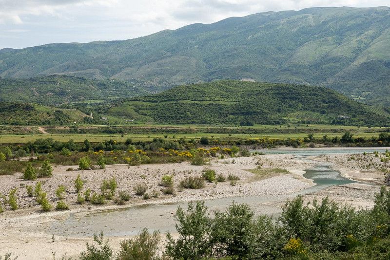
On today's route, we leave the mountains dotted with olive trees. On our way to Sarande, we follow the turquoise Vjosa River, which has been allowed to maintain its natural course untouched from its source to its mouth. This is also the reason why this area was declared a national park in 2023.
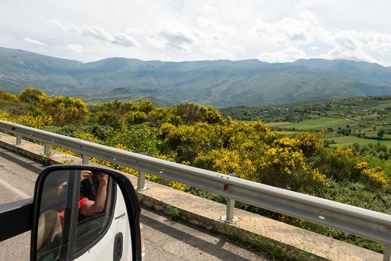
This landscape is given a special touch by the gorse-covered slopes of the mountains that rise up alongside the river and the road and shine in competition with the sun.
Butrinti Sh81, 9701, Sarande, Albania
39° 51' 0.1" N 20° 1' 16.8" E
39.8500200 20.0213300
• Head toward Rruga Butrinti. Go for 279 m.
• Turn right onto Rruga Butrinti (SH81). Go for 196 m.
• Turn left toward Vlore/Tirane. Go for 1.2 km.
• Continue on Çukë. Go for 494 m.
• Turn right onto SH98 toward Metoq. Go for 3.2 km.
• Continue on Dritas-Fanar (SH98). Go for 169 m.
• Continue on SH98. Go for 2.5 km.
• Continue on Pllakë (SH98). Go for 125 m.
• Continue on SH98. Go for 17.0 km.
• Turn right onto SH97. Go for 7.1 km.
• Take the 1st exit from roundabout onto SH97. Go for 236 m.
• Continue toward Eparchiaki Odos Sagiadas-Mavromati. Go for 174 m.
• Take the 1st exit from roundabout onto Eparchiaki Odos Sagiadas-Mavromati. Go for 394 m.
• Take the 1st exit from roundabout onto Eparchiaki Odos Sagiadas-Mavromati. Go for 7.4 km.
• Continue on N. Selefkeias-Sagiadas (18). Go for 17.8 km.
• Continue toward Panellinon. Go for 1.2 km.
• Continue on Panellinon. Go for 397 m.
• Turn left toward Leoforos Ethnikis Antistaseos/6. Go for 161 m.
• Turn right onto Leoforos Ethnikis Antistaseos (6). Go for 1.4 km.
• Take the 1st exit from roundabout onto Agion Apostolon (6). Go for 177 m.
• Turn left onto Kritis. Go for 78 m.
• Turn right onto Pargas. Go for 156 m.
• Take the 2nd exit from roundabout onto Pargas toward Syvota/Plataria/Ioannina/Preveza. Go for 394 m.
• Turn right toward A2/Ioannina/Neos Limenas/New Port/Ladochori. Go for 1.2 km.
• Turn left and take ramp onto E90/E92 (Egnatia Odos) toward Ioannina. Go for 121 km.
• Take exit 7Β toward Trikala/Athina/6 onto E92. Go for 41.1 km.
• Take the 1st exit from roundabout onto Ethniki Odos Metsovou-Kalampakas (E92). Go for 431 m.
• Arrive at Ethniki Odos Metsovou-Kalampakas (E92). Your destination is on the left.
☍
225,4 km
(3 hrs. 10 min.)
Campsite Meteora Garden
Change of plan
The excited, loud honking of geese at the crack of dawn, when we're normally still sound asleep, interrupts our divine peace. They're likely emissaries of the weather god Zeus, who has sent his wrath across the sea with lightning, thunder, and rain, thus persuading us to take a different route to his homeland, Greece.
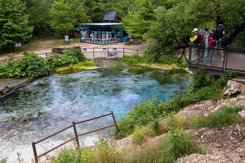
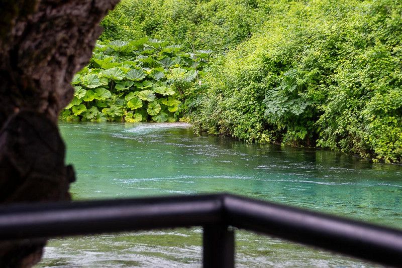
Our destination would have been Butrint , where we would have liked to visit the ancient ruins for a cultural experience for a change. In heavy rain, that would have been quite an experience, but we decided against it and chose a different border crossing.
As Zeus decreed, the rain eases during the journey, and we stop to visit the "Blue Eye," the attraction we pass. It's a good thing we can order coffee here after a short hike. The bubbling and gurgling of the emerald-green waters provides the perfect musical accompaniment for this break.
After crossing the border from Albania to Greece , we're delighted at our rapid progress, as we're allowed to speed along part of the way on a highway. We were too quick to celebrate! The thrill of speed soon comes to an end! The final stretch to Kalampaka is another winding Balkan road, which can only be negotiated at a snail's pace with heavy truck traffic.
The driver has his full concentration on the narrow road, while I, as the passenger, have enough time to devote my full attention to the indescribable landscape.
Contrary to expectations, we finally reach our destination today and reside at the foot of the rocks on which the Meteora monasteries stand.
Kastraki E92, 42200, Kastraki - Kalambaka, Greece
39° 42' 31.9" N 21° 36' 33.9" E
39.7088552 21.6094072
• Head southeast on Ethniki Odos Metsovou-Kalampakas (E92). Go for 632 m.
• Take the 1st exit from roundabout. Go for 517 m.
• Take the 1st exit from roundabout onto E65 (Aftokinitodromos Kentrikis Elladas) toward Lamia/A3/Lamia. Go for 24.7 km.
• Take the exit. Go for 1.3 km.
• Take the 2nd exit from roundabout toward Pertouli Elati/Trikala/Topikes Odoi/Local Roads. Go for 98 m.
• Take the 3rd exit from roundabout onto Ethniki Odos Larisas-Trikalon (E92) toward Kalampaka/Meteora/Larisa. Go for 52.2 km.
• Take the 3rd exit from roundabout onto Perifereiaki Odos Larisas toward Thessaloniki/Kozani/A1. Go for 1.6 km.
• Take the 2nd exit from roundabout onto Sandraki toward Thessaloniki/Kozani/A1. Go for 1.8 km.
• Take the 2nd exit from roundabout onto E65 toward Athina/Thessaloniki. Go for 2.0 km.
• Take the 3rd exit from roundabout onto Karagiorga S. toward Athina/Thessaloniki. Go for 2.1 km.
• Take the 3rd exit from roundabout onto Ethniki Odos Larisas-Thessalonikis toward Thessaloniki. Go for 10.5 km.
• Take ramp onto E75 (Ethniki Odos Larisas-Thessalonikis). Go for 67.3 km.
• Take the exit toward Katerini/Paralia. Go for 93 m.
• Turn left onto Pal. Ethn. Odos Larisas-Thessalonikis toward Katerini. Go for 412 m.
• Turn left onto Chatzoglou toward Kentro/Center. Go for 356 m.
• Continue on 28is Oktovriou. Go for 1.2 km.
• Continue on Plateia Eleftherias. Go for 57 m.
• Arrive at Plateia Eleftherias. Your destination is on the left.
☍
166,8 km
(1 hrs. 41 min.)
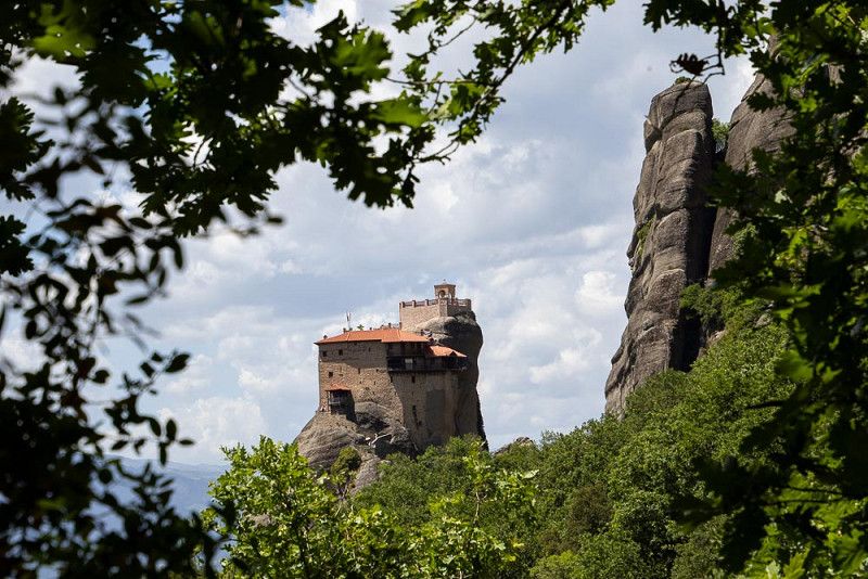
Meteoraklöster
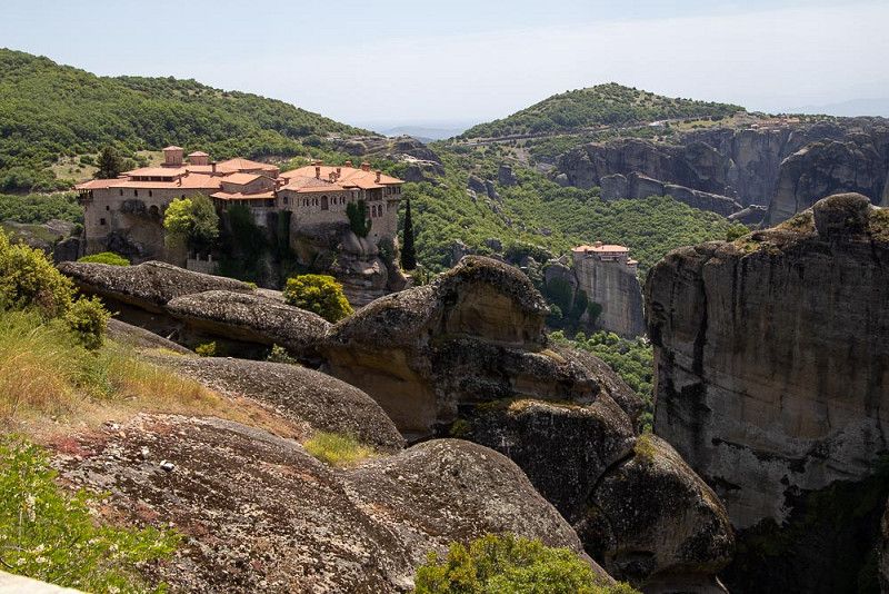
Meteora Monasteries
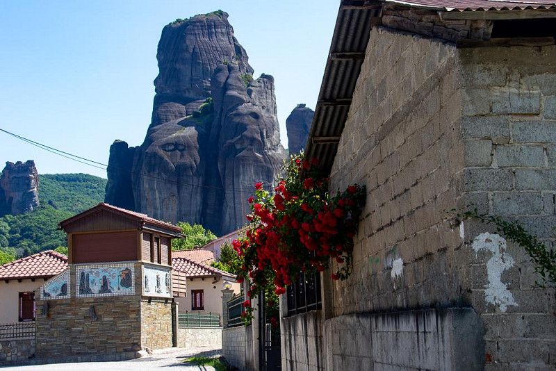
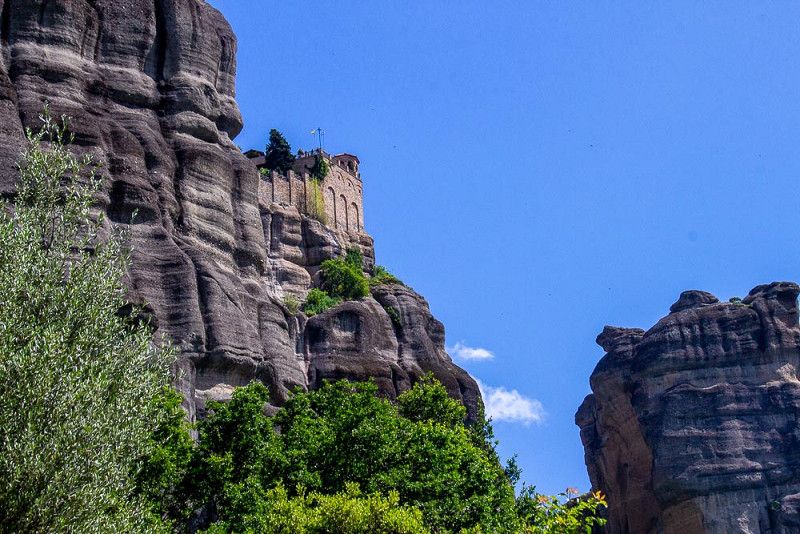
The sun is shining from the sky, practically smiling at us, and we enthusiastically set off on the path that will take us to the monastery landscape on the sandstone cliffs.
First we follow a path through the village of Kastraki , where the perspective makes it seem as if the rock towers are sitting on the houses.
The scent of roses blooming luxuriantly in a variety of colors in the front gardens fills our noses. On the way back, I strike up a conversation with an elderly lady who notices my admiration for her exquisite plants, and she promptly gives me roses from her bushes.
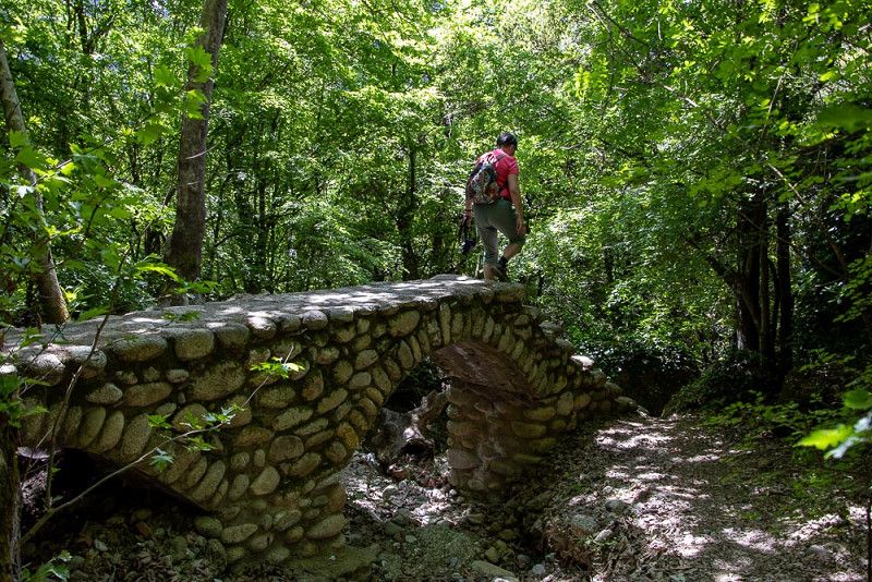
But first, we sweat and pant uphill in summer temperatures, overtaken by tourist buses and numerous cars, until we finally turn onto a forest path away from traffic. Huge ancient trees form a shady canopy over the steep climb, which eventually leads to one of the monasteries (Meteora is ancient Greek and means suspended in the air). Despite these pleasant-sounding conditions, the required exertion has us sweating profusely. Well, we have to endure it to reach our destination. At the end of the path, we are rewarded with a magnificent panorama of the monasteries, perched atop enormous rock towers and inspiring meditation.
With the prospect of delicious food, the downhill journey seems shorter. Soon we're sitting in a cool garden, enjoying a glass of regional white wine with our meal.
Katerini
On the way to Katerini
The dark monumental rock giants with their sacred decoration can now only be seen in the rearview mirror and are becoming smaller and smaller until they disappear completely from our field of vision.
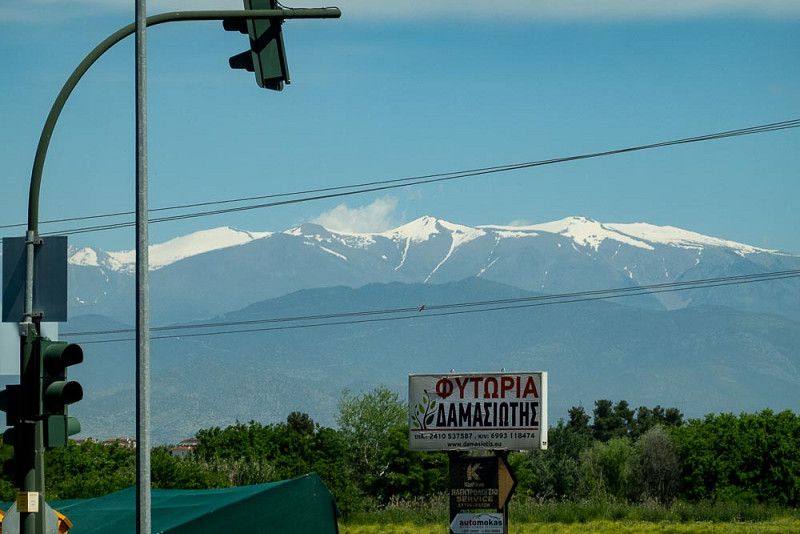
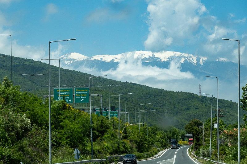
After a few kilometers on the highway toward Thessaloniki , Mount Olympus , with its white snow cap, appears on the side and later in front of us. A small cloud hangs over the peak, resembling a flag, with which Zeus is waving to us in a friendly manner.
Enlivened by the accompaniment of Sirtaki rhythms, sufficiently informed by well-signposted traffic signs that easily guide us into the correct lane, we enjoy the relaxed ride.
Additionally, I notice that roadsides and parking bays are finally clean and free of trash. The problem of pollution, which has plagued us for a long time, has always been very annoying and disgusting.
Unfortunately, my positive opinion doesn't last long. Our current campsite resembles a hopeless, neglected mess that's been crying out for modernization for some time. A walk to the beach reveals the same scene. Only the beachfront restaurants maintain their classy ambiance.
Regionalbezirk Pieria, Makedonien - Thrakien, Griechenland
40° 16' 16.9" N 22° 30' 31.5" E
40.2713616 22.5087618
• Head toward 16is Oktovriou on Plateia Eleftherias. Go for 44 m.
• Continue on Ethnikis Antistaseos. Go for 145 m.
• Turn right onto Kassandrou. Go for 276 m.
• Take the 2nd exit from roundabout onto Kassandrou. Go for 126 m.
• Take the 2nd exit from roundabout onto Dika N. toward Athina/Olympiaki Akti/Paralia. Go for 770 m.
• Turn left and take ramp onto E75 (Ethniki Odos Larisas-Thessalonikis) toward Thessaloniki. Go for 58.4 km.
• Take exit 21 toward Kavala/Serres/Chalkidiki onto E90 (Egnatia Odos). Go for 13.8 km.
• Take exit 23 toward Kavala/Serres onto E79/E90 (Egnatia Odos). Go for 7.5 km.
• Take exit 24 toward Serres/65/Kilkis onto E79 (Ethniki Odos Thessalonikis-Serron). Go for 97.8 km.
• Continue on 1. Go for 2.1 km.
• Continue on A3 (Magistrala Struma). Go for 38.3 km.
• Take the 2nd exit from roundabout onto 1 toward Kresna/Kresna/Blagoevgrad/Blagoevgrad. Go for 25.7 km.
• Take ramp onto Ulitsa Predel (19) toward Gotse Delchev/Gotse Delchev/Bansko/Bansko/Velingrad/Velingrad. Go for 35.8 km.
• Turn left onto 84 toward Velingrad/Velingrad. Go for 70.6 km.
• Take the 3rd exit from roundabout onto Ulitsa Patriarh Evtimiy (84) toward Plovdiv/Plovdiv/Sofia/Sofia. Go for 1.3 km.
• Take the 1st exit from roundabout onto 84 toward Pazardzhik/Pazardzhik/Sofia/Sofia. Go for 5.1 km.
• Turn right onto 376 toward Konstandovo/Konstandovo/Rakitovo/Rakitovo/Batak/Batak. Go for 688 m.
• Keep right onto 376. Go for 2.9 km.
• Continue on Ulitsa Nikola Bozhanov (376). Go for 183 m.
• Continue on Ulitsa Ivan Klincharov (376). Go for 773 m.
• Continue on Ulitsa Todor Tuparov (376). Go for 578 m.
• Turn right onto Ulitsa Todor Tuparov (376). Go for 162 m.
• Continue on Ulitsa Stefan Dobrev (376). Go for 23 m.
• Continue on Ulitsa Todor Tuparov (376). Go for 858 m.
• Turn left onto Ulitsa Ivan Klincharov (376). Go for 368 m.
• Continue on Ulitsa Nikola Bozhanov (376). Go for 77 m.
• Continue on 376. Go for 6.0 km.
• Turn left. Go for 546 m.
• Turn slightly right. Go for 967 m.
• Arrive at your destination on the right.
☍
372,0 km
(4 hrs. 26 min.)
Eco camping Batak
Road trip to Bulgaria
We've planned a lot of mileage for today, so we'll take the highway that will take us to the border with Bulgaria.
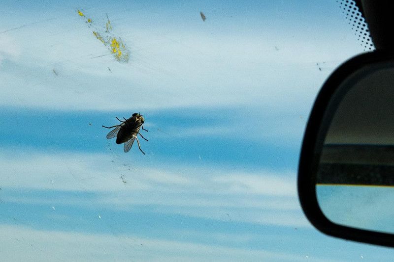
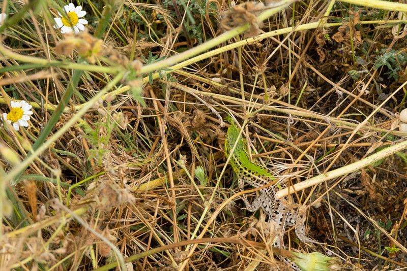
A small hitchhiker seems to want a ride and sticks itself to our windshield. The stowaway manages to cope with the rapid speed surprisingly well, but soon takes off. During one of our rest stops while filling up the car, I spot a small lizard that quickly disappears into the bushes. With these highlights in our luggage, we enter Bulgaria.
The character of the landscape we're traveling through reminds me strongly of our hilly region back home. There are a few fruit trees and lilacs in bloom, and snow-capped mountains gleam in the background. The only difference is that colorful mosques grace the villages.
We hope that an opportunity will arise to restock our supplies. For this, we absolutely need cash (lev), and ideally an ATM. We're lucky: a shopping center offers the option of printing bills, and the attached Lidl supermarket makes it easier for us to find familiar products, which we pack without hesitation, since we're already quite hungry.
We reach our campsite near Batak in the late afternoon and are looking forward to a walk to the lake.
4580, Batak, Bulgaria
41° 57' 31" N 24° 9' 17.1" E
41.9586100 24.1547500
• Head east. Go for 1.5 km.
• Turn left onto 376. Go for 4.5 km.
• Continue on 37. Go for 18.6 km.
• Take the 3rd exit from roundabout onto Ulitsa Mihail Takev (37) toward Pazardzhik/Pazardzhik/Plovdiv. Go for 1.4 km.
• Turn right onto 375 toward Plovdiv. Go for 6.7 km.
• Continue on Ulitsa 1-va (375). Go for 1.3 km.
• Continue on 375. Go for 3.7 km.
• Continue on Ulitsa 38-ma (375). Go for 1.4 km.
• Continue on 375. Go for 3.9 km.
• Continue on Ulitsa 1-va (375). Go for 942 m.
• Continue on 375. Go for 2.1 km.
• Turn left onto 866 toward Stamboliyski/Stamboliyski. Go for 1.9 km.
• Continue on Ulitsa Targovski (866). Go for 180 m.
• Continue on Bulevard Targovski (866). Go for 150 m.
• Continue on Ulitsa Targovski (866). Go for 73 m.
• Turn right toward Plovdiv. Go for 34 m.
• Continue on Bulevard Vasil Levski. Go for 1.4 km.
• Take the 3rd exit from roundabout onto Bulevard Trakia. Go for 2.6 km.
• Continue on Ulitsa Trakia (866). Go for 22 m.
• Continue on Bulevard Trakia (866). Go for 263 m.
• Continue on 866. Go for 833 m.
• Take the 2nd exit from roundabout onto 8005 toward Saedinenie/Saedinenie/Sofia/A1/Sofia. Go for 1.7 km.
• Continue on Ulitsa Stefan Stambolov (8005). Go for 2.9 km.
• Continue on 8005. Go for 767 m.
• Turn left and take ramp onto A1 (Magistrala Trakia) toward Svilengrad/Svilengrad/Burgas/Burgas. Go for 95.8 km.
• Take the exit toward Stara Zagora/Stara Zagora onto 5. Go for 6.4 km.
• Take ramp onto 5/66 toward Burgas/Burgas. Go for 9.5 km.
• Take ramp onto 5 toward Kazanlak/Gabrovo/Ruse/Ruse. Go for 12.3 km.
• Take ramp toward Yagoda/Razhena. Go for 323 m.
• Turn right onto 5007. Go for 961 m.
• Continue on Ulitsa Okolovrastna (5007). Go for 809 m.
• Continue on Ulitsa Panicherevska (5007). Go for 949 m.
• Continue on 5007. Go for 2.4 km.
• Continue on Shanovo (5007). Go for 1.0 km.
• Continue on 5007. Go for 16 m.
• Continue on Shanovo (5007). Go for 983 m.
• Continue on 5007. Go for 3.7 km.
• Continue on Zimnitsa (5007). Go for 925 m.
• Continue on 5007. Go for 30 m.
• Continue on Zimnitsa (5007). Go for 323 m.
• Continue on 5007. Go for 1.4 km.
• Continue on Ulitsa Aleksandar Stamboliyski (5007). Go for 499 m.
• Continue on Ulitsa Zarya (5007). Go for 220 m.
• Turn right onto 5007 toward Burgas/Gurkovo. Go for 11.4 km.
• Turn left onto 55 toward Ruse/Ruse/Veliko Tarnovo/Veliko Tarnovo. Go for 49.2 km.
• Take ramp onto 5502 toward Kilifarevo. Go for 591 m.
• Continue on Ulitsa Hainboaz (5502). Go for 959 m.
• Continue on Ulitsa Georgi Dimitrov. Go for 218 m.
• Continue on Ploshtad Kilifarska komuna. Go for 22 m.
• Turn right onto Ulitsa Aleksandar Stamboliyski. Go for 5.3 km.
• Continue on Plakovo. Go for 145 m.
• Turn left onto Plakovo (551) toward V. Tarnovo/V. Tarnovo. Go for 1.1 km.
• Continue on 551. Go for 2.0 km.
• Turn sharp right toward Velchevo/Kapinovski manastir. Go for 2.2 km.
• Continue on Velchevo. Go for 4.3 km.
• Turn slightly left. Go for 1.9 km.
• Turn left. Go for 130 m.
• Arrive at your destination.
☍
277,0 km
(3 hrs. 41 min.)
Campsite Kapinovski Monastery
It's raining, it's raining... we continue towards Ruse
The rain knocked quietly but steadily against our RV all night. With the rain forecast, we didn't feel like sitting around all day in our small, albeit cozy, cabin, so we decided to continue on toward Ruse.
Another long drive lies ahead of us. Campsites in the interior of Bulgaria are very sparsely spread, so the Kapinovsky Monastery campsite is our only option. Unfortunately, we weren't able to find a spot near a town or a cultural institution worth visiting, which would allow us to use public transport to get to the center of the action. Perhaps we still need to improve our language skills to be able to interpret the Cyrillic alphabet correctly.
Our RV thus transforms into a sightseeing bus. We wind through spectacular gorges, drive through small towns, observe fertile fields and lush green meadows, and watch the wisps of fog linger between the mountains. Despite these autumnal images, we feel cozy and warm in our refuge. We've made a satisfactory arrangement with the rain.
The evening after our arrival, the miserable weather calms down. We immediately set out to explore the surrounding area of the idyllic campsite.
The Kapinovski Monastery area, 5032, Velchevo, Bulgaria
42° 58' 36.4" N 25° 44' 49.4" E
42.9767800 25.7470600
• Head south. Go for 87 m.
• Turn right. Go for 43 m.
• Turn right toward Velchevo. Go for 5.2 km.
• Continue on Velchevo. Go for 3.2 km.
• Turn right onto 551. Go for 6.7 km.
• Continue on Ulitsa Patriarh Evtimiy Tarnovski (551). Go for 188 m.
• Continue on 551. Go for 17 m.
• Continue on Ulitsa Patriarh Evtimiy Tarnovski (551). Go for 65 m.
• Turn left onto Ulitsa Patriarh Evtimiy Tarnovski (551). Go for 67 m.
• Continue on 551. Go for 633 m.
• Turn left onto 5 toward Veliko Tarnovo/Veliko Tarnovo. Go for 5.3 km.
• Keep left onto 5 toward Ruse/Ruse. Go for 53.1 km.
• Take the 2nd exit from roundabout onto 5 toward Ruse/Ruse. Go for 58.5 km.
• Take the 2nd exit from roundabout onto 2 toward Bukuresht. Go for 475 m.
• Turn right onto 2. Go for 1.1 km.
• Continue on DN5. Go for 3.1 km.
• Take the 1st exit from roundabout onto Strada Progresului (DN5) toward București. Go for 639 m.
• Take the 2nd exit from roundabout. Go for 5.1 km.
• Turn right onto DN5 toward București. Go for 2.5 km.
• Pass 9 roundabouts and continue on Șoseaua Giurgiului (DN5). Go for 40.3 km.
• Take ramp onto A0. Go for 26.6 km.
• Take the exit toward Nădlac/Pitești onto A1. Go for 117 km.
• Take exit 7 toward Cârțișoara/Bâlea Lac. Go for 1.3 km.
• Take the 1st exit from roundabout onto DN7C toward Cârțișoara/Bâlea Lac. Go for 14.6 km.
• Turn left onto Strada 1 Mai (DN73C). Go for 1.6 km.
• Take the 2nd exit from roundabout onto Strada Lascăr Catargiu (DN7C/DN73C). Go for 2.4 km.
• Take the 2nd exit from roundabout onto Strada Albești (DN7C). Go for 22.6 km.
• Arrive at Transfăgărășan (DN7C). Your destination is on the left.
☍
372,4 km
(4 hrs. 28 min.)
Dracula Camping
From the Balkans to the Carpathians
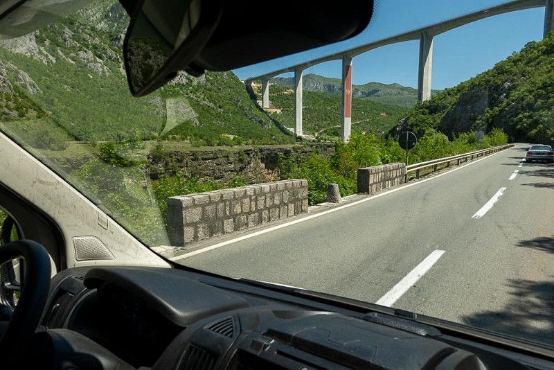
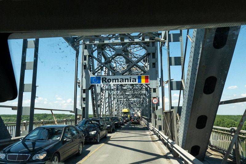
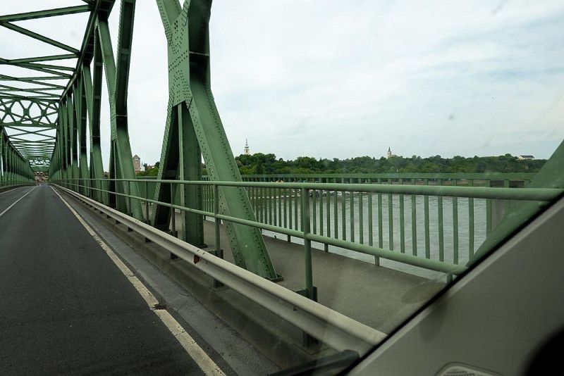
Hiking in the Carpathian Mountains in Romania – with this in mind, we set off. We cross the border at Ruse , which lies right in the middle of the Danube Bridge. This ancient and firmly anchored structure, in need of renovation, spans the river.
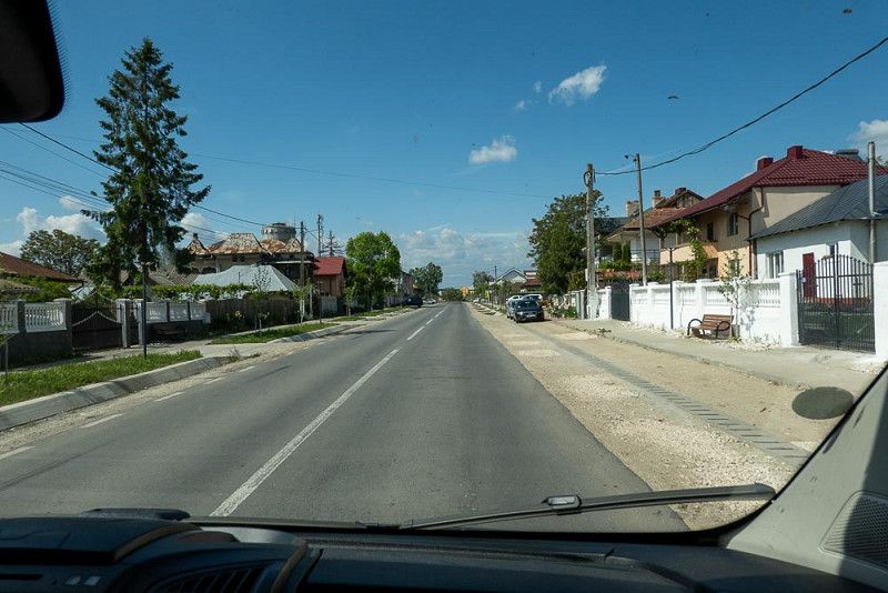
Somehow, I can't shake the feeling that the villages we've been driving through since the border present themselves with pride and renewed splendor. In contrast to their Bulgarian counterparts, they exude order and attractiveness. Most of the houses in the villages along the road have been renovated, and their front gardens are clean and well-kept.
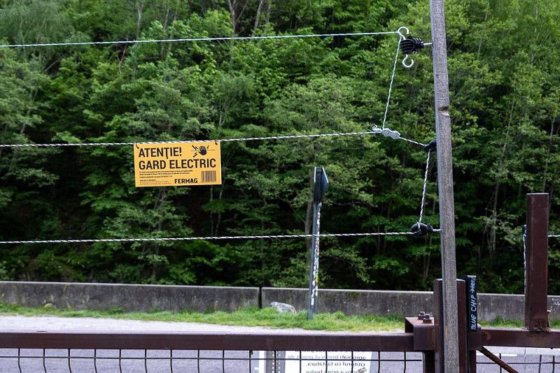
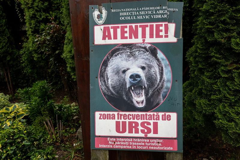
We check in at the Dracula Campsite after first getting the local currency (ron). Our plans to go hiking tomorrow seem off the cards. This area is full of steep slopes—perhaps suitable for climbing, but not for us hikers. What seems even more dangerous to us, however, are bloodthirsty vampires, from whom we try to protect ourselves with a garlic-enriched supper, and starving bears that hopefully won't smell our scent. Our campsite is protected from intruders by an electric fence, like Alcatraz.
I wish us and all readers a good night.
main 190, 117042, Căpăţineni , Romania
45° 20' 59.7" N 24° 37' 59" E
45.3499300 24.6330500
• Head east on Transfăgărășan (DN7C). Go for 7.6 km.
• Turn right. Go for 2.7 km.
• Turn right. Go for 5.2 km.
• Turn right. Go for 2.5 km.
• Turn right toward 703I. Go for 12 m.
• Continue on 703I. Go for 9.7 km.
• Continue on DC268. Go for 1.1 km.
• Turn slightly left onto DJ703I. Go for 3.9 km.
• Turn right onto DJ703I. Go for 1.5 km.
• Keep right onto DJ703I. Go for 1.6 km.
• Turn slightly left onto DJ703I. Go for 4.1 km.
• Turn right onto DN73C toward Curtea de Argeș. Go for 14.5 km.
• Take the 2nd exit from roundabout onto Strada Eroilor (DN7C/DN73C). Go for 2.5 km.
• Take the 1st exit from roundabout onto Strada Râmnicu Vâlcea (DN73C). Go for 26.4 km.
• Turn right onto DN7 toward Rm. Vâlcea. Go for 4.8 km.
• Pass 3 roundabouts and continue on Strada Barajului (DN7). Go for 7.0 km.
• Take ramp onto DN7 toward Sibiu. Go for 383 m.
• Take the 2nd exit from roundabout onto Calea lui Traian (DN7). Go for 19.4 km.
• Take the 2nd exit from roundabout onto DN7. Go for 53.3 km.
• Take the 2nd exit from roundabout onto A1 toward Sebeș/Sibiu. Go for 13.3 km.
• Take the exit toward DJ106D/Cisnădie. Go for 682 m.
• Take ramp toward Sibiu-Sud/DJ106D/Cisnădie. Go for 126 m.
• Take the 3rd exit from roundabout onto DN1/DN7 toward Cisnădie. Go for 909 m.
• Take the 1st exit from roundabout onto DN1/DN7 toward Sibiu-Sud. Go for 3.7 km.
• Take the 3rd exit from roundabout onto Strada Sturnu Sibiului (DN1/DN7) toward Sibiu. Go for 469 m.
• Pass 4 roundabouts and continue on Șoseaua Alba Iulia (DN1/DN7). Go for 3.6 km.
• Take the 3rd exit from roundabout onto Șoseaua Alba Iulia (DN1/DN7) toward Sebeș/Aeroport. Go for 155 m.
• Pass 2 roundabouts and continue on Șoseaua Alba Iulia (DN1/DN7). Go for 1.1 km.
• Arrive at Șoseaua Alba Iulia (DN1/DN7). Your destination is on the right.
☍
192,0 km
(3 hrs. 54 min.)
Sibiu
On the way to Sibiu
We survived the night shivering and fearful. Somehow, the image of a bear coming out of the dark forest toward our RV became ingrained in my mind. This image haunted me even in my dreams. I'm relieved that we skipped the hike and chose to visit Sibiu instead of this risky maneuver.
We have plenty of time today, and there are many opportunities to admire the details of the renovated houses we pass. I find their playful stucco moldings framing the arched windows particularly beautiful. Houses, fences, and even the hay barns are not only functional but also stylishly built, often reminding me of delicately decorated cakes. The churches, which stand out in every village as the center of the religious community, are not to be overlooked.
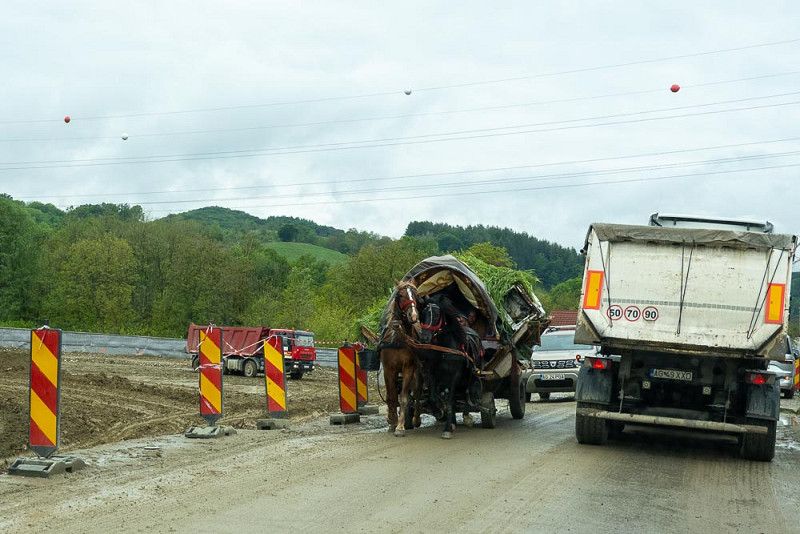
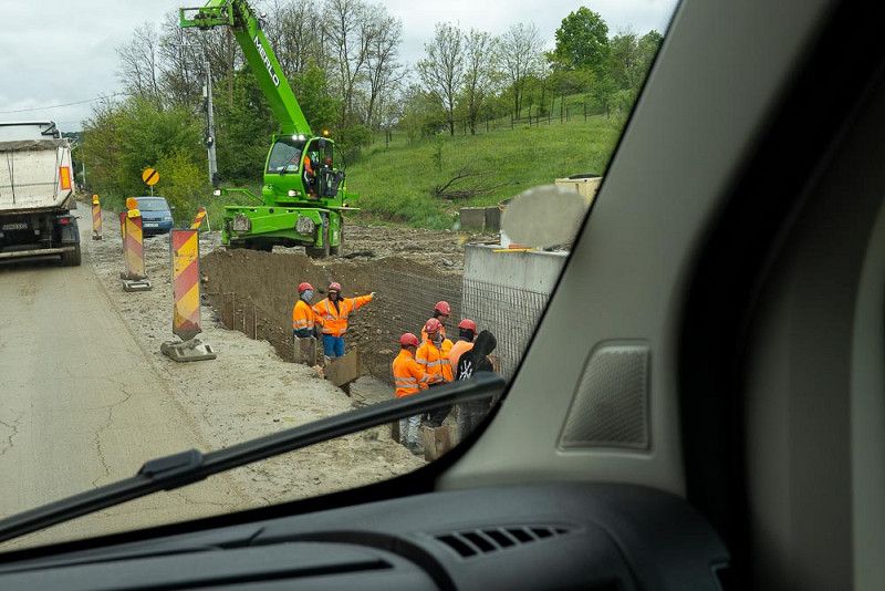
The section of the Carpathians we're traveling through today presents an immense challenge for road maintenance. We repeatedly encounter construction sites because slopes have slipped due to the rain or trees are blocking the way. It's a tough job for the workers, as it's still raining. For us, however, there was plenty of time to observe a horse-drawn cart, a so-called "Tandel Kramer." I'm amazed that one of these still exists and fascinated by what it's packed onto its trailer. A good horse!
I'm looking forward to exploring the city tomorrow. Hopefully the rain front will pass soon.
Sos. Alba Iulia 76, 550042, Sibiu, Romania
45° 47' 37.2" N 24° 7' 4.6" E
45.7936590 24.1179340
• Head toward Strada Alba Iulia on Șoseaua Alba Iulia (DN1/DN7). Go for 625 m.
• Take the 3rd exit from roundabout onto Șoseaua Alba Iulia (DN1/DN7) toward București/A1/Mediaș/Agnita/Sebeș/Aeroportul Internațional/Ocna Sibiului. Go for 1.5 km.
• Take the 2nd exit from roundabout onto Șoseaua Alba Iulia (DN1/DN7). Go for 1.0 km.
• Take the 1st exit from roundabout onto Strada Salzburg (DN7H) toward A1/E81/București/Ocna Sibiului. Go for 2.7 km.
• Continue on DN7H. Go for 1.2 km.
• Take the 2nd exit from roundabout onto DN7H toward Nădlac/Sibiu Vest. Go for 431 m.
• Take ramp onto A1 toward Nădlac/Sebeș. Go for 158 km.
• Continue toward Lugoj/Făget. Go for 31 m.
• Take the 2nd exit from roundabout onto DN68A toward Lugoj. Go for 15.2 km.
• Take the 1st exit from roundabout toward Nădlac/Timișoara. Go for 296 m.
• Turn left onto A1. Go for 159 km.
• Continue on M43. Go for 57.7 km.
• Take the exit toward Budapest/Kecskemét onto M5. Go for 19.9 km.
• Take exit 140 toward Ópusztaszer/Kiskunmajsa. Go for 453 m.
• Take the 3rd exit from roundabout onto 5411. Go for 5.2 km.
• Turn right onto Rákóczi Ferenc utca (5411) toward Kiskunmajsa. Go for 9.3 km.
• Continue on Fő utca (5405) toward Kiskunmajsa. Go for 2.0 km.
• Continue on Fő utca (5402) toward M5/Kiskunfélegyháza/Szank. Go for 170 m.
• Turn right onto Félegyházi út (5402) toward Kiskunfélegyháza/M5/E75. Go for 3.8 km.
• Turn right. Go for 62 m.
• Turn right. Go for 320 m.
• Arrive at your destination on the right.
☍
439,3 km
(3 hrs. 50 min.)
Kulturstadt Sibiu
Perfect weather for a city tour
Wonderful! After a cold night, warm rays of sunshine accompany our breakfast. As if Sibiu needed to be especially picturesque, it has garnished the blue sky with a few clouds.
A pedestrian zone flanked by pretty, renovated houses leads us to a spacious square with a fountain at its center. To rest tired legs, you can rest on one of the benches and observe the hustle and bustle. The pigeons have also caught on, and so they strut around provocatively and beggingly in front of and between the people's feet.
We're looking for a more relaxed atmosphere and visit one of the many restaurants to satisfy our hunger with traditional food. On the menu: polenta with cabbage rolls, polenta with smoked sausages… hearty but delicious!
Next on our agenda is a visit to the Evangelical Parish Church, the seat of the Protestant bishops of Transylvania. The interior is simple, yet testifies to the opulence of a bygone era.
Sibiu, this lovely city with a tradition-conscious character, has captured our hearts!
Camping Jonathermál
Our journey is coming to an end
With the visit to Sibiu, we slowly close our binkerl, which is full to the brim with a variety of impressions from this unforgettable trip.
We have started our journey home via Hungary and will spend another two days here.
Barely over the border, the linguistic debacle begins again. Although written in Latin script, many place names are barely legible while driving by, and I don't even want to attempt to pronounce these tongue twisters correctly. Have fun and good luck with your reading and speaking exercises!
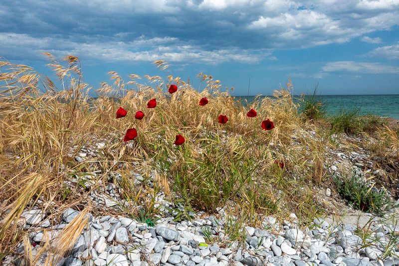
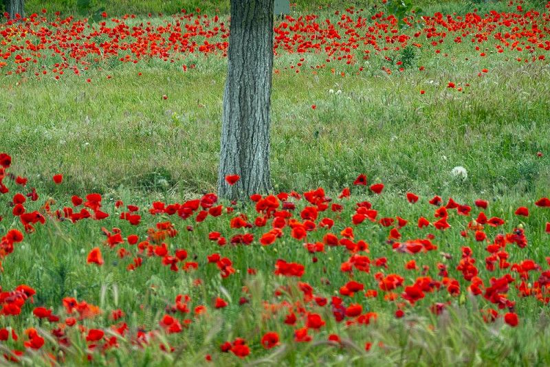
Bright red poppies, which have always accompanied us on our journeys, quickly gathered at the side of the road and are lined up in a row to mark our departure.
Kökút 26, 6120, Kiskunmajsa, Hungary
46° 31' 18" N 19° 44' 53" E
46.5216600 19.7480500
• Head northwest. Go for 320 m.
• Turn left toward 5402. Go for 62 m.
• Turn right onto 5402. Go for 19.2 km.
• Take the 3rd exit from roundabout onto M5 toward Budapest. Go for 90.8 km.
• Take exit 22-23 toward Gyűrű/Ring/Repülőtér/Gyál/Alsónémedi/Győr/M1/Nyíregyháza/M3/Liszt Ferenc repülőtér onto M0. Go for 28.0 km.
• Take ramp onto M7 toward Nagykanizsa/Balaton/Érd-Parkváros. Go for 156 km.
• Take exit 170 toward 76/Zalaegerszeg/Balatonkeresztúr/71/Keszthely/Hévíz/Balatonszentgyörgy/Fly Balaton repülőtér onto E661. Go for 1.5 km.
• Take the 2nd exit from roundabout onto 76 toward Zalaegerszeg/Balatonszentgyörgy/71/Keszthely. Go for 3.3 km.
• Continue on Berzsenyi Dániel utca (76). Go for 1.3 km.
• Continue on 76. Go for 89 m.
• Take the 1st exit from roundabout onto 76 toward Zalaegerszeg/Hévíz/Keszthely/71. Go for 3.4 km.
• Take the 1st exit from roundabout onto 71. Go for 2.6 km.
• Turn right onto 71345 toward Keszthely dél. Go for 3.2 km.
• Turn right onto Festetics György út (71345) toward Centrum/Vasútállomás. Go for 565 m.
• Take the 2nd exit from roundabout onto Kossuth Lajos utca (71345). Go for 182 m.
• Turn right onto Munkácsy Mihály utca (71345) toward Vasútállomás. Go for 105 m.
• Continue on Mártírok utca (71345). Go for 333 m.
• Turn left onto Kazinczy utca (71345). Go for 519 m.
• Continue on Ady Endre utca. Go for 141 m.
• Turn left onto Lovassy Sándor utca. Go for 440 m.
• Turn right onto Malom utca. Go for 151 m.
• Continue on Tessedik Sámuel utca. Go for 252 m.
• Arrive at Tessedik Sámuel utca. Your destination is on the right.
☍
311,9 km
(3 hrs. 3 min.)
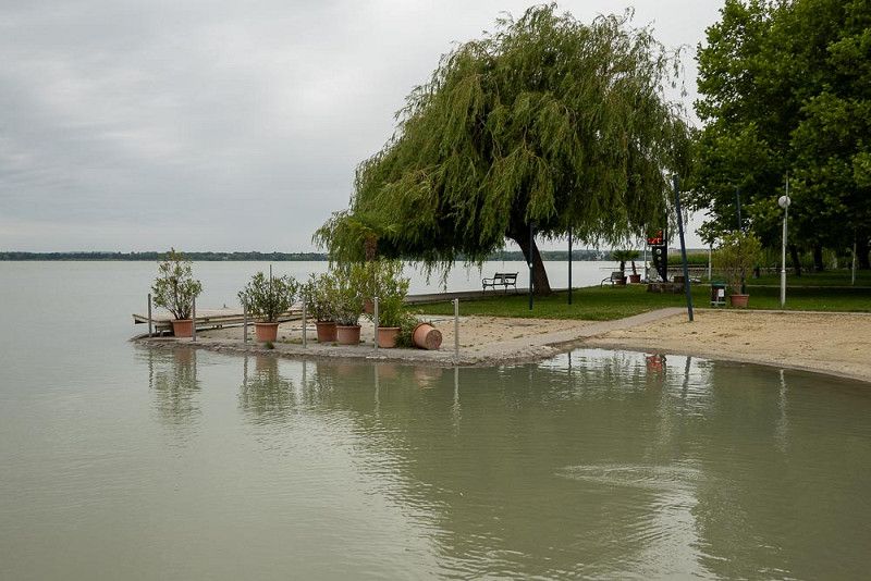
Keszthely
Stop at Lake Balaton
From our accommodation to Lake Balaton, there are still a few kilometers and intersections and turnoffs to negotiate. The navigation system, not always my best friend, is supposed to help me choose the right path. And so, once again, I sit with this aid on my lap, observing when and how far away the next intersection is where I can turn right or left. At the same time, as the passenger, my eyes are fixed on an analog road map and the street signs. And then it happens again – after spotting our destination on a signpost, I announce: "We have to keep right!" – he goes straight ahead. Missed it, turned around again. I grumbled, he gets annoyed, asks the navigation system, and we find the right turning lane. This incident is followed by icy silence until we finally have lunch in our stomachs, which calms our spirits.
I'd like to explain in more detail why my relationship with the navigation system is strained. This clever app always determines the shortest route, but it's not always the best. With this support, we've often taken detours on bumpy roads. It's almost a miracle that our RV hasn't broken down in pieces on the road yet.
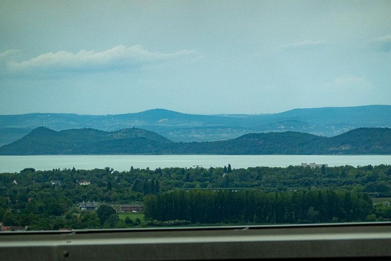
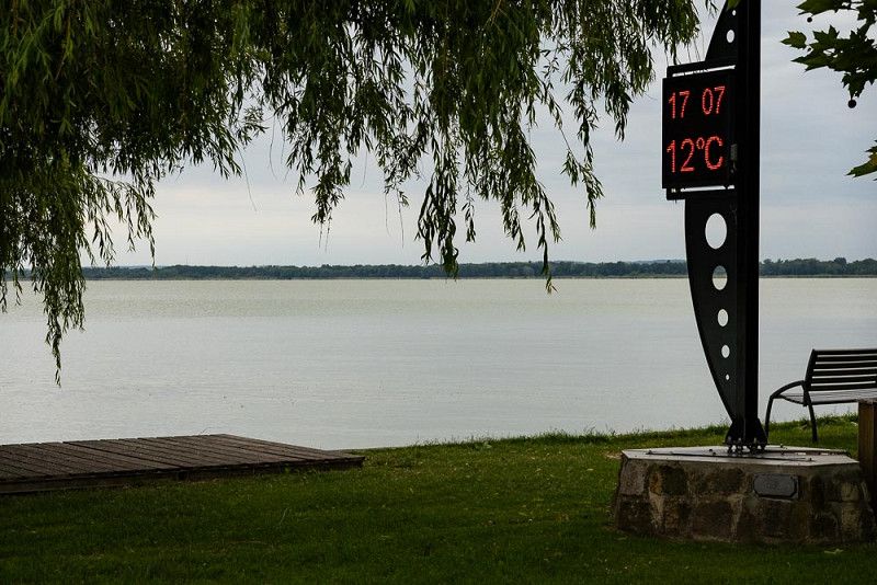
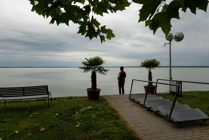
We cross the Danube at Dunaföldvar and drive for a long time on the highway that runs alongside the lake until we reach our destination, Kesthely . A stormy wind prompts us to have coffee in our cozy living room.
But at some point, despite the cold, we feel like getting some fresh air, so we brave the wind and weather and go for a walk along the shore of Lake Balaton.
Letting our gaze wander over the lake and reflecting on the past weeks is like meditation and inner contemplation. We feel immense gratitude for this wonderful, uneventful journey.
Apát utca 33., 8360, Keszthely, Hungary
46° 45' 58.3" N 17° 15' 17" E
46.7662000 17.2547100
• Head east on Tessedik Sámuel utca. Go for 71 m.
• Turn left onto Darnay Kálmán utca. Go for 394 m.
• Turn left onto Tapolcai út. Go for 318 m.
• Continue on Rákóczi tér. Go for 200 m.
• Turn right onto Rákóczi tér. Go for 63 m.
• Continue on Vásár tér. Go for 265 m.
• Continue on Zsidi út. Go for 559 m.
• Take the 2nd exit from roundabout onto Külső Zsidi út (7343) toward Várvölgy. Go for 549 m.
• Take the 2nd exit from roundabout onto Külső Zsidi út (7343) toward Várvölgy. Go for 654 m.
• Continue on Várvölgyi út (7343). Go for 1.9 km.
• Continue on 7343. Go for 7.5 km.
• Turn left onto 7342. Go for 4.7 km.
• Turn right onto 7327. Go for 967 m.
• Continue on Fő utca (7327). Go for 319 m.
• Continue on 7327. Go for 3.7 km.
• Continue on Fő utca (7327). Go for 1.5 km.
• Continue on 7327. Go for 4.6 km.
• Continue on Tátika utca (7327). Go for 260 m.
• Continue on Árpád utca (7327). Go for 504 m.
• Take the 3rd exit from roundabout onto Kossuth Lajos utca (7324). Go for 559 m.
• Continue on Jókai Mór utca (7324). Go for 210 m.
• Continue on Rendeki utca (7324). Go for 279 m.
• Take the 2nd exit from roundabout onto Rendeki utca (7324). Go for 647 m.
• Continue on 7324. Go for 151 m.
• Take the 3rd exit from roundabout onto 84 toward Sopron/Sárvár. Go for 17.9 km.
• Take the 2nd exit from roundabout onto 84 toward Sopron/Sárvár. Go for 18.8 km.
• Take the 2nd exit from roundabout onto 84 toward Sopron/E65/Szombathely/M66. Go for 5.0 km.
• Turn left onto 88 toward E65/M86/Szombathely/Sárvár/Centrum. Go for 10.3 km.
• Take the 2nd exit from roundabout onto 88 toward Szombathely/E65/Vát/86. Go for 289 m.
• Take the 2nd exit from roundabout onto M86 toward Szombathely. Go for 12.3 km.
• Continue on E65. Go for 73 m.
• Take ramp onto 87 toward Szombathely észak/Kőszeg/Bucsu/89/Bük-fürdő. Go for 2.0 km.
• Take the 2nd exit from roundabout onto Repülők útja (87) toward Kőszeg/Bucsu/Bécs/Wien. Go for 796 m.
• Take the 3rd exit from roundabout onto Repülők útja (87) toward Kőszeg. Go for 406 m.
• Take the 2nd exit from roundabout onto 11-es huszár út (87). Go for 1.4 km.
• Take the 2nd exit from roundabout onto 89 toward Bucsu/Gencsapáti/Herény. Go for 547 m.
• Take the 2nd exit from roundabout onto 89 toward Bucsu/Felsőőr/Oberwart. Go for 11.9 km.
• Continue on Steinamangerer Bundesstraße (B63). Go for 15.6 km.
• Take the 2nd exit from roundabout onto Steinamangerer Bundesstraße (B63). Go for 4.5 km.
• Take the 2nd exit from roundabout onto Oberwarter Bundesstraße (B63a) toward Wien/A2/Graz/Oberwart/Gewerbegebiet Oberwart-Nord 1 u. 2/Gewerbegebiet Oberwart-West 1 u. 2. Go for 2.5 km.
• Take the 2nd exit from roundabout onto L269 toward Oberwart. Go for 762 m.
• Take the 2nd exit from roundabout onto L269. Go for 339 m.
• Take the 1st exit from roundabout onto Schulgasse. Go for 211 m.
• Turn right onto Badgasse. Go for 38 m.
• Turn left onto Ganghofergasse. Go for 98 m.
• Arrive at Ganghofergasse. Your destination is on the right.
☍
136,4 km
(1 hrs. 53 min.)
Oberwart
Back home
Our Balkan tour is now over. For four weeks, we explored some previously unknown countries.
The beginning of the trip was marked by some uncertainty for us, as various media outlets repeatedly presented the Balkan countries with only negative headlines.
To our pleasant surprise, however, this turned out to be a big mistake. We had always felt very safe in all the countries we visited. However, we also always stayed at official campsites, which, given the prices charged (except in Croatia), had little impact on our travel budget. Everywhere we went, we met extremely friendly people who repeatedly spoke to us and showed genuine interest in where we came from.
Unfortunately, we were unable to visit some regions as we had hoped, as there are large areas where I was unable to find any suitable campsites in advance.
The entire tour, which was far too short in time, gave us a good overview of what this unique region of Europe has to offer. However, we've already decided to visit some of these countries again, such as Albania and Romania.
Finally, I would like to thank my dear wife, who is responsible for the atmospheric texts of all the previous contributions.
Bezirk Oberwart, Burgenland, Österreich
47° 17' 10.1" N 16° 12' 44.7" E
47.2861513 16.2124214