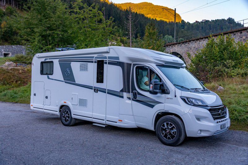
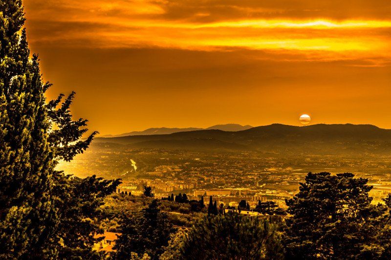
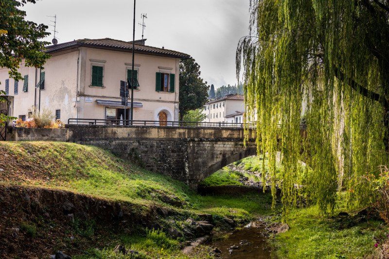
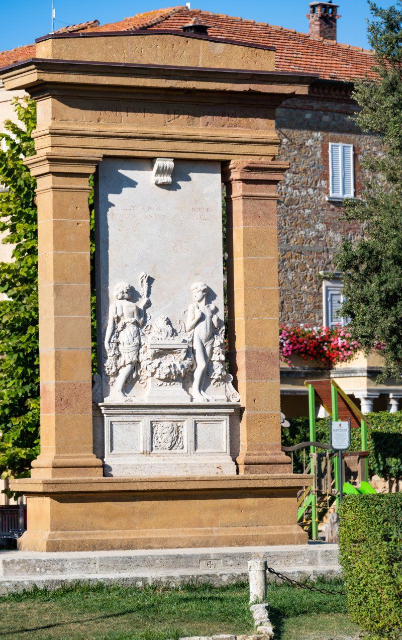
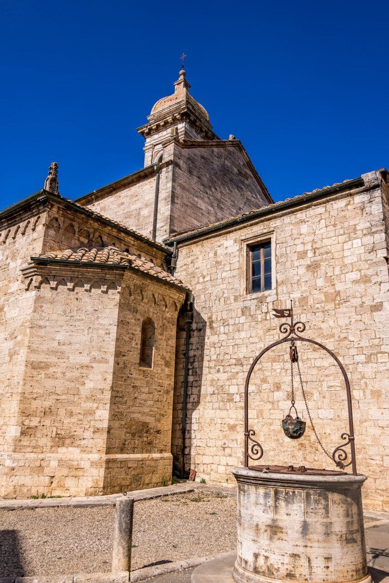
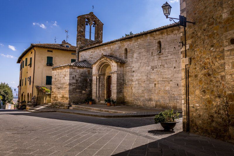
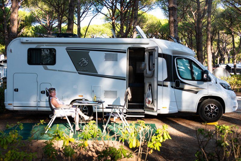
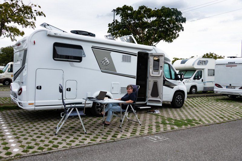
This is the travelogue of our first trip with a motorhome. We rented it and took a 13-day tour through Tuscany with the most beautiful landscapes and sights this region has to offer. We haven't seen everything for a long time and will definitely come back, maybe with our own mobile home. Because we really enjoyed the journey and life in the motorhome.
Day
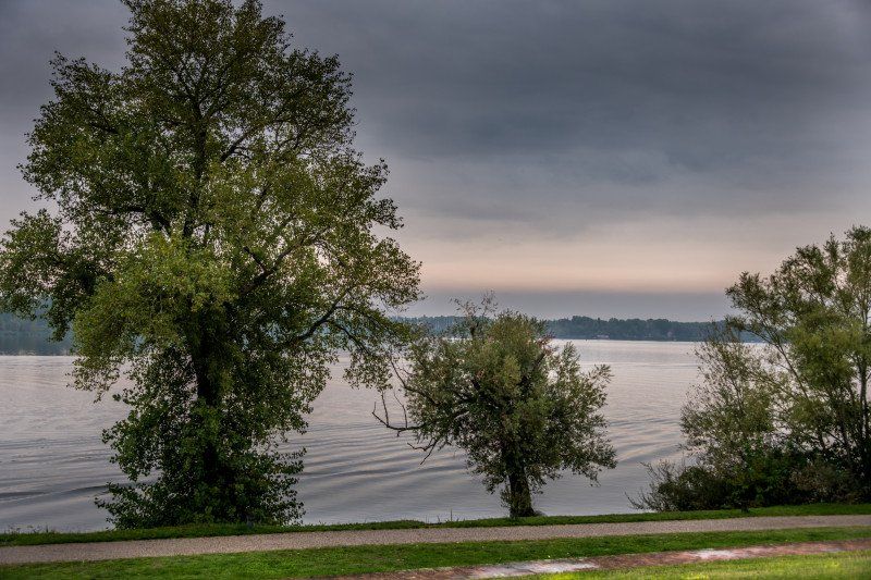
Untervaz, Schweiz
Departure on 09/25/21 at 07:00 from Untervaz in the direction of the Julier Pass.
Salis 5, 7204 Untervaz, Schweiz
46° 55' 29.5" N 9° 32' 25.8" E
46.9248511 9.5405062
• Head toward Seetuf on Kirchgasse. Go for 739 m.
• Continue on Unterm Strässli. Go for 284 m.
• Continue on Werksiedlung. Go for 187 m.
• Turn right toward Oberaurütenen. Go for 687 m.
• Continue on Oberaurütenen. Go for 63 m.
• Turn right and take ramp onto A13 toward Chur. Go for 32.3 km.
• Take ramp toward Thusis-Süd/St. Moritz/Tiefencastel. Go for 340 m.
• Turn left toward Tunnel Sils. Go for 228 m.
• Continue on Tunnel Sils. Go for 1.8 km.
• Continue on 417. Go for 10.3 km.
• Take the 1st exit from roundabout onto 3 toward St. Moritz/Julierpass/Savognin. Go for 43.0 km.
• Take the 3rd exit from roundabout onto Via Chantunela (27) toward Berninapass/29/Zernez/St. Moritz. Go for 2.9 km.
• Pass 2 roundabouts and continue on Via San Gian (27). Go for 850 m.
• Take the 3rd exit from roundabout onto Via dal Bagn. Go for 267 m.
• Turn sharp left onto Via Chavallera. Go for 10 m.
• Arrive at Via Chavallera. Your destination is on the right.
☍
93,9 km
(1 hrs. 17 min.)
Sankt Moritz, Schweiz
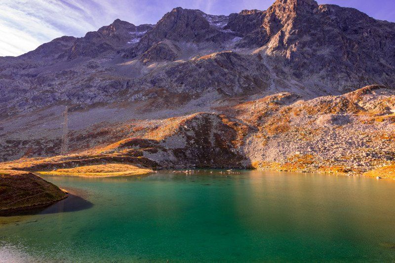
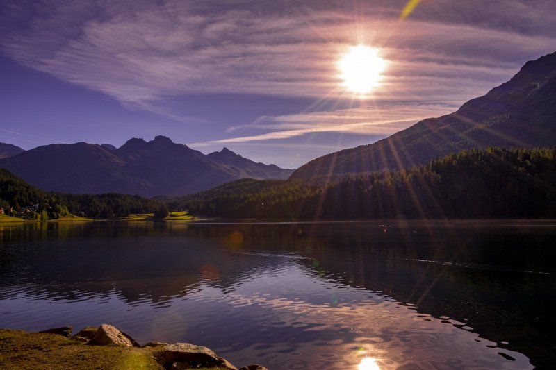
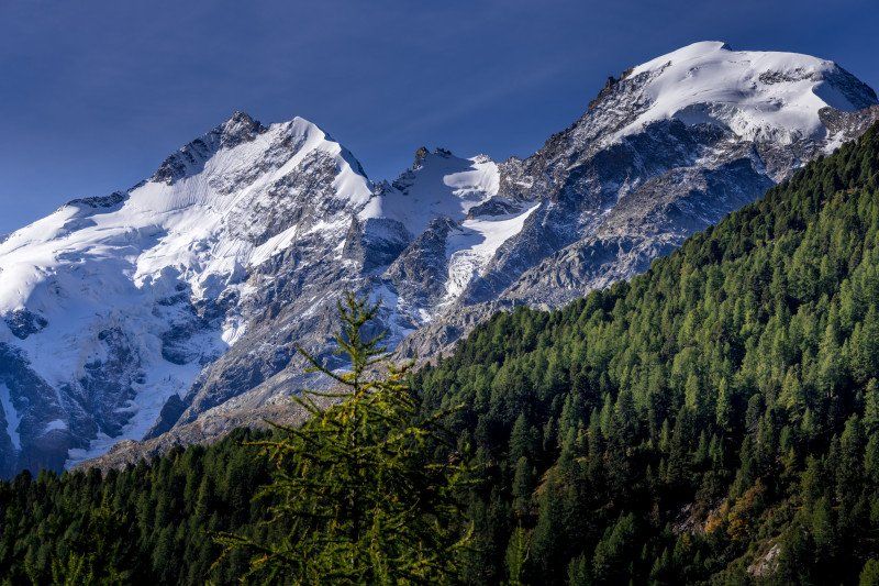
First photo stop at the Julier Pass at around 8:10 a.m. Very nice weather not much traffic. Continue to Pontresina in the direction of the Bernina Pass, with a photo stop on the pass road with a view of the peaks Bernina, Palü, Piz Rosegg, Piz Morteratsch. Coffee stop at the Bernina Hospice.
Via dal Bagn 15b, 7500 St. Moritz, Switzerland 46 ° 29 '23.2 "N 9 ° 50' 3.8" E
Via dal Bagn 15b, 7500 St. Moritz, Schweiz
46° 29' 23.2" N 9° 50' 3.8" E
46.4897889 9.8343905
• Head toward Via dal Bagn on Via Chavallera. Go for 10 m.
• Turn sharp right onto Via dal Bagn. Go for 195 m.
• Take the 3rd exit from roundabout onto Via Grevas (27). Go for 1.3 km.
• Pass 2 roundabouts and continue on 27. Go for 3.4 km.
• Take the 1st exit from roundabout onto 29. Go for 2.8 km.
• Take the 2nd exit from roundabout onto Via da Bernina (29). Go for 46.7 km.
• Continue on Via Elvezia (SS38DirA). Go for 1.7 km.
• Take the 1st exit from Piazza Basilica roundabout onto Piazza Basilica (SS38) toward Sondrio/Milano. Go for 157 m.
• Turn left onto Via Beato Mario Omodei. Go for 192 m.
• Turn slightly left onto Via alla Polveriera. Go for 360 m.
• Continue on Via dell'Artigianato. Go for 222 m.
• Take the 1st exit from roundabout onto Viale Ezio Vanoni. Go for 168 m.
• Arrive at Viale Ezio Vanoni. Your destination is on the left.
☍
57,2 km
( 59 min.)
Tirano, Italien
After Tirano in the direction of Sondrio, stop at a Lidl to buy bread for lunch.
Please make sure not to take the first junction to Abrica. According to a very friendly local resident, a lot of mobile homes get lost there. It has a very narrow place where the access is only for very small and narrow vehicles. Continue in the direction of Sondrio until another junction follows in the direction of Abrica and Brescia. A very winding and partly narrow road finally leads you to Lake Iseo. There are a lot of tunnels and usually a lot of traffic on weekends.
We started at 7:00 a.m. and arrived in Iseo at 2:30 p.m.
Viale Ezio Vanoni, 115, 23037 Tirano SO, Italien
46° 12' 36.6" N 10° 9' 25.6" E
46.2101545 10.1571139
• Head southwest on Viale Ezio Vanoni. Go for 13 m.
• Turn right toward Via della Tecnica. Go for 109 m.
• Turn right onto Via della Tecnica. Go for 221 m.
• Turn left onto Via dell'Artigianato. Go for 110 m.
• Continue on Via alla Polveriera. Go for 360 m.
• Turn slightly left onto Via alla Polveriera. Go for 149 m.
• Take the 2nd exit from roundabout onto Via Nazionale toward Milano. Go for 3.5 km.
• Turn left onto Via Adda (SP25) toward Aprica/Stazzona. Go for 1.4 km.
• Turn right onto Strada Provinciale di Musciano (SP25). Go for 2.8 km.
• Turn left onto Strada Statale del Passo di Aprica (SS39) toward Aprica. Go for 6.9 km.
• Turn left onto Via Valtellina (SS39). Go for 9.0 km.
• Turn right onto Ponte dell'Ogliolo toward Corteno Golgi. Go for 23 m.
• Continue on Via Pradella. Go for 184 m.
• Take the 2nd exit from roundabout onto Via Antonio Schivardi. Go for 1.4 km.
• Take the 1st exit from roundabout onto Via Antonio Schivardi toward Santicolo/Edolo. Go for 709 m.
• Continue on Via Giacomo Leopardi. Go for 2.4 km.
• Continue on Via Generale Giuseppe Treboldi. Go for 1.6 km.
• Continue straight ahead. Go for 1.2 km.
• Continue toward Via Alessandro Morino. Go for 35 m.
• Take the 2nd exit from roundabout onto Via Alessandro Morino toward Sonico/Brescia/Darfo B.T. Go for 991 m.
• Continue toward Via Nazionale/SS42. Go for 45 m.
• Take the 1st exit from roundabout onto Via Nazionale (SS42). Go for 382 m.
• Pass 3 roundabouts and continue on Via Nazionale (SS42). Go for 10.3 km.
• Take the 3rd exit from roundabout onto SS42 toward Brescia/Bergamo. Go for 9.0 km.
• Take ramp toward Nardò Centro/Capo di Ponte/Cimbergo-Paspardo. Go for 218 m.
• Turn right onto Via Breda. Go for 51 m.
• Keep right onto Via Breda toward Capo di Ponte. Go for 148 m.
• Turn left onto Via Nazionale (SPBS42) toward Ono San Pietro/Cerveno. Go for 2.1 km.
• Take the 2nd exit from roundabout onto Via Badetto (SPBS42). Go for 1.5 km.
• Take the 2nd exit from roundabout toward Brescia/Pisogne/SP510. Go for 52 m.
• Continue on Strada Provinciale del Tonale e della Mendola (SPBS42). Go for 1.3 km.
• Take the 2nd exit from roundabout onto Via Nazionale (SPBS42) toward Brescia/Bergamo. Go for 957 m.
• Turn left onto Via Gera (SP91). Go for 62 m.
• Turn right toward Via Gera. Go for 2 m.
• Continue on Via Gera. Go for 167 m.
• Turn left onto Via Gera Superiore. Go for 187 m.
• Continue on Via Laverino Inferiore. Go for 12 m.
• Turn right onto Via Laverino Inferiore. Go for 248 m.
• Turn right onto Via Laverino Inferiore. Go for 1.0 km.
• Continue on Viale Italia. Go for 92 m.
• Turn right onto Viale Italia. Go for 166 m.
• Turn left onto Via 28 Aprile. Go for 493 m.
• Continue on Via Giuseppe Mazzini. Go for 461 m.
• Continue on Strada Provinciale delle Tre Valli (SPBS345) toward Bergamo/Brescia. Go for 2.9 km.
• Take the 1st exit from roundabout onto Via del Lanico (SPBS345) toward Brescia/Bergamo/Piancogno. Go for 707 m.
• Take the 2nd exit from roundabout onto Via Roma (SP112) toward Piancogno. Go for 127 m.
• Take the 1st exit from roundabout onto Strada Provinciale Piancogno-Cividate Camuno (SP112). Go for 382 m.
• Take the 3rd exit from roundabout onto Via Borgo Olcese (SP112) toward Piancogno. Go for 3.4 km.
• Take the 1st exit from roundabout onto Strada Provinciale Piancogno-Esine-Bienno (SP8) toward Ospedale/Bergamo/Brescia/Edolo/Bienno/Esine. Go for 864 m.
• Take the 2nd exit from roundabout onto Strada Statale del Tonale e della Mendola (SS42). Go for 13.4 km.
• Take ramp onto Strada Provinciale Sebina Orientale (SPBS510) toward Brescia. Go for 25.3 km.
• Take ramp toward Rovato/Polaveno/Iseo. Go for 446 m.
• Take the 2nd exit from roundabout onto Strada Provinciale Sebina Orientale (SPBS510) toward Milano/Sarnico/Rovato/Bergamo/Iseo Centro/Provaglio. Go for 2.1 km.
• Take the 3rd exit from roundabout onto SP510 toward Milano/Venezia/A4/Bergamo/Rovato/Sarnico. Go for 242 m.
• Continue on Strada Provinciale Iseo-Rovato (SPXI). Go for 543 m.
• Turn right onto Via Rovato. Go for 50 m.
• Take the 1st exit from roundabout onto Via per Rovato. Go for 697 m.
• Turn left onto Via Canneto. Go for 57 m.
• Turn right onto Via Canneto. Go for 77 m.
• Arrive at Via Canneto.
☍
113,4 km
(1 hrs. 59 min.)
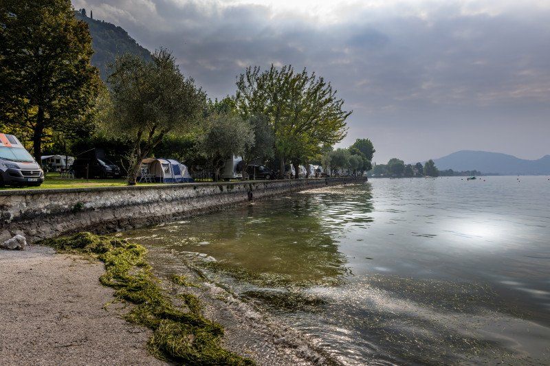
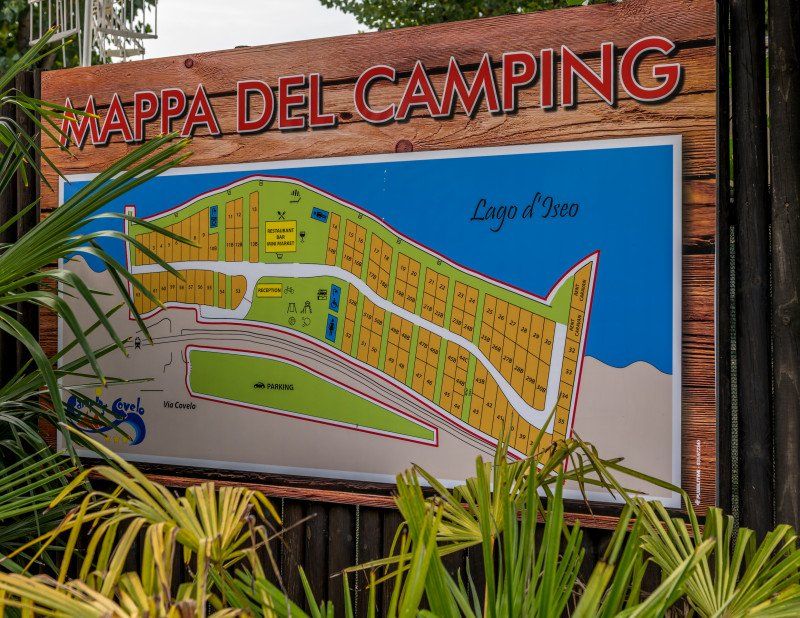
Campeggio Covelo
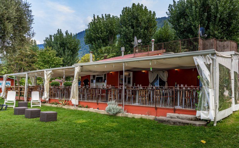
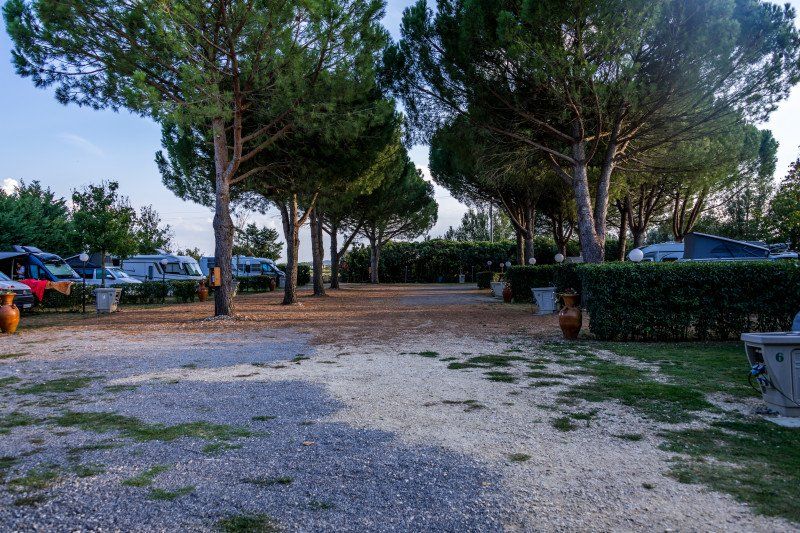
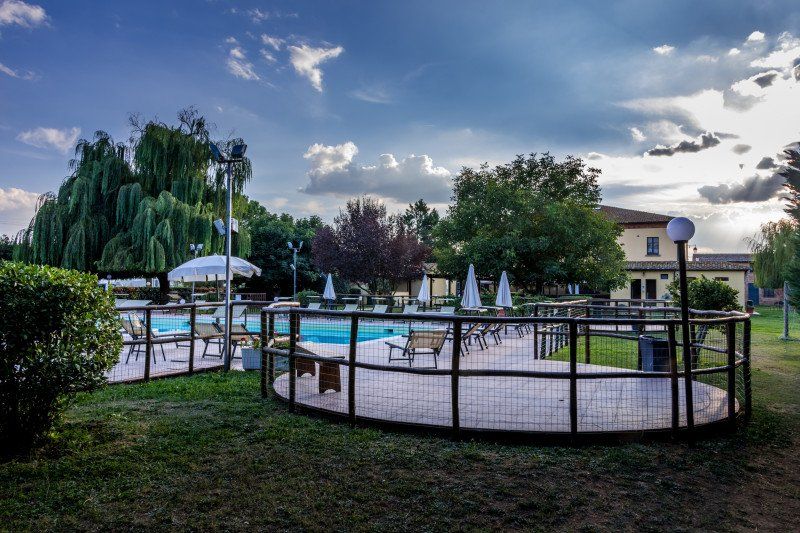
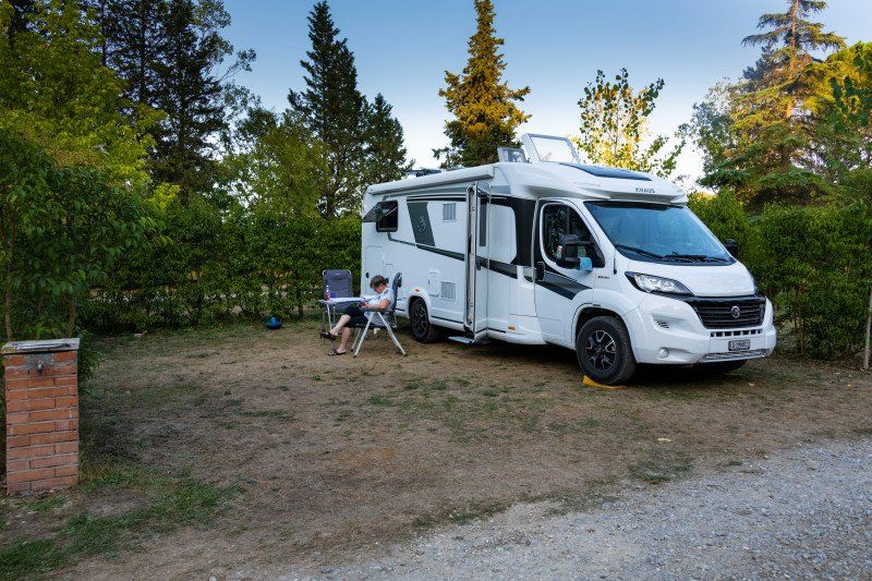
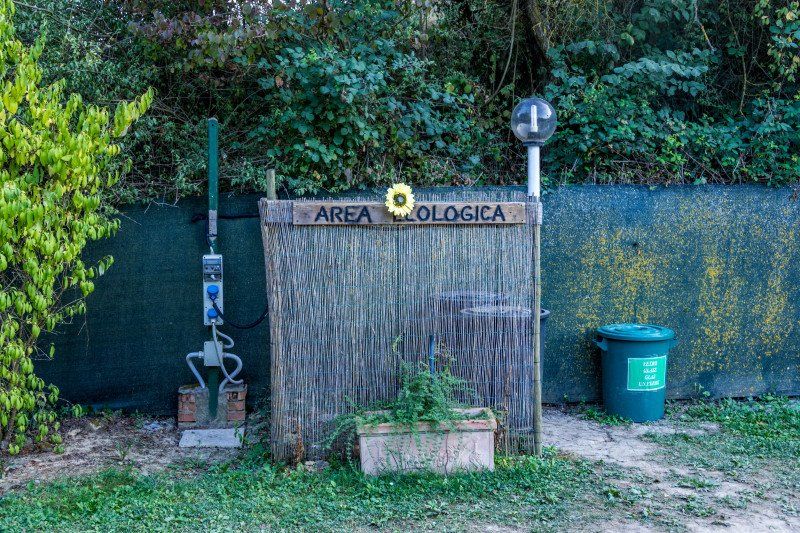
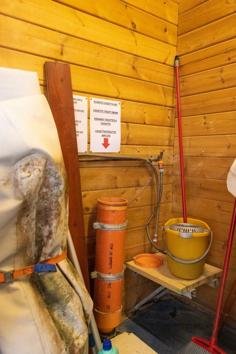
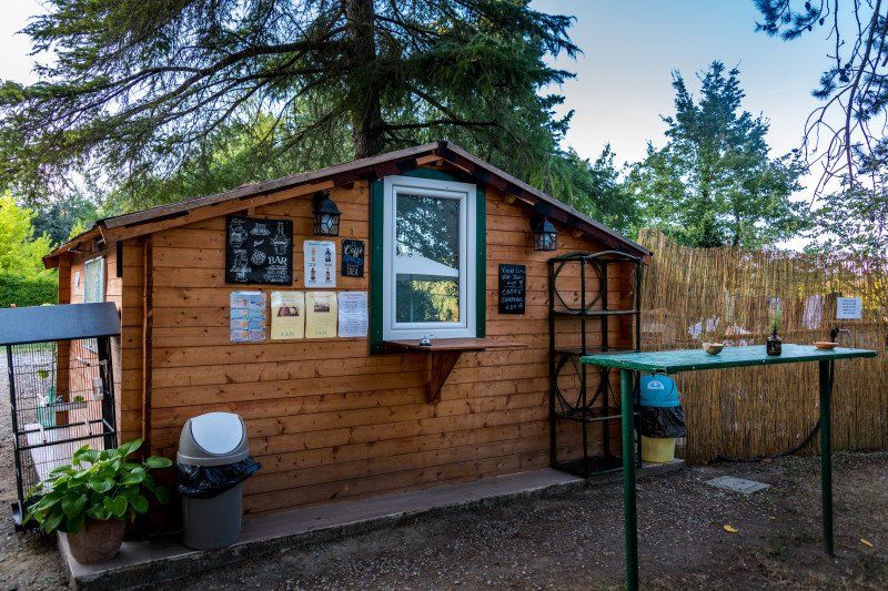
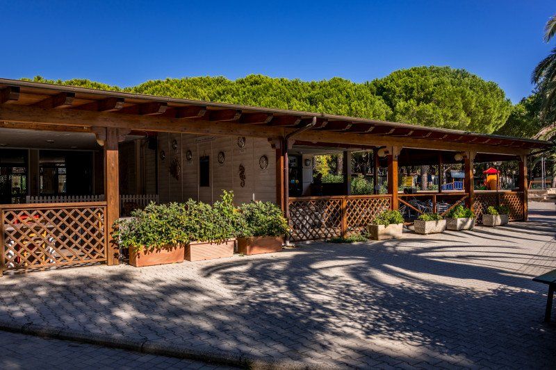
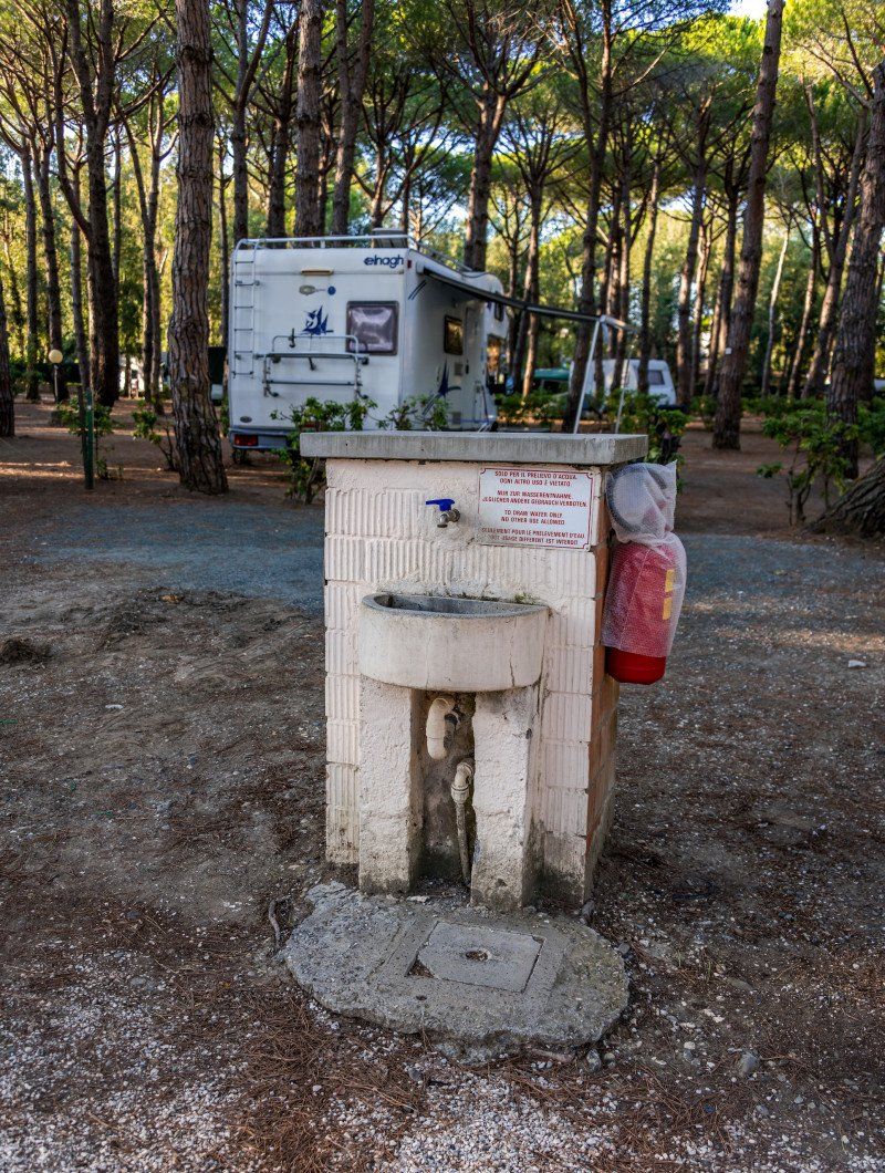
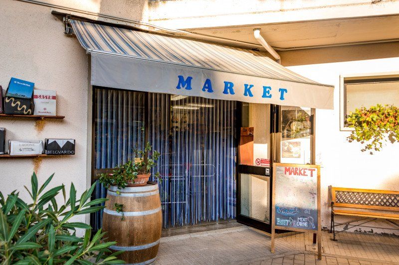
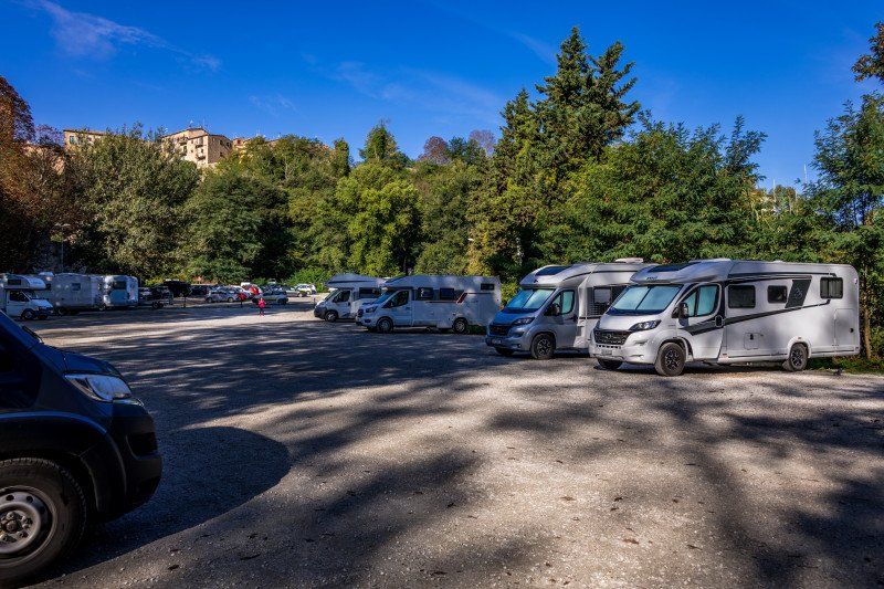
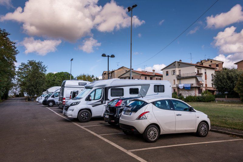
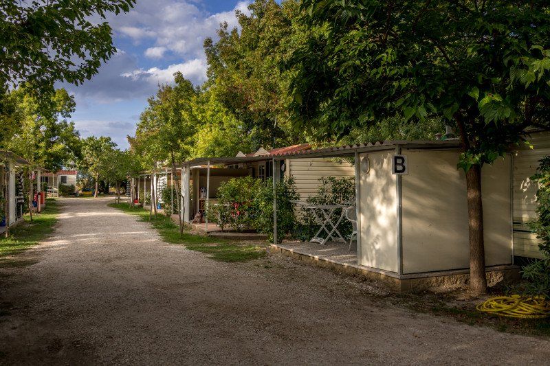
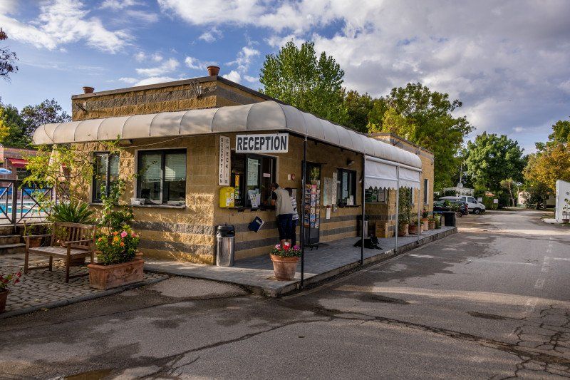
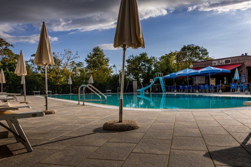
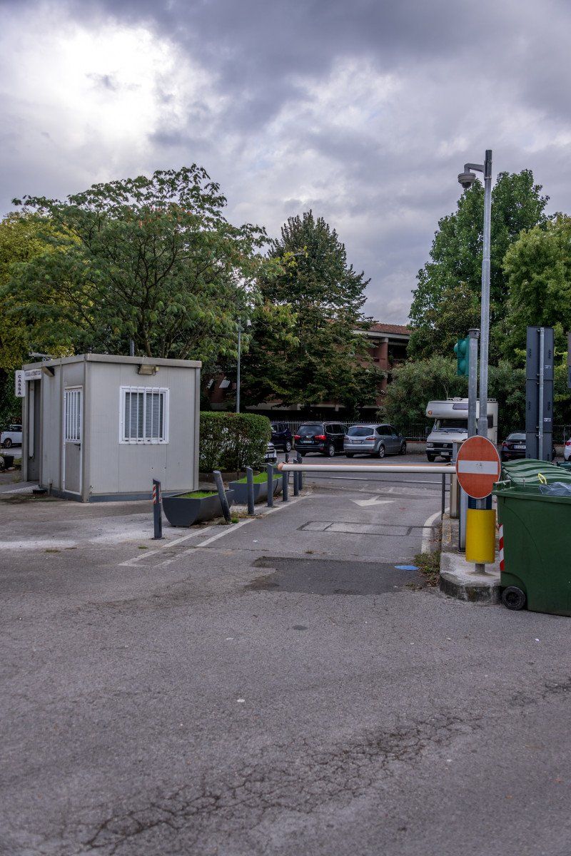
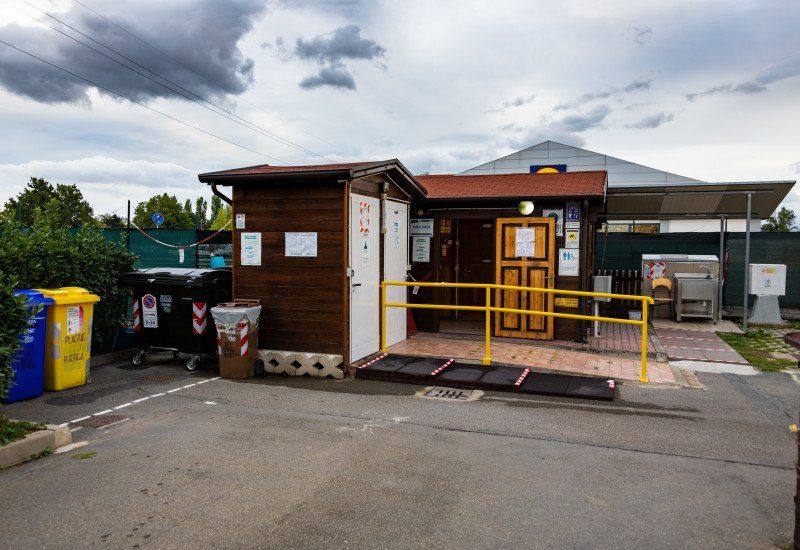
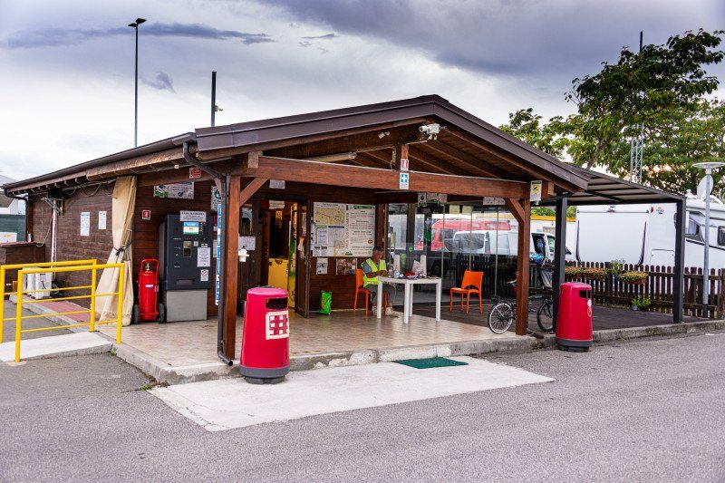
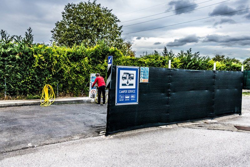
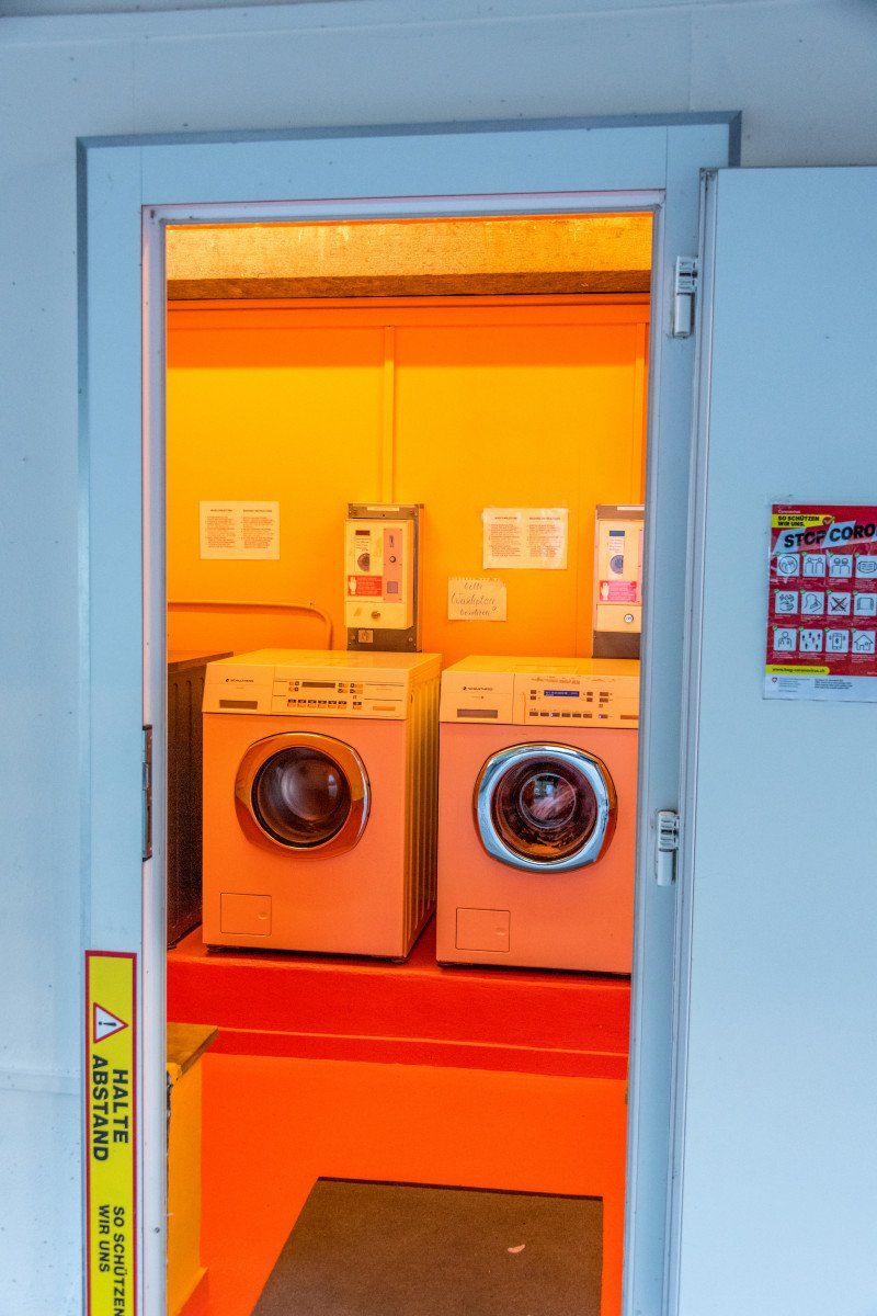
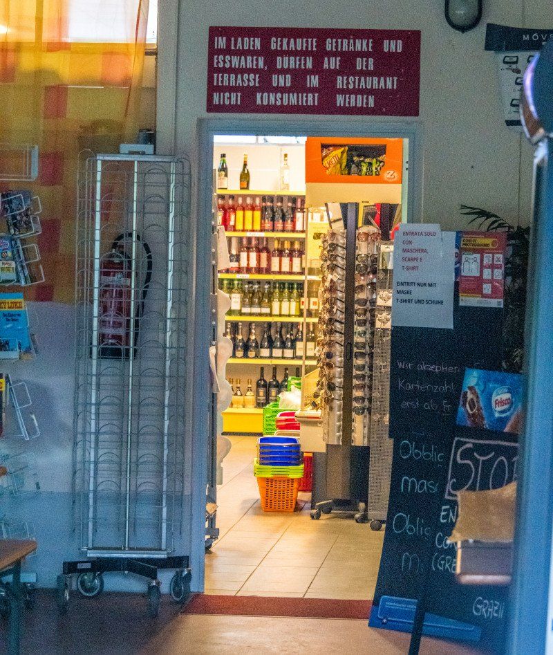
When we arrived very friendly reception at the barrier. We parked the mobile home at the reception and the employee led us to the place. Then he supported us with the online check-in and offered us a welcome drink. The place has about 100 places for tents / caravans and mobile homes up to a size of about 10 meters. The plots are separated by smaller and larger hedges, but there are also places that are separated without delimitation. Reception / bar / restaurant and mini market with fresh bread every day from 08:00 am are part of the facilities such as a children's playground / clean washing areas and a small disposal and supply station as well as disposal for the chemical toilet. Dinner in the restaurant was delicious and value for money was very good.
Covelo 18, 25049, Iseo, Italy 45 ° 39 '42.5 "N 10 ° 2' 27.9" E
Covelo 18, 25049, Iseo, Italy
45° 39' 42.5" N 10° 2' 27.9" E
45.6618100 10.0410900
• Head southwest on Via Canneto. Go for 77 m.
• Turn left onto Via Canneto. Go for 57 m.
• Turn right onto Via per Rovato. Go for 617 m.
• Turn slightly right toward Via per Rovato. Go for 30 m.
• Take the 3rd exit from roundabout. Go for 125 m.
• Turn left onto Strada Provinciale Iseo-Rovato (SPXI). Go for 624 m.
• Continue on SP510. Go for 95 m.
• Take the 1st exit from roundabout onto Strada Provinciale Sebina Orientale (SPBS510) toward Brescia/Pisogne/Darfo B. T. Go for 2.1 km.
• Take the 1st exit from roundabout onto Montecognolo (SPBS510) toward Autostrada/A4/Brescia. Go for 11.0 km.
• Keep right onto Strada Provinciale Sebina Orientale (SPBS510dir) toward Aeroporto Montichiari/Ospitaletto/A4/Tangenziale Sud-Brescia/SS11/Castegnato. Go for 2.7 km.
• Continue on Tangenziale Brescia Sud (SPBS11var). Go for 3.5 km.
• Take ramp toward E64/A4. Go for 525 m.
• Take left ramp onto A4 (Autostrada Torino-Trieste) toward Torino/A21/Piacenza/Venezia/E66. Go for 60.5 km.
• Take the exit toward Brennero-Modena/Verona Nord/Aeroporto/Mantova/Modena/Bologna/A1 onto A22 (Autostrada del Brennero). Go for 28.3 km.
• Take the exit toward Mantova Nord. Go for 742 m.
• Take the 2nd exit from roundabout onto SP28 toward Mantova Centro/Nogara/Verona/Padova. Go for 351 m.
• Take the 4th exit from roundabout onto Via Legnaghese (SPEXSS10) toward Mantova/Brescia. Go for 416 m.
• Pass 3 roundabouts and continue on Via Legnago (SPEXSS10). Go for 2.3 km.
• Turn slightly left onto Strada Lunetta. Go for 305 m.
• Turn right onto Strada Cipata. Go for 357 m.
• Turn right. Go for 135 m.
• Arrive at your destination on the left.
☍
114,8 km
(1 hrs. 8 min.)
Day
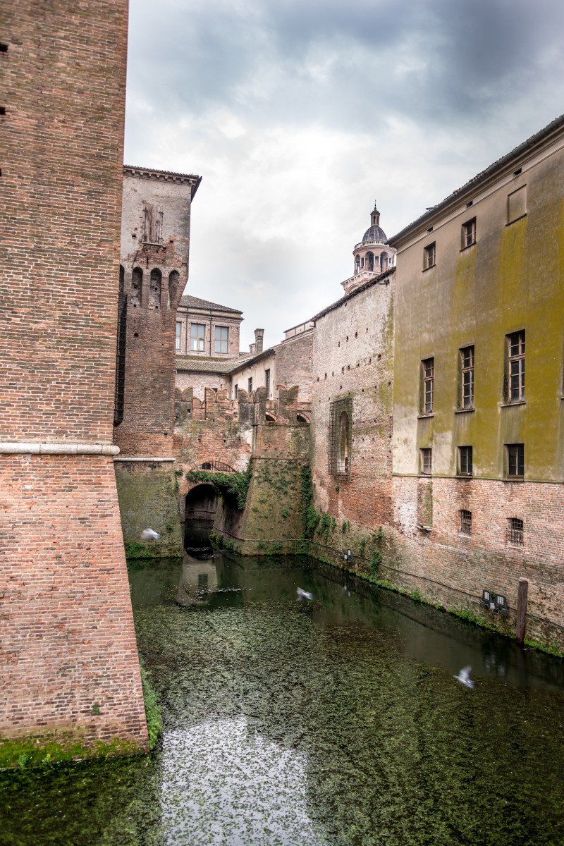
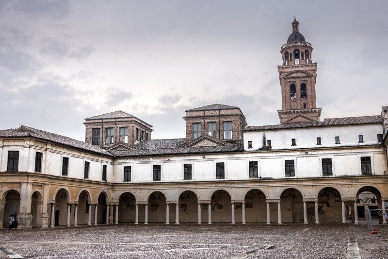
Via Legnago, 1, Mantua, Italien
Departure at 09:00 am from Camping Covelo towards Mantua. The stop was not worth it. Parking space was very good. with 10 euros for 12 hours also acceptable. Very generous supply and disposal station and chemical toilet disposal also good. Then continue to Lago Di Bilancino.
Via Legnago, 1, 46100 Mantova MN, Italy 45 ° 9 '46.3 "N 10 ° 48' 46.6" E
Via Legnago, 1, 46100 Mantova MN, Italien
45° 9' 46.3" N 10° 48' 46.6" E
45.1628583 10.8129360
• Head toward Strada Cipata. Go for 135 m.
• Turn right onto Strada Cipata. Go for 35 m.
• Turn right onto Via Legnago (SPEXSS10). Go for 1.1 km.
• Pass 3 roundabouts and continue on Via Legnaghese (SPEXSS10). Go for 1.9 km.
• Take the 1st exit from roundabout onto SP28 toward Modena/A22. Go for 344 m.
• Take the 4th exit from roundabout toward Ospedale/Ostiglia/Ferrara/Bologna/A1/Roma/Milano/A4/Venezia/Brennero/A22/Modena. Go for 681 m.
• Take ramp onto A22 (Autostrada del Brennero) toward Modena/Bologna/A1/Roma. Go for 56.6 km.
• Take the left exit toward Bologna/Roma/Modena onto A1 (Autostrada del Sole). Go for 2.6 km.
• Take the exit toward Modena Nord/Modena Centro/Tangenziale onto Tangenziale Nord Luigi Pirandello. Go for 7.8 km.
• Keep left onto Tangenziale Nord Giosuè Carducci toward Bologna/A1/SS9. Go for 2.3 km.
• Continue on Tangenziale Nord Boris Leonidovic Pasternak. Go for 2.9 km.
• Keep left onto Via Nuova Estense toward Bologna/A1/Abetone/SS12/Vignola/SP623/Ospedale Civile Baggiovara. Go for 1.2 km.
• Take the 3rd exit from roundabout onto Strada Provinciale del Passo Brasa (SP623) toward Bologna/A1/Vignola. Go for 5.1 km.
• Take the 2nd exit from roundabout onto Strada Provinciale del Passo Brasa (SP623) toward Autostrada/A1/Spilamberto/Vignola. Go for 1.7 km.
• Take the 3rd exit from roundabout onto A1 (Autostrada del Sole) toward Bologna. Go for 35.9 km.
• Continue on SS64var. Go for 927 m.
• Continue on Raccordo Autostradale Sasso Marconi SS64 Porretana. Go for 2.4 km.
• Continue on A1 (Autostrada del Sole). Go for 10.6 km.
• Keep right onto A1var (Variante di Valico) toward Direttissima/A1/Firenze/Badia. Go for 34.8 km.
• Continue on A1 (Viadotto Lora). Go for 91 m.
• Continue on A1var (Variante di Valico). Go for 32 m.
• Continue on A1 (Galleria Manganaccia). Go for 434 m.
• Continue on A1var (Galleria Manganaccia). Go for 1.9 km.
• Continue on A1 (Viadotto Sieve). Go for 139 m.
• Continue on A1var (Viadotto Sieve). Go for 216 m.
• Continue on A1 (Autostrada del Sole). Go for 19 m.
• Take the exit toward Barberino. Go for 911 m.
• Take the 3rd exit from roundabout onto Strada Provinciale di Bilancino (SP131) toward Barberino M.Llo. Go for 4.1 km.
• Turn right onto Via del Turlaccio toward Moriano. Go for 135 m.
• Turn right onto Via del Turlaccio. Go for 258 m.
• Arrive at Via del Turlaccio. Your destination is on the right.
☍
177,2 km
(1 hrs. 49 min.)
Via del Turlaccio, 15, Barberino di Mugello, Florenz, Italien
The route from Mantua to Barberino di Mugello was a trip with permanent and sometimes very heavy rain. We took a short break before continuing to the final destination of today's stage.
Via del Turlaccio, 15, 50031 Barberino di Mugello FI, Italy 43 ° 59 '5 "N 11 ° 15' 34" E
Via del Turlaccio, 15, 50031 Barberino di Mugello FI, Italien
43° 59' 5" N 11° 15' 34" E
43.9847319 11.2594516
• Head toward Strada Vicinale di Moriano Ghereto on Via del Turlaccio. Go for 258 m.
• Turn left onto Via del Turlaccio. Go for 104 m.
• Turn right onto Strada Provinciale di Bilancino (SP131). Go for 1.4 km.
• Take the 1st exit from Via Nazionale roundabout onto Via Nazionale. Go for 131 m.
• Continue on Strada Regionale della Futa (SR65). Go for 2.1 km.
• Take the 2nd exit from roundabout onto Strada Regionale della Futa (SR65) toward Firenze. Go for 3.4 km.
• Take the 2nd exit from roundabout onto Strada Provinciale di Cardatole (SP97) toward Strada Provinciale Faentina/Borgo S. Lorenzo. Go for 4.3 km.
• Take the 1st exit from roundabout onto Strada Provinciale di Cardatole (SP97) toward Roma/A1/Firenze/Forlì. Go for 242 m.
• Turn right onto Strada Regionale Brisighellese-Ravennate (SR302). Go for 11.7 km.
• Turn left onto Strada Provinciale dei Bosconi (SP54). Go for 7.7 km.
• Turn left onto Via Peramonda. Go for 376 m.
• Turn right onto Via Peramonda. Go for 132 m.
• Arrive at your destination on the left.
☍
31,8 km
( 36 min.)
Camping Village Panoramico Fiesole
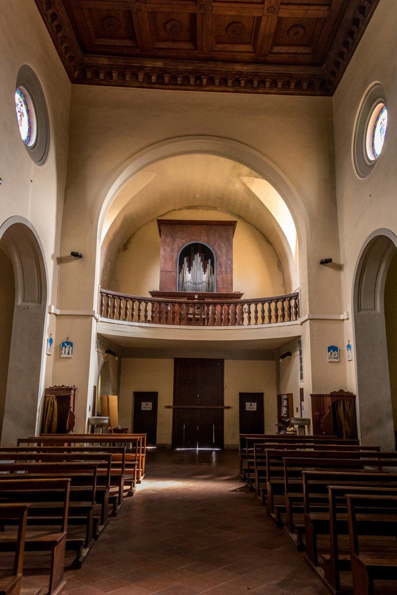
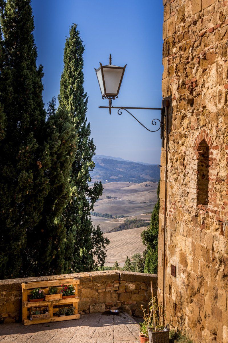
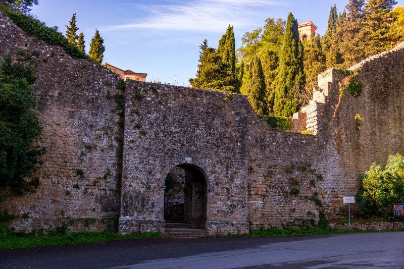
Access via the SS65 from Lago Di Bilancino and then via the SS102. On the sharp and steep left curve towards the rear of the campsite, hit the ground. Fortunately, there was no damage. Motor fault lit up. Telephone to Fiat Service. It rained very heavily and partly also hailed, so no photos from the campsite. The following morning the engine error message was gone and everything worked. But we have decided that we will continue towards Siena and spend a whole day there. The city is much more interesting than Florence.
Camping Panoramico
Via Peramonda 1, 50014, Fiesole, Italy 43 ° 48 '23.1 "N 11 ° 18' 21.2" E
Via Peramonda 1, 50014, Fiesole, Italy
43° 48' 23.1" N 11° 18' 21.2" E
43.8064115 11.3058966
• Head south. Go for 57 m.
• Turn slightly left onto Via Peramonda. Go for 75 m.
• Turn right onto Via Peramonda. Go for 81 m.
• Turn slightly right onto Via Corsica. Go for 309 m.
• Turn right onto Via Francesco Colzi. Go for 166 m.
• Turn left onto Via Giacomo Matteotti (SP53). Go for 756 m.
• Take the 2nd exit from Piazza Mino da Fiesole roundabout onto Piazza Mino da Fiesole (SP53). Go for 2.4 km.
• Continue on Via David Sassoli. Go for 120 m.
• Continue on Via San Domenico. Go for 1.9 km.
• Continue on Piazza Thomas Alva Edison. Go for 123 m.
• Turn left onto Piazza Thomas Alva Edison. Go for 74 m.
• Turn left onto Piazza Thomas Alva Edison. Go for 76 m.
• Turn right onto Viale Alessandro Volta. Go for 71 m.
• Continue on Viale Augusto Righi. Go for 799 m.
• Continue on Viale Ugo Ojetti. Go for 409 m.
• Take the 2nd exit from Viale Ugo Ojetti roundabout onto Viale Edmondo De Amicis. Go for 265 m.
• Take the 3rd exit from roundabout onto Viale Eleonora Duse. Go for 419 m.
• Continue on Viale Giovanni Verga. Go for 546 m.
• Take the 1st exit from Piazza San Bartolomeo al Gignoro roundabout onto Piazza San Bartolomeo al Gignoro. Go for 49 m.
• Keep left onto Via del Gignoro toward Autostrade/Arezzo/Siena. Go for 206 m.
• Pass 3 roundabouts and continue on Via del Gignoro. Go for 955 m.
• Take the 2nd exit from roundabout onto Via della Casaccia. Go for 144 m.
• Take the 3rd exit from Largo Jean-Michel Folon roundabout onto Via Enrico De Nicola. Go for 576 m.
• Turn right onto Ponte Paolo Borsellino (SP127) toward Ospedale S. M. Annunziata/Viale Europa/Autostrade/A11/A1/Bagno a Ripoli/Siena/SS222. Go for 3.3 km.
• Take ramp onto Via Duca di Calabria toward Ospedale S. M. Annunziata/Ponte a Ema/Greve-Siena/SS222. Go for 630 m.
• Take the 1st exit from roundabout onto Strada Regionale Chiantigiana (SR222) toward Ospedale/Grassina-Antella/Greve in Chianti/Siena. Go for 773 m.
• Take the 2nd exit from roundabout onto Strada Regionale Chiantigiana (SR222). Go for 559 m.
• Keep right onto Via Chiantigiana (SR222) toward Grassina/SS222/Impruneta/Greve/Siena. Go for 9.0 km.
• Pass 2 roundabouts and continue on Strada Regionale Chiantigiana (SR222). Go for 2.2 km.
• Keep right onto Strada Regionale Chiantigiana (SR222). Go for 8.7 km.
• Turn right onto Via Lino Falsettacci. Go for 141 m.
• Continue on Via Citille. Go for 36 m.
• Turn right onto Via di Colognole. Go for 417 m.
• Turn slightly right onto Via Montebeni. Go for 151 m.
• Arrive at Via Montebeni. Your destination is on the left.
☍
36,6 km
( 51 min.)
Day
Via Montebeni, 75, Greve in Chianti, Florenz, Italien
Departure in Fiesole at 9:00 a.m., arrival in Greve the Chianti at around 10:30 a.m. on the very good and easily accessible Womo parking space. Walk to the village about 10 minutes. The village has a very attractive main square with a few restaurants and shops such as butchers, bakery etc. We looked around and had a drink and after about 1.5 hours drove on towards Panzano.
Via Montebeni, 75, 50022 Greve in Chianti FI, Italy 43 ° 35 '29.6 "N 11 ° 18' 46.6" E
Via Montebeni, 75, 50022 Greve in Chianti FI, Italien
43° 35' 29.6" N 11° 18' 46.6" E
43.5915560 11.3129440
• Head south on Via Montebeni. Go for 151 m.
• Turn slightly left onto Via di Colognole. Go for 417 m.
• Turn left onto Via Citille. Go for 36 m.
• Turn right onto Via Italo Stecchi. Go for 113 m.
• Turn right onto Viale Giovanni da Verrazzano (SR222) toward Siena. Go for 7.4 km.
• Turn right onto Viale della Conca d'Oro. Go for 557 m.
• Turn right onto Via Michelangelo da Panzano. Go for 48 m.
• Arrive at Via Michelangelo da Panzano. Your destination is on the left.
☍
8,7 km
( 15 min.)
Panzano in Chianti, Florenz, Italien
From Greve we continued on the SS222 to Panzano in Chianti. We have parked the Womo on the parking space in Via degli Orti 2-6 below the village. It was about 5 to 10 minutes on foot from there to the center via a staircase.The place seemed completely deserted and apart from the church there wasn't much to see. After about 30 minutes we drove on towards Castellina in Chianti.
50022 Panzano in Chianti, Florence, Italy 43 ° 32 '39.4 "N 11 ° 18' 55.6" E
50022 Panzano in Chianti, Florenz, Italien
43° 32' 39.4" N 11° 18' 55.6" E
43.5442654 11.3154538
• Head toward Viale della Conca d'Oro on Via Michelangelo da Panzano. Go for 48 m.
• Turn left onto Viale della Conca d'Oro. Go for 543 m.
• Keep right onto Via Chiantigiana (SR222) toward Siena. Go for 10.6 km.
• Arrive at Strada Regionale Chiantigiana (SR222). Your destination is on the left.
☍
11,2 km
( 15 min.)
Strada regionale 222 Chiantigiana, Castellina in Chianti Siena, Italien
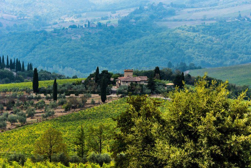
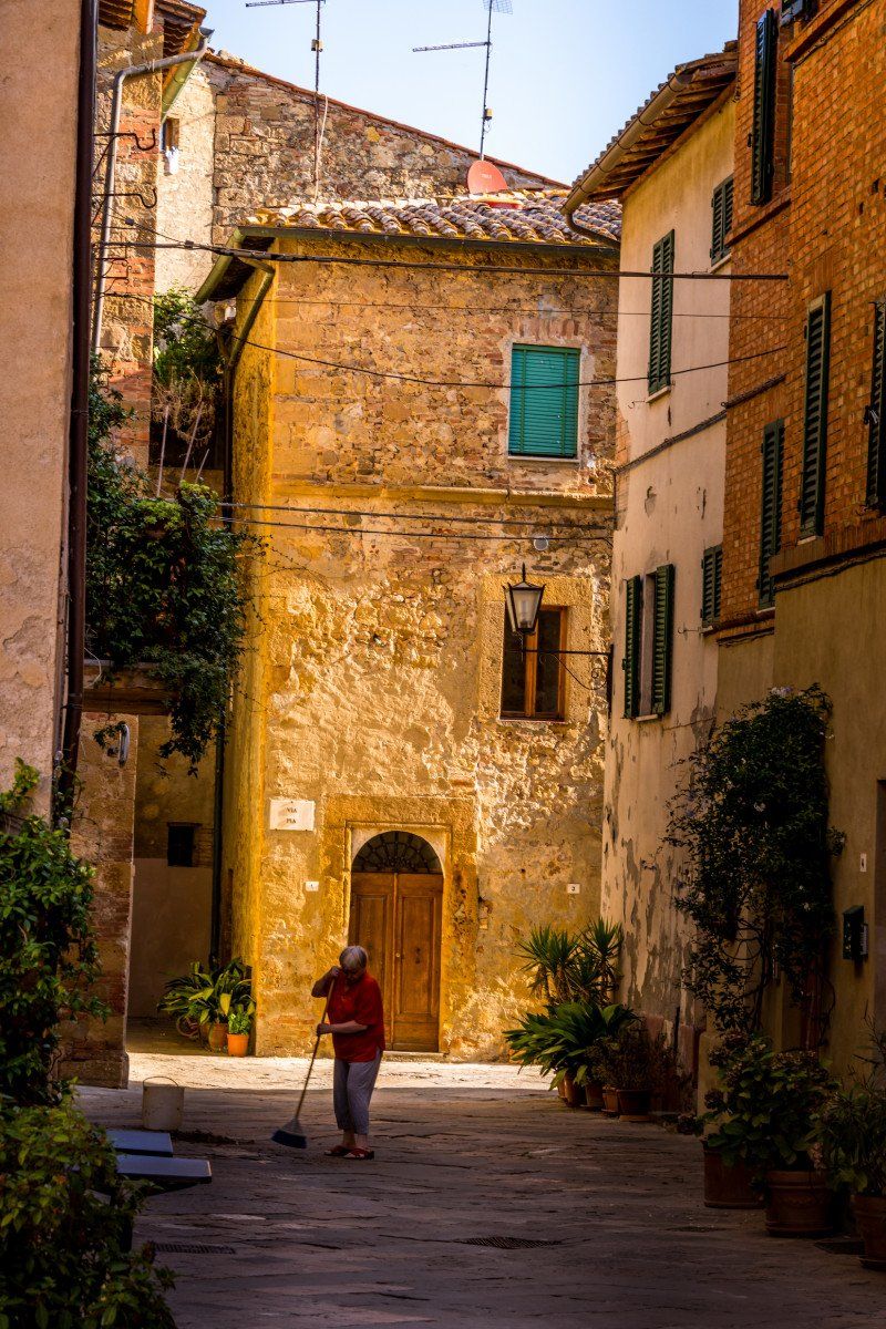
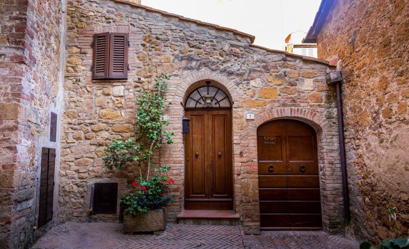
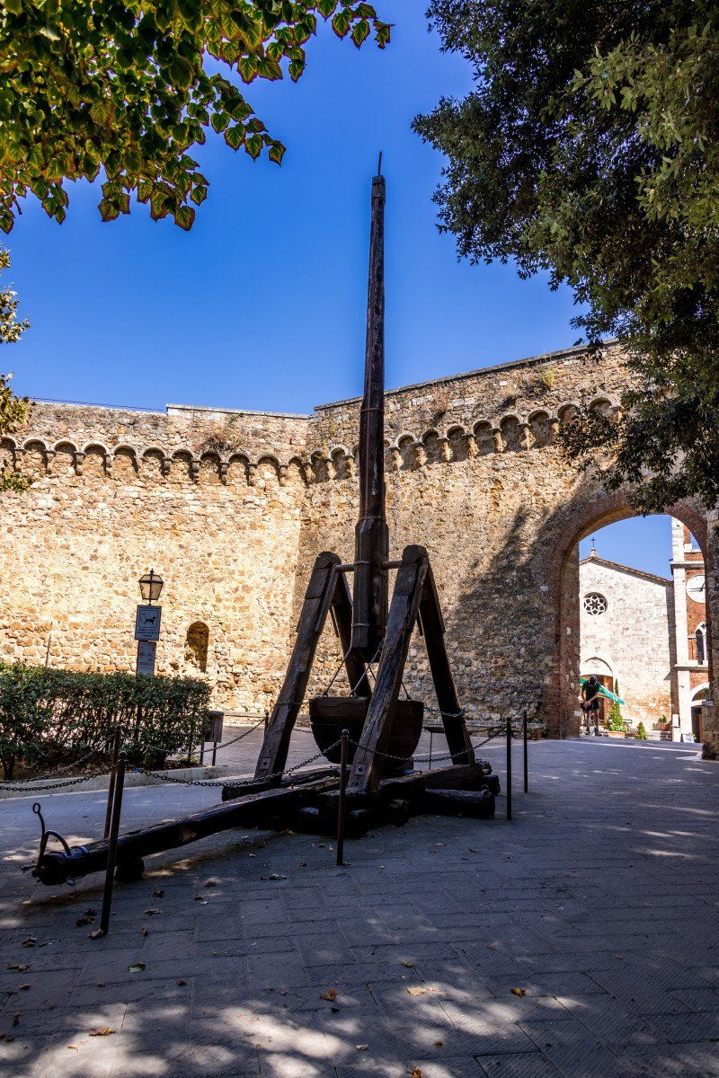
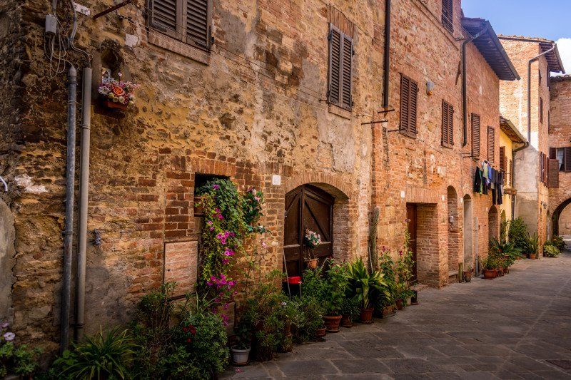
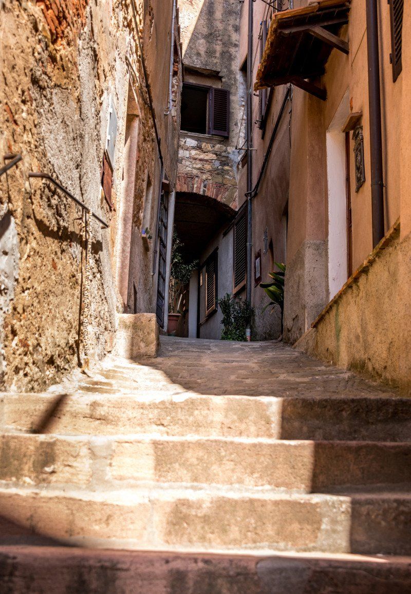
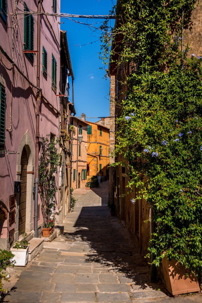
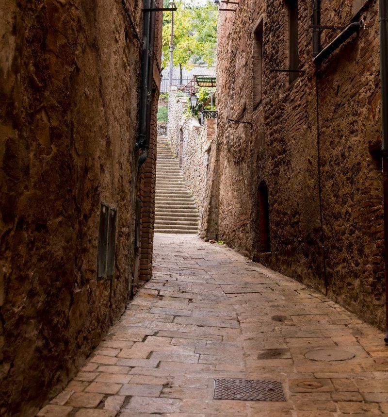
Continue on the SS222 to Castellina in Chianti. The landscape on the whole trip that day was very varied, sometimes hilly and almost barren, then again in forests. The parking space in Castellina is very large and equipped with everything. Supply and disposal, although we did not take care of the supply because we did not know exactly what the quality of the water was. We also emptied the chemical toilet. Price very ok 1 euro / hour or 12 euro / 24 hours. From here it is about 15 minutes into the village center which, in contrast to Panzano, is very lively and the Tuscan flair could be felt. There are not very many sights, but the small alleys and old houses with the associated landscape are not to be underestimated. After about 1.5 hours we drove on towards Siena.
Chiantigiana, Castellina in Chianti SI, Italy 43 ° 28 '31.5 "N 11 ° 17' 46.4" E
SR 222 Chiantigiana, Castellina in Chianti SI, Italien
43° 28' 31.5" N 11° 17' 46.4" E
43.4754094 11.2962253
• Head southwest on Strada Regionale Chiantigiana (SR222). Go for 8.3 km.
• Turn left onto Strada Regionale Chiantigiana (SR222). Go for 10.4 km.
• Take the 2nd exit from roundabout onto Strada di Vico Alto toward San Marino/Ospedale. Go for 1.0 km.
• Take the 3rd exit from roundabout onto Via Aldo Moro toward S.Miniato/Nuovo Ospedale/Ospedale Policlinico le Scotte. Go for 455 m.
• Turn right onto Via Ugo La Malfa toward Policlinico le Scotte Ospedale. Go for 398 m.
• Continue on Via Nazareno Orlandi. Go for 596 m.
• Continue on Strada di Scacciapensieri. Go for 175 m.
• Arrive at Strada di Scacciapensieri. Your destination is on the right.
☍
21,4 km
( 27 min.)
Camping Colleverde
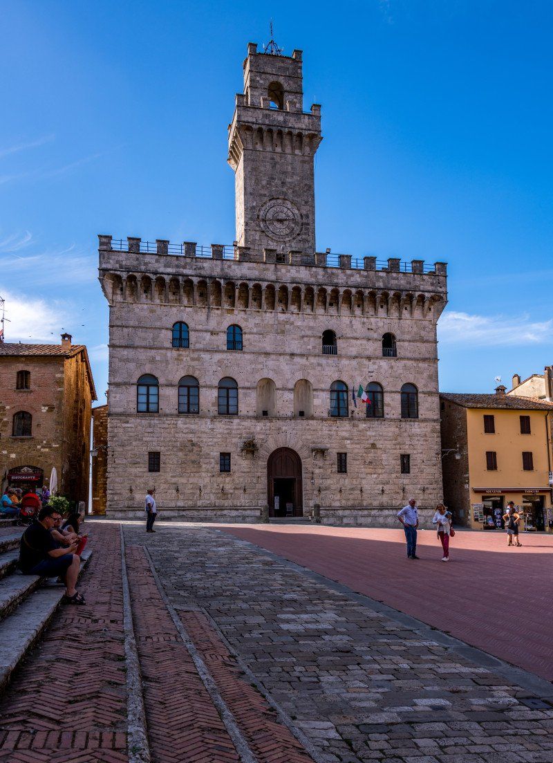
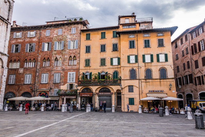
After a 1/2 hour drive we reached the camping site Colleverde in Siena. A large space with very spacious parking spaces parceled out. Also here everything is available what the camper needs with the Womo. The seats are slightly sloping but no problem with the wedge and the rear supports. We arrived at around 3:45 p.m., checked in and set up our seat, and then drove into town. From the camping site there are 2 bus lines which lead directly to the center. Tickets can be bought at the reception for 3 euros there and back. We visited some sights in the evening and had dinner at Piazzo del Campo.
Camping Colleverde
Strada Scacciapensieri 47, 53100, Siena, Italy 43 ° 20 '13.3 "N 11 ° 19' 53.3" E
Strada Scacciapensieri 47, 53100, Siena, Italy
43° 20' 13.3" N 11° 19' 53.3" E
43.3370395 11.3314785
• Head toward Via Alessandro Volta on Strada di Scacciapensieri. Go for 1.3 km.
• Turn right onto Strada Chiantigiana (SS408). Go for 1.0 km.
• Take the 1st exit from roundabout onto Viale Pietro Toselli toward Ospedale/Centro/Firenze. Go for 484 m.
• Take the 3rd exit from roundabout onto Viale Sardegna toward Porta Ovile/Centro. Go for 239 m.
• Take the 1st exit from roundabout onto Via Simone Martini. Go for 357 m.
• Turn slightly right onto Via di Vallerozzi. Go for 44 m.
• Turn left onto Via del Comune. Go for 183 m.
• Turn left onto Via dei Rossi. Go for 248 m.
• Turn left onto Banchi di Sopra. Go for 72 m.
• Continue on Banchi di Sopra. Go for 101 m.
• Turn slightly right onto Via di Città. Go for 51 m.
• Arrive at Via di Città.
☍
4,1 km
( 8 min.)
Day
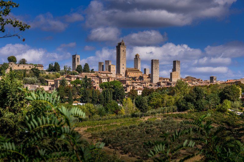
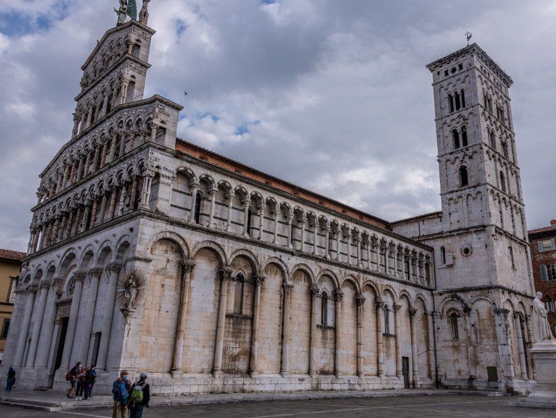
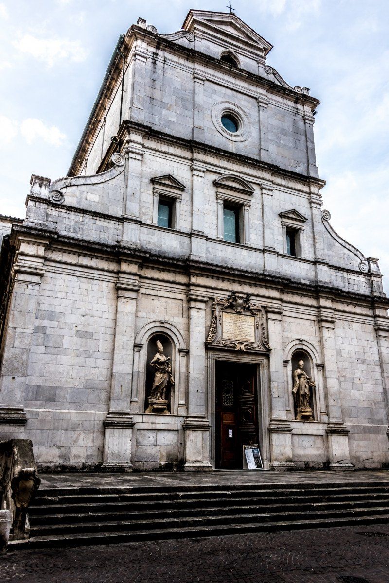
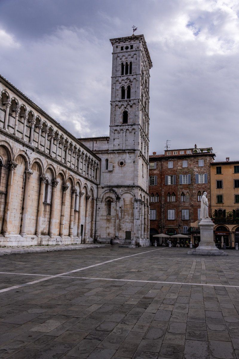
Siena, Italien
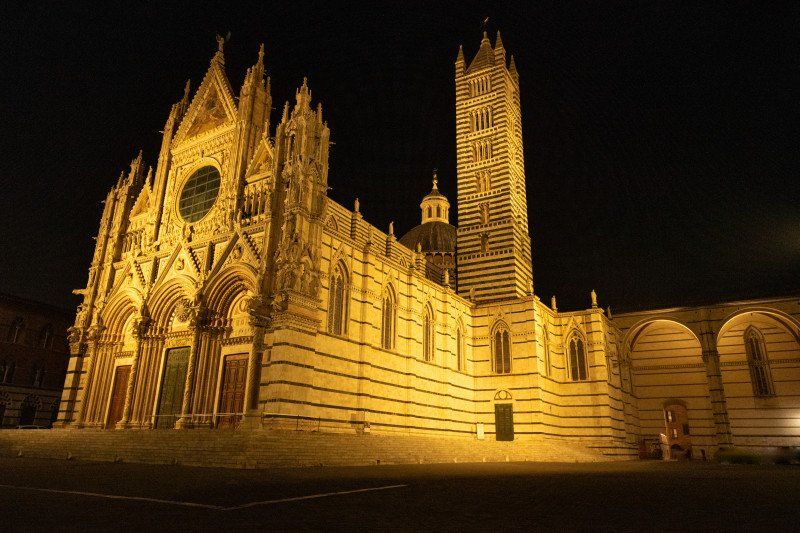
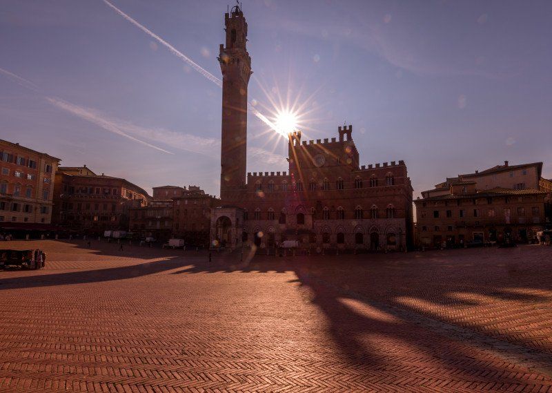
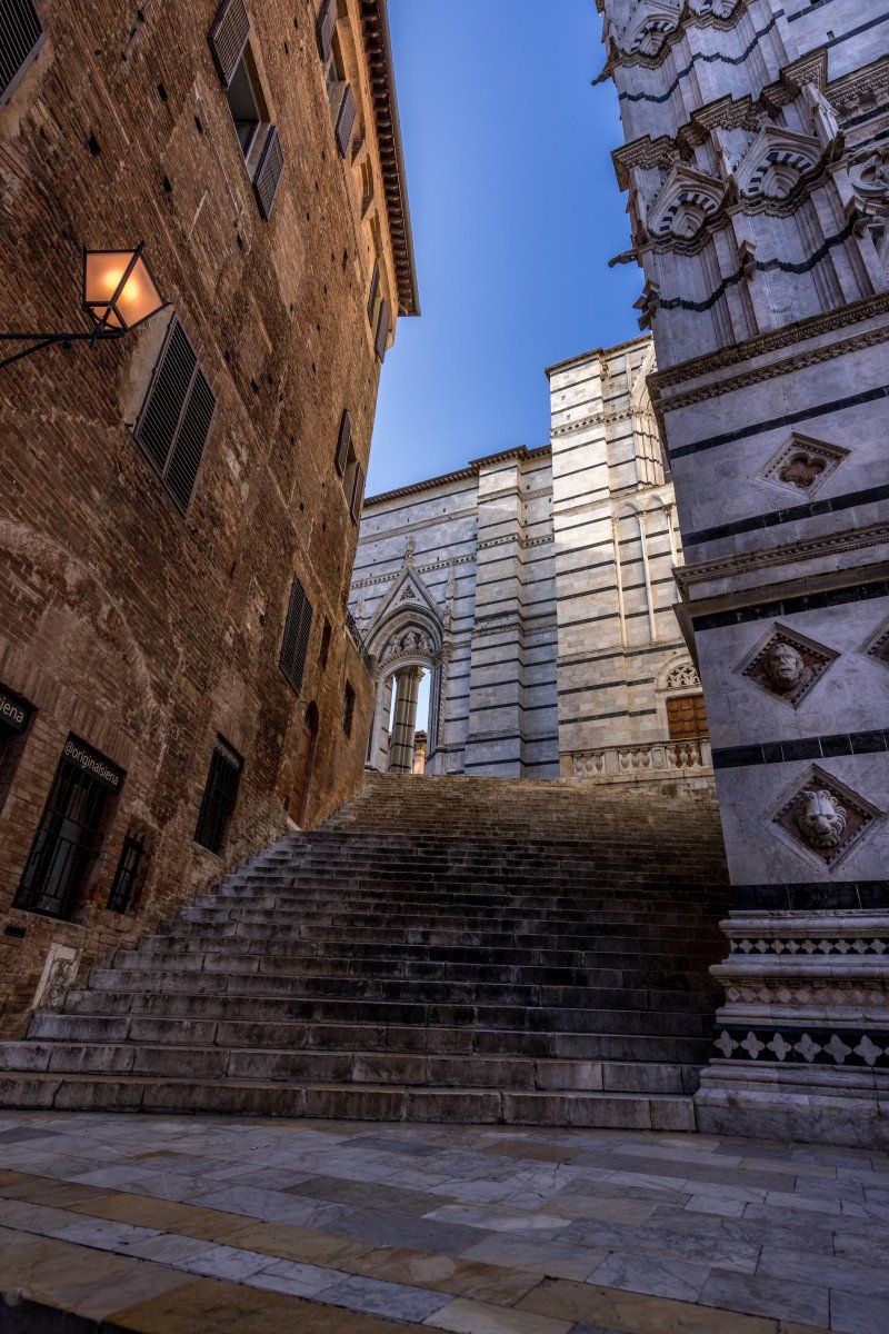
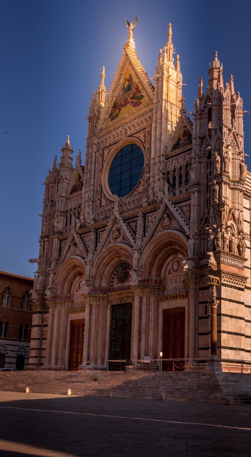
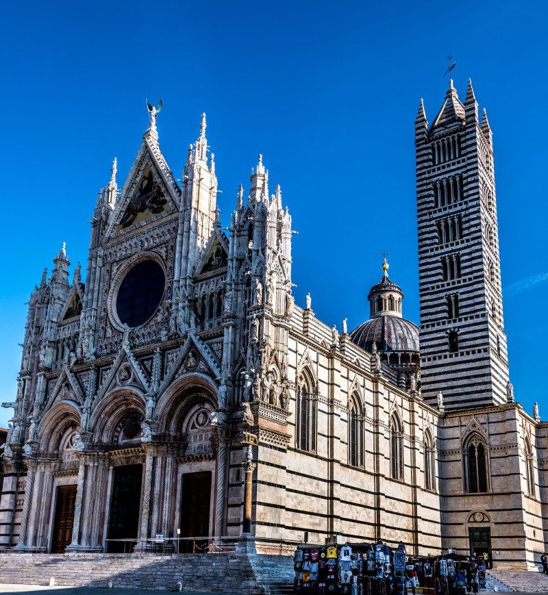
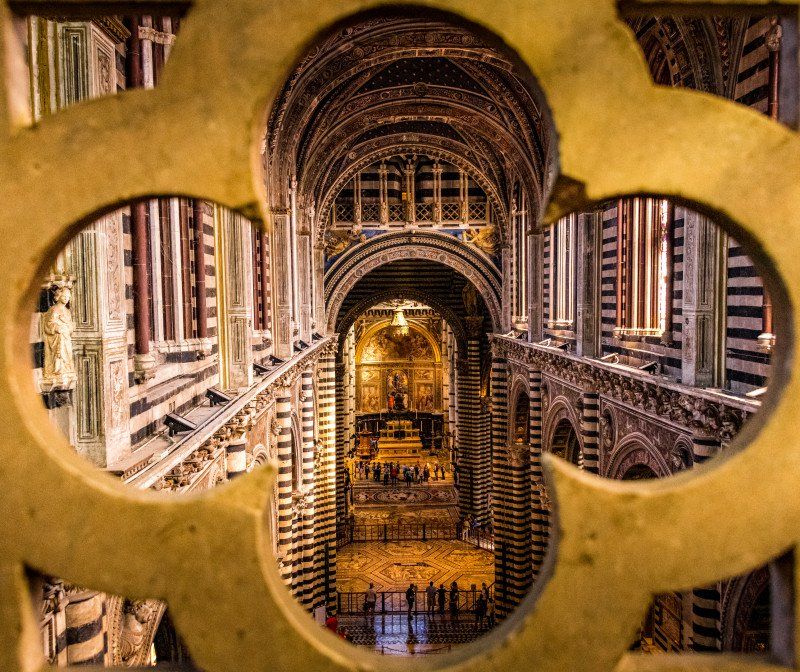
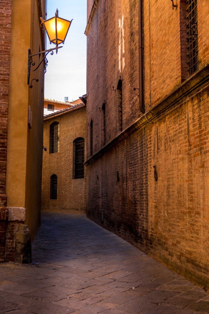
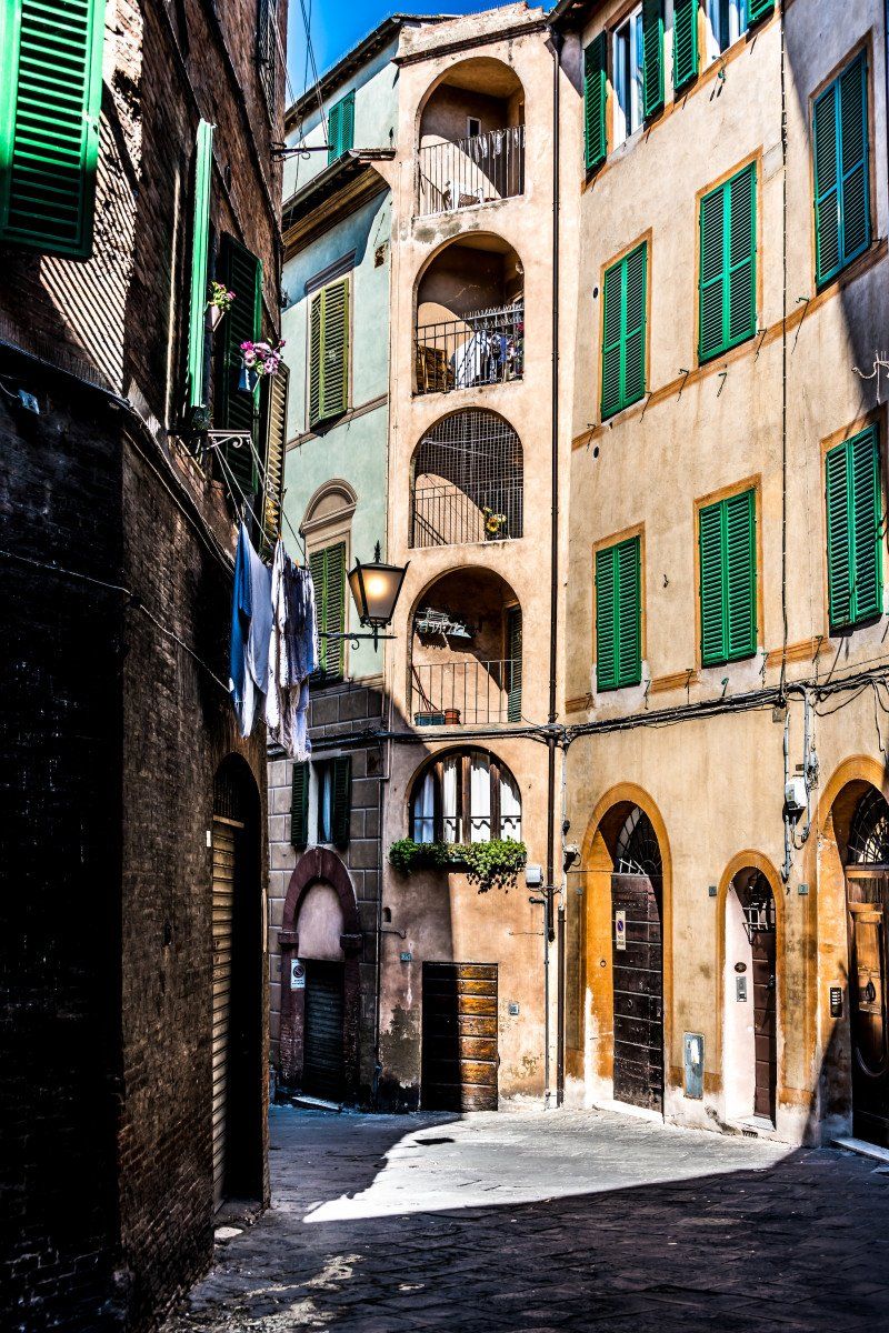
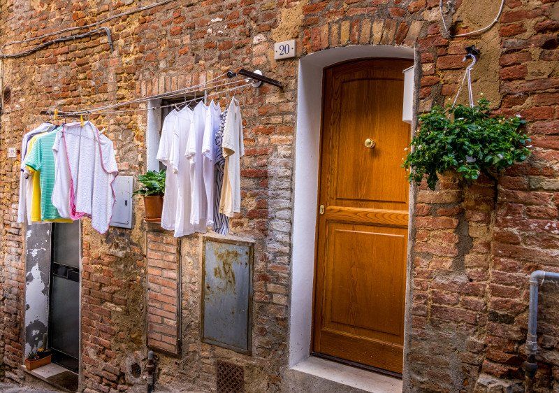
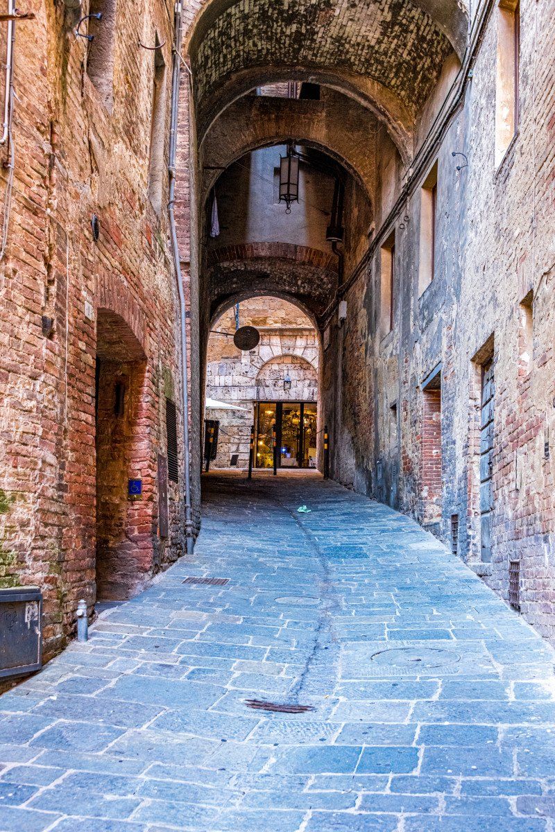
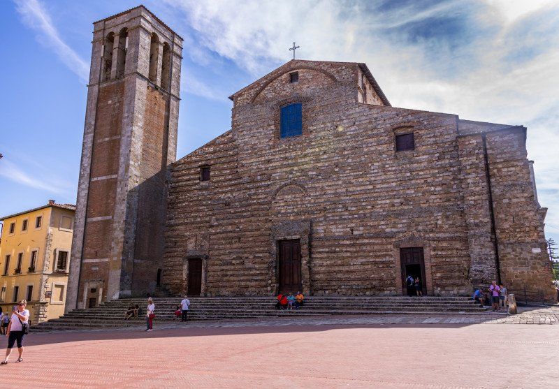
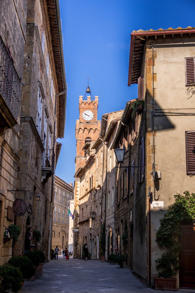
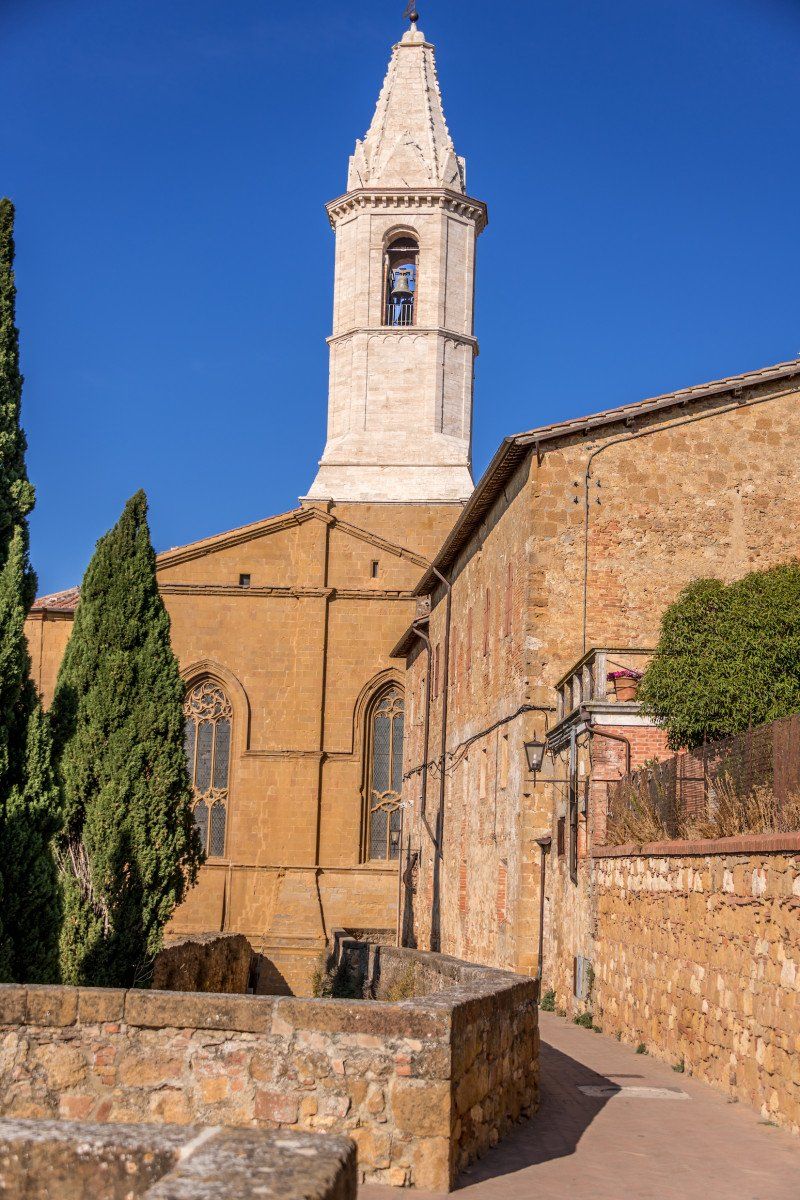
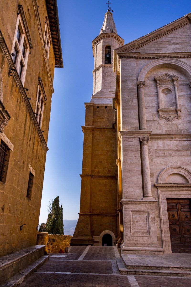
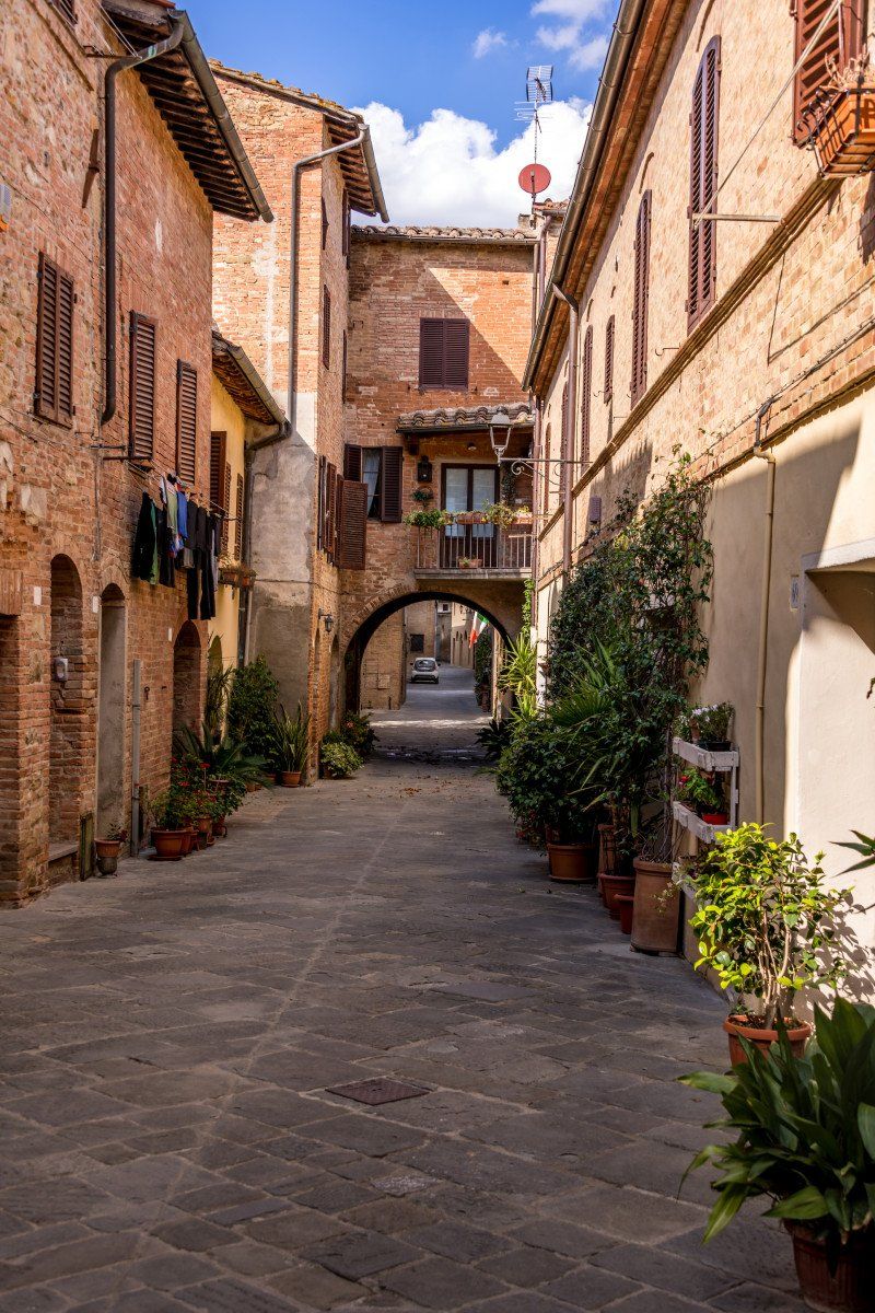
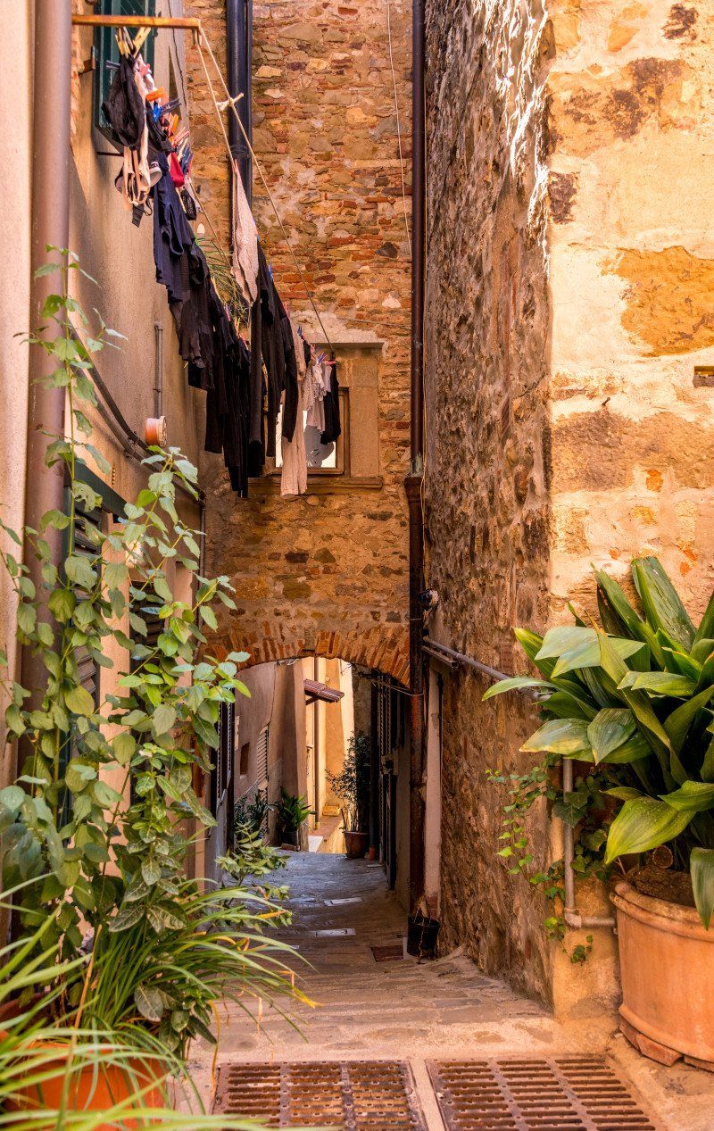
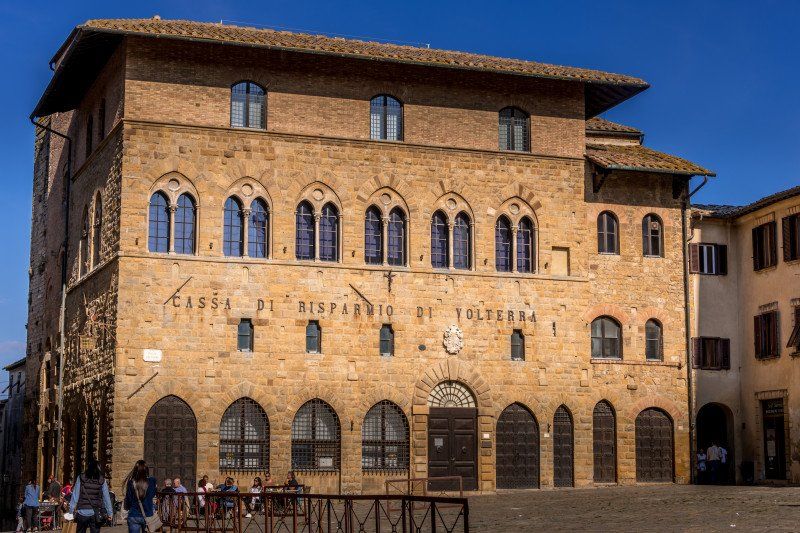
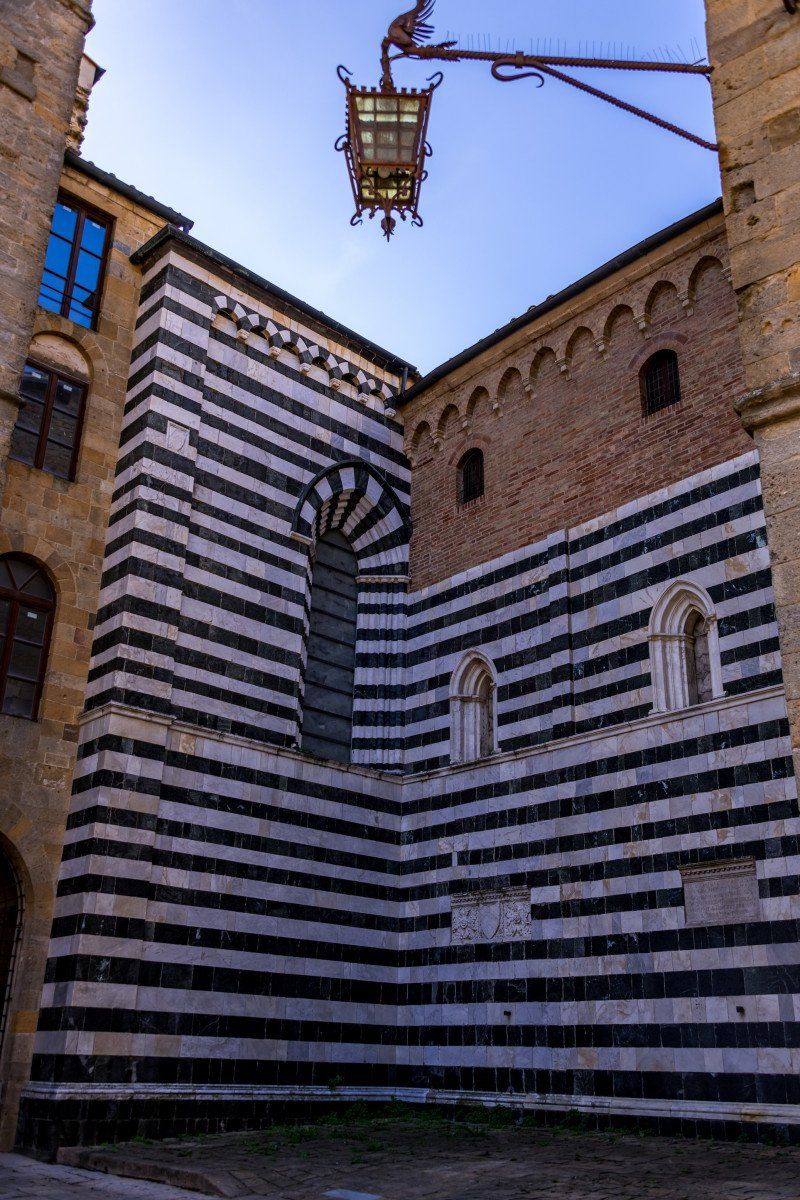
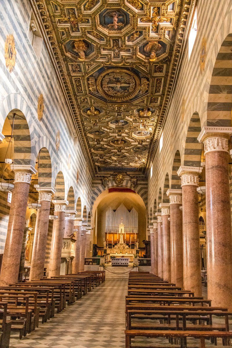
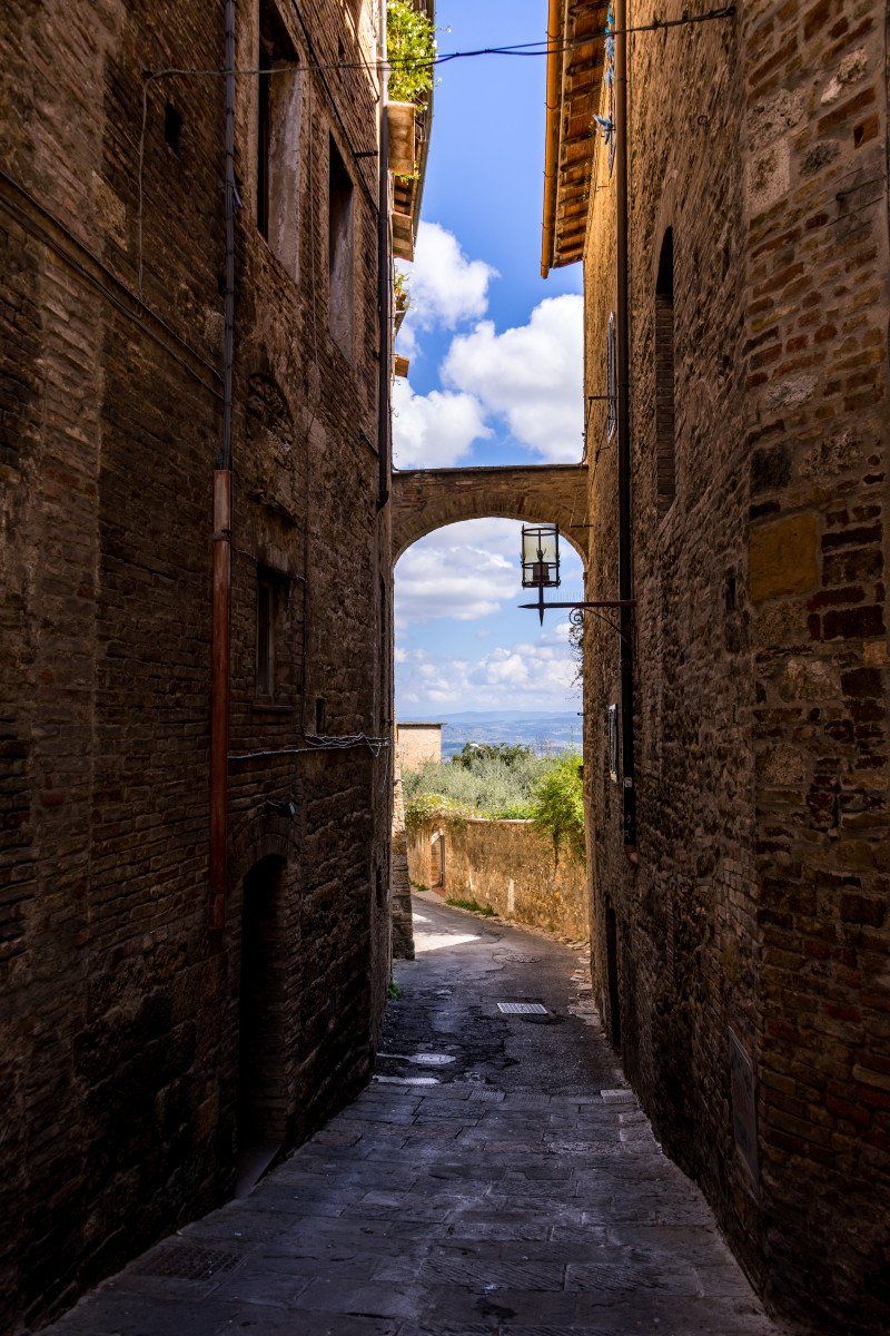
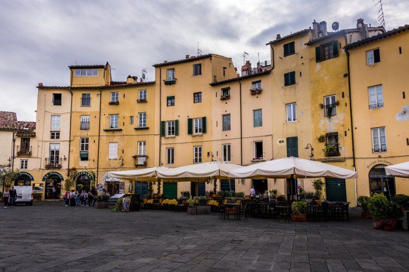
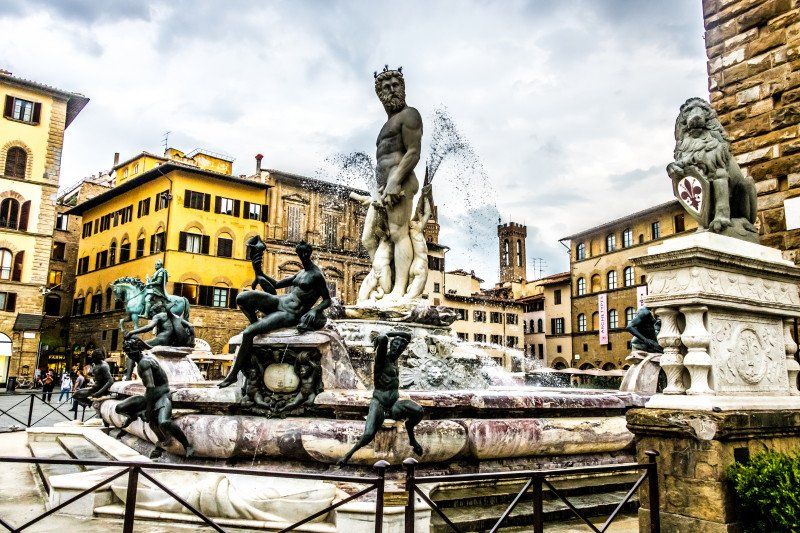
The next morning we took the bus into town at 9:00 a.m. and it was worth going so early. The sights such as the cathedral and Piazza de la Campo were still practically empty, excellent for taking photos. We bought a ticket for 20 euros / person with which we could visit all areas of the cathedral. A highlight is definitely climbing the Panoramica where you have a wonderful view of the whole city. We walked through the city all day and there was something to see at practically every corner, either very narrow and sometimes steep streets or simply house facades with laundry hanging up, which presented a great subject. We ended the day at the campsite and looked forward to the next day.
53100 Siena, Italien
43° 19' 7.7" N 11° 19' 50.7" E
43.3188090 11.3307574
• Head southwest on Via di Città.
• Turn right onto Via delle Terme. Go for 39 m.
• Turn right onto Piazza dell'Indipendenza. Go for 55 m.
• Turn slightly left onto Via dei Termini. Go for 21 m.
• Turn right onto Vicolo Beato Pier Pettinaio. Go for 37 m.
• Turn right onto Banchi di Sopra. Go for 60 m.
• Turn left onto Banchi di Sotto. Go for 183 m.
• Turn slightly right onto Logge del Papa. Go for 59 m.
• Turn left onto Via del Porrione. Go for 154 m.
• Continue on Via di San Martino. Go for 150 m.
• Turn slightly right onto Via Pagliaresi. Go for 6 m.
• Continue on Via di San Girolamo. Go for 66 m.
• Turn left onto Via di San Girolamo. Go for 53 m.
• Continue on Via dell'Oliviera. Go for 170 m.
• Turn slightly left onto Via dei Pispini. Go for 68 m.
• Turn slightly right onto Via dei Pispini. Go for 257 m.
• Turn right onto Via Aretina. Go for 1.3 km.
• Take the 1st exit from roundabout onto Strada Statale di Levante (SP73) toward Firenze-Roma/A1/Arezzo-Perugia/E78/Taverne d'Arbia/Grosseto/Roma. Go for 482 m.
• Pass 2 roundabouts and continue on Raccordo Siena-Bettolle (SP73). Go for 4.7 km.
• Take ramp toward Taverne d'Arbia. Go for 238 m.
• Take the 2nd exit from roundabout onto Strada di Presciano toward Taverne d'Arbia/Arbia. Go for 354 m.
• Take the 3rd exit from roundabout onto Strada Provinciale Lauretana (SP438). Go for 635 m.
• Continue on Via Lauretana (SP438). Go for 253 m.
• Take the 2nd exit from roundabout onto Via Lauretana (SP438). Go for 7.4 km.
• Arrive at Strada Provinciale Lauretana (SP438). Your destination is on the right.
☍
16,6 km
( 22 min.)
Day
Crete Senesi Panoramic Point
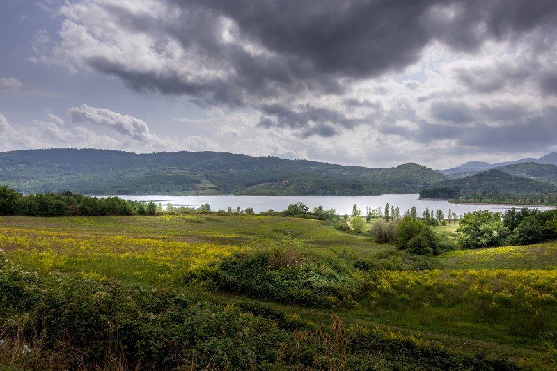
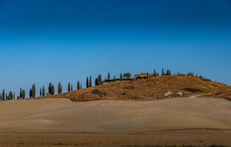
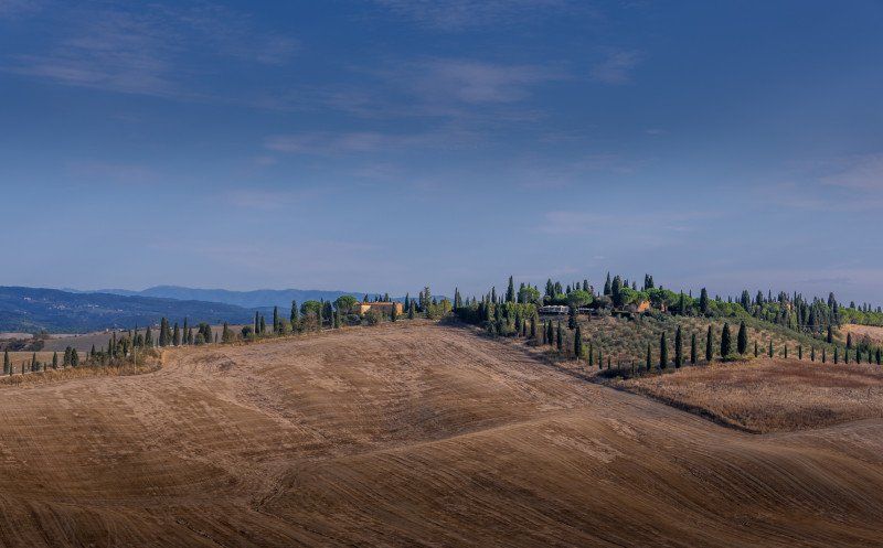
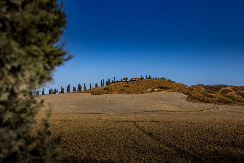
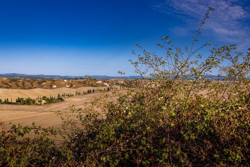
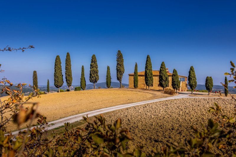
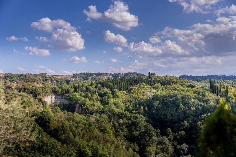
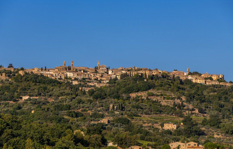
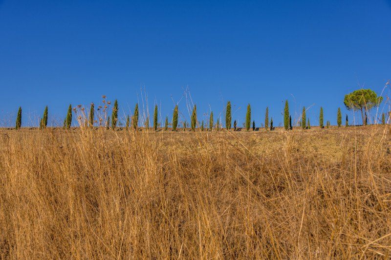
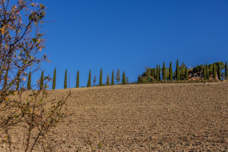
After our departure from Siena we went in the direction of San Giovanni d'Asso to drive to the Point of Panoramica the Crete Senesi and to take photos. The route is very beautiful and varied, with hills and roads bordered by cypress avenues. Just beautiful. It is a bit difficult to find enough large parking spaces with the motorhome, but in an emergency you can also drive into the street and stop there.
53041 Asciano, Siena, Italy 43 ° 16 '33.4 "N 11 ° 29' 2.9" E
53041 Asciano, Siena, Italien
43° 16' 33.4" N 11° 29' 2.9" E
43.2759555 11.4841461
• Head toward Podere Casanuova on Strada Provinciale Lauretana (SP438). Go for 9.3 km.
• Take the 2nd exit from roundabout onto Strada Comunale delle Fonti (SP438) toward Firenze-Roma/A1/Asciano Centro. Go for 7.4 km.
• Turn right onto Strada Provinciale Lauretana (SP10). Go for 11.3 km.
• Keep right onto Strada Provinciale Lauretana (SP10). Go for 2.3 km.
• Continue on Località Villa Maggiore (SS326) toward Chiusi. Go for 364 m.
• Continue on SS326. Go for 331 m.
• Continue on Via Lauretana Nord (SS326). Go for 3.5 km.
• Continue on Via Lauretana Nord (SP15). Go for 432 m.
• Turn left onto Via di Ciliano (SP135). Go for 1.0 km.
• Continue on Strada Provinciale di Montepulciano (SP135). Go for 261 m.
• Continue on Località Casuccia (SP135). Go for 108 m.
• Continue on Strada Provinciale di Montepulciano (SP135). Go for 267 m.
• Turn right onto SP135. Go for 718 m.
• Continue on Via di Torrita (SP135). Go for 1.8 km.
• Continue on SP135. Go for 35 m.
• Continue on Via di Torrita (SP135). Go for 1.2 km.
• Continue on SP135. Go for 2.1 km.
• Continue on Via di Torrita (SP135). Go for 60 m.
• Turn right onto Via Piero Calamandrei (SP17). Go for 1.5 km.
• Turn left toward Via Elio Bernabei. Go for 8 m.
• Turn right onto Via Elio Bernabei. Go for 148 m.
• Take the 1st exit from roundabout onto Via delle Lettere. Go for 154 m.
• Turn left onto Via di Martiena. Go for 257 m.
• Turn right onto Via dell'Acquapuzzola. Go for 172 m.
• Arrive at Via dell'Acquapuzzola. Your destination is on the right.
☍
44,7 km
( 55 min.)
Via dell'Acquapuzzola, Montepulciano, Siena, Italien
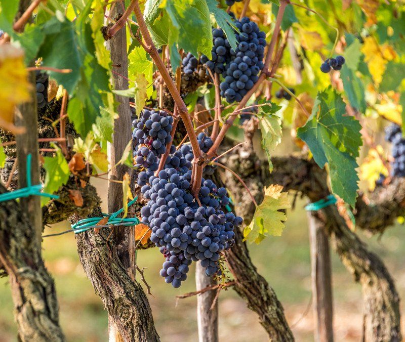
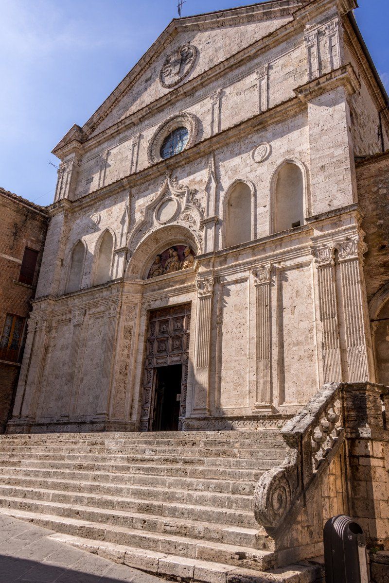
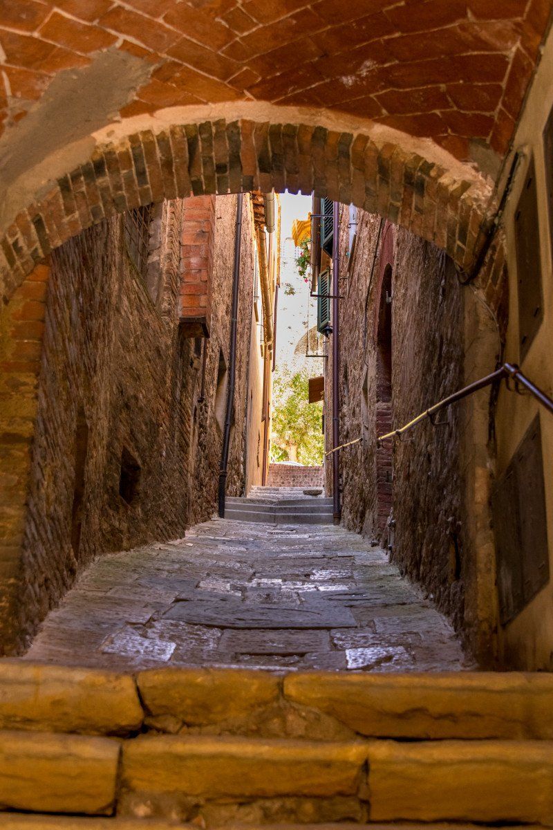
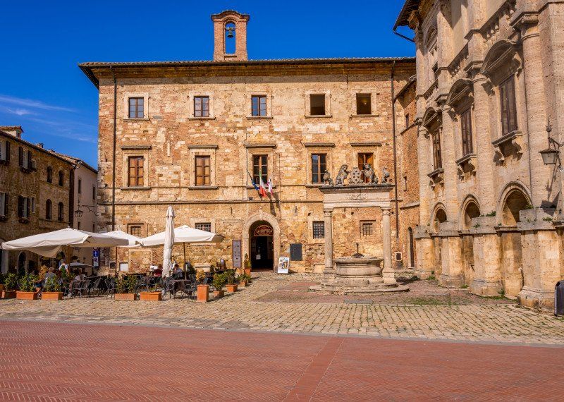
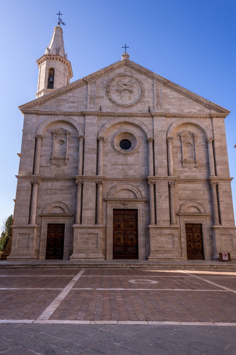
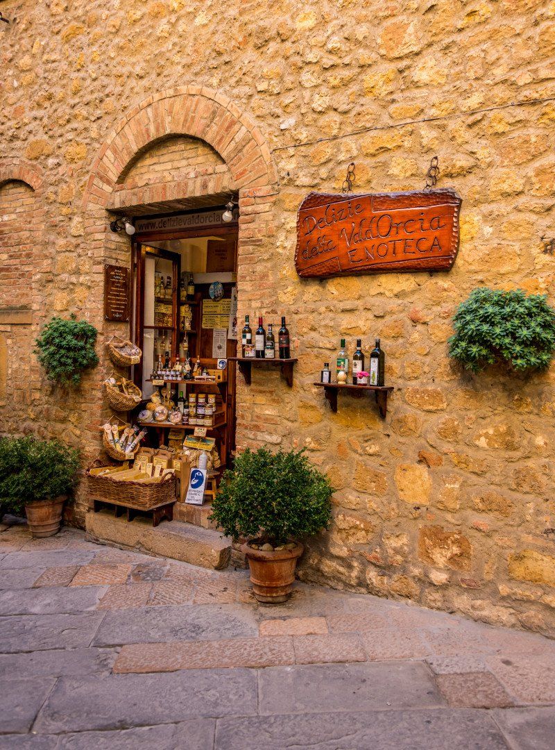
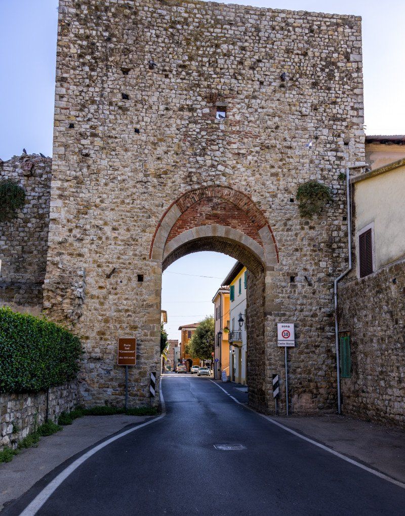
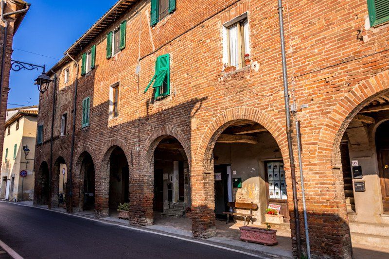
We reached the town of Montepulciano and found the camper place very quickly. A very large place with disposal but no electricity and subject to a charge. It is at the bus station. There is a large shopping center nearby. Montepulciano is a must see and not just for the wine. The town has much more to offer. Magnificent narrow streets a large square at the top of the village. It's a tourist town but we were lucky with the tourists. The selected period of our Tuscany tour turned out to be more than very good. We stocked up on olive oil and wine and finally went shopping in the shopping center. We then set off to head towards our destination for the day.
Via dell'Acquapuzzola, 53045 Montepulciano SI, Italy43° 5' 38.4" N 11° 47' 12.5" E
Via dell'Acquapuzzola, 53045 Montepulciano SI, Italien
43° 5' 38.4" N 11° 47' 12.5" E
43.0940106 11.7868059
• Head toward Via di Martiena on Via dell'Acquapuzzola. Go for 172 m.
• Continue on Via Martiena. Go for 88 m.
• Turn left toward Via Elio Bernabei. Go for 474 m.
• Turn right onto Via Elio Bernabei. Go for 31 m.
• Continue on Via di San Martino. Go for 885 m.
• Continue on Via Antica Chiusina. Go for 1.4 km.
• Continue on Via di Sanguineto. Go for 1.9 km.
• Continue on Via di Pian delle Noci. Go for 476 m.
• Continue on Via Pian delle Noci. Go for 1.7 km.
• Continue on Via del Tombino. Go for 327 m.
• Turn right onto Via Fratelli Braschi (SS326). Go for 1.9 km.
• Turn left onto Via Pozzolese (SS454). Go for 2.5 km.
• Turn right onto Via del Lago. Go for 87 m.
• Arrive at Via del Lago. Your destination is on the left.
☍
11,9 km
( 15 min.)
Agricamping Sosta Camper "I Chiari" Via del Lago 28 Montepulciano
From Montepulciano we drive to today's destination. A small but very nice campsite with approx. 30 parceled out and spacious places. We were welcomed in a very friendly and uncomplicated way. The groundskeeper didn't want any IDs or anything. The site has a supply and disposal station as well as a chemical toilet. We only found the place on the APP Camper Contact under the name Casavacanze I Chiari and thanks to my wife. We can always recommend the place. We stayed one night.
Via del Lago, 28, 53045 Montepulciano SI, Italy 43 ° 6 '50.7 "N 11 ° 54' 31.8" E
Via del Lago, 28, 53045 Montepulciano SI, Italien
43° 6' 50.7" N 11° 54' 31.8" E
43.1140789 11.9088230
• Head northwest on Via del Lago. Go for 87 m.
• Turn left onto Via Pozzolese (SS454). Go for 2.5 km.
• Turn right onto Strada Statale di Rapolano (SS326). Go for 1.9 km.
• Turn left onto Via del Tombino. Go for 327 m.
• Continue on Via Pian delle Noci. Go for 1.7 km.
• Continue on Via di Pian delle Noci. Go for 476 m.
• Continue on Via di Sanguineto. Go for 1.9 km.
• Continue on Via Antica Chiusina. Go for 1.4 km.
• Continue on Via di San Martino. Go for 885 m.
• Continue on Via Elio Bernabei. Go for 439 m.
• Take the 2nd exit from roundabout onto Via Elio Bernabei. Go for 176 m.
• Turn left onto Viale Piero Calamandrei (SP17). Go for 23 m.
• Turn right onto Viale 1 Maggio (SP17). Go for 1.8 km.
• Continue on Strada per Pienza (SP146). Go for 11.5 km.
• Take the 3rd exit from roundabout onto Strada Provinciale di Chianciano (SP146) toward Pienza/Via S.Gregorio. Go for 554 m.
• Turn left onto Via San Gregorio. Go for 289 m.
• Turn right onto Via degli Archi. Go for 31 m.
• Arrive at Via degli Archi. Your destination is on the right.
☍
26,0 km
( 32 min.)
Day
Via degli Archi, 4, Pienza, Siena, Italien
The next morning we left at 8:30 a.m. in the direction of Pienza after we had disposed of and taken care of. We were there around 9:30 a.m. and found a very good parking space and the tour was great, because there were almost no tourists and you could take wonderful photos of the sights and small narrow streets without always having people in the photos. After 2.5 hours we drove towards the famous Cypressen Allee which is about 1 km after Pienza. Then continue to the famous Capel Vitaletta.
Via degli Archi, 4, 53026 Pienza SI, Italy 43 ° 4 '46 "N 11 ° 40' 41.1" E
Via degli Archi, 4, 53026 Pienza SI, Italien
43° 4' 46" N 11° 40' 41.1" E
43.0794310 11.6780780
• Head toward Via San Gregorio on Via degli Archi. Go for 31 m.
• Turn right onto Via San Gregorio. Go for 58 m.
• Turn right onto Via San Gregorio (SP146). Go for 616 m.
• Take the 3rd exit from roundabout onto Strada Provinciale di Chianciano (SP146). Go for 519 m.
• Take the 1st exit from roundabout onto Strada Provinciale di Chianciano (SP146). Go for 8.6 km.
• Turn left onto Via dei Fossi. Go for 315 m.
• Turn right onto Piazza 4 Novembre. Go for 45 m.
• Turn left onto Via Dante Alighieri. Go for 354 m.
• Turn right onto Strada Regionale Cassia (SR2). Go for 2.2 km.
• Turn left onto Località Podere Colombaio toward Di Casabianca. Go for 199 m.
• Continue on Strada Comunale di Casabianca. Go for 2.0 km.
• Turn slightly left onto Località Podere Casabianca. Go for 130 m.
• Continue on Località Podere Poggio Bacoca. Go for 2.4 km.
• Turn left onto Località Vitaleta. Go for 704 m.
• Arrive at your destination on the right.
☍
18,1 km
( 28 min.)
Chapel Vitaleta
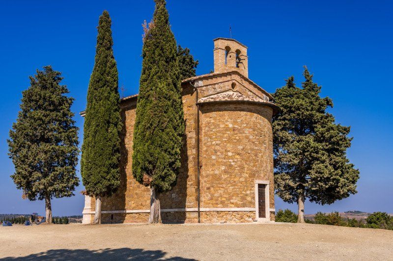
About 6 km after Cypressen Allee, turn left onto a gravel road in the direction of Chapel Vitaleta, which is very well signposted. Follow the gravel road for about 1.3 km until you come to a parking lot where you can park your vehicle. Please note that it is recommended to take all valuables with you. The walk takes about 15 minutes to the chapel. We were lucky and there weren't that many people there so we could start our photo session. After about 30 minutes we went back and left the parking lot and after the gravel road we turned left towards San Qurico d'Orcia.
53027 San Quirico d'Orcia, Siena, Italy 43 ° 4 '15.2 "N 11 ° 38' 3" E
53027 San Quirico d’Orcia, Siena, Italien
43° 4' 15.2" N 11° 38' 3" E
43.0708942 11.6341782
• Head toward Località Cretaiole. Go for 596 m.
• Continue on Località Vitaleta. Go for 108 m.
• Turn right toward Località Podere Poggio Bacoca. Go for 1.8 km.
• Continue on Località Podere Poggio Bacoca. Go for 616 m.
• Continue on Località Podere Casabianca. Go for 118 m.
• Continue on Località Podere Casabianca. Go for 12 m.
• Turn slightly right onto Strada Comunale di Casabianca. Go for 16 m.
• Turn left onto Strada Comunale di Casabianca. Go for 2.1 km.
• Continue on Località Podere Colombaio. Go for 49 m.
• Turn right onto Strada Regionale Cassia (SR2). Go for 2.8 km.
• Take ramp toward Chiusi/A1/Chianciano T./Montepulciano/S. Quirico d'Orcia/Pienza. Go for 142 m.
• Turn left onto Strada Provinciale di Chianciano (SP146) toward San Quirico. Go for 426 m.
• Continue on Via Sano di Pietro. Go for 101 m.
• Arrive at Via Sano di Pietro. Your destination is on the left.
☍
8,9 km
( 17 min.)
Via Sano di Pietro, 25, San Quirico d’Orcia, Siena, Italien
The parking space in San Qurico d'Orcia is easy to find and well signposted. Since we had almost no coins for the parking meter, my wife simply downloaded the Easy Park app and we were able to set the parking time on the mobile phone very easily without having to rely on coins. Easy Parking has been set up in many European cities. We strolled through the beautiful streets of the historic village center. We ate something small for lunch there and drove on after about 1.5 hours. The next destination would actually have been Montalcino, but we have read that the only mobile home parking space was firstly far from the village center and the access for larger mobile homes was not without problems due to the last 5 very steep meters due to the hitting of the rear. So we quickly rescheduled and then drove towards Buonconvento.
Via Sano di Pietro, 25, 53027 San Quirico d'Orcia SI, Italy 43 ° 3 '35 "N 11 ° 36' 5.7" E
Via Sano di Pietro, 25, 53027 San Quirico d'Orcia SI, Italien
43° 3' 35" N 11° 36' 5.7" E
43.0597189 11.6015798
• Head toward Via Giovanni Duprè on Via Sano di Pietro. Go for 157 m.
• Take the 3rd exit from roundabout onto Via Sano di Pietro. Go for 309 m.
• Turn left onto SP137. Go for 143 m.
• Turn right and take ramp onto Strada Regionale Cassia (SR2) toward Montalcino/Siena/Grosseto. Go for 16.1 km.
• Turn right onto Via di Vittorio. Go for 107 m.
• Arrive at Via di Vittorio. Your destination is on the right.
☍
16,8 km
( 16 min.)
Campo Sportivo
The parking lot is very large, free of charge and made for cars and mobile homes. Access to the old town is just a few meters from the car park. But it is a very small old town and, unlike Pienza or Moltepulciano, not nearly as beautiful. So is not necessarily a highlight and not a must. We drove on to an old monastery which is still inhabited today and also includes a school for monks.
Via Giuseppe di Vittorio, 53022, Buonconvento, Italy43 ° 8 '3 "N 11 ° 29' 4" E
Via Giuseppe di Vittorio, 53022, Buonconvento, Italy
43° 8' 3" N 11° 29' 4" E
43.1341667 11.4844444
• Head toward Via Oreste Lizzadri on Via di Vittorio. Go for 107 m.
• Turn right onto Via Cassia (SR2). Go for 571 m.
• Turn right onto Via dei Macelli (SP451) toward Asciano. Go for 8.4 km.
• Turn right onto Località Abbazia Monte Oliveto Maggiore. Go for 203 m.
• Arrive at Località Abbazia Monte Oliveto Maggiore.
☍
9,3 km
( 11 min.)
Abbazia di Monte Oliveto Maggiore, Monte Oliveto Maggiore, Asciano, Siena, Italien
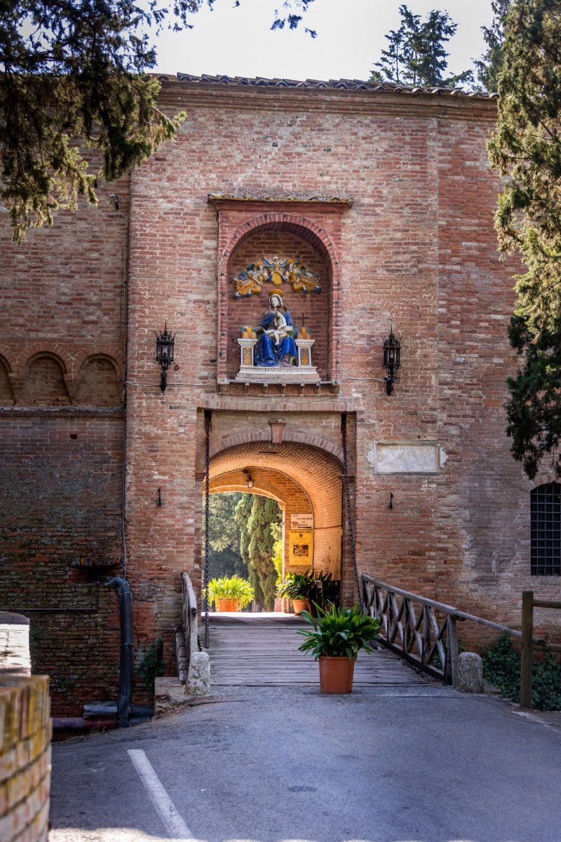
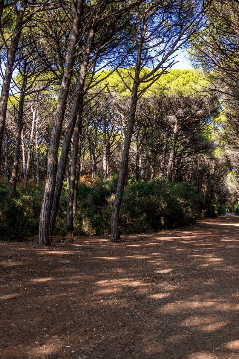
On the way from Buonconvento to Asciano, the signpost to Abbazia di Monte Oliveto Maggiore is signposted on the main road. The parking lot for Womos is on the left side of the street. A gravel place which has space for about 7-8 Womos. After a short ascent you come to the first building and after a descent to a chapel and further to the main building with the church. Very nice building in the middle of the forest. We were there for about 1/2 hour and drove on to today's campsite.
Monte Oliveto Maggiore, 53041 Asciano SI, Italy 43 ° 10 '32.8 "N 11 ° 32' 41.2" E
Monte Oliveto Maggiore, 53041 Asciano SI, Italien
43° 10' 32.8" N 11° 32' 41.2" E
43.1757708 11.5447651
• Head northeast on Località Abbazia Monte Oliveto Maggiore. Go for 13 m.
• Turn slightly left onto Località Abbazia Monte Oliveto Maggiore. Go for 23 m.
• Turn slightly right onto Località Abbazia Monte Oliveto Maggiore. Go for 240 m.
• Continue on Strada Provinciale di Monte Oliveto (SP451). Go for 761 m.
• Turn right toward Strada Provinciale del Pecorile/SP60. Go for 43 m.
• Continue on Strada Provinciale Pecorile-Chiusure (SP60b). Go for 991 m.
• Turn left onto Strada Provinciale Pecorile-Chiusure (SP60b). Go for 1.9 km.
• Turn right onto Strada Provinciale del Pecorile (SP60a) toward S.Giovanni d'Asso. Go for 3.9 km.
• Turn left onto Via delle More. Go for 468 m.
• Continue on Strada Provinciale del Pecorile (SP60). Go for 22 m.
• Turn right onto Strada Provinciale Traversa dei Monti (SP14). Go for 1.0 km.
• Turn right onto Strada Comunale di Monterongriffoli (SC30). Go for 16 m.
• Arrive at Strada Comunale di Monterongriffoli (SC30). Your destination is on the right.
☍
9,4 km
( 12 min.)
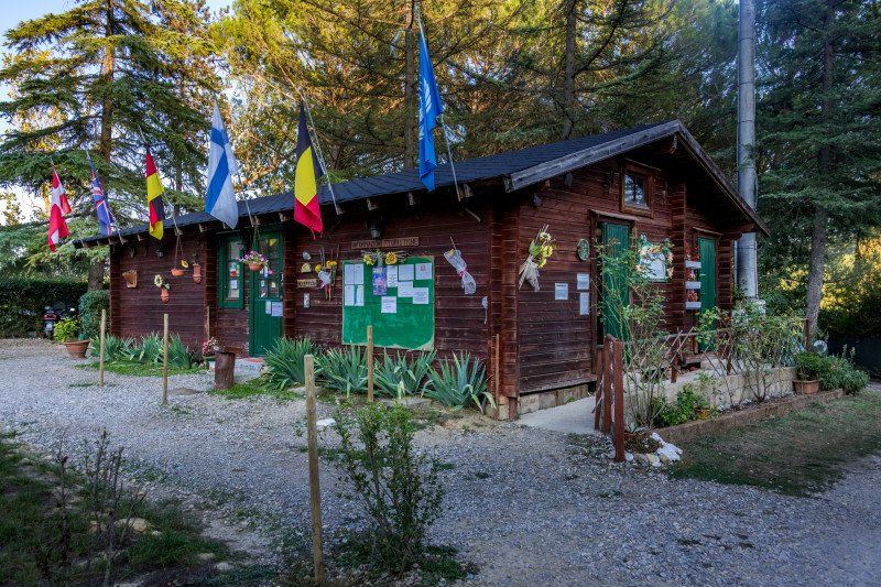
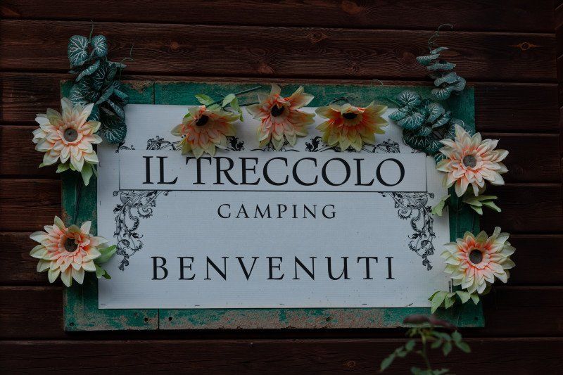
Camping Campeggio Il Treccolo, Strada Provinciale 14 Traversa dei Monti in San Giovanni d 'Asso
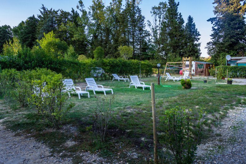
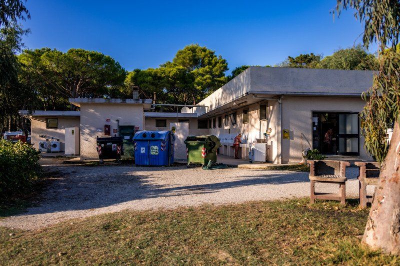
After about 25 minutes we found the campsite. Nobody was present and at the information board you should just choose a place and sit down. It is a relatively small space for around 20-25 campers and mobile homes. All pitches are parceled out and have a gravelly, partly uneven surface. But are about 60-65m2 and offer enough space. It has showers, toilets and disposal for the chemical toilet. Supply is available, disposal is not available. It also has electricity. It also has a bar, a children's playground and a barbecue area which was closed like the bar. There is no market. The place is a very good starting point for visits to the places Montepulciano, Pienza, Montalcino, San Giovanni D'Asso etc. We were there for one night.
SP14,5, 53020 Montalcino SI, Italy 43 ° 8 '42.8 "N 11 ° 34' 58.6" E
SP14, 5, 53020 Montalcino SI, Italien
43° 8' 42.8" N 11° 34' 58.6" E
43.1452290 11.5829320
• Head toward Traversa dei Monti on Strada Comunale di Monterongriffoli (SC30). Go for 16 m.
• Turn right onto Traversa dei Monti (SP14). Go for 7.8 km.
• Take ramp onto Strada Regionale Cassia (SR2) toward Montalcino/S.Quirico d'Orcia/Chiusi/A1/Grosseto/Roma. Go for 1.5 km.
• Take ramp toward Grosseto/Montalcino/Zona Industriale Bivio Asse. Go for 426 m.
• Turn right onto Località Bivio dell'Asso (SP14) toward Montalcino/Grosseto. Go for 5.1 km.
• Take the 2nd exit from roundabout onto Traversa dei Monti (SP14) toward Montalcino Centro/Grosseto. Go for 1.8 km.
• Take the 3rd exit from roundabout onto Traversa dei Monti (SP14) toward Grosseto. Go for 16.1 km.
• Continue on Strada Provinciale Orcia (SP52). Go for 796 m.
• Turn right onto Strada Provinciale Cipressino (SP64). Go for 12.8 km.
• Take the 2nd exit from roundabout onto Strada Provinciale del Cipressino (SP64) toward Paganico. Go for 384 m.
• Turn right onto Via Pietro Leopoldo. Go for 247 m.
• Turn left onto Via Rinaldo Malavolti. Go for 348 m.
• Turn left onto Via A. Arrigo VIII. Go for 153 m.
• Turn right onto Via Giosuè Carducci. Go for 114 m.
• Arrive at Via Giosuè Carducci.
☍
47,6 km
( 48 min.)
Day
Via Giosuè Carducci, Paganico, Grosseto, Italien
Left Camping Il Treccolo at 08:00 in the morning and arrived in Paganico after about 35 minutes. On the way there we passed again cypress avenues and the town of Montalcino. Based on the reports from the motorhome parking space there, we decided not to look at it. We found the parking lot straight away, but the village doesn't offer much, except for a tool shop where we bought pliers, a nut set and an adapter for the water hose. After about 30 minutes we left again in the direction of Piombino to an archaeological excavation site.
Via Giosuè Carducci, 58045 Paganico GR, Italy 42 ° 55 '55.7 "N 11 ° 16' 7.1" E
Via Giosuè Carducci, 58045 Paganico GR, Italien
42° 55' 55.7" N 11° 16' 7.1" E
42.9321260 11.2686506
• Head southwest on Via Giosuè Carducci. Go for 198 m.
• Turn right onto Strada Provinciale del Cipressino (SP64). Go for 573 m.
• Continue straight ahead. Go for 1.5 km.
• Turn right toward Strada di Grande Comunicazione Grosseto-Fano/SS223. Go for 307 m.
• Take ramp onto Strada di Grande Comunicazione Grosseto-Fano (SS223) toward Grosseto. Go for 18.3 km.
• Take ramp onto Strada Statale Aurelia (SS1) toward Grosseto Nord/Livorno. Go for 58.5 km.
• Take ramp onto Strada Statale della Val di Cornia (SS398) toward Venturina/Sardegna. Go for 1.8 km.
• Take ramp toward Zona Industriale. Go for 180 m.
• Turn left onto Via Piombinese. Go for 493 m.
• Continue on Via Lavoriere. Go for 2.2 km.
• Continue toward Strada Provinciale delle Caldanelle/SP23ter. Go for 37 m.
• Turn left onto Strada Provinciale delle Caldanelle (SP23ter). Go for 3.5 km.
• Turn left onto Via della Principessa (SP23). Go for 254 m.
• Take the 1st exit from roundabout onto Località Baratti. Go for 1.4 km.
• Turn left toward Località Baratti. Go for 152 m.
• Turn left onto Località Baratti. Go for 1.1 km.
• Keep right onto Località Baratti. Go for 68 m.
• Arrive at Località Baratti. Your destination is on the left.
☍
90,5 km
( 59 min.)
Località Baratti, 230, Piombino, Livorno, Italien
After a drive of about 1 1/2 hours we wanted to take the branch to the archeological excavations, but there was a prohibition sign for vehicles that are wider than 2.00 mt. Nobody told us that and was not in a book anywhere, not even in our guide WOMO - Series Volume 8 Tuscany and Elba by Ralf Greus. A little frustrated, we drove on towards Castagnetto Carducci and hope that it will work there.
Località Baratti, 230, 57025 Piombino LI, Italy 42 ° 59 '26.3 "N 10 ° 30' 6" E
Località Baratti, 230, 57025 Piombino LI, Italien
42° 59' 26.3" N 10° 30' 6" E
42.9906493 10.5016556
• Head northwest on Località Baratti. Go for 106 m.
• Turn left onto Località Baratti. Go for 124 m.
• Turn left onto Località Baratti. Go for 2.6 km.
• Take the 3rd exit from roundabout onto Via della Principessa (SP23). Go for 3.5 km.
• Take the 2nd exit from roundabout onto Strada Provinciale della Principessa (SP23). Go for 7.3 km.
• Continue toward Largo Berlese. Go for 38 m.
• Take the 1st exit from Largo Berlese roundabout onto Via Roma. Go for 214 m.
• Take the 2nd exit from roundabout onto Via Giacomo Matteotti (SP39). Go for 468 m.
• Take the 4th exit from roundabout onto Via Aurelia Nord (SP39). Go for 711 m.
• Take the 3rd exit from roundabout onto Via Aurelia Nord (SP39). Go for 166 m.
• Take the 2nd exit from roundabout onto Via Aurelia Nord (SP39). Go for 5.9 km.
• Turn right onto Strada Provinciale Accattapane (SP16). Go for 3.9 km.
• Turn right onto Strada Provinciale del Passo di Bocca di Valle (SP329). Go for 2.1 km.
• Arrive at Via della Sassetta (SP329).
☍
27,1 km
( 35 min.)
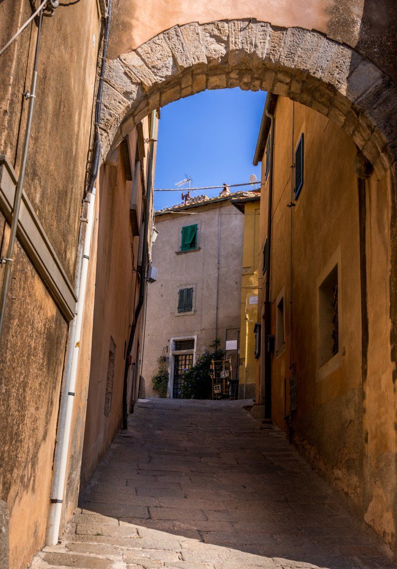
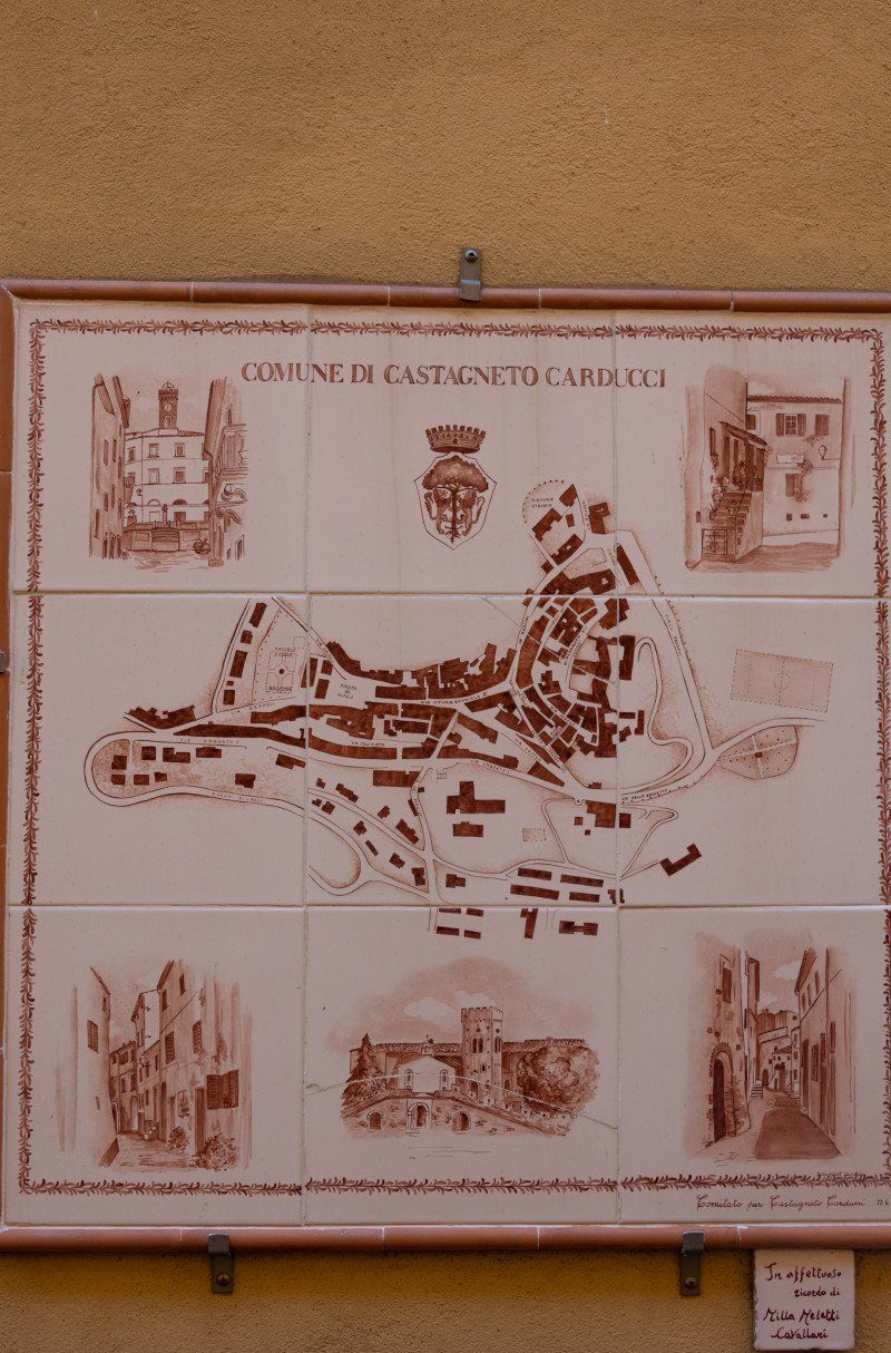
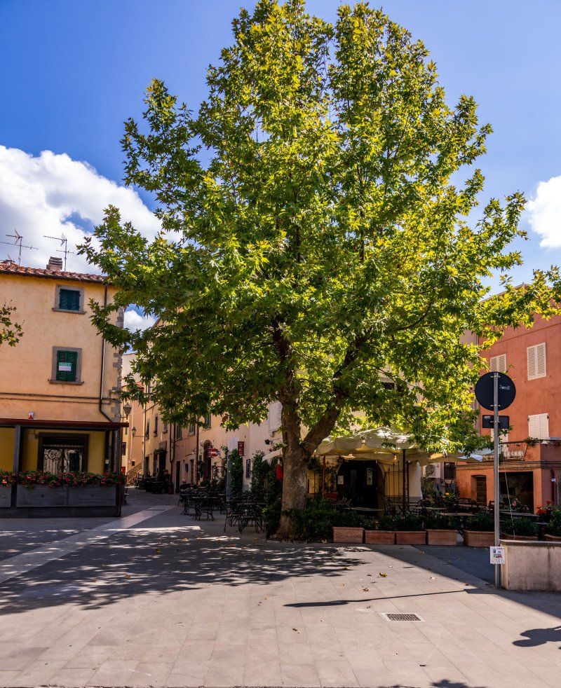
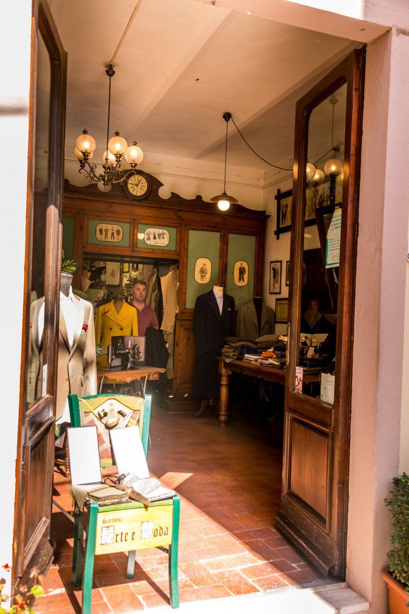
Strada Provinciale 329 Passo di Bocca di Valle, Castagneto Carducci, Livorno, Italien
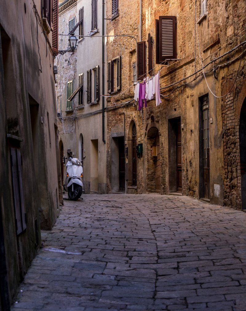
We found the parking lot very well based on the coordinates we entered in the navigation system. The drive up the hill to the small village was really worth it. Again a very ancient and very beautiful village with many narrow and ramified streets, with hanging laundry and balconies decorated with flowers and house entrances - we bought a very good ice cream there and photographed a tailor shop where Mike Jagger had a suit made. Then continue towards Cecina to the Mare Blu campsite.
SP 329 Passo di Bocca di Valle, Castagneto Carducci LI, Italy 43 ° 9 '34.9 "N 10 ° 36' 40.7" E
SP 329 Passo di Bocca di Valle, Castagneto Carducci LI, Italien
43° 9' 34.9" N 10° 36' 40.7" E
43.1596945 10.6113019
• Head toward Via Camillo Benso di Cavour on Via della Sassetta (SP329). Go for 4.5 km.
• Take the 1st exit from roundabout onto Via del Bambolo (SP329). Go for 1.1 km.
• Turn left toward Strada Provinciale del Passo di Bocca di Valle/SP329. Go for 36 m.
• Turn slightly left onto Strada Provinciale Vecchia Aurelia (SP39). Go for 156 m.
• Turn right onto Strada Marina di Castagneto (SP17). Go for 389 m.
• Continue straight ahead. Go for 33 m.
• Take the 3rd exit from roundabout toward Livorno/Grosseto. Go for 76 m.
• Continue toward Strada Statale Aurelia/SS1. Go for 164 m.
• Take left ramp onto Strada Statale Aurelia (SS1) toward Livorno. Go for 18.8 km.
• Take ramp toward Cecina Nord/Livorno/SS1/Cecina. Go for 301 m.
• Continue on Strada Regionale di Val di Cecina (SR68) toward Cecina. Go for 218 m.
• Take the 1st exit from roundabout onto Via Po. Go for 1.6 km.
• Take the 2nd exit from roundabout onto Strada Regionale Pisana-Livornese (SR206). Go for 548 m.
• Take the 2nd exit from Via Pisana Livornese roundabout onto Località San Pietro in Palazzi. Go for 169 m.
• Turn left onto Piazza dei Mille. Go for 384 m.
• Take the 1st exit from roundabout onto Via Francesco Domenico Guerrazzi. Go for 2.3 km.
• Take the 1st exit from roundabout. Go for 44 m.
• Continue on Via Campilunghi. Go for 1.3 km.
• Turn left onto Via Campilunghi. Go for 46 m.
• Arrive at Via Campilunghi. Your destination is on the right.
☍
32,2 km
( 29 min.)
Camping Mareblu, Cecina, Livorno, Italien
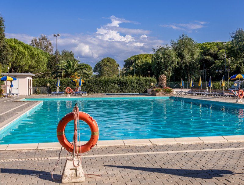
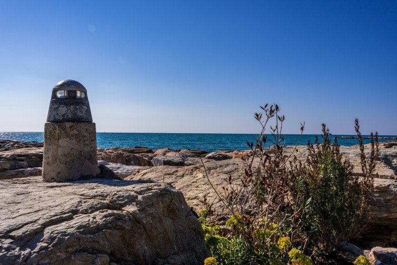
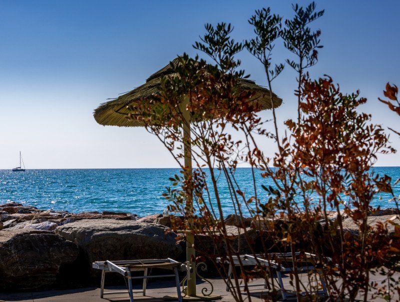
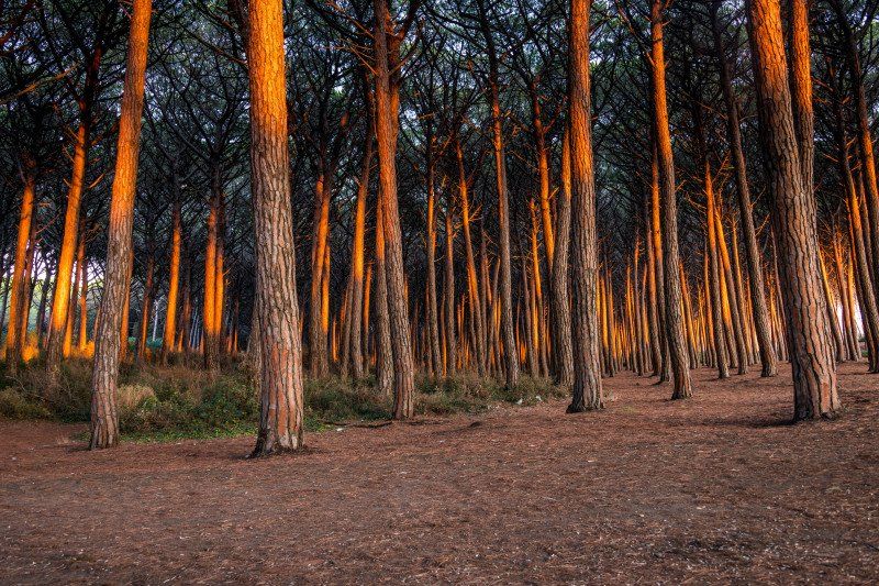
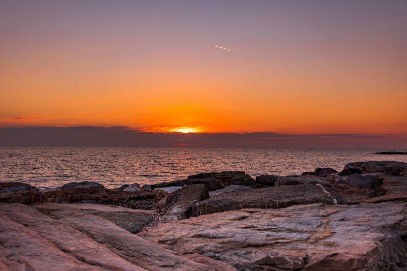
After another 45 minutes we reached the campsite. We had to wait 1 1/2 hours until we were allowed to drive in, as there is silence from 2:00 p.m. to 4:00 p.m. in the afternoon. We were allowed to walk in to choose a place on a map with several marked places. The places are all parceled out and separated with a small hedge and very nicely laid out in the middle of a pine forest. The toilets and washrooms are designed in such a way that they can be accessed very quickly from anywhere. They are very clean. It has a pool, which we didn't need, as the beach is 300 meters from the square. good and easy to reach through a pine forest in the shade. It has a market, a bar / restaurant (self service and full service) / supply and disposal station. Chemical toilets are in every washroom. We ate at the Delfino restaurant on the beach on the first evening. The food was amazing, the prices in the normal range.
Via dei Campilunghi sn, 57023 Cecina LI, Italy 43 ° 19 '5.8 "N 10 ° 28' 26.3" E
Via dei Campilunghi s.n, 57023 Cecina LI, Italien
43° 19' 5.8" N 10° 28' 26.3" E
43.3182822 10.4739714
• Head north on Via Campilunghi. Go for 17 m.
• Turn left. Go for 21 m.
• Turn slightly left. Go for 106 m.
• Arrive at your destination on the left.
☍
0,1 km
( )
Day
Camping Mareblu
The next day we spent on the beach and in the square to rest a little and to prepare for the following days.
Via dei Campilunghi, 57023, Cecina Mare, Italy
43° 19' 7" N 10° 28' 21" E
43.3186100 10.4725000
• Head southeast. Go for 127 m.
• Turn left onto Via Campilunghi. Go for 29 m.
• Turn right onto Via Campilunghi. Go for 1.2 km.
• Continue toward Via Francesco Domenico Guerrazzi. Go for 47 m.
• Take the 3rd exit from roundabout onto Via Francesco Domenico Guerrazzi. Go for 2.3 km.
• Continue straight ahead. Go for 46 m.
• Take the 1st exit from roundabout. Go for 46 m.
• Keep left toward Autostrada. Go for 35 m.
• Take the 2nd exit from roundabout onto Via San Pietro in Palazzi. Go for 490 m.
• Turn right onto Strada Regionale di Val di Cecina (SR68). Go for 143 m.
• Keep right onto Strada Regionale di Val di Cecina (SR68). Go for 1.0 km.
• Pass 4 roundabouts and continue on Strada Regionale di Val di Cecina (SR68). Go for 10.4 km.
• Take the 1st exit from roundabout onto Località Molino di Rialdo (SR68). Go for 2.2 km.
• Continue on Via di Val di Cecina. Go for 284 m.
• Continue on Strada Regionale di Val di Cecina (SR68). Go for 242 m.
• Pass 2 roundabouts and continue on Strada Regionale di Val di Cecina (SR68). Go for 9.6 km.
• Continue toward Via di Val di Cecina. Go for 34 m.
• Take the 1st exit from roundabout onto Via di Val di Cecina. Go for 211 m.
• Continue on Strada Regionale di Val di Cecina (SR68). Go for 5.3 km.
• Take the 1st exit from Via Volterrana roundabout onto Via Volterrana (SR68). Go for 9.0 km.
• Take the 2nd exit from roundabout onto Viale Trento e Trieste (SP15). Go for 642 m.
• Turn right onto Viale Francesco Ferrucci. Go for 473 m.
• Continue on Piazza del Bastione. Go for 62 m.
• Continue on Viale Gabriele D'Annunzio. Go for 237 m.
• Turn right onto Viale Gabriele D'Annunzio. Go for 282 m.
• Turn left onto Via del Poderino. Go for 190 m.
• Turn left. Go for 42 m.
• Turn slightly right. Go for 81 m.
• Arrive at your destination on the right.
☍
44,8 km
( 51 min.)
Day
Parcheggio P3 Fonto di Docciola
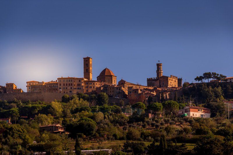
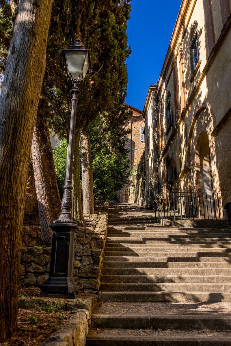
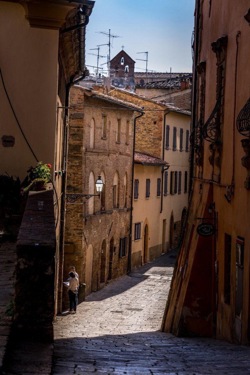
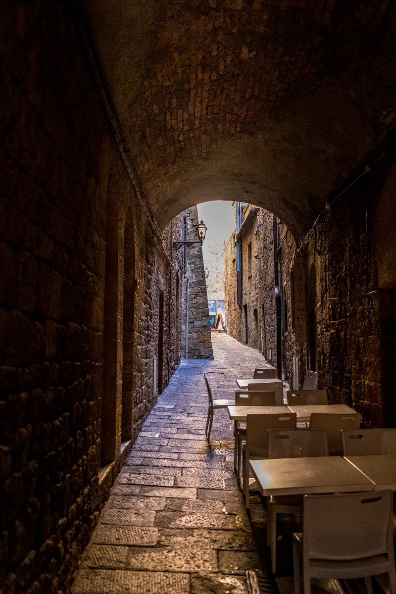
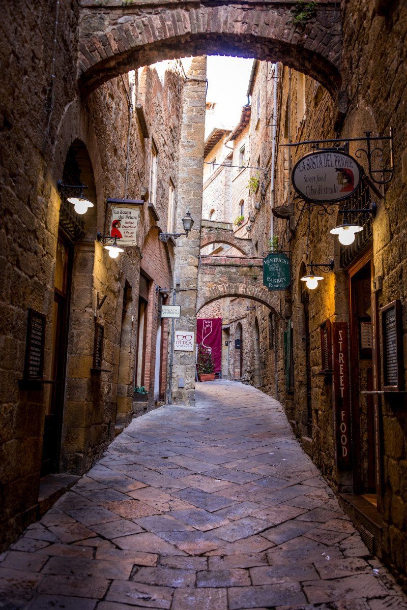
After a day of rest in Cecina, we started early at 8:30 a.m. in the direction of Volterra. We still had supplies and disposal at the Mareblu campsite and were very surprised at the price we had to pay for two nights. At 43 euros it was the cheapest on the whole tour and we can recommend it at any time. After a refueling stop, we arrived at the parking space in Volterra at around 9:45 a.m. Price 15 euros per day including electricity supply and disposal. But since we only stayed about 2 hours, we didn't pay anything. A steep and long staircase leads from the parking lot directly into the center, which was already very busy at this time. It was Sunday and there were a lot of local day tourists who took a trip to the beautiful town. We took a tour and then treated ourselves to a coffee and a small dessert in the bakery (Dolceria) del Corso on Via Giacomo Matteotti 31. We noticed that a lot of locals come and go here and can say that it is a very good choice and that the price for an espresso, a cappuccino and two pieces of patisserie is very cheap for 4.40 euros. We bought two more to take away for dessert in the motorhome after dinner. The town is very nice but it was too crowded for us.
Viale dei Filosofi, 56048, Volterra, Italy43 ° 24 '12 "N 10 ° 51' 49" E
Viale dei Filosofi, 56048, Volterra, Italy
43° 24' 12" N 10° 51' 49" E
43.4033333 10.8636111
• Head east. Go for 123 m.
• Turn left onto Via del Poderino. Go for 384 m.
• Turn right onto Via del Poderino. Go for 579 m.
• Turn left onto Viale Giosuè Carducci (SR68). Go for 11.2 km.
• Turn left onto Strada Provinciale del Cornocchio (SP53). Go for 6.8 km.
• Continue on Strada Provinciale di Camporbiano (SP62). Go for 3.6 km.
• Turn right onto Strada Provinciale di S. Gimignano (SP63). Go for 645 m.
• Continue on Strada Provinciale di Cellole (SP69). Go for 6.1 km.
• Take the 1st exit from roundabout onto Via di Fugnano. Go for 533 m.
• Take the 3rd exit from roundabout. Go for 452 m.
• Take the 1st exit from roundabout. Go for 1.8 km.
• Take the 2nd exit from roundabout onto Strada Provinciale di Castel San Gimignano (SP47). Go for 1.2 km.
• Arrive at Strada Provinciale di Castel San Gimignano (SP47). Your destination is on the left.
☍
33,4 km
( 40 min.)
Area di Sosta Santa Chiara
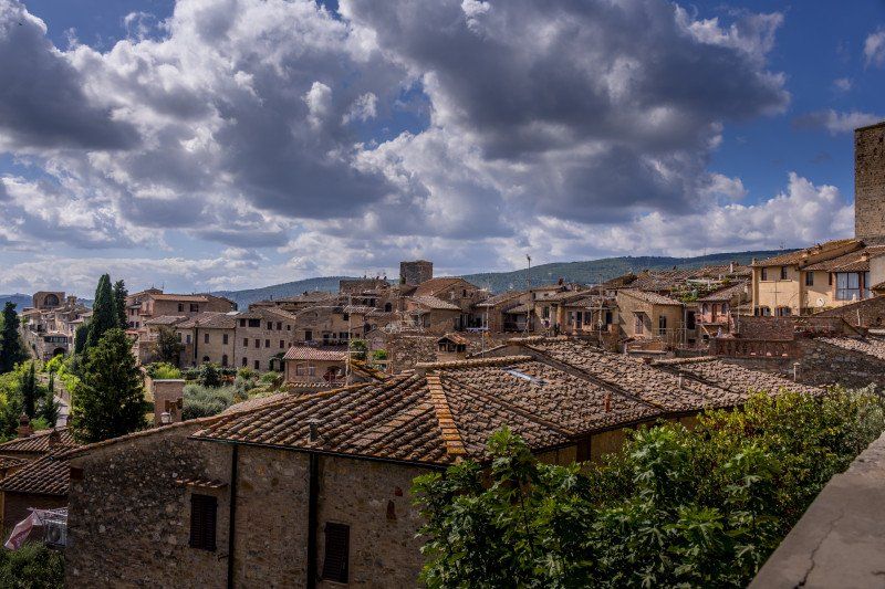
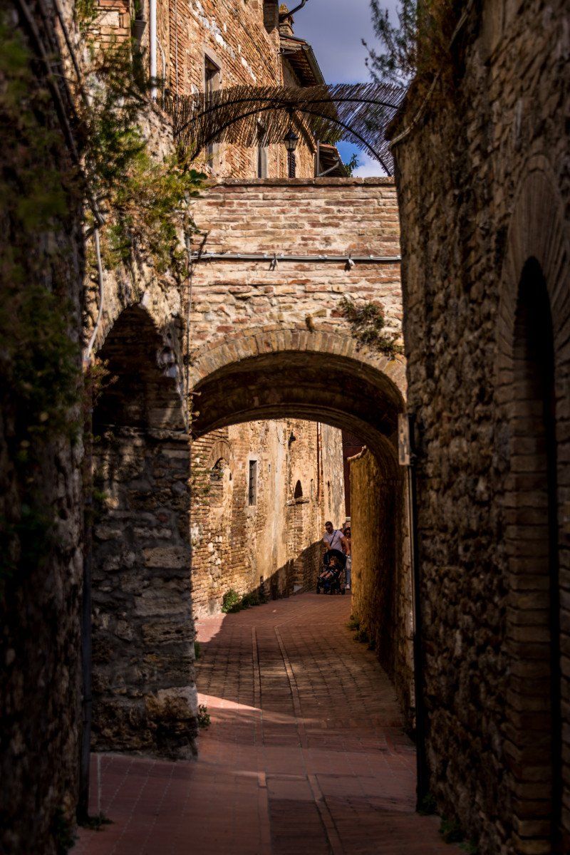
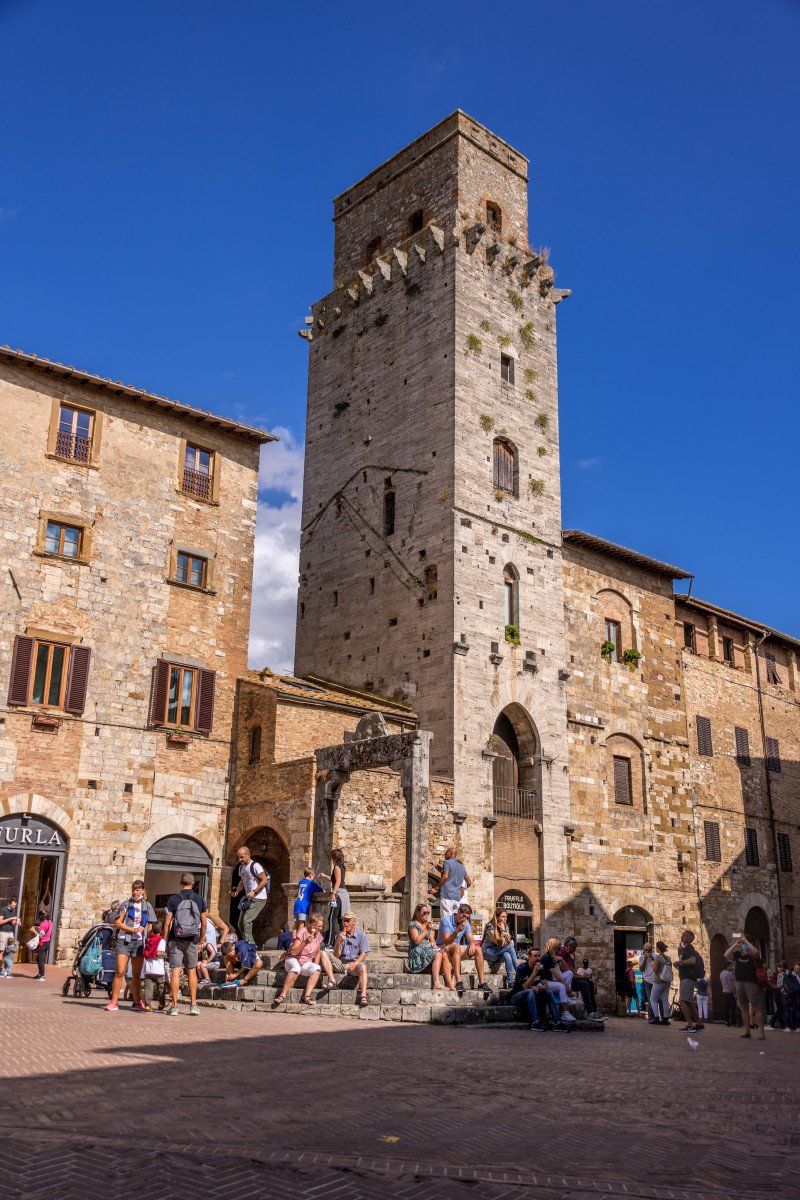
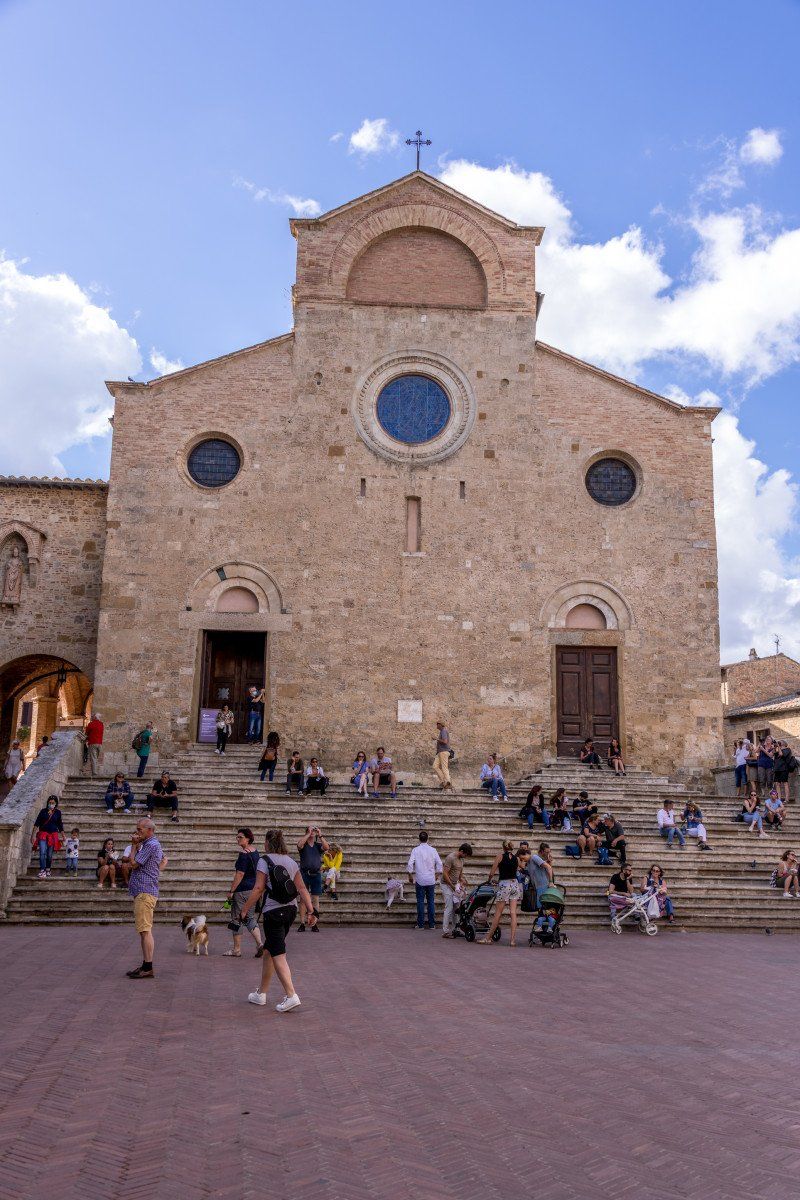
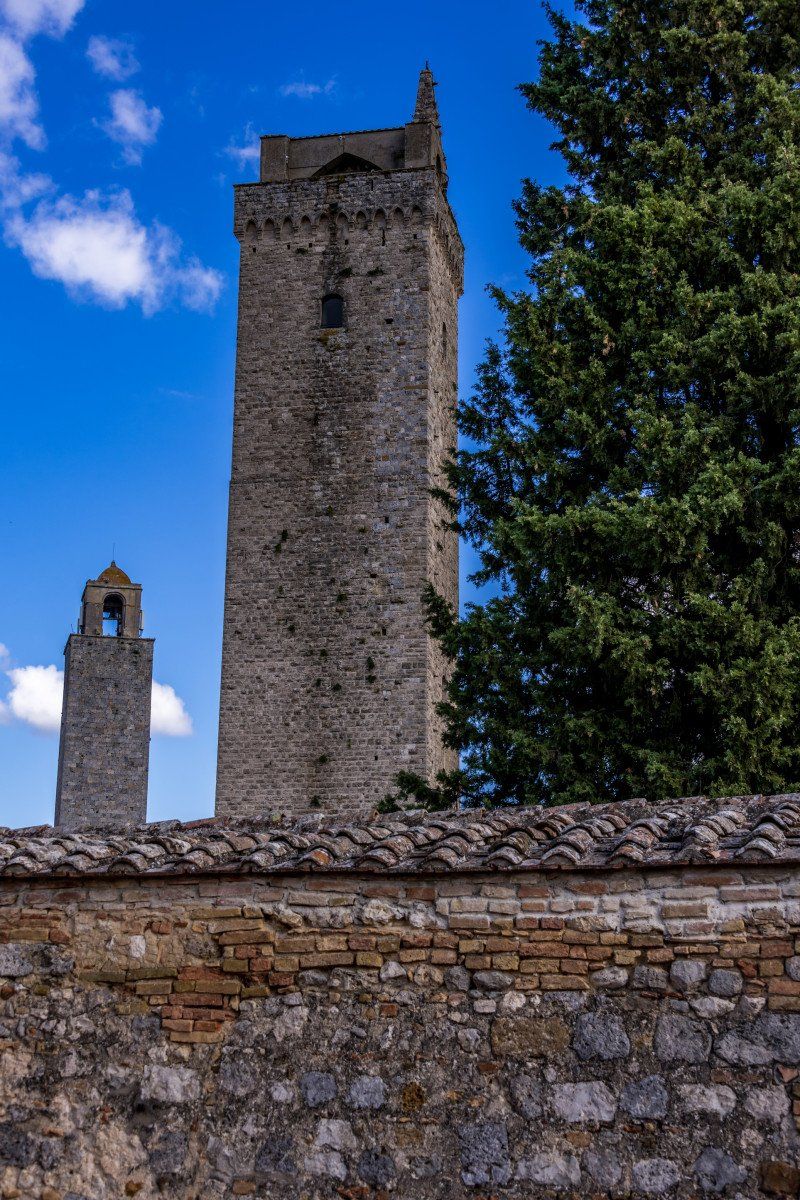
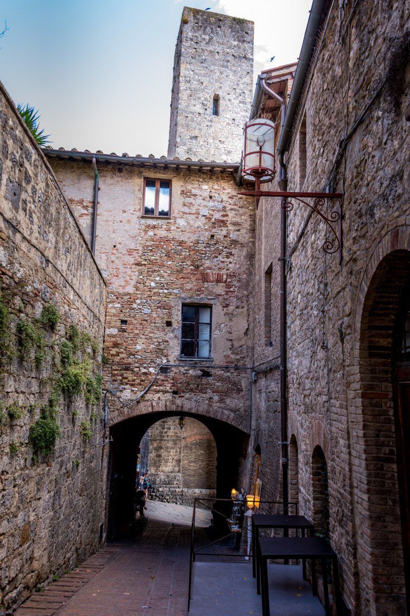
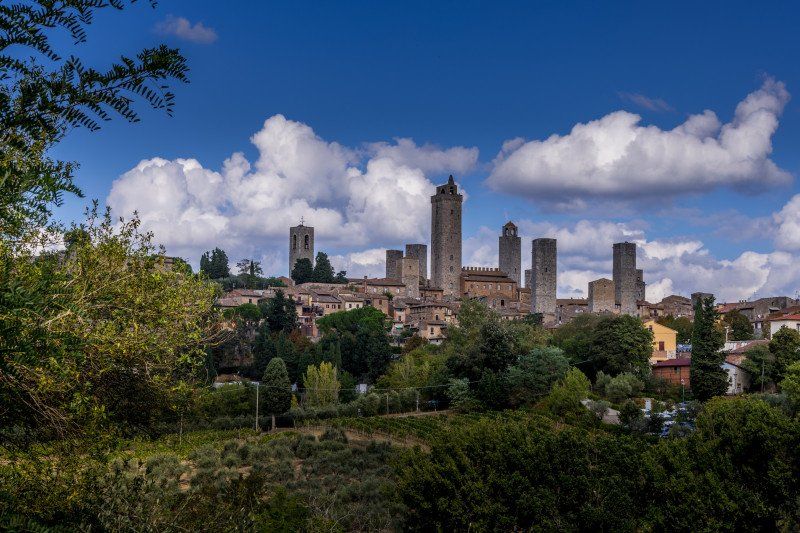
After Volterra we drove on to San Giminiano. We quickly found the parking lot at the soccer field and were even lucky that we could park there. The parking lot is free but has nothing to offer, which didn't bother us. The center can be reached from the square in 13 minutes on foot, slightly uphill. Here the same picture as in Volterra, very, very many people and we didn't feel so comfortable anymore. The town with its seven gender towers is very beautiful with many small winding streets. We ate something small on the main square and then treated ourselves to an ice cream in the world champion's gelateria. We had to queue for about 10 minutes but it was worth it. The ice cream tasted really good. We then left San Giminiano in the direction of Pisa.
Via di Castel San Gimignano, 53037, San Gimignano, Italy43° 27' 21" N 11° 2' 6" E
Via di Castel San Gimignano, 53037, San Gimignano, Italy
43° 27' 21" N 11° 2' 6" E
43.4558333 11.0350000
• Head southwest on Strada Provinciale di Castel San Gimignano (SP47). Go for 107 m.
• Turn right onto Località Santa Chiara. Go for 172 m.
• Turn right onto Località Santa Chiara. Go for 13 m.
• Turn right onto Località Santa Chiara. Go for 157 m.
• Turn left onto Strada Provinciale di Castel San Gimignano (SP47). Go for 1.2 km.
• Take the 2nd exit from roundabout. Go for 1.8 km.
• Take the 1st exit from roundabout. Go for 440 m.
• Take the 2nd exit from roundabout onto Via di Fugnano. Go for 550 m.
• Take the 3rd exit from roundabout onto Strada Provinciale di Cellole (SP69) toward Montaione/Gambassi/Larniano/Libbiano/Pancole. Go for 6.2 km.
• Continue on Strada Provinciale di S. Gimignano (SP63). Go for 645 m.
• Continue on Strada Provinciale di Camporbiano (SP62) toward Castelfiorentino/Castelfalfi/Castagno/Villamagna/Peccioli. Go for 2.3 km.
• Turn right onto Strada Provinciale Volterrana (SP4) toward Villamagna/Castelfiorentino/Castelfalfi/Montaione/Gambassi Terme/Peccioli. Go for 729 m.
• Turn left onto Strada Provinciale dell'Ecce Homo (SP65) toward S.Vivaldo/Montignoso/Castelfalfi/Peccioli. Go for 5.4 km.
• Turn left onto Via Cappella del Lupo (SP26). Go for 4.9 km.
• Take the 3rd exit from roundabout onto Via Casiscala (SP26) toward Pontedera/Peccioli. Go for 19.2 km.
• Take the 2nd exit from roundabout onto Strada Provinciale La Fila (SP64). Go for 155 m.
• Continue on Strada Provinciale Colline per Legoli (SP11). Go for 1.5 km.
• Take the 2nd exit from roundabout onto Strada Provinciale Colline per Legoli (SP11). Go for 1.8 km.
• Pass 2 roundabouts and continue on Strada Provinciale Colline per Legoli (SP11). Go for 3.4 km.
• Take the 1st exit from roundabout toward Firenze/Pisa/Livorno. Go for 93 m.
• Continue on Svincolo Pontedera. Go for 43 m.
• Take ramp onto Strada di Grande Comunicazione Fi-Pi-Li toward Pisa/Livorno. Go for 7.5 km.
• Take ramp onto Strada di Grande Comunicazione Fi-Pi-Li toward Aeroporto G. Galilei/Genova/A12/Firenze/A11/Pisa. Go for 17.7 km.
• Take ramp onto Via Ponte A Piglieri (SS1) toward Pisa. Go for 453 m.
• Pass 4 roundabouts and continue on Strada Statale Aurelia (SS1). Go for 2.4 km.
• Take the 1st exit from roundabout onto Viale delle Cascine toward Centro/Lucca. Go for 260 m.
• Arrive at Viale delle Cascine. Your destination is on the left.
☍
79,3 km
(1 hrs. 15 min.)
Camping Village Torre Pendente
We changed our actual tour the night before and so was our overnight stay in Pisa today. We have chosen the campsite Torre Pendente, which translates as the trademark of this city. I'll let you think about it. The place is very well located and has everything you need. The washrooms are very clean, the toilets have self-disinfectable glasses and the spaces are big enough and some of them are even covered with a canvas. We were welcomed very friendly at the reception and we were allowed to choose our parking space ourselves.
Viale delle Cascine 86, 56122, Pisa, Italy43 ° 43 '26 "N 10 ° 22' 57" E
Viale delle Cascine 86, 56122, Pisa, Italy
43° 43' 26" N 10° 22' 57" E
43.7238800 10.3825000
• Head east on Viale delle Cascine. Go for 703 m.
• Take the 2nd exit from Rotatoria Lorenzo Poggi roundabout onto Via Contessa Matilde toward Ospedale Pronto Soccorso/Lucca/SS12. Go for 895 m.
• Arrive at Via Contessa Matilde.
☍
1,6 km
( 3 min.)
Pisa, Italien
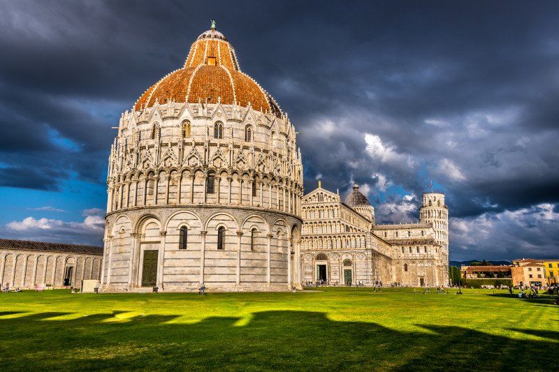
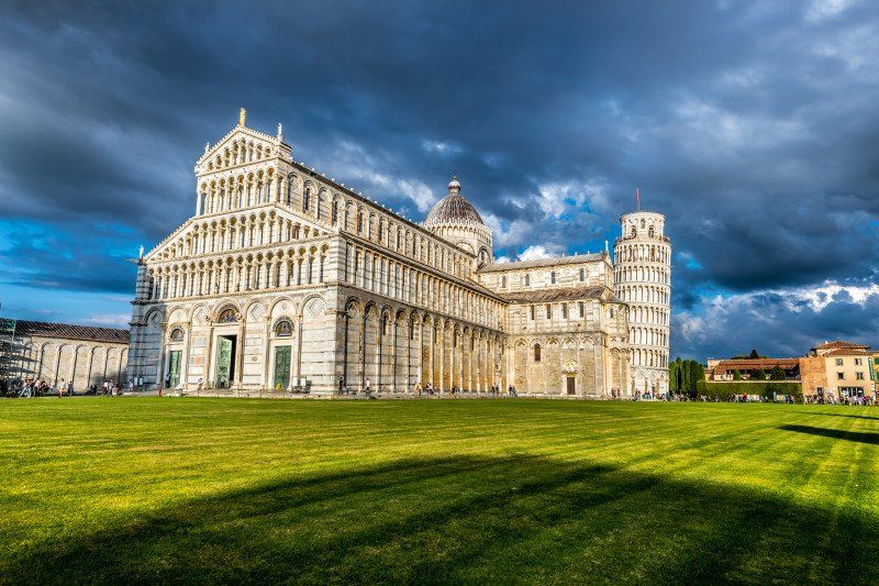
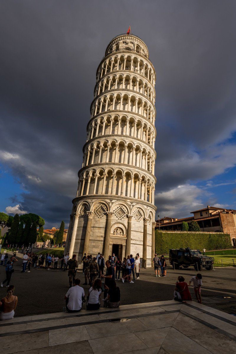
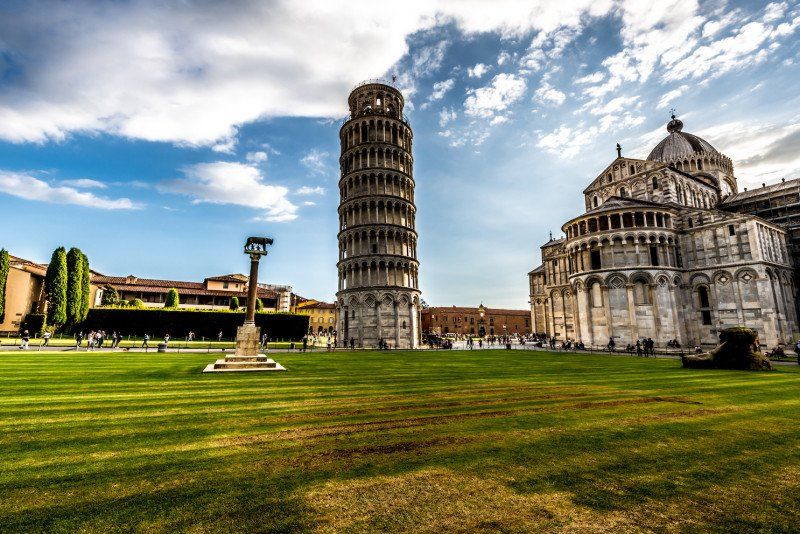
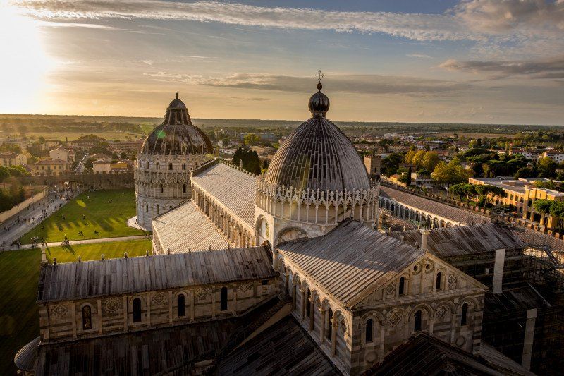
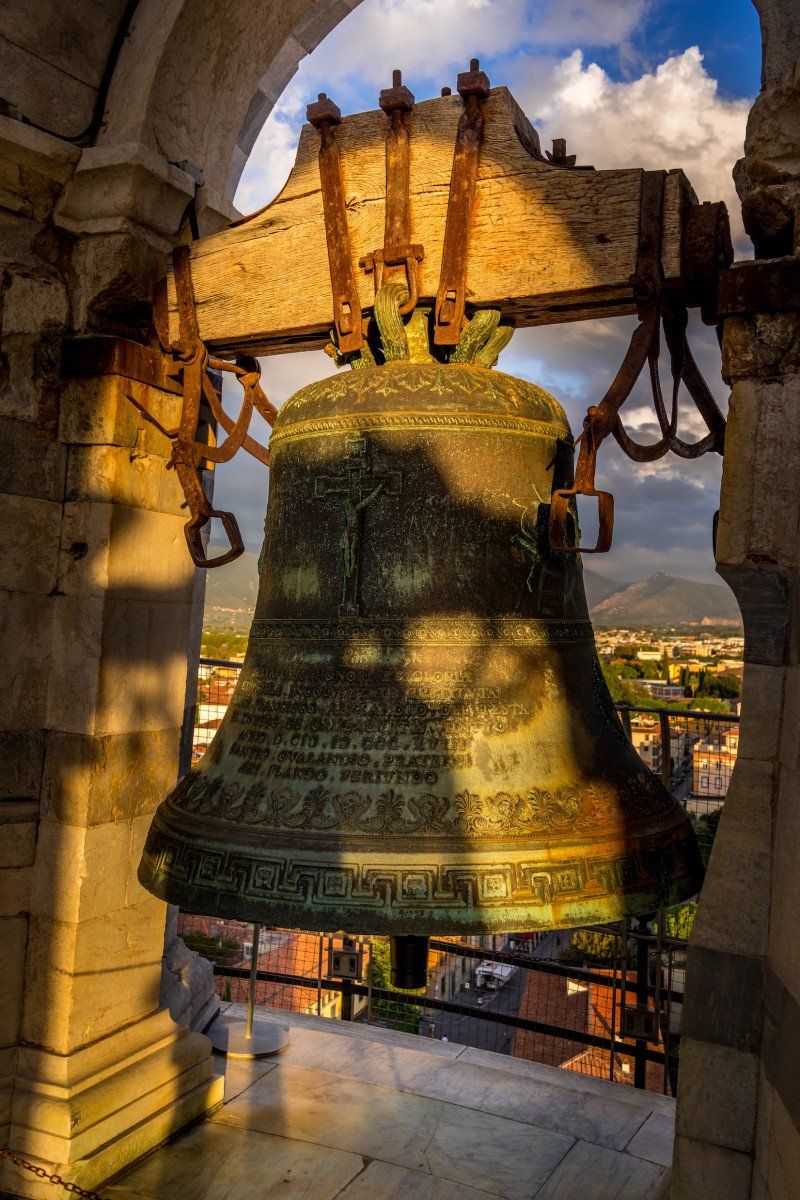
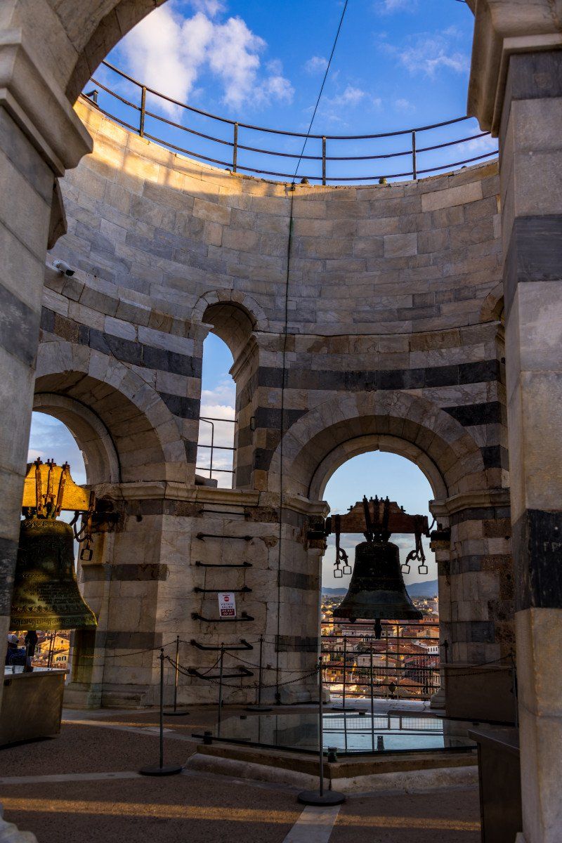
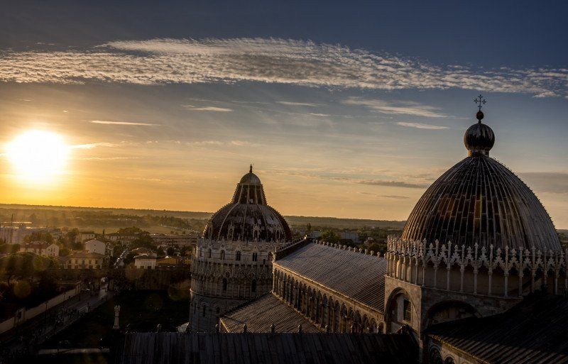
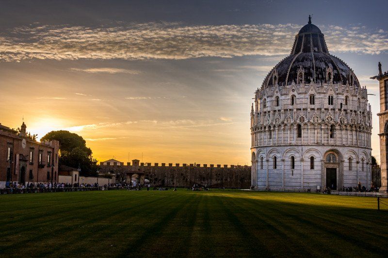
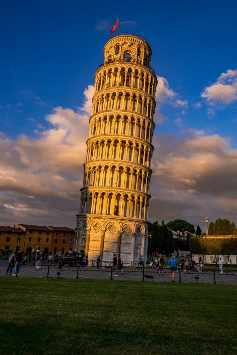
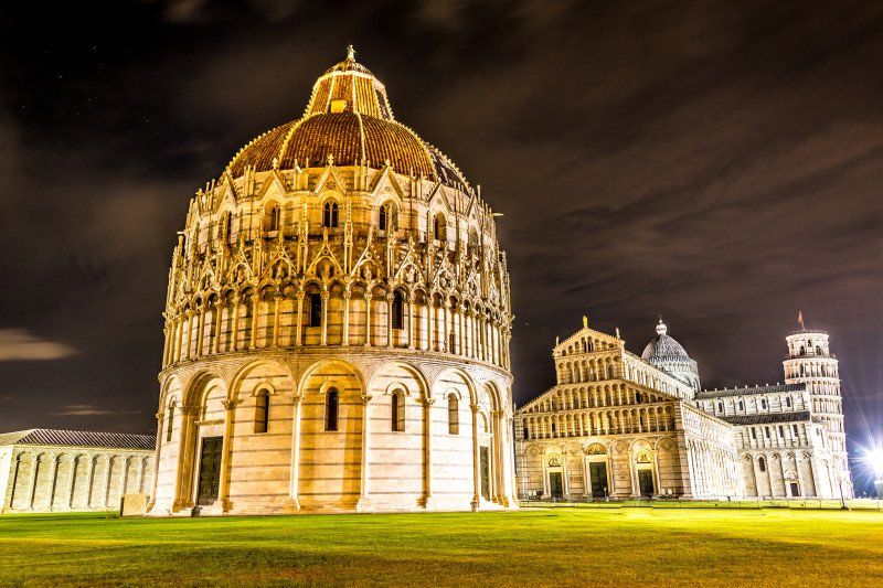
We parked the car, plugged in the electricity, packed our photo rucksack and set off for the city. The walk directly to the leaning tower took 13 minutes. There were also a lot of people, but compared to the main season there were few, and we were able to take photos of the tower from several angles. I went to the tower for 20 euros. The completely marble steps were a bit slippery and it was a bit of a strain to get to the top. But the view is very nice. We were there at dusk and the sun was slowly setting and it lit up the tower beautifully. We went to eat something in a restaurant that is a bit hidden at the beginning of the tourist mile. La Bucca restaurant. The pizza was sensational and at a very good price, considering that you are about 60 mt. seated by the leaning tower of Pisa. It was getting dark and we took a few more pictures with the tripod and were back at the square around 9 p.m. What surprised us was that in the evening the tower was also accessible from the outside, it was guarded by soldiers, but you could move around freely.
43° 43' 22.2" N 10° 24' 6.1" E
43.7228386 10.4016888
• Head toward Via Luigi Bianchi on Via Contessa Matilde. Go for 5 m.
• Continue on Via del Brennero. Go for 596 m.
• Take the 1st exit from Rotonda Martiri delle Foibe roundabout onto Via del Brennero. Go for 75 m.
• Keep left onto Strada Statale dell'Abetone e del Brennero (SS12). Go for 4.3 km.
• Take the 1st exit from roundabout onto Strada Statale dell'Abetone e del Brennero (SS12). Go for 523 m.
• Continue on Via Carlo Barsotti (SS12radd). Go for 9.0 km.
• Take the 2nd exit from roundabout toward Lucca Centro/Autostrade. Go for 314 m.
• Continue on Via di Vicopelago. Go for 1.8 km.
• Turn right toward Viale Europa. Go for 78 m.
• Keep left onto Viale Europa toward Lucca Centro/Autostrade. Go for 163 m.
• Keep right onto Viale Europa toward Pescia/SS435/Camaiore/SP1/Castelnuovo Garfagnana/SP2/Abetone. Go for 778 m.
• Keep left onto Viale Europa toward Viareggio/Castelnuovo Garfagnana/Abetone/Camaiore. Go for 86 m.
• Take the 3rd exit from roundabout onto Viale Idelfonso Nieri. Go for 330 m.
• Continue on Piazzale Italia. Go for 36 m.
• Take the 3rd exit from Piazzale Italia roundabout onto Piazzale Italia. Go for 106 m.
• Continue on Viale Gaetano Luporini. Go for 106 m.
• Take the 1st exit from roundabout onto Viale Gaetano Luporini. Go for 183 m.
• Turn left. Go for 33 m.
• Arrive at your destination on the left.
☍
18,5 km
( 22 min.)
Day
Parking Autocaravan
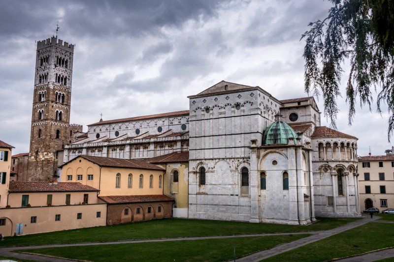
Due to the weather conditions and prospects, we mixed up our tour a bit today. Apart from visiting Lucca, we canceled all destinations and instead went to Lucca by the sea, towards Florence, because the weather forecast was a bit better here. So we left our campsite in Pisa at around 08:45 in the direction of Lucca, where we arrived at around 09:45. We found the parking space without any complications and made our way into town. We watched some videos about the city beforehand and were happy to finally watch them. But we quickly realized that the city didn't have nearly the flair of the previous cities and villages for us. For those who love art of all kinds, this city is kindly disposed. But if you expect that you will find small, dreamy and lovingly designed streets and small, stylishly furnished restaurants, you are wrong. This is a real tourist horny city, which rips everyone off no matter where and not too tight. The only cool thing we did was rent a double bike, which we used to ride the full 4km of the city wall. We were still about 3 hours in this city, with the bike tour alone taking 1 hour, then went back to the mobile home a little disappointed, treated ourselves to a sandwich and freshly bought fruit there and then made our way to Florence.
Via Gaetano Luporini, 55100, Lucca, Italy43° 50' 24" N 10° 29' 18" E
Via Gaetano Luporini, 55100, Lucca, Italy
43° 50' 24" N 10° 29' 18" E
43.8400000 10.4883333
• Head north. Go for 33 m.
• Turn right onto Viale Gaetano Luporini. Go for 154 m.
• Take the 3rd exit from roundabout onto Viale Gaetano Luporini. Go for 137 m.
• Continue on Piazzale Italia. Go for 37 m.
• Take the 1st exit from Piazzale Italia roundabout onto Piazzale Italia. Go for 53 m.
• Continue on Viale Idelfonso Nieri. Go for 257 m.
• Take the 1st exit from roundabout onto Viale Europa toward A11/Autostrade/A12/SS12/Pisa/SR12/Pontedera/SR424. Go for 817 m.
• Turn right toward Autostrada Firenze Mare/A11. Go for 119 m.
• Take left ramp onto A11 (Autostrada Firenze Mare) toward Firenze. Go for 61.3 km.
• Take the exit toward Roma/Siena onto A1 (Autostrada del Sole). Go for 20.1 km.
• Take the exit toward Firenze Sud/Forlì onto SP127 (Raccordo Di Varlungo). Go for 4.5 km.
• Continue on Via Generale Carlo Alberto Dalla Chiesa toward Settignano/Stadio Coverciano/Fiesole. Go for 834 m.
• Turn right. Go for 148 m.
• Arrive at your destination on the left.
☍
88,4 km
( 51 min.)
Firenze Camping in Town, Via Generale C. A. dalla Chiesa, Florenz, Italien
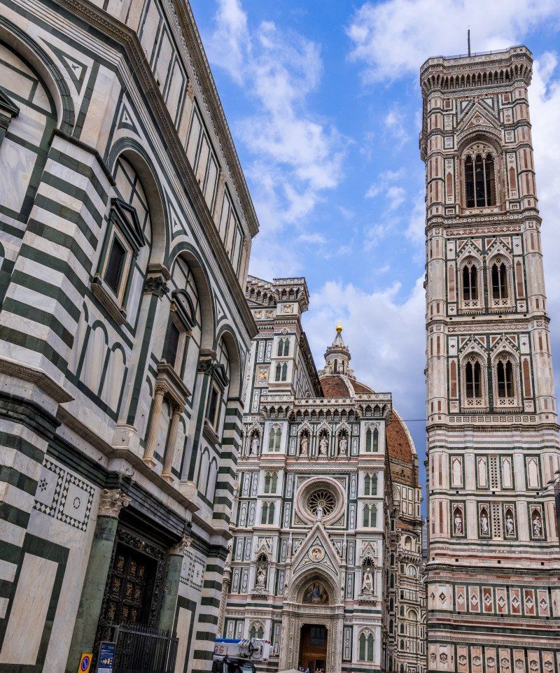
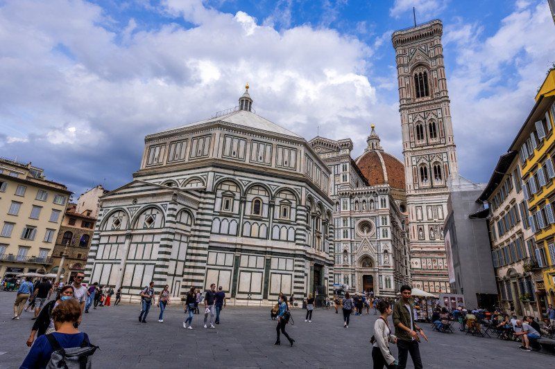
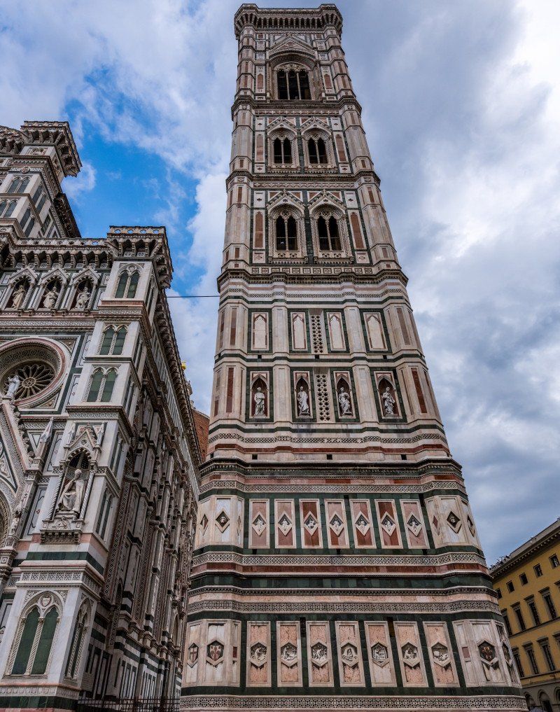
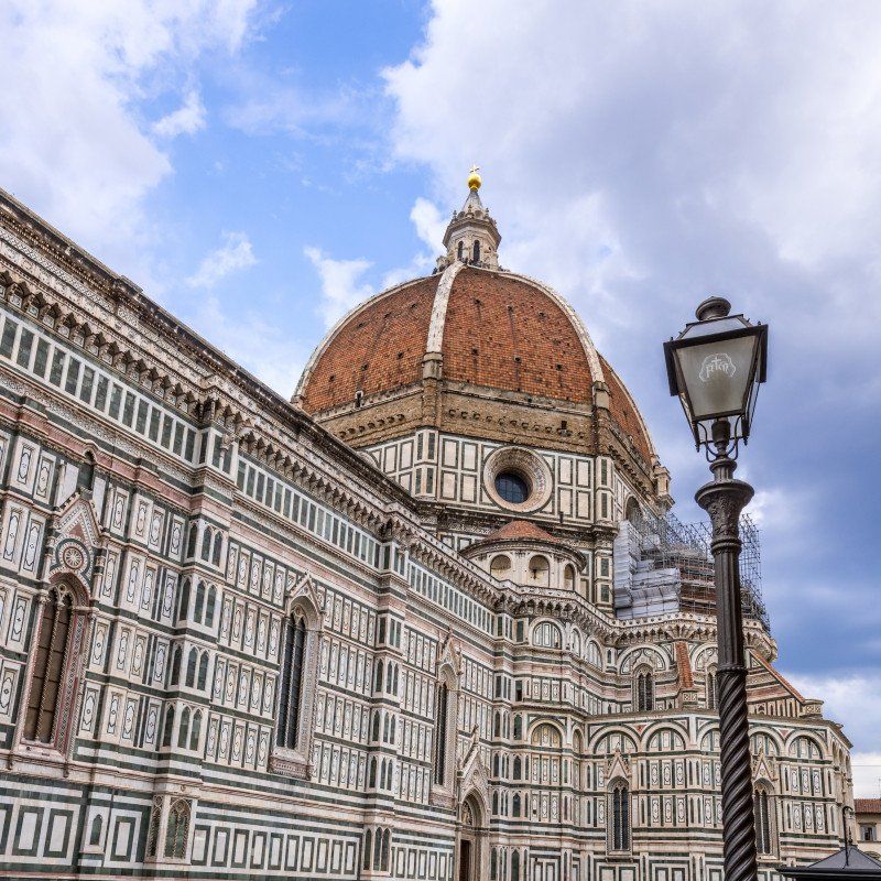
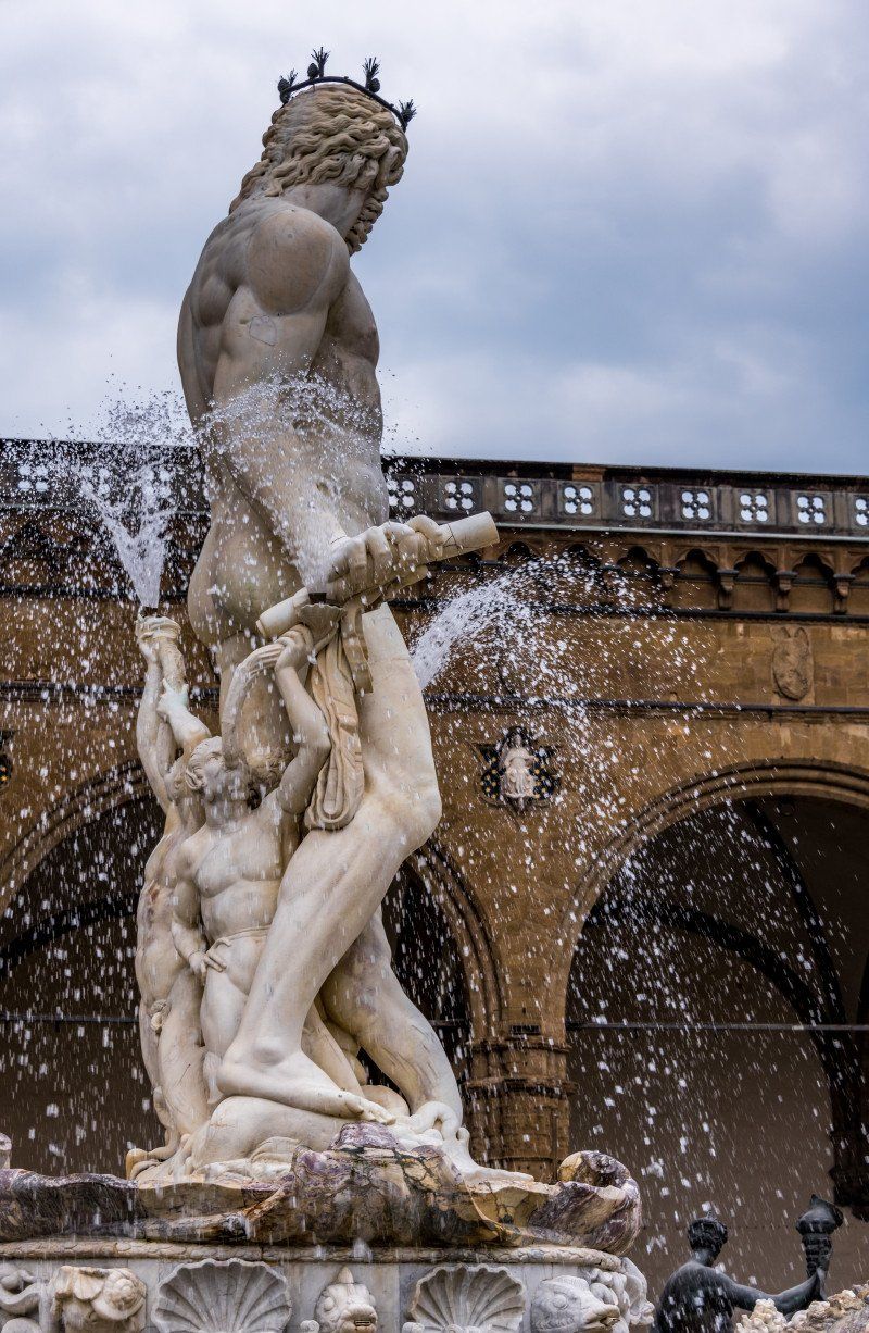
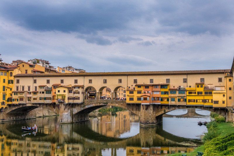
To make it faster, we took the A11 motorway to Florence, which cost us 5.30 euros. But the GPS took us off the motorway in front of the city due to a construction site which caused a traffic jam. As a result, he took us all over the city. The volume of traffic was relatively high and especially the scooter drivers drove past you left and right without looking too much, and yet very few accidents happen here. We reached the campsite after around 1 3/4 hours. As everywhere, we were welcomed very friendly and we were assigned a seat, which was ok. The price, on the other hand, is very expensive and for 46 euros / night the highest of all the places we went to on this tour, but we decided on that because we wanted to visit the city and the parking spaces in the city seemed a bit too unsafe to us. There is a shuttle bus to the city from the campsite, and the bus 14 which is 200 meters away. has a stop from the campsite. We opted for the regular bus because the shuttle bus doesn't go that far into town and for 6 euros for two people there and back with a journey time of 35 minutes each way it is not expensive either. We bought the tickets at the Tourist Info on the campsite and set off. We got off at the last stop and found ourselves fully in the center. We took a few steps and stood in front of the imposing cathedral, where we treated ourselves to an aperitif in a bar and let the impressions sink in. We took a map in advance from the Tourist Info on the campsite, and with this we set out to look at the many sights. The city is many times more attractive than Lucca and the flair cannot be compared either. We walked through small but lively streets and rattled through the historical monuments one by one. At the Basilca di San Lorenzo near the Palazzo Medici we had dinner in a trattoria and then made our way back to the bus stop.
Via Generale CA dalla Chiesa, 1/3, 50136 Firenze FI, Italy 43 ° 45 '52.7 "N 11 ° 18' 58" E
Via Generale C. A. dalla Chiesa, 1/3, 50136 Firenze FI, Italien
43° 45' 52.7" N 11° 18' 58" E
43.7646314 11.3161007
• Head north. Go for 148 m.
• Turn right onto Via Generale Carlo Alberto Dalla Chiesa (SS67). Go for 489 m.
• Take the 4th exit from Piazzale Renato Cappugi roundabout onto Via Aretina (SS67) toward Centro/A1/Autostrade/A11/Siena. Go for 1.5 km.
• Continue on Via Enrico De Nicola. Go for 204 m.
• Turn left onto Ponte Paolo Borsellino (SP127) toward Aeroporto A. Vespucci/Autostrade/A11/A1/Siena-Pisa/Via Villamagna/Bagno a Ripoli. Go for 3.7 km.
• Take left ramp onto A1 (Autostrada del Sole) toward Bologna/Siena/Firenze/A11/Pisa Nord. Go for 38.8 km.
• Keep right onto A1var toward Bologna/Barberino. Go for 39.1 km.
• Continue on A1 (Autostrada del Sole). Go for 9.4 km.
• Take the exit toward Sasso Marconi. Go for 676 m.
• Continue on Via Setta. Go for 210 m.
• Take the 3rd exit from roundabout onto Raccordo Autostradale Sasso Marconi SS64 Porretana toward Bologna/SS64. Go for 2.8 km.
• Continue straight ahead. Go for 33 m.
• Take the 1st exit from roundabout. Go for 117 m.
• Continue on SS64var. Go for 6.9 km.
• Keep right onto SS64var toward Bologna/SS64/Casalecchio di Reno/SS64/Sasso Marconi/Borgonuovo. Go for 211 m.
• Take the 3rd exit from roundabout onto SS64var toward Borgonuovo Centro/Sasso Marconi/SS64/Casalecchio di Reno/SS64/Bologna/SS64. Go for 936 m.
• Take the 1st exit from roundabout onto Via Porrettana (SS64) toward Autostrade/A1/A13/A14/Casalecchio di Reno/Bologna. Go for 1.1 km.
• Pass 4 roundabouts and continue on Strada Statale Porrettana (SS64). Go for 2.8 km.
• Take the 2nd exit from Rotonda Biagi roundabout onto Raccordo Autostrada Tangenziale toward Bologna/Valsamoggia/SS569. Go for 897 m.
• Take left ramp onto Asse Sud-Ovest (SP569) toward A1/A13/Tangenziale/A14/Valsamoggia/SS569/Zona Industriale Via del Lavoro/Autostrade. Go for 828 m.
• Take ramp onto Tangenziale Casalecchio-San Lazzaro (RA1) toward Autostrade/A1/A13/A14. Go for 628 m.
• Take ramp onto A14 (Autostrada Adriatica) toward Milano/A1/Firenze. Go for 630 m.
• Take the exit toward Milano onto A1 (Autostrada del Sole). Go for 84.2 km.
• Take the exit toward Parma Centro/Fiera di Parma. Go for 1.3 km.
• Keep right toward Tangenziale/Parma Centro/Aeroporto. Go for 28 m.
• Take left ramp onto Viale Europa. Go for 684 m.
• Pass 3 roundabouts and continue on Viale Europa. Go for 1.2 km.
• Take ramp onto Via Emilia (SS9) toward Tangenziale di Parma/Aeroporto/Piacenza/La Spezia/SS62/Langhirano. Go for 3.9 km.
• Take ramp onto Tangenziale Unione Europea toward Tangenziale. Go for 696 m.
• Take ramp toward Via Emilia Ovest. Go for 235 m.
• Take the 4th exit from roundabout onto Via Emilia Ovest (SS9) toward Centro. Go for 165 m.
• Turn right onto Largo 24 Agosto 1942. Go for 153 m.
• Turn right. Go for 29 m.
• Arrive at your destination on the left.
☍
204,7 km
(2 hrs. 2 min.)
Day
Area Sosta Camper - Parma, Largo 24 Agosto 1942, Parma, Italien
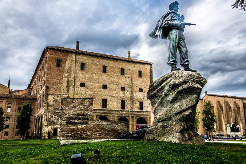
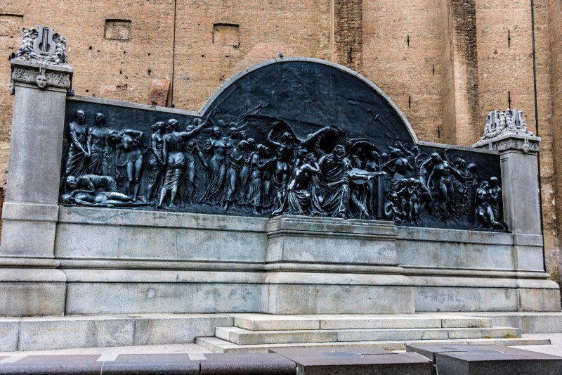
Based on the weather report, we adjusted the initial tour again today and drove from Florence on the A11 to Parma. Due to some construction sites and traffic jams, the journey took about 2:45 hours and arrived at the Area Sosta campsite outside Parma at around 1:30 pm. We were served very friendly and helpful and the groundskeeper tries very hard to make everyone feel comfortable. Everything is available on the square, except for a market but right next to it there is a Lidl. Supply and disposal everything tip top. The only thing that bothers is the proximity to the motorway which is just behind a sound barrier. There is very little traffic at night, in the morning after 5 a.m. it starts again. But otherwise everything is tip top. When we came back from the city tour, the place was full. So it is worth arriving around lunchtime. We were able to get on the bus number 23 from the nearest stop, which is about 100 meters from the entrance to the square, and drive to shortly before the cathedral square. The ticket costs 2.50 euros and is valid for the whole day. We first went back to the Tourist Office to pick up a map of the city and then we started again, with walking and looking, marveling and taking photos. Up to now we have known the city the least, but we were pleasantly surprised at how beautiful and varied it is. We treated ourselves to an aperitif with a plate of Parma ham and salami in a restaurant in an alley. Mmmmhhh que Buono. After about 4 hours we were back on the square, grilled a hamburger and let the evening end with a glass of wine.
Largo 24 Agosto 1942, 21 / a, 43126 Parma PR, Italy 44 ° 48 '31.8 "N 10 ° 17' 3.4" E
Largo 24 Agosto 1942, 21/a, 43126 Parma PR, Italien
44° 48' 31.8" N 10° 17' 3.4" E
44.8088264 10.2842817
• Head toward Largo 24 Agosto 1942. Go for 29 m.
• Turn left onto Largo 24 Agosto 1942. Go for 153 m.
• Turn left onto Via Emilia Ovest (SS9). Go for 77 m.
• Take the 1st exit from roundabout onto Tangenziale Unione Europea toward Tangenziale di Parma/Aeroporto/Autostrade/Mantova/SP343r/Piacenza/SS9/Reggio E. Go for 574 m.
• Take ramp onto Tangenziale Unione Europea toward Aeroporto/Milano-Bologna/A1/Reggio Emilia/SS9/Mantova/SP343r. Go for 3.9 km.
• Take ramp onto Viale Europa toward Milano/A1/Bologna. Go for 487 m.
• Pass 3 roundabouts and continue on Viale Europa. Go for 1.5 km.
• Take ramp toward Milano/A1/Bologna/E35/Zona Industriale Paradigna. Go for 433 m.
• Keep left toward Milano-Bologna/Tangenziale. Go for 98 m.
• Take ramp onto A1 (Autostrada del Sole) toward Milano. Go for 106 km.
• Keep right onto A50 (Tangenziale Ovest) toward E62/Genova/A7/E66/Torino/A4/Varese-Gravellona T./A8/A26/Como-Chiasso/A9/Fiere-Aeroporto Malpensa. Go for 31.7 km.
• Take the exit toward Varese/Gravellona T./A26/Como-Chiasso/A9 onto A8 (Autostrada dei Laghi). Go for 4.9 km.
• Take the exit toward Como/Chiasso onto A9 (Autostrada dei Laghi). Go for 23.7 km.
• Take the exit toward Como Centro. Go for 725 m.
• Take the 3rd exit from roundabout onto Via del Dos toward Varese/Chiasso. Go for 589 m.
• Take the 2nd exit from roundabout onto Via Gabriele D'Annunzio (SP17) toward Chiasso/S.Fermo. Go for 2.0 km.
• Pass 2 roundabouts and continue on Via Roma (SP17). Go for 539 m.
• Take the 1st exit from roundabout onto Via Alessandro Noseda (SP17). Go for 216 m.
• Take the 2nd exit from roundabout onto Strada Provinciale Garibaldina (SP17). Go for 2.1 km.
• Take the 2nd exit from Largo Ceresio roundabout onto Via Luigi Camozzi. Go for 179 m.
• Take the 3rd exit from roundabout onto Via Bellinzona toward Chiasso/Cernobbio/Menaggio. Go for 748 m.
• Take the 3rd exit from roundabout onto Via Bellinzona toward Milano/A9/Svizzera. Go for 1.1 km.
• Take the 1st exit from roundabout onto Via Bellinzona. Go for 60 m.
• Continue on Via Bellinzona. Go for 142 m.
• Continue on Via Maestri Comacini (2). Go for 538 m.
• Take the 1st exit from roundabout onto Via Como (2). Go for 227 m.
• Take the 1st exit from roundabout toward Lugano. Go for 173 m.
• Take ramp onto A2 toward Lugano. Go for 40.3 km.
• Take exit 48 toward Rivera/Monte Ceneri onto 2. Go for 7.7 km.
• Continue on Via Monte Ceneri. Go for 560 m.
• Take the 2nd exit from roundabout onto Via Cantonale (406). Go for 525 m.
• Pass 4 roundabouts and continue on Via Monte Ceneri (406). Go for 3.8 km.
• Keep right onto 406. Go for 1.8 km.
• Take the 2nd exit from roundabout onto A13. Go for 3.4 km.
• Take ramp onto Via San Gottardo (13) toward Orselina/Brione s/M/Muralto/Minusio. Go for 3.7 km.
• Keep left onto Via della Stazione (13). Go for 92 m.
• Turn right onto Via della Stazione (13). Go for 572 m.
• Continue on Lungolago Giuseppe Motta. Go for 466 m.
• Turn left onto Viale al Lido. Go for 280 m.
• Continue on Via Gioacchino Respini. Go for 652 m.
• Turn left onto Viale Giovacchino Respini. Go for 166 m.
• Turn right. Go for 38 m.
• Turn left. Go for 93 m.
• Turn slightly right. Go for 51 m.
• Arrive at your destination on the right.
☍
247,4 km
(2 hrs. 39 min.)
Day
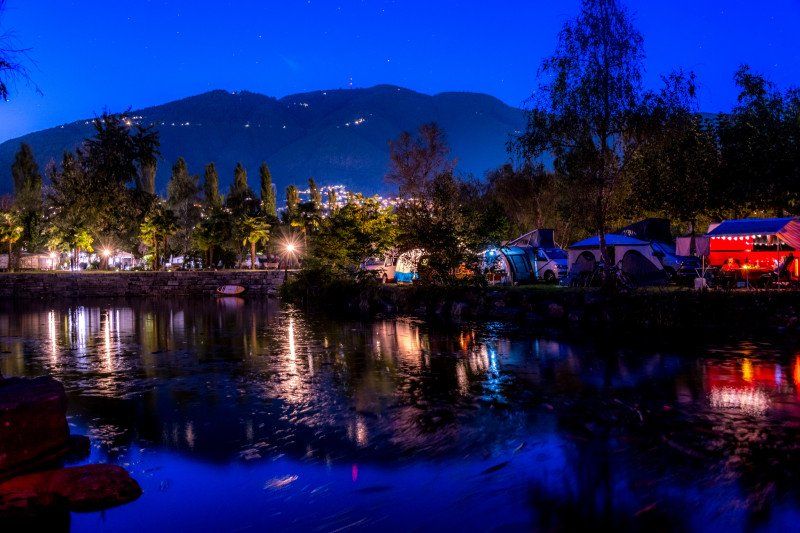
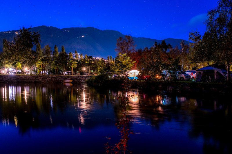
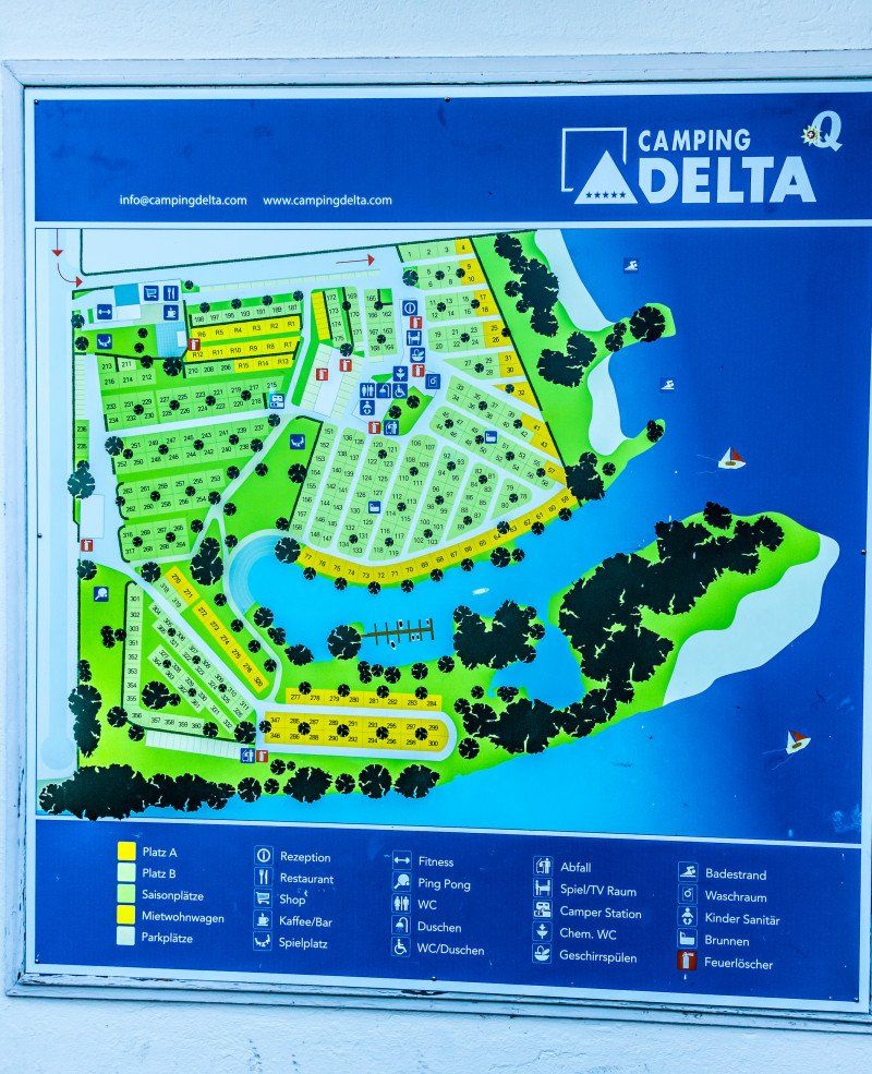
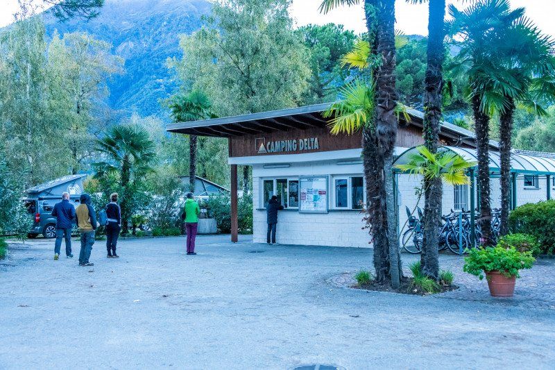
Camping Delta
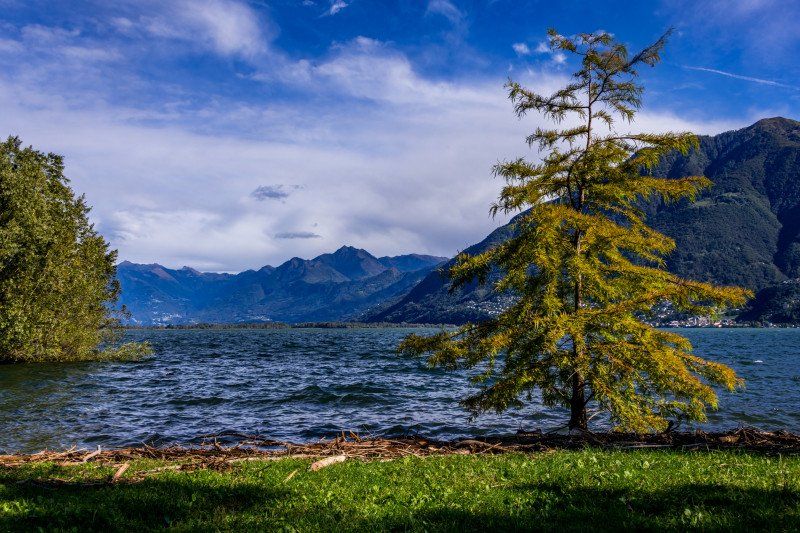
We chose a campsite in Locarno for the last day to end the holiday here, but also that we could do a city tour in Locarno and still enjoy the warmth at the lake and take some photos. We drove from Parma around 10:00 a.m. made a stop at the outlet Fidenza Village on Via Federicco Fellini in Fidenza which is located directly on the Autostrada towards Milan. Then we drove about 2 1/4 hours to Locarno, where we were welcomed again in a very friendly manner and were able to choose a place. We decided on a slightly more expensive place right on the lake for Sfr for the last evening. 67.- to treat ourselves. The place is a 5 star place and rightly so. The supply and supply alone could have been made a little better, but the rest was great. We hooked up everything and went into town on foot.
Via Respini 27, 6600, Locarno, Switzerland 46 ° 9 '20.4 "N 8 ° 48' 2.6" E
Via Respini 27, 6600, Locarno, Switzerland
46° 9' 20.4" N 8° 48' 2.6" E
46.1556600 8.8007100
• Head southeast. Go for 144 m.
• Turn right. Go for 38 m.
• Turn left toward Viale Giovacchino Respini. Go for 6 m.
• Continue on Viale Giovacchino Respini. Go for 160 m.
• Turn right onto Via Gioacchino Respini. Go for 652 m.
• Continue on Viale al Lido. Go for 280 m.
• Continue on Lungolago Giuseppe Motta. Go for 466 m.
• Turn left onto Via Giovanni Antonio Orelli (13). Go for 584 m.
• Arrive at Via Giovanni Antonio Orelli (13). Your destination is on the left.
☍
2,3 km
( 6 min.)
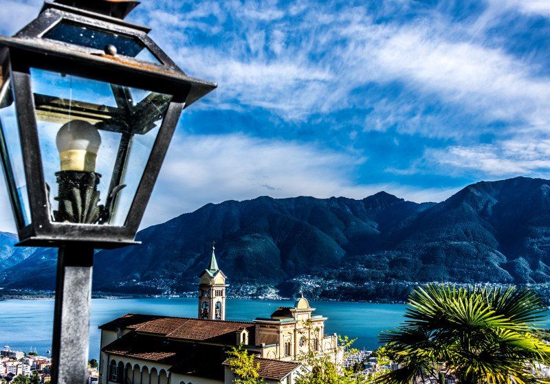
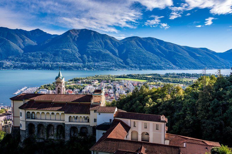
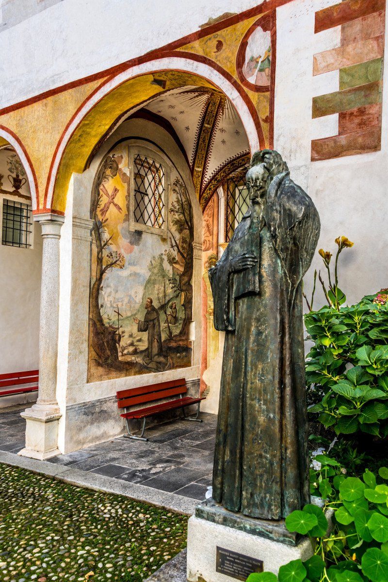
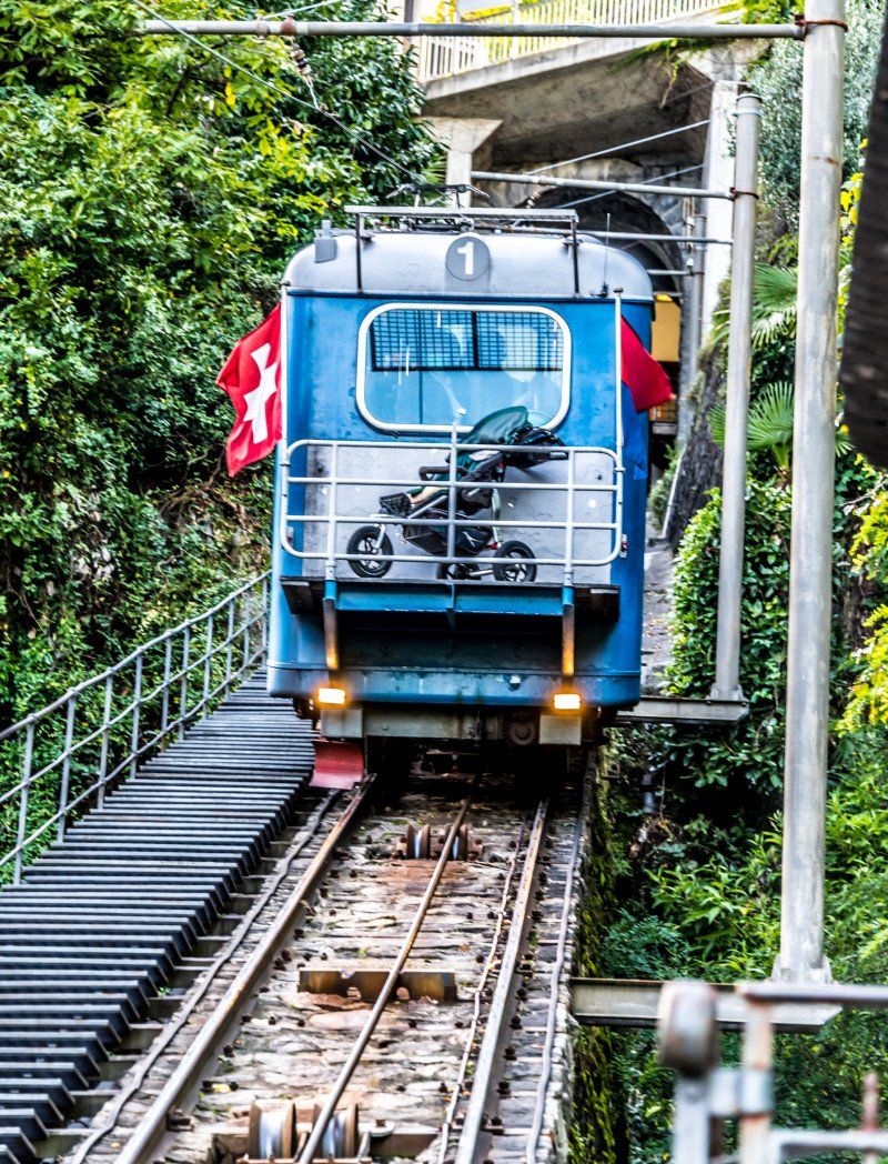
Locarno, Schweiz
The way was about 15 minutes and went all along the lake. We made a detour with the funicular to the Madonna del Sasso where you have a wonderful view of Locarno. The price of Sfr. 7.20 / person is humane. We treated ourselves to an aperitif and walked down to the Madonna del Sasso. Then we were able to take the funicular again to Locarno on the way, you can also walk. We went to the Piazza Grande where there is a music festival once a year and decided to have dinner in one of the restaurants around the square. We ended up at Restaurant America and we weren't disappointed. Highly recommend the hot stone with chicken horse or cattle entercote. Price and quality match perfectly. Very good restaurant with very friendly staff. Then we walked back to the square and enjoyed the last night in the mobile home.
46° 10' 1.2" N 8° 47' 39.4" E
46.1669988 8.7942643
• Head west on Piazza Castello. Go for 10 m.
• Take the 2nd exit from Piazza Castello roundabout onto 13. Go for 580 m.
• Take ramp onto A13 toward Lugano/Bellinzona. Go for 9.5 km.
• Take the 1st exit from roundabout onto 406 toward E35/E43/A2/A13/Lugano/Gambarogno/Aeroporto. Go for 1.4 km.
• Keep left onto Via Monte Ceneri (406). Go for 373 m.
• Pass 5 roundabouts and continue on Via Cantonale (406). Go for 4.3 km.
• Take the 3rd exit from roundabout onto Via San Gottardo (406). Go for 3.6 km.
• Take the 1st exit from roundabout onto In Tirada (2). Go for 213 m.
• Take ramp onto A2 toward San Gottardo/E43/San Bernardino/A13. Go for 7.5 km.
• Take exit 45 toward E43/Chur/San Bernardino/Bellinzona Nord onto A13 (Diramazione Bellinzona Nord). Go for 120 km.
• Take exit 15 toward Zizers/Untervaz. Go for 141 m.
• Take the 2nd exit from roundabout onto 3/13. Go for 105 m.
• Take the 3rd exit from roundabout. Go for 136 m.
• Continue on Oberaurütenen. Go for 750 m.
• Turn left onto Werksiedlung. Go for 187 m.
• Continue on Unterm Strässli. Go for 284 m.
• Continue on Kirchgasse. Go for 1.0 km.
• Turn right onto Cosenzstrasse. Go for 115 m.
• Arrive at Cosenzstrasse. Your destination is on the right.
☍
150,7 km
(1 hrs. 48 min.)
Day
Untervaz, Schweiz
After breakfast and clearing up and disposal we went home via the San Bernardino. It was very cold at 6 ° and the snow is not far anymore. It was definitely not the last trip in a motorhome. We will rent one again to gain more experience and then decide whether we will buy one ourselves. We will also visit the Swiss Caravan Salon on November 1st, 21st to gain more impressions. We enjoyed it very much and it was beautiful.
Cosenzstrasse 12, 7204 Untervaz, Schweiz
46° 55' 38.7" N 9° 32' 19.1" E
46.9274169 9.5386397