Womo tour along the East Frisian coast in September 2021 (including Hamburg and Helgoland)
Day
Peine, Deutschland
52° 19' 13.5" N 10° 14' 35.8" E
52.3204095 10.2432670
• Head toward Woltorfer Straße. Go for 10 m.
• Turn left onto Woltorfer Straße (L321). Go for 1.2 km.
• Turn left onto Ostrandstraße. Go for 1.5 km.
• Take the 1st exit from Ascherslebener Kreisel roundabout onto K69 toward A2/Celle/B444/Gewerbegebiet Nord. Go for 423 m.
• Continue on K75 toward A2/Celle/Edemissen/Gewerbegebiet Nord. Go for 345 m.
• Turn right and take ramp onto A2 toward Berlin. Go for 17.6 km.
• Take exit 55 toward Kassel/Salzgitter/BS-Zentrum onto A391. Go for 4.3 km.
• Take the exit toward Hamburger Straße/Celler Straße/Hamburger Str. onto A392. Go for 2.3 km.
• Turn right onto Hamburger Straße (K2) toward Zentrum. Go for 739 m.
• Turn left onto Rebenring (K11) toward Zentrum/Hauptbahnhof/Stadthalle/Technische Universität. Go for 209 m.
• Turn right onto Mühlenpfordtstraße toward Zentrum. Go for 263 m.
• Continue on Am Wendentor. Go for 167 m.
• Continue on Wendenstraße. Go for 436 m.
• Turn left onto Fallersleber Straße. Go for 160 m.
• Turn left onto Wilhelmstraße. Go for 49 m.
• Arrive at Wilhelmstraße. Your destination is on the right.
☍
29,5 km
( 24 min.)
Braunschweig, Deutschland
52° 16' 7.9" N 10° 31' 36.4" E
52.2688736 10.5267696
• Head toward Neue Knochenhauerstraße on Wilhelmstraße. Go for 302 m.
• Turn right onto Wendenstraße. Go for 85 m.
• Continue on Am Wendentor. Go for 167 m.
• Continue on Mühlenpfordtstraße. Go for 263 m.
• Turn left onto Rebenring (K11). Go for 193 m.
• Turn right onto Hamburger Straße (K2) toward Lüneburg/B4/Gewerbegebiet Hansestraße/Volkswagen BS/Hafen Braunschweig. Go for 741 m.
• Turn left toward A391/A2/A39/Watenbüttel/Hannover/Berlin/Lüneburg/Celle/Kassel. Go for 66 m.
• Continue on A392. Go for 973 m.
• Take the left exit toward Hannover-Berlin/Celle/BS-Watenbüttel onto A392. Go for 638 m.
• Take the exit toward Hannover-Berlin/Lüneburg/Flughafen onto A391. Go for 6.2 km.
• Continue on B4. Go for 26.0 km.
• Take the 2nd exit from roundabout onto An der B4 (B4) toward Lüneburg. Go for 24.3 km.
• Turn left onto Hagener Straße (L280) toward Munster/Unterlüß/Celle. Go for 293 m.
• Turn left onto Schulstraße. Go for 118 m.
• Arrive at Schulstraße. Your destination is on the right.
☍
60,3 km
( 48 min.)
Sprakensehl, Deutschland
29365 Sprakensehl, Deutschland
52° 45' 57.3" N 10° 29' 21" E
52.7659232 10.4891642
• Head north on Schulstraße. Go for 118 m.
• Turn left onto Hagener Straße (L280). Go for 15.6 km.
• Turn right onto Hermannsburger Straße (L280). Go for 2.2 km.
• Turn right onto Neuensothriether Straße (K77). Go for 2.9 km.
• Continue on K47. Go for 5.8 km.
• Continue on Eimker Straße (K9). Go for 5.7 km.
• Turn left onto B71. Go for 749 m.
• Turn right onto Ellerndorfer Straße (K32) toward Brockhöfe. Go for 5.8 km.
• Turn right onto Dorfstraße (L250). Go for 2.7 km.
• Turn left onto Lüneburger Straße (L234). Go for 12.7 km.
• Arrive at Uelzener Straße (L234).
☍
54,2 km
( 43 min.)
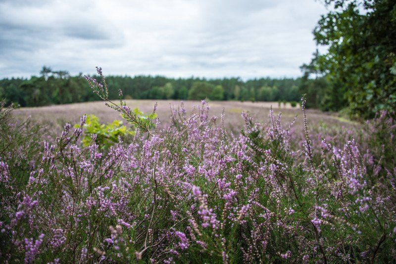
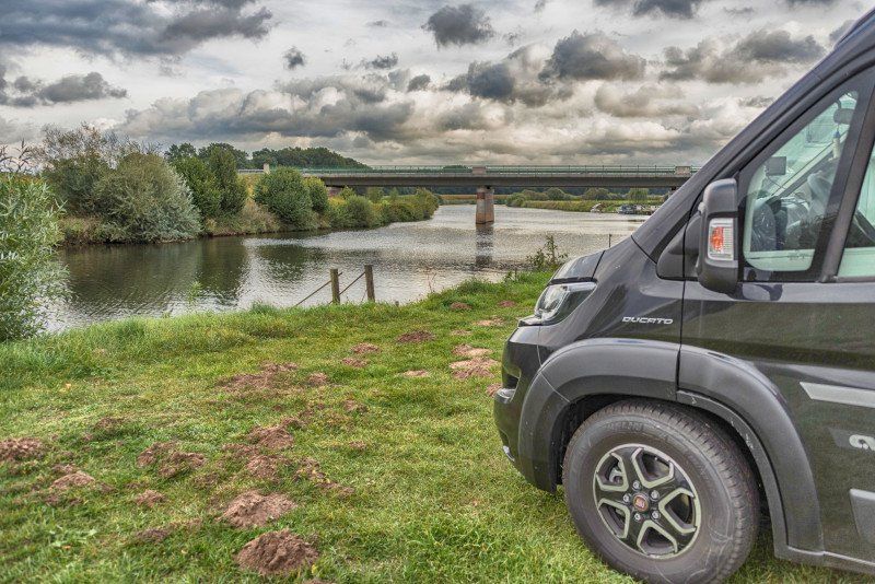
Amelinghausen, Deutschland
Visit to the Kronsbergheide, walk
21385 Amelinghausen, Deutschland
53° 7' 30.2" N 10° 12' 44.7" E
53.1250632 10.2124198
• Head northwest on Uelzener Straße (L234).
• Turn left onto Soltauer Straße (B209). Go for 1.3 km.
• Turn right onto Dehnsener Straße (K9) toward Soderstorf/Dehnsen. Go for 3.8 km.
• Continue on Schulstraße (K45). Go for 3.4 km.
• Continue on K36. Go for 949 m.
• Take the 2nd exit from roundabout onto K36. Go for 1.4 km.
• Turn right onto Dorfstraße (L212). Go for 905 m.
• Turn left and take ramp onto A7 toward Hamburg. Go for 24.9 km.
• Keep left onto Horster Dreieck toward Lübeck/Berlin/Hamburg/Lüneburg/A1. Go for 2.5 km.
• Continue on A1. Go for 10.3 km.
• Take exit 37 toward HH-Stillhorn/HH-Wilhelmsburg. Go for 323 m.
• Turn right onto Stillhorner Weg toward Wilhelmsburg. Go for 134 m.
• Turn left onto Stillhorner Hauptdeich. Go for 1.3 km.
• Continue on Moorwerder Hauptdeich. Go for 2.2 km.
• Turn right onto Moorwerder Hauptdeich. Go for 211 m.
• Arrive at Moorwerder Hauptdeich. Your destination is on the right.
☍
53,6 km
( 37 min.)
Wohnmobilstellplatz Elbepark Bunthaus Hamburg, Moorwerder Hauptdeich, Hamburg, Deutschland
Moorwerder Hauptdeich 33, 21109 Hamburg, Deutschland
53° 27' 40.3" N 10° 3' 47.1" E
53.4611879 10.0630783
• Head northwest on Moorwerder Hauptdeich. Go for 211 m.
• Turn left onto Moorwerder Hauptdeich. Go for 2.2 km.
• Continue on Stillhorner Hauptdeich. Go for 450 m.
• Turn right onto Stillhorner Stegel. Go for 49 m.
• Continue on Stillhorner Weg. Go for 1.0 km.
• Take ramp onto A1 toward Bremen/Hannover. Go for 1.8 km.
• Take exit 38 toward HH-Harburg/Cuxhaven/Harburg onto Neuländer Straße. Go for 2.2 km.
• Continue on Neuländer Straße. Go for 162 m.
• Turn left onto Hannoversche Straße toward Cuxhaven/A7. Go for 867 m.
• Turn right onto Buxtehuder Straße (B73) toward Flensburg/Cuxhaven/Neugraben. Go for 575 m.
• Turn left onto Großer Schippsee. Go for 215 m.
• Arrive at Großer Schippsee. Your destination is on the right.
☍
9,7 km
( 13 min.)
Day
Zoobesuch
Visit to Hagenbeck in the zoo
Day
Day
Harburg, Hamburg, Deutschland
53° 27' 38.8" N 9° 59' 0.9" E
53.4607681 9.9835844
• Head toward Kleiner Schippsee on Großer Schippsee. Go for 59 m.
• Turn left onto Kleiner Schippsee. Go for 161 m.
• Turn right onto Schloßmühlendamm. Go for 208 m.
• Turn left onto Buxtehuder Straße (B73). Go for 16.0 km.
• Turn right onto Hamburger Chaussee (B73) toward Cuxhaven/Stade. Go for 3.8 km.
• Take ramp toward Tostedt. Go for 303 m.
• Turn right onto Lüneburger Schanze toward Tostedt/Moisburg/Buxtehude. Go for 240 m.
• Continue on Moisburger Straße. Go for 325 m.
• Continue on Hauptstraße. Go for 353 m.
• Turn right onto Martinstraße. Go for 190 m.
• Arrive at Martinstraße. Your destination is on the right.
☍
21,7 km
( 28 min.)
Buxtehude, Deutschland
21614 Buxtehude, Deutschland
53° 28' 2.9" N 9° 41' 29.7" E
53.4674857 9.6915741
• Head toward An der Tonkuhle on Martinstraße. Go for 43 m.
• Turn slightly right onto Estestraße. Go for 137 m.
• Turn right onto Ferdinandstraße. Go for 103 m.
• Turn left onto Martinstraße. Go for 54 m.
• Turn right onto Hauptstraße. Go for 101 m.
• Continue on Georgstraße. Go for 99 m.
• Turn left onto Stader Straße (K39). Go for 194 m.
• Turn right onto Stader Straße (K39). Go for 947 m.
• Turn right onto Stader Straße (B73) toward Cuxhaven/Stade. Go for 2.7 km.
• Turn right onto Jorker Straße (K26) toward Jork/Altes Land. Go for 1.7 km.
• Take the 2nd exit from roundabout onto An der Chaussee (K26) toward Jork/A26. Go for 2.2 km.
• Continue on Jorkerfelde (K26). Go for 2.0 km.
• Continue on K26. Go for 456 m.
• Continue on Ostfeld (K26). Go for 795 m.
• Take the 2nd exit from roundabout onto Osterjork (L140). Go for 360 m.
• Arrive at Osterjork (L140). Your destination is on the right.
☍
11,8 km
( 14 min.)
Jork, Deutschland
53° 31' 55.9" N 9° 41' 1.9" E
53.5321932 9.6838518
• Head toward Zum Gräfenhof on Osterjork (L140). Go for 217 m.
• Pass 2 roundabouts and continue on Obstmarschenweg (L140). Go for 5.0 km.
• Turn left onto Hafenplatz (L125) toward A26/Dollern. Go for 2.8 km.
• Turn right and take ramp onto A26 toward Stade. Go for 6.5 km.
• Take the exit toward Stade Zentrum/Stade-Ottenbeck/Gewerbegebiet Süd. Go for 266 m.
• Take the 1st exit from roundabout onto Harburger Straße. Go for 1.8 km.
• Take the 3rd exit from roundabout onto Harburger Straße. Go for 535 m.
• Keep left onto Harburger Straße. Go for 192 m.
• Continue on Harsefelder Straße. Go for 310 m.
• Turn right onto Teichstraße. Go for 170 m.
• Turn left onto Dankersstraße. Go for 44 m.
• Arrive at Dankersstraße. Your destination is on the left.
☍
17,9 km
( 18 min.)
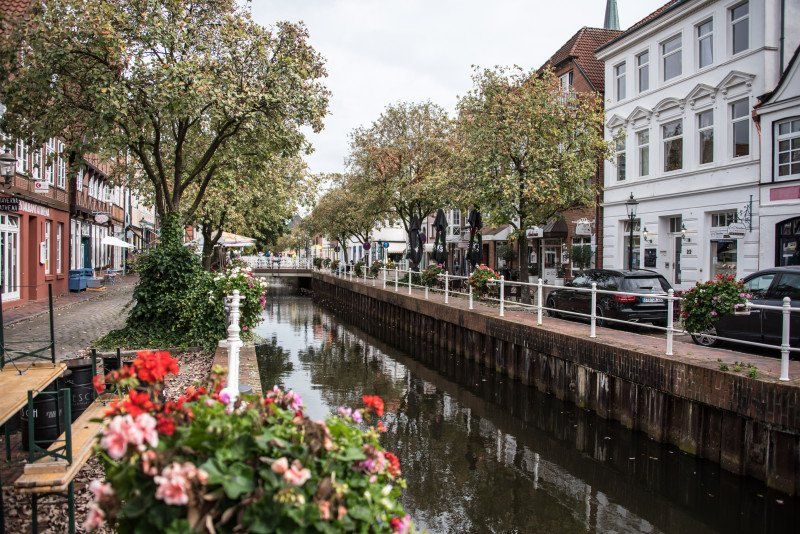
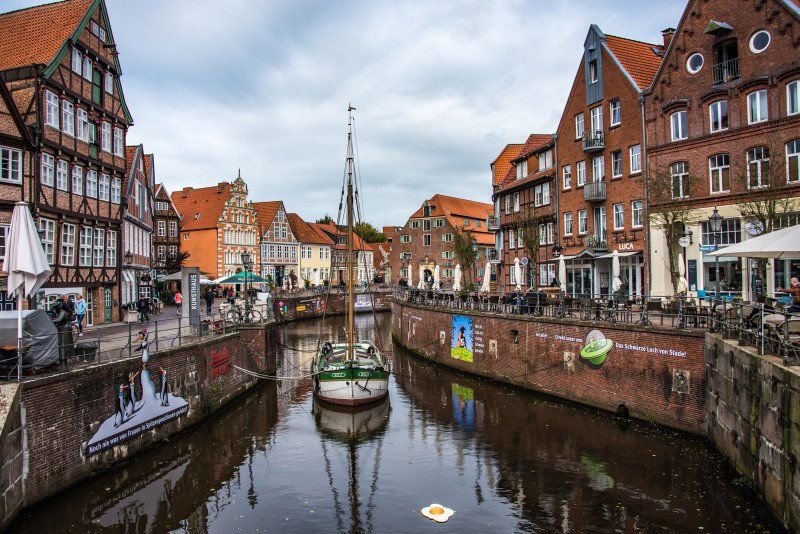
Stade, Deutschland
Overnight on the municipal parking space
53° 35' 34.3" N 9° 28' 15.4" E
53.5928618 9.4709494
• Head toward Teichstraße on Dankersstraße. Go for 44 m.
• Turn right onto Teichstraße. Go for 170 m.
• Turn right onto Harsefelder Straße. Go for 108 m.
• Turn right onto Thuner Straße. Go for 1.2 km.
• Turn right onto B73. Go for 11.7 km.
• Take the 2nd exit from roundabout onto Hauptstraße (B73) toward Cuxhaven/Hechthausen. Go for 38.7 km.
• Turn right onto Stader Landstraße toward Otterndorf. Go for 675 m.
• Continue on Stader Straße. Go for 753 m.
• Continue on Marktstraße. Go for 324 m.
• Continue on Reichenstraße. Go for 127 m.
• Continue on Am Kirchplatz. Go for 64 m.
• Continue on Cuxhavener Straße. Go for 38 m.
• Turn right onto Am Großen Specken. Go for 51 m.
• Turn left onto Am Großen Specken. Go for 70 m.
• Arrive at Am Großen Specken. Your destination is on the right.
☍
54,0 km
( 52 min.)
Day
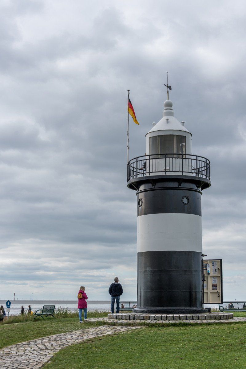
Otterndorf, Deutschland
53° 48' 32.2" N 8° 53' 51.6" E
53.8089499 8.8976663
• Head southeast on Am Großen Specken. Go for 70 m.
• Turn right onto Am Großen Specken. Go for 51 m.
• Turn right onto Cuxhavener Straße. Go for 54 m.
• Take the 2nd exit from roundabout onto Cuxhavener Straße. Go for 716 m.
• Continue on Cuxhavener Landstraße (K70). Go for 1.6 km.
• Turn right onto Cuxhavener Landstraße (B73) toward A27/Cuxhaven. Go for 11.1 km.
• Take the 2nd exit from roundabout onto B73 toward Cuxhaven/Fährhafen. Go for 2.7 km.
• Turn left onto Südersteinstraße. Go for 803 m.
• Continue on Westerwischweg (K2). Go for 391 m.
• Arrive at Westerwischweg (K2). Your destination is on the left.
☍
17,5 km
( 18 min.)
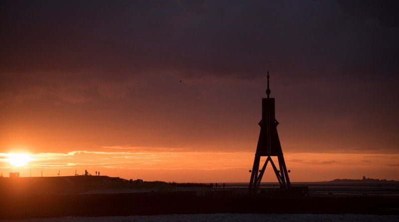
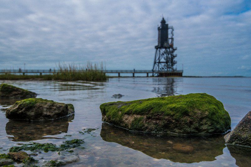
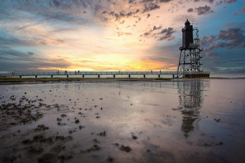
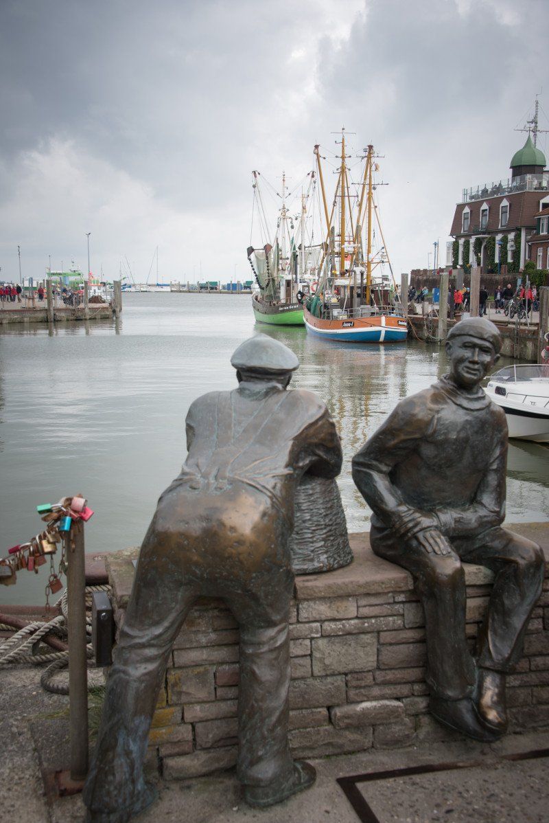
Cuxhaven, Deutschland
Overnight on the pitch in Duhnen
53° 51' 33.6" N 8° 41' 16.5" E
53.8593360 8.6879057
• Head west on Westerwischweg (K2).
• Turn left onto Süderwisch. Go for 1.2 km.
• Turn left onto Drangstweg. Go for 38 m.
• Turn right onto Altenwalder Chaussee (B73) toward A27/Bremerhaven. Go for 2.2 km.
• Continue on Altenwalder Chaussee (L135). Go for 4.1 km.
• Turn right onto Am Möhlendiek (K13) toward Berensch/Oxstedt. Go for 3.1 km.
• Turn left onto Oxstedter Straße (K7). Go for 192 m.
• Continue on Mühlenstraße (K7). Go for 2.9 km.
• Turn right onto Feuerweg (K68). Go for 219 m.
• Continue on Alter Deich (K68). Go for 2.5 km.
• Continue on Cappeler Niederstrich (K68). Go for 3.8 km.
• Continue on Dorumer Niederstrich (K68). Go for 509 m.
• Turn right onto Sieltrift toward Dorum-Neufeld. Go for 2.0 km.
• Continue on Am Kutterhafen. Go for 81 m.
• Turn right onto Am Kutterhafen. Go for 140 m.
• Turn left onto Am Kutterhafen. Go for 96 m.
• Arrive at Am Kutterhafen. Your destination is on the left.
☍
23,1 km
( 29 min.)
Day
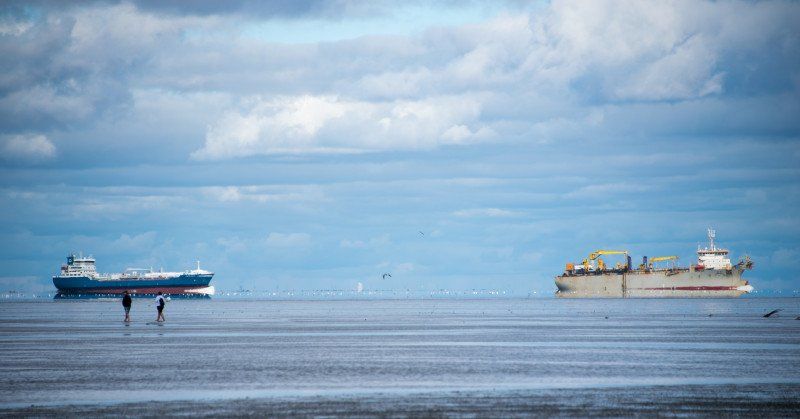
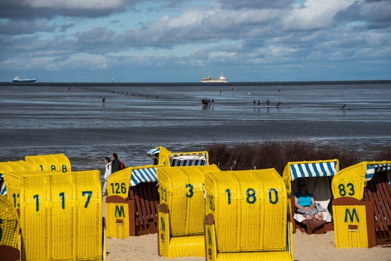
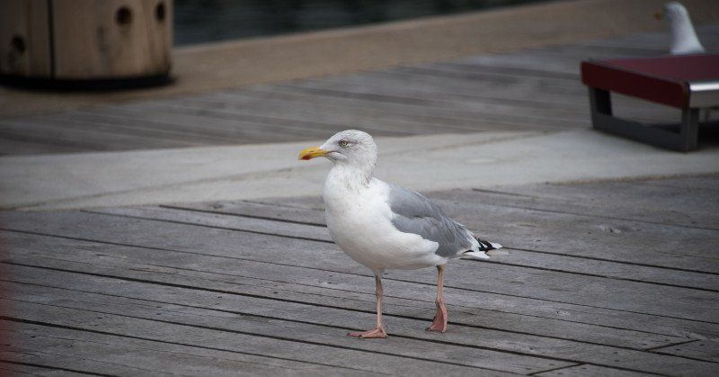
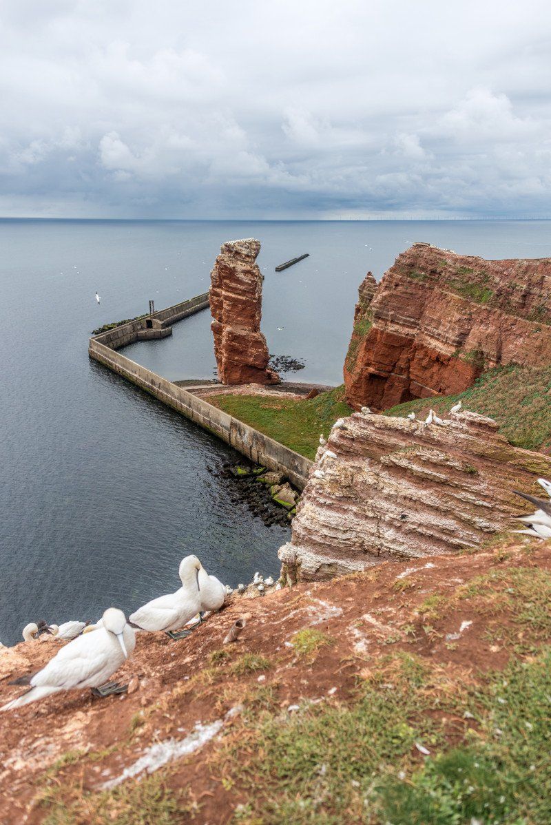
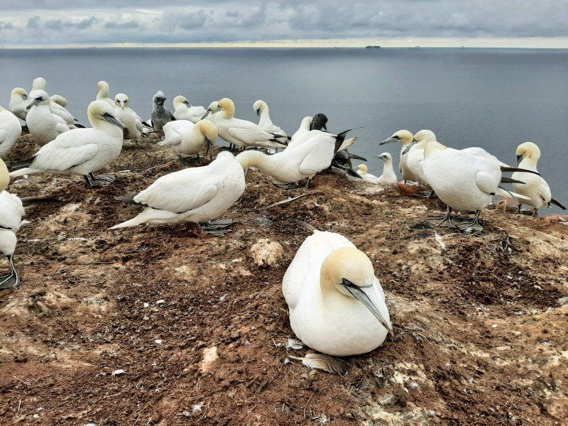
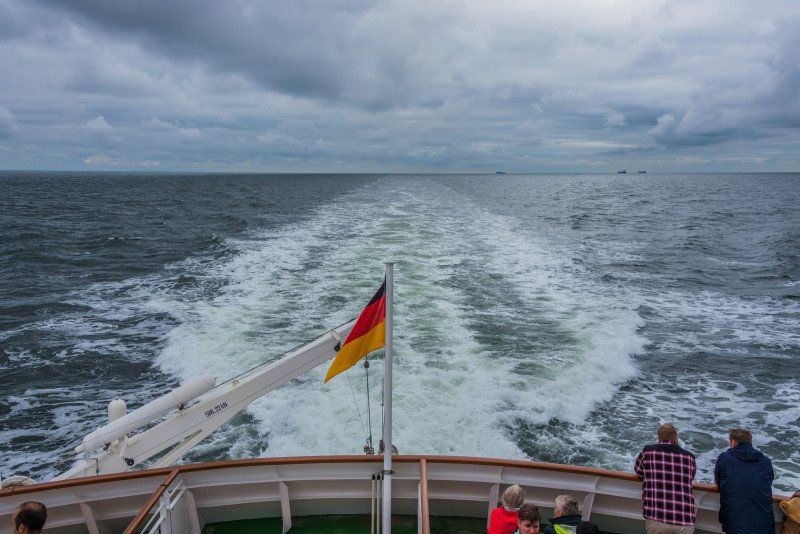
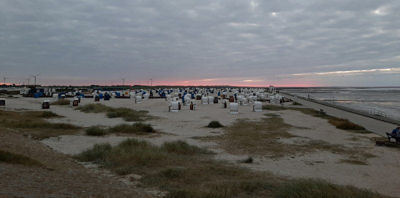
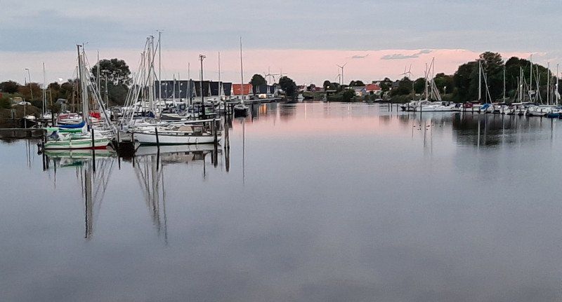
Helgoland
Day trip from Cuxhaven to Helgoland.
For just under 50 euros per person, we boarded the ship to the only German offshore island. Since the weather was also right, we spent a nice 4 hours on the island, time is enough.
Day
Hafen Dorum-Neufeld, Wurster Nordseeküste, Deutschland
Dorum, 27632 Wurster Nordseeküste, Deutschland
53° 44' 19.9" N 8° 30' 57.4" E
53.7388475 8.5159459
• Head northeast on Am Kutterhafen. Go for 65 m.
• Turn left onto Am Kutterhafen. Go for 21 m.
• Turn right onto Am Kutterhafen. Go for 140 m.
• Turn left onto Am Kutterhafen. Go for 81 m.
• Continue on Sieltrift. Go for 2.0 km.
• Turn right onto Dorumer Niederstrich (K68). Go for 751 m.
• Continue on Dorumer Niederstrich (K68). Go for 721 m.
• Continue on Padingbütteler Strich (K68). Go for 2.5 km.
• Continue on Misselwardener Niederstrich (K68). Go for 337 m.
• Continue on Engbütteler Straße (K68). Go for 1.6 km.
• Continue on An der Kreisstraße (K68). Go for 3.3 km.
• Turn right onto Misselwardener Landstraße (L129). Go for 2.4 km.
• Arrive at Wremer Straße (L129). Your destination is on the left.
☍
13,9 km
( 16 min.)
Wremen, Wurster Nordseeküste, Deutschland
Wremen, 27638 Wurster Nordseeküste, Deutschland
53° 38' 52.7" N 8° 30' 32.7" E
53.6479626 8.5090856
• Head toward Im Büttelfeld on Wremer Straße (L129). Go for 6.6 km.
• Continue on Wurster Straße. Go for 1.3 km.
• Turn right onto Senator-Borttscheller-Straße. Go for 2.0 km.
• Continue on Am Nordhafen. Go for 1.1 km.
• Continue on Am Erzhafen. Go for 673 m.
• Turn left onto Brückenstraße. Go for 480 m.
• Continue on Franziusstraße. Go for 1.3 km.
• Turn right onto Barkhausenstraße. Go for 1.7 km.
• Continue on Columbusstraße (B212). Go for 971 m.
• Arrive at Columbusstraße (B212). Your destination is on the left.
☍
16,1 km
( 20 min.)
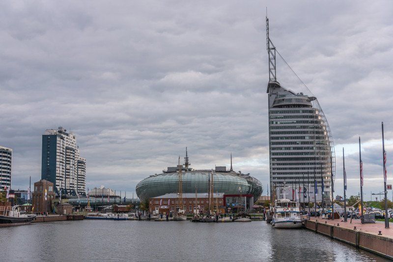
Bremerhaven, Deutschland
Overnight on the "Doppelschleuse" pitch
53° 32' 22.5" N 8° 34' 51.4" E
53.5395845 8.5809424
• Head southeast on Columbusstraße (B212). Go for 469 m.
• Continue on Columbusstraße. Go for 906 m.
• Turn left onto An der Mühle. Go for 805 m.
• Continue on Schiffdorfer Chaussee. Go for 1.2 km.
• Turn right onto Im Felde. Go for 223 m.
• Continue on Poristraße. Go for 181 m.
• Take the 3rd exit from roundabout onto A27 toward Bremen. Go for 10.3 km.
• Take exit 11 toward Oldenburg/A29/Wilhelmshaven. Go for 506 m.
• Continue on B437. Go for 9.8 km.
• Take ramp onto B212. Go for 3.4 km.
• Take ramp onto B437 toward A29/Oldenburg/Wilhelmshaven/Varel. Go for 21.3 km.
• Take the 2nd exit from roundabout onto Bürgermeister-Heidenreich-Straße (B437) toward Oldenburg/Wilhelmshaven/Friedeburg/B436. Go for 3.1 km.
• Take ramp onto A29 toward Wilhelmshaven. Go for 21.0 km.
• Take exit 4 toward Schillig/Horumersiel/Hooksiel/Sengwarden onto L810. Go for 11.7 km.
• Take the 3rd exit from roundabout onto Pakenser Altendeich (L810) toward Schilling/Horumersiel/Jever. Go for 5.0 km.
• Continue on Wiarder Altendeich (L810). Go for 1.2 km.
• Continue on Kaisershof (L810) toward Horumersiel/Schillig. Go for 304 m.
• Continue on L810. Go for 705 m.
• Continue on Goldstraße (L810). Go for 186 m.
• Turn right onto Goldstraße. Go for 224 m.
• Turn left onto Fasanenweg. Go for 55 m.
• Turn left onto Schnepfenweg. Go for 20 m.
• Arrive at Schnepfenweg.
☍
92,6 km
(1 hrs. 12 min.)
Day
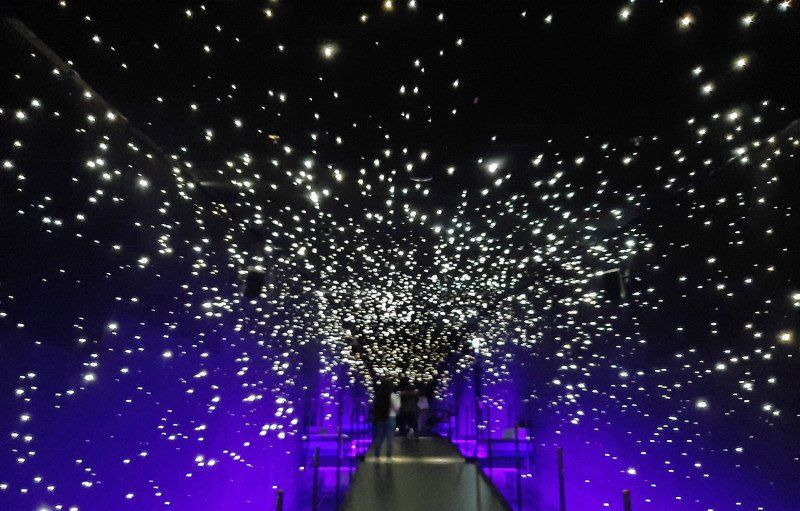
Besuch im Klimahaus
Just admire the climate house
Horumersiel, Wangerland, Deutschland
Horumersiel, 26434 Wangerland, Deutschland
53° 41' 6.6" N 8° 0' 34.4" E
53.6851637 8.0095489
• Head toward Fasanenweg on Schnepfenweg. Go for 20 m.
• Turn right onto Fasanenweg. Go for 55 m.
• Turn right onto Goldstraße. Go for 224 m.
• Turn right onto Störtebekerstraße (K325). Go for 1.0 km.
• Turn left onto Störtebekerstraße (K326). Go for 3.7 km.
• Continue on K87. Go for 460 m.
• Continue on Tengshausen (K87). Go for 1.1 km.
• Continue on Jürgenshausen (K87). Go for 535 m.
• Continue on Tengshausener Mühle (K87). Go for 595 m.
• Continue on Funnenser Altendeich (K87). Go for 943 m.
• Continue on Platthaus (K87). Go for 352 m.
• Continue on Collhörn (K87). Go for 129 m.
• Continue on Störtebekerstraße (K87). Go for 426 m.
• Turn right onto Küstenstraße (K86) toward Carolinensiel/Friederikensiel. Go for 1.1 km.
• Continue on K86. Go for 1.4 km.
• Continue on Friedrich-Augustengroden (K86). Go for 1.6 km.
• Turn right onto Friedrich-Augustengroden (L808) toward Carolinensiel/Harlesiel Flugplatz. Go for 2.9 km.
• Take the 1st exit from roundabout onto Bahnhofstraße (L808). Go for 166 m.
• Turn right onto Gerhard-Tjarks-Straße (B461). Go for 330 m.
• Continue on Schleusenstraße (B461). Go for 441 m.
• Continue on Friedrichsschleuse (B461). Go for 48 m.
• Turn left onto Friedrichsschleuse. Go for 148 m.
• Turn right onto Friedrichsschleuse. Go for 362 m.
• Continue on Am Yachthafen. Go for 112 m.
• Turn left onto Am Yachthafen. Go for 37 m.
• Arrive at Am Yachthafen. Your destination is on the right.
☍
18,2 km
( 23 min.)
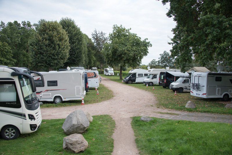
Harlesiel, Wittmund, Deutschland
Overnight on the camping site Harlesiel.
You can recommend the place, for 18 euros including visitor's tax and relatively new sanitary facilities you don't miss anything. We do not need electricity, it has to be paid for separately.
53° 42' 12" N 7° 48' 26.3" E
53.7033422 7.8072929
• Head east on Am Yachthafen. Go for 37 m.
• Turn right onto Am Yachthafen. Go for 112 m.
• Continue on Friedrichsschleuse. Go for 362 m.
• Turn left onto Friedrichsschleuse. Go for 148 m.
• Turn right onto Friedrichsschleuse (B461). Go for 48 m.
• Continue on Schleusenstraße (B461). Go for 441 m.
• Continue on Gerhard-Tjarks-Straße (B461). Go for 330 m.
• Turn right onto Bahnhofstraße (B461). Go for 410 m.
• Continue on Kirchstraße (B461). Go for 35 m.
• Turn right onto Kirchstraße (L6). Go for 136 m.
• Continue on Mühlenstraße (L6). Go for 684 m.
• Continue on L6. Go for 202 m.
• Turn right onto L6 toward Esens/Neuharlingersiel. Go for 4.4 km.
• Take the 2nd exit from roundabout onto L6 toward Bensersiel/Esens/Neuharlingersiel/West. Go for 2.6 km.
• Take the 2nd exit from roundabout onto Bettenwarfen (L5) toward Bensersiel/Ostbense. Go for 7.6 km.
• Take the 2nd exit from roundabout onto L5. Go for 1.7 km.
• Take the 2nd exit from roundabout onto Hauptstraße (L5) toward Norddeich/Dornumersiel. Go for 194 m.
• Continue on Gründeich (L5). Go for 28.4 km.
• Take the 2nd exit from roundabout onto Ostermarscher Straße (L5). Go for 1.0 km.
• Continue on Itzendorfer Straße (K214) toward Norddeich-West. Go for 1.5 km.
• Turn right onto Dörper Weg. Go for 393 m.
• Turn right onto Pelikanstraße. Go for 417 m.
• Turn left onto Nordmeerstraße. Go for 186 m.
• Continue on Strandstraße. Go for 314 m.
• Turn right onto Badestraße. Go for 84 m.
• Continue straight ahead. Go for 15 m.
• Turn right. Go for 42 m.
• Turn left. Go for 27 m.
• Turn right. Go for 247 m.
• Arrive at your destination.
☍
52,1 km
( 58 min.)
Day
Fahrradtour Neuharlingersiel
Day
Norddeich, Norden, Deutschland
53° 36' 59.9" N 7° 9' 31.5" E
53.6166466 7.1587422
• Head northwest. Go for 247 m.
• Turn left. Go for 27 m.
• Turn right. Go for 42 m.
• Turn left toward Badestraße. Go for 15 m.
• Continue on Badestraße. Go for 84 m.
• Turn left onto Strandstraße. Go for 314 m.
• Continue on Nordmeerstraße. Go for 186 m.
• Turn right onto Pelikanstraße. Go for 417 m.
• Turn left onto Dörper Weg. Go for 392 m.
• Turn right onto Itzendorfer Straße (K214). Go for 953 m.
• Continue on Deichstraße (K214). Go for 1.3 km.
• Continue on Ziegeleistraße (K214). Go for 2.9 km.
• Turn right onto Westermarscher Straße (L27) toward Greetsiel. Go for 8.2 km.
• Turn right onto Greetsieler Straße (L27) toward Greetsiel. Go for 5.4 km.
• Turn right onto Mühlenstraße. Go for 331 m.
• Continue on Mühlenstraße. Go for 89 m.
• Turn slightly left onto Mühlenstraße. Go for 34 m.
• Turn slightly right onto Mühlenstraße. Go for 185 m.
• Arrive at Mühlenstraße. Your destination is on the right.
☍
21,1 km
( 25 min.)
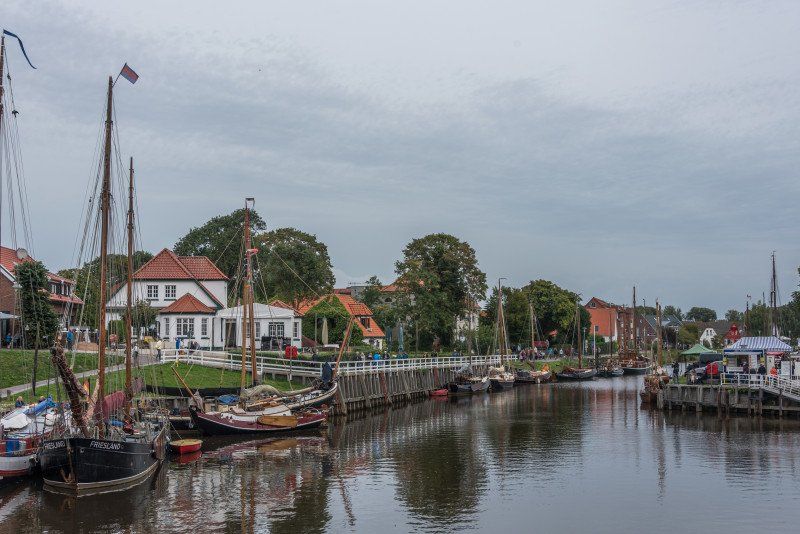
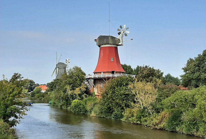
Greetsiel, Krummhörn, Deutschland
Overnight parking space Greetsiel
The parking space was already fully occupied by 12 noon, so arrive early if you want to spend the night here. No sanitary facilities on the square, electricity 1 euro for 8 hours. There are rolls in the morning in the red mill ;-)
Greetsiel, 26736 Krummhörn, Deutschland
53° 30' 0.5" N 7° 5' 42.1" E
53.5001312 7.0950228
• Head northwest on Mühlenstraße.
• Turn left onto Liek Gang. Go for 34 m.
• Continue on Katrepel. Go for 91 m.
• Continue on Am Zingel. Go for 115 m.
• Turn right onto Pilsumer Weg. Go for 718 m.
• Turn right onto K233. Go for 1.4 km.
• Turn right toward Zum Leysiel. Go for 66 m.
• Turn left onto Zum Leysiel. Go for 1.3 km.
• Turn left. Go for 237 m.
• Arrive at your destination.
☍
4,0 km
( 6 min.)
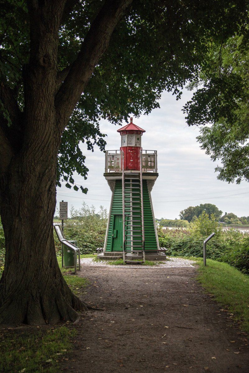
Day
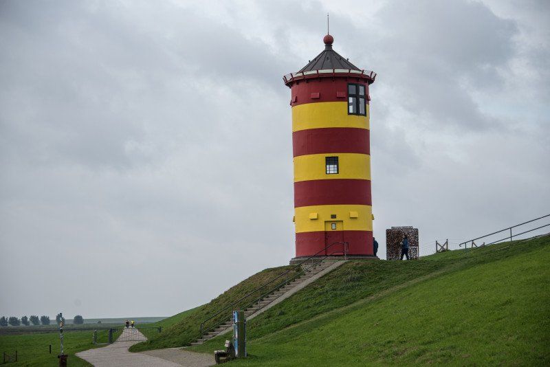
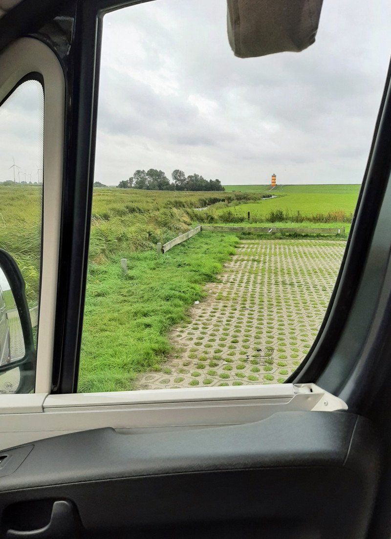
Pilsumer Leuchtturm, Krummhörn, Deutschland
Unnamed Road, 26736 Krummhörn, Deutschland
53° 29' 52.7" N 7° 2' 44.3" E
53.4979815 7.0456498
• Head northeast. Go for 237 m.
• Turn right onto Zum Leysiel. Go for 1.3 km.
• Turn right toward Neu-Etumer-Straße/K233. Go for 66 m.
• Turn right onto Neu-Etumer-Straße (K233). Go for 3.3 km.
• Continue on K233. Go for 2.4 km.
• Continue on Wiard-Meckena-Straße (K233). Go for 1.2 km.
• Turn right onto Van-Wingene-Straße (L2). Go for 4.8 km.
• Turn right onto Heiselhuser Straße (K236). Go for 1.5 km.
• Continue on Diekeweg. Go for 490 m.
• Continue on Campingweg. Go for 304 m.
• Turn right onto Leuchtturmstraße. Go for 354 m.
• Arrive at Leuchtturmstraße. Your destination is on the left.
☍
16,0 km
( 18 min.)
Leuchtturm Campen, Leuchtturmstraße, Krummhörn, Deutschland
Leuchtturmstraße 5, 26736 Krummhörn, Deutschland
53° 24' 20.6" N 7° 0' 56.1" E
53.4057174 7.0155923
• Head toward Campingweg on Leuchtturmstraße. Go for 354 m.
• Turn left onto Campingweg. Go for 304 m.
• Continue on Diekeweg. Go for 490 m.
• Continue on Heiselhuser Straße (K236). Go for 1.5 km.
• Turn right onto Krummhörner Straße (L2). Go for 14.5 km.
• Turn right onto Schlesierstraße. Go for 343 m.
• Continue on Fletumer Straße. Go for 264 m.
• Continue on Hansastraße. Go for 365 m.
• Turn left onto Nesserlander Straße. Go for 145 m.
• Continue on Am Tonnenhof. Go for 178 m.
• Turn right. Go for 190 m.
• Arrive at your destination on the left.
☍
18,7 km
( 23 min.)
Emden, Deutschland
53° 21' 33.9" N 7° 12' 21.6" E
53.3594029 7.2060095
• Head northwest. Go for 190 m.
• Turn right onto Am Tonnenhof. Go for 531 m.
• Continue on Südumgehungsstraße. Go for 578 m.
• Turn left onto Petkumer Straße (L2). Go for 119 m.
• Turn right onto B210. Go for 1.5 km.
• Take ramp onto A31 toward Oberhausen/Aurich/Leer. Go for 23.3 km.
• Take exit 9 toward Meppen/Groningen/Leer-Nord onto A31. Go for 114 km.
• Take exit 26 toward Emsbüren/Schüttorf-Nord. Go for 241 m.
• Turn right onto Euregiostraße (L40) toward Emsbüren. Go for 1.0 km.
• Take the 2nd exit from roundabout onto Schüttorfer Straße (L40). Go for 3.4 km.
• Turn left onto Lange Straße (L40) toward Lingen/Ortsmitte/Gewerbegebiet Rampool. Go for 759 m.
• Turn left onto Richthofstraße. Go for 172 m.
• Continue on Richthofstraße. Go for 33 m.
• Enter the roundabout. Go for 33 m.
• Arrive at your destination on the left.
☍
145,7 km
(1 hrs. 19 min.)
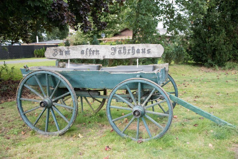
Emsbüren, Deutschland
Overnight on the pitch of the "Zum Alten Fährhaus" campsite.
Somewhat older equipment, but very clean. Great location if you are in the first row to the Ems. Price 13 euros without electricity and water.
48488 Emsbüren, Deutschland
52° 23' 33.6" N 7° 17' 33.7" E
52.3926684 7.2926853
• Follow the roundabout. Go for 30 m.
• Take the 3rd exit from roundabout onto Richthofstraße. Go for 106 m.
• Continue on Richthofstraße. Go for 99 m.
• Continue on Richthofstraße. Go for 559 m.
• Continue on Grenzstraße. Go for 433 m.
• Continue on Kespelweg. Go for 321 m.
• Turn right onto Napoleondamm (K327). Go for 3.9 km.
• Continue on K327. Go for 894 m.
• Continue on Mehringen (K327). Go for 750 m.
• Continue on K327. Go for 342 m.
• Turn left and take ramp onto A30 toward Osnabrück. Go for 53.3 km.
• Take exit 18 toward Bad Iburg/Georgsmarienhütte onto B51/B68 (Iburger Straße). Go for 11.0 km.
• Take the 2nd exit from roundabout onto Charlottenburger Ring (B51). Go for 302 m.
• Take the 3rd exit from roundabout onto Charlottenburger Ring (B51). Go for 602 m.
• Turn left onto Münsterstraße. Go for 42 m.
• Turn right onto Bielefelder Straße. Go for 38 m.
• Turn left onto Sandstraße. Go for 177 m.
• Arrive at Sandstraße. Your destination is on the right.
☍
72,9 km
( 48 min.)
Day
Bad Iburg, Deutschland
49186 Bad Iburg, Deutschland
52° 9' 16.3" N 8° 2' 43" E
52.1545319 8.0452820
• Head toward An der Walkenmühle on Sandstraße. Go for 177 m.
• Turn right onto Bielefelder Straße. Go for 38 m.
• Turn left onto Münsterstraße. Go for 42 m.
• Turn left onto Münsterstraße (B51). Go for 9.3 km.
• Take the 4th exit from roundabout onto Füchtorfer Straße (B475) toward Warendorf/Sassenberg/Füchtorf. Go for 9.4 km.
• Continue on B475 toward Warendorf/Gütersloh. Go for 6.0 km.
• Take the 2nd exit from roundabout onto Sassenberger Straße (L830) toward Zentrum. Go for 1.3 km.
• Turn left onto Zwischen den Emsbrücken. Go for 176 m.
• Continue on Emsstraße. Go for 47 m.
• Turn right onto Mühlenstraße. Go for 40 m.
• Arrive at Mühlenstraße. Your destination is on the left.
☍
26,6 km
( 23 min.)
Warendorf, Deutschland
48231 Warendorf, Deutschland
51° 57' 13.9" N 7° 59' 27.2" E
51.9538685 7.9908987
• Head northwest on Mühlenstraße. Go for 60 m.
• Turn left onto Am Mühlenhof. Go for 81 m.
• Turn left onto Emsstraße. Go for 83 m.
• Continue on Zwischen den Emsbrücken. Go for 176 m.
• Turn right onto Sassenberger Straße (L830). Go for 1.3 km.
• Take the 1st exit from roundabout onto B475. Go for 12.9 km.
• Take ramp onto Nordring (K2) toward Ostenfelde/Ennigerloh/Industriegebiet Haltenberg. Go for 463 m.
• Take the 2nd exit from roundabout onto Nordring (K2) toward Ostenfelde. Go for 1.7 km.
• Take the 2nd exit from roundabout onto Ostring toward Oelde. Go for 1.9 km.
• Take the 2nd exit from roundabout onto Oelder Straße (L792) toward Oelde. Go for 2.4 km.
• Continue on Ennigerloher Straße (L792). Go for 2.0 km.
• Turn right onto Vellerner Straße (L882) toward A2/Neubeckum/Vellern/Gewerbegebiet Oelde. Go for 372 m.
• Take the 2nd exit from roundabout onto Von-Büren-Allee (K30). Go for 2.3 km.
• Take the 2nd exit from roundabout onto In der Geist (L793). Go for 5.0 km.
• Turn left onto Auf der Höhe (K23). Go for 5.4 km.
• Turn right onto Stromberger Straße (K14). Go for 2.6 km.
• Turn right onto Langenberger Straße. Go for 44 m.
• Arrive at Langenberger Straße. Your destination is on the left.
☍
38,7 km
( 37 min.)
Wadersloh, Deutschland
59329 Wadersloh, Deutschland
51° 44' 17.7" N 8° 15' 2.2" E
51.7382559 8.2506241
• Head toward Von-Galen-Straße on Langenberger Straße. Go for 44 m.
• Continue on Langenberger Straße. Go for 8.1 km.
• Turn right onto Beckumer Straße (L586). Go for 3.8 km.
• Turn left onto B55 toward Hannover/A2/Dortmund/Münster/Rheda/B61. Go for 3.3 km.
• Continue on B64. Go for 1.9 km.
• Take ramp onto A2 toward Hannover/Bielefeld. Go for 146 km.
• Keep left onto A2. Go for 19.9 km.
• Take exit 52 toward Peine. Go for 443 m.
• Turn right onto Schwarzer Weg (B444) toward Hildesheim/Salzgitter/Ilsede/Zentrum. Go for 571 m.
• Turn left onto Schwarzer Weg toward Zentrum. Go for 730 m.
• Continue on Kantstraße. Go for 302 m.
• Turn left onto Am Stadtpark (L321) toward Bahnhof. Go for 218 m.
• Turn left onto Woltorfer Straße (L321). Go for 597 m.
• Turn left. Go for 10 m.
• Arrive at your destination on the left.
☍
186,0 km
(1 hrs. 41 min.)
Peine, Deutschland
52° 19' 13.5" N 10° 14' 35.8" E
52.3204095 10.2432670