Our route started in Altena in the Sauerland region.
Our first destination was Vienna, and then we continued on to the island of Krk. After leaving the island of Krk, we wanted to explore the southernmost part of Istria.
After that, we'd spontaneously choose unplanned campsites (or pitches) and visit them on our way home!
On our tour, we mainly visited campsites where we could use our ACSI card.
Altena
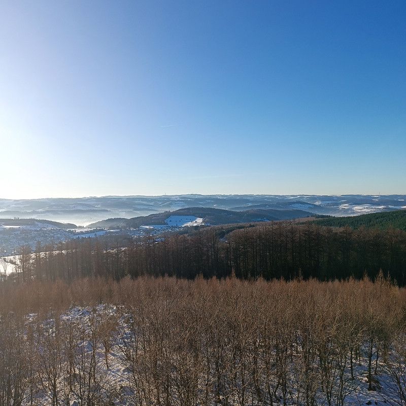
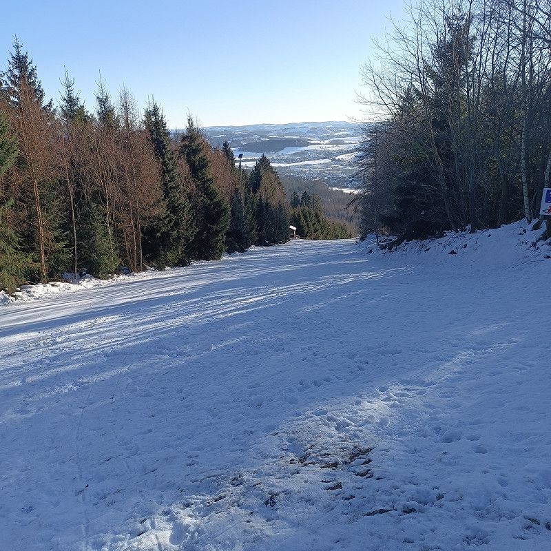
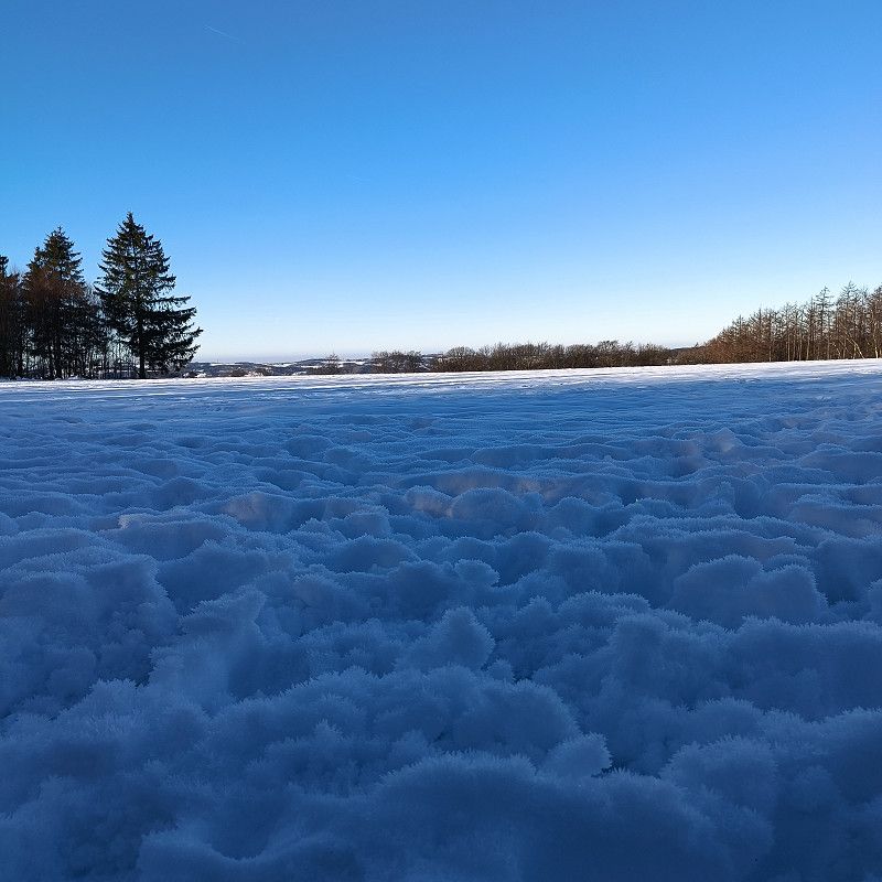
We started the journey on March 15, 2025, in Altena, a small town in the Sauerland region
Lennestraße 46, Altena, Märkischer Kreis, Nordrhein-Westfalen, Deutschland
51° 17' 56.5" N 7° 40' 24.5" E
51.2990263 7.6734841
• Head north on Lenneuferstraße. Go for 154 m.
• Turn right onto Lenneuferstraße. Go for 149 m.
• Take the 1st exit from roundabout onto Linscheidstraße. Go for 54 m.
• Continue on Bachstraße. Go for 74 m.
• Turn left onto Fritz-Berg-Brücke (L698). Go for 429 m.
• Turn right onto Lüdenscheider Straße (B236). Go for 1.2 km.
• Turn right onto Lüdenscheider Straße (L530). Go for 11.3 km.
• Turn left onto Lennestraße (L691). Go for 1.1 km.
• Turn left onto Werdohler Landstraße (L691). Go for 279 m.
• Turn left onto Brunscheider Straße (L655). Go for 415 m.
• Turn left and take ramp onto A45 toward Frankfurt a.M. Go for 183 km.
• Continue on A45 toward München/Würzburg. Go for 19.8 km.
• Continue on E41 (Seligenstädter Dreieck) toward München/Würzburg. Go for 108 m.
• Take the left exit toward München/Würzburg onto A3. Go for 314 km.
• Take exit 104B toward Wörth a.d. Donau-Ost/Falkenstein/Wiesenfelden. Go for 473 m.
• Turn left onto Straubinger Straße (St2125) toward Falkenstein/Wiesenfelden/Regensburg/Krankenhaus. Go for 412 m.
• Take the 1st exit from roundabout onto Altdorferstraße (St2146). Go for 605 m.
• Turn right onto Gschwelltalstraße. Go for 51 m.
• Turn right onto Gschwelltalstraße. Go for 491 m.
• Arrive at Gschwelltalstraße.
☍
534,6 km
(5 hrs. 7 min.)
15. Mar. 2025 -
16. Mar. 2025
Wörth an der Donau
Coordinates:
49.00772, 12.40848
The site is in Wörth an der Donau and is ideally located on the way to Vienna. There is no public transport!
Only about 2km from the A3 motorway exit. An AVIA gas station is also located shortly after the exit.
We stood here well and quietly!
Gschwelltalstraße, Wörth an der Donau, Landkreis Regensburg, Bayern, Deutschland
49° 0' 27.4" N 12° 24' 29.4" E
49.0076116 12.4081577
• Head south on Gschwelltalstraße. Go for 491 m.
• Turn left onto Gschwelltalstraße. Go for 51 m.
• Turn left onto Bayerwaldstraße (St2146). Go for 594 m.
• Take the 2nd exit from roundabout onto Straubinger Straße (St2125). Go for 448 m.
• Turn right and take ramp onto A3 toward Passau. Go for 111 km.
• Continue on A3/A8 (Innkreis Autobahn). Go for 305 m.
• Continue on A8 (Innkreis Autobahn). Go for 60.6 km.
• Continue on A25 (Welser Autobahn) toward Wien/Linz/ÖBB-Terminal/Wels-Nord. Go for 19.4 km.
• Take the exit toward Wien/Linz onto A1 (West Autobahn). Go for 145 km.
• Keep right onto A21 (Knoten Steinhäusl) toward Budapest/A4/S1/Graz/A2/Wien-Süd Ost/Flughafen. Go for 36.0 km.
• Take exit 36 toward Perchtoldsdorf. Go for 615 m.
• Turn left onto Brunner Bundesstraße, Abzw. Brunn (B12a) toward Linz/A21/St.Pölten/Perchtoldsdorf/Tiergarten. Go for 690 m.
• Continue on Brunner Bundesstraße (B12). Go for 2.0 km.
• Turn right onto Perfektastraße (B13a). Go for 1.3 km.
• Turn right. Go for 41 m.
• Turn left. Go for 24 m.
• Arrive at your destination on the left.
☍
378,8 km
(3 hrs. 26 min.)
Day
16. Mar. 2025 -
17. Mar. 2025
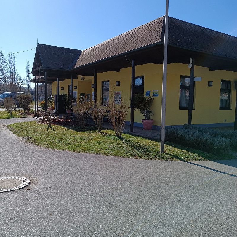
Reisemobil Stellplatz Wien
The parking space is relatively well located (for Vienna) and easily accessible! When we arrived on March 16, there were still plenty of spaces available. There's a discount store across the street, and the subway station is also nearby. The infrastructure is well laid out, and the parking spaces aren't particularly large, but they're perfectly adequate.
Upon arrival, you simply take a folder containing a form that you must fill out. Your license plate number, arrival date, etc. will be recorded at the front entrance.
When you leave, please put the amount due (30€/day/incl. electricity/no additional tourist tax!) in the folder and return it.
During our stay, the restrooms were being renovated, and only designated (men's/women's) containers were available. However, they weren't exactly attractive and far too few for a site of this size!
We quickly left the site and moved to Donaupark Camping. We would only return to the site in an emergency.
Perfektastraße, 1230, Wien, Austria
48° 8' 12.2" N 16° 18' 59.2" E
48.1367300 16.3164500
• Head west. Go for 24 m.
• Turn right toward Perfektastraße/B13a. Go for 41 m.
• Turn right onto Perfektastraße (B13a). Go for 653 m.
• Continue on Erlaaer Straße (B13a). Go for 116 m.
• Turn left onto Triester Straße (B17). Go for 1.5 km.
• Turn right onto Sterngasse. Go for 555 m.
• Turn left and take ramp onto A23 (Anschlussstelle Sterngasse) toward Praha/Favoriten. Go for 11.5 km.
• Take the exit toward Praha/Vienna Int. Centre onto A22 (Donauufer Autobahn). Go for 7.3 km.
• Take the exit toward Klosterneuburg/B14 onto A22 (Nordbrücke). Go for 1.1 km.
• Take the exit toward Klosterneuburg onto B14 (Klosterneuburger Straße). Go for 5.5 km.
• Keep right onto Wiener Straße toward Weidling Tulln/Klosterneuburg/Stift Klosterneuburg. Go for 450 m.
• Keep right onto Wiener Straße toward Klosterneuburg/Stift Klosterneuburg. Go for 1.0 km.
• Take the 1st exit from roundabout onto Wiener Straße. Go for 535 m.
• Continue on Niedermarkt. Go for 122 m.
• Turn right onto Schwarze Au Rollfährestraße. Go for 141 m.
• Turn right. Go for 43 m.
• Arrive at your destination on the right.
☍
30,6 km
( 31 min.)
Day
17. Mar. 2025 -
24. Mar. 2025
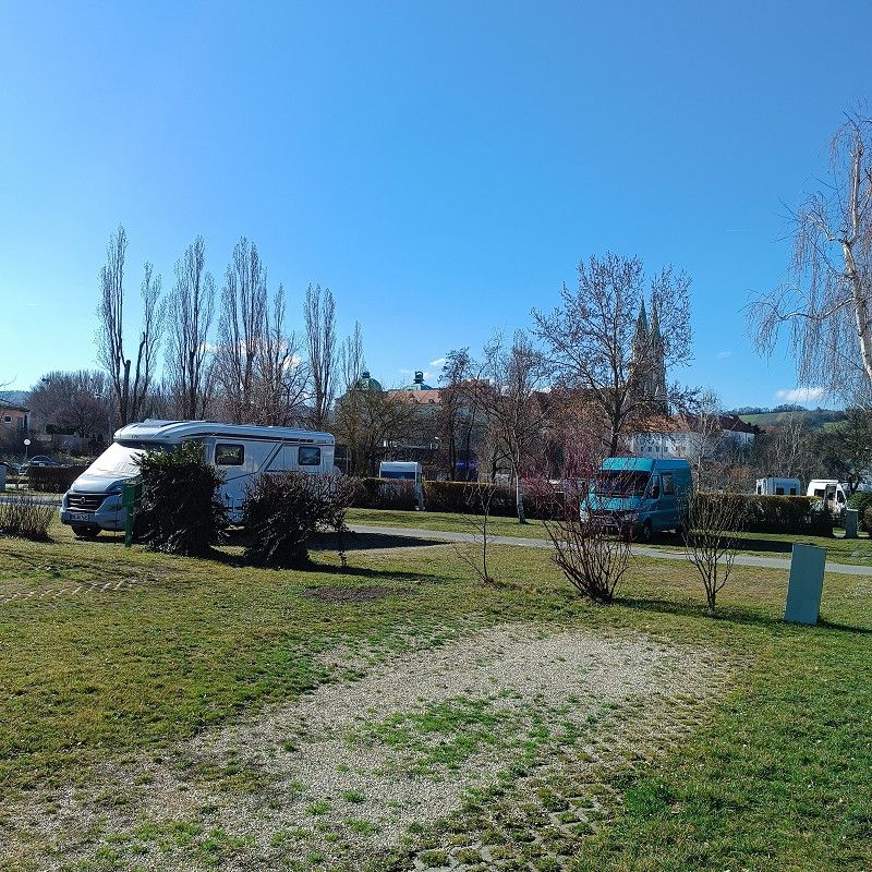
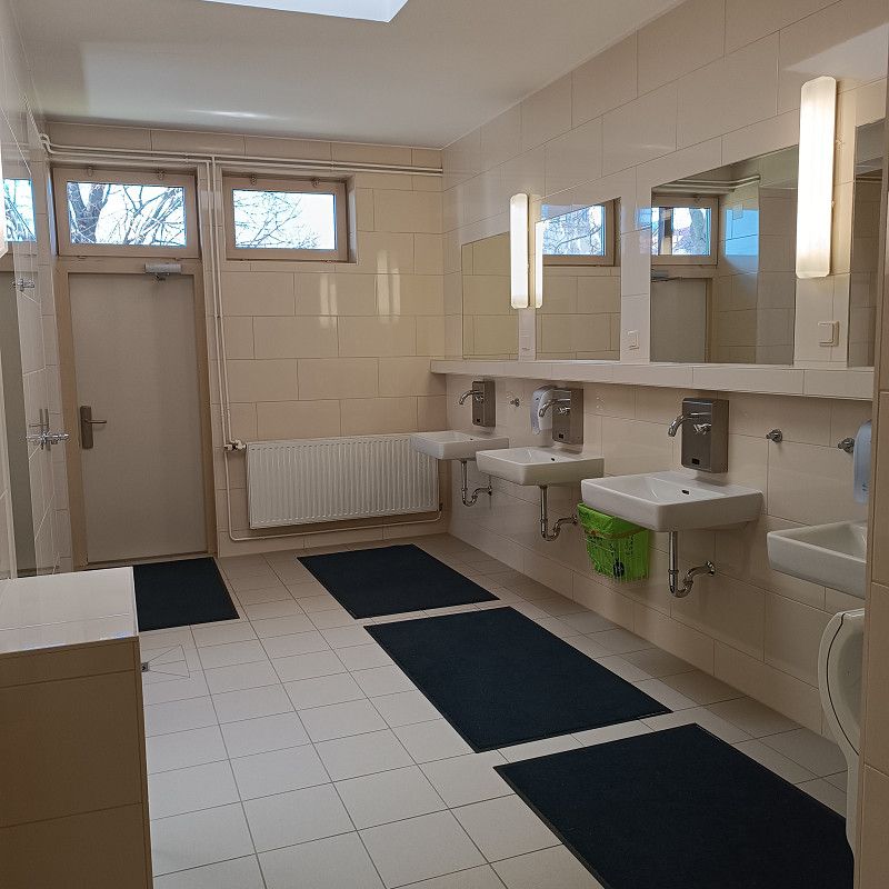
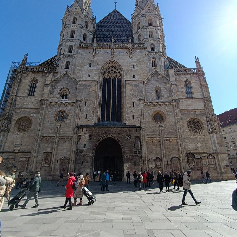
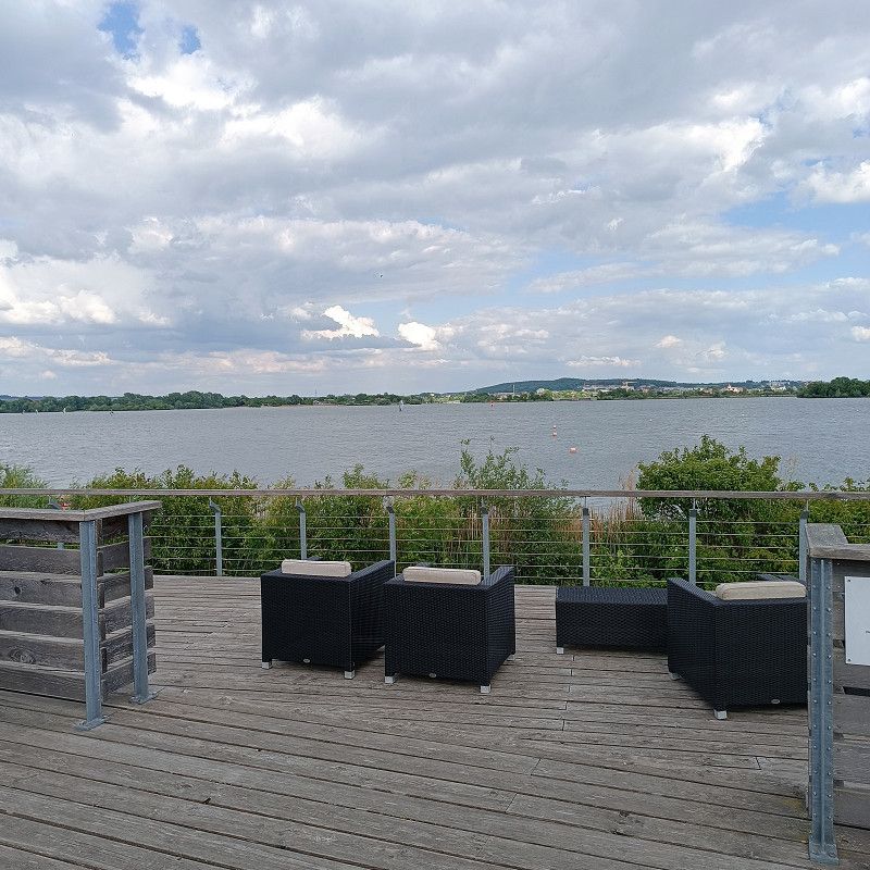
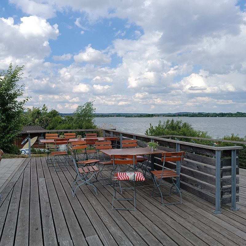
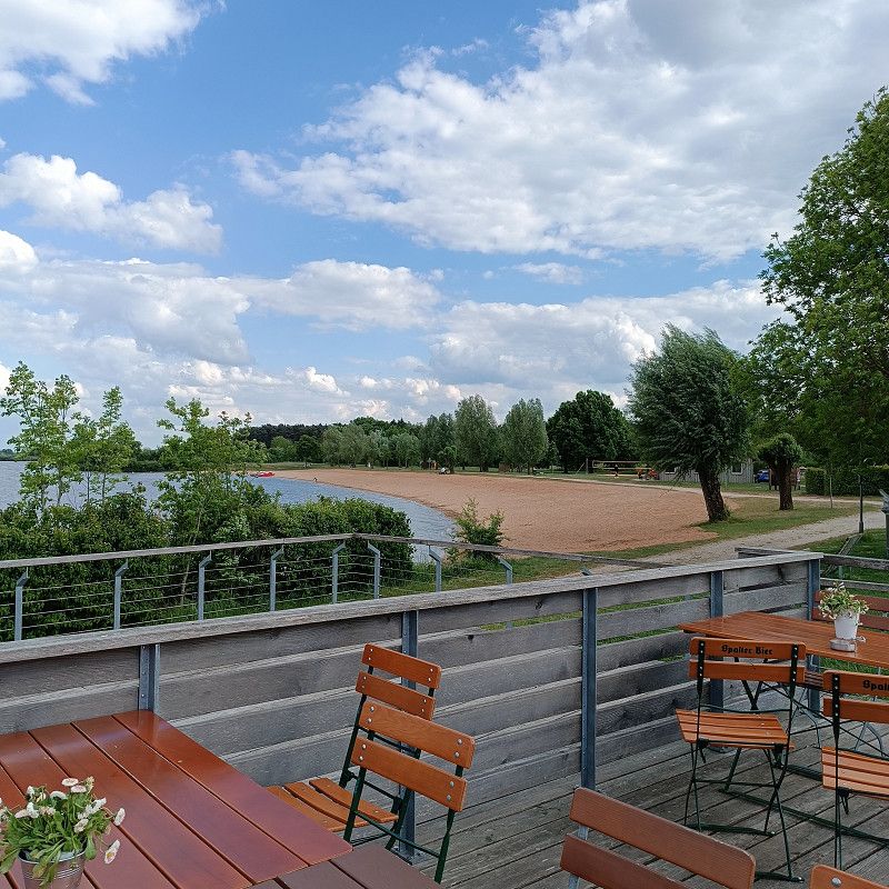
Donaupark Camping Klosterneuburg
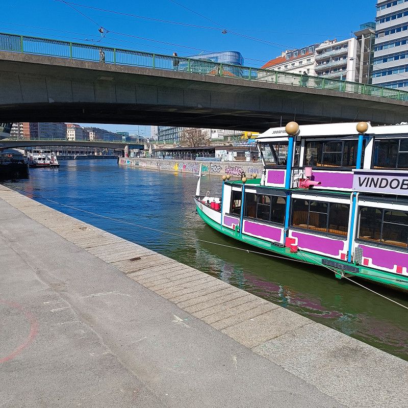
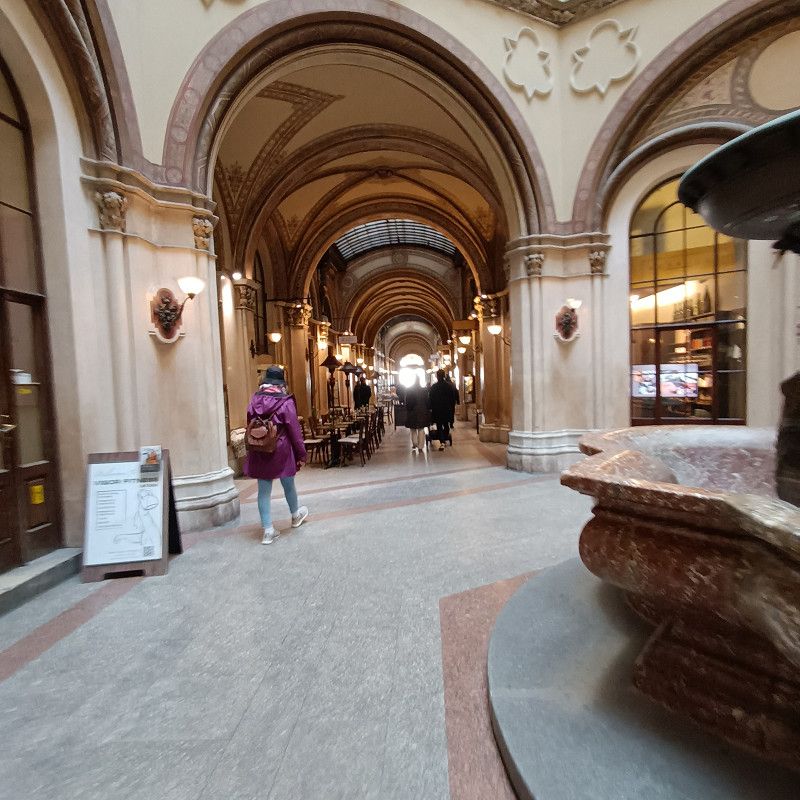
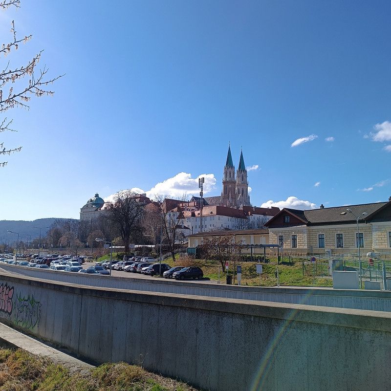
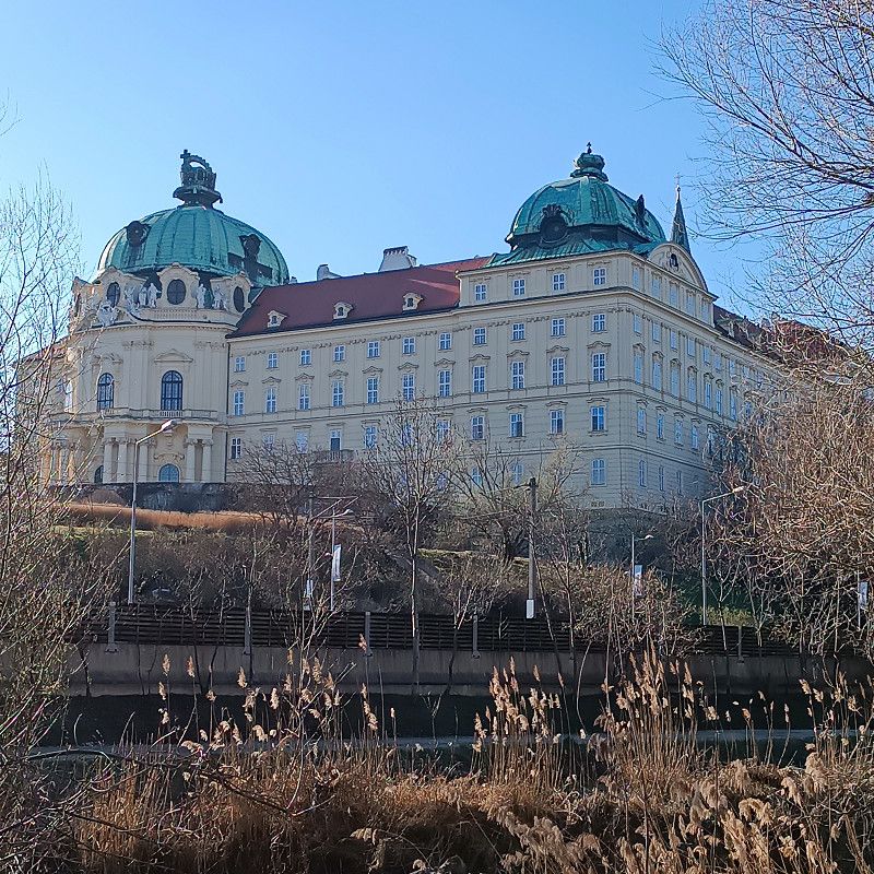
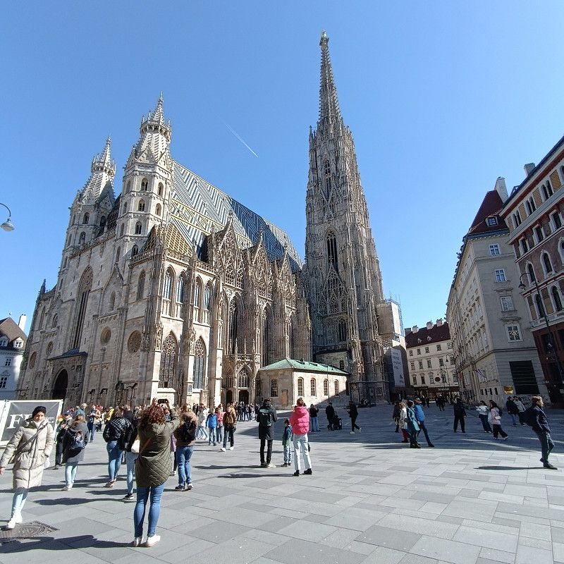
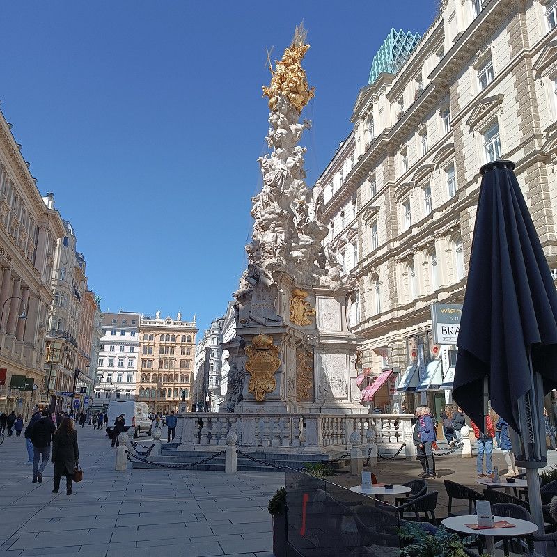
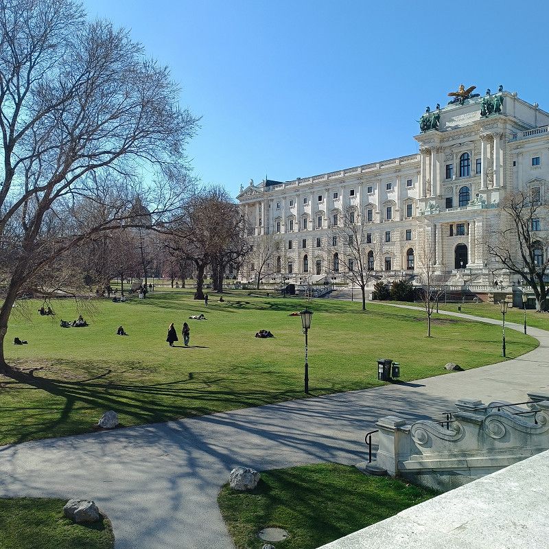
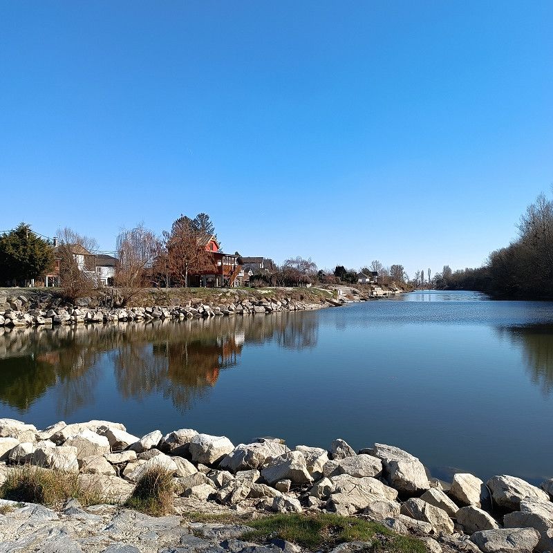
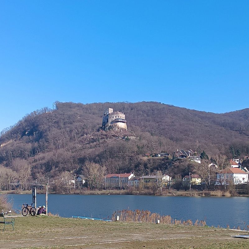
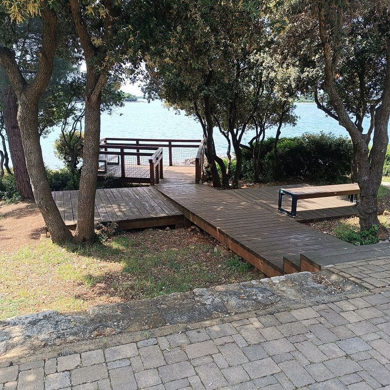
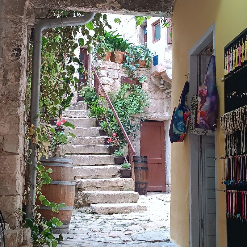
After the motorhome parking space in Vienna, we visited this campsite and were able to use our ACSI card without any problems (27€/+ 2.50€ tourist tax/person).
The site is located just a few meters from the town of Klosterneuburg.
There are several shops and amenities there, including a SPAR (approx. 500m away) and a Penny (approx. 1.8km away). The Danube is also a quick walk away.
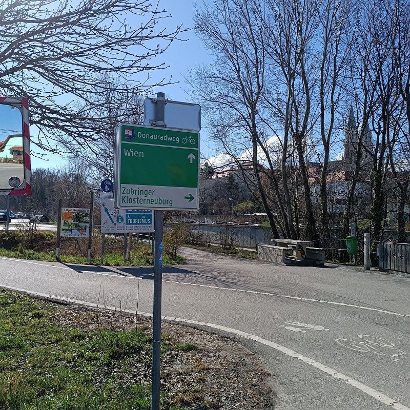
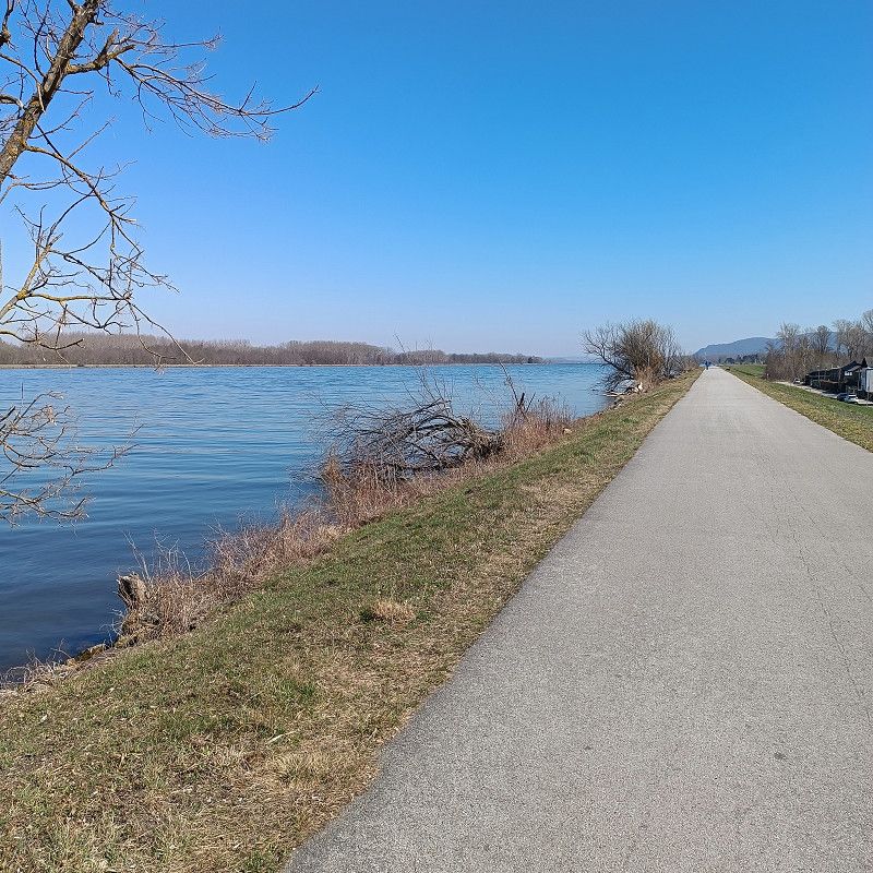
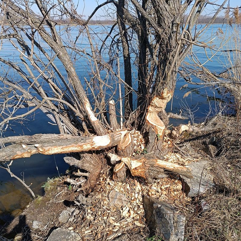
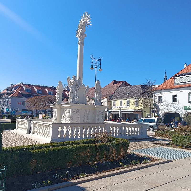
The Danube Cycle Path is right next to the campsite, and it's about 13 km to Vienna's city center. For this reason, I find this campsite an ideal base for a visit to Vienna (you can reach the city center by bike).
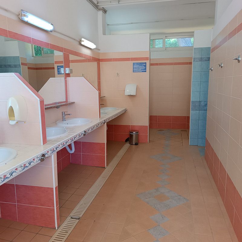
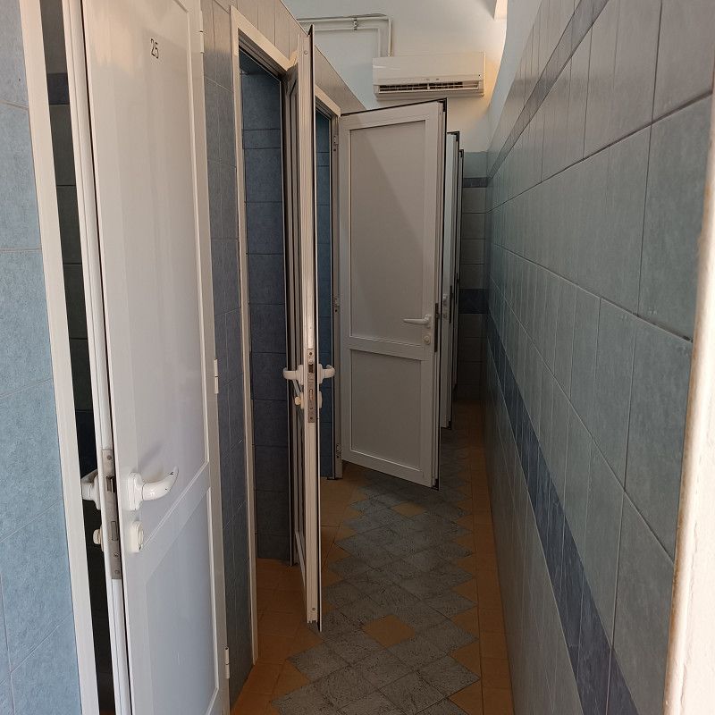
The campsite's sanitary facilities are really well-organized and were always very clean during our stay.
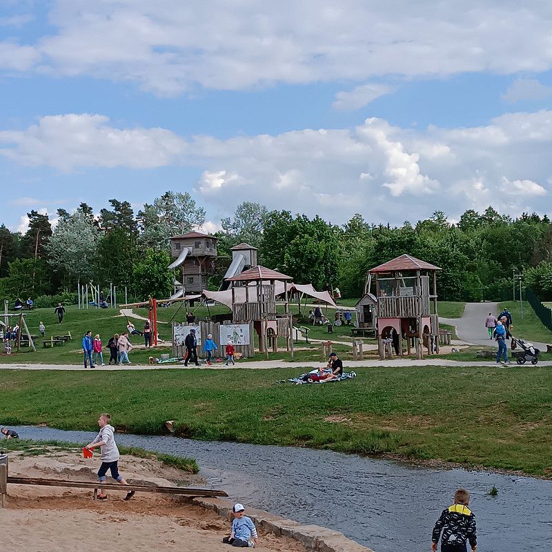
If you have the time and good weather, I recommend a bike ride to Tulln. Here you can cycle all the way along the Danube, and after about 8 km, the Danube Cycle Path becomes simply beautiful and well worth seeing.
Tulln is a small town, but it still has a lot to offer.
The photos shown here were taken at the campsite, in Klosterneuburg, in Vienna and on the Danube Cycle Path towards Tulln (on our bike tour)!
I can also recommend the Greek restaurant in Tulln! I've given it a special rating in my Google Maps reviews!
In der Au 1, 3400, Klosterneuburg, Austria
48° 18' 39" N 16° 19' 39.3" E
48.3108400 16.3275900
• Head toward Schwarze Au Rollfährestraße. Go for 43 m.
• Turn left onto Schwarze Au Rollfährestraße. Go for 141 m.
• Turn sharp left onto Niedermarkt. Go for 122 m.
• Keep left onto Wiener Straße. Go for 515 m.
• Take the 3rd exit from roundabout onto Wiener Straße. Go for 948 m.
• Take the 2nd exit from roundabout onto Wiener Straße. Go for 97 m.
• Keep right onto Wiener Straße toward B14/Wien. Go for 5.7 km.
• Keep left onto Klosterneuburger Straße (B14) toward B227/Budapest Flughafen/A4/Graz/A2/B7/Brno/Handelskai. Go for 263 m.
• Keep left onto Nordbrücke (B14) toward Budapest Flughafen/A4/Graz/A2/B7/Brno/Handelskai. Go for 85 m.
• Take left ramp onto A22 (Nordbrücke) toward B14/Praha/B7/Brno/Graz/A2. Go for 1.0 km.
• Take the exit toward Graz/Austria Center/Floridsdorfer Br./B226 onto A22 (Donauufer Autobahn). Go for 6.5 km.
• Take the exit toward Graz/A2/Linz/A21/A1/Budapest/A4/Flughafen/Handelskai/B14 onto A23 (Praterbrücke). Go for 10.9 km.
• Keep left onto A23 (Wiener Südosttangente) toward A2/Graz/Wr. Neustadt/Mödling/Linz/A21/St. Pölten/A1/Brunn a. Geb. Go for 1.7 km.
• Continue on A2 (Süd Autobahn). Go for 184 km.
• Take exit 186 toward Spielfeld/Flughafen onto A9 (Pyhrn Autobahn). Go for 41.9 km.
• Continue on A1. Go for 25.5 km.
• Take exit 7 toward Zagreb/Ptuj/Aerodrom onto A4. Go for 34.8 km.
• Continue on A2. Go for 60.1 km.
• Continue on E59 (Autocesta Zagreb-Macelj). Go for 1.2 km.
• Continue on A3 (Autocesta Bregana-Zagreb-Lipovac). Go for 3.7 km.
• Take the exit toward Split/Rijeka onto A1 (Autocesta Bosiljevo-Split-Dubrov.). Go for 67.6 km.
• Keep right onto A6 (Čvor Bosiljevo II) toward Pula/Rijeka. Go for 61.6 km.
• Take exit 6 toward Otok Cres/Crikvenica/Otok Krk/501/5061. Go for 744 m.
• Turn left onto 501 toward Otok Cres/Crikvenica/Otok Krk/Meja Gaj/Rijeka. Go for 7.1 km.
• Continue on Čvor Hreljin toward Split/Otok Krk/Rijeka. Go for 491 m.
• Keep left onto Čvor Hreljin toward Split/Otok Krk. Go for 408 m.
• Take ramp onto A7. Go for 4.3 km.
• Keep left onto A7 toward Split/Crikvenica/Otok Krk/8/102. Go for 280 m.
• Continue on E65. Go for 589 m.
• Keep right toward Otok Lošinj/Otok Cres/Otok Krk. Go for 20 m.
• Take the 2nd exit from roundabout onto 102. Go for 4.8 km.
• Turn right toward Ulica Pušća. Go for 47 m.
• Turn slightly right onto Ulica Pušća. Go for 757 m.
• Turn slightly right onto Vodotoč. Go for 33 m.
• Turn right onto Vodotoč. Go for 38 m.
• Turn left onto Vodotoč. Go for 29 m.
• Turn left onto Vodotoč. Go for 26 m.
• Arrive at Vodotoč. Your destination is on the right.
☍
527,7 km
(5 hrs. 8 min.)
Day
22. Mar. 2025 -
29. Mar. 2025
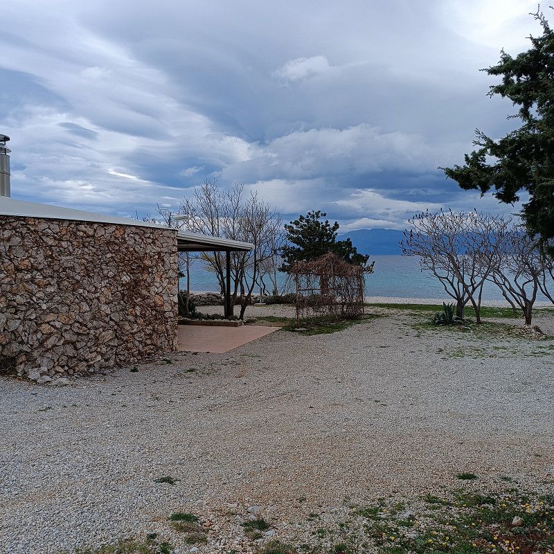
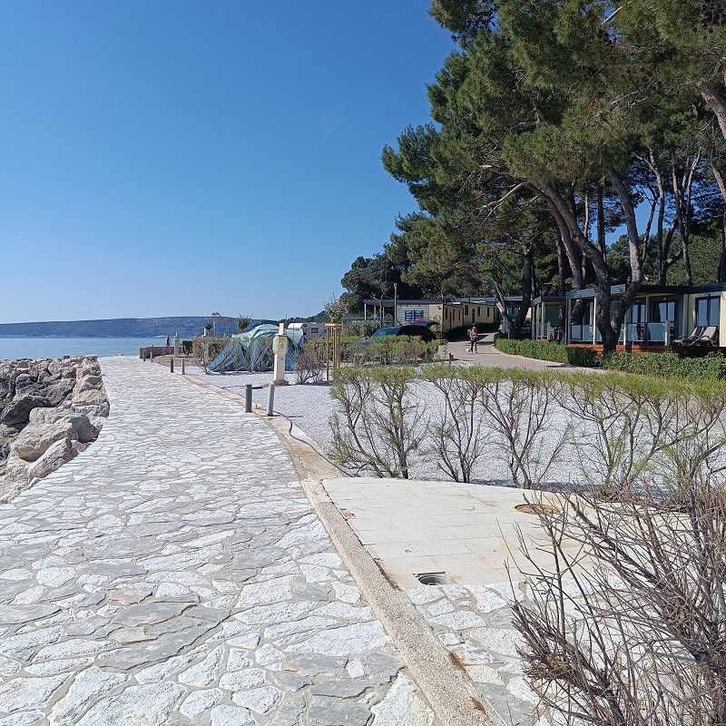
Camping Omišalj
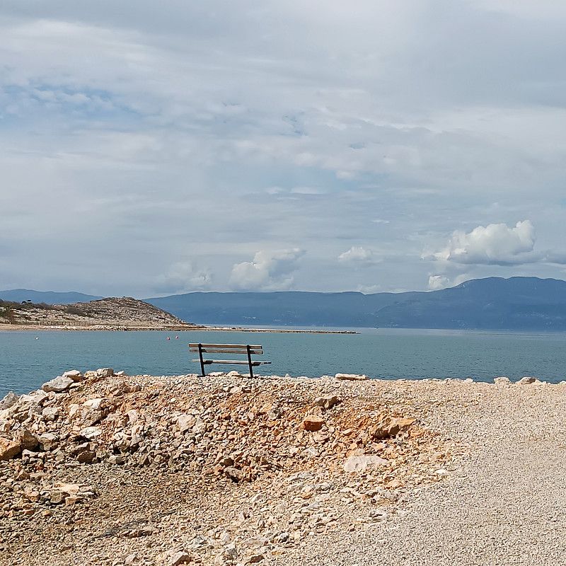
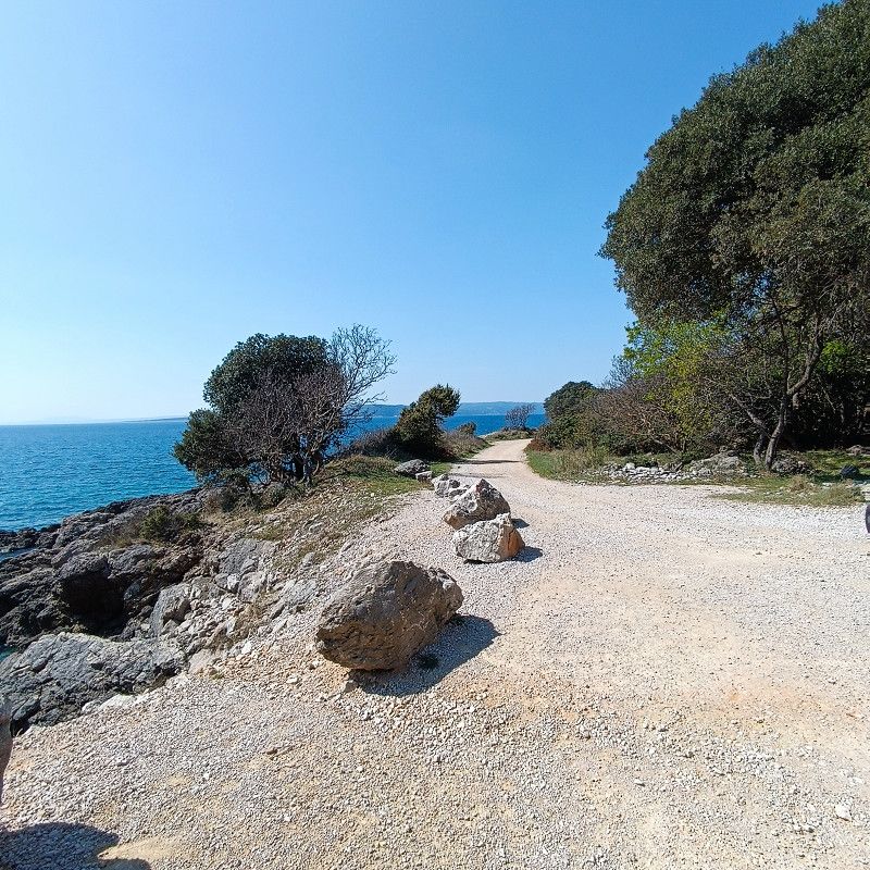
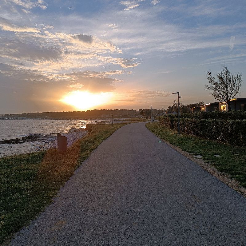
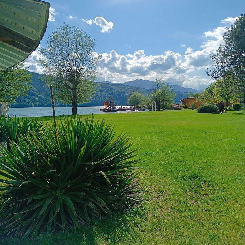
From Klosterneuburg (14 km from Vienna), we drove to our main destination, Croatia (approximately 525 km away). Our first campsite was Camping Omisalj on the island of Krk.
The drive was quite quiet and uneventful on a Monday morning! However, I recommend waiting for good and sufficiently warm weather for the trip (if possible)! It does climb quite a few meters, and the weather conditions can certainly change for the worse quickly. We drove on March 24th, and conditions were good. In winter conditions, there are sections of the road where snow chains are mandatory (and not without reason).
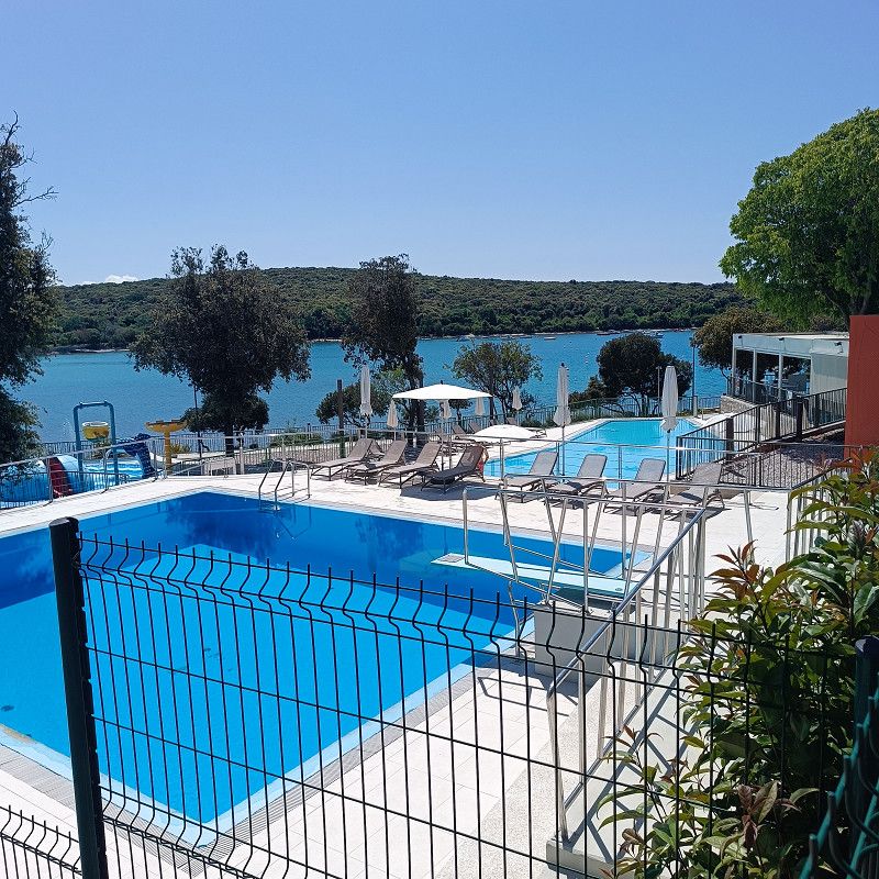
At Camping Omisalj, check-in was seamless, and ACSI was immediately accepted. A tourist tax of €1.30 per person is added to the ACSI price (€27/March 2025).
In March there were only a few campers present and even with ACSI there are many pitches available (also with sea views)
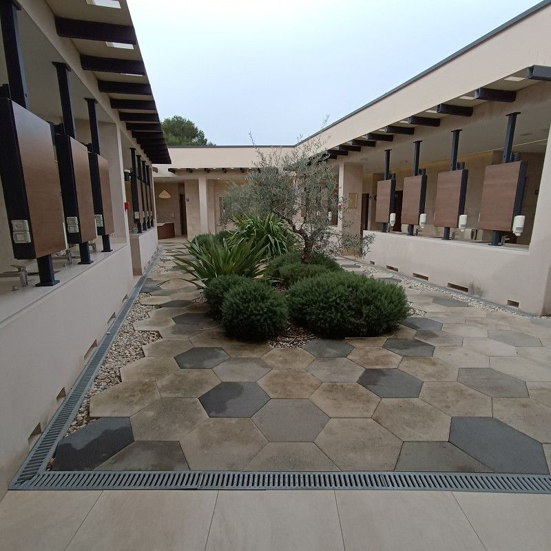
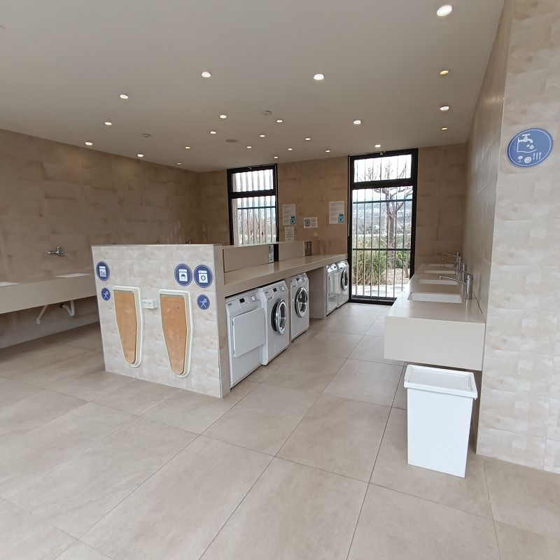
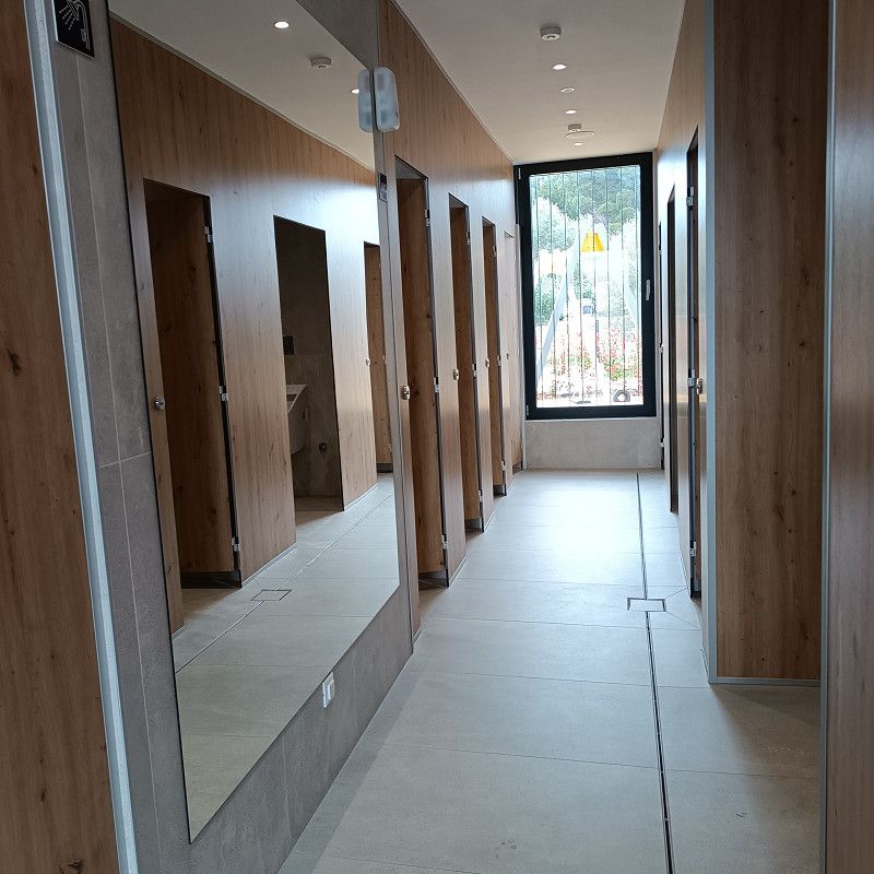
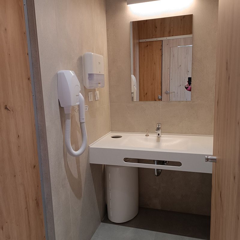
The pitches are quite spacious and have water and sewage hookups. 16-ampere electricity is available, and free, good Wi-Fi is also included! The sanitary building is always well-cleaned and looks modern.
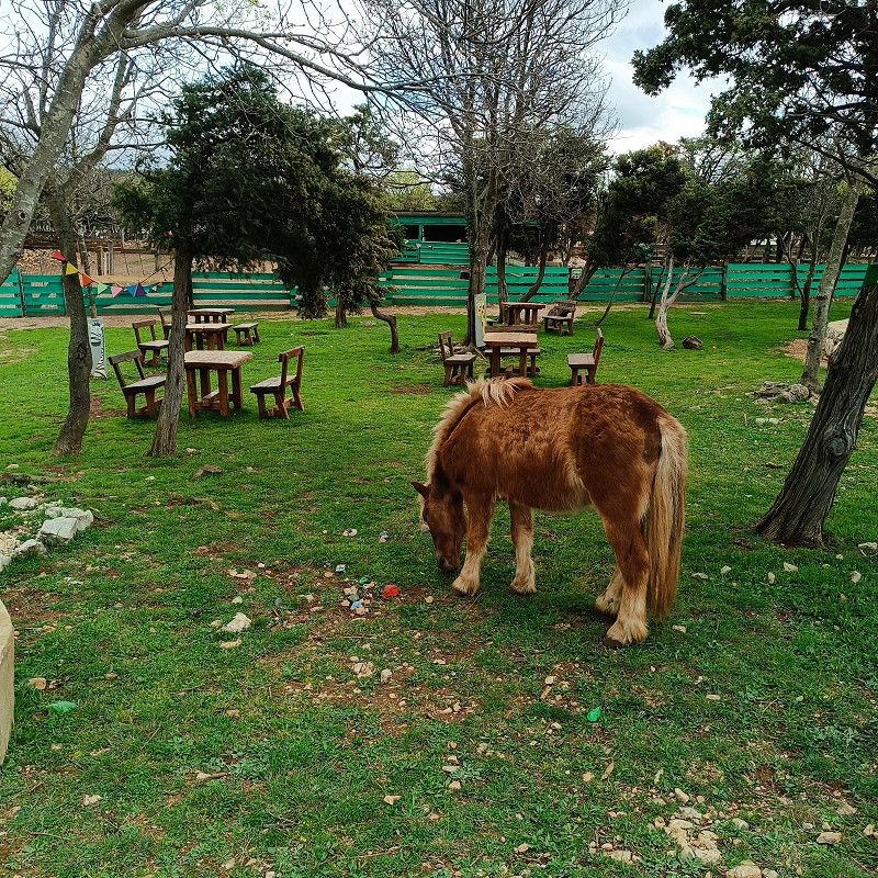
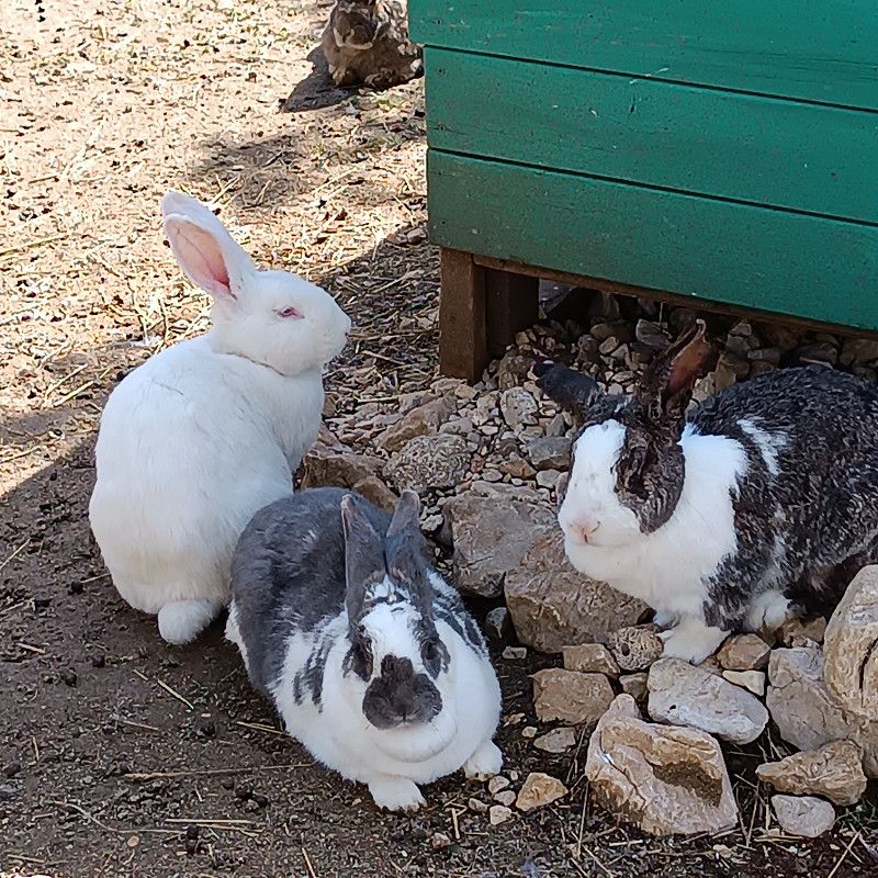
The campsite also has a lovely petting zoo! All photos shown here were taken exclusively on the campsite grounds!
There is a good Lidl about 2.5km away.
We would definitely visit this campsite again (although there is nothing special in the area).
If you are traveling with a caravan and car, you still have good opportunities to explore the island.
Vodotoč 1, 51513, Omišalj (otok Krk), Croatia
45° 14' 2.6" N 14° 33' 7.6" E
45.2340500 14.5521000
• Head east on Vodotoč. Go for 26 m.
• Turn right onto Vodotoč. Go for 29 m.
• Turn right onto Vodotoč. Go for 38 m.
• Turn left onto Vodotoč. Go for 33 m.
• Turn slightly left onto Ulica Pušća. Go for 789 m.
• Turn right onto 102. Go for 1.2 km.
• Take the 3rd exit from roundabout onto 102 toward Krk/Cres-Lošinj/Njivice. Go for 11.2 km.
• Pass 2 roundabouts and continue on 102. Go for 10.1 km.
• Take the 1st exit from roundabout onto 5131 toward Krk. Go for 328 m.
• Continue on Ulica Stjepana Radića (5131). Go for 779 m.
• Turn right onto Ulica Slavka Nikolića (5106) toward Otok Lošinj/Otok Cres/Valbiska/Vrh/Krk. Go for 126 m.
• Continue on Ulica Slavka Nikolića. Go for 1.2 km.
• Take the 1st exit from roundabout onto Kvarnerska ulica. Go for 297 m.
• Turn right onto Kvarnerska ulica. Go for 45 m.
• Continue on Crikvenička ulica. Go for 249 m.
• Turn slightly right onto Crikvenička ulica. Go for 82 m.
• Arrive at your destination on the right.
☍
26,5 km
( 27 min.)
30. Mar. 2025 -
27. Apr. 2025
Camping Bor
On the approach, you drive slightly uphill from the roundabout (about 1km) and through a residential area. At some point, you might think you've taken the wrong turn, but if you follow the clear signs and continue uphill, you'll be on the right track!
We were warmly welcomed by the lady at reception. Checking in in German was also possible!
We had many beautiful places to choose from and quickly found what we were looking for!
The ACSI card was immediately accepted, and we paid €25 + €1.30/person tourist tax in March 2025. A washing machine and dryer cost €5 each.
The pitches are nice and big.
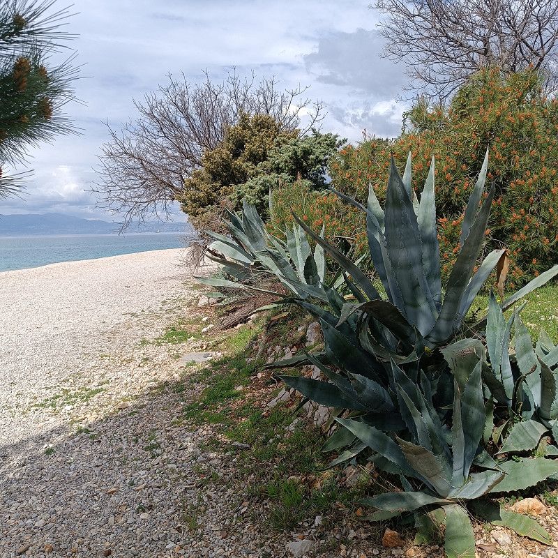
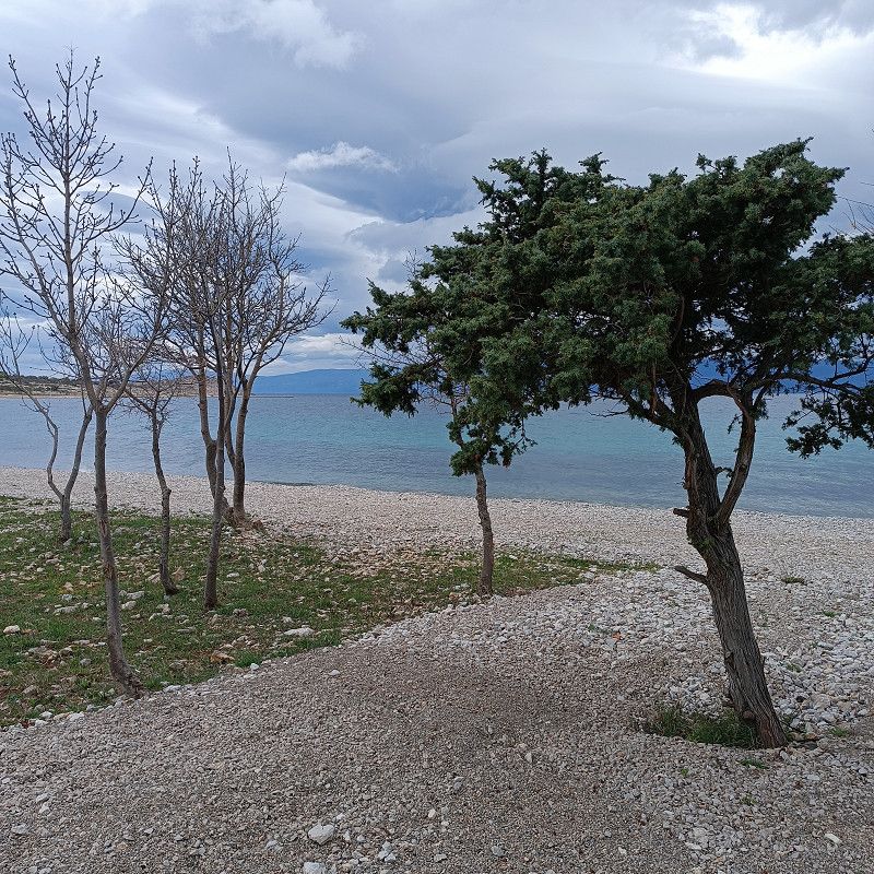
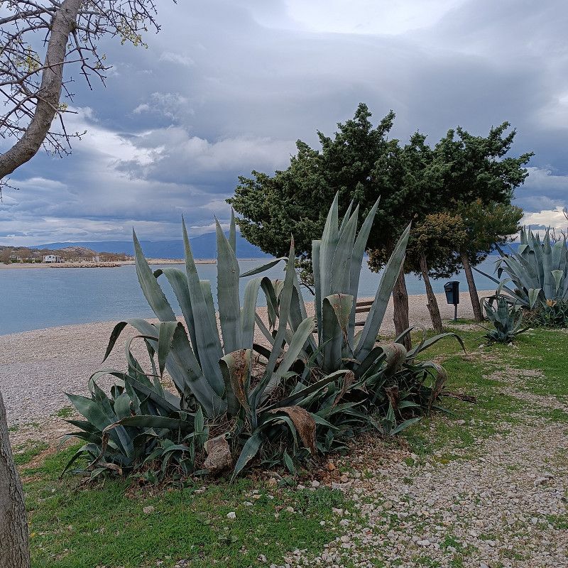
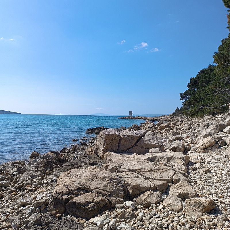
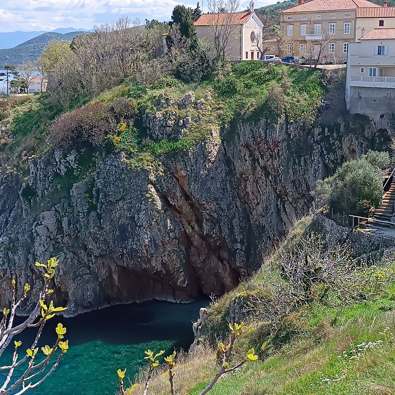
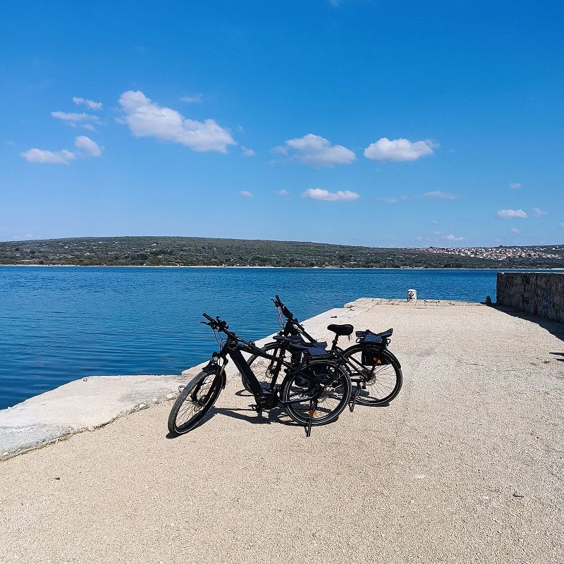
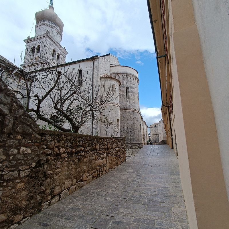
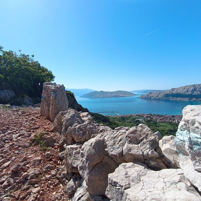
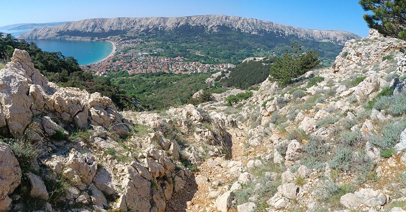
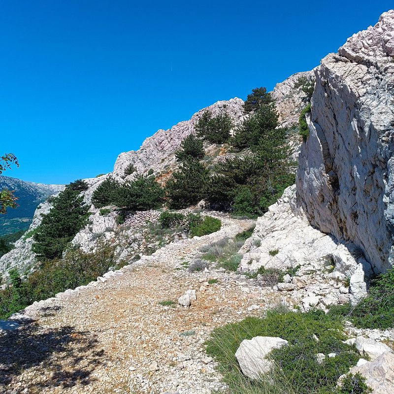
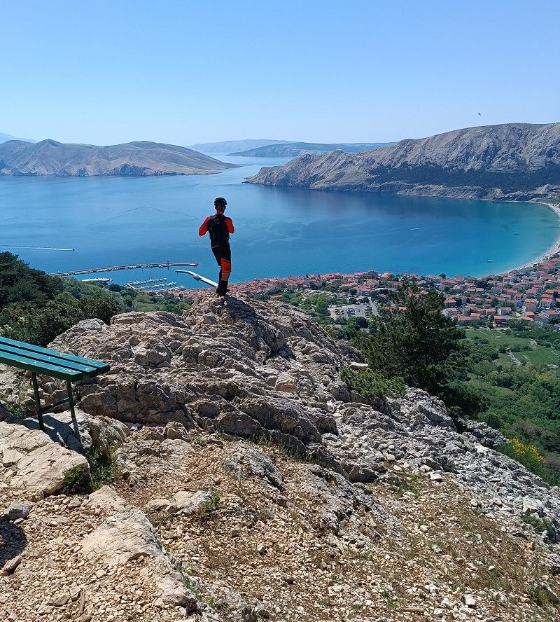
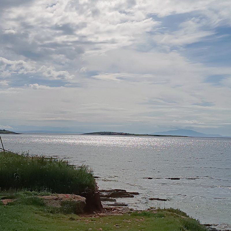
The old town of Krk is about 1.3 km down the hill. The town is worth a visit.
About 2km away there is a central location where there are several discount stores such as Lidl, Konzum, etc.
The restrooms were also in mint condition and were always well cleaned. There's also a fitness room, but it wasn't finished during our stay!
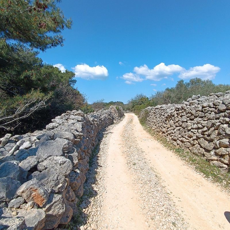
Cycling tours with an e-bike, for example, are easily possible there and walks are also great here.
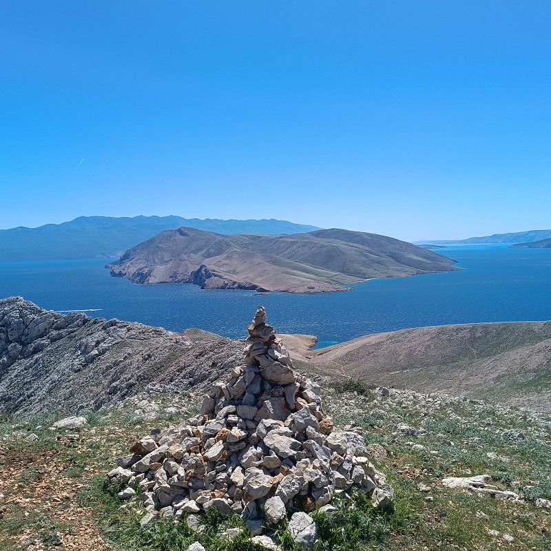
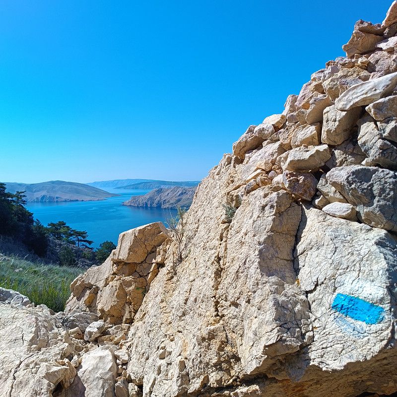
We would love to visit this campsite again and again because of its tranquility! There are two other (very large) campsites in Krk. These are also nice, but they are more hectic.
All photos were taken within a radius of typical cycling tours of approximately 25-30km in length and on hikes.
Crikvenička b.b. 10, 51500, Krk, Croatia
45° 1' 21.9" N 14° 33' 41.5" E
45.0227568 14.5615156
• Head southeast. Go for 57 m.
• Continue on Crikvenička ulica. Go for 274 m.
• Continue on Kvarnerska ulica. Go for 45 m.
• Turn left onto Kvarnerska ulica. Go for 290 m.
• Take the 5th exit from roundabout onto Ulica Slavka Nikolića toward Rijeka. Go for 1.4 km.
• Turn left onto Ulica Stjepana Radića (5131) toward Rijeka/Malinska. Go for 779 m.
• Continue on 5131. Go for 312 m.
• Take the 1st exit from roundabout onto 102 toward Baška/Vrbnik/Punat. Go for 4.9 km.
• Take the 2nd exit from roundabout onto 102 toward Baška/Vrbnik. Go for 37 m.
• Turn right onto 102. Go for 13.5 km.
• Keep right onto Jurandvor (102). Go for 40 m.
• Continue on Ulica kralja Zvonimira. Go for 559 m.
• Turn right onto Put Zablaće. Go for 400 m.
• Turn left onto Put Zablaće. Go for 316 m.
• Turn right onto Put Zablaće. Go for 93 m.
• Arrive at Put Zablaće. Your destination is on the right.
☍
22,9 km
( 28 min.)
Day
Day
27. Apr. 2025 -
03. May. 2025
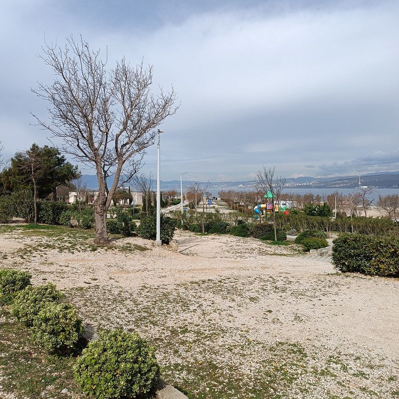
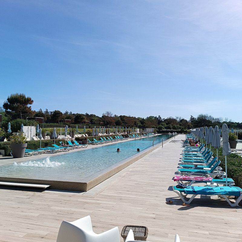
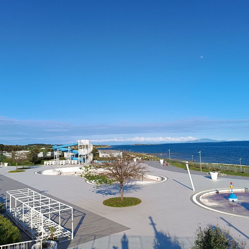
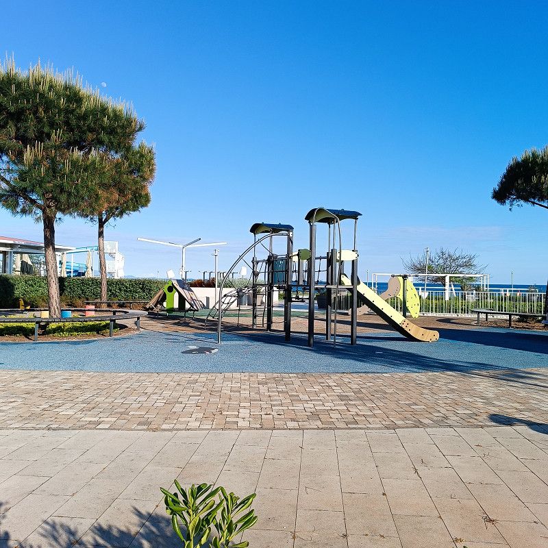
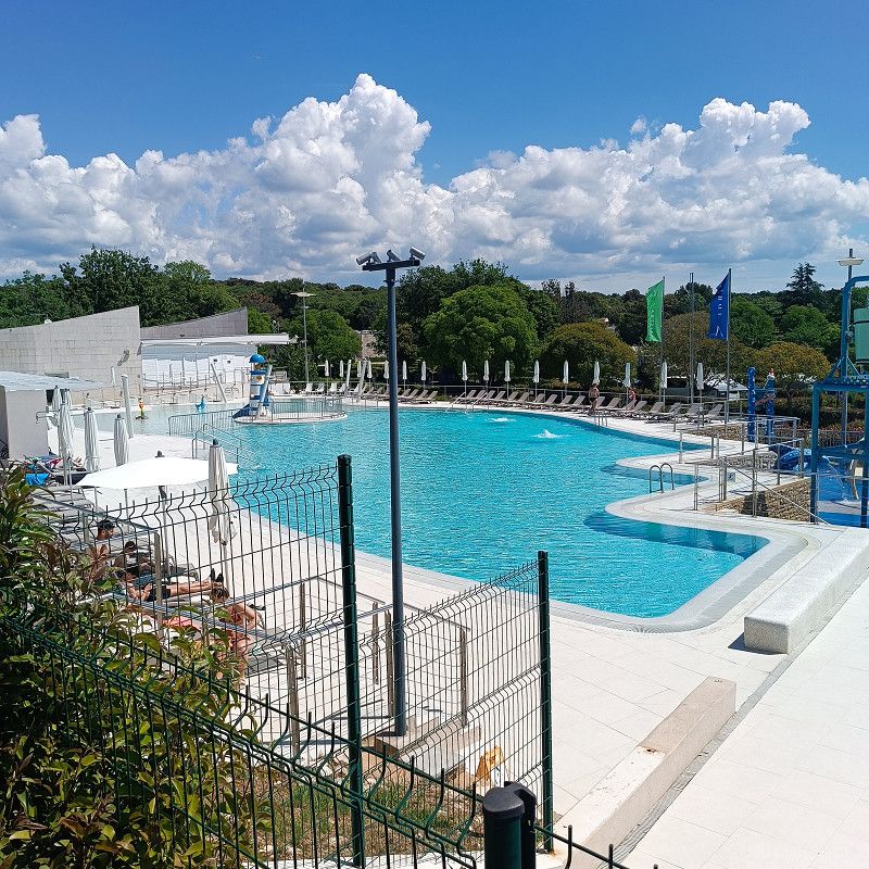
Valamar Camping Baška 4*
After Camping Bor in Krk, we quickly reached Valamar Camping Baska after a 20 km drive.
Check-in went smoothly, and our ACSI card was accepted immediately. However, we had to pay for the agreed-upon days immediately. At Camping Bor, we were able to pay everything at the end.
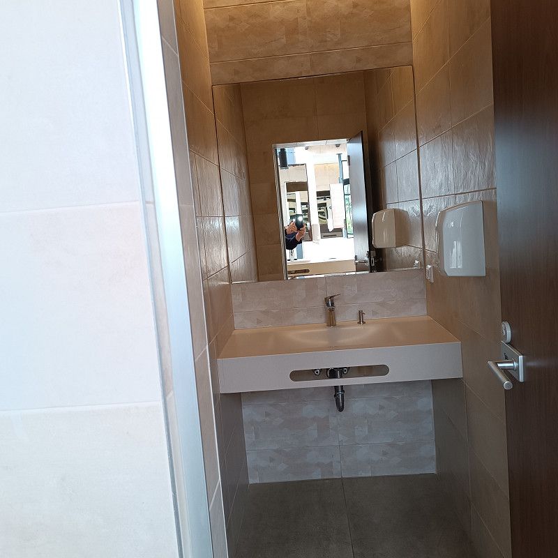
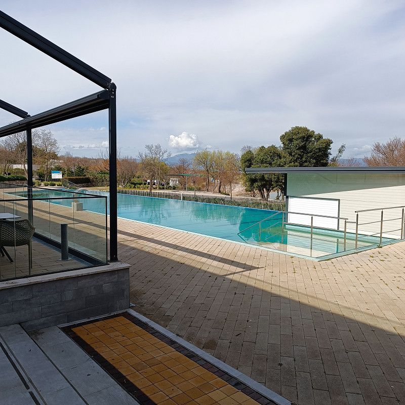
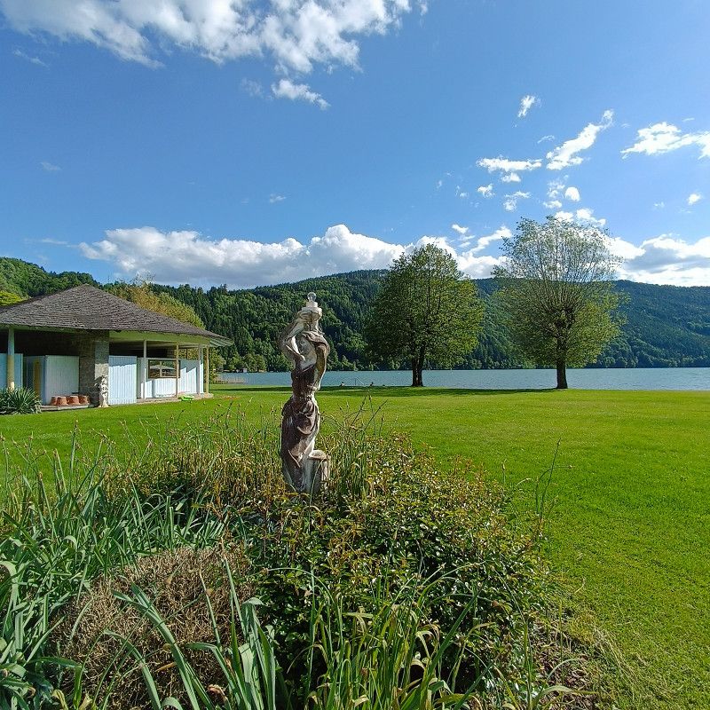
The campsite is clean, spacious, and located right by the sea. The restrooms are constantly cleaned, and everything is very clean!
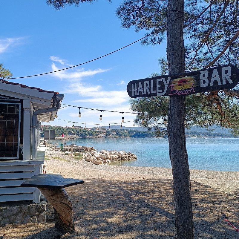
The beautiful promenade with restaurants and much more can be reached on foot in 5 minutes.
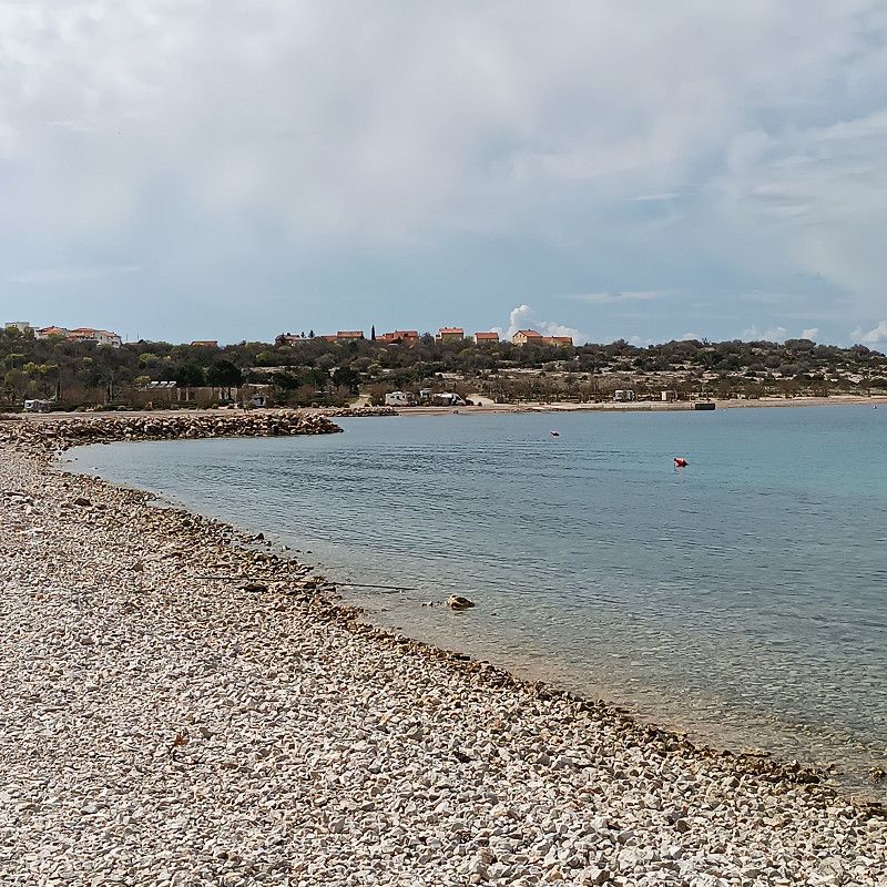
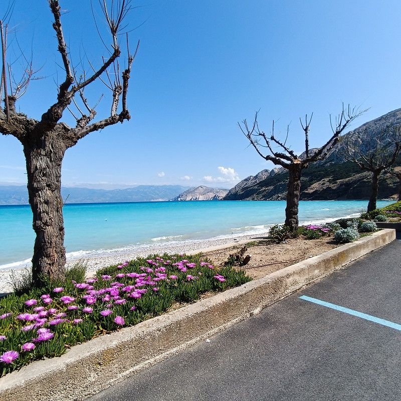
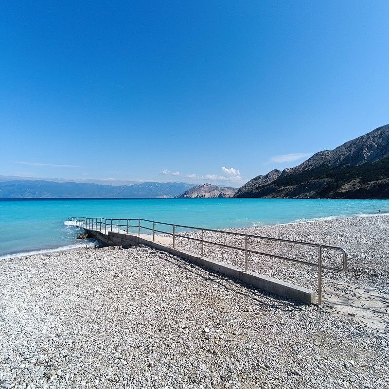
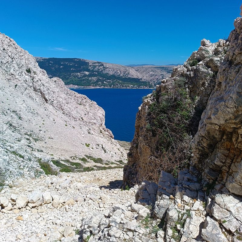
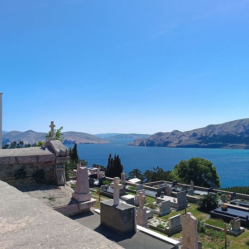
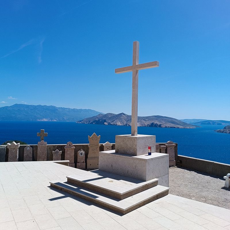
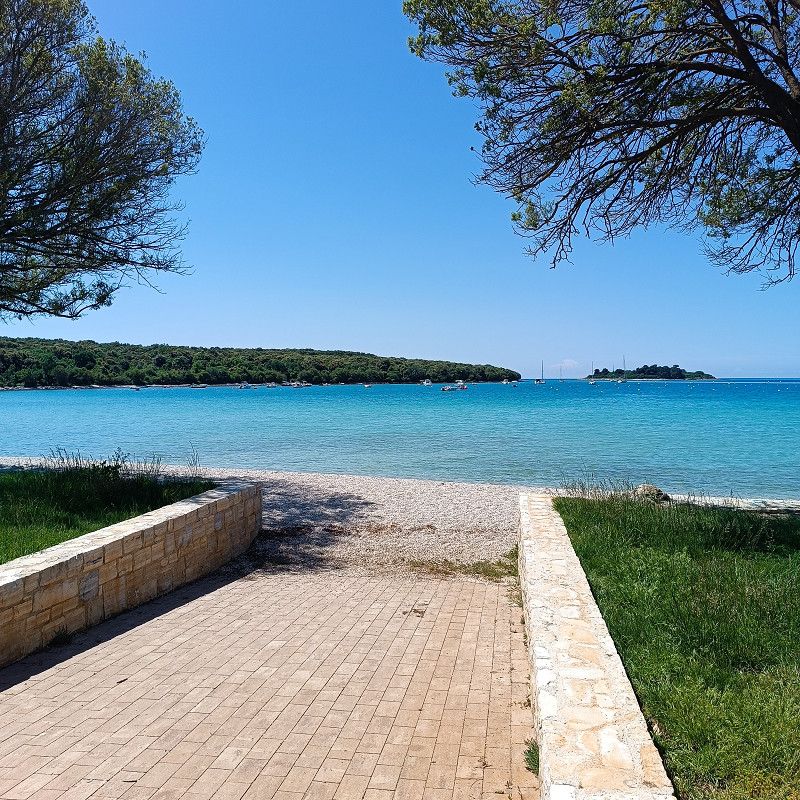
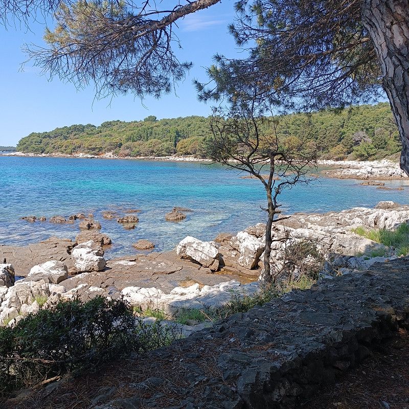
The beach and water are stunningly beautiful. The surrounding mountainous landscape provides a magnificent and unique panorama.
€25/day/pre-season plus €1.99/day per person for the tourist tax! A washing machine and dryer cost €7 each. If you need both, it costs €12.
The Wi-Fi was very good at our site.
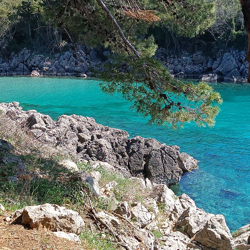
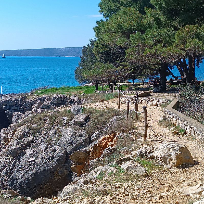
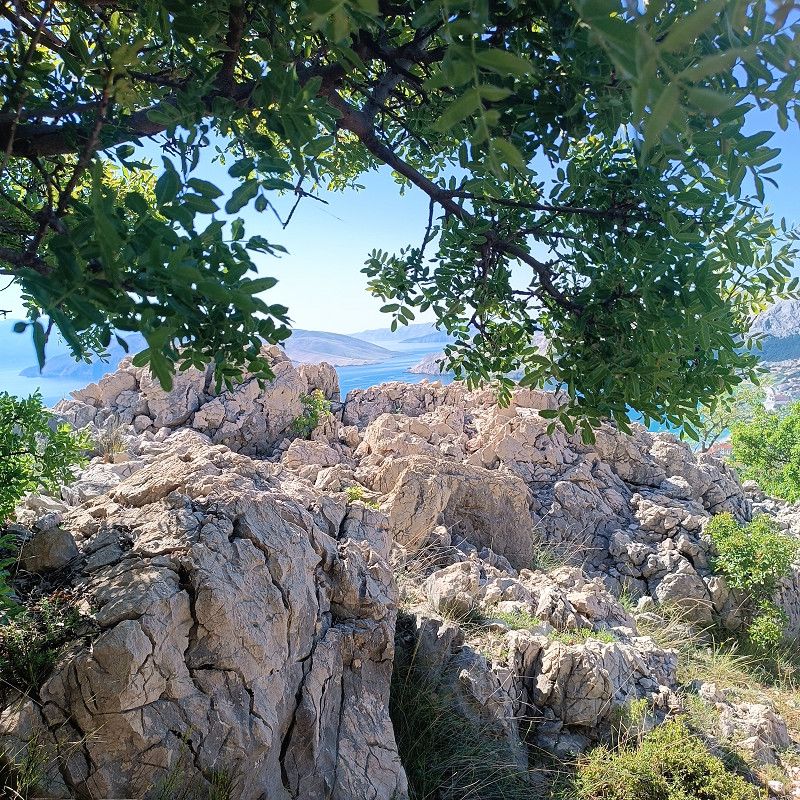
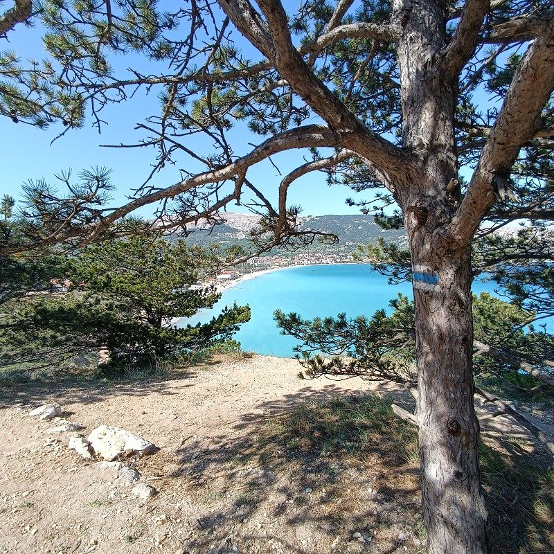
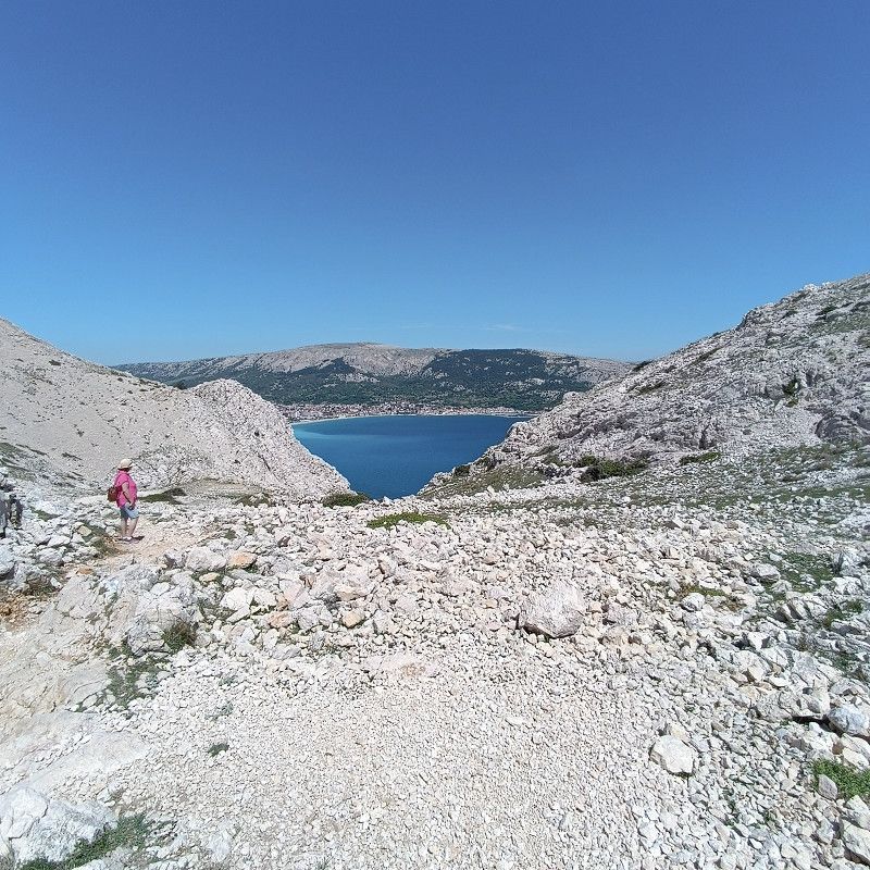
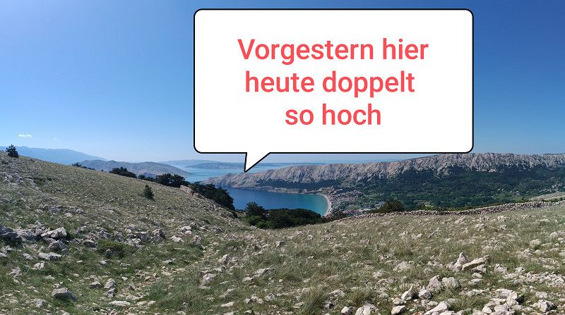
The photos shown here were taken within a radius of approximately 5 km. They were mainly taken during our hikes on the mountains to the right and left of Baska Bay. I would consider the climb up the left mountain of Baska Bay to the Moon Plateau a highlight. Here, we climbed over gravel and scree up to the plateau. The descent is very easy via a great hiking trail (along the church). If you plan to do this, I recommend bringing plenty of fluids (1-1.5 liters per person).
I can wholeheartedly recommend the campsite and the town of Baska if you're considering a vacation on the island of Krk. We felt very comfortable here, but we also had perfect weather during our stay. In bad weather, it might not be so nice! My recommendation would be to check the weather forecast and plan accordingly, if possible.
Put Zablaća 40, 51523, Baška, Croatia
44° 57' 59.5" N 14° 44' 41.6" E
44.9665344 14.7448751
• Head northeast on Put Zablaće. Go for 93 m.
• Turn left onto Put Zablaće. Go for 316 m.
• Turn right onto Put Zablaće. Go for 400 m.
• Turn left onto Ulica kralja Zvonimira. Go for 559 m.
• Keep left onto Jurandvor (102). Go for 13.5 km.
• Take the 2nd exit from roundabout onto 102 toward Rijeka/Krk. Go for 4.9 km.
• Pass 4 roundabouts and continue on 102. Go for 27.2 km.
• Keep left onto 102 toward Zagreb/Rijeka/Uvala Scott/Kraljevica. Go for 139 m.
• Take the 2nd exit from roundabout onto E65. Go for 674 m.
• Continue on A7. Go for 15.2 km.
• Keep left onto Orehovica (A7) toward Ljubljana/Trieste/Pula/Rijeka zapad. Go for 12.1 km.
• Take ramp onto Istarski Ipsilon (A8) toward Pula/Pazin/Opatija. Go for 1.3 km.
• Take the 1st exit from roundabout onto Istarski Ipsilon (A8) toward Pula/Poreč/Pazin. Go for 9.9 km.
• Turn right onto Istarski Ipsilon (A8). Go for 53.8 km.
• Take the exit toward Pula/Brijuni onto A9 (Istarski Ipsilon). Go for 29.0 km.
• Continue on 5200. Go for 1.8 km.
• Pass 2 roundabouts and continue on 5200. Go for 2.9 km.
• Take the 3rd exit from roundabout onto 5133 toward Medulin. Go for 2.2 km.
• Continue on Biškupije (5119) toward Medulin. Go for 325 m.
• Continue on Munida (5119). Go for 1.1 km.
• Take the 2nd exit from roundabout onto Munida (5119) toward Centar/Ližnjan. Go for 240 m.
• Take the 1st exit from roundabout onto Munida (5179). Go for 184 m.
• Continue on Burle (5179). Go for 224 m.
• Continue on Brajdine (5179). Go for 287 m.
• Continue on Sad (5179). Go for 268 m.
• Continue on Osipovica (5179). Go for 971 m.
• Continue on Pošesi (5179). Go for 477 m.
• Continue on Kapovica (5179). Go for 293 m.
• Arrive at Kapovica. Your destination is on the right.
☍
180,4 km
(2 hrs. 17 min.)
Day
02. May. 2025 -
11. May. 2025
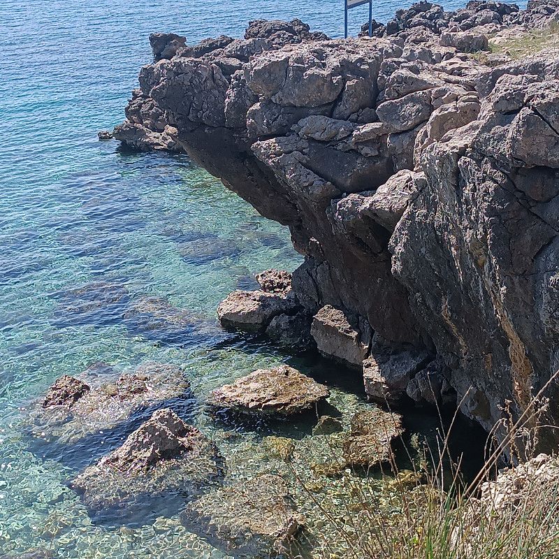
Arena Grand Kažela Campsite
The campsite is located about 2 km from Medulin and is very large.
The young man at the reception was very friendly and spoke perfect German.
There is a good and large Konzum supermarket on the campsite (but you have to look at the prices carefully / there are some reasonable but also some exorbitant prices)
It's easy to get to town by bike!
There are several small bakery containers on the campsite where you can buy bread rolls.
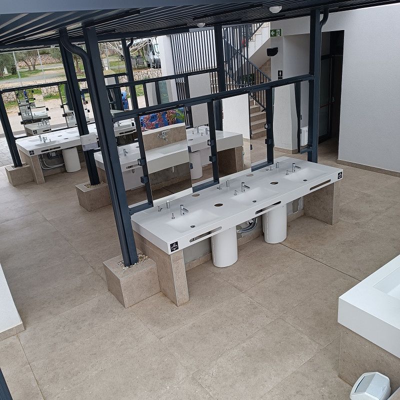
Most of the restrooms on the campsite are very old and no longer up-to-date for what is otherwise a very nice campsite. I found a new washroom in the middle of the site, but it was closed. At the very end of the site, I saw another (open) new and nice washroom. There's also a good, spacious waste disposal station.
Kapovica 350, 52203, Medulin, Croatia
44° 48' 24.6" N 13° 57' 2" E
44.8068300 13.9505600
• Head west on Kapovica. Go for 293 m.
• Continue on Pošesi (5179). Go for 477 m.
• Continue on Osipovica (5179). Go for 971 m.
• Continue on Sad (5179). Go for 268 m.
• Continue on Brajdine (5179). Go for 287 m.
• Continue on Burle (5179). Go for 224 m.
• Continue on Munida (5179). Go for 168 m.
• Take the 3rd exit from roundabout onto Munida (5119) toward Pula/Pola. Go for 243 m.
• Take the 2nd exit from roundabout onto Munida (5119) toward Pula/Pomer. Go for 1.1 km.
• Continue on Biškupije (5119). Go for 325 m.
• Continue on 5133 toward Pula/Pola. Go for 2.0 km.
• Turn right onto 5200 toward Rijeka/Umag/Umago/Zračna luka. Go for 1.2 km.
• Pass 2 roundabouts and continue on 5200. Go for 3.5 km.
• Continue on A9. Go for 12.8 km.
• Take exit 8 toward Bale/Vodnjan sjev./3. Go for 1.7 km.
• Turn right onto 75 toward Bale/Valle. Go for 8.2 km.
• Turn left onto 5096 toward Rovinj/Rovigno/Bale/Valle. Go for 1.0 km.
• Take the 2nd exit from roundabout onto 5096. Go for 5.3 km.
• Continue on Španidiga (5096). Go for 800 m.
• Continue on 5096. Go for 1.2 km.
• Continue on Naselje Cocaletto (5096). Go for 303 m.
• Continue on Kokuletovica (5096) toward AC Veštar. Go for 75 m.
• Turn left onto Cesta sv. Maksimijana iz Veštra (5175) toward AC Veštar. Go for 160 m.
• Continue on Cesta sv. Maksimijana iz Veštra (5175). Go for 866 m.
• Take the 2nd exit from roundabout onto Cesta sv. Maksimijana iz Veštra. Go for 143 m.
• Turn left. Go for 105 m.
• Arrive at your destination on the left.
☍
43,9 km
( 41 min.)
12. May. 2025 -
17. May. 2025
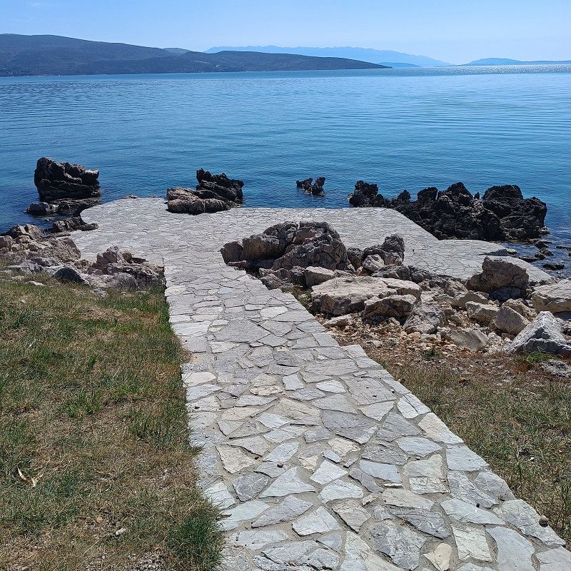
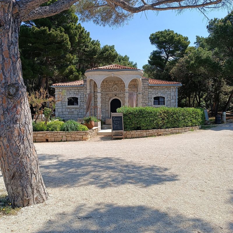
Camping Vestar Rovinj
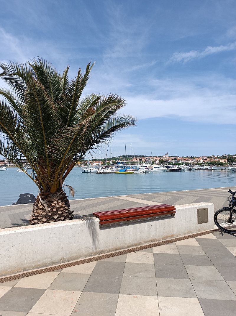
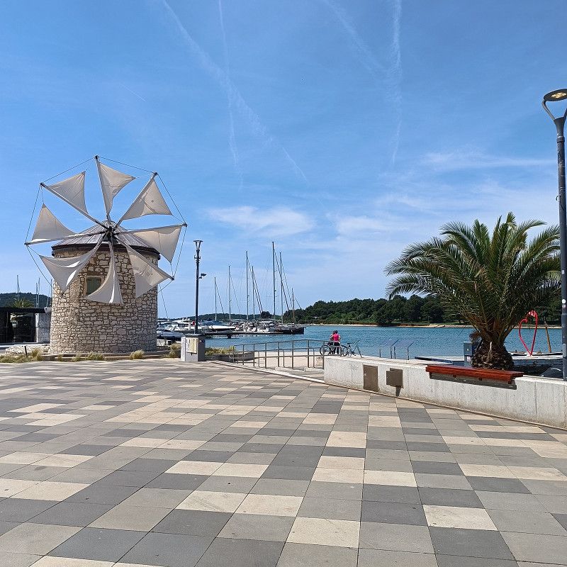
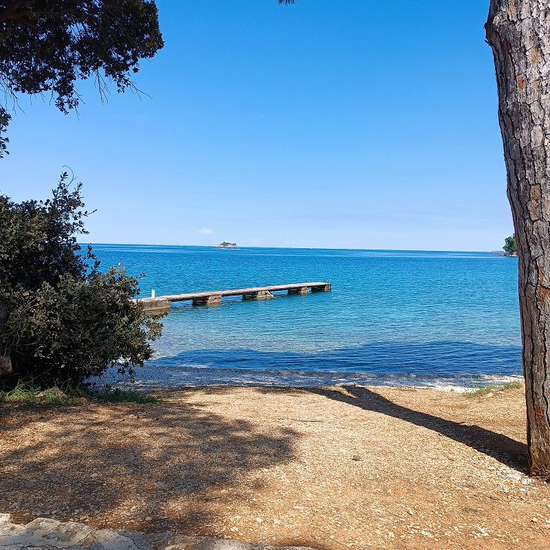
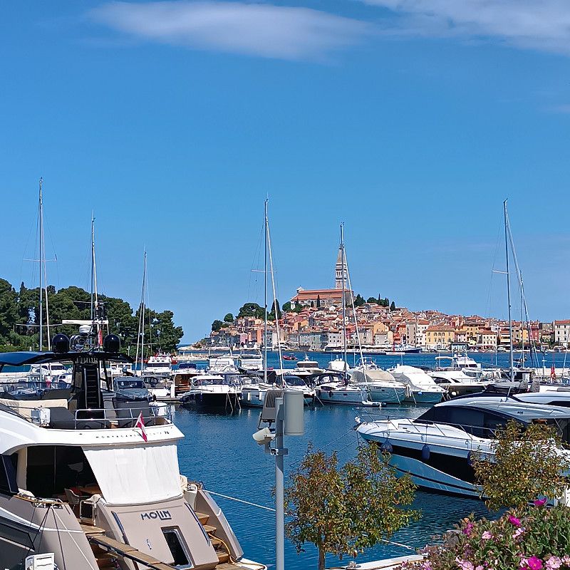
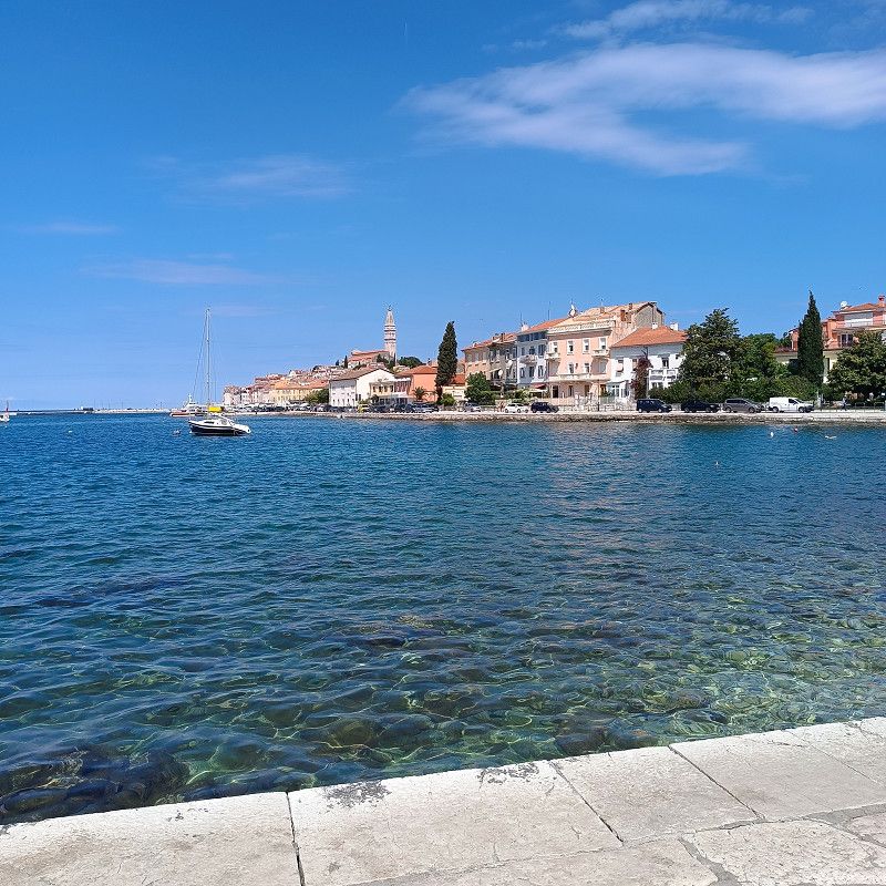
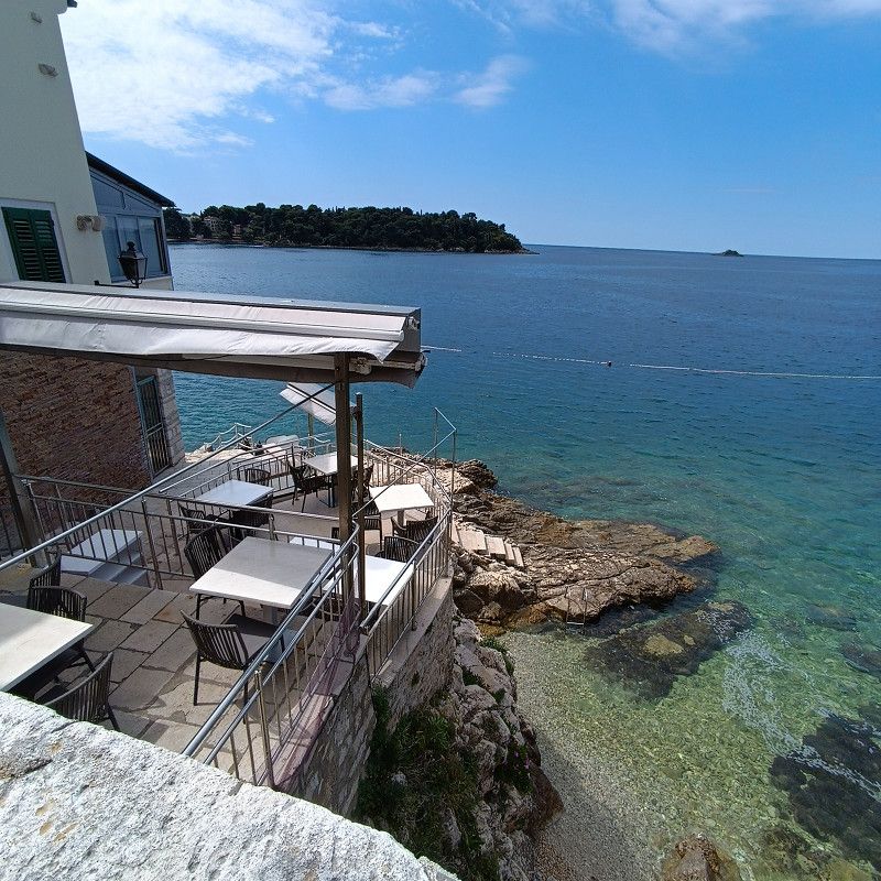
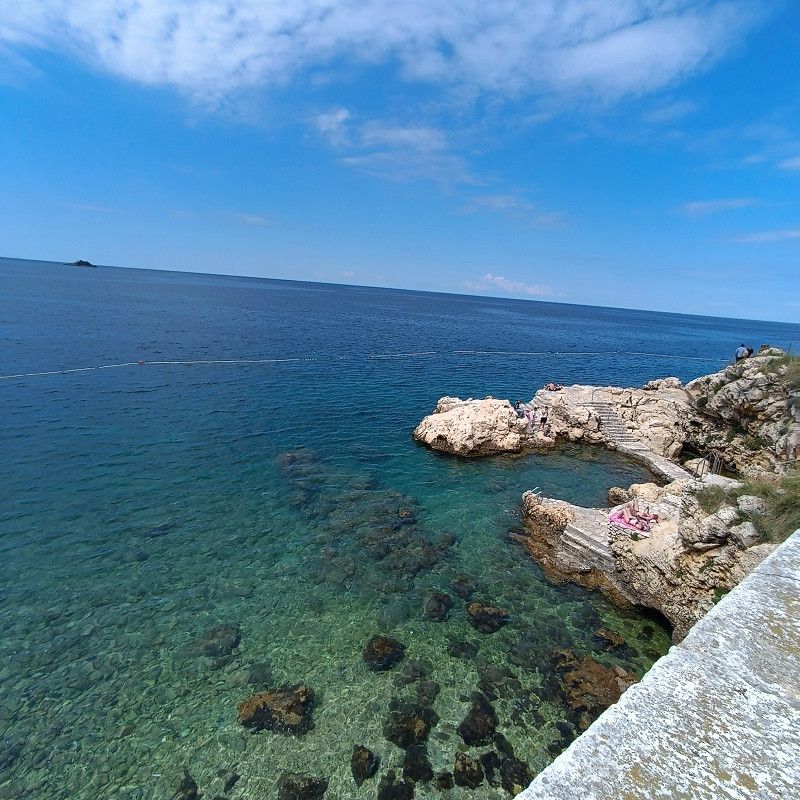
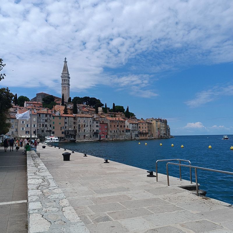
From Medulin, we drove to Camping Vestar in Rovinj (approx. 45km). The campsite is located about 7km below Rovinj.
You can also cycle to Rovinj on great bike paths (approx. 10 km). The first kilometer is more of a footpath and a bit bumpy, but after that, you cycle directly into and through the next campsite (Polari). After that, a fantastic gravel bike path begins all the way to Rovinj, along beautiful bays and views! Highly recommended!
To the Vestar campsite:
When you check in, you're given a sheet of paper with seat numbers (which are available). Each seat number indicates how long it's available. This gives every customer a clear overview! I think this is a great solution!
The campsite is very nice and has an excellent swimming area.
Here with ACSI we had to pay €25 plus €1.30 overnight tax per person.
The campsite has several new sanitary buildings that were also clean (including clean chemical toilet disposal)!
From our point of view, there is nothing to complain about at this campsite!
5175, Grad Rovinj, Istria County, Croatia
45° 3' 12.6" N 13° 41' 16.1" E
45.0534891 13.6877943
• Head east. Go for 16 m.
• Turn right. Go for 64 m.
• Turn right. Go for 80 m.
• Turn left toward Cesta sv. Maksimijana iz Veštra. Go for 8 m.
• Turn right onto Cesta sv. Maksimijana iz Veštra. Go for 22 m.
• Turn left onto Cesta sv. Maksimijana iz Veštra. Go for 1.8 km.
• Turn slightly right onto Polari. Go for 1.3 km.
• Turn left onto 5105. Go for 992 m.
• Continue on Aleja 30. svibnja (5105). Go for 325 m.
• Take the 1st exit from roundabout onto Aleja 30. svibnja (5105) toward Rijeka/Pula/303/Pola/5096. Go for 675 m.
• Take the 2nd exit from roundabout onto Ulica štanga (5096) toward Trst/Trieste/Rijeka/Fiume/Pula/Pola. Go for 322 m.
• Continue on Gripole (5096). Go for 60 m.
• Continue on Naselje Gripole (5096). Go for 1.7 km.
• Take the 1st exit from roundabout onto Aleja Ruđera Boškovića (303) toward Rijeka/A8/Pula/A9/Pola. Go for 507 m.
• Continue on 303 toward Rijeka/A8/Pula/A9/Pola. Go for 5.9 km.
• Continue on Putini (303). Go for 607 m.
• Continue on 303. Go for 2.5 km.
• Continue on Kurili (303). Go for 343 m.
• Continue on 303. Go for 1.8 km.
• Take the 1st exit from roundabout onto Istarski Ipsilon (303) toward Rijeka/Pula/Poreč. Go for 41.2 km.
• Take exit 6 toward Buzet. Go for 486 m.
• Turn left onto Lupoglav (44) toward Buzet/Lupoglav. Go for 15.3 km.
• Pass 3 roundabouts and continue on 201. Go for 6.9 km.
• Continue on Maršiči (208). Go for 15.6 km.
• Turn right onto Kortine (208) toward Ljubljana/A1. Go for 3.7 km.
• Take ramp onto A1 toward Ljubljana. Go for 87.1 km.
• Take left exit 36 toward Beljak/Villach/Kranj/Ljubljana-sever onto A2. Go for 39.4 km.
• Take exit 6 toward E652/101/Celovec/Klagenfurt/Tržič/Kropa onto Razcep Podtabor. Go for 594 m.
• Continue on E652. Go for 17.3 km.
• Continue on Loibltunnel (B91). Go for 14.1 km.
• Take the 2nd exit from roundabout onto Loiblpass Bundesstraße (B91) toward Klagenfurt. Go for 579 m.
• Take the 3rd exit from roundabout onto Rosental Bundesstraße (B85) toward St.Jakob i. R./Feistritz i. R. Go for 19.9 km.
• Keep left onto Rosental Bundesstraße (B85). Go for 1.9 km.
• Take ramp onto A11 (Karawanken Autobahn) toward Villach. Go for 12.6 km.
• Continue on A10 (Tauern Autobahn) toward E55/E66/Salzburg/Villach-Ossiacher See. Go for 23.6 km.
• Take exit 158 toward Paternion/Feistritz. Go for 278 m.
• Turn right onto Kreuzner Straße (L33) toward Paternion/Feistritz/Drau/Stockenboi/Fresach. Go for 1.9 km.
• Turn left onto Villacher Straße (L42). Go for 306 m.
• Turn right onto Bahnhofstraße (L39). Go for 1.2 km.
• Continue on Ferndorfer Straße (L37). Go for 371 m.
• Continue on Glanzer Landesstraße (L39). Go for 8.5 km.
• Arrive at Glanzerstraße (L39). Your destination is on the left.
☍
331,9 km
(4 hrs. 3 min.)
Day
Day
16. May. 2025 -
17. May. 2025
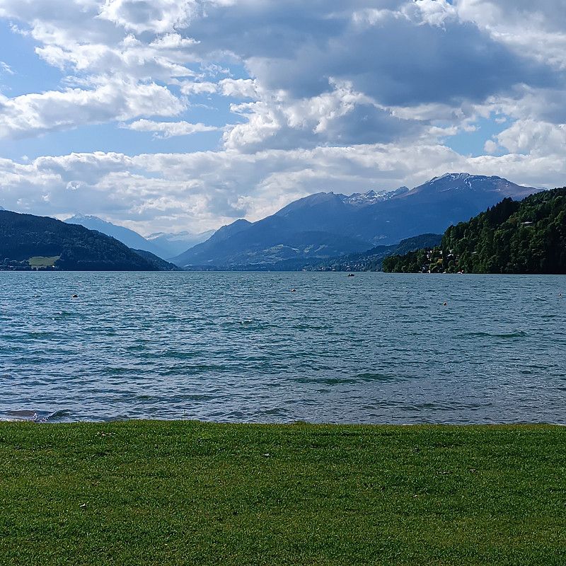
Camping Brunner am See
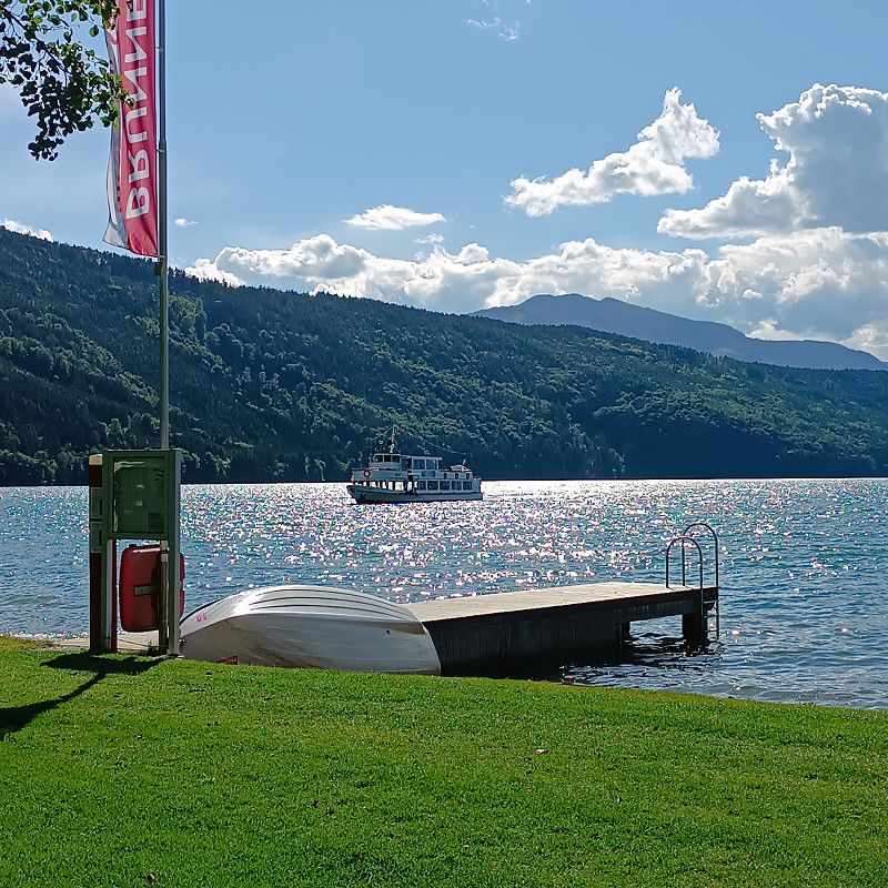
The Brunner campsite on Lake Millstatt is a lovely place for a stopover on the way to Croatia. It's beautifully situated on the lake and not far from the highway. The Karawanks Tunnel in Slovenia is about 45 km south.
With ACSI the pitch costs 27€ plus 2.70€ tourist tax per person plus 4.50€ environmental contribution/day!
I find this environment quite high.
Otherwise, the campsite is very clean, tidy and everyone at reception is extremely friendly.
The sanitary building is also very clean and the Wi-Fi is good!
There is a first-class toilet and shower facility opposite reception. However, you have to cross the street to use it.
Glanzerstraße 108, 9873, Döbriach, Austria
46° 46' 4.2" N 13° 38' 53.7" E
46.7678307 13.6482371
• Head northeast on Glanzerstraße (L39). Go for 140 m.
• Turn left onto Seefeldstraße. Go for 1.5 km.
• Turn left onto Millstätter Straße (B98). Go for 11.6 km.
• Pass 2 roundabouts and continue on Hauptstraße (B98). Go for 1.1 km.
• Take the 3rd exit from roundabout onto Hauptstraße (B98). Go for 602 m.
• Turn right onto A10 (Tauern Autobahn). Go for 1.5 km.
• Take the exit toward Salzburg/Gmünd-Maltatal onto A10 (Tauern Autobahn). Go for 138 km.
• Take the exit onto A1 (West Autobahn). Go for 3.5 km.
• Continue on A8. Go for 114 km.
• Take exit 95 toward Nürnberg/Stuttgart/Messe/ICM/Flughafen München onto A99. Go for 45.1 km.
• Keep right onto A99 (Autobahndreieck München-Allach) toward Stuttgart/Augsburg/Dachau/Fürstenfeldbruck. Go for 4.3 km.
• Continue on A8 (Autobahndreieck München/Eschenried). Go for 46.3 km.
• Take exit 72 toward Donauwörth/Gersthofen onto B2. Go for 39.6 km.
• Keep left onto B25. Go for 13.9 km.
• Take ramp toward Oettingen/Heroldingen/Großsorheim/Schaffhausen. Go for 313 m.
• Turn right onto St2221. Go for 7.9 km.
• Pass 2 roundabouts and continue on St2221. Go for 9.7 km.
• Turn right onto Umgehungsstraße (B466). Go for 1.1 km.
• Take the 1st exit from roundabout onto Gunzenhausener Straße (B466) toward Nürnberg/Schwabach/Gunzenhausen. Go for 21.5 km.
• Turn left onto St2222 toward Feuchtwangen/Arberg/Wald. Go for 953 m.
• Turn right toward Schweina. Go for 584 m.
• Turn right onto Wald-Seezentrum. Go for 421 m.
• Arrive at Wald-Seezentrum. Your destination is on the right.
☍
463,1 km
(4 hrs. 29 min.)
18. May. 2025 -
21. May. 2025
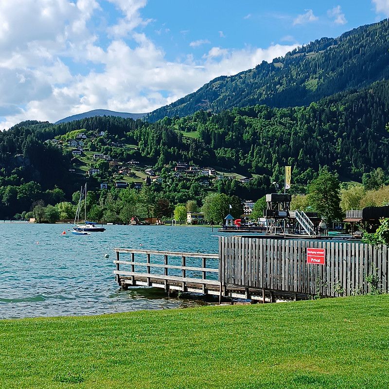
Campingplatz Fischer-Michl
After a 465km drive we drove to the Fischer-Michl campsite in Gunzenhausen.
Registration at reception was quick and ACSI was recognized immediately!
The price was 23€ plus 2€ tourist tax/person and 2.50€ garbage fees.
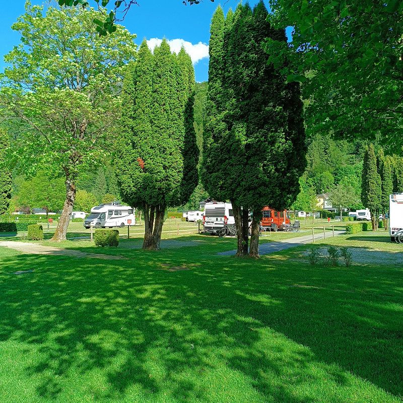
The campsite is divided into several pitches and the pitches are spacious.
The sanitary building is quite old.
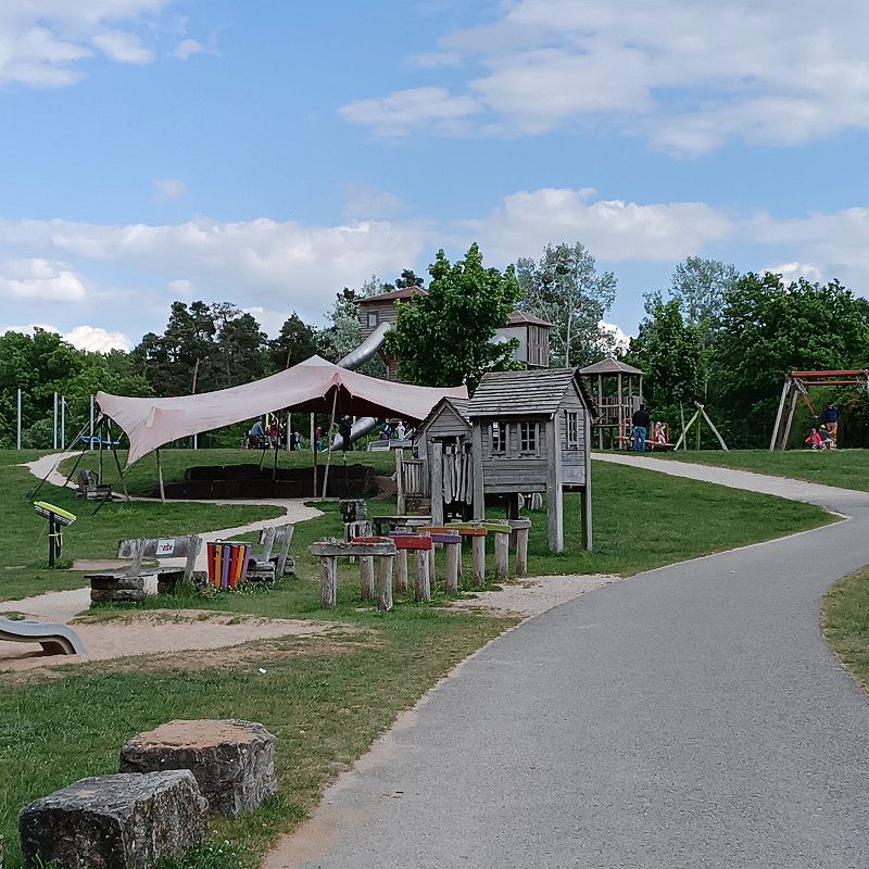
A beautiful adventure playground is within easy walking distance.
Wald Seezentrum 4, 91710, Gunzenhausen, Germany
49° 7' 32" N 10° 42' 58" E
49.1255600 10.7161100
• Head west on Wald-Seezentrum. Go for 421 m.
• Turn left toward St2222. Go for 584 m.
• Turn right onto St2222. Go for 2.8 km.
• Turn right onto Streudorf (WUG24) toward Ornbau/Muhr a. See/Mörsach. Go for 160 m.
• Continue on WUG24. Go for 1.0 km.
• Continue on AN55. Go for 133 m.
• Continue on Streudorfer Straße (AN55). Go for 238 m.
• Continue on Ornbauer Straße (AN55). Go for 364 m.
• Continue on AN55. Go for 3.0 km.
• Turn right onto Stadtmühle (St2411) toward Ansbach/Triesdorf. Go for 4.6 km.
• Turn left onto Markgrafenstraße (St2220) toward Ansbach/Triesdorf. Go for 189 m.
• Take the 1st exit from roundabout onto St2411 toward Ansbach/B13. Go for 1.2 km.
• Turn left onto Am Kreuzweiher (B13) toward Ansbach. Go for 6.7 km.
• Turn left and take ramp onto A6 toward Heilbronn/Würzburg. Go for 23.6 km.
• Take exit 49 toward Schillingsfürst. Go for 289 m.
• Turn left onto St2419 toward Schillingsfürst. Go for 4.7 km.
• Take the 2nd exit from roundabout onto St2419 toward A7/Würzburg/Ulm. Go for 592 m.
• Take ramp onto A7 toward Würzburg/Rothenburg o.d.T. Go for 64.0 km.
• Take exit 102 toward Frankfurt a.M./Würzburg onto A3. Go for 97.7 km.
• Take exit 56 toward Dortmund/Gießen/Kassel/Hanau onto A45. Go for 23.7 km.
• Keep left onto A45 toward Gießen. Go for 180 km.
• Take exit 14 toward Werdohl/Halver/Lüdenscheid/Gewerbegebiet Horringhauser Höh. Go for 339 m.
• Continue on Brunscheider Straße (L655). Go for 628 m.
• Turn right onto Werdohler Landstraße (L691) toward Altena/Lüdenscheid. Go for 236 m.
• Keep right onto Lennestraße (L691). Go for 1.1 km.
• Turn right onto Altenaer Straße (L530). Go for 11.3 km.
• Turn right onto Pott-Jost-Brücke (B236). Go for 236 m.
• Turn right onto Lenneuferstraße. Go for 1.1 km.
• Turn right onto Lenneuferstraße. Go for 70 m.
• Arrive at Lenneuferstraße. Your destination is on the right.
☍
431,4 km
(4 hrs. 6 min.)
Altena
Return home. End of vacation in spring 2025
Märkischer Kreis, Nordrhein-Westfalen, Deutschland
51° 17' 56.5" N 7° 40' 24.5" E
51.2990263 7.6734841