1 mobile home • 1 family • 1 year break • 15+ countries Route planning for the break planned for 2019-2020 with a European trip. We will completely change a lot in our life, including setting up our jobs again and relinquishing a lot of property. And take a lot of time, especially as a family with a three-year-old. Planned countries: Germany, Denmark, Norway, Sweden, Netherlands, Belgium, England, Scotland, Ireland, Northern Ireland, Wales, France, Atlantic coast, Portugal, Spain, France south and via Italy back to southern Germany. Possibly. Supplemented by the countries Morocco, Latvia, Lithuania and in the east Greece etc. We want to take enough time for this before our son has to go to school. At the beginning it goes to Scandinavia in the summer. We will spend the winter in southern Europe, probably at the Balerma Mar Azul campsite in Spain. So we are currently counting on a break of one year. Special challenges: + Choosing the right mobile home + Choosing the means of transport: eBikes, motorcycles, rubber dinghies with a motor, ... + Choosing the right POIs: because Europe is big + route planning itself: route optimization for the shortest distance + compromise between seeing a lot and experience, but not hectic with the child + traveling in general as a family with a small child (3 years) + the problem of storage space: how do we stow away? What do we take with us? The previous route planning was done with GMaps. Here we want, among other things, to plan the route (route with the mobile home) and to exchange ideas with other users. More photos will follow as soon as we are on the way. We look forward to feedback on route planning or travel, suggestions and tips or whatever :-)
Day
München, Deutschland
We start with the motorhome near Munich
48° 8' 6.5" N 11° 34' 55.1" E
48.1351253 11.5819805
• Head toward Lueg ins Land on Tal. Go for 62 m.
• Turn sharp left onto Tal. Go for 74 m.
• Turn left onto Thomas-Wimmer-Ring. Go for 474 m.
• Turn right onto Maximilianstraße. Go for 354 m.
• Turn right onto Steinsdorfstraße. Go for 43 m.
• Make a U-Turn onto Steinsdorfstraße. Go for 67 m.
• Continue on Widenmayerstraße. Go for 1.5 km.
• Continue on Ifflandstraße. Go for 693 m.
• Take left ramp onto Isarring (B2R) toward Nürnberg/A9. Go for 2.5 km.
• Take ramp onto A9 toward Nürnberg/Flughafen München/Allianz Arena. Go for 94.8 km.
• Keep left onto A9. Go for 48.5 km.
• Take exit 54 toward Fürth/Nürnberg/Heilbronn/Feucht/N.-Hafen/N.-Messe/N.-Stadion onto A73. Go for 7.4 km.
• Take the exit toward Heilbronn/Ansbach onto A6. Go for 9.5 km.
• Take exit 56 toward Schwabach-Süd/Rednitzhembach/Nürnberg/Schwabach. Go for 413 m.
• Continue on Rother Straße (B2). Go for 876 m.
• Turn left onto Bahnhofstraße (B2) toward Stadtmitte. Go for 718 m.
• Continue on Ludwigstraße. Go for 51 m.
• Arrive at Ludwigstraße. Your destination is on the left.
☍
168,0 km
(1 hrs. 36 min.)
Eiscafé De Rocco, Ludwigstraße, Schwabach, Deutschland
2nd place Gelato World Tour
Guido de Rocco and his son Luca from Schwabach in Franconia took second place with their ice cream flavor "Tributo alle Serenissima".
Ludwigstraße 10, 91126 Schwabach, Deutschland
49° 19' 44.2" N 11° 1' 25.1" E
49.3289337 11.0236286
• Head west on Ludwigstraße. Go for 78 m.
• Turn right onto Pfarrgasse. Go for 28 m.
• Turn left onto Rosenbergerstraße. Go for 55 m.
• Turn slightly right onto Rosenbergerstraße. Go for 46 m.
• Turn right onto Fleischbrücke. Go for 39 m.
• Continue on Nürnberger Straße. Go for 106 m.
• Turn left onto Friedrichstraße. Go for 174 m.
• Continue on Hördlertorstraße. Go for 214 m.
• Continue on Alte Linde (St2409). Go for 8.4 km.
• Turn right onto Schwabacher Straße (FÜ14). Go for 311 m.
• Continue on Zirndorfer Straße (FÜ14). Go for 501 m.
• Continue on FÜ14. Go for 424 m.
• Continue on Großweismannsdorfer Straße (FÜ14). Go for 560 m.
• Continue on Anwandener Straße (FÜ14). Go for 1.2 km.
• Continue on Schwabacher Straße (FÜ14). Go for 3.1 km.
• Turn right onto Carl-Benz-Straße. Go for 158 m.
• Turn left onto Brandstätterstraße. Go for 362 m.
• Arrive at Brandstätterstraße. Your destination is on the right.
☍
15,7 km
( 18 min.)
Zirndorf, Deutschland
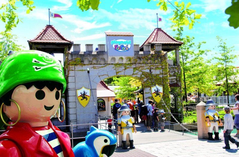
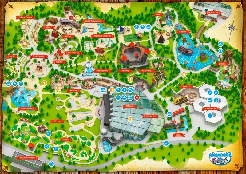
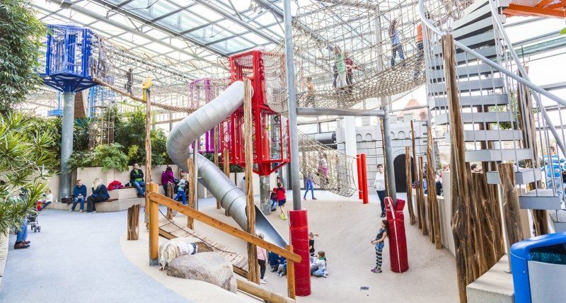
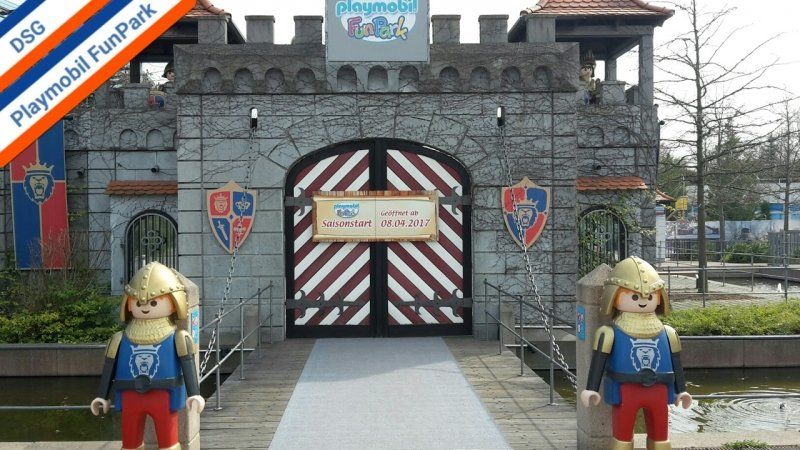
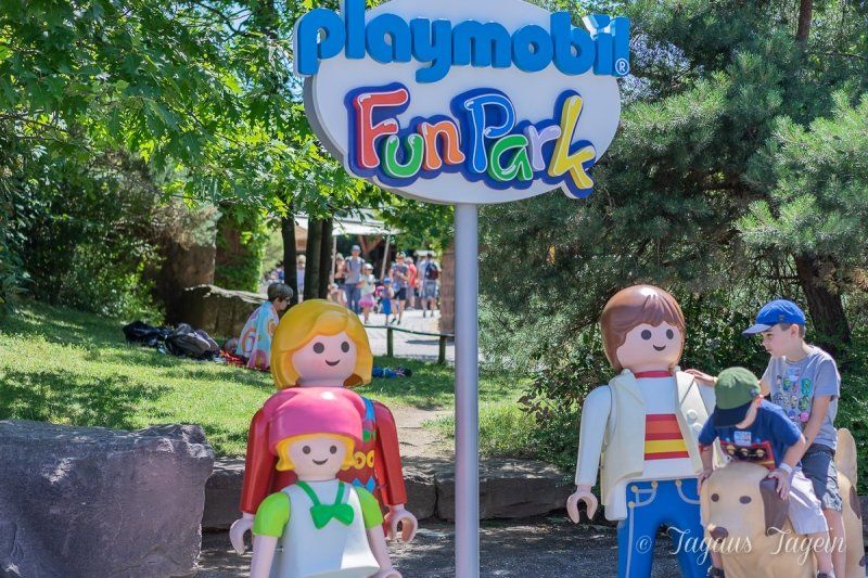
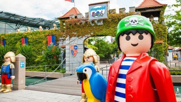
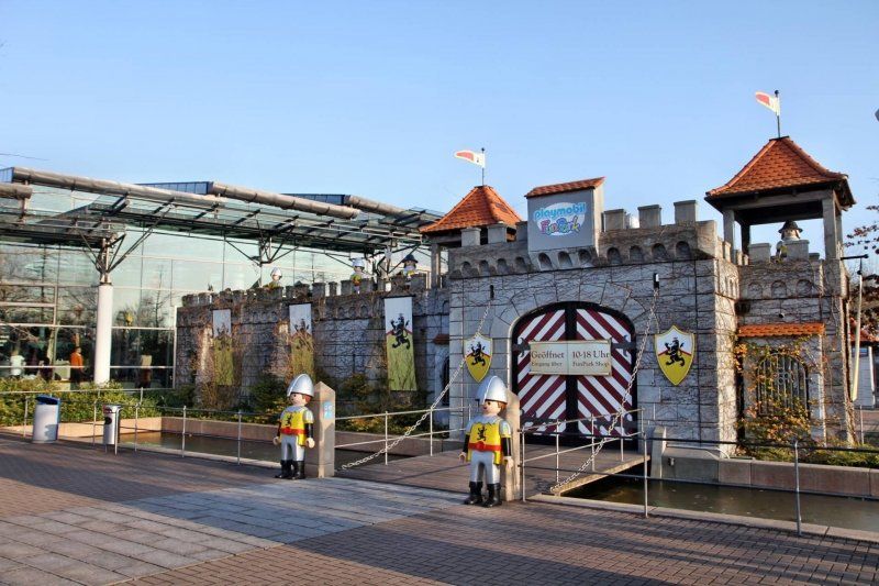
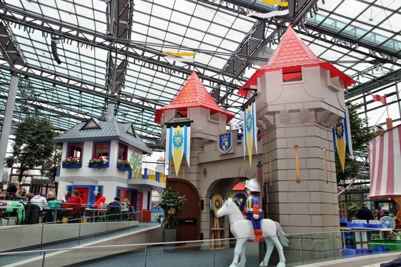
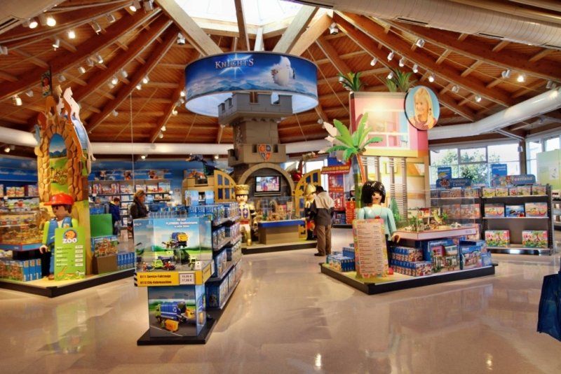
The Playmobil FunPark Zirndorf in the Fürth district has a diverse range of games in Franconia on 90,000 square meters. You first have to get an overview! What is special about the amusement park in Bavaria is that the focus is not on the rides but on the participation of the visitors. So it's about gaining experience yourself.
Zirndorf Playmobil-FunPark, 90513 Zirndorf, Deutschland
49° 25' 51.5" N 10° 56' 29.4" E
49.4309671 10.9415036
• Head toward Robert-Bosch-Straße on Brandstätterstraße. Go for 665 m.
• Turn left onto Zwickauer Straße. Go for 72 m.
• Turn right onto Rothenburger Straße (St2245). Go for 4.0 km.
• Take ramp onto Südwesttangente toward München/Feucht/Prag/Praha/Regensburg/Heilbronn/Hafen/B9/B6/B3. Go for 6.0 km.
• Continue on A73. Go for 12.8 km.
• Take the left exit toward Berlin onto A9. Go for 131 km.
• Take exit 33 toward Dresden/Chemnitz/Hof-Nord onto A72. Go for 53.6 km.
• Take exit 9 toward Reichenbach/Rodewisch/Lengenfeld/Greiz. Go for 340 m.
• Turn left onto Hauptstraße (B94) toward Greiz/Reichenbach. Go for 3.7 km.
• Turn left onto Zwickauer Straße (S293) toward Zwickau/Irfersgrün. Go for 1.2 km.
• Take the 2nd exit from roundabout onto Plohner Hauptstraße (K7819). Go for 857 m.
• Turn right onto Rodewischer Straße (K7820). Go for 600 m.
• Turn right. Go for 16 m.
• Turn right. Go for 17 m.
• Arrive at your destination on the right.
☍
214,5 km
(1 hrs. 56 min.)
Day
Lengenfeld, Deutschland
Rodewischer Str. 21, 08485 Lengenfeld, Deutschland
50° 33' 59.9" N 12° 23' 46.9" E
50.5666360 12.3963600
• Head southwest. Go for 17 m.
• Turn left toward Rodewischer Straße/K7820. Go for 16 m.
• Turn left onto Rodewischer Straße (K7820). Go for 600 m.
• Turn left onto Plohner Hauptstraße (K7819). Go for 798 m.
• Take the 1st exit from roundabout onto S293. Go for 8.9 km.
• Take ramp onto A72 toward Chemnitz. Go for 106 km.
• Take ramp onto A38 toward Dresden/Leipzig-Südost. Go for 14.2 km.
• Take the left exit toward Magdeburg/Halle/Flughafen/Leipzig/A9 onto A14. Go for 91.8 km.
• Take exit 10 toward Braunschweig/Quedlinburg/Aschersleben/B185 onto A36. Go for 52.1 km.
• Take exit 22 toward Blankenburg-Ost/Elbingerode onto B27. Go for 1.0 km.
• Turn right onto Westerhäuser Landstraße (B27). Go for 1.9 km.
• Take the 2nd exit from roundabout onto Westerhäuser Straße (B27). Go for 1.0 km.
• Turn left onto Herzogstraße (B27). Go for 54 m.
• Take the 3rd exit from Lühnertorplatz roundabout onto Hasselfelder Straße (B81) toward Nordhausen/Hasselfelde/Thale. Go for 6.1 km.
• Turn right onto Almsfeld (L94) toward Hüttenrode/B27. Go for 3.3 km.
• Turn left onto Alte Rübeländer Straße (B27) toward Braunlage/Elbingerode/Rübeland/Höhlen. Go for 5.2 km.
• Turn left onto Hasselfelder Straße (L96) toward Hasselfelde/B81/OT Susenburg. Go for 52 m.
• Turn left onto Hasselfelder Straße (L96). Go for 3.4 km.
• Turn right. Go for 849 m.
• Arrive at your destination.
☍
297,7 km
(2 hrs. 47 min.)
Day
Rappbodetalsperre, Deutschland
51° 43' 35.8" N 10° 52' 2.3" E
51.7266241 10.8673096
• Head northeast. Go for 849 m.
• Turn left onto L96. Go for 3.4 km.
• Turn right onto Hasselfelder Straße (L96). Go for 52 m.
• Turn right onto Blankenburger Straße (B27) toward Blankenburg/Hüttenrode/OT Neuwerk. Go for 5.2 km.
• Turn right onto Altenbraker Straße (L94) toward Treseburg/Altenbrak/B81/Bodetal. Go for 3.3 km.
• Turn left onto Almsfeld (B81) toward Halberstadt/Blankenburg/Cattenstedt. Go for 6.0 km.
• Take the 1st exit from Lühnertorplatz roundabout onto Herzogstraße (B27) toward Quedlinburg. Go for 73 m.
• Turn right onto Westerhäuser Straße (B27) toward B6/Quedlinburg/Westerhausen. Go for 979 m.
• Take the 2nd exit from roundabout onto Westerhäuser Landstraße (B27). Go for 1.9 km.
• Turn left onto B27 toward A14/A36/Wernigerode/B6/Quedlinburg. Go for 523 m.
• Take ramp onto A36 toward Quedlinburg. Go for 14.5 km.
• Take exit 25 toward Quedlinburg-Ost Gewerbegebiet/Hedersleben. Go for 345 m.
• Turn right onto L66 toward Hedersleben/Gatersleben/Seeland. Go for 7.6 km.
• Continue on Magdeburger Straße (L66) toward Magdeburg/Kroppenstedt. Go for 11.2 km.
• Turn right onto Rudolf-Breitscheid-Straße. Go for 951 m.
• Turn right onto B81. Go for 24.4 km.
• Take ramp onto A14 toward Hannover/Berlin. Go for 11.1 km.
• Take exit 2 toward Frankfurt (Oder)/Berlin onto A2. Go for 93.7 km.
• Take exit 81 toward Prenzlau/Hamburg/Stettin onto A10 (Berliner Ring). Go for 47.5 km.
• Take exit 29 toward Hamburg/Rostock onto A24. Go for 63.4 km.
• Continue on A19 toward Rostock/Wittstock. Go for 118 km.
• Take exit 6 toward Stralsund/Ribnitz-Damgarten onto B105 (Rövershäger Chaussee). Go for 18.4 km.
• Turn left onto Bäderstraße (L21) toward Prerow/Klockenhagen/Fischland-Darß. Go for 22.3 km.
• Arrive at L21.
☍
455,3 km
(4 hrs. 31 min.)
Day
Weststrand, Born am Darß, Deutschland
18375 Born am Darß, Deutschland
54° 24' 58.4" N 12° 27' 47.4" E
54.4162333 12.4631712
• Head southwest on L21. Go for 22.3 km.
• Turn right onto Heidestraße (B105) toward A19/Rostock/Rövershagen. Go for 18.3 km.
• Take ramp onto A19 toward Berlin/Flugplatz Rostock-Laage. Go for 9.1 km.
• Take exit 9 toward Lübeck onto A20. Go for 101 km.
• Take exit 4 toward Lüdersdorf/Carlow. Go for 327 m.
• Turn right onto L02 toward Lübeck/Lüdersdorf. Go for 4.1 km.
• Take the 3rd exit from roundabout onto Hauptstraße (L02). Go for 3.8 km.
• Take the 2nd exit from roundabout toward Lübeck. Go for 148 m.
• Continue on Brandenbaumer Landstraße. Go for 2.9 km.
• Continue on Marlistraße. Go for 202 m.
• Turn left onto Walderseestraße (K18). Go for 1.5 km.
• Turn right onto Hüxtertorallee (K16). Go for 185 m.
• Turn left onto Hüxterdamm (K16). Go for 257 m.
• Continue on Hüxterdamm. Go for 77 m.
• Turn left onto An der Mauer. Go for 85 m.
• Turn right onto Krähenstraße. Go for 161 m.
• Continue on Wahmstraße. Go for 300 m.
• Arrive at Wahmstraße. Your destination is on the left.
☍
164,3 km
(1 hrs. 56 min.)
Day
Lübeck, Deutschland
53° 51' 55.7" N 10° 41' 11.6" E
53.8654673 10.6865593
• Head west on Wahmstraße.
• Turn right onto Königstraße. Go for 98 m.
• Turn right onto Hüxstraße. Go for 437 m.
• Turn slightly left onto Hüxterdamm. Go for 334 m.
• Turn left onto Hüxtertorallee. Go for 23 m.
• Continue on Falkenstraße. Go for 1.2 km.
• Turn right onto Gustav-Radbruch-Platz. Go for 127 m.
• Keep right onto Travemünder Allee. Go for 7.0 km.
• Take left ramp onto Travemünder Landstraße (B75) toward Lübeck-Travemünde/Hafen Skandinavienkai. Go for 1.3 km.
• Keep left onto B75. Go for 6.8 km.
• Take ramp onto B76 toward Kiel/Timmendorfer Strand. Go for 7.4 km.
• Arrive at Bäderrandstraße (B76). Your destination is on the right.
☍
24,6 km
( 30 min.)
Day
Timmendorfer Strand, Deutschland
23669 Timmendorfer Strand, Deutschland
53° 59' 31.4" N 10° 46' 44.2" E
53.9920636 10.7789388
• Head toward Bergstraße on Bäderrandstraße (B76). Go for 5.0 km.
• Take the 2nd exit from roundabout onto Hamburger Ring (B76) toward Kiel/Eutin/Haffkrug. Go for 1.1 km.
• Turn left onto Strandallee (B76). Go for 473 m.
• Turn left onto Pönitzer Chaussee (B76) toward Lübeck/A1/Puttgarden/B432/Bad Segeberg/Puttgarden/Kiel/Eutin. Go for 1.4 km.
• Turn left and take ramp onto A1 toward Puttgarden. Go for 13.1 km.
• Take exit 13 toward Grömitz onto B501. Go for 10.3 km.
• Continue on Neustädter Straße toward Zentrum. Go for 285 m.
• Take the 3rd exit from roundabout onto Theodor-Klinkforth-Straße. Go for 327 m.
• Enter the roundabout. Go for 29 m.
• Arrive at your destination.
☍
32,0 km
( 27 min.)
Day
Grömitz, Deutschland
54° 9' 1.8" N 10° 57' 36.8" E
54.1504900 10.9602356
• Follow the roundabout. Go for 23 m.
• Take the 3rd exit from roundabout onto Theodor-Klinkforth-Straße. Go for 265 m.
• Take the 2nd exit from roundabout onto Am Markt. Go for 321 m.
• Continue on Neustädter Straße (B501). Go for 10.1 km.
• Take ramp onto A1 toward Lübeck. Go for 5.6 km.
• Take exit 14 toward Hansa-Park/Neustadt i.H.-Mitte/Sierksdorf/Lübeck/Süseler Baum/Eutin onto L309 (An der Bundesstraße). Go for 5.6 km.
• Turn left onto An der Bäderstraße toward Kiel/Eutin/Süsel/B76. Go for 107 m.
• Turn right and take ramp onto B76 toward Kiel/Eutin. Go for 23.1 km.
• Continue on Birkengrund (B76) toward Kiel/Preetz. Go for 26.5 km.
• Keep left onto Theodor-Heuss-Ring (B76). Go for 2.1 km.
• Keep left onto Theodor-Heuss-Ring (B76). Go for 4.7 km.
• Keep right onto Olof-Palme-Damm (B76) toward Eckernförde/Holsteinstadion. Go for 296 m.
• Keep left onto Olof-Palme-Damm (B76) toward Eckernförde/Kiel-Suchsdorf. Go for 486 m.
• Keep left onto Olof-Palme-Damm (B76). Go for 9.0 km.
• Keep left onto B76. Go for 14.2 km.
• Continue on Flensburger Straße (B76/B203) toward Flensburg/Kappeln/Damp/Gewerbegebiet Nord. Go for 2.5 km.
• Take ramp onto B203 toward Kappeln/Damp/Krankenhaus. Go for 380 m.
• Keep left onto Schwansenstraße (B203) toward Kappeln/Damp. Go for 20.9 km.
• Take ramp toward Schönhagen/Karby/Winnemark. Go for 390 m.
• Take the 3rd exit from roundabout onto Ostseestraße (K62). Go for 2.0 km.
• Continue on Karlbergfeld (K62). Go for 260 m.
• Continue on Ostseestraße (K62). Go for 2.4 km.
• Turn slightly right onto Nordhagener Straße. Go for 160 m.
• Turn left onto Möwenring. Go for 87 m.
• Arrive at Möwenring. Your destination is on the left.
☍
131,5 km
(1 hrs. 54 min.)
Day
Schönhagen, Brodersby, Deutschland
Schönhagen, 24398 Brodersby, Deutschland
54° 37' 57.7" N 10° 1' 40.3" E
54.6327005 10.0278709
• Head toward Schwalbenweg on Möwenring. Go for 87 m.
• Turn right onto Nordhagener Straße. Go for 160 m.
• Turn slightly left onto Ostseestraße (K62). Go for 2.4 km.
• Continue on Karlbergfeld (K62). Go for 260 m.
• Continue on Ostseestraße (K62). Go for 345 m.
• Continue on Ostseestraße (K62). Go for 1.6 km.
• Take the 1st exit from roundabout. Go for 94 m.
• Take ramp. Go for 305 m.
• Continue on B203. Go for 3.2 km.
• Continue on B203 toward Kappeln. Go for 485 m.
• Continue on B201. Go for 488 m.
• Continue on Hospitalstraße (B203) toward A7/Flensburg/B199/Schleswig. Go for 698 m.
• Keep left toward A7/Schleswig/Süderbrarup. Go for 46 m.
• Continue on Kappelholz (B201). Go for 23.2 km.
• Turn right onto Eckernförder Straße (L189) toward Böklund/Tolk. Go for 711 m.
• Turn left onto Dallacker Weg. Go for 359 m.
• Take the 1st exit from roundabout onto Tolkschau. Go for 241 m.
• Arrive at Tolkschau.
☍
34,7 km
( 40 min.)
Day
Familien-Freizeitpark Tolk-Schau, Tolkschau, Tolk, Deutschland
Tolkschau 1, 24894 Tolk, Deutschland
54° 34' 28.4" N 9° 37' 49.1" E
54.5745580 9.6302940
• Head north on Tolkschau. Go for 221 m.
• Take the 1st exit from roundabout onto Tolkschau. Go for 1.5 km.
• Turn right onto B201. Go for 10.6 km.
• Pass 4 roundabouts and continue on B201. Go for 27.8 km.
• Take the 3rd exit from roundabout toward A23/Hamburg/Husum/Hafen-Südufer. Go for 278 m.
• Turn right onto Umgehungsstraße (B5). Go for 16.3 km.
• Turn right onto Harblek (L36) toward Oldenswort. Go for 1.0 km.
• Turn right onto Harblek (L36). Go for 905 m.
• Turn left onto Kotzenbüller Chaussee (L311). Go for 4.5 km.
• Turn right onto Gardinger Chaussee (B202). Go for 12.3 km.
• Turn left onto Süderdeich (L33). Go for 2.1 km.
• Turn right onto L33. Go for 5.3 km.
• Take the 1st exit from roundabout onto Eiderstedter Straße (L33) toward Sankt Peter-Dorf/St. Peter-Bad/St. Peter-Ording/Bahnhof Süd. Go for 294 m.
• Turn right onto Am Bahnhof. Go for 265 m.
• Arrive at Am Bahnhof. Your destination is on the left.
☍
83,5 km
(1 hrs. 16 min.)
Day
Sankt Peter-Ording, Deutschland
25826 St. Peter-Ording, Deutschland
54° 18' 17.3" N 8° 39' 8" E
54.3048043 8.6522205
• Head west on Am Bahnhof. Go for 265 m.
• Turn left onto Eiderstedter Straße (L33). Go for 274 m.
• Take the 2nd exit from roundabout onto Wittendüner Allee (L33) toward Heide/Wesselburen/Garding/Flughafen/BG Nordsee Reha-Klinik/Klinik Nordfriesland. Go for 5.4 km.
• Turn left onto Süderdeich (L33). Go for 2.1 km.
• Turn right onto Osterende (B202). Go for 12.3 km.
• Turn left onto Axendorfer Weg (L311). Go for 4.5 km.
• Turn right onto Harblek (L36). Go for 905 m.
• Turn left onto Harblek (L36). Go for 1.0 km.
• Turn left onto Friedrichstädter Chaussee (B5/B202). Go for 12.7 km.
• Take ramp toward Simonsberg/Husum/Hafen-Südufer. Go for 1.2 km.
• Turn right onto Bundesstraße (K137). Go for 1.3 km.
• Turn left onto Gaswerkstraße (L273) toward Niebüll. Go for 1.9 km.
• Turn left onto Schobüller Straße (L30). Go for 5.6 km.
• Continue on L30. Go for 41 m.
• Continue on Pohnshalligkoogstraße (L30). Go for 4.1 km.
• Turn right onto Dammchaussee. Go for 724 m.
• Turn left onto Norderquerweg. Go for 802 m.
• Turn left onto Längsweg. Go for 628 m.
• Arrive at Längsweg.
☍
55,8 km
( 53 min.)
Day
Nordstrand, Deutschland
25845 Nordstrand, Deutschland
54° 30' 39.2" N 8° 55' 28.7" E
54.5108878 8.9246523
• Head toward Hüttenweg on Längsweg. Go for 1.5 km.
• Turn left onto Pohnshalligkoogstraße (L30). Go for 6.3 km.
• Continue on L30. Go for 41 m.
• Turn left onto Dorfstraße (K81). Go for 3.0 km.
• Turn left onto Bundesstraße (B5). Go for 9.4 km.
• Pass 3 roundabouts and continue on An der B5 (B5). Go for 23.2 km.
• Turn left onto Bäderstraße (L7) toward Dagebüll/Niebüll/Gewerbegebiet Süd/Ost/Sylt. Go for 561 m.
• Take the 2nd exit from roundabout onto Kurt-Bachmann-Ring toward Sylt. Go for 988 m.
• Take the DB Autozug Syltshuttle car shuttle train. Stay on for 39.6 km.
• Head north on Syltshuttle Ankunft. Go for 851 m.
• Continue on Culemeyerstraße. Go for 280 m.
• Turn left onto L24. Go for 1.2 km.
• Continue on Umgehungsstraße (L24). Go for 2.2 km.
• Take the 2nd exit from roundabout onto Umgehungsstraße (L24). Go for 2.5 km.
• Turn right onto Arnikaweg. Go for 188 m.
• Turn left onto Hans-Hansen-Wai. Go for 59 m.
• Turn right onto Parkweg. Go for 44 m.
• Arrive at Parkweg. Your destination is on the right.
☍
91,9 km
(2 hrs. 13 min.)
Day
Kampen (Sylt), Deutschland
54° 57' 23.8" N 8° 20' 44.8" E
54.9566095 8.3457700
• Head toward Hans-Hansen-Wai on Parkweg. Go for 44 m.
• Turn left onto Hans-Hansen-Wai. Go for 59 m.
• Turn right onto Arnikaweg. Go for 188 m.
• Turn right onto Hauptstraße (L24). Go for 9.5 km.
• Turn right onto Hafenstraße. Go for 574 m.
• Take the 1st exit from roundabout onto Am Hafen. Go for 64 m.
• Turn right toward Am Fähranleger. Go for 137 m.
• Continue on Am Fähranleger. Go for 50 m.
• Take the List-Havneby Ferry. Stay on for 12.6 km.
• Head southwest. Go for 77 m.
• Turn right toward Kilebryggen. Go for 30 m.
• Turn left onto Kilebryggen. Go for 14 m.
• Continue on Lister Brygge. Go for 85 m.
• Continue on Værftsvej. Go for 178 m.
• Continue on Østre Havnevej. Go for 268 m.
• Continue on Nordre Havnevej. Go for 237 m.
• Continue on Nørre Frankel (175). Go for 7.8 km.
• Turn right onto Vesterhavsvej (175). Go for 13.8 km.
• Take the 3rd exit from roundabout onto Rømøvej (175) toward Toftlund. Go for 20.6 km.
• Take the 4th exit from roundabout onto Koldingvej (25) toward Kolding/Toftlund. Go for 9.9 km.
• Take the 3rd exit from roundabout onto Koldingvej (25) toward Kolding. Go for 3.2 km.
• Turn right onto Røddingvej toward Nustrup. Go for 1.7 km.
• Turn left onto Tingvadvej. Go for 8.0 km.
• Take the 2nd exit from roundabout onto Amtsbanevejen. Go for 1.4 km.
• Continue on Storegade. Go for 1.2 km.
• Continue on Bjerndrupvej. Go for 2.6 km.
• Continue on Bjerndrupgårdvej. Go for 1.8 km.
• Continue on Bjerndrup Landevej. Go for 438 m.
• Turn left onto Hjerndrupvej. Go for 2.5 km.
• Continue on Bruhnsmindevej. Go for 11 m.
• Continue on Hjerndrupvej. Go for 4.9 km.
• Continue on Hjerndrupvej. Go for 229 m.
• Turn left onto Haderslevvej. Go for 261 m.
• Continue on Kongensgade. Go for 23 m.
• Continue on Haderslevvej. Go for 205 m.
• Continue on Kongensgade. Go for 180 m.
• Turn right onto Lindegade. Go for 188 m.
• Turn left onto Lindegade. Go for 98 m.
• Arrive at Lindegade. Your destination is on the right.
☍
105,0 km
(2 hrs. 8 min.)
Day
Christiansfeld, Dänemark
6070 Christiansfeld, Dänemark
55° 21' 24" N 9° 29' 10.7" E
55.3566530 9.4863050
• Head south on Lindegade. Go for 98 m.
• Turn right onto Lindegade. Go for 188 m.
• Turn left onto Kongensgade. Go for 180 m.
• Continue on Haderslevvej. Go for 205 m.
• Continue on Kongensgade. Go for 23 m.
• Continue on Haderslevvej. Go for 261 m.
• Turn right onto Hjerndrupvej. Go for 229 m.
• Continue on Hjerndrupvej. Go for 4.9 km.
• Continue on Bruhnsmindevej. Go for 11 m.
• Continue on Hjerndrupvej. Go for 2.4 km.
• Turn right onto Bjerndrup Landevej. Go for 474 m.
• Turn left onto Bjerndrupgårdvej. Go for 1.8 km.
• Continue on Bjerndrupvej. Go for 2.6 km.
• Turn right onto Sommerstedvej. Go for 8.1 km.
• Turn right onto Haderslevvej (403). Go for 1.3 km.
• Take the 2nd exit from roundabout onto Haderslevvej (403) toward Vejen/Skodborg/Rødding/437. Go for 146 m.
• Turn left onto Jelsvej (437). Go for 7.5 km.
• Take the 2nd exit from roundabout onto Rytterdam (437). Go for 17.6 km.
• Turn left toward Vasevej. Go for 78 m.
• Continue on Vasevej. Go for 359 m.
• Continue on V. Vedsted Vej. Go for 2.8 km.
• Turn left onto Bøge Alle. Go for 175 m.
• Turn right onto Bøge Alle. Go for 99 m.
• Turn right onto Kastanie Alle. Go for 54 m.
• Arrive at Kastanie Alle. Your destination is on the left.
☍
51,5 km
( 46 min.)
Day
Ribe, Dänemark
6760 Ribe, Dänemark
55° 19' 37" N 8° 46' 28.8" E
55.3269360 8.7746650
• Head toward Bøge Alle on Kastanie Alle. Go for 229 m.
• Turn right onto Kastanie Alle. Go for 112 m.
• Turn right onto Kastanie Alle. Go for 175 m.
• Turn left onto Tangevej. Go for 133 m.
• Turn right onto Rosen Alle. Go for 330 m.
• Continue on Nørremarksvej. Go for 151 m.
• Take the 3rd exit from roundabout onto Plantagevej. Go for 319 m.
• Keep right toward Varde/Esbjerg. Go for 232 m.
• Continue on Ringvejen (11/24). Go for 1.9 km.
• Take the 2nd exit from roundabout onto Varde Hovedvej (11/24) toward Varde/Esbjerg. Go for 9.3 km.
• Keep left onto Tjæreborgvej (24) toward Esbjerg. Go for 10.7 km.
• Take the 2nd exit from roundabout onto Tjæreborgvej (24). Go for 3.3 km.
• Take the 2nd exit from roundabout onto Tjæreborgvej (E20) toward Esbjerg Centrum/Havn. Go for 1.1 km.
• Take the 2nd exit from roundabout onto Gammelby Ringvej (E20). Go for 685 m.
• Keep right onto Gammelby Ringvej. Go for 2.0 km.
• Continue on Østre Havnevej (447). Go for 991 m.
• Turn left onto Dokvej toward Fanø. Go for 354 m.
• Turn left onto Dokvej. Go for 52 m.
• Continue on Vestre Dokkaj. Go for 30 m.
• Continue on Dokvej. Go for 103 m.
• Take the Esbjerg-Nordby Ferry. Stay on for 2.5 km.
• Head southwest. Go for 31 m.
• Continue on Langelinie. Go for 447 m.
• Continue on Postvejen. Go for 852 m.
• Turn right onto Strandvejen. Go for 2.3 km.
• Turn right. Go for 114 m.
• Arrive at your destination on the right.
☍
38,4 km
(1 hrs. 11 min.)
Day
Der Strand auf Fanø, Fanö, Dänemark
Der Strand auf Fanø, 6720 Fanö, Dänemark
55° 26' 2.9" N 8° 21' 52.4" E
55.4341288 8.3645471
• Head southeast. Go for 114 m.
• Turn left onto Strandvejen. Go for 13 m.
• Turn right onto Strandvejen. Go for 2.3 km.
• Continue on Postvejen. Go for 852 m.
• Continue on Langelinie. Go for 231 m.
• Turn right onto Langelinie. Go for 242 m.
• Take the Nordby-Esbjerg Ferry. Stay on for 2.5 km.
• Head northeast on Dokvej. Go for 103 m.
• Continue on Vestre Dokkaj. Go for 30 m.
• Continue on Dokvej. Go for 406 m.
• Turn right onto Toldbodvej (E20) toward Kolding/Varde/Ribe/24/Centrum. Go for 92 m.
• Turn left onto Stormgade. Go for 163 m.
• Turn left onto Strandbygade. Go for 940 m.
• Take the 3rd exit from Strandby Plads roundabout onto Hjertingvej (447). Go for 1.8 km.
• Take the 1st exit from roundabout onto Hjertingvej (447). Go for 456 m.
• Turn right onto Tarphagevej (447). Go for 2.6 km.
• Pass 2 roundabouts and continue on Tarphagevej (447). Go for 3.0 km.
• Turn left onto Vestkystvej (463). Go for 11.6 km.
• Take the 3rd exit from roundabout onto Vesterhavsvej (431). Go for 1.4 km.
• Continue on Blåvandvej (431). Go for 8.7 km.
• Turn right onto Blåvandvej (431). Go for 3.7 km.
• Arrive at Blåvandvej (431).
☍
41,2 km
(1 hrs. 12 min.)
Day
Blåvand, Dänemark
6857 Blåvand, Dänemark
55° 33' 46.5" N 8° 10' 48.8" E
55.5629035 8.1802254
• Head northeast on Blåvandvej (431). Go for 3.6 km.
• Turn left onto Blåvandvej (431). Go for 8.8 km.
• Continue on Vesterhavsvej (431). Go for 1.3 km.
• Take the 2nd exit from roundabout onto Vesterhavsvej (431). Go for 6.7 km.
• Take the 1st exit from roundabout onto Vestre Landevej (181/431). Go for 2.1 km.
• Turn right onto Nordre Boulevard (431). Go for 2.5 km.
• Take the 2nd exit from roundabout onto Søndermarksvej (475). Go for 24.9 km.
• Take the 3rd exit from roundabout onto Tingvejen (30) toward Grindsted. Go for 15.0 km.
• Take ramp toward Vejle/Lufthavn/Billund/Grindsted Ø. Go for 268 m.
• Turn right onto Vejle Landevej (28/30) toward Vejle/Billund/Lufthavn. Go for 180 m.
• Take the 2nd exit from roundabout onto Vejle Landevej (28/30) toward Vejle/Lufthavn/Billund. Go for 869 m.
• Take the 2nd exit from roundabout onto Vejle Landevej (28/30) toward Vejle. Go for 7.5 km.
• Take the 2nd exit from roundabout onto Lufthavnsvej (28/30) toward Vejle/Lufthavn. Go for 1.0 km.
• Take the 1st exit from roundabout onto Nordmarksvej. Go for 733 m.
• Take the 2nd exit from roundabout onto Nordmarksvej. Go for 424 m.
• Turn right onto Nordmarksvej. Go for 234 m.
• Turn left toward Højmarksvej. Go for 265 m.
• Turn left onto Højmarksvej. Go for 246 m.
• Arrive at Højmarksvej.
☍
76,7 km
(1 hrs. 4 min.)
Day
LEGOLAND Billund, Nordmarksvej, Billund, Dänemark
Nordmarksvej 9, 7190 Billund, Dänemark
55° 44' 7.8" N 9° 7' 36.5" E
55.7355109 9.1268046
• Head toward Nordmarksvej on Højmarksvej. Go for 246 m.
• Turn right. Go for 265 m.
• Turn right. Go for 36 m.
• Turn right. Go for 111 m.
• Make a U-Turn. Go for 111 m.
• Turn right toward Nordmarksvej. Go for 154 m.
• Continue on Nordmarksvej. Go for 44 m.
• Turn left onto Nordmarksvej. Go for 388 m.
• Take the 1st exit from roundabout onto Nordmarksvej. Go for 753 m.
• Take the 2nd exit from roundabout onto Lufthavnsvej (28/30) toward Grindsted/Esbjerg/425/Ribe. Go for 1.0 km.
• Pass 3 roundabouts and continue on Vejle Landevej (28/30). Go for 8.7 km.
• Continue on Vejle Landevej. Go for 1.5 km.
• Turn right onto Østergade. Go for 400 m.
• Turn right onto Østergade. Go for 266 m.
• Take the 3rd exit from roundabout onto Simmelbrovej (28) toward Sdr. Omme. Go for 8.9 km.
• Turn left onto Vejlevej (28) toward Skjern/Tarm. Go for 9.6 km.
• Take the 2nd exit from roundabout onto Vejlevej (28) toward Skjern/Tarm. Go for 15.3 km.
• Turn right onto Nørremarksvej (28) toward Skjern/11/Holstebro. Go for 1.5 km.
• Take the 1st exit from roundabout onto Åboulevarden (11/28) toward Holstebro/Skjern. Go for 2.0 km.
• Turn right onto Ringvejen (11/28) toward Holstebro/Ringkøbing/439/467. Go for 2.5 km.
• Pass 2 roundabouts and continue on Ringkøbingvej (28). Go for 17.8 km.
• Turn left onto Herningvej (15/28) toward Holstebro/16/Lemvig/Ringkøbing. Go for 289 m.
• Take the 2nd exit from roundabout onto Herningvej (15) toward Ringkøbing. Go for 4.6 km.
• Take the 1st exit from roundabout onto Nordre Ringvej (15). Go for 2.7 km.
• Take the 2nd exit from roundabout onto Vestre Ringvej (15). Go for 2.5 km.
• Take the 1st exit from roundabout onto Søndervig Landevej (15). Go for 3.4 km.
• Pass 2 roundabouts and continue on Søndervig Landevej (15). Go for 4.0 km.
• Turn right onto Houvig Klitvej (181). Go for 638 m.
• Turn left toward Lodbergsvej. Go for 158 m.
• Turn left onto Lodbergsvej. Go for 21 m.
• Arrive at Lodbergsvej. Your destination is on the left.
☍
89,8 km
(1 hrs. 21 min.)
Day
Sand Sculpture Festival, Lodbergsvej, Ringkøbing, Dänemark
Lodbergsvej 44, 6950 Ringkøbing, Dänemark
56° 7' 28.4" N 8° 6' 53.2" E
56.1245605 8.1147740
• Head south on Lodbergsvej. Go for 353 m.
• Turn left toward Houvig Klitvej/181. Go for 97 m.
• Turn right onto Houvig Klitvej (181). Go for 296 m.
• Turn left onto Søndervig Landevej (15). Go for 347 m.
• Pass 2 roundabouts and continue on Søndervig Landevej (15). Go for 7.0 km.
• Take the 2nd exit from roundabout onto Vestre Ringvej (15). Go for 2.5 km.
• Take the 2nd exit from roundabout onto Nordre Ringvej (15). Go for 2.7 km.
• Take the 3rd exit from roundabout onto Herningvej (15). Go for 4.6 km.
• Take the 2nd exit from roundabout onto Herningvej (15/28) toward Herning/Videbæk/Skjern. Go for 346 m.
• Continue on Herningvej (15). Go for 9.4 km.
• Take the 2nd exit from roundabout onto Ringkøbingvej (15) toward Herning. Go for 9.5 km.
• Take the 3rd exit from roundabout onto Herningvej (15) toward Herning. Go for 14.8 km.
• Take the 2nd exit from roundabout toward Herning. Go for 109 m.
• Take ramp onto Messemotorvejen (15). Go for 8.6 km.
• Take the left exit toward Viborg/Aarhus/Holstebro onto 12/15/18 (Midtjyske Motorvej). Go for 1.7 km.
• Take the exit toward Aarhus/Silkeborg onto 15 (Herningmotorvejen). Go for 74.0 km.
• Take the 1st exit from roundabout onto Silkeborgvej (15) toward 195. Go for 631 m.
• Take the 2nd exit from roundabout onto Silkeborgvej (15/195) toward Århus/Brabrand. Go for 4.4 km.
• Turn right onto Viby Ringvej (O2) toward Århus S/180. Go for 3.1 km.
• Turn right onto Skanderborgvej (O2) toward Skanderborg/Århus S. Go for 114 m.
• Turn left onto Holme Ringvej. Go for 666 m.
• Turn right onto Enghavevej. Go for 43 m.
• Turn slightly left onto Sønderhøj. Go for 460 m.
• Arrive at Sønderhøj. Your destination is on the right.
☍
145,8 km
(1 hrs. 40 min.)
Day
Sønderhøj, Viby, Dänemark
Sønderhøj, 8260 Viby, Dänemark
56° 7' 8.8" N 10° 9' 22.1" E
56.1191163 10.1561498
• Head southwest on Sønderhøj.
• Turn left toward Sønderhøj. Go for 94 m.
• Turn left onto Sønderhøj. Go for 432 m.
• Turn right onto Sønderhøj. Go for 17 m.
• Turn slightly right onto Enghavevej. Go for 43 m.
• Turn left onto Holme Ringvej. Go for 657 m.
• Turn right onto Skanderborgvej (O2). Go for 126 m.
• Turn left onto Viby Ringvej (O2) toward 180/Århus V N. Go for 3.1 km.
• Continue on Åby Ringvej (O2) toward Århus N. Go for 5.1 km.
• Turn left onto Randersvej (180/505) toward Egå. Go for 3.0 km.
• Take ramp onto Randersvej (180) toward Lisbjerg/Lufthavn/15/Grenaa. Go for 878 m.
• Turn right and take ramp onto 15 (Djurslandmotorvejen) toward Grenaa/Lufthavn. Go for 31.6 km.
• Turn right onto Ebeltoftvej (21) toward Ebeltoft/Færge. Go for 13.1 km.
• Turn left onto Jernbanegade. Go for 116 m.
• Turn right onto Adelgade. Go for 216 m.
• Turn slightly left onto Overgade. Go for 202 m.
• Arrive at Overgade. Your destination is on the left.
☍
58,6 km
( 47 min.)
Day
Ebeltoft, Dänemark
8400 Ebeltoft, Dänemark
56° 11' 46.8" N 10° 40' 40.3" E
56.1963270 10.6778570
• Head south on Overgade. Go for 4 m.
• Turn right onto Villadsgyde. Go for 171 m.
• Turn right onto Nedergade. Go for 112 m.
• Turn left onto Toldbodvej. Go for 83 m.
• Turn right onto Strandvejen (21). Go for 13.4 km.
• Turn left onto 15/21 toward Aarhus/Randers. Go for 9.6 km.
• Take ramp toward Randers/Ryomgård/523. Go for 523 m.
• Turn right onto Randersvej (21) toward Randers/Ryomgård/Mørke/523. Go for 167 m.
• Pass 2 roundabouts and continue on Randersvej (21). Go for 20.6 km.
• Take the 3rd exit from roundabout onto 16/21 toward Randers. Go for 7.1 km.
• Turn right and take ramp onto E45 (Nordjyske Motorvej). Go for 91.4 km.
• Keep right onto E39 (Vendsyssel) toward Hirtshals/Hjørring/Brønderslev/Høvejen/Thisted. Go for 57.6 km.
• Take the 1st exit from roundabout onto Tverstedvej (597) toward Skagen/Tversted. Go for 10.6 km.
• Take the 2nd exit from roundabout onto Skagensvej (597). Go for 15.4 km.
• Take the 3rd exit from roundabout onto Ålbækvej (40). Go for 6.4 km.
• Take the 3rd exit from roundabout onto Kandestedvej. Go for 3.1 km.
• Turn left onto Milevejen. Go for 8 m.
• Continue on Råbjerg Mile Vej. Go for 666 m.
• Arrive at Råbjerg Mile Vej.
☍
236,8 km
(2 hrs. 39 min.)
Day
Råbjerg Mile, Råbjerg Mile Vej, Skagen, Dänemark
Råbjerg Mile Vej, 9990 Skagen, Dänemark
57° 38' 53.5" N 10° 24' 21.3" E
57.6481856 10.4059115
• Head northwest on Råbjerg Mile Vej. Go for 666 m.
• Continue on Milevejen. Go for 8 m.
• Turn right onto Kandestedvej. Go for 3.0 km.
• Take the 1st exit from roundabout onto Ålbækvej (40). Go for 6.3 km.
• Take the 1st exit from roundabout onto Hirtshalsvej (597). Go for 15.3 km.
• Take the 2nd exit from roundabout onto Skagensvej (597). Go for 10.6 km.
• Take the 3rd exit from roundabout onto E39 (Hirtshalsmotorvejen) toward Aalborg. Go for 42.5 km.
• Take exit 8 toward Tylstrup/Blokhus/Hjallerup/Thisted. Go for 486 m.
• Take the 1st exit from roundabout onto Luneborgvej (515/559) toward Thisted/Blokhus/Store Vildmose. Go for 2.4 km.
• Turn left onto Luneborgvej (515/559). Go for 4.1 km.
• Take the 3rd exit from roundabout onto Centralgårdsvej (515). Go for 10.0 km.
• Turn left onto Brogårdsvej (55) toward Aalborg/Nørresundby/Thisted/11. Go for 1.2 km.
• Take the 1st exit from roundabout onto Thisted Landevej (11) toward Thisted/Brovst/Fjerritslev. Go for 2.0 km.
• Turn right onto Tranumvej toward Tranum/Tranumenge/Birkelse. Go for 386 m.
• Take the 2nd exit from roundabout onto Tranumvej. Go for 4.8 km.
• Continue on Tranum Engevej. Go for 2.1 km.
• Take the 2nd exit from roundabout onto Tranum Engevej. Go for 5.0 km.
• Continue on Dybdalsvej. Go for 1.3 km.
• Continue on Drosselvej. Go for 12 m.
• Continue on Dybdalsvej. Go for 898 m.
• Take the 2nd exit from roundabout onto Hjortdalvej. Go for 3.5 km.
• Turn left onto Bonderupvej. Go for 2.0 km.
• Continue on Mellemmøllevej. Go for 792 m.
• Turn right onto Ålborgvej (11). Go for 29.1 km.
• Pass 2 roundabouts and continue on Oddesundvej (11/26). Go for 26.3 km.
• Take the 2nd exit from roundabout toward Thisted/Havn/Vilsund/Thisted C. Go for 411 m.
• Continue on Åsvej. Go for 27 m.
• Take the 2nd exit from roundabout onto Åsvej. Go for 6.3 km.
• Take the 3rd exit from roundabout onto Vilsundvej (26). Go for 6.0 km.
• Turn left onto Nordmorsvej toward 581/Feggesund/Sdr. Dråby. Go for 10.0 km.
• Turn left onto Feggesundvej (581). Go for 1.4 km.
• Turn right onto Ejerslevvej. Go for 1.4 km.
• Turn right onto Jørsbyvej. Go for 836 m.
• Turn left onto Strandvænget. Go for 605 m.
• Turn slightly right onto Strandvænget. Go for 2.7 km.
• Arrive at Strandvænget.
☍
204,4 km
(2 hrs. 40 min.)
Day
Limfjord, Dänemark
56° 53' 37.3" N 8° 57' 5" E
56.8936898 8.9513840
• Head south on Strandvænget. Go for 3.3 km.
• Turn right onto Jørsbyvej. Go for 836 m.
• Turn left onto Ejerslevvej. Go for 1.4 km.
• Turn left onto Feggesundvej (581). Go for 9.4 km.
• Turn right onto Nørrebro (581). Go for 1.4 km.
• Turn left onto Vildsundvej (26) toward Nykøbing. Go for 22.1 km.
• Pass 3 roundabouts and continue on Nørre Boulevard. Go for 9.3 km.
• Continue on Ågade. Go for 633 m.
• Turn left onto Østerbro. Go for 335 m.
• Continue on Viborgvej. Go for 1.5 km.
• Keep left onto Ny Viborgvej. Go for 2.1 km.
• Take the 2nd exit from roundabout onto Ny Viborgvej (26) toward Viborg. Go for 1.2 km.
• Take the 3rd exit from roundabout onto Hobrovej (579) toward Hobro. Go for 17.4 km.
• Take the 2nd exit from roundabout onto Skivevej (579). Go for 9.4 km.
• Pass 2 roundabouts and continue on Skivevej (579). Go for 19.0 km.
• Turn right onto Hostrupvej (180) toward 555/Randers/Centrum. Go for 1.1 km.
• Turn left onto Mariagervej. Go for 2.1 km.
• Turn left onto Langelandsvej (555). Go for 9.3 km.
• Turn left onto Randersvej (555). Go for 948 m.
• Take the 2nd exit from roundabout onto Fjordgade (555). Go for 792 m.
• Turn right onto Vestergade. Go for 323 m.
• Turn right onto Teglgade. Go for 33 m.
• Turn left onto Klosterstien. Go for 52 m.
• Arrive at Klosterstien. Your destination is on the right.
☍
113,8 km
(1 hrs. 44 min.)
Day
Mariager, Dänemark
9550 Mariager, Dänemark
56° 38' 60" N 9° 58' 38.4" E
56.6499960 9.9773440
• Head toward Teglgade on Klosterstien. Go for 52 m.
• Turn left onto Teglgade. Go for 128 m.
• Turn right onto Fjordgade (555). Go for 8.1 km.
• Take the 2nd exit from roundabout onto Gammel Hadsundvej (555). Go for 4.8 km.
• Take the 2nd exit from roundabout onto Randersvej (507). Go for 745 m.
• Take the 2nd exit from roundabout onto Himmerlandsgade (507/541). Go for 141 m.
• Continue on Himmerlandsgade (507). Go for 1.5 km.
• Pass 2 roundabouts and continue on 507. Go for 32.8 km.
• Turn right onto 507. Go for 107 m.
• Turn right onto Hadsund Landevej (507) toward 595/Egense/Aalborg Ø. Go for 1.5 km.
• Take the 2nd exit from roundabout onto Tranholmvej. Go for 554 m.
• Turn left onto Humlebakken. Go for 2.2 km.
• Turn right and take ramp onto E45 (Nordjyske Motorvej) toward Frederikshavn. Go for 5.9 km.
• Keep right onto E39 (Vendsyssel) toward Hirtshals/Hjørring/Brønderslev/Høvejen/Thisted. Go for 57.6 km.
• Take the 1st exit from roundabout onto Tverstedvej (597) toward Skagen/Tversted. Go for 10.6 km.
• Take the 2nd exit from roundabout onto Skagensvej (597). Go for 15.4 km.
• Take the 3rd exit from roundabout onto Ålbækvej (40). Go for 6.4 km.
• Take the 2nd exit from roundabout onto Ålbækvej (40). Go for 9.3 km.
• Continue on Frederikshavnsvej (40). Go for 1.7 km.
• Take the 2nd exit from roundabout onto Kattegatvej. Go for 651 m.
• Turn left onto Buttervej. Go for 365 m.
• Take the 2nd exit from roundabout onto Bøjlevejen. Go for 3.3 km.
• Take the 2nd exit from roundabout onto Fyrvej (40). Go for 1.8 km.
• Take the 1st exit from roundabout onto Åkandevej. Go for 134 m.
• Arrive at Åkandevej.
☍
165,7 km
(2 hrs. 8 min.)
Day
Grenen, Skagen, Dänemark
Grenen, 9990 Skagen, Dänemark
57° 44' 37" N 10° 38' 43" E
57.7436111 10.6452779
• Head toward Fyrvej on Åkandevej. Go for 89 m.
• Take the 2nd exit from roundabout onto Fyrvej (40). Go for 1.8 km.
• Take the 1st exit from roundabout onto Bøjlevejen. Go for 3.3 km.
• Take the 3rd exit from roundabout onto Buttervej. Go for 430 m.
• Turn right onto Kattegatvej. Go for 562 m.
• Take the 1st exit from roundabout onto Frederikshavnsvej (40). Go for 10.9 km.
• Pass 6 roundabouts and continue on Skagensvej (40). Go for 28.5 km.
• Turn left onto Færgehavnsvej (E45) toward Sverige/Norge/Told/Færge. Go for 142 m.
• Turn left onto Færgehavnsvej (E45). Go for 317 m.
• Turn left onto Færgehavnsvej (E45). Go for 67 m.
• Turn right onto E45. Go for 18 m.
• Take the Frederikshavn-Göteborg Ferry. Stay on for 90.8 km.
• Head toward Emigrantvägen on Masthuggskajen (E45). Go for 813 m.
• Turn left onto Emigrantvägen. Go for 1.1 km.
• Take the 1st exit from roundabout onto Järnvågsgatan. Go for 175 m.
• Turn left onto Olof Palmes plats toward Haga/Vasastaden. Go for 342 m.
• Continue on Nya Allén. Go for 87 m.
• Continue on Södra Allégatan. Go for 147 m.
• Continue on Parkgatan. Go for 864 m.
• Turn right onto Södra vägen. Go for 992 m.
• Continue on Korsvägen. Go for 131 m.
• Continue on Södra vägen. Go for 75 m.
• Turn right onto Eklandagatan. Go for 262 m.
• Turn right onto Carlandersplatsen toward E6/E20/Oslo. Go for 64 m.
• Turn left onto Carlandersplatsen toward E6/E20/Oslo. Go for 67 m.
• Turn left onto Eklandagatan toward E6/E20/Oslo. Go for 321 m.
• Turn left onto Södra vägen toward E6/E20/Oslo. Go for 106 m.
• Continue on Korsvägen. Go for 44 m.
• Turn right onto Örgrytevägen toward E6/E20/E45/40/Flygplats/Liseberg. Go for 211 m.
• Arrive at Örgrytevägen.
☍
142,8 km
(3 hrs. 50 min.)
Day
Liseberg, Örgrytevägen, Gothenburg, Schweden
Örgrytevägen 5, 402 22 Göteborg, Schweden
57° 41' 42.8" N 11° 59' 32.9" E
57.6952191 11.9924641
• Head toward Örgrytemotet on Örgrytevägen. Go for 295 m.
• Keep left toward Oslo/E45. Go for 45 m.
• Take ramp onto E6/E20 (Kungsbackaleden). Go for 1.7 km.
• Keep right onto E6 (Olskroksmotet). Go for 99.9 km.
• Take exit 101 toward Lysekil/Dingle/165/Kungshamn/171/Hunnebostrand/Smögen. Go for 210 m.
• Take the 3rd exit from roundabout onto 162. Go for 5.7 km.
• Take the 1st exit from roundabout onto 171. Go for 6.5 km.
• Take the 2nd exit from roundabout onto Åby Varpet (171). Go for 7.3 km.
• Continue on Svenneby (171). Go for 502 m.
• Continue on Svenneby (171). Go for 2.5 km.
• Take the 2nd exit from roundabout onto 174. Go for 6.8 km.
• Take the 1st exit from roundabout onto Smögenbron. Go for 646 m.
• Continue on Storgatan. Go for 293 m.
• Arrive at Storgatan. Your destination is on the left.
☍
132,5 km
(1 hrs. 34 min.)
Day
Smögen, Schweden
456 50 Smögen, Schweden
58° 21' 48" N 11° 14' 12.4" E
58.3633243 11.2367763
• Head toward Hagabergs industriområde on Storgatan. Go for 293 m.
• Continue on Smögenbron. Go for 599 m.
• Take the 2nd exit from roundabout onto Dinglevägen (174). Go for 6.8 km.
• Take the 2nd exit from roundabout onto Kungshamnsvägen (174). Go for 10.6 km.
• Turn left onto Arslätt. Go for 271 m.
• Continue on Skärholmen Sågen. Go for 864 m.
• Turn right onto Gerlesborg Bräcke. Go for 4.0 km.
• Continue on Skogbyhed. Go for 514 m.
• Continue on Yllene Hed. Go for 274 m.
• Continue on Yllene Sörgård. Go for 601 m.
• Continue on Yllene. Go for 2.0 km.
• Turn right onto 163. Go for 4.1 km.
• Turn right and take ramp onto E6 toward Oslo/Strömstad. Go for 65.7 km.
• Continue on E6 (Svinesundsbroen). Go for 56.2 km.
• Take exit 14 toward Moss/Horten/E18/Elvestad. Go for 382 m.
• Take the 3rd exit from roundabout onto Vålerveien (19) toward Moss/Ferge Horten/E18/Oslo/E6. Go for 261 m.
• Take the 2nd exit from roundabout onto Innfartsveien (19) toward Moss/E18/Horten. Go for 2.4 km.
• Take the 1st exit from roundabout onto Vogts gate (19) toward Horten/Jeløy/Sentrum. Go for 541 m.
• Take the 2nd exit from roundabout onto Kransen (19) toward Horten/Jeløy. Go for 449 m.
• Take the 2nd exit from roundabout onto Østre Kanalgate (19) toward Horten. Go for 134 m.
• Keep right onto Østre Kanalgate (19) toward Horten. Go for 296 m.
• Take the Moss-Horten Ferry. Stay on for 10.8 km.
• Head northwest on 19. Go for 473 m.
• Take the 1st exit from roundabout onto Linden (19). Go for 96 m.
• Take the 2nd exit from roundabout onto Midgardsveien (19) toward E18/325/Tønsberg. Go for 3.0 km.
• Pass 2 roundabouts and continue on Knudstadveien (19). Go for 5.4 km.
• Take the 3rd exit from roundabout onto E18 toward Kristiansand/Larvik. Go for 69.3 km.
• Take the 1st exit from roundabout. Go for 235 m.
• Take ramp. Go for 179 m.
• Take the 2nd exit from roundabout onto E18. Go for 61.2 km.
• Take the 1st exit from roundabout onto E18. Go for 718 m.
• Take ramp onto E18 toward Risør. Go for 8.6 km.
• Continue on Hestemyrveien (416). Go for 65 m.
• Continue on Risørveien (416). Go for 934 m.
• Continue on Krags gate (416). Go for 1.5 km.
• Turn right onto Grønningveien (3454). Go for 621 m.
• Turn left onto Heiveien. Go for 250 m.
• Arrive at Heiveien. Your destination is on the left.
☍
320,4 km
(4 hrs. 31 min.)
Day
Risør, Norwegen
58° 43' 5.8" N 9° 13' 27.9" E
58.7182828 9.2244246
• Head toward Grønningveien on Heiveien. Go for 250 m.
• Turn right onto Grønningveien (3454). Go for 621 m.
• Turn left onto Krags gate (416). Go for 1.5 km.
• Continue on Risørveien (416). Go for 934 m.
• Continue on Hestemyrveien (416). Go for 65 m.
• Continue on Risørveien (416). Go for 8.4 km.
• Take ramp onto E18 toward Larvik. Go for 668 m.
• Take the 2nd exit from roundabout onto Lindlandsveien (E18). Go for 61.0 km.
• Take ramp toward Heistad. Go for 189 m.
• Take the 2nd exit from roundabout. Go for 379 m.
• Take the 1st exit from roundabout onto E18. Go for 61.8 km.
• Take the exit toward Tønsberg/Nøtterøy/Tjøme. Go for 270 m.
• Take the 1st exit from roundabout onto 308. Go for 790 m.
• Take the 2nd exit from roundabout onto Undrumveien (3176). Go for 520 m.
• Turn right onto Barkåkerveien (3152). Go for 2.0 km.
• Turn left onto Hortensveien (325). Go for 4.1 km.
• Take the 1st exit from roundabout onto Kjærveien (311). Go for 1.7 km.
• Turn left onto Torvet. Go for 28 m.
• Continue on Edvard Munchs gate. Go for 405 m.
• Turn right onto Edvard Munchs gate. Go for 73 m.
• Arrive at Edvard Munchs gate. Your destination is on the right.
☍
145,7 km
(1 hrs. 45 min.)
Day
Munch's Hus, Edvard Munchs gate, Åsgårdstrand, Norwegen
Edvard Munchs gate 25, 3179 Åsgårdstrand, Norwegen
59° 21' 8.2" N 10° 28' 3.9" E
59.3522820 10.4677383
• Head north on Edvard Munchs gate. Go for 73 m.
• Turn left onto Edvard Munchs gate. Go for 368 m.
• Turn slightly right onto Torvet. Go for 65 m.
• Turn right onto Grev Wedels gate (311). Go for 1.7 km.
• Take the 1st exit from roundabout onto Raveien (325). Go for 465 m.
• Turn left onto Solerødveien (3178). Go for 1.3 km.
• Take the 1st exit from roundabout onto Adalsveien (3140). Go for 2.3 km.
• Continue on 3140. Go for 167 m.
• Turn right onto Adalsveien (19). Go for 1.4 km.
• Take the 2nd exit from roundabout onto Knudstadveien (19). Go for 843 m.
• Take the 1st exit from roundabout onto E18 toward Oslo. Go for 54.8 km.
• Keep right toward Fosskolltunnelen. Go for 225 m.
• Continue on Fosskolltunnelen. Go for 540 m.
• Continue toward E18. Go for 163 m.
• Continue on E18. Go for 32.6 km.
• Take ramp toward DFDS/Stena/Sentralst. Go for 531 m.
• Turn right onto Myntgata toward Ring 1. Go for 66 m.
• Turn left onto Langkaia toward Ring 1. Go for 183 m.
• Continue on Langkaia. Go for 133 m.
• Turn right onto Operagata toward Ring 1. Go for 316 m.
• Turn left onto Nylandsveien. Go for 514 m.
• Take the 3rd exit from roundabout toward Sentrum V. Go for 205 m.
• Take the 1st exit from roundabout onto Schweigaards gate (162) toward Ring 1/Sentrum V. Go for 105 m.
• Take the 2nd exit from roundabout onto Lybekkergata (162). Go for 214 m.
• Arrive at Lybekkergata (162). Your destination is on the left.
☍
99,3 km
(1 hrs. 11 min.)
Day
Oslo, Norwegen
59° 54' 49.9" N 10° 45' 8.1" E
59.9138688 10.7522454
• Head toward Stenersgata on Lybekkergata (162). Go for 192 m.
• Take the 2nd exit from roundabout onto Schweigaards gate (162). Go for 145 m.
• Take the 1st exit from roundabout onto Schweigaards gate (162) toward Ring 1/Sentrum Ø/E18/Stokholm/E6. Go for 136 m.
• Turn right onto 162 toward Ring 1/Sentrum Ø/E18/E6/Stockholm. Go for 61 m.
• Take the 1st exit from roundabout onto 162. Go for 1.1 km.
• Keep left onto 162 toward Ekeberg/E6/Trondheim/E18/Gøteborg/Stokholm. Go for 263 m.
• Take the 1st exit from roundabout onto Mosseveien (E18) toward Stockholm/E6/Gøteborg. Go for 17.9 km.
• Take ramp onto E6/E18. Go for 820 m.
• Continue on E6 toward Gøteborg. Go for 49.0 km.
• Take exit 11 toward Fredrikstad/110/Råde/118. Go for 301 m.
• Take the 2nd exit from roundabout onto Mosseveien (110/118). Go for 1.8 km.
• Pass 3 roundabouts and continue on 110. Go for 16.1 km.
• Turn right toward 381. Go for 48 m.
• Continue on 381. Go for 98 m.
• Turn left onto Holmegata (381). Go for 90 m.
• Continue on Veumveien (381). Go for 93 m.
• Turn right onto Oredalsveien. Go for 115 m.
• Turn right onto Frydenbergstien. Go for 90 m.
• Turn right onto Frydenbergstien. Go for 107 m.
• Turn left onto Frydenbergstien. Go for 50 m.
• Arrive at Frydenbergstien. Your destination is on the left.
☍
88,5 km
(1 hrs. 8 min.)
Day
Day
Fredrikstad, Norwegen
59° 13' 13.9" N 10° 56' 4.9" E
59.2205369 10.9347012
• Head north on Frydenbergstien. Go for 50 m.
• Turn right onto Frydenbergstien. Go for 107 m.
• Turn left onto Frydenbergstien. Go for 90 m.
• Turn left onto Oredalsveien. Go for 115 m.
• Turn left onto Veumveien (381). Go for 93 m.
• Continue on Holmegata (381). Go for 90 m.
• Turn right onto 381. Go for 102 m.
• Turn right toward 110. Go for 27 m.
• Continue on 110. Go for 980 m.
• Take the 2nd exit from roundabout onto St. Olavs gate (110). Go for 534 m.
• Take the 3rd exit from roundabout onto 110. Go for 237 m.
• Take the 2nd exit from roundabout onto 110. Go for 1.4 km.
• Take the 2nd exit from roundabout onto Haldenveien (110). Go for 585 m.
• Pass 2 roundabouts and continue on Haldenveien (130). Go for 12.6 km.
• Take the 1st exit from roundabout onto E6 toward Gøteborg. Go for 11.0 km.
• Take exit 2 toward Halden/21/118. Go for 499 m.
• Take the 1st exit from roundabout onto Osloveien (204) toward Halden/118/Svinesund. Go for 2.6 km.
• Take the 1st exit from roundabout onto Svinesundsveien (204). Go for 3.9 km.
• Take the 1st exit from roundabout onto Fridtjof Nansens gate. Go for 88 m.
• Continue on Heimdalsveien. Go for 106 m.
• Continue on Fridtjof Nansens gate. Go for 234 m.
• Take the 2nd exit from roundabout onto Walkers gate. Go for 157 m.
• Take the 2nd exit from roundabout onto Walkers gate. Go for 264 m.
• Take the 1st exit from roundabout onto Fisketorget. Go for 165 m.
• Continue on Bakbanken. Go for 46 m.
• Turn right onto Olav Vs gate (220). Go for 176 m.
• Continue on Olav Vs gate. Go for 202 m.
• Turn left onto Festningsgata. Go for 88 m.
• Continue on Johan Stangs plass. Go for 17 m.
• Continue on Festningsgata. Go for 86 m.
• Turn right onto Landsbergs plass. Go for 129 m.
• Continue on Knardalsbakken. Go for 164 m.
• Turn slightly right onto Knardalveien. Go for 347 m.
• Arrive at Knardalveien. Your destination is on the right.
☍
37,3 km
( 39 min.)
Day
Halden, Norwegen
59° 6' 50.7" N 11° 23' 37.4" E
59.1140935 11.3937252
• Head southeast on Knardalveien.
• Turn left onto Knardalveien. Go for 41 m.
• Continue on Hasselveien. Go for 36 m.
• Turn left onto Hasselveien. Go for 131 m.
• Continue on Hovsveien. Go for 260 m.
• Continue on Knardalsbakken. Go for 164 m.
• Continue on Landsbergs plass. Go for 129 m.
• Turn left onto Festningsgata. Go for 86 m.
• Turn right onto Adelgata. Go for 100 m.
• Turn slightly right onto Olav Vs gate. Go for 113 m.
• Continue on Olav Vs gate (220). Go for 176 m.
• Turn left onto Bakbanken. Go for 46 m.
• Continue on Fisketorget. Go for 148 m.
• Take the 2nd exit from roundabout onto Walkers gate. Go for 262 m.
• Take the 2nd exit from roundabout onto Walkers gate. Go for 137 m.
• Take the 1st exit from roundabout onto Fridtjof Nansens gate. Go for 253 m.
• Continue on Heimdalsveien. Go for 106 m.
• Continue on Fridtjof Nansens gate. Go for 68 m.
• Take the 2nd exit from roundabout onto Marcus Thranes gate (204). Go for 3.9 km.
• Take the 2nd exit from roundabout onto Svinesundsveien (204). Go for 2.6 km.
• Take the 3rd exit from roundabout toward E6/Oslo/Gøteborg. Go for 122 m.
• Take ramp onto E6 (Osloveien) toward Oslo. Go for 52.2 km.
• Take exit 14 toward Moss/Horten/E18/Elvestad. Go for 382 m.
• Take the 3rd exit from roundabout onto Vålerveien (19) toward Moss/Ferge Horten/E18/Oslo/E6. Go for 261 m.
• Take the 2nd exit from roundabout onto Innfartsveien (19) toward Moss/E18/Horten. Go for 2.4 km.
• Take the 1st exit from roundabout onto Vogts gate (19) toward Horten/Jeløy/Sentrum. Go for 541 m.
• Take the 2nd exit from roundabout onto Kransen (19) toward Horten/Jeløy. Go for 449 m.
• Take the 2nd exit from roundabout onto Østre Kanalgate (19) toward Horten. Go for 134 m.
• Keep right onto Østre Kanalgate (19) toward Horten. Go for 296 m.
• Take the Moss-Horten Ferry. Stay on for 10.8 km.
• Head northwest on 19. Go for 473 m.
• Take the 1st exit from roundabout onto Linden (19). Go for 96 m.
• Take the 2nd exit from roundabout onto Midgardsveien (19) toward E18/325/Tønsberg. Go for 3.0 km.
• Pass 2 roundabouts and continue on Knudstadveien (19). Go for 5.4 km.
• Take the 3rd exit from roundabout onto E18 toward Kristiansand/Larvik. Go for 69.3 km.
• Take the 1st exit from roundabout. Go for 235 m.
• Take ramp. Go for 179 m.
• Take the 2nd exit from roundabout onto E18. Go for 61.2 km.
• Take the 1st exit from roundabout onto E18. Go for 43.6 km.
• Take ramp toward Fevik/Hisøy/Nedenes. Go for 410 m.
• Continue toward Vesterveien/420. Go for 28 m.
• Take the 1st exit from roundabout onto Vesterveien (420) toward Fevik. Go for 189 m.
• Pass 2 roundabouts and continue on 420. Go for 4.5 km.
• Turn sharp left onto Feviktoppen (3604). Go for 77 m.
• Turn right onto Judehavskleiva. Go for 171 m.
• Turn right onto Dr. Crawfurds vei. Go for 56 m.
• Arrive at Dr. Crawfurds vei. Your destination is on the left.
☍
265,0 km
(3 hrs. 48 min.)
Day
Fevik, Norwegen
58° 22' 41.5" N 8° 40' 33.7" E
58.3782012 8.6760206
• Head toward Judehavskleiva on Dr. Crawfurds vei. Go for 56 m.
• Turn left onto Judehavskleiva. Go for 171 m.
• Turn left onto Feviktoppen (3604). Go for 72 m.
• Turn left onto Fevikveien (420). Go for 4.4 km.
• Take the 2nd exit from roundabout toward Kristiansand/Grimstad. Go for 65 m.
• Take ramp onto E18 toward Kristiansand/Grimstad. Go for 52.0 km.
• Take the 2nd exit from roundabout onto Fidjebakken (E39). Go for 27.4 km.
• Take the exit. Go for 749 m.
• Take the 2nd exit from roundabout onto E39. Go for 180 m.
• Pass 4 roundabouts and continue on Mandalsveien (E39). Go for 21.1 km.
• Take the 1st exit from roundabout onto Mandalsveien (E39) toward Stavanger. Go for 3.2 km.
• Take the 1st exit from roundabout onto Mandalsveien (E39) toward Stavanger. Go for 8.7 km.
• Take the 1st exit from roundabout. Go for 912 m.
• Take the 1st exit from roundabout onto E39. Go for 135 km.
• Pass 3 roundabouts and continue on Sandnesveien (E39). Go for 25.9 km.
• Take the exit. Go for 237 m.
• Pass 3 roundabouts and continue on Motorveien. Go for 926 m.
• Take the 1st exit from roundabout onto Madlaveien (441) toward Sentrum/Ferje/13/Ferge Gb Dk/Turistinformasjon. Go for 433 m.
• Take the 1st exit from roundabout onto Kannikgata (441). Go for 145 m.
• Take the 3rd exit from roundabout onto Olav Vs gate (4580). Go for 254 m.
• Take the 2nd exit from roundabout onto Olav Vs gate (426). Go for 188 m.
• Take the 1st exit from roundabout onto Haakon VIIs gate (426). Go for 43 m.
• Continue on Kongsgårdbakken (426). Go for 15 m.
• Take the 1st exit from roundabout onto Haakon VIIs gate. Go for 50 m.
• Arrive at Haakon VIIs gate. Your destination is on the left.
☍
282,0 km
(3 hrs. 51 min.)
Day
Stavanger, Norwegen
58° 58' 11.9" N 5° 43' 59.2" E
58.9699756 5.7331074
• Head southwest on Haakon VIIs gate. Go for 29 m.
• Take the 2nd exit from roundabout onto Kongsgårdbakken (426). Go for 36 m.
• Continue on Haakon VIIs gate (426). Go for 34 m.
• Take the 2nd exit from roundabout onto Olav Vs gate (426). Go for 200 m.
• Take the 1st exit from roundabout onto Olav Vs gate (4580). Go for 230 m.
• Take the 1st exit from roundabout onto Kannikgata (441). Go for 141 m.
• Take the 2nd exit from roundabout onto Madlaveien (441). Go for 442 m.
• Take the 2nd exit from roundabout onto Motorveien toward 510/Kristiansand/Sandnes/Lufthavn Sola. Go for 197 m.
• Take the 2nd exit from roundabout onto Motorveien. Go for 275 m.
• Take the 2nd exit from roundabout onto Hundvågtunnelen (13). Go for 6.3 km.
• Take the 1st exit from roundabout onto Ryfylketunnelen (13). Go for 14.9 km.
• Take the 1st exit from roundabout onto Ryfylkevegen (13). Go for 115 m.
• Pass 3 roundabouts and continue on Ryfylkevegen (523). Go for 10.9 km.
• Turn left onto Preikestolvegen (4642). Go for 4.5 km.
• Arrive at Preikestolvegen (4642).
☍
38,3 km
( 39 min.)
Day
Preikestolen, Songesand, Norwegen
Preikestolen, Forsand, Norwegen
58° 59' 11.1" N 6° 11' 25.6" E
58.9864100 6.1904396
• Head northeast on Preikestolvegen (4642). Go for 4.5 km.
• Turn left onto Ryfylkevegen (523). Go for 10.9 km.
• Take the 2nd exit from roundabout onto Ryfylkevegen (523). Go for 451 m.
• Keep right onto Ryfylkevegen (523) toward Sandnes/Lauvvik. Go for 562 m.
• Take the Ryfylkevegen Ferry. Stay on for 2.0 km.
• Head west on Lauvvikveien (508). Go for 5.9 km.
• Turn left onto Søredalen (508). Go for 3.6 km.
• Turn left onto Seldalveien (508). Go for 3.7 km.
• Turn left onto Oltedalsveien (45). Go for 58.2 km.
• Continue on Sirdalsveien (468). Go for 64 m.
• Take the 2nd exit from roundabout onto Sirdalsveien (975). Go for 1.6 km.
• Take the 1st exit from roundabout onto Sirdalsveien (975). Go for 13.2 km.
• Turn left onto 4224. Go for 59 m.
• Continue on Lyseveien (4224). Go for 3.1 km.
• Continue on 4224. Go for 11.5 km.
• Continue on Lysevegen (4224). Go for 9.8 km.
• Continue on 4224. Go for 183 m.
• Arrive at 4224.
☍
129,5 km
(2 hrs. 44 min.)
Day
Kjeragbolten, Lysebotn, Norwegen
Kjerag, Forsand, Norwegen
59° 2' 4.8" N 6° 34' 39.1" E
59.0346707 6.5775222
• Head toward Lysevegen on 4224. Go for 614 m.
• Turn right onto Lysevegen (4224). Go for 4.3 km.
• Continue on 4224. Go for 1.0 km.
• Continue on Lysevegen (4224). Go for 1.9 km.
• Take the Lysebotn-Flørli Ferry. Stay on for 13.6 km.
• Take the Flørli-Songesand Ferry. Stay on for 6.6 km.
• Take the Songesand-Forsand Ferry. Stay on for 19.7 km.
• Take the Forsand-Lauvvik Ferry. Stay on for 2.2 km.
• Head west on Lauvvikveien (508). Go for 5.9 km.
• Turn left onto Søredalen (508). Go for 3.6 km.
• Turn left onto Seldalveien (508). Go for 3.7 km.
• Turn right onto Oltedalsveien (45). Go for 11.2 km.
• Turn left onto Europavegen (E39) toward Kristiansand/Flekkefjord. Go for 133 km.
• Take the 1st exit from roundabout. Go for 887 m.
• Continue toward E39. Go for 36 m.
• Take the 3rd exit from roundabout onto E39. Go for 8.7 km.
• Pass 5 roundabouts and continue on E39. Go for 24.4 km.
• Take the 2nd exit from roundabout onto E39 toward Kristiansand. Go for 28.1 km.
• Take the 2nd exit from roundabout onto Fidjebakken (E39). Go for 1.9 km.
• Keep left onto Vesterveien (E18) toward Oslo/Sentrum/Sykehus. Go for 3.3 km.
• Take ramp toward Lund Ø/Gimle. Go for 192 m.
• Enter the roundabout. Go for 58 m.
• Arrive at your destination on the right.
☍
275,6 km
(4 hrs. 52 min.)
Day
Kristiansand, Norwegen
58° 9' 35.7" N 8° 1' 5.5" E
58.1599119 8.0182064
• Follow the roundabout. Go for 61 m.
• Take the 3rd exit from roundabout onto Østerveien (471). Go for 337 m.
• Take the 1st exit from roundabout onto E18 toward Stavanger/E39/Sentrum. Go for 1.3 km.
• Take ramp toward Vennesla/Lund. Go for 124 m.
• Take the 2nd exit from roundabout onto Torridalsveien (482). Go for 9.0 km.
• Continue on Torridalsvegen (482). Go for 636 m.
• Turn right onto 405. Go for 5.0 km.
• Take the 3rd exit from roundabout onto Venneslavegen (405). Go for 713 m.
• Pass 2 roundabouts and continue on Venneslavegen (405). Go for 3.4 km.
• Arrive at Venneslavegen (405). Your destination is on the right.
☍
20,5 km
( 22 min.)
Day
Grovane, Vennesla, Norwegen
4700 Vennesla, Norwegen
58° 17' 41.5" N 7° 58' 50.7" E
58.2948501 7.9807503
• Head north on Venneslavegen (405). Go for 3.5 km.
• Turn left onto 403. Go for 25.5 km.
• Turn right onto Setesdalsvegen (9). Go for 8.5 km.
• Turn left onto Kjetsåvegen (42). Go for 1.5 km.
• Turn left onto Sveindalsvegen (42). Go for 45.0 km.
• Turn right onto Eikenveien (42). Go for 90.2 km.
• Turn right onto Sørlandsveien (E39). Go for 40.9 km.
• Pass 3 roundabouts and continue on Sandnesveien (E39). Go for 12.0 km.
• Take exit 28 toward Sandnes/Ganddal. Go for 268 m.
• Take the 1st exit from roundabout onto Jærveien (44). Go for 1.2 km.
• Turn left onto Gjesdalveien. Go for 104 m.
• Continue on Solaveien. Go for 107 m.
• Arrive at Solaveien. Your destination is on the left.
☍
228,6 km
(3 hrs. 12 min.)
Day
Vitenfabrikken, Storgata, Sandnes, Norwegen
Storgata 28, 4307 Sandnes, Norwegen
58° 51' 5" N 5° 43' 51.4" E
58.8513847 5.7309424
• Head toward Eidsvollgata on Solaveien. Go for 48 m.
• Turn left onto Eidsvollgata. Go for 86 m.
• Turn right onto Oalsgata (334). Go for 1.1 km.
• Turn right and take ramp onto E39 toward Stavanger. Go for 16.9 km.
• Pass 2 roundabouts and continue on Mekjarvikveien (E39). Go for 26.7 km.
• Take the Mortavika-Arsvågen Ferry. Stay on for 9.2 km.
• Head west on E39. Go for 19.8 km.
• Take the 2nd exit from roundabout onto Tysværvegen (E39). Go for 13.2 km.
• Take the 1st exit from roundabout onto Grindafjordvegen (E39/E134) toward Oslo/Bergen. Go for 1.2 km.
• Take the 2nd exit from roundabout onto Grindafjordvegen (E39/E134). Go for 98.8 km.
• Turn left onto 13 toward Brimnes/Odda/550/Utne/551/48/Rosendal. Go for 3.4 km.
• Arrive at 13. Your destination is on the right.
☍
190,4 km
(3 hrs. 15 min.)
Day
Låtefossen, Skare, Norwegen
Låtefossen, Odda, Norwegen
59° 56' 51.3" N 6° 35' 5.6" E
59.9475905 6.5848765
• Head south on 13. Go for 3.4 km.
• Turn right onto E134 toward Haugesund. Go for 98.7 km.
• Take the 2nd exit from roundabout onto Grindafjordvegen (E39/E134). Go for 1.2 km.
• Take the 3rd exit from roundabout onto Tysværvegen (E39) toward Stavanger. Go for 13.3 km.
• Take the 2nd exit from roundabout onto Tysværvegen (E39). Go for 19.9 km.
• Take the Arsvågen-Mortavika Ferry. Stay on for 9.2 km.
• Head south on E39. Go for 24.4 km.
• Pass 2 roundabouts and continue on Ytre Ringvei Vest (E39). Go for 5.6 km.
• Take the exit. Go for 700 m.
• Take the 2nd exit from roundabout onto Motorveien. Go for 237 m.
• Take the 1st exit from roundabout onto Madlaveien (441) toward Sentrum/Ferje/13/Ferge Gb Dk/Turistinformasjon. Go for 433 m.
• Pass 3 roundabouts and continue on Bergelandsbrua (441). Go for 1.2 km.
• Take the 2nd exit from roundabout onto Verksalmenningen (4568). Go for 223 m.
• Take the 2nd exit from roundabout onto Verksgata (4568). Go for 191 m.
• Take the 2nd exit from roundabout onto Østervågkaien (434). Go for 163 m.
• Turn left onto Breigata. Go for 119 m.
• Turn left onto Bakkegata. Go for 55 m.
• Arrive at Bakkegata. Your destination is on the right.
☍
178,9 km
(3 hrs. 11 min.)
Day
Renaa Xpress Sølvberget, Sølvberggata, Stavanger, Norwegen
Sølvberggata 2, 4006 Stavanger, Norwegen
58° 58' 16.5" N 5° 44' 1.1" E
58.9712447 5.7336486
• Head toward Salvågergata on Bakkegata. Go for 55 m.
• Turn left onto Breigata. Go for 59 m.
• Turn right onto Kirkegata. Go for 6 m.
• Turn slightly right onto Kirkegata. Go for 171 m.
• Turn right onto Kjeringholmen (434). Go for 65 m.
• Continue on Østervågkaien (434). Go for 235 m.
• Take the 2nd exit from roundabout onto Verksgata (4568). Go for 193 m.
• Take the 2nd exit from roundabout onto Verksalmenningen (4568). Go for 223 m.
• Take the 1st exit from roundabout onto Bergelandstunnelen (441). Go for 899 m.
• Pass 3 roundabouts and continue on Madlaveien (441). Go for 691 m.
• Take the 2nd exit from roundabout onto Motorveien toward 510/Kristiansand/Sandnes/Lufthavn Sola. Go for 197 m.
• Take the 1st exit from roundabout onto E39 (Eiganestunnelen). Go for 4.1 km.
• Pass 2 roundabouts and continue on Mekjarvikveien (E39). Go for 26.7 km.
• Take the Mortavika-Arsvågen Ferry. Stay on for 9.2 km.
• Head west on E39. Go for 19.8 km.
• Take the 2nd exit from roundabout onto Tysværvegen (E39). Go for 13.2 km.
• Take the 1st exit from roundabout onto Grindafjordvegen (E39/E134) toward Oslo/Bergen. Go for 1.2 km.
• Take the 2nd exit from roundabout onto Grindafjordvegen (E39/E134). Go for 4.6 km.
• Take ramp onto E39 toward Bergen/Stord. Go for 45.7 km.
• Take the 2nd exit from roundabout onto E39. Go for 28.1 km.
• Keep right onto 545 toward Husavik. Go for 410 m.
• Turn right onto E39. Go for 100 m.
• Take the Sandvikvåg-Halhjem Ferry. Stay on for 21.5 km.
• Head northeast on Halhjemsvegen (E39). Go for 401 m.
• Pass 2 roundabouts and continue on E39 (Fjøsangerveien). Go for 29.6 km.
• Take left ramp onto Fjøsangerveien toward Sentrum. Go for 736 m.
• Turn left onto Fjøsangerveien toward E39/E16/Åsane/E39N/Sentrum. Go for 27 m.
• Continue on Strømgaten. Go for 79 m.
• Turn right onto Lars Hilles gate. Go for 339 m.
• Continue on Foreningsgaten. Go for 73 m.
• Continue on Vaskerelven (5334). Go for 123 m.
• Turn right onto Vaskerelvsmauet. Go for 24 m.
• Arrive at Vaskerelvsmauet. Your destination is on the right.
☍
208,8 km
(4 hrs. 24 min.)
Day
Bergen, Norwegen
60° 23' 28.5" N 5° 19' 19.4" E
60.3912628 5.3220544
• Head toward Vaskerelven on Vaskerelvsmauet. Go for 24 m.
• Turn right onto Vaskerelven (5334). Go for 47 m.
• Turn left onto Sigurds gate. Go for 53 m.
• Turn left onto Neumanns gate. Go for 85 m.
• Turn right onto Vestre Torggaten. Go for 76 m.
• Turn left onto Håkonsgaten (5350). Go for 76 m.
• Continue on Nygårdsgaten. Go for 394 m.
• Turn left onto Strømgaten. Go for 140 m.
• Turn right onto Lars Hilles gate. Go for 147 m.
• Continue on Bjørns gate. Go for 15 m.
• Turn right onto Bjørns gate. Go for 15 m.
• Continue on Fjøsangerveien. Go for 302 m.
• Take left ramp onto Åsaneveien (E16/E39) toward Åsane/Ferge Skolten. Go for 12.8 km.
• Continue on E39. Go for 13.7 km.
• Pass 2 roundabouts and continue on Osterfjordvegen (E39). Go for 446 m.
• Turn right onto Osterfjordvegen (E39). Go for 100 m.
• Take the 2nd exit from roundabout onto Osterfjordvegen (E39). Go for 143 m.
• Continue on Haugvegen (E39). Go for 80.1 km.
• Take the Oppedal-Lavik Ferry. Stay on for 5.6 km.
• Head toward Hellebøstranda on E39. Go for 59.2 km.
• Pass 3 roundabouts and continue on Brulandsvegen (E39). Go for 43.1 km.
• Take the 2nd exit from roundabout onto Jølstravegen (E39) toward Ålesund/Nordfjordeid. Go for 19.9 km.
• Turn right onto Fjellvegen (60) toward Stryn. Go for 57.4 km.
• Take the 2nd exit from roundabout onto Nordfjordvegen (15). Go for 15.9 km.
• Turn right onto E39 toward Ålesund/Volda/Grodås. Go for 8.3 km.
• Turn right onto Hornindalsvegen (60) toward Sykkylven/Stranda/Hellesylt. Go for 25.0 km.
• Turn right onto Hellesyltvegen (60) toward Hellesylt/Ferge Geiranger. Go for 878 m.
• Turn left onto Hellesyltvegen (60). Go for 578 m.
• Take the Hellesylt-Geiranger Ferry. Stay on for 20.1 km.
• Head toward Ørnevegen on 63. Go for 119 m.
• Turn right onto Ørnevegen (63). Go for 204 m.
• Turn right onto Maråkvegen. Go for 73 m.
• Continue on Maråkvegen. Go for 260 m.
• Turn left onto Homlungsvegen. Go for 2.1 km.
• Arrive at Homlungsvegen.
☍
367,4 km
(6 hrs. 57 min.)
Day
Day
Geirangerfjord, Stranda, Norwegen
Geirangerfjord, Stranda Municipality, Norwegen
62° 6' 5.4" N 7° 5' 38.7" E
62.1015060 7.0940817
• Head southeast on Homlungsvegen. Go for 2.1 km.
• Turn right onto Maråkvegen. Go for 200 m.
• Continue on Maråkvegen. Go for 133 m.
• Turn left onto Geirangervegen (63). Go for 8.2 km.
• Turn left onto Indreeidstunnelen (63) toward Åndalsnes/Eidsdal. Go for 5.2 km.
• Turn left onto 63 toward Åndalsnes/Eidsdal. Go for 11.8 km.
• Take the Eidsdal-Linge Ferry. Stay on for 2.6 km.
• Head toward Lingestranda on 63. Go for 156 m.
• Turn left onto Lingestranda (650). Go for 38.7 km.
• Turn right onto Giskemovegen (522). Go for 1.0 km.
• Continue on 522. Go for 43 m.
• Continue on Giskemovegen (522). Go for 142 m.
• Continue on Valgermo (522). Go for 97 m.
• Continue on Giskemovegen (522). Go for 176 m.
• Turn right onto Ålesundsvegen (E39/E136). Go for 21.4 km.
• Pass 2 roundabouts and continue on E39. Go for 2.9 km.
• Take the 1st exit from roundabout onto Furnesvegen (E39) toward Molde. Go for 2.5 km.
• Take the Vestnes-Molde Ferry. Stay on for 11.3 km.
• Head toward Fannestrandvegen on E39. Go for 786 m.
• Take the 1st exit from roundabout onto Fannefjordsvegen (E39) toward Trondheim/Kristiansund. Go for 3.2 km.
• Take the 2nd exit from roundabout onto Fannefjordsvegen (E39) toward Trondheim/Kristiansund/Eide. Go for 942 m.
• Take the 3rd exit from roundabout onto Årødalsvegen toward Eide/Einesvågen. Go for 2.0 km.
• Continue on 64. Go for 7.3 km.
• Pass 2 roundabouts and continue on Fræneidet (64). Go for 31.5 km.
• Turn right onto 64. Go for 4.4 km.
• Arrive at Atlanterhavsvegen (64).
☍
158,9 km
(3 hrs. 41 min.)
Day
Atlantikstraße, Averøy, Norwegen
Atlanterhavsveien, Averøy, Norwegen
63° 1' 0.5" N 7° 21' 17.3" E
63.0168142 7.3548186
• Head west on Atlanterhavsvegen (64). Go for 4.4 km.
• Turn left onto Vevangvegen (64). Go for 15.2 km.
• Turn left onto 532. Go for 2.7 km.
• Continue on Strandvegen (532). Go for 98 m.
• Continue on 532. Go for 132 m.
• Continue on Strandvegen (532). Go for 261 m.
• Continue on 532. Go for 70 m.
• Continue on Strandvegen (532). Go for 536 m.
• Continue on 532. Go for 892 m.
• Continue on Strandvegen (532). Go for 799 m.
• Continue on 532. Go for 84 m.
• Continue on Strandvegen (532). Go for 359 m.
• Continue on 532. Go for 130 m.
• Continue on Strandvegen (532). Go for 20 m.
• Continue on 532. Go for 671 m.
• Continue on Strandvegen (532). Go for 459 m.
• Continue on 532. Go for 770 m.
• Continue on Strandvegen (532). Go for 357 m.
• Continue on 532. Go for 626 m.
• Continue on Strandvegen (532). Go for 115 m.
• Continue on 532. Go for 411 m.
• Continue on Strandvegen (532). Go for 802 m.
• Continue on 532. Go for 907 m.
• Continue on Røysan (532). Go for 12 m.
• Continue on 532. Go for 3.6 km.
• Continue on Kolset (532). Go for 96 m.
• Continue on 532. Go for 715 m.
• Continue on Storlandsvegen (532). Go for 2.9 km.
• Continue on 532. Go for 285 m.
• Continue on Grønset (532). Go for 88 m.
• Continue on 532. Go for 2.7 km.
• Turn left onto E39 toward Kristiansund. Go for 1.7 km.
• Take the 1st exit from roundabout onto Tingvollvegen (E39) toward 70/Trondheim/Sunndalsøra. Go for 13.1 km.
• Turn left onto Straumsnesvegen (E39) toward Trondheim/Surnadal. Go for 8.8 km.
• Take the Kanestraum-Halsa Ferry. Stay on for 5.6 km.
• Head toward Landvegen on E39. Go for 7.3 km.
• Turn left onto Gurålivegen (E39) toward Trondheim/Kyrksæterøra. Go for 43.4 km.
• Turn right onto Søvassdalsveien (E39) toward Trondheim/Orkanger. Go for 46.6 km.
• Turn right onto E39 toward Trondheim/Orkanger. Go for 2.0 km.
• Pass 3 roundabouts and continue on E39. Go for 970 m.
• Take the 2nd exit from roundabout onto E39 toward Trondheim. Go for 26.8 km.
• Take the 2nd exit from roundabout toward Trondheim. Go for 117 m.
• Take ramp onto E6. Go for 10.9 km.
• Keep left onto 6690 toward Sentrum. Go for 3.4 km.
• Turn right onto Bispegata. Go for 346 m.
• Turn slightly left onto Kjøpmannsgata. Go for 266 m.
• Turn left onto Kongens gate. Go for 296 m.
• Arrive at Kongens gate. Your destination is on the right.
☍
212,7 km
(3 hrs. 26 min.)
Day
Trondheim, Norwegen
63° 25' 49.9" N 10° 23' 42.2" E
63.4305149 10.3950528
• Head toward Apotekerveita on Kongens gate. Go for 296 m.
• Turn left onto Kjøpmannsgata. Go for 557 m.
• Continue on Brattørbrua. Go for 33 m.
• Continue on Havnegata. Go for 332 m.
• Take the 1st exit from roundabout onto 706. Go for 383 m.
• Take the 2nd exit from roundabout onto 706 toward E6/Narvik. Go for 4.0 km.
• Take the 3rd exit from roundabout onto E6 toward E134/Narvik/Stjørdal. Go for 4.9 km.
• Pass 6 roundabouts and continue on Riksvegen (E6). Go for 44.9 km.
• Take the 1st exit from roundabout onto Breivegen (E6). Go for 2.8 km.
• Turn right toward Gamle Kongeveg Sør/6854. Go for 387 m.
• Take the 1st exit from roundabout onto Gamle Kongeveg Sør (6854). Go for 1.3 km.
• Continue on Gamle Kongeveg Sør (6854). Go for 3.8 km.
• Continue on 6854. Go for 227 m.
• Continue on 79. Go for 73 m.
• Continue on 6854. Go for 54 m.
• Continue on Kirkaunbakken (6854). Go for 22 m.
• Continue on Gamle E6 (6854). Go for 176 m.
• Turn left onto Eknesvegen (6856). Go for 940 m.
• Turn right and take ramp onto E6 toward E6 N. Go for 8.9 km.
• Pass 9 roundabouts and continue on Kvamsvegen (E6). Go for 312 km.
• Take the 1st exit from roundabout onto E6 toward Narvik. Go for 1.2 km.
• Take the 1st exit from roundabout onto Vollanvegen (E6) toward Narvik. Go for 2.4 km.
• Turn left onto 78 toward Sandnessjøen/Helgelands-Kysten. Go for 36.0 km.
• Turn left onto 17 toward Steinkjer/Brønnøysund. Go for 17.5 km.
• Arrive at 17. Your destination is on the left.
☍
442,9 km
(5 hrs. 49 min.)
Day
Helgelandsbrua, Leirfjord, Norwegen
8890 Leirfjord, Norwegen
66° 2' 15.2" N 12° 43' 15.3" E
66.0375642 12.7209236
• Head north on 17. Go for 17.5 km.
• Turn right onto 78 toward Mosjøen. Go for 16.2 km.
• Turn left onto Ømmervassvegen (78) toward E6/Mo i Rana/Drevjamoen. Go for 8.5 km.
• Turn left onto E6. Go for 59.7 km.
• Take the 2nd exit from roundabout onto E6 toward Narvik. Go for 102 m.
• Take the 1st exit from roundabout onto E6 toward Narvik. Go for 747 m.
• Pass 5 roundabouts and continue on Selforsveien (E6). Go for 2.7 km.
• Take the 1st exit from roundabout onto Saltfjellveien (E6) toward Narvik. Go for 173 km.
• Pass 10 roundabouts and continue on 80. Go for 53.4 km.
• Take the 3rd exit from roundabout onto Sjøgata (80). Go for 567 m.
• Take the 1st exit from roundabout onto Jernbaneveien (80). Go for 120 m.
• Take the 2nd exit from roundabout onto Jernbaneveien (80). Go for 504 m.
• Take the 3rd exit from roundabout onto Terminalveien (80). Go for 96 m.
• Turn left onto Terminalveien (80). Go for 274 m.
• Take the Bodø-Moskenes Ferry. Stay on for 96.9 km.
• Head east on Birger Eriksens vei (E10). Go for 127 m.
• Turn left onto Birger Eriksens vei (E10). Go for 388 m.
• Turn left onto Moskenesveien (E10). Go for 3.3 km.
• Continue on Kong Olavs vei (E10). Go for 207 m.
• Continue on Moskenesveien (E10). Go for 1.1 km.
• Turn left onto Å-veien. Go for 198 m.
• Arrive at Å-veien.
☍
435,7 km
(7 hrs. 40 min.)
Day
Å i Lofoten, Norwegen
67° 52' 50" N 12° 58' 57.5" E
67.8805614 12.9826432
• Head north on Å-veien. Go for 198 m.
• Turn right onto Kong Olavs vei (E10). Go for 185 m.
• Turn slightly left onto Kong Olavs vei (E10). Go for 870 m.
• Continue on Kong Olavs vei (E10). Go for 207 m.
• Continue on Moskenesveien (E10). Go for 3.3 km.
• Turn right onto Birger Eriksens vei (E10). Go for 388 m.
• Turn right onto Birger Eriksens vei (E10). Go for 127 m.
• Take the Moskenes-Bodø Ferry. Stay on for 96.9 km.
• Head east on Terminalveien (80). Go for 271 m.
• Turn right onto Terminalveien (80). Go for 32 m.
• Turn right onto Terminalveien (80). Go for 30 m.
• Take the 1st exit from roundabout onto Jernbaneveien (80). Go for 482 m.
• Take the 2nd exit from roundabout onto Jernbaneveien (80). Go for 145 m.
• Take the 3rd exit from roundabout onto Sjøgata (80). Go for 589 m.
• Pass 11 roundabouts and continue on Storgaten (E6). Go for 146 km.
• Arrive at Saltfjellveien (E6).
☍
250,1 km
(5 hrs. 13 min.)
Day
Polarsirkelen, Norwegen
66° 34' 48.5" N 15° 21' 23.5" E
66.5801290 15.3565281
• Head southwest on Saltfjellveien (E6). Go for 80.2 km.
• Take the 2nd exit from roundabout onto Selforsveien (E6) toward Mo i Rana. Go for 265 m.
• Take the 2nd exit from roundabout onto Selforsveien (E6). Go for 255 m.
• Take the 3rd exit from roundabout onto E12 toward Umeå. Go for 38.8 km.
• Continue on Blå vägen (E12). Go for 124 km.
• Turn right toward Kittelfjäll/Dikanäs/Umnäs. Go for 3.4 km.
• Continue on Hällnäs. Go for 3.7 km.
• Continue on Umnäs. Go for 5.6 km.
• Turn right toward Morka. Go for 6.1 km.
• Continue on Morka. Go for 1.9 km.
• Turn right toward Silverberg. Go for 109 m.
• Continue on Silverberg. Go for 2.0 km.
• Continue on Sjöberg. Go for 2.9 km.
• Continue on Skansnäs. Go for 10.3 km.
• Continue on Björkenäs. Go for 2.1 km.
• Continue on Skansnäsvägen. Go for 3.2 km.
• Turn left onto Dikanäsvägen. Go for 3.0 km.
• Turn right onto Sagavägen. Go for 6.0 km.
• Continue on Lillsutsberg. Go for 2.8 km.
• Continue on Sagavägen. Go for 3.2 km.
• Continue on Atjiken. Go for 3.8 km.
• Continue on Eriksberg. Go for 24.9 km.
• Turn left onto Sagavägen. Go for 18.1 km.
• Turn right onto Granliden. Go for 12.0 km.
• Continue on Brännåker. Go for 7.8 km.
• Continue on Västra Granberget. Go for 5.4 km.
• Turn left toward Långselevägen. Go for 7.1 km.
• Continue on Långselevägen. Go for 4.7 km.
• Continue on Bredsele. Go for 6.5 km.
• Continue on Västra Ormsjö. Go for 13.5 km.
• Continue on Östra Ormsjö. Go for 4.1 km.
• Continue on Barnäs. Go for 3.9 km.
• Continue on Tvåtjärn. Go for 5.0 km.
• Continue on Avaträsk. Go for 6.9 km.
• Continue on Västra Nyhem. Go for 1.7 km.
• Continue on Östra Nyhem. Go for 2.9 km.
• Continue on Åbron. Go for 481 m.
• Turn right onto E45. Go for 20.1 km.
• Turn left onto Rossövägen (346) toward Junsele/Backe/Rossön. Go for 43.2 km.
• Turn right onto 331. Go for 371 m.
• Turn left onto 331. Go for 87.2 km.
• Turn right onto 87/331. Go for 8.2 km.
• Turn left onto Viksmon (331) toward Viksjö/Sundsvall. Go for 74.1 km.
• Turn right and take ramp onto E4 toward Sundsvall. Go for 384 km.
• Continue on E4 (Uppsalavägen) toward Stockholm/E20. Go for 38.8 km.
• Continue on E4 (Trafikplats Saltskog östra) toward Helsingborg/Nyköping. Go for 290 km.
• Take exit 95B toward Helsingborg/Växjö onto E4. Go for 223 km.
• Take exit 30 toward Helsingborg S/Malmö onto E4/E6/E20. Go for 8.0 km.
• Continue on E6/E20 (Trafikplats Helsingborg S). Go for 64.4 km.
• Continue on E20 (Yttre Ringvägen) toward Flygplats/Köpenhamn/Limhamn. Go for 11.0 km.
• Arrive at Öresundsbron (E20). Your destination is on the left.
☍
1,681,1 km
(17 hrs. 19 min.)
Day
Day
Öresundbrücke, Malmö, Schweden
Malmö, Schweden
55° 34' 14.3" N 12° 50' 55.1" E
55.5706287 12.8486371
• Head west on E20 (Öresundsbron). Go for 2.7 km.
• Continue on E20 (Øresundsbroen). Go for 53.5 km.
• Keep right onto E47/E55 (Køge Vest) toward Rødby/Gedser. Go for 77.6 km.
• Continue on E47 (Sydmotorvejen) toward Rødby. Go for 44.4 km.
• Take the Rødby-Puttgarden Ferry. Stay on for 18.7 km.
• Head southwest on E47. Go for 865 m.
• Continue on B207. Go for 21.3 km.
• Continue on A1. Go for 128 km.
• Take the left exit toward Bremen/Hannover/HH-Stillhorn onto A1. Go for 15.2 km.
• Take the exit toward Bremen/Seevetal-Hittfeld onto A1 (Horster Dreieck). Go for 213 km.
• Take exit 72 toward Amsterdam/Rheine onto A30. Go for 65.1 km.
• Continue on A1. Go for 25.8 km.
• Take the exit toward Amsterdam/Deventer onto A1. Go for 122 km.
• Keep left onto A1. Go for 10.9 km.
• Take the exit toward Rotterdam/Luchthaven Schiphol onto A10 (Watergraafsmeer). Go for 3.0 km.
• Take exit 12 toward Amsterdam-Centrum/Amsterdam-Zuidoost/Duivendrecht/Diemen-Zuid/Centrum/Ziekenhuizen OLVG. Go for 407 m.
• Turn left onto Gooiseweg (s112) toward Centrum/Ziekenhuizen OLVG. Go for 2.0 km.
• Turn right onto Wibautstraat (s112) toward Centrum/Ziekenhuis OLVG Oost. Go for 2.4 km.
• Turn left toward Waterlooplein. Go for 11 m.
• Arrive at Waterlooplein. Your destination is on the left.
☍
806,5 km
(8 hrs. 12 min.)
Day
Amsterdam, Niederlande
52° 22' 4.7" N 4° 54' 12.8" E
52.3679843 4.9035614
• Head west on Mr. Visserplein (s112).
• Turn left onto Mr. Visserplein (s112). Go for 2.3 km.
• Keep right onto Wibautstraat (s112) toward Ring/A10/RAI. Go for 138 m.
• Continue on Prins Bernhardplein. Go for 29 m.
• Keep right onto Meester Treublaan toward RAI. Go for 296 m.
• Continue on Berlagebrug toward Ring/A10/Utrecht/Rotterdam. Go for 129 m.
• Turn left onto Amsteldijk (s110) toward Ouderkerk a/d Amstel/Amstelveen/Ring/A10/Utrecht/Den Haag/RAI. Go for 996 m.
• Turn left onto Nieuwe Utrechtseweg (s110) toward Ring A10(oost)/Utrecht/Hengelo. Go for 44.0 km.
• Take the exit toward Breda/Gorinchem onto A27. Go for 55.1 km.
• Take the exit toward Roosendaal/Antwerpen/Industrieterrein Breda 0-7000 onto A58. Go for 6.3 km.
• Take the left exit toward E19/Antwerpen onto A16. Go for 5.9 km.
• Continue on E19. Go for 41.2 km.
• Take exit 3 toward Luchthaven Antwerpen/Deurne. Go for 513 m.
• Turn right onto Luitenant Lippenslaan (N184). Go for 93 m.
• Continue on Plantin en Moretuslei (N184). Go for 2.3 km.
• Continue on Bourlastraat. Go for 98 m.
• Turn right onto Leopoldplaats. Go for 39 m.
• Continue on Leopoldstraat. Go for 347 m.
• Continue on Komedieplaats. Go for 117 m.
• Turn right onto Huidevettersstraat. Go for 198 m.
• Continue on Meir. Go for 67 m.
• Turn right onto Eiermarkt. Go for 174 m.
• Arrive at Eiermarkt. Your destination is on the left.
☍
160,2 km
(1 hrs. 37 min.)
Day
Antwerpen, Belgien
51° 13' 10" N 4° 24' 8.9" E
51.2194475 4.4024643
• Head toward Beddenstraat on Eiermarkt. Go for 174 m.
• Turn right onto Schoenmarkt. Go for 139 m.
• Continue on Groenplaats. Go for 120 m.
• Continue on Nationalestraat. Go for 782 m.
• Keep right onto Volkstraat. Go for 311 m.
• Take the 6th exit from Leopold de Waelplaats roundabout onto Graaf van Hoornestraat. Go for 528 m.
• Turn right onto Amerikalei (N113). Go for 470 m.
• Take the exit toward Ring Antwerpen 1/Brugge/Gent onto E34 (Ring Antwerpen 1). Go for 2.7 km.
• Continue on E17. Go for 42.9 km.
• Take the exit toward Zelzate/Haven 1-6990 onto R4. Go for 7.2 km.
• Keep left toward John Kennedylaan/N424. Go for 277 m.
• Continue on John Kennedylaan (N424). Go for 928 m.
• Keep left onto John Kennedylaan (N424) toward Eeklo/N9/Haven 1-410. Go for 1.0 km.
• Keep left onto Afrikalaan (N424) toward Haven 1-190. Go for 703 m.
• Take the 1st exit from roundabout onto Muidelaan (R40). Go for 799 m.
• Continue on Blaisantvest (N430). Go for 710 m.
• Continue on Opgeëistenlaan (N430). Go for 526 m.
• Continue on Begijnhoflaan (N430). Go for 563 m.
• Turn left onto Brugsepoortstraat. Go for 106 m.
• Continue on Hoogstraat. Go for 451 m.
• Continue on Poel. Go for 53 m.
• Arrive at Poel. Your destination is on the right.
☍
61,4 km
( 43 min.)
Day
Gent, Belgien
51° 3' 15.6" N 3° 43' 2.7" E
51.0543422 3.7174243
• Head toward Hoogstraat on Poel. Go for 53 m.
• Turn left onto Oude Houtlei. Go for 500 m.
• Turn right onto Annonciadenstraat. Go for 120 m.
• Continue on Papegaaistraat. Go for 395 m.
• Keep left onto Rozemarijnstraat. Go for 252 m.
• Continue on Antonius Triestlaan (R40). Go for 1.2 km.
• Turn left onto Drongensesteenweg (N466). Go for 1.1 km.
• Keep left onto Drongensesteenweg (N466). Go for 1.3 km.
• Take the 4th exit from roundabout onto Deinsesteenweg (N466) toward Industriezone Drongen I. Go for 3.1 km.
• Turn left and take ramp onto E40 toward Oostende/Brugge. Go for 31.6 km.
• Take the exit toward Haven Zeebrugge/Brugge onto E403 (Expresweg). Go for 11.3 km.
• Take ramp toward Blankenberge. Go for 573 m.
• Take the 3rd exit from roundabout onto Blankenbergse Steenweg (N371) toward E40/E403/Blankenberge/Zuienkerke. Go for 5.5 km.
• Take the 2nd exit from roundabout toward Blankenberge. Go for 93 m.
• Turn right onto Brugse Steenweg (N371). Go for 2.5 km.
• Continue on Koning Leopold III Plein (N34). Go for 195 m.
• Make a U-Turn at J. van de Puttelaan onto Koning Albert I-Laan (N34). Go for 223 m.
• Arrive at Koning Leopold III Plein (N34). Your destination is on the left.
☍
60,0 km
( 44 min.)
Day
Blankenberge, Belgien
51° 18' 44.5" N 3° 7' 58" E
51.3123743 3.1327685
• Head south on Koning Leopold III Plein (N34).
• Continue on Kerkstraat (N371). Go for 7.4 km.
• Take ramp onto Expresweg (E403) toward E40/Brugge. Go for 8.8 km.
• Take ramp toward Zedelgem/St.-Michiels. Go for 316 m.
• Take the 1st exit from roundabout onto Koning Albert I-Laan (N397) toward Zedelgem. Go for 1.6 km.
• Take the 1st exit from roundabout onto E40 toward Oostende. Go for 50.5 km.
• Continue on A16 (Autoroute des Estuaires). Go for 50.3 km.
• Take exit 47 toward Calais-Port/Calais-Z.I.Est/Centre Universitaire onto A216 (Rocade Est). Go for 5.3 km.
• Keep left onto Rocade Est (N216) toward Calais-Centre/Terminal Intermodal. Go for 565 m.
• Take ramp toward Calais-Centre/Terminal Intermodal. Go for 216 m.
• Take the 5th exit from roundabout toward Capitainerie. Go for 536 m.
• Take the 1st exit from roundabout toward Capitainerie. Go for 576 m.
• Arrive at your destination on the left.
☍
126,1 km
(1 hrs. 15 min.)
Day
P&O Ferries Calais, Terminal E, Calais, Frankreich
Terminal E, 62100 Calais, Frankreich
50° 57' 58.6" N 1° 51' 44.5" E
50.9662690 1.8623490
• Head southeast. Go for 532 m.
• Take the 1st exit from roundabout toward A16/A26/Calais-Centre. Go for 347 m.
• Continue straight ahead. Go for 20 m.
• Take the 3rd exit from roundabout toward A16/A26. Go for 614 m.
• Continue toward Avenue du Mérite Maritime. Go for 18 m.
• Take the 2nd exit from roundabout onto Avenue du Mérite Maritime. Go for 383 m.
• Continue straight ahead. Go for 22 m.
• Take the 2nd exit from roundabout. Go for 166 m.
• Take the 3rd exit from roundabout. Go for 847 m.
• Turn right toward Avenue de l'Embarquement. Go for 857 m.
• Continue on Avenue de l'Embarquement. Go for 852 m.
• Take the Calais-Dover Ferry. Stay on for 40.6 km.
• Head northwest. Go for 133 m.
• Turn right toward Ramp B. Go for 129 m.
• Continue on Ramp B. Go for 69 m.
• Turn right toward The Fan. Go for 143 m.
• Continue on The Fan. Go for 269 m.
• Keep right onto Inward Car Lanes. Go for 115 m.
• Keep left onto North Exit Road. Go for 438 m.
• Continue on Dock Exit Road. Go for 99 m.
• Keep left toward London/(M20)/Folkestone/Dover town centre. Go for 511 m.
• Continue on A20. Go for 883 m.
• Turn right onto York Street (A20). Go for 441 m.
• Take the 2nd exit from roundabout onto Priory Road (A256). Go for 252 m.
• Turn right onto Ladywell. Go for 88 m.
• Continue on Park Place. Go for 58 m.
• Continue on Park Street. Go for 94 m.
• Turn slightly right onto Maison Dieu Road (A256). Go for 278 m.
• Turn right onto Pencester Road. Go for 67 m.
• Arrive at Pencester Road. Your destination is on the left.
☍
49,3 km
(1 hrs. 49 min.)
Day
Dover, Vereinigtes Königreich
51° 7' 40.4" N 1° 18' 48.2" E
51.1278758 1.3134027
• Head toward Worthington Street on Pencester Road. Go for 186 m.
• Turn right onto Biggin Street. Go for 70 m.
• Turn left onto Priory Street. Go for 87 m.
• Take the 1st exit from roundabout onto York Street (A20). Go for 410 m.
• Turn left onto Townwall Street (A20). Go for 395 m.
• Turn left onto Woolcomber Street (A256) toward Town centre. Go for 204 m.
• Turn right onto Castle Street (A258). Go for 1.0 km.
• Turn right onto Upper Road. Go for 1.4 km.
• Turn left onto Upper Road. Go for 2.1 km.
• Turn right. Go for 125 m.
• Arrive at your destination.
☍
6,0 km
( 9 min.)
Day
Kreidefelsen von Dover, Vereinigtes Königreich
51° 8' 4.1" N 1° 21' 26.3" E
51.1344689 1.3573028
• Head toward Upper Road. Go for 125 m.
• Turn left onto Upper Road. Go for 2.1 km.
• Turn right onto Upper Road. Go for 1.4 km.
• Turn right onto A258. Go for 1.6 km.
• Take the 1st exit from roundabout onto A2 toward London/(M2)/Canterbury/Ramsgate/(A256). Go for 3.3 km.
• Take the 3rd exit from roundabout onto A2 toward Canterbury/(M2). Go for 32.5 km.
• Take the 2nd exit from Brenley Cor roundabout toward London. Go for 112 m.
• Take ramp onto M2. Go for 41.2 km.
• Continue on Watling Street (A2). Go for 1.3 km.
• Keep right onto Watling Street (A2) toward (M25)/London/Dartford Crossing. Go for 9.9 km.
• Keep right onto Watling Street (A2) toward London/(M25)/Dartford Crossing. Go for 2.3 km.
• Keep right onto A2 toward M25(S)/(M23)/Dartford/(A225)/London/Bexleyheath. Go for 7.4 km.
• Keep right onto East Rochester Way (A2) toward C. London/Lewisham/Bexleyh'th/(A221). Go for 2.3 km.
• Keep right onto East Rochester Way (A2) toward C. London/Lewisham. Go for 2.6 km.
• Keep right onto East Rochester Way (A2) toward Central London/Lewisham/Blackwall Tnl/(A102). Go for 4.3 km.
• Keep right onto Rochester Way Relief Road (A2) toward Greenwich/Blackheath/Blackwall Tunnel/(A102). Go for 4.3 km.
• Keep right onto Silvertown Tunnel (A1026). Go for 1.9 km.
• Keep left onto Lower Lea Crossing (A1026) toward Stratford/(A12)/The City/(A13)/Blackwall Tunnel/Canary Wharf. Go for 831 m.
• Take the 2nd exit from roundabout onto Aspen Way (A1261) toward The CITY/(A13)/Canary Wharf/Isle of Dogs. Go for 472 m.
• Keep right onto Aspen Way (A1261) toward The CITY/Tower Bridge/Canary Wharf Parking. Go for 1.0 km.
• Keep right onto Aspen Way (A1261). Go for 51 m.
• Continue on Limehouse Link (A1203). Go for 4.1 km.
• Keep right onto East Smithfield (A1203) toward Shoreditch/Aldgate/Southwark Bridge. Go for 86 m.
• Keep left onto Tower Hill (A100) toward Westminster/(A3211). Go for 264 m.
• Continue on Byward Street (A100). Go for 162 m.
• Continue on Lower Thames Street (A3211). Go for 2.0 km.
• Continue on Victoria Embankment (A3211). Go for 1.2 km.
• Turn right onto Northumberland Avenue (A400). Go for 187 m.
• Turn left onto Great Scotland Yard. Go for 186 m.
• Turn right onto Whitehall (A3212). Go for 143 m.
• Enter the roundabout. Go for 7 m.
• Arrive at Charing Cross. Your destination is on the right.
☍
129,4 km
(1 hrs. 36 min.)
Day
London, Vereinigtes Königreich
51° 30' 26.5" N 0° 7' 39.9" W
51.5073509 -0.1277583
• Follow the roundabout. Go for 66 m.
• Take the 3rd exit from roundabout onto Trafalgar Square (A4). Go for 33 m.
• Turn left onto Trafalgar Square (A4). Go for 96 m.
• Continue on St Martin's Place (A400). Go for 169 m.
• Continue on Charing Cross Road (A400). Go for 389 m.
• Turn right onto Shaftesbury Avenue (A401). Go for 383 m.
• Continue on Bloomsbury Avenue (A401). Go for 85 m.
• Continue on Bloomsbury Street (A400). Go for 256 m.
• Continue on Bedford Square (A400). Go for 105 m.
• Continue on Gower Street (A400). Go for 769 m.
• Continue on Euston Road (A400). Go for 133 m.
• Continue on A400. Go for 41 m.
• Turn right onto Tottenham Court Road (A400). Go for 25 m.
• Continue on Hampstead Road (A400). Go for 1.4 km.
• Turn left onto Delancey Street (A503). Go for 366 m.
• Turn left onto Parkway (A4201). Go for 93 m.
• Turn right onto Prince Albert Road (A5205). Go for 1.3 km.
• Turn right onto Avenue Road (B525). Go for 1.0 km.
• Turn left onto Adelaide Road (A41). Go for 107 m.
• Keep right onto Finchley Road (A41). Go for 162 m.
• Keep left onto Finchley Road (A41). Go for 2.4 km.
• Continue on Finchley Road (A41). Go for 61 m.
• Keep left onto Hendon Way (A41). Go for 2.3 km.
• Keep right onto Brent Cross Flyover (A41) toward Aylesbury/Hatfield/(A1). Go for 3.5 km.
• Continue on Watford Way (Barnet By-Pass) (A1). Go for 1.9 km.
• Take the 2nd exit from Mill Hill Circus roundabout onto Watford Way (Barnet By-Pass) (A1) toward The NORTH/(M25)/Aylesbury/(A41). Go for 918 m.
• Take the 3rd exit from Apex Corner roundabout onto Barnet Way (Barnet By-Pass) (A1) toward The NORTH/Hatfield/Borehamwood/(M25 East). Go for 2.5 km.
• Take the 3rd exit from Stirling Corner roundabout onto Barnet By-pass (A1) toward The North/(M25)/Hatfield/Borehamwood. Go for 44.7 km.
• Continue on A1. Go for 6.5 km.
• Take the 2nd exit from roundabout onto A1 toward The North. Go for 3.7 km.
• Pass 2 roundabouts and continue on A1. Go for 11.1 km.
• Turn left onto Black Cat Roundabout (A1). Go for 13.0 km.
• Take the 2nd exit from roundabout onto Great North Road (A1) toward The North/Peterborough. Go for 7.8 km.
• Keep right onto A1(M) toward The North/Peterborough. Go for 20.7 km.
• Continue on Great North Road (A1). Go for 117 km.
• Keep right onto A1(M) (Doncaster By-pass) toward The North/Doncaster. Go for 37.2 km.
• Keep right onto A1(M) toward The North/Wetherby/Manchester/Leeds/(M62). Go for 16.6 km.
• Take the exit onto A1(M) (Aberford By Pass). Go for 134 km.
• Continue on A1. Go for 8.2 km.
• Keep right onto A1 toward Newcastle/Airport/Hexham/(A69). Go for 5.9 km.
• Keep right onto A1 toward Morpeth/Airport/Jedburgh/(A696). Go for 2.8 km.
• Keep right onto A1 toward Morpeth. Go for 92.6 km.
• Take the 1st exit from roundabout onto A1 toward Edinburgh. Go for 3.4 km.
• Take the 2nd exit from roundabout onto A1 toward Edinburgh/Berwick Train Station. Go for 4.0 km.
• Pass 5 roundabouts and continue on Milton Link (A1). Go for 82.6 km.
• Turn left onto Milton Road (A1) toward City Centre. Go for 3.6 km.
• Turn left onto London Road (A1). Go for 1.3 km.
• Turn slightly left onto Montrose Terrace (A1). Go for 980 m.
• Take the 1st exit from roundabout onto Regent Road (A1). Go for 391 m.
• Arrive at Waterloo Place (A1). Your destination is on the left.
☍
638,4 km
(6 hrs. 38 min.)
Day
Edinburgh, Vereinigtes Königreich
55° 57' 11.7" N 3° 11' 17.8" W
55.9532520 -3.1882670
• Head toward Leith Street on Waterloo Place (A1). Go for 48 m.
• Continue on Princes Street. Go for 275 m.
• Turn right onto South St David Street. Go for 110 m.
• Continue on St Andrew Square. Go for 131 m.
• Continue on North St David Street. Go for 102 m.
• Turn left onto Queen Street. Go for 819 m.
• Continue on St Colme Street. Go for 156 m.
• Turn left onto Ainslie Place. Go for 61 m.
• Turn left onto Great Stuart Street. Go for 92 m.
• Turn left onto Randolph Crescent. Go for 93 m.
• Turn right onto Queensferry Street (A90). Go for 1.4 km.
• Take the 2nd exit from roundabout onto Queensferry Road (A90) toward Forth Road Bridge/(A720)/Blackhall. Go for 10.2 km.
• Take ramp onto A90. Go for 2.8 km.
• Keep right onto M90. Go for 4.1 km.
• Take exit 1B toward Port of Rosyth. Go for 511 m.
• Take the 3rd exit from roundabout onto Hope Street (B981) toward Inverkeithing. Go for 535 m.
• Turn right onto Ferryhills Road. Go for 2.0 km.
• Turn left onto Main Street (B981). Go for 106 m.
• Turn left onto Battery Road. Go for 185 m.
• Keep right onto Battery Road. Go for 165 m.
• Arrive at Battery Road.
☍
23,8 km
( 32 min.)
Day
Forth Bridge, Vereinigtes Königreich
Vereinigtes Königreich
56° 0' 2.3" N 3° 23' 18.4" W
56.0006491 -3.3884392
• Head west on Battery Road. Go for 350 m.
• Turn right onto Main Street (B981). Go for 106 m.
• Turn right onto Ferryhills Road. Go for 14 m.
• Turn slightly left onto Ferryhills Road. Go for 219 m.
• Turn slightly right onto Ferryhills Road. Go for 1.8 km.
• Turn left onto Hope Street (B981). Go for 257 m.
• Take the 3rd exit from roundabout onto M90 toward North. Go for 44.8 km.
• Take exit 10 toward Stirling/Crianlarich/Inverness/(A9) onto M90. Go for 5.0 km.
• Take the 2nd exit from Broxden Roundabout roundabout onto A9 toward Inverness/Crianlarich/(A85). Go for 4.1 km.
• Take the 2nd exit from Inveralmound Roundabout roundabout onto A9 toward Inverness. Go for 86.2 km.
• Turn left onto A889 toward Dalwhinnie/Spean Bridge/(A86)/Fort William/(A82). Go for 13.8 km.
• Turn left onto A86 toward Kinloch Laggan/Spean Bridge/Fort William/(A82). Go for 45.9 km.
• Turn left onto A82. Go for 12.0 km.
• Take the 2nd exit from Lochy Bridge Roundabout roundabout onto A830 toward Mallaig. Go for 872 m.
• Take the 2nd exit from roundabout onto A830. Go for 23.5 km.
• Turn right. Go for 609 m.
• Arrive at your destination on the left.
☍
239,4 km
(2 hrs. 56 min.)
Day
Glenfinnan Viaduct, A830 Rd, Glenfinnan, Vereinigtes Königreich
A830 Rd, Glenfinnan PH37 4LT, Vereinigtes Königreich
56° 52' 34.7" N 5° 25' 54.7" W
56.8763083 -5.4318595
• Head southwest. Go for 609 m.
• Turn left onto A830. Go for 23.5 km.
• Take the 3rd exit from roundabout onto A830. Go for 879 m.
• Take the 2nd exit from Lochy Bridge Roundabout roundabout onto A82 toward An Gearasdan/Fort William. Go for 744 m.
• Take the 4th exit from roundabout onto North Road (A82). Go for 1.0 km.
• Take the 1st exit from roundabout onto A82 toward A' Chrìon-Làraich/Crianlarich/Meadhan A' Bhaile/Town Centre. Go for 206 m.
• Take the 3rd exit from roundabout onto Belford Road (A82) toward A' Chrìon-Làraich/Crianlarich/Meadhan A' Bhaile/Town centre. Go for 932 m.
• Take the 1st exit from roundabout onto A82 toward Crianlarich. Go for 789 m.
• Take the 3rd exit from West End Roundabout roundabout onto Achintore Road (A82) toward A' Chrìon - Làraich/Crianlarich/An t-Òban/(A828)/Oban. Go for 20.3 km.
• Pass 4 roundabouts and continue on A82. Go for 113 km.
• Take the 2nd exit from Stoneymollan Roundabout roundabout onto A82 toward Glasgow/Erskine Bridge/Dumbarton. Go for 5.7 km.
• Pass 5 roundabouts and continue on Great Western Road (A82). Go for 13.9 km.
• Keep right onto Great Western Road (A82) toward Drumchapel. Go for 3.7 km.
• Keep left onto Great Western Road (A82) toward City Centre/Aberfoyle/(A81)/Gartnavel Hospital. Go for 4.6 km.
• Keep right onto Great Western Road (A82). Go for 81 m.
• Continue on Great Western Road (A82). Go for 7 m.
• Continue on West Graham Street. Go for 332 m.
• Turn slightly right onto Cowcaddens Road. Go for 811 m.
• Turn right onto North Hanover Street. Go for 124 m.
• Turn right onto Killermont Street. Go for 172 m.
• Arrive at Killermont Street. Your destination is on the left.
☍
191,7 km
(2 hrs. 54 min.)
Day
Glasgow, Vereinigtes Königreich
55° 51' 51.3" N 4° 15' 6.5" W
55.8642370 -4.2518060
• Head toward Renfrew Street on Killermont Street. Go for 143 m.
• Turn left onto West Nile Street. Go for 423 m.
• Turn right onto St Vincent Street. Go for 930 m.
• Turn left onto Newton Street (A804). Go for 172 m.
• Turn right onto Newton Street (A804) toward Greenock/Glasgow Airport/Kilmarnock/(M77). Go for 9 m.
• Continue on A804. Go for 330 m.
• Take ramp onto M8. Go for 1.7 km.
• Take the exit onto M77. Go for 26.8 km.
• Continue on A77. Go for 17.4 km.
• Keep left onto A77 Link Road. Go for 208 m.
• Continue on Prestwick Bypass (A77). Go for 3.5 km.
• Pass 7 roundabouts and continue on A77. Go for 37.0 km.
• Take the 2nd exit from Bridgemill Roundabout roundabout onto A77 toward Stranraer. Go for 1.0 km.
• Turn slightly left onto Dalrymple Street toward Stranraer/A77/Newton Stewart/(A714)/Town Centre. Go for 695 m.
• Continue on Glendoune Street. Go for 487 m.
• Take the 1st exit from roundabout onto Glendoune Street (A77) toward Stranraer/Newton Stewart/(A714). Go for 470 m.
• Take the 3rd exit from Shallochpark Roundabout roundabout onto A77 toward Stranraer. Go for 35.1 km.
• Take the 1st exit from roundabout onto A77 toward Dumfries/(A75)/Stranraer. Go for 2.4 km.
• Turn right toward P & O Larne Ferry. Go for 35 m.
• Take the 1st exit from roundabout. Go for 224 m.
• Turn left. Go for 903 m.
• Take the Cairnryan-Larne Ferry. Stay on for 61.6 km.
• Head southwest. Go for 154 m.
• Turn left. Go for 91 m.
• Take the 3rd exit from roundabout. Go for 116 m.
• Take the 3rd exit from Larne Harbour Roundabout roundabout onto The Harbour Highway (A8) toward Belfast/Londonderry/Ballymena/(A36)/Coleraine/Carrickfergus/(A2)/Town Centre. Go for 628 m.
• Take the 1st exit from Redlands Roundabout roundabout onto Belfast Road (A8) toward Belfast/Londonderry/Ballymena/(A36)/Carrickfergus/(A2)/Town Centre. Go for 597 m.
• Turn right toward Carrickfergus/Glenarm/Town centre. Go for 180 m.
• Take the 1st exit from roundabout onto Circular Road (A2) toward Carrickfergus. Go for 360 m.
• Take the 1st exit from roundabout onto Circular Road (A2) toward Carrickfergus. Go for 11.3 km.
• Turn left onto Island Road Lower (B90) toward Islandmagee. Go for 1.0 km.
• Continue on Lough Road (B90). Go for 516 m.
• Take the 2nd exit from roundabout onto Reids Road (B90). Go for 386 m.
• Turn left onto Middle Road (B90). Go for 2.5 km.
• Turn right onto Gobbins Brae. Go for 472 m.
• Turn left onto Langdale Lane. Go for 454 m.
• Turn right onto Gobbins Road. Go for 633 m.
• Turn left. Go for 55 m.
• Arrive at your destination on the right.
☍
210,9 km
(4 hrs. 7 min.)
Day
The Gobbins, Gobbins Road, Larne, Vereinigtes Königreich
77-83 Gobbins Rd, Larne BT40 3TB, Vereinigtes Königreich
54° 48' 1.9" N 5° 41' 38.9" W
54.8005386 -5.6941386
• Head toward Gobbins Road. Go for 55 m.
• Turn right onto Gobbins Road. Go for 633 m.
• Turn left onto Langdale Lane. Go for 454 m.
• Turn right onto Gobbins Brae. Go for 472 m.
• Turn left onto Middle Road (B90). Go for 2.5 km.
• Turn right onto Reids Road (B90). Go for 368 m.
• Take the 2nd exit from roundabout onto Lough Road (B90). Go for 530 m.
• Continue on Island Road Lower (B90). Go for 1.0 km.
• Turn right onto Larne Road (A2). Go for 11.0 km.
• Keep left onto Glynn Road. Go for 334 m.
• Continue on High Street. Go for 58 m.
• Continue on Bridge Street. Go for 34 m.
• Continue on High Street. Go for 151 m.
• Turn left onto Pound Street. Go for 242 m.
• Turn right onto Belfast Road (A8) toward Belfast/M2/Londonderry/A6/Ballymena/A36. Go for 922 m.
• Keep left onto Belfast Road (A8) toward Belfast/Londonderry/Ballymena/(A36). Go for 1.7 km.
• Take the 2nd exit from Millbrook Roundabout roundabout onto Belfast Road (A8) toward Belfast/Londonderry/(M2)/Ballymena/(A36). Go for 1.1 km.
• Take the 3rd exit from roundabout onto Shanes Hill Road (A36) toward Coleraine/(A26)/Ballymena. Go for 26.9 km.
• Take the 5th exit from Larne Road Roundabout roundabout onto M2 toward Coleraine. Go for 7.8 km.
• Continue on A26. Go for 339 m.
• Continue on Crankill Road (A26) toward Coleraine/Ballycastle/A44. Go for 13.4 km.
• Take the 2nd exit from Drones Road Roundabout roundabout onto Drones Road (A44) toward Ballycastle/Armoy/Rathlin Island/Loughguile. Go for 21.4 km.
• Turn right onto Moyarget Road (A44). Go for 866 m.
• Turn left onto Whitepark Road. Go for 352 m.
• Turn right onto Straid Road (A2). Go for 44 m.
• Turn left onto Whitepark Road. Go for 5.1 km.
• Keep left onto B15. Go for 576 m.
• Continue on Whitepark Road (B15). Go for 1.2 km.
• Arrive at Whitepark Road (B15).
☍
99,6 km
(1 hrs. 17 min.)
Day
Carrick-A-Rede Rope Bridge, Ballycastle, Vereinigtes Königreich
Ballycastle BT54 6LS, Vereinigtes Königreich
55° 14' 22.4" N 6° 19' 56.8" W
55.2395608 -6.3324557
• Head toward Glenstaughey Road on Whitepark Road (B15). Go for 1.4 km.
• Continue on B15. Go for 194 m.
• Continue on Main Street (B15). Go for 680 m.
• Continue on B15. Go for 22 m.
• Continue on Whitepark Road (B15). Go for 986 m.
• Turn left onto Ballinlea Road (A2). Go for 1.9 km.
• Turn right onto Ballinlea Road (B147). Go for 2.4 km.
• Turn right onto Straid Road (B17). Go for 48 m.
• Turn left onto Ballinlea Road (B147). Go for 367 m.
• Continue on B147. Go for 33 m.
• Continue on Ballinlea Road (B147). Go for 6.4 km.
• Turn left onto Chatham Road. Go for 561 m.
• Turn right toward Ballykenver Road. Go for 645 m.
• Turn right onto Ballykenver Road. Go for 317 m.
• Turn right onto Bregagh Road. Go for 217 m.
• Arrive at Bregagh Road.
☍
16,2 km
( 16 min.)
Day
The Dark Hedges, Bregagh Road, Stranocum, Ballymoney, Vereinigtes Königreich
Bregagh Rd, Stranocum, Ballymoney BT53 8PX, Vereinigtes Königreich
55° 8' 4.9" N 6° 22' 51" W
55.1346929 -6.3808220
• Head toward Ballykenver Road on Bregagh Road. Go for 217 m.
• Turn left onto Ballykenver Road. Go for 317 m.
• Turn left toward Chatham Road. Go for 645 m.
• Turn left onto Chatham Road. Go for 561 m.
• Turn right onto Ballinlea Road (B147). Go for 2.4 km.
• Turn left toward Moyarget Road/B67. Go for 178 m.
• Turn left onto Moyarget Road (B67). Go for 2.0 km.
• Continue on Main Street (B67). Go for 358 m.
• Continue on Moyarget Road (B67). Go for 5.1 km.
• Continue on Castlecat Road (B66). Go for 58 m.
• Turn left onto Benvardin Road (B67). Go for 4.5 km.
• Turn right onto Ballybogy Road (B62). Go for 9.4 km.
• Turn sharp right onto Dunluce Road (A2). Go for 263 m.
• Arrive at Dunluce Road (A2). Your destination is on the left.
☍
26,0 km
( 21 min.)
Day
Whiterocks, Portrush, Vereinigtes Königreich
Portrush BT56 8NA, Vereinigtes Königreich
55° 12' 17.3" N 6° 36' 30.4" W
55.2048070 -6.6084470
• Head southwest on Dunluce Road (A2). Go for 263 m.
• Turn sharp left onto Ballybogy Road (B62). Go for 4.4 km.
• Turn right onto Cloyfin Road (B17). Go for 5.6 km.
• Take the 1st exit from Bushmills Road Roundabout roundabout onto Ring Road (A29). Go for 1.3 km.
• Take the 2nd exit from Ballycastle Road Roundabout roundabout onto Ring Road (A29). Go for 1.4 km.
• Take the 3rd exit from Lodge Road Roundabout roundabout onto Ring Road (A29) toward Cookstown/Garvagh/Londonderry/Limavady/(A37)/Kilrea/(A54)/Castlerock/(B201)/Killowen/Waterside. Go for 1.2 km.
• Pass 4 roundabouts and continue on Broad Road (A37). Go for 20.5 km.
• Take the 1st exit from Killane Roundabout roundabout onto Ballykelly Road (A2) toward Londonderry/Airport/Limavady. Go for 1.6 km.
• Take the 2nd exit from Lisnakilly Roundabout roundabout onto Ballykelly Road (A2) toward Londonderry/Eglinton/Airport/Ballykelly. Go for 12.9 km.
• Pass 5 roundabouts and continue on Clooney Road (A2). Go for 9.0 km.
• Take the 4th exit from Caw Roundabout roundabout onto Madams Bank Road (A515) toward Letterkenny/Buncrana/(A2)/Moville. Go for 2.5 km.
• Take the 3rd exit from Culmore Road Roundabout roundabout onto Culmore Road (A2). Go for 5.5 km.
• Continue on Main Street (R238). Go for 8.5 km.
• Turn left onto R240. Go for 16.2 km.
• Take the 2nd exit from roundabout onto Malin Road (R238). Go for 3.0 km.
• Continue on Drumaville (R242). Go for 1.5 km.
• Continue on Drumcarbit (R242). Go for 475 m.
• Continue on R242. Go for 177 m.
• Turn left onto R242. Go for 945 m.
• Continue on Lagg Road (R242). Go for 1.5 km.
• Continue on R242. Go for 79 m.
• Continue on Balleelaghan (R242). Go for 260 m.
• Continue on Goorey (R242). Go for 57 m.
• Continue on Goorey Rocks (R242). Go for 133 m.
• Continue on Goorey (R242). Go for 1.7 km.
• Continue on Ballycramsy (R242). Go for 147 m.
• Continue on Drung (R242). Go for 179 m.
• Continue on Lag (R242). Go for 1.2 km.
• Continue on Knockglass (R242). Go for 653 m.
• Continue on Mossedge (R242). Go for 299 m.
• Continue on Umgall (R242). Go for 1.8 km.
• Continue on Keenagh (R242). Go for 684 m.
• Continue on Bree (R242). Go for 1.2 km.
• Continue on Ballygorman (R242). Go for 422 m.
• Continue on Carnmalin (R242). Go for 345 m.
• Continue on Ardmalin (R242). Go for 1.1 km.
• Continue on Slievebane (R242). Go for 400 m.
• Continue on Portmore (R242). Go for 52 m.
• Continue on Slievebane (R242). Go for 507 m.
• Continue on Ballyhillin (R242). Go for 1.8 km.
• Turn right onto Ballyhillin. Go for 588 m.
• Arrive at Ballyhillin.
☍
111,9 km
(1 hrs. 29 min.)
Day
Hells Hole, Ardmalin, County Donegal, Irland
Ardmalin, Co. Donegal, Irland
55° 22' 50.6" N 7° 22' 57.1" W
55.3807240 -7.3825206
• Head south on Ballyhillin. Go for 588 m.
• Turn left onto Ballyhillin. Go for 1.8 km.
• Continue on Slievebane (R242). Go for 507 m.
• Continue on Portmore (R242). Go for 52 m.
• Continue on Slievebane (R242). Go for 400 m.
• Continue on Ardmalin (R242). Go for 1.1 km.
• Continue on Carnmalin (R242). Go for 345 m.
• Continue on Ballygorman (R242). Go for 422 m.
• Continue on Bree (R242). Go for 1.2 km.
• Continue on Keenagh (R242). Go for 684 m.
• Continue on Umgall (R242). Go for 1.8 km.
• Continue on Mossedge (R242). Go for 299 m.
• Continue on Knockglass (R242). Go for 653 m.
• Continue on Lag (R242). Go for 1.2 km.
• Continue on Drung (R242). Go for 179 m.
• Continue on Ballycramsy (R242). Go for 147 m.
• Continue on Goorey (R242). Go for 1.7 km.
• Continue on Goorey Rocks (R242). Go for 133 m.
• Continue on Goorey (R242). Go for 57 m.
• Continue on Balleelaghan (R242). Go for 260 m.
• Continue on R242. Go for 79 m.
• Continue on Lagg Road (R242). Go for 1.5 km.
• Continue on R242. Go for 945 m.
• Turn right onto R242. Go for 177 m.
• Continue on Drumcarbit (R242). Go for 475 m.
• Continue on Drumaville (R242). Go for 1.5 km.
• Continue on Drumaville (R238). Go for 3.0 km.
• Take the 2nd exit from roundabout onto Malin Street (R240). Go for 16.2 km.
• Turn right onto R238. Go for 8.1 km.
• Turn right onto R239. Go for 104 m.
• Continue on An Cúlain (R239). Go for 51 m.
• Continue on R239. Go for 850 m.
• Continue on Mullanbane (R239). Go for 186 m.
• Continue on Soppog (R239). Go for 279 m.
• Continue on Sappa (R239). Go for 1.5 km.
• Continue on Drumhaggart (R239). Go for 101 m.
• Continue on Sappa (R239). Go for 728 m.
• Continue on Drumhaggart (R239). Go for 1.5 km.
• Continue on Drumadooey (R239). Go for 199 m.
• Continue on Birdstown (R239). Go for 137 m.
• Continue on Drumadooey (R239). Go for 116 m.
• Continue on Birdstown (R239). Go for 675 m.
• Continue on Ballyederowen (R239). Go for 668 m.
• Continue on Trooperstown (R239). Go for 340 m.
• Continue on Ballyederowen (R239). Go for 172 m.
• Continue on Trooperstown (R239). Go for 325 m.
• Continue on Ballyederowen (R239). Go for 987 m.
• Turn left onto Ballyederowen (R238). Go for 338 m.
• Turn right onto Slab Road (R239). Go for 2.7 km.
• Turn right onto Carrownamaddy (N13). Go for 464 m.
• Turn left onto Speenoge. Go for 827 m.
• Turn right onto Speenoge. Go for 1.4 km.
• Turn left onto Toulett. Go for 627 m.
• Arrive at Toulett.
☍
60,6 km
( 53 min.)
Day
Grianan of Aileach, Carrowreagh, County Donegal, Irland
Grianan of Aileach, Carrowreagh, Co. Donegal, Irland
55° 1' 25.3" N 7° 25' 39.1" W
55.0236857 -7.4275259
• Head northwest on Toulett. Go for 627 m.
• Turn right onto Speenoge. Go for 1.4 km.
• Turn left onto Speenoge. Go for 827 m.
• Turn left onto Speenoge (N13). Go for 17.7 km.
• Take the 2nd exit from roundabout onto N13. Go for 4.4 km.
• Take the 2nd exit from Dry Arch Roundabout roundabout onto Bunnagee (N14). Go for 1.5 km.
• Take the 3rd exit from roundabout onto Ramelton Road (N56). Go for 538 m.
• Pass 2 roundabouts and continue on Ramelton Road (R245). Go for 761 m.
• Continue on R245. Go for 314 m.
• Continue on Magheranan (R245). Go for 340 m.
• Continue on R245. Go for 150 m.
• Continue on Glebe (R245). Go for 787 m.
• Continue on Loughnagin (R245). Go for 1.5 km.
• Continue on Roughpark (R245). Go for 688 m.
• Continue on Ballymaleel (R245). Go for 774 m.
• Continue on Ballyboencurragh (R245). Go for 155 m.
• Continue on Drumnaskeagh (R245). Go for 889 m.
• Continue on Cashelshanaghan (R245). Go for 1.8 km.
• Continue on Aghangaddy Glebe (R245). Go for 1.9 km.
• Continue on R245. Go for 134 m.
• Continue on Letterkenny Road (R245). Go for 473 m.
• Continue on R245. Go for 104 m.
• Continue on Chapel Road (R245). Go for 349 m.
• Turn left onto Bridge End (R245). Go for 615 m.
• Continue on Milford Road (R245). Go for 316 m.
• Continue on Roughan (R245). Go for 625 m.
• Continue on Clooney (R245). Go for 397 m.
• Continue on Blacks Glen (R245). Go for 1.1 km.
• Continue on Fawninoughan (R245). Go for 1.4 km.
• Continue on The Lagg (R245). Go for 206 m.
• Continue on Loughnakey (R245). Go for 281 m.
• Continue on The Lagg (R245). Go for 281 m.
• Continue on Loughnakey (R245). Go for 102 m.
• Continue on Legmuckduff (R245). Go for 189 m.
• Continue on Glenkeen (R245). Go for 176 m.
• Continue on Forquar (R245). Go for 141 m.
• Continue on R245. Go for 154 m.
• Turn right toward Aghanursan. Go for 495 m.
• Continue on Aghanursan. Go for 267 m.
• Continue on Forquar. Go for 110 m.
• Continue on Urbalshinny. Go for 575 m.
• Continue on Drumbern. Go for 96 m.
• Continue on Lough Road (R246). Go for 1.1 km.
• Continue on Tirhomin (R246). Go for 1.9 km.
• Continue on Gortnavern (R246). Go for 683 m.
• Continue on Ranny (R246). Go for 1.3 km.
• Continue on R246. Go for 246 m.
• Turn left onto Main Street (R246). Go for 205 m.
• Continue on Shore Road (R246). Go for 2.1 km.
• Turn left onto Carlan Upper (R247). Go for 393 m.
• Continue on Ballymagowan Upper (R247). Go for 610 m.
• Continue on Ballymagowan Lower (R247). Go for 2.4 km.
• Continue on Ballykinard (R247). Go for 217 m.
• Continue on Rosnakill (R247). Go for 630 m.
• Continue on Ballina (R247). Go for 549 m.
• Continue on Tamney (R247). Go for 285 m.
• Turn left onto Tawny (R247). Go for 338 m.
• Continue on Ballina (R247). Go for 60 m.
• Continue on Croaghan (R247). Go for 408 m.
• Continue on Massmount (R247). Go for 192 m.
• Continue on Croaghan (R247). Go for 1.6 km.
• Continue on Kindrum (R247). Go for 1.3 km.
• Continue on Coolback (R247). Go for 540 m.
• Continue on Fanavolty (R247). Go for 438 m.
• Continue on Ballyhiernan (R247). Go for 1.4 km.
• Continue on Rinmore (R247). Go for 559 m.
• Continue on Magheradrumman (R247). Go for 499 m.
• Continue on Rinmore (R247). Go for 628 m.
• Continue on Cooladerry (R247). Go for 576 m.
• Continue on Ballincrick and Ballynabrocky (R247). Go for 602 m.
• Continue on Ballynalost (R247). Go for 394 m.
• Continue on Ballymichael (R247). Go for 465 m.
• Continue on Ballure (R247). Go for 522 m.
• Continue on Arryheernabin (R247). Go for 1.5 km.
• Arrive at Arryheernabin (R247).
☍
70,2 km
(1 hrs. )
Day
Fanad Head Lighthouse, Baile Láir, Letterkenny, County Donegal, Irland
Cionn Fhánada, Eara Thíre na Binne, Baile Láir, Letterkenny, Co. Donegal, F92 YC03, Irland
55° 16' 34.1" N 7° 37' 55" W
55.2761314 -7.6319416
• Head northwest on Arryheernabin (R247). Go for 1.5 km.
• Continue on Ballure (R247). Go for 522 m.
• Continue on Ballymichael (R247). Go for 465 m.
• Continue on Ballynalost (R247). Go for 394 m.
• Continue on Ballincrick and Ballynabrocky (R247). Go for 602 m.
• Continue on Cooladerry (R247). Go for 576 m.
• Continue on Rinmore (R247). Go for 628 m.
• Continue on Magheradrumman (R247). Go for 499 m.
• Continue on Rinmore (R247). Go for 559 m.
• Continue on Ballyhiernan (R247). Go for 1.4 km.
• Continue on Fanavolty (R247). Go for 438 m.
• Continue on Coolback (R247). Go for 540 m.
• Continue on Kindrum (R247). Go for 1.3 km.
• Continue on Croaghan (R247). Go for 1.6 km.
• Continue on Massmount (R247). Go for 192 m.
• Continue on Croaghan (R247). Go for 408 m.
• Continue on Ballina (R247). Go for 60 m.
• Continue on Tawny (R247). Go for 338 m.
• Turn right onto Tamney (R247). Go for 285 m.
• Continue on Ballina (R247). Go for 549 m.
• Continue on Rosnakill (R247). Go for 630 m.
• Continue on Ballykinard (R247). Go for 217 m.
• Continue on Ballymagowan Lower (R247). Go for 2.4 km.
• Continue on Ballymagowan Upper (R247). Go for 146 m.
• Turn right onto Ballymagowan Upper (R247). Go for 464 m.
• Continue on Carlan Upper (R247). Go for 393 m.
• Continue on Carlan Upper (R246). Go for 2.1 km.
• Continue on Main Street (R246). Go for 205 m.
• Turn right onto R246. Go for 246 m.
• Continue on Ranny (R246). Go for 1.3 km.
• Continue on Gortnavern (R246). Go for 683 m.
• Continue on Tirhomin (R246). Go for 1.9 km.
• Continue on Urbalshinny (R246). Go for 1.1 km.
• Continue on Drumbern. Go for 96 m.
• Continue on Urbalshinny. Go for 575 m.
• Continue on Forquar. Go for 110 m.
• Continue on Aghanursan. Go for 762 m.
• Turn left onto R245. Go for 154 m.
• Continue on Forquar (R245). Go for 141 m.
• Continue on Glenkeen (R245). Go for 176 m.
• Continue on Legmuckduff (R245). Go for 189 m.
• Continue on Loughnakey (R245). Go for 102 m.
• Continue on The Lagg (R245). Go for 281 m.
• Continue on Loughnakey (R245). Go for 281 m.
• Continue on The Lagg (R245). Go for 206 m.
• Continue on Fawninoughan (R245). Go for 1.4 km.
• Continue on Blacks Glen (R245). Go for 1.1 km.
• Continue on Clooney (R245). Go for 397 m.
• Continue on Roughan (R245). Go for 625 m.
• Continue on Milford Road (R245). Go for 316 m.
• Continue on Bridge End (R245). Go for 406 m.
• Turn right onto Bridge End (R245). Go for 209 m.
• Turn right onto Chapel Road (R245). Go for 349 m.
• Continue on R245. Go for 104 m.
• Continue on Letterkenny Road (R245). Go for 473 m.
• Continue on R245. Go for 134 m.
• Continue on Aghangaddy Glebe (R245). Go for 1.9 km.
• Continue on Cashelshanaghan (R245). Go for 1.8 km.
• Continue on Drumnaskeagh (R245). Go for 889 m.
• Continue on Ballyboencurragh (R245). Go for 155 m.
• Continue on Ballymaleel (R245). Go for 774 m.
• Continue on Roughpark (R245). Go for 688 m.
• Continue on Loughnagin (R245). Go for 1.5 km.
• Continue on Glebe (R245). Go for 787 m.
• Continue on R245. Go for 150 m.
• Continue on Magheranan (R245). Go for 340 m.
• Continue on R245. Go for 314 m.
• Continue on Ramelton Road (R245). Go for 252 m.
• Pass 2 roundabouts and continue on Ramelton Road (N56). Go for 918 m.
• Take the 1st exit from roundabout onto N14. Go for 1.4 km.
• Take the 3rd exit from Dry Arch Roundabout roundabout onto Bunnagee (N13). Go for 13.4 km.
• Turn right onto Kilross (N13) toward Srath an Urláir/Stranorlar/Sligeach/Sligo/Bealach Féich/Ballybofey. Go for 3.8 km.
• Turn right onto Main Street (N15) toward Sligeach/Sligo/Dún na Ngall/Donegal. Go for 26.9 km.
• Take the 3rd exit from Drumlonagher Roundabout roundabout onto N56 toward Na Cealla Beaga/Killybegs. Go for 2.5 km.
• Take the 2nd exit from roundabout onto Doonan (N56). Go for 26.1 km.
• Continue on R263. Go for 156 m.
• Continue on Shore Road (R263). Go for 188 m.
• Turn right onto Quay Street (L1355). Go for 111 m.
• Continue on L1355. Go for 12 m.
• Turn left onto Fintra Road (L1355). Go for 553 m.
• Continue on L1355. Go for 207 m.
• Continue on Fintra Road (L1355). Go for 389 m.
• Take the 3rd exit from roundabout onto Granhy (R263). Go for 375 m.
• Continue on Island (R263). Go for 43 m.
• Continue on Fintragh (R263). Go for 2.0 km.
• Continue on The Braes (R263). Go for 35 m.
• Continue on Fintragh (R263). Go for 44 m.
• Continue on Tullid (R263). Go for 239 m.
• Continue on Fintragh (R263). Go for 72 m.
• Continue on Tullid (R263). Go for 60 m.
• Continue on Fintragh (R263). Go for 429 m.
• Continue on Largysillagh (R263). Go for 2.1 km.
• Continue on Bavan (R263). Go for 2.5 km.
• Continue on Meentakeeraghan (R263). Go for 655 m.
• Continue on Letter (R263). Go for 1.1 km.
• Continue on Drumnafinnagle (R263). Go for 475 m.
• Continue on Keenaghan (R263). Go for 438 m.
• Continue on Cashelcarn (R263). Go for 796 m.
• Turn right onto Cashelcarn (R263). Go for 267 m.
• Continue on Drumreagh (R263). Go for 67 m.
• Continue on Cashlings (R263). Go for 295 m.
• Continue on Kilcasey (R263). Go for 102 m.
• Continue on Cashlings (R263). Go for 1.1 km.
• Continue on Bogagh Glebe (R263). Go for 1.2 km.
• Continue on R263. Go for 161 m.
• Continue on Bogagh Road (R263). Go for 443 m.
• Continue on R263. Go for 23 m.
• Continue on Carrick Upper (R263). Go for 137 m.
• Turn left onto Teelin Road. Go for 1.0 km.
• Continue on Carrick Lower. Go for 68 m.
• Continue on Aghragh. Go for 846 m.
• Continue on Shanbally. Go for 123 m.
• Continue on Aghragh. Go for 95 m.
• Continue on Shanbally. Go for 889 m.
• Turn left onto Shanbally. Go for 213 m.
• Continue on Pilgrim's Path. Go for 596 m.
• Arrive at Pilgrim's Path.
☍
138,4 km
(1 hrs. 56 min.)
Day
Slieve League, Shanbally, County Donegal, Irland
Slieve League, Shanbally, Co. Donegal, Irland
54° 38' 24.3" N 8° 40' 55.9" W
54.6400952 -8.6821988
• Head northeast on Pilgrim's Path. Go for 596 m.
• Continue on Shanbally. Go for 213 m.
• Turn right onto Shanbally. Go for 889 m.
• Continue on Aghragh. Go for 95 m.
• Continue on Shanbally. Go for 123 m.
• Continue on Aghragh. Go for 846 m.
• Continue on Carrick Lower. Go for 68 m.
• Continue on Teelin Road. Go for 1.0 km.
• Turn right onto Main Street (R263). Go for 137 m.
• Continue on R263. Go for 23 m.
• Continue on Bogagh Road (R263). Go for 443 m.
• Continue on R263. Go for 161 m.
• Continue on Bogagh Glebe (R263). Go for 1.2 km.
• Continue on Cashlings (R263). Go for 1.1 km.
• Continue on Kilcasey (R263). Go for 102 m.
• Continue on Cashlings (R263). Go for 295 m.
• Continue on Drumreagh (R263). Go for 67 m.
• Continue on Cashelcarn (R263). Go for 267 m.
• Turn left onto Cashelcarn (R263). Go for 796 m.
• Continue on Keenaghan (R263). Go for 438 m.
• Continue on Drumnafinnagle (R263). Go for 475 m.
• Continue on Letter (R263). Go for 1.1 km.
• Continue on Meentakeeraghan (R263). Go for 655 m.
• Continue on Bavan (R263). Go for 2.5 km.
• Continue on Largysillagh (R263). Go for 2.1 km.
• Continue on Fintragh (R263). Go for 429 m.
• Continue on Tullid (R263). Go for 60 m.
• Continue on Fintragh (R263). Go for 72 m.
• Continue on Tullid (R263). Go for 239 m.
• Continue on Fintragh (R263). Go for 44 m.
• Continue on The Braes (R263). Go for 35 m.
• Continue on Fintragh (R263). Go for 2.0 km.
• Continue on Island (R263). Go for 43 m.
• Continue on Granhy (R263). Go for 330 m.
• Take the 2nd exit from roundabout onto Fintra Road (L1355). Go for 429 m.
• Continue on L1355. Go for 207 m.
• Continue on Fintra Road (L1355). Go for 553 m.
• Turn right onto L1355. Go for 12 m.
• Continue on Quay Street (L1355). Go for 111 m.
• Turn left onto Shore Road (R263). Go for 188 m.
• Continue on R263. Go for 156 m.
• Continue on Donegal Road (R263). Go for 2.8 km.
• Turn right onto Aghayeevoge (N56). Go for 23.3 km.
• Take the 2nd exit from roundabout onto Doonan (N56). Go for 2.4 km.
• Take the 2nd exit from Drumlonagher Roundabout roundabout onto Clarcarricknagun (N15) toward Sligeach/Sligo/Béal átha Seanaidh/Ballyshannon. Go for 3.7 km.
• Pass 3 roundabouts and continue on N15. Go for 27.9 km.
• Take the 1st exit from roundabout onto Magheracar (N15) toward Sligeach/Sligo. Go for 10.8 km.
• Turn right onto The Borough Road (R279) toward An Mullach Mór/Mullaghmore. Go for 1.8 km.
• Continue on R279. Go for 701 m.
• Turn left onto R279. Go for 689 m.
• Turn right onto R279. Go for 106 m.
• Continue on Kilkilloge (R279). Go for 143 m.
• Continue on R279. Go for 756 m.
• Arrive at R279. Your destination is on the right.
☍
95,7 km
(1 hrs. 13 min.)
Day
Mullaghmore, County Sligo, Irland
Kilkilloge, Mullaghmore, Co. Sligo, Irland
54° 27' 56" N 8° 26' 58" W
54.4655463 -8.4494544
• Head southwest on R279. Go for 756 m.
• Continue on Kilkilloge (R279). Go for 143 m.
• Continue on R279. Go for 795 m.
• Turn right onto R279. Go for 701 m.
• Continue on Creevymore (R279). Go for 1.8 km.
• Turn right onto N15. Go for 20.0 km.
• Turn right onto Scotman's Walk toward (R291). Go for 484 m.
• Turn right onto R291. Go for 52 m.
• Continue on Shannon Eighter (R291). Go for 325 m.
• Continue on Ballincar (R291). Go for 1.5 km.
• Continue on Ballincar Heights (R291). Go for 144 m.
• Continue on Ballincar (R291). Go for 128 m.
• Continue on Ballincar Cottages (R291). Go for 127 m.
• Continue on Ballincar (R291). Go for 426 m.
• Continue on Cregg (R291). Go for 596 m.
• Continue on Ballyweelin (R291). Go for 1.5 km.
• Continue on R291. Go for 1.3 km.
• Arrive at R291. Your destination is on the right.
☍
30,8 km
( 26 min.)
Day
Rosses Point, County Sligo, Irland
Rosses Upper, Rosses Point, Co. Sligo, Irland
54° 18' 17.1" N 8° 33' 50.5" W
54.3047546 -8.5640206
• Head east on R291. Go for 1.3 km.
• Continue on Ballyweelin (R291). Go for 1.5 km.
• Continue on Cregg (R291). Go for 596 m.
• Continue on Ballincar (R291). Go for 426 m.
• Continue on Ballincar Cottages (R291). Go for 127 m.
• Continue on Ballincar (R291). Go for 128 m.
• Continue on Ballincar Heights (R291). Go for 144 m.
• Continue on Ballincar (R291). Go for 1.5 km.
• Continue on Shannon Eighter (R291). Go for 325 m.
• Continue on R291. Go for 691 m.
• Continue on Cartron Hill (R291). Go for 509 m.
• Turn right onto N15 toward Ospidéal/Hospital/Inis Ceithleann/Enniskillen/N16/Áth Cliath/Dublin/N4/(N17)/Sligeach/Sligo/An Leathros/Strandhill/(R292)/Aerfort/Airport. Go for 532 m.
• Continue on Michael Conlon Road (N4). Go for 1.0 km.
• Take the 2nd exit from Summerhill Roundabout roundabout onto N4 toward Áth Cliath/Dublin/Gaillimh/Galway/Béal an Átha/Ballina. Go for 5.2 km.
• Take ramp toward Béal an Átha/Ballina/Baile Easa Dara/Ballysadare/An Leathros/Strandhill. Go for 251 m.
• Turn right onto Belladrihid (N59) toward (R292)/Béal an Átha/Ballina/Baile Easa Dara/Ballysadare/An Leathros/Strandhill. Go for 1.8 km.
• Take the 2nd exit from roundabout onto Main Street (N59) toward Béal an Átha/Ballina/Slí an Atlantaigh Fhiáin/Wild Atlantic Way. Go for 258 m.
• Take the 2nd exit from roundabout onto N59 toward Béal an Átha/Ballina/An Droim Mór Thiar/Dromore West. Go for 49.1 km.
• Take the 2nd exit from roundabout onto Sligo Road (N59) toward Baingear/Bangor/Béal an Átha/Town Centre. Go for 1.6 km.
• Turn right toward (R314). Go for 10 m.
• Turn right onto Emmet Street (N59). Go for 260 m.
• Turn left toward N59. Go for 143 m.
• Turn left onto N59. Go for 19 m.
• Turn right onto Humbert Street (N59). Go for 177 m.
• Take the 2nd exit from roundabout onto Circular Road (N59). Go for 274 m.
• Take the 2nd exit from roundabout onto Corcoran's Terrace (R314) toward Cill Ala/Killala/Crois Mhaoilíona/Crossmolina/(N59). Go for 216 m.
• Continue on Killala Road (R314). Go for 2.0 km.
• Continue on Laughtawanagh (R314). Go for 171 m.
• Continue on Culleens (R314). Go for 1.1 km.
• Continue on Rathruyan (R314). Go for 1.3 km.
• Continue on Rathroeen (R314). Go for 368 m.
• Continue on Coonealcauraun (R314). Go for 1.0 km.
• Continue on Rosserk (R314). Go for 495 m.
• Continue on Broadlands (R314). Go for 989 m.
• Continue on Derreens (R314). Go for 313 m.
• Continue on Rathglass East (R314). Go for 369 m.
• Continue on Ballinteean (R314). Go for 832 m.
• Continue on Carrowreagh (R314). Go for 354 m.
• Continue on Tawnaghmore (R314). Go for 199 m.
• Continue on Crosspatrick (R314). Go for 338 m.
• Continue on Meelick (R314). Go for 916 m.
• Continue on Kilroe (R314). Go for 245 m.
• Continue on Townplots East (R314). Go for 62 m.
• Continue on Ballina Road (R314). Go for 458 m.
• Continue on R314. Go for 154 m.
• Continue on Gore Street (R314). Go for 196 m.
• Continue on Church Street (R314). Go for 130 m.
• Continue on Market Street (R314). Go for 126 m.
• Turn left onto George Street (R314). Go for 230 m.
• Continue on Greenpark (R314). Go for 134 m.
• Continue on Croghan (R314). Go for 1.0 km.
• Continue on Killybrone (R314). Go for 432 m.
• Continue on Leadymore (R314). Go for 338 m.
• Continue on Cortoon (R314). Go for 167 m.
• Continue on Leadymore (R314). Go for 114 m.
• Continue on Castlereagh (R314). Go for 525 m.
• Continue on Cortoon (R314). Go for 343 m.
• Continue on Castlereagh (R314). Go for 1.3 km.
• Continue on Palmerstown (R314). Go for 188 m.
• Continue on Doonamona (R314). Go for 226 m.
• Continue on Rathbaun (R314). Go for 307 m.
• Continue on Doonamona (R314). Go for 255 m.
• Continue on Carn (R314). Go for 1.5 km.
• Continue on Barroe (R314). Go for 575 m.
• Continue on Billoos (R314). Go for 1.4 km.
• Continue on Carrowcuilleen (R314). Go for 980 m.
• Continue on Aghaleague (R314). Go for 126 m.
• Continue on Athleague (R314). Go for 495 m.
• Continue on Aghaleague (R314). Go for 220 m.
• Continue on R314. Go for 126 m.
• Continue on Heathfield (R314). Go for 198 m.
• Continue on Rathoonagh (R314). Go for 1.5 km.
• Continue on Carrowcubic Lower (R314). Go for 663 m.
• Continue on Carrowcubic Upper (R314). Go for 276 m.
• Continue on Main Street (R314). Go for 113 m.
• Turn right onto Dominick Street. Go for 79 m.
• Continue on Carrowniskey. Go for 49 m.
• Turn right onto Carrowniskey. Go for 1.9 km.
• Continue on Ballymachugh. Go for 450 m.
• Continue on Cabintown. Go for 331 m.
• Continue on Castletown. Go for 772 m.
• Continue on Muingreevagh. Go for 497 m.
• Turn left onto Killeen. Go for 1.8 km.
• Arrive at Killeen.
☍
99,6 km
(1 hrs. 27 min.)
Day
Downpatrick Head, Knockaun, County Mayo, Irland
Downpatrick Head, Knockaun, Co. Mayo, Irland
54° 19' 25" N 9° 20' 38" W
54.3236111 -9.3438888
• Head toward Muingreevagh on Killeen. Go for 1.8 km.
• Turn right onto Muingreevagh. Go for 497 m.
• Continue on Castletown. Go for 772 m.
• Continue on Cabintown. Go for 331 m.
• Continue on Ballymachugh. Go for 450 m.
• Continue on Carrowniskey. Go for 1.9 km.
• Turn left onto Carrowniskey. Go for 49 m.
• Continue on Dominick Street. Go for 79 m.
• Turn right onto Main Street (R314). Go for 346 m.
• Turn left onto Glen Road (R315). Go for 4.0 km.
• Continue on Annagh More (R315). Go for 968 m.
• Continue on Annagh Beg (R315). Go for 847 m.
• Continue on Creevesbeg (R315). Go for 527 m.
• Continue on Creevagh More (R315). Go for 1.2 km.
• Continue on Ratheskin (R315). Go for 2.1 km.
• Continue on Ballyduane (R315). Go for 377 m.
• Continue on Doonarrow Upper (R315). Go for 1.0 km.
• Continue on Fallgarve (R315). Go for 816 m.
• Continue on Garranard (R315). Go for 379 m.
• Continue on Ballingor (R315). Go for 493 m.
• Continue on Carn (R315). Go for 250 m.
• Continue on Garrynagran (R315). Go for 377 m.
• Continue on Killeennashask (R315). Go for 189 m.
• Continue on Knockcullen (R315). Go for 63 m.
• Continue on Ardvarney (R315). Go for 568 m.
• Continue on Ballyglass (R315). Go for 852 m.
• Continue on Correens (R315). Go for 705 m.
• Continue on Glenmore (R315). Go for 216 m.
• Continue on Stonehall (R315). Go for 1.0 km.
• Continue on Behy (R315). Go for 934 m.
• Continue on Ballaghamuck (R315). Go for 1.7 km.
• Continue on Tooreen (R315). Go for 541 m.
• Continue on Fotish (R315). Go for 426 m.
• Continue on R315. Go for 158 m.
• Continue on Fotish (R315). Go for 369 m.
• Turn right onto Fotish (R315). Go for 56 m.
• Continue on Church Road (R315). Go for 550 m.
• Turn right onto Church Street (R315). Go for 170 m.
• Turn left onto Bridge Street (N59). Go for 127 m.
• Turn right onto Main Street (R315). Go for 24 m.
• Continue on Mullinmore Street (R315). Go for 3.9 km.
• Turn right onto Ballybrinoge (R316). Go for 808 m.
• Continue on Kilmurry Beg (R316). Go for 762 m.
• Continue on Ballyvicmaha (R316). Go for 241 m.
• Continue on Richmond (R316). Go for 178 m.
• Continue on Ballyvicmaha (R316). Go for 812 m.
• Continue on Creevy (R316). Go for 603 m.
• Continue on Ballyloughan (R316). Go for 1.2 km.
• Continue on Srahyconigaun (R316). Go for 1.4 km.
• Continue on Derryhillagh (R316). Go for 2.4 km.
• Continue on Doonaroya (R316). Go for 670 m.
• Continue on Tristia (R316). Go for 1.3 km.
• Continue on Boghadoon (R316). Go for 695 m.
• Turn left onto Boghadoon (R312). Go for 1.7 km.
• Continue on Derreen (R312). Go for 577 m.
• Continue on Prughlish (R312). Go for 1.8 km.
• Continue on Boggey (R312). Go for 741 m.
• Continue on Beltra (R312). Go for 87 m.
• Continue on Bracklagh (R312). Go for 877 m.
• Turn right onto Bracklagh (R317). Go for 2.2 km.
• Continue on Cloondaff (R317). Go for 2.1 km.
• Continue on Gortnaheltia (R317). Go for 1.5 km.
• Continue on Cloggernagh East (R317). Go for 2.0 km.
• Continue on Knockmoyle (R317). Go for 1.2 km.
• Continue on Letterlough (R317). Go for 1.1 km.
• Continue on Derrykill West (R317). Go for 144 m.
• Continue on Tawnawoggaun (R317). Go for 397 m.
• Continue on Derrykill West (R317). Go for 362 m.
• Continue on Tawnawoggaun (R317). Go for 263 m.
• Continue on Derrykill West (R317). Go for 480 m.
• Continue on Derryloughan More (R317). Go for 99 m.
• Continue on Comploon (R317). Go for 747 m.
• Continue on Bleachyard (R317). Go for 122 m.
• Continue on Derryloughan Beg (R317). Go for 498 m.
• Continue on Glenhest Road (R317). Go for 356 m.
• Turn right onto Mulranny Road (N59). Go for 17.6 km.
• Turn left onto Mulranny (R319). Go for 3.3 km.
• Continue on Owenduff (R319). Go for 2.9 km.
• Continue on Tonragee East (R319). Go for 3.3 km.
• Continue on R319. Go for 4.8 km.
• Continue on Saula (R319). Go for 645 m.
• Continue on R319. Go for 907 m.
• Continue on Saula (R319). Go for 1.5 km.
• Continue on Cashel (R319). Go for 2.8 km.
• Continue on Bunacurry (R319). Go for 3.0 km.
• Continue on Keel (R319). Go for 1.2 km.
• Continue on Closhreed (R319). Go for 298 m.
• Continue on Keel (R319). Go for 151 m.
• Continue on Dookineela (R319). Go for 161 m.
• Continue on River (R319). Go for 81 m.
• Continue on Keel (R319). Go for 2.8 km.
• Turn right onto Keel East (R319). Go for 876 m.
• Continue on Purteen (R319). Go for 494 m.
• Continue on Pollagh (R319). Go for 806 m.
• Continue on Slievemore (R319). Go for 1.1 km.
• Continue on Keel West (R319). Go for 5.0 km.
• Arrive at Keel West (R319).
☍
116,2 km
(1 hrs. 59 min.)
Day
Keem Beach, County Mayo, Irland
Keem Beach, Co. Mayo, Irland
53° 58' 1.8" N 10° 11' 34.4" W
53.9671631 -10.1928951
• Head northeast on Keel West (R319). Go for 5.0 km.
• Continue on Slievemore (R319). Go for 1.1 km.
• Continue on Pollagh (R319). Go for 806 m.
• Continue on Purteen (R319). Go for 494 m.
• Continue on Keel East (R319). Go for 3.6 km.
• Continue on River (R319). Go for 81 m.
• Continue on Dookineela (R319). Go for 161 m.
• Continue on Keel (R319). Go for 151 m.
• Continue on Closhreed (R319). Go for 298 m.
• Continue on Keel (R319). Go for 1.2 km.
• Continue on Bunacurry (R319). Go for 3.0 km.
• Continue on Cashel (R319). Go for 2.8 km.
• Continue on Saula (R319). Go for 1.5 km.
• Continue on R319. Go for 907 m.
• Continue on Saula (R319). Go for 645 m.
• Continue on R319. Go for 4.8 km.
• Continue on Tonragee West (R319). Go for 3.3 km.
• Continue on Owenduff (R319). Go for 2.9 km.
• Continue on Achill Road (R319). Go for 3.3 km.
• Turn right onto N59. Go for 28.1 km.
• Take the 2nd exit from roundabout onto N59 toward An Clochán/Clifden/Cathair na Mart/Westport/(R330)/Gaillimh/Galway. Go for 1.2 km.
• Turn left onto North Mall. Go for 112 m.
• Turn right onto R309. Go for 259 m.
• Keep right onto Shop Street (R330) toward N59/An Clochán/Clifden/R335/Cluain Cearbán/Louisburgh. Go for 116 m.
• Keep left onto N59 toward An Clochán/Clifden/R335/Cluain Cearbán/Louisburgh. Go for 383 m.
• Turn left onto Leanane Road (N59). Go for 27.8 km.
• Turn right onto Aasleagh (R335). Go for 546 m.
• Continue on Letterass (R335). Go for 3.8 km.
• Continue on Lettereeragh (R335). Go for 2.3 km.
• Turn left onto Lettereeragh. Go for 728 m.
• Arrive at Lettereeragh.
☍
101,5 km
(1 hrs. 42 min.)
Day
Killary Harbour, Irland
53° 36' 40.1" N 9° 46' 9.2" W
53.6111488 -9.7692085
• Head northeast on Lettereeragh. Go for 728 m.
• Turn right onto Lettereeragh (R335). Go for 2.3 km.
• Continue on Letterass (R335). Go for 3.8 km.
• Continue on Aasleagh (R335). Go for 546 m.
• Turn right onto Aasleagh (N59). Go for 31.7 km.
• Turn left onto Streamstown (N59). Go for 2.0 km.
• Turn right onto Sky Road. Go for 564 m.
• Turn right onto Sky Road. Go for 2.1 km.
• Arrive at Sky Road. Your destination is on the right.
☍
43,8 km
( 52 min.)
Day
Sky Road, County Galway, Irland
Sky Rd, Co. Galway, Irland
53° 30' 13.2" N 10° 4' 5.6" W
53.5036710 -10.0682315
• Head east on Sky Road. Go for 2.1 km.
• Turn slightly right onto Letternoosh. Go for 116 m.
• Continue on Letterdeen. Go for 281 m.
• Continue on Letternoosh. Go for 65 m.
• Turn right onto Letternoosh (N59). Go for 2.4 km.
• Turn right onto Main Street. Go for 48 m.
• Continue on Bridge Street. Go for 275 m.
• Continue on R341. Go for 34 m.
• Continue on Ardbear (R341). Go for 127 m.
• Continue on R341. Go for 173 m.
• Continue on Ardbear Cottages (R341). Go for 1.7 km.
• Continue on Ardagh (R341). Go for 1.1 km.
• Continue on Ballinaboy (R341). Go for 1.1 km.
• Continue on Derrygimla (R341). Go for 278 m.
• Continue on Derrigimlagh (R341). Go for 378 m.
• Continue on Maum (R341). Go for 82 m.
• Continue on Derrygimla (R341). Go for 208 m.
• Continue on Derrigimlagh (R341). Go for 456 m.
• Continue on Derrygimla (R341). Go for 56 m.
• Turn left onto Derrygimla. Go for 1.1 km.
• Arrive at Derrygimla.
☍
12,1 km
( 17 min.)
Day
Derrigimlagh, Mannin, County Galway, Irland
Derrigimlagh, Mannin, Co. Galway, Irland
53° 26' 40" N 10° 2' 27.5" W
53.4444442 -10.0409656
• Head west on Derrygimla. Go for 1.1 km.
• Turn left onto Derrygimla (R341). Go for 2.6 km.
• Continue on R341. Go for 175 m.
• Continue on Derrygimla (R341). Go for 164 m.
• Continue on R341. Go for 824 m.
• Continue on Mellowmooneens (R341). Go for 148 m.
• Continue on R341. Go for 774 m.
• Continue on Foorglass (R341). Go for 1.0 km.
• Continue on Doohulla (R341). Go for 1.3 km.
• Continue on Emlaghmore (R341). Go for 590 m.
• Continue on Callow (R341). Go for 1.8 km.
• Continue on Dolan (R341). Go for 866 m.
• Continue on Murvey (R341). Go for 2.2 km.
• Continue on Errisbeg West (R341). Go for 3.0 km.
• Continue on Coogla (R341). Go for 101 m.
• Continue on R341. Go for 374 m.
• Continue on Coast Road (R341). Go for 739 m.
• Continue on High Street (R341). Go for 263 m.
• Arrive at High Street (R341). Your destination is on the right.
☍
18,2 km
( 22 min.)
Day
Roundstone, County Galway, Irland
Roundstone, Co. Galway, Irland
53° 23' 47.1" N 9° 55' 8.5" W
53.3964208 -9.9190184
• Head north on High Street (R341).
• Continue on R341. Go for 463 m.
• Continue on Letterdife (R341). Go for 2.2 km.
• Continue on Cushatrower (R341). Go for 2.8 km.
• Continue on Toombeola (R341). Go for 1.3 km.
• Continue on Derradda West (R341). Go for 474 m.
• Continue on Toombeola (R341). Go for 1.5 km.
• Continue on Ballynahinch (R341). Go for 1.9 km.
• Continue on Killeen (R341). Go for 532 m.
• Continue on Ballinafad (R341). Go for 3.2 km.
• Continue on Athry (R341). Go for 66 m.
• Turn right onto Athry (N59). Go for 34.9 km.
• Turn left onto Clifden Road (N59). Go for 14.2 km.
• Pass 2 roundabouts and continue on Moycullen Bypass (N59). Go for 10.7 km.
• Continue on Upper Newcastle Road (N59). Go for 1.0 km.
• Turn left onto Quincentenary Bridge Approach Road (N6). Go for 1.1 km.
• Turn left onto Headford Road (N6). Go for 623 m.
• Continue on Bothar na Dtreabh (N6). Go for 5.1 km.
• Take the 2nd exit from Coolagh Roundabout roundabout onto Bothar na Dtreabh (R446) toward Órán Mór/Oranmore/Gaillimh (Thoir)/Galway City (East)/Duganna/Docks. Go for 3.9 km.
• Take the 2nd exit from roundabout onto N18 toward Luimneach/Limerick/(N19)/(R446)/Creachmhaoil/Craughwell. Go for 910 m.
• Take the 2nd exit from roundabout onto N18 toward Luimneach/Limerick/An Gort/Gort/Droichead an Chláirín/Clarinbridge. Go for 1.3 km.
• Take the 1st exit from roundabout onto Rocklands (N18) toward Luimneach/Limerick/An Gort/Gort. Go for 7.3 km.
• Turn right onto Kilcolgan (N67) toward Inis Díomáin/Ennistimon/Cinn Mhara/Kinvarra/Aillte an Mhothair/Cliffs of Moher/An Bhoirinn/The BURREN. Go for 30.6 km.
• Turn left onto Ballyvaughan (N67). Go for 15.5 km.
• Take the 2nd exit from roundabout onto Main Street (N67). Go for 421 m.
• Turn right onto Kincora Road (N67). Go for 2.0 km.
• Turn right onto Laghtmurreda (R478). Go for 394 m.
• Continue on Aughiska More (R478). Go for 822 m.
• Continue on Carnane (R478). Go for 290 m.
• Continue on Aughiska More (R478). Go for 188 m.
• Continue on Carnaun (R478). Go for 187 m.
• Continue on Carnane (R478). Go for 171 m.
• Continue on Carnaun (R478). Go for 741 m.
• Continue on R478. Go for 106 m.
• Continue on Coogyulla (R478). Go for 67 m.
• Continue on Carnaun (R478). Go for 157 m.
• Continue on Coogyulla (R478). Go for 174 m.
• Continue on R478. Go for 130 m.
• Turn right onto Coogyulla (R479). Go for 178 m.
• Continue on Boherboy (R479). Go for 436 m.
• Continue on Cronagort East (R479). Go for 306 m.
• Continue on Teergonean (R479). Go for 709 m.
• Continue on Doolin (R479). Go for 279 m.
• Arrive at Doolin (R479). Your destination is on the right.
☍
149,4 km
(2 hrs. 32 min.)
Day
Doolin, Clare, Irland
Doolin, Co. Clare, Irland
53° 0' 57.7" N 9° 22' 38.7" W
53.0160289 -9.3774199
• Head southeast on Doolin (R479). Go for 279 m.
• Continue on Teergonean (R479). Go for 709 m.
• Continue on Cronagort East (R479). Go for 306 m.
• Continue on Boherboy (R479). Go for 436 m.
• Continue on Coogyulla (R479). Go for 178 m.
• Turn right onto Coogyulla (R478). Go for 48 m.
• Continue on Boherboy (R478). Go for 259 m.
• Continue on Cronagort East (R478). Go for 1.3 km.
• Continue on Ballycullaun (R478). Go for 284 m.
• Continue on Doonnagore (R478). Go for 1.2 km.
• Continue on Luogh North (R478). Go for 2.5 km.
• Continue on Cnoc Aobhinn (R478). Go for 776 m.
• Continue on Lislorkan North (R478). Go for 714 m.
• Turn right. Go for 203 m.
• Arrive at your destination on the left.
☍
9,1 km
( 11 min.)
Day
Cliffs of Moher, Lislorkan North, Liscannor, Clare, Irland
Lislorkan North, Liscannor, Co. Clare, Irland
52° 58' 18.8" N 9° 25' 35.4" W
52.9718800 -9.4265100
• Head toward Lislorkan North. Go for 225 m.
• Turn right onto Lislorkan North (R478). Go for 922 m.
• Continue on Ardnacraa (R478). Go for 976 m.
• Continue on Ballysteen (R478). Go for 155 m.
• Continue on St Brigid's Well (R478). Go for 200 m.
• Continue on Derreen (R478). Go for 1.0 km.
• Continue on Beaghy (R478). Go for 630 m.
• Continue on Teeraghbeg (R478). Go for 151 m.
• Continue on Beaghy (R478). Go for 351 m.
• Continue on Cloghaundine (R478). Go for 322 m.
• Continue on R478. Go for 596 m.
• Continue on Main Street (R478). Go for 432 m.
• Continue on R478. Go for 662 m.
• Continue on Laghcloon (R478). Go for 1.0 km.
• Continue on Sandfield (R478). Go for 317 m.
• Continue on R478. Go for 303 m.
• Continue on Ballyellery (R478). Go for 324 m.
• Continue on R478. Go for 479 m.
• Continue on Dough (R478). Go for 1.2 km.
• Turn left onto Ennistymon Road (N67). Go for 3.6 km.
• Turn right onto New Road (N85). Go for 24.8 km.
• Take the 2nd exit from Claureen Roundabout roundabout onto N85. Go for 1.9 km.
• Pass 2 roundabouts and continue on N85. Go for 2.8 km.
• Take the 3rd exit from Clareabbey Roundabout roundabout onto N85. Go for 1.5 km.
• Pass 2 roundabouts and continue on N85. Go for 1.3 km.
• Take the 2nd exit from Killow East Roundabout roundabout onto M18. Go for 12.9 km.
• Continue on N18. Go for 21.0 km.
• Take ramp onto M20 toward Corcaigh/Cork/Trá Lí/Tralee/(N21). Go for 10.5 km.
• Continue on N21. Go for 3.5 km.
• Pass 3 roundabouts and continue on Croagh (N21). Go for 25.6 km.
• Take the 3rd exit from roundabout onto Sheehans Road (N21) toward Trá Lí/Tralee. Go for 39.9 km.
• Take the 2nd exit from roundabout onto N21. Go for 3.3 km.
• Take the 2nd exit from roundabout onto N23 toward Cill Airne/Killarney/An Fearann Fuar/Farranfore Airport. Go for 1.6 km.
• Take the 2nd exit from roundabout onto Clashganniv (N23) toward Cill Airne/Killarney/An Fearann Fuar/Farranfore Airport. Go for 8.0 km.
• Turn left onto N22 toward Corcaigh/Cork/Cill Airne/Killarney/(R561)/Caisleán na Mainge/Castlemaine/Daingean Uí Chúis/Dingle. Go for 348 m.
• Turn right onto R561 toward Caisleán na Mainge/Castlemaine/Daingean Uí Chúis/Dingle/Cill Orglan/Killorglin/(N70)/Na Foidhrí/Fieries. Go for 73 m.
• Continue on Dromore (R561). Go for 1.4 km.
• Continue on Gurteenroe (R561). Go for 149 m.
• Continue on Dromore (R561). Go for 114 m.
• Continue on Gurteenroe (R561). Go for 578 m.
• Continue on Bohereens (R561). Go for 194 m.
• Continue on Killahane (R561). Go for 581 m.
• Continue on R561. Go for 275 m.
• Continue on The Village Green (R561). Go for 41 m.
• Continue on R561. Go for 176 m.
• Continue on Dingle Road (R561). Go for 90 m.
• Continue on R561. Go for 520 m.
• Continue on Longfield (R561). Go for 1.5 km.
• Continue on Kilnanare (R561). Go for 889 m.
• Continue on Ballybrack (R561). Go for 935 m.
• Continue on Rath Beg (R561). Go for 410 m.
• Continue on Mounthenry (R561). Go for 109 m.
• Continue on Rath Beg (R561). Go for 99 m.
• Continue on Rusheen (R561). Go for 948 m.
• Continue on Brackhill (R561). Go for 1.8 km.
• Continue on R561. Go for 232 m.
• Turn right onto N70. Go for 583 m.
• Turn left onto R561. Go for 371 m.
• Continue on Annagh Castlemaine (R561). Go for 73 m.
• Continue on Annagh (R561). Go for 465 m.
• Continue on Ardcanaght (R561). Go for 2.0 km.
• Continue on Boolteens West (R561). Go for 794 m.
• Continue on Castledrum (R561). Go for 1.2 km.
• Continue on Gortaneden (R561). Go for 451 m.
• Continue on Caherfealane (R561). Go for 1.0 km.
• Continue on Shanahill East (R561). Go for 1.1 km.
• Continue on Shanakeal (R561). Go for 911 m.
• Continue on Fybagh (R561). Go for 653 m.
• Continue on Gortaleen (R561). Go for 809 m.
• Continue on Ballyarkane Oughter (R561). Go for 328 m.
• Continue on Ballyarkane Eighter (R561). Go for 177 m.
• Continue on Ballyarkane Oughter (R561). Go for 177 m.
• Continue on Ballyarkane Eighter (R561). Go for 780 m.
• Continue on Aughils (R561). Go for 1.3 km.
• Continue on Lack (R561). Go for 1.6 km.
• Continue on Killeenagh (R561). Go for 892 m.
• Continue on Caherpierce (R561). Go for 1.1 km.
• Continue on Caheracruttera (R561). Go for 609 m.
• Continue on Ballinagroun (R561). Go for 501 m.
• Continue on Ballycullane (R561). Go for 1.2 km.
• Continue on Inch East (R561). Go for 626 m.
• Continue on Ardroe (R561). Go for 564 m.
• Continue on Inch (R561). Go for 101 m.
• Continue on Ardroe (R561). Go for 21 m.
• Arrive at Ardroe (R561). Your destination is on the right.
☍
204,4 km
(2 hrs. 48 min.)
Day
Inch Beach, County Kerry, Irland
Ardroe, Inch Beach, Co. Kerry, Irland
52° 8' 33.8" N 9° 58' 51.6" W
52.1427200 -9.9810100
• Head northeast on Ardroe (R561). Go for 21 m.
• Continue on Inch (R561). Go for 101 m.
• Continue on Ardroe (R561). Go for 564 m.
• Continue on Inch East (R561). Go for 626 m.
• Continue on Ballycullane (R561). Go for 1.2 km.
• Continue on Ballinagroun (R561). Go for 501 m.
• Continue on Caheracruttera (R561). Go for 609 m.
• Continue on Caherpierce (R561). Go for 1.1 km.
• Continue on Killeenagh (R561). Go for 892 m.
• Continue on Lack (R561). Go for 1.6 km.
• Continue on Aughils (R561). Go for 1.3 km.
• Continue on Ballyarkane Eighter (R561). Go for 780 m.
• Continue on Ballyarkane Oughter (R561). Go for 177 m.
• Continue on Ballyarkane Eighter (R561). Go for 177 m.
• Continue on Ballyarkane Oughter (R561). Go for 328 m.
• Continue on Gortaleen (R561). Go for 809 m.
• Continue on Fybagh (R561). Go for 653 m.
• Continue on Shanakeal (R561). Go for 911 m.
• Continue on Shanahill (R561). Go for 1.1 km.
• Continue on Caherfealane (R561). Go for 1.0 km.
• Continue on Gortaneden (R561). Go for 451 m.
• Continue on Castledrum (R561). Go for 1.2 km.
• Continue on Boolteens West (R561). Go for 794 m.
• Continue on Ardcanaght (R561). Go for 2.0 km.
• Continue on Annagh (R561). Go for 465 m.
• Continue on Annagh Castlemaine (R561). Go for 73 m.
• Continue on R561. Go for 371 m.
• Turn right onto N70. Go for 583 m.
• Turn right onto N70. Go for 2.6 km.
• Turn right onto Bridge Street (N70). Go for 631 m.
• Take the 2nd exit from roundabout onto N70 toward Cill Orglan/Killorglin. Go for 5.9 km.
• Take the 3rd exit from roundabout onto N70. Go for 663 m.
• Take the 1st exit from roundabout onto Iveragh Road (N70). Go for 44.6 km.
• Turn right onto Laharan South (R565). Go for 1.2 km.
• Continue on Derreen Lower (R565). Go for 673 m.
• Continue on Ardcost (R565). Go for 1.0 km.
• Continue on Gortreagh (R565). Go for 1.2 km.
• Continue on Emlaghpeastia (R565). Go for 953 m.
• Continue on Aghanboy (R565). Go for 1.0 km.
• Continue on Aghagadda (R565). Go for 326 m.
• Continue on Knockeenawaddra (R565). Go for 845 m.
• Continue on Kilkeaveragh (R565). Go for 1.0 km.
• Continue on Gortreagh (R565). Go for 1.1 km.
• Continue on Lateeve (R565). Go for 773 m.
• Continue on Doory (R565). Go for 1.4 km.
• Turn left onto Coarha More. Go for 295 m.
• Continue on Coarha Beg Lower. Go for 644 m.
• Continue on Coarha Beg. Go for 74 m.
• Continue on Coarha Beg Lower. Go for 585 m.
• Turn slightly left onto Coarha Beg Upper. Go for 42 m.
• Turn slightly left onto Bray. Go for 437 m.
• Continue straight ahead. Go for 2.1 km.
• Arrive at your destination.
☍
90,6 km
(1 hrs. 25 min.)
Day
Bray Head, Bray, County Kerry, Irland
Bray Head, Bray, Co. Kerry, Irland
51° 53' 3" N 10° 25' 29" W
51.8841667 -10.4247222
• Head toward Bray. Go for 2.1 km.
• Continue on Bray. Go for 437 m.
• Turn slightly right onto Coarha Beg Upper. Go for 42 m.
• Turn slightly right onto Coarha Beg Lower. Go for 585 m.
• Continue on Coarha Beg. Go for 74 m.
• Continue on Coarha Beg Lower. Go for 644 m.
• Continue on Coarha More. Go for 295 m.
• Turn right onto Coarha More (R565). Go for 1.4 km.
• Continue on Lateeve (R565). Go for 773 m.
• Continue on Gortreagh (R565). Go for 1.1 km.
• Continue on Kilkeaveragh (R565). Go for 1.0 km.
• Continue on Knockeenawaddra (R565). Go for 845 m.
• Continue on Aghagadda (R565). Go for 326 m.
• Continue on Aghanboy (R565). Go for 1.0 km.
• Continue on Emlaghpeastia (R565). Go for 953 m.
• Continue on Gortreagh (R565). Go for 1.2 km.
• Continue on Ardcost (R565). Go for 1.0 km.
• Continue on Derreen Lower (R565). Go for 673 m.
• Continue on Laharan South (R565). Go for 1.2 km.
• Turn right onto Laharan South (N70). Go for 71.7 km.
• Turn right onto N71. Go for 923 m.
• Take the 2nd exit from roundabout onto Shelbourne Street (N71). Go for 207 m.
• Take the 1st exit from roundabout onto Bell Heights (N71). Go for 44.2 km.
• Turn right onto Wolfe Tone Square (N71). Go for 162 m.
• Keep left onto The Quay (N71). Go for 3.7 km.
• Turn right onto Gortacloona (R591). Go for 755 m.
• Continue on Aghagooheen (R591). Go for 784 m.
• Continue on Cloonee (R591). Go for 2.5 km.
• Continue on Crottees (R591). Go for 994 m.
• Continue on Dromataniheen (R591). Go for 205 m.
• Continue on R591. Go for 256 m.
• Continue on Dromataniheen (R591). Go for 130 m.
• Continue on Rusheenaniska (R591). Go for 381 m.
• Continue on Carrigboy (R591). Go for 542 m.
• Continue on Dromreagh (R591). Go for 205 m.
• Continue on Murreagh (R591). Go for 184 m.
• Continue on Dromreagh (R591). Go for 158 m.
• Continue on Ardogeena (R591). Go for 225 m.
• Continue on Murreagh (R591). Go for 240 m.
• Continue on Ardogeena (R591). Go for 391 m.
• Continue on Coolcoulaghta (R591). Go for 931 m.
• Continue on Dunbeacon (R591). Go for 3.7 km.
• Continue on Drishane (R591). Go for 764 m.
• Continue on Cashelfean (R591). Go for 2.4 km.
• Continue on Kilcomane (R591). Go for 670 m.
• Continue on Cashelfean (R591). Go for 1.3 km.
• Continue on Barnatonicane (R591). Go for 1.1 km.
• Continue on Ratooragh (R591). Go for 357 m.
• Continue on Lissacaha (R591). Go for 475 m.
• Continue on Dunmanus East (R591). Go for 240 m.
• Continue on Gorttyowen (R591). Go for 1.1 km.
• Continue on Dunmanus (R591). Go for 642 m.
• Continue on R591. Go for 594 m.
• Turn right onto R591. Go for 455 m.
• Continue on The Mud Flats (R591). Go for 747 m.
• Continue on R591. Go for 133 m.
• Continue on Ballyrisode (R591). Go for 2.4 km.
• Continue on Ballydivlin (R591). Go for 921 m.
• Continue on Boulysallagh (R591). Go for 137 m.
• Continue on Coorlacka (R591). Go for 562 m.
• Continue on Ballydivlin (R591). Go for 611 m.
• Continue on R591. Go for 211 m.
• Continue on Main Street (R591). Go for 174 m.
• Turn right onto Church Road. Go for 464 m.
• Turn slightly right onto Callras. Go for 304 m.
• Continue on Colleras. Go for 97 m.
• Continue on Callaros Eighter. Go for 378 m.
• Continue on Callras. Go for 120 m.
• Continue on Knockeenagearagh. Go for 87 m.
• Continue on Boulysallagh. Go for 406 m.
• Continue on Callaros Oughter. Go for 507 m.
• Continue on Greenane. Go for 389 m.
• Continue on Callaros Oughter. Go for 99 m.
• Continue on Ballyvoge More. Go for 434 m.
• Continue on Ballyvoge Beg. Go for 105 m.
• Continue on Ballyvoge More. Go for 123 m.
• Continue on Ballyvogue. Go for 204 m.
• Continue on Ballyvoge Beg. Go for 418 m.
• Continue on Letter. Go for 123 m.
• Continue on Lissagriffin. Go for 2.0 km.
• Continue on Cannawee. Go for 97 m.
• Turn left onto Cannawee. Go for 272 m.
• Continue on Lissagriffin. Go for 442 m.
• Continue on Cannawee. Go for 149 m.
• Continue on Corran More. Go for 1.1 km.
• Continue on Corran Beg. Go for 137 m.
• Continue on Corran More. Go for 63 m.
• Continue on Corran Beg. Go for 346 m.
• Continue on Cloghane. Go for 1.4 km.
• Arrive at Cloghane.
☍
175,4 km
(2 hrs. 51 min.)
Day
Mizen Head, Irland
51° 27' 8" N 9° 49' 8" W
51.4522222 -9.8188888
• Head toward Barleycove Beach Holiday Homes on Cloghane. Go for 1.4 km.
• Continue on Corran Beg. Go for 346 m.
• Continue on Corran More. Go for 63 m.
• Continue on Corran Beg. Go for 137 m.
• Continue on Corran More. Go for 1.1 km.
• Continue on Cannawee. Go for 149 m.
• Continue on Lissagriffin. Go for 442 m.
• Continue on Cannawee. Go for 272 m.
• Turn right onto Cannawee. Go for 97 m.
• Continue on Lissagriffin. Go for 2.0 km.
• Continue on Letter. Go for 123 m.
• Continue on Ballyvoge Beg. Go for 418 m.
• Continue on Ballyvogue. Go for 204 m.
• Continue on Ballyvoge More. Go for 123 m.
• Continue on Ballyvoge Beg. Go for 105 m.
• Continue on Ballyvoge More. Go for 434 m.
• Continue on Callaros Oughter. Go for 99 m.
• Continue on Greenane. Go for 389 m.
• Continue on Callaros Oughter. Go for 507 m.
• Continue on Boulysallagh. Go for 406 m.
• Continue on Knockeenagearagh. Go for 87 m.
• Continue on Callras. Go for 120 m.
• Continue on Callaros Eighter. Go for 378 m.
• Continue on Colleras. Go for 97 m.
• Continue on Callras. Go for 304 m.
• Turn slightly left onto High Street. Go for 464 m.
• Turn left onto Main Street (R591). Go for 174 m.
• Continue on R591. Go for 211 m.
• Continue on Ballydivlin (R591). Go for 611 m.
• Continue on Coorlacka (R591). Go for 562 m.
• Continue on Boulysallagh (R591). Go for 137 m.
• Continue on Ballydivlin (R591). Go for 921 m.
• Continue on Ballyrisode (R591). Go for 2.4 km.
• Continue on R591. Go for 133 m.
• Continue on The Mud Flats (R591). Go for 747 m.
• Continue on R591. Go for 455 m.
• Turn left onto R591. Go for 594 m.
• Continue on Dunmanus East (R591). Go for 642 m.
• Continue on Gorttyowen (R591). Go for 1.1 km.
• Continue on Dunmanus East (R591). Go for 240 m.
• Continue on Lissacaha (R591). Go for 475 m.
• Continue on Ratooragh (R591). Go for 357 m.
• Continue on Barnatonicane (R591). Go for 1.1 km.
• Continue on Cashelfean (R591). Go for 1.3 km.
• Continue on Kilcomane (R591). Go for 670 m.
• Continue on Cashelfean (R591). Go for 2.4 km.
• Continue on Drishane (R591). Go for 764 m.
• Continue on Dunbeacon (R591). Go for 3.7 km.
• Continue on Coolcoulaghta (R591). Go for 931 m.
• Continue on Ardogeena (R591). Go for 391 m.
• Continue on Murreagh (R591). Go for 240 m.
• Continue on Ardogeena (R591). Go for 225 m.
• Continue on Dromreagh (R591). Go for 158 m.
• Continue on Murreagh (R591). Go for 184 m.
• Continue on Dromreagh (R591). Go for 205 m.
• Continue on Carrigboy (R591). Go for 542 m.
• Continue on Rusheenaniska (R591). Go for 381 m.
• Continue on Dromataniheen (R591). Go for 130 m.
• Continue on R591. Go for 256 m.
• Continue on Dromataniheen (R591). Go for 205 m.
• Continue on Crottees (R591). Go for 994 m.
• Continue on Cloonee (R591). Go for 2.5 km.
• Continue on Aghagooheen (R591). Go for 784 m.
• Continue on Gortacloona (R591). Go for 755 m.
• Turn right onto Dromacoosane (N71). Go for 1.4 km.
• Continue on Keilnascarta (R586). Go for 26.9 km.
• Turn right onto Market Square (R586). Go for 1.0 km.
• Turn left onto Chapel Street (R587). Go for 9.8 km.
• Turn right onto Gloun Cross (R585). Go for 18.7 km.
• Turn right onto Bellmount Lower (R585). Go for 2.3 km.
• Turn right onto Inchirahilly (N22) toward Corcaigh/Cork/B. an Chollaigh/Ballincollig. Go for 17.2 km.
• Keep right onto N40 toward Soir/Eastbound/Corcaigh (An Lár)/CORK (Centre)/(N27). Go for 15.3 km.
• Keep right onto M8 (Dunkettle Interchange) toward Áth Cliath/Dublin/An tOileán Beag/Little Island/Waterford/Port Láirge/N25. Go for 142 km.
• Take the exit onto M7. Go for 76.0 km.
• Continue on N7. Go for 18.6 km.
• Keep right onto N7 toward An Lár/City Centre/Inse Chór/Inchicore/M50. Go for 1.8 km.
• Keep right onto N7 toward An Lár/City Centre/Inse Chór/Inchicore. Go for 324 m.
• Continue on R110. Go for 4.2 km.
• Continue on Grattan Crescent. Go for 257 m.
• Keep right onto Grattan Crescent. Go for 33 m.
• Continue on Inchicore Road. Go for 139 m.
• Turn left onto Memorial Road. Go for 114 m.
• Turn right onto Con Colbert Road (R148) toward An Lár/CITY CENTRE/Port Áth Cliath/Dublin Port/Aerphort. Go for 484 m.
• Keep right onto Con Colbert Road (R148) toward An Lár/City Centre. Go for 1.4 km.
• Turn right onto Wolfe Tone Quay (R148) toward An Lár/City Centre/Airport. Go for 1.0 km.
• Continue on Inns Quay (R148). Go for 1.1 km.
• Turn left onto O'Connell Street Lower. Go for 261 m.
• Arrive at O'Connell Street Lower. Your destination is on the right.
☍
379,6 km
(4 hrs. 3 min.)
Day
Dublin, Irland
53° 20' 59.3" N 6° 15' 37.1" W
53.3498053 -6.2603097
• Head north on O'Connell Street Lower.
• Continue on O'Connell Street Upper. Go for 315 m.
• Turn left onto Parnell Street (R803). Go for 534 m.
• Turn right onto Ryder's Row (R803). Go for 97 m.
• Continue on Capel Street (R803). Go for 101 m.
• Turn left onto Bolton Street (R804). Go for 332 m.
• Turn left onto Church Street (R108). Go for 760 m.
• Keep left onto High Street (R108). Go for 269 m.
• Turn right onto Nicholas Street (R137). Go for 1.2 km.
• Turn left onto South Circular Road (R811). Go for 469 m.
• Continue on Harrington Street (R811). Go for 235 m.
• Turn left onto Camden Street Upper (R114). Go for 96 m.
• Turn right onto Charlotte Way (R114). Go for 131 m.
• Keep right onto Harcourt Street (R114). Go for 142 m.
• Turn left onto Charlemont Street (R117). Go for 2.2 km.
• Continue on Clonskeagh Road (R825) toward Cluain Sceach/Clonskeagh. Go for 1.9 km.
• Keep right onto Roebuck Road (R825). Go for 1.2 km.
• Keep right onto Lower Drummartin Road (R825). Go for 492 m.
• Continue on Lower Drummartin Road. Go for 238 m.
• Continue on Drummartin Link Road. Go for 1.7 km.
• Take the 1st exit from roundabout onto M50 toward Ó Dheas/Southbound/(M11)/Loch Garman/Wexford. Go for 7.8 km.
• Continue on M11. Go for 3.7 km.
• Continue on N11. Go for 18.3 km.
• Keep right onto M11 toward Loch Garman/Wexford/Ros Láir/Rosslare. Go for 82.6 km.
• Take the 1st exit from roundabout onto Garrynisk (N11) toward Loch Garman/Wexford/Ros Láir/Rosslare. Go for 12.4 km.
• Pass 2 roundabouts and continue on Clonard Great (N25). Go for 5.8 km.
• Take the 2nd exit from Rosslare Road Roundabout roundabout onto Blackhorse (N25) toward Ros Láir/Rosslare. Go for 7.0 km.
• Take the 2nd exit from roundabout onto Ballybrennan Big (N25) toward Rosslare Harbour. Go for 6.5 km.
• Take the 2nd exit from roundabout onto St Patrick's Road (N25) toward Chalafort Ros Láir/Rosslare Harbour. Go for 1.3 km.
• Take the 2nd exit from roundabout toward Criochfort Terminal. Go for 154 m.
• Turn sharp left. Go for 309 m.
• Turn slightly left. Go for 44 m.
• Keep left. Go for 52 m.
• Take the Rosslare-Fishguard Ferry. Stay on for 101 km.
• Head south. Go for 891 m.
• Take the 2nd exit from roundabout. Go for 47 m.
• Take the 1st exit from Parrog roundabout onto The Parrog (A40) toward (M4)/Hwlffordd/Haverfordwest/Abergwaun/Fishguard/(A487)/Aberteifi/Cardigan. Go for 861 m.
• Pass 4 roundabouts and continue on A40. Go for 23.2 km.
• Take the 1st exit from Scotchwell roundabout onto Narberth Road (A40) toward Sanclêr/St Clears/(M4). Go for 11.1 km.
• Pass 2 roundabouts and continue on A40. Go for 5.3 km.
• Take the 3rd exit from Penblewin roundabout onto A40 toward (M4)/Sanclêr/St Clears. Go for 3.9 km.
• Take the 2nd exit from roundabout onto A40 toward (M4)/Sanclêr/St Clears/Hendy-gwyn/Whitland. Go for 3.6 km.
• Take the 1st exit from Blackbridge roundabout onto A40 toward (M4)/Sanclêr/St Clears. Go for 2.4 km.
• Pass 2 roundabouts and continue on A40. Go for 20.4 km.
• Take the 3rd exit from Pont Lesneven Roundabout roundabout onto Pont Lesneven (A40) toward (M4)/Abertawe/(A48)/Swansea. Go for 796 m.
• Take the 2nd exit from Pensarn Roundabout roundabout onto A48 toward (M4)/Abertawe/Swansea. Go for 17.8 km.
• Take the 3rd exit from roundabout onto A48 toward (M4)/Abertawe/Swansea. Go for 6.0 km.
• Take the 3rd exit from roundabout onto M4 toward Caerdydd/Cardiff/Abertawe/Swansea/Llanelli. Go for 135 km.
• Take exit 19 toward Ring Road/(A4174)/Bristol(C)/Bristol. Go for 1.1 km.
• Continue on M32 toward Bristol. Go for 7.0 km.
• Continue on Newfoundland Way (A4032). Go for 675 m.
• Keep left onto Bond Street South (A4044) toward Bristol Airport/Temple Meads Train Station. Go for 308 m.
• Take ramp toward The Galleries/Broadmead/Arnolfini/M Shed. Go for 139 m.
• Take the 3rd exit from Old Market Roundabout roundabout onto Castle Street toward Broadmead. Go for 183 m.
• Turn left onto Tower Hill. Go for 148 m.
• Turn right onto Passage Street. Go for 157 m.
• Turn right onto East Tucker Street. Go for 67 m.
• Arrive at East Tucker Street. Your destination is on the right.
☍
500,7 km
(7 hrs. 38 min.)
Day
Day
Bristol, Vereinigtes Königreich
51° 27' 16.2" N 2° 35' 16.5" W
51.4545130 -2.5879100
• Head toward Temple Back on East Tucker Street. Go for 67 m.
• Turn left onto Passage Street. Go for 165 m.
• Continue on Narrow Plain. Go for 87 m.
• Turn left onto Temple Way. Go for 132 m.
• Take the 2nd exit from Old Market Roundabout roundabout toward (M32)/(M4)/City Centre/(M5). Go for 72 m.
• Take ramp onto Bond Street South (A4044). Go for 390 m.
• Keep right toward Newfoundland Street/A4032. Go for 57 m.
• Turn right onto Newfoundland Street (A4032). Go for 102 m.
• Keep left onto Newfoundland Way (A4032) toward Frenchay/Easton. Go for 569 m.
• Keep right onto M32 toward (M4)/(M5). Go for 7.1 km.
• Continue toward London/Swindon/M4. Go for 259 m.
• Take the exit onto M4. Go for 123 km.
• Take the exit toward Wokingham/Bracknell onto A329(M). Go for 6.1 km.
• Continue on Berkshire Way (A329). Go for 436 m.
• Turn left onto Berkshire Way (A329) toward (M3)/Bracknell/Ascot. Go for 1.1 km.
• Take the 1st exit from Doncastle Roundabout roundabout onto Berkshire Way (A329) toward Bracknell/Ascot. Go for 995 m.
• Take the 2nd exit from Twin Bridges Roundabout roundabout onto Downshire Way (A322) toward Bagshot/(M3). Go for 1.0 km.
• Take the 4th exit from roundabout onto Bagshot Road (A322) toward (M3)/Bagshot/(A30). Go for 944 m.
• Take the 2nd exit from roundabout onto Bagshot Road (A322) toward (M3)/Bagshot/(A30). Go for 4.3 km.
• Keep right onto A322 toward (M3)/Bagshot/(A30). Go for 3.0 km.
• Take the 1st exit from roundabout onto M3 toward London/(M25)/(M4). Go for 10.5 km.
• Take exit 2 toward (M4, M40, M1)/Heathrow Airport/Watford/Staines/Gatwick Airport/M23/Chertsey/A320/Dartford/M20 onto M25. Go for 38.1 km.
• Take exit 7 toward M23(S)/Brighton/Gatwick Airport onto M23. Go for 24.1 km.
• Continue on A23. Go for 12.7 km.
• Keep right onto A23 toward Brighton. Go for 12.7 km.
• Keep left. Go for 449 m.
• Take the 2nd exit from roundabout toward Lewes/Newhaven. Go for 123 m.
• Take the 2nd exit from roundabout onto A27 toward Lewes/Newhaven/Hollingbury Industrial Estates. Go for 1.7 km.
• Keep right onto A27 toward Lewes/Newhaven. Go for 3.6 km.
• Keep right onto Falmer Hill (A27) toward Lewes/Newhaven. Go for 4.4 km.
• Pass 2 roundabouts and continue on A27. Go for 5.8 km.
• Take the 2nd exit from roundabout onto A26 toward Newhaven/Seaford/(A259). Go for 8.2 km.
• Turn right onto Drove Road (B2109) toward Newhaven/A259. Go for 138 m.
• Turn left onto Railway Approach. Go for 56 m.
• Take the 1st exit from roundabout onto Railway Approach. Go for 167 m.
• Arrive at your destination on the left.
☍
272,6 km
(2 hrs. 59 min.)
Day
DFDS - Newhaven Ferry Port Office, Newhaven, Vereinigtes Königreich
Newhaven BN9 0DF, Vereinigtes Königreich
50° 47' 36.4" N 0° 3' 14.4" E
50.7934320 0.0540030
• Head south. Go for 569 m.
• Take the Newhaven-Dieppe Ferry. Stay on for 122 km.
• Head northeast. Go for 90 m.
• Arrive at your destination.
☍
122,6 km
(3 hrs. 36 min.)
DFDS Ferries, Quai Gaston Lalitte, Dieppe, Frankreich
7 Quai Gaston Lalitte, 76200 Dieppe, Frankreich
49° 56' 2.3" N 1° 5' 22.8" E
49.9339800 1.0896600
• Head southeast. Go for 6 m.
• Continue on Quai Gaston Lalitte. Go for 241 m.
• Take the 1st exit from roundabout onto Quai de l'Avenir toward Centre Ville. Go for 470 m.
• Take the 1st exit from roundabout onto Quai de la Marne. Go for 520 m.
• Continue on Quai de la Somme. Go for 128 m.
• Turn left onto Grande Rue du Pollet. Go for 33 m.
• Turn right onto Rue Joseph Brunel. Go for 169 m.
• Continue on Rue Maurice Levasseur. Go for 72 m.
• Take the 1st exit from roundabout onto Rue Bonne Nouvelle. Go for 254 m.
• Continue on Route de Bonne Nouvelle. Go for 1.0 km.
• Turn right onto Cours Bourbon. Go for 259 m.
• Take the 2nd exit from roundabout onto Cours Bourbon. Go for 62 m.
• Take the 2nd exit from roundabout onto Avenue de Bréauté. Go for 152 m.
• Take the 3rd exit from roundabout onto Avenue de Bréauté (D927) toward Fécamp/Rouen/Le Havre/Rouxmesnil-Bouteilles/Offranville/Z.A. Normandie-Sussex. Go for 1.4 km.
• Take the 2nd exit from Rond-Point des Canadiens roundabout onto Rocade de Janval (D925) toward Fécamp/St Valery en Cx. Go for 4.9 km.
• Pass 5 roundabouts and continue on Voie Communale Charles de Gaulle (D925). Go for 18.0 km.
• Enter the roundabout. Go for 11 m.
• Arrive at your destination on the left.
☍
27,8 km
( 31 min.)
Day
Veules-les-Roses, Frankreich
49° 52' 14.3" N 0° 48' 6.2" E
49.8706480 0.8017130
• Follow the roundabout. Go for 27 m.
• Take the 3rd exit from roundabout onto Voie Communale Charles de Gaulle (D925). Go for 24 m.
• Take the 1st exit from roundabout onto Voie Communale Charles de Gaulle (D925) toward Dieppe/Fontaine le Dun. Go for 454 m.
• Turn right onto Route de Rouen (D142) toward La Gaillarde/Luneray/St Pierre le Viger/Fontaine le Dun. Go for 23.5 km.
• Take the 2nd exit from roundabout onto Route de Veules-les-Roses (D142). Go for 720 m.
• Turn slightly right onto Avenue Charles de Gaulle (D929). Go for 2.3 km.
• Take the 2nd exit from roundabout onto D929. Go for 2.4 km.
• Take the 1st exit from roundabout onto A29 toward Le Havre. Go for 52.6 km.
• Continue on N1029. Go for 7.1 km.
• Keep left onto A29 toward Deauville/Trouville/Caen. Go for 16.0 km.
• Take the exit toward Lisieux/Caen onto A13 (Autoroute de Normandie). Go for 50.5 km.
• Take the exit toward Alençon/Rennes/Cherbourg onto N513 (Porte de Paris). Go for 964 m.
• Take ramp onto Périphérique (N513/N814). Go for 12.7 km.
• Take ramp onto A84 toward Le Mt-St-Michel/Rennes/Vire. Go for 91.0 km.
• Continue on N175. Go for 10.6 km.
• Take ramp onto N175 toward St Brieuc/St Malo/Le Mont-St Michel/Pontorson. Go for 2.1 km.
• Take ramp onto Lieu-dit La Chaussée (D43) toward Courtils. Go for 7.1 km.
• Turn left onto Rue Mont-d'Huisnes (D75). Go for 650 m.
• Continue on D107. Go for 9 m.
• Continue on Rue des Jardins (D75). Go for 390 m.
• Turn right onto Rue Mont d'Huisnes. Go for 101 m.
• Arrive at Rue Mont d'Huisnes. Your destination is on the left.
☍
281,3 km
(2 hrs. 47 min.)
Day
German War Cemetery Huisnes-sur-Mer, Rue Mont d'Huisnes, Huisnes-sur-Mer, Frankreich
1 Rue Mont d'Huisnes, 50170 Huisnes-sur-Mer, Frankreich
48° 36' 56.3" N 1° 27' 11.5" W
48.6156312 -1.4531944
• Head northwest on Rue Mont d'Huisnes.
• Turn right onto Rue Mont d'Huisnes. Go for 113 m.
• Turn right onto Rue des Jardins (D75). Go for 499 m.
• Continue on Rue de la Grève (D75). Go for 191 m.
• Turn right onto Rue des Marais (D75). Go for 179 m.
• Continue on Rue des Arrêts (D75). Go for 47 m.
• Continue on Ruelle de la Chapelle (D75). Go for 844 m.
• Continue on D75. Go for 210 m.
• Continue on Route de la Rencontre (D75). Go for 415 m.
• Continue on Rue de Rome (D75). Go for 1.6 km.
• Turn left onto Rue de la Forge (D80). Go for 325 m.
• Continue on D80. Go for 991 m.
• Continue on Rue de la Saint-Côme (D80). Go for 979 m.
• Take the 1st exit from roundabout onto Rue d'Enfer. Go for 254 m.
• Turn right onto Route Nationale (N175). Go for 2.6 km.
• Keep left onto N176. Go for 76.8 km.
• Take ramp onto N12. Go for 24.1 km.
• Take ramp onto D222 toward Le Perray/Quimper/Quintin/Ploufragan/Plédran/Trégueux. Go for 5.7 km.
• Take ramp toward Quimper/Vannes/St Brieuc/Loudéac/Quintin. Go for 303 m.
• Take the 3rd exit from roundabout onto D700 toward Quimper/Vannes/Loudéac/Quintin/Les Châtelets. Go for 7.0 km.
• Take ramp toward D790/Malakoff/Quimper/Rostrenen/Quintin/St Brandan. Go for 220 m.
• Continue on D790 B. Go for 124 m.
• Take the 2nd exit from roundabout onto Lieu-dit Malakoff (D790) toward Quimper/Quintin/Rostrenen. Go for 6.3 km.
• Take the 3rd exit from roundabout onto D790 toward Quimper/Guingamp/Rostrenen. Go for 23.6 km.
• Take the 3rd exit from Rond-Point Miltown roundabout onto D790 toward Quimper/Rostrenen/Plounévez-Quintin. Go for 13.8 km.
• Take the 1st exit from roundabout onto N164 toward Quimper/Carhaix Plouguer/Glomel. Go for 4.2 km.
• Take ramp. Go for 498 m.
• Take the 1st exit from roundabout onto N164 toward Brest/Quimper/Carhaix Plouguer. Go for 55.4 km.
• Take the 3rd exit from roundabout onto N164 toward Quimper. Go for 204 m.
• Take the 3rd exit from roundabout onto N165 toward Quimper. Go for 22.4 km.
• Take ramp toward Audierne/Douarnenez/Pont l'Abbé/Locronan/Quimper-Nord/Quimper-Ouest/Park Poullig. Go for 397 m.
• Take the 1st exit from Rond-Point de Park Poullig roundabout onto Boulevard de la Pointe du van (D100) toward Douarnenez/Aéroport Pont l'Abbé/Audierne/Locronan/Quimper-Nord et Ouest/Parc des Expositions. Go for 7.0 km.
• Take the 4th exit from Rond-Point de Prad Ar C'Hras roundabout onto Route d'Audierne (D784). Go for 3.1 km.
• Take the 3rd exit from Rond-Point du Paradis roundabout onto D56. Go for 1.3 km.
• Pass 2 roundabouts and continue on D56. Go for 2.5 km.
• Take the 2nd exit from Giratoire de l'Aérodrome roundabout onto D56. Go for 1.5 km.
• Take the 1st exit from roundabout onto D785. Go for 9.7 km.
• Take the 2nd exit from Rond-Point de Kermaria roundabout onto D785. Go for 2.2 km.
• Take the 3rd exit from roundabout onto D785. Go for 1.1 km.
• Take the 2nd exit from roundabout onto D785. Go for 902 m.
• Take the 1st exit from roundabout onto Route de Plomeur (D785). Go for 3.2 km.
• Pass 3 roundabouts and continue on Route de Penmarch (D785). Go for 1.1 km.
• Take the 1st exit from roundabout onto V2. Go for 759 m.
• Continue on Lieu-dit Le Reun (V2). Go for 180 m.
• Continue on Lieu-dit Kersiviny Vihan (V2). Go for 879 m.
• Continue on V2. Go for 817 m.
• Continue on Lieu-dit Kerverret (V2). Go for 328 m.
• Take the 2nd exit from roundabout onto Rozantremen (V2). Go for 569 m.
• Continue on Kogell Reunaour (V2). Go for 359 m.
• Continue on V2. Go for 314 m.
• Continue on Lieu-dit An Dorchenn. Go for 19 m.
• Turn right. Go for 180 m.
• Arrive at your destination.
☍
288,3 km
(3 hrs. 5 min.)
Day
Pointe de la Torche, Plomeur, Frankreich
Pointe de la Torche, 29120 Plomeur, Frankreich
47° 50' 13.4" N 4° 21' 11.8" W
47.8370680 -4.3532740
• Head toward Lieu-dit An Dorchenn. Go for 180 m.
• Turn left onto Lieu-dit An Dorchenn. Go for 320 m.
• Continue on V2. Go for 13 m.
• Continue on Kogell Reunaour (V2). Go for 359 m.
• Continue on Kogell Reunaour (V2). Go for 537 m.
• Take the 1st exit from roundabout onto Rozantremen (V2). Go for 351 m.
• Continue on V2. Go for 817 m.
• Continue on Lieu-dit Kersiviny Vihan (V2). Go for 879 m.
• Continue on Lieu-dit Le Reun (V2). Go for 180 m.
• Continue on V2. Go for 735 m.
• Take the 3rd exit from roundabout onto Route de Penmarch (D785). Go for 452 m.
• Pass 3 roundabouts and continue on D785. Go for 3.9 km.
• Take the 3rd exit from roundabout onto D785. Go for 969 m.
• Pass 2 roundabouts and continue on D785. Go for 3.3 km.
• Take the 4th exit from Rond-Point de Kermaria roundabout onto D785. Go for 14.1 km.
• Keep right toward Boulevard de Poulguinan. Go for 169 m.
• Continue on Boulevard de Poulguinan. Go for 882 m.
• Take ramp onto Boulevard Louis Le Guennec (D34). Go for 1.6 km.
• Take the 2nd exit from Rond-Point de Kerustum roundabout onto Boulevard Flandres-Dunkerque 1940 (D783 A). Go for 1.1 km.
• Take the 2nd exit from Rond-Point de Gutenberg roundabout onto Avenue du Morbihan (D365). Go for 4.8 km.
• Take the 2nd exit from Rond-Point de Troyalac'h roundabout onto D365. Go for 313 m.
• Take the 1st exit from roundabout onto N165 toward Lorient. Go for 57.4 km.
• Keep left onto Voie Express de Nantes à Brest (N165) toward Vannes/Nantes/Rennes/Hennebont/Auray. Go for 59.9 km.
• Keep left onto N165 toward St Nazaire/Nantes/Theix/Muzillac. Go for 91.5 km.
• Take ramp onto N444 toward Bordeaux/Nantes-Centre/Aéroport Nantes-Atlantique/St Herblain/Couëron. Go for 5.7 km.
• Take ramp onto Périphérique Ouest (N844) toward Noirmoutier/Bordeaux/Poitiers/Périphérique-Sud/Aéroport Nantes-Atlantique. Go for 5.6 km.
• Keep left onto Périphérique Ouest (N844). Go for 8.2 km.
• Take ramp onto A83 toward Porte des Sorinières/Bordeaux/La Roche S/Yon/St Philbert de Gd L. Go for 150 km.
• Take the exit toward E5/Bordeaux/Saintes/Limoges/Angoulême onto A10 (Échangeur Niort-Nord). Go for 179 km.
• Continue on A630 toward Aéroport Mérignac/Bordeaux-Lac. Go for 12.6 km.
• Take exit 8 toward Le Verdon S/ Mer/Lacanau/St Médard en Jalles/Eysines-Centre onto D1215. Go for 1.4 km.
• Pass 3 roundabouts and continue on Route de Lacanau (D1215). Go for 3.4 km.
• Take the 2nd exit from roundabout onto Route de Lacanau (D1215) toward Le Verdon S/Mer/Lacanau/St Médard/St Aubin de M. Go for 1.3 km.
• Take the 2nd exit from roundabout onto Route de Lacanau (D1215) toward Le Verdon S/Mer/Lacanau/St Aubin de M. Go for 1.0 km.
• Take the 1st exit from roundabout onto D1215 E1 toward Le Verdon S/Mer/Castelnau de M./Le Pian-Médoc. Go for 3.1 km.
• Pass 4 roundabouts and continue on D1215 E1. Go for 11.6 km.
• Take the 2nd exit from roundabout onto D1215 toward Listrac-Médoc/St Laurent/Lesparre/Le Verdon. Go for 890 m.
• Take the 2nd exit from roundabout onto D1215 toward Listrac-Médoc/St Laurent/Lesparre/Le Verdon. Go for 1.6 km.
• Take the 1st exit from roundabout onto D1215 toward Listrac-Médoc/St Laurent/Lesparre/Le Verdon. Go for 13.3 km.
• Take the 2nd exit from roundabout onto D1215 toward Pauillac/Lesparre-M/Le Verdon S/ Mer. Go for 375 m.
• Take the 1st exit from roundabout onto Route de Pauillac (D206) toward Pauillac. Go for 6.2 km.
• Take the 1st exit from roundabout onto Avenue Charles de Gaulle (D205). Go for 922 m.
• Take the 2nd exit from roundabout onto Rue Mandavy. Go for 444 m.
• Continue on Quai Paul Doumer (D2 E6). Go for 282 m.
• Continue on Quai Albert Pichon (D205). Go for 133 m.
• Continue on Quai Léon Perrier (D205). Go for 162 m.
• Continue on Quai Antoine Ferchaud (D205). Go for 27 m.
• Arrive at Quai Antoine Ferchaud (D205). Your destination is on the left.
☍
653,0 km
(5 hrs. 59 min.)
Day
Pauillac, Frankreich
33250 Pauillac, Frankreich
45° 11' 58.5" N 0° 44' 46.4" W
45.1995850 -0.7462120
• Head toward Rue Lucien Teyssier on Quai Antoine Ferchaud (D205). Go for 27 m.
• Continue on Quai Léon Perrier (D205). Go for 162 m.
• Continue on Quai Albert Pichon (D205). Go for 133 m.
• Continue on Quai Paul Doumer (D2 E6). Go for 282 m.
• Continue on Rue Mandavy. Go for 373 m.
• Take the 2nd exit from roundabout onto Avenue Charles de Gaulle (D205). Go for 937 m.
• Take the 2nd exit from roundabout onto D206. Go for 6.2 km.
• Take the 2nd exit from roundabout onto D1215 toward St Laurent-M/Bordeaux/Carcans/Hourtin. Go for 388 m.
• Take the 2nd exit from roundabout onto D1215 toward Listrac-M./Bordeaux/Carcans/Hourtin. Go for 13.3 km.
• Take the 2nd exit from roundabout onto D1215 toward Bordeaux. Go for 1.6 km.
• Take the 2nd exit from roundabout onto D1215 toward Bordeaux. Go for 893 m.
• Take the 2nd exit from roundabout onto D1215 E1 toward Bordeaux/Le Taillan-Médoc. Go for 2.1 km.
• Pass 4 roundabouts and continue on D1215 E1. Go for 12.7 km.
• Take the 2nd exit from roundabout onto Route de Lacanau (D1215) toward Rocade/Bordeaux/Eysines/Le Taillan-M. Go for 1.1 km.
• Take the 1st exit from roundabout onto Route de Lacanau (D1215) toward Rocade/Eysines/Bordeaux. Go for 1.3 km.
• Take the 1st exit from roundabout onto Route de Lacanau (D1215) toward Rocade/Eysines/Bordeaux/P+R. Go for 1.4 km.
• Pass 3 roundabouts and continue on D1215. Go for 3.1 km.
• Take ramp onto A630 (Rocade de Bordeaux) toward Rocade/Toulouse/A62/Bayonne/Bassin d'Arcachon/A63/Aéroport Mérignac. Go for 11.2 km.
• Take exit 15 toward St Sébastien/Bayonne/Mont de Marsan/Bassin d'Arcachon onto A63. Go for 155 km.
• Take exit 8 toward Seignosse. Go for 879 m.
• Pass 4 roundabouts and continue on Avenue de Verdun (D28). Go for 2.8 km.
• Take the 1st exit from roundabout onto Boulevard des Cigales (D152). Go for 216 m.
• Pass 5 roundabouts and continue on Boulevard des Cigales (D152). Go for 1.4 km.
• Take the 3rd exit from roundabout onto Rue des Campeurs. Go for 318 m.
• Take the 1st exit from Avenue du Maréchal Leclerc roundabout onto Avenue du Maréchal Leclerc (D652). Go for 137 m.
• Take the 2nd exit from roundabout onto Esplanade du Bourret. Go for 131 m.
• Take the 1st exit from roundabout onto Esplanade du Bourret. Go for 292 m.
• Continue on Quai du Bourret. Go for 272 m.
• Continue on Boulevard Notre-Dame. Go for 560 m.
• Continue on Boulevard de la Dune. Go for 595 m.
• Turn left onto Boulevard de la Dune. Go for 19 m.
• Turn left onto Avenue des Hippocampes. Go for 106 m.
• Arrive at Avenue des Hippocampes. Your destination is on the left.
☍
219,5 km
(2 hrs. 15 min.)
Day
Hossegor Surf Club, Impasse de la Digue Nord, Soorts-Hossegor, Frankreich
22 Impasse de la Digue N, 40150 Soorts-Hossegor, Frankreich
43° 39' 48.8" N 1° 26' 32.1" W
43.6635439 -1.4422543
• Head north on Avenue des Hippocampes.
• Turn slightly right onto Avenue des Hippocampes. Go for 205 m.
• Continue on Boulevard de la Dune. Go for 8 m.
• Turn left onto Boulevard de la Dune. Go for 256 m.
• Take the 1st exit from roundabout onto Avenue des Cigognes. Go for 288 m.
• Continue on Avenue des Rouges-Gorges. Go for 145 m.
• Continue on Avenue de la Grande Dune. Go for 37 m.
• Take the 2nd exit from roundabout onto Avenue de la Grande Dune. Go for 579 m.
• Take the 2nd exit from roundabout onto Avenue de la Grande Dune. Go for 342 m.
• Turn right onto Avenue Brémontier. Go for 710 m.
• Take the 2nd exit from roundabout onto Esplanade du Bourret. Go for 124 m.
• Take the 1st exit from roundabout onto Avenue du Maréchal Leclerc (D652). Go for 139 m.
• Take the 2nd exit from Avenue du Maréchal Leclerc roundabout onto Avenue du Maréchal Leclerc (D652). Go for 172 m.
• Take the 2nd exit from roundabout onto Avenue du Bourret. Go for 282 m.
• Take the 1st exit from roundabout onto Boulevard des Cigales (D152). Go for 663 m.
• Pass 4 roundabouts and continue on Boulevard des Cigales (D152). Go for 796 m.
• Take the 3rd exit from roundabout onto Avenue de Verdun (D28). Go for 436 m.
• Pass 2 roundabouts and continue on D28. Go for 2.1 km.
• Take the 3rd exit from roundabout onto Route de Capbreton (D28) toward Bénesse-Mne/St V. de Tyrosse/Dax. Go for 140 m.
• Take ramp onto A63 toward Bayonne. Go for 50.4 km.
• Continue on AP-8 (Autopista del Cantábrico). Go for 12.2 km.
• Continue on GI-20 toward Errenteria/Beraun/Pasaia/Donostia/S. Sebastián. Go for 7.1 km.
• Take exit 7 toward Donostia Erdialdea/San Sebastián/Loiola/Hirigunea/S. Sebastián/Amara onto Paseo Ribera de Loyola. Go for 474 m.
• Continue on Paseo de la Ribera de Loiola. Go for 774 m.
• Continue on Paseo de Bizkaia. Go for 648 m.
• Turn left onto Calle de Azpeitia. Go for 76 m.
• Turn right onto Avenida de Sancho El Sabio. Go for 168 m.
• Continue on Plaza del Centenario. Go for 102 m.
• Turn slightly left onto Calle de Easo. Go for 776 m.
• Arrive at Calle de Easo. Your destination is on the left.
☍
80,1 km
(1 hrs. )
Day
Playa de La Concha, Spanien
Playa de La Concha, 20007, Gipuzkoa, Spanien
43° 19' 7" N 1° 59' 9.6" W
43.3186188 -1.9860118
• Head northwest on Calle de Easo.
• Continue on Avenida de la Libertad. Go for 92 m.
• Turn right onto Calle de Urbieta. Go for 684 m.
• Continue on Plaza del Centenario. Go for 226 m.
• Continue on Avenida de Sancho El Sabio. Go for 436 m.
• Take the 3rd exit from Plaza de Pío XII roundabout onto Avenida de Carlos I toward Bilbao/Vitoria-Gasteiz/Pamplona/Iruña/Ospitaleak/Anoeta. Go for 137 m.
• Keep right onto Avenida de Carlos I toward Bilbao/Vitoria/Gasteiz/Pamplona/Iruña. Go for 400 m.
• Take ramp onto GI-20. Go for 6.5 km.
• Continue on AP-1/AP-8 (Autopista del Cantábrico). Go for 41.4 km.
• Take exit 69 toward Bergara/Vitoria-Gasteiz onto AP-1. Go for 44.7 km.
• Continue on Autopista Vitoria-Eibar. Go for 87 m.
• Take exit 101 toward Vitoria-Gasteiz/Burgos/A-1 onto N-622. Go for 3.8 km.
• Take ramp onto A-1 toward Burgos/Madrid. Go for 24.0 km.
• Take exit 328 toward Burgos/Logroño/AP-68/Bilbao onto AP-1 (Autovía del Norte). Go for 83.3 km.
• Continue on A-1 (Autovía del Norte) toward Madrid/A-62/Valladolid/Portugal. Go for 7.1 km.
• Keep right onto BU-30 (Nudo de Landa) toward Palencia/Valladolid/A-62/León/A-231. Go for 4.2 km.
• Take the exit toward Burgos (Oeste)/N-120/N-120/León/A-231/Santander/A-73/Polígono Industrial de Villalonquéjar onto BU-30. Go for 4.7 km.
• Keep left onto BU-30 toward León/A-231/Burgos (Oeste)/N-120/Villalbilla de Burgos/Tardajos/Polígono Industrial de Villalonquéjar. Go for 1.4 km.
• Continue on A-231 toward Villanueva de Argaño/León. Go for 110 km.
• Take exit 46 toward Camino de Santiago onto Avenida Sahagún. Go for 476 m.
• Turn right onto N-120. Go for 13.1 km.
• Continue on Carretera de Burgos (N-120). Go for 374 m.
• Continue on N-120. Go for 6.9 km.
• Continue on Carretera Castrovega (N-120). Go for 249 m.
• Continue on N-120. Go for 1.4 km.
• Turn right onto N-601. Go for 4.0 km.
• Turn left onto LE-521 toward Matadeón/Valencia de Don Juan. Go for 3.9 km.
• Continue on Carretera Valencia (LE-521). Go for 411 m.
• Continue on LE-521. Go for 12.7 km.
• Continue on Avenida Matallana (LE-521). Go for 191 m.
• Take the 3rd exit from roundabout onto Avenida del Rey Juan Carlos I (LE-512). Go for 351 m.
• Take the 1st exit from roundabout onto Avenida de Asturias (CL-621). Go for 1.5 km.
• Turn left onto CV-232-18. Go for 2.4 km.
• Continue on Avenida Valencia. Go for 1.2 km.
• Continue on Camino Cementerio. Go for 860 m.
• Continue on Calle Real. Go for 2.5 km.
• Continue on Carretera Valencia D. Juan. Go for 292 m.
• Continue on Carretera Valencia. Go for 154 m.
• Take the 2nd exit from roundabout. Go for 1.8 km.
• Take the 2nd exit from roundabout. Go for 132 m.
• Take the 2nd exit from roundabout onto A-66 (Autovía Ruta de la Plata) toward Benavente. Go for 22.7 km.
• Continue on A-52 (Autovía de las Rías Bajas) toward Puebla de Sanabria/Ourense/VIgo. Go for 115 km.
• Take exit 114 toward Vilavella/A Mezquita. Go for 361 m.
• Continue on N-525. Go for 4.5 km.
• Take ramp onto A-52 (Autovía das Rías Baixas) toward Verín/Ourense. Go for 40.9 km.
• Take exit 159 toward Chaves onto A-75 (Autovía Verín-Frontera Portuguesa). Go for 12.7 km.
• Continue on A24 (Autoestrada do Interior Norte). Go for 3.3 km.
• Keep left onto A24 (Autoestrada do Interior Norte). Go for 41.3 km.
• Take exit 17 toward Porto/Guimarães onto A7 (Autoestrada do Douro). Go for 61.6 km.
• Take exit 9 toward Guimarães Sul/Vizela. Go for 1.2 km.
• Take the 2nd exit from roundabout. Go for 628 m.
• Take the 2nd exit from roundabout onto Avenida de Santo Estêvão. Go for 493 m.
• Take the 1st exit from roundabout onto Rua Rodovia de Covas (N105). Go for 1.1 km.
• Take the 2nd exit from roundabout onto Rua Rodovia de Covas (N105). Go for 265 m.
• Keep right onto Rua do Salgado toward Guimarães Sul. Go for 596 m.
• Take the 2nd exit from roundabout onto Avenida Dom João IV. Go for 454 m.
• Take the 1st exit from roundabout onto Avenida Dom João IV. Go for 848 m.
• Turn right onto Largo da República do Brasil. Go for 164 m.
• Take the 2nd exit from Largo da República do Brasil roundabout onto Avenida Alberto Sampaio. Go for 74 m.
• Arrive at Avenida Alberto Sampaio.
☍
697,0 km
(6 hrs. 23 min.)
Day
Guimarães, Portugal
41° 26' 33.1" N 8° 17' 30.4" W
41.4425300 -8.2917857
• Head toward Largo da República do Brasil on Avenida Alberto Sampaio. Go for 19 m.
• Take the 2nd exit from Largo da República do Brasil roundabout onto Largo da República do Brasil. Go for 215 m.
• Turn slightly right onto Avenida Dom João IV. Go for 728 m.
• Take the 1st exit from roundabout onto Avenida Dom João IV. Go for 418 m.
• Take the 1st exit from roundabout onto Rua do Salgado. Go for 364 m.
• Take ramp onto Rua Rodovia de Covas (N105) toward Braga/Felgueiras. Go for 783 m.
• Take ramp onto Variante de Creixomil toward (A3)/Porto/A7/V. do Conde/A11/Braga/(N206)/Famalicão. Go for 2.2 km.
• Keep left toward Variante dos Silvares. Go for 570 m.
• Continue on Variante dos Silvares. Go for 847 m.
• Take ramp onto A11 (Autoestrada do Baixo Minho) toward V. Conde/Famalicão/Porto/(A3). Go for 2.2 km.
• Continue on A7 (Autoestrada do Douro). Go for 15.8 km.
• Take exit 5 toward Porto/Braga. Go for 954 m.
• Take the exit toward Porto/S.to Tirso onto A3 (Autoestrada do Minho). Go for 25.6 km.
• Take exit 6 toward VCI/Porto/Boavista/Gaia-Arrábida onto A20 (CRIP). Go for 4.5 km.
• Take the exit toward Boavista/Bessa onto Avenida da Associação Empresarial de Portugal. Go for 385 m.
• Keep left onto Avenida da Associação Empresarial de Portugal toward Av. Sidónio Pais/Boavista/Centro Aliados. Go for 424 m.
• Continue on Avenida Sidónio Pais. Go for 371 m.
• Continue on Rua de Cinco de Outubro. Go for 582 m.
• Enter the roundabout. Go for 475 m.
• Arrive at Praça Mouzinho de Albuquerque.
☍
57,6 km
( 42 min.)
Day
Porto, Portugal
41° 9' 28.6" N 8° 37' 44.8" W
41.1579438 -8.6291053
• Follow the roundabout. Go for 409 m.
• Take the 4th exit from roundabout onto Rua de Caldas Xavier toward VCI/P.te Arrábida. Go for 54 m.
• Continue on Praça do Bom Sucesso. Go for 78 m.
• Continue on Rua Gonçalo Sampaio. Go for 319 m.
• Keep left onto Rua Gonçalo Sampaio toward VCI. Go for 473 m.
• Take left ramp onto A28 (Autoestrada do Litoral Norte) toward Lisboa/A1/Gaia/Ponte da Arrábida. Go for 1.4 km.
• Continue on A1 (Autoestrada do Norte). Go for 55.2 km.
• Take exit 16 toward Aveiro onto A25 (Autoestrada da Costa da Prata). Go for 10.7 km.
• Continue on A17 (Autoestrada da Costa da Prata) toward Ílhavo/Lisboa/(A8). Go for 118 km.
• Continue on A8 (Autoestrada do Oeste). Go for 19.6 km.
• Take exit 22 toward Nazaré. Go for 1.1 km.
• Take the 2nd exit from roundabout onto N8-5 toward Tomar/Nazaré. Go for 663 m.
• Take the 3rd exit from roundabout onto N8-5 toward Nazaré. Go for 228 m.
• Take the 2nd exit from roundabout onto Avenida da Nazaré (N8-5). Go for 1.9 km.
• Continue on N8-5. Go for 1.9 km.
• Pass 2 roundabouts and continue on N8-5. Go for 439 m.
• Take the 1st exit from roundabout onto N8-5 toward Nazaré. Go for 396 m.
• Continue on Rua Combatentes do Ultramar (N8-5). Go for 392 m.
• Take the 2nd exit from Rotunda do Matadouro roundabout onto Avenida dos Bombeiros Voluntários (N242). Go for 314 m.
• Turn right onto Avenida Vieira Guimarães. Go for 175 m.
• Turn sharp right onto Beco dos Barrancos. Go for 41 m.
• Arrive at Beco dos Barrancos. Your destination is on the left.
☍
214,1 km
(2 hrs. 2 min.)
Day
Nazaré, Portugal
Nazaré, 2450, Portugal
39° 35' 58.3" N 9° 4' 9.7" W
39.5995271 -9.0693620
• Head toward Avenida Vieira Guimarães on Beco dos Barrancos. Go for 41 m.
• Turn slightly right onto Avenida Vieira Guimarães. Go for 71 m.
• Turn right onto Rua Sub Vila. Go for 134 m.
• Turn right onto Travessa do Açougue. Go for 58 m.
• Turn right onto Rua da Paz. Go for 80 m.
• Turn right onto Rua da Pátria. Go for 8 m.
• Turn right onto Rua Mouzinho de Albuquerque. Go for 27 m.
• Keep left onto Rua Mouzinho de Albuquerque. Go for 142 m.
• Continue on Avenida dos Bombeiros Voluntários (N242). Go for 148 m.
• Take the 2nd exit from Rotunda do Matadouro roundabout onto Rua Combatentes do Ultramar (N8-5). Go for 421 m.
• Continue on N8-5. Go for 367 m.
• Take the 3rd exit from roundabout onto N8-5 toward Lisboa/Leiria/Valado dos Frades. Go for 198 m.
• Pass 2 roundabouts and continue on N8-5. Go for 2.2 km.
• Continue on Avenida da Nazaré (N8-5). Go for 1.8 km.
• Take the 2nd exit from roundabout onto N8-5. Go for 237 m.
• Take the 2nd exit from roundabout onto N8-5 toward Alcobaça/A8. Go for 664 m.
• Take the 3rd exit from roundabout onto A8 (Autoestrada do Oeste) toward Lisboa. Go for 87.8 km.
• Take exit 5 toward Venda do Pinheiro/Ericeira/Mafra/Malveira onto A21 (Autoestrada de Mafra). Go for 20.8 km.
• Take the 4th exit from roundabout onto N116. Go for 320 m.
• Take the 2nd exit from roundabout onto N116. Go for 606 m.
• Take the 1st exit from roundabout onto Rua dos Bombeiros Voluntários (N247). Go for 393 m.
• Turn left onto Calçada do Rego. Go for 117 m.
• Arrive at Calçada do Rego. Your destination is on the right.
☍
116,7 km
(1 hrs. 12 min.)
Day
Ericeira, Portugal
Ericeira, 2655 Ericeira, Portugal
38° 57' 59.4" N 9° 25' 3.4" W
38.9664933 -9.4176169
• Head southwest on Calçada do Rego.
• Turn slightly left onto Rua Cinco de Outubro. Go for 55 m.
• Continue on Largo do Pelourinho. Go for 23 m.
• Continue on Rua Cinco de Outubro. Go for 30 m.
• Continue on Largo da Misericórdia. Go for 8 m.
• Turn left onto Rua dos Ferreiros. Go for 92 m.
• Turn right onto Largo dos Condes da Ericeira. Go for 111 m.
• Turn right onto Largo dos Condes da Ericeira. Go for 20 m.
• Take the 1st exit from roundabout onto Rua Prudêncio Franco da Trindade. Go for 180 m.
• Turn right onto Rua dos Bombeiros Voluntários (N247). Go for 87 m.
• Take the 2nd exit from roundabout onto N116. Go for 632 m.
• Take the 2nd exit from roundabout onto N116. Go for 223 m.
• Take the 1st exit from roundabout onto A21 (Autoestrada de Mafra) toward Lisboa/Mafra/Malveira. Go for 20.5 km.
• Take the exit toward Lisboa/Loures onto A8 (Autoestrada do Oeste). Go for 9.8 km.
• Take exit 3A toward A5/IC19/A16/IC22 onto A9 (CREL). Go for 20.6 km.
• Continue on N6-3. Go for 1.1 km.
• Keep left onto Avenida Marginal (N6) toward Lisboa/Algés. Go for 3.8 km.
• Keep left onto Avenida da Índia toward C. Sodré/Sul/A2/Alcântara. Go for 2.0 km.
• Arrive at Avenida da Índia. Your destination is on the right.
☍
59,2 km
( 41 min.)
Day
Belem, Lissabon, Portugal
1300-300 Lissabon, Portugal
38° 41' 46.5" N 9° 11' 51.3" W
38.6962549 -9.1975933
• Head east on Avenida da Índia. Go for 2.5 km.
• Continue on Avenida 24 de Julho. Go for 271 m.
• Turn left onto Avenida Infante Santo. Go for 1.3 km.
• Continue on Rua da Estrela. Go for 190 m.
• Continue on Rua de São Jorge. Go for 168 m.
• Take the 4th exit from roundabout onto Avenida Álvares Cabral. Go for 504 m.
• Keep right onto Avenida Álvares Cabral toward Restauradores/M. Pombal. Go for 41 m.
• Continue on Largo do Rato. Go for 109 m.
• Keep left onto Largo do Rato toward P. Espanha/Estefânia/M. Pombal/Restauradores. Go for 54 m.
• Continue on Rua Alexandre Herculano. Go for 152 m.
• Turn right onto Rua Alexandre Herculano toward Almirante Reis/M. Pombal. Go for 686 m.
• Continue on Rua do Conde de Redondo. Go for 219 m.
• Turn right onto Rua Luciano Cordeiro. Go for 420 m.
• Continue on Alameda de Santo António dos Capuchos. Go for 184 m.
• Continue on Campo dos Mártires da Pátria. Go for 124 m.
• Arrive at Campo dos Mártires da Pátria. Your destination is on the right.
☍
6,9 km
( 14 min.)
Day
Lissabon, Portugal
38° 43' 20.1" N 9° 8' 21.6" W
38.7222524 -9.1393366
• Head toward Largo do Mitelo on Campo dos Mártires da Pátria. Go for 6 m.
• Continue on Largo do Mitelo toward Parque Cp. M. da Pátria/Mq. Pombal. Go for 39 m.
• Turn right onto Largo do Mitelo toward Parque Cp. M. da Pátria/Mq. Pombal. Go for 27 m.
• Turn right onto Largo do Mitelo toward Parque Cp. M. da Pátria/Mq. Pombal. Go for 39 m.
• Turn right onto Largo do Mitelo toward Parque Cp. M. da Pátria/Mq. Pombal. Go for 24 m.
• Turn left onto Campo dos Mártires da Pátria toward Parque Cp. M. da Pátria/Mq. Pombal. Go for 130 m.
• Turn left onto Rua de Santo António dos Capuchos. Go for 256 m.
• Continue on Rua do Telhal. Go for 174 m.
• Continue on Rua das Pretas. Go for 81 m.
• Continue on Avenida da Liberdade. Go for 34 m.
• Turn right onto Avenida da Liberdade. Go for 828 m.
• Continue toward A1/A2/A5/Saldanha/Cp. Grande. Go for 49 m.
• Take the 2nd exit from Praça do Marquês de Pombal roundabout onto Praça do Marquês de Pombal toward Sul/A2/Cascais/A5/Amoreiras. Go for 209 m.
• Continue on Rua Joaquim António de Aguiar. Go for 44 m.
• Keep right onto Rua Joaquim António de Aguiar. Go for 52 m.
• Take left ramp onto Tunel do Marquês. Go for 311 m.
• Keep left onto Tunel do Marquês toward Sul/A2/Cascais/A5. Go for 831 m.
• Continue on Avenida Engenheiro Duarte Pacheco. Go for 391 m.
• Take ramp onto IP7 (Avenida da Ponte) toward Setúbal/Almada/Sul-Ponte. Go for 5.4 km.
• Continue on A2 (Autoestrada do Sul). Go for 236 km.
• Take exit 15 toward Lagos/Portimão/Albufeira onto A22 (Via Infante de Sagres). Go for 52.8 km.
• Take the 2nd exit from roundabout onto N120 toward Sines/Aljezur. Go for 8.4 km.
• Turn left onto Espinhaço de Cão toward M.te Ruivo/Alfambras. Go for 19 m.
• Turn right onto Espinhaço de Cão toward M.te Ruivo/Alfambras. Go for 5.1 km.
• Turn left onto N268. Go for 8.5 km.
• Arrive at N268.
☍
319,3 km
(2 hrs. 55 min.)
Day
Praia da Bordeira, Portugal
37° 11' 55.8" N 8° 53' 54" W
37.1988255 -8.8983221
• Head south on N268. Go for 15.6 km.
• Take the 4th exit from roundabout toward Sagres. Go for 125 m.
• Turn right onto N268. Go for 7.4 km.
• Continue on Avenida Infante Dom Henrique (N268). Go for 1.4 km.
• Take the 1st exit from roundabout onto Estrada ao Cabo de São Vicente (N268). Go for 1.1 km.
• Continue on N268. Go for 1.5 km.
• Arrive at N268.
☍
27,2 km
( 25 min.)
Day
Praia do Beliche, Sagres, Portugal
Sagres, Vila do Bispo, Sagres, Portugal
37° 1' 32.3" N 8° 57' 50.8" W
37.0256310 -8.9641140
• Head northwest on N268. Go for 17 m.
• Turn left toward N268. Go for 79 m.
• Turn right onto N268. Go for 1.6 km.
• Continue on Estrada ao Cabo de São Vicente (N268). Go for 1.1 km.
• Take the 3rd exit from roundabout onto Avenida Infante Dom Henrique (N268). Go for 1.1 km.
• Arrive at Avenida Infante Dom Henrique (N268). Your destination is on the left.
☍
3,9 km
( 7 min.)
Day
Sagres, Portugal
Sagres, 8650 Sagres, Portugal
37° 1' 0.6" N 8° 56' 26.1" W
37.0168316 -8.9405858
• Head toward Rua da Bica on Avenida Infante Dom Henrique (N268). Go for 333 m.
• Continue on N268. Go for 7.3 km.
• Continue on N125. Go for 3.5 km.
• Pass 6 roundabouts and continue on N125. Go for 10.9 km.
• Take the 3rd exit from roundabout onto N125. Go for 1.9 km.
• Pass 2 roundabouts and continue on N125. Go for 4.0 km.
• Take the 2nd exit from roundabout onto N125 toward Lagos. Go for 1.3 km.
• Pass 2 roundabouts and continue on N125. Go for 1.2 km.
• Take the 2nd exit from roundabout onto Avenida das Comunidades Portuguesas (N125) toward Centro. Go for 416 m.
• Turn left onto Rua Doutor Teixeira Gomes. Go for 244 m.
• Take the 2nd exit from roundabout onto Estrada do Biker. Go for 176 m.
• Turn right onto Rua Infante de Sagres. Go for 45 m.
• Turn left onto Rua Infante de Sagres. Go for 14 m.
• Continue on Largo dos Quartéis. Go for 128 m.
• Continue on Rua do Jogo da Bola. Go for 26 m.
• Continue on Rua do Paiol. Go for 75 m.
• Turn left onto Rua dos Peixeiros. Go for 70 m.
• Turn right onto Rua Dr. António José de Almeida. Go for 106 m.
• Arrive at Rua Dr. António José de Almeida. Your destination is on the right.
☍
31,8 km
( 29 min.)
Day
Lagos, Portugal
8600 Lagos, Portugal
37° 6' 10" N 8° 40' 22.9" W
37.1027881 -8.6730275
• Head east on Rua Dr. António José de Almeida.
• Turn slightly left onto Rua Doutor Faria e Silva. Go for 171 m.
• Turn right onto Rua Conselheiro Joaquim Machado. Go for 145 m.
• Turn right onto Rua António Crisógono dos Santos. Go for 8 m.
• Turn right onto Rua da Capelinha. Go for 142 m.
• Turn right onto Avenida dos Descobrimentos (N125). Go for 136 m.
• Make a U-Turn onto Avenida dos Descobrimentos (N125). Go for 883 m.
• Take the 1st exit from roundabout onto N125. Go for 50 m.
• Continue on Ponte Dona Maria II (N125). Go for 211 m.
• Continue on N125. Go for 112 m.
• Take the 2nd exit from roundabout onto N125. Go for 99 m.
• Turn right onto N125 toward Portimão/Faro. Go for 1.3 km.
• Pass 3 roundabouts and continue on N125. Go for 5.6 km.
• Continue toward N125. Go for 35 m.
• Take the 1st exit from roundabout onto N125. Go for 2.0 km.
• Pass 4 roundabouts and continue on N125. Go for 11.1 km.
• Take ramp toward Ferragudo/Estômbar/Parchal. Go for 962 m.
• Continue toward N125. Go for 32 m.
• Take the 2nd exit from roundabout onto N125. Go for 646 m.
• Continue toward N125. Go for 54 m.
• Take the 2nd exit from roundabout onto N125. Go for 494 m.
• Take the 2nd exit from roundabout onto N125. Go for 350 m.
• Continue on Rua Infante de Sagres (N125). Go for 231 m.
• Take the 2nd exit from roundabout onto Rua Infante de Sagres (N125). Go for 165 m.
• Take the 4th exit from roundabout onto Rua Foz do Arade (M530-1). Go for 294 m.
• Take the 2nd exit from roundabout onto Rua Foz do Arade (M530-1). Go for 443 m.
• Take the 1st exit from roundabout onto Rua Infante Dom Henrique (M530-1). Go for 868 m.
• Continue on Rua Afonso de Albuquerque. Go for 112 m.
• Turn right toward Rua Marechal Carmona/M530-1. Go for 31 m.
• Turn left onto Rua Marechal Carmona (M530-1). Go for 62 m.
• Continue on Rua do Regato (M530-1). Go for 58 m.
• Turn right onto Largo do Regato. Go for 36 m.
• Continue on Rua 1 de Maio. Go for 351 m.
• Turn right onto Largo Dom Marcelino Franco. Go for 15 m.
• Arrive at Largo Dom Marcelino Franco. Your destination is on the right.
☍
27,2 km
( 31 min.)
Day
Ferragudo, Portugal
Ferragudo, 8400 Ferragudo, Portugal
37° 7' 25.3" N 8° 31' 16.8" W
37.1236815 -8.5213327
• Head toward Rua 1 de Maio on Largo Dom Marcelino Franco. Go for 15 m.
• Turn slightly right toward Rua Mouzinho de Albuquerque. Go for 170 m.
• Turn right onto Rua Mouzinho de Albuquerque. Go for 5 m.
• Take the 2nd exit from roundabout onto Urbanização da Cerca do Moinho. Go for 109 m.
• Continue on Rua Luís de Camões. Go for 59 m.
• Turn left onto Rua Luís de Camões. Go for 112 m.
• Turn right toward Rua da Hortinha/M530-1. Go for 89 m.
• Turn left onto Rua da Hortinha (M530-1). Go for 210 m.
• Continue on Largo do Regato (M530-1). Go for 31 m.
• Continue on Rua do Regato (M530-1). Go for 58 m.
• Continue on Rua Marechal Carmona (M530-1). Go for 62 m.
• Turn right toward Rua Afonso de Albuquerque. Go for 31 m.
• Turn left onto Rua Afonso de Albuquerque. Go for 112 m.
• Continue on Rua Infante Dom Henrique (M530-1). Go for 856 m.
• Take the 4th exit from roundabout onto Rua Foz do Arade (M530-1). Go for 464 m.
• Take the 2nd exit from roundabout onto Rua Foz do Arade (M530-1). Go for 247 m.
• Take the 2nd exit from roundabout onto Rua Infante de Sagres (N125). Go for 173 m.
• Take the 2nd exit from roundabout onto Rua Infante de Sagres (N125). Go for 279 m.
• Continue on N125. Go for 304 m.
• Take the 1st exit from roundabout onto N125. Go for 438 m.
• Continue toward N125. Go for 48 m.
• Take the 2nd exit from roundabout onto N125. Go for 699 m.
• Take the 2nd exit from roundabout. Go for 867 m.
• Take ramp onto N125 toward A22/Lagoa. Go for 2.9 km.
• Take ramp onto N124-1 toward Faro/A22/Lagos/A2/Lisboa/Silves. Go for 2.4 km.
• Take the 1st exit from roundabout onto A22 (Via Infante de Sagres) toward Faro/Lisboa/(A2). Go for 104 km.
• Continue on A-49 (Autopista del V Centenario). Go for 133 km.
• Continue on Avenida Expo 92 (N-630). Go for 1.3 km.
• Keep left toward Centro Ciudad. Go for 36 m.
• Turn right onto Avenida Cristo de la Expiración. Go for 427 m.
• Keep left toward Hosp. Universitario Virgen Macarena/Aeropuerto/Estación Santa Justa/Calle Torneo. Go for 51 m.
• Turn slightly left toward Hosp. Universitario Virgen Macarena/Aeropuerto/Estación Santa Justa/Calle Torneo. Go for 179 m.
• Continue on Avenida Torneo. Go for 661 m.
• Continue on Calle Torneo. Go for 59 m.
• Continue on Avenida Torneo. Go for 47 m.
• Continue on Calle Torneo. Go for 20 m.
• Continue on Avenida Torneo. Go for 627 m.
• Continue on Calle Torneo toward Macarena. Go for 44 m.
• Continue on Avenida Torneo toward Macarena. Go for 63 m.
• Turn right onto Calle Resolana toward Hospital Universitario/Ronda Ciudad Histórica. Go for 534 m.
• Continue on Calle Parlamento de Andalucía. Go for 548 m.
• Continue on Calle Ronda de Capuchinos. Go for 460 m.
• Continue on Calle María Auxiliadora. Go for 537 m.
• Continue on Calle Recaredo. Go for 347 m.
• Continue on Plaza de San Agustín. Go for 93 m.
• Arrive at Plaza de San Agustín. Your destination is on the left.
☍
253,9 km
(2 hrs. 23 min.)
Day
Day
Sevilla, Spanien
Sevilla, Provinz Sevilla, Spanien
37° 23' 20.7" N 5° 59' 4.1" W
37.3890924 -5.9844589
• Head south on Plaza de San Agustín.
• Continue on Avenida Menéndez Pelayo. Go for 121 m.
• Keep right onto Avenida Menéndez Pelayo. Go for 826 m.
• Take the 2nd exit from Plaza Don Juan de Austria roundabout onto Avenida del Cid. Go for 221 m.
• Take the 1st exit from roundabout onto Avenida María Luisa. Go for 417 m.
• Turn right onto Glorieta Marineros Voluntarios toward Cádiz/E-5/A-4/Estadio Benito Villamarín. Go for 61 m.
• Turn left onto Paseo de las Delicias toward Cádiz/E-5/A-4/Estadio Benito Villamarín. Go for 737 m.
• Turn right onto Avenida Molini toward Puerto. Go for 120 m.
• Take the 3rd exit from roundabout onto Avenida La Raza. Go for 1.1 km.
• Continue on Avenida de la Raza. Go for 1.4 km.
• Take the 2nd exit from roundabout onto Avenida de la Raza toward SE-30. Go for 706 m.
• Take the 1st exit from roundabout toward Dos Hermanas/E-5/Cadiz/A-4/Granada/A-92/Córdoba/A-4. Go for 216 m.
• Take the 2nd exit from roundabout onto A-4 (Autovía del Sur) toward Dos Hermanas/A-92/Córdoba/Cádiz. Go for 13.3 km.
• Continue on AP-4 (Autopista del Sur). Go for 92.6 km.
• Continue on CA-35. Go for 7.2 km.
• Continue on Avenida Cortes de Cádiz. Go for 645 m.
• Take the 1st exit from Glorieta de Jesús Gargallo roundabout onto Avenida Astilleros. Go for 1.1 km.
• Turn right onto Avenida del Puerto. Go for 90 m.
• Turn sharp left onto Carretera Cuesta de las Calesas. Go for 343 m.
• Continue on Calle Santa Elena. Go for 32 m.
• Arrive at Calle Santa Elena. Your destination is on the left.
☍
121,1 km
(1 hrs. 10 min.)
Day
Cádiz, Spanien
Cádiz, Provinz Cádiz, Spanien
36° 31' 37.4" N 6° 17' 18.9" W
36.5270612 -6.2885962
• Head toward Calle Mirador on Calle Santa Elena. Go for 75 m.
• Continue on Plaza de la Constitución. Go for 215 m.
• Continue on Avenida Andalucía. Go for 1.4 km.
• Continue on Plaza San José. Go for 30 m.
• Continue on Avenida Ana de Viya. Go for 681 m.
• Continue on Avenida Cayetano del Toro. Go for 827 m.
• Continue on Avenida Periodista Beatriz Cienfuegos. Go for 677 m.
• Keep right onto Avenida Vía Augusta Julia. Go for 13.0 km.
• Continue on A-48 (Autovía de la Costa de la Luz). Go for 37.2 km.
• Continue on N-340. Go for 1.3 km.
• Take the 1st exit from roundabout onto N-340. Go for 441 m.
• Take the 2nd exit from roundabout onto N-340. Go for 47.7 km.
• Turn right toward Tarifa. Go for 89 m.
• Continue on Carretera Cádiz-Málaga. Go for 57 m.
• Continue on Carretera Cádiz-Málaga. Go for 277 m.
• Take the 2nd exit from roundabout onto Calle Amador de los Ríos. Go for 815 m.
• Arrive at Calle Amador de los Ríos. Your destination is on the left.
☍
104,8 km
(1 hrs. 10 min.)
Day
Day
Tarifa, Spanien
Tarifa, Provinz Cádiz, Spanien
36° 0' 51.4" N 5° 36' 16" W
36.0142861 -5.6044443
• Head southwest on Calle Amador de los Ríos.
• Continue on Avenida de Andalucía. Go for 108 m.
• Turn right onto Calle San Sebastián. Go for 97 m.
• Turn left onto Calle Bailén. Go for 31 m.
• Turn left onto Calle San Isidro. Go for 95 m.
• Turn left onto Avenida de Andalucía. Go for 147 m.
• Continue on Calle Amador de los Ríos. Go for 784 m.
• Take the 2nd exit from roundabout. Go for 50 m.
• Continue on Carretera Cádiz-Málaga. Go for 257 m.
• Keep right onto Carretera Cádiz-Málaga toward Algeciras/Málaga. Go for 221 m.
• Continue on N-340. Go for 16.6 km.
• Pass 2 roundabouts and continue on N-340. Go for 812 m.
• Take ramp toward N-350/Algeciras (Sur)/Puerto (Sur). Go for 161 m.
• Take the 4th exit from roundabout onto A-7 (Autovía del Mediterráneo) toward Málaga. Go for 4.7 km.
• Continue on N-340 toward A-7/San Roque/Málaga/Sevilla. Go for 1.3 km.
• Continue on A-7 (Autovía del Mediterráneo). Go for 24.5 km.
• Continue on AP-7 (Autopista del Mediterráneo) toward Estepona/Málaga. Go for 9.7 km.
• Keep right onto AP-7. Go for 12.0 km.
• Continue on A-7 (Autopista del Mediterráneo). Go for 2.8 km.
• Take exit 157 toward Estepona/San Pedro de Alcántara/Málaga onto A-7 (Autovía del Mediterráneo). Go for 3.5 km.
• Take ramp. Go for 164 m.
• Take the 3rd exit from roundabout. Go for 126 m.
• Take the 1st exit from roundabout. Go for 80 m.
• Take the 2nd exit from roundabout. Go for 99 m.
• Turn right onto Camino de la Almedina. Go for 235 m.
• Continue on Camino de la Alberdina. Go for 530 m.
• Turn right. Go for 552 m.
• Turn left. Go for 14 m.
• Turn right toward Camino de la Alberdina. Go for 287 m.
• Continue on Camino de la Alberdina. Go for 4.1 km.
• Arrive at your destination.
☍
84,0 km
(1 hrs. 11 min.)
Day
Estepona, Spanien
Estepona, Provinz Málaga, Spanien
36° 28' 41.3" N 5° 7' 20.5" W
36.4781254 -5.1223608
• Head southeast. Go for 1.9 km.
• Continue on Camino de la Alberdina. Go for 2.1 km.
• Turn slightly right onto Camino de la Alberdina. Go for 868 m.
• Turn right onto Autovía del Mediterráneo (A-7). Go for 4.0 km.
• Take exit 157 toward Marbella/Málaga onto AP-7 (Autopista del Mediterráneo). Go for 14.7 km.
• Keep right toward Autopista del Mediterráneo/AP-7. Go for 321 m.
• Continue on AP-7 (Autopista del Mediterráneo). Go for 8.9 km.
• Continue on A-7 (Autovía del Mediterráneo). Go for 5.2 km.
• Keep left onto AP-7 (Autopista del Mediterráneo) toward Fuengirola/Málaga. Go for 14.7 km.
• Keep right toward Autopista del Mediterráneo/AP-7. Go for 375 m.
• Continue on AP-7 (Autopista del Mediterráneo). Go for 12.0 km.
• Continue on A-7 (Autopista del Mediterráneo). Go for 13.1 km.
• Keep right onto AP-7 toward Torremolinos/Málaga (Oeste)/MA-20/MA-21/Aeropuerto. Go for 3.7 km.
• Continue on MA-20. Go for 12.9 km.
• Continue on A-7 (Autovía del Mediterráneo). Go for 158 km.
• Take exit 829 toward Balanegra. Go for 187 m.
• Take the 1st exit from roundabout onto N-340a toward Balanegra. Go for 690 m.
• Continue on Carretera de Málaga (N-340a). Go for 365 m.
• Take the 5th exit from roundabout onto Carretera a Balerma (AL-4300). Go for 372 m.
• Continue on AL-4300. Go for 1.3 km.
• Continue on Carretera de Balerma (AL-4300). Go for 608 m.
• Continue on Calle La Loma (AL-4300). Go for 149 m.
• Take the 2nd exit from roundabout onto Calle La Loma (AL-4300) toward Centro Urbano. Go for 290 m.
• Continue on Plaza Puerta del Sol (AL-4300). Go for 43 m.
• Continue on Calle Las Dalias (AL-4300). Go for 104 m.
• Take the 1st exit from roundabout onto Calle Góngora. Go for 582 m.
• Continue on Calle Rambla del Sentir. Go for 102 m.
• Turn left onto Calle Princesa Sofía. Go for 49 m.
• Continue on Carretera de Guardias Viejas. Go for 678 m.
• Turn left. Go for 58 m.
• Arrive at your destination on the left.
☍
258,8 km
(2 hrs. 37 min.)
Day
Camping Mar Azul
Ctra. de Guardias Viejas s/n, 04712, Balerma, Spanien
36° 43' 19.9" N 2° 52' 40.1" W
36.7222000 -2.8778000
• Head northeast. Go for 115 m.
• Turn right onto Carretera de Guardias Viejas. Go for 678 m.
• Continue on Calle Princesa Sofía. Go for 49 m.
• Turn right onto Calle Rambla del Sentir. Go for 102 m.
• Continue on Calle Góngora. Go for 569 m.
• Take the 1st exit from roundabout onto Paseo de las Palmeras (AL-4300) toward Tarambana/El Ejido. Go for 353 m.
• Continue on AL-4300. Go for 946 m.
• Take the 2nd exit from roundabout onto AL-4300 toward Almería/E-15/Málaga/A-7. Go for 2.8 km.
• Turn right and take ramp onto A-7 (Autovía del Mediterráneo) toward El Ejido/Almería. Go for 35.5 km.
• Take exit 790 toward Almería. Go for 373 m.
• Continue toward Almería/vía parque/puerto. Go for 33 m.
• Take the 1st exit from roundabout toward Almería/Puerto. Go for 1.5 km.
• Take ramp onto Carretera de Málaga (N-340a). Go for 1.2 km.
• Take the 3rd exit from roundabout onto Carretera de Málaga (N-340a) toward Centro Ciudad/Almería Centro Ciudad. Go for 1.6 km.
• Turn left onto Calle Ribera de las Almadrabillas. Go for 65 m.
• Turn left onto Carretera de Ronda. Go for 63 m.
• Turn left onto Calle Reina Regente. Go for 15 m.
• Arrive at Calle Reina Regente. Your destination is on the right.
☍
45,9 km
( 32 min.)
Day
Day
Day
Day
Day
Day
Day
Day
Day
Day
Day
Day
Day
Day
Day
Day
Day
Day
Day
Day
Day
Day
Day
Day
Day
Day
Day
Day
Day
Day
Day
Day
Day
Day
Day
Day
Day
Day
Day
Day
Day
Day
Day
Day
Day
Day
Day
Day
Day
Day
Day
Day
Day
Day
Day
Day
Day
Day
Day
Day
Almería, Spanien
36° 50' 2.6" N 2° 27' 49.4" W
36.8340470 -2.4637136
• Head toward Carretera de Málaga on Calle Reina Regente. Go for 53 m.
• Turn left onto N-340a. Go for 318 m.
• Take the 4th exit from roundabout onto Carretera de Ronda toward Murcia. Go for 522 m.
• Pass 2 roundabouts and continue on Avenida Nuestra Señora de Montserrat. Go for 1.7 km.
• Take the 2nd exit from roundabout onto AL-12 toward Aeropuerto/El Alquián/Níjar. Go for 881 m.
• Pass 2 roundabouts and continue on AL-12. Go for 5.0 km.
• Continue on N-344. Go for 3.4 km.
• Take the 3rd exit from roundabout onto N-349 toward E-15/Almería/Murcia. Go for 2.2 km.
• Take the 1st exit from roundabout onto A-7 (Autovía del Mediterráneo) toward Murcia. Go for 200 km.
• Take the left exit onto A-7/A-30 (Murcia Ronda Oeste). Go for 3.1 km.
• Continue on A-7 (Autovía del Mediterráneo) toward Alicante. Go for 53.8 km.
• Keep left onto A-70 (Autovía del Mediterráneo) toward Alacant/Alicante. Go for 13.9 km.
• Take exit 21A toward Alacant/Alicante onto A-31 (Autovía Alicante). Go for 3.0 km.
• Take the exit toward Alacant/Alicante/Centro Ciudad/Gran Vía/N-332. Go for 415 m.
• Take the 3rd exit from roundabout onto Calle México. Go for 474 m.
• Continue on Calle Pianista Gonzalo Soriano. Go for 230 m.
• Turn right toward Calle Fernando Madroñal. Go for 48 m.
• Turn right onto Calle Fernando Madroñal. Go for 249 m.
• Keep right onto Avenida de Aguilera. Go for 922 m.
• Take the 3rd exit from Glorieta de la Estrella roundabout onto Avenida de Salamanca. Go for 158 m.
• Keep right onto Avenida de la Estación. Go for 380 m.
• Enter the roundabout. Go for 25 m.
• Arrive at Plaza Los Luceros. Your destination is on the left.
☍
290,3 km
(2 hrs. 40 min.)
Day
Alicante, Spanien
Alicante, Provinz Alicante, Spanien
38° 20' 45.6" N 0° 29' 26.5" W
38.3459963 -0.4906855
• Follow the roundabout. Go for 124 m.
• Take the 3rd exit from roundabout onto Avenida General Marvá. Go for 200 m.
• Turn left onto Avenida Benito Pérez Galdós. Go for 77 m.
• Turn right onto Calle José María Py. Go for 133 m.
• Turn left onto Calle Jaime María Buch. Go for 63 m.
• Continue on Avenida Condes de Soto Ameno. Go for 456 m.
• Continue on Avenida del Doctor Rico. Go for 731 m.
• Take the 1st exit from roundabout onto Calle Campo de Mirra toward A-70/Valencia/Murcia/A-31/Madrid/Hospital General. Go for 179 m.
• Turn left onto Calle Teulada. Go for 237 m.
• Keep left onto Calle Teulada (A-77a) toward Madrid/N-330/Valencia/A-7/Murcia/S. Vicente del Raspeig/Universidad. Go for 548 m.
• Take the 2nd exit from roundabout onto Avenida de la Universidad (A-77a). Go for 2.0 km.
• Take the 4th exit from roundabout onto A-77 toward Alcoi. Go for 7.9 km.
• Continue on A-7 toward Alcoi/València. Go for 91.8 km.
• Take the exit toward València onto A-7 (Autovía del Mediterráneo). Go for 91.1 km.
• Keep left onto A-7 (Autovía del Mediterráneo) toward AP-7/Castelló/Castellón/Barcelona. Go for 485 m.
• Continue on AP-7 (Autovía del Mediterráneo). Go for 114 km.
• Take exit 43 toward N-340/Peníscola/Peñíscola/Benicarló/Vinarós. Go for 808 m.
• Turn right. Go for 24 m.
• Turn right. Go for 442 m.
• Turn left toward Avenida de la Estación/CV-141. Go for 600 m.
• Turn left onto Avenida de la Estación (CV-141). Go for 2.2 km.
• Pass 4 roundabouts and continue on Avenida de la Estación (CV-1410). Go for 2.5 km.
• Take the 2nd exit from Plaza de la Constitución roundabout onto Avenida Akra-Leuka. Go for 497 m.
• Turn left onto Calle Levante. Go for 87 m.
• Turn right onto Avenida Doctor Marcelino Roca. Go for 35 m.
• Continue on Calle del Puertovera. Go for 105 m.
• Continue on Calle Atarazanas. Go for 59 m.
• Continue on Bajada del Bufador. Go for 48 m.
• Continue on Calle del Príncipe. Go for 74 m.
• Turn left onto Calle Mayor. Go for 73 m.
• Turn right onto Calle de Jaime Sanz Roca. Go for 43 m.
• Turn left onto Plaza de San Roque. Go for 11 m.
• Turn right onto Plaza de San Roque. Go for 14 m.
• Continue on Calle Castell. Go for 37 m.
• Arrive at Calle Castell. Your destination is on the right.
☍
317,6 km
(3 hrs. 2 min.)
Day
Calle Castillo, Peniscola, Spanien
Calle Castillo, 12598 Peñíscola, Castellón, Spanien
40° 21' 30.4" N 0° 24' 28.4" E
40.3584576 0.4078939
• Head toward Plaza de Armas on Calle Castell. Go for 45 m.
• Turn left onto Plaza de Armas. Go for 18 m.
• Continue on Travesía de San Vicente. Go for 25 m.
• Turn right onto Calle San Vicente. Go for 30 m.
• Turn left onto Calle del Olvido. Go for 26 m.
• Turn right onto Subida al Portal Fosc. Go for 146 m.
• Turn right onto Plaza de Toros. Go for 69 m.
• Turn slightly right onto Avenida del Mar. Go for 288 m.
• Take the 1st exit from roundabout onto Avenida del Mar (CV-1401). Go for 140 m.
• Take the 2nd exit from roundabout onto Placa Illueca. Go for 69 m.
• Take the 2nd exit from Plaza Illueca roundabout onto Plaza Illueca toward N-340/AP-7/Valencia/Barcelona. Go for 51 m.
• Continue on Calle Pigmalión. Go for 107 m.
• Take the 1st exit from roundabout onto Calle Pigmalión. Go for 503 m.
• Turn left onto Camino Peñíscola a Benicarló toward AP-7/Valencia/Barcelona. Go for 176 m.
• Take the 1st exit from roundabout onto Avenida de la Estación (CV-1410) toward N-340/E-15/AP-7/Castelló/Tarragona/Benicarló. Go for 310 m.
• Take the 3rd exit from roundabout onto Avenida de la Estación (CV-141) toward E-15/AP-7/Castelló/Tarragona. Go for 1.3 km.
• Take the 3rd exit from roundabout onto Avenida de la Estación (CV-141). Go for 3.6 km.
• Continue on CV-141 toward Benicarló/Tarragona/E-15/AP-7/Valencia/Barcelona. Go for 72 m.
• Take the 2nd exit from roundabout onto N-340 toward Benicarló/Tarragona/E-15/AP-7/Valencia/Barcelona. Go for 1.8 km.
• Take ramp toward N-340a/Benicarló sud/Benicarló Sur/Castelló/Castellón/E-15/AP-7/Tarragona. Go for 332 m.
• Take the 1st exit from roundabout onto AP-7 (Autopista del Mediterráneo) toward Barcelona. Go for 145 km.
• Take exit 31 toward El Vendrell/N-340/Coma-ruga/Aeroport/Barcelona per Vilanova i la G. onto C-32 (Autopista Pau Casals). Go for 56.1 km.
• Continue on B-20. Go for 2.8 km.
• Take exit 16B toward Ronda Litoral/Barcelona onto B-10 (Ronda del Litoral). Go for 12.1 km.
• Take exit 23 toward Poblenou/Bac de Roda. Go for 125 m.
• Keep left toward Avinguda del Litoral. Go for 303 m.
• Continue on Avinguda del Litoral. Go for 933 m.
• Turn left onto Carrer de Bac de Roda. Go for 2.2 km.
• Keep middle onto Carrer de Felip II. Go for 127 m.
• Arrive at Carrer de Felip II.
☍
229,1 km
(2 hrs. 22 min.)
Day
Pont de Calatrava, Carrer de Felip II, Barcelona, Spanien
Carrer de Felip II, 08018 Barcelona, Spanien
41° 24' 58.4" N 2° 11' 33" E
41.4162098 2.1924916
• Head toward Plaça del General Moragues on Carrer de Felip II. Go for 651 m.
• Turn sharp left onto Avinguda Meridiana (C-33). Go for 1.3 km.
• Turn right onto Carrer d'Aragó toward C. Aragó/G. V. Corts Catalanes/Pl. Glòries/Centre Ciutat. Go for 2.9 km.
• Turn left onto Carrer de Balmes toward G. V. Corts Catalanes/Pl. Catalunya. Go for 526 m.
• Turn right onto Ronda de la Universitat toward Rda. Universitat/Rda. Sant Antoni. Go for 150 m.
• Continue on Plaça de la Universitat toward Pl. Universitat/G. V. Corts Catalanes/Pl. Espanya/Rda. Sant Antoni. Go for 97 m.
• Continue on Ronda de Sant Antoni. Go for 124 m.
• Turn right onto Plaça de Goya. Go for 69 m.
• Continue on Carrer de Sepúlveda. Go for 1.2 km.
• Turn left onto Carrer de Vilamarí. Go for 120 m.
• Turn slightly right onto Carrer de Vilamarí. Go for 27 m.
• Continue on Carrer de Lleida. Go for 240 m.
• Turn right onto Avinguda de Rius i Taulet toward Av. F.F. I Guàrdia. Go for 150 m.
• Turn left onto Carrer de la Guàrdia Urbana. Go for 101 m.
• Turn right onto Plaça de Carles Buïgas. Go for 143 m.
• Turn slightly left onto Plaça del Marquès de Foronda. Go for 49 m.
• Turn slightly right onto Travessia del Buenaire P E. Go for 39 m.
• Turn slightly right onto Plaça del Marquès de Foronda. Go for 51 m.
• Turn slightly left onto Plaça de Carles Buïgas. Go for 137 m.
• Arrive at Plaça de Carles Buïgas. Your destination is on the right.
☍
8,2 km
( 19 min.)
Day
Day
Pavelló Mies Van Der Rohe, Avinguda Francesc Ferrer i Guàrdia, Barcelona, Spanien
Av. Francesc Ferrer i Guàrdia, 7, 08038 Barcelona, Spanien
41° 22' 14.2" N 2° 9' 0.6" E
41.3706091 2.1501628
• Head southeast on Plaça de Carles Buïgas. Go for 137 m.
• Turn slightly right onto Plaça del Marquès de Foronda. Go for 51 m.
• Turn slightly left onto Travessia del Buenaire P E. Go for 39 m.
• Turn slightly left onto Plaça del Marquès de Foronda. Go for 49 m.
• Turn slightly right onto Plaça de Carles Buïgas. Go for 143 m.
• Turn left onto Plaça Font Màgica. Go for 101 m.
• Turn right onto Avinguda de Rius i Taulet. Go for 150 m.
• Turn left onto Carrer de Lleida toward Av. Paral.lel/C. Entença. Go for 103 m.
• Turn right onto Carrer de Tamarit. Go for 166 m.
• Continue on Carrer d'Entença. Go for 456 m.
• Turn right onto Gran Via de les Corts Catalanes toward Gran Via/Pl. de les Glòries. Go for 1.6 km.
• Keep right toward Gran Via de les Corts Catalanes. Go for 29 m.
• Turn left onto Gran Via de les Corts Catalanes. Go for 146 m.
• Turn slightly left onto Gran Via de les Corts Catalanes toward Pl. Glòries/Pg. Sant Joan. Go for 308 m.
• Keep right onto Gran Via de les Corts Catalanes. Go for 463 m.
• Keep right onto Plaça de Tetuán. Go for 39 m.
• Continue on Gran Via de les Corts Catalanes. Go for 37 m.
• Continue on Plaça de Tetuán. Go for 17 m.
• Keep left onto Plaça de Tetuán toward Pl. de les Glòries/Pl. Mossèn Jacint Verdaguer/La Sagrada Família. Go for 89 m.
• Turn right onto Plaça de Tetuán toward Pl. Glòries/Estació del Nord/C. Marina. Go for 61 m.
• Continue on Gran Via de les Corts Catalanes toward Pl. Glòries. Go for 839 m.
• Continue on Túnel de les Glòries. Go for 3.8 km.
• Take the left exit onto B-10 (Ronda del Litoral). Go for 4.8 km.
• Continue on C-58. Go for 365 m.
• Keep right toward Girona/A-7/França. Go for 559 m.
• Continue on C-33 (Autopista de Barcelona a la Jonquera). Go for 12.2 km.
• Continue on AP-7 (Autopista de Barcelona a Mollet del Vallès). Go for 136 km.
• Continue on A9 (La Catalane). Go for 86.1 km.
• Take the exit toward Toulouse/E80/Carcassonne onto A61 (Autoroute des Deux Mers). Go for 49.5 km.
• Take exit 24 toward Carcassonne-Centre/Trèbes/Carcassonne-la Cité. Go for 677 m.
• Continue on Bretelle Echangeur Carcassonne-Est. Go for 522 m.
• Keep left toward Carcassonne/La Cité. Go for 395 m.
• Take ramp onto Route de Marseille à Bordeaux (D6113). Go for 2.7 km.
• Continue on Avenue du Général Leclerc. Go for 120 m.
• Take the 2nd exit from Rond-Point de l'Europe roundabout onto Avenue du Général Leclerc. Go for 2.1 km.
• Continue on Avenue Arthur Mullot. Go for 123 m.
• Turn right onto Square Gambetta. Go for 147 m.
• Continue on Boulevard Jean Jaurès. Go for 28 m.
• Keep left onto Square Gambetta. Go for 20 m.
• Continue on Rue de Verdun. Go for 506 m.
• Turn right onto Rue Jules Sauzède. Go for 89 m.
• Turn right onto Rue Victor Hugo. Go for 148 m.
• Continue on Place Carnot. Go for 45 m.
• Arrive at Place Carnot. Your destination is on the right.
☍
306,2 km
(2 hrs. 55 min.)
Day
Day
Carcassonne, Frankreich
11000 Carcassonne, Frankreich
43° 12' 47.6" N 2° 21' 6.4" E
43.2132151 2.3517703
• Head east on Place Carnot. Go for 40 m.
• Continue on Rue Barbès. Go for 170 m.
• Turn right onto Rue Coste Reboulh. Go for 171 m.
• Turn left onto Rue Aimé Ramond. Go for 92 m.
• Continue on Square Gambetta. Go for 202 m.
• Turn right onto Avenue Arthur Mullot. Go for 123 m.
• Continue on Avenue du Général Leclerc. Go for 2.1 km.
• Take the 2nd exit from Rond-Point de l'Europe roundabout onto Avenue du Général Leclerc. Go for 166 m.
• Continue on Avenue du 3ème R.P.I.M.A. Go for 2.2 km.
• Take ramp onto Bretelle Echangeur Carcassonne-Est toward A61/Narbonne/Perpignan/Toulouse. Go for 1.2 km.
• Take ramp onto A61 (Autoroute des Deux Mers) toward Narbonne/Perpignan/Montpellier. Go for 48.2 km.
• Take the left exit toward E15/Lyon/Montpellier/Béziers onto A9 (La Languedocienne). Go for 71.2 km.
• Take exit 33 toward Sète/Frontignan/Balaruc/Mèze. Go for 711 m.
• Keep left onto D600 toward Sète/Montpellier/Balaruc/Frontignan/Gigean/Fabrègues/Villeveyrac/Z.I. des Trouyaux. Go for 6.8 km.
• Take the 3rd exit from Rond-Point Salvador Allende roundabout onto D600 toward Montpellier/Sète/Frontignan-Plage/Z.I. les Eaux Blanches. Go for 742 m.
• Keep right toward Sète-Centre. Go for 202 m.
• Continue on Route de Montpellier (N112). Go for 549 m.
• Pass 2 roundabouts and continue on Route de Montpellier (N112). Go for 1.1 km.
• Take the 1st exit from roundabout onto Pont du Mas Coulet toward Béziers/Agde. Go for 65 m.
• Turn left onto Quai des Moulins. Go for 99 m.
• Take the 2nd exit from roundabout onto Quai des Moulins. Go for 186 m.
• Continue on Pont du Tivoli. Go for 73 m.
• Enter the roundabout. Go for 14 m.
• Arrive at your destination on the left.
☍
136,5 km
(1 hrs. 14 min.)
Day
Sète, Frankreich
34200 Sète, Frankreich
43° 24' 28.4" N 3° 42' 3" E
43.4078758 3.7008219
• Follow the roundabout. Go for 47 m.
• Take the 4th exit from roundabout onto Pont du Tivoli. Go for 73 m.
• Continue on Quai des Moulins. Go for 163 m.
• Take the 1st exit from roundabout onto Pont des Dockers. Go for 53 m.
• Continue on Quai du Mas Coulet. Go for 110 m.
• Take the 3rd exit from roundabout onto Avenue Gilbert Martelli (N112) toward A9/Montpellier/Frontignan/Balaruc. Go for 677 m.
• Pass 2 roundabouts and continue on Route de Montpellier (N112). Go for 1.2 km.
• Take the 3rd exit from roundabout onto D600 toward A9/Béziers/Frontignan-Centre/Balaruc/Z.I. les Eaux Blanches/La Peyrade. Go for 930 m.
• Take the 2nd exit from Rond-Point Salvador Allende roundabout onto D600 toward A9/Montpellier/Béziers. Go for 7.1 km.
• Take ramp onto A9 (La Languedocienne) toward Montpellier/Lyon. Go for 68.0 km.
• Take the exit toward Nîmes-Centre/Aéroport Garons/Arles/Aix en Pce/Marseille onto A54. Go for 48.0 km.
• Continue on A54. Go for 23.7 km.
• Take the exit toward Aix en Pce/Aéroport Marignane/Nice/Marseille onto A7 (Autoroute du Soleil). Go for 11.8 km.
• Keep right onto A7 (Échangeur de la Croix de Coudoux) toward Marseille/Aéroport Marignane. Go for 19.8 km.
• Take the exit toward Marseille-Vieux Port/Marseille-l'Estaque/Port de Marseille/Fos/Martigues onto A55. Go for 14.8 km.
• Take the exit toward Vieux Port/Hôtel de Ville onto Quai du Vieux-Port. Go for 488 m.
• Continue on Quai du Port. Go for 80 m.
• Turn left onto Avenue de Saint-Jean. Go for 228 m.
• Turn right onto Rue Caisserie. Go for 204 m.
• Continue on Place du Palais. Go for 29 m.
• Continue on Place du 23 Janvier 1943. Go for 46 m.
• Continue on Place du Mazeau. Go for 50 m.
• Continue on Grand'Rue. Go for 74 m.
• Turn right onto Rue Bonneterie. Go for 123 m.
• Turn right onto Rue de la Loge. Go for 119 m.
• Arrive at Rue de la Loge. Your destination is on the right.
☍
197,9 km
(1 hrs. 53 min.)
Day
Marseille, Frankreich
43° 17' 47.3" N 5° 22' 11.2" E
43.2964820 5.3697800
• Head toward Rue de la Guirlande on Rue de la Loge. Go for 119 m.
• Turn right onto Rue Bonneterie. Go for 40 m.
• Turn right onto Quai du Port. Go for 640 m.
• Continue on Quai du Vieux-Port. Go for 252 m.
• Take the 1st exit from roundabout onto Avenue Vaudoyer. Go for 233 m.
• Continue on Esplanade de la Tourette. Go for 100 m.
• Turn left onto Place de la Major. Go for 46 m.
• Continue on Avenue Robert Schuman. Go for 169 m.
• Continue on Esplanade de la Cathédrale. Go for 6 m.
• Continue on Avenue Robert Schuman. Go for 435 m.
• Continue on Boulevard de Dunkerque toward Aéroport Marignane/Fos/Martigues/Lyon/Aix en Pce. Go for 560 m.
• Take left ramp onto Autoroute du Littoral (A55) toward Fos/Martigues/Aéroport Marignane/Aix en Pce/Lyon/L'Estaque/Les Arnavaux. Go for 12.0 km.
• Take the exit toward Barcelone/Lyon/Aéroport Marseille-Provence onto A7 (Autoroute du Soleil). Go for 55.4 km.
• Take exit 25 toward Cavaillon/Apt onto D99. Go for 1.9 km.
• Continue on D99 C. Go for 185 m.
• Take ramp onto D938 toward D99/Cavaillon/L'Isle sur la Sorgue/Apt. Go for 1.0 km.
• Take the 3rd exit from roundabout onto Avenue du Pont toward Centre Ville. Go for 555 m.
• Continue on Avenue de Verdun. Go for 388 m.
• Take the 2nd exit from roundabout onto Avenue Gabriel Péri. Go for 86 m.
• Turn right onto Avenue du Maréchal Joffre. Go for 181 m.
• Take the 2nd exit from roundabout onto Avenue Pierre Semard. Go for 322 m.
• Turn right onto Avenue Abel Sarnette. Go for 62 m.
• Continue on Carrefour Bellevue. Go for 3 m.
• Keep left onto Carrefour Bellevue toward Avignon/Carpentras/Isle sur la Sorgue/Fontaine de Vaucluse. Go for 41 m.
• Keep right onto Avenue John Fitzgerald Kennedy (D15) toward Clinique St Roch. Go for 739 m.
• Pass 2 roundabouts and continue on Route de Gordes (D15). Go for 3.3 km.
• Continue on Chemin Rural 15 (D15). Go for 754 m.
• Take the 2nd exit from Rond-Point Charles Reboul roundabout onto Chemin Rural 15 (D15). Go for 2.9 km.
• Take the 3rd exit from roundabout onto D15. Go for 540 m.
• Continue on Lieu-dit Les Rouges (D15). Go for 184 m.
• Continue on D15. Go for 281 m.
• Continue on Ancienne Route de Gordes (D15). Go for 1.1 km.
• Take the 2nd exit from roundabout onto Ancienne Route de Gordes (D15). Go for 1.1 km.
• Continue on Route de Cavaillon à Saint-Saturnin-lès-Apt (D2). Go for 3.8 km.
• Take the 2nd exit from roundabout onto Route de Cavaillon à Sault-de-Vaucluse (D15) toward Gordes/Abbaye de Senanque/Saint-Firmin. Go for 1.4 km.
• Keep right onto Route de Cavaillon à Sault-de-Vaucluse (D15) toward Gordes Centre/Saint-Firmin. Go for 614 m.
• Take the 1st exit from Place du Marché roundabout onto Place du Château. Go for 57 m.
• Arrive at Place du Château.
☍
91,6 km
(1 hrs. 5 min.)
Day
Gordes, Frankreich
84220 Gordes, Frankreich
43° 54' 40.7" N 5° 12' 0.6" E
43.9113150 5.2001760
• Head east on Place du Château. Go for 16 m.
• Turn slightly right onto Rue de la Poste. Go for 49 m.
• Turn right onto Rue Baptistin Picca. Go for 159 m.
• Take the 3rd exit from Place du Marché roundabout onto Rue de la Combe (D15). Go for 2.1 km.
• Take the 1st exit from roundabout onto Avenue Justin Bonfils (D2) toward Cavaillon/Cabrières/L'Isle sur la Sorgue/Fontaine de Vaucluse/Musée des Bories. Go for 3.3 km.
• Continue on Route de Cavaillon à Saint-Saturnin-lès-Apt (D2). Go for 469 m.
• Continue on Ancienne Route de Gordes (D15) toward Fontaine de Vaucluse/Isle sur la Sorgue. Go for 1.1 km.
• Take the 2nd exit from roundabout onto Route de Cavaillon à Sault-de-Vaucles (D15). Go for 1.2 km.
• Continue on D15. Go for 281 m.
• Continue on Lieu-dit Les Rouges (D15). Go for 184 m.
• Continue on D15. Go for 438 m.
• Take the 3rd exit from roundabout onto Route de Gordes (D15). Go for 3.0 km.
• Take the 2nd exit from Rond-Point Charles Reboul roundabout onto Chemin Rural 15 (D15). Go for 792 m.
• Continue on Route de Gordes (D15). Go for 2.9 km.
• Pass 2 roundabouts and continue on Avenue John Fitzgerald Kennedy (D15). Go for 1.2 km.
• Continue toward Avenue John F. Kennedy/D15. Go for 9 m.
• Keep left toward Avenue John F. Kennedy/D15. Go for 17 m.
• Continue on Avenue Abel Sarnette. Go for 116 m.
• Turn right onto Avenue Abel Sarnette. Go for 118 m.
• Take the 2nd exit from Place Léon Gambetta roundabout onto Cours Victor Hugo. Go for 160 m.
• Keep left onto Avenue Gabriel Péri. Go for 167 m.
• Take the 2nd exit from roundabout onto Avenue de Verdun. Go for 410 m.
• Continue on Avenue du Pont. Go for 463 m.
• Take the 2nd exit from roundabout onto Route de Marseille (D938). Go for 654 m.
• Keep right onto D99. Go for 478 m.
• Take ramp onto A7 (Autoroute du Soleil) toward Salon de Pce/Aix en Pce/Marseille/Nice. Go for 35.7 km.
• Keep left onto A8 (Échangeur de la Croix de Coudoux) toward Nice/Toulon/Aix en Pce. Go for 30.3 km.
• Take the exit toward Toulon/Aubagne onto A52. Go for 20.5 km.
• Keep right onto A52 (Échangeur du Pont de l'Étoile) toward Toulon/Aubagne-les Passons/Z.I. les Paluds. Go for 5.0 km.
• Continue on A50. Go for 6.1 km.
• Take exit 8 toward Cassis. Go for 613 m.
• Continue on D559 A. Go for 87 m.
• Take the 1st exit from roundabout onto Route Pierre Imbert (D559) toward Cassis. Go for 3.0 km.
• Take the 2nd exit from roundabout onto Route Pierre Imbert. Go for 339 m.
• Take the 3rd exit from roundabout onto Avenue de Provence. Go for 370 m.
• Take the 1st exit from roundabout onto Avenue du 11 Novembre 1918. Go for 337 m.
• Take the 2nd exit from roundabout onto Avenue Joseph Liautaud. Go for 102 m.
• Continue on Corniche Paul Vence. Go for 93 m.
• Take the 2nd exit from roundabout onto Avenue Jules Ferry. Go for 265 m.
• Continue on Avenue Docteur Emmanuel Agostini. Go for 172 m.
• Turn right onto Rue du Général Bonaparte. Go for 72 m.
• Turn right onto Rue du Docteur Séverin Icard. Go for 34 m.
• Turn left onto Rue Michel Arnaud. Go for 58 m.
• Turn right onto Rue Thérèse Rastit. Go for 87 m.
• Arrive at Rue Thérèse Rastit. Your destination is on the left.
☍
122,9 km
(1 hrs. 22 min.)
Day
Cassis, Frankreich
13260 Cassis, Frankreich
43° 12' 54.5" N 5° 32' 13.6" E
43.2151340 5.5371200
• Head northwest on Rue Thérèse Rastit.
• Turn right onto Rue Frédéric Mistral. Go for 37 m.
• Turn right onto Rue Jules Simon. Go for 76 m.
• Turn left onto Rue de Belloy. Go for 102 m.
• Turn right onto Avenue Docteur Emmanuel Agostini. Go for 95 m.
• Turn left onto Avenue Victor Hugo. Go for 49 m.
• Turn slightly right onto Rue de La Ciotat. Go for 305 m.
• Take the 3rd exit from roundabout onto Avenue de Provence. Go for 368 m.
• Take the 1st exit from roundabout onto Route Pierre Imbert. Go for 318 m.
• Take the 1st exit from roundabout onto Route Pierre Imbert (D559). Go for 3.0 km.
• Take the 1st exit from roundabout onto D559 toward A50/Toulon/La Ciotat. Go for 358 m.
• Take left ramp onto A50 toward La Ciotat/Toulon. Go for 28.0 km.
• Take the exit. Go for 237 m.
• Pass 3 roundabouts and continue on Place Jean Monnet (D11). Go for 2.0 km.
• Take the 1st exit from Rond-Point Jerzy Popieluszko roundabout onto Allée Estienne d'Orves (D559). Go for 70 m.
• Take the 2nd exit from roundabout onto Allée Estienne d'Orves (D559). Go for 148 m.
• Continue on Rue Jean Jaurès (D559). Go for 131 m.
• Continue on Quai Charles de Gaulle (D559). Go for 30 m.
• Continue on Quai Charles de Gaulle (D559). Go for 49 m.
• Turn right onto Rue Félix Pijeaud. Go for 37 m.
• Arrive at Rue Félix Pijeaud. Your destination is on the left.
☍
35,4 km
( 26 min.)
Day
Sanary-sur-Mer, Frankreich
83110 Sanary-sur-Mer, Frankreich
43° 7' 4.9" N 5° 48' 5.2" E
43.1180210 5.8014350
• Head toward Rue Louis Blanc on Rue Félix Pijeaud. Go for 103 m.
• Turn right onto Rue Gaillard. Go for 56 m.
• Turn left onto Rue Joseph Courrau. Go for 91 m.
• Turn right onto Avenue du 2ème Spahis. Go for 245 m.
• Take the 2nd exit from Rond-Point du Souvenir Français roundabout onto Avenue du 2ème Spahis toward A50 (Toulon)/Ollioules. Go for 72 m.
• Take the 1st exit from Carrefour Saint-Roch roundabout onto Chemin de la Buge (D211). Go for 554 m.
• Take the 2nd exit from Rond-Point Bad Sackingen roundabout onto Route de la Gare (D11). Go for 1.2 km.
• Take the 2nd exit from roundabout onto Route de la Gare (D11). Go for 293 m.
• Take the 2nd exit from roundabout onto A50. Go for 11.4 km.
• Continue on A57. Go for 6.6 km.
• Take the exit toward St Tropez/Hyères/Aéroport Hyères/Zi Toulon-Est onto A570. Go for 7.8 km.
• Keep left onto D98 toward Hyères-Centre/St Tropez/Aéroport Hyères. Go for 1.1 km.
• Take the 2nd exit from Rond-Point Henri Petit roundabout onto Avenue Léopold Ritondale (D98) toward Saint-Tropez/La Londe/Centre Ville/Le Port/Giens-les Îles/Aéroport Hyères. Go for 412 m.
• Turn slightly right onto Avenue Geoffroy Saint-Hilaire (D559) toward Carqueiranne/Aéroport Hyères/Le Port/Giens-les Îles. Go for 743 m.
• Pass 2 roundabouts and continue on Route de l'Almanarre (D559). Go for 666 m.
• Take the 3rd exit from roundabout onto Avenue de l'Aéroport (D97) toward D197/Giens/Aéroport Toulon-Hyères/Z.A. Palyvestre/Les Îles d'Or/Le Port. Go for 2.6 km.
• Continue on Avenue de l'Aéroport. Go for 62 m.
• Take the 1st exit from Rond-Point Porte-Avions Arromanches roundabout onto Route de Giens (D97). Go for 277 m.
• Pass 3 roundabouts and continue on Route de Giens (D97). Go for 4.5 km.
• Take the 2nd exit from Rond-Point Majastre roundabout onto Route de la Madrague toward La Madrague/Giens. Go for 3.3 km.
• Continue on Avenue René de Knyff. Go for 168 m.
• Turn left onto Chemin de Lou Castèou Négré. Go for 30 m.
• Turn slightly right onto Chemin de Lou Castèou Négré. Go for 245 m.
• Turn slightly right onto Chemin de Lou Castèou Négré. Go for 113 m.
• Arrive at Chemin du Château Noir. Your destination is on the left.
☍
42,7 km
( 42 min.)
Day
La Madrague, Hyères, Frankreich
La Madrague, 83400 Hyères, Frankreich
43° 2' 15.8" N 6° 6' 17.4" E
43.0377330 6.1048470
• Head east on Chemin du Château Noir. Go for 113 m.
• Turn slightly left onto Chemin de Lou Castèou Négré. Go for 275 m.
• Turn right onto Avenue René de Knyff. Go for 168 m.
• Continue on Route de la Madrague. Go for 850 m.
• Turn left onto Route de la Madrague. Go for 2.5 km.
• Take the 3rd exit from Rond-Point Majastre roundabout onto Route de Giens (D97) toward D197/Hyères/Aéroport-Hyères/La Capte/Le Port. Go for 791 m.
• Pass 3 roundabouts and continue on Route de Giens (D97). Go for 4.0 km.
• Take the 2nd exit from Rond-Point Porte-Avions Arromanches roundabout onto Boulevard de la Marine (D42). Go for 1.2 km.
• Pass 2 roundabouts and continue on Boulevard de la Marine (D42). Go for 2.2 km.
• Take the 3rd exit from roundabout onto Boulevard du Front de Mer (D42). Go for 2.1 km.
• Turn slightly left toward D12. Go for 41 m.
• Continue on Route des Vieux Salins (D12). Go for 1.9 km.
• Turn left and take ramp onto D98 toward St Tropez/La Londe les Maures/Le Lavandou. Go for 2.9 km.
• Pass 5 roundabouts and continue on Avenue Lou Mistraou (D559). Go for 11.1 km.
• Turn right onto Route de Cabasson (D42 A). Go for 988 m.
• Continue on Route de Cabasson (D42 A). Go for 3.2 km.
• Turn left onto Avenue Guy Tezenas (D42 D). Go for 1.6 km.
• Turn right onto Route du Bout du Monde. Go for 1.4 km.
• Arrive at Avenue Guy Tezenas. Your destination is on the left.
☍
37,2 km
( 48 min.)
Day
Fort de Brégançon, Bormes-les-Mimosas, Frankreich
Bormes-les-Mimosas, Frankreich
43° 5' 34.5" N 6° 19' 20.1" E
43.0929205 6.3222637
• Head toward Domaine de Malherbe on Avenue Guy Tezenas. Go for 1.4 km.
• Turn left onto Avenue Guy Tezenas. Go for 1.6 km.
• Turn right onto Route de Cabasson (D42 A). Go for 4.1 km.
• Continue toward Rue du Muguet/D42 A. Go for 34 m.
• Turn left onto Avenue Lou Mistraou (D559). Go for 261 m.
• Pass 2 roundabouts and continue on Avenue Lou Mistraou (D559). Go for 2.5 km.
• Take the 1st exit from roundabout onto Route de Martegasse (D98). Go for 16.3 km.
• Pass 5 roundabouts and continue on D98. Go for 11.5 km.
• Turn right onto D559 toward D98/St Tropez/Fréjus/St Raphaël/Ste Maxime. Go for 248 m.
• Keep right onto Rond-Point de la Foux (D98 A) toward St Tropez/Ramatuelle. Go for 524 m.
• Keep right onto D98 A. Go for 394 m.
• Take the 1st exit from roundabout onto Route du Littoral (D98 A). Go for 880 m.
• Keep right onto Route de Ramatuelle (D61) toward Gassin/Ramatuelle. Go for 524 m.
• Take the 2nd exit from roundabout onto Route de Ramatuelle (D61). Go for 2.4 km.
• Continue on Vallon de Bois (D61). Go for 1.2 km.
• Continue on D61. Go for 17 m.
• Continue on Route de la Rouillère (D61). Go for 416 m.
• Continue on D61. Go for 690 m.
• Take the 3rd exit from roundabout onto Lieu-dit La Rocade (D61) toward La Croix/Valmer. Go for 1.3 km.
• Continue on Parc d'Activité le Colombier (D61). Go for 240 m.
• Continue on D61. Go for 25 m.
• Take the 2nd exit from roundabout onto Route des Plages (D93) toward St Tropez. Go for 2.1 km.
• Turn right onto Chemin des Prés. Go for 295 m.
• Turn left onto Chemin du Pré Long. Go for 558 m.
• Continue on Chemin de Bistagne. Go for 415 m.
• Arrive at Chemin de Bistagne.
☍
50,0 km
( 58 min.)
Day
Strand von Pampelonne, Ramatuelle, Frankreich
83350 Ramatuelle, Frankreich
43° 12' 59.9" N 6° 39' 46.7" E
43.2166425 6.6629842
• Head toward Chemin des Prés on Chemin de Bistagne. Go for 415 m.
• Continue on Chemin du Pré Long. Go for 558 m.
• Turn right onto Chemin des Prés. Go for 295 m.
• Turn right onto Route des Plages (D93). Go for 2.7 km.
• Take the 2nd exit from roundabout onto Route des Plages (D93). Go for 3.8 km.
• Take the 2nd exit from roundabout onto Avenue Général Leclerc (D98 A). Go for 2.9 km.
• Keep right onto Route du Littoral (D98 A). Go for 586 m.
• Take the 2nd exit from roundabout onto Avenue du Littoral (D98 A). Go for 790 m.
• Keep right toward Aix Nice/Fréjus/St Raphaël/Ste Maxime. Go for 68 m.
• Turn right onto D559. Go for 1.8 km.
• Take the 1st exit from roundabout onto Route du Littoral (D559). Go for 495 m.
• Pass 3 roundabouts and continue on Boulevard Jean Moulin (D559). Go for 5.1 km.
• Continue on Boulevard Jean Moulin (D559). Go for 181 m.
• Keep left onto Avenue Saint-Exupéry toward A8/Plan de La Tour/Le Muy/Z.A. Camp Ferrat. Go for 211 m.
• Take the 1st exit from Rond-Point du Train des Pignes roundabout onto Avenue Antoine de Saint-Exupéry toward A8/St Raphaël/Le Muy. Go for 275 m.
• Take the 2nd exit from Rond-Point du Préconil roundabout onto Avenue du 8 Mai 1945 toward A8/Draguignan/Aix en Pce/Plan de La Tour/Le Muy. Go for 639 m.
• Take the 2nd exit from Rond-Point Léonce Olivier roundabout onto D25 toward A8/Draguignan/Aix en Pce/Plan de La Tour/Le Muy. Go for 361 m.
• Pass 5 roundabouts and continue on Route du Muy (D25). Go for 19.4 km.
• Continue on Route de Sainte-Maxime (D125). Go for 55 m.
• Take the 3rd exit from roundabout onto D1555 toward Toulon/Nice/Aix en Pce. Go for 324 m.
• Take ramp onto A8 (La Provençale) toward Fréjus/St Raphaël/Nice. Go for 48.1 km.
• Take exit 42 toward Grasse/Mougins/Le Cannet onto D6285 (Avenue des Alliés). Go for 2.6 km.
• Continue on Boulevard Sadi Carnot (N285) toward D6285/Cannes/Rocheville. Go for 194 m.
• Take the 2nd exit from roundabout onto Boulevard Sadi Carnot (N85) toward Cannes. Go for 1.5 km.
• Continue on Rue Jean de Riouffé. Go for 137 m.
• Arrive at Rue Jean de Riouffé. Your destination is on the left.
☍
93,6 km
(1 hrs. 16 min.)
Day
Cannes, Frankreich
43° 33' 10.2" N 7° 1' 2.5" E
43.5528470 7.0173690
• Head toward Rue d'Antibes on Rue Jean de Riouffé. Go for 147 m.
• Turn left onto Boulevard de la Croisette (N98). Go for 1.5 km.
• Turn left onto Boulevard Alexandre III toward Antibes/Golfe-Juan/Sophia-Antipolis/La Californie. Go for 377 m.
• Take the 2nd exit from roundabout onto Boulevard Alexandre III. Go for 619 m.
• Take the 1st exit from roundabout onto Avenue Maréchal Juin (N7) toward Antibes. Go for 143 m.
• Pass 3 roundabouts and continue on Route de Cannes (D6007). Go for 5.0 km.
• Take the 3rd exit from Rond-Point d'Antibes les Pins roundabout onto Voie Alphonse et Odette Grebel (N7 BIS) toward A8/Nice/Antibes/Marineland. Go for 536 m.
• Take the 1st exit from Rond-Point des Eucalyptus roundabout onto D6107 toward Nice/Antibes/Marineland/Les Autrichiens. Go for 1.0 km.
• Keep left onto N7 BIS. Go for 496 m.
• Continue on Route de la Badine. Go for 370 m.
• Take ramp onto Avenue du Châtaignier toward Antibes-Centre/Le Châtaignier. Go for 481 m.
• Take the 2nd exit from Rond-Point des Châtaigniers roundabout onto Avenue Aristide Briand. Go for 143 m.
• Turn right onto Rue du Directeur Chaudon (N7). Go for 136 m.
• Turn slightly left onto Boulevard Maréchal Foch. Go for 139 m.
• Turn left onto Avenue Niquet. Go for 156 m.
• Turn right onto Boulevard Albert 1er (D255 9). Go for 423 m.
• Keep left onto Boulevard Maréchal Leclerc. Go for 56 m.
• Arrive at Boulevard Maréchal Leclerc. Your destination is on the left.
☍
11,8 km
( 21 min.)
Day
Antibes, Antibes, Frankreich
Le Florid 2 boulevard du Marechal Leclerc, 06600 Antibes, Frankreich
43° 34' 36.3" N 7° 7' 31.5" E
43.5767424 7.1254266
• Head toward Avenue Général Maizière on Boulevard Maréchal Leclerc. Go for 25 m.
• Turn slightly left onto Avenue Barquier. Go for 152 m.
• Turn left onto Avenue Principal Pastour. Go for 61 m.
• Turn right onto Avenue Maréchal Reille. Go for 192 m.
• Continue on Avenue du 24 Août. Go for 21 m.
• Turn slightly left onto Avenue du 24 Août. Go for 47 m.
• Turn slightly right onto Avenue du 24 Août. Go for 113 m.
• Continue on Place Guynemer. Go for 13 m.
• Keep right onto Rue Vauban. Go for 276 m.
• Take the 1st exit from Carrefour Vauban roundabout onto Avenue Saint-Roch. Go for 141 m.
• Continue on Avenue de Verdun. Go for 43 m.
• Take the 3rd exit from Rond-Point Saint-Roch roundabout onto Avenue du 11 Novembre. Go for 411 m.
• Continue on Avenue du Bord de Mer (N98). Go for 756 m.
• Continue on Route du Bord-de-Mer (D6098). Go for 1.2 km.
• Take the 1st exit from roundabout onto Route du Bord-de-Mer (D6098). Go for 846 m.
• Take the 3rd exit from roundabout onto D6098. Go for 106 m.
• Turn right onto Route de Nice (D6007). Go for 109 m.
• Take the 1st exit from Rond-Point de la Mer roundabout onto Route de Nice (D6007) toward Nice/Aéroport Nice-Côte d'Azur/Villeneuve-Loubet/Cagnes S/Mer. Go for 3.0 km.
• Take the 3rd exit from roundabout onto D6007 toward Nice/Roquefort les Pins/Cagnes S/ Mer/Villeneuve Loubet-Village. Go for 478 m.
• Take the 1st exit from roundabout onto Avenue des Rives toward Nice/Bouches du Loup. Go for 79 m.
• Take ramp onto A8 (La Provençale) toward A8/Nice. Go for 40.9 km.
• Take exit 59 toward Menton/Sospel. Go for 618 m.
• Turn right onto D22 A toward Menton/Sospel. Go for 192 m.
• Take the 1st exit from roundabout onto Route de Sospel (D2566) toward Menton. Go for 664 m.
• Pass 6 roundabouts and continue on Avenue de Sospel (D2566). Go for 2.7 km.
• Take the 2nd exit from roundabout onto Avenue Félix Faure (D6007) toward Sciences-Po. Go for 47 m.
• Turn left onto Avenue Boyer. Go for 183 m.
• Arrive at Avenue Boyer. Your destination is on the right.
☍
53,3 km
( 48 min.)
Day
Menton, Frankreich
06500 Menton, Frankreich
43° 46' 28.1" N 7° 29' 51.1" E
43.7744810 7.4975400
• Head toward Rue Partouneaux on Avenue Boyer. Go for 46 m.
• Turn left toward Avenue de Verdun/D2566. Go for 32 m.
• Turn right onto Avenue de Verdun (D2566). Go for 296 m.
• Take the 2nd exit from Avenue de Sospel roundabout onto Avenue de Sospel (D2566) toward A8/(Gênes)/(Nice)/Sospel/Castillon. Go for 710 m.
• Take the 3rd exit from Rond-Point Dondera roundabout onto Allée Maréchal de Lattre de Tassigny (D2566) toward A8/(Gênes)/(Nice)/Sospel/Castillon. Go for 331 m.
• Take the 2nd exit from Rond-Point Taulaigo roundabout onto Allée Maréchal de Lattre de Tassigny (D2566) toward A8/(Gênes)/(Nice)/Sospel/Castillon. Go for 651 m.
• Take the 3rd exit from roundabout onto Route de Sospel (D2566) toward Sospel/Castillon/A8/(Gênes)/(Nice). Go for 287 m.
• Take the 2nd exit from roundabout onto Route de Sospel (D2566). Go for 192 m.
• Take the 3rd exit from Rond-Point des Douanes roundabout onto Route de Sospel (D2566) toward A8/(Gênes)/(Nice). Go for 702 m.
• Take the 2nd exit from roundabout onto D22 A toward Nice/Monaco/Gênes/Ste Agnès. Go for 229 m.
• Turn left toward A8/Gênes/San Rémo. Go for 200 m.
• Turn right and take ramp onto A8 (La Provençale) toward Vintimille/Gênes. Go for 4.3 km.
• Continue on A10 (Galleria Cima Giralda). Go for 18.7 km.
• Take the exit toward Sanremo onto SP80. Go for 1.7 km.
• Turn left toward Sanremo/Aurelia/SS1. Go for 27 m.
• Turn left onto Via Padre Semeria. Go for 36 m.
• Turn right toward Via Padre Semeria. Go for 449 m.
• Turn right onto Via Padre Semeria. Go for 2.4 km.
• Turn left onto Corso Matuzia (SS1) toward Centro/Genova. Go for 340 m.
• Take the 2nd exit from roundabout onto Corso Matuzia (SS1) toward Genova/Centro. Go for 1.3 km.
• Enter the roundabout. Go for 23 m.
• Arrive at your destination on the right.
☍
32,9 km
( 36 min.)
Day
Sanremo, Imperia, Italien
18038 Sanremo, Imperia, Italien
43° 48' 57.5" N 7° 46' 33.8" E
43.8159671 7.7760567
• Follow the roundabout. Go for 33 m.
• Take the 4th exit from roundabout onto Via Roma (SS1). Go for 867 m.
• Take the 1st exit from Rondò Giuseppe Garibaldi roundabout onto Corso Felice Cavallotti (SS1) toward Genova/A10. Go for 1.0 km.
• Turn left onto Via Alfonso La Marmora toward Genova/A10/Ventimiglia. Go for 382 m.
• Turn left onto Strada San Martino. Go for 37 m.
• Turn right onto Via Alfonso La Marmora. Go for 478 m.
• Take ramp onto Via Aurelia Bis toward E80/A10/Genova/Ventimiglia/Arma di Taggia/SS1. Go for 4.9 km.
• Take ramp toward Genova/A10/Ventimiglia/Arma di Taggia/Sanremo. Go for 159 m.
• Turn left onto Via Aurelia Bis toward Sanremo/Autostrada/A10. Go for 217 m.
• Continue on Via Beglini. Go for 2.5 km.
• Take ramp onto A10 (Autostrada dei Fiori) toward Genova. Go for 22.4 km.
• Take the exit toward Imperia Est. Go for 2.2 km.
• Continue toward Via Garessio/SS28. Go for 27 m.
• Take the 1st exit from roundabout onto Via Garessio (SS28). Go for 10.8 km.
• Continue on Via Nazionale. Go for 10.1 km.
• Take the 3rd exit from roundabout onto Variante di Pieve di Teco (SS28var/A). Go for 2.2 km.
• Take the 2nd exit from roundabout toward Torino/SS28/Ceva. Go for 129 m.
• Continue on Strada Statale del Colle di Nava (SS28). Go for 714 m.
• Take the 1st exit from roundabout onto Strada Statale del Colle di Nava (SS28) toward Torino. Go for 30.7 km.
• Continue on Via Nazionale a Valle (SS28). Go for 21.2 km.
• Turn left and take ramp onto A6 (Autostrada Torino-Savona) toward Torino. Go for 18.4 km.
• Take the exit toward Mondovì. Go for 659 m.
• Keep left toward Strada Provinciale di Fondovalle Tanaro/SP12. Go for 191 m.
• Take the 1st exit from roundabout onto Strada Provinciale di Fondovalle Tanaro (SP12) toward Carrù/SS23 Dir/Alba. Go for 169 m.
• Take the 2nd exit from roundabout. Go for 51 m.
• Continue on Via Tanaro (SP12). Go for 4.7 km.
• Take the 2nd exit from roundabout onto Strada Provinciale di Fondovalle Tanaro (SP12). Go for 3.5 km.
• Pass 2 roundabouts and continue on SP12. Go for 10.1 km.
• Take the 2nd exit from roundabout onto Località Moriglioni (SP12). Go for 2.3 km.
• Take the 2nd exit from roundabout onto Strada Provinciale delle Langhe (SP661). Go for 682 m.
• Turn right onto SP58. Go for 27 m.
• Continue on Località Fasana (SP58). Go for 311 m.
• Continue on SP58. Go for 1.1 km.
• Continue on Località Baricalino (SP58). Go for 1.4 km.
• Continue on Via Circonvallazione. Go for 1.0 km.
• Take the 1st exit from roundabout onto Via Umberto Giordano (SP58). Go for 128 m.
• Turn left toward Località Ravegna. Go for 683 m.
• Continue on Località Ravegna. Go for 211 m.
• Continue on Località Ravera. Go for 696 m.
• Turn left onto Località Ravera (SP163). Go for 1.6 km.
• Arrive at Via Monforte (SP163).
☍
159,0 km
(2 hrs. 25 min.)
Day
Barolo, Cuneo, Italien
12060 Barolo CN, Italien
44° 36' 31.7" N 7° 56' 25.1" E
44.6088032 7.9403041
• Head toward Via Enrico Ghisolfi on Via Monforte (SP163). Go for 148 m.
• Continue on Piazza Eraldo Cabutto (SP163). Go for 72 m.
• Continue on Via Roma (SP163). Go for 410 m.
• Take the 1st exit from roundabout onto Via Crosia (SP3). Go for 4.6 km.
• Continue on SP3bis. Go for 2.2 km.
• Take the 2nd exit from roundabout onto Località Piana Gallo (SP3bis). Go for 2.5 km.
• Take ramp onto E74. Go for 708 m.
• Continue on SP3bis. Go for 2.8 km.
• Continue on Strada Statale di Santa Vittoria (SS231). Go for 2.4 km.
• Keep left onto Autostrada Delle Langhe (A33) toward Torino/A21/Piacenza/Asti. Go for 20.5 km.
• Continue on Strada Statale di Santa Vittoria (SS231). Go for 6.2 km.
• Take ramp toward Torino/A21/Piacenza/Alessandria/SR10/E70. Go for 563 m.
• Keep left toward E70/Torino/A21/Piacenza/Brescia. Go for 859 m.
• Take left ramp onto A21 (Autostrada Torino-Piacenza-Brescia) toward Piacenza/Brescia/Genova Voltri/E25/A26/Gravellona T./E62/A7/Milano. Go for 26.2 km.
• Take the exit toward Alessandria Sud/Genova Voltri/E80/Ventimiglia/A10 onto A26 (Autostrada Genova Voltri-Gravellona Toce). Go for 67.8 km.
• Continue on A10 (Autostrada Genova-Ventimiglia). Go for 11.5 km.
• Take the exit toward Milano onto A7 (Autostrada Milano-Genova). Go for 2.8 km.
• Take the exit toward Genova Est/Livorno onto A12 (Autostrada Azzurra). Go for 3.2 km.
• Take the exit toward Genova Est onto Svincolo Genova Est. Go for 2.6 km.
• Continue toward Stadio L. Ferraris/Centro Sportivo Sciorba. Go for 88 m.
• Keep left toward Molassana/Centro Sportivo Sciorba/Piacenza/SS45. Go for 46 m.
• Continue on Lungobisagno Istria. Go for 1.2 km.
• Continue on Lungobisagno Dalmazia. Go for 479 m.
• Take the 3rd exit from roundabout onto Lungobisagno Dalmazia. Go for 674 m.
• Continue on Via Gelasio Adamoli. Go for 52 m.
• Take the 2nd exit from roundabout onto Via Gelasio Adamoli. Go for 3.4 km.
• Continue on Via Augusto Pedullà. Go for 842 m.
• Continue on Strada Statale di Val Trebbia. Go for 602 m.
• Continue on Via Augusto Pedullà toward Piacenza/Torriglia. Go for 47 m.
• Take the 2nd exit from roundabout onto Via di Sponda Nuova toward Piacenza. Go for 672 m.
• Continue on Galleria della Paglia. Go for 310 m.
• Continue on Via Bavari. Go for 6.6 km.
• Take the 1st exit from roundabout toward Ferriere/Chiavari. Go for 52 m.
• Continue on Strada Provinciale di Val Fontanabuona (SP225). Go for 4.1 km.
• Turn left onto Strada Provinciale di Boasi (SP77). Go for 356 m.
• Turn right onto Frazione Scagnelli. Go for 764 m.
• Turn slightly left onto Frazione Scagnelli. Go for 1.9 km.
• Arrive at Frazione Scagnelli.
☍
180,2 km
(2 hrs. 7 min.)
Day
Genua, Italien
44° 26' 47.9" N 9° 8' 44.2" E
44.4466254 9.1456153
• Head north on Frazione Scagnelli. Go for 2.7 km.
• Turn left onto Strada Provinciale di Boasi (SP77). Go for 356 m.
• Continue on Strada Provinciale di Val Fontanabuona (SP225). Go for 968 m.
• Turn right onto Frazione Lagomarsino (SP19) toward Lumarzo/Pannesi/Uscio/SP333/Recco. Go for 8.8 km.
• Turn right onto Via Colle Caprile (SP333) toward Recco/Genova/Autostrada/A12. Go for 4.7 km.
• Turn right onto Via Guglielmo Marconi (SP333). Go for 5.9 km.
• Turn right onto Via Autostrada A12. Go for 2.0 km.
• Take ramp onto A12 (Autostrada Azzurra) toward Livorno. Go for 5.6 km.
• Take the exit toward Rapallo onto Svincolo Rapallo. Go for 673 m.
• Continue on Piazzale Genova. Go for 92 m.
• Keep right onto Piazzale Genova (SP31) toward Via S. Anna. Go for 718 m.
• Take the 1st exit from roundabout onto Via Torino toward Porto Garibaldi/S.Margherita Lig./Genova. Go for 48 m.
• Continue on Via Milano. Go for 545 m.
• Continue on Viale Milano toward Genova/Porto Garibaldi/Santa Margherita. Go for 70 m.
• Continue on Via Giovanni Amendola. Go for 232 m.
• Turn right onto Via Aurelia Ponente (SS1) toward Genova/Porto Garibaldi/S.Margherita Lig./S.Michele di Pagana. Go for 37 m.
• Turn left onto Corso Cristoforo Colombo. Go for 450 m.
• Continue on Via San Michele (SS227). Go for 1.6 km.
• Continue on Via Pagana (SS227). Go for 378 m.
• Continue on Via Antonio Gramsci (SS227). Go for 212 m.
• Continue on Via Andrea Doria (SS227). Go for 139 m.
• Take the 2nd exit from roundabout onto Via Pescino (SS227). Go for 131 m.
• Continue on Piazza Martiri della Libertà (SS227). Go for 146 m.
• Turn slightly right onto Corso Guglielmo Marconi (SS227). Go for 255 m.
• Continue on Via Tommaso Bottaro (SS227). Go for 147 m.
• Continue on Via Giuseppe Garibaldi (SS227). Go for 111 m.
• Continue on Via Milite Ignoto (SS227). Go for 473 m.
• Continue on Lungomare Raffaele Rossetti (SS227). Go for 1.4 km.
• Continue on Lungomare Raffaele Rossetti (SS227). Go for 714 m.
• Arrive at Via Paraggi a Monte (SS227). Your destination is on the right.
☍
39,6 km
(1 hrs. 4 min.)
Day
Paraggi, Genua, Italien
Paraggi GE, Italien
44° 18' 43.4" N 9° 12' 36.7" E
44.3120448 9.2101907
• Head southeast on Via Paraggi a Monte (SS227). Go for 714 m.
• Continue on Lungomare Raffaele Rossetti (SS227). Go for 589 m.
• Turn slightly right onto Lungomare Raffaele Rossetti (SS227). Go for 799 m.
• Continue on Via Milite Ignoto (SS227). Go for 473 m.
• Continue on Via Giuseppe Garibaldi (SS227). Go for 111 m.
• Continue on Via Tommaso Bottaro (SS227). Go for 147 m.
• Continue on Corso Guglielmo Marconi (SS227). Go for 255 m.
• Turn slightly left onto Piazza Martiri della Libertà (SS227). Go for 146 m.
• Continue on Via Pescino (SS227). Go for 100 m.
• Take the 1st exit from roundabout onto Via Andrea Doria (SS227). Go for 151 m.
• Continue on Via Antonio Gramsci (SS227). Go for 212 m.
• Continue on Via Pagana (SS227). Go for 378 m.
• Continue on Via San Michele (SS227). Go for 1.6 km.
• Continue on Corso Cristoforo Colombo (SS227). Go for 450 m.
• Turn right onto Via Aurelia (SS1). Go for 72 m.
• Turn left onto Via Carlo e Nello Rosselli. Go for 247 m.
• Continue on Via Torino. Go for 592 m.
• Turn right onto Via Torino. Go for 34 m.
• Take the 2nd exit from roundabout onto Corso Goffredo Mameli (SP31) toward Autostrada/A12. Go for 322 m.
• Continue on Via Luigi Arpinati. Go for 414 m.
• Continue on Piazzale Genova toward A12/Autostrada. Go for 83 m.
• Continue on Svincolo Rapallo. Go for 190 m.
• Take ramp onto A12 (Autostrada Azzurra) toward Livorno. Go for 133 km.
• Take the exit toward Pisa Centro/Aeroporto Pisa onto Strada di Grande Comunicazione Fi-Pi-Li. Go for 21.0 km.
• Take left ramp onto Strada di Grande Comunicazione Fi-Pi-Li toward Firenze. Go for 8.6 km.
• Take ramp onto Svincolo Pontedera toward Pontedera. Go for 683 m.
• Take the 5th exit from roundabout onto Strada Provinciale Colline per Legoli (SP11) toward Casciana Terme/Capannoli/Peccioli/Volterra. Go for 2.1 km.
• Take the 2nd exit from roundabout onto Strada Provinciale Colline per Legoli (SP11). Go for 1.5 km.
• Take the 2nd exit from roundabout onto Strada Provinciale Colline per Legoli (SP11). Go for 1.8 km.
• Take the 2nd exit from roundabout onto Strada Provinciale Colline per Legoli (SP11). Go for 1.5 km.
• Continue on Strada Provinciale La Fila (SP64). Go for 122 m.
• Pass 2 roundabouts and continue on Strada Provinciale La Fila (SP64). Go for 3.5 km.
• Take the 3rd exit from roundabout onto Strada Provinciale di San Pietro Belvedere (SP26). Go for 1.6 km.
• Turn right onto Strada Provinciale Colline per Legoli (SP11). Go for 14.9 km.
• Take the 1st exit from roundabout onto Via Castelfalfi (SP26) toward Castelfalfi. Go for 4.9 km.
• Turn right onto Strada Provinciale dell'Ecce Homo (SP65). Go for 255 m.
• Keep right onto Via Ecce Homo (SP65). Go for 5.2 km.
• Turn right onto Località Il Castagno (SP4). Go for 729 m.
• Turn left onto Strada Provinciale di Camporbiano (SP62). Go for 2.3 km.
• Continue on Strada Provinciale di S. Gimignano (SP63). Go for 645 m.
• Continue on Strada Provinciale di Cellole (SP69). Go for 6.1 km.
• Take the 2nd exit from roundabout onto Via Martiri di Citerna (SP1) toward S.Gimignano Centro/Colle Val d'Elsa/Poggibonsi/Siena-Firenze. Go for 2.0 km.
• Turn slightly left onto Via Quercecchio. Go for 61 m.
• Turn left onto Via Quercecchio. Go for 169 m.
• Turn left onto Via San Giovanni. Go for 9 m.
• Turn slightly left onto Via San Giovanni. Go for 17 m.
• Continue on Piazza Cisterna. Go for 32 m.
• Turn slightly left onto Via San Matteo. Go for 24 m.
• Arrive at Via San Matteo. Your destination is on the right.
☍
221,1 km
(2 hrs. 43 min.)
Day
San Gimignano, Siena, Italien
53037 San Gimignano, Siena, Italien
43° 28' 3.5" N 11° 2' 36.6" E
43.4676324 11.0434909
• Head toward Piazza Duomo on Via San Matteo. Go for 345 m.
• Turn right onto Strada Provinciale di San Gimignano (SP1). Go for 1.6 km.
• Take the 2nd exit from roundabout onto Strada Provinciale di Cellole (SP69) toward Cellole Gambassi/Montaione/Gambassi/Larniano/Libbiano/Pancole. Go for 6.2 km.
• Continue on Strada Provinciale di S. Gimignano (SP63). Go for 645 m.
• Continue on Strada Provinciale di Camporbiano (SP62) toward Castelfiorentino/Castelfalfi/Castagno/Villamagna/Peccioli. Go for 2.3 km.
• Turn left onto Strada Provinciale Volterrana (SP4) toward Villamagna. Go for 10.8 km.
• Continue on Strada Regionale Sarzanese Valdera Diramazione (SR439dir). Go for 6.9 km.
• Turn left onto Strada Regionale Sarzanese Valdera (SR439). Go for 16.3 km.
• Take the 1st exit from Via Borgo Lisci roundabout onto Via Borgo Lisci (SR68). Go for 5.4 km.
• Continue on Via di Val di Cecina. Go for 184 m.
• Take the 3rd exit from roundabout onto Strada Regionale di Val di Cecina (SR68). Go for 7.8 km.
• Take the 2nd exit from roundabout onto Strada Provinciale dei Quattro Comuni (SP18). Go for 2.0 km.
• Turn right onto Strada Provinciale Camminata (SP19). Go for 7.6 km.
• Continue on Strada Provinciale della Camminata (SP15). Go for 2.1 km.
• Turn left onto Strada Provinciale Bolgherese (SP16). Go for 558 m.
• Turn left onto Strada Provinciale Bolgherese (SP16). Go for 5.1 km.
• Turn left onto Strada Provinciale San Guido (SP16). Go for 515 m.
• Turn right onto Località Solcone. Go for 30 m.
• Arrive at Località Solcone. Your destination is on the left.
☍
76,4 km
(1 hrs. 21 min.)
Day
Day
Day
Bolgheri, Livorno, Italien
57022 Bolgheri, Livorno, Italien
43° 14' 1.2" N 10° 37' 1.3" E
43.2336764 10.6170139
• Head south on Località Solcone. Go for 405 m.
• Turn slightly left onto Via del Poggio. Go for 7 m.
• Turn left onto Piazza Ugo. Go for 11 m.
• Turn right onto Piazza Ugo. Go for 13 m.
• Turn slightly left onto Via Lauretta. Go for 156 m.
• Turn right onto Località Viale San Guido. Go for 548 m.
• Continue on Strada Provinciale San Guido (SP16). Go for 4.2 km.
• Turn right onto Strada Provinciale Vecchia Aurelia (SP39). Go for 2.7 km.
• Take the 2nd exit from roundabout onto Strada Provinciale Vecchia Aurelia (SP39). Go for 3.2 km.
• Take ramp onto Strada Statale Aurelia (SS1) toward Genova/A12/Livorno. Go for 8.3 km.
• Continue on A12 (Autostrada Azzurra). Go for 31.7 km.
• Take the exit toward Collesalvetti/Firenze onto Strada di Grande Comunicazione Fi-Pi-Li. Go for 67.3 km.
• Take ramp onto A1 (Viadotto Arno) toward E35/Bologna-Roma/E74/Pisa Nord/A11/E80/Genova-Livorno/A12/Bologna. Go for 25.8 km.
• Keep right onto A1var toward Bologna/Barberino. Go for 39.1 km.
• Continue on A1 (Autostrada del Sole). Go for 34.3 km.
• Take the exit toward Valsamoggia onto Svincolo Valsamoggia. Go for 762 m.
• Take the 3rd exit from roundabout toward Via Emilia/SS9/Anzola E./SS9/S. Giovanni P./SP2/Zona Industriale Polo Martignone. Go for 1.1 km.
• Continue on Via San Lorenzo. Go for 1.3 km.
• Take the 3rd exit from roundabout toward Strada Statale Emilia/SS9/Strada Provinciale delle Budrie/SS2. Go for 496 m.
• Continue on Via Chiesaccia. Go for 611 m.
• Continue on Via Samoggia. Go for 146 m.
• Take the 1st exit from roundabout toward Via Emilia/SS9/Strada Provinciale delle Budrie/SP2/Bologna/Modena/S. Giovanni in P. Go for 518 m.
• Take the 3rd exit from roundabout onto Via Emilia (SS9) toward Strada Statale Emilia/Ponte Samoggia/Castelfranco/Modena. Go for 2.6 km.
• Pass 6 roundabouts and continue on Piazza Eugenio Curiel. Go for 6.8 km.
• Take the 1st exit from roundabout onto Via Andrea Costa (SP14). Go for 853 m.
• Take the 1st exit from roundabout onto Strada Provinciale di Castelfranco (SP14). Go for 1.3 km.
• Turn left onto Via Pioppa. Go for 762 m.
• Turn right onto Via Nino Bixio. Go for 342 m.
• Arrive at Via Nino Bixio. Your destination is on the left.
☍
235,3 km
(2 hrs. 31 min.)
Day
Panzano, Modena, Italien
41013 Panzano MO, Italien
44° 37' 14.8" N 11° 2' 23.5" E
44.6207765 11.0398554
• Head toward Via della Pace on Via Nino Bixio. Go for 131 m.
• Turn left onto Via Claudia. Go for 1.2 km.
• Continue on Via Ghiarone. Go for 30 m.
• Continue on Via Claudia. Go for 905 m.
• Turn right onto Via Emilia (SS9). Go for 2.8 km.
• Take the 3rd exit from roundabout onto Strada Scartazza. Go for 2.3 km.
• Turn right onto Strada Collegara. Go for 294 m.
• Turn left onto Strada Vignolese (SP623). Go for 2.2 km.
• Take the 2nd exit from roundabout onto Strada Provinciale del Passo Brasa (SP623) toward Autostrada/A1/Spilamberto/Vignola. Go for 1.7 km.
• Take the 3rd exit from roundabout onto A1 (Autostrada del Sole) toward Bologna. Go for 35.9 km.
• Continue on SS64var. Go for 927 m.
• Continue on Raccordo Autostradale Sasso Marconi SS64 Porretana. Go for 2.4 km.
• Continue on A1 (Autostrada del Sole). Go for 10.6 km.
• Keep right onto A1var (Variante di Valico) toward Direttissima/A1/Firenze/Badia. Go for 34.8 km.
• Continue on A1 (Viadotto Lora). Go for 91 m.
• Continue on A1var (Variante di Valico). Go for 32 m.
• Continue on A1 (Galleria Manganaccia). Go for 434 m.
• Continue on A1var (Galleria Manganaccia). Go for 1.9 km.
• Continue on A1 (Viadotto Sieve). Go for 139 m.
• Continue on A1var (Viadotto Sieve). Go for 216 m.
• Continue on A1 (Autostrada del Sole). Go for 19 m.
• Continue on A1var (Variante di Valico). Go for 116 m.
• Continue on A1 (Autostrada del Sole). Go for 269 km.
• Take the exit toward Roma Centro/Grande Raccordo Anulare/Aeroporti/Civitavecchia/A12/E80/Roma Nord/Rieti onto A1dir. Go for 19.2 km.
• Take the exit toward Settebagni onto SS4 (Via Salaria). Go for 12.4 km.
• Continue on Via Giovanni Pacini. Go for 131 m.
• Continue on Largo Amilcare Ponchielli. Go for 86 m.
• Continue on Via Ruggero Giovannelli. Go for 60 m.
• Turn right onto Via Giovanni Aldega. Go for 86 m.
• Keep left onto Largo Nicola Spinelli. Go for 20 m.
• Turn left onto Via Giovanni Paisiello. Go for 124 m.
• Continue on Largo Giuseppe Tartini. Go for 15 m.
• Continue on Via Pinciana. Go for 791 m.
• Continue on Piazzale Brasile. Go for 53 m.
• Turn left onto Piazzale Brasile. Go for 42 m.
• Continue on Largo Federico Fellini. Go for 34 m.
• Continue on Via Vittorio Veneto. Go for 357 m.
• Turn left onto Via Leonida Bissolati. Go for 318 m.
• Continue on Largo di Santa Susanna. Go for 68 m.
• Keep left onto Piazza San Bernardo. Go for 50 m.
• Continue on Via Vittorio Emanuele Orlando. Go for 208 m.
• Enter the roundabout. Go for 104 m.
• Arrive at Piazza della Repubblica. Your destination is on the left.
☍
402,6 km
(3 hrs. 40 min.)
Day
Roma, Rom, Italien
Rom, Italien
41° 54' 10" N 12° 29' 46.9" E
41.9027835 12.4963655
• Follow the roundabout.
• Take the 1st exit from roundabout onto Via Giuseppe Romita. Go for 92 m.
• Turn right onto Via Cernaia. Go for 606 m.
• Turn right onto Via Palestro. Go for 67 m.
• Turn left onto Via Montebello. Go for 205 m.
• Turn slightly right onto Viale del Policlinico. Go for 439 m.
• Continue on Via Giovanni Battista Morgagni. Go for 386 m.
• Take the 2nd exit from Piazza Salerno roundabout onto Via Bari. Go for 296 m.
• Continue on Via Catania. Go for 411 m.
• Take the 3rd exit from Piazzale delle Provincie roundabout onto Via della Lega Lombarda. Go for 394 m.
• Keep left toward Grande Raccordo Anulare. Go for 196 m.
• Continue on Via Tiburtina. Go for 241 m.
• Keep right toward Prenestina/San Giovanni. Go for 98 m.
• Keep left toward Circonvallazione Tiburtina. Go for 21 m.
• Continue on Circonvallazione Tiburtina. Go for 463 m.
• Take ramp. Go for 172 m.
• Keep right toward Autostrada dei Parchi/A24. Go for 137 m.
• Take left ramp onto A24 (Autostrada dei Parchi) toward Grande Raccordo Anulare. Go for 15.2 km.
• Keep right onto A24 (Svincolo Lunghezza). Go for 2.7 km.
• Take the exit toward Napoli onto A1 (Autostrada del Sole). Go for 198 km.
• Take the exit toward Napoli Centro onto A3 (Autostrada Napoli-Salerno). Go for 2.0 km.
• Take the exit toward Centro/Napoli Centro/Porto onto Via Reggia di Portici. Go for 1.4 km.
• Take the 1st exit from roundabout onto Via Alessandro Volta. Go for 491 m.
• Take the 2nd exit from roundabout onto Via Amerigo Vespucci. Go for 746 m.
• Turn right onto Corso Giuseppe Garibaldi. Go for 570 m.
• Keep left onto Corso Giuseppe Garibaldi. Go for 36 m.
• Arrive at Corso Giuseppe Garibaldi. Your destination is on the right.
☍
225,5 km
(1 hrs. 59 min.)
Day
Neapel, Italien
40° 51' 6.4" N 14° 16' 5.2" E
40.8517746 14.2681244
• Head north on Corso Giuseppe Garibaldi. Go for 37 m.
• Turn right onto Piazza Giuseppe Garibaldi toward Autostrade/C.so Lucci. Go for 359 m.
• Continue on Corso Arnaldo Lucci. Go for 197 m.
• Take the 2nd exit from roundabout onto Via Galileo Ferraris. Go for 416 m.
• Turn left onto A3 (Autostrada Napoli-Salerno). Go for 3.2 km.
• Take the left exit toward Salerno-Reggio C./E45 onto A3 (Autostrada Napoli-Salerno). Go for 48.8 km.
• Continue on E45 (A2dirNA). Go for 2.1 km.
• Continue on A2 (A2dirNA). Go for 421 km.
• Keep right toward Villa S. Giovanni. Go for 2.8 km.
• Take ramp toward Villa S. Giovanni. Go for 2.2 km.
• Keep left. Go for 48 m.
• Turn right toward Villa S. Giovanni/Via Zanotti Bianco Centro. Go for 286 m.
• Continue on Via Guglielmo Marconi. Go for 88 m.
• Turn left onto Viale Italia (E45). Go for 158 m.
• Turn left onto Via Giuseppe Garibaldi (E45/E90). Go for 347 m.
• Turn left. Go for 357 m.
• Take the Villa San Giovanni-Messina Ferry. Stay on for 6.8 km.
• Head toward Rotonda San Francesco di Paola on Rada San Francesco. Go for 194 m.
• Continue on Imbarco Traghetti Caronte. Go for 363 m.
• Turn right toward Viale della Libertà. Go for 103 m.
• Turn left onto Viale della Libertà toward Centro/Autostrade. Go for 727 m.
• Continue on Piazza dell'Unità d'Italia. Go for 139 m.
• Keep right onto Corso Camillo Benso di Cavour toward Via Vitt. Emanuele II/Autostrade. Go for 189 m.
• Turn right onto Viale Boccetta toward Autostrade. Go for 913 m.
• Keep right toward Autostrade. Go for 222 m.
• Continue on Contrada Scoppo. Go for 495 m.
• Take ramp onto A20 (Autostrada Messina-Palermo) toward Catania. Go for 9.2 km.
• Continue on A18 (Autostrada Messina-Catania). Go for 76.7 km.
• Continue on RA15 (Tangenziale di Catania). Go for 54 m.
• Take the exit toward Catania Centro/S. Gregorio. Go for 625 m.
• Keep right toward Catania Centro. Go for 51 m.
• Continue on Raccordo Autostradale Catania Messina (A18dir). Go for 4.0 km.
• Continue on Viale Mediterraneo. Go for 123 m.
• Keep left onto Viale Mediterraneo. Go for 303 m.
• Continue on Via Vincenzo Giuffrida. Go for 763 m.
• Keep right onto Via Vincenzo Giuffrida. Go for 232 m.
• Turn right onto Via Gabriele D'Annunzio. Go for 358 m.
• Continue on Via Monserrato. Go for 332 m.
• Continue on Via San Nicolò al Borgo. Go for 95 m.
• Turn left onto Via Antonino Longo. Go for 413 m.
• Continue on Via Salvatore Tomaselli. Go for 437 m.
• Continue on Via Santa Maddalena. Go for 127 m.
• Arrive at Via Santa Maddalena. Your destination is on the left.
☍
586,7 km
(6 hrs. 3 min.)
Day
Catania, Italien
37° 30' 28.4" N 15° 4' 58.9" E
37.5078772 15.0830304
• Head south on Via Santa Maddalena. Go for 33 m.
• Continue on Piazza San Domenico. Go for 18 m.
• Continue on Via Santa Maddalena. Go for 18 m.
• Turn left onto Via Pietro Garofalo. Go for 89 m.
• Continue on Via Cappuccini. Go for 80 m.
• Turn left onto Piazza della Borsa. Go for 637 m.
• Turn right onto Viale Regina Margherita. Go for 103 m.
• Turn left onto Via Etnea. Go for 1.4 km.
• Turn right onto Viale Odorico da Pordenone. Go for 586 m.
• Continue on Viale Marco Polo. Go for 36 m.
• Take ramp onto Viale Mediterraneo toward Aeroporto/Messina/A18/Siracusa/SS114. Go for 772 m.
• Continue on Raccordo Autostradale Catania Messina (A18dir). Go for 3.8 km.
• Keep left onto Raccordo Autostradale Catania Messina (A18dir) toward Aeroporto/E45/Messina/A18/E932/Siracusa/Palermo/A19/Tangenziale/Paesi Etnei. Go for 319 m.
• Take ramp onto RA15 (Tangenziale di Catania) toward Messina/A18/Paesi Etnei. Go for 427 m.
• Continue on A18 (Autostrada Messina-Catania) toward Messina. Go for 76.7 km.
• Continue on A20 (Autostrada Messina-Palermo) toward Palermo/E90/Messina Boccetta/Messina Centro/Messina Gazzi/Messina San Filippo. Go for 8.9 km.
• Take the exit toward Messina Boccetta/Traghetti. Go for 932 m.
• Continue on Contrada Scoppo. Go for 277 m.
• Continue on Viale Boccetta. Go for 1.0 km.
• Turn right onto Via Vittorio Emanuele II. Go for 998 m.
• Continue on Via Luigi Rizzo. Go for 368 m.
• Continue on Marittima. Go for 46 m.
• Turn left. Go for 35 m.
• Take the Messina-Villa San Giovanni Ferry. Stay on for 8.2 km.
• Head southeast. Go for 272 m.
• Continue on Piazzale Stazione Imbarco Automezzi. Go for 153 m.
• Continue toward Autostrada del Mediterraneo/A2. Go for 1.2 km.
• Take ramp onto A2 (Autostrada del Mediterraneo) toward Salerno. Go for 127 km.
• Take the exit toward Falerna/Nocera T./SP164. Go for 512 m.
• Take the 2nd exit from roundabout onto SS18dir toward Falerna/Gizzeria/Amantea/Paola. Go for 829 m.
• Turn right onto Località Cartolano (SS18) toward Salerno/Amantea/Paola. Go for 14.5 km.
• Pass 2 roundabouts and continue on Strada Statale Tirrena Inferiore (SS18). Go for 27.6 km.
• Take the 2nd exit from roundabout. Go for 76 m.
• Continue on Via della Civiltà (SS18). Go for 1.3 km.
• Take the 1st exit from roundabout onto Via della Civiltà (SS18). Go for 1.9 km.
• Take the 3rd exit from roundabout onto Strada Statale Tirrena Inferiore (SS18). Go for 41.3 km.
• Pass 5 roundabouts and continue on Corso Mediterraneo (SS18). Go for 62.9 km.
• Take left ramp onto A2 (Autostrada del Mediterraneo) toward Salerno. Go for 41.0 km.
• Take the exit toward Atena Lucana/Val d'Agri onto SS598. Go for 14.9 km.
• Take ramp toward Potenza. Go for 188 m.
• Continue on SS276 toward Potenza/Brienza. Go for 163 m.
• Take the 1st exit from roundabout onto SS95var toward Potenza. Go for 19.9 km.
• Take ramp onto RA5 (Raccordo Autostradale Scalo Sicignano-Potenza) toward Potenza. Go for 14.4 km.
• Keep left onto SS7 toward Foggia/SS658/Matera/SS407. Go for 1.8 km.
• Keep left onto Strada Statale Basentana (SS407) toward Matera/Metaponto/SS106/Melfi/SS658. Go for 1.1 km.
• Take ramp onto Viadotto Appia (SS658) toward Rionero-Melfi/Lavello/A16/Autostrade/A14/Foggia. Go for 48.6 km.
• Continue on Strada Provinciale Melfi-Ofanto. Go for 10.8 km.
• Take left ramp onto SS655 toward Autostrade/A16/A14/Ofantina/SS401/Foggia. Go for 10.0 km.
• Continue on SS655. Go for 31.5 km.
• Take ramp onto Strada Statale Adriatica (SS16) toward Bari/A14/San Giovanni Rotondo. Go for 3.7 km.
• Keep right onto Strada Statale Adriatica (SS16) toward Pescara/Autostrada/A14/S. Giovanni R./Manfredonia/Bari. Go for 818 m.
• Take ramp onto Tangenziale di Foggia (SS673) toward Aeroporto Amendola/Bo-Ta/A14/Pescara/SS16/Campobasso/SS17/S. Giovanni R. Go for 9.6 km.
• Take ramp onto A14 (Autostrada Adriatica) toward Bologna/Bari/Pescara/E55. Go for 254 km.
• Take the exit toward Grottammare/Grottammare Centro/SS16/S. Benedetto D. T./Cupra M./Acquaviva P. Go for 712 m.
• Turn left toward Viale della Fratellanza. Go for 208 m.
• Continue on Viale della Fratellanza. Go for 468 m.
• Take the 1st exit from roundabout toward Grottammare Sud/S. Benedetto D.I. Go for 50 m.
• Continue on Strada Statale Adriatica (SS16). Go for 2.1 km.
• Arrive at Corso Giuseppe Mazzini (SS16). Your destination is on the right.
☍
851,9 km
(9 hrs. 44 min.)
Day
Day
San Benedetto del Tronto, Ascoli Piceno, Italien
63074 San Benedetto del Tronto, Province of Ascoli Piceno, Italien
42° 57' 39.5" N 13° 52' 28.7" E
42.9609785 13.8746469
• Head south on Corso Giuseppe Mazzini (SS16). Go for 7 m.
• Turn left onto Piazza San Filippo Neri. Go for 25 m.
• Turn left toward Corso Giuseppe Mazzini/SS16. Go for 87 m.
• Turn right onto Corso Giuseppe Mazzini (SS16). Go for 2.1 km.
• Take the 3rd exit from roundabout toward Ripatransone/Pescara/A14/Ancona. Go for 136 m.
• Continue on Viale della Fratellanza. Go for 563 m.
• Take ramp onto A14 (Autostrada Adriatica) toward Ancona. Go for 176 km.
• Take the exit toward Rimini Sud/Rimini Centro/Fiera Rimini/Coriano-Verucchio. Go for 900 m.
• Continue on Via Consolare (SS72). Go for 520 m.
• Keep left onto Strada Statale Consolare Rimini San Marino (SS72). Go for 100 m.
• Take the 2nd exit from roundabout onto Viale della Repubblica. Go for 581 m.
• Continue on Via Flaminia Conca. Go for 8 m.
• Turn left onto Via Flaminia Conca. Go for 84 m.
• Turn left onto Via Flaminia Conca. Go for 27 m.
• Turn right onto Via Flaminia Conca. Go for 516 m.
• Take the 2nd exit from Rotonda Enzo Tortora roundabout onto Viale Giovanni Pascoli. Go for 643 m.
• Take the 3rd exit from roundabout onto Viale Ugo Bassi. Go for 579 m.
• Take the 2nd exit from Rotonda Officina Locomotive Rimini roundabout onto Via Roma. Go for 211 m.
• Pass 3 roundabouts and continue on Via Roma. Go for 809 m.
• Take the 1st exit from roundabout onto Via dei Mille. Go for 162 m.
• Take the 1st exit from roundabout onto Via Girolamo Savonarola. Go for 91 m.
• Take the 2nd exit from roundabout onto Via Girolamo Savonarola toward Viserba. Go for 118 m.
• Continue on Via Destra del Porto. Go for 124 m.
• Take the 3rd exit from roundabout onto Ponte della Resistenza toward Rivabella/Viserba/Viserbella/Torre Pedrera. Go for 100 m.
• Arrive at Ponte della Resistenza.
☍
184,0 km
(1 hrs. 38 min.)
Day
Rimini, Italien
44° 4' 4.2" N 12° 34' 10.3" E
44.0678288 12.5695158
• Head toward Lungomarecchia Ruggero Diotallevi on Ponte della Resistenza. Go for 70 m.
• Take the 1st exit from roundabout onto Via Destra del Porto. Go for 131 m.
• Continue on Via Girolamo Savonarola. Go for 95 m.
• Take the 1st exit from roundabout onto Via Girolamo Savonarola toward Autostrada/A14/Bologna/Ancona/Ravenna/San Marino. Go for 104 m.
• Take the 3rd exit from roundabout onto Via dei Mille. Go for 189 m.
• Take the 2nd exit from roundabout onto Via Roma. Go for 334 m.
• Pass 3 roundabouts and continue on Via Roma. Go for 695 m.
• Take the 2nd exit from Rotonda Officina Locomotive Rimini roundabout onto Viale Ugo Bassi. Go for 599 m.
• Take the 1st exit from roundabout onto Viale Giovanni Pascoli. Go for 620 m.
• Take the 2nd exit from Rotonda Enzo Tortora roundabout onto Via Flaminia Conca. Go for 632 m.
• Turn right onto Viale della Repubblica. Go for 357 m.
• Keep left onto Viale della Repubblica. Go for 85 m.
• Take the 2nd exit from roundabout onto Strada Statale Consolare Rimini San Marino (SS72). Go for 685 m.
• Take ramp onto A14 (Autostrada Adriatica) toward Bologna. Go for 114 km.
• Take the exit toward Padova/Bologna Arcoveggio onto A13 (Autostrada Bologna-Padova). Go for 101 km.
• Take the exit toward Padova Sud onto A13dir (Diramazione per Padova Sud). Go for 4.5 km.
• Keep left onto Corso Boston (SR47) toward A4/Milano/Venezia/SS47/Trento/SS11/Vicenza/Aeroporto. Go for 2.2 km.
• Take ramp onto Corso Australia (SR47) toward Padova Centro/Milano/A4/Trento. Go for 1.7 km.
• Take ramp onto Cavalcavia Brusegana (SP89) toward Aeroporto. Go for 1.2 km.
• Take the 2nd exit from roundabout onto Via Sorio (SP89). Go for 1.1 km.
• Take the 2nd exit from roundabout onto Piazzale di Porta San Giovanni. Go for 162 m.
• Keep right onto Via Euganea. Go for 286 m.
• Continue on Ponte San Giovanni delle Navi. Go for 53 m.
• Continue on Via del Vescovado. Go for 290 m.
• Continue on Via San Martino e Solferino. Go for 65 m.
• Turn left onto Via degli Obizzi. Go for 67 m.
• Turn right onto Via dei Soncin. Go for 132 m.
• Continue on Via San Martino e Solferino. Go for 11 m.
• Arrive at Via San Martino e Solferino.
☍
230,8 km
(2 hrs. 7 min.)
Day
Padua, Italien
45° 24' 23.2" N 11° 52' 36.3" E
45.4064349 11.8767611
• Head south on Via San Martino e Solferino.
• Turn right onto Via San Martino e Solferino. Go for 200 m.
• Turn right onto Via Domenico Vandelli. Go for 68 m.
• Turn slightly left onto Piazza del Duomo. Go for 50 m.
• Turn left onto Piazza del Duomo. Go for 29 m.
• Continue on Via Arco Valaresso. Go for 111 m.
• Turn slightly left onto Via dei Tadi. Go for 187 m.
• Continue on Ponte dei Tadi. Go for 50 m.
• Continue on Via San Prosdocimo. Go for 246 m.
• Turn right onto Via Niccolò Orsini. Go for 559 m.
• Take the 3rd exit from roundabout onto Piazzale di Porta Savonarola (SR11). Go for 108 m.
• Take the 2nd exit from roundabout onto Piazzale di Porta Savonarola (SR11). Go for 845 m.
• Take ramp onto Corso Australia (SR47) toward Milano/Venezia/A4/Trento/Bassano/Treviso/Venezia. Go for 3.5 km.
• Continue on Via Po (SP47). Go for 815 m.
• Take ramp onto A4 (Autostrada della Serenissima) toward Venezia. Go for 166 km.
• Continue on RA13 (Raccordo Autostradale A4-Trieste). Go for 191 m.
• Take the exit toward Trieste. Go for 505 m.
• Keep left onto Frazione Sistiana toward Trieste. Go for 577 m.
• Take ramp onto Frazione Aurisina Cave (SS14). Go for 14.4 km.
• Take the 3rd exit from roundabout onto Viale Miramare. Go for 1.8 km.
• Continue on Piazza della Libertà. Go for 36 m.
• Keep left onto Piazza della Libertà toward Slovenia/Muggia/Centro/Porto Nuovo/Ospedale Burlo Garofalo/Ospedale di Cattinara. Go for 133 m.
• Continue on Corso Camillo Benso di Cavour. Go for 265 m.
• Continue on Piazza Luigi Amedeo Duca degli Abruzzi. Go for 102 m.
• Continue on Riva 3 Novembre. Go for 177 m.
• Turn left onto Piazza Niccolò Tommaseo. Go for 178 m.
• Continue on Piazza della Borsa. Go for 535 m.
• Arrive at Corso Italia. Your destination is on the left.
☍
191,9 km
(1 hrs. 49 min.)
Day
Triest, Italien
45° 38' 58.3" N 13° 46' 36.5" E
45.6495264 13.7768182
• Head east on Corso Italia.
• Continue on Piazza Carlo Goldoni. Go for 28 m.
• Keep left onto Piazza Carlo Goldoni. Go for 39 m.
• Continue on Passo Carlo Goldoni. Go for 37 m.
• Turn left onto Via Giosuè Carducci. Go for 679 m.
• Continue on Via Carlo Ghega. Go for 147 m.
• Turn right onto Via Benvenuto Cellini. Go for 88 m.
• Continue on Piazza della Libertà. Go for 79 m.
• Continue on Viale Miramare. Go for 1.7 km.
• Keep right onto Viale Miramare. Go for 14.1 km.
• Take ramp onto Frazione Sistiana toward Aurisina/Autostrada/A4/Nabrezina. Go for 1.3 km.
• Take ramp onto A4 (Autostrada della Serenissima). Go for 70.7 km.
• Take the exit toward Portogruaro/Pordenone/Conegliano onto A28 (Autostrada Portogruaro-Pordenone-Conegliano). Go for 48.5 km.
• Take the exit toward Venezia onto A27 (Autostrada d'Alemagna). Go for 15.9 km.
• Take the exit toward SPV/A31/Valdastico/E70/A4/Milano onto Superstrada Pedemontana Veneta. Go for 41.6 km.
• Take the exit toward Bassano D.G. Est/Rosà. Go for 548 m.
• Take the 1st exit from roundabout. Go for 216 m.
• Take the 1st exit from roundabout onto Strada Statale della Valsugana Variante Est (SS47) toward Trento/SP57/Romano d'Ezzellino. Go for 90.1 km.
• Keep left onto Tangenziale Ovest (SS47) toward Aeroporto/Centro/Brennero-Modena/A22/Bolzano-Verona. Go for 1.0 km.
• Take ramp onto Strada dell'Interporto (SP235) toward Mezzolombardo/Lavis-Bolzano/SS12/Brennero/A22. Go for 2.9 km.
• Take ramp toward Brennero-Modena/A22/Zona Industriale Spini. Go for 215 m.
• Take the 4th exit from roundabout onto A22 (Autostrada del Brennero) toward Brennero. Go for 46.5 km.
• Take the exit toward Bolzano Sud/Bozen Süd/Merano/Trento/SS12/Laives/SS12/Aeroporto/Flughafen/Leifers/Meran onto SS38 (MeBo). Go for 28.3 km.
• Take ramp toward Merano Centro/Meran Zentrum. Go for 192 m.
• Take the 1st exit from roundabout onto Strada Provinciale Variante di Merano (SP185) toward Centro/Ospedale/Meran/Merano. Go for 982 m.
• Take the 1st exit from roundabout. Go for 27 m.
• Continue on Via 4 Novembre. Go for 182 m.
• Take the 2nd exit from roundabout onto Via 4 Novembre. Go for 167 m.
• Take the 2nd exit from roundabout onto Piazza Stazione. Go for 103 m.
• Continue on Viale Europa. Go for 241 m.
• Enter the roundabout. Go for 51 m.
• Arrive at Piazza Giuseppe Mazzini. Your destination is on the left.
☍
366,4 km
(3 hrs. 34 min.)
Day
Meran, Bozen, Italien
46° 40' 16.7" N 11° 9' 9.1" E
46.6712938 11.1525179
• Follow the roundabout. Go for 12 m.
• Take the 1st exit from roundabout onto Viale Europa. Go for 237 m.
• Continue on Piazza Stazione. Go for 70 m.
• Take the 2nd exit from roundabout onto Via 4 Novembre. Go for 152 m.
• Take the 3rd exit from roundabout onto Via 4 Novembre toward Autostrada/A12/Bolzano. Go for 225 m.
• Take the 2nd exit from roundabout onto Strada Provinciale Variante di Merano (SP185) toward Algund/Lagundo. Go for 1.1 km.
• Take the 2nd exit from roundabout onto MeBo (SS38) toward Autostrada/A22/Bozen/Bolzano. Go for 27.1 km.
• Take left ramp onto A22 (Autostrada del Brennero) toward Autostrada/Bolzano Centro/Bozen Zentrum/E45/Brennero/Brenner/Modena. Go for 86.9 km.
• Continue on A13 (Brennerpass). Go for 34.5 km.
• Continue on A12 (Inntal Autobahn). Go for 74.9 km.
• Continue on A93 (Grenzübergang Kiefersfelden). Go for 24.8 km.
• Take the left exit toward München/Rosenheim-West onto A8. Go for 57.4 km.
• Keep middle onto Anschlussstelle München-Ramersdorf toward Stadtmitte. Go for 66 m.
• Continue on Rosenheimer Straße. Go for 2.9 km.
• Turn left onto Rosenheimer Straße. Go for 161 m.
• Continue on Ludwigsbrücke. Go for 213 m.
• Continue on Zweibrückenstraße. Go for 236 m.
• Continue on Isartorplatz. Go for 114 m.
• Continue on Tal. Go for 40 m.
• Arrive at Tal. Your destination is on the left.
☍
311,1 km
(3 hrs. 10 min.)
Day
München, Deutschland
Our time out ends after many months in southern Germany
48° 8' 6.5" N 11° 34' 55.1" E
48.1351253 11.5819805