Route description for Summer in D / DK / SWE (womo-esser.de)
Route from Wesseling to Rostock, by ferry to Trelleborg, then along the North Sea coast to Gothenburg, across Sweden to Stockholm, down the Baltic coast towards Malmö, over to Copenhagen, across Denmark and then along the North Sea to Büsum, via Glückstadt towards Bremen, Lower Rhine and back home.
Cost of the trip including fuel, bridge fees and parking spaces approx. € 2000.00.
Wesseling
Rhein-Erft-Kreis, Nordrhein-Westfalen, Deutschland
50° 49' 29" N 6° 58' 51.9" E
50.8247166 6.9810852
• Head toward Römerstraße on Bahnhofstraße. Go for 18 m.
• Turn slightly right onto Kreuzstraße. Go for 182 m.
• Turn slightly left onto Gartenstraße. Go for 27 m.
• Turn right onto Konrad-Adenauer-Straße (L300). Go for 451 m.
• Take the 2nd exit from roundabout onto Theodor-Heuss-Straße (L300) toward Köln/A555/Brühl/W.-Berzdorf. Go for 2.2 km.
• Turn left onto Kerkrader Straße (L150) toward A553/A555/Brühl. Go for 556 m.
• Turn left and take ramp onto A555 toward Köln. Go for 3.9 km.
• Take exit 2 toward Olpe/Oberhausen onto A4. Go for 7.7 km.
• Take exit 15 toward Köln Ost/Oberhausen/Düsseldorf/Olpe onto A3/A4. Go for 4.3 km.
• Continue on A3. Go for 10.1 km.
• Take exit 23 toward Dortmund onto A1. Go for 87.1 km.
• Take exit 82 toward Hannover/Bielefeld onto A2. Go for 159 km.
• Take exit 38 toward Bad Nenndorf/Barsinghausen. Go for 397 m.
• Turn left onto B65. Go for 566 m.
• Turn right onto Landwehrstraße (B442) toward Neustadt a.Rbge./Bad Nenndorf. Go for 174 m.
• Keep left onto Landwehrstraße (B442) toward Neustadt a.Rbge. Go for 11.9 km.
• Turn left onto Hagenburger Straße (B441) toward Steinhude/Stolzenau. Go for 5.0 km.
• Turn right onto Altenhäger Straße (K41) toward Steinhude. Go for 104 m.
• Continue on Steinhuder Straße (K41). Go for 245 m.
• Continue on K331. Go for 684 m.
• Continue on Im Sandbrinke (K331). Go for 309 m.
• Turn left onto Bruchdamm. Go for 463 m.
• Turn left. Go for 10 m.
• Turn left. Go for 20 m.
• Turn right. Go for 16 m.
• Arrive at your destination on the right.
☍
295,4 km
(2 hrs. 51 min.)
Day
Wunstorf
Bruchdamm, Wunstorf, Region Hannover, Niedersachsen, Deutschland
52° 27' 0.5" N 9° 21' 5.8" E
52.4501325 9.3516138
• Head east. Go for 16 m.
• Turn right toward Bruchdamm. Go for 94 m.
• Turn left onto Bruchdamm. Go for 14 m.
• Turn right onto Bruchdamm. Go for 354 m.
• Turn right onto Im Sandbrinke (K331). Go for 309 m.
• Continue on K331. Go for 684 m.
• Continue on Steinhuder Straße (K41). Go for 245 m.
• Continue on Altenhäger Straße (K41). Go for 92 m.
• Turn left onto Wunstorfer Straße (B441) toward Hannover/Wunstorf. Go for 5.7 km.
• Continue on Hagenburger Straße (B441/B442). Go for 40 m.
• Turn right onto Am Stadtgraben (B441) toward Hannover/Zentrum. Go for 7.1 km.
• Take ramp onto A2 toward Hannover. Go for 10.3 km.
• Keep right onto A352 (Autobahndreieck Hannover-West) toward Hamburg/Flughafen. Go for 17.7 km.
• Take the exit toward Hamburg/Bremen/Berkhof onto A7. Go for 106 km.
• Keep left onto Horster Dreieck toward Lübeck/Berlin/Hamburg/Lüneburg/A1. Go for 2.5 km.
• Continue on A1. Go for 13.2 km.
• Take exit 36 toward Lübeck/Berlin/Hamburg-Südost onto A1. Go for 56.6 km.
• Take exit 24 toward Rostock/Lübeck-Genin/Flughafen Lübeck onto A20. Go for 72.3 km.
• Take exit 9 toward Wismar Hafen/Wismar Gewerbegebiet onto A14. Go for 2.5 km.
• Take ramp onto B105. Go for 37.7 km.
• Turn left toward August-Bebel-Straße. Go for 201 m.
• Continue on August-Bebel-Straße. Go for 228 m.
• Turn right onto Beethovenstraße. Go for 462 m.
• Take the 1st exit from roundabout onto Nienhäger Chaussee (L12). Go for 943 m.
• Take the 2nd exit from roundabout onto Nienhäger Chaussee (L12). Go for 3.1 km.
• Turn right onto Schulstraße (K9). Go for 89 m.
• Turn left onto Rosenwinkel. Go for 94 m.
• Turn left onto Rosenwinkel. Go for 18 m.
• Arrive at Rosenwinkel. Your destination is on the left.
☍
339,2 km
(3 hrs. 19 min.)
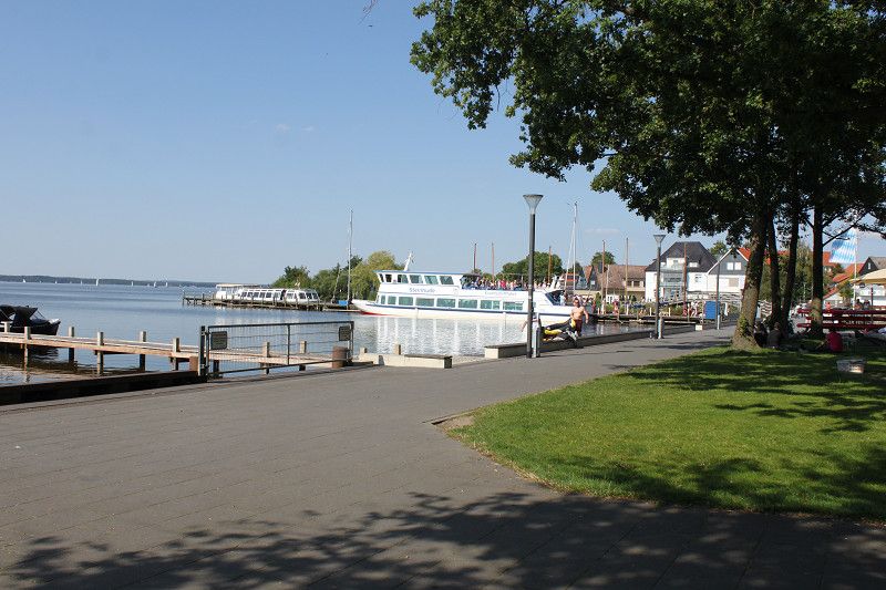
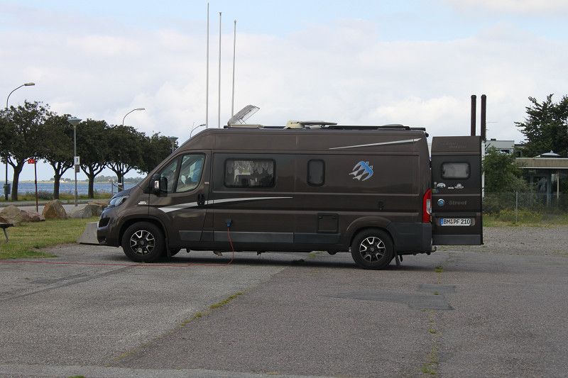
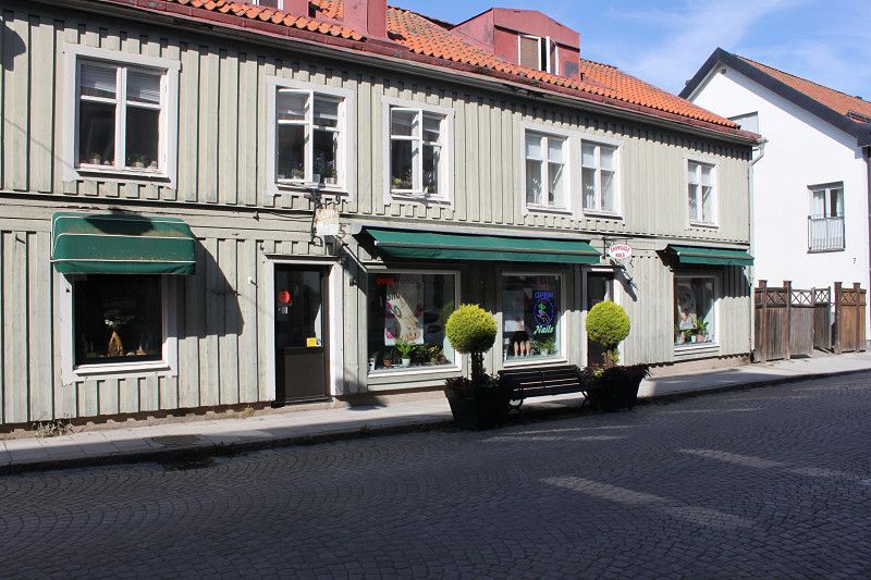
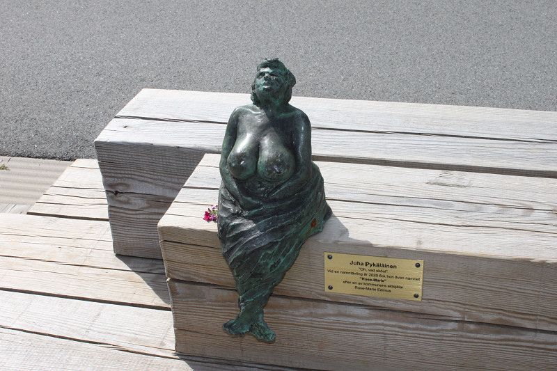
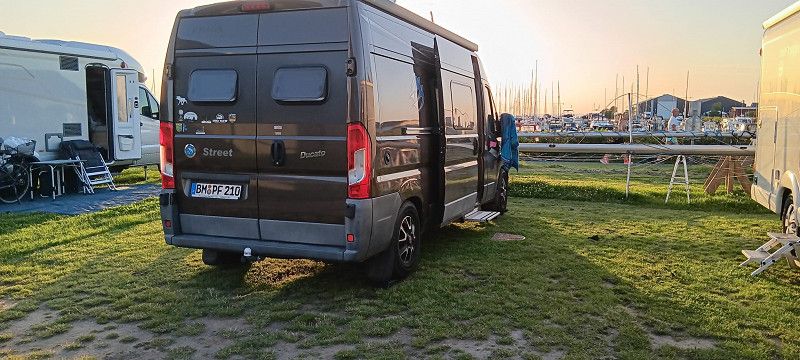
Bericht - Steinhude
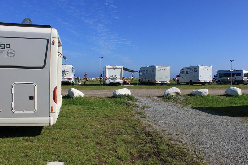
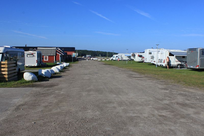
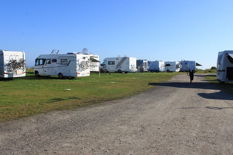
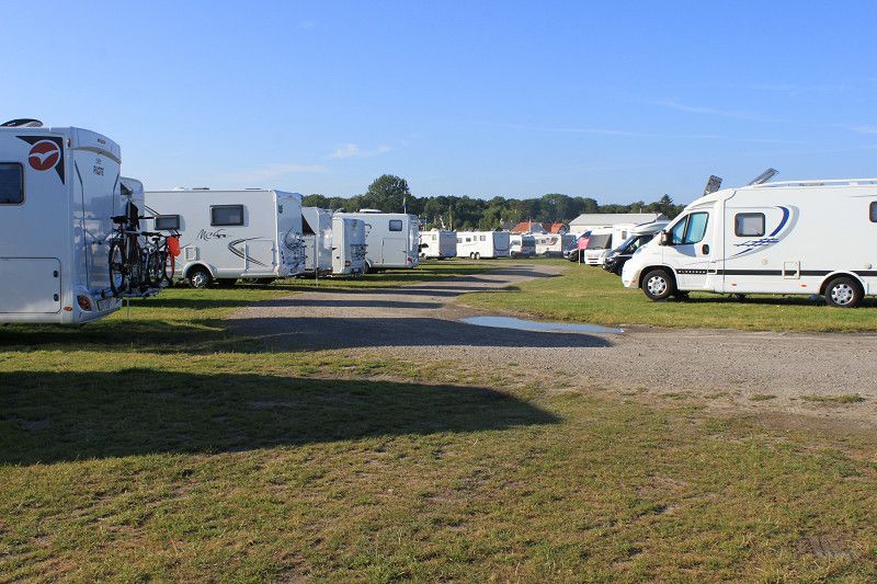
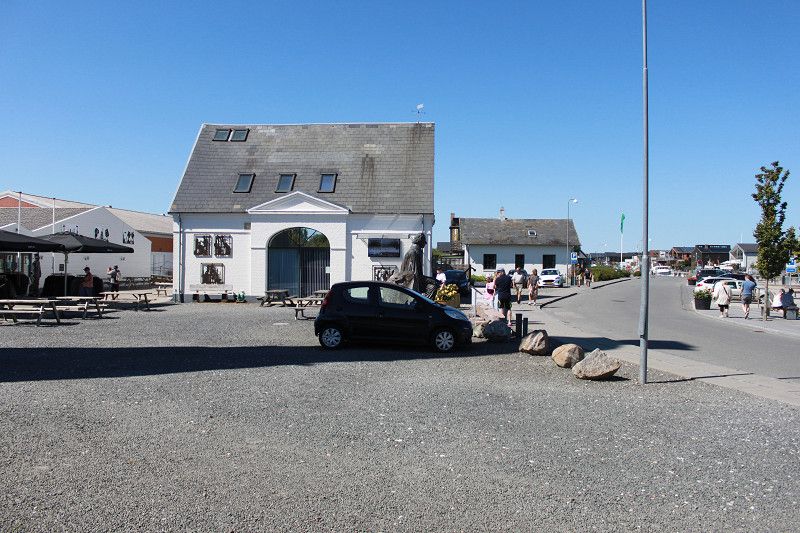
Nice place near the Steinhuder Meer, max. 900 meters away. The place itself is partly flat, gravel or grass, but solid ground. Unfortunately, the place is a bit old and could be improved a bit. But otherwise it is well suited for more than just an overnight stay. Payment is made via a QR code and a pay machine. There are 2 showers each and for €1 you can shower for 3 minutes. What is good is that if you turn the water off in between, the timer for the water also stops and you can take your time showering. There is also a washing machine and a dryer for €3.00 each. Access to the sanitary area is via the barcode that you get at the barrier when you drive in. At the entrance, a traffic light system also shows whether the place is already full. Otherwise a very nice area for walking and strolling. Unfortunately a bit crowded on weekends, but everything is within limits. We would definitely come back again and maybe for 2-3 days.
Day
Börgerende-Rethwisch
Landkreis Rostock, Mecklenburg-Vorpommern, Deutschland
54° 8' 25.9" N 11° 56' 15.7" E
54.1405165 11.9377074
• Head southwest on Rosenwinkel. Go for 18 m.
• Turn right onto Rosenwinkel. Go for 94 m.
• Turn right onto Schulstraße (K9). Go for 89 m.
• Turn right onto Nienhäger Straße (L12). Go for 4.6 km.
• Take the 1st exit from roundabout onto L12 toward Warnemünde. Go for 2.9 km.
• Take the 1st exit from roundabout onto K10 toward Rostock/Lichtenhagen/Lütten Klein. Go for 484 m.
• Continue on Dorfstraße (K10). Go for 601 m.
• Take the 2nd exit from roundabout onto Dorfstraße (K10). Go for 582 m.
• Take the 2nd exit from roundabout onto Dorfstraße (K10). Go for 730 m.
• Take the 1st exit from roundabout onto Ostseeallee (K10). Go for 178 m.
• Turn left onto Warnowallee (K10). Go for 273 m.
• Take the 2nd exit from roundabout onto Warnowallee (K10). Go for 847 m.
• Continue toward K10. Go for 93 m.
• Continue on B105. Go for 3.7 km.
• Take ramp. Go for 290 m.
• Turn left onto Petersdorfer Straße toward Überseehafen. Go for 297 m.
• Turn left onto Zum Südtor. Go for 787 m.
• Turn right onto Oldendorfer Straße. Go for 311 m.
• Turn left onto Up'n Warnowsand. Go for 205 m.
• Turn right onto Zur Warnow. Go for 188 m.
• Arrive at Zur Warnow.
☍
17,3 km
( 21 min.)
Bericht - Bei der Tante
Private
Day
Day
Zur Warnow
Mecklenburg-Vorpommern, Deutschland
54° 7' 50.3" N 12° 6' 9.1" E
54.1306410 12.1025249
• Head toward Up'n Warnowsand on Zur Warnow. Go for 188 m.
• Turn left onto Up'n Warnowsand. Go for 205 m.
• Continue on Oldendorfer Straße. Go for 311 m.
• Turn left onto Zum Südtor. Go for 765 m.
• Turn right onto Petersdorfer Straße (E55). Go for 275 m.
• Turn right and take ramp onto A19 toward Berlin/Flugplatz Rostock-Laage/A20. Go for 5.7 km.
• Take exit 6 toward Rostock-Ost onto L22 (Rövershäger Chaussee). Go for 3.6 km.
• Turn left onto Warnowstraße. Go for 572 m.
• Turn right onto Mühlendamm. Go for 72 m.
• Continue on Ernst-Barlach-Straße. Go for 372 m.
• Turn right onto Steinstraße. Go for 88 m.
• Turn slightly left onto Wallstraße. Go for 126 m.
• Turn right onto Buchbinderstraße. Go for 164 m.
• Turn right onto Garbräterstraße. Go for 52 m.
• Continue on Glatter Aal. Go for 62 m.
• Arrive at Glatter Aal. Your destination is on the left.
☍
12,6 km
( 15 min.)
Bericht - Parkplatz zur Warnow
The place is actually just a parking lot, but it's OK for an overnight stay. Tomorrow we'll be leaving for the ferry at 5:30 a.m.
Day
TT-Line
Departure port: Rostock
Mecklenburg-Vorpommern, Deutschland
54.0886707 12.1400211
Arrival port: Trelleborg
Provinz Schonen, Schweden
55.3759213.1461522
• Head toward Västra Vallgatan on Svenstorpsgatan. Go for 103 m.
• Turn left onto Västra Vallgatan. Go for 77 m.
• Turn right onto Västergatan. Go for 50 m.
• Turn left onto Östersjögatan. Go for 167 m.
• Turn right onto Slussgatan (9). Go for 408 m.
• Turn left onto Travemündeallén toward Travemünde/E6/Sassnitz/E22/Rostock/Swinoujscie. Go for 45 m.
• Turn right onto Travemündeallén. Go for 131 m.
• Turn left onto Strandridaregatan. Go for 305 m.
• Arrive at Strandridaregatan.
☍
Distance not available
(Duration not available)
Strandridaregatan
Provinz Schonen, Schweden
55° 22' 16.5" N 13° 8' 25.2" E
55.3712526 13.1403216
• Head northwest on Strandridaregatan. Go for 305 m.
• Turn right onto Travemündeallén. Go for 131 m.
• Turn left onto Travemündeallén. Go for 45 m.
• Turn left onto E6/E22. Go for 3.7 km.
• Take the 2nd exit from roundabout onto E6/E22 toward Malmö. Go for 19.3 km.
• Take exit 12 toward Göteborg/Kalmar onto E6/E20/E22 (Yttre Ringvägen). Go for 15.0 km.
• Continue on E6/E20 toward E4/Göteborg/Stockholm. Go for 56.8 km.
• Continue on E6/E20 toward Göteborg/Höganäs/111/Helsingborg N. Go for 199 km.
• Take exit 66 toward Göteborg V/Mölndal S C/Göteborg västra/Åby onto E6.20 (Söderleden). Go for 11.7 km.
• Keep right onto Hisingsleden (E45.1) toward Oslo/E6/Hisingen. Go for 2.3 km.
• Keep left onto Hisingsleden (E6.20) toward Oslo/E6/Färja Öckerö/155/Torslanda. Go for 1.0 km.
• Keep left onto Hisingsleden (E6.20) toward E6/Angered/E45. Go for 8.8 km.
• Turn left onto Holmvägen. Go for 279 m.
• Turn left onto Holmvägen. Go for 606 m.
• Continue on Nya Bergets väg. Go for 262 m.
• Turn left onto Nya Bergets väg. Go for 42 m.
• Arrive at Nya Bergets väg.
☍
319,1 km
(3 hrs. 6 min.)
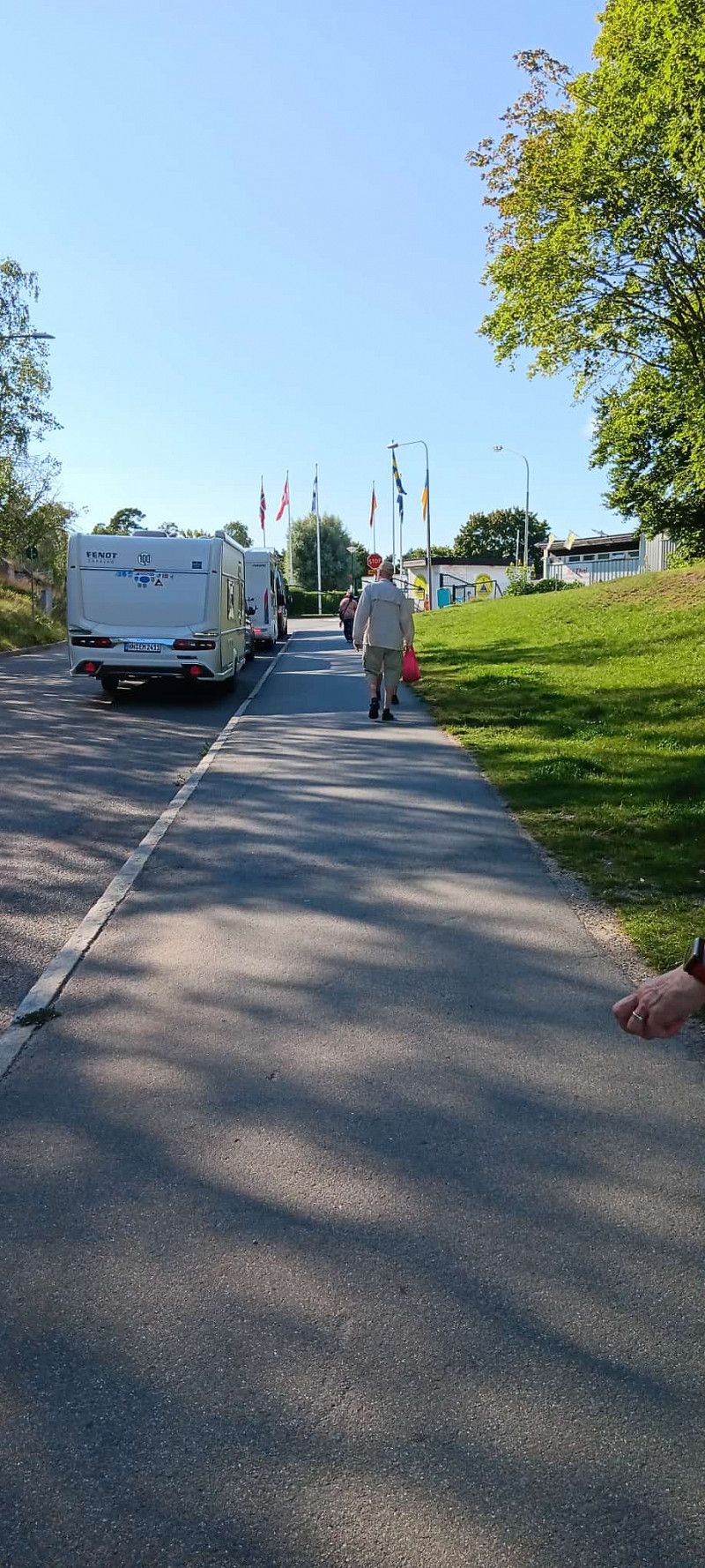
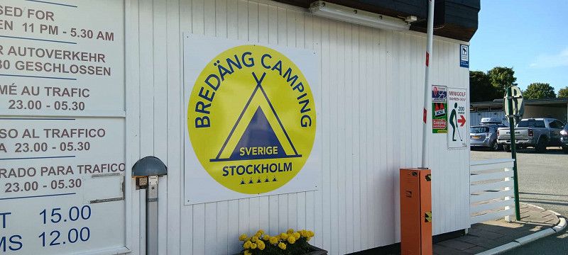
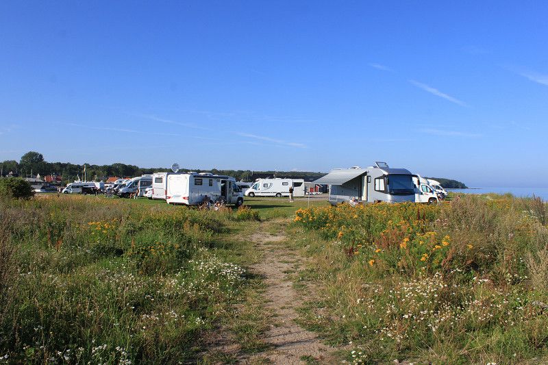
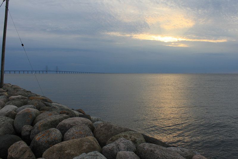
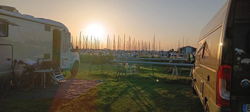
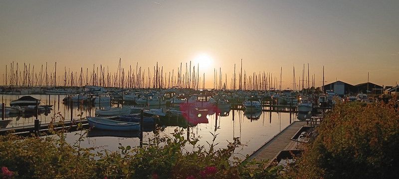
Trelleborgstrand Ställplats
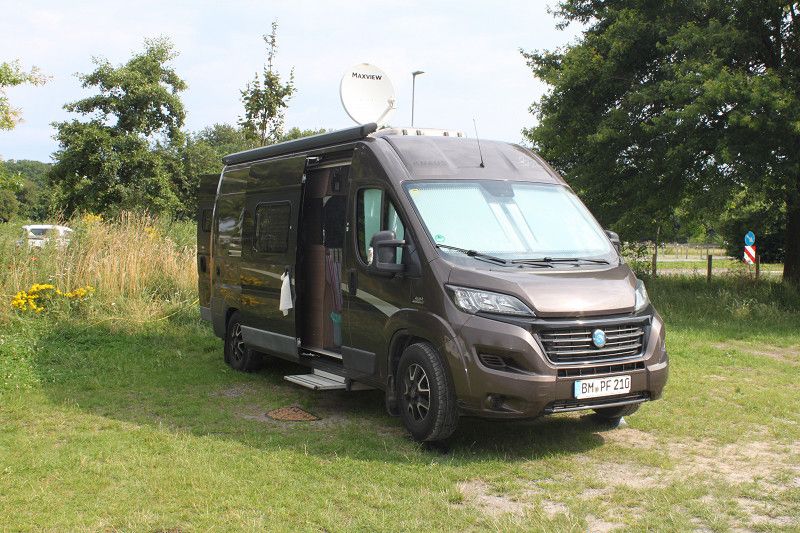
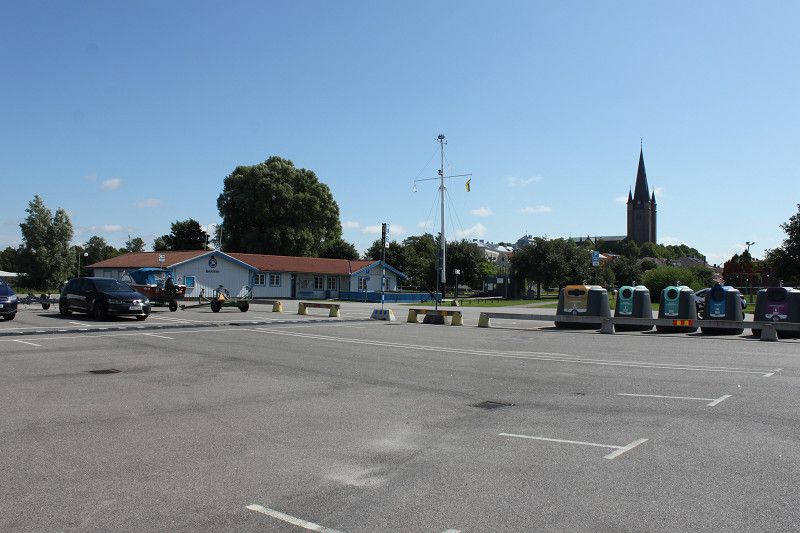
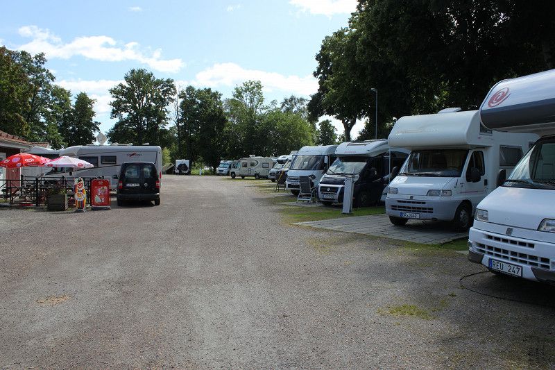
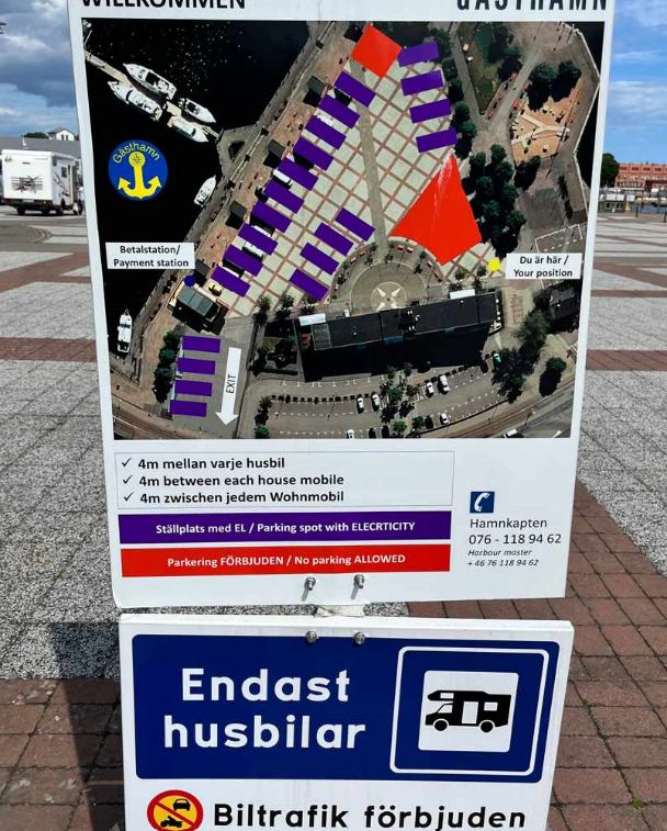
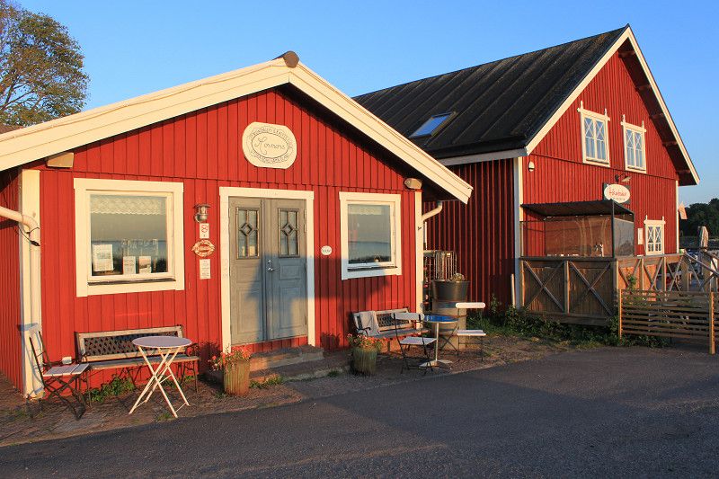
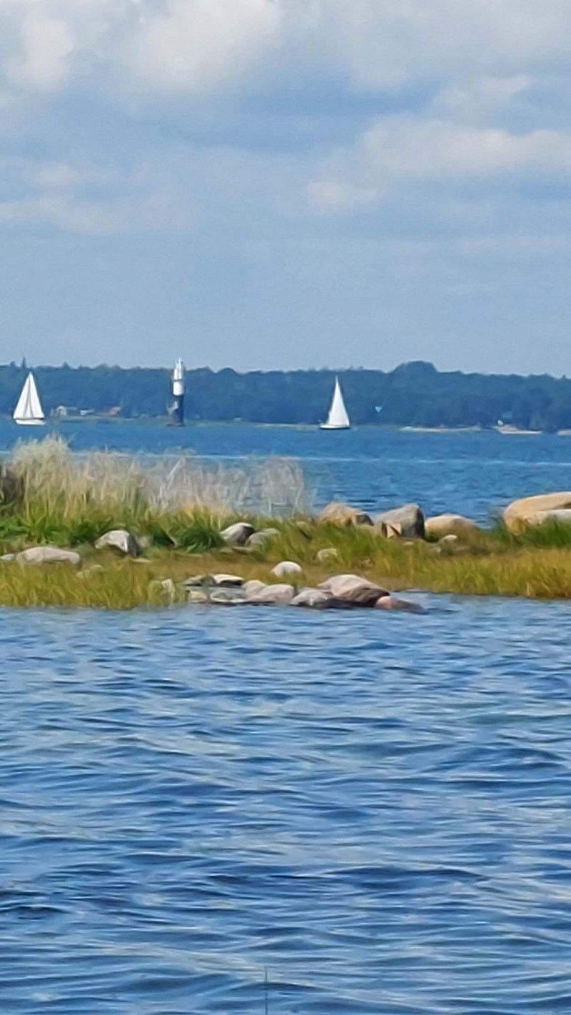
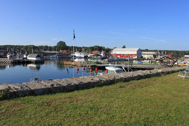
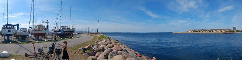
Gravel site with spacious plots. View directly onto the Baltic Sea, unfortunately it smelled a bit because there was a lot of algae rotting on the shore. There is a "MAXI" shop very close by where you can buy everything you need for the trip. You can only enter the site with an app, so you have to scan the QR code at the barrier, register and then state how long you want to stay and whether you need electricity. The electricity was a bit complicated. You had to press a blue button on the column and then open the front flap. Then you have to enter the code that you got from the app and then enter the number of the plug, after which you finally have electricity. You can also use the app to see how much consumption is or was. When you leave, you should then switch off the electricity connection via the app. Toilet, water and waste water were OK, the only thing to complain about was that there were two water connections. One was quite slow and you had to keep pressing the button to get the water to come back on. With the second connection you only had to open a valve and the water came out of the pipe a little faster. The disadvantage was that the hose reel leaked a little and quite a lot of water ran past unnecessarily. Nevertheless, the place is recommended for 1-2 nights, especially before or after the ferry crossing.
Day
Lilla Böslid
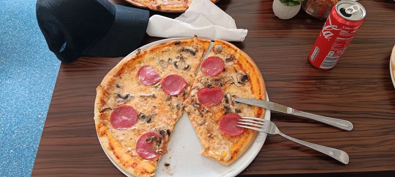
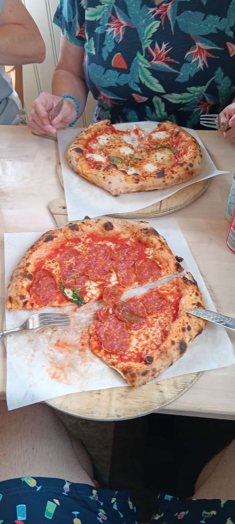
Gravel rough site, quiet and partly flat. Payment either in an envelope with cash (only Swedish kronor) or via APP (acamp.com). An absolute MUST is the trip into town to the only pizzeria. Here you can get a large, delicious pizza for little money, and you also get a free salad with your pizza.
Bericht - Lilla Böslid (Pizza)
Gravel rough area, quiet and partly flat. Payment either in an envelope with cash (Swedish Krona only) or via APP (acamp.com). An absolute MUST is the trip to the only pizzeria in town. Here you can get a large, delicious pizza for very little money, and you also get a free salad with your pizza.
Day
Göteborg
Hisingsleden, Göteborg, Provinz Västra Götaland, Schweden
57° 46' 18.8" N 11° 52' 37" E
57.7718785 11.8769515
• Head northeast on Nya Bergets väg. Go for 42 m.
• Turn right onto Nya Bergets väg. Go for 262 m.
• Continue on Holmvägen. Go for 606 m.
• Turn right onto Holmvägen. Go for 279 m.
• Turn left onto Hisingsleden (E6.20). Go for 7.5 km.
• Turn right onto Klarebergsvägen toward E45/Angered. Go for 636 m.
• Take ramp onto E6 (Kungälvsleden) toward Malmö/Centrum. Go for 7.3 km.
• Take the left exit toward Stockholm/E20/Karlstrand/E45/Frederikshavn/Centrum onto Marieholmsförbindelsen. Go for 1.3 km.
• Continue toward Marieholmsmotet. Go for 143 m.
• Continue on Marieholmsmotet toward E20/Stockholm. Go for 440 m.
• Continue on E20 (Partihallsviadukten). Go for 42.5 km.
• Take the 2nd exit from roundabout onto Sveaplan (E20) toward 180/Stockholm. Go for 124 km.
• Take ramp. Go for 342 m.
• Take the 1st exit from roundabout onto E20.2. Go for 223 m.
• Pass 4 roundabouts and continue on Göteborgsvägen. Go for 3.5 km.
• Continue on Gärdesbron. Go for 82 m.
• Continue on Göteborgsvägen. Go for 128 m.
• Continue on Göteborgsvägen. Go for 16 m.
• Continue on Nygatan. Go for 735 m.
• Continue on Hamngatan. Go for 161 m.
• Turn right. Go for 98 m.
• Arrive at your destination on the left.
☍
190,5 km
(2 hrs. 6 min.)
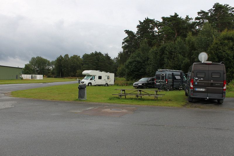
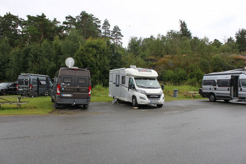
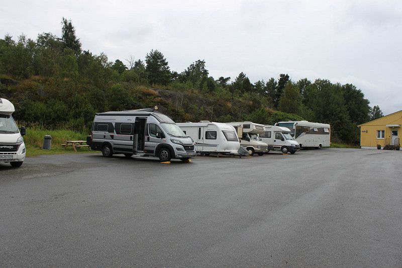
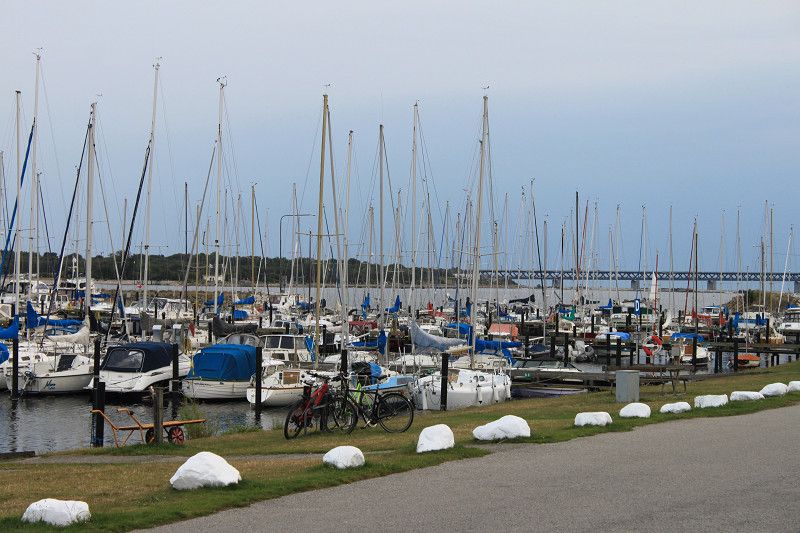
Bericht - Göteborg (Aeroseum)
Since all the spaces near Gothenburg were occupied over the weekend, we had to find an alternative space that was still within reach of Gothenburg. So we used "Park4Night" to get to the parking space at the airport in Väg. There is a museum here called "Aeroseum". If you pay the entrance fee to the museum, you can stay for two nights for a fee. Very quiet place at night, occasional helicopter flights during the day. Huge, unmarked lawns with electricity (10A), with a view of the neighboring airport. There are sanitary facilities in the nearby buildings. Fresh water is available. The shower is not the best, as it is shared with some of the mechanics who work on the site. The museum is definitely worth a visit, as there are many different airplanes and helicopters from the old days.
Day
Day
Gästhamnen Mariestad
Hamngatan, 54286, Mariestad, Schweden
58° 42' 53" N 13° 49' 10" E
58.7147222 13.8194444
• Head toward Hamngatan. Go for 98 m.
• Turn left onto Hamngatan. Go for 161 m.
• Continue on Nygatan. Go for 498 m.
• Turn left onto Stockholmsvägen (E20.4). Go for 681 m.
• Take the 2nd exit from roundabout onto Stockholmsvägen (E20.4). Go for 1.5 km.
• Take the 2nd exit from roundabout onto Stockholmsvägen (E20.4). Go for 660 m.
• Turn right onto Krontorp Hinkan (202). Go for 426 m.
• Take the 1st exit from roundabout onto E20 toward Stockholm/Mora. Go for 41.4 km.
• Continue on E20. Go for 14.1 km.
• Take the 1st exit from roundabout onto Röforsvägen (205) toward Askersund. Go for 25.9 km.
• Take the 2nd exit from roundabout onto Södra infarten toward Karlskoga/Laxå/Centrum. Go for 200 m.
• Turn right. Go for 54 m.
• Arrive at your destination on the right.
☍
85,7 km
(1 hrs. 4 min.)
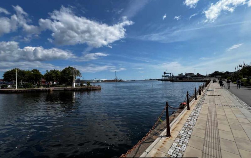
Bericht - Mariestad
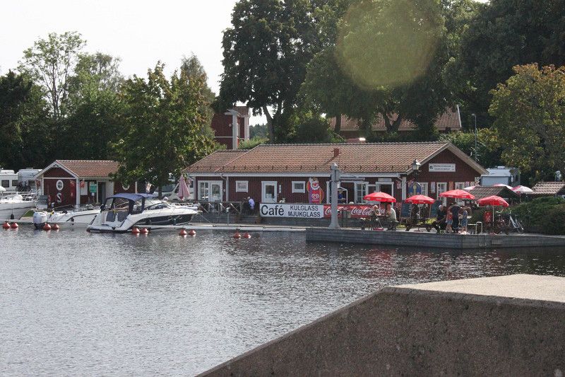
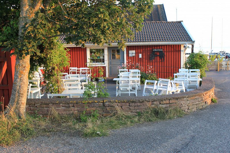
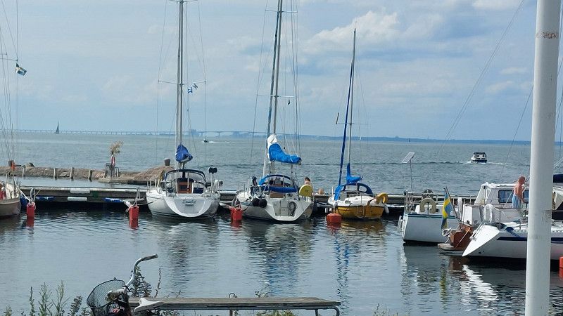
Very nice place directly between two arms of the lake. Large plots with a view of the sea. But you have to be there at least by 1pm to get a plot. The sanitary facilities are clean and included in the price. You have to pay for your space using a parking machine, which also automatically gives you the code to open the doors to the sanitary facilities. The place is quite clear and there are a few pizzerias and restaurants. There are various options for eating at the harbor. The place is definitely recommended.
Day
Askersund
Södra infarten, Askersund, Provinz Örebro, Schweden
58° 52' 39.5" N 14° 53' 55.5" E
58.8776402 14.8987603
• Head toward Södra infarten. Go for 58 m.
• Turn sharp left onto Södra infarten. Go for 186 m.
• Take the 1st exit from roundabout onto Bergslagsdiagonalen (50) toward Örebro. Go for 25.7 km.
• Take ramp onto E20 (Bergslagsdiagonalen) toward Stockholm/Örebro. Go for 71.5 km.
• Take exit 121 toward Stockholm/Eskilstuna/Arboga Ö onto E20. Go for 4.5 km.
• Take the 3rd exit from roundabout onto E20 toward Stockholm/Eskilstuna/Kungsör. Go for 10.9 km.
• Continue on E20 toward 56. Go for 101 km.
• Take the left exit toward Stockholm onto E4/E20. Go for 23.2 km.
• Take exit 152 toward Bredäng/Mälarhöjden/Fruängen/Segeltorp. Go for 378 m.
• Take the 3rd exit from roundabout onto Bredängsvägen toward E4 S/E20 S/Mälarhöjden/Sätra. Go for 1.9 km.
• Continue on Bredängs allé. Go for 65 m.
• Turn right onto Stora Sällskapets väg. Go for 627 m.
• Arrive at Stora Sällskapets väg.
☍
240,5 km
(2 hrs. 29 min.)
Bericht - Askersund
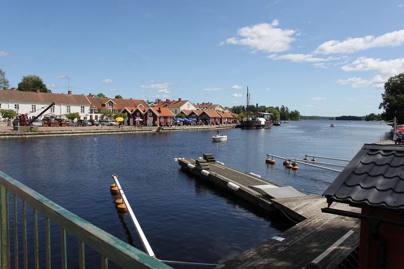
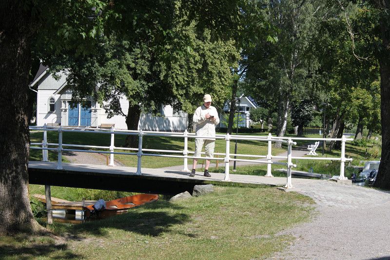
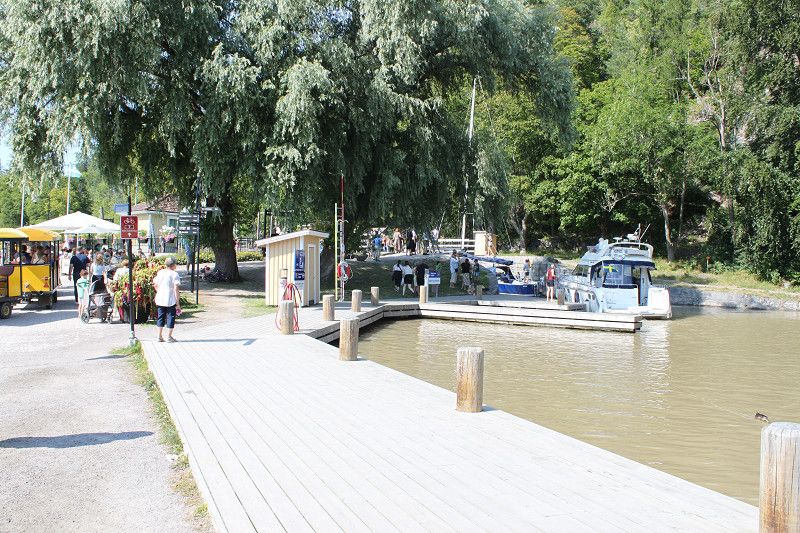
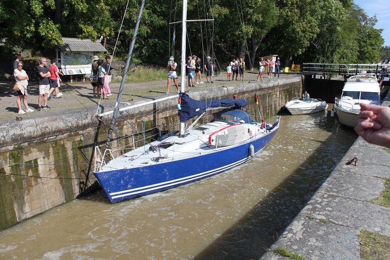
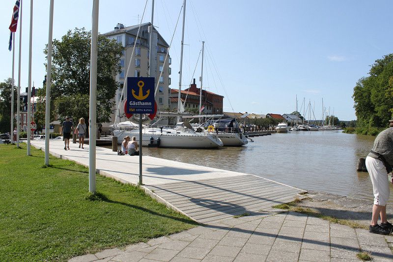
Beautiful quiet place directly on the Göta Canal. Unfortunately, there are only 21 spaces. We were there at 12.30pm and just managed to get the last two spaces. The service on site is very friendly, there is a washing machine with a quick wash program (20 minutes and the laundry is done). In the town, directly opposite the canal, there are small snack bars, ice cream shops, art shops and much more. From there, there is also a little train that costs nothing. It takes you to a small model village as it used to be, like an open-air museum. The town itself is not particularly big, but it has many restaurants and a supermarket, so everything you need. You can easily spend a few pleasant hours or even days here.
Day
Stockholm
Stora Sällskapets Väg, Stockholm, Provinz Stockholm, Schweden
59° 17' 43.7" N 17° 55' 22.1" E
59.2954668 17.9228000
• Head toward Ålgrytevägen on Stora Sällskapets väg. Go for 192 m.
• Turn right onto Ålgrytevägen. Go for 508 m.
• Turn left onto Björksätravägen. Go for 356 m.
• Turn slightly left onto Eksätravägen. Go for 188 m.
• Turn right onto Bredängs allé. Go for 52 m.
• Turn right onto Skärholmsvägen. Go for 2.5 km.
• Turn left and take ramp onto E4/E20 (Södertäljevägen). Go for 20.0 km.
• Continue on E4 (Trafikplats Saltskog östra) toward Helsingborg/Nyköping. Go for 120 km.
• Keep right onto Trafikplats Norrköping norra toward Norrköping N C/55/Ingelsta/56. Go for 1.0 km.
• Continue toward 55/56. Go for 215 m.
• Continue on Stockholmsvägen toward 55/56. Go for 662 m.
• Continue on E4.8 (Stockholmsvägen). Go for 1.2 km.
• Take the 2nd exit from Ingelstarondellen roundabout onto Stockholmsvägen (E4.8) toward Centrum. Go for 273 m.
• Take the 3rd exit from Sandbyhovsrondellen roundabout onto Ståthögavägen (E4.8) toward Centrum. Go for 1.1 km.
• Pass 3 roundabouts and continue on Söderköpingsvägen (E22). Go for 6.6 km.
• Keep left onto Söderköpingsvägen (E22) toward Kalmar. Go for 10.6 km.
• Continue on Erik Dahlbergsgatan (E22) toward 210. Go for 495 m.
• Turn left onto Nybrogatan. Go for 263 m.
• Turn right onto Ågatan. Go for 149 m.
• Turn left onto Tingshusgatan. Go for 58 m.
• Turn slightly right onto Skepparevägen. Go for 83 m.
• Arrive at Skepparevägen. Your destination is on the left.
☍
166,6 km
(1 hrs. 53 min.)
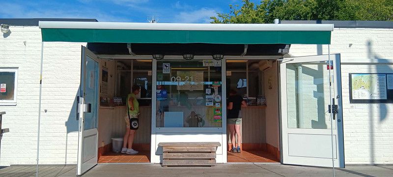
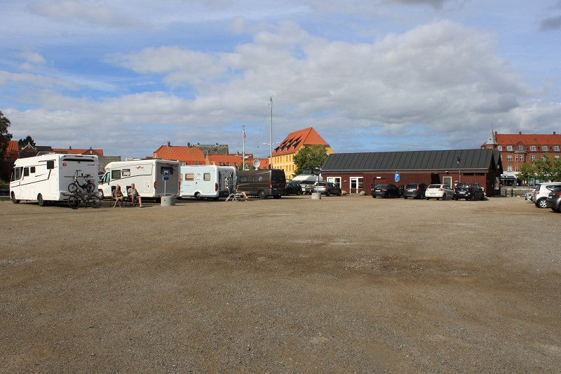
Bericht - Stockholm (bredäng)
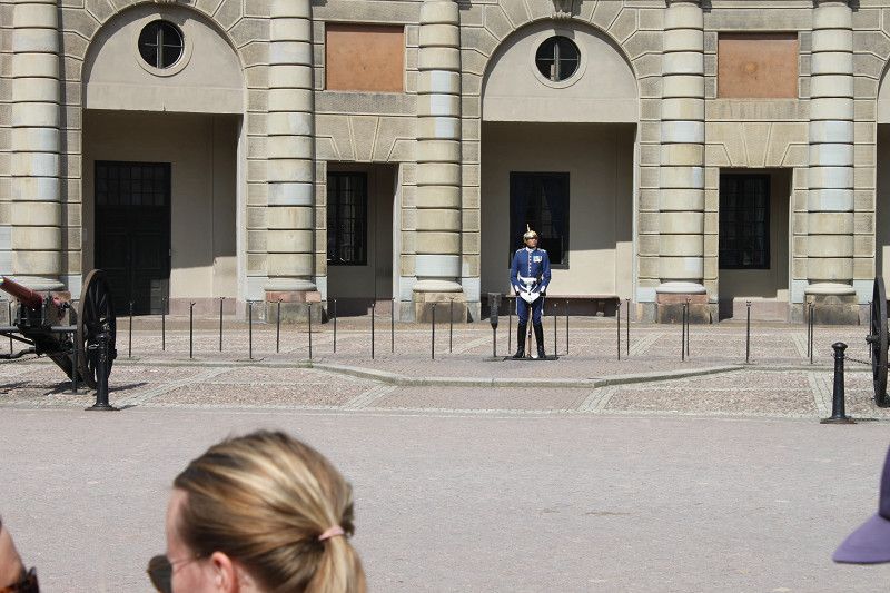
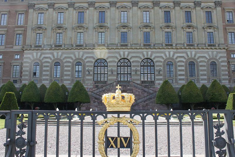
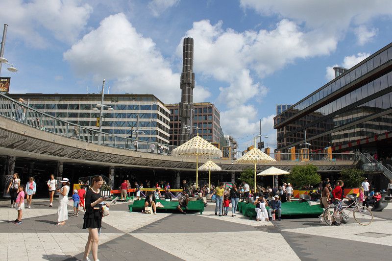
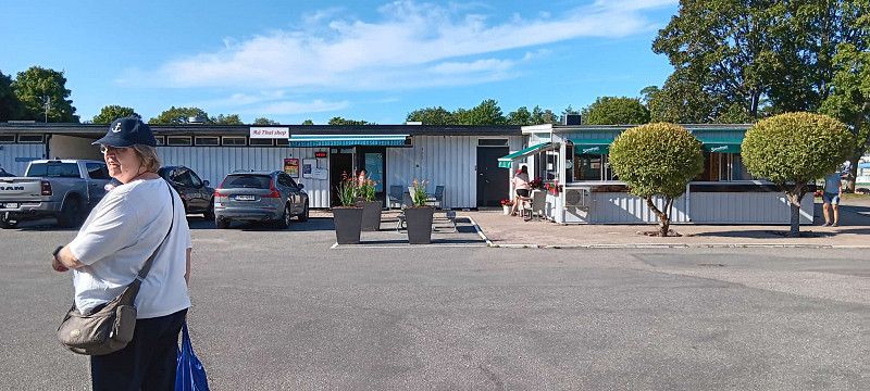
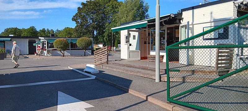
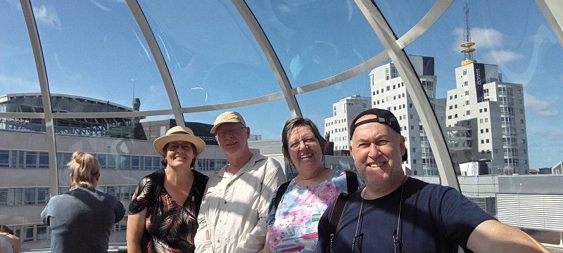
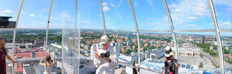
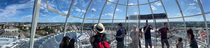
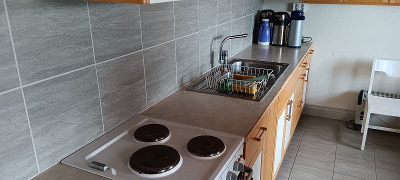
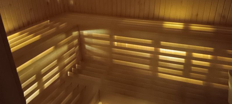
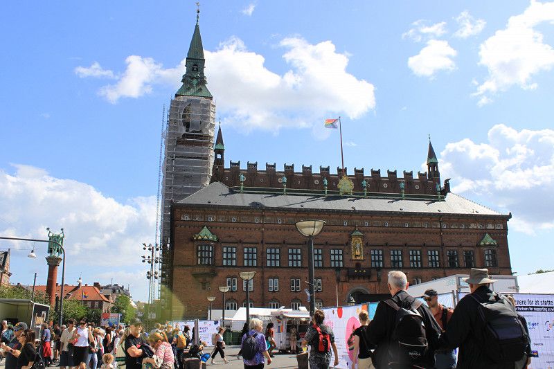
Very nice place, unfortunately a bit crowded. The staff was friendly and accommodating. Only the price was a bit high. Otherwise there were many options on site such as a sauna, several showers and toilets, a relaxation room for reading, a small shop and a small Thai restaurant "Mä Thai". The connection to Stockholm worked great. It was about 700 meters from the campsite to the train and a ticket for an adult costs 42 SEK per way (valid for 75 minutes), and 26 SEK for seniors over 65. You could get to Stockholm in 17 minutes and line 13 ran every 10 minutes from 6:00 a.m. until just before midnight. The other train connections were also very straightforward. If you want to see some of the city, it is best to get off at LSUTTEN or GAMLA STAN. From there you can get to the city, the harbor and the Royal Palace relatively quickly. A tip on the side: every Wednesday at 12.15 p.m. and Sunday at 1.15 p.m. there is a changing of the guard with music, highly recommended. A visit to the "GLOBE" is also recommended, which is a bit outside of Stockholm, but can be reached quickly and easily with the 17, 18 or 19. Here you take a gondola up to the roof and can look out over the whole of Stockholm into the distance.
Day
Day
Day
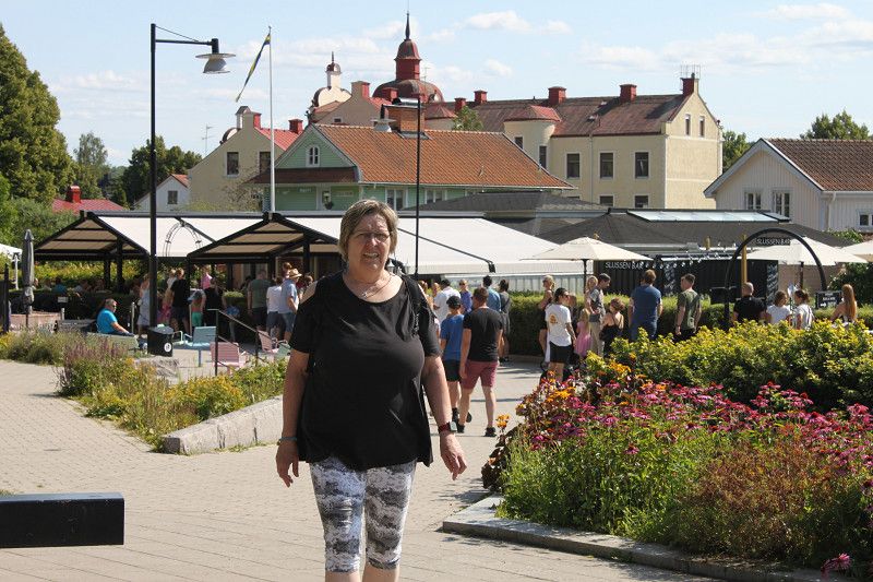
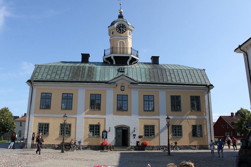
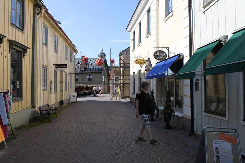
Söderköping
Skepparevägen, Söderköping, Provinz Östergötland, Schweden
58° 28' 51.6" N 16° 19' 49.5" E
58.4810108 16.3304223
• Head toward Ågatan on Skepparevägen. Go for 83 m.
• Turn slightly left onto Tingshusgatan. Go for 58 m.
• Turn right onto Ågatan. Go for 149 m.
• Turn left onto Nybrogatan. Go for 252 m.
• Turn left onto Erik Dahlbergsgatan (E22). Go for 155 km.
• Take ramp toward Oskarshamn N. Go for 487 m.
• Continue on Björngatan. Go for 686 m.
• Take the 1st exit from roundabout onto Björngatan. Go for 244 m.
• Continue on Skeppsbron. Go for 223 m.
• Turn left onto Skeppsbron. Go for 39 m.
• Turn left onto Skeppsbron. Go for 63 m.
• Arrive at Skeppsbron. Your destination is on the right.
☍
157,1 km
(1 hrs. 47 min.)
Bericht - Söderköpings
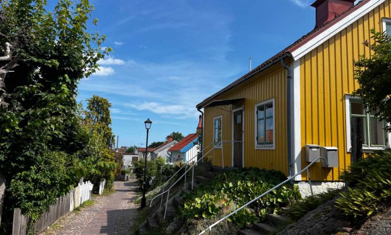
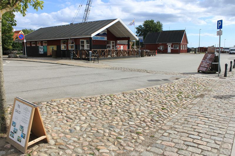
The site is located on the outskirts of the city, well maintained with reception, showers, toilets, cooking and dishwashing room. The plots are spacious and partly flat. Unfortunately, satellite reception is not available everywhere because there are sometimes tall trees that prevent the signal from getting through. Unfortunately, there is a through road near the campsite which makes it a bit noisy. On the square there is also a mill with a small café where you can have a sandwich or a piece of cake for average prices. Tomorrow, from 8:00 a.m., fresh rolls and bread will be available at reception even without prior ordering. The town itself and the Göta Canal are worth a visit.
Day
Oskarshamns Gästhamn
Skeppsbron, 38391, Oskarshamn, Schweden
57° 15' 59" N 16° 27' 11" E
57.2663889 16.4530556
• Head north on Skeppsbron. Go for 91 m.
• Turn right onto Skeppsbron. Go for 106 m.
• Continue on Björngatan. Go for 222 m.
• Take the 2nd exit from roundabout onto Björngatan. Go for 789 m.
• Take ramp. Go for 402 m.
• Continue on E22. Go for 70.7 km.
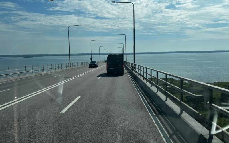
• Take the exit toward Öland. Go for 451 m.
• Take the 3rd exit from Ölandsleden roundabout onto Ölandsleden (137) toward Öland. Go for 12.4 km.
• Continue on 136. Go for 9.5 km.
• Turn left onto Stora Rörsvägen. Go for 1.7 km.
• Arrive at Stora Rörs hamnplan. Your destination is on the left.
☍
96,4 km
(1 hrs. 7 min.)
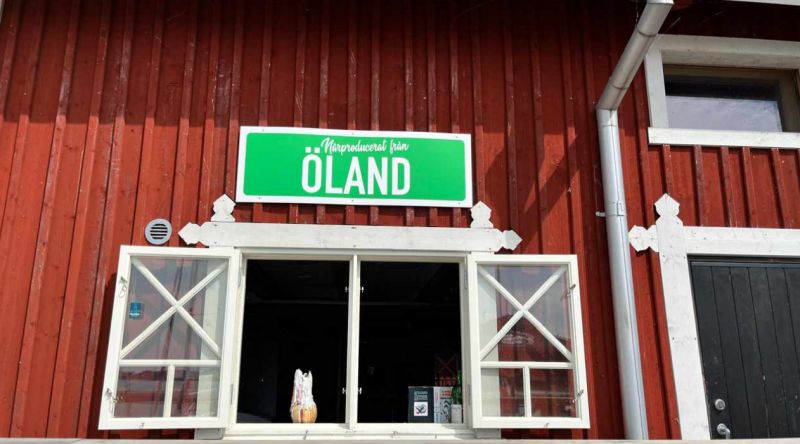
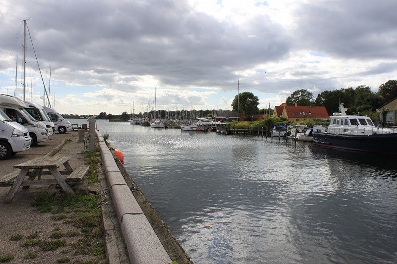
Bericht - Oskarshamn
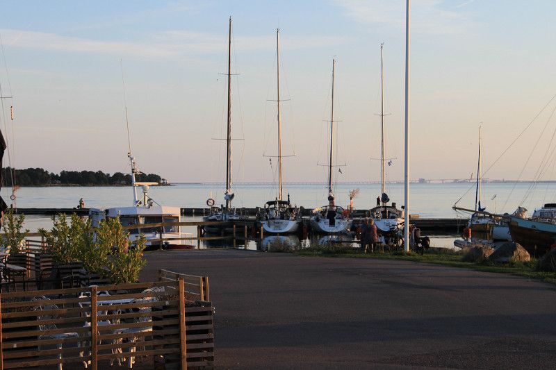
Very nice parking space directly at a marina with all everything you need. Shower, toilets, sewage and much more in very good condition. Payment at the machine or, if the booth at the machine is occupied, directly at the marina.
Day
Stora Rörsvägen, Provinz Kalmar, Schweden
56° 45' 20.4" N 16° 31' 37" E
56.7556563 16.5269408
• Head west on Stora Rörs hamnplan. Go for 251 m.
• Turn left onto Stora Rörsvägen. Go for 1.6 km.
• Turn right onto Rällavägen (136). Go for 9.5 km.
• Continue on 137. Go for 12.1 km.
• Take the 2nd exit from Ölandsleden roundabout onto E22 toward Malmö/25/Flygplats/31. Go for 92.8 km.
• Pass 2 roundabouts and continue on E22. Go for 65.5 km.
• Take exit 47 toward Nogersund/Hanö/Mjällby/Listerlandet/Hällevik/Sölve industriområde. Go for 315 m.
• Continue on Hälleviksvägen (123). Go for 547 m.
• Take the 2nd exit from roundabout onto Hälleviksvägen (123). Go for 5.3 km.
• Continue on Tejnabacksvägen (123). Go for 2.1 km.
• Turn right onto Skogshagevägen (123). Go for 2.6 km.
• Turn left onto Östra hamnvägen (123). Go for 109 m.
• Turn slightly right onto 123. Go for 24 m.
• Continue on Östra hamnvägen (123). Go for 54 m.
• Turn right toward Hamnplan. Go for 14 m.
• Turn slightly right onto Hamnplan. Go for 82 m.
• Arrive at Hamnplan. Your destination is on the left.
☍
193,1 km
(2 hrs. 12 min.)
Bericht - Stora Rör
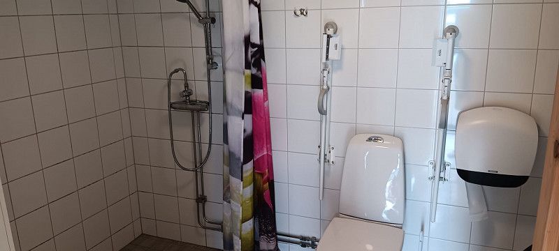
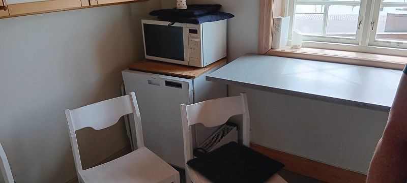
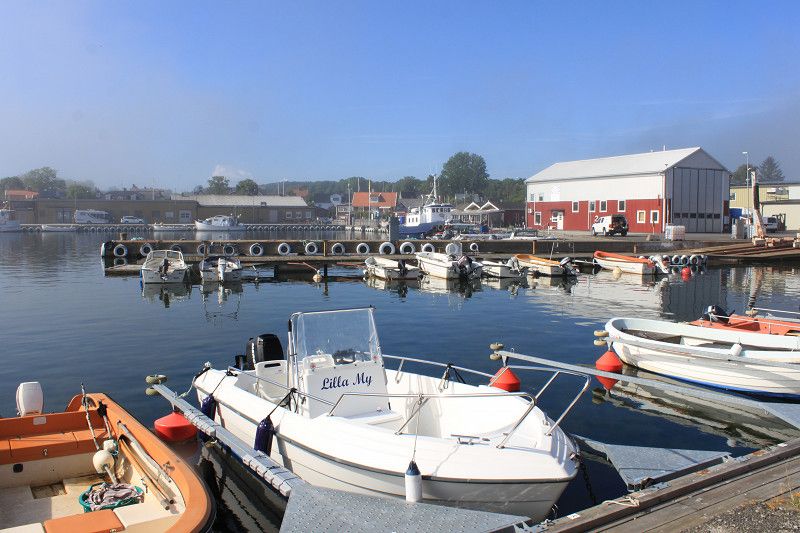
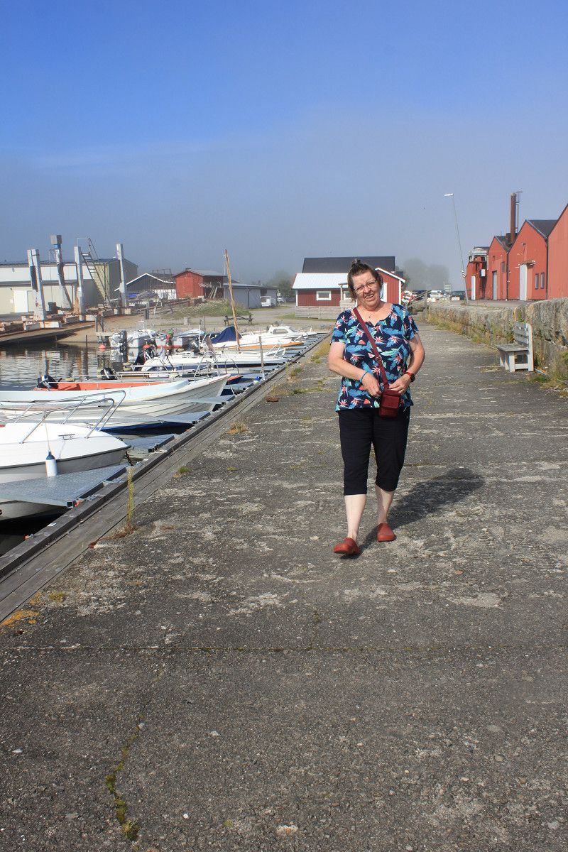
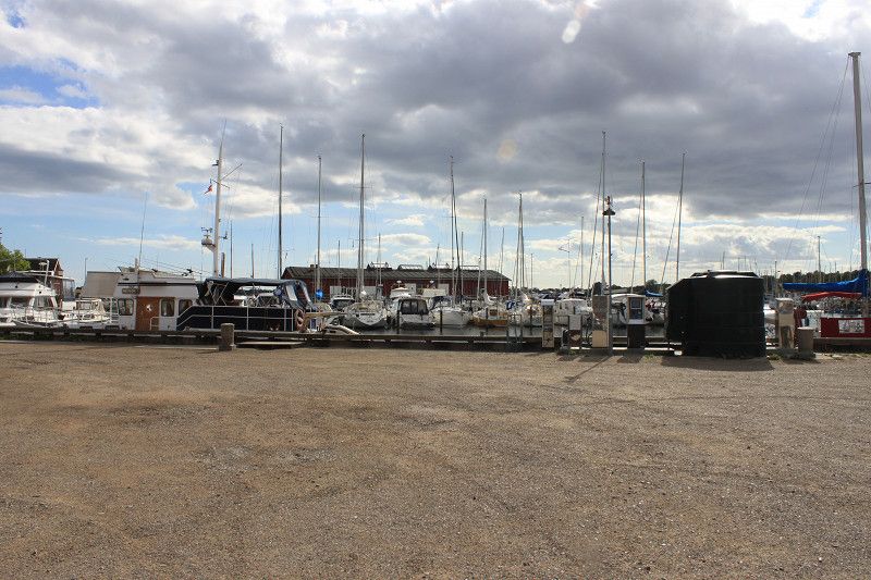
Motorhome parking space at a marina for 10 motorhomes. Electricity, shower, water etc. all included in the price. You can pay either via an app or, better yet, to the harbor master who comes by twice a day. Very friendly staff and clean service rooms. In the service room there is a disabled shower, several normal showers and toilets, a sauna and a kitchen with a stove and microwave. You can use the sauna yourself at any time. Simply turn the left control on the sauna heater up a little and about 15 minutes later the sauna will be hot. Right next door there is a kind of pastry shop with cakes and sandwiches. Next to that there is a pizzeria that serves very tasty pizzas. Unfortunately the prices are a bit more expensive, but that is normal on the island. There is WiFi with the identifier "SRBS" and the password "kalmarsund". The access to the service rooms is: 197272#.
Day
Day
Nogersund Hamn
Östra Hamnvägen, 29495, Sölvesborg, Schweden
56° 0' 14" N 14° 44' 13" E
56.0038889 14.7369444
• Head northeast on Hamnplan. Go for 82 m.
• Turn slightly left toward Östra hamnvägen/123. Go for 14 m.
• Continue on Östra hamnvägen (123). Go for 54 m.
• Turn slightly right onto 123. Go for 24 m.
• Turn slightly left onto Östra hamnvägen (123). Go for 109 m.
• Turn right onto Nogersundsvägen (123). Go for 1.6 km.
• Continue on Skogshagevägen (123). Go for 996 m.
• Turn left onto Tejnabacksvägen (123). Go for 2.1 km.
• Continue on Hälleviksvägen (123). Go for 5.3 km.
• Take the 2nd exit from roundabout onto Hälleviksvägen (123). Go for 606 m.
• Take ramp onto E22. Go for 33.5 km.
• Take exit 37 toward Ystad/Flygplats onto E22 (Malmövägen). Go for 738 m.
• Keep right onto E22 (Malmövägen) toward Simrishamn/Ystad/Flygplats. Go for 80.5 km.
• Continue on E22.10 (Stockholmsvägen) toward Malmö. Go for 4.1 km.
• Continue on Stockholmsvägen toward Centrum. Go for 2.7 km.
• Turn right toward Stockholmsvägen. Go for 72 m.
• Continue on Stockholmsvägen. Go for 70 m.
• Continue on Hornsgatan. Go for 235 m.
• Turn right onto Hornsgatan toward Slussen. Go for 122 m.
• Keep right onto Hornsgatan toward Slussen. Go for 403 m.
• Take the 1st exit from roundabout onto Hornsgatan. Go for 1.4 km.
• Turn right onto Slottsgatan toward E6/E20. Go for 37 m.
• Continue on Hovrättsbron. Go for 40 m.
• Continue on Gibraltargatan. Go for 158 m.
• Turn left onto Norra Neptunigatan. Go for 537 m.
• Turn left onto Skeppsbyggaregatan. Go for 133 m.
• Turn right onto Citadellsvägen toward Trelleborg/E6/Köpenhamn/E20. Go for 280 m.
• Continue on Limhamnsvägen. Go for 787 m.
• Pass 2 roundabouts and continue on Limhamnsvägen. Go for 3.0 km.
• Turn right onto Övägen toward Sibbarp/Ön. Go for 199 m.
• Turn left onto Strandgatan toward Sibbarp. Go for 349 m.
• Turn right onto Bryggövägen. Go for 283 m.
• Turn right onto Vågbrytarvägen. Go for 56 m.
• Arrive at Vågbrytarvägen. Your destination is on the left.
☍
140,6 km
(1 hrs. 40 min.)
Bericht Nogersund
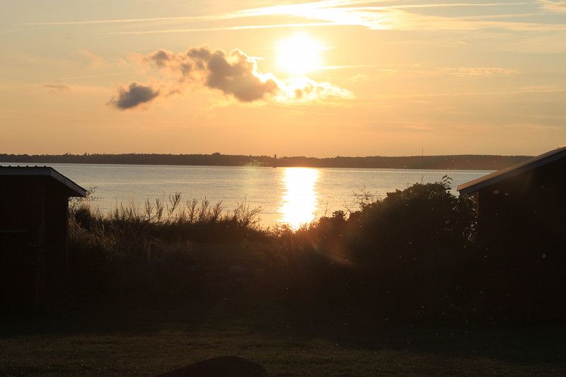
Parking space on a headland in Nogersund. Small town without shops. The only thing that is on site is a small restaurant right on the harbor, 2 minutes from the square, where you can find some delicious dishes. The sanitary facilities are clean and acceptable with 2 toilets and a disabled toilet with shower. Payment is only possible via APP and should be booked at least one day in advance. The plots are spacious and partly flat and some offer a direct view of the Baltic Sea. When we arrived today, there was a lot of fog from the water side. That's why the morning and part of the afternoon were very hazy. From 4 p.m. onwards, the fog lifted and you could see the whole place and the nearby island of Nöha became visible again.
Day
Malmö
Bryggövägen, Malmö, Provinz Schonen, Schweden
55° 35' 4.1" N 12° 55' 8.2" E
55.5844731 12.9189365
• Head toward Bryggövägen on Vågbrytarvägen. Go for 56 m.
• Turn left onto Bryggövägen. Go for 283 m.
• Turn right onto Strandgatan. Go for 189 m.
• Turn left onto Linnégatan. Go for 497 m.
• Turn right onto Kalkbrottsgatan toward E6/E20/E22/E65. Go for 762 m.
• Continue on Annetorpsvägen toward E20/E6/E65/Kalmar/E22. Go for 370 m.
• Pass 4 roundabouts and continue on Annetorpsvägen. Go for 2.7 km.
• Take the 1st exit from roundabout onto Lorensborgsgatan toward E6/E20/E22/E65/Vintrie/Ollebo. Go for 499 m.
• Pass 2 roundabouts and continue on Lorensborgsgatan. Go for 1.3 km.
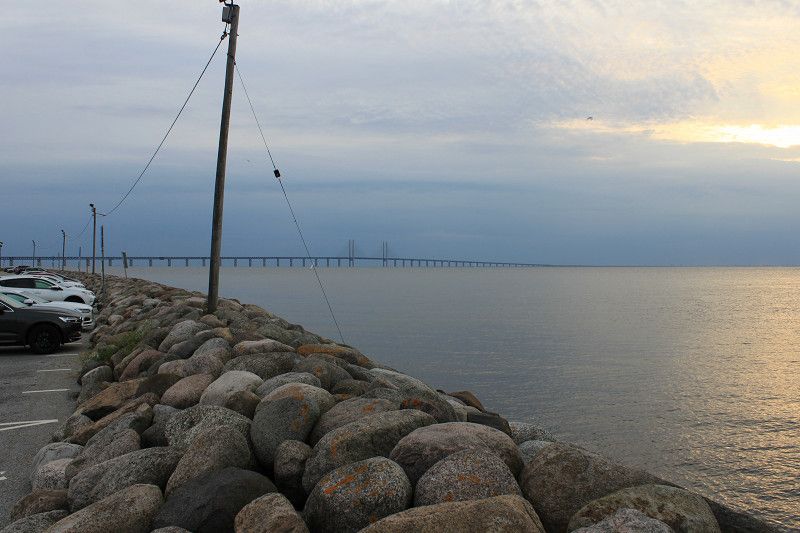
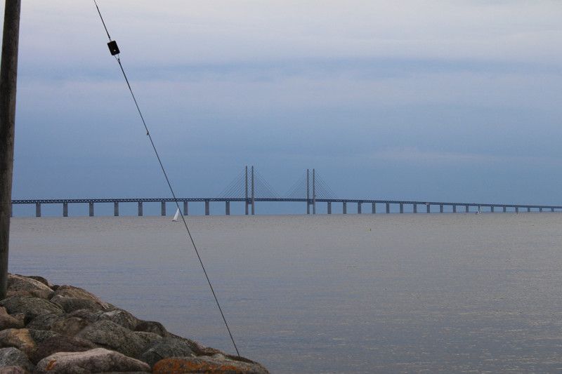
• Turn right and take ramp onto E20 (Yttre Ringvägen) toward Köpenhamn. Go for 9.9 km.
• Continue on E20 (Øresundsbroen). Go for 14.4 km.
• Take exit 18 toward Tårnby/Dragør. Go for 400 m.
• Turn left onto Englandsvej (221) toward Dragør. Go for 743 m.
• Continue on Englandsvej (221). Go for 1.7 km.
• Continue on Englandsvej (221). Go for 1.9 km.
• Turn right onto Søndre Kinkelgade. Go for 293 m.
• Continue on Fælledvej. Go for 1.2 km.
• Turn left onto Bachersmindevej. Go for 248 m.
• Turn right onto Bachersmindevej. Go for 25 m.
• Turn left. Go for 16 m.
• Turn right. Go for 19 m.
• Arrive at your destination on the left.
☍
37,5 km
( 34 min.)
Bericht - Malmö
The parking space is located directly next to a marina. It can be booked via "booking.smabatshamnen.se". Some of the pitches are very slanted and the wedges are not enough to balance the motorhome. It is about a 15-20 minute walk to the city of Limhamn.
Day
Day
Copenhagen Camping
Bachersmindevej 11, 2791, Dragør, Dänemark
55° 34' 59" N 12° 37' 46" E
55.5830600 12.6294400
• Head toward Bachersmindevej. Go for 25 m.
• Turn right onto Bachersmindevej. Go for 59 m.
• Turn left onto Bachersmindevej. Go for 248 m.
• Turn right onto Fælledvej. Go for 1.2 km.
• Continue on Søndre Kinkelgade. Go for 293 m.
• Turn right onto Englandsvej (221). Go for 158 m.
• Make a U-Turn at Kirkevej onto Englandsvej (221). Go for 2.1 km.
• Continue on Englandsvej (221). Go for 2.3 km.
• Turn left and take ramp onto E20 (Øresundsmotorvejen) toward København. Go for 38.8 km.
• Keep left onto E20 (Køge Vest) toward Odense. Go for 55.9 km.
• Take exit 40A toward Slagelse V/Kalundborg/Næstved/Skælskør/259. Go for 546 m.
• Turn left onto Omfartsvejen (22) toward Næstved/Skælskør/259. Go for 543 m.
• Take the 1st exit from roundabout onto Skælskør Landevej (259) toward Skælskør. Go for 789 m.
• Pass 2 roundabouts and continue on Slagelse Landevej (259/265). Go for 14.5 km.
• Turn right onto Havnevej. Go for 290 m.
• Arrive at Havnevej. Your destination is on the right.
☍
117,9 km
(1 hrs. 14 min.)
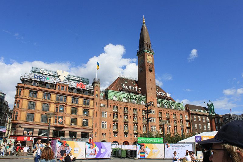
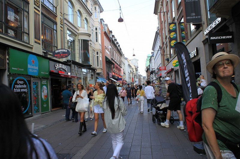
Bericht - Kopenhagen
Pitch is located outside Copenhagen on a campsite. Check-in is only possible from 12:00 noon. The receptionist was not particularly friendly and told us to use the visitor parking lot until 12:00. The place itself is a bit run down and anything else you do, such as showering, washing up or going to the swimming pool, is charged extra when you check out. We were given 2 ID cards with which we had to open everything. What we were not told at the beginning is that the cards are charged with a SEK 50 deposit, which is then deducted from the consumption. Electricity is charged at SEK 13.00 per kWh consumed.
Day
Day
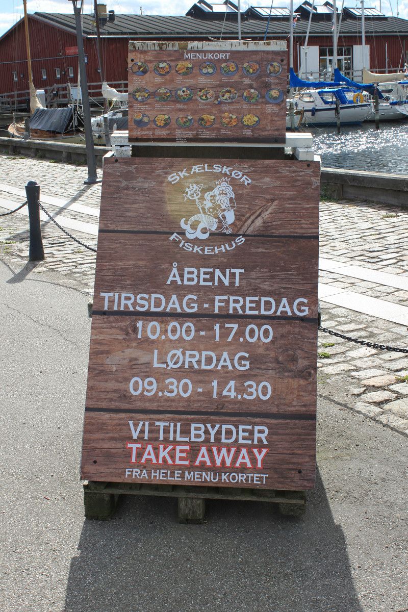
Skælskør Havn
Havnevej 20, 4230, Skælskør, Dänemark
55° 15' 11" N 11° 17' 25" E
55.2530556 11.2902778
• Head toward Strandgade on Havnevej. Go for 67 m.
• Turn slightly left onto Havnevej. Go for 223 m.
• Turn left onto Norvejen (259/265). Go for 2.9 km.
• Turn left onto Rennebjergvej. Go for 3.7 km.
• Take the 2nd exit from roundabout onto Gryderupvej. Go for 1.2 km.
• Turn right onto Tinghusvej. Go for 1.8 km.
• Continue on Ormeslevvej. Go for 2.7 km.
• Turn left onto Slagelse Landevej (150). Go for 295 m.
• Turn right onto Bildsøvej (277). Go for 1.3 km.
• Take the 2nd exit from roundabout onto Bildsøvej (277). Go for 315 m.
• Turn left and take ramp onto E20 (Vestmotorvejen) toward Odense. Go for 81.0 km.
• Take exit 55 toward Aarup/329/Bogense. Go for 428 m.
• Turn right onto Bogensevej (329) toward Bogense/Gelsted/161. Go for 246 m.
• Take the 2nd exit from roundabout onto Bogensevej (329). Go for 6.2 km.
• Turn left onto Rugårdsvej (303/329). Go for 873 m.
• Turn right onto Bogensevej (329). Go for 9.7 km.
• Turn left onto Odensevej (311/317). Go for 2.2 km.
• Turn left onto Vestergade. Go for 695 m.
• Turn left onto Vestre Havnevej. Go for 412 m.
• Turn left onto Vestre Havnevej. Go for 152 m.
• Arrive at Vestre Havnevej. Your destination is on the left.
☍
116,3 km
(1 hrs. 24 min.)
Bericht - Skaelskor
Very nice place right on the harbor. Unfortunately, there are fewer places than stated by ProMobil. There are a maximum of 7 parking spaces available at the marina. The place itself is not very big but the area around the harbor is very inviting. The restaurant right next to the parking space is unfortunately very expensive. A few meters further there is the restaurant "Corner", where you can get many very tasty dishes at reasonable prices. You pay at the machine, which you can even set to German, make your selection, hold your card up and you get a sticker like at the airport that goes around your suitcase and that you can then attach to the outside of your RV.
Day
Bogense Havn & Marina
Vestre Havnevej, Bogense, Region Süddänemark, Dänemark
55° 34' 6.1" N 10° 4' 37.5" E
55.5683681 10.0770763
• Head southeast on Vestre Havnevej. Go for 152 m.
• Turn right onto Vestre Havnevej. Go for 412 m.
• Turn right onto Vestergade. Go for 695 m.
• Turn right onto Adelgade (311/317). Go for 2.2 km.
• Turn right onto Assensvej (317/329). Go for 1.3 km.
• Turn right onto Middelfartvej (317). Go for 14.6 km.
• Turn left onto Hedegaardsvej (317). Go for 2.0 km.
• Take the 1st exit from roundabout onto E20 (Fynske Motorvej) toward Kolding/Middelfart. Go for 17.0 km.
• Keep left onto E20 (Fredericia) toward Esbjerg/E45s/Kolding/Flensborg. Go for 15.5 km.
• Continue on E45 (Sønderjyske Motorvej) toward Flensborg. Go for 40.2 km.
• Take exit 69 toward Haderslev S/Tønder. Go for 690 m.
• Turn right onto Marstrupvej (435) toward Tønder. Go for 4.9 km.
• Take the 2nd exit from roundabout onto Marstrupvej (435). Go for 1.4 km.
• Take the 2nd exit from roundabout onto Strandelhjørnvej (435) toward Tønder. Go for 4.9 km.
• Continue on Rangstrupvej. Go for 4.5 km.
• Take the 2nd exit from roundabout onto Rangstrupvej. Go for 615 m.
• Continue on Branderupvej. Go for 4.4 km.
• Continue on Løgumklostervej. Go for 2.4 km.
• Continue on Branderupvej. Go for 6.9 km.
• Continue on Nørremark. Go for 612 m.
• Take the 1st exit from roundabout onto Bredebrovej (401/429). Go for 2.2 km.
• Take the 3rd exit from roundabout onto Grænsevej (25) toward Tønder. Go for 5.9 km.
• Take the 1st exit from roundabout onto Adelvadvej toward Sølsted/11. Go for 2.7 km.
• Take the 2nd exit from roundabout onto Hjerpstedvej toward Hjerpsted/419/Visby. Go for 1.9 km.
• Continue on Høybergvej. Go for 2.6 km.
• Continue on Trøjborgvej. Go for 1.9 km.
• Continue on Hjerpstedvej. Go for 3.1 km.
• Turn left onto Højervej (419). Go for 4.1 km.
• Turn right onto Emmerlevvej. Go for 2.3 km.
• Continue on Emmerlev Klev. Go for 95 m.
• Turn left onto Emmerlev Klev. Go for 32 m.
• Arrive at Emmerlev Klev. Your destination is on the right.
☍
152,2 km
(1 hrs. 49 min.)
Bericht - Bogense
Day
Emmerlev Klev
Emmerlev Klev 1, Kommune Tondern, Region Süddänemark, Dänemark
54° 59' 12.9" N 8° 39' 47.1" E
54.9869220 8.6630840
• Head toward Stampemøllevej on Emmerlev Klev. Go for 32 m.
• Turn right onto Emmerlev Klev. Go for 95 m.
• Continue on Emmerlevvej. Go for 2.3 km.
• Turn right onto Højervej (419). Go for 1.9 km.
• Take the 2nd exit from roundabout onto Tværmarksvej. Go for 728 m.
• Continue on Højer Dige. Go for 3.3 km.
• Continue on Ved Gaden. Go for 2.8 km.
• Continue on Rudbølvej. Go for 1.8 km.
• Continue on Rosenkranzer Straße (L312). Go for 1.0 km.
• Turn left onto Aventofter Landstraße (L6). Go for 3.5 km.
• Turn right onto Gotteskoogstraße (K106). Go for 3.5 km.
• Continue on Aventofter Straße (K106). Go for 7.2 km.
• Turn left onto Klanxbüller Straße (L8). Go for 1.4 km.
• Turn right onto Uhlebüller Straße (K114). Go for 1.1 km.
• Continue on Hauptstraße (K114). Go for 233 m.
• Turn left onto Brandkuhle (K114). Go for 145 m.
• Take the 1st exit from roundabout onto Osterweg (K114). Go for 733 m.
• Turn left onto Peter-Schmidts-Weg (L7) toward A7/B5/Gewerbegebiet Süd/Gewerbegebiet Ost. Go for 235 m.
• Pass 2 roundabouts and continue on Peter-Schmidts-Weg (L7). Go for 685 m.
• Turn right onto Peter-Schmidts-Weg (K115). Go for 1.7 km.
• Turn right onto An der B5 (B5) toward A7/Flensburg/Husum/Hüsem/Bredstedt/Bräist. Go for 12.6 km.
• Take the 2nd exit from roundabout onto An der B5 (B5) toward Husum. Go for 7.9 km.
• Take the 3rd exit from Verteilerring roundabout onto Eisenbahnstraße (B5) toward Husum Hüsem. Go for 1.6 km.
• Take the 2nd exit from roundabout onto Husumer Straße (B5) toward Husum. Go for 10.5 km.
• Turn right onto Husumer Straße (K81) toward Husum. Go for 3.2 km.
• Take the 1st exit from roundabout onto An der Alten B5 (L273). Go for 1.2 km.
• Turn right onto Adolf-Brütt-Straße (L30). Go for 188 m.
• Continue on Deichstraße (L273). Go for 1.9 km.
• Turn right onto Wilhelmstraße (K24). Go for 87 m.
• Turn right onto Simonsberger Straße (K136). Go for 261 m.
• Take the 2nd exit from roundabout onto Breitenweg (K136). Go for 1.1 km.
• Continue on Finkhauschaussee (K136). Go for 819 m.
• Continue on Hauptstraße (K136). Go for 2.7 km.
• Continue on Königsweg (K136). Go for 1.4 km.
• Continue on Dorfstraße (L31). Go for 1.3 km.
• Continue on Mühlendeich (L31). Go for 2.0 km.
• Turn right onto Kirchspielweg (L310). Go for 2.9 km.
• Continue on L310. Go for 3.7 km.
• Continue on Everschoper Straße (L310). Go for 3.9 km.
• Turn right onto Norderheverkoogstraße (L310). Go for 4.1 km.
• Continue on L34. Go for 377 m.
• Continue on Norderheverkoogstraße (L34). Go for 168 m.
• Continue on Möhlendiek (L34). Go for 2.7 km.
• Turn right onto Sankt-Johanniskoog-Ring (K14). Go for 1.7 km.
• Turn right onto Neukruger Chaussee (K14). Go for 1.1 km.
• Continue on Süderheverkoog-Chaussee (K14). Go for 1.2 km.
• Turn left onto Koogstraße (K36). Go for 5.8 km.
• Continue on Tümlauer Chaussee (K36). Go for 3.3 km.
• Turn right onto Ketelskoog. Go for 125 m.
• Arrive at Ketelskoog. Your destination is on the left.
☍
114,4 km
(1 hrs. 38 min.)
Bericht - Hoyer
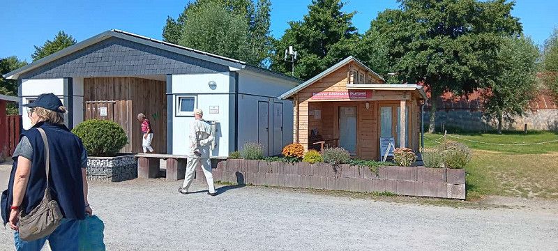
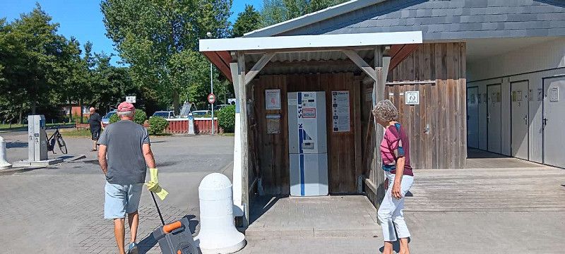
The campsite is just a stone's throw from the North Sea. You can check in via an app or on site at CHEKIN, also in German. Easy to use and you pay for the space plus 50 DEK each for electricity and shower. Both will be charged when you check out and the rest will be refunded. The owners are German and very friendly. The boss came to the car immediately and answered all questions with a smile and in a friendly manner. You can choose your own spot on the screen and the plots are generously divided into sections. There is a kitchen, shower, sanitary facilities and a common room. Everything was super clean and up to date when we arrived.
Day
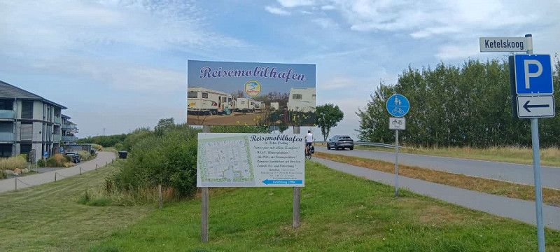
Reisemobilhafen St. Peter-Ording
Ketelskoog 4, 25826, St. Peter-Ording, Deutschland
54° 18' 31" N 8° 38' 6" E
54.3086111 8.6350000
• Head east on Ketelskoog. Go for 125 m.
• Turn right onto Neuweg (K36). Go for 131 m.
• Turn left onto Eiderstedter Straße (L33). Go for 1.1 km.
• Take the 2nd exit from roundabout onto Wittendüner Allee (L33) toward Heide/Wesselburen/Garding/Flughafen/BG Nordsee Reha-Klinik/Klinik Nordfriesland. Go for 5.4 km.
• Continue on Krimm (L305). Go for 6.9 km.
• Continue on L305. Go for 11.5 km.
• Take the 1st exit from roundabout onto Am Stadtpark (K62). Go for 538 m.
• Continue on Eiderstedter Straße. Go for 564 m.
• Take the 1st exit from roundabout onto Lollfuß (L156). Go for 6.4 km.
• Turn right onto Hauptstraße (B203). Go for 2.5 km.
• Take the 2nd exit from roundabout onto Heider Straße (B203). Go for 2.3 km.
• Turn right onto Dr.-Martin-Bahr-Straße. Go for 163 m.
• Turn right. Go for 111 m.
• Arrive at your destination on the right.
☍
37,8 km
( 33 min.)
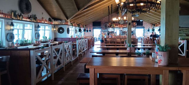
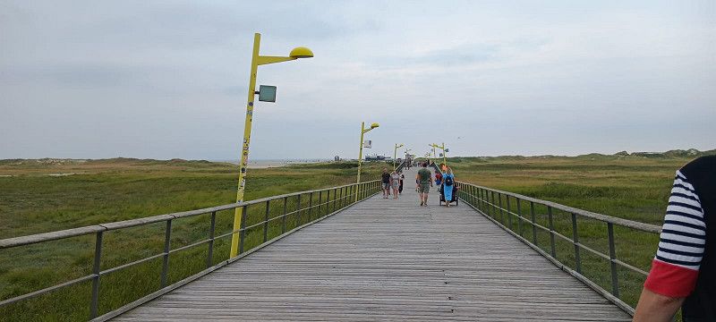
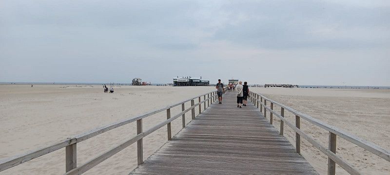
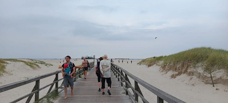
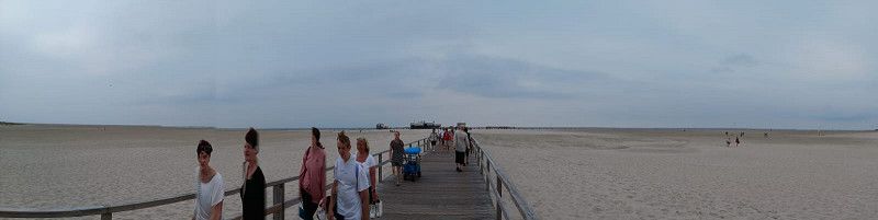
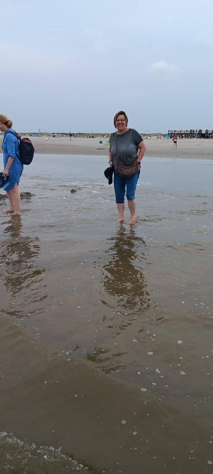
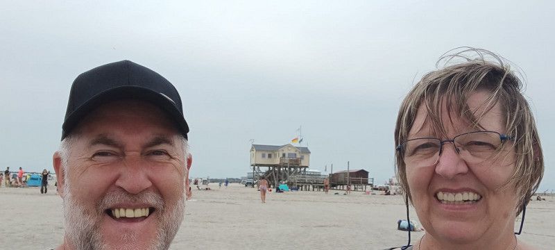
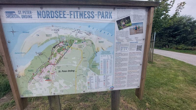
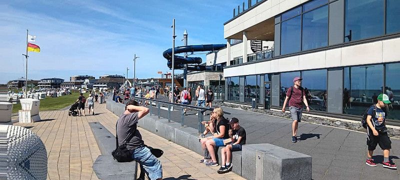
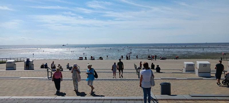
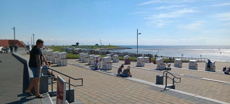
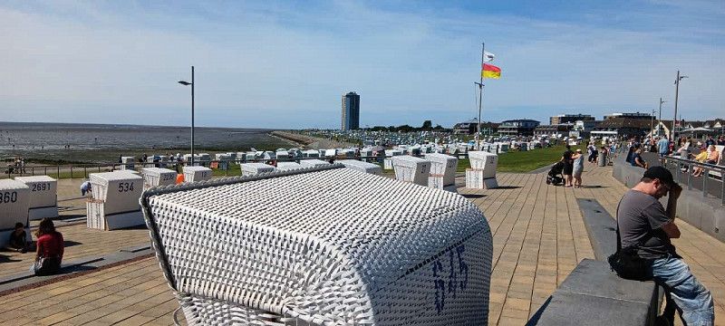
Bericht - St.Peter-Ording
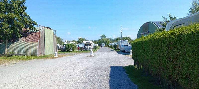
The RV parking space is a TOP spot, but in my opinion not quite justified. The pitches are divided into plots but the paths are relatively narrow. It takes just a few minutes to get to the town. The beaches are about 3 km away. It is best to use the bus as it is free with the tourist tax.
Day
Wohnmobilstellplatz Büsum Hafen
Doktor-Martin-Bahr-Straße 5, Büsum, Dithmarschen, Schleswig-Holstein, Deutschland
54° 7' 45.9" N 8° 52' 12.7" E
54.1294216 8.8701955
• Head southwest. Go for 111 m.
• Turn left onto Dr.-Martin-Bahr-Straße. Go for 163 m.
• Turn left onto Hafentörn (B203). Go for 2.2 km.
• Pass 2 roundabouts and continue on Heider Straße (B203). Go for 13.3 km.
• Continue on B203. Go for 396 m.
• Turn right and take ramp onto A23 toward Hamburg. Go for 51.9 km.
• Take exit 10 toward Itzehoe-Süd. Go for 306 m.
• Take the 1st exit from roundabout onto L119 toward Elmshorn/Glückstadt/Dägeling. Go for 6.1 km.
• Continue on L112. Go for 202 m.
• Turn right onto Hauptstraße (L112). Go for 9.5 km.
• Continue on An der Chaussee (B431). Go for 2.2 km.
• Turn left onto Steinburgstraße (B431). Go for 390 m.
• Turn right onto Christian-IV-Straße (B431) toward Hamburg/Elmshorn. Go for 725 m.
• Take the 1st exit from roundabout onto Stadtstraße (K8) toward Hafen/Zentrum. Go for 59 m.
• Take the 2nd exit from roundabout onto Am Fleth (K8). Go for 231 m.
• Arrive at Am Fleth (K8). Your destination is on the right.
☍
87,8 km
( 59 min.)
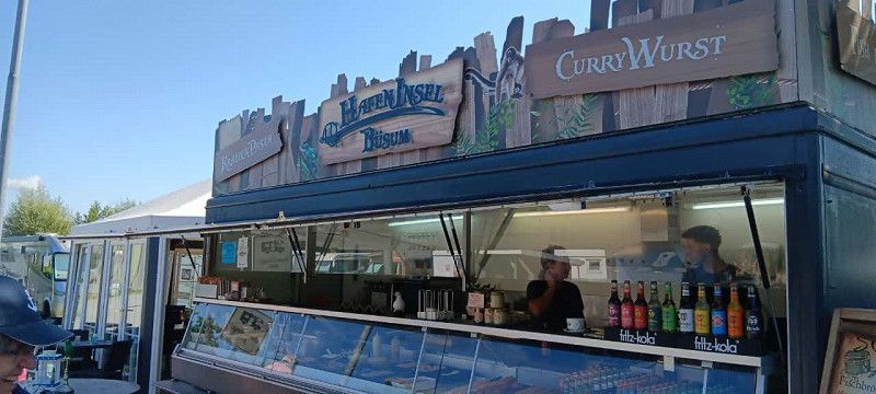
Bericht - Büsum
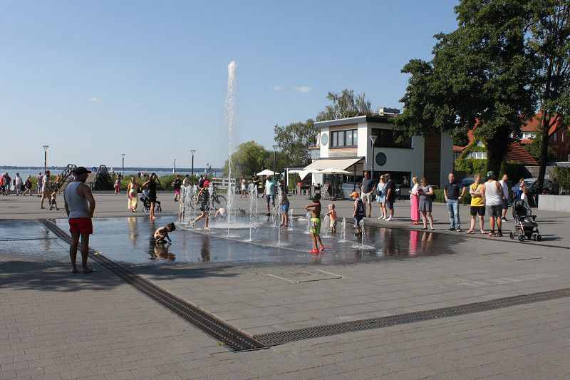
The site is close to the harbor and the town center can be reached within about 10 minutes (700 m). The main pedestrian zone is full of shops as you would expect in a port town. Many souvenir and clothing shops. In the city there is an Asian restaurant that serves very tasty and large dishes at reasonable prices. There are two little trains in the town, red and green. The Green Train runs through the town via seven stations and with a tourist card the journey is free.
Day
Day
Day
Fähre Elbe
Departure port: Glückstadt
Kreis Steinburg, Schleswig-Holstein, Deutschland
53.7879270 9.4238157
Arrival port: Wischhafen
Landkreis Stade, Niedersachsen, Deutschland
53.77347819.3184108
• Head toward Unterm Deich on Stader Straße (B495). Go for 2.7 km.
• Continue on Stader Straße (L111). Go for 1.8 km.
• Turn left onto Dornbuscher Hafenstraße. Go for 276 m.
• Continue on Elbinsel Krautsand. Go for 3.3 km.
• Turn left toward Elbstraße. Go for 132 m.
• Turn slightly right onto Elbstraße. Go for 126 m.
• Turn right. Go for 49 m.
• Arrive at your destination on the left.
☍
Distance not available
(Duration not available)
Elbstrand Resort - Hotel
Elbstraße 1, Drochtersen, Landkreis Stade, Niedersachsen, Deutschland
53° 45' 12" N 9° 23' 12.3" E
53.7533355 9.3867632
• Head northwest. Go for 49 m.
• Turn left onto Elbstraße. Go for 214 m.
• Turn right onto Elbinsel Krautsand (K19). Go for 3.3 km.
• Continue on Dornbuscher Hafenstraße. Go for 276 m.
• Turn right onto Dornbuscher Straße (L111). Go for 1.8 km.
• Turn left onto Ostener Straße (B495). Go for 21.6 km.
• Turn right onto Mittelstenaher Straße (L116) toward Bad Bederkesa/Mittelstenahe. Go for 19.6 km.
• Pass 2 roundabouts and continue on L119. Go for 3.2 km.
• Take the 3rd exit from roundabout onto Drangstedter Straße (L120) toward A27/Bremen/Bremerhaven/Drangstedt. Go for 10.8 km.
• Take ramp onto A27. Go for 21.8 km.
• Take exit 11 toward Oldenburg/A29/Wilhelmshaven. Go for 506 m.
• Continue on B437. Go for 9.8 km.
• Take ramp onto B212. Go for 3.4 km.
• Take ramp onto B437 toward A29/Oldenburg/Wilhelmshaven/Varel. Go for 13.9 km.
• Turn left onto Außendeicher Straße (L862) toward Jaderberg. Go for 10.0 km.
• Take the 2nd exit from roundabout onto Spohler Straße (L820). Go for 7.6 km.
• Turn right onto Petersfelder Straße (L820). Go for 7.7 km.
• Turn left onto Neuenburger Straße (L815). Go for 2.3 km.
• Continue on Ammerlandallee (L815). Go for 140 m.
• Turn left and take ramp onto A28 toward Emden/Leer. Go for 22.8 km.
• Take exit 3 toward Filsum/Rhauderfehn. Go for 300 m.
• Turn left onto B72 toward Cloppenburg/Filsum/Friesoythe/Rhauderfehn. Go for 4.0 km.
• Take ramp toward Stickhausen/Augustfehn/Potshausen. Go for 215 m.
• Turn right onto Potshauser Straße (L21). Go for 219 m.
• Turn right onto Breitenweg (L821). Go for 437 m.
• Turn left onto Zur Jümmebrücke (L821). Go for 127 m.
• Turn right onto Von-Glan-Straße (L821). Go for 205 m.
• Arrive at Von-Glan-Straße (L821). Your destination is on the right.
☍
166,0 km
(2 hrs. 3 min.)
Bericht - Drochtersen
The parking space is located directly behind the dike and you can reach the Elbe beach in just one minute. The area is partly flat, tarred and partly grassy. Unfortunately, only a few RVs fit on the site and the space between the vehicles is not very big. Less than five minutes from the campsite there is a kind of beach bar and a tent where you can get coffee, crepes, cakes and various other things. There is also a fish stall. There are two or three campsites and motorhome parking spaces nearby that you can use as an alternative. There was a problem at the payment machine, the instructions are not entirely correct and you either have to fight your way through or ask someone who has already purchased a ticket. We were lucky, a young couple came up to me and asked if I wanted their ticket because they wanted to travel again. This meant we got a free ticket and a parking space became available. Before that we took the ferry from Glückstadt to Wischhafen, which costs €23.50 for a motorhome with two people.
Day
Reisemobilhafen Detern
Alte Heerstraße 6, 26847, Detern, Deutschland
53° 12' 58" N 7° 38' 47" E
53.2161111 7.6463889
• Head toward Grüner Weg on Von-Glan-Straße (L821). Go for 205 m.
• Turn left onto Burgstraße (L821). Go for 127 m.
• Take ramp onto B72. Go for 4.5 km.
• Take ramp onto A28 toward Emden/Oberhausen/Leer. Go for 10.1 km.
• Continue on A31. Go for 173 km.
• Take exit 34 toward Borken/Bocholt/Groß Reken onto B67. Go for 48.5 km.
• Take the 3rd exit from roundabout onto Emmericher Landstraße (L7) toward Wesel/Rees. Go for 210 m.
• Turn right onto Emmericher Straße. Go for 153 m.
• Turn right onto Ebentalstraße. Go for 227 m.
• Arrive at Ebentalstraße. Your destination is on the right.
☍
237,3 km
(2 hrs. 7 min.)
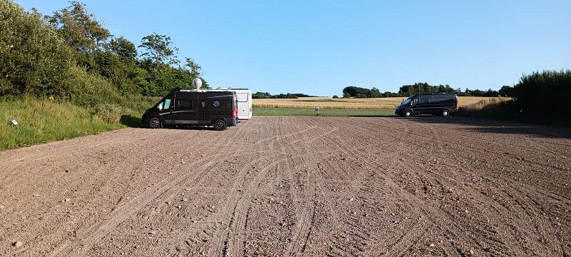
Bericht - Detern
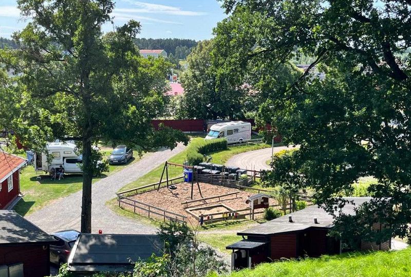
The square is divided into two parts. The first place is paved and has a sign on each plot indicating whether this plot has already been reserved. The second pitch is gravel and has some grass. Everything is relatively flat. Electricity costs € 2.00 for 24 hours. This must be inserted directly at the electricity column. When we wanted to pay, we discovered that we could only pay on site, at the nearby snack bar, the tourist information office or in the evening at the adjacent restaurant. Unfortunately, no one was there, the information desk was not manned that day and the snack bar and the restaurant were closed on Mondays. So you can ride for free once, assuming no one comes by tomorrow morning to check. You can shop at EDEKA, but it is about 1.3 km away. Buses only run a few times a day and you have to be lucky to catch one. Officially the site is a "TOP site", although I'm not entirely sure. The sanitary facilities are OK, but a bit dated.
Day
Ebentalstraße
Ebentalstraße 9, Rees, Kreis Kleve, Nordrhein-Westfalen, Deutschland
51° 45' 54.9" N 6° 23' 23.9" E
51.7652370 6.3899858
• Head toward Kopernikusstraße on Ebentalstraße. Go for 216 m.
• Turn right onto Grüttweg. Go for 498 m.
• Turn right onto Reeser Landstraße (B67). Go for 620 m.
• Take the 2nd exit from roundabout onto Reeser Landstraße (B67) toward Arnheim/Oberhausen/A3/Münster/Isselburg. Go for 6.3 km.
• Take ramp onto A3 toward Oberhausen. Go for 43.0 km.
• Take exit 10 toward Köln/Düsseldorf/Duisburg onto A3. Go for 6.0 km.
• Take exit 12 toward Kamp-Lintfort/Venlo onto A42 (Emscherschnellweg). Go for 3.3 km.
• Take exit 6 toward Duisburg onto A59 (Nord-Süd-Straße). Go for 15.8 km.
• Take the exit toward Essen/DU-Rahm onto A524. Go for 6.9 km.
• Take the left exit toward Köln onto A3. Go for 51.4 km.
• Take exit 28 toward Aachen/Köln-Süd onto A4. Go for 8.2 km.
• Take exit 12 toward Bonn onto A555. Go for 5.2 km.
• Take the exit. Go for 451 m.
• Continue on Kerkrader Straße (L150) toward Godorf/Sürth/Wesseling Gewerbegebiet. Go for 752 m.
• Turn right onto Industriestraße (L300) toward Wesseling-Nord. Go for 2.1 km.
• Take the 3rd exit from roundabout onto Mühlenweg toward Rheinforum. Go for 202 m.
• Turn right onto Gartenstraße. Go for 339 m.
• Turn left onto Am Neuen Garten. Go for 154 m.
• Turn right onto Römerstraße. Go for 74 m.
• Turn left onto Bahnhofstraße. Go for 18 m.
• Arrive at Bahnhofstraße. Your destination is on the right.
☍
151,4 km
(1 hrs. 33 min.)
Bericht - Rees
Day
Wesseling
Rhein-Erft-Kreis, Nordrhein-Westfalen, Deutschland