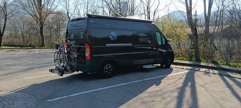
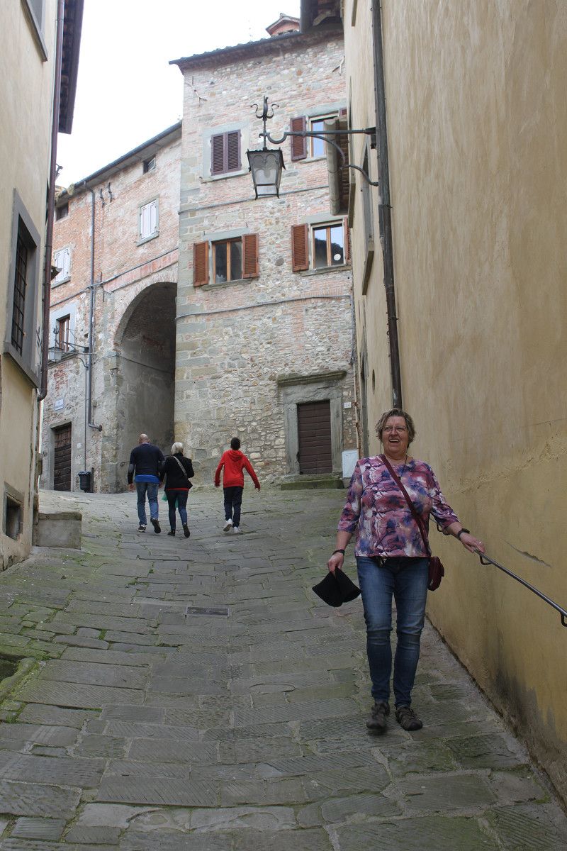
Germany-Austria-Italy-Austria-Germany.
Total distance approx. 3,700 km,
Diesel consumption approx. 340 liters,
Parking costs approx. €600.00,
Total toll fees approx. €120.00
(estimated)
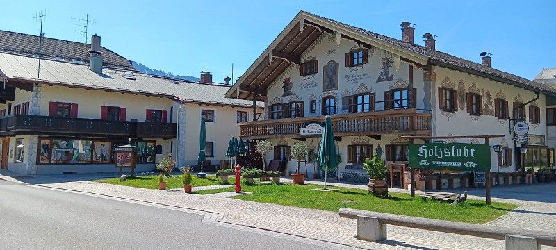
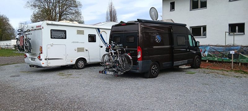
Wesseling
Rhein-Erft-Kreis, Nordrhein-Westfalen, Deutschland
50° 49' 29" N 6° 58' 51.9" E
50.8247166 6.9810852
• Head toward Römerstraße on Bahnhofstraße. Go for 18 m.
• Turn slightly right onto Kreuzstraße. Go for 182 m.
• Turn slightly left onto Gartenstraße. Go for 27 m.
• Turn left onto Konrad-Adenauer-Straße (L300). Go for 855 m.
• Turn right onto Kronenweg toward A555/W.-Keldenich. Go for 661 m.
• Take the 3rd exit from roundabout onto Ahrstraße toward Bonn/A555/W.-Urfeld/Akademie/Eichholz. Go for 758 m.
• Turn right toward Siebengebirgsstraße/L192. Go for 60 m.
• Continue on Siebengebirgsstraße (L192). Go for 402 m.
• Turn left and take ramp onto A555 toward Bonn. Go for 8.6 km.
• Take exit 7 toward Koblenz onto A565. Go for 19.6 km.
• Take the left exit toward Koblenz/Trier/Bad Neuenahr-Ahrweiler onto A61. Go for 120 km.
• Take exit 50 toward Frankfurt/Mainz/Ingelheim/Bingen-Ost onto A60. Go for 3.7 km.
• Take exit 13 toward Bingen-Kempten/Bingen-Ost Gewerbegebiet/Rüdesheim a.Rh. Fähre. Go for 404 m.
• Take the 2nd exit from roundabout onto L419. Go for 1.4 km.
• Turn right onto Mainzer Straße toward Bin.-Gaulsheim. Go for 228 m.
• Turn left onto Außerhalb Gaulsheim. Go for 148 m.
• Turn right. Go for 80 m.
• Turn right. Go for 20 m.
• Arrive at your destination on the right.
☍
156,8 km
(1 hrs. 36 min.)
05. Apr. 2025 -
06. Apr. 2025
Wohnmobilpark Bingen
49.968896283966394, 7.944610458654462
49° 58' 8" N 7° 56' 40.6" E
49.9688963 7.9446105
• Head south. Go for 16 m.
• Turn right. Go for 32 m.
• Turn left toward Außerhalb Gaulsheim. Go for 22 m.
• Turn left onto Außerhalb Gaulsheim. Go for 148 m.
• Turn right onto Mainzer Straße. Go for 228 m.
• Turn left onto L419. Go for 1.3 km.
• Take ramp. Go for 27 m.
• Take the 3rd exit from roundabout onto A60 toward St. Goar/Bingen/Rüdesheim a.Rh./Koblenz/Ludwigshafen/A61. Go for 3.5 km.
• Take the left exit toward Ludwigshafen/Bad Kreuznach onto A61. Go for 92.6 km.
• Take the left exit toward Stuttgart/Heilbronn/Karlsruhe onto A6. Go for 7.8 km.
• Take exit 31 toward Basel/Karlsruhe onto A5. Go for 109 km.
• Take exit 55 toward Offenburg/Villingen-Schwenningen/B33/Gengenbach/Kinzigtal onto B33A. Go for 324 m.
• Keep left onto B33A toward Basel/A5/Villingen-Schwenningen/B33/Gengenbach/Kinzigtal/Offenburg. Go for 450 m.
• Keep right onto B33A toward Villingen-Schwenningen/B33/Gengenbach/Kinzigtal/Offenburg. Go for 1.8 km.
• Take ramp onto B3 toward Villingen-Schwenningen/Lahr/Biberach/Kinzigtal/Gengenbach/OG Ost/Süd/Gewerbegebiet Elgersweier/Messe/B33. Go for 1.7 km.
• Keep right onto B33 toward Villingen-Schwenningen/Biberach/Kinzigtal/Gengenbach/Gewerbegebiet Elgersweier-Nord. Go for 23.4 km.
• Keep right onto B33 toward Villingen-Schwenningen/Haslach/Gewerbegebiet Steinach-Ost. Go for 265 m.
• Turn right onto Steinacher Straße (B33). Go for 27.7 km.
• Turn right onto Frejusstraße (B500) toward Furtwangen/Schönwald/Elzach/Schonach/Stadtmitte. Go for 881 m.
• Turn right onto Hauptstraße. Go for 82 m.
• Arrive at your destination on the left.
☍
271,1 km
(2 hrs. 50 min.)
Day
Bericht Bingen
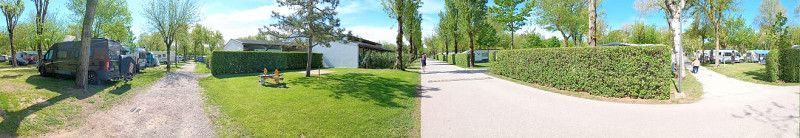
Today we set off on our Tuscany tour and reached our first stop in Bingen.
The motorhome park is very well signposted from the motorway.
We had booked the site several weeks in advance and upon arrival we were personally greeted by the groundskeeper and shown around the site.
Another short explanation of what you will find on the site.
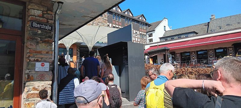
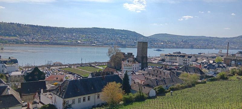
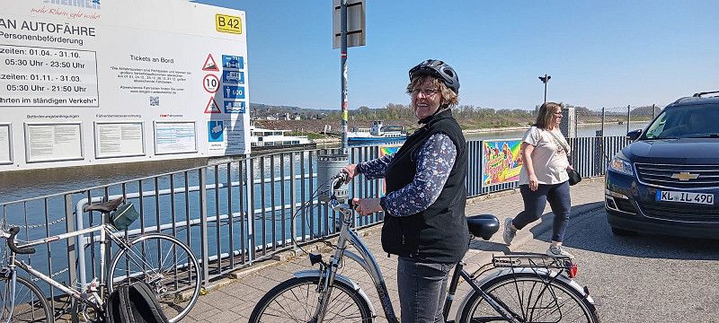
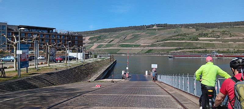
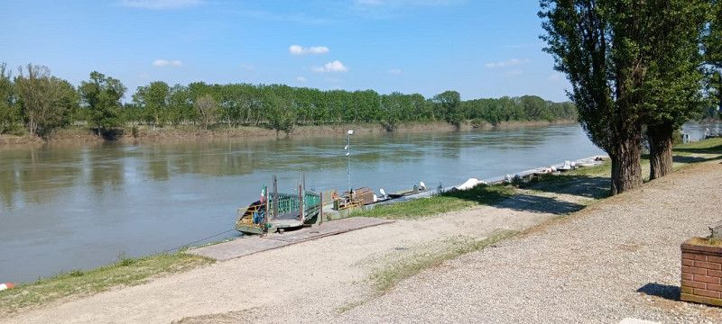
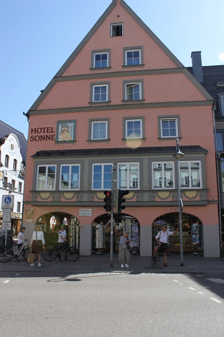
After we had set everything up, we rode our bikes towards Bingener Hafen and took the car ferry over to Rüdesheim.
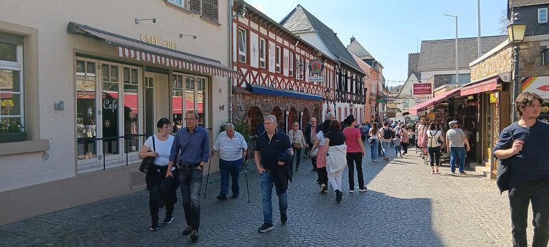
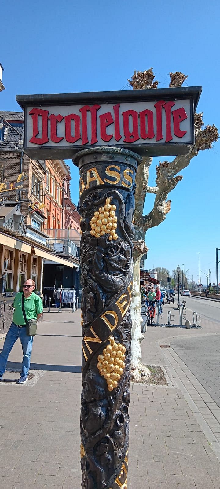
We parked our bikes and headed off to the Drosselgasse to see what we found.
Lots of small shops, restaurants and lots of things for tourists.
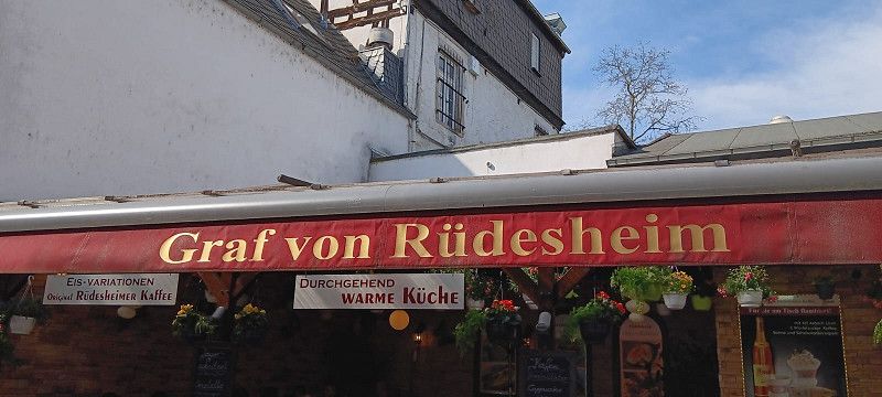
At the end of the Drosselgasse we are first "Graf von Rüdesheim"
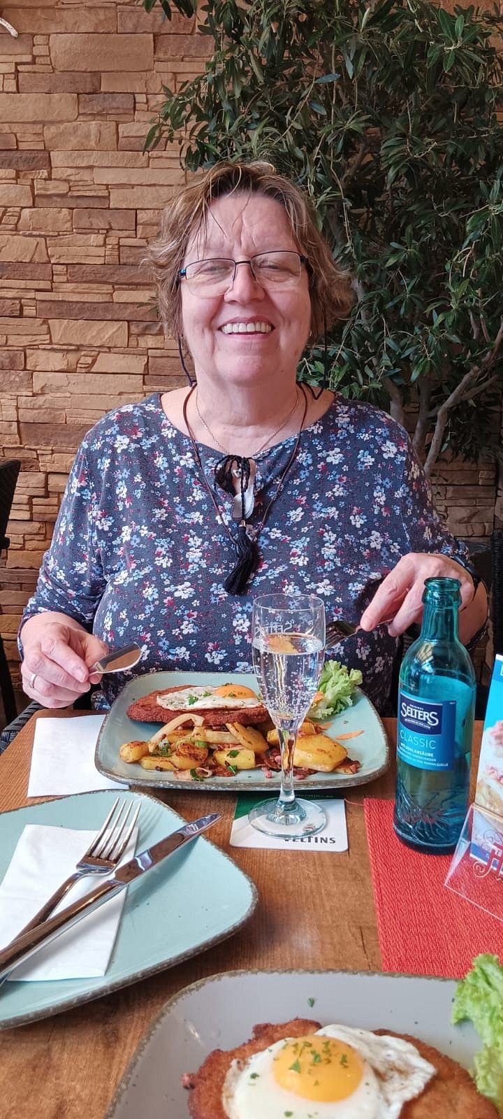
Here they had a very tasty Winzerschnitzel for €11.90, I actually know it as Holsteinschnitzel but it was tasty and with the fried potatoes more than enough.
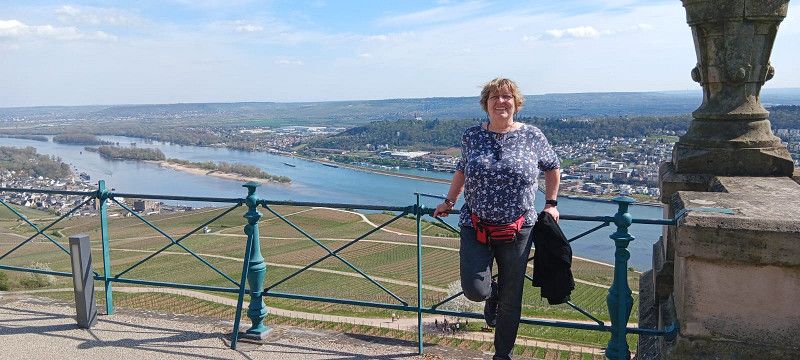
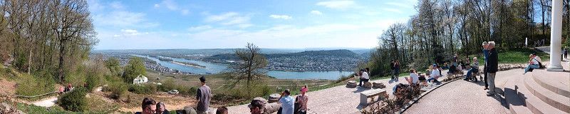
Afterwards, we took the cable car up the mountain. Unfortunately, we had to wait a bit and climb two floors before we reached the chairlift, which took a while. A one-way trip up and down costs €11.00 per adult.
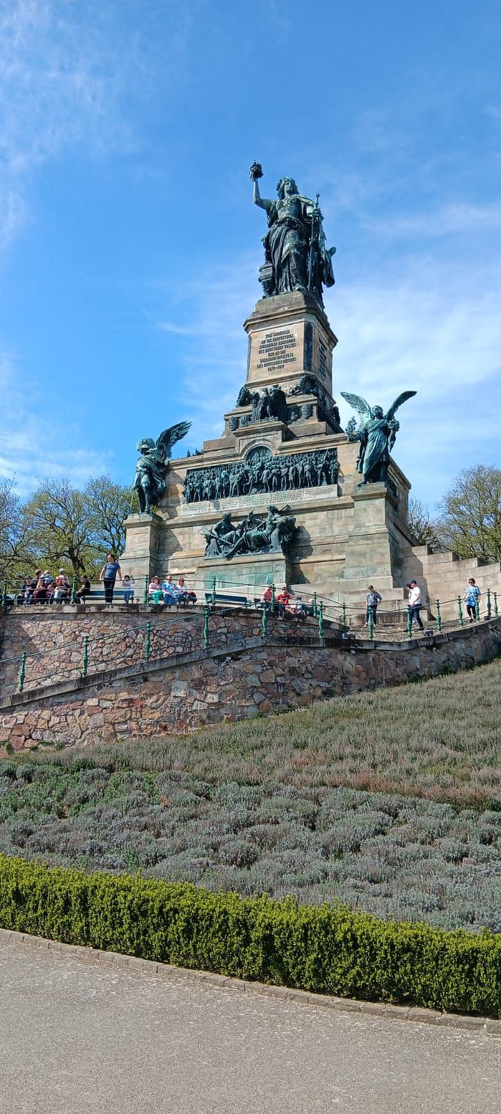
Once we got to the top, we took a short walk and looked at the large Niederwald Monument.
Then take a look at the surrounding area and head back down to Rüdesheim.
Once we got downstairs, we wanted to get some ice cream. We had to pay €2.00 for a scoop, a bit pricey, but that's the way it is in tourist resorts.
Afterwards we went back to Bingen and back to the parking space.
There we enjoyed the beautiful weather for a while and let the evening come to a close.
Conclusion: We will definitely come back here to get to know Bingen better, but then for at least two or three days.
06. Apr. 2025 -
07. Apr. 2025
Triberg
An der Gutach 1, Triberg im Schwarzwald, Schwarzwald-Baar-Kreis, Baden-Württemberg, Deutschland
48° 7' 56.4" N 8° 13' 57.1" E
48.1323207 8.2325186
• Head toward Gartenstraße. Go for 31 m.
• Continue on Hauptstraße. Go for 51 m.
• Turn left onto Hauptstraße (B500). Go for 881 m.
• Turn right onto Hornberger Straße (B33) toward Villingen-Schwenningen/St. Georgen/Bahnhof. Go for 14.4 km.
• Continue on Am Schoren (B33) toward Villingen-Schwenningen/Mönchweiler. Go for 19.4 km.
• Take ramp onto A864 toward Stuttgart/Singen. Go for 5.5 km.
• Take the left exit toward Singen onto A81. Go for 31.1 km.
• Take exit 40 toward Lindau/Friedrichshafen/Stockach onto A98. Go for 14.0 km.
• Continue on B31N. Go for 15.6 km.
• Continue on B31. Go for 12.9 km.
• Keep left onto B31/B33 toward Lindau/Friedrichshafen/Hagenau. Go for 4.6 km.
• Continue on B31 toward Lindau/Friedrichshafen. Go for 15.5 km.
• Take ramp onto Lindauer Straße toward Friedrichshafen-Ost/Gewerbegebiet Unteresch. Go for 471 m.
• Turn left onto Lindauer Straße. Go for 27 m.
• Turn right onto Lindauer Straße. Go for 165 m.
• Arrive at Lindauer Straße. Your destination is on the left.
☍
134,6 km
(1 hrs. 38 min.)
Day
Bericht Triberg
From Bingen to Triberg it was about 260 km and the motorway was pretty clear.
When we arrived in Triberg we looked for the signs for the parking space and unfortunately drove right past them and ended up in a dead end.
So I went back and searched again and found it.
When we arrived at the square, a young lady came to meet us and showed us around.
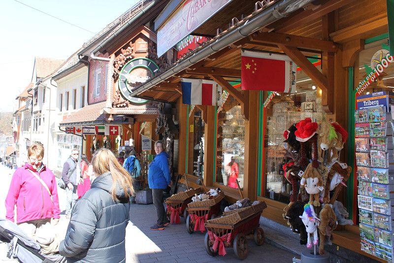
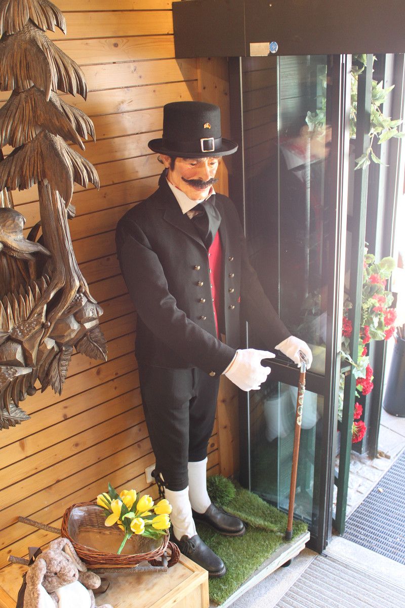
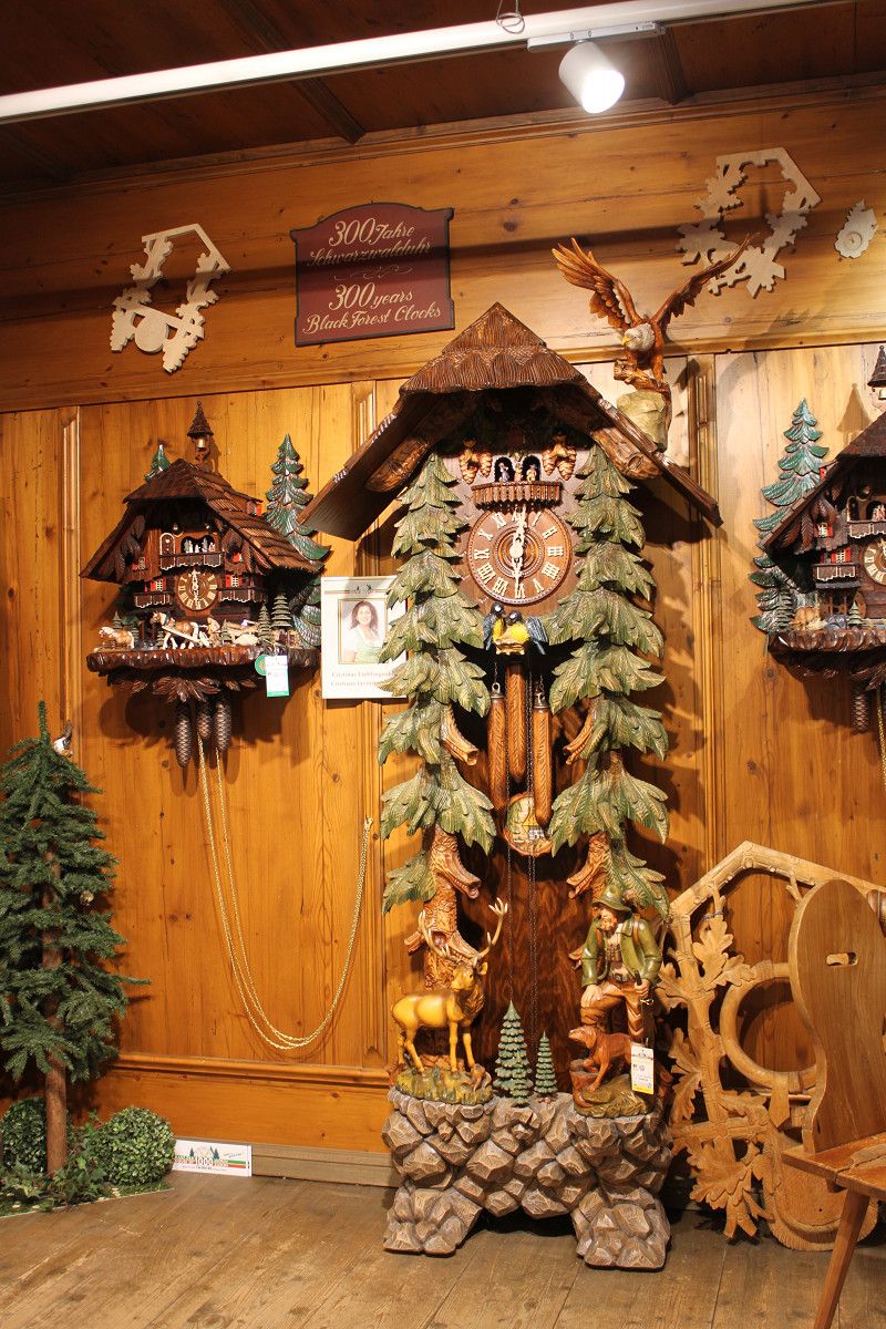
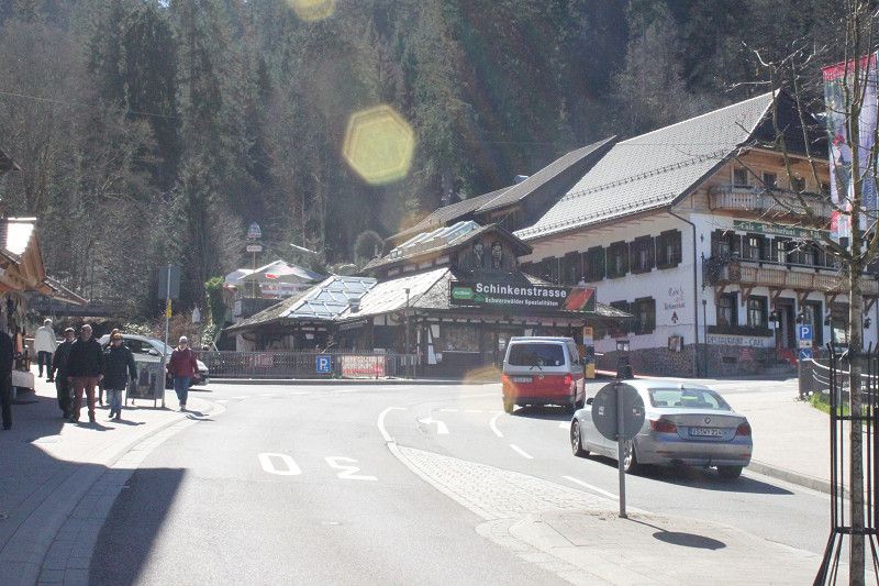
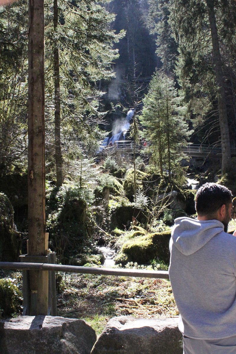
When we paid, we also received two guest cards, which allow free entry to various events, such as the waterfalls. After setting up our campervan, we first went looking for a restaurant, then headed toward the Triberg Waterfalls. After that, we walked a bit through Triberg and visited the tourist shops, such as the House of 1,000 Cuckoo Clocks, and so on.
Once we arrived at the campsite, we checked out the options within the site's halls. Here, you can rent a caravan inside the hall.
Then take a shower and end the evening comfortably.
07. May. 2025 -
08. May. 2025
Friedrichshafen
Lindauer Straße 88/2, Friedrichshafen, Bodenseekreis, Baden-Württemberg, Deutschland
47° 38' 51.1" N 9° 30' 18" E
47.6475302 9.5050011
• Head east on Lindauer Straße. Go for 165 m.
• Turn left onto Lindauer Straße. Go for 27 m.
• Turn right onto Lindauer Straße (L328A). Go for 121 m.
• Take ramp onto B31 toward Lindau. Go for 18.1 km.
• Take ramp toward Kempten/Lindau. Go for 341 m.
• Take the 1st exit from roundabout onto B12 toward Friedrichshafen/Kressbronn/B31/Kempten/Wangen/Oberreitnau/Weißensberg. Go for 2.6 km.
• Turn right onto B12 toward München/A96/Lindau/Kempten/Isny/Hergensweiler/Flugplatz Wildberg. Go for 4.3 km.
• Take the 2nd exit from roundabout onto Kemptener Straße (B12). Go for 6.1 km.
• Take ramp onto B12 toward Kempten/Isny. Go for 44.2 km.
• Keep left onto A980 toward Waltenhofen/Kempten/B19. Go for 4.6 km.
• Take exit 1 toward Innsbruck/Reutte/Füssen/Oy-Mittelberg onto A7. Go for 32.7 km.
• Continue on Grenztunnel Füssen (B179). Go for 28.9 km.
• Take ramp toward Garmisch/Ehrwald/Lermoos/Biberwier. Go for 517 m.
• Turn right onto Ehrwalder Bundesstraße (B187) toward Garmisch/Ehrwald/Lermoos. Go for 4.1 km.
• Turn left onto Ehrwalder Bundesstraße (B187) toward Garmisch. Go for 7.5 km.
• Continue on B23. Go for 9.9 km.
• Take the 1st exit from roundabout onto B23. Go for 1.8 km.
• Turn right onto Gernackerstraße toward Innsbruck/Mittenwald/Partenkirchen/Krankenhaus/B2. Go for 275 m.
• Continue on Sankt-Martin-Straße. Go for 2.5 km.
• Continue on Bahnhofstraße. Go for 436 m.
• Continue on Rathausplatz. Go for 131 m.
• Turn left onto Rathausplatz (B2). Go for 1.2 km.
• Turn right onto Münchner Straße. Go for 208 m.
• Turn left onto Wankbahnstraße. Go for 180 m.
• Arrive at Wankbahnstraße. Your destination is on the right.
☍
170,9 km
(2 hrs. 16 min.)
Day
Bericht Friedrichshafen
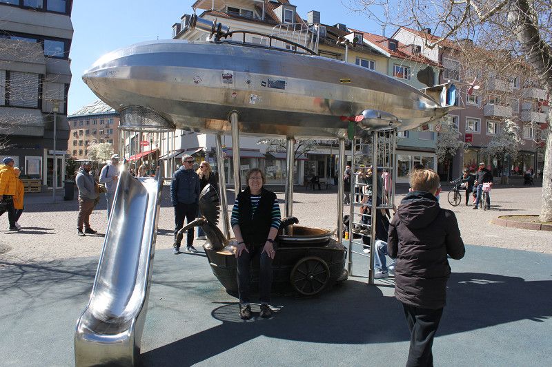
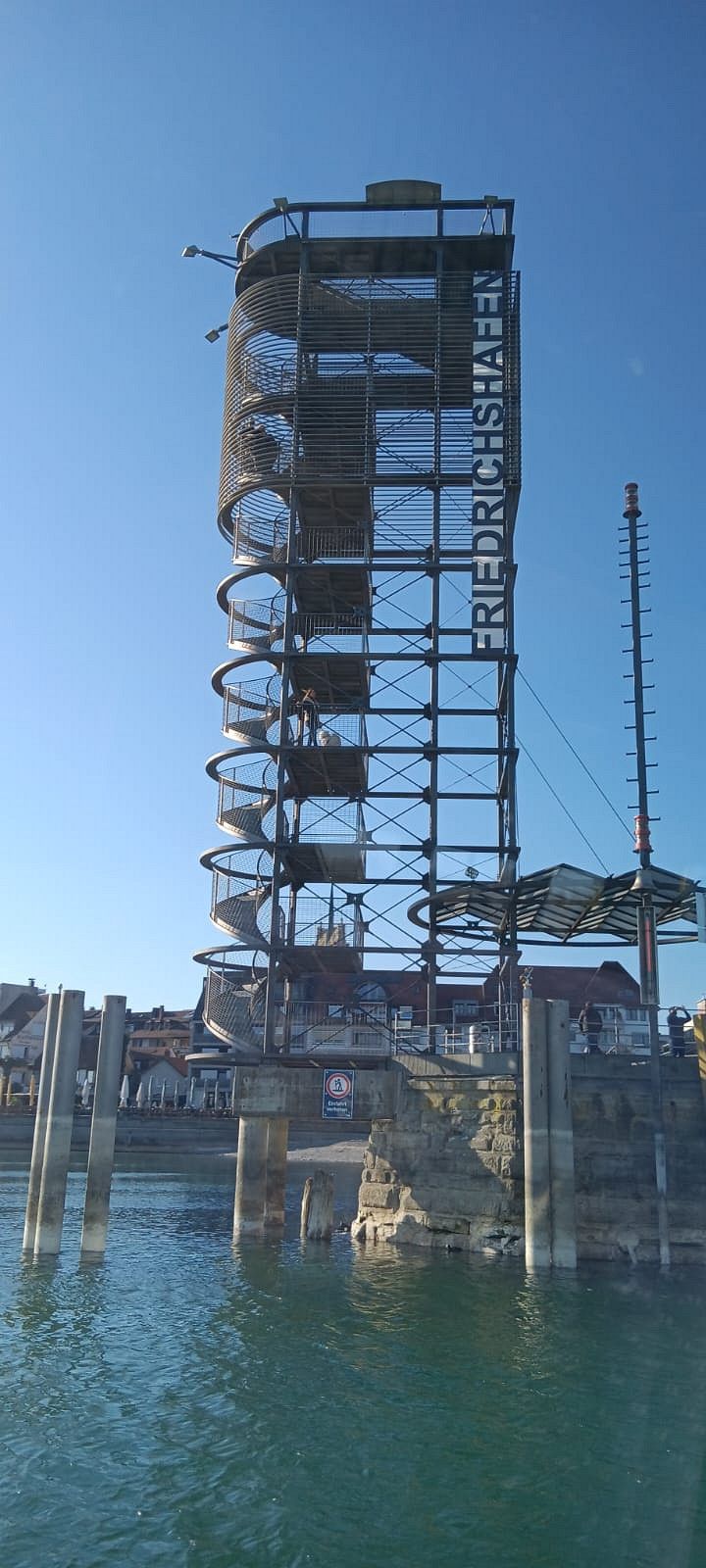
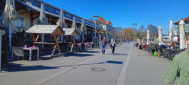
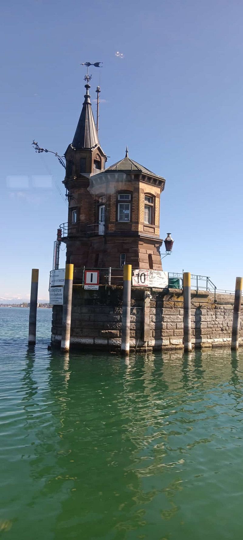
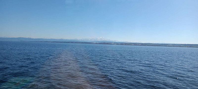
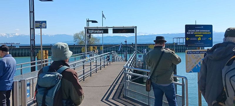
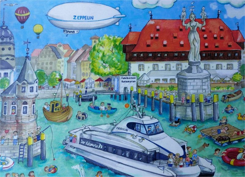
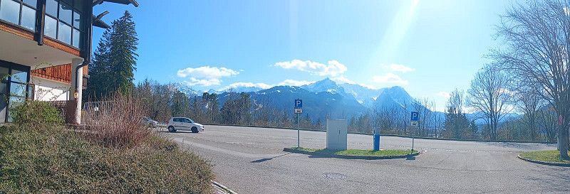
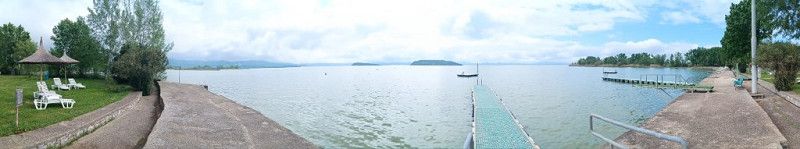
The further we drove, the larger the mountains became and Lake Constance became visible. When we arrived in Friedrichshafen, we accidentally drove onto the campsite below the parking space. Luckily we noticed that a night at the campsite would cost more than €30. So we reversed back onto the road and onto the parking space. Once we got here, there were a total of four lanes. In three of the lanes, all but one space was occupied. So we quickly got to the last parking space. The fourth lane unfortunately had the disadvantage that it slopes sharply to the left. Unfortunately, one power pole was defective and the others were all occupied, so we were running on batteries today. After we had set everything up, we headed towards the harbor. A short trip through the harbor and then by catamaran to Konstanz, just under an hour through the city and then back by catamaran and spent the evening relaxing. In conclusion, you should definitely allow yourself 2-3 days for Friedrichshafen and Konstanz.
08. Apr. 2025 -
10. Apr. 2025
Gamisch-Partenkirchen
Wankbahnstraße 2a, Garmisch-Partenkirchen, Landkreis Garmisch-Partenkirchen, Bayern, Deutschland
47° 30' 12.9" N 11° 6' 17.5" E
47.5035788 11.1048475
• Head northeast on Wankbahnstraße.
• Turn left onto Wankbahnstraße. Go for 19 m.
• Turn left onto Wankbahnstraße. Go for 194 m.
• Turn right onto Münchner Straße. Go for 208 m.
• Turn right onto Münchner Straße (B2). Go for 12.4 km.
• Keep left onto A95 toward München. Go for 20.9 km.
• Take exit 9 toward Sindelsdorf/Bad Tölz/Bichl/Penzberg-Süd. Go for 203 m.
• Turn right onto B472 toward Bad Tölz/Kochel/Benediktbeuern/Bichl/Penzberg/Sindelsdorf. Go for 9.0 km.
• Continue on B472. Go for 2.7 km.
• Take the 1st exit from roundabout onto Tölzer Straße (B472). Go for 10.2 km.
• Continue on B472 toward Gewerbegebiet Flinthöhe. Go for 8.5 km.
• Take the 2nd exit from roundabout onto B472 toward München/A8/Salzburg/Miesbach. Go for 11.2 km.
• Take ramp onto Bayrischzeller Straße (B472) toward München/Salzburg/A8/Irschenberg. Go for 1.9 km.
• Take the 1st exit from roundabout onto B472 toward Salzburg/Irschenberg. Go for 6.9 km.
• Turn right toward Salzburg. Go for 269 m.
• Take ramp onto A8. Go for 16.8 km.
• Take exit 102 toward Rosenheim/Bad Endorf. Go for 260 m.
• Continue on Rosenheimer Straße (B15). Go for 1.3 km.
• Continue on B15 toward Bad Endorf/Stephanskirchen/Rosenheim. Go for 3.6 km.
• Continue on Kufsteiner Straße (St2363). Go for 32 m.
• Turn slightly right onto Brianconstraße (St2363) toward Landshut/Traunstein/Krankenhaus/B15. Go for 352 m.
• Turn left onto Rathausstraße (B15) toward Landshut. Go for 443 m.
• Arrive at Rathausstraße (B15). Your destination is on the left.
☍
107,4 km
(1 hrs. 29 min.)
Day
Bericht Garmisch-Partenkirchen.
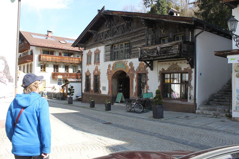
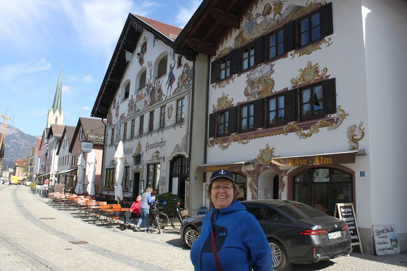
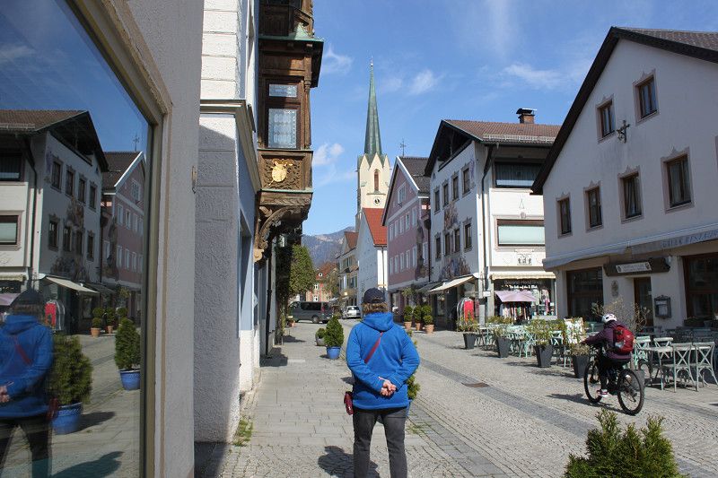
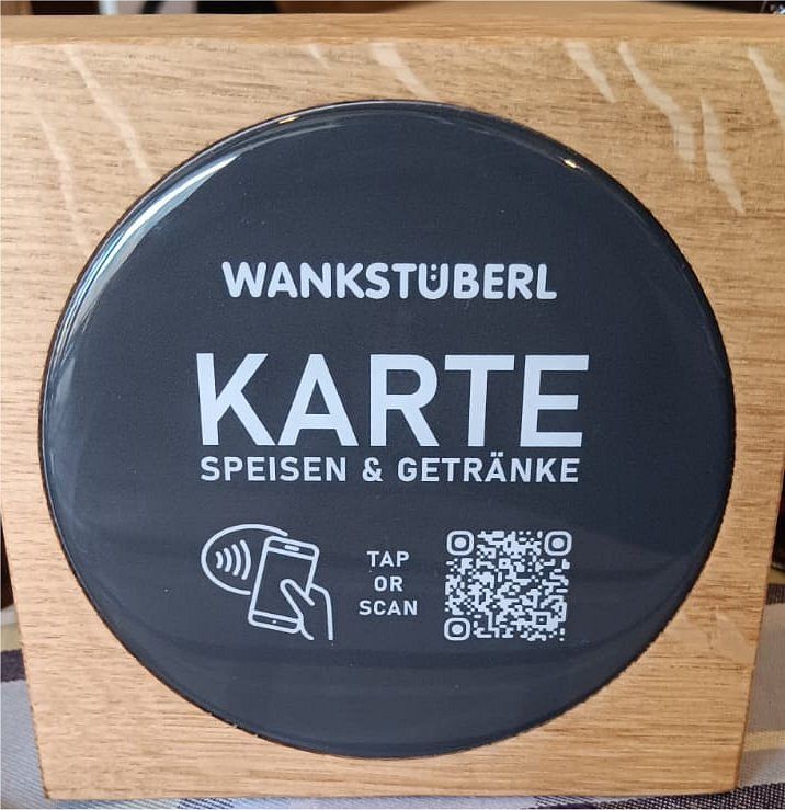
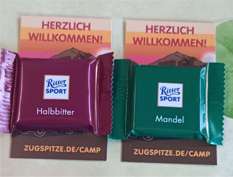
Our fourth stop today is Garmisch-Partenkirchen. We drove straight through Garmisch and then to the parking space at the Wank Camp cable car. There weren't many campers there yet. Of course, not everywhere is on holiday yet. First, we hooked up the electricity and paid one euro for 1500 watts. Then we went to the little house, the reception, which is sometimes manned. If no one is there, you can also pay at the parking meter. A young lady was there for us and explained everything we wanted to know. She was very friendly, and after paying, we received a bonus card. After your 10th night, you get 50% off the parking space price. At the very end, we were treated to two small bars of Ritter Sport as a treat. Today we wanted to take it easy and do nothing. Right next to the Wank cable car, there's a small restaurant with a weekly menu. Three dishes every day for a reasonable price. We had roast pork with two dumplings and coleslaw. The slice of meat was really thick and large, and so tender that you hardly needed a knife. The dumplings and the sauce were delicious, as was the coleslaw. Tomorrow we're planning to go to Garmisch-Partenkirchen.
10. Apr. 2025 -
11. Apr. 2025
Bernau am Chiemsee
Bayern, Deutschland
47° 51' 14.1" N 12° 7' 38.1" E
47.8539273 12.1272620
• Head toward Bismarckstraße on Rathausstraße (B15). Go for 1.3 km.
• Keep left toward St2095. Go for 94 m.
• Take ramp onto St2095. Go for 1.6 km.
• Take ramp. Go for 130 m.
• Turn right onto Rohrdorfer Straße (St2359). Go for 1.0 km.
• Take the 2nd exit from roundabout onto Lauterbacher Straße (RO5). Go for 6.6 km.
• Continue on RO5 toward Salzburg. Go for 455 m.
• Turn left and take ramp onto A8 toward Salzburg. Go for 34.3 km.
• Take exit 112 toward Inzell/Ruhpolding. Go for 248 m.
• Continue on Deutsche Alpenstraße (B306) toward Lofer/Inzell/Ruhpolding/Siegsdorf. Go for 769 m.
• Take the 1st exit from roundabout onto St2098 toward Reit im Winkl/Ruhpolding. Go for 6.8 km.
• Turn right onto Hauptstraße. Go for 492 m.
• Turn right onto Brandstätterstraße. Go for 50 m.
• Arrive at Brandstätterstraße. Your destination is on the right.
☍
53,8 km
( 39 min.)
Day
Bericht Bernau
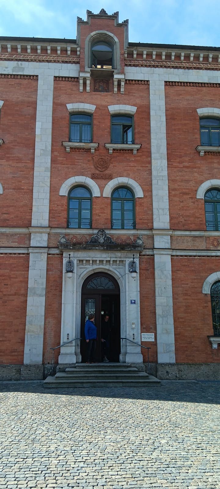
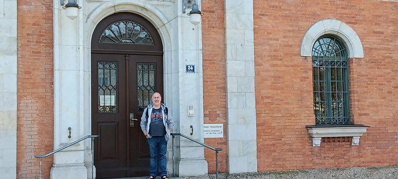
We actually wanted to go straight to Bernau am Chiemsee, but since we left Garmisch relatively early, we quickly popped into Rosenheim. Normally we'd wanted to fill up in Austria, but in Rosenheim diesel cost €1.54, which was pretty cheap at the time. When we arrived in the center of Rosenheim, we naturally went first to the Rosenheim Cops. Or rather, to the old town hall, which is always passed off as the police headquarters. We quickly took a few photos and had a look inside to see if it looked like it did on TV. No, they're cheating here too, everything is completely different. After that, we crisscrossed the city center and then headed towards Bernau. When we arrived at the parking space, our license plate is scanned, and the barrier opens. We found a space, entered all the necessary information into the parking meter, topped up our card, connected the power supply, activated the power connection with the card, and we were done. Now for a nice stroll along Lake Chiemsee and relaxed. The sanitary facilities were fine, but could be a bit better. What is a bit annoying is the adjacent motorway.
11. Apr. 2025 -
13. Apr. 2025
Ruhpolding
Landkreis Traunstein, Bayern, Deutschland
47° 45' 43.2" N 12° 38' 45.6" E
47.7620099 12.6459934
• Head south on Brandstätterstraße. Go for 85 m.
• Turn sharp right onto Schulgasse. Go for 72 m.
• Turn left onto Rathausplatz. Go for 133 m.
• Turn right onto Kirchberggasse. Go for 18 m.
• Turn left onto Rathausstraße. Go for 164 m.
• Turn left onto Hauptstraße. Go for 206 m.
• Turn left onto Hauptstraße (St2098). Go for 6.7 km.
• Take the 2nd exit from roundabout onto Deutsche Alpenstraße (B306) toward A8/Traunstein/Siegsdorf. Go for 915 m.
• Turn left and take ramp onto A8 toward Salzburg. Go for 25.6 km.
• Continue on A1 (West Autobahn). Go for 2.1 km.
• Take the exit toward Ljubljana/Villach/Salzburg-Süd onto A10 (Tauern Autobahn). Go for 182 km.
• Take left exit 182 toward Wien/Klagenfurt onto A2 (Süd Autobahn). Go for 9.5 km.
• Take exit 335 toward Wörthersee. Go for 2.0 km.
• Take the 2nd exit from roundabout onto Villacher Straße (B83) toward Velden. Go for 2.3 km.
• Arrive at Klagenfurter Straße (B83). Your destination is on the left.
☍
232,0 km
(2 hrs. 23 min.)
Day
Bericht Ruhpolding
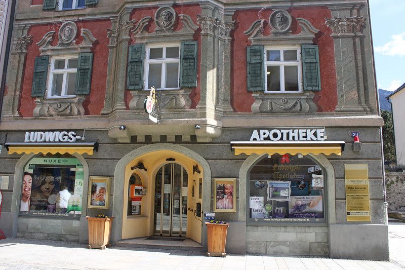
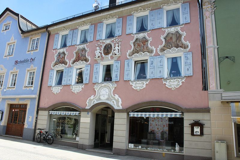
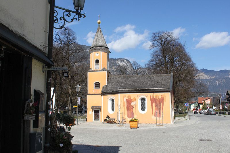
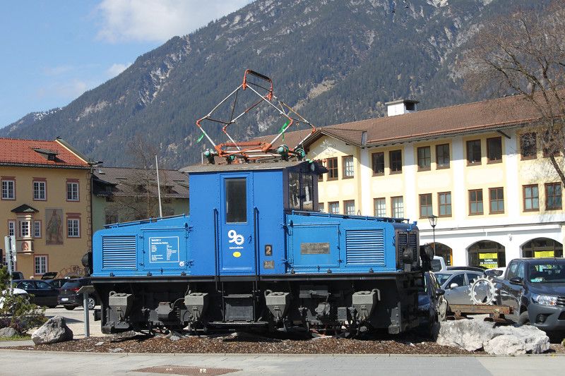
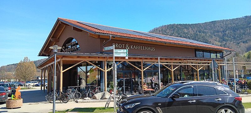
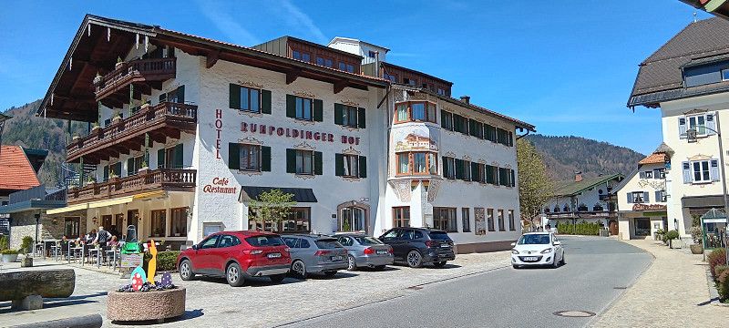
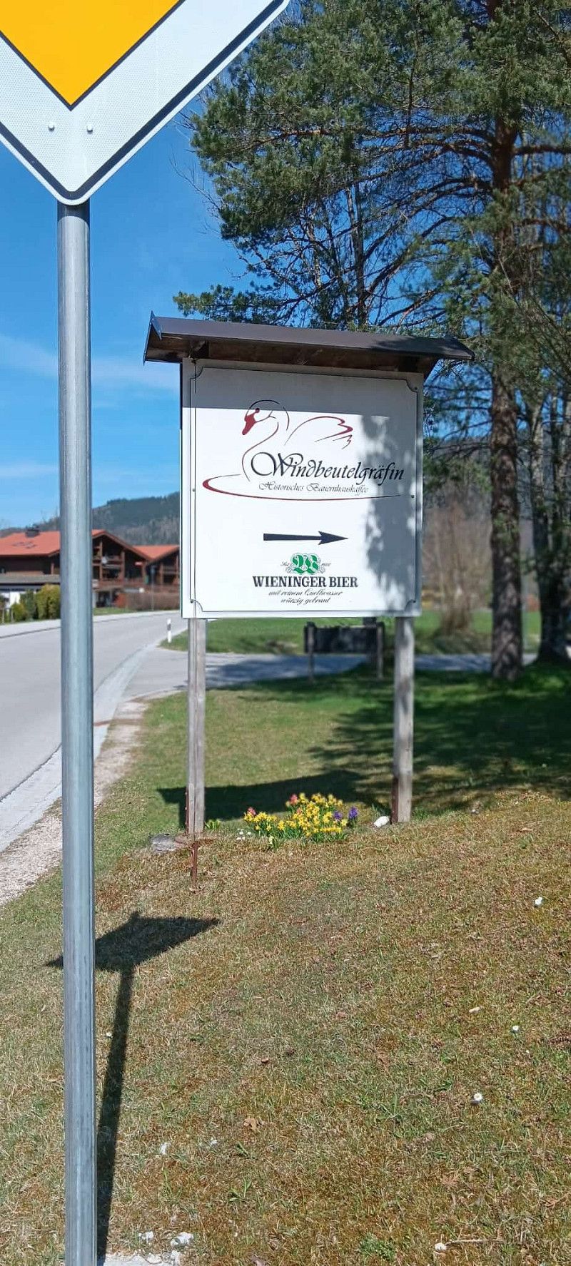
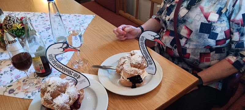
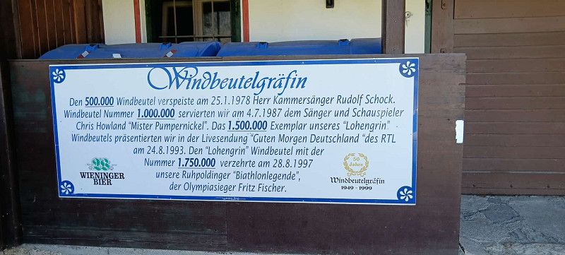
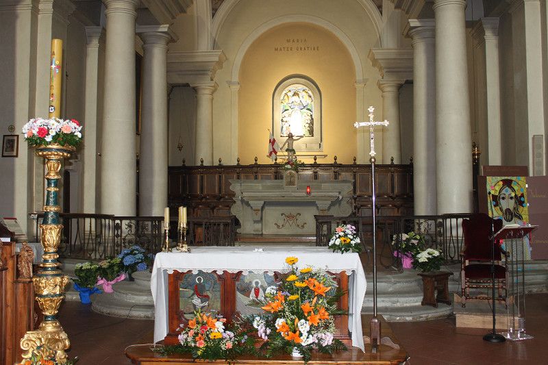
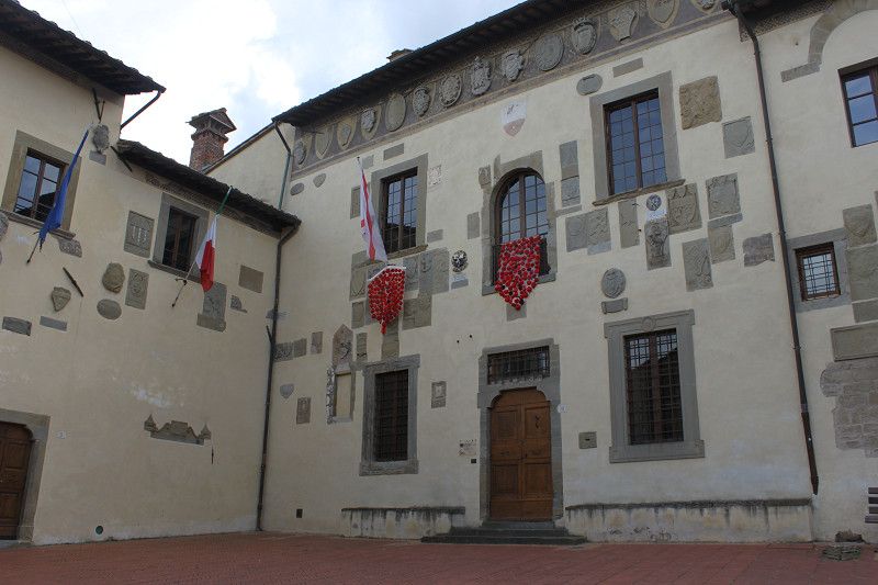
When we arrived in Ruhpolding, we first parked in the wrong parking lot. But no problem, the right one was one street away, right at the intersection. I actually thought that because it was the start of the school holidays, the spot might already be taken. But there were only two RVs there, so it wasn't a problem, and we parked in a free spot. After that, we headed to Ruhpolding to see what had changed in recent years. In the evening, we went to the "Ruhpoldinger Hof," where we had a delicious asparagus soup, a schnitzel, and a cordon bleu. Very tasty and highly recommended. On the second day, we first went to the "Kaffeehaus Schubeck" for breakfast. They offer a great selection of breakfasts, the atmosphere is wonderful, and the staff is very friendly. We bought a few drinks and some snacks and then went to the summer toboggan run at the edge of Ruhpolding. We went up and down twice, and we had a blast. Afterward, we drove through Ruhpolding toward the "Windbeutelgräfin" (Windbeutel Countess). An absolute must-do when in Ruhpolding. The portions are generous and delicious. Bottom line: To climb the mountains and see even more, you'll need to stay in Ruhpolding for more than just two nights.
13. Apr. 2025 -
14. Apr. 2025
Velden
Klagenfurter Straße 33, Velden am Wörther See, Bezirk Villach-Land, Kärnten, Österreich
46° 37' 10.1" N 14° 3' 17.3" E
46.6194690 14.0548002
• Head west on Klagenfurter Straße (B83). Go for 2.2 km.
• Take the 1st exit from roundabout onto A2 (Süd Autobahn) toward Villach. Go for 36.7 km.
• Continue on A23 (Autostrada Alpe-Adria). Go for 119 km.
• Take the exit toward E70/Milano/Venezia onto A4 (Autostrada della Serenissima). Go for 22.9 km.
• Take the exit toward Latisana. Go for 2.2 km.
• Keep left toward Trieste/SS14. Go for 752 m.
• Continue on Via Lignano Nord (SS354). Go for 2.6 km.
• Take the 1st exit from roundabout onto SP102. Go for 1.7 km.
• Take the 3rd exit from roundabout onto Via Isonzo. Go for 179 m.
• Take the 1st exit from roundabout onto Via Isonzo. Go for 523 m.
• Turn left onto Via Sottopovolo (SS14). Go for 1.3 km.
• Take the 2nd exit from roundabout onto Via Aldo Moro (SP74). Go for 2.4 km.
• Continue toward Via Marango/SP42. Go for 49 m.
• Take the 1st exit from roundabout onto Via Marango (SP42). Go for 3.1 km.
• Take the 3rd exit from roundabout onto Via Chiesa (SP70). Go for 744 m.
• Turn left onto Via Biancure. Go for 754 m.
• Turn right onto Via Beni Comuni. Go for 547 m.
• Turn right onto Via Beni Comuni. Go for 374 m.
• Turn left onto Via Monte Baldo. Go for 267 m.
• Continue on Strada Brussa. Go for 253 m.
• Arrive at Strada Brussa.
☍
198,5 km
(2 hrs. )
Day
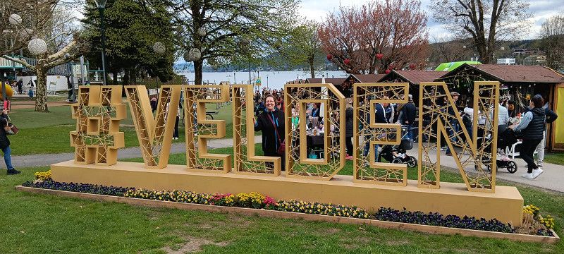
Bericht Velden
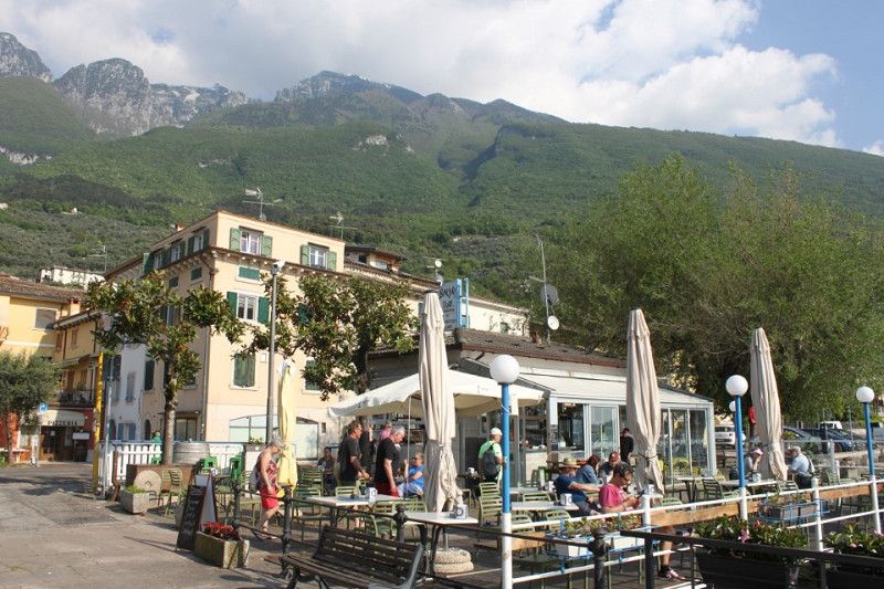
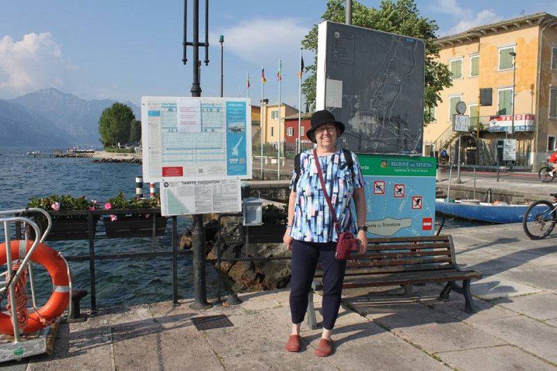
On the way from Ruhpolding to Velden am Wörthersee we took the A10. Apart from some construction work in front of a tunnel, we got through really well. Then we got off the motorway and headed towards Velden. Right at the entrance to the town we saw that it was Easter weekend and that a few stands had been set up right in the town on Lake Wörthersee. So first we drove to the parking space and found out how things worked there. The parking space is right next to a golf tee with a booth where you can buy golf-related items and where you can pay the parking fee. Since we also wanted electricity, we weren't supposed to pay until the next day because of the electricity consumption. According to the ProMobilApp, the space should cost €16.00 and each adult €3.00, so for us it was €22.00. But the price on the signs had been taped over and it was now €25.00 including 2 adults. During my tour I discovered that electricity only works with a standard Schuko plug, so I got out an adapter and plugged it in. The showers are outside and only enclosed by a few boards, so they are outside showers. To get hot water you have to redeem chips from the machine. A hot shower for 3 minutes costs €2.50, which is much too expensive in my opinion. The toilets also leave a lot to be desired; they aren't exactly clean and are showing their age. Drinking water is only available from one tap, which you have to search for. Grey water can only be drained through a small drain about 20x20 cm in size, and I couldn't find anything to empty the chemical toilet. The town itself is manageable. The prices are of course appropriate, such as a scoop of ice cream, which costs between €2.10 and €2.50. In conclusion: the place is OK for one night, but not suitable for several days.
14. Apr. 2025 -
15. Apr. 2025
Strada Brussa
Venezia, Venetien, Italien
45° 42' 58.4" N 12° 58' 9.3" E
45.7162179 12.9692636
• Head toward Via Beni Comuni on Strada Brussa. Go for 253 m.
• Continue on Via Monte Baldo. Go for 267 m.
• Turn right onto Via Beni Comuni. Go for 374 m.
• Turn left onto Via Beni Comuni. Go for 547 m.
• Turn left onto Via Biancure. Go for 754 m.
• Turn right onto Via Chiesa (SP70). Go for 714 m.
• Take the 3rd exit from roundabout onto Via Fausta (SP42). Go for 14.4 km.
• Pass 3 roundabouts and continue on Piazza San Giovanni Bosco (SP42). Go for 15.0 km.
• Continue toward Eraclea/Jesolo/S. Donà di P. Go for 32 m.
• Take the 1st exit from roundabout onto Via Fausta (SP42) toward Jesolo. Go for 1.0 km.
• Take the 2nd exit from roundabout onto Via Fausta (SP42) toward Venezia/Treviso/Jesolo. Go for 146 m.
• Turn right onto Via Piave Nuovo (SP42). Go for 110 m.
• Make a U-Turn onto Strada Provinciale Jesolana (SP42). Go for 177 m.
• Keep right onto Strada Provinciale Jesolana (SP42). Go for 3.4 km.
• Take the 1st exit from roundabout onto Via Mediterraneo toward A4/Venezia-Trieste/Treviso/Venezia. Go for 3.0 km.
• Take the 2nd exit from roundabout onto Via Adriatico toward Punta Sabbioni/Lido di Jesolo/Ospedale/Cavallino. Go for 3.4 km.
• Keep left toward Punta/Sabbioni/Cavallino/SP42/Treporti. Go for 152 m.
• Continue on Via John Lennon. Go for 611 m.
• Continue on Strada Provinciale Jesolana (SP42). Go for 1.3 km.
• Pass 3 roundabouts and continue on Strada Provinciale Jesolana (SP42). Go for 4.2 km.
• Turn left onto Via Danubio. Go for 126 m.
• Turn right onto Via dell'Artigliere. Go for 502 m.
• Turn left onto Via del Granatiere. Go for 22 m.
• Take the 1st exit from roundabout onto Via Francesco Baracca. Go for 458 m.
• Continue on Via Francesco Baracca. Go for 363 m.
• Pass 3 roundabouts and continue on Via Francesco Baracca. Go for 827 m.
• Take the 2nd exit from roundabout onto Via Fausta (SP42) toward Ca' Savio/Punta Sabbioni/Venezia. Go for 6.4 km.
• Take the 2nd exit from roundabout onto Via Fausta (SP42) toward Punta Sabbioni. Go for 1.3 km.
• Take the 3rd exit from roundabout onto Via Fausta (SP42) toward Punta Sabbioni/Venezia. Go for 2.4 km.
• Take the 4th exit from roundabout onto Via Carso toward Punta Sabbioni/Cavallino. Go for 400 m.
• Turn slightly right onto Via Carso. Go for 1.5 km.
• Turn left onto Via Montello. Go for 994 m.
• Turn right. Go for 110 m.
• Turn right. Go for 60 m.
• Turn left. Go for 175 m.
• Turn right. Go for 115 m.
• Arrive at your destination on the left.
☍
65,8 km
(1 hrs. 16 min.)
Day
Bericht Caorle
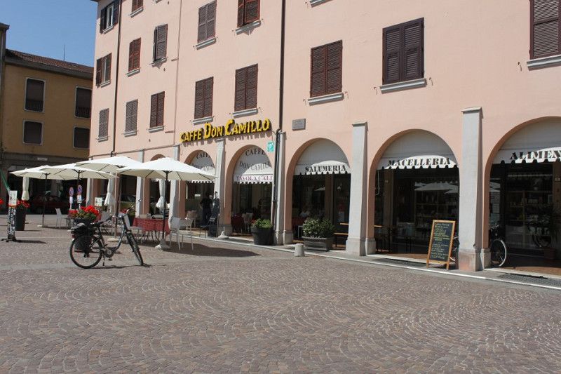
There's not much to report today. On the way from Velden to Caorle we went through countless tunnels, both short and long, some modern and some very old. The paint and concrete were already crumbling from the walls and sometimes water even leaked from the walls, but everything was fine. In Velden it was 21 degrees when we left the motorway and suddenly, after the umpteenth tunnel, it rained non-stop. When we then turned off the motorway and onto the country road, we had to drive over some narrow streets on the way to the campsite. Once we only had a small bridge, 2.20 meters wide, with no warning. Luckily we had a few centimeters to spare on both sides. When we arrived in Caorle we first had to look for the campsite and drove in circles twice until we found the entrance. Once we got to the campsite we headed towards the toilet building. Everything was fine so far, but there is no room by the showers where you can leave your clothes and everything else. That is a drawback at the campsite. Otherwise, it's also more expensive than the price listed by Pro Mobil. We paid €32.40 for two adults and a pitch for one night, a bit pricey, but that's probably due to the location right on the Adriatic.
15. Apr. 2025 -
20. Apr. 2025
Marina di Venezia
Via Montello 6, Cavallino-Treporti, Venezia, Venetien, Italien
45° 26' 11.5" N 12° 26' 28.8" E
45.4365175 12.4413405
• Head northeast. Go for 115 m.
• Turn left. Go for 175 m.
• Turn right. Go for 60 m.
• Turn left. Go for 21 m.
• Turn left toward Via Montello. Go for 89 m.
• Turn left onto Via Montello. Go for 994 m.
• Turn right onto Via Carso. Go for 1.8 km.
• Take the 1st exit from roundabout onto Via Fausta (SP42) toward Ca' Savio/Jesolo. Go for 2.4 km.
• Pass 2 roundabouts and continue on Via Fausta (SP42). Go for 7.6 km.
• Take the 2nd exit from roundabout onto Via Francesco Baracca toward Via F.Baracca/Jesolo. Go for 211 m.
• Pass 3 roundabouts and continue on Via Francesco Baracca. Go for 1.5 km.
• Take the 3rd exit from roundabout onto Via del Granatiere. Go for 90 m.
• Turn right onto Via dell'Artigliere. Go for 502 m.
• Turn left onto Via Danubio. Go for 126 m.
• Turn right onto Via Fausta (SP42). Go for 1.5 km.
• Pass 3 roundabouts and continue on Via Roma Destra (SP42). Go for 4.0 km.
• Keep left toward Autostrade/Trieste/Udine/Venezia/Treviso. Go for 488 m.
• Continue on Via John Lennon. Go for 275 m.
• Continue on Via Adriatico (SR43). Go for 3.2 km.
• Take the 3rd exit from roundabout onto Via Adriatico toward Venezia/Treviso. Go for 4.6 km.
• Take the 2nd exit from roundabout onto Via Adriatico (SR43) toward Venezia/San Donà di Piave/SS14/A4/Autostrade/A27. Go for 3.2 km.
• Take the 5th exit from roundabout onto Via Armellina (SR43) toward Venezia/A4. Go for 1.2 km.
• Take the 2nd exit from roundabout onto Strada Provinciale Portegrandi-Caposile-Jesolo (SP43) toward Venezia. Go for 8.0 km.
• Turn right onto Via Trezze (SP43) toward Trieste/S. Donà. Go for 615 m.
• Turn left onto Via Trieste (SS14). Go for 318 m.
• Turn left onto Strada Statale della Venezia Giulia (SS14) toward Aeroporto/Venezia/A4. Go for 9.7 km.
• Keep right toward Trieste/A4/Milano/A57/Venezia/Treviso/A27/Belluno. Go for 193 m.
• Continue on Raccordo Marco Polo. Go for 5.0 km.
• Take the exit toward Tangenziale/E70/Milano/A4/Bologna/A13 onto A57. Go for 9.1 km.
• Take the exit toward Ravenna/SS309/Marghera. Go for 682 m.
• Take the 3rd exit from Rotonda Romea roundabout toward Padova/Ravenna. Go for 399 m.
• Continue on Strada Statale Romea (SS309). Go for 1.3 km.
• Take the 2nd exit from roundabout onto Strada Statale Romea (SS309) toward Ravenna/Chioggia/Padova/SP81. Go for 1.2 km.
• Take the 3rd exit from roundabout onto Strada Statale Romea (SS309) toward Ravenna. Go for 2.5 km.
• Take the 2nd exit from roundabout onto Strada Statale Romea (SS309) toward Malcontenta. Go for 26.3 km.
• Take the 2nd exit from roundabout toward Ravenna/Chioggia. Go for 241 m.
• Continue on Strada Statale Romea (SS309). Go for 37.9 km.
• Pass 4 roundabouts and continue on Strada Statale Romea (SS309). Go for 44.6 km.
• Take the 3rd exit from roundabout onto Via degli Scariolanti (SP24) toward Casal Borsetti. Go for 2.0 km.
• Take the 1st exit from Rotonda Dello Scirocco roundabout onto Via delle Maone. Go for 1.4 km.
• Take the 2nd exit from Rotonda Del Garbino roundabout onto Via Giovanni Spallazzi. Go for 372 m.
• Turn right onto Via Stefano Ortolani. Go for 166 m.
• Arrive at Via Stefano Ortolani. Your destination is on the right.
☍
186,2 km
(2 hrs. 45 min.)
Day
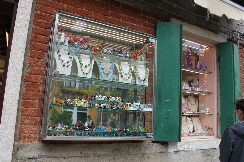
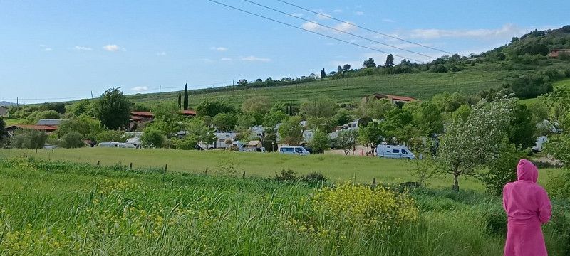
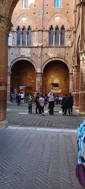
Bericht Marina Di Venezia
Day 1:
First, we arrive, but for that, we first have to go to the check-in area. Before entering the "Marina Di Venezia" area, you have to register, whether you have a reservation or not. Then you receive a brief instruction, a wristband, and a sticker for your windshield stating your expected arrival time. Only then do we go to the large campsite. Luckily, my son was already there and told us where to park our motorhome. We briefly walked through the area where we were supposed to park, chose a spot, and set up our tent. After that, we went to the nearest supermarket to do some shopping. By now, the sun was starting to shine again. Afterward, we cycled across the entire campsite to see what was available. After seeing a lot, we went to a pizzeria just outside Marina Di Venezia. They served very large and delicious pizzas. Afterward, we rounded off the evening with a glass of Italian wine.
Day 2:
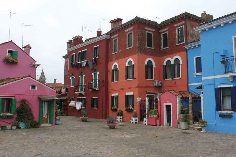
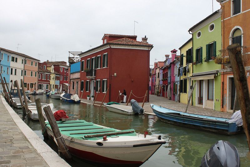
After breakfast we drove to the nearby harbor to take the passenger boats to Burano and Murano. A day ticket cost €25 per person. Unfortunately the first boat left right in front of us and we had to wait for about 45 minutes. After that we went straight to Burano, a very beautiful island with many colorful houses, all the way across the island and then back to the next passenger boat towards Murano. Once there we saw one glass shop after another. Whether they were all original Murano glass shops, who knows. In contrast to Burano, Murano is a bit run down, but all the more expensive. Here too we went all the way across the island and then back to the harbor to start the return trip to the mainland. But the harbor was a madhouse. Masses of tourists and workers, all wanting to get on the next boat. When the boat was full it left without us and we had to wait almost an hour for the next boat. Finally back at the campsite, we headed to the burger restaurant, as we hadn't eaten anything all day except breakfast. Now we'll wind down the day and see what tomorrow brings.
Day 3:
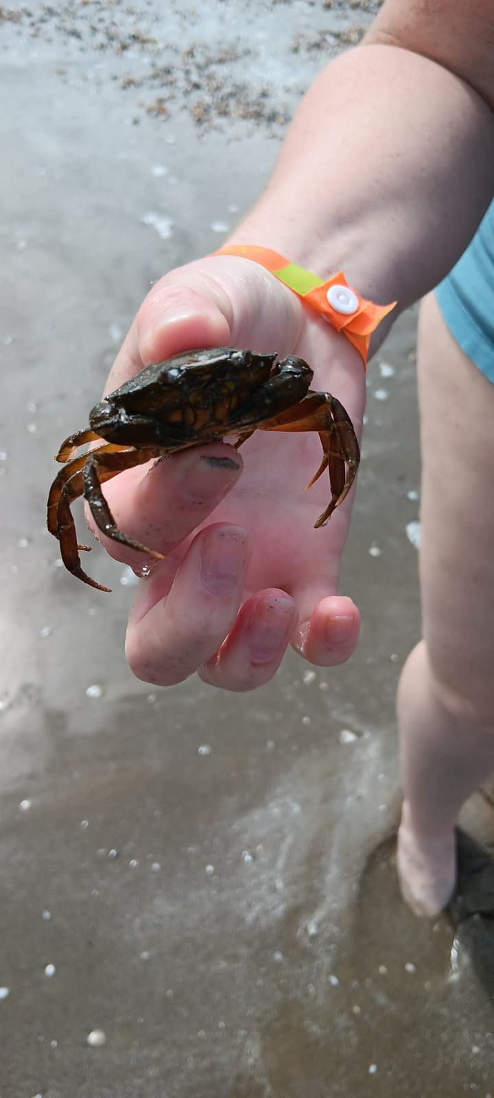
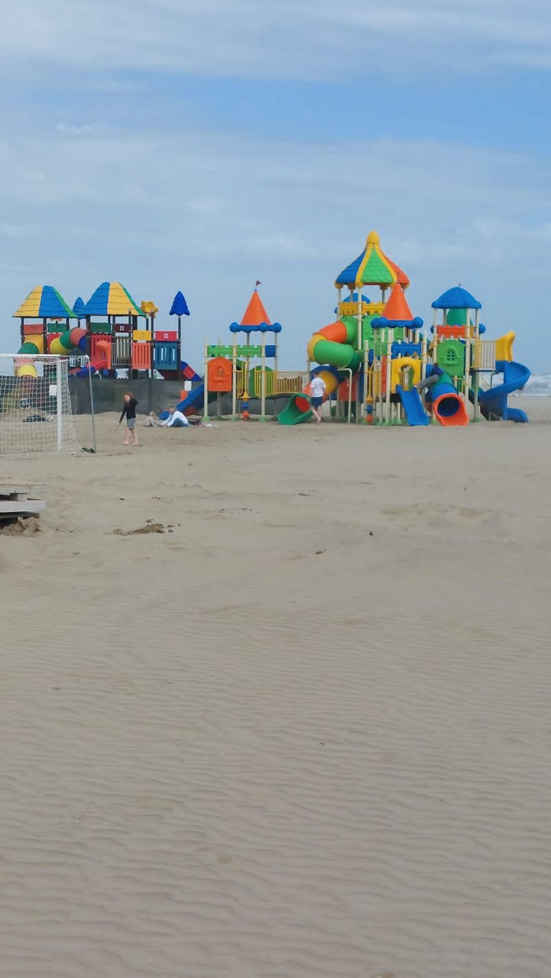
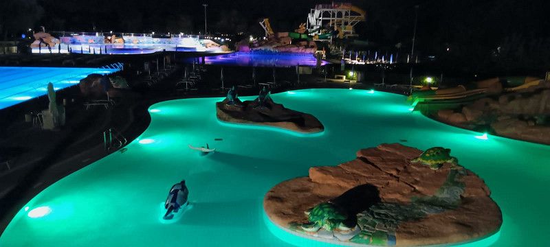
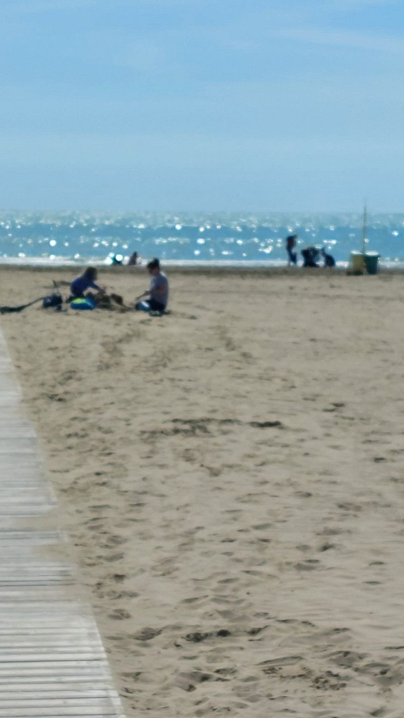
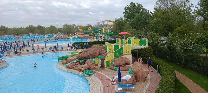
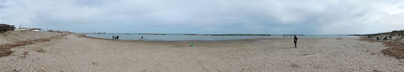
Today was all about relaxing. First, we slept in, had a coffee, and then went to the supermarket here in Marina di Venezia. Then we strolled around a bit, and after lunch, we headed to the water park. In the afternoon, we walked along the beach and dipped our feet in the Adriatic. In the evening, we had ice cream and watched the evening entertainment.
Day 4:
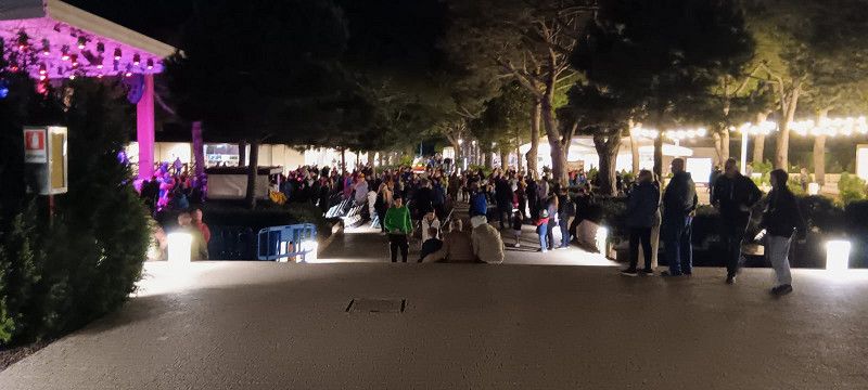
This morning it was very sunny, so we took advantage of it to go to the water park together and simply enjoy the water. We relaxed a bit in the afternoon, had something to eat together in the evening, and then went to the evening program at Marina Di Venezia and let the evening come to a close.
Day 5:
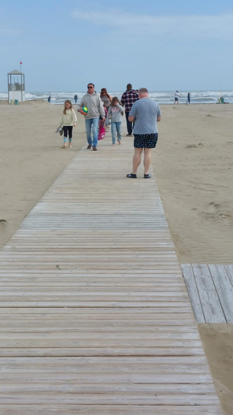
Since the shops were open again today, we went to the local supermarket after breakfast to buy the essentials. Since the sun was really strong again today, we went to the seaside again, into the sea, and collected some shells. In the afternoon, some veil clouds rolled in again, and it was noticeable that it was getting a bit cooler. Since we're leaving the campsite tomorrow and continuing on our journey through Tuscany, we went to a nearby pizzeria together again.
20. Apr. 2025 -
21. Apr. 2025
Area Sosta Mare & Parco
Ravenna, Emilia-Romagna, Italien
44° 33' 0.4" N 12° 16' 46.1" E
44.5500982 12.2794688
• Head toward Via 4 Agosto 1849 on Via Stefano Ortolani. Go for 166 m.
• Turn left onto Via Giovanni Spallazzi. Go for 318 m.
• Take the 2nd exit from Rotonda Del Garbino roundabout onto Via Giovanni Spallazzi. Go for 2.4 km.
• Continue on Viale Italia. Go for 240 m.
• Turn right onto Strada Provinciale delle Valli (SP112). Go for 3.8 km.
• Take the 2nd exit from roundabout onto Via Romea Nord (SS309) toward Ravenna/Autostrada/A14. Go for 7.6 km.
• Keep left onto Via San Vitale Strada Statale (SS309dir) toward Bologna-Bari/A14/Ferrara-Rimini/SS16/Bologna/SP253/Forlì/SS67/Tiberina/SS3bis/E45. Go for 2.0 km.
• Take the 2nd exit from roundabout onto Via San Vitale Strada Statale (SS309dir) toward Bologna-Ancona/A14/SS3bis/E45/SS16/Bologna. Go for 3.4 km.
• Continue on A14dir. Go for 528 m.
• Take the exit toward Ravenna Centro/Rimini/Cesena-Roma/E45 onto SS16 (Via Reale). Go for 6.1 km.
• Take the 2nd exit from roundabout onto Via Classicana (SS16) toward E45/Cesena/Roma/Rimini. Go for 1.1 km.
• Take ramp onto Innesto SS16 Adriatica (SS3bis) toward Ancona/A14/Roma. Go for 111 km.
• Take ramp toward Sansepolcro Sud. Go for 349 m.
• Take the 2nd exit from roundabout onto Strada Statale Senese Aretina (SS73). Go for 622 m.
• Turn right onto Via dei Tarlati toward Chiusi della Verna/Anghiari/Caprese M. Go for 1.3 km.
• Take the 2nd exit from roundabout onto Via dei Tarlati (SP43). Go for 4.4 km.
• Turn left onto Strada Provinciale della Libbia (SP43). Go for 1.3 km.
• Turn left onto Strada Provinciale di Caprese Michelangelo (SP47). Go for 345 m.
• Turn right onto Via della Fossa. Go for 287 m.
• Turn right onto Via della Fossa. Go for 94 m.
• Arrive at Via della Fossa. Your destination is on the right.
☍
147,7 km
(1 hrs. 42 min.)
Day
Bericht Casalborsetti
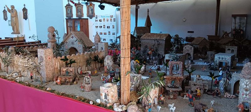
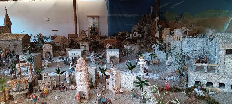
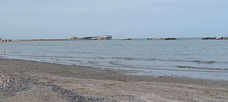
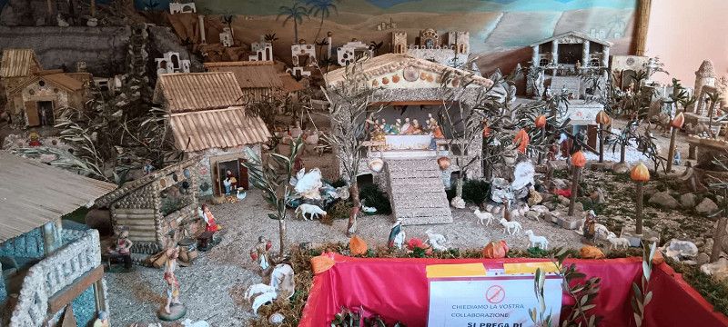
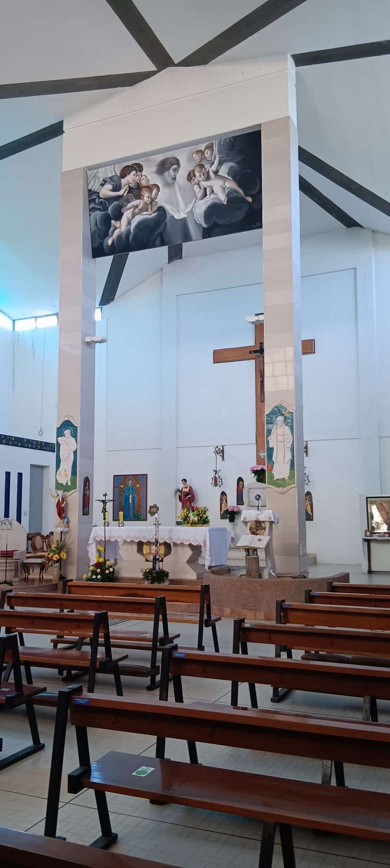
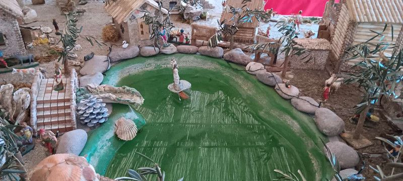
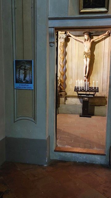
This morning we had to leave Marina di Venezia before 11:00 a.m., otherwise we would have had to pay for another day. But no problem: breakfast, payment, assembly, and at exactly 11:00 a.m. we set off on the next leg. Since I had set Google Maps to motorway and no toll roads, Maps led us across the area via narrow, narrow roads and very broken roads; we won't be doing that again on the next leg. When we arrived in Casalbrosetti, we first drove to the campsite because the reception was closed. So we chose a spot ourselves, and our neighbor said someone would be by in the evening to pay. So first we went to the beach, a bit along the shore, and then a bit through the small town. On the way to the campsite, we found a simple church, not what you're used to. Very plain, but at the entrance there was a large nativity scene with the Crucifixion, which looked fantastic. When we arrived at the campsite, we wanted to pay first, but this turned out to be difficult. The man at reception spoke neither German nor English and tried to make himself understood with Google Translate, but this wasn't very successful. It turned out, however, that we were supposed to go to a different spot. So we tried several times with the translator until we understood what he wanted. We packed everything up again and moved the car to another spot. Apparently there were Germans here too, but we didn't see a single one. We were supposed to park right between two Italians. Well, that's what we did. The spot is nothing special, and you're usually standing on half grass and half dusty sand.
Conclusion: It's okay for one night, but not for longer stays.
21. Apr. 2025 -
22. Apr. 2025
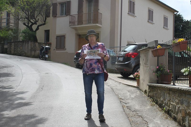
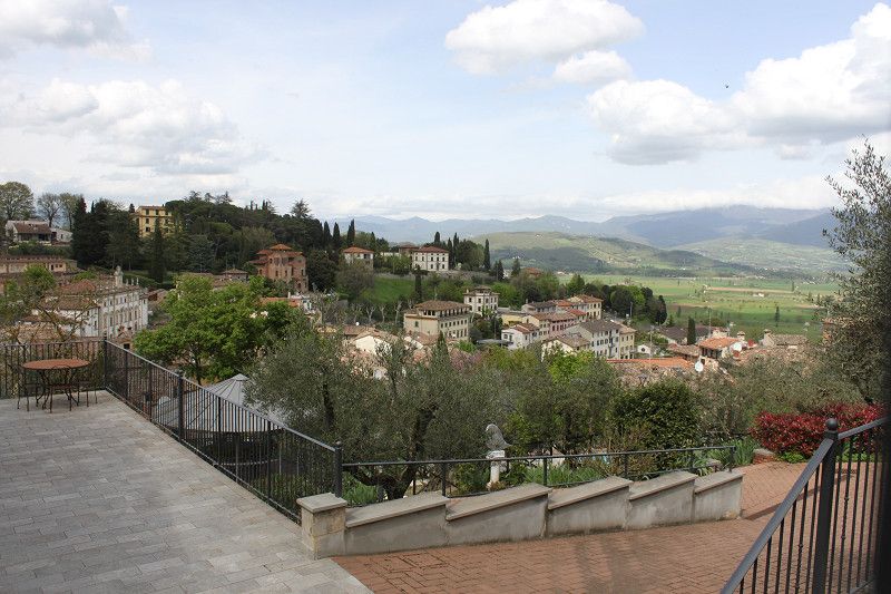
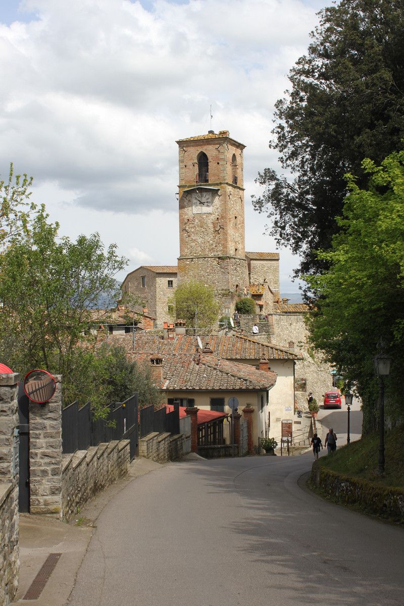
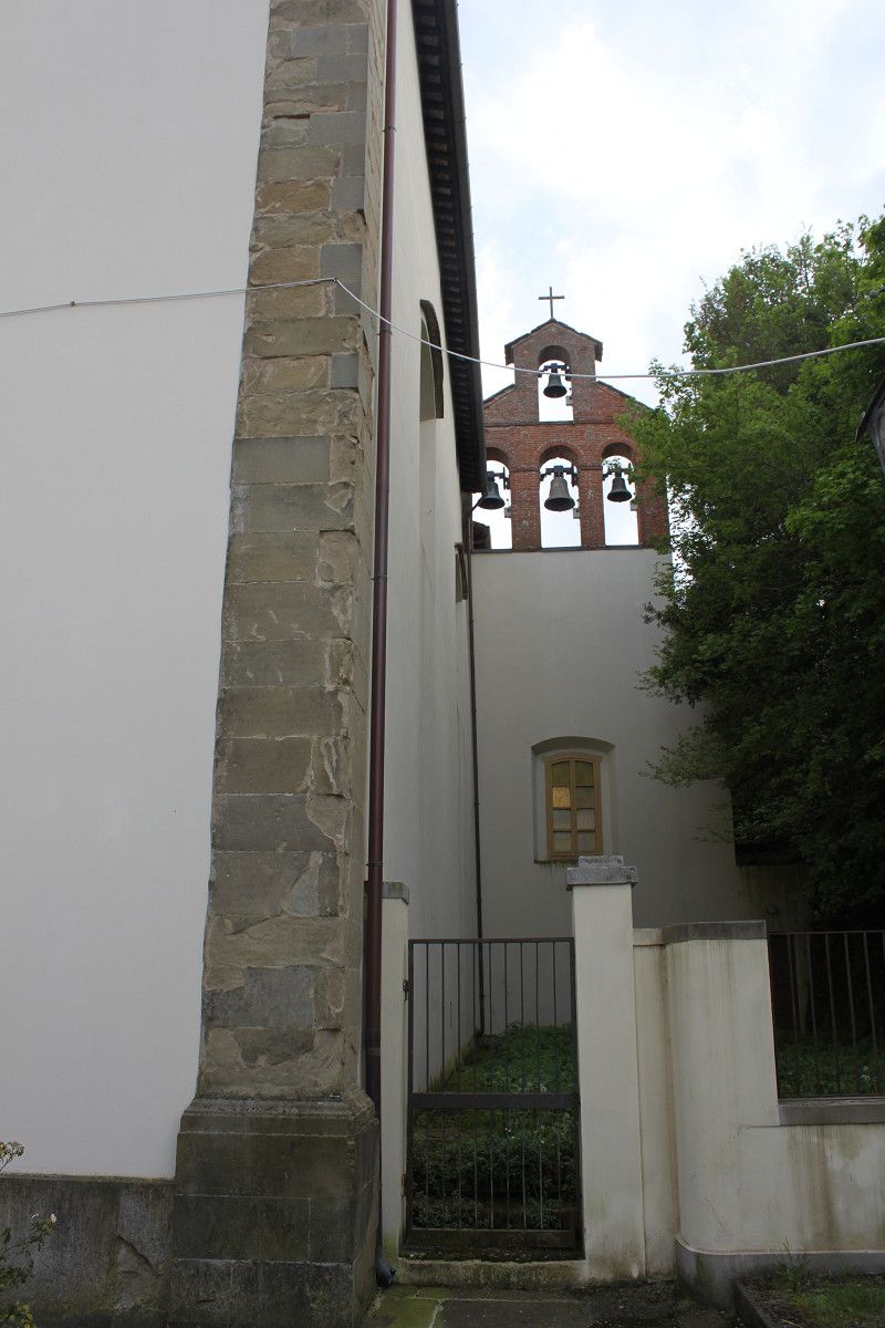
Agriturismo Val della Pieve
Via della Fossa, Anghiari, Arezzo, Toskana, Italien
43° 32' 11.8" N 12° 3' 3.9" E
43.5366022 12.0510837
• Head northeast on Via della Fossa. Go for 94 m.
• Turn left onto Via della Fossa. Go for 287 m.
• Turn left onto Via del Campo della Fiera (SP47). Go for 310 m.
• Turn left onto Via di Caprese Michelangelo (SP43). Go for 20.1 km.
• Turn left onto Località Ponte alla Chiassa (SR71). Go for 212 m.
• Turn right onto Strada Provinciale della Libbia (SP43). Go for 3.0 km.
• Take the 2nd exit from roundabout onto Località Campoluci (SP43). Go for 1.4 km.
• Turn right onto Località Quarata (SP1). Go for 2.3 km.
• Turn right toward Località Ponte a Buriano/SP56. Go for 674 m.
• Turn right onto Località Ponte a Buriano (SP56). Go for 142 m.
• Keep left onto Località Ponte a Buriano (SP1). Go for 3.1 km.
• Turn right. Go for 630 m.
• Turn left toward Strada Comunale Meliciano. Go for 591 m.
• Turn right onto Strada Comunale Meliciano. Go for 54 m.
• Turn left. Go for 110 m.
• Arrive at your destination on the right.
☍
33,0 km
( 35 min.)
Day
22. Apr. 2025 -
23. Apr. 2025
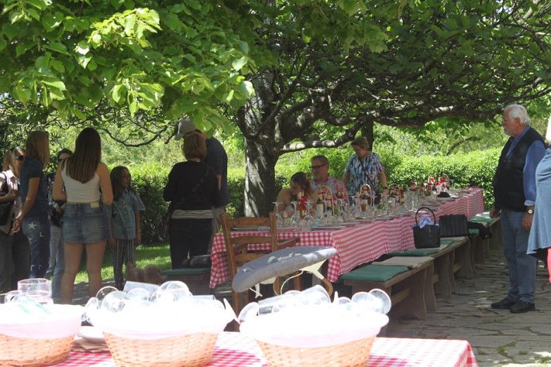
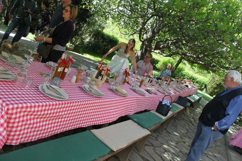
Fattoria La Vialla
Via di Meliciano 26, Castiglion Fibocchi, Arezzo, Toskana, Italien
43° 31' 43.7" N 11° 46' 48.9" E
43.5288067 11.7802463
• Head toward Località Meliciano. Go for 110 m.
• Turn right onto Strada Comunale Meliciano. Go for 54 m.
• Turn left. Go for 591 m.
• Turn right toward Strada Provinciale Setteponti/SP1. Go for 630 m.
• Turn left onto Strada Provinciale Setteponti (SP1). Go for 3.2 km.
• Turn left toward Strada Provinciale Setteponti/SP1. Go for 5.2 km.
• Take the 1st exit from roundabout onto Via di Montione. Go for 1.2 km.
• Turn left onto Via Alessandro e Domenico Scarlatti. Go for 437 m.
• Continue on Via Samuel Morse. Go for 700 m.
• Take ramp onto Raccordo Arezzo-Battifolle toward Autostrada. Go for 1.5 km.
• Keep left onto Raccordo Arezzo-Battifolle toward Firenze/A1/Roma. Go for 5.0 km.
• Take the 2nd exit from roundabout toward Firenze/Roma. Go for 64 m.
• Take ramp onto A1 (Autostrada del Sole) toward Roma. Go for 27.1 km.
• Take the exit toward Valdichiana/Bettolle-Sinalunga/Bettolle/Pienza/Montepulciano/Ospedale Nottola/Torrita di Siena. Go for 419 m.
• Take the 2nd exit from roundabout onto Raccordo Perugia A1 (RA6) toward Ospedale Nottola/Bettolle/Perugia. Go for 25.0 km.
• Take ramp onto Svincolo Tuoro toward Tuoro. Go for 147 m.
• Turn left onto Via Navaccia. Go for 99 m.
• Arrive at Via Navaccia. Your destination is on the left.
☍
71,5 km
( 49 min.)
Day
23. Apr. 2025 -
24. Apr. 2025
Via Navaccia
Perugia, Umbrien, Italien
43° 11' 44.9" N 12° 4' 39.6" E
43.1958065 12.0776529
• Head toward Svincolo Tuoro on Via Navaccia. Go for 99 m.
• Continue toward Strada Statale del Niccone/SS416. Go for 10 m.
• Continue on Strada Statale del Niccone (SS416). Go for 79 m.
• Turn left onto Strada Statale del Niccone (SS416) toward Firenze/Roma/A1/Arezzo/Tuoro/Liscianio Niccone/Umbertide. Go for 81 m.
• Turn left and take ramp onto Raccordo Autostradale Bettolle-Perugia (RA6) toward Firenze/Roma/A1/Arezzo/Castiglion del Lago. Go for 5.5 km.
• Take ramp toward Castiglion del Lago. Go for 298 m.
• Turn left onto Strada Regionale Umbro Casentinese Romagnola (SR71) toward Orvieto/Castiglion del Lago. Go for 907 m.
• Continue on Strada Statale Umbro Casentinese (SS71). Go for 7.1 km.
• Take the 1st exit from roundabout onto Via Fratelli Rosselli toward Chiusi/Chianciano/Pozzuolo/Gioiella. Go for 491 m.
• Take the 2nd exit from roundabout onto Via Marcantoni toward Chiusi-Orvieto/SR71/Roma/A1. Go for 125 m.
• Continue on Piazza Aereonautica. Go for 86 m.
• Continue on Via Matteo Bartoli. Go for 103 m.
• Take the 1st exit from roundabout onto Via Roma (SS71). Go for 567 m.
• Take the 2nd exit from roundabout onto Via Roma (SS71) toward Chiusi-Orvieto/SR71/Roma/A1. Go for 3.4 km.
• Take the 2nd exit from roundabout toward Chiusi/Orvieto. Go for 110 m.
• Continue on Strada Statale Umbro Casentinese (SS71). Go for 2.2 km.
• Pass 2 roundabouts. Go for 12.9 km.
• Take the 2nd exit from roundabout onto Strada Statale del Pasubio (SS146) toward Roma/A1/Città della Pieve/Fabro/Orvieto. Go for 167 m.
• Turn right toward Roma/A1/Orvieto/Fabro. Go for 2.1 km.
• Continue on Via Fondovalle. Go for 117 m.
• Turn left onto Via Fondovalle (SP49). Go for 507 m.
• Take the 2nd exit from roundabout onto Strada Provinciale di Chiusi e del Lago (SP49) toward Roma-Fabro/A1/S.Casciano dei Bagni. Go for 5.6 km.
• Turn right onto Strada Provinciale di Città della Pieve II Tratto (SP308) toward S. Casciano D.B./Palazzone/Piazze. Go for 3.7 km.
• Continue on Strada Provinciale Villa Emma Fabro Ficulle (SP308). Go for 773 m.
• Continue on Villa Emma (SP308). Go for 44 m.
• Continue on Via del Tamburino (SP82). Go for 1.1 km.
• Turn left onto Via Provinciale (SS321). Go for 19.6 km.
• Keep right onto Strada Regionale Cassia (SR2) toward Siena/Abbadia S. S./Radicofani/Piancastagnaio. Go for 1.8 km.
• Turn left onto Strada Provinciale del Monte Amiata (SP18) toward Grosseto/Abbadia S.S./Piancastagnaio/Castellazzara. Go for 733 m.
• Turn slightly left onto Traversa Cassia Aurelia (SP20) toward Castell'Azzara/Pistoia. Go for 4.3 km.
• Continue on Strada Provinciale Pitiglianese (SP134). Go for 4.8 km.
• Turn left onto Strada Provinciale Pitigliano-Santa Fiora (SP4). Go for 14.6 km.
• Turn right onto Via della Madonnina (SP22). Go for 69 m.
• Turn right onto Piazza del Municipio (SP22). Go for 42 m.
• Turn left onto Via Ildebrando da Sovana (SP22). Go for 25.3 km.
• Turn left onto Strada Provinciale Follonata (SP10). Go for 9.6 km.
• Turn right onto Strada Vicinale della Peschiera. Go for 1.4 km.
• Turn left onto Strada Vicinale della Peschiera. Go for 823 m.
• Arrive at Strada Vicinale della Peschiera. Your destination is on the left.
☍
131,1 km
(2 hrs. 5 min.)
Day
24. Apr. 2025 -
25. Apr. 2025
Strada Vicinale della Peschiera
Grosseto, Toskana, Italien
42° 39' 16.9" N 11° 29' 15.3" E
42.6546807 11.4875779
• Head east on Strada Vicinale della Peschiera. Go for 823 m.
• Turn right onto Strada Vicinale della Peschiera. Go for 1.4 km.
• Turn right onto Strada Provinciale Follonata (SP10). Go for 5.1 km.
• Turn right onto Strada Provinciale Scansanese (SP159). Go for 19.6 km.
• Take the 2nd exit from roundabout onto Strada Provinciale Amiatina (SP160). Go for 1.1 km.
• Turn right onto Via della Botte. Go for 67 m.
• Continue on Via Guglielmo Marconi. Go for 436 m.
• Turn right onto Strada Provinciale Scansanese (SP159). Go for 509 m.
• Continue on Via Scansanese. Go for 47 m.
• Take the 2nd exit from roundabout onto Via Scansanese. Go for 83 m.
• Continue on Strada Provinciale Scansanese (SP159). Go for 21.3 km.
• Turn right onto Via dei Laghi (SP42). Go for 4.7 km.
• Turn right onto Via Batignanese. Go for 57 m.
• Continue on Via Rosellana. Go for 25 m.
• Continue on Via Batignanese. Go for 1.8 km.
• Continue on Via Batignanese Canonica. Go for 233 m.
• Turn left and take ramp onto Strada di Grande Comunicazione Grosseto-Fano (SS223) toward Siena. Go for 51.1 km.
• Take the 2nd exit from roundabout onto Strada di Grande Comunicazione Grosseto-Fano (SS223) toward A1/Autostrada/Siena. Go for 10.4 km.
• Take left ramp onto Circonvallazione Nuova toward Siena Centro/Bologna/A1/Firenze. Go for 1.5 km.
• Take ramp toward Siena Sud/Centro/Cassia/SS2. Go for 93 m.
• Take the 3rd exit from Strada Massetana Romana roundabout onto Strada Massetana Romana (SP6) toward Porta S. Marco. Go for 705 m.
• Take the 1st exit from roundabout onto Strada Massetana Romana (SP6). Go for 532 m.
• Take the 2nd exit from roundabout onto Strada Massetana Romana (SP6) toward Centro/Busturistici/Firenze/A1. Go for 278 m.
• Turn right onto Strada Massetana. Go for 295 m.
• Arrive at Strada di Pescaia. Your destination is on the right.
☍
122,1 km
(1 hrs. 46 min.)
Day
25. Apr. 2025 -
26. Apr. 2025
Strada di Pescaia
Siena, Toskana, Italien
43° 18' 37.7" N 11° 19' 1.9" E
43.3104844 11.3171993
• Head north on Strada di Pescaia. Go for 49 m.
• Make a U-Turn onto Strada di Pescaia. Go for 186 m.
• Keep right toward Tangenziale Siena Ovest. Go for 107 m.
• Take ramp onto Tangenziale Siena Ovest toward Firenze. Go for 30.3 km.
• Take ramp toward Poggibonsi Nord/S. Gimignano/Certaldo/Zona Industriale Fosci. Go for 673 m.
• Take the 2nd exit from roundabout toward Certaldo/SR429/Zona Industriale Fosci. Go for 137 m.
• Continue on Collegamento Siena-Firenze SS429 (SR429bis). Go for 2.3 km.
• Continue on Strada Regionale di Val d'Elsa (SR429). Go for 2.1 km.
• Pass 3 roundabouts and continue on Strada Regionale di Val d'Elsa (SR429). Go for 7.5 km.
• Take the 3rd exit from roundabout onto Strada Regionale di Val d'Elsa (SR429) toward Empoli. Go for 9.9 km.
• Take the 2nd exit from roundabout onto Via Niccolò Machiavelli toward Montaione/Empoli. Go for 949 m.
• Take the 3rd exit from roundabout onto Viale Luigi Zanini (SP4) toward Montaione/Gambassi. Go for 415 m.
• Take the 1st exit from roundabout onto SR429var. Go for 4.9 km.
• Continue on SR429var. Go for 855 m.
• Pass 4 roundabouts and continue on Strada Regionale di Val d'Elsa (SR429var). Go for 10.7 km.
• Take the 2nd exit from roundabout onto Strada di Grande Comunicazione Fi-Pi-Li toward Pisa/Livorno/S.G.C. FI-PI-LI. Go for 30.9 km.
• Take ramp onto Strada di Grande Comunicazione Fi-Pi-Li toward Aeroporto G. Galilei/Genova/A12/Firenze/A11/Pisa. Go for 17.7 km.
• Take ramp onto Via Ponte A Piglieri (SS1) toward Pisa. Go for 453 m.
• Pass 6 roundabouts and continue on Via Aurelia Madonna dell'Acqua (SS1). Go for 4.9 km.
• Turn right onto Via delle Palanche (SP59). Go for 1.5 km.
• Turn left onto Via Ernesto Che Guevara (SP9). Go for 864 m.
• Take the 1st exit from roundabout onto Via Ernesto Che Guevara (SP9). Go for 86 m.
• Arrive at Via Ernesto Che Guevara (SP9). Your destination is on the left.
☍
127,4 km
(1 hrs. 41 min.)
Day
26. Apr. 2025 -
27. Apr. 2025
Via Che Guevara
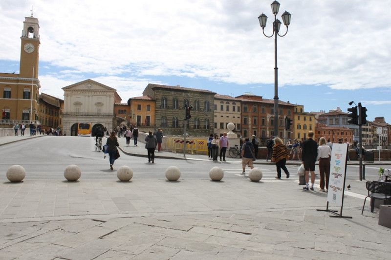
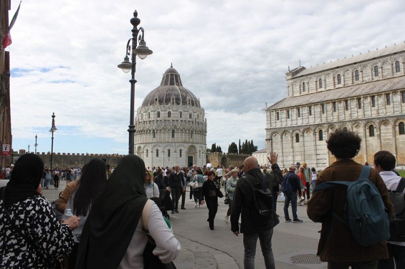
Pisa, Toskana, Italien
43° 45' 28.3" N 10° 23' 18.1" E
43.7578525 10.3883648
• Head south on Via Ernesto Che Guevara (SP9). Go for 14 m.
• Take the 2nd exit from roundabout onto Via Ernesto Che Guevara (SP9). Go for 900 m.
• Turn right onto Via delle Palanche (SP59). Go for 1.5 km.
• Turn right onto Via Aurelia Madonna dell'Acqua (SS1). Go for 26 m.
• Turn right onto Via Aurelia Madonna dell'Acqua (SS1). Go for 4.8 km.
• Turn right toward Genova/A12/Livorno/E80/Rosignano Marittimo/Firenze/Roma. Go for 82 m.
• Continue on Autostrada Firenze Mare toward Genova/A12/Livorno/E80/Rosignano Marittimo/Firenze/Roma. Go for 76.2 km.
• Take the exit toward Roma/Siena onto A1 (Autostrada del Sole). Go for 20.1 km.
• Take the exit toward Firenze Sud/Forlì onto SP127 (Raccordo Di Varlungo). Go for 4.5 km.
• Continue on Via Generale Carlo Alberto Dalla Chiesa toward Settignano/Stadio Coverciano/Fiesole. Go for 834 m.
• Turn right. Go for 52 m.
• Arrive at your destination on the right.
☍
109,0 km
(1 hrs. 6 min.)
Day
27. Apr. 2025 -
29. Apr. 2025
Via Generale Dalla Chiesa
Via Generale Dalla Chiesa 1-3, Florenz, Firenze, Toskana, Italien
43° 45' 55.7" N 11° 18' 57" E
43.7654770 11.3158408
• Head north. Go for 52 m.
• Turn right onto Via Generale Carlo Alberto Dalla Chiesa (SS67). Go for 489 m.
• Take the 4th exit from Piazzale Renato Cappugi roundabout onto Via Aretina (SS67) toward Centro/A1/Autostrade/A11/Siena. Go for 1.5 km.
• Continue on Via Enrico De Nicola. Go for 204 m.
• Turn left onto Ponte Paolo Borsellino (SP127) toward Aeroporto A. Vespucci/Autostrade/A11/A1/Siena-Pisa/Via Villamagna/Bagno a Ripoli. Go for 3.7 km.
• Take left ramp onto A1 (Autostrada del Sole) toward Bologna/Siena/Firenze/A11/Pisa Nord. Go for 38.8 km.
• Keep right onto A1var toward Bologna/Barberino. Go for 39.1 km.
• Continue on A1 (Autostrada del Sole). Go for 94.6 km.
• Take the exit toward Terre di Canossa/Campegine. Go for 1.4 km.
• Take the 2nd exit from roundabout onto Strada Provinciale Poviglio Caprara Calerno Montecchio (SP111) toward Mantova/Boretto/Poviglio/Castelnovo di Sotto. Go for 2.2 km.
• Take the 2nd exit from roundabout onto Asse Nord-Sud di Val d'Enza (SP111). Go for 1.9 km.
• Take the 3rd exit from roundabout onto Asse Nord-Sud di Val d'Enza (SP111). Go for 927 m.
• Pass 5 roundabouts and continue on SP111. Go for 11.3 km.
• Take the 3rd exit from roundabout onto Via Argine (SP62r). Go for 191 m.
• Turn left onto Via Tre Ponti. Go for 338 m.
• Turn right onto Via Geometra Pompeo Mingori. Go for 110 m.
• Turn right onto Via Geometra Pompeo Mingori. Go for 55 m.
• Turn right onto Via Viazza. Go for 34 m.
• Arrive at Via Viazza. Your destination is on the right.
☍
196,8 km
(2 hrs. 1 min.)
Day
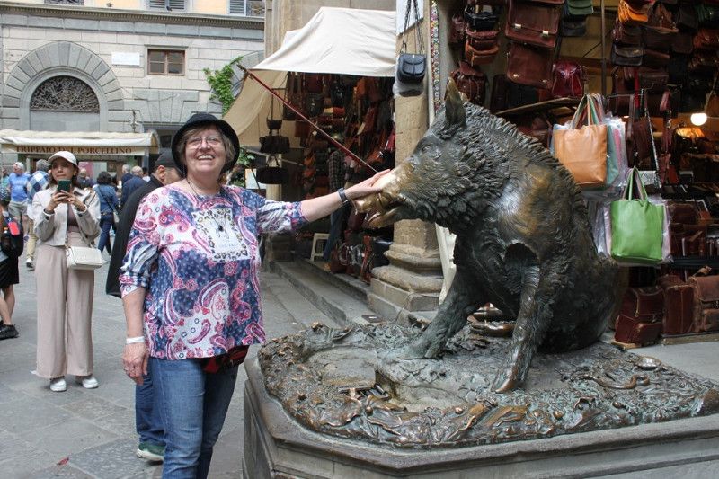
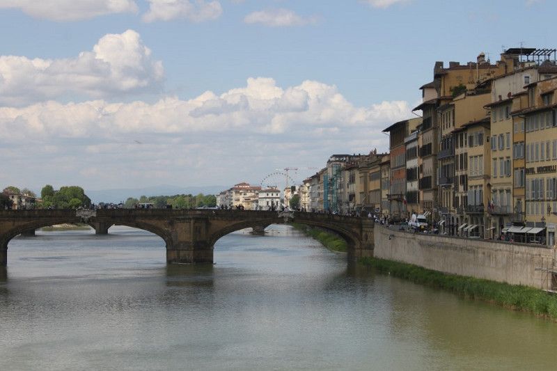
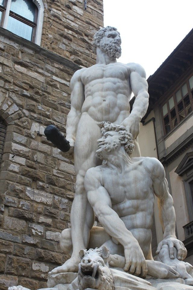
Bericht Florenz
1 day:
This morning we went to the hotel next to the campsite for breakfast and had a really delicious breakfast. Then we packed up and headed off towards Florence. I was always worried that some crazy person would drive in front of us and try to pull the mirror trick. But it all went well and we were in Florence in no time. We went straight to the campsite that had been recommended to us on Facebook. I had reserved a two-night stay two days in advance so we could get a spot. We checked in and in no time we were at the campsite and spent the rest of the day relaxing, so we could go to Florence tomorrow to do some sightseeing. But first we had to do some laundry and in the evening we went to the attached restaurant and ate a delicious pizza.
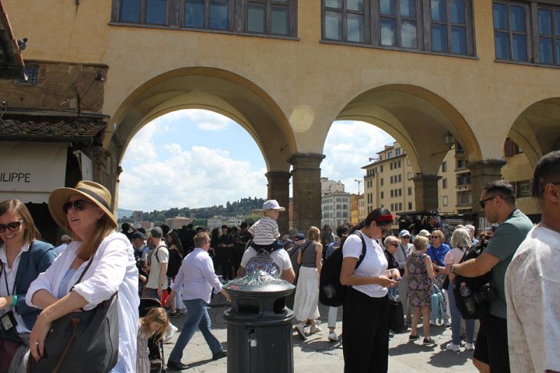
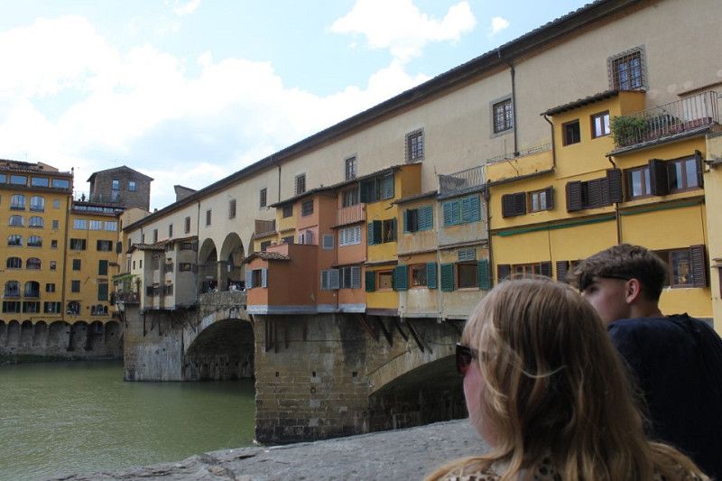
Day 2: After a quick breakfast, we took the bus toward Florence city center. There's a bus stop right in front of the campsite, and from there, you can take bus number 14 directly to Florence Cathedral. We circled the cathedral once, then headed toward Ponte Veccio and back through various side streets. The city was very crowded and hot, but it was worth it. Afterward, we found a bus stop where bus number 14A departed and headed back to the campsite. We did some shopping at the campsite market and, because it was so hot, took a dip in the cool water of the pool. In the evening, we went back to the campsite restaurant to end the day.
Day
28. Apr. 2025 -
29. Apr. 2025
Via Viazza
Via Viazza 15, Boretto, Reggio nell'Emilia, Emilia-Romagna, Italien
44° 54' 11.3" N 10° 32' 3" E
44.9031399 10.5341610
• Head toward Via Geometra Pompeo Mingori on Via Viazza. Go for 183 m.
• Turn left onto Via Fratelli Cervi. Go for 37 m.
• Continue on Via Anteo Carrara. Go for 763 m.
• Continue on Via Papa Giovanni XXIII. Go for 646 m.
• Continue on Via Umberto I. Go for 77 m.
• Continue on Viale Umberto I. Go for 106 m.
• Take the 2nd exit from roundabout onto Viale Umberto I. Go for 132 m.
• Continue on Via Umberto I. Go for 362 m.
• Turn right onto Via Argine (SP62r). Go for 4.9 km.
• Turn left onto SP62r. Go for 2.7 km.
• Take the 2nd exit from roundabout onto Via Cisa Ligure (SP62r). Go for 701 m.
• Take the 1st exit from roundabout onto Circonvallazione Di Via Ferrara. Go for 373 m.
• Take the 2nd exit from roundabout onto Via Nicola Sacco e Bartolomeo Vanzetti (SP42). Go for 190 m.
• Take the 2nd exit from roundabout onto Via Nicola Sacco e Bartolomeo Vanzetti. Go for 986 m.
• Take the 3rd exit from roundabout onto Via Nicola Sacco e Bartolomeo Vanzetti. Go for 205 m.
• Turn right onto Strada Statale della Cisa Veneta (SP62r). Go for 1.7 km.
• Continue on Via Staffola (SP2). Go for 14 m.
• Take the 1st exit from roundabout onto Via Staffola (SP2). Go for 2.1 km.
• Take the 3rd exit from roundabout onto Strada Provinciale Variante Cispadana (SP62rvar). Go for 7.0 km.
• Continue on Viale Karl Marx (SP49). Go for 862 m.
• Pass 4 roundabouts and continue on Strada Provinciale Ovest (SP49). Go for 7.6 km.
• Take the 3rd exit from roundabout onto A22 (Autostrada del Brennero) toward Autostrada/Brennero/Verona/Milano-Venezia/A4. Go for 70.8 km.
• Take the exit toward Affi/Lago di Garda Sud. Go for 989 m.
• Take the 3rd exit from roundabout toward Peschiera/SS450. Go for 337 m.
• Take the 1st exit from roundabout toward Caprino/Affi/Garda/Cavaion/Brenzone. Go for 223 m.
• Continue toward Via Costabella/SP9. Go for 99 m.
• Take the 1st exit from roundabout onto Via Costabella (SP9) toward Caprino V.Se/SP29/Costermano/Garda/S. Zeno M./Malcesine/SR249. Go for 227 m.
• Take the 2nd exit from roundabout onto Via Costabella (SP9). Go for 623 m.
• Keep left toward Prada/S.Zeno di M./Garda/Bardolino. Go for 114 m.
• Keep right onto Via Costabella (SP9) toward Costermano/Garda/SP8/S.Zeno M./SS249/Malcesine. Go for 2.3 km.
• Pass 2 roundabouts and continue on Via 1 Maggio (SP9). Go for 2.1 km.
• Take the 3rd exit from roundabout onto Via della Repubblica toward Garda/SP8/Torri D.B./SR249/Brenzone. Go for 289 m.
• Turn right onto Via Stazione (SP8). Go for 269 m.
• Pass 4 roundabouts and continue on Via Don Carlo Gnocchi (SP8). Go for 3.2 km.
• Take the 1st exit from roundabout onto Corso Italia (SR249) toward Brenzone/Riva/Malcesine/Torri del Benaco. Go for 20.3 km.
• Pass 2 roundabouts and continue on Via Gardesana (SR249). Go for 2.6 km.
• Arrive at Via Gardesana (SR249). Your destination is on the right.
☍
135,9 km
(1 hrs. 57 min.)
Day
30. Apr. 2025 -
02. May. 2025
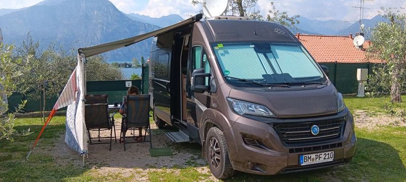
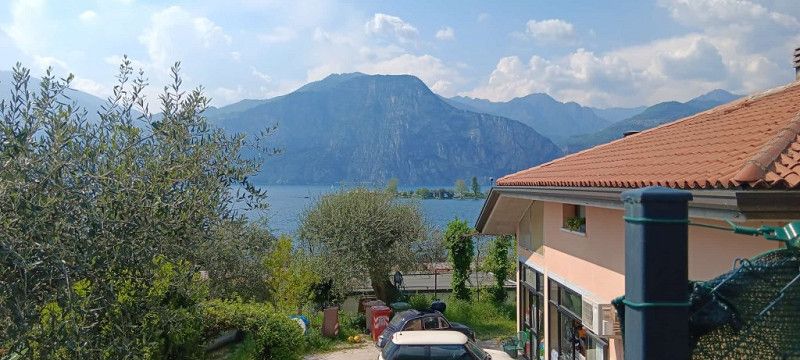
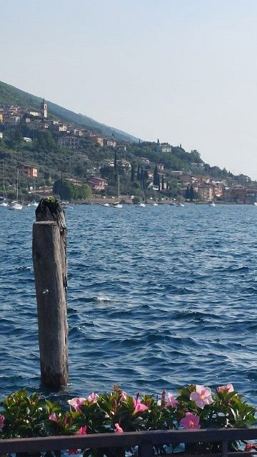
Wohnmobilstellplatz Camping Punto Verde in Brenzone
Via Gardesana 64, Assenza, Verona, Italien
45° 43' 44.4" N 10° 46' 54.8" E
45.7290104 10.7818836
• Head north on Via Gardesana (SR249). Go for 3.0 km.
• Pass 3 roundabouts and continue on Via Gardesana (SR249). Go for 10.3 km.
• Continue on Strada Statale Gardesana Orientale (SS249). Go for 5.5 km.
• Take the 1st exit from roundabout onto Strada Statale di Loppio e Val di Ledro (SS240) toward Autostrada/A22/Nago/Rovereto. Go for 1.9 km.
• Pass 3 roundabouts and continue on Località Loppio (SS240). Go for 11.4 km.
• Keep right toward Brennero/Modena. Go for 196 m.
• Take ramp onto A22 (Autostrada del Brennero) toward Brennero/Trento. Go for 167 km.
• Continue on A13 (Brennerpass). Go for 31.7 km.
• Keep right onto A13 (Knoten Innsbruck-Berg Isel) toward Bregenz/Garmisch/Innsbruck-West. Go for 2.0 km.
• Continue on A12 (Inntal Autobahn). Go for 35.0 km.
• Take exit 113 toward Mötz/Reutte/Fernpass. Go for 319 m.
• Turn right onto Mötzer Landesstraße (L236). Go for 4.8 km.
• Take the 2nd exit from roundabout onto Mieminger Bundesstraße (B189) toward Reutte/Fernpaß/Nassereith. Go for 13.4 km.
• Keep left onto Mieminger Bundesstraße (B189) toward Reutte/Garmisch. Go for 91 m.
• Continue on Fernpass Bundesstraße (B179). Go for 49.1 km.
• Continue on Grenztunnel Füssen (A7). Go for 1.7 km.
• Take exit 139 toward Füssen/Kaufbeuren/Pfronten/Rieden am Forggensee. Go for 262 m.
• Turn left onto B310 toward Kaufbeuren/Rieden am Forggensee. Go for 3.6 km.
• Turn right onto Augsburger Straße (B16) toward Schwangau/Krankenhaus Füssen/Hopfen am See/Königsschlösser. Go for 290 m.
• Take the 1st exit from roundabout onto Hopfener Straße (St2008) toward Seeg/Hopfen/Fachklinik/Enzensberg. Go for 320 m.
• Turn left onto Abt-Hafner-Straße. Go for 226 m.
• Turn left onto Abt-Hafner-Straße. Go for 17 m.
• Turn left. Go for 41 m.
• Turn left. Go for 19 m.
• Turn right. Go for 63 m.
• Arrive at your destination on the right.
☍
342,5 km
(4 hrs. 8 min.)
Day
02. May. 2025 -
03. May. 2025
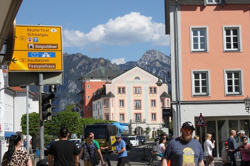
Wohnmobilplatz Füssen Camper's Stop
Abt-Hafner-Straße 9, Füssen, Landkreis Ostallgäu, Bayern, Deutschland
47° 34' 53" N 10° 42' 3.9" E
47.5813979 10.7010944
• Head north. Go for 31 m.
• Turn left. Go for 20 m.
• Turn right toward Abt-Hafner-Straße. Go for 73 m.
• Turn right onto Abt-Hafner-Straße. Go for 17 m.
• Turn right onto Abt-Hafner-Straße. Go for 226 m.
• Turn right onto Hopfener Straße (St2008). Go for 319 m.
• Take the 2nd exit from roundabout onto Augsburger Straße (B16) toward A7/Ulm/Innsbruck/Kaufbeuren/Kempten/B310. Go for 348 m.
• Turn left onto B310 toward Ulm/A7/Innsbruck/Kempten/Pfronten/Weißensee/Gewerbegebiet Füssen-West. Go for 3.5 km.
• Take ramp onto A7. Go for 108 km.
• Take exit 122 toward Ulm/Neu-Ulm/Senden onto B28. Go for 10.6 km.
• Take ramp toward Neu-Ulm/Gewerbegebiet Neu-Ulm. Go for 356 m.
• Turn left onto Europastraße (B10) toward Wiblingen. Go for 159 m.
• Take the 2nd exit from roundabout onto Wiblinger Straße (St2021) toward Neu-Ulm. Go for 526 m.
• Turn left onto Öschweg. Go for 125 m.
• Turn left. Go for 41 m.
• Turn right. Go for 28 m.
• Arrive at your destination on the left.
☍
124,8 km
(1 hrs. 8 min.)
Day
03. May. 2025 -
04. May. 2025
Wohnmobilstellplatz am Donaubad
Öschweg 6, Neu-Ulm, Landkreis Neu-Ulm, Bayern, Deutschland
48° 22' 59.5" N 9° 59' 8.2" E
48.3831906 9.9856068
• Head east. Go for 28 m.
• Turn left toward Öschweg. Go for 41 m.
• Turn right onto Öschweg. Go for 125 m.
• Turn left onto Wiblinger Straße (St2021). Go for 593 m.
• Turn left and take ramp onto B10. Go for 1.8 km.
• Keep right toward Wallstraßenbrücke/B10. Go for 578 m.
• Continue on Wallstraßenbrücke (B10). Go for 6.2 km.
• Take ramp onto A8 toward Stuttgart. Go for 27.3 km.
• Take the exit. Go for 406 m.
• Turn sharp left onto K1431 toward Wiesensteig/Westerheim. Go for 1.7 km.
• Continue on Lämmerbuckel (K1431). Go for 257 m.
• Turn right onto Lämmerbuckel (L1236). Go for 2.4 km.
• Turn left onto Hauptstraße (L1200). Go for 2.6 km.
• Turn left onto K1430 toward Schopfloch. Go for 3.4 km.
• Continue on K1247. Go for 2.4 km.
• Turn right onto L1212. Go for 2.0 km.
• Turn left onto K1250. Go for 223 m.
• Turn left. Go for 225 m.
• Arrive at your destination on the right.
☍
52,3 km
( 40 min.)
Day
04. May. 2025 -
05. May. 2025
Albengel
6, Lenningen, Landkreis Esslingen, Baden-Württemberg, Deutschland
48° 33' 43.4" N 9° 31' 27.5" E
48.5620427 9.5243194
• Head toward Torfgrube. Go for 225 m.
• Turn left onto K1250. Go for 1.1 km.
• Continue on Schmalzgrube (K1250). Go for 192 m.
• Continue on K1250. Go for 609 m.
• Continue on Schopflocher Straße (K1250). Go for 114 m.
• Continue on Bissinger Straße (K1250). Go for 313 m.
• Continue on K1250. Go for 4.0 km.
• Continue on Dachsbühl (K1250). Go for 520 m.
• Continue on K1250. Go for 127 m.
• Turn left onto K1250. Go for 876 m.
• Take the 1st exit from roundabout onto Bissinger Straße (K1250). Go for 260 m.
• Continue on Neue Straße (K1250). Go for 1.3 km.
• Continue on K1250. Go for 1.0 km.
• Take the 1st exit from roundabout onto K1250. Go for 199 m.
• Turn right onto B465 toward A8/Kirchheim u. Teck/Dettingen u. Teck. Go for 1.4 km.
• Take ramp onto A8 toward Karlsruhe. Go for 38.4 km.
• Continue on A8 toward Karlsruhe/Basel/Leonberg-West. Go for 53.8 km.
• Take the exit toward Frankfurt a.M./Mannheim/Karlsruhe/Landau (Pfalz) onto A5 (Autobahndreieck Karlsruhe). Go for 105 km.
• Continue on E35 (Darmstädter Kreuz) toward Köln/Wiesbaden/Mainz/A67. Go for 952 m.
• Continue on A67. Go for 22.2 km.
• Take the left exit toward Köln/Wiesbaden onto A3. Go for 139 km.
• Take exit 32 toward Bonn/Flughafen Köln-Bonn/Siegburg/Sankt Augustin onto A560. Go for 7.6 km.
• Take the left exit toward Königswinter/Bonn onto A59. Go for 3.2 km.
• Take exit 40 toward Koblenz/Bonn onto A565. Go for 5.0 km.
• Take exit 4 toward Köln-Süd onto A555. Go for 9.3 km.
• Take exit 5 toward Wesseling. Go for 445 m.
• Continue on Siebengebirgsstraße (L192). Go for 145 m.
• Take the 1st exit from roundabout onto Ahrstraße (L192) toward Köln/Bonn/W.-Urfeld. Go for 757 m.
• Turn right onto Ludwigshafener Straße (L192). Go for 34 m.
• Continue on Willy-Brandt-Straße (L300). Go for 2.0 km.
• Turn right onto Gartenstraße. Go for 122 m.
• Turn right onto Am Neuen Garten. Go for 154 m.
• Turn right onto Römerstraße. Go for 74 m.
• Turn left onto Bahnhofstraße. Go for 18 m.
• Arrive at Bahnhofstraße. Your destination is on the right.
☍
400,8 km
(3 hrs. 44 min.)
Day
05. May. 2025 -
05. May. 2025
Wesseling
Rhein-Erft-Kreis, Nordrhein-Westfalen, Deutschland
50° 49' 29" N 6° 58' 51.9" E
50.8247166 6.9810852