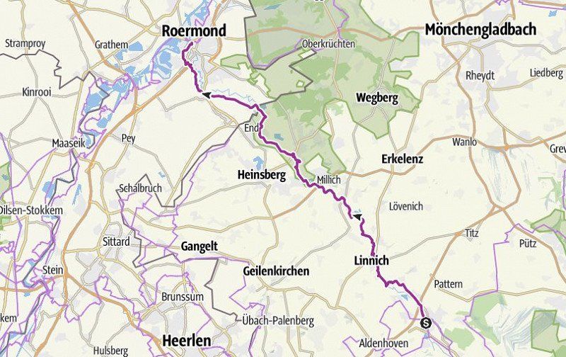
Biking close to nature on the newly designed RurUfer cycle path between the source of the Rur in the High Fens near Botrange (Belgium) and the mouth of the Maas near Roermond (Netherlands).
We love river bike trails and our RV. The combination of both is not entirely trivial.
There are actually only two options:
1 - You drive a distance and then back again to get back to the Womo.
2 - You drive a stage and use public transport to come back to catch up/relocate the Womo.
Advantages and disadvantages:
1 - The river is then twice as long, since all routes are driven twice. Sometimes that's not so bad, the route suddenly looks completely different on the way back or other things catch your eye. If you choose the parking space in the middle of the stage, you can drive "back" one day and "forward" the next day, so you always stand for two days and then move to the middle of the next stage.
2 - On the larger rivers such as the Rhine and Main, there are often good and frequently traveled railway lines with which you can come back to catch up with the camper. On smaller rivers this is more difficult and you still have to keep an eye on the timetable, which puts some pressure on the tour. The distance from the train station and the parking space, which you then have to walk to, is also important, or you have to cycle to the train station.
At the Rur we tried a combination.
Day
ehemaliger Bahnhof Kalterherberg
is now used as a trolley station. Good starting point for the journey to the starting point of the first stage.
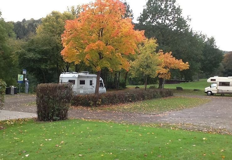
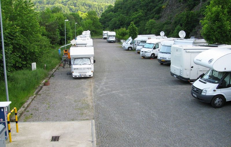
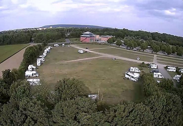
Have big parking lot. NO designated WOMO parking space. We stayed there and it didn't bother anyone.
Küchelscheid 36, 4750 Bütgenbach, Belgien
50° 31' 12.2" N 6° 12' 21.1" E
50.5200434 6.2058709
• Head toward Auf dem Hau on Am Breitenbach. Go for 132 m.
• Continue on Bahnhofstraße. Go for 1.3 km.
• Turn left onto B399. Go for 3.5 km.
• Turn left onto Schwingsborn (B258). Go for 4.1 km.
• Take the 2nd exit from roundabout onto Burgring (B258) toward Aachen/A44. Go for 2.7 km.
• Take the 1st exit from roundabout onto Karweg (L246) toward Düren. Go for 745 m.
• Pass 2 roundabouts and continue on Hauptstraße (L246). Go for 3.7 km.
• Turn right onto Kammerbruchstraße (L166) toward A1/Euskirchen/Gemünd/Rursee. Go for 3.1 km.
• Turn left onto L166 toward Rurberg/Rursee. Go for 4.2 km.
• Continue on L128. Go for 1.1 km.
• Turn sharp left toward In den Brüchen. Go for 272 m.
• Turn left onto In den Brüchen. Go for 144 m.
• Arrive at In den Brüchen. Your destination is on the left.
☍
25,0 km
( 28 min.)
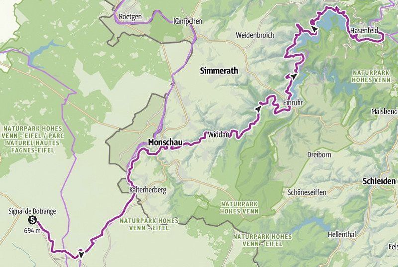
RurUfer-Radweg - Vorschlag Etappe 1
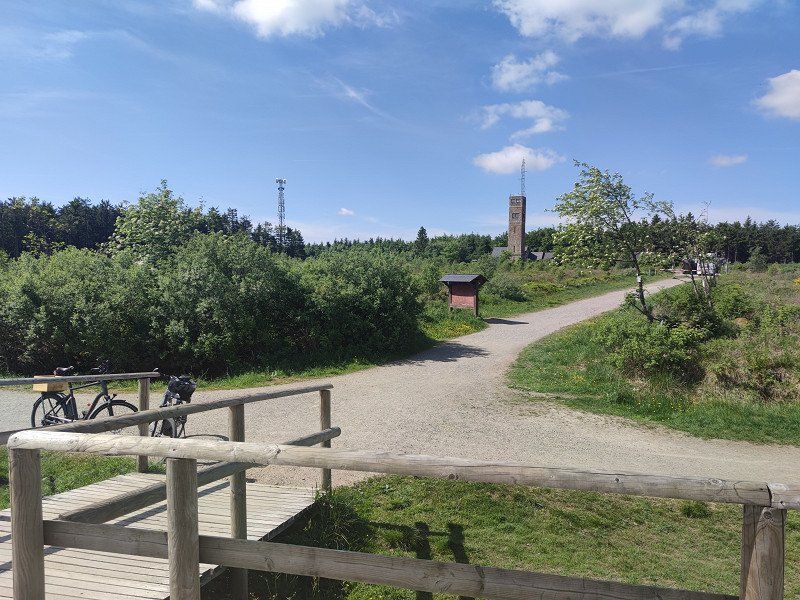
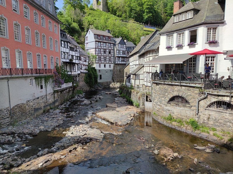
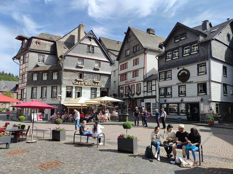
From Signal de Botrange, the highest point in Belgium in the High Fens, it goes via the former cloth-making town of Monschau through the deep valley of the Rur to the Rurseenplatte.
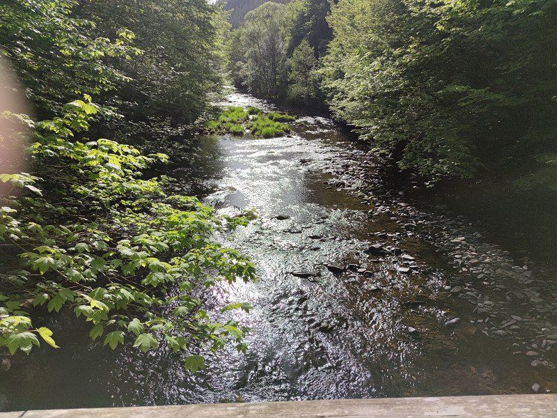
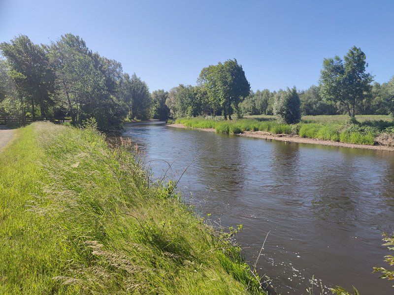
Anyone who goes to Rurquelle in the Belgian Fagnes will not initially believe that this enchanted place is only a few kilometers away from Aachen, Eupen or Liège. Here, at the highest point in Belgium, visitors can expect an unusual habitat and an ecosystem that is unique in Central Europe, a raised bog of an unusual size. The town of Monschau invites every cyclist to take a rest, explore the city center and enjoy the flair of the former stronghold of cloth making. Through the deep notched valley of the Rur we head towards the Rurseenplatte. Towering slate rocks accompany the small road and the subsequent off-road paths that lead through the valley to Einruhr.
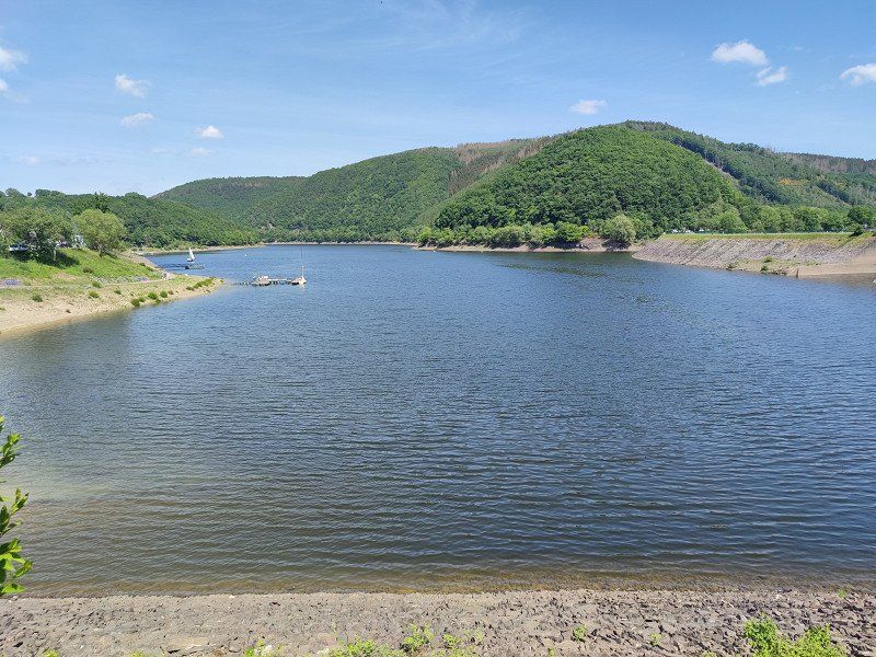
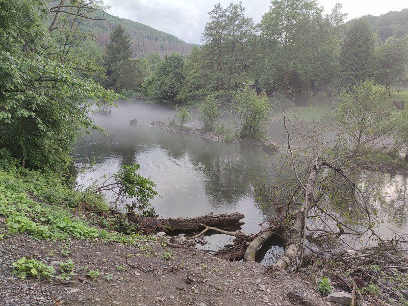
The next section of the RurUfer cycle path focuses on the only national park in NRW, the Eifel National Park, in addition to the large dammed water areas. You will experience the area where wild cats, woodpeckers and wall lizards call the shots and where people "let nature be nature". The RurUfer cycle path runs along both banks of the Rursee. The route to the right of the bank crosses the national park, to the left you will come across the water sports resort of Woffelsbach before you reach your destination, Heimbach.
Distance 65.3 km
Duration 4:30 h
Ascent 303 m
Descent 793 m
Highest point 693 m
Lowest point 204 m
Source: outdooractive.com
Unsere Etappe 1
Starting from Kalterherberg train station, we first ride on the old railway line to then reach the starting point of the Signal de Botrange cycle path on the banks of the Rur.
Back the same way and on to Monschau. The plan was that only I would drive back to get the camper and use the parking space in Monschau for the next night.
After seeing the Monschau parking space https://www.promobil.de/stellplatz/stellplatz-am-vennbad-5a143c59f28b876f71468351.html we changed our plans and drove to Ruhrberg.
Womo Stellplatz Rurberg
https://www.promobil.de/stellplatz/wohnmobilstellplatz-rurberg-588f1ff7721d54a528161964.html
Beautifully situated at the bathing lake. Has everything a decent pitch needs, except a baker. Unfortunately quite expensive.
In den Brüchen 52, 52152 Simmerath, Deutschland
50° 36' 25" N 6° 22' 47.8" E
50.6069377 6.3799349
• Head north on In den Brüchen. Go for 402 m.
• Continue on In den Birken. Go for 6 m.
• Turn left onto An der Eiche. Go for 71 m.
• Turn right onto An der Eiche. Go for 302 m.
• Continue on Wieskuhl. Go for 286 m.
• Turn left onto Steinbüchelstraße. Go for 123 m.
• Turn right onto L128. Go for 8.1 km.
• Turn right onto L246. Go for 5.2 km.
• Turn right onto Monschauer Straße (L218) toward Heimbach/Rursee-Schwammenauel/Schmidt. Go for 905 m.
• Continue on Heimbacher Straße (L218) toward Gemünd/Heimbach/Rursee/Schwammenauel. Go for 5.2 km.
• Turn left onto Schwammenaueler Straße (L218). Go for 2.0 km.
• Take the 3rd exit from roundabout onto An der Laag (L249). Go for 143 m.
• Arrive at An der Laag (L249).
☍
22,7 km
( 26 min.)
Day
Unsere Etappe Tag 2
Back to Monschau it goes through a narrow valley that the Rur dug here.
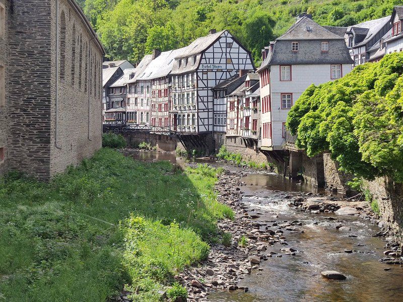
A lot of half-timbering and beautiful old houses give an idea that a lot of money was once made in Monschau. The city is well preserved and now lives from tourism.
Back at the Rursee we are dealing with a completely different landscape. Of course, man intervened and dammed this lake. With many side arms, which were probably formed by some tributaries, it goes to Heimbach. As a way back to the parking space, we use the other side of the lake as a small shortcut.
Then we transfer to Heimbach.
Wohnmobilhafen Heimbach
https://www.promobil.de/stellplatz/wohnmobilhafen-heimbach-588f207a721d54a528162585.html
Being right next to the train station is of course practical, but also noisy when the trains come. But not many come and at night we don't hear anything. The road directly next to it is also so busy that it bothers us.
An der Laag 4, 52396, Heimbach, Germany
50° 38' 11" N 6° 28' 23" E
50.6363889 6.4730556
• Head northwest on An der Laag (L249). Go for 10.3 km.
• Take the 1st exit from roundabout onto Jülicher Straße (L33) toward Düren. Go for 619 m.
• Take the 2nd exit from roundabout onto L33. Go for 6.1 km.
• Keep left onto L33. Go for 42 m.
• Take the 2nd exit from roundabout onto L33 toward Bonn/Euskirchen/Erftstadt/Zülpich/Gladbach/Vettweiß. Go for 796 m.
• Take the 3rd exit from roundabout onto B56 toward Düren. Go for 2.7 km.
• Pass 2 roundabouts and continue on Westring. Go for 29.1 km.
• Turn right onto Rurauenstraße. Go for 346 m.
• Arrive at Rurauenstraße. Your destination is on the right.
☍
50,0 km
( 43 min.)
Day
Etappe 2: Heimbach - Jülich
Rugged rock formations, castles and wildly towering rock towers as well as a gently undulating Börde landscape with arable land and artificially created arms of the river characterize this stage. Düren with its 1950s charm, Jülich with its fortifications and Indeland, which is in the midst of a structural change from opencast lignite mining to a new landscape, also characterize this stage of the RurUfer cycle path.
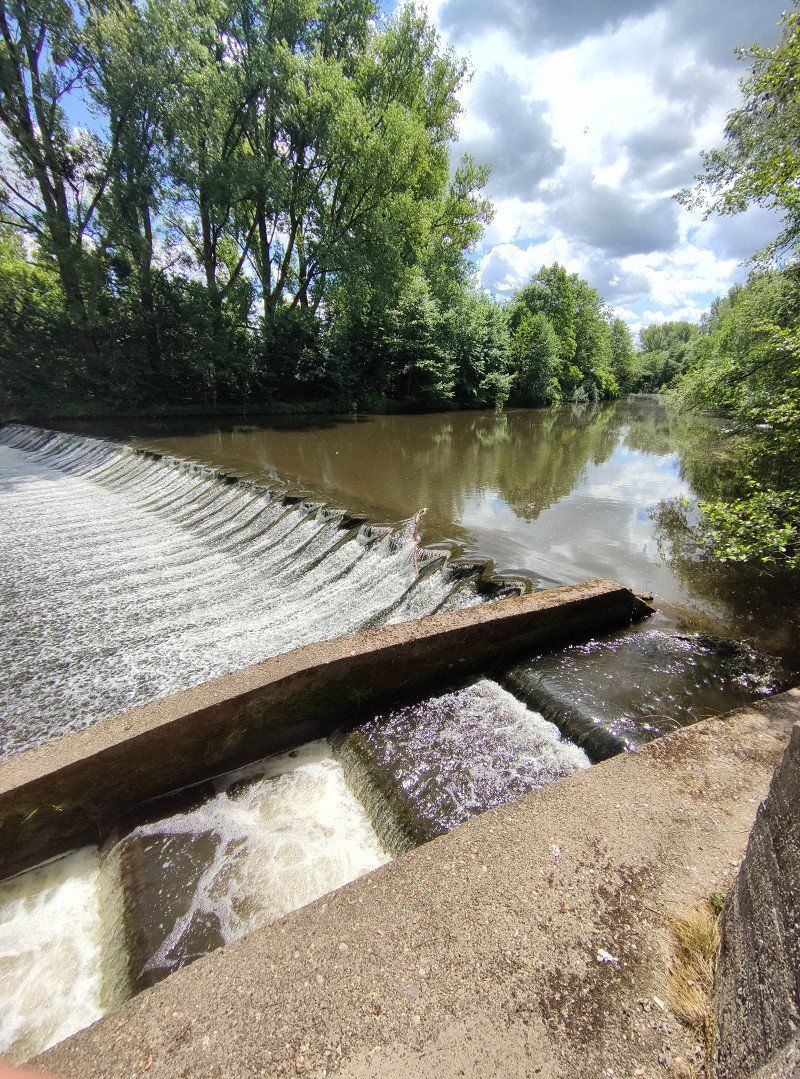
From Heimbach it goes along the northern part of the national park and below the towering red sandstone cliffs of Nideggen to the last reservoir of the Rur. Be sure to check out the fish ladder at Obermaubach, which will allow migratory fish to resume their normal life cycle in the spawning waters of the upper reaches of the river. After that, the mountains disappear and large alluvial forests line the Rur to Düren. A detour to the district town is worthwhile to take a break at the traffic-calmed market square or to visit one of the museums. We continue to Julich. At least three special features await you there. Before reaching the city, a visit to the Inden open-cast lignite mine is tempting. This can be circumnavigated with a 12 km long loop. The steel Indemann invites you to climb and enjoy a magnificent all-round view.
In Jülich, be sure to visit the Renaissance citadel and the Bridgehead Park from Napoleonic times. Here the third stage can be finished.
Distance 48.8 km
Duration 3:30 h
Ascent 77 m
Descent 208 m
Highest point 221 m
Lowest point77 hm
Source: outdooractive.com
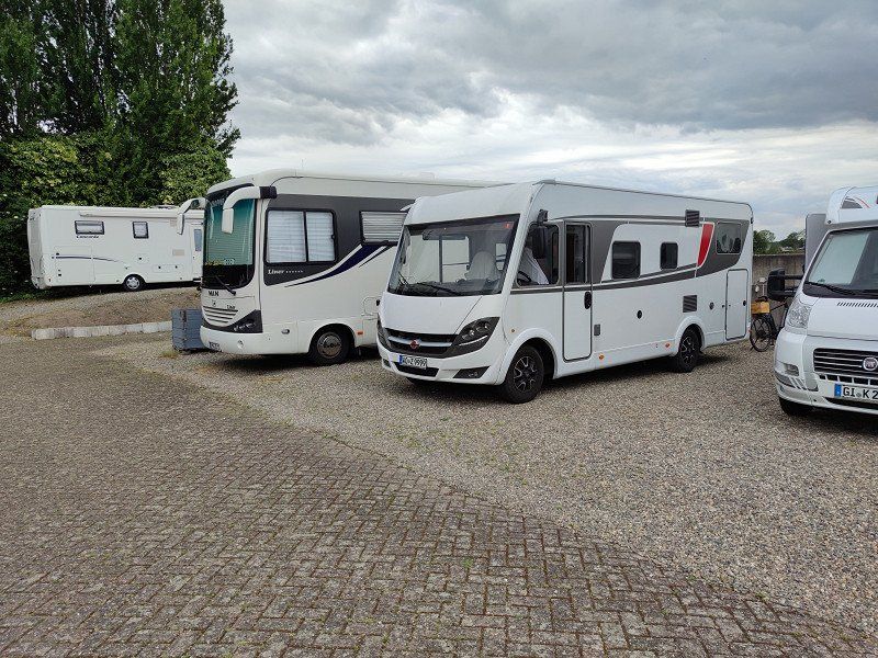
Since the mobile home port in Heimbach is right next to the train station and Jülich also has a train station, it makes sense here to complete the stage and catch up with the mobile home by taking public transport back. This also worked very well, but took a little over 2.5 hours.
Stellplatz am Brückenkopf-Park
https://www.promobil.de/stellplatz/stellplatz-am-brueckenkopf-park-588f200b721d54a528161b7b.html
Sufficient space, even for very large and giant vehicles. It's a bit of a stretch in the city. Bike is an advantage
Rurauenstraße 11, 52428, Jülich, Germany
50° 55' 24" N 6° 20' 26" E
50.9233333 6.3405556
• Head west on Rurauenstraße. Go for 916 m.
• Turn right onto Genossenschaftsweg. Go for 33 m.
• Continue on Am Rurdamm. Go for 471 m.
• Turn left toward Hasenfelder Straße/K15. Go for 450 m.
• Turn right onto Hasenfelder Straße (K15). Go for 304 m.
• Continue on K15. Go for 657 m.
• Turn left onto L253. Go for 6.0 km.
• Take the 2nd exit from roundabout onto Kiffelberg (K9). Go for 207 m.
• Continue on K9. Go for 940 m.
• Continue on Waldstraße (K9). Go for 24 m.
• Continue on K9. Go for 457 m.
• Continue on Glimbacher Straße (K9). Go for 667 m.
• Continue on Hauptstraße (K9). Go for 358 m.
• Turn right onto Wiesenstraße (B57). Go for 4.1 km.
• Turn left onto Lövenicher Straße (L117) toward Heinsberg/Wassenberg/Hückelhoven-Zentrum/Gewerbegebiet Baal. Go for 3.1 km.
• Take the 2nd exit from roundabout onto L117. Go for 973 m.
• Turn right onto Dinstühlerstraße (L364). Go for 1.1 km.
• Turn left onto Martin-Luther-Straße. Go for 204 m.
• Turn right toward Rauhutstraße. Go for 133 m.
• Turn left onto Rauhutstraße. Go for 57 m.
• Turn left onto Bauerstraße. Go for 276 m.
• Arrive at Bauerstraße. Your destination is on the right.
☍
21,4 km
( 25 min.)
Hückelhoven
15, Bauerstraße, Schaufenberg, Hückelhoven, Kreis Heinsberg, Nordrhein-Westfalen, 41836, Deutschland
51° 3' 28.8" N 6° 13' 21.6" E
51.0579951 6.2226655
• Head toward Knappenstiege on Bauerstraße. Go for 276 m.
• Turn right onto Rauhutstraße. Go for 57 m.
• Turn right toward Martin-Luther-Straße. Go for 133 m.
• Turn right onto Martin-Luther-Straße. Go for 309 m.
• Take the 1st exit from roundabout onto Parkhofstraße. Go for 29 m.
• Continue on Sophiastraße. Go for 118 m.
• Take the 1st exit from roundabout onto Sophiastraße. Go for 534 m.
• Continue on Kantinenberg. Go for 357 m.
• Continue on Jacobastraße. Go for 653 m.
• Take the 2nd exit from roundabout. Go for 153 m.
• Take the 1st exit from roundabout onto L117N toward Heinsberg/A46. Go for 186 m.
• Take the 1st exit from roundabout onto A46 toward Heinsberg. Go for 7.6 km.
• Take exit 4 toward Heinsberg/Waldfeucht/Geilenkirchen/B56. Go for 318 m.
• Turn right onto Donselen (B221) toward Heinsberg. Go for 2.3 km.
• Take ramp onto Alte Landstraße. Go for 654 m.
• Take the 2nd exit from roundabout onto Geilenkirchener Straße toward Heinsberg/Stadtmitte. Go for 1.3 km.
• Turn left onto Geilenkirchener Straße (L228). Go for 74 m.
• Take the 2nd exit from roundabout onto Sittarder Straße (L228). Go for 91 m.
• Turn right onto Westpromenade. Go for 262 m.
• Turn left onto Riedweiher. Go for 72 m.
• Turn right onto Riedweiher. Go for 98 m.
• Arrive at Riedweiher. Your destination is on the left.
☍
15,6 km
( 15 min.)
Heinsberg
1, Riedweiher, Lieck, Heinsberg, Kreis Heinsberg, Nordrhein-Westfalen, 52525, Deutschland
51° 3' 45.5" N 6° 5' 20.1" E
51.0626256 6.0889229
• Head southwest on Riedweiher. Go for 98 m.
• Turn left onto Riedweiher. Go for 72 m.
• Turn left onto Westpromenade. Go for 126 m.
• Turn left onto Westpromenade. Go for 319 m.
• Turn right onto Liecker Straße. Go for 166 m.
• Turn left onto Auf dem Brand. Go for 611 m.
• Turn right onto Kolpingstraße. Go for 399 m.
• Take the 3rd exit from roundabout onto Kempener Straße (L230). Go for 2.2 km.
• Continue on Kempener Straße (L230). Go for 4.5 km.
• Continue on Karkenerweg (N293). Go for 975 m.
• Pass 4 roundabouts and continue on Heinsbergerweg (N293). Go for 6.6 km.
• Turn left onto Heinsbergerweg. Go for 1.2 km.
• Take the 2nd exit from roundabout onto Karel Doormanplein. Go for 273 m.
• Continue on Karel Doormanstraat. Go for 465 m.
• Continue on Bredeweg. Go for 429 m.
• Take the 3rd exit from roundabout onto Koninginnelaan (N271). Go for 889 m.
• Keep left onto Koninginnelaan (N271) toward Maastricht/Sittard. Go for 110 m.
• Turn left onto Willem II Singel (N271). Go for 132 m.
• Continue on Zwartbroekplein. Go for 55 m.
• Continue on Minderbroederssingel. Go for 499 m.
• Keep left toward Minderbroederssingel. Go for 26 m.
• Take the 2nd exit from roundabout onto De Ster. Go for 299 m.
• Arrive at De Ster. Your destination is on the right.
☍
20,4 km
( 25 min.)
Day
Etappe 3: Jülich - Roermond
The third stage takes you along the Börden landscape from Jülich to Roermond. In addition to an idyllic river meadow landscape, the tour also offers some historical and cultural highlights. From castles and mansions to various museums and relics from the days of coal mining, there is a lot to discover. The country becomes flatter and flatter, the Rur calmer and the journey more leisurely the further north you go. Linnich holds the glass painting museum and then it goes on to the Heinsberger Land. You drive between meadows and pastures through the wide floodplain landscape, past mansions and moated castles (Haus Großkünkel, Haus Kleinkünkel, Rittergut Grittern, Burg Wassenberg, Haus Effelt), idyllic small towns and various lakes (Adolfosee in Ratheim, Effelder Waldsee). The Hilfarth district of Hückelhoven was known in earlier times for the production of woven baskets and other objects made of willow branches. In the past, the basket-making villages lined up like a string of pearls. The museum in Hückelhoven-Hilfarth tells the history of basket making on the Rur and invites visitors to join in. Winding towers and tailings dumps in Hückelhoven and Ratheim, on the other hand, are reminiscent of the former Sophia-Jacoba colliery and the importance of hard coal mining in the region. At the end of the tour, you cross the border in the direction of Roermond, which invites you to stroll and stroll with its numerous shops and cafés.
Distance 56.2 km
Duration 2:30 h
Ascent 49 m
Descent 92 m
Highest point79 hm
Lowest point 17 m
Source: outdooractive.com
unser Tag 4: Jülich - Hückelhofen und zurück
We have planned about half of stage three. This is the town of Hückelhofen. The route had no significant highlights and neither did Hückelhofen. That's why we had enough time to move to Roermond, where we had reserved - and that was a good thing.
Roermond, Niederlande
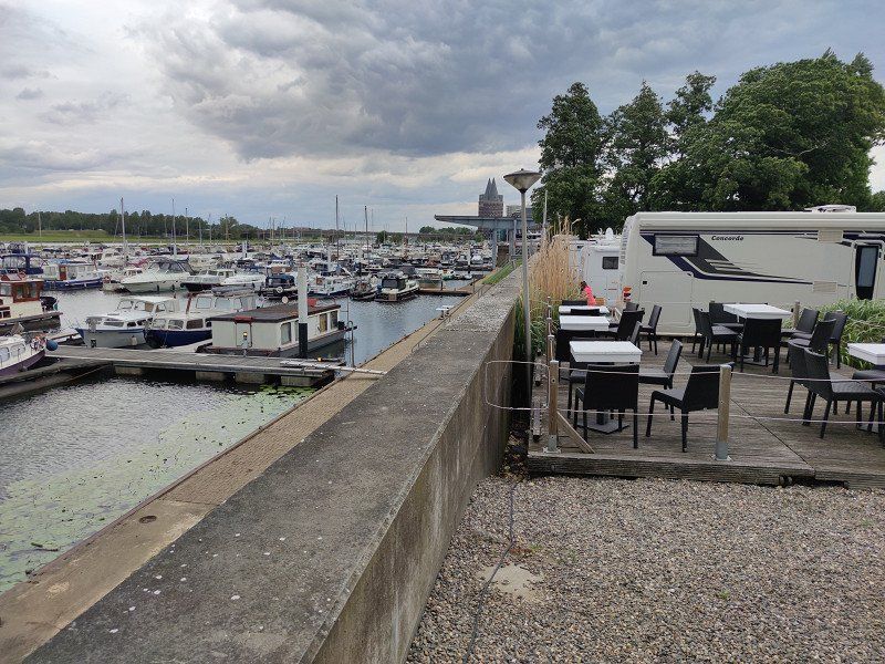
https://www.promobil.de/stellplatz/camperplaats-helenawerf-588f1d5d721d54a52815d2b6.html
Being able to reserve here is a big advantage. Otherwise we would probably have been very far out of town. The prices are decent. But we also stood here nice and quiet.
De Ster 26, 6041 LP Roermond, Niederlande
51° 11' 37.6" N 5° 58' 48.4" E
51.1937865 5.9801090
unsere letzte Etappe: Von Roermond nach Hückelhofen
However, we turned around shortly before because the Father's Day hustle and bustle in Germany was much heavier than in the Dutch section of our tour.
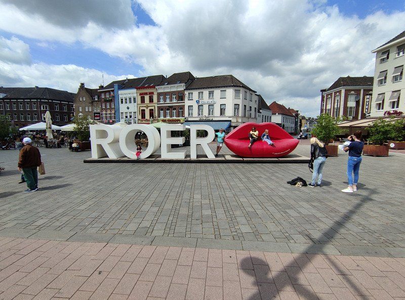
We then paid a visit to the Roermond designer outlet and ended our Rur tour with it.