The long-term weather forecast offered the same temperatures for southern Germany as for northern Italy, where we actually wanted to go. So quickly changed my mind and off to Franconia. We always wanted to look at each other. And we were surprised - very, very positively.
Day
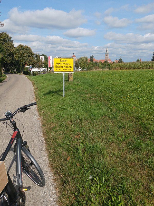
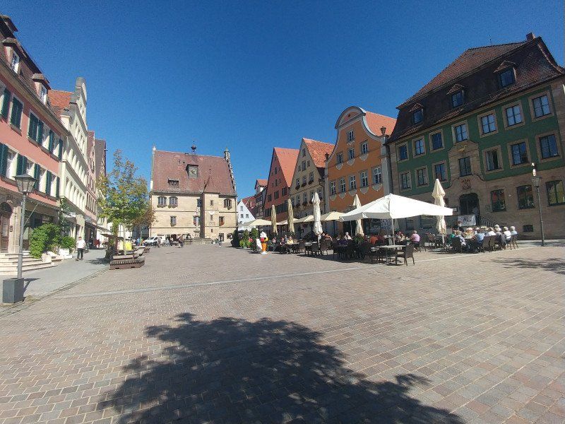
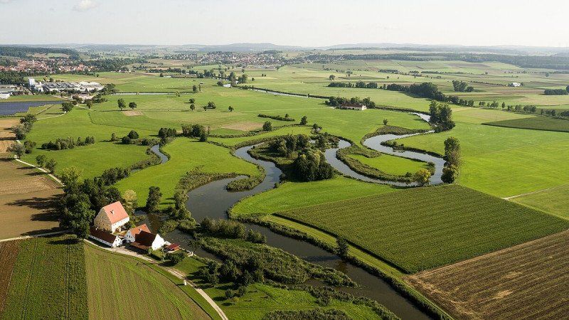
Stellplatz Münsterblick
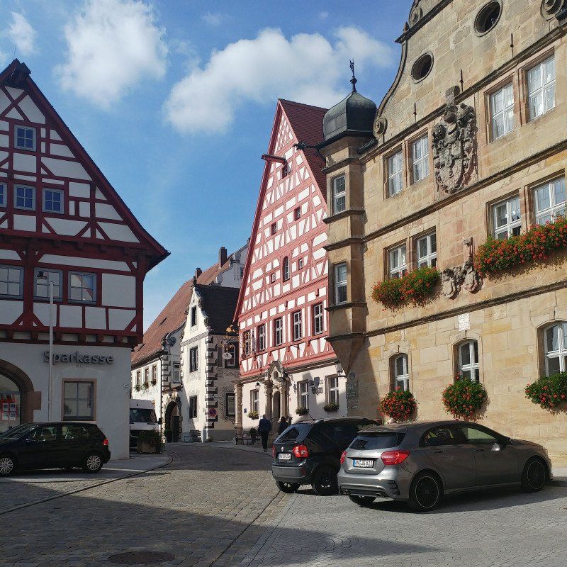
Located at the top of some parking space guides, we have chosen this parking space as our first destination. And despite the low season - completely occupied. We looked at it again later. Really great. But the town is also really worth seeing. So go on. We found a parking space in the neighboring village.
https: //www.promobil.de/stellp ...
Waizendorfer Straße 15, 91639, Wolframs-Eschenbach, Germany
49° 13' 32" N 10° 43' 11" E
49.2255556 10.7197222
• Head southwest. Go for 249 m.
• Turn left onto AN58. Go for 400 m.
• Turn right onto Merkendorfer Straße (St2220). Go for 2.8 km.
• Turn right toward Weißbachmühle. Go for 673 m.
• Turn right onto Weißbachmühle. Go for 129 m.
• Arrive at your destination on the left.
☍
4,2 km
( 5 min.)
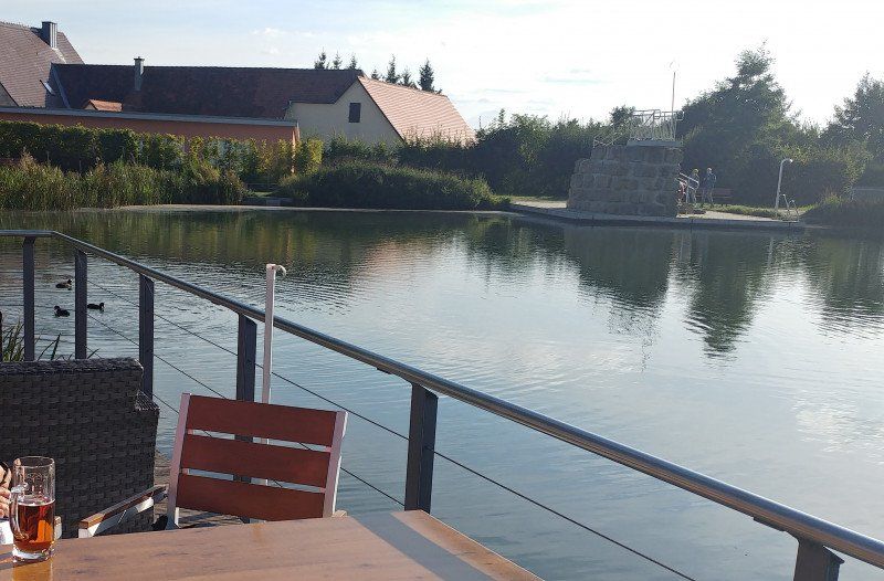
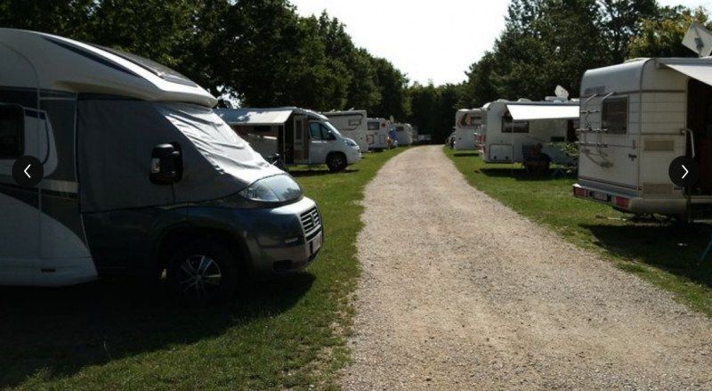
Wohnmobilstellplatz am Naturfreibad Weißbachmühle
That's why we ended up here. Just one place further we got the penultimate parking space, but mobile phones can still be parked on the adjacent meadow if you don't need electricity.
Shower, toilet, kiosk at the swimming pond and with the bike in the place to the bakery and butcher no problem. Very nice place.
https: //www.promobil.de/stellp ...
Weißbachmühle 3, 91732, Merkendorf, Germany
49° 12' 28.6" N 10° 41' 32.9" E
49.2079450 10.6924610
• Head northwest. Go for 11 m.
• Continue on Weißbachmühle. Go for 118 m.
• Turn left toward Ringstraße/St2220. Go for 673 m.
• Turn sharp right onto Ringstraße (St2220). Go for 428 m.
• Turn right onto Hauptstraße (St2220). Go for 309 m.
• Turn left onto Gunzenhausener Straße (B13) toward München/Weißenburg/Gunzenhausen/Fränkisches Seenland. Go for 10.1 km.
• Turn right onto B13/B466 toward München/Weißenburg/Nördlingen/Gunzenhausen/Altmühlsee Südufer. Go for 935 m.
• Turn left onto B13 toward München/Weißenburg/Gunzenhausen-Süd. Go for 1.1 km.
• Turn right onto Oettinger Straße (B13) toward München/Weißenburg/Gunzenhausen-Süd. Go for 321 m.
• Turn left onto B13 toward Unterwurmbach. Go for 1.1 km.
• Continue on B13 toward München/Weißenburg/Gunzenhausen-Süd. Go for 4.3 km.
• Turn right onto St2230 toward Treuchtlingen/Heidenheim/Dittenheim. Go for 10.3 km.
• Continue on St2230 toward Treuchtlingen. Go for 921 m.
• Continue on St2230. Go for 8.3 km.
• Take the 2nd exit from roundabout onto Promenade. Go for 106 m.
• Continue on Kästleinsmühlenstraße. Go for 311 m.
• Arrive at Kästleinsmühlenstraße. Your destination is on the right.
☍
39,3 km
( 31 min.)
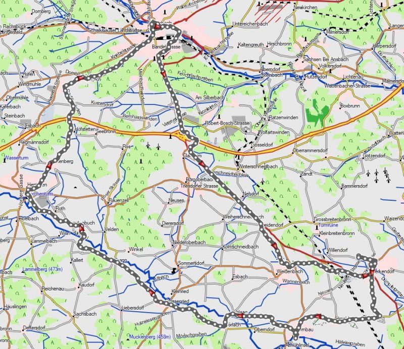
Day
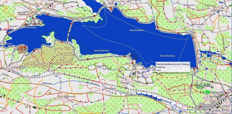
Rundtour Altmühlsee und Gunzenhausen
55 km
450 meters in altitude
varied, mostly along the Franconian water cycle path
https: //www.frankentourismus.d ...
Gunzenhausen is definitely worth seeing.
Day
Altmühl aufwärts
60 km
400 m
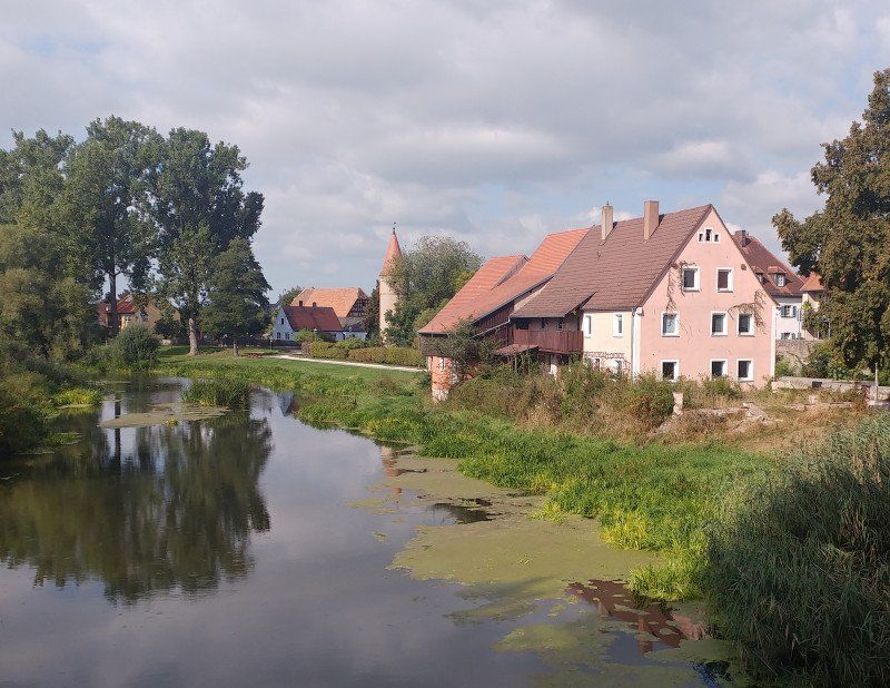
We visit the historic town of Ornbau with the Altmühlbrücke and cycle Altmühl up to Herrieden. Here we turn north and pay a visit to the district town of Ansbach.
Day
Stellplatz am Kurpark
A parking space - almost like a campsite - with a sanitary house and washing machine. With good organization and an even better rating. There are bread rolls as well as the check-in at the gas station.
https: //www.promobil.de/stellp ...
Kästleinsmühlenstraße, 91757, Treuchtlingen, Germany
48° 57' 37" N 10° 55' 4" E
48.9602778 10.9177778
• Head toward Industriestraße on Kästleinsmühlenstraße. Go for 311 m.
• Continue on Promenade. Go for 35 m.
• Take the 1st exit from roundabout onto Nürnberger Straße (St2216). Go for 759 m.
• Continue on Oettinger Straße (St2216). Go for 508 m.
• Continue on Wettelsheimer Straße (St2230). Go for 18.3 km.
• Turn right onto B13. Go for 1.5 km.
• Turn left onto Sonnenstraße (WUG1) toward Langlau/Pfofeld. Go for 132 m.
• Continue on WUG1. Go for 2.1 km.
• Continue on Hauptstraße (WUG1). Go for 555 m.
• Turn left onto Hauptstraße (WUG1). Go for 155 m.
• Continue on WUG1. Go for 1.7 km.
• Take the 2nd exit from roundabout onto WUG1. Go for 407 m.
• Continue on Seestraße (WUG1). Go for 335 m.
• Continue on WUG1. Go for 2.3 km.
• Turn right onto Badehalbinsel. Go for 356 m.
• Continue toward Badehalbinsel. Go for 46 m.
• Turn right onto Badehalbinsel. Go for 39 m.
• Arrive at Badehalbinsel.
☍
29,6 km
( 26 min.)
Kurztrip nach Weißenburg
Located near the Limes, the old Roman settlement with a well-preserved historic old town is a worth seeing destination for a short trip on the day of arrival.
Day
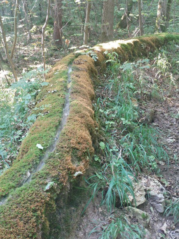
Steinerne Rinne bei Wolfsbronn
... we already read as a guide on the way to Treuchtlingen what aroused our curiosity. It is a natural phenomenon that a stream moves upwards here due to the precipitation of lime. Is there more often than not, we didn't know it until then.
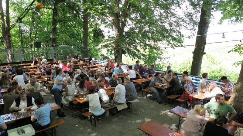
Wettelsheimer Keller
On the way back to Treuchtlingen you should definitely pay a visit to the Wettelsheimer Keller. The delicious beer of a small private brewery and the beer garden kitchen is known and popular (and cheap)
Day
Altmühl Richtung Eichstätt
48 km
400 m
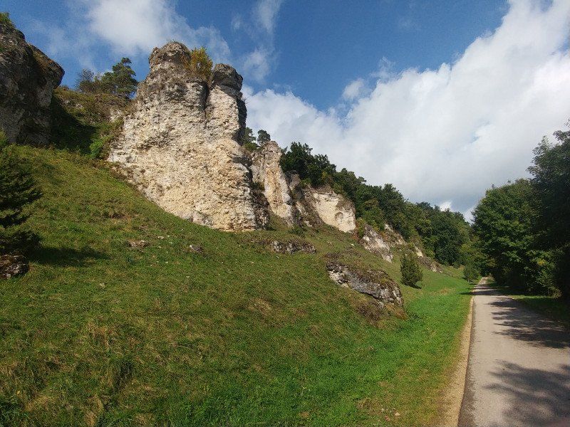
Along the Altmühl from Treuchtlingen towards Eichstätt is often referred to as the king's stage of the Altmühl cycle path. Passing Pappenheim you come to the 12 apostles, a rock formation on the Altmühl. We have found a circular route that takes us back to Treuchtlingen on an attractive route from Altendorf.
Day
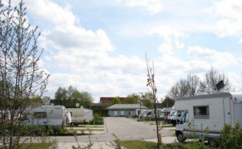
Stellplatz Badehalbinsel
A parking space for over 200 mobiles at one of the region's tourist attractions - the large Brombachsee. With every comfort - a little too big for us.
https: //www.promobil.de/stellp ...
Badehalbinsel, 91720, Absberg, Germany
49° 8' 17" N 10° 52' 19" E
49.1380556 10.8719444
• Head southwest on Badehalbinsel. Go for 269 m.
• Turn left onto WUG1. Go for 1.6 km.
• Turn right onto Furthmühle (WUG20). Go for 224 m.
• Continue on WUG20. Go for 2.4 km.
• Turn right onto St2222. Go for 4.4 km.
• Turn right onto Nürnberger Straße (St2222). Go for 712 m.
• Turn left onto B466. Go for 2.7 km.
• Continue on B466 toward Nördlingen/Altmühlsee Südufer. Go for 2.3 km.
• Turn right onto St2219 toward Wassertrüdingen/Unterschwaningen/Cronheim/Maicha. Go for 4.4 km.
• Take the 2nd exit from roundabout onto St2219 toward Wassertrüdingen/Unterschwaningen. Go for 4.1 km.
• Take the 2nd exit from roundabout onto St2221 toward Wassertrüdingen. Go for 3.7 km.
• Take the 2nd exit from roundabout onto Schafhof (St2221). Go for 274 m.
• Continue on St2221. Go for 319 m.
• Take the 2nd exit from roundabout onto St2221. Go for 329 m.
• Continue on Ansbacher Straße (St2221). Go for 754 m.
• Continue on Poststraße (St2221). Go for 142 m.
• Turn right onto Dinkelsbühler Straße (St2218). Go for 25 m.
• Turn left onto Entengraben. Go for 242 m.
• Turn right. Go for 46 m.
• Arrive at your destination on the right.
☍
29,0 km
( 25 min.)
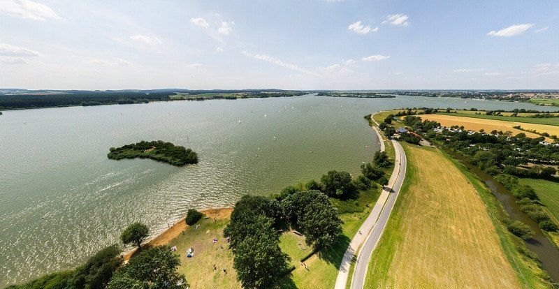
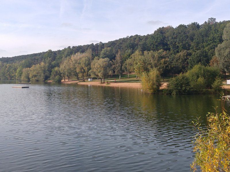
Rund um den Brombachsee
33.5 km
395 m
including a detour to Pleinfeld, which is not worthwhile. The history of this relatively young lake as a water reservoir for the region is interesting and well explained along the way. Otherwise just a paradise for water sports enthusiasts.
Day
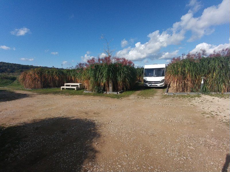
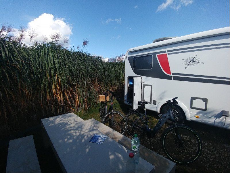
Stellplatz am Entengraben
One of the hottest pitches I've visited so far. Newly laid out for the 2019 garden show, the grasses have now grown so large that the 12 parking spaces are very demarcated. We had our private room with a concrete table and bench.
V + E perfect and even toilet and shower a few meters away in the sundial park for little money. A reason to visit Wassertrüdingen once.
But also as a starting point for bike tours ingeniously located on the Wörnitz.
Grüner Weg/Kappelgasse, 91717, Wassertrüdingen, Germany
49° 2' 21" N 10° 35' 41" E
49.0391667 10.5947222
• Head toward Entengraben. Go for 31 m.
• Turn left onto Entengraben. Go for 277 m.
• Turn left onto Dinkelsbühler Straße (St2218). Go for 20.2 km.
• Take the 1st exit from roundabout onto B25 toward Würzburg/Rothenburg/T./Dinkelsbühl. Go for 1.3 km.
• Pass 2 roundabouts and continue on Unsinnige Mühle (B25). Go for 11.0 km.
• Continue toward Dinkelsbühler Straße/B25. Go for 36 m.
• Take the 2nd exit from roundabout onto Dinkelsbühler Straße (B25) toward Würzburg/Rothenburg/T./Stadtmitte. Go for 651 m.
• Arrive at Dinkelsbühler Straße (B25).
☍
33,4 km
( 28 min.)
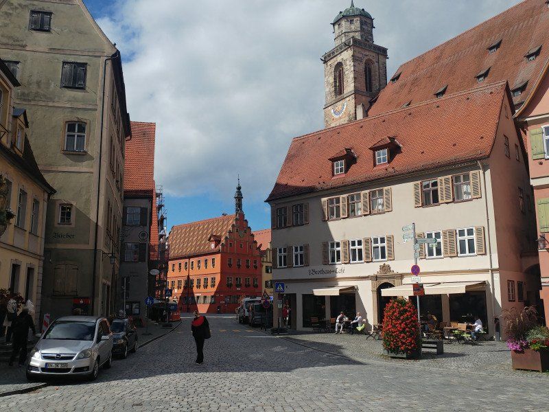
Dinkelsbühl
Probably the most beautiful old town in Germany attracts many tourists. From Wassertrüdingen only 25 km away, a trip along the Wörnitz is a nice bike ride. We didn't find a round trip, but we weren't angry either to drive back the same way, as it gave a completely different view of the landscape. On the way back, it is worth visiting the lard mill, which produces very good cheese.
Day
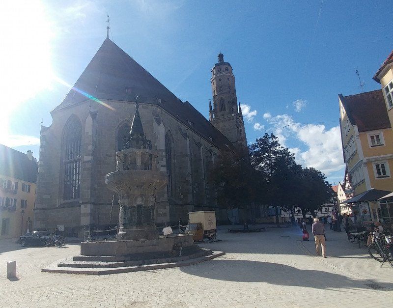
Nördlingen
77 km
410 m
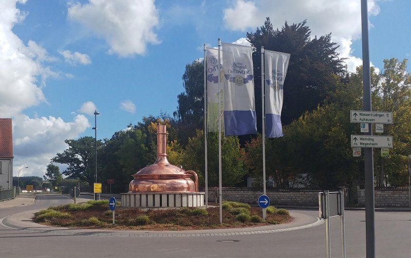
We start the tour to Nördlingen via Öttingen, which is really worth seeing and has nothing in common with the cheap beer that is at home here. Further along the Wörnitz, we then turn off at Fischbach to visit Nördlingen. In the middle of the Ries, a huge crater from the early days, we are already here in Swabia before we return to Wassertrüdingen via another route, but via Öttingen.
Day
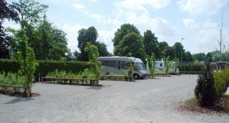
Wohnmobilstellplatz Feuchtwangen
Conveniently located on the main street and a shopping center, but also within walking distance of the old town. V + E, electricity available and free of charge, what more could you want.
https: //www.promobil.de/stellp ...
Dinkelsbühler Straße, 91555, Feuchtwangen, Germany
49° 9' 45" N 10° 19' 39" E
49.1625000 10.3275000
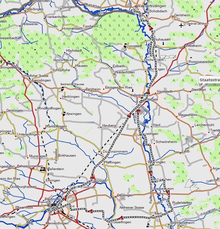
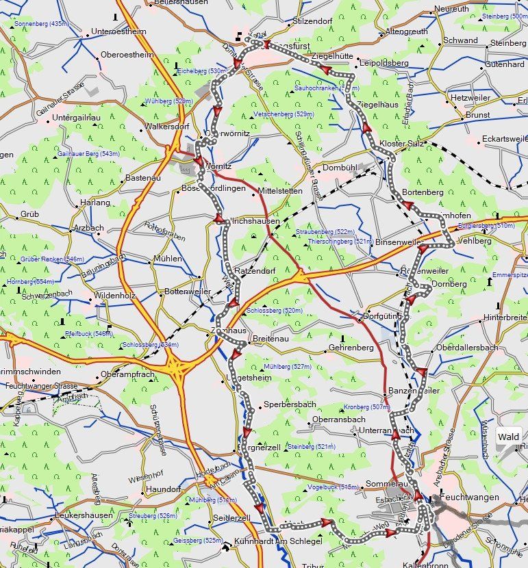
zur Wörnitzquelle
47 km
450 m
The Wörnitz cycle path begins at the source in Schillingsfürst and leads in just over 100 km to Donauwörth, where it flows into the Danube.
We drove part of it and made a round trip out of it.