After long planning and Corona, the time had finally come on May 29th, 2022. The trip to Spain starts with our WoMo. We wish you a lot of fun “traveling afterwards”.
Day
67551 Worms, Deutschland
Zum Haubert 18, 67551 Worms, Deutschland
49° 36' 11.9" N 8° 19' 22.1" E
49.6033000 8.3228000
• Head toward Neugasse on Zum Haubert. Go for 123 m.
• Turn slightly left onto Neugasse. Go for 22 m.
• Turn right onto Wiesoppenheimer Straße (K3). Go for 20 m.
• Continue on Weinsheimer Hauptstraße (K3). Go for 607 m.
• Turn left onto Weinbergstraße. Go for 289 m.
• Continue on Höhlchenstraße. Go for 538 m.
• Take the 2nd exit from roundabout onto Kolpingstraße (K17). Go for 1.1 km.
• Turn left and take ramp onto B47 toward A61/Monsheim. Go for 2.6 km.
• Take ramp onto A61 toward Ludwigshafen/Kaiserslautern. Go for 21.4 km.
• Take exit 61 toward Landau/Neustadt/Weinstr. onto A65. Go for 49.4 km.
• Take exit 22 toward Kandel-Süd/Strasbourg/Lauterbourg onto B9. Go for 11.2 km.
• Continue on A35. Go for 47.2 km.
• Keep right toward E25/A355. Go for 2.5 km.
• Continue on A355. Go for 23.8 km.
• Continue on A35. Go for 38.6 km.
• Continue on D83. Go for 10.7 km.
• Keep left onto A35. Go for 38.5 km.
• Take the left exit toward A35/Mulhouse/Lyon/Paris onto A36 (La Comtoise). Go for 4.6 km.
• Keep left onto A36 (La Comtoise) toward Paris/Lyon/Guebwiller. Go for 97.7 km.
• Take exit 5 toward Valdahon/Baume les Dames. Go for 896 m.
• Take the 2nd exit from roundabout. Go for 209 m.
• Turn left onto D50 toward Baume les Dames/Valdahon/Pontarlier. Go for 2.7 km.
• Turn right onto Faubourg d'Anroz (D683) toward Besançon/Valdahon/Pontarlier/Centre Ville/Place Jean Férrat. Go for 557 m.
• Turn left onto Place Chamars (D50) toward Pont Les Moulins/Valdahon/Ornans/Pontarlier/Val de Cusance/Cour. Go for 669 m.
• Take the 2nd exit from roundabout onto D50. Go for 356 m.
• Turn sharp right onto Quai du Canal (D277). Go for 861 m.
• Arrive at Quai du Canal (D277).
☍
356,9 km
(3 hrs. 16 min.)
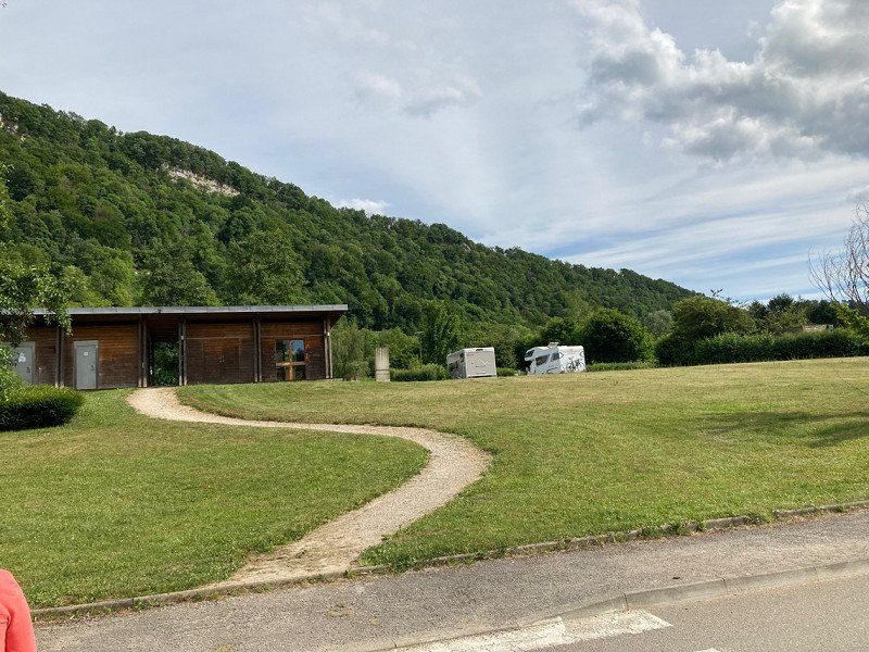
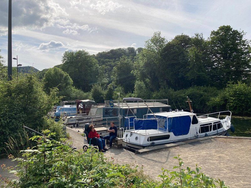
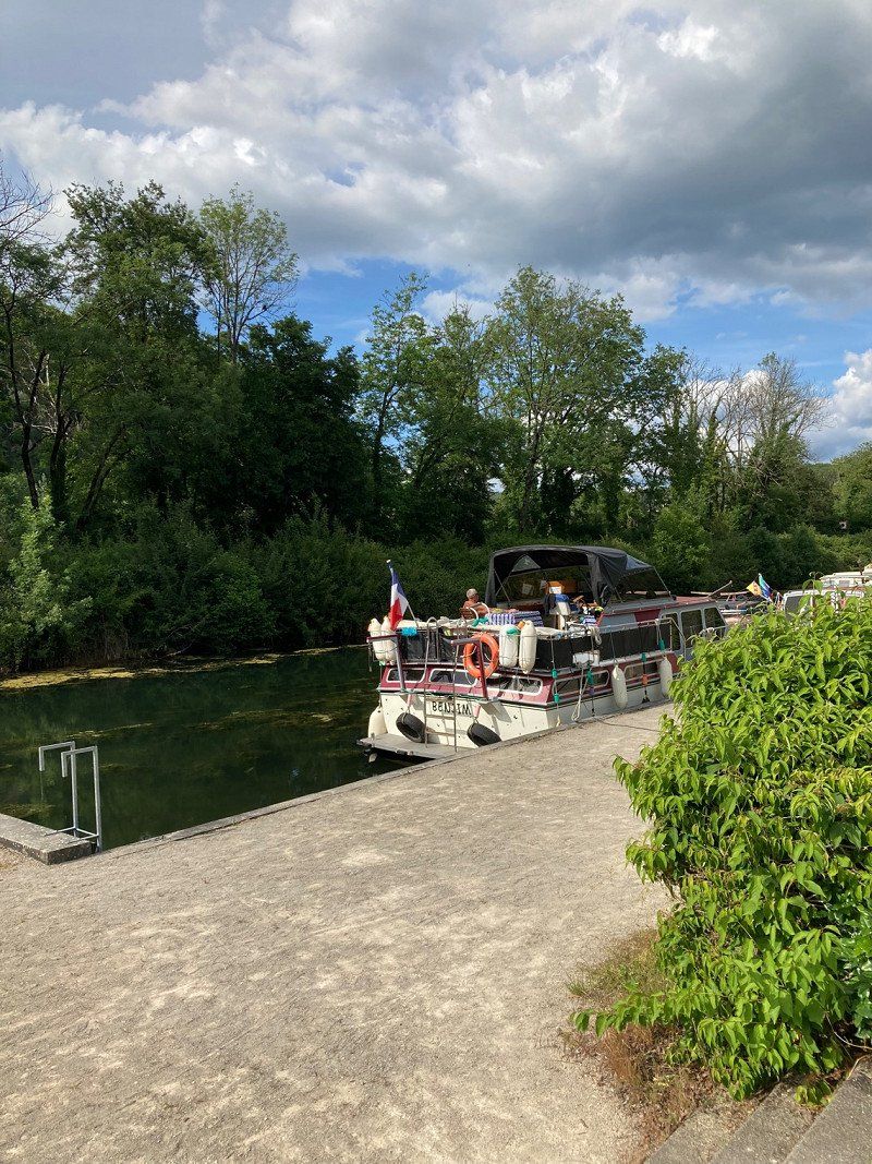
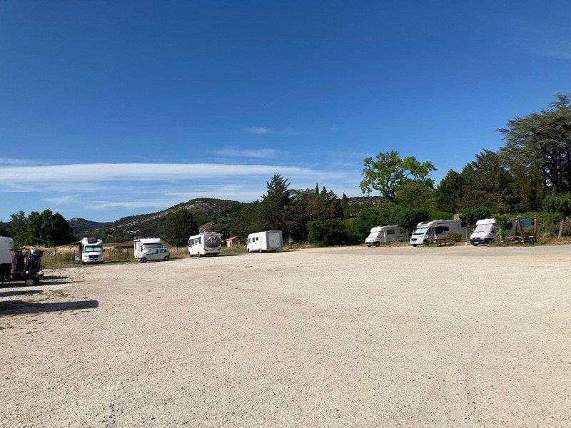
Quai du Canal, Baume-les-Dames, Frankreich
This pitch is located at a marina and is very popular. If all pitches are occupied, there is another campsite about 300m away for overnight stays.
Quai du Canal, 25110 Baume-les-Dames, Frankreich
47° 20' 16.5" N 6° 21' 12.5" E
47.3379189 6.3534798
• Head southwest on Quai du Canal (D277).
• Arrive at Quai du Canal (D277).
☍
Distance not available
(Duration not available)
Day
Quai du Canal, Baume-les-Dames, Frankreich
Quai du Canal, 25110 Baume-les-Dames, Frankreich
47° 20' 16.5" N 6° 21' 12.5" E
47.3379189 6.3534798
• Head northeast on Quai du Canal (D277). Go for 834 m.
• Turn sharp left onto Rue de Mi-Cour (D50). Go for 342 m.
• Take the 2nd exit from roundabout onto Rue de Mi-Cour (D50). Go for 709 m.
• Turn right onto Faubourg d'Anroz (D683). Go for 573 m.
• Turn left onto Route de Rougemont (D50) toward A36/Autechaux/Rougemont/Lure. Go for 2.6 km.
• Turn right toward Strasbourg/Mulhouse/Belfort/Montbéliard/Paris/Lyon/Besançon. Go for 173 m.
• Take the 1st exit from roundabout. Go for 83 m.
• Take ramp onto A36 (La Comtoise) toward Paris/Lyon/Besançon. Go for 85.3 km.
• Take the exit toward Lyon/Lons le S./Dole/Choisey onto A39 (Autoroute Verte). Go for 113 km.
• Continue on A40. Go for 22.4 km.
• Continue on A42 toward Grenoble/Chambéry/Lyon/Aéroport Saint-Exupéry. Go for 48.9 km.
• Take the left exit toward Marseille/Grenoble/Lyon/N346 onto A42. Go for 990 m.
• Take the exit toward Lyon onto A42. Go for 3.6 km.
• Take the left exit toward Marseille/Grenoble/Périphérique Sud/Porte de Cusset onto D383 (Boulevard Laurent Bonnevay). Go for 6.0 km.
• Keep left onto Boulevard Laurent Bonnevay (D383) toward St Étienne/Marseille/Vénissieux. Go for 1.9 km.
• Keep left onto Boulevard Laurent Bonnevay (D383) toward Paris/Saint-Étienne/Marseille/Lyon-Centre/Vénissieux-Centre. Go for 3.3 km.
• Keep left onto D383 toward Paris/Marseille/Saint-Étienne/Pierre Bénite/Saint Fons-Centre/Port E. Herriot. Go for 2.3 km.
• Keep left onto Boulevard Pierre Sémard (D383) toward A7/Paris/Lyon/Pierre-Bénite/Marseille/St Étienne/Vénissieux/Feyzin. Go for 188 m.
• Take ramp onto A7 (Autoroute du Soleil) toward St Étienne/Feyzin/Marseille. Go for 168 km.
• Take exit 19 toward Alès/Vaison la Romaine/Pont St Esprit/Bollène. Go for 1.5 km.
• Take the 3rd exit from Rond-Point des Portes de Provence roundabout onto Avenue Jean Monnet (D994) toward Alès/Pont St Esprit/Orange/Z.I. la Croisière/Z.A. la Préférence. Go for 677 m.
• Take the 4th exit from Rond-Point de l'Europe roundabout onto Avenue Jean Monnet (D994) toward Alès/Pont St Esprit/Orange/Lapalud/Z.I. la Croisiere. Go for 1.3 km.
• Take the 3rd exit from roundabout onto D994 toward Z.I la Croisière. Go for 2.7 km.
• Continue on N86 toward N7/Montélimar/Pierrelatte/Lapalud. Go for 2.0 km.
• Take the 3rd exit from roundabout onto N86 toward Alès/Pont St Esprit. Go for 1.6 km.
• Take the 3rd exit from roundabout onto N86 toward Alès/Bagnols S/Cèze/St Étienne des Sorts. Go for 1.8 km.
• Take the 2nd exit from roundabout onto N86 toward Nîmes/Alès/Bagnols S/C. Go for 1.3 km.
• Take the 3rd exit from roundabout onto Route Nationale (N86) toward Nîmes/Alès/Bagnols S/C. Go for 4.6 km.
• Pass 4 roundabouts and continue on Route de Lyon (N86). Go for 3.8 km.
• Take the 3rd exit from Rond-Point Jean Monnet roundabout onto Avenue Robert Gourdon (N580) toward A9/Z.A. de Berret/Z.A. de l'Euze/Marcoule/Avignon. Go for 1.5 km.
• Take the 2nd exit from Rond-Point Edgar Tailhades roundabout onto Avenue Georges Besse (N580) toward A9/Avignon/Z.A. de Berret/Z.A. de l'Euze/Marcoule. Go for 769 m.
• Take the 2nd exit from Rond-Point Constant Compère-Morel roundabout onto Route d'Avignon (N580) toward L'Ardoise/Avignon/Roquemaure/Marcoule/Z.A. de l'Euze. Go for 2.9 km.
• Turn left onto D865 toward Chusclan. Go for 576 m.
• Continue on Chemin des Saumes (D865). Go for 613 m.
• Continue on Chemin des Horts (D865). Go for 374 m.
• Turn right onto D138. Go for 66 m.
• Arrive at D138. Your destination is on the right.
☍
489,5 km
(4 hrs. 24 min.)
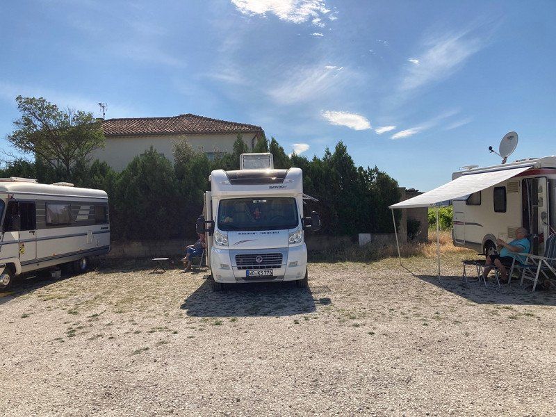
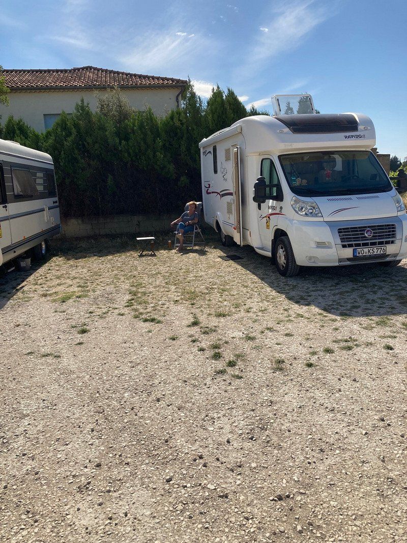
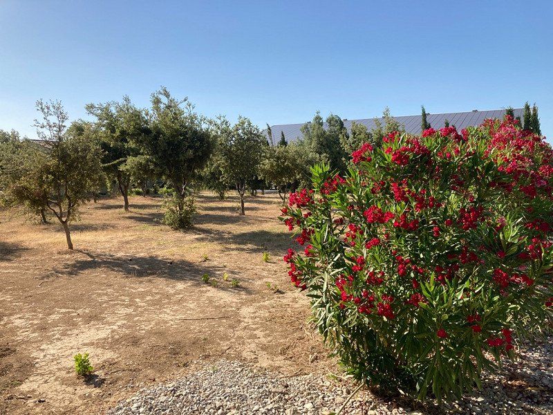
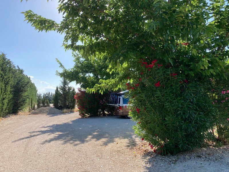
5 Chemin des Gaches, Chusclan, Frankreich
GPS parking space N44°8'44" E4°40'38"
Free parking space on the outskirts.
5 Chemin des Gaches, 30200 Chusclan, Frankreich
44° 8' 45.7" N 4° 40' 42.8" E
44.1460145 4.6785683
• Head south on D138. Go for 3 m.
• Arrive at D138. Your destination is on the left.
☍
0,0 km
(Duration not available)
Day
5 Chemin des Gaches, Chusclan, Frankreich
5 Chemin des Gaches, 30200 Chusclan, Frankreich
44° 8' 45.7" N 4° 40' 43.2" E
44.1460143 4.6786764
• Head south on D138.
• Continue on Chemin des Gâches (D138). Go for 261 m.
• Continue on Route d'Orsan (D138). Go for 636 m.
• Continue on D138. Go for 721 m.
• Turn left onto D138 toward Avignon/Bagnols S/ C./L'Ardoise/Marcoule. Go for 185 m.
• Take the 2nd exit from roundabout onto N580 toward A9/Avignon/L'Ardoise. Go for 4.2 km.
• Take the 1st exit from roundabout onto N580. Go for 230 m.
• Take the 2nd exit from roundabout onto N580 toward A9/Avignon/Roquemaure/St Laurent des A./P.R.A.E. Lavoisier. Go for 1.9 km.
• Take the 2nd exit from roundabout onto N580. Go for 3.1 km.
• Take the 2nd exit from roundabout onto N580 toward A9/Avignon/Les Angles. Go for 4.0 km.
• Take the 2nd exit from roundabout onto Échangeur de Roquemaure toward Avignon/Roquemaure/Pujaut/Les Angles/Villeneuve. Go for 498 m.
• Take ramp onto A9 (La Languedocienne) toward Nîmes/Montpellier. Go for 266 km.
• Continue on AP-7 (Autopista de la Mediterrània). Go for 28.6 km.
• Take exit 4 toward Figueres S/Roses. Go for 1.6 km.
• Continue straight ahead. Go for 29 m.
• Take the 3rd exit from roundabout toward La Jonquera/Perpignan/C-260/Roses/Cadaqués/N-260/Llançà/Centre Duaner Vilamalla. Go for 144 m.
• Continue toward N-2. Go for 165 m.
• Take ramp onto N-2. Go for 2.1 km.
• Take ramp toward l'Escala. Go for 580 m.
• Take the 2nd exit from roundabout onto C-31 toward l'Escala/Torroella de Montgrí/La Bisbal d'Empordà. Go for 23.4 km.
• Take the 2nd exit from roundabout onto Carrer del Baix Empordà (C-252) toward La Bisbal d'Empordà. Go for 4.5 km.
• Take the 3rd exit from roundabout onto Carretera de Torroella de Montgrí a Parlavà (GI-643) toward Torroella de M. Go for 377 m.
• Continue on GI-643. Go for 2.9 km.
• Continue on Carrer de Torroella (GI-643). Go for 20 m.
• Continue on Carretera a Ullastret (GI-643). Go for 50 m.
• Take the 1st exit from roundabout toward GI-644/Ullastret/Vulpellac/La Bisbal d'Empordà. Go for 90 m.
• Continue on Carretera a Ullastret (GI-644). Go for 349 m.
• Continue on GI-644. Go for 175 m.
• Take the 2nd exit from roundabout onto GI-644 toward Ullastret/Vulpellac/La Bisbal d'Empordà. Go for 2.4 km.
• Continue on Carretera de Vulpellac a Serra de Daró (GI-644). Go for 283 m.
• Take the 2nd exit from roundabout onto Carretera de Vulpellac a Serra de Daró (GI-644) toward Vulpellac/La Bisbal d'Empordà. Go for 313 m.
• Continue on GI-644. Go for 2.4 km.
• Take the 2nd exit from roundabout onto GI-644 toward Vulpellac/La Bisbal d'E./Palamós. Go for 2.3 km.
• Take the 4th exit from roundabout onto C-66 toward Pals/Palafrugell/Palamós. Go for 582 m.
• Pass 4 roundabouts and continue on Carretera de Girona a Palamós (C-66). Go for 7.8 km.
• Keep right onto C-31 (Carretera de Girona a Palamós) toward Paratge del Sobira. Go for 7.2 km.
• Take exit 326 toward La Fosca/St. Joan de Palamós/Palamós/Hospital. Go for 519 m.
• Take the 4th exit from roundabout toward AP-7/Palamós/St. Joan P./La Fosca. Go for 201 m.
• Keep left toward Palafrugell/La Fosca/Sant Joan de Palamós/Palamós. Go for 469 m.
• Take the 1st exit from roundabout onto Carrer Àngel Guimerà toward Palamós/St. Joan de Palamós. Go for 510 m.
• Take the 2nd exit from roundabout onto Carrer Àngel Guimerà toward Centre Urbà/Estadi. Go for 402 m.
• Continue on Avinguda de la Llibertat. Go for 499 m.
• Continue on Avinguda del President Lluís Companys. Go for 354 m.
• Continue on Avinguda Onze de Setembre. Go for 11 m.
• Arrive at Avinguda Onze de Setembre. Your destination is on the left.
☍
373,5 km
(3 hrs. 30 min.)
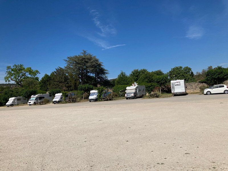
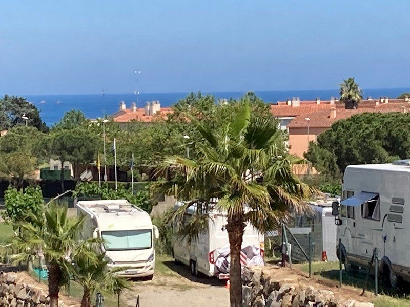
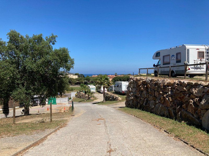
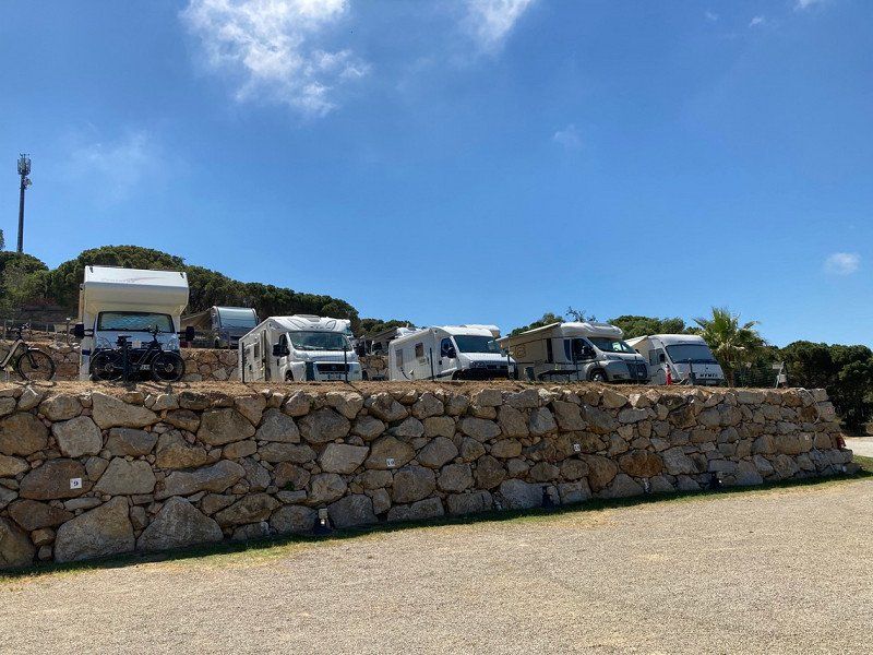
Palamós, Spanien
GPS location: N41°51'22" E3°08'08"
Very nice parking space on the outskirts of Palamos. Terraced pitches.
Palamós, Provinz Girona, Spanien
41° 51' 1.8" N 3° 7' 47.3" E
41.8505066 3.1298161
• Head south on Avinguda Onze de Setembre.
• Arrive at Avinguda Onze de Setembre. Your destination is on the left.
☍
Distance not available
(Duration not available)
Day
Palamós, Spanien
Palamós, Provinz Girona, Spanien
41° 51' 1.8" N 3° 7' 47.3" E
41.8505066 3.1298161
• Head south on Avinguda Onze de Setembre. Go for 17 m.
• Take the 1st exit from roundabout onto Avinguda Catalunya. Go for 201 m.
• Pass 4 roundabouts and continue on Avinguda Catalunya. Go for 910 m.
• Continue on Carrer del Mar. Go for 116 m.
• Take the 1st exit from roundabout onto Riera Aubi (C-256) toward Hospital/Palafrugell/Girona. Go for 307 m.
• Take the 1st exit from roundabout onto Riera Aubi (C-256) toward AP-7/C-31/Girona/Palafrugell/Vall-Llobrega/Sant Joan de Palamós/Hospital. Go for 112 m.
• Continue on C-256. Go for 146 m.
• Take the 3rd exit from roundabout onto C-256 toward Calonge/Platja d'Aro/AP-7. Go for 349 m.
• Take the 2nd exit from roundabout onto C-31 toward Calonge/Platja d'Aro/AP-7. Go for 14.6 km.
• Continue on C-65. Go for 6.3 km.
• Continue on C-35 toward Barcelona/AP-7 sud/Lloret de Mar. Go for 17.3 km.
• Take the 1st exit from roundabout onto AP-7 (Autopista de la Mediterrània) toward Barcelona. Go for 51.9 km.
• Keep right onto AP-7 (Autopista de la Mediterrània) toward Lleida/E-90/AP-2/Tarragona/Sabadell/C-58/Túnels de Vallvidrera/E-9/Manresa/C-16/Polígon Industrial de Zona Franca/Fira. Go for 129 km.
• Take exit 37 toward T-312/Cambrils/N-340. Go for 1.1 km.
• Keep left toward Cambrils. Go for 73 m.
• Take the 4th exit from roundabout onto T-312 toward Cambrils. Go for 986 m.
• Take the 1st exit from roundabout onto N-340 toward Cambrils oest. Go for 1.5 km.
• Turn left toward Urb. Eldorado/Urb. Marcambrils/Platja de L'Ardiaca. Go for 172 m.
• Turn right onto Carrer de Jerez toward Platja de L'Ardiaca/Urb. Tarraco/Urb. La Dorada/Urb. Marcambrils. Go for 615 m.
• Turn left onto Carrer Cèsar Martinell. Go for 56 m.
• Turn right onto Carrer de Guillem Carbonell. Go for 194 m.
• Turn left onto Carrer de Josep Pujol. Go for 27 m.
• Turn right. Go for 26 m.
• Turn left. Go for 204 m.
• Arrive at your destination on the left.
☍
225,8 km
(2 hrs. 13 min.)
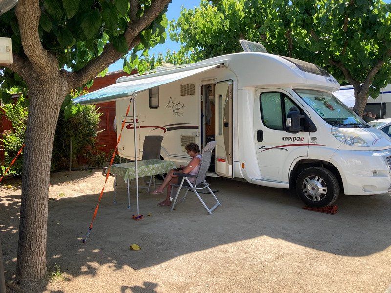
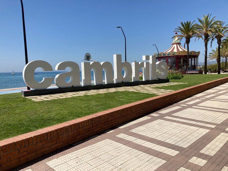
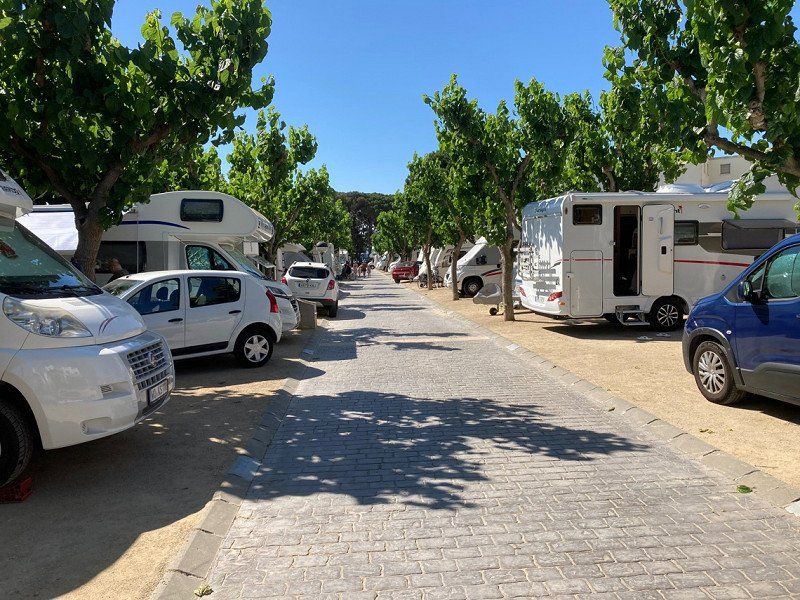
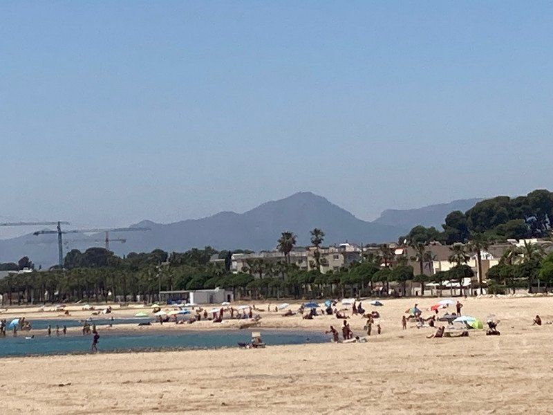
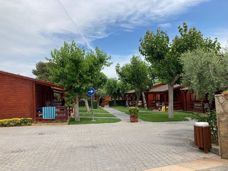
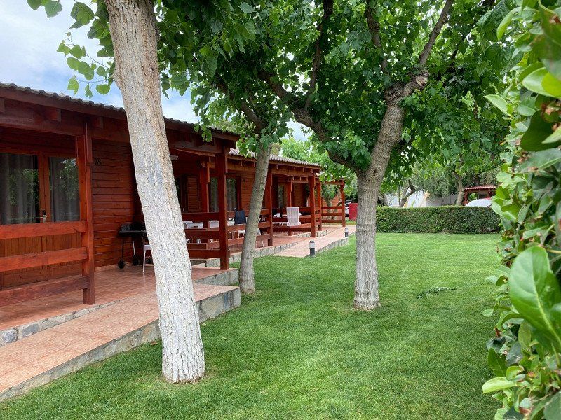
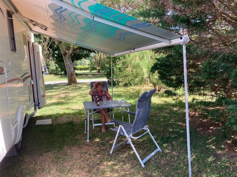
Camping Joan
Passeig Marítim 88, 43850, Cambrils, Spanien
41° 3' 28.3" N 1° 1' 35.8" E
41.0578500 1.0266000
• Head southeast.
• Arrive at your destination on the left.
☍
Distance not available
(Duration not available)
Day
Camping Joan
After 10 beautiful days of vacation it is time to say goodbye.
Passeig Marítim 88, 43850, Cambrils, Spanien
41° 3' 28.3" N 1° 1' 35.8" E
41.0578500 1.0266000
• Head southeast. Go for 14 m.
• Turn right. Go for 22 m.
• Turn right. Go for 94 m.
• Turn slightly left toward Carrer de Josep Pujol. Go for 159 m.
• Turn right onto Carrer de Josep Pujol. Go for 129 m.
• Turn left onto Carrer de Lluís Domènech i Montaner. Go for 132 m.
• Turn left onto Carrer del Massó. Go for 37 m.
• Turn slightly right onto Carrer Cèsar Martinell. Go for 59 m.
• Turn left onto Carrer Cèsar Martinell. Go for 148 m.
• Continue on Carrer Gòtic. Go for 323 m.
• Turn right onto N-340. Go for 2.2 km.
• Take the 3rd exit from roundabout onto T-312 toward Tarragona/E-15/A-7/Castelló/AP-7/Montbrió del Camp. Go for 993 m.
• Take the 2nd exit from roundabout toward E-15/Tarragona/Barcelona/València. Go for 416 m.
• Take ramp onto AP-7 (Autopista de la Mediterrània) toward Tarragona/Barcelona. Go for 138 km.
• Take exit 12B toward Centre Ciutat la Roca del V./Granollers est/Mataró/C-60. Go for 1.0 km.
• Take the left exit toward La Roca del V./Mataró onto C-60 (Autovia Mataró Granollers). Go for 9.8 km.
• Take the exit toward Mataró oest Hospital/Girona onto C-32 (Autopista de Barcelona a Mataró). Go for 23.2 km.
• Take exit 122 toward Calella/Pineda de Mar/Sta. Susanna. Go for 1.1 km.
• Continue on Carrer del Torrent dels Frares toward Calella Platges/Pineda de Mar/Sta. Susanna/Girona/N-2. Go for 23 m.
• Continue on Carrer Torrent del Convent toward Calella Platges/Pineda de Mar/Sta. Susanna/Girona/N-2. Go for 27 m.
• Keep left toward Calella Platges/Pineda de Mar/Sta. Susanna/Girona/N-2. Go for 204 m.
• Continue on Avinguda del Rierany dels Frares toward Pineda Centre/Sta. Susanna/N-2/Girona. Go for 120 m.
• Turn left onto Carrer Andorra toward Pineda Centre/Sta. Susanna/N-2/Girona. Go for 72 m.
• Turn left onto Carrer Montecarlo. Go for 138 m.
• Continue on Carrer Garbí (N-2) toward Pineda Centre Ciutat/Sta. Susanna/Girona. Go for 217 m.
• Take the 3rd exit from roundabout onto Carrer Garbí (N-2) toward Girona. Go for 367 m.
• Pass 2 roundabouts and continue on Carrer Garbí (N-2). Go for 800 m.
• Turn right onto Avinguda Montserrat toward Centre Urbà/Barri de les Creus. Go for 59 m.
• Turn left onto Avinguda Montserrat. Go for 219 m.
• Turn slightly right onto Plaça de la Pagesia. Go for 179 m.
• Take the 1st exit from roundabout onto Avinguda de la Mare de Déu de la Mercè. Go for 54 m.
• Continue on Plaça de l'Estatut. Go for 106 m.
• Turn left onto Carrer d'Ignasi Iglesias. Go for 215 m.
• Turn right onto Carrer de Moragas i Barret. Go for 95 m.
• Turn right onto Carrer Tarragona. Go for 61 m.
• Arrive at Carrer Tarragona. Your destination is on the right.
☍
181,3 km
(1 hrs. 52 min.)
Area Pineda de Mar, Carrer Tarragona, 24, Pineda de Mar, Spanien
Paid parking space in the center of Pineda de Mar. Very friendly operator.
Carrer Tarragona, 24, 08397 Pineda de Mar, Barcelona, Spanien
41° 37' 19.5" N 2° 41' 22.1" E
41.6220965 2.6894747
• Head west on Carrer Tarragona.
• Arrive at Carrer Tarragona. Your destination is on the right.
☍
Distance not available
(Duration not available)
Day
Area Pineda de Mar, Carrer Tarragona, Pineda de Mar, Spanien
Carrer Tarragona, 24, 08397 Pineda de Mar, Barcelona, Spanien
41° 37' 19.5" N 2° 41' 22.1" E
41.6220965 2.6894747
• Head west on Carrer Tarragona. Go for 68 m.
• Turn right onto Carrer de la Tribala. Go for 358 m.
• Take the 2nd exit from roundabout onto Plaça de la Pagesia. Go for 128 m.
• Continue on Avinguda Montserrat. Go for 219 m.
• Turn left onto Avinguda Montserrat toward C-32/Girona. Go for 109 m.
• Continue on Carrer Extremadura toward C-32/Girona. Go for 41 m.
• Continue on Carrer de Santa Susanna. Go for 27 m.
• Continue on Passeig d'Hortsavinyà. Go for 446 m.
• Continue on Camí de Sant Pere. Go for 659 m.
• Turn slightly left toward Autopista de Barcelona a Mataró/C-32. Go for 615 m.
• Take ramp onto C-32 (Autopista de Barcelona a Mataró) toward Girona. Go for 10.0 km.
• Take exit 134 toward Blanes/Lloret de Mar/Tossa de Mar/Tordera/Girona. Go for 371 m.
• Take the 3rd exit from roundabout onto GI-600 toward Tordera/Girona/N-2. Go for 2.1 km.
• Take the 1st exit from roundabout onto N-2 toward E-15/AP-7/Girona/França/Francia/Aeroport. Go for 27.6 km.
• Take the exit onto AP-7 (Autopista de la Mediterrània). Go for 67.2 km.
• Continue on A9 (La Catalane). Go for 281 km.
• Continue on A7 (Autoroute du Soleil). Go for 5.4 km.
• Take exit 20 toward Pont St Esprit/Mondragon/Piolenc. Go for 519 m.
• Take the 1st exit from roundabout onto Route de Lyon (N7) toward A7/Orange/Piolenc. Go for 992 m.
• Turn left onto Boulevard Frédéric Mistral (D43) toward Sérignan. Go for 193 m.
• Take the 2nd exit from roundabout onto Avenue de la Gare (D172). Go for 258 m.
• Continue on D172. Go for 18 m.
• Continue on Avenue de la Gare (D172). Go for 28 m.
• Continue on Avenue Saint-Louis (D172). Go for 929 m.
• Continue on D172. Go for 240 m.
• Continue on Route d'Uchaux (D172). Go for 613 m.
• Continue on D172. Go for 558 m.
• Continue on Route d'Uchaux (D172). Go for 760 m.
• Continue on Route de Piolenc (D172). Go for 866 m.
• Continue on Route de Sérignan (D172). Go for 577 m.
• Arrive at Route de Sérignan (D172). Your destination is on the right.
☍
402,8 km
(3 hrs. 39 min.)
Route de Sérignan, 84100 Uchaux, Frankreich
Rte de Sérignan, Uchaux, Frankreich
44° 11' 55.6" N 4° 48' 28.3" E
44.1987659 4.8078661
• Head east on Route de Sérignan (D172).
• Arrive at Route de Sérignan (D172). Your destination is on the right.
☍
Distance not available
(Duration not available)
Day
Route de Sérignan, 84100 Uchaux, Frankreich
Rte de Sérignan, Uchaux, Frankreich
44° 11' 55.6" N 4° 48' 28.3" E
44.1987659 4.8078661
• Head toward Chemin des Majuranes on Route de Sérignan (D172). Go for 577 m.
• Turn right onto Route d'Orange (D11). Go for 978 m.
• Continue on D11. Go for 105 m.
• Continue on Route d'Orange (D11). Go for 2.8 km.
• Turn left onto Route de Bollène (D12). Go for 1.1 km.
• Continue on D12. Go for 3.5 km.
• Continue on Lieu-dit La Roquette (D12). Go for 57 m.
• Continue on D12. Go for 1.5 km.
• Continue on Route d'Uchaux (D12). Go for 310 m.
• Turn left onto Avenue Émile Lachaux (D994). Go for 1.3 km.
• Take the 1st exit from roundabout onto Avenue Salvador Allende (D8) toward A7/Pierrelatte/St Paul/Pont St Esprit. Go for 1.7 km.
• Take the 2nd exit from Rond-Point des Portes de Provence roundabout toward Lyon/Montélimar/Marseille/Nîmes/Orange. Go for 164 m.
• Take ramp onto A7 (Autoroute du Soleil) toward Montélimar/Valence/Lyon. Go for 176 km.
• Keep right onto Autoroute du Soleil (M7) toward Paris/A6/Clermont-Fd/A89/Roanne. Go for 149 km.
• Take exit 24.1 toward Beaune-Centre/Beaune-Hospices onto D470 (Avenue du Général de Gaulle). Go for 1.1 km.
• Continue on Avenue du Général de Gaulle (D470) toward Beaune. Go for 83 m.
• Take the 1st exit from roundabout onto Avenue du Général de Gaulle (D470). Go for 352 m.
• Take the 1st exit from Rond-Point Philippe le Bon roundabout onto Rocade Est (D1074) toward Dole/Seurre/Ste Marie la B./Verdun S/le Doubs. Go for 457 m.
• Take the 2nd exit from roundabout onto Rocade Est (D1074). Go for 1.1 km.
• Take the 1st exit from roundabout onto Route de Seurre (D973) toward Dole. Go for 1.2 km.
• Turn left onto Route de Seurre (D20 H) toward Vignoles/Z.A. des Bruottées. Go for 37 m.
• Continue on D20 H. Go for 964 m.
• Take the 2nd exit from roundabout onto Rue des Châteaux (D20 H). Go for 163 m.
• Turn left onto Rue du Ruisseau. Go for 206 m.
• Turn right onto Rue Jaune. Go for 147 m.
• Arrive at Rue Jaune. Your destination is on the right.
☍
345,0 km
(3 hrs. 18 min.)
10 Rue Jaune, 21200 Vignoles, Frankreich
Paid campsite on the outskirts.
47° 1' 35.2" N 4° 52' 58.1" E
47.0264441 4.8827925
• Head northeast on Rue Jaune.
• Arrive at Rue Jaune. Your destination is on the right.
☍
Distance not available
(Duration not available)
Day
10 Rue Jaune, 21200 Vignoles, Frankreich
47° 1' 35.2" N 4° 52' 58.1" E
47.0264441 4.8827925
• Head toward Rue aux Clous on Rue Jaune. Go for 432 m.
• Turn right onto Route de Gigny. Go for 269 m.
• Take the 2nd exit from roundabout onto Route de Gigny. Go for 75 m.
• Turn left onto Route de Gigny (D20 H). Go for 1.2 km.
• Continue on D20 H. Go for 27 m.
• Turn left onto D20. Go for 1.2 km.
• Continue on Route de Longvay (D20). Go for 595 m.
• Take the 1st exit from roundabout onto D20. Go for 528 m.
• Continue on Rue de Chorey (D20). Go for 965 m.
• Take the 1st exit from roundabout onto D1074 toward A6-A31-A36/Dijon/Nuits St Georges. Go for 271 m.
• Take the 1st exit from roundabout onto Route de Dijon (D974). Go for 454 m.
• Take the 1st exit from roundabout toward A6/Paris/Auxerre/Lyon/Chalon S/S./Besançon/Dijon/Autun. Go for 87 m.
• Take the 2nd exit from roundabout onto A6 (Autoroute du Soleil) toward Lyon/Chalon S/Saône/Besançon/Dijon. Go for 1.8 km.
• Take the exit toward A36/Besançon/Dijon onto A31. Go for 5.0 km.
• Take the exit toward Mulhouse/Besançon/Dole onto A36 (La Comtoise). Go for 164 km.
• Keep left onto A36 (La Comtoise) toward Strasbourg/Mulhouse/Belfort/Montbéliard. Go for 63.0 km.
• Take the exit toward A35/E25/Strasbourg/Colmar onto Échangeur de Bâle-Mulhouse. Go for 2.4 km.
• Continue on A35. Go for 38.3 km.
• Continue on D83. Go for 10.7 km.
• Keep left onto A35. Go for 39.0 km.
• Continue on A355 toward E25/A4/Paris/A35/Karlsruhe/Strasbourg. Go for 23.6 km.
• Keep right toward A35/A4/Schiltigheim/Karlsruhe/Lauterbourg/Hoerdt. Go for 2.6 km.
• Continue on A35. Go for 47.0 km.
• Continue on B9. Go for 10.7 km.
• Keep right onto B9 toward Gewerbegebiet Horst/A65. Go for 229 m.
• Take the left exit toward Ludwigshafen/Landau/Speyer/Kandel-Nord/Gewerbegebiet Horst onto A65. Go for 49.6 km.
• Take exit 7 toward Koblenz/Mainz onto A61. Go for 20.7 km.
• Take exit 58 toward Monsheim/Worms/Worms-Zentr. onto B47. Go for 3.3 km.
• Take ramp toward Wo.-Horchheim. Go for 292 m.
• Turn left onto Kolpingstraße (K17). Go for 833 m.
• Take the 2nd exit from roundabout onto Höhlchenstraße toward Wo.-Weinsheim. Go for 577 m.
• Continue on Weinbergstraße. Go for 22 m.
• Arrive at Weinbergstraße.
☍
489,5 km
(4 hrs. 25 min.)
67551 Worms, Deutschland
49° 36' 29.1" N 8° 19' 55.2" E
49.6080857 8.3320035