At the end of May 2022 we made a trip to the Mediterranean Sea with the camper. Two weeks without a drop of rain, and regular temperatures above 25 and even above 30 degrees. Beautiful of course, because that is one of the reasons you drive to the South. Was a bit “too” now and then, and that has especially depressed our activity level. It's never good you would almost say.
Orange, the Mediterranean, Carcassonne, Oradour and Ypres were the decided stops in advance. The rest has been added according to the form and meaning of the day. To travel really relaxed, 14 days is actually just a bit short for this round. We simply do not like to make long travel days. So after a few days stationary at the furthest point, we went further north again in stages. But a whole week in the Mediterranean would not have been a punishment.
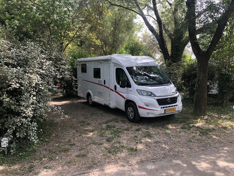
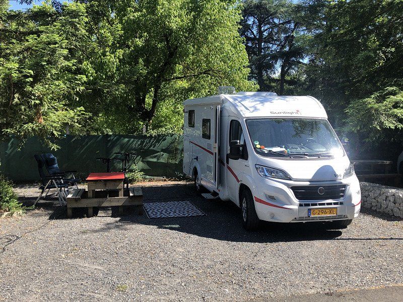
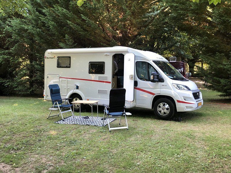
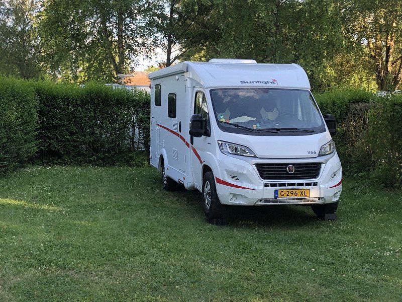
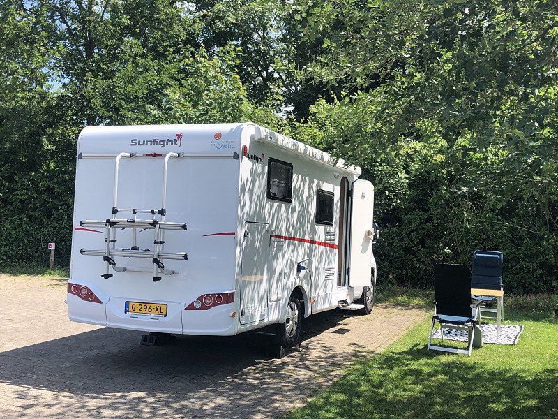
Always a photo of the pitch where we spent the night, so that you hopefully have an idea of the size of the places.
Maybe you'll get an idea for your own trip. If so, drop a note!
Day
Almere, Nederland
Grootzeil 112, 1319 AS Almere, Nederland
52° 23' 19.2" N 5° 10' 39.7" E
52.3886736 5.1776836
• Head northwest on Kombuis. Go for 12 m.
• Turn left onto Kombuis. Go for 405 m.
• Take the 2nd exit from roundabout onto Boegdreef. Go for 720 m.
• Take the 1st exit from roundabout onto Hogering (s101). Go for 4.5 km.
• Take left ramp onto A6 toward Almere-Poort/Amsterdam. Go for 5.6 km.
• Take the left exit toward E231/Hengelo/Amersfoort/Hilversum onto A1. Go for 13.9 km.
• Take the exit toward Hilversum/Utrecht onto A27 (Rijksweg). Go for 87.3 km.
• Take the exit toward Roosendaal/Antwerpen/Industrieterrein Breda 0-7000 onto A58. Go for 6.3 km.
• Take the left exit toward E19/Antwerpen onto A16. Go for 5.9 km.
• Continue on E19. Go for 41.8 km.
• Continue on E19 (Ring Antwerpen 1). Go for 2.4 km.
• Continue on E34 (Kleine Ring) toward Brugge/Gent/Haven 1000-2000. Go for 5.2 km.
• Continue on E17. Go for 49.5 km.
• Take the exit toward Gent Centrum onto B401. Go for 2.6 km.
• Keep right onto Graaf van Vlaanderenplein. Go for 299 m.
• Turn left onto Woodrow Wilsonplein. Go for 16 m.
• Turn right onto Vlaanderenstraat. Go for 192 m.
• Arrive at Hippoliet Lippensplein. Your destination is on the right.
☍
226,4 km
(2 hrs. 9 min.)
Gent, België
51° 3' 0.1" N 3° 43' 49.2" E
51.0500182 3.7303351
• Head northwest on Hippoliet Lippensplein. Go for 216 m.
• Turn left onto Lieven Bauwensplein. Go for 21 m.
• Continue on François Laurentplein. Go for 102 m.
• Turn left onto Brabantdam. Go for 158 m.
• Turn right onto Hippoliet Lippensplein. Go for 233 m.
• Continue on Frankrijkplein. Go for 86 m.
• Continue on Franklin Rooseveltlaan (N422). Go for 451 m.
• Keep left onto B401. Go for 112 m.
• Keep left onto B401 toward E17/E40. Go for 2.6 km.
• Take the exit toward Rijsel/Lille/Kortrijk onto E17. Go for 50.4 km.
• Continue on A22. Go for 11.7 km.
• Keep left onto N356 toward Paris/A1/Lille/Aéroport Lille Lesquin. Go for 4.8 km.
• Keep left onto N356 toward Paris/Dunkerque/Lille-Centre/Aéroport Lesquin. Go for 1.7 km.
• Keep left onto Boulevard Périphérique Est de Lille (N356) toward Paris/Bruxelles/Valenciennes/Villeneuve d'Ascq/Aéroport Lesquin. Go for 411 m.
• Take ramp onto A1 (Autoroute du Nord). Go for 20.5 km.
• Keep left onto A1 (Autoroute du Nord). Go for 18.1 km.
• Take the exit toward Cambrai/Reims/Metz/Nancy/Lyon onto A26 (Autoroute des Anglais). Go for 159 km.
• Continue on E17. Go for 322 m.
• Take the exit onto A4 (Contournement Sud de Reims). Go for 34.6 km.
• Take the exit toward St Gibrien/Châlons en Ch. Rive Gauche/Troyes/Lyon onto A26. Go for 96.2 km.
• Continue on E17 toward A5/Mulhouse/Lyon/Dijon/Chaumont. Go for 123 m.
• Take the exit onto A5. Go for 93.2 km.
• Continue on A31. Go for 65.5 km.
• Take exit 4 toward Dijon-Centre/St Apollinaire/Arc S/Tille. Go for 1.0 km.
• Take the 3rd exit from roundabout onto Lieu-dit L'Arc (D700) toward Dijon/Varois et Chaignot. Go for 7.0 km.
• Take the 3rd exit from Rond-Point de la Porte des Longènes roundabout onto Rue Jean Moulin toward Dijon-Centre. Go for 368 m.
• Take the 2nd exit from Rond-Point Jean Moulin roundabout onto Rue Jean Moulin toward Dijon-Centre. Go for 528 m.
• Continue toward Grésilles/Centre Ville/Grand Stade. Go for 35 m.
• Turn left onto Avenue Raymond Poincaré (D70) toward Grésilles. Go for 1.5 km.
• Take the 3rd exit from Place Jean Bouhey roundabout onto Boulevard Georges Clemenceau (D70). Go for 555 m.
• Continue on Place de la République. Go for 371 m.
• Turn right onto Rue Jean-Jacques Rousseau. Go for 235 m.
• Turn right onto Rue d'Assas. Go for 179 m.
• Turn left onto Rue de la Préfecture. Go for 136 m.
• Take the 2nd exit from roundabout onto Rue de la Préfecture. Go for 52 m.
• Turn right onto Rue de la Préfecture. Go for 16 m.
• Arrive at Rue de la Préfecture.
☍
572,4 km
(4 hrs. 54 min.)
Day
Dijon, Frankrijk
21000 Dijon, Frankrijk
47° 19' 19.4" N 5° 2' 29.3" E
47.3220470 5.0414800
• Head northeast on Rue de la Préfecture. Go for 16 m.
• Turn left onto Rue de la Préfecture. Go for 33 m.
• Take the 1st exit from roundabout onto Rue de la Préfecture. Go for 322 m.
• Turn right onto Rue du Nord. Go for 147 m.
• Turn slightly right onto Rue Dietsch. Go for 162 m.
• Turn right onto Boulevard Thiers (D905). Go for 519 m.
• Take the 3rd exit from Place du 30 Octobre et Légion d'Honneur roundabout onto Boulevard Voltaire (D905). Go for 997 m.
• Turn left onto Rue d'Auxonne (D905). Go for 2.2 km.
• Take ramp onto Voie Georges Pompidou (M274) toward A31/(Lyon)/Beaune/Chalon S/S./Dijon-Sud/Chenôve/Aéroport Longvic. Go for 3.9 km.
• Keep left onto A311 toward Lyon/A31/Chalon S/ S./Beaune. Go for 4.6 km.
• Continue on A31. Go for 27.8 km.
• Continue on A6 (Autoroute du Soleil). Go for 24.6 km.
• Take exit 25.2 toward Chalon S/S.-Centre/Châtenoy le Royal. Go for 1.1 km.
• Turn right onto Avenue de l'Europe (D906) toward Autun/Chalon-Centre/Châtenoy le R. Go for 3.0 km.
• Continue on Pont Jean-Richard (D673). Go for 571 m.
• Take the 2nd exit from roundabout onto Avenue de Verdun (D673). Go for 544 m.
• Turn left onto Avenue des Granges Forestier. Go for 360 m.
• Turn slightly left onto Rue Julien Leneveu. Go for 966 m.
• Arrive at Rue Julien Leneveu. Your destination is on the right.
☍
71,8 km
( 49 min.)
Camping du Pont de Bourgogne
Simple campsite, beautifully situated in relation to the historic center of Chalon. You can walk there from the campsite. We did it by bike in five minutes.
Rue Julien Leneveu, 71380, Saint Marcel, Frankrijk
46° 47' 4.5" N 4° 52' 28" E
46.7845724 4.8744315
• Head southwest on Rue Julien Leneveu. Go for 966 m.
• Turn right onto Rue des Chavannes. Go for 26 m.
• Continue on Pont des Chavannes. Go for 110 m.
• Continue on Rue de Strasbourg. Go for 220 m.
• Continue on Quai de la Monnaie. Go for 314 m.
• Turn right onto Pont Saint-Laurent. Go for 126 m.
• Turn left onto Quai des Messageries (D5). Go for 266 m.
• Continue on Place du Port Villiers (D5). Go for 25 m.
• Turn right onto Place du Port Villiers. Go for 47 m.
• Continue on Rue du Port Villiers. Go for 94 m.
• Arrive at Rue du Port Villiers. Your destination is on the left.
☍
2,2 km
( 5 min.)
Day
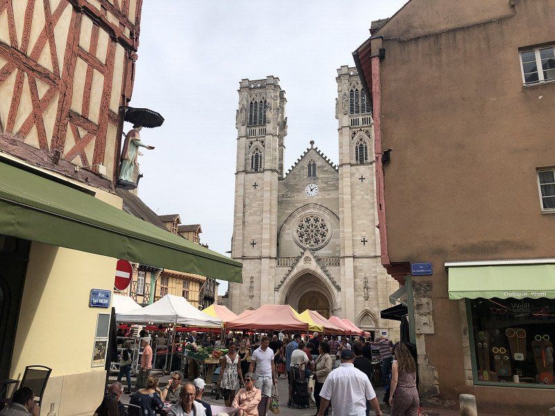
Chalon-sur-Saône, Frankrijk
For us really only a stopover on the way to the South, but it turns out to have a real historic center that is worth a visit. On Sunday morning there is a large fruit and vegetable market where it was pleasantly busy.
71100 Chalon-sur-Saône, Frankrijk
46° 46' 50.8" N 4° 51' 14.2" E
46.7807640 4.8539470
• Head toward Rue au Change on Rue du Port Villiers. Go for 25 m.
• Continue on Rue Général Leclerc. Go for 342 m.
• Continue on Place de l'Obélisque. Go for 43 m.
• Turn left onto Place de l'Obélisque. Go for 34 m.
• Continue on Boulevard de la République. Go for 422 m.
• Turn left onto Avenue Nicéphore Niépce (D906). Go for 613 m.
• Turn right onto Quai Saint-Cosme (D906) toward Mâcon/Le Creusot/Montceau. Go for 1.7 km.
• Take the 3rd exit from Route de Lyon roundabout onto Route de Lyon (D906) toward A6/Mâcon/Le Creusot/Montceau/Lux. Go for 672 m.
• Take the 2nd exit from roundabout onto Route Express Chalon Montceau (N80) toward A6/Moulins/Montceau les M./Le Creusot/Cluny. Go for 724 m.
• Take the 2nd exit from roundabout toward Paris/Dijon/Lyon/Bourg en B./Mâcon. Go for 558 m.
• Take ramp onto A6 (Autoroute du Soleil) toward Lyon/Bourg en B./Mâcon. Go for 117 km.
• Keep left onto Autoroute du Soleil (M6) toward Lyon-Centre. Go for 3.9 km.
• Take ramp toward Lyon-Centre/Perrache/La Confluence. Go for 178 m.
• Keep right toward Lyon-Centre/La Confluence. Go for 31 m.
• Continue on Trémie 7. Go for 91 m.
• Continue on Trémie 7. Go for 191 m.
• Keep left toward Lyon-Centre. Go for 354 m.
• Continue on Quai Docteur Gailleton. Go for 660 m.
• Keep left onto Quai Docteur Gailleton toward Terreaux/Croix-Rousse. Go for 290 m.
• Continue on Quai Jules Courmont. Go for 345 m.
• Turn left onto Rue Childebert toward Place de la République. Go for 72 m.
• Turn right onto Rue Grolée. Go for 201 m.
• Turn right onto Rue Président Carnot. Go for 27 m.
• Turn sharp left onto Rue Ferrandière. Go for 227 m.
• Turn right onto Rue du Président Édouard Herriot. Go for 146 m.
• Continue on Rue du Président Édouard Herriot. Go for 138 m.
• Turn right onto Rue des Forces. Go for 74 m.
• Turn right onto Rue de la Gerbe. Go for 60 m.
• Arrive at Rue de la Gerbe. Your destination is on the left.
☍
128,6 km
(1 hrs. 23 min.)
Lyon, Frankrijk
We drove through the Lyon ring road. Not a nice route with the camper. Already busy, and the navigation gave directions that didn't seem right. Somewhere in the middle of that ring, the thing also started reporting an environmental zone. Didn't see a sign, and it shouldn't be an issue for us anyway. But you don't want that distraction when it's busy. Made my own plan and of course got through it well, but a route around Lyon is a bit quieter I think. If you can, make something up!
45° 45' 50.6" N 4° 50' 8.4" E
45.7640430 4.8356590
• Head southeast on Rue de la Gerbe.
• Turn right onto Rue de la Poulaillerie. Go for 103 m.
• Turn right onto Rue du Président Édouard Herriot. Go for 75 m.
• Continue on Rue du Président Édouard Herriot. Go for 133 m.
• Turn right onto Rue du Bât d'Argent. Go for 290 m.
• Turn right onto Quai Jean Moulin. Go for 292 m.
• Continue on Quai Jules Courmont. Go for 480 m.
• Keep left onto Quai Jules Courmont toward A6/Paris/A7/Marseille/Perrache. Go for 240 m.
• Continue on Quai Docteur Gailleton. Go for 925 m.
• Keep left onto Quai Docteur Gailleton. Go for 123 m.
• Keep left onto Quai Docteur Gailleton toward Marseille/St Étienne/Périphérique/Porte de Gerland/La Confluence/Gare Perrache. Go for 236 m.
• Keep left onto Quai Perrache. Go for 135 m.
• Take ramp onto Autoroute du Soleil (M7). Go for 2.0 km.
• Keep left onto Autoroute du Soleil (M7). Go for 194 km.
• Take exit 21 toward Orange-Centre/Caderousse. Go for 1.5 km.
• Take the 4th exit from roundabout onto Route de Caderousse (D17) toward Caderousse. Go for 295 m.
• Take the 1st exit from roundabout onto Rue Agis Rigord. Go for 211 m.
• Take the 2nd exit from roundabout. Go for 44 m.
• Continue on Rue Paul Marquion. Go for 64 m.
• Turn right onto Rue Alexis Carrel. Go for 268 m.
• Pass 2 roundabouts and continue on Rue Alexis Carrel. Go for 576 m.
• Take the 3rd exit from roundabout onto Rue du Pradoun. Go for 125 m.
• Turn right onto Impasse de l'Ésparradou. Go for 84 m.
• Turn left onto Impasse de l'Ésparradou. Go for 36 m.
• Arrive at Impasse de l'Ésparradou. Your destination is on the right.
☍
202,7 km
(2 hrs. 7 min.)
Camping Manon, Rue Alexis Carrel, Orange, Frankrijk
Quiet campsite. After ten o'clock only the croaking of frogs could be heard in the distance. Friendly camping owner too, who explains the city center without being asked, and in the evening makes a tour of the campsite to take the order of bread. It takes about 15 minutes to walk from the campsite to the Arc de Triomphe. And from there you can reach the Roman theater in 15 minutes.
The sanitary facilities on the campsite are adequate. Our first motorhome trip took us through Denmark; it (obviously) falls far short of that standard.
1321 Rue Alexis Carrel, 84100 Orange, Frankrijk
44° 8' 46.2" N 4° 47' 42.8" E
44.1461604 4.7952149
• Head east on Impasse de l'Ésparradou. Go for 36 m.
• Turn right onto Impasse de l'Ésparradou. Go for 84 m.
• Turn left onto Rue du Pradoun. Go for 87 m.
• Take the 2nd exit from roundabout onto Rue du Bourbonnais. Go for 329 m.
• Take the 2nd exit from roundabout onto Rue du Bourbonnais. Go for 272 m.
• Turn right onto Avenue du Maréchal de Lattre de Tassigny (N7). Go for 253 m.
• Take the 2nd exit from Rond-Point de l'Arc de Triomphe roundabout onto Rond-Point de l'Arc de Triomphe (N7). Go for 505 m.
• Turn left onto Boulevard Édouard Daladier (N7) toward Avignon/Carpentras/Camaret/Vaison la R. Go for 96 m.
• Turn right onto Rue du Fond du Sac. Go for 86 m.
• Turn left onto Rue du Renoyer. Go for 12 m.
• Arrive at Rue du Renoyer. Your destination is on the right.
☍
1,8 km
( 5 min.)
Day
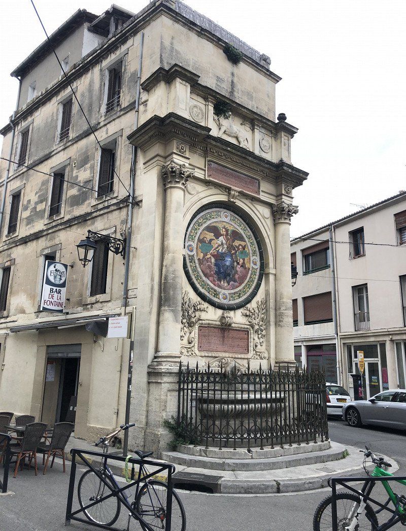
Orange, Frankrijk
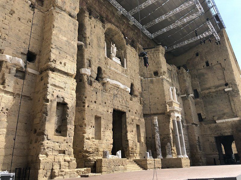
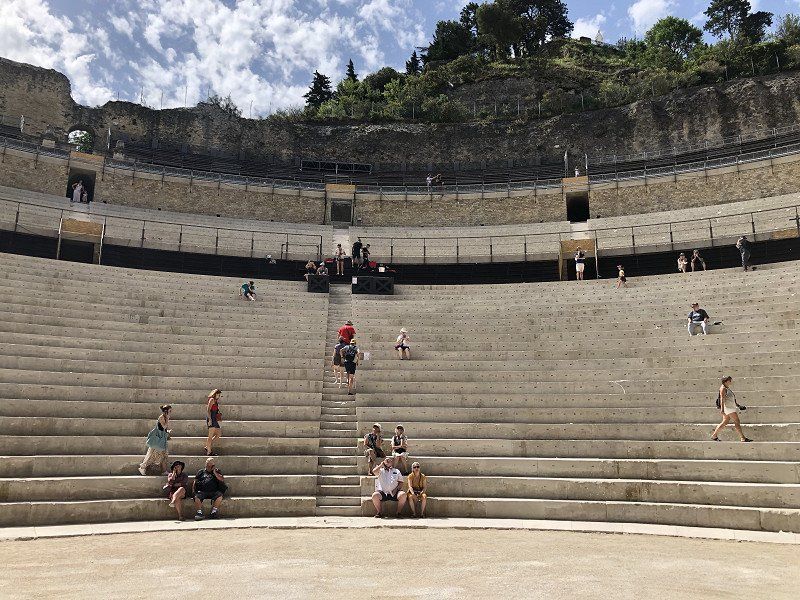
Impressed with Orange! As the campsite owner said "the theater is the best, it doesn't get any better". That's right, but what a nice place to hang out. That theater is really great. Good explanation during the audio tour as well, which really brings the building to life. More often seen remnants, but here you really have an idea of what it could have been like. Afterwards we hung out and ate in the neighborhood. Relaxed atmosphere here. Orange is definitely recommended. To be honest, we didn't bother to look for any traces of those other Oranges. It was a bit warm too.
84100 Orange, Frankrijk
44° 8' 17.2" N 4° 48' 27" E
44.1380989 4.8075110
• Head toward Rue du Tillet on Rue du Renoyer. Go for 66 m.
• Turn left onto Rue Caristie. Go for 39 m.
• Turn left onto Boulevard Édouard Daladier (N7). Go for 196 m.
• Continue on Rue Auguste Lacour toward A7/A9/Caderousse/Nîmes. Go for 96 m.
• Continue on Cours Aristide Briand. Go for 196 m.
• Take the 1st exit from roundabout onto Avenue Charles de Gaulle (D17) toward A7/A9/Caderousse. Go for 352 m.
• Take the 3rd exit from roundabout onto Avenue Charles de Gaulle (D17) toward A7/A9. Go for 283 m.
• Take the 3rd exit from roundabout onto A7 (Autoroute du Soleil) toward Avignon/Marseille. Go for 21.9 km.
• Take exit 23 toward Avignon-Centre/Le Pontet/Sorgues/Vedène. Go for 591 m.
• Keep left toward Avignon/Le Pontet. Go for 53 m.
• Take the 4th exit from roundabout onto Route de Carpentras (D225) toward Avignon/Le Pontet. Go for 2.8 km.
• Continue on D907. Go for 1.9 km.
• Take ramp onto D225 toward Avignon-Centre. Go for 2.4 km.
• Take ramp onto Boulevard Saint-Lazare toward Pont d'Avignon St Bénezet. Go for 466 m.
• Continue on Boulevard du Quai de la Ligne. Go for 516 m.
• Continue on Boulevard du Rhône. Go for 325 m.
• Keep left toward Boulevard du Rhône. Go for 160 m.
• Take ramp onto Boulevard du Rhône toward Villeneuve/Les Angles. Go for 102 m.
• Take ramp onto Pont Édouard Daladier. Go for 494 m.
• Turn right onto Chemin de la Barthelasse. Go for 699 m.
• Turn right. Go for 10 m.
• Arrive at your destination on the right.
☍
33,6 km
( 27 min.)
Camping du Pont d'Avignon
The arrival at the campsite was somewhat ominous. “Someone had to stay in the camper” because apparently many cars are robbed during registration. According to the camping man at the barrier. Once registered, nothing crazy noticed. Nice place in the shade selected. Sanitary facilities are reasonable. Will get even better when everything is open. From the campsite you can walk across the bridge to the city in about twenty minutes. Or you can take the free pedestrian ferry that leaves behind the campsite. In the early and late season, the ferry still takes an afternoon break, but it sails every 15 minutes.
10 chemin de la Barthelasse, 84000, Avignon, Frankrijk
43° 57' 24" N 4° 48' 7.8" E
43.9566700 4.8021700
• Head southeast.
• Turn right. Go for 25 m.
• Turn right toward Chemin de la Barthelasse. Go for 12 m.
• Turn left onto Chemin de la Barthelasse. Go for 562 m.
• Turn left onto Chemin de Bagatelle. Go for 223 m.
• Continue on Chemin de l'Île de Piot. Go for 124 m.
• Take the 1st exit from roundabout. Go for 162 m.
• Turn right onto Pont Édouard Daladier. Go for 372 m.
• Turn right and take ramp toward Pl. Crillon. Go for 32 m.
• Keep left onto Boulevard de l'Oulle toward Pl. Crillon. Go for 26 m.
• Turn slightly left onto Boulevard de l'Oulle. Go for 20 m.
• Continue on Porte de l'Oulle. Go for 9 m.
• Continue on Place Crillon. Go for 59 m.
• Continue on Rue Folco de Baroncelli. Go for 57 m.
• Turn right onto Rue Joseph Vernet. Go for 667 m.
• Turn left onto Rue de la République. Go for 393 m.
• Turn left onto Place de l'Horloge. Go for 17 m.
• Turn right onto Place de l'Horloge. Go for 31 m.
• Turn left onto Rue Félicien David. Go for 14 m.
• Arrive at Rue Félicien David. Your destination is on the right.
☍
2,8 km
( 8 min.)
Day
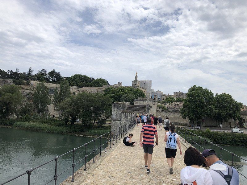
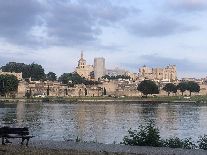
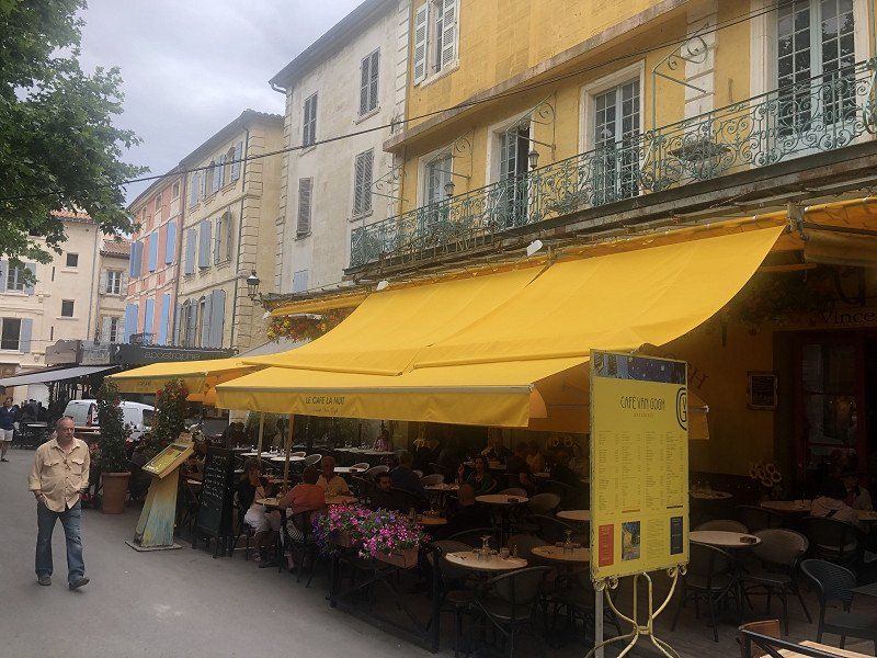
Avignon, Frankrijk
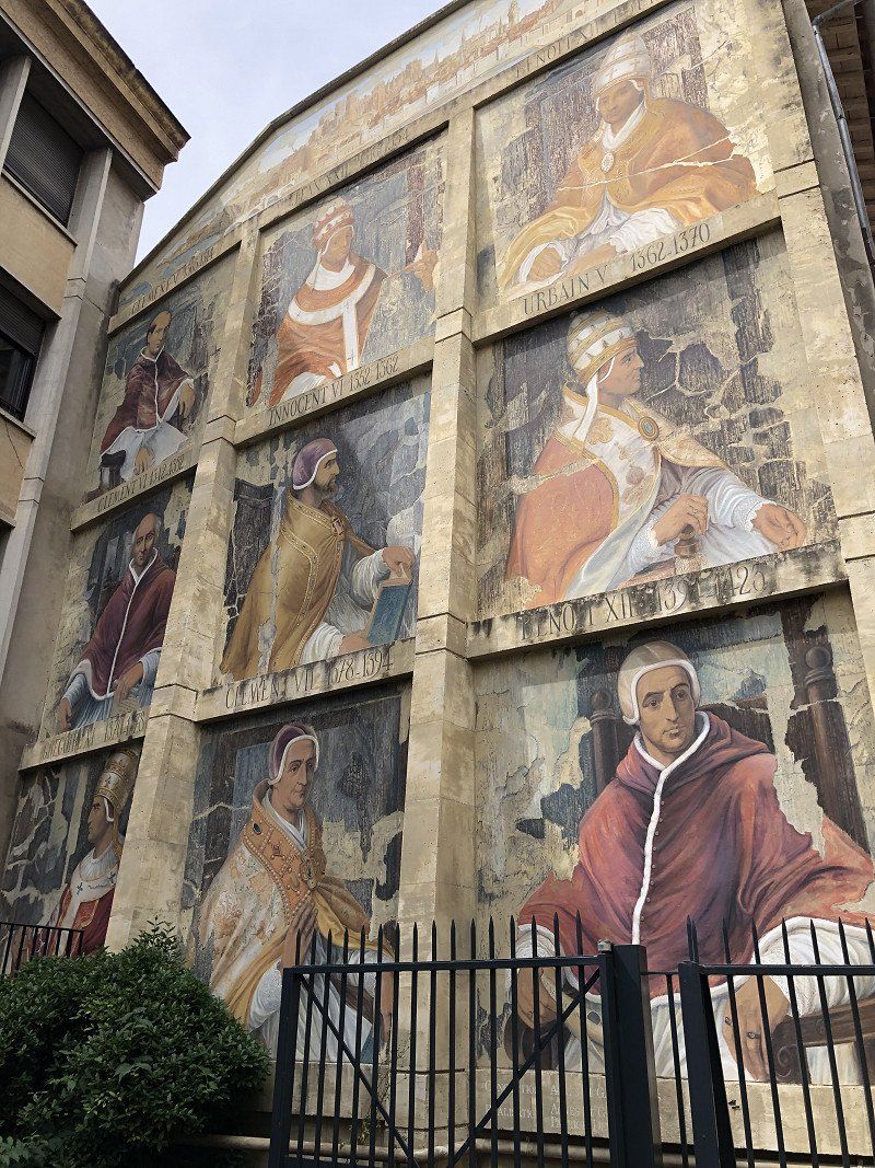
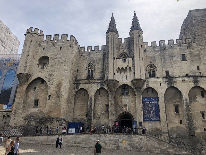
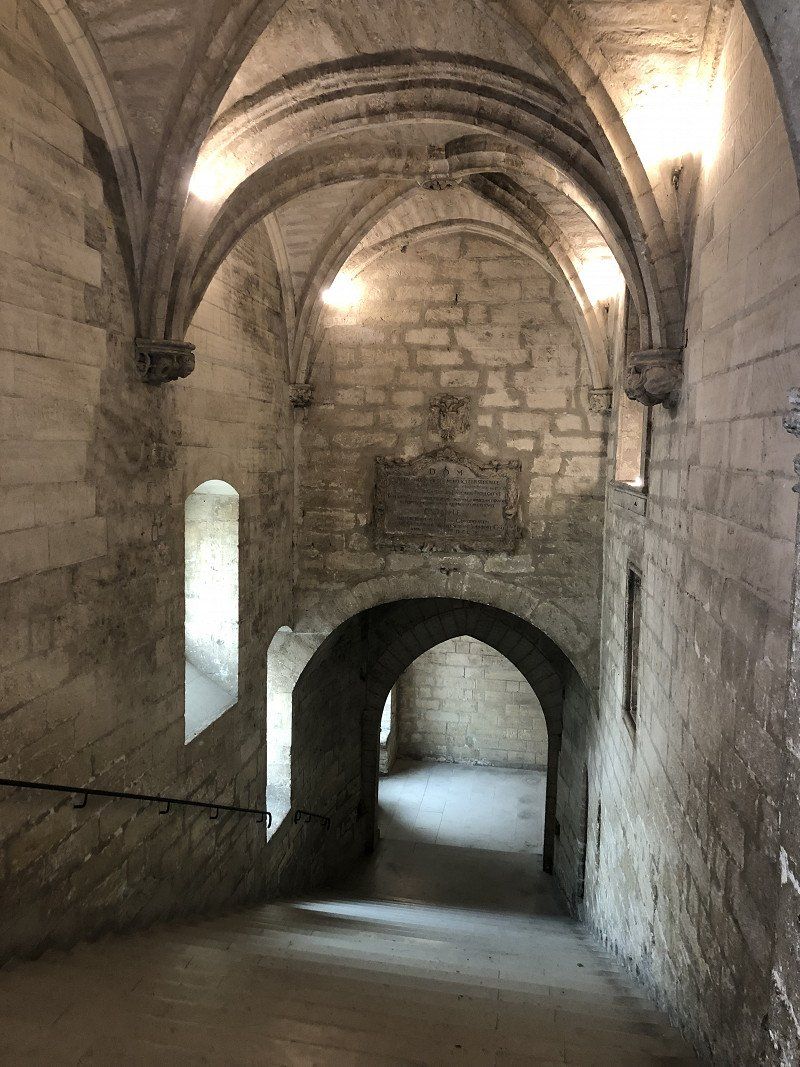
Avignon is the city of the popes. What a palace, or rather, castle they have built! It dominates the city, and the view of it. The visit is more than worth it. By means of virtual reality you get a nice picture of how the rooms were furnished at the time. Finally a very good application of it.
After the visit I wandered through the city where the endless shopping streets stand out. By no means seen everything, it is so vast. Lots of clothes, but also books and CDs/LPs. Interspersed of course with nice terraces for a snack and drink. Avignon did not disappoint.
43° 56' 57.5" N 4° 48' 19.9" E
43.9493170 4.8055280
• Head toward Passage Agricol Moureau on Rue Félicien David. Go for 48 m.
• Turn right onto Rue Racine. Go for 138 m.
• Continue on Place de la Madeleine. Go for 16 m.
• Turn left onto Place de la Madeleine. Go for 169 m.
• Turn slightly left onto Rue du Rempart du Rhône. Go for 78 m.
• Turn right onto Porte de l'Oulle. Go for 9 m.
• Turn slightly right onto Boulevard du Rhône. Go for 26 m.
• Turn slightly right onto Boulevard du Rhône. Go for 326 m.
• Make a U-Turn onto Boulevard du Rhône. Go for 262 m.
• Keep right onto Boulevard du Rhône. Go for 195 m.
• Continue on Allée de l'Oulle. Go for 329 m.
• Keep right toward A7/Arles/Aix en Pce/Courtine/Gare TGV. Go for 705 m.
• Continue on Rocade Charles de Gaulle. Go for 1.3 km.
• Turn right onto Route du Confluent toward Arles/Beaucaire/Tarascon/Z.A. Courtine. Go for 842 m.
• Take the 2nd exit from roundabout onto N1007 toward Arles/Beaucaire/Tarascon/Rognonas/Courtine. Go for 436 m.
• Take the 2nd exit from roundabout onto N1007 toward Arles/Beaucaire/Tarascon/Rognonas. Go for 3.3 km.
• Take the 2nd exit from Giratoire du Mas du Temple roundabout onto D570 N toward Arles/Beaucaire/Tarascon/Graveson. Go for 1.5 km.
• Pass 3 roundabouts and continue on Route d'Avignon (D570 N). Go for 5.6 km.
• Take the 1st exit from roundabout onto Route de Tarascon (D570 N) toward Arles/Beaucaire/Tarascon/Fontvieille/St Étienne du G./St Michel de Frigolet. Go for 997 m.
• Take the 3rd exit from roundabout onto Route d'Arles (D570 N) toward Arles/Fontvieille/St Étienne du G./Beaucaire. Go for 7.0 km.
• Pass 4 roundabouts and continue on Avenue de la Libération. Go for 12.3 km.
• Take the 2nd exit from Rond-Point de la Résistance roundabout onto Avenue de Stalingrad toward Arles-Centre/Arles-Trebon. Go for 2.1 km.
• Take the 4th exit from Place Lamartine roundabout onto Boulevard Émile Combes. Go for 897 m.
• Turn right onto Montée Vauban. Go for 201 m.
• Turn right onto Rue de la Dominante. Go for 81 m.
• Turn slightly left onto Rue Porte de Laure. Go for 18 m.
• Turn slightly left onto Rue de la Calade. Go for 215 m.
• Arrive at Rue de la Calade. Your destination is on the left.
☍
39,0 km
( 41 min.)
Day
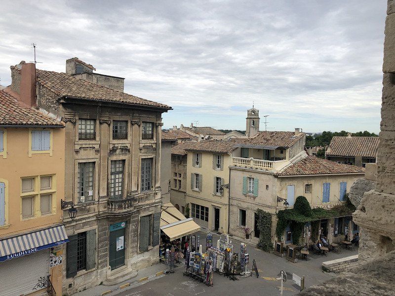
Arles, Frankrijk
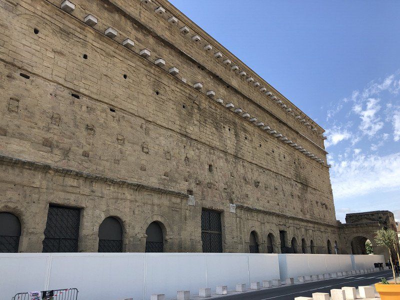
Arles didn't quite deliver what I expected. Visually, the arena has been somewhat destroyed by the addition of temporary stands. The antique theater has been demolished to such an extent that it offers little after seeing the theater in Orange. I knew it had been largely destroyed, and Orange at least gave the remains a place. Finally, Van Gogh… I thought I would stumble upon locations where some scenes could be recognized. I should have prepared myself better, because in the city there is little to nothing marked.
33 Rue de l'Hôtel de ville, 13200 Arles, Frankrijk
43° 40' 35.9" N 4° 37' 40" E
43.6766470 4.6277769
• Head west on Rue de la Calade.
• Continue on Plan de la Cour. Go for 51 m.
• Turn slightly left onto Rue Balze. Go for 95 m.
• Turn right onto Rue Frédéric Mistral. Go for 51 m.
• Turn left onto Rue Barrème. Go for 47 m.
• Turn right onto Place Honoré Clair. Go for 94 m.
• Continue on Rue du Docteur Fanton. Go for 64 m.
• Turn left onto Quai Marx Dormoy. Go for 53 m.
• Continue on Quai Marx Dormoy. Go for 38 m.
• Continue on Quai de la Roquette. Go for 78 m.
• Turn left onto Rue du Port. Go for 36 m.
• Turn left onto Rue Élie Giraud. Go for 92 m.
• Turn right onto Rue Anatole France. Go for 8 m.
• Continue on Rue de la République. Go for 44 m.
• Continue on Place Antonelle. Go for 232 m.
• Turn right onto Boulevard Georges Clemenceau (N453). Go for 314 m.
• Take left ramp onto Nouveau Pont (N113) toward A9/Nîmes/Stes Maries de la Mer/St Gilles/St Martin de Crau. Go for 5.4 km.
• Keep left onto A54 toward Garons/Nîmes/Montpellier. Go for 23.4 km.
• Take the exit onto A9 (La Languedocienne). Go for 104 km.
• Take the exit toward Valras-Plage/Sérignan/Aéroport Béziers-Cap d'Agde/Béziers-Centre onto A75 (La Méridienne). Go for 1.9 km.
• Take exit 64 toward Sérignan. Go for 1.7 km.
• Take the 2nd exit from Rond-Point des Étoiles roundabout toward Sérignan/Villeneuve lès B./Aéroport Béziers Cap d'Agde/Béziers-Gare/Béziers-la Devèze. Go for 193 m.
• Take the 2nd exit from Rond-Point du 9 Mai roundabout onto D612 toward Valras Plage/Sérignan/Villeneuve lès B./Aéroport Béziers-Cap d'Agde. Go for 2.0 km.
• Take the 2nd exit from Rond-Point de la Méditerranée roundabout onto Route de Sérignan (D64) toward Sérignan/Valras-Plage. Go for 4.2 km.
• Take ramp. Go for 386 m.
• Take the 2nd exit from roundabout onto D37 toward Sérignan-Plage. Go for 165 m.
• Take the 1st exit from roundabout onto D37 E11. Go for 2.0 km.
• Turn slightly left toward Lieu-dit Sainte-Denise. Go for 667 m.
• Continue on Lieu-dit Sainte-Denise. Go for 1.0 km.
• Continue on Domaine Sainte-Rita. Go for 127 m.
• Turn right. Go for 22 m.
• Turn right toward Lieu-dit Sainte-Rita. Go for 32 m.
• Continue on Lieu-dit Sainte-Rita. Go for 596 m.
• Turn left onto Allée de la Grande Maire (D37 E11). Go for 333 m.
• Continue on D37 E11. Go for 20 m.
• Continue on Allée de la Grande Maire (D37 E11). Go for 476 m.
• Turn right onto Allée de Beauséjour. Go for 244 m.
• Turn left. Go for 130 m.
• Turn right. Go for 43 m.
• Arrive at your destination on the right.
☍
150,6 km
(1 hrs. 36 min.)
Camping Beausejour
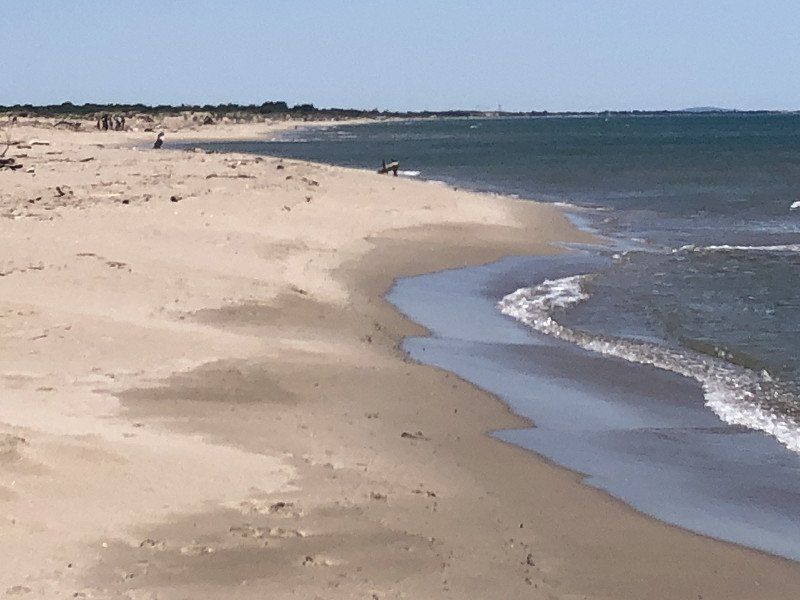
To avoid the crowds and the announced storm, we did not drive to Saintes-Maries-de-Mer, but to Serignan-Plage. A nice, quiet campsite right on the dunes and the beach. To do nothing for two days.
We hadn't thought for a while that the Ascension holiday would also mobilize many people in France. It is not that bad at the campsite here, but on the road it was certainly busy. The urgent tip from the previous campsite "book because everything is going to be full" is not so bad for the time being.
34410, Sérignan Plage, France
43° 15' 59" N 3° 19' 52" E
43.2663800 3.3311100
• Head north. Go for 43 m.
• Turn left toward Allée de Beauséjour. Go for 130 m.
• Turn right onto Allée de Beauséjour. Go for 244 m.
• Turn left onto Allée de la Grande Maire (D37 E11). Go for 476 m.
• Continue on D37 E11. Go for 20 m.
• Continue on Allée de la Grande Maire (D37 E11). Go for 333 m.
• Continue on D37 E11. Go for 1.8 km.
• Turn right. Go for 98 m.
• Turn right toward Chemin de Portiragnes à Sérignan. Go for 2.2 km.
• Turn left onto Chemin de Portiragnes à Sérignan. Go for 896 m.
• Continue on Lieu-dit Les Salans Hauts. Go for 97 m.
• Continue on Chemin de Portiragnes à Sérignan. Go for 150 m.
• Turn left onto Chemin du Grand Salan. Go for 351 m.
• Continue on Chemin du Grand Salan. Go for 49 m.
• Turn left onto Avenue de Béziers (D37). Go for 431 m.
• Continue on Chemin de Béziers (D37). Go for 59 m.
• Continue on Lieu-dit La Prade (D37). Go for 165 m.
• Continue on Chemin de Béziers (D37). Go for 406 m.
• Continue on Route de Portiragnes (D37). Go for 262 m.
• Take ramp onto Route d'Agde (D612). Go for 2.1 km.
• Keep right toward A9/A75/Béziers-Centre/Pézenas. Go for 297 m.
• Continue on Avenue de la Méditerranée (D612). Go for 1.7 km.
• Take ramp toward A75/A9/Clermont-Fd/Montpellier/Narbonne/Pézenas/P.A.E. du Capiscol/P.A.E. la Méridienne. Go for 259 m.
• Take the 2nd exit from Rond-Point des Étoiles roundabout onto A75 (La Méridienne) toward Narbonne/Montpellier. Go for 2.4 km.
• Take the exit toward Barcelone/Toulouse/Narbonne/Béziers-Ouest onto A9 (La Languedocienne). Go for 34.2 km.
• Take the exit toward Toulouse/Carcassonne onto A61 (Autoroute des Deux Mers). Go for 48.0 km.
• Take exit 24 toward Carcassonne-Centre/Trèbes/Carcassonne-la Cité. Go for 677 m.
• Continue on Bretelle Echangeur Carcassonne-Est. Go for 522 m.
• Keep left toward Carcassonne/La Cité. Go for 395 m.
• Take ramp onto Route de Marseille à Bordeaux (D6113). Go for 2.7 km.
• Continue on Avenue du Général Leclerc. Go for 120 m.
• Take the 2nd exit from Rond-Point de l'Europe roundabout onto Avenue du Général Leclerc. Go for 2.1 km.
• Continue on Avenue Arthur Mullot. Go for 123 m.
• Turn right onto Square Gambetta. Go for 147 m.
• Continue on Boulevard Jean Jaurès. Go for 28 m.
• Keep left onto Square Gambetta. Go for 20 m.
• Continue on Rue de Verdun. Go for 506 m.
• Turn right onto Rue Jules Sauzède. Go for 89 m.
• Turn right onto Rue Victor Hugo. Go for 148 m.
• Continue on Place Carnot. Go for 45 m.
• Arrive at Place Carnot. Your destination is on the right.
☍
104,7 km
(1 hrs. 12 min.)
Day
Dagje rust
Only a bike ride to the Orpellieres nature reserve. A tidal area that only floods at high water levels.
Day
Dagje rust
Walk along the high tide line to Portiragnes. There and back about 6 kilometers. At 30 degrees, there is really no rest day anymore.
Day
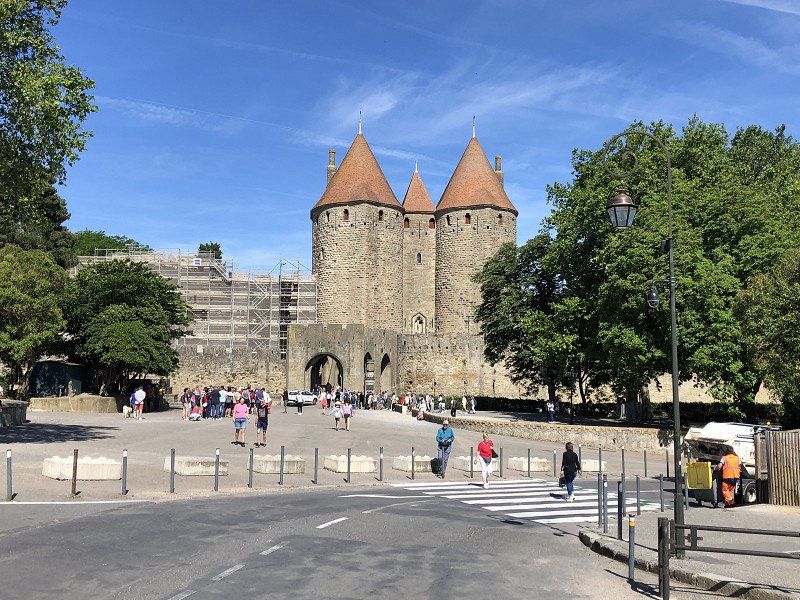
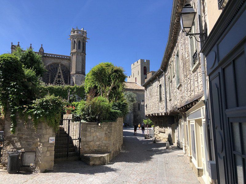
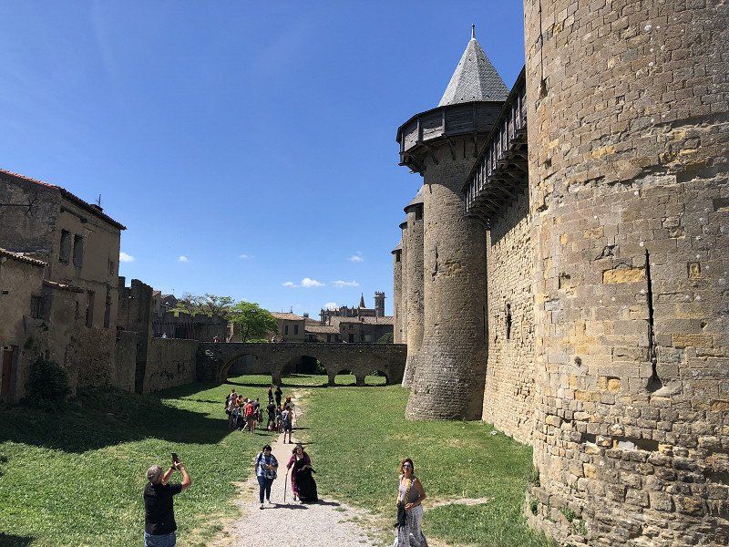
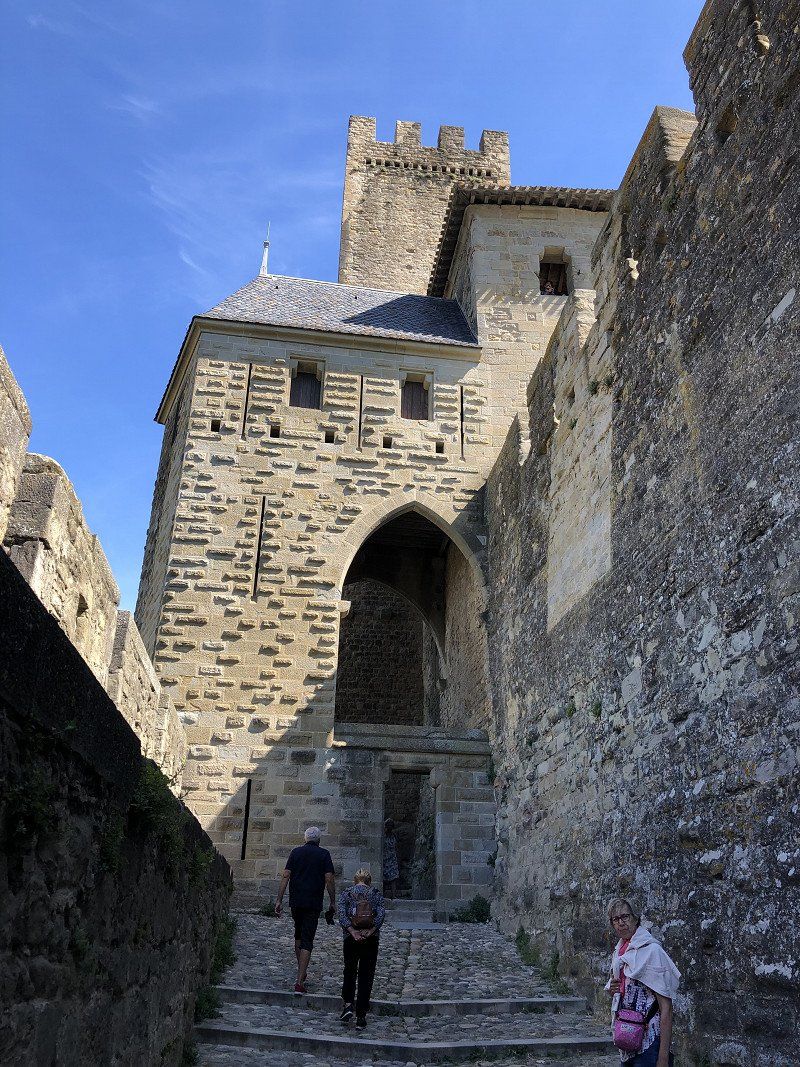
Carcassonne, Frankrijk
I suspect Carcassonne is one of the top five places to visit in France, but it was the board game that gave the impetus to draw the route along here. The creators of the game had a good example. The old town is still intact as an old fortress, and within the walls the streets run like a maze. That after an hour starts to feel familiar again.
In terms of tourist magnet, Carcassonne resembles the Mont Saint Michel, but with a little more variety to save your money. Incidentally, just as well arranged as at the Mont; clearly marked spacious car parks a short walk away also make the visit pleasant.
Definitely don't regret this stop!
11000 Carcassonne, Frankrijk
43° 12' 47.6" N 2° 21' 6.4" E
43.2132151 2.3517703
• Head east on Place Carnot. Go for 40 m.
• Continue on Rue Barbès. Go for 44 m.
• Turn right onto Rue Pinel. Go for 90 m.
• Turn right onto Rue de Verdun. Go for 534 m.
• Turn slightly right onto Place Davilla. Go for 108 m.
• Turn left onto Allée d'Iéna. Go for 202 m.
• Turn right onto Avenue Docteur Henri Gout. Go for 796 m.
• Continue on Route de Limoux (D118). Go for 455 m.
• Take the 2nd exit from roundabout onto Route de Limoux (D118/D6161) toward A61/Toulouse/Limoux/Maquens. Go for 725 m.
• Turn right onto Rocade Ouest (D6161) toward A61/Toulouse/Foix/Castres/Mazamet/Castelnaudary/Aéroport Carcassonne en Pays Cathare. Go for 1.1 km.
• Take the 4th exit from roundabout toward A61/Toulouse. Go for 1.2 km.
• Take ramp onto A61 (Autoroute des Deux Mers) toward Toulouse. Go for 78.8 km.
• Keep left onto A620 toward A614/Le Palays/Toulouse-Centre/Aéroport Blagnac/Tarbes. Go for 3.5 km.
• Take exit 20 toward Gare Matabiau/Gare S.N.C.F. Matabiau/Rangueil onto Boulevard de la Méditerranée. Go for 1.4 km.
• Take the 2nd exit from Rond-Point Raymonde Borios roundabout onto Boulevard de la Méditerranée. Go for 1.1 km.
• Keep left onto Boulevard de la Méditerranée toward Gare Matabiau. Go for 161 m.
• Continue on Boulevard Bernard Griffoul Dorval. Go for 872 m.
• Continue on Port Saint-Sauveur. Go for 420 m.
• Continue on Port Saint-Étienne toward Centre Ville/Gare Matabiau. Go for 232 m.
• Keep left. Go for 14 m.
• Keep right toward Gare Matabiau. Go for 54 m.
• Turn right onto Boulevard du Professeur Léopold Escande toward Gare Matabiau. Go for 21 m.
• Turn left onto Rue de l'Étoile. Go for 353 m.
• Turn right onto Boulevard Lazare Carnot. Go for 241 m.
• Turn slightly left onto Boulevard Lazare Carnot. Go for 287 m.
• Turn right onto Rue Saint-Antoine du T. Go for 32 m.
• Take the 4th exit from Place du Président Thomas Wilson roundabout onto Rue Lapeyrouse. Go for 283 m.
• Turn right onto Rue du Poids de l'Huile. Go for 58 m.
• Turn slightly left onto Rue du Poids de l'Huile. Go for 83 m.
• Arrive at Rue du Poids de l'Huile. Your destination is on the right.
☍
93,3 km
(1 hrs. 1 min.)
Toulouse, Frankrijk
We only drive past Toulouse, but if you have time, it is definitely worth spending a day and evening. In the evening you can stroll along the water of the Garonne and on the squares (Capitole, Wilson) of the city. And during the day there is aviation history to discover. For France, this is where the airmail era began. The very beginning of what has now become Airbus.
43° 36' 16.7" N 1° 26' 39.2" E
43.6046520 1.4442090
• Head southwest on Rue du Poids de l'Huile. Go for 24 m.
• Turn left onto Rue de la Pomme. Go for 51 m.
• Turn right onto Rue Saint-Pantaléon. Go for 68 m.
• Continue on Place Roger Salengro. Go for 26 m.
• Continue on Rue des Puits-Clos. Go for 67 m.
• Turn left onto Rue Baronie. Go for 92 m.
• Turn left onto Rue Genty Magre. Go for 52 m.
• Continue on Rue Antonin Mercié. Go for 101 m.
• Turn slightly right onto Rue Cantegril. Go for 57 m.
• Turn left onto Rue Boulbonne. Go for 37 m.
• Continue on Place Saint-Georges. Go for 75 m.
• Continue on Rue Saint-Antoine du T. Go for 247 m.
• Take the 2nd exit from Place du Président Thomas Wilson roundabout onto Allées du Président Franklin Roosevelt. Go for 179 m.
• Continue on Allées Jean Jaurès. Go for 618 m.
• Continue on Pont Georges Pompidou. Go for 53 m.
• Continue on Place du Rotary. Go for 46 m.
• Continue on Boulevard de Marengo. Go for 276 m.
• Turn right onto Avenue Georges Pompidou toward Montrabé/Lavaur/Jolimont/La Roseraie. Go for 336 m.
• Continue on Avenue Léon Blum. Go for 333 m.
• Continue on Avenue Yves Brunaud. Go for 99 m.
• Take the 3rd exit from Rond-Point du Capitaine Alfred Dreyfus roundabout onto Avenue Yves Brunaud toward Albi/Périphérique/A61/A62. Go for 605 m.
• Continue on Place de la Roseraie toward Albi/Périphérique/A61/A62/A68/Montrabé/Lavaur. Go for 367 m.
• Pass 2 roundabouts and continue on Route d'Agde (M112). Go for 924 m.
• Turn left toward Lavaur/Albi/Bordeaux/Toulouse-Centre/La Roseraie/Jolimont/Parc d'Activités de Montblanc. Go for 63 m.
• Take ramp onto A61 (Autoroute des Deux Mers) toward Lavaur/Albi/Bordeaux. Go for 779 m.
• Take the exit toward Lavaur/Albi/Castres onto A68. Go for 62.1 km.
• Continue on N88. Go for 10.2 km.
• Take ramp toward Millau/Lacaune/Villefranche d'A./St Juéry. Go for 497 m.
• Take the 2nd exit from roundabout onto Avenue de Saint-Juéry toward St Juéry. Go for 310 m.
• Take the 3rd exit from roundabout onto Avenue de Saint-Juéry (D100). Go for 211 m.
• Take the 2nd exit from roundabout onto Avenue de Saint-Juéry (D100). Go for 256 m.
• Turn right onto Rue Francisco Goya. Go for 103 m.
• Turn left onto Allée du Camping. Go for 271 m.
• Arrive at Allée du Camping. Your destination is on the left.
☍
79,5 km
( 53 min.)
Albirondack Parc camping lodge et spa
A campsite that really likes to radiate that it is an American natural park. Great facilities, a bit pricey though. Chosen because it is within walking/cycling distance of the city center. Via a “green cycle path”. That turns out to be a very hilly path. So the bike has to be handled regularly, because we don't drive electrically yet.
Allée de la piscine 31, 81000, Albi, France
43° 56' 1.2" N 2° 9' 56.4" E
43.9336800 2.1656800
• Head south on Allée du Camping. Go for 271 m.
• Turn right onto Rue Francisco Goya. Go for 13 m.
• Turn right onto Avenue de Saint-Juéry (D100). Go for 96 m.
• Pass 2 roundabouts and continue on Avenue du Maréchal de Lattre de Tassigny (D100). Go for 987 m.
• Turn left onto Boulevard Valmy (D100). Go for 467 m.
• Take the 2nd exit from Place du Maquis roundabout onto Boulevard Valmy (D100). Go for 300 m.
• Continue on Boulevard Montebello (D100). Go for 211 m.
• Turn right onto Rue Michel Leclerc. Go for 86 m.
• Turn right onto Boulevard Édouard Andrieu. Go for 134 m.
• Take the 2nd exit from Place Jean Jaurès roundabout onto Boulevard Édouard Andrieu (D600). Go for 57 m.
• Take ramp. Go for 12 m.
• Arrive at your destination.
☍
2,6 km
( 6 min.)
Day
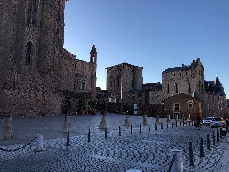
Albi, Frankrijk
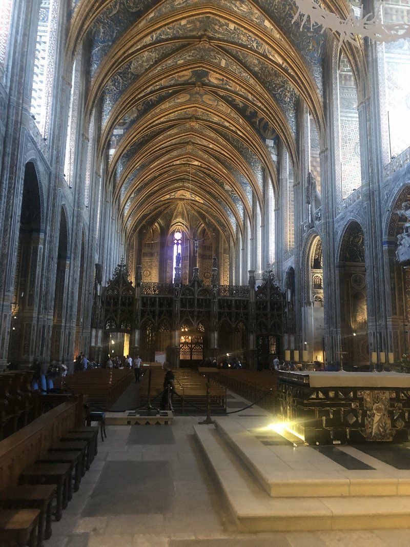
Very understandable that Albi, the red city, has been placed on the UNESCO World Heritage List. A very beautiful city. The gigantic cathedral is not only striking on the outside, but the inside is also (still) very lavishly decorated. A little further on, the monastery of Saint Salvi is hidden. You will find the monastery garden through covered alleys, and it is then difficult to leave here again. What a lovely quiet place where it is very good to stay out of the sun (it was 30 degrees today).
43° 55' 30.3" N 2° 8' 55.1" E
43.9250853 2.1486413
• Take ramp onto Place Jean Jaurès (D13). Go for 251 m.
• Turn right onto Boulevard Montebello (D100). Go for 327 m.
• Take the 4th exit from Place du 8 Mai 1945 roundabout onto Boulevard du Lude. Go for 593 m.
• Take the 2nd exit from Rond-Point de la Rachoune roundabout onto Boulevard du Lude toward Toulouse/Montauban/Castres. Go for 259 m.
• Take ramp onto N88 toward Toulouse/Montauban/Castres. Go for 8.1 km.
• Keep left onto A68 toward Toulouse/Montauban/Gaillac. Go for 13.7 km.
• Take exit 9 toward Montauban/Rabastens/Gaillac/Graulhet. Go for 240 m.
• Pass 2 roundabouts and continue on D968. Go for 2.7 km.
• Take the 2nd exit from roundabout onto D999 toward Montauban/Salvagnac/Ste Cécile d'Avès. Go for 2.6 km.
• Take the 2nd exit from roundabout onto Route de Montauban (D999) toward Montauban/Salvagnac. Go for 9.7 km.
• Turn right onto D14 toward Puycelsi/Les Barrières. Go for 735 m.
• Continue on Lieu-dit Les Goudous (D14). Go for 98 m.
• Continue on D14. Go for 2.7 km.
• Continue on Lieu-dit Le Thournon (D14). Go for 199 m.
• Continue on Lieu-dit La Goulpade (D14). Go for 120 m.
• Continue on D14. Go for 143 m.
• Continue on Lieu-dit Combecaude (D14). Go for 106 m.
• Continue on D14. Go for 120 m.
• Continue on Route du Moulin des Jésuites (D14). Go for 509 m.
• Continue on Route de Sainte-Catherine (D5). Go for 33 m.
• Continue on Route de Sainte-Catherine (D20). Go for 6.2 km.
• Turn left onto Route de Monclar (D1). Go for 4.4 km.
• Turn right onto Route de Monclar D32 (D32) toward Montricoux/Bruniquel. Go for 5.4 km.
• Continue on D32. Go for 33 m.
• Continue on Route de Puygaillard (D32). Go for 2.8 km.
• Continue on Lieu-dit Les Naudounets (D32). Go for 76 m.
• Continue on Route de Puygaillard (D32). Go for 2.1 km.
• Take the 1st exit from roundabout onto D964 toward D958/Montricoux/Caussade/St Antonin Noble Val. Go for 615 m.
• Turn left onto D78. Go for 111 m.
• Continue on Lieu-dit Les Tanneries (D78). Go for 29 m.
• Continue on Chemin de Bioule (D78). Go for 180 m.
• Continue on Lieu-dit Lalande (D78). Go for 2.8 km.
• Continue on Route de Montricoux (D78). Go for 3.7 km.
• Take the 2nd exit from roundabout onto Rue des Mercadiés (D78). Go for 718 m.
• Take the 1st exit from roundabout onto Route de Caussade (D64). Go for 3.5 km.
• Continue on D64. Go for 189 m.
• Continue on Lieu-dit Ferrages (D64). Go for 12 m.
• Continue on Route de Négrepelisse à Caussade (D64). Go for 3.0 km.
• Take the 2nd exit from roundabout onto D117 toward Cahors/Montauban/Réalville/Montpezat de Quercy. Go for 609 m.
• Take the 1st exit from roundabout onto A20 (L'Occitane) toward Paris/Cahors. Go for 215 km.
• Take exit 32 toward Limoges-Nord/La Bastide. Go for 750 m.
• Continue on Rue Henri Matisse. Go for 200 m.
• Continue on Boulevard Georges Clemenceau. Go for 421 m.
• Continue on Boulevard des Arcades (N520). Go for 1.7 km.
• Turn slightly left onto Boulevard de Beaublanc (N520) toward Angoulême/Périgueux/St Junien/Beaublanc/C.H.R.U. Dupuytren/Aéroport Bellegarde/Palais des Sports. Go for 2.2 km.
• Turn right onto Rue Armand Dutreix (D941) toward Angoulême/Niort/Oradour S/Glane/St Junien/Landouge/Aéroport Bellegarde/Les Vaseix/Lycée Agricole. Go for 6.4 km.
• Continue on N141. Go for 4.9 km.
• Take ramp toward St Gence/Veyrac/Oradour S/ Glane. Go for 621 m.
• Turn right onto Route de Limoges à Confolens (D9) toward Veyrac/Oradour S/Glane. Go for 1.9 km.
• Take the 3rd exit from roundabout onto Route d'Oradour-sur-Glane (D9). Go for 4.7 km.
• Continue on D3. Go for 910 m.
• Take the 2nd exit from roundabout onto Avenue du 10 Juin 1944 (D3). Go for 234 m.
• Arrive at Avenue du 10 Juin 1944 (D3). Your destination is on the right.
☍
319,5 km
(3 hrs. 13 min.)
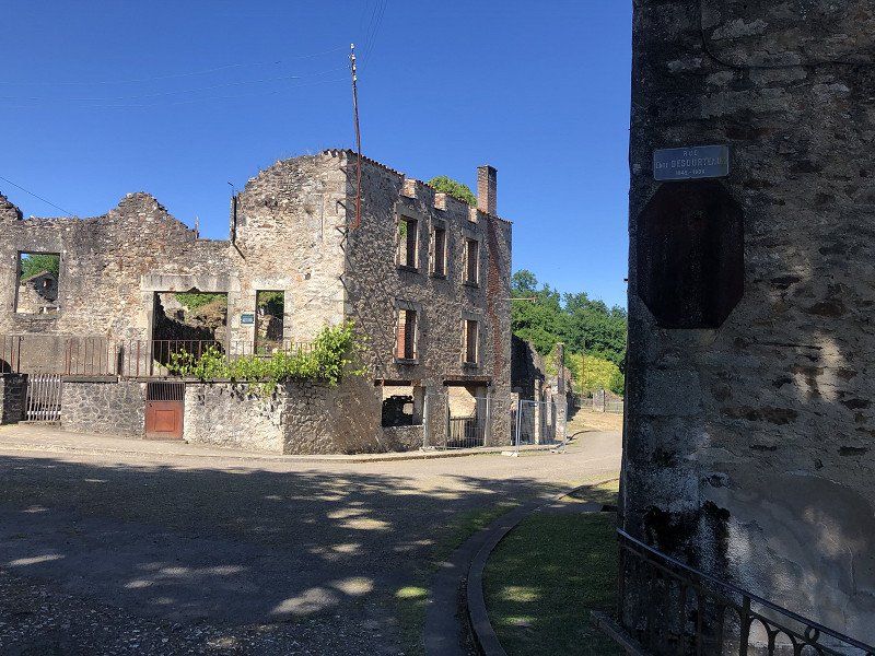
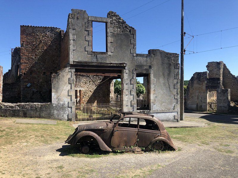
Oradour-sur-Glane, Frankrijk
Of course you know in advance what you are going to look at, but it remains overwhelming. An entire village that was massacred and burned to the ground by an SS brigade, and whose ruins have never been rebuilt. The walk through the village itself was strangely soothing. The entrance to the village is via the accompanying exhibition and just before the entrance the portraits of all victims are presented. That made the passage about fifty heavy meters.
It remains a bizarre story that was not carried out on a whim, but was well prepared. Unbelievable, intense, and yet good to see for real.
La croix du Merle, 87520 Oradour-sur-Glane, Frankrijk
45° 55' 51.9" N 1° 1' 57.9" E
45.9310789 1.0327460
• Head toward Rue de la Renaissance on Avenue du 10 Juin 1944 (D3). Go for 202 m.
• Take the 2nd exit from roundabout onto D3. Go for 936 m.
• Turn left onto D101. Go for 541 m.
• Continue on Lieu-dit Masset (D101). Go for 279 m.
• Continue on D101. Go for 191 m.
• Continue on Lieu-dit La Croix des Bordes (D101). Go for 671 m.
• Continue on D101. Go for 347 m.
• Continue on Lieu-dit Les Bordes (D101). Go for 373 m.
• Continue on D101. Go for 1.2 km.
• Continue on Lieu-dit Mas de Glane (D101). Go for 408 m.
• Continue on D101. Go for 306 m.
• Continue on Lieu-dit Le Traux (D101). Go for 136 m.
• Continue on D101. Go for 817 m.
• Continue on Route d'Oradour-sur-Glane (D101). Go for 2.6 km.
• Turn right onto Route de Chaboret à Mézières-sur-Issoire (D39). Go for 1.0 km.
• Continue on Rue du 8 Mai 1945 (D39). Go for 72 m.
• Continue on Rue Jules Ferry (D128). Go for 18 m.
• Turn left onto Rue Jules Ferry (D128). Go for 297 m.
• Continue on Route de Saint-Jouvent à Couzeix (D128). Go for 2.9 km.
• Turn right onto Route de Limoges à Saumur (N147) toward St Jouvent. Go for 313 m.
• Turn left onto Route de la Gare (D128) toward St Jouvent. Go for 1.6 km.
• Continue on Route de Glane (D128). Go for 268 m.
• Continue on Rue de Gattebourg (D128). Go for 758 m.
• Turn left onto Rue des Écoles (D28). Go for 284 m.
• Continue on Place de l'Église (D28). Go for 72 m.
• Continue on Rue de Bel-Air (D28). Go for 405 m.
• Continue on Route de la Croix Senamaud (D28). Go for 832 m.
• Continue on Route de la Croix Senamaud (D28). Go for 1.3 km.
• Turn right toward D7. Go for 8 m.
• Turn sharp left onto Route de Couzeix (D28). Go for 1.1 km.
• Turn right onto D97. Go for 406 m.
• Continue on Route de la Lande (D97). Go for 1.5 km.
• Continue on Route du Bas Jailloux (D97). Go for 636 m.
• Continue on Route des Pacages du Masbatin (D97). Go for 1.3 km.
• Continue on Rue de la Sablonnade (D97). Go for 409 m.
• Take the 1st exit from roundabout onto Place de l'Europe. Go for 18 m.
• Turn slightly right onto Rue du 8 Mai 1945. Go for 1.0 km.
• Turn left onto Allée Moulin de Leychoisier. Go for 45 m.
• Arrive at Allée Moulin de Leychoisier. Your destination is on the right.
☍
25,6 km
( 28 min.)
Castel Le Chateau De Leychoisier
Neat campsite, with a super friendly campsite owner. Very quiet here, the barrier closes for a good night. Plumbing is a bit dated.
87270, Bonnac La Côte, France
45° 55' 59.9" N 1° 17' 20.8" E
45.9333000 1.2891000
• Head toward Allée le Haut Leychoisier on Allée Moulin de Leychoisier. Go for 45 m.
• Turn right onto Rue du 8 Mai 1945. Go for 1.0 km.
• Turn slightly left onto Place de l'Europe. Go for 8 m.
• Take the 1st exit from roundabout onto Place de l'Europe (D97). Go for 20 m.
• Continue on Rue de la Mazelle (D97). Go for 242 m.
• Continue on Route des Pradeaux (D97). Go for 917 m.
• Continue on Route de Chazelas (D97). Go for 394 m.
• Continue on Route de Tramont (D97). Go for 375 m.
• Turn right and take ramp onto A20 (L'Occitane) toward Limoges. Go for 122 km.
• Take exit 54 toward Gouffre de Padirac/Gramat/Rocamadour. Go for 1.3 km.
• Continue toward Decazeville/Rodez/Martel/Rocamadour/Gramat/Figeac/Gfre de Padirac. Go for 33 m.
• Take the 2nd exit from roundabout onto D840 toward Figeac/Decazeville/Rodez/Martel/Gramat/Rocamadour/Gfre de Padirac. Go for 9.6 km.
• Take the 2nd exit from Place Gambetta roundabout onto Avenue du Général de Gaulle (D840) toward Decazeville/Rodez/Gramat/Figeac/Rocamadour/Gfre de Padirac/St Céré. Go for 16.4 km.
• Take the 1st exit from roundabout onto D673 toward Rocamadour. Go for 3.6 km.
• Take the 2nd exit from roundabout onto Lieu-dit L'Hospitalet (D673). Go for 125 m.
• Continue on Lieu-dit Le Garroustié (D32). Go for 628 m.
• Continue on D32. Go for 364 m.
• Continue on Voie Sainte (D32). Go for 213 m.
• Continue on Place Bernard de Ventadour (D32). Go for 4 m.
• Continue on Porte du Figuier. Go for 10 m.
• Continue on Rue Roland Le Preux. Go for 215 m.
• Continue on Rue de la Couronnerie. Go for 37 m.
• Arrive at Rue de la Couronnerie. Your destination is on the right.
☍
157,1 km
(1 hrs. 37 min.)
Day
Rocamadour, Frankrijk
We leave the exit on the right, but if you have days left, then Rocamadour might be a nice stopover. A medieval town and a place of pilgrimage, below and at the top of a rock.
46500 Rocamadour, Frankrijk
44° 47' 57.8" N 1° 37' 4.4" E
44.7993830 1.6179010
• Head south on Rue de la Couronnerie. Go for 210 m.
• Continue on Lieu-dit Lou Coustalou. Go for 111 m.
• Turn left onto Lieu-dit Roquefraich. Go for 84 m.
• Continue on D32 B. Go for 715 m.
• Continue on D32. Go for 365 m.
• Turn right onto Place Bernard de Ventadour (D32). Go for 4 m.
• Continue on Voie Sainte (D32). Go for 213 m.
• Continue on D32. Go for 364 m.
• Continue on Lieu-dit Le Garroustié (D32). Go for 628 m.
• Continue on Lieu-dit L'Hospitalet (D32). Go for 93 m.
• Take the 1st exit from roundabout onto Place de l'Europe (D673). Go for 3.5 km.
• Take the 3rd exit from roundabout onto D840 toward Brive/Montvalent/Martel/Vayrac. Go for 16.4 km.
• Take the 2nd exit from Place Gambetta roundabout onto Avenue de Brive (D840) toward Brive/Cressensac/Aéroport Brive-Vallée de la Dordogne. Go for 9.6 km.
• Take the 2nd exit from roundabout toward Brive/Paris. Go for 632 m.
• Take ramp onto A20 (L'Occitane). Go for 259 km.
• Take exit 10 toward Vatan. Go for 341 m.
• Turn slightly right onto D920 toward A20/(Vierzon)/Vatan/Issoudun/Valençay. Go for 2.8 km.
• Continue on Grande Rue (D136) toward Romorantin. Go for 240 m.
• Turn left onto Rue Saint-Laurian (D960) toward C214/St Florentin/Églises St Laurian. Go for 5.3 km.
• Turn right onto D25. Go for 20.4 km.
• Take the 2nd exit from roundabout onto Rue Jean Jaurès (D4). Go for 969 m.
• Continue on Lieu-dit Le Pont (D128). Go for 1.7 km.
• Pass 2 roundabouts and continue on Route de Romorantin (D128). Go for 4.4 km.
• Continue on Rue des Prés Neufs (C2). Go for 850 m.
• Turn left onto D20. Go for 142 m.
• Continue on Place des Anciens Combattants (D20). Go for 36 m.
• Turn right onto D159. Go for 8 m.
• Turn left onto Rue Victor Hugo (D20). Go for 934 m.
• Continue on D20. Go for 2.7 km.
• Continue on Route de Pruniers (D20). Go for 425 m.
• Continue on Lieu-dit Bellevue (D20). Go for 100 m.
• Continue on Route de Pruniers (D20). Go for 609 m.
• Continue on Lieu-dit L'Étang de Paris (D20). Go for 145 m.
• Turn left onto D20. Go for 248 m.
• Continue on Route de Romorantin (D20). Go for 2.5 km.
• Continue on Route de Mur-de-Sologne (D20). Go for 1.1 km.
• Continue on D20. Go for 118 m.
• Continue on Lieu-dit La Saugère (D20). Go for 364 m.
• Continue on D20. Go for 950 m.
• Continue on Rue de Lassay (D20). Go for 1.7 km.
• Turn left onto Rue Nationale (D765). Go for 394 m.
• Turn right onto Rue Camille Masson (D63) toward Courmemin/Veilleins. Go for 11 m.
• Turn left onto Rue de Chambord (D20). Go for 1.1 km.
• Continue on D20. Go for 243 m.
• Continue on Lieu-dit La Meule (D20). Go for 56 m.
• Continue on D20. Go for 2.8 km.
• Continue on Lieu-dit La Moutinière (D20). Go for 128 m.
• Continue on D20. Go for 1.4 km.
• Continue on Lieu-dit Les Corbelières (D20). Go for 74 m.
• Continue on Lieu-dit Les Cobrières (D20). Go for 110 m.
• Continue on D20. Go for 2.3 km.
• Continue on Lieu-dit Les Pluies (D20). Go for 59 m.
• Continue on D20. Go for 586 m.
• Continue on Lieu-dit Le Bois (D20). Go for 70 m.
• Continue on D20. Go for 318 m.
• Continue on Lieu-dit La Croix du Bois (D20). Go for 74 m.
• Continue on D20. Go for 1.2 km.
• Turn right onto Route de l'Arche (D119). Go for 1.6 km.
• Turn left onto Place de l'Église (D120). Go for 4.1 km.
• Turn right onto Avenue de Cheverny (D102). Go for 568 m.
• Turn right onto Rue de la Mairie (D60). Go for 155 m.
• Turn left onto Place de l'Hôtel de Ville. Go for 105 m.
• Turn left onto Place de l'Hôtel de Ville (D923). Go for 147 m.
• Turn right onto Rue Roger Brun (D923). Go for 218 m.
• Take the 2nd exit from roundabout onto Rue Roger Brun (D923). Go for 274 m.
• Take the 2nd exit from roundabout onto Route de Chambord (D112). Go for 6.8 km.
• Continue on Route de la Commission (D33). Go for 177 m.
• Turn sharp right onto Rue de la Grange aux Dîmes. Go for 113 m.
• Arrive at Rue de la Grange aux Dîmes. Your destination is on the left.
☍
366,8 km
(3 hrs. 46 min.)
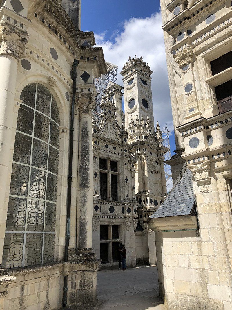
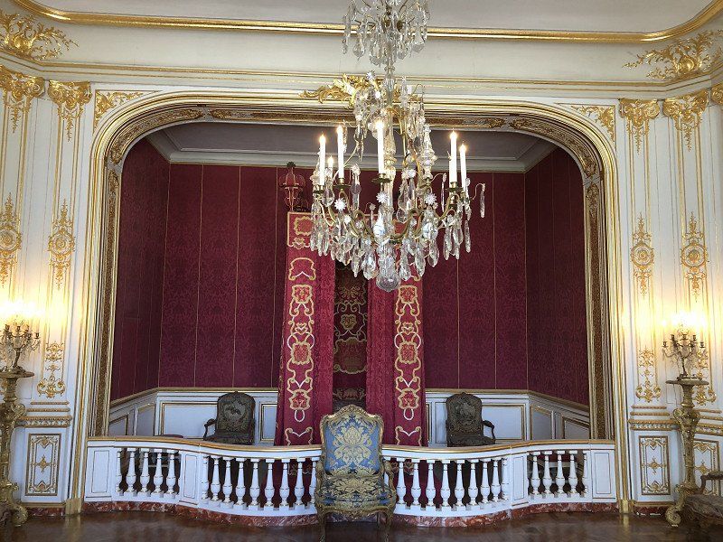
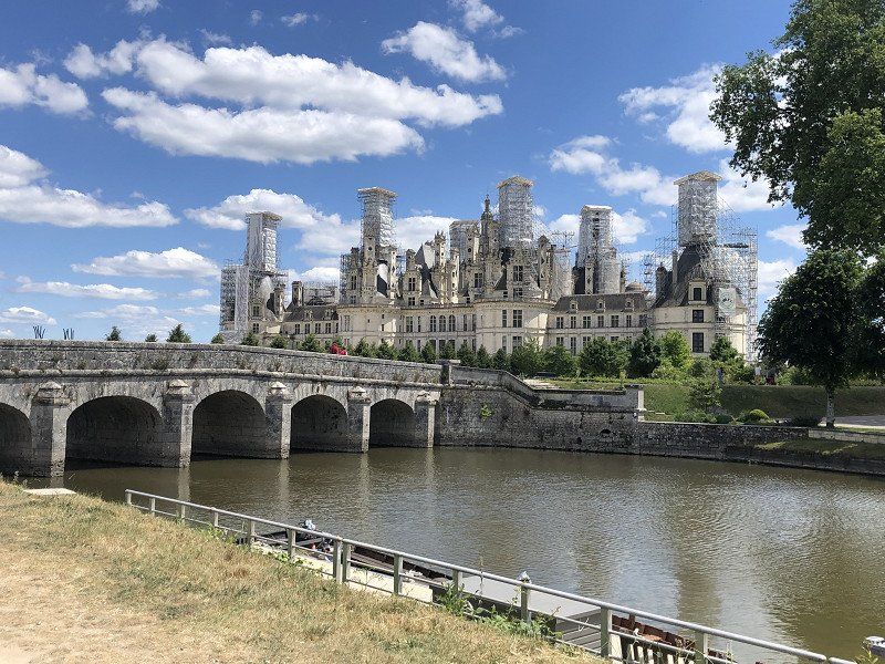
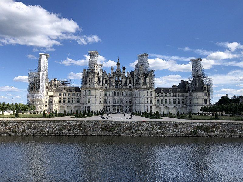
Chambord, Frankrijk
One of the famous tourist places of course. Judging by the size of the car parks, it can be incredibly busy here in the summer season. Still fine to do at the end of May.
Building remains more beautiful on the outside than the inside. Although with the modern virtual guide it comes to life a bit more than during our previous visits (still in the last century 😊).
41250 Chambord, Frankrijk
47° 36' 51" N 1° 31' 0.8" E
47.6141580 1.5168780
• Head toward Route de la Commission on Rue de la Grange aux Dîmes. Go for 113 m.
• Turn right onto Route de la Commission (D33). Go for 632 m.
• Turn right onto D112. Go for 973 m.
• Pass 2 roundabouts and continue on D112. Go for 4.8 km.
• Turn left onto D103. Go for 260 m.
• Continue on Route de Sologne (D112). Go for 861 m.
• Take the 2nd exit from roundabout onto Avenue du Pont (D112). Go for 2.8 km.
• Take the 1st exit from roundabout onto Rue du Goulet des Prés (D112). Go for 239 m.
• Pass 2 roundabouts and continue on Route d'Orléans (D112). Go for 1.9 km.
• Take the 1st exit from roundabout onto Route d'Orléans (D2152) toward A10/Orléans/Beaugency/Z.I. des Portes de Chambord. Go for 904 m.
• Take the 2nd exit from roundabout onto D205 toward Marchenoir/Talcy/Z.I. des Portes de Chambord. Go for 1.8 km.
• Take the 1st exit from roundabout onto D205 toward Paris/Bordeaux. Go for 713 m.
• Take ramp onto A10 (L'Aquitaine) toward Paris/Orléans. Go for 38.0 km.
• Take exit 14 toward Le Mans/Fleury les Aubrais/Saran/Orléans-Nord onto D2701. Go for 3.5 km.
• Take ramp onto D2060 toward E60/Montargis/Nevers/Fontainebleau/Fleury-les-Aubrais. Go for 13.3 km.
• Take ramp onto Rue des Ajoncs (D8) toward Chécy. Go for 588 m.
• Take the 3rd exit from Rond-Point des Ajoncs roundabout onto Rue de Grainloup (D8). Go for 1.0 km.
• Continue on Rue de la Charpenterie. Go for 396 m.
• Turn right onto Avenue de Patay. Go for 152 m.
• Take the 3rd exit from Place du 8 Mai 1945 roundabout onto Avenue de Domrémy. Go for 203 m.
• Turn left onto Rue du Maréchal Leclerc. Go for 211 m.
• Continue on Place Jean Zay. Go for 50 m.
• Continue on Rue du Port. Go for 179 m.
• Turn right onto Rue des Plantes. Go for 86 m.
• Turn right onto Chemin du Port. Go for 34 m.
• Continue on Chemin du Port. Go for 369 m.
• Arrive at Chemin du Port. Your destination is on the left.
☍
74,1 km
( 53 min.)
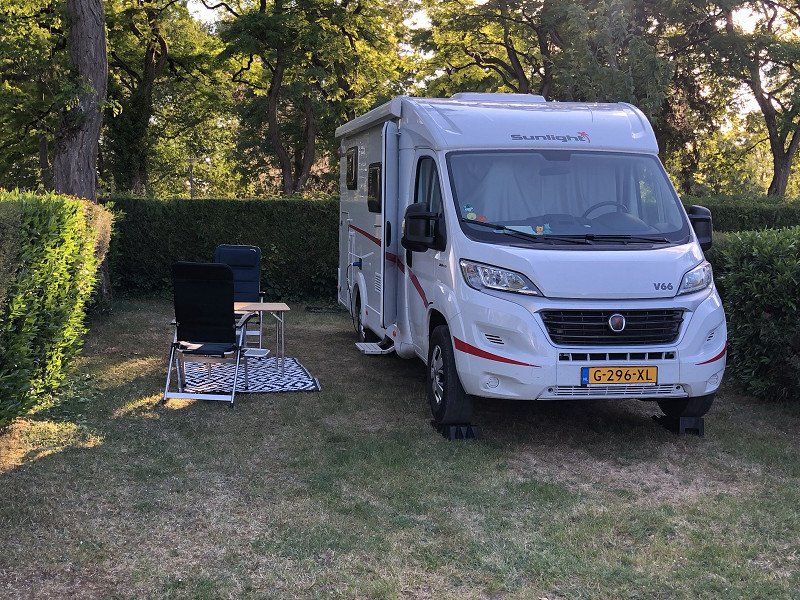
Camping Municipal Les Pâtures
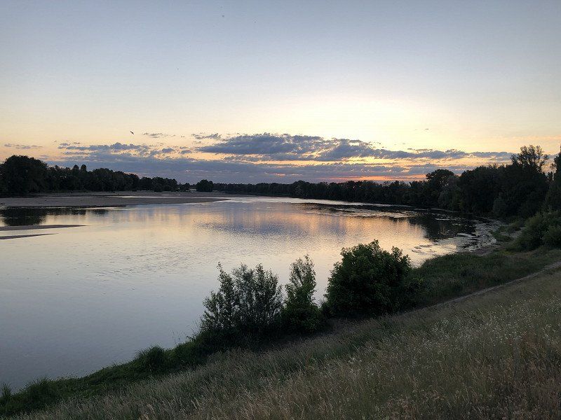
We are tired of driving for today, and look for a campsite nearby. It will be the municipal campsite in Checy near Orléans. Expectations are not high, and finding it is already a thing. We also turn out to be just too late, but we can get up and do the paperwork tomorrow. It turns out to be a neat campsite right on the banks of the Loire. Great place to stay overnight or explore the area from here.
45430, Checy, France
47° 53' 12.5" N 2° 1' 39.7" E
47.8868000 2.0277000
• Head toward Levée de la Loire on Chemin du Port. Go for 403 m.
• Continue on Rue des Plantes. Go for 86 m.
• Turn right onto Rue de Saint-Germain. Go for 191 m.
• Continue on Rue de la Herpinière. Go for 28 m.
• Turn slightly right onto Rue de la Herpinière. Go for 74 m.
• Continue on Rue de Gaudigny. Go for 130 m.
• Take the 1st exit from roundabout onto Rue de Gaudigny. Go for 339 m.
• Turn left onto Avenue Jean Beaudoin (D960). Go for 683 m.
• Turn right onto Rue de Grainloup (D8). Go for 925 m.
• Take the 3rd exit from Rond-Point des Ajoncs roundabout onto Rue des Ajoncs (D8). Go for 414 m.
• Take the 2nd exit from roundabout onto Rue des Ajoncs (D8). Go for 165 m.
• Take left ramp onto D2060 toward Orléans. Go for 12.8 km.
• Take ramp onto D2701 toward A10 (A71)-(A19)/Paris/Vierzon/Le Mans/Pôle Santé Oreliance. Go for 3.0 km.
• Take ramp onto A10 (L'Aquitaine) toward E60/Montargis/Paris/Chartres. Go for 103 km.
• Take the exit toward Lille/A1/Paris/A6/Rungis/Aéroport Orly onto A10. Go for 3.6 km.
• Keep right toward A6 B/E15/A86/A1/Lille/Rungis/Aéroport Orly. Go for 502 m.
• Continue on Voie des Molières. Go for 145 m.
• Continue toward A6 B. Go for 170 m.
• Continue on A6 B. Go for 1.8 km.
• Take the exit toward A4/Lille/A1/Créteil/Aéroport Orly/Rungis onto N186. Go for 1.9 km.
• Keep left onto N186 toward A86/Lille/Metz/Nancy/Créteil. Go for 1.9 km.
• Keep left onto A86 toward Sénia/Lille/Metz/Nancy/Vitry/Créteil/Thiais-Centre/Parc Interdal des Sports. Go for 11.0 km.
• Take the exit onto A4/A86. Go for 2.7 km.
• Keep left onto A4 (Autoroute de l'Est). Go for 124 km.
• Take exit 22 toward Reims-Centre/Tinqueux onto A4 (Autoroute de l'Est). Go for 1.2 km.
• Continue on A344 (Autoroute de l'Est). Go for 4.3 km.
• Take exit 23 toward Reims-Centre. Go for 386 m.
• Take the 2nd exit from roundabout. Go for 74 m.
• Take ramp. Go for 463 m.
• Continue on Boulevard Louis Roederer toward Centre Ville/Laon-Zola. Go for 965 m.
• Turn right onto Place de la République toward Centre Ville. Go for 145 m.
• Turn right onto Boulevard Desaubeau toward Centre Ville/Cathédrale. Go for 83 m.
• Turn left onto Rue du Général Sarrail toward Centre Ville/Cathédrale. Go for 315 m.
• Continue on Place de l'Hôtel de Ville. Go for 24 m.
• Turn left onto Place de l'Hôtel de Ville. Go for 75 m.
• Turn left onto Place de l'Hôtel de Ville. Go for 23 m.
• Continue on Rue de Mars. Go for 51 m.
• Arrive at Rue de Mars. Your destination is on the left.
☍
278,0 km
(2 hrs. 36 min.)
Day
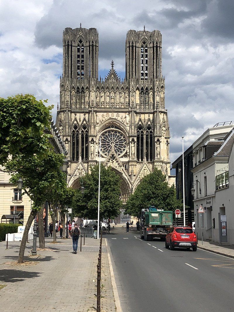
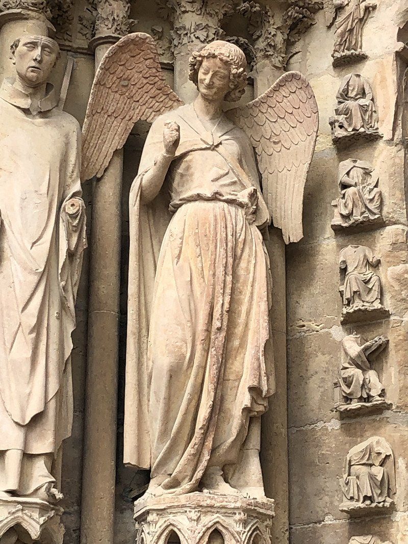
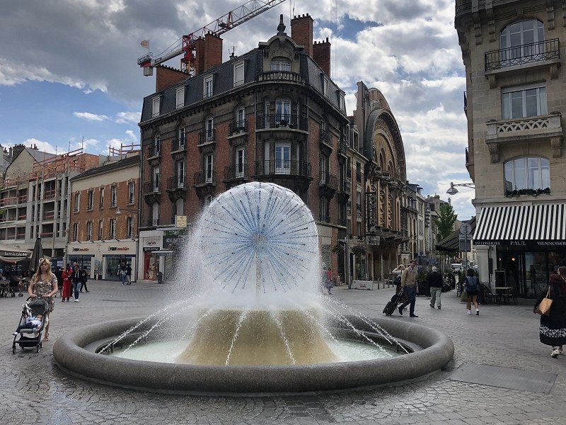
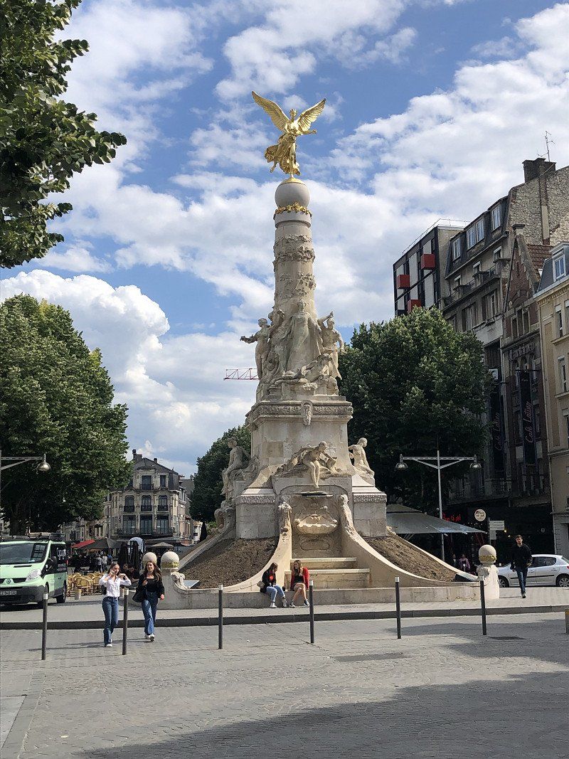
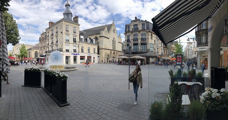
Reims, Frankrijk
Reims is a city that we have often passed by, and of which we are of course familiar with the image of the “Notre Dame look alike” cathedral. We'll look it up now. We park at the Stade de Reims where the camper fits perfectly, and walk into the city over the bridge. Beautiful cathedral with the angel smiling, and which we had to search for a while. She's in the left arch.
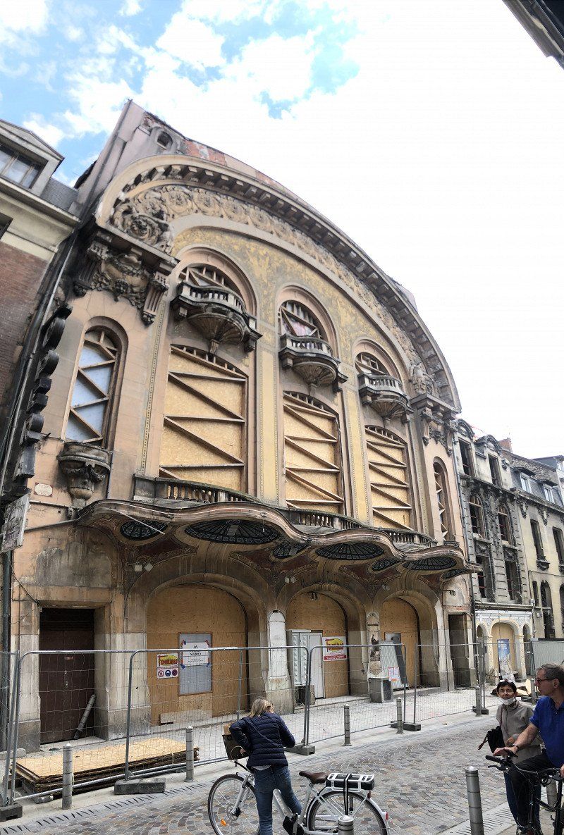
As far as we're concerned, the old theater / opera in art deco style is second to none. It is being renovated, and we are very curious about the result.
At three than the modern fountain; it looks like some kind of charged particle.
Great city of Reims with the necessary relaxing terraces.
51100 Reims, Frankrijk
49° 15' 30" N 4° 1' 54.1" E
49.2583290 4.0316960
• Head toward Rue Albert Reville on Rue de Mars. Go for 262 m.
• Continue on Place de la République. Go for 167 m.
• Continue on Avenue de Laon (N44) toward Laon-Zola/Charles Arnould/Musée de la Reddition. Go for 2.6 km.
• Take the 2nd exit from roundabout onto Avenue de Laon (D944) toward A26(A4)/Laon/La Neuvilette. Go for 1.8 km.
• Take the 1st exit from roundabout onto A26 (Autoroute des Anglais) toward Lille/Laon/Rouen. Go for 81.4 km.
• Take exit 11 toward St Quentin-Centre/St Quentin-Sud/Gauchy/Chauny/Tergnier/Soissons/Essigny le Grand onto D1. Go for 4.7 km.
• Take ramp onto D8 toward Essigny le Grand/Seraucourt le Grand. Go for 787 m.
• Turn right onto Rue de la Libération (D72). Go for 262 m.
• Continue on Rue de la Gare (D72). Go for 1.2 km.
• Continue on D72. Go for 3.5 km.
• Continue on Rue du Jeu d'Arc (D72). Go for 347 m.
• Continue on Rue L. de Robert de La Tour (D32). Go for 267 m.
• Turn right onto Rue Charles Voyeux (D321). Go for 87 m.
• Arrive at Rue Charles Voyeux (D321). Your destination is on the left.
☍
97,4 km
( 58 min.)
Camping du Vivier aux Carpes
Campsite selected at the indicated distance to the highway. About ten kilometers, and they appear to be really away from the highway. In the middle of the campaign on a fishing pond fed by the Somme. Small campsite with excellent facilities and a good restaurant with a daily menu with two choices. Ready for our last leg that takes us out of France again.
4 rue Charles Voyeux, 02790, SERAUCOURT LE GRAND, France
49° 46' 55.1" N 3° 12' 47.4" E
49.7819660 3.2131530
• Head toward Place Verte on Rue Charles Voyeux (D321). Go for 281 m.
• Continue on Rue Falaise (D321). Go for 1.1 km.
• Continue on D321. Go for 407 m.
• Continue on Grand Rue (D321). Go for 653 m.
• Continue on D321. Go for 2.0 km.
• Continue on Rue de Provence (D321). Go for 813 m.
• Take the 1st exit from roundabout onto Rue de Champagne (D321). Go for 248 m.
• Continue on D321. Go for 1.0 km.
• Continue on Route de Grugies (D321). Go for 519 m.
• Take the 1st exit from roundabout onto Route de Grugies (D321). Go for 675 m.
• Turn slightly left onto Route de Chauny (D8). Go for 113 m.
• Take the 1st exit from roundabout onto D1. Go for 685 m.
• Take ramp onto A26 (Autoroute des Anglais) toward Cambrai/Calais/Lille/Amiens/A1 (Paris). Go for 69.7 km.
• Take the exit toward Douai/Lille onto A1 (Autoroute du Nord). Go for 40.3 km.
• Continue on A25. Go for 14.3 km.
• Take exit 8 toward Armentières. Go for 421 m.
• Take the 1st exit from roundabout onto D945. Go for 76 m.
• Continue on M945. Go for 38 m.
• Continue on D945. Go for 211 m.
• Continue on M945 toward Armentières/Houplines/La Chapelle d'Armentières. Go for 26 m.
• Take the 2nd exit from roundabout onto M945 toward Armentières/Houplines/La Chapelle d'Armentières. Go for 777 m.
• Continue on D945. Go for 114 m.
• Continue on M945. Go for 43 m.
• Take the 2nd exit from roundabout onto M945 toward Comines/Frelinghien/Houplines/P.A. des Moulins de la Lys. Go for 1.3 km.
• Take the 2nd exit from roundabout onto M945. Go for 480 m.
• Take the 1st exit from roundabout onto M945. Go for 563 m.
• Continue on D945. Go for 6 m.
• Continue on M945. Go for 1.8 km.
• Take the 3rd exit from roundabout onto Boulevard de l'Europe (D7). Go for 717 m.
• Continue on N58. Go for 6.6 km.
• Take ramp toward Ypres/Ieper/Messines/Mesen/Warneton/Waasten. Go for 308 m.
• Turn left onto Iepersteenweg (N336). Go for 7.1 km.
• Take the 1st exit from roundabout onto Rijselseweg (N336). Go for 3.7 km.
• Take the 1st exit from roundabout onto Zuiderring (N37). Go for 785 m.
• Take the 3rd exit from roundabout onto Steverlyncklaan. Go for 563 m.
• Turn left onto Bolwerkstraat. Go for 129 m.
• Arrive at Bolwerkstraat. Your destination is on the right.
☍
158,6 km
(1 hrs. 39 min.)
Day
Stellplatz vor Jeugdstadion Camping
Basic campsite near the center of Ypres. Ten minute walk to the Menin Gate.
Close by is industry where it seems to burn around an oven for 24 hours. In the background, the roar of the furnace and the occasional dumping of the next load of fuel can be heard continuously. Not a big deal for one night, but it would get on the nerves for longer. And whether the chimney only blows clean air, we doubt it.
Bolwerkstraat 1, 8900, Ieper, Belgium
50° 50' 49" N 2° 53' 53" E
50.8469444 2.8980556
• Head southeast on Bolwerkstraat. Go for 129 m.
• Turn right onto Steverlyncklaan. Go for 457 m.
• Take the 1st exit from roundabout onto Zuiderring (N37). Go for 788 m.
• Take the 2nd exit from roundabout onto Oudstrijderslaan (N37b). Go for 996 m.
• Turn left onto Dikkebusseweg (N375). Go for 605 m.
• Turn left onto Pannenhuisstraat. Go for 234 m.
• Turn left onto Ter Wilgen. Go for 62 m.
• Turn left onto Ter Linden. Go for 108 m.
• Turn left onto Ter Linden. Go for 60 m.
• Arrive at Ter Linden. Your destination is on the left.
☍
3,4 km
( 6 min.)
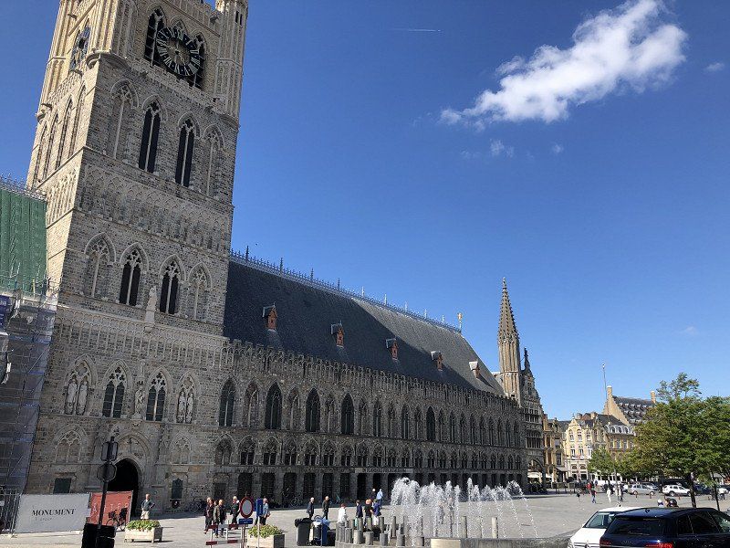
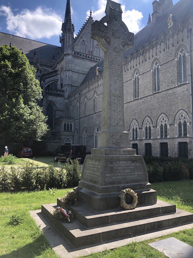
Ieper, België
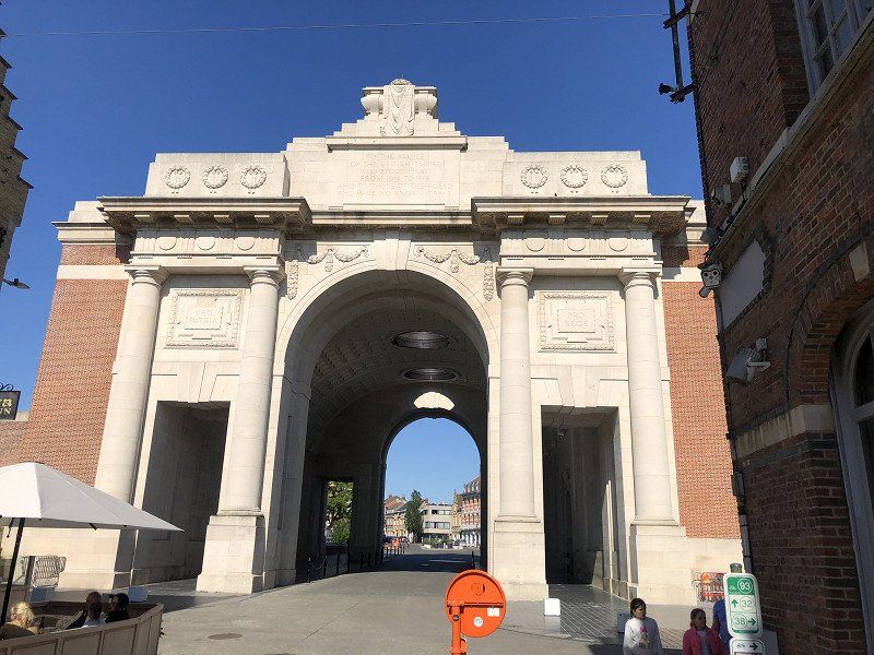
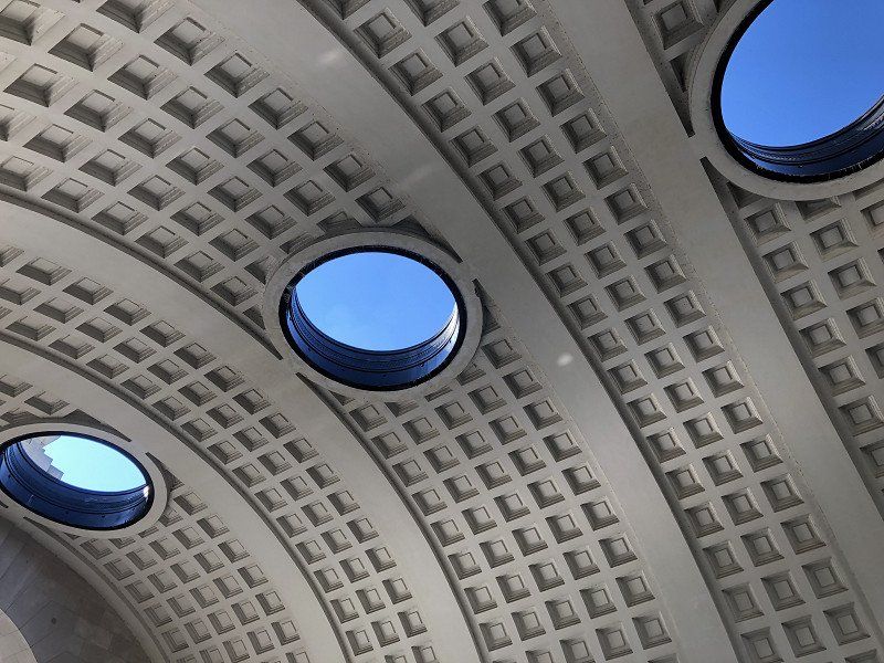
Ypres had been on the list for a long time. Because of the Ypres Salient in the Great War, and to experience the evening commemoration at the Menin Gate. The story of Ypres still makes a bit sad and quiet. But it is a beautiful rebuilt city. And it is impressive to experience the Last Post under the Menin Gate. “Internet” advised to be present half an hour before. But when we arrive at a quarter past seven from our terrace, we are already running late. Unbelievable and unbelievably beautiful that it has been so busy here every evening for more than a hundred years. But it was also quite a bit. Just consider that all the names here on the gate belong only to the missing and only to the Commonwealth.
Ter Linden 15, 8900 Ieper, België
50° 50' 28.4" N 2° 52' 26.1" E
50.8412212 2.8739301
• Head south on Ter Linden. Go for 60 m.
• Turn right onto Ter Linden. Go for 108 m.
• Turn right onto Ter Wilgen. Go for 62 m.
• Turn right onto Pannenhuisstraat. Go for 234 m.
• Turn right onto Dikkebusseweg (N375). Go for 605 m.
• Turn left onto Colaertplein (N37b). Go for 501 m.
• Turn right onto Capronstraat (N308). Go for 69 m.
• Take the 3rd exit from roundabout onto Haiglaan (N8). Go for 822 m.
• Take the 1st exit from roundabout onto Oude Veurnestraat (N379). Go for 459 m.
• Take the 3rd exit from roundabout onto Diksmuidseweg (N369). Go for 20.8 km.
• Arrive at Koning Albertstraat (N369). Your destination is on the left.
☍
23,7 km
( 25 min.)
Day
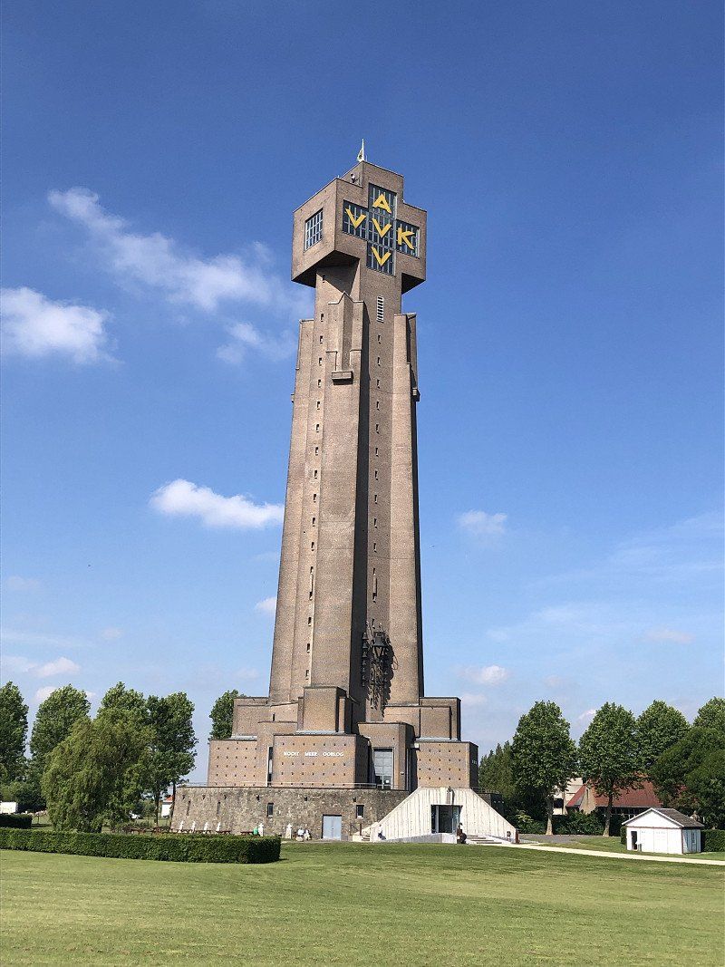
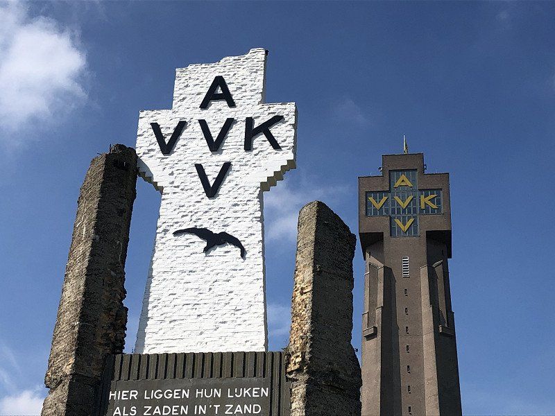
Diksmuide, Vlaanderen, België
Looked up to see the Ysertoren live. Very sad how a monument and movement so pure in nature and striving for world peace, after the horror of the Great War, can become so controversial. The sorrow of Belgium.
“Never again war” makes so much sense when you drive around in this region. And it is, in 2022, so crooked.
8600 Diksmuide, België
51° 1' 54" N 2° 51' 50.2" E
51.0316593 2.8639376
• Head north on Koning Albertstraat (N369). Go for 10 m.
• Turn right onto Maria Doolaeghestraat (N35) toward E40/E403/Kortemark/Middelkerke. Go for 160 m.
• Turn left onto Admiraal Ronarchstraat (N369) toward E40/Middelkerke/Koekelare/Centrum. Go for 7.8 km.
• Continue on Oostendestraat (N369) toward Oostende/Nieuwpoort/Sint-Pieters-Kapelle/E40. Go for 3.5 km.
• Continue on Bruggesteenweg (N367) toward E40/Nieuwpoort/Middelkerke. Go for 212 m.
• Turn right onto Diksmuidestraat (N369) toward E40/Middelkerke. Go for 1.6 km.
• Turn right and take ramp onto E40 toward Brussel/Brugge/Oostende. Go for 35.4 km.
• Take exit 10 toward Wingene/Beernem. Go for 267 m.
• Keep left toward Reigerlostraat/N370. Go for 34 m.
• Turn slightly left onto Reigerlostraat (N370) toward Beernem. Go for 1.4 km.
• Turn right onto Sint-Andreaslaan (N368). Go for 6.4 km.
• Turn right onto De Plaats (N368). Go for 880 m.
• Turn left onto Knokkebaan (N44). Go for 9.6 km.
• Take ramp onto E34 toward Antwerpen/Zelzate/Eeklo. Go for 26.1 km.
• Take exit 13 toward Middelburg (Tol)/Terneuzen/Zelzate/Puyenbroeck/Haven 1-5995 onto N449. Go for 1.1 km.
• Take the 3rd exit from roundabout onto President J.F. Kennedylaan (R4) toward Terneuzen/Zelzate/Haven 5510-9990. Go for 2.1 km.
• Keep right onto Traktaatweg (N423) toward Middelburg (Tol)/Terneuzen/Haven 5990-5995. Go for 568 m.
• Continue on Tractaatweg (N62). Go for 4.4 km.
• Take ramp toward Industrieterrein Drieschouwen/Zuiddorpe/Hulst. Go for 547 m.
• Take the 1st exit from roundabout onto Langeweg (N258) toward Industrieterrein Drieschouwen/Zuiddorpe/Hulst. Go for 3.7 km.
• Take the 3rd exit from roundabout onto Kinderdijk toward Axel. Go for 1.2 km.
• Take the 2nd exit from roundabout onto Oranjestraat. Go for 293 m.
• Continue on Kerkdreef. Go for 311 m.
• Turn sharp right onto Noordstraat. Go for 50 m.
• Turn slightly left onto Tuinstraat. Go for 113 m.
• Turn right onto Szydlowskiplein. Go for 98 m.
• Arrive at Szydlowskiplein. Your destination is on the right.
☍
107,8 km
(1 hrs. 18 min.)
Axel, Nederland
4571 Axel, Nederland
51° 16' 0.8" N 3° 54' 33.9" E
51.2668789 3.9094234
• Head north on Szydlowskiplein. Go for 13 m.
• Turn right onto Tuinstraat. Go for 41 m.
• Turn right onto Nassaustraat. Go for 132 m.
• Turn right onto Nassaustraat. Go for 324 m.
• Turn right onto Kanaalkade. Go for 134 m.
• Take the 3rd exit from roundabout onto Kinderdijk. Go for 1.2 km.
• Take the 2nd exit from roundabout onto Kinderdijk toward Industrieterrein Drieschouwen/Koewacht/Zuiddorpe. Go for 1.4 km.
• Keep right onto Kinderdijk. Go for 340 m.
• Continue on Provinciale Weg. Go for 2.7 km.
• Continue on Kruisstraat. Go for 2.0 km.
• Turn right onto Papdijk toward E34/Moerbeke/Wachtebeke-(Overslag). Go for 660 m.
• Take the 2nd exit from roundabout toward Antwerpen/E34. Go for 542 m.
• Take the 4th exit from roundabout toward E34/Kruisstraat. Go for 210 m.
• Take ramp onto E34 toward Antwerpen. Go for 22.3 km.
• Take the exit toward Breda/Rotterdam/Haven/Doel onto R2. Go for 11.3 km.
• Take the exit toward Brussel/Luik/Antwerpen/Breda/Haven 2,4.204 onto A12 (Havenweg). Go for 9.9 km.
• Continue on Zoomseweg toward Breda/E19. Go for 518 m.
• Take the exit onto E19. Go for 35.2 km.
• Continue on A16. Go for 4.1 km.
• Take the exit toward E312/Amsterdam/Utrecht/Eindhoven/Breda-Oost onto A58. Go for 7.1 km.
• Take the exit toward Amsterdam/Utrecht/Oosterhout/Breda onto A27. Go for 86.8 km.
• Take the exit toward Amsterdam/Hilversum-Noord/E231 onto A1. Go for 14.2 km.
• Take the exit toward Lelystad/Almere onto A6. Go for 3.0 km.
• Keep left onto A6 toward Groningen/Lelystad/Almere/Afrit 4-8. Go for 3.8 km.
• Keep right onto A6 toward Afrit 4-5/Almere-Stad/Almere-Haven/Ring. Go for 1.3 km.
• Take exit 4 toward Almere-Haven onto Noorderdreef. Go for 1.1 km.
• Turn right onto Lindengouw. Go for 184 m.
• Turn left onto Lindengouw. Go for 112 m.
• Turn slightly left onto Lindengouw. Go for 22 m.
• Arrive at Lindengouw. Your destination is on the right.
☍
210,7 km
(2 hrs. 8 min.)
Almere, Nederland
Lindengouw 60, 1351 LE Almere, Nederland
52° 20' 52.2" N 5° 12' 57.9" E
52.3478458 5.2160946