Day
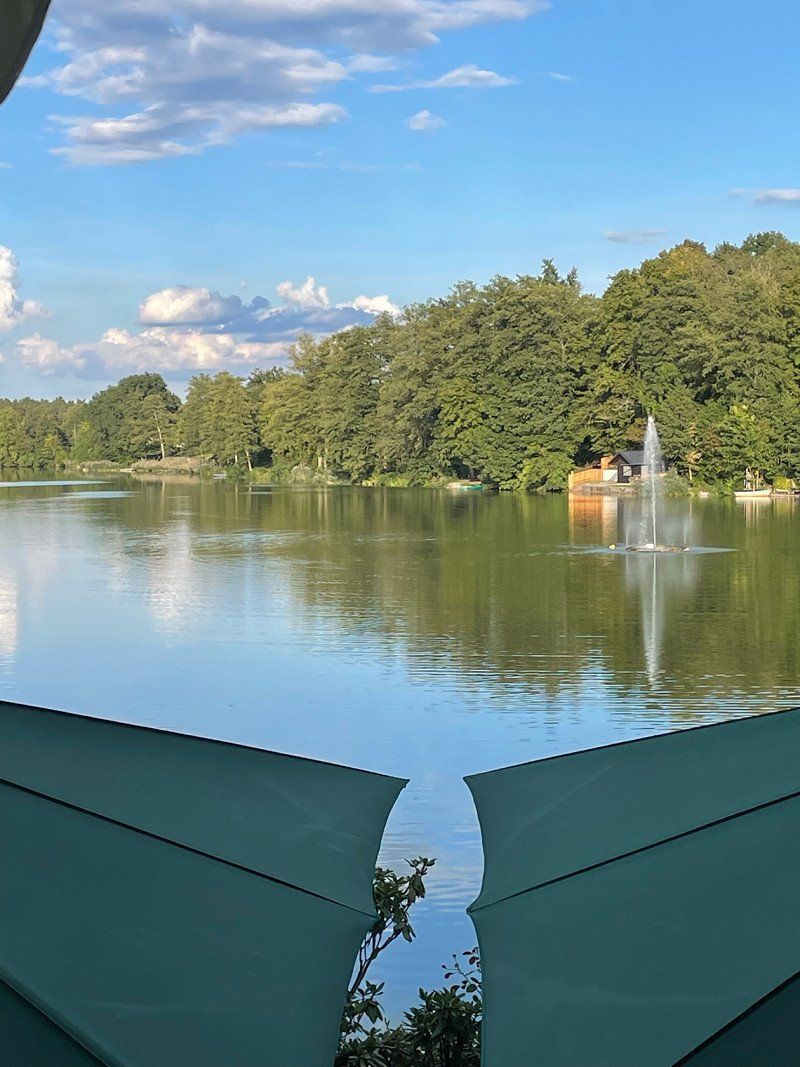
Naturpark Altmühltal
49° 4' 18.7" N 11° 18' 7.2" E
49.0718583 11.3019891
• Head southeast on A9. Go for 72.6 km.
• Take exit 66 toward Pfaffenhofen/Au i.d. Hallertau/Schweitenkirchen. Go for 142 m.
• Turn left onto St2045 toward Au i.d. Hallertau/Schweitenkirchen. Go for 366 m.
• Turn left and take ramp onto A9. Go for 5.7 km.
• Arrive at A9. Your destination is on the right.
☍
78,8 km
( 48 min.)
A9
48° 33' 6" N 11° 35' 29.7" E
48.5516663 11.5915743
• Head northwest on A9. Go for 50.1 km.
• Keep left onto A9. Go for 374 km.
• Take exit 8 toward Zerbst/Anhalt. Go for 376 m.
• Turn left onto B187 toward Dessau-Roßlau/Zerbst/Anhalt. Go for 275 m.
• Turn left and take ramp onto A9 toward Leipzig/München. Go for 1.7 km.
• Arrive at A9. Your destination is on the right.
☍
426,1 km
(3 hrs. 33 min.)
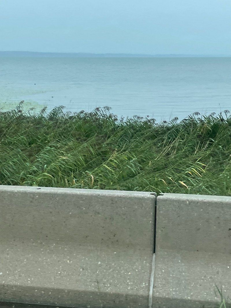
Mittlere Elbe
51° 52' 34.6" N 12° 23' 20" E
51.8762664 12.3888818
• Head southwest on A9. Go for 193 km.
• Take exit 33 toward Chemnitz/Regensburg/Hof-Nord onto A72. Go for 14.7 km.
• Take exit 4 toward Regensburg/Prag/Praha onto A93. Go for 190 km.
• Take exit 47 toward Landshut/Neufahrn i. NB/Schierling/B15n onto Anschlussstelle Saalhaupt. Go for 913 m.
• Continue on B15. Go for 36.2 km.
• Take ramp onto A92 toward München/Landshut Zentrum. Go for 3.9 km.
• Take exit 15 toward Landshut-Stadtmitte/Essenbach-Altheim/Landshut/Ergolding/Gewerbegebiet Altheim onto B15. Go for 4.5 km.
• Take ramp toward München/A92/Traunstein/Altötting/Neustadt a.d.Do./Altdorf/Landshut-Ost/Messe/Ergolding-West/Gewerbegebiet Landshut-Nord/Gewerbegebiet La.-Bayerwald/Gewerbegebiet Ergolding/Trausnitz. Go for 232 m.
• Turn left onto Konrad-Adenauer-Straße (B299). Go for 1.9 km.
• Turn left onto Niedermayerstraße (B299) toward Traunstein/Altötting/Frontenhausen/Adlkofen. Go for 120 m.
• Keep right onto B299 toward Mühldorf/A94/Traunstein/Burg Trausnitz. Go for 16.8 km.
• Turn right onto B299 toward A94/Traunstein/Passau/München/B388/Industriegebiet Süd-West/Industriestraße. Go for 4.2 km.
• Take ramp onto B299/B388. Go for 2.7 km.
• Take ramp onto B299 toward Traunstein/Altötting/Mühldorf a. Inn/Aich. Go for 1.6 km.
• Take the 2nd exit from roundabout onto Vilsbiburger Straße (B299) toward Traunstein/Altötting/Neumarkt St. Veit. Go for 9.5 km.
• Turn right onto B299 toward A94/München/Passau/Traunstein/Altötting/Mühldorf a. Inn. Go for 1.8 km.
• Take the 2nd exit from roundabout onto B299 toward München/A94/Passau/Traunstein/Altötting/Mühldorf a. Inn. Go for 11.8 km.
• Take ramp onto A94. Go for 9.0 km.
• Take exit 22 toward Altötting/Traunstein/Burgkirchen/Neuötting-West Gewerbegebiet. Go for 300 m.
• Turn right onto B299 toward Traunstein/Burgkirchen/Altötting/Industriegebiet Neuötting. Go for 12.5 km.
• Turn left onto Fabrikstraße (St2356) toward Hirten/Hart a.d. Alz/Gewerbegebiet Werk Hart. Go for 945 m.
• Turn left onto Fabrikstraße (St2356). Go for 2.1 km.
• Turn right onto AÖ10. Go for 159 m.
• Continue on Maierhof (AÖ10). Go for 181 m.
• Continue on AÖ10. Go for 1.5 km.
• Continue on Zeitlarn (AÖ10). Go for 182 m.
• Continue on AÖ10. Go for 1.0 km.
• Continue on Schulgasse (AÖ10). Go for 309 m.
• Continue on AÖ10. Go for 655 m.
• Continue on Heitzenberg (AÖ10). Go for 164 m.
• Continue on AÖ10. Go for 1.0 km.
• Continue on Gallersöd (AÖ10). Go for 67 m.
• Continue on AÖ10. Go for 1.3 km.
• Continue on Hofschalling (AÖ10). Go for 180 m.
• Continue on AÖ10. Go for 693 m.
• Continue on TS52. Go for 349 m.
• Continue on Unterried (TS52). Go for 111 m.
• Continue on TS52. Go for 364 m.
• Continue on Laiming (TS52). Go for 81 m.
• Continue on TS52. Go for 1.2 km.
• Turn right onto Dorfstraße (TS10). Go for 264 m.
• Turn left onto Am Herrnsitz (TS52). Go for 133 m.
• Continue on TS52. Go for 867 m.
• Continue on Laufing (TS52). Go for 308 m.
• Continue on TS52. Go for 646 m.
• Turn right onto B20. Go for 1.3 km.
• Turn right onto St2105 toward Traunstein/Waging a. See/Salzburg/Freilassing/Gewerbegebiet Tittmoning. Go for 13.4 km.
• Turn left onto Taching am See. Go for 263 m.
• Continue on Am Strandbad. Go for 39 m.
• Arrive at Am Strandbad. Your destination is on the left.
☍
545,1 km
(5 hrs. 5 min.)
Seecamping Taching am See
Am Strandbad 1, 83373, Taching am See, Deutschland
47° 57' 43.4" N 12° 43' 55.6" E
47.9620600 12.7321100
• Head toward Tachenseestraße on Am Strandbad. Go for 39 m.
• Continue on Taching am See. Go for 263 m.
• Turn left onto Tachenseestraße (St2105). Go for 3.8 km.
• Take the 2nd exit from roundabout onto St2105. Go for 9.2 km.
• Take ramp. Go for 299 m.
• Turn right onto B304. Go for 946 m.
• Keep right onto B306 toward München/A8/Salzburg/Zentrum/Traunstein/Mitte. Go for 5.6 km.
• Turn right and take ramp onto A8 toward München. Go for 43.4 km.
• Take exit 101 toward Innsbruck/Kufstein/Brenner onto A93. Go for 21.0 km.
• Take exit 59 toward Oberaudorf/Niederaudorf/Erl/Ebbs/Niederndorf. Go for 348 m.
• Turn left onto Tiroler Straße (St2093) toward Niederaudorf/Oberaudorf/Sudelfeld/Tatzelwurm. Go for 574 m.
• Turn right onto Naunspitzstraße toward Bayrischzell/Brannenburg/Niederaudorf/Klinik Bad Trißl/Tatzelwurm/Sudelfeld. Go for 283 m.
• Turn left onto Geigelsteinstraße toward Bayrischzell/Brannenburg/Niederaudorf/Klinik Bad Trißl/Tatzelwurm/Sudelfeld. Go for 453 m.
• Turn right onto Rosenheimer Straße (St2089) toward Bayrischzell/Brannenburg/Niederaudorf/Klinik Bad Trißl/Tatzelwurm/Sudelfeld. Go for 2.0 km.
• Arrive at Rosenheimer Straße (St2089). Your destination is on the right.
☍
88,2 km
(1 hrs. )
Day
Chiemsee (See), Deutschland
47° 52' 15.3" N 12° 27' 13.5" E
47.8709042 12.4537375
• Head south on Rosenheimer Straße (St2089). Go for 2.0 km.
• Turn left onto Geigelsteinstraße toward A93/Erl/Niederndorf. Go for 453 m.
• Turn right onto Naunspitzstraße toward München-Salzburg/Innsbruck/Niederndorf/Tirol. Go for 283 m.
• Turn left onto Tiroler Straße (St2093) toward A93/Erl/Niederndorf. Go for 574 m.
• Turn right and take ramp onto A93 toward Innsbruck. Go for 5.2 km.
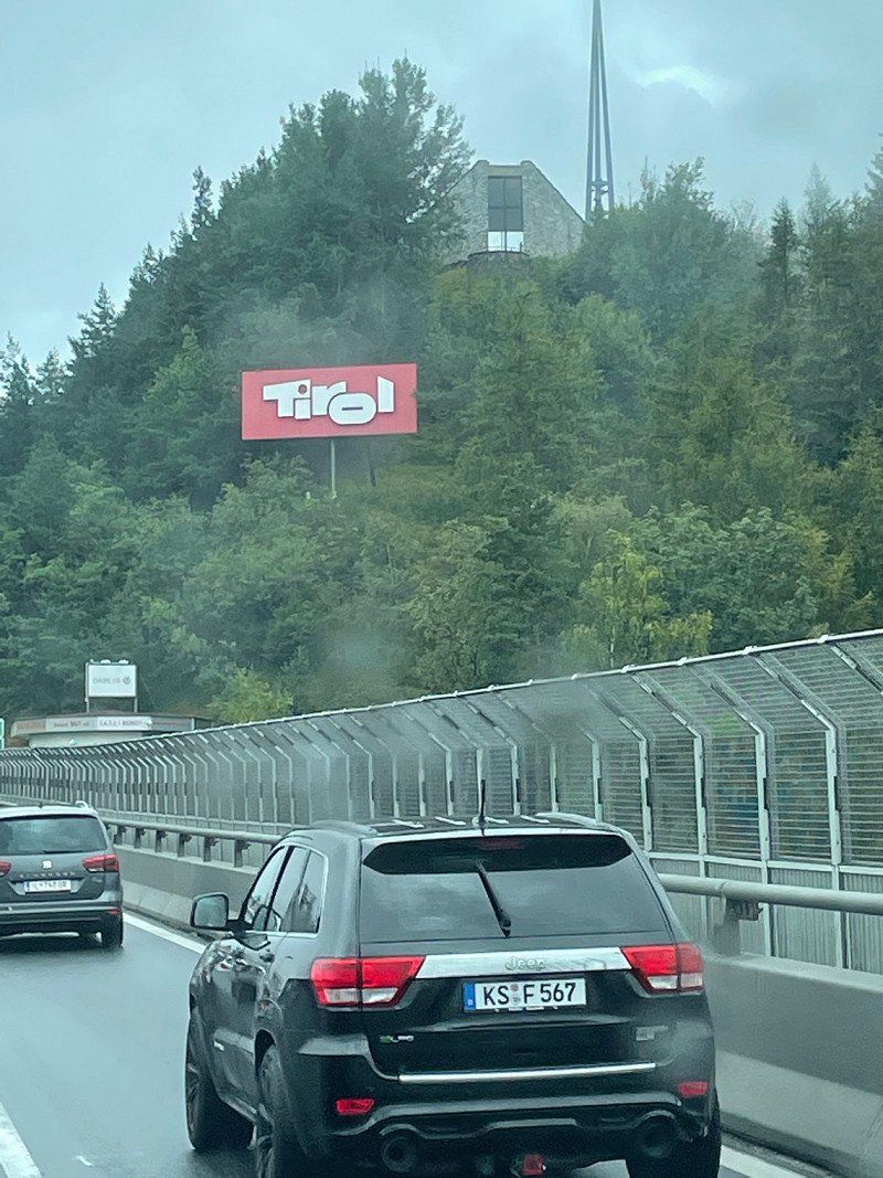
• Continue on A12 (Inntal Autobahn). Go for 74.9 km.
• Keep left onto A13 (Brenner Autobahn) toward Bozen/Brenner/Innsbruck-Süd. Go for 7.9 km.
• Arrive at Brenner Autobahn (A13). Your destination is on the right.
☍
91,3 km
(1 hrs. )
Rosenheimer Straße 116
47° 40' 1.1" N 12° 10' 10.3" E
47.6669617 12.1695140
• Head southwest on A13 (Brenner Autobahn). Go for 26.5 km.
• Continue on A22 (Autostrada del Brennero). Go for 77.2 km.
• Take the exit toward Bolzano Nord Centro/Val d'Ega/Bozen Nord Zentrum/Eggental/Kardaun/Cardano/Bozen/Bolzano/Jenesien/S. Genesio. Go for 741 m.
• Turn right onto Strada Statale dell'Abetone e del Brennero (SS12) toward Kardaun/Cardano/Bozen/Bolzano/Jenesien/S. Genesio. Go for 825 m.
• Take ramp toward Rentsch-St.Magdalena. Go for 177 m.
• Take the 2nd exit from roundabout onto Via Brennero toward Rentsch-St.Magdalena/Renico-S. Maddalena. Go for 891 m.
• Continue on Via Rencio. Go for 1.8 km.
• Continue on Via Brennero. Go for 294 m.
• Turn right onto Via Brennero. Go for 209 m.
• Continue on Piazza della Dogana. Go for 18 m.
• Take the 1st exit from roundabout onto Piazza della Dogana. Go for 30 m.
• Turn right onto Via Camillo Benso di Cavour. Go for 428 m.
• Turn right onto Via Weggenstein. Go for 582 m.
• Turn right onto Via Beato Arrigo. Go for 534 m.
• Continue on Via Sant'Antonio. Go for 104 m.
• Continue on Ponte Sant'Antonio. Go for 167 m.
• Turn right onto Via Sarentino (SS508). Go for 930 m.
• Continue on Galleria Rafenstein. Go for 1.6 km.
• Continue on Galleria Goldegg. Go for 2.2 km.
• Continue on Strada Statale di Val Sarentino e Passo Vizze (SS508). Go for 5.0 km.
• Take the 2nd exit from roundabout onto Strada Statale di Val Sarentino e Passo Vizze (SS508). Go for 35.1 km.
• Arrive at Strada Statale di Val Sarentino e Passo Vizze (SS508). Your destination is on the right.
☍
155,4 km
(2 hrs. 2 min.)
Brenner-Autobahn
47° 11' 56.3" N 11° 23' 57.4" E
47.1989746 11.3992795
• Head south on Strada Statale di Val Sarentino e Passo Vizze (SS508). Go for 35.1 km.
• Take the 2nd exit from roundabout onto Strada Statale di Val Sarentino e Passo Vizze (SS508). Go for 5.1 km.
• Continue on Galleria Goldegg. Go for 2.2 km.
• Continue on Galleria Rafenstein. Go for 1.6 km.
• Continue on Strada Statale di Val Sarentino e Passo Vizze (SS508). Go for 1.3 km.
• Continue on Via Luigi Cadorna. Go for 82 m.
• Turn right onto Via Fago. Go for 1.2 km.
• Turn left onto Piazza Gries. Go for 107 m.
• Take the 1st exit from roundabout onto Via Vittorio Veneto. Go for 1.8 km.
• Continue on Via Lorenz Böhler. Go for 84 m.
• Take the 1st exit from roundabout onto Via Lorenz Böhler. Go for 409 m.
• Take the 2nd exit from Via Lorenz Böhler roundabout onto Via Lorenz Böhler. Go for 266 m.
• Turn left onto Via Merano (SP165). Go for 638 m.
• Take the 1st exit from roundabout onto Via Castel Firmiano (SS42) toward Autostrada/Merano. Go for 10.2 km.
• Pass 2 roundabouts and continue on Strada Provinciale Caldaro-Roverè della Luna (SP14). Go for 724 m.
• Turn right onto Via Stazione. Go for 215 m.
• Continue on Via Andreas Hofer. Go for 117 m.
• Turn slightly left onto Via Andreas Hofer. Go for 78 m.
• Turn right onto Vicolo Stella. Go for 130 m.
• Arrive at Vicolo Stella. Your destination is on the left.
☍
61,3 km
(1 hrs. 6 min.)
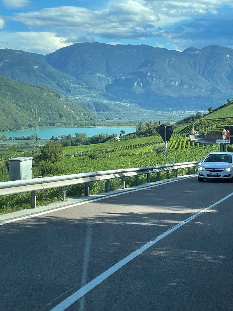
Penser Joch Alm, SS508, Sarntal, Autonome Provinz Bozen - Südtirol, Italien
SS508, 39058 Sarentino BZ, Italien
46° 49' 0.1" N 11° 26' 58.9" E
46.8166815 11.4497018
• Head toward Via Andreas Hofer on Vicolo Stella. Go for 130 m.
• Turn right onto Via Andreas Hofer. Go for 57 m.
• Continue on Piazza Principale. Go for 37 m.
• Continue on Via dell'Oro. Go for 85 m.
• Turn right onto Via dell'Oro. Go for 232 m.
• Continue on Via Europa. Go for 191 m.
• Turn left onto Via Barleit (SP15). Go for 136 m.
• Continue on Via Kartheiner (SP15). Go for 623 m.
• Take the 2nd exit from roundabout onto Strada Provinciale Caldaro-Roverè della Luna (SP14) toward Autostrada/A22/Autobahn/Trami/Termeno. Go for 4.2 km.
• Arrive at Località San Giuseppe al Lago (SP14). Your destination is on the left.
☍
5,7 km
( 7 min.)
Kaltern am See_Caldaro al Lago, Marktplatz, Kaltern, Autonome Provinz Bozen - Südtirol, Italien
Marktpl., 8, 39052 Kaltern, Autonome Provinz Bozen - Südtirol, Italien
46° 24' 47.7" N 11° 14' 43.7" E
46.4132414 11.2454776
• Head southeast on Località San Giuseppe al Lago (SP14). Go for 991 m.
• Pass 2 roundabouts and continue on Strada Provinciale Caldaro-Roverè della Luna (SP14). Go for 4.5 km.
• Take the 3rd exit from roundabout onto Strada Provinciale Autostrada-Termeno (SP16) toward Autostrada/A22/Autobahn/Neumarkt/Egna. Go for 1.1 km.
• Take the 3rd exit from roundabout onto Strada Provinciale Autostrada-Termeno (SP16) toward Autostrada/A22/Autobahn/Auer/Ora/Bozen/Bolzano. Go for 1.4 km.
• Take the 2nd exit from roundabout onto A22 (Autostrada del Brennero) toward Autostrada/Autobahn/Modena/Trento. Go for 65.6 km.
• Take the exit toward Rovereto Sud/Lago di Garda Nord. Go for 1.3 km.
• Take the 4th exit from roundabout toward Mori/Riva D/G/Arco. Go for 306 m.
• Continue on SS240. Go for 6.2 km.
• Pass 2 roundabouts and continue on Strada Rivana (SS240). Go for 5.1 km.
• Take the 4th exit from roundabout onto Strada Statale di Loppio e Val di Ledro (SS240) toward Torbole/Riva del Garda. Go for 2.0 km.
• Take the 2nd exit from roundabout onto Via Giacomo Matteotti (SS249) toward Malcesine/Verona. Go for 5.5 km.
• Continue on Strada Regionale Gardesana Orientale (SR249). Go for 5.4 km.
• Turn left onto Via Navene Vecchia. Go for 152 m.
• Turn right onto Via Navene Vecchia. Go for 197 m.
• Continue on Località Molini di Cal. Go for 148 m.
• Arrive at Località Molini di Cal.
☍
100,0 km
(1 hrs. 13 min.)
Camping St. Josef am Kalterer See
St. Josef 75, 39052, Kaltern, Italien
46° 22' 20.4" N 11° 15' 9.6" E
46.3723200 11.2526600
• Head southwest on Località Molini di Cal. Go for 91 m.
• Arrive at Località Molini di Cal. Your destination is on the right.
☍
0,1 km
( )
Campeggio Lombardi
Località San Carlo, 37018, Malcesine, Italien
45° 47' 5" N 10° 49' 21" E
45.7847222 10.8225000
• Head northeast on Località Molini di Cal. Go for 238 m.
• Continue on Via Navene Vecchia. Go for 197 m.
• Turn left onto Via Navene Vecchia. Go for 152 m.
• Turn right onto Via Gardesana (SR249). Go for 5.4 km.
• Continue on Strada Statale Gardesana Orientale (SS249). Go for 5.5 km.
• Take the 1st exit from roundabout onto Strada Statale di Loppio e Val di Ledro (SS240) toward Autostrada/A22/Nago/Rovereto. Go for 1.8 km.
• Arrive at Strada Statale di Loppio e Val di Ledro (SS240).
☍
13,3 km
( 16 min.)
Day
Camping Lombardi
45° 47' 3.7" N 10° 49' 17.1" E
45.7843628 10.8214254
• Head south on Strada Statale di Loppio e Val di Ledro (SS240). Go for 118 m.
• Pass 3 roundabouts and continue on Località Loppio (SS240). Go for 11.4 km.
• Keep right toward Brennero/Modena. Go for 196 m.
• Take ramp onto A22 (Autostrada del Brennero) toward Modena/Verona. Go for 147 km.
• Take the left exit toward Bologna/Roma/Modena onto A1 (Autostrada del Sole). Go for 2.6 km.
• Take the exit toward Modena Nord/Modena Centro/Tangenziale onto Tangenziale Nord Luigi Pirandello. Go for 7.8 km.
• Keep left onto Tangenziale Nord Giosuè Carducci toward Bologna/A1/SS9. Go for 2.3 km.
• Continue on Tangenziale Nord Boris Leonidovic Pasternak. Go for 2.9 km.
• Keep left onto Via Nuova Estense toward Bologna/A1/Abetone/SS12/Vignola/SP623/Ospedale Civile Baggiovara. Go for 1.2 km.
• Take the 3rd exit from roundabout onto Strada Provinciale del Passo Brasa (SP623) toward Bologna/A1/Vignola. Go for 5.1 km.
• Take the 2nd exit from roundabout onto Strada Provinciale del Passo Brasa (SP623) toward Autostrada/A1/Spilamberto/Vignola. Go for 1.7 km.
• Take the 3rd exit from roundabout onto A1 (Autostrada del Sole) toward Bologna. Go for 35.9 km.
• Continue on SS64var. Go for 927 m.
• Continue on Raccordo Autostradale Sasso Marconi SS64 Porretana. Go for 2.4 km.
• Continue on A1 (Autostrada del Sole). Go for 10.6 km.
• Keep right onto A1var (Variante di Valico) toward Direttissima/A1/Firenze/Badia. Go for 34.8 km.
• Continue on A1 (Viadotto Lora). Go for 91 m.
• Continue on A1var (Variante di Valico). Go for 32 m.
• Continue on A1 (Galleria Manganaccia). Go for 434 m.
• Continue on A1var (Galleria Manganaccia). Go for 1.9 km.
• Continue on A1 (Viadotto Sieve). Go for 139 m.
• Continue on A1var (Viadotto Sieve). Go for 216 m.
• Continue on A1 (Autostrada del Sole). Go for 19 m.
• Continue on A1var (Variante di Valico). Go for 116 m.
• Continue on A1 (Autostrada del Sole). Go for 17.8 km.
• Take the exit toward Genova/A12/Firenze Centro/Firenze Aeroporto onto A11 (Autostrada Firenze Mare). Go for 42.9 km.
• Take the exit toward Chiesina U. Go for 329 m.
• Turn right onto Via Romana (SP13) toward Uzzano/Montecarlo. Go for 464 m.
• Pass 2 roundabouts and continue on Strada Provinciale Romana (SP13). Go for 4.1 km.
• Continue on Strada Provinciale Mammianese (SP3). Go for 675 m.
• Take the 3rd exit from roundabout onto Via Salvo D'Acquisto. Go for 241 m.
• Take the 2nd exit from roundabout onto Via del Castellare (SP11). Go for 729 m.
• Take the 2nd exit from roundabout onto Via Lucchese (SR435). Go for 1.4 km.
• Take the 1st exit from roundabout onto Via Panoramica. Go for 951 m.
• Turn right onto Via delle Cartiere (SP12). Go for 587 m.
• Turn left onto Via per San Gennaro. Go for 78 m.
• Arrive at Via per San Gennaro. Your destination is on the left.
☍
340,0 km
(3 hrs. 18 min.)
Day
SS 240
45° 52' 44.7" N 10° 53' 15.1" E
45.8790894 10.8875299
• Head toward Via del Colle Collodi on Via per San Gennaro. Go for 51 m.
• Continue on Via Benvenuto Pasquinelli. Go for 662 m.
• Turn right onto Via delle Cartiere (SP12). Go for 706 m.
• Turn right onto Via Lucchese (SR435). Go for 7.2 km.
• Pass 7 roundabouts and continue on Viale Castruccio Castracani (SR435). Go for 6.7 km.
• Take the 2nd exit from roundabout onto Viale Guglielmo Marconi. Go for 102 m.
• Take the 2nd exit from roundabout onto Piazzale Don Aldo Mei. Go for 289 m.
• Take the 1st exit from roundabout onto Viale Giuseppe Giusti. Go for 633 m.
• Continue on Piazza Curtatone. Go for 100 m.
• Continue on Piazzale Bettino Ricasoli. Go for 402 m.
• Keep right onto Viale Giosuè Carducci. Go for 548 m.
• Take the 3rd exit from roundabout onto Viale Europa. Go for 877 m.
• Turn right. Go for 221 m.
• Keep left toward Pisa/SS12bis/SS12/Pontedera. Go for 156 m.
• Turn right toward Pisa/SS12/Pontedera/SS435. Go for 1.1 km.
• Continue on Via di Vicopelago. Go for 877 m.
• Take the 1st exit from roundabout onto Via Nuova per Pisa (SS12radd) toward Pisa/SS12. Go for 9.0 km.
• Turn right onto Strada Reg. dell'Abetone e del Brennero (SR12) toward Pontasserchio/Vecchiano/S.Giuliano Terme. Go for 563 m.
• Turn left onto Via Martin Luther King. Go for 24 m.
• Turn right onto Via Roma. Go for 167 m.
• Arrive at Via Roma. Your destination is on the left.
☍
30,5 km
( 36 min.)
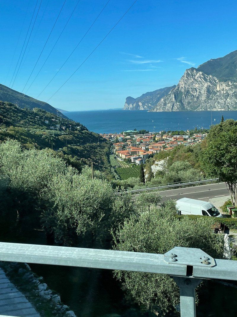
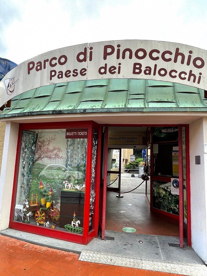
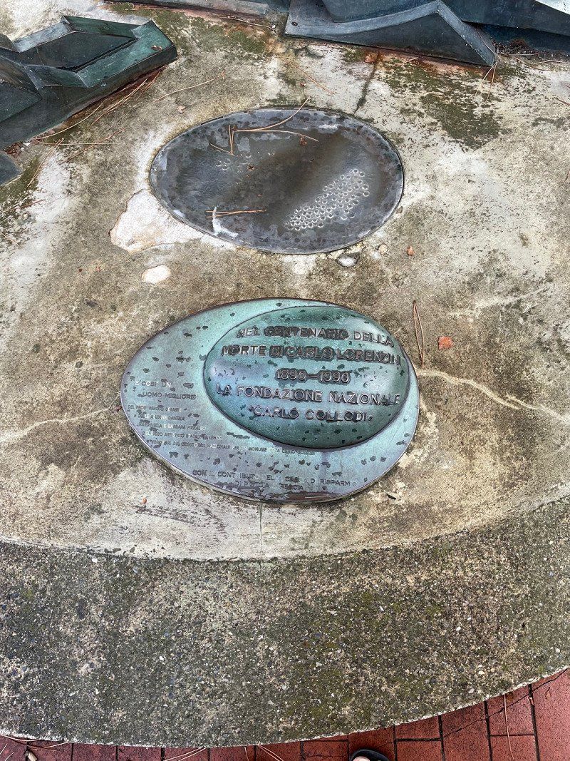
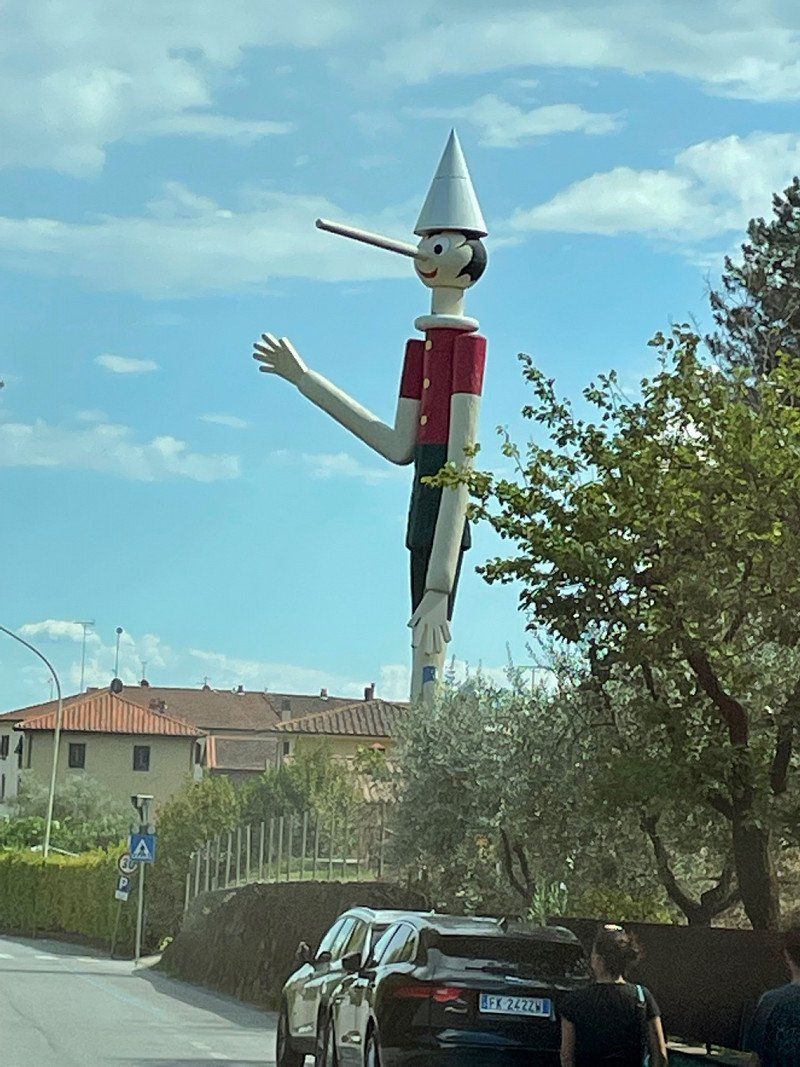
Pinocchio Park, SP35, Pescia, Pistoia, Italien
SP35, 51012 Pescia PT, Italien
43° 54' 0.1" N 10° 39' 7.5" E
43.9000164 10.6520769
• Head toward Via Martin Luther King on Via Roma. Go for 167 m.
• Turn left onto Via Martin Luther King. Go for 24 m.
• Turn right onto Strada Reg. dell'Abetone e del Brennero (SR12). Go for 563 m.
• Turn left onto Via Carlo Barsotti (SS12radd). Go for 9.0 km.
• Take the 2nd exit from roundabout toward Lucca Centro/Autostrade. Go for 314 m.
• Continue on Via di Vicopelago. Go for 1.8 km.
• Turn right toward Viale Europa. Go for 78 m.
• Keep left onto Viale Europa toward Lucca Centro/Autostrade. Go for 163 m.
• Keep right onto Viale Europa toward Pescia/SS435/Camaiore/SP1/Castelnuovo Garfagnana/SP2/Abetone. Go for 778 m.
• Keep right onto Viale Giosuè Carducci toward Pescia. Go for 952 m.
• Turn left onto Piazzale Bettino Ricasoli. Go for 78 m.
• Continue on Sortita Baluardo San Colombano. Go for 183 m.
• Turn left onto Rampa Baluardo San Colombano. Go for 91 m.
• Turn sharp right onto Corso Giuseppe Garibaldi. Go for 140 m.
• Turn left onto Piazza della Rosa. Go for 25 m.
• Continue on Via della Rosa. Go for 239 m.
• Continue on Piazza Santa Maria Forisportam. Go for 16 m.
• Turn left onto Via Santa Croce. Go for 202 m.
• Continue on Via Santa Croce. Go for 100 m.
• Continue on Via Roma. Go for 81 m.
• Continue on Piazza San Michele. Go for 28 m.
• Arrive at Piazza San Michele. Your destination is on the right.
☍
15,0 km
( 20 min.)
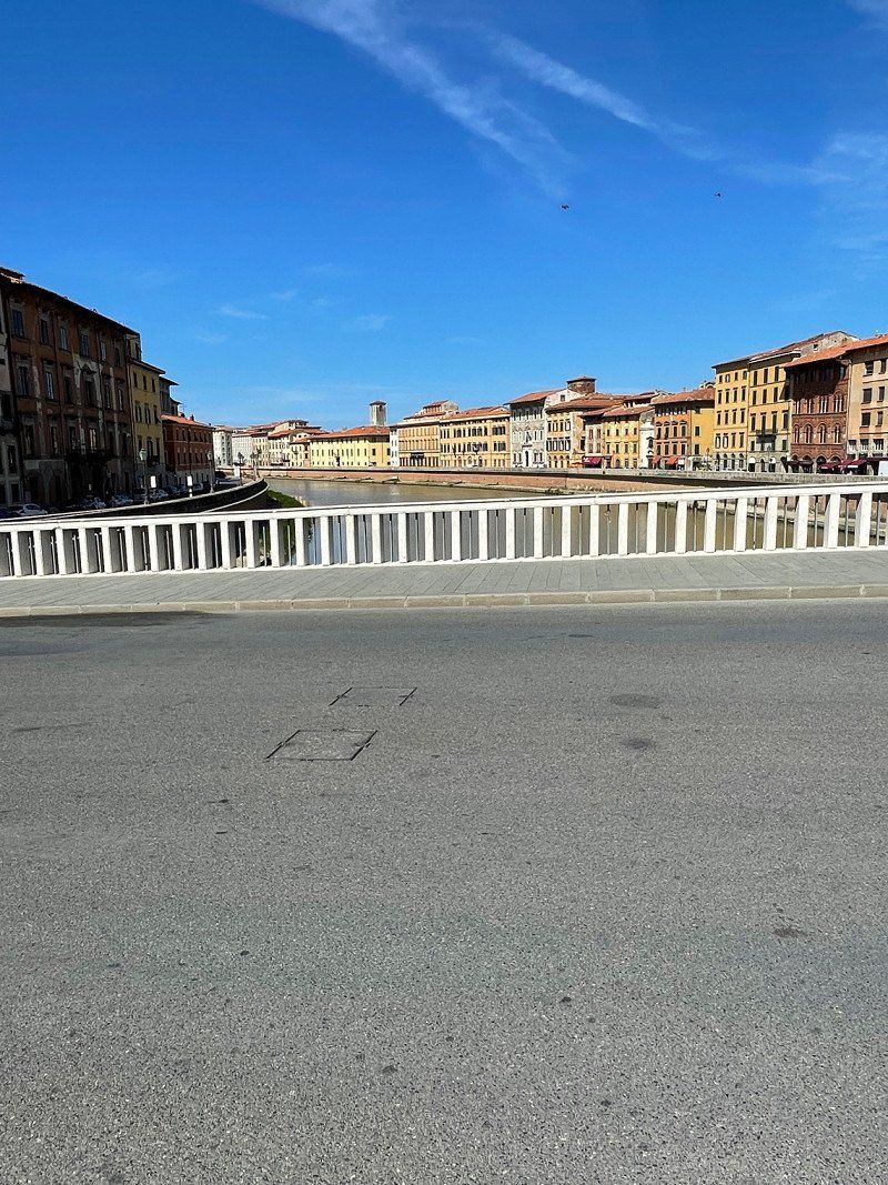
S.Giuliano Terme, 56017 San Giuliano Terme, Pisa, Italien
56017 San Giuliano Terme, Pisa, Italien
43° 45' 53.6" N 10° 26' 12.8" E
43.7648950 10.4368990
• Head west on Piazza San Michele. Go for 41 m.
• Turn left onto Via Vittorio Veneto. Go for 97 m.
• Turn right onto Via Vittorio Emanuele. Go for 406 m.
• Turn right onto Piazzale Giuseppe Verdi. Go for 99 m.
• Make a U-Turn at Via San Paolino onto Piazzale Giuseppe Verdi. Go for 95 m.
• Turn slightly right onto Piazzale Giuseppe Verdi. Go for 51 m.
• Continue on Piazzale Luigi Boccherini. Go for 100 m.
• Take the 3rd exit from roundabout onto Piazzale Luigi Boccherini. Go for 101 m.
• Continue on Viale Giosuè Carducci. Go for 185 m.
• Take the 2nd exit from roundabout onto Viale Europa. Go for 844 m.
• Turn right. Go for 221 m.
• Keep left toward Pisa/SS12bis/SS12/Pontedera. Go for 156 m.
• Turn right toward Pisa/SS12/Pontedera/SS435. Go for 1.1 km.
• Continue on Via di Vicopelago. Go for 877 m.
• Take the 1st exit from roundabout onto Via Nuova per Pisa (SS12radd) toward Pisa/SS12. Go for 9.0 km.
• Turn right onto Strada Reg. dell'Abetone e del Brennero (SR12) toward Pontasserchio/Vecchiano/S.Giuliano Terme. Go for 563 m.
• Turn left onto Via Martin Luther King. Go for 24 m.
• Turn right onto Via Roma. Go for 167 m.
• Arrive at Via Roma. Your destination is on the left.
☍
14,2 km
( 18 min.)
Day
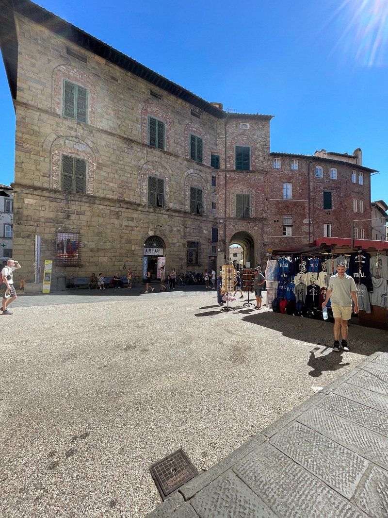
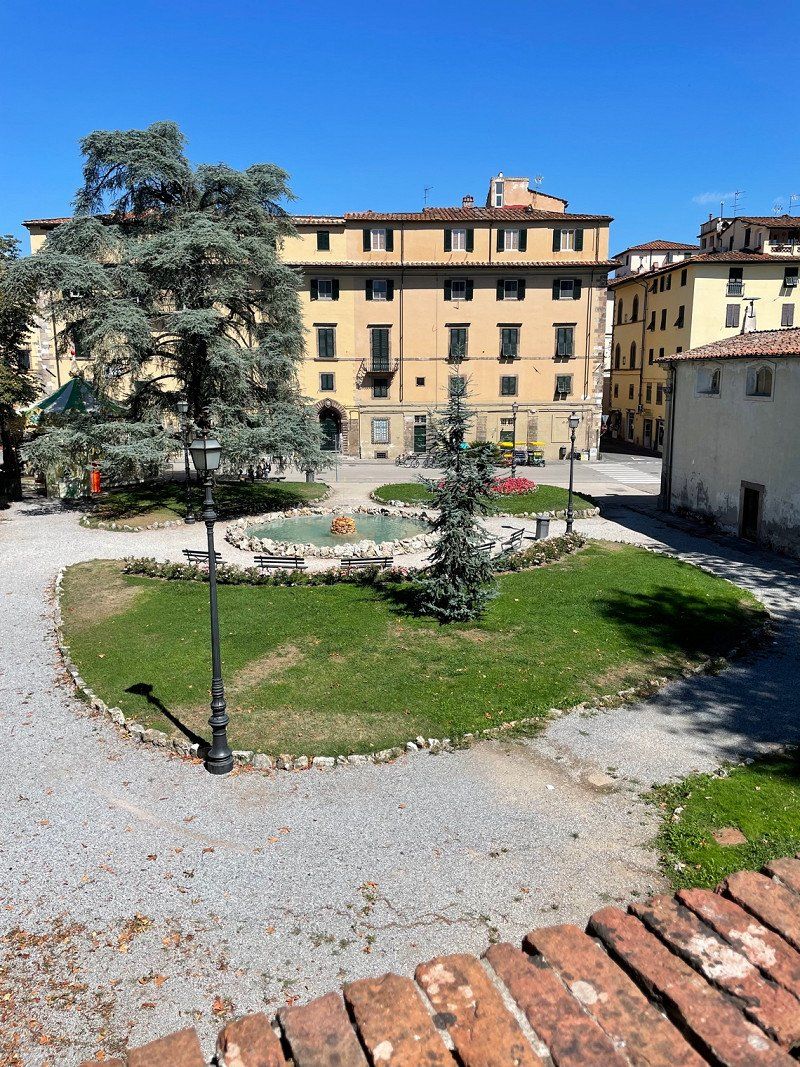
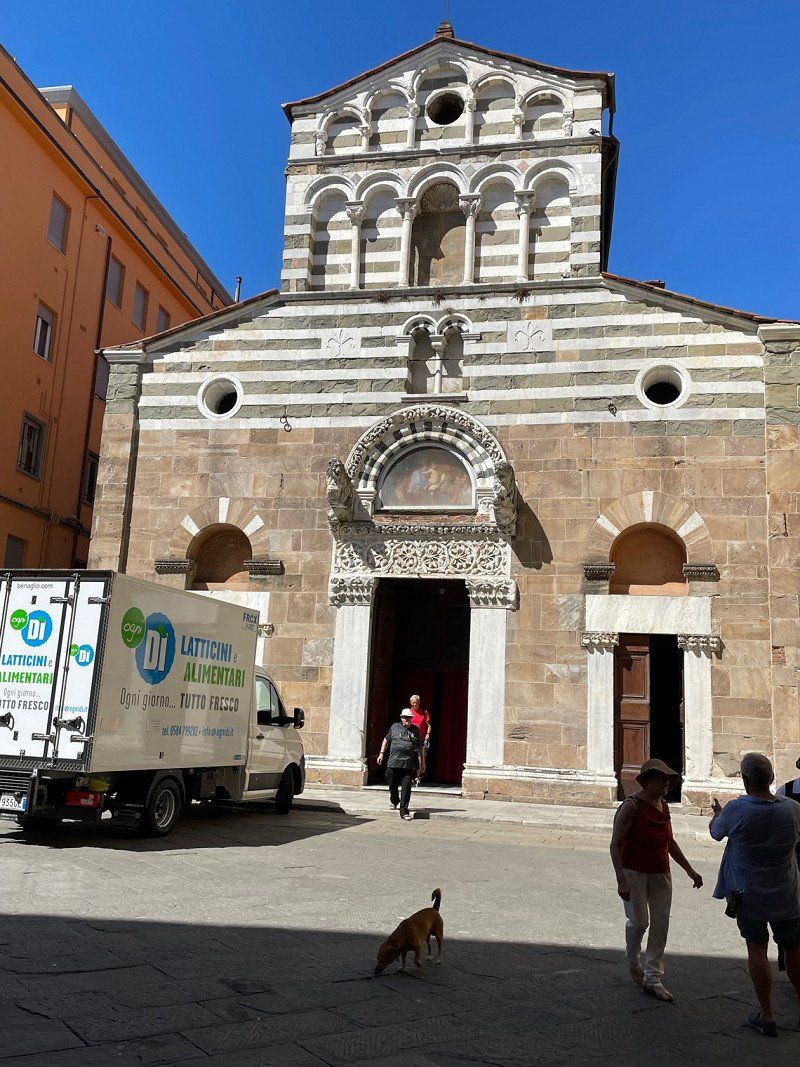
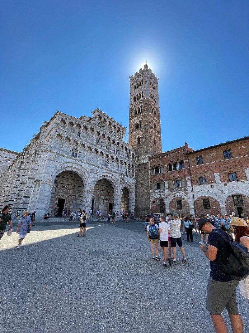
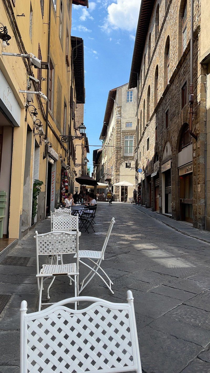
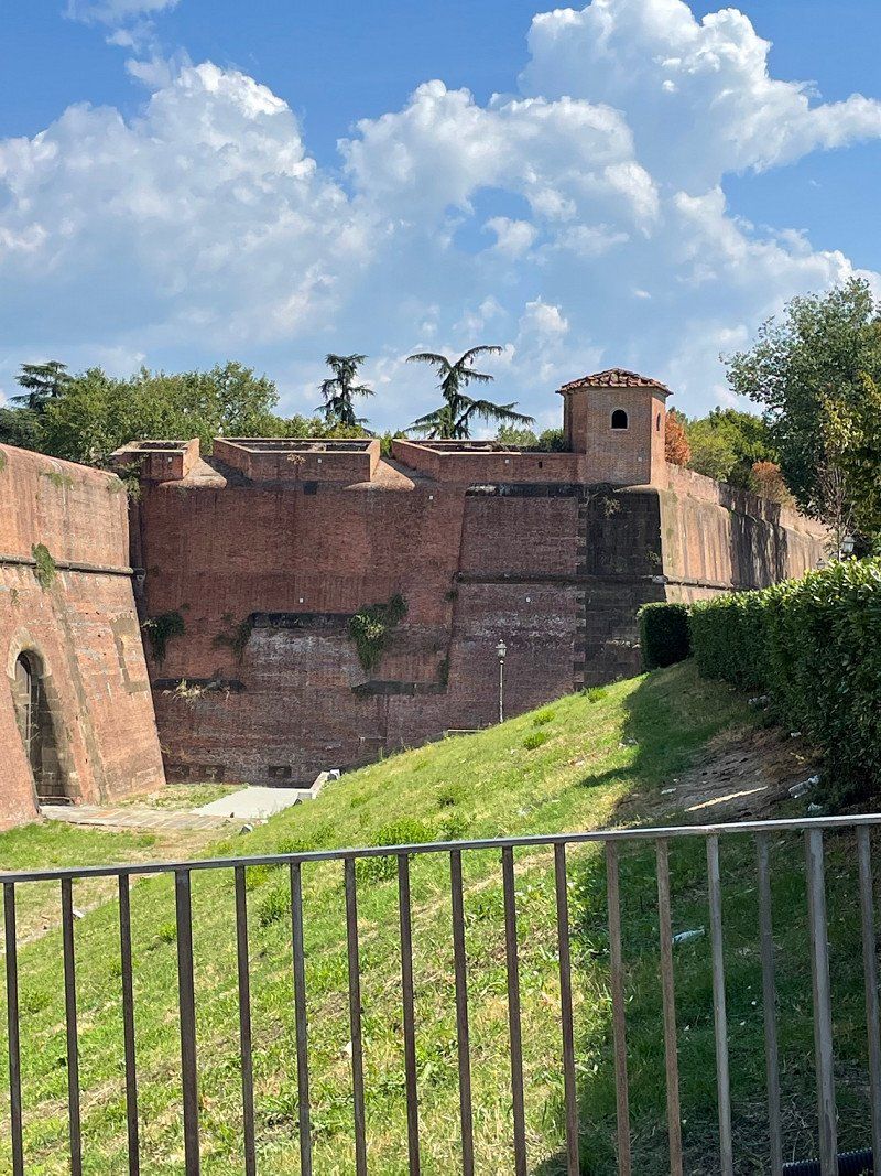
Lucca, Italien
Rode my bike to Lucca today, there is no directly marked cycle path, but we made it that way too 😊
It's very beautiful and worth seeing.
I'm just dreading the way back, after many of them we'll start cycling again 🥵
55100 Lucca, Italien
43° 50' 34.5" N 10° 30' 9.7" E
43.8429197 10.5026977
• Head toward Via Martin Luther King on Via Roma. Go for 167 m.
• Turn left onto Via Martin Luther King. Go for 24 m.
• Turn right onto Strada Reg. dell'Abetone e del Brennero (SR12). Go for 563 m.
• Turn right onto Strada Statale dell'Abetone e del Brennero (SS12). Go for 509 m.
• Take the 2nd exit from roundabout onto Strada Statale dell'Abetone e del Brennero (SS12). Go for 4.4 km.
• Continue on Via del Brennero. Go for 43 m.
• Take the 2nd exit from Rotonda Martiri delle Foibe roundabout onto Via del Brennero. Go for 637 m.
• Arrive at Via del Brennero. Your destination is on the left.
☍
6,3 km
( 7 min.)
Day
S.Giuliano Terme, 56017 San Giuliano Terme Pisa, Italien
56017 San Giuliano Terme, Pisa, Italien
43° 45' 53.6" N 10° 26' 12.8" E
43.7648950 10.4368990
• Head west on Via del Brennero.
• Continue on Via Contessa Matilde. Go for 874 m.
• Take the 2nd exit from Rotatoria Lorenzo Poggi roundabout onto Via Pietrasantina. Go for 2.5 km.
• Continue on Via Aurelia Madonna dell'Acqua (SS1). Go for 251 m.
• Turn right onto Via Aurelia Madonna dell'Acqua (SS1). Go for 4.8 km.
• Turn right toward Genova/A12/Livorno/E80/Rosignano Marittimo/Firenze/Roma. Go for 82 m.
• Continue on Autostrada Firenze Mare toward Genova/A12/Livorno/E80/Rosignano Marittimo/Firenze/Roma. Go for 81.7 km.
• Keep left onto Viale Zoroastro da Peretola. Go for 196 m.
• Keep left onto Viale degli Astronauti toward Firenze Centro/Aeroporto A.Vespucci/Novoli/A1/Autostrade/A11. Go for 338 m.
• Continue on Viale Alessandro Guidoni. Go for 35 m.
• Turn right onto Via Ermenegildo Santoni. Go for 102 m.
• Turn slightly right onto Via Francesco Geminiani. Go for 411 m.
• Take the 2nd exit from roundabout onto Via Francesco Baracca. Go for 2.0 km.
• Continue on Ponte Enzo Ferrari. Go for 31 m.
• Turn right onto Piazza Giacomo Puccini. Go for 70 m.
• Turn left onto Piazza Giacomo Puccini. Go for 203 m.
• Turn right onto Via del Ponte alle Mosse. Go for 1.2 km.
• Turn left onto Piazzale della Porta al Prato. Go for 84 m.
• Keep right onto Piazzale della Porta al Prato. Go for 50 m.
• Continue on Viale Fratelli Rosselli. Go for 497 m.
• Continue on Viale Filippo Strozzi. Go for 502 m.
• Turn right onto Viale Filippo Strozzi. Go for 39 m.
• Continue on Viale Spartaco Lavagnini. Go for 604 m.
• Turn right onto Piazza della Libertà toward Piazza Beccaria/Autostrade/A1/Bagno a Ripoli/A11. Go for 140 m.
• Keep left onto Piazza della Libertà. Go for 58 m.
• Continue on Viale Giacomo Matteotti. Go for 712 m.
• Continue on Piazzale Donatello. Go for 42 m.
• Take the 1st exit from Piazzale Donatello roundabout onto Piazzale Donatello toward Via Aretina/SS67/Piazza Beccaria/Autostrade/A11/A1. Go for 141 m.
• Continue on Viale Antonio Gramsci. Go for 900 m.
• Turn right onto Via dell'Agnolo. Go for 672 m.
• Continue on Via dei Pandolfini. Go for 328 m.
• Turn left onto Via del Proconsolo. Go for 80 m.
• Turn right onto Piazza di San Firenze. Go for 29 m.
• Turn right onto Via della Condotta. Go for 52 m.
• Turn left onto Via dei Magazzini. Go for 37 m.
• Continue on Piazza della Signoria. Go for 39 m.
• Turn right onto Piazza della Signoria. Go for 73 m.
• Arrive at Piazza della Signoria. Your destination is on the left.
☍
99,9 km
(1 hrs. 11 min.)
Day
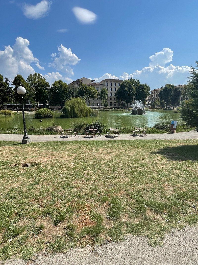
Pisa, Italien
First by bike to the train station, about 1 1/2 km, then by train to Pisa, was totally easy. For a round trip just under 6 €
paid.
43° 43' 22.2" N 10° 24' 6.1" E
43.7228386 10.4016888
• Head west on Piazza della Signoria. Go for 56 m.
• Turn left onto Piazza della Signoria. Go for 64 m.
• Continue on Via della Ninna. Go for 100 m.
• Turn slightly right onto Piazza del Grano. Go for 65 m.
• Continue on Via dei Castellani. Go for 75 m.
• Continue on Via dei Saponai. Go for 95 m.
• Continue on Piazza Mentana. Go for 27 m.
• Turn right onto Piazza Mentana. Go for 55 m.
• Turn left onto Lungarno Generale Armando Diaz. Go for 100 m.
• Continue on Lungarno delle Grazie. Go for 242 m.
• Continue on Piazza dei Cavalleggeri. Go for 33 m.
• Continue on Lungarno della Zecca Vecchia. Go for 419 m.
• Continue on Lungarno Guglielmo Pecori Giraldi. Go for 257 m.
• Keep left onto Viale Giovanni Amendola toward Viale Circonvallazione/Centro/Aeroporto A. Vespucci. Go for 335 m.
• Keep right onto Viale Giovanni Amendola. Go for 930 m.
• Continue on Piazzale Donatello toward Piazza Libertà/Autostrade. Go for 183 m.
• Take the 1st exit from roundabout onto Piazzale Donatello toward Piazza Libertà. Go for 691 m.
• Continue on Piazza della Libertà. Go for 327 m.
• Keep right onto Viale Spartaco Lavagnini toward Aeroporto Amerigo Vespucci/A1/Autostrade/A11/Prato-Pisa. Go for 716 m.
• Turn right onto Viale Filippo Strozzi. Go for 556 m.
• Keep right onto Viale Filippo Strozzi toward Ponte della Vittoria/Aeroporto/S.G.C. FI-PI-LI/Siena/Milano/A1/Pisa/A11. Go for 206 m.
• Continue on Viale Belfiore. Go for 105 m.
• Keep right onto Viale Francesco Redi toward Novoli/Aeroporto A. Vespucci/Autostrade/A1/A11/Sesto Fiorentino-Prato/Campi Bisenzio-Pistoia. Go for 1.5 km.
• Continue on Via di Novoli toward Aeroporto/Autostrade/A1/A11/Sesto Fiorentino-Prato/Campi Bisenzio-Pistoia. Go for 103 m.
• Take the 1st exit from Via di Novoli roundabout onto Via Enrico Forlanini toward Ospedale Careggi/A1/Autostrade/A11/Campi Bisenzio-Pistoia. Go for 550 m.
• Continue on Viale Alessandro Guidoni toward Campi B.-Prato/A1/Autostrade/A11. Go for 12 m.
• Turn left onto Viale Alessandro Guidoni toward Aeroporto/A1/Autostrade/A11/Sesto Fiorentino-Prato/Campi Bisenzio-Pistoia. Go for 1.9 km.
• Turn right onto Viale Undici Agosto. Go for 239 m.
• Keep middle onto Viale Undici Agosto toward Autostrade/A11/A1/Aeroporto A. Vespucci/Prato-Pistoia. Go for 157 m.
• Continue on Viale Giovanni Luder. Go for 294 m.
• Keep right onto Viale Giovanni Luder toward Aeroporto A. Vespucci/Osmannoro/Firenze-Mare/A11/Milano-Napoli/A1/Prato-Pistoia. Go for 390 m.
• Keep middle onto Autostrada Firenze Mare (A11) toward Firenze-Mare/Milano-Napoli/A1/Prato-Pistoia. Go for 65.9 km.
• Take the exit toward Lucca Est onto Viale Europa. Go for 841 m.
• Keep right onto Viale Europa toward Pescia/SS435/Camaiore/SP1/Castelnuovo Garfagnana/SP2/Abetone. Go for 778 m.
• Keep right onto Viale Giosuè Carducci toward Pescia. Go for 952 m.
• Turn left onto Piazzale Bettino Ricasoli. Go for 78 m.
• Continue on Sortita Baluardo San Colombano. Go for 183 m.
• Turn left onto Rampa Baluardo San Colombano. Go for 91 m.
• Turn sharp right onto Corso Giuseppe Garibaldi. Go for 140 m.
• Turn left onto Piazza della Rosa. Go for 25 m.
• Continue on Via della Rosa. Go for 239 m.
• Continue on Piazza Santa Maria Forisportam. Go for 16 m.
• Turn left onto Via Santa Croce. Go for 202 m.
• Continue on Via Santa Croce. Go for 100 m.
• Continue on Via Roma. Go for 81 m.
• Continue on Piazza San Michele. Go for 28 m.
• Arrive at Piazza San Michele. Your destination is on the right.
☍
80,4 km
(1 hrs. )
Day
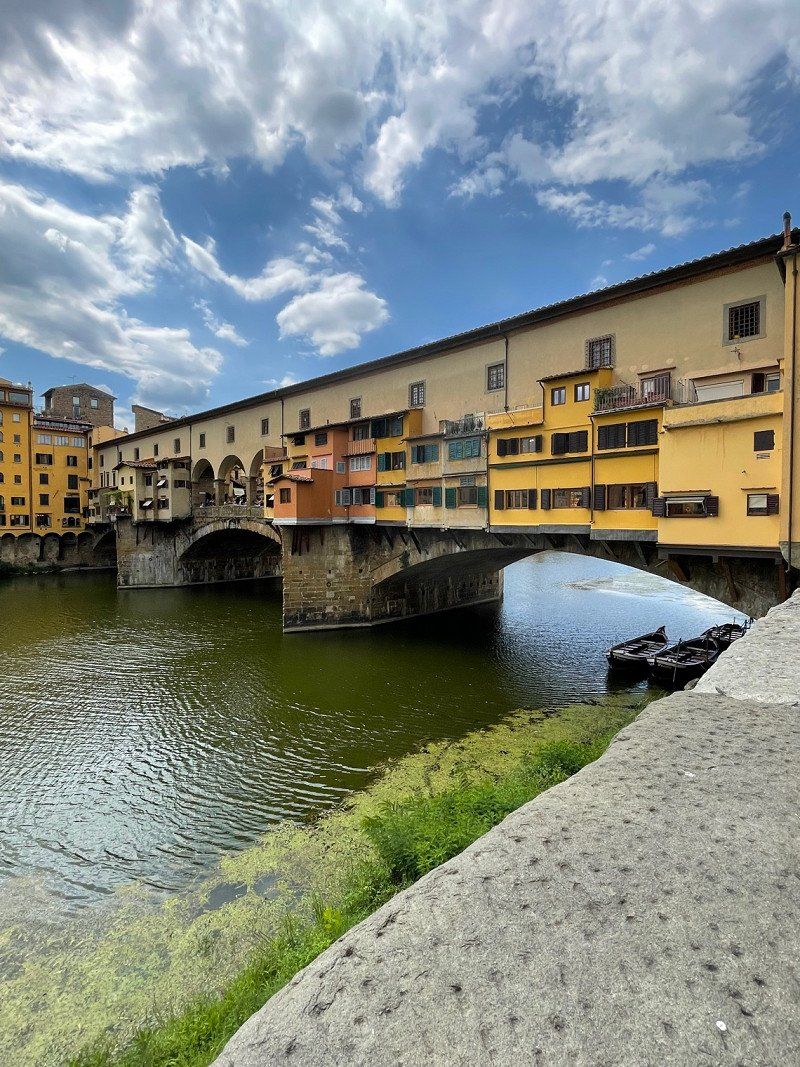
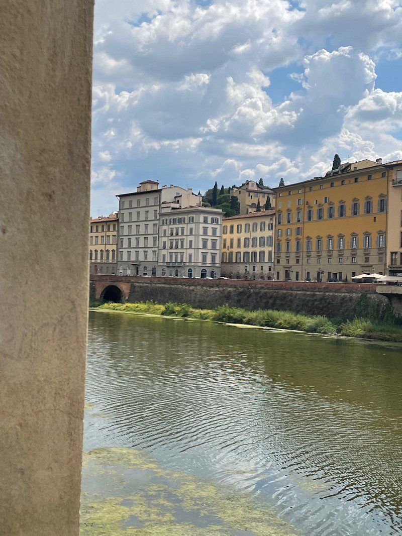
Florenz, Italien
43° 46' 10.4" N 11° 15' 20.9" E
43.7695604 11.2558136
• Head west on Piazza San Michele. Go for 41 m.
• Turn left onto Via Vittorio Veneto. Go for 97 m.
• Turn right onto Via Vittorio Emanuele. Go for 406 m.
• Turn right onto Piazzale Giuseppe Verdi. Go for 99 m.
• Make a U-Turn at Via San Paolino onto Piazzale Giuseppe Verdi. Go for 95 m.
• Turn slightly right onto Piazzale Giuseppe Verdi. Go for 51 m.
• Continue on Piazzale Luigi Boccherini. Go for 100 m.
• Take the 3rd exit from roundabout onto Piazzale Luigi Boccherini. Go for 101 m.
• Continue on Viale Giosuè Carducci. Go for 185 m.
• Take the 2nd exit from roundabout onto Viale Europa. Go for 844 m.
• Turn right. Go for 221 m.
• Keep left toward Pisa/SS12bis/SS12/Pontedera. Go for 156 m.
• Turn right toward Pisa/SS12/Pontedera/SS435. Go for 1.1 km.
• Continue on Via di Vicopelago. Go for 877 m.
• Take the 1st exit from roundabout onto Via Nuova per Pisa (SS12radd) toward Pisa/SS12. Go for 9.0 km.
• Turn right onto Strada Reg. dell'Abetone e del Brennero (SR12) toward Pontasserchio/Vecchiano/S.Giuliano Terme. Go for 563 m.
• Turn left onto Via Martin Luther King. Go for 24 m.
• Turn right onto Via Roma. Go for 167 m.
• Arrive at Via Roma. Your destination is on the left.
☍
14,2 km
( 17 min.)
Lucca, Italien
55100 Lucca, Italien
43° 50' 34.5" N 10° 30' 9.7" E
43.8429197 10.5026977
• Head toward Via Martin Luther King on Via Roma. Go for 167 m.
• Turn left onto Via Martin Luther King. Go for 24 m.
• Turn left onto Strada Reg. dell'Abetone e del Brennero (SR12). Go for 129 m.
• Continue on Via Giuseppe Di Vittorio (SP30). Go for 1.0 km.
• Pass 2 roundabouts and continue on Via Giuseppe Di Vittorio (SP30). Go for 2.9 km.
• Take the 2nd exit from roundabout onto Strada Provinciale Vecchianese (SP10). Go for 3.1 km.
• Keep right onto Via della Bozza. Go for 1.9 km.
• Turn left onto Via Traversagna. Go for 1.7 km.
• Take the 1st exit from roundabout onto Strada Statale Aurelia (SS1) toward La Spezia/Viareggio. Go for 5.5 km.
• Take the 2nd exit from roundabout onto Via Aurelia toward Torre del Lago. Go for 1.1 km.
• Continue on Via Aurelia Sud. Go for 452 m.
• Turn left onto Viale Giacomo Puccini. Go for 64 m.
• Continue on Via Giuseppe Garibaldi. Go for 62 m.
• Continue on Sottopasso Martin Pescatore. Go for 146 m.
• Continue on Via Guglielmo Marconi. Go for 894 m.
• Take the 3rd exit from Largo Rita Casaroli roundabout onto Viale Guglielmo Marconi. Go for 1.2 km.
• Continue on Via del Mare. Go for 424 m.
• Take the 2nd exit from Terrazza T. Tesei e A. Pedretti roundabout onto Viale Europa. Go for 204 m.
• Arrive at Viale Europa. Your destination is on the right.
☍
21,1 km
( 25 min.)
Day
S.Giuliano Terme, 56017 San Giuliano Terme, Pisa, Italien
56017 San Giuliano Terme, Pisa, Italien
43° 45' 53.6" N 10° 26' 12.8" E
43.7648950 10.4368990
• Head toward Viale dei Pini on Viale Europa. Go for 86 m.
• Turn left onto Viale John Fitzgerald Kennedy. Go for 161 m.
• Turn left onto Viale dei Pini. Go for 234 m.
• Turn right onto Via del Mare. Go for 249 m.
• Continue on Viale John Fitzgerald Kennedy. Go for 1.2 km.
• Take the 4th exit from Largo Rita Casaroli roundabout onto Via Giovanni XXIII. Go for 988 m.
• Turn right onto Via dei Lecci. Go for 111 m.
• Keep left onto Via dei Lecci. Go for 2.3 km.
• Take the 3rd exit from Largo Padre Leonardo Pacini OFM roundabout onto Vietta dei Comparini. Go for 560 m.
• Turn right onto Viale dei Tigli. Go for 1.6 km.
• Continue on Piazza Benedetto Brin. Go for 23 m.
• Continue on Via Alfredo Cappellini. Go for 45 m.
• Turn right onto Via Guglielmo Oberdan. Go for 115 m.
• Take the 3rd exit from roundabout onto Piazza Alessandro Manzoni. Go for 285 m.
• Turn right onto Via Michelangelo Buonarroti. Go for 100 m.
• Turn left onto Piazza Massimo d'Azeglio. Go for 109 m.
• Turn right onto Viale Daniele Manin. Go for 668 m.
• Continue on Viale Giosuè Carducci. Go for 651 m.
• Turn left onto Traversa A Mare N. 19 Alfredo Pardini. Go for 61 m.
• Turn left onto Via Giuseppe Barellai. Go for 110 m.
• Turn right onto Via Giuseppe Barellai. Go for 185 m.
• Arrive at Via Giuseppe Barellai. Your destination is on the left.
☍
9,9 km
( 17 min.)
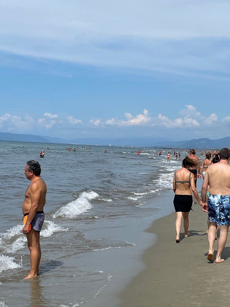
Day
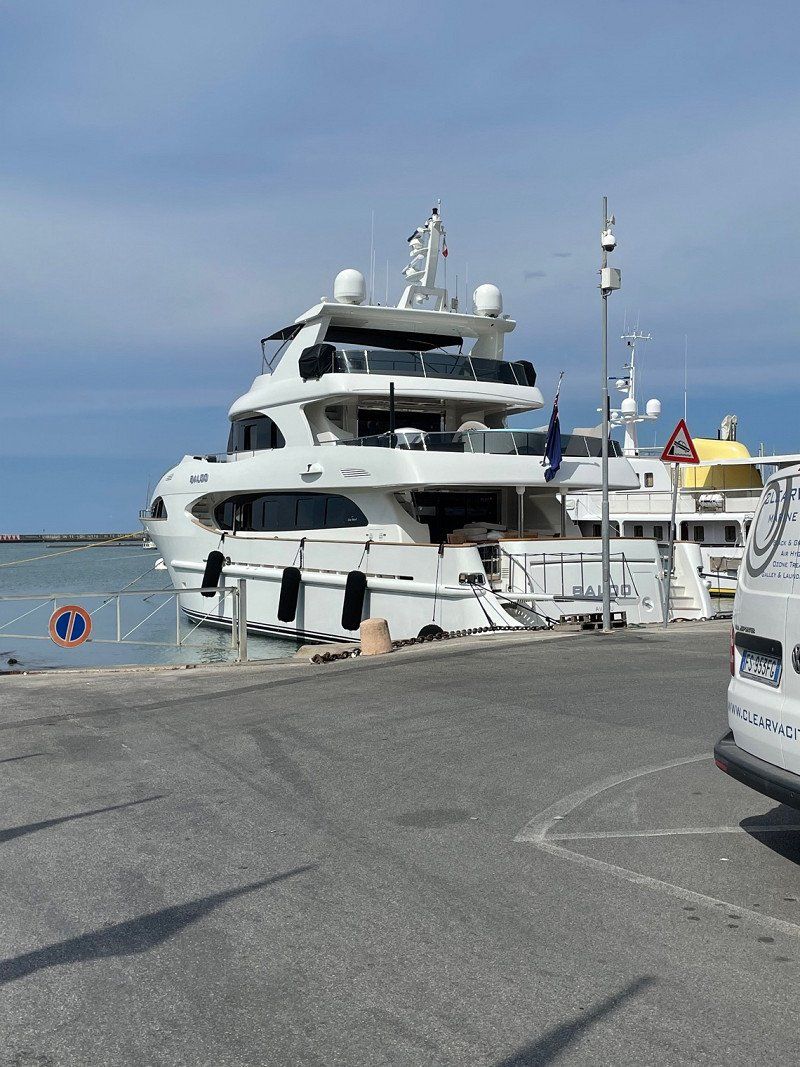
Viareggio Spiaggia Libera, Marina di Torre del Lago Puccini, Lucca, Italien
Small stopover, look at the port.
Some have yachts like other houses
55049 Marina di Torre del Lago Puccini, Lucca, Italien
43° 49' 1.3" N 10° 15' 36.2" E
43.8170280 10.2600421
• Head southeast on Via Giuseppe Barellai. Go for 8 m.
• Turn left onto Traversa A Mare N. 14 Lelio Maffei. Go for 22 m.
• Turn left onto Viale Guglielmo Marconi. Go for 301 m.
• Turn right onto Traversa A Mare N. 19 Alfredo Pardini. Go for 33 m.
• Turn left onto Viale Giosuè Carducci. Go for 543 m.
• Turn right onto Piazza Giacomo Puccini. Go for 947 m.
• Take the 2nd exit from roundabout onto Via Marco Polo. Go for 279 m.
• Turn left onto Variante Aurelia. Go for 128 m.
• Take ramp onto Strada Statale Aurelia (SS1) toward Firenze/A11/Genova/A12/Rosignano. Go for 3.2 km.
• Take ramp onto A12 (Autostrada Azzurra) toward Genova/E31/Parma/A15. Go for 42.1 km.
• Take the exit toward Parma onto A15 (Autostrada della Cisa). Go for 99.8 km.
• Take the exit toward Bologna/Parma onto A1 (Autostrada del Sole). Go for 9.4 km.
• Take the exit. Go for 763 m.
• Keep right toward Tangenziale/Parma Centro/Aeroporto. Go for 28 m.
• Take left ramp onto Viale Europa. Go for 684 m.
• Pass 4 roundabouts and continue on Viale Europa. Go for 2.0 km.
• Take the 2nd exit from roundabout onto Via Europa toward Ospedale. Go for 294 m.
• Pass 2 roundabouts and continue on Via Europa. Go for 483 m.
• Take the 2nd exit from roundabout onto Viale 4 Novembre. Go for 298 m.
• Turn right onto Viale Paolo Toschi. Go for 165 m.
• Take the 1st exit from roundabout onto Viale Giovanni Mariotti. Go for 351 m.
• Turn left onto Strada Giuseppe Mazzini. Go for 284 m.
• Continue on Piazza Giuseppe Garibaldi. Go for 21 m.
• Arrive at Piazza Giuseppe Garibaldi. Your destination is on the right.
☍
162,1 km
(1 hrs. 35 min.)
Viareggio sul Mare, Via Giuseppe Barellai, Viareggio, Lucca, Italien
Via Giuseppe Barellai, 32, 55049 Viareggio LU, Italien
43° 52' 25.8" N 10° 14' 20.4" E
43.8738453 10.2390059
• Head east on Piazza Giuseppe Garibaldi. Go for 37 m.
• Continue on Strada della Repubblica. Go for 812 m.
• Take the 3rd exit from Piazzale Vittorio Emanuele II roundabout onto Piazzale Vittorio Emanuele II toward Ospedale/Autostrade/Tangenziale/Reggio E./SS9. Go for 94 m.
• Continue on Piazzale Vittorio Emanuele II. Go for 76 m.
• Continue on Via Emilia Est. Go for 397 m.
• Take the 4th exit from roundabout onto Via Mantova. Go for 1.2 km.
• Take the 3rd exit from Rotatoria Angela M. Guidi Cingolani roundabout toward Ospedale/Aeroporto/Autostrade/Tangenziale/Sorbolo/Mantova/Zona Industriale Via Mantova/Zona Industriale Via Londra/Zona Industriale Via Strasburgo. Go for 102 m.
• Continue on Via Mantova. Go for 78 m.
• Pass 9 roundabouts and continue on Strada Provinciale della Cisa (SP62r). Go for 17.7 km.
• Turn left onto Viale Nord Soliani. Go for 31 m.
• Turn left. Go for 17 m.
• Arrive at your destination on the right.
☍
20,6 km
( 23 min.)
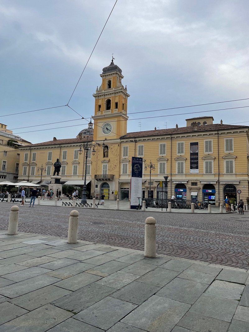
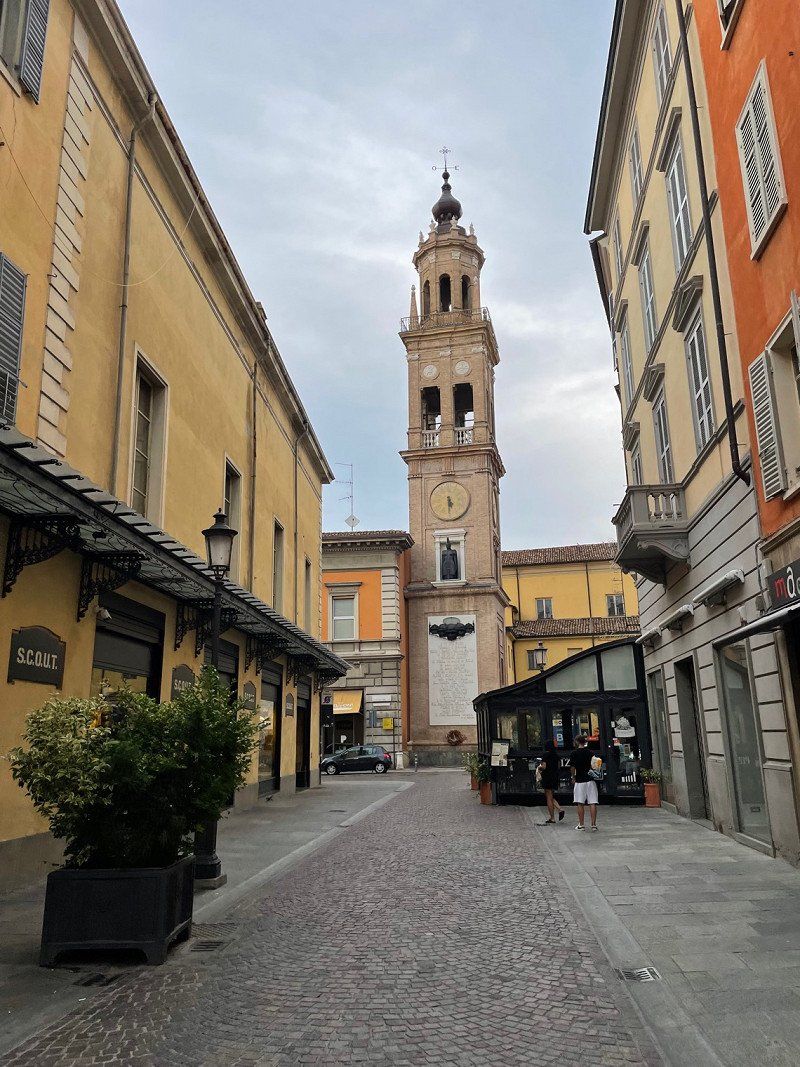
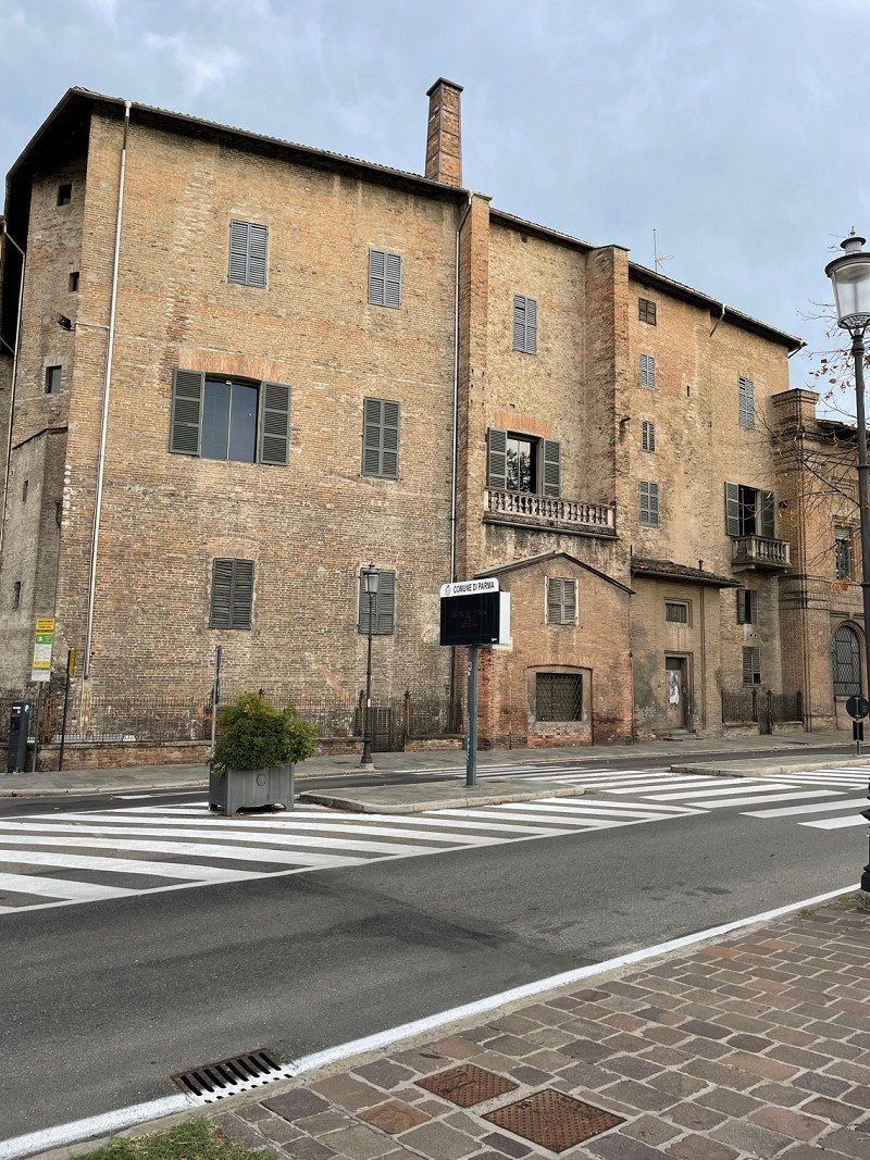
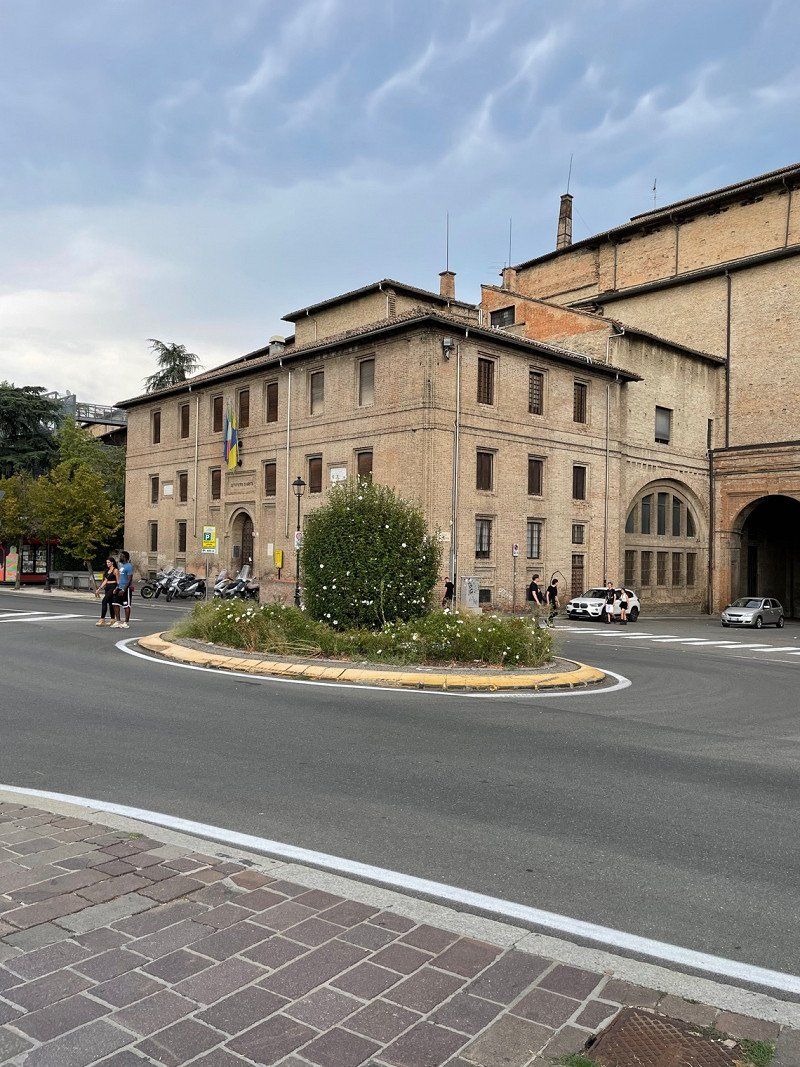
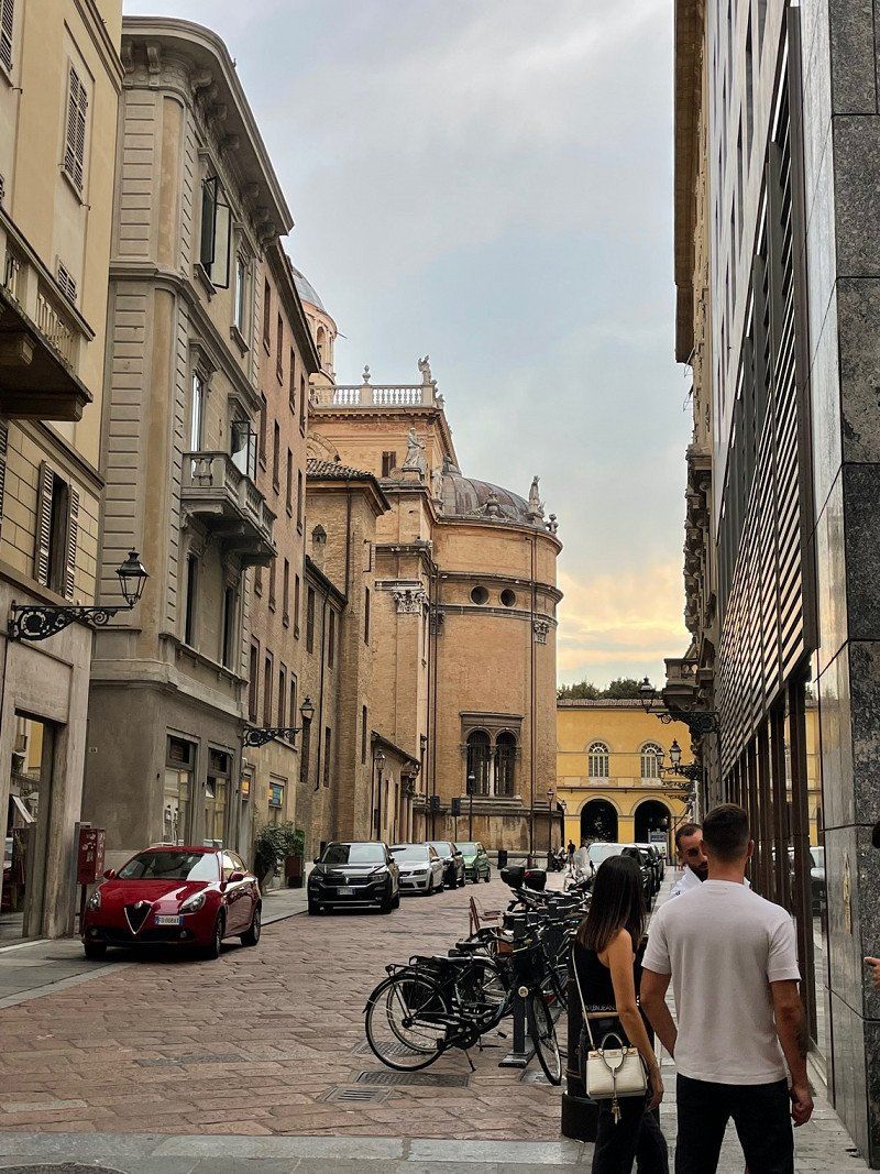
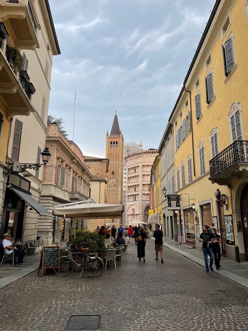
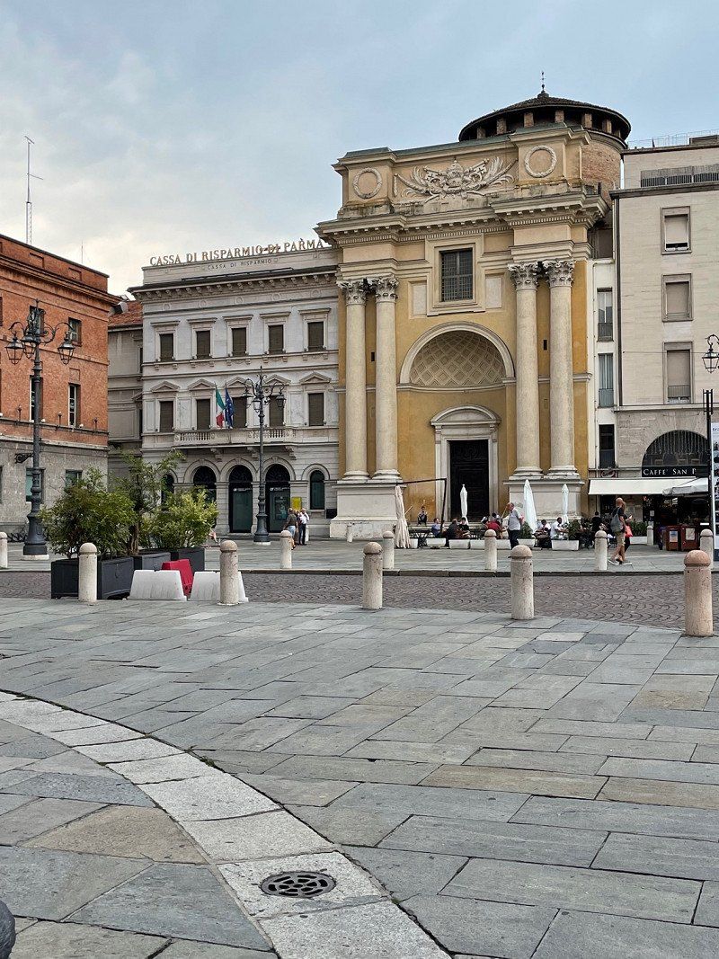
Parma, Italien
44° 48' 5.3" N 10° 19' 40.5" E
44.8014850 10.3279036
• Head southwest.
• Turn right onto Piazzale Volontari del Po. Go for 39 m.
• Turn right onto Via N. Soliani. Go for 29 m.
• Continue on Viale Nord Soliani. Go for 31 m.
• Turn left onto Strada Provinciale della Cisa (SP62r). Go for 298 m.
• Turn right toward Via Marco Salvio Ottone. Go for 34 m.
• Turn right onto Via Marco Salvio Ottone. Go for 169 m.
• Turn left onto Via Gioacchino Rossini. Go for 55 m.
• Continue on Via Giuseppe Verdi. Go for 260 m.
• Turn left onto Via Venturini. Go for 81 m.
• Arrive at Via Venturini.
☍
1,0 km
( 2 min.)
Brescello
Via Soliani, 42041, Brescello, Italien
44° 54' 11" N 10° 30' 52" E
44.9030556 10.5144444
• Head southeast on Via Venturini.
• Take the 4th exit from roundabout onto Via Roma. Go for 423 m.
• Turn right onto Via Marco Salvio Ottone. Go for 112 m.
• Turn right onto Strada Provinciale della Cisa (SP62r). Go for 1.7 km.
• Take the 1st exit from roundabout onto SP111. Go for 2.0 km.
• Take ramp onto Strada Provinciale Variante Cispadana (SP62rvar). Go for 8.9 km.
• Pass 2 roundabouts and continue on Strada Provinciale Variante Cispadana (SP62rvar). Go for 5.0 km.
• Continue toward Strada Provinciale Variante Cispadana/SP62rvar. Go for 46 m.
• Take the 2nd exit from roundabout onto Strada Provinciale Variante Cispadana (SP62rvar). Go for 1.6 km.
• Take the 2nd exit from roundabout onto Strada Provinciale Variante Cispadana (SP62rvar). Go for 6.8 km.
• Continue on Viale Karl Marx (SP49). Go for 862 m.
• Pass 4 roundabouts and continue on Strada Provinciale Ovest (SP49). Go for 7.6 km.
• Take the 3rd exit from roundabout onto A22 (Autostrada del Brennero) toward Autostrada/Brennero/Verona/Milano-Venezia/A4. Go for 70.8 km.
• Take the exit toward Affi/Lago di Garda Sud. Go for 989 m.
• Take the 3rd exit from roundabout toward Peschiera/SS450. Go for 337 m.
• Take the 1st exit from roundabout toward Caprino/Affi/Garda/Cavaion/Brenzone. Go for 223 m.
• Continue toward Via Costabella/SP9. Go for 99 m.
• Take the 3rd exit from roundabout onto Via Costabella (SP9) toward Lazise/SP31/Bardolino/Cavaion V.Se/SP29. Go for 949 m.
• Take the 3rd exit from roundabout onto Via Pozzo dell'Amore (SP29) toward Verona/SP5. Go for 670 m.
• Continue toward Via Ca' Nove. Go for 42 m.
• Take the 1st exit from roundabout onto Via Ca' Nove toward Lazise/Bardolino/Calmasino. Go for 461 m.
• Take the 2nd exit from roundabout onto Via Ca' Nove. Go for 409 m.
• Take the 2nd exit from roundabout onto Strada del Trenin (SP31) toward Bardolino. Go for 2.1 km.
• Continue on Via Europa Unita (SP31). Go for 2.3 km.
• Take the 2nd exit from roundabout onto Via Europa Unita (SP31) toward Bardolino/Bardolino Centro. Go for 64 m.
• Continue on Via Molini (SP31). Go for 235 m.
• Continue on Via Benedetto Croce (SP31). Go for 298 m.
• Take the 1st exit from roundabout onto Via Guglielmo Marconi (SR249). Go for 39 m.
• Pass 3 roundabouts and continue on Località Ca' Nova di sotto (SR249). Go for 1.7 km.
• Arrive at Via Gardesana dell'Acqua (SR249). Your destination is on the left.
☍
116,8 km
(1 hrs. 16 min.)
Day
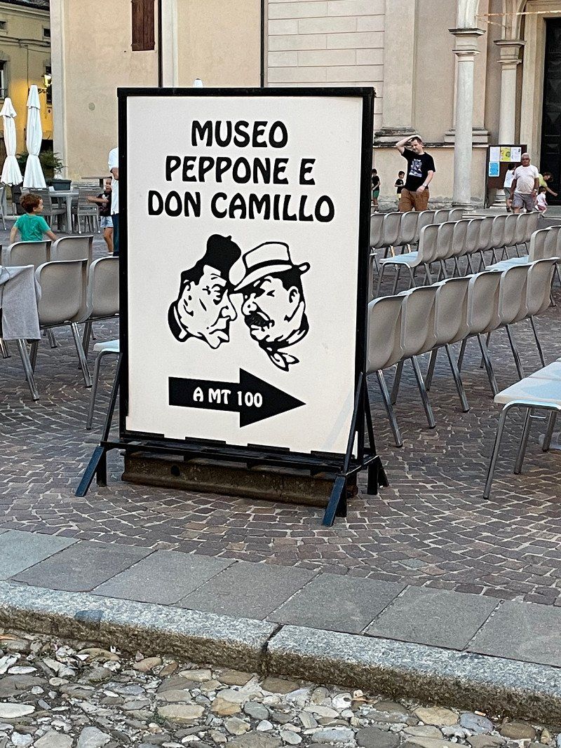
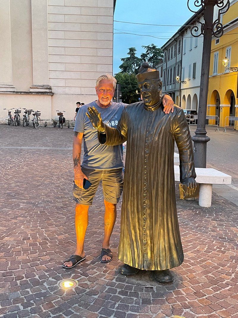
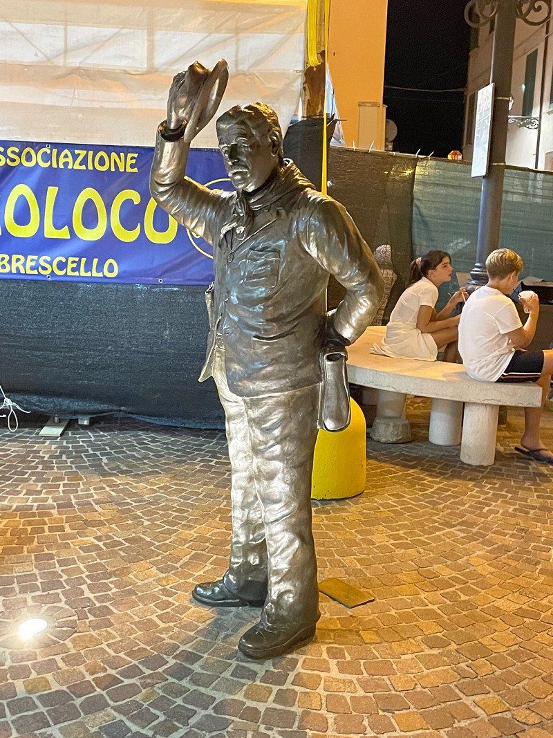
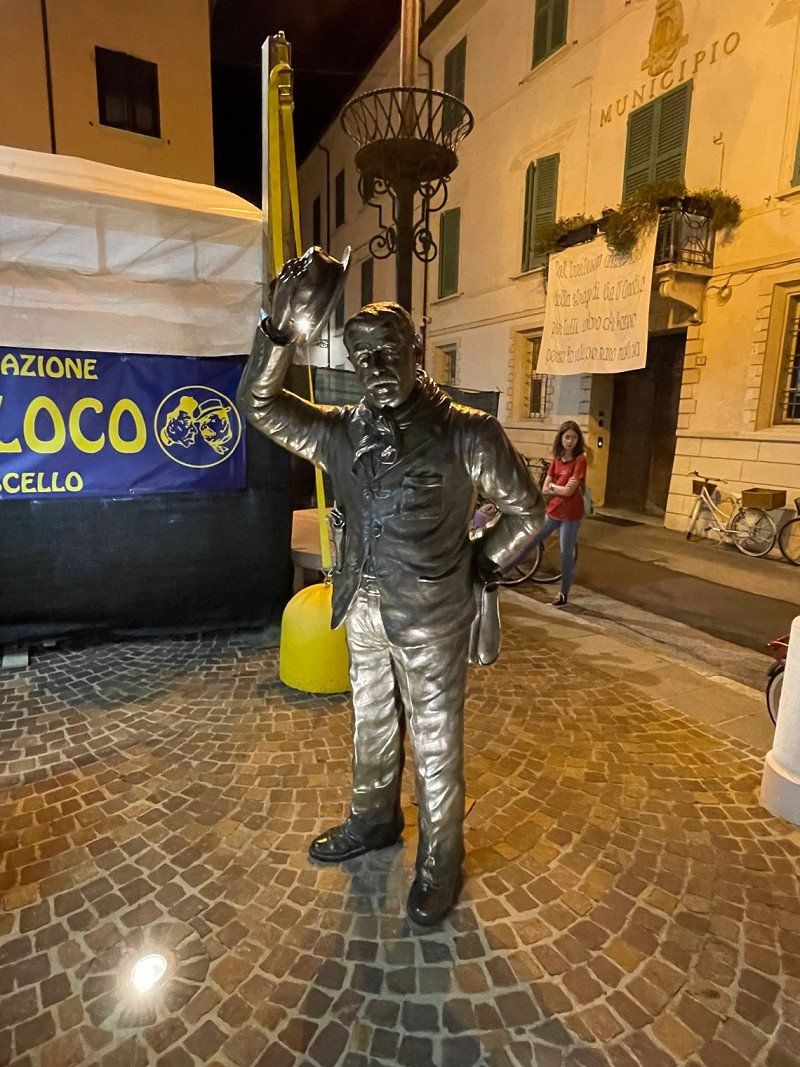
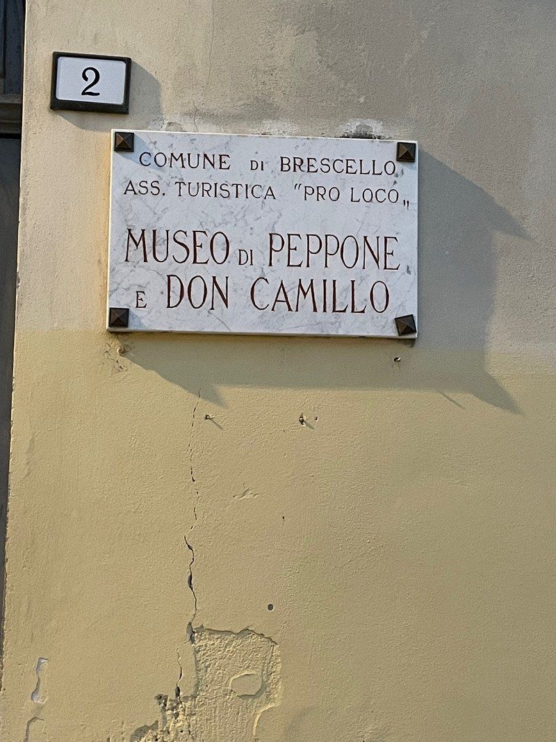
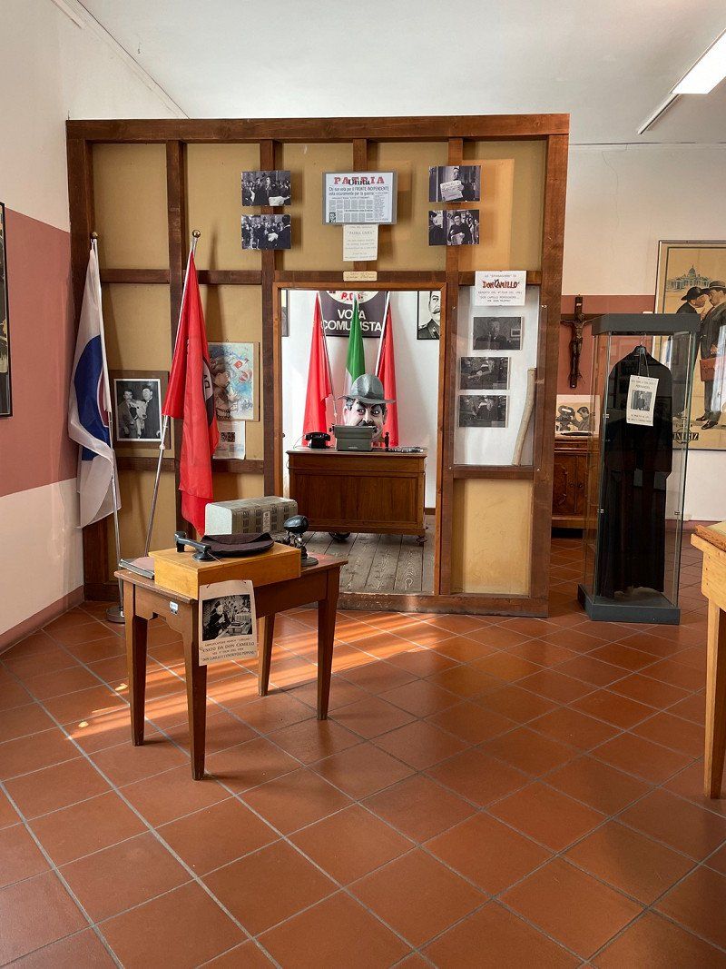
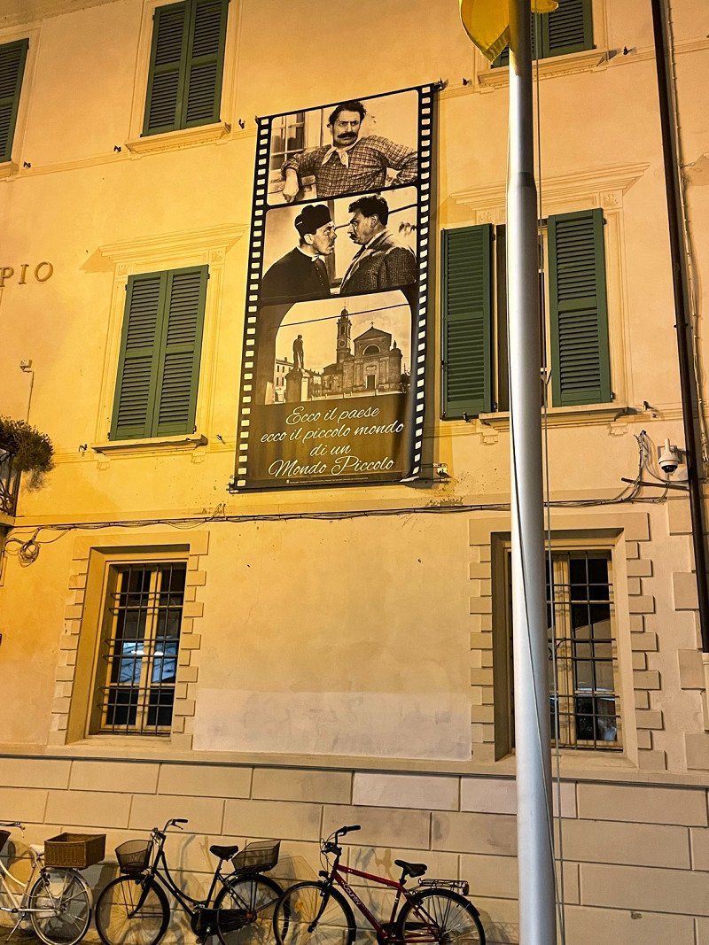
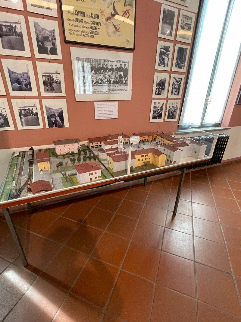
Brescello, Reggio Emilia, Italien
42041 Brescello, Reggio Emilia, Italien
44° 53' 55.6" N 10° 31' 5.1" E
44.8987694 10.5180777
• Head toward Piazzale Regina Adelaide on Via Gardesana dell'Acqua (SR249). Go for 1.6 km.
• Take the 3rd exit from roundabout onto Corso Italia (SR249). Go for 2.6 km.
• Pass 5 roundabouts and continue on Via Peschiera (SR249). Go for 5.6 km.
• Arrive at Via Gardesana (SR249). Your destination is on the right.
☍
9,9 km
( 11 min.)
Park Camper Serenella
Via Gardesana dell Acqua, 37011, Bardolino, Italien
45° 33' 42" N 10° 42' 54" E
45.5616667 10.7150000
• Head southeast on Via Gardesana (SR249).
• Take the 3rd exit from roundabout onto Via Gardesana (SR249). Go for 2.2 km.
• Pass 4 roundabouts and continue on Via Guglielmo Marconi (SR249). Go for 3.1 km.
• Arrive at Via Guglielmo Marconi (SR249).
☍
5,4 km
( 6 min.)
Day
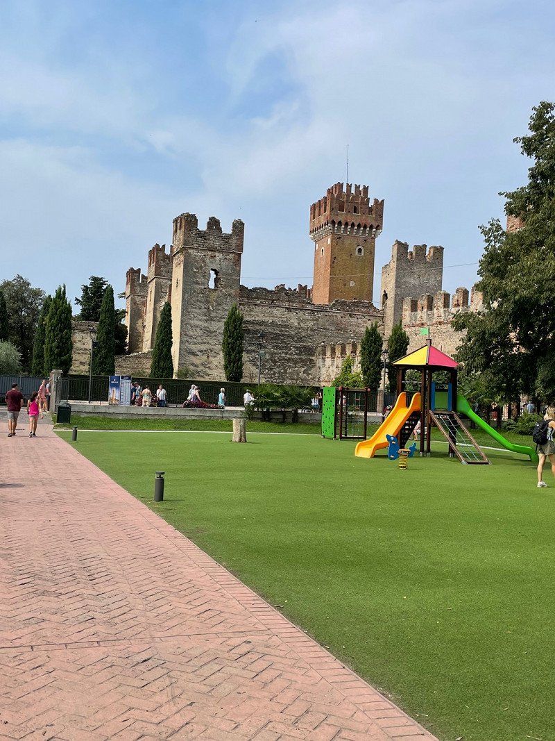
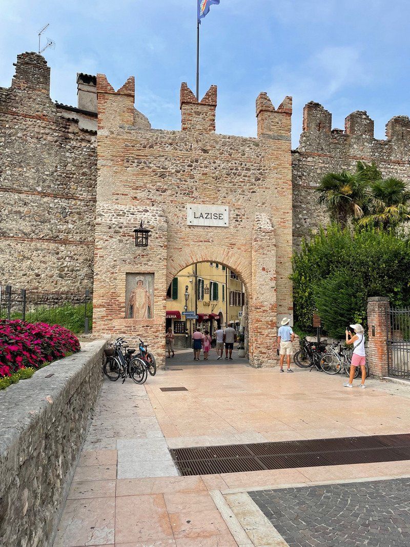
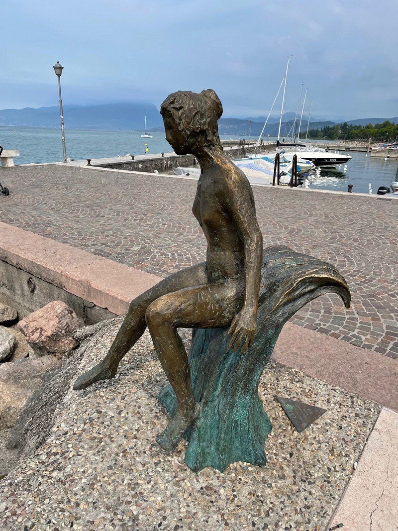
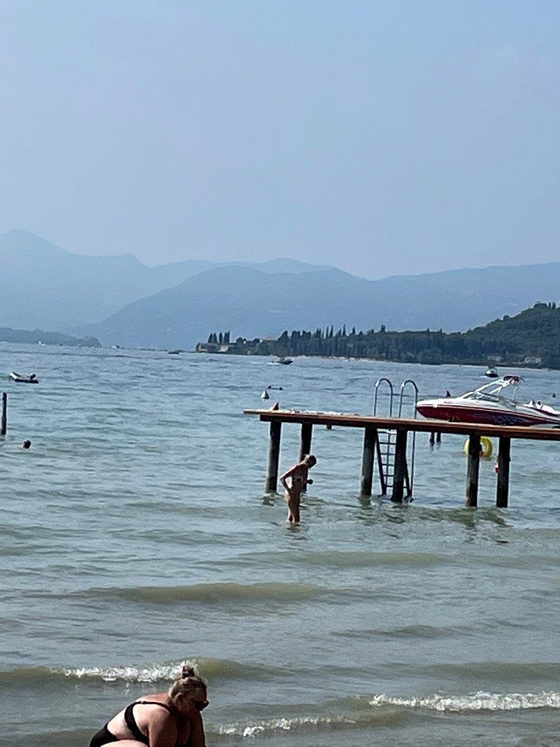
Lazise, Verona, Italien
37017 Lazise, VR, Italien
45° 30' 21.7" N 10° 44' 6.3" E
45.5060202 10.7350716
• Head toward Via San Colombano on Via Guglielmo Marconi (SR249). Go for 296 m.
• Pass 3 roundabouts and continue on Corso Italia (SR249). Go for 3.0 km.
• Arrive at Corso Italia (SR249). Your destination is on the right.
☍
3,3 km
( 4 min.)
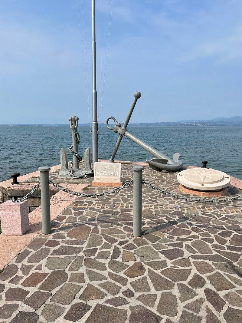
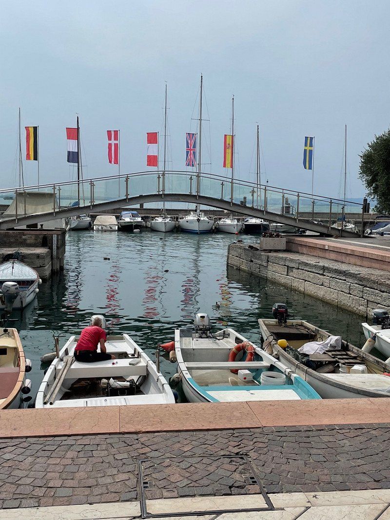
Bardolino, Verona, Italien
37011 Bardolino, VR, Italien
45° 33' 6.5" N 10° 43' 17.3" E
45.5518170 10.7214679
• Head toward Via Gaino on Corso Italia (SR249). Go for 290 m.
• Take the 2nd exit from roundabout onto Via Don Carlo Gnocchi (SP8) toward A22/Autostrade/Costermano/Caprino V.Se/Ferrara di M.B. Go for 973 m.
• Pass 4 roundabouts and continue on Salita degli Olivi (SP8). Go for 2.7 km.
• Take the 1st exit from roundabout onto Via 1 Maggio (SP9) toward Autostrade/Affi/Verona/SP5. Go for 1.9 km.
• Pass 2 roundabouts and continue on Via Costabella (SP9). Go for 3.1 km.
• Take the 3rd exit from roundabout toward Autostrade/Peschiera D.G./SR450/Verona/SP5/Trento/SS12. Go for 114 m.
• Continue straight ahead. Go for 36 m.
• Take the 2nd exit from roundabout toward SS12/A22/Brennero-Modena/A4/Venezia. Go for 556 m.
• Take the 2nd exit from roundabout onto A22 (Autostrada del Brennero) toward Milano/A4/Brennero. Go for 105 km.
• Take the exit toward Egna/Ora/Termeno/Neumarkt/Auer/Tramin. Go for 977 m.
• Take the 1st exit from roundabout onto Strada Provinciale Autostrada-Termeno (SP16) toward Trami/Termeno/Kurtatsch/Cortaccia/Kaltern/Caldaro/Industriegebiet am Bahnhof/Industriegebiet Obere Insel/Zona Industriale Isola di Sopra. Go for 1.4 km.
• Take the 1st exit from roundabout onto Strada Provinciale Autostrada-Termeno (SP16) toward Trami/Termeno/Kurtatsch/Cortaccia/Kaltern/Caldaro. Go for 1.0 km.
• Take the 1st exit from roundabout onto Strada Provinciale Caldaro-Roverè della Luna (SP14) toward Kaltern/Caldaro. Go for 2.5 km.
• Pass 2 roundabouts and continue on Strada Provinciale Caldaro-Roverè della Luna (SP14). Go for 4.8 km.
• Turn right onto Località San Giuseppe al Lago. Go for 108 m.
• Turn right onto Località San Giuseppe al Lago. Go for 317 m.
• Turn left onto Località San Giuseppe al Lago. Go for 38 m.
• Turn slightly right. Go for 20 m.
• Continue straight ahead. Go for 104 m.
• Arrive at your destination on the left.
☍
126,1 km
(1 hrs. 14 min.)
Day
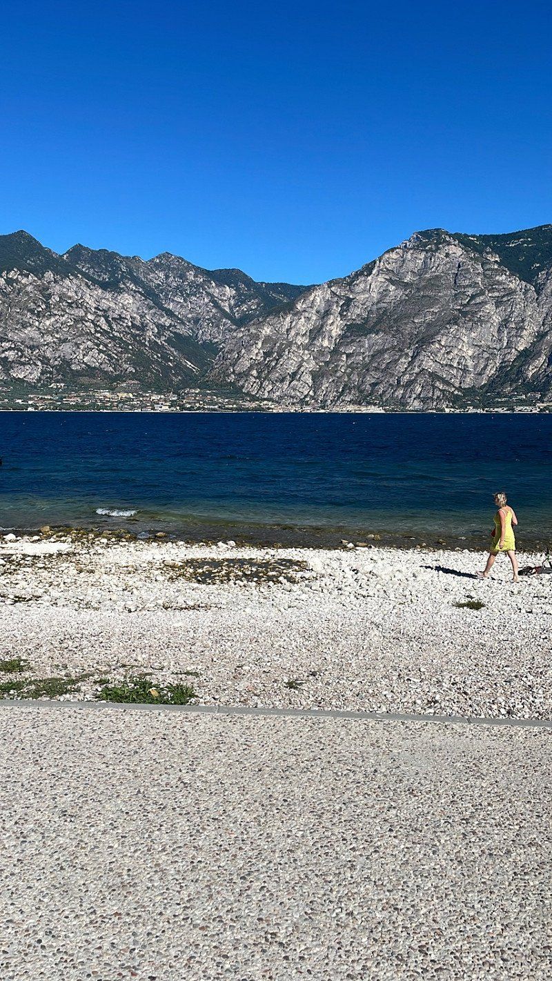
Garda, Verona, Italien
37016 Garda, VR, Italien
45° 34' 37.6" N 10° 42' 20" E
45.5771011 10.7055676
• Head south.
• Arrive at your destination on the left.
☍
Distance not available
(Duration not available)
Camping Gretl am See
Weinstraße 18, 39052, Kaltern, Italien
46° 22' 57" N 11° 15' 29" E
46.3825000 11.2580600
• Head south.
• Arrive at your destination on the left.
☍
Distance not available
(Duration not available)
Day
Camping Gretl am See
Weinstraße 18, 39052, Kaltern, Italien
46° 22' 57" N 11° 15' 29" E
46.3825000 11.2580600
• Head north. Go for 124 m.
• Turn right onto Località San Giuseppe al Lago. Go for 146 m.
• Turn left onto Località San Giuseppe al Lago. Go for 163 m.
• Turn right onto Località San Giuseppe al Lago. Go for 348 m.
• Arrive at Località San Giuseppe al Lago. Your destination is on the right.
☍
0,8 km
( 2 min.)
Day
Camping Gretl am See
Weinstraße 18, 39052, Kaltern, Italien
46° 22' 57" N 11° 15' 29" E
46.3825000 11.2580600
• Head south on Località San Giuseppe al Lago. Go for 145 m.
• Turn left onto Località San Giuseppe al Lago. Go for 366 m.
• Turn left onto Località San Giuseppe al Lago. Go for 108 m.
• Turn right onto Strada Provinciale Caldaro-Roverè della Luna (SP14). Go for 2.4 km.
• Pass 3 roundabouts and continue on Strada Provinciale Caldaro-Roverè della Luna (SP14). Go for 9.2 km.
• Keep right onto Via Bolzano toward Frangart/Frangarto/Girlan/Cornaiano. Go for 1.5 km.
• Turn left onto Via Castel Firmiano (SP18). Go for 224 m.
• Turn left. Go for 342 m.
• Arrive at your destination on the left.
☍
14,3 km
( 16 min.)
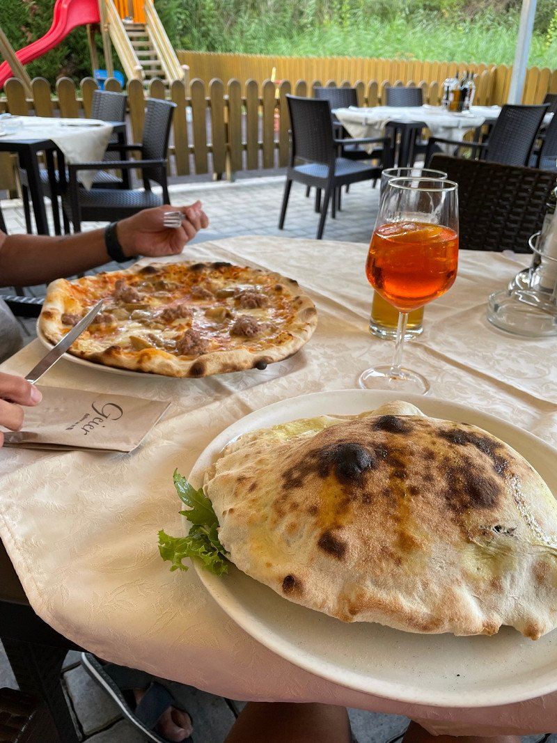
Restaurant Pizzeria Geier, Kaltern an der Weinstraße., Autonome Provinz Bozen - Südtirol, Italien
St. Josef am See 12, 39052 Caldaro sulla strada del vino BZ, Italien
46° 23' 9.4" N 11° 15' 32.5" E
46.3859367 11.2590150
• Head toward Via Castel Firmiano. Go for 342 m.
• Turn left onto Ponte Adige (SP18). Go for 296 m.
• Continue on Via Castel Firmiano (SP18). Go for 250 m.
• Take the 2nd exit from roundabout toward Autostrada/A22. Go for 76 m.
• Continue on Via Oltradige (SS42) toward Autostrada/A22/Autobahn/Merano/Meran. Go for 1.1 km.
• Turn left and take ramp onto MeBo (SS38) toward Autobahn/Autostrada/Trento/Brenner/Brennero. Go for 2.3 km.
• Take left ramp onto A22 (Autostrada del Brennero) toward Autostrada/Bolzano Centro/Bozen Zentrum/E45/Brennero/Brenner/Modena. Go for 86.9 km.
• Continue on A13 (Brennerpass). Go for 34.5 km.
• Continue on A12 (Inntal Autobahn). Go for 74.9 km.
• Continue on A93 (Grenzübergang Kiefersfelden). Go for 24.8 km.
• Take the left exit toward München/Rosenheim-West onto A8. Go for 45.6 km.
• Take exit 95 toward Nürnberg/Stuttgart/Messe/ICM/Flughafen München onto A99. Go for 29.8 km.
• Take exit 13 toward Berlin/Nürnberg/Deggendorf/Flughafen München onto A9. Go for 41.7 km.
• Take exit 65 toward Prag/Praha/Hof/Regensburg/Wolnzach onto A93. Go for 92.8 km.
• Take exit 35 toward Teublitz/Bruck/Nittenau. Go for 431 m.
• Turn right onto SAD1 toward Cham/Nittenau/Bruck/Maxhütte-Haidhof. Go for 12.2 km.
• Continue on Hinterthürn (SAD1). Go for 82 m.
• Continue on SAD1. Go for 1.2 km.
• Take the 3rd exit from roundabout onto St2150. Go for 808 m.
• Take left ramp onto B85. Go for 1.0 km.
• Turn right onto Mögendorf (St2398) toward Bodenwöhr. Go for 1.1 km.
• Arrive at Neunburger Straße (St2398). Your destination is on the left.
☍
452,4 km
(4 hrs. 35 min.)
Day
Meran Bozen 20
46° 29' 7.2" N 11° 17' 41.7" E
46.4853210 11.2949118
• Head toward Ludwigsheide on Neunburger Straße (St2398). Go for 170 m.
• Turn right onto Schwandorfer Straße (SAD16). Go for 1.3 km.
• Turn right onto B85. Go for 11.5 km.
• Take ramp onto A93 toward Hof/Nürnberg/Amberg/B85. Go for 49.5 km.
• Take exit 21B toward Altenstadt/Bayreuth/Parkstein/Neustadt-Süd. Go for 284 m.
• Take the 2nd exit from roundabout onto Parksteiner Straße (B15) toward Neustadt a.d.W./Altenstadt a.d.W./Gewerbegebiet Traindorfstraße. Go for 505 m.
• Continue on Hauptstraße (B15). Go for 1.6 km.
• Turn right onto Hofgartenweg. Go for 84 m.
• Turn left onto Johann-Dietl-Straße. Go for 174 m.
• Arrive at Johann-Dietl-Straße. Your destination is on the left.
☍
65,0 km
( 39 min.)
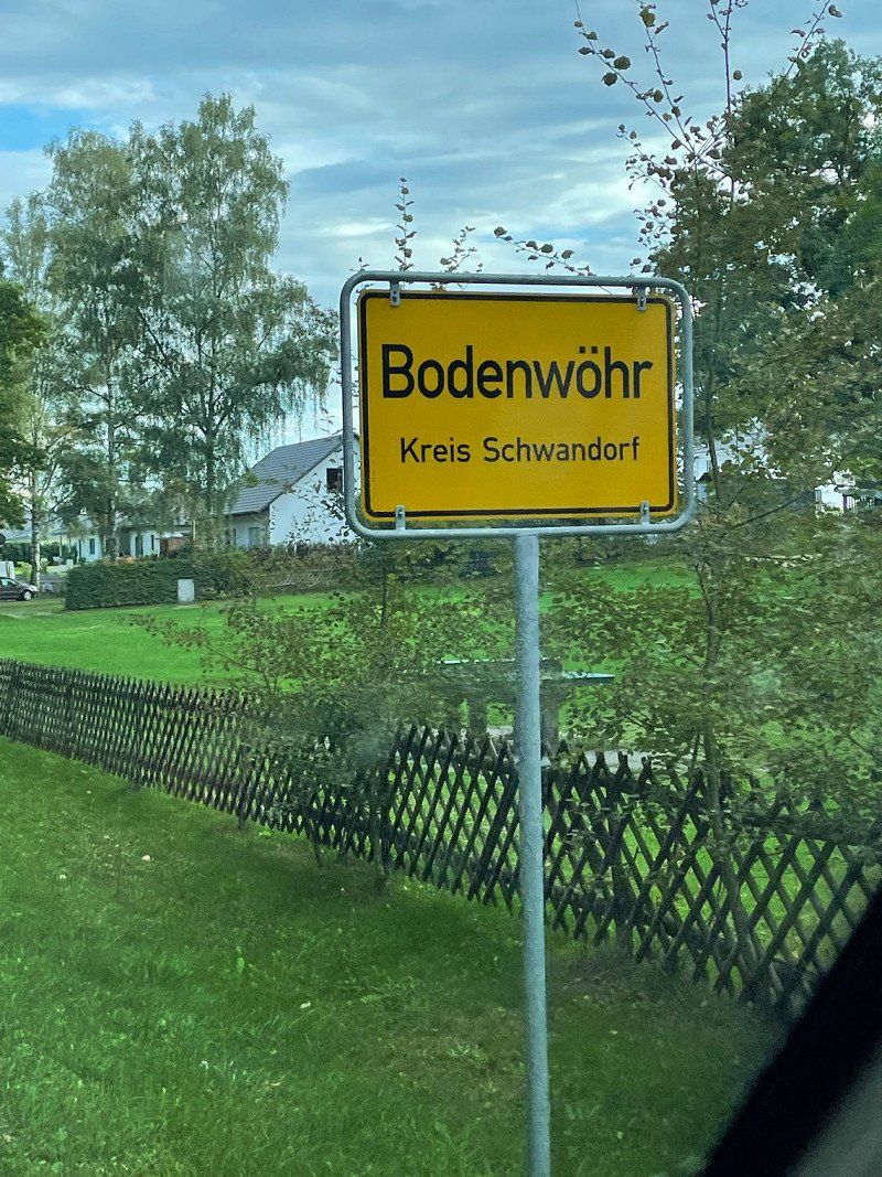
Bodenwöhr, Deutschland
49° 16' 16.7" N 12° 18' 23.2" E
49.2713068 12.3064346
• Head toward Hofgartenweg on Johann-Dietl-Straße. Go for 174 m.
• Turn right onto Hofgartenweg. Go for 84 m.
• Turn right onto Raiffeisenplatz (B15). Go for 959 m.
• Take the 2nd exit from roundabout onto B15. Go for 394 m.
• Turn left onto St2172. Go for 1.7 km.
• Turn left and take ramp onto A93 toward Hof. Go for 21.7 km.
• Take exit 18 toward Wiesau/Friedenfels/Fuchsmühl. Go for 320 m.
• Turn left onto St2169 toward Wiesau/Friedenfels/Fuchsmühl. Go for 215 m.
• Take ramp onto A93. Go for 5.1 km.
• Arrive at A93.
☍
30,6 km
( 18 min.)
Neustadt an der Waldnaab, Deutschland
49° 43' 55.5" N 12° 10' 41.3" E
49.7320956 12.1781271
• Head southwest on A93. Go for 1.9 km.
• Take exit 19 toward Falkenberg/Marienbad/Mariánské Lázne/Erbendorf/Reuth b. Erb. Go for 311 m.
• Turn left onto B299 toward Marienbad/Mariánské Lázne/Tirschenreuth/Falkenberg. Go for 176 m.
• Turn right and take ramp onto A93. Go for 72.7 km.
• Take the left exit toward Berlin/Hof-Nord onto A72. Go for 14.2 km.
• Take exit 1 toward Berlin/Leipzig/Erfurt onto A9. Go for 255 km.
• Take exit 1 toward Hamburg/Magdeburg/Rostock onto A10 (Berliner Ring). Go for 8.5 km.
• Take exit 21 toward Prenzlau/Hamburg/Rostock onto A10 (Autobahndreieck Werder). Go for 37.9 km.
• Take exit 28 toward Falkensee. Go for 325 m.
• Take the 3rd exit from roundabout onto L201 toward Falkensee. Go for 2.0 km.
• Turn left onto K6302. Go for 119 m.
• Continue on Brieselanger Straße (K6302). Go for 63 m.
• Continue on K6302. Go for 1.7 km.
• Continue on Brieselanger Straße (K6302). Go for 2.1 km.
• Turn right onto Chausseestraße (L16). Go for 1.1 km.
• Continue on L16. Go for 1.1 km.
• Turn left onto K6301. Go for 775 m.
• Continue on Wansdorfer Dorfstraße (K6301). Go for 2.0 km.
• Turn left onto Robinienallee. Go for 265 m.
• Arrive at Robinienallee. Your destination is on the left.
☍
401,9 km
(3 hrs. 30 min.)
Day
LSG innerhalb des Naturparks Steinwald (ehemals Schutzzone)
On the way home, even the best vacation comes to an end! 🥲
49° 52' 35.2" N 12° 11' 28.2" E
49.8764343 12.1911645
Ahornweg 4
52° 38' 43.9" N 13° 6' 1.3" E
52.6455383 13.1003718