On our route we explored beautiful places, historical sites, culture and the production of typical products. Here and there we give tips on geocaching.
Tourist destinations that we find worthwhile are briefly described with the reason for this. ;) In addition, RV-suitable parking spaces are included everywhere.
Some destinations are specific to geocachers (everywhere that says GC or LAB).
Conclusion: It was a very nice and educational vacation. ;)
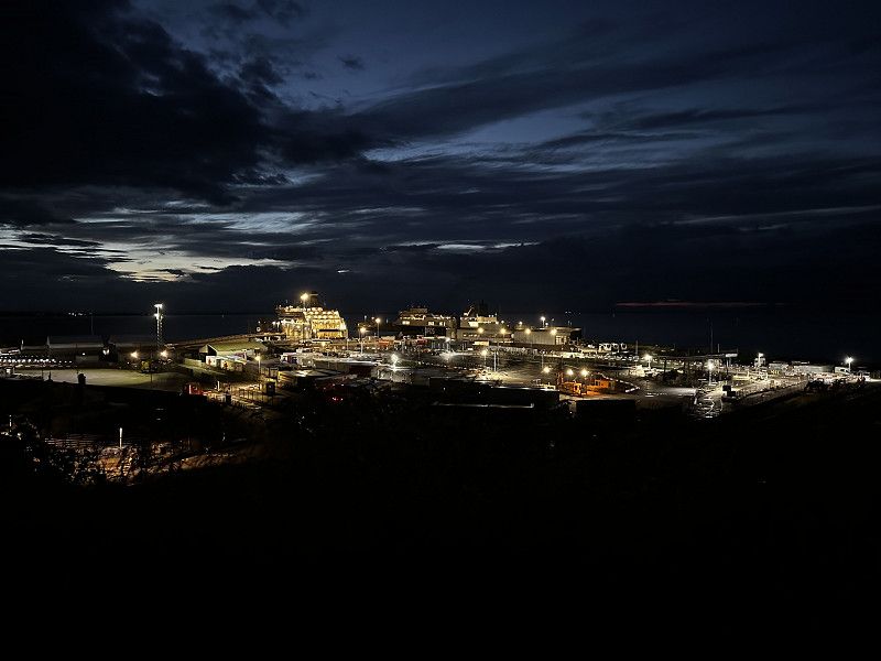
Ankunft mit DFDS, Irland
We arrived at this terminal with DFDS.
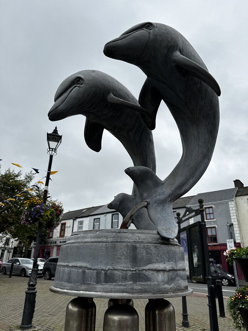
E 01;E 30, County Wexford, Irland
52° 15' 13.9" N 6° 20' 11.8" W
52.2538714 -6.3366209
• Head southeast. Go for 97 m.
• Turn sharp right. Go for 824 m.
• Take the 1st exit from roundabout toward Sli Amach/Port Exit/N25/Loch Garman Wexford. Go for 878 m.
• Take the 2nd exit from roundabout toward N25/Corcaigh/Cork/Loch Garman/Wexford. Go for 541 m.
• Continue on N25 toward Calafort Ros Láir/Rosslare Harbour. Go for 154 m.
• Turn right. Go for 141 m.
• Turn right. Go for 13 m.
• Arrive at your destination on the left.
☍
2,6 km
( 6 min.)
Übernachtung aus Park4Night (P4N)
We spent our first night well in the supermarket parking lot. It was advisable to look for a "corner".
In the evening, the “café” - more of a pizzeria - was still open and we were able to enjoy a nice walk along the beach promenade with a view of the sea and back to the ferry port.
At St. Martins Road there was some sports equipment to try out.
County Wexford, Irland
52° 14' 59.9" N 6° 20' 39.5" W
52.2499816 -6.3443026
• Head toward Ballygerry. Go for 28 m.
• Turn left onto Ballygerry. Go for 49 m.
• Turn right onto N25. Go for 509 m.
• Pass 4 roundabouts and continue on Clonard Great (N25). Go for 19.3 km.
• Take the 2nd exit from New Ross Road Roundabout roundabout onto Belmont (N11) toward Áth Cliath/Dublin. Go for 12.4 km.
• Take the 2nd exit from roundabout onto M11 toward Áth Cliath/Dublin/(N80)/Ceatharlach/Carlow. Go for 77.0 km.
• Take exit 16 toward Áth na Fuinseoige/Ashford/Ráth Naoi/Rathnew/An Tóchar/Roundwood/R772. Go for 400 m.
• Take the 1st exit from roundabout onto Rossana Upper (R772). Go for 375 m.
• Continue on Ballinalea (R772). Go for 507 m.
• Keep right onto R772. Go for 1.1 km.
• Take the 1st exit from roundabout onto R764. Go for 358 m.
• Turn left onto Ballinahinch Ashford (R763). Go for 292 m.
• Turn sharp left onto Ballinahinch Ashford (R763). Go for 664 m.
• Continue on R763. Go for 195 m.
• Continue on Ballinahinch (R763). Go for 53 m.
• Continue on Ballymaghroe (R763). Go for 1.3 km.
• Continue on Ballardbeg (R763). Go for 1.3 km.
• Continue on Ballymaghroe (R763). Go for 332 m.
• Continue on Tiglin (R763). Go for 1.7 km.
• Continue on Annagowlan (R763). Go for 1.3 km.
• Continue on Tomdarragh Lane (R763). Go for 799 m.
• Continue on Tomriland (R763). Go for 2.5 km.
• Continue on Ballinacorbeg (R763). Go for 241 m.
• Continue on R763. Go for 102 m.
• Continue on Ballinacorbeg (R763). Go for 81 m.
• Turn left onto Ballinacorbeg (R755). Go for 4.6 km.
• Continue on R756. Go for 1.7 km.
• Continue on R757. Go for 357 m.
• Continue on Sevenchurches (R757). Go for 95 m.
• Continue on R757. Go for 92 m.
• Continue on Sevenchurches (R757). Go for 1.1 km.
• Continue on R757. Go for 139 m.
• Turn left. Go for 31 m.
• Turn slightly right. Go for 33 m.
• Turn left. Go for 27 m.
• Arrive at your destination on the left.
☍
131,0 km
(1 hrs. 31 min.)
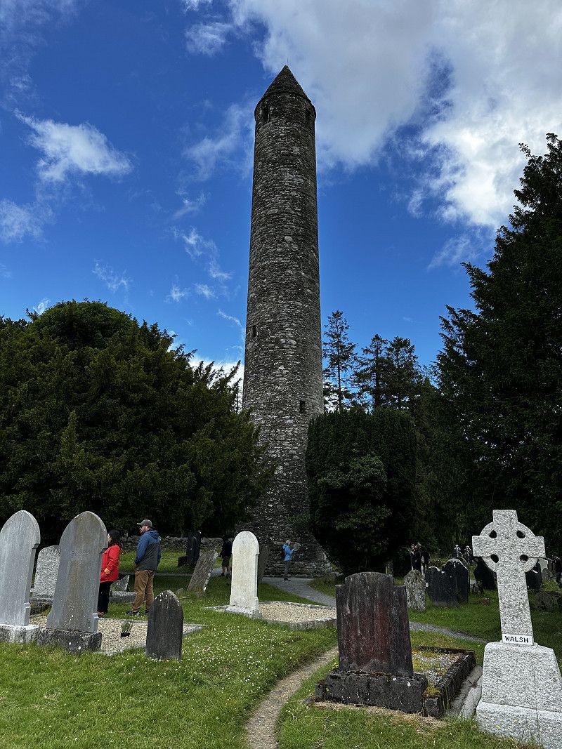
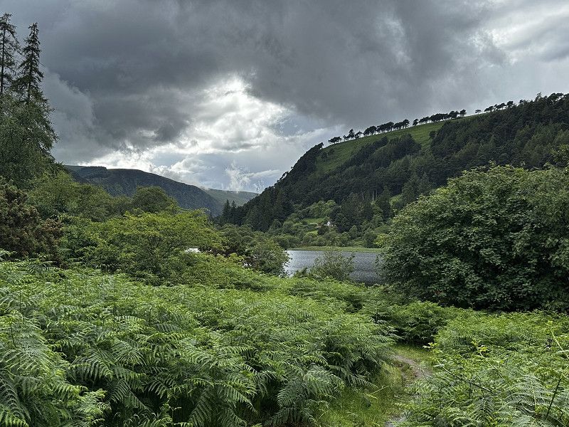
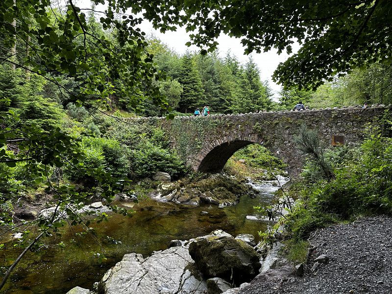
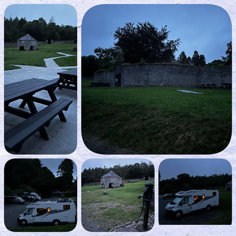
PP am river Glenacalo
Glendalough is a hive of activity, and there are very few parking spaces in town. This campsite is a little outside of the tourist attraction, but by the lake. It is larger. The staff are very keen to accommodate camper vans who want to stay overnight - even if the site is actually full.
You can take a scenic walk to the monastery and visit the early Christian monastery of Glendalough, have a nice meal or a coffee in the village. Numerous stalls delight souvenir hunters.
R757, County Wicklow, Irland
53° 0' 25.7" N 6° 20' 40.2" W
53.0071376 -6.3444915
• Head west. Go for 27 m.
• Turn right toward R757. Go for 64 m.
• Turn right onto R757. Go for 139 m.
• Continue on Sevenchurches (R757). Go for 1.1 km.
• Continue on R757. Go for 92 m.
• Continue on Sevenchurches (R757). Go for 95 m.
• Continue on R757. Go for 357 m.
• Continue on R756. Go for 1.7 km.
• Continue on R755. Go for 23.4 km.
• Take the 1st exit from roundabout onto R755. Go for 105 m.
• Take the 1st exit from roundabout. Go for 61 m.
• Take ramp onto N11. Go for 2.9 km.
• Keep right onto M11. Go for 1.6 km.
• Take exit 5 toward Bré(Thuaidh)/Bray(North)/Gleann Cuilinn/Glencullen/Áth na Sceire/Enniskerry/L2047. Go for 357 m.
• Turn right onto Old Connaught Avenue toward Bré/Bray. Go for 565 m.
• Turn right onto Dublin Road (R761). Go for 908 m.
• Turn left onto Quinsborough Road. Go for 648 m.
• Turn left onto Strand Road. Go for 89 m.
• Arrive at Strand Road. Your destination is on the right.
☍
34,2 km
( 35 min.)
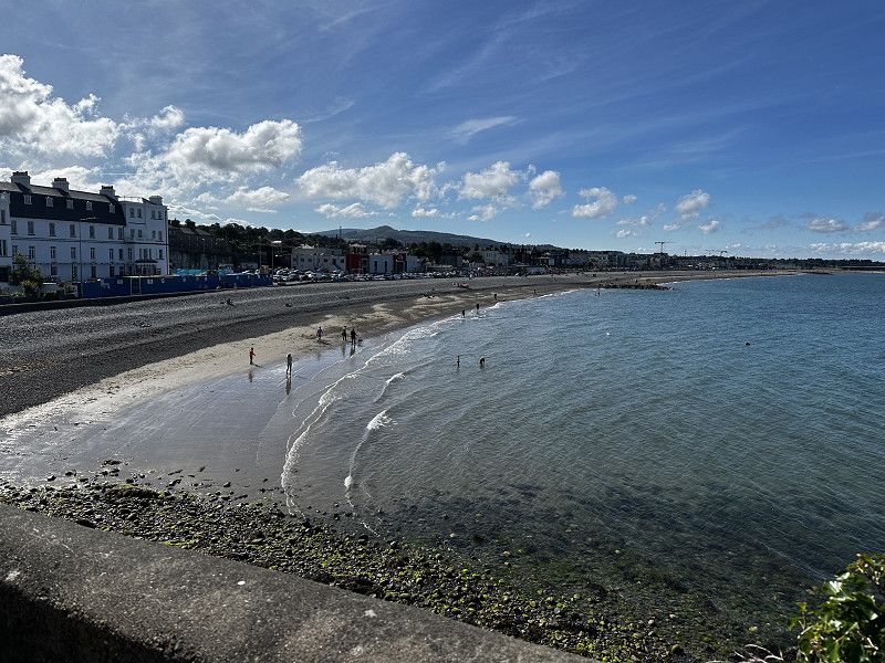
Bray, Parken an “The Promenade” in Bray
5€ per day, free at night
A beautiful beach, chic promenade, numerous small shops and snack bars.
Great starting point for geocachers. Here you can hike up Bray's Head and enjoy a wonderful view and log Europe's historic first geocache. 😎
The Promenade, County Wicklow, Irland
53° 12' 22.9" N 6° 6' 0" W
53.2063627 -6.1000124
• Head toward Martello Terrace on Strand Road. Go for 158 m.
• Turn slightly left onto Seapoint Road. Go for 152 m.
• Turn slightly right onto Seapoint Road. Go for 435 m.
• Turn right onto Main Street (R761). Go for 1.1 km.
• Take the 1st exit from roundabout onto M11 toward Dublin. Go for 2.2 km.
• Keep right onto M50 toward Ó Thuaidh/Northbound/Aerfort Átha Cliath/Dublin Airport/Calafort Átha Cliath/Dublin Port. Go for 20.5 km.
• Take exit 9 toward Luimneach/Limerick/Corcaigh/Cork/Port Láirge/Waterford/(N8)/(N9) onto N7. Go for 3.9 km.
• Take ramp toward Grange Castle. Go for 308 m.
• Take the 3rd exit from roundabout onto R136 toward Leamhcán/Lucan/Cais. na Gráinsí/Grange Castle/Baile Dhónaill/Baldonnell. Go for 420 m.
• Take the 3rd exit from roundabout onto Green Isle Road toward L1003. Go for 559 m.
• Turn left. Go for 54 m.
• Arrive at your destination.
☍
29,9 km
( 21 min.)
Camac Valley Tourist Caravan & Camping Park
Campsite near Dublin, possibility to explore the city by public transport. The bus leaves regularly right in front of the campsite.
The facilities are very good: supplies and disposal are guaranteed. However, it is not exactly "cheap".
During the high season there was still a spot available spontaneously.
Naas Road, Clondalkin, Dublin 22, Irland
53° 18' 20.4" N 6° 24' 55.5" W
53.3056631 -6.4154109
• Head toward Green Isle Road. Go for 54 m.
• Turn right onto Green Isle Road. Go for 415 m.
• Take the 2nd exit from roundabout onto N7 toward Áth Cliath/Dublin. Go for 1.9 km.
• Keep right onto N7 toward An Lár/City Centre/Inse Chór/Inchicore/M50. Go for 1.8 km.
• Keep right onto N7 toward An Lár/City Centre/Inse Chór/Inchicore. Go for 324 m.
• Continue on R110. Go for 4.2 km.
• Turn right onto Emmet Road (R810). Go for 925 m.
• Continue on Old Kilmainham (R810) toward An Lár/City Centre. Go for 2.3 km.
• Continue on High Street (R108). Go for 161 m.
• Continue on Christchurch Place (R137). Go for 581 m.
• Turn left onto Crow Street. Go for 94 m.
• Turn right onto Cecilia Street. Go for 27 m.
• Turn left onto Fownes Street Lower. Go for 60 m.
• Turn right onto Temple Bar. Go for 20 m.
• Arrive at Temple Bar. Your destination is on the right.
☍
12,9 km
( 17 min.)
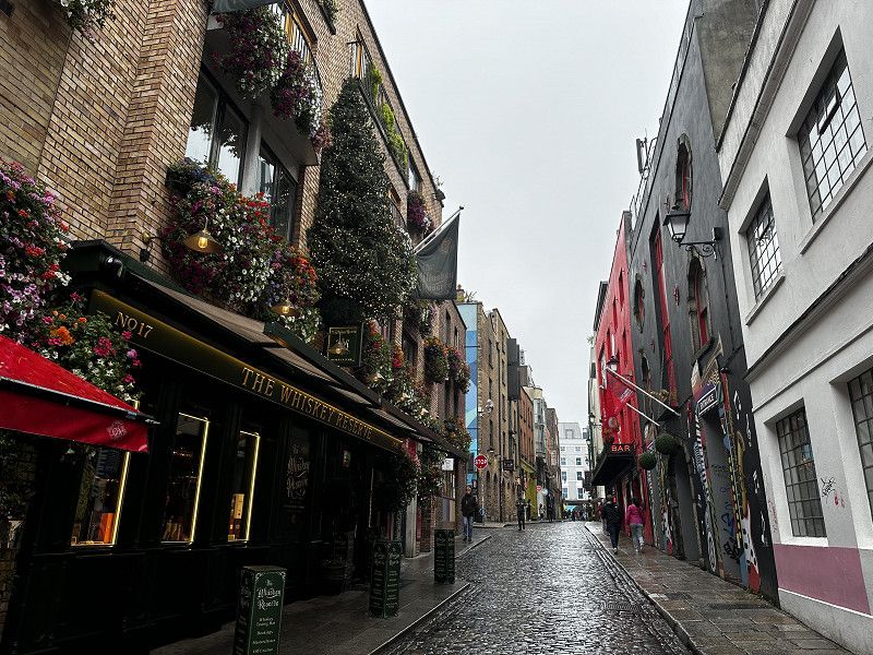
Temple Bar
Must visit…
Historic pub with live music. Great atmosphere. In Dublin's city center, several pubs with live music invite you to socialize.
Temple Bar Square, Dublin, Dublin 2, Irland
53° 20' 43.8" N 6° 15' 47.2" W
53.3454957 -6.2631139
• Head toward Cope Street on Temple Bar. Go for 18 m.
• Turn right onto Crown Alley. Go for 78 m.
• Turn right onto Cope Street. Go for 43 m.
• Turn left onto Fownes Street Upper. Go for 78 m.
• Turn right onto Dame Street (R137). Go for 611 m.
• Continue on High Street (R108). Go for 161 m.
• Continue on Cornmarket (R810). Go for 729 m.
• Turn left. Go for 52 m.
• Turn right toward Portland Street West. Go for 205 m.
• Turn right onto Portland Street West. Go for 32 m.
• Arrive at Portland Street West. Your destination is on the left.
☍
2,0 km
( 5 min.)
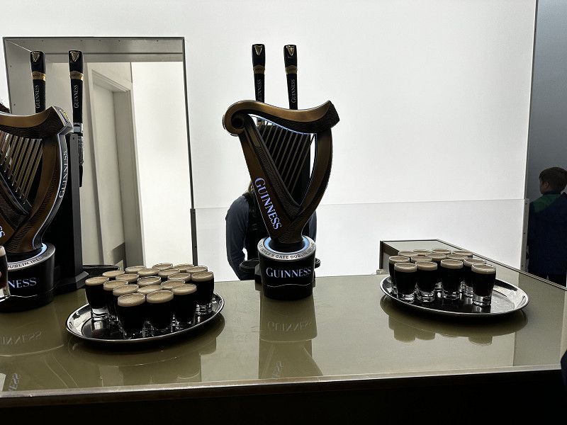
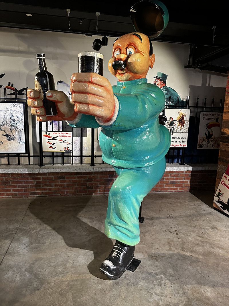
Guinness Storehouse
The multimedia experience impressively shows how the dark brew is made, with all the trimmings, and is one of the TOP experiences of our vacation. All of the senses are addressed here.
At the end: TOP panoramic view over Dublin in the "Gravity Bar" while you are served a Guinness. Highly recommended!
Market Street South, Dublin, Dublin 8, Irland
53° 20' 31" N 6° 17' 12.2" W
53.3419328 -6.2867297
• Head toward Rainsford Street on Portland Street West. Go for 32 m.
• Turn left. Go for 205 m.
• Turn left toward James's Street/R810. Go for 52 m.
• Turn left onto James's Street (R810). Go for 315 m.
• Keep right onto Bow Lane West. Go for 488 m.
• Continue on Bow Bridge. Go for 54 m.
• Turn right onto Irwin Street. Go for 98 m.
• Turn left. Go for 154 m.
• Arrive at your destination on the left.
☍
1,4 km
( 4 min.)
Irish Museum of Modern Art
Admission to the museum is free. It is located in a beautiful building and is surrounded by extensive gardens. Regular tours and workshops take place. There are special activities for children. Our conclusion: Worth a visit for art lovers who like very unusual art.
Military Road, Dublin, Dublin 8, Irland
53° 20' 34.5" N 6° 17' 58.1" W
53.3429135 -6.2994639
• Head west.
• Turn left. Go for 45 m.
• Turn left. Go for 67 m.
• Turn right toward Military Road. Go for 124 m.
• Turn left onto Military Road. Go for 274 m.
• Turn right onto St Johns Road West (R148). Go for 467 m.
• Turn right onto Wolfe Tone Quay (R148) toward An Lár/City Centre/Airport. Go for 1.0 km.
• Turn left onto Church Street (R108) toward Airport/N1-N2. Go for 496 m.
• Turn right onto King Street North (R804). Go for 5.3 km.
• Take ramp onto M50 toward Béal Feirste/Belfast/Aerfort/Airport/(M1). Go for 1.9 km.
• Continue on M1 toward Bhéal Feirste/Belfast/Aerfort/Airport. Go for 38.3 km.
• Take exit 9 toward Droichead Átha/Drogheda/Dún Uabhair/Donore. Go for 376 m.
• Take the 1st exit from roundabout onto Donore Road. Go for 1.0 km.
• Continue on Tubberfin. Go for 1.2 km.
• Continue on The Grange. Go for 99 m.
• Continue toward Staleen Road. Go for 225 m.
• Turn right onto Staleen Road. Go for 2.2 km.
• Arrive at Stalleen. Your destination is on the right.
☍
53,1 km
( 41 min.)
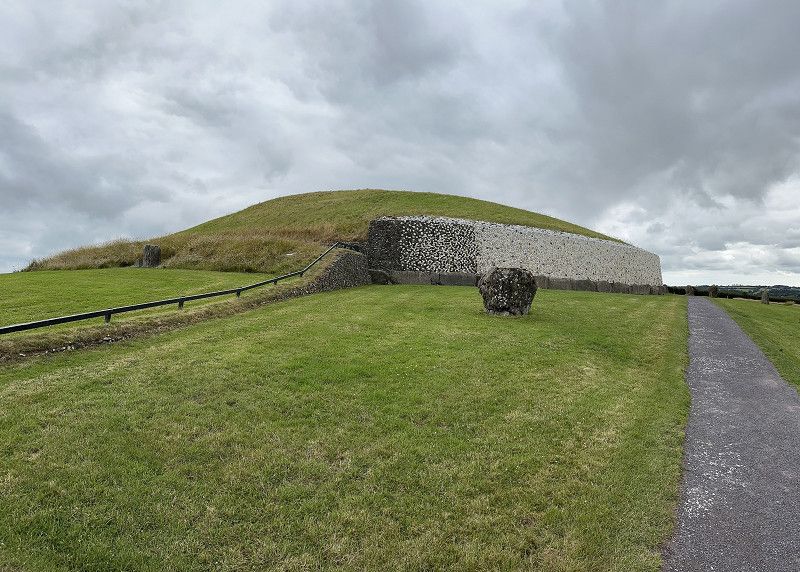
Newgrange Visitors Centre - Brú na Bóinne
Newgrange Visitors Center - Brú na Bóinne
At this waypoint is the parking lot. It has a special area for parking RVs.
Our goal was to visit the Newgrange burial mound. Unfortunately, the number of visitors per day is very limited, so that in high season it is not possible to get tickets to visit the interior of the burial mound on short notice.
We decided to take a guided tour around the burial mound. The museum in the visitor center also shows the interior quite impressively. A good place to stop for refreshments in the visitor center rounded off the experience.
L1601, County Meath, Irland
53° 41' 42.7" N 6° 26' 46.2" W
53.6951957 -6.4461542
• Head east on Stalleen. Go for 2.2 km.
• Turn left toward The Grange. Go for 225 m.
• Continue on The Grange. Go for 1.2 km.
• Continue on Tubberfin. Go for 84 m.
• Continue on Donore Road. Go for 952 m.
• Take the 1st exit from roundabout onto M1 toward Belfast/Toll Plaza. Go for 30.6 km.
• Take exit 16 toward Dún Dealgan (Theas)/Dundalk (South)/An Muileann gCearr/Mullingar. Go for 550 m.
• Take the 3rd exit from roundabout onto Haynestown (N52) toward Dún Dealgan/Dundalk/Na Creagacha Dubha/Blackrock. Go for 1.5 km.
• Take the 1st exit from roundabout onto N52. Go for 2.4 km.
• Take the 2nd exit from roundabout onto N52. Go for 740 m.
• Take the 3rd exit from roundabout onto Avenue Road (R172). Go for 571 m.
• Take the 1st exit from roundabout onto Red Barns Road. Go for 573 m.
• Take the 2nd exit from roundabout onto Red Barns Road. Go for 925 m.
• Turn right onto Point Road. Go for 101 m.
• Turn left onto Suil na Mara. Go for 427 m.
• Arrive at Suil na Mara. Your destination is on the left.
☍
43,1 km
( 31 min.)
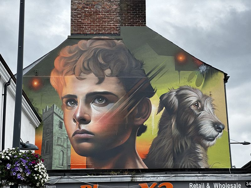
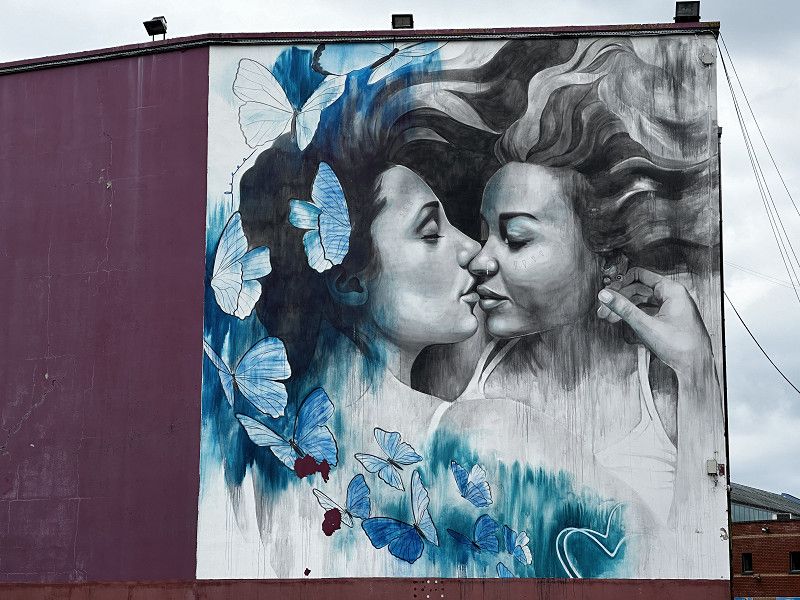
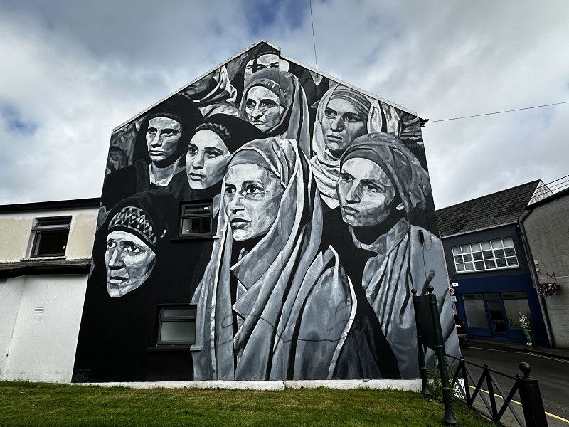
Dundalk im County Louth, Irland
The town of Dundalk shows interested tourists some impressive murals, but otherwise has little to offer in terms of tourism. The overnight spot is a dead end street with a turning area and comes from P4N and has the number #99335.
It is located on a jogger and dog walking path. It is quiet there in the evenings.
For geocachers: We liked the LAB series on the murals.
County Louth, Irland
54° 0' 24.4" N 6° 21' 38" W
54.0067745 -6.3605455
• Head west on Suil na Mara. Go for 427 m.
• Turn right onto Point Road. Go for 1.1 km.
• Continue on Quay Street. Go for 258 m.
• Turn left onto St Gerards Square. Go for 60 m.
• Continue on St Gerards Terrace. Go for 28 m.
• Continue on Barrack Street. Go for 47 m.
• Turn right onto N52. Go for 2.9 km.
• Take the 2nd exit from roundabout onto New Inn (N52). Go for 686 m.
• Take the 2nd exit from roundabout onto Faughart Lower. Go for 242 m.
• Take the 3rd exit from roundabout onto N1. Go for 9.8 km.
• Continue on A1. Go for 4.1 km.
• Take ramp toward Newry/Forkhill. Go for 484 m.
• Take the 2nd exit from Cloghogue Roundabout roundabout onto Dublin Road (A2) toward Newry/Warrenpoint. Go for 2.6 km.
• Turn right onto Abbey Yard. Go for 76 m.
• Turn left onto Abbey Yard. Go for 52 m.
• Continue on Courtney Hill. Go for 460 m.
• Continue on Ballyholland Road. Go for 998 m.
• Continue on Temple Hill Road. Go for 64 m.
• Continue on Ballyholland Road. Go for 2.3 km.
• Turn left onto Derryleckagh Road. Go for 89 m.
• Turn right onto Hilltown Road (B8). Go for 943 m.
• Continue on Newry Road (B8). Go for 2.9 km.
• Take the 1st exit from roundabout onto Hilltown Road (B8). Go for 291 m.
• Take the 2nd exit from roundabout onto Hilltown Road (B8). Go for 2.3 km.
• Continue on Newry Road (B8). Go for 3.4 km.
• Continue on Main Street (B8). Go for 910 m.
• Turn right onto Kilkeel Road (B27). Go for 1.7 km.
• Turn left onto Bryansford Road (B180). Go for 8.6 km.
• Continue on Hilltown Road (B180). Go for 2.6 km.
• Continue on Bryansford Road (B180). Go for 828 m.
• Continue on Hilltown Road (B180). Go for 900 m.
• Turn right onto Bryansford Road (B180). Go for 670 m.
• Turn right. Go for 1.2 km.
• Turn left. Go for 14 m.
• Turn right. Go for 16 m.
• Arrive at your destination on the right.
☍
54,1 km
( 49 min.)
Tullymore Forest Parc
Parking space, and it may even be possible to spend the night there. We didn't see any prohibition signs.
Bryansford Road, Bryansford, County Down, Nordirland, Vereinigtes Königreich
54° 13' 29.1" N 5° 56' 25.1" W
54.2247401 -5.9402972
• Head east. Go for 16 m.
• Turn left. Go for 14 m.
• Turn right. Go for 119 m.
• Turn left toward Hilltown Road/B180. Go for 213 m.
• Turn right onto Hilltown Road (B180). Go for 835 m.
• Continue on Ballyhafry Road (B180). Go for 1.1 km.
• Turn right onto Castlewellan Road (A50). Go for 75 m.
• Turn left onto Carnacavill Road (B180). Go for 1.3 km.
• Continue on Ballyloughlin Road (B180). Go for 3.0 km.
• Continue on Old Road (B180). Go for 578 m.
• Turn left onto Dundrum Road (A2). Go for 4.6 km.
• Continue on Main Street (A24). Go for 391 m.
• Take the 2nd exit from roundabout onto Downpatrick Road (A25) toward Downpatrick. Go for 9.6 km.
• Turn left onto Church Street (A7). Go for 656 m.
• Take the 2nd exit from roundabout onto New Bridge Street (A22) toward Comber/Strangford/(A25). Go for 199 m.
• Turn right onto Strangford Road (A25). Go for 1.9 km.
• Turn left onto Quay Road. Go for 358 m.
• Arrive at Quay Road. Your destination is on the left.
☍
25,0 km
( 25 min.)
Downpatrick bei Quoile Castle
Idyllic hiking car park from P4N. It is also popular with athletes, anglers and walkers. Very quiet in the evenings, ideal for spending the night. We were able to see red deer opposite.
Quay Road, Downpatrick, County Down, Nordirland, Vereinigtes Königreich
54° 21' 5.2" N 5° 41' 57.6" W
54.3514467 -5.6993469
• Head south on Quay Road. Go for 358 m.
• Turn right onto Strangford Road (A25). Go for 1.9 km.
• Continue on New Bridge Street (A22). Go for 176 m.
• Take the 2nd exit from roundabout onto Belfast Road (A7) toward Belfast/Ballynahinch/(B2)/Crossgar. Go for 8.0 km.
• Take the 2nd exit from roundabout onto Crossgar Road (A7). Go for 16.3 km.
• Take the 3rd exit from roundabout onto Saintfield Road (A24) toward Belfast. Go for 3.4 km.
• Turn left onto Cairnshill Road. Go for 234 m.
• Take the 2nd exit from roundabout onto Beechill Road. Go for 1.1 km.
• Turn right onto Newtownbreda Road. Go for 181 m.
• Turn left toward Belvoir Road/A55. Go for 48 m.
• Turn left onto Belvoir Road (A55). Go for 235 m.
• Turn right onto Belvoir Drive toward Belvoir Park Estate. Go for 425 m.
• Turn right toward Belvoir Drive. Go for 393 m.
• Continue on Belvoir Drive. Go for 96 m.
• Arrive at your destination.
☍
32,8 km
( 30 min.)
Belvoir Forest
Good alternative to camping for a visit to Belfast,
Free parking in Belvoir Forest Park, water refills possible. The ranger at the Forest Park is very friendly and talkative and keeps an eye on things. According to him, it is a former campsite.
There is a bus to and from Belfast every hour, a 7-minute walk to the stop.
Very quiet at night, walkers during the day, often with dogs.
Belvoir Drive, Purdysburn, County Down, Nordirland, Vereinigtes Königreich
54° 33' 27.8" N 5° 55' 41.8" W
54.5577360 -5.9282819
• Head north. Go for 127 m.
• Turn left onto Belvoir Drive. Go for 452 m.
• Turn left onto Belvoir Drive. Go for 411 m.
• Turn left onto Belvoir Road (A55). Go for 1.2 km.
• Turn slightly left onto Saintfield Road (A24) toward Newcastle/City Centre (Ormeau Road). Go for 1.2 km.
• Take the 2nd exit from roundabout onto Ravenhill Road (B506). Go for 3.3 km.
• Continue on Bridge End (A2) toward Park & Ride. Go for 188 m.
• Keep right onto Dalton Street toward Lagan Bridge/(M3)/The NORTH/(M2)/(M5)/The WEST/(A12)/(M1)/The SOUTH/City Airport/A2/Bangor. Go for 104 m.
• Take ramp onto M3 toward Lagan Bridge/The NORTH/M2/M5/The WEST/The SOUTH. Go for 1.1 km.
• Continue on M2. Go for 3.9 km.
• Keep right onto M5. Go for 2.6 km.
• Take the 2nd exit from roundabout onto Shore Road (A2) toward Whiteabbey/Carrickfergus. Go for 805 m.
• Take the 2nd exit from roundabout onto Shore Road (A2) toward Carrickfergus. Go for 5.0 km.
• Take the 2nd exit from Seapark Roundabout roundabout onto Belfast Road (A2) toward Carrickfergus/Larne/Causeway Coastal Route. Go for 3.0 km.
• Take the 3rd exit from roundabout onto Rodgers Quay toward Park and Ride/Waterfront/Carrick Castle. Go for 129 m.
• Turn left. Go for 36 m.
• Turn left. Go for 16 m.
• Turn right. Go for 25 m.
• Arrive at your destination on the right.
☍
23,5 km
( 25 min.)
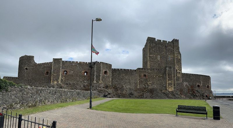
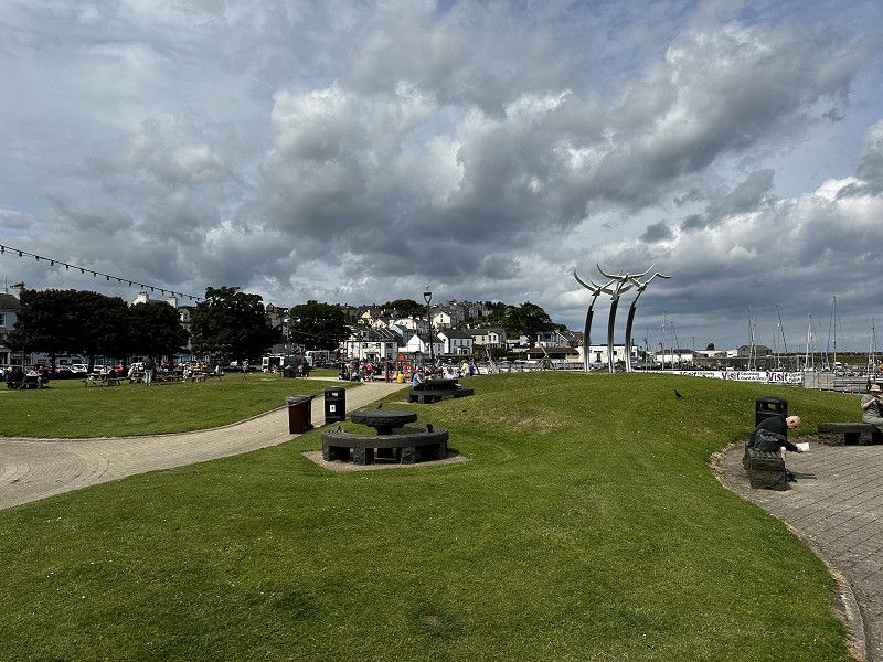
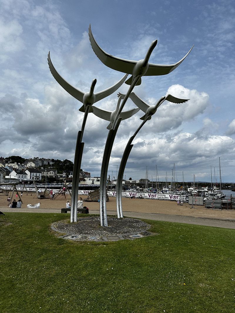
Carrickfergus
Good day parking from P4N. We wouldn't like to park here at night because it's too "busy". During the day, several motorhomes parked here in high season, which made parking quite safe.
Good for visiting the castle or shopping.
Marine Highway, Carrickfergus, County Antrim, Nordirland, Vereinigtes Königreich
54° 42' 46.8" N 5° 48' 31.9" W
54.7129999 -5.8088733
• Head west. Go for 25 m.
• Turn left. Go for 16 m.
• Turn right toward Rodgers Quay. Go for 36 m.
• Turn right onto Rodgers Quay. Go for 62 m.
• Take the 3rd exit from roundabout onto A2 toward Larne. Go for 255 m.
• Arrive at A2. Your destination is on the right.
☍
0,4 km
( 1 min.)
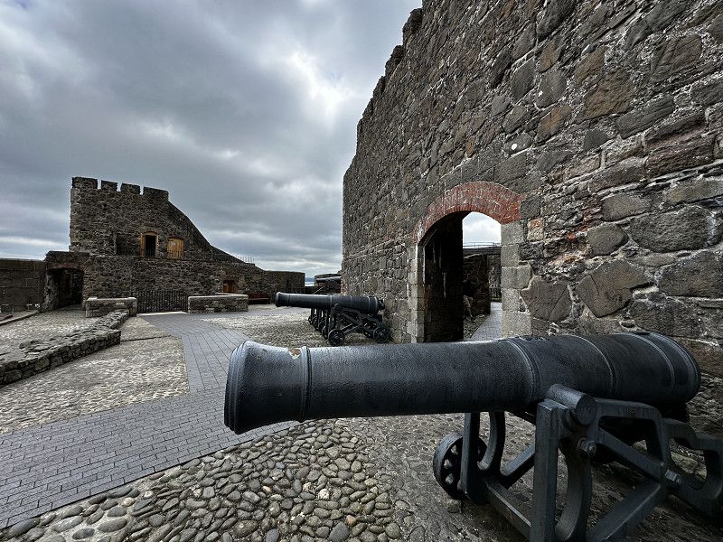
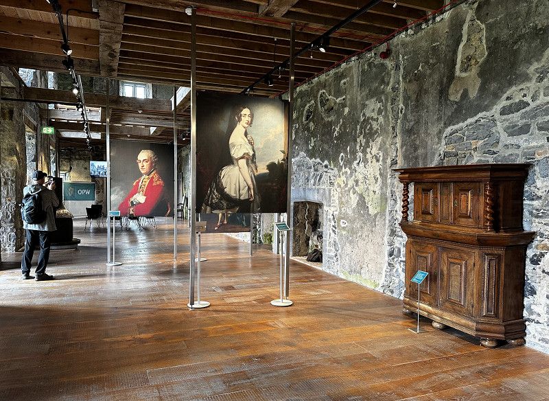
Carrickfergus castle
Old Norman castle. Some wax figures and exhibits illustrate the past life. Beautiful views of the town and the sea. Several activities for children's education, very suitable for families.
Entrance fee 2024: 6 € per person
Marine Highway, Carrickfergus, County Antrim, Nordirland, Vereinigtes Königreich
54° 42' 49.4" N 5° 48' 23" W
54.7137304 -5.8063959
• Head toward Castle Street on A2. Go for 7.5 km.
• Arrive at Belfast Road (A2). Your destination is on the right.
☍
7,5 km
( 7 min.)
Whitehead
Start of the route:
Coastal panoramic road that is easily accessible with a motorhome
Belfast Road, Whitehead, County Antrim, Nordirland, Vereinigtes Königreich
54° 44' 45.8" N 5° 42' 44.2" W
54.7460427 -5.7122852
• Head toward Greenfield Terrace on Belfast Road (A2). Go for 14.8 km.
• Keep left onto Glynn Road. Go for 334 m.
• Continue on High Street. Go for 58 m.
• Continue on Bridge Street. Go for 34 m.
• Continue on High Street. Go for 151 m.
• Turn left onto Pound Street. Go for 193 m.
• Turn right onto Meetinghouse Street. Go for 180 m.
• Continue on Lower Cairncastle Road. Go for 527 m.
• Turn left onto The Roddens. Go for 55 m.
• Turn right onto Upper Cairncastle Road. Go for 909 m.
• Take the 1st exit from roundabout onto Killyglen Road. Go for 39 m.
• Take the 2nd exit from roundabout onto Brustin Brae Road. Go for 4.7 km.
• Continue on Drumnagreagh Road (B148). Go for 5.2 km.
• Turn left onto Coast Road (A2). Go for 5.0 km.
• Turn right. Go for 36 m.
• Arrive at your destination on the right.
☍
32,3 km
( 31 min.)
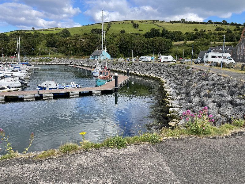
Glenarm Marina
Large, spacious P4N pitch right by the harbor. Many mobile homes dock here.
Opportunity to visit Glenarm Castle or buy local products near the castle.
Dickeystown Road, Glenarm, County Antrim, Nordirland, Vereinigtes Königreich
54° 58' 9" N 5° 56' 59.9" W
54.9691741 -5.9499810
• Head toward Coast Road. Go for 36 m.
• Turn right onto Coast Road (A2). Go for 317 m.
• Take the 2nd exit from roundabout onto The Cloney (A2). Go for 18.6 km.
• Turn right onto Glenariffe Road (A2). Go for 2.6 km.
• Turn left onto Mill Street (A2). Go for 24.6 km.
• Take the 1st exit from roundabout onto Quay Road (A2). Go for 287 m.
• Turn left. Go for 172 m.
• Arrive at your destination.
☍
46,7 km
( 43 min.)
Ballycastle Stadion
Possibility to park from P4N, even overnight if necessary. We visited Ballycastle. Beautiful beach promenade, stylish shops in the town.
Quay Road, Ballycastle, County Antrim, Nordirland, Vereinigtes Königreich
55° 12' 7.8" N 6° 14' 36.4" W
55.2021721 -6.2434470
• Head toward Quay Road. Go for 172 m.
• Turn right onto Quay Road (A2). Go for 273 m.
• Take the 1st exit from roundabout onto North Street (B15). Go for 135 m.
• Turn right. Go for 27 m.
• Turn slightly left. Go for 53 m.
• Arrive at your destination on the right.
☍
0,7 km
( 2 min.)
Ballycastle
Beautiful beach promenade, swimming on the beach, various cafes
Bayview Road, Ballycastle, County Antrim, Nordirland, Vereinigtes Königreich
55° 12' 23" N 6° 14' 24.6" W
55.2063863 -6.2401588
• Head north. Go for 26 m.
• Turn right toward North Street/B15. Go for 99 m.
• Turn right onto North Street (B15). Go for 432 m.
• Continue on Clare Road (B15). Go for 1.9 km.
• Turn right onto Whitepark Road (B15). Go for 3.6 km.
• Keep left onto B15. Go for 576 m.
• Continue on Whitepark Road (B15). Go for 2.2 km.
• Arrive at Whitepark Road (B15). Your destination is on the right.
☍
8,8 km
( 9 min.)
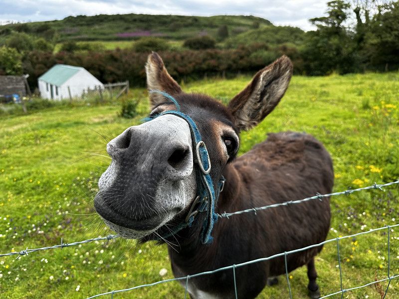
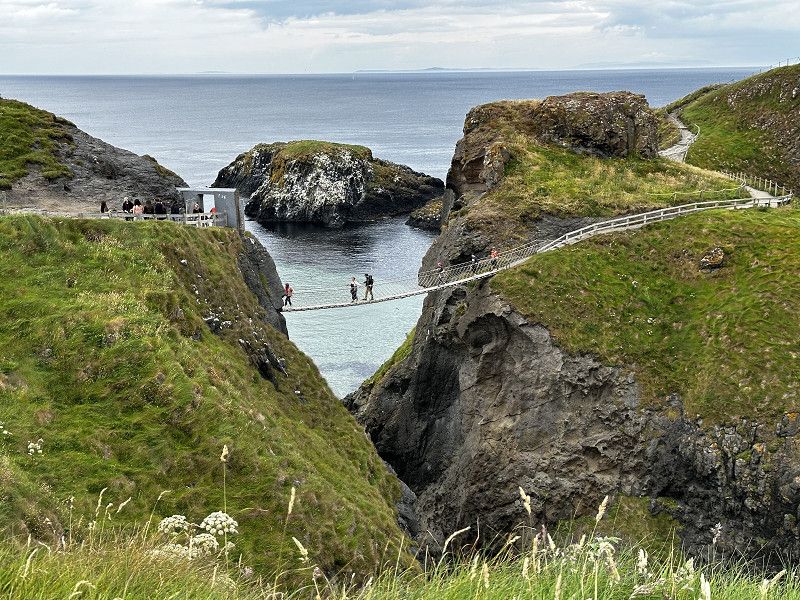
Wohnmobil PP: Carry a rope bridge
From P4N: The official parking space for the Carry a Rope Bridge is only opened on special request. We found a closed bar that wouldn't let us through. 🙁 They sometimes open on request.
So we - and another RV - parked up here on the road and walked down to the official parking lot, a 15' walk to the start of the walk to the famous suspension bridge. On the way we made friends with 2 cute donkeys in their enclosure. A nice experience!
55.2354, -6.3485
55° 14' 7.4" N 6° 20' 54.6" W
55.2354000 -6.3485000
• Head toward Glenstaughey Road on Whitepark Road (B15). Go for 929 m.
• Arrive at Whitepark Road (B15).
☍
0,9 km
( )
Carrick-a-rede Rope Bridge
Beautifully situated in a picturesque location, a worthwhile destination! We arrived after the ticket office closed. It's not bad just to look at the bridge from the outside. ;)
Carrick-a-rede Rope Bridge, County Antrim, Nordirland, Vereinigtes Königreich
55° 14' 22.6" N 6° 19' 56.7" W
55.2396127 -6.3324200
• Head toward Glenstaughey Road on Whitepark Road (B15). Go for 1.4 km.
• Continue on B15. Go for 194 m.
• Continue on Main Street (B15). Go for 680 m.
• Continue on B15. Go for 22 m.
• Continue on Whitepark Road (B15). Go for 1.9 km.
• Arrive at Whitepark Road (A2). Your destination is on the right.
☍
4,2 km
( 4 min.)
Aussichtspunkt auf der Route
From P4N: It is listed here as a possible place to stay overnight. However, the parking space was too noisy for us because it is close to the road. However, it was good for taking a look at the sea.
55.2301, -6.3926
55° 13' 48.4" N 6° 23' 33.4" W
55.2301000 -6.3926000
• Head toward Craigalappin Road on Whitepark Road (A2). Go for 1.2 km.
• Turn right onto Whitepark Road. Go for 149 m.
• Arrive at Whitepark Road. Your destination is on the left.
☍
1,4 km
( 1 min.)
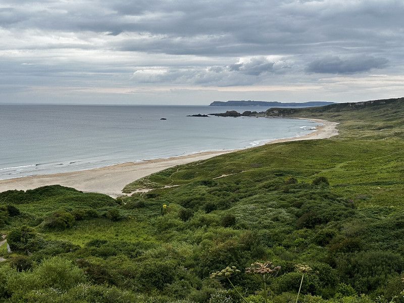
White Parc Bay Beach
From P4N: It is a good place to park at the famous beach, an overnight stay would theoretically also be possible.
The beach is great and swimming is fun, but the water was -in July- wooooo - cold!
55.2287, -6.4070
55° 13' 43.3" N 6° 24' 25.2" W
55.2287000 -6.4070000
• Head west on Whitepark Road. Go for 149 m.
• Turn right onto Whitepark Road (A2). Go for 8.6 km.
• Turn left onto Dundarave Park. Go for 55 m.
• Turn left. Go for 114 m.
• Arrive at your destination.
☍
8,9 km
( 8 min.)
Bushmills Park- und Stellplatz
Popular free parking space for motorhomes.
Option to use Park and Ride to Giants Causeway. £11 per person 2024. We were happy with this decision. (No cost and no hassle with parking.)
A visit to the distillery in Bushmills is highly recommended. It is advisable to book in advance.
Main Street, Bushmills, County Antrim, Nordirland, Vereinigtes Königreich
55° 12' 28.2" N 6° 31' 22.3" W
55.2078380 -6.5228477
• Head northwest. Go for 115 m.
• Turn right toward Dundarave Park. Go for 51 m.
• Turn right onto Dundarave Park. Go for 55 m.
• Turn left onto Main Street (A2). Go for 89 m.
• Take the 1st exit from roundabout onto Main Street. Go for 401 m.
• Continue on B17. Go for 34 m.
• Continue on Hamill Terrace (B17). Go for 144 m.
• Continue on Castlecat Road (B17). Go for 35 m.
• Turn left onto Distillery Road. Go for 38 m.
• Turn left. Go for 42 m.
• Arrive at your destination on the right.
☍
1,0 km
( 2 min.)
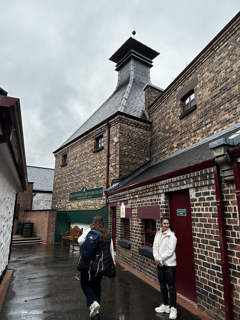
Bushmills Distillery
Here the modern distillery is shown in great detail and you are guided through the production rooms. Highly recommended!
Main Street, Bushmills, County Antrim, Nordirland, Vereinigtes Königreich
55° 12' 4.4" N 6° 31' 15.7" W
55.2012120 -6.5210398
• Head south. Go for 42 m.
• Turn right onto Distillery Road. Go for 38 m.
• Turn right onto Castlecat Road (B17). Go for 35 m.
• Continue on Elmwood Park (B17). Go for 144 m.
• Continue on B17. Go for 34 m.
• Continue on Main Street (B17). Go for 131 m.
• Continue on Main Street. Go for 256 m.
• Take the 2nd exit from roundabout onto Whitepark Road (A2). Go for 1.8 km.
• Turn left onto Causeway Road (B146). Go for 1.5 km.
• Turn left onto Causeway Road. Go for 45 m.
• Turn slightly right onto Causeway Road. Go for 49 m.
• Turn right. Go for 8 m.
• Turn left. Go for 49 m.
• Turn left. Go for 11 m.
• Arrive at your destination.
☍
4,1 km
( 6 min.)
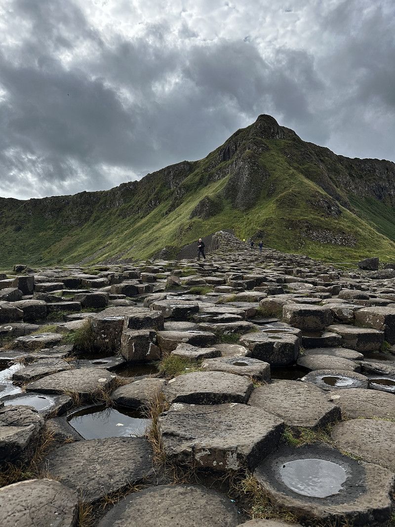
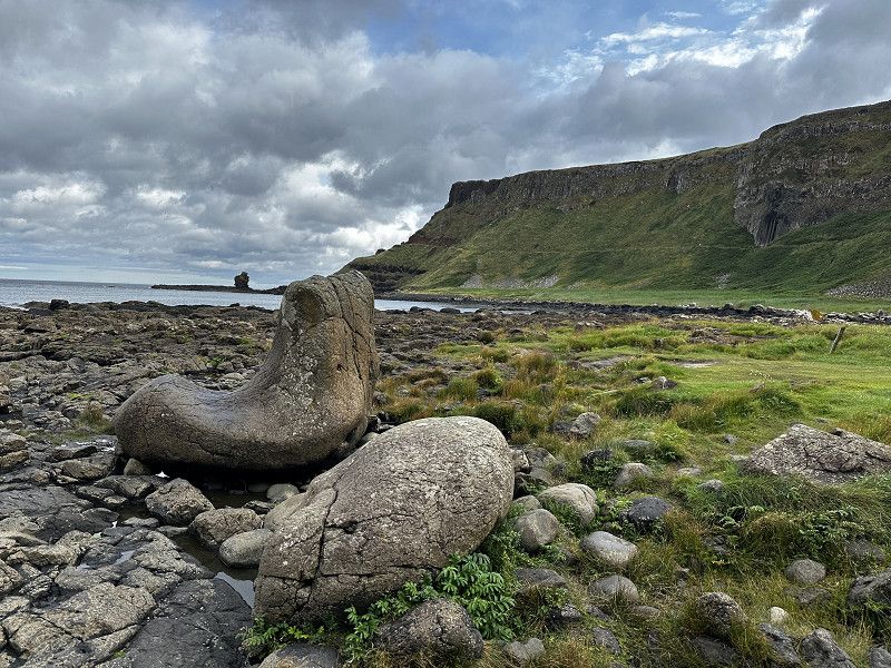
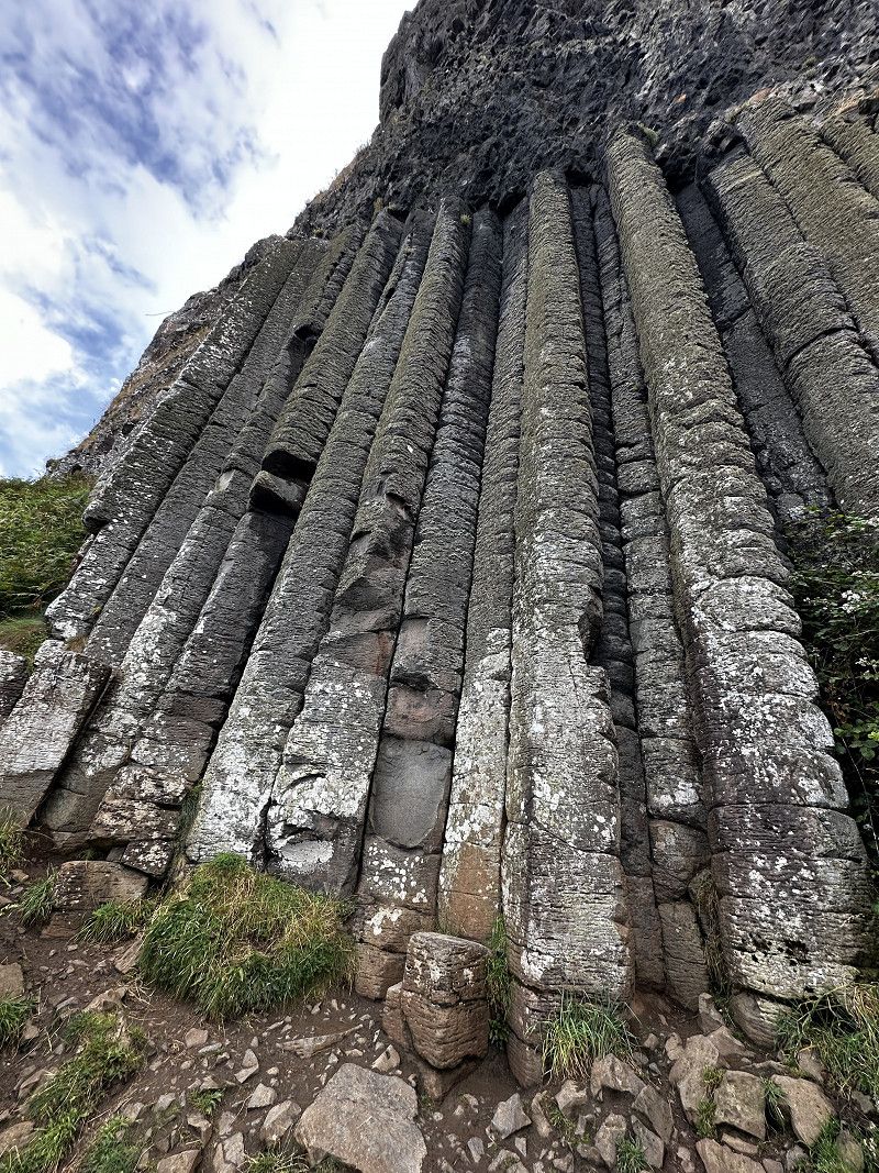
Giant's Causeway
Coordinates point to the parking lot
Tip: in the evening
Then you don’t have to pay anything anymore
Sunset !
Legend has it that the columns come from a dam built by a giant. It is true that the natural wonder was created by the rapid cooling of volcanic lava about 60 million years ago.
We visited this attraction via Park and Ride from Bushmills. It was stress-free and quite inexpensive.
Vereinigtes Königreich
55° 14' 27" N 6° 30' 41.9" W
55.2408215 -6.5116386
• Head southeast. Go for 11 m.
• Turn right. Go for 49 m.
• Turn right toward Causeway Road. Go for 8 m.
• Turn left onto Causeway Road. Go for 69 m.
• Turn slightly left onto Causeway Road. Go for 25 m.
• Turn right onto Causeway Road (B146). Go for 1.5 km.
• Turn right onto Whitepark Road (A2). Go for 1.8 km.
• Take the 2nd exit from roundabout onto Dunluce Road (A2). Go for 3.7 km.
• Turn right. Go for 258 m.
• Arrive at your destination on the left.
☍
7,3 km
( 8 min.)
Dunlucoe Castle Nordirland, Vereinigtes Königreich
Nice virtual geocache, unfortunately not visited myself.
Ballytober Road, County Antrim, Nordirland, Vereinigtes Königreich
55° 12' 34.9" N 6° 34' 42.9" W
55.2096916 -6.5785923
• Head toward Dunluce Road. Go for 117 m.
• Turn right onto Dunluce Road (A2). Go for 2.3 km.
• Turn sharp left onto Ballybogy Road (B62). Go for 4.4 km.
• Turn right onto Cloyfin Road (B17). Go for 5.6 km.
• Take the 1st exit from Bushmills Road Roundabout roundabout onto Ring Road (A29). Go for 1.3 km.
• Take the 2nd exit from Ballycastle Road Roundabout roundabout onto Ring Road (A29). Go for 1.4 km.
• Take the 3rd exit from Lodge Road Roundabout roundabout onto Ring Road (A29) toward Cookstown/Garvagh/Londonderry/Limavady/(A37)/Kilrea/(A54)/Castlerock/(B201)/Killowen/Waterside. Go for 1.2 km.
• Pass 4 roundabouts and continue on Broad Road (A37). Go for 20.5 km.
• Take the 1st exit from Killane Roundabout roundabout onto Ballykelly Road (A2) toward Londonderry/Airport/Limavady. Go for 1.6 km.
• Take the 2nd exit from Lisnakilly Roundabout roundabout onto Ballykelly Road (A2) toward Londonderry/Eglinton/Airport/Ballykelly. Go for 12.9 km.
• Pass 6 roundabouts and continue on Clooney Road (A2). Go for 11.6 km.
• Turn right onto King Street (A2) toward City Centre/Strabane/Omagh/(A5). Go for 144 m.
• Take the 1st exit from Waterside Roundabout roundabout onto Waterside Link (A2) toward City Centre/Strabane/Omagh/(A5)/Dublin. Go for 451 m.
• Take the 1st exit from Duke Street Roundabout roundabout onto Duke Street (A2) toward City Centre/(A5). Go for 181 m.
• Keep right onto A2 toward LR.Deck/L'Kenny/City Centre. Go for 231 m.
• Take the 2nd exit from Lower Deck Roundabout roundabout onto Craigavon Bridge Lower Deck (A2) toward Buncrana/Moville/City Centre/Letterkenny/(A40). Go for 318 m.
• Turn left onto Foyle Road (A40). Go for 102 m.
• Arrive at Foyle Road (A40). Your destination is on the left.
☍
64,3 km
( 53 min.)
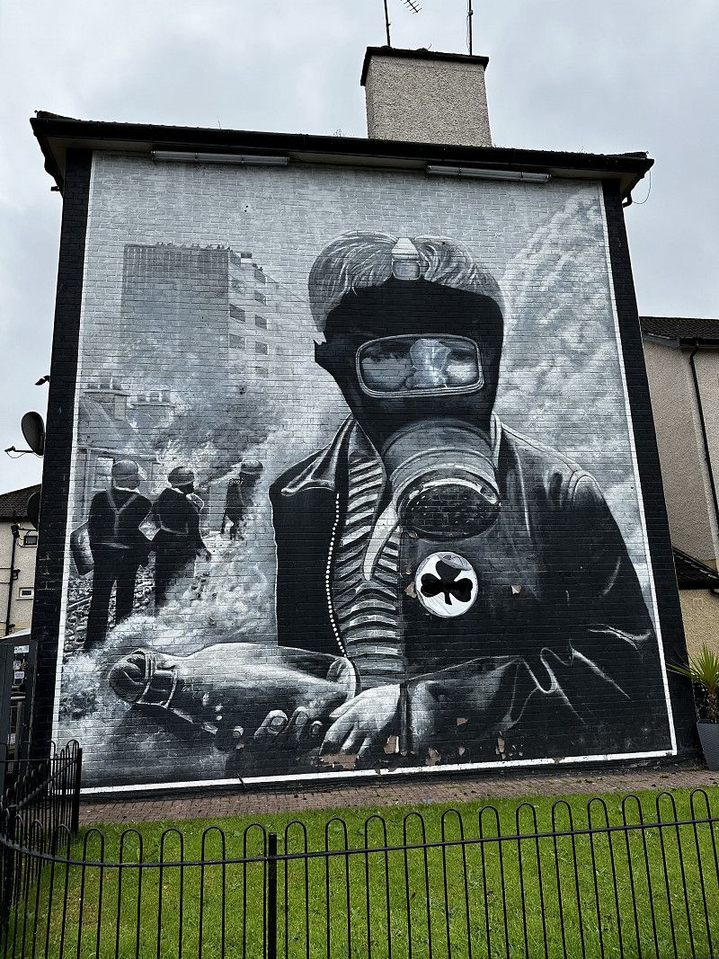
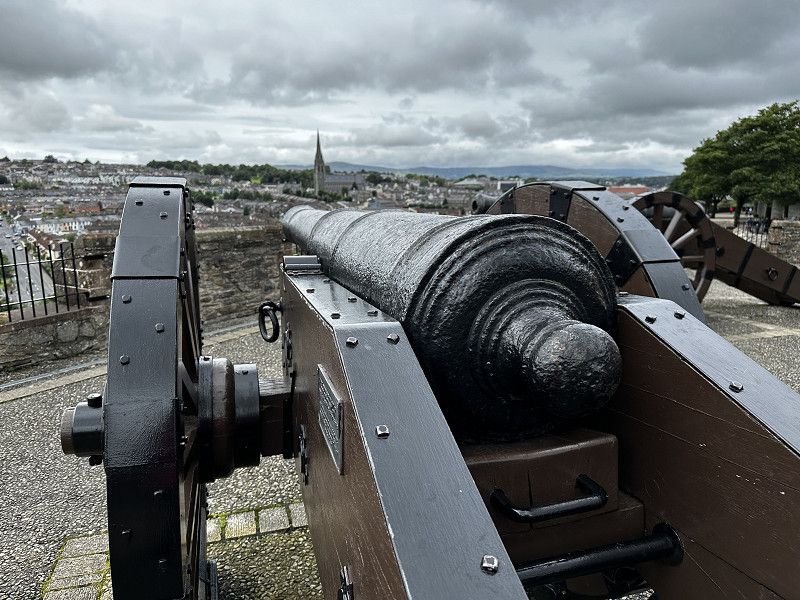
Derry/Londonderry Stellplatz P4N
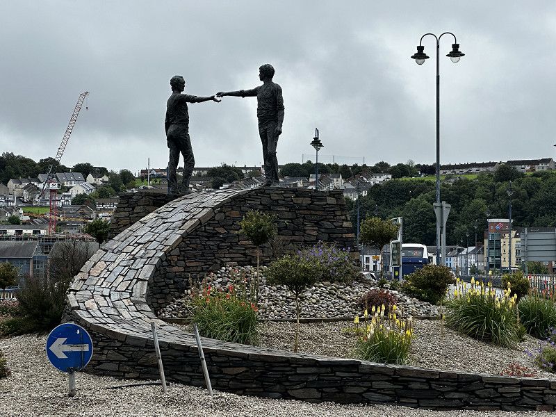
Derry~Londonderry is the only walled city in Ireland and one of the most beautiful in Europe. We liked it a lot and strolled along the city walls.
We had a tour here about recent history: “Bloody Sunday”. It led to impressive wall paintings, the so-called murals.
Geocaching :
Derry “City Wall” LAB series
LAB “A peaceful walk”
Foyle Road, Derry/Londonderry, County Londonderry, Nordirland, Vereinigtes Königreich
54° 59' 27.6" N 7° 19' 15.9" W
54.9909879 -7.3210772
• Head southwest on Foyle Road (A40). Go for 22 m.
• Turn left toward Foyle Road/A40. Go for 82 m.
• Turn right onto Foyle Road (A40). Go for 59 m.
• Turn right onto Craigavon Bridge Lower Deck (A2). Go for 313 m.
• Take the 2nd exit from Lower Deck Roundabout roundabout toward Strabane/Omagh/Dublin/(A5). Go for 106 m.
• Turn right onto Victoria Road (A5) toward Omagh/Strabane/Dublin. Go for 21.7 km.
• Pass 2 roundabouts and continue on Great Northern Link (A5). Go for 2.7 km.
• Turn right onto Orchard Road toward Orchard Road Industrial Estate. Go for 6.5 km.
• Turn left onto Tullymoan Road. Go for 749 m.
• Continue on Peacock Road. Go for 2.1 km.
• Continue on Grahamstown Road. Go for 2.6 km.
• Continue on Listymore Road. Go for 559 m.
• Turn right onto Strabane Road (B72). Go for 2.1 km.
• Take the 1st exit from roundabout onto Strabane Road (B72). Go for 116 m.
• Continue on Lower Strabane Road (B72). Go for 369 m.
• Take the 1st exit from roundabout onto Main Street (B72). Go for 22.1 km.
• Take the 3rd exit from roundabout onto Church Road (B4). Go for 1.7 km.
• Turn left onto Manoo Road (B72). Go for 4.3 km.
• Turn left onto Killadeas Road (A47). Go for 14.1 km.
• Take the 2nd exit from roundabout onto Irvinestown Road (A32) toward Enniskillen/Belfast/(A4). Go for 2.4 km.
• Take the 1st exit from roundabout onto Irvinestown Road (A32) toward Enniskillen. Go for 796 m.
• Take the 3rd exit from Cherrymount Roundabout roundabout onto Cornagrade Road (A32) toward Donegal/Sligo/(A4)/Dublin/(A509). Go for 1.6 km.
• Take the 3rd exit from roundabout onto Queen Street (A32) toward Belleek/(A46)/Donegal/Sligo/(A4)/Derrygonnelly/(B81). Go for 366 m.
• Continue on Castle Street (A4). Go for 43 m.
• Turn right onto Wellington Road (A4) toward The West/(A46)/Dublin/(A509). Go for 147 m.
• Turn left onto Henry Street (A4) toward Belcoo/Sligo/Derrylin/Cavan/Dublin/(A509)/Florencecourt/Marble Arch & Geo Park. Go for 2.4 km.
• Take the 2nd exit from roundabout onto Sligo Road (A4) toward Belcoo/Sligo. Go for 1.9 km.
• Turn left onto Swanlinbar Road (A32) toward Swanlinbar/Florencecourt/Ballinamore/Marble Arch Caves. Go for 6.1 km.
• Turn right onto Marble Arch Road (B52). Go for 4.5 km.
• Turn left onto Marlbank Road. Go for 3.3 km.
• Turn right toward Marlbank Road. Go for 748 m.
• Turn right onto Marlbank Road. Go for 8 m.
• Arrive at Marlbank Road. Your destination is on the left.
☍
106,4 km
(1 hrs. 40 min.)
Marble Arch Caves
https://marblearchcaves.co.uk/
Theoretically, you can also visit the caves here, but we skipped them due to lack of time, so we can't say anything about them.
Marlbank Road, Legnabrocky, Fermanagh, Nordirland, Vereinigtes Königreich
54° 15' 30.7" N 7° 48' 47.5" W
54.2585187 -7.8131855
• Head east on Marlbank Road. Go for 768 m.
• Turn left onto Marlbank Road. Go for 3.3 km.
• Turn left onto Marble Arch Road (B52). Go for 7.3 km.
• Continue on Toam. Go for 298 m.
• Continue on Breffni Court. Go for 59 m.
• Continue on An Bonnán Buí Way. Go for 129 m.
• Continue on Tuam. Go for 111 m.
• Continue on Main Street (N16). Go for 468 m.
• Turn left onto Toam (R206) toward Gleann Ghaibhle/Glangevlin. Go for 98 m.
• Continue on R206. Go for 181 m.
• Continue on Cora na Heascainne (R206). Go for 43 m.
• Continue on Toam (R206). Go for 757 m.
• Continue on Kiltaglassan (R206). Go for 594 m.
• Continue on Termon (R206). Go for 136 m.
• Turn left onto Termon (R206). Go for 408 m.
• Continue on Kiltaglassan (R206). Go for 934 m.
• Continue on Unshogagh (R206). Go for 519 m.
• Continue on Cornagee (R206). Go for 192 m.
• Continue on Unshogagh (R206). Go for 1.8 km.
• Continue on Cornahaw (R206). Go for 1.8 km.
• Continue on Stranamart (R206). Go for 364 m.
• Arrive at Stranamart (R206).
☍
20,3 km
( 20 min.)
Shannon Pot
Our plan was to follow the River Shannon from its source to the sea. We implemented the plan consistently.
The car park at Shannon Pot is a wonderful place to spend the night, in a very quiet location. If you're lucky, you can watch a beautiful sunset in the mountains.
R206, County Cavan, Irland
54° 14' 5" N 7° 55' 8.2" W
54.2347175 -7.9189572
• Head north on Stranamart (R206). Go for 364 m.
• Continue on Cornahaw (R206). Go for 551 m.
• Turn left onto Cornahaw. Go for 162 m.
• Continue on Stranamart. Go for 1.9 km.
• Turn left onto Stranamart (R207). Go for 48 m.
• Continue on Gubaveeny (R207). Go for 2.3 km.
• Continue on Corlea (R207). Go for 725 m.
• Continue on Corraquigley (R207). Go for 1.3 km.
• Continue on Corrahoash (R207). Go for 418 m.
• Continue on Cashel (R207). Go for 1.1 km.
• Continue on Corrard (R207). Go for 729 m.
• Continue on Corradeverrid (R207). Go for 615 m.
• Continue on R207. Go for 700 m.
• Continue on Main Street (R207). Go for 324 m.
• Continue on Cornageeha (R207). Go for 85 m.
• Turn left onto Cornageeha (R200). Go for 38 m.
• Arrive at Cornageeha (R200). Your destination is on the left.
☍
11,4 km
( 11 min.)
Dowra
First view -after the source- of the Shannon.
The Shannon is still very narrow here. There is an opportunity to drive out.
R200, County Leitrim, Irland
54° 11' 23.5" N 8° 0' 48.5" W
54.1898730 -8.0134589
• Head south on Cornageeha (R200). Go for 38 m.
• Turn left onto Cornageeha (R207). Go for 28 m.
• Continue on Kilmore (R207). Go for 495 m.
• Continue on Cornageeha (R207). Go for 342 m.
• Continue on Cornaguillagh (R207). Go for 279 m.
• Continue on Tullynapurtlin (R207). Go for 457 m.
• Continue on Cornamucklagh North (R207). Go for 506 m.
• Continue on Greaghnafarna (R207). Go for 1.2 km.
• Continue on Derrynahona (R207). Go for 277 m.
• Continue on Greaghnafarna (R207). Go for 164 m.
• Continue on Largandill (R207). Go for 496 m.
• Continue on Druminalass (R207). Go for 884 m.
• Continue on Tullyveacan (R207). Go for 678 m.
• Continue on Drumristin (R207). Go for 923 m.
• Continue on Cleighran Beg (R207). Go for 592 m.
• Continue on Cleighran More (R207). Go for 573 m.
• Arrive at Cleighran More (R207). Your destination is on the right.
☍
7,9 km
( 7 min.)
Blick auf Lough Allen - Shannon
Good picnic spot, we had breakfast here.
54.1249, -8.0221
54° 7' 29.6" N 8° 1' 19.6" W
54.1249000 -8.0221000
• Head southwest on Cleighran More (R207). Go for 406 m.
• Continue on Cornamucklagh South (R207). Go for 690 m.
• Continue on Stonyriver (R207). Go for 414 m.
• Continue on Greaghnaguillaun (R207). Go for 1.2 km.
• Continue on Cormongan (R207). Go for 1.3 km.
• Continue on Cornashamsoge (R207). Go for 1.6 km.
• Continue on Derrintober (R207). Go for 1.2 km.
• Continue on Murhaun (R207). Go for 716 m.
• Continue on Corlough (R207). Go for 847 m.
• Continue on Corrachuill (R207). Go for 273 m.
• Continue on R207. Go for 93 m.
• Continue on Carricknabrack (R207). Go for 42 m.
• Turn right onto Carricknabrack. Go for 485 m.
• Take the 2nd exit from roundabout onto Carricknabrack (R208). Go for 426 m.
• Continue on Blackrock (R208). Go for 511 m.
• Continue on Mahanagh (R208). Go for 924 m.
• Continue on Mahanagh (R280). Go for 50 m.
• Arrive at Mahanagh (R280). Your destination is on the right.
☍
11,2 km
( 10 min.)
Blick auf den Shannon
R280, County Leitrim, Irland
54° 3' 14.9" N 8° 4' 1.6" W
54.0541439 -8.0671006
• Head southeast on Mahanagh (R280). Go for 50 m.
• Continue on Mahanagh (R208). Go for 924 m.
• Continue on Blackrock (R208). Go for 511 m.
• Continue on Carricknabrack (R208). Go for 390 m.
• Take the 1st exit from roundabout onto Carricknabrack. Go for 499 m.
• Turn left onto Carricknabrack (R207). Go for 42 m.
• Continue on R207. Go for 93 m.
• Continue on Corrachuill (R207). Go for 273 m.
• Continue on Corlough (R207). Go for 847 m.
• Continue on Murhaun (R207). Go for 716 m.
• Continue on Derrintober (R207). Go for 1.2 km.
• Continue on Cornashamsoge (R207). Go for 1.6 km.
• Continue on Cormongan (R207). Go for 183 m.
• Turn left onto Cormongan. Go for 65 m.
• Arrive at Cormongan. Your destination is on the left.
☍
7,3 km
( 7 min.)
Shannon am Lough Allen
A quick look and move on. ;)
54.0922, -8.0357
54° 5' 31.9" N 8° 2' 8.5" W
54.0922000 -8.0357000
• Head east on Cormongan. Go for 65 m.
• Turn right onto Cormongan (R207). Go for 183 m.
• Continue on Cornashamsoge (R207). Go for 1.6 km.
• Continue on Derrintober (R207). Go for 1.2 km.
• Continue on Murhaun (R207). Go for 716 m.
• Continue on Corlough (R207). Go for 847 m.
• Continue on Corrachuill (R207). Go for 273 m.
• Continue on R207. Go for 93 m.
• Continue on Carricknabrack (R207). Go for 42 m.
• Continue on Dowra Road (R207). Go for 249 m.
• Turn right onto Convent Avenue (R207). Go for 82 m.
• Turn left onto Main Street (R208). Go for 96 m.
• Turn right onto Carrick Road (R207). Go for 426 m.
• Continue on R207. Go for 96 m.
• Continue on Drumhalwy (R207). Go for 357 m.
• Continue on Acres (R207). Go for 240 m.
• Continue on Drumduff North (R207). Go for 504 m.
• Continue on Cornaroy (R207). Go for 647 m.
• Continue on Aughriman (R207). Go for 267 m.
• Continue on Drumkeelan Beg (R207). Go for 1.5 km.
• Continue on Drumkeelan Beg (R280). Go for 2.4 km.
• Turn left onto Drumshanbo Road. Go for 110 m.
• Turn right onto Drumshanbo Road. Go for 74 m.
• Arrive at Drumshanbo Road. Your destination is on the right.
☍
12,1 km
( 13 min.)
Leitrim Village Hafen am Shannon
The place was very busy, with RVs and boat owners. We only parked briefly and then drove on.
53.9911, -8.0642
53° 59' 28" N 8° 3' 51.1" W
53.9911000 -8.0642000
• Head northwest on Drumshanbo Road. Go for 74 m.
• Turn left onto Drumshanbo Road. Go for 110 m.
• Turn left onto Drumshanbo Road (R280). Go for 6.0 km.
• Turn left onto Main Street (R280). Go for 449 m.
• Take the 3rd exit from Shannon Roundabout roundabout onto Dublin Road (N4) toward Sligeach/Sligo/Main. na Búille/Boyle. Go for 734 m.
• Take the 2nd exit from roundabout onto Bridge Street (R903) toward Cora Droma Rúisc/Town Centre. Go for 80 m.
• Turn left onto Quay Road (R903). Go for 70 m.
• Turn right onto Quay Road (R903). Go for 114 m.
• Turn left onto St George's Terrace. Go for 156 m.
• Turn left. Go for 38 m.
• Arrive at your destination.
☍
7,8 km
( 10 min.)
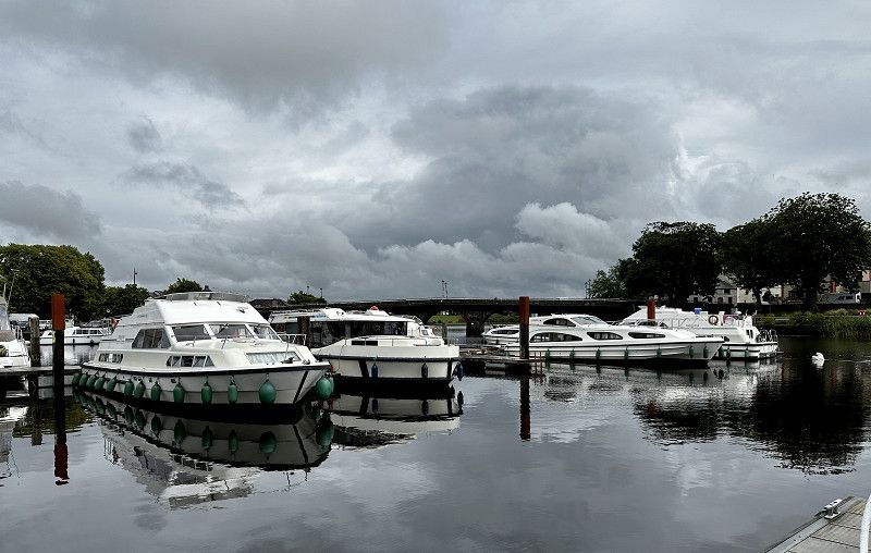
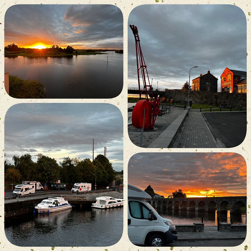
Carrick on Shannon
Visit the harbor, watch boats
County Leitrim, Irland
53° 56' 38.3" N 8° 5' 50.1" W
53.9439613 -8.0972467
• Head northeast. Go for 39 m.
• Turn slightly right onto St George's Terrace. Go for 215 m.
• Turn right onto Bridge Street (R903). Go for 215 m.
• Take the 1st exit from roundabout onto Dublin Road (N4). Go for 700 m.
• Take the 3rd exit from Shannon Roundabout roundabout onto N4 toward Áth Cliath/Dublin. Go for 493 m.
• Pass 2 roundabouts and continue on N4. Go for 13.1 km.
• Turn right onto Faulties. Go for 579 m.
• Continue on Furnace. Go for 1.1 km.
• Continue on Drumod Beg. Go for 1.2 km.
• Turn right onto Drumod Beg. Go for 284 m.
• Turn left onto Drumod Beg. Go for 114 m.
• Arrive at Drumod Beg. Your destination is on the left.
☍
18,1 km
( 16 min.)
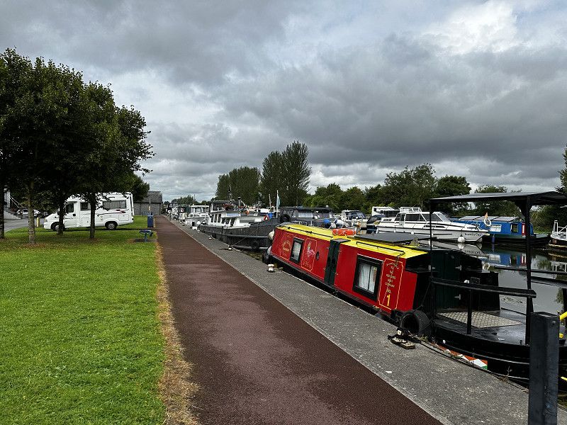
Drumod Hafen
Walk around the harbor, watch the houseboats
County Leitrim, Irland
53° 51' 18.7" N 7° 55' 25.8" W
53.8552016 -7.9238463
• Head north on Drumod Beg. Go for 398 m.
• Turn right onto Drumod Beg. Go for 15 m.
• Continue on Drumod More. Go for 285 m.
• Continue on Dromod More. Go for 149 m.
• Continue on Drumod More. Go for 1.1 km.
• Continue on Killinaker. Go for 711 m.
• Continue on Moher. Go for 280 m.
• Continue on Knockmacrory. Go for 374 m.
• Turn right onto Georgia (R371). Go for 66 m.
• Continue on Main Street (R371). Go for 915 m.
• Continue on Roosky New (R371). Go for 107 m.
• Continue on R371. Go for 479 m.
• Continue on Drumman More (R371). Go for 1.2 km.
• Continue on Knockhall (R371). Go for 1.9 km.
• Continue on Ballykilcline (R371). Go for 1.2 km.
• Continue on Lecarrow (R371). Go for 663 m.
• Continue on Legan (R371). Go for 45 m.
• Continue on Lecarrow (R371). Go for 195 m.
• Continue on Legan (R371). Go for 856 m.
• Continue on Carrownskeheen (R371). Go for 129 m.
• Continue on Rooaun (R371). Go for 1.3 km.
• Continue on Glen (R371). Go for 168 m.
• Continue on Tully (R371). Go for 793 m.
• Continue on Ballyfeeny (R371). Go for 73 m.
• Continue on Tully (R371). Go for 91 m.
• Continue on Ballyfeeny (R371). Go for 1.3 km.
• Continue on Pollymount (R371). Go for 902 m.
• Continue on Bellanamullia (R371). Go for 450 m.
• Continue on Scramoge (R371). Go for 352 m.
• Turn left onto Scramoge (N5). Go for 9.3 km.
• Turn right onto Harbour Road. Go for 277 m.
• Continue on Tarmon Harbour. Go for 132 m.
• Turn right onto Ballytoohey. Go for 48 m.
• Arrive at Ballytoohey. Your destination is on the left.
☍
26,3 km
( 22 min.)
Stellplatz Termonbarry
from P4N, nice parking space at the harbor, restaurant on site#
The Shannon Bar with live music
There we had a very friendly welcome, a cheap meal, and a lot of fun.
53.7386, -7.9206
53° 44' 19" N 7° 55' 14.2" W
53.7386000 -7.9206000
• Head east on Ballytoohey. Go for 90 m.
• Turn left onto Ballytoohey. Go for 394 m.
• Turn right onto Ballytoohey (N5). Go for 6.9 km.
• Take the 2nd exit from roundabout onto Ballyminion (N5) toward An Longfort/Longford. Go for 572 m.
• Take the 2nd exit from roundabout onto Gleann Riada toward Páirc Ghnó Baile Mionnán/Ballyminion Business PK. Go for 214 m.
• Take the 2nd exit from roundabout onto Ballyminion. Go for 337 m.
• Take the 2nd exit from roundabout onto Ballyminion. Go for 148 m.
• Take the 3rd exit from roundabout onto Athlone Road (N63). Go for 1.8 km.
• Turn left onto Cartronageeragh (R397) toward Baile Átha Luain/Athlone/Baile Uí Mhatháin/Ballymahon/Baile Nua an Chaisil/Newtown Cashel. Go for 69 m.
• Continue on Mullaghavorneen (R397). Go for 311 m.
• Continue on Stonepark (R397). Go for 345 m.
• Continue on Knockanboy (R397). Go for 89 m.
• Continue on Stonepark (R397). Go for 271 m.
• Continue on Cloonturk (R397). Go for 41 m.
• Continue on Stonepark (R397). Go for 289 m.
• Continue on Cloonturk (R397). Go for 182 m.
• Continue on Craane (R397). Go for 374 m.
• Continue on Curry (R397). Go for 1.2 km.
• Continue on Ballintempan (R397). Go for 297 m.
• Continue on Caldraghmore (R397). Go for 1.3 km.
• Continue on Cloonanny (R397). Go for 197 m.
• Continue on Knockagowny (R397). Go for 285 m.
• Continue on Brickeens (R397). Go for 430 m.
• Continue on Doonameran (R397). Go for 736 m.
• Continue on Aghnashingan (R397). Go for 820 m.
• Continue on Ballyknock (R397). Go for 755 m.
• Continue on Snugborough (R397). Go for 268 m.
• Continue on Mosstown (R397). Go for 1.0 km.
• Continue on R397. Go for 177 m.
• Continue on Crannach (R397). Go for 247 m.
• Continue on R397. Go for 668 m.
• Continue on Loughill (R397). Go for 312 m.
• Continue on Laughil (R397). Go for 169 m.
• Continue on Creagh (R397). Go for 662 m.
• Continue on Loughill (R397). Go for 132 m.
• Continue on Creagh (R397). Go for 314 m.
• Continue on Clogh (R397). Go for 233 m.
• Continue on Lismacmurrogh (R397). Go for 366 m.
• Continue on Clogh (R397). Go for 252 m.
• Continue on Lismacmurrogh (R397). Go for 407 m.
• Continue on Corryena (R397). Go for 612 m.
• Continue on Lismacmurrogh (R397). Go for 166 m.
• Continue on Tirlickeen (R397). Go for 983 m.
• Turn left onto Tirlickeen (R392). Go for 3.6 km.
• Turn right onto Athlone Road (N55) toward B. Átha Luain/Athlone/Glasán/Glasson. Go for 18.0 km.
• Pass 2 roundabouts and continue on Ballymahon Road. Go for 2.7 km.
• Continue on Garden Vale. Go for 158 m.
• Continue on Gleeson Street. Go for 105 m.
• Continue on St Marys Place. Go for 50 m.
• Continue on John Broderick Street. Go for 168 m.
• Take the 2nd exit from roundabout onto Golden Island. Go for 230 m.
• Turn left toward Golden Island. Go for 83 m.
• Continue on Golden Island. Go for 143 m.
• Turn left onto Golden Island. Go for 69 m.
• Arrive at Golden Island. Your destination is on the right.
☍
50,7 km
( 51 min.)
Golden Island Shopping Centre
Pitch for the day, less suitable at night and not allowed. Boat trip across Lough Ree to Hodson Bay and back with a Viking boat.
MacDiarmada Road, The Municipal District of Athlone — Moate, County Westmeath, Irland
53° 25' 12" N 7° 55' 58.2" W
53.4199939 -7.9328373
• Head south on Golden Island. Go for 69 m.
• Turn left onto Golden Island. Go for 325 m.
• Take the 3rd exit from roundabout onto Golden Island. Go for 260 m.
• Take the 2nd exit from roundabout onto Castlemaine Street (R446). Go for 170 m.
• Continue on Brideswell (R446). Go for 565 m.
• Continue on Dublin Road (R446). Go for 1.0 km.
• Take the 2nd exit from roundabout onto Dublin Road (R446). Go for 215 m.
• Take the 2nd exit from roundabout onto Dublin Road (R446). Go for 791 m.
• Take the 3rd exit from roundabout onto Dublin Road (N62) toward Áth Cliath/Dublin/N6. Go for 1.4 km.
• Turn right onto Fardrum (N62) toward Biorra/Birr/An Féar Bán/Ferbane/Cluain Mhic Nóis/Clonmacnoise. Go for 9.0 km.
• Turn right onto R444 toward Dr. na Sionainne/Shannonbridge/Cluain Mhic Nóis/Clonmacnoise. Go for 11.4 km.
• Turn right. Go for 146 m.
• Arrive at your destination on the left.
☍
25,4 km
( 26 min.)
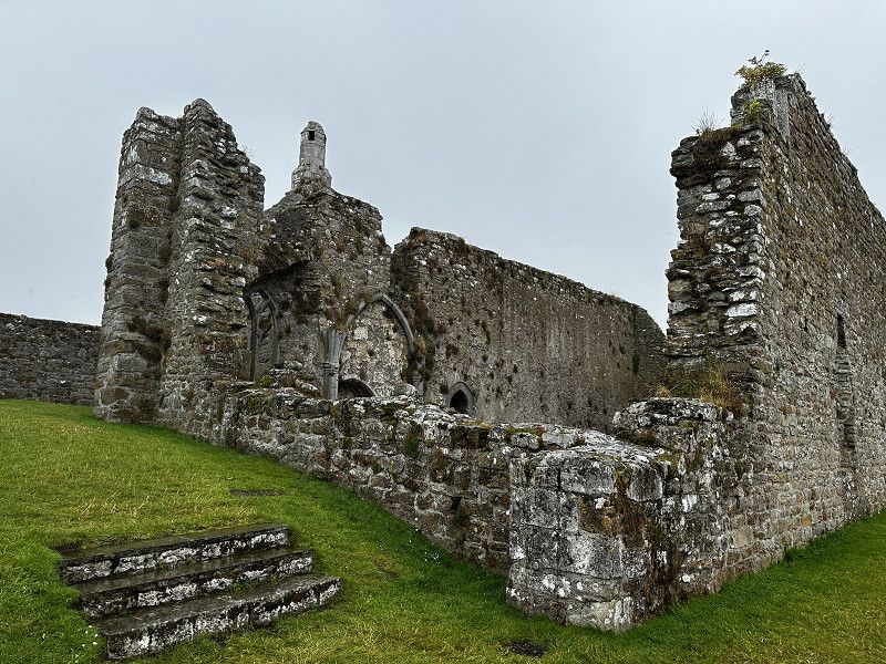
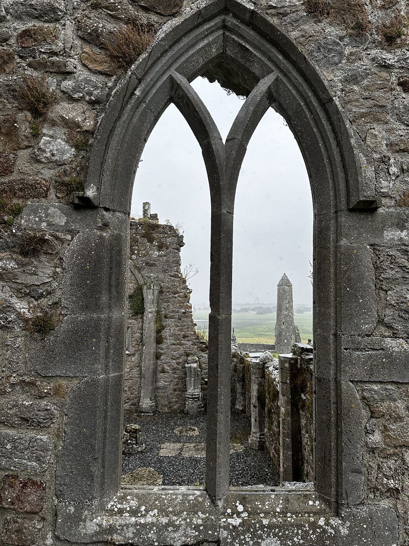
Clonmacnoise Kloster
Parking for visiting the monastery. Very good exhibition, impressive ruins
Beautiful view over the Shannon.
R444, Birr, County Offaly, Irland
53° 19' 31.5" N 7° 59' 14" W
53.3254227 -7.9872205
• Head toward Clonmacnoise. Go for 44 m.
• Make a U-Turn. Go for 184 m.
• Turn right onto Clonmacnoise (R444). Go for 6.3 km.
• Turn right onto Cloghan Road (R357). Go for 710 m.
• Turn left. Go for 92 m.
• Arrive at your destination on the right.
☍
7,4 km
( 12 min.)
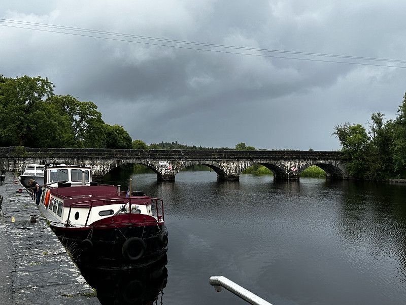
Shannonbridge
Nice parking space, right by the harbor, restaurant with panoramic windows on site
Perfect sunset over the bridge
53.2790, -8.0499
53° 16' 44.4" N 8° 2' 59.6" W
53.2790000 -8.0499000
• Head toward Main Street. Go for 92 m.
• Turn right onto Main Street (R357). Go for 9.9 km.
• Turn right toward Clonony Beg. Go for 1.3 km.
• Continue on Clonony Beg. Go for 1.0 km.
• Arrive at Clonony Beg.
☍
12,4 km
( 11 min.)
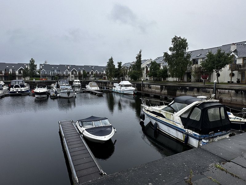
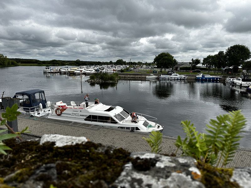
Shannon Harbour
The Griffith Bridge is very steep and narrow - impressive! The harbor looks like a "vintage" boat museum.
County Offaly, Irland
53° 13' 19.9" N 7° 57' 3.7" W
53.2221946 -7.9510244
• Head southwest on Clonony Beg.
• Turn left onto Clonony Beg. Go for 705 m.
• Continue on Park. Go for 800 m.
• Continue on Curraghlahan. Go for 746 m.
• Turn right onto Curraghlahan (R356). Go for 2.7 km.
• Turn right onto Main Street (R356). Go for 324 m.
• Arrive at West End (R356).
☍
5,2 km
( 7 min.)
Banagher
Stroll and view of the harbor
Main Street, Birr, County Offaly, Irland
53° 11' 30.8" N 7° 59' 23.6" W
53.1918947 -7.9898955
• Head toward The Marina on West End (R356). Go for 10.7 km.
• Turn left onto R356. Go for 5.7 km.
• Continue on Magheranearla (R355) toward Cill Íomair/Killimor/Port Omna/Portumna. Go for 129 m.
• Turn left onto Magheranearla (R355). Go for 9.6 km.
• Turn left onto St Brendans Road (N65). Go for 751 m.
• Turn left onto St Brendan's Street (N65) toward Buiríos Uí Chéin/Borrisokane/Port Omna/Town Centre. Go for 74 m.
• Arrive at St Brendan's Street (N65).
☍
27,0 km
( 25 min.)
Parkplatz zu Portumna castle
This parking lot is located directly in front of the Garda, so the motorhome is well “guarded”.
Saint Brendan's Street, County Galway, Irland
53° 5' 29.7" N 8° 13' 18.9" W
53.0915719 -8.2219280
• Head southwest on St Brendan's Street (N65). Go for 24 m.
• Turn left onto Castle Avenue. Go for 217 m.
• Turn right. Go for 43 m.
• Arrive at your destination.
☍
0,3 km
( )
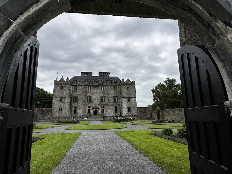
Portumna Castle and Gardens
Castle with small exhibition, nice park, nice café
Nearby (rear exit towards the sea) there are ruins of an old monastery, very worth seeing!
Castle Avenue, County Galway, Irland
53° 5' 14.8" N 8° 13' 15" W
53.0874399 -8.2208460
• Head toward Abbey Street. Go for 43 m.
• Turn left onto Castle Avenue. Go for 217 m.
• Turn left onto St Brendan's Street (N65). Go for 50 m.
• Continue on St Joseph's Road (R353) toward R352/An Scairbh/Scariff. Go for 5.9 km.
• Turn left onto Killeen South (R352). Go for 23.3 km.
• Arrive at R352. Your destination is on the left.
☍
29,6 km
( 25 min.)
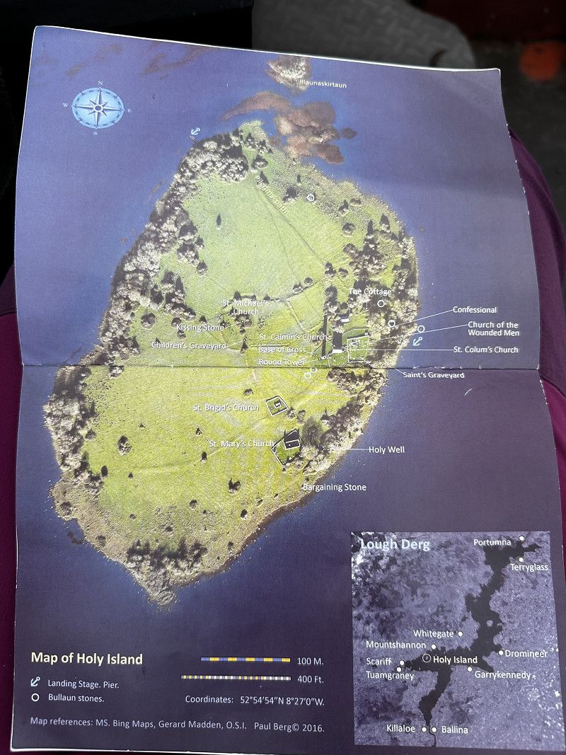
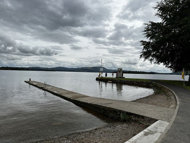
Mountshannon
We park along the street in the town and walk down to the beach.
We take a boat to Holy Island. There we have 1 hour to visit the ruins. Afterwards the boat picks us up again.
We booked the whole thing directly on the beach, at a souvenir stall.
R352, County Clare, Irland
52° 55' 54.8" N 8° 25' 41.6" W
52.9318795 -8.4282297
• Head toward Mountshannon Court on R352. Go for 13.8 km.
• Turn left onto R352. Go for 24.8 km.
• Take the 2nd exit from roundabout onto M18. Go for 3.7 km.
• Take exit 12 toward Inis/Ennis/Inis Díomáin/Ennistimon/Farantóireachta Cill Rois/Kilrush Ferry. Go for 341 m.
• Take the 3rd exit from Killow East Roundabout roundabout onto N85. Go for 222 m.
• Pass 2 roundabouts and continue on N85. Go for 2.6 km.
• Take the 1st exit from Clareabbey Roundabout roundabout onto Limerick Road (R458). Go for 178 m.
• Turn right onto Kildysart Cross (R473). Go for 156 m.
• Continue on Kildysart Road (R473). Go for 617 m.
• Continue on R473. Go for 733 m.
• Continue on Hempfield (R473). Go for 565 m.
• Continue on Barntick (R473). Go for 1.5 km.
• Continue on Feagh (R473). Go for 74 m.
• Continue on Buncraggy (R473). Go for 557 m.
• Continue on Ballyveskil (R473). Go for 875 m.
• Continue on Teermaclane (R473). Go for 104 m.
• Continue on Ballyveskil (R473). Go for 121 m.
• Continue on Teermaclane (R473). Go for 1.1 km.
• Continue on Craggykerrivan (R473). Go for 371 m.
• Continue on Drumquin (R473). Go for 633 m.
• Continue on Cragbrien (R473). Go for 160 m.
• Continue on Lisheen (R473). Go for 2.2 km.
• Continue on Ballycorick (R473). Go for 208 m.
• Continue on Lisduff (R473). Go for 502 m.
• Continue on Ballycorick (R473). Go for 914 m.
• Continue on Knappoge (R473). Go for 603 m.
• Continue on Mount (R473). Go for 119 m.
• Continue on Poulaphuca (R473). Go for 142 m.
• Continue on Knocksaggart (R473). Go for 188 m.
• Continue on Cornfield (R473). Go for 92 m.
• Continue on Knocksaggart (R473). Go for 578 m.
• Continue on R473. Go for 1.3 km.
• Continue on Paradise (R473). Go for 1.9 km.
• Continue on Cooga (R473). Go for 830 m.
• Continue on Ballylean (R473). Go for 541 m.
• Continue on Crovraghan (R473). Go for 280 m.
• Continue on Ballyleann East (R473). Go for 104 m.
• Continue on Crovraghan (R473). Go for 794 m.
• Continue on Lackannashinagh (R473). Go for 605 m.
• Continue on Ennis Road (R473). Go for 617 m.
• Turn left onto Barrack Court. Go for 50 m.
• Arrive at Barrack Court.
☍
65,7 km
( 57 min.)
Kildysert
Parking directly on the water.
If you don't need any supplies, there is no cost for an overnight stay.
52.6695, -9.0997
52° 40' 10.2" N 9° 5' 58.9" W
52.6695000 -9.0997000
• Head northwest on Barrack Court. Go for 50 m.
• Turn left onto Ennis Road (R473). Go for 208 m.
• Continue on Main Street (R473). Go for 314 m.
• Continue on R473. Go for 727 m.
• Continue on Ballynacragga (R473). Go for 803 m.
• Continue on Cappanavarnoge (R473). Go for 595 m.
• Continue on Cahiracon (R473). Go for 1.2 km.
• Continue on Caheracon (R473). Go for 2.2 km.
• Continue on Shannakea More (R473). Go for 397 m.
• Continue on Shannakea Beg (R473). Go for 63 m.
• Continue on Shannakea More (R473). Go for 1.1 km.
• Continue on Shannakea Beg (R473). Go for 412 m.
• Continue on Aillroe Beg (R473). Go for 1.1 km.
• Continue on Erribul (R473). Go for 1.4 km.
• Continue on Slievedooley (R473). Go for 343 m.
• Continue on Clonkerry West (R473). Go for 411 m.
• Continue on Slievedooley (R473). Go for 194 m.
• Continue on Clonkerry East (R473). Go for 579 m.
• Continue on Slievedooley (R473). Go for 261 m.
• Continue on Clonkerry West (R473). Go for 379 m.
• Continue on R473. Go for 190 m.
• Turn right onto Kilrush Road (R473). Go for 120 m.
• Continue on R473. Go for 747 m.
• Continue on Ballyartney (R473). Go for 1.2 km.
• Continue on Ballygeery West (R473). Go for 474 m.
• Continue on Prospect (R473). Go for 329 m.
• Continue on Clonderalaw (R473). Go for 1.1 km.
• Continue on Prospect (R473). Go for 429 m.
• Continue on Clonderalaw (R473). Go for 383 m.
• Continue on Kilmurry West (R473). Go for 1.2 km.
• Continue on Carrowniska (R473). Go for 357 m.
• Continue on Carrowniska South (R473). Go for 295 m.
• Continue on Bleanmore (R473). Go for 602 m.
• Continue on Cassarnagh (R473). Go for 405 m.
• Continue on Bleanmore (R473). Go for 1.1 km.
• Continue on Tarmon (R473). Go for 3.1 km.
• Continue on Derrylough (R473). Go for 1.1 km.
• Continue on Carrowfree (R473). Go for 1.5 km.
• Continue on Thomastown (R473). Go for 917 m.
• Continue on Kilcarroll (R473). Go for 1.2 km.
• Continue on Moyadda Beg (R473). Go for 755 m.
• Continue on Parknamoney (R473). Go for 495 m.
• Continue on Ballymacurtaun (R473). Go for 177 m.
• Continue on Monvana (R473). Go for 169 m.
• Continue on R473. Go for 171 m.
• Continue on Woodroad (R473). Go for 268 m.
• Continue on R473. Go for 44 m.
• Continue on St Senan's Terrace (R473). Go for 188 m.
• Continue on Crawford Street (R473). Go for 193 m.
• Continue on Moore Street (R473). Go for 360 m.
• Take the 1st exit from Market Square roundabout onto Frances Street. Go for 460 m.
• Continue on Merchants Quay. Go for 230 m.
• Arrive at Merchants Quay. Your destination is on the right.
☍
33,0 km
( 32 min.)
Kilrush Dolphin watching
We find a very nice place to park, which is spacious at the back.
There are also paid, proper RV parking spaces.
The main attraction is a boat tour for dolphin watching. We were able to park in the marina. We were also able to observe masses of dolphins.
Shanakyle Road, Kilrush, County Clare, Irland
52° 38' 8.1" N 9° 29' 36.5" W
52.6355807 -9.4934835
• Head toward Pella Road on Merchants Quay. Go for 230 m.
• Continue on Frances Street. Go for 434 m.
• Take the 2nd exit from Market Square roundabout onto Henry Street (N67). Go for 283 m.
• Take the 3rd exit from roundabout onto O'Dea's Road (N68). Go for 217 m.
• Turn left onto N68. Go for 40.4 km.
• Take the 3rd exit from Kilrush Road Roundabout roundabout onto N68. Go for 355 m.
• Take the 1st exit from Rocky Road Roundabout roundabout onto N85. Go for 1.2 km.
• Take the 3rd exit from Clareabbey Roundabout roundabout onto N85. Go for 1.5 km.
• Pass 2 roundabouts and continue on N85. Go for 1.3 km.
• Take the 2nd exit from Killow East Roundabout roundabout onto M18. Go for 12.9 km.
• Continue on N18. Go for 21.2 km.
• Continue on M7. Go for 80.8 km.
• Take exit 21 toward Maighean Rátha/Mountrath/Buiríos Mór Osraí/Borris-in-Ossory/Ráth Domhnaigh/Rathdowney/Main. Laoise/Abbeyleix. Go for 507 m.
• Take the 1st exit from roundabout onto R435. Go for 929 m.
• Take the 2nd exit from roundabout onto R435. Go for 1.3 km.
• Take the 2nd exit from roundabout onto Roscrea Road (R445). Go for 3.1 km.
• Turn right onto Sentry Hill (R434). Go for 747 m.
• Continue on Ballytarsna (R434). Go for 170 m.
• Continue on Sentry Hill (R434). Go for 940 m.
• Continue on Knockaroe (R434). Go for 496 m.
• Continue on Kilbeg (R434). Go for 719 m.
• Continue on Derrinoliver (R434). Go for 300 m.
• Continue on Lowran (R434). Go for 477 m.
• Continue on Carrowreagh (R434). Go for 749 m.
• Continue on Keelough Glebe (R434). Go for 744 m.
• Continue on Aghaboe (R434). Go for 609 m.
• Continue on Corraun (R434). Go for 393 m.
• Continue on Aghaboe (R434). Go for 78 m.
• Continue on Corraun (R434). Go for 66 m.
• Continue on Aghaboe (R434). Go for 908 m.
• Continue on Cross (R434). Go for 331 m.
• Continue on Friarsland (R434). Go for 97 m.
• Continue on Coolfin (R434). Go for 476 m.
• Continue on Springfield (R434). Go for 269 m.
• Continue on Boherard (R434). Go for 335 m.
• Continue on Springfield (R434). Go for 1.4 km.
• Continue on Kilminfoyle (R434). Go for 1.4 km.
• Continue on R434. Go for 433 m.
• Continue on Clough Road (R434). Go for 1.1 km.
• Continue on Durrow Road (R434). Go for 156 m.
• Continue on R434. Go for 195 m.
• Continue on Cool (R434). Go for 819 m.
• Continue on Coolderry (R434). Go for 1.2 km.
• Continue on Moyne (R434). Go for 1.7 km.
• Continue on Swan (R434). Go for 332 m.
• Continue on R434. Go for 40 m.
• Continue on Swan Road (R434). Go for 1.2 km.
• Turn right onto N77. Go for 164 m.
• Turn left onto The Square (N77) toward Cill Chainnigh/Kilkenny/Béal Átha Ragad/Ballyragget. Go for 17.0 km.
• Turn left onto Jenkinstown. Go for 950 m.
• Turn left onto Jenkinstown Park. Go for 588 m.
• Arrive at Jenkinstown Park. Your destination is on the right.
☍
204,1 km
(2 hrs. 21 min.)
Jenkinstown
Very nice rest area north of Kilkenny. Decent toilets on site, nice tables and benches. Very quiet at night. However, there are only a few parking spaces for large motorhomes. However, there is a larger site nearby.
52.7314, -7.2889
52° 43' 53" N 7° 17' 20" W
52.7314000 -7.2889000
• Head toward Jenkinstown on Jenkinstown Park. Go for 588 m.
• Turn right onto Jenkinstown. Go for 36 m.
• Turn left onto Tower Road. Go for 1.2 km.
• Turn right onto Ballyrafton (N78). Go for 1.6 km.
• Take the 1st exit from roundabout onto N77. Go for 3.6 km.
• Take the 1st exit from roundabout onto N77 toward (M9)/Áth Cliath/Dublin/Port Láirge/Waterford/(N76)/Cluain Meala/Clonmel. Go for 1.9 km.
• Take the 2nd exit from New Orchard Road Roundabout roundabout onto N77 toward (M9)/Áth Cliath/Dublin/Port Láirge/Waterford/(N76)/Cluain Meala/Clonmel. Go for 754 m.
• Take the 3rd exit from Johnswell Road Roundabout roundabout onto Johnswell Road toward An Pháirc Nua/Newpark/L2615. Go for 1.1 km.
• Take the 1st exit from Newpark Drive Roundabout roundabout onto Pennefeather Way. Go for 115 m.
• Turn right. Go for 40 m.
• Turn left. Go for 29 m.
• Arrive at your destination on the left.
☍
10,9 km
( 12 min.)
Newparc Shopping Centre
To explore the city, we park in a parking space far away from the entrance, right in the corner.
52.6601, -7.2401
52° 39' 36.4" N 7° 14' 24.4" W
52.6601000 -7.2401000
• Head southeast. Go for 37 m.
• Turn left. Go for 36 m.
• Turn right. Go for 29 m.
• Turn right toward Pennefeather Way. Go for 40 m.
• Turn left onto Pennefeather Way. Go for 95 m.
• Take the 2nd exit from Newpark Drive Roundabout roundabout onto Newpark Drive. Go for 560 m.
• Take the 3rd exit from New Road Roundabout roundabout onto New Road. Go for 524 m.
• Continue on Green Street. Go for 81 m.
• Turn left onto Vicar Street (R693). Go for 186 m.
• Turn right onto Vicar Street. Go for 66 m.
• Turn left onto Irishtown. Go for 101 m.
• Continue on Parliament Street. Go for 132 m.
• Turn left onto Parliament Street. Go for 41 m.
• Arrive at Parliament Street. Your destination is on the right.
☍
1,9 km
( 5 min.)
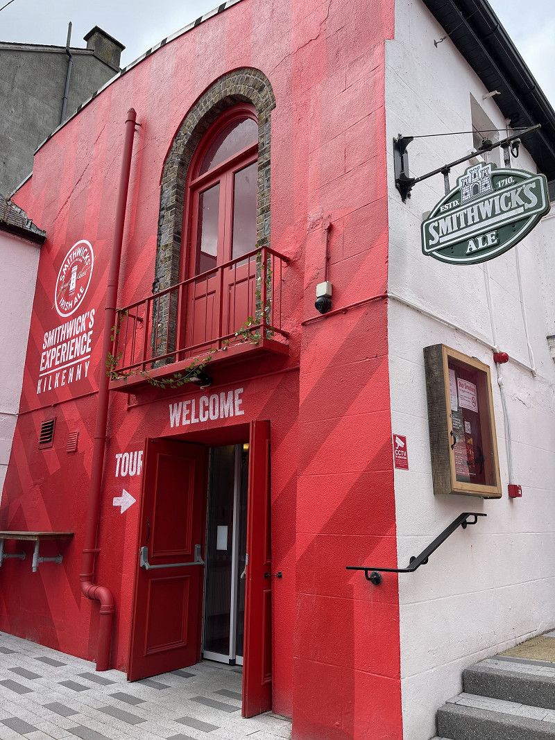
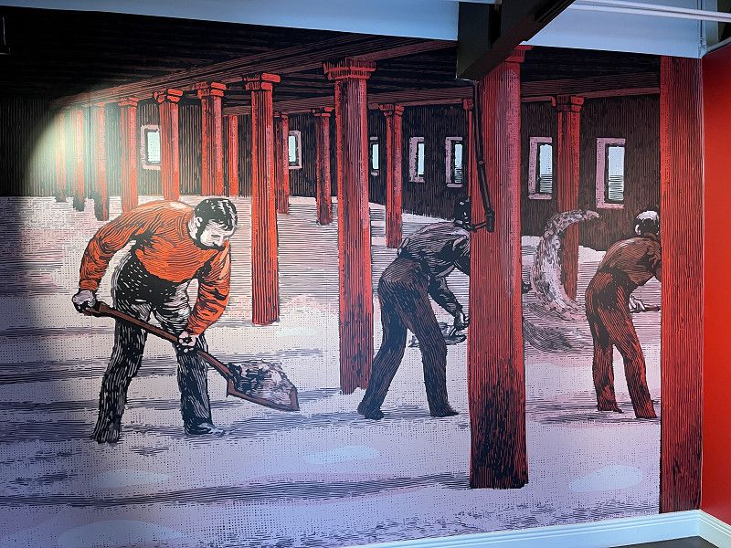
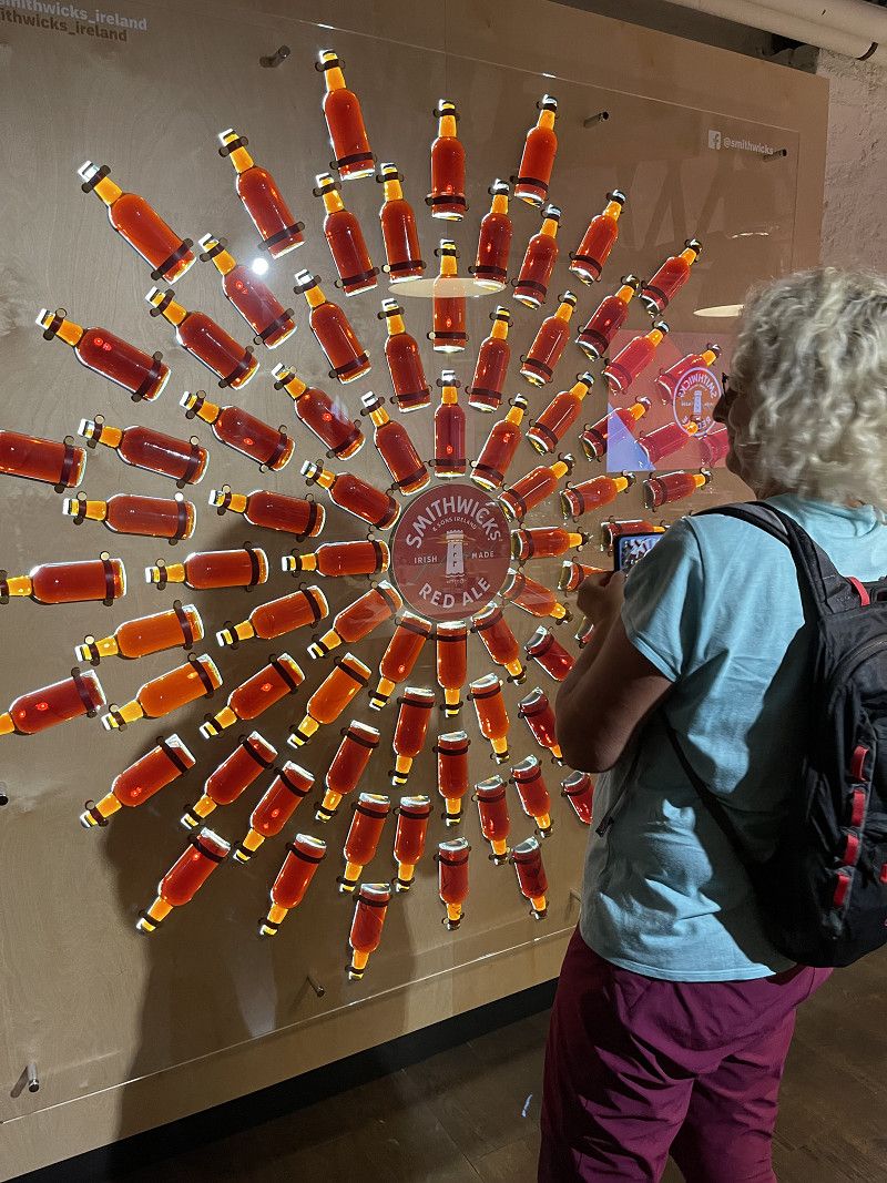
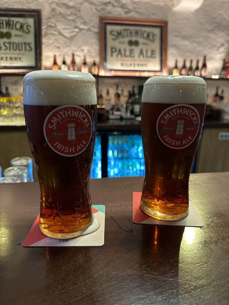
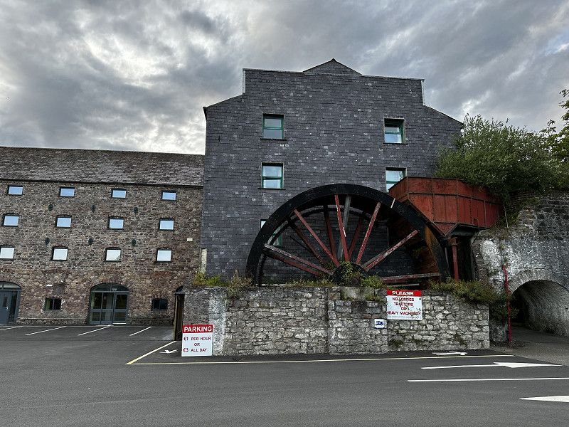
Smithwick's Brewery Experience
Here you can follow the path of the red Smithwicks Ale from cultivation to the tap. The whole thing is demonstrated very clearly and the visitor can experience it with all of his senses. At the end there is a tasting. Highly recommended!
Very funny tour, well oriented towards the audience. There is a taste at the end.
Parliament Street, Kilkenny, County Kilkenny, Irland
52° 39' 16.3" N 7° 15' 13.9" W
52.6545147 -7.2538695
• Head north on Parliament Street. Go for 131 m.
• Turn left onto Parliament Street. Go for 38 m.
• Turn right onto Irishtown. Go for 101 m.
• Turn left onto Dean Street. Go for 309 m.
• Take the 1st exit from roundabout. Go for 57 m.
• Continue on Kennyswell Road. Go for 67 m.
• Continue on Dominic Street. Go for 251 m.
• Continue on Stephens Street. Go for 258 m.
• Continue on St Rioch's Street. Go for 183 m.
• Continue on Old Callan Road. Go for 312 m.
• Turn right onto Callan Road. Go for 40 m.
• Take the 2nd exit from College Road Roundabout roundabout onto Callan Road. Go for 228 m.
• Take the 1st exit from roundabout onto N76 toward (M9)/(N10)/Áth Cliath/Dublin/Port Láirge/Waterford/(N77)/Darú/Durrow. Go for 656 m.
• Take the 2nd exit from roundabout onto N76 toward (M9)/(N10)/Áth Cliath/Dublin/Port Láirge/Waterford/(N77)/Darú/Durrow/(R910)/An Lár/City Centre. Go for 500 m.
• Take the 3rd exit from Waterford Road Roundabout roundabout onto Ring Road (N10) toward Port Láirge/Waterford/(M9). Go for 680 m.
• Pass 2 roundabouts and continue on N10. Go for 6.7 km.
• Take the 2nd exit from roundabout onto M9 toward Port Láirge/Waterford. Go for 35.1 km.
• Take the 2nd exit from Quarry Roundabout roundabout onto N24 toward Luimneach/Limerick/Cluain Meala/Clonmel/Móin Choinn/Mooncoin. Go for 565 m.
• Arrive at N24. Your destination is on the left.
☍
46,2 km
( 32 min.)
Grannagh castle
A beautiful place from P4N, unfortunately close to a busy road. We stayed here for one night. It was quieter between 11pm and 5am. However, we had the impression that motorhome drivers were not welcome. Early in the morning, the lawn was mowed noisily. At the "back" of the motorhome first. 🫣
The next day we visited the city of Waterford. We recommend the large 3D cinema near the Vikings, which gives an insight into the history of this time.
52.2811, -7.1589
52° 16' 52" N 7° 9' 32" W
52.2811000 -7.1589000
• Head east on N24. Go for 456 m.
• Take the 2nd exit from Quarry Roundabout roundabout onto N9 toward Port Láirge/WATERFORD/(N25)/Corcaigh/Cork/Ros Láir/Rosslare. Go for 668 m.
• Take the 2nd exit from Grannagh Junction Roundabout roundabout onto R861 toward An Lár/CITY CENTRE/R448. Go for 1.2 km.
• Take the 2nd exit from Newrath Roundabout roundabout onto R448. Go for 2.0 km.
• Take the 3rd exit from roundabout onto Brother Edmund Ignatius Rice Bridge (R680). Go for 258 m.
• Turn left onto Merchants Quay (R680). Go for 424 m.
• Pass 2 roundabouts and continue on Custom House Quay (R680). Go for 893 m.
• Turn left onto Catherine Street (R708). Go for 397 m.
• Continue on South Parade (R708). Go for 178 m.
• Continue on Ballytruckle Road (R708). Go for 553 m.
• Continue on Ballytruckle Green (R708). Go for 87 m.
• Arrive at Ballytruckle Green (R708). Your destination is on the right.
☍
7,1 km
( 11 min.)
Waterford: Guter Straßenparkplatz
The car park was created by a local at P4N. It is ideal for exploring Wexford. After parking, we had nice conversations with the locals. That gave us security - for our motorhome.
52.2489, -7.1108
52° 14' 56" N 7° 6' 38.9" W
52.2489000 -7.1108000
• Head south on Ballytruckle Green (R708). Go for 161 m.
• Take the 4th exit from roundabout onto Lower Grange (R708). Go for 303 m.
• Continue on Ballytruckle Road (R708). Go for 553 m.
• Continue on South Parade (R708). Go for 178 m.
• Continue on Otteran Place (R708). Go for 397 m.
• Turn right onto Parnell Street (R680). Go for 507 m.
• Pass 2 roundabouts and continue on Merchants Quay (R680). Go for 804 m.
• Turn right onto Brother Edmund Ignatius Rice Bridge (R680). Go for 210 m.
• Take the 3rd exit from roundabout onto Dock Road (R711). Go for 1.7 km.
• Pass 2 roundabouts and continue on Belmount Road (R711). Go for 2.9 km.
• Take the 2nd exit from Slieverue Roundabout roundabout onto Rathpatrick (N29). Go for 743 m.
• Take the 2nd exit from Luffany Roundabout roundabout onto Rathpatrick (N25) toward Ros Láir/Rosslare/Ros Mhic Thriúin/New Ross. Go for 9.6 km.
• Take the 3rd exit from roundabout onto N25 toward Ros Láir/Rosslare/Loch Garman/Wexford. Go for 8.8 km.
• Take the 3rd exit from roundabout onto Ballymacar (N25) toward Ros Láir/Rosslare/Loch Garman/Wexford. Go for 27.9 km.
• Take the 2nd exit from New Ross Road Roundabout roundabout onto Belmont (R769) toward Loch Garman/Wexford. Go for 3.2 km.
• Turn left onto Hill Street (R769). Go for 258 m.
• Take the 2nd exit from roundabout onto 98 Street (R769). Go for 257 m.
• Keep right toward 98 Street/R769. Go for 24 m.
• Continue on Redmond Road (R730). Go for 128 m.
• Take the 2nd exit from roundabout onto Redmond Place (R730) toward Quay Bridge. Go for 297 m.
• Turn left onto R741. Go for 5.2 km.
• Turn left onto Mill Haven. Go for 16 m.
• Turn left onto Mill Haven. Go for 36 m.
• Arrive at Mill Haven. Your destination is on the left.
☍
64,2 km
(1 hrs. )
Castlebridge
Parking space for ten euros per night, fair
Grey water disposal possible, but no waste disposal and no electricity
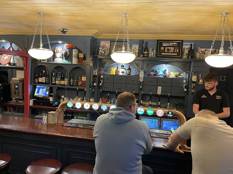
Pub with live music in town
Mill Haven, County Wexford, Irland
52° 23' 4" N 6° 26' 54.9" W
52.3844383 -6.4485947
• Head northeast on Mill Haven. Go for 36 m.
• Turn right onto Mill Haven. Go for 16 m.
• Turn right onto R741. Go for 5.2 km.
• Turn right onto R730. Go for 71 m.
• Turn left onto Skeffington Street. Go for 115 m.
• Turn left onto Selskar Street. Go for 31 m.
• Arrive at Selskar Street.
☍
5,5 km
( 7 min.)
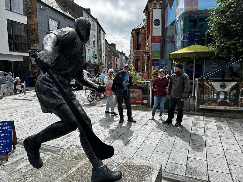
Wexford
City stroll, last purchases
Selskar Street, Wexford, County Wexford, Irland
52° 20' 29.4" N 6° 27' 49.6" W
52.3415114 -6.4637857
• Head toward Georges Street Lower on Selskar Street. Go for 54 m.
• Continue on North Main Street. Go for 64 m.
• Turn left onto Charlotte Street. Go for 80 m.
• Turn right onto Commercial Quay (R730). Go for 4.6 km.
• Pass 2 roundabouts and continue on Ballybrennan Big (N25). Go for 12.7 km.
• Arrive at Churchtown (N25). Your destination is on the right.
☍
17,5 km
( 17 min.)
Culleton‘s Pub und Restaurant
Dinner in the pub, very good food, enough space to park, also for motorhomes
Perfect and shorten the waiting time for the ferry
52.2419, -6.3562
52° 14' 30.8" N 6° 21' 22.3" W
52.2419000 -6.3562000
• Head east on Churchtown (N25). Go for 826 m.
• Take the 2nd exit from roundabout onto St Patrick's Road (N25) toward Chalafort Ros Láir/Rosslare Harbour. Go for 1.3 km.
• Take the 2nd exit from roundabout toward Criochfort Terminal. Go for 154 m.
• Turn sharp left. Go for 309 m.
• Turn right. Go for 183 m.
• Turn slightly left. Go for 31 m.
• Arrive at your destination on the left.
☍
2,8 km
( 5 min.)
Rosslare Harbour
Terminal for return journey
E 01, County Wexford, Irland
52° 15' 16.8" N 6° 20' 5.7" W
52.2546695 -6.3349261