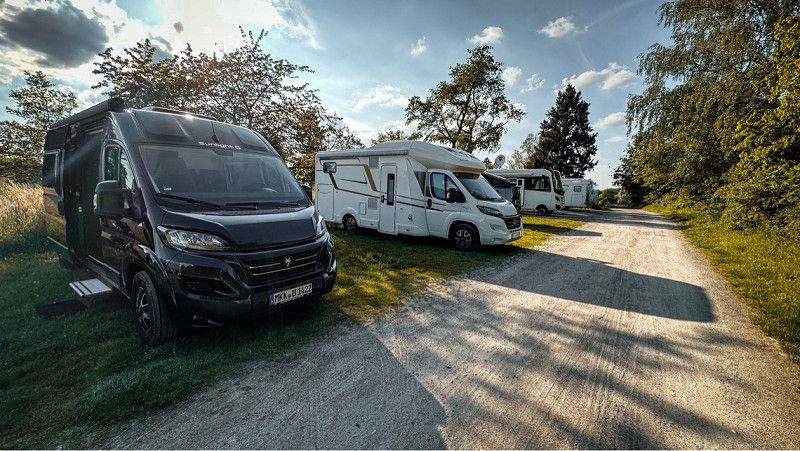
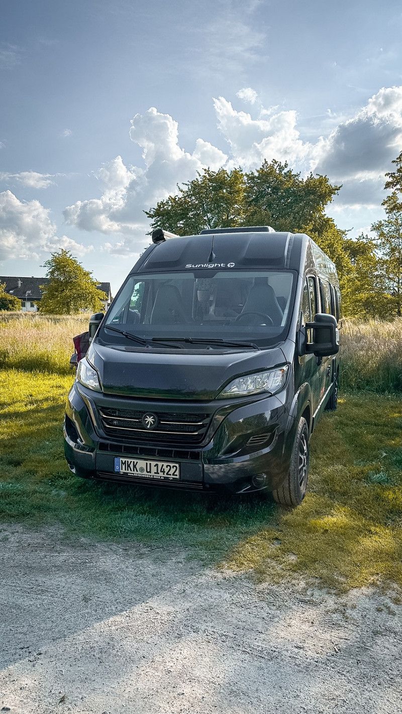
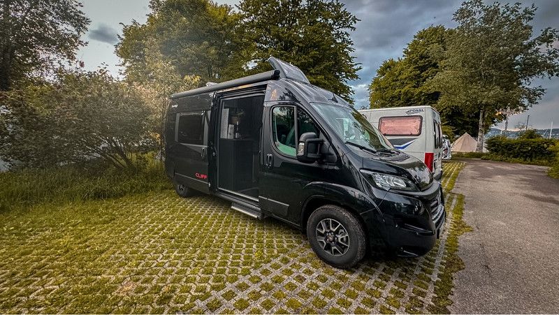
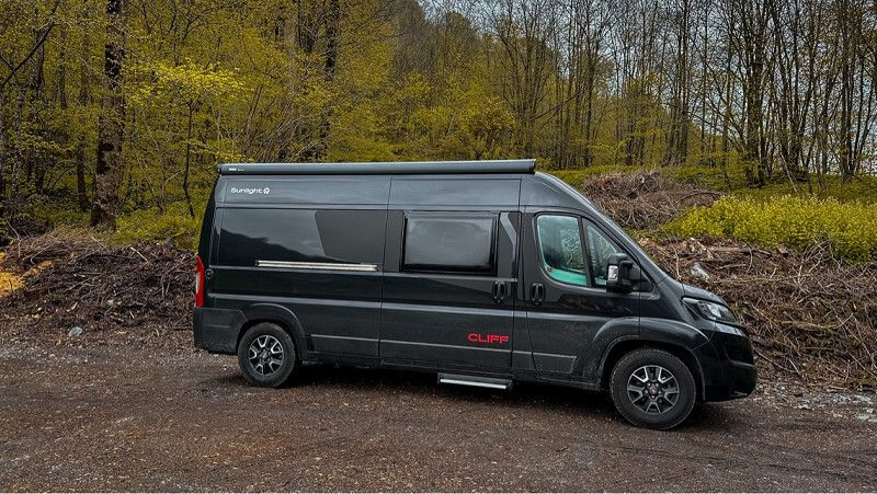
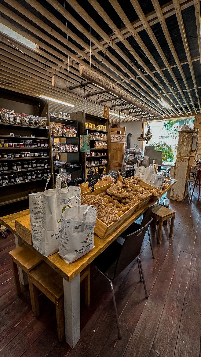
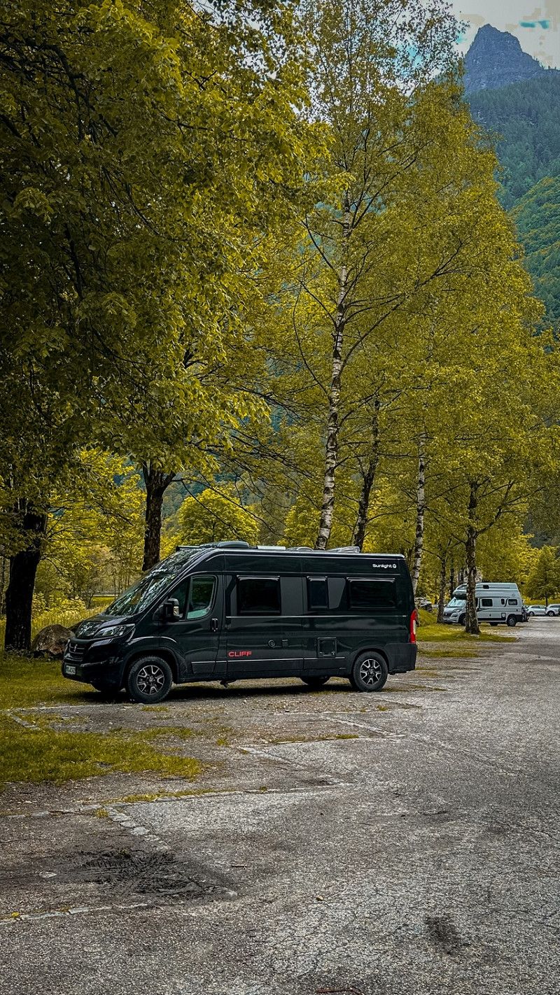
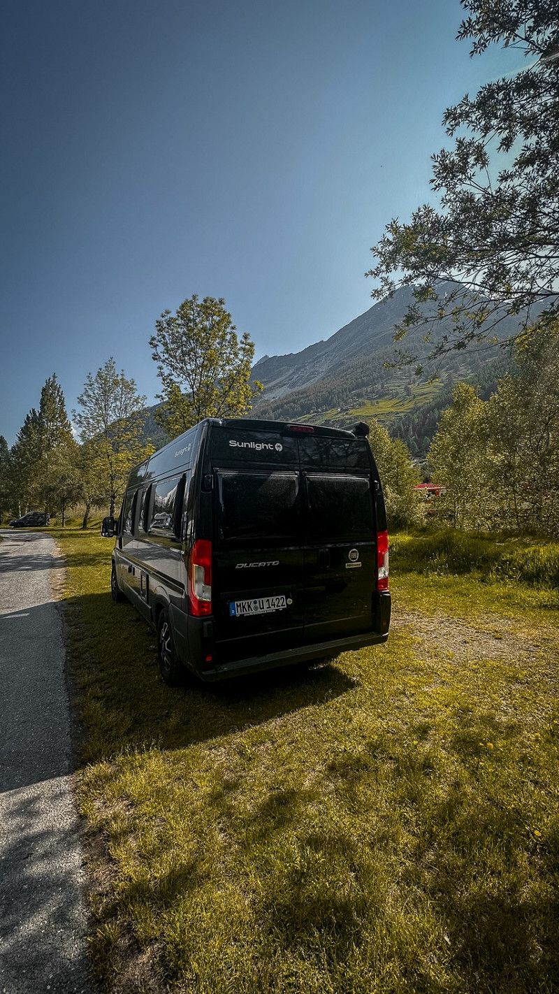
1. longer tour with our first own mobile home. In recent years we have always rented a mobile home. Now we have struck at short notice. We are as happy as Bolle.
Besides visiting friends, we just want to enjoy nature. Take photos, relax from everyday life. Maybe you're there.
Day
Homebase
Here we go! We left in the afternoon. I (Ric) had to work until noon.
Sinntal, Deutschland
50° 18' 45.6" N 9° 37' 25.2" E
50.3126669 9.6236534
• Head southwest on Schlüchterner Straße (L3180). Go for 2.9 km.
• Continue on Lindenstraße (L3180). Go for 5.2 km.
• Continue on L3329 toward Frankfurt/A66/Steinau a.d.Str./Schlüchtern. Go for 887 m.
• Turn left onto Hanauer Straße (L3329) toward A66/Steinau a.d.Str. Go for 4.4 km.
• Take ramp onto A66 toward Frankfurt. Go for 44.4 km.
• Take exit 43 toward Dieburg/A3/F. Kreuz/Flughafen/Hanau-Steinheim/Hanau-Wolfgang/B43A onto Hanauer Kreuz. Go for 1.7 km.
• Continue on B43A. Go for 7.4 km.
• Take ramp onto B45. Go for 1.9 km.
• Keep left onto B45 toward Flughafen/A3/Frankfurter Kreuz/Würzburg/Dieburg/Seligenstadt. Go for 1.5 km.
• Take ramp onto A3 toward Köln/F. Kreuz/Flughafen. Go for 19.7 km.
• Take exit 50 toward Basel/Darmstadt onto A5. Go for 23.6 km.
• Take the exit toward Basel/Karlsruhe/Heidelberg onto A5. Go for 109 km.
• Take exit 48 toward Karlsruhe-Süd/Rheinstetten/Messe KA/Gewerbegebiet Ettlingen onto B3. Go for 758 m.
• Take ramp onto B3 toward Rastatt/Malsch/Ettlingen-West/Rheinstetten/Gewerbegebiet Ettlingen. Go for 1.8 km.
• Keep left onto B3 toward Rastatt/Malsch. Go for 7.6 km.
• Turn left onto Murgtalstraße (L67) toward Gaggenau/Kuppenheim/Gewerbegebiet Mugg.-Vogesenstr. Go for 1.4 km.
• Take the 1st exit from roundabout onto L67. Go for 1.6 km.
• Take the 1st exit from roundabout onto Vogesenstraße. Go for 236 m.
• Arrive at Vogesenstraße. Your destination is on the right.
☍
236,5 km
(2 hrs. 19 min.)
Day
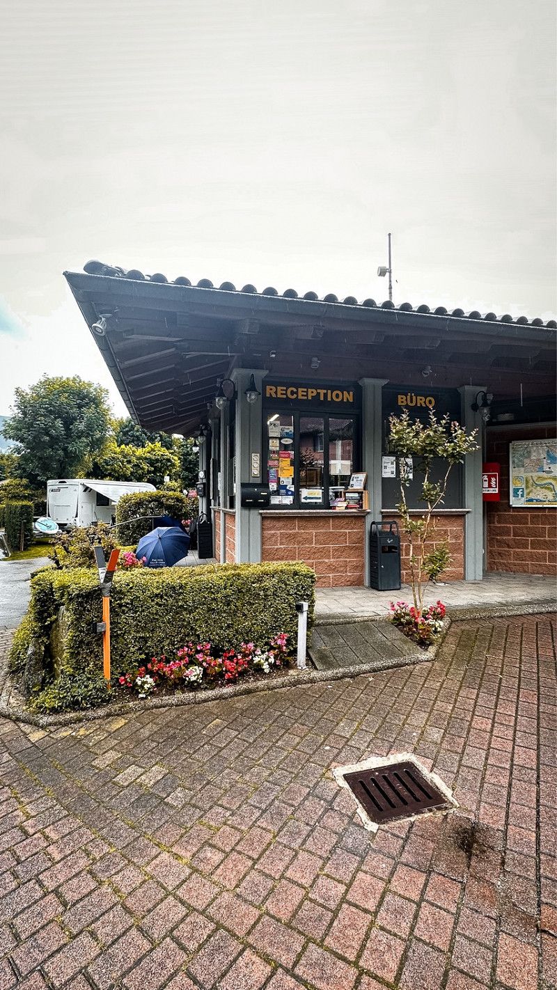
Stellplatz Muggensturm
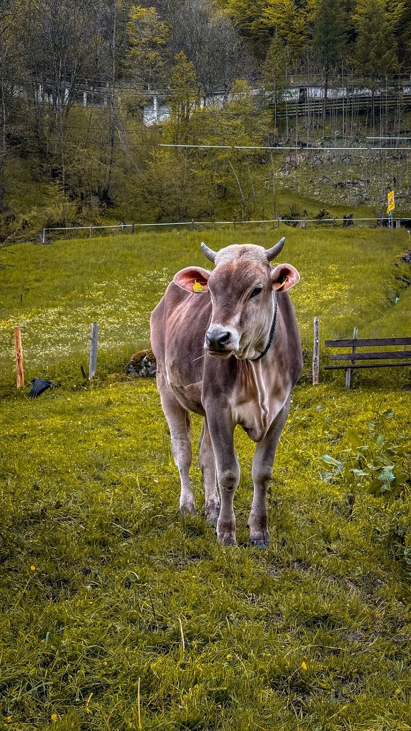
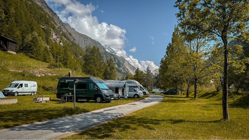
Day 1 - 1st pitch here in Muggensturm. Right on a small lake.
no service Space for 5 parking spaces on a meadow.
Tomorrow we're off to Zurich. We will head for Lake Zurich. To visit Zurich's old town during the day on Tuesday and meet friends in the evening.
Vogesenstraße 101
48° 52' 39.4" N 8° 17' 22.2" E
48.8776245 8.2894908
• Head northwest on Vogesenstraße. Go for 151 m.
• Take the 4th exit from roundabout onto Vogesenstraße. Go for 450 m.
• Take the 1st exit from roundabout onto L67. Go for 3.3 km.
• Turn left and take ramp onto B462 toward Rastatt/RA-Rauental. Go for 2.2 km.
• Take ramp onto A5 toward Basel. Go for 162 km.
• Take the exit toward Rheinfelden/Lörrach onto A98. Go for 16.6 km.
• Take exit 7 toward Schweiz/Rheinfelden-Mitte onto A861. Go for 4.6 km.
• Continue on A861. Go for 106 m.
• Continue toward A3. Go for 508 m.
• Take the left exit toward Zürich/Rheinfelden-Ost onto A3. Go for 42.0 km.
• Take the left exit toward Zürich/Baden onto A1/A3. Go for 16.1 km.
• Take exit 59 toward Chur/Luzern/Westring-Zürich onto A3/A4. Go for 10.4 km.
• Take left exit 31 toward San Bernardino/Chur/Zürich-City onto A3. Go for 5.2 km.
• Take the exit toward San Bernardino/Chur onto A3. Go for 1.8 km.
• Take exit 33 toward Wollishofen/Adliswil. Go for 393 m.
• Turn left onto Albisstrasse. Go for 2.1 km.
• Turn right onto Seestrasse. Go for 213 m.
• Turn right onto Seestrasse (3). Go for 966 m.
• Turn left onto Seestrasse. Go for 52 m.
• Turn left. Go for 16 m.
• Arrive at your destination on the right.
☍
269,3 km
(2 hrs. 29 min.)
Fischer's Fritz
Small campsite on Lake Zurich. With service. Costs 55 CHF. A small shop and restaurant is on site. There are a few benches right by the lake that invite you to linger. Public transport also goes to the center from here.
47° 20' 11" N 8° 32' 28.1" E
47.3363953 8.5411293
• Head toward Seestrasse. Go for 16 m.
• Turn right onto Seestrasse. Go for 52 m.
• Turn right onto Seestrasse (3). Go for 954 m.
• Continue on Mythenquai (3). Go for 1.5 km.
• Turn left onto Alfred-Escher-Strasse (3). Go for 1.6 km.
• Turn right onto Stauffacherquai. Go for 304 m.
• Continue on Stauffacherquai. Go for 247 m.
• Continue on Kasernenstrasse. Go for 433 m.
• Turn right onto Gessnerbrücke. Go for 51 m.
• Continue on Usteribrücke. Go for 80 m.
• Continue on Usteristrasse. Go for 297 m.
• Continue on Bahnhofplatz. Go for 219 m.
• Arrive at Bahnhofplatz.
☍
5,7 km
( 10 min.)
Day
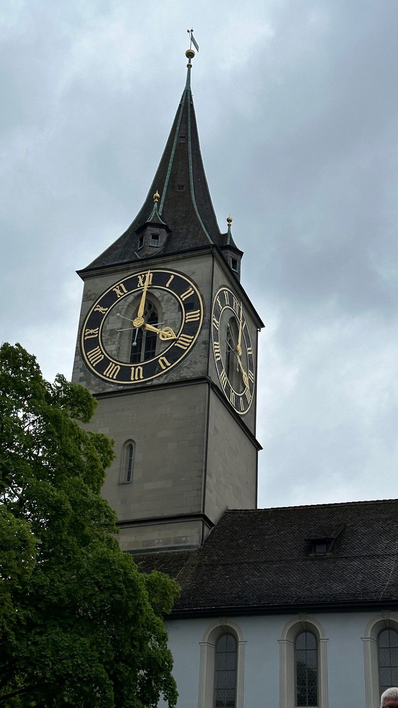
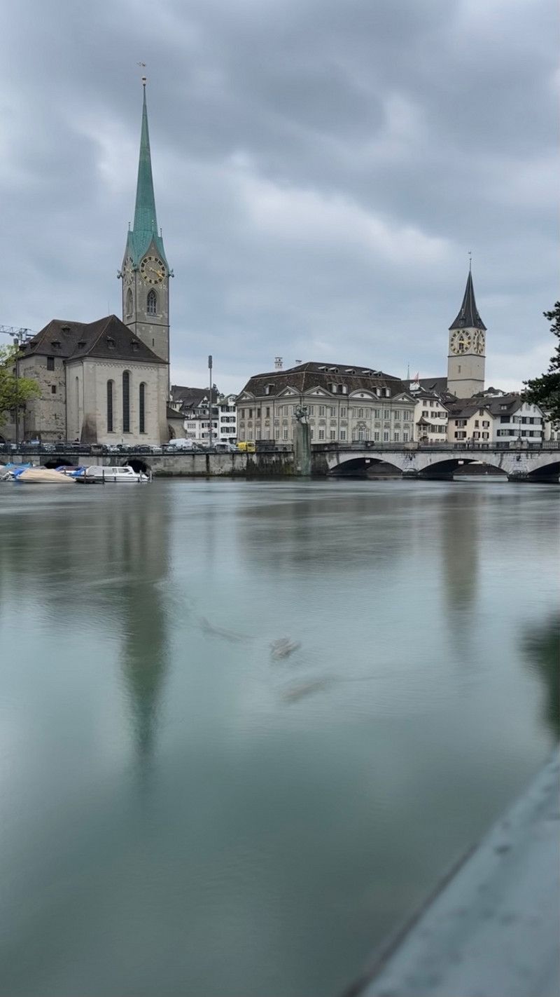
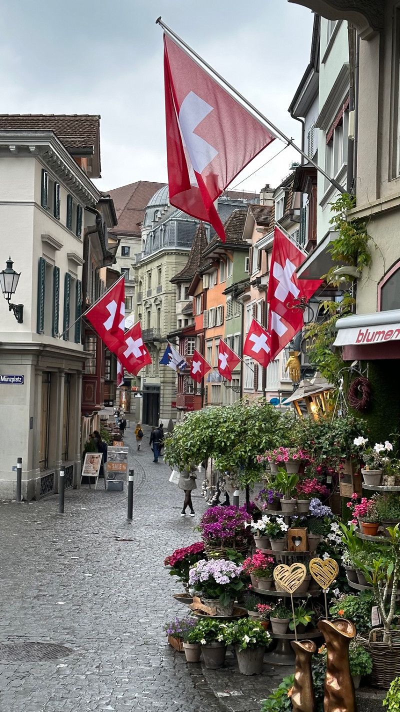
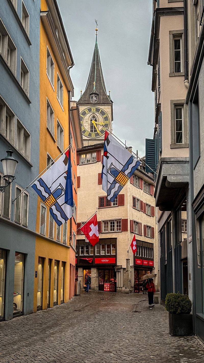
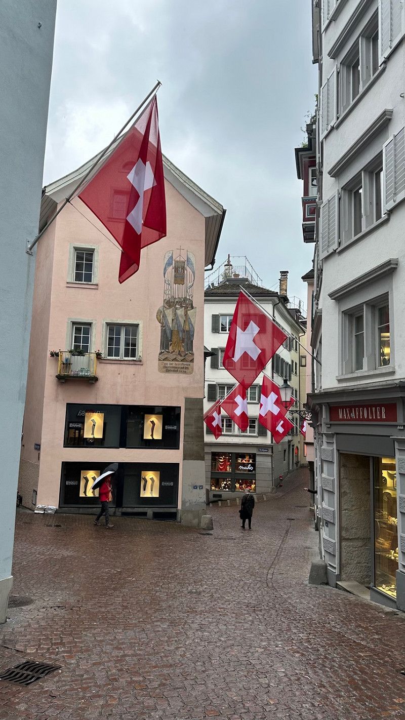
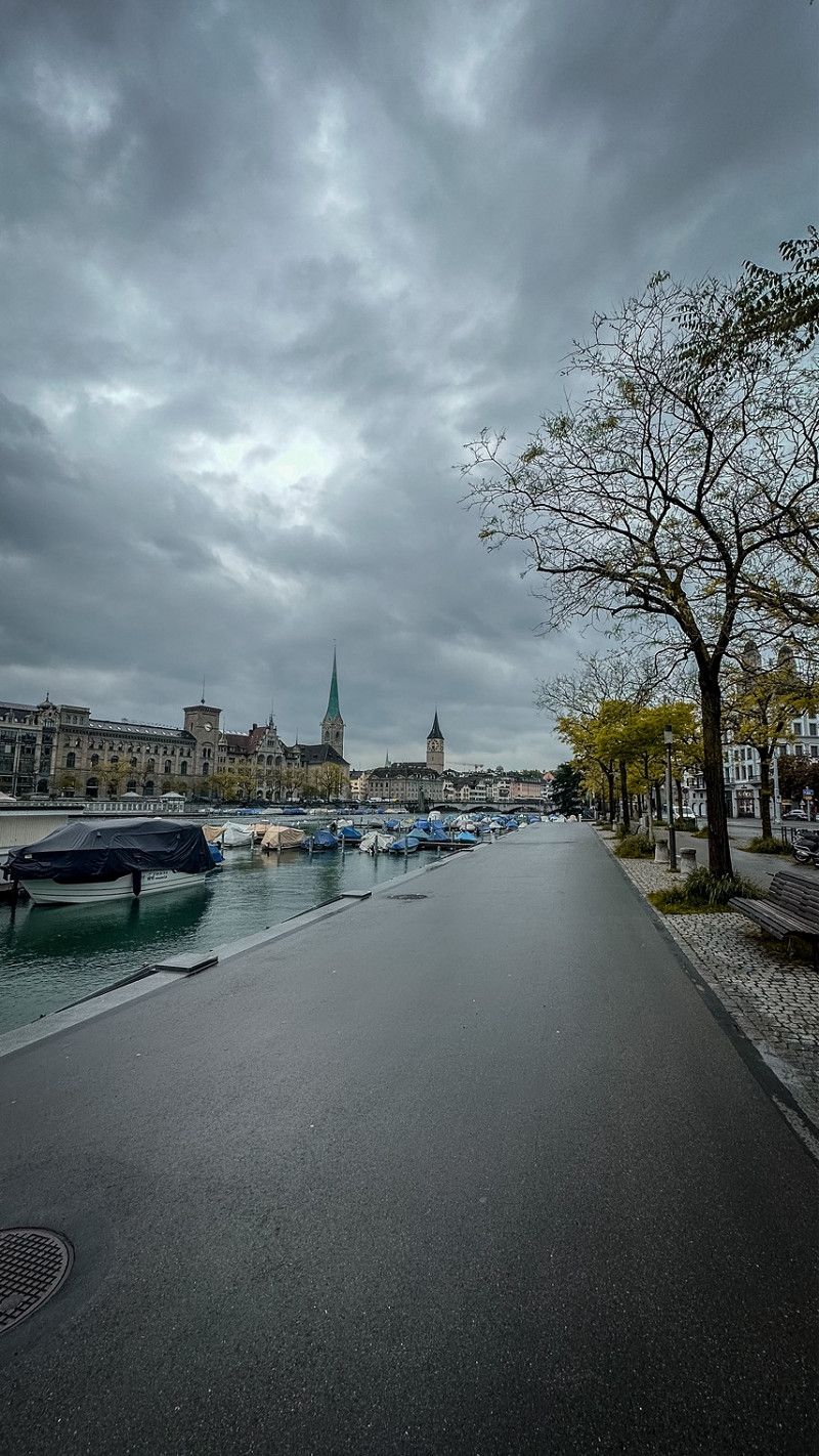
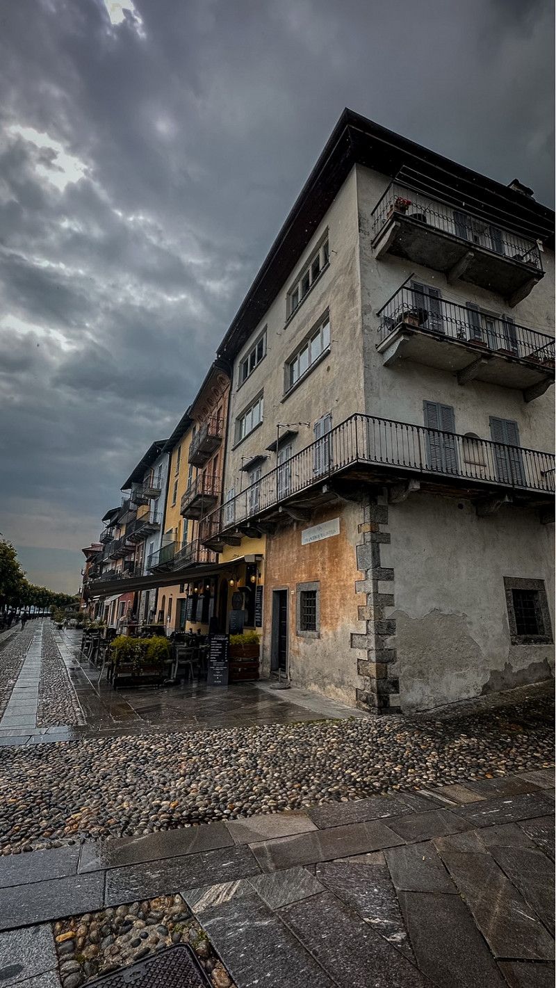
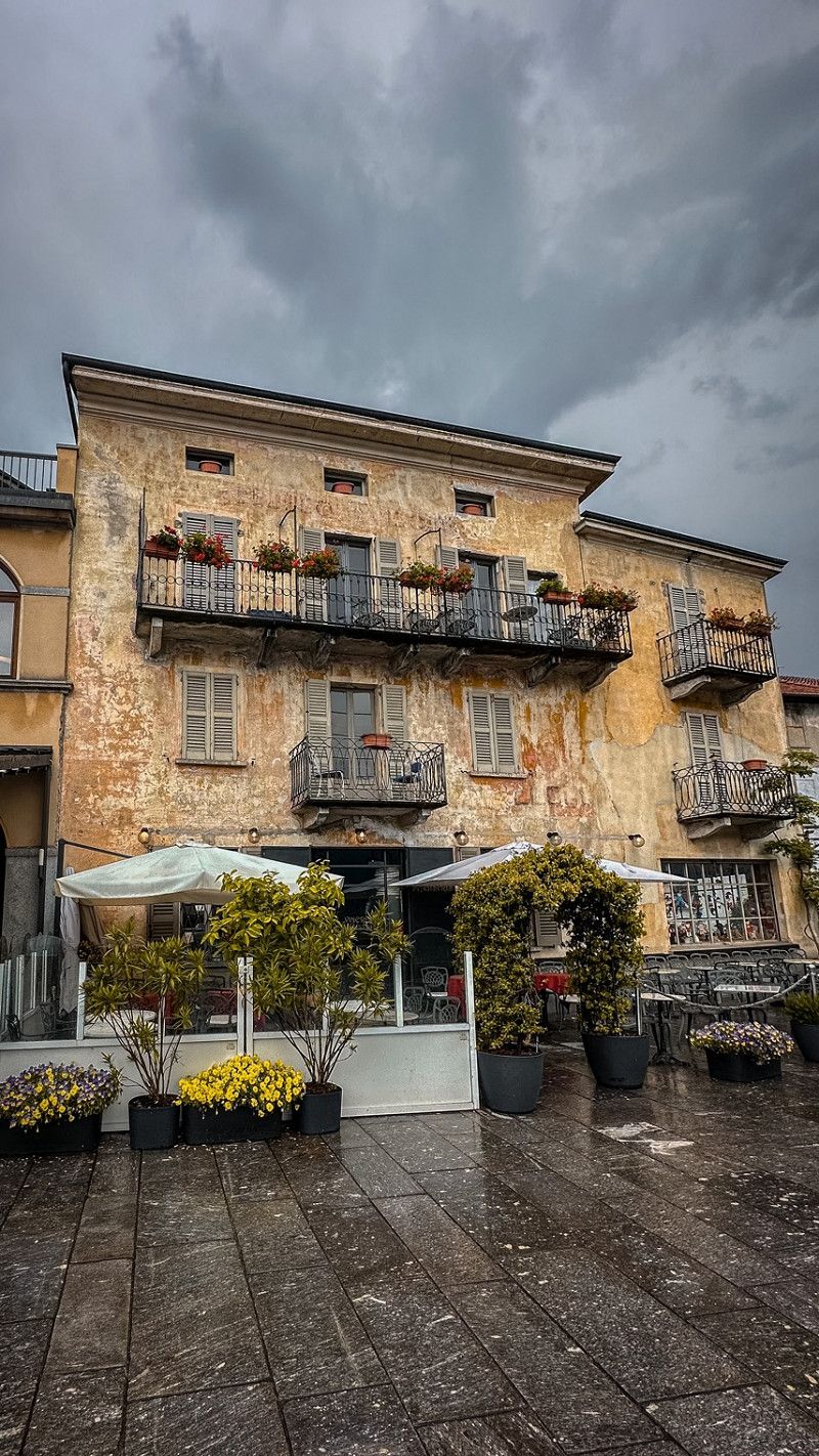
Zürich, Schweiz
It had rained quite a bit in the morning until the afternoon. So we had to spend the time in the van. Not bad - time to read. In the afternoon we walked into town.
We parked in Dufourstrasse directly on Lake Zurich. You can also walk well from Cp Fischers Fritz. Driving the WoMo in the city is a bit exhausting.
47° 22' 36.8" N 8° 32' 30.1" E
47.3768866 8.5416940
• Head toward Bahnhofquai on Bahnhofplatz. Go for 10 m.
• Make a U-Turn at Bahnhofquai onto Bahnhofplatz. Go for 356 m.
• Turn left onto Gessnerallee. Go for 651 m.
• Continue on Selnaustrasse. Go for 262 m.
• Continue on Sihlhölzlistrasse. Go for 320 m.
• Turn right onto Sihlhölzlibrücke (3). Go for 259 m.
• Continue on Manessestrasse (4). Go for 159 m.
• Keep left onto A3W toward A3. Go for 3.3 km.
• Continue on A3. Go for 13.0 km.
• Take exit 35 toward Horgen/Hirzel. Go for 474 m.
• Take the 1st exit from roundabout onto Zugerstrasse (388) toward Luzern/Hirzel. Go for 1.1 km.
• Turn right onto Zugerstrasse (388) toward Luzern. Go for 2.5 km.
• Turn left onto Schönenbergstrasse toward Schönenberg. Go for 1.3 km.
• Continue on Müsli. Go for 177 m.
• Continue on Hirzelstrasse. Go for 9 m.
• Continue on Nussbäumen. Go for 241 m.
• Continue on Hirzelstrasse. Go for 821 m.
• Turn right onto Gubel. Go for 24 m.
• Arrive at Gubel. Your destination is on the right.
☍
24,9 km
( 21 min.)
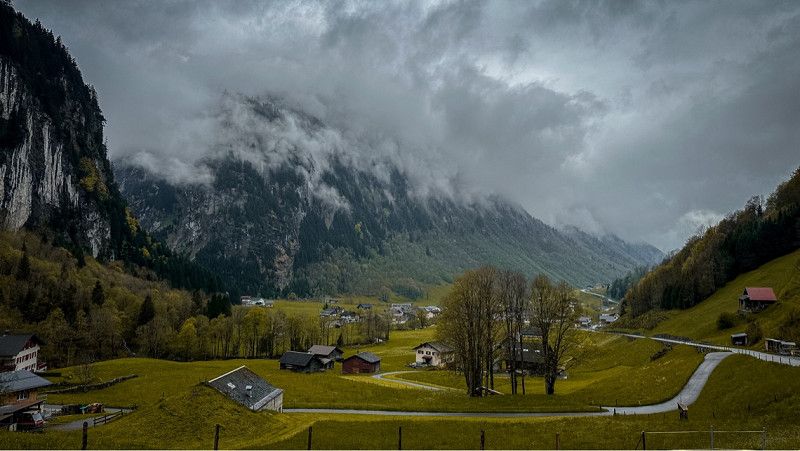
Day
Blick auf die Hirzel Höhi
Gubel 1
47° 11' 46.6" N 8° 37' 32.7" E
47.1962891 8.6257569
• Head south on Gubel. Go for 178 m.
• Continue on Säge. Go for 610 m.
• Continue on Neumatt. Go for 333 m.
• Continue on Rain. Go for 212 m.
• Continue toward Neuhaus. Go for 305 m.
• Continue on Neuhaus. Go for 45 m.
• Turn right onto Haslaubstrasse. Go for 1.9 km.
• Turn right toward Ziegelhüsli. Go for 284 m.
• Continue on Ziegelhüsli. Go for 525 m.
• Continue on Bostadel. Go for 796 m.
• Continue on Neudorfstrasse. Go for 3.2 km.
• Turn left onto Hauptstrasse. Go for 1.7 km.
• Turn left onto Edlibachstrasse. Go for 3.3 km.
• Turn left onto 381. Go for 2.6 km.
• Take the 2nd exit from roundabout onto Zugerstrasse (381). Go for 283 m.
• Turn right toward Zugerbergstrasse. Go for 69 m.
• Turn right onto Zugerbergstrasse. Go for 23 m.
• Turn sharp left onto Lorzenstrasse. Go for 10 m.
• Arrive at Lorzenstrasse.
☍
16,3 km
( 19 min.)
Unterägeri, Schweiz
Great view of the lake. We just drove by.
47° 8' 12.5" N 8° 34' 59.1" E
47.1368093 8.5830915
• Head toward Höfnerstrasse on Lorzenstrasse. Go for 124 m.
• Turn left onto Höfnerstrasse. Go for 94 m.
• Turn right onto Seestrasse (381). Go for 10.1 km.
• Turn left onto 371. Go for 104 m.
• Take ramp onto Schlagstrasse (8). Go for 8.6 km.
• Take the 1st exit from roundabout onto 2/8. Go for 199 m.
• Take ramp onto A4 toward Gotthard/Altdorf/Brunnen. Go for 9.7 km.
• Take the 1st exit from roundabout onto Axenstrasse (A4). Go for 7.6 km.
• Take the 3rd exit from roundabout onto Flüelerstrasse (2) toward Altdorf/Klausenpass. Go for 2.9 km.
• Take the 2nd exit from roundabout onto Gotthardstrasse (2). Go for 218 m.
• Take the 2nd exit from roundabout onto Klausenstrasse (17). Go for 12.5 km.
• Arrive at Klausenstrasse (17). Your destination is on the left.
☍
52,1 km
( 56 min.)
P4N Parkplatz Unterschächen
Unfortunately, since there is a festival on site on the public parking lot, we could have stood, but we didn't want to. That's why we avoided here.
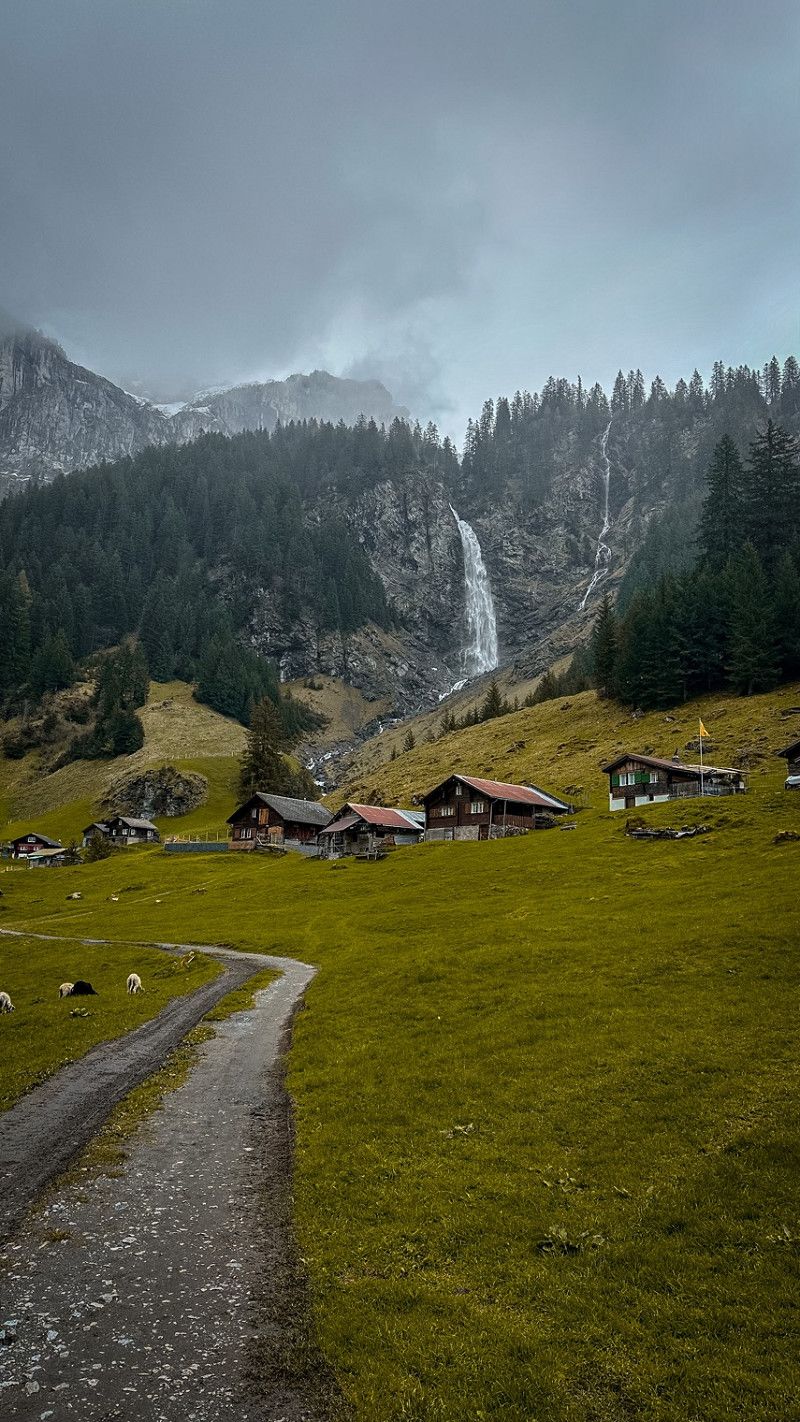
Starting point for hiking to the Stäubifall.
Klausenstrasse 37
46° 51' 53.2" N 8° 46' 48.1" E
46.8647766 8.7800259
• Head southeast on Klausenstrasse (17). Go for 523 m.
• Arrive at Höll (17).
☍
0,5 km
( )
Stäubifall, Unterschächen, Schweiz
6465 Unterschächen, Schweiz
46° 51' 50.1" N 8° 49' 5.5" E
46.8639153 8.8181857
• Head toward Ruogig on Höll (17). Go for 12.9 km.
• Take the 2nd exit from roundabout onto Gotthardstrasse (2). Go for 246 m.
• Turn right onto Grenzgasse. Go for 449 m.
• Arrive at Grenzgasse. Your destination is on the right.
☍
13,6 km
( 17 min.)
Begegnungshof by Herger
We decided at short notice to go back to Altdorf in the canton of Uri. And we stay here 2 nights. With farm shop. Costs 20 CHF per night. Shower and toilet on site. Electricity and water.
https://www.byherger.ch
Grenzgasse 8
46° 52' 23.4" N 8° 38' 39.8" E
46.8731689 8.6443994
• Head toward Pfistergasse on Grenzgasse. Go for 449 m.
• Turn left onto Gotthardstrasse (2). Go for 198 m.
• Take the 1st exit from roundabout onto Klausenstrasse (17). Go for 1.4 km.
• Turn right onto Kirchplatz. Go for 12 m.
• Arrive at Kirchplatz.
☍
2,0 km
( 3 min.)
Day
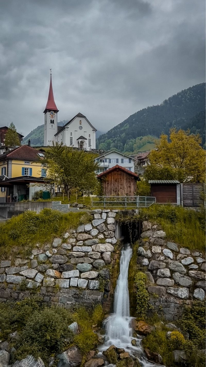
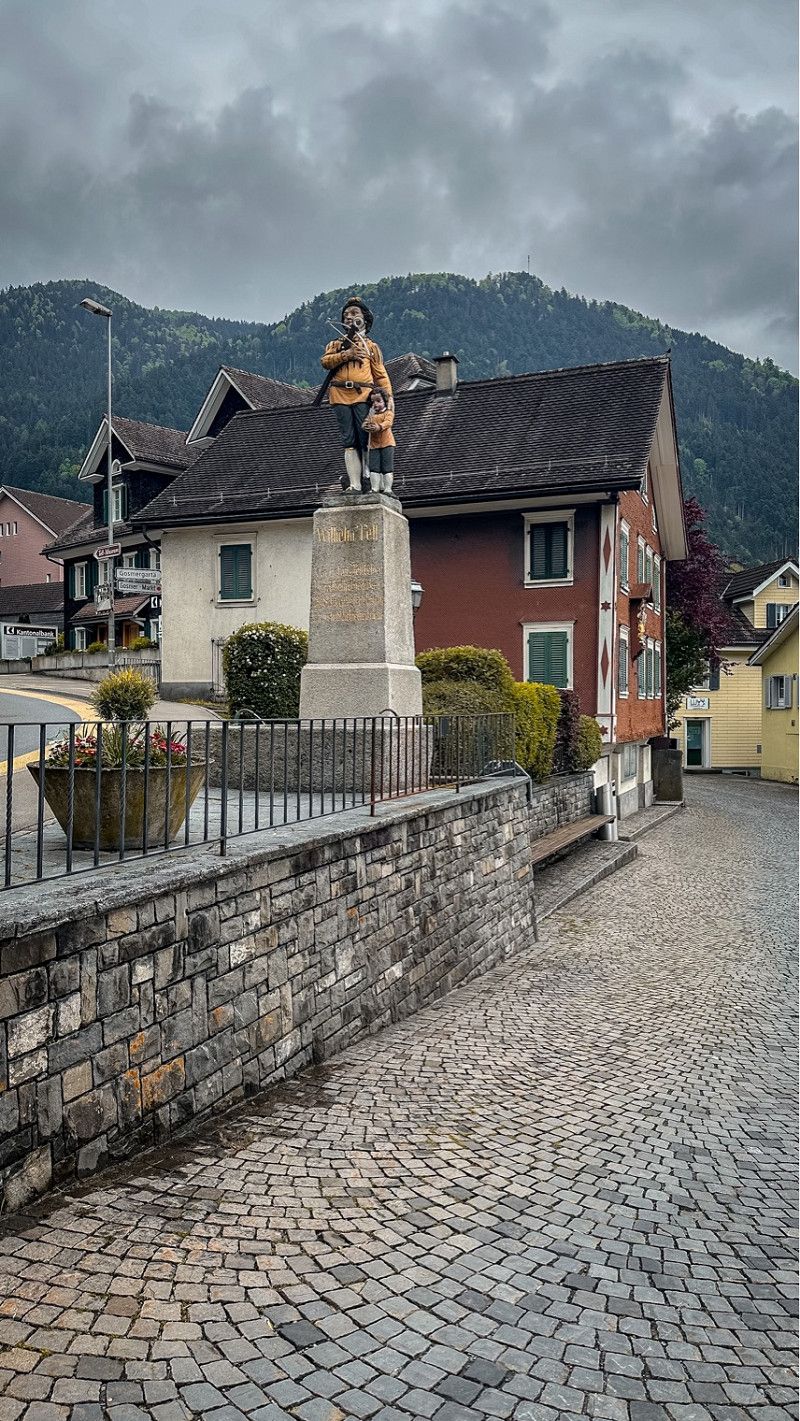
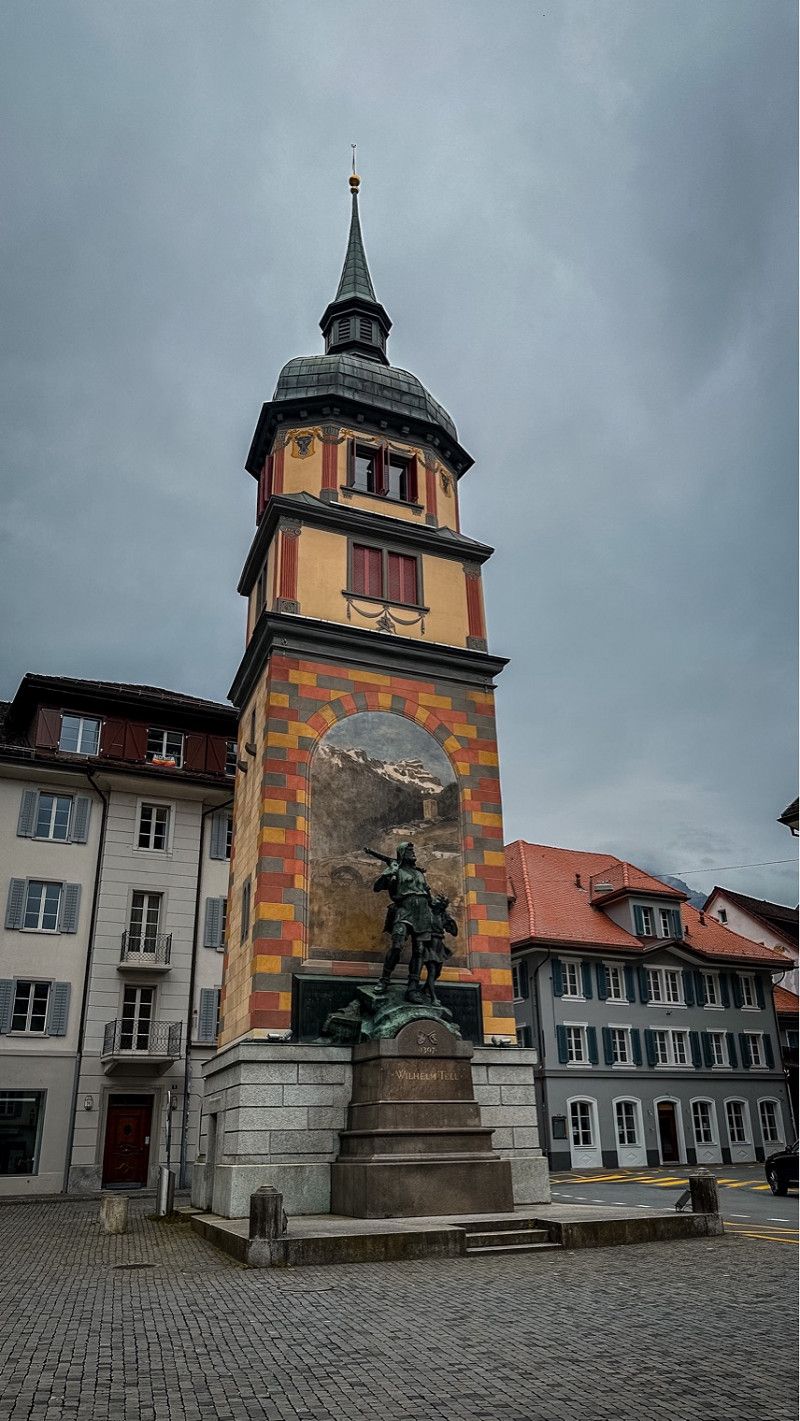
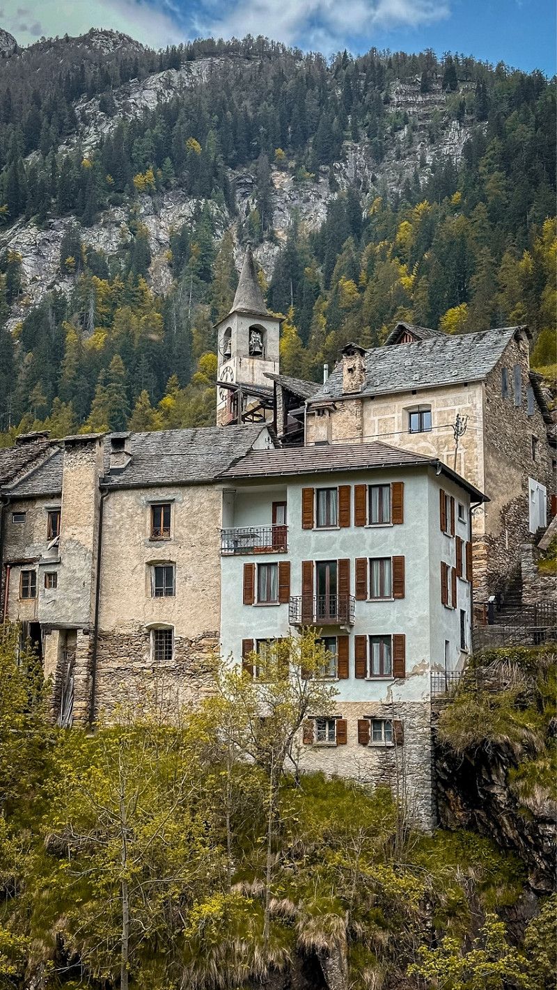
Bürglen - auf Tell‘s Spuren
Tell's hometown. We walked from Altdorf to Bürglen. Past Tell's home and into Tell's museum. A bit of culture is a must.
Kirchplatz 1
46° 52' 31" N 8° 39' 46.3" E
46.8752747 8.6628537
• Head toward Klausenstrasse on Kirchplatz. Go for 12 m.
• Turn left onto Klausenstrasse (17). Go for 1.3 km.
• Take the 1st exit from roundabout onto Gotthardstrasse (2). Go for 209 m.
• Take the 2nd exit from roundabout onto Gotthardstrasse (2). Go for 858 m.
• Arrive at Tellsgasse (2). Your destination is on the right.
☍
2,4 km
( 4 min.)
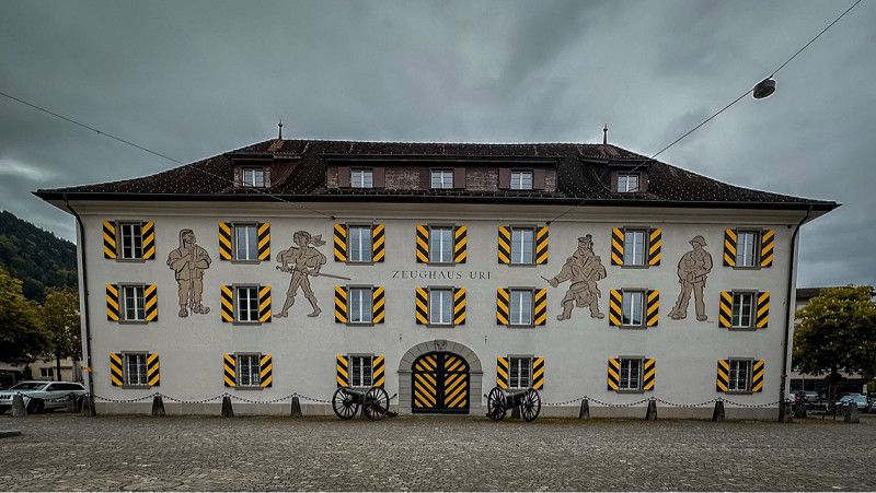
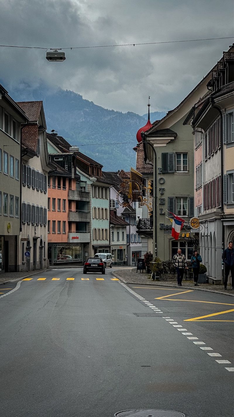
Altdorf, Schweiz
Of course, a short tour of the city was a must.
6460 Altdorf, Schweiz
46° 52' 55.7" N 8° 38' 34.2" E
46.8821272 8.6428436
• Head northwest on Tellsgasse (2). Go for 2.0 km.
• Take the 3rd exit from roundabout onto A4 toward Gotthard/Luzern. Go for 414 m.
• Take ramp onto A2 toward Lugano/Gotthard. Go for 55.7 km.
• Take exit 42 toward Quinto/Ambrì-Piotta/Rodi/Dalpe. Go for 408 m.
• Turn right onto Via San Gottardo (2). Go for 3.0 km.
• Arrive at Via San Gottardo (2). Your destination is on the left.
☍
61,5 km
( 53 min.)
Day
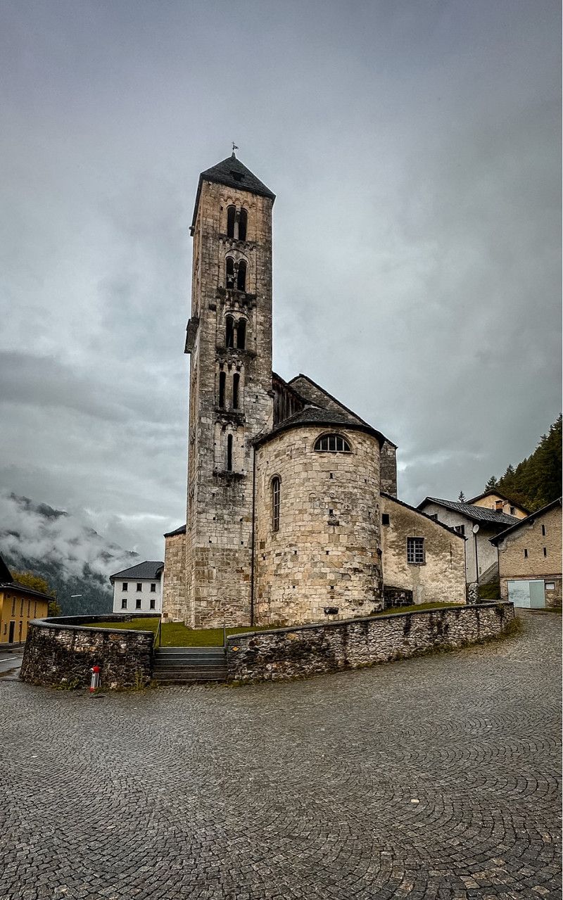
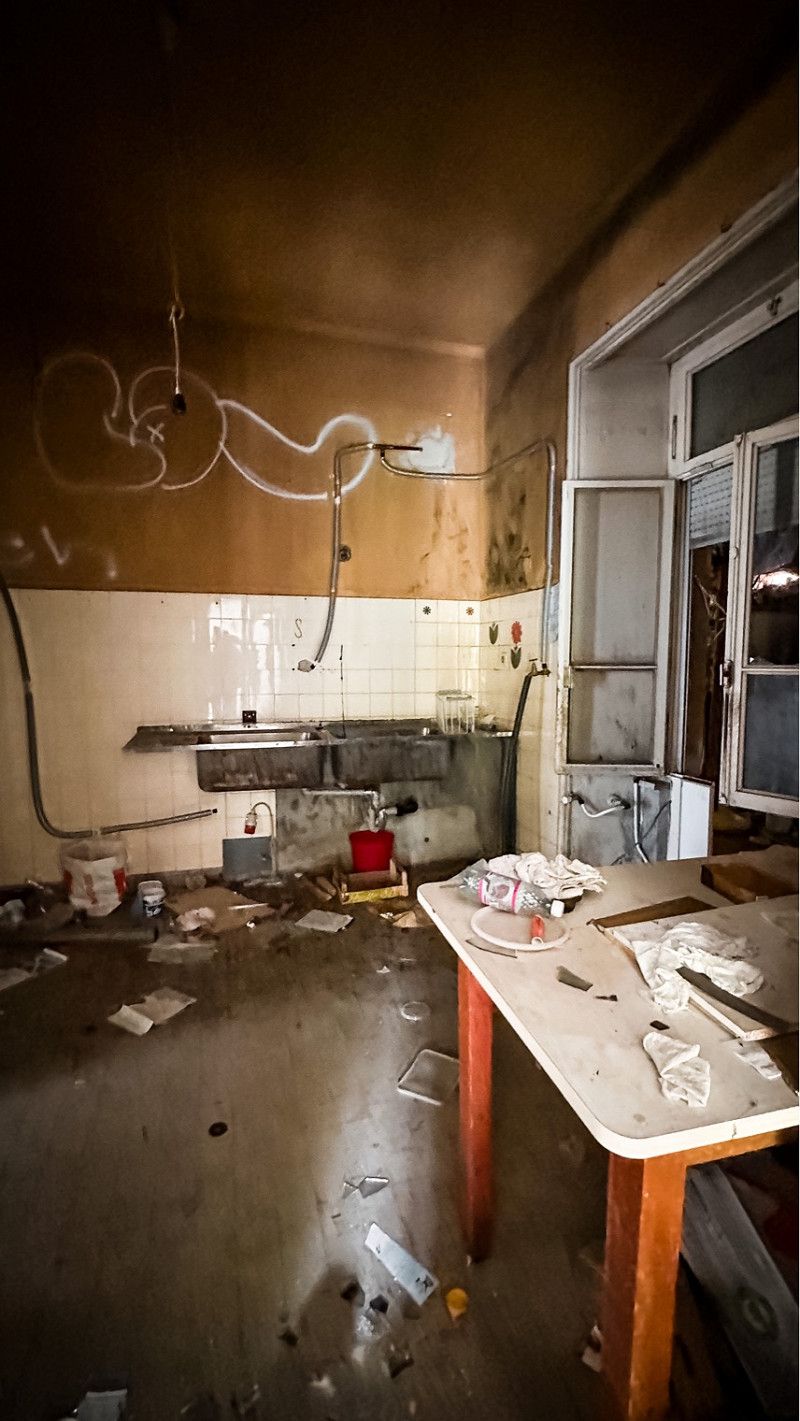
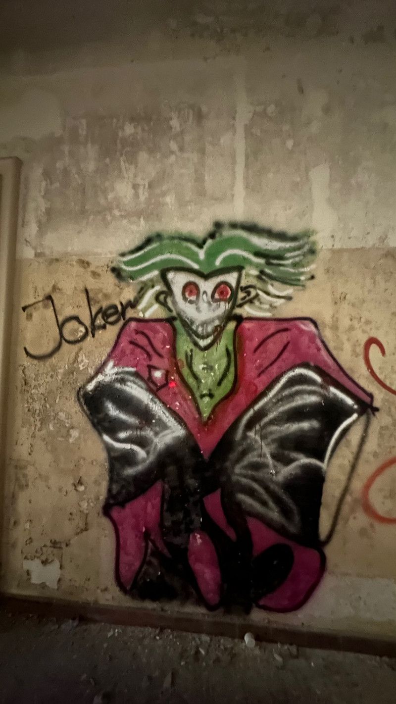
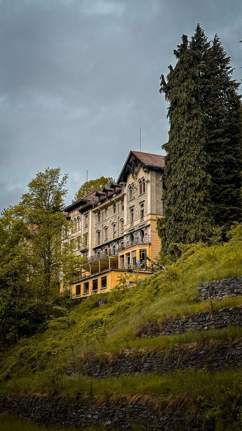
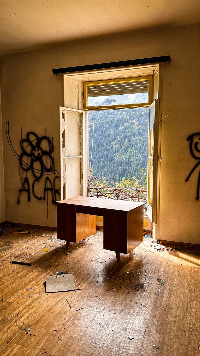
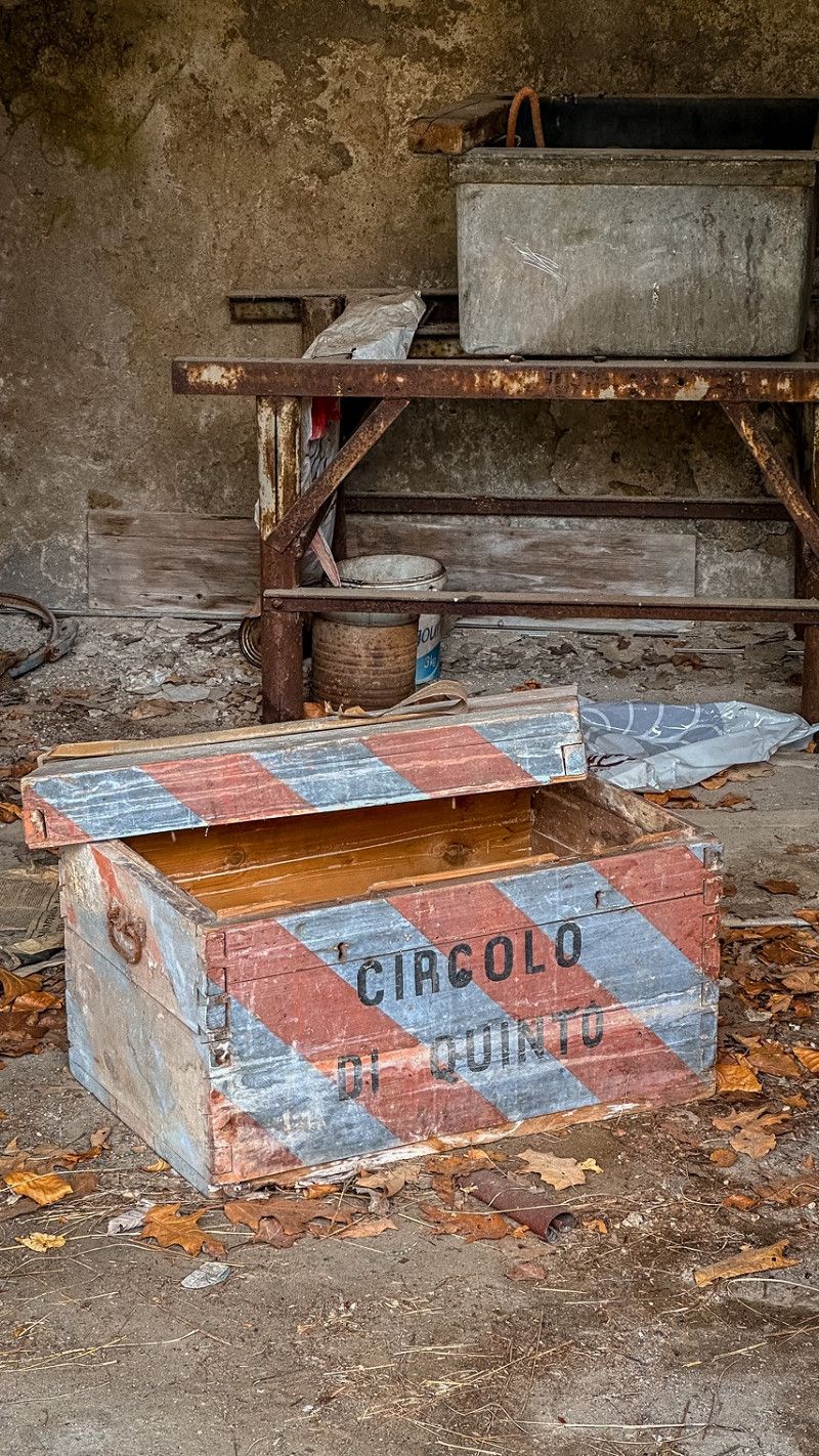
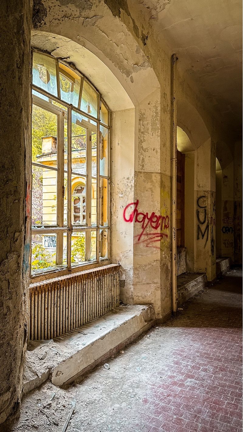
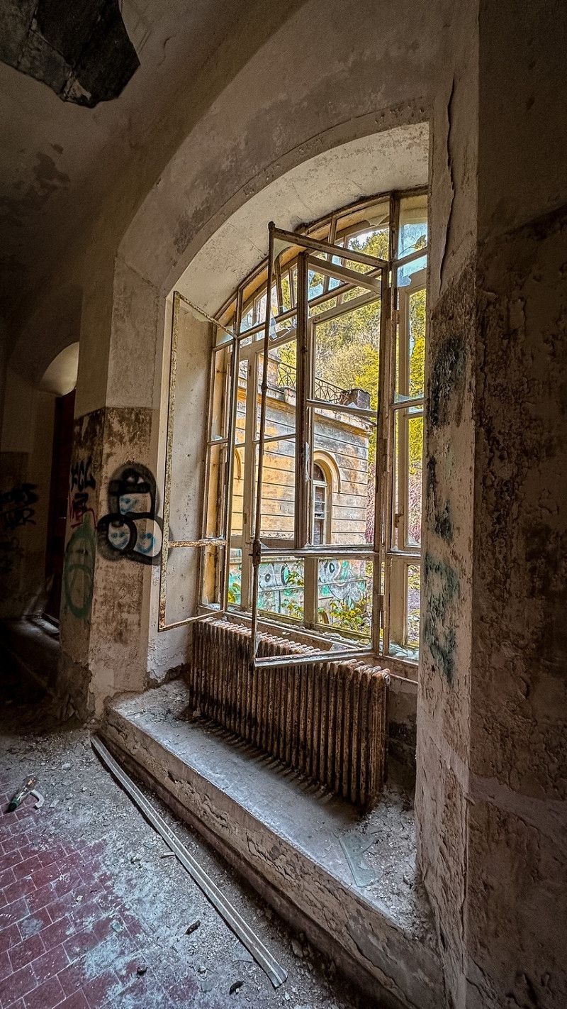
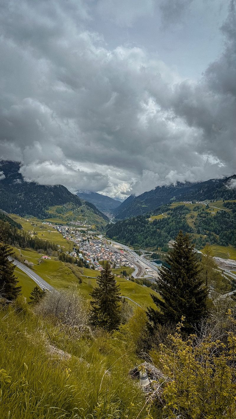
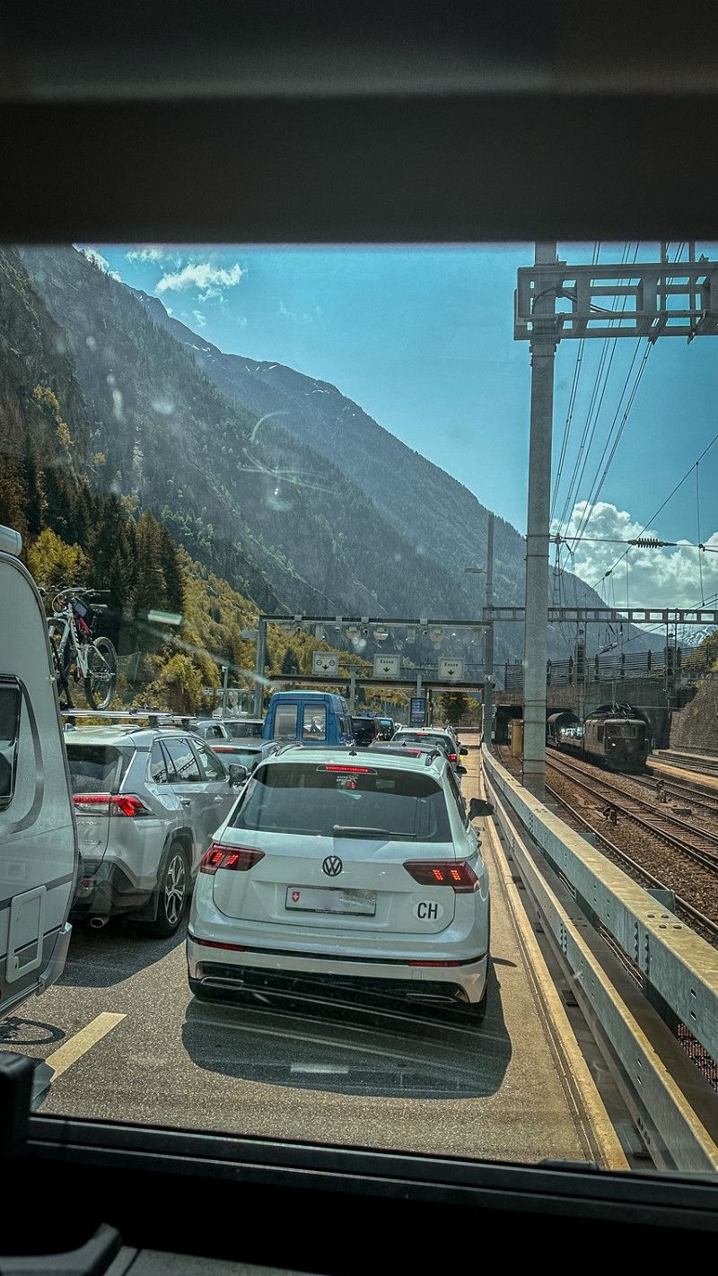
Quinto, Schweiz
We drove past a nice little place called Quinto. But that's not all. Anyone who knows us knows something Lost Place is a must.
46° 30' 35.9" N 8° 41' 34.5" E
46.5099625 8.6929161
• Head toward Via alla Fiera on Via San Gottardo (2). Go for 8.6 km.
• Turn right onto 2. Go for 1.1 km.
• Continue on 2. Go for 1.6 km.
• Arrive at 2. Your destination is on the right.
☍
11,3 km
( 13 min.)
Parkplatz oberhalb von Airolo
At noon at 12 o'clock we make breakfast in this beautiful little place. Enjoy our van and the view with the sliding door open.
Hauptstrasse 2
46° 31' 56.6" N 8° 35' 23.1" E
46.5323792 8.5897421
• Head south on 2. Go for 1.6 km.
• Continue on Bedrína (2). Go for 1.1 km.
• Turn left onto Via San Gottardo (2). Go for 1.3 km.
• Turn right onto Via San Gottardo. Go for 413 m.
• Take the 1st exit from roundabout onto 413. Go for 1.0 km.
• Turn right toward San Gottardo. Go for 199 m.
• Continue on A2. Go for 226 m.
• Take the 1st exit from roundabout onto A2 toward Milano/Lugano/Bellinzona. Go for 9.7 km.
• Take exit 42 toward Quinto. Go for 330 m.
• Turn left toward A2. Go for 81 m.
• Turn left and take ramp onto A2 toward Zürich/Luzern/San Gottardo. Go for 27.5 km.
• Take exit 40 toward Andermatt. Go for 974 m.
• Pass 3 roundabouts and continue on Gotthardstrasse (2). Go for 14.3 km.
• Turn right onto 561. Go for 2.9 km.
• Turn left onto 561. Go for 785 m.
• Arrive at 561. Your destination is on the right.
☍
62,3 km
(1 hrs. 6 min.)
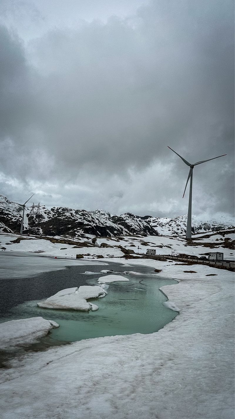
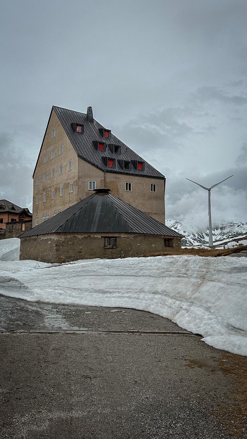
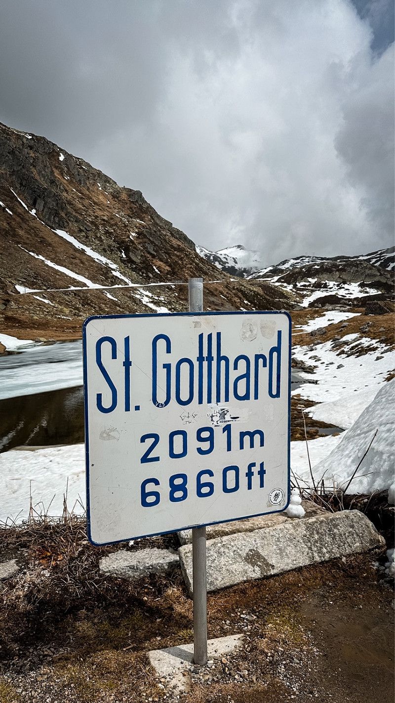
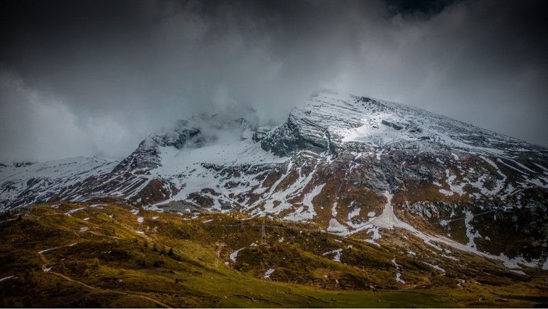
Gotthardpass
We drove up the old road. Totally a lot of beautiful switchbacks. The sun greets us up here, so we decided to sleep up here.
Vier Quellen Weg
46° 33' 24.9" N 8° 34' 1.2" E
46.5569153 8.5670096
• Head northwest on 561. Go for 3.7 km.
• Turn left onto 2. Go for 4.9 km.
• Turn right. Go for 155 m.
• Turn right toward Alte Gotthardstrasse. Go for 342 m.
• Continue on Alte Gotthardstrasse. Go for 456 m.
• Take the 1st exit from roundabout onto Gotthardstrasse (2/19) toward Oberalppass/Andermatt. Go for 3.4 km.
• Pass 2 roundabouts. Go for 5.3 km.
• Take ramp onto A2 toward Gotthard/Lugano/Airolo. Go for 28.0 km.
• Take exit 42 toward Quinto/Ambrì-Piotta/Rodi/Dalpe. Go for 408 m.
• Turn left onto 2. Go for 3.5 km.
• Arrive at 2.
☍
50,0 km
( 47 min.)
Day
Auf der Strecke nach Lavertezzo
Hauptstrasse 2
46° 29' 29.5" N 8° 45' 29.7" E
46.4915161 8.7582392
• Head southeast on 2. Go for 14.6 km.
• Arrive at Via San Gottardo (2). Your destination is on the right.
☍
14,6 km
( 14 min.)
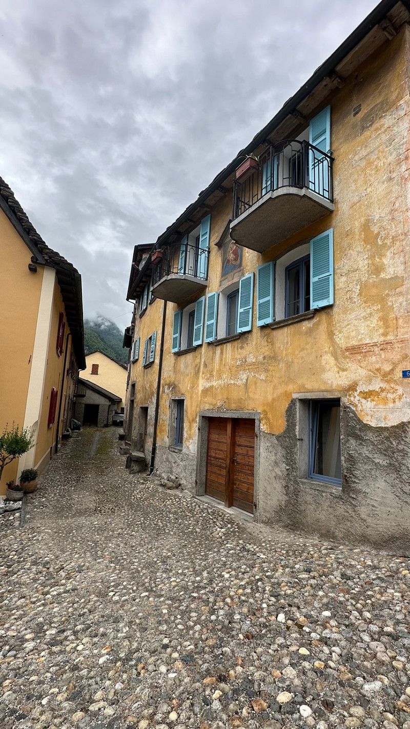
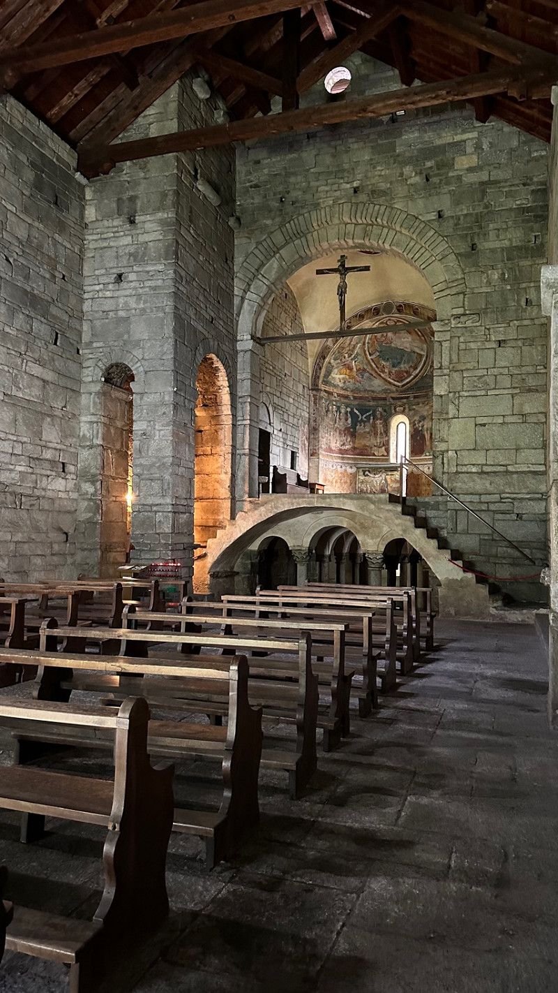
Giornico
Via S Gottardo 57
46° 24' 13.9" N 8° 52' 25.1" E
46.4038696 8.8736466
• Head toward Via alla Torre on Via San Gottardo (2). Go for 1.8 km.
• Turn right onto Via Industrie. Go for 564 m.
• Turn right toward A2. Go for 37 m.
• Take the 2nd exit from roundabout onto A2. Go for 6.6 km.
• Take exit 44 toward Lucomagno/Bellinzona onto 408. Go for 946 m.
• Continue on Via della Pietra (408). Go for 3.4 km.
• Continue on Via Cantonale (408). Go for 3.1 km.
• Take the 2nd exit from roundabout onto Via Cantonale (408). Go for 2.5 km.
• Arrive at Via Cantonale (408). Your destination is on the right.
☍
18,8 km
( 17 min.)
Auf der Strecke nach Bellinzona
Via Cantonale 5
46° 16' 30.7" N 8° 59' 19" E
46.2752075 8.9886154
• Head toward Via delle Vigne on Via Cantonale (408). Go for 1.1 km.
• Continue on El Stradón (408). Go for 2.1 km.
• Continue on Via Cantonale (408). Go for 3.9 km.
• Take the 2nd exit from roundabout onto Via Cantonale (408). Go for 552 m.
• Turn right onto Via Galbisio. Go for 2.4 km.
• Take the 1st exit from roundabout onto Via Birreria. Go for 1.2 km.
• Continue on El Stradún. Go for 389 m.
• Turn right onto El Stradún (13). Go for 9.9 km.
• Take the 1st exit from roundabout onto Via Cantonale (13). Go for 537 m.
• Continue on Via San Gottardo (13). Go for 1.7 km.
• Turn right onto Via San Gottardo. Go for 16 m.
• Continue on Via Valle Verzasca. Go for 9.2 km.
• Continue on Fo Pra di Bèri. Go for 2.1 km.
• Continue on Lavertezzo Paese. Go for 321 m.
• Continue on Lavertezzo-Valle. Go for 654 m.
• Continue on Aquino. Go for 1.8 km.
• Continue on Motta. Go for 1.3 km.
• Continue on Chiossetto. Go for 111 m.
• Continue on Ganne. Go for 1.1 km.
• Continue on Pianésc. Go for 494 m.
• Continue on Piée. Go for 211 m.
• Continue toward Via Cantonale. Go for 232 m.
• Continue on Via Cantonale. Go for 730 m.
• Continue on Alnasca. Go for 1.1 km.
• Continue on Prato Maggiore. Go for 842 m.
• Continue on Gerra. Go for 66 m.
• Continue on Formighera. Go for 359 m.
• Continue on Gerra. Go for 1.6 km.
• Continue on Efra. Go for 171 m.
• Continue on Strada Cantonale. Go for 155 m.
• Continue on Strada Cantonale. Go for 2.4 km.
• Continue on Strada Cantonale. Go for 96 m.
• Turn right onto Strada de Vegornèss. Go for 216 m.
• Arrive at your destination on the left.
☍
49,0 km
(1 hrs. 4 min.)
Sonogno
They are officially hers in a parking lot in the village. Disposal and fresh water possible. CH 24.00 for 24h.
Strada del Ciòss 8
46° 21' 5.4" N 8° 47' 21.4" E
46.3515015 8.7892681
• Head northeast. Go for 174 m.
• Turn right onto caraa dal Morign. Go for 64 m.
• Turn sharp right onto Strada del Ciòss. Go for 164 m.
• Continue on Strada de Vegornèss. Go for 1.8 km.
• Continue on Ar Secada. Go for 1.6 km.
• Continue on Cabione. Go for 113 m.
• Arrive at Cabione.
☍
3,9 km
( 8 min.)
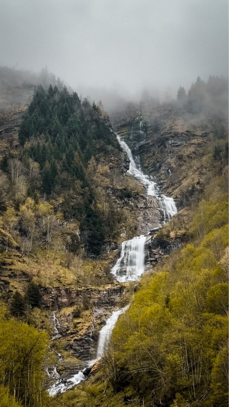
Day
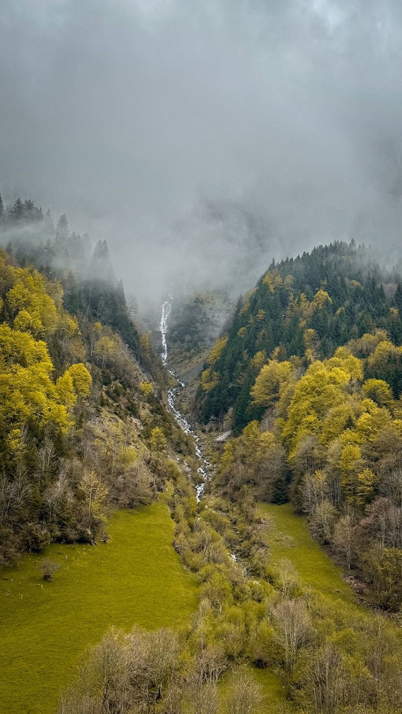
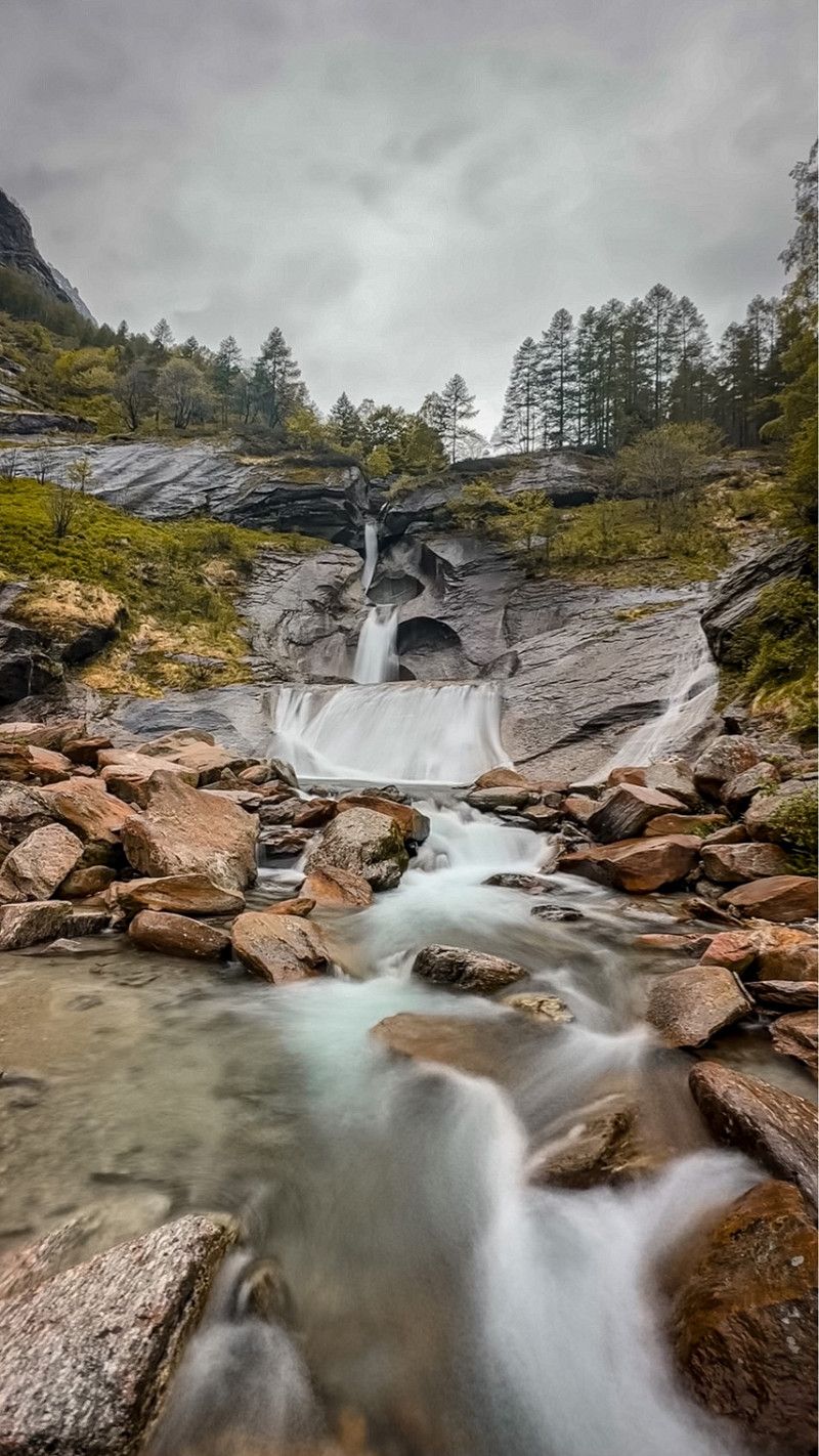
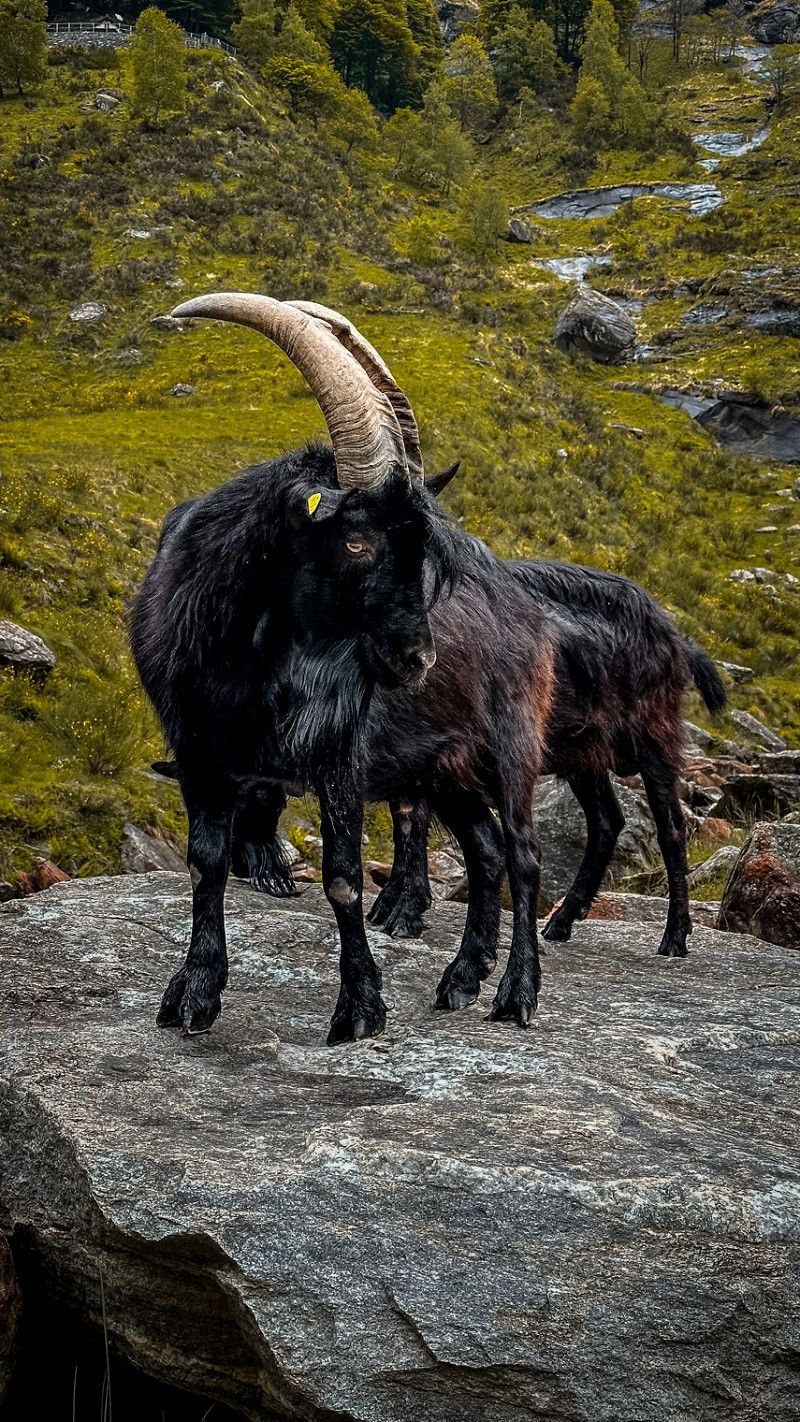
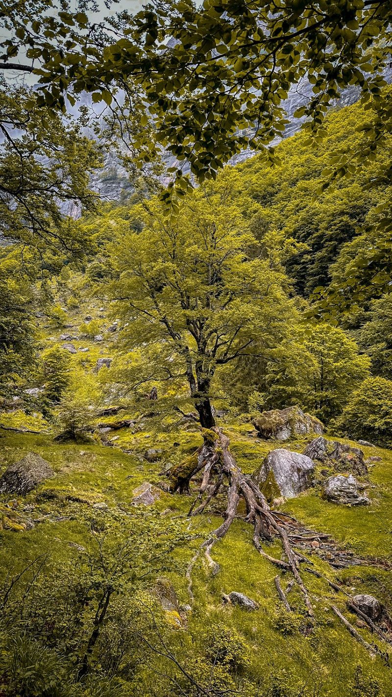
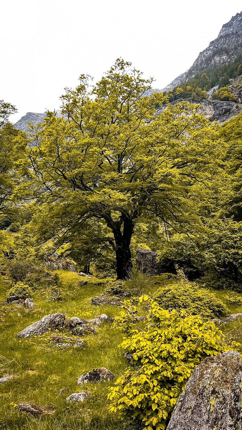
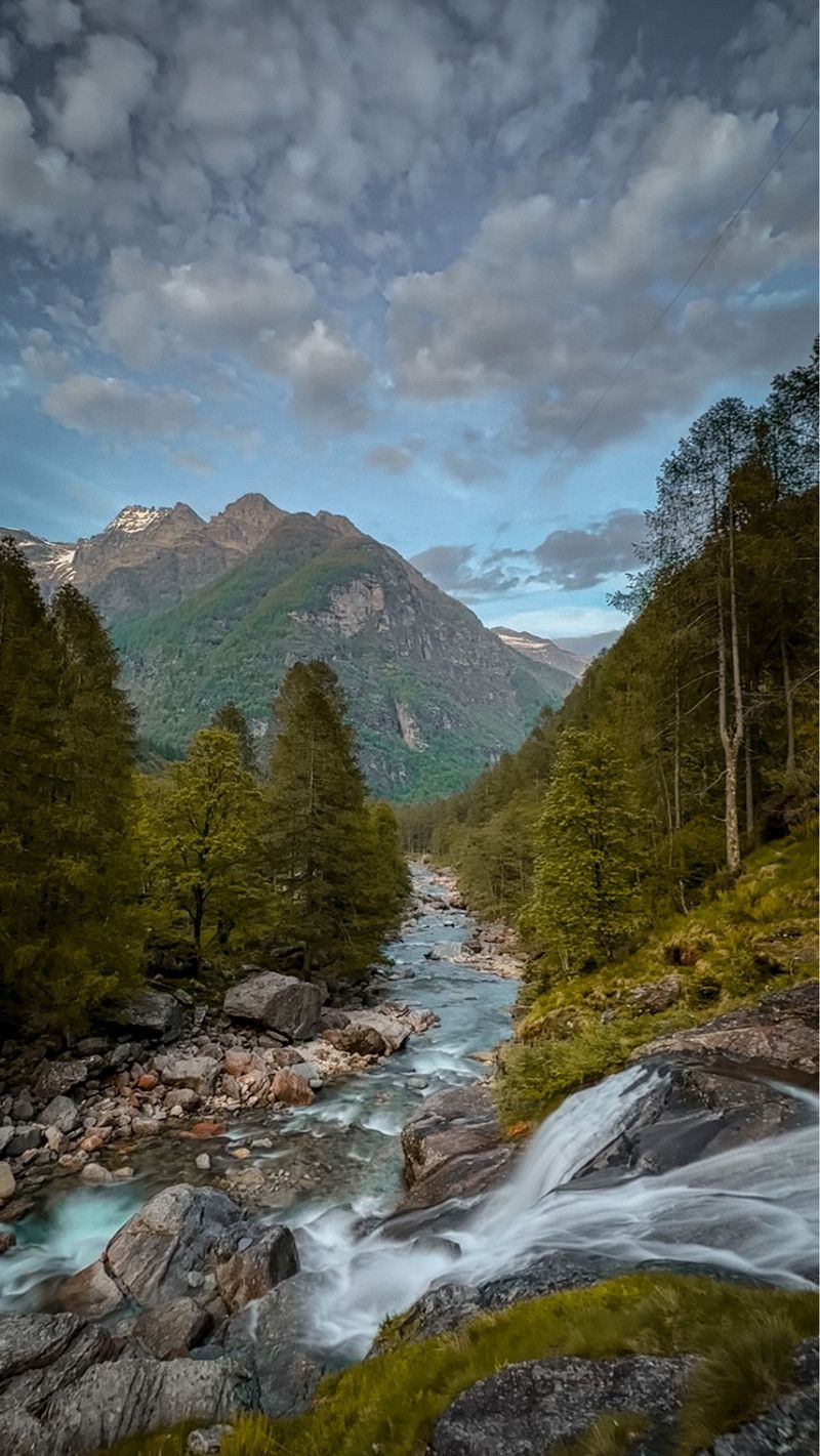
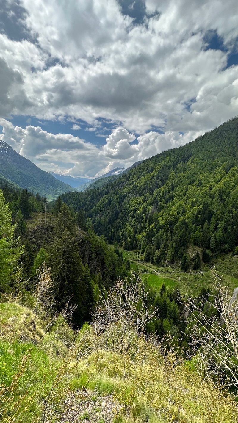
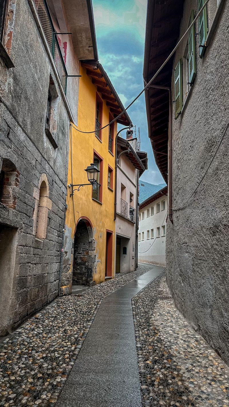
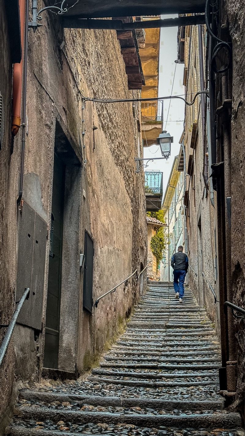
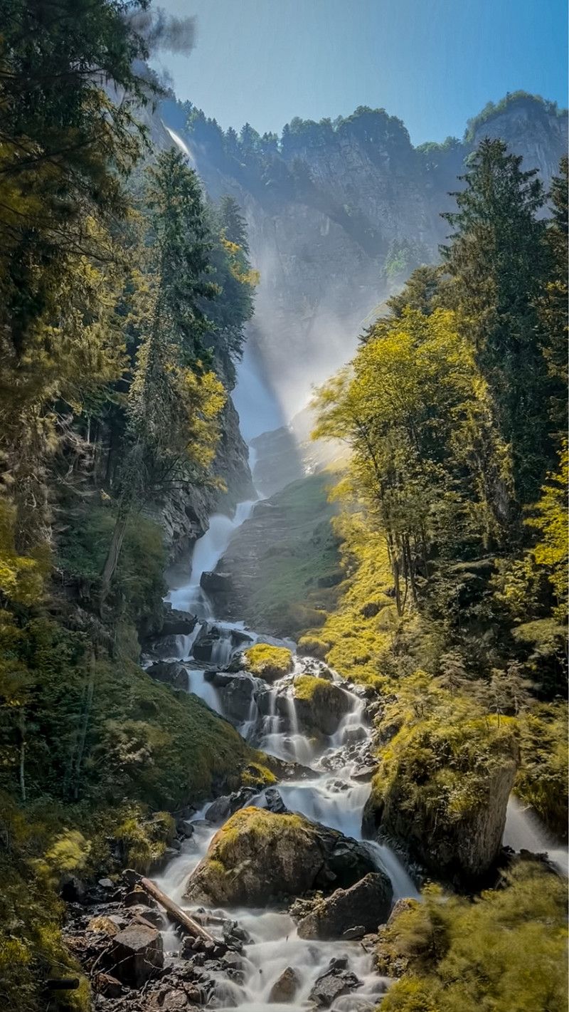
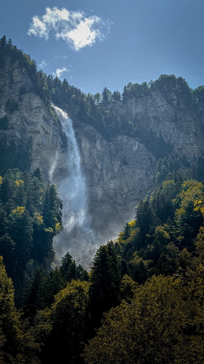
Wanderung zum Wasserfall Verzasca
A beautiful hike along the valley, not that difficult at all. Along old houses and the stream.
9QMF+9CQ, Verzasca, Schweiz
46° 23' 0.5" N 8° 46' 25" E
46.3834625 8.7736094
• Head southeast on Cabione. Go for 1.6 km.
• Continue on Ar Secada. Go for 82 m.
• Continue on Strada de Vegornèss. Go for 1.8 km.
• Continue on Strada del Ciòss. Go for 237 m.
• Turn left onto Er Piazza. Go for 15 m.
• Turn right onto Er Piazza. Go for 15 m.
• Turn slightly left onto Strada dal Forn. Go for 144 m.
• Continue on Strada dai Casèll. Go for 306 m.
• Turn slightly left onto Strada de Redòrta. Go for 109 m.
• Arrive at Strada de Redòrta. Your destination is on the right.
☍
4,3 km
( 9 min.)
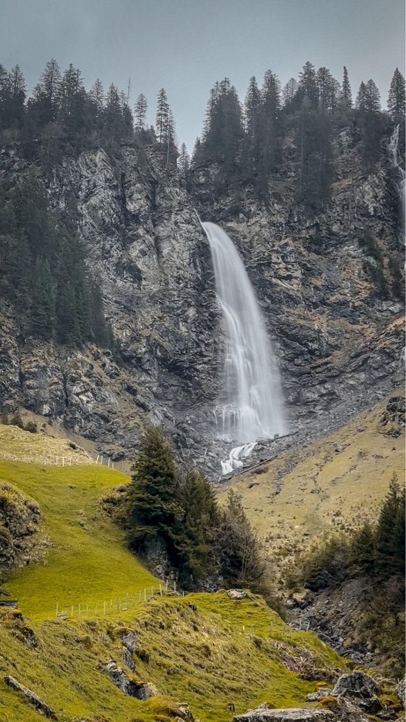
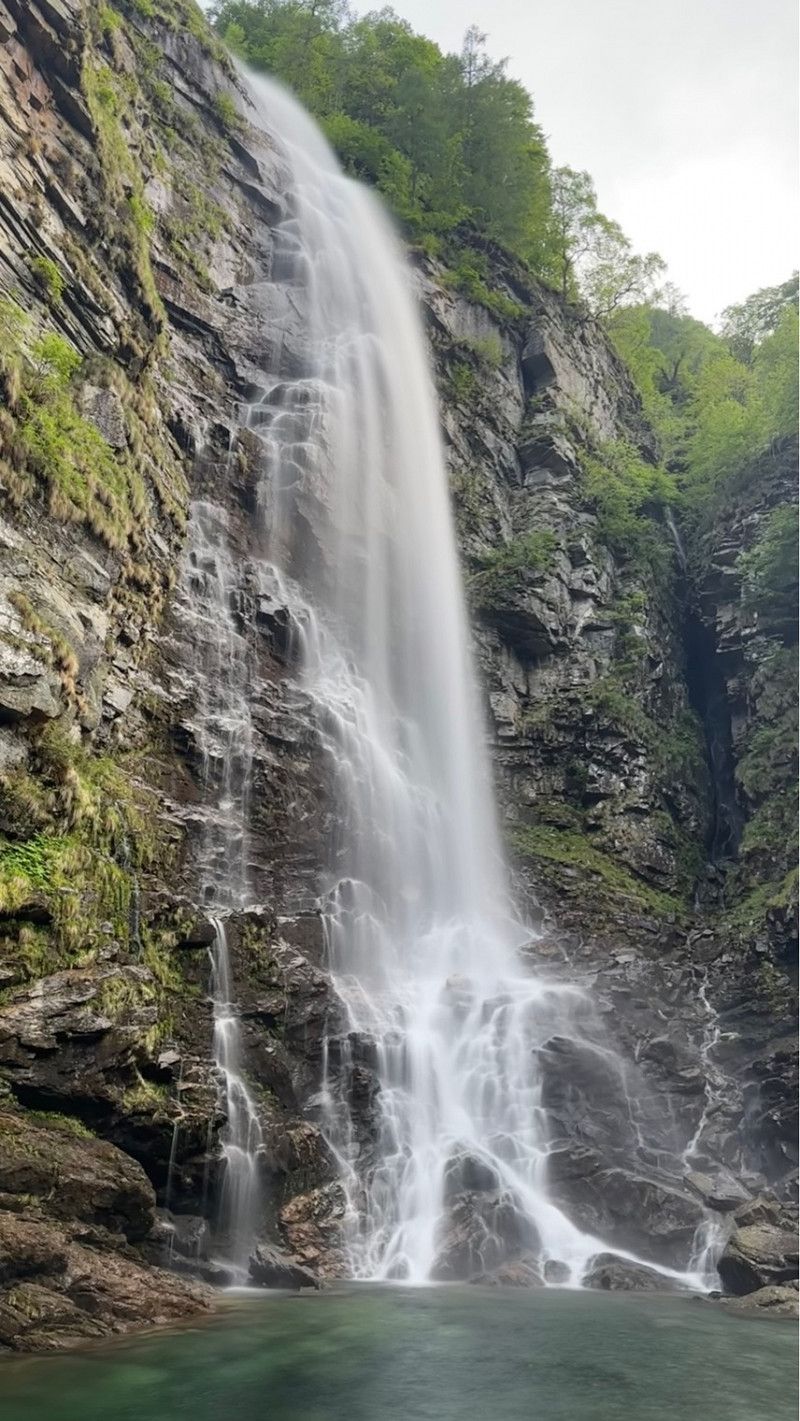
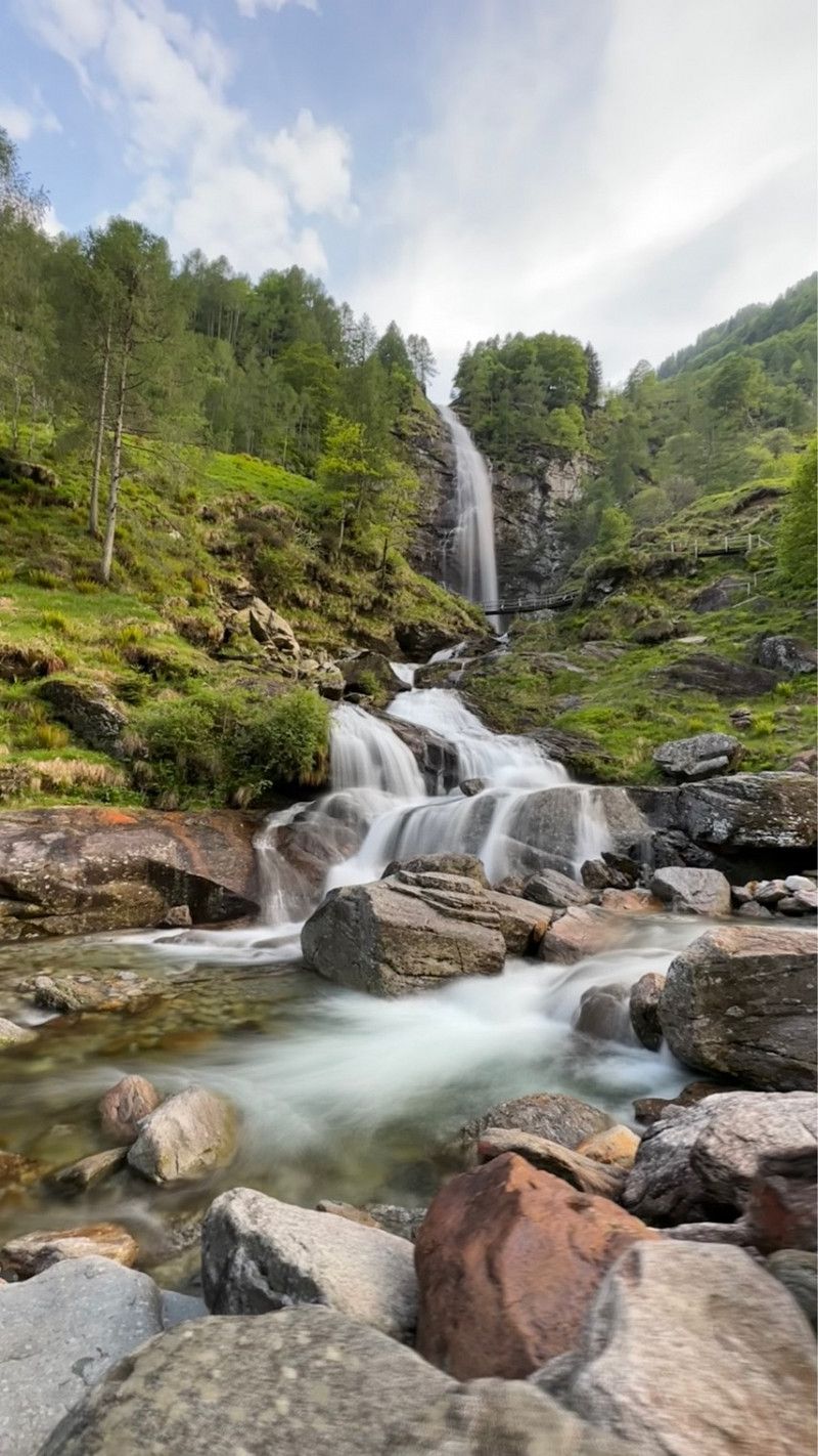
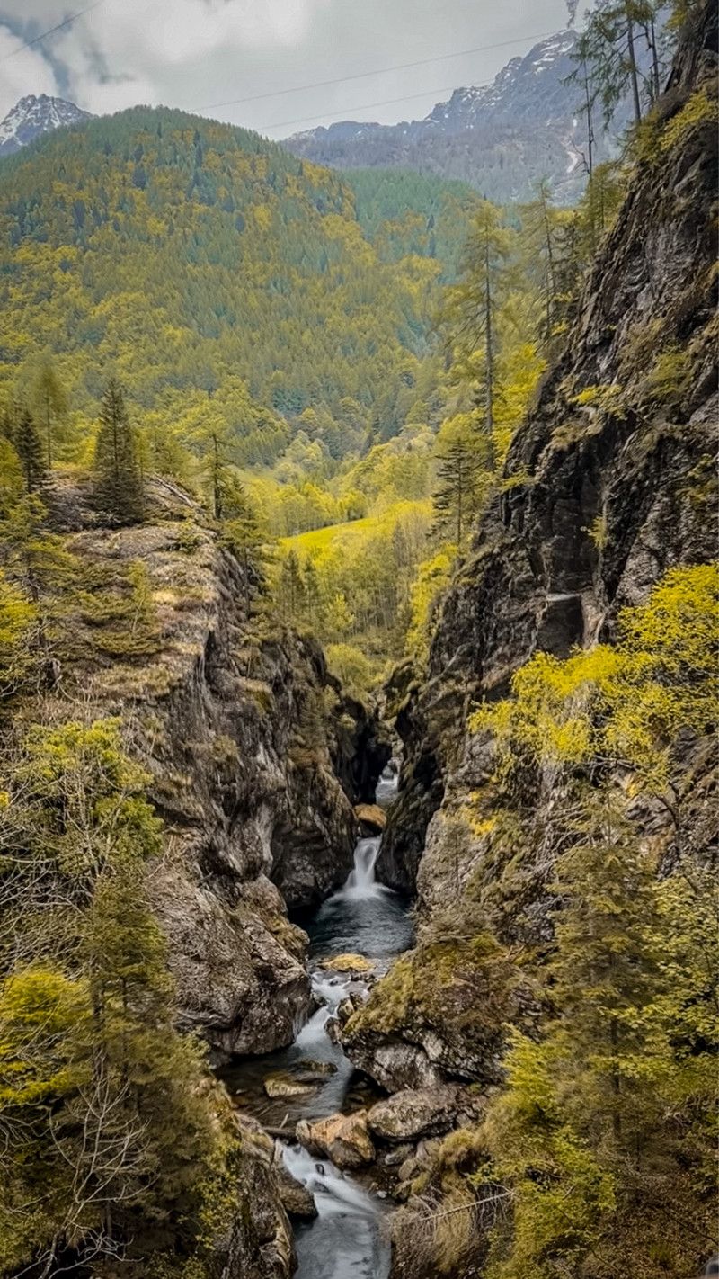
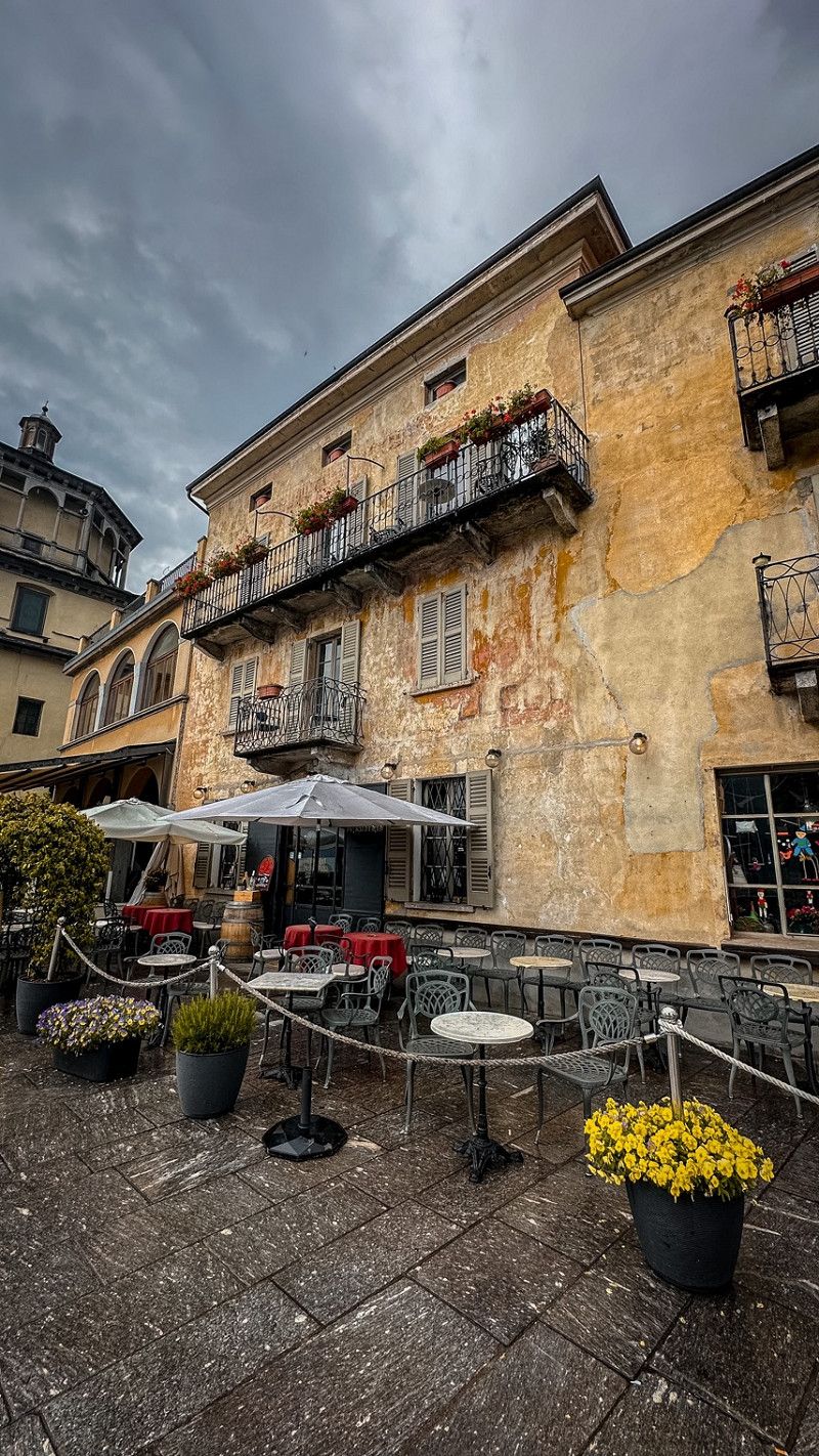
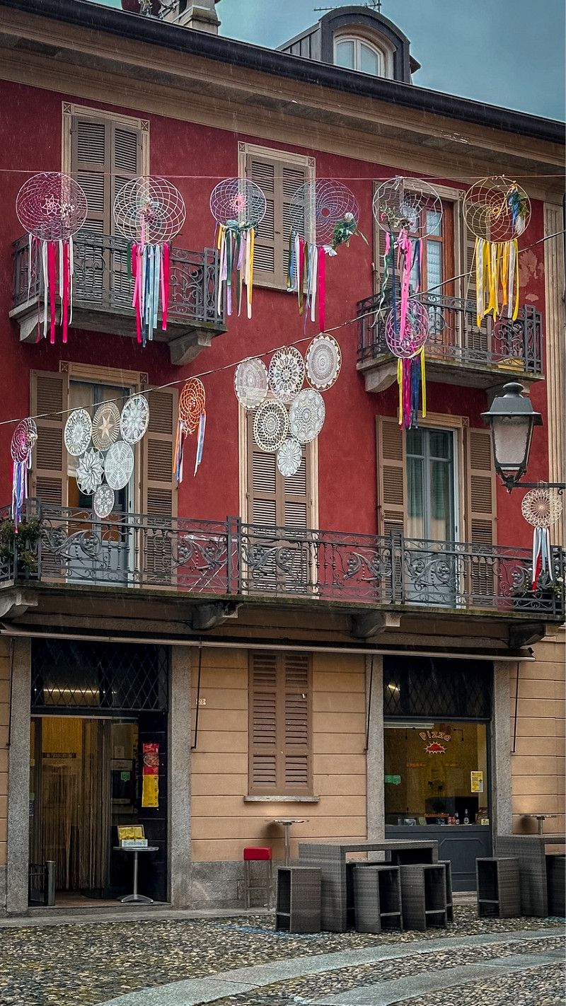
Casrada la Frodo (Wasserfall)
We went to the small, beautiful village for something to eat. Then walked to this waterfall in the evening. Freely accessible and mega impressive. I think this is one of the most beautiful ones here in Switzerland (next to the Stäubifall). slept Do we have one more night in the public car park/pitch.
Strada de Redòrta 36, 6637 Sonogno, Schweiz
46° 20' 59.8" N 8° 46' 47.1" E
46.3499381 8.7797375
• Head east on Strada de Redòrta. Go for 109 m.
• Turn slightly right onto Strada dai Casèll. Go for 306 m.
• Continue on Strada dal Forn. Go for 144 m.
• Turn slightly right onto Er Piazza. Go for 15 m.
• Turn slightly right onto Er Piazza. Go for 29 m.
• Continue on El Stradomm. Go for 129 m.
• Continue on Strada Cantonale. Go for 96 m.
• Continue on Mora di Dentro. Go for 2.6 km.
• Continue on Efra. Go for 234 m.
• Continue on Gerra. Go for 1.4 km.
• Continue on Formighera. Go for 359 m.
• Continue on Gerra. Go for 66 m.
• Continue on Froda. Go for 1.2 km.
• Continue on Alnasca. Go for 669 m.
• Continue on Via Cantonale. Go for 962 m.
• Continue on Piée. Go for 211 m.
• Continue on Pianésc. Go for 749 m.
• Continue on Ganne. Go for 798 m.
• Continue on Chiossetto. Go for 111 m.
• Continue on Ciossett. Go for 1.3 km.
• Continue on Aquino. Go for 1.8 km.
• Continue on Ponte dei Salti. Go for 544 m.
• Arrive at Ponte dei Salti. Your destination is on the right.
☍
14,0 km
( 20 min.)
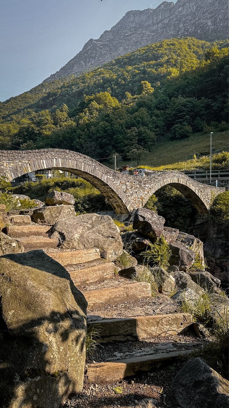
Day
Sentiero Verzasca
Roman bridge
46° 15' 36.8" N 8° 50' 7.4" E
46.2602234 8.8353911
• Head northwest on Ponte dei Salti. Go for 35 m.
• Arrive at Ponte dei Salti. Your destination is on the left.
☍
0,0 km
( )
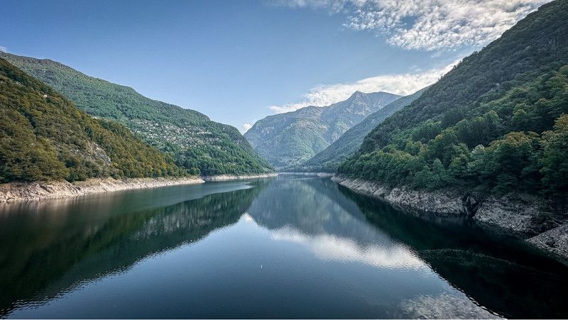
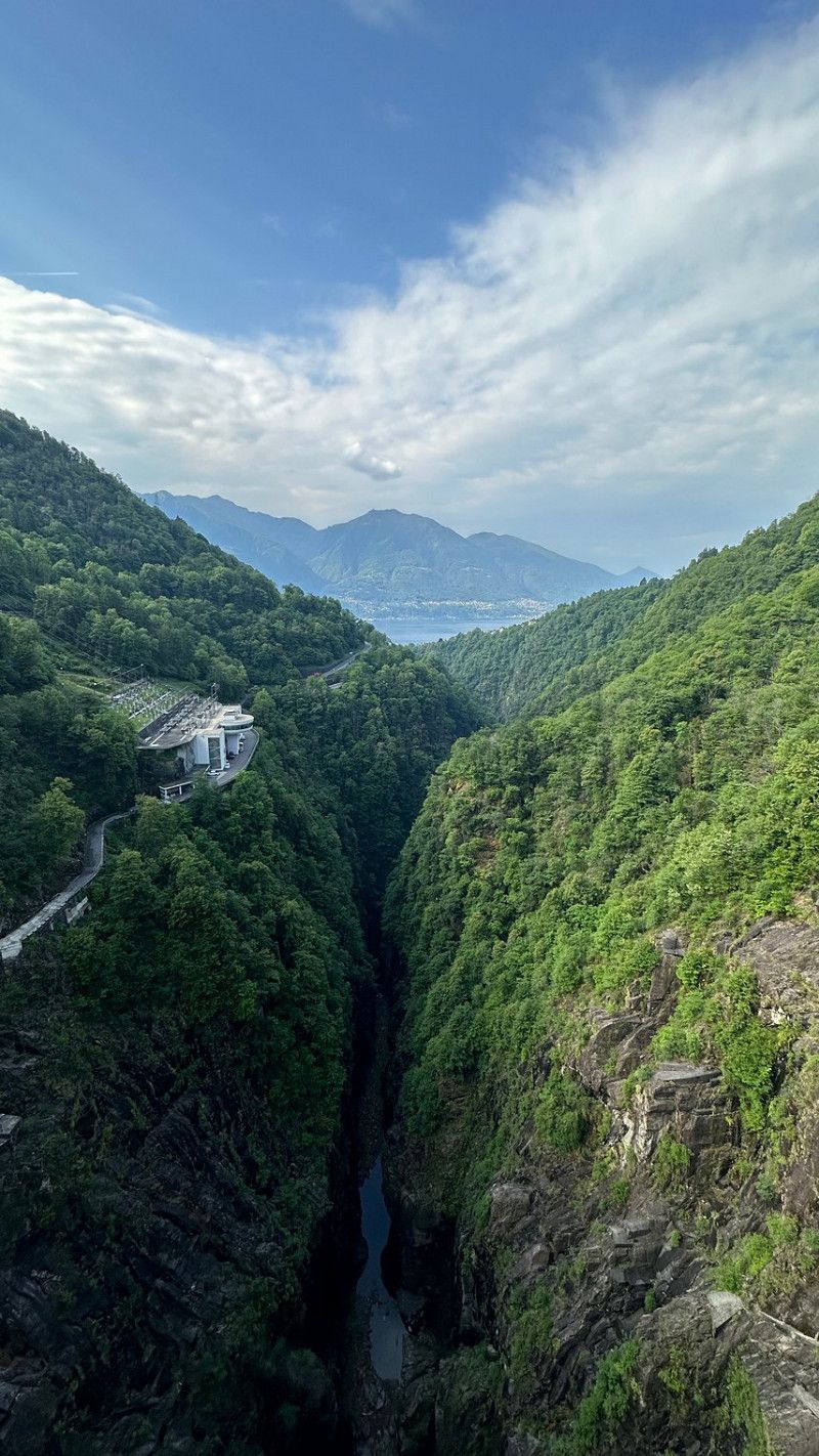
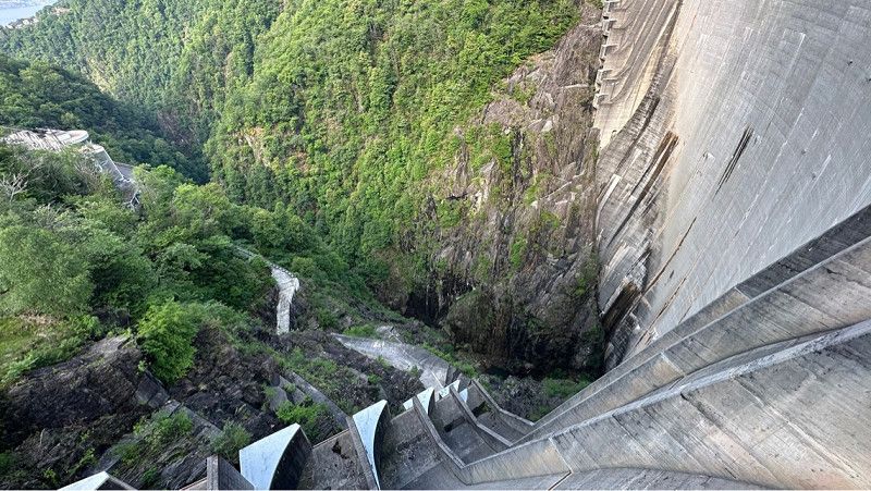
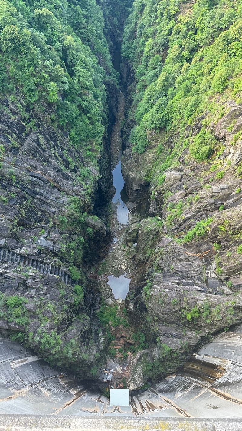
Staumauer
Via Brione Verzasca 4–6
46° 15' 37.2" N 8° 50' 8.4" E
46.2603455 8.8356632
• Head toward Lavertezzo Paese on Ponte dei Salti. Go for 145 m.
• Continue on Lavertezzo Paese. Go for 321 m.
• Continue on Prevesio. Go for 11.4 km.
• Continue on Via San Gottardo. Go for 16 m.
• Turn right onto Via San Gottardo (13). Go for 801 m.
• Take the 2nd exit from roundabout onto Via San Gottardo (13). Go for 539 m.
• Keep right onto Via San Gottardo (13). Go for 3.4 km.
• Keep right onto Via Sempione. Go for 212 m.
• Continue on Via Sempione. Go for 184 m.
• Continue on Via Cappuccini. Go for 288 m.
• Continue on Via Borghese. Go for 347 m.
• Turn left onto Via Vallemaggia. Go for 952 m.
• Turn slightly right onto Via Vallemaggia (407). Go for 2.8 km.
• Turn slightly right onto Via Vallemaggia (407). Go for 1.7 km.
• Continue on Via Cantonale (407). Go for 212 m.
• Continue on Via Vallemaggia (407). Go for 92 m.
• Continue on Via Cantonale (407). Go for 429 m.
• Continue on Via Vallemaggia (407). Go for 368 m.
• Continue on Via Cantonale (407). Go for 31 m.
• Continue on Via Vallemaggia (407). Go for 322 m.
• Continue on Via Cantonale (407). Go for 224 m.
• Continue on Via Vallemaggia (407). Go for 89 m.
• Continue on Via Cantonale (407). Go for 148 m.
• Continue on Via Vallemaggia (407). Go for 1.2 km.
• Continue on Via Cantonale (407). Go for 359 m.
• Continue on Via Vallemaggia (407). Go for 29 m.
• Continue on Via Cantonale (407). Go for 365 m.
• Continue toward Via Vallemaggia/407. Go for 33 m.
• Continue on Via Cantonale (407). Go for 130 m.
• Continue on Via Vallemaggia (407). Go for 176 m.
• Continue on Via Cantonale (407). Go for 364 m.
• Continue on Via di Bozitt (407). Go for 2.7 km.
• Take the 2nd exit from roundabout onto La Cantonál (407). Go for 8.3 km.
• Continue on Spazzada (407). Go for 114 m.
• Continue on La Cantonál (407). Go for 247 m.
• Continue on Via Cantonale (407). Go for 765 m.
• Continue on La Cantonál (407). Go for 30 m.
• Continue on Via Cantonale (407). Go for 44 m.
• Continue on Via Valmaggina (407). Go for 1.0 km.
• Continue on Visletto (407). Go for 198 m.
• Continue on Via Valmaggina (407). Go for 4.1 km.
• Turn right onto Via Lavizzara (407). Go for 1.2 km.
• Continue on Brontalletto di Sopra. Go for 1.7 km.
• Continue on Cambiasca. Go for 1.7 km.
• Continue on Al Boscaccio. Go for 88 m.
• Continue on Ruino. Go for 905 m.
• Continue on Campagna. Go for 789 m.
• Continue on Via Cantonale. Go for 346 m.
• Continue on Al Ned. Go for 2.0 km.
• Continue on Prato. Go for 193 m.
• Continue on Via Cantonale. Go for 1.4 km.
• Turn right onto Via Cantonale. Go for 324 m.
• Turn left toward Via Cantonale. Go for 3.3 km.
• Continue on Via Cantonale. Go for 2.2 km.
• Turn left toward Via Cantonale. Go for 554 m.
• Continue on Via Cantonale. Go for 241 m.
• Turn right onto Via Cantonale. Go for 358 m.
• Turn right onto Tecial. Go for 327 m.
• Continue on Prau du Mulin. Go for 467 m.
• Turn slightly left. Go for 355 m.
• Turn left. Go for 1.1 km.
• Arrive at your destination on the right.
☍
64,6 km
(1 hrs. 24 min.)
6696
46° 27' 15.2" N 8° 39' 47.3" E
46.4542236 8.6631347
• Head toward Mevsc. Go for 1.1 km.
• Turn right toward Prau du Mulin. Go for 355 m.
• Turn slightly right onto Prau du Mulin. Go for 563 m.
• Continue on Tecial. Go for 231 m.
• Turn right onto Salee. Go for 277 m.
• Turn right toward Via Cantonale. Go for 174 m.
• Continue on Via Cantonale. Go for 621 m.
• Turn right toward Via Cantonale. Go for 904 m.
• Continue on Via Cantonale. Go for 4.6 km.
• Turn right onto Via Cantonale. Go for 324 m.
• Turn left onto Via Cantonale. Go for 1.4 km.
• Continue on Prato. Go for 1.4 km.
• Continue on Al Ned. Go for 804 m.
• Continue on Via Cantonale. Go for 432 m.
• Continue on Campagna. Go for 1.1 km.
• Continue on Ruino. Go for 533 m.
• Continue on Al Boscaccio. Go for 88 m.
• Continue on Cambiasca. Go for 2.1 km.
• Continue on Brontalletto di Sopra. Go for 1.2 km.
• Continue on Via Lavizzara. Go for 1.2 km.
• Turn left onto Via Valmaggina (407). Go for 4.1 km.
• Continue on Visletto (407). Go for 198 m.
• Continue on Via Valmaggina (407). Go for 1.0 km.
• Continue on Via Cantonale (407). Go for 44 m.
• Continue on La Cantonál (407). Go for 30 m.
• Continue on Via Cantonale (407). Go for 765 m.
• Continue on La Cantonál (407). Go for 247 m.
• Continue on Spazzada (407). Go for 114 m.
• Continue on La Cantonál (407). Go for 8.3 km.
• Take the 3rd exit from roundabout onto La Cantonál (407). Go for 2.7 km.
• Continue on Via Cantonale (407). Go for 364 m.
• Continue on Via Vallemaggia (407). Go for 176 m.
• Continue on Via Cantonale (407). Go for 130 m.
• Continue toward Via Vallemaggia/407. Go for 33 m.
• Continue on Via Cantonale (407). Go for 365 m.
• Continue on Via Vallemaggia (407). Go for 29 m.
• Continue on Via Cantonale (407). Go for 359 m.
• Continue on Via Vallemaggia (407). Go for 1.2 km.
• Continue on Via Cantonale (407). Go for 148 m.
• Continue on Via Vallemaggia (407). Go for 89 m.
• Continue on Via Cantonale (407). Go for 224 m.
• Continue on Via Vallemaggia (407). Go for 322 m.
• Continue on Via Cantonale (407). Go for 31 m.
• Continue on Via Vallemaggia (407). Go for 368 m.
• Continue on Via Cantonale (407). Go for 429 m.
• Continue on Via Vallemaggia (407). Go for 92 m.
• Continue on Via Cantonale (407). Go for 212 m.
• Continue on Via Vallemaggia (407). Go for 4.5 km.
• Pass 2 roundabouts and continue on Via Alberto Vigizzi (407). Go for 561 m.
• Take the 3rd exit from roundabout onto Via Locarno (407). Go for 430 m.
• Turn right and take ramp onto 13 toward Italia/Brissago. Go for 9.8 km.
• Continue on Strada Statale del Lago Maggiore (SS34). Go for 3.8 km.
• Arrive at Casali Darbedo (SS34).
☍
60,6 km
(1 hrs. 15 min.)
Camping Residence Campagna
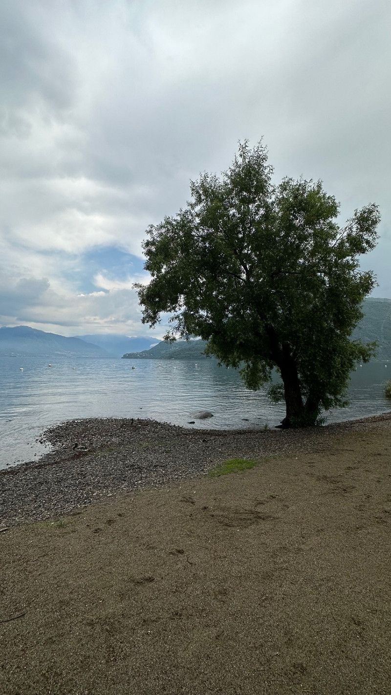
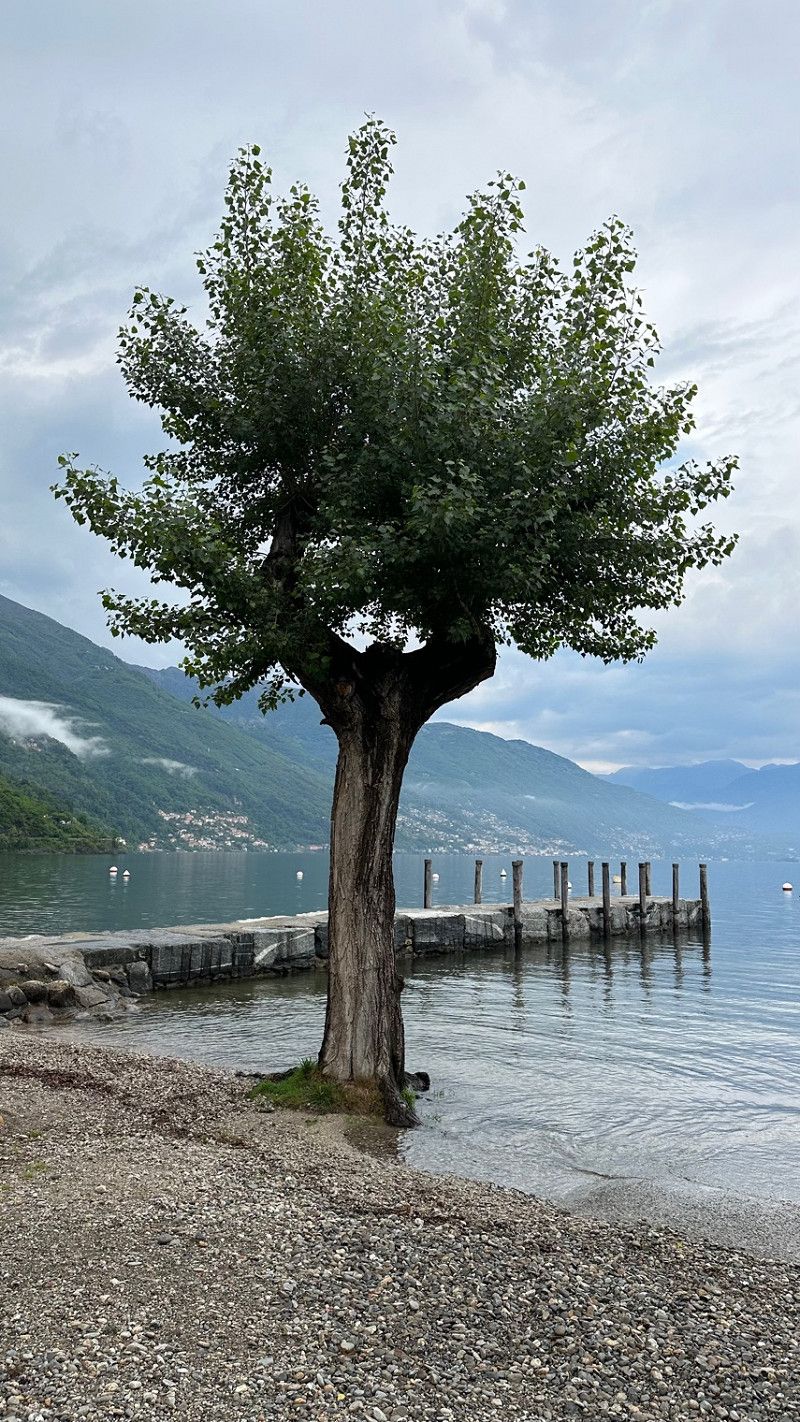
After we first drove through the beautiful Valle Maggia and we couldn't drive to the planned parking space because the owners would only open their yard in 14 days. We decided, since the weather was great, to go to Lago Magiore. We decided on a pitch just behind the Italian border.
Casali Darbedo, 20/22, 28822, Cannobio, Italien
46° 4' 17.3" N 8° 41' 35.5" E
46.0714700 8.6932000
• Head toward Via Darbedo on Casali Darbedo (SS34). Go for 843 m.
• Turn left onto Viale Rimembranze. Go for 227 m.
• Continue on Piazza Santa Pietà. Go for 41 m.
• Arrive at Piazza Santa Pietà. Your destination is on the left.
☍
1,1 km
( 2 min.)
Day
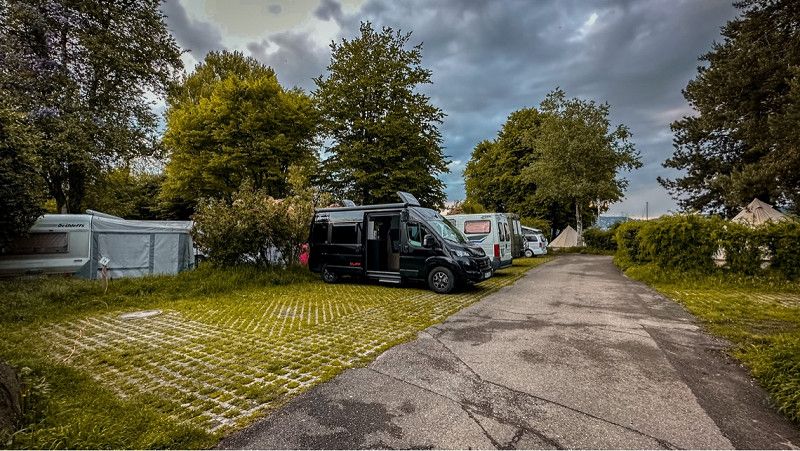
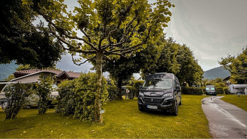
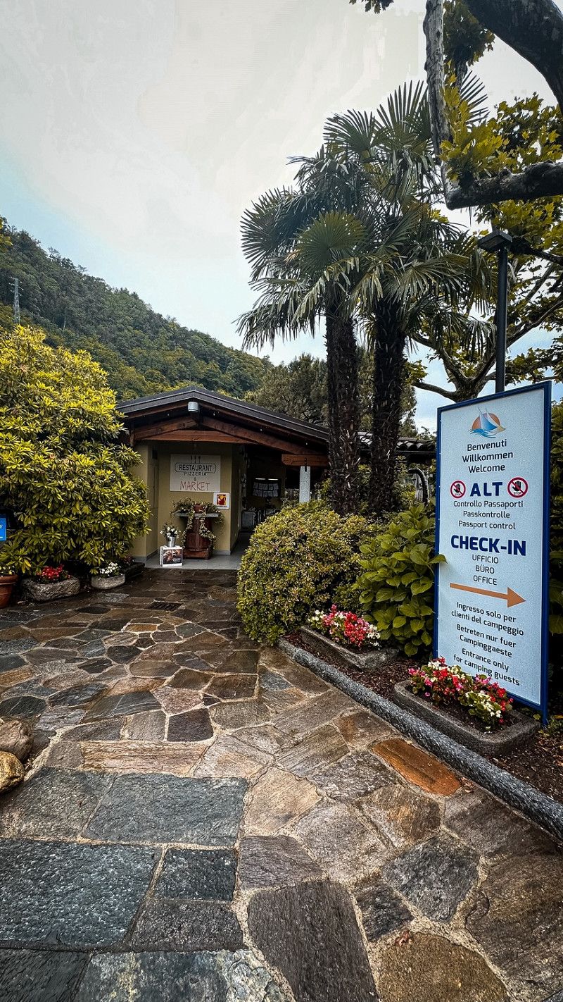
Camping Residence Campagna
Here are some pictures from the campsite at Lake Maggiore. We thought he was beautiful. Sanitary facilities clean and priced ok.
Casali Darbedo, 20/22, 28822, Cannobio, Italien
46° 4' 17.3" N 8° 41' 35.5" E
46.0714700 8.6932000
• Head southeast on Piazza Santa Pietà.
• Turn right onto Via Don Silvio Gallotti. Go for 48 m.
• Continue on Via Luigi Meschio. Go for 252 m.
• Turn left onto Strada Statale del Lago Maggiore (SS34). Go for 19.7 km.
• Take the 2nd exit from roundabout onto Corso Goffredo Mameli (SS34). Go for 483 m.
• Take the 3rd exit from roundabout onto Strada Statale del Lago Maggiore (SS34). Go for 1.5 km.
• Take the 3rd exit from roundabout onto Corso Europa (SS34). Go for 321 m.
• Pass 5 roundabouts and continue on Strada Statale del Lago Maggiore (SS34). Go for 9.7 km.
• Take ramp onto A26 (Autostrada Genova Voltri-Gravellona Toce) toward Ornavasso. Go for 2.9 km.
• Keep left onto Strada Statale del Sempione (SS33) toward E62/Iselle. Go for 25.1 km.
• Keep left onto Strada Statale del Sempione (SS33) toward Sempione/Confine di Stato. Go for 25.1 km.
• Continue on San Marco (E62). Go for 19.5 km.
• Arrive at Simplonpass (E62).
☍
104,6 km
(1 hrs. 35 min.)
Day
Camping Residence Campagna
It rained almost all morning. So we relaxed after breakfast in the WoMo.
Casali Darbedo, 20/22, 28822, Cannobio, Italien
46° 4' 17.3" N 8° 41' 35.5" E
46.0714700 8.6932000
• Head northeast on Simplonpass (E62). Go for 22.7 km.
• Take ramp onto A9 toward Lausanne/Sion/Autoverlad Lötschberg. Go for 7.5 km.
• Take the exit. Go for 506 m.
• Take the 2nd exit from roundabout onto Staldbach toward Zermatt/Saas-Fee. Go for 1.6 km.
• Continue on Kantonsstrasse. Go for 72 m.
• Keep right onto Kantonsstrasse. Go for 644 m.
• Take the 1st exit from roundabout onto Kantonsstrasse. Go for 966 m.
• Continue on Milachru. Go for 2.5 km.
• Continue on Chinegga-Brücke. Go for 1.3 km.
• Take the 3rd exit from roundabout onto Illas. Go for 138 m.
• Continue on Steinschlag. Go for 283 m.
• Continue on Bärgji. Go for 412 m.
• Continue on Saastalstrasse. Go for 577 m.
• Continue on Polleruweg. Go for 176 m.
• Continue on Äusserer Reschtiweg. Go for 90 m.
• Continue on Innerer Reschtiweg. Go for 1.1 km.
• Continue on Raftgarten. Go for 363 m.
• Continue on Fluhbalmen. Go for 868 m.
• Continue on Zen-Schmieden. Go for 523 m.
• Continue on Zen Eisten. Go for 395 m.
• Continue on Randfluh. Go for 409 m.
• Continue on Tyrbelwang. Go for 653 m.
• Continue on Huteggen. Go for 635 m.
• Continue on Bodenbrücke. Go for 1.6 km.
• Continue on Holler. Go for 1.2 km.
• Continue on Saastalstrasse. Go for 36 m.
• Continue on Waldrand. Go for 343 m.
• Continue on Zur Kleinen Kapelle. Go for 1.2 km.
• Continue on Saastalstrasse. Go for 1.7 km.
• Continue on Tamattu. Go for 87 m.
• Continue on Saasthalstrasse. Go for 1.2 km.
• Turn left onto Nivine. Go for 726 m.
• Continue on Ze Löübinu. Go for 370 m.
• Continue on Zer Unnru Briggu. Go for 605 m.
• Continue on Talstrasse. Go for 1.1 km.
• Turn right. Go for 42 m.
• Turn sharp left. Go for 1.4 km.
• Arrive at your destination.
☍
56,0 km
( 54 min.)
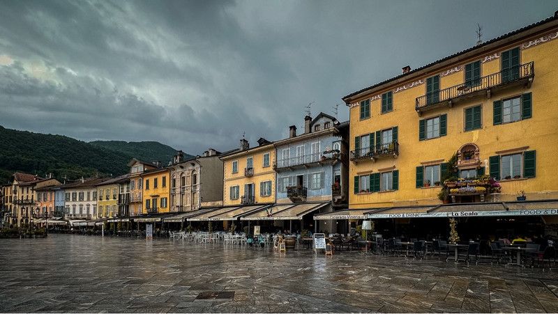
Lungolago di Cannobio
Walk through the city. Unfortunately, it then started to rain. Therefore only briefly.
46° 3' 48.4" N 8° 42' 1.5" E
46.0634460 8.7004050
• Head toward Aelpji. Go for 1.4 km.
• Turn sharp right toward Talstrasse. Go for 42 m.
• Turn left onto Talstrasse. Go for 1.3 km.
• Continue on Zer Unnru Briggu. Go for 438 m.
• Continue on Feechi. Go for 370 m.
• Continue on Wüstenmatten. Go for 726 m.
• Turn right onto Saasthalstrasse. Go for 1.2 km.
• Continue on Tamattu. Go for 2.3 km.
• Continue on Fellmatten. Go for 26 m.
• Arrive at Fellmatten. Your destination is on the right.
☍
7,7 km
( 10 min.)
Day
Simplonpass, Simplon, Schweiz
Here we spent one night. There are also some nice trails to hike.
Simplonpass, 3907 Simplon, Schweiz
46° 15' 2.1" N 8° 1' 55.9" E
46.2505944 8.0322074
• Head northwest on Fellmatten. Go for 601 m.
• Continue on Ine Hefu. Go for 343 m.
• Continue on Saastalstrasse. Go for 1.2 km.
• Continue on Holler. Go for 1.3 km.
• Continue on Bodenbrücke. Go for 596 m.
• Continue on Huteggen. Go for 622 m.
• Continue on Tyrbelwang. Go for 467 m.
• Continue on Randfluh. Go for 409 m.
• Continue on Zen Eisten. Go for 624 m.
• Continue on Zen-Schmieden. Go for 792 m.
• Continue on Fluhbalmen. Go for 460 m.
• Continue on Raftgarten. Go for 1.2 km.
• Continue on Innerer Reschtiweg. Go for 148 m.
• Continue on Äusserer Reschtiweg. Go for 90 m.
• Continue on Polleruweg. Go for 176 m.
• Continue on Saastalstrasse. Go for 577 m.
• Continue on Bärgji. Go for 623 m.
• Continue on Steinschlag. Go for 111 m.
• Continue on Illas. Go for 49 m.
• Take the 3rd exit from roundabout onto Illas. Go for 848 m.
• Continue on Tunnel Stägjitschugge. Go for 2.3 km.
• Continue on Kantonsstrasse. Go for 1.1 km.
• Continue on Grossberg. Go for 3.1 km.
• Take the 2nd exit from roundabout onto Grächenstrasse. Go for 115 m.
• Continue on Eye. Go for 536 m.
• Continue on Eye. Go for 587 m.
• Take the 2nd exit from roundabout onto Rittinen. Go for 5.0 km.
• Continue on Längmatten. Go for 870 m.
• Continue on Breitmatten. Go for 2.9 km.
• Take the 1st exit from roundabout onto Kantonsstrasse. Go for 521 m.
• Continue on Moos. Go for 274 m.
• Continue on Flurstrasse. Go for 370 m.
• Continue on Nikolaital. Go for 436 m.
• Continue on Kantonsstrasse. Go for 344 m.
• Continue on Dorf. Go for 1.9 km.
• Take the 2nd exit from roundabout onto Kantonsstrasse. Go for 102 m.
• Continue on Neue Kantonsstrasse. Go for 120 m.
• Continue on Neue Kantonsstrasse. Go for 10 m.
• Arrive at Neue Kantonsstrasse. Your destination is on the right.
☍
31,8 km
( 33 min.)
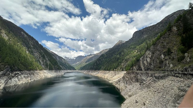
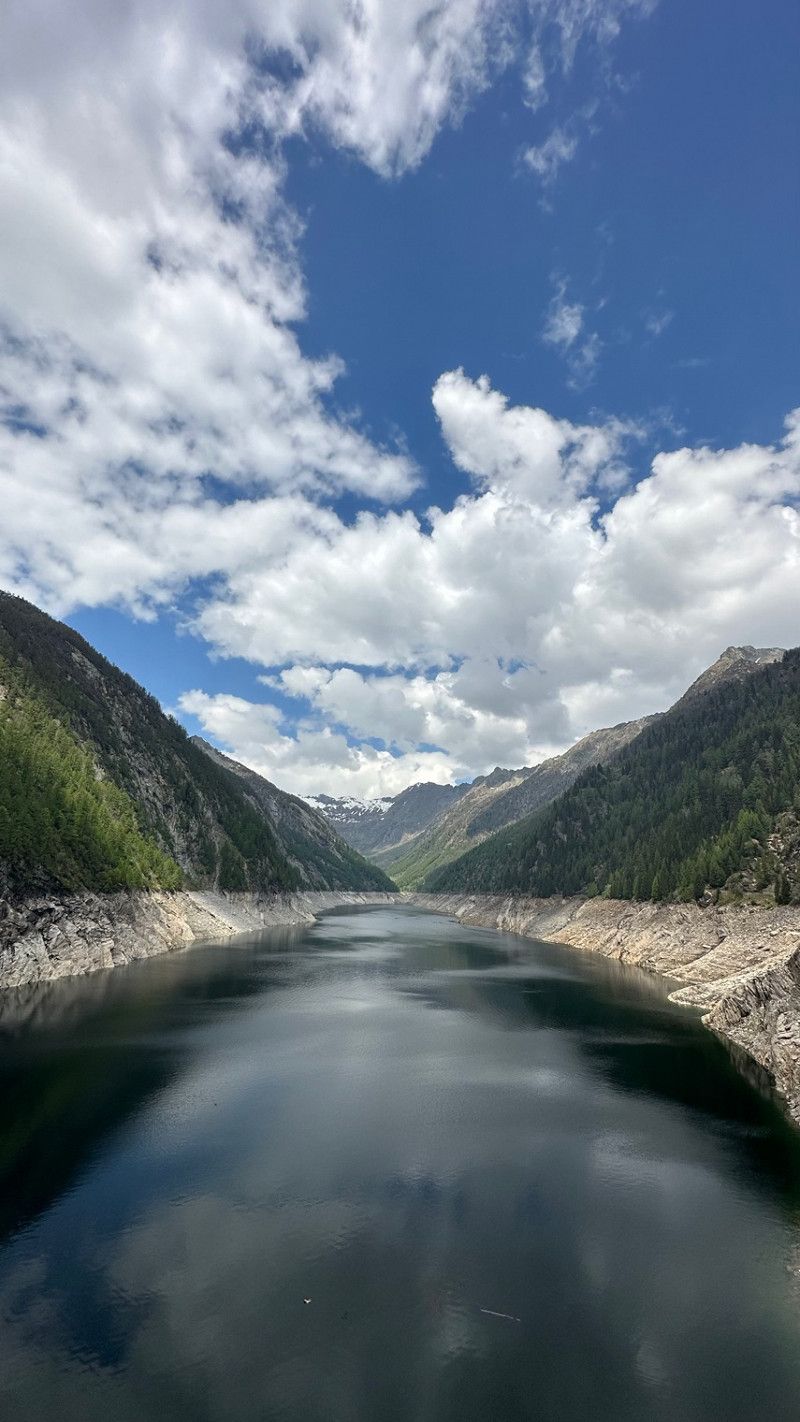
Mattmark Dam
46° 2' 55.1" N 7° 57' 20.4" E
46.0486450 7.9556529
• Head north on Neue Kantonsstrasse. Go for 10 m.
• Continue on Dorf. Go for 120 m.
• Continue on Kantonsstrasse. Go for 16 m.
• Turn left. Go for 72 m.
• Arrive at your destination on the left.
☍
0,2 km
( )
Almagell, Saas-Almagell, Schweiz
Almagell, 3905 Saas-Almagell, Schweiz
46° 6' 0" N 7° 57' 0" E
46.1000000 7.9500000
• Head north. Go for 66 m.
• Take the 1st exit from roundabout onto Kantonsstrasse. Go for 83 m.
• Continue on Neue Kantonsstrasse. Go for 120 m.
• Continue on Neue Kantonsstrasse. Go for 126 m.
• Arrive at Neue Kantonsstrasse. Your destination is on the right.
☍
0,4 km
( 1 min.)
Saas-Balen, Schweiz
46° 9' 11.9" N 7° 55' 42.4" E
46.1533008 7.9284545
• Head south on Neue Kantonsstrasse.
• Arrive at Neue Kantonsstrasse. Your destination is on the right.
☍
Distance not available
(Duration not available)
Camping Alphubel, Täsch, Schweiz
Camping Alphubel, 3929 Täsch, Schweiz
46° 3' 56.9" N 7° 46' 29.4" E
46.0658020 7.7748349
• Head north on Neue Kantonsstrasse. Go for 126 m.
• Continue on Dorf. Go for 120 m.
• Continue on Kantonsstrasse. Go for 72 m.
• Take the 2nd exit from roundabout onto Kantonsstrasse. Go for 2.1 km.
• Continue on Kantonsstrasse. Go for 308 m.
• Continue on Nikolaital. Go for 287 m.
• Continue on Flurstrasse. Go for 603 m.
• Continue on Moos. Go for 304 m.
• Continue on Kantonsstrasse. Go for 223 m.
• Take the 2nd exit from roundabout. Go for 2.8 km.
• Continue on Breitmatten. Go for 359 m.
• Continue on Längmatten. Go for 622 m.
• Continue on Talstrasse. Go for 4.9 km.
• Take the 1st exit from roundabout. Go for 608 m.
• Continue on Eye. Go for 371 m.
• Continue on Eye. Go for 171 m.
• Continue on Grächenstrasse. Go for 85 m.
• Take the 1st exit from roundabout onto Feld. Go for 3.2 km.
• Continue on Kantonsstrasse. Go for 1.1 km.
• Continue on Tunnel Stägjitschugge. Go for 2.3 km.
• Continue on Kantonsstrasse. Go for 794 m.
• Take the 2nd exit from roundabout. Go for 1.0 km.
• Continue on Chinegga-Brücke. Go for 295 m.
• Continue on Hauptstrasse. Go for 3.4 km.
• Take the 1st exit from roundabout onto Kantonsstrasse. Go for 324 m.
• Keep left onto Kesswilweg toward Lausanne/Sion. Go for 1.2 km.
• Continue on Visperautunnel. Go for 563 m.
• Take ramp onto A9 (Tunnel Visp). Go for 11.4 km.
• Take exit 31 toward Gampel-Steg/Lötschberg. Go for 465 m.
• Take the 2nd exit from Kreisel Schnydrigen roundabout onto Kantonsstrasse (E62) toward Lötschberg/Gampel-Steg/Turtmann/Lausanne/Sion. Go for 344 m.
• Take the 2nd exit from roundabout onto Bahnhofstrasse (A6) toward Lötschberg/Lötschental. Go for 10.5 km.
• Arrive at your destination.
☍
51,0 km
( 48 min.)
Day
Matterhorn Terminal Täsch, Bahnhof, Täsch, Schweiz
Bahnhof, 3929 Täsch, Schweiz
46° 4' 2.5" N 7° 46' 29.3" E
46.0673615 7.7748182
• Head south. Go for 321 m.
• Continue on Hauptstrasse. Go for 303 m.
• Continue straight ahead. Go for 14 m.
• Take the Lötschbergtunnel car shuttle train. Stay on for 17.2 km.
• Head north on A6. Go for 169 m.
• Turn right onto Bahnhofstrasse. Go for 296 m.
• Turn left onto Aeussere Dorfstrasse. Go for 111 m.
• Turn right toward Oeschistrasse. Go for 92 m.
• Turn right onto Oeschistrasse. Go for 114 m.
• Turn slightly left onto Oeschistrasse. Go for 385 m.
• Turn right onto Zilfuristrasse. Go for 134 m.
• Turn slightly left onto Hubleweg. Go for 46 m.
• Arrive at Hubleweg. Your destination is on the left.
☍
19,2 km
( 56 min.)
Zermatt, Schweiz
46° 1' 14.6" N 7° 44' 56.8" E
46.0207133 7.7491170
• Head toward Zilfuristrasse on Hubleweg. Go for 46 m.
• Turn slightly right onto Zilfuristrasse. Go for 134 m.
• Turn left onto Oeschistrasse. Go for 385 m.
• Turn left onto Öschiweg. Go for 240 m.
• Arrive at Öschiweg.
☍
0,8 km
( 2 min.)
Sunnegga, Sunnegga, Zermatt, Schweiz
Sunnegga, 3920 Zermatt, Schweiz
46° 1' 1.5" N 7° 46' 12" E
46.0170939 7.7699995
• Head east on Öschiweg.
• Arrive at Öschiweg.
☍
Distance not available
(Duration not available)
Camping Alphubel
3929, Täsch, Schweiz
46° 3' 53.3" N 7° 46' 28.5" E
46.0648100 7.7745800
• Head toward Schützenweg on Öschiweg. Go for 240 m.
• Turn right onto Oeschistrasse. Go for 385 m.
• Turn right onto Zilfuristrasse. Go for 134 m.
• Turn slightly left onto Hubleweg. Go for 46 m.
• Arrive at Hubleweg. Your destination is on the left.
☍
0,8 km
( 1 min.)
Day
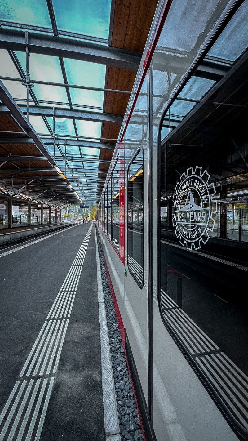
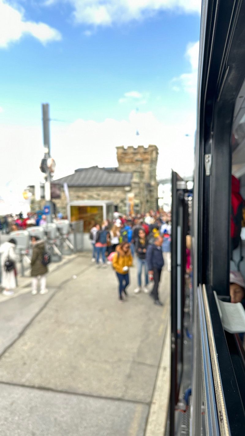
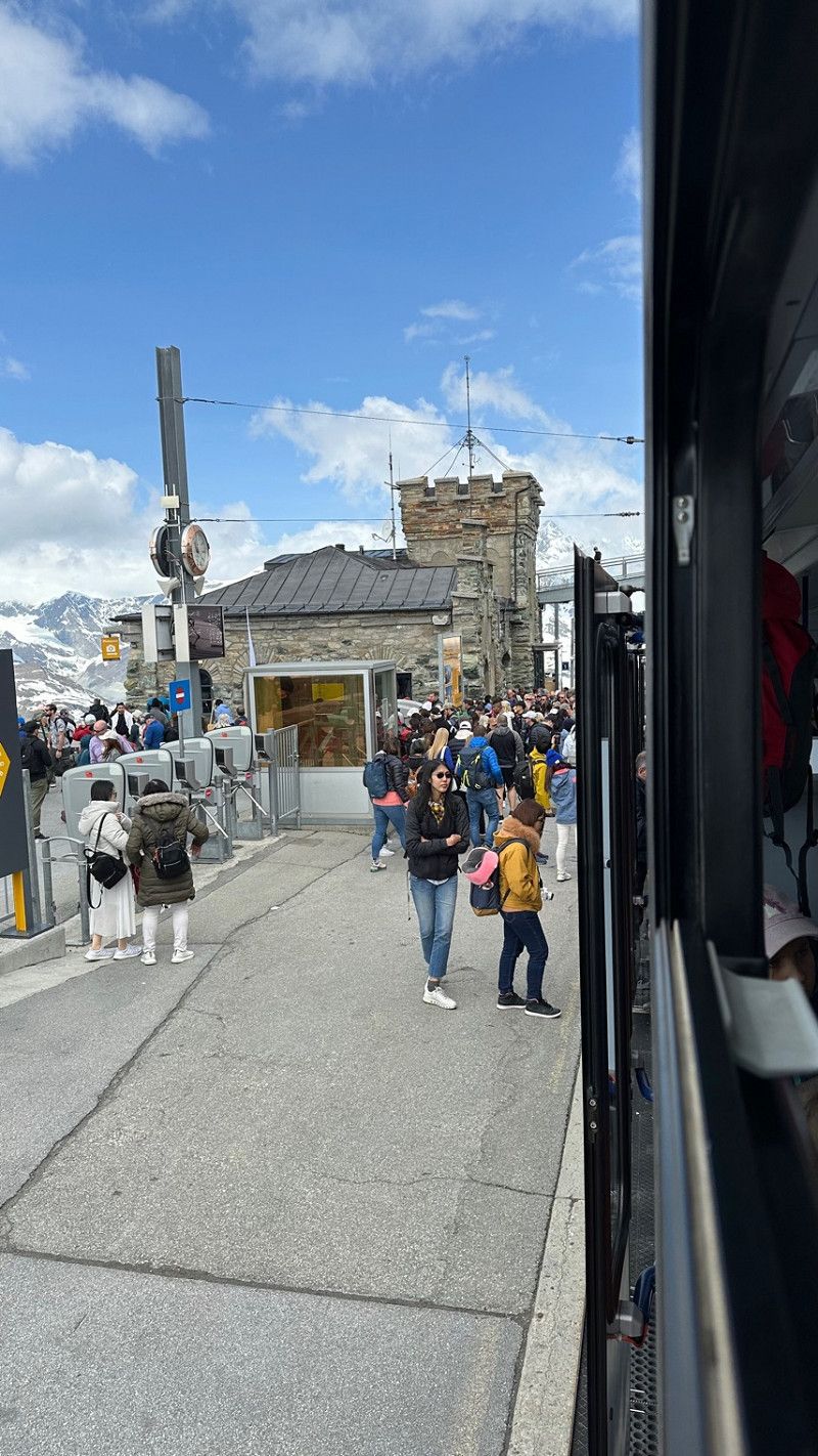
Gornergrat Bahn, Bahnhofplatz, Zermatt, Schweiz
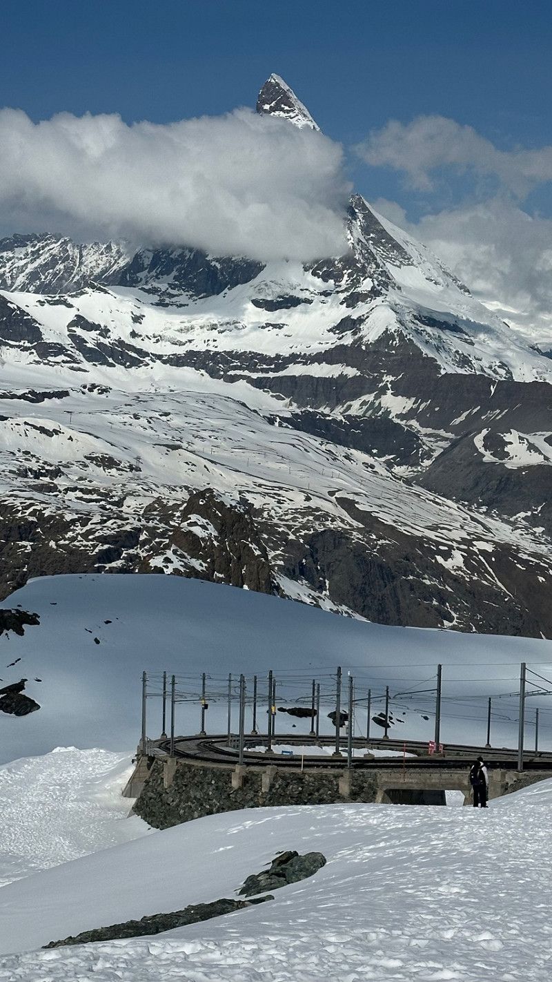
It makes sense to leave very early. Around noon was just withdrawing quite a lot of people.
Bahnhofpl. 1, 3920 Zermatt, Schweiz
46° 1' 26.2" N 7° 44' 54.5" E
46.0239501 7.7484824
• Head toward Zilfuristrasse on Hubleweg. Go for 46 m.
• Turn slightly right onto Zilfuristrasse. Go for 134 m.
• Turn right onto Oeschistrasse. Go for 108 m.
• Turn slightly left onto Oeschistrasse. Go for 69 m.
• Continue on Öschigässli. Go for 520 m.
• Turn right onto Aeussere Dorfstrasse. Go for 845 m.
• Take ramp onto Bühl (A6). Go for 4.2 km.
• Turn left onto Blausee. Go for 339 m.
• Arrive at Blausee. Your destination is on the left.
☍
6,2 km
( 9 min.)
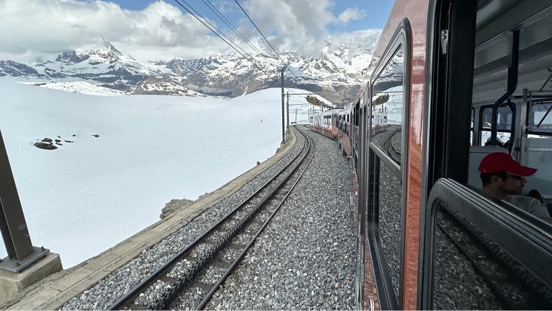
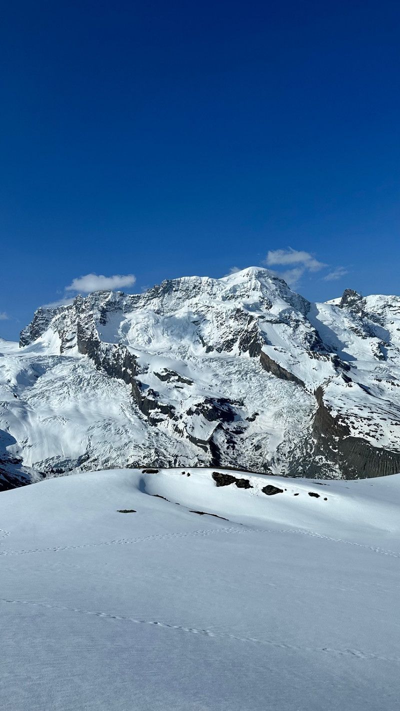
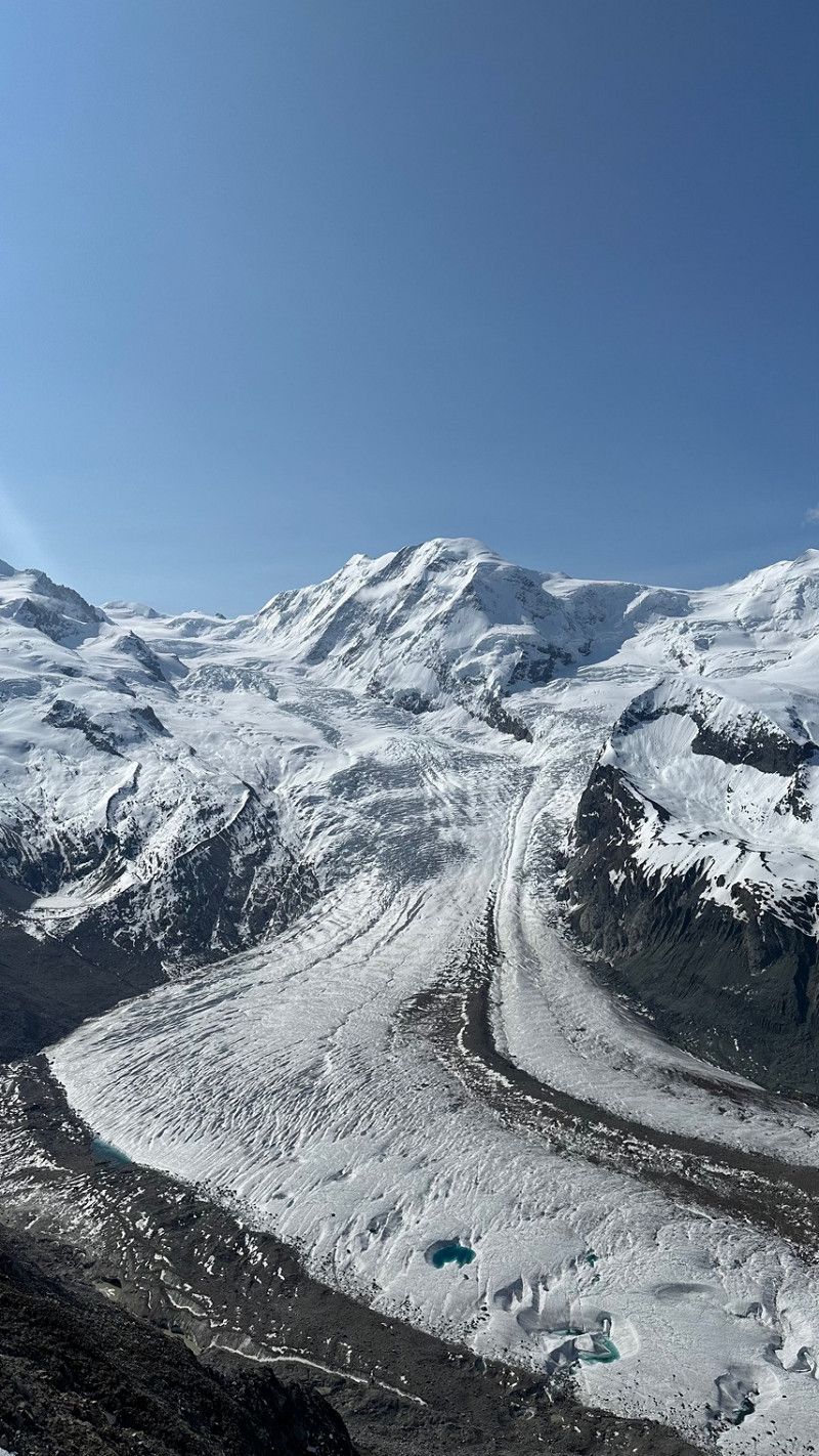
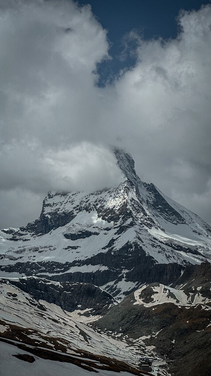
Gornergrat, Zermatt, Schweiz
Gornergrat, 3920 Zermatt, Schweiz
45° 59' 0.5" N 7° 47' 4.8" E
45.9834759 7.7846801
• Head toward Kanderstegstrasse on Blausee. Go for 339 m.
• Turn left onto Kanderstegstrasse (A6). Go for 5.8 km.
• Keep left onto Lötschbergstrasse (A6). Go for 7.3 km.
• Turn right onto Aeschistrasse toward Mülenen-Dorf/Gewerbezone Chappelengand. Go for 781 m.
• Continue on Mülenenstrasse. Go for 1.9 km.
• Take the 2nd exit from roundabout onto Alleestrasse. Go for 581 m.
• Continue on Krattigenstrasse. Go for 1.1 km.
• Continue on Aeschistrasse. Go for 578 m.
• Continue on Dorfstrasse. Go for 649 m.
• Continue on Leissigenstrasse. Go for 1.6 km.
• Continue on Mad. Go for 877 m.
• Continue on Hauptstrasse. Go for 641 m.
• Turn right onto Hauptstrasse (6/11). Go for 1.7 km.
• Turn right and take ramp onto A8 toward Interlaken. Go for 28.1 km.
• Keep left toward Grimsel/Susten/Meiringen/Unterbach/6/11. Go for 223 m.
• Continue on 6/11. Go for 1.5 km.
• Take the 2nd exit from roundabout onto Hauptstrasse (6/11). Go for 4.8 km.
• Take the 1st exit from roundabout onto Balmstrasse toward Balm. Go for 705 m.
• Turn left toward Bielti. Go for 894 m.
• Turn slightly right onto Bielti. Go for 820 m.
• Continue on Prasti. Go for 1.4 km.
• Turn slightly right onto Unterzaun. Go for 971 m.
• Continue on Zaun. Go for 1.0 km.
• Arrive at Zaun.
☍
64,3 km
(1 hrs. 2 min.)
Camping Alphubel
3929, Täsch, Schweiz
46° 3' 53.3" N 7° 46' 28.5" E
46.0648100 7.7745800
• Head east on Zaun. Go for 1.0 km.
• Continue on Unterzaun. Go for 2.2 km.
• Continue on Prasti. Go for 723 m.
• Continue on Bielti. Go for 1.1 km.
• Turn right onto Balmstrasse. Go for 689 m.
• Take the 1st exit from roundabout onto 6/11 toward Grimsel/Susten. Go for 1.6 km.
• Take the 1st exit from roundabout onto Grimselstrasse (6/11) toward Grimsel/Susten. Go for 3.6 km.
• Arrive at Hauptstrasse (6/11).
☍
11,0 km
( 16 min.)
Day
Lötschental
Right now we are standing and waiting here for the car train. Quite a lot of traffic but the only way to Kandersteg.
46° 22' 5.5" N 7° 45' 18.3" E
46.3681946 7.7550720
• Head toward Scheideggstrasse on Hauptstrasse (6/11). Go for 3.6 km.
• Take the 1st exit from roundabout onto Alpbachstrasse toward Meiringen. Go for 516 m.
• Continue on Rudenz. Go for 174 m.
• Continue on Bahnhofstrasse. Go for 311 m.
• Continue on Hauptstrasse. Go for 558 m.
• Turn right onto Brünigstrasse. Go for 2.3 km.
• Continue on Brünigpassstrasse. Go for 3.7 km.
• Turn right onto Gnoll (A8) toward Luzern/Brünig/Hasliberg. Go for 32.4 km.
• Keep left onto A8 toward Gotthard/Stans/Luzern. Go for 1.3 km.
• Take ramp onto A2 (Kirchenwaldtunnel) toward Gotthard/Stans. Go for 57.0 km.
• Take exit 40 toward Gotthardpass/Furkapass/Oberalppass/Andermatt. Go for 961 m.
• Pass 2 roundabouts and continue on Umfahrungsstrasse (2). Go for 8.5 km.
• Take the 1st exit from roundabout onto Furkastrasse (19) toward Furkapass/Realp/Autoverlad Furka. Go for 28.0 km.
• Turn right onto 6 toward Grimsel. Go for 6.0 km.
• Turn left toward Grimselpass/6. Go for 56 m.
• Turn left onto Grimselpass (6). Go for 11.6 km.
• Turn right. Go for 66 m.
• Arrive at your destination.
☍
157,0 km
(2 hrs. 13 min.)
Campingplätze Rendez-vous, Hubleweg, Kandersteg, Schweiz
Camping Rendez-vous, Hubleweg, 3718 Kandersteg, Schweiz
46° 29' 48.4" N 7° 41' 1" E
46.4967770 7.6836019
• Head toward Am Grimselpass. Go for 66 m.
• Turn right onto Am Grimselpass (6). Go for 14.6 km.
• Turn right onto Sustenstrasse (11) toward Wassen. Go for 45.5 km.
• Turn right onto Gotthardstrasse (2) toward Lugano/Airolo/Gotthardpass/Göschenen. Go for 4.1 km.
• Take the 3rd exit from roundabout onto 2. Go for 5.1 km.
• Take the 2nd exit from roundabout onto Umfahrungsstrasse (2) toward Gotthardpass/Furkapass/Furka. Go for 3.4 km.
• Take the 1st exit from roundabout onto Furkastrasse (19) toward Furkapass/Realp/Autoverlad Furka. Go for 28.0 km.
• Turn right onto 6 toward Grimsel. Go for 6.0 km.
• Turn left toward Grimselpass/6. Go for 56 m.
• Turn left onto Grimselpass (6). Go for 6.7 km.
• Arrive at Am Grimselpass (6).
☍
113,6 km
(1 hrs. 57 min.)
Day
Oeschinen Lake, Kandersteg, Schweiz
Oeschinensee, 3718 Kandersteg, Schweiz
46° 29' 56.1" N 7° 43' 44.8" E
46.4989089 7.7291063
• Head northwest on Am Grimselpass (6). Go for 5.0 km.
• Arrive at Am Grimselpass (6). Your destination is on the right.
☍
5,0 km
( 4 min.)
Via Alpina
46° 30' 12.1" N 7° 43' 41.1" E
46.5033569 7.7280705
• Head northwest on Am Grimselpass (6). Go for 947 m.
• Turn right. Go for 172 m.
• Make a U-Turn. Go for 172 m.
• Turn left onto Handegg (6). Go for 1.1 km.
• Turn left. Go for 66 m.
• Arrive at your destination.
☍
2,5 km
( 6 min.)
Camping Rendez-vous, Hubleweg, Kandersteg, Schweiz
Camping Rendez-vous, Hubleweg, 3718 Kandersteg, Schweiz
46° 29' 48.4" N 7° 41' 1" E
46.4967770 7.6836019
• Head toward Am Grimselpass. Go for 66 m.
• Turn right onto Am Grimselpass (6). Go for 14.6 km.
• Turn right onto Sustenstrasse (11) toward Wassen. Go for 45.5 km.
• Turn right onto Gotthardstrasse (2) toward Lugano/Airolo/Gotthardpass/Göschenen. Go for 4.1 km.
• Take the 3rd exit from roundabout onto 2. Go for 5.1 km.
• Take the 2nd exit from roundabout onto Umfahrungsstrasse (2) toward Gotthardpass/Furkapass/Furka. Go for 3.4 km.
• Take the 1st exit from roundabout onto Furkastrasse (19) toward Furkapass/Realp/Autoverlad Furka. Go for 28.0 km.
• Turn right onto 6 toward Grimsel. Go for 6.0 km.
• Arrive at Grimselpass (6). Your destination is on the left.
☍
106,7 km
(1 hrs. 50 min.)
Day
Blausee, Kandergrund, Schweiz
Blausee, 3717 Kandergrund, Schweiz
46° 31' 56.8" N 7° 39' 53.1" E
46.5324482 7.6647629
• Head southwest on Grimselpass (6). Go for 63 m.
• Turn left toward Grimselpass/6. Go for 56 m.
• Turn left onto Grimselpass (6). Go for 26.2 km.
• Turn right onto Sustenstrasse (11) toward Wassen. Go for 45.5 km.
• Turn right onto Gotthardstrasse (2) toward Lugano/Airolo/Gotthardpass/Göschenen. Go for 4.1 km.
• Take the 3rd exit from roundabout onto 2. Go for 5.1 km.
• Take the 2nd exit from roundabout onto Umfahrungsstrasse (2) toward Gotthardpass/Furkapass/Furka. Go for 3.4 km.
• Take the 1st exit from roundabout onto Furkastrasse (19) toward Furkapass/Realp/Autoverlad Furka. Go for 20.4 km.
• Turn right onto Belvédère. Go for 47 m.
• Arrive at Belvédère. Your destination is on the right.
☍
104,9 km
(1 hrs. 51 min.)
Oltschibachfall, Meiringen, Schweiz
As we drove by, we discovered the waterfall. We then stood in a parking lot at an airfield. From here you already had a great view. The best view is from the street on the right. On the left you come to a small forest path to the waterfall.
According to the internet, it is said to be one of the most beautiful waterfalls in the Bernese Oberland.
Oltschibachfall, 3860 Meiringen, Schweiz
46° 43' 52.3" N 8° 6' 51" E
46.7312000 8.1141600
• Head toward Furkastrasse on Belvédère. Go for 47 m.
• Turn left onto Furkastrasse (19). Go for 20.4 km.
• Take the 3rd exit from roundabout onto Gotthardstrasse (2/19) toward Oberalppass/Andermatt. Go for 3.5 km.
• Take the 1st exit from roundabout onto Gotthardstrasse toward Oberalppass/Andermatt. Go for 789 m.
• Take the 2nd exit from roundabout onto Oberalpstrasse (19) toward Oberalppass/Chur. Go for 10.7 km.
• Arrive at Oberalppass (19). Your destination is on the right.
☍
35,4 km
( 40 min.)
Aareschlucht, Innertkirchen, Schweiz
Aareschlucht, 3862 Innertkirchen, Schweiz
46° 42' 41.5" N 8° 12' 54.1" E
46.7115335 8.2150367
• Head southeast on Oberalppass (19).
• Arrive at Oberalppass (19). Your destination is on the right.
☍
Distance not available
(Duration not available)
3864
46° 36' 39" N 8° 18' 41.8" E
46.6108398 8.3116170
• Head southeast on Oberalppass (19). Go for 20.7 km.
• Turn left onto Via Sursilvana (19). Go for 28.8 km.
• Take the 2nd exit from roundabout onto Oberalpstrasse (19) toward Chur/Flims. Go for 1.8 km.
• Turn right and take ramp toward Schluein/Spital Ilanz. Go for 87 m.
• Continue on Casanova. Go for 25 m.
• Arrive at Casanova. Your destination is on the left.
☍
51,4 km
( 50 min.)
Day
Räterichsbodensee
46° 35' 15.1" N 8° 19' 34.2" E
46.5875244 8.3261804
• Head east on Casanova. Go for 25 m.
• Take ramp. Go for 87 m.
• Turn right onto 19 toward Chur/Flims. Go for 6.0 km.
• Pass 2 roundabouts and continue on Stradun Cantunal (19). Go for 14.4 km.
• Take ramp onto A13 toward Chur. Go for 33.0 km.
• Take exit 11 toward St. Gallen/St. Margrethen/München/Feldkirch/Vaduz onto A13. Go for 40.9 km.
• Take exit 4 toward Kriessern/Altstätten/Götzis. Go for 268 m.
• Continue on Zollstrasse. Go for 260 m.
• Continue on L58. Go for 429 m.
• Take the 3rd exit from roundabout onto Mäderer Landesstraße (L58). Go for 1.2 km.
• Take the 3rd exit from roundabout onto Neue Landstraße (L55). Go for 951 m.
• Take left ramp onto A14 (Rheintal Autobahn) toward Deutschland/Bregenz. Go for 26.5 km.
• Continue on A96. Go for 41.0 km.
• Take exit 9 toward Leutkirch-West/Biberach/Bad Wurzach. Go for 297 m.
• Turn left onto B465 toward Biberach/Bad Wurzach/Reichenhofen. Go for 12.4 km.
• Take the 2nd exit from roundabout onto Ortsrandstraße II (B465) toward Biberach/Ravensburg/Bad Waldsee. Go for 752 m.
• Turn right onto Ravensburger Straße toward Bad Wurzach. Go for 603 m.
• Turn left onto Biberacher Straße. Go for 434 m.
• Turn right onto Biberacher Straße (B465) toward Unterschwarzach/Biberach/B455. Go for 14.3 km.
• Turn right onto B30. Go for 19.1 km.
• Take ramp toward Schwendi/Schemmerhofen/Äpfingen/Warthausen. Go for 354 m.
• Turn right onto L267 toward Schwendi/Schemmerhofen/Äpfingen. Go for 898 m.
• Turn left onto L266. Go for 3.7 km.
• Continue on Hauptstraße (L266). Go for 1.6 km.
• Turn right onto Ingerkinger Straße (K7528) toward Ehingen/Altheim. Go for 352 m.
• Continue on K7528. Go for 56 m.
• Turn left onto K7589. Go for 741 m.
• Take the 2nd exit from roundabout toward Biberach/B465/Ehingen/Ingerkingen. Go for 299 m.
• Turn right onto B465. Go for 6.5 km.
• Take the 2nd exit from roundabout onto B465 toward Stuttgart/Ehingen. Go for 3.3 km.
• Turn right onto Graf-Konrad-Straße (K7355) toward Berg. Go for 212 m.
• Turn right. Go for 17 m.
• Arrive at your destination on the left.
☍
230,8 km
(2 hrs. 27 min.)
Handeggfallbrücke, Guttannen, Schweiz
Aare, 3864 Guttannen, Schweiz
46° 36' 49.1" N 8° 18' 29.2" E
46.6136321 8.3081177
• Head toward Graf-Konrad-Straße. Go for 17 m.
• Turn right onto Graf-Konrad-Straße (K7355). Go for 29 m.
• Turn left onto Brauhausstraße (K7355). Go for 465 m.
• Continue on K7355. Go for 2.5 km.
• Turn right onto L259. Go for 5.1 km.
• Turn left onto Ersinger Straße (K7373). Go for 381 m.
• Continue on K7373. Go for 1.8 km.
• Continue on Rißtisser Straße (K7373). Go for 687 m.
• Turn right onto Dellmensinger Straße (K7373). Go for 1.3 km.
• Continue on K7373. Go for 615 m.
• Turn left and take ramp toward Ulm/B30. Go for 149 m.
• Turn right onto B311N. Go for 3.8 km.
• Take the 2nd exit from roundabout onto B30 toward A7/A8/Ulm. Go for 11.0 km.
• Take ramp onto B28 toward Stuttgart/Ulm/Neu-Ulm. Go for 1.5 km.
• Take ramp toward Neu-Ulm/Gewerbegebiet Neu-Ulm. Go for 356 m.
• Turn right onto Europastraße (B10) toward Augsburg/Neu-Ulm/Gewerbegebiet Neu-Ulm. Go for 519 m.
• Keep left onto Europastraße (B10) toward A7/A8/Augsburg/Nersingen/Gewerbegebiet Neu-Ulm. Go for 8.1 km.
• Take ramp onto A7 toward Würzburg/München/Augsburg. Go for 252 km.
• Take exit 94 toward Schlüchtern/Motten. Go for 364 m.
• Turn left onto St2790 toward Fulda/Speicherz/Schlüchtern/Motten. Go for 3.4 km.
• Turn left onto KG24 toward Schlüchtern/Oberzell. Go for 1.4 km.
• Continue on K939. Go for 2.0 km.
• Take the 1st exit from roundabout toward Flieden/Schlüchtern/Sterbfritz/Gundhelm. Go for 782 m.
• Turn left onto Fuldaer Straße (L2304) toward Flieden/Schlüchtern/Sterbfritz/Gundhelm. Go for 8.5 km.
• Continue on Bahnhofstraße (L3180) toward Schlüchtern/Sannerz. Go for 193 m.
• Arrive at Bahnhofstraße (L3180). Your destination is on the left.
☍
306,6 km
(2 hrs. 57 min.)
3864
46° 36' 33.8" N 8° 18' 49.3" E
46.6093750 8.3137080
Day
Grimselstrasse 21
46° 33' 40.8" N 8° 20' 15.1" E
46.5613403 8.3375215
Eisgrotte
46° 34' 38.3" N 8° 23' 16.2" E
46.5773010 8.3878351
Day
Furkapass Parkplatz, Obergoms VS, Schweiz
Only drove past with a small photo stop.
3999 Obergoms VS, Schweiz
46° 34' 20.5" N 8° 24' 54.8" E
46.5723742 8.4152182
Oberalpstrasse
46° 39' 31.4" N 8° 40' 15.7" E
46.6587219 8.6710251
Oberalpstrasse
46° 39' 31.4" N 8° 40' 15.7" E
46.6587219 8.6710251
Hauptstrasse 19
46° 46' 39.6" N 9° 12' 50.9" E
46.7776794 9.2141416
Graf-Konrad-Straße 20
48° 15' 42.1" N 9° 44' 7.9" E
48.2616882 9.7355300
Back home
Sinntal, Deutschland
50° 18' 45.6" N 9° 37' 25.2" E
50.3126669 9.6236534