Day
92262 Birgland, Deutschland
At the end of April after the Easter holidays we started our 3000 km tour through Austria and northern Italy:
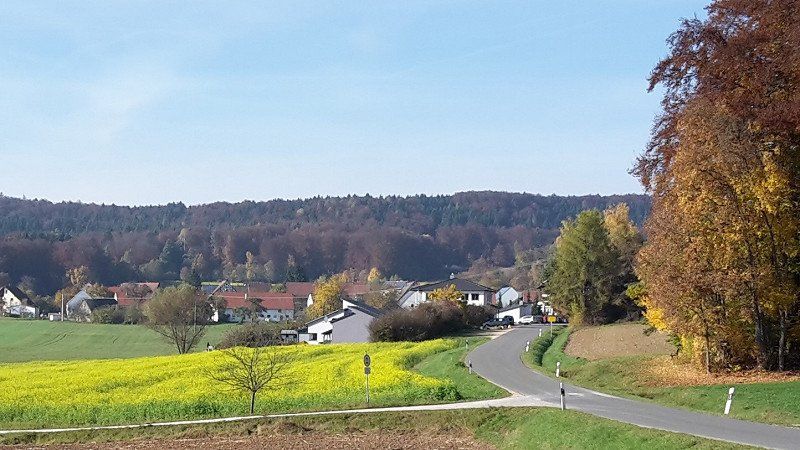
- Upper Palatinate, Lower Bavaria
- Upper Austria, Styria, Carinthia
- Veneto, Emiglia-Romana, Tuscany, Liguria, Lombardy, Trentino, South Tyrol
- East Tyrol, Salzburger Land
- Upper Bavaria
49° 26' 14.4" N 11° 37' 0.8" E
49.4373342 11.6168798
• Head south on Frechetsfeld (AS36). Go for 259 m.
• Continue on AS36. Go for 938 m.
• Continue on AS3. Go for 2.4 km.
• Continue on Schwenderöd (AS3). Go for 132 m.
• Turn right onto Schwenderöd (St2164). Go for 7.7 km.
• Turn left onto Gleisnach (St2164) toward Neumarkt i.d.OPf./Parsberg/Velburg/Gewerbegebiet-Hohe Birke/Gewerbegebiet-Zur Schanze/Gewerbegebiet-Süd. Go for 1.4 km.
• Turn left onto St2236. Go for 166 m.
• Turn right onto B299 toward Neumarkt i.d.OPf./Parsberg/Velburg/Engelsberg/Habsberg. Go for 338 m.
• Turn left onto NM1 toward Parsberg/Velburg/Engelsberg. Go for 7.6 km.
• Take the 2nd exit from roundabout onto NM1. Go for 7.9 km.
• Take the 2nd exit from roundabout onto NM1 toward A3/Nürnberg/Regensburg/Neumarkt i.d.OPf./Deining/Lengenfeld. Go for 1.1 km.
• Continue on St2220. Go for 1.4 km.
• Take ramp onto A3 toward Regensburg. Go for 180 km.
• Take the exit. Go for 336 m.
• Turn left onto B12. Go for 151 m.
• Continue on A94. Go for 570 m.
• Continue on B12. Go for 1.6 km.
• Turn right onto Rottau toward Pfarrkirchen/Bad Birnbach/Bad Griesbach/Ruhstorf a.d. Rott. Go for 496 m.
• Continue on Königswiese. Go for 67 m.
• Turn right onto B388 toward Pfarrkirchen/Bad Birnbach/Bad Griesbach/Ruhstorf a.d. Rott. Go for 1.4 km.
• Turn right onto Rotthofer Straße (St2619) toward Ruhstorf. Go for 68 m.
• Turn right onto Rotthofer Straße (St2619). Go for 253 m.
• Turn left onto Pfarrkirchener Straße (St2619). Go for 1.4 km.
• Turn left onto Pillhamer Straße. Go for 63 m.
• Turn left onto Wasserfeldstraße. Go for 154 m.
• Turn left onto Taubenberg. Go for 74 m.
• Arrive at Taubenberg. Your destination is on the left.
☍
217,8 km
(2 hrs. 3 min.)
Ruhstorf an der Rott, Deutschland
Our first stop was near Passau, where we were visiting friends.
We spent a cozy evening and had a lot to tell each other.
94099 Ruhstorf an der Rott, Deutschland
48° 26' 20" N 13° 19' 59.3" E
48.4388803 13.3331522
• Head toward Caritasweg on Taubenberg. Go for 74 m.
• Turn right onto Wasserfeldstraße. Go for 154 m.
• Turn right onto Pillhamer Straße. Go for 63 m.
• Turn left onto Passauer Straße (St2619). Go for 3.2 km.
• Turn right onto Ruhstorfer Straße (St2619). Go for 1.9 km.
• Turn left onto Eglseer Straße (PA7). Go for 682 m.
• Continue on PA7. Go for 534 m.
• Continue on Krottenberg (PA7). Go for 176 m.
• Continue on PA7. Go for 147 m.
• Continue on Eglsee (PA7). Go for 1.7 km.
• Continue on PA7. Go for 358 m.
• Continue on Höch (PA7). Go for 3.4 km.
• Continue on PA7. Go for 460 m.
• Continue on Fürstdobl (PA7). Go for 415 m.
• Continue on PA7. Go for 1.5 km.
• Turn left onto St2110. Go for 1.2 km.
• Turn right onto Neuburger Straße (St2110) toward Passau. Go for 3.0 km.
• Continue on Neuburger Straße. Go for 553 m.
• Turn left onto Prachatitzer Straße. Go for 57 m.
• Turn right onto Schönauerweg. Go for 249 m.
• Arrive at Schönauerweg. Your destination is on the right.
☍
19,8 km
( 20 min.)
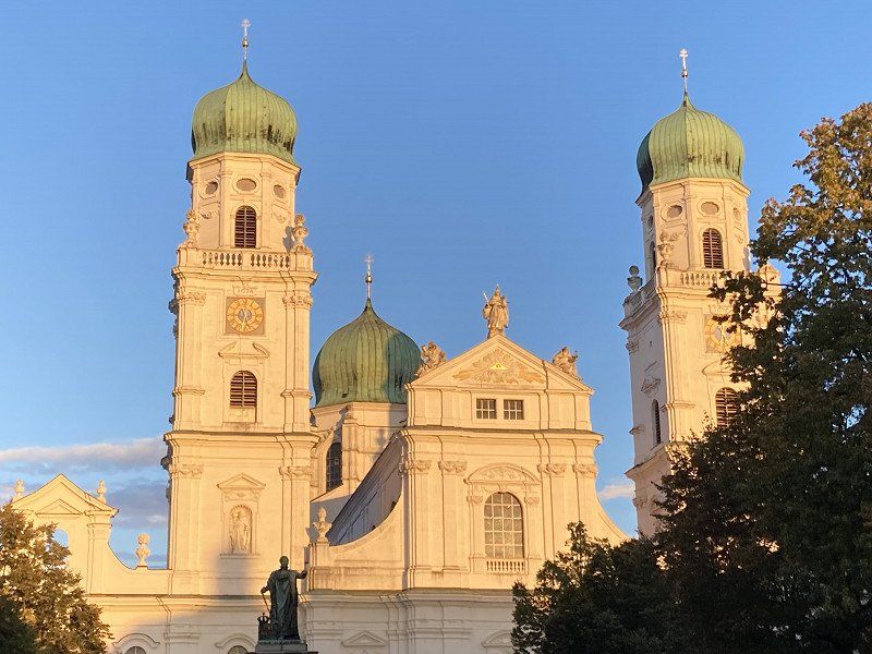
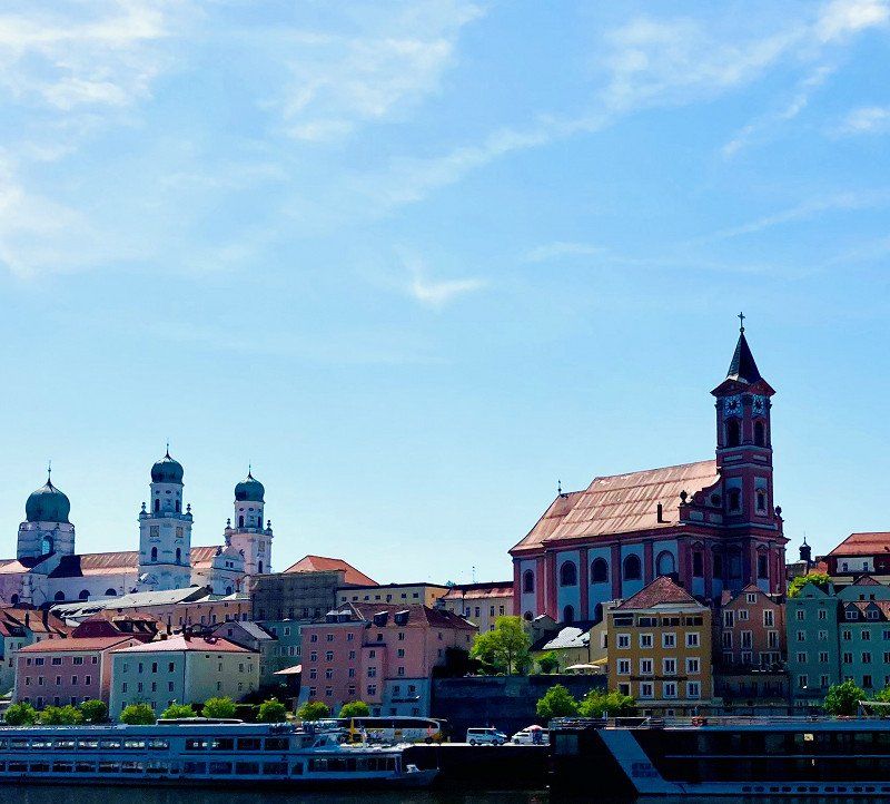
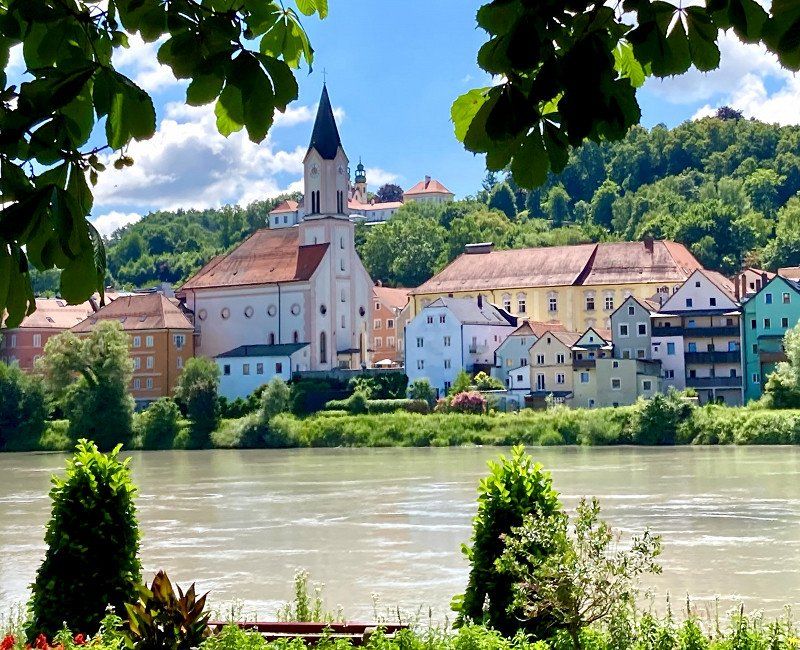
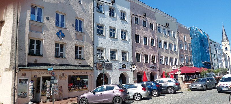
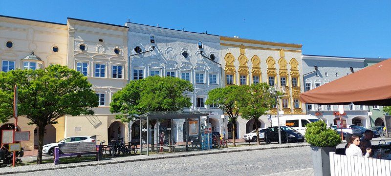
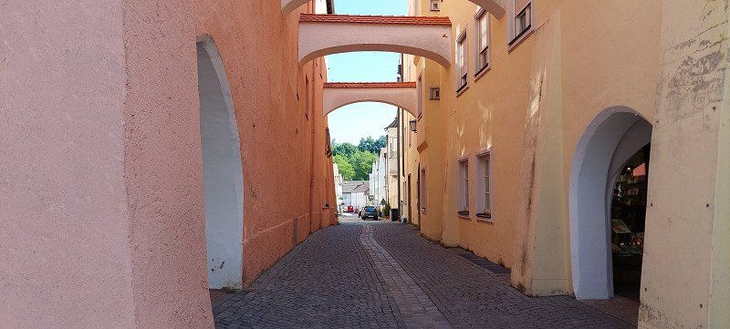
Passau, Deutschland
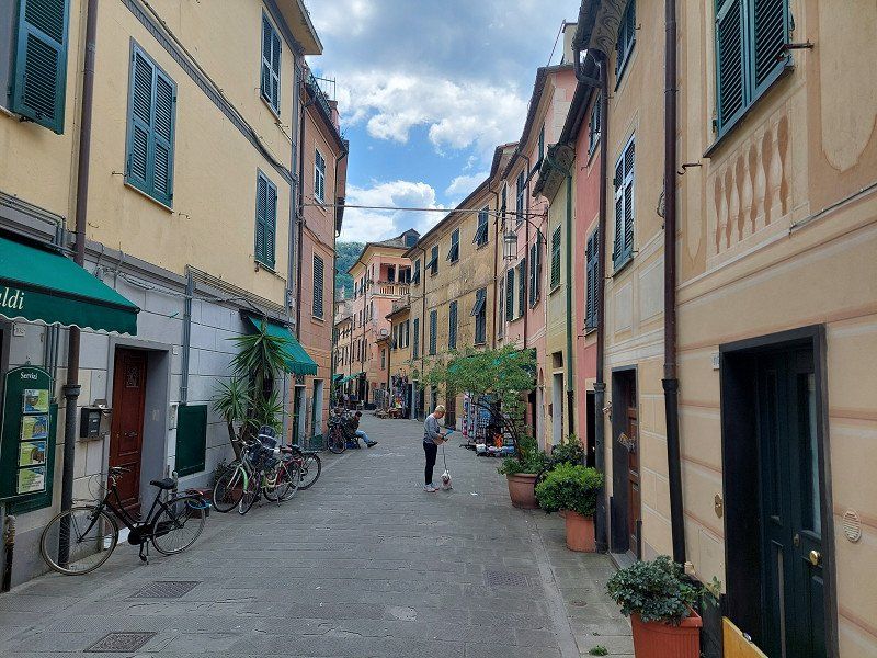
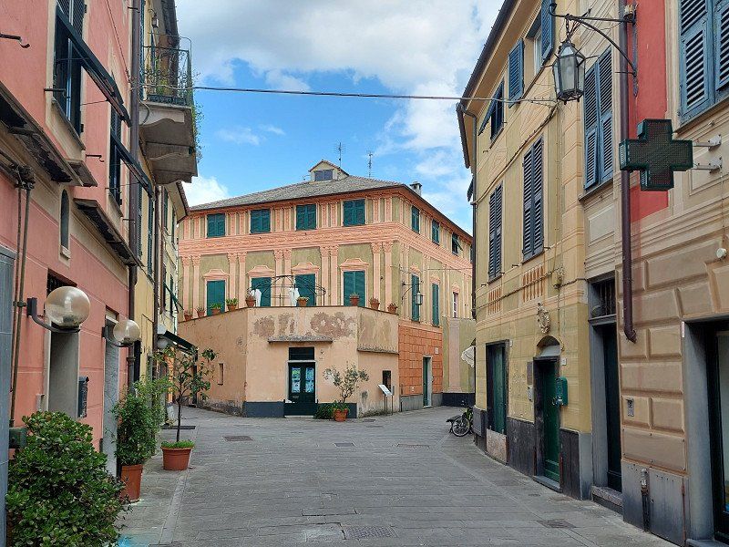
After Landshut, Passau is the largest city in Lower Bavaria.
The old town is located on a long peninsula between the Inn and the Danube.
The historic three-river city is an absolute highlight, if only because of its special flair.
48° 34' 0.3" N 13° 25' 55" E
48.5667364 13.4319466
• Head south on Schönauerweg. Go for 249 m.
• Turn left onto Prachatitzer Straße. Go for 57 m.
• Turn right onto Neuburger Straße. Go for 3.5 km.
• Continue on St2618 toward Regensburg/A3/Linz/München/Bad Griesbach/Fürstenzell/Neukirchen a. Inn. Go for 830 m.
• Take ramp onto A3 toward Linz. Go for 16.7 km.
• Continue on A3/A8 (Innkreis Autobahn). Go for 305 m.
• Continue on A8 (Innkreis Autobahn). Go for 60.6 km.
• Continue on A25 (Welser Autobahn) toward Wien/Linz/ÖBB-Terminal/Wels-Nord. Go for 19.4 km.
• Take the exit toward Wien/Linz onto A1 (West Autobahn). Go for 95.7 km.
• Take exit 80 toward Melk/B1. Go for 358 m.
• Turn right onto Melker Bundesstraße (B3a) toward Melk/B1/Donaubrücke/B3. Go for 405 m.
• Take the 3rd exit from roundabout onto Melker Bundesstraße (B3a) toward Melk. Go for 3.5 km.
• Take the 3rd exit from roundabout onto Donau Bundesstraße (B3) toward Krems/Spitz/Krems a.d. Donau/Spitz a. d. Donau/Schallemmersdorf/Weinstraße Wachau. Go for 14.9 km.
• Take the 1st exit from roundabout onto Donau Bundesstraße (B3) toward Krems/Krems a. d. Donau/Dürnstein. Go for 452 m.
• Arrive at Donau Bundesstraße (B3). Your destination is on the left.
☍
217,0 km
(2 hrs. 1 min.)
Day
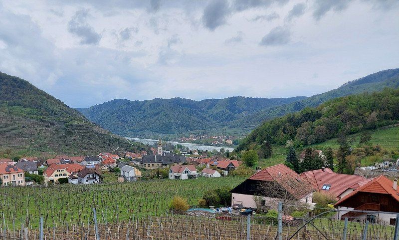
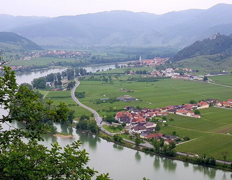
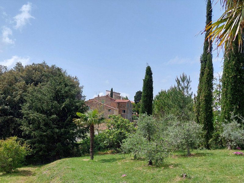
Spitz, Österreich
After breakfast we leave.
Our journey takes us to the Wachau World Heritage Site in Lower Austria.
In Spitz we enjoy the view over the valley on the left bank of the Danube.
3620 Spitz, Österreich
48° 21' 42.5" N 15° 24' 57.3" E
48.3617961 15.4159155
• Head toward Carl-Jedek-Gasse on Donau Bundesstraße (B3). Go for 10.6 km.
• Turn left onto Dürnstein. Go for 7 m.
• Turn right onto Dürnstein. Go for 205 m.
• Arrive at Dürnstein. Your destination is on the left.
☍
10,8 km
( 8 min.)
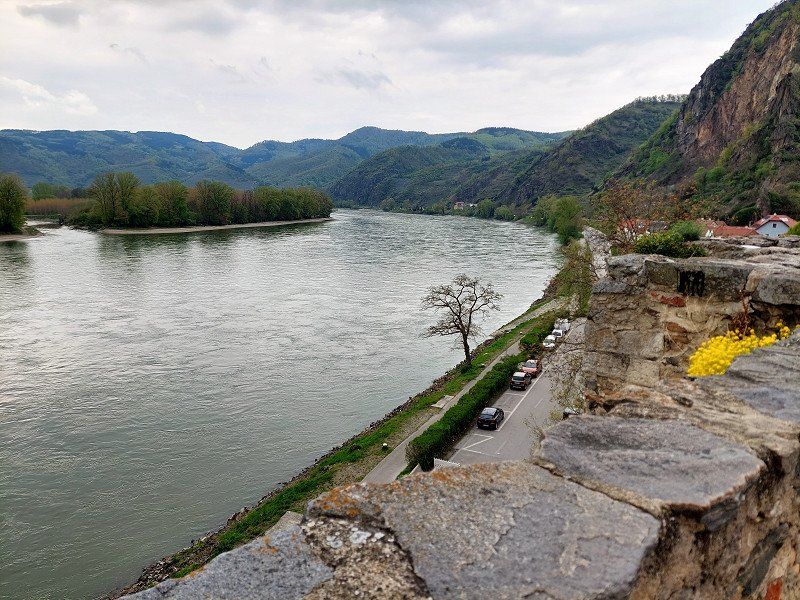
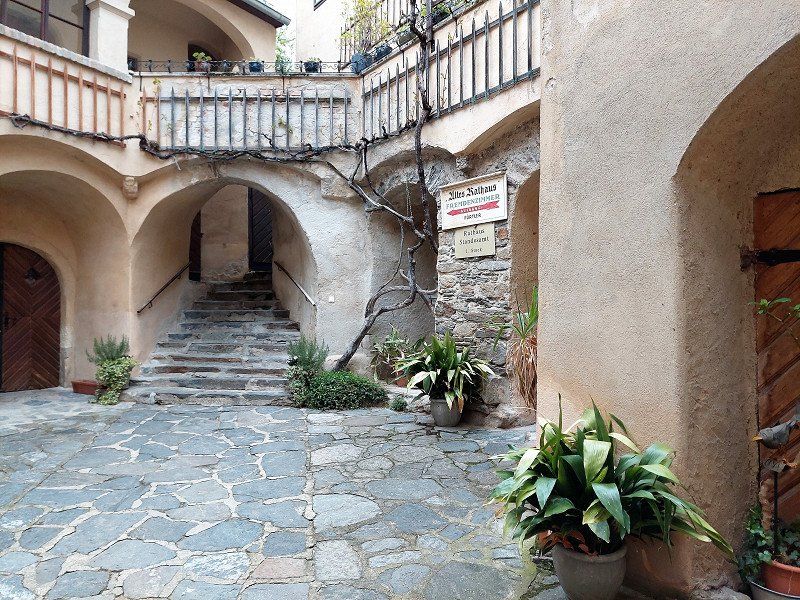
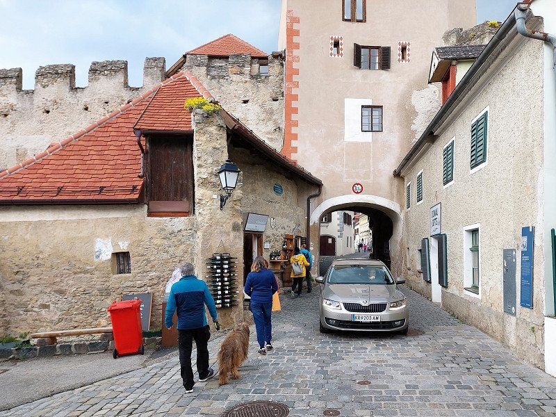
Dürnstein, Österreich
We then continue to Dürnstein and walk through the romantic town.
Here King Lionheart was imprisoned in the Middle Ages and was found by the singer Blondel and released for a horrendous ransom.
3601 Dürnstein, Österreich
48° 23' 51.4" N 15° 31' 11.1" E
48.3976064 15.5197381
• Head south on Dürnstein. Go for 626 m.
• Turn right onto Donau Bundesstraße (B3). Go for 4.5 km.
• Take the 3rd exit from roundabout onto Aggsteiner Bundesstr.,Abzw. Donaubrücke (B33a) toward Mautern/Stift Göttweig. Go for 841 m.
• Take the 3rd exit from roundabout onto Kremser Straße (B33a). Go for 224 m.
• Turn right onto Melker Straße (L109). Go for 3.6 km.
• Arrive at Unterbergern (L109). Your destination is on the right.
☍
9,7 km
( 11 min.)
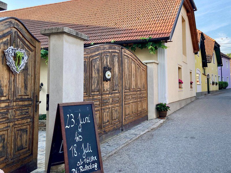
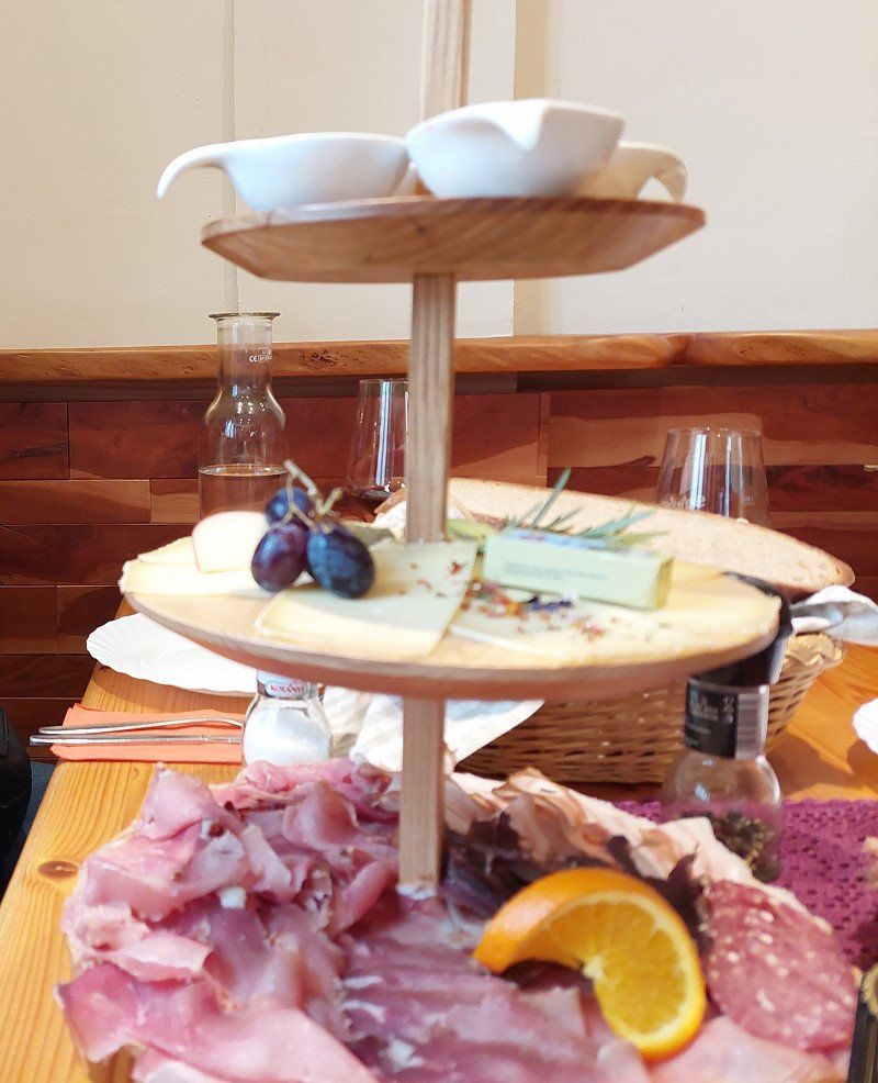
Unterbergern, Österreich
In the local restaurant there was of course wine from the Wachau with a hearty meal.
We spent the night on the property of a wine grower.
3512 Unterbergern, Österreich
48° 22' 29.4" N 15° 32' 51" E
48.3748300 15.5475101
• Head north on Unterbergern (L109). Go for 2.2 km.
• Turn left onto Mauternbach. Go for 466 m.
• Turn right onto Aggsteiner Bundesstraße (B33). Go for 4.5 km.
• Continue on Anschlussstelle Krems Süd. Go for 713 m.
• Keep left onto Anschlussstelle Krems Süd toward Wien/Tulln/A1/St. Pölten/Krems. Go for 276 m.
• Take ramp onto Kremser Bundesstraße (B37a) toward Wien/Tulln/St. Pölten/A1/Hollenburg. Go for 6.6 km.
• Continue on Knoten Traismauer. Go for 413 m.
• Take left ramp onto S33 (Kremser Schnellstraße) toward A1/St. Pölten/Traismauer-Süd. Go for 22.8 km.
• Take the exit onto A1 (West Autobahn). Go for 24.3 km.
• Keep right onto A21 (Knoten Steinhäusl) toward Budapest/A4/S1/Graz/A2/Wien-Süd Ost/Flughafen. Go for 17.1 km.
• Take exit 17 toward Mayerling. Go for 789 m.
• Take the 2nd exit from roundabout onto Mödlinger Bundesstraße (B11) toward Mödling/Heiligenkreuz. Go for 3.2 km.
• Turn right onto L130 toward Baden/Sattelbach. Go for 3.1 km.
• Turn left onto Sattelbach (B210) toward Baden/Cholerakapelle. Go for 10.3 km.
• Turn right onto Vöslauer Straße (B212) toward Bad Vöslau/Sooß. Go for 2.2 km.
• Take the 4th exit from roundabout onto Industriestraße (B212) toward A2/Wien/Graz/Kottingbrunn. Go for 791 m.
• Take the 2nd exit from roundabout onto B212 toward A2/Kottingbrunn. Go for 1.1 km.
• Take ramp onto A2 (Süd Autobahn) toward Graz. Go for 31.8 km.
• Keep right onto Knoten Seebenstein toward Bruck a. d. Mur/S6/Semmering/Neunkirchen. Go for 1.0 km.
• Continue on S6 (Semmering Schnellstraße). Go for 104 km.
• Continue on S36 (Murtal Schnellstraße) toward Klagenfurt/St.Stefan ob Leoben. Go for 20.0 km.
• Take the exit toward Knittelfeld-Ost/Knittelfeld/St. Margarethen/Rachau/Glein/Kleinlobming/Großlobming/Apfelberg. Go for 244 m.
• Turn left onto Murtal Begleitstraße Landesstraße (L518) toward Knittelfeld/St. Margarethen/Rachau/Glein/Kleinlobming/Großlobming/Apfelberg. Go for 533 m.
• Take the 2nd exit from roundabout onto Lobminger Landesstraße (L504). Go for 1.2 km.
• Take the 2nd exit from roundabout onto Leobner Straße (L553). Go for 349 m.
• Turn right onto Ainbachallee (L504). Go for 1.9 km.
• Turn left onto Stubalpenstraße (L504). Go for 3.0 km.
• Turn right onto Murweg. Go for 15 m.
• Turn slightly left onto Murweg. Go for 18 m.
• Turn right onto Murweg. Go for 536 m.
• Turn slightly right onto Murweg. Go for 121 m.
• Turn left onto Mursiedlung. Go for 43 m.
• Turn right onto Mursiedlung. Go for 308 m.
• Arrive at Mursiedlung. Your destination is on the right.
☍
265,5 km
(2 hrs. 37 min.)
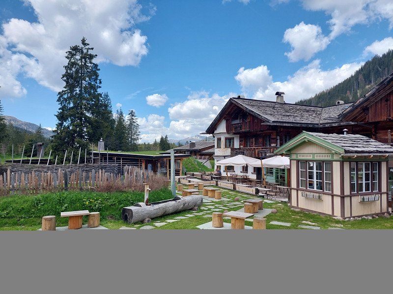
Day
Camping Murinsel
Then we continue to Styria.
A campsite of superlatives!!! Pure peace and relaxation.
A very nice operator who is wholeheartedly involved.
Unfortunately, the navigation system leads over a narrow street with a headroom of 2.8 m. It is better to follow the signs for Großlobming / Camping Murinsel.
We paid €28 (2 adults + 1 dog) for one night with our camper.
Teichweg 1, 8734, Großlobming, Austria
47° 11' 39.5" N 14° 48' 16.1" E
47.1943100 14.8044600
• Head southeast on Mursiedlung. Go for 308 m.
• Turn left onto Mursiedlung. Go for 43 m.
• Turn right onto Murweg. Go for 121 m.
• Turn slightly left onto Hauptstraße. Go for 536 m.
• Turn left onto Murweg. Go for 33 m.
• Turn right onto Hauptstraße (L504). Go for 234 m.
• Turn right onto Möbersdorfer Landesstraße (L543). Go for 4.1 km.
• Continue on Am Teichgrund (L543). Go for 246 m.
• Continue on Möbersdorfer Landesstraße (L543). Go for 891 m.
• Turn left onto Zeltweger Landesstraße (L537). Go for 1.3 km.
• Continue on Zeltweger Landesstraße (L537). Go for 815 m.
• Take the 3rd exit from roundabout onto Obdacher Bundesstraße (B78). Go for 28.3 km.
• Take the 1st exit from roundabout onto Klagenfurter Straße (B78). Go for 3.2 km.
• Turn left and take ramp onto A2 (Süd Autobahn) toward Klagenfurt. Go for 79.9 km.
• Take the left exit onto A2 (Süd Autobahn). Go for 53.0 km.
• Continue on A23 (Autostrada Alpe-Adria). Go for 26.8 km.
• Take the exit toward Pontebba. Go for 1.7 km.
• Turn left onto Località Pegla (SS13) toward Dogana/Pontebba/Udine/Moggio Udinese. Go for 30.5 km.
• Take ramp onto SS52 toward Udine/A23/Tarvisio/Tolmezzo. Go for 493 m.
• Turn left toward Via Tolmezzo. Go for 55 m.
• Turn right onto Via Tolmezzo. Go for 730 m.
• Continue on Strada Statale Carnica (SS52). Go for 2.4 km.
• Take the 2nd exit from roundabout onto Strada Statale Carnica (SS52) toward Autostrada/Tolmezzo/A23. Go for 2.9 km.
• Take ramp toward Cavazzo. Go for 1.2 km.
• Continue on Via San Rocco. Go for 875 m.
• Continue on Via 4 Novembre. Go for 372 m.
• Turn left onto SS512. Go for 3.4 km.
• Turn right onto Via Tolmezzo. Go for 3.2 km.
• Arrive at Via Tolmezzo. Your destination is on the left.
☍
247,9 km
(2 hrs. 50 min.)
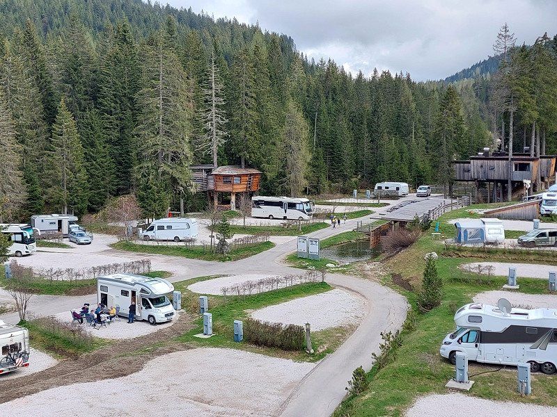
Day
Camping Lago 3 Comuni, Via Tolmezzo, Trasaghis, Udine, Italien
Before Venice we make one more night.
Very beautiful lake, ideal for a circumnavigation or bike rides.
Via Tolmezzo, 52, 33010 Trasaghis UD, Italien
46° 19' 32.8" N 13° 3' 49.9" E
46.3257733 13.0638670
• Head toward Via Somplago on Via Tolmezzo. Go for 1.3 km.
• Continue on Piazza 1 Maggio. Go for 45 m.
• Continue on Via Libertà. Go for 283 m.
• Continue on Via 8 Ottobre. Go for 615 m.
• Continue on SS512. Go for 3.4 km.
• Pass 2 roundabouts and continue on SS512. Go for 1.8 km.
• Take the 1st exit from roundabout onto SS512. Go for 1.5 km.
• Turn right onto Via Taboga (SS13). Go for 845 m.
• Take the 2nd exit from roundabout onto Via Taboga (SS13). Go for 1.5 km.
• Take ramp onto Via Pordenone (SP49) toward Udine/Tarvisio/A23. Go for 1.6 km.
• Turn left and take ramp onto A23 (Autostrada Alpe-Adria) toward Udine. Go for 44.5 km.
• Take the exit toward E70/Milano/Venezia onto A4 (Autostrada della Serenissima). Go for 65.5 km.
• Take the exit toward S.Donà/Noventa onto Svincolo San Donà di Piave. Go for 1.1 km.
• Take the 3rd exit from roundabout toward Trieste/S. Donà di Piave/Jesolo/Venezia. Go for 260 m.
• Continue on Via Martiri delle Foibe. Go for 5.3 km.
• Take the 2nd exit from roundabout onto Via Mario del Monaco (SS14var/B) toward Venezia/SS14/Zona Industriale S. Donà di P. Go for 6.3 km.
• Take the 1st exit from roundabout onto Via Armellina (SP47) toward Venezia/Treviso/Jesolo. Go for 3.0 km.
• Take the 5th exit from roundabout onto Via Caposile (SR43) toward Jesolo. Go for 3.5 km.
• Pass 2 roundabouts and continue on Via Adriatico. Go for 7.5 km.
• Keep left toward Punta/Sabbioni/Cavallino/SP42/Treporti. Go for 152 m.
• Continue on Via John Lennon. Go for 611 m.
• Continue on Strada Provinciale Jesolana (SP42). Go for 1.3 km.
• Pass 3 roundabouts and continue on Strada Provinciale Jesolana (SP42). Go for 4.2 km.
• Turn left onto Via Danubio. Go for 126 m.
• Turn right onto Via dell'Artigliere. Go for 502 m.
• Turn left onto Via del Granatiere. Go for 22 m.
• Take the 1st exit from roundabout onto Via Francesco Baracca. Go for 458 m.
• Continue on Via Francesco Baracca. Go for 363 m.
• Pass 3 roundabouts and continue on Via Francesco Baracca. Go for 827 m.
• Take the 2nd exit from roundabout onto Via Fausta (SP42) toward Ca' Savio/Punta Sabbioni/Venezia. Go for 6.4 km.
• Take the 2nd exit from roundabout onto Via Fausta (SP42) toward Punta Sabbioni. Go for 1.3 km.
• Take the 3rd exit from roundabout onto Via Fausta (SP42) toward Punta Sabbioni/Venezia. Go for 2.4 km.
• Take the 4th exit from roundabout onto Via Carso toward Punta Sabbioni/Cavallino. Go for 400 m.
• Turn slightly right onto Via Carso. Go for 1.5 km.
• Turn left onto Via Montello. Go for 667 m.
• Turn right. Go for 14 m.
• Arrive at your destination on the left.
☍
171,1 km
(2 hrs. 9 min.)
Day
Camping Village Marina di Venezia
Large campsite with access to the sea.
Doesn't have much to do with Italy. Pure money printing machine.
Via Montello 6, 30013, Cavallino Treporti, Italy
45° 26' 14.6" N 12° 26' 17.2" E
45.4373900 12.4381000
• Head southeast. Go for 20 m.
• Turn left. Go for 24 m.
• Turn left toward Via Montello. Go for 37 m.
• Turn left onto Via Montello. Go for 689 m.
• Turn right onto Via Carso. Go for 1.8 km.
• Take the 2nd exit from roundabout toward Lio Grando. Go for 219 m.
• Turn right onto Lungomare San Felice. Go for 299 m.
• Turn right onto Piazzale di Lio Grando. Go for 350 m.
• Continue on Via Riccardo Selvatico. Go for 479 m.
• Continue on Via Fausta (SP42) toward Autostrada. Go for 1.5 km.
• Pass 2 roundabouts and continue on Via Fausta (SP42). Go for 7.6 km.
• Take the 3rd exit from roundabout onto Via Fausta (SP42) toward Cavallino Centro/Jesolo. Go for 810 m.
• Take the 1st exit from roundabout onto Via Fausta (SP42) toward Autostrada/Venezia/Jesolo. Go for 327 m.
• Take the 2nd exit from roundabout onto Via Fausta (SP42) toward Jesolo. Go for 1.1 km.
• Turn right onto Via del Granatiere. Go for 317 m.
• Turn left onto Via dell'Artigliere. Go for 502 m.
• Turn left onto Via Danubio. Go for 126 m.
• Turn right onto Via Fausta (SP42). Go for 1.5 km.
• Pass 3 roundabouts and continue on Via Roma Destra (SP42). Go for 4.0 km.
• Keep left toward Autostrade/Trieste/Udine/Venezia/Treviso. Go for 488 m.
• Continue on Via John Lennon. Go for 275 m.
• Continue on Via Adriatico (SR43). Go for 3.2 km.
• Take the 3rd exit from roundabout onto Via Adriatico toward Venezia/Treviso. Go for 4.6 km.
• Take the 2nd exit from roundabout onto Via Adriatico (SR43) toward Venezia/San Donà di Piave/SS14/A4/Autostrade/A27. Go for 3.2 km.
• Take the 5th exit from roundabout onto Via Armellina (SR43) toward Venezia/A4. Go for 1.2 km.
• Take the 2nd exit from roundabout onto Strada Provinciale Portegrandi-Caposile-Jesolo (SP43) toward Venezia. Go for 8.0 km.
• Turn right onto Via Trezze (SP43) toward Trieste/S. Donà. Go for 615 m.
• Turn left onto Via Trieste (SS14). Go for 318 m.
• Turn left onto Strada Statale della Venezia Giulia (SS14) toward Aeroporto/Venezia/A4. Go for 9.7 km.
• Keep right toward Trieste/A4/Milano/A57/Venezia/Treviso/A27/Belluno. Go for 193 m.
• Continue on Raccordo Marco Polo. Go for 5.0 km.
• Take the exit toward Tangenziale/E70/Milano/A4/Bologna/A13 onto A57. Go for 9.1 km.
• Take the exit toward Ravenna/SS309/Marghera. Go for 682 m.
• Take the 3rd exit from Rotonda Romea roundabout toward Padova/Ravenna. Go for 399 m.
• Continue on Strada Statale Romea (SS309). Go for 1.3 km.
• Take the 2nd exit from roundabout onto Strada Statale Romea (SS309) toward Ravenna/Chioggia/Padova/SP81. Go for 1.2 km.
• Take the 3rd exit from roundabout onto Strada Statale Romea (SS309) toward Ravenna. Go for 2.5 km.
• Take the 2nd exit from roundabout onto Strada Statale Romea (SS309) toward Malcontenta. Go for 26.3 km.
• Take the 2nd exit from roundabout toward Ravenna/Chioggia. Go for 241 m.
• Continue on Strada Statale Romea (SS309). Go for 37.9 km.
• Pass 4 roundabouts and continue on Strada Statale Romea (SS309). Go for 44.6 km.
• Take the 2nd exit from roundabout toward Autostrada/A14/Ravenna. Go for 115 m.
• Continue on Via Romea Nord (SS309). Go for 4.6 km.
• Take the 1st exit from roundabout onto Via Romea Nord (SS309) toward Ravenna/Autostrada/A14. Go for 7.6 km.
• Take ramp toward Ravenna Centro. Go for 368 m.
• Take the 2nd exit from Rotonda degli Spedizionieri roundabout onto Via Romea Nord toward Ravenna/Zona Industriale Bassette. Go for 862 m.
• Take the 2nd exit from Rotonda Vecchia Fornace roundabout onto Via Romea Nord. Go for 392 m.
• Keep right onto Via Romea Nord. Go for 525 m.
• Take the 1st exit from Rotonda dei Camionisti roundabout onto Via Romea Nord. Go for 791 m.
• Take the 3rd exit from Rotonda Montecarlo roundabout onto Via della Chimica. Go for 1.2 km.
• Continue toward Via Attilio Monti. Go for 30 m.
• Take the 2nd exit from Rotonda Belgio roundabout onto Via Attilio Monti. Go for 848 m.
• Take the 2nd exit from Rotonda Finlandia roundabout onto Via Trieste. Go for 5.2 km.
• Take the 2nd exit from Rotonda degli Sgobbolari roundabout onto Via Trieste (SS67). Go for 594 m.
• Take the 1st exit from Rotonda dei Pinaroli roundabout onto Viale della Pace. Go for 138 m.
• Arrive at Viale della Pace.
☍
206,1 km
(3 hrs. 12 min.)
Day
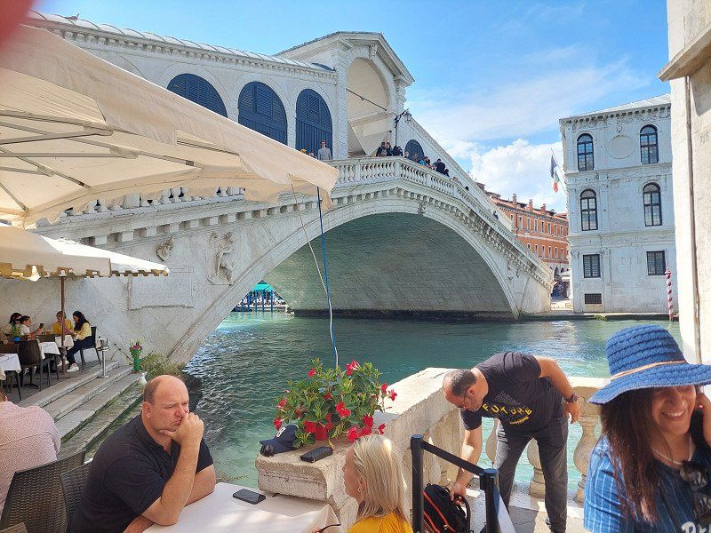
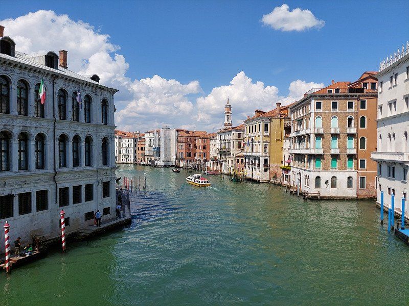
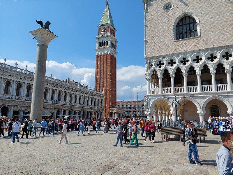
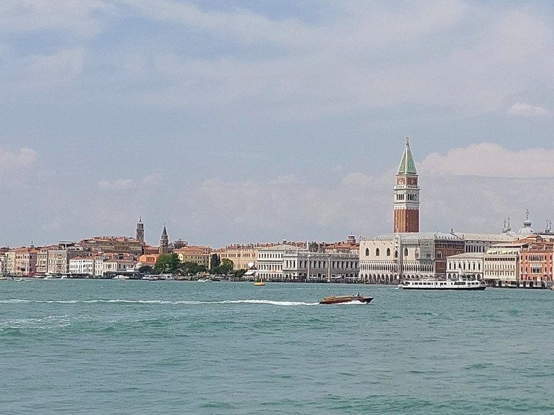
Venedig
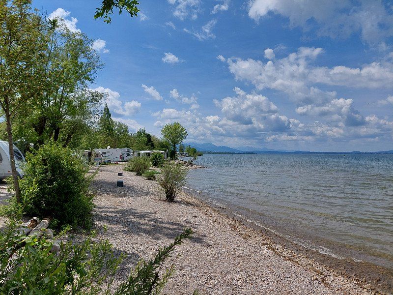
We chose this campsite because of its proximity to Punta Sabbioni (about 2 km).
From there you can easily (for €10 per person) take the boat to Venice and back.
Venice has lost some of its fascination due to the large number of tourists.
Day
Piomboni Camping Village ***
Overnight stay on the way to Tuscany. We drove on the country road, but would rather advise the Autostrada.
Very dusty campsite due to the drought. The area is industrial (port facility with oil tanks).
For us rather not a place to feel good.
via della Pace 421, 48122, Marina di Ravenna, Italy
44° 28' 2" N 12° 16' 59" E
44.4672200 12.2830500
• Head southwest on Viale della Pace. Go for 110 m.
• Take the 2nd exit from Rotonda dei Pinaroli roundabout onto Via Trieste (SS67). Go for 593 m.
• Take the 1st exit from Rotonda degli Sgobbolari roundabout onto Via Trieste (SS67). Go for 5.2 km.
• Take the 1st exit from Rotonda Finlandia roundabout onto Via Attilio Monti. Go for 784 m.
• Take the 2nd exit from Rotonda Belgio roundabout onto Via della Chimica. Go for 1.1 km.
• Take the 2nd exit from Rotonda Montecarlo roundabout onto Via Enrico Mattei. Go for 285 m.
• Take the 2nd exit from Rotonda dei Mosaicisti roundabout onto Via Enrico Mattei. Go for 579 m.
• Take the 1st exit from Rotonda Svezia roundabout onto Via Bisanzio (SP1). Go for 1.8 km.
• Take the 3rd exit from roundabout onto Via San Vitale Strada Statale (SS309dir) toward Bologna. Go for 3.5 km.
• Continue on A14dir. Go for 29.1 km.
• Take the exit toward Bologna onto A14 (Autostrada Adriatica). Go for 53.4 km.
• Take the left exit toward Firenze onto A1 (Autostrada del Sole). Go for 11.7 km.
• Continue on SS64var. Go for 927 m.
• Continue on Raccordo Autostradale Sasso Marconi SS64 Porretana. Go for 2.4 km.
• Continue on A1 (Autostrada del Sole). Go for 10.6 km.
• Keep right onto A1var (Variante di Valico) toward Direttissima/A1/Firenze/Badia. Go for 34.8 km.
• Continue on A1 (Viadotto Lora). Go for 91 m.
• Continue on A1var (Variante di Valico). Go for 32 m.
• Continue on A1 (Galleria Manganaccia). Go for 434 m.
• Continue on A1var (Galleria Manganaccia). Go for 1.9 km.
• Continue on A1 (Viadotto Sieve). Go for 139 m.
• Continue on A1var (Viadotto Sieve). Go for 216 m.
• Continue on A1 (Autostrada del Sole). Go for 19 m.
• Continue on A1var (Variante di Valico). Go for 116 m.
• Continue on A1 (Autostrada del Sole). Go for 34.1 km.
• Take the exit toward Firenze/Impruneta/Siena/SS223. Go for 440 m.
• Turn right onto Superstrada Firenze-Siena (RA3) toward Galluzzo/Firenze Centro/Nuovo Ospedale San Giovanni di Dio/Siena/Scandicci/S. Casciano V. P. Go for 145 m.
• Keep left onto Superstrada Firenze-Siena (RA3) toward Siena. Go for 31.1 km.
• Take ramp toward Poggibonsi Nord/S. Gimignano/Certaldo/Zona Industriale Fosci. Go for 327 m.
• Take the 2nd exit from roundabout toward Certaldo/SR429/Zona Industriale Fosci. Go for 137 m.
• Continue on Collegamento Siena-Firenze SS429 (SR429bis). Go for 2.0 km.
• Take ramp toward Poggibonsi/S. Gimignano. Go for 835 m.
• Continue on Strada Regionale Raccordo Drove (SR429bis). Go for 178 m.
• Take the 1st exit from roundabout onto Strada Provinciale di S. Gimignano (SP63) toward S. Gimignano/Zona Industriale Fosci. Go for 62 m.
• Continue on Via San Gimignano (SP1). Go for 122 m.
• Take the 2nd exit from roundabout onto Via San Gimignano (SP1). Go for 694 m.
• Continue toward Strada Provinciale di San Gimignano/SP1. Go for 24 m.
• Take the 1st exit from roundabout onto Strada Provinciale di San Gimignano (SP1) toward Volterra/SR68/San Gimignano/Ulignano/Cusona. Go for 119 m.
• Pass 3 roundabouts and continue on Strada Provinciale di San Gimignano (SP1). Go for 8.3 km.
• Take the 3rd exit from roundabout onto Strada Provinciale di Castel San Gimignano (SP47) toward Castel San Gimignano/Cecina/SS68/Volterra. Go for 124 m.
• Turn left onto Strada Comunale San Gimignano-Santa Lucia toward S.Lucia/Monte Oliveto. Go for 467 m.
• Continue on Località Maccagli. Go for 220 m.
• Continue on Strada Comunale San Gimignano-Santa Lucia. Go for 153 m.
• Continue on Località Monteoliveto. Go for 232 m.
• Continue on Località Barbiano-Monteoliveto. Go for 550 m.
• Continue on Strada Comunale da San Gimignano a Santa Lucia. Go for 247 m.
• Continue on Strada Comunale da San Gimignano a Santa Lucia. Go for 165 m.
• Continue on Località Santa Lucia. Go for 11 m.
• Arrive at Località Santa Lucia. Your destination is on the left.
☍
240,7 km
(2 hrs. 32 min.)
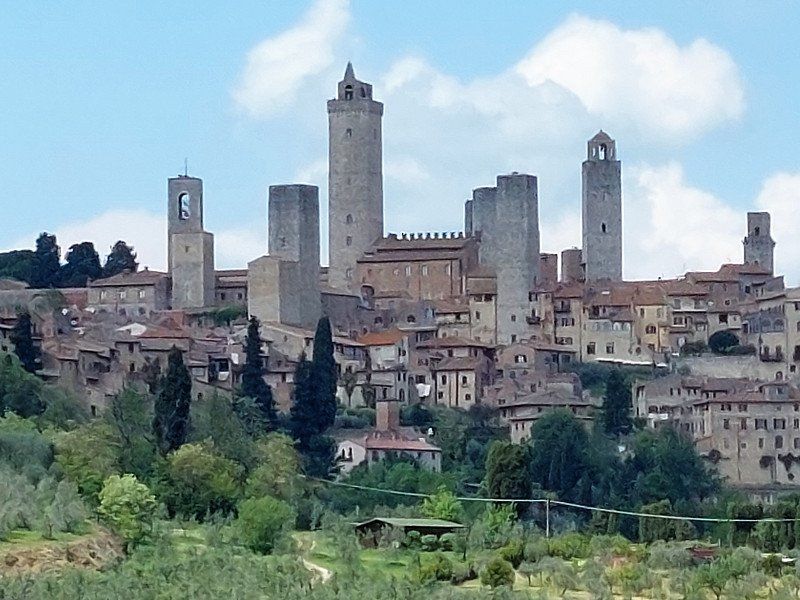
Day
Strada Comunale Di Santa Lucia, 43, 53037 San Gimignano, Siena, Italien
Camping Boschetto di Piemma
Località Santa Lucia 38/c
53037 - San Gimignano - SIENA
Phone: +39 0577.907134
Email: info@boschettodipiemma.it
By bus Pubblico 2 km to San Gimignano.
Unfortunately, due to its proximity to San Gimignano, this coveted campsite was already fully booked.
So be sure to reserve in advance!
Strada Comunale Di Santa Lucia, 43, 53037 San Gimignano SI, Italien
43° 27' 5.7" N 11° 3' 35.4" E
43.4515896 11.0598202
• Head toward Via Domenico Ghirlandaio on Località Santa Lucia. Go for 11 m.
• Continue on Località Ghermona. Go for 412 m.
• Continue on Località Barbiano-Monteoliveto. Go for 550 m.
• Continue on Via di Santa Lucia. Go for 232 m.
• Continue on Strada Comunale San Gimignano-Santa Lucia. Go for 153 m.
• Continue on Località Maccagli. Go for 220 m.
• Continue on Strada Comunale San Gimignano-Santa Lucia. Go for 467 m.
• Turn left onto Strada Provinciale di Castel San Gimignano (SP47). Go for 165 m.
• Take the 1st exit from roundabout. Go for 1.7 km.
• Take the 1st exit from roundabout. Go for 440 m.
• Take the 2nd exit from roundabout onto Via di Fugnano. Go for 550 m.
• Take the 3rd exit from roundabout onto Strada Provinciale di Cellole (SP69) toward Montaione/Gambassi/Larniano/Libbiano/Pancole. Go for 6.2 km.
• Continue on Strada Provinciale di S. Gimignano (SP63). Go for 645 m.
• Continue on Strada Provinciale di Camporbiano (SP62) toward Castelfiorentino/Castelfalfi/Castagno/Villamagna/Peccioli. Go for 2.3 km.
• Turn left onto Strada Provinciale Volterrana (SP4) toward Villamagna. Go for 10.8 km.
• Continue on Strada Regionale Sarzanese Valdera Diramazione (SR439dir). Go for 334 m.
• Turn left onto Strada Provinciale Volterrana (SP15). Go for 7.7 km.
• Turn right onto Via di Mandringa. Go for 80 m.
• Arrive at Via di Mandringa. Your destination is on the right.
☍
33,1 km
( 40 min.)
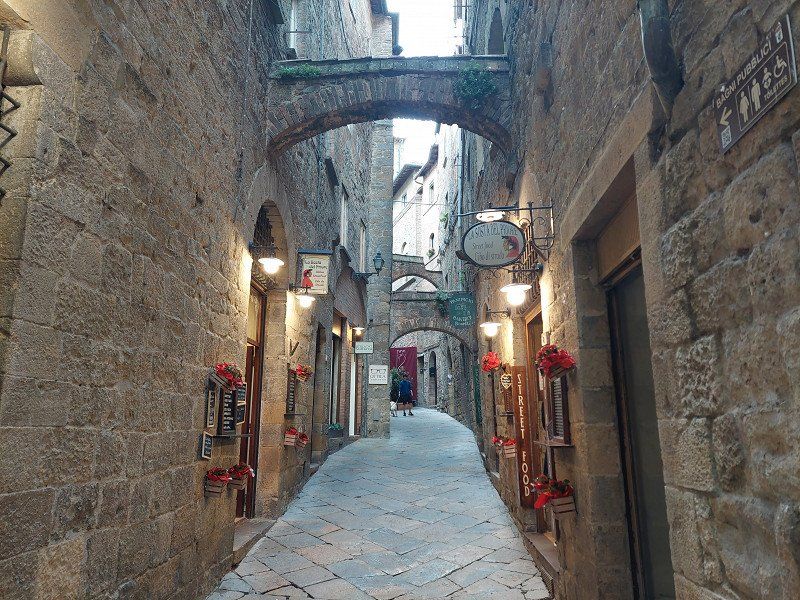
Camping Le Balze
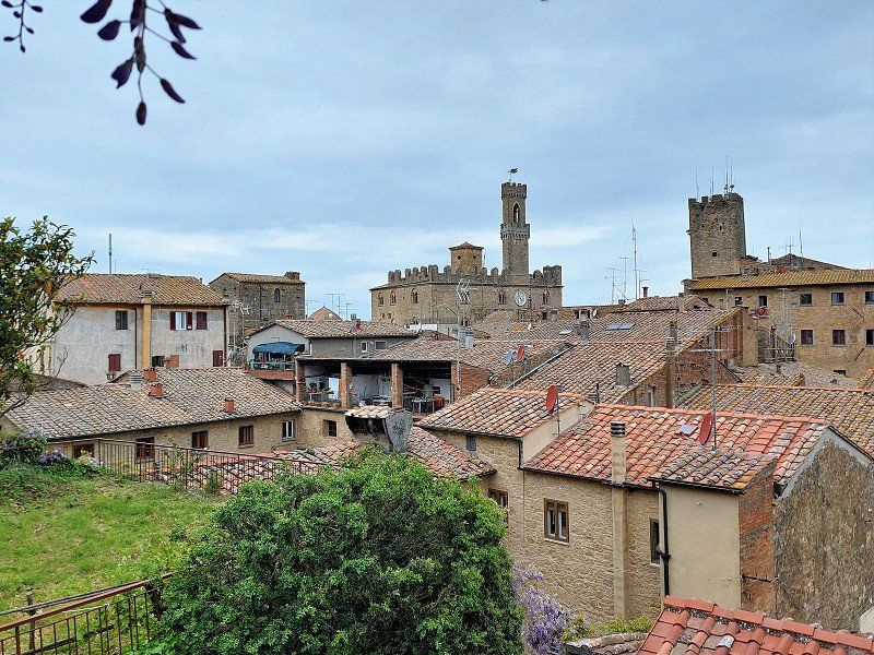
That's why we went on to Volterra.
After what feels like half a century, the sanitary facilities of the campsite are in need of renovation and are not well maintained.
We only have a few meters to walk to the old town and are still compensated with a quiet location.
Of course, the operators of the campsite charge for the proximity to the city.
di mandringa 1, 56048, Volterra, Italy
43° 24' 43.8" N 10° 51' 4.6" E
43.4121800 10.8512800
• Head toward Strada Provinciale Volterrana on Via di Mandringa. Go for 80 m.
• Turn right onto Via Pisana (SP15). Go for 350 m.
• Take the 2nd exit from roundabout onto Via Pisana (SP15). Go for 1.1 km.
• Take the 2nd exit from roundabout onto Viale Giuseppe Garibaldi (SR68). Go for 9.0 km.
• Take the 2nd exit from Via Borgo Lisci roundabout onto Via Borgo Lisci (SR68). Go for 5.4 km.
• Continue on Via di Val di Cecina. Go for 184 m.
• Take the 3rd exit from roundabout onto Strada Regionale di Val di Cecina (SR68). Go for 7.8 km.
• Take the 2nd exit from roundabout onto Strada Provinciale dei Quattro Comuni (SP18). Go for 2.0 km.
• Turn right onto Strada Provinciale Camminata (SP19). Go for 7.6 km.
• Continue on Strada Provinciale della Camminata (SP15). Go for 2.1 km.
• Turn left onto Strada Provinciale Bolgherese (SP16). Go for 558 m.
• Turn right onto Via Campigliese. Go for 4.5 km.
• Turn left onto Strada Provinciale Vecchia Aurelia (SP39). Go for 7.4 km.
• Take the 2nd exit from roundabout onto Strada Provinciale Vecchia Aurelia (SP39). Go for 773 m.
• Continue on Strada Provinciale Vecchia Aurelia (SP39). Go for 1.6 km.
• Turn right. Go for 343 m.
• Turn left. Go for 347 m.
• Turn right. Go for 332 m.
• Turn right. Go for 283 m.
• Arrive at your destination on the left.
☍
51,7 km
( 59 min.)
Day
Day
Podere Pianetti
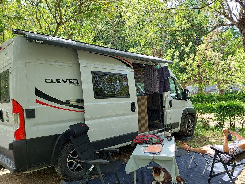
A campsite of superlatives!!
Very large pitches. Each with its own water and electricity connection. Absolutely top-kept area, exudes a pleasant atmosphere.
The beach is only a few minutes walk away.
In the shop at the reception you can buy local products.
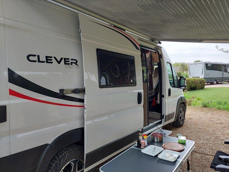
Our panel van looks a bit tiny compared to the Concorde motorhomes from Switzerland and Germany.
At €64 per night, the price is reasonable for the ambience on offer.
Località Pianetti 380/A, 57022, Donoratico, Italy
43° 9' 17.1" N 10° 32' 53.8" E
43.1547500 10.5482800
• Head toward Località Villa Antinori. Go for 42 m.
• Turn sharp left onto Località Villa Antinori. Go for 597 m.
• Turn left. Go for 309 m.
• Turn slightly right. Go for 48 m.
• Turn right. Go for 275 m.
• Turn slightly left toward Strada Provinciale Vecchia Aurelia/SP39. Go for 25 m.
• Turn slightly left onto Strada Provinciale Vecchia Aurelia (SP39). Go for 1.3 km.
• Continue on Strada Provinciale Vecchia Aurelia (SP39). Go for 394 m.
• Continue on Piazza della Stazione (SP39). Go for 755 m.
• Take the 1st exit from roundabout onto Strada Provinciale Vecchia Aurelia (SP39). Go for 321 m.
• Turn left onto Strada Marina di Castagneto (SP17). Go for 389 m.
• Continue straight ahead. Go for 33 m.
• Take the 3rd exit from roundabout toward Livorno/Grosseto. Go for 76 m.
• Continue toward Strada Statale Aurelia/SS1. Go for 164 m.
• Take left ramp onto Strada Statale Aurelia (SS1) toward Livorno. Go for 20.2 km.
• Continue on A12 (Autostrada Azzurra). Go for 2.9 km.
• Take the exit toward Rosignano M./Livorno/E80/Grosseto/A12/Roma/Vada/SS208/Cecina/Castellina M./S. Luce/Pisa onto SS1 (Strada Statale Aurelia). Go for 3.0 km.
• Keep left onto Strada Statale Aurelia (SS1) toward Grosseto/Cecina/SR206/Pisa/Vada/SP13. Go for 55 m.
• Continue on Variante Aurelia. Go for 42 m.
• Take the 2nd exit from roundabout onto Variante Aurelia toward Pisa/SR206/Grosseto/Vada. Go for 392 m.
• Take the 2nd exit from roundabout onto Via Emilia (SR206) toward Pisa/Castellina Marittima. Go for 8.5 km.
• Turn sharp right onto Località Le Lenze (SP51). Go for 7.4 km.
• Turn left onto Via del Commercio Sud (SP13). Go for 1.0 km.
• Turn left onto Piazza Rimembranza. Go for 16 m.
• Arrive at Piazza Rimembranza. Your destination is on the left.
☍
48,2 km
( 43 min.)
Day
56040 Santa Luce, Pisa, Italien
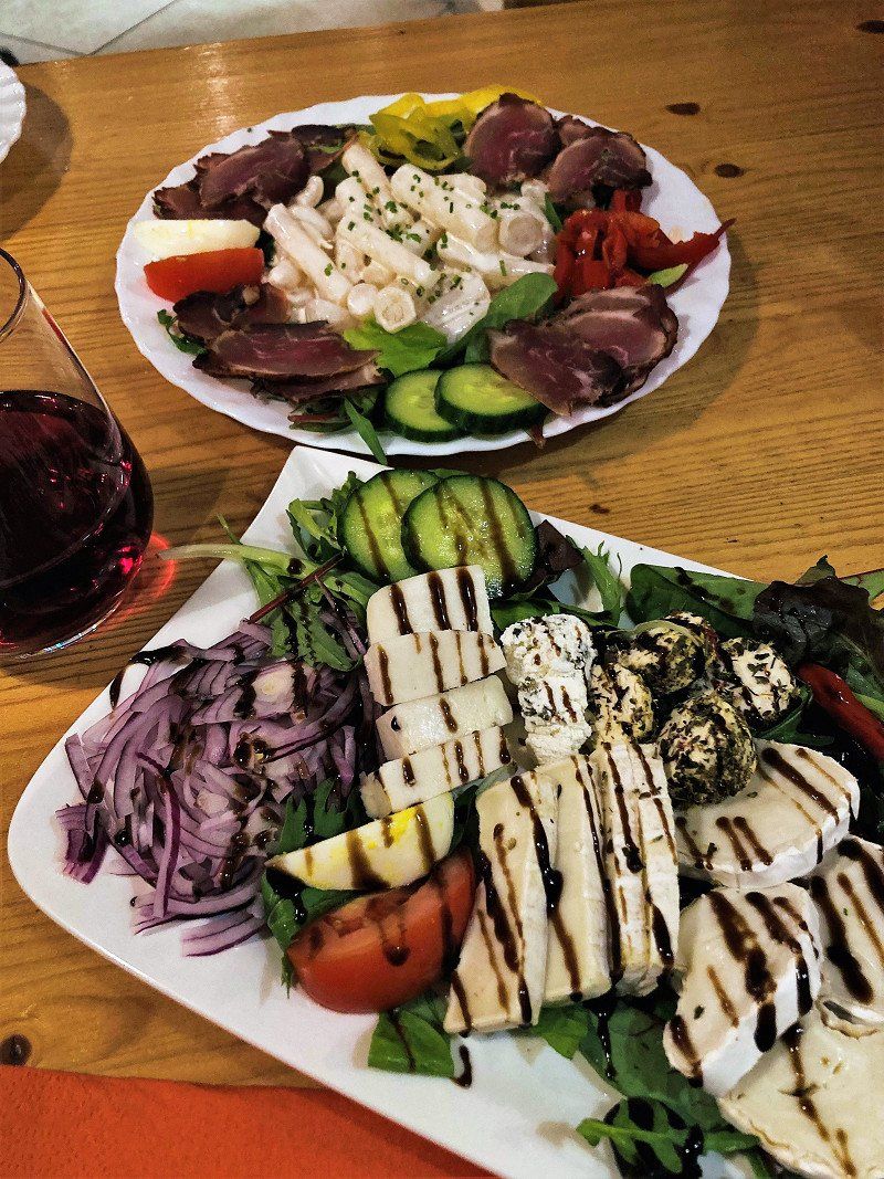
The next day we visit a former work colleague who has retired in a small village and is spending the rest of his life there.
We enjoy a great meal in the trattoria with Gino, who attaches great importance to good quality products. No matter which cellar master, the Sangiovese also tastes good here.
43° 28' 21.6" N 10° 33' 53.8" E
43.4726689 10.5649492
• Head toward Via del Commercio Sud on Piazza Rimembranza. Go for 16 m.
• Continue on Via del Commercio Nord (SP13). Go for 1.8 km.
• Turn left onto Via delle Colline (SP37). Go for 5.4 km.
• Continue on Via Roma (SP37). Go for 3.3 km.
• Continue on Via Orcianese (SP5bis). Go for 986 m.
• Turn right onto Strada Regionale Pisana-Livornese (SR206). Go for 1.7 km.
• Turn left onto Strada Regionale Pisana-Livornese (SR206). Go for 1.4 km.
• Pass 2 roundabouts and continue on Via Emilia (SR206). Go for 4.8 km.
• Keep left onto Strada Regionale Pisana-Livornese (SR206) toward Pisa/SS206/Firenze/Genova/A12. Go for 1.6 km.
• Take the 3rd exit from roundabout onto Strada Regionale Pisana-Livornese (SR206). Go for 960 m.
• Pass 2 roundabouts and continue on Strada Regionale Pisana-Livornese (SR206). Go for 3.8 km.
• Turn right toward Firenze/Pontedera/Livorno/Rosignano M./Genova/A12. Go for 211 m.
• Take left ramp onto Strada di Grande Comunicazione Fi-Pi-Li toward Livorno/Genova/A12/Rosignano Marittimo. Go for 2.1 km.
• Take ramp onto A12 (Autostrada Azzurra) toward Genova/E76/Firenze/A11. Go for 62.7 km.
• Take the exit toward Massa/Avenza/Carrara. Go for 589 m.
• Take the 2nd exit from roundabout onto Strada Provinciale Massa Avenza (SP3) toward Avenza/Carrara. Go for 2.6 km.
• Turn left onto Via Flavio Torello Baracchini. Go for 1.3 km.
• Turn left onto Via delle Pinete. Go for 302 m.
• Turn right onto Via delle Pinete. Go for 12 m.
• Turn left onto Via delle Pinete. Go for 135 m.
• Arrive at Via delle Pinete. Your destination is on the left.
☍
95,8 km
(1 hrs. 6 min.)
Via delle Pinete, 382, 54100 Marina di Massa, Massa-Carrara, Italien
Overnight stay at Camping Giardino .
The area is fully designed for mass tourism. It was ok for one night.
Via delle Pinete, 54100 Marina di Massa MS, Italien
44° 1' 30.5" N 10° 4' 23.5" E
44.0251332 10.0732074
• Head southeast on Via delle Pinete. Go for 131 m.
• Turn left onto Via delle Pinete. Go for 13 m.
• Turn left onto Via delle Pinete. Go for 1.3 km.
• Continue on Viale delle Pinete. Go for 559 m.
• Keep left onto Viale delle Pinete toward La Spezia/Carrara. Go for 178 m.
• Continue on Viale Giovanni da Verrazzano. Go for 846 m.
• Take the 2nd exit from roundabout onto Viale Cristoforo Colombo. Go for 797 m.
• Take the 2nd exit from roundabout onto Viale Cristoforo Colombo. Go for 424 m.
• Turn right onto Viale Galileo Galilei. Go for 1.4 km.
• Take the 2nd exit from roundabout onto A12 (Autostrada Azzurra) toward Parma/E31/Genova. Go for 41.0 km.
• Take the exit toward Levanto. Go for 1.6 km.
• Turn left onto Via Levanto (SP566dir) toward Levanto/Monterosso/SS370/Bonassola/Cinque Terre. Go for 9.9 km.
• Take the 2nd exit from roundabout onto Via Nostra Signora della Guardia (SP566dir) toward Centro. Go for 564 m.
• Take the 4th exit from roundabout onto Strada Provinciale Albero d'Oro (SP43) toward Genova-Livorno/A12/Parma/A15/Carrodano/Monterosso/La Spezia. Go for 166 m.
• Turn left onto Località Albero d'Oro (SP43). Go for 50 m.
• Turn right toward Loc.Sella Mereti. Go for 57 m.
• Continue on Località Sella-Mereti. Go for 318 m.
• Turn slightly left onto Località Sella-Mereti. Go for 121 m.
• Arrive at Località Sella-Mereti. Your destination is on the left.
☍
59,4 km
( 48 min.)
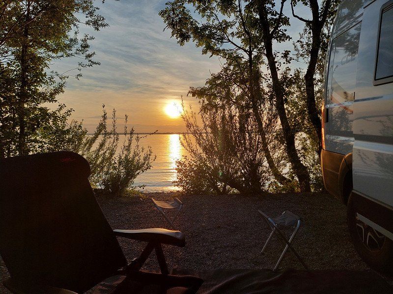
Day
Camping 5 Terre
Nice shaded campsite in Levanto.
Ideal starting point for Cinque Terre. Train station can be reached on foot in 15 minutes.
The day ticket for the train to La Spezia costs €18 per person.
Località Sella Mereti, 19015, Levanto, Italy
44° 10' 26.6" N 9° 37' 29.4" E
44.1740600 9.6248200
• Head northwest on Località Sella-Mereti. Go for 496 m.
• Turn left onto Località Albero d'Oro (SP43). Go for 50 m.
• Turn right onto Strada Provinciale Albero d'Oro (SP43) toward Centro/Genova-Livorno/A12/Genova. Go for 139 m.
• Take the 1st exit from roundabout onto Via Nostra Signora della Guardia (SP566dir) toward Genova/Parma/A15/Genova-Livorno/A12/Carrodano/Montale. Go for 556 m.
• Take the 2nd exit from roundabout onto Località San Gottardo (SP566dir) toward A12/Autostrade/A15/Casella/Carrodano/Montale. Go for 9.9 km.
• Take ramp onto A12 (Autostrada Azzurra) toward Parma/A15/Livorno/E31. Go for 26.3 km.
• Take the exit toward Parma onto A15 (Autostrada della Cisa). Go for 95.3 km.
• Take the exit toward Parma Ovest/Fidenza/Milano/Parma/Fontevivo/Noceto onto SS9 (Via Emilia). Go for 5.3 km.
• Pass 2 roundabouts and continue on Via Emilia (SS9). Go for 5.9 km.
• Take ramp toward Fidenza Centro/Ospedale/Salsomaggiore Terme/Tabiano. Go for 186 m.
• Take the 3rd exit from roundabout onto Tangenziale Sud. Go for 713 m.
• Take the 2nd exit from roundabout onto Tangenziale Sud. Go for 759 m.
• Take the 2nd exit from roundabout onto Tangenziale Sud. Go for 1.5 km.
• Take the 3rd exit from roundabout onto Via Cabriolo. Go for 1.0 km.
• Take the 2nd exit from roundabout. Go for 272 m.
• Continue on Strada di Tabiano. Go for 722 m.
• Continue on Località Gambarato. Go for 436 m.
• Continue on Viale Fidenza. Go for 958 m.
• Continue on Località Colombara. Go for 154 m.
• Continue on Viale Fidenza. Go for 153 m.
• Continue on Località Colombara. Go for 1.3 km.
• Continue on Viale Fidenza. Go for 445 m.
• Continue on Viale Fidenza. Go for 701 m.
• Take the 1st exit from roundabout onto Via Tabiano. Go for 800 m.
• Turn left. Go for 38 m.
• Arrive at your destination on the right.
☍
154,1 km
(1 hrs. 42 min.)
Day
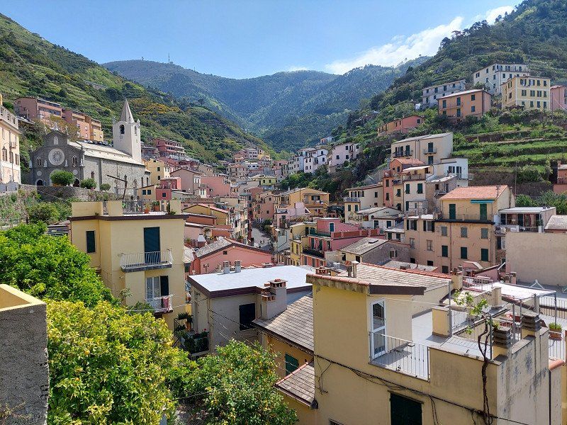
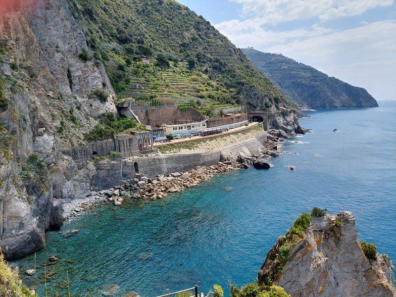
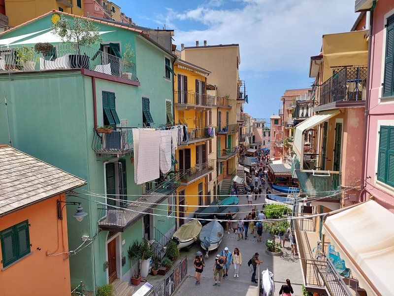
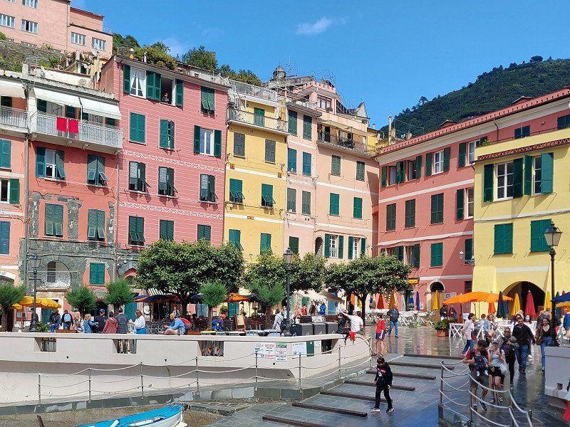
Cinque Terre
Travel by train from Levanto to
- Monterosso al Mare
- Vernazza
- Corniglia
- Manarola
- Riomaggiore
Day
Camping Arizona
From Liguria we continue through Tuscany in the Emiglia to Salsomaggiore, not far from Parma.
However, the famous spa town has not been used as a health resort for several years, since the health insurance companies in Italy have also cut back.
Local politicians don't seem to be trying too hard to stop the city from falling apart, even though the Barilla boss and Berlusconi wanted to build a villa there.
Via Tabiano 42a, 43039, Tabiano Terme-Salsomaggiore T., Italy
44° 48' 23.6" N 10° 0' 38.7" E
44.8065500 10.0107500
• Head toward Via Tabiano. Go for 38 m.
• Turn right onto Via Tabiano. Go for 771 m.
• Take the 2nd exit from roundabout onto Viale Fidenza. Go for 959 m.
• Continue on Viale Fidenza. Go for 1.0 km.
• Continue on Località Colombara. Go for 569 m.
• Continue on Viale Fidenza. Go for 120 m.
• Continue on Località Colombara. Go for 267 m.
• Continue on Viale Fidenza. Go for 845 m.
• Continue on Località Gambarato. Go for 521 m.
• Continue on Strada di Tabiano. Go for 744 m.
• Continue toward Via Cabriolo. Go for 51 m.
• Take the 2nd exit from roundabout onto Via Cabriolo. Go for 950 m.
• Take the 2nd exit from roundabout onto Tangenziale Sud. Go for 1.4 km.
• Pass 2 roundabouts and continue on Tangenziale Sud. Go for 1.2 km.
• Take the 2nd exit from roundabout toward Autostrada/A1/Cremona/Busseto/Soragna/Piacenza. Go for 422 m.
• Continue on Strada Provinciale di Soragna (SP12). Go for 965 m.
• Take ramp onto Strada Provinciale di Soragna (SP12) toward Autostrada/A1/Soragna/Fidenza Centro. Go for 722 m.
• Continue toward A1/Autostrada/Busseto-Soragna. Go for 40 m.
• Take the 2nd exit from roundabout onto Strada Provinciale di Soragna (SP12) toward Autostrada/A1. Go for 775 m.
• Continue toward Strada Provinciale di Soragna/SP12. Go for 49 m.
• Take the 2nd exit from roundabout onto Strada Provinciale di Soragna (SP12). Go for 602 m.
• Continue toward Autostrada del Sole/A1. Go for 36 m.
• Take the 2nd exit from roundabout toward Busseto/Soragna/Mi/Bo/A1/La Spezia/Autostrada. Go for 148 m.
• Take left ramp onto A1 (Autostrada del Sole) toward Autostrada/Milano. Go for 80.2 km.
• Take the exit toward Tang. Esterna/Brescia/A35/E64/Venezia/A4 onto A58 (TEEM). Go for 31.4 km.
• Take the exit toward Venezia onto A4 (Autostrada Torino-Trieste). Go for 24.5 km.
• Take the exit toward Bergamo/Aeroporto Orio al Serio onto Svincolo Bergamo. Go for 1.7 km.
• Keep right. Go for 203 m.
• Turn right toward Alzano L./SP35/SS470/Bergamo Centro. Go for 183 m.
• Continue on Circonvallazione Paltriniano. Go for 667 m.
• Continue on Circonvallazione Mugazzone. Go for 1.1 km.
• Continue on Viadotto Di Boccaleone. Go for 1.6 km.
• Take ramp. Go for 206 m.
• Take the 3rd exit from Largo Decorati al Valor Civile roundabout onto Via Quinto Alpini. Go for 530 m.
• Take the 1st exit from roundabout onto Via Filippo Corridoni. Go for 855 m.
• Take the 1st exit from roundabout onto Via Filippo Corridoni. Go for 108 m.
• Turn right. Go for 11 m.
• Arrive at your destination.
☍
156,6 km
(1 hrs. 26 min.)
Day
Day
Camper Parking Area - City of Thousand - Bergamo, Via F. Corridoni, 123, 24124 Bergamo, Italien
The pitch was ok for one night. Grey/black water disposal and toilet available, as well as water and electricity included for €18.
Together with a nice work colleague and his wife, we visited Bergamo Città Alta , the upper part of the city, which is a listed building. Great ambience, outstanding cuisine.
Even at midnight it was still pleasantly warm.
Via F. Corridoni, 123, 24124 Bergamo BG, Italien
45° 42' 47.2" N 9° 42' 7" E
45.7131004 9.7019453
• Head toward Via Filippo Corridoni. Go for 11 m.
• Turn left onto Via Filippo Corridoni. Go for 92 m.
• Take the 2nd exit from roundabout onto Via Filippo Corridoni. Go for 201 m.
• Turn left onto Via Martinella. Go for 339 m.
• Turn right onto Via Cesare Correnti (SP35). Go for 618 m.
• Turn left toward Circonvallazione delle Valli. Go for 809 m.
• Continue on Circonvallazione delle Valli. Go for 474 m.
• Keep left onto Circonvallazione delle Valli toward Autostrada/A4. Go for 886 m.
• Continue on Circonvallazione Mugazzone. Go for 1.2 km.
• Continue on Circonvallazione Paltriniano. Go for 638 m.
• Turn left onto Circonvallazione Paltriniano. Go for 114 m.
• Take ramp. Go for 400 m.
• Keep right onto Svincolo Bergamo. Go for 183 m.
• Turn right onto Svincolo Bergamo. Go for 148 m.
• Take left ramp onto A4 (Autostrada Torino-Trieste) toward Venezia/E66. Go for 87.1 km.
• Take the exit toward Peschiera. Go for 1.1 km.
• Continue on Strada Regionale Gardesana Orientale (SR249). Go for 27 m.
• Keep right toward Brescia/Verona/SR11/Mantova/Valeggio S/M. Go for 285 m.
• Continue toward SS11dir. Go for 38 m.
• Take the 3rd exit from roundabout onto SS11dir toward Affi/SR450/Castelnuovo D.G./Valeggio S/Mincio/Modena/A22/Brennero. Go for 4.2 km.
• Continue on Strada Regionale di Affi (SR450). Go for 12.6 km.
• Take the 1st exit from roundabout toward SS12/A22. Go for 359 m.
• Take the 2nd exit from roundabout onto A22 (Autostrada del Brennero) toward Milano/A4/Brennero. Go for 169 km.
• Take the exit toward Bressanone-Val Pusteria/Brixen-Pustertal. Go for 633 m.
• Continue on Via Brennero. Go for 88 m.
• Keep left toward Naz Sciaves/SS49/Natz Schabs/Brunico/Bruneck/S. Candido/Innichen. Go for 156 m.
• Keep right onto Strada Statale della Pusteria (SS49bis) toward Natz-Schabs/Naz-Sciaves/Bruneck/Brunico/Toblach/Dobbiaco/Innichen/S. Candido. Go for 766 m.
• Take the 2nd exit from roundabout onto Strada Statale della Pusteria (SS49bis) toward Innichen/S. Candido/Bruneck/Brunico. Go for 8.5 km.
• Continue on Strada Statale della Pusteria (SS49) toward Bruneck/Brunico/Innichen/S. Candido/Lodenwelt/Obervintl/Vandoies di Sopra. Go for 34.2 km.
• Take the 1st exit from roundabout onto Via Principale (SS49) toward Welsberg Zentrum/Monguelfo Centro/Innichen/San Candido. Go for 3.9 km.
• Take the 2nd exit from roundabout onto Strada Statale della Pusteria (SS49) toward Innichen/San Candido. Go for 7.0 km.
• Take the 3rd exit from roundabout onto Strada Statale della Pusteria (SS49) toward Innichen/San Candido/Toblach/Dobbiaco. Go for 297 m.
• Pass 2 roundabouts and continue on Strada Statale della Pusteria (SS49). Go for 3.4 km.
• Turn right onto Strada Statale Carnica (SS52) toward Sexten/Sesto. Go for 13.6 km.
• Turn left onto Via San Giuseppe. Go for 108 m.
• Turn left. Go for 43 m.
• Arrive at your destination.
☍
353,2 km
(3 hrs. 32 min.)
Day
Caravan Park Sexten
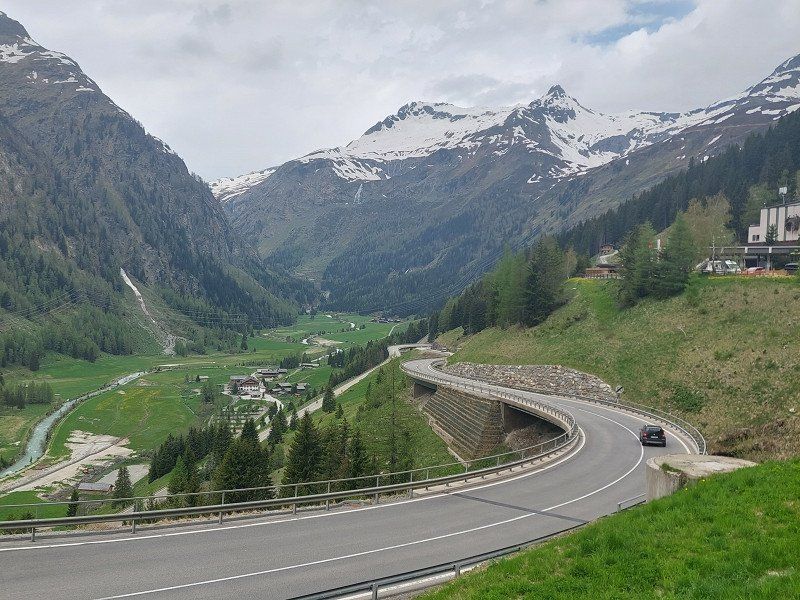
Then we went on to the Alto Adige . At 1500 meters above sea level, the temperatures were more pleasant than in the Parma-Milano basin.
Very nice 5* campsite. Breakfast available in the restaurant.
Dinner for 2 people depending on the wine pairing between 100-150 €.
St. Josefstr. 54, 39030, Sexten, Italy
46° 40' 7" N 12° 23' 58" E
46.6686100 12.3994400
• Head northwest.
• Turn right. Go for 34 m.
• Turn right. Go for 42 m.
• Turn right toward Via San Giuseppe. Go for 38 m.
• Continue on Via San Giuseppe. Go for 108 m.
• Turn right onto Strada Statale Carnica (SS52). Go for 12.2 km.
• Turn right onto Via Sesto. Go for 541 m.
• Turn left onto Via Freising. Go for 291 m.
• Turn right onto Via Duca Tassilo. Go for 440 m.
• Turn right onto Strada Statale della Pusteria (SS49) toward Österreich/Austria. Go for 6.6 km.
• Continue on Arnbach (B100). Go for 33.8 km.
• Take the 3rd exit from roundabout onto Iseltaler Straße (B108) toward Matrei i.O./Matrei i. O. Go for 27.4 km.
• Continue on Felbertauernstraße. Go for 37.6 km.
• Take the 1st exit from roundabout onto B168 toward Zell am See. Go for 6.4 km.
• Pass 2 roundabouts and continue on Zeller Straße (B168). Go for 13.7 km.
• Take the 2nd exit from roundabout onto Mittersiller Bundesstraße (B168). Go for 3.0 km.
• Turn right onto B168a toward A10/Salzburg/Bischofshofen/B311. Go for 1.3 km.
• Keep right toward A10/Salzburg/Bischofshofen. Go for 145 m.
• Continue on Brucker Bundesstraße (B311). Go for 921 m.
• Take the 4th exit from roundabout onto Thumersbacher Landesstraße (L247) toward Thumersbach/Krankenhaus/Gewerbegebiet Waagstraße. Go for 1.8 km.
• Turn left onto Seeuferstraße. Go for 67 m.
• Arrive at Seeuferstraße. Your destination is on the right.
☍
146,5 km
(1 hrs. 56 min.)
Day
Day
Panorama Camp Zell am See
We then continued on the Felbertauernstrasse to Zell am See.
Beautiful campsite, well maintained.
Because of thunderstorms and heavy rain, we decided to change our tour slightly and drive back to sunny Bavaria.
Seeuferstraße 196, 5700, Zell am See, Austria
47° 18' 6.3" N 12° 48' 55" E
47.3017400 12.8152700
• Head north on Seeuferstraße. Go for 67 m.
• Turn right onto Erlberg (L247). Go for 1.7 km.
• Take the 1st exit from roundabout onto Pinzgauer Bundesstraße (B311) toward Lofer/Zell am See/Mittersill/B168/Kaprun. Go for 1.0 km.
• Pass 2 roundabouts and continue on Brucker Bundesstraße (B311). Go for 454 m.
• Continue toward B168/Mittersill/Zell am See. Go for 29 m.
• Take the 2nd exit from roundabout onto Brucker Bundesstraße (B311) toward B168/Mittersill/Zell am See. Go for 241 m.
• Keep right onto Pinzgauer Bundesstraße (B311) toward Innsbruck/Saalfelden/Zell am See. Go for 15.8 km.
• Pass 3 roundabouts and continue on Lofererstraße (B311). Go for 24.2 km.
• Take the 1st exit from roundabout onto Lofer (B311f). Go for 2.0 km.
• Take ramp onto Loferer Bundesstraße (B178). Go for 9.5 km.
• Continue on B21. Go for 6.9 km.
• Keep left onto B21 toward Salzburg/Bad Reichenhall. Go for 11.5 km.
• Take ramp onto B20 toward München/A8/Salzburg/Passau/Burghausen/Freilassing. Go for 2.8 km.
• Take the 2nd exit from roundabout onto B20 toward A8/München/Salzburg/Passau/Burghausen/Freilassing/Piding-Dorf. Go for 399 m.
• Turn left and take ramp onto A8 toward München. Go for 32.0 km.
• Take exit 109 toward Grabenstätt/Reit im Winkl/Marquartstein/Chieming. Go for 199 m.
• Take the 3rd exit from roundabout onto St2096 toward Traunstein/Traunreut/Chieming/Industriegebiet Grabenstätt. Go for 6.0 km.
• Turn left onto Am Chiemsee. Go for 13 m.
• Arrive at Am Chiemsee. Your destination is on the right.
☍
114,8 km
(1 hrs. 26 min.)
Day
Chiemsee Strandcamping
Even this beautiful day came to an end at some point...
Am Chiemsee 1, 83355, Grabenstätt/Unterhochstätt, Germany
47° 52' 35.4" N 12° 31' 43" E
47.8764900 12.5286000
• Head east on Am Chiemsee. Go for 13 m.
• Turn left onto St2096. Go for 3.4 km.
• Take the 3rd exit from roundabout onto Laimgrub (St2095) toward Rosenheim/Seebruck/Gewerbegebiet Egerer. Go for 1.1 km.
• Turn right onto Truchtlachinger Straße (TS31) toward Truchtlaching/Tabing. Go for 519 m.
• Continue on TS31. Go for 427 m.
• Continue on Weidach (TS31). Go for 238 m.
• Continue on TS31. Go for 362 m.
• Continue on Fehling (TS31). Go for 142 m.
• Continue on TS31. Go for 1.5 km.
• Continue on Tabing (TS31). Go for 46 m.
• Turn left onto Tabing (TS11). Go for 143 m.
• Continue on TS11. Go for 91 m.
• Turn right onto TS31. Go for 2.5 km.
• Turn right onto St2093 toward Altenmarkt/Truchtlaching. Go for 948 m.
• Turn left onto TS31. Go for 8 m.
• Continue on Seeoner Straße (TS31). Go for 1.2 km.
• Continue on TS31. Go for 404 m.
• Continue on Point (TS31). Go for 126 m.
• Continue on TS31. Go for 1.8 km.
• Continue on Altenmarkter Straße (TS31). Go for 55 m.
• Take the 2nd exit from roundabout onto TS31. Go for 397 m.
• Continue on Rabendener Straße (TS31). Go for 577 m.
• Continue on TS31. Go for 2.1 km.
• Turn right onto B304. Go for 122 m.
• Turn left onto Kienberger Straße (TS31) toward Kienberg/Viehhausen. Go for 118 m.
• Continue on TS31. Go for 742 m.
• Continue on Viehhausen (TS31). Go for 228 m.
• Continue on TS31. Go for 1.4 km.
• Continue on Sonnau (TS31). Go for 30 m.
• Continue on TS31. Go for 1.1 km.
• Turn left onto Trostberger Straße (St2357). Go for 439 m.
• Turn right onto Emertshamer Straße (TS8). Go for 281 m.
• Continue on TS8. Go for 1.1 km.
• Continue on Randling (TS8). Go for 152 m.
• Continue on TS8. Go for 1.2 km.
• Continue on Arfling (TS8). Go for 417 m.
• Continue on TS8. Go for 166 m.
• Continue on Kirchstätt (TS8). Go for 145 m.
• Continue on TS8. Go for 466 m.
• Continue on Kienberger Straße (TS8). Go for 310 m.
• Turn left onto Trostberger Straße (St2091). Go for 570 m.
• Turn right onto Engelsberger Straße (TS8). Go for 1.2 km.
• Continue on TS8. Go for 1.2 km.
• Continue on Wartmoning (TS8). Go for 56 m.
• Continue on TS8. Go for 1.5 km.
• Continue on Pürn (TS8). Go for 157 m.
• Continue on TS8. Go for 2.7 km.
• Turn right onto Mühldorfer Straße (TS9). Go for 259 m.
• Turn left onto Inhausen (TS17). Go for 101 m.
• Continue on Mühldorfer Straße (TS17). Go for 1.0 km.
• Continue on TS17. Go for 74 m.
• Continue on AÖ9. Go for 794 m.
• Continue on Kaindl (AÖ9). Go for 69 m.
• Turn left onto St2355. Go for 10.7 km.
• Turn right onto St2092. Go for 3.8 km.
• Turn left onto Brückenstraße (St2550). Go for 918 m.
• Turn right onto Innstraße (St2092) toward Stadtmitte. Go for 240 m.
• Turn left onto Katharinenplatz (St2092) toward München/A94/Passau. Go for 587 m.
• Enter the roundabout. Go for 31 m.
• Arrive at your destination on the left.
☍
52,5 km
( 49 min.)
Day
Mühldorf am Inn, Deutschland
Eat lunch in Mühldorf am Inn before heading home via Straubing and Regensburg.
84453 Mühldorf am Inn, Deutschland
48° 14' 46" N 12° 31' 22.7" E
48.2461124 12.5229789
• Follow the roundabout. Go for 15 m.
• Take the 2nd exit from roundabout onto Innere Neumarkter Straße (St2092) toward A94/München/Passau/Landshut/Neumarkt-St. Veit/Mühldorf Nord/B299. Go for 692 m.
• Turn right onto Bürgermeister-Hess-Straße (St2092) toward A94/München/Passau/Landshut/Neumarkt-St. Veit/B299. Go for 3.8 km.
• Take the 2nd exit from roundabout onto St2092 toward München/A94/Passau/Landshut/Neumarkt-Sankt Veit. Go for 159 m.
• Continue on B299. Go for 5.3 km.
• Turn right onto Stetten (MÜ36) toward Niedertaufkirchen. Go for 4.6 km.
• Take the 2nd exit from roundabout onto MÜ36. Go for 3.7 km.
• Continue on Hörbering (St2111). Go for 21.2 km.
• Take the 2nd exit from roundabout onto St2111. Go for 4.3 km.
• Take the 1st exit from roundabout onto DGF15 toward A92/München/Deggendorf/Dingolfing/Straubing/Mengkofen/BMW-Werke. Go for 5.1 km.
• Take the 3rd exit from roundabout onto St2327. Go for 824 m.
• Continue on DGF15. Go for 3.3 km.
• Pass 2 roundabouts and continue on DGF15. Go for 1.3 km.
• Turn left and take ramp onto A92 toward Deggendorf. Go for 12.1 km.
• Take exit 22 toward Cham/Straubing onto B20. Go for 18.2 km.
• Take ramp toward Straubing/Aiterhofen. Go for 190 m.
• Turn right onto St2142. Go for 267 m.
• Pass 3 roundabouts and continue on Äußere Passauer Straße (St2142). Go for 5.2 km.
• Turn left onto Schildhauerstraße. Go for 63 m.
• Turn left. Go for 41 m.
• Turn left. Go for 20 m.
• Arrive at your destination on the right.
☍
90,3 km
(1 hrs. 9 min.)
Straubing, Deutschland
The university town on the Danube has a beautiful town center and the location on the edge of the Bavarian Forest offers many excursion possibilities.
The second largest folk festival in Bavaria takes place in Straubing every year.
94315 Straubing, Deutschland
48° 52' 39.8" N 12° 34' 48.6" E
48.8777333 12.5801538
• Head east.
• Turn left. Go for 24 m.
• Turn left. Go for 20 m.
• Turn right toward Schildhauerstraße. Go for 18 m.
• Turn right onto Schildhauerstraße. Go for 63 m.
• Turn left onto Innere Passauer Straße (St2142). Go for 411 m.
• Turn left onto Mühlsteingasse (SRs19). Go for 221 m.
• Continue on Stadtgraben (St2141). Go for 261 m.
• Continue on Stadtgraben (St2142). Go for 283 m.
• Turn right onto Stadtgraben (St2142). Go for 73 m.
• Continue on Stadtgraben (SRs34). Go for 151 m.
• Continue on Am Kinseherberg (SRs48). Go for 3.6 km.
• Continue on St2125. Go for 4.2 km.
• Continue on St2148. Go for 1.8 km.
• Take ramp onto A3 toward Nürnberg/Regensburg. Go for 33.1 km.
• Take exit 100A toward Regensburg-Universität/Regensburg-Klinikum/P+R. Go for 636 m.
• Turn right onto Galgenbergstraße. Go for 1.7 km.
• Continue on Galgenbergstraße. Go for 390 m.
• Continue on Galgenbergbrücke. Go for 272 m.
• Continue on Dr.-Martin-Luther-Straße. Go for 99 m.
• Arrive at Dr.-Martin-Luther-Straße. Your destination is on the right.
☍
47,2 km
( 33 min.)
Regensburg, Deutschland
The capital of the Upper Palatinate, UNESCO World Heritage City, is no longer an insider tip because of its uniqueness.
Regensburg is not only known for its cathedral and the oldest stone bridge in Germany.
But also because of its historic old town with its culture and culinary diversity.
In addition, the rivers Danube, Regen, Laaber and Naab offer many opportunities for hiking, cycling and canoeing.
49° 0' 48.3" N 12° 6' 5.8" E
49.0134297 12.1016236
• Head toward Hemauerstraße on Dr.-Martin-Luther-Straße. Go for 108 m.
• Turn right onto Luitpoldstraße toward GVZ/Hafen. Go for 450 m.
• Keep left onto Greflingerstraße toward Nürnberg/Passau/Weiden/Cham/Gewerbegebiet R.-Ost/GVZ/Hafen. Go for 209 m.
• Turn left onto Weißenburgstraße (B15). Go for 1.6 km.
• Turn left onto Frankenstraße (St2660). Go for 2.4 km.
• Turn left and take ramp onto A93 (Pfaffensteiner Brücke) toward Hof. Go for 37.2 km.
• Take exit 32 toward Schwandorf-Fronberg/Amberg onto B85. Go for 15.6 km.
• Take ramp onto A6 toward Nürnberg/Amberg. Go for 25.0 km.
• Take exit 64 toward Lauterhofen/Schwend. Go for 371 m.
• Turn left onto St2164 toward Lauterhofen/Schwend. Go for 504 m.
• Turn right onto Schwenderöd (AS3) toward Nürnberg-Amberg/Sulzbach-Rosenberg. Go for 132 m.
• Continue on AS3. Go for 2.4 km.
• Continue on AS36. Go for 938 m.
• Continue on Frechetsfeld (AS36). Go for 259 m.
• Arrive at Frechetsfeld (AS36). Your destination is on the right.
☍
87,1 km
( 53 min.)
92262 Birgland, Deutschland
49° 26' 14.4" N 11° 37' 0.8" E
49.4373342 11.6168798
Day