Two days off - what can you do? Most of the time, these considerations lead to long-distance trips. We had to realize that we had somewhat lost sight of the most obvious goals in recent years. In the immediate vicinity, away from the usual routes, there are quite a few attractive places. They offer history (Romans), things of interest (cityscapes), culture (museums) and leisure (lakes) in a very small space. Of course, our suggestions are only a small selection of the possibilities and leave plenty of room for your own extensions and additions.
Day
Schwäbisch Gmünd - Stellplatz am Freibad
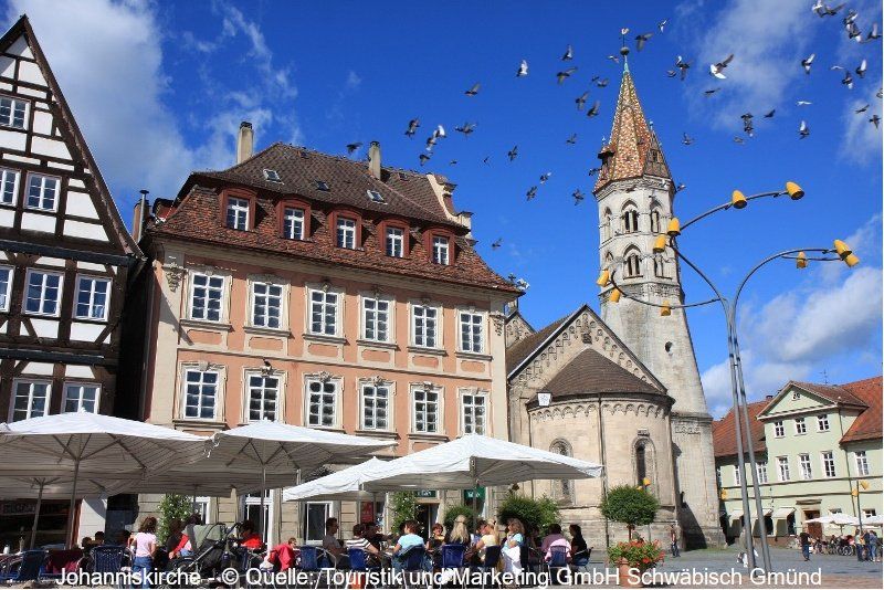
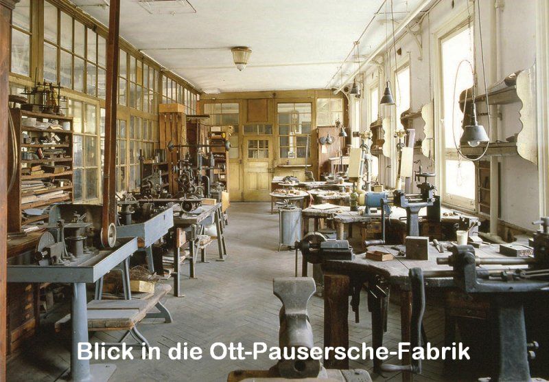
The starting point is (once again) the Staufer town of Schwäbisch Gmünd. It is the oldest attested medieval town founding in Württemberg. Many witnesses from this time still characterize the city today. Market square, St. John's Church, Münster, St. Salvator (rock chapel and Stations of the Cross), Prediger (museum) or the Ott-Pausersche factory (silverware museum) are some of the stops that also justify a stay of several days. The State Horticultural Show 2014 also had a lasting impact on the cityscape and the surrounding area. The "heavenly garden" with the "heavenly striker" are impressive witnesses of this. After a visit to the site, a walk through the forest along the "ball track" down to the "Erdenreich" is a good idea. During the summer months, the "Electric Zügle" is also on the move, stopping at prominent points in the city.
Attention: The parking space situation in Schwäbisch Gmünd has changed.
Information can be found at: https://www.gmuender-baeder.de/wohnmobilhafen.html
Schießtalstraße 13, 73525, Schwäbisch Gmünd, Deutschland
48° 48' 17" N 9° 48' 49" E
48.8047222 9.8136111
• Head west. Go for 33 m.
• Turn right toward Richard-Bullinger-Straße. Go for 160 m.
• Turn right onto Richard-Bullinger-Straße. Go for 37 m.
• Continue on Schießtalstraße. Go for 318 m.
• Turn right onto Herlikofer Straße (L1075). Go for 499 m.
• Turn left and take ramp onto B29 toward A7/Aalen. Go for 9.3 km.
• Continue on Stuttgarter Straße (B29) toward A7/Aalen. Go for 11.7 km.
• Keep right onto B19 toward Heidenheim/AA-Zentrum/AA-Süd. Go for 316 m.
• Keep left toward AA-Zentrum. Go for 438 m.
• Take the 2nd exit from roundabout toward Aalen-Zentrum. Go for 554 m.
• Keep right toward Stuttgarter Straße. Go for 122 m.
• Continue on Stuttgarter Straße. Go for 742 m.
• Turn left onto Friedrichstraße (K3311). Go for 405 m.
• Turn left onto Friedhofstraße. Go for 162 m.
• Turn left onto Friedhofstraße. Go for 117 m.
• Turn left onto Sankt-Johann-Straße. Go for 184 m.
• Arrive at Sankt-Johann-Straße. Your destination is on the left.
☍
25,2 km
( 22 min.)
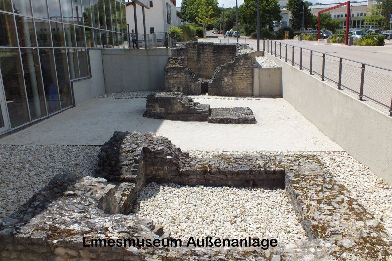
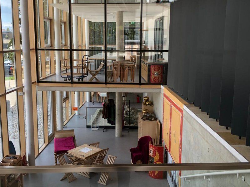
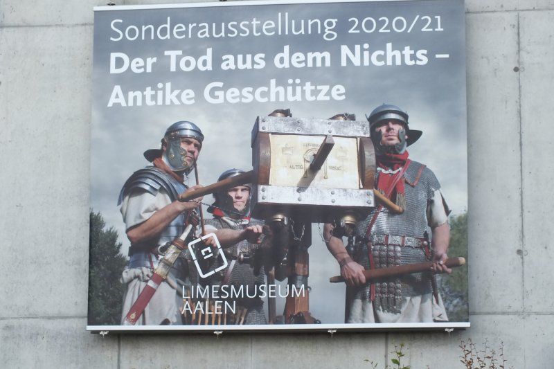
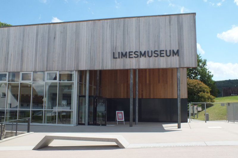
Limesmuseum Aalen
Sankt-Johann-Straße 5, 73430 Aalen, Deutschland
48° 50' 10.6" N 10° 5' 2.8" E
48.8362671 10.0841024
• Head southwest on Sankt-Johann-Straße. Go for 38 m.
• Turn right onto Berliner Platz. Go for 54 m.
• Continue on Steimlestraße. Go for 85 m.
• Turn right onto Friedhofstraße. Go for 313 m.
• Turn right onto Friedhofstraße. Go for 162 m.
• Turn left onto Friedrichstraße (K3311). Go for 906 m.
• Pass 3 roundabouts and continue on Stiewingstraße (K3311). Go for 1.4 km.
• Turn right onto Stiewingstraße (K3287). Go for 233 m.
• Turn left onto Wilhelmstraße (L1029). Go for 522 m.
• Take the 2nd exit from roundabout onto Bahnparallele Trasse (L1029). Go for 1.1 km.
• Keep right onto Ellwanger Straße (L1029). Go for 2.9 km.
• Turn right onto B29 toward Stuttgart. Go for 7.1 km.
• Turn right onto L1076 toward Lauchheim/Kapfenburg. Go for 958 m.
• Continue on Hauptstraße. Go for 90 m.
• Arrive at Hauptstraße. Your destination is on the right.
☍
15,8 km
( 17 min.)
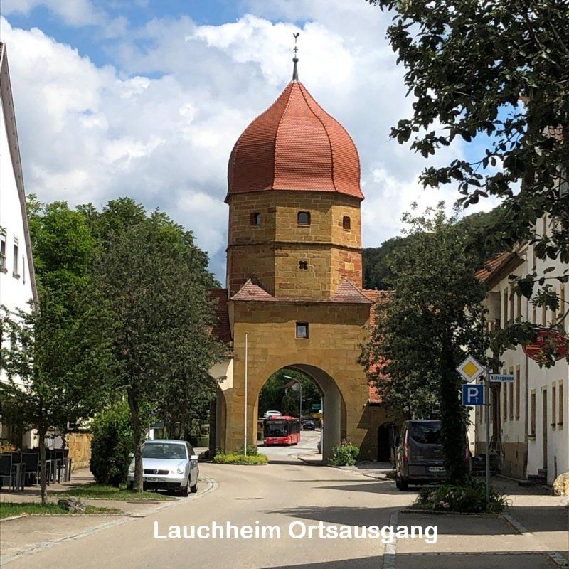
Lauchheim
73466 Lauchheim, Deutschland
48° 52' 16.9" N 10° 14' 35.8" E
48.8713499 10.2432861
• Head toward Gartenstraße on Hauptstraße. Go for 466 m.
• Continue on Bopfinger Straße. Go for 345 m.
• Continue on Burgfried. Go for 76 m.
• Take the 2nd exit from roundabout onto Burgfried. Go for 501 m.
• Continue on Bopfinger Straße. Go for 86 m.
• Turn right onto B29. Go for 1.8 km.
• Turn left onto K3200 toward Baldern/Röttingen/Schloß Baldern. Go for 1.0 km.
• Continue on Salenfeld (K3200). Go for 184 m.
• Continue on Baldernstraße (K3200). Go for 243 m.
• Turn left onto Dreyerstraße. Go for 59 m.
• Arrive at Dreyerstraße. Your destination is on the left.
☍
4,7 km
( 5 min.)
Röttingen
Röttingen, 73466 Lauchheim, Deutschland
48° 52' 48.9" N 10° 17' 31.9" E
48.8802510 10.2922080
• Head toward Baldernstraße on Dreyerstraße. Go for 59 m.
• Turn left onto Baldernstraße (K3200). Go for 155 m.
• Turn left onto Baldernstraße (K3200). Go for 641 m.
• Continue on K3200. Go for 1.6 km.
• Continue on Kahlhöfe (K3200). Go for 177 m.
• Continue on K3200. Go for 1.4 km.
• Continue on Röttinger Straße (K3200). Go for 685 m.
• Turn left onto Zöbinger Straße (K3200). Go for 127 m.
• Turn left onto Baldern. Go for 142 m.
• Arrive at Baldern. Your destination is on the right.
☍
4,9 km
( 6 min.)
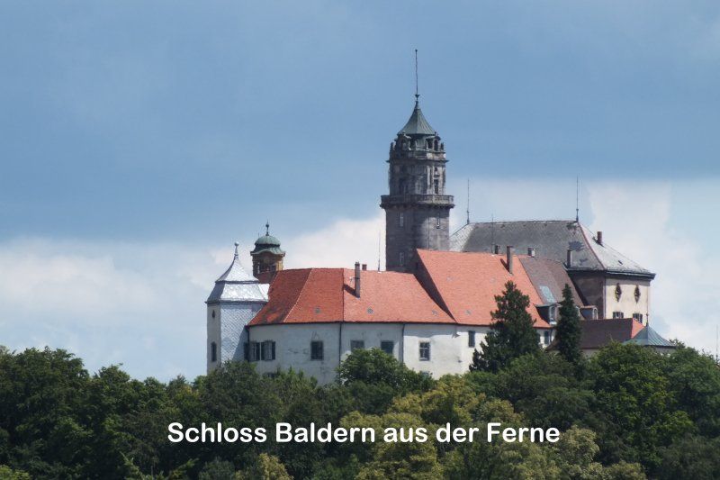
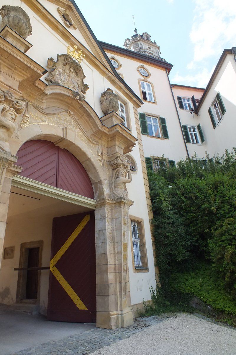
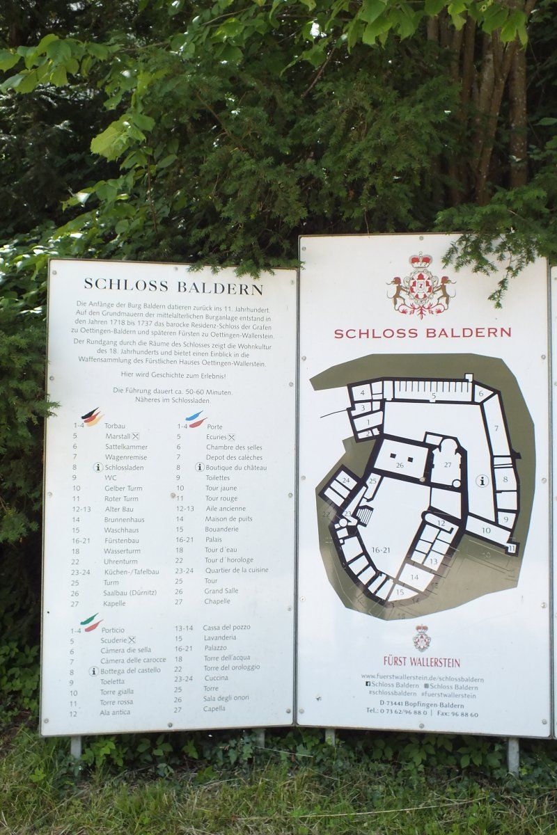
Baldern
Baldern, 73441 Bopfingen, Deutschland
48° 54' 23.2" N 10° 18' 55.4" E
48.9064400 10.3153840
• Head toward Zöbinger Straße on Baldern. Go for 142 m.
• Turn left onto Zöbinger Straße (K3200). Go for 39 m.
• Continue on K3200. Go for 275 m.
• Turn right onto K3200. Go for 1.5 km.
• Continue on Schönes Feldle (K3200). Go for 1.2 km.
• Continue on Holzgasse (K3200). Go for 166 m.
• Turn left onto Bopfinger Straße (L1070). Go for 318 m.
• Turn right onto Schneidheimer Straße (L1060) toward Nördlingen/Wallerstein/Unterschneidheim. Go for 7.6 km.
• Continue on St1060. Go for 903 m.
• Continue on Benzenzimmerner Straße. Go for 197 m.
• Turn right onto Hauptstraße. Go for 898 m.
• Turn sharp left onto Weinstraße (DON12) toward Birkhausen. Go for 242 m.
• Arrive at Weinstraße (DON12). Your destination is on the right.
☍
13,5 km
( 13 min.)
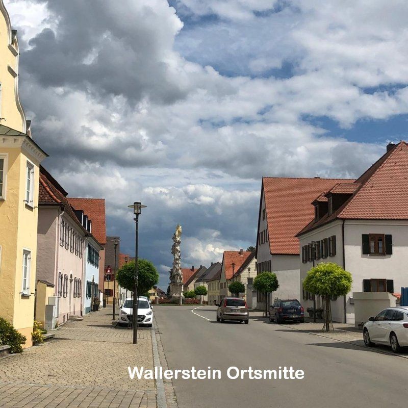
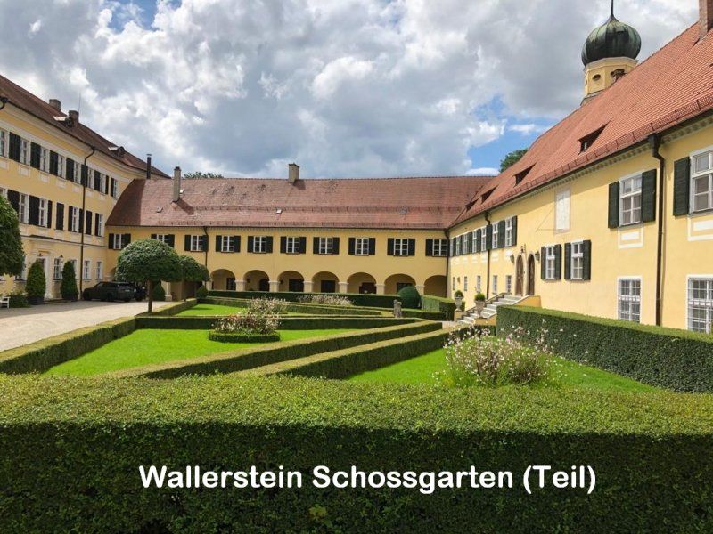
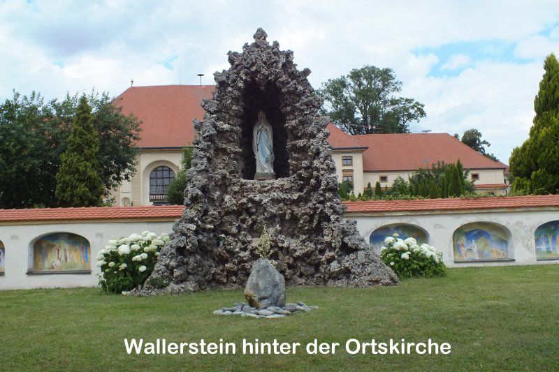
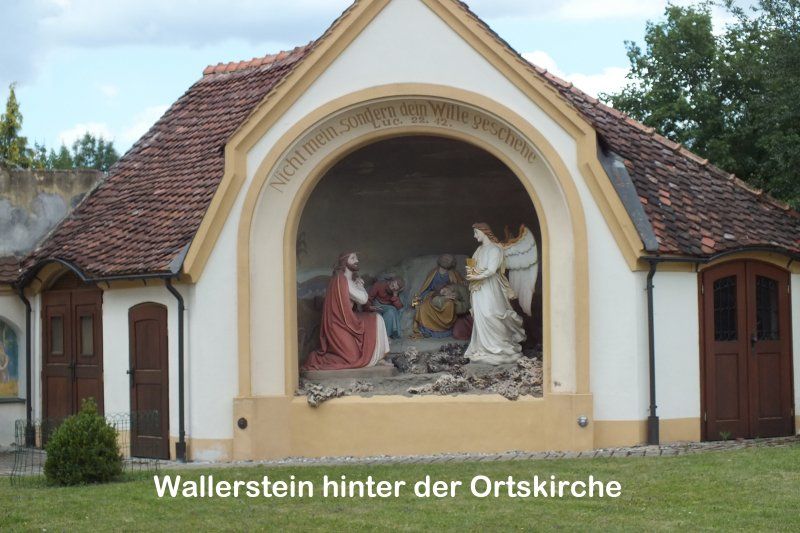
Wallerstein
86757 Wallerstein, Deutschland
48° 53' 13.1" N 10° 28' 37.1" E
48.8869717 10.4769657
• Head toward Von-Knebel-Straße on Weinstraße (DON12). Go for 193 m.
• Keep left onto Nördlinger Straße (DON12). Go for 240 m.
• Continue on DON12. Go for 628 m.
• Continue on Melchior-Meyr-Straße (DON12). Go for 397 m.
• Continue on DON12. Go for 547 m.
• Take the 3rd exit from roundabout onto B25 toward Augsburg/Donauwörth/Nürnberg/B466/Industriegebiet Nördlingen. Go for 4.0 km.
• Turn right onto Gewerbestraße (St2213) toward Wemding/Deiningen/Nördlingen-Ost/Gewerbegebiet-Ost. Go for 273 m.
• Turn left onto St2213. Go for 4.9 km.
• Pass 2 roundabouts and continue on Hauptstraße (St2213). Go for 9.6 km.
• Continue on Bahnhofstraße (St2214). Go for 1.2 km.
• Turn left onto Nördlinger Straße. Go for 101 m.
• Turn right onto Langgasse. Go for 98 m.
• Turn left onto Wolfgangstraße. Go for 106 m.
• Arrive at Wolfgangstraße. Your destination is on the right.
☍
22,3 km
( 19 min.)
Wemding
86650 Wemding, Deutschland
48° 52' 27.9" N 10° 43' 25.1" E
48.8744277 10.7236307
• Head north on Wolfgangstraße.
• Continue on Marktplatz. Go for 43 m.
• Turn right onto Marktplatz. Go for 60 m.
• Continue on Mangoldstraße. Go for 174 m.
• Turn right onto Kapuzinergraben (St2214). Go for 383 m.
• Turn left onto Harburger Straße (St2384). Go for 2.3 km.
• Turn left onto DON20. Go for 5.0 km.
• Turn right toward Fünfstettener Straße. Go for 1.5 km.
• Continue on Fünfstettener Straße. Go for 1.4 km.
• Continue on Fünfstettener Straße. Go for 133 m.
• Continue on Luggasse. Go for 526 m.
• Continue on Luggasse. Go for 305 m.
• Turn right onto DON24. Go for 2.3 km.
• Continue on Listhof (DON24). Go for 335 m.
• Continue on DON24. Go for 619 m.
• Continue on Mündlinger Straße (DON24). Go for 494 m.
• Arrive at Mündlinger Straße (DON24). Your destination is on the left.
☍
15,6 km
( 13 min.)
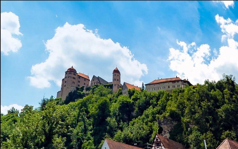
Harburg
86655 Harburg (Schwaben), Deutschland
48° 47' 7.7" N 10° 41' 42.6" E
48.7854698 10.6951796
• Head west on Mündlinger Straße (DON24). Go for 347 m.
• Turn left onto Grasstraße (St2384) toward Nördlingen/Donauwörth. Go for 550 m.
• Take left ramp onto B25. Go for 1.2 km.
• Turn left onto Burgstraße. Go for 405 m.
• Continue on Burgstraße. Go for 2.3 km.
• Continue on DON16. Go for 2.4 km.
• Take the 1st exit from roundabout onto Schaffhausen (DON9). Go for 48 m.
• Continue on DON9. Go for 4.0 km.
• Continue on Jurastraße (DON9). Go for 444 m.
• Turn right onto Albstraße (St2221). Go for 137 m.
• Arrive at Albstraße (St2221).
☍
11,8 km
( 10 min.)
Mönchsdeggingen
86751 Mönchsdeggingen, Deutschland
48° 46' 39.4" N 10° 35' 0.9" E
48.7776092 10.5835923
• Head north on Albstraße (St2221). Go for 2 m.
• Turn left onto Alemannenstraße. Go for 948 m.
• Continue on DON9. Go for 3.0 km.
• Continue on Schloßstraße (DON9). Go for 488 m.
• Turn right onto Hauptstraße (St2212). Go for 677 m.
• Take the 3rd exit from roundabout onto DON9. Go for 3.2 km.
• Continue on Kreisstraße (DON9). Go for 1.8 km.
• Turn right onto Hauptstraße (DON1) toward Nördlingen/Ederheim. Go for 1.5 km.
• Continue on Kreisstraße (DON1). Go for 356 m.
• Continue on DON1. Go for 118 m.
• Continue straight ahead. Go for 47 m.
• Turn right. Go for 8 m.
• Turn left. Go for 721 m.
• Arrive at your destination.
☍
13,0 km
( 12 min.)
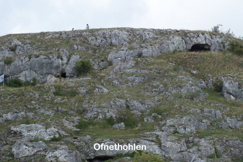
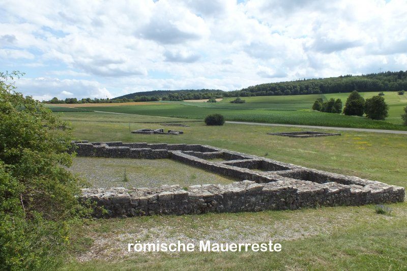
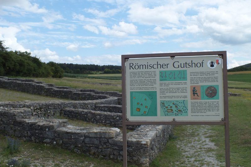
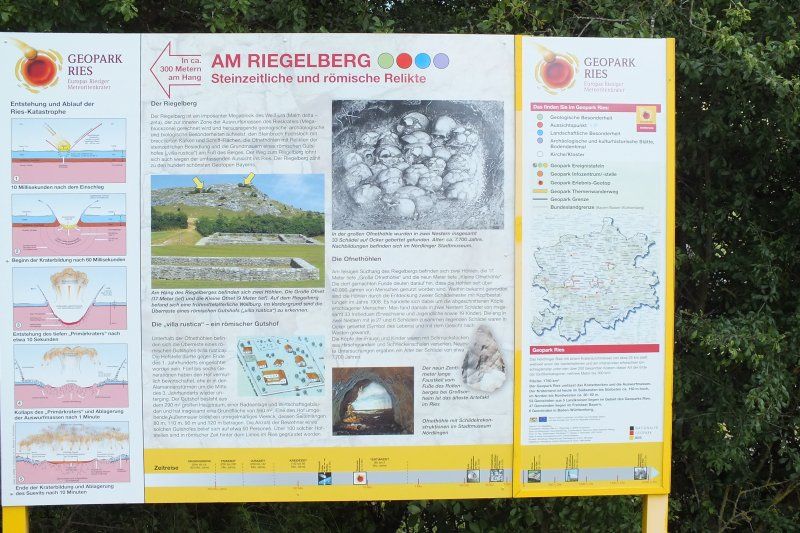
Ofnethöhlen, Nördlingen
Unnamed Road, 86720 Nördlingen, Deutschland
48° 49' 6.6" N 10° 27' 1.6" E
48.8185058 10.4504506
• Head southeast. Go for 721 m.
• Turn right. Go for 8 m.
• Turn left toward DON1. Go for 47 m.
• Continue on DON1. Go for 118 m.
• Continue on Kreisstraße (DON1). Go for 356 m.
• Continue on Hauptstraße (DON1). Go for 1.7 km.
• Continue on DON1. Go for 3.2 km.
• Continue on Hoppelmühle (DON1). Go for 363 m.
• Continue on DON1. Go for 146 m.
• Continue on Christgarten (DON1). Go for 256 m.
• Turn left onto Christgarten. Go for 22 m.
• Turn right onto Christgarten. Go for 64 m.
• Arrive at Christgarten. Your destination is on the left.
☍
7,0 km
( 8 min.)
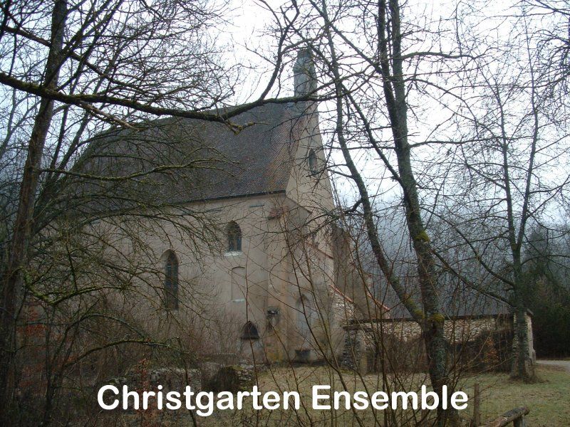
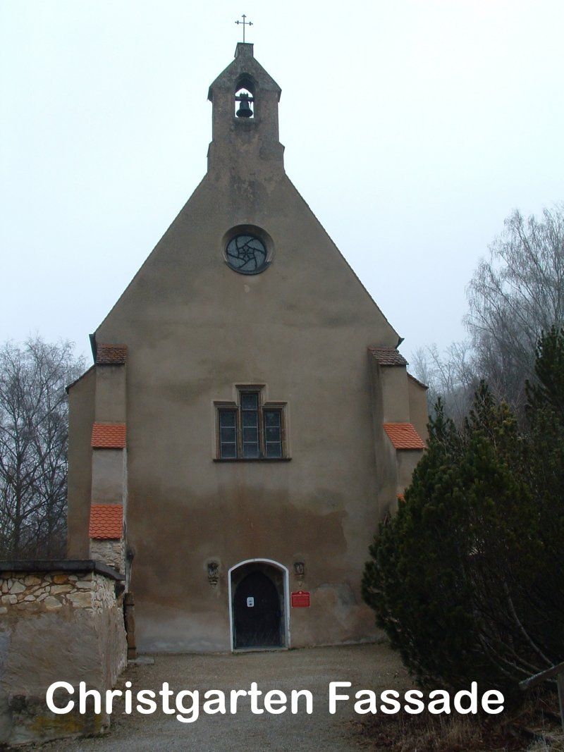
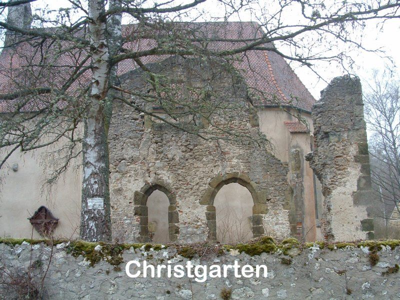
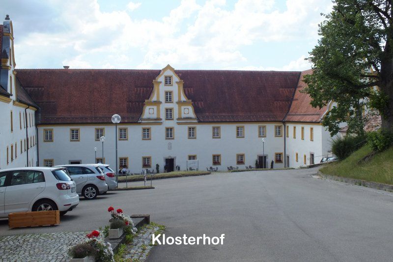
Karthäuserkloster Christgarten
Christgarten 13, 86739 Ederheim, Deutschland
48° 46' 56.6" N 10° 27' 47.8" E
48.7823808 10.4632760
• Head north on Christgarten. Go for 86 m.
• Turn left onto Christgarten (DON1). Go for 52 m.
• Continue on DON1. Go for 4.0 km.
• Turn right onto DON8. Go for 3.0 km.
• Continue on K3301. Go for 953 m.
• Continue on Forheimer Straße (K3301). Go for 261 m.
• Turn left onto Schweindorfer Straße (K3301). Go for 92 m.
• Turn right onto Hohlensteiner Straße (K3301). Go for 1.3 km.
• Continue on K3301. Go for 859 m.
• Continue on Hohlenstein (K3301). Go for 288 m.
• Continue on K3301. Go for 337 m.
• Continue on Wolfsberg (K3301). Go for 671 m.
• Continue on K3301. Go for 955 m.
• Turn left onto Maria Buch toward Kloster. Go for 100 m.
• Continue on Alte Kösinger Straße. Go for 1.6 km.
• Turn sharp right. Go for 8 m.
• Arrive at your destination.
☍
14,6 km
( 12 min.)
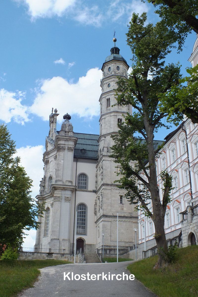
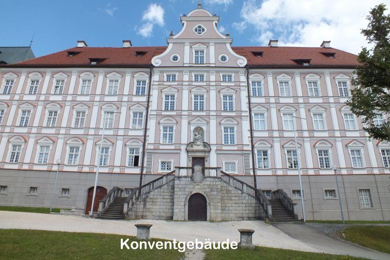
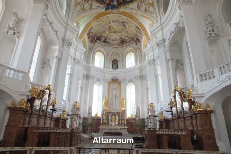
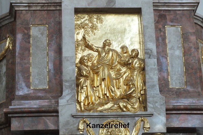
Kloster Neresheim
Abteikirche Neresheim, Kloster 11, 73450 Neresheim, Deutschland
48° 45' 21.1" N 10° 20' 37.4" E
48.7558741 10.3437116
• Head toward Alte Kösinger Straße. Go for 8 m.
• Turn right onto Ulrichstraße (K3309). Go for 934 m.
• Turn left onto Dischinger Straße (L2033). Go for 113 m.
• Arrive at Dischinger Straße (L2033). Your destination is on the left.
☍
1,1 km
( 1 min.)
Neresheim - Stellplatz "Alter Bahnhof"
Dischinger Straße 11, 73450, Neresheim, Deutschland
48° 45' 3" N 10° 20' 22" E
48.7508333 10.3394444
• Head southeast on Dischinger Straße (L2033). Go for 5.7 km.
• Turn right onto L2033. Go for 2.5 km.
• Turn right onto Hauptstraße (L1181). Go for 212 m.
• Arrive at Marktplatz (L1181). Your destination is on the right.
☍
8,4 km
( 6 min.)
Day
Dischingen
Dischingen, Deutschland
48° 41' 49.5" N 10° 21' 42.7" E
48.6970825 10.3618559
• Head toward Kirchgasse on Marktplatz (L1181). Go for 7 m.
• Turn left onto Marktplatz. Go for 72 m.
• Turn left onto Grabenstraße. Go for 86 m.
• Turn slightly right onto Hauptstraße (L1181). Go for 123 m.
• Turn right onto Schloßstraße (L2033). Go for 3.2 km.
• Turn right onto Sperrbergstraße (L1082). Go for 2.1 km.
• Continue on St1082. Go for 3.7 km.
• Take the 2nd exit from roundabout onto St1082 toward Heidenheim/A7/Dillingen/Giengen/Bachhagel/Ortsmitte. Go for 427 m.
• Take the 1st exit from roundabout onto St1082 toward Heidenheim/A7/Giengen. Go for 1.2 km.
• Turn right onto St1082. Go for 400 m.
• Take the 2nd exit from roundabout onto L1082. Go for 4.4 km.
• Continue on Schwagestraße (L1082). Go for 80 m.
• Turn right onto Herbrechtinger Straße (L1082). Go for 82 m.
• Make a U-Turn onto Herbrechtinger Straße (L1082). Go for 85 m.
• Continue on Goethestraße. Go for 93 m.
• Arrive at Goethestraße. Your destination is on the right.
☍
16,1 km
( 17 min.)
Giengen an der Brenz
Giengen an der Brenz, Deutschland
48° 37' 20.6" N 10° 14' 21" E
48.6223985 10.2391536
• Head east on Goethestraße. Go for 7 m.
• Turn right onto Richard-Steiff-Straße. Go for 64 m.
• Turn right onto Richard-Steiff-Straße. Go for 262 m.
• Turn right onto Bahnhofstraße (L1083). Go for 147 m.
• Continue on L1082. Go for 3.1 km.
• Turn left onto B19 toward A7/Ulm/Dillingen/Sontheim a.d. Brenz/Hermaringen. Go for 1.5 km.
• Turn right onto L1079. Go for 237 m.
• Take the 2nd exit from roundabout onto L1079 toward Ulm/Giengen-Hurben. Go for 1.7 km.
• Turn left onto L1079. Go for 1.8 km.
• Turn right onto K3019. Go for 3.3 km.
• Turn left and take ramp. Go for 172 m.
• Turn right onto L1164. Go for 2.2 km.
• Take the 2nd exit from roundabout. Go for 1.6 km.
• Continue on L1164. Go for 5.6 km.
• Turn right onto L1164. Go for 1.3 km.
• Arrive at Böhmenstraße (L1164). Your destination is on the right.
☍
23,0 km
( 19 min.)
Gerstetten
89547 Gerstetten, Deutschland
48° 37' 21.2" N 10° 1' 10.4" E
48.6225677 10.0195611
• Head northwest on Böhmenstraße (L1164). Go for 94 m.
• Take the 2nd exit from roundabout onto Marktplatz (L1164). Go for 759 m.
• Turn left onto L1164. Go for 453 m.
• Turn right onto K3016. Go for 1.6 km.
• Continue on Gerstetter Straße (K3016). Go for 169 m.
• Turn left onto Gussenstadter Straße (K3014). Go for 164 m.
• Continue on K3014. Go for 3.2 km.
• Turn right onto K3015. Go for 922 m.
• Continue on Gussenstadter Straße (K3015). Go for 2.1 km.
• Turn right onto Böhmenkircher Straße (B466). Go for 434 m.
• Arrive at Böhmenkircher Straße (B466).
☍
9,9 km
( 8 min.)
Söhnstetten
Söhnstetten, 89555 Steinheim am Albuch, Deutschland
48° 40' 14.5" N 9° 59' 10.8" E
48.6707032 9.9863469
• Head toward In der Breite on Böhmenkircher Straße (B466). Go for 4.4 km.
• Arrive at Hauptstraße (B466). Your destination is on the right.
☍
4,4 km
( 3 min.)
Böhmenkirch
Böhmenkirch, Deutschland
48° 41' 5.5" N 9° 56' 0.2" E
48.6848582 9.9333779
• Head toward Brommstraße on Hauptstraße (B466). Go for 200 m.
• Turn left onto Baierstraße (L1221) toward Aalen. Go for 8.4 km.
• Turn right onto L1162. Go for 840 m.
• Continue on Hauptstraße (L1165). Go for 26 m.
• Arrive at Hauptstraße (L1165). Your destination is on the right.
☍
9,5 km
( 7 min.)
Bartholomä
Hauptstraße 4, 73566 Bartholomä, Deutschland
48° 45' 7.4" N 9° 59' 16.2" E
48.7520430 9.9878382
• Head toward Beckengasse on Hauptstraße (L1165). Go for 26 m.
• Continue on Heubacher Straße (L1162). Go for 8.0 km.
• Take the 2nd exit from roundabout onto Postplatz (L1161). Go for 59 m.
• Turn left onto Böbinger Straße. Go for 43 m.
• Arrive at Böbinger Straße. Your destination is on the left.
☍
8,1 km
( 8 min.)
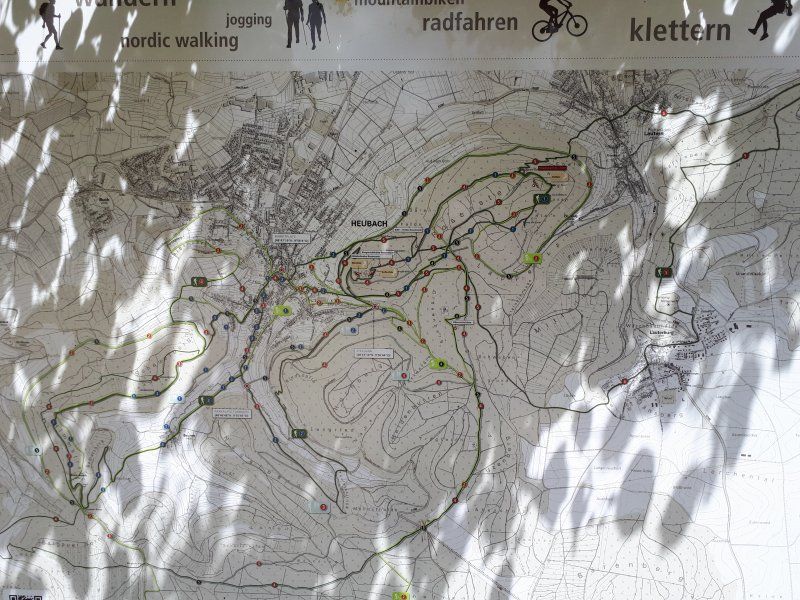
Heubach
Böbinger Str. 3, 73540 Heubach, Deutschland
48° 47' 35.5" N 9° 56' 1.4" E
48.7931838 9.9337326
• Head toward Gartenstraße on Böbinger Straße. Go for 45 m.
• Turn left onto Hermannstraße. Go for 77 m.
• Turn left onto Klotzbachstraße. Go for 97 m.
• Turn right onto Gmünder Straße (L1161). Go for 824 m.
• Pass 2 roundabouts and continue on L1161. Go for 4.2 km.
• Arrive at L1161. Your destination is on the right.
☍
5,2 km
( 5 min.)
Umfahrung Bargau
L1161, 73529 Schwäbisch Gmünd, Deutschland
48° 47' 17.3" N 9° 52' 44.3" E
48.7881252 9.8789733
• Head southeast on L1161.
• Take the 1st exit from roundabout onto L1161. Go for 1.7 km.
• Take the 2nd exit from roundabout onto Buchauffahrt (L1161). Go for 2.4 km.
• Turn right onto Benzholzstraße (L1161). Go for 188 m.
• Turn right onto Hauptstraße (K3267). Go for 265 m.
• Take the 3rd exit from roundabout onto Aalener Straße (B29). Go for 2.3 km.
• Take ramp onto Herlikofer Straße (B298) toward Schwäbisch Hall/Leinzell/Mutlangen/Stauferklinik. Go for 402 m.
• Turn left onto Schießtalstraße. Go for 318 m.
• Continue on Richard-Bullinger-Straße. Go for 37 m.
• Turn left. Go for 160 m.
• Turn left. Go for 33 m.
• Arrive at your destination on the left.
☍
7,8 km
( 8 min.)
GD - Stellplatz am Freibad
Schießtalstraße 13, 73525, Schwäbisch Gmünd, Deutschland
48° 48' 17" N 9° 48' 49" E
48.8047222 9.8136111