Hi guys, this is our trip through Portugal in winter 2022/23 and back via Spain.
To all who follow us - bon voyage! 🚐
Left:
https://www.visitportugal.com/en
https://travel-to-spain.com/
https://www.beachrex.com/en/portugal?scr=destinationsMap
https://www.geo.de/reisen/19825-rtkl-portugal-ria-formosa-eine-lagunenlandschaft-zum-verlieben
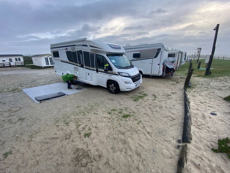
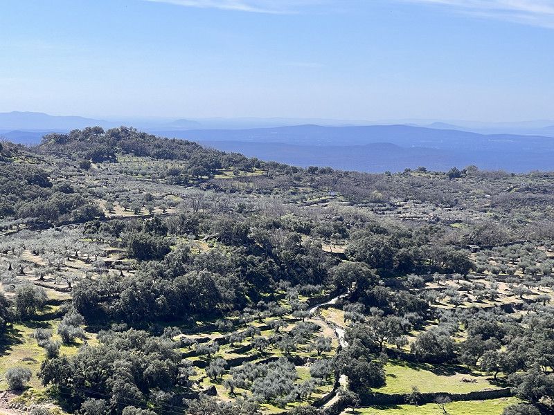
In my opinion, if you go to Portugal to spend the winter, you should better do the loop clockwise. Then it may still be/already warm in the Algarve and you have a better chance of warm and, above all, dry weather on the west coast on the Atlantic.
Day
Deidesheim, Deutschland
67146 Deidesheim, Deutschland
49° 24' 34.5" N 8° 11' 5.1" E
49.4095800 8.1847560
• Head toward Kaisergarten on Bennstraße. Go for 133 m.
• Turn right onto Kaisergarten. Go for 24 m.
• Turn left onto Weinstraße (L516). Go for 620 m.
• Turn right onto L527 toward A45/Speyer/Niederkirchen/Bad Dürkheim. Go for 485 m.
• Take the 3rd exit from roundabout onto B271 toward Neustadt/Weinstr. Go for 4.1 km.
• Take the left exit toward Karlsruhe/Neustadt/Weinstr. onto A65. Go for 38.3 km.
• Take exit 22 toward Kandel-Süd/Strasbourg/Lauterbourg onto B9. Go for 11.2 km.
• Continue on A35. Go for 47.2 km.
• Keep right toward E25/A355. Go for 2.5 km.
• Continue on A355. Go for 23.8 km.
• Continue on A35. Go for 38.6 km.
• Continue on D83. Go for 10.7 km.
• Keep left onto A35. Go for 38.5 km.
• Take the left exit toward A35/Mulhouse/Lyon/Paris onto A36 (La Comtoise). Go for 4.6 km.
• Keep left onto A36 (La Comtoise) toward Paris/Lyon/Guebwiller. Go for 223 km.
• Take the exit onto A31. Go for 6.1 km.
• Continue on A6 (Autoroute du Soleil). Go for 31.2 km.
• Take exit 26 toward Lons le Saunier/Montceau les M./Le Creusot. Go for 1.2 km.
• Take the 2nd exit from roundabout onto Route Express Chalon Montceau (N80) toward Moulins/Montceau les M./Le Creusot/Cluny. Go for 746 m.
• Take the 2nd exit from Giratoire de Cortelin roundabout onto Route Express Chalon Montceau (N80) toward Moulins/Montceau les M./Le Creusot. Go for 26.6 km.
• Take the 3rd exit from Rond-Point Jeanne Rose roundabout onto N70 toward Montchanin/Montceau les M./Moulins/Montchanin-Centre. Go for 44.0 km.
• Continue on N79. Go for 844 m.
• Keep left onto N79 toward Moulins/Nevers/Roanne/Vichy/Digoin/Paray le M.-Sud. Go for 9.0 km.
• Keep left onto A79 toward Montluçon/Nevers/Vichy/Moulins/Digoin-Ouest. Go for 7.1 km.
• Take exit 24 toward Vichy/Lapalisse/Digoin/Molinet. Go for 794 m.
• Take the 3rd exit from roundabout onto Route de Vichy (D994) toward Digoin/Molinet. Go for 2.3 km.
• Arrive at Place Charles Vertray (D994). Your destination is on the left.
☍
573,9 km
(5 hrs. 9 min.)
Molinet, Frankreich
Ideal stopover with 2 parking spaces
03510 Molinet, Frankreich
46° 27' 57.5" N 3° 56' 10.5" E
46.4659610 3.9362500
• Head southwest on Place Charles Vertray (D994). Go for 2.3 km.
• Take the 1st exit from roundabout toward N79/E62/Montluçon/Moulins/Chalon S/Saône/Mâcon/Montceau les M./Dompierre S/B. Go for 154 m.
• Take left ramp onto A79 toward N1079/E62/Montluçon/Moulins/Dompierre S/B. Go for 84.6 km.
• Take the exit toward Clermont-Fd onto A71. Go for 48.1 km.
• Take the exit toward Bordeaux/Limoges onto A89. Go for 161 km.
• Take the left exit toward E70/Toulouse/Bordeaux/Périgueux/Brive la G. onto A20 (L'Occitane). Go for 16.7 km.
• Take the exit toward Bordeaux/Périgueux/Sarlat onto A89 (Viaduc du Maumont). Go for 168 km.
• Continue on N89. Go for 17.8 km.
• Keep left onto N89 toward Arcachon/Bayonne/Toulouse/Bordeaux-St Jean/Z.I. Artigues. Go for 217 m.
• Take ramp onto Rocade de Bordeaux (N230) toward Arcachon/Bayonne/Toulouse/Bordeaux-Centre/Bordeaux-St Jean/Z.I. Artigues. Go for 17.7 km.
• Take exit 15 toward Saint Sébastien/Bayonne/Mont de Marsan/Bassin d'Arcachon onto A63. Go for 206 km.
• Continue on AP-8 (Autopista del Cantábrico). Go for 12.2 km.
• Take the exit toward Bilbao/Vitoria-Gasteiz/Burgos/Hernani/A-15/Iruña/Pamplona onto AP-1/AP-8. Go for 14.8 km.
• Take the exit onto AP-1/AP-8 (Autopista del Cantábrico). Go for 10.5 km.
• Take exit 38 toward N-634/Zarautz/Getaria. Go for 578 m.
• Take the 2nd exit from roundabout onto Calle Irita. Go for 119 m.
• Take the 2nd exit from roundabout onto Camino Mendibeltz. Go for 162 m.
• Turn left onto Camino Sorginmuno. Go for 18 m.
• Turn right toward Camino Talaimendi. Go for 203 m.
• Turn slightly left onto Camino Talaimendi. Go for 87 m.
• Turn right toward Camino Talaimendi. Go for 373 m.
• Continue on Camino Talaimendi. Go for 212 m.
• Turn slightly left onto Camino Talaimendi. Go for 262 m.
• Turn right toward Camino Talaimendi. Go for 77 m.
• Turn slightly left onto Camino Talaimendi. Go for 10 m.
• Turn left onto Laurgain kalea. Go for 16 m.
• Continue toward Camino Talaimendi. Go for 57 m.
• Turn left onto Camino Talaimendi. Go for 5 m.
• Turn right. Go for 27 m.
• Turn left. Go for 28 m.
• Arrive at your destination on the left.
☍
762,4 km
(6 hrs. 41 min.)
Camping Gran Camping Zarautz
Monte Talai-mendi Zarautz, 20800, Zarautz, Spanien
43° 17' 26" N 2° 8' 48" W
43.2905600 -2.1466700
• Head east. Go for 28 m.
• Turn right toward Camino Talaimendi. Go for 27 m.
• Turn left onto Camino Talaimendi. Go for 5 m.
• Turn right toward Laurgain kalea. Go for 57 m.
• Continue on Laurgain kalea. Go for 16 m.
• Turn right onto Camino Talaimendi. Go for 10 m.
• Turn slightly right toward Camino Talaimendi. Go for 77 m.
• Turn left onto Camino Talaimendi. Go for 262 m.
• Turn slightly right onto Camino Talaimendi. Go for 212 m.
• Turn left toward Camino Talaimendi. Go for 373 m.
• Turn left onto Camino Talaimendi. Go for 87 m.
• Turn slightly right toward Camino Sorginmuno. Go for 203 m.
• Turn left onto Camino Sorginmuno. Go for 18 m.
• Turn right onto Camino Mendibeltz. Go for 112 m.
• Take the 2nd exit from roundabout onto Calle Irita toward Bilbao/A-8/Donostia/S. Sebastián. Go for 133 m.
• Take the 2nd exit from roundabout toward Donostia/San Sebastián/Bilbo/Vitoria/Gasteiz. Go for 75 m.
• Take ramp onto AP-1/AP-8 (Autopista del Cantábrico) toward Bilbo/Bilbao/Vitoria-Gasteiz. Go for 31.4 km.
• Take exit 69 toward Bergara/Vitoria-Gasteiz onto AP-1. Go for 44.7 km.
• Continue on Autopista Vitoria-Eibar. Go for 87 m.
• Take exit 101 toward Vitoria-Gasteiz/Burgos/A-1 onto N-622. Go for 3.8 km.
• Take ramp onto A-1 toward Burgos/Madrid. Go for 24.0 km.
• Take exit 328 toward Burgos/Logroño/AP-68/Bilbao onto AP-1 (Autovía del Norte). Go for 83.3 km.
• Continue on A-1 (Autovía del Norte) toward Madrid/A-62/Valladolid/Portugal. Go for 58.1 km.
• Take exit 185 toward Cabañes de Esgueva/Roa. Go for 291 m.
• Take the 1st exit from roundabout onto BU-130 toward Cabañes de Esgueva/Roa. Go for 21.3 km.
• Keep left onto BU-130. Go for 62 m.
• Turn right toward Avenida Constitución/BU-130. Go for 53 m.
• Turn right onto Avenida Constitución (BU-130). Go for 5.9 km.
• Take the 2nd exit from roundabout onto BU-120. Go for 271 m.
• Pass 2 roundabouts and continue on BU-120. Go for 1.0 km.
• Turn right onto BU-130 toward Peñafiel/Fuentecén. Go for 626 m.
• Take the 2nd exit from Carretera a la Estación roundabout onto Carretera a la Estación (BU-130) toward Peñafiel. Go for 11.1 km.
• Continue on VA-130. Go for 1.1 km.
• Continue toward Carretera de Valladolid a Soria/N-122. Go for 65 m.
• Turn right onto Carretera de Valladolid a Soria (N-122) toward Peñafiel/Valladolid. Go for 8.8 km.
• Take the 1st exit from roundabout onto Avenida Escalona (N-122) toward Valladolid. Go for 346 m.
• Turn left onto Calle de la Laguna. Go for 236 m.
• Turn left onto Calle Rondas (VP-2307). Go for 187 m.
• Continue on Camino del Cementerio (VP-2307). Go for 40 m.
• Turn left toward Calle Bodegas Protos. Go for 40 m.
• Turn left onto Calle Bodegas Protos. Go for 16 m.
• Arrive at Calle Bodegas Protos. Your destination is on the right.
☍
298,6 km
(2 hrs. 56 min.)
Bodegas Protos, Camino Bodegas Protos, Peñafiel, Spanien
The detour is only worth it if you appreciate good red wine from one of the best bodegas. Check the website beforehand for opening times. Visits in rock cellars possible.
Cam. Bodegas Protos, 24-28, 47300 Peñafiel, Valladolid, Spanien
41° 35' 59.3" N 4° 6' 49.4" W
41.5998048 -4.1137293
• Head toward Camino del Cementerio on Calle Bodegas Protos. Go for 50 m.
• Turn right onto Calle Rondas (VP-2307). Go for 187 m.
• Turn right onto Calle de la Laguna. Go for 81 m.
• Turn left onto Calle del Exmo. Sr. Don Vicente Muñoz Calero. Go for 115 m.
• Turn left onto Avenida Escalona (N-122). Go for 36.7 km.
• Continue on A-11. Go for 14.3 km.
• Take the 2nd exit from roundabout onto Avenida de Soria (VA-11) toward VA-30/Salamanca/Segovia. Go for 309 m.
• Take the 1st exit from roundabout onto VA-30 (Ronda Exterior Sur) toward Salamanca/Segovia. Go for 9.4 km.
• Take the exit toward Tordesillas/Salamanca/Madrid/Zamora onto A-62 (Autovía de Castilla). Go for 23.9 km.
• Keep right onto A-62 (Autovía de Castilla) toward E-82/Zamora/A-11/Salamanca/Portugal. Go for 81.1 km.
• Take exit 234 toward Salamanca/Pol. Ind. Los Villares onto N-620. Go for 1.8 km.
• Take the 4th exit from roundabout onto Camino Cabrerizos (DSA-600). Go for 485 m.
• Continue on Carretera Villares de la Reina (DSA-600). Go for 864 m.
• Continue on Calle Camino Villares (DSA-600). Go for 1.6 km.
• Take the 3rd exit from roundabout onto Calle Los Labradores. Go for 242 m.
• Turn right onto Calle Salas Pombo. Go for 25 m.
• Arrive at Calle Salas Pombo.
☍
171,1 km
(1 hrs. 39 min.)
Camping Don Quijote - SALAMANCA
Carretera Salamanca-aldealengua KM 1.930, 37193, Salamanca-este, Spain
40° 58' 43" N 5° 36' 35" W
40.9786100 -5.6097200
• Head toward Calle Los Arroyos on Calle Salas Pombo. Go for 47 m.
• Continue on Calle Camino de Salamanca. Go for 144 m.
• Turn right onto Calle Azucena. Go for 222 m.
• Turn right onto Avenida de las Palmeras. Go for 120 m.
• Take the 4th exit from roundabout onto Calle Camino Villares (DSA-600). Go for 1.6 km.
• Continue on Carretera Villares de la Reina (DSA-600). Go for 864 m.
• Continue on Camino Cabrerizos (DSA-600). Go for 365 m.
• Take the 1st exit from roundabout onto N-620. Go for 941 m.
• Take ramp onto A-62 (Autovía de Castilla) toward Portugal. Go for 121 km.
• Continue on A25 (Autoestrada Beiras Litoral e Alta). Go for 14.1 km.
• Take exit 32 toward Pinhel/Sabugal. Go for 335 m.
• Take the 3rd exit from roundabout onto N324. Go for 221 m.
• Take the 1st exit from roundabout onto N324. Go for 1.5 km.
• Take the 3rd exit from roundabout onto N16. Go for 4.5 km.
• Turn right. Go for 669 m.
• Turn slightly left. Go for 450 m.
• Arrive at your destination on the left.
☍
147,4 km
(1 hrs. 24 min.)
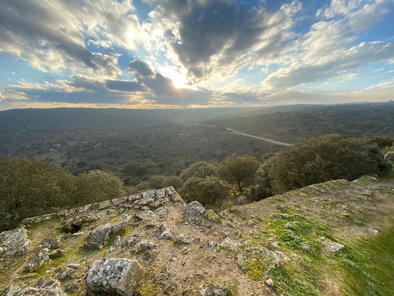
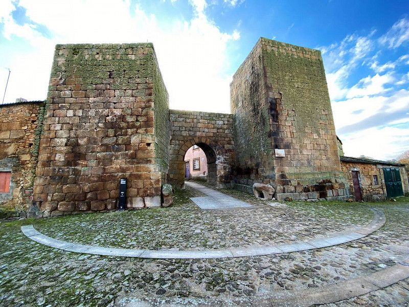
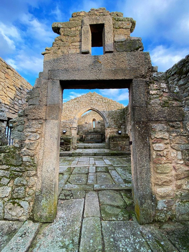
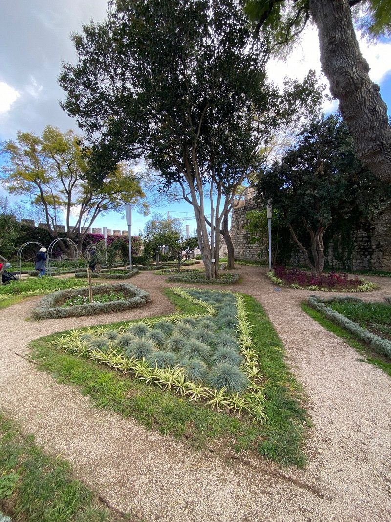
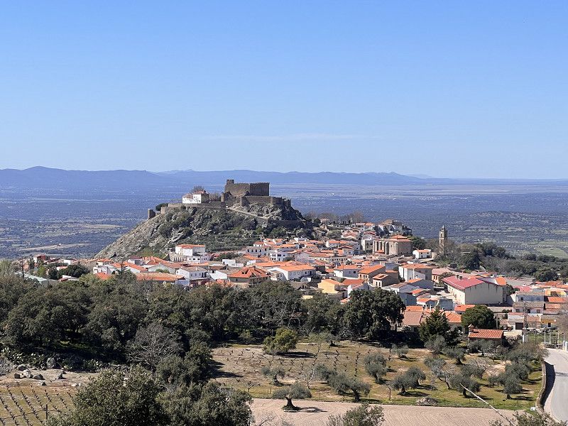
Castelo Mendo, Portugal
There is a parking space for campers right in front of the small, pretty town. Excellent. The village seems a bit deserted, but there are actually around 80 normal people still living there.
Castelo Mendo, 6355, Portugal
40° 35' 35.6" N 6° 56' 51.9" W
40.5932130 -6.9477532
• Head west. Go for 450 m.
• Turn slightly right. Go for 547 m.
• Keep right toward N16. Go for 122 m.
• Turn left onto N16. Go for 4.4 km.
• Take the 1st exit from roundabout onto N324. Go for 1.5 km.
• Take the 2nd exit from roundabout onto N324. Go for 196 m.
• Take the 2nd exit from roundabout onto A25 (Autoestrada Beiras Litoral e Alta) toward Aveiro/Guarda. Go for 171 km.
• Take the exit toward Aveiro onto A25 (Autoestrada Beiras Litoral e Alta). Go for 6.2 km.
• Take exit 3 toward Aveiro. Go for 336 m.
• Take the 1st exit from roundabout. Go for 251 m.
• Take the 3rd exit from Rotunda dos Marnotos roundabout onto Rua do Alavário. Go for 362 m.
• Continue on Rua do Clube dos Galitos. Go for 131 m.
• Turn right onto Rua Belém do Pará. Go for 134 m.
• Arrive at Rua Belém do Pará. Your destination is on the left.
☍
185,9 km
(1 hrs. 56 min.)
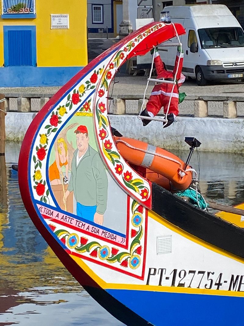
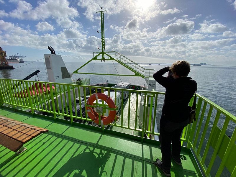
Aveiro, Portugal
lagoon city
Take the ferry to Sao Jacinto
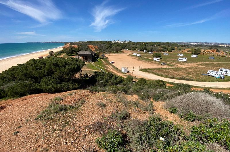
Parking space beautifully located at Praia da Costa da Lavos
40° 38' 25.8" N 8° 39' 13.5" W
40.6405055 -8.6537539
• Head toward Praça da República on Rua Belém do Pará. Go for 42 m.
• Continue on Rua Gustavo Ferreira Pinto Bastos. Go for 103 m.
• Turn right onto Rua Professor Barbosa de Magalhães. Go for 84 m.
• Turn left onto Rua do Capitão João Souza Pizarro. Go for 223 m.
• Turn right onto Avenida Artur Ravara. Go for 255 m.
• Take the 1st exit from Rotunda do Hospital roundabout onto Rua de Calouste Gulbenkian. Go for 377 m.
• Take the 2nd exit from roundabout onto Rua Condessa Mumadona Dias. Go for 492 m.
• Take the 2nd exit from Rotunda dos Marnotos roundabout. Go for 311 m.
• Take the 2nd exit from roundabout onto A25 (Autoestrada Beiras Litoral e Alta). Go for 8.3 km.
• Continue on Avenida de Nossa Senhora da Saúde (N109-7). Go for 1.1 km.
• Continue on Avenida José Estevão (N109-7). Go for 1.8 km.
• Continue on M592. Go for 5.1 km.
• Take the 1st exit from roundabout onto Avenida João Vaz da Silva. Go for 417 m.
• Continue on Avenida João Vaz. Go for 27 m.
• Turn left onto Rua Onze. Go for 71 m.
• Turn left onto Avenida Claudino Santos Costa (M592). Go for 341 m.
• Continue on M591-2. Go for 465 m.
• Take the 1st exit from roundabout onto Rua Principal (M591). Go for 1.2 km.
• Arrive at Rua Principal (M591). Your destination is on the right.
☍
20,7 km
( 25 min.)
Gafanha da Boa Hora, STELLPLATZ bei Goretti
3840 Gafanha da Boa Hora, Portugal
40° 32' 55.5" N 8° 45' 26" W
40.5487610 -8.7572321
• Head southwest on Rua Principal (M591). Go for 7.2 km.
• Turn left onto Rua do Leque Florestal. Go for 7.0 km.
• Continue straight ahead. Go for 731 m.
• Continue straight ahead. Go for 260 m.
• Continue toward Autoestrada do Litoral Centro/A17. Go for 32 m.
• Take the 3rd exit from roundabout onto A17 (Autoestrada do Litoral Centro) toward Lisboa/Fig.ra Foz. Go for 91.9 km.
• Take exit 1 toward Leiria Sul/A1/N242/M.nha Grande Este onto A8 (Nó da A8-A17). Go for 6.6 km.
• Take exit 26 toward A19/Centro Leiria/Batalha. Go for 641 m.
• Take the exit toward A19/Batalha/Azoia onto IC2. Go for 1.1 km.
• Keep left toward Autoestrada Variante da Batalha/A19. Go for 233 m.
• Take ramp onto A19 (Autoestrada Variante da Batalha). Go for 11.7 km.
• Take exit 1 toward Lisboa/Alcobaça. Go for 306 m.
• Take the 2nd exit from Rotunda Aérea do Chão da Feira roundabout onto IC2 toward Alcobaça/IC9/Nazaré. Go for 2.1 km.
• Take the 1st exit from roundabout toward Cruz da Légua. Go for 35 m.
• Continue on Rua Príncipal (N242-4). Go for 494 m.
• Turn right onto Rua da Capeleira. Go for 49 m.
• Arrive at Rua da Capeleira. Your destination is on the right.
☍
130,2 km
(1 hrs. 19 min.)
R. da Capeleira nº6, Portugal - OLIVENÖL!!!!!!!
R. da Capeleira nº6, 2480-113, Portugal
39° 36' 8.3" N 8° 51' 46.5" W
39.6023045 -8.8629086
• Head southwest on Rua da Capeleira. Go for 49 m.
• Turn left onto Rua Príncipal (N242-4). Go for 522 m.
• Take the 1st exit from roundabout onto IC2 toward Lisboa/Rio Maior. Go for 5.5 km.
• Take ramp onto IC9 toward Nazaré/Alcobaça/A8. Go for 8.7 km.
• Keep left onto IC9 toward Nazaré/A8. Go for 8.4 km.
• Take the 4th exit from roundabout onto Variante da Nazaré toward Nazaré. Go for 942 m.
• Take the 1st exit from roundabout onto N8-5 toward Nazaré. Go for 190 m.
• Take the 1st exit from roundabout onto N8-5 toward Nazaré. Go for 396 m.
• Continue on Rua Combatentes do Ultramar (N8-5). Go for 392 m.
• Take the 1st exit from Rotunda do Matadouro roundabout onto Avenida Nogent-Sur Marne (N242). Go for 256 m.
• Take the 4th exit from Rotunda da Cerâmica roundabout onto Avenida Circular Norte. Go for 206 m.
• Turn left onto Avenida Circular Norte. Go for 40 m.
• Turn slightly right onto Avenida da Independência Nacional. Go for 30 m.
• Continue on Avenida de Olivença. Go for 90 m.
• Continue on Rua Adrião Batalha. Go for 143 m.
• Turn left onto Rua Mouzinho de Albuquerque. Go for 14 m.
• Turn right onto Rua França Borges. Go for 25 m.
• Arrive at Rua França Borges. Your destination is on the left.
☍
25,9 km
( 21 min.)
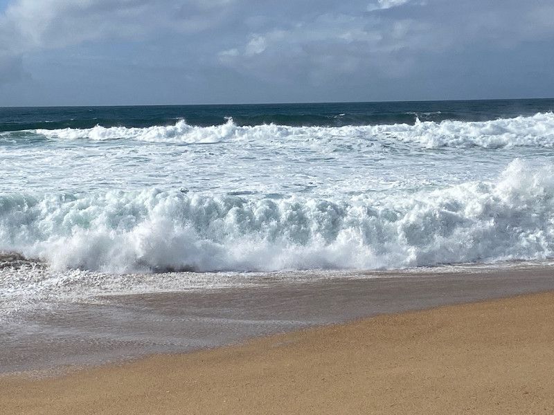
Nazaré, Portugal
Big waves up to 30m high..."the beast".
2450 Nazaré, Portugal
39° 36' 4.4" N 9° 4' 12.4" W
39.6012147 -9.0700991
• Head toward Travessa do Açougue on Rua França Borges. Go for 37 m.
• Turn slightly left onto Travessa do Açougue. Go for 4 m.
• Turn left onto Travessa do Açougue. Go for 17 m.
• Turn left onto Rua Joaquim Bernardo de Souza Lobo. Go for 68 m.
• Turn right onto Rua Mouzinho de Albuquerque. Go for 83 m.
• Keep left onto Rua Mouzinho de Albuquerque. Go for 142 m.
• Continue on Avenida dos Bombeiros Voluntários (N242). Go for 148 m.
• Take the 2nd exit from Rotunda do Matadouro roundabout onto Rua Combatentes do Ultramar (N8-5). Go for 421 m.
• Continue on N8-5. Go for 367 m.
• Take the 3rd exit from roundabout onto N8-5 toward Lisboa/Leiria/Valado dos Frades. Go for 198 m.
• Take the 1st exit from roundabout onto Variante da Nazaré toward Caldas da Rainha/Lisboa. Go for 2.6 km.
• Take the 2nd exit from roundabout onto Variante da Nazaré toward Lisboa. Go for 538 m.
• Continue on N242. Go for 8.8 km.
• Take the 3rd exit from Rotunda da Escola roundabout onto N242. Go for 213 m.
• Turn left toward Estrada de Vale Paraíso. Go for 35 m.
• Turn left onto Estrada de Vale Paraíso. Go for 685 m.
• Arrive at Estrada de Vale Paraíso.
☍
14,4 km
( 15 min.)
São Martinho do Porto, Portugal
2460 São Martinho do Porto, Portugal
39° 30' 55" N 9° 7' 4.6" W
39.5152784 -9.1179465
• Head northeast on Estrada de Vale Paraíso. Go for 1.1 km.
• Continue on Rua 1 de Maio. Go for 680 m.
• Continue on Rua Direita. Go for 928 m.
• Turn right toward Rua Joao de Deus. Go for 236 m.
• Continue on Rua Joao de Deus. Go for 258 m.
• Continue on Rua João de Deus. Go for 426 m.
• Continue on Praça Professor Joaquim André dos Santos. Go for 97 m.
• Turn left onto Rua 25 de Abril (N242). Go for 955 m.
• Take the 2nd exit from roundabout onto A8 (Autoestrada do Oeste) toward Lisboa/Caldas da Rainha. Go for 51.7 km.
• Take exit 8 toward Centro T.res Vedras/Alenquer. Go for 1.6 km.
• Take the 1st exit from Rotunda de Arenes roundabout onto Avenida das Guerreiras Peninsulares. Go for 642 m.
• Take the 3rd exit from roundabout. Go for 671 m.
• Continue toward N8. Go for 23 m.
• Take the 3rd exit from roundabout onto N8. Go for 174 m.
• Take the 1st exit from roundabout onto N9. Go for 215 m.
• Take the 1st exit from roundabout onto N9. Go for 542 m.
• Take the 1st exit from roundabout onto N9. Go for 1.1 km.
• Take the 2nd exit from roundabout onto N9. Go for 845 m.
• Take the 3rd exit from roundabout onto N9. Go for 1.8 km.
• Pass 2 roundabouts and continue on N9. Go for 3.7 km.
• Continue toward N9/N247. Go for 27 m.
• Take the 2nd exit from roundabout onto N9/N247. Go for 2.8 km.
• Take the 2nd exit from roundabout onto N9/N247. Go for 678 m.
• Take the 2nd exit from roundabout onto N247. Go for 1.7 km.
• Turn right toward Estrada da Mimosa. Go for 34 m.
• Continue on Estrada da Mimosa. Go for 485 m.
• Turn slightly right toward Estrada da Mimosa. Go for 24 m.
• Continue on Estrada da Mimosa. Go for 709 m.
• Turn left onto Rua Principal Azenha Velha (M552). Go for 100 m.
• Keep right onto Rua Principal Azenha Velha (M552). Go for 321 m.
• Continue on Rua Principal Azenha Velha (M552). Go for 71 m.
• Continue on Rua Principal (M552). Go for 9 m.
• Turn slightly right onto Rua do Casaleiro. Go for 399 m.
• Continue on Rua Principal de Barrocas. Go for 125 m.
• Turn slightly right onto Rua Principal de Barrocas. Go for 523 m.
• Continue on Rua Principal Gentias. Go for 480 m.
• Turn right onto Rua Carvalho. Go for 690 m.
• Continue on Largo da Foz. Go for 38 m.
• Turn left. Go for 14 m.
• Arrive at your destination on the right.
☍
76,9 km
(1 hrs. 2 min.)
Praia da Foz do Sizandro
Parking space at the river mouth
2560 São Pedro da Cadeira, Portugal
39° 6' 9.6" N 9° 23' 56.5" W
39.1026655 -9.3990290
• Head west. Go for 31 m.
• Turn left. Go for 89 m.
• Turn left toward Rua do Sizandro. Go for 45 m.
• Turn right onto Rua do Sizandro. Go for 234 m.
• Continue on Rua Foz do Sizandro. Go for 317 m.
• Turn left onto Rua Principal Gentias. Go for 808 m.
• Continue on Rua Principal de Barrocas. Go for 363 m.
• Turn slightly left onto Rua Principal de Barrocas. Go for 188 m.
• Continue on Rua do Casaleiro. Go for 336 m.
• Turn slightly left onto Rua Principal (M552). Go for 9 m.
• Keep left onto Rua Principal Azenha Velha (M552). Go for 492 m.
• Turn right onto Estrada da Mimosa. Go for 595 m.
• Continue on Estrada da Mimosa. Go for 358 m.
• Continue on Estrada da Mimosa. Go for 299 m.
• Turn right onto N247. Go for 12.4 km.
• Take the 1st exit from roundabout onto N247. Go for 1.3 km.
• Pass 6 roundabouts and continue on Avenida da Aviação Portuguesa (N9/N247). Go for 23.4 km.
• Take the 3rd exit from roundabout onto Avenida Heliodoro Salgado (N9). Go for 134 m.
• Arrive at Avenida Heliodoro Salgado (N9). Your destination is on the left.
☍
41,3 km
( 51 min.)
Sintra, Portugal (PARKEN schwierig)
Quinta da Regaleira - fairy tale castle in the center of Sintra
2710 Sintra, Portugal
38° 48' 10.3" N 9° 22' 54" W
38.8028687 -9.3816589
• Head south on Avenida Heliodoro Salgado (N9). Go for 40 m.
• Continue on Avenida Doutor Desidério Cambournac. Go for 311 m.
• Take the 2nd exit from roundabout onto Avenida Doutor Desidério Cambournac. Go for 565 m.
• Take the 1st exit from Rotunda Doutor Eduardo Lacerda Tavares roundabout onto Avenida General Mário Firmino Miguel toward A16/A9/IC19/Algueirão. Go for 578 m.
• Take ramp onto A16 toward Lisboa/IC19/Cascais. Go for 2.7 km.
• Take exit 7 toward Lisboa/Amadora onto A37 (Autoestrada Radial de Sintra). Go for 1.5 km.
• Keep left onto Autoestrada Radial de Sintra (A37) toward Lisboa/Algueirão/Rio de Mouro/N249. Go for 1.5 km.
• Keep left onto Autoestrada Radial de Sintra (A37) toward Lisboa/Rio de Mouro. Go for 2.8 km.
• Keep left onto Autoestrada Radial de Sintra (A37) toward Lisboa/Tercena/Massamá. Go for 4.0 km.
• Keep left onto Autoestrada Radial de Sintra (A37) toward Lisboa/Queluz. Go for 3.4 km.
• Take ramp onto N117 toward Lisboa/Cascais/A5/Algés. Go for 3.1 km.
• Keep left onto N117 toward Lisboa/A5/Sul/A2/Belém. Go for 676 m.
• Take ramp onto A5 (Autoestrada da Costa do Estoril) toward Lisboa/Sul/A2. Go for 4.3 km.
• Keep left onto Tunel do Marquês. Go for 503 m.
• Keep right onto Tunel do Marquês. Go for 936 m.
• Take ramp onto Avenida Fontes Pereira de Melo toward Saldanha. Go for 314 m.
• Turn right onto Rua Martens Ferrão. Go for 121 m.
• Turn right onto Rua Sousa Martins. Go for 65 m.
• Continue toward Campo Mártires da Pátria/Rato. Go for 35 m.
• Continue on Rua Luciano Cordeiro. Go for 629 m.
• Continue on Alameda de Santo António dos Capuchos. Go for 184 m.
• Continue on Campo dos Mártires da Pátria. Go for 124 m.
• Arrive at Campo dos Mártires da Pátria. Your destination is on the right.
☍
28,4 km
( 25 min.)
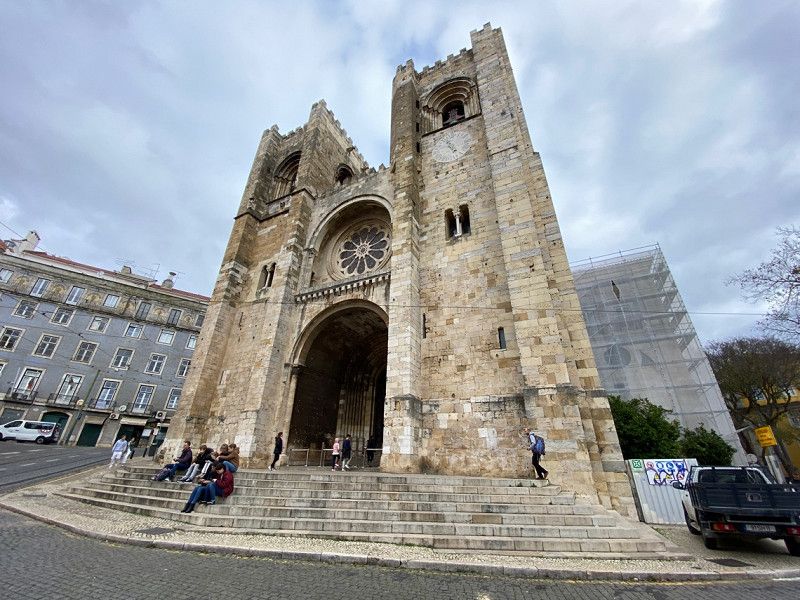
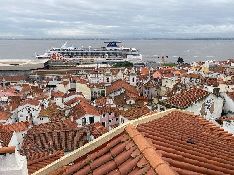
Lissabon, Portugal
38° 43' 20.1" N 9° 8' 21.6" W
38.7222524 -9.1393366
• Head toward Largo do Mitelo on Campo dos Mártires da Pátria. Go for 6 m.
• Continue on Largo do Mitelo toward Parque Cp. M. da Pátria/Mq. Pombal. Go for 39 m.
• Turn right onto Largo do Mitelo toward Parque Cp. M. da Pátria/Mq. Pombal. Go for 27 m.
• Turn right onto Largo do Mitelo toward Parque Cp. M. da Pátria/Mq. Pombal. Go for 39 m.
• Turn right onto Largo do Mitelo toward Parque Cp. M. da Pátria/Mq. Pombal. Go for 24 m.
• Turn left onto Campo dos Mártires da Pátria toward Parque Cp. M. da Pátria/Mq. Pombal. Go for 130 m.
• Turn left onto Rua de Santo António dos Capuchos. Go for 256 m.
• Continue on Rua do Telhal. Go for 174 m.
• Continue on Rua das Pretas. Go for 81 m.
• Continue on Avenida da Liberdade. Go for 34 m.
• Turn right onto Avenida da Liberdade. Go for 828 m.
• Continue toward A1/A2/A5/Saldanha/Cp. Grande. Go for 49 m.
• Take the 2nd exit from Praça do Marquês de Pombal roundabout onto Praça do Marquês de Pombal toward Sul/A2/Cascais/A5/Amoreiras. Go for 209 m.
• Continue on Rua Joaquim António de Aguiar. Go for 44 m.
• Keep right onto Rua Joaquim António de Aguiar. Go for 52 m.
• Take left ramp onto Tunel do Marquês. Go for 311 m.
• Keep left onto Tunel do Marquês toward Sul/A2/Cascais/A5. Go for 831 m.
• Continue on Avenida Engenheiro Duarte Pacheco. Go for 391 m.
• Take ramp onto IP7 (Avenida da Ponte) toward Setúbal/Almada/Sul-Ponte. Go for 5.4 km.
• Continue on A2 (Autoestrada do Sul). Go for 10.3 km.
• Take exit 2 toward Sesimbra/(N10)/Azeitão onto N378 (Avenida 23 de Julho de 1833). Go for 1.3 km.
• Pass 3 roundabouts and continue on Avenida 23 de Julho de 1833 (N378). Go for 5.6 km.
• Take the 3rd exit from roundabout onto N378. Go for 7.0 km.
• Pass 3 roundabouts and continue on N378. Go for 1.6 km.
• Continue on Avenida João Paulo II (N378). Go for 38 m.
• Continue on N378. Go for 214 m.
• Continue on Avenida João Paulo II (N378). Go for 78 m.
• Continue on N378. Go for 201 m.
• Take the 2nd exit from roundabout onto Avenida João Paulo II (N378). Go for 826 m.
• Keep right onto Avenida João Paulo II (N378). Go for 302 m.
• Take the 2nd exit from Praça Duques de Palmela roundabout onto Rua Dr. Alberto Leite (N379). Go for 287 m.
• Turn left onto N378. Go for 1.4 km.
• Keep left onto N378. Go for 635 m.
• Continue on Praça João Pereira Ramada Crespo (N378). Go for 83 m.
• Continue on Rua Cândido dos Reis (N378). Go for 238 m.
• Turn left onto Rua Rainha D. Leonor. Go for 64 m.
• Continue on Largo 5 de Outubro. Go for 76 m.
• Turn left onto Avenida da Liberdade (M585). Go for 12 m.
• Turn left onto Largo 5 de Outubro. Go for 74 m.
• Continue on Rua Almirante Sande de Vasconcelos. Go for 25 m.
• Arrive at Rua Almirante Sande de Vasconcelos. Your destination is on the left.
☍
39,2 km
( 41 min.)
Sesimbra, Portugal
2970 Sesimbra, Portugal
38° 26' 39.2" N 9° 6' 5.4" W
38.4442170 -9.1014903
• Head toward Rua 2 de Abril on Rua Almirante Sande de Vasconcelos. Go for 54 m.
• Continue on Largo do Movimento das Forças Armadas. Go for 63 m.
• Turn right onto Largo Dom Nuno Álvares Pereira. Go for 18 m.
• Turn slightly right onto Rua João de Deus. Go for 90 m.
• Turn slightly left onto Rua Conselheiro Ramada Curto. Go for 531 m.
• Take the 1st exit from roundabout onto Rua Eduardo da Cunha Serrão. Go for 313 m.
• Continue on N378. Go for 1.4 km.
• Continue on Rua Dr. Alberto Leite (N379). Go for 271 m.
• Take the 1st exit from Praça Duques de Palmela roundabout onto Avenida Sérgio de Melo (N379). Go for 378 m.
• Take the 2nd exit from roundabout onto N379. Go for 815 m.
• Continue on Rua das Oliveiras (N379). Go for 58 m.
• Continue on N379. Go for 316 m.
• Take the 2nd exit from roundabout onto N379. Go for 9.5 km.
• Take the 1st exit from roundabout onto N10 toward Azeitão/Setúbal. Go for 1.3 km.
• Take the 2nd exit from roundabout onto N10. Go for 646 m.
• Take the 1st exit from roundabout onto Rua dos Picheleiros (M528). Go for 503 m.
• Take the 2nd exit from roundabout onto Rua dos Picheleiros (M528). Go for 118 m.
• Continue on M528. Go for 3.4 km.
• Continue on Estrada dos Picheleiros (M528). Go for 1.3 km.
• Turn right onto Estrada do Vale da Rasca (N10-4). Go for 3.2 km.
• Continue on N10-4. Go for 1.3 km.
• Turn right onto Rua Orlando Curto (N379-1). Go for 157 m.
• Arrive at Rua Orlando Curto (N379-1). Your destination is on the left.
☍
25,6 km
( 29 min.)
EcoParque do Outão, Rua Orlando Curto, Setúbal, Portugal
R. Orlando Curto, 2900-182 Setúbal, Portugal
38° 30' 10.5" N 8° 55' 43" W
38.5029297 -8.9286225
• Head northeast on Rua Orlando Curto (N379-1). Go for 157 m.
• Continue on Estrada da Rasca (N10-4). Go for 3.5 km.
• Continue on Rua Amália Rodrigues (N10-4). Go for 320 m.
• Continue on Avenida Luísa Todi (N10-4). Go for 797 m.
• Make a U-Turn onto Avenida Luísa Todi (N10-4). Go for 61 m.
• Turn right onto Avenida 22 de Dezembro. Go for 146 m.
• Take the 1st exit from roundabout onto Avenida 22 de Dezembro. Go for 254 m.
• Take the 1st exit from roundabout onto Avenida Mariano de Carvalho. Go for 231 m.
• Arrive at Avenida Mariano de Carvalho.
☍
5,5 km
( 9 min.)
Setúbal, Portugal
Setúbal Municipality, Portugal
38° 31' 33.8" N 8° 53' 27.4" W
38.5260437 -8.8909328
• Head toward Avenida Alexandre Herculano on Avenida Mariano de Carvalho. Go for 7 m.
• Turn right onto Avenida Alexandre Herculano. Go for 68 m.
• Turn left onto Avenida Cinco de Outubro (M524-1). Go for 285 m.
• Keep right onto M524-1. Go for 212 m.
• Turn right onto Praça General Luís Domingues. Go for 204 m.
• Continue on Rua do Doutor Vicente José de Carvalho. Go for 45 m.
• Turn right onto Ladeira da Ponte de São Sebastião. Go for 166 m.
• Continue on Avenida Luísa Todi. Go for 141 m.
• Turn left toward Rua Teotónio Banha. Go for 49 m.
• Continue on Rua Teotónio Banha. Go for 129 m.
• Turn left onto Avenida Jaime Rebelo. Go for 54 m.
• Keep right onto Avenida Jaime Rebelo. Go for 345 m.
• Turn right onto Avenida Jaime Rebelo. Go for 40 m.
• Take the Setúbal-Tróia Ferry. Stay on for 6.9 km.
• Head southeast. Go for 44 m.
• Turn right toward N253-1. Go for 533 m.
• Turn right onto N253-1. Go for 4.4 km.
• Take the 1st exit from roundabout onto Alameda do Pinheiro Manso (N253-1). Go for 191 m.
• Continue on Alameda do Salgueiro (N253-1). Go for 94 m.
• Turn left onto Alameda do Salgueiro (N253-1). Go for 111 m.
• Turn left onto Alameda do Salgueiro. Go for 58 m.
• Turn left onto Alameda do Salgueiro. Go for 74 m.
• Turn right onto Alameda do Zambujeiro. Go for 80 m.
• Turn right onto Rua da Aroeira. Go for 146 m.
• Turn right onto Alameda da Marina. Go for 132 m.
• Arrive at Alameda da Marina.
☍
14,5 km
( 56 min.)
Grândola
Tróia, Carvalhal, Grândola, Setúbal, 7570-781, Portugal
38° 29' 58.1" N 8° 53' 25.8" W
38.4994853 -8.8905067
• Head southwest on Alameda da Marina. Go for 132 m.
• Turn left onto Rua da Aroeira. Go for 146 m.
• Turn right onto Alameda do Zambujeiro. Go for 179 m.
• Turn left onto Alameda do Zambujeiro. Go for 498 m.
• Take the 1st exit from roundabout onto N253-1. Go for 1.3 km.
• Keep right toward N253-1. Go for 49 m.
• Continue on N253-1. Go for 15.8 km.
• Continue on N261 toward R261/Sines/Santiago do Cacém/Grândola. Go for 5.7 km.
• Turn right toward Brejos da Carregueira. Go for 1.1 km.
• Continue on Maria Mendonça Menezes. Go for 281 m.
• Turn right. Go for 539 m.
• Turn left. Go for 326 m.
• Arrive at your destination.
☍
26,0 km
( 32 min.)
Comporta
Torre, Comporta, Alcácer do Sal, Setúbal, 7580-681, Portugal
38° 20' 13.6" N 8° 47' 18.2" W
38.3371225 -8.7883800
• Head east. Go for 326 m.
• Turn right. Go for 539 m.
• Turn left toward Maria Mendonça Menezes. Go for 141 m.
• Continue on Maria Mendonça Menezes. Go for 1.2 km.
• Turn right onto N261. Go for 4.8 km.
• Turn right onto N261. Go for 22.8 km.
• Turn right onto M544. Go for 1.7 km.
• Turn left onto M1085. Go for 4.5 km.
• Take the 3rd exit from roundabout onto R261-5 toward Sines/Odemira. Go for 3.8 km.
• Continue on A26-1 toward Sines/A26/Beja. Go for 8.6 km.
• Take the 1st exit from roundabout onto R261-5 toward Centro Sines. Go for 1.3 km.
• Pass 2 roundabouts and continue on R261-5. Go for 894 m.
• Take ramp toward Sines. Go for 374 m.
• Take the 3rd exit from roundabout onto Avenida Dom Pedro I. Go for 480 m.
• Take the 2nd exit from roundabout onto Avenida Dom Pedro I. Go for 178 m.
• Take the 1st exit from roundabout onto Rua Maria Lamas. Go for 393 m.
• Turn right onto Bairro 1 de Maio. Go for 31 m.
• Arrive at Bairro 1 de Maio. Your destination is on the left.
☍
52,0 km
( 45 min.)
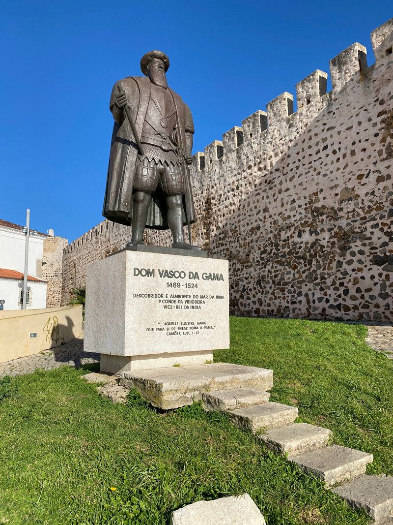
Sines, Portugal - Vasco da Gama, Festung
most important industrial port in Portugal.
Cozy old town.
Insider tip: 230 km long long-distance hiking trail. www.rotavicentina.com
Sines, Portugal
37° 57' 25.8" N 8° 51' 39.2" W
37.9571555 -8.8608907
• Head toward Rua Maria Lamas on Bairro 1 de Maio. Go for 31 m.
• Turn right onto Rua Maria Lamas. Go for 150 m.
• Turn left onto Rua Júlio Gomes da Silva. Go for 52 m.
• Turn right onto Rua Pedro Álvares Cabral. Go for 276 m.
• Continue on Rua Gago Coutinho. Go for 126 m.
• Turn left onto Rua João de Deus. Go for 98 m.
• Turn right onto Rua Pedro Nunes. Go for 311 m.
• Turn left onto Avenida Vasco da Gama (IC4). Go for 445 m.
• Take the 2nd exit from roundabout onto IC4. Go for 1.1 km.
• Pass 2 roundabouts and continue on IC4. Go for 4.3 km.
• Turn right onto M1109 toward Porto Covo/São Torpes. Go for 1.6 km.
• Take the 1st exit from roundabout onto M1109. Go for 6.8 km.
• Continue on Rua do Mar (M1109). Go for 225 m.
• Turn left onto Rua Jacinto Fernandes Bandeira. Go for 456 m.
• Turn left. Go for 28 m.
• Arrive at your destination on the right.
☍
16,0 km
( 17 min.)
Costa do Vizir
7520-437, Porto Covo, Portugal
37° 51' 23" N 8° 47' 14" W
37.8563900 -8.7872300
• Head toward Rua Jacinto Fernandes Bandeira. Go for 189 m.
• Turn left toward M554. Go for 224 m.
• Turn left onto M554. Go for 2.1 km.
• Take the 1st exit from roundabout onto M554-1. Go for 335 m.
• Turn left onto M1116. Go for 2.4 km.
• Turn left onto Rua 1 de Maio. Go for 3.7 km.
• Turn right toward IC4. Go for 152 m.
• Turn right onto IC4. Go for 1.7 km.
• Continue on N120 toward Lagos/Odemira/Cercal. Go for 7.2 km.
• Take the 1st exit from Largo dos Caieiros roundabout onto Rua 25 de Abril (N390) toward Lagos/Milfontes. Go for 10.7 km.
• Pass 2 roundabouts and continue on N390. Go for 2.4 km.
• Take the 1st exit from roundabout toward V. N.va Milfontes. Go for 115 m.
• Continue on Rua Custódio Brás Pacheco. Go for 316 m.
• Take the 2nd exit from Largo Custódio Brás Pacheco roundabout onto Rua Custódio Brás Pacheco. Go for 719 m.
• Turn right onto Rua António Mantas. Go for 130 m.
• Turn left onto Rua de São Sebastião. Go for 168 m.
• Turn right onto Rua Vicente Ferreira. Go for 134 m.
• Turn left onto Rua Santos Agudo. Go for 43 m.
• Turn left onto Rua Santos Agudo. Go for 12 m.
• Continue on Largo Doutor António Martins Quaresma. Go for 54 m.
• Arrive at Largo Doutor António Martins Quaresma.
☍
32,9 km
( 33 min.)
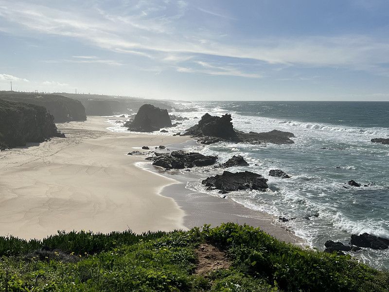
Costa Alentejana, Portugal
Costa Alentejana: Picturesque Atlantic coast. Miles of sandy beaches.
Vila Nova de Milfontes, castle from 1602, nice atmosphere, clean beaches
Porto Covo, 17km south of Sines. Streets laid out in a checkerboard pattern to each other.
7645 Vila Nova de Milfontes, Portugal
37° 43' 26.4" N 8° 46' 54.3" W
37.7240021 -8.7817552
• Head east on Largo Doutor António Martins Quaresma.
• Turn left onto Rua Sarmento Beires. Go for 111 m.
• Continue on Rua Custódio Brás Pacheco. Go for 836 m.
• Take the 1st exit from Largo Custódio Brás Pacheco roundabout onto Rua Custódio Brás Pacheco. Go for 418 m.
• Take the 1st exit from roundabout onto N393 toward Odemira. Go for 8.9 km.
• Take the 2nd exit from roundabout onto N393 toward Odemira. Go for 5.9 km.
• Turn right onto M502 toward Zambujeira. Go for 8.3 km.
• Turn left onto M502-1. Go for 4.2 km.
• Take the 1st exit from roundabout onto N120 toward Lagos/Aljezur. Go for 1.1 km.
• Take the 2nd exit from roundabout onto N120 toward Lagos. Go for 26.9 km.
• Enter the roundabout. Go for 29 m.
• Arrive at your destination on the left.
☍
56,8 km
( 47 min.)
Aljezur, Portugal
Visit Maurenburg for free. Wild southwest coast, picture perfect beaches Arrifana, Monte Clerigo, and Amoreira
further north: Odeceixe.
Unfortunately very camper-unfriendly - hardly any parking spaces :-(
8670 Aljezur, Portugal
37° 18' 59.7" N 8° 47' 57.4" W
37.3165700 -8.7992645
• Follow the roundabout. Go for 73 m.
• Take the 3rd exit from roundabout onto Avenida General Humberto Delgado (N120) toward Lagos/Bordeira. Go for 7.5 km.
• Turn right onto N268 toward V. do Bispo/Sagres/Alfambras/Bordeira/Carrapateira. Go for 27.7 km.
• Take the 4th exit from roundabout toward Sagres. Go for 125 m.
• Turn right onto N268. Go for 7.4 km.
• Continue on Avenida Infante Dom Henrique (N268). Go for 330 m.
• Arrive at Avenida Infante Dom Henrique (N268). Your destination is on the right.
☍
43,1 km
( 36 min.)
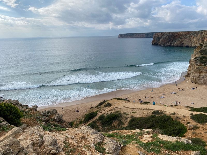
Sagres, Portugal
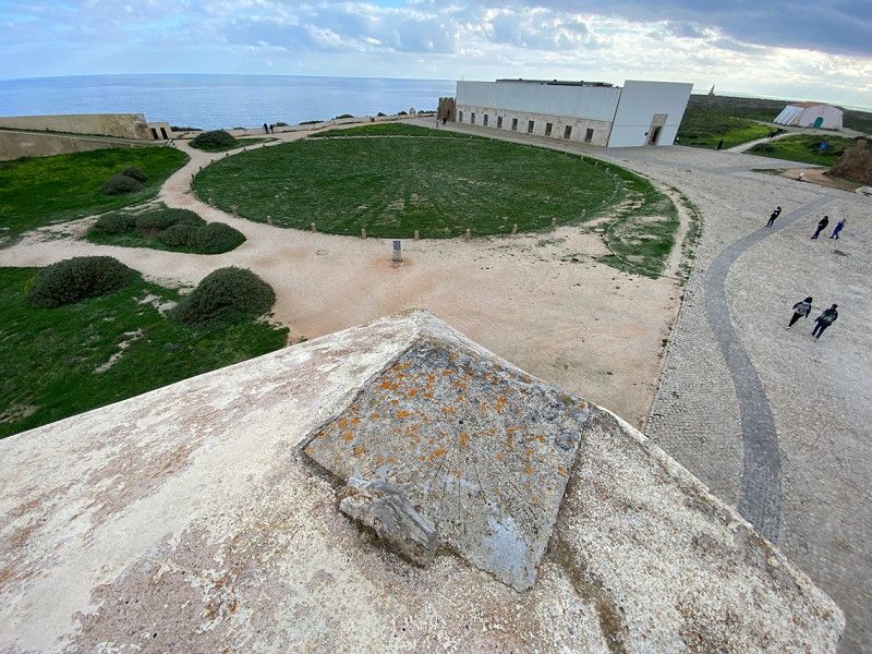
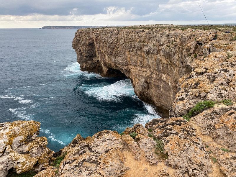
Cabo de Sao Vicente - most southwestern point of Europe
Beaches between Sagres and Odeceixe are among the most beautiful landscapes in Europe.
8650 Sagres, Portugal
37° 1' 0.6" N 8° 56' 26.1" W
37.0168293 -8.9405931
• Head south on Avenida Infante Dom Henrique (N268).
• Turn left onto Rua da Bica. Go for 31 m.
• Turn left onto Avenida Infante Dom Henrique. Go for 52 m.
• Turn right onto Avenida Infante Dom Henrique (N268). Go for 278 m.
• Continue on N268. Go for 7.3 km.
• Continue on N125. Go for 3.5 km.
• Pass 6 roundabouts and continue on N125. Go for 10.9 km.
• Take the 3rd exit from roundabout onto N125. Go for 1.9 km.
• Pass 2 roundabouts and continue on N125. Go for 4.0 km.
• Take the 2nd exit from roundabout onto N125 toward Lagos. Go for 1.3 km.
• Pass 2 roundabouts and continue on N125. Go for 1.2 km.
• Take the 2nd exit from roundabout onto Avenida das Comunidades Portuguesas (N125) toward Centro. Go for 416 m.
• Turn left onto Rua Doutor Teixeira Gomes. Go for 244 m.
• Take the 2nd exit from roundabout onto Estrada do Biker. Go for 176 m.
• Turn right onto Rua Infante de Sagres. Go for 45 m.
• Turn left onto Rua Infante de Sagres. Go for 14 m.
• Continue on Largo dos Quartéis. Go for 128 m.
• Continue on Rua do Jogo da Bola. Go for 26 m.
• Continue on Rua do Paiol. Go for 75 m.
• Turn left onto Rua dos Peixeiros. Go for 70 m.
• Turn right onto Rua Dr. António José de Almeida. Go for 106 m.
• Arrive at Rua Dr. António José de Almeida. Your destination is on the right.
☍
31,8 km
( 29 min.)
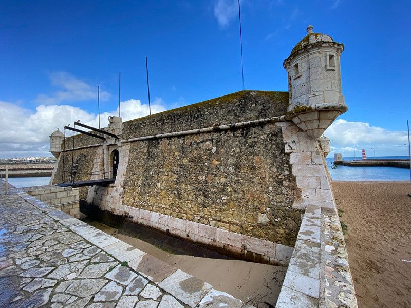
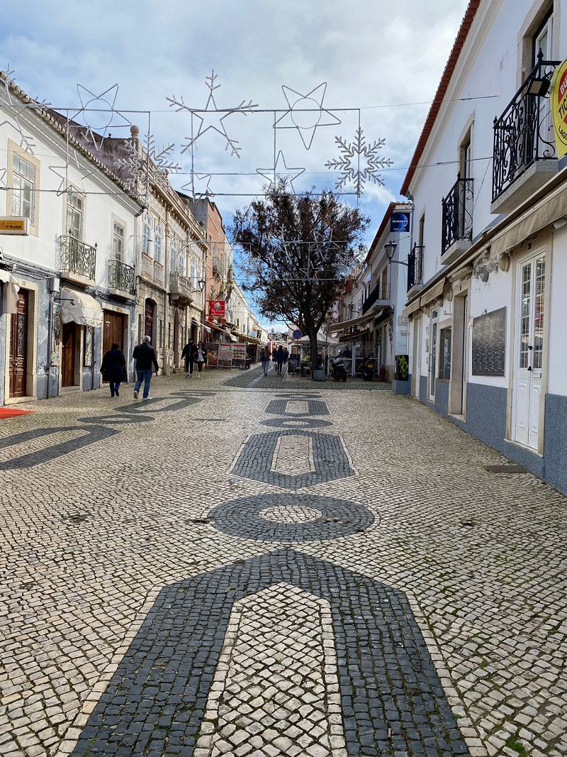
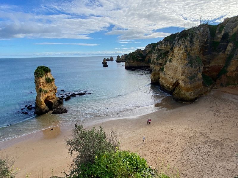
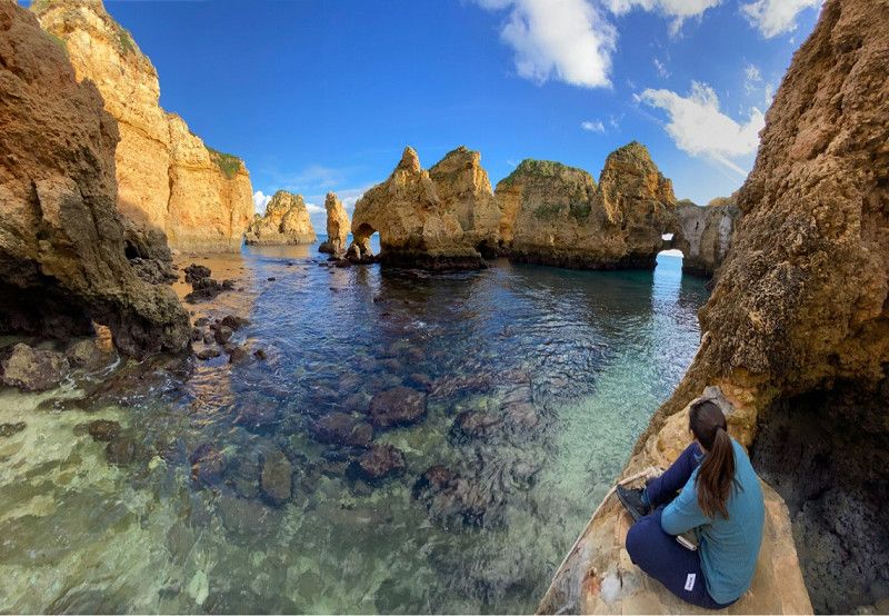
Lagos, Portugal
Atmospheric city in the Algarve. Bustling old town, numerous bars
Visit: Mercado, Praca Infante Dom Henrique, Forte Ponta da Bandeira
Boat trip to Ponta da Piedade or kayak trip:
www.bombadia-boattrips.com
www.outdoor-tours.com
8600 Lagos, Portugal
37° 6' 10" N 8° 40' 22.9" W
37.1027881 -8.6730275
• Head east on Rua Dr. António José de Almeida.
• Turn slightly left onto Rua Doutor Faria e Silva. Go for 171 m.
• Turn right onto Rua Conselheiro Joaquim Machado. Go for 145 m.
• Turn right onto Rua António Crisógono dos Santos. Go for 8 m.
• Turn right onto Rua da Capelinha. Go for 142 m.
• Turn right onto Avenida dos Descobrimentos (N125). Go for 136 m.
• Make a U-Turn onto Avenida dos Descobrimentos (N125). Go for 883 m.
• Take the 1st exit from roundabout onto N125. Go for 50 m.
• Continue on Ponte Dona Maria II (N125). Go for 211 m.
• Continue on N125. Go for 112 m.
• Take the 2nd exit from roundabout onto N125. Go for 99 m.
• Turn right onto N125 toward Portimão/Faro. Go for 1.3 km.
• Pass 3 roundabouts and continue on N125. Go for 5.6 km.
• Continue toward N125. Go for 35 m.
• Take the 1st exit from roundabout onto N125. Go for 2.0 km.
• Pass 4 roundabouts and continue on N125. Go for 4.2 km.
• Take ramp toward Alvor/Faro/A22. Go for 168 m.
• Take the 1st exit from roundabout onto M531-1. Go for 3.9 km.
• Take the 2nd exit from roundabout onto Rua do Rossio de São Pedro (M531-1). Go for 484 m.
• Take the 2nd exit from roundabout onto Estrada de Alvor (M531-1). Go for 661 m.
• Continue toward M531. Go for 42 m.
• Take the 1st exit from roundabout. Go for 38 m.
• Continue on M531. Go for 483 m.
• Take the 2nd exit from roundabout onto M531. Go for 671 m.
• Take the 1st exit from roundabout. Go for 179 m.
• Take the 2nd exit from roundabout. Go for 208 m.
• Turn right. Go for 367 m.
• Arrive at your destination on the left.
☍
22,3 km
( 30 min.)
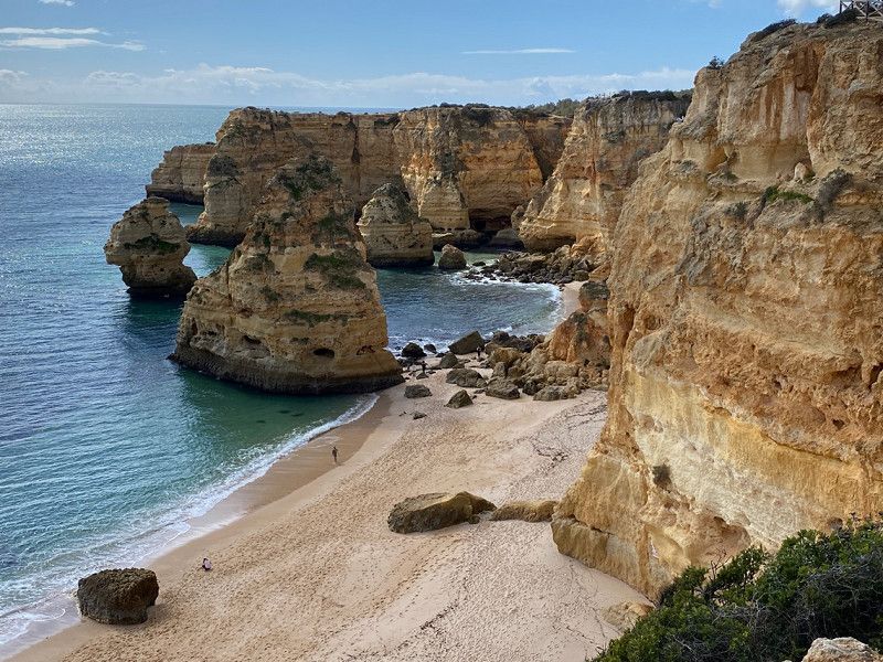
Praia dos Três Irmãos, Rua Praia dos Três Irmãos, Alvor, Portugal
beautiful rocky coast
also Praia Prainha
Rua Praia dos Três Irmãos, 8500 Alvor, Portugal
37° 7' 4.8" N 8° 34' 41.4" W
37.1180033 -8.5781584
• Head east. Go for 367 m.
• Turn left. Go for 169 m.
• Take the 1st exit from roundabout. Go for 193 m.
• Take the 1st exit from roundabout onto M531. Go for 1.0 km.
• Take the 2nd exit from Rotunda Simón Bolívar roundabout onto Avenida das Comunidades Lusíadas (M531). Go for 1.3 km.
• Take the 3rd exit from Rotunda dos Três Castelos roundabout onto Avenida São Lourenço da Barrosa (N124). Go for 734 m.
• Pass 2 roundabouts and continue on Avenida São Lourenço da Barrosa (N124). Go for 1.7 km.
• Take the 2nd exit from roundabout onto Avenida São Lourenço da Barrosa (N124). Go for 155 m.
• Take ramp onto Avenida Paul Harris (N124) toward Faro/Monchique/Cardosas/Sardal/A22. Go for 825 m.
• Keep left onto N124 toward Faro/Lagos/Monchique/Silves. Go for 912 m.
• Take the 2nd exit from roundabout onto N124. Go for 181 m.
• Take ramp onto N125 toward Faro. Go for 6.7 km.
• Take ramp onto N124-1 toward Faro/A22/Lagos/A2/Lisboa/Silves. Go for 2.4 km.
• Take the 2nd exit from roundabout onto N124-1. Go for 240 m.
• Take the 1st exit from roundabout onto N124-1. Go for 4.3 km.
• Turn left onto N124-1. Go for 225 m.
• Turn left onto N124. Go for 276 m.
• Continue on Estrada Nacional 124 (N124). Go for 59 m.
• Turn right toward Rua Cruz da Palmeira. Go for 27 m.
• Continue on Rua Cruz da Palmeira. Go for 197 m.
• Turn right onto Rua Dr. Eugénio Nobre Oliveira. Go for 156 m.
• Turn left onto Rua Miguel Bombarda. Go for 89 m.
• Turn right onto Rua Gago Coutinho. Go for 112 m.
• Turn right onto Rua Dom Paio Peres Correia. Go for 41 m.
• Turn right onto Rua Nova da Boavista. Go for 80 m.
• Arrive at Rua Nova da Boavista. Your destination is on the right.
☍
22,4 km
( 26 min.)
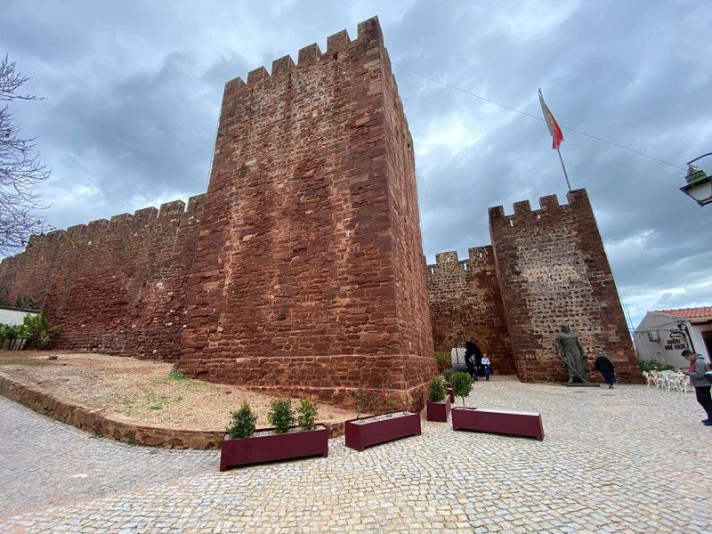
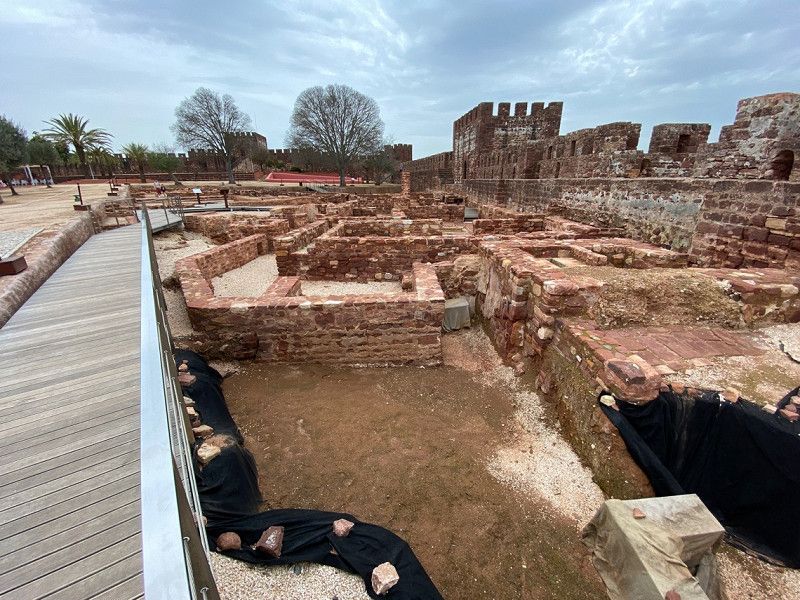
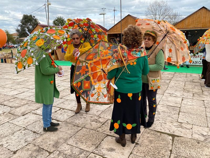
Silves, Portugal - Maurenburg
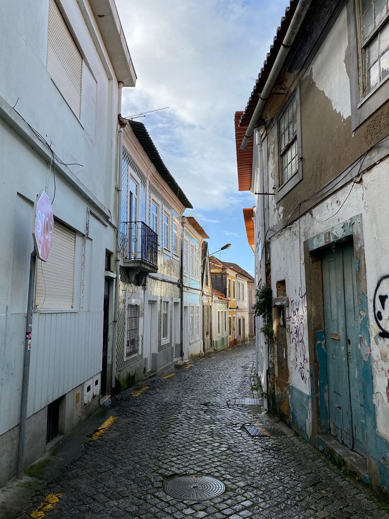
Very worth seeing city in the hinterland. Orange Festival in February. Good kitchen and 3 large pitches.
Silves, Portugal
37° 11' 20.4" N 8° 26' 28.3" W
37.1889987 -8.4412078
• Head toward Rua Pintor Bernardo Marques on Rua Nova da Boavista. Go for 95 m.
• Turn right onto Rua 25 de Abril. Go for 87 m.
• Turn sharp left onto Rua Samora Barros. Go for 145 m.
• Continue on Rua Francisco Pablos. Go for 170 m.
• Turn left toward Estrada Nacional 124/N124. Go for 27 m.
• Turn left onto Estrada Nacional 124 (N124). Go for 59 m.
• Continue on N124. Go for 236 m.
• Turn right onto N124-1. Go for 194 m.
• Turn right onto N124-1. Go for 4.2 km.
• Continue toward N124-1. Go for 43 m.
• Take the 2nd exit from roundabout onto N124-1. Go for 235 m.
• Take the 1st exit from roundabout onto N124-1. Go for 747 m.
• Take ramp toward Lagoa Norte. Go for 203 m.
• Take the 1st exit from roundabout onto N124-1. Go for 211 m.
• Take the 2nd exit from roundabout onto N124-1. Go for 678 m.
• Take the 2nd exit from roundabout onto Rua D.a Maria Eugénia Júdice Dias Ferr. Go for 339 m.
• Continue on Rua Alfredo Keil. Go for 89 m.
• Continue on Rua Francisco Sá Carneiro. Go for 369 m.
• Take the 3rd exit from roundabout onto Rua Francisco Sá Carneiro. Go for 112 m.
• Take the 2nd exit from roundabout. Go for 295 m.
• Take the 2nd exit from roundabout. Go for 2.5 km.
• Take the 1st exit from roundabout. Go for 521 m.
• Continue straight ahead. Go for 21 m.
• Take the 1st exit from roundabout. Go for 1.1 km.
• Take the 3rd exit from roundabout onto M1273. Go for 2.1 km.
• Take the 1st exit from roundabout onto Caminho Municipal 1273. Go for 40 m.
• Turn slightly left. Go for 244 m.
• Arrive at your destination on the right.
☍
15,1 km
( 20 min.)
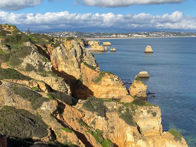
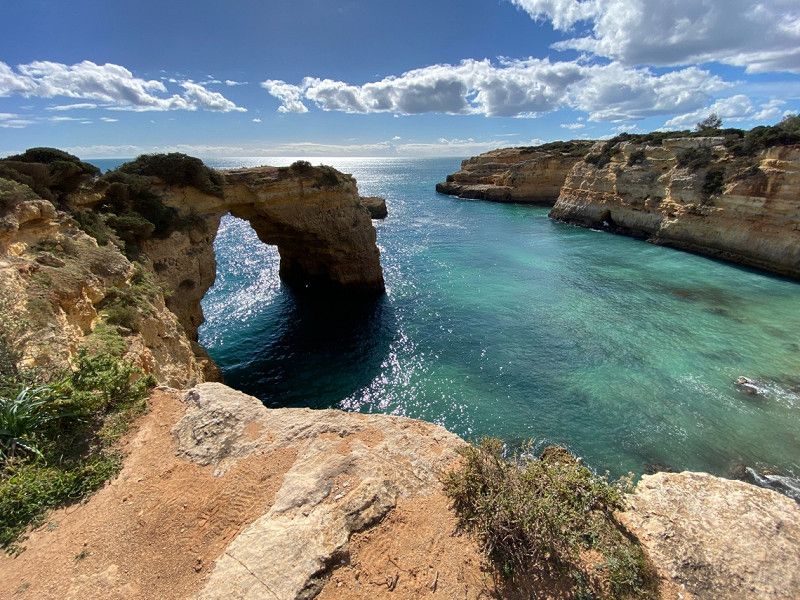
Praia de Benagil, Carvoeiro, Portugal
The "Cueva de Benagil" can only be reached by water.
Excursion: Silves. Restored Moorish castle, medieval Arade bridge.
Traces of Phoenicians, Romans and Moors.
Benagil, 8400 Carvoeiro, Portugal
37° 5' 13.8" N 8° 25' 39.8" W
37.0871557 -8.4277186
• Head northeast. Go for 244 m.
• Turn slightly right onto Caminho Municipal 1273. Go for 31 m.
• Take the 1st exit from roundabout onto M1273. Go for 1.8 km.
• Turn right onto Estrada da Caramujeira (M1154). Go for 584 m.
• Continue on M1154. Go for 328 m.
• Take the 2nd exit from roundabout onto M1154. Go for 595 m.
• Continue on Caminho Municipal 1154 (M1154). Go for 435 m.
• Continue on M1154. Go for 1.8 km.
• Take the 1st exit from roundabout onto N125. Go for 1.8 km.
• Pass 3 roundabouts and continue on N125. Go for 4.3 km.
• Take the 3rd exit from roundabout onto A22 (Via Infante de Sagres) toward Lisboa/Faro. Go for 9.4 km.
• Take exit 9 toward (N395)/Albufeira/(N125)/Guia onto IC1. Go for 926 m.
• Take left ramp onto N125 toward (N395)/Albufeira/Ferreiras. Go for 1.4 km.
• Take ramp toward Albufeira/Ferreiras. Go for 268 m.
• Take the 1st exit from roundabout onto N395 toward Albufeira. Go for 2.0 km.
• Pass 2 roundabouts and continue on N395. Go for 1.0 km.
• Take the 3rd exit from roundabout onto Avenida dos Descobrimentos (M526) toward Areias de S. João/Oura. Go for 494 m.
• Take the 2nd exit from roundabout onto Avenida dos Descobrimentos (M526). Go for 516 m.
• Turn right onto Rua dos Bombeiros Voluntários. Go for 80 m.
• Continue on Rua do Município. Go for 57 m.
• Turn left onto Rua das Telecomunicações. Go for 157 m.
• Turn right onto Rua Fernão de Magalhães. Go for 29 m.
• Turn left onto Impasse Fernão de Magalhães. Go for 76 m.
• Arrive at Impasse Fernão de Magalhães. Your destination is on the right.
☍
28,2 km
( 29 min.)
Albufeira, Portugal
Very touristy
8200 Albufeira, Portugal
37° 5' 20.7" N 8° 14' 52.4" W
37.0890719 -8.2478796
• Head toward Rua Fernão de Magalhães on Impasse Fernão de Magalhães. Go for 76 m.
• Turn left onto Rua Fernão de Magalhães. Go for 45 m.
• Turn right onto Rua Fernão de Magalhães. Go for 54 m.
• Turn right onto Rua Gil Vicente. Go for 135 m.
• Turn right onto Rua das Telecomunicações. Go for 46 m.
• Turn left onto Rua Pedro Álvares Cabral toward Faro/A22/Portimão/Montechoro. Go for 79 m.
• Continue on Rua Pedro Álvares Cabral. Go for 68 m.
• Continue on Rua Pedro Álvares Cabral. Go for 57 m.
• Keep left onto Rua do Município toward Montechoro/Portimão/A22/Faro. Go for 72 m.
• Turn right onto Rua dos Bombeiros Voluntários toward Montechoro/Portimão/Faro/A22. Go for 63 m.
• Turn right onto Avenida dos Descobrimentos (M526) toward Faro/A22/Portimão/Lisboa/A2. Go for 457 m.
• Pass 4 roundabouts and continue on M526. Go for 5.9 km.
• Take the 1st exit from roundabout onto M1289. Go for 560 m.
• Take the 3rd exit from Rotunda de Vale Carro roundabout onto Estrada de Vale Carro. Go for 1.1 km.
• Turn right onto Caminho da Várzea. Go for 421 m.
• Turn right onto Caminho Banco. Go for 214 m.
• Turn right onto Caminho do Banco. Go for 43 m.
• Turn left onto Rua dos Foros. Go for 777 m.
• Turn left onto Estrada do Alfa-Mar. Go for 914 m.
• Turn left onto Estrada da Rocha Baixinha. Go for 2.6 km.
• Arrive at Estrada da Rocha Baixinha.
☍
13,6 km
( 25 min.)
Praia dos Tomates, Portugal
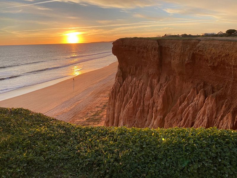
Wonderful Beach, Red Sandstone Cliffs
Praia da Falésia, Portugal
37° 4' 33.5" N 8° 8' 3.1" W
37.0759611 -8.1341991
• Head toward Caminho do Poço Velho on Estrada da Rocha Baixinha. Go for 2.6 km.
• Turn right onto Estrada do Alfa-Mar. Go for 914 m.
• Turn right onto Rua dos Foros. Go for 777 m.
• Turn right onto Caminho do Banco. Go for 43 m.
• Turn left toward Caminho Banco. Go for 21 m.
• Continue on Caminho Banco. Go for 193 m.
• Turn left onto Caminho da Várzea. Go for 421 m.
• Turn right onto Estrada de Vale Carro. Go for 940 m.
• Turn right onto M526. Go for 3.3 km.
• Take the 3rd exit from roundabout onto N125. Go for 1.6 km.
• Take the 1st exit from roundabout onto Avenida Prof. Dr. Aníbal Ant. Cavaco Silva (N270). Go for 45 m.
• Take the 2nd exit from roundabout onto Avenida Ayrton Senna da Silva (N270). Go for 2.7 km.
• Continue toward Via Infante de Sagres/A22. Go for 50 m.
• Take ramp onto A22 (Via Infante de Sagres) toward Espanha/Faro. Go for 13.7 km.
• Take exit 13 toward (N125)/Faro-Oeste/Aeroporto. Go for 770 m.
• Continue on IC4. Go for 5.6 km.
• Continue on IC4. Go for 3.0 km.
• Take the 2nd exit from roundabout onto Avenida José Maria Nunes (N125). Go for 399 m.
• Take the 2nd exit from Rotunda do Teatro roundabout onto Avenida Prof. Dr. Adelino de Palma Carlos (N125). Go for 547 m.
• Continue on Largo de Camões (N125). Go for 25 m.
• Take the 2nd exit from roundabout onto Largo de Camões. Go for 56 m.
• Continue on Rua Aboim Ascensão. Go for 526 m.
• Continue on Rua do General Teófilo da Trindade. Go for 257 m.
• Turn right onto Rua Horta Machado. Go for 31 m.
• Turn left onto Beco França Borges. Go for 60 m.
• Arrive at Beco França Borges. Your destination is on the right.
☍
38,6 km
( 41 min.)
Faro, Portugal
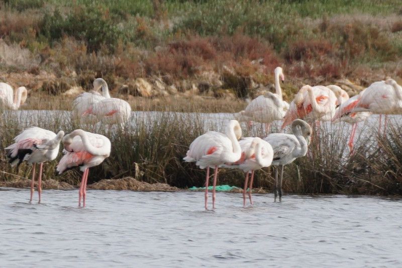
Parque Natural de Ria Formosa - Lagoon area made up of salt marshes, sand dunes and mud flats...Natural reserve.
Faro - administrative city,
37° 1' 9.7" N 7° 55' 49.6" W
37.0193548 -7.9304397
• Head toward Rua Horta Machado on Beco França Borges. Go for 60 m.
• Turn right onto Rua Horta Machado. Go for 31 m.
• Turn right onto Rua Doutor Cândido Guerreiro. Go for 422 m.
• Take the 3rd exit from roundabout onto Avenida 5 de Outubro. Go for 418 m.
• Take the 3rd exit from Praceta do Infante roundabout onto Avenida Dr. Júlio Filipe Almeida Carrapato. Go for 325 m.
• Take the 1st exit from roundabout onto Rua Reitor Teixeira Guedes (N125). Go for 803 m.
• Turn left onto Rua Doutor José de Matos. Go for 75 m.
• Take the 1st exit from roundabout toward Olhão/N125. Go for 126 m.
• Keep left onto M518. Go for 369 m.
• Take the 1st exit from roundabout. Go for 182 m.
• Continue on Estrada Caldeira de Neto. Go for 67 m.
• Take the 1st exit from roundabout onto N125. Go for 1.6 km.
• Take the 2nd exit from roundabout onto N125 toward Olhão. Go for 2.1 km.
• Take the 2nd exit from roundabout onto N125. Go for 2.2 km.
• Take the 1st exit from roundabout onto Avenida 5 de Outubro. Go for 163 m.
• Turn left onto Rua da Feira. Go for 485 m.
• Turn right onto Rua Matadouro. Go for 59 m.
• Turn left onto Rua Manuel Lopes Almeida. Go for 170 m.
• Turn right onto Rua Doutor António José Almeida. Go for 77 m.
• Arrive at Rua Doutor António José Almeida. Your destination is on the right.
☍
9,7 km
( 13 min.)
Parque de Campismo da Fuseta
We recommend a visit to the Parque Natural da Ria Formosa nature park. Either by boat including a guided tour or as a mini tour at the eastern end of Olhao.
Tv. Alm. Reis 30, 8700-328 Olhão, Portugal
37° 1' 35.4" N 7° 50' 41" W
37.0265088 -7.8447113
• Head south on Rua Doutor António José Almeida.
• Turn left onto Rua da Liberdade. Go for 81 m.
• Turn left onto Rua Almirante Reis. Go for 101 m.
• Turn right onto Rua Diogo Cristina. Go for 245 m.
• Continue on Rua General Humberto Delgado. Go for 126 m.
• Turn left onto Rua de Cândido do Ó Ventura. Go for 110 m.
• Turn right onto Avenida dos Combatentes da Grande Guerra. Go for 141 m.
• Turn left onto Avenida da República. Go for 149 m.
• Continue on Avenida Bernardino Silva. Go for 460 m.
• Take the 1st exit from roundabout onto Avenida Dom João VI (N125). Go for 412 m.
• Pass 3 roundabouts and continue on N125. Go for 19.2 km.
• Take the 2nd exit from roundabout onto N125. Go for 2.3 km.
• Turn right toward M508. Go for 45 m.
• Turn right onto Rua Álvaro de Campos (M508). Go for 132 m.
• Turn left onto Avenida Zeca Afonso. Go for 55 m.
• Arrive at Avenida Zeca Afonso. Your destination is on the left.
☍
23,6 km
( 27 min.)
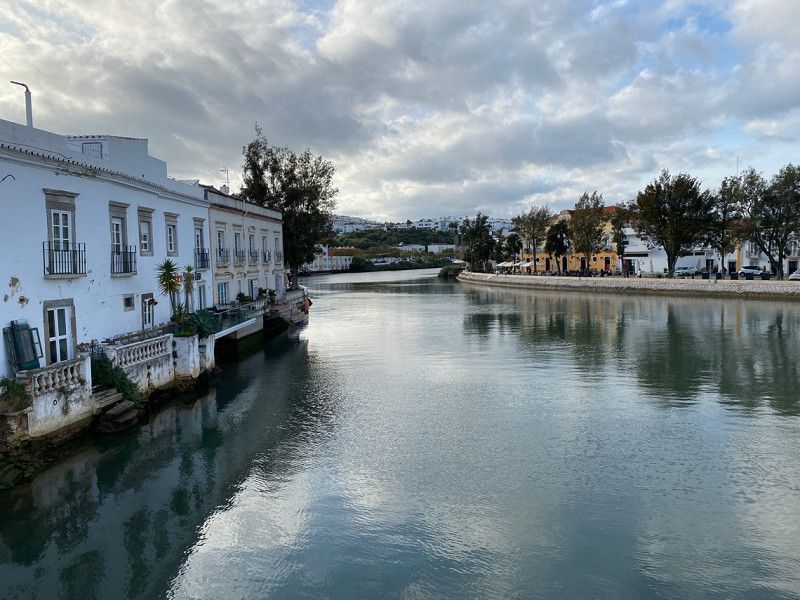
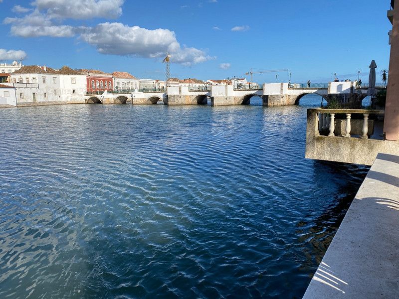
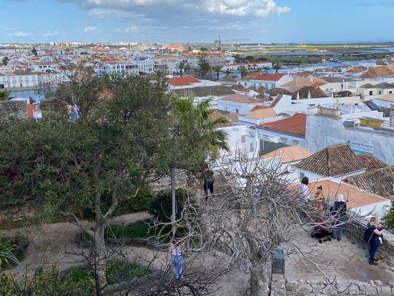
Tavira, Portugal
Tavira is on the Gilão. There are flamingos, spoonbills, herons and other shorebirds. The medieval Castelo de Tavira is located on a hill and offers a beautiful panoramic view. In the Church of Santa María do Castelo are the tombs of 7 knights killed by the Moors.
Tavira has a pleasant, non-touristy atmosphere.
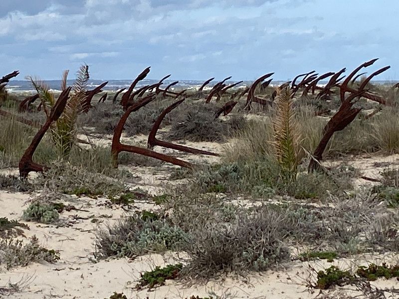
Nearby is Santa Lucia with the famous Seaside Anchor Cemetery.
8800 Tavira, Portugal
37° 8' 0.9" N 7° 38' 34.8" W
37.1335906 -7.6430019
• Head toward Rua Álvaro de Campos on Avenida Zeca Afonso. Go for 55 m.
• Turn right onto Rua Álvaro de Campos (M508). Go for 132 m.
• Continue on M508. Go for 28 m.
• Take the 1st exit from roundabout. Go for 128 m.
• Continue on N125. Go for 486 m.
• Pass 6 roundabouts and continue on N125. Go for 14.3 km.
• Take the 2nd exit from roundabout onto N125. Go for 319 m.
• Take the 2nd exit from roundabout onto N125. Go for 367 m.
• Continue on Barranco (N125). Go for 139 m.
• Continue on N125. Go for 1.4 km.
• Pass 4 roundabouts and continue on N125. Go for 3.8 km.
• Take the 2nd exit from roundabout onto Avenida Fernando Salgueiro Maia (N125). Go for 613 m.
• Take the 4th exit from roundabout onto N122. Go for 179 m.
• Turn right onto Rua António Vicente Campinas. Go for 109 m.
• Turn left. Go for 94 m.
• Arrive at your destination on the right.
☍
22,1 km
( 26 min.)
Rua António Fernando Santos (Tossan), Portugal
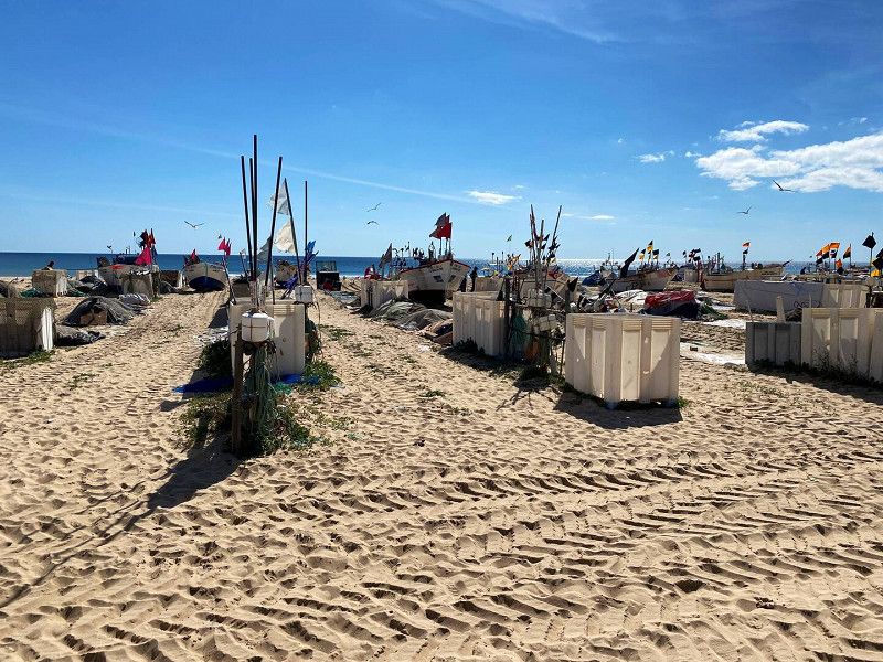
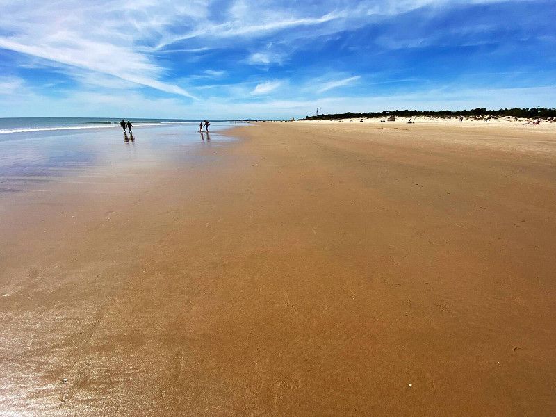
We find a great place to spend the night in a hidden parking lot in Retur, barely 100m from the beach. One day we go to the border river Guadiana and the second day we spend on the beach. We were impressed by a section of the beach where local fishermen still pull their boats onto the beach like they did a hundred years ago.
Rua António Fernando Santos (Tossan), 8900-002 VILA REAL SANTO ANTONIO, Vila Real de Santo António, Portugal
37° 11' 42.4" N 7° 25' 27.4" W
37.1951168 -7.4242737
• Head south. Go for 94 m.
• Turn right onto Rua António Vicente Campinas. Go for 109 m.
• Turn right onto N122. Go for 193 m.
• Pass 2 roundabouts and continue on N122. Go for 3.6 km.
• Take the 1st exit from roundabout onto N122. Go for 1.0 km.
• Take ramp onto A22 (Via Infante de Sagres) toward Espanha. Go for 3.0 km.
• Continue on A-49 (Autopista del V Centenario). Go for 3.3 km.
• Take exit 129 toward Ayamonte Este. Go for 303 m.
• Take the 2nd exit from roundabout onto N-431 toward Ayamonte Este. Go for 6.4 km.
• Turn right onto El Empalme (A-5150) toward Isla Cristina. Go for 114 m.
• Continue on A-5150. Go for 616 m.
• Continue on Villa Elena (A-5150). Go for 120 m.
• Continue on A-5150. Go for 366 m.
• Continue on Villa Emilia (A-5150). Go for 71 m.
• Continue on A-5150. Go for 90 m.
• Continue on Carretera Huelva (A-5150). Go for 841 m.
• Take the 2nd exit from roundabout onto Carrereta Isla Cristiana (A-5150) toward Isla Cristina. Go for 871 m.
• Continue on A-5150. Go for 17 m.
• Turn right toward Barriada de la Estación. Go for 363 m.
• Turn slightly right onto Barriada de la Estación. Go for 30 m.
• Arrive at Barriada de la Estación. Your destination is on the right.
☍
21,5 km
( 19 min.)
CAMPER PARK PLAYAS DE LUZ
Nice parking space and view. Good starting point for cycling tours into the foothills of the Rio Formosa.
BARRIADA LA ESTACIÓN S/N, 21420, POZO DEL CAMINO, Spain
37° 13' 18.9" N 7° 19' 24.1" W
37.2219300 -7.3233600
• Head south on Barriada de la Estación. Go for 30 m.
• Turn slightly left. Go for 323 m.
• Continue toward A-5150. Go for 38 m.
• Turn left onto A-5150. Go for 37 m.
• Continue on Carrereta Isla Cristiana (A-5150). Go for 819 m.
• Take the 2nd exit from roundabout onto Carretera Huelva (A-5150) toward Portugal/Huelva. Go for 897 m.
• Continue on A-5150. Go for 90 m.
• Continue on Villa Emilia (A-5150). Go for 71 m.
• Continue on A-5150. Go for 366 m.
• Continue on Villa Elena (A-5150). Go for 120 m.
• Continue on A-5150. Go for 616 m.
• Continue on El Empalme (A-5150). Go for 61 m.
• Turn right onto Efiasa (N-431) toward Lepe/Huelva. Go for 383 m.
• Turn slightly left onto N-446 toward E-1/A-49/Huelva/Portugal. Go for 1.4 km.
• Take ramp onto A-49 (Autopista del V Centenario) toward Huelva. Go for 47.1 km.
• Take exit 75 toward N-435/Trigueros/Badajoz/San Juan del Puerto. Go for 216 m.
• Take the 3rd exit from roundabout onto A-494 toward N-435/Badajoz. Go for 194 m.
• Continue on N-435. Go for 132 m.
• Take the 1st exit from roundabout onto N-435 toward Badajoz. Go for 23.2 km.
• Take the 2nd exit from roundabout onto N-435 toward Badajoz. Go for 126 km.
• Turn right toward EX-112/Jerez de los Caballeros/Oliva de la Frontera. Go for 89 m.
• Turn right onto Carretera de Villanueva toward Jerez de los Caballeros/Centro Urbano. Go for 811 m.
• Arrive at Carretera de Villanueva. Your destination is on the right.
☍
203,3 km
(2 hrs. 18 min.)
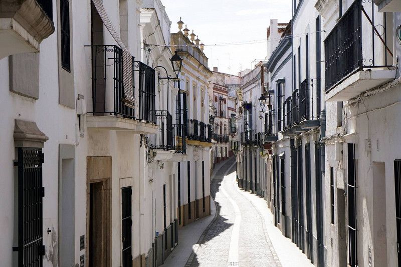
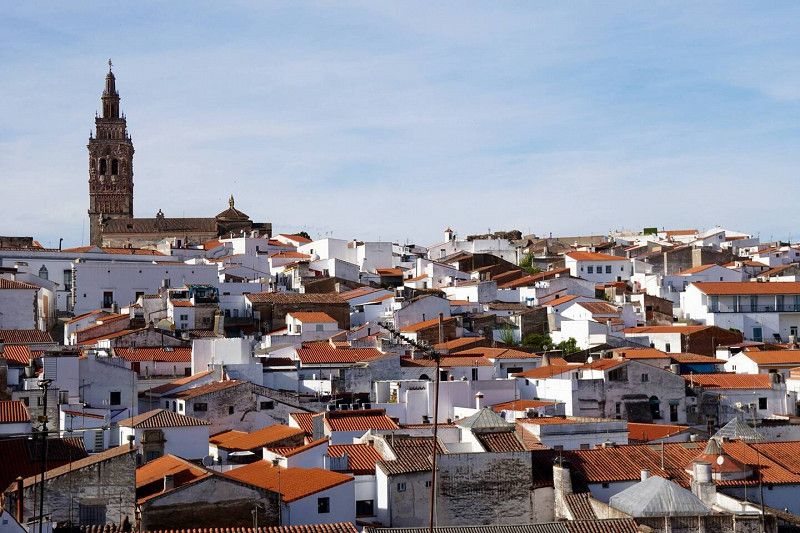
Jerez de los Caballeros, Spanien
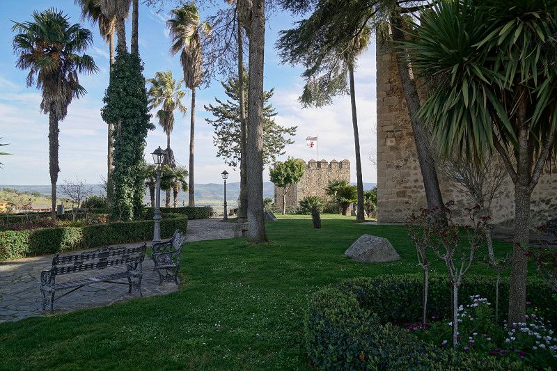
On the way to the north we pass through Jerez dlC, a city worth seeing with 3 church towers that can be seen from afar and a great castle. The view of the hilly surrounding area with the many cork oak forests and meadows is great. There is a free parking space at the bullring for travelers like us.
06380 Jerez de los Caballeros, Provinz Badajoz, Spanien
38° 19' 16.4" N 6° 46' 28.9" W
38.3212139 -6.7746965
• Head toward Travesía Mercado on Carretera de Villanueva. Go for 874 m.
• Turn right onto Carretera Badajoz (N-435). Go for 240 m.
• Take the 1st exit from Carretera Badajoz roundabout onto Carretera Badajoz (N-435). Go for 252 m.
• Turn left onto Carretera Zafra (EX-112). Go for 27.3 km.
• Turn left toward EX-112. Go for 31 m.
• Turn left onto EX-101. Go for 8.3 km.
• Take the 1st exit from roundabout onto Calle Jerez de los Caballeros (EX-101) toward Zafra Sur/Los Santos de Maimona/A-66/N-630/Sevilla. Go for 1.6 km.
• Take the 2nd exit from Calle de Alcazaba roundabout onto Carretera Santos de Maimona (EX-101) toward A-66/E-803/Mérida/Los Santos de Maimona. Go for 220 m.
• Arrive at Carretera Santos de Maimona (EX-101). Your destination is on the left.
☍
38,8 km
( 34 min.)
Parking de Recinto Ferial
Contrada de los Santos de Maimona, 06300, Zafra, Spanien
38° 25' 31" N 6° 24' 39" W
38.4252778 -6.4108333
• Head northeast on Carretera Santos de Maimona (EX-101). Go for 1.5 km.
• Take the 1st exit from roundabout onto EX-101. Go for 4.0 km.
• Turn left onto N-630. Go for 2.1 km.
• Take ramp onto A-66 (Autovía de la Plata) toward Mérida. Go for 49.5 km.
• Take exit 626 toward Mérida Oeste. Go for 1.0 km.
• Take the 2nd exit from roundabout onto Carretera de Madrid-Badajoz (N-630) toward Mérida Centro. Go for 350 m.
• Take the 3rd exit from roundabout onto Carretera de Badajoz. Go for 388 m.
• Pass 2 roundabouts and continue on Carretera de Badajoz. Go for 526 m.
• Turn left onto Calle Antonio Rodríguez Moñino. Go for 140 m.
• Turn right onto Avenida de la Constitución. Go for 146 m.
• Take the 2nd exit from roundabout onto Avenida de la Libertad. Go for 537 m.
• Take the 1st exit from roundabout onto Puente de Lusitania. Go for 664 m.
• Take the 2nd exit from roundabout onto Calle de Almendralejo. Go for 679 m.
• Take the 2nd exit from roundabout onto Avenida de Extremadura. Go for 163 m.
• Turn right onto Rambla Mártir Santa Eulalia. Go for 250 m.
• Turn left onto Rambla Mártir Santa Eulalia. Go for 148 m.
• Continue on Calle Santa Lucía. Go for 35 m.
• Arrive at Calle Santa Lucía. Your destination is on the right.
☍
62,2 km
( 41 min.)
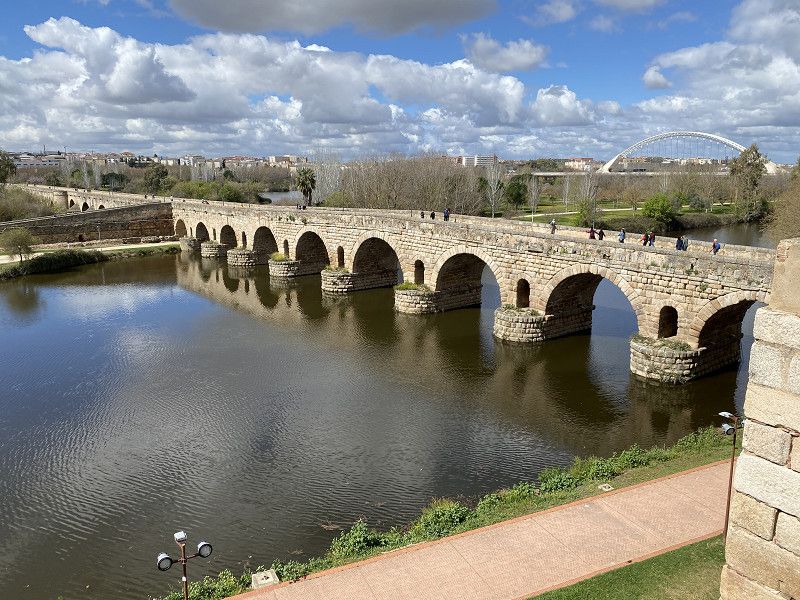
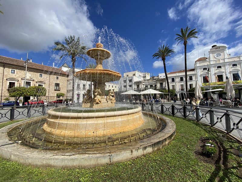
Mérida, Spanien
06800 Mérida, Badajoz, Spanien
38° 55' 8.9" N 6° 20' 26.9" W
38.9191439 -6.3408055
• Head northeast on Calle Santa Lucía. Go for 137 m.
• Turn left onto Calle de López Puigcerver. Go for 66 m.
• Turn right onto Avenida de Extremadura. Go for 73 m.
• Keep left onto Avenida de Extremadura. Go for 255 m.
• Continue on Avenida Juan Carlos I. Go for 818 m.
• Take the 5th exit from roundabout onto Avenida Cáceres (N-630). Go for 1.4 km.
• Pass 3 roundabouts and continue on N-630. Go for 1.3 km.
• Take the 3rd exit from roundabout onto A-66 (Autovía de la Plata) toward Cáceres. Go for 27.3 km.
• Take exit 590 toward Cruce de las Herrerías/Alcuéscar/Montánchez. Go for 242 m.
• Take the 2nd exit from roundabout onto EX-382 toward Alcuéscar/Montánchez/Cruce de las Herrerías/N-630. Go for 473 m.
• Take the 2nd exit from roundabout onto EX-382. Go for 12.2 km.
• Take the 1st exit from roundabout onto CC-160. Go for 1.3 km.
• Continue on Calle del Obispo Senso (CC-160). Go for 53 m.
• Turn left onto Calle del Prado (CC-160). Go for 187 m.
• Continue on Calle Peñas Redondas (CC-160). Go for 132 m.
• Continue on Calle Transversal (CC-160). Go for 102 m.
• Continue on Calle Fuente de Santa Cruz (CC-160). Go for 52 m.
• Take the 4th exit from roundabout onto Calle Fuente de Santa Cruz. Go for 280 m.
• Turn slightly right onto Calle Rivera Robledo. Go for 14 m.
• Continue on Rivera Robledo. Go for 481 m.
• Arrive at Rivera Robledo. Your destination is on the left.
☍
46,9 km
( 36 min.)
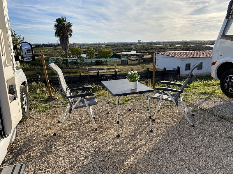
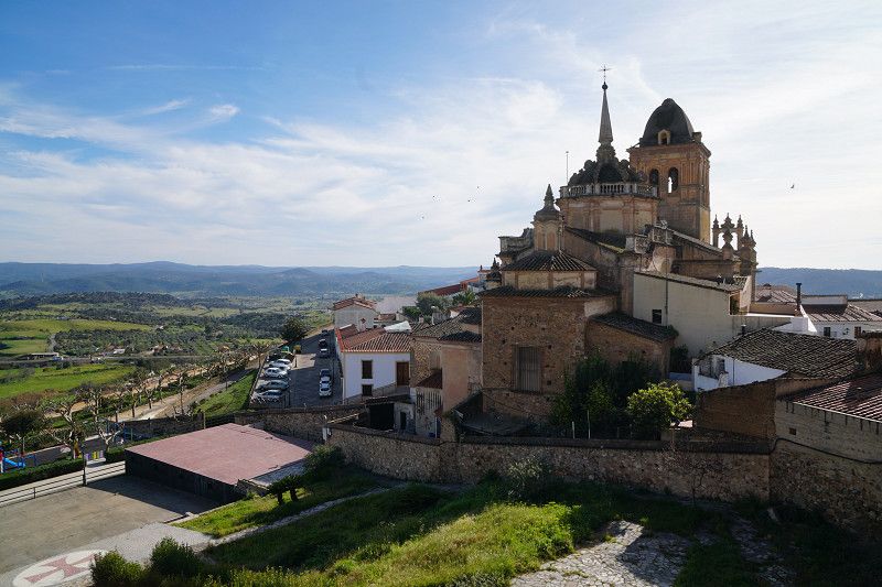
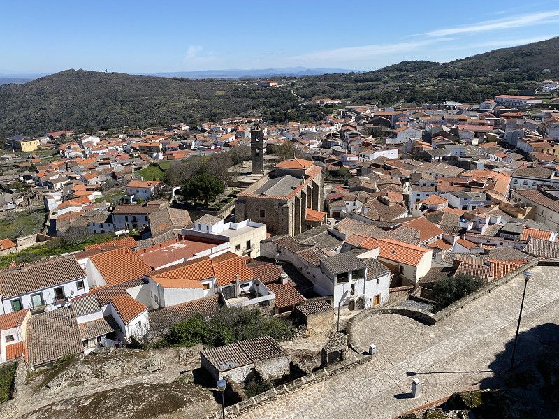
Montanchez, Camperstop Alegria
The town of Montánchez is located on a hill above the mountain range of the same name. From here, especially from the castle above the city, you have a magnificent view over the valley of the Extremadura. Below the castle is the city's cemetery, said to be one of the most beautiful in the country - beautiful might be the wrong word.
On the Pico de Montánchez there are radio masts at about 1000m and the famous shaky stone "El Cancho que se Menea"
Our pitch Camperstop Alegria is one of the best so far and is owned by Dutchmen Joop and Ivon. We have never stood so calmly and sublimely.
Extrarradio Rivera Robledo, 10170, Montánchez, Spain
39° 13' 49.6" N 6° 8' 23.4" W
39.2304400 -6.1398200
• Head toward Calle Finca Rústica Canape on Rivera Robledo. Go for 481 m.
• Continue on Calle Rivera Robledo. Go for 14 m.
• Turn slightly left onto Calle Fuente de Santa Cruz. Go for 231 m.
• Take the 1st exit from roundabout onto Calle Fuente de Santa Cruz (CC-160). Go for 76 m.
• Continue on Calle Transversal (CC-160). Go for 102 m.
• Continue on Calle Peñas Redondas (CC-160). Go for 132 m.
• Continue on Calle del Prado (CC-160). Go for 187 m.
• Continue on Calle del Obispo Senso (CC-160). Go for 53 m.
• Continue on CC-160. Go for 1.3 km.
• Take the 1st exit from roundabout onto EX-382. Go for 7.7 km.
• Take the 3rd exit from roundabout onto EX-206. Go for 15.7 km.
• Take the 1st exit from roundabout onto EX-206. Go for 16.6 km.
• Take the 1st exit from roundabout onto Ronda Sur (EX-C2) toward A-5/Madrid/N-521. Go for 1.1 km.
• Take the 1st exit from roundabout onto Ronda Sur (EX-C2) toward A-5/Madrid/N-521. Go for 518 m.
• Take the 1st exit from roundabout onto Ronda Sur (EX-C2) toward A-5/Madrid/N-521. Go for 1.1 km.
• Take the 2nd exit from roundabout onto Ronda Sur (EX-C2) toward A-5/Madrid/N-521. Go for 876 m.
• Take the 2nd exit from roundabout onto Ronda Sur (EX-C2) toward A-5/Madrid/N-521/Ronda Norte. Go for 383 m.
• Take the 5th exit from roundabout onto Avenida de la Universidad (N-521) toward Centro Urbano. Go for 1.5 km.
• Take the 3rd exit from roundabout onto Calle Lope de Vega. Go for 255 m.
• Continue on Avenida de San Blas. Go for 271 m.
• Continue on Calle Sande. Go for 191 m.
• Continue on Calle Godoy. Go for 56 m.
• Turn right onto Calle Zapatería toward Plaza Mayor/Oficina de Turismo. Go for 73 m.
• Continue on Calle Sancti Espíritu. Go for 92 m.
• Turn left onto Calle Ríos Verdes. Go for 114 m.
• Arrive at Calle Ríos Verdes. Your destination is on the right.
☍
48,9 km
( 45 min.)
Cáceres, Spanien
39° 28' 31" N 6° 22' 20.7" W
39.4752765 -6.3724247
• Head toward Calle Andrada on Calle Ríos Verdes. Go for 114 m.
• Turn left onto Calle General Margallo. Go for 501 m.
• Turn left onto Plaza de Argel toward A-66/Casar de Cáceres. Go for 64 m.
• Turn right onto Plaza de Argel (CC-38) toward A-66/Casar de Cáceres. Go for 939 m.
• Take the 2nd exit from roundabout onto Carretera del Casar (CC-38) toward A-66/Casar de Cáceres. Go for 138 m.
• Continue on Carretera del Casar de Cáceres a Cáceres (CC-38). Go for 5.9 km.
• Take the 1st exit from roundabout onto A-66 (Autovía de la Plata) toward Cañaveral/Plasencia/Salamanca. Go for 139 km.
• Take exit 393 toward Guijuelo. Go for 253 m.
• Take the 2nd exit from roundabout toward E-803/A-66/Béjar/Plasencia/Cáceres. Go for 302 m.
• Take the 1st exit from roundabout onto N-630a toward Guijuelo/Guijo de Ávila. Go for 188 m.
• Turn right toward Calle San Joaquín. Go for 45 m.
• Continue on Calle San Joaquín. Go for 2.1 km.
• Turn right onto Carretera del Guijo (DSA-164). Go for 2.3 km.
• Turn sharp right onto Calle El Rollo. Go for 97 m.
• Continue on Camino Viejo. Go for 1.3 km.
• Continue on Camino de Matorral. Go for 347 m.
• Arrive at Camino de Matorral.
☍
154,1 km
(1 hrs. 26 min.)
Guijo de Ávila
Camino Fuentemuño, Guijo de Ávila, Salamanca, Kastilien und León, 37774, Spanien
40° 30' 37.6" N 5° 38' 42" W
40.5104478 -5.6450034
• Head west on Camino de Matorral. Go for 347 m.
• Continue on Camino Viejo. Go for 1.3 km.
• Continue on Calle El Rollo. Go for 97 m.
• Turn sharp left onto Carretera del Guijo (DSA-164). Go for 3.9 km.
• Turn sharp right onto Avenida del Príncipe Felipe (SA-104). Go for 284 m.
• Continue on Calle del Príncipe de Asturias (SA-104). Go for 310 m.
• Continue on SA-104. Go for 622 m.
• Turn left onto Barrio San José. Go for 933 m.
• Continue on Camino de Aldeavieja. Go for 1.0 km.
• Take the 2nd exit from roundabout onto A-66 (Autovía Ruta de la Plata) toward Salamanca. Go for 41.5 km.
• Take exit 346 toward Salamanca (Sur)/Ávila/SA-20/Madrid/A-50/Aeropuerto onto N-630. Go for 2.3 km.
• Take the 3rd exit from roundabout onto Avenida de Saavedra y Fajardo (N-630) toward Salamanca Centro Ciudad. Go for 1.5 km.
• Take the 1st exit from Glorieta de Vettones y Vacceos roundabout onto Vía Helmántica (N-501). Go for 127 m.
• Keep left onto Vía Helmántica (N-501) toward Centro Ciudad. Go for 86 m.
• Take the 2nd exit from roundabout onto Avenida de los Reyes de España. Go for 556 m.
• Continue on Calle de San Pablo. Go for 41 m.
• Turn right onto Calle Arroyo de Santo Domingo. Go for 265 m.
• Take the 2nd exit from roundabout onto Plaza de los Basilios. Go for 492 m.
• Turn left onto Calle Correhuela. Go for 157 m.
• Turn left onto Calle Pozo Amarillo. Go for 76 m.
• Arrive at Calle Pozo Amarillo. Your destination is on the right.
☍
56,0 km
( 42 min.)
Salamanca, Spanien
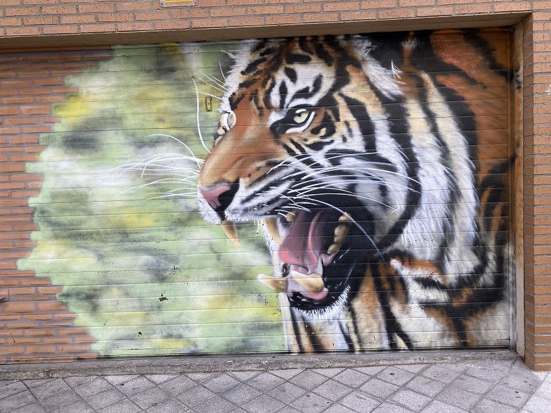
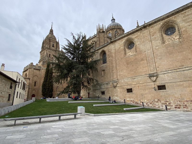
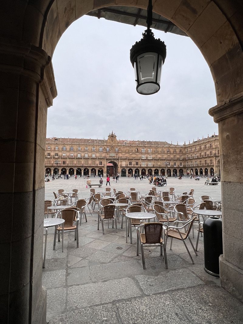
Always worth a trip to the center. Visit the artist district with street art! District Oeste
We are at the Don Quixote campsite, just outside of Salamanca. From here you can quickly reach the city by bike. It takes about 30 minutes on the bike path along the Tormes. In addition to some highlights that we look at, we also go to the district of Oeste, where street art has been on display for a few years. There are great graffitis, but overall everything seems a bit artificial, not grown.
This is where many of the city's more than 30,000 students live, some of whom we recognize.
40° 57' 54.6" N 5° 39' 50.5" W
40.9651572 -5.6640182
• Head southwest on Calle Pozo Amarillo.
• Turn right onto Plaza del Mercado. Go for 40 m.
• Continue on Plaza de la Verdura. Go for 35 m.
• Continue on Plaza Poeta Iglesias. Go for 53 m.
• Turn left onto Plaza Poeta Iglesias. Go for 38 m.
• Turn left onto Plaza del Peso. Go for 48 m.
• Continue on Calle de San Justo. Go for 155 m.
• Turn left onto Calle Gran Vía. Go for 634 m.
• Take the 2nd exit from Plaza de España roundabout onto Plaza de España. Go for 86 m.
• Turn right onto Avenida de los Comuneros. Go for 407 m.
• Take the 2nd exit from Glorieta de Antonio Machado roundabout onto Avenida de los Comuneros. Go for 462 m.
• Take the 3rd exit from Plaza Alto del Rollo roundabout onto Calle Colombia. Go for 662 m.
• Continue on Carretera de Aldealengua. Go for 2.5 km.
• Take the 3rd exit from Carretera de Aldealengua roundabout onto Calle Los Arroyos. Go for 484 m.
• Turn right onto Calle Constitución. Go for 98 m.
• Turn left onto Calle Los Labradores. Go for 34 m.
• Turn left onto Calle Salas Pombo. Go for 25 m.
• Arrive at Calle Salas Pombo.
☍
5,7 km
( 12 min.)
Camping Don Quijote
Carretera Salamanca-aldealengua KM 1.930, 37193, Salamanca-este, Spanien
40° 58' 43" N 5° 36' 35" W
40.9786100 -5.6097200
• Head toward Calle Los Arroyos on Calle Salas Pombo. Go for 47 m.
• Continue on Calle Camino de Salamanca. Go for 144 m.
• Turn right onto Calle Azucena. Go for 222 m.
• Turn right onto Avenida de las Palmeras. Go for 120 m.
• Take the 4th exit from roundabout onto Calle Camino Villares (DSA-600). Go for 1.6 km.
• Continue on Carretera Villares de la Reina (DSA-600). Go for 864 m.
• Continue on Camino Cabrerizos (DSA-600). Go for 365 m.
• Take the 1st exit from roundabout onto N-620. Go for 391 m.
• Take ramp onto A-62 (Autovía de Castilla) toward Tordesillas/Valladolid. Go for 83.4 km.
• Keep right onto A-62 (Autovía de Castilla) toward Valladolid/Burgos. Go for 17.9 km.
• Take exit 134 toward Puente Duero/Tudela de Duero. Go for 726 m.
• Take the 3rd exit from roundabout onto CL-600 toward Puente Duero/CL-610/Medina del Campo. Go for 933 m.
• Take the 1st exit from roundabout onto Camino Viejo de Simancas. Go for 402 m.
• Continue on Camino del Batán. Go for 14 m.
• Arrive at Camino del Batán. Your destination is on the right.
☍
107,2 km
( 57 min.)
Area de Autocaravanas de Simancas, Camino del Batán, Simancas, Spanien
Cam. del Batán, 47130 Simancas, Valladolid, Spanien
41° 35' 15" N 4° 49' 22.1" W
41.5874938 -4.8228090
• Head toward Carretera de Puente Duero on Camino del Batán. Go for 33 m.
• Continue on Camino Viejo de Simancas. Go for 356 m.
• Take the 3rd exit from roundabout onto CL-600. Go for 904 m.
• Take the 1st exit from roundabout onto A-62 (Autovía de Castilla) toward Valladolid. Go for 127 km.
• Continue on BU-30 (Autovía de Castilla). Go for 4.3 km.
• Continue on A-1 (Nudo de Landa). Go for 7.1 km.
• Continue on AP-1 (Autovía del Norte). Go for 81.9 km.
• Take the left exit onto A-1 (Autovía del Norte). Go for 24.7 km.
• Take exit 352 toward E-80/Francia/AP-1/Bilbao/AP-68/Aireportua onto N-622. Go for 2.3 km.
• Take ramp toward Aireportua/Foronda/Etxabarri-Ibiña/Donostia/AP-1/San Sebastián. Go for 273 m.
• Keep left toward Autopista Vitoria-Eibar/AP-1. Go for 862 m.
• Take ramp onto AP-1 (Autopista Vitoria-Eibar) toward Donostia/San Sebastián. Go for 44.7 km.
• Take the exit onto AP-1/AP-8 (Autopista del Cantábrico). Go for 42.6 km.
• Take the exit toward Hernani/Pasaia/Irun/Baiona/Bordeaux onto AP-1/AP-8 (Segundo Cinturón de San Sebastián). Go for 14.6 km.
• Take the exit onto AP-8. Go for 12.7 km.
• Continue on A63 (Autoroute de la Côte Basque). Go for 39.1 km.
• Take exit 7 toward Labenne/Boucau-Tarnos/Ondres. Go for 1.1 km.
• Take the 3rd exit from roundabout onto D85 toward Labenne/Ondres. Go for 2.0 km.
• Take the 1st exit from roundabout onto D810 toward Bordeaux/Mont de Marsan/Dax/Capbreton/Labenne/Ondres. Go for 2.0 km.
• Turn left onto Avenue Paul Dupruilh Laurent Stayan (D26). Go for 631 m.
• Take the 2nd exit from Rond-Point de la Vierge roundabout onto Avenue de la Plage (D26). Go for 1.7 km.
• Take the 2nd exit from roundabout onto Avenue de la Plage (D26). Go for 872 m.
• Turn left. Go for 287 m.
• Turn left. Go for 84 m.
• Arrive at your destination on the right.
☍
412,3 km
(3 hrs. 45 min.)
Stellplatz bei Camping Ondres Plage
2511 Route de la Plage, 40440, Ondres, Frankreich
43° 34' 26.4" N 1° 29' 0.2" W
43.5739900 -1.4833800
• Head east. Go for 135 m.
• Turn right onto Avenue de la Plage. Go for 47 m.
• Turn right toward Avenue de la Plage/D26. Go for 327 m.
• Turn right onto Avenue de la Plage (D26). Go for 840 m.
• Take the 2nd exit from roundabout onto Avenue de la Plage (D26). Go for 1.7 km.
• Take the 3rd exit from Rond-Point de la Vierge roundabout onto Avenue Paul Dupruilh Laurent Stayan (D26). Go for 674 m.
• Turn right onto Avenue du 11 Novembre 1918 (D810). Go for 2.0 km.
• Take the 3rd exit from roundabout onto D85 toward A63/Pau. Go for 1.9 km.
• Continue toward Pau/St Sébastien/Bayonne. Go for 38 m.
• Take the 1st exit from roundabout toward Bayonne. Go for 78 m.
• Take ramp onto A63 (Autoroute de la Côte Basque). Go for 8.0 km.
• Take exit 5.1 toward Toulouse/Pau/Bayonne-Mousserolles onto D1 (Échangeur de Bayonne-Mousserolles). Go for 3.1 km.
• Take ramp toward Mouguerre-Bourg. Go for 172 m.
• Turn left onto Avenue de la Soule (D936) toward Mouguerre. Go for 357 m.
• Continue on D936. Go for 196 m.
• Continue on Route de Saint-Pierre d'Irube (D936). Go for 1.2 km.
• Turn right onto Route de Villefranque (D257). Go for 2.0 km.
• Turn left onto Route des Cîmes (D22). Go for 12.2 km.
• Turn left onto Voie de Hasparren Vers le Bois. Go for 877 m.
• Continue on Chemin Arrokatea. Go for 2.3 km.
• Arrive at Chemin Arrokatea.
☍
38,2 km
( 40 min.)
Hasparren
Chemin d'Arrokategia, Lapurdi, Hasparren, Bayonne, Pyrenäen-Atlantik, Neu-Aquitanien, Metropolitanes Frankreich, 64240, Frankreich
43° 24' 6.9" N 1° 22' 28.7" W
43.4019241 -1.3746376
• Head south on Chemin Arrokatea. Go for 2.3 km.
• Continue on Voie de Hasparren Vers le Bois. Go for 877 m.
• Turn right onto Lieu-dit Pascoénéa (D22). Go for 12.2 km.
• Turn right onto Route de Villefranque (D257). Go for 2.0 km.
• Turn left onto Route de Saint-Pierre d'Irube (D936). Go for 1.2 km.
• Turn right and take ramp onto D1 toward St Sébastien/A63/Bordeaux/Bayonne/Mouguerre. Go for 2.7 km.
• Take ramp onto A63 (Autoroute de la Côte Basque) toward Bordeaux/Bassin d'Arcachon/Mont de Marsan/Bayonne-St Esprit. Go for 174 km.
• Take the exit toward Paris/Toulouse/Bordeaux/Talence onto A630 (Rocade de Bordeaux). Go for 9.2 km.
• Keep left onto Rocade de Bordeaux (N230) toward Paris/A10/Lyon/A89. Go for 8.4 km.
• Take ramp onto N89 toward Périgueux/Libourne/Yvrac. Go for 18.5 km.
• Keep left onto A89 toward Lyon/Périgueux/Bergerac/Libourne-Nord. Go for 138 km.
• Take exit 17 toward St Yrieix la Perche/Montignac-Lascaux/Terrasson/Sarlat/Brive la G./Le Lardin/Montignac/Les Eyzies. Go for 586 m.
• Take the 2nd exit from roundabout toward Le Lardin/Montignac. Go for 134 m.
• Continue on D6089. Go for 8.7 km.
• Take the 1st exit from roundabout onto D6089 toward A89 (Clermont Fd)/Brive/Terrasson. Go for 2.2 km.
• Turn right onto Place Marcel Paul. Go for 195 m.
• Turn left onto Rue des Rouffiats. Go for 45 m.
• Continue on Rue André Delmas. Go for 177 m.
• Arrive at Rue André Delmas. Your destination is on the left.
☍
381,5 km
(3 hrs. 30 min.)
Terrasson-Lavilledieu, Frankreich
Pretty little town. Aire d'Eden pitch
Terrasson-Lavilledieu, 24120, Frankreich
45° 7' 45.2" N 1° 18' 6.8" E
45.1292139 1.3018796
• Head east on Rue André Delmas. Go for 4 m.
• Turn right onto Rue des Petites Soeurs. Go for 91 m.
• Turn left onto Rue du Gouverneur Général Cournarie (D63). Go for 148 m.
• Turn right onto Rue Aristide Briand (D6089). Go for 1.8 km.
• Take the 2nd exit from roundabout onto D6089 toward A89/Brive/Larche. Go for 3.5 km.
• Take the 2nd exit from roundabout onto D60 toward A89-A20. Go for 770 m.
• Continue on Rue Principale (D39). Go for 211 m.
• Continue on D133 toward A89-A20. Go for 557 m.
• Take the 3rd exit from roundabout onto D133 toward Brive la G./Périgueux/Mansac. Go for 1.8 km.
• Take the 1st exit from roundabout onto A89 toward Limoges/Lyon/Brive la G. Go for 11.1 km.
• Take the left exit toward Paris/Limoges/Lyon/A89/Clermont-Fd/Tulle/Brive-Est onto A20 (L'Occitane). Go for 16.7 km.
• Take exit 46.1 toward Lyon/Clermont-Fd/Tulle/St-Germain les V. onto A89. Go for 161 km.
• Take the left exit toward E11/Paris/Montluçon/Vichy onto A71. Go for 46.6 km.
• Take exit 11 toward E62/Moulins/Bourbon l'Arch. onto A79. Go for 91.8 km.
• Continue on N79. Go for 10.1 km.
• Continue on N70. Go for 43.7 km.
• Take the 2nd exit from Rond-Point Jeanne Rose roundabout onto N80 toward A6/Chalon S/S./A6/Chalon. Go for 26.6 km.
• Take the 1st exit from Giratoire de Cortelin roundabout onto Route Express Chalon Montceau (N80) toward Chalon S/Saône. Go for 450 m.
• Turn right toward A6/Paris/Dijon/Lyon/Bourg en B./Mâcon. Go for 332 m.
• Take ramp onto A6 (Autoroute du Soleil) toward Paris/Dijon. Go for 31.1 km.
• Continue on A31. Go for 5.3 km.
• Take the exit toward Mulhouse/Besançon/Dole onto A36 (La Comtoise). Go for 164 km.
• Keep left onto A36 (La Comtoise) toward Strasbourg/Mulhouse/Belfort/Montbéliard. Go for 58.7 km.
• Take exit 18A toward D430/Mulhouse-Centre/Riedisheim onto D366. Go for 896 m.
• Take ramp onto Avenue du Repos. Go for 635 m.
• Keep right onto Avenue du Repos. Go for 61 m.
• Continue on Rue Lefebvre. Go for 506 m.
• Turn left onto Rue de la Mertzau. Go for 484 m.
• Turn left onto Boulevard de la Marseillaise. Go for 395 m.
• Continue on Avenue de Colmar (D430). Go for 21 m.
• Keep right onto Avenue de Colmar (D430). Go for 462 m.
• Turn right onto Rue Franklin (D166). Go for 126 m.
• Turn left onto Rue des Orphelins. Go for 224 m.
• Turn right. Go for 9 m.
• Turn left. Go for 82 m.
• Arrive at your destination on the left.
☍
679,6 km
(5 hrs. 58 min.)
Mülhausen, Frankreich
47° 45' 3" N 7° 20' 9.2" E
47.7508390 7.3358880
• Head south. Go for 82 m.
• Turn right toward Rue des Orphelins. Go for 9 m.
• Turn right onto Rue des Orphelins. Go for 110 m.
• Turn left onto Avenue du Président Kennedy. Go for 116 m.
• Continue on Boulevard de l'Europe. Go for 207 m.
• Turn left onto Boulevard de l'Europe. Go for 46 m.
• Turn right onto Boulevard de l'Europe. Go for 428 m.
• Continue on Square du 14 Juillet. Go for 93 m.
• Turn slightly left onto Allée Nathan Katz toward Aéroport. Go for 896 m.
• Continue on Rue de l'Ill. Go for 175 m.
• Turn left onto Allée Quatelbach (D366) toward Illzach Centre/Bourtzwiller/A36/A35/Sausheim/Drouot. Go for 140 m.
• Keep right onto A36 toward Strasbourg/Freibourg/Bâle (Basel)/Aéroport/Z.I. Île Napoléon. Go for 4.2 km.
• Take the exit toward A35/E25/Strasbourg/Colmar onto Échangeur de Bâle-Mulhouse. Go for 2.4 km.
• Continue on A35. Go for 38.3 km.
• Continue on D83. Go for 10.7 km.
• Keep left onto A35. Go for 39.0 km.
• Continue on A355 toward E25/A4/Paris/A35/Karlsruhe/Strasbourg. Go for 23.6 km.
• Keep right toward A35/A4/Schiltigheim/Karlsruhe/Lauterbourg/Hoerdt. Go for 2.6 km.
• Continue on A35. Go for 47.0 km.
• Continue on B9. Go for 10.7 km.
• Keep right onto B9 toward Gewerbegebiet Horst/A65. Go for 229 m.
• Take the left exit toward Ludwigshafen/Landau/Speyer/Kandel-Nord/Gewerbegebiet Horst onto A65. Go for 37.7 km.
• Take exit 11 toward Deidesheim/Bad Dürkheim onto B271. Go for 4.9 km.
• Take ramp toward Forst/Deidesheim/Niederkirchen. Go for 324 m.
• Turn right onto L527 toward Forst/Deidesheim. Go for 274 m.
• Take the 2nd exit from roundabout onto L527 toward Forst. Go for 524 m.
• Turn left onto L516. Go for 655 m.
• Turn right onto Kaisergarten. Go for 24 m.
• Turn left onto Bennstraße. Go for 133 m.
• Arrive at Bennstraße. Your destination is on the left.
☍
225,6 km
(2 hrs. 15 min.)
Deidesheim, Deutschland
67146 Deidesheim, Deutschland
49° 24' 34.5" N 8° 11' 5.1" E
49.4095800 8.1847560