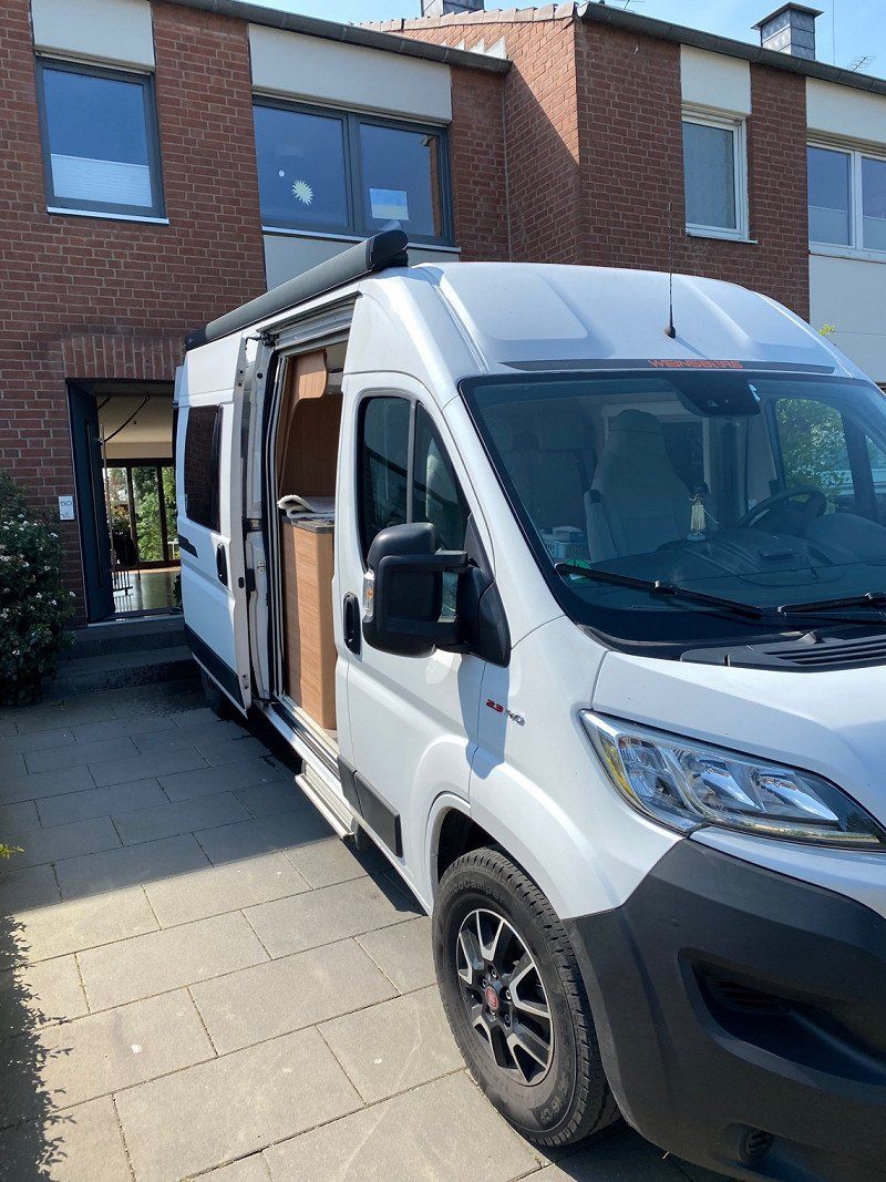
Planned tour with the camper in the Easter holidays. The exact procedure will be decided spontaneously. We adjust the route from time to time. Photos and report will be expanded.
Köln, Deutschland
50° 56' 15.1" N 6° 57' 37" E
50.9375310 6.9602786
• Head toward Seidmacherinnengäßchen on Unter Käster. Go for 10 m.
• Continue on Heumarkt. Go for 174 m.
• Turn right onto Augustinerstraße (L111). Go for 507 m.
• Turn left and take ramp onto Neuköllner Straße toward Barbarossaplatz/Severins-Brücke. Go for 412 m.
• Continue on Tel-Aviv-Straße toward Severins-Brücke/Barbarossaplatz. Go for 496 m.
• Continue on Ulrichgasse. Go for 437 m.
• Continue on Vorgebirgstraße. Go for 2.3 km.
• Turn left onto Raderthalgürtel (K12). Go for 770 m.
• Turn right onto Brühler Straße toward Raderthal. Go for 1.2 km.
• Continue on Brühler Landstraße (B51) toward Meschenich. Go for 6.0 km.
• Continue on A553. Go for 14.2 km.
• Continue on A1. Go for 36.1 km.
• Take exit 114 toward Blankenheim/Dahlem/Trier onto B51. Go for 38.1 km.
• Take ramp onto B51/B410. Go for 7.2 km.
• Take the 2nd exit from roundabout onto B51 toward Luxemburg/A60/Trier/Bitburg/E42/Schloßheck. Go for 223 m.
• Take ramp onto A60 toward Luxembourg/Trier/Bitburg. Go for 18.9 km.
• Take exit 6 toward Luxembourg/Bitburg onto B51. Go for 32.9 km.
• Take ramp onto A64 toward Luxembourg. Go for 8.8 km.
• Continue on A1 (Sauertalbrücke). Go for 36.4 km.
• Take the exit toward Metz/Saarbrücken/Livange onto A3. Go for 13.0 km.
• Continue on A31. Go for 100 km.
• Take the exit toward Lyon/Paris/Dijon/Toul onto A31. Go for 132 km.
• Take the left exit toward Lyon/Besançon/Dijon/Langres-Sud onto A31. Go for 113 km.
• Take the exit toward Paris/Auxerre/Beaune-St Nicolas onto A6 (Autoroute du Soleil). Go for 2.5 km.
• Take exit 24 toward Savigny lès Beaune/Beaune-St Nicolas. Go for 467 m.
• Take the 2nd exit from roundabout toward Beaune/Dijon. Go for 119 m.
• Take the 3rd exit from roundabout onto Route de Dijon (D974) toward Beaune. Go for 518 m.
• Take the 2nd exit from roundabout onto Route de Dijon (D974) toward Centre Ville. Go for 1.5 km.
• Turn right onto Boulevard Maréchal Foch (D974) toward A6 (Lyon)/Chalon S/S./Autun. Go for 123 m.
• Turn right onto Avenue de l'Aigue. Go for 138 m.
• Turn right onto Rue des Rôles. Go for 398 m.
• Arrive at Rue des Rôles. Your destination is on the right.
☍
569,4 km
(5 hrs. 25 min.)
Day
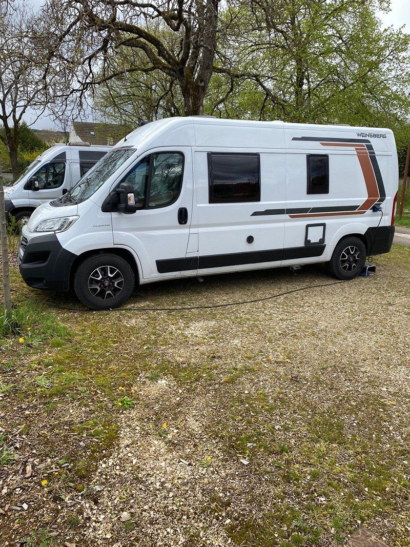
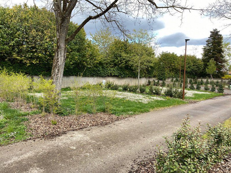
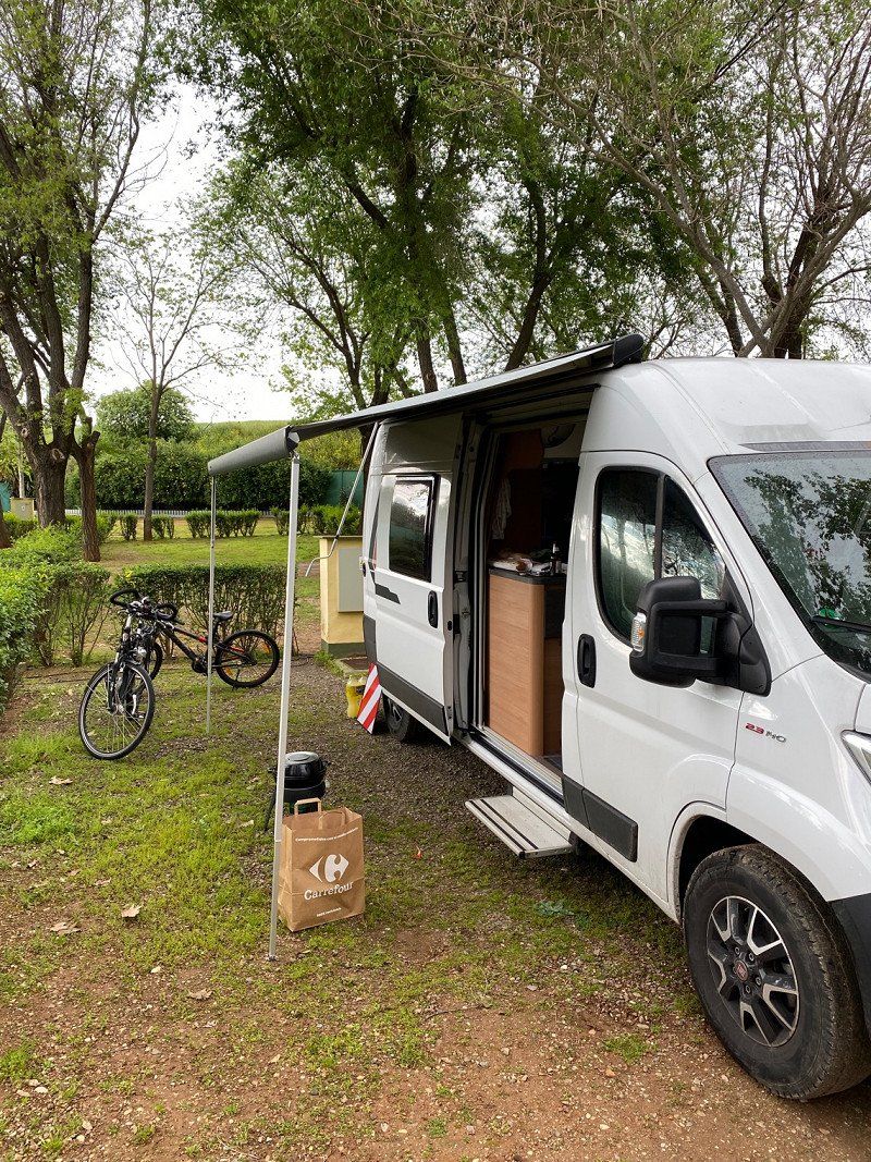
Camping Municipal Les Cent Vignes
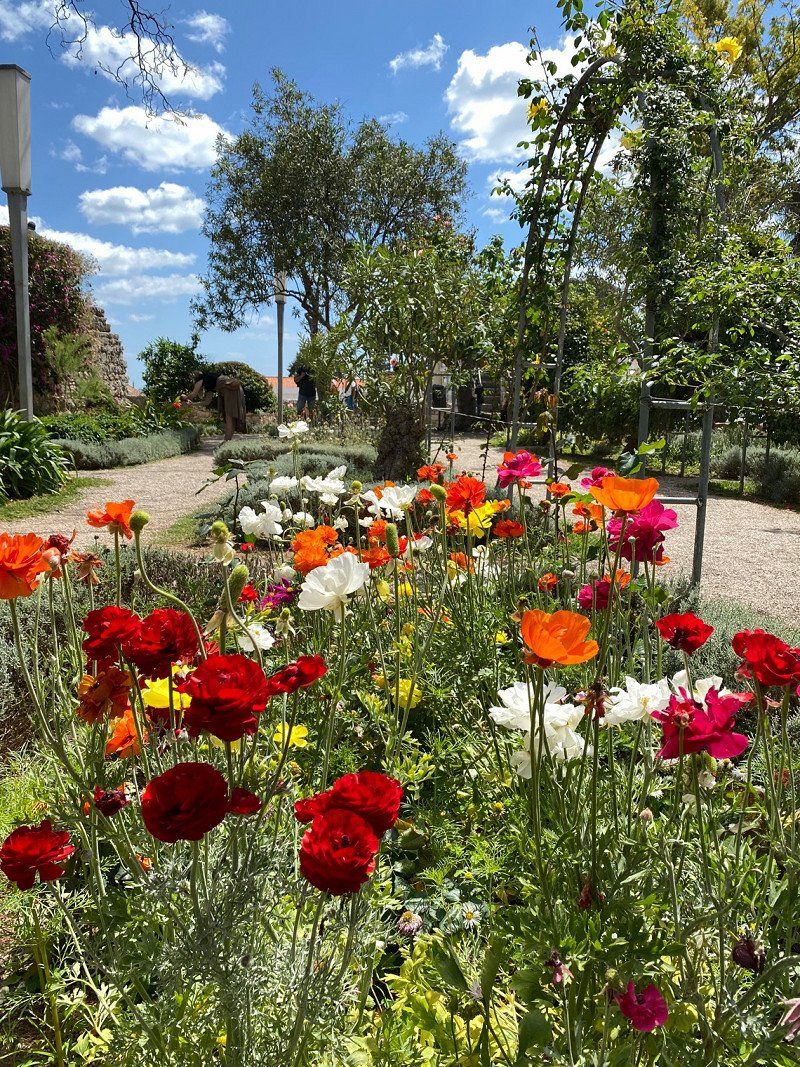
Very nice little square near the old town. In a calm neighborhood. The lady at the reception is really very friendly. The restaurant on the square is small and simply furnished but very tasty.
All in all, highly recommended for exploring the area or for a stopover in transit.
Rue Auguste Dubois 10, 21200, Beaune, Frankreich
47° 1' 54" N 4° 50' 18" E
47.0316600 4.8383300
• Head toward Petite Rue des Roles on Rue des Rôles. Go for 127 m.
• Take the 1st exit from roundabout onto Rue Auguste Dubois. Go for 219 m.
• Turn slightly left onto Avenue des Stades. Go for 6 m.
• Take the 1st exit from roundabout onto Route de Savigny (D18). Go for 128 m.
• Turn left onto Rue du Faubourg Saint-Nicolas (D974). Go for 986 m.
• Take the 2nd exit from roundabout onto Route de Dijon (D974). Go for 476 m.
• Take the 1st exit from roundabout toward A6/Paris/Auxerre/Lyon/Chalon S/S./Besançon/Dijon/Autun. Go for 87 m.
• Take the 2nd exit from roundabout onto A6 (Autoroute du Soleil) toward Lyon/Chalon S/Saône/Besançon/Dijon. Go for 1.8 km.
• Take the left exit toward Genève/Lyon/Chalon S/ Saône/Beaune-Hospices onto A6 (Autoroute du Soleil). Go for 149 km.
• Keep left onto Autoroute du Soleil (M6) toward Lyon-Centre. Go for 6.8 km.
• Keep left onto Autoroute du Soleil (M7). Go for 194 km.
• Keep right onto A9 (Échangeur d'Orange) toward Barcelone/Toulouse/Montpellier/Nîmes. Go for 149 km.
• Take exit 34 toward Pézenas/Agde/Vias/Bessan. Go for 952 m.
• Take the 1st exit from roundabout onto D612 A toward Vias/Agde/Cap d'Agde/Aéroport Béziers-Cap d'Agde/Europark. Go for 7.7 km.
• Take ramp onto D612 toward Béziers/Vias/Portiragnes/Aéroport Béziers-Cap d'Agde. Go for 952 m.
• Take ramp toward Vias-Centre/Vias-Plage. Go for 307 m.
• Take the 2nd exit from roundabout onto D137. Go for 380 m.
• Continue on Avenue de la Méditerranée (D137). Go for 1.1 km.
• Take the 2nd exit from roundabout onto Avenue de la Méditerranée (D137). Go for 201 m.
• Turn left onto Avenue des Rosses. Go for 246 m.
• Turn right. Go for 12 m.
• Arrive at your destination on the left.
☍
513,6 km
(4 hrs. 43 min.)
Day
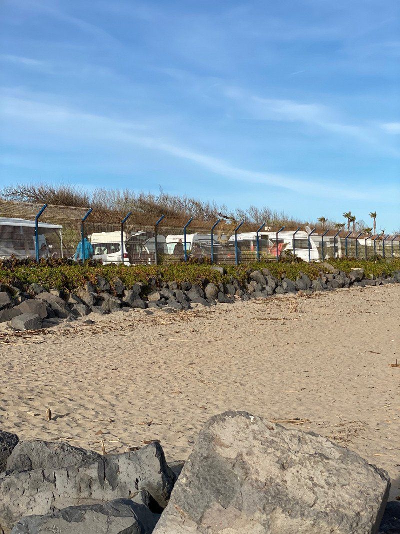
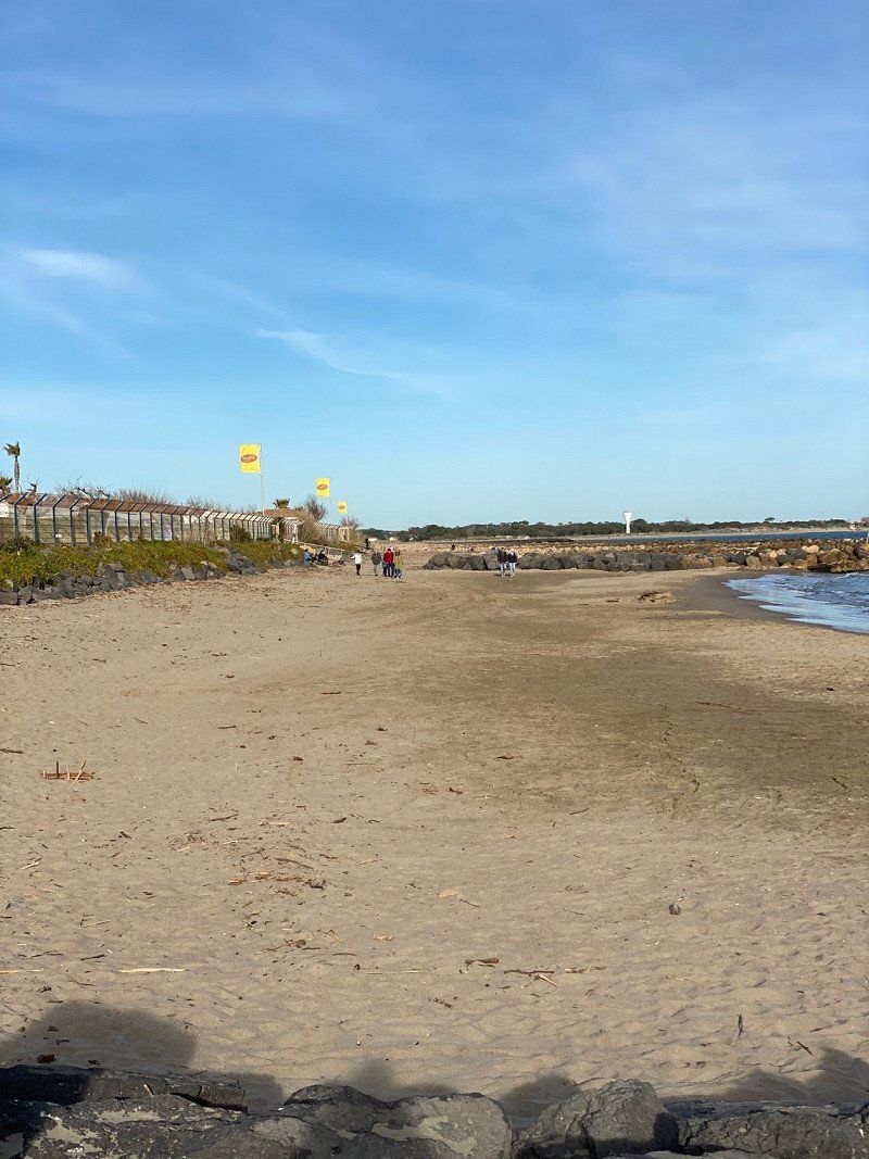
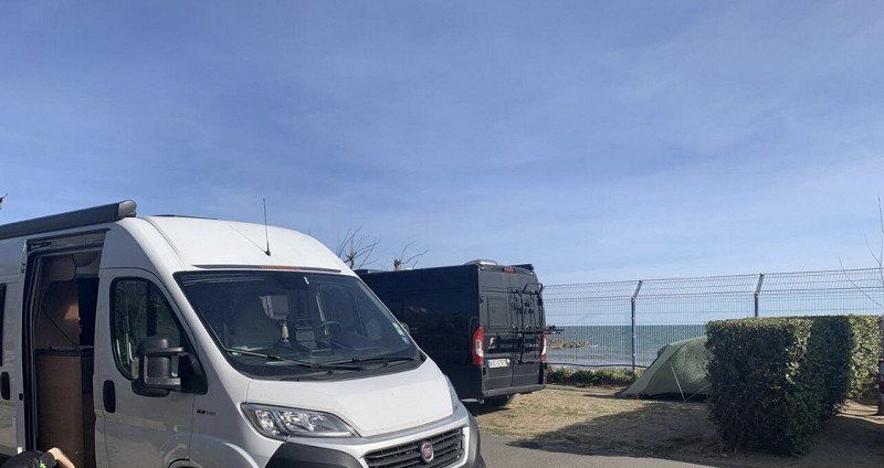
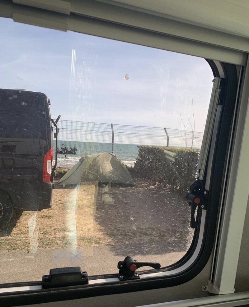
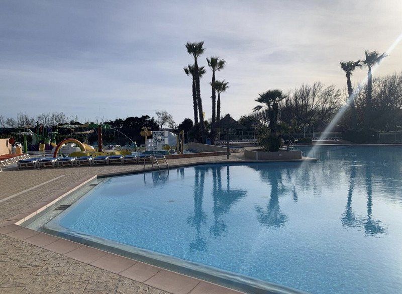
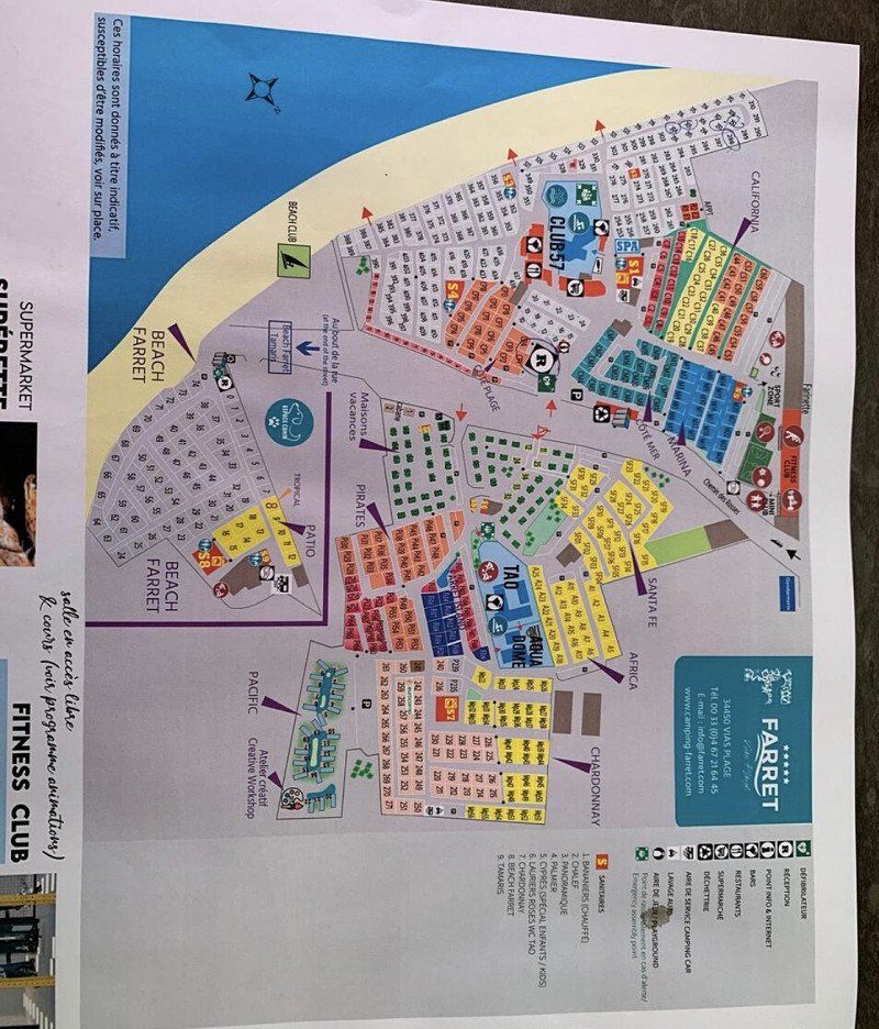
Yelloh! Village Le Club Farret
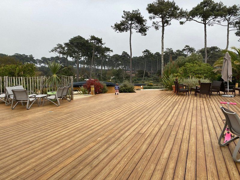
Ideal for families. Our son was very enthusiastic, even if it was still a bit too fresh for swimming. The place is nice but nothing more. Listening to the sea while falling asleep was worth the stay. Everything clean and the staff very friendly. but the season has only just started here and some shops were still closed. Could be a longer stay destination in the summer.
Chemin des Rosses, 34450, Vias Plage, Frankreich
43° 17' 28" N 3° 25' 8.5" E
43.2911000 3.4190200
• Head toward Avenue des Rosses. Go for 12 m.
• Turn right onto Avenue des Rosses. Go for 137 m.
• Continue on Chemin des Rosses. Go for 5 m.
• Continue on Avenue des Rosses. Go for 153 m.
• Turn slightly left onto Chemin des Rosses. Go for 80 m.
• Continue toward Chemin du Clot. Go for 89 m.
• Turn slightly left onto Chemin du Clot. Go for 131 m.
• Turn left onto Avenue du Clot. Go for 545 m.
• Take the 1st exit from roundabout onto Avenue de la Méditerranée (D137). Go for 1.1 km.
• Continue on D137. Go for 301 m.
• Take the 1st exit from roundabout. Go for 242 m.
• Continue on D612. Go for 4.9 km.
• Take the 3rd exit from roundabout onto D612 toward A9/Béziers/Portiragnes. Go for 1.9 km.
• Take the 2nd exit from roundabout onto D612. Go for 3.6 km.
• Keep right toward A9/A75/Béziers-Centre/Pézenas. Go for 297 m.
• Continue on Avenue de la Méditerranée (D612). Go for 1.7 km.
• Take ramp toward A75/A9/Clermont-Fd/Montpellier/Narbonne/Pézenas/P.A.E. du Capiscol/P.A.E. la Méridienne. Go for 259 m.
• Take the 2nd exit from Rond-Point des Étoiles roundabout onto A75 (La Méridienne) toward Narbonne/Montpellier. Go for 2.4 km.
• Take the exit toward Barcelone/Toulouse/Narbonne/Béziers-Ouest onto A9 (La Languedocienne). Go for 121 km.
• Continue on AP-7 (Autopista de la Mediterrània). Go for 136 km.
• Keep right onto AP-7 (Autopista de la Mediterrània) toward Lleida/E-90/AP-2/Tarragona/Sabadell/C-58/Túnels de Vallvidrera/E-9/Manresa/C-16/Polígon Industrial de Zona Franca/Fira. Go for 255 km.
• Take exit 44 toward Torreblanca/N-340/Alcossebre. Go for 1.4 km.
• Take the 3rd exit from roundabout onto N-340 toward Tarragona. Go for 2.8 km.
• Turn right toward Capicorb. Go for 1.6 km.
• Turn right onto CV-142 toward Alcossebre. Go for 591 m.
• Take the 2nd exit from roundabout onto Carretera de las Fuentes toward Urbanización Las Fuentes. Go for 2.4 km.
• Take the 3rd exit from Plaza de las Fuentes roundabout onto Avenida Manila. Go for 787 m.
• Take the 2nd exit from Plaza de Tanduay roundabout onto Calle Piber. Go for 361 m.
• Turn right onto Calle Portell. Go for 235 m.
• Turn left onto Camino El Atall. Go for 176 m.
• Continue on Camino de Ribamar. Go for 248 m.
• Turn slightly left onto Camino de Ribamar. Go for 1.2 km.
• Arrive at Camino de Ribamar.
☍
541,8 km
(5 hrs. )
Day
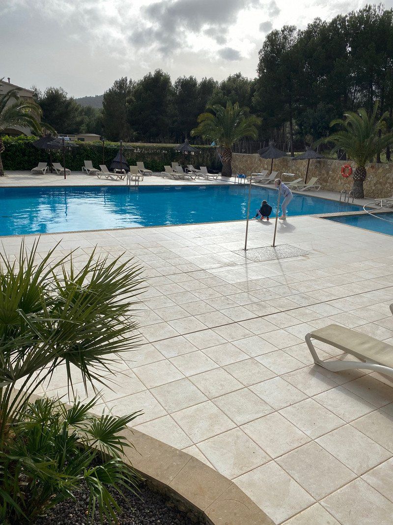
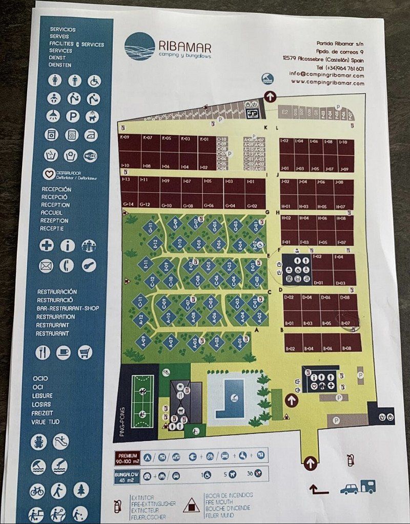
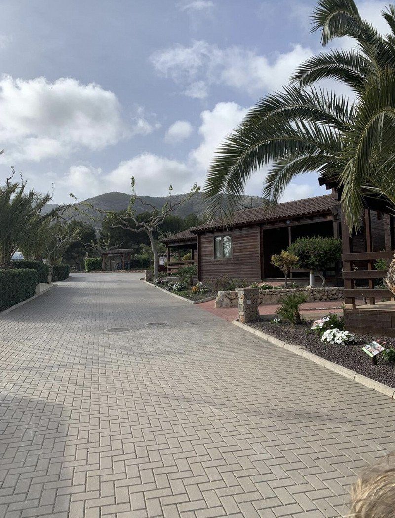
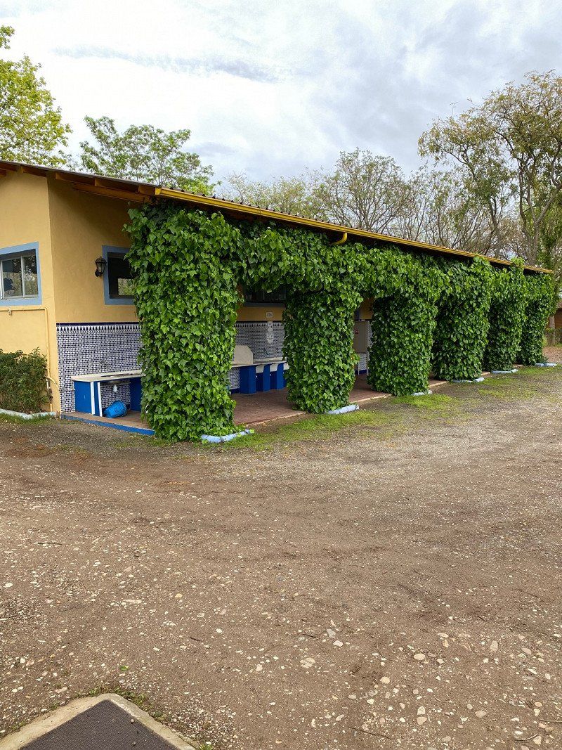
Camping Ribamar
By far the best stop on our tour so far. In the middle of nothing, totally beautiful. Very nicely laid out with a pool, playground and restaurant. Staff very nice, sanitary clean. The approach is really bad, about 2 km over an unpaved mogul slope but it's so worth it. More for self-catering, the restaurant was unfortunately not that tasty.
Partida Ribamar s/n, 12579, Alcossebre, Spanien
40° 16' 3.8" N 0° 18' 12.6" E
40.2677300 0.3034900
• Head toward Partida Ribamar on Camino de Ribamar. Go for 1.4 km.
• Continue on Camino El Atall. Go for 176 m.
• Turn right onto Calle Portell. Go for 235 m.
• Turn left onto Calle Piber. Go for 313 m.
• Take the 2nd exit from Plaza de Tanduay roundabout onto Avenida Manila. Go for 799 m.
• Take the 2nd exit from Plaza de las Fuentes roundabout onto Carretera de las Fuentes. Go for 2.4 km.
• Take the 1st exit from roundabout onto CV-142 toward AP-7/N-340/CV-13. Go for 626 m.
• Turn left toward Cap i Corb. Go for 1.6 km.
• Turn left onto N-340. Go for 2.2 km.
• Take ramp toward Benlloch/Aeroport/CV-10/Castelló/Castellón/Torrenostra. Go for 319 m.
• Take the 3rd exit from roundabout onto AP-7 (Autopista del Mediterráneo) toward Valencia. Go for 89.6 km.
• Continue on A-7 (Autovía del Mediterráneo). Go for 28.1 km.
• Take exit 335 toward Madrid onto A-3 (Autovía del Este). Go for 159 km.
• Keep left onto A-43 (Autovía Extremadura-Comunidad Valenciana) toward Albacete/A-31/Ciudad Real/N-301/Ocaña/AP-36. Go for 123 km.
• Take exit 51 toward Manzanares/Córdoba onto A-4 (Autovía del Sur). Go for 197 km.
• Take exit 377 toward Villafranca/Adamuz/El Carpio/Jaén/A-306. Go for 181 m.
• Turn sharp right onto Carretera Córdoba-Ademuz (A-421) toward Villafranca/Adamuz. Go for 205 m.
• Take the 3rd exit from roundabout onto Carretera Córdoba-Ademuz (A-421). Go for 774 m.
• Continue on A-421. Go for 394 m.
• Take the 3rd exit from roundabout onto Calle La Encina. Go for 249 m.
• Take the 3rd exit from roundabout onto CO-3103. Go for 403 m.
• Turn left toward Camino de las Moñizas. Go for 13 m.
• Turn slightly right onto Camino de las Moñizas. Go for 201 m.
• Arrive at Camino de las Moñizas. Your destination is on the left.
☍
609,1 km
(5 hrs. 21 min.)
Day
Camping la Albolafia
Very nicely situated in the green under trees on the outskirts of Villafranca. Arrived in the rain, a bit muddy. Very nice staff, ideal for a stopover.
Camino de la Vega, 14420, Villafranca de Córdoba, Spanien
37° 57' 23" N 4° 33' 18.9" W
37.9563800 -4.5552600
• Head east on Camino de las Moñizas. Go for 201 m.
• Turn slightly left toward CO-3103. Go for 13 m.
• Turn right onto CO-3103. Go for 356 m.
• Take the 1st exit from roundabout. Go for 77 m.
• Continue on Calle la Encina. Go for 162 m.
• Take the 1st exit from roundabout onto A-421. Go for 404 m.
• Continue on Carretera Córdoba-Ademuz (A-421). Go for 734 m.
• Take the 2nd exit from roundabout onto Carretera Córdoba-Ademuz (A-421). Go for 253 m.
• Take ramp onto A-4 (Autovía del Sur) toward Córdoba. Go for 155 km.
• Continue on Nudo Gota de Leche toward Centro Ciudad Sevilla/avd. Kansas City/Estación de Santa Justa. Go for 392 m.
• Take the exit toward Ronda Urbana Norte/Sevilla Norte/E-803/Mérida/A-66 onto SE-30 (Nudo Gota de Leche). Go for 4.2 km.
• Take the 2nd exit from Glorieta Olímpica roundabout onto SE-30 (Puente El Alamillo) toward Huelva/E-1/A-49/Mérida/E-803/N-630/Isla de la Cartuja/Estadio Olímpico. Go for 3.7 km.
• Take the exit toward A-49/Huelva/E-5/A-4/Cádiz onto A-66 (Autovía de la Plata). Go for 2.9 km.
• Take exit 17C toward Camas onto A-49 (Autopista del V Centenario). Go for 133 km.
• Continue on A22 (Via Infante de Sagres). Go for 8.9 km.
• Take exit 17 toward Monte Gordo/(N125). Go for 2.2 km.
• Continue toward N125. Go for 42 m.
• Take the 1st exit from roundabout onto N125. Go for 292 m.
• Pass 4 roundabouts and continue on N125. Go for 10.8 km.
• Take the 3rd exit from Rotunda da Conceição roundabout onto Rua Nossa Senhora da Conceição (M1238). Go for 271 m.
• Take the 2nd exit from roundabout onto Rua Nossa Senhora da Conceição (M1238). Go for 339 m.
• Turn sharp left onto Rua Ana de Castro. Go for 350 m.
• Arrive at your destination on the left.
☍
324,6 km
(3 hrs. )
Day
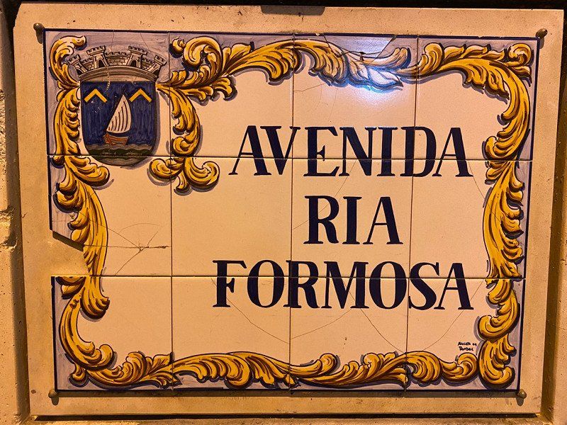
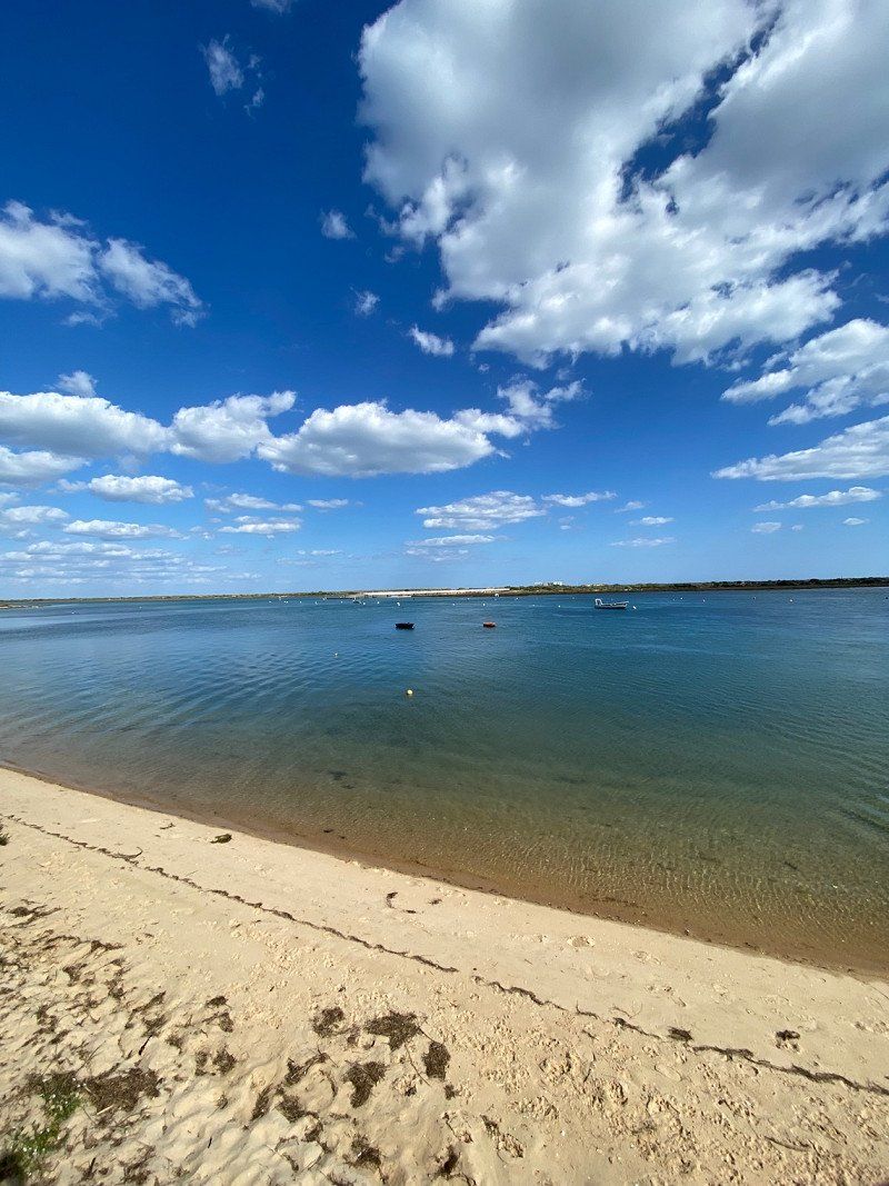
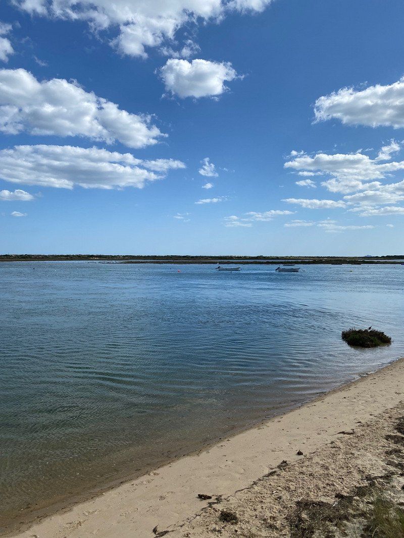
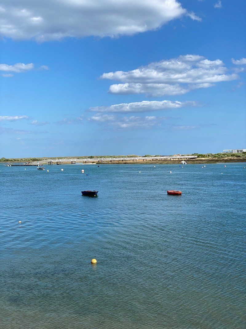
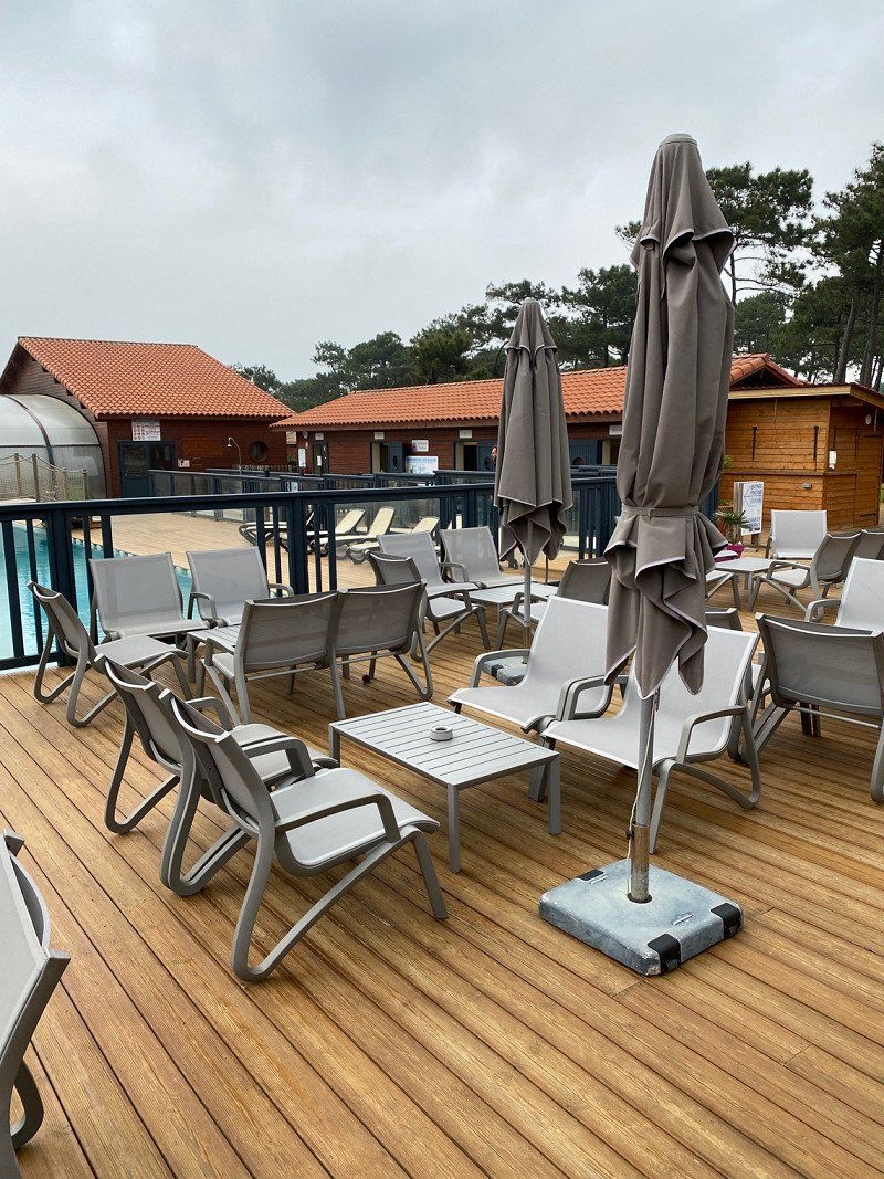
Camping Ria Formosa
Arrived! Shut down and relax first. The place is appropriate. I don't find the places very nice but ok. The staff is very nice. The place is pretty empty at the moment. Sanitary super clean, rarely experienced so well but there is no toilet paper. Otherwise we're going on vacation for a week before we start our way back.
Cabanas and also Tavira are worth a trip. We were lucky that the weather showed itself from its very best side, it was like on summer vacation. The place itself is only a little filled at this time, so that you can get a parking space without any problems. From the character but more of a parking lot but we found it very great here. We are slowly preparing for the journey home, although we would like to stay a few more days.
Quinta da Gomeira, 8800-591, Cabanas, Portugal
37° 8' 42.4" N 7° 36' 8" W
37.1451200 -7.6022210
• Head toward Rua Doutora Regina Quintanilha. Go for 214 m.
• Continue on Rua Ana de Castro. Go for 136 m.
• Turn sharp right onto Rua Nossa Senhora da Conceição (M1238). Go for 304 m.
• Take the 2nd exit from roundabout onto Rua Nossa Senhora da Conceição (M1238). Go for 226 m.
• Take the 1st exit from Rotunda da Conceição roundabout onto N125. Go for 7.4 km.
• Pass 3 roundabouts and continue on N125. Go for 3.5 km.
• Take the 2nd exit from roundabout onto N125. Go for 319 m.
• Take the 3rd exit from roundabout toward A22/Faro/Espanha. Go for 1.9 km.
• Take ramp onto A22 (Via Infante de Sagres) toward Espanha/Beja. Go for 9.1 km.
• Continue on A-49 (Autopista del V Centenario). Go for 133 km.
• Keep right toward E-803/Mérida/A-66/Aeropuerto/E-5/Córdoba/A-4. Go for 302 m.
• Continue on SE-30. Go for 649 m.
• Continue on A-66. Go for 182 km.
• Take the exit toward E-90/Madrid/Cáceres onto A-5 (Autovía de Extremadura). Go for 4.9 km.
• Keep right onto A-66 (Autovía de la Plata) toward Mérida/Avda. Felipe VI/Cáceres. Go for 263 km.
• Take exit 346 toward Salamanca (Sur)/Ávila/SA-20/Madrid/A-50/Aeropuerto onto N-630. Go for 2.3 km.
• Take the 1st exit from roundabout onto Avenida Consejo de Europa toward SA-20/A-50/Ávila/Madrid. Go for 1.1 km.
• Take the 2nd exit from roundabout onto Avenida Consejo de Europa (SA-20) toward A-50/Aeropuerto Matacán/Ávila/Madrid. Go for 1.3 km.
• Take the 2nd exit from roundabout onto A-50 (Autovía Ávila-Salamanca) toward Aeropuerto/Ávila/Madrid. Go for 3.2 km.
• Take exit 96 toward Pelabravo/Calvarrasa de Abajo/Sta. Marta de Tormes. Go for 449 m.
• Take the 2nd exit from roundabout onto N-501 toward A-50/Salamanca/Pelabravo/Calvarrasa de Abajo/Sta. Marta de Tormes. Go for 277 m.
• Take the 1st exit from roundabout onto N-501 toward Pelabravo/Calvarrasa de Abajo/Sta. Marta de Tormes. Go for 460 m.
• Take the 3rd exit from roundabout onto N-501a toward Santa Marta de Tormes. Go for 566 m.
• Continue on Carretera de Madrid (N-501a). Go for 883 m.
• Turn left. Go for 138 m.
• Turn left. Go for 34 m.
• Take the 1st exit from roundabout. Go for 142 m.
• Turn slightly right. Go for 77 m.
• Arrive at your destination on the left.
☍
617,3 km
(5 hrs. 14 min.)
Day
Day
Day
Day
Day
Day
Day
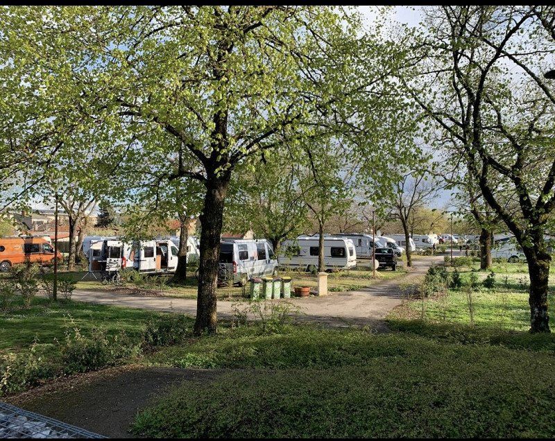
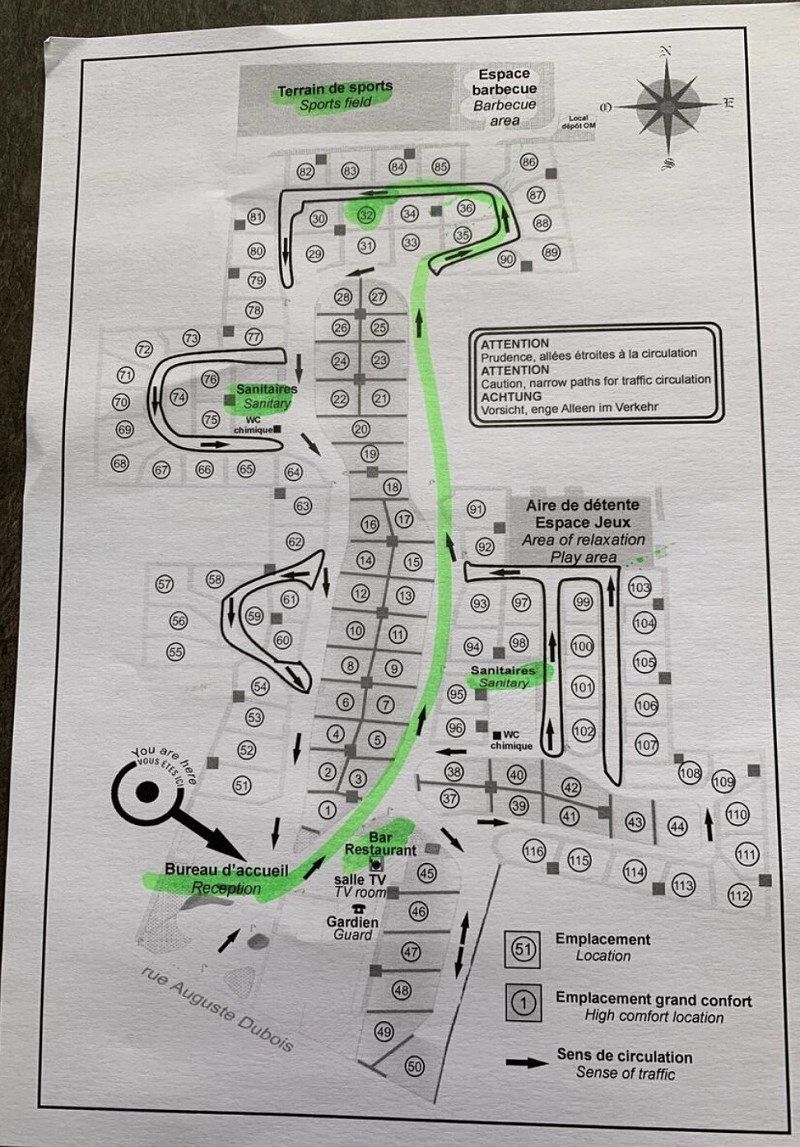
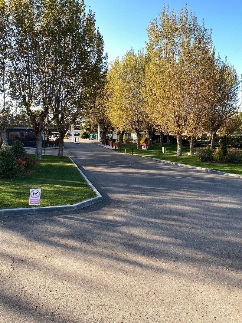
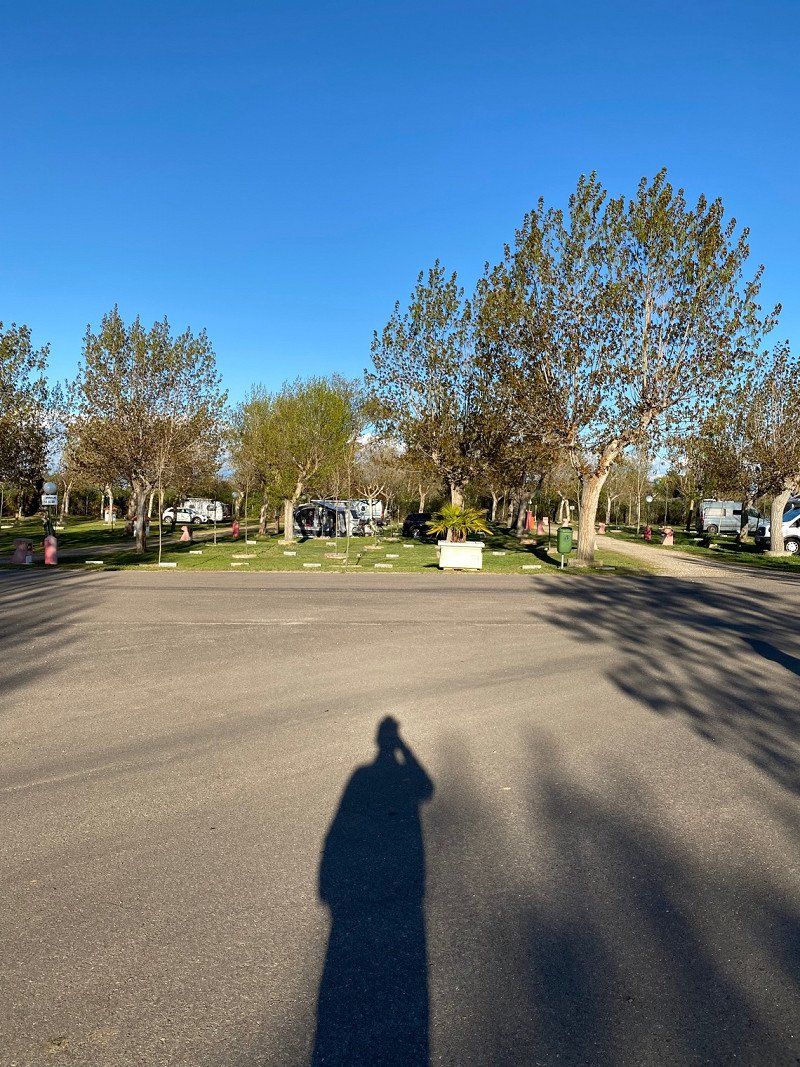
Camping Regio
The place is beautifully laid out and belongs to a fairly large hotel complex outside of Salamanca. Right in front of the square there is currently an hourly bus to the city. Really good for a visit to the city. But it's quicker by taxi. Sanitary clean and ok. staff friendly. Snack bar ok, restaurant expensive. Well located for a night's rest.
Ctra. Salamanca-madrid KM.4, 37900, SALAMANCA, Spanien
40° 56' 48" N 5° 36' 51" W
40.9466600 -5.6141600
• Head west. Go for 31 m.
• Turn right. Go for 101 m.
• Turn right. Go for 12 m.
• Turn left. Go for 75 m.
• Take the 2nd exit from roundabout. Go for 47 m.
• Turn right. Go for 39 m.
• Turn right toward Avenida de Madrid/N-501a. Go for 101 m.
• Turn left onto Avenida de Madrid (N-501a). Go for 510 m.
• Pass 6 roundabouts and continue on Avenida de Madrid (N-501a). Go for 1.6 km.
• Take the 1st exit from roundabout onto Avenida Serna (DSA-100). Go for 865 m.
• Take the 1st exit from roundabout onto Puente de la Serna (DSA-100). Go for 413 m.
• Take the 3rd exit from Glorieta del Arenal del Ángel roundabout onto Avenida Fernando III El Santo. Go for 414 m.
• Take the 2nd exit from roundabout onto Avenida de la Reina Berenguela. Go for 752 m.
• Take the 2nd exit from Glorieta de la Flecha roundabout onto Calle Jamaica. Go for 386 m.
• Continue on Calle Río Miño. Go for 68 m.
• Take the 2nd exit from Glorieta Río Miño roundabout onto Calle Río Miño. Go for 145 m.
• Continue on Avenida de los Cipreses. Go for 600 m.
• Take the 2nd exit from Glorieta Julio Robles roundabout onto Avenida de los Cipreses. Go for 86 m.
• Turn right onto Avenida de Gonzalo Torrente Ballester. Go for 1.0 km.
• Take the 2nd exit from roundabout onto Carretera de Valladolid (N-620). Go for 1.4 km.
• Take the 2nd exit from roundabout onto N-620. Go for 435 m.
• Take ramp onto A-62 (Autovía de Castilla) toward Tordesillas/Valladolid. Go for 83.4 km.
• Keep right onto A-62 (Autovía de Castilla) toward Valladolid/Burgos. Go for 145 km.
• Continue on BU-30 (Autovía de Castilla). Go for 4.3 km.
• Continue on A-1 (Nudo de Landa). Go for 7.1 km.
• Continue on AP-1 (Autovía del Norte). Go for 81.9 km.
• Take the left exit onto A-1 (Autovía del Norte). Go for 24.7 km.
• Take exit 352 toward E-80/Francia/AP-1/Bilbao/AP-68/Aireportua onto N-622. Go for 2.3 km.
• Take ramp toward Aireportua/Foronda/Etxabarri-Ibiña/Donostia/AP-1/San Sebastián. Go for 273 m.
• Keep left toward Autopista Vitoria-Eibar/AP-1. Go for 862 m.
• Take ramp onto AP-1 (Autopista Vitoria-Eibar) toward Donostia/San Sebastián. Go for 44.7 km.
• Take the exit onto AP-1/AP-8 (Autopista del Cantábrico). Go for 42.6 km.
• Take the exit toward Hernani/Pasaia/Irun/Baiona/Bordeaux onto AP-1/AP-8 (Segundo Cinturón de San Sebastián). Go for 14.6 km.
• Take the exit onto AP-8. Go for 12.7 km.
• Continue on A63 (Autoroute de la Côte Basque). Go for 87.7 km.
• Take exit 12 toward Vielle-St-Girons/Castets. Go for 536 m.
• Take the 5th exit from roundabout onto D947 toward Castets/St Girons/Z.I. de Juston. Go for 573 m.
• Pass 2 roundabouts and continue on Rue de Juston (D947). Go for 1.2 km.
• Take the 1st exit from roundabout onto Rue Sainte-Hélène (D947 E). Go for 476 m.
• Continue on Rue du Marensin (D947). Go for 308 m.
• Turn left onto Route d'Uza (D5). Go for 3.8 km.
• Continue on D5. Go for 6.8 km.
• Continue on Route de Castets (D5). Go for 1.6 km.
• Continue on Route d'Uza (D5). Go for 1.7 km.
• Continue on D5. Go for 113 m.
• Continue on Rue de Castets (D5). Go for 3.3 km.
• Turn left onto Rue de Lit et Mixe (D66). Go for 1.8 km.
• Continue on Rue du Point du Jour (D66). Go for 2.6 km.
• Turn left onto Avenue de la Côte d'Argent (D652). Go for 188 m.
• Turn right onto Rue Henri Crouzet. Go for 545 m.
• Continue on Rue du Stade (D340). Go for 570 m.
• Continue on D340. Go for 73 m.
• Continue on Route de Contis (D340). Go for 6.7 km.
• Continue on Allée du Pont Rose (D340). Go for 191 m.
• Continue on Route du Pont Rose (D340). Go for 100 m.
• Turn left onto Avenue de l'Océan (D41). Go for 509 m.
• Turn left. Go for 30 m.
• Turn left. Go for 35 m.
• Arrive at your destination on the right.
☍
595,3 km
(5 hrs. 33 min.)
Day
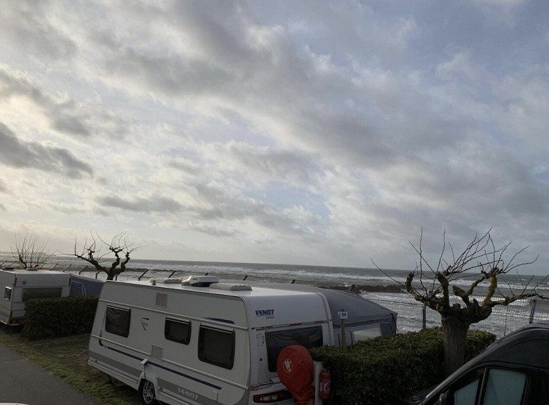
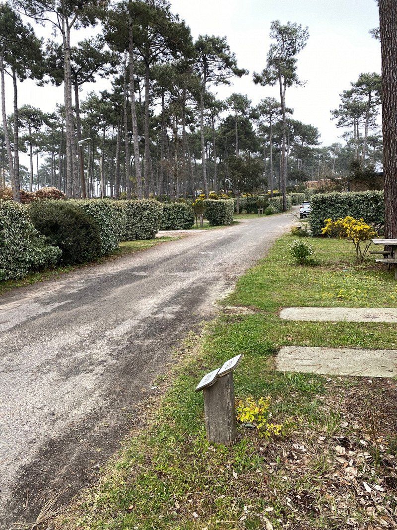
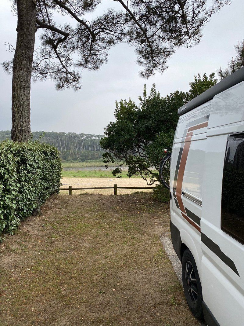
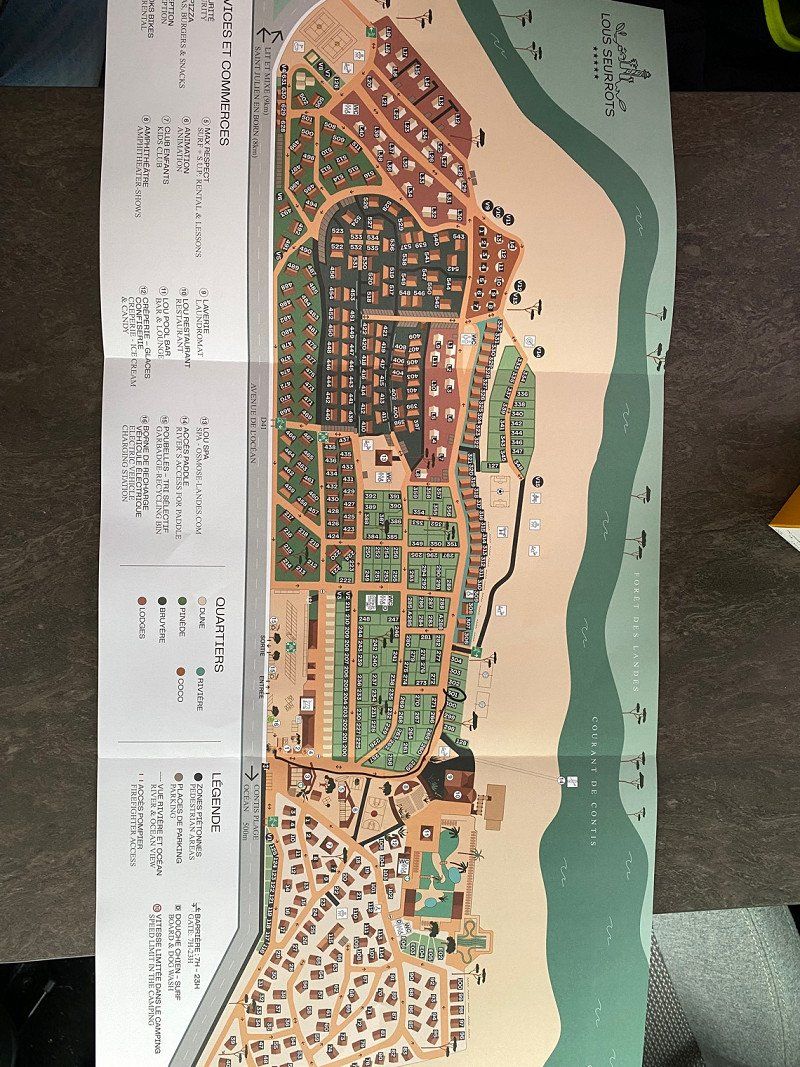
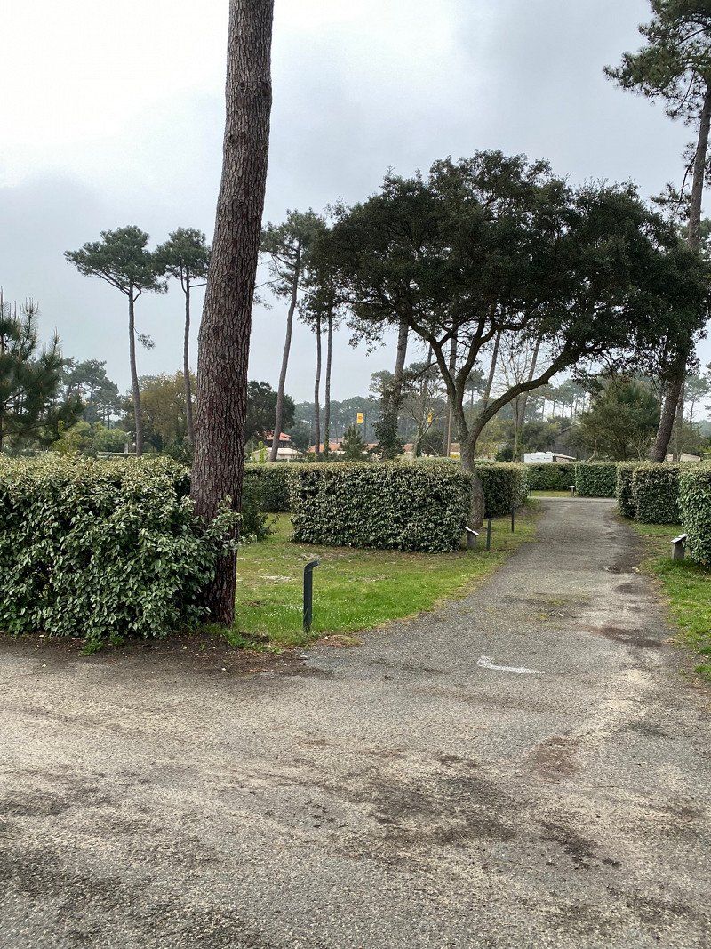
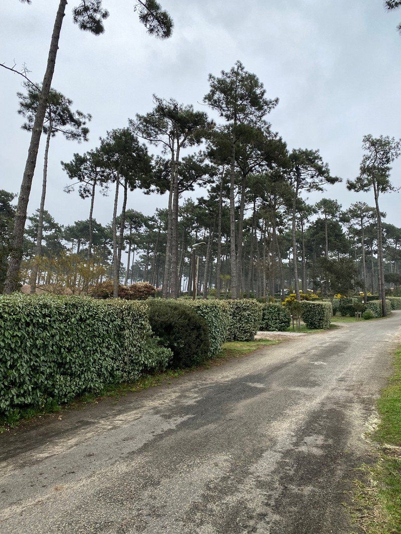
Yelloh! Village Lous Seurrots
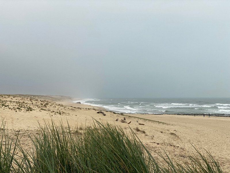
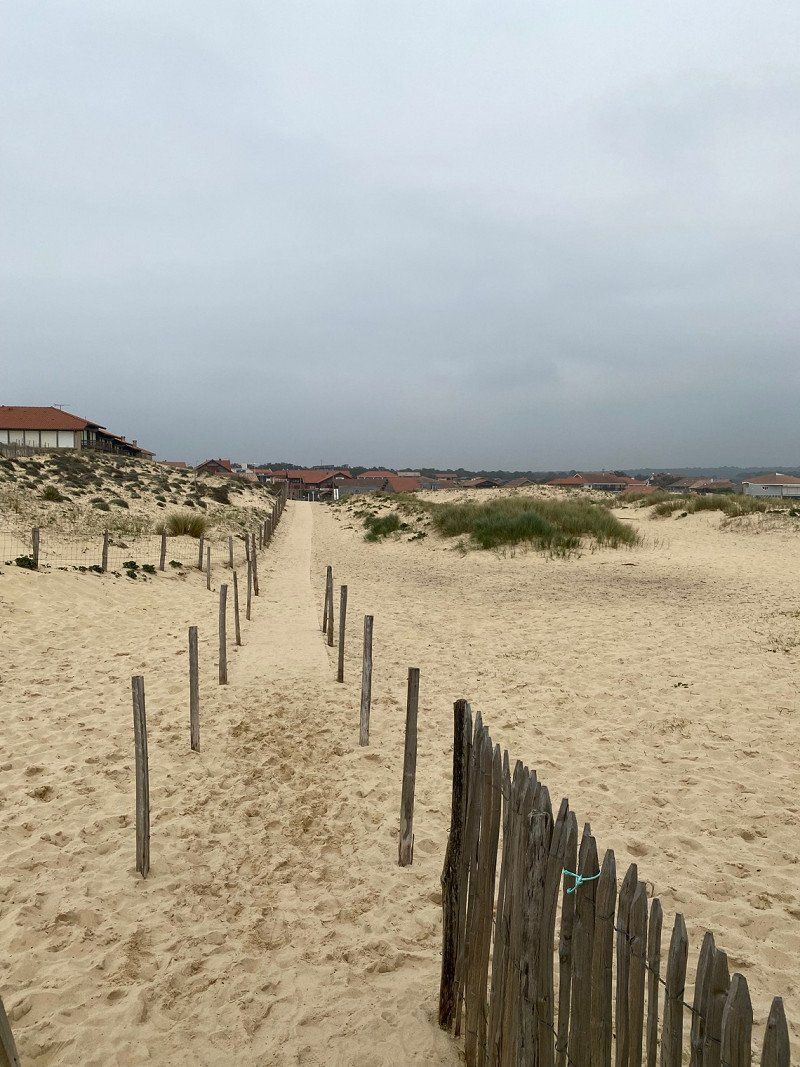
Great place but above all great scenery. You drive for kilometers through pine forests to get to Contis-Les-Baines. The place is currently still very quiet just like the place. The Atlantic has shown its rough side today and it smells like the sea. The place itself is clean and really nicely laid out, we can also imagine coming back here in summer.
avenue de l'Océan 606, 40170, Contis Plage, Frankreich
44° 5' 18" N 1° 18' 58" W
44.0883300 -1.3161100
• Head southeast. Go for 84 m.
• Turn right toward Avenue de l'Océan/D41. Go for 18 m.
• Turn right onto Avenue de l'Océan (D41). Go for 477 m.
• Continue on Route de Contis (D41). Go for 6.6 km.
• Take the 2nd exit from roundabout onto Route Océane (D167). Go for 5.8 km.
• Take the 3rd exit from roundabout onto Avenue du Born (D63). Go for 4.1 km.
• Continue on Lieu-dit Ninicq (D63). Go for 126 m.
• Continue on D63. Go for 326 m.
• Continue on Lieu-dit Soulès (D63). Go for 65 m.
• Continue on D63. Go for 325 m.
• Continue on Lieu-dit L'Habitant (D63). Go for 70 m.
• Continue on D63. Go for 7.7 km.
• Continue on Lieu-dit Cameleyre (D63). Go for 304 m.
• Continue on D63. Go for 1.5 km.
• Continue on Route de Mezos (D63). Go for 284 m.
• Turn right onto Route de Mimizan (D44). Go for 819 m.
• Pass 2 roundabouts and continue on Lieu-dit Cap de Pin (D44). Go for 5.3 km.
• Take the 4th exit from roundabout onto A63 toward Bordeaux. Go for 82.9 km.
• Take the exit toward Paris/Toulouse/Bordeaux/Talence onto A630 (Rocade de Bordeaux). Go for 9.2 km.
• Keep left onto Rocade de Bordeaux (N230) toward Paris/A10/Lyon/A89. Go for 10.2 km.
• Take left ramp onto A10 toward E606/Paris/Nantes/Angoulême/Saintes. Go for 460 km.
• Take the exit toward E60/A19/Metz/Nancy/Fontainebleau/Montargis. Go for 1.2 km.
• Continue on A19. Go for 98.7 km.
• Take the exit toward Metz/Nancy/Troyes/Sens onto A19. Go for 29.4 km.
• Take the exit toward Troyes/Metz/Nancy onto A5. Go for 51.1 km.
• Take exit 20 toward Troyes-Centre/Sainte Savine onto E511. Go for 2.9 km.
• Take the 2nd exit from roundabout onto D660 toward Troyes/Sainte Savine/Romilly S/Seine/La Rivière de Corps/Z.I. Torvilliers. Go for 1.5 km.
• Take the 2nd exit from roundabout toward N2060/La Rivière de Corps/Savipol/Ste-Savine. Go for 249 m.
• Continue on Avenue du Général Leclerc. Go for 848 m.
• Take the 1st exit from roundabout onto Avenue du Général Leclerc. Go for 3.2 km.
• Continue on Avenue du Général Gallieni. Go for 1.1 km.
• Take the 1st exit from roundabout onto Avenue du Général Gallieni. Go for 207 m.
• Continue on Rue Voltaire. Go for 393 m.
• Take the 3rd exit from Place du Général Patton roundabout onto Boulevard Carnot. Go for 215 m.
• Turn right onto Avenue du Maréchal Joffre. Go for 55 m.
• Continue on Rue du Général de Gaulle. Go for 518 m.
• Turn right onto Rue de la République. Go for 172 m.
• Continue on Place Maréchal Foch. Go for 49 m.
• Turn right onto Rue Urbain IV. Go for 34 m.
• Turn right onto Place Maréchal Foch. Go for 38 m.
• Arrive at Place Maréchal Foch. Your destination is on the right.
☍
788,4 km
(6 hrs. 52 min.)
Day
Troyes, Frankreich
10000 Troyes, Frankreich
48° 17' 50.4" N 4° 4' 27.8" E
48.2973451 4.0744009
• Head toward Place Alexandre Israël on Place Maréchal Foch. Go for 20 m.
• Turn slightly right onto Rue Aristide Briand. Go for 95 m.
• Turn right onto Rue Claude Huez. Go for 80 m.
• Turn left onto Rue de la République. Go for 126 m.
• Turn right onto Boulevard Gambetta. Go for 249 m.
• Take the 3rd exit from roundabout onto Quai de Dampierre. Go for 133 m.
• Take the 2nd exit from roundabout onto Avenue Chomedey de Maisonneuve. Go for 910 m.
• Pass 2 roundabouts and continue on Avenue Chomedey de Maisonneuve. Go for 900 m.
• Continue on Rue Pénétrante Nord. Go for 1.3 km.
• Take ramp onto Rocade Est (D610) toward A26/Châlons S/M./Nancy/Chaumont/Pont Ste-Marie. Go for 3.5 km.
• Take ramp toward A26/Châlons-en-Ch./Pont Ste-Marie/Arcis S/Aube. Go for 313 m.
• Take the 4th exit from roundabout onto D677 toward Arcis S/Aube/La Chapelle St-Luc. Go for 202 m.
• Take the 1st exit from roundabout onto D677 toward A26/Châlons-en-Ch./Vitry-le-Fr./Feuges/Arcis S/Aube. Go for 440 m.
• Take ramp onto D677. Go for 6.2 km.
• Take the 1st exit from roundabout onto D15 toward A26/Châlons-en-Ch./Vitry-le-Fr./Reims/Metz/Lyon/Charmont S/S Barbuise. Go for 3.1 km.
• Take the 3rd exit from roundabout onto A26 toward Châlons en Ch. Go for 76.2 km.
• Take the left exit toward Paris/Lille/Charleville-M./Reims onto A4 (Autoroute de l'Est). Go for 23.5 km.
• Take the exit toward E46/Charleroi/Charleville-M./Reims-Centre/Cormontreuil onto A34 (Autoroute de l'Est). Go for 2.1 km.
• Take the exit toward Charleroi/Charleville-M/Reims-Est onto N244 (Avenue Nicéphore Niépce). Go for 13.2 km.
• Continue on N51. Go for 31.6 km.
• Continue on A34. Go for 33.6 km.
• Take the exit toward E44/Liège/Luxembourg/Sedan/Charleville-M. onto A34. Go for 2.4 km.
• Take the exit toward Liège/Metz/Sedan/Villers-Semeuse onto A34. Go for 16.0 km.
• Continue on N43. Go for 5.6 km.
• Take ramp onto N58 toward Arlon/Dinant/Liège/Bouillon. Go for 11.8 km.
• Continue on Route de Florenville (E46). Go for 23.9 km.
• Pass 2 roundabouts and continue on E46. Go for 6.2 km.
• Take ramp onto E411 toward Luxembourg/Arlon/Liège/Bastogne. Go for 12.9 km.
• Take the exit toward Liège/Bastogne onto E25. Go for 85.0 km.
• Take exit 45 toward Verviers/Theux/Banneux. Go for 434 m.
• Continue on Rue de Louveigné (N678). Go for 510 m.
• Take the 1st exit from roundabout onto Rue de Louveigné (N678) toward Spa/Verviers/Theux/Banneux/Zone Industrielle Cornemont. Go for 1.1 km.
• Continue on Rue de Theux. Go for 1.5 km.
• Continue on Rue de Theux toward N62/Spa/Theux. Go for 6.7 km.
• Take the 2nd exit from roundabout onto La Boverie toward E42/Verviers/Pepinster/Centre. Go for 274 m.
• Turn left onto Place du Perron. Go for 136 m.
• Take the 2nd exit from roundabout onto Rue du Pont (N690). Go for 113 m.
• Continue on Chaussée de Verviers (N657). Go for 4.0 km.
• Take the 2nd exit from roundabout onto Chaussée de Verviers (N657). Go for 266 m.
• Take the 2nd exit from roundabout onto E42 toward Maastricht/Aachen/Liège/Verviers. Go for 2.4 km.
• Take exit 6 toward Ensival. Go for 296 m.
• Continue on Rue de Franchimont. Go for 37 m.
• Continue on Rue des Etangs. Go for 113 m.
• Keep right toward Rue des Déportés. Go for 258 m.
• Keep right onto Rue des Déportés. Go for 644 m.
• Take the 2nd exit from Place de l'Yser roundabout onto Rue de Bruxelles. Go for 311 m.
• Continue on Place de la Victoire. Go for 60 m.
• Turn right onto Rue du Palais (N61). Go for 705 m.
• Turn right onto Place du Palais de Justice (N61). Go for 68 m.
• Arrive at Place du Palais de Justice (N61). Your destination is on the right.
☍
381,4 km
(3 hrs. 34 min.)
Verviers, Belgien
50° 35' 28.1" N 5° 52' 0.1" E
50.5911266 5.8666876
• Head east on Place du Palais de Justice (N61).
• Turn right onto Rue du Tribunal. Go for 57 m.
• Turn right onto Chaussée de Heusy (N657). Go for 109 m.
• Turn slightly right onto Rue du Centre. Go for 155 m.
• Turn slightly right onto Rue de la Colline. Go for 144 m.
• Turn left onto Rue du Palais (N61). Go for 466 m.
• Take the 3rd exit from Place de la Victoire roundabout onto Rue d'Ensival (N61). Go for 362 m.
• Take the 1st exit from Rond-Point Armand Delsemme roundabout onto Rue d'Ensival (N61). Go for 352 m.
• Take the 3rd exit from Rond-Point Amiral Brasseur-Kermadec roundabout onto Rue d'Ensival (N61). Go for 176 m.
• Take ramp onto E42 toward Maastricht/Aachen/Liège/Eupen. Go for 6.5 km.
• Take the exit toward Aachen/Eupen/Zone Industrielle Les Plénesses onto E40. Go for 23.3 km.
• Continue on A44. Go for 10.4 km.
• Take exit 4 toward Köln onto A4. Go for 58.2 km.
• Take exit 11A toward K.-Klettenberg/Hürth/Zentrum/Klettenberg/Universität. Go for 420 m.
• Turn right onto Luxemburger Straße (B265) toward Zentrum/Klettenberg/Universität. Go for 4.1 km.
• Continue on Pfälzer Straße (B265). Go for 715 m.
• Keep left onto Blaubach toward Dom, Hbf./Deutzer Brücke. Go for 536 m.
• Continue on Mühlenbach. Go for 227 m.
• Continue on An der Malzmühle. Go for 72 m.
• Continue on Am Malzbüchel. Go for 70 m.
• Turn right onto Heumarkt toward Flughafen/Altstadt. Go for 152 m.
• Turn left toward Augustinerstraße/L111. Go for 329 m.
• Turn right onto Augustinerstraße (L111). Go for 45 m.
• Turn right onto Heumarkt toward Altstadt. Go for 174 m.
• Continue on Unter Käster. Go for 10 m.
• Arrive at Unter Käster.
☍
107,1 km
(1 hrs. 6 min.)
Köln, Deutschland
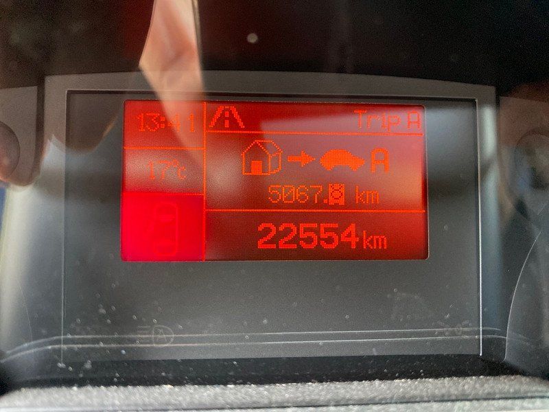
We drove through the 1200km in one go. It wasn't as bad as I feared, but it wasn't as bad either. The tour itself was really great and will definitely be repeated again. Cleaning is the order of the day today. After exactly 5067 km we are back home.
50° 56' 15.1" N 6° 57' 37" E
50.9375310 6.9602786