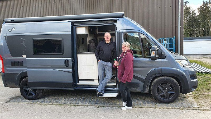
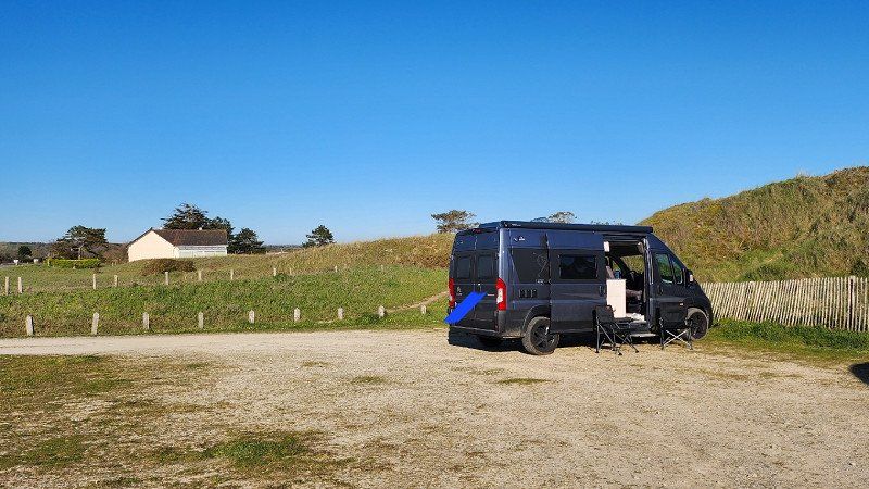
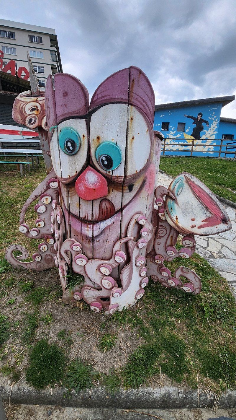
If not now then when??? In 2023 we will leave work, work and take six months together before we return to everyday life... In August 2022 we treated ourselves to a Jumper motorhome and in April 2023 we will start...
Here the planning of the first part of the tour from home to Barcelona. The second section should then take us from Barcelona via ferry to Italy and Greece...
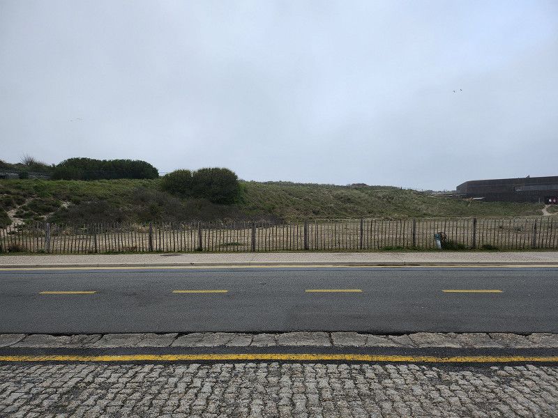
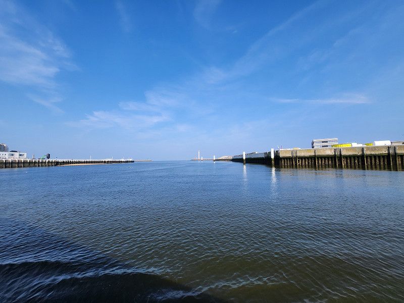
Hamburg, Deutschland
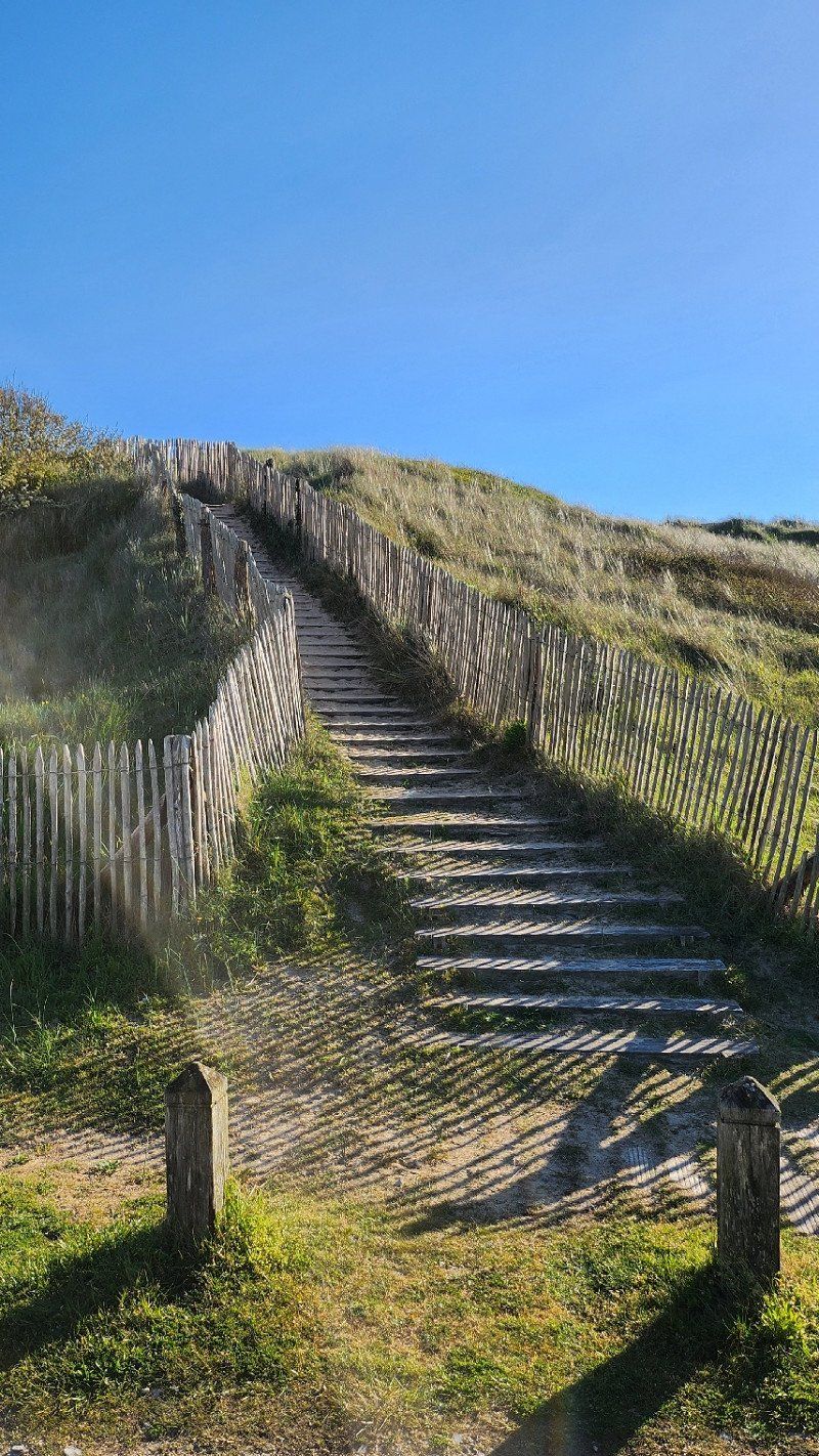
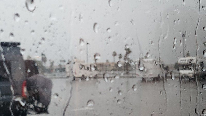
Finally packed everything we think and off we go on the wild ride...
Hudekamp 14, 23863 Kayhude, Deutschland
53° 45' 24.1" N 10° 8' 18.8" E
53.7567052 10.1385641
• Head toward Schulstraße on Hudekamp. Go for 167 m.
• Turn right onto Schulstraße. Go for 315 m.
• Turn slightly left onto Schulstraße. Go for 208 m.
• Turn left onto Segeberger Straße (B432). Go for 10.5 km.
• Continue on Segeberger Chaussee (B432) toward A7/Hannover/Bremen/HH-Schnelsen/Flughafen Hamburg/Gewerbegebiet Garstedt/Friedrichsgabe. Go for 2.0 km.
• Take the 2nd exit from roundabout onto Segeberger Chaussee (B432) toward Hannover/A7/HH-Schnelsen. Go for 387 m.
• Continue on Ohechaussee (B432). Go for 4.9 km.
• Keep right onto Oldesloer Straße (B432) toward A7/Schnelsen. Go for 1.4 km.
• Take ramp onto A7 toward Hannover/Bremen/Husum/Heide. Go for 11.4 km.
• Keep left onto A7. Go for 14.7 km.
• Keep right onto A261 (Autobahndreieck Hamburg-Südwest) toward Bremen/Tötensen. Go for 9.0 km.
• Take exit 4 toward Osnabrück/Bremen/Rade onto A1. Go for 93.3 km.
• Take exit 58A toward Oldenburg onto A28. Go for 42.6 km.
• Take the exit toward Groningen/Emden/Leer/Bad Zwischenahn/OL-Wechloy onto A28. Go for 55.2 km.
• Continue on A31. Go for 19.5 km.
• Take exit 14 toward Groningen/Bunde-West onto A280. Go for 4.8 km.
• Continue on A7. Go for 24.9 km.
• Take the exit toward Eemshaven/Delfzijl onto N33. Go for 28.6 km.
• Turn left onto Hogelandsterweg (N363). Go for 7.9 km.
• Continue on Hoofdstraat. Go for 108 m.
• Take the 1st exit from roundabout onto Hoofdstraat (N363). Go for 836 m.
• Arrive at Hoofdstraat. Your destination is on the left.
☍
332,5 km
(3 hrs. 19 min.)
Day
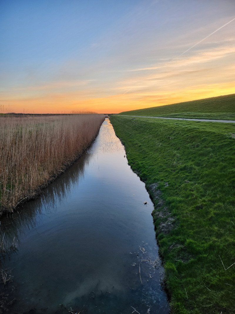
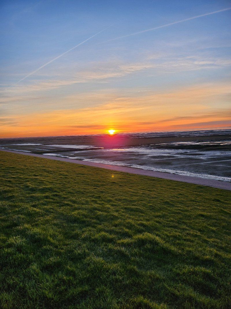
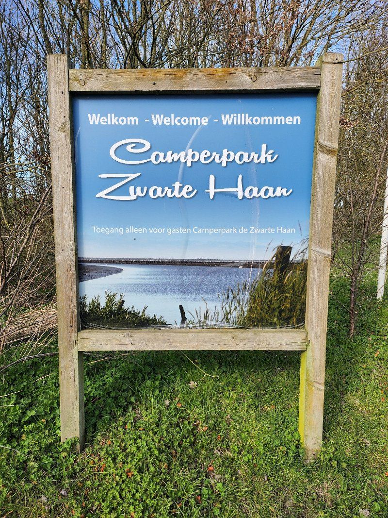
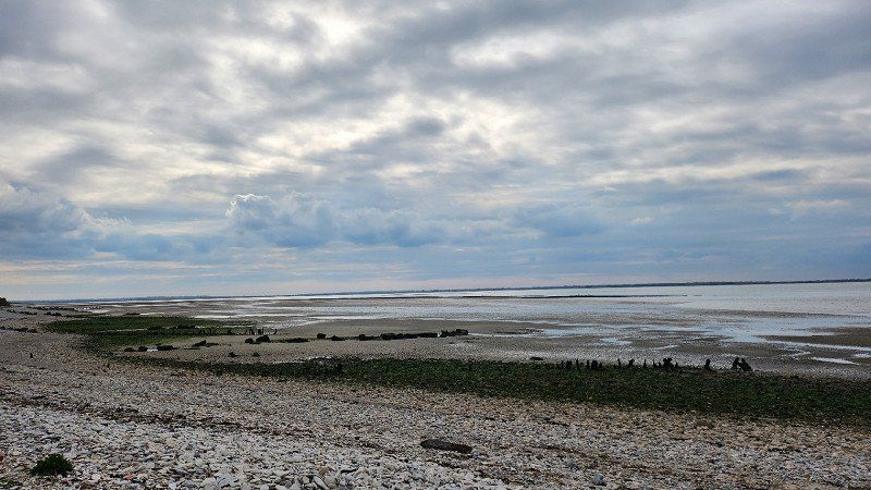
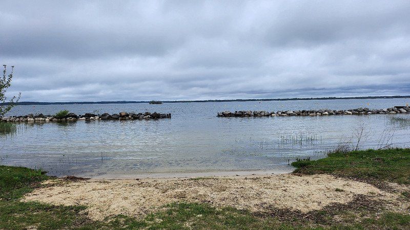
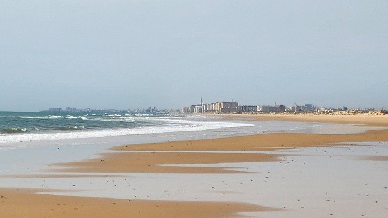
03.04.2023 - Uithuizermeeden, Niederlande
A parking lot behind the dike in the bird sanctuary - otherwise: nothing
It doesn't cost anything, but it doesn't offer anything either, except for peace and quiet.
9982 Uithuizermeeden, Netherlands
53° 24' 51.8" N 6° 43' 32" E
53.4143783 6.7255617
• Head southwest on Hoofdstraat.
• Turn left onto Kerkstraat. Go for 188 m.
• Turn left onto Bergsmastraat. Go for 56 m.
• Continue on Havenweg. Go for 507 m.
• Turn left onto Oosternielands Weg. Go for 1.2 km.
• Continue on Maarvlietweg. Go for 854 m.
• Continue on Fivelweg. Go for 53 m.
• Turn right and take ramp onto N46. Go for 25.8 km.
• Take ramp onto Friesestraatweg (N370) toward Ring Groningen/Drachten/A7/Leeuwarden/Assen/A28. Go for 4.3 km.
• Keep right onto N370 toward Leeuwarden/Amsterdam/Drachten/Martini/Stadspark/N7. Go for 108 m.
• Take ramp onto Weg Der Verenigde Naties (N7). Go for 3.1 km.
• Continue on A7 (Weg Der Verenigde Naties). Go for 27.8 km.
• Take exit 30A toward Drachten/Burgum/Leeuwarden onto N31 (Waldwei). Go for 33.8 km.
• Take ramp toward Marsum/St. Annaparochie/Stiens. Go for 594 m.
• Turn right onto Westergoawei (N383). Go for 156 m.
• Keep right toward Westergoawei/N383. Go for 28 m.
• Take the 2nd exit from roundabout onto Westergoawei (N383). Go for 2.2 km.
• Pass 3 roundabouts and continue on Hemmemaweg (N383). Go for 6.9 km.
• Turn right onto Van Harenstraat (N393). Go for 8 m.
• Turn left onto Stadhoudersweg. Go for 2.0 km.
• Turn right onto Oudebildtdijk. Go for 48 m.
• Turn left onto Schuringaweg. Go for 1.4 km.
• Turn left onto Nieuwebildtdijk. Go for 1.7 km.
• Arrive at Nieuwebildtdijk. Your destination is on the right.
☍
112,9 km
(1 hrs. 18 min.)
Day
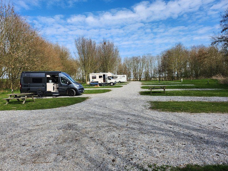
04.04.2023 - Zwarte Haan
Camper pitch 15.50 euros from 12:00 p.m. to 12:00 p.m. incl. electricity, water and waste disposal
Sint Jacobiparochie, Niederlande
53° 18' 32.5" N 5° 37' 42.9" E
53.3090392 5.6285925
• Head southeast on Nieuwebildtdijk. Go for 1.7 km.
• Turn right onto Schuringaweg. Go for 1.4 km.
• Turn right onto Oudebildtdijk. Go for 48 m.
• Turn left onto Stadhoudersweg. Go for 2.0 km.
• Turn right onto Van Harenstraat (N393). Go for 8 m.
• Turn left onto Warmoesstraat (N383). Go for 1.2 km.
• Pass 3 roundabouts and continue on Westergoawei (N383). Go for 7.8 km.
• Keep right toward Westergoawei/N383. Go for 33 m.
• Take the 2nd exit from roundabout onto Westergoawei (N383). Go for 183 m.
• Take the 1st exit from roundabout onto A31 (Waadseewei) toward Dronrijp/Harlingen. Go for 18.2 km.
• Continue on N31. Go for 9.9 km.
• Keep left onto A31 toward Den Helder/Amsterdam/A7/E22. Go for 2.0 km.
• Continue on A7 (Afsluitdijk). Go for 88.1 km.
• Take the exit toward Amsterdam/Zaanstad-Zuid/A7 onto A8. Go for 4.2 km.
• Take the left exit toward Ring-Noord/Utrecht/Amersfoort/E35 onto A10 (Knooppunt Coenplein). Go for 8.2 km.
• Take exit 15 toward Schellingwoude/Durgerdam. Go for 457 m.
• Continue on Zuiderzeeweg. Go for 875 m.
• Take the 2nd exit from roundabout onto Zuiderzeeweg toward Zeeburg. Go for 1.4 km.
• Continue on Zuiderzeeweg. Go for 172 m.
• Turn right onto Zuiderzeeweg. Go for 42 m.
• Turn left onto Zuiderzeeweg. Go for 215 m.
• Turn right onto Zuider IJdijk. Go for 590 m.
• Turn slightly left onto Zuider IJdijk. Go for 58 m.
• Arrive at Zuider IJdijk. Your destination is on the right.
☍
148,8 km
(1 hrs. 39 min.)
Day
05.04.2023 - Camping Zeeburg Amsterdam
Well located campsite - by tram or bike in about 20 minutes in the center. Camper incl. 2 people 37.50 euros/day for the proximity to the center, good infrastructure and sanitary facilities, we found this okay. Supermarket and restaurant on the square, not recommended in our view, as it is clearly too expensive.
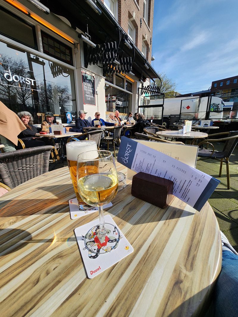
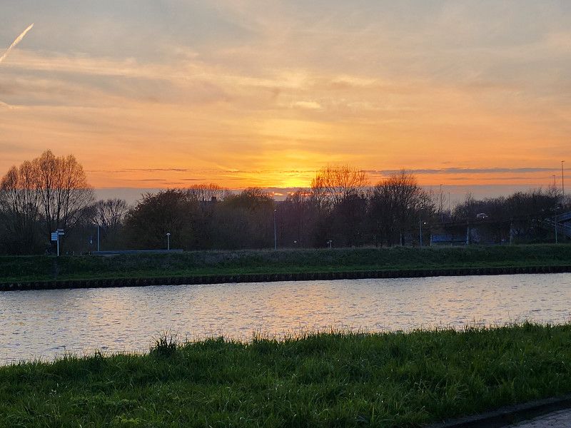
On the day of arrival, we explored the part of Amsterdam that can be reached from here on foot and got stuck at Café Dorst in the sunshine. Late sunset watched at the square.
Zuider Idijk 20, 1095 KN, Amsterdam, Niederlande
52° 21' 55" N 4° 57' 31" E
52.3652800 4.9586100
• Head northwest on Zuider IJdijk. Go for 648 m.
• Turn left onto Zuiderzeeweg. Go for 215 m.
• Turn right onto Zuiderzeeweg. Go for 42 m.
• Turn left onto Zuiderzeeweg. Go for 152 m.
• Turn right onto IJburglaan (s114). Go for 702 m.
• Turn right and take ramp onto A10 (Ring Amsterdam) toward s113/Amersfoort/Utrecht. Go for 5.8 km.
• Take the exit toward Eindhoven/Utrecht onto A2. Go for 32.3 km.
• Take the exit toward Den Haag/Rotterdam onto A12. Go for 30.8 km.
• Keep right onto A20 (Knooppunt Gouwe) toward Hoek van Holland/Rotterdam/Gouda-West. Go for 12.9 km.
• Take the exit toward E19/Ring Rotterdam (oost)/Dordrecht/Breda/A16 onto Knooppunt Terbregseplein. Go for 2.2 km.
• Continue on A16 (Ring Rotterdam). Go for 867 m.
• Keep left onto A16 (Ring Rotterdam) toward Dordrecht/Breda/Havens 1200-9900. Go for 5.8 km.
• Keep right onto Knooppunt Ridderkerk toward Ridderkerk/Zierikzee/Europoort/Havens 1200-9900/A15. Go for 709 m.
• Keep left onto A15 (Knooppunt Ridderkerk) toward Ring Rotterdam/Barendrecht/Zierikzee/Europoort/Havens 1200-9900. Go for 682 m.
• Take exit 19A+20 toward Zierikzee/Rotterdam-Zuid/Bergen op Zoom/Barendrecht/RING/A29 onto A15 (Knooppunt Ridderkerk). Go for 2.4 km.
• Continue on Knooppunt Vaanplein toward Bergen op Zoom/Zierikzee/Rotterdam-Zuidplein/Rotterdam-Centrum/A29/s103. Go for 922 m.
• Take the left exit toward Bergen op Zoom/Zierikzee onto A29 (Knooppunt Vaanplein). Go for 26.8 km.
• Continue on A4 (Zoomweg). Go for 33.2 km.
• Continue on A58 (Zeelandweg) toward Vlissingen/Terneuzen (Tol)/Goes. Go for 52.9 km.
• Continue on Sloeweg (N288). Go for 1.9 km.
• Take the 3rd exit from roundabout onto Hercules Segherslaan. Go for 569 m.
• Turn right onto Bloemenlaan. Go for 455 m.
• Turn right onto Anjelierenlaan. Go for 132 m.
• Turn right onto Jan Steenlaan. Go for 83 m.
• Arrive at Jan Steenlaan. Your destination is on the right.
☍
213,3 km
(2 hrs. 10 min.)
Day
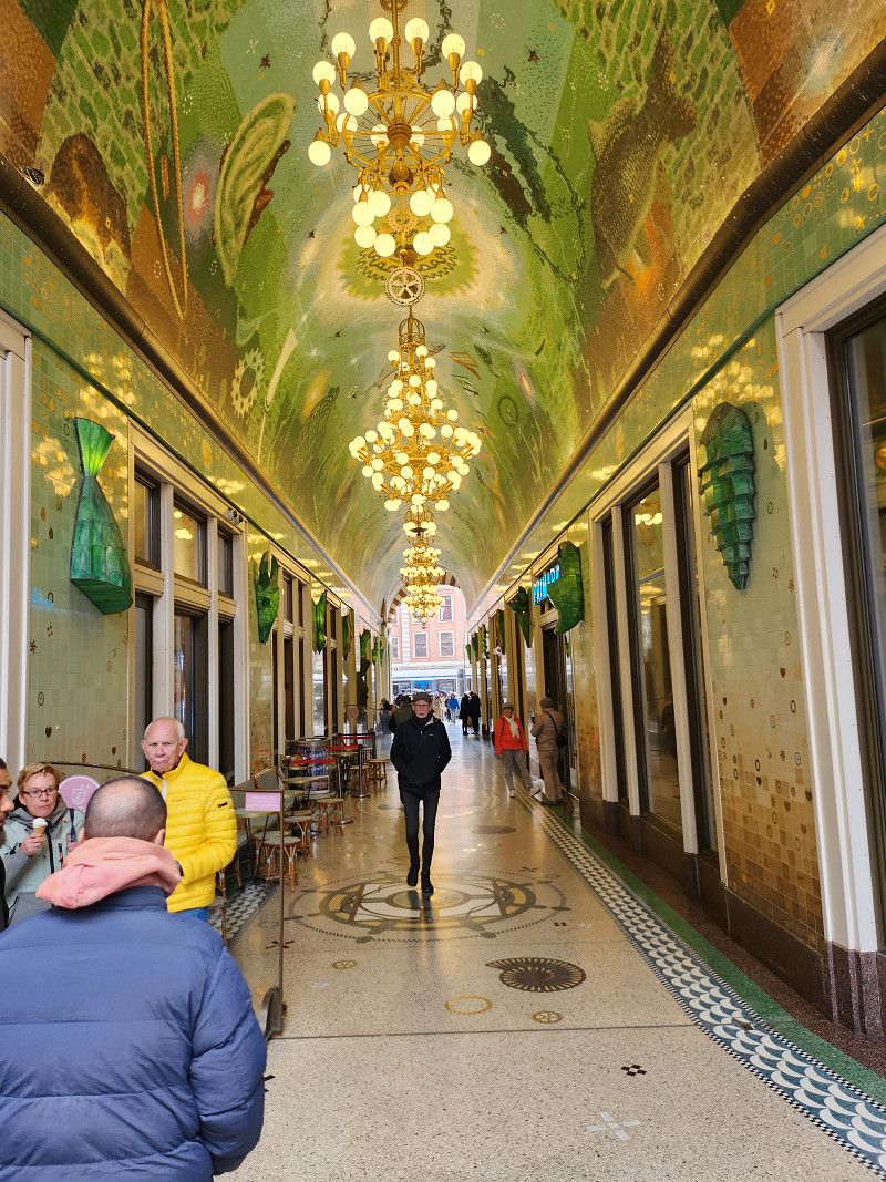
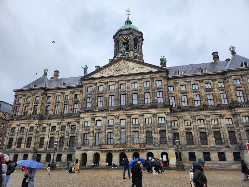
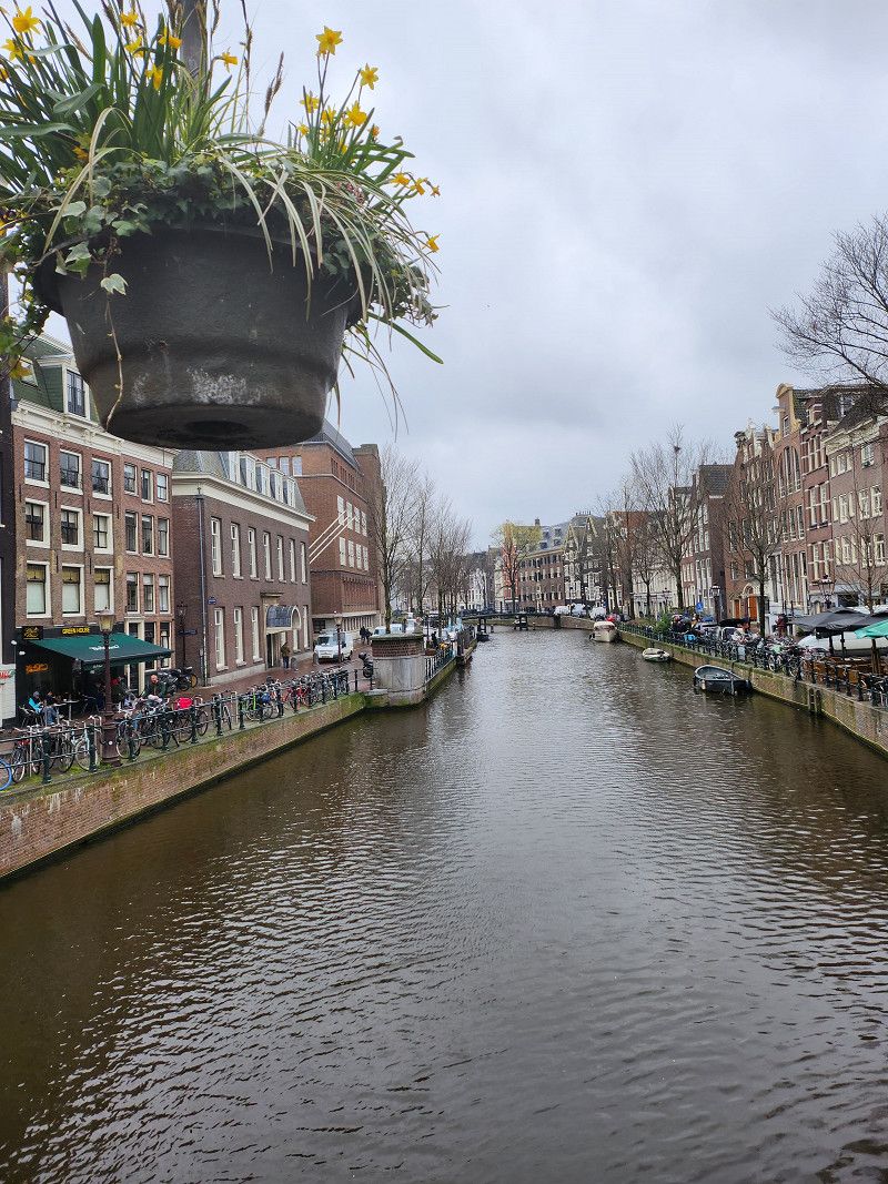
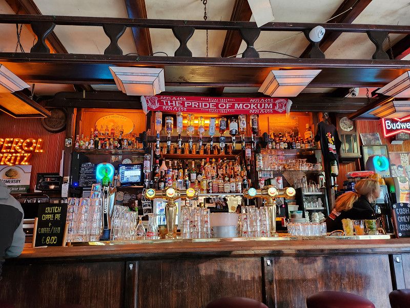
06.04.2023 - Amsterdam - Stadtbummel
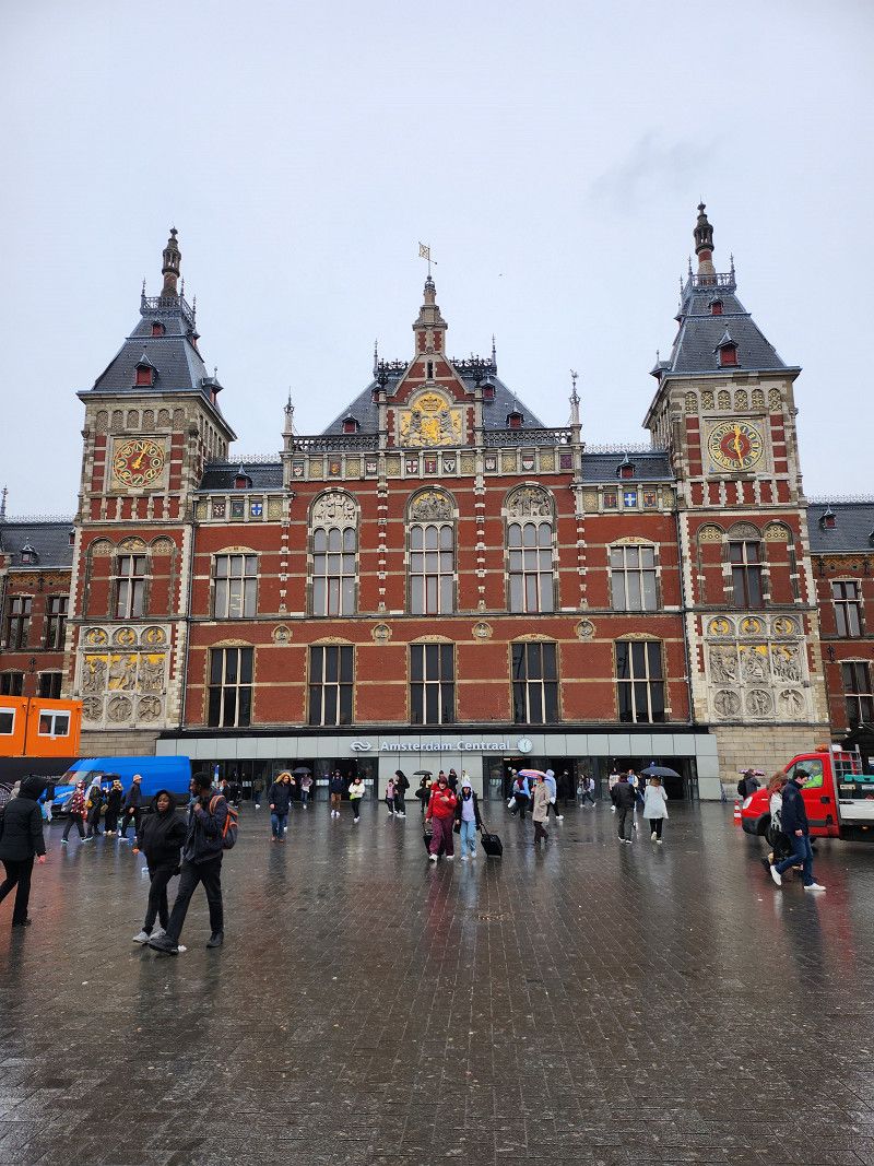
Got tickets for the tram at the reception and off to the center of Amsterdam. Royal palace, church, main train station, canals, red-light district and of course a quaint pub - it was all fun, unfortunately it rained the whole time, otherwise we would have been out longer...
Day
07.04.2023 - Hoogerheide, Niederlande
Only a parking lot, but 6 WoMo places where it is also possible to stay overnight. After ten seats, all of which were full, we just wanted to stand...
Vlissingen, Netherlands
51° 27' 13.2" N 3° 34' 15.3" E
51.4536672 3.5709125
• Head toward Hogeweg on Jan Steenlaan. Go for 41 m.
• Turn left onto Hogeweg. Go for 88 m.
• Turn right onto Rembrandtlaan. Go for 201 m.
• Turn right onto President Rooseveltlaan. Go for 241 m.
• Turn left onto Bloemenlaan. Go for 152 m.
• Turn left onto Hercules Segherslaan. Go for 456 m.
• Take the 1st exit from roundabout onto Sloeweg (N288). Go for 1.9 km.
• Continue on A58. Go for 3.3 km.
• Take exit 39 toward Industrieterrein Vlissingen-Oost. Go for 490 m.
• Take the 1st exit from roundabout onto Sloeweg Noord (N254) toward Terneuzen/Industrieterrein Vlissingen-Oost/Havens 0-9990. Go for 9.1 km.
• Take ramp onto N62. Go for 19.2 km.
• Take ramp onto Hoofdweg (N61) toward Hoek/Oostburg. Go for 2.6 km.
• Keep right toward Biervliet/Oostburg/Breskens. Go for 49 m.
• Take the 2nd exit from roundabout onto Hoofdweg (N61) toward Biervliet/Oostburg/Breskens. Go for 4.7 km.
• Keep right toward Biervliet/Oostburg/Breskens. Go for 45 m.
• Take the 2nd exit from roundabout onto Middenweg (N61) toward Biervliet/Oostburg/Breskens. Go for 2.6 km.
• Keep right toward IJzendijke/Oostburg/Breskens. Go for 44 m.
• Pass 2 roundabouts and continue on Middenweg (N61). Go for 11.5 km.
• Take the 3rd exit from roundabout onto Lange Heerenstraat (N253) toward Oostburg/Sluis/Knokke-Heist. Go for 3.3 km.
• Pass 7 roundabouts and continue on Rondweg (N253). Go for 13.0 km.
• Continue on Sluisstraat (N376). Go for 2.4 km.
• Take the 3rd exit from roundabout onto Sluisstraat (N376). Go for 923 m.
• Take the 1st exit from roundabout onto Dudzelestraat (N376) toward E34/A11/Brugge/Knokke-Heist. Go for 302 m.
• Take the 3rd exit from roundabout onto Natiënlaan (E34) toward A11/Brugge/Haven Zeebrugge. Go for 1.2 km.
• Take ramp onto A11 toward E40/E403/Brugge. Go for 10.9 km.
• Continue on Zeelaan (E403). Go for 9.4 km.
• Take ramp toward Zedelgem/St.-Michiels. Go for 316 m.
• Take the 1st exit from roundabout onto Koning Albert I-Laan (N397) toward Zedelgem. Go for 1.6 km.
• Take the 1st exit from roundabout onto E40 toward Oostende. Go for 8.5 km.
• Take the exit toward Oostende onto A10. Go for 11.3 km.
• Take the 2nd exit from President Kennedyplein roundabout onto Verenigde Natieslaan (N340) toward Centrum. Go for 1.7 km.
• Enter the roundabout. Go for 14 m.
• Arrive at Vuurkruisenplein. Your destination is on the left.
☍
121,5 km
(1 hrs. 28 min.)
Day
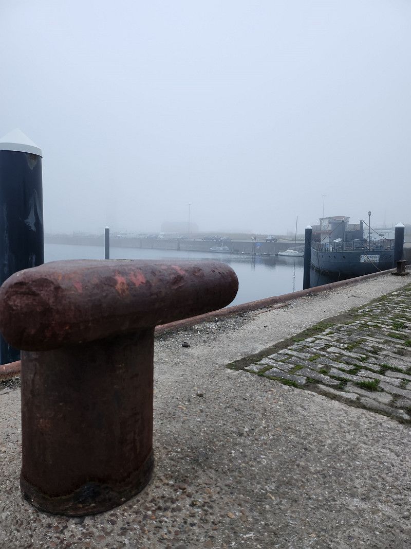
08.04.2023 - Ostende, Belgien
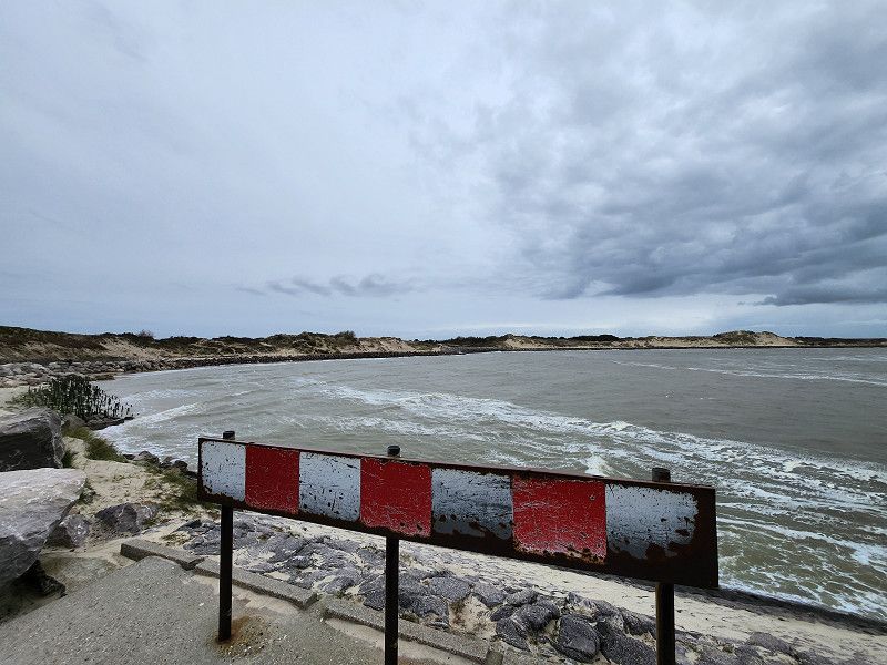
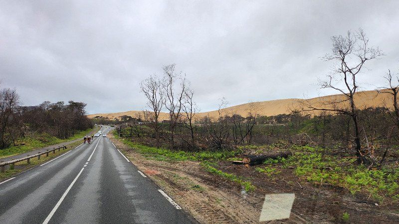
Roughly planned destination was Bruges, but as in the past few days, we didn't like it or it was full, so we let ourselves drift and finally ended up in Ostend via De Haan. We stood with many others between the dyke and a small river port (Vuurtorenweg 10, Oostende). Officially, staying overnight is probably not allowed, we spent a total of three nights there, but moved the camper every day. Tip: about 8 km away in Gistel there is a mobile home parking space where you can stay overnight (14 euros). Here, however, everyone can only use the supply and disposal.
Ostende, 8400, Belgien
51° 13' 33.1" N 2° 55' 10.2" E
51.2258565 2.9194960
• Follow the roundabout. Go for 163 m.
• Take the 4th exit from roundabout onto Verenigde Natieslaan (N340). Go for 1.5 km.
• Turn right onto Elisabethlaan (R31). Go for 1.6 km.
• Turn left onto Torhoutsesteenweg (N33) toward Calais/Veurne/E40/Gistel/Industriezone Oostende. Go for 1.1 km.
• Take the 2nd exit from roundabout onto Torhoutsesteenweg (N33) toward E40/Gistel. Go for 5.9 km.
• Take ramp onto E40 toward Veurne/Calais/Diksmuide. Go for 31.0 km.
• Continue on A16 (Autoroute des Estuaires). Go for 125 km.
• Take exit 25 toward Berck/Fort-Mahon-Plage/Quend. Go for 824 m.
• Take the 2nd exit from roundabout onto D303 toward Berck/Merlimont. Go for 1.6 km.
• Take the 2nd exit from roundabout onto D303. Go for 1.1 km.
• Take the 2nd exit from roundabout onto Pénétrante Est de Berck (D303). Go for 544 m.
• Pass 3 roundabouts and continue on D303. Go for 3.8 km.
• Take the 1st exit from roundabout onto Avenue de Verdun (D940). Go for 557 m.
• Take the 3rd exit from roundabout onto Rue de l'Impératrice (D917). Go for 1.8 km.
• Turn left onto Allée des Peupliers. Go for 48 m.
• Arrive at Allée des Peupliers. Your destination is on the left.
☍
177,0 km
(1 hrs. 51 min.)
Day
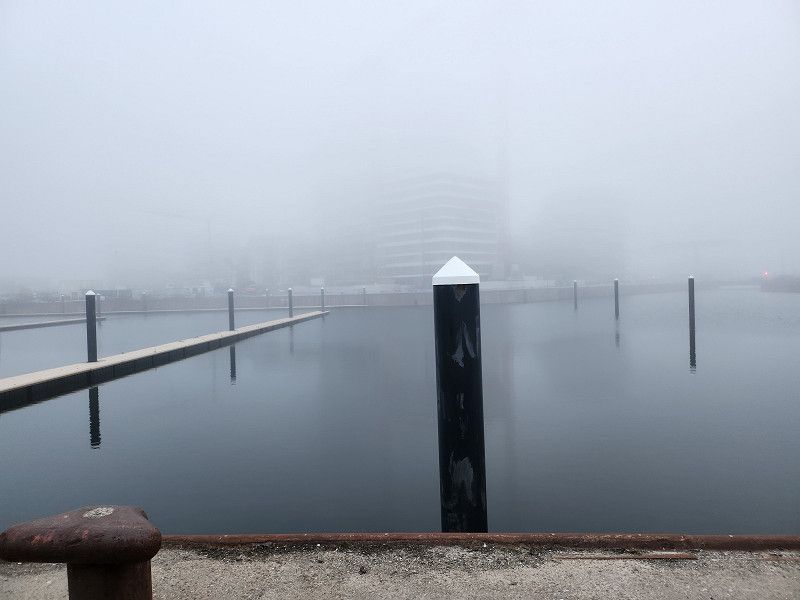
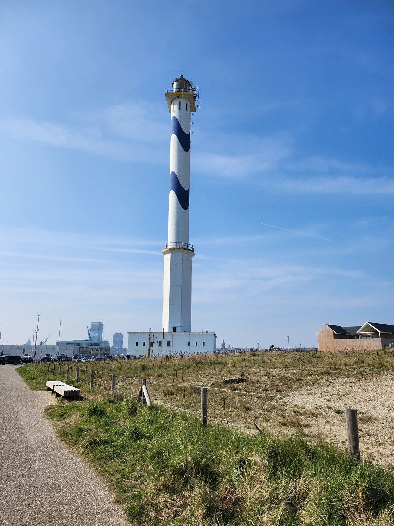
09.04.2023 - Ostende - Stadtbummel
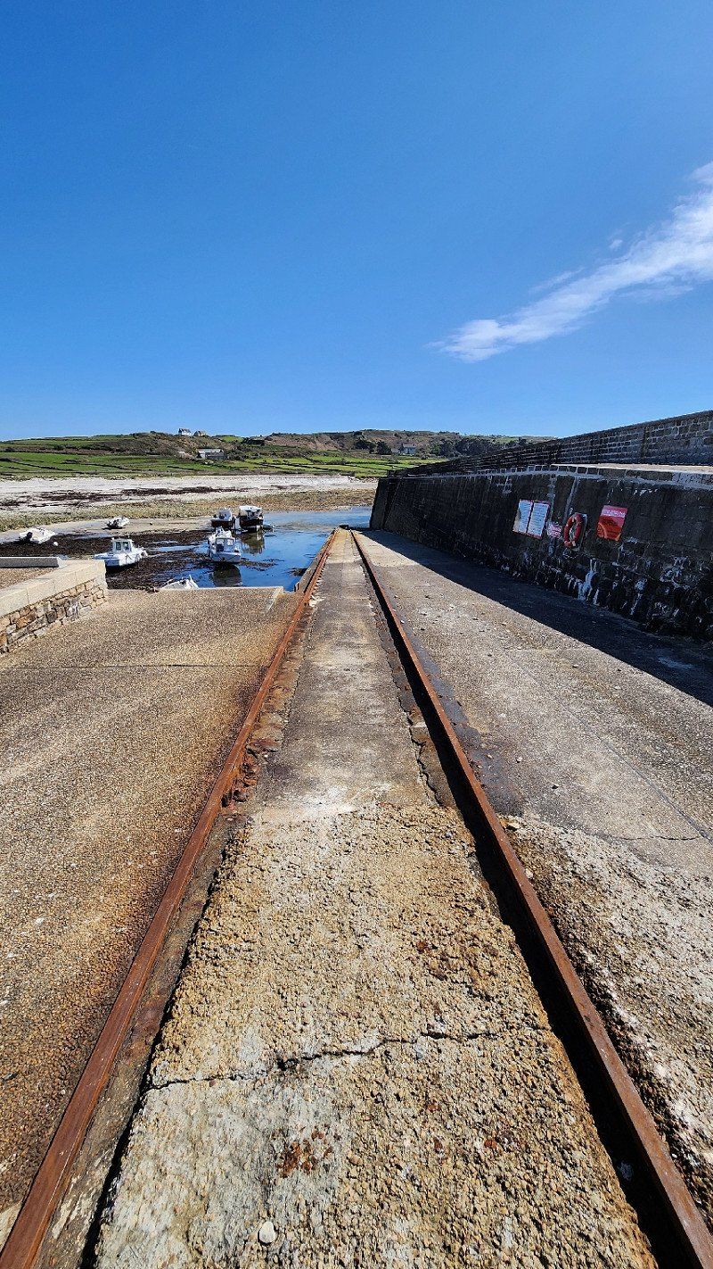
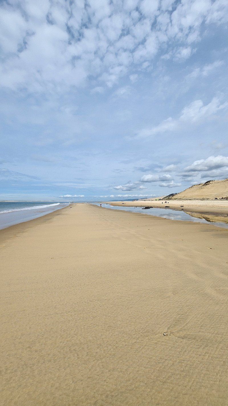
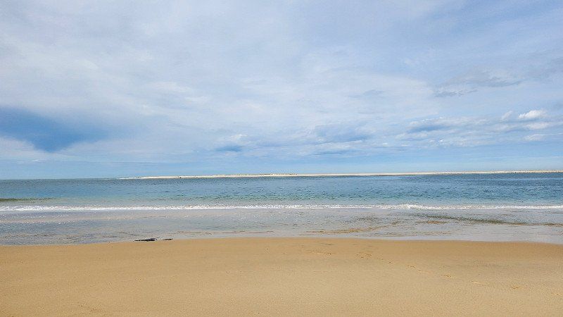
From the parking lot, behind the lighthouse, there is an old slipway and a small lock - from there you can take the ferry across to the center. The ferry is free and the crossing takes about 10 minutes.
Spent the day in the most beautiful sunshine in Ostend and took the ferry back.
09.04.2023 - Fort Napoleon und Strand
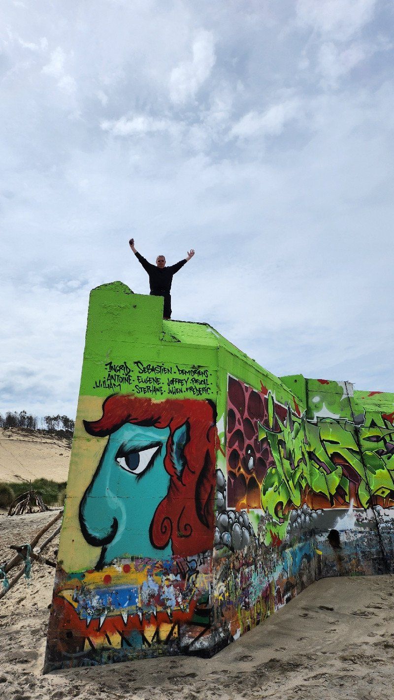
Incidentally, you will also find Fort Napoleon (military fortifications built in 1811 by order of Napoleon) directly at the parking space. We decided to go for a walk :-)
Day
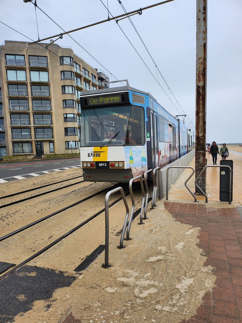
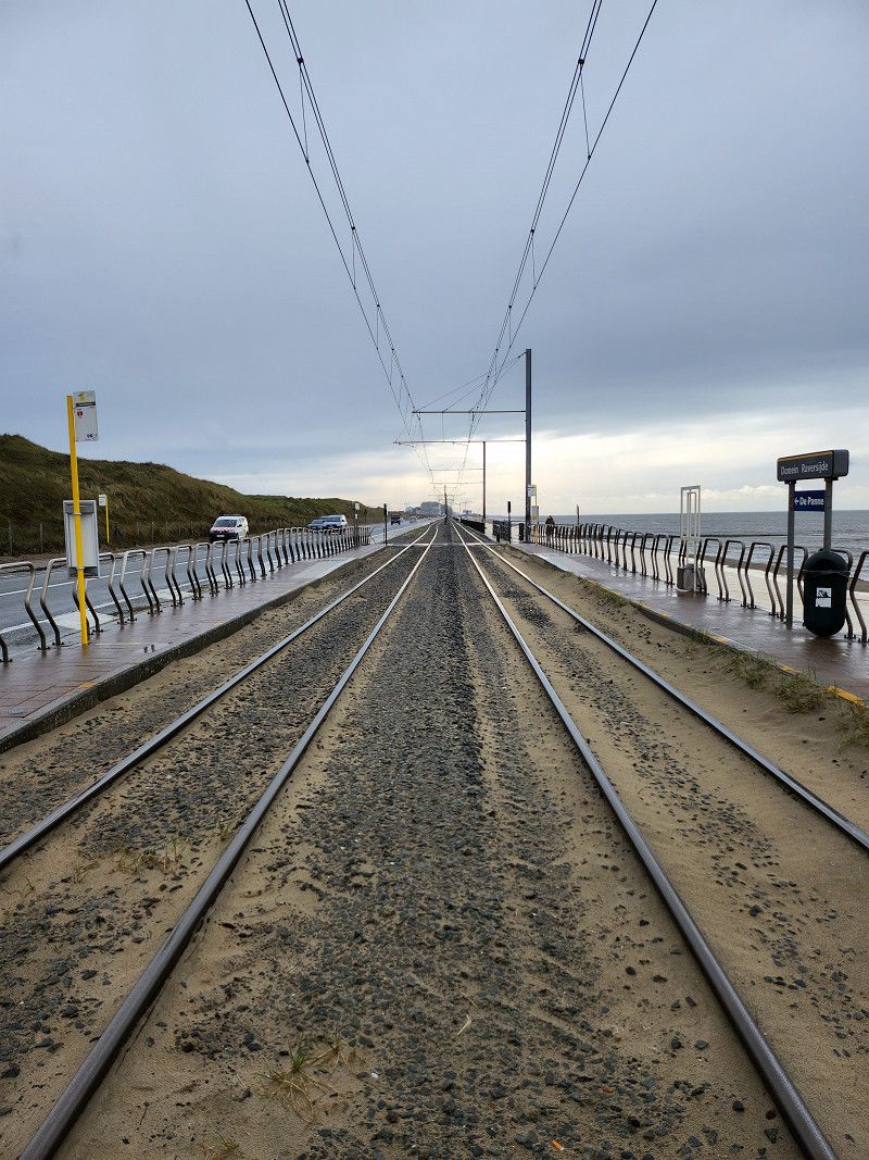
10.04.2023 - Ostende - Küstentram und Atlantikwall
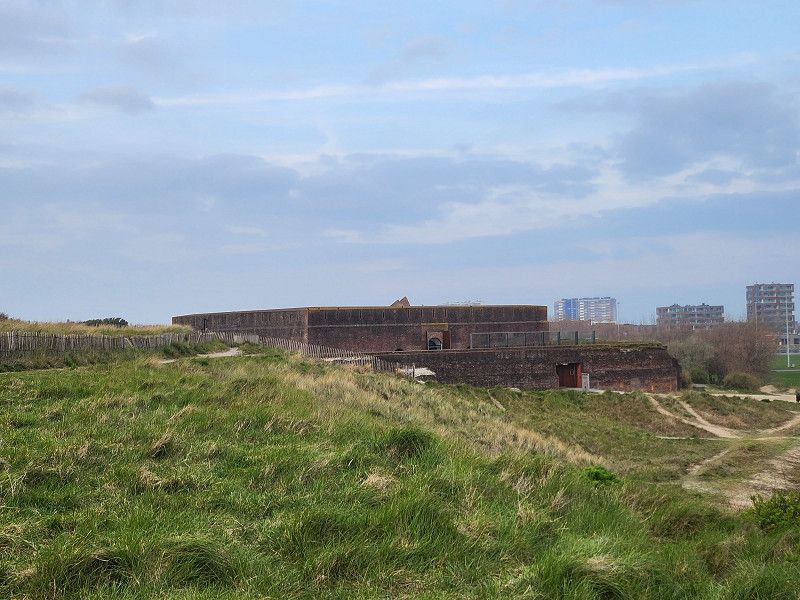
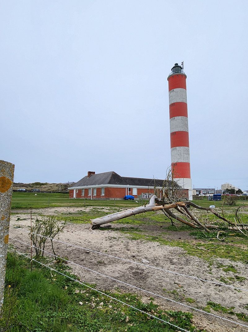
Started with the best weather, we wanted to explore part of the longest tram route in the world (day ticket 7.50 euros). Since you can get off and on again at any time, a visit to the Atlantic Wall was planned as a stopover. It was already raining when we arrived in Raversyde and it didn't get any better... Two hours later we were well informed about the Atlantic Wall in World War I and II, but we were soaking wet and frozen through. The coastal tram was jam-packed and the windows fogged up - demolition and back to the camper.
Day
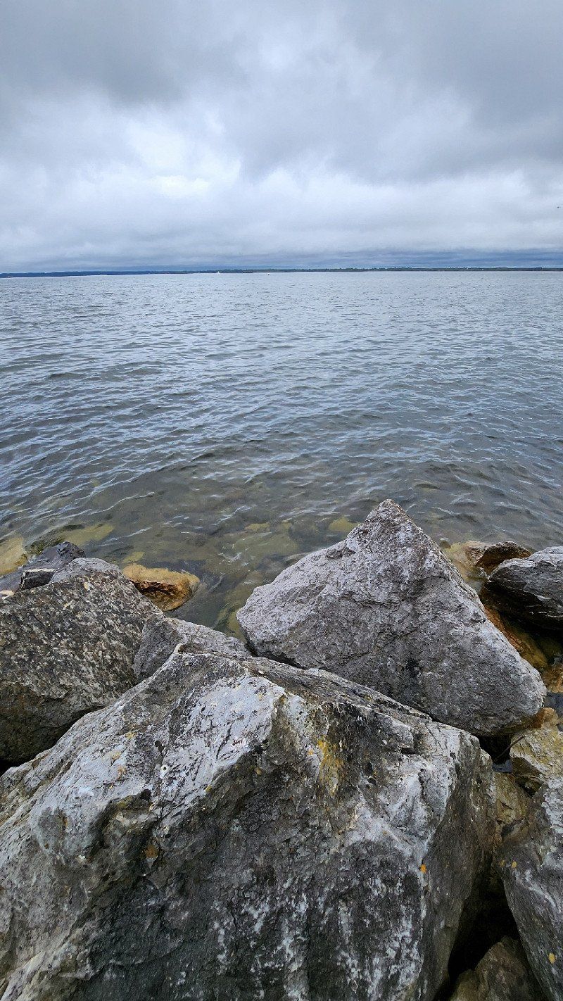
11.04.2023 - Berck, Frankreich
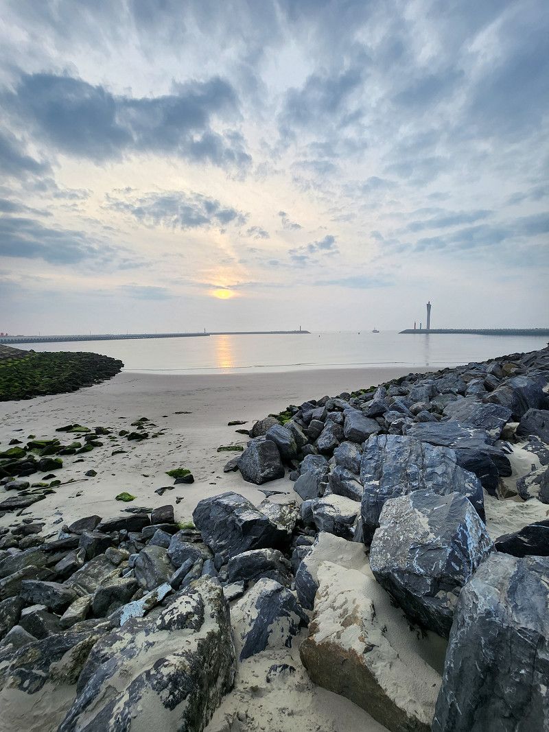
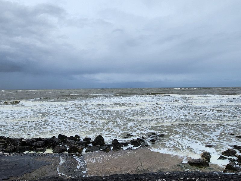
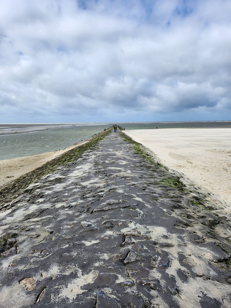
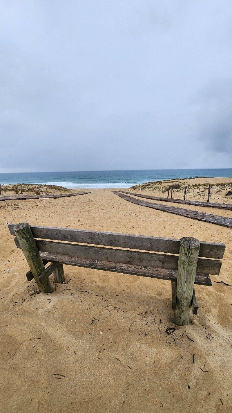
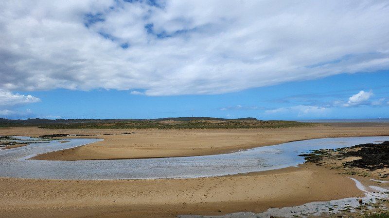
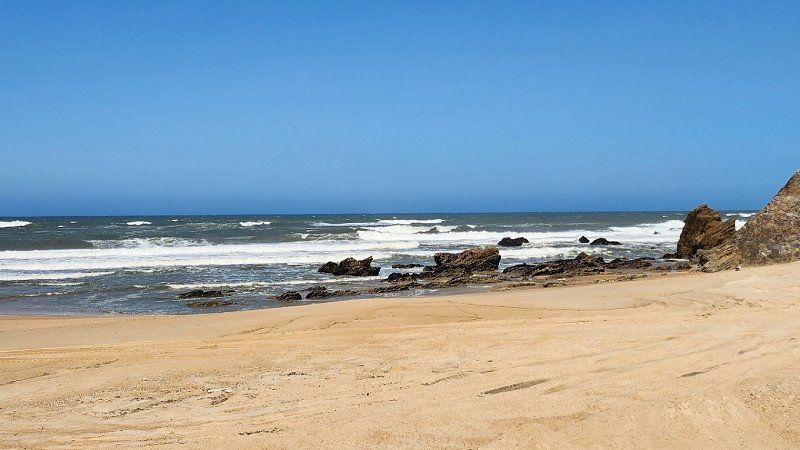
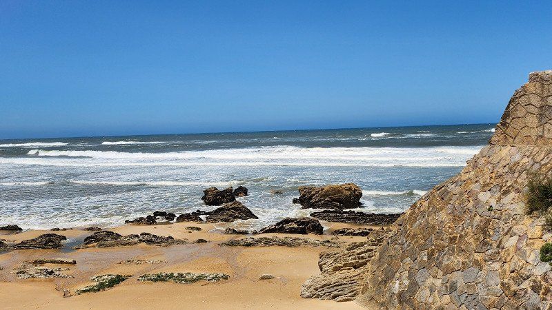
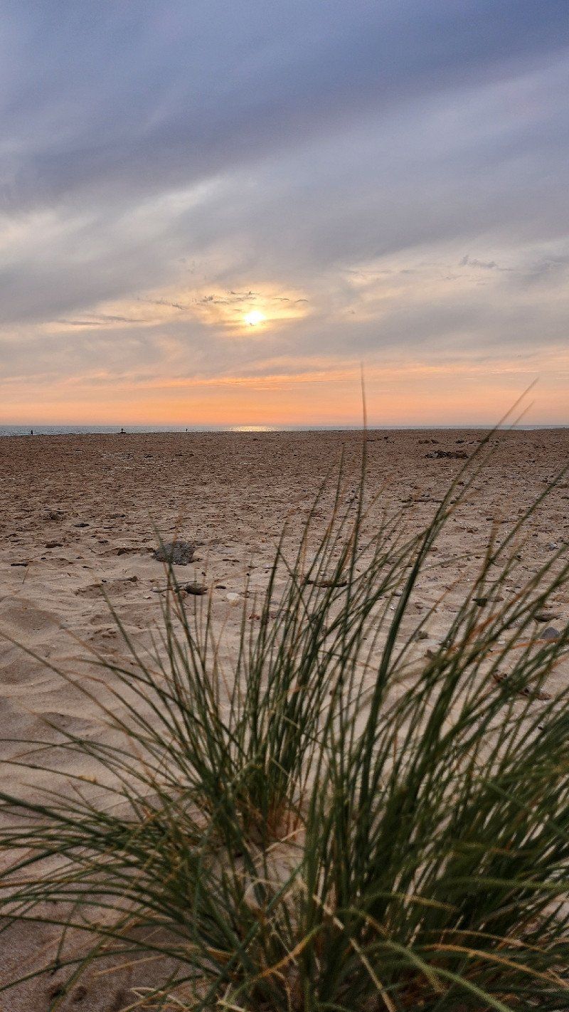
Parking for about 80 mobile homes in Berck, 1 Chemin aux Raisins - about 100 meters further the road ends directly at the water. We were told that in the morning between 8:00 a.m. and 10:00 a.m. someone would knock on the mobile home to collect the parking fee (10 euros/night) - there was nobody with us... First walk on the beach: At high tide the water bangs up to the stones below the concrete path, beach at this time none. Since it was very windy, only a short walk today, also past donkeys and the lighthouse.
Berck, 62600, Frankreich
50° 24' 18.9" N 1° 34' 16.2" E
50.4052576 1.5711617
• Head toward Rue des Grandes Garennes on Allée des Peupliers. Go for 51 m.
• Turn left onto Rue des Grandes Garennes. Go for 221 m.
• Turn right onto Rue Francis Pauchet. Go for 215 m.
• Turn left onto Boulevard de Paris. Go for 310 m.
• Take the 3rd exit from roundabout onto Boulevard de Paris. Go for 1.2 km.
• Take the 2nd exit from roundabout onto D303. Go for 564 m.
• Pass 4 roundabouts and continue on Pénétrante Est de Berck (D303). Go for 4.9 km.
• Take the 2nd exit from roundabout onto D303. Go for 1.6 km.
• Take the 1st exit from roundabout onto A16 (Autoroute des Estuaires) toward Abbeville/Rouen/Paris. Go for 33.5 km.
• Take exit 23 toward Abbeville-Centre/Le Havre/Rouen/Eu/Le Tréport onto E402 (Autoroute des Estuaires). Go for 1.1 km.
• Take the exit toward Le Tréport/Rouen/Le Havre/St Valéry S/S/Le Crotoy onto A28 (Autoroute des Estuaires). Go for 73.7 km.
• Keep right onto A29 toward Le Havre/Caen. Go for 83.8 km.
• Continue on N1029. Go for 7.1 km.
• Take ramp toward Honfleur. Go for 429 m.
• Take the 1st exit from roundabout onto D580 toward Caen/Trouville/Deauville/Honfleur. Go for 323 m.
• Pass 2 roundabouts and continue on D580. Go for 981 m.
• Take the 3rd exit from roundabout onto Cours Jean de Vienne (D580) toward Honfleur. Go for 768 m.
• Take the 2nd exit from Rond-Point du Port roundabout onto Cours Jean de Vienne (D580). Go for 388 m.
• Take the 3rd exit from Rond-Point Carnot roundabout onto Rue des Vases (D580). Go for 390 m.
• Take the 4th exit from Rond-Point de la Tour roundabout onto Quai Lepaulmier (D580). Go for 156 m.
• Take the 1st exit from Place de la Porte de Rouen roundabout onto Place de la Porte de Rouen (D580). Go for 112 m.
• Arrive at Rue Montpensier (D580). Your destination is on the right.
☍
211,9 km
(1 hrs. 59 min.)
Day
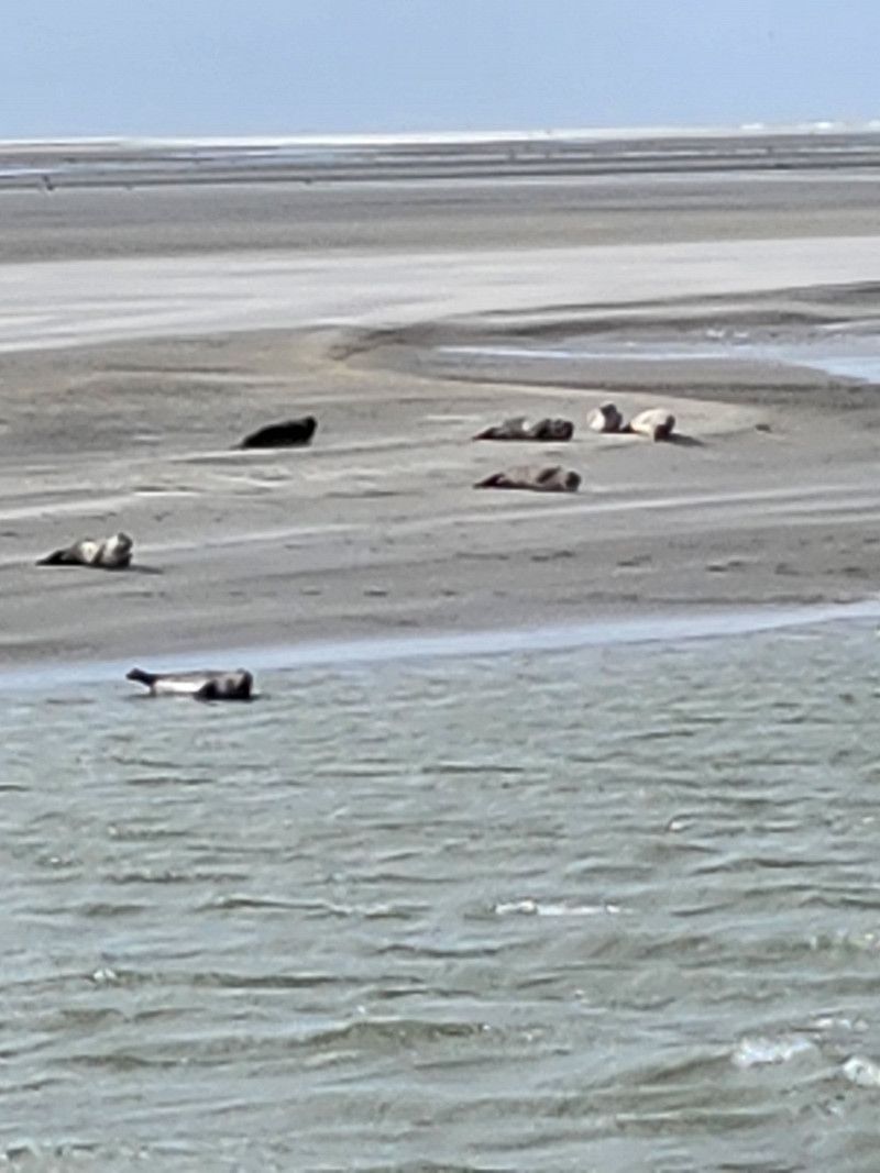
12.04.2023 - Berck
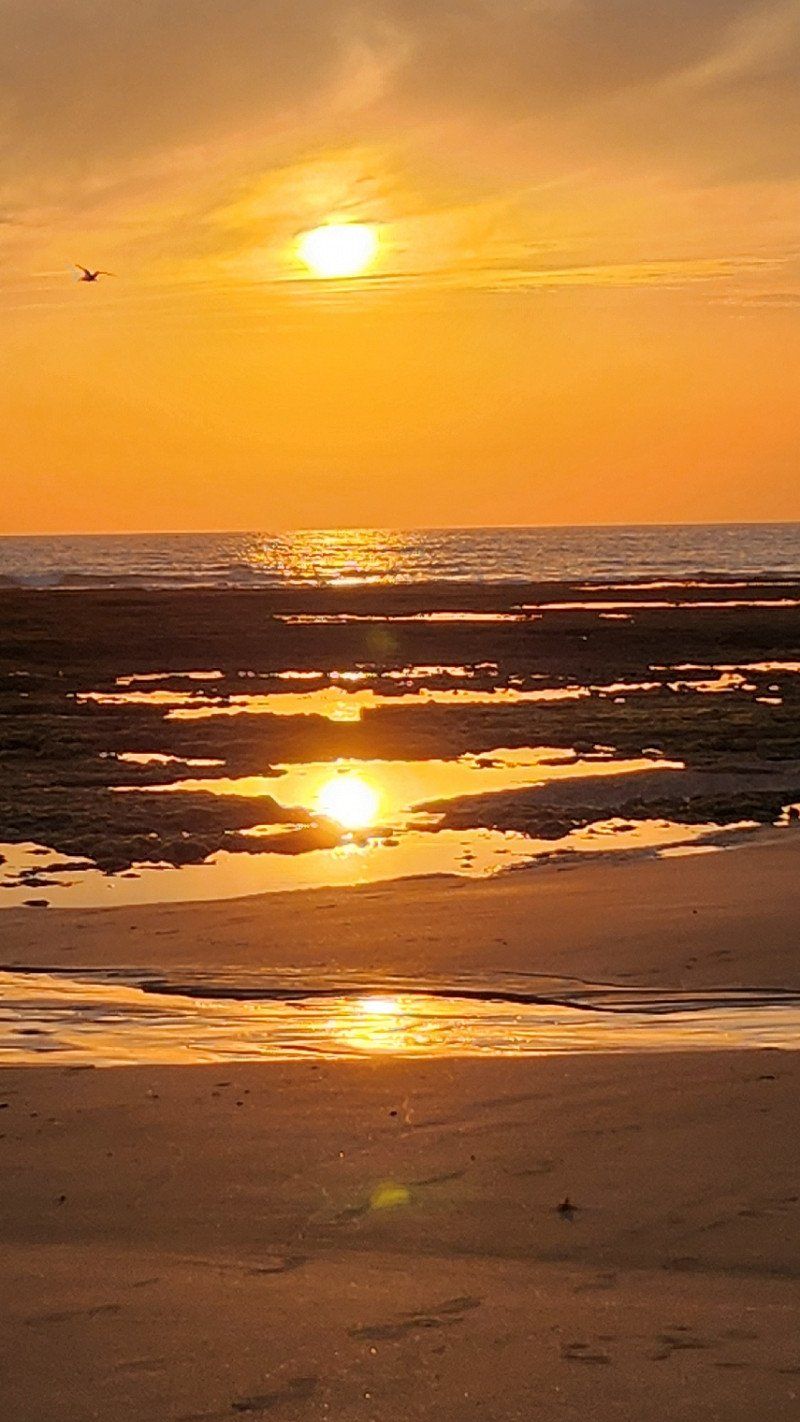
After a night of strong wind and rain - the camper shook a lot - we decided to spend a relaxing day reading, listening to music, using the computer or just being lazy and stayed. Went to the water again during a break in the rain and lo and behold... There is a beach, a sandbank and... SEALS :-)
If you have a camera with a telephoto, it would be worth it here!
Day
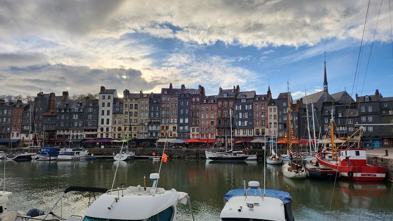
13.04.2023 - Honfleur, Frankreich
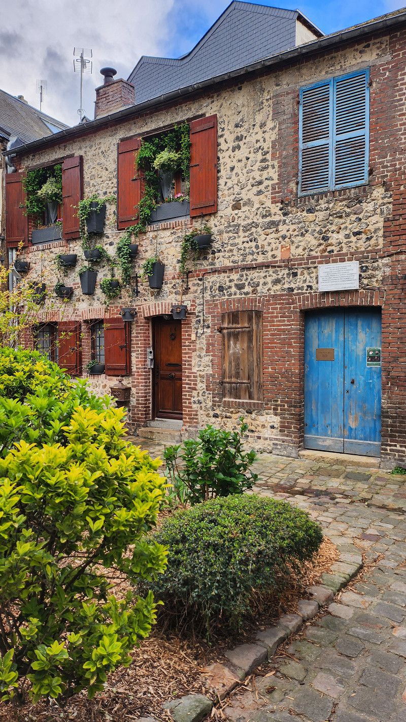
Parking space in Honfleur, Quai de la Cale - directly on the Seine, within walking distance to the center (12 euros/24 hours). Since it's sunshine and blue sky today - a site visit immediately (for tomorrow it's gray again and rain announced). Really great little town, which could invite you to enjoy a few days.
I took about 50 photos in 90 minutes - the houses, the shops, the streets... I'm a bit in love with this place.
Honfleur, 14600, Frankreich
49° 25' 11" N 0° 14' 2" E
49.4197222 0.2338889
• Head toward Quai Sainte-Catherine on Rue Montpensier (D580). Go for 36 m.
• Turn left onto Rue de la République (D579 A). Go for 831 m.
• Take the 1st exit from roundabout onto Cours Albert Manuel (D579 A). Go for 2.1 km.
• Take the 2nd exit from roundabout onto D62. Go for 3.7 km.
• Continue on Route de Trouville-sur-Mer (D513). Go for 1.7 km.
• Continue on Route de Trouville-sur-Mer (D513). Go for 6.2 km.
• Turn right onto Route de la Corniche. Go for 800 m.
• Continue on Rue Louis Pasteur. Go for 127 m.
• Continue on Rue de la Chapelle. Go for 125 m.
• Turn left onto Rue des Jardins. Go for 52 m.
• Turn left onto Rue d'Orléans. Go for 9 m.
• Turn right onto Cité Bonsecours. Go for 41 m.
• Arrive at Cité Bonsecours. Your destination is on the left.
☍
15,7 km
( 22 min.)
Day
Day
15.04.2023 - Trouville-sur-Mer, Frankreich - französisches Seebad
Very nice little place, easily fell in love on the slow drive through.
Trouville-sur-Mer, 14360, Frankreich
49° 22' 6" N 0° 4' 57" E
49.3683333 0.0825000
• Head toward Rue d'Orléans on Cité Bonsecours. Go for 41 m.
• Turn right onto Rue d'Orléans. Go for 25 m.
• Turn left onto Rue Thiers. Go for 52 m.
• Turn left onto Rue de la Chapelle. Go for 70 m.
• Continue on Place Maréchal de Lattre. Go for 29 m.
• Continue on Rue Victor Hugo. Go for 220 m.
• Turn left onto Boulevard Fernand Moureaux (D535). Go for 624 m.
• Take the 1st exit from Place Fernand Moureaux roundabout onto Pont des Belges (D513). Go for 156 m.
• Take the 2nd exit from Rond-Point de la Touques roundabout onto Avenue de la République (D513). Go for 114 m.
• Take the 3rd exit from Rond-Point des Jumelages roundabout onto Avenue de la République (D513). Go for 137 m.
• Take the 2nd exit from roundabout onto Rue Désiré le Hoc. Go for 278 m.
• Take the 3rd exit from Place Morny roundabout onto Rue Désiré le Hoc. Go for 219 m.
• Take the 1st exit from roundabout onto Rue Victor Hugo. Go for 56 m.
• Arrive at Rue Victor Hugo. Your destination is on the left.
☍
2,0 km
( 6 min.)
15.04.2023 - Deauville, Frankreich - altes Seebad
Honfleur, Trouville and Deauville are so beautiful that you could easily visit them again with 10 degrees more 😉
Deauville, 14800, Frankreich
49° 21' 36" N 0° 4' 31" E
49.3600000 0.0752778
• Head toward Rue Olliffe on Rue Victor Hugo. Go for 385 m.
• Turn right onto Quai de la Marine. Go for 227 m.
• Take the 4th exit from roundabout onto Avenue de la République (D513). Go for 95 m.
• Turn right onto Route des Créacteurs (D27 A). Go for 469 m.
• Take the 2nd exit from roundabout onto Route des Créacteurs (D27 A). Go for 2.2 km.
• Take the 2nd exit from Rond-Point des Salines roundabout onto D27 A. Go for 1.0 km.
• Take the 1st exit from roundabout onto D27. Go for 1.5 km.
• Take the 2nd exit from roundabout onto D27. Go for 4.3 km.
• Take the 1st exit from roundabout onto D27. Go for 4.2 km.
• Take the 2nd exit from roundabout onto Route de Lisieux (D27). Go for 2.8 km.
• Turn left onto Route de Lisieux (D27). Go for 6.0 km.
• Take the 2nd exit from roundabout onto D27. Go for 4.2 km.
• Take the 2nd exit from roundabout onto D513. Go for 6.1 km.
• Take the 1st exit from roundabout onto Route de Cabourg (D224). Go for 1.4 km.
• Continue on Rue du Général de Gaulle (D37). Go for 1.3 km.
• Take the 2nd exit from roundabout onto D37. Go for 623 m.
• Take the 2nd exit from roundabout onto Route de Cabourg (D514). Go for 493 m.
• Pass 2 roundabouts and continue on D514. Go for 1.2 km.
• Take ramp onto D514 toward Ouistreham Car Ferry/Douvres la Délivrande/Zone d'Activités de Bénouville. Go for 2.8 km.
• Take the 2nd exit from roundabout onto Avenue du Grand-Large (D84) toward Ouistreham Car Ferry/Le Port/Port Ouistreham Car Ferry Gare Maritime/Plage de Riva-Bella. Go for 835 m.
• Take the 3rd exit from roundabout onto Avenue du Grand-Large (D84). Go for 519 m.
• Turn left onto Rue du Bief. Go for 326 m.
• Take the 2nd exit from roundabout onto Avenue du Maréchal Foch. Go for 126 m.
• Turn right toward Avenue du Maréchal Foch. Go for 42 m.
• Continue on Avenue du Maréchal Foch. Go for 17 m.
• Arrive at Avenue du Maréchal Foch. Your destination is on the right.
☍
43,2 km
( 44 min.)
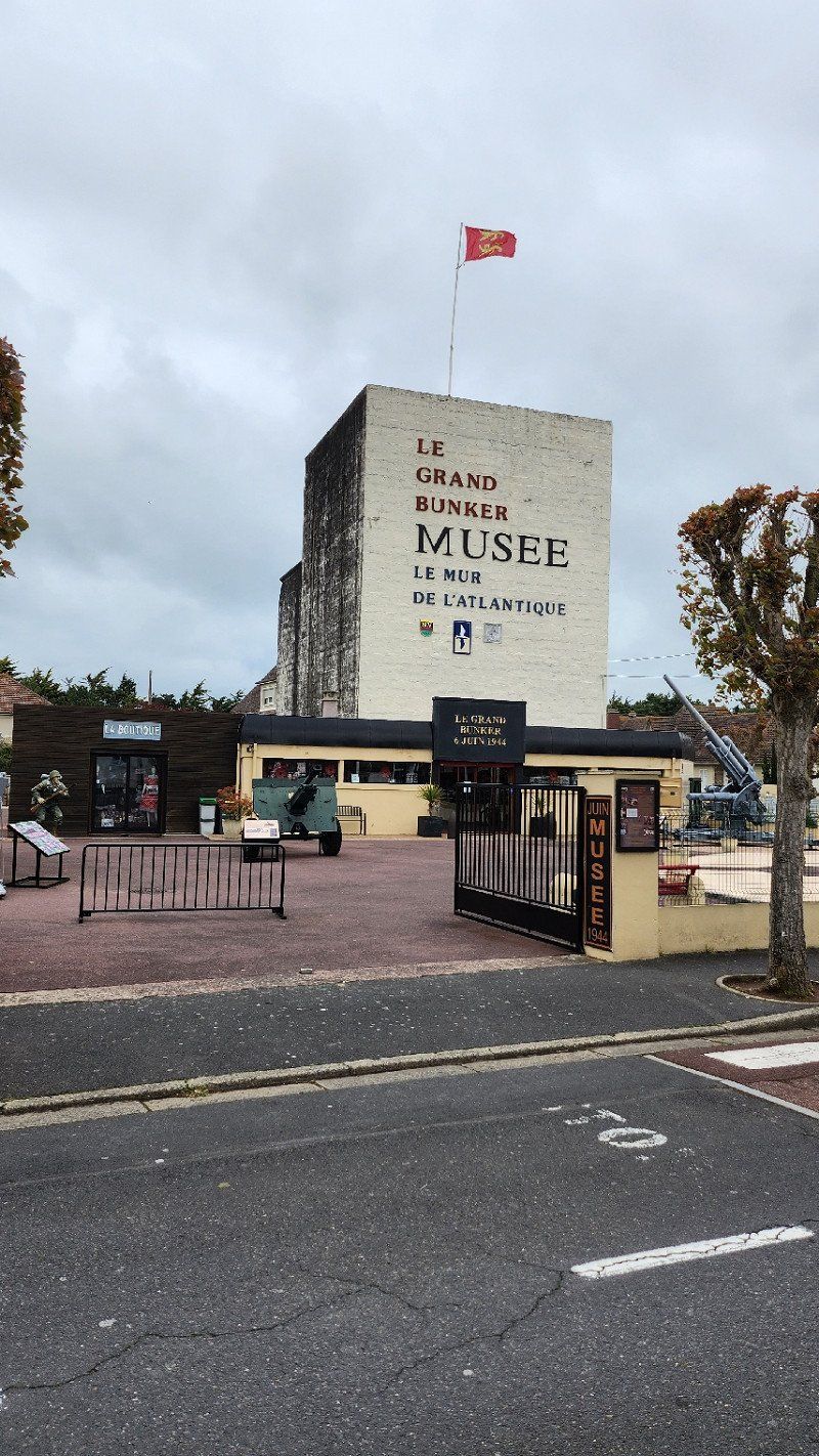
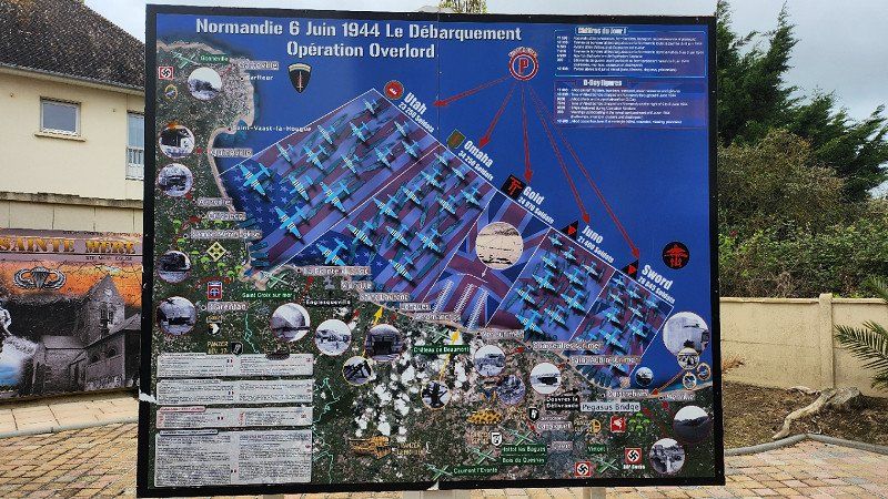
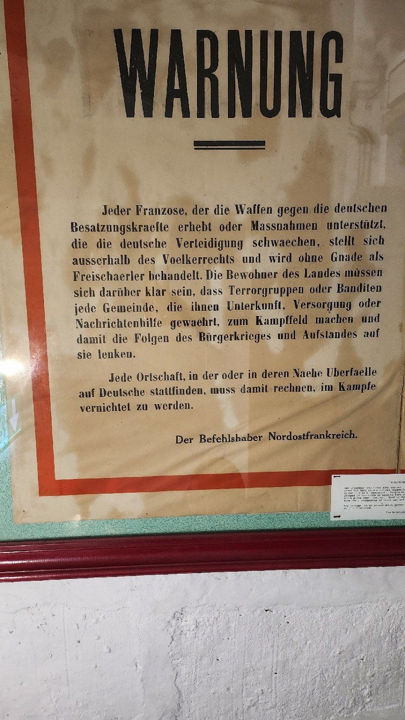
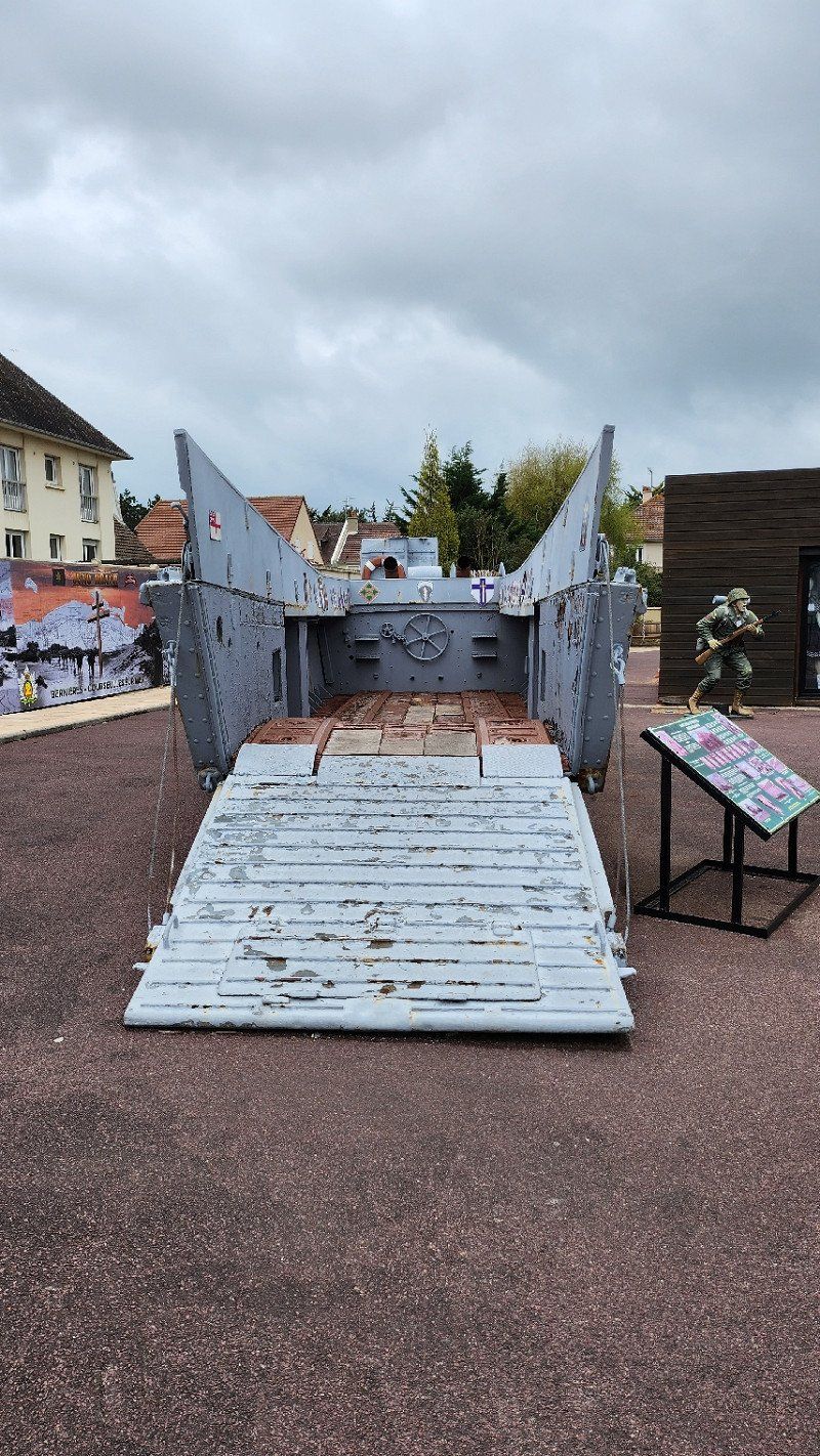
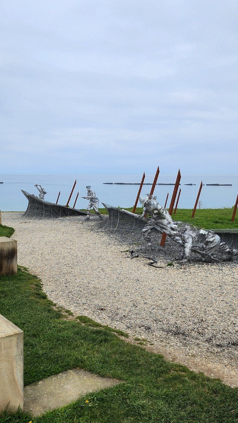
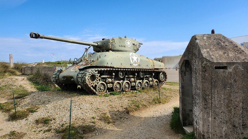
15.04.2023 - Ouistreham, Frankreich - Bunkermuseum
Bunker Museum
During the Allied landings in Normandy in World War II, the town was on Sword Beach.
Ouistreham, 14150, Frankreich
49° 16' 38.5" N 0° 15' 28.5" W
49.2773562 -0.2579265
• Head south on Avenue du Maréchal Foch. Go for 45 m.
• Turn right onto Avenue du Maréchal Foch. Go for 68 m.
• Take the 2nd exit from roundabout onto Rue du Bief. Go for 350 m.
• Turn right onto Avenue du Grand-Large (D84). Go for 452 m.
• Take the 2nd exit from roundabout onto Avenue du Grand-Large (D84). Go for 816 m.
• Take the 3rd exit from roundabout onto D514 toward A13/Caen/Cabourg. Go for 2.5 km.
• Keep left onto D515. Go for 7.5 km.
• Take ramp onto Périphérique (N814) toward Périphérique Ouest/Rennes/Cherbourg/Bayeux/Hérouville-Ouest. Go for 6.8 km.
• Keep left onto N13 toward Bessin/Cherbourg/Bayeux/Aéroport Carpiquet. Go for 28.8 km.
• Take ramp toward Vaucelles/Tour en Bessin/Mosles. Go for 352 m.
• Take the 2nd exit from roundabout onto D613. Go for 264 m.
• Continue on Route de Bayeux (D613). Go for 1.6 km.
• Turn right onto Route de Maisons (D100). Go for 1.2 km.
• Continue on D100. Go for 663 m.
• Continue on Lieu-dit Saint-Vaast (D100). Go for 79 m.
• Continue on D100. Go for 1.6 km.
• Turn right onto D100. Go for 346 m.
• Continue on Lieu-dit Escurès (D100). Go for 215 m.
• Turn left onto Route de Port (D6). Go for 1.3 km.
• Take the 2nd exit from Rond-Point de Montgomery roundabout onto Rue de Bayeux. Go for 610 m.
• Continue on Rue de Bayeux. Go for 282 m.
• Arrive at Rue de Bayeux. Your destination is on the right.
☍
55,9 km
( 40 min.)
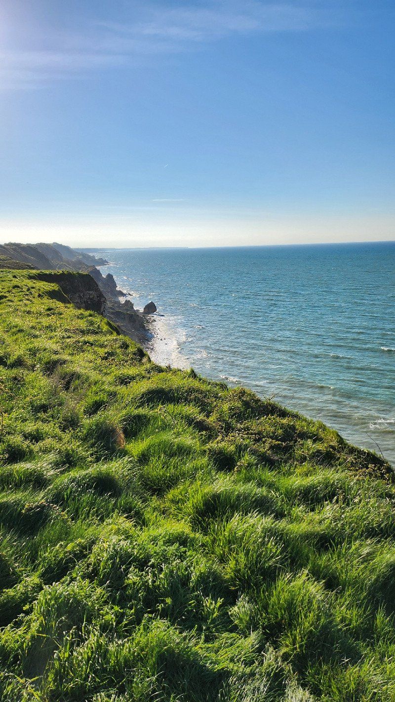
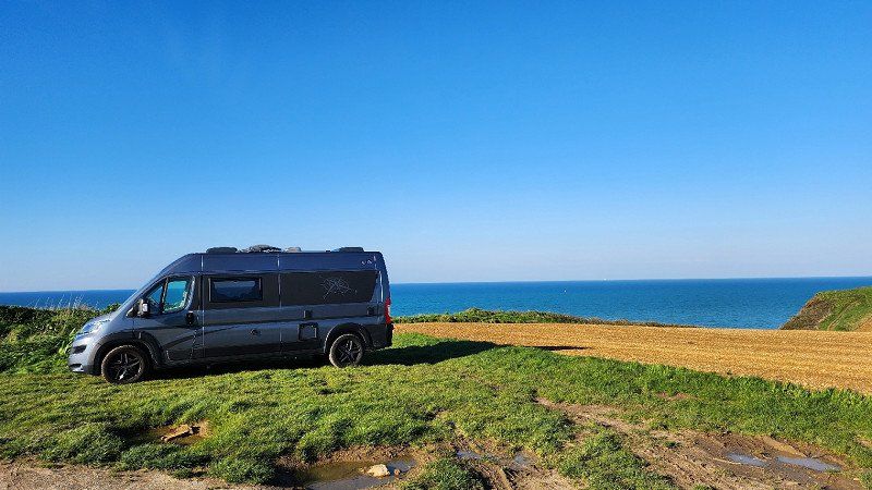
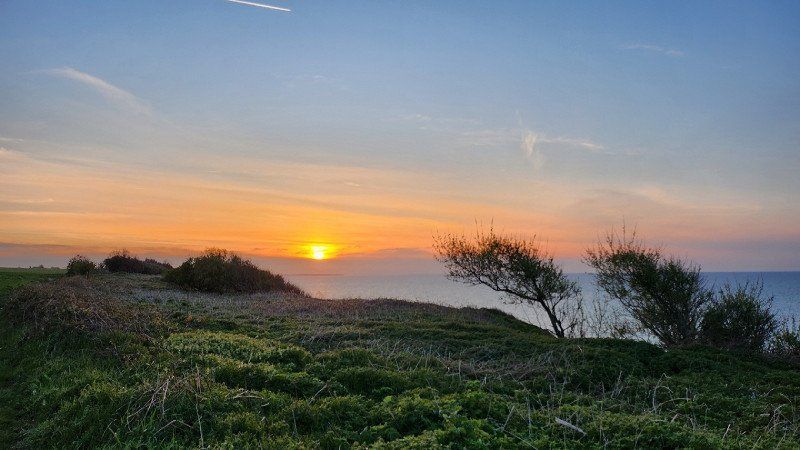
Longues-sur-Mer, 181 Rte d'Auray
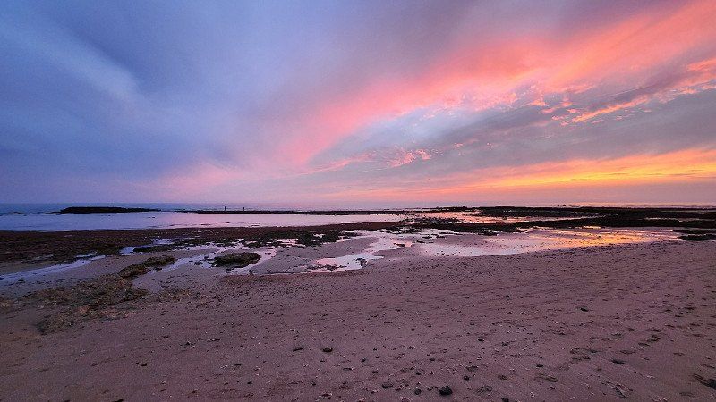
Inconspicuous road that briefly turns into a short gravel road and then ends at the cliffs. Great view and beautiful sunset. We would not drive down here with a larger camper/WoMo.
Day
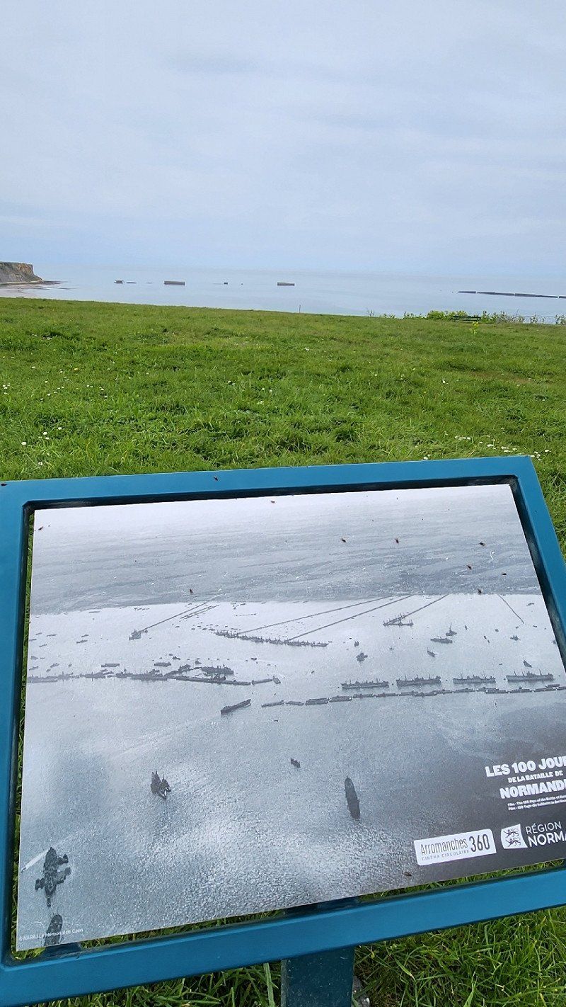
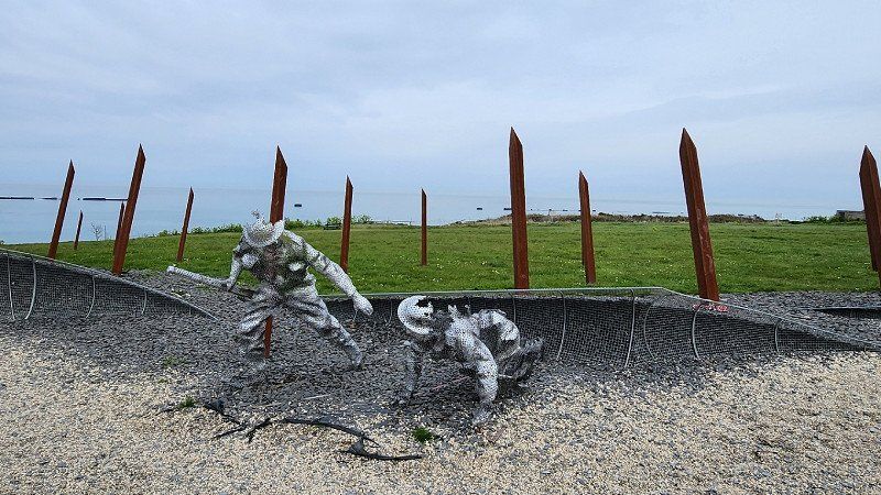
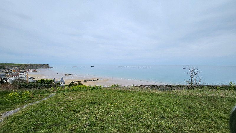
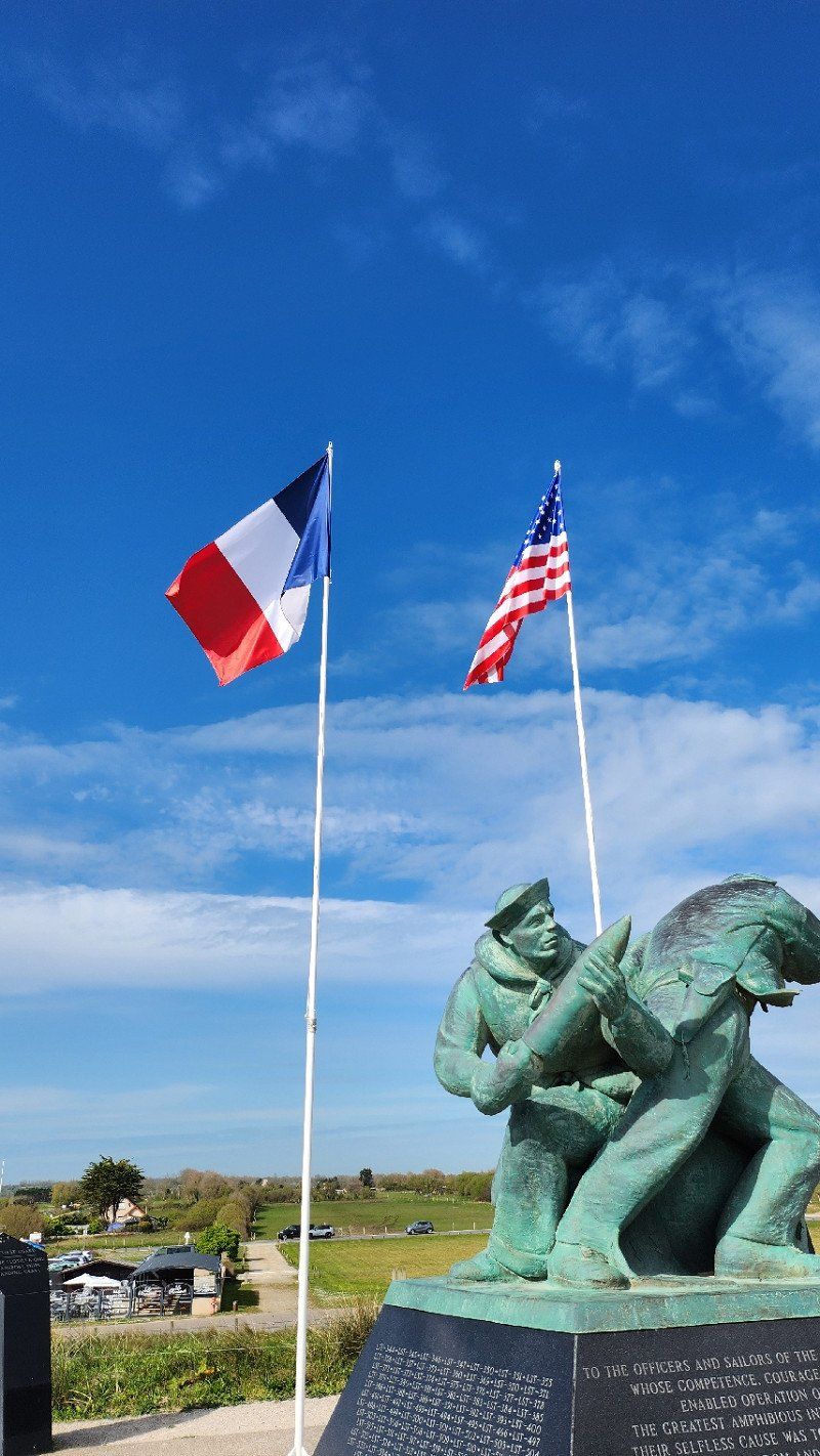
16.04 2023 - Arromanches-des-Bains
Monument D-Day above Gold Beach...
Port-en-Bessin-Huppain, Frankreich - größter Hafen für Fischer in der Normandie
Port-en-Bessin-Huppain, 14520, Frankreich
49° 20' 46.2" N 0° 45' 17.9" W
49.3461643 -0.7549678
• Head north on Rue de Bayeux. Go for 36 m.
• Turn left onto Place Cousteau. Go for 133 m.
• Turn left onto Rue Nationale. Go for 64 m.
• Turn right onto Rue du 11 Novembre. Go for 310 m.
• Turn right onto Avenue du Maréchal de Tourville (D514). Go for 6.5 km.
• Arrive at Route d'Omaha Beach (D514). Your destination is on the right.
☍
7,0 km
( 9 min.)
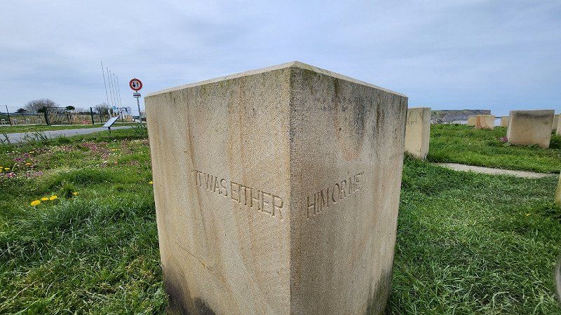
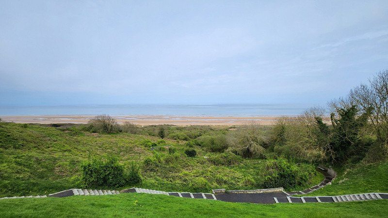
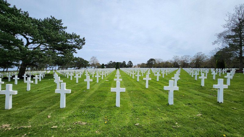
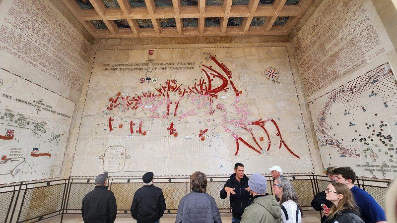
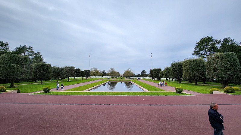
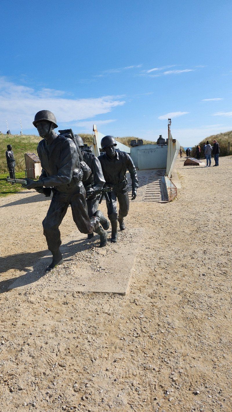
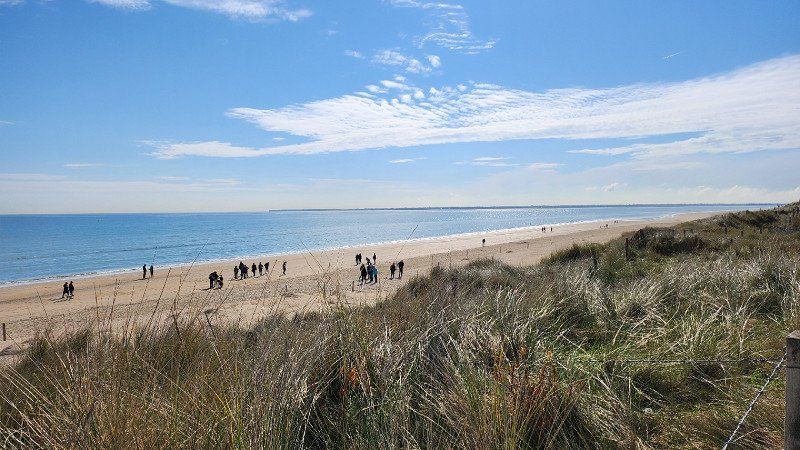
16.04.2023 - Colleville-sur-Mer, Frankreich - Soldatenfriedhof mit Blick auf Omaha-Beach
Impressive...
Colleville-sur-Mer, 14710, Frankreich
49° 20' 55.9" N 0° 50' 31.2" W
49.3488630 -0.8420033
• Head toward Chemin de la Delle on Route d'Omaha Beach (D514). Go for 1.6 km.
• Turn right onto Route de Mosles (D97). Go for 219 m.
• Continue on D97. Go for 1.0 km.
• Continue on Route du Fresne (D97). Go for 1.4 km.
• Continue on D97. Go for 902 m.
• Continue on Rue d'Argouges (D97). Go for 829 m.
• Turn right toward N13. Go for 161 m.
• Take left ramp onto N13. Go for 53.1 km.
• Take ramp toward Montebourg/Quinéville/Quettehou. Go for 174 m.
• Turn left toward Lieu-dit La Lande Mangon. Go for 198 m.
• Continue on Lieu-dit La Lande Mangon. Go for 56 m.
• Continue on Hameau Es Blond. Go for 908 m.
• Continue on Rue Paul Lecacheux. Go for 160 m.
• Turn right onto Rue Monseigneur le Nordez (D42). Go for 5.2 km.
• Take the 3rd exit from roundabout onto Route des Sapins (D14). Go for 9.8 km.
• Take the 2nd exit from roundabout onto Place Clemenceau (D1). Go for 134 m.
• Take the 1st exit from roundabout onto Rue de Gaulle (D902). Go for 9.4 km.
• Turn left onto Rue Varengue. Go for 53 m.
• Arrive at Rue Varengue. Your destination is on the left.
☍
85,4 km
(1 hrs. )
Gefosse-Fontenay
Here ends our wild ride for today. Twice WWII was enough input... Now have some wine and a bite to eat and see if we see oystercatchers tomorrow...
Yep, the oystercatchers came and two boats disappeared in the fog. We didn't notice her return, because we were already on the road again...
Day
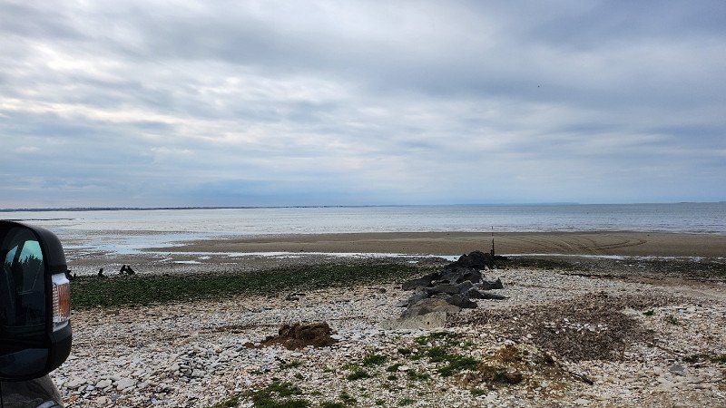
17.04.2023 - Utah-Beach Landing Museum
Came by and thus also briefly appreciated the last of the five D-Day beaches. This time, however, only viewed the outdoor facilities and not the museum itself.
Barfleur, Frankreich - eines der schönsten Dörfer Frankreichs
Barfleur, 50760, Frankreich
49° 40' 14.5" N 1° 15' 51.9" W
49.6706815 -1.2644272
• Head toward Rue des Fours on Rue Varengue. Go for 76 m.
• Continue on Rue du Port. Go for 99 m.
• Turn right onto Quai Henri Chardon. Go for 28 m.
• Turn slightly right onto Quai Henri Chardon (D901). Go for 12 m.
• Turn right onto Rue Saint-Thomas Becket (D901). Go for 178 m.
• Turn right onto Rue de la Halle (D901). Go for 10.1 km.
• Continue on Rue Hippolyte de Tocqueville. Go for 84 m.
• Turn left onto Place de l'Abbé de Saint-Pierre. Go for 165 m.
• Turn left onto Place de l'Abbé de Saint-Pierre (D26). Go for 11.8 km.
• Take the 2nd exit from roundabout onto Rue du Val Canu (D901). Go for 2.0 km.
• Take the 3rd exit from Rue de Penesme roundabout onto Boulevard de l'Est (N132) toward Cherbourg/Sauxmarais-Zone d'Activités/Cherbourg-Octeville/Sauxmarais. Go for 665 m.
• Pass 2 roundabouts and continue on Boulevard de l'Est (N132). Go for 905 m.
• Take the 3rd exit from roundabout onto Boulevard de l'Est (N132). Go for 1.4 km.
• Take the 3rd exit from Rond-Point de Thémis roundabout onto Avenue Jean François Millet (N132). Go for 113 m.
• Keep right onto Avenue Jean François Millet. Go for 559 m.
• Continue on Boulevard Mendès France. Go for 682 m.
• Continue on Boulevard Guillaume le Conquérant. Go for 1.2 km.
• Continue on Rue de l'Abbaye (D901). Go for 305 m.
• Keep right onto Rue de l'Abbaye (D901). Go for 45 m.
• Continue on Boulevard de la Saline. Go for 2.4 km.
• Take the 1st exit from Rond-Point de Capel roundabout onto Boulevard de la Mer. Go for 1.2 km.
• Take the 2nd exit from roundabout onto Rue des Rivières. Go for 337 m.
• Take the 3rd exit from roundabout onto Rue des Rivières. Go for 285 m.
• Keep right onto Rue Marcel Sembat. Go for 8.9 km.
• Turn right toward D404 E1. Go for 81 m.
• Turn left onto D404 E1. Go for 43 m.
• Continue on Route de Beaumont (D404 E1). Go for 387 m.
• Turn right. Go for 138 m.
• Arrive at your destination on the left.
☍
44,1 km
( 42 min.)
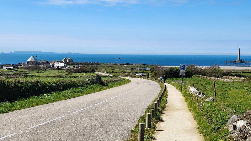
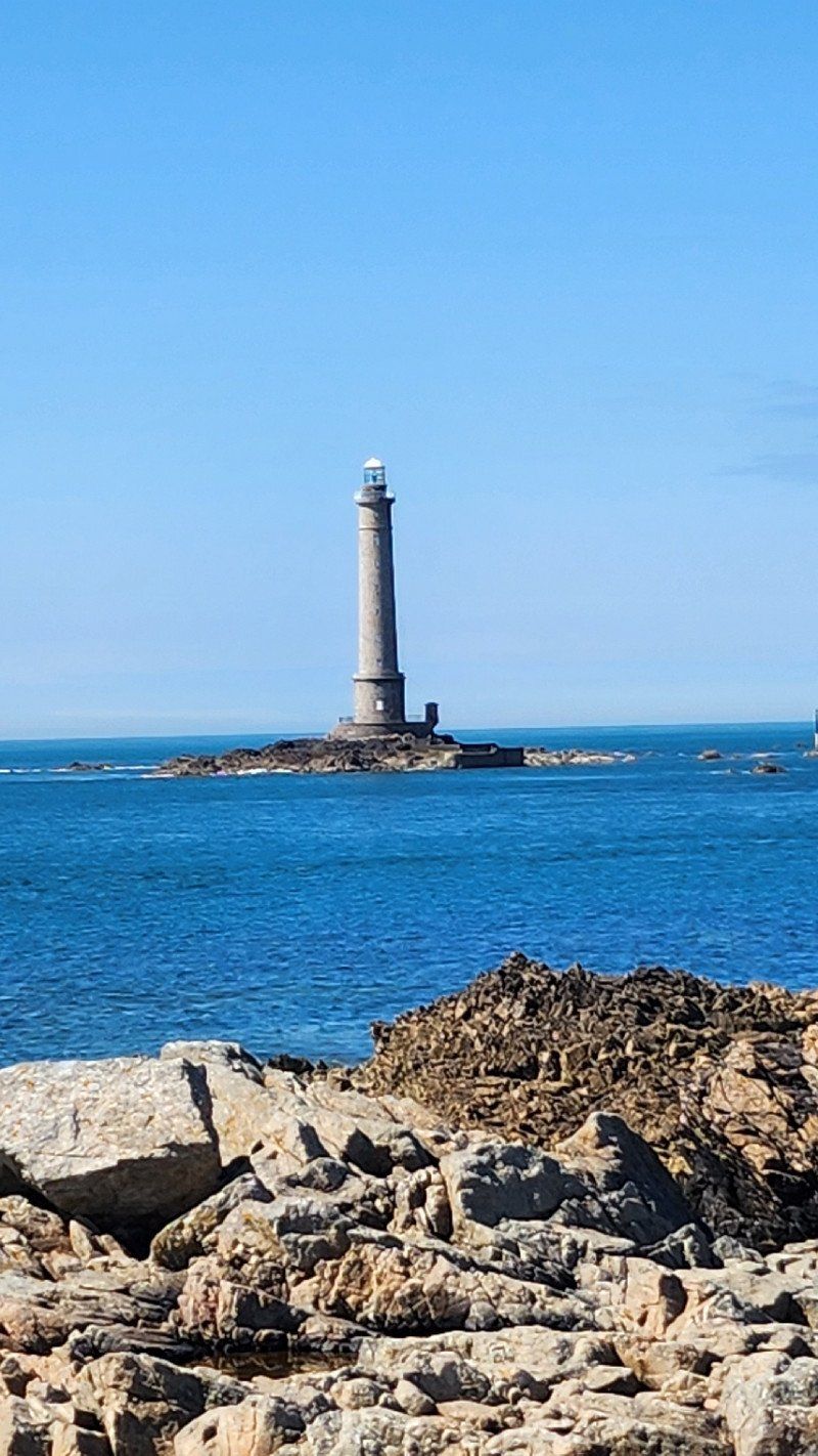
La Hague, Frankreich - weiter nach Auderville/Goury
Very small place 5 houses, a closed restaurant, a small harbor and a lighthouse... At a house near the harbor, food and drinks were sold out of a window, which could be consumed at the tables and benches provided.
French were there and collected snails at the port - bon appétit
La Hague, 50440;50460;50690, Frankreich
49° 39' 17.4" N 1° 47' 56.8" W
49.6548321 -1.7991053
• Head toward Route de Beaumont. Go for 138 m.
• Turn right onto Route de Beaumont (D404 E1). Go for 56 m.
• Continue on D404 E1. Go for 213 m.
• Continue on D37. Go for 12.4 km.
• Take the 2nd exit from roundabout onto Lieu-dit Le Calvaire (D37). Go for 2.3 km.
• Take the 1st exit from roundabout onto Lieu-dit La Croix Georges (D650). Go for 2.4 km.
• Pass 4 roundabouts and continue on D650. Go for 10.7 km.
• Continue on D904. Go for 1.6 km.
• Continue on Lieu-dit Le Meaudenaville de Haut (D650). Go for 2.8 km.
• Turn right onto Route de l'Europe (D904 E). Go for 1.3 km.
• Take the 1st exit from Avenue de la République roundabout onto Avenue de la République (D902). Go for 579 m.
• Turn left onto Route du Pont du Tôt. Go for 339 m.
• Turn left onto Village du Tôt. Go for 205 m.
• Arrive at Village du Tôt. Your destination is on the left.
☍
35,1 km
( 29 min.)
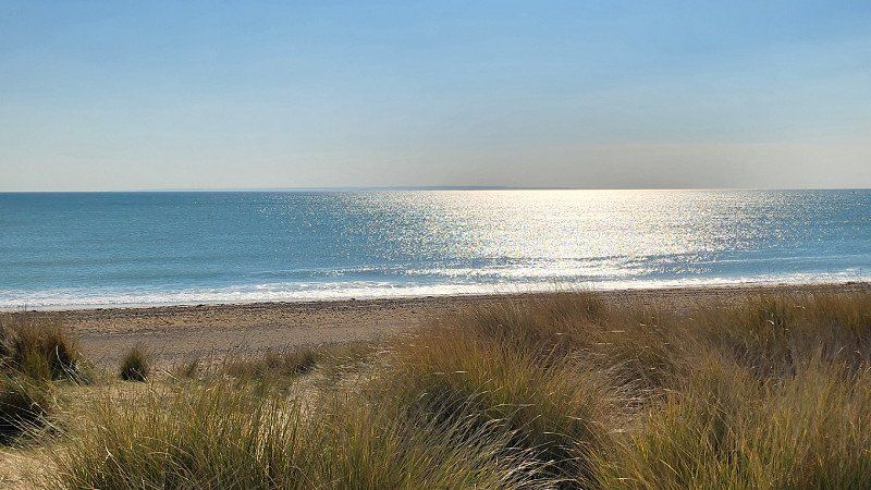
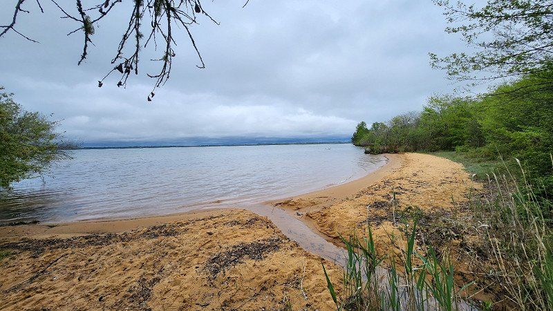
17.04.2023 - Barneville-Carteret, Normandy, France - wow Strand
Shortly afterwards we landed in Saint-George-de-la-Rivière on a crazy beach separated only by a dune.
50270, France
49° 22' 50.3" N 1° 46' 8.4" W
49.3806471 -1.7689906
• Head east on Village du Tôt. Go for 297 m.
• Continue on Chemin du Tôt. Go for 302 m.
• Turn left onto Rue Guy de Maupassant. Go for 36 m.
• Continue on Rue Guy de Maupassant. Go for 87 m.
• Turn right onto Rue Guillaume le Conquérant (D903 E). Go for 542 m.
• Continue on Rue des Halles (D903 E). Go for 114 m.
• Take the 2nd exit from Place du Docteur Auvret roundabout onto Place de l'Église (D903). Go for 817 m.
• Turn right onto D650. Go for 1.8 km.
• Continue toward D903. Go for 70 m.
• Continue on D650. Go for 2.1 km.
• Take the 2nd exit from roundabout onto D650. Go for 1.9 km.
• Turn left onto D903. Go for 2.0 km.
• Take the 2nd exit from roundabout onto D903. Go for 9.1 km.
• Take the 1st exit from roundabout onto D900. Go for 2.3 km.
• Pass 4 roundabouts and continue on Rue de la Sainte-Croix (D900). Go for 7.5 km.
• Take the 2nd exit from roundabout onto Route des Landes (D2). Go for 10.3 km.
• Take the 2nd exit from roundabout onto D2. Go for 4.0 km.
• Turn right onto Rue Es Galliots (D274). Go for 970 m.
• Turn left onto Rue Guillemin (D74). Go for 592 m.
• Continue on Lieu-dit Le Montbraye (D74). Go for 70 m.
• Continue on D74. Go for 1.2 km.
• Turn right onto Village au Pelley (D2). Go for 1.5 km.
• Take the 2nd exit from roundabout onto Lieu-dit Le Gros Frêne (D2). Go for 1.3 km.
• Turn right and take ramp onto D971. Go for 1.5 km.
• Take the 3rd exit from roundabout onto D971 toward A84/Bréhal/Granville/Le Mont-St Michel/Z.I. de la Gare. Go for 3.9 km.
• Take the 2nd exit from roundabout onto Rue des Ajoncs (D437). Go for 1.2 km.
• Continue on D437. Go for 208 m.
• Continue on Rue de la Belletière (D437). Go for 191 m.
• Turn right onto Route de Coutances (D7). Go for 2.5 km.
• Pass 2 roundabouts and continue on Rue de la Croix Daniel (D7). Go for 12.4 km.
• Turn left onto Rue du Moulin (D9). Go for 97 m.
• Turn right onto Rue Haute Rue (D38). Go for 1.5 km.
• Continue on D38. Go for 365 m.
• Continue on Lieu-dit Catte sur Cat (D38). Go for 67 m.
• Continue on Lieu-dit Catte sur Cat (D33). Go for 101 m.
• Continue on D33. Go for 93 m.
• Continue on Lieu-dit Le Val Raimond (D33). Go for 177 m.
• Continue on D33. Go for 479 m.
• Continue on Lieu-dit La Doronnerie (D33). Go for 104 m.
• Continue on D33. Go for 233 m.
• Continue on Lieu-dit Le Trébuchet (D33). Go for 56 m.
• Continue on D33. Go for 733 m.
• Continue on Lieu-dit Guédon (D33). Go for 98 m.
• Continue on D33. Go for 1.1 km.
• Continue on Lieu-dit Au Fèvre (D33). Go for 150 m.
• Continue on D33. Go for 350 m.
• Continue on Lieu-dit L'Orail (D33). Go for 89 m.
• Continue on D33. Go for 1.0 km.
• Continue on Lieu-dit La Rourie (D33). Go for 117 m.
• Continue on D33. Go for 895 m.
• Continue on Lieu-dit Le Couvent (D33). Go for 113 m.
• Continue on D33. Go for 270 m.
• Continue on Lieu-dit L'Hôtel Chaignon (D33). Go for 201 m.
• Continue on D33. Go for 1.1 km.
• Continue on Route du Mesnil Garnier (D33). Go for 3.0 km.
• Take the 1st exit from roundabout onto D33 toward Villedieu les P./Gavray/Granville. Go for 381 m.
• Take the 3rd exit from roundabout onto A84 toward Avranches/Rennes. Go for 17.2 km.
• Continue on N175. Go for 10.6 km.
• Take ramp onto N175 toward St Brieuc/St Malo/Le Mont-St Michel/Pontorson. Go for 2.1 km.
• Take ramp onto Lieu-dit La Chaussée (D43) toward Courtils. Go for 7.1 km.
• Continue on D275. Go for 4.6 km.
• Take the 2nd exit from roundabout onto D776. Go for 983 m.
• Turn right onto Route du Mont-Saint-Michel. Go for 256 m.
• Turn right. Go for 144 m.
• Turn left toward Lieu-dit Le Bas Pays. Go for 190 m.
• Turn left onto Lieu-dit Le Bas Pays. Go for 165 m.
• Turn right onto Route du Mont-Saint-Michel. Go for 195 m.
• Continue on Route du Mont-Saint-Michel. Go for 2.5 km.
• Turn left onto Montée aux Poulains. Go for 136 m.
• Arrive at Montée aux Poulains. Your destination is on the left.
☍
129,8 km
(1 hrs. 46 min.)
Day
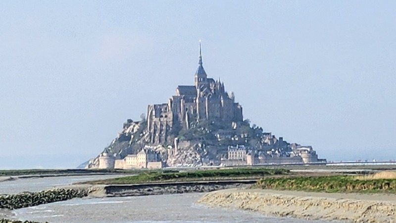
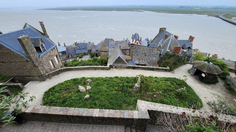
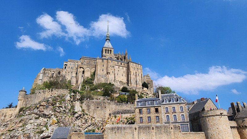
18.04.2023 - Le Mont-Saint-Michel, Frankreich
After a leisurely start, we drove across the country, stocked up on supplies in the Carrefour and finally landed in Beauvoir around 5 p.m. (11 Rue le Réage du Violet - 16.50 euros + one-off 5 euros for the map). . Grab a scooter and bike and off to the monastery island of Le Mont-Saint-Michel, about 5 km away. Impressive building, tomorrow again with more time :-)
Le Mont-Saint-Michel, 50170, Frankreich
48° 38' 9.1" N 1° 30' 45.4" W
48.6358559 -1.5126096
• Head west on Montée aux Poulains. Go for 136 m.
• Turn right toward Route du Mont-Saint-Michel. Go for 104 m.
• Continue on Route du Mont-Saint-Michel. Go for 2.6 km.
• Turn left onto Lieu-dit Le Bas Pays. Go for 178 m.
• Turn sharp right toward D776. Go for 443 m.
• Turn right onto D776. Go for 1.3 km.
• Turn left onto Rue d'Astériac (D80). Go for 648 m.
• Continue on Rue de Grandelle (D80). Go for 427 m.
• Continue on D80. Go for 587 m.
• Continue on Route de la Baie (D80). Go for 987 m.
• Continue on Rue de Beau Seuil (D80). Go for 216 m.
• Continue on Rue de la Forge (D80). Go for 325 m.
• Continue on D80. Go for 991 m.
• Continue on Rue de la Saint-Côme (D80). Go for 979 m.
• Pass 2 roundabouts and continue on Rue de la Saint-Côme (D80). Go for 284 m.
• Turn slightly left onto Rue de la Plaine (D80). Go for 1.0 km.
• Continue on D80. Go for 26 m.
• Continue on Rue de la Plaine (D80). Go for 95 m.
• Continue on D80. Go for 267 m.
• Continue on Lieu-dit Les Chaliers (D80). Go for 524 m.
• Continue on D80. Go for 64 m.
• Continue on Lieu-dit Les Briaudais (D80). Go for 797 m.
• Continue on D80. Go for 184 m.
• Continue on Lieu-dit La Butte (D80). Go for 60 m.
• Continue on D80. Go for 1.1 km.
• Continue on Lieu-dit Le Poteau (D80). Go for 98 m.
• Continue on D80. Go for 111 m.
• Turn left onto D30. Go for 5.3 km.
• Take the 2nd exit from roundabout onto A84 toward Rennes/Fougères. Go for 52.7 km.
• Take the exit toward Le Mans/Nantes onto N136 (Rocade Est). Go for 5.3 km.
• Take ramp onto Rocade Sud (N136) toward Nantes/Angers. Go for 8.9 km.
• Take ramp toward Porte d'Alma/Le Blosne/Écomusée du Pays de Rennes/Rennes-Centre. Go for 391 m.
• Take the 3rd exit from roundabout onto N137 toward E31/Angers/Le Mans/Caen/Nantes. Go for 62.7 km.
• Take ramp onto N171 toward St Nazaire/La Grigonnais/Blain. Go for 4.1 km.
• Pass 2 roundabouts and continue on Lieu-dit La Bretonnière (N171). Go for 7.2 km.
• Take the 3rd exit from Rond-Point de l'Europe roundabout onto N171 toward St Nazaire/Le Château. Go for 1.1 km.
• Pass 2 roundabouts and continue on Boulevard de la Résistance (N171). Go for 813 m.
• Take the 3rd exit from roundabout onto Rue de la Croix Rouge (N171) toward St Nazaire/Bouvron/Le Port/Le Château. Go for 747 m.
• Pass 3 roundabouts and continue on N171. Go for 6.4 km.
• Take the 3rd exit from roundabout onto N171. Go for 1.6 km.
• Take the 2nd exit from roundabout onto N171. Go for 2.2 km.
• Take the 3rd exit from roundabout onto N171. Go for 2.2 km.
• Take the 2nd exit from roundabout onto Lieu-dit La Croix Blanche (N171) toward St Nazaire/Savenay. Go for 3.7 km.
• Take the 2nd exit from roundabout onto N171 toward St Nazaire/La Baule/Savenay-Centre. Go for 24.3 km.
• Take the 3rd exit from roundabout onto Route Bleue (D213) toward Noirmoutier/La Rochelle/St Brevin les Pins/Méan Penhoët. Go for 9.1 km.
• Take ramp onto Rue de Pornic toward D77/St Brévin-Centre/P.A. la Guerche. Go for 266 m.
• Take the 3rd exit from Rond-Point d'Ayent-Anzère roundabout onto Rue de Pornic. Go for 196 m.
• Take the 2nd exit from Place du Souvenir Français roundabout onto Rue de Pornic. Go for 134 m.
• Continue on Rue Jean Fouchet. Go for 13 m.
• Keep left onto Rue Jean Fouchet. Go for 33 m.
• Turn right onto Rue Jean Foucher. Go for 43 m.
• Arrive at Rue Jean Foucher.
☍
214,1 km
(2 hrs. 22 min.)
Day
19.04.2023 - Le Mont-Saint-Michel
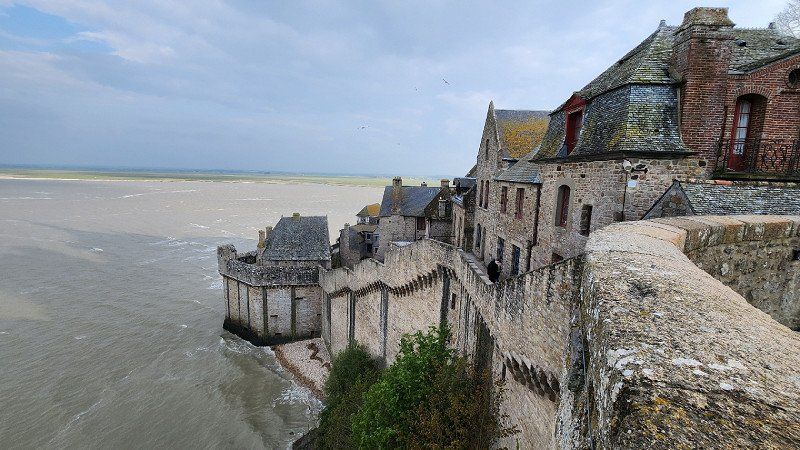
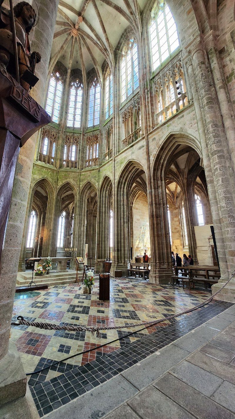
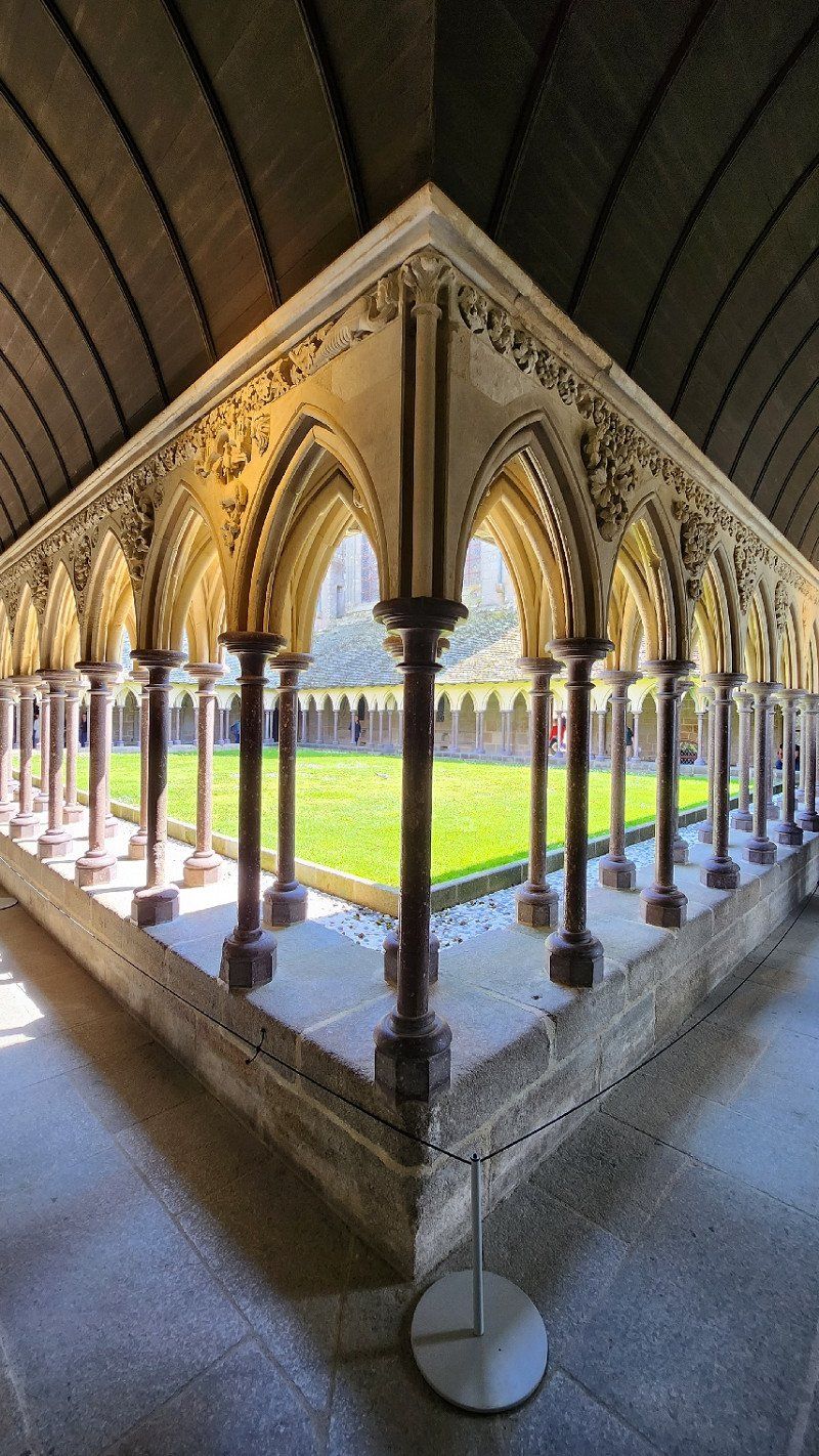
Day 2 - parking space in Beauvoir and again by bike and scooter to the monastery island. Today the abbey is also visited (admission 11 euros, audio accompaniment on request for 3 euros). You should be reasonably able to walk, with all the inclines and stairs, but it was impressive and definitely recommended.
Day
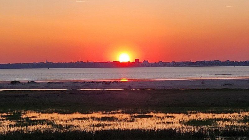
20.04.2023 - Saint-Brevin-les-Pins
Beautiful landscapes, small villages, arrived in Saint-Nazaiere, there is a great boulevard right on the beach, but unfortunately three of the parking spaces indicated there were nothing for our camper. Now we're in Saint-Brevin-les-Pins, in a parking lot at a sports field and we're going to visit the beach here... Nice walk, although without a beach, but with a view of the Loire estuary in the Atlantic and a fantastic Sunset.
Frankreich
47° 14' 48" N 2° 9' 56.9" W
47.2466590 -2.1658070
• Head toward Place de la Victoire on Rue Jean Foucher. Go for 61 m.
• Take the 3rd exit from Place de la Victoire roundabout onto Avenue du Maréchal Foch. Go for 111 m.
• Turn left onto Rue Alfred Durand. Go for 105 m.
• Continue on Rue Jean Fouchet. Go for 46 m.
• Continue on Rue de Pornic. Go for 115 m.
• Take the 2nd exit from Place du Souvenir Français roundabout onto Rue de Pornic. Go for 119 m.
• Take the 1st exit from Rond-Point d'Ayent-Anzère roundabout onto Rue de Pornic. Go for 189 m.
• Take ramp onto Route Bleue (D213). Go for 28.6 km.
• Take the 3rd exit from Giratoire Les Puymains roundabout onto Route Bleue (D13) toward Noirmoutier/La Roche S/Yon/La Rochelle/Bourgneuf en Retz/Machecoul. Go for 542 m.
• Take the 2nd exit from Giratoire du Moulin Saint-Laurent roundabout onto Route Bleue (D13) toward Noirmoutier/La Roche S/Yon/La Rochelle/Nantes/Machecoul. Go for 909 m.
• Take the 2nd exit from Giratoire de la Corderie roundabout onto D758 toward Noirmoutier/Les Sables d'Olne/Bouin. Go for 8.0 km.
• Pass 3 roundabouts and continue on Rue de Nantes (D758). Go for 8.6 km.
• Take the 2nd exit from Carrefour de la Croix Blanche roundabout onto Rue des Sables (D22). Go for 568 m.
• Pass 3 roundabouts and continue on Avenue de l'Estacade (D22). Go for 6.4 km.
• Take the 2nd exit from roundabout onto Route de Saint-Jean de Monts (D38 C). Go for 688 m.
• Take the 2nd exit from roundabout onto Route de Saint-Jean de Monts (D38 C). Go for 231 m.
• Turn right onto Route de la Grande Côte (D38 B). Go for 395 m.
• Take the 3rd exit from roundabout onto Chemin de la Rive. Go for 64 m.
• Take the 1st exit from roundabout onto D38. Go for 3.7 km.
• Pass 7 roundabouts and continue on D38. Go for 11.5 km.
• Take the 1st exit from Rond-Point de l'Europe roundabout onto Route de Noirmoutier (D948). Go for 626 m.
• Pass 2 roundabouts and continue on Rue du Boucaud (D948). Go for 3.1 km.
• Turn right onto Quai Jean Bart. Go for 244 m.
• Turn left onto Place Saint-Louis. Go for 24 m.
• Continue on Rue du Marché. Go for 90 m.
• Arrive at Place de l'Hôtel de Ville. Your destination is on the left.
☍
75,0 km
(1 hrs. 2 min.)
Day
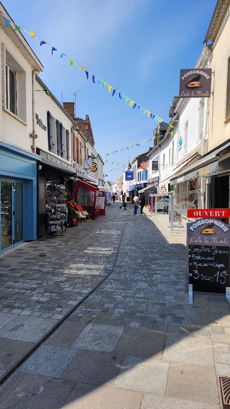
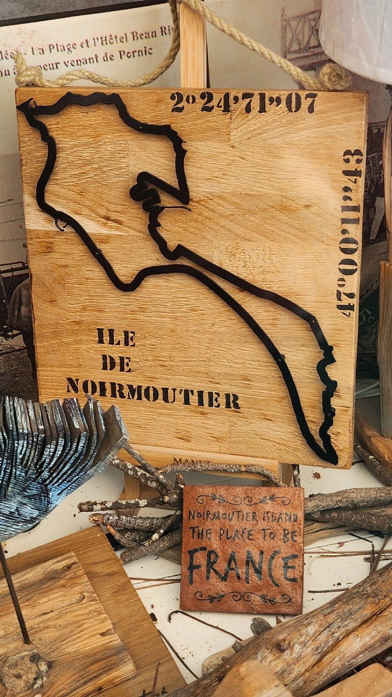
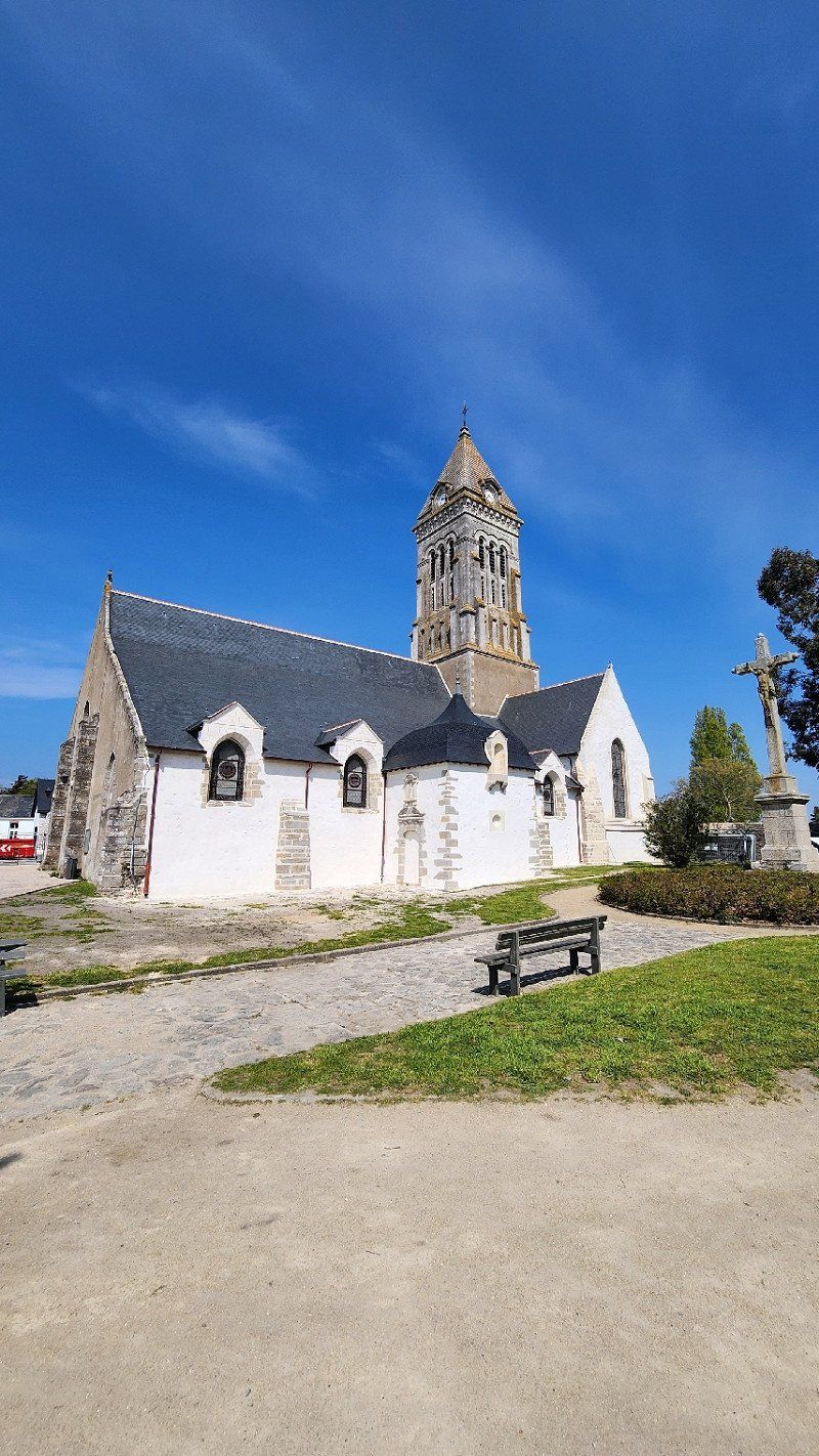
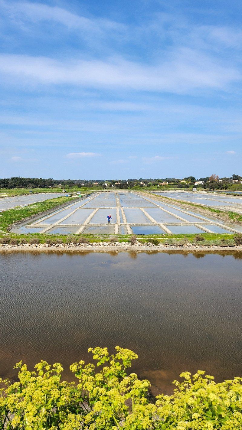
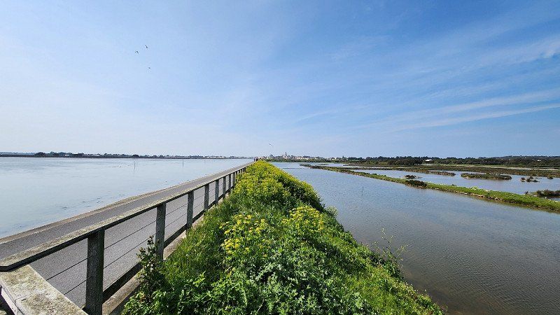
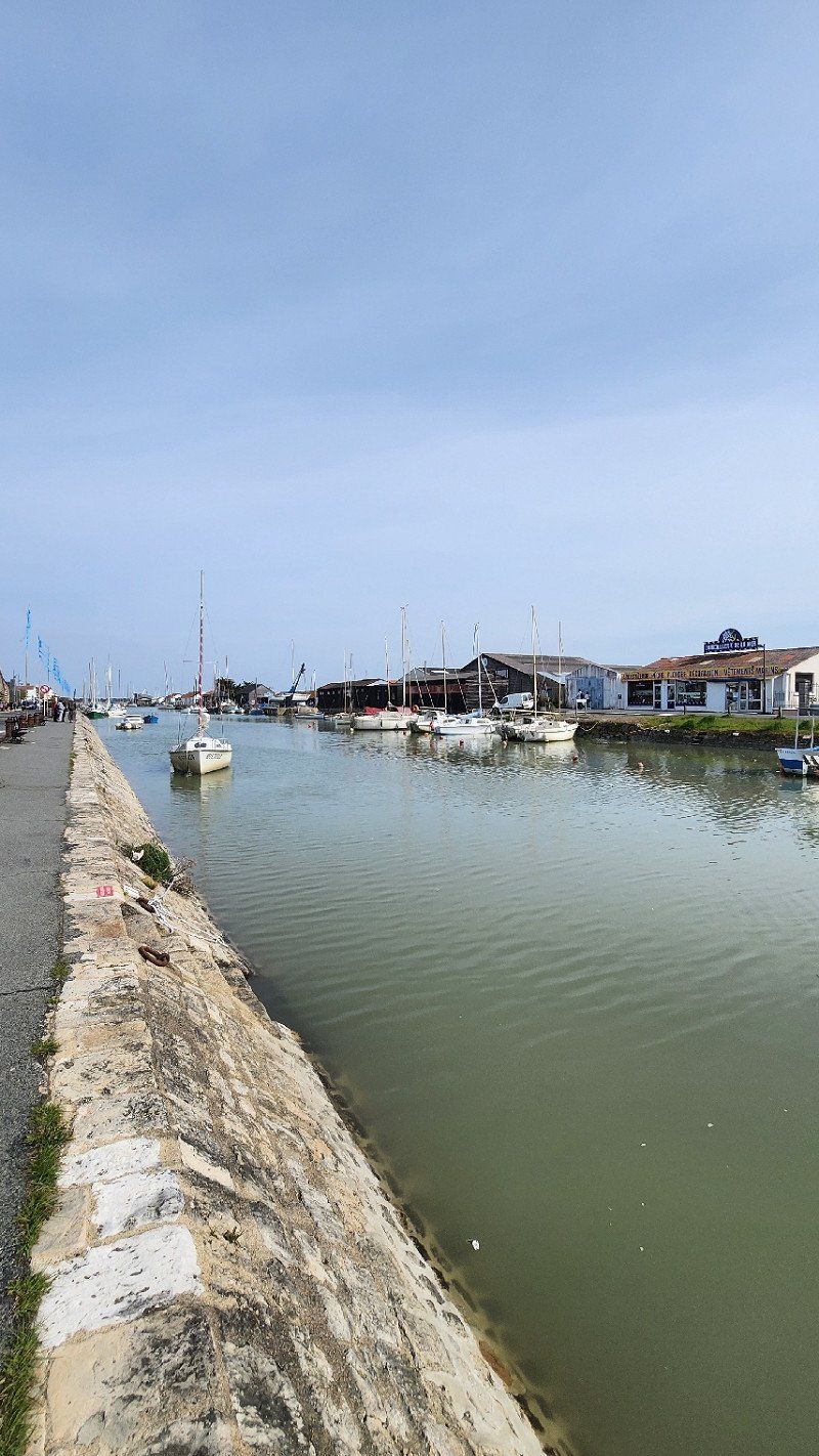
21.04.2023 - Noirmoutier-en-l'Île, Frankreich
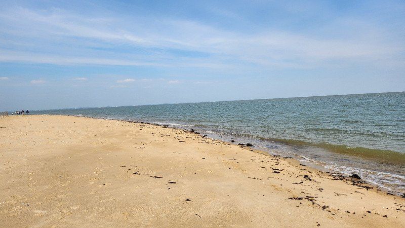
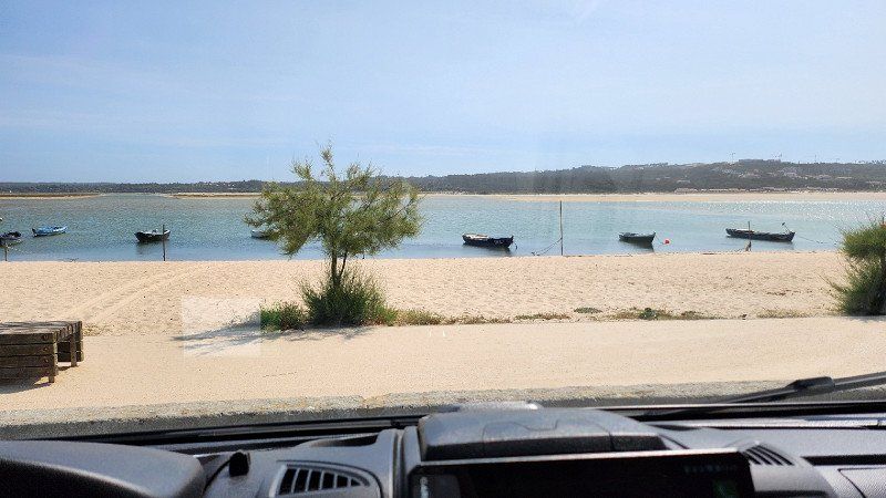
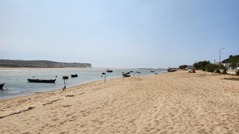
Change of plans and off to the island... Get a good parking space with a map on the edge of the main town of Noirmoutier. In the best weather along the small harbor, once through the town center and then between the harbor and salt marshes/bird paradise to a beautiful sandy beach and back (about 2 hours on foot).
Noirmoutier-en-l'Île, 85330, Frankreich
47° 0' 0.3" N 2° 14' 38.9" W
47.0000890 -2.2441449
• Head southeast on Place de l'Hôtel de Ville. Go for 35 m.
• Turn right onto Rue Saint-Louis. Go for 71 m.
• Turn right onto Quai Jean Bart. Go for 292 m.
• Turn left onto Rue du Boucaud (D948). Go for 215 m.
• Take the 2nd exit from roundabout onto Rue du Boucaud (D948). Go for 466 m.
• Turn right onto D95. Go for 495 m.
• Turn left toward D948. Go for 252 m.
• Turn right onto D948. Go for 1.8 km.
• Take the 2nd exit from roundabout onto Route de Noirmoutier (D948). Go for 654 m.
• Take the 3rd exit from Rond-Point de l'Europe roundabout onto D38. Go for 1.1 km.
• Pass 3 roundabouts and continue on D38. Go for 3.2 km.
• Take the 3rd exit from roundabout onto D38. Go for 3.0 km.
• Pass 2 roundabouts and continue on D38. Go for 4.2 km.
• Take the 3rd exit from roundabout onto Rue de l'Estacade (D38). Go for 3.8 km.
• Take the 3rd exit from roundabout onto Chemin de la Rive. Go for 88 m.
• Take the 1st exit from roundabout onto Route de la Grande Côte (D38 B). Go for 409 m.
• Turn left onto Route de Saint-Jean de Monts (D38 C). Go for 203 m.
• Take the 2nd exit from roundabout onto Route de Saint-Jean de Monts (D38 C). Go for 653 m.
• Take the 1st exit from roundabout onto Avenue de l'Estacade (D22). Go for 1.1 km.
• Take the 2nd exit from roundabout onto Avenue de l'Estacade (D22). Go for 2.7 km.
• Take the 1st exit from roundabout onto Lieu-dit Saint-Philbert (D51). Go for 1.8 km.
• Turn left onto D103. Go for 281 m.
• Continue on Lieu-dit La Tiercerie (D103). Go for 78 m.
• Continue on D103. Go for 238 m.
• Continue on Lieu-dit Les Airaudes (D103). Go for 138 m.
• Continue on D103. Go for 260 m.
• Continue on Lieu-dit Le Serin (D103). Go for 100 m.
• Continue on D103. Go for 1.3 km.
• Continue on Lieu-dit La Flocellière (D103). Go for 70 m.
• Continue on D103. Go for 240 m.
• Continue on Lieu-dit La Maison Rousse (D103). Go for 66 m.
• Continue on Rue de la Sablière (D103). Go for 562 m.
• Continue on D103. Go for 36 m.
• Continue on Rue de la Sablière (D103). Go for 846 m.
• Take the 3rd exit from roundabout onto Rue de la Croix de Mission (D59). Go for 521 m.
• Take the 1st exit from roundabout onto Route de Taizan (D120). Go for 1.7 km.
• Continue on Lieu-dit Bellevue (D120). Go for 80 m.
• Continue on Route de Taizan (D120). Go for 993 m.
• Continue on Lieu-dit Le Grand Taizan (D120). Go for 20 m.
• Turn right onto D948. Go for 3.6 km.
• Pass 2 roundabouts and continue on Rue de Beauvoir (D948). Go for 3.3 km.
• Take the 3rd exit from Rond-Point de Noirmoutier roundabout onto D948. Go for 2.6 km.
• Keep right onto D948 toward La Roche S/ Yon/Cholet. Go for 4.8 km.
• Pass 2 roundabouts and continue on D948. Go for 35.0 km.
• Take the 4th exit from Rond-Point de l'Atlantique roundabout onto Rue des Terres Noires (D160) toward La Rochelle/Cholet/Les Terres Noires. Go for 4.4 km.
• Keep left onto D948. Go for 20.4 km.
• Take the 3rd exit from roundabout toward Nantes/Angers/Bordeaux/Poitiers/Niort. Go for 139 m.
• Take ramp onto A83 toward Poitiers/Niort/Bordeaux. Go for 12.4 km.
• Take exit 7 toward La Rochelle. Go for 952 m.
• Continue toward La Rochelle/Les Sables d'O./St Jean de Beugné. Go for 29 m.
• Take the 1st exit from roundabout onto D137 toward La Rochelle/St Jean de Beugné. Go for 699 m.
• Pass 5 roundabouts and continue on D137. Go for 11.9 km.
• Take the 2nd exit from roundabout onto D10 A toward Puyravault. Go for 6.2 km.
• Take the 2nd exit from roundabout onto D10 A. Go for 6.6 km.
• Continue on D9. Go for 1.4 km.
• Take the 2nd exit from roundabout onto Route de Villedoux (D9). Go for 6.3 km.
• Take the 1st exit from roundabout onto D10. Go for 1.6 km.
• Take the 4th exit from roundabout onto D9. Go for 1.2 km.
• Take the 1st exit from roundabout onto Rue de la Liberté (D9). Go for 2.3 km.
• Take the 3rd exit from roundabout onto D9. Go for 2.6 km.
• Take the 3rd exit from roundabout onto D9. Go for 1.6 km.
• Take the 2nd exit from roundabout toward La Rochelle/Rochefort. Go for 263 m.
• Continue on N11. Go for 2.3 km.
• Take ramp onto N237 toward Bordeaux/Rochefort/Angoulême. Go for 389 m.
• Keep left onto N137. Go for 6.3 km.
• Continue on D137. Go for 4.9 km.
• Take ramp toward Châtelaillon-Plage/Thairé/St Vivien. Go for 318 m.
• Take the 3rd exit from roundabout onto Avenue de Strasbourg (D109). Go for 374 m.
• Take the 1st exit from roundabout onto Avenue de Strasbourg (D109). Go for 482 m.
• Take the 3rd exit from roundabout onto Avenue de Strasbourg. Go for 129 m.
• Keep left onto Avenue de Strasbourg. Go for 42 m.
• Turn slightly right onto Rue Émile Zola. Go for 139 m.
• Turn left onto Boulevard de la République. Go for 160 m.
• Continue on Boulevard de la Libération. Go for 24 m.
• Turn right onto Rue Carnot. Go for 62 m.
• Turn left onto Rue Paul Bert. Go for 37 m.
• Arrive at Rue Paul Bert. Your destination is on the right.
☍
180,0 km
(2 hrs. 12 min.)
Day
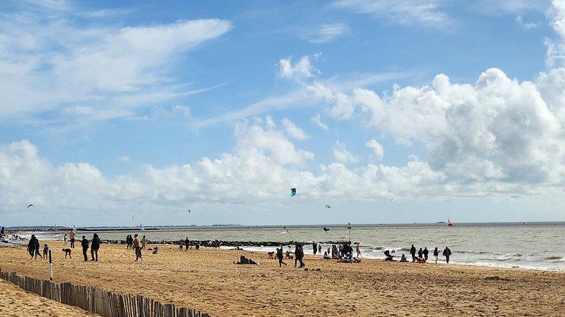
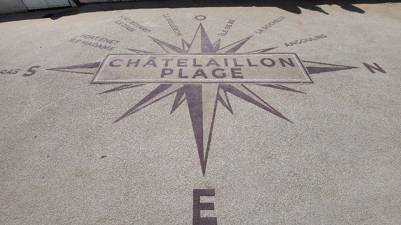
22.04.2023 - Châtelaillon-Plage, Frankreich
Passed through La Rochelle and ended up in Châtelaillon-Plage. Good parking space, sun and blue sky - first coffee and then exploring the area. Chic church, a few chic houses, but at first glance quiet and inconspicuous and then you come to the beach... A promenade with small shops, cafes, hotels and lots of people. Walking on the beach, playing and sunbathing in the sand and surfing or kiting in the water - everything was represented.
Châtelaillon-Plage, 17340, Frankreich
46° 4' 25.9" N 1° 5' 25.4" W
46.0738633 -1.0903991
• Head toward Boulevard de la Libération on Rue Paul Bert. Go for 14 m.
• Turn left onto Boulevard de la Libération. Go for 89 m.
• Continue on Boulevard de la République. Go for 8 m.
• Turn right onto Rue Georges Musset. Go for 199 m.
• Turn slightly right onto Avenue de Strasbourg. Go for 136 m.
• Pass 2 roundabouts and continue on Avenue de Strasbourg (D109). Go for 849 m.
• Take the 2nd exit from roundabout onto D137 toward A837/A10/Rochefort/Fouras. Go for 16.2 km.
• Take ramp toward Rochefort-Centre/Île d'Oléron/Royan/Marennes. Go for 543 m.
• Take the 2nd exit from roundabout onto D733 toward A837 (A10)/Rochefort-Centre/Île d'Oléron/Royan/Marennes. Go for 1.0 km.
• Pass 3 roundabouts and continue on Boulevard du Mille-Pattes (D733). Go for 27.6 km.
• Take the 2nd exit from roundabout onto D733 toward Royan/L'Éguille S/Seudre. Go for 3.7 km.
• Pass 6 roundabouts and continue on Avenue de Rochefort (D733). Go for 8.8 km.
• Take the 2nd exit from roundabout onto Avenue Daniel Heddé toward Port Pointe de Grave/Pontaillac/Centre Ville. Go for 446 m.
• Take the 2nd exit from roundabout onto Avenue Daniel Heddé toward Centre Ville/Pontaillac. Go for 961 m.
• Take the 1st exit from roundabout onto Rue Pierre Loti (D122). Go for 17 m.
• Continue on Rue Pierre Loti. Go for 318 m.
• Turn left onto Rue Alsace-Lorraine. Go for 53 m.
• Turn right onto Boulevard Aristide Briand. Go for 180 m.
• Arrive at Boulevard Aristide Briand. Your destination is on the right.
☍
61,1 km
( 48 min.)
Day
23.04.2023 - ein Tag Fahrpause
Stayed in Châtelaillon-Plage, had a champagne breakfast and enjoyed the day. Read a little, listen to music and what you do on a day without eating kilometers...
Day
24.04.2023 - Royan, Frankreich
Very nice city that you could visit in peace... Today just drove through comfortably and suddenly stood at the ferry on the way to Arcachon.
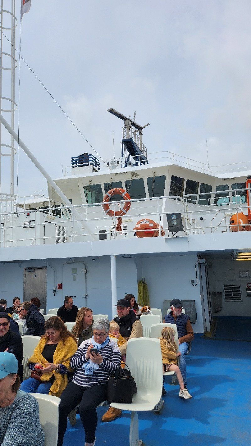
Okay, then the first time with the camper on the ferry (47 euros camper + 2 people) and over to Le Verdon to then drive to Arcachon...
Royan, 17200, Frankreich
45° 37' 28.3" N 1° 1' 43.5" W
45.6245332 -1.0287636
• Head southeast on Boulevard Aristide Briand.
• Turn right onto Place Charles de Gaulle. Go for 63 m.
• Turn left onto Rue Pierre Loti. Go for 74 m.
• Turn left onto Square de la Brigade Rac. Go for 418 m.
• Continue on Cours de l'Europe toward A10/Bordeaux/Stade d'Honneur. Go for 371 m.
• Continue on Place du Docteur Gantier. Go for 460 m.
• Continue on Avenue de la Grande Conche. Go for 33 m.
• Take the 3rd exit from roundabout onto Avenue de la Libération toward A10/Saintes/St Georges de D./Saujon/Marne l'Yeuse/Aérodrome. Go for 924 m.
• Take the 2nd exit from Rond-Point Rhin et Danube roundabout onto Avenue Louis Bouchet (D750) toward A10/Bordeaux/Saintes/Angoulême/St Georges de Didonne/Saujon. Go for 130 m.
• Take ramp onto D25 toward Bordeaux/St Georges de Didonne/Cozes/A10. Go for 1.5 km.
• Take the 2nd exit from roundabout onto D25 toward A10/Bordeaux/Meschers/Cozes/St Georges de Didonne-Plage. Go for 1.5 km.
• Take ramp toward A10/Bordeaux/Cozes. Go for 226 m.
• Take the 3rd exit from roundabout onto Route de Bordeaux (D730) toward A10/Bordeaux/Royan/Cozes/Saujon. Go for 218 m.
• Pass 2 roundabouts and continue on D730. Go for 5.0 km.
• Continue on D730. Go for 411 m.
• Pass 2 roundabouts and continue on D730. Go for 7.1 km.
• Take the 1st exit from roundabout onto Route de Bordeaux (D730) toward A10/Bordeaux/Mirambeau/Jonzac/Épargnes. Go for 3.6 km.
• Pass 3 roundabouts and continue on D730. Go for 26.8 km.
• Turn right toward A10/E5/Paris/Bordeaux. Go for 220 m.
• Take ramp onto A10 (L'Aquitaine) toward Bordeaux. Go for 61.1 km.
• Take exit 1 toward Toulouse/Bayonne/Bassin d'Arcachon/Bordeaux/Périgueux onto N230 (Rocade de Bordeaux). Go for 19.8 km.
• Take exit 15 toward Saint Sébastien/Bayonne/Mont de Marsan/Bassin d'Arcachon onto A63. Go for 25.4 km.
• Take exit 22 toward Bassin d'Arcachon/Biscarrosse onto A660. Go for 19.1 km.
• Continue on N250. Go for 4.1 km.
• Pass 2 roundabouts and continue on N250. Go for 2.2 km.
• Keep left onto D1250 toward Arcachon/La Teste-Centre. Go for 1.3 km.
• Continue toward D1250. Go for 43 m.
• Take the 2nd exit from roundabout onto D1250 toward Arcachon. Go for 899 m.
• Take the 3rd exit from roundabout. Go for 607 m.
• Take the 3rd exit from roundabout onto Boulevard du Pyla (D217). Go for 674 m.
• Take the 1st exit from roundabout onto Boulevard d'Arcachon (D217 E1) toward Le Moulleau/Les Abatilles. Go for 1.7 km.
• Turn right onto Allée Jean Balde. Go for 147 m.
• Pass 2 roundabouts and continue on Allée Jean Balde. Go for 681 m.
• Turn right onto Allée Achille Gouilly. Go for 172 m.
• Turn slightly left onto Allée Vénus. Go for 48 m.
• Turn right onto Allée de la Galaxie. Go for 18 m.
• Arrive at Allée de la Galaxie. Your destination is on the right.
☍
187,1 km
(2 hrs. 6 min.)
Arcachon, Frankreich
Only drove through to be able to pick up the Amazon order in the next town...
33120 Arcachon, France
44° 39' 8.3" N 1° 10' 42.6" W
44.6522970 -1.1785016
• Head southeast on Allée de la Galaxie. Go for 72 m.
• Turn right onto Allée Maryse Bastié. Go for 178 m.
• Turn right onto Allée Charles Péguy. Go for 191 m.
• Take the 4th exit from roundabout onto Allée Jean Balde. Go for 364 m.
• Take the 1st exit from roundabout onto Allée Jean Balde. Go for 125 m.
• Continue on Boulevard de la Teste (D217 E1). Go for 1.7 km.
• Take the 3rd exit from roundabout onto Boulevard du Pyla (D217) toward Bordeaux/La Teste-Centre. Go for 641 m.
• Take the 3rd exit from roundabout onto Boulevard du Pyla (D217). Go for 776 m.
• Take the 2nd exit from roundabout onto Rue Victor Hugo (D217). Go for 266 m.
• Turn right onto Rue du Général Gallieni. Go for 81 m.
• Arrive at Rue du Général Gallieni. Your destination is on the left.
☍
4,4 km
( 7 min.)
24.04.2023 - La Teste-de-Buch, Frankreich - zum roten Affen
or the French Bofrost store... if you find that you forgot to buy adapters for the gas cylinders, you order them and have them delivered three destinations down the road. Unfortunately, what we ordered wasn't there yet and we set off to look for a place to sleep...
La Teste-de-Buch, 33115;33260, Frankreich
44° 37' 54.1" N 1° 8' 56.9" W
44.6316943 -1.1491319
• Head southeast on Rue du Général Gallieni. Go for 21 m.
• Turn left onto Rue Pierre Dignac. Go for 328 m.
• Turn right onto Place Jean Hameau (D217). Go for 55 m.
• Turn right onto Rue du Captalat (D112). Go for 95 m.
• Turn right onto Rue du Président Carnot (D112). Go for 485 m.
• Take the 2nd exit from roundabout onto Rue du Président Carnot (D112). Go for 217 m.
• Take the 1st exit from Avenue Saint-Exupéry roundabout onto Avenue Saint-Exupéry (D112). Go for 1.1 km.
• Take the 3rd exit from roundabout onto N250 toward Bordeaux/Bayonne. Go for 1.1 km.
• Take the 2nd exit from roundabout onto N250 toward Bordeaux/Bayonne/La Hume. Go for 4.2 km.
• Continue on A660. Go for 13.9 km.
• Take exit 1 toward Lacanau de Mios onto D216. Go for 7.8 km.
• Take the 3rd exit from roundabout onto Route du Barp (D5). Go for 1.7 km.
• Pass 4 roundabouts and continue on Lieu-dit Pointe Émile (D5). Go for 12.7 km.
• Turn left onto D5 E9. Go for 68 m.
• Take ramp onto D106. Go for 6.8 km.
• Pass 6 roundabouts and continue on Avenue Charles de Gaulle (D106). Go for 19.1 km.
• Turn right onto Avenue du Truc Vert. Go for 1.9 km.
• Continue on Route Forestière du Truc Vert. Go for 54 m.
• Arrive at Route Forestière du Truc Vert. Your destination is on the right.
☍
71,7 km
(1 hrs. 3 min.)
24.04.2023- Lège-Cap-Ferret, Frankreich
Driven a bit north and found a great woodland car park at Plage du Grand Crohot - no charge, straight square and beach a few minutes walk. Unfortunately rain again, but still visited the beach and watched the surfers.
Lège-Cap-Ferret, 33950;33970, Frankreich
44° 43' 28.5" N 1° 13' 23.5" W
44.7245776 -1.2232052
• Head toward Avenue du Milan on Route Forestière du Truc Vert. Go for 54 m.
• Continue on Avenue du Truc Vert. Go for 1.9 km.
• Turn left onto Route de Bordeaux (D106). Go for 3.4 km.
• Pass 4 roundabouts and continue on D106. Go for 12.9 km.
• Take the 3rd exit from roundabout onto D106. Go for 2.6 km.
• Take the 2nd exit from roundabout onto D106. Go for 6.7 km.
• Take ramp onto Route de Marcheprime (D5) toward A63/Marcheprime/Le Temple. Go for 8.4 km.
• Pass 5 roundabouts and continue on Route du Barp (D5). Go for 7.4 km.
• Take the 3rd exit from roundabout onto Route du Barp (D5). Go for 392 m.
• Take the 1st exit from roundabout onto A63 toward Bassin d'Arcachon/Bayonne. Go for 40.6 km.
• Take exit 17 toward Parentis en Born/Liposthey. Go for 373 m.
• Take the 1st exit from roundabout onto Route d'Ychoux (D43) toward Ychoux/Parentis-en-B./Biscarosse. Go for 3.5 km.
• Pass 5 roundabouts and continue on Avenue Nicolas Brémontier (D43). Go for 12.5 km.
• Turn left onto Avenue Pasteur (D43). Go for 425 m.
• Take the 1st exit from roundabout onto Route de Pontenx (D652). Go for 995 m.
• Take the 2nd exit from roundabout onto Chemin d'Arcachon à Bayonne (D652). Go for 1.2 km.
• Take the 3rd exit from roundabout onto Route de Ponteux-les-Forges (D652). Go for 1.0 km.
• Turn right onto Route de Gaste (D652). Go for 4.0 km.
• Take the 1st exit from roundabout onto Avenue du Lac. Go for 38 m.
• Arrive at Avenue du Lac. Your destination is on the left.
☍
108,6 km
(1 hrs. 25 min.)
Day
25.04.2023 - Avenue du Lac, 40160 Gastes, Frankreich
Since the Amazon order is still not there, after visiting La Teste-de-Buch again, we drove past our desired destination, the Dune-du-Pilat. Here almost all campsites and parking lots fell victim to a forest fire in 2022 and are in the best case being rebuilt... So we drove to Gastes and found another place from the operator, for which we already have a ticket and stood two nights at Lac de Parentis-Biscarrosse. Walk in the rain break, otherwise read, travel diary and let the day go...
Avenue du Lac, 40160, Gastes, Frankreich
44° 19' 32" N 1° 8' 47.9" W
44.3255582 -1.1466484
• Head northwest on Avenue du Lac.
• Make a U-Turn onto Avenue du Lac. Go for 21 m.
• Take the 3rd exit from roundabout onto Avenue de la Côte d'Argent (D652). Go for 4.0 km.
• Continue toward D46. Go for 60 m.
• Continue on Route de Pontenx les Forges (D652). Go for 994 m.
• Take the 2nd exit from roundabout onto Route de Ponteux-les-Forges (D652). Go for 1.3 km.
• Take the 2nd exit from roundabout onto Route de Pontenx les Forges (D652). Go for 996 m.
• Take the 3rd exit from roundabout onto Avenue du 8 Mai 1945 (D652). Go for 471 m.
• Turn left onto Avenue Henri Guillaumet (D652). Go for 604 m.
• Take the 4th exit from roundabout onto Avenue Henri Guillaumet (D652). Go for 1.1 km.
• Take the 2nd exit from roundabout onto Route de Biscarosse (D652). Go for 4.0 km.
• Take the 3rd exit from roundabout onto Route de Parentis (D652). Go for 1.5 km.
• Pass 2 roundabouts and continue on Avenue du Maréchal Lyautey (D652). Go for 1.7 km.
• Take the 2nd exit from roundabout onto Avenue Alphonse Daudet. Go for 152 m.
• Take the 2nd exit from roundabout onto Avenue Alphonse Daudet. Go for 677 m.
• Continue on Avenue de Caupos. Go for 907 m.
• Continue on Avenue de Guyenne. Go for 513 m.
• Take the 2nd exit from roundabout onto Avenue de Laouadie (D146). Go for 841 m.
• Take the 3rd exit from roundabout onto Avenue de Laouadie (D146). Go for 7.3 km.
• Take the 2nd exit from roundabout onto Rue du Soleil. Go for 232 m.
• Keep right onto Rue des Planètes. Go for 278 m.
• Take the 1st exit from roundabout onto Avenue du Pyla (D83). Go for 976 m.
• Take the 1st exit from roundabout onto Avenue du Pyla (D83). Go for 880 m.
• Take the 2nd exit from roundabout onto D83. Go for 1.9 km.
• Continue on Route d'Arcachon à Biscarrosse (D218). Go for 13.7 km.
• Turn left. Go for 93 m.
• Turn right. Go for 138 m.
• Turn right. Go for 59 m.
• Turn left. Go for 84 m.
• Arrive at your destination.
☍
45,5 km
( 47 min.)
Day
Day
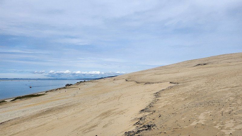
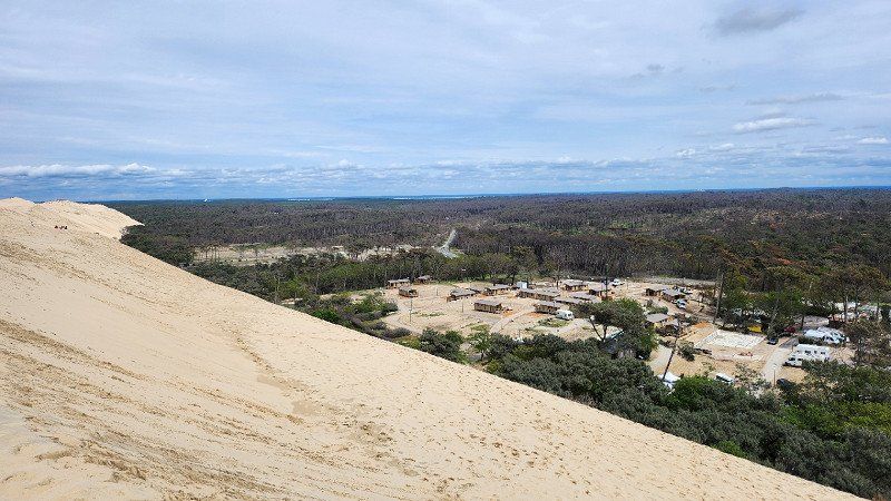
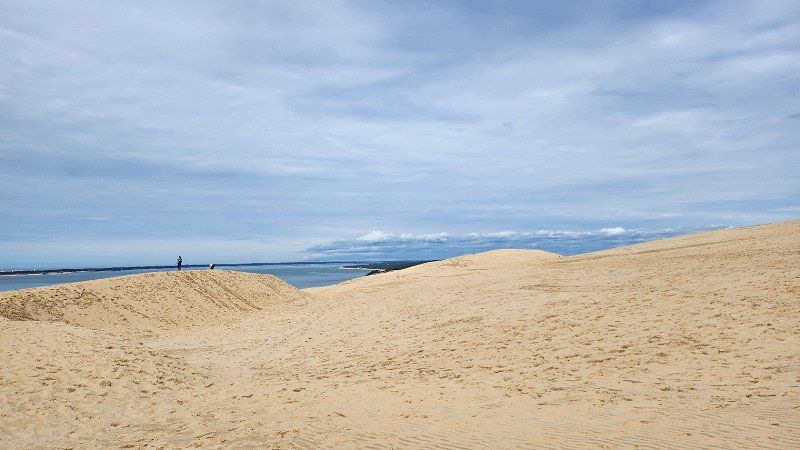
27.04.2023 - Dune du Pilat, Frankreich - höchste Wanderdüne Europas
First to La Teste-de-Buch and pick up the order, then accept the challenge of finding a parking space on the dunes... The main parking lot was already closed again at 12:00 p.m. because it was full. In Le Petit Nice, we drove into a parking lot that was "actually" only for vehicles up to 1.90 m (we weren't the only ones with a camper)... Due to the coast breaking off, only a cliff - we also came down to the beach not entirely allowed. Approx. 1.5 hour walk to and from the Dune du Pilat. Great view and then back again. Since campers/WoMos were not allowed there, we finally parked in Arcachon in a parking lot (allowed for WoMos, on the main road, but free of charge) and stayed overnight.
Dune du Pilat, Frankreich
44° 35' 21" N 1° 12' 50.8" W
44.5891615 -1.2141047
• Head east. Go for 84 m.
• Turn right toward Route d'Arcachon à Biscarrosse/D218. Go for 325 m.
• Turn left onto Route d'Arcachon à Biscarrosse (D218). Go for 1.9 km.
• Take the 1st exit from roundabout onto D259 toward Bordeaux/Bayonne/La Teste-Centre/Arcachon. Go for 3.5 km.
• Take the 2nd exit from roundabout onto Boulevard des Portes de l'Océan (D259). Go for 480 m.
• Take ramp onto D1250. Go for 333 m.
• Continue on N250. Go for 1.1 km.
• Pass 2 roundabouts and continue on N250. Go for 5.3 km.
• Continue on A660. Go for 18.1 km.
• Continue toward A63. Go for 29 m.
• Take exit 22 toward Mt de Marsan/Bayonne/S. Sebastian onto A63. Go for 146 km.
• Take exit 6 toward Bayonne-Nord/Bayonne/Peyrehorade onto D810 (Échangeur de Bayonne-Nord). Go for 691 m.
• Take the 4th exit from Rond-Point du Grand-Basque roundabout onto Avenue du Grand-Basque (D810) toward Bayonne-Centre/Biarritz/St Sébastien/Anglet/Hasparren/St Esprit/Gare/Stade Didier Deschamps. Go for 1.4 km.
• Turn sharp right onto Rue Gustave Eiffel (D935) toward St Pierre d'Irube/Hasparren/Centre Ville. Go for 139 m.
• Take the 3rd exit from Rond-Point Porteteny roundabout onto Avenue Duvergier de Hauranne (D936). Go for 391 m.
• Take the 2nd exit from Rond-Point de la Nautique roundabout onto Avenue Capitaine Resplandy (D936). Go for 570 m.
• Turn left onto Place du Réduit. Go for 96 m.
• Continue on Pont Mayou. Go for 63 m.
• Turn right onto Place de la Liberté. Go for 130 m.
• Arrive at Rue Bernède. Your destination is on the right.
☍
180,9 km
(1 hrs. 39 min.)
Day
28.04.2023 - Bayonne, Frankreich
On the way to Biarritz only drove through, but here too a clear recommendation to spend one or more days. Biarritz, on the other hand, was unspectacular, at least in transit...
Bayonne, 64100, Frankreich
43° 29' 36" N 1° 28' 30.4" W
43.4933379 -1.4750990
• Head toward Rue Adolphe Thiers on Rue Bernède. Go for 41 m.
• Continue on Place Charles de Gaulle. Go for 256 m.
• Turn right toward Allées Marines/D5. Go for 45 m.
• Turn left onto Avenue des Allées Paulmy (D5). Go for 846 m.
• Take the 1st exit from Rond-Point Saint-Léon roundabout onto Avenue Maréchal Soult (D810) toward A63 (St Sebastien)/St Jean de Luz/St Sébastien/Biarritz/Anglet/Cambo/Donibane Lohizune/Donostia. Go for 623 m.
• Turn right onto Avenue Marcel Dassault toward N263/A63-(St Sebastien)/Ustaritz/Cambo/St Pée. Go for 290 m.
• Take the 4th exit from Giratoire Les Pontots roundabout onto Boulevard d'Aritxague toward A63-A64. Go for 478 m.
• Take the 2nd exit from Giratoire de Lachepaillet roundabout onto Boulevard d'Aritxague toward N263/A63-A64/Ustaritz/Cambo/St Pée S/Niv. Go for 752 m.
• Take the 3rd exit from Giratoire de Beyris roundabout onto Boulevard d'Aritxague toward N263/A63-A64/Ustaritz/Cambo/St Pée S/Niv. Go for 1.6 km.
• Take the 2nd exit from Giratoire de Maignon roundabout onto Avenue du 8 Mai 1945 (D932) toward A63/Pau/Ustaritz/Cambo/St Pée S/Niv. Go for 397 m.
• Take the 1st exit from Giratoire de Lestaulan roundabout onto A63 (Autoroute de la Côte Basque) toward St-Sébastien/Biarritz. Go for 5.0 km.
• Take exit 4 toward Biarritz/Aéroport Biarritz-Parme/Bidart/St Pée S/Nivelle. Go for 636 m.
• Continue toward Boulevard Marcel Dassault/D810. Go for 46 m.
• Take the 3rd exit from roundabout onto Boulevard Marcel Dassault (D810) toward St Jean de Luz/St Sébastien/Bidart/Donostia. Go for 1.5 km.
• Take the 3rd exit from roundabout onto Avenue de Bayonne (D810) toward St Jean de Luz/Bidart-Centre. Go for 295 m.
• Pass 2 roundabouts and continue on Avenue Chabadenia (D810). Go for 1.6 km.
• Turn right onto Rue de l'Église. Go for 142 m.
• Arrive at Place Atchoarenea. Your destination is on the right.
☍
14,6 km
( 18 min.)
28.04.2023 - Bidart, Frankreich
Last parking space in France - again with the well-known operator. Space was good and the weather was good when we arrived, so we got out and had a barbecue for the first time... Unfortunately, we just managed to eat before the wind and gray got too strong.
Bidart, 64210, Frankreich
43° 26' 21" N 1° 35' 23.6" W
43.4391702 -1.5898909
• Head north on Place Atchoarenea. Go for 24 m.
• Turn left onto Avenue de la Grande Plage. Go for 203 m.
• Turn left onto Chemin Tarte Berria. Go for 46 m.
• Take the 1st exit from roundabout onto Rue Tarte Berria. Go for 60 m.
• Take the 1st exit from roundabout onto Avenue Atherbéa (D810). Go for 865 m.
• Pass 2 roundabouts and continue on Route Nationale 10 (D810). Go for 4.9 km.
• Turn left onto Avenue Lahanchipia toward Bayonne/St Sébastien. Go for 75 m.
• Take ramp onto A63 (Autoroute de la Côte Basque) toward St Sébastien. Go for 13.3 km.
• Continue on AP-8 (Autopista del Cantábrico). Go for 12.2 km.
• Take the exit toward Bilbao/Vitoria-Gasteiz/Burgos/Hernani/A-15/Iruña/Pamplona onto AP-1/AP-8. Go for 14.8 km.
• Take the exit onto AP-1/AP-8 (Autopista del Cantábrico). Go for 41.9 km.
• Continue on AP-8 (Autopista del Cantábrico) toward Eibar/Bilbao. Go for 34.2 km.
• Take exit 103 toward N-637/Aireportua/Centro Ciudad Bilbao/Barakaldo/Getxo onto BI-30. Go for 14.2 km.
• Take exit 14 toward Artxandako Tunelak/Centro Ciudad Bilbao onto Camino Pike. Go for 585 m.
• Turn right toward Camino Pike. Go for 37 m.
• Continue on Camino Pike. Go for 144 m.
• Turn right onto Camino Pike. Go for 10 m.
• Keep left onto Camino Pike toward Begoña/BI-625. Go for 197 m.
• Continue on Túnel de Artxanda. Go for 1.3 km.
• Keep left onto Carretera Enekuri-Artxanda toward F.moyua Plaza. Go for 299 m.
• Continue on Puente de la Salve. Go for 252 m.
• Continue on Alameda Recalde. Go for 515 m.
• Enter the roundabout. Go for 285 m.
• Arrive at Plaza Federico Moyúa. Your destination is on the left.
☍
140,3 km
(1 hrs. 29 min.)
Day
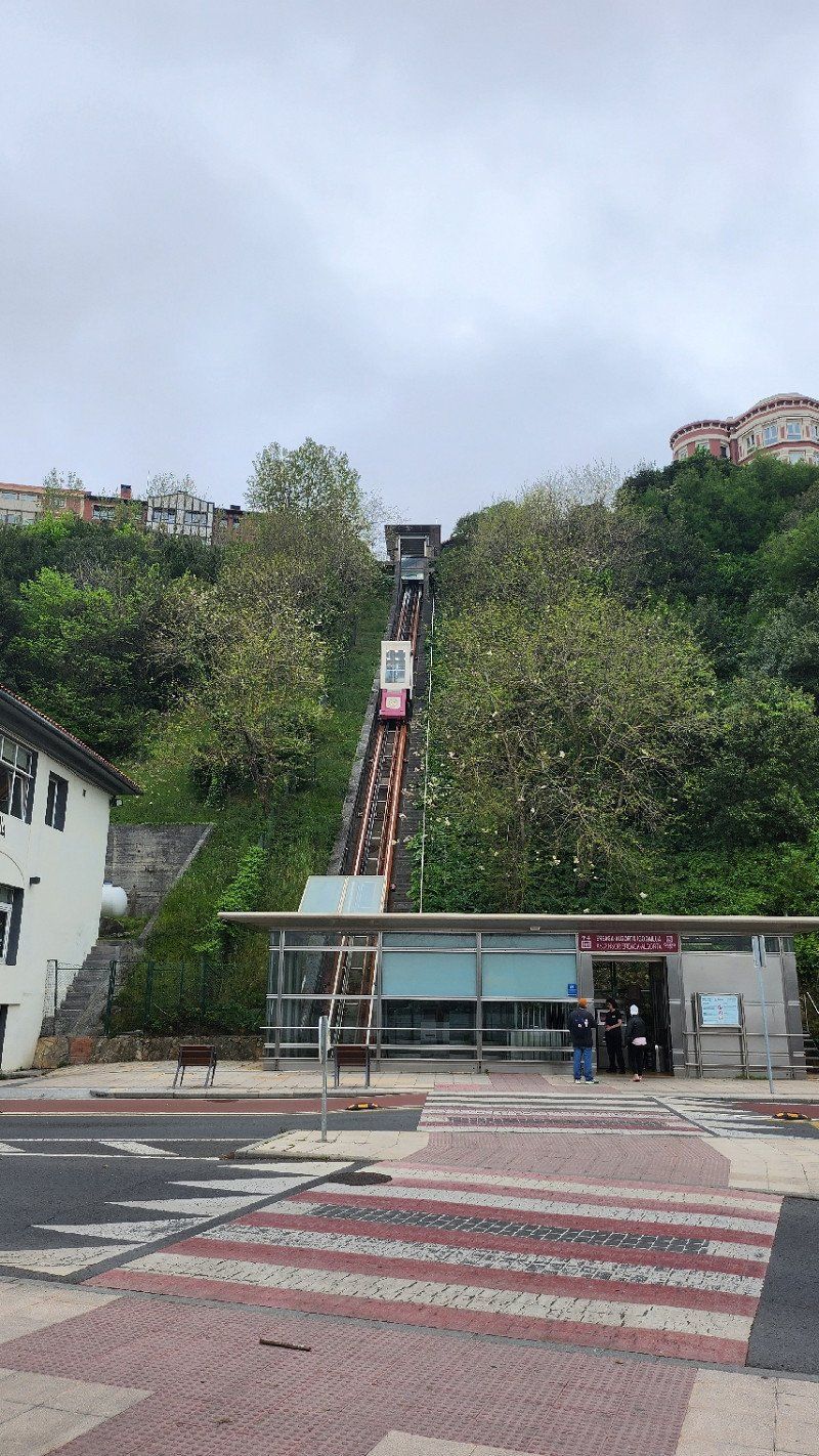
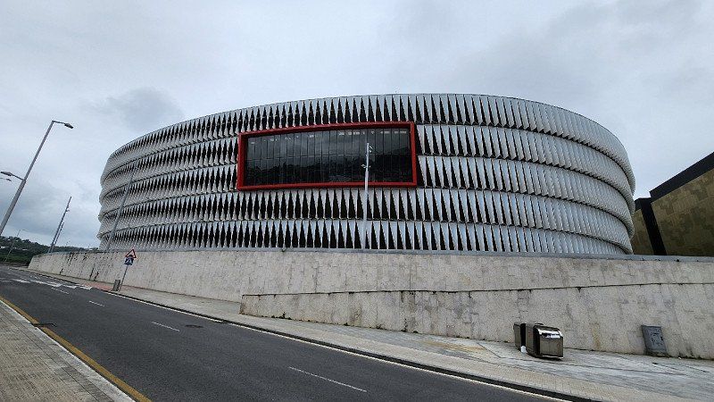
29.04.2023 - Bilbao, Spanien
Jipie, finally in Spain... Unfortunately for the long weekend in May and previously selected parking spaces are already full, because the Spaniards are all on the road... Nevertheless, we parked briefly at the port and at the stadium and took a look before we left the city, to even find a place...
Bilbao, Biscay, Spain
43° 15' 46.8" N 2° 56' 5.9" W
43.2630126 -2.9349852
• Follow the roundabout. Go for 218 m.
• Take the 5th exit from roundabout onto Calle de Elcano. Go for 150 m.
• Turn right onto Calle General Concha. Go for 469 m.
• Turn left onto Calle Autonomía toward Plaza Zabalburu/Estación Bilbao-Abando/Bilbao-Abando Geltokia. Go for 114 m.
• Continue on Plaza Zabálburu. Go for 23 m.
• Turn right onto Calle Juan de Garay. Go for 738 m.
• Take the 2nd exit from roundabout toward A-8. Go for 69 m.
• Continue on Calle Eskurtze. Go for 85 m.
• Take ramp onto A-8 (Autovía del Cantábrico) toward Donostia/San Sebastián/AP-68/Vitoria/Gasteiz. Go for 2.4 km.
• Keep left onto AP-8 (Autopista del Cantábrico) toward A-8/Donostia-San Sebastián. Go for 6.1 km.
• Take exit 107 toward Galdakao/Hiri-Erdialdea. Go for 368 m.
• Take the 1st exit from roundabout onto Bizkai kalea. Go for 426 m.
• Take the 1st exit from roundabout onto Bizkai kalea. Go for 185 m.
• Take the 1st exit from roundabout onto Aranzelai bidea. Go for 211 m.
• Turn slightly right onto Torrezabal bidea. Go for 58 m.
• Continue on Aranzelai bidea. Go for 274 m.
• Arrive at Aranzelai bidea. Your destination is on the left.
☍
11,9 km
( 15 min.)
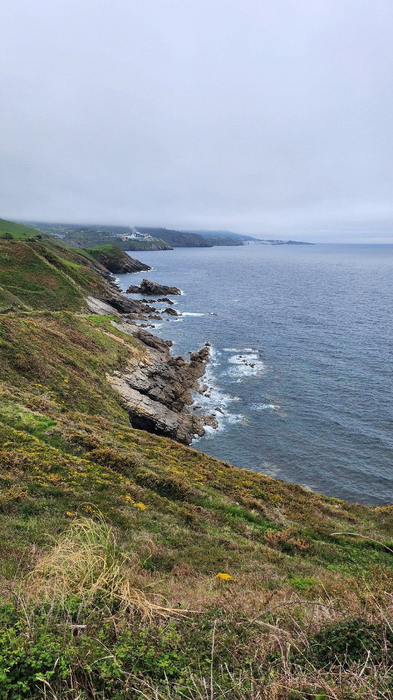
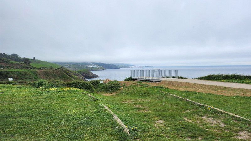
29.04.2023 - Bizkaia, Spanien
Free parking space for max. 72 hours directly on the Atlantic. Great view, even if the weather is only half good, maybe the sky will open up in the evening... Nice path along the coast for running or walking, even if the sun didn't come through.
Bizkaia, Spanien
43° 14' 18.5" N 2° 51' 5.9" W
43.2384820 -2.8516316
• Head toward Torrezabal bidea on Aranzelai bidea. Go for 274 m.
• Continue on Torrezabal bidea. Go for 58 m.
• Turn slightly left onto Aranzelai bidea. Go for 195 m.
• Take the 2nd exit from roundabout onto Bizkai kalea. Go for 202 m.
• Take the 2nd exit from roundabout onto Bizkai kalea. Go for 446 m.
• Take the 3rd exit from roundabout onto AP-8 (Autopista del Cantábrico) toward Bilbao. Go for 6.5 km.
• Continue on A-8 (Autovía del Cantábrico). Go for 85.4 km.
• Take exit 199 toward Torrelavega/Oviedo onto A-8 (Autovía del Cantábrico). Go for 162 km.
• Take exit 360 toward Gijón/A Coruña/Aeropuerto de Asturias onto A-8 (Autovía del Cantábrico). Go for 18.6 km.
• Take exit 379 toward Gijón/El Llano/Pola de Siero. Go for 627 m.
• Take the 2nd exit from roundabout onto Prolongación Avenida del Llano (AS-246). Go for 909 m.
• Continue on Avenida del Llano. Go for 790 m.
• Take the 4th exit from roundabout onto Avenida del Llano. Go for 242 m.
• Arrive at Avenida del Llano. Your destination is on the left.
☍
275,7 km
(2 hrs. 34 min.)
Day
Day
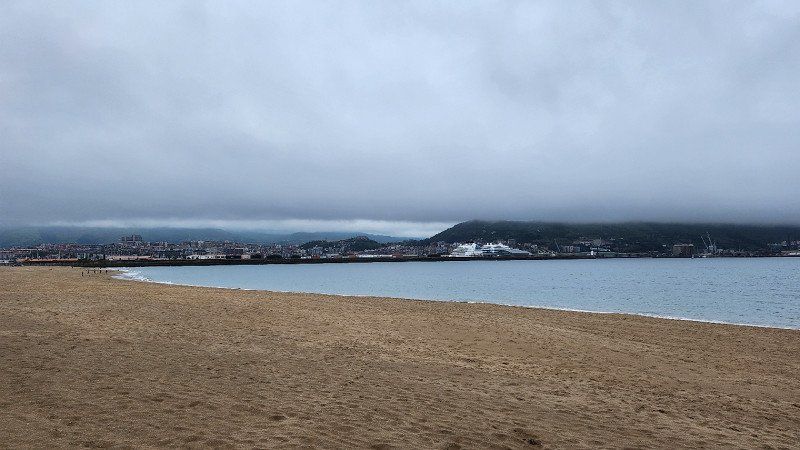
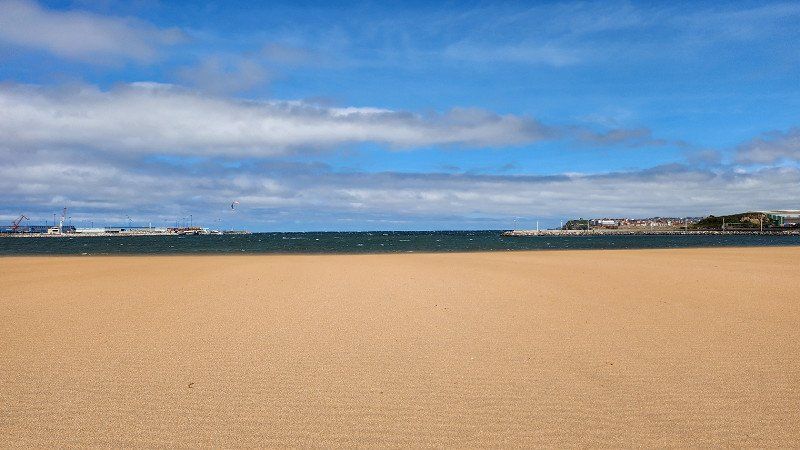
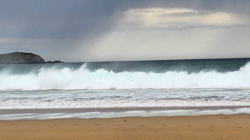
01.05.2023 - Gijón
Pitch right on the beach, but it was so windy that the sand was flying around our ears... according to the weather forecast, there was no immediate improvement, so we decided to continue on to Leon.
Spanien
43° 31' 55.9" N 5° 39' 40" W
43.5322015 -5.6611195
• Head toward Calle Pérez de Ayala on Avenida del Llano. Go for 781 m.
• Continue on Prolongación Avenida del Llano (AS-246). Go for 863 m.
• Take the 2nd exit from roundabout onto AS-I toward Tremañes/AS-19/Gijón (Ronda)/Santander/Pola de Siero/Langreo/Mieres. Go for 33.8 km.
• Take the left exit toward Mieres (sur)/León/AS-242/Figaredo onto A-66 (Autovía Ruta de la Plata). Go for 18.6 km.
• Continue on AP-66 (Autopista Ruta de la Plata). Go for 76.6 km.
• Take exit 143 toward León onto N-120. Go for 5.3 km.
• Keep left onto Avenida Profesor Pablo Díez (N-120). Go for 170 m.
• Take the 1st exit from roundabout onto Avenida Profesor Pablo Díez (N-120). Go for 845 m.
• Take the 3rd exit from roundabout onto N-120. Go for 775 m.
• Take the 2nd exit from roundabout onto Avenida Portugal (N-120). Go for 1.2 km.
• Take the 2nd exit from roundabout onto Avenida de Fernández Ladreda (N-630). Go for 1.1 km.
• Take the 2nd exit from roundabout onto Calle de la Corredera. Go for 165 m.
• Keep right onto Calle de la Corredera. Go for 732 m.
• Keep right onto Avenida de la Independencia. Go for 446 m.
• Turn right toward Avenida Ordoño II. Go for 28 m.
• Enter the roundabout. Go for 54 m.
• Arrive at Plaza de Santo Domingo. Your destination is on the right.
☍
141,4 km
(1 hrs. 25 min.)
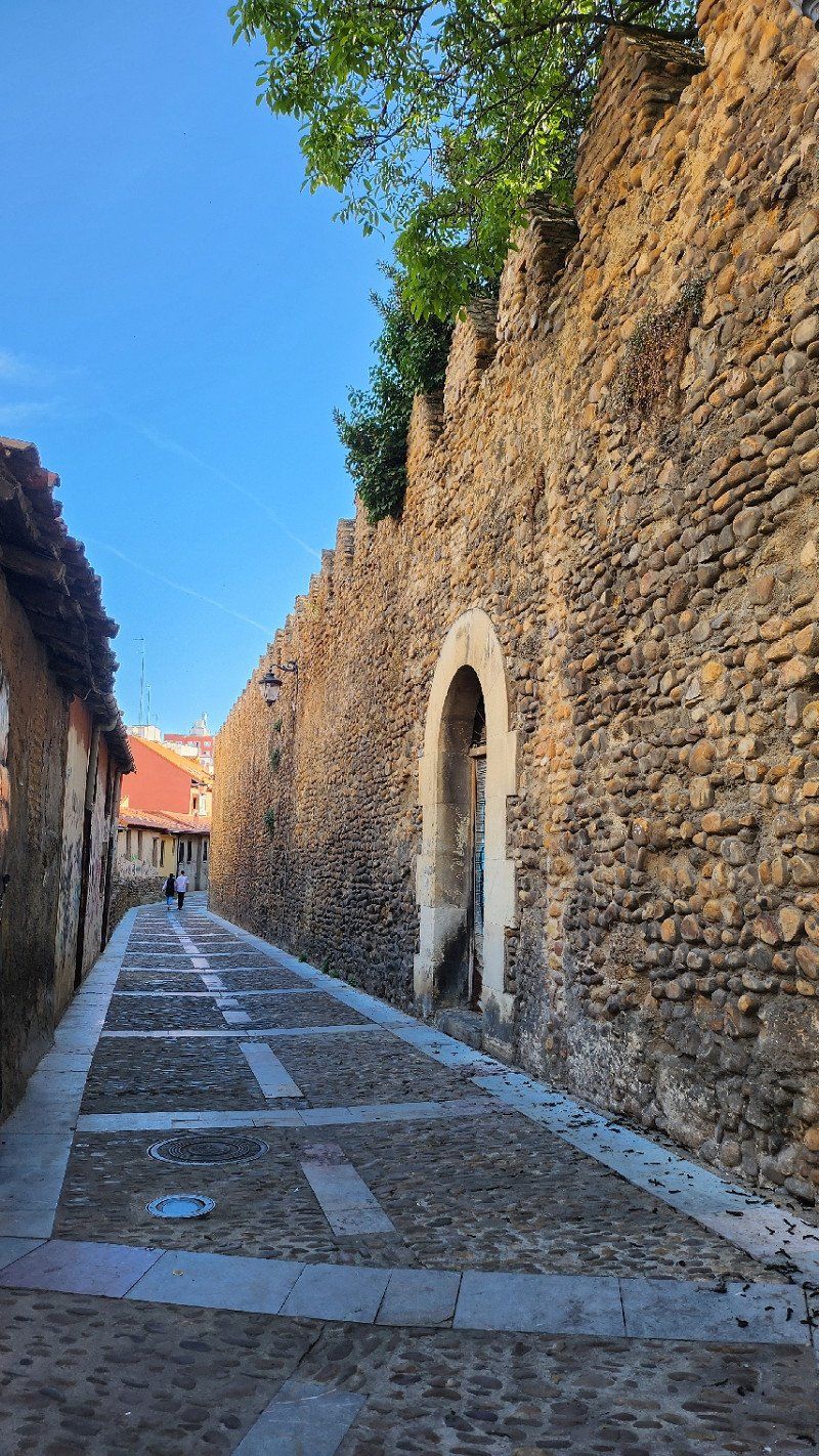
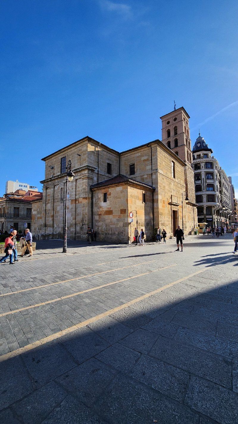
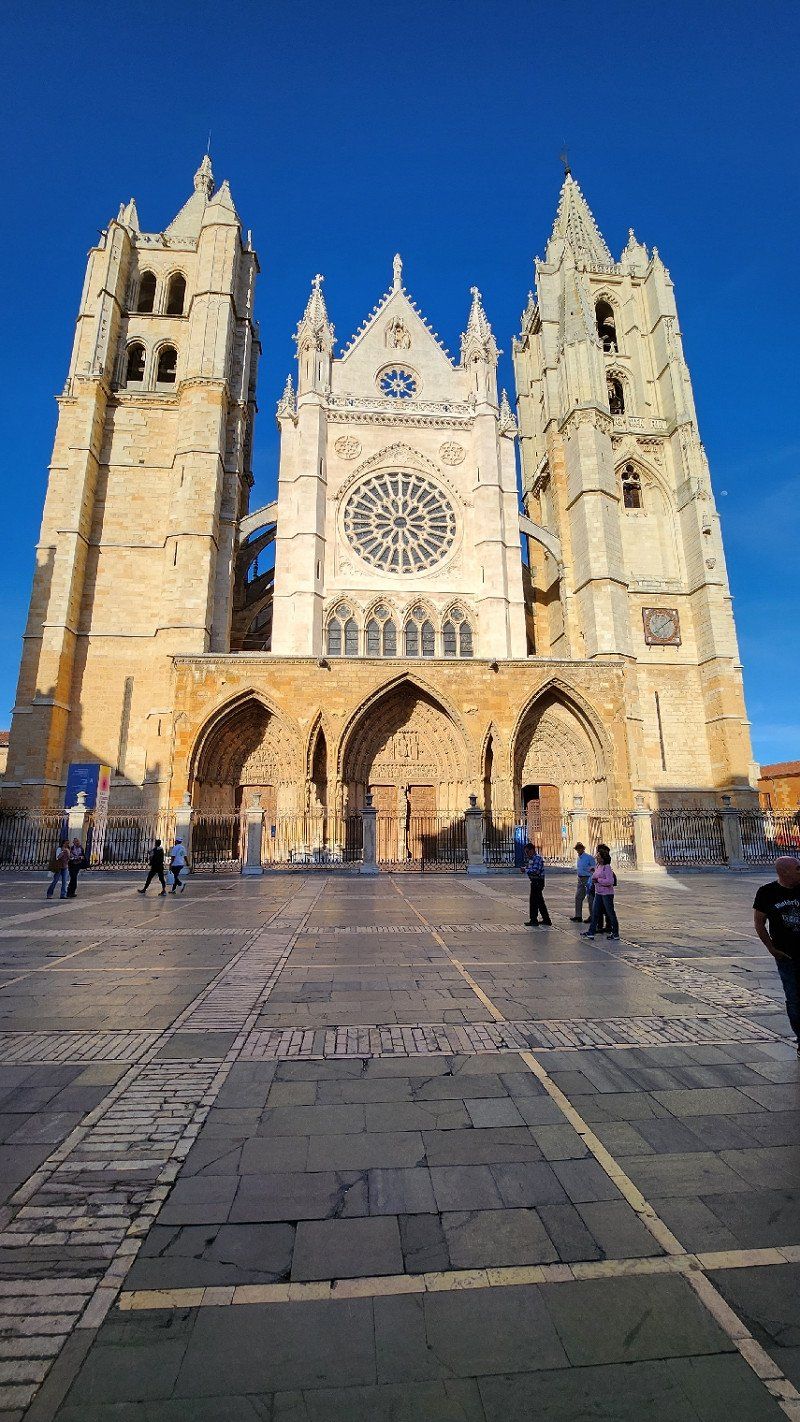
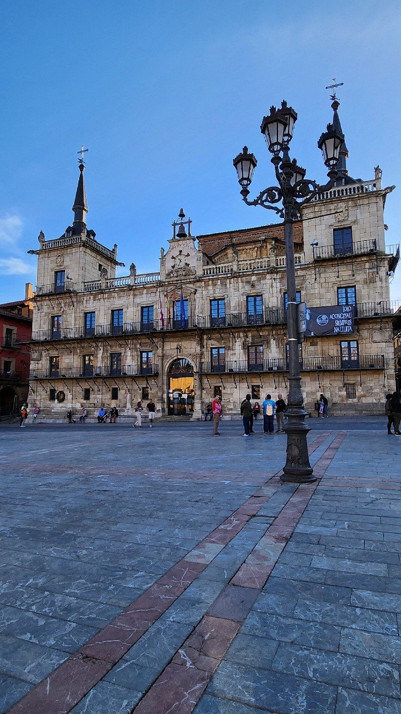
01.05.2023 - León, Spanien
Free parking is available between the park and the street, and the Old Town is within walking distance. A brief overview was provided on the first evening.
León, Spain
42° 35' 54.1" N 5° 34' 18.8" W
42.5983611 -5.5718779
• Follow the roundabout. Go for 40 m.
• Take the 3rd exit from roundabout onto Avenida de la Independencia. Go for 147 m.
• Continue on Calle de Santa Nonia. Go for 295 m.
• Continue on Plaza Jardín de San Francisco. Go for 203 m.
• Continue on Avenida Marqueses de San Isidro. Go for 385 m.
• Continue on Calle Cartagena. Go for 171 m.
• Continue on Calle de la Corredera. Go for 115 m.
• Take the 1st exit from roundabout onto Avenida de Fernández Ladreda (N-630). Go for 1.0 km.
• Take the 3rd exit from roundabout onto Avenida Antibióticos (N-630). Go for 1.7 km.
• Take ramp onto LE-30 toward Astorga/AP-71/Oviedo/AP-66/Benavente/A-66. Go for 6.9 km.
• Continue on AP-71. Go for 36.8 km.
• Take exit 37 toward A Coruña onto A-6 (Autovía del Noroeste). Go for 198 km.
• Take exit 522AB toward Ferrol/Oviedo onto A-8 (Autovía do Cantábrico). Go for 17.4 km.
• Take exit 575 toward Vilalba Centro Cidade/AG-64/Ferrol. Go for 465 m.
• Take the 4th exit from roundabout onto AG-64 (Autovía Ferrol-Vilalba) toward Viveiro/As Pontes/Ferrol. Go for 51.3 km.
• Take exit 5 toward Valdoviño/Narón onto AC-566 (Nelle). Go for 6.3 km.
• Take the 2nd exit from roundabout onto O Barreiro-Valdoviño (AC-566). Go for 1.5 km.
• Enter the roundabout. Go for 24 m.
• Arrive at your destination.
☍
323,3 km
(2 hrs. 51 min.)
Day
Day
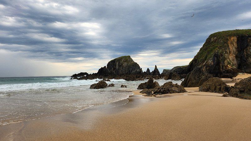
03.05.2022 - Valdoviño
A short cultural break between León and Santiago. Parking right on the beach—free of charge, beautiful views, and lovely walks during breaks in the rain.
Spanien
43° 36' 28" N 8° 8' 33.4" W
43.6077823 -8.1426180
• Follow the roundabout. Go for 12 m.
• Take the 2nd exit from roundabout onto Avenida Porta do Sol (AC-566). Go for 1.4 km.
• Pass 2 roundabouts and continue on AC-566. Go for 7.3 km.
• Continue on A Areosa (AC-566). Go for 419 m.
• Continue on Gadoi (AC-566). Go for 516 m.
• Continue on Estrada Cedeira (AC-566). Go for 380 m.
• Take the 1st exit from roundabout onto Segunda Travesía Río Seco. Go for 194 m.
• Continue on Rúa Río Seco. Go for 96 m.
• Turn left onto Rúa Uxío López. Go for 46 m.
• Take the 3rd exit from Rúa Uxío López roundabout onto Rúa Uxío López. Go for 217 m.
• Take the 3rd exit from roundabout onto FE-12 toward Ferrol. Go for 2.2 km.
• Take the 3rd exit from roundabout onto AP-9 (Autoestrada do Atlántico) toward A Coruña. Go for 33.5 km.
• Take the left exit toward Santiago/A-6/Lugo/Arteixo onto AP-9 (Autoestrada do Atlántico). Go for 53.4 km.
• Take exit 67 toward Santiago/Lugo/A-54/Aeroporto Lavacolla (SCQ). Go for 606 m.
• Take the 3rd exit from roundabout onto Avenida de Camilo José Cela (SC-20) toward Fontiñas/Santiago Sur. Go for 2.0 km.
• Keep left onto Avenida de Gonzalo Torrente Ballester (SC-20) toward Ourense/SC-11/Pontevedra/Noia/AC-543/Santiago Sur. Go for 1.3 km.
• Keep left onto Avenida de Lugo (SC-20). Go for 556 m.
• Keep right onto Avenida de Lugo toward Centro Cidade/Centro Ciudad. Go for 266 m.
• Take the 1st exit from roundabout onto Rúa do Hórreo. Go for 574 m.
• Continue on Rúa do Hórreo. Go for 13 m.
• Arrive at Rúa do Hórreo.
☍
104,9 km
(1 hrs. 1 min.)
Day
04.05.2023 - Santiago de Compostela, Spanien
Santiago de Compostela, A Coruña, Spain
42° 52' 36.7" N 8° 32' 39" W
42.8768606 -8.5441729
• Head toward Rúa da Fonte de Santo Antonio on Rúa do Hórreo. Go for 2 m.
• Turn left onto Rúa Senra. Go for 130 m.
• Continue on Rúa do Campo da Estrela. Go for 48 m.
• Turn left onto Rúa do Campo da Estrela. Go for 41 m.
• Continue on Avenida de Xoán Carlos I. Go for 203 m.
• Continue on Avenida de Rosalía de Castro. Go for 483 m.
• Take the 3rd exit from roundabout onto Avenida Romero Donallo. Go for 533 m.
• Turn sharp right onto Avenida de Antonio Fraguas. Go for 255 m.
• Take ramp onto Avenida de Santiago de Cuba (SC-11) toward AP-53/N-525/Ourense/E-1/AP-9/N-550/A Coruña. Go for 1.4 km.
• Keep left onto Avenida de Santiago de Cuba (SC-11) toward A Coruña/E-1/AP-9/Pontevedra/Vigo/Ourense/Lamas de Abade. Go for 1.0 km.
• Turn right and take ramp onto AP-9 (Autoestrada do Atlántico) toward Hospital Clínico/SC-20/Pontevedra. Go for 105 km.
• Take the exit toward Tui (sur)/Portugal onto A-55. Go for 4.9 km.
• Continue on A3 (Autoestrada do Minho). Go for 4.9 km.
• Take exit 14 toward V. Castelo/Caminha/V. Nv. Cerveira onto N13. Go for 1.4 km.
• Pass 4 roundabouts and continue on N13. Go for 9.7 km.
• Enter the roundabout. Go for 96 m.
• Arrive at your destination on the left.
☍
130,3 km
(1 hrs. 17 min.)
Day
Day
06.05.2023 - Vila Nova de Cerveira
Free parking (water and waste disposal, but no electricity), right on the Rio Minho. There are railway lines in between, but the railway didn't bother us. A cute place, a supermarket open on Sundays, and a great place to walk or bike along the river. The weather was so great that we stayed two nights.
Portugal
41° 56' 18" N 8° 44' 38.7" W
41.9383326 -8.7440773
• Follow the roundabout. Go for 71 m.
• Take the 3rd exit from roundabout onto Rua Santo António (N13) toward Viana do Castelo/Caminha. Go for 1.8 km.
• Take the 1st exit from roundabout onto N13 toward Viana do Castelo/Caminha. Go for 2.0 km.
• Keep left onto Autoestrada do Litoral Norte (A28) toward Porto/Viana C.lo. Go for 27.1 km.
• Take exit 24 toward Porto onto A27/A28 (Autoestrada do Litoral Norte). Go for 729 m.
• Continue on A28 (Autoestrada do Litoral Norte). Go for 67.7 km.
• Keep left onto Avenida da Associação Empresarial de Portugal toward Boavista/Bessa. Go for 326 m.
• Keep left onto Avenida da Associação Empresarial de Portugal toward Av. Sidónio Pais/Boavista/Centro Aliados. Go for 424 m.
• Continue on Avenida Sidónio Pais. Go for 371 m.
• Continue on Rua de Cinco de Outubro. Go for 582 m.
• Enter the roundabout. Go for 475 m.
• Arrive at Praça Mouzinho de Albuquerque.
☍
101,6 km
(1 hrs. 2 min.)
Day
Day
08.05.2023 - Porto, Portugal
Free parking without service, busy at night with young people, but only 6 km from Porto's old town. For the first time, I spent a restless night.
Porto, Portugal
41° 9' 28.6" N 8° 37' 44.8" W
41.1579438 -8.6291053
• Follow the roundabout. Go for 409 m.
• Take the 4th exit from roundabout onto Rua de Caldas Xavier toward VCI/P.te Arrábida. Go for 54 m.
• Continue on Praça do Bom Sucesso. Go for 78 m.
• Continue on Rua Gonçalo Sampaio. Go for 319 m.
• Keep left onto Rua Gonçalo Sampaio toward VCI. Go for 473 m.
• Take left ramp onto A28 (Autoestrada do Litoral Norte) toward Lisboa/A1/Gaia/Ponte da Arrábida. Go for 1.4 km.
• Continue on A1 (Autoestrada do Norte). Go for 55.2 km.
• Take exit 16 toward Aveiro onto A25 (Autoestrada da Costa da Prata). Go for 10.7 km.
• Take the exit toward Aveiro onto A25 (Autoestrada Beiras Litoral e Alta). Go for 6.2 km.
• Take exit 3 toward Aveiro. Go for 336 m.
• Take the 1st exit from roundabout. Go for 251 m.
• Take the 3rd exit from Rotunda dos Marnotos roundabout onto Rua do Alavário. Go for 362 m.
• Continue on Rua do Clube dos Galitos. Go for 131 m.
• Turn right onto Rua Belém do Pará. Go for 134 m.
• Arrive at Rua Belém do Pará. Your destination is on the left.
☍
76,0 km
( 46 min.)
Day
09.05.2023 - Aveiro
Parking lot between the hospital, train station, and bus station (free and with supplies and waste disposal facilities). We only stayed overnight because we didn't want to spend a second night in Porto in the parking lot, then continued on to Fatima.
Portugal
40° 38' 25.8" N 8° 39' 13.5" W
40.6405055 -8.6537539
• Head toward Praça da República on Rua Belém do Pará. Go for 42 m.
• Continue on Rua Gustavo Ferreira Pinto Bastos. Go for 103 m.
• Turn right onto Rua Professor Barbosa de Magalhães. Go for 84 m.
• Turn left onto Rua do Capitão João Souza Pizarro. Go for 223 m.
• Turn right onto Avenida Artur Ravara. Go for 255 m.
• Take the 3rd exit from Rotunda do Hospital roundabout onto Avenida da Universidade. Go for 663 m.
• Take the 2nd exit from roundabout onto Avenida da Universidade. Go for 836 m.
• Continue on N235. Go for 6.3 km.
• Take the 2nd exit from roundabout onto N235. Go for 989 m.
• Pass 2 roundabouts and continue on Rua Fonte Campinho (N235). Go for 2.5 km.
• Take the 3rd exit from roundabout onto A1 (Autoestrada do Norte) toward Lisboa/Mealhada. Go for 119 km.
• Take exit 8 toward N356/Fátima/(IC9)/Batalha. Go for 1.5 km.
• Take ramp onto Avenida João XXIII (N356) toward Rotunda Sul/Ourém/Tomar. Go for 1.9 km.
• Take the 2nd exit from Rotunda dos Pastorinhos roundabout onto Avenida Irmã Lúcia de Jesus (N356) toward Ourém/Tomar. Go for 1.4 km.
• Continue on Avenida Irmã Lúcia de Jesus. Go for 158 m.
• Arrive at Avenida Irmã Lúcia de Jesus. Your destination is on the right.
☍
135,8 km
(1 hrs. 20 min.)
Day
10.05.2023 - Fatima, Portugal
Left Porto, spent the night in Aveiro, we arrived in Fátima. Huge free WoMo parking lot (200 spaces) directly behind the church. The church (1928) itself is almost the least spectacular in this place. A huge square (152,000 sqm), outside a "pavilion altar" where services are held in different languages all day long...always new pilgrims coming, a new pilgrimage church (2007) incl. museum...crazy. ..
2495 Fátima, Portugal
39° 37' 1" N 8° 39' 7.3" W
39.6169407 -8.6520361
• Head toward Rua da Cooperativa on Avenida Irmã Lúcia de Jesus. Go for 8 m.
• Continue on Estrada Nossa Senhora da Ortiga. Go for 57 m.
• Turn right toward Rua da Cooperativa. Go for 60 m.
• Turn right onto Rua da Cooperativa. Go for 61 m.
• Turn left onto Avenida Irmã Lúcia de Jesus. Go for 1.5 km.
• Take the 4th exit from Rotunda dos Pastorinhos roundabout onto Avenida João XXIII (N356). Go for 1.6 km.
• Take ramp toward Lisboa/Porto. Go for 1.3 km.
• Take ramp onto A1 (Autoestrada do Norte) toward Porto/Leiria. Go for 15.1 km.
• Take exit 9 toward Leiria/(N242)/M.nha Grande onto A8-1. Go for 2.8 km.
• Keep left onto A8-1 toward Leiria Sul/A8/Aveiro/A17/Batalha/A19. Go for 252 m.
• Take ramp onto A8-1. Go for 469 m.
• Continue on A8 (Autoestrada do Oeste) toward Leiria Sul/Aveiro/A17/Batalha/A19. Go for 10.4 km.
• Take exit 25 toward M.nha Grande. Go for 842 m.
• Take the 2nd exit from roundabout onto N242 toward M.nha Grande/Pataias. Go for 4.0 km.
• Turn right onto Rua 25 de Abril (M1185). Go for 582 m.
• Continue on Rua Luís de Camões (M1185). Go for 60 m.
• Turn left onto Avenida Dom Dinis. Go for 142 m.
• Continue on Largo 5 de Outubro. Go for 80 m.
• Continue on Rua Machado Santos. Go for 49 m.
• Turn left onto Rua António Campos Júnior. Go for 45 m.
• Arrive at Rua António Campos Júnior. Your destination is on the left.
☍
39,5 km
( 30 min.)
10.05.2023 - Marinha Grande
Free parking above the beach. A quiet night and a lovely walk along the beach before continuing on...
Portugal
39° 45' 1.4" N 8° 55' 54.5" W
39.7503802 -8.9318059
• Head south on Rua António Campos Júnior.
• Turn right onto Rua Marquês de Pombal. Go for 70 m.
• Turn left onto Rua Pereira Crespo. Go for 94 m.
• Continue on Rua Joaquim Barosa. Go for 33 m.
• Turn right onto Rua Joaquim Barosa. Go for 64 m.
• Turn left onto Rua Bernardino José Gomes (N242-1). Go for 37 m.
• Continue on Rua Bombeiros Voluntários (N242-1). Go for 66 m.
• Take the 2nd exit from Rotunda Rotary Club da Marinha Grande roundabout onto Rua Bombeiros Voluntários (N242-1). Go for 161 m.
• Take the 2nd exit from Praça do Vidreiro roundabout onto Avenida Doutor José Henriques Vareda (N242). Go for 726 m.
• Pass 2 roundabouts and continue on Rua da Nazaré (N242). Go for 2.9 km.
• Take ramp toward Lisboa/Nazaré/Leiria. Go for 1.0 km.
• Keep left toward Autoestrada do Oeste/A8. Go for 958 m.
• Take ramp onto A8 (Autoestrada do Oeste) toward Lisboa/Nazaré. Go for 39.7 km.
• Take the exit. Go for 299 m.
• Turn left onto Avenida Infante Dom Henrique. Go for 310 m.
• Continue on Rua Infante Dom Henrique. Go for 291 m.
• Continue on Avenida Infante Dom Henrique. Go for 426 m.
• Take the 2nd exit from roundabout onto Avenida Infante Dom Henrique. Go for 456 m.
• Take the 3rd exit from roundabout onto Avenida Infante Dom Henrique. Go for 311 m.
• Continue on Variante Atlântica. Go for 1.8 km.
• Take the 2nd exit from roundabout onto Variante Atlântica. Go for 1.8 km.
• Turn left onto Rua das Arroteias. Go for 443 m.
• Turn right onto Rua Francisco Almeida Grandela (N360). Go for 250 m.
• Arrive at Rua Francisco Almeida Grandela (N360). Your destination is on the left.
☍
52,2 km
( 35 min.)
Day
11.05.2023 - Foz do Arelho
Pitch right on the lagoon (€6/night). Great for walking, watching the sunset over the Atlantic, watching the kitesurfers (if you can't do it yourself), and/or just chilling...
Portugal
39° 26' 11.6" N 9° 12' 48.3" W
39.4365442 -9.2134149
• Head west on Rua Francisco Almeida Grandela (N360). Go for 79 m.
• Turn right onto Rua Joaquim Soares. Go for 180 m.
• Keep right onto Rua Joaquim Soares. Go for 123 m.
• Turn right onto Rua Capitão Lourenço. Go for 58 m.
• Turn left onto Rua Paulino da Silva. Go for 20 m.
• Turn right onto Variante Atlântica. Go for 429 m.
• Pass 2 roundabouts and continue on Variante Atlântica. Go for 3.7 km.
• Continue on Avenida Infante Dom Henrique. Go for 268 m.
• Take the 3rd exit from roundabout onto Avenida Infante Dom Henrique. Go for 452 m.
• Take the 2nd exit from roundabout onto Avenida Infante Dom Henrique. Go for 464 m.
• Continue on Rua Infante Dom Henrique. Go for 291 m.
• Continue on Avenida Infante Dom Henrique. Go for 266 m.
• Take ramp onto A8 (Autoestrada do Oeste) toward Lisboa/T. Vedras. Go for 82.0 km.
• Keep left onto Autoestrada do Oeste (A8) toward Lisboa Centro/Lumiar/CRIL/IC17/Algés/IC16/Odivelas Oeste. Go for 579 m.
• Continue on Calçada de Carriche (IC1). Go for 1.2 km.
• Continue on Avenida Padre Cruz. Go for 2.0 km.
• Keep left onto Avenida Padre Cruz. Go for 532 m.
• Keep right onto Avenida Padre Cruz toward Cp. Grande. Go for 267 m.
• Continue on Campo Grande. Go for 29 m.
• Turn right onto Campo Grande toward Centro/M. Pombal. Go for 406 m.
• Keep left onto Campo Grande. Go for 712 m.
• Keep right toward Campo Grande. Go for 240 m.
• Take the 3rd exit from roundabout onto Campo Grande toward Av. Estados Unidos da América. Go for 141 m.
• Continue on Avenida dos Estados Unidos da América. Go for 213 m.
• Keep right onto Avenida dos Estados Unidos da América toward Av. de Roma. Go for 256 m.
• Turn right onto Avenida de Roma. Go for 914 m.
• Continue on Praça de Londres. Go for 231 m.
• Continue on Avenida Manuel da Maia. Go for 537 m.
• Continue on Largo do Leão. Go for 53 m.
• Turn left onto Rua António Pereira Carrilho. Go for 155 m.
• Turn right onto Rua Alves Torgo toward Areeiro/Anjos. Go for 200 m.
• Continue on Rua de Arroios. Go for 592 m.
• Continue on Largo de Santa Bárbara. Go for 60 m.
• Turn slightly right toward Largo de Santa Bárbara. Go for 32 m.
• Continue on Rua de Santa Bárbara. Go for 211 m.
• Continue on Largo do Conde de Pombeiro. Go for 90 m.
• Turn right onto Paço da Rainha. Go for 8 m.
• Turn left onto Paço da Rainha. Go for 196 m.
• Continue on Largo do Mitelo. Go for 39 m.
• Arrive at Largo do Mitelo. Your destination is on the left.
☍
98,2 km
(1 hrs. 10 min.)
Day
Day
13.05.2023 - Lissabon, Portugal
Pitch in a former munitions factory (20 euros/night - without electricity including VE) - everything a bit unconventional/alternative, but the camper is safe and you can quickly get to the city by bike/scooter (20 minutes).
Lisbon, Portugal
38° 43' 20.1" N 9° 8' 21.6" W
38.7222524 -9.1393366
• Head west on Largo do Mitelo.
• Continue on Campo dos Mártires da Pátria. Go for 130 m.
• Turn left onto Rua de Santo António dos Capuchos. Go for 256 m.
• Continue on Rua do Telhal. Go for 174 m.
• Continue on Rua das Pretas. Go for 81 m.
• Continue on Avenida da Liberdade. Go for 34 m.
• Turn right onto Avenida da Liberdade. Go for 828 m.
• Continue toward A1/A2/A5/Saldanha/Cp. Grande. Go for 49 m.
• Take the 2nd exit from Praça do Marquês de Pombal roundabout onto Praça do Marquês de Pombal toward Sul/A2/Cascais/A5/Amoreiras. Go for 209 m.
• Continue on Rua Joaquim António de Aguiar. Go for 44 m.
• Keep right onto Rua Joaquim António de Aguiar. Go for 52 m.
• Take left ramp onto Tunel do Marquês. Go for 311 m.
• Keep left onto Tunel do Marquês toward Sul/A2/Cascais/A5. Go for 831 m.
• Continue on Avenida Engenheiro Duarte Pacheco. Go for 391 m.
• Take ramp onto IP7 (Avenida da Ponte) toward Setúbal/Almada/Sul-Ponte. Go for 5.4 km.
• Continue on A2 (Autoestrada do Sul). Go for 236 km.
• Take exit 15 toward Lagos/Portimão/Albufeira onto A22 (Via Infante de Sagres). Go for 4.9 km.
• Take exit 9 toward (N395)/Albufeira/(N125)/Guia onto IC1. Go for 1.1 km.
• Take left ramp onto N125 toward (N395)/Albufeira/Ferreiras. Go for 1.4 km.
• Take ramp toward Albufeira/Ferreiras. Go for 268 m.
• Take the 1st exit from roundabout onto N395 toward Albufeira. Go for 2.0 km.
• Pass 2 roundabouts and continue on N395. Go for 1.0 km.
• Take the 3rd exit from roundabout onto Avenida dos Descobrimentos (M526) toward Areias de S. João/Oura. Go for 494 m.
• Take the 2nd exit from roundabout onto Avenida dos Descobrimentos (M526). Go for 516 m.
• Turn right onto Rua dos Bombeiros Voluntários. Go for 80 m.
• Continue on Rua do Município. Go for 57 m.
• Turn left onto Rua das Telecomunicações. Go for 157 m.
• Turn right onto Rua Fernão de Magalhães. Go for 29 m.
• Turn left onto Impasse Fernão de Magalhães. Go for 76 m.
• Arrive at Impasse Fernão de Magalhães. Your destination is on the right.
☍
256,5 km
(2 hrs. 20 min.)
Day
Day
15.05.2023 - Albufeira, Portugal
We stopped off in Albufeira, above the city, at a parking lot in a residential area. The view was beautiful, but the place was too touristy for us.
8200 Albufeira, Portugal
37° 5' 20.7" N 8° 14' 52.4" W
37.0890719 -8.2478796
• Head toward Rua Fernão de Magalhães on Impasse Fernão de Magalhães. Go for 76 m.
• Turn left onto Rua Fernão de Magalhães. Go for 45 m.
• Turn right onto Rua Fernão de Magalhães. Go for 54 m.
• Turn right onto Rua Gil Vicente. Go for 135 m.
• Turn right onto Rua das Telecomunicações. Go for 46 m.
• Turn left onto Rua Pedro Álvares Cabral toward Faro/A22/Portimão/Montechoro. Go for 79 m.
• Continue on Rua Pedro Álvares Cabral. Go for 68 m.
• Continue on Rua Pedro Álvares Cabral. Go for 57 m.
• Keep left onto Rua do Município toward Montechoro/Portimão/A22/Faro. Go for 72 m.
• Turn right onto Rua dos Bombeiros Voluntários toward Montechoro/Portimão/Faro/A22. Go for 63 m.
• Turn left onto Avenida dos Descobrimentos (M526) toward Montechoro/Olhos d'Água. Go for 528 m.
• Take the 2nd exit from roundabout onto Avenida dos Descobrimentos (M526). Go for 479 m.
• Take the 1st exit from roundabout onto N395 toward Paderne/Ferreiras/Lisboa/A2/Faro/A22/Portimão. Go for 642 m.
• Pass 2 roundabouts and continue on N395. Go for 2.4 km.
• Take the 3rd exit from roundabout onto N395 toward Faro/A22/Portimão/Lisboa/Ferreiras. Go for 245 m.
• Take the 1st exit from roundabout onto N125 toward Lisboa/IC1/Faro/A22/Portimão. Go for 1.5 km.
• Take ramp onto IC1 toward Ourique/Faro/A22/Portimão/Lisboa/(A2). Go for 779 m.
• Take ramp onto A22 (Via Infante de Sagres) toward Faro/Espanha/Lisboa/(A2). Go for 85.5 km.
• Continue on A-49 (Autopista del V Centenario). Go for 132 km.
• Take left exit 0B toward Coria del Río/E-5/Cádiz/A-4/Granada/A-92 onto A-66. Go for 7.8 km.
• Take exit 9A toward Cádiz onto A-4 (Autovía del Sur). Go for 13.3 km.
• Continue on AP-4 (Autopista del Sur). Go for 92.6 km.
• Continue on CA-35. Go for 7.2 km.
• Continue on Avenida Cortes de Cádiz. Go for 645 m.
• Take the 2nd exit from Glorieta de Jesús Gargallo roundabout onto Avenida de la Independencia. Go for 380 m.
• Enter the roundabout. Go for 22 m.
• Arrive at Glorieta Lebrón. Your destination is on the left.
☍
346,8 km
(3 hrs. 16 min.)
Day
16.05.2023 - Cádiz, Spanien
Cádiz, Spain
36° 31' 15.7" N 6° 16' 49.6" W
36.5210142 -6.2804565
• Follow the roundabout.
• Arrive at Glorieta Lebrón. Your destination is on the left.
☍
Distance not available
(Duration not available)
Day
17.05.2023 - Cádiz
Yesterday Cádiz beach, today Cádiz city...harbor, old town, market—definitely a city where you could stay longer, but today we're heading towards Gibraltar...
Spanien
36° 31' 15.7" N 6° 16' 49.6" W
36.5210142 -6.2804565
• Follow the roundabout. Go for 67 m.
• Take the 4th exit from roundabout onto Avenida de la Independencia. Go for 99 m.
• Turn right onto Calle Carpinteros de Ribera. Go for 163 m.
• Turn right onto Avenida Cortes de Cádiz. Go for 465 m.
• Continue on Puente de la Constitución 1812. Go for 7.2 km.
• Continue on AP-4 (Autopista del Sur). Go for 3.1 km.
• Take exit 102 toward Paterna/A-408/E-5/Jerez de la Frontera/A-4/Sevilla/Algeciras/A-48 onto CA-3113. Go for 324 m.
• Take the 3rd exit from roundabout onto Carretera de Medina. Go for 402 m.
• Take the 3rd exit from roundabout onto A-408. Go for 17.5 km.
• Take the 1st exit from roundabout onto A-381 toward Algeciras. Go for 70.0 km.
• Take the left exit toward San Roque/Estepona/Málaga onto A-7 (Autovía del Mediterráneo). Go for 8.0 km.
• Take exit 1107 toward San Roque (Sur)/La Línea/Gibraltar. Go for 467 m.
• Keep left onto CA-34 toward La Línea/Gibraltar. Go for 1.7 km.
• Pass 3 roundabouts and continue on Avenida de España (CA-34). Go for 3.5 km.
• Take the 2nd exit from roundabout onto Calle Torres Quevedo. Go for 184 m.
• Take the 3rd exit from roundabout onto Calle Virgen Purísima Concepción. Go for 523 m.
• Take the 1st exit from roundabout onto Calle Virgen del Rosario. Go for 212 m.
• Take the 3rd exit from roundabout onto Calle Pedreras. Go for 144 m.
• Turn right onto Calle Prim. Go for 742 m.
• Turn right onto Avenida María Guerrero. Go for 442 m.
• Turn right onto Calle Puerto de la Luz. Go for 25 m.
• Arrive at Calle Puerto de la Luz. Your destination is on the left.
☍
115,3 km
(1 hrs. 19 min.)
17.05.2023 - La Línea de la Concepción
Arrival Parking in Spain in front of the border (15 euros/24 hours/
Spanien
36° 10' 5.7" N 5° 20' 58.1" W
36.1682563 -5.3494719
• Head west on Calle Puerto de la Luz. Go for 54 m.
• Turn right onto Pasaje San Roque. Go for 69 m.
• Turn right onto Calle San Roque. Go for 61 m.
• Turn right onto Calle Gabriel Miró. Go for 56 m.
• Turn right onto Avenida María Guerrero. Go for 89 m.
• Continue on Calle Ángel. Go for 37 m.
• Turn right onto Calle Colón. Go for 414 m.
• Continue on Calle Buenos Aires. Go for 214 m.
• Turn right onto Calle Quevedo. Go for 229 m.
• Turn left onto Calle Sevilla. Go for 209 m.
• Take the 3rd exit from roundabout onto Avenida Príncipe de Asturias (N-351). Go for 588 m.
• Take the 1st exit from Rotonda Real Balompédica Linense roundabout onto Avenida Príncipe de Asturias (N-351). Go for 326 m.
• Turn right onto Avenida Alcaidesa Marina toward Gibraltar. Go for 49 m.
• Take the 2nd exit from roundabout onto Carretera de la Frontera. Go for 462 m.
• Turn right. Go for 140 m.
• Continue toward Winston Churchill Avenue. Go for 29 m.
• Continue on Winston Churchill Avenue. Go for 63 m.
• Turn left toward Kingsway. Go for 262 m.
• Take the 1st exit from roundabout onto Kingsway. Go for 379 m.
• Continue on Kingsway Tunnel. Go for 529 m.
• Continue on Kingsway. Go for 367 m.
• Take the 1st exit from roundabout onto Devil's Tower Road. Go for 438 m.
• Take the 1st exit from roundabout onto Devil's Tower Road. Go for 358 m.
• Take the 3rd exit from roundabout onto Winston Churchill Avenue toward City Centre/Port. Go for 323 m.
• Take the 1st exit from roundabout onto Smith Dorrien Avenue. Go for 319 m.
• Take the 1st exit from roundabout onto Line Wall Road. Go for 484 m.
• Turn left onto John Mackintosh Square. Go for 104 m.
• Turn slightly left onto City Mill Lane. Go for 6 m.
• Arrive at City Mill Lane. Your destination is on the left.
☍
6,7 km
( 17 min.)
Day
18.05.2023 - Gibraltar
We're still parked with the camper on the Spanish side in La Linea. From there, Gibraltar is easily accessible on foot or by bike – 500 meters to the border, a quick crossover, and you're there... Our first attempt ended at the first gas station, and after an hour of vainly hoping it would stop raining, we finally got back to the camper, soaking wet.
At least Madame Sonne made a brief appearance in the evening...
Main Street, GX11 1AA, Gibraltar, Gibraltar
36° 8' 26.7" N 5° 21' 12.9" W
36.1407510 -5.3535850
• Head east on City Mill Lane.
• Arrive at City Mill Lane. Your destination is on the left.
☍
Distance not available
(Duration not available)
Day
19.05.2023 - Gibraltar
New day, good weather, second trip to Gibraltar...
This time, it couldn't have been better. A stroll through the pedestrian zone/shopping street, a few streets to the left and right, then a cable car ride up to the monkeys, and finally a final beer in the sunshine on the market square.
Gibraltar - we will definitely come back again!
Main Street, GX11 1AA, Gibraltar, Gibraltar
36° 8' 26.7" N 5° 21' 12.9" W
36.1407510 -5.3535850
• Head toward Cornwall's Lane on City Mill Lane. Go for 25 m.
• Turn slightly right onto City Mill Lane. Go for 121 m.
• Turn right onto Governor's Street. Go for 163 m.
• Continue on Town Range. Go for 54 m.
• Turn right onto George's Lane. Go for 113 m.
• Turn left onto Cathedral Square. Go for 72 m.
• Turn right onto Cathedral Square. Go for 34 m.
• Turn slightly left toward Line Wall Road. Go for 34 m.
• Continue on Line Wall Road. Go for 714 m.
• Take the 1st exit from roundabout onto Smith Dorrien Avenue. Go for 323 m.
• Take the 3rd exit from roundabout onto Winston Churchill Avenue. Go for 301 m.
• Take the 1st exit from roundabout onto Devil's Tower Road. Go for 343 m.
• Take the 1st exit from roundabout onto Devil's Tower Road. Go for 434 m.
• Take the 3rd exit from roundabout onto Kingsway. Go for 466 m.
• Continue on Kingsway Tunnel. Go for 550 m.
• Continue on Kingsway. Go for 336 m.
• Take the 2nd exit from roundabout. Go for 212 m.
• Keep right. Go for 281 m.
• Turn right. Go for 140 m.
• Continue toward Avenida Príncipe de Asturias. Go for 151 m.
• Turn right onto Avenida Príncipe de Asturias. Go for 115 m.
• Make a U-Turn onto Avenida Príncipe de Asturias. Go for 511 m.
• Continue on Avenida Príncipe de Asturias (N-351). Go for 269 m.
• Take the 2nd exit from Rotonda Real Balompédica Linense roundabout onto Avenida Príncipe de Asturias (N-351) toward San Roque/Campamento. Go for 533 m.
• Take the 4th exit from roundabout onto Avenida de España (CA-34). Go for 444 m.
• Take the 3rd exit from roundabout onto Avenida de España (CA-34) toward San Roque. Go for 425 m.
• Take the 3rd exit from roundabout onto Avenida de España (CA-34). Go for 425 m.
• Take the 3rd exit from roundabout onto Avenida de España (CA-34) toward San Roque. Go for 1.9 km.
• Pass 2 roundabouts and continue on CA-34. Go for 2.9 km.
• Take ramp onto A-7 (Autovía del Mediterráneo) toward Estepona/Málaga. Go for 14.6 km.
• Continue on AP-7 (Autopista del Mediterráneo) toward Estepona/Málaga. Go for 9.7 km.
• Keep right onto AP-7. Go for 12.0 km.
• Continue on A-7 (Autopista del Mediterráneo). Go for 2.8 km.
• Continue on AP-7 (Autopista del Mediterráneo) toward Marbella/Málaga. Go for 15.1 km.
• Keep right toward Autopista del Mediterráneo/AP-7. Go for 321 m.
• Continue on AP-7 (Autopista del Mediterráneo). Go for 8.9 km.
• Continue on A-7 (Autovía del Mediterráneo). Go for 5.2 km.
• Keep left onto AP-7 (Autopista del Mediterráneo) toward Fuengirola/Málaga. Go for 14.7 km.
• Keep right toward Autopista del Mediterráneo/AP-7. Go for 375 m.
• Continue on AP-7 (Autopista del Mediterráneo). Go for 12.0 km.
• Continue on A-7 (Autopista del Mediterráneo). Go for 13.1 km.
• Keep right onto AP-7 toward Torremolinos/Málaga (Oeste)/MA-20/MA-21/Aeropuerto. Go for 3.7 km.
• Continue on MA-20. Go for 12.9 km.
• Continue on A-7 (Autovía del Mediterráneo). Go for 47.6 km.
• Take exit 940 toward Torrox/N-340a/Cómpeta/A-7207. Go for 608 m.
• Take the 1st exit from roundabout onto A-7207 toward Torrox Costa/N-340a. Go for 1.2 km.
• Pass 2 roundabouts and continue on A-7207. Go for 1.2 km.
• Take the 2nd exit from roundabout onto Calle Castillo Bajo (N-340a) toward Nerja/N-340/Almería. Go for 582 m.
• Pass 6 roundabouts and continue on Avenida Pescía (N-340a). Go for 7.8 km.
• Take the 3rd exit from Avenida Pescía roundabout onto Avenida Pescía (N-340a). Go for 464 m.
• Take the 3rd exit from roundabout onto Avenida Pescía (N-340a) toward Maro. Go for 464 m.
• Pass 2 roundabouts and continue on N-340a. Go for 1.8 km.
• Take the 2nd exit from roundabout toward Vélez Málaga/E-15/Málaga/A-7/Motril/Almería. Go for 848 m.
• Continue toward Autovía del Mediterráneo/A-7. Go for 44 m.
• Take the 1st exit from roundabout onto A-7 (Autovía del Mediterráneo) toward Motril/Almería. Go for 9.2 km.
• Take exit 920 toward N-340a/La Herradura/Almuñécar. Go for 483 m.
• Take the 1st exit from roundabout toward N-340a/La Herradura/Almuñécar/E-15/N-340/Granada/Almería. Go for 890 m.
• Take the 2nd exit from roundabout onto N-340 toward La Herradura/N-340a/Granada/Almería. Go for 8.0 km.
• Turn right toward Almuñécar/Jete/Otívar. Go for 23 m.
• Turn right onto Avenida Fenicia. Go for 155 m.
• Turn right onto Calle Carrera de la Concepción. Go for 81 m.
• Take the 4th exit from Calle Carrera de la Concepción roundabout onto Calle Carrera de la Concepción. Go for 132 m.
• Turn right onto Avenida Andalucía. Go for 268 m.
• Turn right onto Calle Portillo de la Victoria. Go for 38 m.
• Continue on Calle Pescadería. Go for 49 m.
• Turn left onto Plaza Pescadería. Go for 18 m.
• Arrive at Plaza Pescadería. Your destination is on the left.
☍
219,7 km
(2 hrs. 42 min.)
Day
20.05.2023 - Almuñécar
Because of laundry and dog-sitting, we left La Liniea de Concepción late (2:00 p.m.). We ended up in the Almuñécar region and spent the night in a layby on the road above the bay.
Comarca de la Costa Granadina, Andalusien, Spanien
36° 43' 58.3" N 3° 41' 22.8" W
36.7328699 -3.6896800
• Head toward Plaza Noreta on Plaza Pescadería. Go for 18 m.
• Turn right onto Calle Pescadería. Go for 49 m.
• Continue on Calle Portillo de la Victoria. Go for 38 m.
• Turn right onto Avenida Andalucía. Go for 123 m.
• Continue on Plaza de Madrid. Go for 55 m.
• Continue on Calle Alcalde Julio Fajardo. Go for 73 m.
• Turn left onto Paseo Puerta del Mar. Go for 71 m.
• Take the 1st exit from roundabout onto Paseo Puerta del Mar. Go for 152 m.
• Take the 2nd exit from roundabout onto Avenida Juan Carlos I. Go for 191 m.
• Take the 2nd exit from Avenida Juan Carlos I roundabout onto Calle La Huerta. Go for 174 m.
• Turn right onto Calle Baracoa. Go for 153 m.
• Turn left onto Calle Puerto de la Cruz. Go for 290 m.
• Turn right toward N-340. Go for 22 m.
• Turn right onto N-340. Go for 422 m.
• Take the 2nd exit from roundabout onto N-340 toward Salobreña/Almería. Go for 3.5 km.
• Take the 4th exit from roundabout toward E-15/A-7/Málaga/Almería. Go for 2.0 km.
• Take the 1st exit from roundabout onto A-7 (Autovía del Mediterráneo) toward Motril/A-2/Almería. Go for 211 km.
• Take exit 695A toward E-15/AP-7/Cartagena. Go for 1.3 km.
• Continue on AP-7. Go for 9.8 km.
• Take exit 901 toward Cuevas del Almanzora/A-332/Los Lobos. Go for 743 m.
• Take the 2nd exit from roundabout toward Los Lobos/A-332. Go for 110 m.
• Take the 2nd exit from roundabout onto A-332 toward Los Lobos. Go for 11.8 km.
• Take ramp toward San Juan de los Terreros/Pozo del Esparto/Villaricos. Go for 186 m.
• Take the 2nd exit from roundabout toward San Juan de los Terreros. Go for 109 m.
• Take the 4th exit from roundabout onto Avenida Europa. Go for 529 m.
• Take the 2nd exit from roundabout onto Avenida Europa. Go for 451 m.
• Take the 2nd exit from roundabout onto Avenida del Mar toward Centro Urbano. Go for 1.8 km.
• Take the 3rd exit from roundabout toward Pulpí. Go for 112 m.
• Turn right onto Calle Columbia. Go for 51 m.
• Arrive at Calle Columbia. Your destination is on the right.
☍
245,8 km
(2 hrs. 25 min.)
Day
21.05.2023 - San Juan de los Terreros / Pulpi
Continuing our journey along the coast, we first reached the Mermaids Reef (Cabo da Gata) and then a site with a few RVs that still seemed strange to us (Palomares). A quick internet search revealed that there was a plane crash involving nuclear bombs here in the 1960s, releasing plutonium (see also Wikipedia: Palomares nuclear accident). We didn't want to stay there, so we drove a bit further. In Pulpi, we spent the night in a huge parking lot next to a construction site. Next to it was a residential and/or hotel complex and a completed promenade.
Almería, Andalusien, Spanien
37° 21' 38.9" N 1° 39' 49.2" W
37.3608107 -1.6636704
• Head toward Calle Marte on Calle Columbia. Go for 166 m.
• Turn right onto Calle Marte. Go for 22 m.
• Turn left onto Avenida Puerta del Litoral Andaluz (A-332). Go for 660 m.
• Continue on A-332. Go for 2.6 km.
• Take the 2nd exit from roundabout toward Águilas/RM-333. Go for 112 m.
• Turn right onto N-332. Go for 121 m.
• Continue on RM-333. Go for 1.6 km.
• Take the 1st exit from roundabout onto Carretera Vera (RM-333) toward Águilas. Go for 422 m.
• Take the 2nd exit from Carretera Vera roundabout onto Carretera Vera (RM-333) toward Águilas. Go for 779 m.
• Take the 2nd exit from roundabout onto RM-333 toward Águilas. Go for 617 m.
• Pass 2 roundabouts and continue on RM-333. Go for 2.2 km.
• Take the 4th exit from roundabout onto RM-11 toward N-332/E-15/Vera/AP-7/Almería/Cartagena/Lorca. Go for 3.6 km.
• Take the exit toward Vera/Almería/Cartagena. Go for 390 m.
• Take the 3rd exit from roundabout onto AP-7 toward Cartagena. Go for 33.8 km.
• Take exit 845 toward RM-3/Pto. Mazarrón/Totana. Go for 749 m.
• Take the 2nd exit from roundabout onto D-4 toward Puerto de Mazarrón/RM-3/Totana/Morata. Go for 114 m.
• Take ramp onto RM-3 (Autovía de Mazarrón) toward Totana/Alhama de Murcia. Go for 13.5 km.
• Keep right onto RM-23 toward Aeropuerto/Murcia (Alhama)/RM-2/Fuente Álamo. Go for 10.0 km.
• Take the 4th exit from roundabout onto RM-2 (Autovía Alhama-Campo de Cartagena) toward A-7/Murcia. Go for 4.3 km.
• Take exit 0 toward Murcia/Alicante onto A-7 (Autovía del Mediterráneo). Go for 32.1 km.
• Take the left exit onto A-7/A-30 (Murcia Ronda Oeste). Go for 3.1 km.
• Continue on A-7 (Autovía del Mediterráneo) toward Alicante. Go for 53.8 km.
• Keep left onto A-70 (Autovía del Mediterráneo) toward Alacant/Alicante. Go for 24.5 km.
• Take exit 6 toward Alicante. Go for 695 m.
• Take the 2nd exit from roundabout onto Vía Parque. Go for 289 m.
• Take the 1st exit from roundabout onto Avenida de Flora. Go for 1.2 km.
• Take the 3rd exit from roundabout onto Calle de Zaragoza. Go for 903 m.
• Take the 2nd exit from Plaza Deportista Carolina Pascual roundabout onto Avenida Locutor Vicente Hipólito. Go for 960 m.
• Turn right toward Avenida Arquitecto Félix Candela. Go for 113 m.
• Turn right onto Avenida Arquitecto Félix Candela. Go for 453 m.
• Turn left onto Camino del Ciprés. Go for 86 m.
• Arrive at Camino del Ciprés. Your destination is on the left.
☍
193,9 km
(2 hrs. 1 min.)
Day
22.05.2023 - Alicante / Platja L'Ermita / Panorama
Camping in the middle of nowhere... Even though there was no beach, it was a good spot... But only if you can be self-sufficient for at least a day or two. No water or waste disposal, and nothing else. We stayed here until May 24, 2023, but because it rained heavily the whole time and you're standing on sand, we left.
camino del ciprés, Alicante, l'Alacantí, Valencianische Gemeinschaft, Spanien
38° 22' 37" N 0° 25' 50.6" W
38.3769453 -0.4307350
• Head toward Urbanización Condomina on Camino del Ciprés. Go for 86 m.
• Turn right onto Avenida Arquitecto Félix Candela. Go for 453 m.
• Turn right toward Avenida Locutor Vicente Hipólito. Go for 30 m.
• Turn right onto Avenida Locutor Vicente Hipólito. Go for 839 m.
• Take the 1st exit from Plaza Deportista Carolina Pascual roundabout onto Calle de Zaragoza. Go for 890 m.
• Take the 1st exit from roundabout onto Avenida de Flora. Go for 1.1 km.
• Take the 4th exit from roundabout onto Vía Parque. Go for 427 m.
• Take the 2nd exit from roundabout toward Murcia/Valencia/Madrid/A-31. Go for 102 m.
• Take ramp onto A-70 (Autovía del Mediterráneo) toward Murcia/Cartagena/A-31/Madrid/A-77/Alcoi/Alcoy. Go for 25.6 km.
• Continue on A-7 (Autovía del Mediterráneo). Go for 56.4 km.
• Take exit 138 toward Almería/Granada onto A-7 (Autovía del Mediterráneo). Go for 83.8 km.
• Take exit 651 toward Vélez Rubio/Granada onto A-91. Go for 17.0 km.
• Continue on A-92N. Go for 119 km.
• Continue on A-92. Go for 45.0 km.
• Take exit 250 toward Víznar. Go for 309 m.
• Turn right onto Camino de Víznar (GR-3102) toward A-92/Guadix/Almería/Murcia. Go for 4.5 km.
• Take the 2nd exit from roundabout onto Calle Alcalde Mosén Rubí de Bracamonte. Go for 685 m.
• Take the 3rd exit from roundabout onto Camino de Alfacar. Go for 394 m.
• Take the 2nd exit from Plaza Santa Bonifacia Rodríguez roundabout onto Camino de Alfacar. Go for 592 m.
• Continue on Paseo de Cartuja. Go for 22 m.
• Turn right onto Calle Doctor González de Vega. Go for 274 m.
• Take the 3rd exit from roundabout onto Avenida Pulianas. Go for 861 m.
• Continue on Plaza de San Isidro toward Centro Ciudad. Go for 75 m.
• Continue on Calle Ancha de Capuchinos. Go for 354 m.
• Continue on Avenida Capitán Moreno. Go for 162 m.
• Continue on Calle Ancha de Capuchinos. Go for 15 m.
• Take the 1st exit from roundabout onto Plaza del Triunfo. Go for 59 m.
• Continue on Calle Tinajilla. Go for 79 m.
• Turn left onto Calle Gran Vía de Colón. Go for 522 m.
• Arrive at Calle Gran Vía de Colón.
☍
359,6 km
(3 hrs. 15 min.)
Day
Day
24.05.2023 - València, Spanien
Free parking is available between the marina and the container port. A small restaurant is right next door, about 6 km from the old town. Arrival at 7:00 p.m., and all that's left to do is enjoy the evening.
Granada, Spain
37° 10' 38.9" N 3° 35' 54.4" W
37.1774605 -3.5984368
• Head southeast on Calle Gran Vía de Colón.
• Turn right onto Calle Cárcel Baja. Go for 50 m.
• Turn right onto Plaza de Villamena. Go for 60 m.
• Turn right onto Calle Cristo de San Agustín. Go for 75 m.
• Turn left onto Calle Gran Vía de Colón. Go for 643 m.
• Take the 1st exit from roundabout onto Avenida de la Constitución. Go for 48 m.
• Continue on Avenida del Hospicio. Go for 218 m.
• Continue on Calle Acera de San Ildefonso. Go for 31 m.
• Continue on Calle Real de Cartuja. Go for 335 m.
• Continue on Paseo de Cartuja toward Monasterio La Cartuja/Campus Universitario La Cartuja. Go for 257 m.
• Keep right onto Paseo de Cartuja. Go for 244 m.
• Take the 3rd exit from roundabout onto Paseo de Cartuja. Go for 372 m.
• Continue on Camino de Alfacar. Go for 512 m.
• Take the 2nd exit from Plaza Santa Bonifacia Rodríguez roundabout onto Camino de Alfacar. Go for 350 m.
• Take the 1st exit from roundabout onto Calle Alcalde Mosén Rubí de Bracamonte toward Víznar. Go for 612 m.
• Take the 1st exit from roundabout onto Camino de Víznar (GR-3102). Go for 4.4 km.
• Turn left and take ramp onto A-92 toward Guadix/Almería/Murcia. Go for 143 km.
• Take exit 392 toward Almería/Málaga/Viator/E-15/Aeropuerto/Murcia onto A-7 (Autovía del Mediterráneo). Go for 7.8 km.
• Take exit 786 toward Almería/avda. Federico García Lorca. Go for 612 m.
• Take the 1st exit from roundabout toward Almería. Go for 422 m.
• Pass 3 roundabouts and continue on Calle Malecón Fernández Caballero. Go for 1.1 km.
• Continue on Calle Malecón de San Blas. Go for 163 m.
• Take the 2nd exit from roundabout onto Avenida de Federico García Lorca. Go for 1.3 km.
• Continue on Plaza Emilio Pérez. Go for 159 m.
• Arrive at Calle Reina Regente. Your destination is on the right.
☍
162,3 km
(1 hrs. 33 min.)
Day
25.05.2023 - València
Grab your scooter/bike and off you go to explore the city... Find the park and use the bike paths. The park is fantastic; you pass the City of Arts and Sciences, and shortly after, you'll arrive in the old town. Today's itinerary included the old town, including a water dish (feel free to google it) and delicious tapas. Besides the old stones, be sure to visit the market hall.
Spanien
36° 50' 2.6" N 2° 27' 49.4" W
36.8340470 -2.4637136
• Head toward Carretera de Málaga on Calle Reina Regente. Go for 53 m.
• Turn left onto N-340a. Go for 318 m.
• Take the 4th exit from roundabout onto Carretera de Ronda toward Murcia. Go for 522 m.
• Pass 2 roundabouts and continue on Avenida Nuestra Señora de Montserrat. Go for 1.7 km.
• Take the 2nd exit from roundabout onto AL-12 toward Aeropuerto/El Alquián/Níjar. Go for 881 m.
• Pass 2 roundabouts and continue on AL-12. Go for 5.0 km.
• Continue on N-344. Go for 3.4 km.
• Take the 3rd exit from roundabout onto N-349 toward E-15/Almería/Murcia. Go for 2.2 km.
• Take the 1st exit from roundabout onto A-7 (Autovía del Mediterráneo) toward Murcia. Go for 200 km.
• Take the left exit onto A-7/A-30 (Murcia Ronda Oeste). Go for 3.1 km.
• Take exit 134 toward Molina de Segura/Albacete onto A-30 (Autovía de Murcia). Go for 24.0 km.
• Keep right onto A-33 toward Jumilla/Yecla/Valencia. Go for 90.8 km.
• Take the exit onto A-35. Go for 33.4 km.
• Continue on A-7 (Autovía del Mediterráneo). Go for 43.3 km.
• Keep left onto V-31 toward Centre Ciutat València/Av. Ausiàs March. Go for 13.9 km.
• Take the 2nd exit from roundabout onto Avenida de Ausiàs March toward Centre Ciutat. Go for 1.4 km.
• Turn right onto Plaza de Manuel Sanchis Guarner. Go for 79 m.
• Turn right onto Calle Filipinas toward Centre Ciutat. Go for 506 m.
• Continue on Calle de Gibraltar. Go for 190 m.
• Turn right onto Gran Vía de las Germanías. Go for 445 m.
• Continue on Gran Vía Marqués del Turia. Go for 470 m.
• Make a U-Turn onto Gran Vía Marqués del Turia. Go for 40 m.
• Turn right onto Calle Isabel la Católica. Go for 348 m.
• Turn slightly left onto Calle Pérez Bayer. Go for 116 m.
• Continue on Plaza Niños de San Vicente. Go for 30 m.
• Continue on Calle Sagasta. Go for 92 m.
• Continue on Calle Correos. Go for 174 m.
• Arrive at Calle Correos. Your destination is on the left.
☍
426,1 km
(3 hrs. 54 min.)
Day
26.05.2023 - València
Today we'll explore the harbor area on foot and discover the beach...
Comarca de València, Valencianische Gemeinschaft, Spanien
39° 28' 10.9" N 0° 22' 34.8" W
39.4697065 -0.3763353
• Head west on Calle Correos.
• Arrive at Calle Correos. Your destination is on the right.
☍
Distance not available
(Duration not available)
Day
27.05.2023 - València
Today we visited the Science Museum (admission €8.70). Take your time; we were there from 11:00 AM to 6:00 PM, and it was really great.
Spanien
39° 28' 11.7" N 0° 22' 34.6" W
39.4699075 -0.3762881
• Head west on Calle Correos.
• Arrive at Calle Correos. Your destination is on the left.
☍
Distance not available
(Duration not available)
Day
28.05.2023 - València
Before we move on, we want to see the Oceanogràfic. Since we were up early in the morning, we first take care of supply and disposal (near El Puig de Santa Maria) and drank our coffee there on the beach. Then back into the city, park for free in front of the Oceanogràfic and head into the parlor (€36 per person). It was also a great experience that I wouldn't want to miss.
From there continue towards Barcelona and around 19:00 stop in Tarragona.
Comarca de València, Valencianische Gemeinschaft, Spanien
39° 28' 10.9" N 0° 22' 34.8" W
39.4697065 -0.3763353
• Head toward Calle Pérez Pujol on Calle Correos. Go for 89 m.
• Turn left onto Calle Pérez Pujol. Go for 67 m.
• Turn right onto Calle de las Barcas. Go for 67 m.
• Continue on Calle Pintor Sorolla. Go for 296 m.
• Continue on Plaza de Alfonso el Magnánimo. Go for 51 m.
• Turn left onto Plaza de Alfonso el Magnánimo. Go for 109 m.
• Turn right onto Calle Palacio de Justicia. Go for 118 m.
• Take the 1st exit from Plaza Puerta de la Mar roundabout onto Avenida Navarro Reverter toward Alacant/V-31/Albacete/Castelló/V-21/Barcelona/Teruel/Zaragoza. Go for 321 m.
• Keep right onto Plaza América toward Alicante/Alacant/El Saler. Go for 200 m.
• Turn left onto Puente de Aragón. Go for 227 m.
• Continue toward Avenida de Aragón. Go for 57 m.
• Take the 3rd exit from Plaza Zaragoza roundabout onto Avenida de Aragón toward Barcelona/N-234/Zaragoza/Saragossa. Go for 371 m.
• Take the 1st exit from roundabout onto Avenida de Aragón. Go for 707 m.
• Take the 3rd exit from Plaza Cardenal Vicente Enrique y Tarancón roundabout onto Avenida de Cataluña (V-21) toward Castelló/Barcelona/Teruel/Zaragoza. Go for 319 m.
• Keep left onto V-21 toward Castelló/Barcelona/Teruel/Zaragoza. Go for 19.4 km.
• Continue on AP-7 (Autovía del Mediterráneo). Go for 114 km.
• Take exit 43 toward N-340/Peníscola/Peñíscola/Benicarló/Vinarós/Vinaròs/Tarragona. Go for 1.3 km.
• Take the 5th exit from roundabout onto N-340 toward Tarragona. Go for 22.4 km.
• Pass 2 roundabouts and continue on N-340. Go for 9.9 km.
• Turn right onto Camí d'en Carrofer toward St. Carles de la Ràpita oest. Go for 526 m.
• Continue on Carretera del Cementiri. Go for 779 m.
• Turn right onto Carrer del Marquès de Valterra. Go for 221 m.
• Take the 3rd exit from roundabout onto Carrer del Marquès de Valterra. Go for 209 m.
• Arrive at Carrer del Marquès de Valterra. Your destination is on the right.
☍
171,3 km
(1 hrs. 44 min.)
Day
29.05.2023 - Tarragona
After wonderful days in Valencia (I would do it again), we had to head towards Barcelona, as our ferry was already booked for June 1st. We don't enjoy campers and big cities, so we chose a campsite about an hour outside of Barcelona in Tarragona (€25/night including electricity). The campsite had water and waste disposal, an ATM, a supermarket, good restrooms, a pool, and a beautiful beach. Even though we're not fans of all-inclusive, the place was pretty good, and so we spent our last four nights in Spain here, including a scooter/bike trip to Tarragona.
Spanien
40° 37' 13.8" N 0° 35' 22.7" E
40.6204924 0.5896357
• Head toward Carrer del Migdia on Carrer del Marquès de Valterra. Go for 150 m.
• Turn right onto Carrer del Comte de Floridablanca. Go for 43 m.
• Turn right onto Carrer del Mestre Fargas. Go for 594 m.
• Turn left onto Avinguda del Sagrat Cor. Go for 727 m.
• Continue on Camí d'en Carrofer. Go for 526 m.
• Turn right onto N-340 toward Sant Carles de la Ràpita nord/Tarragona. Go for 10.4 km.
• Take ramp toward Amposta/TV-3454/Deltebre. Go for 504 m.
• Turn right onto TV-3454 toward Amposta. Go for 928 m.
• Turn right onto Carretera d'Amposta (N-340a) toward St. Carles de la Ràpita/Castelló. Go for 358 m.
• Take the 2nd exit from roundabout toward E-15/AP-7/Tarragona/Castelló. Go for 1.0 km.
• Take ramp onto AP-7 (Autopista de la Mediterrània) toward Barcelona. Go for 101 km.
• Take exit 31 toward El Vendrell/N-340/Coma-ruga/Aeroport/Barcelona per Vilanova i la G. onto C-32 (Autopista Pau Casals). Go for 56.1 km.
• Continue on B-20. Go for 2.8 km.
• Take exit 16B toward Barcelona/Fira/Gran Via onto C-31 (Avinguda de la Gran Via de l'Hospitalet). Go for 5.1 km.
• Keep left onto Avinguda de la Gran Via de l'Hospitalet (C-31) toward Barcelona Centre/Fira Montjuïc. Go for 4.0 km.
• Keep right toward Gran Via de les Corts Catalanes. Go for 29 m.
• Turn left onto Gran Via de les Corts Catalanes. Go for 146 m.
• Turn right onto Passeig de Gràcia. Go for 212 m.
• Turn right onto Plaça de Catalunya. Go for 141 m.
• Arrive at Plaça de Catalunya. Your destination is on the left.
☍
185,3 km
(1 hrs. 59 min.)
Day
Day
Day
01.06.2023 - Barcelona, Spanien
Stocked up on supplies on the way to Barcelona and arrived at the ferry around 7:30 p.m. The pizza from the bar/restaurant at the harbor to bridge the waiting time can only be recommended. 11:00 p.m. up on the ferry - 11:20 p.m. departure towards Sardinia.
The first part ends here, please follow us for part 2 from Barcelona to Crete...
Barcelona, Spain
41° 23' 14.6" N 2° 10' 6.8" E
41.3873974 2.1685680