Departing September 2019. Traveling with van, 2 adults and 2 dogs
In search of peace and nature, beautiful areas, relaxation without the hustle and bustle and cities, we actually wanted to start towards the Mediterranean, but then decided to go in the other direction. So first the Atlantic, then the Pyrenees, then the Mediterranean. In retrospect, it was also a good decision, everything went well!
More exciting trips with dogs in a mobile home at www.womodogs.com or Instagram womodogs09
Gerichshain
Machern, Deutschland
51° 21' 24" N 12° 34' 60" E
51.3566766 12.5833254
• Head west on Leipziger Straße. Go for 2.8 km.
• Turn right onto Panitzscher Straße (K8360) toward Gewerbegebiet Panitzsch/A14/B6. Go for 338 m.
• Continue on K8360. Go for 411 m.
• Turn left onto B6. Go for 3.1 km.
• Take ramp onto A14 toward Magdeburg/Halle. Go for 22.4 km.
• Take exit 20 toward München/Erfurt onto A9. Go for 70.1 km.
• Take exit 24 toward Frankfurt a.M./Jena/Erfurt onto A4. Go for 183 km.
• Take the exit toward Frankfurt/Gießen/Würzburg/Fulda onto A7. Go for 3.9 km.
• Keep left onto A5/A7 toward Basel/Frankfurt/Wiesbaden/Gießen. Go for 214 m.
• Continue on A5. Go for 117 km.
• Take exit 18 toward Wiesbaden/F-Höchst onto A66. Go for 26.1 km.
• Take the exit toward Mainz-Kastel/Wiesbaden-Erbenheim/Wiesbaden-Süd onto B455. Go for 5.0 km.
• Take the 2nd exit from Ludwigsplatz roundabout onto Ludwigsrampe (B455) toward Mainz/WI-Biebrich/MZ-Amöneburg. Go for 331 m.
• Take the 2nd exit from roundabout onto Theodor-Heuss-Brücke (B40) toward Mainz. Go for 1.3 km.
• Turn left onto Kaiserstraße (B40) toward Universität/Hauptbahnhof. Go for 1.3 km.
• Keep left onto Binger Straße (L419) toward A60/Universität. Go for 696 m.
• Take ramp toward Mainz Hartenberg/Münchfeld. Go for 269 m.
• Turn left onto Albert-Schweitzer-Straße (K4). Go for 472 m.
• Arrive at Albert-Schweitzer-Straße (K4). Your destination is on the left.
☍
438,8 km
(3 hrs. 55 min.)
Mainz
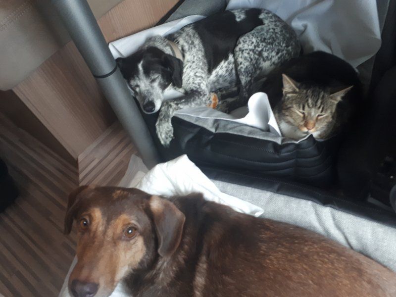
Stopped by our daughter to drop off our cat. By the way, the cat really enjoyed the ride in the mobile home...?
Deutschland
49° 59' 34.3" N 8° 14' 50.1" E
49.9928617 8.2472526
• Head south on Albert-Schweitzer-Straße (K4). Go for 114 m.
• Turn left onto Xaveriusweg. Go for 417 m.
• Turn right onto Untere Zahlbacher Straße (K1). Go for 448 m.
• Turn left onto Zahlbacher Steig (K7). Go for 393 m.
• Continue on Obere Zahlbacher Straße (K7). Go for 48 m.
• Turn right onto Landwehrweg. Go for 736 m.
• Turn right onto B40. Go for 2.9 km.
• Continue on A63. Go for 70.3 km.
• Continue on Dreieck Kaiserslautern. Go for 343 m.
• Continue on A6. Go for 72.1 km.
• Continue on A320. Go for 13.5 km.
• Continue on E50 (Échangeur de Freyming). Go for 259 m.
• Take the left exit toward Paris/Metz/St Avold/Carling onto A4 (Autoroute de l'Est). Go for 202 km.
• Take the exit toward St Gibrien/Épernay/Troyes/Orléans onto A26. Go for 96.4 km.
• Take the exit toward Orléans/Paris/Auxerre/Sens onto A5. Go for 69.8 km.
• Take the exit toward Sens/Provins/Orléans onto A19. Go for 28.5 km.
• Take the exit toward Orléans/Montargis onto A19. Go for 101 km.
• Continue toward Bordeaux/Orléans. Go for 464 m.
• Take the exit onto A10 (L'Aquitaine). Go for 15.1 km.
• Take the exit toward A20/Toulouse/Clermont-Fd/Vierzon onto A71. Go for 79.7 km.
• Take the exit toward Toulouse/Limoges/Châteauroux/Vierzon-Centre onto A20 (L'Occitane). Go for 159 km.
• Take exit 25 toward Razès/Lac de St Pardoux/St Sylvestre. Go for 282 m.
• Turn right onto D220 toward St Léger la Montagne/St Sylvestre/Razès/Lac de St Pardoux. Go for 72 m.
• Turn right onto D44. Go for 467 m.
• Continue on Lieu-dit Les Betoulles (D44). Go for 188 m.
• Continue on D44. Go for 1.3 km.
• Continue on Lieu-dit Gouillet (D44). Go for 596 m.
• Continue on D44. Go for 2.3 km.
• Continue on Rue de la Mairie (D44). Go for 172 m.
• Continue toward Place de l'Église/D44. Go for 41 m.
• Continue on Route d'Ambazac (D44). Go for 4.9 km.
• Continue toward Rue Markt Eckental/D914. Go for 25 m.
• Turn sharp left onto Avenue Général de Gaulle (D914). Go for 1.2 km.
• Turn left onto Lieu-dit Jonas (C40). Go for 381 m.
• Turn right onto Lieu-dit Jonas. Go for 216 m.
• Arrive at Lieu-dit Jonas.
☍
926,0 km
(7 hrs. 50 min.)
Camping Ecrin Nature, Ambazac, Frankreich
We made the first route a little longer to make a little "kilometres". Also worked fine. Sundays, little traffic, hardly any trucks, it worked... By the way, we also tried to save some tolls. But it doesn't make sense if you want to move forward. Lots of town crossings with lots of roundabouts slow you down quite a bit.
We didn't consider that the season is already over for many at the beginning of September. The planned CP was still in operation, but at 7:30 p.m. the gate was closed. So we stood in front of it in the parking lot and took advantage of the services of the CP on foot and for free!
87240 Ambazac, Frankreich
45° 58' 16.7" N 1° 24' 48.5" E
45.9713050 1.4134590
• Head southwest on Lieu-dit Jonas. Go for 216 m.
• Turn left onto Lieu-dit Jonas (C40). Go for 381 m.
• Turn right onto Lieu-dit Gattebourg (D914). Go for 1.2 km.
• Turn slightly left onto Rue Markt Eckental (D914). Go for 563 m.
• Take the 2nd exit from Rond-Point de l'Europe roundabout onto Avenue François Mitterrand (D914). Go for 8.5 km.
• Take the 1st exit from roundabout onto Avenue de Maison Rouge (D220). Go for 191 m.
• Turn left onto Rocade de Maison Rouge (D97). Go for 414 m.
• Turn left and take ramp onto A20 (L'Occitane) toward Limoges. Go for 4.8 km.
• Take exit 28 toward Angoulême/Périgueux/Couzeix/Rilhac Rancon/Aéroport Bellegarde. Go for 382 m.
• Take the 2nd exit from roundabout onto Rocade Nord-Ouest (N520) toward Poitiers/Angoulême/Saint-Junien/Couzeix/Oradour S/Glane/Aéroport Bellegarde/Périgueux/Z.I.N Centre Routier. Go for 915 m.
• Take the 2nd exit from roundabout onto Rocade Nord-Ouest (N520) toward Poitiers/Angoulême/Périgueux/St Junien/Oradour S/G./Aéroport Bellegarde/Couzeix. Go for 13.3 km.
• Take the 1st exit from roundabout onto N141 toward Angoulême/St Junien/Oradour S/Glane. Go for 51.1 km.
• Take ramp. Go for 263 m.
• Take the 1st exit from roundabout. Go for 248 m.
• Take the 2nd exit from roundabout. Go for 572 m.
• Take the 1st exit from roundabout onto N141. Go for 8.8 km.
• Take the 3rd exit from roundabout onto N141 toward Angoulême/Taponnat/La Rochefoucauld. Go for 30.9 km.
• Continue on N10. Go for 93.9 km.
• Keep left onto N10 toward A10/Bordeaux. Go for 351 m.
• Take ramp onto A10 (L'Aquitaine). Go for 16.4 km.
• Take exit 1 toward Toulouse/Bayonne/Bassin d'Arcachon/Bordeaux/Périgueux onto N230 (Rocade de Bordeaux). Go for 19.8 km.
• Take exit 15 toward Saint Sébastien/Bayonne/Mont de Marsan/Bassin d'Arcachon onto A63. Go for 25.4 km.
• Take exit 22 toward Bassin d'Arcachon/Biscarrosse onto A660. Go for 19.1 km.
• Continue on N250. Go for 4.1 km.
• Pass 2 roundabouts and continue on N250. Go for 2.2 km.
• Take ramp onto D259 toward Biscarrosse/Dune du Pyla/Plages Océanes. Go for 884 m.
• Take the 2nd exit from roundabout onto D259. Go for 3.5 km.
• Take the 3rd exit from roundabout onto Avenue de Biscarrosse (D218) toward Biscarrosse/Plages Océanes. Go for 3.9 km.
• Turn right. Go for 39 m.
• Arrive at your destination on the left.
☍
312,4 km
(3 hrs. 23 min.)
Camping Panorama du Pyla Yelloh Village Dune du Pilat, Avenue de Biscarrosse, La Teste-de-Buch, Frankreich
France was actually only intended for quick transit, as we used to have bad experiences with the friendliness of the people and the standard of the sanitary facilities. But this place is really too bad for a stopover. Grandiose location with a great view. Showers and washrooms very nice, toilets are still in need of improvement, but tolerable.
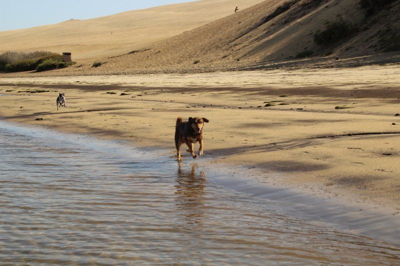
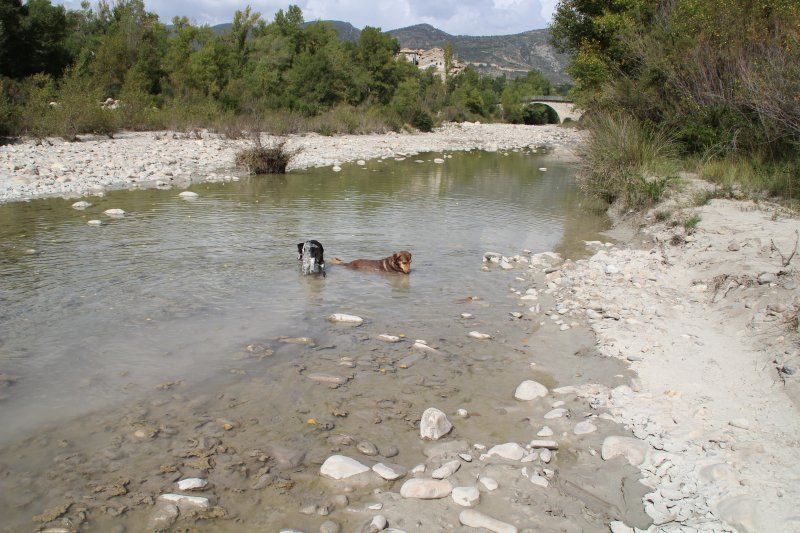
Even though we only stayed 2 nights, we got a front row seat and really enjoyed it. It was great for our dogs, because they were allowed to go everywhere on the beach and whizzed over the gigantic dunes.
Linguistically, it wasn't a problem either, English was everywhere, sometimes they tried to speak German.
Yes, but since we had a plan and still had many goals, we "had" to move on.
Avenue de Biscarrosse, 33115 La Teste-de-Buch, Frankreich
44° 34' 21.1" N 1° 13' 13.3" W
44.5725270 -1.2203493
• Head toward Route d'Arcachon à Biscarrosse. Go for 39 m.
• Turn sharp right onto Route d'Arcachon à Biscarrosse (D218). Go for 63 m.
• Turn right. Go for 43 m.
• Make a U-Turn. Go for 43 m.
• Turn left onto Route d'Arcachon à Biscarrosse (D218). Go for 3.8 km.
• Take the 1st exit from roundabout onto D259 toward Bordeaux/Bayonne/La Teste-Centre/Arcachon. Go for 3.5 km.
• Take the 2nd exit from roundabout onto Boulevard des Portes de l'Océan (D259). Go for 480 m.
• Take ramp onto D1250. Go for 333 m.
• Continue on N250. Go for 1.1 km.
• Pass 2 roundabouts and continue on N250. Go for 5.3 km.
• Continue on A660. Go for 18.1 km.
• Continue toward A63. Go for 29 m.
• Take exit 22 toward Mt de Marsan/Bayonne/S. Sebastian onto A63. Go for 180 km.
• Continue on AP-8 (Autopista del Cantábrico). Go for 12.2 km.
• Take the exit toward Bilbao/Vitoria-Gasteiz/Burgos/Hernani/A-15/Iruña/Pamplona onto AP-1/AP-8. Go for 14.8 km.
• Take the exit onto AP-1/AP-8 (Autopista del Cantábrico). Go for 10.5 km.
• Take exit 38 toward N-634/Zarautz/Getaria. Go for 578 m.
• Take the 2nd exit from roundabout onto Calle Irita. Go for 119 m.
• Take the 2nd exit from roundabout onto Camino Mendibeltz. Go for 162 m.
• Turn left onto Camino Sorginmuno. Go for 18 m.
• Turn right toward Camino Talaimendi. Go for 203 m.
• Turn slightly left onto Camino Talaimendi. Go for 87 m.
• Turn right toward Camino Talaimendi. Go for 373 m.
• Continue on Camino Talaimendi. Go for 212 m.
• Turn slightly left onto Camino Talaimendi. Go for 262 m.
• Turn right toward Camino Talaimendi. Go for 77 m.
• Turn slightly left onto Camino Talaimendi. Go for 10 m.
• Turn left onto Laurgain kalea. Go for 16 m.
• Continue toward Camino Talaimendi. Go for 57 m.
• Turn left onto Camino Talaimendi. Go for 5 m.
• Turn right. Go for 27 m.
• Turn left. Go for 32 m.
• Arrive at your destination on the left.
☍
252,4 km
(2 hrs. 25 min.)
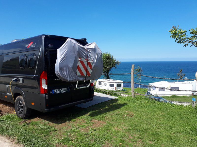
Camping Gran Camping Zarautz
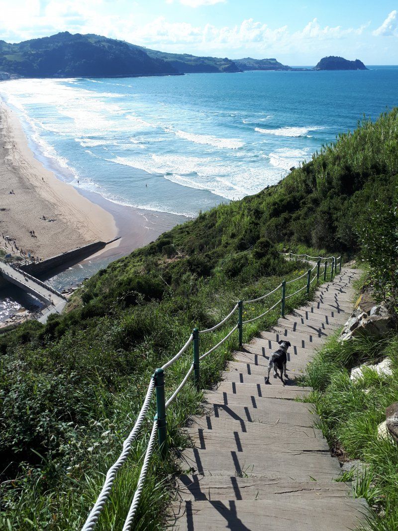
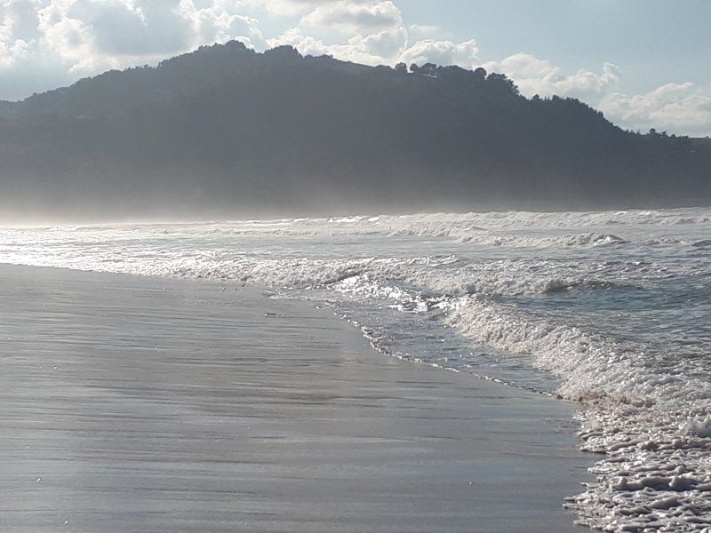
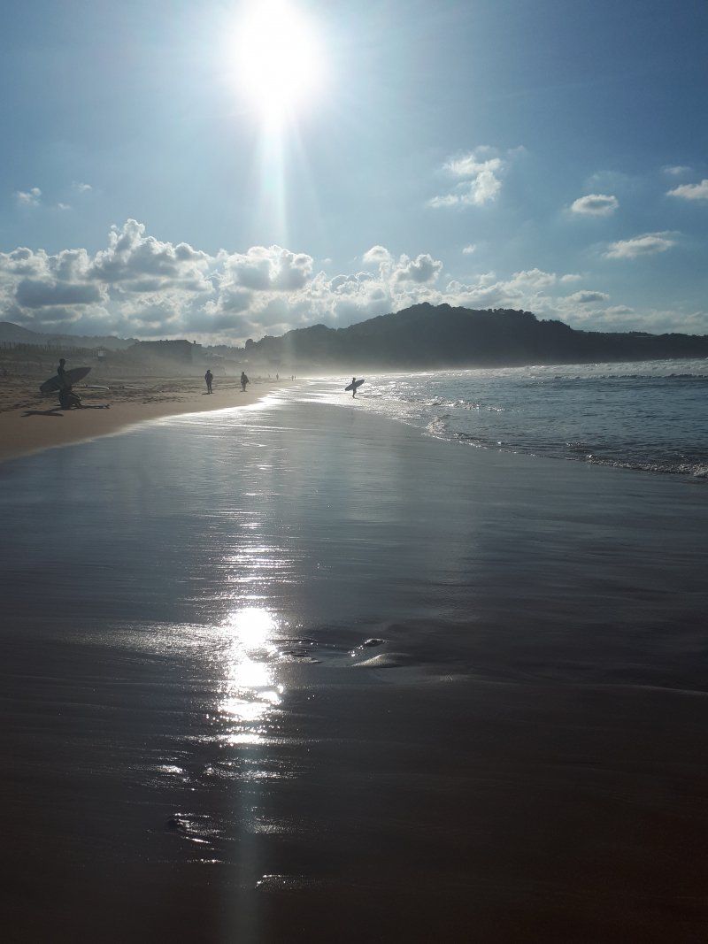
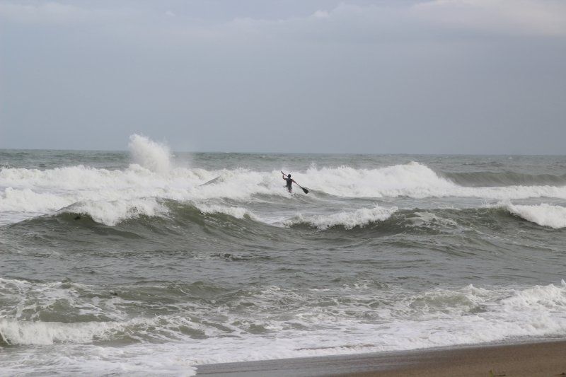
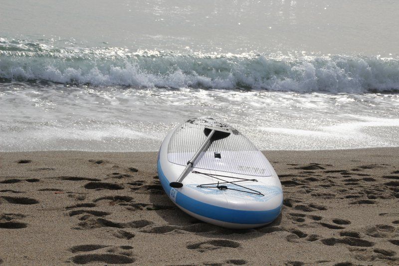
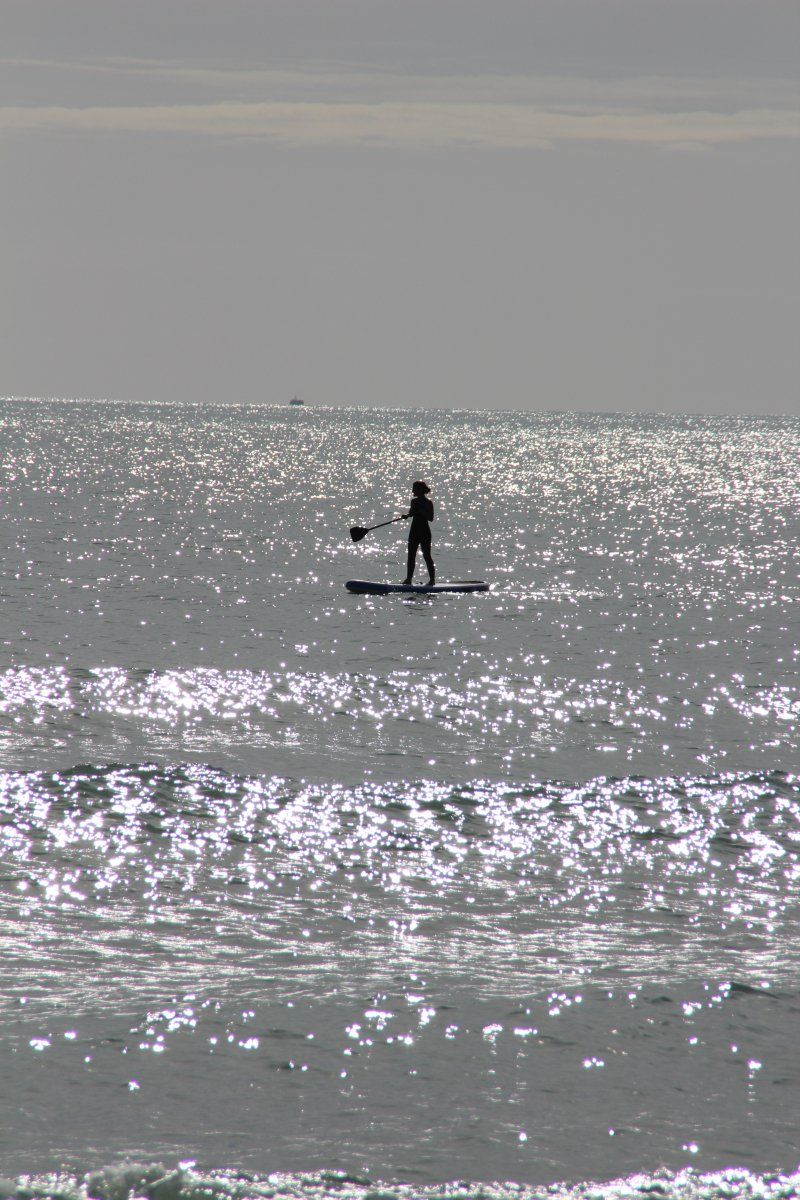
After a relaxing drive (I travel a lot on German autobahns for work, so I really enjoyed it..), our sat nav took us to a construction site in the middle of the city, far away from the CP?. But then we found it. First impression wasn't great as the place has a good view but it takes a while to get to the sea...(about 15 minutes with a lot of stairs). But we have not regretted it. A really great beach, a paradise for surfers...
Unnamed Road, 20800 Zarautz, Gipuzkoa, Spain
43° 17' 26.2" N 2° 8' 48.1" W
43.2906000 -2.1467000
• Head east. Go for 32 m.
• Turn right toward Camino Talaimendi. Go for 27 m.
• Turn left onto Camino Talaimendi. Go for 5 m.
• Turn right toward Laurgain kalea. Go for 57 m.
• Continue on Laurgain kalea. Go for 16 m.
• Turn right onto Camino Talaimendi. Go for 10 m.
• Turn slightly right toward Camino Talaimendi. Go for 77 m.
• Turn left onto Camino Talaimendi. Go for 262 m.
• Turn slightly right onto Camino Talaimendi. Go for 212 m.
• Turn left toward Camino Talaimendi. Go for 373 m.
• Turn left onto Camino Talaimendi. Go for 87 m.
• Turn slightly right toward Camino Sorginmuno. Go for 203 m.
• Turn left onto Camino Sorginmuno. Go for 18 m.
• Turn right onto Camino Mendibeltz. Go for 112 m.
• Take the 2nd exit from roundabout onto Calle Irita toward Bilbao/A-8/Donostia/S. Sebastián. Go for 133 m.
• Take the 2nd exit from roundabout toward Donostia/San Sebastián/Bilbo/Vitoria/Gasteiz. Go for 75 m.
• Take ramp onto AP-1/AP-8 (Autopista del Cantábrico) toward Bilbo/Bilbao/Vitoria-Gasteiz. Go for 31.4 km.
• Continue on AP-8 (Autopista del Cantábrico) toward Eibar/Bilbao. Go for 34.2 km.
• Take exit 103 toward N-637/Aireportua/Centro Ciudad Bilbao/Barakaldo/Getxo onto BI-30. Go for 19.8 km.
• Take the exit toward Sestao/Portua/Santander onto A-8 (Autovía del Cantábrico). Go for 77.4 km.
• Take exit 199 toward Torrelavega/Oviedo onto A-8 (Autovía del Cantábrico). Go for 85.9 km.
• Take exit 285 toward N-634/Pendueles/Vidiago/Playa de Vidiago. Go for 547 m.
• Take the 2nd exit from roundabout onto Barrio de las Bárcenas toward Playa de Vidiago. Go for 609 m.
• Arrive at Barrio de las Bárcenas. Your destination is on the left.
☍
251,6 km
(2 hrs. 24 min.)
Camping la Paz
Next stop: Camping La Paz! Terraced campsite, so that you have a fantastic sea view from almost all pitches. The course is located over 2 bays, which allow an impressive walk at low tide. Somehow the bays at low tide reminded me of the old film adaptation of "Planet of the Apes". Very exciting?!
The Way of St. James runs right through the square. We hiked it 5 km west to get to a place on the coast where small geysers can be admired. More or less depending on the tide. With us it was rather less...?
After 2 days we went on to the Pyrenees.
Playa de Vidiago-llanes Llanes, 33597, Vidiago/llanes, Spanien
43° 23' 58.9" N 4° 39' 11.9" W
43.3997000 -4.6533000
• Head west on Barrio de las Bárcenas. Go for 551 m.
• Take the 2nd exit from roundabout onto N-634 toward Llanes/Oviedo. Go for 297 m.
• Take the 1st exit from roundabout onto A-8 (Autovía del Cantábrico) toward Unquera/Santander. Go for 86.1 km.
• Take the exit onto A-8 (Autovía del Cantábrico). Go for 70.3 km.
• Keep left onto AP-8 toward Balmaseda/BI-636/Bilbao/Miribilla/Vitoria-Gasteiz/Donostia/S. Sebastián. Go for 17.6 km.
• Continue on AP-68 (Autopista del Ebro). Go for 33.2 km.
• Take exit 5 toward Vitoria-Gasteiz/Iruñea/Pamplona onto N-622. Go for 19.4 km.
• Take ramp onto A-1 toward Donostia/San Sebastián/Iruña/Pamplona. Go for 45.9 km.
• Take the exit toward Pamplona/Iruña onto A-10 (Autovía de la Barranca). Go for 28.9 km.
• Take the exit toward Pamplona/AP-15/Iruña onto A-15 (Autopista de Navarra). Go for 919 m.
• Continue on AP-15 (Autopista de Navarra). Go for 15.5 km.
• Continue on A-15 (Ronda Oeste). Go for 13.2 km.
• Continue on AP-15 (Autopista de Navarra). Go for 807 m.
• Take exit 82 toward Sangüesa/Huesca onto A-21. Go for 68.0 km.
• Take the 2nd exit from roundabout onto N-240 toward Jaca/Huesca. Go for 13.8 km.
• Take the 2nd exit from roundabout onto A-176 toward A-21/Jaca/Hecho. Go for 591 m.
• Take the 2nd exit from roundabout onto A-21 (Autovía del Pirineo) toward Jaca. Go for 15.0 km.
• Take exit 101 toward Jaca/N-240/Huesca. Go for 320 m.
• Take the 1st exit from roundabout toward Jaca/N-240/Huesca. Go for 716 m.
• Continue on Aragón. Go for 296 m.
• Take the 2nd exit from roundabout onto N-240 toward Jaca/Huesca. Go for 2.2 km.
• Take the 4th exit from roundabout onto Avenida Nuestra Señora de la Victoria (N-240). Go for 1.1 km.
• Take the 2nd exit from roundabout onto Avenida Perimetral (N-330a) toward E-7/N-330/Sabiñánigo/Huesca/Francia. Go for 851 m.
• Take the 3rd exit from roundabout onto N-330a toward N-330/Sabiñánigo/Huesca. Go for 2.3 km.
• Take the 2nd exit from roundabout onto A-23 (Autovía Mudéjar) toward Sabiñánigo/Huesca. Go for 10.6 km.
• Take the 3rd exit from roundabout onto N-330 toward Zona Industrial de Sabiñánigo. Go for 1.7 km.
• Take the 3rd exit from roundabout onto N-330 toward N-260/Biescas/Sabiñánigo. Go for 948 m.
• Take ramp onto N-260 toward N-260a/Biescas/Larrés. Go for 633 m.
• Continue on N-260. Go for 12.1 km.
• Turn right onto N-260. Go for 131 m.
• Continue on Avenida Ordesa (N-260). Go for 790 m.
• Continue on N-260. Go for 2.0 km.
• Continue on Calle Única (N-260). Go for 266 m.
• Continue on N-260. Go for 6.6 km.
• Arrive at N-260.
☍
473,6 km
(4 hrs. 27 min.)
Camping Gavín S.L. 1ª categoria
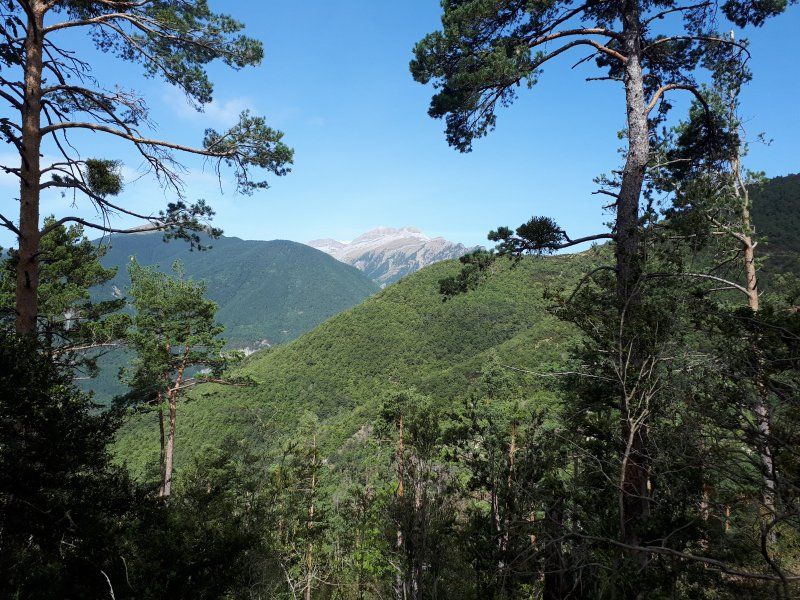
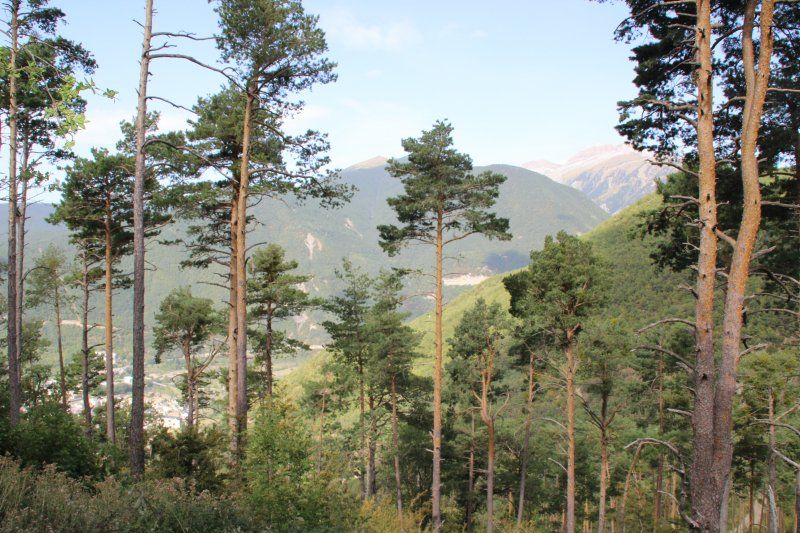
Since we read that dogs are sometimes forbidden in the national parks, we avoided it and went to other areas.
This area was just right for us as occasional hikers. 18 km route with 950 meters of altitude was enough for us...?
Nice area, nice people. We had the impression that we were the only Germans, but that didn't bother anyone.
Yésero, 22639, Huesca, Spain
42° 38' 29.4" N 0° 14' 11" W
42.6415000 -0.2364000
• Head east on N-260. Go for 8.1 km.
• Continue on Avenida Ordesa (N-260). Go for 185 m.
• Continue on N-260. Go for 8.4 km.
• Continue on Avenida de Ordesa (N-260). Go for 1.3 km.
• Continue on N-260. Go for 12.6 km.
• Pass 3 roundabouts and continue on N-260. Go for 55.0 km.
• Take the 1st exit from roundabout onto HU-V-9601 toward Torre La Ribera. Go for 10.4 km.
• Continue on Carretera a Villacarli (HU-V-9601). Go for 2.5 km.
• Continue on HU-V-9601. Go for 217 m.
• Continue on Carretera a Villacarli (HU-V-9601). Go for 4.4 km.
• Turn right onto A-1605. Go for 2.9 km.
• Continue on Carretera Graus a Viella (A-1605). Go for 386 m.
• Continue on A-1605. Go for 3.0 km.
• Continue on Carretera Graus a Viella (A-1605). Go for 132 m.
• Arrive at Carretera Graus a Viella (A-1605). Your destination is on the left.
☍
109,4 km
(1 hrs. 33 min.)
Camping Isábena
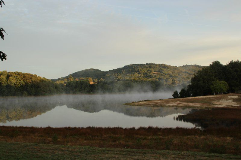
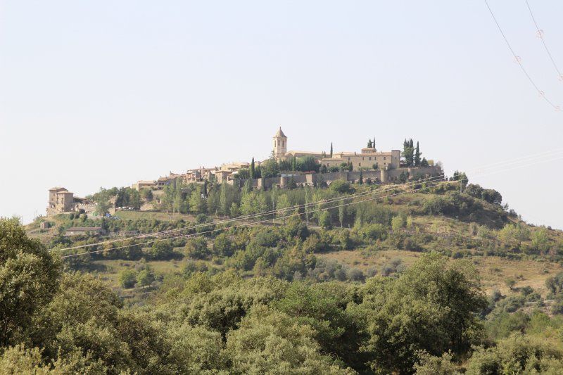
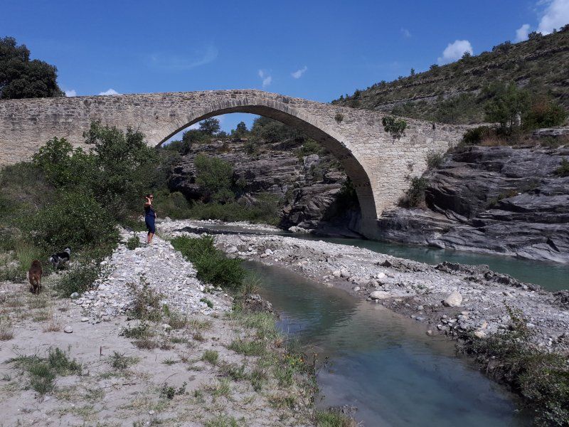
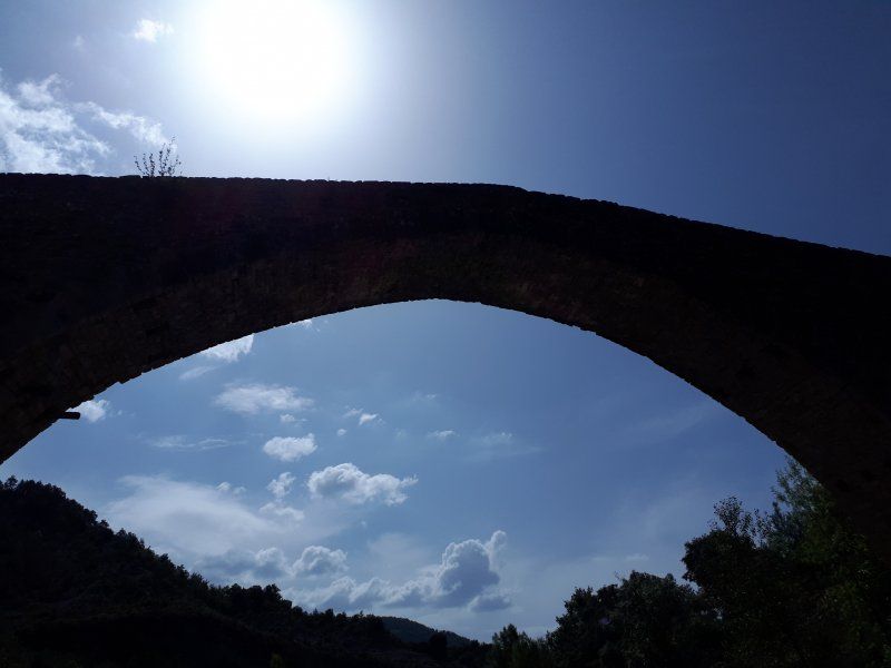
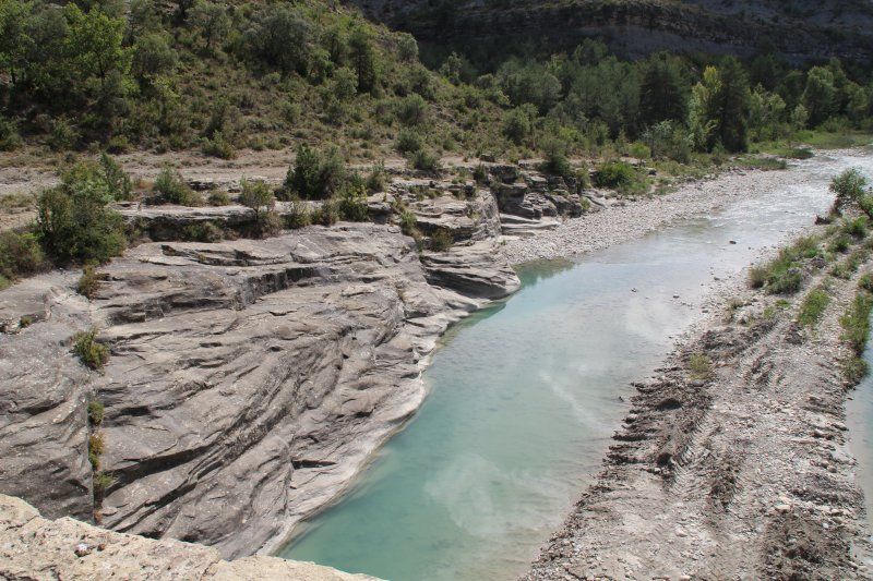
It was only a short distance between these two destinations, but the scenery was very impressive! Beautiful valleys, great views and finally water in the rivers. The dry summer has also left its mark in the Pyrenees: many dry streams and rivers give rise to the idea of traveling to this region in spring or early summer next time.
We chose the CP itself because it is under German management. Now we wouldn't recommend him unreservedly because he's under German management...?. The square has become the central meeting point for many motorcyclists and groups, with all the associated background noise...
Ctra. Graus-Viella, Puebla R, 10, 22482, Huesca, Spain
42° 18' 11.5" N 0° 32' 30.1" E
42.3032000 0.5417000
• Head toward Calle Baja on Carretera Graus a Viella (A-1605). Go for 251 m.
• Continue on A-1605. Go for 11.8 km.
• Continue on Salanova (A-1605). Go for 185 m.
• Continue on A-1605. Go for 13.8 km.
• Continue on Carretera Capella (A-1605). Go for 61 m.
• Continue on Calle Valle de Arán (A-1605). Go for 863 m.
• Take the 4th exit from Glorieta Joaquín Costa roundabout onto Calle Ángel Samblancat (A-139). Go for 1.5 km.
• Turn left onto N-123a. Go for 8.3 km.
• Turn left and take ramp onto N-123 toward Benabarre. Go for 10.1 km.
• Turn right onto N-230 toward Lérida. Go for 36.4 km.
• Pass 2 roundabouts and continue on Avinguda de Lleida (N-230). Go for 4.0 km.
• Take the 1st exit from roundabout onto A-14 toward Lleida/Aeroport/Almacelles. Go for 2.4 km.
• Take the 1st exit from roundabout toward Aeroport/Lleida/Almacelles. Go for 174 m.
• Take the 4th exit from roundabout onto A-14 (Autovia de la Ribagorza) toward Lleida. Go for 15.5 km.
• Take the left exit toward Lleida/Alcalde Porqueres/Barcelona onto A-2 (Autovia del Nordest). Go for 61.5 km.
• Take exit 518 toward Manresa/Girona onto C-25 (Eix Transversal). Go for 96.4 km.
• Take the exit onto C-17/C-25 (Eix Transversal). Go for 2.6 km.
• Keep right onto C-25 (Eix Transversal) toward Girona/Vic/Centre Ciutat Manlleu. Go for 53.9 km.
• Take the exit onto C-25. Go for 3.1 km.
• Take the 3rd exit from roundabout onto AP-7 (Autopista de la Mediterrània) toward Girona/França/Francia. Go for 31.8 km.
• Take exit 5 toward l'Escala/Empúries. Go for 788 m.
• Turn left onto GI-623. Go for 3.8 km.
• Take the 3rd exit from roundabout onto GI-623 toward Viladamat/St. Pere Pescador/l'Escala. Go for 3.1 km.
• Take the 2nd exit from roundabout onto GI-623 toward l'Escala. Go for 2.5 km.
• Turn slightly left onto GI-624 toward Ventalló. Go for 679 m.
• Continue on Carrer de Banyoles (GI-624). Go for 528 m.
• Continue on Carretera de Ventalló (GI-624). Go for 119 m.
• Continue on GI-624. Go for 1.4 km.
• Take the 1st exit from roundabout toward l'Armentera/Figueres. Go for 379 m.
• Take the 2nd exit from roundabout onto C-31a toward l'Armentera. Go for 257 m.
• Turn right onto GIV-6302 toward l'Armentera/St. Pere P. Go for 1.8 km.
• Continue on Carrer de l'Armentera (GIV-6302). Go for 180 m.
• Continue on GIV-6302. Go for 204 m.
• Continue on Carretera d'Armentera (GIV-6302). Go for 1.5 km.
• Continue on GIV-6303. Go for 1.5 km.
• Take the 1st exit from roundabout toward l'Escala/St. Martí d'Empúries. Go for 414 m.
• Continue on Carrer Empordà. Go for 77 m.
• Take the 3rd exit from roundabout. Go for 158 m.
• Turn slightly right onto Carretera de la Platja. Go for 978 m.
• Continue on Carretera de la Platja. Go for 466 m.
• Continue straight ahead. Go for 20 m.
• Arrive at your destination on the left.
☍
375,1 km
(3 hrs. 38 min.)
Camping La Gaviota
After we could not be accommodated in the planned CP Aquarius due to overcrowding, we had to switch to this place. We didn't find anything that could keep us there longer. So we went straight to France.
Ctra Platja s/n, 17470, Sant Pere Pescador, Spanien
42° 11' 21.1" N 3° 6' 32" E
42.1892000 3.1089000
• Head toward Carretera de la Platja. Go for 20 m.
• Continue on Carretera de la Platja. Go for 1.4 km.
• Turn slightly left. Go for 110 m.
• Take the 1st exit from roundabout. Go for 28 m.
• Continue on Carrer Empordà. Go for 439 m.
• Take the 1st exit from roundabout onto GIV-6303 toward Figueres/Roses. Go for 48 m.
• Continue on Pont de Sant Pere Pescador (GIV-6303). Go for 168 m.
• Continue toward Camí del Joncar. Go for 57 m.
• Continue on Camí del Joncar. Go for 358 m.
• Take the 3rd exit from roundabout onto Carrer Provença. Go for 394 m.
• Take the 1st exit from roundabout onto Carretera de Sant Miquel de Fluvià (GIV-6216) toward AP-7/Castelló d'Empúries/Roses/Figueres/Parc Natural dels Aiguamolls. Go for 292 m.
• Continue on GIV-6216. Go for 6.5 km.
• Continue on Carretera de Sant Miquel de Fluvià (GIV-6216). Go for 173 m.
• Take the 4th exit from roundabout onto C-260 toward AP-7/Figueres/Girona. Go for 1.8 km.
• Pass 4 roundabouts. Go for 5.3 km.
• Keep left onto C-260. Go for 696 m.
• Take ramp onto Cinturó de Ronda (N-2) toward La Jonquera/Perpinyà. Go for 5.4 km.
• Take ramp onto AP-7 (Autopista de la Mediterrània) toward La Jonquera. Go for 21.8 km.
• Continue on A9 (La Catalane). Go for 24.9 km.
• Take exit 42 toward Andorre la V./Perpignan-Centre/Prades/Canet en Roussillon/Thuir/St Charles Internal. Go for 1.3 km.
• Take the 3rd exit from Rond-Point de l'Euro-Méditerranée roundabout onto D900 A toward Andorre la Vieille/Narbonne/Perpignan-Centre/Canet en Roussillon/Prades/St Charles Internal. Go for 218 m.
• Continue on Rocade Saint-Charles (D900 A). Go for 318 m.
• Keep left onto Rocade Saint-Charles (D900 A) toward Perpignan-Centre/Narbonne/Andorre la V./Prades/Canet en R. Go for 2.2 km.
• Take the 2nd exit from Rond-Point de Copenhague roundabout onto Rocade Saint-Charles (D900 A) toward Perpignan-Centre/Narbonne/Andorre la V./Prades/Canet en R. Go for 1.6 km.
• Keep left toward Perpignan-Centre/Canet en Roussillon. Go for 87 m.
• Continue on Boulevard Edmond Michelet. Go for 1.6 km.
• Keep left onto Boulevard Edmond Michelet toward Narbonne/Foix/St Estève/Canet en R./Aéroport/Le Vernet. Go for 237 m.
• Continue on Boulevard de la France Libre. Go for 57 m.
• Keep left onto Boulevard de la France Libre (D82) toward Canet/Les Platanes. Go for 479 m.
• Pass 3 roundabouts and continue on Boulevard de la France Libre (D82). Go for 1.6 km.
• Take the 2nd exit from Rond-Point des Platanes roundabout onto D617. Go for 8.9 km.
• Take ramp. Go for 215 m.
• Take the 3rd exit from Rond-Point Charles de Gaulle roundabout onto D81. Go for 843 m.
• Turn right toward CR30. Go for 203 m.
• Take the 2nd exit from roundabout onto CR30. Go for 380 m.
• Turn left onto Avenue des Anneaux du Roussillon. Go for 891 m.
• Take the 1st exit from roundabout onto Avenue des Anneaux du Roussillon. Go for 30 m.
• Continue on Avenue des Anneaux du Roussillon. Go for 95 m.
• Arrive at your destination on the right.
☍
91,1 km
(1 hrs. 7 min.)
Yelloh ! Village Le Brasilia
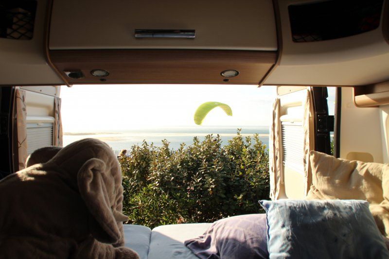
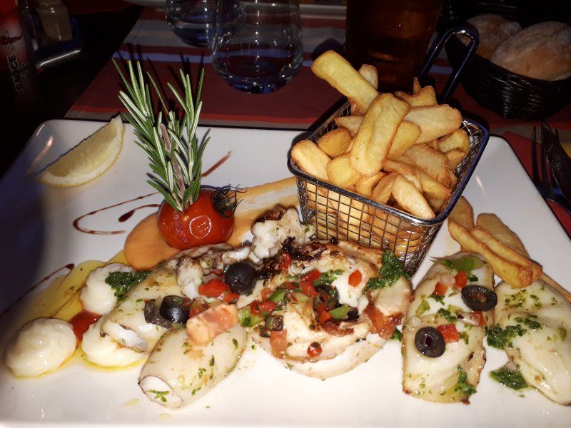
Just great! Let your soul dangle for 5 days, enjoy the beach, food and weather. That was a good finish before heading into fall.
Avenue les Anneaux du Roussillon 2, 66140, Canet En Roussillon, Frankreich
42° 42' 32.4" N 3° 2' 11.4" E
42.7090000 3.0365000
• Head south. Go for 81 m.
• Continue on Avenue des Anneaux du Roussillon. Go for 14 m.
• Continue on Avenue des Anneaux du Roussillon. Go for 7 m.
• Take the 1st exit from roundabout onto Avenue des Anneaux du Roussillon. Go for 915 m.
• Turn right onto CR30. Go for 327 m.
• Take the 2nd exit from roundabout. Go for 239 m.
• Continue on D81. Go for 2.8 km.
• Take the 3rd exit from roundabout. Go for 321 m.
• Continue on D81. Go for 3.1 km.
• Take the 2nd exit from roundabout onto D81. Go for 2.4 km.
• Take ramp onto D83 toward Le Barcarès/Leucate. Go for 5.8 km.
• Take the 3rd exit from roundabout onto D83. Go for 1.1 km.
• Continue on D627. Go for 8.6 km.
• Take the 2nd exit from roundabout onto D627. Go for 5.8 km.
• Continue toward D627. Go for 36 m.
• Take the 2nd exit from roundabout onto D627. Go for 2.4 km.
• Take ramp onto A9 (La Catalane) toward Narbonne/Montpellier/Toulouse. Go for 220 km.
• Continue on A7 (Autoroute du Soleil). Go for 196 km.
• Keep right onto Autoroute du Soleil (M7) toward Paris/A6/Clermont-Fd/A89/Roanne. Go for 152 km.
• Continue on A31. Go for 100 km.
• Take exit 6 toward Langres-Sud/Besancon/Langres/Gray. Go for 829 m.
• Take the 1st exit from roundabout onto D428 toward Gray/Langres. Go for 8.5 km.
• Take ramp onto D974 toward Chaumont/Nancy/Langres. Go for 2.4 km.
• Pass 2 roundabouts and continue on Route de Dijon (D974). Go for 1.5 km.
• Continue on Place des États-Unis (N74) toward Vesoul. Go for 46 m.
• Turn slightly right onto Rue des Auges (N19) toward Vesoul. Go for 1.4 km.
• Take the 2nd exit from roundabout onto Rue de Vesoul (N19) toward Vesoul/Mulhouse/Fayl-Billot. Go for 2.3 km.
• Turn right onto D284 toward Peigney. Go for 1.7 km.
• Continue on Rue des Voiliers (D284). Go for 1.0 km.
• Turn left. Go for 142 m.
• Arrive at your destination on the left.
☍
721,5 km
(6 hrs. 23 min.)
Camping de la Liez
And there it was...autumn. To support our farewell mood, did the sky cry the whole trip???
The CP, which we chose as the last stop, certainly has a lot to offer during the season. At the end of September we were almost alone.
Rue des Voiliers, 52200, PEIGNEY, Frankreich
47° 52' 18.8" N 5° 22' 51.2" E
47.8719000 5.3809000
• Head toward Rue des Voiliers. Go for 142 m.
• Turn left onto Rue des Voiliers (D284). Go for 72 m.
• Continue on D284. Go for 819 m.
• Turn right onto D52. Go for 3.5 km.
• Turn left toward Rue de la Liez. Go for 757 m.
• Continue on Rue de la Liez. Go for 933 m.
• Turn right onto Route de Nancy (D74). Go for 14.0 km.
• Take the 2nd exit from roundabout onto D417 toward A31/Épinal/Vittel/Bourbonne. Go for 1.9 km.
• Take ramp onto A31 toward Nancy/Épinal. Go for 108 km.
• Take the left exit toward Metz/Luxembourg onto A31. Go for 43.2 km.
• Take exit 29 toward Saarbrücken/Metz-Est/Marly onto N431. Go for 15.4 km.
• Continue on A315. Go for 266 m.
• Take the exit toward Boulay/St Avold/Sarrebruck/Strasbourg onto A314. Go for 2.5 km.
• Continue on A4 (Autoroute de l'Est). Go for 40.3 km.
• Take the exit toward Forbach onto A320. Go for 14.6 km.
• Continue on A6. Go for 71.9 km.
• Keep right onto Dreieck Kaiserslautern toward Frankfurt a.M./Mainz/Kaisersl.-Centrum/A63. Go for 523 m.
• Continue on A63. Go for 70.2 km.
• Take exit 2 toward Bingen/Wiesbaden onto A60. Go for 1.5 km.
• Take exit 20 toward Mainz-Lerchenberg/Mainz-Marienborn/Mainz-Bretzenheim/Essenheim/Mz.-Marienborn/Mz.-Bretzenheim onto K3. Go for 1.7 km.
• Turn right onto Jakob-Leischner-Straße (K1) toward Mz.-Bretzenheim. Go for 194 m.
• Turn left onto Am Ostergraben (K4). Go for 114 m.
• Turn right onto Ludwig-Nauth-Straße (K4). Go for 114 m.
• Continue on Gänsmarkt (K4). Go for 69 m.
• Continue on An der Wied (K4). Go for 103 m.
• Turn left onto Martin-Kirchner-Straße (K4) toward Mz.-Bretzenheim. Go for 65 m.
• Continue on Anzengasse (K4). Go for 131 m.
• Continue on Ulrichstraße (K4). Go for 14 m.
• Continue on Turnvater-Jahn-Straße (K4). Go for 320 m.
• Continue on Albert-Schweitzer-Straße (K4). Go for 843 m.
• Arrive at Albert-Schweitzer-Straße (K4). Your destination is on the right.
☍
393,9 km
(3 hrs. 38 min.)
Mainz
Albert-Schweitzer-Straße 115, 55128 Mainz, Germany
49° 59' 34.3" N 8° 14' 50.1" E
49.9928617 8.2472526
• Head toward Anselm-Franz-von-Bentzel-Weg on Albert-Schweitzer-Straße (K4). Go for 426 m.
• Turn right and take ramp onto Saarstraße (L419). Go for 1.1 km.
• Turn slightly left onto Alicenplatz (B40) toward MZ-Kastel. Go for 692 m.
• Turn right onto Bauhofstraße. Go for 307 m.
• Turn left onto Große Bleiche. Go for 332 m.
• Continue on Peter-Altmeier-Allee (B40). Go for 293 m.
• Make a U-Turn onto Rheinstraße (B40). Go for 861 m.
• Keep left onto B40. Go for 95 m.
• Take the 2nd exit from roundabout onto Ludwigsrampe (B455) toward Mainz. Go for 351 m.
• Take the 2nd exit from Ludwigsplatz roundabout onto Ludwigsplatz (B455) toward Wiesbaden/WI-Erbenheim/Mainz. Go for 4.4 km.
• Take ramp onto A66 toward Frankfurt/Köln. Go for 25.1 km.
• Take exit 19 toward Hannover/Kassel/Dortmund onto A5. Go for 119 km.
• Continue on A7. Go for 3.7 km.
• Take the exit toward Berlin/Dresden/Erfurt/Bad Hersfeld onto A4. Go for 182 km.
• Take exit 56A toward Berlin/Halle (Saale)/Leipzig onto A9. Go for 45.7 km.
• Take exit 19 toward Leipzig-Süd onto A38. Go for 39.6 km.
• Take exit 33 toward Dresden/Görlitz onto A14. Go for 3.5 km.
• Take exit 29 toward Naunhof/Brandis. Go for 314 m.
• Turn left onto S43 toward Brandis. Go for 3.1 km.
• Take the 2nd exit from roundabout onto S43. Go for 3.7 km.
• Turn left onto Leipziger Straße. Go for 973 m.
• Arrive at Leipziger Straße.
☍
435,1 km
(3 hrs. 57 min.)
Gerichshain
Machern, Deutschland
51° 21' 24" N 12° 34' 60" E
51.3566766 12.5833254
Fazit!
Driven almost 5000 km, seen and experienced a lot. This was the almost perfect trip. Almost, because we never really want to experience the perfect trip, otherwise we would stay at home next time...?
Driving itself is no problem at all once you have left Germany. If you keep an eye on it, you can also keep fuel costs under control (in France around €1.40, in Spain around €1.20/litre).
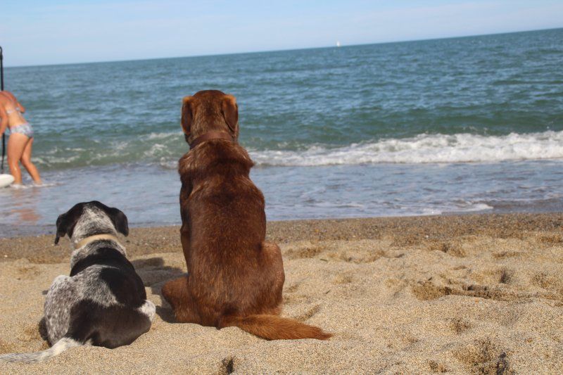
We never had any problems with our dogs.
Amazingly, we felt more welcome in France than ever before!
With many great memories and some delicious bottles of wine in our luggage, we are now back home...
...and already planning the next trip?