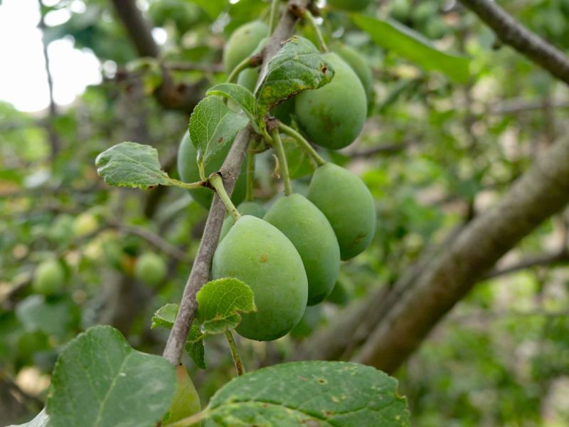
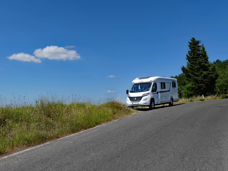
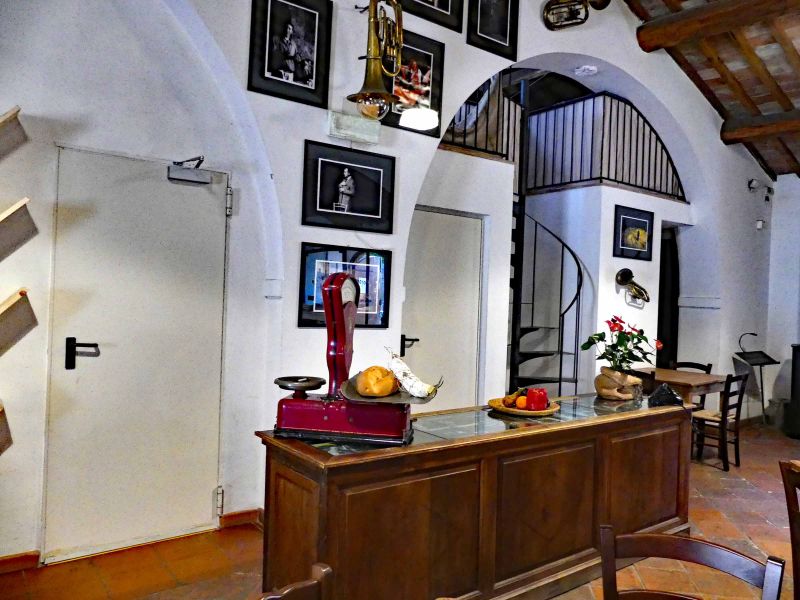
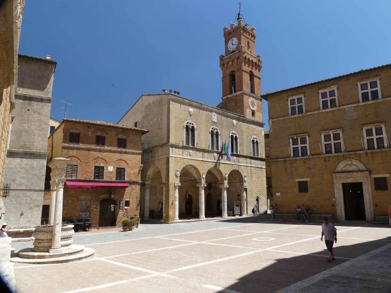
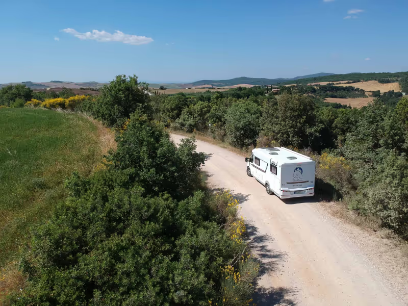
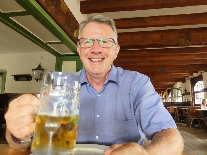
Our big trip in 2019 went to Tuscany, Germany's favorite Italy. We traveled under the motto "Tuscany - with body and soul". On the one hand we wanted to let the landscape, the flair and the deceleration have an effect on us and on the other hand we wanted to discover the culinary treasures of Tuscany; Chianti, Brunello, Nobile, salami, ham ... whatever Tuscany has to offer for the soul and the palate. But unlike in previous years, we didn't want to "tick off" sights, but rather travel according to the motto "The journey is the destination". We had made our travel planning with the help of a map of Tuscany, the ADAC Tourguide Tuscany and FREEONTOUR; the program also determined our preliminary selection of parking spaces (even if we decided differently in individual cases). I've never planned a tour faster or more comfortably. We would be very happy to receive your feedback in the comments or at info@nanuq-womoblog.de. Also follow us on Youtube: youtube.com/nanuqwomoblog. There you will (soon) find the videos of our trip.
Day
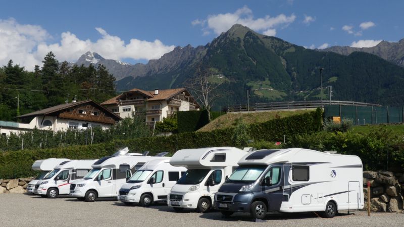
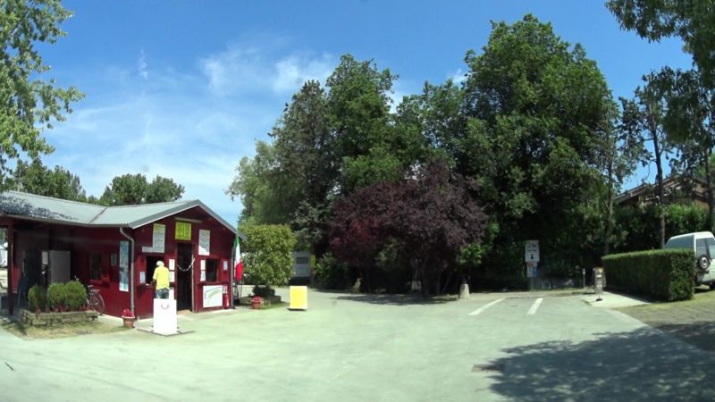
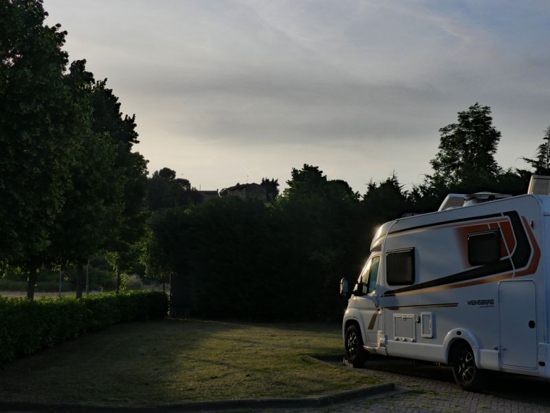
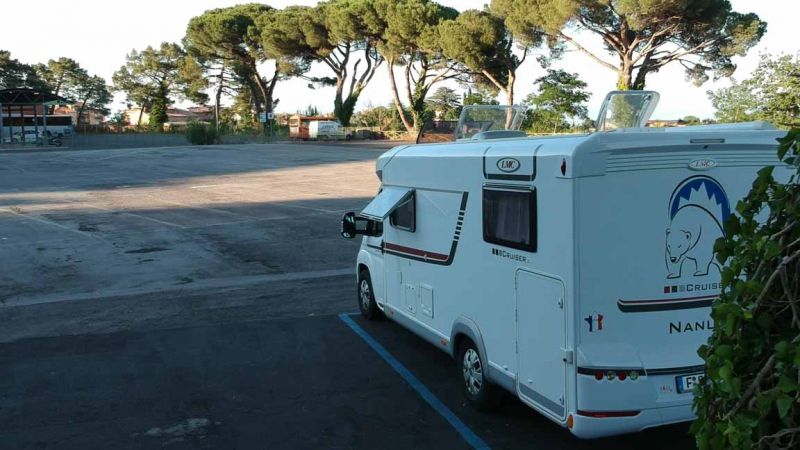
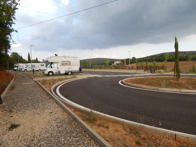
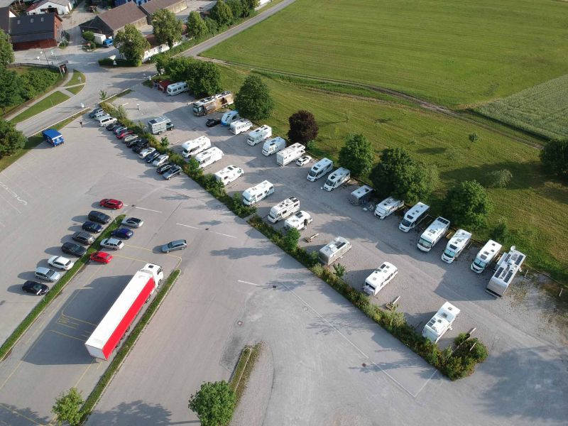
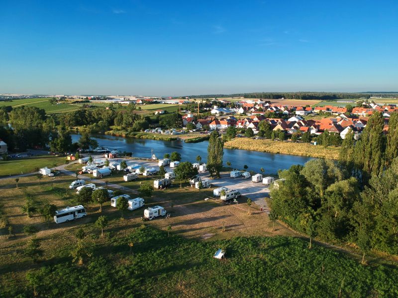
Campingplatz Mainkur
From here we start our tours, as well as our trip to Tuscany. Ready packed, everything filled and weighed as a precaution, we started in the evening south.
Frankfurter Landstraße 107, 63477, Maintal/Frankfurt am Main, Deutschland
50° 8' 18.2" N 8° 46' 58.8" E
50.1384000 8.7830000
• Head toward Hanauer Landstraße on Frankfurter Landstraße. Go for 439 m.
• Turn right onto Hanauer Landstraße (B8/B40). Go for 1.9 km.
• Turn left onto Am Kreuzstein (B8/B40) toward A66/Bischofsheim/Gewerbegebiet West. Go for 782 m.
• Turn right and take ramp onto A66 toward Hanau/Maintal. Go for 13.0 km.
• Take exit 38 toward München/Würzburg/Aschaffenburg/A45. Go for 405 m.
• Keep left onto Hanauer Kreuz toward München/Würzburg/Aschaffenburg/A45. Go for 647 m.
• Take the exit onto A45. Go for 18.2 km.
• Continue on E41 (Seligenstädter Dreieck) toward München/Würzburg. Go for 108 m.
• Take the left exit toward München/Würzburg onto A3. Go for 48.7 km.
• Take exit 65 toward Marktheidenfeld/Wertheim/Kreuzwertheim. Go for 325 m.
• Turn right onto St2315 toward Wertheim/Kreuzwertheim. Go for 6.8 km.
• Take the 3rd exit from roundabout onto Haslocher Straße (MSP32). Go for 912 m.
• Turn right onto Fährgasse. Go for 90 m.
• Turn left. Go for 20 m.
• Arrive at your destination on the right.
☍
92,4 km
( 56 min.)
Stellplatz am Mainufer
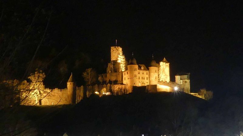
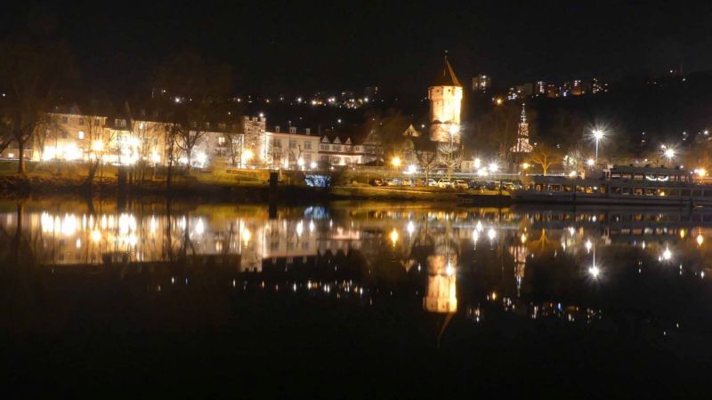
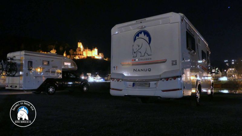
Our first stage took us to Kreuzwertheim in the early evening. We decided on this rather short stage right after the working day so that we don't have to go through Frankfurt and the A3 in the morning rush hour. So we can drive off completely relaxed. Apart from that, we have another evening in front of a great backdrop, the illuminated Wertheim with its castle. A vacation can't start any better, right?
Fährgasse, 97892, Kreuzwertheim, Deutschland
49° 45' 45" N 9° 31' 5" E
49.7625000 9.5180556
• Head toward Fährgasse. Go for 20 m.
• Turn right onto Fährgasse. Go for 90 m.
• Turn right onto Brückenstraße (MSP32). Go for 639 m.
• Continue on L2310. Go for 356 m.
• Turn left onto Eichelgasse (L2310). Go for 9.4 km.
• Take ramp onto A3 toward Würzburg. Go for 39.1 km.
• Take the exit toward Kassel/Erfurt/Schweinfurt/Ulm/Rothenburg onto A7. Go for 293 km.
• Take exit 139 toward Füssen/Schwangau/Rieden am Forggensee/Hopferau. Go for 528 m.
• Turn left onto B310 toward Füssen/Schwangau/Rieden am Forggensee. Go for 3.9 km.
• Turn right onto Augsburger Straße (B16) toward Schwangau/Krankenhaus Füssen/Hopfen am See/Königsschlösser. Go for 290 m.
• Take the 1st exit from roundabout onto Hopfener Straße (St2008) toward Seeg/Hopfen/Fachklinik/Enzensberg. Go for 320 m.
• Turn left onto Abt-Hafner-Straße. Go for 226 m.
• Turn left onto Abt-Hafner-Straße. Go for 17 m.
• Turn left. Go for 13 m.
• Arrive at your destination on the right.
☍
347,9 km
(3 hrs. 1 min.)
Day
Stellplatz Füssen/Campers Stop
The second stage on the way to Tuscany. The Camper's Stop Füssen is practically close to the route to the south. We got the tip from Hartmut Conrad, another blogger. Even if it is not in an idyllic location, it is always practical. In the middle of the commercial area with Aldi, Lidl etc. in the immediate vicinity offer the opportunity to replenish supplies. If you have more time - it is a good starting point for excursions in the area.
Abt-Hafner-Straße 9, 87629, Füssen, Deutschland
47° 34' 56" N 10° 42' 3" E
47.5822222 10.7008333
• Head toward Abt-Hafner-Straße. Go for 13 m.
• Turn right onto Abt-Hafner-Straße. Go for 17 m.
• Turn right onto Abt-Hafner-Straße. Go for 226 m.
• Turn right onto Hopfener Straße (St2008). Go for 319 m.
• Take the 2nd exit from roundabout onto Augsburger Straße (B16) toward A7/Ulm/Innsbruck/Kaufbeuren/Kempten/B310. Go for 348 m.
• Turn left onto B310 toward Ulm/A7/Innsbruck/Kempten/Pfronten/Weißensee/Gewerbegebiet Füssen-West. Go for 3.8 km.
• Take ramp onto A7 toward Innsbruck/Reutte/Fernpass. Go for 2.3 km.
• Continue on Grenztunnel Füssen (B179). Go for 48.8 km.
• Take ramp onto Mieminger Bundesstraße (B189) toward Imst/Arlberg/Reschen. Go for 10.2 km.
• Take the 2nd exit from roundabout onto Mieminger Bundesstraße (B189) toward Landeck/B171. Go for 1.5 km.
• Take the 2nd exit from roundabout onto Bundesstraße (B171). Go for 4.5 km.
• Take the 2nd exit from roundabout onto A12 (Inntal Autobahn) toward Bregenz. Go for 8.7 km.
• Take exit 144 toward B180/Reschenpass/Kaunertal/Meran/St. Moritz onto A12 (Inntal Autobahn). Go for 32.3 km.
• Keep left onto Reschen Bundesstraße (B180) toward Nauders/Reschenpaß. Go for 14.6 km.
• Continue on Via Nazionale (SS40). Go for 18.3 km.
• Take the 2nd exit from roundabout onto Strada Statale del Passo Resia (SS40) toward Mals/Malles/Meran/Merano. Go for 13.1 km.
• Take the 3rd exit from roundabout onto Strada Statale dello Stelvio (SS38) toward Meran/Merano. Go for 2.1 km.
• Pass 6 roundabouts and continue on Via Nazionale (SS38). Go for 32.4 km.
• Continue straight ahead. Go for 47 m.
• Take the 2nd exit from roundabout toward Meran/Merano. Go for 126 m.
• Continue on Strada Statale dello Stelvio (SS38). Go for 3.8 km.
• Turn left onto Via San Jacob. Go for 187 m.
• Turn left onto Via Lahn. Go for 2.1 km.
• Turn right onto Via Max von Isser. Go for 124 m.
• Turn left onto Via Gaudententurm. Go for 212 m.
• Continue on Via Spauregg. Go for 29 m.
• Turn right onto Via Spauregg. Go for 59 m.
• Turn right onto Via Zehent. Go for 97 m.
• Turn slightly right onto Via Zehent. Go for 625 m.
• Turn slightly right onto Via Zehent. Go for 706 m.
• Turn left onto Via Venosta (SS38). Go for 4.4 km.
• Take ramp toward Merano Centro/Meran Zentrum/Autostrada/A22/Autobahn/Bozen/Bolzano. Go for 263 m.
• Take the 2nd exit from roundabout onto Strada Provinciale Variante di Merano (SP185) toward Autobahn/Autostrada/A22/Bozea/Bolzano/Centro/Ospedale/Meran/Merano. Go for 1.0 km.
• Take the 1st exit from roundabout. Go for 27 m.
• Continue on Via 4 Novembre. Go for 182 m.
• Take the 2nd exit from roundabout onto Via 4 Novembre. Go for 167 m.
• Take the 2nd exit from roundabout onto Piazza Stazione. Go for 103 m.
• Continue on Viale Europa. Go for 241 m.
• Take the 3rd exit from Piazza Giuseppe Mazzini roundabout onto Via Rezia toward Tirolo/Scena/Tirol/Schenna. Go for 275 m.
• Continue on Ponte Rezia. Go for 48 m.
• Continue on Via Francesco Petrarca. Go for 336 m.
• Continue on Via Francesco Petrarca. Go for 142 m.
• Take the 2nd exit from roundabout onto Via Francesco Petrarca. Go for 227 m.
• Continue on Via Roma. Go for 391 m.
• Turn right onto Via Camillo Benso di Cavour (SS44) toward Obermais/Maia Alta/Tirol/Tirolo/Schenna/Scena. Go for 716 m.
• Continue on Via San Giorgio (SS44). Go for 1.5 km.
• Turn left onto Via Principale (SP7). Go for 2.1 km.
• Turn sharp left onto Via Monte Benedetto. Go for 653 m.
• Continue on Via Monte Benedetto. Go for 227 m.
• Turn slightly right onto Via Monte Benedetto. Go for 95 m.
• Arrive at Via Monte Benedetto. Your destination is on the left.
☍
214,8 km
(3 hrs. 15 min.)
Day
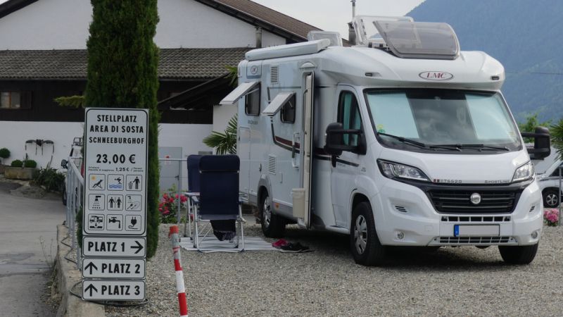
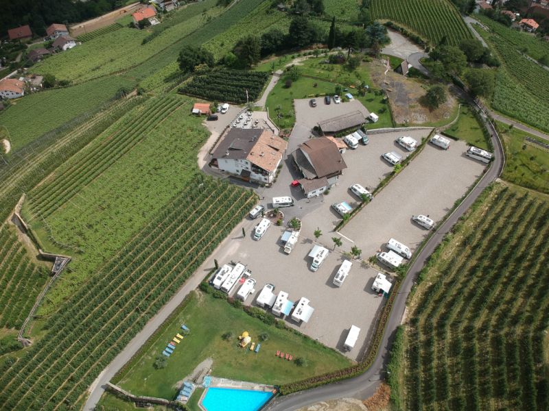
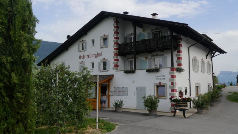
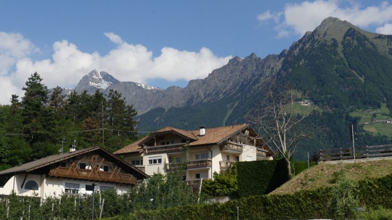
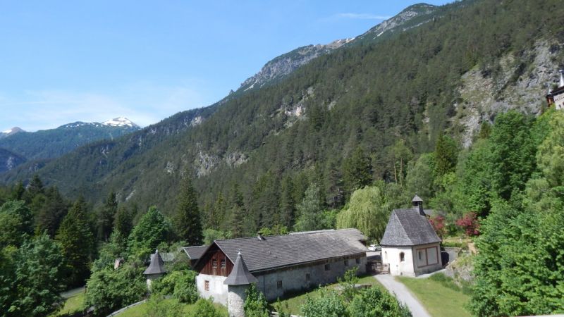
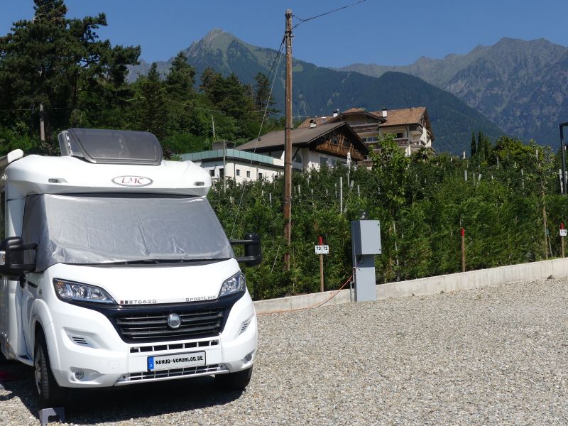
Stellplatz Schneeburghof
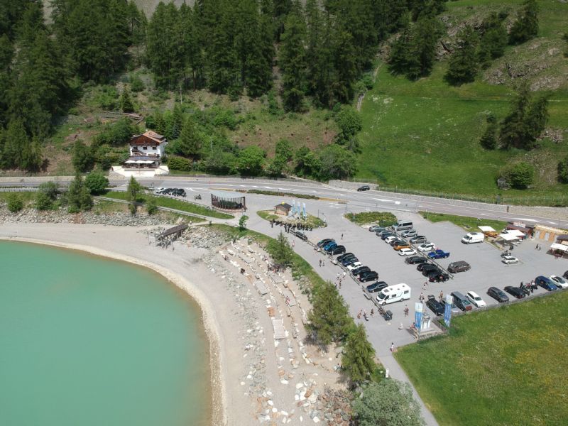
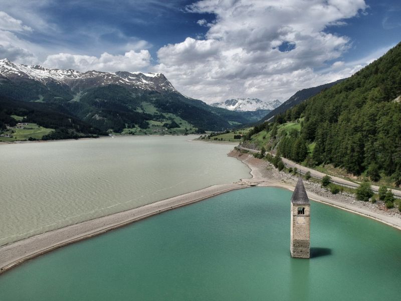
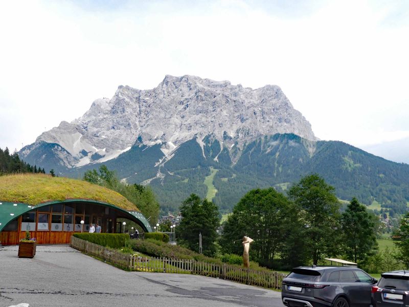
Since we had decided not to drive over the Brenner as usual, but over the Fernpass and the Reschenpass, our plans have changed a bit. Even if the drive over the two pass roads is quite problem-free for a motorhome thanks to the slight incline or slope, we did not make it to Lake Garda in one stage. That wouldn't have changed if we hadn't taken the long break at Lake Reschen (the parking lot costs € 1/60 minutes). Then we would have missed something.
We decided on a parking space near Merano, the Schneeburghof parking space in Tirolo. A large space for approx. 50 mobiles, with a restaurant, toilet, showers, WLAN, V / E and electricity. And, you can comfortably walk downhill to Merano in 30 minutes.
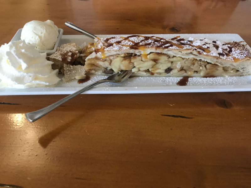
On the last evening we did the sample in the restaurant and loved it. Real Wiener Schnitzel - hot, tender, juicy and the breading crispy until the end. And for dessert an apple strudel with vanilla ice cream and whipped cream - but we shared it.
Oh yes: the Schneeburghof also grows its own wine. And we can really recommend that too.
Segenbühelweg 26, 39019, Dorf Tirol, Italien
46° 40' 33" N 11° 10' 0" E
46.6758333 11.1666667
• Head north on Via Monte Benedetto. Go for 975 m.
• Turn sharp right onto Via Principale (SP7). Go for 2.0 km.
• Turn sharp right onto Via del Giovo (SS44). Go for 1.5 km.
• Continue on Strada Statale del Passo Giovo (SS44). Go for 1.1 km.
• Turn right onto Ponte Teatro. Go for 57 m.
• Continue on Piazza Teatro. Go for 83 m.
• Turn left onto Corso della Libertà. Go for 524 m.
• Enter the roundabout. Go for 10 m.
• Arrive at Piazza Giuseppe Mazzini. Your destination is on the left.
☍
6,3 km
( 10 min.)
Day
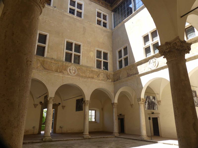
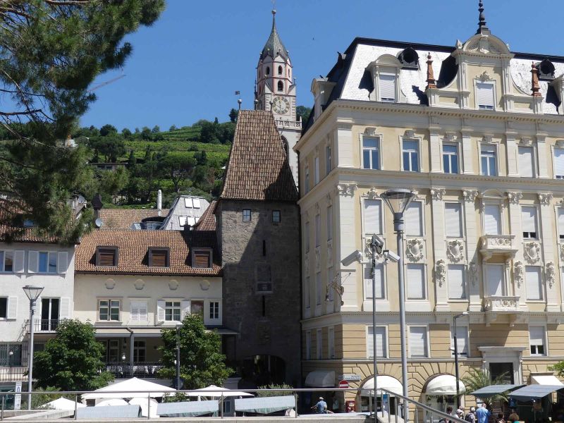
Meran, Südtirol, Italien
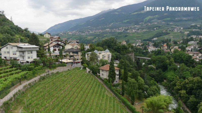
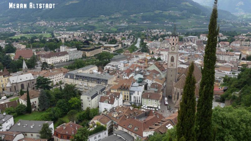
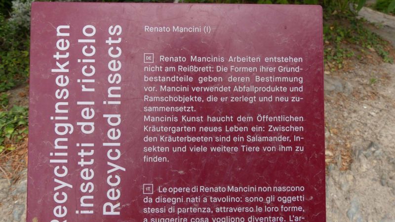
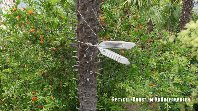
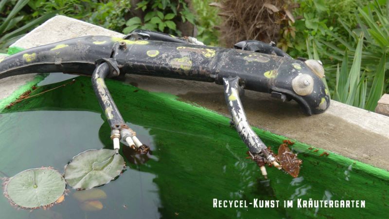
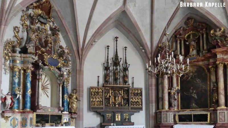
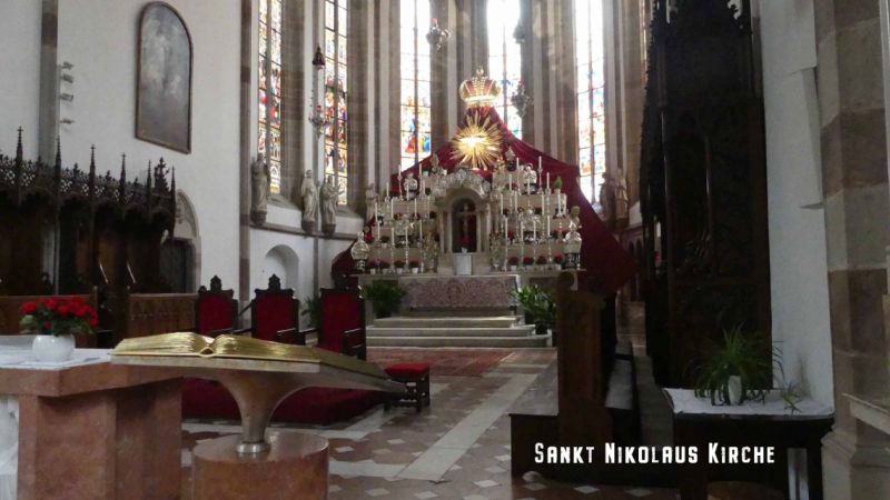
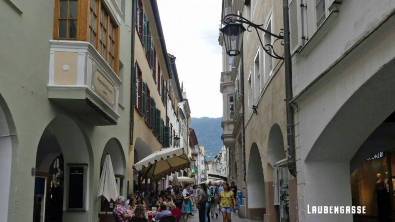
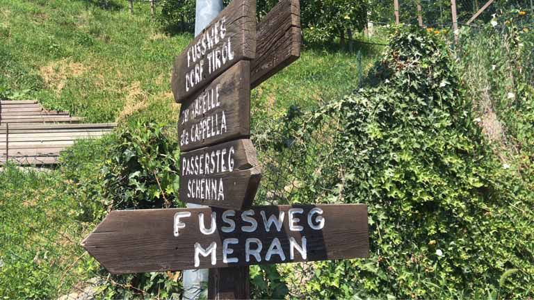
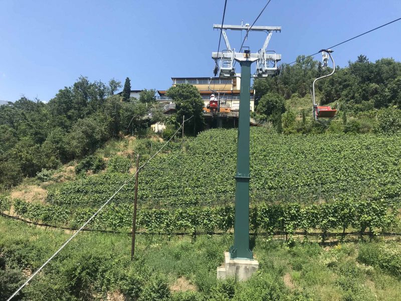
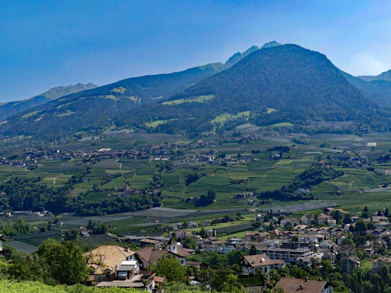
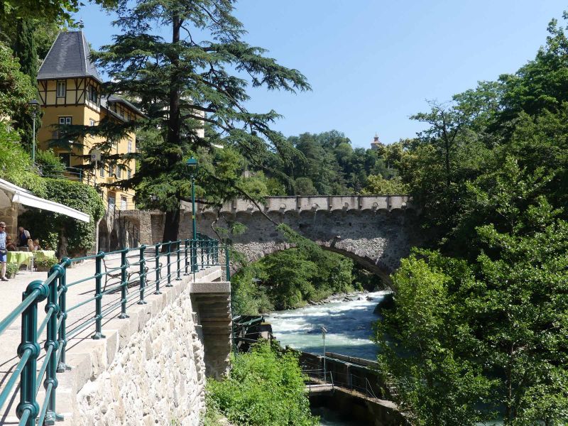
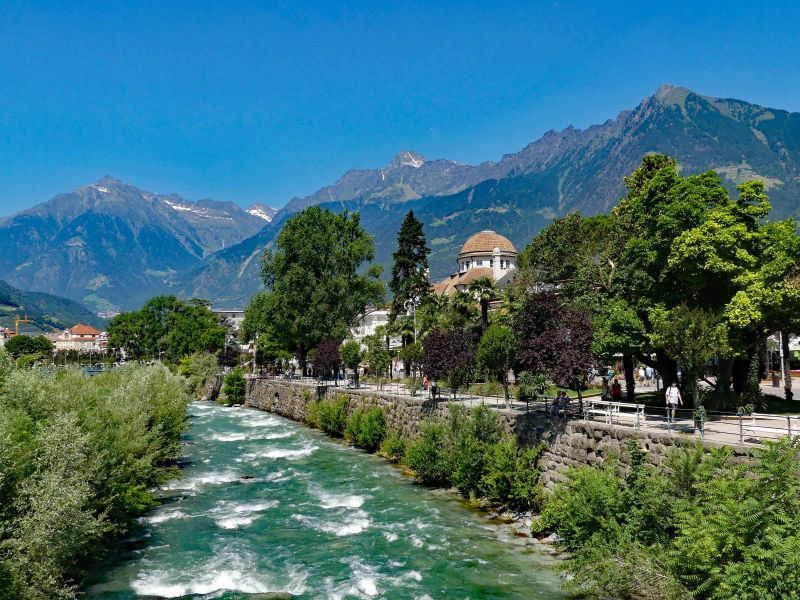
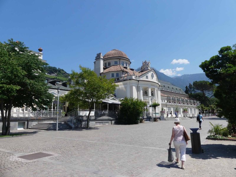
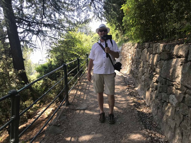
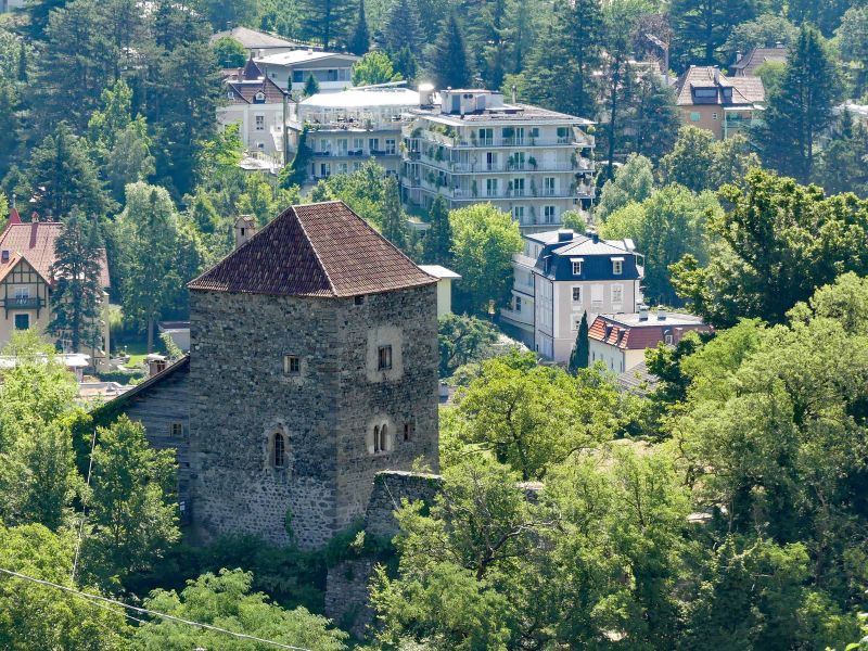
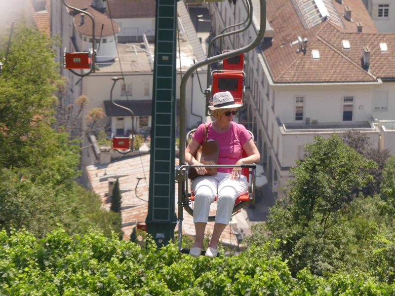
Meran - spa town in South Tyrol. Elisabeth (Sissi), Empress of Austria, stayed here several times. Small, quite manageable (at least the old town) but really nice and worth seeing. The Schneeburghof parking space is ideal for a visit. You can walk downhill from the parking space in about 30 minutes, sometimes over the Tappeiner Promenade. If you are still looking at the herb garden and the powder tower , one of the sights on the way, you will of course need a little longer to get to the Church of St. Nicholas and the Barbara Chapel , right in the old town. We left the Tappeiner Promenade on the Tiroler Steig and went straight to the old town. From St. Nikolaus you can also get directly to Laubengasse , a medieval street lined with houses with arcades to the right and left. In the arcades you can find restaurants, clothing chains, shoe shops, almost all of them with modern shop windows that don't really fit in with the old houses. But also corridors, stairwells, backyards ... Today mostly the gardens of restaurants or wine bars.
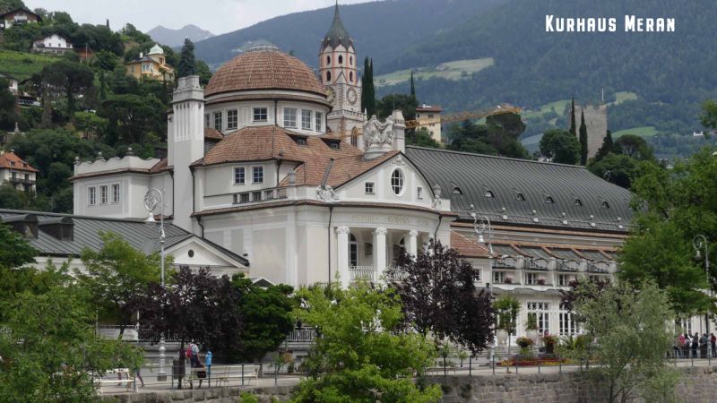
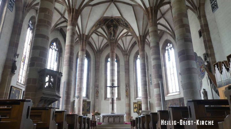
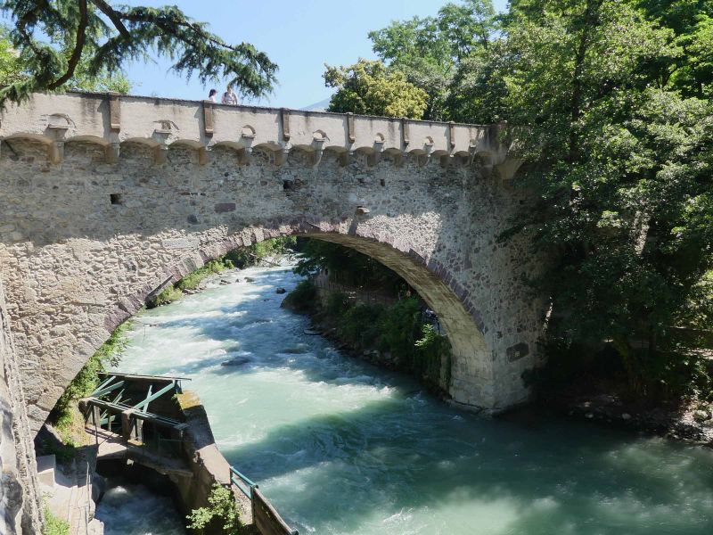
Seen from St. Nikolaus, at the back you can go to the right to the cable car , which brings you back up the mountain comfortably and to the left to the tourist information office, to the Kurhaus and on the river to the Kurpromenade . If you stroll to the left past the Kurhaus, you will come to the city gate and, on the other bank of the river, to the Heilig Geist Church , a former hospital.
There is certainly a lot more to see in Merano - it should be enough for us. But, since we want to visit South Tyrol as our own travel destination, there is still an opportunity.
46° 40' 16.7" N 11° 9' 9.1" E
46.6712938 11.1525179
• Follow the roundabout. Go for 12 m.
• Take the 1st exit from roundabout onto Viale Europa. Go for 237 m.
• Continue on Piazza Stazione. Go for 70 m.
• Take the 2nd exit from roundabout onto Via 4 Novembre. Go for 152 m.
• Take the 3rd exit from roundabout onto Via 4 Novembre toward Autostrada/A12/Bolzano. Go for 225 m.
• Take the 2nd exit from roundabout onto Strada Provinciale Variante di Merano (SP185) toward Algund/Lagundo. Go for 1.1 km.
• Take the 2nd exit from roundabout onto MeBo (SS38) toward Autostrada/A22/Bozen/Bolzano. Go for 27.1 km.
• Take left ramp onto A22 (Autostrada del Brennero) toward Autostrada/Bolzano Centro/Bozen Zentrum/E45/Brennero/Brenner/Modena. Go for 123 km.
• Take the exit toward Affi/Lago di Garda Sud. Go for 598 m.
• Take the 3rd exit from roundabout toward Peschiera/SS450. Go for 337 m.
• Take the 2nd exit from roundabout onto Strada Regionale di Affi (SR450) toward Milano/A4/Peschiera/Verona/SR11. Go for 13.0 km.
• Keep left onto SS11dir toward Milano-Venezia/A4/Brescia/SR11/Sirmione/Peschiera. Go for 3.6 km.
• Keep left toward Sirmione/SR11/Brescia. Go for 292 m.
• Continue on Paradiso di Sotto. Go for 329 m.
• Continue on Strada Regionale Padana Superiore (SR11). Go for 2.6 km.
• Turn left onto SPBS11 toward Milano-Venezia/A4/Brescia/SS11/Sirmione. Go for 2.5 km.
• Turn right toward Pozzolengo/S. Benedetto/Rovizza. Go for 162 m.
• Continue toward SPBS11. Go for 30 m.
• Take the 2nd exit from roundabout onto SPBS11 toward Peschiera/Verona. Go for 348 m.
• Continue on Strada Provinciale Padana Superiore (SPBS11var). Go for 1.1 km.
• Take the 3rd exit from roundabout onto Strada Padana Superiore toward Sirmione. Go for 928 m.
• Turn right onto Via Lugana Marina. Go for 322 m.
• Arrive at Via Lugana Marina. Your destination is on the left.
☍
177,9 km
(1 hrs. 48 min.)
Day
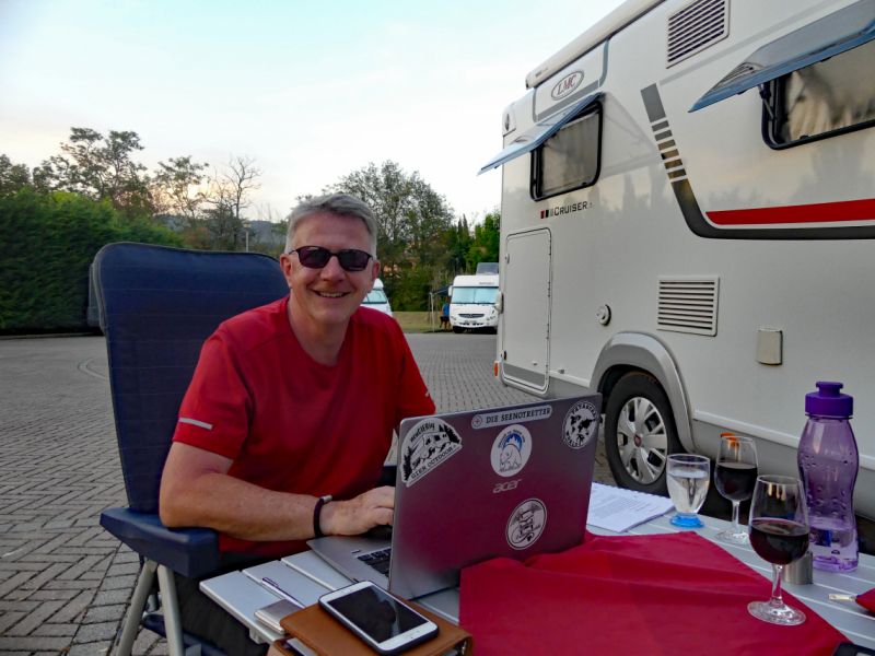
Arbeitstag
Today we have a working day; Cut videos, sort and edit pictures, update social media. And otherwise laze around and enjoy the vacation.
Day
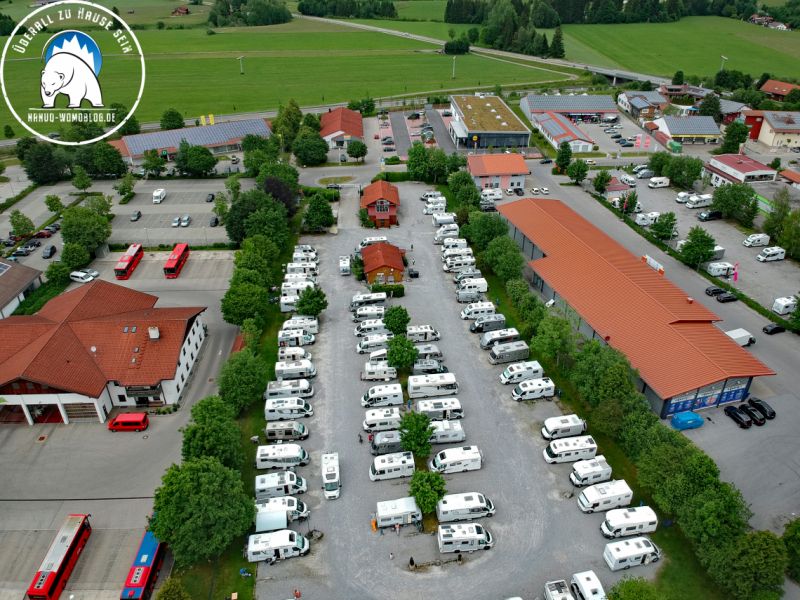
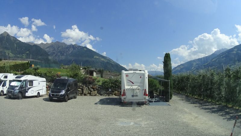
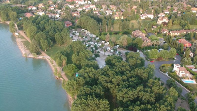
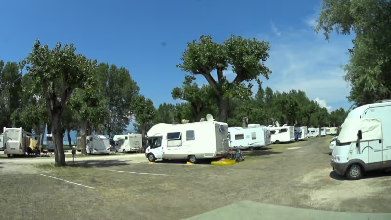
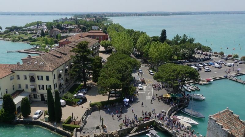
Area Sosta Camper Lugana Marina
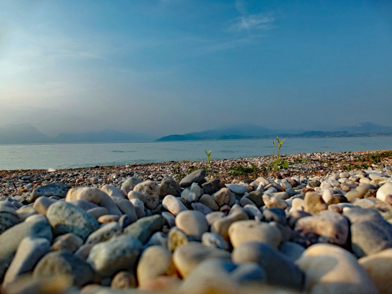
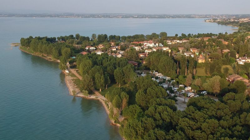
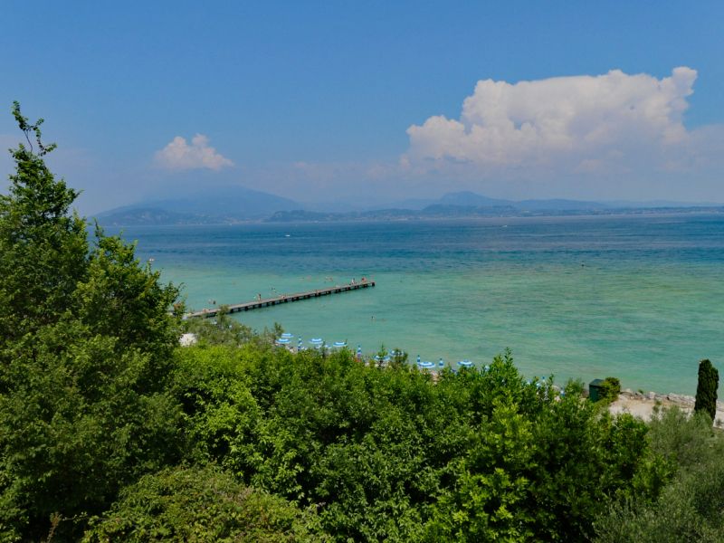
Nach unserer ungeplanten Pause auf dem Schneeburghof in Tirol geht es nun weiter in Richtung Süden und zwar an den Gardasee. Der Stellplatz liegt direkt am See, nur getrennt durch eine Liegewiese und durch den Uferweg (Fahrräder und Fußgänger). Vom Stellplatz aus ist man mit dem Fahrrad in ca. 20 Minuten direkt an der Scaligerburg in Sirmione. Besonders für Kinder ist der Gardasee am Stellplatz geeignet, denn es bleibt lange flach.
Gerade im Sommer sollder Platz recht voll sein, so dass man hier besser reserviert.
Via Cantarane 18, 25019, Sirmione, Italien
45° 27' 38" N 10° 38' 1" E
45.4605556 10.6336111
• Head toward Via Onofria on Via Lugana Marina. Go for 322 m.
• Turn right onto Strada Padana Superiore. Go for 122 m.
• Pass 4 roundabouts and continue on Strada Padana Superiore. Go for 1.8 km.
• Take the 1st exit from roundabout onto Via Colombare. Go for 42 m.
• Continue on Via Colombare. Go for 40 m.
• Pass 2 roundabouts and continue on Via Colombare. Go for 708 m.
• Take the 2nd exit from roundabout onto Via Bagnera. Go for 200 m.
• Turn right onto Via Giacomo Leopardi. Go for 87 m.
• Arrive at Via Giacomo Leopardi. Your destination is on the left.
☍
3,4 km
( 7 min.)
Day
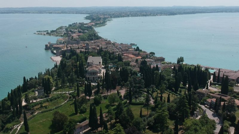
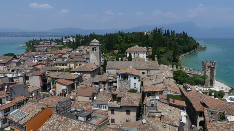
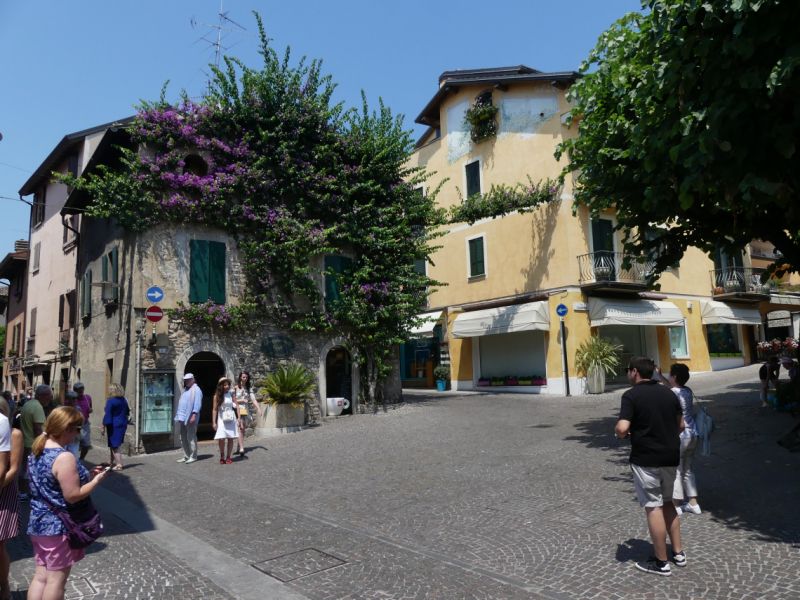
Sirmione, Italien
Unseren Kurzaufenthalt haben wir dazu genutzt, uns Sirmione anzuschauen.
Sirmione ist eine durch und durch vom Tourismus geprägte Stadt. Dennoch hat sie ihren eigenen Charme. Wir haben uns für den Stadtrundgang auf die Altstadt beschränkt. Die Fahrräder haben wir unterhalb der Burg am Hafen angeschlossen; sie mit in die Altstadt zu nehmen ist verboten und es wird streng kontrolliert.
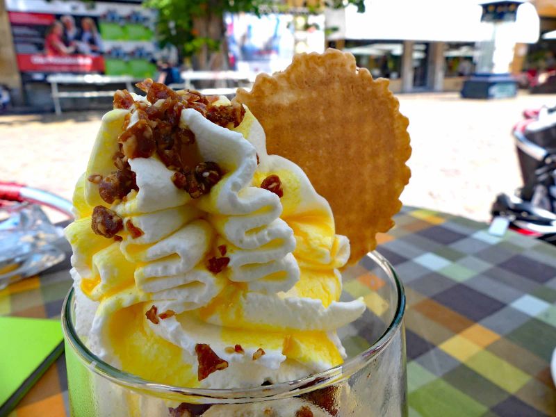
Hinter der Burg eröffnen sich die alten Gassen, geprägt von Souvenirgeschäften, Restaurants und Eisdielen. Das Eis, das wir hatten, war hervorragend; 2 "Kugeln" für 4 Euro. Bei uns zu Hause hätte man da 4 Kugeln draus gemacht. Damit war der Preis ok.
Nach unserem Rundgang haben wir uns noch eine kleine Erfrischung in der Bar des Hotels Meridiana in der Via Caio Valerio Catullo gegönnt. Dort gibt es ein super Craft Weizenbier, Knabbereien sind im Preis inbegriffen.
Via Giacomo Leopardi, 9, 25019 Sirmione BS, Italien
45° 28' 24.6" N 10° 36' 30.9" E
45.4735080 10.6085760
• Head toward Via Bagnera on Via Giacomo Leopardi. Go for 87 m.
• Turn left onto Via Bagnera. Go for 173 m.
• Take the 3rd exit from roundabout onto Via Colombare. Go for 233 m.
• Continue on Via 25 Aprile. Go for 188 m.
• Take the 1st exit from roundabout onto Via 25 Aprile. Go for 1.4 km.
• Continue on Viale Guglielmo Marconi. Go for 540 m.
• Continue on Largo Johann Wolfgang von Goethe. Go for 92 m.
• Continue on Piazza Castello. Go for 90 m.
• Turn right onto Via Vittorio Emanuele II. Go for 22 m.
• Turn right onto Via Santa Maria Maggiore. Go for 100 m.
• Turn right onto Via Dante Alighieri. Go for 64 m.
• Turn right onto Via Dante. Go for 26 m.
• Arrive at Via Dante. Your destination is on the left.
☍
3,0 km
( 7 min.)
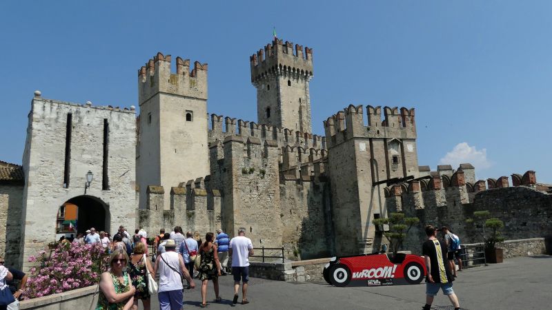
Rocca Scaligera
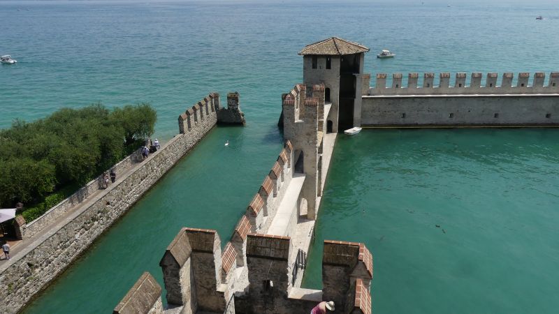
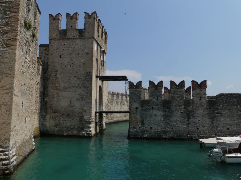
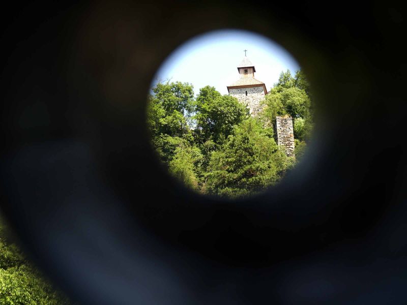
In the courtyard there is a 47 meter high tower and three corner towers. The battlements and loopholes give a good idea of how to defend a castle. The tower was used as an armory in the Middle Ages and was the main military facility. Today you can climb the tower and enjoy a wonderful view of Lake Garda and the city of Sirmione from above. Above all, however, the castle served to protect the city of Sirmione against enemies. The curtain wall plays an important role, because it completely separates Sirmione from the mainland. Access to the city is only possible via a drawbridge. The castle still dominates the image of the town of Sirmione today.
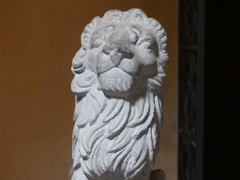
The Scaliger Castle, Rocca Scaligera , was started in the 13th century and hermetically shielded the headland with the old town of Sirmione. Access could be effectively prevented by several heavy drawbridges and the castle also had its own harbor protected by thick walls. In 1405, however, Sirmione fell to Venice, which is also reminiscent of the Venetian lion above the entrance portal. The castle remained in Venetian ownership until the end of the Austrian monarchy and then became the municipal property of Sirmione. In the courtyard there is a 47 meter high tower that was used as an armory in the Middle Ages. Today you can climb the tower and enjoy a wonderful view of Lake Garda and the city of Sirmione from above.
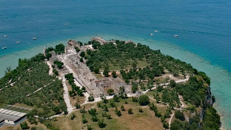
The Catullus Caves (you can buy a combined ticket) were unfortunately closed on the day of our visit, so we had to be satisfied with an aerial photo.
Info: gardasee-info.com/informationen/kultur/rocca-scaligera/
Piazza Castello, 34, 25019 Sirmione BS, Italien
45° 29' 32.6" N 10° 36' 30.1" E
45.4923897 10.6083727
• Head toward Piazza Castello on Via Dante. Go for 30 m.
• Turn right onto Via Vittorio Emanuele II. Go for 72 m.
• Turn right onto Via Vittorio Emanuele II. Go for 98 m.
• Turn right onto Via San Salvatore. Go for 11 m.
• Turn left onto Via G. Piana. Go for 188 m.
• Turn slightly right onto Via Caio Valerio Catullo. Go for 593 m.
• Arrive at Via Caio Valerio Catullo.
☍
1,0 km
( 2 min.)
Grotten des Catull
On the tip of the island of Sirmione are the ruins of a large Roman country house from the 2nd century, the so-called Grottoes of Catullus.
Ornate remains of frescoes and beautiful mosaics point to the splendid furnishings of the former property.
Info: gardasee.de/ausflugsziel/grotten-catull
Piazza Orti Manara, 4, 25019 Sirmione BS, Italien
45° 30' 5.3" N 10° 36' 23.7" E
45.5014593 10.6065917
• Head southeast on Via Caio Valerio Catullo. Go for 71 m.
• Turn right onto Via C. Arici. Go for 302 m.
• Turn right onto Via Caio Valerio Catullo. Go for 199 m.
• Turn slightly right onto Piazza Don Angelo Piatti. Go for 31 m.
• Turn left onto Via Vittorio Emanuele II. Go for 249 m.
• Turn left onto Via Santa Maria Maggiore. Go for 100 m.
• Turn right onto Via Dante Alighieri. Go for 64 m.
• Turn right onto Via Dante. Go for 56 m.
• Turn left onto Piazza Castello. Go for 18 m.
• Continue on Largo Johann Wolfgang von Goethe. Go for 92 m.
• Turn right onto Piazzale Porto. Go for 72 m.
• Turn slightly left onto Lungolago Armando Diaz. Go for 237 m.
• Turn left toward Viale Guglielmo Marconi. Go for 17 m.
• Turn slightly right onto Viale Guglielmo Marconi. Go for 279 m.
• Continue on Via 25 Aprile. Go for 1.4 km.
• Take the 2nd exit from roundabout onto Via 25 Aprile. Go for 216 m.
• Continue on Via Colombare. Go for 196 m.
• Take the 3rd exit from roundabout onto Via Colombare. Go for 166 m.
• Turn right onto Via Aldo Moro. Go for 324 m.
• Take the 2nd exit from roundabout onto Viale Giacomo Matteotti. Go for 262 m.
• Take the 2nd exit from roundabout onto Viale Giacomo Matteotti. Go for 320 m.
• Take the 2nd exit from roundabout toward Aeroporto Montichiari/Autostrada/A4/S. Martino D.B./Lonato/Salò/Brescia/Mantova. Go for 74 m.
• Continue on Viale della Comunità Europea. Go for 304 m.
• Continue toward Via Salvo D'Acquisto. Go for 39 m.
• Take the 2nd exit from roundabout toward MI-VE/A4/Brescia. Go for 51 m.
• Continue on Via Salvo D'Acquisto. Go for 1.6 km.
• Take the 2nd exit from roundabout onto Via dei Colli Storici toward Autostrada/A4/Brescia/Verona. Go for 290 m.
• Take the 2nd exit from roundabout onto Via dei Colli Storici toward Milano/A4/Venezia/Pozzolengo/S.Martino D/B. Go for 487 m.
• Pass 2 roundabouts and continue on Via dei Colli Storici. Go for 1.4 km.
• Take the 4th exit from roundabout onto Svincolo Sirmione toward Milano/Venezia/A4. Go for 261 m.
• Take ramp onto A4 (Autostrada della Serenissima) toward Venezia/E45/A22/Brennero-Modena. Go for 23.9 km.
• Take the exit toward Brennero-Modena/Verona Nord/Aeroporto/Mantova/Modena/Bologna/A1 onto A22 (Autostrada del Brennero). Go for 84.5 km.
• Take the exit toward Campogalliano. Go for 846 m.
• Take the 3rd exit from roundabout onto Viale del Lavoro toward Campogalliano/Autoporto Doganale/Rubiera. Go for 669 m.
• Take the 2nd exit from roundabout onto Viale del Lavoro toward Modena/Carpi/Reggio Emilia. Go for 297 m.
• Take the 1st exit from roundabout onto Strada Provinciale di Campogalliano (SP13) toward Bologna/Modena/Soliera. Go for 1.4 km.
• Take the 2nd exit from roundabout onto Strada Campogalliano (SP13) toward Modena. Go for 1.6 km.
• Keep right onto Strada Nazionale per Carpi Nord (SP413) toward Autostrade/Modena/Bologna/SS9/Milano/Ospedale Civile Baggiovara. Go for 1.4 km.
• Take left ramp onto Tangenziale Nord Luigi Pirandello toward Bologna. Go for 2.5 km.
• Keep left onto Tangenziale Nord Giosuè Carducci toward Bologna/A1/SS9. Go for 2.3 km.
• Continue on Tangenziale Nord Boris Leonidovic Pasternak. Go for 2.9 km.
• Keep left onto Via Nuova Estense toward Bologna/A1/Abetone/SS12/Vignola/SP623/Ospedale Civile Baggiovara. Go for 1.2 km.
• Take the 3rd exit from roundabout onto Strada Provinciale del Passo Brasa (SP623) toward Bologna/A1/Vignola. Go for 5.1 km.
• Take the 2nd exit from roundabout onto Strada Provinciale del Passo Brasa (SP623) toward Autostrada/A1/Spilamberto/Vignola. Go for 1.7 km.
• Take the 3rd exit from roundabout onto A1 (Autostrada del Sole) toward Bologna. Go for 35.9 km.
• Continue on SS64var. Go for 927 m.
• Continue on Raccordo Autostradale Sasso Marconi SS64 Porretana. Go for 2.4 km.
• Continue on A1 (Autostrada del Sole). Go for 10.6 km.
• Keep right onto A1var (Variante di Valico) toward Direttissima/A1/Firenze/Badia. Go for 34.8 km.
• Continue on A1 (Viadotto Lora). Go for 91 m.
• Continue on A1var (Variante di Valico). Go for 32 m.
• Continue on A1 (Galleria Manganaccia). Go for 434 m.
• Continue on A1var (Galleria Manganaccia). Go for 1.9 km.
• Continue on A1 (Viadotto Sieve). Go for 139 m.
• Continue on A1var (Viadotto Sieve). Go for 216 m.
• Continue on A1 (Autostrada del Sole). Go for 19 m.
• Continue on A1var (Variante di Valico). Go for 116 m.
• Continue on A1 (Autostrada del Sole). Go for 34.1 km.
• Take the exit toward Impruneta. Go for 476 m.
• Take the 3rd exit from roundabout onto Strada Regionale Cassia (SR2) toward Impruneta/Firenze/Bologna/A1/E35/Roma/A11/Pisa Nord/Aeroporto A. Vespucci. Go for 2.5 km.
• Pass 2 roundabouts and continue on Via Senese. Go for 1.5 km.
• Keep right onto Via del Gelsomino toward Centro/Fiesole-Arezzo/Pisa. Go for 674 m.
• Turn right onto Via del Gelsomino. Go for 16 m.
• Turn left onto Via del Gelsomino. Go for 130 m.
• Turn right. Go for 24 m.
• Arrive at your destination.
☍
266,3 km
(2 hrs. 52 min.)
Day
Firenze, Italien
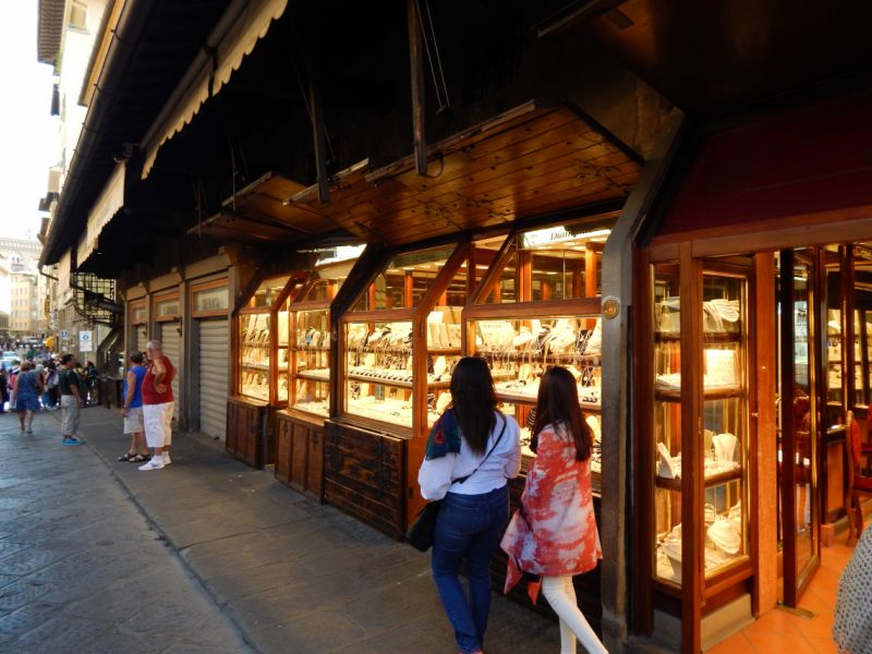
Chiao Lago di Garda, buona sera Firenze. Heute sind wir am Nachmittag in Florenz angekommen und wieder auf dem Stellplatz gelandet, auf dem wir bereits vor 2 Jahren gestanden haben. Nicht der beste Platz, aber zentral gelegen, nachts trotz Innenstadt nicht allzu laut. Außerdem mangelt es etwas an brauchbaren Alternativen. Wer außerhalb stehen möchte und auf sein Glück vertraut, der kann hier mit dem Womo auch stundenweise stehen. Die Tagesgebühr für 24 Stunden beträgt 15 Euro. Die Buslinie 11 fährt direkt vor dem Platz ab. Außerdem gibt es V/E, im Preis enthalten. Bei der Anfahrt an den Stellplatz vorsichtig sein, sonst ist man ganz schnell an der Einfahrt vorbei!
In die Altstadt von Florenz könnt ihr entweder laufen: am Stellplatz die Via Gelsomino hoch. An der Kreuzung links in die Viale del Poggio Imperiale. Der folgt ihr bis zur Porta Romana, wo ihr im Kreisverkehr halb links in die Via Romana abbiegt, die euch direkt zum Ponte Vecchio führt. Dauer ca. 30 Minuten). Oder ihr nehmt den Bus Linie 11, der direkt vor dem Stellplatz abfährt (gleiche Straßenseite). Tickets gibt's in Tabakgeschäften (1,50 einfache Fahrt) oder beim Fahrer (2,50). Ausstieg ist an der Station Frescobaldo, das ist die 5. Station. Achtung: zurück geht der Bus an der Ecke Lungarno Soderini/Ponte alla Carraia, das ist die 2. Brücke nach dem Ponte Vecchio und eine Brücke nach der, an der man ankommt. Die Station am Stellplatz heißt dann Gelsomino 1 und es sind mehr als 5 Stationen.
Florenz ist nicht nur eine große Stadt, wobei man die Altstadt bequem zu Fuß "erlaufen" kann, sie hat auch extrem viel zu bieten. Plazzi, Museen, Piazzas - so viel, dass man bestimmt mindestens Woche braucht, um alles zu sehen. Wir müssen uns leider auf das Wesentliche beschränken.
Via del Gelsomino, 7-9, 50125 Firenze FI, Italien
43° 45' 8.4" N 11° 14' 41.5" E
43.7523456 11.2448733
• Head northeast. Go for 24 m.
• Turn left toward Via del Gelsomino. Go for 113 m.
• Continue on Via del Gelsomino. Go for 17 m.
• Turn right onto Via del Gelsomino. Go for 16 m.
• Turn right onto Via del Gelsomino. Go for 201 m.
• Turn left onto Viale del Poggio Imperiale toward Centro/Pisa/Porta Romana/Viali di Circonvallazione. Go for 859 m.
• Take the 3rd exit from Piazzale di Porta Romana roundabout onto Viale Francesco Petrarca toward Centro/Porta della Vittoria/Scandicci-Pisa. Go for 743 m.
• Turn right onto Piazza Torquato Tasso. Go for 69 m.
• Keep left onto Piazza Torquato Tasso. Go for 64 m.
• Continue on Via del Leone. Go for 297 m.
• Turn right onto Borgo San Frediano. Go for 284 m.
• Turn left onto Piazza Nazario Sauro. Go for 69 m.
• Continue on Ponte Alla Carraia. Go for 150 m.
• Turn slightly right onto Piazza Carlo Goldoni. Go for 15 m.
• Take the 2nd exit from Piazza Carlo Goldoni roundabout onto Via del Moro. Go for 238 m.
• Turn right onto Via del Sole. Go for 122 m.
• Turn slightly left onto Via della Spada. Go for 50 m.
• Continue on Via degli Strozzi. Go for 34 m.
• Arrive at Via degli Strozzi. Your destination is on the right.
☍
3,4 km
( 9 min.)
Day
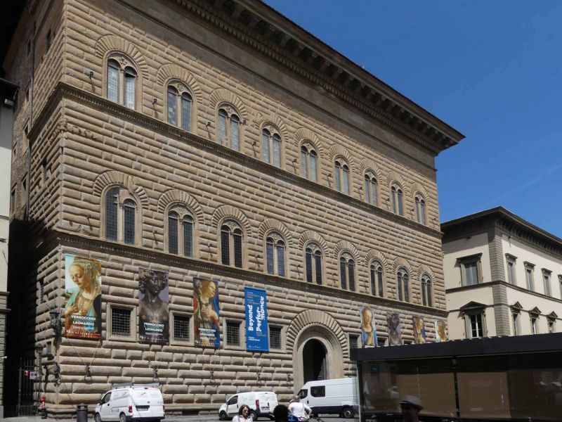
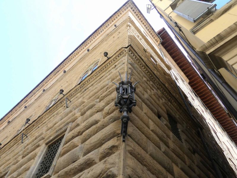
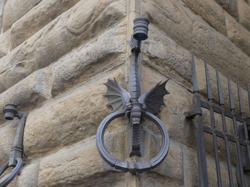
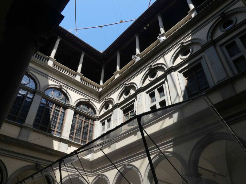
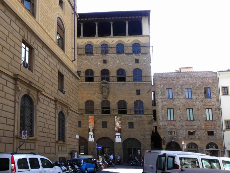
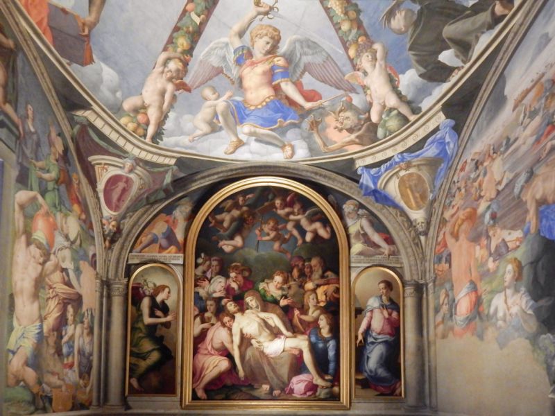
Palazzo Strozzi, Piazza degli Strozzi, Florenz, Italien
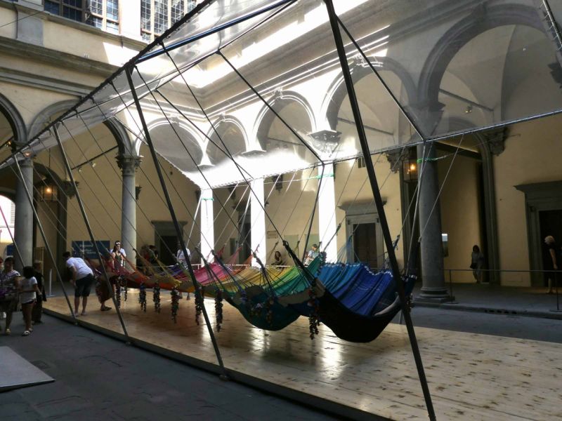
After arriving at the bus station, we are first across the bridge there. After the first orientation problems we found the Palazzo Strozzi. An art museum with free entry to the imposing inner courtyard. This is really very beautiful, unfortunately an installation of modern art (hammocks with rattles) has a negative impact on the overall architectural impression.
What is special about Palazzo Strozzi is the history of its origins. Strozzi wanted to build a magnificent palace, but feared the wrath of the Medici. So he spread the word that his family was planning to set up a small, modest branch in Florence. Thereupon he was clearly ordered by the Medici to kindly build a residence that would be worthy of the prestige of Florence and that of his family. Strozzi didn't have to be told that twice ...
Info and tickets : https://www.palazzostrozzi.org
Piazza degli Strozzi, 50123 Firenze FI, Italien
43° 46' 16.6" N 11° 15' 6.3" E
43.7712730 11.2517612
• Head toward Piazza degli Strozzi on Via degli Strozzi. Go for 80 m.
• Turn left onto Via dei Vecchietti. Go for 180 m.
• Continue on Piazza di Santa Maria Maggiore. Go for 33 m.
• Turn left onto Via dei Cerretani. Go for 46 m.
• Turn slightly right onto Via Panzani. Go for 250 m.
• Continue on Piazza della Stazione. Go for 255 m.
• Continue on Via Santa Caterina da Siena. Go for 69 m.
• Turn left onto Via della Scala. Go for 295 m.
• Continue on Piazza di Santa Maria Novella. Go for 61 m.
• Continue on Via del Sole. Go for 163 m.
• Turn slightly left onto Via della Spada. Go for 50 m.
• Turn right onto Via dei Tornabuoni. Go for 137 m.
• Turn left onto Via Porta Rossa. Go for 119 m.
• Arrive at Via Porta Rossa. Your destination is on the right.
☍
1,7 km
( 6 min.)
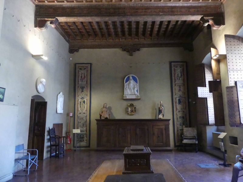
Museo di Palazzo Davanzati, Via Porta Rossa, Florenz, Italien
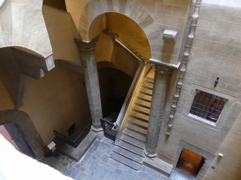
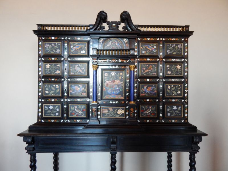
The Palazzo Davanzati, which is very close to the Palazzo Strozzi, has changed hands several times in the course of its history, was barely the victim of a demolition as part of town planning at the beginning of the 20th century, rebuilt several times but is now in its old splendor.
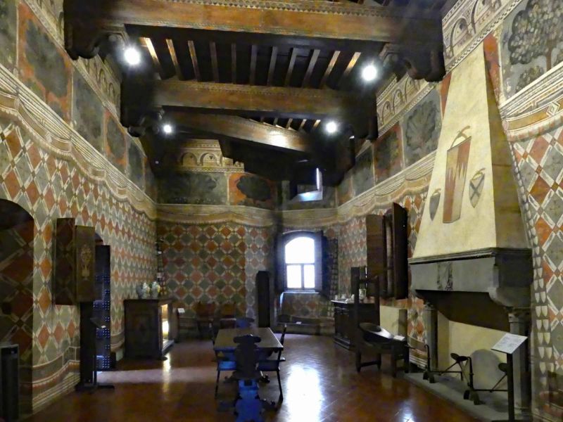
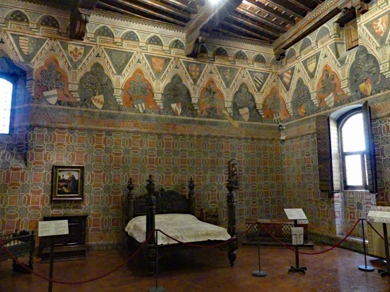
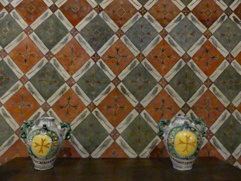
The 14th century palazzo depicts the upscale life of the upper Florentine population in the 14th to 16th centuries. Elaborate frescoes that decorate the individual rooms, water on every floor, toilets and bathrooms also on every floor testify to the high standard of living of the owners.
For us, the Palazzo Davanzati is the most beautiful building after the Palazzo Vecchio and is definitely worth a visit.
Via Porta Rossa, 13, 50123 Firenze FI, Italien
43° 46' 12.5" N 11° 15' 10.2" E
43.7701431 11.2528442
• Head east on Via Porta Rossa. Go for 59 m.
• Turn left onto Via Pellicceria. Go for 41 m.
• Turn right onto Via dei Lamberti. Go for 72 m.
• Turn right onto Via Calimala. Go for 41 m.
• Turn right onto Via Porta Rossa. Go for 29 m.
• Turn left onto Piazza di Mercato Nuovo. Go for 23 m.
• Arrive at Piazza di Mercato Nuovo.
☍
0,3 km
( 1 min.)
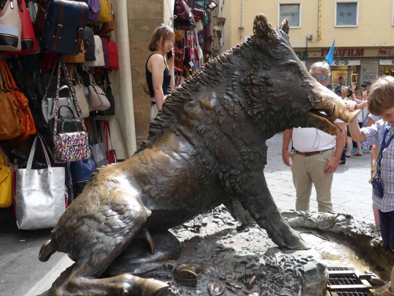
Piazza del Mercato Nuovo, Florenz, Italien
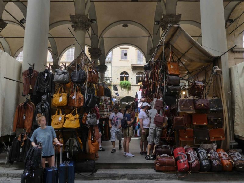
The "New Market" was originally built for traders in gold, silk and other luxury goods. Originally it was just a market square, but in the 16th century it got its portico. Today it is a market for leather items of all kinds, definitely interesting to look at.
The bronze wild boar from the 17th century is said to bring luck if you rub its trunk. You can help the whole thing with a coin that you put in the wild boar's mouth, provided that it disappears in the process after letting go.
Piazza del Mercato Nuovo, Firenze FI, Italien
43° 46' 12.1" N 11° 15' 14.6" E
43.7700174 11.2540563
• Head toward Via Porta Rossa on Piazza di Mercato Nuovo. Go for 23 m.
• Turn left onto Via Porta Rossa. Go for 43 m.
• Turn right onto Via Pellicceria. Go for 102 m.
• Continue on Piazza della Repubblica. Go for 42 m.
• Turn right onto Piazza della Repubblica. Go for 69 m.
• Turn left onto Piazza della Repubblica. Go for 33 m.
• Continue on Via Roma. Go for 43 m.
• Turn right onto Via dei Tosinghi. Go for 72 m.
• Continue on Via dell'Oche. Go for 119 m.
• Turn left onto Via dello Studio. Go for 20 m.
• Turn left onto Via della Canonica. Go for 83 m.
• Turn right onto Via del Campanile. Go for 30 m.
• Arrive at Via del Campanile. Your destination is on the right.
☍
0,7 km
( 4 min.)
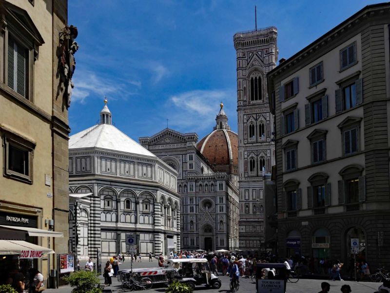
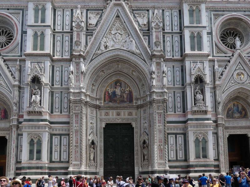
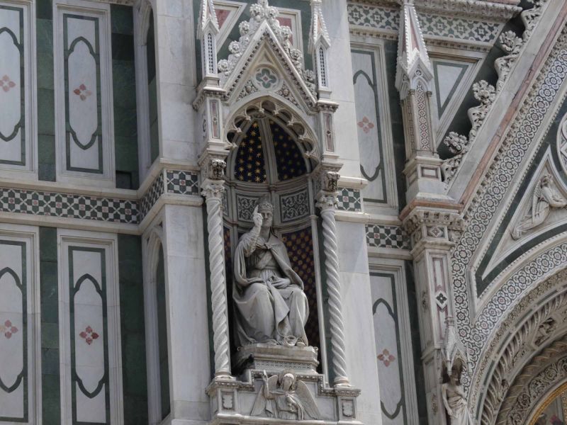
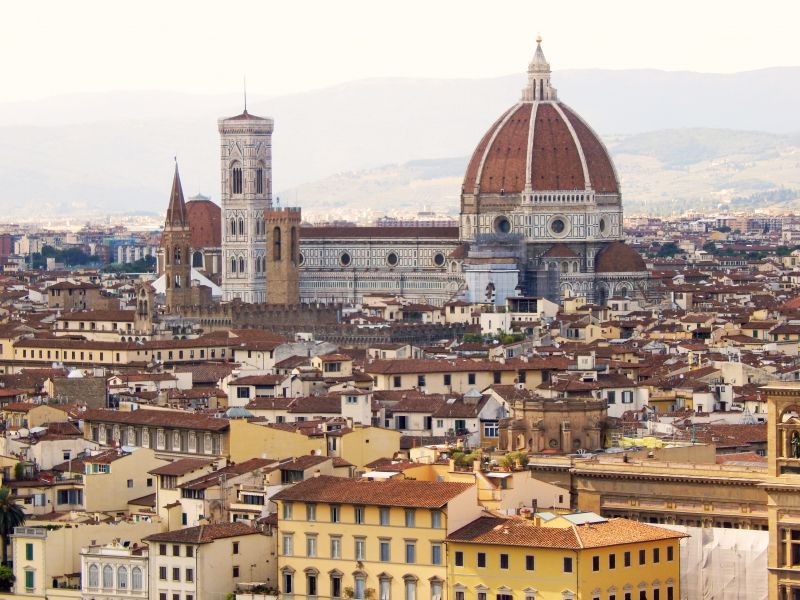
Dom Von Florenz, Piazza del Duomo, Florenz, Italien
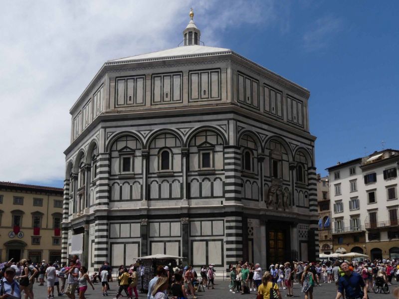
The Florentine Cathedral is one of the most impressive buildings we have seen. The size and facade are absolutely magnificent, the marble-clad cathedral literally shines in the midday sun. And it is of a size that makes it almost impossible to get it in full glory and with all parts (cathedral with dome, baptistery and bell tower) in the picture.
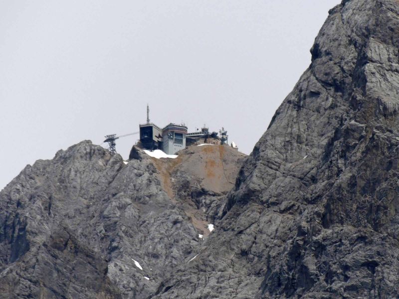
As with the main museums of Florence, the Uffizi Gallery and the Academy, you have to order tickets in advance. Well in advance. Otherwise what happened to us happens: the dome (two mutually supporting dome shells span 41 m room diameter) was already fully booked for the next few days, the baptistery was only available much later that day and the bell tower (85 meters, 414 steps) cannot be booked separately.
And what you need for the cathedral, which you can enter without a ticket, is patience. Eternal queuing in the scorching sun is the order of the day. In our opinion, the cathedral itself is a bit plain.
The oldest part of the entire complex is, by the way, the octagonal Battisterio San Giovanni, the baptistery from the 11th / 12th. Century. The highlight are the gold-plated bronze doors. As with many outdoor works of art, these are copies. The originals are in the cathedral museum.
The Museo dell'Opera del Duome, the museum of the Dombauhütte shows works of art from the cathedral and the baptistery.
So: good planning and order at least a week in advance!
Piazza del Duomo, 50122 Firenze FI, Italien
43° 46' 23.3" N 11° 15' 21.5" E
43.7731450 11.2559602
• Head toward Via della Canonica on Via del Campanile. Go for 52 m.
• Turn left onto Via dell'Oche. Go for 86 m.
• Turn left onto Via dello Studio. Go for 10 m.
• Turn right onto Via dei Bonizzi. Go for 31 m.
• Turn left onto Piazza di San Benedetto. Go for 35 m.
• Turn right onto Piazza delle Pallottole. Go for 24 m.
• Turn slightly left onto Via dei Maccheroni. Go for 24 m.
• Turn right onto Via del Proconsolo. Go for 189 m.
• Turn left onto Via Ghibellina. Go for 302 m.
• Turn left onto Via Giuseppe Verdi. Go for 169 m.
• Continue on Via Fiesolana. Go for 99 m.
• Turn right onto Via di Mezzo. Go for 276 m.
• Turn slightly left onto Via Giosuè Carducci. Go for 222 m.
• Continue on Piazza Massimo d'Azeglio. Go for 190 m.
• Turn left onto Piazza Massimo d'Azeglio. Go for 141 m.
• Continue on Via Giuseppe Giusti. Go for 483 m.
• Turn right onto Via Gino Capponi. Go for 240 m.
• Turn left onto Via Venezia. Go for 345 m.
• Continue on Via Sant'Anna. Go for 80 m.
• Turn right onto Via San Gallo. Go for 50 m.
• Turn left onto Via delle Mantellate. Go for 83 m.
• Turn left onto Via Zara. Go for 118 m.
• Continue on Via Santa Reparata. Go for 333 m.
• Turn right onto Via 27 Aprile. Go for 195 m.
• Turn left onto Piazza dell'Indipendenza. Go for 111 m.
• Continue on Via Nazionale. Go for 386 m.
• Continue on Largo Fratelli Alinari. Go for 20 m.
• Keep left onto Largo Fratelli Alinari. Go for 66 m.
• Turn left onto Piazza della Stazione. Go for 94 m.
• Continue on Piazza dell'Unità Italiana. Go for 65 m.
• Continue on Via Panzani. Go for 187 m.
• Turn right onto Via dei Rondinelli. Go for 86 m.
• Turn left onto Piazza degli Antinori. Go for 15 m.
• Turn slightly left onto Via degli Agli. Go for 38 m.
• Continue on Via dei Pecori. Go for 16 m.
• Turn right onto Via dei Pescioni. Go for 138 m.
• Turn left onto Via degli Strozzi. Go for 112 m.
• Continue on Piazza della Repubblica. Go for 69 m.
• Turn right onto Piazza della Repubblica. Go for 42 m.
• Continue on Via Calimala. Go for 27 m.
• Turn left onto Via Orsanmichele. Go for 17 m.
• Arrive at Via Orsanmichele. Your destination is on the right.
☍
5,3 km
( 18 min.)
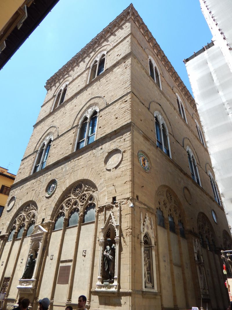
Orsanmichele, Florenz, Italien
Orsanmichele - The church doesn't look like a church at all. But that's no wonder, because it was built in 1337 as a grain market. A picture of Mary displayed here turned out to be miraculous, so that the hall quickly became a church in 1380. The arcades were bricked up and Gothic windows were built in the upper part. The guilds set up their patron saints in the niches on the outer wall; the originals can be seen on Mondays in the museum on the upper floor.
Entry to the church is free.
50123 Florenz, Italien
43° 46' 14.9" N 11° 15' 16.6" E
43.7708160 11.2546085
• Head toward Vicolo di Ferro on Via Orsanmichele. Go for 11 m.
• Turn right onto Via dell'Arte della Lana. Go for 35 m.
• Turn left onto Via dei Lamberti. Go for 43 m.
• Turn right onto Via dei Calzaiuoli. Go for 66 m.
• Continue on Piazza della Signoria. Go for 10 m.
• Turn left onto Piazza della Signoria. Go for 40 m.
• Arrive at Piazza della Signoria. Your destination is on the left.
☍
0,2 km
( 1 min.)
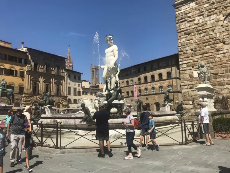
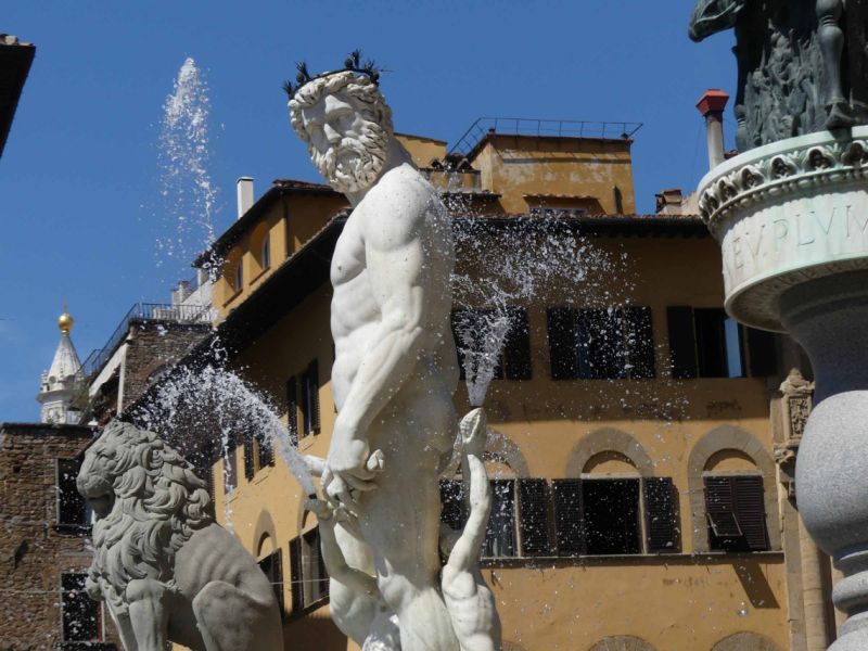
Piazza della Signoria, Piazza della Signoria, Florenz, Italien
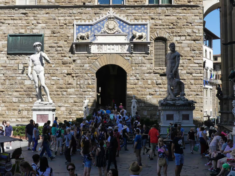
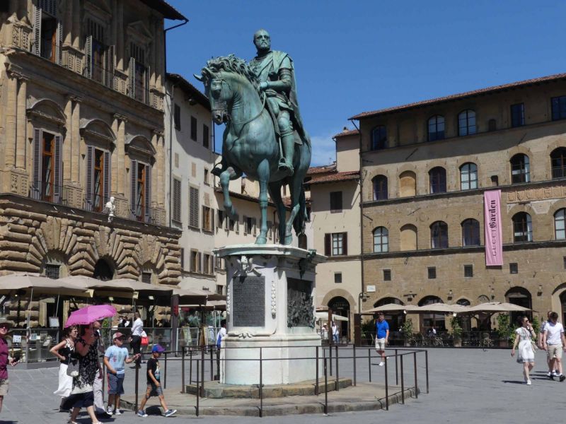
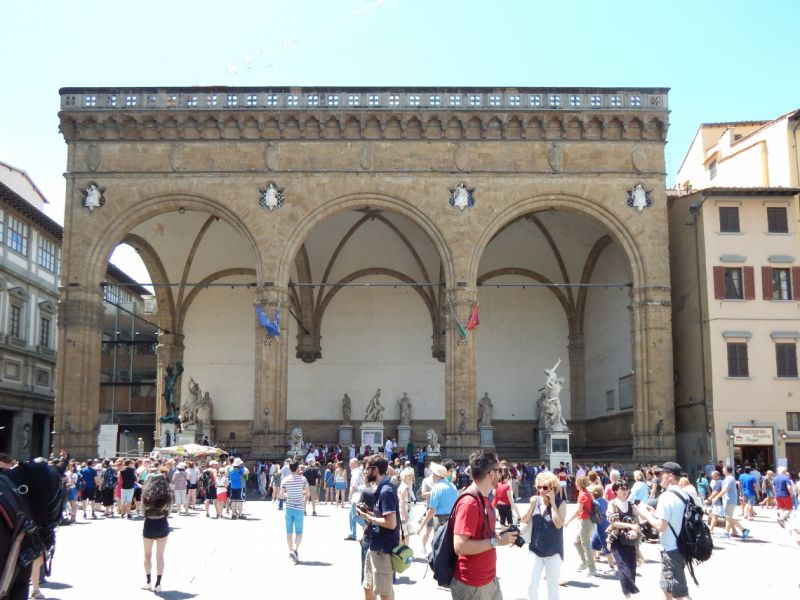
The Piazza della Signoria, named after the Signoria, the republican government of the city of Florence, is the most important square in the city. Not only does the Palazzo Vecchio stand on it, but also a number of famous sculptures, such as Michelangelo's David (the original is in the Accademia), Hercules and Cacus by Bandinelli or the equestrian statue of Cosimo I de Medici . In the square is also the Loggia di Lanzi , an arcade hall in which the receptions of the city of Florence were previously held and which is also populated with statues.
Piazza della Signoria, 50122 Firenze FI, Italien
43° 46' 10.9" N 11° 15' 20.3" E
43.7696855 11.2556422
• Head southeast on Piazza della Signoria.
• Turn right onto Piazza della Signoria. Go for 41 m.
• Turn left onto Piazza della Signoria. Go for 64 m.
• Continue on Via della Ninna. Go for 18 m.
• Arrive at Via della Ninna. Your destination is on the left.
☍
0,1 km
( )
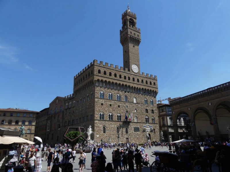
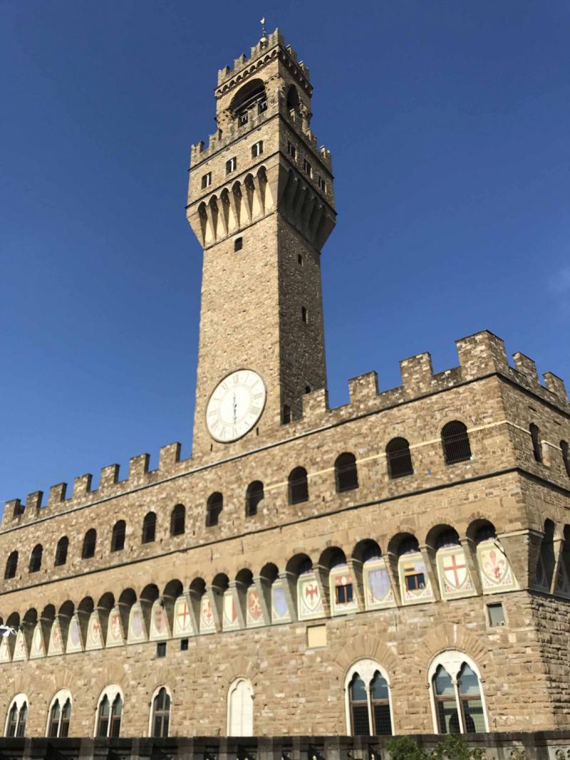
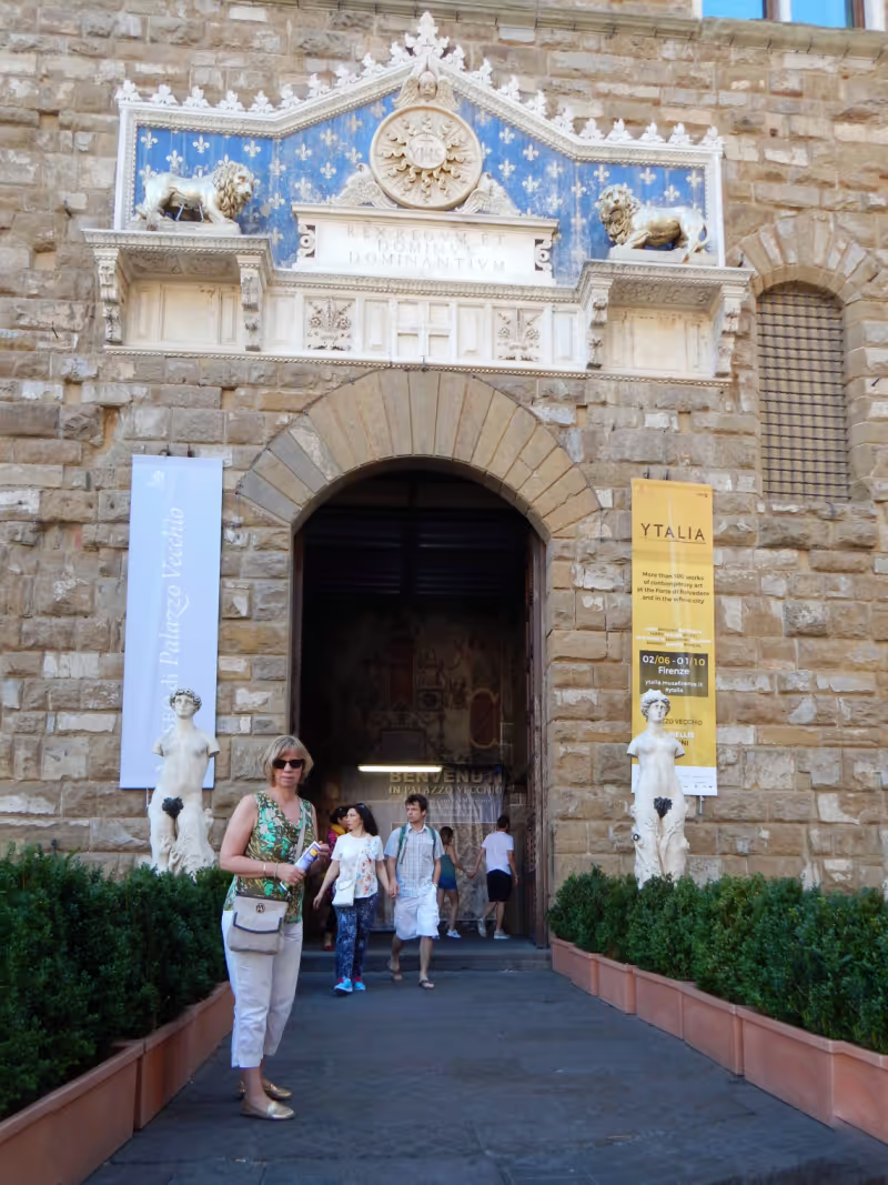
Palazzo Vecchio, Piazza della Signoria, Florenz, Italien
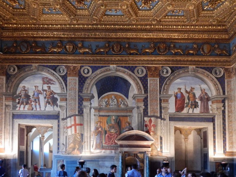
The palace, the construction of which began together with the cathedral in 1299, was supposed to be the seat of the city council and so its original name was also Palazzo della Signoria. After the Medici came to power, they had the palace lavishly furnished from the middle of the 16th century. The building became the Palazzo Vecchio, the "Old Palace", after the Medici had built their Palazzo Pitti on the other side of the Arno.
The Palazzo Vecchio is a must see when in Florence. Wall and ceiling paintings, sculptures, the private apartments - it's all just worth seeing.
Piazza della Signoria, 50122 Firenze FI, Italien
43° 46' 9.5" N 11° 15' 22.1" E
43.7693012 11.2561509
• Head toward Via dei Neri on Via della Ninna. Go for 82 m.
• Turn slightly right onto Piazza del Grano. Go for 65 m.
• Continue on Via dei Castellani. Go for 75 m.
• Continue on Via dei Saponai. Go for 95 m.
• Continue on Piazza Mentana. Go for 27 m.
• Turn right onto Piazza Mentana. Go for 55 m.
• Turn left onto Lungarno Generale Armando Diaz. Go for 100 m.
• Turn right onto Ponte Alle Grazie. Go for 162 m.
• Turn right onto Lungarno Torrigiani. Go for 387 m.
• Turn slightly right onto Via dei Bardi. Go for 122 m.
• Turn right onto Via dei Guicciardini. Go for 13 m.
• Arrive at Via dei Guicciardini. Your destination is on the left.
☍
1,2 km
( 3 min.)
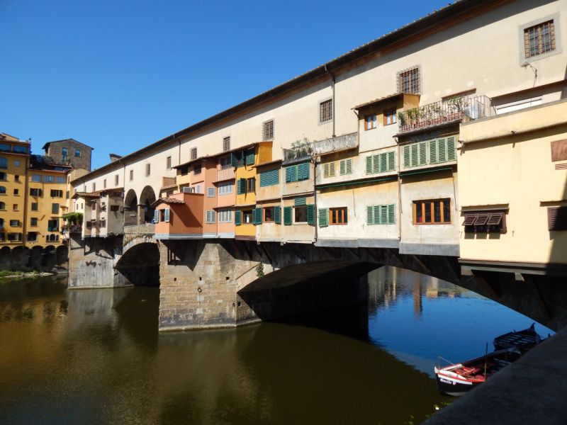
Ponte Vecchio, Florenz, Italien
The Ponte Vecchio, the "old bridge" was built in 1345 and already then built on both sides with rows of shops. Butchers, tanners and fishmongers had their headquarters here. A corridor was laid out above it for the Medici so that they could get from their new palace, the Palazzo Pitti , to the other side of the administration building.
However, the Medici "stank" in the truest sense of the word when they had to cross the Ponte Vecchio. So they decided without further ado that only goldsmiths were allowed to operate their trade on the bridge. And that's still the case today.
Incidentally, the Ponte Vecchio has also made it to the cinema: In the film Parfum by Süskind, the Ponte Vecchio is the model for the Seine bridge, on which the perfumer Baldini lives.
Ponte Vecchio, 50125 Firenze FI, Italien
43° 46' 4.3" N 11° 15' 11" E
43.7678677 11.2530619
• Head southwest on Via dei Guicciardini. Go for 13 m.
• Turn left onto Via dei Bardi. Go for 122 m.
• Turn slightly left onto Lungarno Torrigiani. Go for 387 m.
• Continue on Lungarno Serristori. Go for 498 m.
• Continue on Piazza Giuseppe Poggi. Go for 72 m.
• Continue on Lungarno Benvenuto Cellini. Go for 446 m.
• Take the 4th exit from Piazza Francesco Ferrucci roundabout onto Piazza Francesco Ferrucci toward Centro/Fiesole/Viali di Circonvallazione/Aeroporto A. Vespucci. Go for 205 m.
• Continue on Ponte San Niccolò. Go for 177 m.
• Continue on Viale Giovanni Amendola. Go for 275 m.
• Turn left onto Viale Duca degli Abruzzi toward Centro/Lungarni/A1/Autostrade/A11/Roma. Go for 81 m.
• Keep left onto Viale della Giovine Italia toward Lungarni/Ponta San Niccolò/A1/Autostrade/A11. Go for 261 m.
• Keep right onto Viale della Giovine Italia. Go for 102 m.
• Continue on Lungarno della Zecca Vecchia. Go for 419 m.
• Turn slightly right onto Piazza dei Cavalleggeri. Go for 44 m.
• Continue on Corso dei Tintori. Go for 232 m.
• Turn right onto Via dei Benci. Go for 167 m.
• Continue on Piazza di Santa Croce. Go for 19 m.
• Turn left onto Via dell'Anguillara. Go for 261 m.
• Continue on Via della Condotta. Go for 135 m.
• Turn left onto Via delle Farine. Go for 29 m.
• Turn slightly right onto Piazza della Signoria. Go for 91 m.
• Turn slightly right onto Via Vacchereccia. Go for 70 m.
• Turn left onto Via Por Santa Maria. Go for 144 m.
• Turn left onto Piazza del Pesce. Go for 24 m.
• Continue on Lungarno degli Archibusieri. Go for 78 m.
• Arrive at Lungarno degli Archibusieri. Your destination is on the left.
☍
4,4 km
( 13 min.)
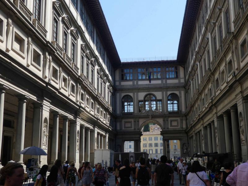
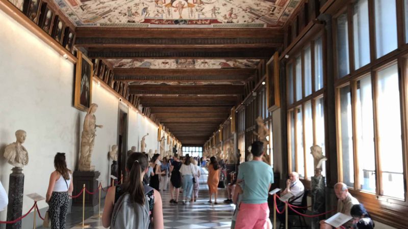
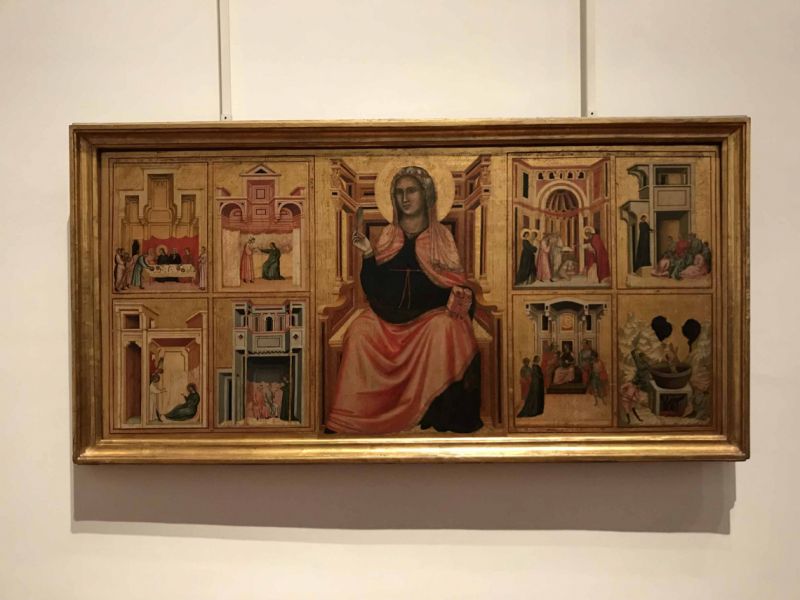
Uffizien, Piazzale degli Uffizi, Florenz, Italien
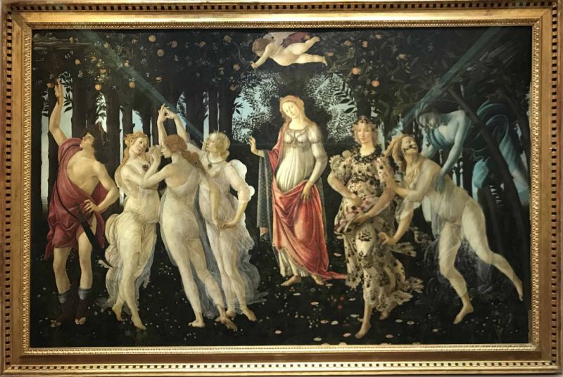
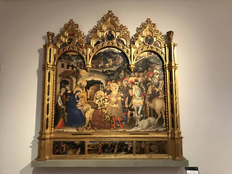
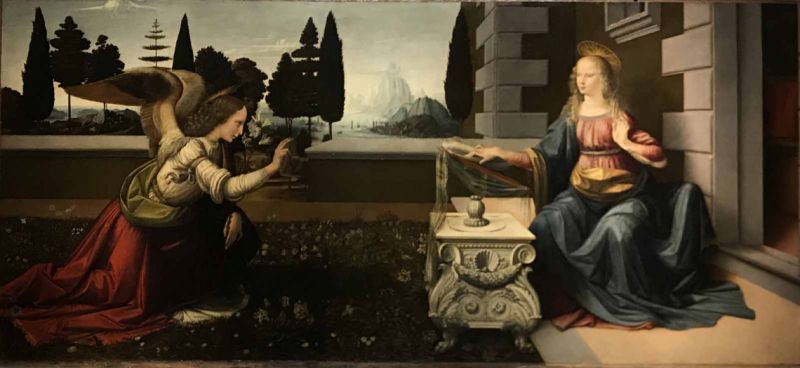
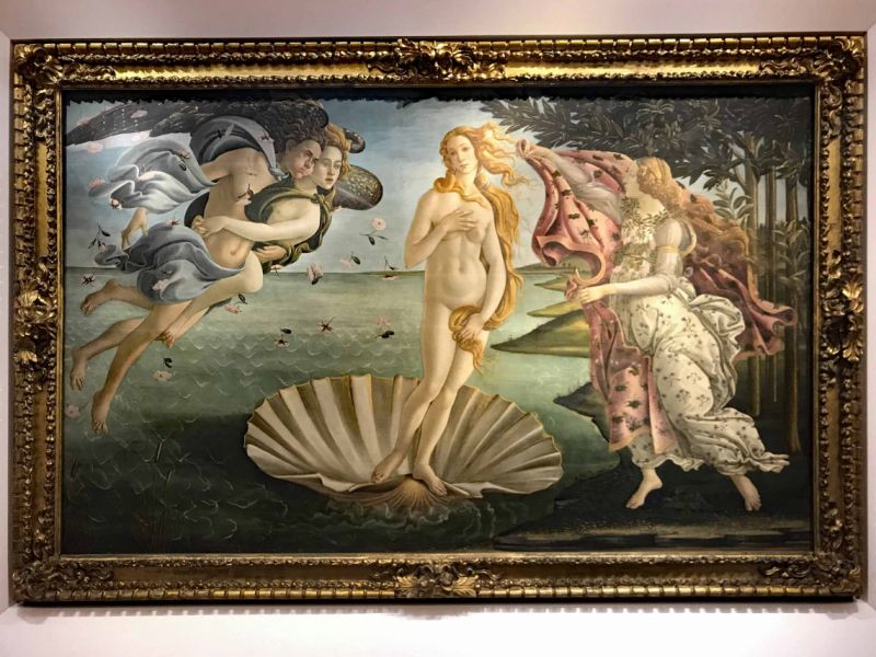
The Uffizi, formerly the "office complex" of the city administration, commissioned by Cosimo I de Medici in 1559, today houses one of the most important art collections in the world.
If you want to see the works of Titian, Raffael, Leonardo da Vinci, Michelangelo, Dürer ... you should book early. At least 3-4 days in advance on the Internet and on the official website of the Florentine Museums. Or you have a few hours to queue up for a ticket.
But a visit is worthwhile, the works and the sheer amount of works of art is absolutely overwhelming, even if at some point we felt a bit overwhelmed.
But honestly: what is a visit to Florence without the Uffizi Gallery?
Piazzale degli Uffizi, 6, 50122 Firenze FI, Italien
43° 46' 4" N 11° 15' 19.1" E
43.7677856 11.2553108
• Head southeast on Lungarno degli Archibusieri.
• Turn left onto Arco delle Carrozze. Go for 26 m.
• Turn slightly left onto Via dei Georgofili. Go for 46 m.
• Turn right onto Via Lambertesca. Go for 51 m.
• Turn left onto Piazzale degli Uffizi. Go for 72 m.
• Turn right onto Via della Ninna. Go for 100 m.
• Turn slightly right onto Piazza del Grano. Go for 65 m.
• Continue on Via dei Castellani. Go for 75 m.
• Continue on Via dei Saponai. Go for 95 m.
• Continue on Piazza Mentana. Go for 27 m.
• Turn right onto Piazza Mentana. Go for 55 m.
• Turn left onto Lungarno Generale Armando Diaz. Go for 100 m.
• Turn right onto Ponte Alle Grazie. Go for 162 m.
• Turn left onto Lungarno Serristori. Go for 93 m.
• Turn right onto Via Mario Monicelli. Go for 38 m.
• Turn left onto Via dei Renai. Go for 129 m.
• Turn slightly right onto Via dell'Olmo. Go for 41 m.
• Turn left onto Via di San Niccolò. Go for 45 m.
• Continue on Via San Miniato. Go for 68 m.
• Continue on Via del Monte alle Croci. Go for 577 m.
• Turn sharp left onto Viale Galileo. Go for 203 m.
• Continue on Piazzale Michelangiolo. Go for 80 m.
• Arrive at Piazzale Michelangelo.
☍
2,1 km
( 8 min.)
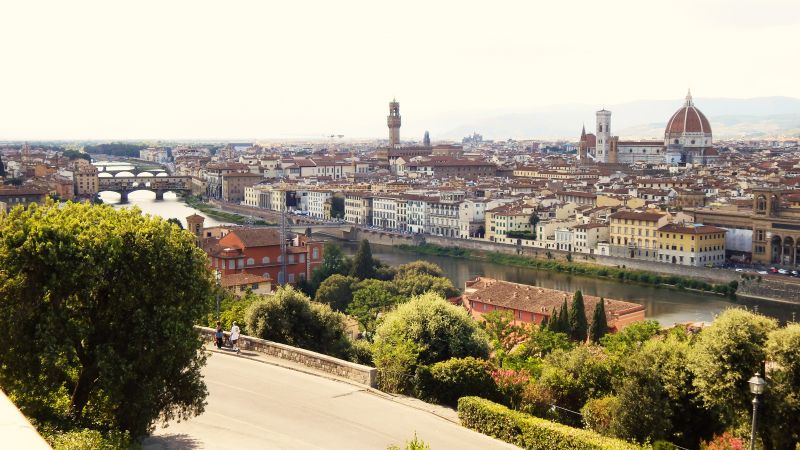
Piazzale Michelangelo, Florenz, Italien
Even if it's a decent stretch - the hike or drive to Piazzale Michelangelo is worthwhile. From there you have the most beautiful view of Florence and its city center.
Piazzale Michelangelo, 50125 Firenze FI, Italien
43° 45' 44.8" N 11° 15' 53.7" E
43.7624561 11.2649304
• Head east on Piazzale Michelangelo. Go for 49 m.
• Continue on Viale Michelangiolo toward Ponte San Nicolò/Centro/Autostrade/A1/A11/Fiesole. Go for 298 m.
• Turn right onto Via di San Miniato al Monte. Go for 165 m.
• Turn right onto Via del Monte alle Croci. Go for 365 m.
• Turn left onto Viale Galileo. Go for 1.6 km.
• Turn left onto Piazzale Galileo toward Galluzzo/A1/Autostrade/A11/Siena. Go for 22 m.
• Continue on Viale Evangelista Torricelli. Go for 450 m.
• Continue on Via del Gelsomino toward Galluzzo/A1/Autostrade/A11/Siena. Go for 850 m.
• Turn left onto Via Senese. Go for 1.3 km.
• Continue straight ahead. Go for 33 m.
• Take the 1st exit from roundabout toward Scandicci/Ospedale San Giovanni di Dio. Go for 78 m.
• Continue on Galleria La Romita. Go for 319 m.
• Continue toward Bypass del Galluzzo. Go for 34 m.
• Take the 3rd exit from roundabout onto Bypass del Galluzzo. Go for 3.0 km.
• Take left ramp onto Superstrada Firenze-Siena (RA3). Go for 2.9 km.
• Take ramp onto Strada Regionale Cassia (SR2) toward Impruneta/Greve in Chianti. Go for 2.7 km.
• Turn left onto Strada Provinciale Chiantigiana per Val di Greve (SP3). Go for 6.0 km.
• Continue on Via di Poneta. Go for 93 m.
• Continue on Strada Provinciale Chiantigiana per Val di Greve (SP3). Go for 4.5 km.
• Keep right onto Località Passo dei Pecorai (SP33) toward Greve in Chianti. Go for 3.8 km.
• Turn right onto Strada Regionale Chiantigiana (SR222). Go for 3.1 km.
• Turn right onto Via Lino Falsettacci. Go for 141 m.
• Continue on Via Citille. Go for 36 m.
• Turn right onto Via di Colognole. Go for 417 m.
• Turn left onto Via Montebeni. Go for 82 m.
• Arrive at Via Montebeni. Your destination is on the right.
☍
32,3 km
( 38 min.)
Day
Punto Sosta per Camper
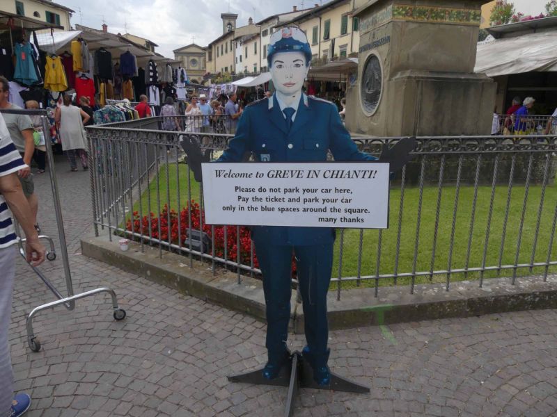
Den Tipp, nach Greve zu fahren, haben wir von Ilona, auch Nutzerin von FREEONTOUR, bekommen. Da wir ohnehin ins Chianti wollten, sind wir dem Tipp gefolgt und es hat sich definitiv gelohnt. Greve verfügt sogar über einen eigenen Stellplatz in der Nähe der Innenstadt, so dass man bequem in 13 Minuten rein laufen kann. Der Stellplatz ist kostenlos mit V/E aber ohne Strom. Er liegt direkt neben dem Schwimmbad, so dass es tagsüber nicht ganz leise ist, was uns aber nicht gestört hat.
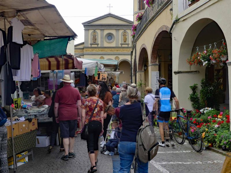
Greve selber hat zwar eine kleine Altstadt, aber diese ist schön verträumt mit ihren Ladengalerien, Geschäftchen, Restaurants. Die Piazza Matteotti ist von Arkaden und mehreren Palazzi gesäumt und hier finden viele Märkte statt. Der Platz war während des Mittelalters der Marktplatz des Castello Montefioralle, einer Burg, die heute noch den Ort überragt. Auf der Piazza Matteotti befindet sich die Statue des Giovanni da Verrazzano. Dieser berühmte Forschungsreisende entdeckte einst die Bucht von New York.
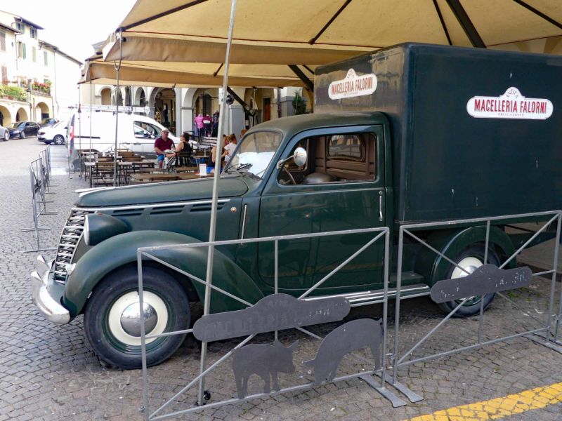
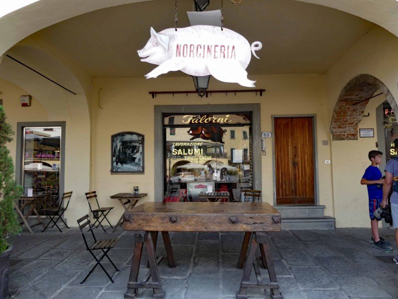
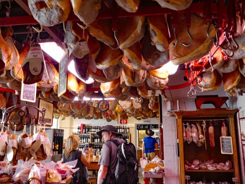
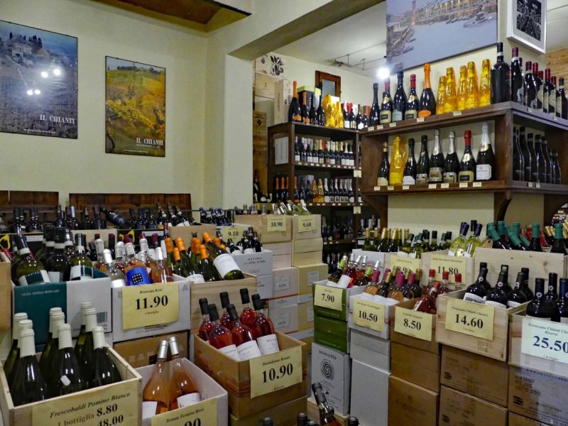
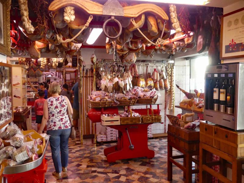
Etwas ganz besonderes ist auch ein Besuch in der "Macelleria Falorni". Ein Geschäft, in dem der Himmel voller Schinken hängt. Und Salami in allen Variationen. Verschiedene Käsesorten und Weine. Auch zum probieren in der eigenen Weinbank. Und einen Bereich, wo man gemütlich schlemmen kann... Der Himmel auf Erden.
Via Montebeni, 50026, Greve in Chianti, Italien
43° 35' 25" N 11° 18' 46" E
43.5902778 11.3127778
• Head east on Via Montebeni. Go for 82 m.
• Turn right onto Via di Colognole. Go for 417 m.
• Turn left onto Via Citille. Go for 36 m.
• Turn right onto Via Italo Stecchi. Go for 113 m.
• Turn right onto Viale Giovanni da Verrazzano (SR222) toward Siena. Go for 363 m.
• Arrive at Viale Vittorio Veneto (SR222). Your destination is on the left.
☍
1,0 km
( 3 min.)
Day
Greve in Chianti, Italien
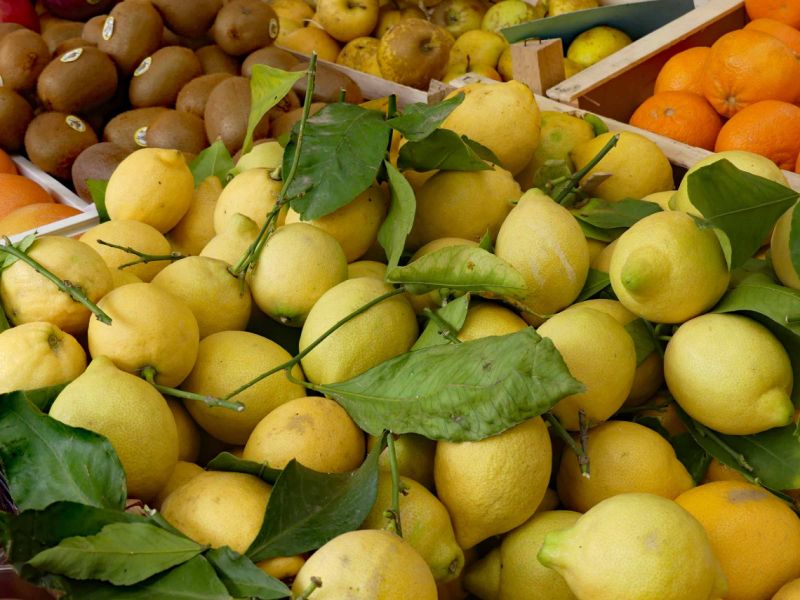
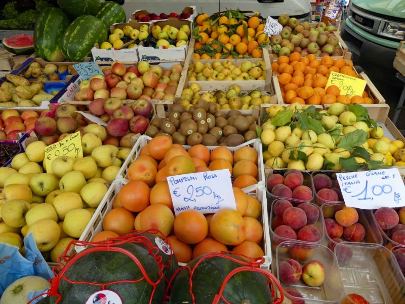
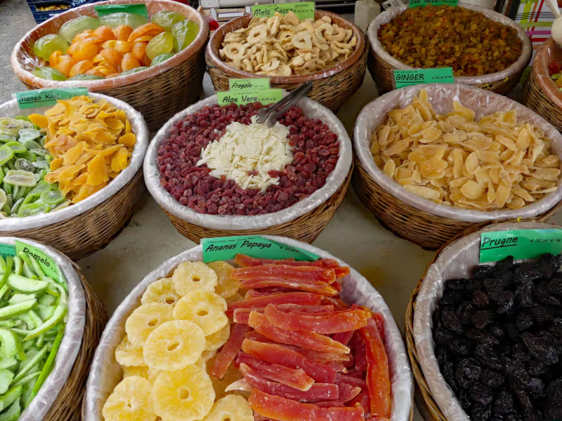
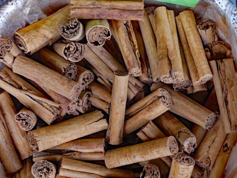
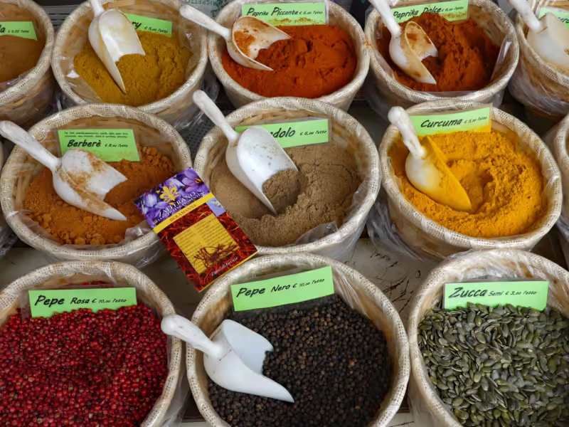
Wir hatten Glück und waren auch am Samstag noch in Greve, denn Samstag ist Markttag. Wir lieben Markttage. Es ist für uns, die wir aus einer Großstadt kommen, immer wieder erstaunlich zu sehen, dass in anderen Ländern wie Italien und Frankreich Märkte noch immer eine wichtige Einkaufsmöglichkeit darstellt. Kleidung, Haushaltsgegenstände aber auch natürlich Gemüse, Obst, Fisch und Fleisch. Das alles zu sehen, das bunte Treiben, die Gerüche und Farben, das geschäftige Gewusel der Menschen - das macht für uns die Faszination von Märkten aus. Und natürlich finden wir auch immer etwas zum Probieren und mitnehmen. Richtig lecker waren die Brötchen mit gegrilltem Wildschwein
Piazza delle Cantine, 2, 50022 Greve in Chianti FI, Italien
43° 35' 1.6" N 11° 19' 2.2" E
43.5837739 11.3172891
• Head toward Via Cesare Battisti on Viale Vittorio Veneto (SR222). Go for 86 m.
• Turn right onto Via Cesare Battisti. Go for 55 m.
• Turn slightly left onto Piazza Giacomo Matteotti. Go for 34 m.
• Turn right onto Via Roma. Go for 109 m.
• Continue on Via Domenico Giuliotti. Go for 68 m.
• Continue on Piazza Trento. Go for 19 m.
• Turn right onto Piazza Trento. Go for 17 m.
• Turn left onto Viale Giovanni da Verrazzano (SR222). Go for 405 m.
• Turn sharp left onto Via Lino Falsettacci. Go for 141 m.
• Continue on Via Citille. Go for 47 m.
• Turn right onto Via Buondelmonti. Go for 301 m.
• Turn right onto Via del Castello di Cintoia. Go for 594 m.
• Continue on Località Montefioralle. Go for 360 m.
• Turn right onto Località Montefioralle. Go for 117 m.
• Turn left onto Località Montefioralle. Go for 79 m.
• Arrive at Località Montefioralle. Your destination is on the left.
☍
2,4 km
( 6 min.)
Montefioralle, Florenz, Italien
If you are in Greve, visit the tourist information. There is interesting information there, for example a hiking tour to Montefioralle and, if you have the time and inclination and the heat doesn't slow you down, back to Greve in a wide arc. The special thing about the tour is that you pass various points where artists present their works.
Because of the intense heat, however, we only made it to Montefioralle and then went back almost the same way.
Montefioralle itself can be reached on foot in around 20 minutes. It is one of the oldest villages in the Chianti region and was one of the largest military fortresses in the region during the Middle Ages. Even today, Montefioralle is surrounded by the original walls, two octagonal fortress walls with four city gates. On a walk you can admire the pretty houses built on arches and the many passageways.
50022 Montefioralle, Florenz, Italien
43° 34' 50.9" N 11° 18' 11" E
43.5808099 11.3030483
• Head southeast on Località Montefioralle. Go for 104 m.
• Turn right onto Località Montefioralle. Go for 32 m.
• Turn left onto Via del Castello. Go for 360 m.
• Continue on Case Sparse Montefioralle. Go for 594 m.
• Turn left onto Via Buondelmonti. Go for 301 m.
• Turn left onto Via Citille. Go for 47 m.
• Turn right onto Via Italo Stecchi. Go for 113 m.
• Turn right onto Viale Giovanni da Verrazzano (SR222) toward Siena. Go for 19.7 km.
• Arrive at Via Chiantigiana (SR222). Your destination is on the left.
☍
21,3 km
( 31 min.)
Day
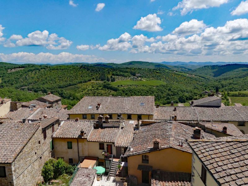
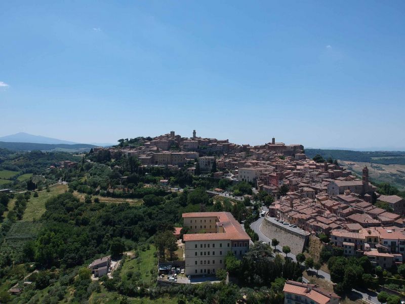
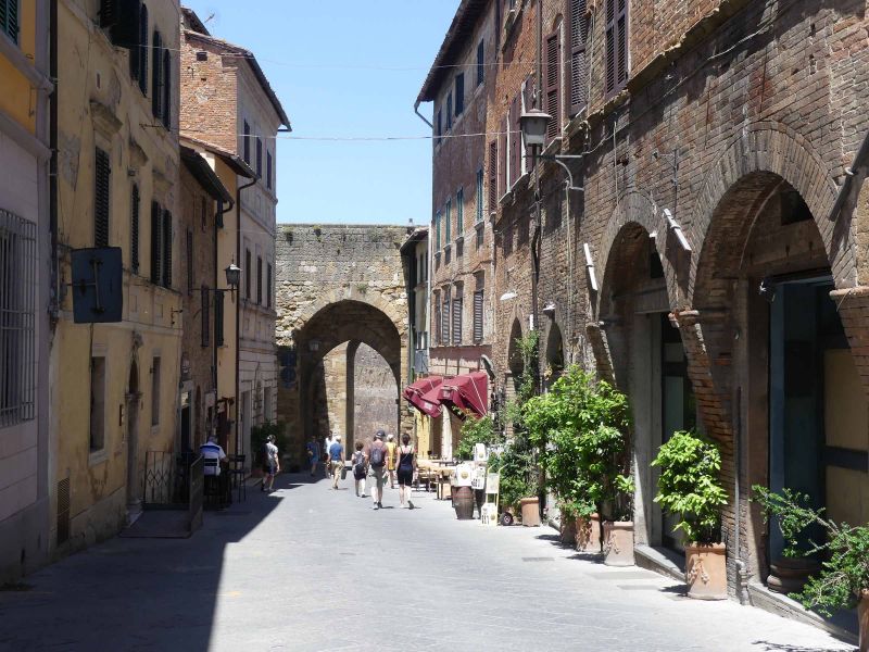
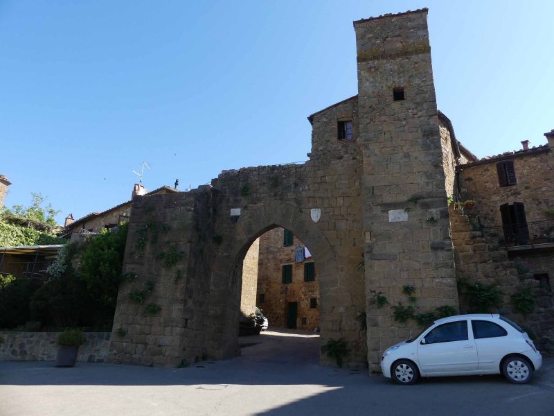
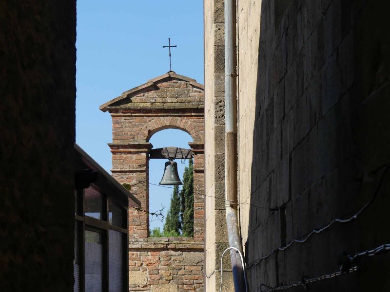
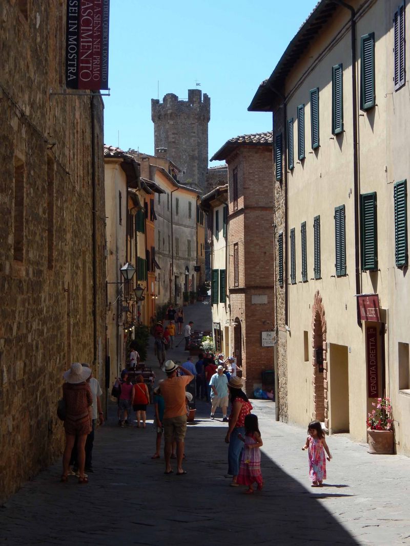
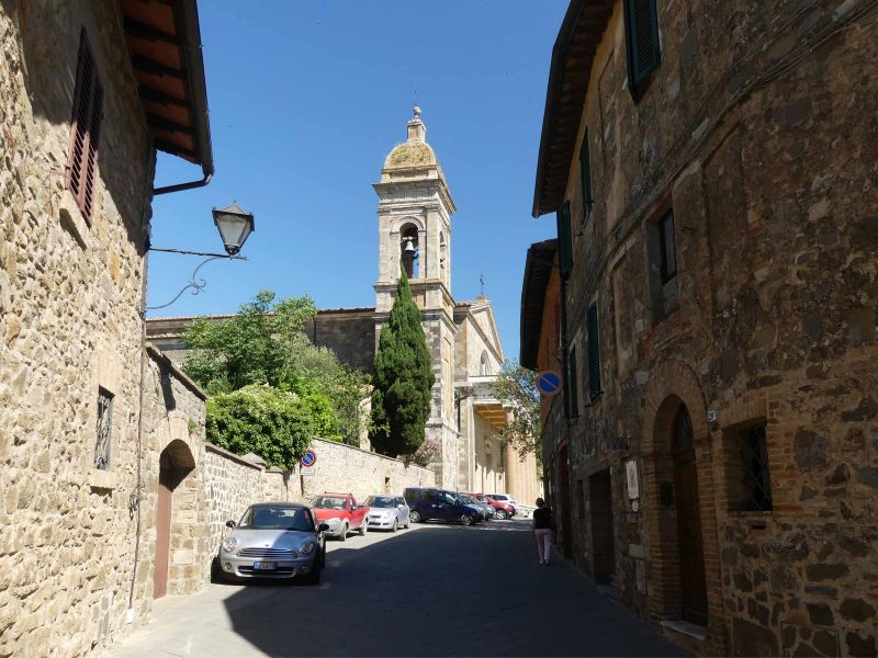
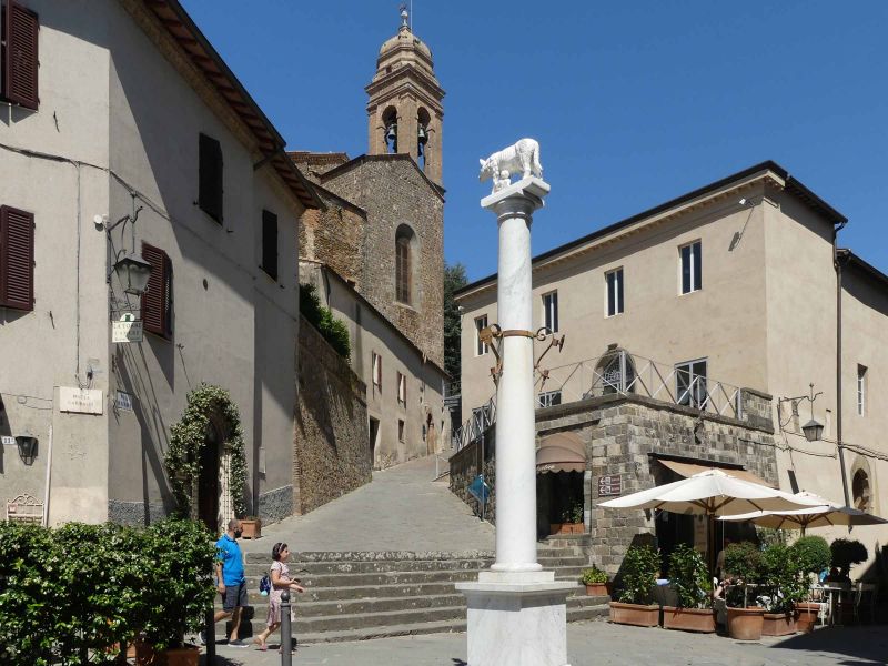
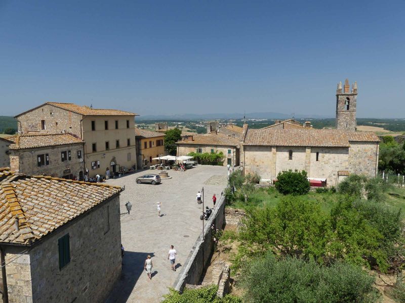
Castellina in Chianti, Siena, Italien
South of Greve, Chianti is only just beginning to get really beautiful (according to the lady from the tourist information office). And in this particularly beautiful part is Castellina in Chianti, one of the typical places of Chianti and Tuscany. And the place is really beautiful, has charm, away from the "normal" tourist destinations. Here, as in the other villages and towns in Tuscany, you can still experience Italy, literally feel it.
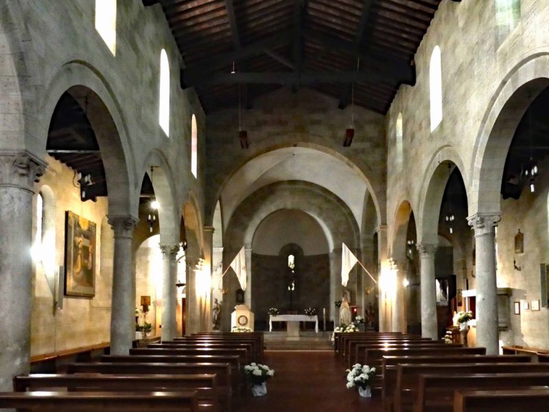
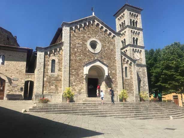
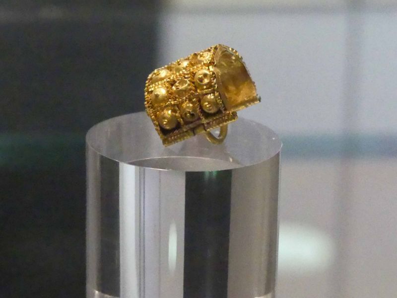
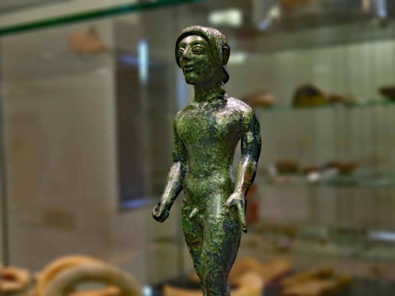
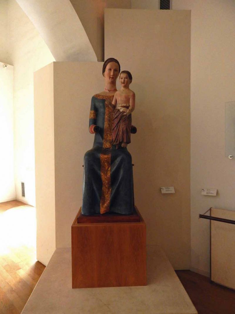
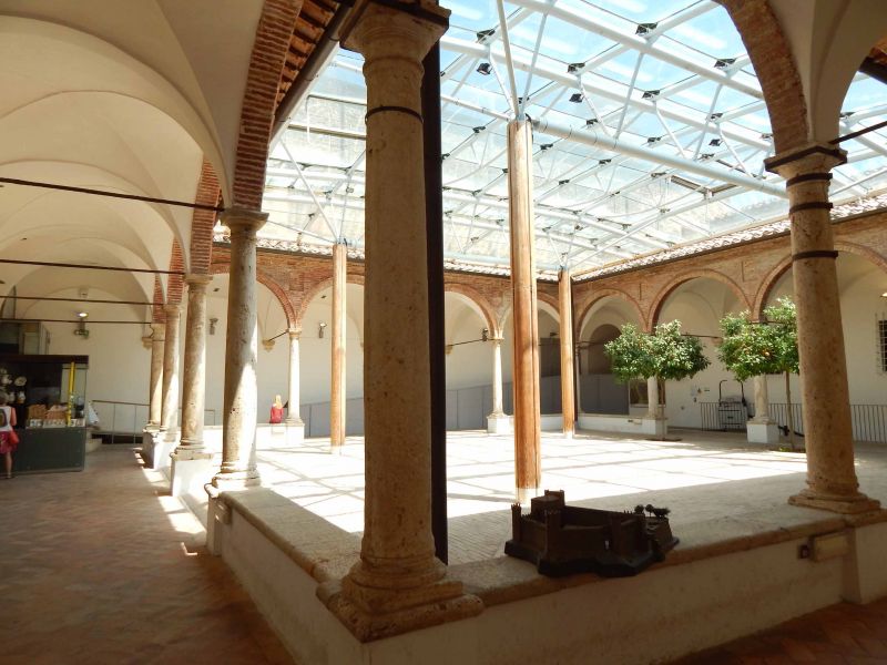
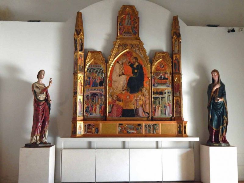
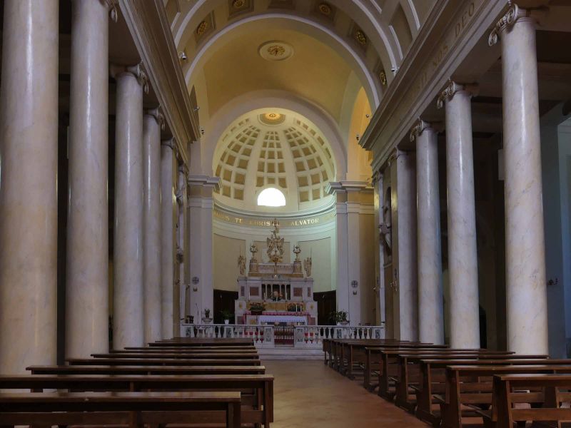
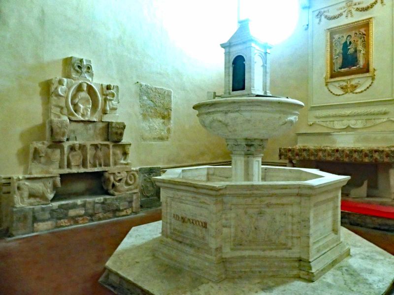
Our city tour led us first to the church of San Salvatore from the 16th century. It houses valuable art treasures, such as the Madonna fresco by di Lorenzo from the 14th century. We continued through the alleys to the 15th century Fortezza , which is also home to the Archaeological Museum. The small collection shows art of the Etruscans and is worth a visit, especially since you can only get to the tower through the museum, from which you have a fantastic view of the city and the surrounding landscape.
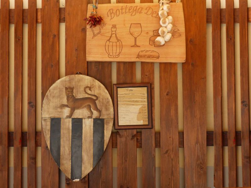
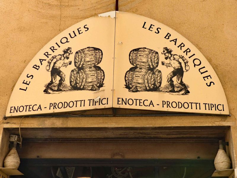
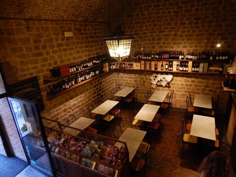
Back again, first a short break in the delicatessen store " la bottega del borgo food and wine ". The not so up-to-date plastic tableware may cause ecological remorse, but it will quickly make you forget the food and the wine. The pickled cherry peppers with tuna paste are awesome. We then took some of them with us.
After refreshment, we continue to our penultimate highlight, the accessible part of the tunnel that used to surround the city. Here you will find craft shops and restaurants.
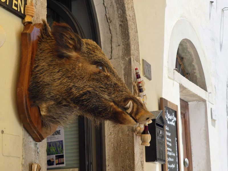
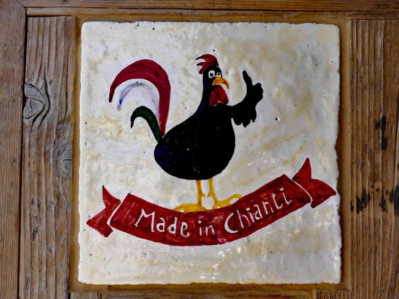
Oh yes, there is the ubiquitous black rooster that you come across all over Chianti. It is not only the logo of the Chianti Classico Consortium founded in 1924, but there is also a story behind it. In order to end the endless conflict between Florence and Siena, both cities decided in the 13th century that two knights should set out at the first crowing of the cock and ride towards the opposing city. The meeting point should be the new frontier. The Sienese spoiled their white cock so that it should crow loudly. In contrast, the Florentines chose a black rooster that they barely fed, so that on the crucial morning it crowed hungry long before sunrise. So the rider from Florence was able to set out very early and he managed to get to the gates of Siena ...
The Castellina parking space is located on a parking lot that is a bit noisy during the day due to traffic, especially motorbikes, and is also designed for cars and buses. It costs 12 euros including electricity. V / E, water costs extra and you are in the middle of the city in about 10 minutes.
53011 Castellina in Chianti SI, Italien
43° 28' 17.5" N 11° 17' 8.4" E
43.4715142 11.2856676
• Head toward Piazza Roma on Via Chiantigiana (SR222). Go for 910 m.
• Arrive at Via 4 Novembre (SR222). Your destination is on the left.
☍
0,9 km
( 1 min.)
Gelateria di Castellina, Viale IV Novembre, Castellina in Chianti, Siena, Italien
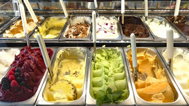
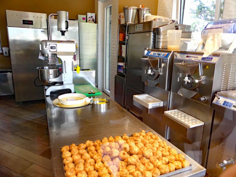
An experience not to be missed if you like ice cream. The Gelateria di Castellina is the stronghold of Gelati. Even if it is a bit outside of the old town (the walk takes about 10-15 minutes) it is definitely worth a visit. Not just ice creams galore, all of which are made there. It's the taste of each variety. Our criterion is always pistachio ice cream. Really really good is hard to find - but they have the best. And if you're a little lucky, you can even watch it being made. While enjoying this delicious ice cream.
Viale IV Novembre, 47, 53011 Castellina in Chianti SI, Italien
43° 27' 51.4" N 11° 17' 23.3" E
43.4642891 11.2898042
• Head toward Strada Provinciale di Castagnoli on Via 4 Novembre (SR222). Go for 2.7 km.
• Turn right onto Strada Regionale di Val d'Elsa (SR429) toward Radda in C/Gaiole in C/Montevarchi. Go for 10.4 km.
• Keep right onto Strada Regionale di Val d'Elsa (SR429). Go for 127 m.
• Take the 2nd exit from roundabout onto Strada Regionale di Val d'Elsa (SR429). Go for 1.3 km.
• Turn left onto Strada Regionale di Val d'Elsa (SR429) toward Montevarchi/A1. Go for 6.0 km.
• Turn left onto Strada Provinciale di Montevarchi (SP408) toward Montevarchi/A1/Montegrossi/Cavriglia/Arezzo. Go for 7.3 km.
• Pass 3 roundabouts and continue on Viale Maestri del Lavoro (SP408). Go for 7.1 km.
• Take the 2nd exit from roundabout. Go for 105 m.
• Continue on Viale Camillo Benso di Cavour. Go for 174 m.
• Take the 2nd exit from roundabout onto Viale Camillo Benso di Cavour. Go for 320 m.
• Take ramp onto Via di Terranuova (SP59) toward Autostrada/A1/Terranuova B.Ni/Arezzo/SP11. Go for 688 m.
• Turn right onto Via dell'Olmo. Go for 144 m.
• Keep left onto Strada Provinciale Lungo Arno (SP11) toward Centro/Autostrada/A1/San Giovanni Valdarno/Loro Ciuffenna/SP59/Arezzo. Go for 172 m.
• Keep right onto Strada Provinciale Lungo Arno toward Centro/Autostrada/A1/San Giovanni Valdarno/SP11/Loro Ciuffenna/SP59/Arezzo/Firenze/SR69. Go for 93 m.
• Continue on Strada Provinciale Valdarno Casentinese (SP59). Go for 170 m.
• Keep right onto Via Ponte Mocarini (SP59) toward Centro/Loro Ciuffenna/Arezzo/SP1/Terranuova B. Go for 364 m.
• Pass 2 roundabouts and continue on Strada Provinciale Valdarno Casentinese (SP59). Go for 8.2 km.
• Continue on Via 7 Ponti Levante (SP1). Go for 6.1 km.
• Take the 2nd exit from roundabout onto Via Girolamo del Borro (SP1). Go for 5.9 km.
• Take the 2nd exit from roundabout onto Strada Provinciale Setteponti (SP1). Go for 502 m.
• Turn left onto Via Guglielmo Marconi. Go for 330 m.
• Turn slightly left onto Via Guglielmo Marconi. Go for 28 m.
• Turn right onto Piazza delle Fiere. Go for 1.1 km.
• Turn left onto Via di Meliciano. Go for 23 m.
• Turn right. Go for 17 m.
• Arrive at your destination.
☍
59,5 km
(1 hrs. 14 min.)
Day
Fattoria La Vialla, Italien
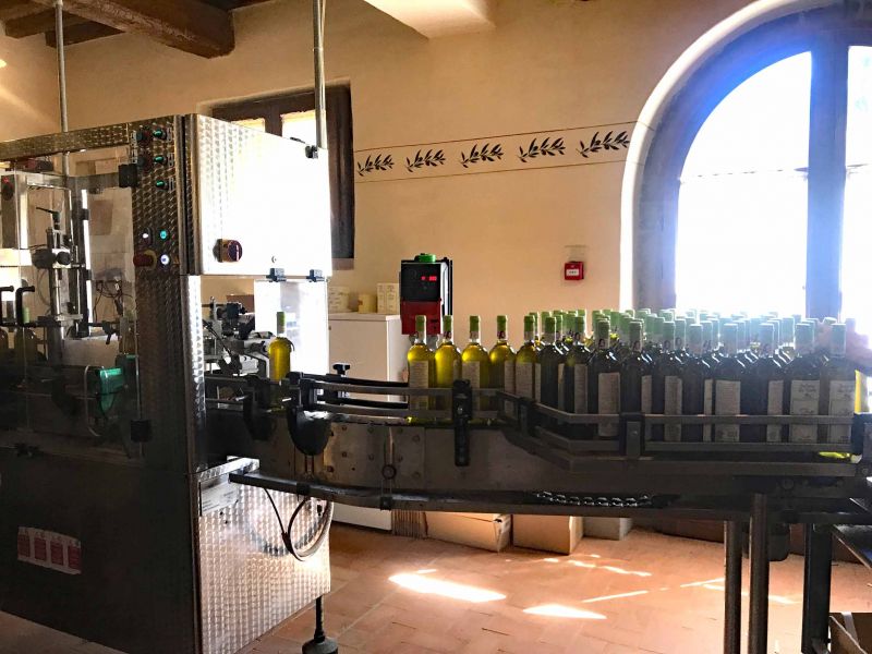
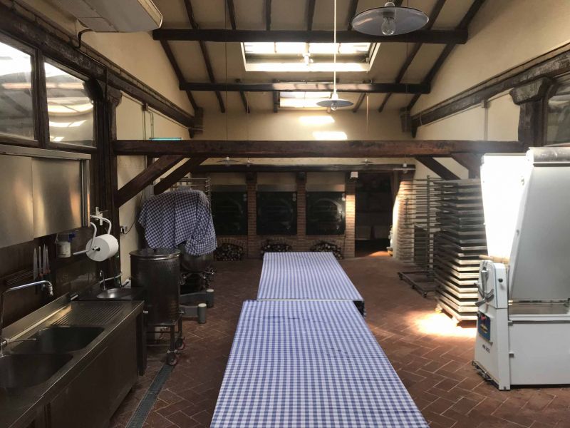
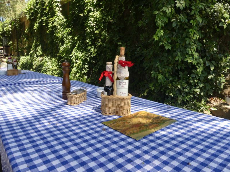
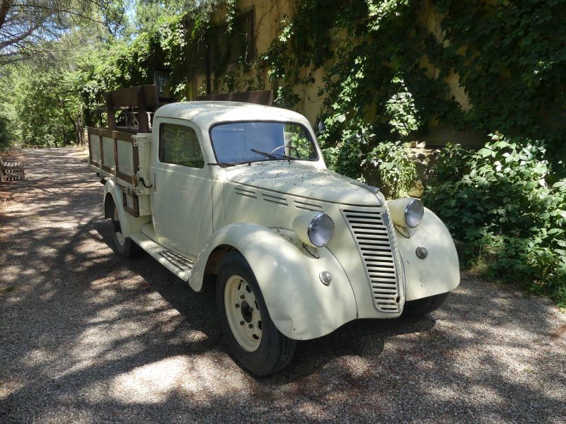
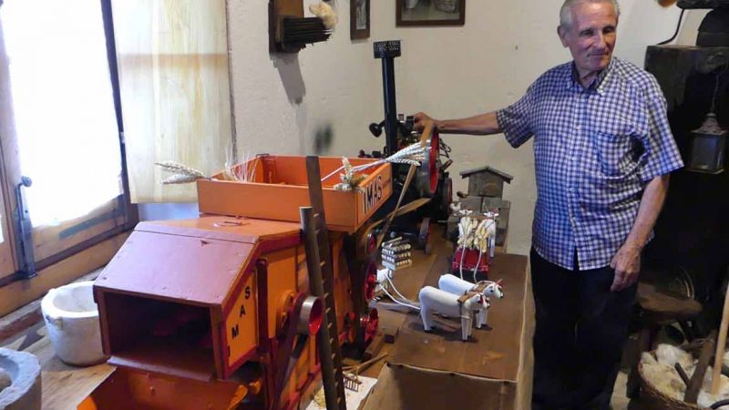
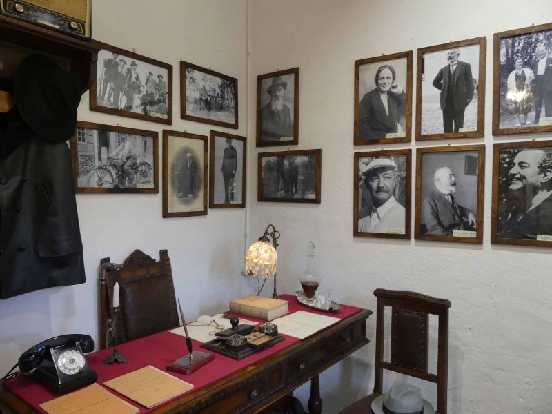
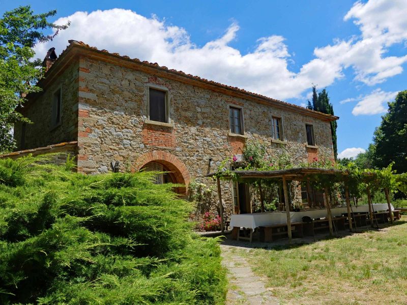
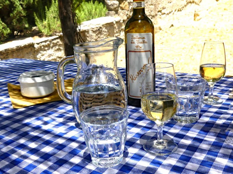
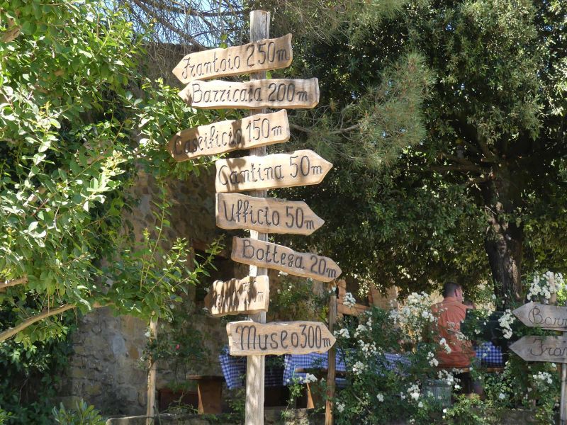
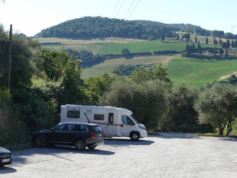
The Fattoria La Vialla is no longer a very secret insider tip. Some people know them and also shop there, be it online over the Internet or in one of the three "pantries" in Germany. But few were on the estate in Tuscany. They look forward to a visit there and are excellently prepared for them. La Vialla not only offers motorhome parking spaces (registration requested through the office), which are free but without service. There is a pick-up / delivery service with golf carts, a museum (an experience), a small restaurant, enjoy the tranquility of the courtyard, guided tours, wine tastings ... A visit there is slowing down in itself. Oh yes, almost every employee speaks German.
The specialty of La Vialla, however, is the fact that two brothers took over and restored a completely dilapidated farm in 1978, and at that time they were already fully committed to organic farming (today, biodynamic according to Demeter). We then went to the markets in Munich in a small delivery van. You can see that as an organic farm you can be extremely successful, provided you have courage, perseverance and a good concept. However, a good dose of luck is also part of it.
Via di Meliciano, 52029 Castiglion Fibocchi AR, Italien
43° 31' 45.9" N 11° 46' 35.9" E
43.5294272 11.7766344
• Head east.
• Turn left toward Via di Meliciano. Go for 101 m.
• Turn left onto Via di Meliciano. Go for 23 m.
• Turn left onto Via di Meliciano. Go for 202 m.
• Continue on Strada Comunale Meliciano. Go for 23 m.
• Turn right. Go for 591 m.
• Turn right toward Strada Provinciale Setteponti/SP1. Go for 630 m.
• Turn left onto Strada Provinciale Setteponti (SP1). Go for 3.2 km.
• Turn left toward Strada Provinciale Setteponti/SP1. Go for 5.2 km.
• Take the 1st exit from roundabout onto Via di Montione. Go for 1.2 km.
• Turn left onto Via Alessandro e Domenico Scarlatti. Go for 437 m.
• Continue on Via Samuel Morse. Go for 700 m.
• Take ramp onto Raccordo Arezzo-Battifolle toward Autostrada. Go for 1.5 km.
• Keep left onto Raccordo Arezzo-Battifolle toward Firenze/A1/Roma. Go for 5.0 km.
• Take the 2nd exit from roundabout toward Firenze/Roma. Go for 64 m.
• Take ramp onto A1 (Autostrada del Sole) toward Roma. Go for 27.1 km.
• Take the exit toward Valdichiana/Bettolle-Sinalunga/Bettolle/Pienza/Montepulciano/Ospedale Nottola/Torrita di Siena. Go for 419 m.
• Take the 3rd exit from roundabout onto SP327 toward Ospedale Nottola/Bettolle/Firenze/Roma. Go for 4.7 km.
• Take the 3rd exit from roundabout onto Via Basilicata. Go for 476 m.
• Continue on Località Stradella. Go for 185 m.
• Continue on Via Basilicata. Go for 106 m.
• Take the 1st exit from roundabout toward Chianciano T./Montepulciano/Pienza/Ospedale Loc. Nottola/Zona Industriale il Confino. Go for 549 m.
• Take the 2nd exit from roundabout. Go for 1.0 km.
• Take the 2nd exit from roundabout onto SP135 toward Chianciano T./Montepulciano. Go for 1.1 km.
• Continue on Località Passaccio (SP135). Go for 218 m.
• Continue on SP135. Go for 858 m.
• Continue on Via di Torrita (SP135). Go for 1.8 km.
• Continue on SP135. Go for 35 m.
• Continue on Via di Torrita (SP135). Go for 1.2 km.
• Continue on SP135. Go for 2.1 km.
• Continue on Via di Torrita (SP135). Go for 60 m.
• Turn right onto Via Piero Calamandrei (SP17). Go for 1.5 km.
• Turn left toward Via Elio Bernabei. Go for 8 m.
• Turn right onto Via Elio Bernabei. Go for 148 m.
• Take the 1st exit from roundabout onto Via delle Lettere. Go for 186 m.
• Continue on Piazzale dello Sterro. Go for 17 m.
• Arrive at Piazzale dello Sterro.
☍
62,6 km
( 58 min.)
Day
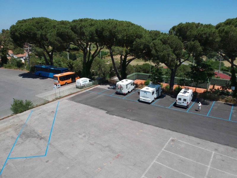
Parkplatz Lo Sterro P 5
Der Stellplatz liegt auf einem großen Parkplatz und bietet keinen Service. Allerdings ist er tagsüber gebührenpflichtig (z. Zt. 5 €/6 Std.); zu beachten ist aber, dass die Zeiträume fest von 8:00 Uhr bis 14:00 Uhr und von 14:00 Uhr bis 20:00 Uhr gehen. Von 20:00 Uhr bis 8:00 Uhr ist der Platz kostenlos. Dumm halt, wenn man um 11:00 Uhr ankommt...
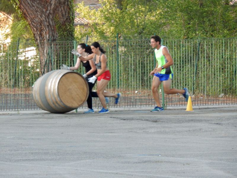
Auch wenn es sich um einen Großparkplatz handelt, so haben wir doch recht ruhig dort gestanden. Und das er von den Teilnehmern der verschiedenen Feste zum trainieren genutzt wird finden wir eher interessant als störend. Egal ob Fassroller, Fahnenschwinger oder Trommler.
Vom Parkplatz aus ist man mit zwei kostenlosen Aufzügen auch schnell und bequem am Fuß der Stadt. Von da allerdings geht's (bis zum Rückweg) nur noch bergauf.
Via delle Lettere, 53045, Montepulciano, Italien
43° 5' 48" N 11° 47' 13" E
43.0966667 11.7869444
• Head toward Via delle Lettere on Piazzale dello Sterro. Go for 17 m.
• Continue on Via delle Lettere. Go for 173 m.
• Take the 2nd exit from roundabout onto Via Marino Cappelli. Go for 50 m.
• Arrive at Via Marino Cappelli.
☍
0,2 km
( )
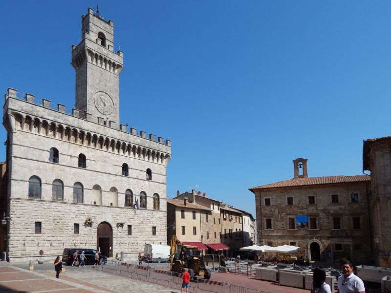
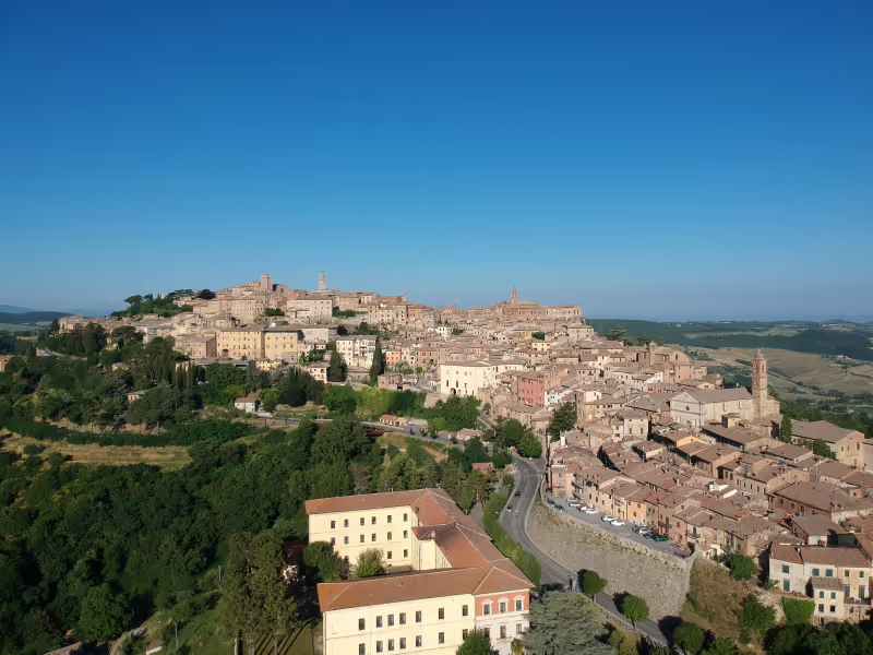
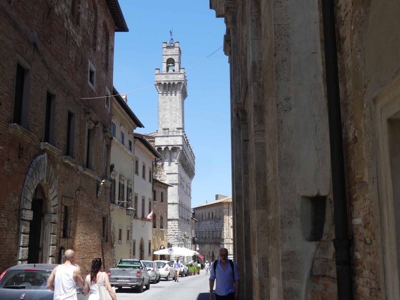
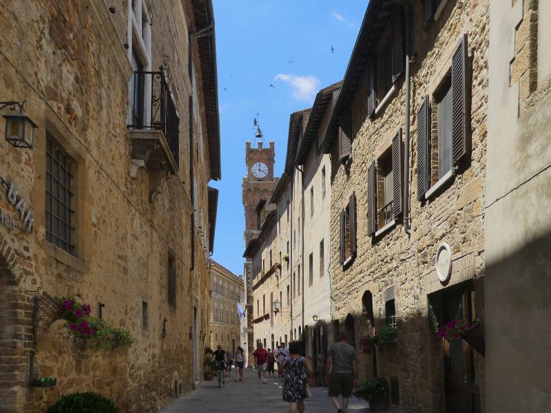
Montepulciano, Siena, Italien
Montepulciano is one of the typical cities of Tuscany. Fortified, located on a mountain and full of history: old churches, palazzi and of course a castle. But Montepulciano has something else - the Nobile di Montepulciano. Already by the cellar master of Pope Paul III. Praised as an excellent wine in the 16th century, it became famous at all European courts. The maturation must be at least 2 years, one of them in wooden barrels. So anyone who buys a 2017 Nobile in 2019 has been tricked, because the wine harvested in 2017 may only be officially sold from January 2020. However, it can still be stored for a few years.
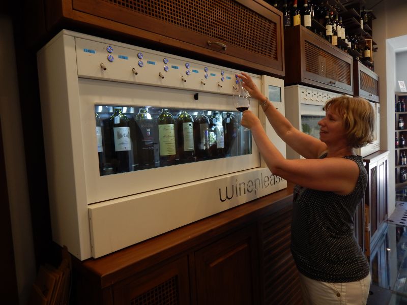
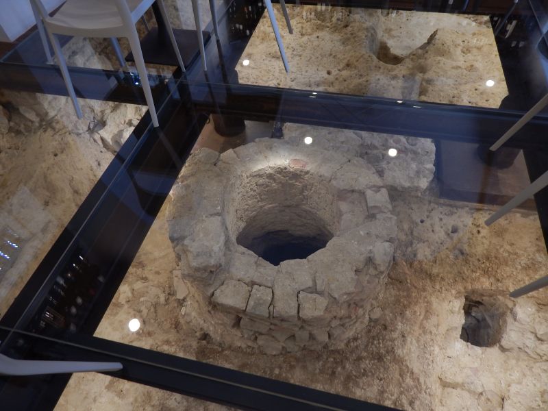
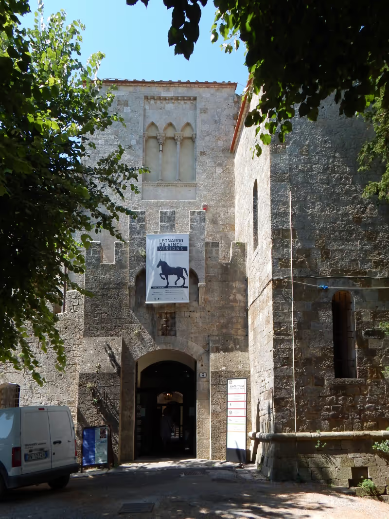
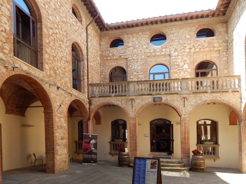
Anyone who is next to the churches and the various wineries (the Cantine del Palazzo Contucci is said to be a special one) invites the Fortezza to pay a visit. There is not only a very interesting exhibition about Leonardo da Vinci but also the wine bank of the cooperative. If you only try their wines in the sales rooms of individual winemakers, you can taste the different wines of different winemakers here in the wine bank in an interesting setting (glass floor above the excavations of cisterns).
53045 Montepulciano, Siena, Italien
43° 5' 55.3" N 11° 47' 14.1" E
43.0986938 11.7872467
• Head north on Via Marino Cappelli. Go for 155 m.
• Turn left onto Via Marino Cappelli. Go for 58 m.
• Turn left onto Viale Piero Calamandrei (SP17). Go for 200 m.
• Turn right onto Viale 1 Maggio (SP17). Go for 1.8 km.
• Turn left onto Strada per Chianciano (SP146). Go for 1.7 km.
• Turn right onto Via della Montagna (SP88). Go for 3.3 km.
• Turn right onto SP88. Go for 863 m.
• Continue on Località Pianoia (SP88). Go for 105 m.
• Continue on SP88. Go for 1.3 km.
• Continue on Podere Fonticoni (SP88). Go for 32 m.
• Continue on SP88. Go for 779 m.
• Continue on Strada Provinciale Podernovo le Ville (SP88). Go for 184 m.
• Continue on SP88. Go for 572 m.
• Continue on Strada Provinciale Podernovo le Ville (SP88). Go for 1.5 km.
• Turn right onto Via Marino Cappelli. Go for 78 m.
• Arrive at Via Marino Cappelli. Your destination is on the left.
☍
12,7 km
( 17 min.)
Day
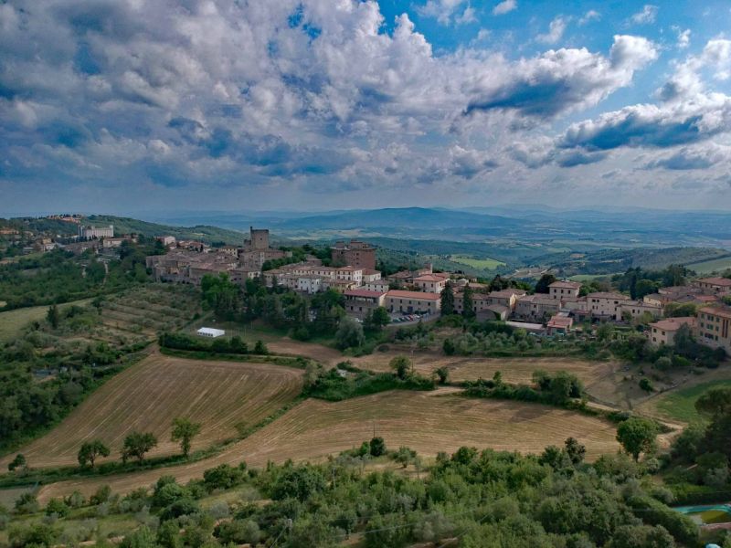
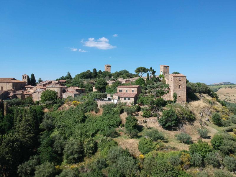
Monticchiello, Siena, Italien
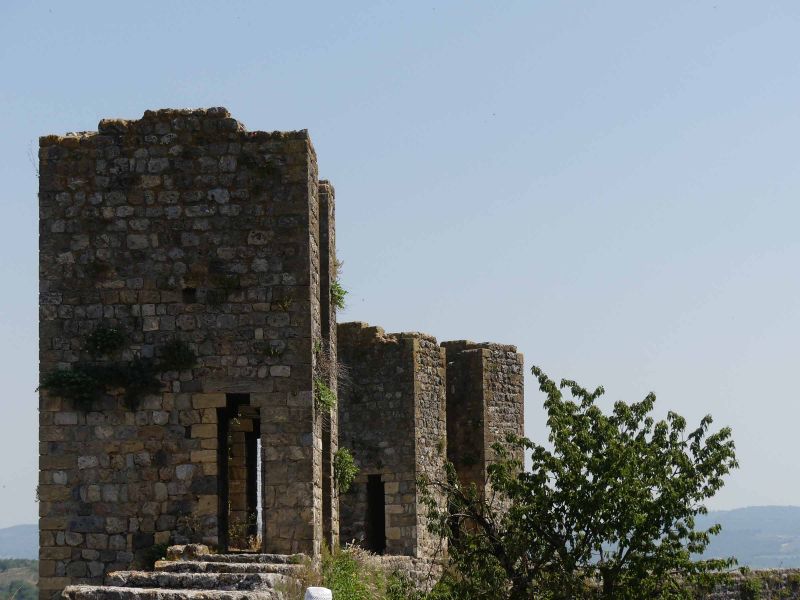
Monticchiello is a small dreamy town, just as typical of Tuscany as Montepulciano. Even if it is small, the villages were mostly fortified, with strong walls and defensive towers. So also this little place. We got there early that morning, so one of the few sights, the church, was still closed. My attempt to open the door was watched with great interest by a cat who obviously also wanted to go into the cool church. In the tourist office you can learn a little about the place. So z. For example, that the citizens of the 13th century were tired of the persistent mismanagement of the Crusaders, who got the castle as a fief for their services and joined the Republic of Siena. From then on, the castle, or rather the place, experienced a heyday that lasted until the middle of the 16th century. During this time, after a heavy siege, it fell to Florence.
53026 Monticchiello, Siena, Italien
43° 3' 55.1" N 11° 43' 23.1" E
43.0652955 11.7230833
• Head toward Strada Comunale Pienza Monticchiello on Via Marino Cappelli. Go for 78 m.
• Continue on Strada Provinciale Podernovo le Ville (SP88). Go for 972 m.
• Continue on SP88. Go for 3.2 km.
• Turn right onto Strada Provinciale del Monte Amiata (SP18). Go for 4.9 km.
• Continue on Via di Circonvallazione. Go for 837 m.
• Turn left onto Largo Roma. Go for 91 m.
• Continue on Via delle Mura. Go for 209 m.
• Arrive at Via delle Mura. Your destination is on the left.
☍
10,3 km
( 14 min.)
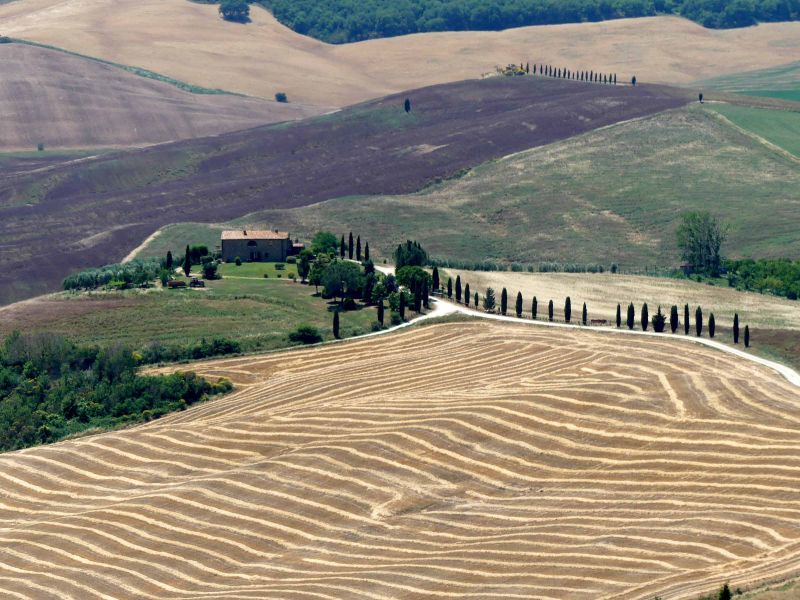
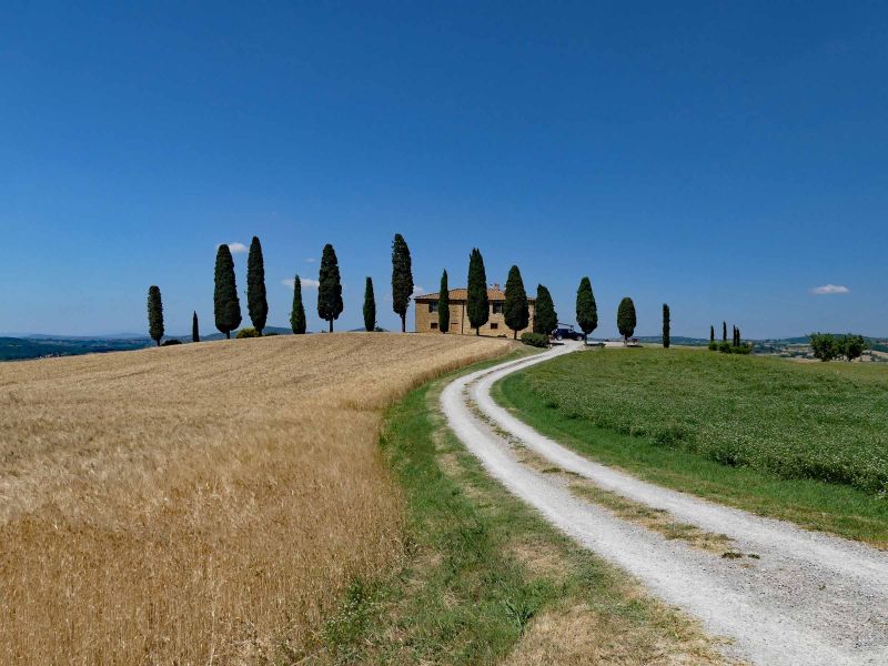
Pienza, Siena, Italien
Pienza is definitely worth a stop and even the way from the south shows Tuscany like from a picture book. If you follow the signs for the parking spaces in Pienza, you come to a motorhome parking space for 4 mobiles, which unfortunately can also be used by cars. So you need a bit of luck. But it's worth it. In 5 minutes you can walk to the old town. And - of course - it has a lot of history to offer. There is the Palazzo Piccolomini, where Pope Pius II had his seat. The cathedral with the baptistery and the corridor labyrinth over several floors. The panorama path ...
53026 Pienza SI, Italien
43° 4' 38.8" N 11° 40' 39.3" E
43.0774495 11.6775951
• Head toward Via Enzo Mangiavacchi on Via delle Mura. Go for 19 m.
• Turn slightly left onto Strada Provinciale di Chianciano (SP146). Go for 756 m.
• Take the 2nd exit from roundabout onto Strada Provinciale di Chianciano (SP146) toward S.Quirico d'Orcia/Siena/Cassia/SP2. Go for 8.6 km.
• Turn left onto Via dei Fossi. Go for 315 m.
• Turn right onto Piazza 4 Novembre. Go for 45 m.
• Turn left onto Via Dante Alighieri. Go for 354 m.
• Turn right onto Strada Regionale Cassia (SR2). Go for 2.2 km.
• Turn left onto Località Podere Colombaio toward Di Casabianca. Go for 199 m.
• Continue on Strada Comunale di Casabianca. Go for 2.0 km.
• Turn slightly left onto Località Podere Casabianca. Go for 130 m.
• Continue on Località Podere Poggio Bacoca. Go for 2.4 km.
• Turn left onto Località Vitaleta. Go for 704 m.
• Arrive at your destination on the right.
☍
17,7 km
( 28 min.)
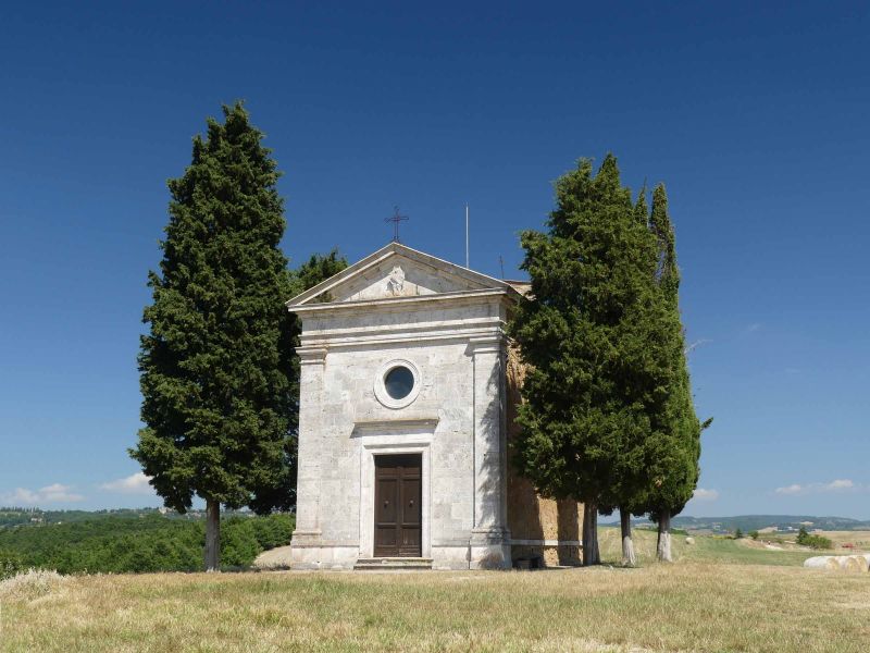
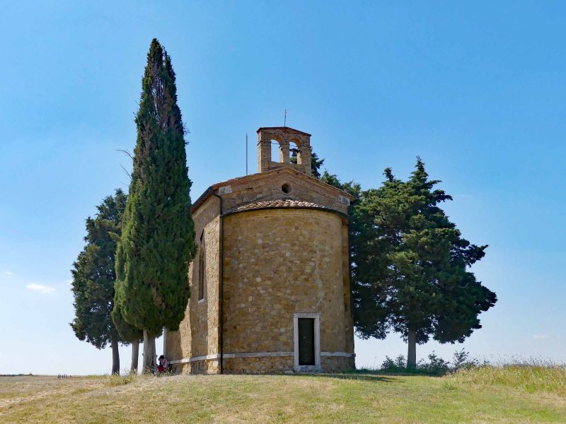
Cappella Madonna di Vitaleta, San Quirico d'Orcia, Siena, Italien
When you are in Pienza, you are not allowed to drive past the Cappella Madonna di Vitaleta. The way is a good distance over a gravel road and the rest, about 1 km, you have to walk. But it's worth it. This chapel (unfortunately closed) is the ultimate photo motif.
53027 San Quirico d'Orcia, Siena, Italien
43° 4' 15.1" N 11° 38' 3.8" E
43.0708575 11.6343921
• Head toward Località Cretaiole. Go for 596 m.
• Continue on Località Vitaleta. Go for 108 m.
• Turn right toward Località Podere Poggio Bacoca. Go for 1.8 km.
• Continue on Località Podere Poggio Bacoca. Go for 616 m.
• Continue on Località Podere Casabianca. Go for 118 m.
• Continue on Località Podere Casabianca. Go for 12 m.
• Turn slightly right onto Strada Comunale di Casabianca. Go for 16 m.
• Turn left onto Strada Comunale di Casabianca. Go for 2.1 km.
• Continue on Località Podere Colombaio. Go for 49 m.
• Turn right onto Strada Regionale Cassia (SR2). Go for 8.7 km.
• Take ramp onto Località Bivio dell'Asso (SP14) toward Grosseto/Montalcino/Zona Industriale Bivio Asse. Go for 5.5 km.
• Take the 2nd exit from roundabout onto Traversa dei Monti (SP14) toward Montalcino Centro/Grosseto. Go for 1.8 km.
• Take the 3rd exit from roundabout onto Traversa dei Monti (SP14) toward Grosseto. Go for 118 m.
• Turn right onto Via Osticcio. Go for 161 m.
• Arrive at Via Osticcio. Your destination is on the left.
☍
21,7 km
( 29 min.)
Parcheggio Albergheria
Der Stellplatz, in einem "Vorort" von Montalcino, hat eine etwas steile Anfahrt und bei der Zufahrt von der Straße zum Stellplatz muss man aufpassen, nicht aufzusetzen. Die Stellplätze sind gepflastert und ausreichend groß, dass man Tisch und Stühle rausstellen kann. Es gibt V/E aber keinen Strom. Die Parkgebühr ist auch hier für Zeitintervalle zu entrichten, bezahlt man aber den Maximalbetrag (2 Intervalle), so erhält man einen Parkschein für 24 Stunden, anders als in Montepulciano.
Leider wird der Stellplatz auch zunehmend von Anwohnern als Parkplatz oder Abstellplatz für's eigene Womo benutzt. Aber da nicht wirklich viel los war ist das nicht weiter schlimm.
Via Osticcio, 53024, Montalcino, Italien
43° 3' 11" N 11° 29' 17" E
43.0530556 11.4880556
• Head north on Via Osticcio. Go for 237 m.
• Arrive at Traversa dei Monti (SP14). Your destination is on the left.
☍
0,2 km
( )
Day
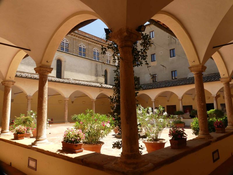
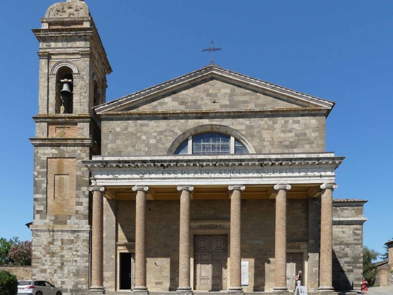
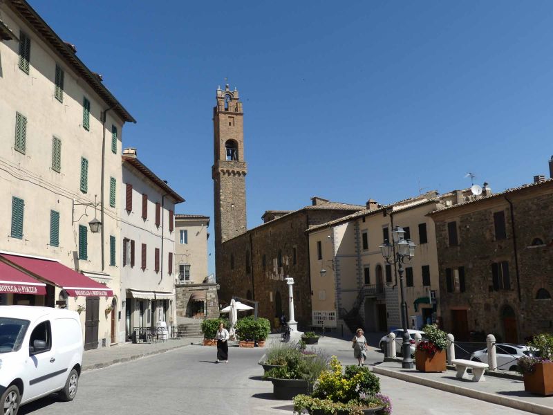
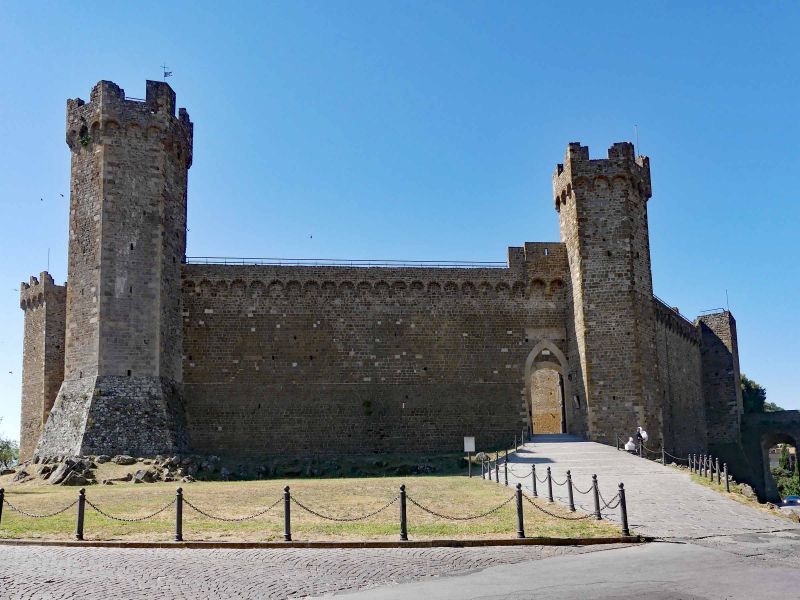
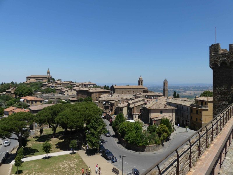
Montalcino, Siena, Italien
The city of Montalcino, which dates back to an Etruscan foundation, is best known for its Brunello di Montalcine, one of the best red wines in the world. One of the few Italian red wines that can be made from pure Sangiovese, can be stored for 10 to 30 years depending on the vintage (if you have the patience and a suitable storage room). The wine must be stored for at least 4 years, at least 2 of them in wooden barrels.
But Montalcino has more to offer. On the one hand there is the diocesan museum in the former Augistine monastery. Or the cathedral. Or the Piazza Garibaldi and the Piazza del Popolo, where the tourist information is also located. And of course there are plenty of wine shops here too. However, we prefer the enoteca in the castle, the Fortezza.
53024 Montalcino, Siena, Italien
43° 3' 18.4" N 11° 29' 20.4" E
43.0551015 11.4890032
• Head northeast on Traversa dei Monti (SP14).
• Take the 3rd exit from roundabout onto Viale Pietro Strozzi. Go for 100 m.
• Turn slightly right onto Via Bettino Ricasoli. Go for 103 m.
• Turn right onto Piazzale Fortezza. Go for 96 m.
• Turn slightly right. Go for 26 m.
• Arrive at your destination on the right.
☍
0,3 km
( 1 min.)
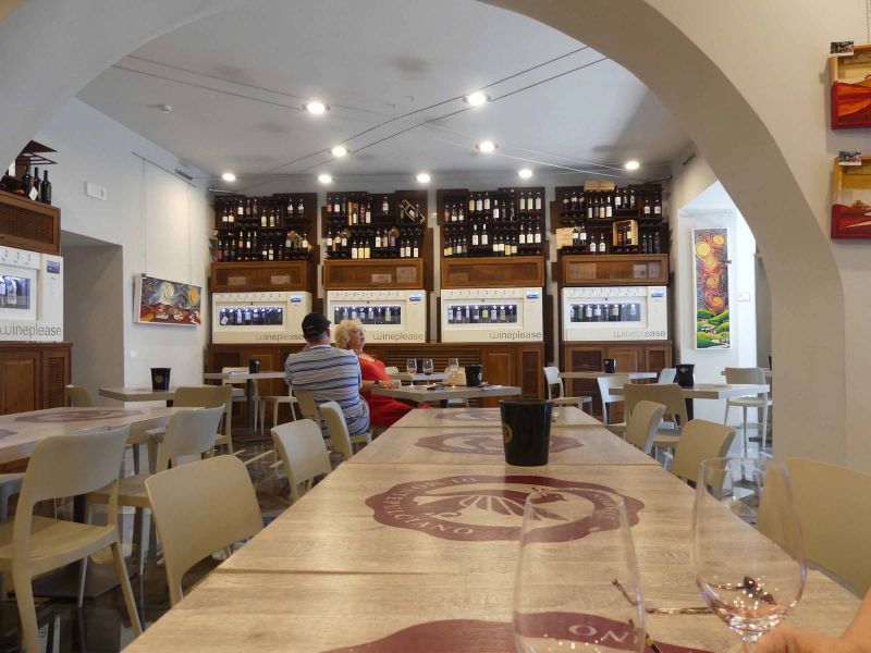
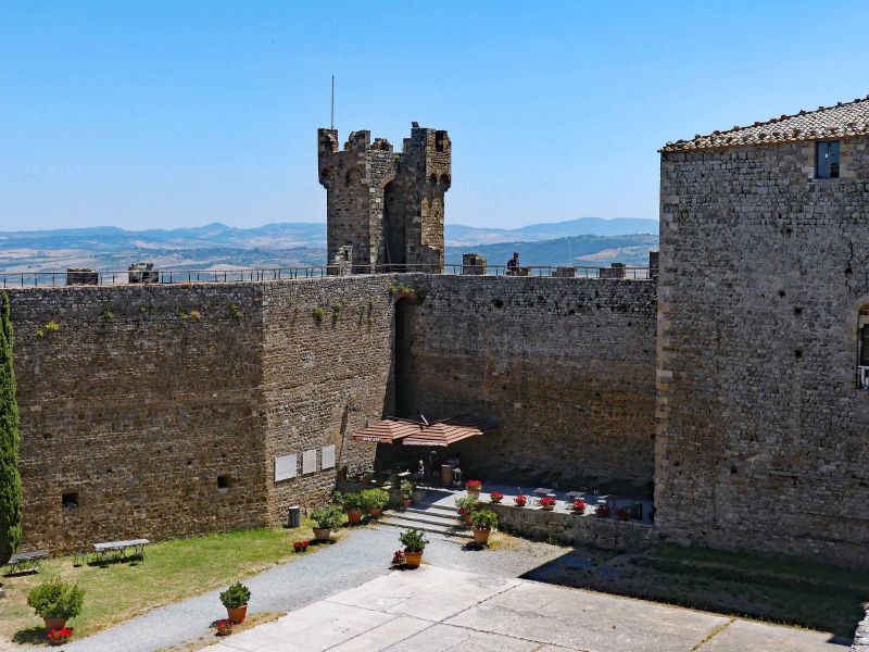
Enoteca la Fortezza di Montalcino Srl, Piazzale Fortezza, Montalcino, Siena, Italien
Here you can have a good time. Well, the Enoteca la Fortezza is not cheap. But really good. And the wines that you get for the wine tasting are all really good. Sitting in the shade, watching the hustle and bustle across the courtyard and enjoying the good of Tuscany - that's how it can be endured.
And if you decide to take one or the other case of wine with you (as I said - these are really great wines, so they are not cheap), you can have them delivered free of charge within Europe. After all, shipping costs around € 40 elsewhere.
Strengthened it then goes through the enoteca on the defensive wall of the castle and the tower. The effort is rewarded with a wonderful view of Montalcino and the surrounding area.
Piazzale Fortezza, 9, 53024 Montalcino SI, Italien
43° 3' 21.1" N 11° 29' 23.5" E
43.0558600 11.4898673
• Head toward Piazzale Fortezza. Go for 26 m.
• Turn slightly left onto Piazzale Fortezza. Go for 96 m.
• Turn left onto Via Bettino Ricasoli. Go for 26 m.
• Turn right onto Viale della Libertà. Go for 76 m.
• Turn left onto Via Antonio Gramsci. Go for 46 m.
• Turn left onto Viale Pietro Strozzi. Go for 180 m.
• Take the 4th exit from roundabout onto Via Circonvallazione (SP14) toward Autostrada/A1/Roma/SR2/Siena/Torrenieri. Go for 1.8 km.
• Take the 2nd exit from roundabout onto Strada Provinciale del Brunello (SP45) toward Siena/SR2/Buonconvento. Go for 9.5 km.
• Turn left toward Strada Provinciale del Brunello/SP45. Go for 30 m.
• Turn left onto Strada Regionale Cassia (SR2). Go for 12.8 km.
• Take the 3rd exit from roundabout onto SR2 toward Firenze-Roma/A1/Arezzo-Perugia/E78/Siena/Grosseto/Arezzo/Firenze. Go for 4.4 km.
• Turn right onto Strada Regionale Cassia (SR2) toward Grosseto/Firenze/Siena/Monteroni d' Arbia Nord. Go for 3.3 km.
• Take the 2nd exit from roundabout onto Strada Regionale Cassia (SR2). Go for 5.3 km.
• Turn left onto Strada Massetana Romana (SP6) toward Porta S. Marco/Porta Tufi/A1. Go for 867 m.
• Take the 2nd exit from roundabout onto Strada Massetana Romana (SP6) toward Porta S.Marco/A1/Centro. Go for 714 m.
• Take the 2nd exit from Strada Massetana Romana roundabout onto Tangenziale Siena Ovest toward Firenze/A1. Go for 62.7 km.
• Keep left onto Superstrada Firenze-Siena (RA3) toward Autostrade/A1/A11/Impruneta/SR2/Tavarnuzze/Galluzzo. Go for 441 m.
• Take the 3rd exit from roundabout onto A1 (Autostrada del Sole) toward Bologna/Roma/Firenze/A11/Pisa Nord/Aeroporto A. Vespucci. Go for 34.1 km.
• Keep right onto A1var toward Bologna/Barberino. Go for 39.1 km.
• Continue on A1 (Autostrada del Sole). Go for 9.4 km.
• Take the exit toward Sasso Marconi. Go for 676 m.
• Continue on Via Setta. Go for 210 m.
• Take the 3rd exit from roundabout onto Raccordo Autostradale Sasso Marconi SS64 Porretana toward Bologna/SS64. Go for 2.8 km.
• Continue straight ahead. Go for 33 m.
• Take the 1st exit from roundabout. Go for 117 m.
• Continue on SS64var. Go for 6.9 km.
• Keep right onto SS64var toward Bologna/SS64/Casalecchio di Reno/SS64/Sasso Marconi/Borgonuovo. Go for 211 m.
• Take the 3rd exit from roundabout onto SS64var toward Borgonuovo Centro/Sasso Marconi/SS64/Casalecchio di Reno/SS64/Bologna/SS64. Go for 936 m.
• Take the 1st exit from roundabout onto Via Porrettana (SS64) toward Autostrade/A1/A13/A14/Casalecchio di Reno/Bologna. Go for 1.1 km.
• Pass 4 roundabouts and continue on Strada Statale Porrettana (SS64). Go for 2.8 km.
• Take the 2nd exit from Rotonda Biagi roundabout onto Raccordo Autostrada Tangenziale toward Bologna/Valsamoggia/SS569. Go for 897 m.
• Take left ramp onto Asse Sud-Ovest (SP569) toward A1/A13/Tangenziale/A14/Valsamoggia/SS569/Zona Industriale Via del Lavoro/Autostrade. Go for 828 m.
• Take ramp onto Tangenziale Casalecchio-San Lazzaro (RA1) toward Autostrade/A1/A13/A14. Go for 628 m.
• Take ramp onto A14 (Autostrada Adriatica) toward Milano/A1/Firenze. Go for 630 m.
• Take the exit toward Milano onto A1 (Autostrada del Sole). Go for 39.6 km.
• Take the exit toward Brennero onto A22 (Autostrada del Brennero). Go for 84.8 km.
• Take the exit toward Milano onto A4 (Autostrada della Serenissima). Go for 17.5 km.
• Take the exit toward Peschiera. Go for 1.3 km.
• Continue on Strada Regionale Gardesana Orientale (SR249). Go for 27 m.
• Keep right toward Brescia/Verona/SR11/Mantova/Valeggio S/M. Go for 285 m.
• Continue toward SR11/Sirmione/Brescia. Go for 38 m.
• Take the 1st exit from roundabout onto Strada Regionale Padana Superiore (SR11) toward Sirmione/Brescia. Go for 2.8 km.
• Turn left onto SPBS11 toward Milano-Venezia/A4/Brescia/SS11/Sirmione. Go for 2.5 km.
• Turn right toward Pozzolengo/S. Benedetto/Rovizza. Go for 162 m.
• Continue toward SPBS11. Go for 30 m.
• Take the 2nd exit from roundabout onto SPBS11 toward Peschiera/Verona. Go for 348 m.
• Continue on Strada Provinciale Padana Superiore (SPBS11var). Go for 1.1 km.
• Take the 3rd exit from roundabout onto Strada Padana Superiore toward Sirmione. Go for 928 m.
• Turn right onto Via Lugana Marina. Go for 322 m.
• Arrive at Via Lugana Marina. Your destination is on the left.
☍
355,3 km
(3 hrs. 47 min.)
Area Sosta Camper Lugana Marina
Italia, Via Cantarane, 16, 25019 Sirmione BS, Italy
45° 27' 38" N 10° 38' 1" E
45.4605556 10.6336111
• Head toward Strada Padana Superiore on Via Lugana Marina. Go for 322 m.
• Turn left onto Via Verona. Go for 797 m.
• Continue toward Verona/Peschiera. Go for 57 m.
• Take the 2nd exit from roundabout onto Strada Padana Superiore toward Verona/Peschiera. Go for 2.0 km.
• Pass 2 roundabouts and continue on Via Bell'Italia (SR11). Go for 1.5 km.
• Take the 1st exit from roundabout onto Via Tangenziale (SR11) toward Milano/A4/Venezia/Verona/Mantova. Go for 3.1 km.
• Take ramp toward Peschiera Centro/Autostrada/A4/Valeggio S/M/SR249. Go for 178 m.
• Take the 1st exit from roundabout onto Località Paradiso di Sotto toward Località Paradiso. Go for 247 m.
• Turn right onto Strada Regionale Gardesana Orientale (SR249). Go for 156 m.
• Keep left onto Strada Regionale Gardesana Orientale (SR249) toward Peschiera Centro/Ospedale/Valeggio S.M. Go for 96 m.
• Keep left onto Strada Regionale Gardesana Orientale (SR249) toward Milano-Venezia/A4/Valeggio sul Mincio/Mantova/Verona/SR11/Affi/SR450. Go for 69 m.
• Turn left toward Milano-Venezia/Milano-Brennero/A22. Go for 63 m.
• Take ramp onto A4 (Autostrada della Serenissima) toward Venezia/Brennero-Modena/A22. Go for 16.8 km.
• Take the exit toward Brennero-Modena/Verona Nord/Aeroporto/Mantova/Modena/Bologna/A1 onto A22 (Autostrada del Brennero). Go for 84.9 km.
• Take the left exit toward Bologna/Roma/Modena onto A1 (Autostrada del Sole). Go for 51.7 km.
• Continue on SS64var. Go for 927 m.
• Continue on Raccordo Autostradale Sasso Marconi SS64 Porretana. Go for 2.4 km.
• Continue on A1 (Autostrada del Sole). Go for 10.6 km.
• Keep right onto A1var (Variante di Valico) toward Direttissima/A1/Firenze/Badia. Go for 34.8 km.
• Continue on A1 (Viadotto Lora). Go for 91 m.
• Continue on A1var (Variante di Valico). Go for 32 m.
• Continue on A1 (Galleria Manganaccia). Go for 434 m.
• Continue on A1var (Galleria Manganaccia). Go for 1.9 km.
• Continue on A1 (Viadotto Sieve). Go for 139 m.
• Continue on A1var (Viadotto Sieve). Go for 216 m.
• Continue on A1 (Autostrada del Sole). Go for 19 m.
• Continue on A1var (Variante di Valico). Go for 116 m.
• Continue on A1 (Autostrada del Sole). Go for 34.1 km.
• Take the exit toward Firenze/Impruneta/Siena/SS223. Go for 440 m.
• Turn right onto Superstrada Firenze-Siena (RA3) toward Galluzzo/Firenze Centro/Nuovo Ospedale San Giovanni di Dio/Siena/Scandicci/S. Casciano V. P. Go for 145 m.
• Keep left onto Superstrada Firenze-Siena (RA3) toward Siena. Go for 40.4 km.
• Take ramp toward Colle Val d'Elsa Sud/Colle Val d'Elsa/Casole d'Elsa. Go for 263 m.
• Continue on Strada Provinciale del Castello di Staggia (SP70). Go for 78 m.
• Take the 2nd exit from roundabout onto Strada Provinciale Traversa Maremmana (SP541) toward Grosseto/Follonica/Casole d'Elsa/Radicondoli/SP23/Zona Industriale Pian dell'Olmino/Zona Industriale Pian Senese/Zona Industriale San Marziale. Go for 1.6 km.
• Pass 2 roundabouts and continue on Strada Provinciale Traversa Maremmana (SP541). Go for 23.4 km.
• Turn right onto Strada Provinciale Senese Aretina (SP73). Go for 7.6 km.
• Keep left onto Strada Provinciale Senese Aretina (SP73). Go for 2.9 km.
• Turn right onto Strada Provinciale Massetana (SP441). Go for 2.2 km.
• Turn left onto Strada Provinciale di San Galgano (SP58). Go for 284 m.
• Turn right onto Strada Provinciale di San Galgano (SP58). Go for 433 m.
• Arrive at Località San Galgano (SP58). Your destination is on the right.
☍
327,4 km
(3 hrs. 13 min.)
Abbazia San Galgano, Strada Comunale di San Galgano, Chiusdino, Siena, Italien
The history of this abbey, which was founded in the 13th century but was abandoned in the 16th century, goes back to a legend about Saint Galgano. This, a young knight, led a target-me nefarious and depraved life until he had an apparition of the Archangel Michael, who asked him to change his life. He replied that it was easier to share a stone with your sword than to change your life. As proof he struck the rock whereupon his sword slipped through like butter and got stuck there. This place became a place of pilgrimage and Cistercian monks settled here. After two plague epidemics and constant attacks by rioters, the monks moved to Siena in the 16th century.
The Arthurian legend is probably inspired and influenced by this legend.
Strada Comunale di S. Galgano, 53012 Chiusdino SI, Italien
43° 8' 58.1" N 11° 9' 18.2" E
43.1494740 11.1550660
• Head west on Località San Galgano (SP58). Go for 433 m.
• Turn left onto Strada Provinciale di San Galgano (SP58). Go for 284 m.
• Turn right onto Strada Provinciale Massetana (SP441). Go for 2.2 km.
• Turn left onto Località Pian di Feccia (SP73) toward Siena/Firenze. Go for 16.1 km.
• Take the 2nd exit from roundabout onto Via di Barbicciaia (SP73) toward Firenze/Sovicille/Siena. Go for 6.1 km.
• Turn left onto Strada del Ferratore (SP101) toward Firenze/SR2/Monteriggioni. Go for 3.0 km.
• Continue toward Monteriggioni. Go for 76 m.
• Continue on Strada di Montalbuccio (SP101). Go for 777 m.
• Continue on Strada del Pian del Lago (SP101). Go for 3.1 km.
• Turn left onto Strada del Pecorile (SP101) toward Firenze/Monteriggioni. Go for 994 m.
• Turn left onto Strada Regionale Cassia (SR2). Go for 5.7 km.
• Turn right. Go for 99 m.
• Turn right. Go for 26 m.
• Turn slightly right. Go for 112 m.
• Arrive at your destination on the left.
☍
39,2 km
( 40 min.)
Aera Sosta Camping, Montiriggioni, Italien
Da Wohnmobile nicht mehr auf dem Parkplatz vor der Burg stehen dürfen, haben wir den sehr nahegelegenen Wohnmobilstellplatz angefahren. Eine moderne Anlage, die offensichtlich viel Geld gekostet hat, aber leider nur unregelmäßig gepflegt wird. An vielen Plätzen wächst das Unkraut zwischen den Rasengittersteinen hoch, nicht alle Stromsäulen sind angeschaltet, die Nachtbeleuchtung ist abgeschaltet. Dennoch – für 16€/Nacht bekommt man einen ordentlichen Stellplatz, Strom, V/E, saubere Toiletten und kostenlose heiße Duschen. Wir finden das akzeptabel. Dennoch schade um den Platz.
Via Cassia Nord, 136, 53035 Monteriggioni SI, Italien
43° 23' 9" N 11° 13' 40.4" E
43.3858331 11.2278920
• Head east. Go for 112 m.
• Turn right. Go for 29 m.
• Turn right toward Strada Regionale Cassia/SR2. Go for 99 m.
• Turn right onto Strada Regionale Cassia (SR2). Go for 89 m.
• Turn right onto Strada di Monteriggioni toward Monteriggioni Centro. Go for 560 m.
• Arrive at Strada di Monteriggioni. Your destination is on the left.
☍
0,9 km
( 3 min.)
Day
Monteriggioni, Siena, Italien
Monteriggioni is a castle that, as an outpost of Siena against Florence, unlike usual, was not conquered, but built from scratch. At times 100 people lived here. Monteriggioni is also on the Via Francigena, an old pilgrimage route that led from England to Rome to the tomb of Peter and on to Jerusalem. The journey from Canterbury to Rome took about 80-90 days if you arrived healthy.
Montiriggioni fell into disrepair over the centuries, but was again painstakingly restored and is now not only a popular tourist magnet, but also the backdrop for lavish medieval spectacles every year in July. We were told at the tourist information office (in the medieval museum) that the medieval festivals were well attended, but not overcrowded. Parking spaces and tickets are always available.
Oh yes, one more thing: Monteriggioni was never conquered and has withstood all attacks. But after only 3 days of siege it fell through a betrayal of the governor, who gave the keys to the Florentine troops for safe conduct.
53035 Monteriggioni, Siena, Italien
43° 23' 24.5" N 11° 13' 24.2" E
43.3901353 11.2233863
• Head southwest on Strada di Monteriggioni. Go for 82 m.
• Turn slightly right onto Strada di Monteriggioni. Go for 478 m.
• Turn sharp right onto Strada Regionale Cassia (SR2). Go for 1.1 km.
• Take the 1st exit from roundabout onto Strada Regionale Cassia (SR2). Go for 192 m.
• Take ramp onto Superstrada Firenze-Siena (RA3) toward Firenze. Go for 45.9 km.
• Keep left onto Superstrada Firenze-Siena (RA3) toward Autostrade/A1/A11/Impruneta/SR2/Tavarnuzze/Galluzzo. Go for 441 m.
• Take the 3rd exit from roundabout onto A1 (Autostrada del Sole) toward Bologna/Roma/Firenze/A11/Pisa Nord/Aeroporto A. Vespucci. Go for 34.1 km.
• Keep right onto A1var toward Bologna/Barberino. Go for 39.1 km.
• Continue on A1 (Autostrada del Sole). Go for 63.7 km.
• Take the exit toward Brennero onto A22 (Autostrada del Brennero). Go for 228 km.
• Take the exit toward Bolzano Sud/Bozen Süd/Merano/Trento/SS12/Laives/SS12/Aeroporto/Flughafen/Leifers/Meran onto SS38 (MeBo). Go for 22.8 km.
• Take ramp toward Sinich/Sinigo/Zona Industriale Lana. Go for 264 m.
• Turn right toward Strada Provinciale Zona Industriale di Lana/SP101. Go for 27 m.
• Continue on Strada Provinciale Zona Industriale di Lana (SP101). Go for 202 m.
• Continue on Via Nazionale. Go for 222 m.
• Take the 2nd exit from roundabout onto Via Nazionale. Go for 1.7 km.
• Continue toward Via Lungo Rio Nova/SP8. Go for 30 m.
• Take the 1st exit from roundabout onto Via Lungo Rio Nova (SP8) toward Schenna/Scena/Tirol/Tirolo/Hafling/Avelengo/Voran/Verano. Go for 877 m.
• Take the 2nd exit from roundabout onto Via San Valentino (SP8) toward Schenna/Hafling/Scena/Avelengo/Molten/Meltina/Voran/Verano. Go for 1.7 km.
• Take the 3rd exit from roundabout onto Via Scena toward Obermais/Maia Alta/Tirol/Tirolo. Go for 951 m.
• Turn right onto Via Virgilio toward Tirol/Tirolo. Go for 200 m.
• Continue on Via San Giorgio toward Tirol/Tirolo. Go for 218 m.
• Turn right onto Via San Giorgio (SS44) toward Tirol/Tirolo. Go for 1.5 km.
• Turn left onto Via Principale (SP7). Go for 2.1 km.
• Turn sharp left onto Via Monte Benedetto. Go for 653 m.
• Continue on Via Monte Benedetto. Go for 227 m.
• Turn slightly right onto Via Monte Benedetto. Go for 95 m.
• Arrive at Via Monte Benedetto. Your destination is on the left.
☍
446,4 km
(4 hrs. )
Stellplatz Schneeburghof
The hot and humid weather has overturned our plans; we move to the north and make our way home a little earlier than planned. Siena, which we had already visited 2 years ago, as well as Lucca, as well as Pisa, whose visit was a long time ago, we have to save for another time. It's a shame, but it was just too hot.
Since we liked the Schneeburghof so much on the way there, we quickly decided to stop for a few more days on the way back. In fact there was always a little wind through the mountains, so that the weather was quite bearable.
Segenbühelweg 26, 39019, Dorf Tirol, Italien
46° 40' 33" N 11° 10' 0" E
46.6758333 11.1666667
• Head north on Via Monte Benedetto. Go for 975 m.
• Turn sharp right onto Via Principale (SP7). Go for 2.0 km.
• Turn sharp right onto Via del Giovo (SS44). Go for 1.5 km.
• Continue on Strada Statale del Passo Giovo (SS44). Go for 1.1 km.
• Turn right onto Ponte Teatro. Go for 57 m.
• Continue on Piazza Teatro. Go for 83 m.
• Turn left onto Corso della Libertà. Go for 524 m.
• Enter the roundabout. Go for 10 m.
• Arrive at Piazza Giuseppe Mazzini. Your destination is on the left.
☍
6,3 km
( 9 min.)
Day
Meran, Südtirol, Italien
Meran - a little stroll on Saturday is a must. However, this time we did not take the same route from the parking space as we did during the first visit. We turned a little earlier and crossed the Passer on the Steinernen Steg a little upstream. On the next bridge downstream we went back to the spa promenade, where there was a flea market. It's always amazing what people keep, sell, and buy. For us, however, there was nothing there ;-)
Through the city it was then very comfortably back towards the chairlift and the parking space.
46° 40' 16.7" N 11° 9' 9.1" E
46.6712938 11.1525179
• Follow the roundabout. Go for 12 m.
• Take the 1st exit from roundabout onto Viale Europa. Go for 237 m.
• Continue on Piazza Stazione. Go for 70 m.
• Take the 2nd exit from roundabout onto Via 4 Novembre. Go for 152 m.
• Take the 3rd exit from roundabout onto Via 4 Novembre toward Autostrada/A12/Bolzano. Go for 225 m.
• Take the 2nd exit from roundabout onto Strada Provinciale Variante di Merano (SP185) toward Algund/Lagundo. Go for 1.1 km.
• Take the 2nd exit from roundabout onto MeBo (SS38) toward Autostrada/A22/Bozen/Bolzano. Go for 27.1 km.
• Take left ramp onto A22 (Autostrada del Brennero) toward Autostrada/Bolzano Centro/Bozen Zentrum/E45/Brennero/Brenner/Modena. Go for 86.9 km.
• Continue on A13 (Brennerpass). Go for 31.7 km.
• Keep right onto A13 (Knoten Innsbruck-Berg Isel) toward Bregenz/Garmisch/Innsbruck-West. Go for 2.0 km.
• Continue on A12 (Inntal Autobahn). Go for 9.0 km.
• Take exit 87 toward Garmisch/Seefeld/Zirl-Ost onto B177 (Seefelder Bundesstraße). Go for 1.4 km.
• Keep left onto Seefelder Bundesstraße (B177) toward Garmisch/Seefeld. Go for 20.5 km.
• Continue on Am Brunnstein (B2). Go for 40.3 km.
• Keep left onto A95 toward München. Go for 4.8 km.
• Take exit 10B toward Ohlstadt/Weilheim i.OB/Murnau a. Staffelsee. Go for 246 m.
• Turn left onto B2 toward Weilheim i.OB/Murnau/Ohlstadt. Go for 6.2 km.
• Continue on B2. Go for 1.1 km.
• Turn left onto Weilheimer Straße (B2) toward München/A95/Weilheim/Bad Tölz. Go for 5.7 km.
• Take the 2nd exit from roundabout onto B2/B472 toward München/Weilheim. Go for 3.6 km.
• Continue on B2 toward München/Weilheim. Go for 8.0 km.
• Pass 2 roundabouts and continue on B2. Go for 6.3 km.
• Turn left onto St2056 toward Dießen/Raisting/Pähl. Go for 6.4 km.
• Continue on Herrschinger Straße (St2068). Go for 94 m.
• Turn right onto Erlinger Straße (WM7). Go for 2.6 km.
• Continue on STA3. Go for 1.2 km.
• Continue on Fischener Straße (STA3). Go for 884 m.
• Turn right onto Herrschinger Straße (St2067). Go for 643 m.
• Turn left onto Andechser Straße. Go for 750 m.
• Arrive at Andechser Straße.
☍
269,1 km
(3 hrs. 14 min.)
Day
Unser letzter Tag in Meran
While we're there ... We wanted to see if we could get to the Zenoburg. Since it is privately owned and inhabited, it can only be viewed on selected weekends and upon prior notification. But we wanted to have a nice view of the castle. So this time we followed the sign to Zenoburg and then a sign to a hotel / restaurant. That was a coincidence, but it was worth it. Although we could hardly see anything of the Zenoburg (that can only be done from the air), we found a wonderful park. Almost a bit of a jungle with lots of "natural" works of art. And a wild passer and a ravine. And that in Merano. Of course, we had to come across the Sissi way at some point. The walk was definitely worth it for us. Dreamlike.
The Reest was as usual - after a stroll through the city (some shops are also open on Sundays) back to the chairlift.
In the evening, this time we had dumplings for dinner - suuuper, after dark there was a really extraordinary spectacle, the Sacred Heart Fire. These go back to a long pre-Christian tradition and the summer solstice and have developed in Tyrol into the Sacred Heart Fires, which are lit on the 3rd Sunday after Pentecost. These Sacred Heart Fires, crosses and the letters "IHS" shine on all mountains. A fascinating sight and a nice farewell to Merano, Tyrol and Italy.
Day
Kloster Andechs, Bergstraße, Andechs, Deutschland
We are back in Germany. We only crossed Austria on Monday because the Fernpass and other federal and country roads are closed to tourists at the weekend. So we came back without any problems via Reschen and Fernpass.
As a station, we have chosen the parking space at Andechs Monastery. The facility, the monastery beer and the Braustüberl were tempting, the detour minimal.
The pitch costs € 17 with electricity, € 14 a night without; Included is a voucher for the Braustüberl for € 3.40, which is even valid for one year. IMPORTANT: Before you book and pay for your stay at the parking meter (coins and cards), think carefully about whether you need electricity. It can only be booked in conjunction with the parking space, not individually! Otherwise, the gravel parking space is nice, the demarcated plots are big enough and the way to the "Holy Mountain" is not far.
Bergstraße 2, 82346 Andechs, Deutschland
47° 58' 28.1" N 11° 10' 58.1" E
47.9744764 11.1828171
• Head north on Andechser Straße.
• Continue on Seefelder Straße. Go for 3.3 km.
• Turn slightly right onto Andechser Straße. Go for 1.6 km.
• Turn left onto Dorfstraße. Go for 607 m.
• Continue on Burgstraße. Go for 1.1 km.
• Turn right onto Münchner Straße (St2068). Go for 5.3 km.
• Take the 2nd exit from roundabout onto St2068. Go for 3.1 km.
• Take ramp onto A96 toward München. Go for 14.3 km.
• Take exit 35 toward Nürnberg/Stuttgart/München-West/Flughafen M/Messe/ICM onto A99. Go for 6.1 km.
• Take exit 8 toward Stuttgart/Augsburg onto A8. Go for 112 km.
• Take exit 65 toward Würzburg/Heilbronn onto A7. Go for 164 km.
• Take exit 103 toward Kitzingen/Biebelried. Go for 333 m.
• Turn left onto B8 toward Nürnberg/Iphofen/Kitzingen. Go for 721 m.
• Turn left onto KT27 toward Mainstockheim/Buchbrunn. Go for 2.4 km.
• Continue on Bahnweg (KT27). Go for 404 m.
• Turn left onto Hauptstraße (St2270). Go for 748 m.
• Turn right onto Albertshöfer Straße. Go for 238 m.
• Continue on Fähre Albertshofen-Mainstockheim. Go for 57 m.
• Arrive at Fähre Albertshofen-Mainstockheim. Your destination is on the right.
☍
316,2 km
(2 hrs. 54 min.)
Day
Besuch im Kloster Andechs
Yesterday we were a little too late to still enjoy the monastery and the Braustüberl in peace, so we extended it by one night and looked at everything today. The monastery complex, the church, the Braustüberl - all of this can be seen comfortably in one day. Incidentally, the Braustüberl closes at 8:00 p.m., as it is located in the monastery area, but the warm kitchen closes at 6:00 p.m. If you want to enjoy Wammerl, Haxen & Co., you should order them around noon or around 5:00 p.m. We were late so have to come back again!
Due to the predicted thunderstorms, which were obviously not on the weather list for Petrus, the brother Messner had not opened the church tower - so I have to use our little flying companion for the beautiful view of the monastery and the surrounding area.
Day
Stellplatz am Fähranleger
Unfortunately, our vacation is coming to an irrevocable end. We let the last few days end on the Main, pack up, prepare our Nanuq for the coming, hopefully only short, rest period and still work a little on our travel report.
We stay three nights, then we go back home.
Albertshöfer Straße, 97320, Mainstockheim, Deutschland
49° 46' 19" N 10° 9' 21" E
49.7719444 10.1558333
• Head southeast on Fähre Albertshofen-Mainstockheim.
• Arrive at Fähre Albertshofen-Mainstockheim. Your destination is on the right.
☍
Distance not available
(Duration not available)
Day
Day
Stellplatz am Fähranleger
Albertshöfer Str. 13, 97320 Mainstockheim, Germany
49° 46' 19" N 10° 9' 21" E
49.7719444 10.1558333
• Head northwest on Fähre Albertshofen-Mainstockheim. Go for 57 m.
• Continue on Albertshöfer Straße. Go for 238 m.
• Turn left onto Hauptstraße (St2270). Go for 748 m.
• Turn right onto Bahnweg (KT27). Go for 404 m.
• Continue on KT27. Go for 2.4 km.
• Turn right onto B8. Go for 3.9 km.
• Take ramp onto A3 toward Frankfurt a.M./Stuttgart. Go for 118 km.
• Take exit 52 toward B. Homburg/Frankfurt onto A661. Go for 6.9 km.
• Take exit 14 toward Hanau/Maintal onto B8/B40 (Hanauer Landstraße). Go for 4.3 km.
• Turn right onto Frankfurter Landstraße. Go for 483 m.
• Arrive at Frankfurter Landstraße. Your destination is on the left.
☍
137,2 km
(1 hrs. 16 min.)
Day
Campingplatz Mainkur, Frankfurter Landstraße, Maintal, Deutschland
Unload and immediately get back in and exile for one night - an old aircraft bomb was found near our home and 16,500 Frankfurters, including us, have to leave their apartments for 10 hours. How nice that we can flee into exile with our mobile home ;-)
Our journey and our report ends here. We would be happy if you liked the report. Write us in the comments below, we would be happy. Or visit us on Facebook (facebook.com/nanuqwomoblog) or on Youtube (youtube.com/nanuqwomoblog)
Frankfurter Landstraße 107, 63477 Maintal, Deutschland
50° 8' 17.7" N 8° 46' 58.4" E
50.1382638 8.7828941