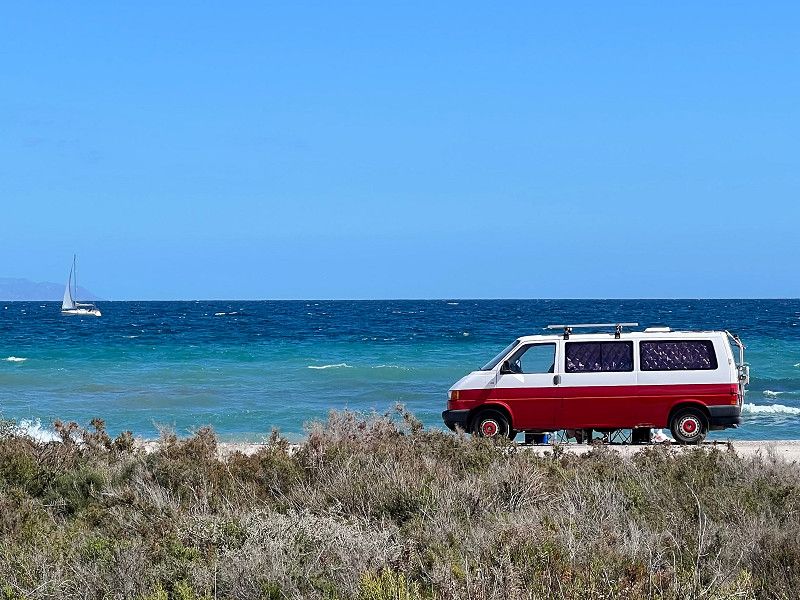
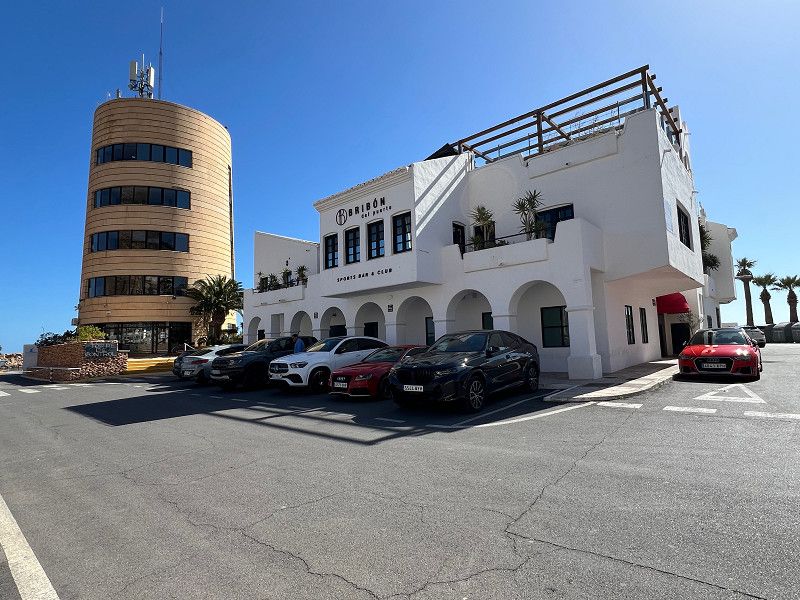
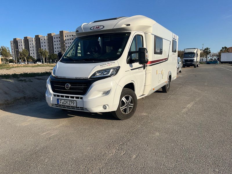
We are spending the winter in Spain. For us, spending the winter means traveling around, getting to know the country and its people, discovering great places and sights. Being on tour, in other words. You can find the whole route on Polarsteps and YouTube under nanuqontour
21. Jan. 2025 -
21. Jan. 2025
Echterdingen
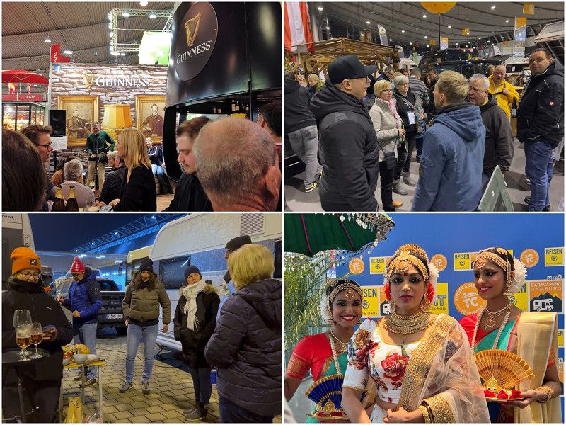
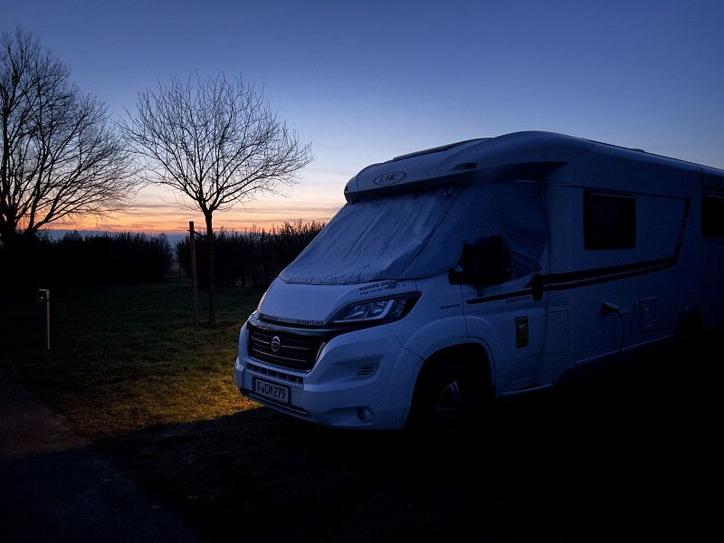
Departure from the CMT
Schenker Allee Ost, Echterdingen, Landkreis Esslingen, Baden-Württemberg, Deutschland
48° 41' 47" N 9° 11' 15.3" E
48.6963870 9.1875928
• Head southwest. Go for 25 m.
• Turn right. Go for 33 m.
• Turn left toward Pforte Tor 1. Go for 236 m.
• Turn right onto Pforte Tor 1. Go for 102 m.
• Turn right onto Echterdinger Straße (L1192). Go for 1.2 km.
• Turn right and take ramp onto A8 toward Karlsruhe/Singen/Heilbronn/Stuttgart. Go for 17.0 km.
• Continue on A8 toward Karlsruhe/Basel/Leonberg-West. Go for 53.8 km.
• Take the left exit toward Basel/Baden-Baden/Ettlingen onto A5. Go for 162 km.
• Take exit 66 toward Lyon/Mulhouse/Flughafen Euro onto A5. Go for 611 m.
• Continue on A36 (La Comtoise). Go for 13.5 km.
• Keep left onto A36 (La Comtoise) toward Paris/Lyon/Guebwiller. Go for 55.7 km.
• Take exit 9 toward Exincourt/Audincourt/Étupes. Go for 475 m.
• Take the 2nd exit from roundabout onto Rue de Sochaux (D437) toward Exincourt/Audincourt/Étupes. Go for 294 m.
• Pass 2 roundabouts and continue on D437. Go for 2.5 km.
• Take the 4th exit from Rond-Point Lumière roundabout onto Rue de Belfort (D437). Go for 782 m.
• Take the 2nd exit from Place Georges Brassens roundabout onto Avenue de la Révolution de 1789 (D437). Go for 1.2 km.
• Take the 1st exit from roundabout onto Rue de Valentigney (D437). Go for 1.2 km.
• Take the 3rd exit from roundabout onto Route de Beaulieu (D437) toward Mandeure/Pont de Roide. Go for 1.2 km.
• Take the 2nd exit from roundabout onto Route de Beaulieu toward Pontarlier/Mandeure/Pont-de-Roide-Vermondans. Go for 3.3 km.
• Turn right onto Rue de l'Église. Go for 522 m.
• Continue on Chemin des Combottes. Go for 17 m.
• Arrive at Chemin des Combottes. Your destination is on the right.
☍
315,8 km
(2 hrs. 50 min.)
21. Jan. 2025 -
22. Jan. 2025
Camping Les Grands Ansanges
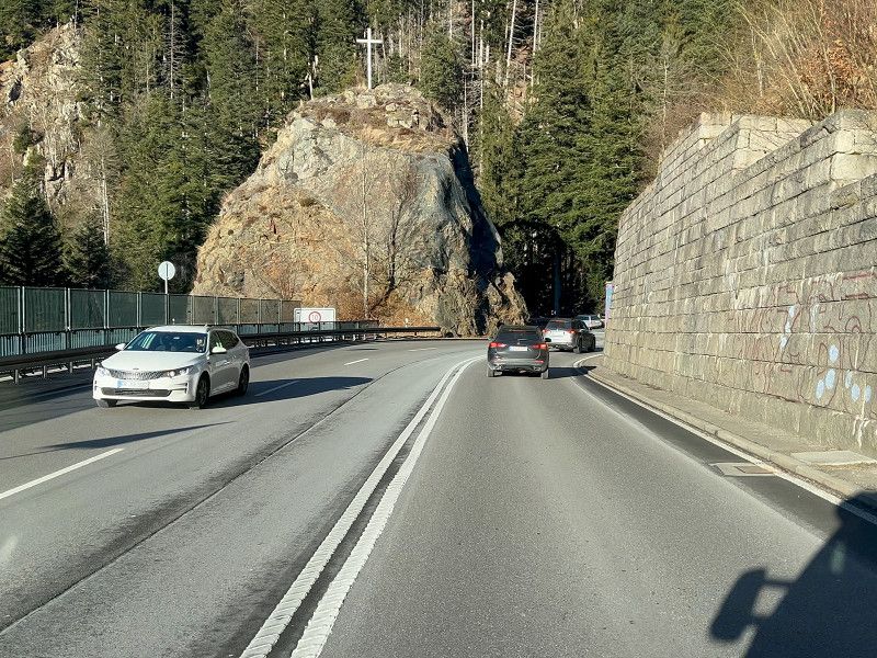
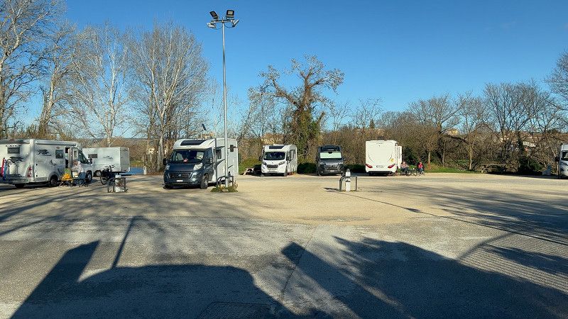
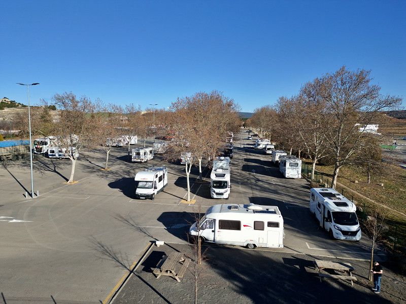
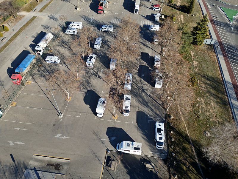
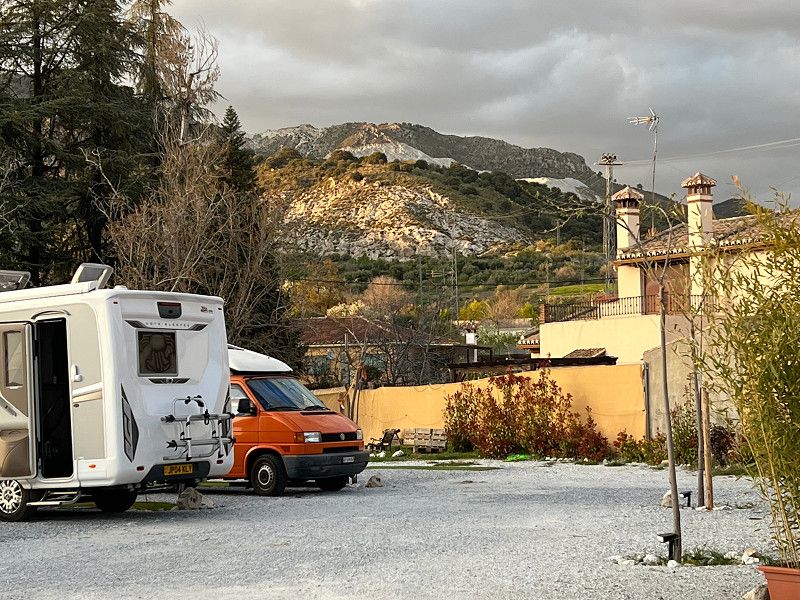
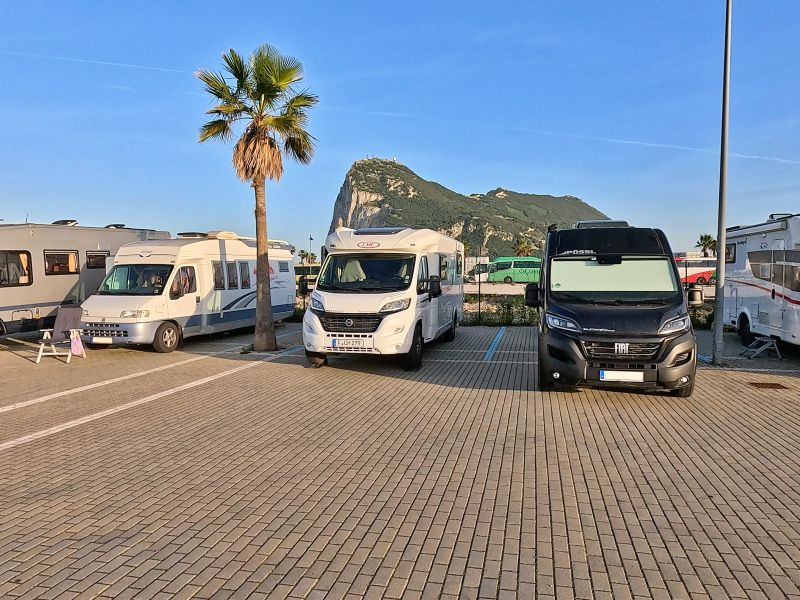
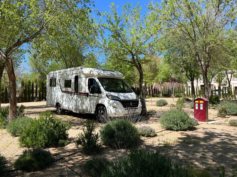
We decided to check the time difference between toll and toll-free routes at each stage. It should be 20 minutes, so toll-free. But first we had to refill the gas bottle before we set off in brilliant sunshine through the Black Forest and, from the Rhine Valley onwards, in thick fog to our first overnight spot, a Camping-Car Park site.
Rue de l'Église, 25350, Mandeure, France
47° 27' 20.4" N 6° 48' 17.9" E
47.4556700 6.8049800
• Head toward Rue de Coudroye on Chemin des Combottes. Go for 17 m.
• Continue on Rue de l'Église. Go for 522 m.
• Turn right onto Rue du Pont (D437). Go for 2.4 km.
• Turn right onto Rue de la Roche. Go for 982 m.
• Turn right onto Rue de Montbéliard (D438). Go for 898 m.
• Continue on D53 toward A36/Montbéliard/Écot. Go for 938 m.
• Take the 3rd exit from roundabout onto A36 (La Comtoise) toward Paris/Lyon/Besançon. Go for 159 km.
• Take the exit onto A31. Go for 6.1 km.
• Continue on A6 (Autoroute du Soleil). Go for 123 km.
• Take exit 31.2 toward Roanne/Villefranche-Sud. Go for 579 m.
• Take the 1st exit from roundabout onto Route de Riottier (D70) toward A6/Paris/Macon/Parc d'Activités de l'Échangeur. Go for 277 m.
• Take the 2nd exit from roundabout onto Route de Riottier toward Parc d'Activités de l'Echangeur. Go for 1.2 km.
• Turn right onto Route de Riottier. Go for 101 m.
• Take the 1st exit from Route de Riottier roundabout onto Route de Riottier. Go for 53 m.
• Arrive at Route de Riottier. Your destination is on the right.
☍
295,6 km
(2 hrs. 31 min.)
21. Jan. 2025 -
22. Jan. 2025
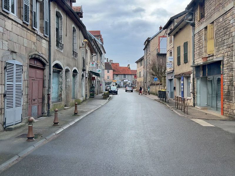
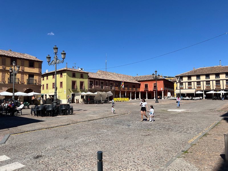
Villefranche-sur-Saône
Our journey from the Doubs region to the Jura, to Villefranche sur Saône, the capital of Beaujolais. The route is short, but the journey through the villages and the small country roads with their countless roundabouts takes time. But we saved a lot on tolls. Now we are standing with a view of the Saône and enjoying the evening (unfortunately without a glass of Beaujolais).
Route de Riottier, Villefranche-sur-Saône, Rhône, Auvergne-Rhone-Alpen, Frankreich
45° 58' 19.5" N 4° 45' 7.2" E
45.9720897 4.7520076
• Head northeast on Route de Riottier. Go for 42 m.
• Take the 2nd exit from Route de Riottier roundabout onto Route de Riottier. Go for 1.3 km.
• Take the 2nd exit from roundabout onto Route de Riottier (D70) toward A6/Lyon/Roanne/Anse/Limas/Centre Ville. Go for 310 m.
• Take the 3rd exit from roundabout onto A6 (Autoroute du Soleil) toward Lyon. Go for 24.6 km.
• Keep left onto Autoroute du Soleil (M6) toward Lyon-Centre. Go for 6.8 km.
• Keep left onto Autoroute du Soleil (M7). Go for 194 km.
• Keep right onto A9 (Échangeur d'Orange) toward Barcelone/Toulouse/Montpellier/Nîmes. Go for 29.0 km.
• Take exit 23 toward Beaucaire/Tarascon/Uzès/Remoulins/Pont du Gard. Go for 732 m.
• Take the 3rd exit from roundabout onto D6100 toward Nîmes/Alès/Beaucaire/Tarascon/Remoulins/Uzès/Pont du Gard. Go for 1.9 km.
• Take the 3rd exit from Carrefour de l'Arnède roundabout onto Avenue Geoffroy Perret (D6100) toward Nîmes/Beaucaire/Tarascon. Go for 1.6 km.
• Take the 1st exit from roundabout onto Avenue du Pont du Gard (D981) toward Pont du Gard. Go for 153 m.
• Arrive at Avenue du Pont du Gard (D981). Your destination is on the right.
☍
260,1 km
(2 hrs. 22 min.)
23. Jan. 2025 -
25. Jan. 2025
Remoulins
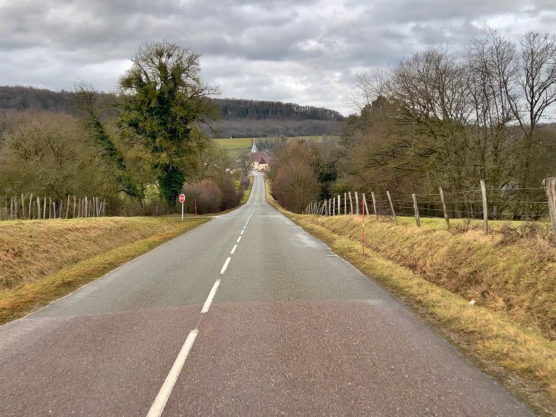
We had barely been driving for two days when we changed our plans for the first time. We actually wanted to go to La Carnourgue as a stopover on the way to Spain, but we decided to drive a little further and look at the Pont du Gard. Again we started off toll-free, but as soon as we passed through Lyon we got lost and spent half an hour winding through Lyon until we finally got on the A7 towards Marseille. As we continued on and after a traffic jam due to a serious accident, we realized somewhere in the Jura mountains that we would not be in Remoulins until early evening. So we quickly reprogrammed the sat nav and took the toll motorway. This saved us over two hours. Tomorrow we will look at the Pont du Gard.
Avenue du Pont du Gard, Remoulins, Remoulins, Département Gard, Frankreich
43° 56' 16.9" N 4° 33' 18.8" E
43.9380273 4.5552124
• Head southeast on Avenue du Pont du Gard (D981). Go for 125 m.
• Take the 2nd exit from roundabout onto D6086 toward A9/Avignon/Montélimar/Alès/Uzès/Bagnols S/C./Pont du Gard. Go for 1.6 km.
• Take the 2nd exit from Carrefour de l'Arnède roundabout onto D6100 toward A9/Montélimar/Nîmes/Avignon/Les Angles/Villeneuve lez A./Fournes/Roquemaure. Go for 1.8 km.
• Take the 2nd exit from roundabout onto A9 (La Languedocienne) toward Nîmes/Aéroport Garons/Arles/Montpellier/Toulouse/Barcelone. Go for 190 km.
• Take exit 40 toward Salses le Ch./Port-Leucate/Leucate. Go for 883 m.
• Continue on D627. Go for 2.4 km.
• Pass 2 roundabouts and continue on D627. Go for 14.5 km.
• Continue on D83. Go for 1.0 km.
• Take the 2nd exit from roundabout onto D83. Go for 708 m.
• Take ramp toward Coudalère/Grande Plage. Go for 151 m.
• Take the 3rd exit from Rond-Point Coudalère roundabout. Go for 288 m.
• Take the 1st exit from Rond-Point Pierre Mendès France roundabout onto Avenue du Roussillon (D90). Go for 176 m.
• Continue on Avenue du Lido (D90). Go for 1.4 km.
• Take the 2nd exit from roundabout onto Avenue Annibal (D90). Go for 625 m.
• Take the 3rd exit from Rond-Point Annibal roundabout onto Avenue Annibal (D90). Go for 715 m.
• Take the 1st exit from Rond-Point de l'Appel du 18 Juin 1940 roundabout. Go for 429 m.
• Arrive at your destination on the left.
☍
217,2 km
(1 hrs. 57 min.)
Pont du Gard
Route du Pont du Gard 400, Vers-Pont-du-Gard, Gard, Okzitanien, Frankreich
43° 56' 49.5" N 4° 32' 8.2" E
43.9470703 4.5356005
25. Jan. 2025 -
26. Jan. 2025
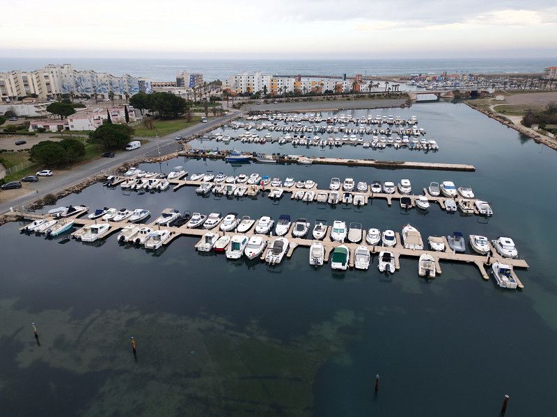
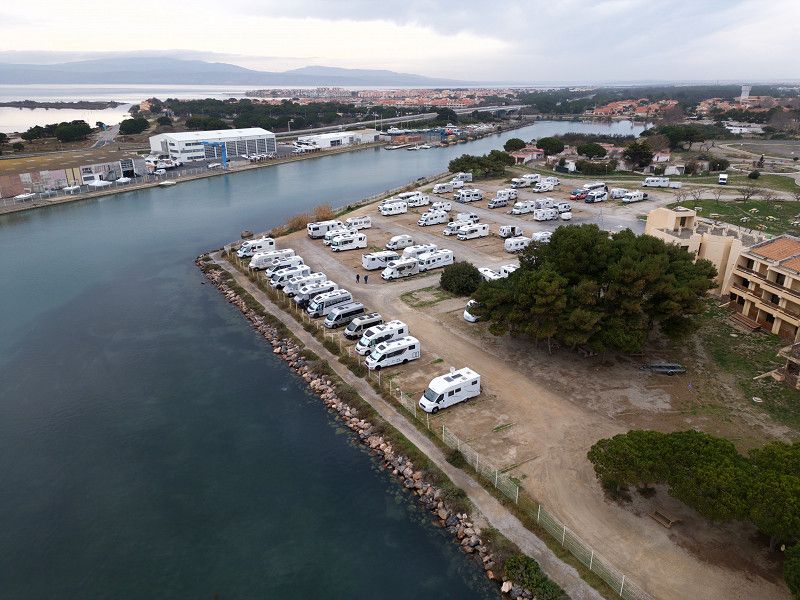
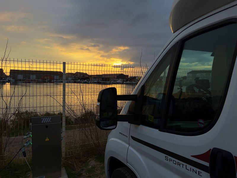
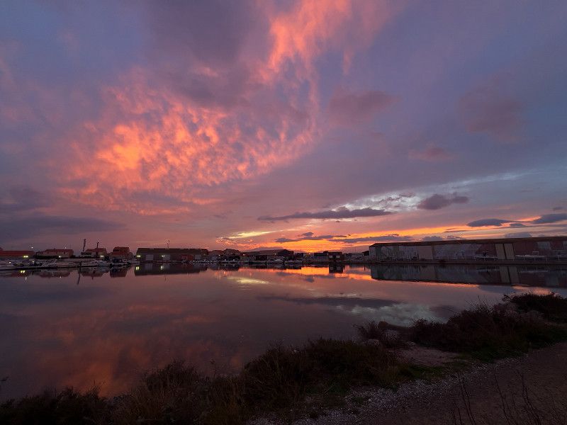
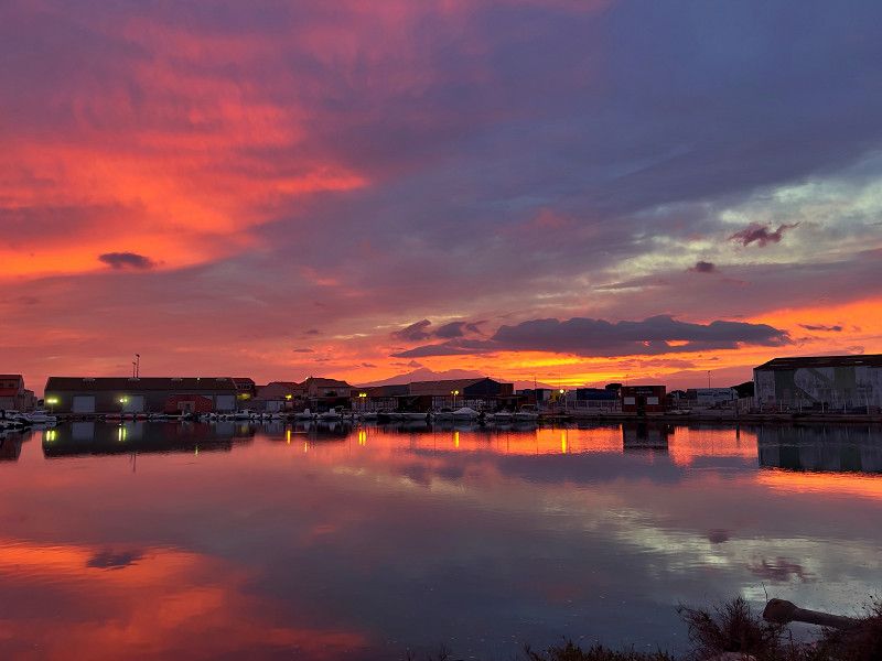
Le Barcarès
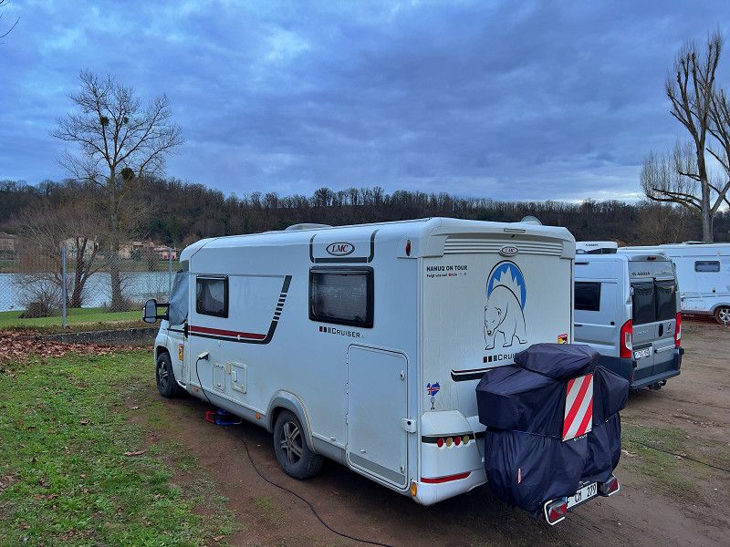
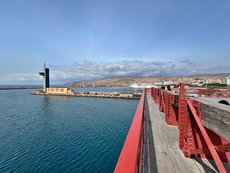
We made another stopover in France because the journey to our next destination in Spain was too far. Now, like last year, we are standing at the harbor with a view of the water. And you can see the Pyrenees in the background.
Quai Alain Colas, Le Barcarès, Ostpyrenäen, Okzitanien, Frankreich
42° 48' 4.6" N 3° 1' 56.9" E
42.8012699 3.0324840
• Head east. Go for 375 m.
• Take the 1st exit from Rond-Point de l'Appel du 18 Juin 1940 roundabout onto Avenue Charles de Gaulle (D90). Go for 416 m.
• Take the 1st exit from roundabout onto Boulevard du Port (D90). Go for 160 m.
• Take the 2nd exit from roundabout onto Boulevard du Port (D90). Go for 345 m.
• Take the 2nd exit from Rond-Point des Déportés et des Résistants roundabout onto Cours de la Méditerranée. Go for 112 m.
• Pass 2 roundabouts and continue on Cours de la Méditerranée. Go for 977 m.
• Take ramp onto D83 toward A9. Go for 10.9 km.
• Take the 2nd exit from roundabout onto D83 toward Barcelone/Toulouse/Montpellier/Narbonne. Go for 209 m.
• Take ramp onto A9 (La Catalane) toward Barcelone. Go for 39.8 km.
• Continue on AP-7 (Autopista de la Mediterrània). Go for 136 km.
• Keep right onto AP-7 (Autopista de la Mediterrània) toward Lleida/E-90/AP-2/Tarragona/Sabadell/C-58/Túnels de Vallvidrera/E-9/Manresa/C-16/Polígon Industrial de Zona Franca/Fira. Go for 11.4 km.
• Take exit 20 toward Sabadell/Manresa/Barcelona onto C-58. Go for 13.2 km.
• Continue on C-16. Go for 1.7 km.
• Take exit 23 toward B-40 onto C-58. Go for 16.6 km.
• Take left ramp toward Barcelona. Go for 605 m.
• Continue on C-55. Go for 280 m.
• Take ramp toward El Mas/El Tortuguer/Montserrat. Go for 290 m.
• Take the 1st exit from roundabout. Go for 410 m.
• Arrive at your destination on the right.
☍
233,7 km
(2 hrs. 24 min.)
26. Jan. 2025 -
27. Jan. 2025
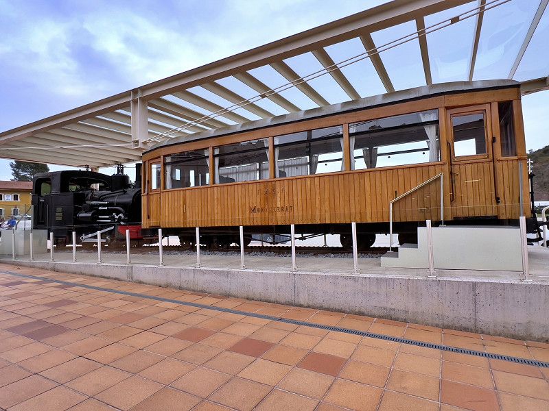
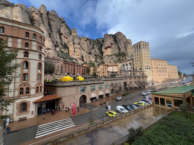
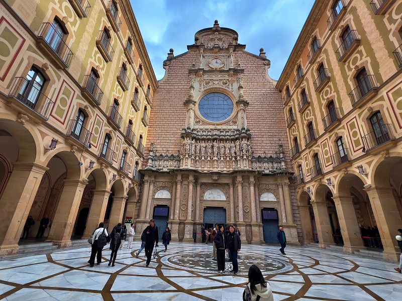
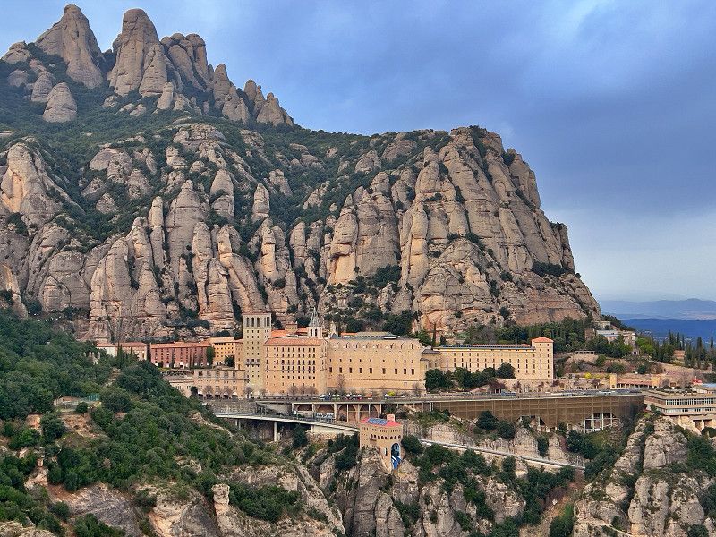
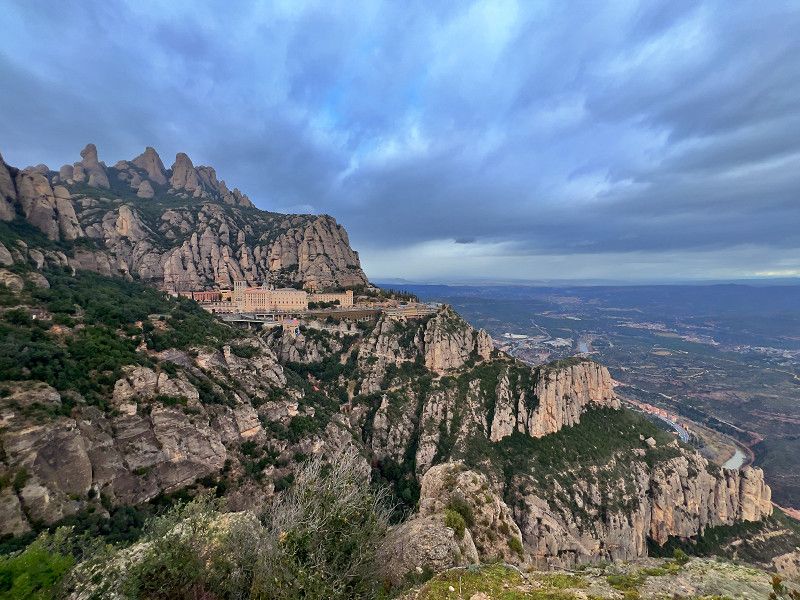
Montserrat
We have finally arrived in Spain and at our first destination, Montserrat. Here at the train station you can park for one night for free in the bus parking lot if you want to visit the monastery. We will tackle that tomorrow.
Camí del Cementiri, Montserrat, Bages, Catalonia, Spain
41° 36' 55.1" N 1° 50' 35.8" E
41.6153156 1.8432783
• Head southwest.
• Turn sharp left. Go for 23 m.
• Turn left. Go for 262 m.
• Turn slightly right toward C-55. Go for 111 m.
• Take the 1st exit from roundabout onto C-55. Go for 14.6 km.
• Take ramp onto A-2 (Autovia Lleida-Barcelona). Go for 1.2 km.
• Take exit 585 toward Martorell/E-15/AP-7/Tarragona onto N-2A. Go for 2.2 km.
• Keep right onto N-2A toward E-15/E-90/Lleida/AP-7/Tarragona/Barcelona/Girona/Capellades/B-224. Go for 2.7 km.
• Take ramp onto AP-7 (Autopista de la Mediterrània) toward Lleida/Tarragona. Go for 41.3 km.
• Keep right toward AP-2/Lleida/Zaragoza. Go for 913 m.
• Continue on AP-2 (Autopista Saragossa Mediterrània). Go for 39.3 km.
• Take exit 9 toward Montblanc/l'Espluga de Francolí. Go for 1.5 km.
• Take the 1st exit from roundabout onto N-240 toward Lleida/l'Espluga de Francolí. Go for 3.0 km.
• Take ramp onto TV-7001 toward l'Espluga de Francolí/Poblet. Go for 1.8 km.
• Continue on Carretera Montblanc (TV-7001). Go for 271 m.
• Take the 1st exit from roundabout onto Avinguda de Catalunya toward AP-2/N-240. Go for 276 m.
• Take the 3rd exit from roundabout onto Avinguda de Catalunya (T-700) toward Poblet/Prades/Les Masies. Go for 804 m.
• Take the 2nd exit from roundabout onto Plaça de Montserrat Canals (T-700) toward Poblet/Les Masies/Centre Ciutat. Go for 62 m.
• Continue on Avinguda de Catalunya (T-700). Go for 84 m.
• Take the 1st exit from roundabout onto Plaça del Centenari (T-700) toward Poblet/Les Masies/Prades/Alberg Jaume I. Go for 136 m.
• Continue on Carretera de Poblet (T-700). Go for 444 m.
• Continue on Carretera de Espluga de Francolí Flix (T-700). Go for 199 m.
• Continue on T-700. Go for 1.6 km.
• Take the 2nd exit from roundabout toward Les Masies/Prades. Go for 48 m.
• Continue on Poblet (T-700). Go for 163 m.
• Continue on TV-7007 toward Les Masies/L'Espluga F. Go for 36 m.
• Turn right. Go for 20 m.
• Turn slightly right. Go for 36 m.
• Arrive at your destination on the right.
☍
113,1 km
(1 hrs. 12 min.)
26. Jan. 2025 -
26. Jan. 2025
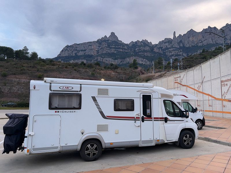
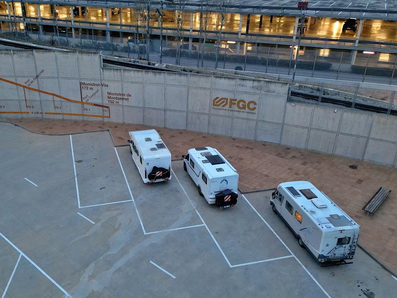
Monistrol de Montserrat
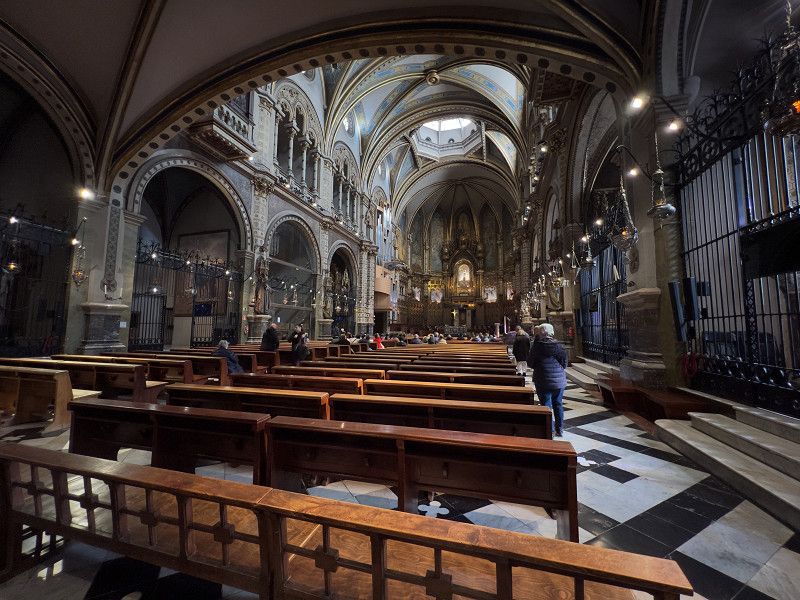
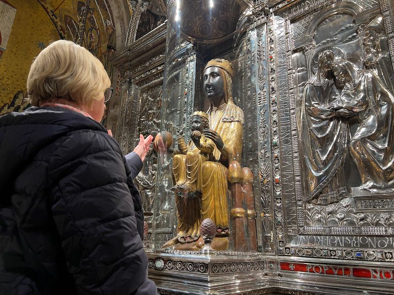
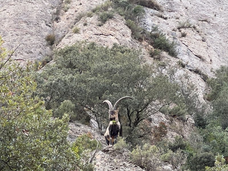
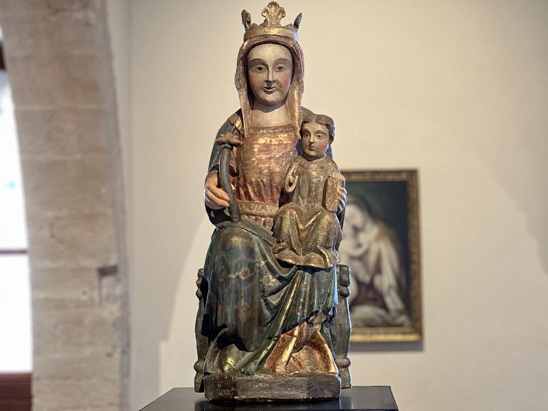
Today we took the cog railway up to the monastery. It was a bit of a shame that they sold us a combined ticket without pointing out that most of the entrance tickets can only be bought through the monastery itself, and so we paid a bit more than we should have. The monastery complex is impressive when you see it built right up to the edge of the cliff in this rugged mountain landscape. We visited the museum, the audio-visual show, the basilica and the Madonna, which the Catalans call "The Brown One" because of its colour. Touching it, which is possible through a small window in the glass display case, is said to bring good luck. We then walked another 20 minutes to the San Miguel cross, from which you have a breathtaking view of the monastery, the rocky landscape and far across the valley.
Carretera de Montserrat, Monistrol de Montserrat, Provinz Barcelona, Spanien
41° 35' 34.8" N 1° 50' 13.9" E
41.5929890 1.8372023
27. Jan. 2025 -
29. Jan. 2025
Vimbodí i Poblet
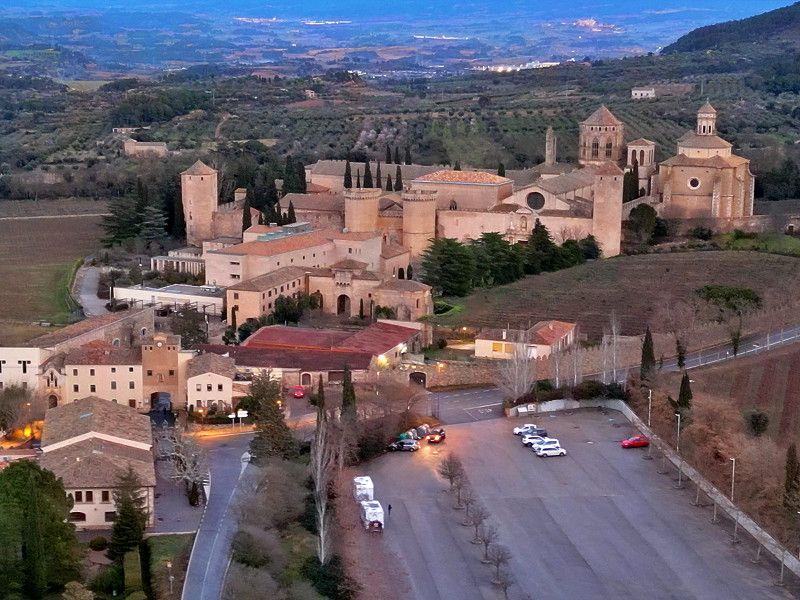
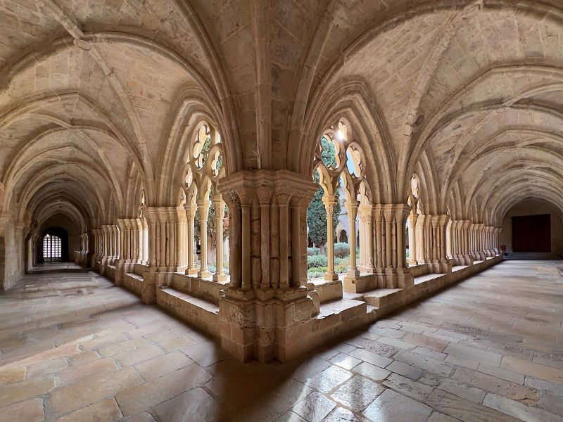
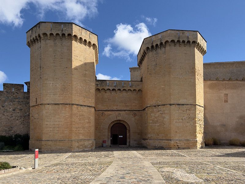
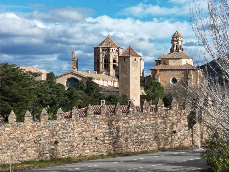
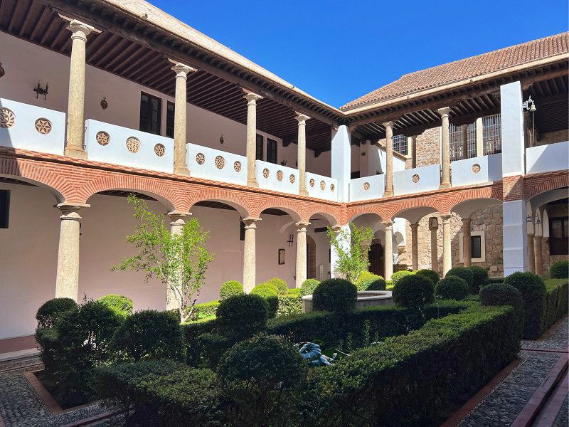
We left Montserrat behind us and drove on to Poblet to see the next monastery, the Monasterio de Poblet, which is said to be one of the most beautiful, if not the most beautiful, in Spain. We are parked with another motorhome in the visitor parking lot, where you can also spend the night. Tomorrow we will go to the monastery.
T-700, Vimbodí i Poblet, Conca de Barberà, Katalonien, Spanien
41° 22' 47.8" N 1° 4' 46.9" E
41.3799424 1.0796848
• Head northeast. Go for 56 m.
• Turn left onto TV-7007. Go for 36 m.
• Continue on Poblet (T-700). Go for 192 m.
• Take the 2nd exit from roundabout onto TV-7002 toward Vimbodí/Lleida. Go for 3.6 km.
• Keep right onto Viaducte de Milans (TV-7002). Go for 142 m.
• Continue on TV-7002. Go for 227 m.
• Take the 2nd exit from roundabout onto Carrer de Vallclara (TV-7004) toward Vallclara. Go for 168 m.
• Continue on TV-7004. Go for 725 m.
• Take the 1st exit from roundabout onto TV-7004 toward Lleida/Tarragona. Go for 1.2 km.
• Take the 3rd exit from roundabout onto TV-7004 toward Les Borges B./N-240/Lleida. Go for 96 m.
• Take the 2nd exit from roundabout onto N-240 toward Les Borges B./Lleida. Go for 7.4 km.
• Turn slightly left toward L'Albi/Vinaixa. Go for 38 m.
• Turn right onto LP-7013. Go for 1.8 km.
• Continue on LP-7032. Go for 649 m.
• Take the 2nd exit from roundabout onto Carretera de Cervià de les Garrigues a l'Albí (LP-7032). Go for 914 m.
• Take ramp onto AP-2 (Autopista Saragossa Mediterrània) toward Lleida/Zaragoza. Go for 46.4 km.
• Take exit 5 toward Soses/N-2/Alcarràs/Fraga/A-2. Go for 1.1 km.
• Take the 3rd exit from roundabout onto A-2 (Autovia del Nordest) toward Zaragoza. Go for 9.1 km.
• Take exit 436 toward Fraga/Seròs/Monzón/A-1234. Go for 339 m.
• Take the 3rd exit from roundabout onto A-242 toward Seròs. Go for 3.8 km.
• Continue on C-45. Go for 3.2 km.
• Take the 2nd exit from roundabout onto Avinguda de Fraga (C-45). Go for 365 m.
• Take the 1st exit from roundabout onto Carrer de la Creu (LP-7041). Go for 451 m.
• Continue on LP-7041. Go for 5.7 km.
• Continue on Carretera de la Granja d'Escarp (LP-7041). Go for 173 m.
• Take the 1st exit from roundabout onto LP-7041. Go for 498 m.
• Turn left toward Carrer Joan Noguer i Bosch. Go for 181 m.
• Continue on Carrer Joan Noguer i Bosch. Go for 112 m.
• Turn right onto Carrer de Mequinensa (LP-7041a). Go for 316 m.
• Arrive at Carrer de Mequinensa (LP-7041a). Your destination is on the right.
☍
88,9 km
( 59 min.)
28. Jan. 2025 -
28. Jan. 2025
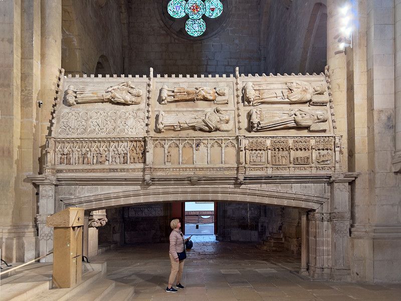
Monasteiro di Poblet
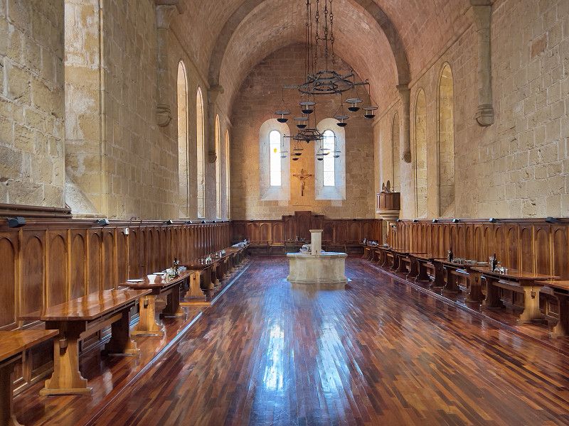
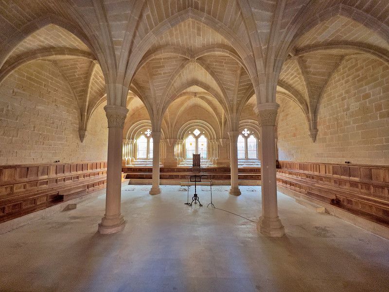
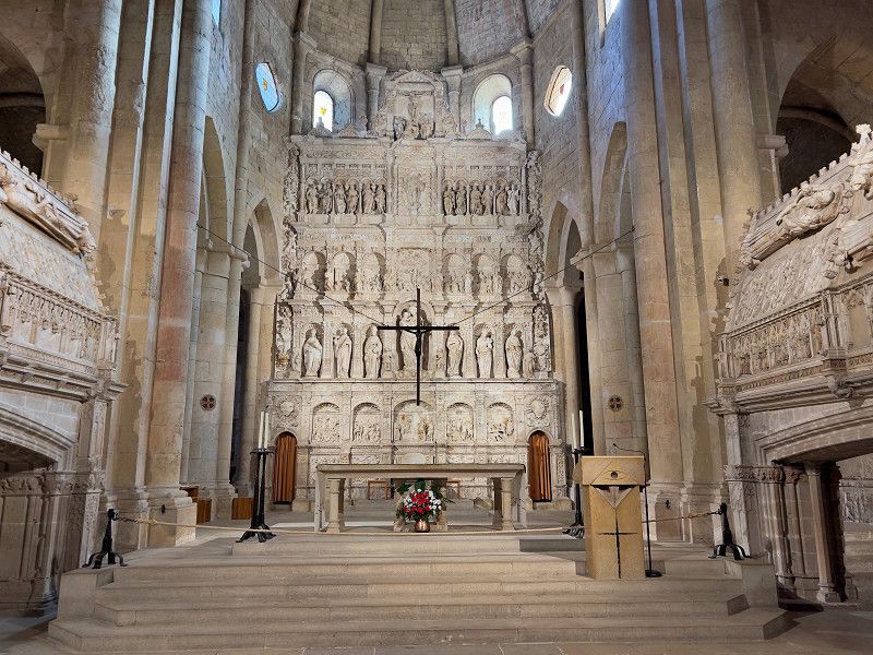
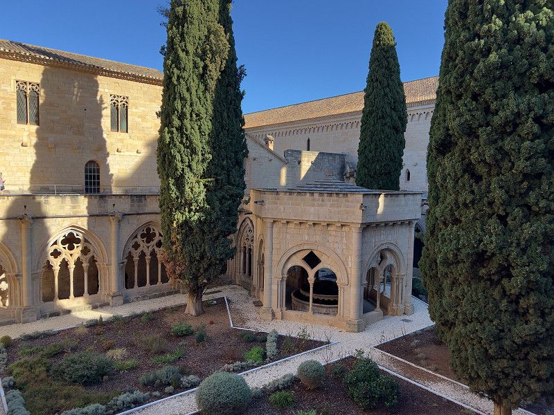
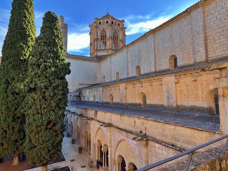
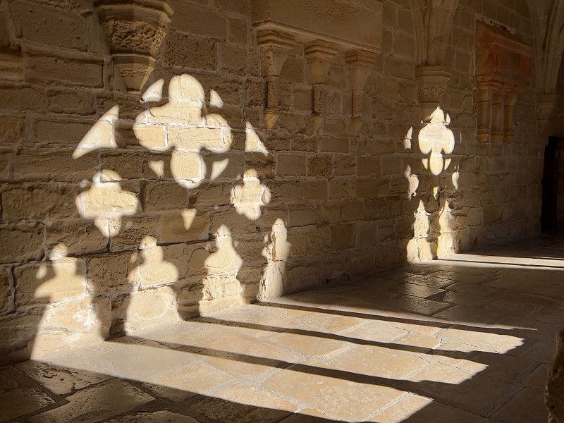
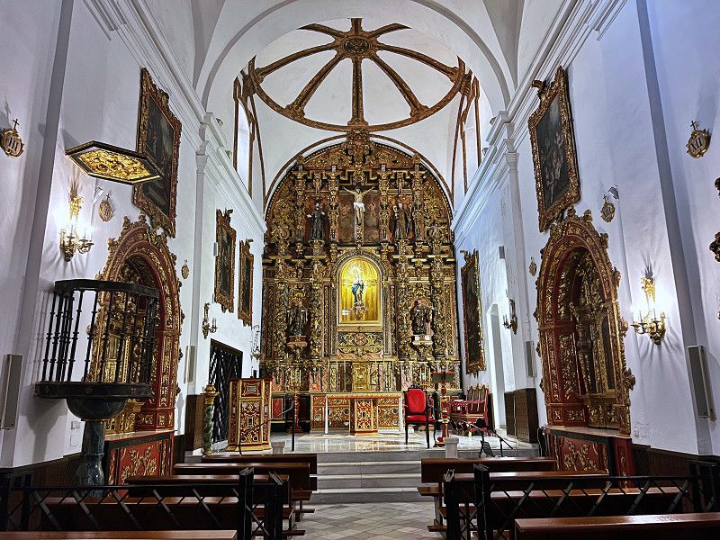
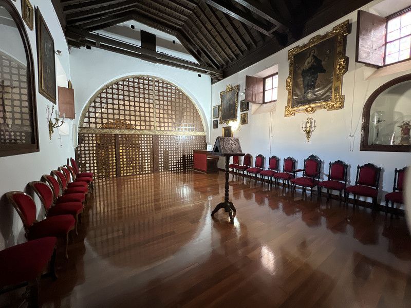
We visited the monastery today. We paid seven euros per person, including the senior discount. You can download a free audio guide to your phone using a QR code. We opted for the short tour, which nevertheless takes you through all accessible rooms, as the monastery still houses Cistercians. The monastery is also the burial place for the kings of Aragon, although the sarcophagi are set up - or rather attached - in a somewhat unusual way. In addition to the royal tombs and the basilica, the cloister with the gardens and of course the defensive wall with the mighty portal are particularly worth seeing. The refectory and the chapter house can only be viewed through the panes of the doors, as the monastery is, as mentioned, still in use.
T-700, Vimbodí i Poblet, Conca de Barberà, Catalonia, Spain
41° 22' 48.6" N 1° 4' 50.7" E
41.3801690 1.0807616
29. Jan. 2025 -
30. Jan. 2025
La Granja D'Escarp
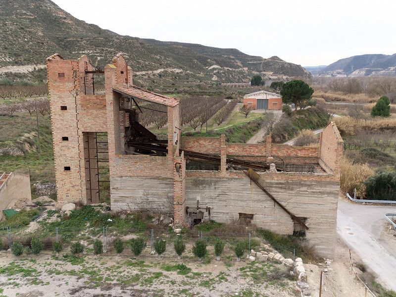
We actually wanted to drive to Poblet in Zaragoza. But the last four days without any sun or electricity have pretty much drained our batteries. So we looked for a place to park with electricity on the way and found one here. Everything is there and the place is free. And right next to it there is a lost place, the remains of an old cement factory.
Carrer del Poliesportiu, La Granja d'Escarp, Lleida, Spain
41° 24' 58" N 0° 20' 58.3" E
41.4161249 0.3495194
• Head southwest on Carrer de Mequinensa (LP-7041a).
• Turn right onto Carrer de Mequinensa. Go for 128 m.
• Turn right onto Carrer de Mequinensa. Go for 20 m.
• Turn left onto Carrer de Mequinensa (LP-7041a). Go for 202 m.
• Turn left onto Carrer Joan Noguer i Bosch. Go for 293 m.
• Turn right onto LP-7041. Go for 426 m.
• Take the 3rd exit from roundabout onto Carretera de la Granja d'Escarp (LP-7041). Go for 253 m.
• Continue on LP-7041. Go for 5.7 km.
• Continue on Carrer de la Creu (LP-7041). Go for 431 m.
• Take the 3rd exit from roundabout onto Avinguda de Fraga (C-45). Go for 385 m.
• Take the 2nd exit from roundabout onto Avinguda de Fraga (C-45). Go for 3.3 km.
• Continue on A-242. Go for 3.6 km.
• Take the 4th exit from roundabout onto A-2 (Autovía del Nordeste) toward Zaragoza. Go for 3.3 km.
• Take exit 433 toward A-131/Huesca/Fraga/Mequinenza/E-90/AP-2. Go for 440 m.
• Take the 4th exit from roundabout onto N-211 toward Torrente de Cinca/Mequinenza/E-90/AP-2. Go for 1.9 km.
• Turn left toward E-90/AP-2/Lleida/Zaragoza/Tarragona/Barcelona. Go for 647 m.
• Take ramp onto AP-2 (Autopista Zaragoza Mediterráneo) toward Zaragoza. Go for 95.5 km.
• Continue on A-2 (Autopista Zaragoza Mediterráneo). Go for 16.7 km.
• Take exit 323 toward avda. Ranillas/Campus Río Ebro. Go for 2.8 km.
• Take the 1st exit from roundabout onto Ronda de Boltaña toward A-23/Huesca/Juslibol/Parque Goya. Go for 755 m.
• Take the 1st exit from roundabout onto Ronda de Boltaña. Go for 330 m.
• Take the 1st exit from roundabout onto Calle Poeta Luciano Gracia. Go for 743 m.
• Turn right. Go for 376 m.
• Turn right. Go for 62 m.
• Arrive at your destination on the right.
☍
138,2 km
(1 hrs. 21 min.)
Saragossa
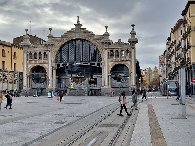
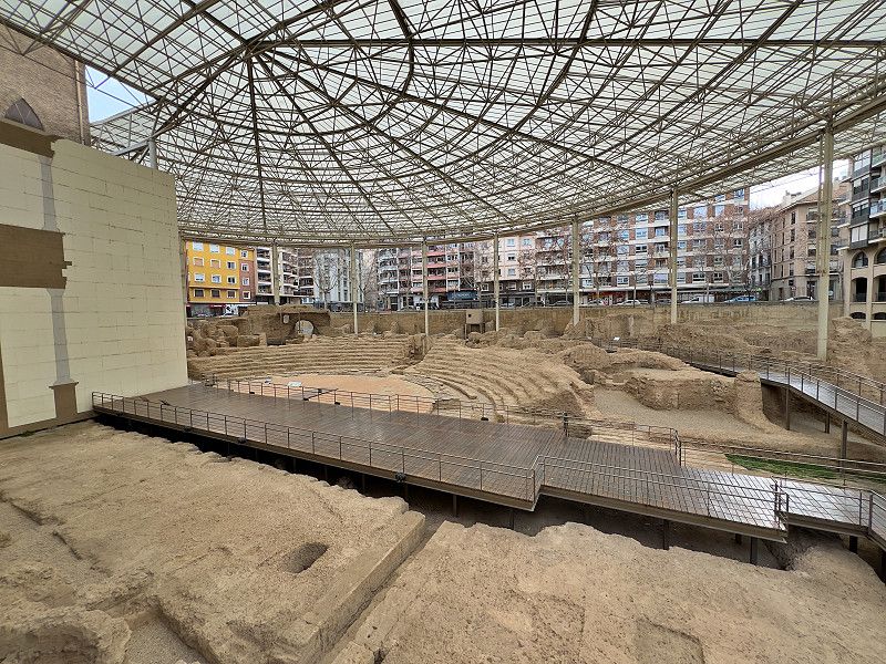
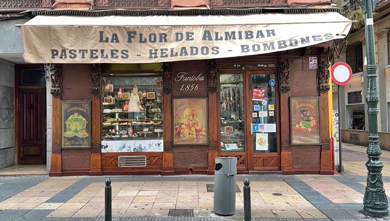
We arrived in Zaragoza, or Saragossa. We managed to get a spot on the parking lot by the university. Right in front of the square is a stop for the only tram line in Zaragoza, but it takes you right into the middle of the city. And that costs 1.65 per person, and the ticket is valid for one hour on the bus and train. So it's no wonder that the tram is full. We discovered that almost everything is closed for a few hours at lunchtime, so our city tour was limited to a few places, such as the Mercado Central, the Roman theater (all from the outside only). To compensate, we found a pretty old patisserie on Calle de Don Jaime I and made our day a little sweeter. Hopefully tomorrow will be better.
Calle Poeta Luciano Gracia, Saragossa, Saragossa, Spanien
41° 40' 58.8" N 0° 53' 25.1" W
41.6830000 -0.8903000
• Head south. Go for 87 m.
• Turn right toward Calle Poeta Luciano Gracia. Go for 140 m.
• Turn right onto Calle Poeta Luciano Gracia. Go for 271 m.
• Turn right toward Calle Poeta Luciano Gracia. Go for 102 m.
• Turn left onto Calle Poeta Luciano Gracia. Go for 670 m.
• Take the 3rd exit from roundabout onto Ronda de Boltaña. Go for 406 m.
• Take the 1st exit from roundabout onto Ronda de Boltaña. Go for 824 m.
• Take the 3rd exit from roundabout onto A-2 (Autovía del Nordeste) toward Logroño/A-68/Pamplona/AP-68/Madrid/Teruel/A-23. Go for 8.7 km.
• Keep left onto Z-40 toward Teruel/A-23/Alcañiz/A-68/Castellón. Go for 4.8 km.
• Take exit 29 toward Cariñena/Teruel onto A-23 (Autovía Mudéjar). Go for 91.6 km.
• Take exit 185 toward Calamocha/A-1508/Navarrete/Daroca/N-234/Soria/N-330. Go for 835 m.
• Take the 1st exit from roundabout toward Daroca/N-234/Soria/N-330/A-1508/Calamocha/Navarrete. Go for 165 m.
• Take the 4th exit from roundabout onto Carretera a Navarrete y Vival (A-1508) toward Daroca/N-234/Soria/N-330/Calamocha. Go for 1.0 km.
• Take the 1st exit from roundabout onto Calle Desvío (N-234) toward Daroca/Soria. Go for 2.2 km.
• Turn right. Go for 69 m.
• Turn right. Go for 18 m.
• Turn left. Go for 11 m.
• Arrive at your destination.
☍
112,1 km
(1 hrs. 2 min.)
30. Jan. 2025 -
30. Jan. 2025
Saragossa
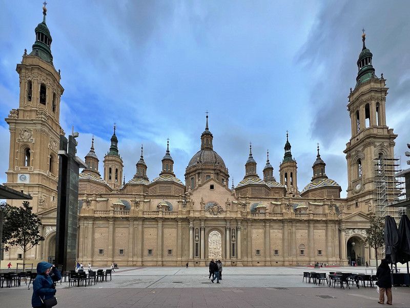
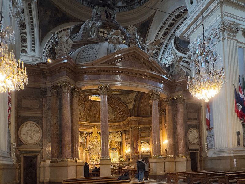
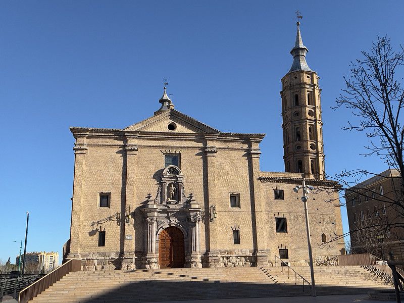
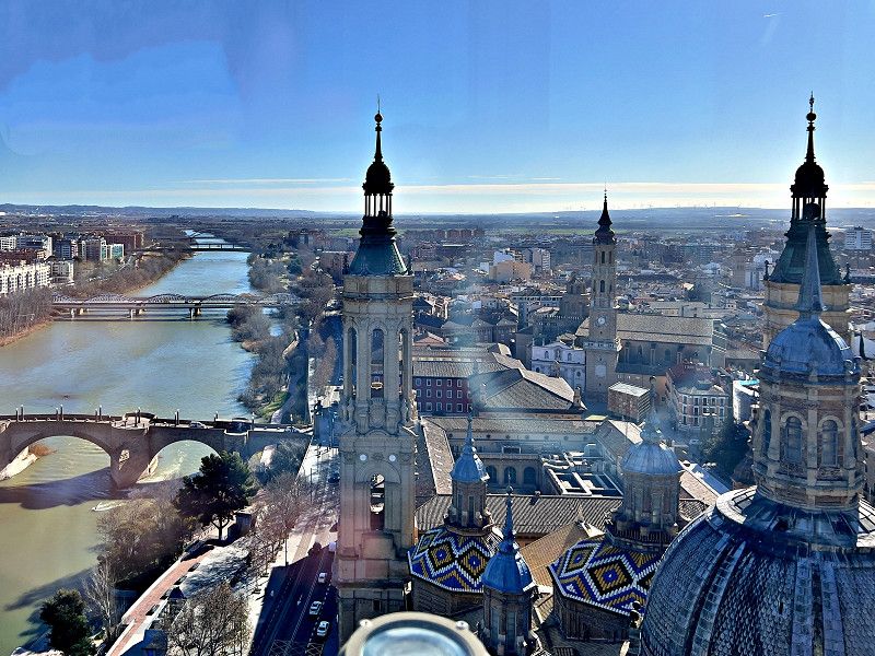
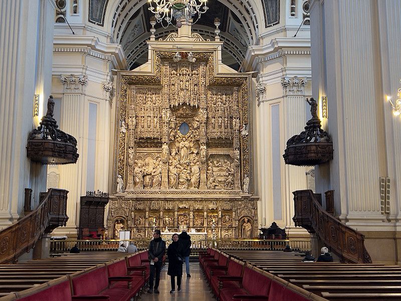
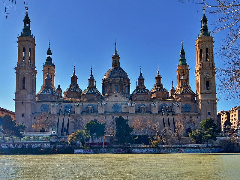
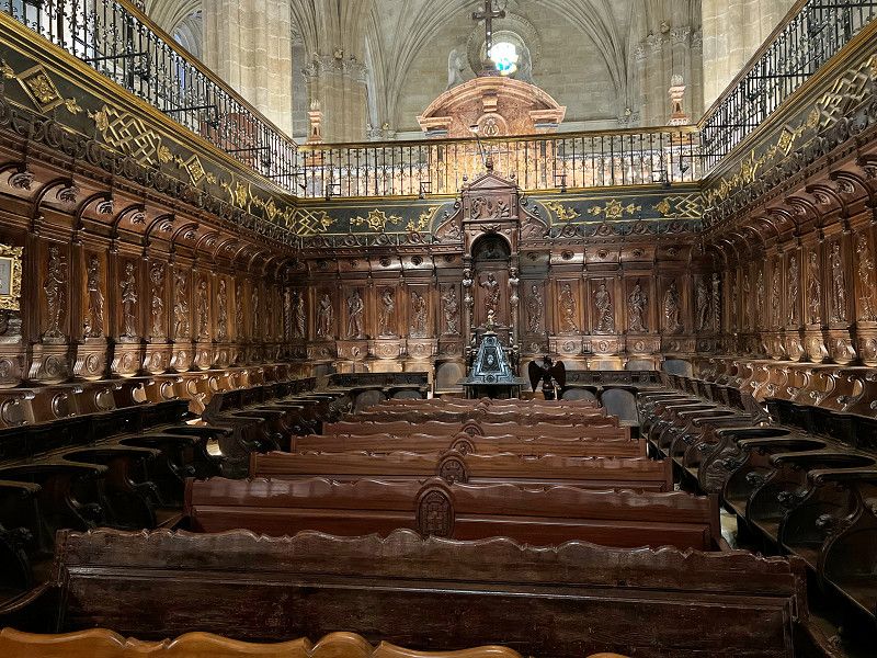
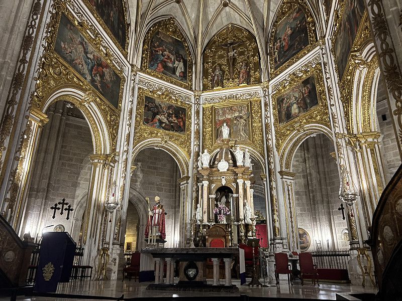
Today the sun is shining, but the wind is still strong and icy. But we set off. An English couple who had just left gave us a rechargeable tram card that even had a little credit left. And with this card, a single journey actually only costs 45 cents per person. It really is possible! We take the tram to Plaza del Pilar, the central square where, in addition to the tourist information office, the church with the leaning tower (so you can find them not only in Pisa), a cathedral, the town hall and another museum, there is also the Basilica del Pilar, one of the main sights. In addition to the paintings by Goya, the alabaster altar is particularly impressive.
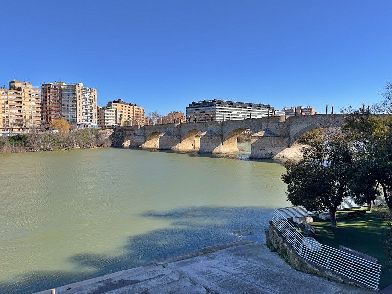
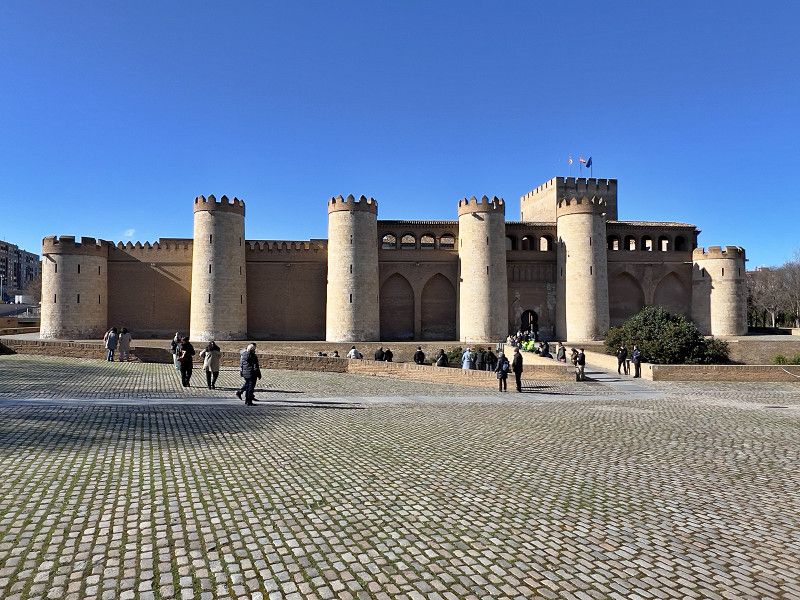
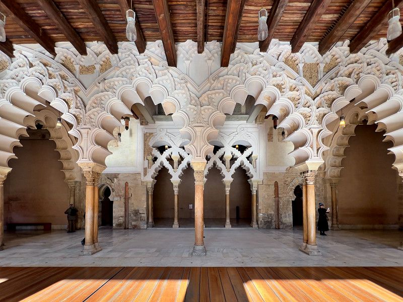
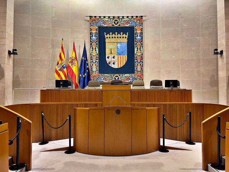
We crossed the Puente de Piedra to the other side of the Ebro, from where we have a beautiful view of the basilica. The next attraction is the Palacio de la Aljaferia, built by the Moors in the 11th century as a pleasure palace and fortress and later the seat of the kings of Aragon. Today the Aragonese parliament is based there. The structural changes of the last few centuries were fortunately reversed in the 1980s and today the palace is a world cultural heritage site. It deserves the title.
Plaza de Nuestra Señora del Pilar, Saragossa, Saragossa, Spanien
41° 39' 25.4" N 0° 52' 49.9" W
41.6570433 -0.8805198
01. Feb. 2025 -
02. Feb. 2025
Calamocha
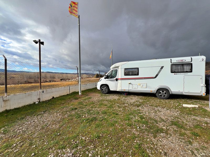
On our way to Albarrazin we make a short stop here to charge our auxiliary batteries, as they were not fully charged during the short trips of the last few days. Our solar modules are not really helping either.
N-234 km 194, Calamocha, Provinz Teruel, Spanien
40° 56' 23.2" N 1° 17' 40.9" W
40.9397916 -1.2946964
• Head west. Go for 11 m.
• Turn right toward Carretera Zaragoza/N-234. Go for 87 m.
• Turn left onto Carretera Zaragoza (N-234). Go for 2.2 km.
• Take the 5th exit from roundabout onto Calle Navarrete (A-1508) toward Teruel/A-23/Zaragoza/Navarrete. Go for 965 m.
• Take the 1st exit from roundabout toward A-23/Teruel/Zaragoza. Go for 145 m.
• Take the 1st exit from roundabout toward Teruel/Zaragoza. Go for 364 m.
• Take ramp onto A-23 (Autovía Mudéjar) toward Teruel/Monreal del Campo. Go for 53.9 km.
• Take exit 131 toward Cella/A-2515/Celadas. Go for 311 m.
• Take the 1st exit from roundabout toward A-2515/Cella. Go for 545 m.
• Continue toward A-2515. Go for 55 m.
• Take the 2nd exit from roundabout. Go for 112 m.
• Turn slightly right onto A-2515. Go for 894 m.
• Take the 3rd exit from roundabout onto A-2515. Go for 2.0 km.
• Turn slightly left onto Camino Circunvalación. Go for 1.2 km.
• Turn left onto TE-V-9011 toward Gea de Albarracín/Albarracín. Go for 3.4 km.
• Turn right onto A-1512 toward Gea de Albarracín/Albarracín. Go for 17.4 km.
• Turn left onto Calle Llano del Arrabal. Go for 521 m.
• Continue on Carretera a Albarracín. Go for 73 m.
• Take the 3rd exit from roundabout onto Camino de Gea. Go for 423 m.
• Turn slightly right. Go for 194 m.
• Arrive at your destination on the right.
☍
84,8 km
( 59 min.)
01. Feb. 2025 -
05. Feb. 2025
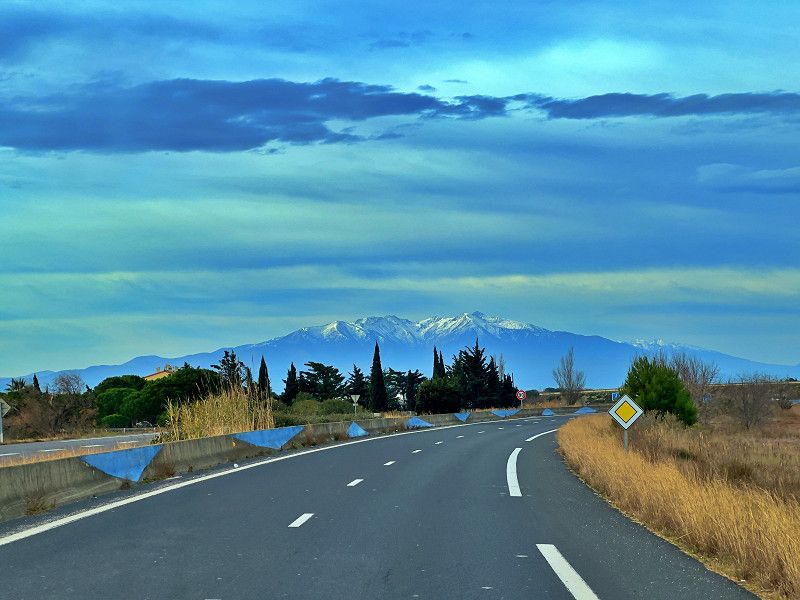
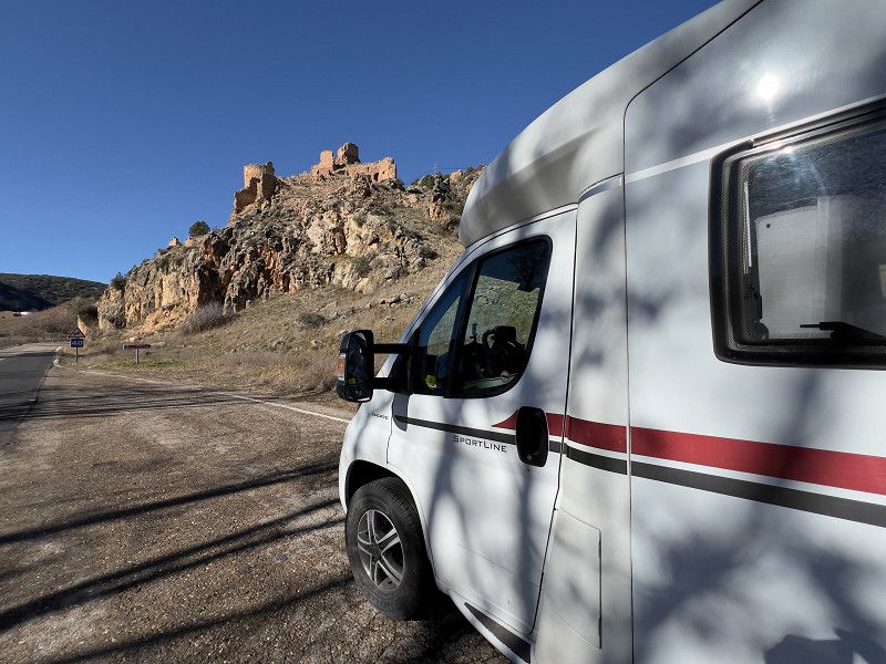
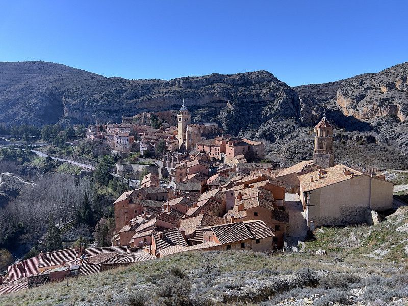
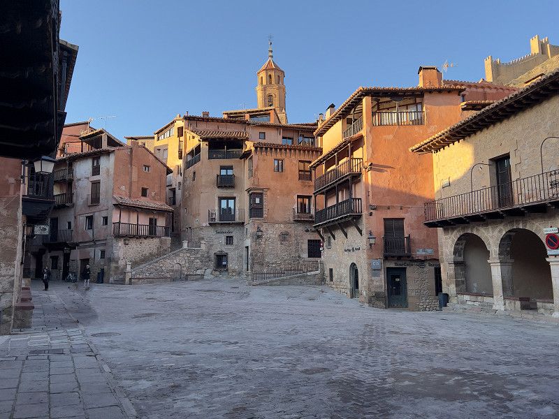
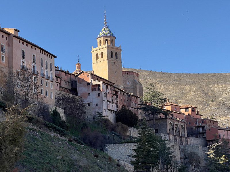
Albarracin
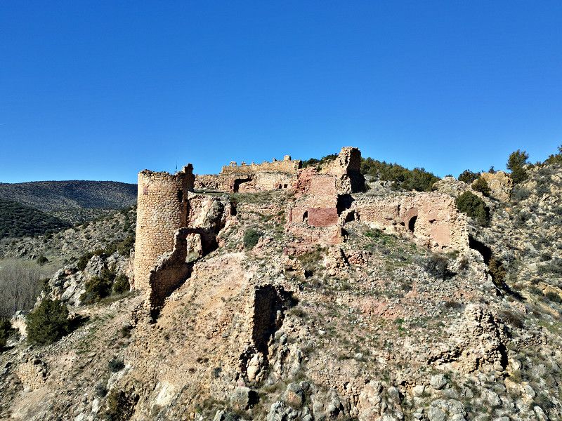
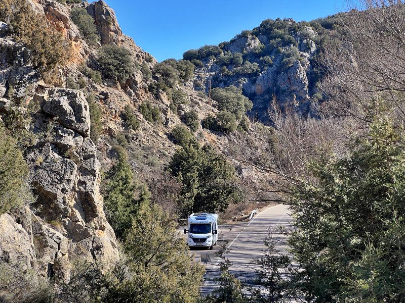
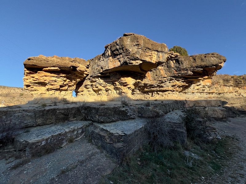
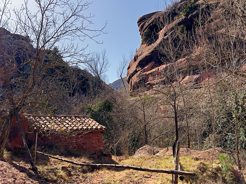
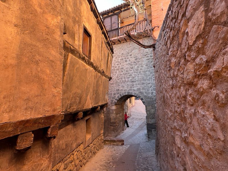
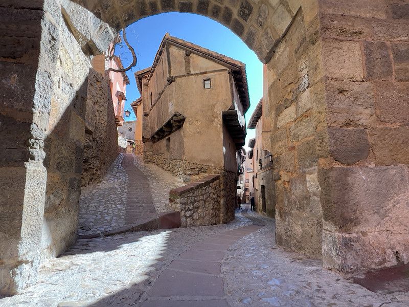
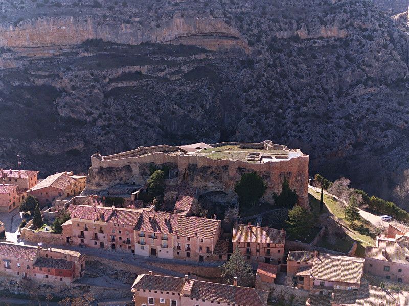
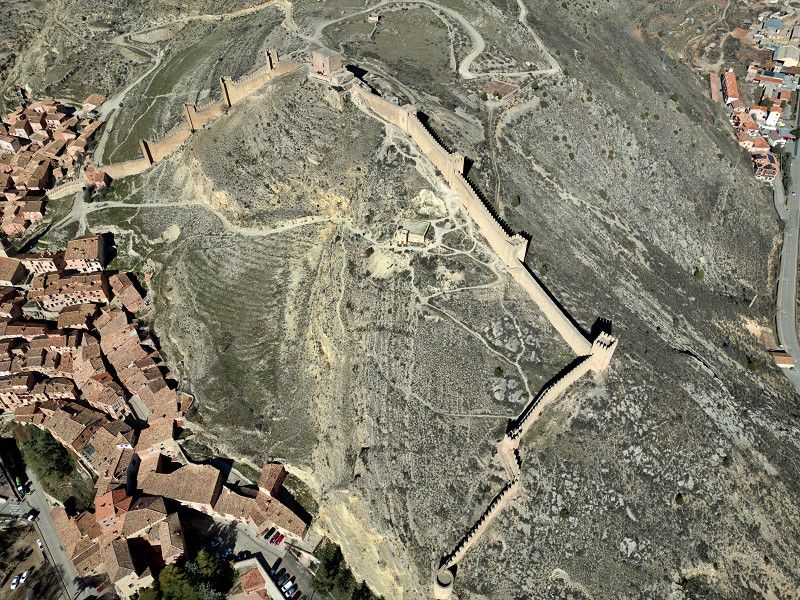
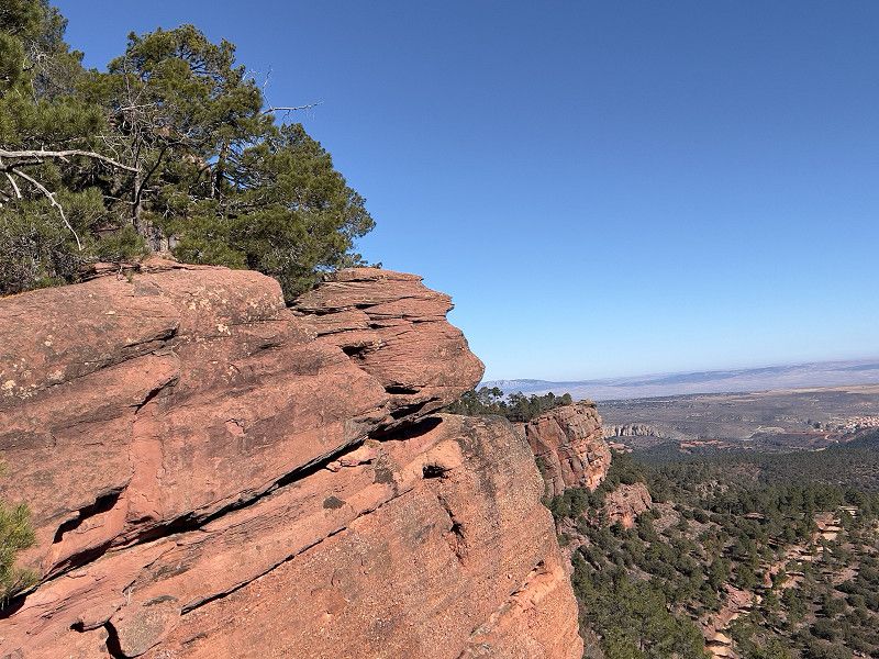
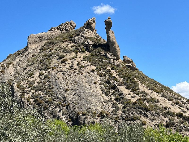
We continued on to Albarracin. As soon as we reached the Río Guadalaviar, the journey went through the breathtaking landscape of the Sierra Albarracin with its rugged rock faces, where we discovered not only a ruined castle but also the remains of a former Roman aqueduct. Albarracin was conquered by the Moors in the 9th century and became an independent Taifa kingdom under the Banu Razin dynasty, after whom the town is named (Al-Banu-Razin). Today the town is practically an open-air museum with narrow streets, reddish houses, a well-preserved wall from the Islamic period, the Moorish castle from the 10th century, of which only ruins remain, and much more. The parking space where we are standing is still relatively new.
Camino del Cid, Albarracín, Sierra de Albarracín, Aragon, Spain
40° 24' 32.3" N 1° 25' 40.7" W
40.4089761 -1.4279834
• Head toward Camino de Gea. Go for 194 m.
• Turn slightly left onto Camino de Gea. Go for 392 m.
• Take the 1st exit from roundabout onto Carretera a Albarracín. Go for 83 m.
• Continue on Calle Llano del Arrabal. Go for 521 m.
• Turn left onto Calle San Antonio (A-1512). Go for 7.1 km.
• Turn left onto A-1703. Go for 2.0 km.
• Turn right onto A-1704. Go for 21.0 km.
• Arrive at Carretera a Frías de Albarracín (A-1704). Your destination is on the right.
☍
31,3 km
( 34 min.)
Albarracín
We had a look around this fascinating place. Unfortunately, all museums, churches, etc. are closed at this time (Jan./Feb.). But there is still plenty to discover.
Sierra de Albarracín, Aragonien, Spanien
40° 24' 26.2" N 1° 26' 39.4" W
40.4072825 -1.4442792
05. Feb. 2025 -
05. Feb. 2025
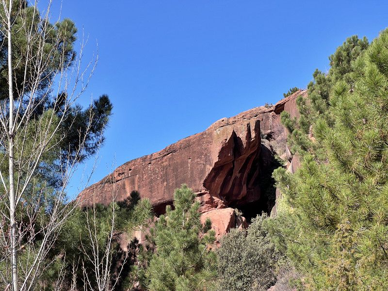
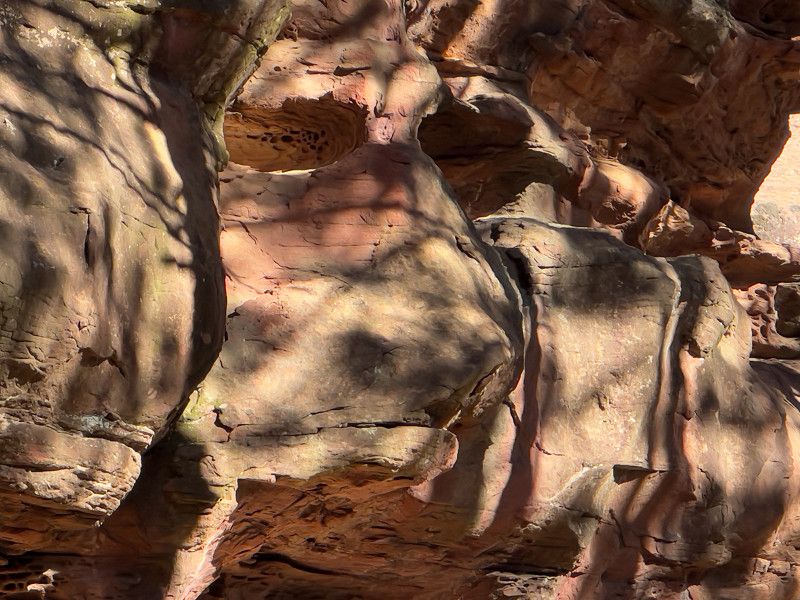
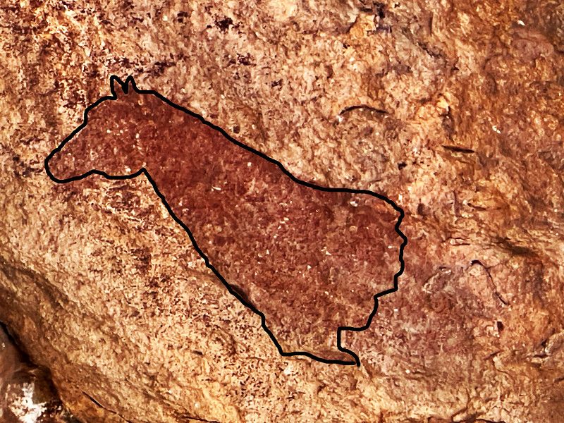
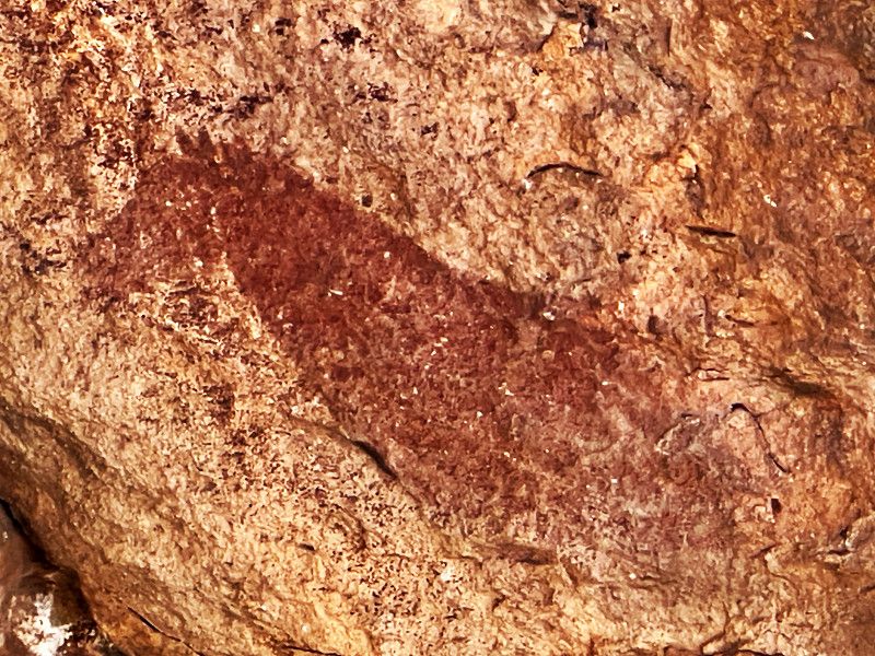
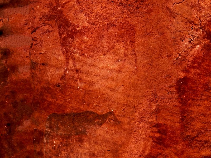
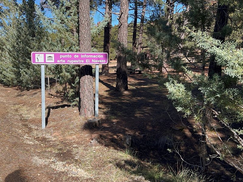
El Navazo
In the rocky landscapes around Albarrazin there are a number of places with petroglyphs. We visited the one at El Navazo. From a large car park (fees apply) there is a circular walk through this area with fascinating rock formations in which
you can see a number of these petroglyphs. However, since they are more or less exposed to the weather, they have faded somewhat after more than 6,000 years but, and this is also fascinating, they are still recognizable.
Sierra de Albarracín, Aragonien, Spanien
40° 20' 50" N 1° 40' 29.1" W
40.3472201 -1.6747364
• Head east on Carretera a Frías de Albarracín (A-1704). Go for 21.0 km.
• Turn left onto A-1703. Go for 2.0 km.
• Turn right onto A-1512. Go for 35.5 km.
• Keep right onto A-1512 toward Teruel. Go for 82 m.
• Continue on N-234. Go for 2.0 km.
• Take the 4th exit from roundabout onto N-234. Go for 3.2 km.
• Take the 3rd exit from roundabout onto Carretera de Sagunto a Burgos (N-234) toward A-23/Zaragoza/Castellón/Valencia/Teruel. Go for 7.3 km.
• Take the 3rd exit from roundabout onto Avenida de Sagunto toward Dinópolis. Go for 277 m.
• Turn right onto Calle Polígono la Fuente Fresca. Go for 147 m.
• Turn right. Go for 18 m.
• Turn left. Go for 45 m.
• Arrive at your destination on the right.
☍
71,5 km
(1 hrs. 6 min.)
04. Feb. 2025 -
05. Feb. 2025
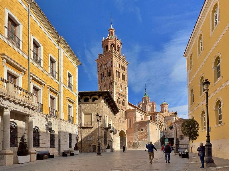
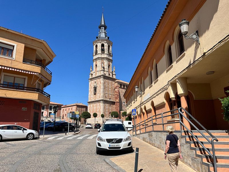
Teruel
We have arrived in Teruel and are parked at the municipal parking lot. There is space for 30 mobile homes on this, in our opinion, beautifully laid out site, which is completely free; overnight accommodation as well as water and waste disposal are also free. There is no electricity. Tomorrow we will visit the city of the Mudéjar towers.
Avenida de Sagunto, Teruel, Comunidad de Teruel, Aragonien, Spanien
40° 19' 58.3" N 1° 5' 8" W
40.3328696 -1.0855609
• Head west. Go for 45 m.
• Turn right toward Calle Polígono la Fuente Fresca. Go for 18 m.
• Turn left onto Calle Polígono la Fuente Fresca. Go for 157 m.
• Take the 3rd exit from roundabout onto Avenida Sagrada Familia. Go for 230 m.
• Take the 3rd exit from roundabout onto Carretera de Sagunto a Burgos (N-234) toward A-23/Valencia/Castellón. Go for 6.8 km.
• Take ramp onto A-23 (Autovía Mudéjar) toward Valencia/Castellón. Go for 64.1 km.
• Take exit 42 toward Jérica/Caudiel. Go for 277 m.
• Take the 1st exit from roundabout onto CV-195 toward A-23/Teruel/Benafer/Caudiel. Go for 242 m.
• Take the 3rd exit from roundabout onto CV-195 toward Benafer/Caudiel/Montán/Montanejos. Go for 2.7 km.
• Continue on Avenida Valencia (CV-195). Go for 223 m.
• Continue on Plaza La Virgen (CV-195). Go for 56 m.
• Continue on Avenida Valencia (CV-195) toward Salón/Socio-Cultural/El Olivar. Go for 122 m.
• Continue on Calle Paulino Carabella (CV-195) toward Salón/Socio-Cultural/El Olivar. Go for 69 m.
• Turn left onto Calle Pelayo. Go for 20 m.
• Turn right onto Calle de Hernán Cortés. Go for 43 m.
• Turn right onto Calle Concordia. Go for 101 m.
• Continue on Avenida Estación. Go for 199 m.
• Arrive at Avenida Estación. Your destination is on the left.
☍
75,3 km
( 44 min.)
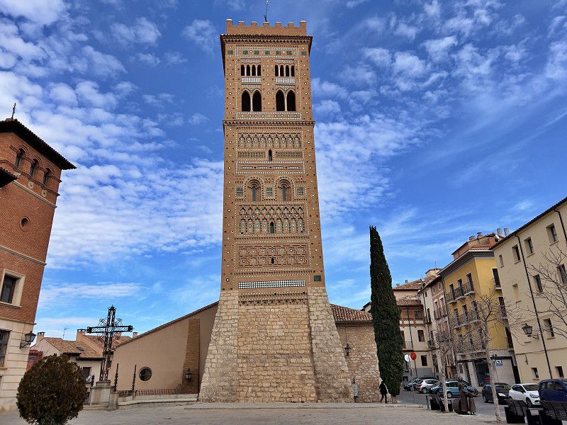
Teruel
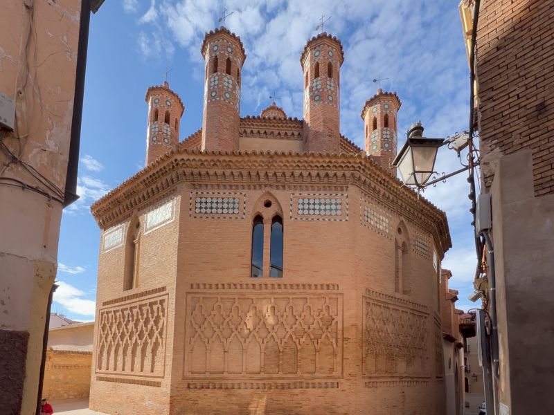
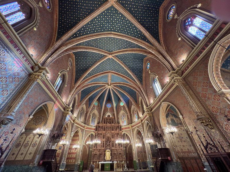
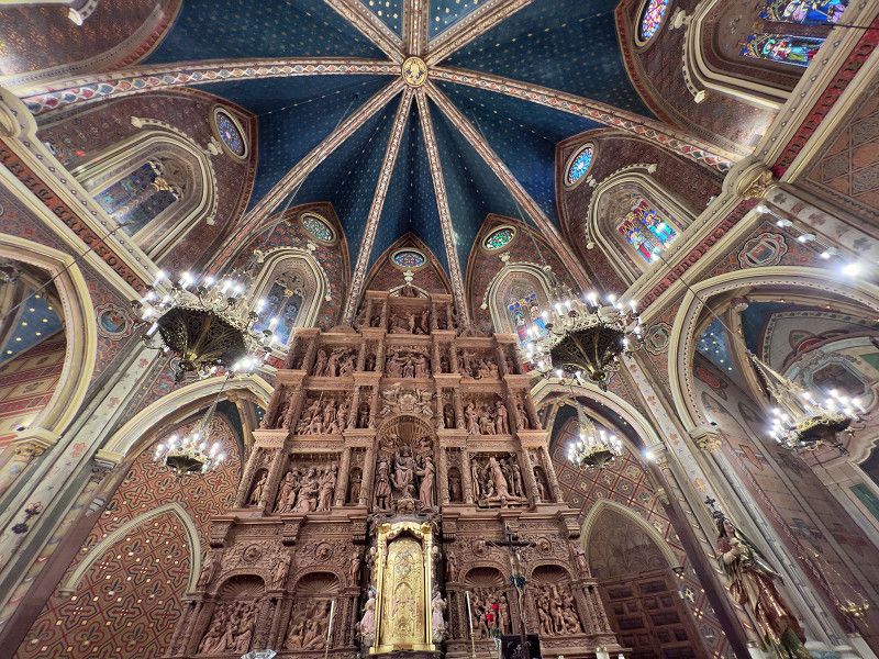
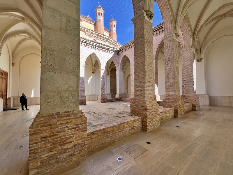
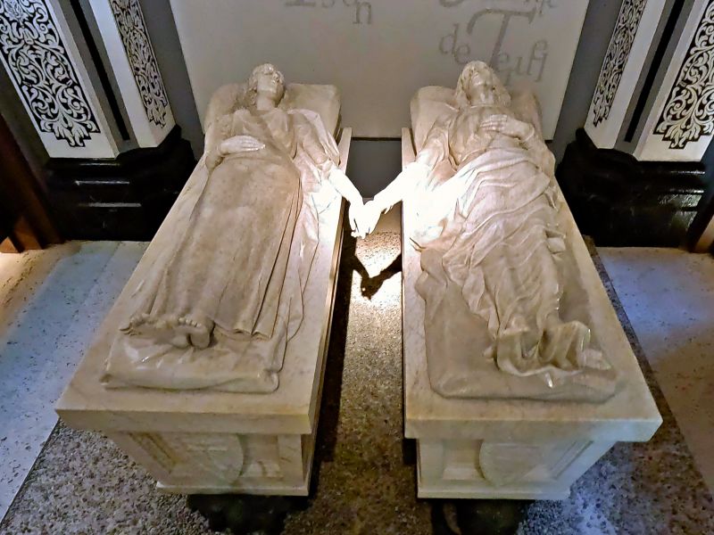
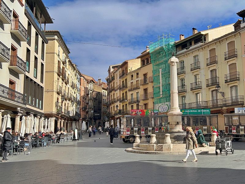
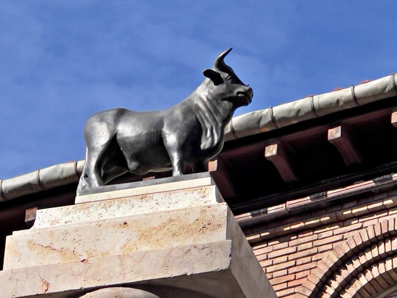
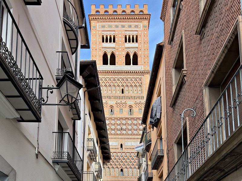
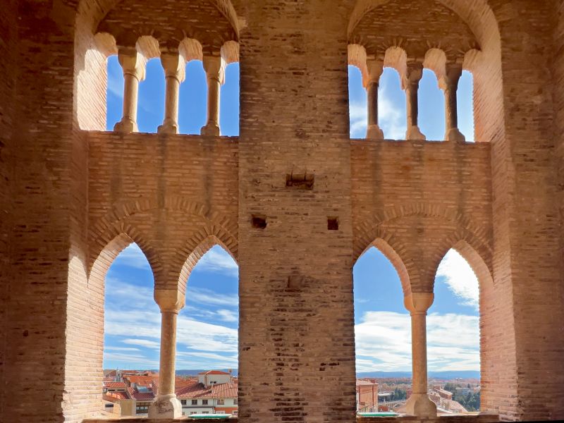
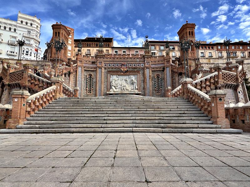
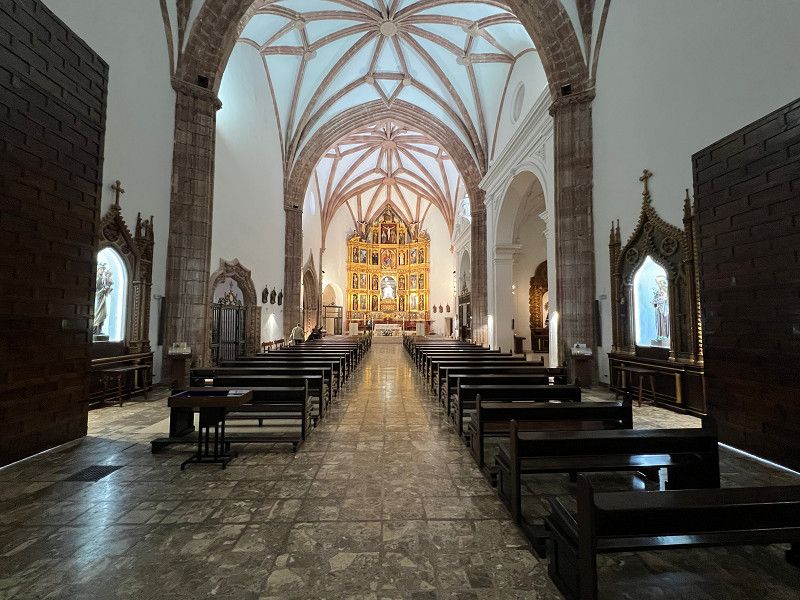
Teruel is known for its relatively well-preserved Mudèjar architecture. The Mudèjar style is named after its creators, the Mudèjar. The term comes from the Arabic mudajjan, which means "subject to tolerance" and was used for the Muslims who continued to live in Spain and Portugal after the Reconquista, the Christian reconquest. We walked into the city to see the most important buildings. It took us 35 minutes to walk from the parking spot until we reached the Iglésia San Pedro, where our tour began. The tower of San Pedro (13th century) is considered one of the oldest and most typical Mudèjar towers in Teruel. The church itself dates from the 15th century and is not only spectacular in itself but also houses the mausoleum of the lovers. These are Isabel de Segura and Juan Diego de Marcilla, who were madly in love with each other. Isabel's father prevented the two from marrying, and their love ended tragically with their deaths. Since the 13th century, both have been honored with a festival on the third Friday in February. We continue to the Plaza del Torico, a central square in Teruel. The central point and symbol of the city is the little bull (Torico), a bull statue that is only 45 cm high. Among other things, it commemorates the legend of Teruel's founding. In addition to the cathedral with its 13th century Mudèjar tower and impressive wooden ceiling, we also visit the Tower of San Salvador, which is considered the most magnificent of the Mudèjar towers and which you can climb, and the Tower of San Martin. The final part of the tour is the staircase gallery from the 1920s in the Neo-Mudèjar style with a relief of the lovers.
Aragonien, Spanien
40° 36' 1.9" N 0° 55' 22.5" W
40.6005259 -0.9229282
06. Feb. 2025 -
07. Feb. 2025
Caudiel
We left Teruel; the parking space was nicely laid out and there was a supermarket "on the doorstep", but we weren't so keen on the refrigerated trucks and the reversing signals. One night was a bit of a problem, but we wanted to move on anyway... We are now at a new place in this small town and there is now electricity here too.
Avenida de la Estación, Caudiel, Valencianische Gemeinschaft, Spanien
39° 56' 50.8" N 0° 34' 19.1" W
39.9474376 -0.5719813
• Head southeast on Avenida Estación. Go for 17 m.
• Turn slightly left onto Avenida Estación. Go for 182 m.
• Continue on Calle Concordia. Go for 101 m.
• Turn left onto Calle de Hernán Cortés. Go for 43 m.
• Turn left onto Calle Pelayo. Go for 20 m.
• Turn right onto Calle Paulino Carabella (CV-195). Go for 69 m.
• Continue on Avenida Valencia (CV-195). Go for 122 m.
• Continue on Plaza La Virgen (CV-195). Go for 56 m.
• Continue on Avenida Valencia (CV-195). Go for 223 m.
• Continue on CV-195. Go for 2.6 km.
• Take the 1st exit from roundabout onto CV-195 toward Jérica/Viver/A-23/Castellón/Valencia. Go for 273 m.
• Take the 4th exit from roundabout onto A-23 (Autovía Mudéjar) toward Castellón/Valencia. Go for 41.0 km.
• Take the exit toward Valencia onto V-23. Go for 3.9 km.
• Keep right onto A-7 (Ramal 3) toward Aeropuerto/E-901/A-3/Madrid/Alacant/Alicante. Go for 47.0 km.
• Keep right onto A-7 toward Alacant/Alicante/Albacete/A-35. Go for 44.5 km.
• Continue on A-35 toward Albacete/Murcia. Go for 32.7 km.
• Take exit 11 toward La Font de la Figuera/Alacant/Alicante/Murcia onto A-33. Go for 92.9 km.
• Continue on A-30 (Autovía de Murcia). Go for 7.2 km.
• Keep left onto A-30 (Autovía de Murcia). Go for 15.4 km.
• Take exit 134A toward Murcia/Ronda Oeste/Cartagena/E-15/Almería onto A-7/A-30 (Murcia Ronda Oeste). Go for 3.0 km.
• Take exit 138 toward Almería/Granada onto A-7 (Autovía del Mediterráneo). Go for 147 km.
• Take exit 714 toward Sorbas/Tabernas. Go for 335 m.
• Pass 2 roundabouts and continue on N-340a. Go for 30.8 km.
• Take the 1st exit from roundabout onto A-1100 toward Uleila del Campo/Lubrín/AL-4102. Go for 653 m.
• Turn right. Go for 82 m.
• Turn slightly right. Go for 369 m.
• Arrive at your destination on the right.
☍
470,0 km
(4 hrs. 20 min.)
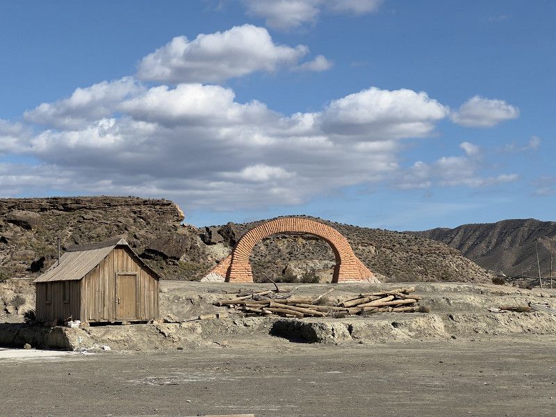
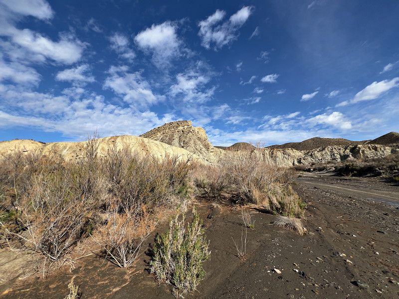
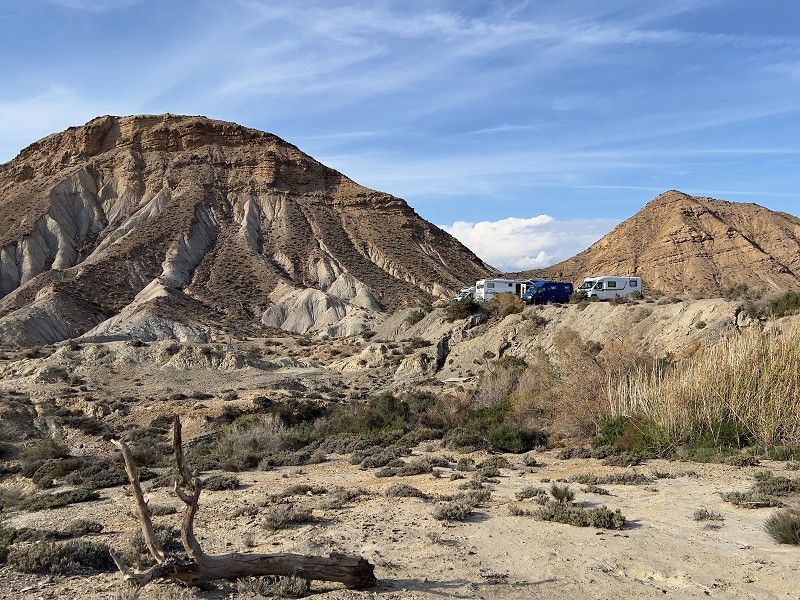
Tabernas
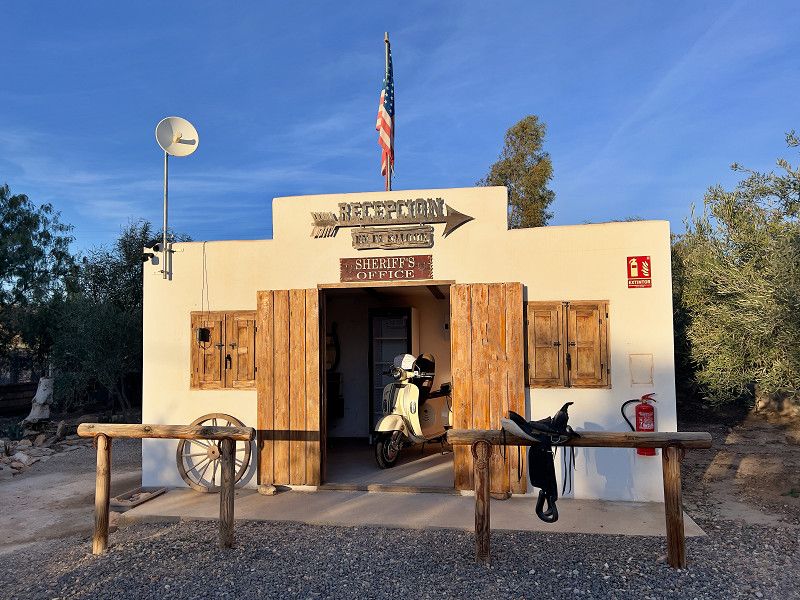
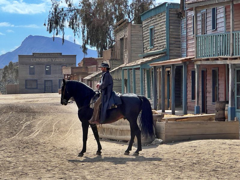
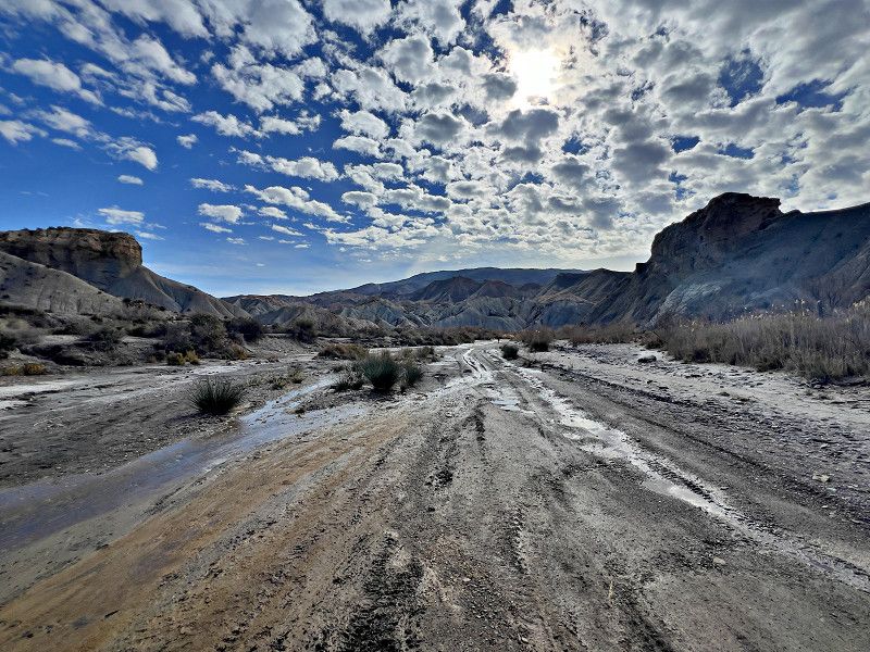
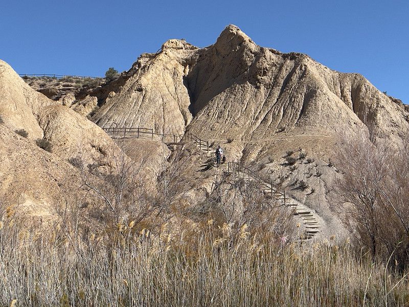
We drove from Calar Alto down into the only desert in Europe, Tabernas. First of all, to the Little Texas parking spot. The name comes from the fact that a lot of things here in Tabernas revolve around the Wild West, as many Hollywood classics were filmed here in the desert, such as Once Upon a Time in the West and Lawrence of Arabia, to name just a few.
A-1100, Tabernas, Andalusien, Spanien
37° 5' 42.7" N 2° 17' 17.1" W
37.0951877 -2.2880821
• Head southwest. Go for 451 m.
• Turn left onto A-1100. Go for 630 m.
• Take the 1st exit from roundabout onto N-340a. Go for 8.9 km.
• Keep left onto N-340a toward Almería. Go for 3.3 km.
• Turn right. Go for 1.3 km.
• Arrive at your destination on the right.
☍
14,5 km
( 13 min.)
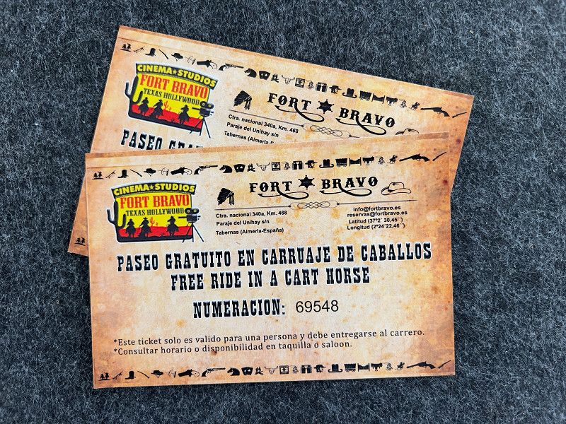
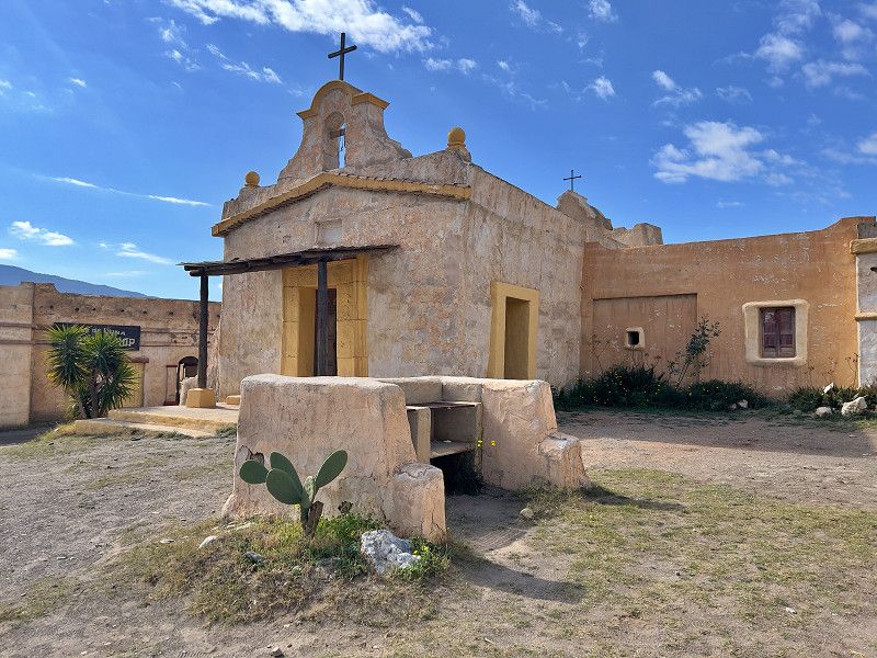
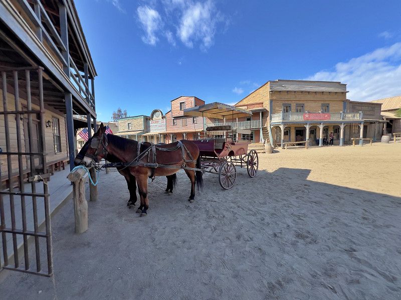
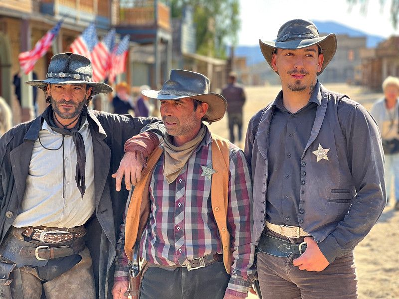
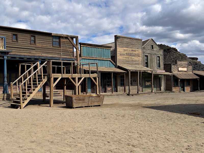
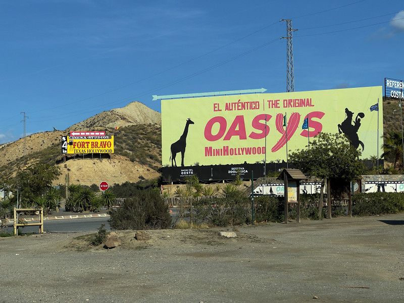
Fort Bravo
We drove to Fort Bravo. A western town that used to be a film set for many big westerns, but is still used for various shots today. Since these are sets, most of the houses are of course completely empty and not all are kept in good condition, like the buildings in the central square. Shows take place here, as well as in the saloon; typical saloon scenes and a bank robbery. Everything is a bit funny but in Spanish (of course), so we could only get the funny parts from the plot. Nevertheless, we liked it a lot.
Texas Hollywood / Fort Bravo, Tabernas, Almería, Andalusien, Spanien
37° 2' 52.9" N 2° 25' 15.5" W
37.0480272 -2.4209645
• Head southeast. Go for 1.3 km.
• Turn right onto N-340a. Go for 4.4 km.
• Take the 5th exit from roundabout onto N-340a toward Tabernas/Sorbas. Go for 966 m.
• Turn right. Go for 789 m.
• Turn right. Go for 318 m.
• Arrive at your destination on the left.
☍
7,7 km
( 11 min.)
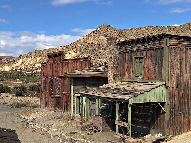
Oasys MiniHollywood
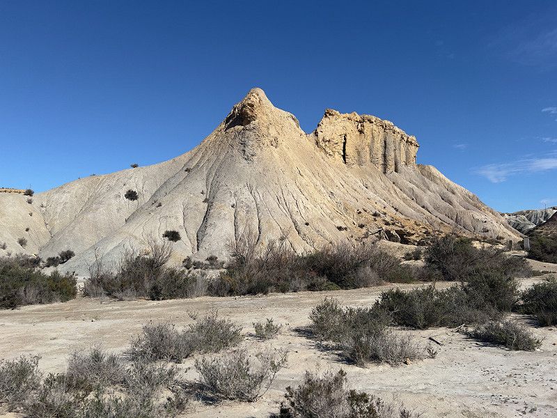
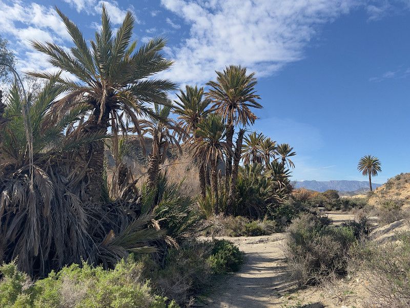
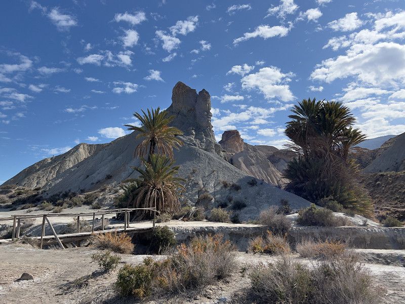
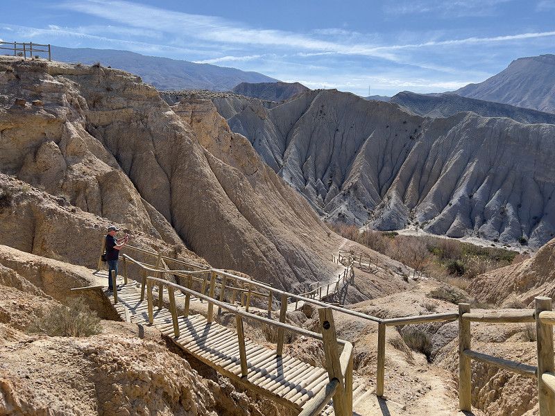
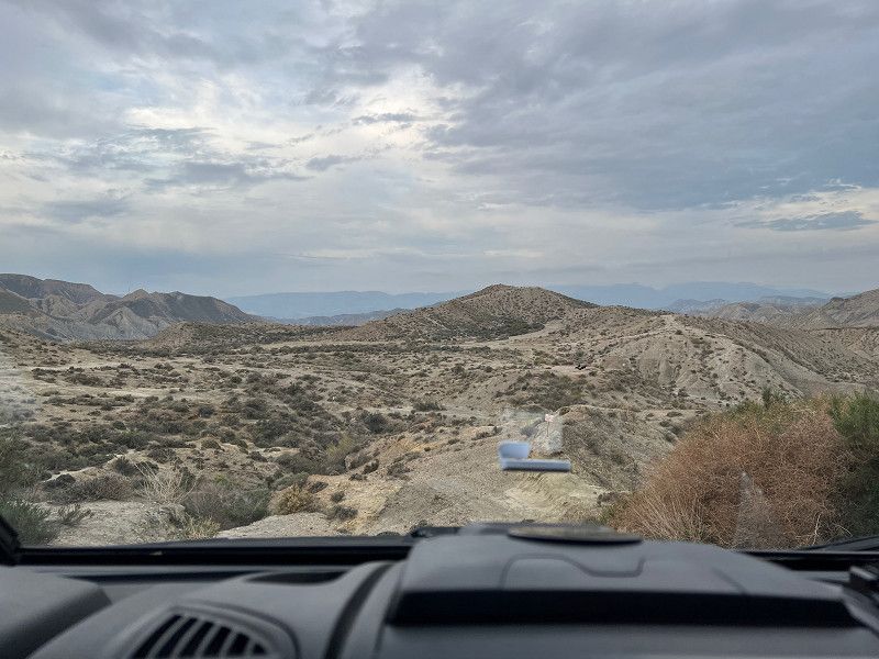
We spent a free but not entirely quiet night in the hiking car park in front of the Oasys Mini Hollywood (37.0208 -2.4352) and from here we started a short hike through the desert. The path leads down into a rambla, which are riverbeds and/or flood channels for heavy rainfall. A lot of filming was done here too and it is not difficult to imagine a chief riding around the next bend with his two aides and warriors with bows and arrows standing on the mountain ridges all around. Before we walk back up the mountains we visit the oasis from Lawrence of Arabia, because that was also filmed here.
Carretera Nacional N−340a, Tabernas, Almería, Andalusien, Spanien
37° 1' 4.6" N 2° 25' 48.4" W
37.0179583 -2.4301126
• Head northwest. Go for 318 m.
• Turn left. Go for 430 m.
• Turn slightly right toward N-340a. Go for 287 m.
• Turn sharp right toward N-340a. Go for 17 m.
• Turn right onto N-340a. Go for 6.6 km.
• Keep left onto N-340a toward Sorbas/Murcia. Go for 2.4 km.
• Arrive at Los Albardinales (N-340a). Your destination is on the right.
☍
10,0 km
( 9 min.)
Tabernas
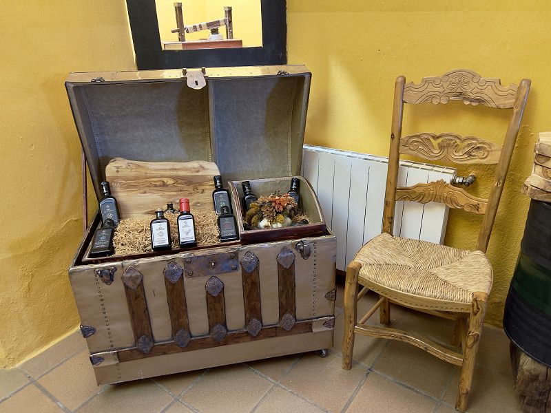
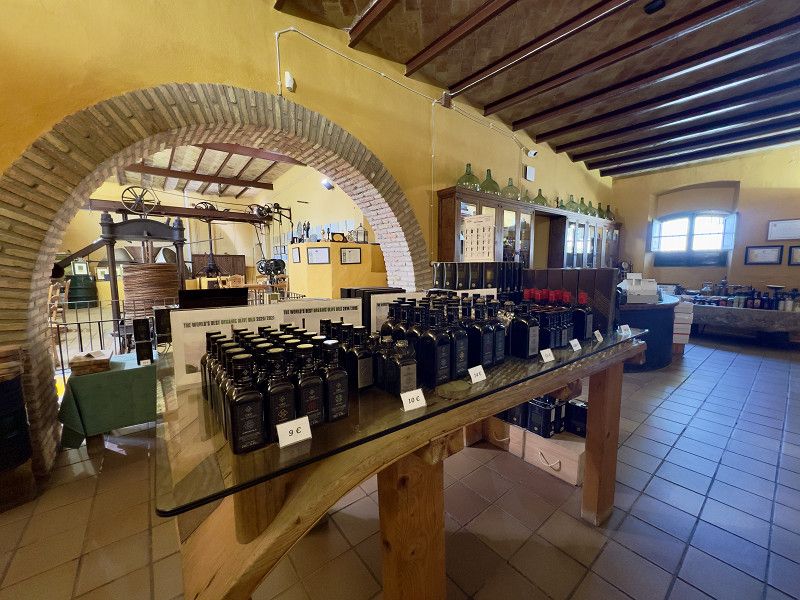
After our hike, we visited an oil mill and did some shopping in Tabernas before heading to our next overnight spot, which was much quieter than the last one. Again, it had a great view.
N-340A, Tabernas, Andalusien, Spanien
37° 4' 15.8" N 2° 21' 54.7" W
37.0710616 -2.3652057
• Head west on Los Albardinales (N-340a). Go for 2.2 km.
• Keep left onto N-340a toward Almería. Go for 7.6 km.
• Take the 3rd exit from roundabout toward A-92/Almería. Go for 139 m.
• Take the 1st exit from roundabout. Go for 514 m.
• Turn sharp right. Go for 99 m.
• Arrive at your destination on the right.
☍
10,6 km
( 9 min.)
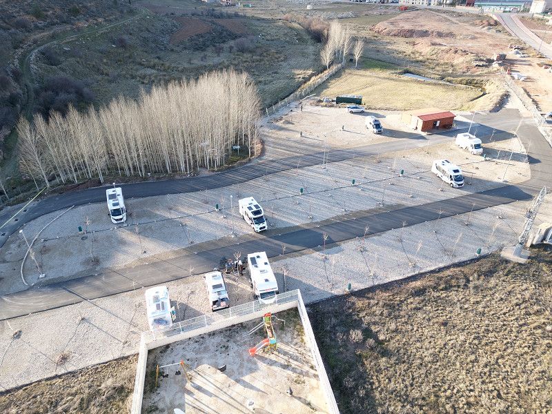
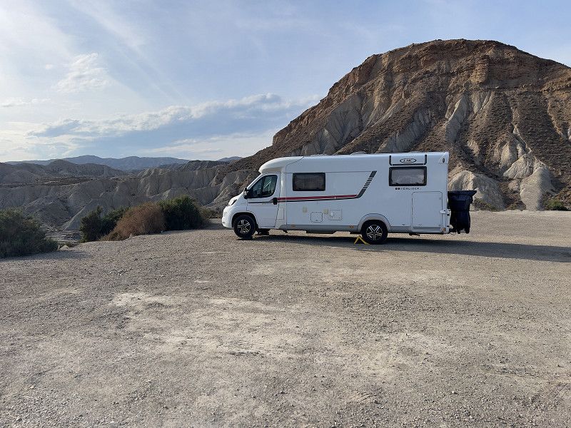
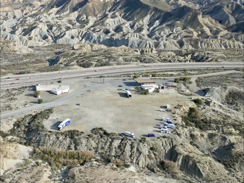
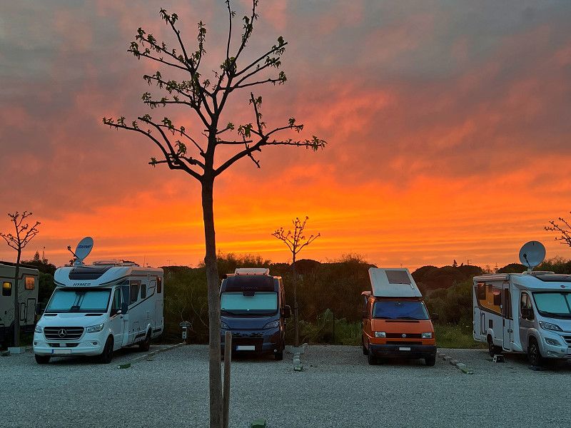
Tabernas
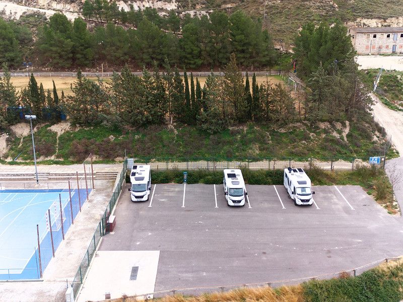
We spend the night here on a large site behind a gas station; in one part there are trucks every now and then, but in the larger part there are mobile homes with a wonderful view of the desert landscape. A good opportunity for a few last pictures, also from the air...
Andalusien, Spanien
37° 1' 0.2" N 2° 26' 50.2" W
37.0167292 -2.4472825
• Head southeast. Go for 99 m.
• Turn sharp left toward A-92. Go for 452 m.
• Take the 1st exit from roundabout onto A-92 toward Almería. Go for 16.8 km.
• Take exit 392 toward Almería/Málaga/Viator/E-15/Aeropuerto/Murcia onto A-7 (Autovía del Mediterráneo). Go for 21.1 km.
• Take exit 800 toward Roquetas de Mar/Aguadulce/Vícar (Este). Go for 162 m.
• Take the 3rd exit from roundabout onto A-391 toward E-15/A-7/Almería/El Parador/A-1051/Roquetas de Mar/Aguadulce. Go for 241 m.
• Take the 1st exit from roundabout onto A-1051 toward El Parador/Roquetas de Mar. Go for 401 m.
• Take the 2nd exit from roundabout onto A-1051 (Variante de Roquetas de Mar) toward Roquetas de Mar/N-340a. Go for 9.0 km.
• Take the 3rd exit from roundabout onto Variante de Roquetas de Mar (A-1051R4). Go for 724 m.
• Take the 4th exit from roundabout onto Camino de la Solana. Go for 130 m.
• Turn right onto Camino de los Baños. Go for 1.2 km.
• Continue on Carretera Los Mercados. Go for 82 m.
• Turn left onto Calle Colombia. Go for 262 m.
• Continue on Carretera La Marina. Go for 103 m.
• Turn right. Go for 32 m.
• Arrive at your destination on the left.
☍
50,7 km
( 32 min.)
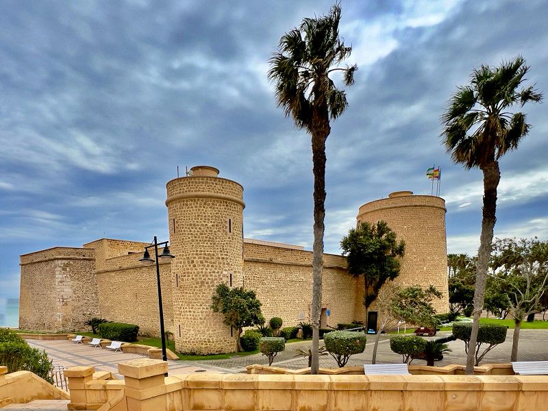
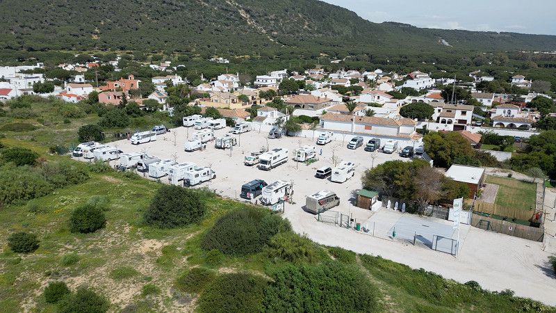
Roquetas de Mar
We've arrived at the Roquetas Camper Park, where we'll be staying for the next four weeks. Unfortunately, we're not having much luck with the weather. Since our arrival, it's deteriorated significantly across most of Spain. A freezing wind, almost constantly at gale force, rain, and the occasional glimpse of sunshine. Not ideal conditions for doing anything, except for the occasional taxi to the hairdresser or the shopping center. At least it hasn't hit us as hard as other places. But we're making the best of it, taking advantage of every break in the rain for walks.
Calle Martinica 9, Roquetas de Mar, Andalusien, Spanien
36° 44' 41.9" N 2° 37' 4.4" W
36.7449820 -2.6178805
• Head toward Calle Nicaragua. Go for 41 m.
• Turn right onto Calle Martinica. Go for 34 m.
• Continue on Calle Brasília. Go for 42 m.
• Turn right onto Calle Guatemala. Go for 116 m.
• Turn right onto Carretera La Marina. Go for 69 m.
• Arrive at Carretera La Marina. Your destination is on the right.
☍
0,3 km
( )
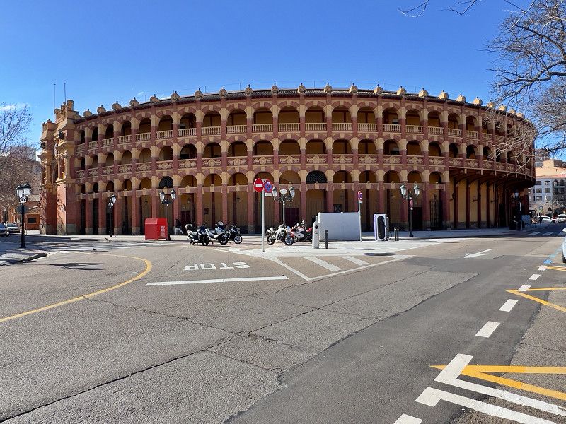
Roquetas de Mar
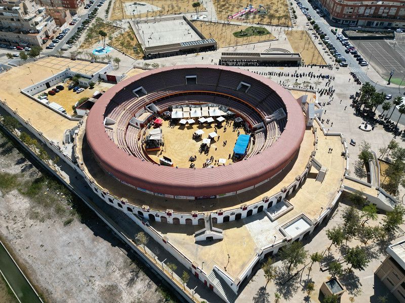
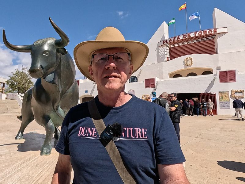
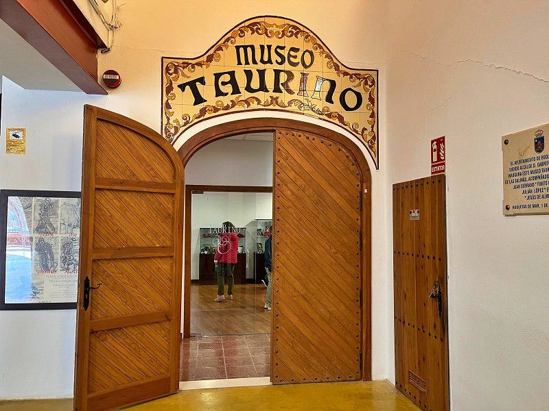
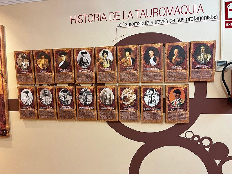
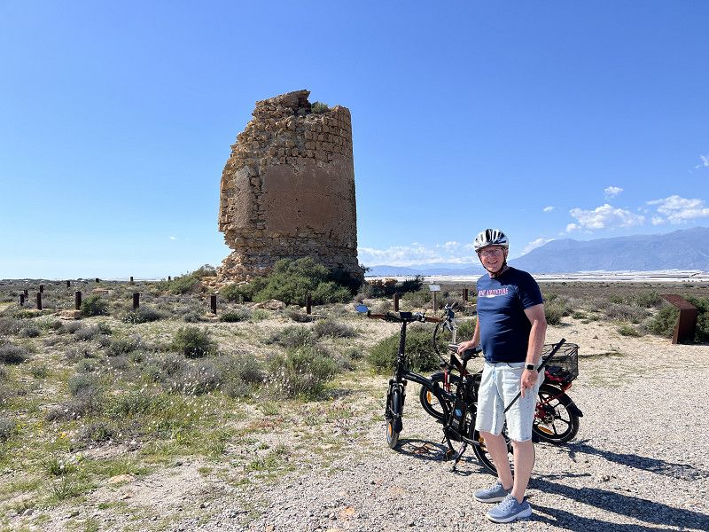
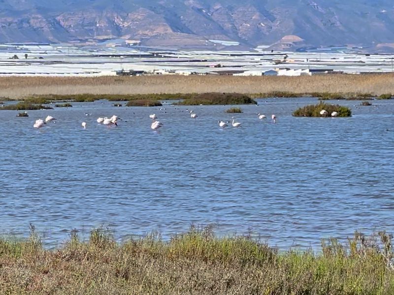
We took advantage of the little time we had left here in Roquetas and the increasingly better weather to see at least a few things. The Castillo Santa Ana, the bullring (we happened upon a biker rally during our visit), and even a bike ride through the Punta Entinas-Sabinar National Park, where many flamingos spend the summer. And, of course, we went to the market again.
Andalusien, Spanien
36° 44' 39.9" N 2° 37' 4.4" W
36.7444167 -2.6178934
• Head toward Calle Guatemala on Carretera La Marina. Go for 69 m.
• Continue on Calle Colombia. Go for 262 m.
• Turn right onto Carretera Los Mercados. Go for 82 m.
• Continue on Camino de los Baños. Go for 1.2 km.
• Turn left onto Camino de la Solana. Go for 38 m.
• Take the 1st exit from roundabout onto Variante de Roquetas de Mar (A-1051R4). Go for 603 m.
• Take the 2nd exit from roundabout onto A-1051 (Variante de Roquetas de Mar) toward A-7/Almería/Málaga. Go for 8.9 km.
• Take the 2nd exit from roundabout onto A-1051 toward A-391/La Envía/Felix/Enix/E-15/A-7/Almería/Málaga/Aguadulce (Norte). Go for 457 m.
• Take the 3rd exit from roundabout onto A-7 (Autovía del Mediterráneo) toward Almería/Murcia. Go for 9.1 km.
• Take exit 790 toward Almería. Go for 373 m.
• Continue toward Almería/vía parque/puerto. Go for 33 m.
• Take the 1st exit from roundabout toward Almería/Puerto. Go for 1.5 km.
• Take ramp onto Carretera de Málaga (N-340a). Go for 1.2 km.
• Take the 3rd exit from roundabout onto Carretera de Málaga (N-340a) toward Centro Ciudad/Almería Centro Ciudad. Go for 1.8 km.
• Take the 3rd exit from roundabout onto Carretera Sierra Alhamilla toward Ciudad Jardín/Ctra. de Sierra Alhamilla. Go for 1.3 km.
• Take the 1st exit from roundabout. Go for 28 m.
• Continue on Avenida del Mediterráneo. Go for 156 m.
• Take the 2nd exit from roundabout onto Avenida del Mediterráneo. Go for 632 m.
• Arrive at Avenida del Mediterráneo. Your destination is on the left.
☍
27,8 km
( 22 min.)
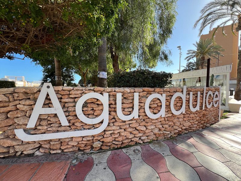
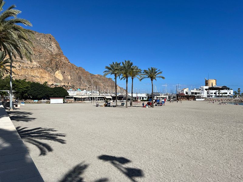
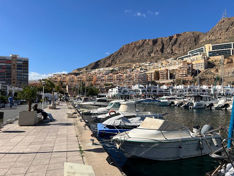
Aguadulce
Aguadulce – we've heard a lot about this town, or rather, a district of Roquetas. We wanted to see it for ourselves. So, we hopped on our bikes and cycled the 10 km from the campsite to Aguadulce. The promenade is beautiful, but the harbor with its boats, restaurants, cafés, and clubs is the highlight.
Almería, Andalusien, Spanien
36° 48' 44.7" N 2° 34' 15.5" W
36.8124067 -2.5709688
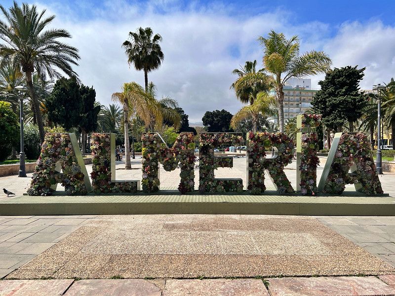
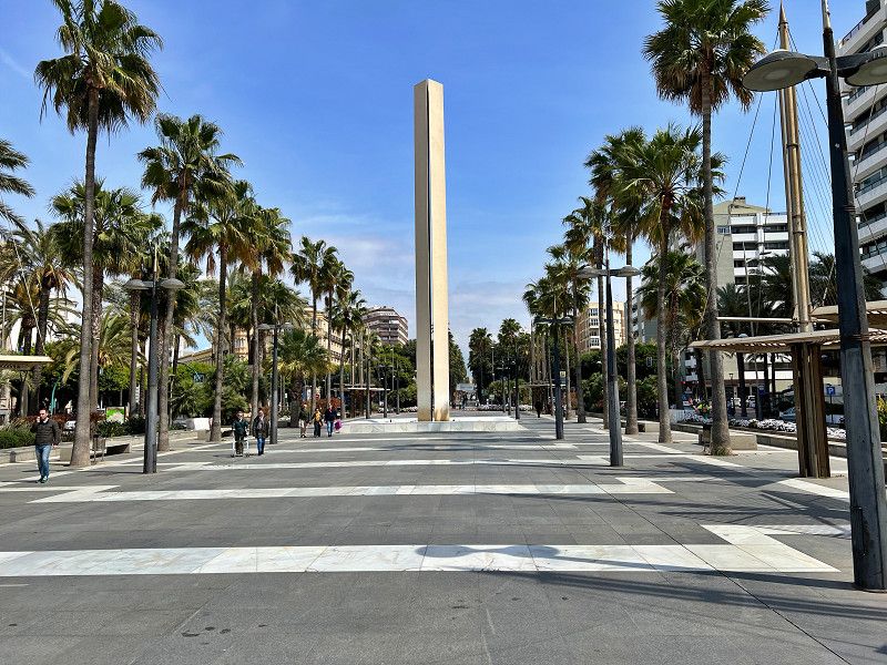
Almería
Our time in Roquestas de Mar is over. We say goodbye to our friends and continue on, driving 30 km to start with. We actually wanted to explore Almeria during our stay in Roquetas, but the weather... We're parked in a large parking lot, from which we can quickly reach the city by bike.
Avenida del Mediterráneo, Almería, Andalusien, Spanien
36° 49' 46.4" N 2° 26' 41.1" W
36.8295515 -2.4447447
• Head south on Avenida del Mediterráneo. Go for 607 m.
• Turn right toward Avenida Cabo de Gata. Go for 57 m.
• Take the 5th exit from roundabout onto Avenida del Mediterráneo. Go for 1.4 km.
• Take the 2nd exit from roundabout onto Avenida del Mediterráneo. Go for 198 m.
• Take the 3rd exit from roundabout. Go for 106 m.
• Turn right toward Calle Fernán Caballero. Go for 45 m.
• Continue on Calle Fernán Caballero. Go for 76 m.
• Turn right onto Avenida Nuestra Señora de Montserrat. Go for 844 m.
• Take the 2nd exit from roundabout onto AL-12 toward Aeropuerto/El Alquián/Níjar. Go for 881 m.
• Take the 2nd exit from roundabout onto AL-12 toward El Alquián/Níjar. Go for 1.1 km.
• Take the 3rd exit from roundabout onto AL-3117 toward Viator/Hospital. Go for 1.3 km.
• Take the 2nd exit from roundabout onto El Mami (AL-3117) toward Viator. Go for 250 m.
• Continue on AL-3117. Go for 865 m.
• Take the 3rd exit from roundabout. Go for 79 m.
• Continue on AL-3117. Go for 238 m.
• Continue on Carretera de Almería (AL-3117). Go for 1.8 km.
• Take the 1st exit from roundabout onto Carretera de Alquián (A-1000) toward E-15/A-7/Murcia/Granada/A-92. Go for 791 m.
• Continue on A-1000. Go for 90 m.
• Take the 2nd exit from roundabout onto A-1000 toward E-15/A-7/Almería/Murcia. Go for 113 m.
• Take the 3rd exit from roundabout onto A-92 toward Guadix/Granada. Go for 136 km.
• Take exit 256 toward Huétor de Santillán/Beas de Granada onto A-4003. Go for 864 m.
• Continue on Calle Colmenar (A-4003). Go for 300 m.
• Turn left onto GR-3107. Go for 205 m.
• Keep left onto GR-3107. Go for 1.5 km.
• Continue on Calle del Río (GR-3107). Go for 326 m.
• Turn right onto Calle del Río. Go for 36 m.
• Arrive at Calle del Río. Your destination is on the right.
☍
150,6 km
(1 hrs. 26 min.)
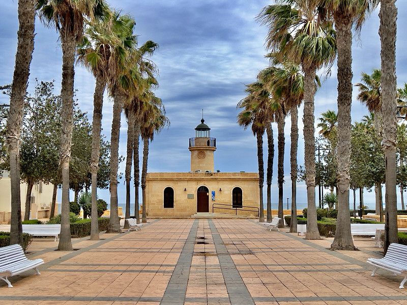
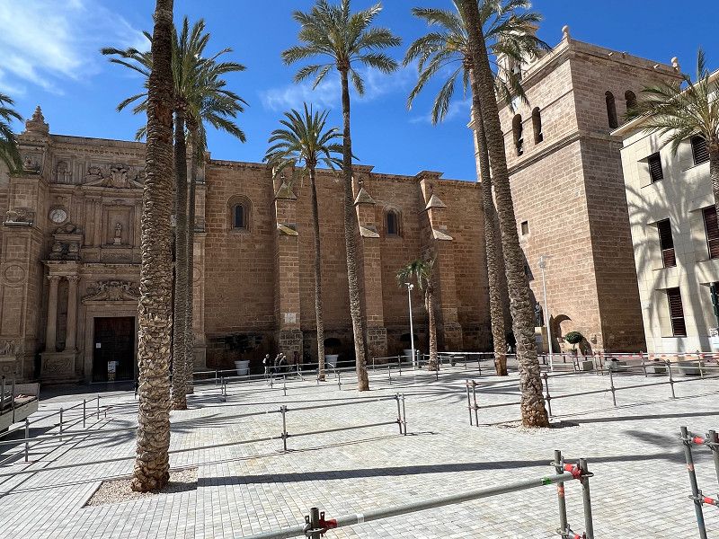
Kathedrale
We cycle along the well-maintained bike paths along the beach to Almería's old town. Our first stop is the cathedral. We leave our bikes here and visit the other sights on foot. The cathedral is absolutely worth seeing and costs €10 per person for a combined ticket with the monastery, which is located nearby and also worth a visit.
Plaza de la Catedral, Almería, Andalusien, Spanien
36° 50' 19" N 2° 28' 1.8" W
36.8386227 -2.4671533
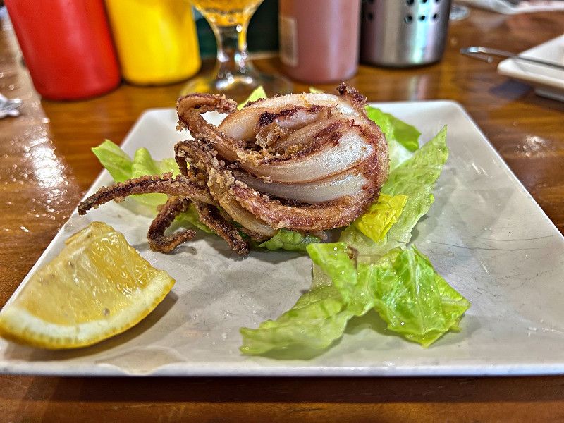
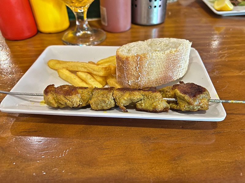
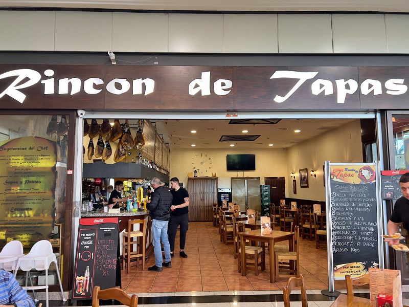
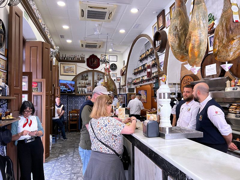
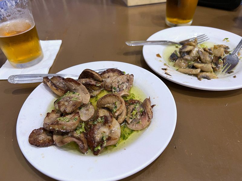
Tapas Bar Casa Puga
This tapas bar was a hidden gem. It's been around since 1870 and offers fresh tapas and other dishes in a typically rustic setting. As in classic tapas bars, you'll usually stand and enjoy the tapas that comes free with your drink.
Calle Jovellanos 10, Almería, Andalusien, Spanien
36° 50' 26.1" N 2° 27' 59.4" W
36.8405850 -2.4664881
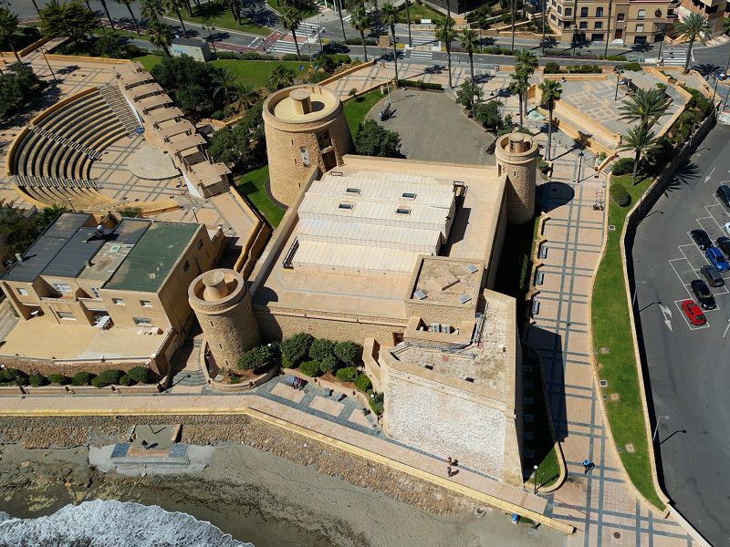
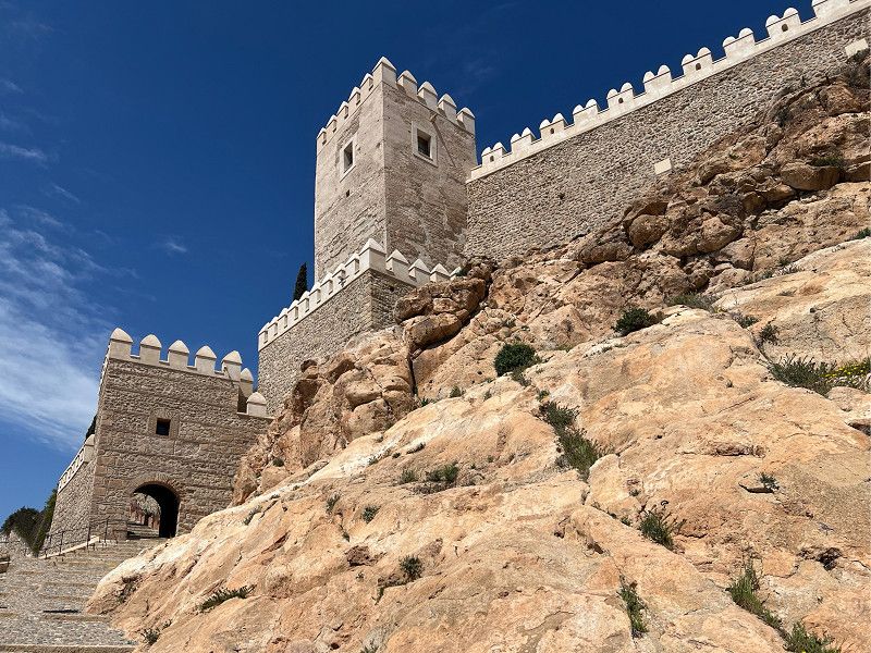
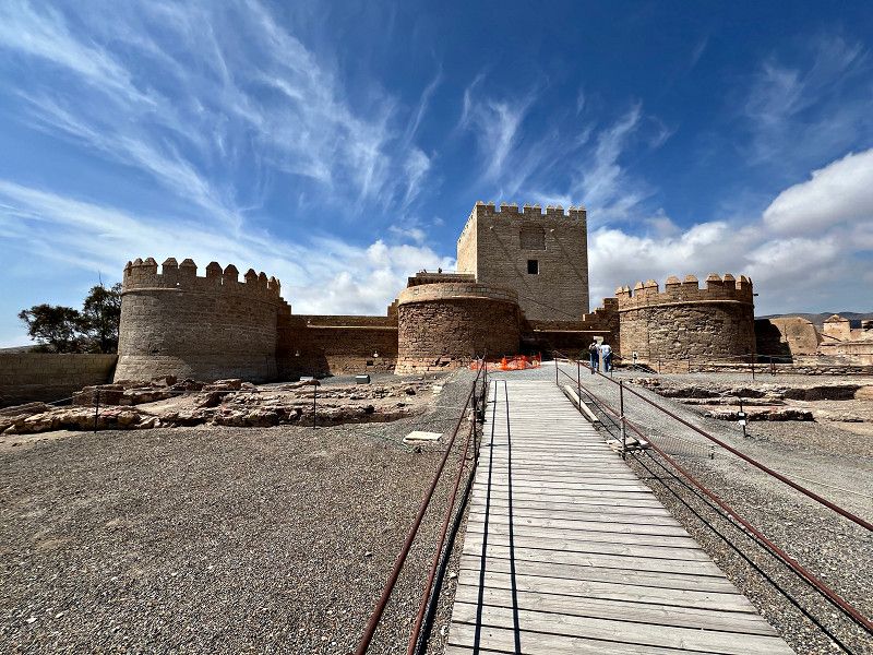
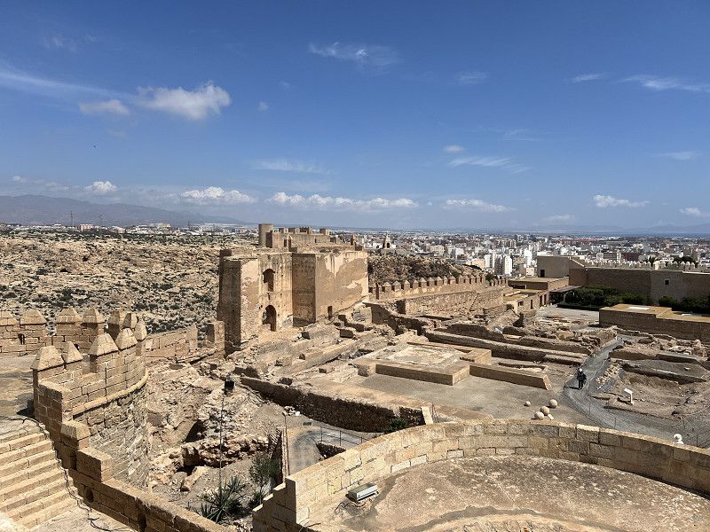
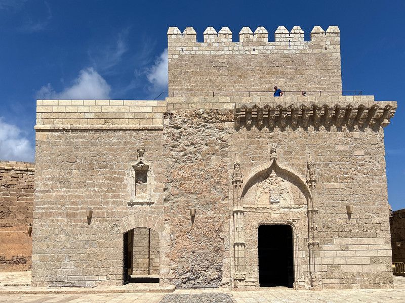
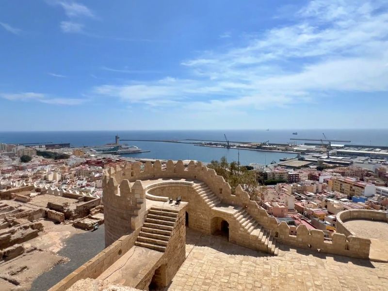
Alcazaba de Almeria
The Alcazaba is the largest Moorish fortress in Spain and absolutely worth seeing, although not as richly decorated as the fortress in Zaragoza or even the Alhambra in Granada. Admission is free for EU citizens. It's worth a while to wander around this vast complex. And from the towers, you have a fantastic view of the city and harbor.
Andalusien, Spanien
36° 50' 24.3" N 2° 28' 15.1" W
36.8400757 -2.4708490
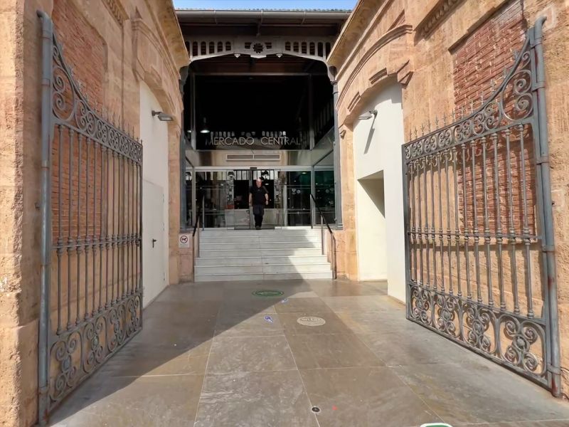
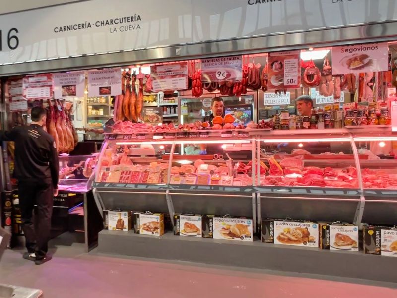
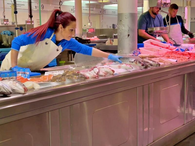
Mercado Central
As usual, we pay a quick visit to the Mercado Central to see what's on offer. Unfortunately, most of the food stalls are closed, so we don't stay long.
Even though the often praised shops, cafés and restaurants did not live up to our expectations, Almeria's promenade is worth a visit.
Avenida Federico García Lorca, Almería, Andalusien, Spanien
36° 50' 13.8" N 2° 27' 40" W
36.8371731 -2.4611234
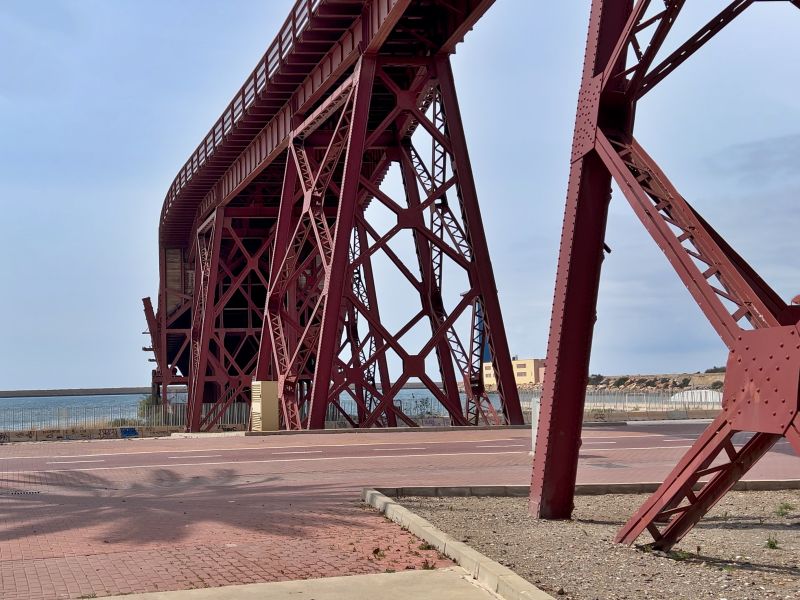
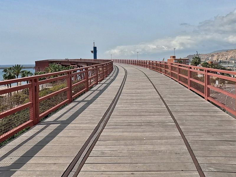
Cargadero de Cables Inglés
The Cargadero de Cables Inglés (Inglés Cable Dock) is an ore loading station built by an English mining company in the early 20th century, now an industrial monument. If you walk to the end, you'll have a beautiful view of the harbor.
Carretera de Ronda, Almería, Andalusien, Spanien
36° 50' 1.2" N 2° 27' 33.1" W
36.8336682 -2.4591860
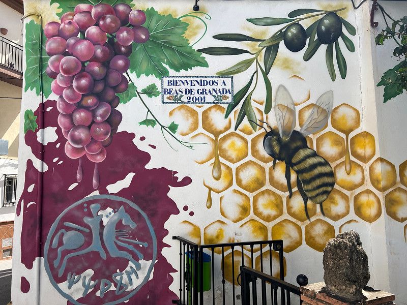
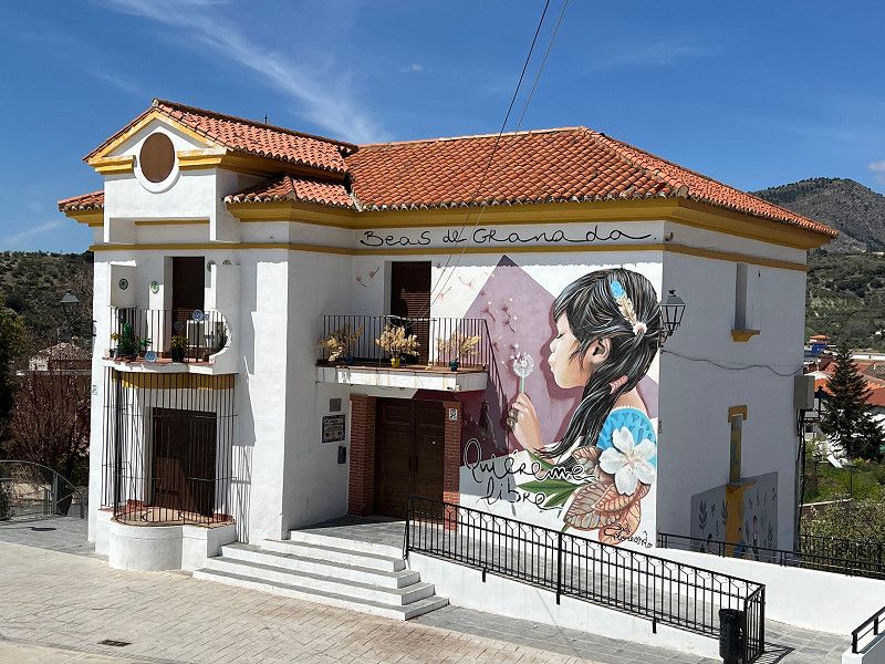
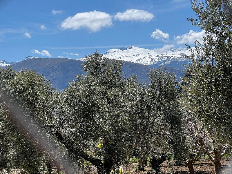
Beas de Granada
We're spending the weekend here before continuing on to Granada. We use the time to do a bit of hiking. There are several trails here; you can get a map at the campsite. Even though the paths aren't always easy (they're often steep uphill and occasionally require a bit of scrambling), you'll be rewarded with impressive views.
The SP offers water and sewage disposal, electricity, toilet and shower as well as a washing machine and dryer.
37° 13' 14.4" N 3° 28' 54.9" W
37.2206728 -3.4819030
• Head toward Camino del Nacimiento on Calle del Río. Go for 36 m.
• Turn left onto Calle del Río (GR-3107). Go for 326 m.
• Continue on GR-3107. Go for 1.7 km.
• Turn right onto Calle Colmenar (A-4003). Go for 300 m.
• Continue on A-4003. Go for 433 m.
• Take left ramp onto A-92 toward Granada. Go for 79.1 km.
• Take exit 177 toward Algeciras onto A-92M. Go for 26.0 km.
• Continue on A-45 (Autovía de Málaga). Go for 1.5 km.
• Keep left onto AP-46 (Autopista de Málaga) toward Málaga/Algeciras/Almería. Go for 25.8 km.
• Continue on A-7 (Autovía del Mediterráneo). Go for 27.0 km.
• Keep left onto A-7 (Autopista del Mediterráneo) toward Marbella/Algeciras. Go for 1.8 km.
• Continue on AP-7 (Autopista del Mediterráneo). Go for 11.9 km.
• Keep right toward Autopista del Mediterráneo/AP-7. Go for 356 m.
• Continue on AP-7 (Autopista del Mediterráneo). Go for 14.8 km.
• Continue on A-7 (Autopista del Mediterráneo). Go for 5.2 km.
• Keep left onto AP-7 (Autopista del Mediterráneo) toward Estepona/Algeciras. Go for 8.7 km.
• Keep right toward Autopista del Mediterráneo/AP-7. Go for 356 m.
• Continue on AP-7 (Autopista del Mediterráneo). Go for 15.5 km.
• Continue on A-7 (Autovía del Mediterráneo). Go for 2.4 km.
• Continue on AP-7 (Autopista del Mediterráneo). Go for 11.6 km.
• Keep right onto AP-7. Go for 10.2 km.
• Continue on A-7 (Autovía del Mediterráneo). Go for 13.4 km.
• Take exit 1106 toward CA-34/La Línea/Gibraltar. Go for 239 m.
• Turn right onto N-340a toward San Roque (Este). Go for 1.1 km.
• Turn left toward CA-34/La Línea/Gibraltar. Go for 214 m.
• Keep left onto CA-34 toward La Línea/Gibraltar. Go for 1.7 km.
• Pass 5 roundabouts and continue on Avenida de España (CA-34). Go for 4.4 km.
• Take the 1st exit from roundabout onto Avenida Príncipe de Asturias (N-351). Go for 552 m.
• Take the 1st exit from Rotonda Real Balompédica Linense roundabout onto Avenida Príncipe de Asturias (N-351). Go for 326 m.
• Turn right onto Avenida Alcaidesa Marina toward Gibraltar. Go for 49 m.
• Take the 1st exit from roundabout onto Avenida Alcaidesa Marina. Go for 204 m.
• Take the 2nd exit from roundabout onto Avenida de los Barcos. Go for 117 m.
• Take the 1st exit from roundabout. Go for 509 m.
• Turn right. Go for 70 m.
• Arrive at your destination on the right.
☍
267,7 km
(2 hrs. 30 min.)
La Linea
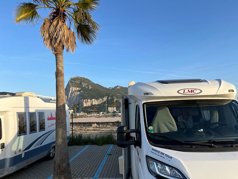
We had actually planned to visit Granada and the Alhambra, but couldn't book tickets in advance. We tried it on a whim, but definitely couldn't get tickets. So we'll have to wait and try again the next day – parking is too expensive. We've decided to drive to Gibraltar. In La Linea, just before the border, we're standing in the marina with a great view of the boats and the Rock of Gibraltar behind us. Tomorrow we'll head to the peninsula; it's a 10-minute walk to the border, and another 10 minutes to the city.
Avenida de los Barcos, La Línea de la Concepción, Campo de Gibraltar, Andalusia, Spain
36° 9' 25.2" N 5° 21' 21.5" W
36.1569900 -5.3559625
• Head southwest. Go for 251 m.
• Turn left toward Avenida de los Barcos. Go for 366 m.
• Take the 1st exit from roundabout onto Avenida de los Barcos. Go for 102 m.
• Take the 1st exit from roundabout onto Avenida Príncipe de Asturias. Go for 71 m.
• Continue on Avenida Alcaidesa Marina. Go for 141 m.
• Continue on Avenida Príncipe de Asturias. Go for 21 m.
• Take the 3rd exit from roundabout onto Avenida Príncipe de Asturias. Go for 113 m.
• Turn right. Go for 4 m.
• Turn left toward Avenida Príncipe de Asturias/N-351. Go for 47 m.
• Continue on Avenida Príncipe de Asturias (N-351). Go for 269 m.
• Take the 2nd exit from Rotonda Real Balompédica Linense roundabout onto Avenida Príncipe de Asturias (N-351) toward San Roque/Campamento. Go for 533 m.
• Take the 4th exit from roundabout onto Avenida de España (CA-34). Go for 444 m.
• Take the 3rd exit from roundabout onto Avenida de España (CA-34) toward San Roque. Go for 425 m.
• Take the 3rd exit from roundabout onto Avenida de España (CA-34). Go for 425 m.
• Take the 3rd exit from roundabout onto Avenida de España (CA-34) toward San Roque. Go for 1.9 km.
• Pass 2 roundabouts and continue on CA-34. Go for 2.9 km.
• Keep left toward CA-34/San Roque/Algeciras/E-15/A-7/Cádiz/Sevilla. Go for 226 m.
• Take ramp onto A-7 (Autovía del Mediterráneo) toward Algeciras/Cádiz. Go for 7.9 km.
• Take exit 1115A toward Los Barrios/Jerez/E-5/Sevilla/AP-4 onto A-381. Go for 21.8 km.
• Take exit 66. Go for 495 m.
• Take the 2nd exit from roundabout onto A-2226 toward Benalup/Casas Viejas/Benalup-Casas Viejas. Go for 19.6 km.
• Continue on A-2228. Go for 24 m.
• Continue on A-2226. Go for 2.8 km.
• Continue on A-2228. Go for 220 m.
• Continue on Carretera del Castaño (A-2228). Go for 265 m.
• Turn right onto Calle San Juan (A-2228). Go for 149 m.
• Continue on Calle Veintiocho de Febrero (A-2228). Go for 207 m.
• Pass 2 roundabouts and continue on Calle Veintiocho de Febrero (A-2228). Go for 399 m.
• Take the 3rd exit from roundabout onto Carretera Benalup a Vejer (A-2228). Go for 789 m.
• Continue on A-2228. Go for 4.6 km.
• Continue on Venta del Faisán (A-2228). Go for 193 m.
• Continue on A-2228. Go for 2.1 km.
• Continue on Avenida Santo Tomás de Villanueva (A-2228). Go for 345 m.
• Continue on A-2228. Go for 159 m.
• Take the 1st exit from roundabout onto A-2228. Go for 7.2 km.
• Continue toward Vejer de la Frontera/Barbate. Go for 27 m.
• Turn left onto A-396 toward Vejer de la Frontera/Barbate. Go for 3.7 km.
• Take the 1st exit from roundabout onto N-340. Go for 1.3 km.
• Continue on A-48 (Autovía de la Costa de la Luz) toward Vejer de la Frontera/A-2229/Los Caños de Meca/A-2233. Go for 201 m.
• Take exit 36 toward Vejer de la Frontera/A-2229/Los Caños de Meca/A-2233. Go for 406 m.
• Take the 4th exit from roundabout toward A-2229/Vejer/A-2233/Los Caños de Meca/N-340/Algeciras/Málaga/El Palmar. Go for 263 m.
• Take the 2nd exit from roundabout toward Vejer/A-2229/Los Caños de Meca/A-2233/El Palmar. Go for 237 m.
• Take the 1st exit from roundabout onto A-2230. Go for 1.6 km.
• Continue on Montecote (A-2230). Go for 115 m.
• Continue on A-2230. Go for 5.6 km.
• Take the 3rd exit from roundabout onto A-2233. Go for 1.8 km.
• Take the 2nd exit from roundabout onto A-2233. Go for 374 m.
• Take the 2nd exit from roundabout onto A-2233. Go for 430 m.
• Take the 2nd exit from roundabout onto A-2233 toward Caños de Meca/Barbate. Go for 1.6 km.
• Continue on Venta Alfardía (A-2233). Go for 140 m.
• Continue on Avenida de Trafalgar (A-2233). Go for 359 m.
• Turn left onto Calle Corbeta. Go for 216 m.
• Arrive at Calle Corbeta. Your destination is on the right.
☍
95,9 km
(1 hrs. 18 min.)
Gibraltar
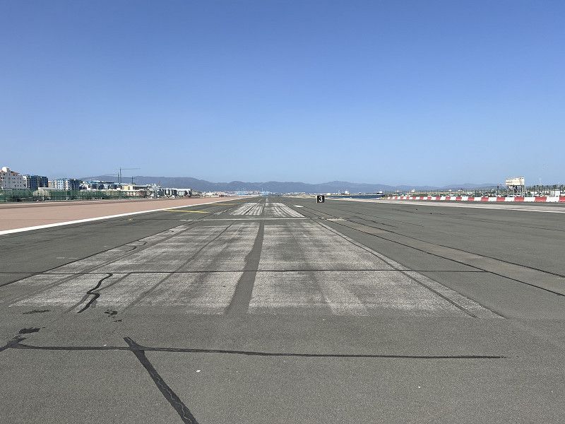
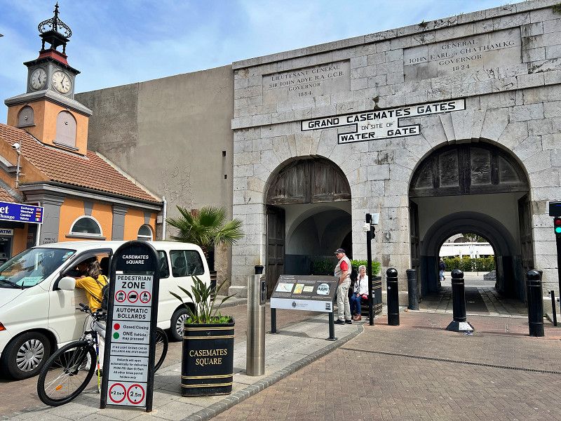
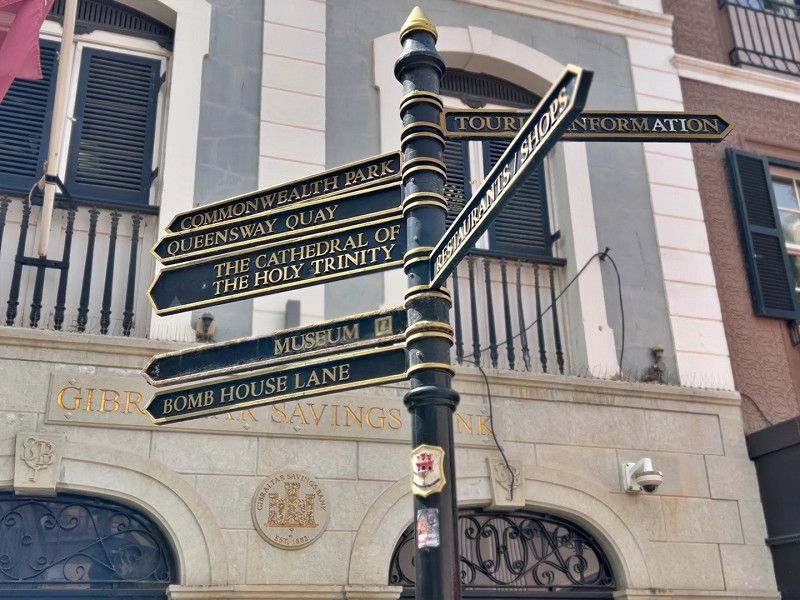
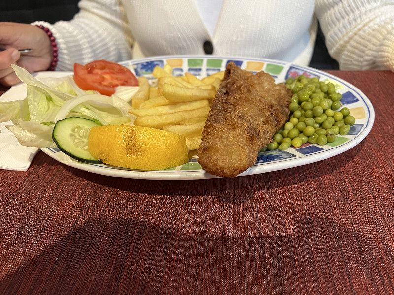
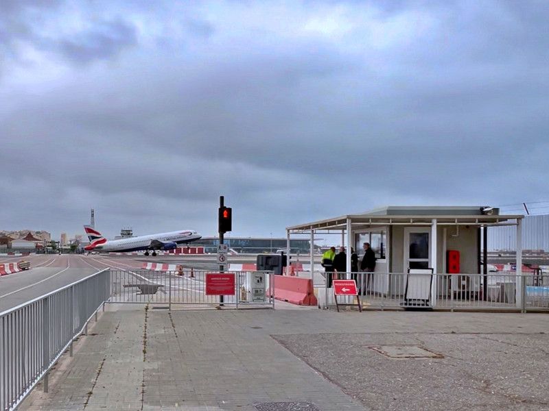
We're in Gibraltar today. From the parking spot, it's a ten-minute walk to passport and customs control (on the British side, we were greeted in German), and then another ten minutes into the city, which crosses the airport runway. The Main Street, the Old Town, and the Gibraltar Nature Reserve, or the Rock of Gibraltar, are all interesting places to visit, as almost all of the sights are located. However, the €70 entrance fee was a bit too much for a Moorish fortress, a stalactite cave, casemates, and a suspension bridge. Instead, we go out for a classic British meal – fish and chips. However, we can't recommend the fish and chips shops on Grand Casemates Square; at least we were very disappointed by the "ultimate" recommendation, the Rock Fish and Chips. Everything was pretty tasteless and, as we later discovered, too expensive.
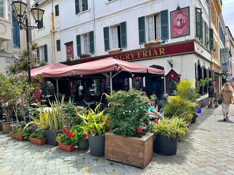
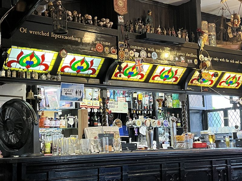
Instead, head through C. Real/Main Street toward South Gate. At Convent Place, you'll find a quaint little pub, "The Angry Friar." The fish and chips here are not only cheaper but also far better. They also serve other dishes and even good draft beer.
On the way back the traffic lights were red because a plane was taking off.
36° 7' 42.9" N 5° 20' 50.9" W
36.1285933 -5.3474761
Lo Caños de Meca
We actually wanted to go to Tarifa. But we needed electricity, and it was supposed to rain in Tarifa. So we drove a little further to Los Caños de Meca near Trafalgar. This is where the English fleet fought against the Spanish and French fleets under Nelson in 1805. England was victorious, Napoleon couldn't invade England, and Nelson died in the fighting. Fun fact: Since Nelson was to be buried in London, he was placed in a barrel of brandy to preserve him for the long journey. Despite the cliffs and dangerous currents, the town, which really only consists of one road, is a mecca for windsurfers. Here we enjoy the (unpredicted) sunshine and walk on the beach.
The pitch is close to the beach, is fully equipped and has a children's playground.
La Janda, Andalusia, Spain
36° 11' 23.8" N 6° 1' 19.5" W
36.1899337 -6.0220713
• Head south on Calle Corbeta. Go for 216 m.
• Turn right onto Avenida de Trafalgar (A-2233). Go for 359 m.
• Continue on Venta Alfardía (A-2233). Go for 140 m.
• Continue on A-2233. Go for 1.5 km.
• Take the 2nd exit from roundabout onto A-2233 toward Vejer/Conil. Go for 437 m.
• Take the 2nd exit from roundabout onto A-2233. Go for 379 m.
• Take the 2nd exit from roundabout onto A-2233. Go for 1.8 km.
• Take the 1st exit from roundabout onto A-2230. Go for 5.6 km.
• Continue on Montecote (A-2230). Go for 115 m.
• Continue on A-2230. Go for 1.6 km.
• Take the 6th exit from roundabout toward A-4200/La Muela/E-5/A-48/Cadiz/Algeciras. Go for 238 m.
• Take the 1st exit from roundabout onto A-48 (Autovía de la Costa de la Luz) toward N-340/Algeciras/Málaga. Go for 659 m.
• Continue on N-340. Go for 1.3 km.
• Take the 1st exit from roundabout onto N-340. Go for 441 m.
• Take the 2nd exit from roundabout onto N-340. Go for 46.2 km.
• Turn right toward Tarifa. Go for 170 m.
• Continue on Calle Batalla del Salado. Go for 233 m.
• Take the 2nd exit from roundabout onto Calle Batalla del Salado. Go for 831 m.
• Turn right onto Calle Mar del Norte. Go for 240 m.
• Turn right onto Calle Pintor Guillermo. Go for 39 m.
• Arrive at Calle Pintor Guillermo. Your destination is on the right.
☍
62,5 km
( 47 min.)
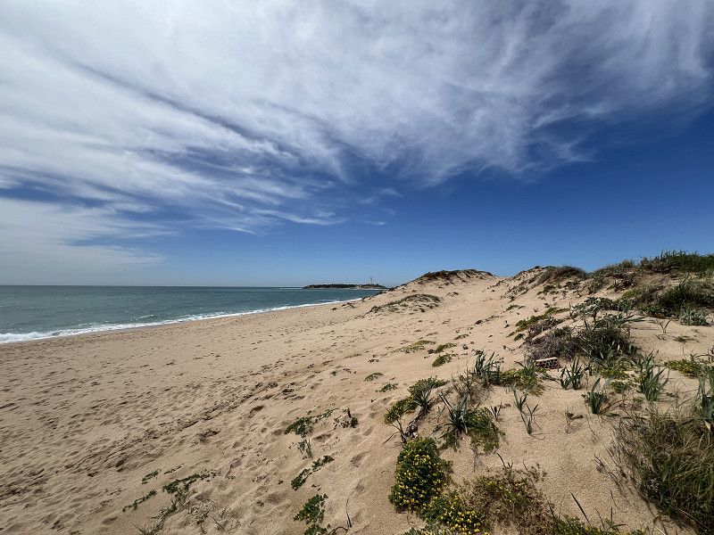
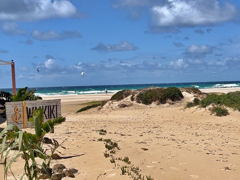
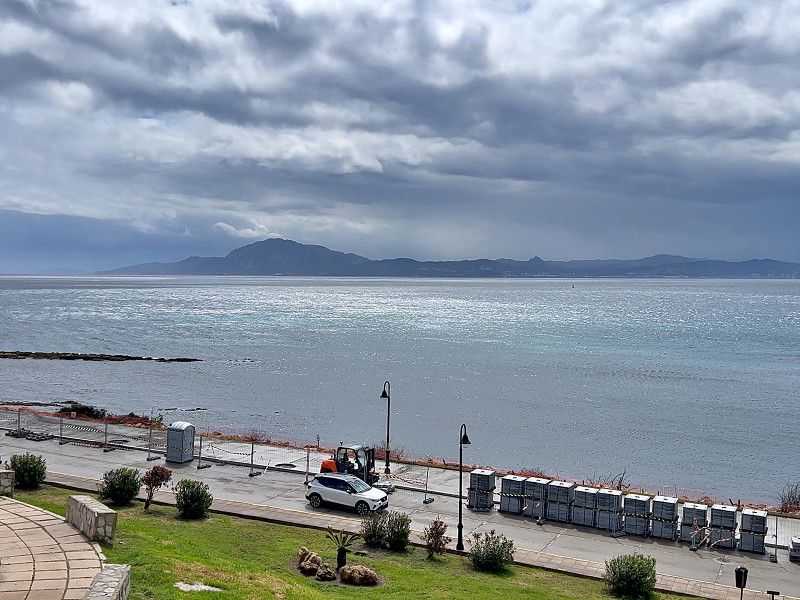
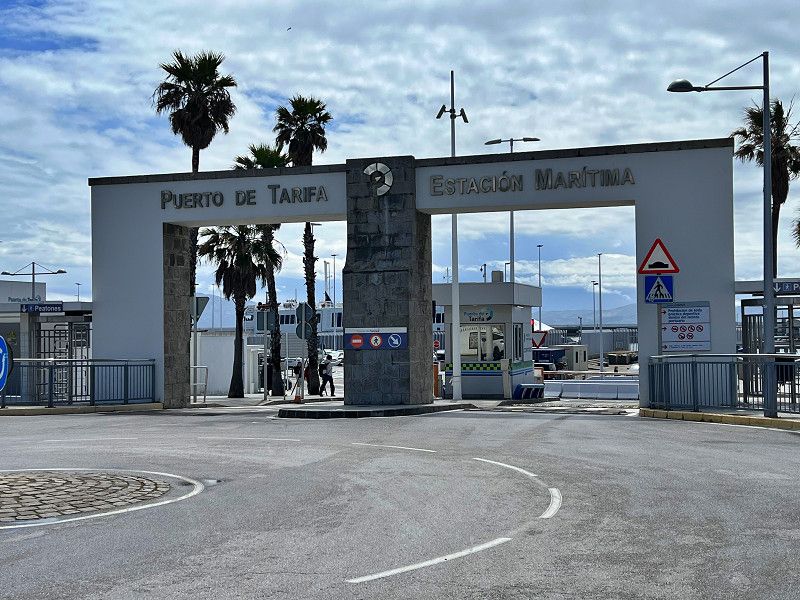
Tarifa
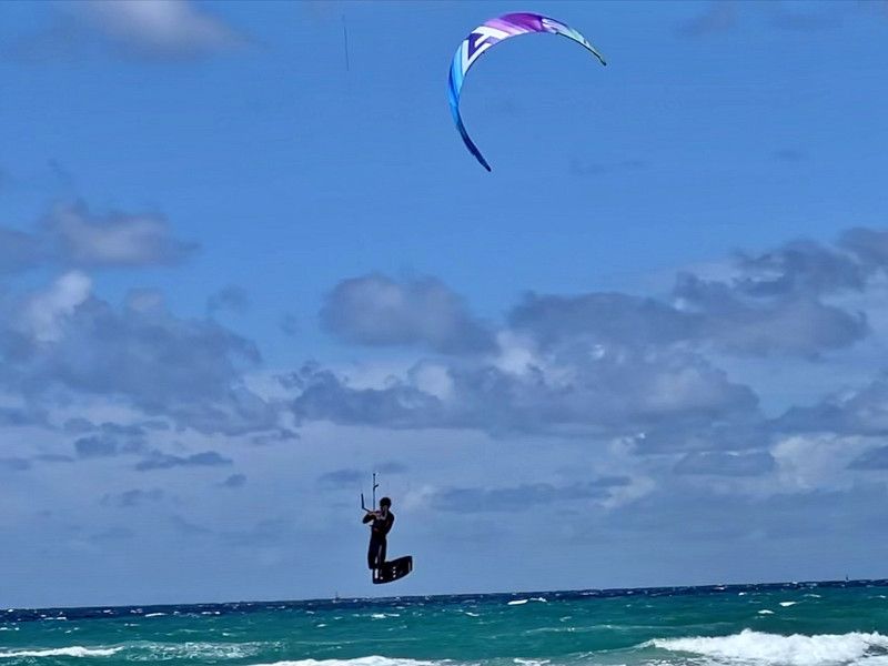
We're located in the Tarifa Caravan Park (36.0179, -5.6105) for €15/night. The beach is supposedly only 200 meters away. Tarifa's beaches are an absolute dream. Fine, light sand meets turquoise water, all with a good breeze, a paradise for kitesurfers. Whether you want to chill, stroll through the dunes, or simply stare out at the sea with a cold drink, everyone will find their spot here. And: On clear days, you can even see Africa.
Calle Mar del Norte, Tarifa, Campo de Gibraltar, Andalusien, Spanien
36° 1' 4.8" N 5° 36' 39.1" W
36.0180014 -5.6108599
• Head northwest on Calle Pintor Guillermo. Go for 334 m.
• Continue on Avenida Lances. Go for 135 m.
• Turn right onto Calle del Mar Mediterráneo. Go for 64 m.
• Continue on Calle Mar Egeo. Go for 151 m.
• Turn left onto Calle Batalla del Salado. Go for 453 m.
• Take the 3rd exit from roundabout onto Calle Batalla del Salado. Go for 317 m.
• Turn right onto N-340 toward Cadiz/Vejer de la Frontera. Go for 1.5 km.
• Take the 2nd exit from roundabout onto N-340 toward Algeciras/Málaga. Go for 16.9 km.
• Take the 1st exit from roundabout onto N-340 toward Málaga. Go for 572 m.
• Take the 3rd exit from roundabout onto Calle Maestro Luis Cano Toba toward Barriada Los Pastores. Go for 449 m.
• Turn right onto Pasaje Carretera del Cobre. Go for 131 m.
• Turn right onto Carretera al Cobre (CA-9208). Go for 369 m.
• Keep right onto Carretera al Cobre. Go for 22 m.
• Turn right toward Autovía del Mediterráneo/A-7. Go for 74 m.
• Take the 5th exit from roundabout onto A-7 (Autovía del Mediterráneo) toward Estepona/Málaga. Go for 4.8 km.
• Continue on N-340 toward A-7/San Roque/Málaga/Sevilla. Go for 1.3 km.
• Continue on A-7 (Autovía del Mediterráneo). Go for 24.5 km.
• Continue on AP-7 (Autopista del Mediterráneo) toward Estepona/Málaga. Go for 9.7 km.
• Keep right onto AP-7. Go for 12.0 km.
• Continue on A-7 (Autopista del Mediterráneo). Go for 2.8 km.
• Continue on AP-7 (Autopista del Mediterráneo) toward Marbella/Málaga. Go for 15.1 km.
• Keep right toward Autopista del Mediterráneo/AP-7. Go for 321 m.
• Continue on AP-7 (Autopista del Mediterráneo). Go for 8.9 km.
• Continue on A-7 (Autovía del Mediterráneo). Go for 5.2 km.
• Keep left onto AP-7 (Autopista del Mediterráneo) toward Fuengirola/Málaga. Go for 14.7 km.
• Keep right toward Autopista del Mediterráneo/AP-7. Go for 375 m.
• Continue on AP-7 (Autopista del Mediterráneo). Go for 12.0 km.
• Continue on A-7 (Autopista del Mediterráneo). Go for 28.7 km.
• Keep right toward Córdoba/Granada/Sevilla. Go for 430 m.
• Continue on AP-46 (Autopista de Málaga). Go for 26.2 km.
• Continue on A-45 (Autovía de Málaga). Go for 117 km.
• Take exit 0 toward Centro Ciudad de Córdoba/Madrid onto A-4 (Autovía del Sur). Go for 6.4 km.
• Take exit 401 toward Mercacórdoba onto Avenida Compositor Rafael Castro. Go for 1.1 km.
• Turn left. Go for 110 m.
• Turn left toward Avenida Compositor Rafael Castro. Go for 16 m.
• Turn right onto Avenida Compositor Rafael Castro. Go for 118 m.
• Arrive at Avenida Compositor Rafael Castro. Your destination is on the right.
☍
313,1 km
(2 hrs. 59 min.)
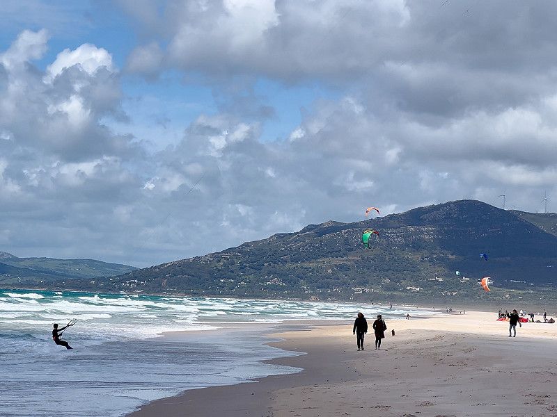
Tarifa
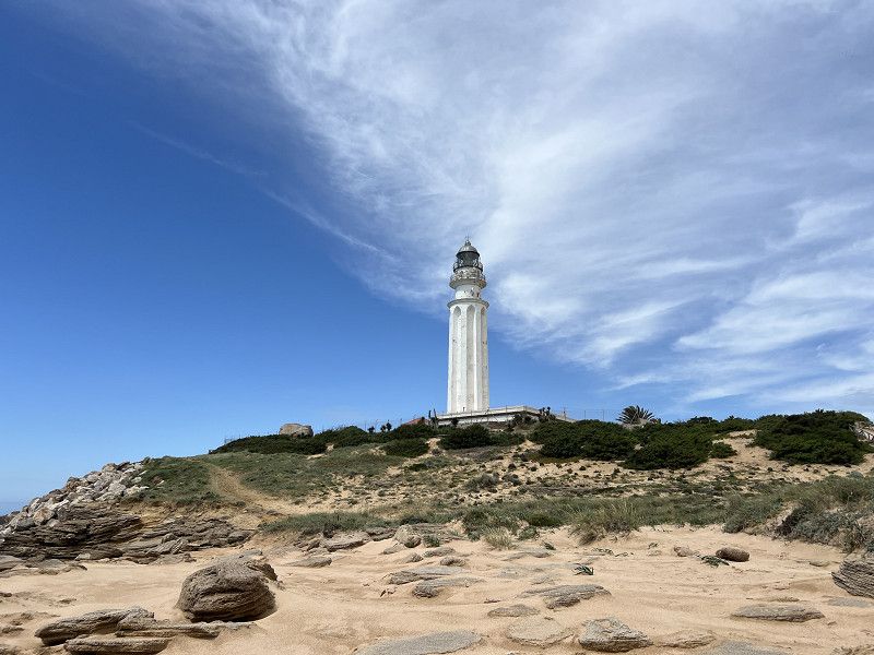
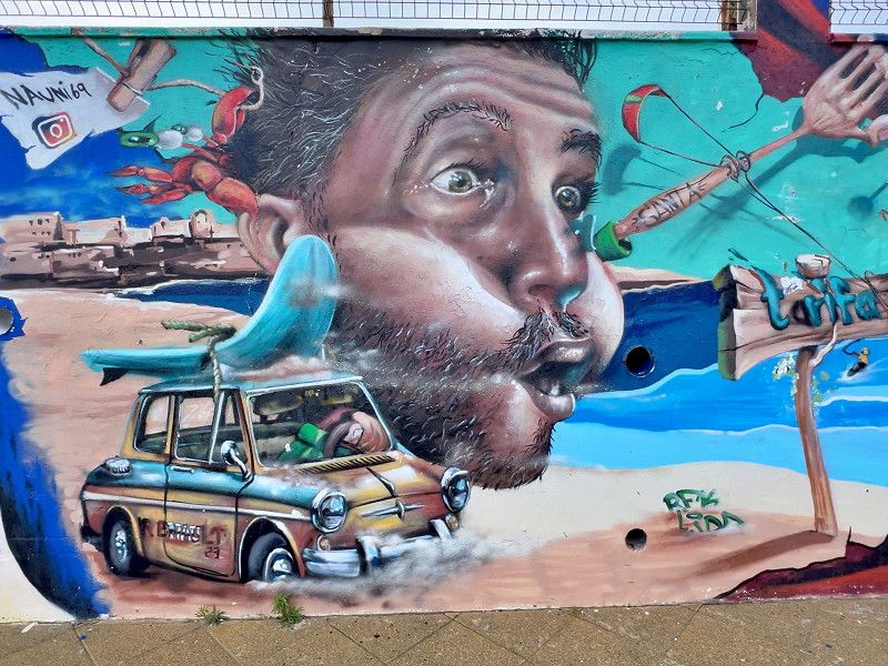
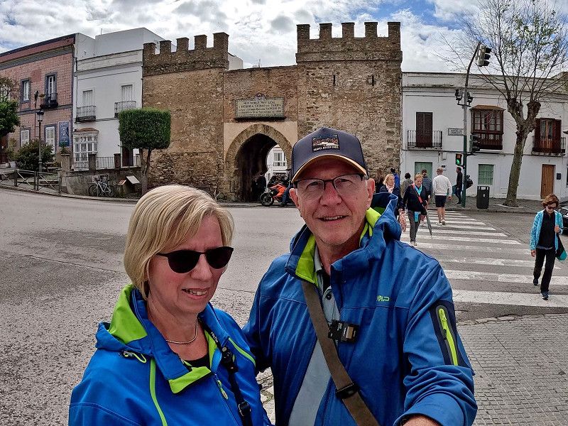
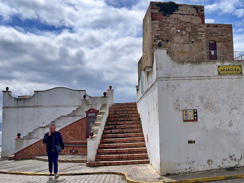
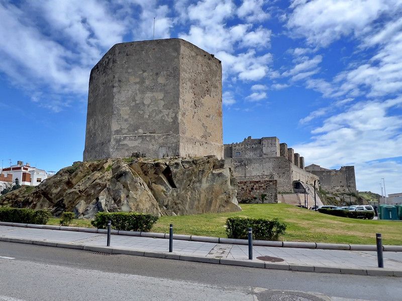
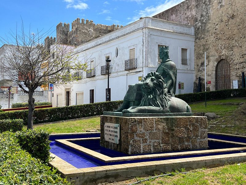
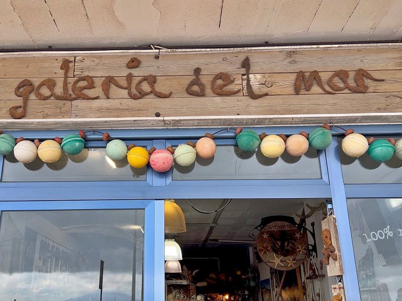
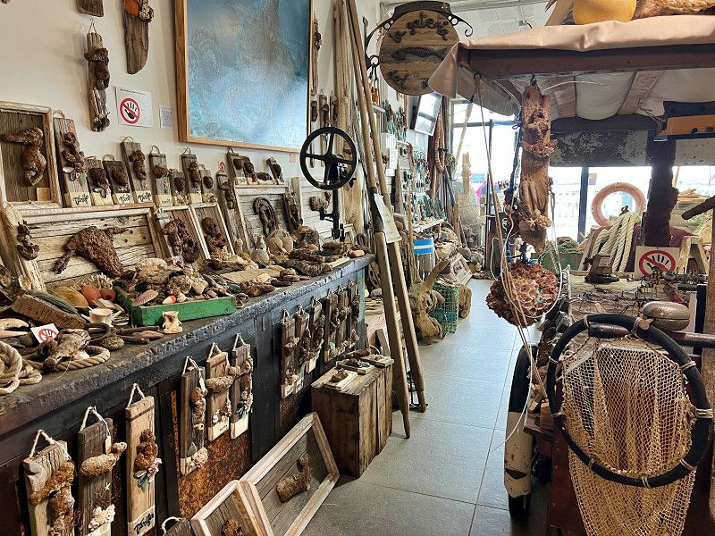
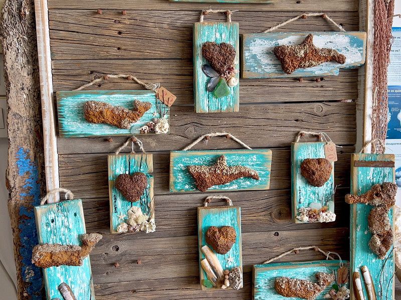
Tarifa is the southernmost tip of Europe. The old town, nestled between Moorish walls, whitewashed houses, and narrow streets, is full of small boutiques, tapas bars, and cafés where you could easily while away the entire afternoon. Sights include the Castillo de Guzmán el Bueno and the ancient city walls with the Torre Miramar, from which you have a magnificent view of Morocco – Africa is only 14 kilometers away! By chance, we stumble upon the Galeria del Mar – here, a German expat creates art and souvenirs from marine debris and flotsam. Popular not only with tourists but also as decoration for hotels and bars.
Calle Turriano Gracil, Tarifa, Campo de Gibraltar, Andalusien, Spanien
36° 0' 46.5" N 5° 36' 18.1" W
36.0129082 -5.6050213
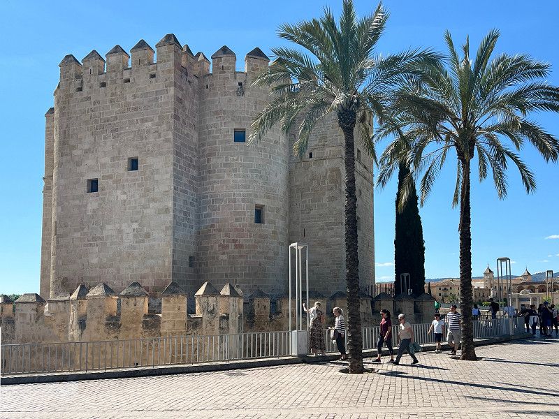
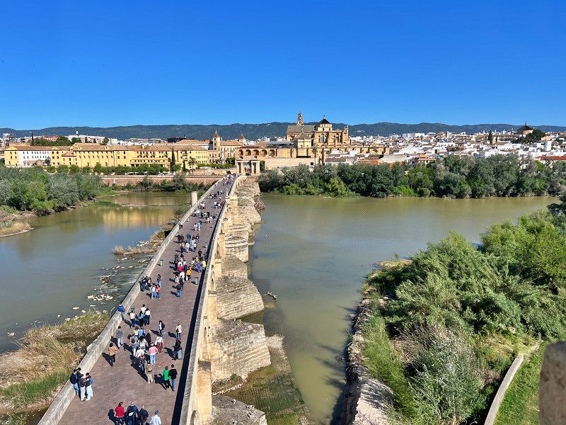
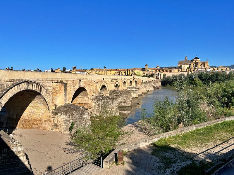
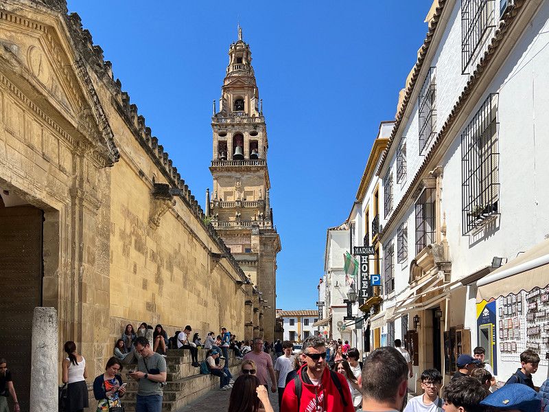
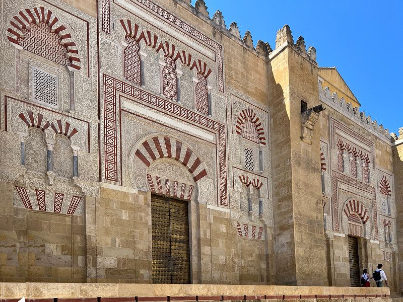
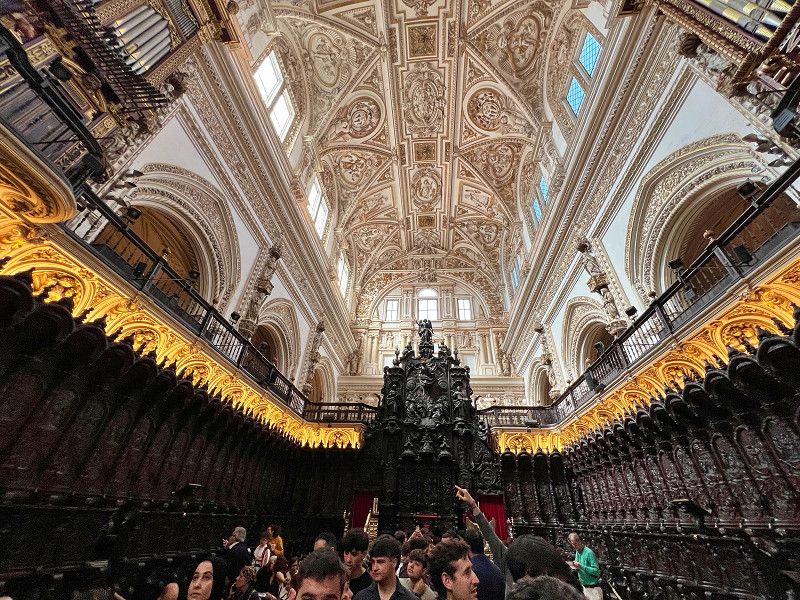
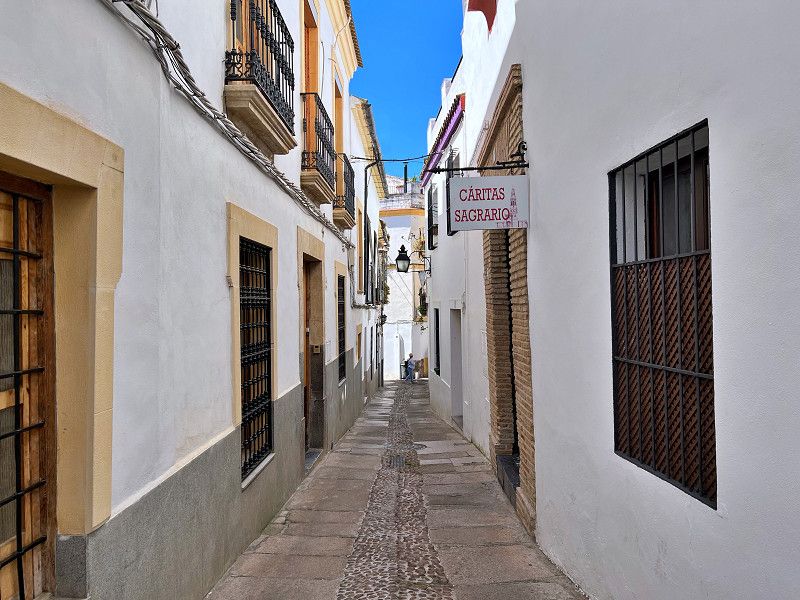
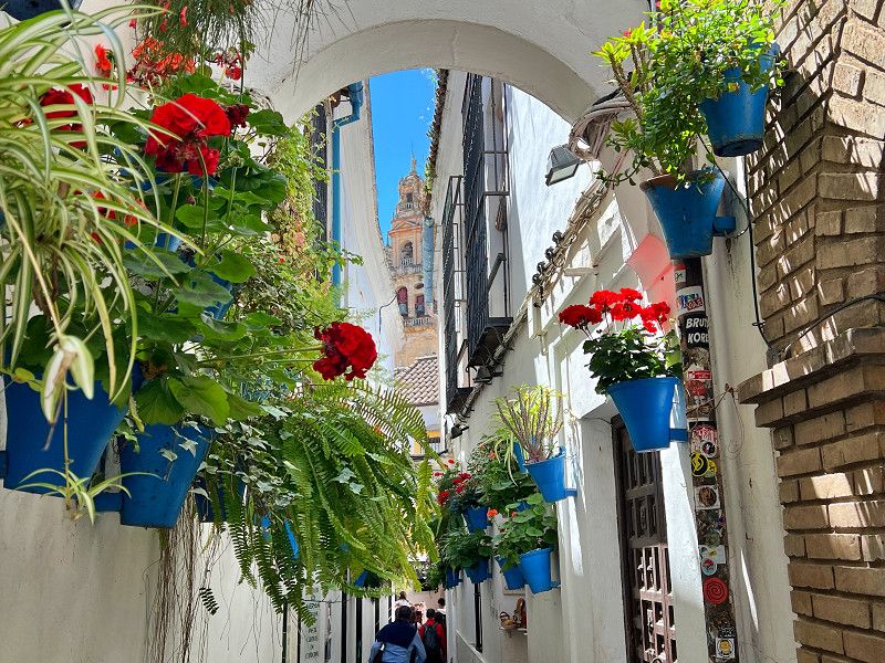
Cordoba
Avenida del Compositor Rafael Castro, Córdoba, Andalusia, Spain
37° 52' 30.8" N 4° 45' 57.7" W
37.8752283 -4.7660182
• Head southeast on Avenida Compositor Rafael Castro. Go for 234 m.
• Take left ramp onto A-4 (Autovía Ronda de Córdoba) toward Madrid/Bailén. Go for 181 km.
• Take exit 208 toward Valdepeñas. Go for 235 m.
• Take the 1st exit from roundabout onto CM-3157 toward Valdepeñas. Go for 5.6 km.
• Take the 1st exit from roundabout onto CM-412 toward Villanueva de los Infantes. Go for 584 m.
• Pass 2 roundabouts and continue on CM-412. Go for 2.7 km.
• Take the 3rd exit from roundabout onto CR-624 toward Valdepeñas. Go for 514 m.
• Continue on Calle Madre Cándida. Go for 134 m.
• Turn right onto Calle Bogotá. Go for 693 m.
• Continue on Calle Alameda. Go for 507 m.
• Turn right onto Calle Salida del Peral (CM-3109). Go for 419 m.
• Continue on CM-3109. Go for 4.7 km.
• Take the 3rd exit from roundabout onto CM-3109. Go for 16.4 km.
• Take the 1st exit from roundabout onto CM-3109. Go for 410 m.
• Take the 2nd exit from roundabout onto Carretera Valdepeñas (CM-3109). Go for 414 m.
• Take the 4th exit from roundabout onto Avenida del Deporte toward Polígono Industrial Municipal. Go for 213 m.
• Take the 2nd exit from roundabout onto Avenida del Deporte. Go for 262 m.
• Arrive at Avenida del Deporte. Your destination is on the right.
☍
215,3 km
(2 hrs. 2 min.)
La Solana
Avenida del Deporte, La Solana, Ciudad Real, Spanien
38° 56' 11.2" N 3° 14' 38.5" W
38.9364362 -3.2440303
• Head southeast on Avenida del Deporte. Go for 240 m.
• Take the 1st exit from roundabout onto Avenida del Deporte. Go for 191 m.
• Take the 1st exit from roundabout onto Carretera Valdepeñas (CM-3109) toward Albacete. Go for 366 m.
• Take the 2nd exit from roundabout onto CM-3109 toward San Carlos del Valle/Villanueva de los Infantes/CR-3127/Tomelloso/Ruidera/N-430/Albacete. Go for 936 m.
• Take the 3rd exit from roundabout onto CM-3109 toward Tomelloso. Go for 1.4 km.
• Take the 3rd exit from roundabout onto CM-3109. Go for 458 m.
• Take the 3rd exit from roundabout onto CM-3109. Go for 534 m.
• Take the 2nd exit from roundabout onto CM-3109. Go for 22.9 km.
• Turn left onto CM-3115. Go for 865 m.
• Pass 2 roundabouts and continue on CM-3115. Go for 1.1 km.
• Take the 1st exit from roundabout onto Carretera Tomelloso (N-310). Go for 786 m.
• Continue on N-310. Go for 4.4 km.
• Continue on Carretera de Argamasilla (N-310). Go for 2.2 km.
• Take the 4th exit from roundabout onto Carretera Alcázar (CM-400) toward Alcázar de San Juan/CM-42. Go for 2.7 km.
• Take the 2nd exit from roundabout. Go for 198 m.
• Take the 3rd exit from roundabout onto CM-42/CM-400 (Autovía de los Viñedos) toward Alcázar de San Juan/Toledo. Go for 23.1 km.
• Take exit 95 toward Alcázar de San Juan (Sur)/Campo de Criptana/Cuenca. Go for 449 m.
• Take the 3rd exit from roundabout onto CM-4133. Go for 1.3 km.
• Turn right. Go for 447 m.
• Arrive at your destination on the left.
☍
64,6 km
( 46 min.)
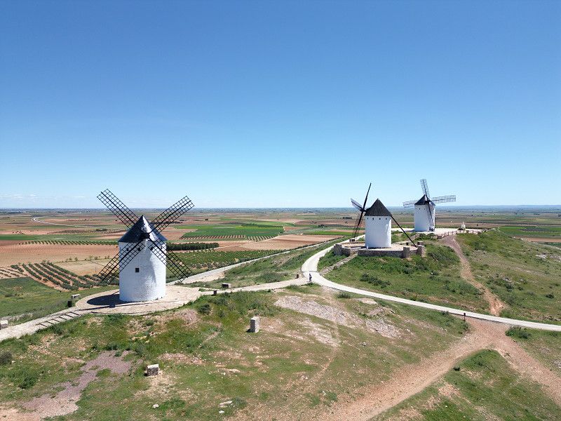
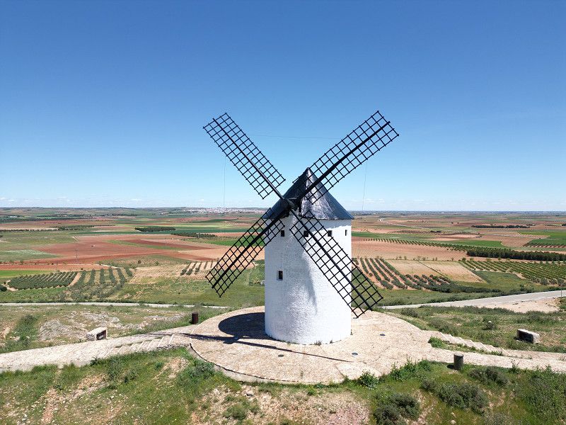
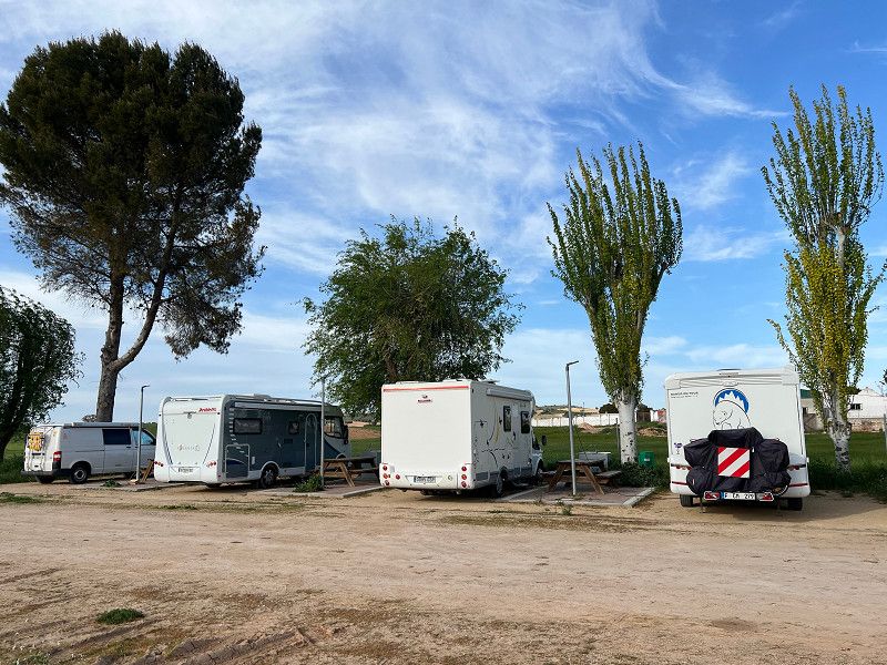
Alcázar de San Juan
Camino Cerro de San Antón, Alcázar de San Juan, Kastilien-La Mancha, Spanien
39° 22' 14.5" N 3° 11' 29" W
39.3707000 -3.1914000
• Head southwest. Go for 106 m.
• Turn left. Go for 324 m.
• Turn right toward CM-4133. Go for 68 m.
• Turn right onto CM-4133. Go for 80 m.
• Turn left toward CM-4133. Go for 35 m.
• Turn right onto CM-4133. Go for 1.1 km.
• Take the 5th exit from roundabout onto CM-420. Go for 3.3 km.
• Pass 5 roundabouts and continue on CM-420. Go for 8.1 km.
• Take the 1st exit from roundabout onto CM-420 toward Pedro Muñoz/Mota del Cuervo/Cuenca. Go for 10.5 km.
• Pass 2 roundabouts and continue on Avenida de la Constitución (CM-420). Go for 1.3 km.
• Continue toward Mota del Cuervo/Cuenca. Go for 35 m.
• Take the 3rd exit from roundabout onto Avenida de la Constitución (CM-420) toward Mota del Cuervo/Cuenca. Go for 10.4 km.
• Take the 1st exit from roundabout onto N-301 toward La Roda/Albacete/Cuenca. Go for 2.5 km.
• Take ramp toward Belmonte/Cuenca. Go for 546 m.
• Take the 2nd exit from roundabout onto N-420 toward Belmonte/Cuenca. Go for 21.2 km.
• Turn left onto Carretera de Fuentelespino (CM-3009) toward Fuentelespino de Haro/Villares del Saz/A-3. Go for 4.7 km.
• Continue on CM-3009. Go for 4.3 km.
• Continue on Carretera Villaescusa (CM-3009). Go for 1.6 km.
• Continue on Carretera Villaescusa (CU-313). Go for 458 m.
• Continue on CU-313. Go for 10.4 km.
• Turn left onto CM-3009. Go for 1.0 km.
• Take the 1st exit from roundabout onto Carretera Montalbo (CM-3120). Go for 624 m.
• Turn left onto Calle Santa Ana la Nueva. Go for 58 m.
• Arrive at Calle Santa Ana la Nueva. Your destination is on the right.
☍
82,7 km
(1 hrs. 4 min.)
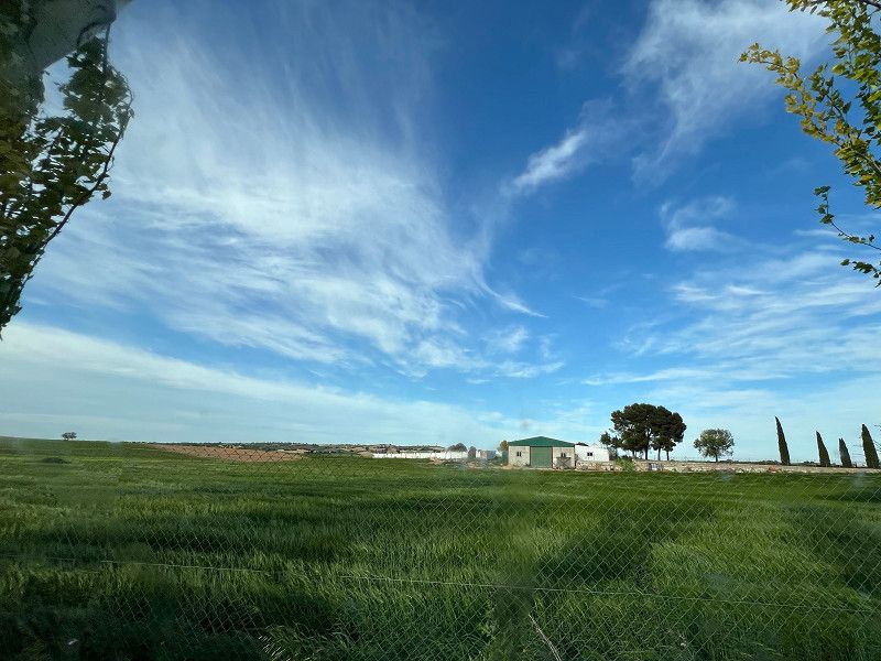
Villarejo De Fuentes
Calle Santa Ana la Nueva, Villarejo De Fuentes, Cuenca, Spain