At Easter we had 5 days for a long weekend. So we are looking for a goal not too far away that (hopefully) cannot be overrun. Alsace. But not at random. We decided on a combination of the different routes through Alsace and planned a round trip with FREEONTOUR. We had to cancel some things in the course of the journey, others were not accessible or only difficult to reach because a pass in the Vosges was still closed. Nevertheless - we had 5 wonderful and varied days and are already looking forward to our next visit to Alsace. Because there is still so much to discover. You can also follow our trip as a film on YOUTUBE at youtube.com/nanuqwomoblog Write us in the comments if you would like to have our original route planning, which was previously at this point. We have printed it as a PDF and are happy to send it to you.
Day
Frankfurt am Main, Deutschland
50° 6' 39.3" N 8° 40' 55.7" E
50.1109221 8.6821267
• Head toward Neue Kräme on Braubachstraße. Go for 12 m.
• Continue on Paulsplatz. Go for 107 m.
• Continue on Bethmannstraße. Go for 73 m.
• Turn right onto Kornmarkt. Go for 78 m.
• Turn left onto Berliner Straße toward Hauptbahnhof. Go for 90 m.
• Keep left onto Berliner Straße toward Groß-Gerau/Hauptbahnhof. Go for 152 m.
• Continue on Theatertunnel. Go for 547 m.
• Continue on Gutleutstraße. Go for 557 m.
• Turn left onto Baseler Straße (B44) toward Anschluss Süd/Groß-Gerau/Sachsenhausen/Flughafen. Go for 548 m.
• Turn right onto Theodor-Stern-Kai toward Niederrad/Schwanheim/Uni-Klinikum. Go for 902 m.
• Continue on Niederräder Ufer. Go for 2.0 km.
• Continue on Schwanheimer Ufer. Go for 1.0 km.
• Turn slightly left toward Flughafen Basel/Frankf. Kreuz. Go for 54 m.
• Take ramp onto A5 toward Flughafen Basel/Frankf. Kreuz. Go for 25.7 km.
• Continue on A67 (Darmstädter Kreuz) toward Stuttgart/Mannheim. Go for 35.4 km.
• Continue on A6. Go for 9.4 km.
• Take exit 27 toward Flughafen onto A656. Go for 1.7 km.
• Take exit 2 toward Flughafen onto B38A. Go for 1.0 km.
• Turn right onto Will-Sohl-Straße (B38A) toward MA-Seckenheim/Ma-Neuostheim/City/Airport/Gewerbegebiet Mühlfeld. Go for 180 m.
• Turn right onto Hans-Thoma-Straße. Go for 94 m.
• Turn left. Go for 83 m.
• Arrive at your destination.
☍
79,8 km
( 49 min.)
Mannheim, Deutschland
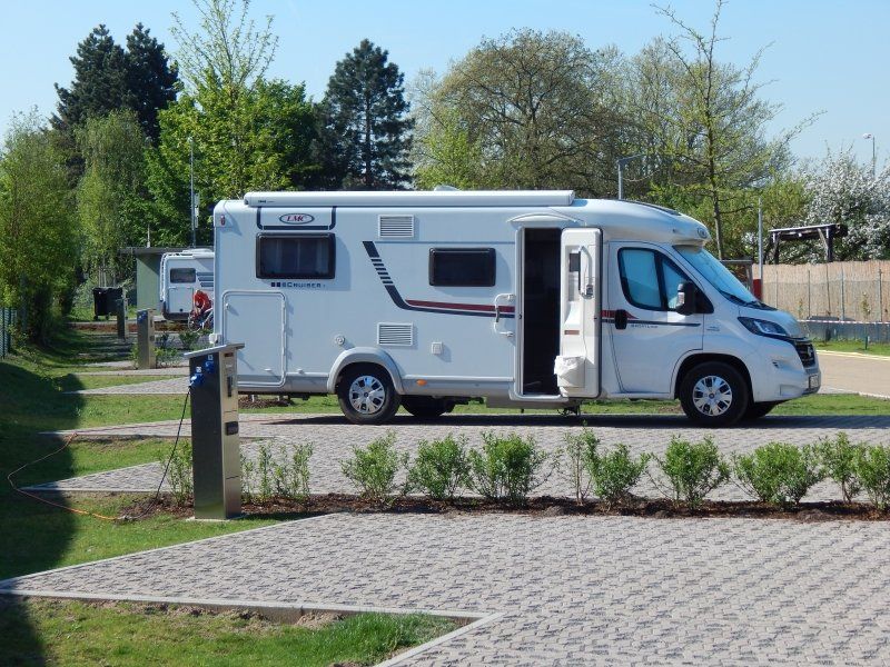
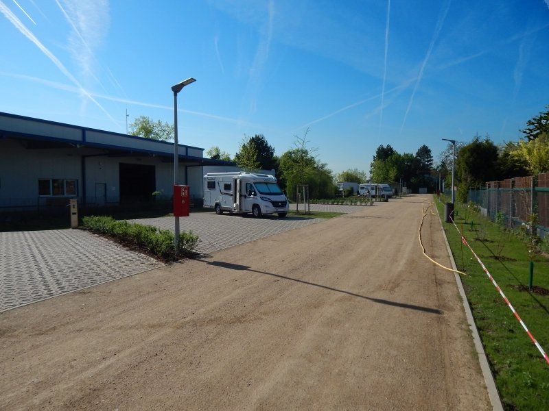
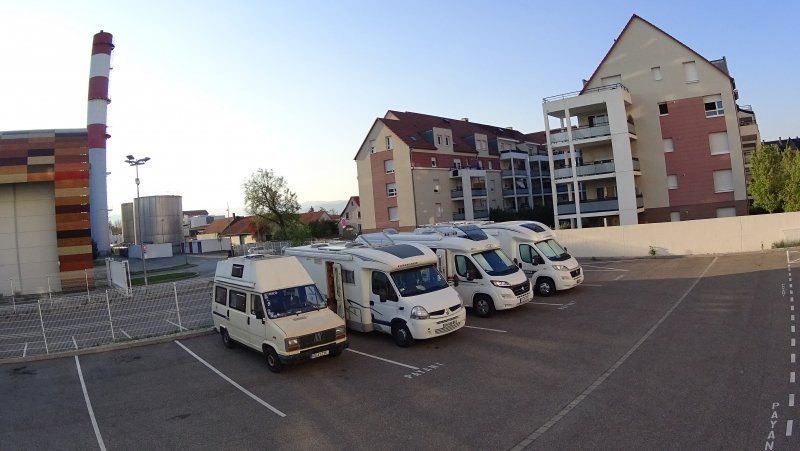
In order to avoid the rush hour traffic in the Rhine-Main area, we drove off the evening before and, once again, stopped at the motorhome parking lot in Mannheim Neuostheim. The parking space, which offers V / E and generously sized parking spaces, is conveniently located for a stopover in terms of traffic, but is also very suitable as a base for a visit to Mannheim. However, also because of the nearby airport, it is not very quiet. And the electricity is a bit expensive here, at 1 € / KWh, in our opinion.
Trübnerstraße 12, 68163 Mannheim, Deutschland
49° 28' 30.5" N 8° 31' 31.2" E
49.4751435 8.5253282
• Head toward Seckenheimer Landstraße. Go for 64 m.
• Turn right onto Seckenheimer Landstraße (L637). Go for 232 m.
• Turn right onto Seckenheimer Landstraße. Go for 66 m.
• Turn right onto Karl-Kuntz-Weg. Go for 149 m.
• Turn right onto Hans-Thoma-Straße. Go for 402 m.
• Turn left onto Will-Sohl-Straße (B38A). Go for 158 m.
• Turn left onto B38A toward Ladenburg/MA-Vogelstang/MA-Käfertal/MA-Feudenheim. Go for 811 m.
• Take ramp onto A656 toward Kreuz Mannheim. Go for 1.5 km.
• Take exit 3 toward Stuttgart onto A6. Go for 21.8 km.
• Take exit 31 toward Basel/Karlsruhe onto A5. Go for 109 km.
• Take exit 55 toward Flughafen onto L98. Go for 6.4 km.
• Pass 2 roundabouts and continue on L98. Go for 4.6 km.
• Continue on Pont Pierre Pflimlin (M353). Go for 5.3 km.
• Take ramp toward M83/St Dié par Tunnel/Colmar/Fegersheim. Go for 1.5 km.
• Turn right onto Rue de Lyon (M83) toward Colmar/Erstein/Lipsheim/Fegersheim. Go for 2.7 km.
• Take the 1st exit from roundabout onto D83. Go for 23.9 km.
• Take ramp onto A35. Go for 14.6 km.
• Continue on D83. Go for 10.7 km.
• Take ramp toward Colmar/Munster/Kaysersberg/Bennwihr/Houssen. Go for 420 m.
• Take the 1st exit from roundabout onto D83 toward Colmar/Munster/Kaysersberg/Bennwihr/Houssen. Go for 1.3 km.
• Pass 2 roundabouts and continue on Avenue Gilbert Meyer (D83). Go for 1.4 km.
• Keep right onto Avenue Gilbert Meyer (D201) toward Colmar-Centre. Go for 1.9 km.
• Turn slightly left onto Route de Neuf-Brisach (D418) toward Freiburg/Neuf-Brisach. Go for 603 m.
• Turn left onto Rue du Canal. Go for 232 m.
• Arrive at Rue du Canal. Your destination is on the left.
☍
209,6 km
(2 hrs. 5 min.)
Day
Port de Plaisance
Der Stellplatz war, als wir ankamen, komplett belegt. Wir mussten daher umplanen und haben uns für den zweiten Stellplatz auf einem Parkplatz entschiedenen. Zum Glück können wir eine Zeit lang ohne Service auskommen...
Rue du Canal 6, 68000, Colmar, Frankreich
48° 4' 50" N 7° 22' 29" E
48.0805556 7.3747222
• Head toward Route de Neuf-Brisach on Rue du Canal. Go for 232 m.
• Turn right onto Route de Neuf-Brisach (D418). Go for 592 m.
• Turn right onto Avenue d'Alsace (D201). Go for 1.0 km.
• Turn sharp left onto Rue de la 1ère-Armée-Française (D514). Go for 654 m.
• Turn right onto Rue Henry Wilhelm. Go for 66 m.
• Turn right. Go for 31 m.
• Arrive at your destination on the left.
☍
2,6 km
( 5 min.)
Colmar, Frankreich
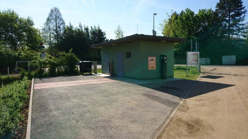
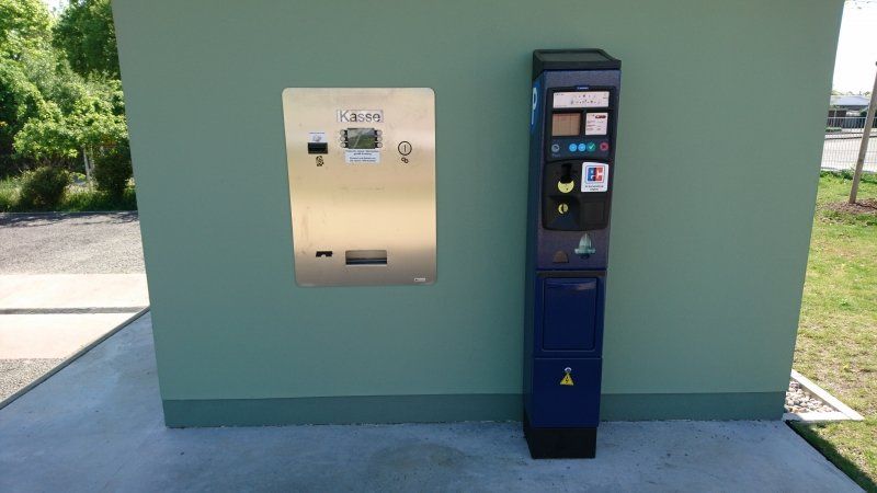
If you look at the satellite images from Google, the RV park doesn't seem to have been around for too long. There it is still a wasteland (04/2019). In the meantime, the square is paved, parking spaces are drawn and a parking machine is also there. Here you can, and we think that's really good, also stand by the hour. So we paid only € 4.80 for the afternoon until the next morning. However, there is no service. But for a night or two that's perfectly fine.
6 Rue Henry Wilhelm, 68000 Colmar, Frankreich
48° 5' 1.3" N 7° 21' 19" E
48.0837061 7.3552671
• Head toward Rue Henry Wilhelm. Go for 31 m.
• Turn right onto Rue Henry Wilhelm. Go for 263 m.
• Continue on Rue Henry Wilhelm. Go for 80 m.
• Turn left onto Route d'Ingersheim (D415). Go for 249 m.
• Turn left onto Place de la 5ème Division Blindée (D415). Go for 256 m.
• Turn right onto Rue de la Cavalerie (D415). Go for 624 m.
• Turn right onto Avenue d'Alsace (D201). Go for 39 m.
• Turn right onto Route de Sélestat. Go for 126 m.
• Continue on Route de Neuf-Brisach. Go for 58 m.
• Turn slightly right onto Route de Neuf-Brisach. Go for 36 m.
• Turn right onto Rue du Nord. Go for 190 m.
• Arrive at Rue du Nord.
☍
2,0 km
( 4 min.)
Colmar, Frankreich
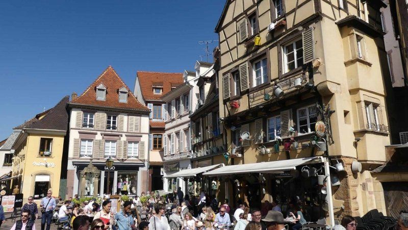
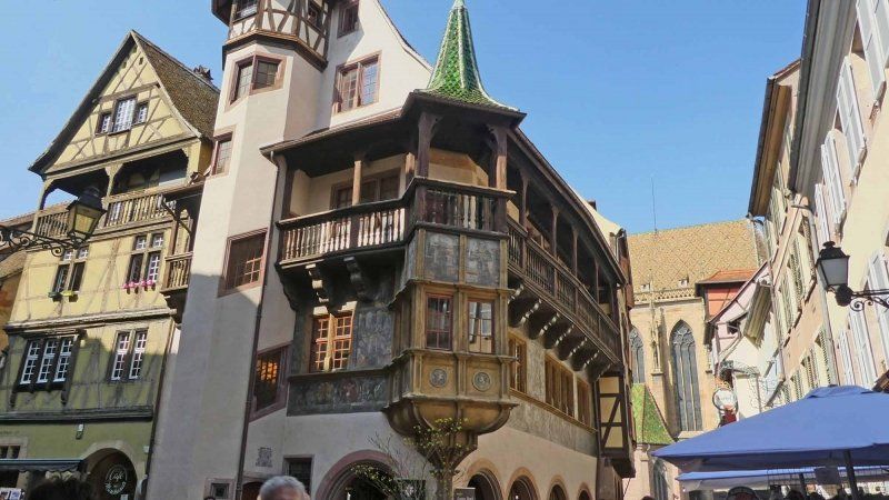
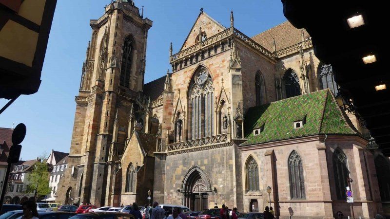
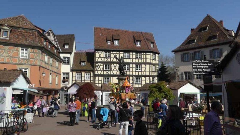
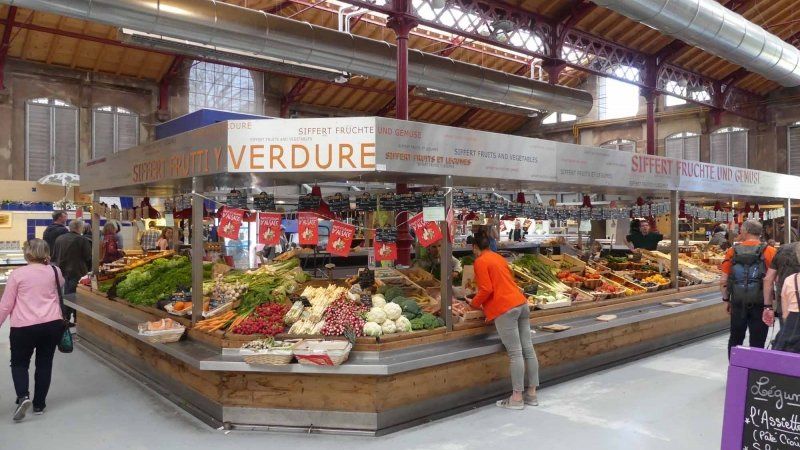
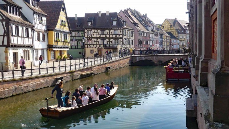
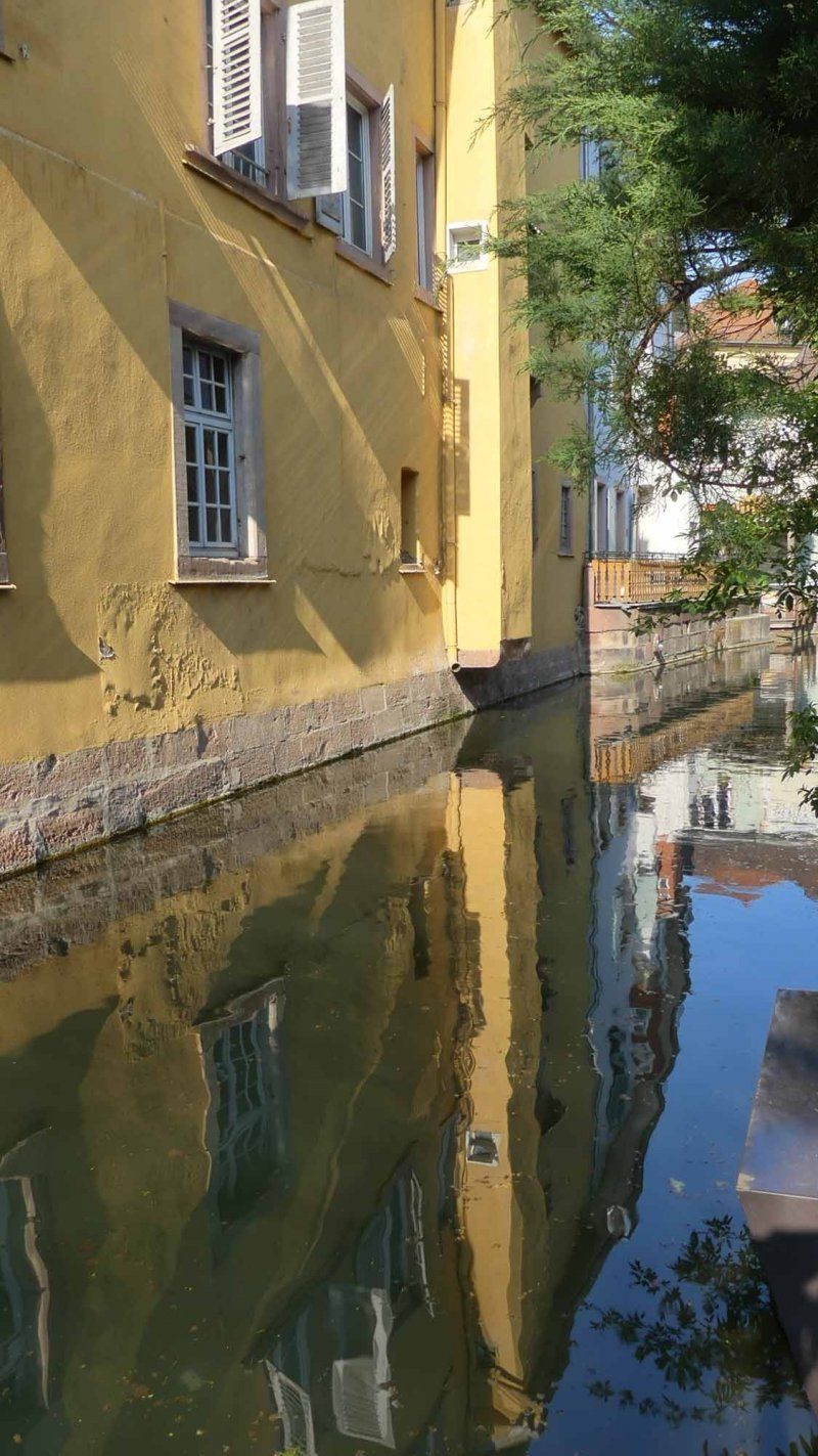
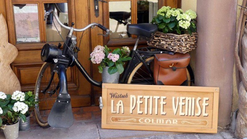
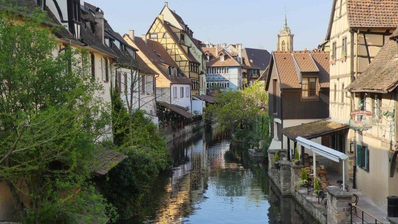
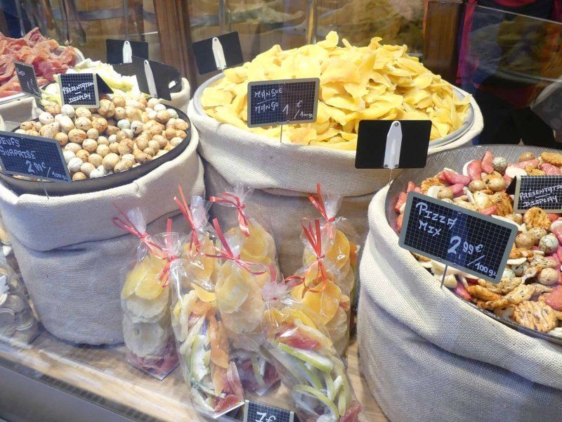
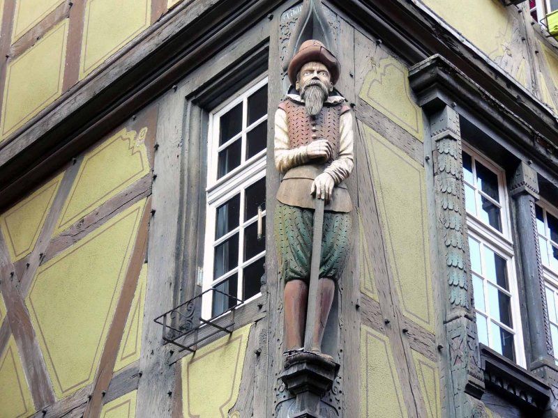
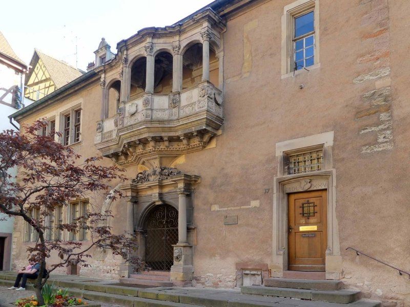
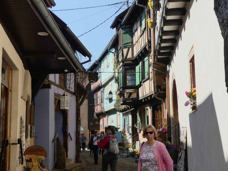
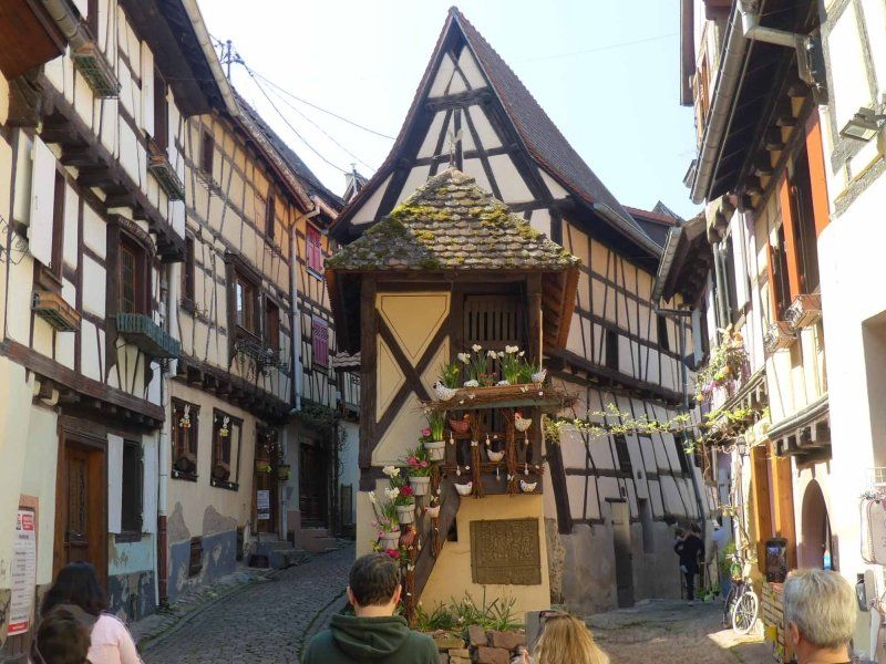
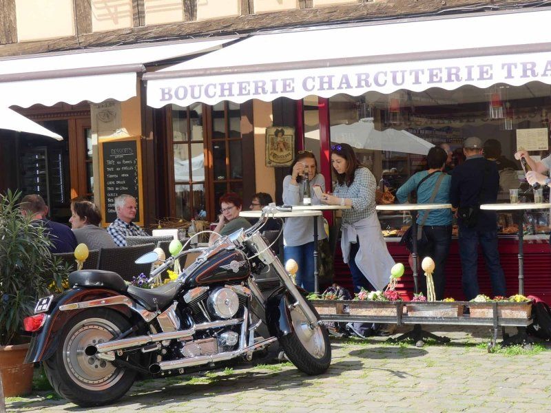
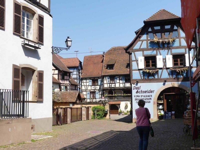
From our parking space we were in the middle of Colmar in about 5 minutes on foot. As always, we first went to the tourist information office (well signposted) and got a city map (free of charge). Then we went straight to the old town, the small streets and the half-timbered houses. There are some museums you can see, but we're not that big of a museum visitor; we have to be very interested in a topic. But the houses, churches and shops have enough to offer. When we were there was spring market; at the same place is the Christmas market, which we can also highly recommend. We continued to the market hall (we are always happy to take a look at market halls), which is open until 18:00 on weekdays. This is directly followed by the tanners' quarter and the Petit Venice, the little Venice. Here you can also book a small trip on the river Lauch with one of the fishing boats.
Back it went past the old police station and the former nut market.
68000 Colmar, Frankreich
48° 4' 45.7" N 7° 21' 30.6" E
48.0793589 7.3585120
• Head northwest on Rue du Nord. Go for 141 m.
• Turn left onto Rue Golbéry. Go for 320 m.
• Continue on Rue Roesselmann. Go for 269 m.
• Turn slightly right onto Place Jean de Lattre de Tassigny. Go for 76 m.
• Continue on D417. Go for 785 m.
• Pass 5 roundabouts and continue on Route de Wintzenheim (D417). Go for 1.8 km.
• Take the 4th exit from roundabout onto Rue du Tiefenbach (D1 BII) toward D1 BISII/Wettolsheim/Eguisheim. Go for 1.2 km.
• Turn left onto D83 toward Belfort/Mulhouse/Basel/Eguisheim/Rouffach. Go for 901 m.
• Take the 2nd exit from roundabout onto D1 BIS toward Husseren-les-Châteaux/Eguisheim. Go for 411 m.
• Continue on Route de Wettolsheim (D1 BIS). Go for 584 m.
• Turn right onto Rue des Oiseaux. Go for 224 m.
• Turn right onto Rue de Colmar. Go for 88 m.
• Arrive at Rue de Colmar. Your destination is on the left.
☍
6,8 km
( 11 min.)
Day
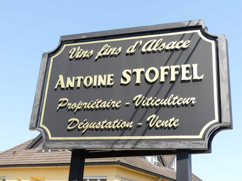
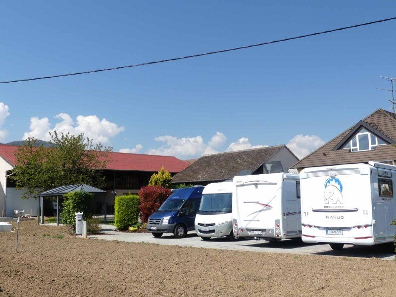
EARL Antoine STOFFEL, Rue de Colmar, Eguisheim, Frankreich
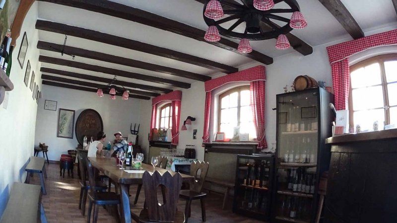
Eguisheim is a small town with a beautiful old core. But not well stocked with parking spaces. The Antoine Stoffel winery offers 4 free parking spaces. Electricity costs € 5 per day, the (free) wine tasting is "compulsory". The owners are nice, the wine is really good and the old town is only a few minutes away. V / E is available, although the sewage disposal is a bit difficult ...
21 Rue de Colmar, 68420 Eguisheim, Frankreich
48° 2' 49.2" N 7° 18' 25.1" E
48.0469869 7.3069685
• Head toward Rue des Oiseaux on Rue de Colmar. Go for 88 m.
• Turn right onto Rue de Colmar. Go for 212 m.
• Turn slightly left onto Rue de Colmar. Go for 69 m.
• Turn left onto Rue du Traminer. Go for 7 m.
• Turn right onto Rue de l'Hôpital. Go for 61 m.
• Arrive at Rue de l'Hôpital. Your destination is on the left.
☍
0,4 km
( 1 min.)
Eguisheim, Frankreich
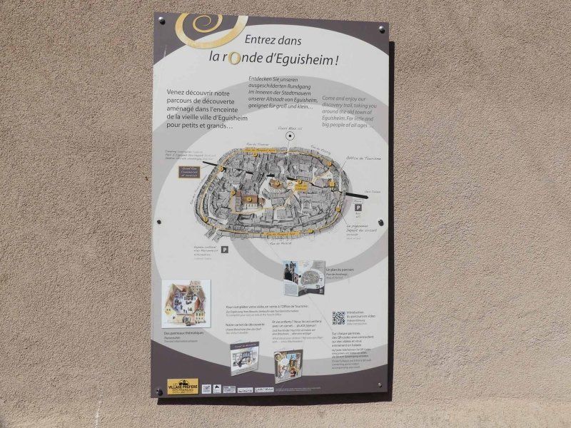
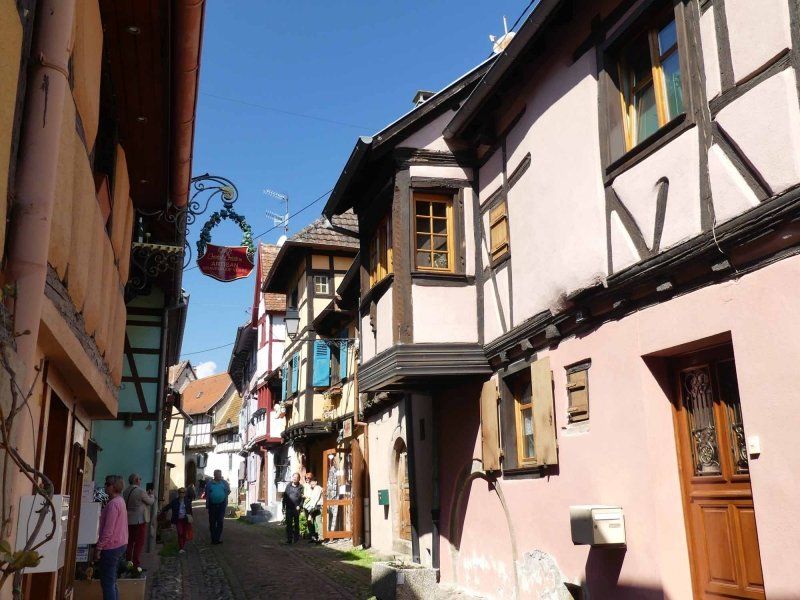
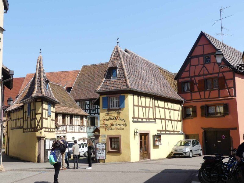
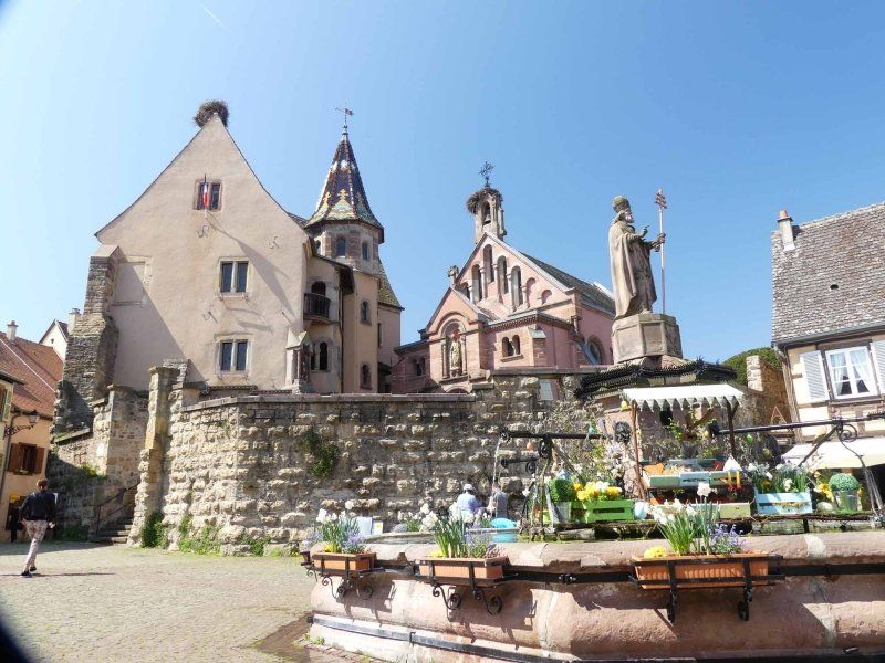
Eguisheim ist das typische Beispiel für die Elsässische Weinstraße schlechthin. Weingüter, Weinstuben, buntes Fachwerk, Brunnen, ein Schloss – eine Stadt wie aus dem Bilderbuch. Drei ovale Straßen folgen dem Verlauf der ehemaligen Stadtmauern. So kann man Eguisheim umrunden und kommt immer an seinen Ausgangspunkt zurück. Die Rue Rempart ist dabei die schönste der Straßen. Im Chateau wurde 1002 Bruno von Eguisheim geboren, der spätere Papst Leo IX.
Wir waren von Eguisheim fasziniert und hätten noch einige Stunden dort verbringen können.
4 Rue de L Hôpital, 68420 Eguisheim, Frankreich
48° 2' 35.8" N 7° 18' 23.5" E
48.0432650 7.3065220
• Head toward Place du Château Saint-Léon on Rue de l'Hôpital. Go for 40 m.
• Turn right onto Grand Rue (D514). Go for 30 m.
• Turn right onto Impasse Quibourg. Go for 62 m.
• Turn right onto Rue Allmend Nord. Go for 29 m.
• Turn left onto Rue de l'Hôpital. Go for 44 m.
• Turn right onto Rue du Riesling. Go for 25 m.
• Continue on Rue des Fleurs. Go for 371 m.
• Turn right onto Route de Wettolsheim (D1 BIS). Go for 244 m.
• Take the 3rd exit from roundabout onto Rue de la 1ère Armée (D514). Go for 299 m.
• Continue on D514. Go for 386 m.
• Take the 1st exit from roundabout onto Route Nationale toward D83/Belfort/Rouffach. Go for 109 m.
• Take ramp onto D83. Go for 21.0 km.
• Take the 1st exit from roundabout onto D429 toward Soultz. Go for 1.4 km.
• Turn left onto Rue du Vieil Armand (D4 BIS). Go for 699 m.
• Take the 2nd exit from roundabout onto Route de Jungholtz (D5 1). Go for 1.0 km.
• Turn left onto Route de Jungholtz. Go for 136 m.
• Continue on Montée Malgré-Nous. Go for 10.9 km.
• Turn right onto Route des Crêtes (D431). Go for 6.1 km.
• Arrive at Route des Crêtes (D431).
☍
42,9 km
( 45 min.)
Day
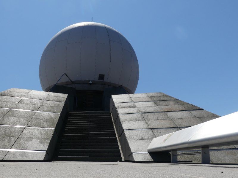
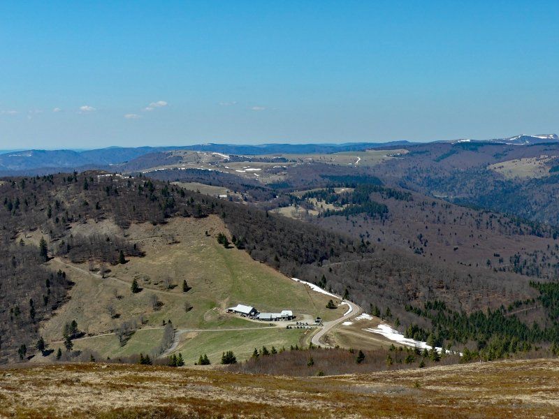
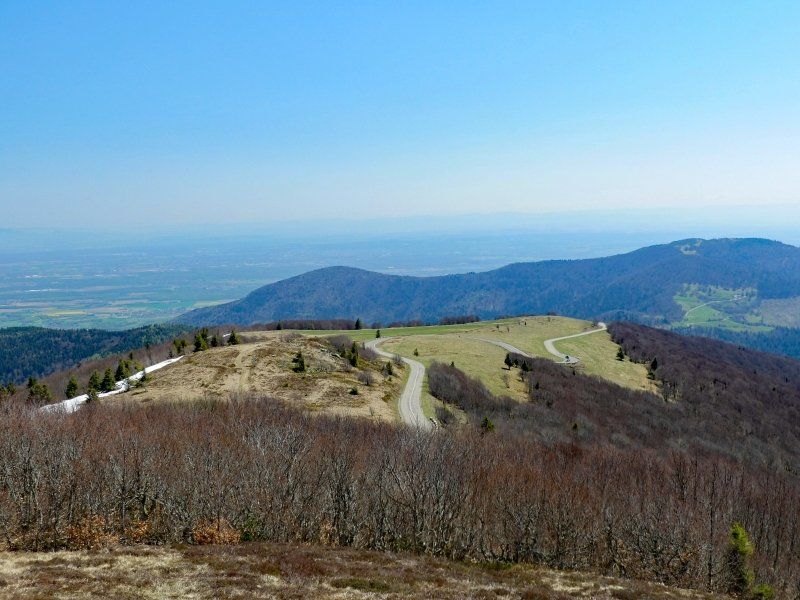
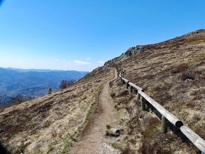
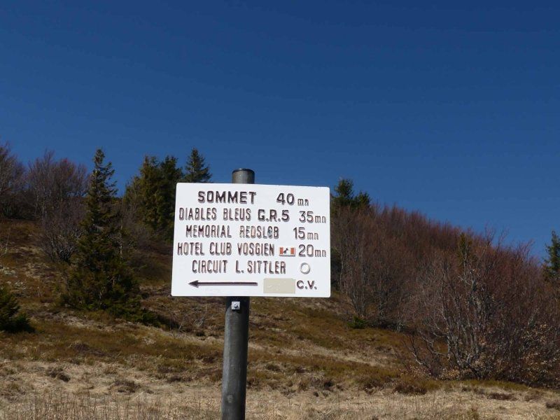
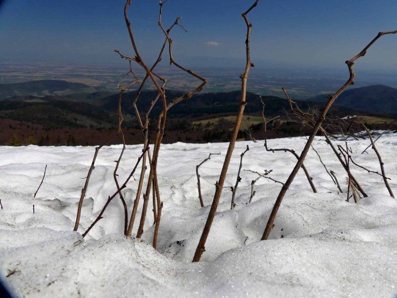
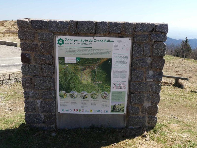
Grand Ballon, Geishouse, Frankreich
We "left the Hartmannswillerkopf". Not due to lack of piety towards the thousands of victims of the First World War, but because after Verdun and the battlefields of Normandy we have already learned too much about the incredible misery.
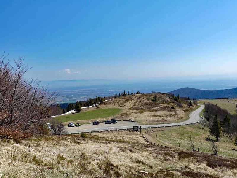
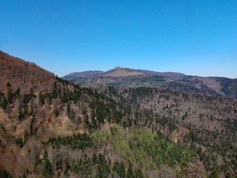
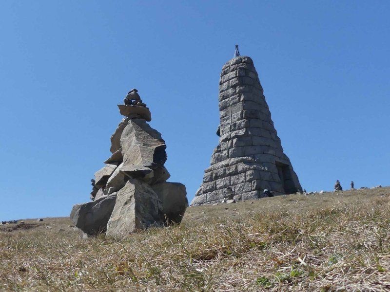
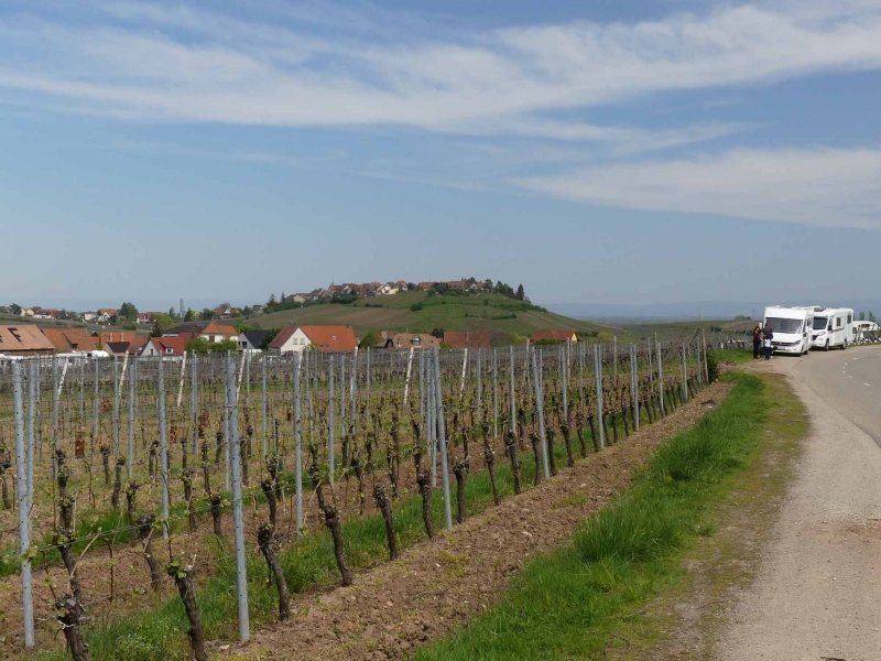
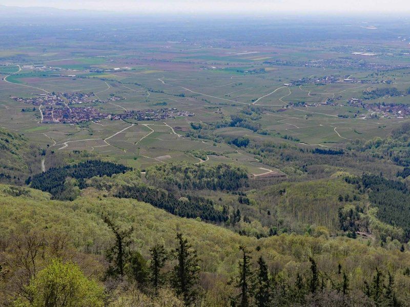
So we are directly to the highest mountain in the Vosges, the Grand Ballon. It is 1,424 meters high. You can drive almost to the summit by car. We stopped a little further down in a parking lot and hiked to the summit for a good 45 minutes. The view over the valleys of the Vosges is magnificent on the way.
Großer Belchen, 68360 Geishouse, Frankreich
47° 54' 3.6" N 7° 5' 53.6" E
47.9009960 7.0982330
• Head north on Route des Crêtes (D431). Go for 7.3 km.
• Turn right onto D430a. Go for 127 m.
• Continue on D430. Go for 18.8 km.
• Turn right onto Rue de la Gare. Go for 237 m.
• Turn left onto Rue de la Fabrique. Go for 324 m.
• Turn right onto Rue du 5 Février. Go for 199 m.
• Take the 2nd exit from roundabout onto Rue Florival (D429). Go for 58 m.
• Turn right onto Rue de la Tuilerie (D40 II). Go for 59 m.
• Turn right onto Rue du Murbach (D40 II). Go for 1.3 km.
• Continue on D40 II. Go for 6 m.
• Continue on Rue du Murbach (D40 II). Go for 378 m.
• Continue on D40 II. Go for 159 m.
• Continue on Rue de Guebwiller (D40 II). Go for 427 m.
• Turn right onto Rue de l'Église. Go for 121 m.
• Arrive at Rue de l'Église. Your destination is on the left.
☍
29,5 km
( 34 min.)
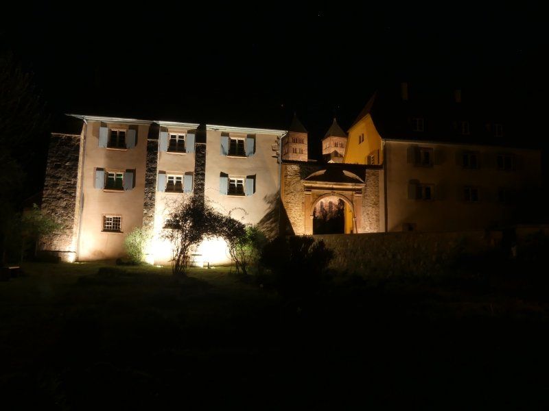
Kloster Murbach, Rue de l'Église, Murbach, Frankreich
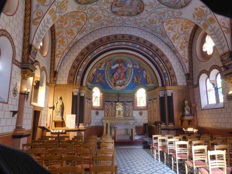
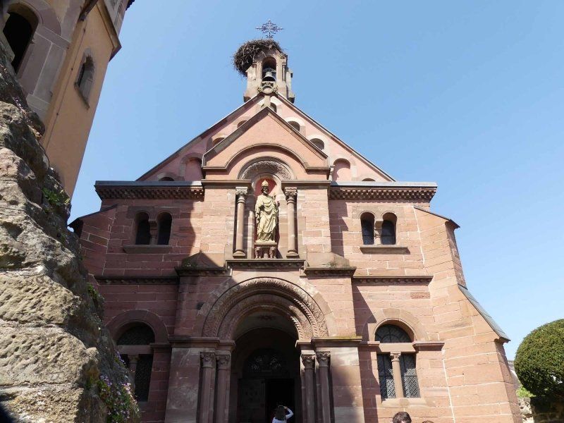
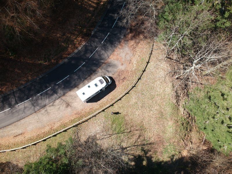
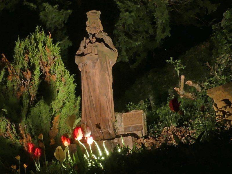
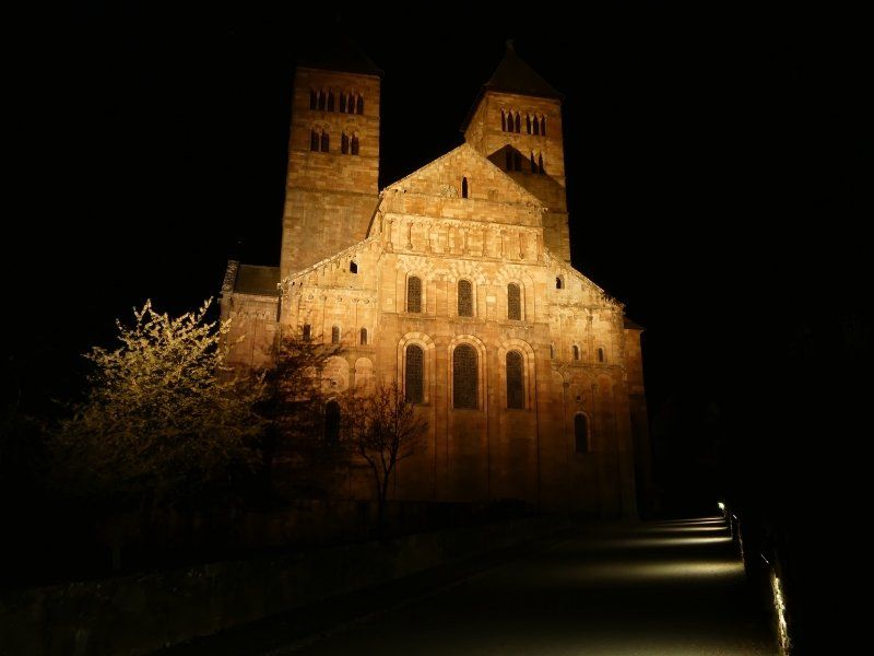
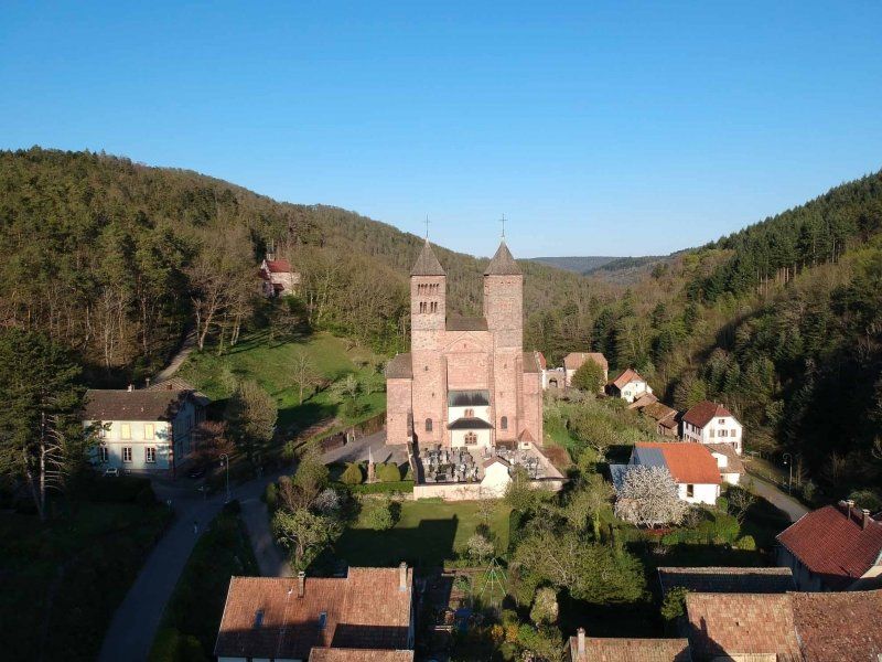
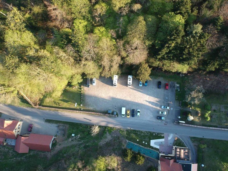
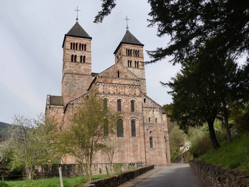
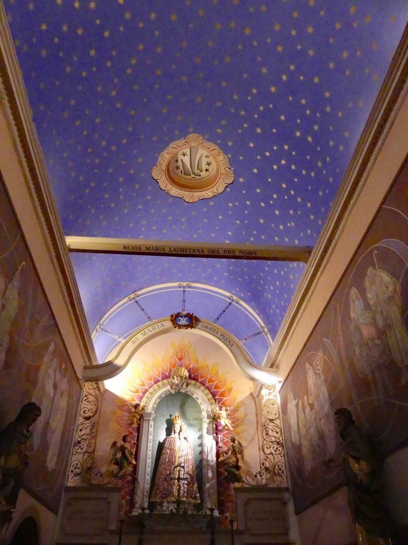
We ended up here by chance, but we haven't regretted it for a minute. We were looking for a parking space for the night. There wasn't too much choice in the area we were traveling in. The free parking space in the visitor parking lot of a former monastery that was largely destroyed in the 30 Years War came in very handy. We actually wanted to leave out the remains of the monastery church described in the travel guide. What would we have missed!
When we were almost at the parking lot, we saw the imposing, huge double towers, as I only knew them from Maria Laach. And we have stood in the shadow of these towers. The visit to the "rest of the church", the transept and the choir, as well as the pilgrimage chapel on top of the hill were absolutely worth it and with the drone there were wonderful views above.
We will definitely stay there again when we are in the area.
1 Rue de l'Église, 68530 Murbach, Frankreich
47° 55' 23.9" N 7° 9' 28.5" E
47.9233120 7.1579274
• Head toward Chemin de la Chapelle on Rue de l'Église. Go for 165 m.
• Turn left onto Rue de Lucerne. Go for 265 m.
• Continue on Rue de Guebwiller (D40 II). Go for 427 m.
• Continue on D40 II. Go for 159 m.
• Continue on Rue du Murbach (D40 II). Go for 378 m.
• Continue on D40 II. Go for 6 m.
• Continue on Rue du Murbach (D40 II). Go for 1.4 km.
• Continue on Rue Florival (D429). Go for 525 m.
• Continue on Rue de la République (D429). Go for 968 m.
• Turn left onto Rue du 17 Novembre (D429). Go for 198 m.
• Turn right onto Rue du Général de Gaulle (D430). Go for 1.5 km.
• Continue on Route de Colmar (D430). Go for 459 m.
• Turn left onto Route de Colmar (D5 II). Go for 208 m.
• Keep right onto Route de Colmar (D3 BIS). Go for 1.3 km.
• Pass 2 roundabouts and continue on Rue de Merxheim (D3 BIS). Go for 1.7 km.
• Take ramp onto D83 toward Colmar/Rouffach/Raedersheim/Ensisheim. Go for 19.0 km.
• Take the 2nd exit from roundabout onto D83 toward Nancy/Strasbourg/Munster/Wintzenheim/Z.I. Colmar. Go for 2.3 km.
• Take the 3rd exit from roundabout onto Carrefour Ligibel (D83) toward Freiburg/Nancy/Strasbourg/Z.I. Colmar/Ingersheim/Turckheim. Go for 1.0 km.
• Take the 3rd exit from roundabout onto Carrefour Ligibel (D83) toward Freiburg/Nancy/Strasbourg/Z.I. Colmar/Ingersheim. Go for 825 m.
• Take the 2nd exit from roundabout onto Avenue de Lorraine (D83) toward Freiburg/Nancy/St Dié/Strasbourg/Z.I. Colmar. Go for 282 m.
• Take the 2nd exit from roundabout onto D415 toward Nancy/Saint Dié/Sigolsheim/Kaysersberg/Ammerschwihr. Go for 1.9 km.
• Pass 3 roundabouts and continue on D415. Go for 12.7 km.
• Take the 2nd exit from roundabout onto La Croix d'Orbey (D48) toward Orbey/Labaroche/Z.I. de Hachimette. Go for 2.7 km.
• Turn slightly right onto Rue Charles de Gaulle (D48). Go for 515 m.
• Turn left onto Rue du Faudé (D48). Go for 199 m.
• Continue on Chemin de Sainte Marie-aux-Mines a Soultzeren (D48). Go for 9.1 km.
• Arrive at D48 II.
☍
60,2 km
( 58 min.)
Day
Lac Blanc, Orbey, Frankreich
Actually today we should go to Lac Blanc and Lac Noir, hike and maybe spend the night at one of the two lakes. But nature and the road construction authorities have thwarted our plans by a huge amount. After we were almost there, we suddenly faced a roadblock - not all of the passes had been reopened. So take a detour (which was almost as long as the previous route). Until just another road closure due to road construction work. Next detour.
When we finally got to the lakes in the early afternoon, the parking lots were of course already completely overcrowded. So we just had to keep going.
Lac Blanc, 68370 Orbey, Frankreich
48° 7' 33.8" N 7° 5' 24.8" E
48.1260635 7.0902084
• Head southeast on D48 II. Go for 1.4 km.
• Turn right toward Lieu-dit Lac Noir. Go for 183 m.
• Continue on Lieu-dit Lac Noir. Go for 1.1 km.
• Turn right onto Lieu-dit Lac Noir. Go for 225 m.
• Arrive at Lieu-dit Lac Noir.
☍
2,9 km
( 4 min.)
Lac Noir, Orbey, Frankreich
Lac Noir, 68370 Orbey, Frankreich
48° 6' 47.6" N 7° 5' 45.8" E
48.1132276 7.0960675
• Head southeast on Lieu-dit Lac Noir. Go for 225 m.
• Turn left onto Lieu-dit Lac Noir. Go for 1.1 km.
• Turn right toward D48 II. Go for 196 m.
• Turn right onto D48 II. Go for 7.6 km.
• Continue on Rue Charles de Gaulle (D48). Go for 458 m.
• Turn slightly left onto Rue Charles de Gaulle (D48). Go for 2.6 km.
• Take the 1st exit from roundabout onto Route de Saint-Dié (D415) toward Colmar/Hachimette/Kaysersberg. Go for 3.1 km.
• Pass 2 roundabouts and continue on D415. Go for 4.9 km.
• Turn left onto Rue de l'Ancienne Gare (D10 II) toward Kaysersberg/Kientzheim/Ribeauvillé. Go for 323 m.
• Turn right onto Route du Vin (D28). Go for 1.9 km.
• Continue on D1 BIS. Go for 2.1 km.
• Take the 3rd exit from roundabout onto D1 BIS. Go for 3.3 km.
• Take the 4th exit from roundabout onto Route de Colmar (D300). Go for 1.5 km.
• Take the 3rd exit from roundabout onto Avenue Jacques Preiss (D300). Go for 355 m.
• Turn left onto Place Fernand Zeyer (D300). Go for 13 m.
• Arrive at Place Fernand Zeyer (D300). Your destination is on the right.
☍
29,6 km
( 35 min.)
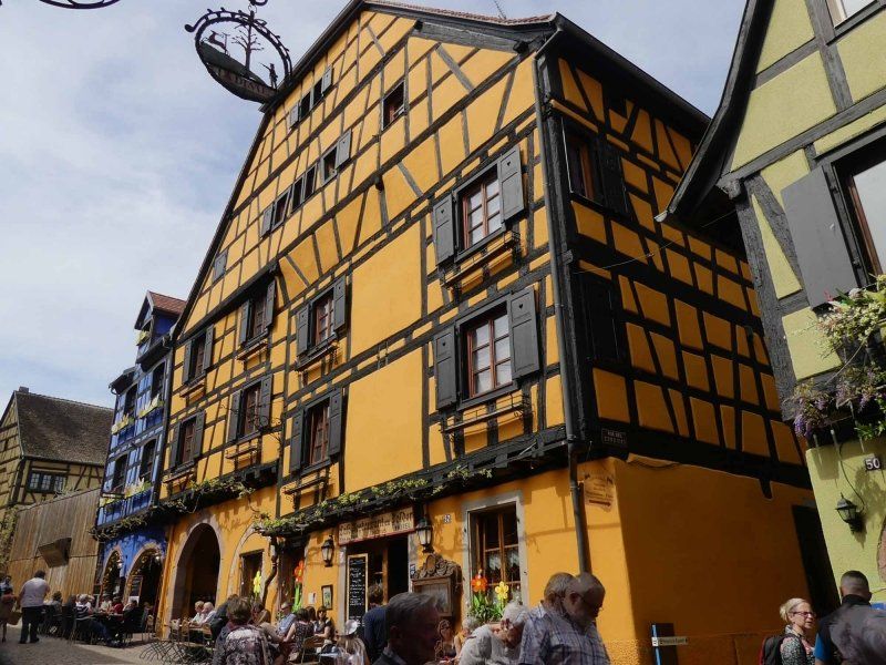
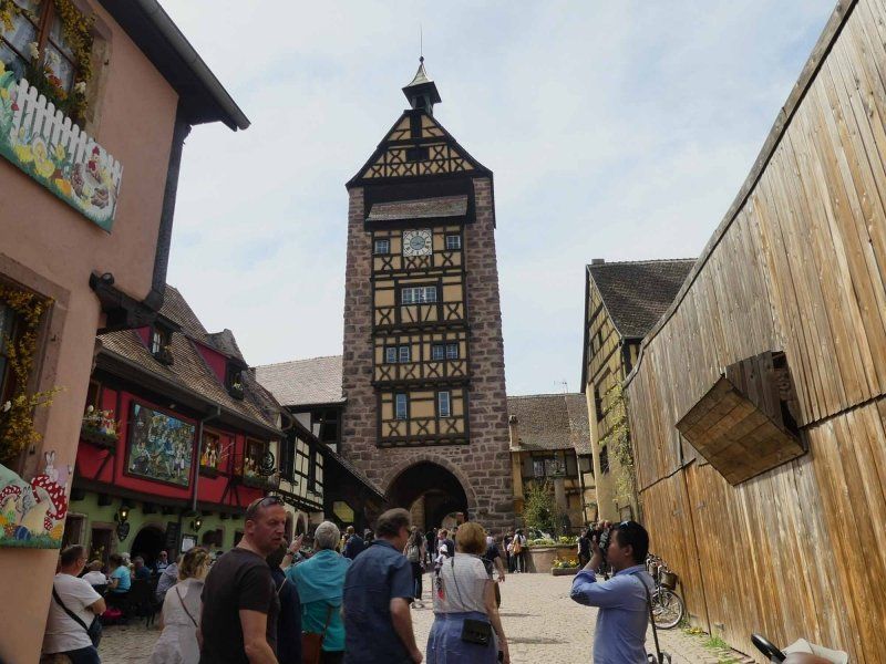
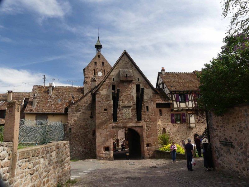
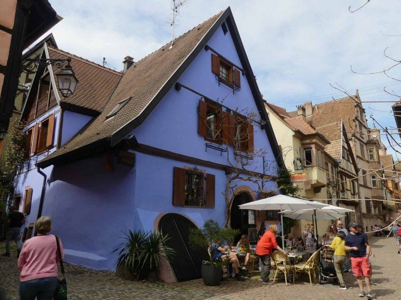
Riquewihr, Frankreich
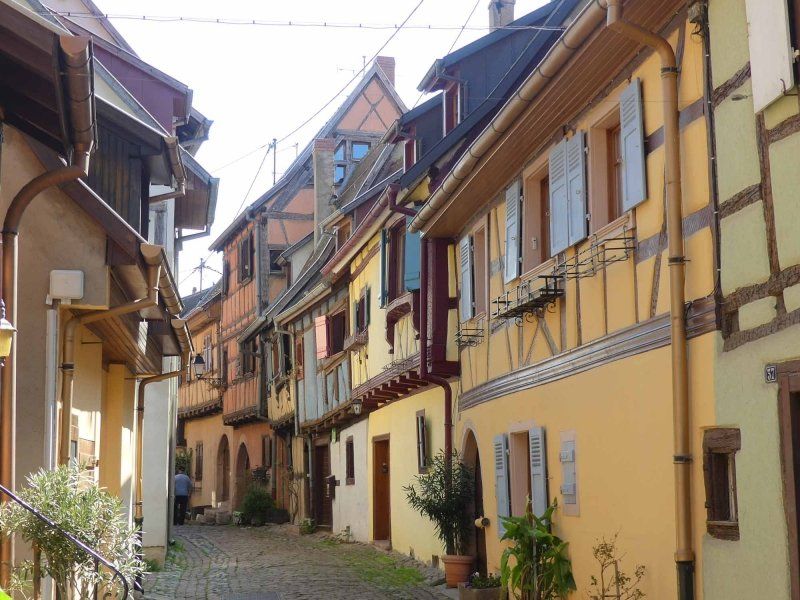
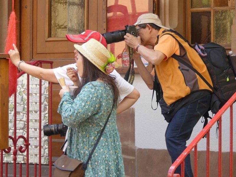
We ended our trip through the Vosges in frustration and drove back on the Alsatian Wine Route to Riquewihr. According to the travel guide, one of the most beautiful villages in France. As the saying goes: "Beauty is always in the eye of the beholder". There are certainly many who find Drosselgasse in Rüdesheim beautiful. We like Disneyland. And Riquewihr appeared to us to be a mixture of both. A wine bar and souvenir shop next to the other and brightly colored half-timbered facades. And full. But it was Easter Sunday too. That should have been clear to us.
We saw Riquewihr and that's enough for us.
68340 Riquewihr, Frankreich
48° 9' 58.2" N 7° 17' 59.4" E
48.1661580 7.2998220
• Head south on Place Fernand Zeyer (D300). Go for 184 m.
• Turn left onto Rue Mandlé. Go for 176 m.
• Turn left onto Heftweg. Go for 760 m.
• Continue on Route de Colmar (D300). Go for 854 m.
• Take the 1st exit from roundabout onto Route du Vin (D1 BIS). Go for 251 m.
• Turn left onto Rue du 5 Décembre (D300). Go for 406 m.
• Continue on Rue de Hoen (D300). Go for 498 m.
• Continue on Route d'Ostheim (D300). Go for 416 m.
• Continue on D300. Go for 1.9 km.
• Turn right onto D416. Go for 1.1 km.
• Take the 1st exit from roundabout onto Route de Strasbourg (D416) toward Jebsheim/Sélestat/Colmar. Go for 419 m.
• Take the 3rd exit from roundabout onto Rue de Jebsheim (D300) toward Jebsheim/Sélestat. Go for 678 m.
• Take left ramp onto D83 toward Sélestat/Strasbourg/Guémar. Go for 6.5 km.
• Keep left onto A35. Go for 5.6 km.
• Take exit 17 toward St Dié/Nancy/Ste Marie aux M./Villé. Go for 326 m.
• Take the 2nd exit from roundabout onto D424 toward St Dié/Nancy/Châtenois/Ste Marie aux M./Villé. Go for 518 m.
• Take the 1st exit from roundabout onto D424 toward D1059/Nancy/Saint-Dié des V/Ste Marie aux M./Villé/Sélestat-Ouest/Châtenois. Go for 622 m.
• Take the 3rd exit from roundabout onto Route de Sélestat (D559) toward Châtenois. Go for 1.4 km.
• Take the 3rd exit from roundabout onto Rue du Maréchal Foch (D35) toward Kintzheim. Go for 253 m.
• Turn right onto Allée des Bains. Go for 169 m.
• Turn left onto Rue de l'Ortenbourg. Go for 60 m.
• Arrive at Rue de l'Ortenbourg. Your destination is on the left.
☍
23,1 km
( 21 min.)
Stellplatz am Sportplatz
The space for 5 mobiles was of course full when we arrived. But if you want to spend the night there, you will still find plenty of parking space at the beginning of the street in front of and across from the kindergarten. About 10-12 mobiles fit there. And quite legally.
Allée des Bains, 67730, Châtenois, Frankreich
48° 16' 28" N 7° 23' 52" E
48.2744444 7.3977778
• Head toward Rue des Bains on Rue de l'Ortenbourg. Go for 117 m.
• Turn left onto Rue de la Montagne. Go for 180 m.
• Turn right onto Rue du Maréchal Foch (D35). Go for 2.1 km.
• Turn right onto Rue du Général de Gaulle (D159). Go for 552 m.
• Continue on D159. Go for 2.9 km.
• Continue on Lieu-dit La Wick (D159). Go for 100 m.
• Continue on D159. Go for 1.0 km.
• Continue on Lieu-dit Schaflager (D159). Go for 257 m.
• Continue on D159. Go for 3.2 km.
• Turn sharp left. Go for 117 m.
• Arrive at your destination on the left.
☍
10,6 km
( 15 min.)
Day
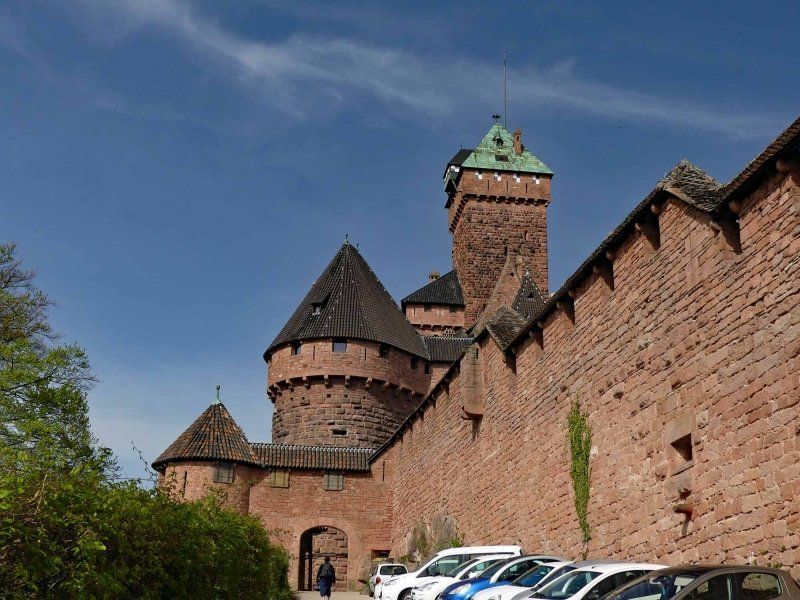
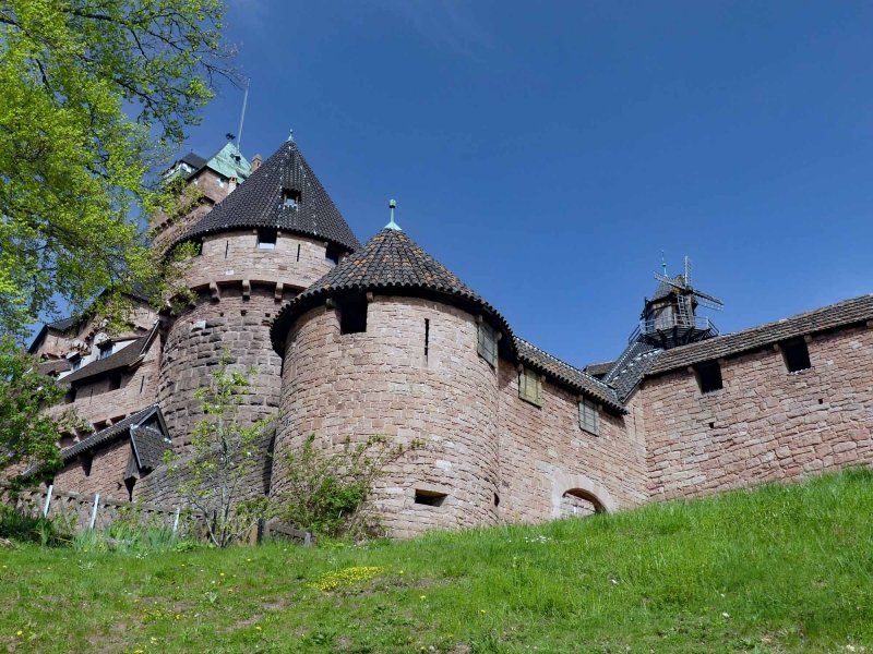
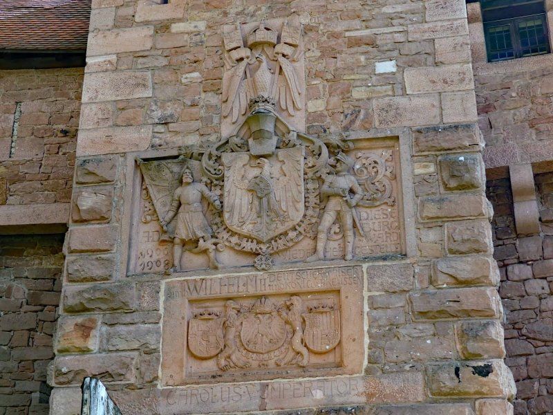
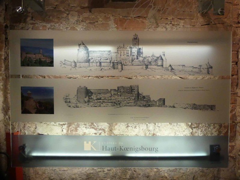
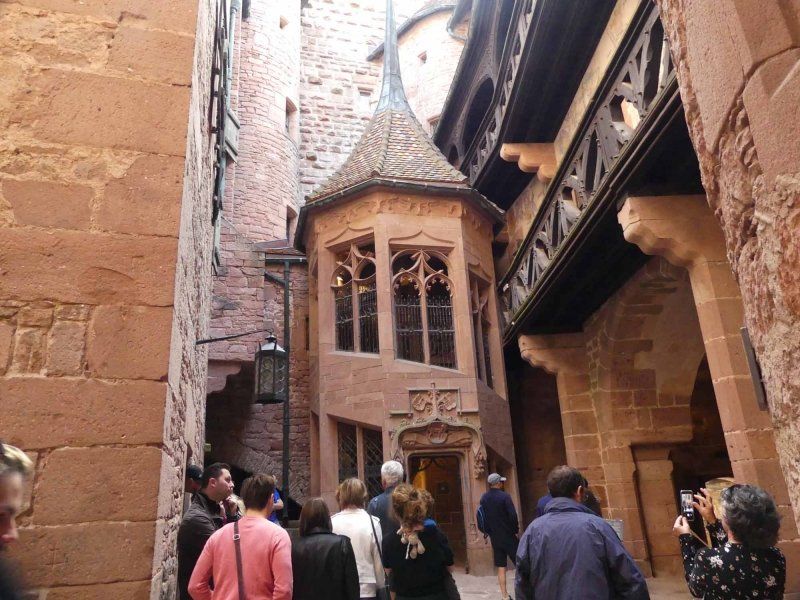
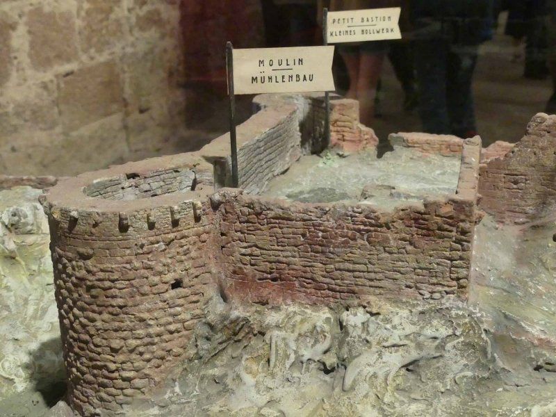
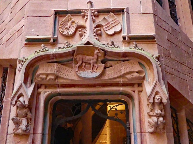
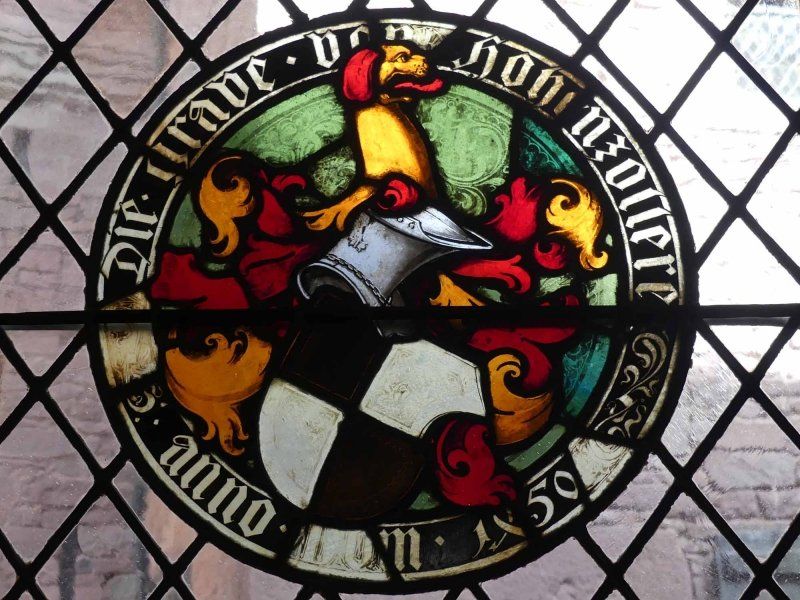
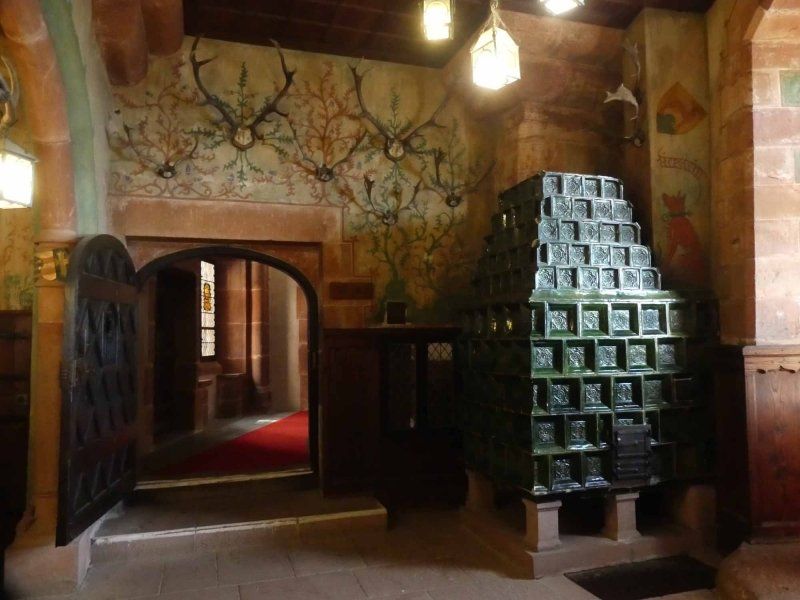
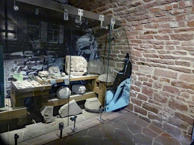
Hohkönigsburg, Orschwiller, Frankreich
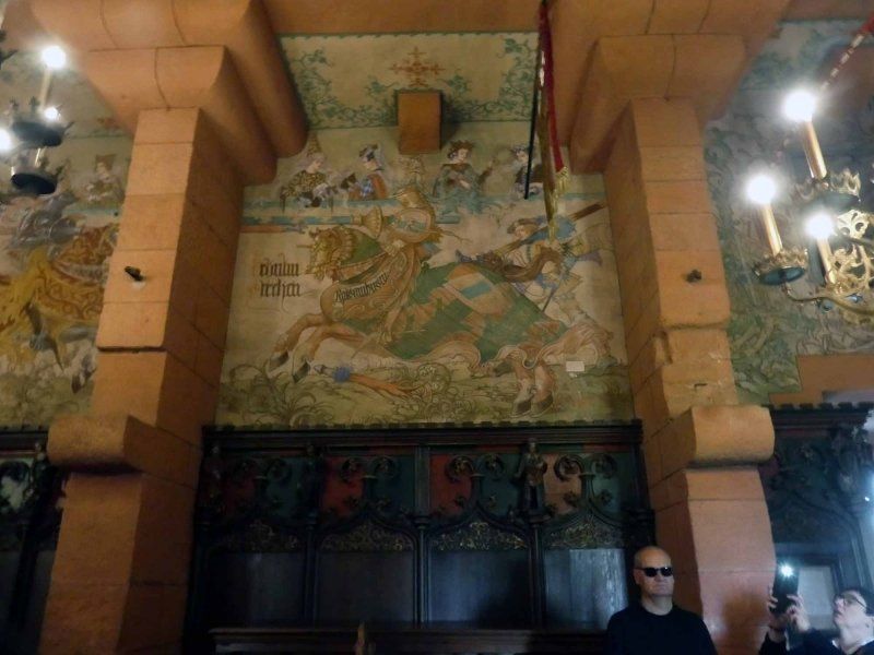
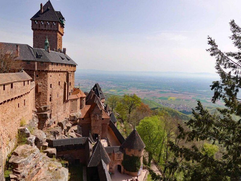
The Hochkönigsburg was, during Germany's rule over Alsace, a gift to Kaiser Wilhelm II, who had the castle ruins rebuilt and reconstructed. The fact that, according to historical understanding, not everything corresponded to the (assumed) conditions on site does not affect the experience. We paid 27 € for two with audio guides, which paid off for us. By the way, from the castle you have a wonderful view of the Vosges and the wine region.
By the way, you should arrive at the castle early enough to get a parking space for your Womo on the access road to the castle. When we left everything was parked.
67600 Orschwiller, Frankreich
48° 14' 58.1" N 7° 20' 40.1" E
48.2494853 7.3444831
• Head south. Go for 117 m.
• Turn left onto D159. Go for 3.1 km.
• Continue on Lieu-dit Schaflager (D159). Go for 257 m.
• Continue on D159. Go for 1.0 km.
• Continue on Lieu-dit La Wick (D159). Go for 100 m.
• Continue on D159. Go for 2.9 km.
• Continue on Rue du Général de Gaulle (D159). Go for 585 m.
• Turn left onto Rue du Général de Gaulle (D159). Go for 511 m.
• Pass 2 roundabouts and continue on D159. Go for 1.7 km.
• Take the 4th exit from Carrefour du Haut-Koenigsbourg roundabout onto D424 toward Strasbourg/Colmar/St Dié/Ste Marie aux M. Go for 757 m.
• Take the 1st exit from roundabout onto D424 toward Strasbourg/Z.I. Nord/Colmar/St Dié/Nancy/Châtenois/Ste Marie aux M./Villé. Go for 69 m.
• Take ramp onto A35 toward Strasbourg. Go for 33.2 km.
• Continue on A355 toward E25/A4/Paris/A35/Karlsruhe/Strasbourg. Go for 25.1 km.
• Continue on A4 (Autoroute de l'Est). Go for 7.0 km.
• Take exit 46 toward A340/Haguenau onto D1340. Go for 7.4 km.
• Take ramp onto Rue Binsenbruch (D1063) toward Schweighouse S/M./Niederbronn les B. Go for 589 m.
• Keep right onto D1063. Go for 7.0 km.
• Take ramp toward Woerth/Morsbronn les B. Go for 375 m.
• Take the 3rd exit from roundabout onto Route de Woerth. Go for 181 m.
• Take the 1st exit from roundabout onto Route de Woerth. Go for 150 m.
• Continue on D927. Go for 5.7 km.
• Take the 1st exit from roundabout onto D927. Go for 3.7 km.
• Pass 2 roundabouts and continue on Route de Haguenau (D927). Go for 3.3 km.
• Turn left onto Grand'Rue (D927). Go for 318 m.
• Continue on Route de Lembach (D927). Go for 8.4 km.
• Take the 2nd exit from roundabout onto Route de Bitche (D3). Go for 3.5 km.
• Turn right onto D925. Go for 2.9 km.
• Continue on L488. Go for 77 m.
• Continue on Hauptstraße (L488). Go for 829 m.
• Continue on L488. Go for 1.1 km.
• Continue on Hauptstraße (L488). Go for 457 m.
• Continue on L488. Go for 1.9 km.
• Turn left onto L478 toward Eppenbrunn/Ludwigswinkel/Fischbach. Go for 5.7 km.
• Turn left onto L478. Go for 2.3 km.
• Arrive at L478.
☍
132,2 km
(1 hrs. 35 min.)
3JQX+HG Ludwigswinkel, Deutschland
49° 5' 20.2" N 7° 38' 55.9" E
49.0889473 7.6488702
• Head southeast on L478. Go for 2.3 km.
• Turn left onto L487 toward Hinterweidenthal/Salzwoog. Go for 11.8 km.
• Continue on Lindelstraße (L487). Go for 621 m.
• Turn left onto L486 toward B10/Pirmasens/Lemberg. Go for 96 m.
• Turn right onto Kaltenbacher Straße (L487) toward Landau/B10. Go for 4.4 km.
• Take the 2nd exit from roundabout toward Landau. Go for 103 m.
• Take ramp onto B10. Go for 32.9 km.
• Take left ramp onto A65 toward Ludwigshafen/Neustadt/Weinstr./Speyer/B272. Go for 31.5 km.
• Take exit 7 toward Koblenz/Mainz onto A61. Go for 12.4 km.
• Take exit 59 toward Frankfurt a.M./Frankenthal-Nord onto A6. Go for 17.8 km.
• Take the left exit toward Hannover/Frankfurt/Köln/Darmstadt onto A67. Go for 11.7 km.
• Take exit 9 toward Bensheim/Heppenheim/Lorsch onto B47. Go for 4.2 km.
• Turn left and take ramp onto A5 toward Frankfurt/Darmstadt. Go for 22.3 km.
• Take the exit toward Hannover/Kassel/Frankfurt/Darmstadt onto A5. Go for 25.8 km.
• Take the exit toward F-Niederrad/Uniklinik onto Schwanheimer Ufer. Go for 1.1 km.
• Keep left onto Schwanheimer Ufer toward Stadtmitte/Sachsenhausen/Uni-Klinikum. Go for 275 m.
• Continue on Niederräder Ufer. Go for 2.0 km.
• Continue on Theodor-Stern-Kai. Go for 466 m.
• Turn right onto Carl-von-Noorden-Platz. Go for 458 m.
• Turn left onto Stresemannallee (B44) toward Hanau/Offenbach/B43/Stadtmitte/Messe/Hauptbahnhof. Go for 526 m.
• Turn right onto Wilhelm-Leuschner-Straße toward Stadtmitte/Westhafen. Go for 627 m.
• Turn left onto Mainluststraße toward Hanau/Offenbach. Go for 70 m.
• Keep left onto Mainluststraße toward Hanau/Offenbach. Go for 145 m.
• Continue on Theatertunnel. Go for 521 m.
• Continue on Berliner Straße. Go for 126 m.
• Turn right onto Kornmarkt. Go for 78 m.
• Turn left onto Bethmannstraße. Go for 73 m.
• Continue on Paulsplatz. Go for 107 m.
• Continue on Braubachstraße. Go for 12 m.
• Arrive at Braubachstraße. Your destination is on the right.
☍
184,5 km
(1 hrs. 59 min.)
Frankfurt am Main, Deutschland
Unfortunately, our trip to Alsace ends with the return journey. But we know for sure: We were not in Alsace for the last time.
50° 6' 39.3" N 8° 40' 55.7" E
50.1109221 8.6821267