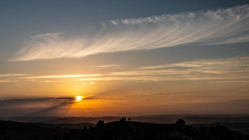
For a long time we couldn't travel or go on tours. Because of Corona. But the incidence numbers are falling, and travel restrictions are being lifted everywhere. At first we were unsure where we should go, the requirements and restrictions in the individual countries were still too different. We therefore selected our travel destination at very short notice and spontaneously: Italy. In a part that we haven't even been to yet. Our motorhome is packed, refueled and ready to travel. So we start, towards Italy.
Day
Campingplatz Mainkur
Frankfurter Landstraße 107, 63477, Maintal/Frankfurt am Main, Germany
50° 8' 18.1" N 8° 46' 58.8" E
50.1383700 8.7830100
• Head toward Hanauer Landstraße on Frankfurter Landstraße. Go for 439 m.
• Turn left onto Hanauer Landstraße (B8/B40). Go for 3.9 km.
• Turn left onto B8/B40 toward Darmstadt/A661/Flughafen Frankf. Kreuz/Offenbach. Go for 79 m.
• Take ramp onto A661 toward Darmstadt/Flughafen Frankf. Kreuz/Offenbach. Go for 5.4 km.
• Take exit 17 toward Köln/Wiesbaden/F. Kreuz/Flughafen onto A3. Go for 8.5 km.
• Take exit 50 toward Basel/Darmstadt onto A5. Go for 23.6 km.
• Take the exit toward Basel/Karlsruhe/Heidelberg onto A5. Go for 287 km.
• Take the exit toward Rheinfelden/Lörrach onto A98. Go for 7.4 km.
• Take exit 5 toward Lörrach-Mitte/Schopfheim/Basel/Weil am Rhein/Lörrach onto B317. Go for 2.3 km.
• Turn left onto Grüttweg. Go for 53 m.
• Continue on Im Grütt. Go for 79 m.
• Continue on Grüttweg. Go for 32 m.
• Turn slightly left onto Grüttweg. Go for 142 m.
• Arrive at Grüttweg. Your destination is on the left.
☍
338,9 km
(3 hrs. 6 min.)
Wohnmobilstellplatz Lörrach, Grüttweg, Lörrach, Deutschland
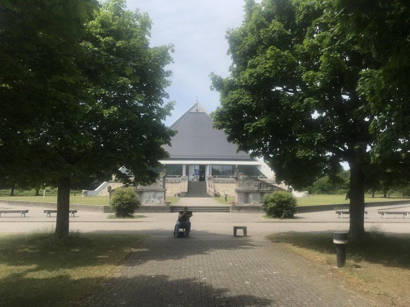
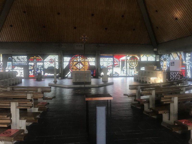
We started this morning in Frankfurt am Main. During a short lunch break at the Baden Baden service station on the A5, I looked at the St. Christiopherus motorway church. It is one of 45 autobahn churches in Germany and I think it is worth seeing. Above all, the many modern reliefs cast from concrete or the crypt (I would not have suspected a motorway church).
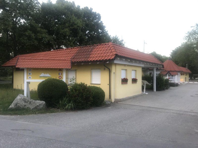
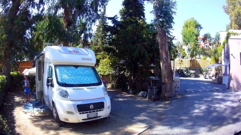
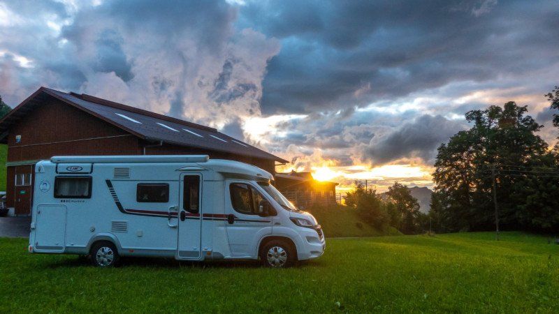
The destination of today's stage was Lörrach, right before the Swiss border, because we only wanted to travel through Switzerland due to the applicable corona rules. We stopped at the Lörrach motorhome parking lot. After a 5 hour drive we arrived there at about 36 ° C. First of all, extend the awning, take out the chairs and have a nice cold beer after work.
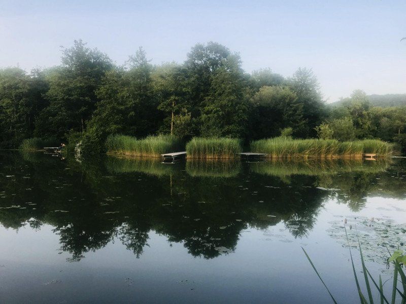
Then there was pizza from the stone oven in the campsite pizzeria and an extended digestive walk through the beautiful adjacent park.
Grüttweg 8, 79539 Lörrach, Deutschland
47° 37' 27.4" N 7° 39' 43.9" E
47.6242649 7.6621886
• Head northwest on Grüttweg. Go for 174 m.
• Continue on Im Grütt. Go for 79 m.
• Continue on Grüttweg. Go for 43 m.
• Turn right onto B317. Go for 1.4 km.
• Turn left and take ramp onto A98 toward Rheinfelden. Go for 9.7 km.
• Take exit 7 toward Schweiz/Rheinfelden-Mitte onto A861. Go for 4.6 km.
• Continue on A861. Go for 106 m.
• Continue toward A3. Go for 508 m.
• Take exit 14 toward Bern/Luzern/Basel/Liestal onto A3. Go for 2.1 km.
• Take exit 9 toward Chiasso/Gotthard/Luzern/Bern/Arisdorf onto A2. Go for 28.3 km.
• Take the left exit toward Chiasso/Gotthard/Luzern/Zürich/Rothrist onto A1/A2. Go for 8.9 km.
• Take exit 47 toward Chiasso/Gotthard/Luzern/Reiden onto A2 (Verzweigung Wiggertal). Go for 237 km.
• Continue on A9 (Autostrada dei Laghi). Go for 689 m.
• Take the left exit toward Como Centro/Lago/Cernobbio Menaggio/SS340/Bellagio/SS583 onto Raccordo SS340-A9. Go for 1.8 km.
• Turn right onto Via Francesco Borromini. Go for 222 m.
• Turn right onto Via Brennero. Go for 159 m.
• Arrive at your destination on the left.
☍
295,8 km
(3 hrs. 14 min.)
Day
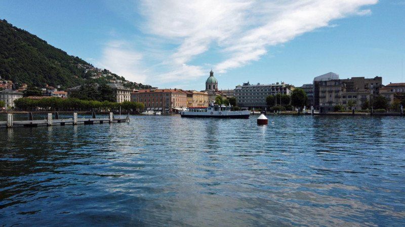
Wohnmobilstellplatz Como, Italien
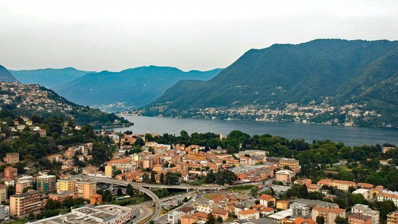
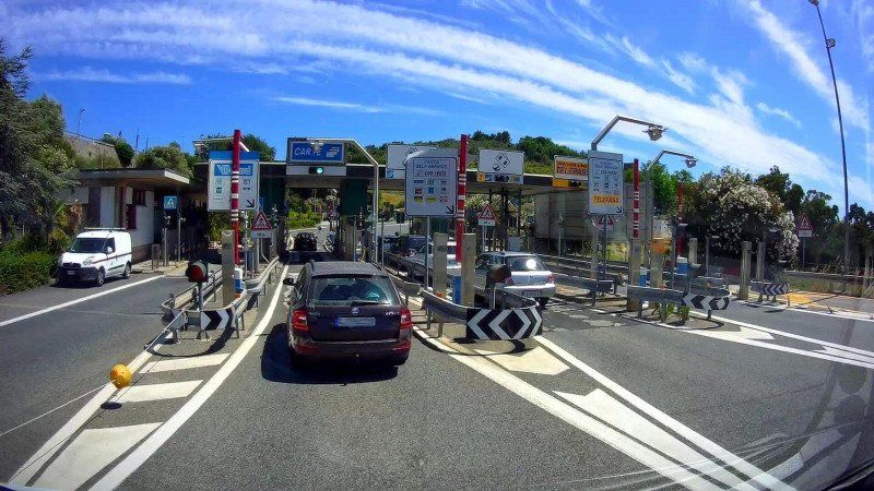
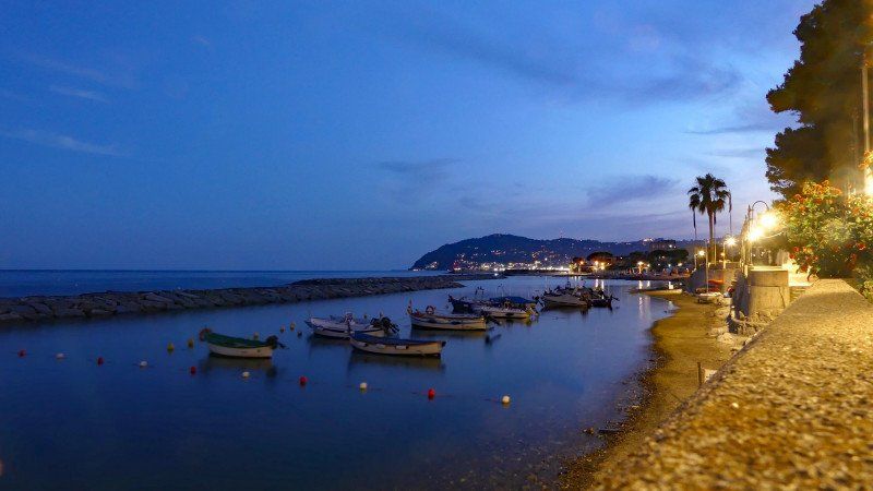
We started shortly before 11:00 a.m. in Lörrach. We actually wanted to leave an hour earlier, but we "stumbled" over a Dutch blogger couple from Bonn who are driving a 20-year-old Carthago. And we chatted tight. Dispose of it quickly and take the motorway towards Switzerland. Everything went smoothly. No controls, we were in Switzerland in no time. With the exception of a short lunch break, we are non-stop to Italy. We were only stopped by a 3 km traffic jam in front of the Gotthard tunnel and then another when entering Italy. But that was only due to the slalom set up in the border station. We were not checked this time either (a PCR or antigen test not older than 48 hours was mandatory for entry). No wonder that the mutations can spread so quickly and unhindered. But that's another topic.
In any case, we drove straight to the Area Sosta Camper in Como, where we will stay until Sunday, because France and Germany will play in the European Championship on Saturday and we have to see that (says my wife).
Via Brennero, 7, 22100 Como CO, Italien
45° 50' 5.9" N 9° 3' 38.8" E
45.8349847 9.0607784
• Head toward Via Adamello. Go for 2 m.
• Continue on Via Brennero. Go for 157 m.
• Turn left onto Via Francesco Borromini. Go for 222 m.
• Turn right onto Via Asiago toward Cernobbio/Como Centro/SS340. Go for 217 m.
• Take the 5th exit from roundabout onto Via Asiago toward Milano/A9/Svizzera. Go for 924 m.
• Keep left onto Raccordo SS340-A9 toward Milano/A9/Como Sud. Go for 752 m.
• Take ramp onto A9 (Autostrada dei Laghi). Go for 31.0 km.
• Take the left exit onto A8 (Autostrada dei Laghi). Go for 5.1 km.
• Take the exit toward E64/Torino/A4/Genova/A7/Bologna/A1 onto A50 (Tangenziale Ovest). Go for 20.5 km.
• Take the exit toward Genova onto A7 (Autostrada Milano-Genova). Go for 18.0 km.
• Take the exit toward Bereguardo/Pavia Nord onto A53 (Raccordo Autostradale Pavia Bereguardo). Go for 8.9 km.
• Take exit 7 toward Pavia Via Riviera/Ospedale. Go for 347 m.
• Continue on Via Adda. Go for 195 m.
• Turn right onto Via San Lanfranco Beccari (SP130). Go for 381 m.
• Continue on Via Mascherpa (SP130). Go for 200 m.
• Arrive at Via Mascherpa (SP130). Your destination is on the left.
☍
86,9 km
( 54 min.)
Day
Day
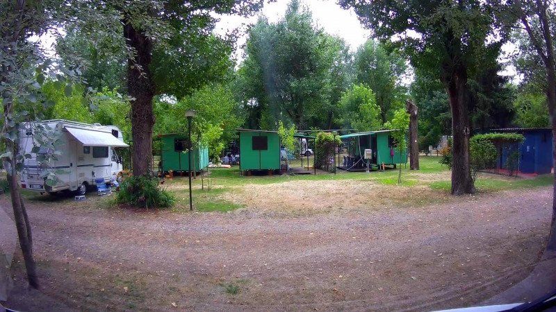
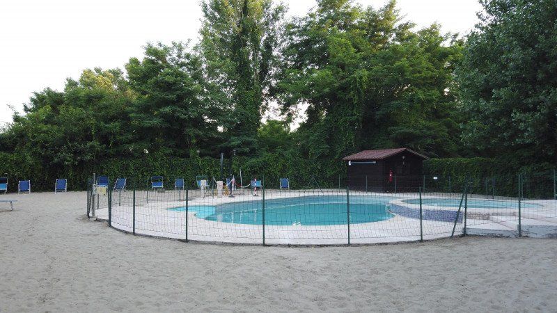
Camping Ticino, Via Mascherpa, Pavia, Italien
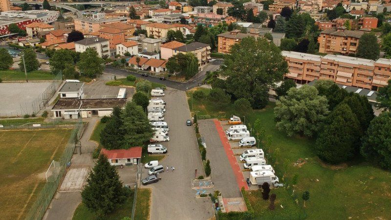
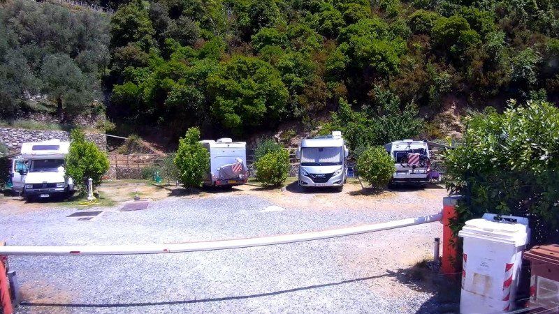
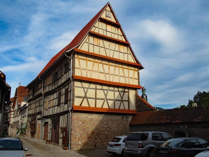
We have arrived at the first destination of our trip, Piedmont. But look at what? There are several places that are worth a more or less brief visit. The decision was made for us. Piedmont, as well as Liguria later, are not really camper-friendly. Sure, every bigger place, every city has its own RV park. But almost always it is a parking lot, without service with no or very bad ratings or it simply doesn't exist anymore. And parking facilities for sightseeing - often nil.
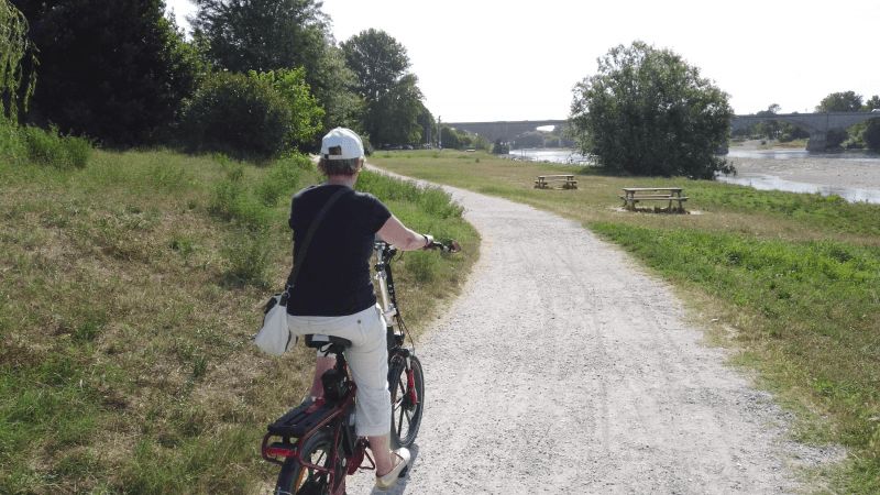
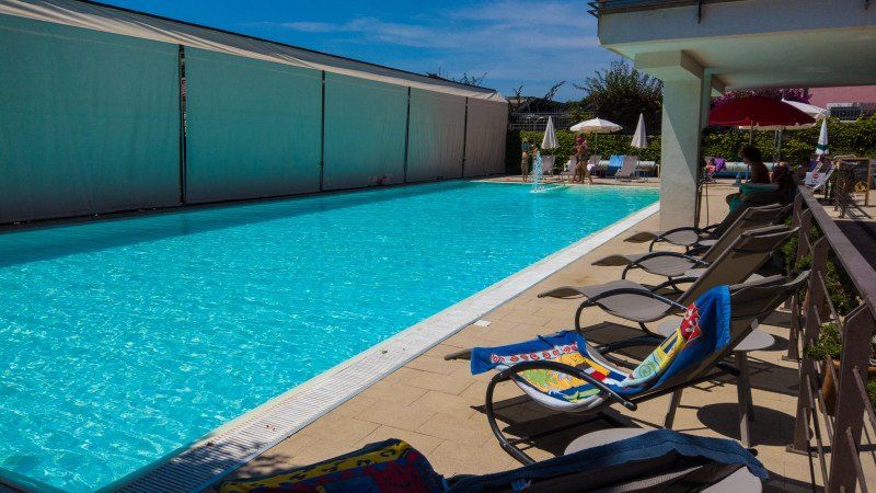
Pavia makes an exception. The small pitch / camping site for over 30 mobiles is located on the outskirts and offers some shade. The place is very clean, barrier-free and also has a small pool. But the best thing is that you can quickly get to the old town of Pavia by bike. A nice drive mostly along the banks of the Ticino.
Via Mascherpa, 16, 27100 Pavia PV, Italien
45° 11' 42.8" N 9° 7' 12.6" E
45.1952230 9.1201570
• Head east on Via Mascherpa (SP130). Go for 200 m.
• Continue on Via San Lanfranco Beccari (SP130). Go for 381 m.
• Turn left onto Via Adda toward Tangenziale Ovest/Pavia. Go for 389 m.
• Take left ramp onto A53 (Raccordo Autostradale Pavia Bereguardo) toward Milano/Genova/A7/Staz. Bereguardo. Go for 8.6 km.
• Take the left exit toward Genova onto A7 (Autostrada Milano-Genova). Go for 41.0 km.
• Take the exit toward Torino/Gravellona T./A26/E25 onto A21 (Autostrada Torino-Piacenza-Brescia). Go for 49.3 km.
• Take the exit toward A33/Cuneo onto SS231 (Strada Statale di Santa Vittoria). Go for 8.3 km.
• Continue on Autostrada Delle Langhe (A33). Go for 8.5 km.
• Take ramp toward Costigliole/Govone. Go for 390 m.
• Take the 2nd exit from roundabout. Go for 233 m.
• Continue toward Strada Valle Tanaro/SP54. Go for 25 m.
• Take the 2nd exit from roundabout onto Strada Valle Tanaro (SP54) toward Castagnole/Neive/Coazzolo/S. Stefano B. Go for 2.0 km.
• Continue on Via Valle Tanaro (SP54). Go for 1.5 km.
• Continue on SP54. Go for 948 m.
• Continue on Via Valle Tanaro (SP54). Go for 1.4 km.
• Take the 2nd exit from roundabout onto Via 24 Maggio (SP39). Go for 783 m.
• Continue on Piazza San Bartolomeo (SP39). Go for 18 m.
• Take the 1st exit from roundabout onto Via Fratelli Vicari (SP23). Go for 90 m.
• Turn left onto Via Val Bera (SP39). Go for 987 m.
• Keep right onto SP39b. Go for 752 m.
• Continue on Via Maestra (SP39b). Go for 1.5 km.
• Continue on Via Bosco (SP39b). Go for 1.5 km.
• Continue on SP195. Go for 404 m.
• Continue on Località Romanino (SP195). Go for 191 m.
• Turn right onto Località Romanino (SP51). Go for 747 m.
• Continue on Borgata Olano (SP51). Go for 838 m.
• Continue on Località Riforno (SP51). Go for 129 m.
• Continue on Via Sant'Ambrogio (SP51). Go for 1.5 km.
• Take the 1st exit from roundabout onto Via Circonvallazione (SP51). Go for 196 m.
• Continue on Località Trava (SP51). Go for 97 m.
• Turn right onto Località Trava. Go for 39 m.
• Arrive at Località Trava. Your destination is on the left.
☍
133,1 km
(1 hrs. 22 min.)
Day
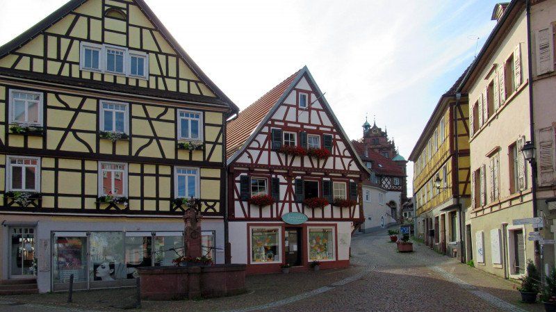
Sightseeing in Pavia
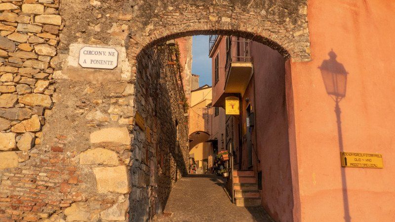
Today we have decided on our first city, Pavia. There is a lot to see here, but we didn't look at everything, as one or the other sight is a bit outside of the city center.
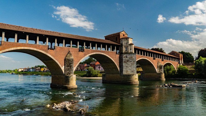
If you come by bike from the campsite, the first stop is the Ponte Coperto, the covered bridge. It is somewhat reminiscent of the Ponte Vecchio in Florence, but unlike it has no shops. But there is a small chapel in the middle. Unfortunately, the medieval bridge was destroyed in the war and rebuilt in 1949. But it is still beautiful.
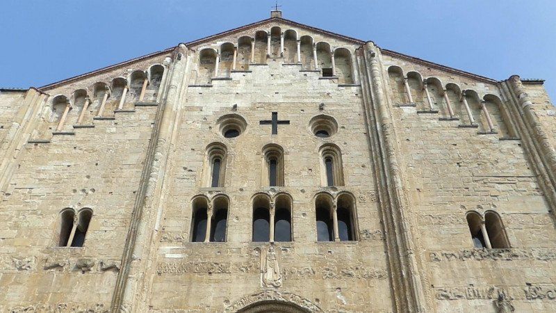
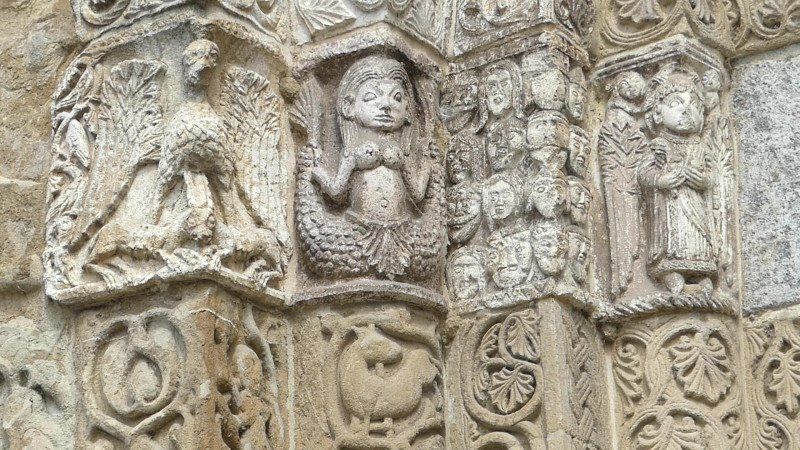
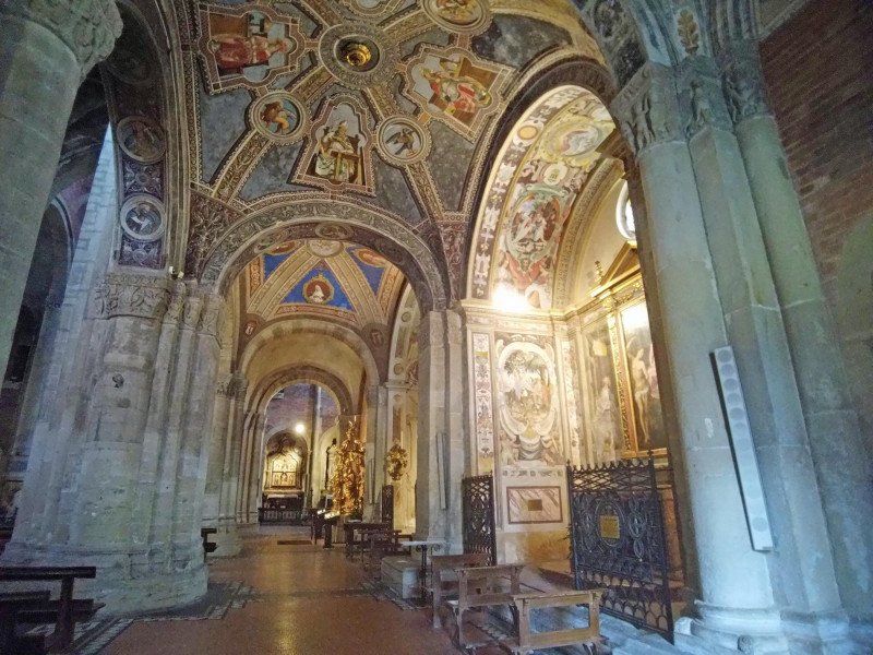
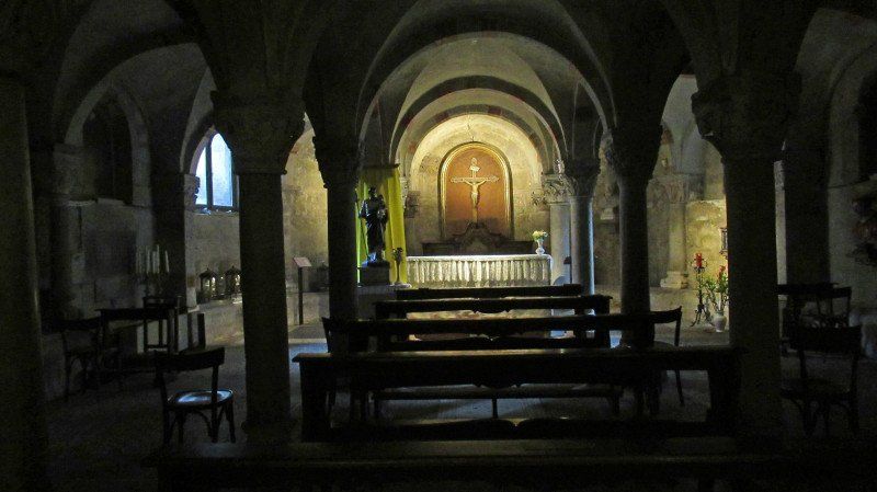
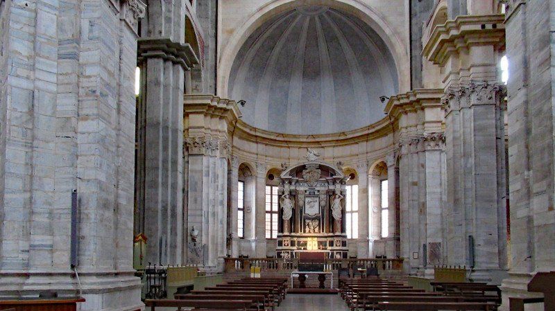
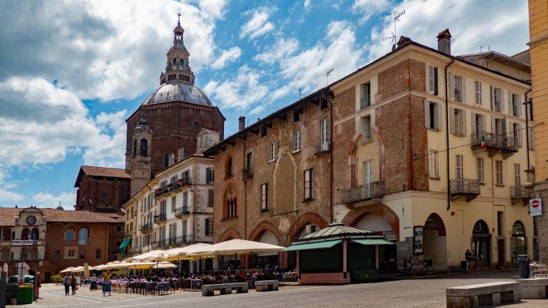
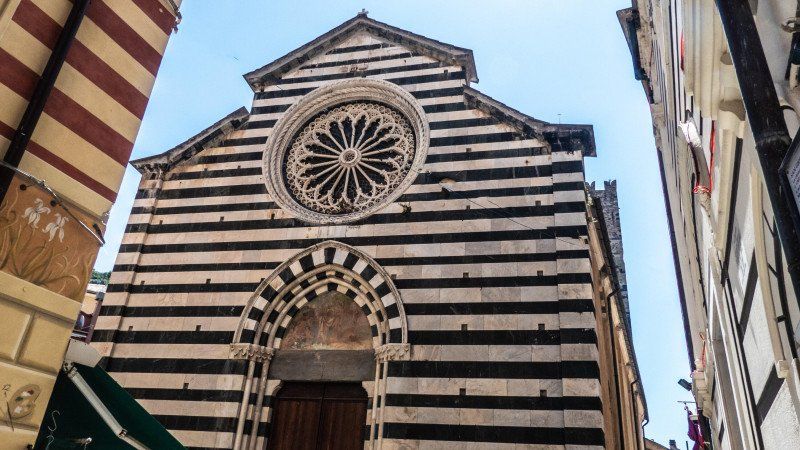
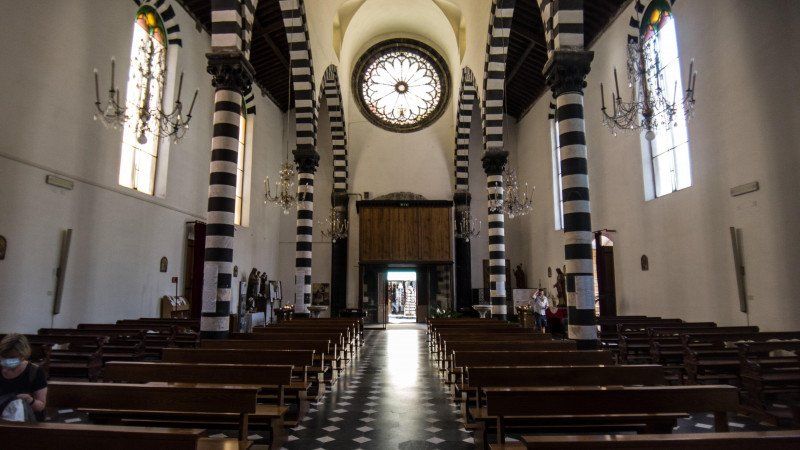
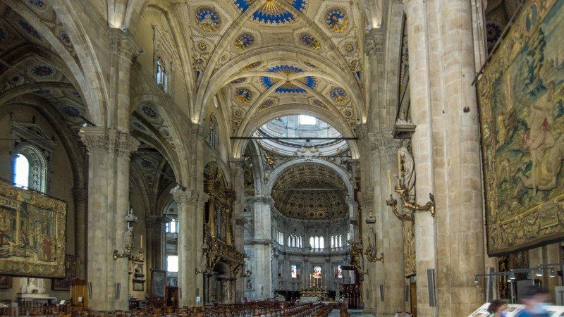
From here you can quickly get to the Basilica di San Michele Maggiore. In 1155 Emperor Barbarossa was crowned King of Italy in it. The many relief figures on the sandstone facade and the dwarf gallery, which is rather untypical for the area, are special here. What we did not consider is that the churches here close at noon. And so after a short time we were asked non-verbally but clearly to leave. So on to the cathedral from the 15th century. The dome, whose designs also come from the Renaissance, was not added until 1884. The 11th century brick tower next to the cathedral collapsed in 1989 and killed 4 people. Inside, the cathedral is kept rather simple.
On the Piazza della Vittoria you have a beautiful view of old patrician houses, the Borletto from the 12th / 13th. Century, former seat of the city government, and the cathedral dome.
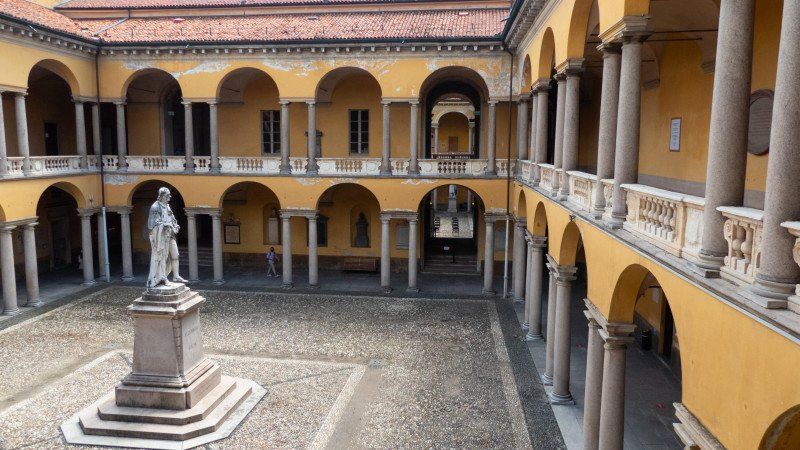
The next destination is the university. It is the second oldest university in Italy after Bologna. In the courtyards of the building complex there are statues of famous professors and students, such as B. by Allesandro Volta, the inventor of the electric battery.
If you leave the university through the rear area, you can see the remaining three of the former 200 family towers of Pavia.
Day
Azienda Agricola La Trava, SP51, Mango, Cuneo, Italien
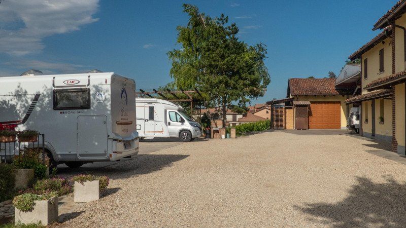
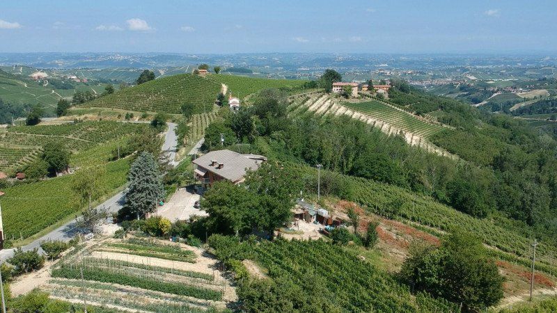
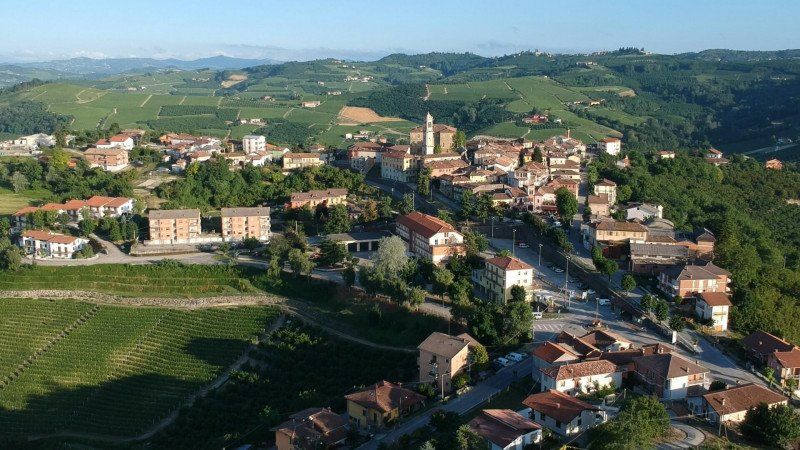
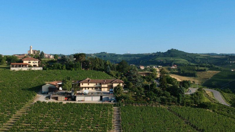
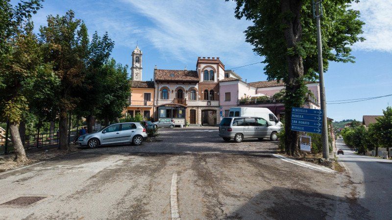
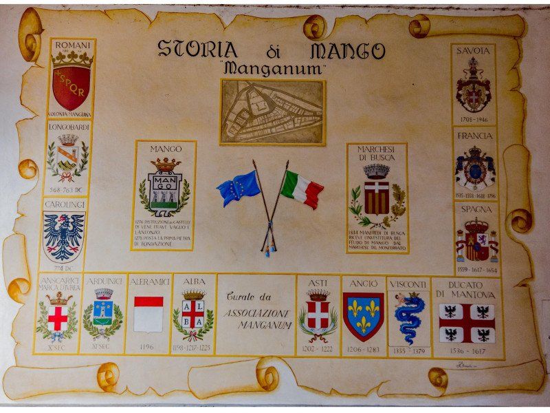
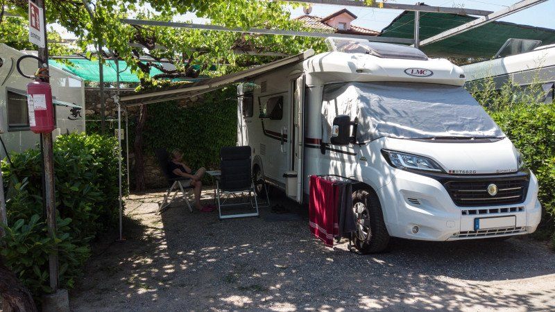
We have already described the problem with cities and sights. Apart from that, we didn't want to organize a sightseeing marathon this time, but rather take it easy. Asti or Alba, where the famous sparkling wine or white truffles come from. But again we failed because of the parking space issue. We looked and found what we were looking for. A small winery, remote in the Alba area, should offer a fantastic view and the operators should be very nice.
So we worked our way up the serpentines into the mountains, just passed the driveway and turned in Mango. But we weren't promised too much in the app this time. And the fact that the wine was really tasty was almost too much of a good thing. Sure, we stayed two nights and stocked up on wine for the rest of our tour. You never know what's coming ...
SP51, 2, 12056 Mango CN, Italien
44° 41' 21.1" N 8° 8' 48.3" E
44.6891979 8.1467637
• Head toward Località Achivi on Località Trava. Go for 39 m.
• Turn left onto Località Trava (SP51). Go for 97 m.
• Continue on Via Circonvallazione (SP51). Go for 137 m.
• Turn right onto Via Circonvallazione (SP265). Go for 413 m.
• Keep right onto Via Vincenzo Bertorello (SP265). Go for 723 m.
• Continue on Località Fornace (SP265). Go for 2.0 km.
• Take the 1st exit from roundabout onto SP265. Go for 659 m.
• Continue on Località Badellini (SP265). Go for 619 m.
• Continue on SP265. Go for 1.4 km.
• Continue on Via Cappelletto (SP265). Go for 1.5 km.
• Take the 2nd exit from roundabout onto Via Cappelletto (SP230). Go for 1.4 km.
• Continue on Via Montemarino (SP230). Go for 1.1 km.
• Turn left onto SP429. Go for 2.8 km.
• Turn right onto Via Alba (SP429). Go for 3.3 km.
• Turn right onto Via Nazionale Castino Alba (SP31). Go for 4.7 km.
• Turn left onto Via Provinciale Valle Bormida (SP31). Go for 5.1 km.
• Turn right onto Località Fontane (SP439). Go for 13.6 km.
• Pass 3 roundabouts and continue on Via Roma (SP439). Go for 7.9 km.
• Take the 2nd exit from roundabout onto Via Vittorio Emanuele II (SP439). Go for 3.4 km.
• Continue on Via Valbormida (SP339). Go for 2.9 km.
• Take the 2nd exit from roundabout onto Strada Provinciale San Giuseppe Cengio (SP42) toward Cosseria/S.Giuseppe di Cairo. Go for 7.6 km.
• Take the 2nd exit from roundabout onto Strada Provinciale Cairo Montenotte-Scaletta Uzzone (SP29) toward Cairo M./Acqui T./SP30/Ospedale Pronto Soccorso. Go for 790 m.
• Take the 1st exit from roundabout onto Variante di Vispa toward Torino-Savona/A6. Go for 2.0 km.
• Continue on Tunnel Monte Grosso. Go for 1.5 km.
• Continue on Variante di Vispa. Go for 14 m.
• Continue on Tunnel Vispa. Go for 356 m.
• Continue on Variante di Vispa. Go for 623 m.
• Take the 2nd exit from roundabout onto Strada Provinciale Cairo Montenotte-Scaletta Uzzone (SP29) toward Altare Centro/Torino-Savona/A6/Savona. Go for 486 m.
• Keep left toward Torino-Savona/A6/Torino/Ceva/Carcare. Go for 84 m.
• Continue on Strada Provinciale Cairo Montenotte-Scaletta Uzzone (SP29). Go for 126 m.
• Keep right toward Torino-Savona/A6. Go for 138 m.
• Take left ramp onto A6 (Autostrada Torino-Savona) toward Savona. Go for 15.4 km.
• Take the exit toward Ventimiglia onto A10 (Autostrada dei Fiori). Go for 67.7 km.
• Take the exit toward Imperia Ovest. Go for 1.4 km.
• Take the 2nd exit from roundabout onto Via Tommaso Littardi toward Imperia Centro. Go for 561 m.
• Turn right onto SS1 toward Poggi/San Lorenzo al Mare/SP1/Sanremo/Confine di Stato. Go for 478 m.
• Turn right onto Via Giovanni Ballestra (SP96) toward Poggi. Go for 25 m.
• Turn right onto Via Giovanni Ballestra. Go for 144 m.
• Arrive at Via Giovanni Ballestra. Your destination is on the left.
☍
153,3 km
(2 hrs. 10 min.)
Day
Day
Camping De Wijnstok, Strada Comunale Poggi, Imperia, Italien
We have arrived on the Riviera! Here, too, the same "misery" awaited us. Nothing with small, dreamy parking spaces in secluded bays, as the advertising likes to suggest.
In parking lots (like in Bodighera) undesirable, the parking spaces, if available, dusty areas at the edge of a garbage collection point and actually only just in the first row because of the view of the sea, like in San Remo. We had promised each other more. We drove along the coast and chose one of the two campsites in Imperia. Maybe we can take a beach vacation here. Well, the ratings weren't great, but the heavy traffic and sometimes narrow streets took their toll.
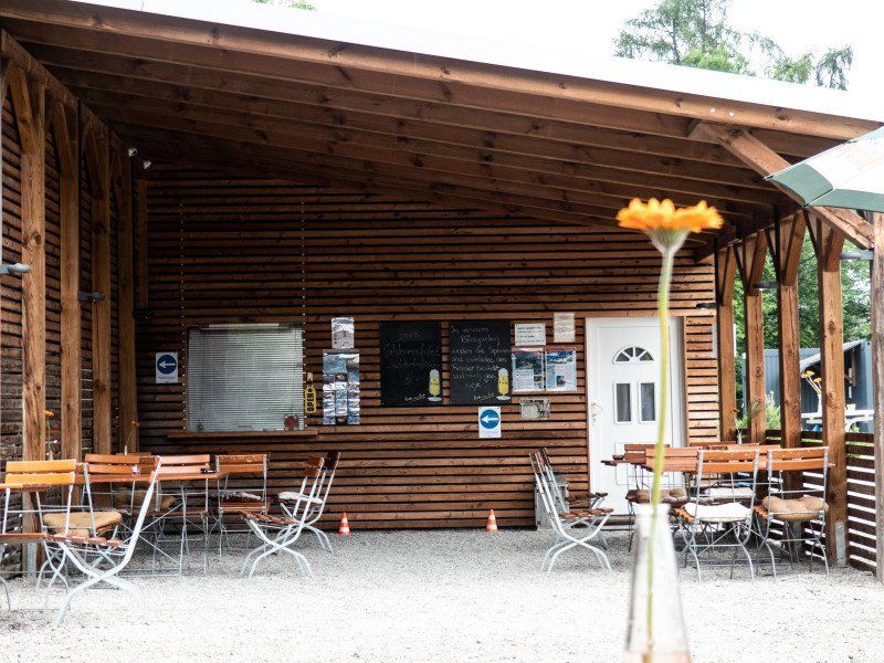
But the first place right at the entrance was an imposition. So turn around and get out again. Second place, Camping De Wijnstok is not exactly the first choice either (rating 2.5, the pitches emphasize the space, the sanitary facilities are pretty shabby), but it's okay for one night. After we had mastered the very narrow driveway and registered, we were assigned the space. The highlight on the square is the pizzeria. The pizza is really delicious and one of 2 pizzas is the free welcome pizza.
Strada Comunale Poggi, 2, 18100 Imperia IM, Italien
43° 52' 10.5" N 7° 59' 52" E
43.8695755 7.9977865
• Head toward Strada Poggi on Via Giovanni Ballestra. Go for 144 m.
• Turn left onto Via Giovanni Ballestra (SP96). Go for 25 m.
• Turn left onto Via Aurelia (SS1). Go for 475 m.
• Turn left onto Via Tommaso Littardi toward Genova/A10/Ventimiglia/Dolcedo/SP39/Piani. Go for 584 m.
• Take the 1st exit from roundabout toward Genova/A10/Ventimiglia. Go for 940 m.
• Take ramp onto A10 (Autostrada dei Fiori) toward Genova. Go for 12.2 km.
• Take the exit toward Aurelia/SS1. Go for 1.2 km.
• Continue on Via Pairola (SP34) toward Aurelia/SS1/San Bartolomeo/Cervo/Diano Marina. Go for 566 m.
• Take the 1st exit from roundabout onto Via Roma (SP34) toward Diano Marina/Cervo. Go for 724 m.
• Take the 3rd exit from roundabout onto Via Aurelia (SS1) toward Cervo. Go for 482 m.
• Turn right onto Via Nazario Sauro. Go for 58 m.
• Turn right onto Via Nazario Sauro. Go for 85 m.
• Arrive at Via Nazario Sauro.
☍
17,6 km
( 16 min.)
Day
Camping Lino, Via Nazario Sauro, Cervo, Imperia, Italien
We are on the next day. First along the coast, then on the autostrada. We nail our heads and have signed up for 3 days at a really good campsite in Cervo. With a small grocery store, pool, private beach ... Camping Lino is the name of our beach oasis. The driveway to the parking spaces is pretty narrow and a bit sporty, but the guide from the staff was a professional.
In the afternoon we went to the beach and into the sea. At the end of June the water is still a little fresh.
Via Nazario Sauro, 4, 18010 Cervo IM, Italien
43° 55' 22" N 8° 6' 34" E
43.9227778 8.1094444
• Head north on Via Nazario Sauro. Go for 85 m.
• Turn left onto Via Nazario Sauro. Go for 58 m.
• Turn left onto Via Aurelia (SS1). Go for 433 m.
• Take the 1st exit from roundabout onto Via Roma (SP34) toward Villa Faraldi/Chiappa/Pairola/Genova/A10/Ventimiglia. Go for 724 m.
• Take the 2nd exit from roundabout onto Via Pairola (SP34) toward Genova/A10/Ventimiglia/Pairola. Go for 635 m.
• Take left ramp onto A10 (Autostrada dei Fiori) toward Genova. Go for 88.2 km.
• Take the exit toward Genova/Livorno/A12 onto A10 (Autostrada Genova-Ventimiglia). Go for 791 m.
• Take the exit onto A10 (Autostrada Genova-Ventimiglia). Go for 12.0 km.
• Take the exit toward Milano onto A7 (Autostrada Milano-Genova). Go for 2.8 km.
• Take the exit toward Genova Est/Livorno onto A12 (Autostrada Azzurra). Go for 68.8 km.
• Take the exit toward Levanto. Go for 1.6 km.
• Turn left onto Via Levanto (SP566dir) toward Levanto/Monterosso/SS370/Bonassola/Cinque Terre. Go for 9.9 km.
• Take the 2nd exit from roundabout onto Via Nostra Signora della Guardia (SP566dir) toward Centro. Go for 564 m.
• Take the 4th exit from roundabout onto Strada Provinciale Albero d'Oro (SP43) toward Genova-Livorno/A12/Parma/A15/Carrodano/Monterosso/La Spezia. Go for 166 m.
• Turn left onto Località Albero d'Oro (SP43). Go for 5.4 km.
• Continue toward SP38. Go for 28 m.
• Continue on SP38. Go for 119 m.
• Continue on Località Colle di Gritta (SP38). Go for 135 m.
• Continue on Galleria Colle di Gritta (SP38). Go for 84 m.
• Continue on SP38. Go for 335 m.
• Continue on Galleria Soviore (SP38). Go for 80 m.
• Continue on SP38. Go for 1.1 km.
• Arrive at SP38.
☍
194,1 km
(2 hrs. 12 min.)
Day
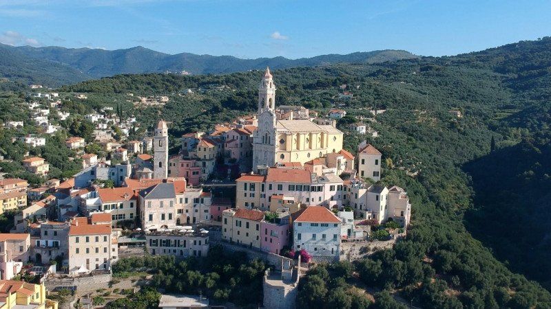
Cervo - mittelalterliche Perle Liguriens
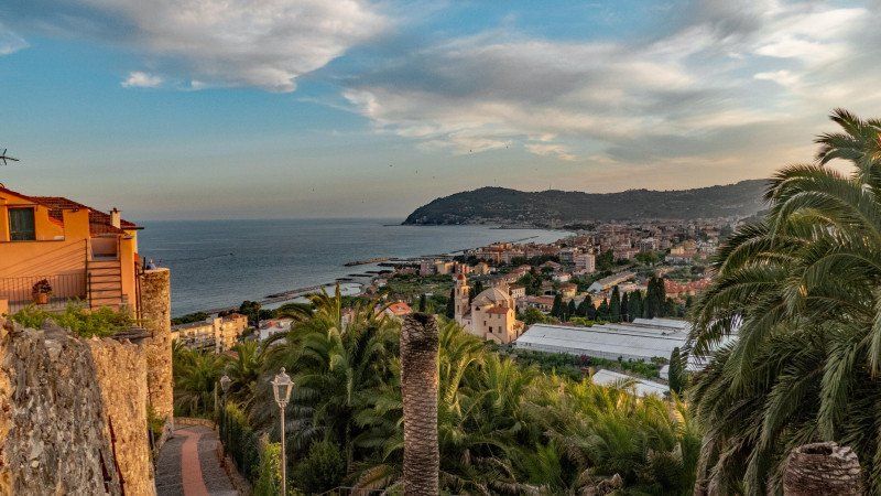
The next morning I first let the drone go up. On the beach in front of the mountain-built town of Cervo.
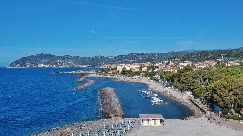
In the afternoon we explored this medieval place, which always feels like it's uphill. Because the place was built on the rocks by the sea. Narrow, car-free streets, nested houses, small squares where life happens - all the way up to the summit, where the Castello di Cervo (city museum) is located. Another attraction is the Church of San Giovanni Battista. The church (18th century), once donated by the coral fishermen, captivates with its baroque facade and a large flight of stairs in front of the sea. Chamber concerts are held on the Piazza della Chiesa in front of the church in July and August.
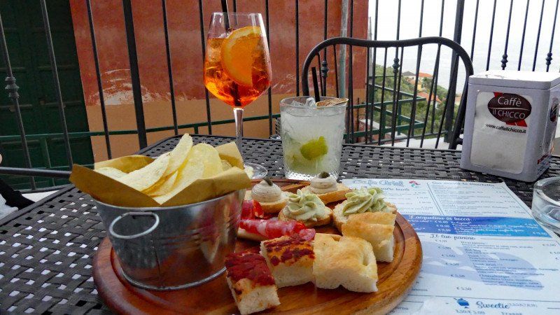
We ended the day in the panorama bar Arielle; Cocktails, nibbles and a fantastic view.
Day
Day
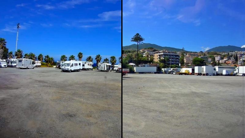
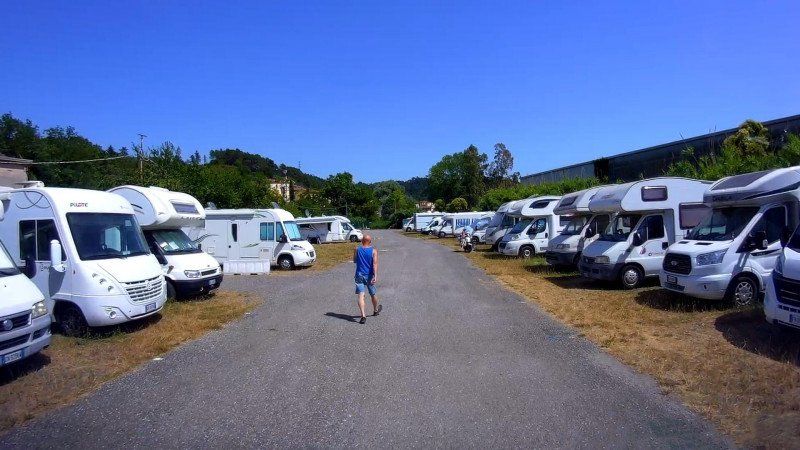
Area Sosta Camper - Il Poggio
We have finished our beach days and want to move on. The Portofino area should be. And again the same picture emerged: bad or too distant parking or camping sites, too few sights. So again rescheduled at short notice and off to the Cinque Terre.
There is a parking space here on the way to Monterosso. There is also a bus stop for the bus to Monterosso right next to the parking space. But - bad luck. The pitch is full. Turning didn't work, so down to Monterosso (I love switchbacks). But we didn't get in; at the small roundabout at the entrance to the town it was over, the road was closed. So turned in a confined space and everything back again.
We have enough! We're going to La Spezia, even if the pitch isn't that great again, but we want to go to the Cinque Terre.
Loc. Beo, 19016 Monterosso al mare SP, Italien
44° 9' 17.5" N 9° 39' 33.7" E
44.1548493 9.6593747
• Head north on SP38. Go for 1.1 km.
• Continue on Galleria Soviore (SP38). Go for 80 m.
• Continue on SP38. Go for 335 m.
• Continue on Galleria Colle di Gritta (SP38). Go for 84 m.
• Continue on Località Colle di Gritta (SP38). Go for 135 m.
• Continue on SP38. Go for 110 m.
• Turn sharp right onto SP38. Go for 14.7 km.
• Turn right onto Via Aurelia Sud (SS1). Go for 5.9 km.
• Continue on SS1var/A toward La Spezia. Go for 6.0 km.
• Take the 1st exit from roundabout onto Via del Forno toward Centro. Go for 359 m.
• Take the 2nd exit from roundabout onto Via Buonviaggio (SP330) toward Centro. Go for 420 m.
• Take the 2nd exit from roundabout onto Via del Canaletto (SP330). Go for 363 m.
• Turn left onto Via Sarzana (SS1). Go for 988 m.
• Take the 1st exit from roundabout onto Via del Camposanto. Go for 352 m.
• Take the 2nd exit from roundabout onto Via del Camposanto. Go for 413 m.
• Take the 2nd exit from roundabout onto Via degli Stagnoni toward Porto Est/Macelli/Autostrade/Lerici. Go for 186 m.
• Continue on Via Privata O.T.O. Go for 400 m.
• Turn left onto Via Valdilocchi. Go for 26 m.
• Take the 2nd exit from roundabout onto Via Privata ENEL toward Lerici. Go for 521 m.
• Take the 2nd exit from roundabout onto Via delle Casermette toward Lerici. Go for 205 m.
• Arrive at Via delle Casermette. Your destination is on the left.
☍
32,7 km
( 41 min.)
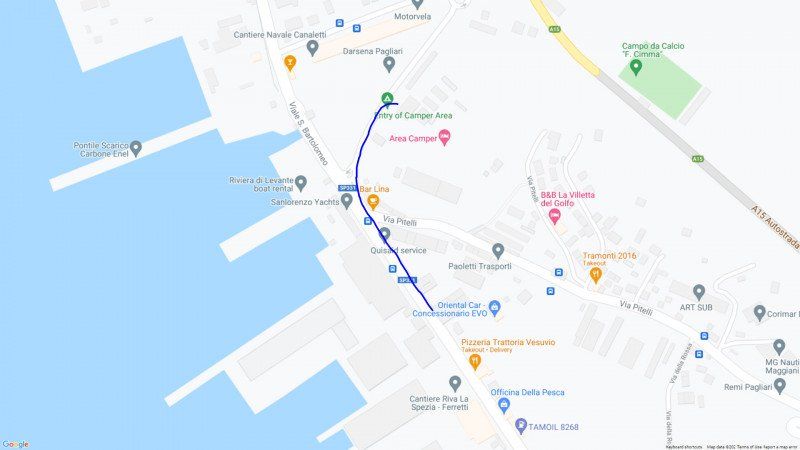
Area Attrezzata La Spezia
The parking space on the edge of the industrial port is indeed a little "charmless". A decent part of the space is occupied with permanently parked mobile homes. But it is quiet at night and a good starting point for tours to La Spezia and the Cinqe Terre. At the square you can also get bus tickets for the return trip; these are cheaper here than with the driver.
However, the stop was moved to La Spezia; we once traced the path. However, we do not know whether the relocation is temporary or permanent.
Viale San Bartolomeo, 19120, La Spezia, Italy
44° 6' 15" N 9° 51' 34" E
44.1041667 9.8594444
• Head toward Via Pagliari on Via delle Casermette. Go for 165 m.
• Take the 2nd exit from roundabout onto Via delle Casermette. Go for 528 m.
• Take the 1st exit from roundabout onto Via Valdilocchi. Go for 728 m.
• Take the 2nd exit from roundabout onto Largo Guido Rossa toward Aurelia/SS1. Go for 136 m.
• Continue on Via Melara. Go for 693 m.
• Continue toward Autostrada della Cisa/A15. Go for 43 m.
• Take the 3rd exit from roundabout onto A15 (Autostrada della Cisa) toward E31/Parma/S. Stefano M./Rosignano M. Go for 4.4 km.
• Take the exit toward E80/Genova/A12/Livorno/A12/Rosignano M./Roma/E80/E31/Parma onto A15 (Autostrada della Cisa). Go for 101 km.
• Take the left exit onto A1 (Autostrada del Sole). Go for 97.7 km.
• Keep right onto A50 (Tangenziale Ovest) toward E62/Genova/A7/E66/Torino/A4/Varese-Gravellona T./A8/A26/Como-Chiasso/A9/Fiere-Aeroporto Malpensa. Go for 31.7 km.
• Take the exit toward Varese/Gravellona T./A26/Como-Chiasso/A9 onto A8 (Autostrada dei Laghi). Go for 4.9 km.
• Take the exit toward Como/Chiasso onto A9 (Autostrada dei Laghi). Go for 31.1 km.
• Take the exit toward Lago di Como onto Raccordo SS340-A9. Go for 1.7 km.
• Turn right onto Via Francesco Borromini. Go for 222 m.
• Turn right onto Via Brennero. Go for 145 m.
• Arrive at Via Brennero. Your destination is on the left.
☍
275,3 km
(2 hrs. 28 min.)
Day
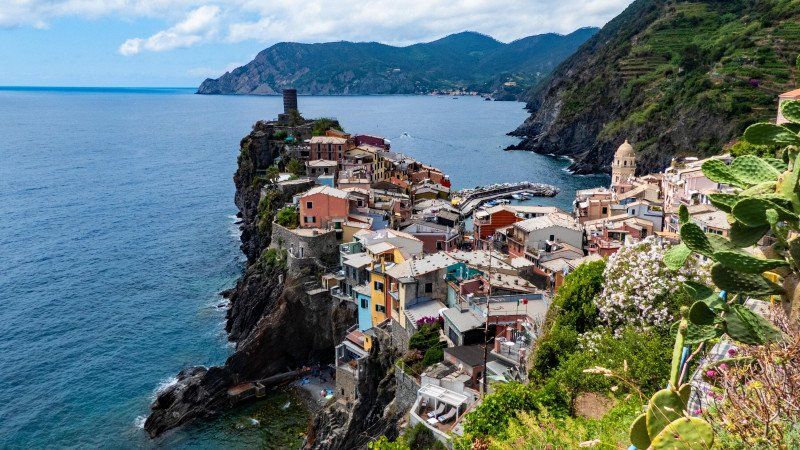
Nationalpark Cinqe Terre - Monterosso
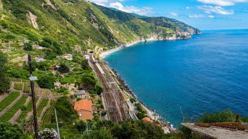
We're going to the Cinque Terre. But what is that anyway? Cinque Terre is the name for five centuries-old villages, which with their colorful houses and terraced vineyards and olive groves were built into the steep cliffs of the Italian Riviera. A hiking trail, the Sentiero Azzuro, connects the villages. There is also a train line that stops in every village.
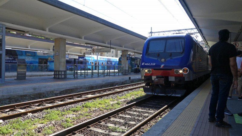
We informed ourselves well and bought the bus tickets for the trip to the train station (round trip) right on the pitch. That is cheaper than with the driver. The bus stop, which is supposed to be "right around the corner", was relocated, so that two buses simply drove past us. In the end it worked and after a 20 minute drive through La Spezia we arrived at the Central Station. There you can buy tickets for the train ride and entry to the national park (needed if you want to hike from village to village). And there are also hints, for example which hiking route is open or closed.
Then off to the platform and wait for the regional train. For the feeling of being at home (the train sends its regards) the track was changed. But luckily on the same platform. Otherwise it could have been tight. We drove all the way to Monterosso. Monterosso is the largest of the 5 villages and has the only sandy beach in the Cinque Terre. A tunnel leads from the beach to the old town with its beautiful, narrow streets and the church of San Giovanni Battista.
Von Vernazza nach Corniglia
We covered the way from Monterosso al Mare to Vernazza again by train. The climb from Monterosso is said to be too strenuous. So we didn't even try. We were also told that the route from Vernazza to Corniglia was the easier one (the other two routes were closed anyway).
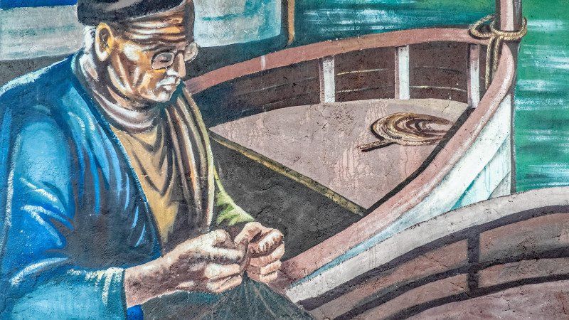
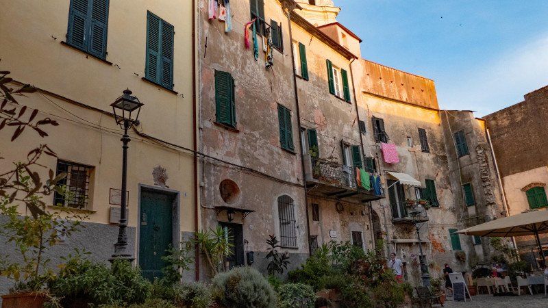
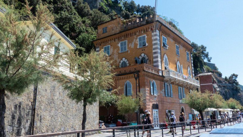
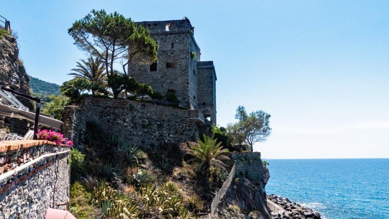
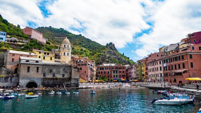
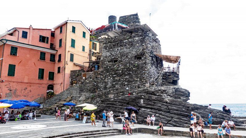
But first we took a leisurely look at Vernazza. It is said to be the most beautiful of the 5 villages in the Cinque Terre, with its romantic harbor. First you can see the colorful houses, but they only really come into their own when the sun is shining. Then the narrow streets of the old town and of course the harbor with its colorful fishing boats. Unfortunately, we couldn't see the castle with its angular tower, from which one should have a nice view of the harbor, as it is a restaurant. Or maybe we just didn't find the way to the tower.
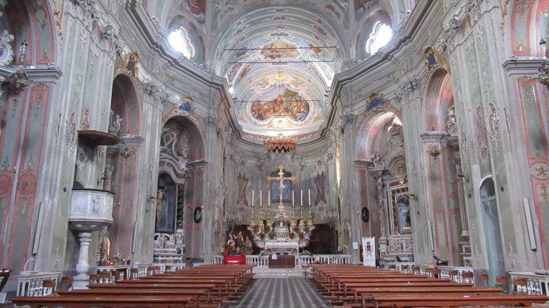
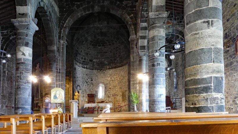
And then there is the church of Santa Margherita d'Antiochia, the patron saint of the city. It was first mentioned in 1318 and probably expanded in the 16th century. You can clearly see the two different parts. The altar (14th century) is still original. The extraordinary bell tower with a square base and an octagonal structure was part of the village's defense system.
The most beautiful view of Vernazza comes from Monterosso. Or you take the effort and go up the cliffs to the left of the village. There, according to the photos in the national park brochure, you can see the whole place from above. But first we got something to eat: one bag of fried fish to take away: crab claws, squid rings, anchovies ... delicious.
Then we made our way to Corniglia. After all, we wanted to hike in the Cinque Terre as well. Even the way out of Vernazza was exhausting, because it is only uphill. And that shouldn't change most of the way. And mostly on roughly hewn stone stairs - sometimes flat, sometimes high and crooked and crooked. For the sweaty hike, however, you will be rewarded with fantastic views. And so we were happy to arrive in Corniglia after about 3.5 kilometers and almost 2 hours (with photo breaks). First a break before descending to the train station. We gave each other the other two places because it was late and we were exhausted. So back to La Spezia directly by train.
Day
La Spezia - nichts wie weg
Actually we wanted to see La Spezia today, to stroll through the city. But something happened yesterday that changed our minds completely. We just wanted to get out of here.
For the first time in all the decades we have traveled, including Kenya and India, we have become a victim of pickpockets. We were standing at the bus stop of the train station yesterday and were about to get in to drive back to the parking space when a guy pushed his way in and dropped his bag. Other passengers and his accomplices pushed in from behind and in the crowd they opened my wife's backpack and fished out the purse in all the things that were in there. Unnoticed. And suddenly they were gone again. Got out of the car in a flash just before the doors were closed.
But - luck in bad luck. It was only 15 euros, the bank card (blocked immediately) and a few shopping cards. The only annoying thing was the driver's license. Replacing it takes time, costs and in the meantime she is not allowed to drive a car.
So we left without further ado. After the parking lot in Piacenza (we actually wanted to go there) hadn't made a trustworthy impression on us, we drove through to Como. On the way, we have come a good 150 kilometers, the police headquarters of La Spezia reported, they had found the wallet with some documents (cards). But we had already driven too far to turn back. And the bank card was already blocked.
Area Sosta Camper - Tavernola - Como, Via Brennero, 7, 22100 Como, CO, Italien
Via Brennero, 7, 22100 Como CO, Italien
45° 50' 6.2" N 9° 3' 39.4" E
45.8350613 9.0609582
• Head toward Via Adamello on Via Brennero. Go for 145 m.
• Turn left onto Via Francesco Borromini. Go for 222 m.
• Turn right onto Via Asiago toward Cernobbio/Como Centro/SS340. Go for 217 m.
• Take the 5th exit from roundabout onto Via Asiago toward Milano/A9/Svizzera. Go for 924 m.
• Keep right onto Via Asiago (SP16) toward Ponte Chiasso/Maslianico/Lugano. Go for 1.4 km.
• Turn right onto Via 25 Aprile. Go for 135 m.
• Take the 3rd exit from roundabout onto Via Molino Nuovo. Go for 192 m.
• Continue on Via 20 Settembre. Go for 39 m.
• Continue on Via Pizzamiglio. Go for 36 m.
• Turn left onto Via del Breggia (397). Go for 914 m.
• Turn left onto 397. Go for 134 m.
• Take the 3rd exit from roundabout onto Via Pietro e Luisita Chiesa. Go for 207 m.
• Take the 1st exit from roundabout onto Via Como (2). Go for 78 m.
• Take the 2nd exit from roundabout toward Lugano. Go for 205 m.
• Take ramp onto A2 toward Lugano. Go for 169 km.
• Take exit 35 toward Beckenried/Seelisberg/Emmetten. Go for 264 m.
• Turn right onto Mühlebachstrasse. Go for 841 m.
• Turn right onto Emmetterstrasse. Go for 1.2 km.
• Continue on Dorfstrasse. Go for 2.2 km.
• Turn right onto Ischenstrasse. Go for 1.2 km.
• Continue on Kellberg. Go for 944 m.
• Turn slightly right onto Steckenmattberg. Go for 110 m.
• Continue on Berlix. Go for 501 m.
• Continue on Lanzig. Go for 687 m.
• Turn left onto Ruotzen. Go for 408 m.
• Arrive at Ruotzen. Your destination is on the right.
☍
182,2 km
(1 hrs. 59 min.)
Day
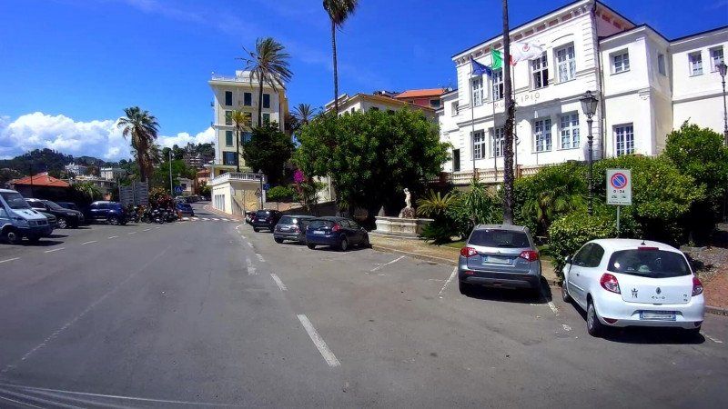
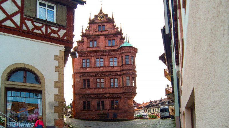
Comos Altstadt
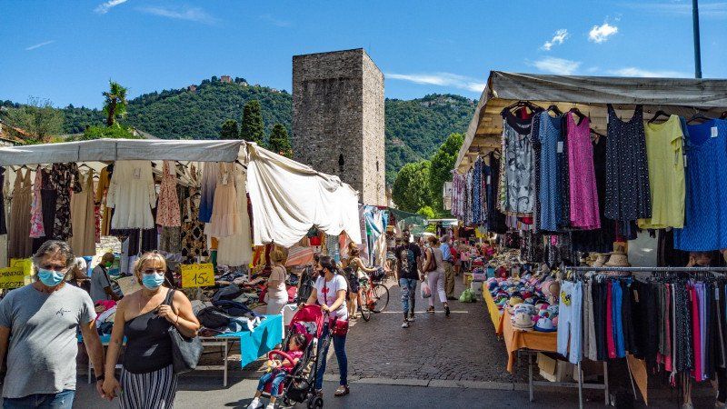
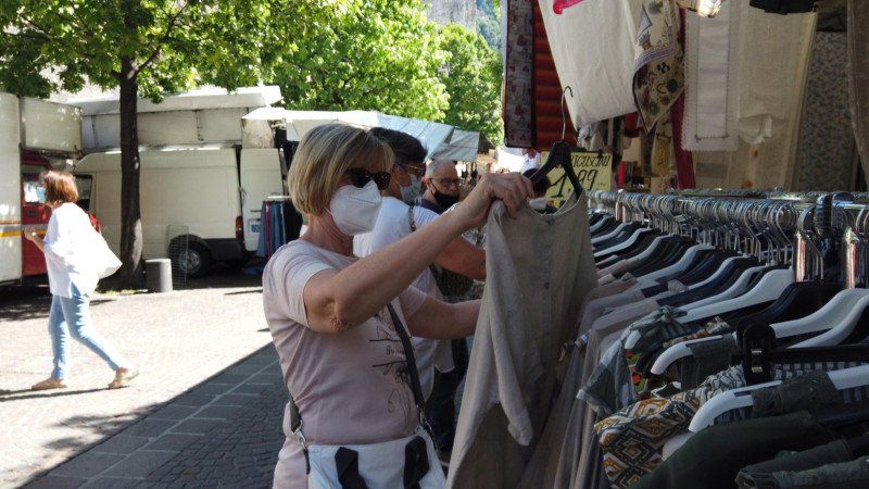
If we are in Como for the second time now and also have some time, we want to take a look at the city this time. Especially since there is market today (Tuesdays and Thursdays from 7:00 a.m. to 1:00 p.m., Saturdays until 7:00 p.m.).
We quickly found out that a bus was driving near the parking space. But where to get the tickets from? We knew from Florence and La Spezia that the drivers usually don't sell tickets. But where do we get them? After a long search on the Internet, we found a point of sale in the tobacco shop in front of the Bennet supermarket.
As always, you have to be a little careful when taking the bus, because the buses don't stop if nobody gets on or off. So simply counting the stations is not. But Google helps here too ...
We got off right at the market and plunged into the lively hustle and bustle. And we love to stroll through markets. Light summer clothes or local specialties - we always find something.
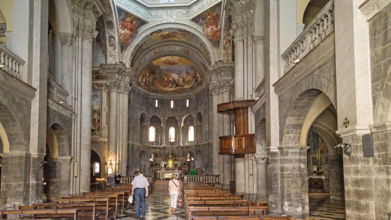
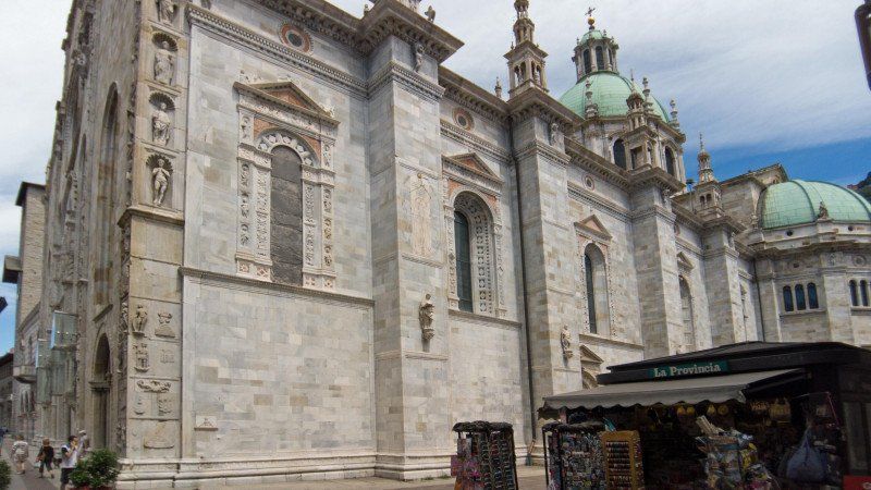
It is only a few steps from the market in Piazza Vittoria to the old town. The first destination was the Romanesque Basilica San Fedele from the 12th century on the small but very beautiful Piazza S. Fedele. From there we are through the alleys to the cathedral, the Gothic Cattedrale di Santa Maria Assunta, which is really worth a visit. If you now walk from the cathedral directly towards the lake, you almost stumble across the tourist information office (mandatory city map).
We first ate something in the Caffè Monti and took a break before continuing to the marina and the "Life Electric" in Lake Como. The modern sculpture was erected in honor of Alessandro Volta, the inventor of the electric battery. But what is special is the view you have from the platform in the lake.
Day
Arbeitstag
I used this and the next day to sort and edit the pictures and films for our homepage and our YouTube channel.
Day
Day
Emmetten, Schweiz
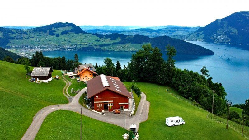
We actually wanted to travel non-stop through Switzerland on the return journey. In fact. But we received an email while on vacation from the operator of the landcamp.ch platform that was founded this year. Whether we want to take a look at the concept and report on it. Well, we still had some space in our travel plan, so why not. We then voted and opted for Lisa and Beat Ambauen's organic farm Ruotzen on Lake Lucerne.
We entered the address from the Internet into the GPS and it promptly sent us the wrong way. It is better to enter the coordinates. In Emmetten on Dorfstraße, take the 2nd street right after the petrol station (Ischenstraße) and more or less straight ahead. The road is narrow and there is a tight hairpin just before the courtyard, but that is the only way allowed. From the courtyard, the road, although better developed, is a cantonal private road and driving on it can be really expensive.
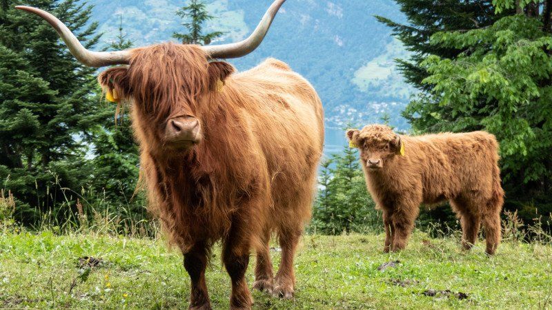
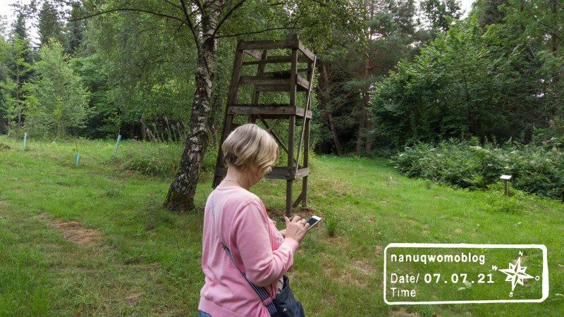
In any case, we had a nice day on the farm, had a great chat with Lisa and Beat and enjoyed the fantastic view of Lake Lucerne. The area is great for cycling and hiking and of course there is also a lot to do.
Ruotzen 1, 6376 Emmetten, Schweiz
46° 57' 5.5" N 8° 28' 36.9" E
46.9515373 8.4769112
• Head west on Ruotzen. Go for 408 m.
• Turn right onto Lanzig. Go for 687 m.
• Continue on Berlix. Go for 501 m.
• Continue on Steckenmattberg. Go for 110 m.
• Turn slightly left toward Kellberg. Go for 181 m.
• Continue on Kellberg. Go for 1.3 km.
• Continue on Ischenstrasse. Go for 667 m.
• Turn left onto Dorfstrasse. Go for 2.2 km.
• Continue on Emmetterstrasse. Go for 1.2 km.
• Turn left onto Mühlebachstrasse. Go for 841 m.
• Turn right and take ramp onto A2 toward Luzern/Stans. Go for 67.4 km.
• Take the exit onto A1/A2. Go for 8.5 km.
• Take exit 45 toward E25/Basel/Egerkingen onto A2. Go for 41.2 km.
• Keep left onto A2 (Verzweigung Wiese) toward Karlsruhe/Basel-Rheinhafen. Go for 363 m.
• Continue on A2 (Verzweigung Wiese). Go for 1.5 km.
• Continue on A5. Go for 166 km.
• Take exit 49 toward Gernsbach/Gaggenau. Go for 401 m.
• Turn left onto B462 toward Freudenstadt/Gernsbach/Gaggenau. Go for 13.9 km.
• Take ramp onto Hördener Straße toward Gernsbach/hist. Altstadt/Schloß Eberstein. Go for 272 m.
• Continue on Bleichstraße. Go for 137 m.
• Take the 2nd exit from roundabout onto Bleichstraße. Go for 500 m.
• Turn right onto Stadtbrücke (L78). Go for 114 m.
• Turn left onto Schloßstraße (K3700). Go for 397 m.
• Continue on Klingelstraße (K3700). Go for 62 m.
• Arrive at Klingelstraße (K3700). Your destination is on the right.
☍
309,1 km
(2 hrs. 56 min.)
Day
Stellplatz Murginsel
We left Switzerland, even if we would have liked to have stayed a little longer. But we want to pay a visit to the Unimog Museum in Gaggenau on the way back. Gaggenau has a parking space at the thermal baths, and there is a nice beer garden on the way to the museum. But unfortunately the parking space was full. So an alternative place had to be found nearby. Gernsbach offered himself then.
According to our motto: "Who knows what it is good for", the emergency solution turned out to be the much better one this time as well. A great pitch, much nicer and well maintained. And you can get to the old town of Gernsbach in no time. We only stayed here, but since there is a lot to discover here, we will definitely come back.
Schlossstraße, 76593, Gernsbach, Germany
48° 45' 34" N 8° 20' 20" E
48.7594444 8.3388889
• Head toward Schloßstraße on Klingelstraße (K3700). Go for 62 m.
• Continue on Schloßstraße (K3700). Go for 397 m.
• Turn right onto Hofstätte (L78). Go for 114 m.
• Turn right onto Igelbachstraße (L78). Go for 219 m.
• Turn left onto Loffenauer Straße (L564). Go for 59 m.
• Turn left onto Gottlieb-Klumpp-Straße. Go for 633 m.
• Take the 2nd exit from roundabout onto Bleichstraße. Go for 221 m.
• Continue on Hördener Straße. Go for 93 m.
• Take ramp onto Hördener Straße (B462). Go for 7.4 km.
• Turn left toward Akademie/Schloss Rotenfels. Go for 48 m.
• Continue on Oberau. Go for 69 m.
• Turn right. Go for 57 m.
• Arrive at your destination on the left.
☍
9,4 km
( 10 min.)
Day
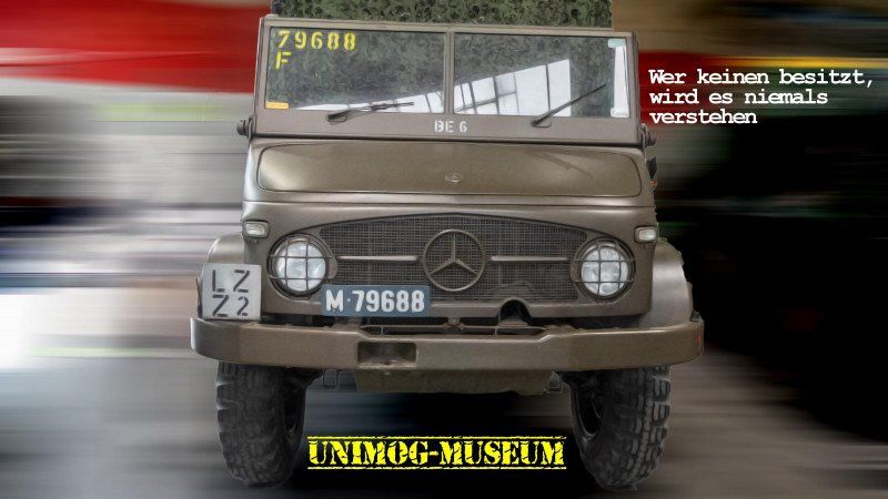
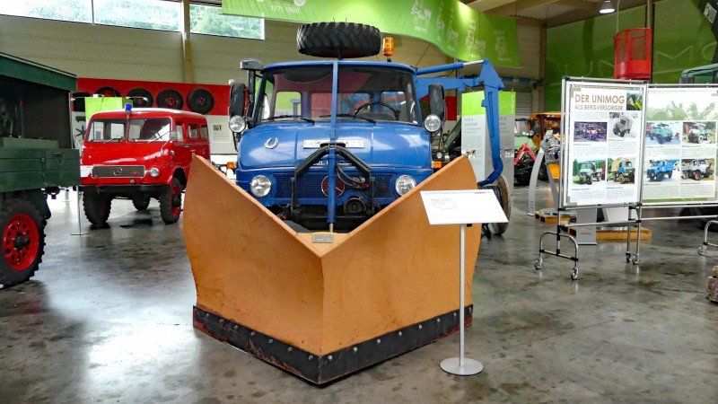
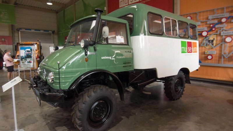
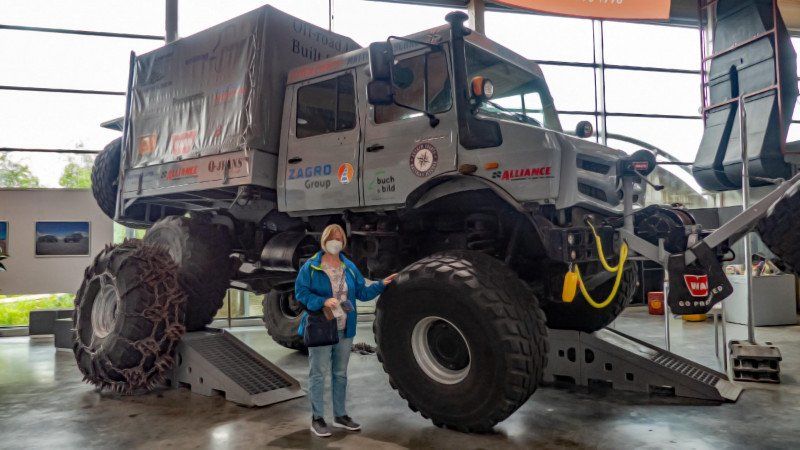
Unimog-Museum, B462, Gaggenau, Deutschland
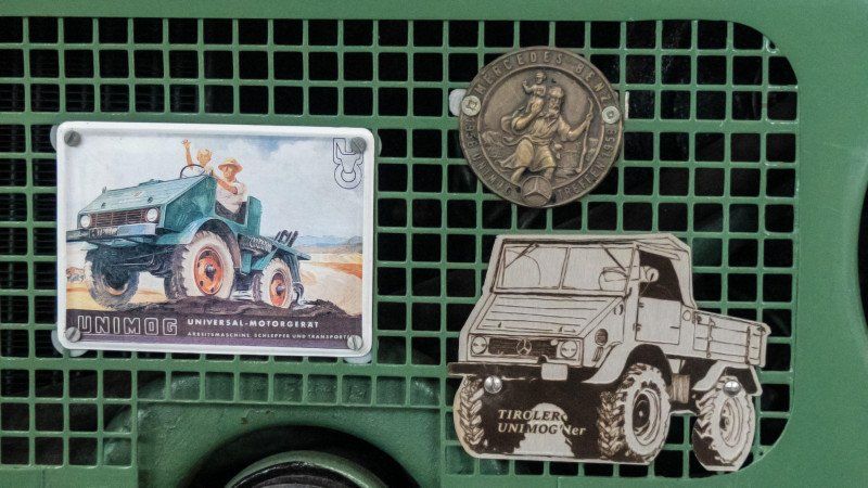
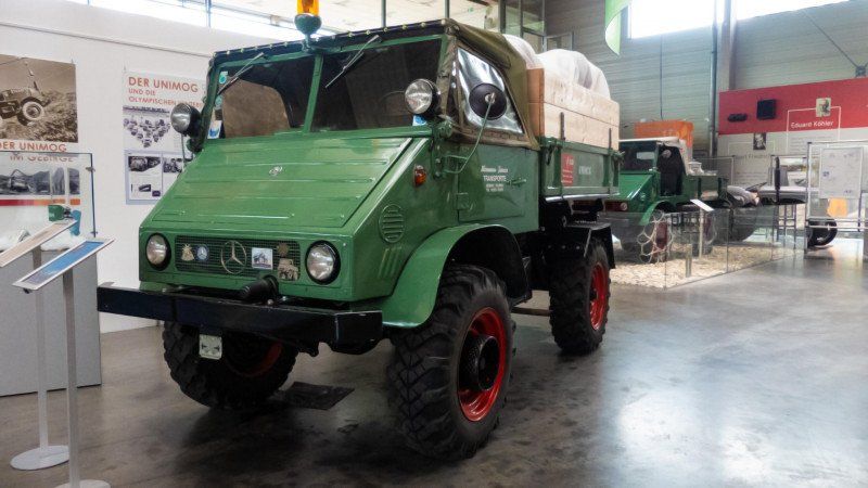
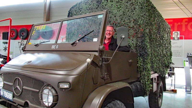
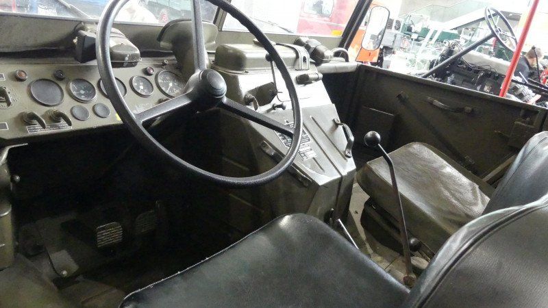
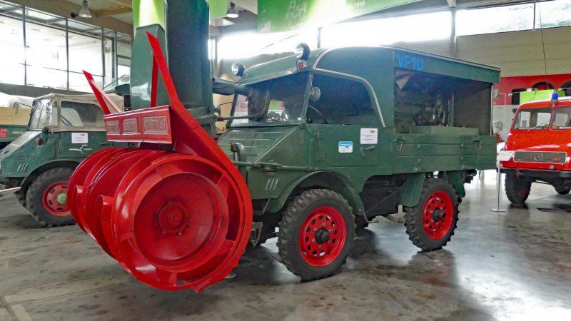
Unimog - a myth, history and future in equal measure. And a masterpiece of automotive engineering. Universally applicable, highly off-road. Built since 1946 (initially as a prototype) and taken over by Daimler in 1951, it was manufactured in Gaggenau until 2001. In countless variants, but always based on the same principle. It is still the most off-road (series) wheeled vehicle in the world and is also represented worldwide. And I wanted to look at this myth. Why? Because I was allowed to drive the Unimog for nine months in the Bundeswehr myself. And he still fascinates and inspires me today.
Photo 2 shows one of the Unimogs that saved the 1964 Winter Olympics in Innsbruck. There was not enough snow on the piste and they were the only vehicles that, due to their cross-country mobility, were able to transport it there so that it could be distributed on the piste.
Oh yes, if you want, you can also ride in a Unimog on the premises and convince yourself of the capabilities of this vehicle. A small "test track" is right on the premises.
Information and pictures about the museum are available at unimog-museum.com
An der, B462, 76571 Gaggenau, Deutschland
48° 49' 2.9" N 8° 17' 41.6" E
48.8174699 8.2948910
• Head southwest. Go for 57 m.
• Turn left onto Oberau. Go for 105 m.
• Turn left onto B462. Go for 6.6 km.
• Take ramp onto A5. Go for 57.1 km.
• Take exit 40 toward Heilbronn onto A6. Go for 18.4 km.
• Take exit 33A toward Mosbach/Neckargemünd/B45/Sinsheim. Go for 320 m.
• Turn left onto B39/B292 toward Mosbach/Neckargemünd/B45/Sinsheim Gewerbegebiet/Sinsheim Stadion. Go for 16.1 km.
• Turn left onto L590 toward Schwarzach/Aglasterhausen. Go for 759 m.
• Continue on Heidelberger Straße (L532). Go for 145 m.
• Take the 1st exit from roundabout onto Schwarzacher Straße (L590) toward Eberbach/Neckargerach/Neunkirchen/Schwarzach/Gewerbegebiet Schwarzacher Straße/Schwarzacher Hof. Go for 1.2 km.
• Turn right onto Tonwerkstraße. Go for 85 m.
• Turn right onto Tonwerkstraße. Go for 284 m.
• Arrive at your destination on the left.
☍
101,2 km
(1 hrs. )
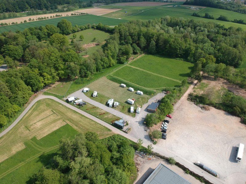
Wohnmobilpark Schwarzach Am Wildpark
We ended our summer trip with Theo and Silke on the motorhome parking lot at the wildlife park in Schwarzach, Neckar-Odenwald-Kreis. Relax for a few more days, go for a walk, geocache and eat delicious food. Is there a better way to end a trip?
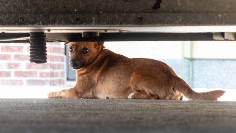
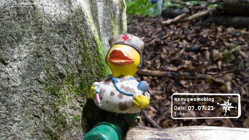
Oh yes, by the way, the rubber duck is "Sister Rabiata" ...
Tonwerkstraße 8, 74869 Schwarzach, Deutschland
49° 22' 3.2" N 8° 59' 12" E
49.3675493 8.9866662
Day
ENDE
Our journey ends here. We hope you enjoyed our little travelogue.
You will soon be able to see our travel report as a video on YouTube at youtube.com/nanuqwomoblog
Further information and reports are available at nanuq-womoblog.de
And if you would like to exchange ideas with like-minded people, visit the Facebook group "Motorhome Passion"