From Northern Germany to Saint-Malo and back via Normandy in 14 days
Groß Offenseth-Aspern
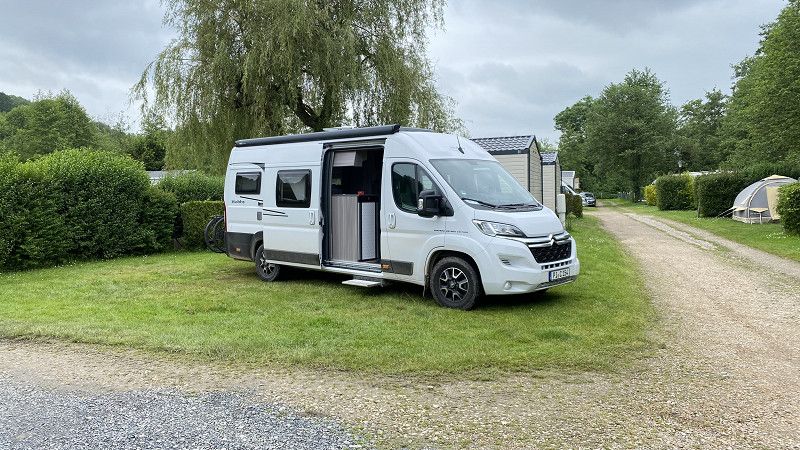
Departure on 24.5.24 at 11:00 am from the motorhome rental. First stop on the way to France is Vessem in the Netherlands. Unfortunately it is Friday and the motorways are full.
Kreis Pinneberg, Schleswig-Holstein, Deutschland
53° 49' 4" N 9° 43' 46.1" E
53.8177760 9.7294770
• Head northwest on Dorfstraße. Go for 916 m.
• Turn right onto Dorfstraße (L113). Go for 1.7 km.
• Continue on L288. Go for 1.5 km.
• Turn right and take ramp onto A23 toward Hamburg. Go for 28.7 km.
• Continue on A7 (Autobahndreieck Hamburg-Nordwest). Go for 7.0 km.
• Keep left onto A7. Go for 14.7 km.
• Keep right onto A261 (Autobahndreieck Hamburg-Südwest) toward Bremen/Tötensen. Go for 9.0 km.
• Take exit 4 toward Osnabrück/Bremen/Rade onto A1. Go for 251 km.
• Take exit 78 toward Recklinghausen/Dülmen onto A43. Go for 41.8 km.
• Take exit 9 toward Gladbeck/Gelsenkirchen-Buer/Marl onto A52. Go for 23.5 km.
• Take ramp onto A2 toward Oberhausen/Emden. Go for 11.9 km.
• Continue on A3. Go for 5.1 km.
• Take exit 12 toward Kamp-Lintfort/Venlo onto A42 (Emscherschnellweg). Go for 18.1 km.
• Take the exit onto A57. Go for 5.8 km.
• Take exit 10 toward Venlo onto A40. Go for 28.6 km.
• Continue on A67 (Europaweg). Go for 52.1 km.
• Continue on A2 (Randweg Eindhoven). Go for 3.2 km.
• Take the exit toward Antwerpen/Eersel onto A67. Go for 9.0 km.
• Take exit 30 toward Eersel/Bergeijk/N397. Go for 500 m.
• Turn right toward Steenovens. Go for 360 m.
• Continue on Steenovens. Go for 722 m.
• Continue on Knegselsedijk. Go for 971 m.
• Continue on Hoef. Go for 1.3 km.
• Continue on De Horstenbleek. Go for 878 m.
• Continue on De Fluiter. Go for 1.1 km.
• Continue on Grootakker. Go for 1.5 km.
• Turn left onto Hoogeloonseweg. Go for 822 m.
• Turn right onto Zwembadweg. Go for 496 m.
• Arrive at your destination on the left.
☍
522,3 km
(4 hrs. 45 min.)
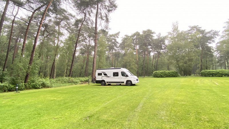
Eurocamping Vessem
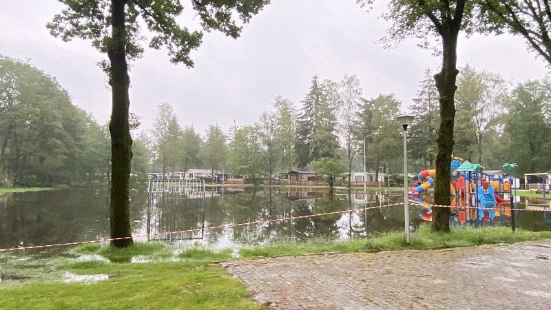
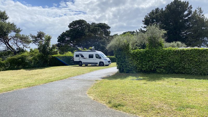
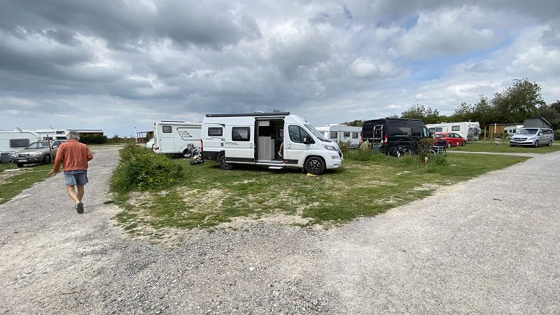
We reached the Eurocamping Vessem campsite around 7pm on May 24th. Check-in was uncomplicated. We were almost alone on the site. It felt like the whole of the Netherlands was one big lake. It had recently rained an incredible amount of water. Luckily the site was paved. But it wasn't possible to spend more than one night there. If the weather is good, it would be a lovely family campsite.
Zwembadweg 1, 5512, Vessem, Netherlands
51° 24' 52" N 5° 16' 21" E
51.4144444 5.2725000
• Head southeast. Go for 69 m.
• Continue on Zwembadweg. Go for 427 m.
• Turn left onto Hoogeloonseweg. Go for 822 m.
• Turn right onto Grootakker. Go for 1.5 km.
• Continue on De Fluiter. Go for 1.1 km.
• Continue on De Horstenbleek. Go for 878 m.
• Continue on Hoef. Go for 1.3 km.
• Continue on Knegselsedijk. Go for 963 m.
• Continue on Steenovens. Go for 1.1 km.
• Turn right and take ramp onto A67 toward Turnhout/Antwerpen. Go for 9.8 km.
• Continue on E34. Go for 57.6 km.
• Continue on E34 (Antwerpen-Oost) toward Ring Antwerpen 1/Brugge/Gent/Haven 1000-2000/Brussel/Ring Antwerpen 2/Breda/Haven 1-999. Go for 1.8 km.
• Continue on E19 (Ring Antwerpen 1). Go for 2.4 km.
• Continue on E34 (Kleine Ring) toward Brugge/Gent/Haven 1000-2000. Go for 5.2 km.
• Continue on E17. Go for 101 km.
• Continue on A22. Go for 11.7 km.
• Keep left onto N356 toward Paris/A1/Lille/Aéroport Lille Lesquin. Go for 4.8 km.
• Keep left onto N356 toward Paris/Dunkerque/Lille-Centre/Aéroport Lesquin. Go for 1.7 km.
• Keep left onto Boulevard Périphérique Est de Lille (N356) toward Paris/Bruxelles/Valenciennes/Villeneuve d'Ascq/Aéroport Lesquin. Go for 411 m.
• Take ramp onto A1 (Autoroute du Nord). Go for 20.5 km.
• Keep left onto A1 (Autoroute du Nord). Go for 71.3 km.
• Take the exit toward E44/A29/Reims/Rouen/St Quentin/Amiens. Go for 1.5 km.
• Take the exit toward Amiens/Rouen/Paris-Ouest onto A29. Go for 33.0 km.
• Take the exit toward Amiens-Nord onto N25. Go for 10.1 km.
• Take ramp onto N25 toward Amiens-Centre/Amiens-Nord/Doullens. Go for 2.2 km.
• Take the 2nd exit from roundabout onto Route Nationale (N25) toward Arras/Doullens. Go for 1.1 km.
• Continue toward Arras/Villers Bocage/Doullens. Go for 37 m.
• Take the 2nd exit from roundabout onto Route Nationale (N25) toward Arras/Villers Bocage/Doullens. Go for 1.0 km.
• Turn left toward Bertangles/Château de Bertangles. Go for 720 m.
• Continue on Rue de Coisy. Go for 330 m.
• Turn right onto Rue d'Amiens (D97). Go for 97 m.
• Turn right onto Rue de l'Église. Go for 154 m.
• Turn slightly right onto Rue du Château. Go for 100 m.
• Arrive at Rue du Château. Your destination is on the left.
☍
346,8 km
(3 hrs. 13 min.)
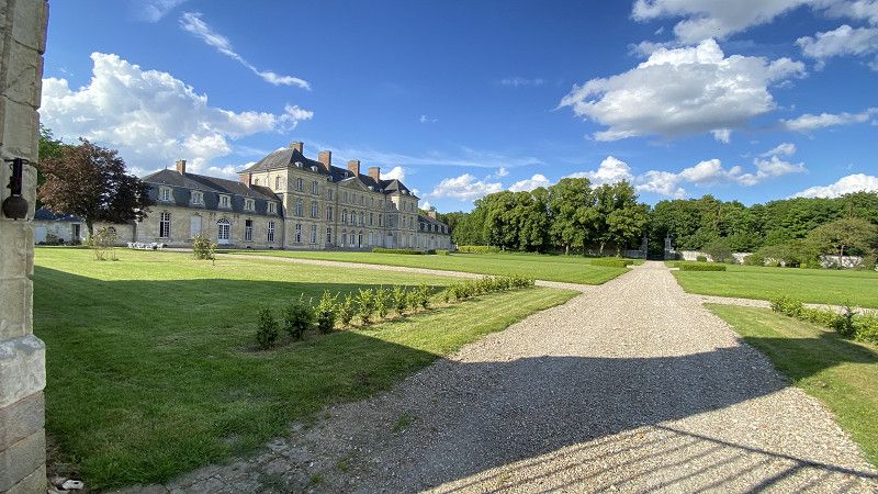
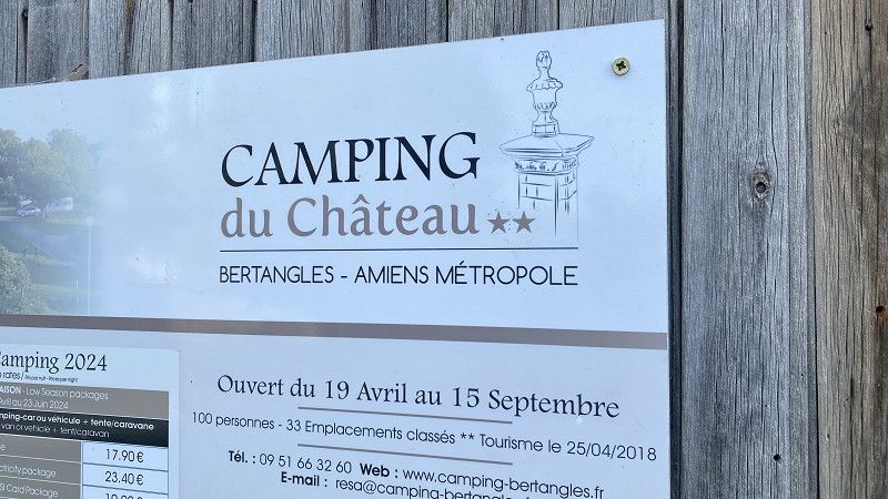
Le château de Bertangles
05/25/24, Camping du Chateau Bertangles. A beautiful campsite located next to a chateau. Unfortunately, a visit was not possible at that time. Uncomplicated check-in. It is noticeable, however, that French is actually spoken in France. ;-) English is difficult. The site is apparently used a lot by travelers. Nice, separated pitches, some of which are surrounded by trees and hedges. Clean toilets and washrooms. And the toilets have a toilet seat and toilet paper! Not that common in France. Bread rolls and chroissants were available upon advance order. A small selection of regional products was also available.
80260, Bertangles, Frankreich
49° 58' 17.4" N 2° 18' 2.5" E
49.9715000 2.3007000
• Head toward Rue de l'Église on Rue du Château. Go for 100 m.
• Turn slightly left onto Rue de l'Église. Go for 154 m.
• Turn right onto Rue du Moulin (D97). Go for 282 m.
• Turn left onto Rue de Saint-Sauveur (D97). Go for 243 m.
• Take the 1st exit from roundabout onto Rue de Saint-Sauveur (D97). Go for 321 m.
• Continue on D97. Go for 1.5 km.
• Turn slightly left onto D97. Go for 2.9 km.
• Take the 2nd exit from roundabout onto Route de Villers-Bocage (D97). Go for 628 m.
• Turn left onto C303. Go for 948 m.
• Turn left onto D1001. Go for 1.1 km.
• Take the 1st exit from roundabout onto A16 (L'Européenne) toward Paris/Reims/Rouen/Amiens-Ouest. Go for 7.0 km.
• Take the exit toward Le Havre/Rouen/Poix de Picardie onto A29. Go for 59.2 km.
• Take the exit onto A28. Go for 20.7 km.
• Keep right onto A29 toward Le Havre/Caen. Go for 83.8 km.
• Continue on N1029. Go for 7.1 km.
• Keep left onto A29 toward Deauville/Trouville/Caen. Go for 16.0 km.
• Take the exit toward Lisieux/Caen onto A13 (Autoroute de Normandie). Go for 50.5 km.
• Take the exit toward Alençon/Rennes/Cherbourg onto N513 (Porte de Paris). Go for 964 m.
• Take ramp onto Périphérique (N513/N814). Go for 12.7 km.
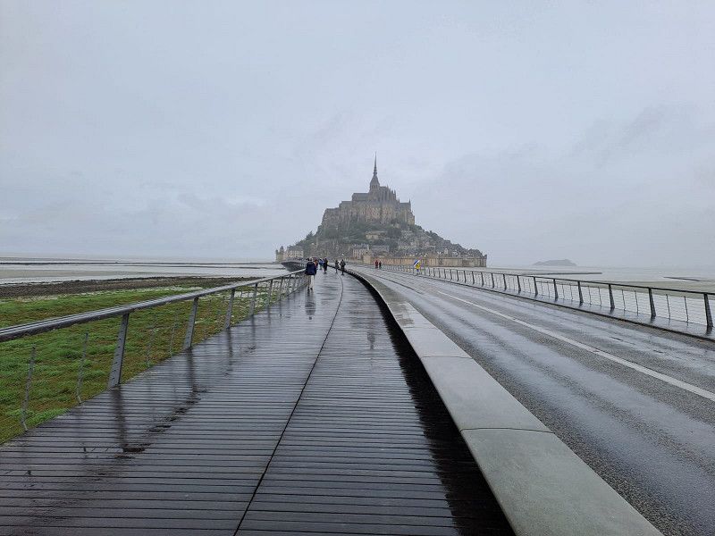
• Take ramp onto A84 toward Le Mt-St-Michel/Rennes/Vire. Go for 91.0 km.
• Continue on N175. Go for 10.6 km.
• Take ramp onto N175 toward St Brieuc/St Malo/Le Mont-St Michel/Pontorson. Go for 13.2 km.
• Keep left onto N176. Go for 32.5 km.
• Take ramp onto D137 toward St Malo/Châteauneuf d'I. et V./Barrage de la Rance. Go for 10.3 km.
• Keep left onto D137 toward Saint-Malo Par Saint-Servan/D168/Dinard/Aéroport Pleurtuit/Barrage de la Rance. Go for 260 m.
• Keep left onto Rue du Général Patton (D137) toward Saint-Malo Par Saint-Servan. Go for 152 m.
• Pass 2 roundabouts and continue on Rue du Général Patton. Go for 845 m.
• Continue on Rue de la Balue. Go for 280 m.
• Take the 1st exit from roundabout onto Rue de la Balue. Go for 296 m.
• Take the 3rd exit from Rond-Point du Mouchoir Vert roundabout onto Boulevard Douville toward St Servan/Hôpital le Rosais/St Servan-Centre. Go for 501 m.
• Continue on Rue Ville Pépin. Go for 192 m.
• Continue on Rue Ville Pépin. Go for 57 m.
• Turn left onto Place du Maréchal Leclerc. Go for 13 m.
• Turn right onto Boulevard Porée. Go for 184 m.
• Turn left onto Boulevard Gouazon. Go for 192 m.
• Turn right onto Rue Jean XXIII. Go for 127 m.
• Continue on Rue de la Fontaine. Go for 57 m.
• Turn right onto Rue Duport-Dutertre. Go for 160 m.
• Continue on Rue Ernest Lamort. Go for 108 m.
• Continue on Rue de la Cité. Go for 137 m.
• Turn slightly left onto Rue de la Cité. Go for 151 m.
• Continue on Place Saint-Pierre. Go for 13 m.
• Turn left onto Allée Gaston Buy. Go for 6 m.
• Turn slightly right onto Allée Gaston Buy. Go for 49 m.
• Turn left onto Allée du Marégraphe. Go for 159 m.
• Arrive at Allée du Marégraphe. Your destination is on the right.
☍
427,8 km
(4 hrs. 1 min.)
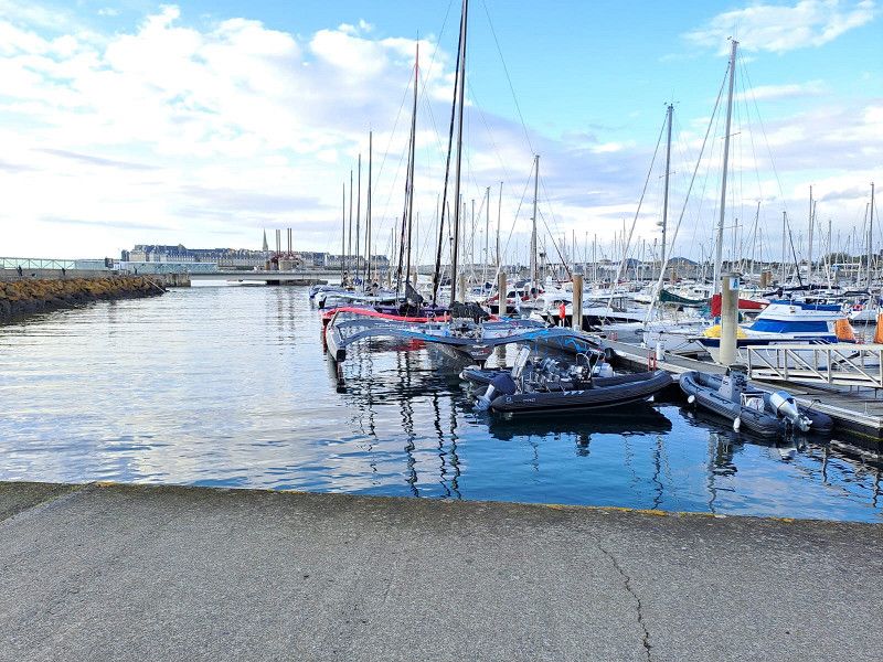
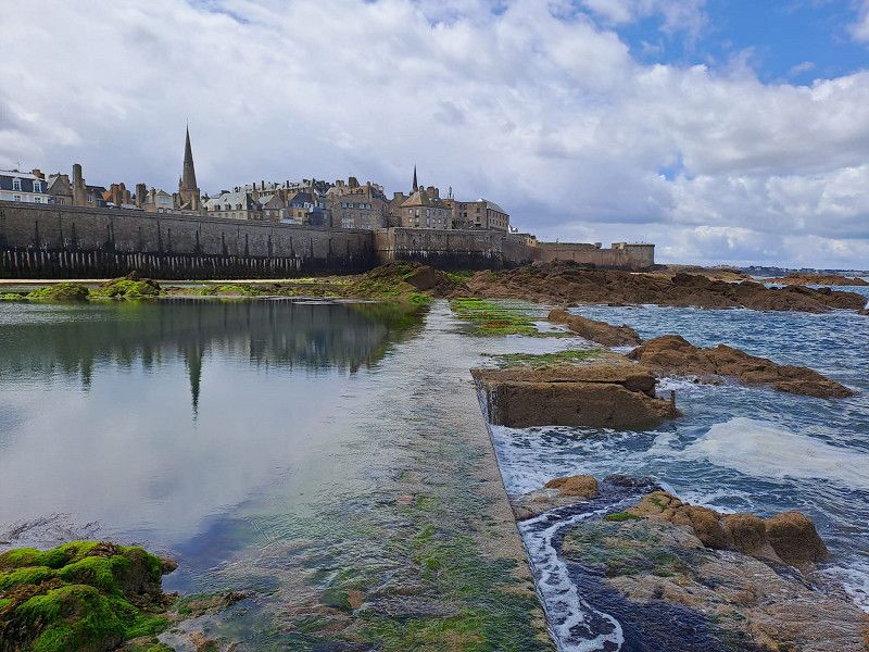
Camping de la Cité d'Alet
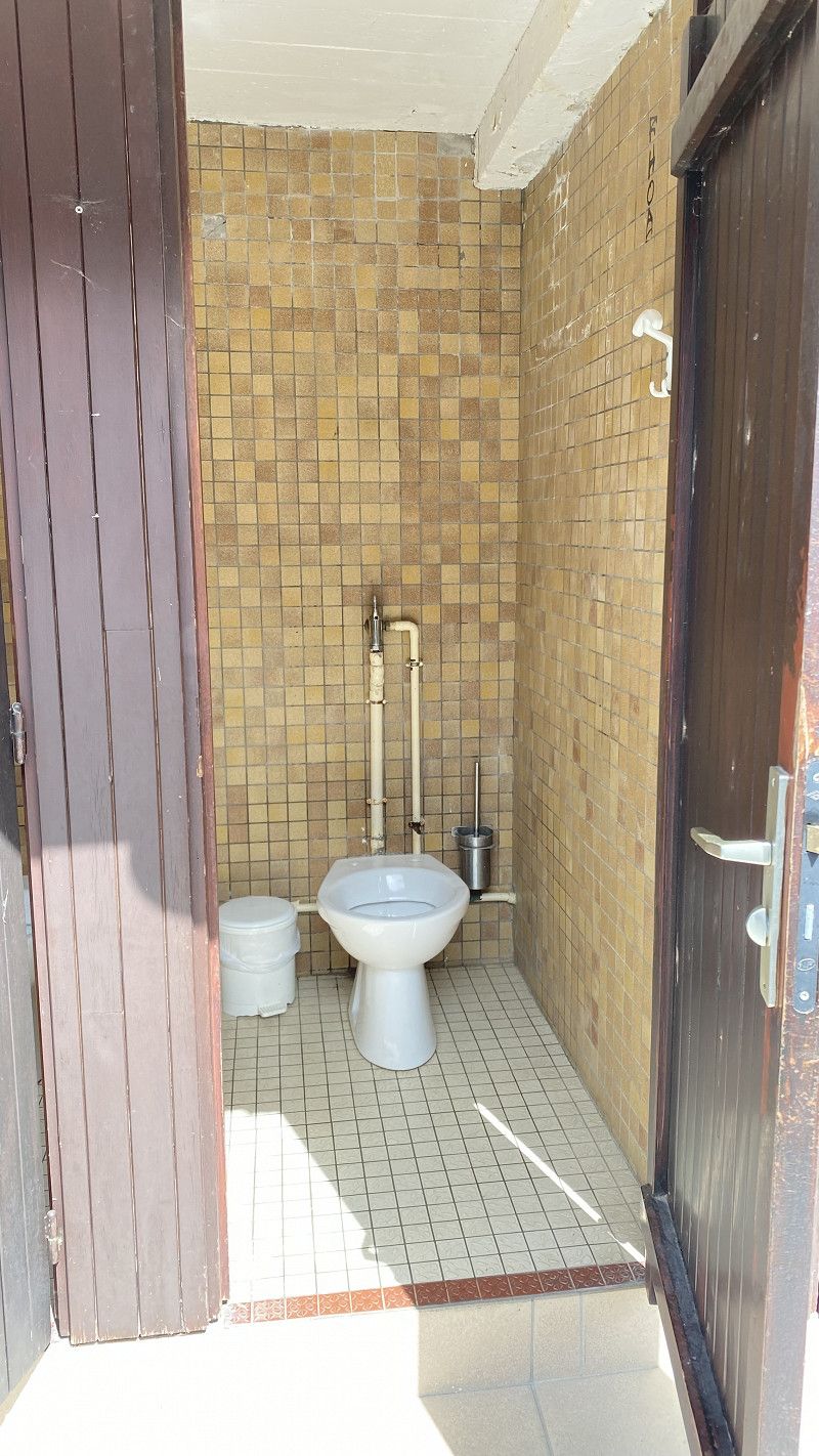
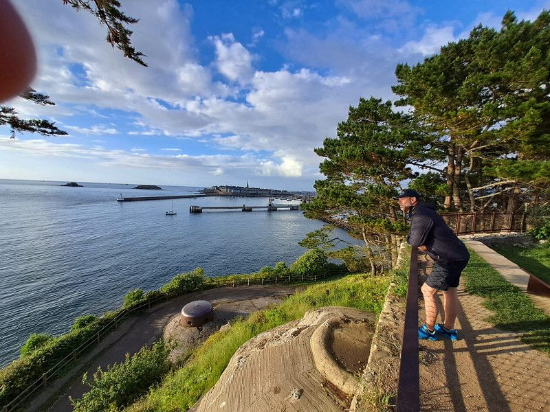
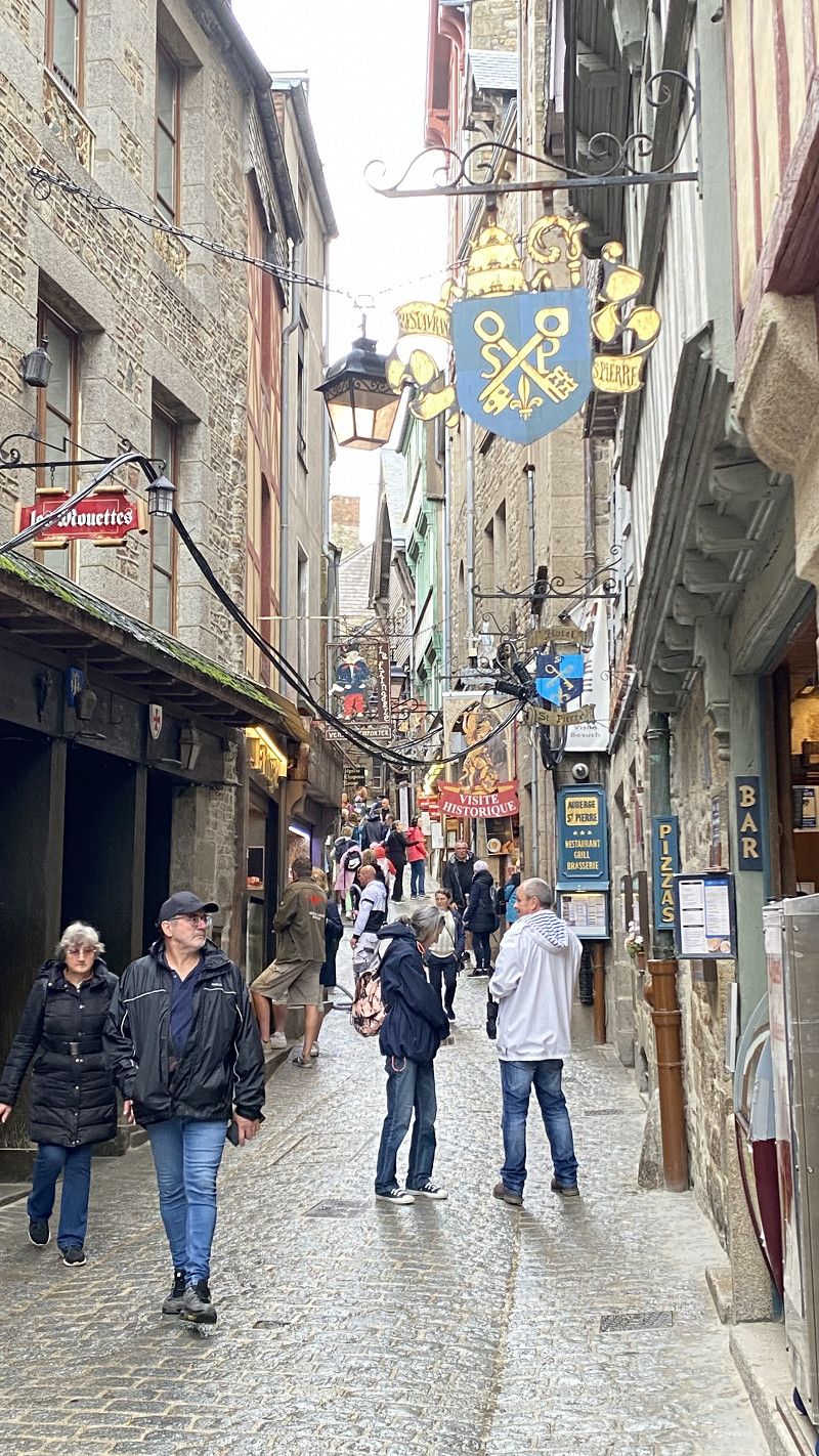
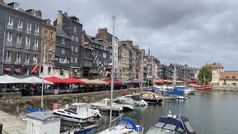
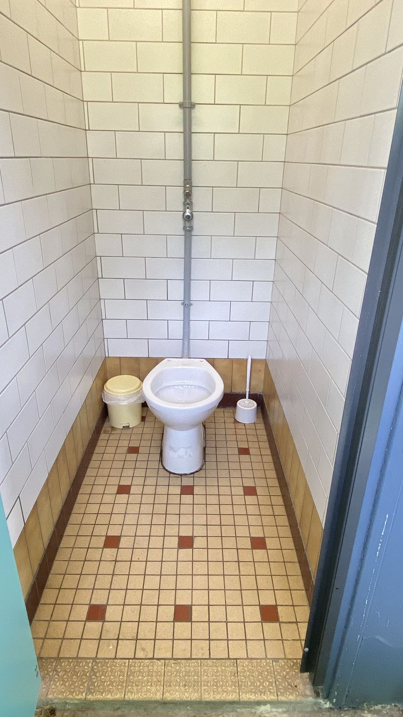
Our first long stop on the tour and our furthest point towards the west. The destination was Saint Malo. The campsite was opposite the old town on an old fortification. A good starting point for exploring the city and the harbour. The stay was from May 26th to May 28th. The weather was mixed and at times very cool and wet. From here on we had to get used to campsites without toilet seats and toilet paper.
allée Gaston Buy, 35400, Saint Malo, Frankreich
48° 38' 6.9" N 2° 1' 44.9" W
48.6352500 -2.0291400
• Head west on Allée du Marégraphe. Go for 37 m.
• Turn sharp left onto Chemin de la Corderie. Go for 207 m.
• Continue on Place Saint-Pierre. Go for 47 m.
• Continue on Rue d'Alet. Go for 120 m.
• Turn left onto Quai Sébastopol. Go for 44 m.
• Keep right onto Esplanade du Commandant Yves Menguy. Go for 144 m.
• Continue on Rue Amiral Épron. Go for 43 m.
• Turn slightly right onto Rue des Hauts-Sablons. Go for 130 m.
• Continue on Place Monseigneur Duchesne. Go for 126 m.
• Continue on Rue des Bas-Sablons. Go for 217 m.
• Continue on Rue de Gaspé. Go for 230 m.
• Take the 2nd exit from roundabout onto Quai de Trichet (D126) toward Barrage de la Rance. Go for 414 m.
• Take the 2nd exit from Giratoire des Quatre Pavillons roundabout onto Rue des Grèves de Chasles (D126) toward Marville/Paramé. Go for 152 m.
• Take the 3rd exit from roundabout onto Boulevard des Talards toward Palais des Congrès. Go for 495 m.
• Take the 1st exit from Giratoire Marcel Planchet roundabout onto Avenue Maurice Callame. Go for 232 m.
• Take the 3rd exit from Rond-Point de Marville roundabout onto Avenue Anita Conti. Go for 124 m.
• Take the 2nd exit from roundabout onto Avenue Anita Conti. Go for 274 m.
• Take the 2nd exit from roundabout onto Avenue de Moka. Go for 857 m.
• Turn right onto Avenue Pasteur (D155). Go for 603 m.
• Turn slightly left onto Boulevard Chateaubriand (D201). Go for 828 m.
• Turn slightly left onto Avenue du Président John Kennedy (D201). Go for 1.7 km.
• Continue on Boulevard de Rothéneuf (D201). Go for 768 m.
• Continue on Boulevard Saint-Michel des Sablons (D201). Go for 407 m.
• Turn right onto Place du Canada (D201). Go for 81 m.
• Turn left onto Rue du Hâvre (D201). Go for 252 m.
• Continue on Avenue de la Guimorais (D201). Go for 229 m.
• Continue on Rue de la Sablière (D201). Go for 555 m.
• Turn left onto Rue de la Sablière. Go for 37 m.
• Arrive at Rue de la Sablière. Your destination is on the right.
☍
9,4 km
( 21 min.)
Saint-Coulomb
Boulevard de Rothéneuf, La Sablière, Saint-Coulomb, Saint-Malo, Ille-et-Vilaine, Bretagne, Metropolitanes Frankreich, 35350, Frankreich
48° 40' 49.2" N 1° 57' 18.2" W
48.6803460 -1.9550520
• Head southeast on Rue de la Sablière. Go for 37 m.
• Turn left onto Rue de la Sablière (D201). Go for 272 m.
• Continue on D201. Go for 570 m.
• Continue on Lieu-dit Le Lupin (D201). Go for 128 m.
• Continue on D201. Go for 527 m.
• Continue on Lieu-dit le moulin de Mer (D201). Go for 73 m.
• Continue on D201. Go for 486 m.
• Continue on Lieu-dit Le Vieux Châtel (D201). Go for 55 m.
• Continue on D201. Go for 300 m.
• Continue on Rue de la Marette (D201). Go for 636 m.
• Continue on Lieu-dit Le Terquetay (D201). Go for 711 m.
• Continue on D201. Go for 278 m.
• Continue on Lieu-dit Le Haut-Pays (D201). Go for 717 m.
• Continue on D201. Go for 1.6 km.
• Continue on Boulevard de Koh-Chang (D201). Go for 1.1 km.
• Continue on D201. Go for 1.7 km.
• Continue on Lieu-dit Le Bas Valade (D201). Go for 79 m.
• Continue on D201. Go for 1.4 km.
• Continue on Boulevard des Ajoncs (D201). Go for 336 m.
• Enter the roundabout. Go for 53 m.
• Arrive at your destination on the left.
☍
10,9 km
( 11 min.)
Cancale
D 201, Cancale, Ille-et-Vilaine, Bretagne, Frankreich
48° 42' 18.9" N 1° 50' 54.1" W
48.7052477 -1.8483704
• Follow the roundabout. Go for 60 m.
• Take the 4th exit from roundabout onto Avenue de la Côte d'Émeraude (D201). Go for 2.9 km.
• Take the 2nd exit from roundabout onto Avenue de Scissy (D201). Go for 1.2 km.
• Pass 2 roundabouts and continue on Avenue Olivier Biard (D76). Go for 3.3 km.
• Keep left toward D3076. Go for 756 m.
• Turn right onto D3076. Go for 164 m.
• Turn right onto D155. Go for 5.1 km.
• Take the 2nd exit from roundabout onto Grande Rue (D155). Go for 4.5 km.
• Turn left. Go for 94 m.
• Arrive at your destination on the left.
☍
17,9 km
( 20 min.)
Le Vivier-sur-Mer
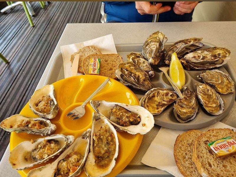
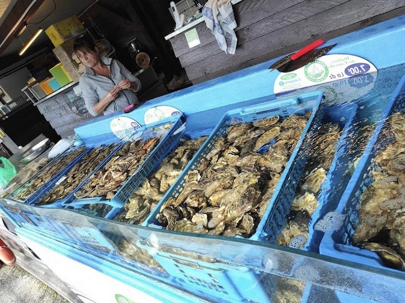
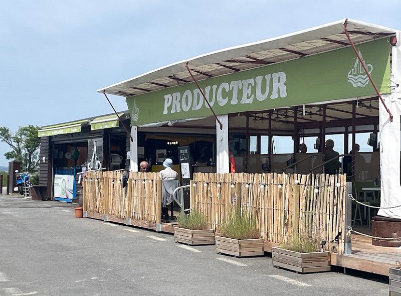
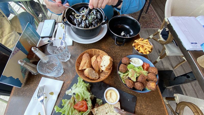
We went to a supplier/restaurant and distributor of oysters. There was no way to enjoy fresher oysters. Great restaurant with a view of the sea. Uncomplicated and with a whole range of dishes that are typical for the region.
Rue de la Grève, Le Vivier-sur-Mer, Ille-et-Vilaine, Bretagne, Frankreich
48° 36' 16.8" N 1° 46' 53.6" W
48.6046569 -1.7815587
• Head toward Rue de la Grève. Go for 33 m.
• Turn left onto Rue de la Grève (D155). Go for 503 m.
• Turn right onto Rond-Point du Centre (D155). Go for 6.0 km.
• Take the 2nd exit from roundabout onto D155 toward Dol de Bgne. Go for 655 m.
• Take left ramp onto N176 toward Fougères/Mt St Michel/Alençon/Dol-Est/Pontorson. Go for 16.8 km.
• Take ramp toward Pontorson. Go for 400 m.
• Take the 1st exit from roundabout onto D997 toward Pontorson/Pleine-Fougères. Go for 1.5 km.
• Take the 2nd exit from roundabout onto Chaussée de Ville Chérel (D776). Go for 261 m.
• Take the 1st exit from Rue Couesnon roundabout onto Rue Couesnon (D75) toward Centre Ville. Go for 63 m.
• Turn left onto Rue du Petit Train. Go for 62 m.
• Turn left onto Rue Duquesne. Go for 22 m.
• Turn right onto Boulevard du Général Patton (D19). Go for 138 m.
• Turn left onto Chemin des Soupirs. Go for 430 m.
• Arrive at Chemin des Soupirs. Your destination is on the left.
☍
26,9 km
( 22 min.)
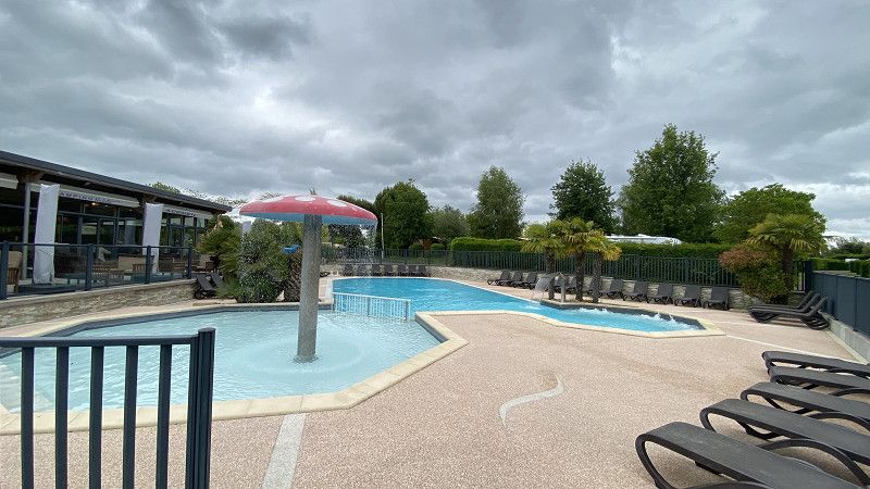
Camping Seasonova Haliotis
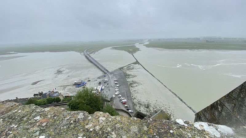
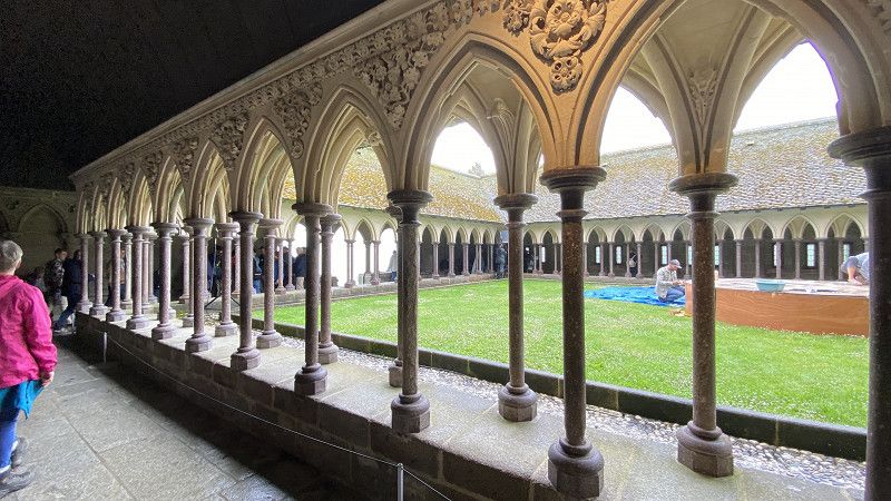
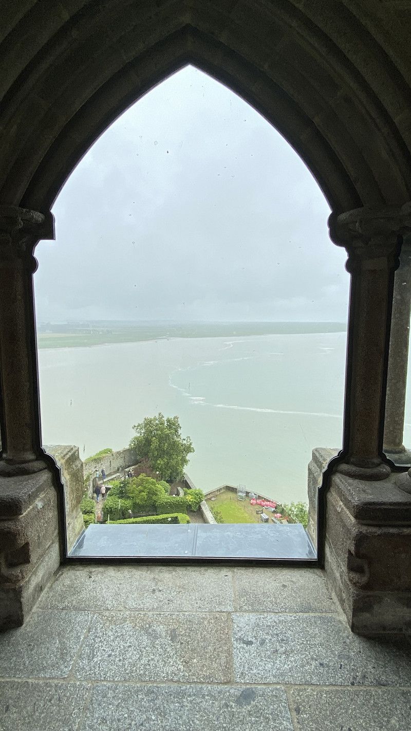
May 28th to May 30th, 2024; beautifully located campsite near Le Mont Saint Michel. Clean toilet facilities, pool area and bar area. Shops were within a short distance. Clearly recommend the site. Easy to reach by bike or bus shuttle. Unfortunately, we chose by far the worst weather for a visit. It rained incessantly. This somewhat spoiled the enjoyment of the visit.
Boulevard Patton, 50170, PONTORSON, Frankreich
48° 33' 29.6" N 1° 30' 52.5" W
48.5582180 -1.5145904
• Head toward Boulevard du Général Patton on Chemin des Soupirs. Go for 430 m.
• Turn right onto Boulevard du Général Patton (D19). Go for 196 m.
• Take the 2nd exit from Rue Couesnon roundabout onto Rue Couesnon (D75) toward Centre Ville. Go for 303 m.
• Take the 1st exit from roundabout onto Rue Couesnon (D776). Go for 238 m.
• Take the 2nd exit from roundabout onto Rue de la Libération (D975) toward Caen/Cherbourg/Alençon/Ducey/St Hilaire du H./Avranches. Go for 459 m.
• Take the 3rd exit from roundabout onto Rue de Caugé (D975). Go for 1.5 km.
• Take ramp onto N176. Go for 173 m.
• Continue on N175. Go for 12.7 km.
• Take ramp onto N175. Go for 11.3 km.
• Keep left onto A84 toward Cherbourg/Caen/Saint-Lô/Villedieu-les-Poêles. Go for 44.2 km.
• Take exit 40 toward Cherbourg. Go for 480 m.
• Take the 4th exit from roundabout onto N174 toward Cherbourg/Saint Lô/Z.A. de la Détourbe. Go for 48.4 km.
• Take ramp onto N13 toward Caen/Isigny S/Mer. Go for 22.2 km.
• Take ramp toward Formigny/Trévières/St Laurent S/M./Colleville S/M./Vierville S/M./Omaha Beach. Go for 214 m.
• Turn left onto D30. Go for 159 m.
• Continue on Lieu-dit Formigny (D517). Go for 3.4 km.
• Take the 3rd exit from roundabout onto Route de Vierville (D514). Go for 2.8 km.
• Turn right onto Rue de la Herode. Go for 596 m.
• Arrive at your destination on the left.
☍
149,7 km
(1 hrs. 31 min.)
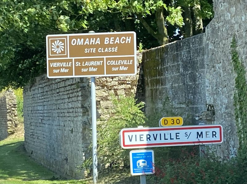
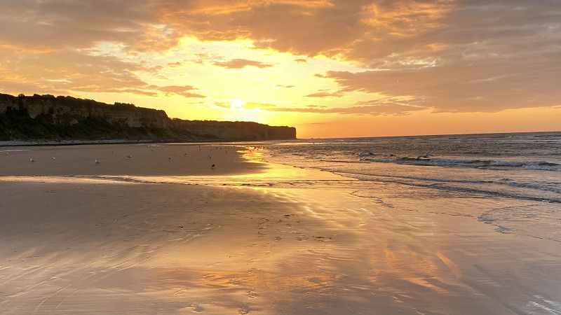
Flower Camping Omaha Beach
We actually stayed at the Omaha Beach campsite for 2 days just before the 80th anniversary of DDay celebrations. A last-minute booking was possible even though there were a lot of tourists there. A popular place, apparently for the English. Beautifully situated above the famous stretch of coast. The whole region is shaped by this historic turning point in World War II. Remnants of military equipment and bunkers can still be found everywhere. What is equally impressive is the friendliness of the people here. We were here from May 30th to June 1st, 2024.
Rue de la Herode, 14710, Vierville-sur-Mer, Frankreich
49° 22' 46.8" N 0° 54' 34.8" W
49.3796584 -0.9096674
• Head toward Route de Grandcamp. Go for 91 m.
• Turn slightly left onto Rue de la Herode. Go for 505 m.
• Continue on Route de la Chassé aux Prix. Go for 260 m.
• Turn left onto Chemin de la Chasse Bertin. Go for 229 m.
• Turn left onto Rue de l'Église. Go for 262 m.
• Turn left onto Route de Formigny (D30). Go for 200 m.
• Turn right onto Rue Pavée (D514). Go for 2.2 km.
• Turn left onto Chemin Rural de la Campagne du Montmain. Go for 115 m.
• Turn right onto Rue du Montmain. Go for 211 m.
• Turn left onto Avenue de la Libération (D517). Go for 142 m.
• Turn right onto Avenue de la Libération. Go for 90 m.
• Turn slightly right onto Rue du Val. Go for 610 m.
• Continue on Rue Bernard Dargol. Go for 799 m.
• Turn right. Go for 1.9 km.
• Turn left. Go for 168 m.
• Make a U-Turn. Go for 77 m.
• Turn left. Go for 60 m.
• Turn right. Go for 12 m.
• Turn left. Go for 52 m.
• Turn right. Go for 112 m.
• Turn right. Go for 181 m.
• Arrive at your destination.
☍
8,3 km
( 20 min.)
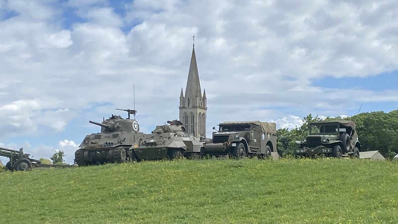
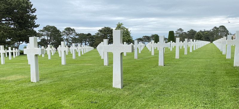
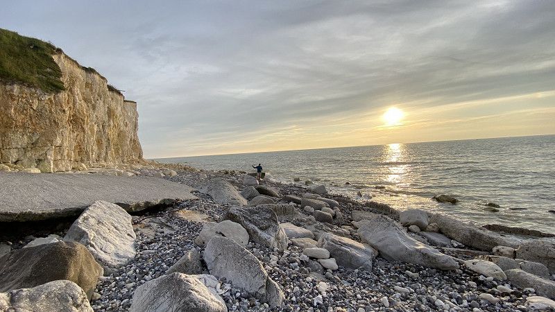
Colleville-sur-Mer
American military cemetery that should not be missed on any trip to Normandy.
Route du Capitaine Joe Dawson, Colleville-sur-Mer, Calvados, Normandie, Frankreich
49° 21' 35.1" N 0° 51' 12.3" W
49.3597471 -0.8534142
• Head west. Go for 162 m.
• Continue straight ahead. Go for 290 m.
• Take the 1st exit from roundabout. Go for 803 m.
• Take the 3rd exit from roundabout onto D514. Go for 2.8 km.
• Turn right onto Route de Mosles (D97). Go for 219 m.
• Continue on D97. Go for 1.0 km.
• Continue on Route du Fresne (D97). Go for 1.4 km.
• Continue on D97. Go for 902 m.
• Continue on Rue d'Argouges (D97). Go for 829 m.
• Turn left onto Lieu-dit La Cavée (D613). Go for 75 m.
• Continue on D613. Go for 249 m.
• Continue on Lieu-dit La Butte (D613). Go for 184 m.
• Continue on Lieu-dit Mosles (D613). Go for 648 m.
• Continue on D613. Go for 2.6 km.
• Continue on Route de Bayeux (D100/D613). Go for 279 m.
• Continue on Route de Bayeux (D613). Go for 1.6 km.
• Continue on D613. Go for 156 m.
• Take the 1st exit from roundabout. Go for 117 m.
• Take left ramp onto N13 toward Caen. Go for 39.5 km.
• Take ramp toward Deauville/Trouville/Rouen. Go for 456 m.
• Keep left onto A13 (Autoroute de Normandie) toward Deauville/Trouville/Le Havre/Rouen/Paris/Troarn/Dozulé. Go for 50.1 km.
• Take the exit toward Le Havre/Amiens/Calais/Honfleur/Pont de Normandie onto A29. Go for 17.2 km.
• Take exit 3 toward Honfleur. Go for 334 m.
• Take the 1st exit from roundabout onto D580 toward Beuzeville/Pont de Tancarville. Go for 2.0 km.
• Continue on D180. Go for 342 m.
• Take the 2nd exit from roundabout onto Route de l'Estuaire (D180) toward A13/Alençon/Beuzeville/Pt Audemer. Go for 250 m.
• Turn right onto Route de la Morelle (D22) toward Beuzeville/Manneville la Raoult/Fiquefleur-Équainville. Go for 899 m.
• Arrive at Route de la Morelle (D22). Your destination is on the right.
☍
125,4 km
(1 hrs. 20 min.)
Sites et Paysages Domaine de la Catinière
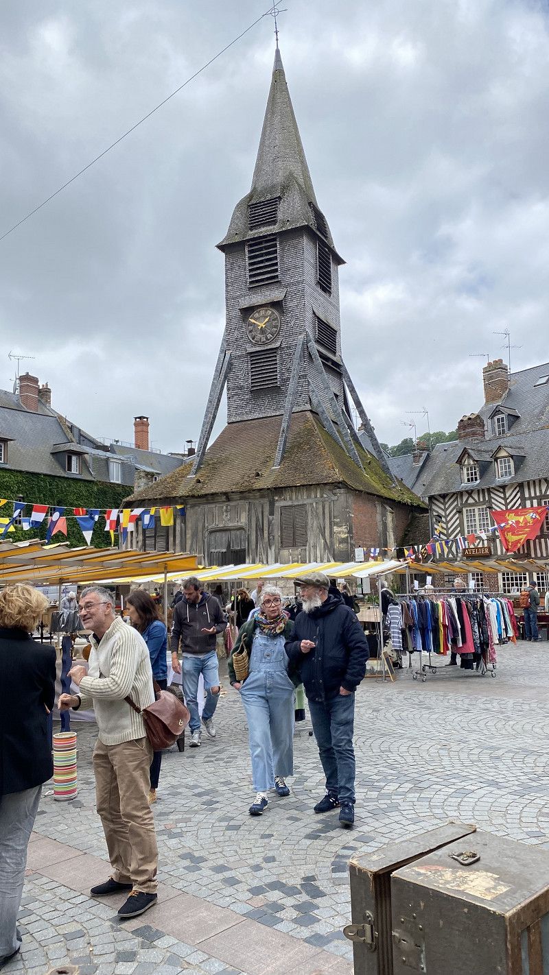
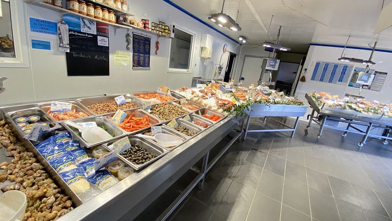
A small, idyllic campsite just outside Honfleur. The town is easy to reach by bike and should also be included as a sightseeing spot on the Normandy tour. But be careful, the town is literally flooded with visitors. We therefore did not eat our snack in the local restaurants but in the typical fish markets. It doesn't get any fresher and you can also have wine served with your meal there.
910 Route de la Morelle, 27210, Honfleur-Fiquefleur Equainville, Frankreich
49° 24' 3.3" N 0° 18' 23.7" E
49.4009251 0.3065724
• Head north on Route de la Morelle (D22). Go for 888 m.
• Turn left onto Route de l'Estuaire (D180). Go for 227 m.
• Take the 2nd exit from roundabout onto D180 toward A29/Le Havre/Honfleur/Pont de Normandie. Go for 390 m.
• Continue on D580. Go for 1.9 km.
• Take the 1st exit from roundabout onto A29 toward Le Havre/Pont de Normandie. Go for 352 m.
• Continue on N1029. Go for 7.1 km.
• Continue on A29. Go for 67.4 km.
• Take the exit toward Rouen/Dieppe. Go for 815 m.
• Take the exit toward Dieppe onto A151. Go for 1.7 km.
• Continue on N27. Go for 26.7 km.
• Take the 2nd exit from roundabout onto N27 toward Dieppe/Arques la Bataille. Go for 2.0 km.
• Take the 2nd exit from roundabout onto D54 B toward Dieppe/Rouxmesnil-Bouteilles/Arques la Bataille. Go for 1.9 km.
• Take the 2nd exit from roundabout onto D154 E toward Dieppe. Go for 2.3 km.
• Take the 2nd exit from roundabout onto D485 toward Eu/Le Tréport/Envermeu/Neuville-lès-Dieppe/Z.A. Euro-Channel. Go for 2.2 km.
• Take the 3rd exit from roundabout onto D925 toward Eu/Le Tréport. Go for 932 m.
• Take the 2nd exit from roundabout onto D925 toward Eu/Le Tréport/Bracquemont/Criel S/Mer. Go for 222 m.
• Continue on D925. Go for 1.3 km.
• Pass 4 roundabouts and continue on D925. Go for 15.2 km.
• Take ramp toward Criel-sur-Mer/Assigny/Mesnil-Val Plage/Le Tréport Par les Plages. Go for 173 m.
• Turn left onto Route d'Assigny (D222). Go for 378 m.
• Continue on Rue de la Libération (D222). Go for 440 m.
• Turn left onto Rue de la Plage (D222). Go for 1.3 km.
• Arrive at Rue de la Plage (D222). Your destination is on the left.
☍
135,9 km
(1 hrs. 26 min.)
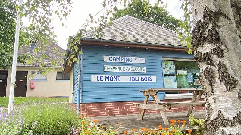
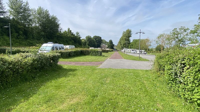
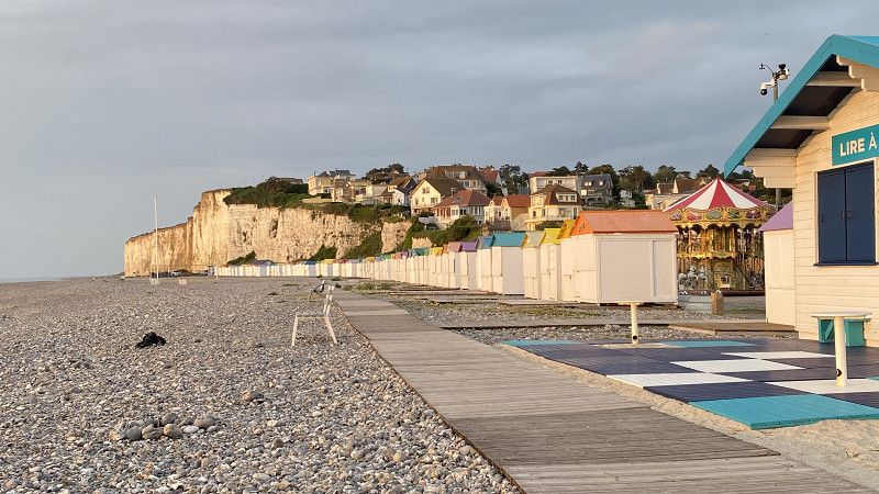
Camping Le Mont Joli Bois
03.06.24; This place on our route is rather small and dreamy and invites you to linger. Unfortunately, we had only decided to stay one night. We had to slowly move towards the Belgian border. Our time was coming to an end. The campsite was not up to date either, but the plots were large, the operator was friendly and we had peace and quiet. There is another campsite right next door which is closer to the water but is therefore more busy and the campers are packed together.
29 rue de La Plage - RD 222, 76910, CRIEL SUR MER, Frankreich
50° 1' 32.6" N 1° 18' 30.9" E
50.0257089 1.3085935
• Head toward Rue Basse on Rue de la Plage (D222). Go for 1.3 km.
• Turn left onto Rue de la Libération (D222). Go for 659 m.
• Continue on Rue de Havelange (D16). Go for 62 m.
• Continue on Route d'Havelange (D16). Go for 210 m.
• Continue on Rue de Havelange (D16). Go for 41 m.
• Take the 3rd exit from roundabout onto D925 toward Eu/Le Tréport/Flocques/Étalondes/St Rémy-Boscrocourt. Go for 6.2 km.
• Take the 3rd exit from roundabout onto D925 toward Eu/Le Tréport/Abbeville. Go for 924 m.
• Continue on Rue du Mont Vitot. Go for 785 m.
• Continue on D925. Go for 1.2 km.
• Take the 2nd exit from roundabout onto D925 toward Abbeville/Beauvais/Eu/Mers les Bains. Go for 911 m.
• Take the 3rd exit from Giratoire de Froidville roundabout onto D925 toward Abbeville/St Valery S/S./Friville-Esc./Ault. Go for 902 m.
• Take ramp onto D940 toward Berck/Ault/St Valery S/Somme. Go for 5.2 km.
• Pass 2 roundabouts and continue on Rue d'Eu (D940). Go for 14.2 km.
• Take the 1st exit from roundabout onto D940 toward A28/A16/Abbeville. Go for 1.4 km.
• Pass 3 roundabouts and continue on D940. Go for 6.4 km.
• Take the 2nd exit from roundabout onto D940 toward Berck-Plage/Noyelles S/M./Le Crotoy/Crécy-en-P. Go for 502 m.
• Keep left onto D940. Go for 1.5 km.
• Turn right onto Route Départementale 140 (D140). Go for 1.6 km.
• Turn right onto Route de Morlay (D235). Go for 1.7 km.
• Turn left onto Route de Forest-Montiers (D235). Go for 573 m.
• Continue on D235. Go for 3.0 km.
• Continue on Route de Ponthoile (D235). Go for 337 m.
• Continue on D235. Go for 285 m.
• Take the 2nd exit from roundabout onto D32 toward A16/Abbeville. Go for 1.1 km.
• Take the 2nd exit from roundabout toward Abbeville. Go for 85 m.
• Take ramp onto A16 (Autoroute des Estuaires) toward Berck/Calais. Go for 133 km.
• Take exit 62 toward Dunkerque-Centre/Dunkerque-Malo/Dunkerque-Rosendaël/Centre Hospitalier onto D635 (Avenue du 9 Mai 1945). Go for 1.7 km.
• Take ramp. Go for 197 m.
• Turn left onto Rue Célestin Malo (D636). Go for 709 m.
• Continue on Pont du Littoral. Go for 691 m.
• Continue on Rue Robert Vangheluwe. Go for 259 m.
• Continue on Boulevard Paul Cambon. Go for 162 m.
• Turn right onto Boulevard de la République François Mitterrand (D79). Go for 1.3 km.
• Turn left onto Rue du Docteur Laennec. Go for 127 m.
• Take the 2nd exit from roundabout onto Rue du Docteur Laennec. Go for 177 m.
• Turn right onto Boulevard de l'Europe. Go for 115 m.
• Arrive at Boulevard de l'Europe. Your destination is on the left.
☍
189,3 km
(2 hrs. 10 min.)
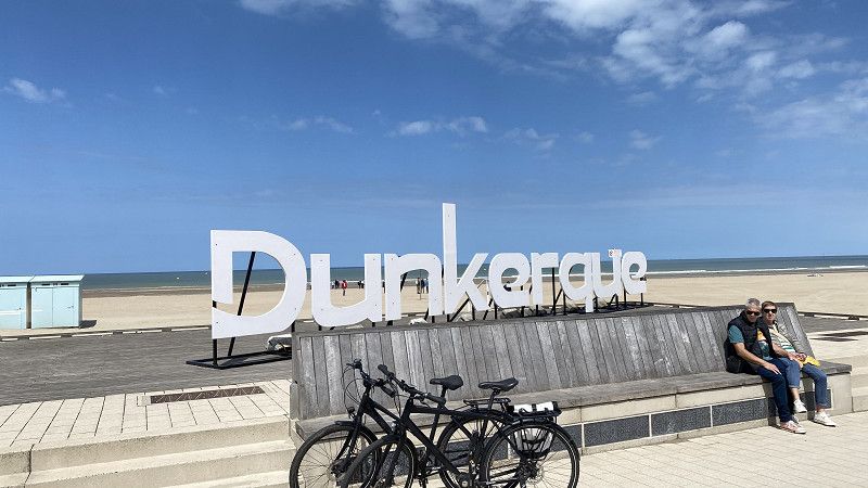
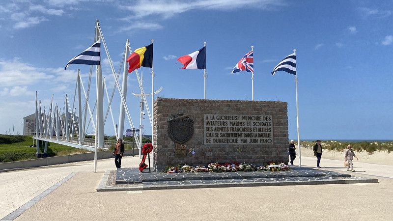
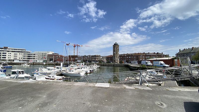
Camping de la Licorne
June 4th to June 6th: Last stop and campsite on our route. Unfortunately, the campsite was not a good choice. Rather disappointing. The operator has apparently made the decision to convert the site into holiday homes. Campers were crammed together in one part of the site. The pitches looked very unkempt and uninviting. The infrastructure of the toilets and washrooms was also showing its age. Overall, we were disappointed with the site. We really liked the town, however. And the network of cycle paths. This was being expanded even further at the time of our stay. The communities and municipalities in Germany could learn a thing or two from how this is implemented in other European countries.
1005, boulevard de l'Europe, 59240, Dunkerque Malo, Frankreich
51° 3' 5.7" N 2° 25' 12.3" E
51.0515800 2.4200800
• Head toward Rue René Castelin on Boulevard de l'Europe. Go for 104 m.
• Take the 1st exit from roundabout onto Rue René Castelin. Go for 250 m.
• Turn left onto Boulevard de la République François Mitterrand (D79). Go for 591 m.
• Take the 1st exit from roundabout onto Rue de Terminus (D79). Go for 378 m.
• Continue on Rue d'Uxem (D60). Go for 110 m.
• Turn left onto Rue de Leffrinckoucke. Go for 731 m.
• Take the 1st exit from roundabout onto Route du Pont (D79). Go for 1.2 km.
• Turn left and take ramp onto A16 (Autoroute des Estuaires) toward Bray-Dunes/La Panne/Furnes. Go for 8.2 km.
• Continue on E40. Go for 91.3 km.
• Take the exit toward Antwerpen onto E17. Go for 52.6 km.
• Continue on E34 (Ring Antwerpen 2). Go for 8.6 km.
• Take the exit toward E313/Luik/Eindhoven/Aken/Aachen onto E34 (Antwerpen-Oost). Go for 9.4 km.
• Keep right onto E34 (Ranst) toward Eindhoven/Turnhout. Go for 49.2 km.
• Continue on A67. Go for 18.0 km.
• Take the exit toward Maastricht/Venlo/A67 onto A2 (Knooppunt de Hogt). Go for 4.4 km.
• Keep right onto A67 toward Duisburg/Venlo. Go for 52.2 km.
• Continue on A40. Go for 27.8 km.
• Take exit 8 toward Nijmegen/Oberhausen onto A57. Go for 6.6 km.
• Take exit 8 toward Dortmund/Oberhausen onto A42. Go for 17.5 km.
• Take exit 8 toward Arnheim/Hannover onto A3. Go for 6.3 km.
• Continue on A2 toward Hannover/Emden/Dreieck/Bottrop. Go for 10.8 km.
• Take exit 5 toward Gladbeck/Marl. Go for 970 m.
• Continue on Essener Straße (B224). Go for 23.2 km.
• Take the exit toward Münster onto A43. Go for 41.4 km.
• Take exit 2 toward Bremen/Münster-Nord onto A1 (Hansalinie). Go for 227 km.
• Take exit 47 toward Sittensen. Go for 404 m.
• Turn left onto Stader Straße (L130) toward Sittensen/Scheeßel. Go for 205 m.
• Take the 2nd exit from roundabout onto Stader Straße (L130) toward Scheeßel. Go for 834 m.
• Arrive at Bahnhofstraße (L130). Your destination is on the left.
☍
660,1 km
(5 hrs. 51 min.)
Sittensen
06.06.24 Last stop at friends' property before returning the camper to the landlord on 07.06.24.
Bahnhofstraße 23, Sittensen, Landkreis Rotenburg (Wümme), Niedersachsen, Deutschland
53° 16' 55.3" N 9° 30' 20.5" E
53.2820148 9.5057018
• Head south on Bahnhofstraße (L130). Go for 36 m.
• Turn right onto Bahnhofstraße. Go for 89 m.
• Turn right toward Bahnhofstraße/L130. Go for 142 m.
• Turn left onto Bahnhofstraße (L130). Go for 745 m.
• Take the 2nd exit from roundabout onto Stader Straße (L130) toward Horneburg. Go for 213 m.
• Take ramp onto A1 toward Hamburg. Go for 25.0 km.
• Take exit 43 toward Flensburg/Kiel/Hamburg-West/Tötensen/Flughafen onto A261 (Buchholzer Dreieck). Go for 10.3 km.
• Continue on A7. Go for 11.6 km.
• Keep right onto A7. Go for 10.1 km.
• Keep right onto A23 (Autobahndreieck Hamburg-Nordwest) toward Husum/Heide/HH-Eidelstedt. Go for 28.0 km.
• Take exit 13 toward Horst/Elmshorn. Go for 364 m.
• Turn right onto L288 toward Wrist/Brande-Hörnerkirchen/Barmstedt/Gr. Offenseth-Aspern/Elmshorn. Go for 1.2 km.
• Continue on Rosenstraße (L113). Go for 2.3 km.
• Turn right onto Kleine Gartenstraße. Go for 66 m.
• Turn left onto Tannenhof. Go for 322 m.
• Turn left onto Hauptstraße (L112). Go for 197 m.
• Turn left onto Dorfstraße (L113). Go for 156 m.
• Turn right toward Dorfstraße. Go for 30 m.
• Arrive at Dorfstraße. Your destination is on the right.
☍
90,9 km
( 55 min.)
Groß Offenseth-Aspern
Dorfstraße, Groß Offenseth-Aspern, Kreis Pinneberg, Schleswig-Holstein, Deutschland
53° 49' 4" N 9° 43' 46.1" E
53.8177760 9.7294770