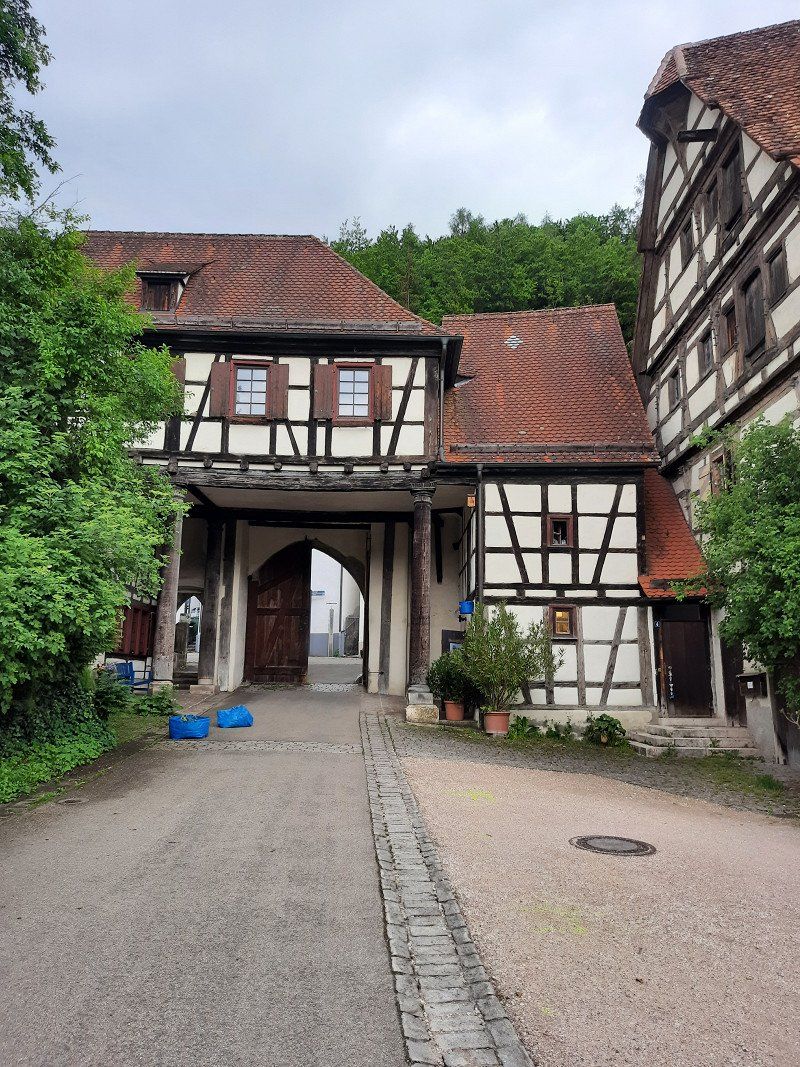
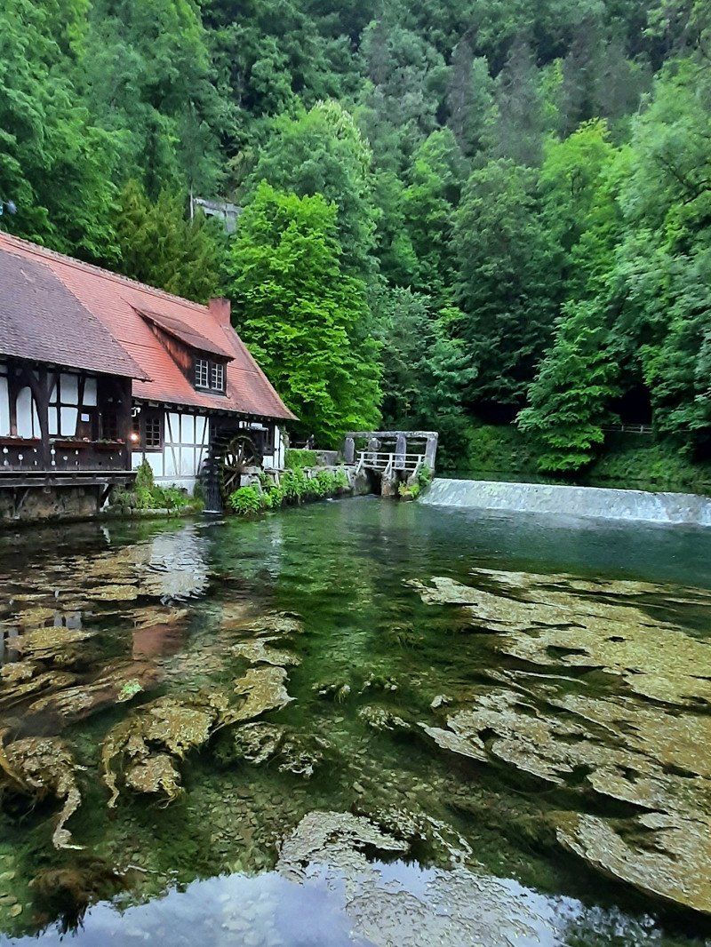
Road trip Italy
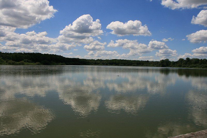
Our home port is the beautiful Nettetal in close proximity to the Netherlands.
Although we have a premium hiking trail, small lakes and the typical
Lower Rhine landscape but now and then we want mountains and sea.
Italy is our country of longing, which can offer us all this.
Come along to Italy for a bit.
This time we almost always went spontaneously to campsites with a camping card and we deliberately avoided the toll roads in Bella Italia, after all, the journey should be the goal.
We have attached some information and photos to our stations, you have to click on the diary view under the map.
A list of costs can be found at aspaltoldies.de.
Day
41334 Nettetal, Deutschland
51° 19' 34.6" N 6° 16' 19.6" E
51.3262794 6.2721001
• Head toward An Schönkes Krüz on Wevelinghoven. Go for 209 m.
• Continue on Neustraße. Go for 1.0 km.
• Turn right onto L373. Go for 2.4 km.
• Continue on B509 toward A61/Viersen-Boisheim. Go for 3.7 km.
• Take ramp onto A61 toward Koblenz. Go for 26.2 km.
• Continue on Autobahndreieck Mönchengladbach-Wanlo toward Koblenz/Aachen/Düsseldorf/A61. Go for 375 m.
• Take the exit onto A46. Go for 3.8 km.
• Take exit 11 toward Koblenz/Köln/Aachen/A61 onto A44. Go for 8.2 km.
• Take exit 16 toward Koblenz/Köln onto A61. Go for 40.7 km.
• Continue on A61 toward Koblenz/Weilerswist. Go for 239 km.
• Take the left exit toward Stuttgart/Heilbronn/Karlsruhe onto A6. Go for 7.8 km.
• Take exit 31 toward Basel/Karlsruhe onto A5. Go for 37.5 km.
• Take exit 46 toward München/Stuttgart/Pforzheim onto A8. Go for 60.8 km.
• Continue on A8 toward München/Ulm/S-Möhringen/Degerloch/Flughafen/Messe. Go for 94.2 km.
• Take exit 65 toward Kempten/Lindau onto A7. Go for 127 km.
• Continue on Grenztunnel Füssen (B179). Go for 34.6 km.
• Turn left and take ramp toward Ehrwald/Biberwier. Go for 131 m.
• Continue on Ehrwalder Landesstraße (L391). Go for 2.0 km.
• Turn sharp right onto Marienbergweg. Go for 326 m.
• Turn left onto Marienbergweg. Go for 63 m.
• Turn right onto Marienbergweg. Go for 81 m.
• Turn right. Go for 48 m.
• Arrive at your destination on the left.
☍
690,1 km
(6 hrs. 17 min.)
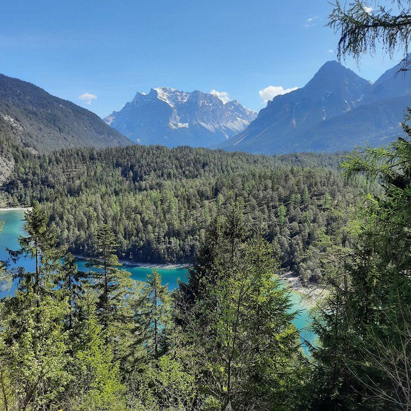
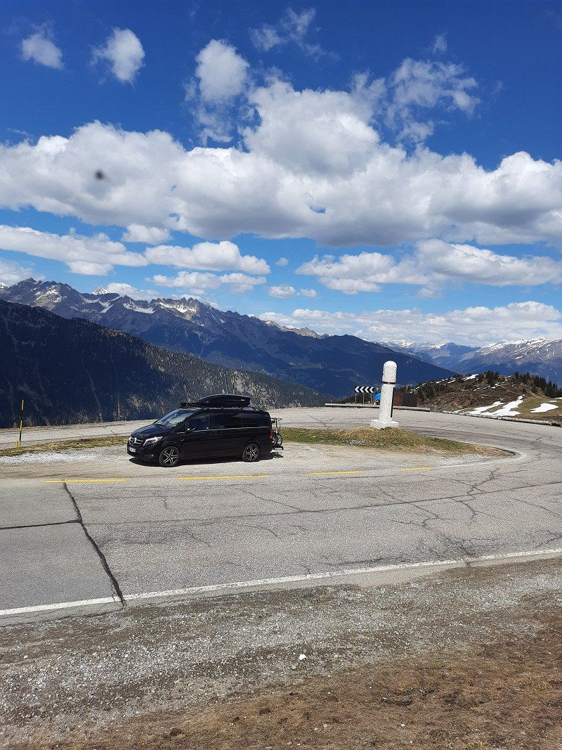
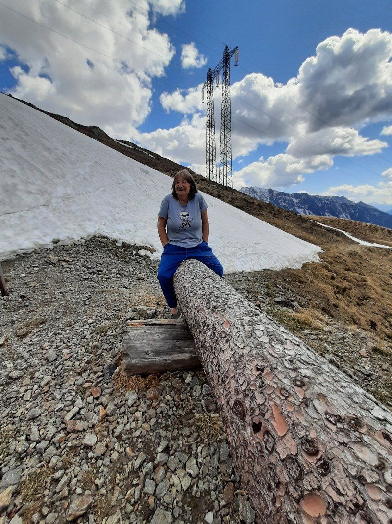
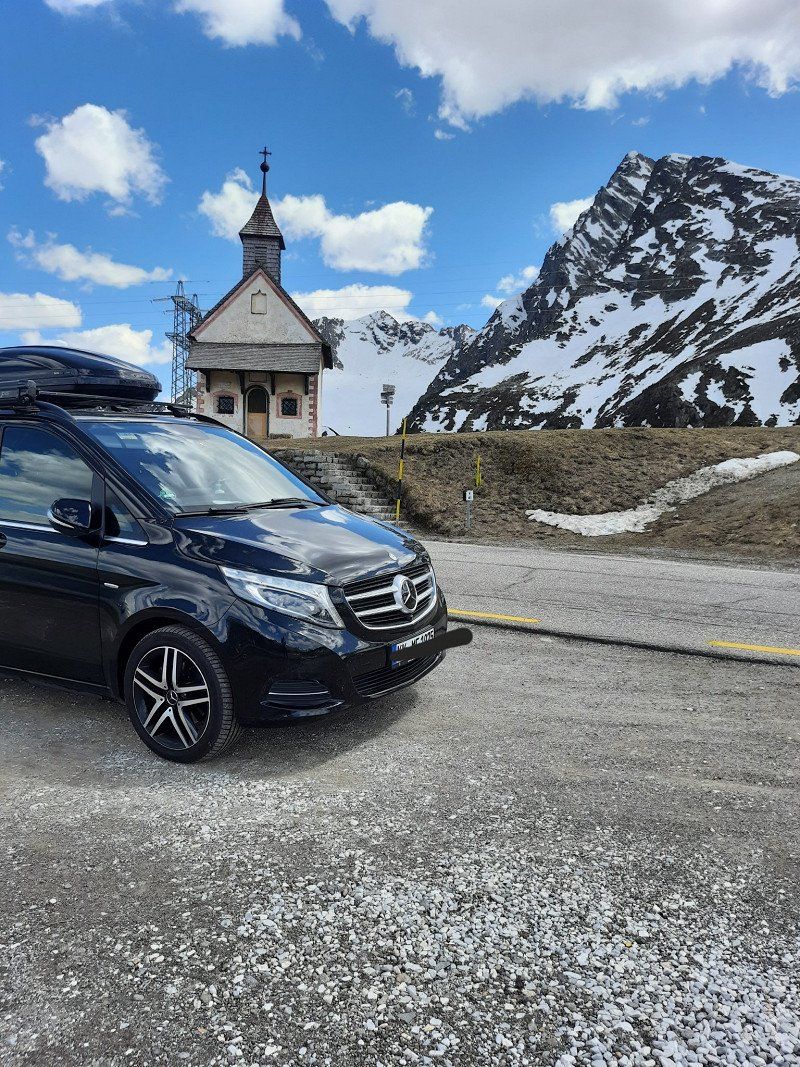
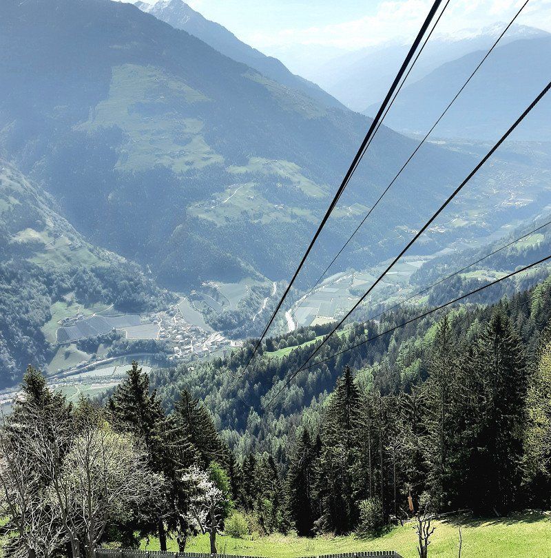
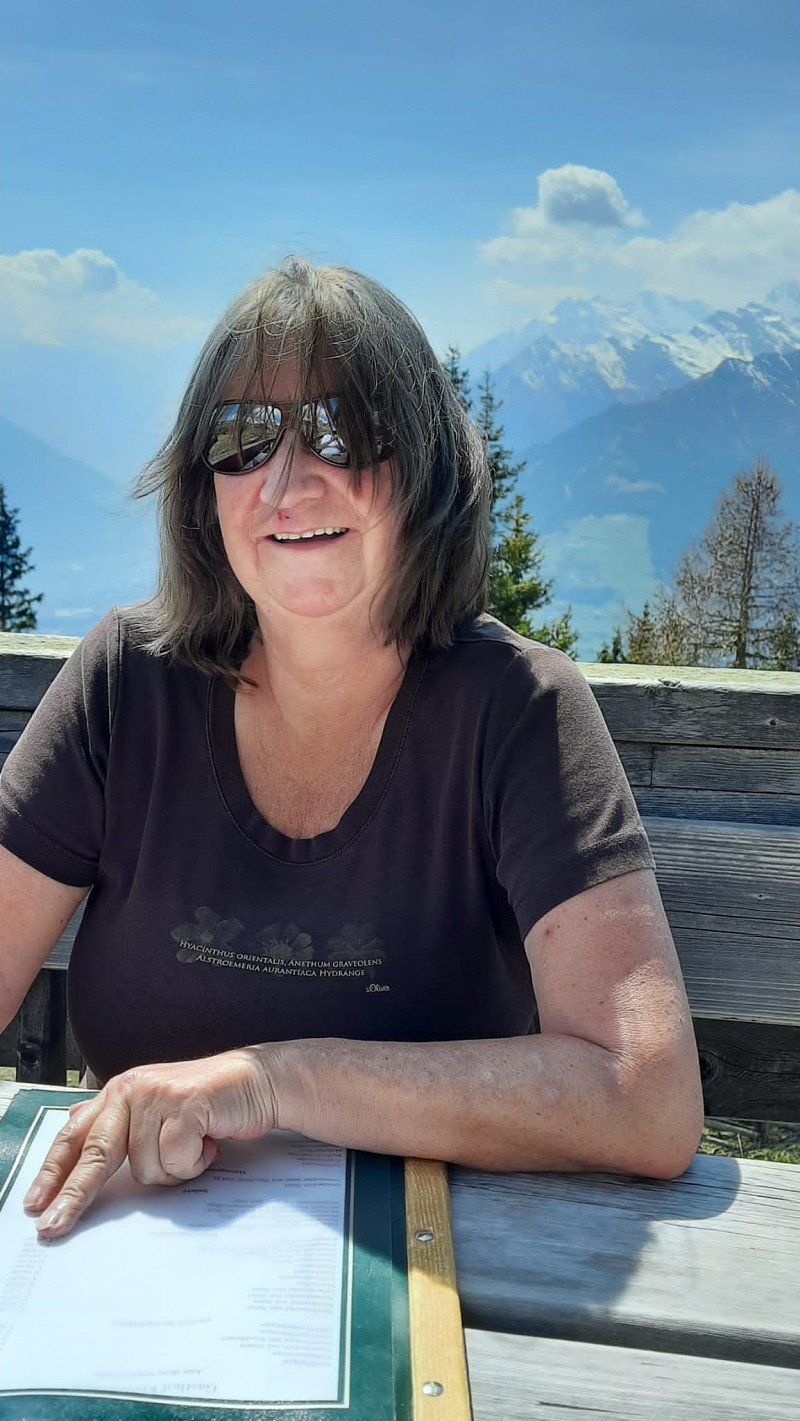
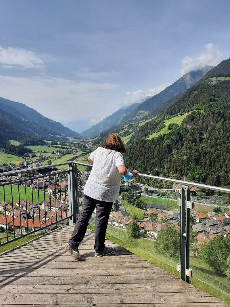
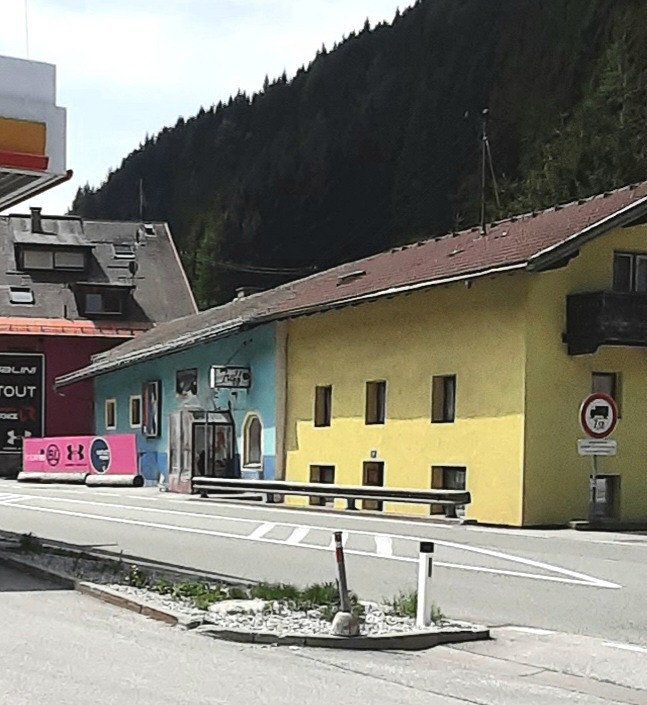
Zugspitzblick
From home we always drive over the Tiroler Fernpass.
Make sure to stop at the Zugspitzblick (Biberwier 162 / Austria) great view
THINKING ABOUT THE VIGNETTE !
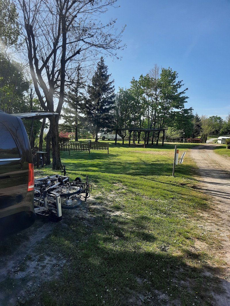
Alpencamp-Marienberg, Marienbergweg, Biberwier, Österreich
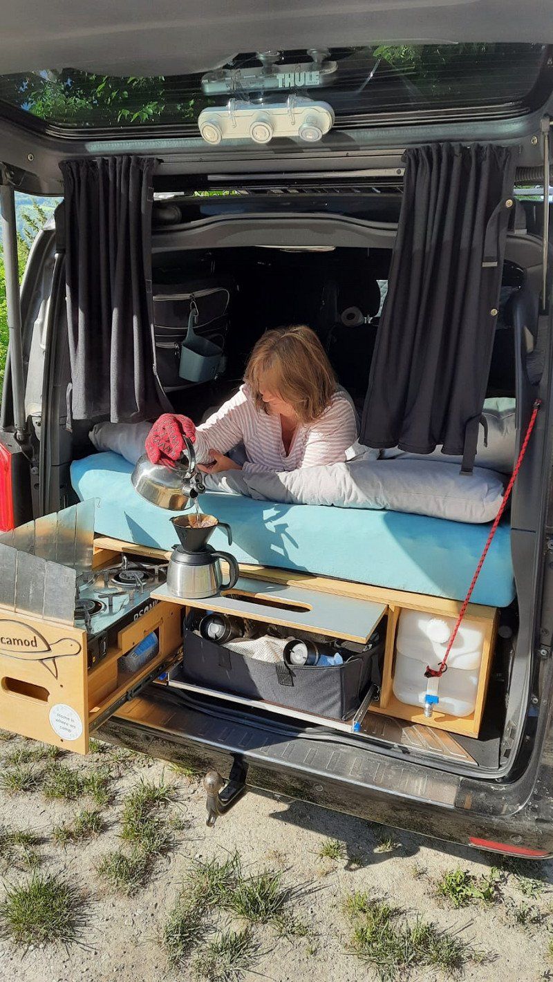
We spend our first night at the Alpencamp Marienberg (Tyrolean Zugspitz Arena),
actually the stay should last a little longer but unfortunately everything except the CP was closed, the season starts on 26.5.22
We have been there several times in summer, the location is beautiful because all activities are nearby.
For the kids there's the beaver path, really nice for adults too
Entrance a bit confusing!
1 night stay
Marienbergweg 15, 6633 Biberwier, Österreich
47° 22' 29.3" N 10° 53' 33.7" E
47.3747981 10.8926999
• Head toward Marienbergweg. Go for 48 m.
• Turn left onto Marienbergweg. Go for 81 m.
• Turn left toward Marienbergweg. Go for 14 m.
• Continue on Marienbergweg. Go for 49 m.
• Turn right onto Marienbergweg. Go for 326 m.
• Turn sharp left onto Fernpass Straße (L391). Go for 2.0 km.
• Keep right toward Fernpass. Go for 248 m.
• Take ramp. Go for 71 m.
• Turn right onto Fernpass Bundesstraße (B179). Go for 14.7 km.
• Continue on Mieminger Bundesstraße (B189). Go for 13.4 km.
• Take the 1st exit from roundabout onto Krebsbach (L236) toward Innsbruck/Bregenz/Mötz. Go for 5.0 km.
• Turn right and take ramp onto A12 (Inntal Autobahn) toward Innsbruck. Go for 35.6 km.
• Keep right onto A13 (Knoten Innsbruck-Wilten) toward E45/Bozen/Brenner/Innsbruck-Süd. Go for 33.5 km.
• Continue on A22 (Autostrada del Brennero). Go for 16.4 km.
• Take the exit toward Vipiteno/Sterzing/Stazione Vipiteno/Bahnhof Sterzing. Go for 1.5 km.
• Take the 4th exit from roundabout onto Passo di Giovo (SS44). Go for 1.1 km.
• Pass 5 roundabouts and continue on Via Passiria (SS44). Go for 36.3 km.
• Turn left onto Via Passiria (SS44). Go for 10.4 km.
• Turn left onto Via Passiria. Go for 40 m.
• Turn left onto Via Passiria. Go for 198 m.
• Arrive at Via Passiria. Your destination is on the left.
☍
171,0 km
(2 hrs. 41 min.)
Day
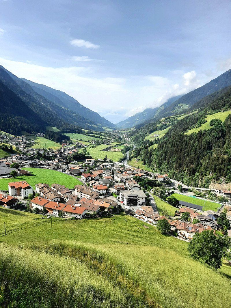
Passeiertal
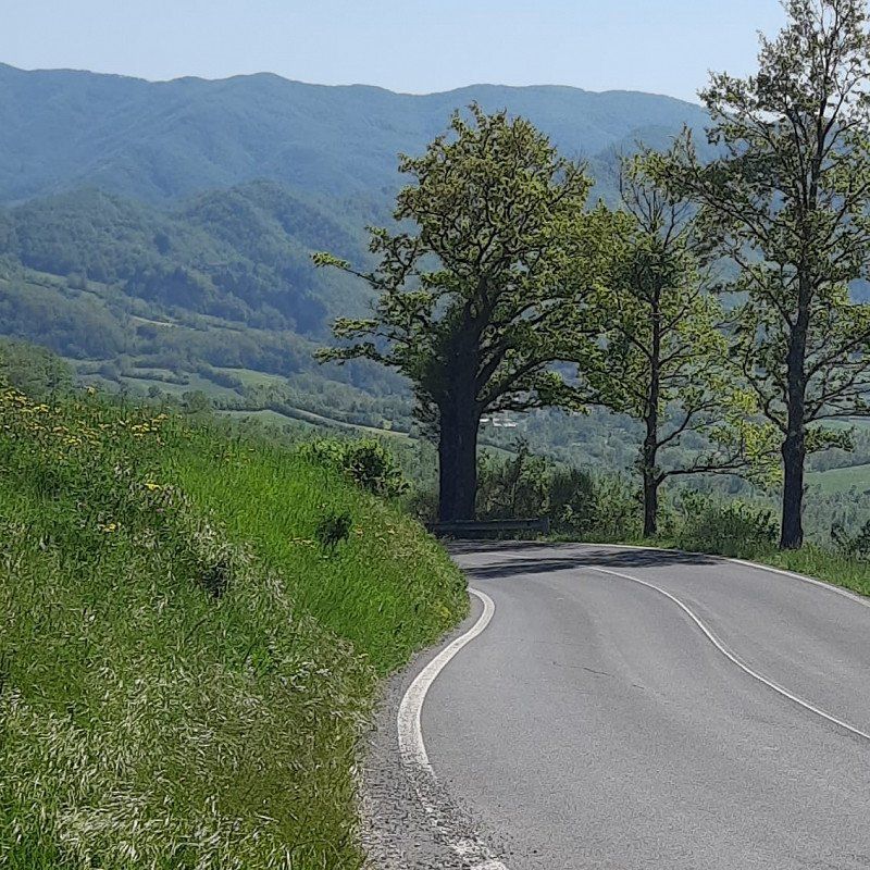
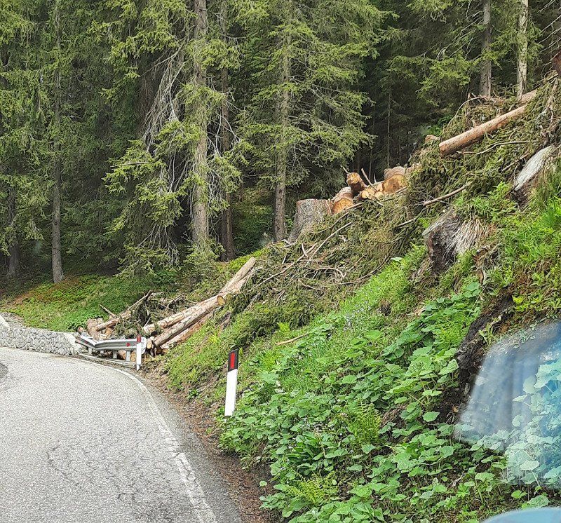
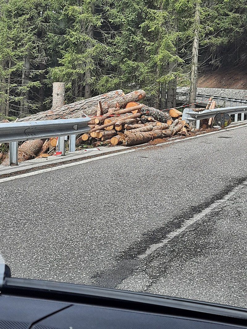
From Biberwier (from here toll out) we went into the Passeier Valley over the Jaufpass
to CP Untersaltaushof
The Jaufenpass is actually a must, a great panorama.
As far as I know, teams are forbidden.
You will find a corresponding link on the website
We with the V class had no problems,
Without a toll you drive on this route under the Brenner motorway, or parallel, scenic route.
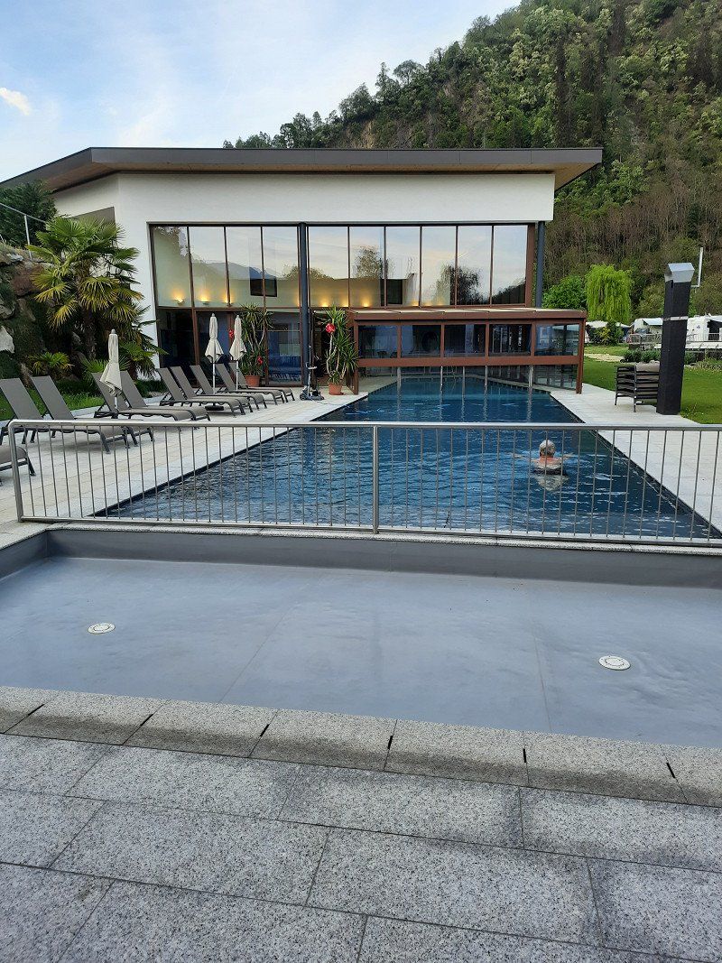
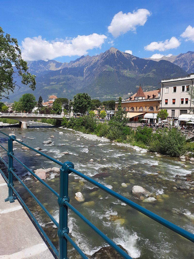
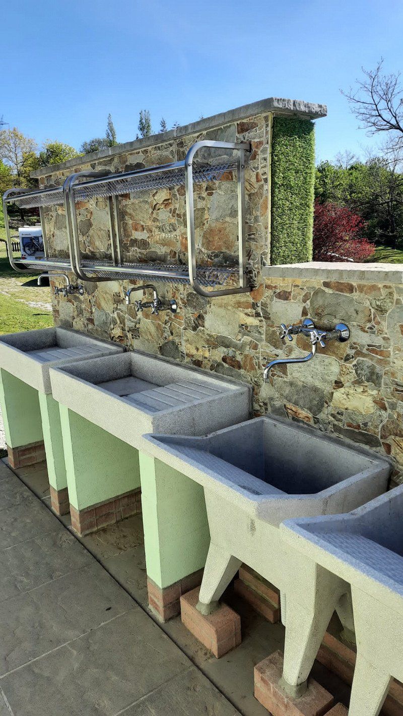
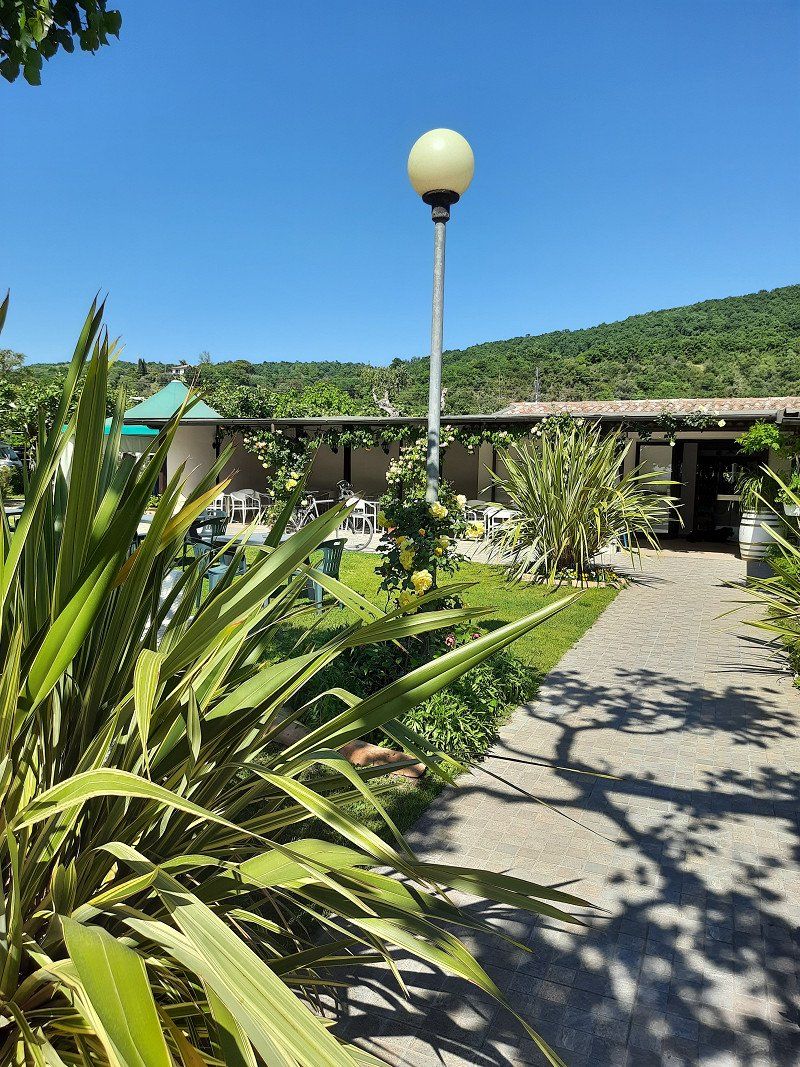
Camping Passeier Meran
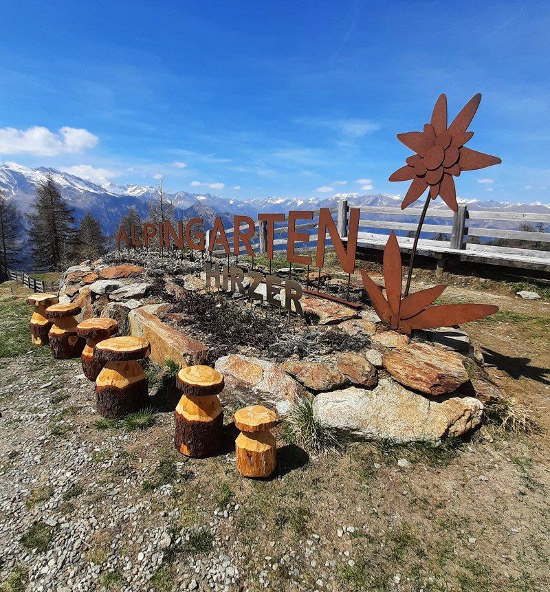
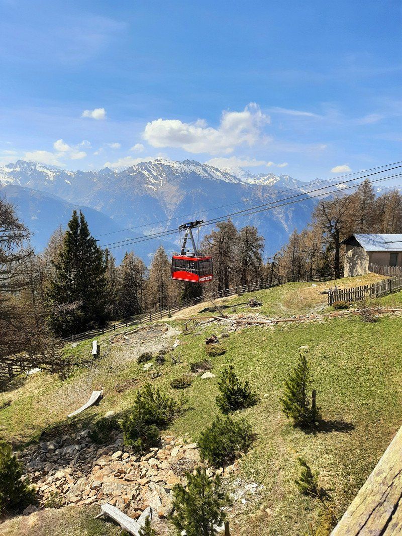
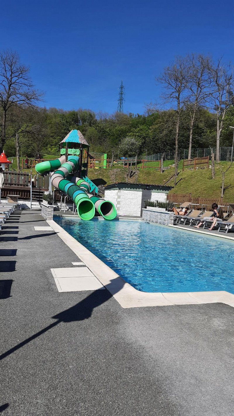
The site is right next to the Hirzer cable car, the cycle path to Meran is a stone's throw away.
A swimming pool is also available.
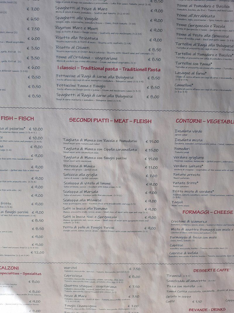
The attached restaurant and shop are good.
You can get tickets for the middle and mountain station at the CP
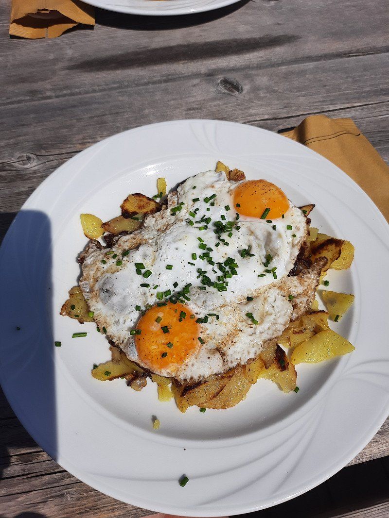
The fried potatoes at Klammeben (mountain station) are great
2 nights
Pseirerstr. 10, 39010, Saltaus - St. Martin, Italy
46° 43' 41.8" N 11° 12' 7.7" E
46.7282800 11.2021300
• Head southeast on Via Passiria.
• Arrive at Via Passiria. Your destination is on the left.
☍
Distance not available
(Duration not available)
Day
Camping Passeier bei Meran, Pseirerstraße, Saltaus, Autonome Provinz Bozen - Südtirol, Italien
Pseirerstraße, 10, 39010 Saltaus, Autonome Provinz Bozen - Südtirol, Italien
46° 43' 41.6" N 11° 12' 7.8" E
46.7282206 11.2021728
• Head northwest on Via Passiria. Go for 198 m.
• Turn left onto Via Passiria. Go for 48 m.
• Turn left onto Via Passiria (SS44). Go for 8.4 km.
• Turn left onto Via San Giorgio. Go for 218 m.
• Continue on Via Virgilio. Go for 200 m.
• Turn left onto Via Scena toward Schenna/Scena/Hafling/Avelengo/Bozen/Bolzano. Go for 887 m.
• Take the 2nd exit from roundabout onto Strada Provinciale Scena (SP8) toward Bozen/Bolzano. Go for 1.6 km.
• Continue toward Obermais/Maia Alta. Go for 25 m.
• Take the 2nd exit from roundabout toward Meran/Merano/Bozen/Bolzano. Go for 33 m.
• Continue on Via Lungo Rio Nova (SP8). Go for 842 m.
• Take the 2nd exit from roundabout onto Via Nazionale toward Bozen/Bolzano. Go for 1.7 km.
• Take the 2nd exit from roundabout onto Via Nazionale toward Autostrada/Autobahn/Lana/Bozen/Bolzano. Go for 260 m.
• Continue on Strada Provinciale Zona Industriale di Lana (SP101) toward Autostrade/A22/Lana/Bozen/Bolzano. Go for 221 m.
• Turn left onto Industriezone Lana Landstraße (SP101). Go for 58 m.
• Keep left onto Industriezone Lana Landstraße (SP101). Go for 69 m.
• Continue toward A22/Bozen/Bolzano. Go for 312 m.
• Continue on MeBo (SS38). Go for 21.3 km.
• Take left ramp onto A22 (Autostrada del Brennero) toward Autostrada/Bolzano Centro/Bozen Zentrum/E45/Brennero/Brenner/Modena. Go for 123 km.
• Take the exit toward Affi/Lago di Garda Sud. Go for 598 m.
• Take the 3rd exit from roundabout toward Peschiera/SS450. Go for 337 m.
• Take the 2nd exit from roundabout onto Strada Regionale di Affi (SR450) toward Milano/A4/Peschiera/Verona/SR11. Go for 13.0 km.
• Keep left onto SS11dir toward Milano-Venezia/A4/Brescia/SR11/Sirmione/Peschiera. Go for 3.6 km.
• Keep left toward Sirmione/SR11/Brescia. Go for 292 m.
• Continue on Paradiso di Sotto. Go for 329 m.
• Continue on Strada Regionale Padana Superiore (SR11). Go for 2.6 km.
• Turn left onto SPBS11 toward Milano-Venezia/A4/Brescia/SS11/Sirmione. Go for 2.5 km.
• Turn right toward Pozzolengo/S. Benedetto/Rovizza. Go for 162 m.
• Continue toward SPBS11. Go for 30 m.
• Take the 2nd exit from roundabout onto SPBS11 toward Peschiera/Verona. Go for 348 m.
• Continue on Strada Provinciale Padana Superiore (SPBS11var). Go for 1.1 km.
• Take the 2nd exit from roundabout onto Via Punta Gro'. Go for 119 m.
• Turn right onto Via Punta Gro'. Go for 39 m.
• Arrive at Via Punta Gro'. Your destination is on the right.
☍
184,3 km
(2 hrs. 8 min.)
Day
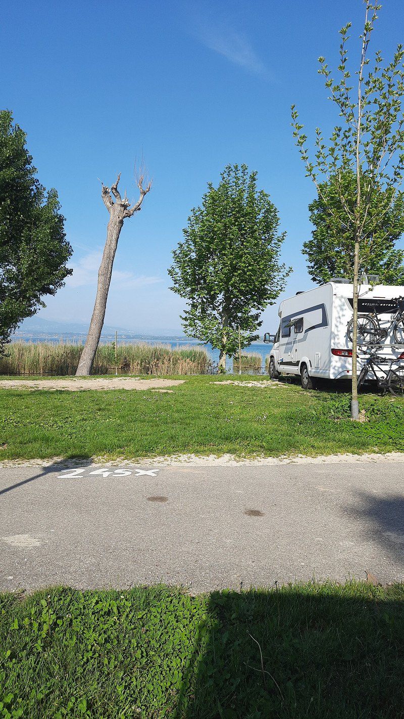
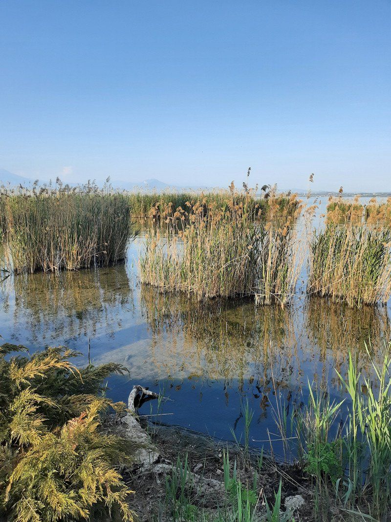
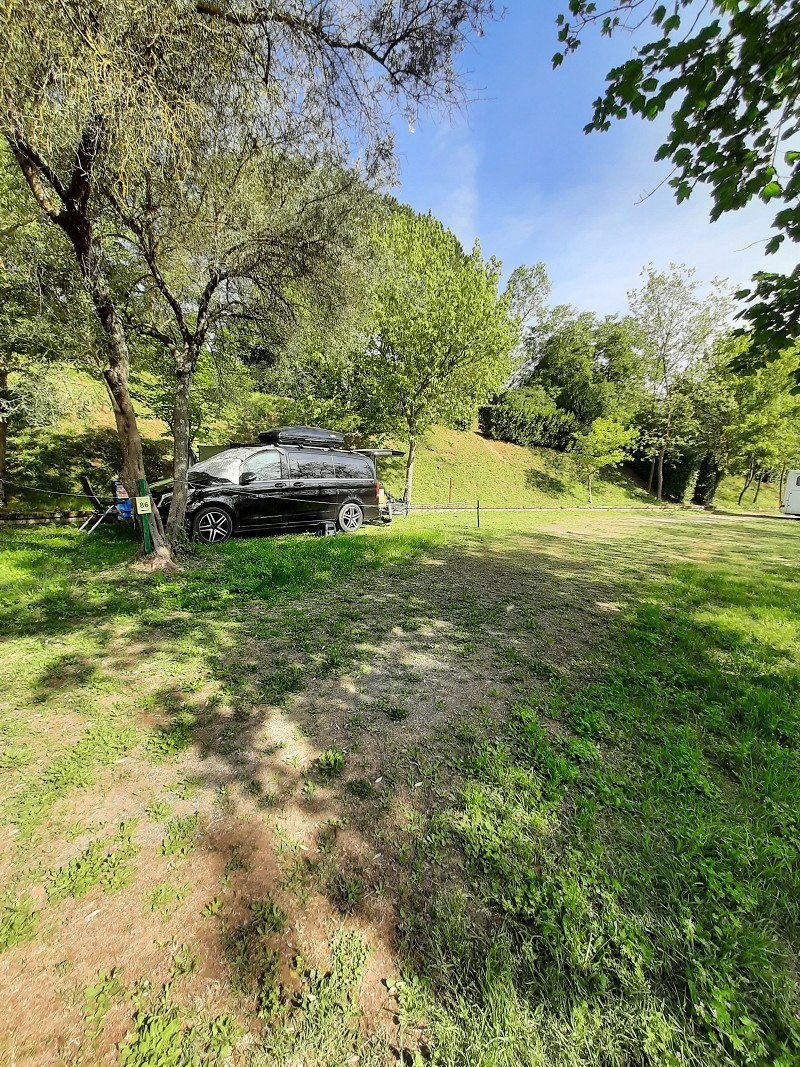
Camping Villaggio Tiglio
Actually, we spontaneously chose this place because the reviews were pretty good. The proximity to the lake can't be beat, but otherwise we were pretty disappointed with the CP.
After one night we drove on
Via Punta Grò 6, 25019, Lugana di Sirmione (Bs), Italy
45° 27' 26.2" N 10° 38' 25.9" E
45.4572800 10.6405300
• Head southwest on Via Punta Gro'. Go for 39 m.
• Turn left onto Via Punta Gro'. Go for 64 m.
• Take the 3rd exit from roundabout onto Strada Padana Superiore toward Milano-Venezia/A4/Verona/Peschiera. Go for 2.0 km.
• Pass 2 roundabouts and continue on Via Bell'Italia (SR11). Go for 1.5 km.
• Take the 1st exit from roundabout onto Via Tangenziale (SR11) toward Milano/A4/Venezia/Verona/Mantova. Go for 3.1 km.
• Take ramp toward Peschiera Centro/Autostrada/A4/Valeggio S/M/SR249. Go for 178 m.
• Take the 1st exit from roundabout onto Località Paradiso di Sotto toward Località Paradiso. Go for 247 m.
• Turn right onto Strada Regionale Gardesana Orientale (SR249). Go for 156 m.
• Keep left onto Strada Regionale Gardesana Orientale (SR249) toward Peschiera Centro/Ospedale/Valeggio S.M. Go for 96 m.
• Keep left onto Strada Regionale Gardesana Orientale (SR249) toward Milano-Venezia/A4/Valeggio sul Mincio/Mantova/Verona/SR11/Affi/SR450. Go for 69 m.
• Turn left toward Milano-Venezia/Milano-Brennero/A22. Go for 63 m.
• Take ramp onto A4 (Autostrada della Serenissima) toward Venezia/Brennero-Modena/A22. Go for 16.8 km.
• Take the exit toward Brennero-Modena/Verona Nord/Aeroporto/Mantova/Modena/Bologna/A1 onto A22 (Autostrada del Brennero). Go for 84.9 km.
• Take the left exit toward Bologna/Roma/Modena onto A1 (Autostrada del Sole). Go for 51.7 km.
• Continue on SS64var. Go for 927 m.
• Continue on Raccordo Autostradale Sasso Marconi SS64 Porretana. Go for 2.4 km.
• Continue on A1 (Autostrada del Sole). Go for 32.5 km.
• Take the exit toward Roncobilaccio. Go for 404 m.
• Turn left onto Via del Casello. Go for 890 m.
• Turn left onto Strada Provinciale Castiglione-Baragazza-Campallorzo (SP8). Go for 5.8 km.
• Continue on Strada Provinciale di Roncobilaccio (SP120). Go for 606 m.
• Turn right onto Strada Provinciale di Bruscoli (SP59). Go for 905 m.
• Turn right. Go for 148 m.
• Turn right toward Via Bruscoli Futa. Go for 18 m.
• Continue on Via Bruscoli Futa. Go for 107 m.
• Turn slightly right. Go for 14 m.
• Arrive at your destination on the right.
☍
205,6 km
(2 hrs. 2 min.)
Day
Camping la futa, Via Bruscoli Futa, Firenzuola, Florenz, Italien
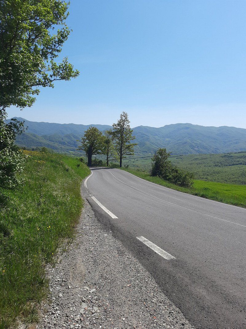
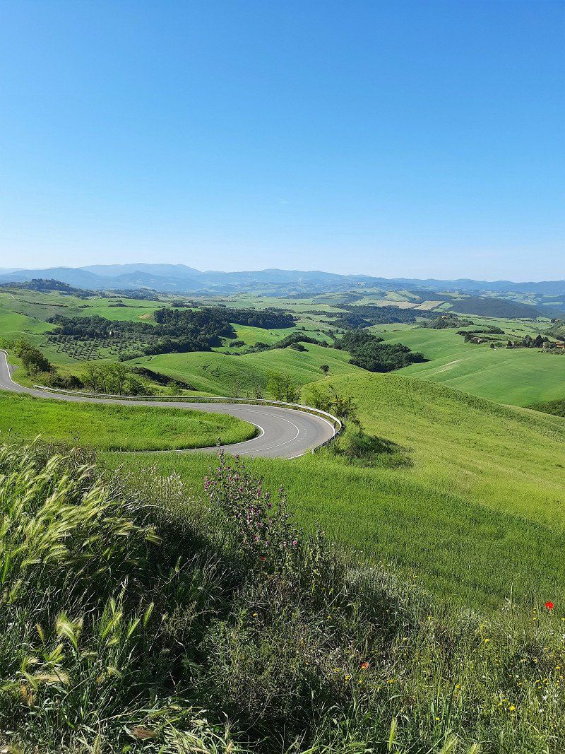
If you still leave the toll out of the navigation system, you can get to CP la Futa via the Passo della Raticosa.
The journey takes a little longer, but the journey is the destination.
This is how you experience a scenic route with serpentines.
At the CP La Futa, the ratings on the net are not exaggerated, a great, clean place with nice operators.
1 night stay
Via Bruscoli Futa, 889h, 50033 Firenzuola FI, Italien
44° 5' 52.9" N 11° 16' 6" E
44.0980237 11.2683463
• Head toward Via Bruscoli Futa. Go for 14 m.
• Turn slightly left onto Via Bruscoli Futa. Go for 273 m.
• Turn right onto Strada Provinciale di Bruscoli (SP59). Go for 857 m.
• Take the 2nd exit from roundabout onto Passo della Futa (SR65). Go for 5.5 km.
• Keep right toward Viadotto Casaglia/A1var. Go for 3.2 km.
• Take ramp onto A1var (Viadotto Casaglia). Go for 7.8 km.
• Continue on A1 (Viadotto Lora). Go for 91 m.
• Continue on A1var (Variante di Valico). Go for 32 m.
• Continue on A1 (Galleria Manganaccia). Go for 434 m.
• Continue on A1var (Galleria Manganaccia). Go for 1.9 km.
• Continue on A1 (Viadotto Sieve). Go for 139 m.
• Continue on A1var (Viadotto Sieve). Go for 216 m.
• Continue on A1 (Autostrada del Sole). Go for 19 m.
• Continue on A1var (Variante di Valico). Go for 116 m.
• Continue on A1 (Autostrada del Sole). Go for 25.6 km.
• Take the exit toward Firenze Scandicci/FI-PI-LI/Pisa-Livorno/Scandicci Centro onto Strada di Grande Comunicazione Fi-Pi-Li. Go for 13.7 km.
• Take ramp toward Ginestra F./S.C.G. Firenze/Ginestra F.Na/Montespertoli. Go for 168 m.
• Continue on Via Chiantigiana (SP12). Go for 372 m.
• Take the 3rd exit from roundabout onto Strada Provinciale Val di Pesa (SP12) toward S.G.C. Fi-Si/Montespertoli/S. Casciano V.P./Scandicci. Go for 914 m.
• Pass 2 roundabouts and continue on Via Empolese (SP12). Go for 2.8 km.
• Turn left onto Via del Lago. Go for 1.1 km.
• Arrive at Via del Lago.
☍
65,2 km
( 49 min.)
Day
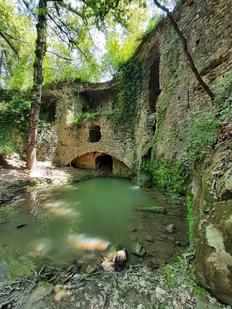
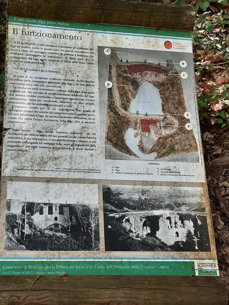
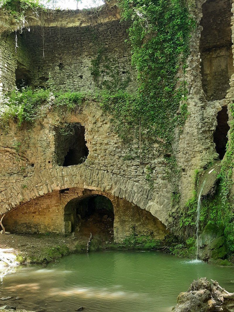
Mulinaccio, Scandicci, Florenz, Italien
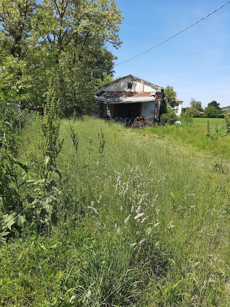
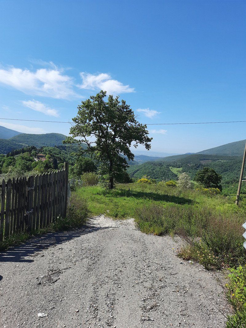
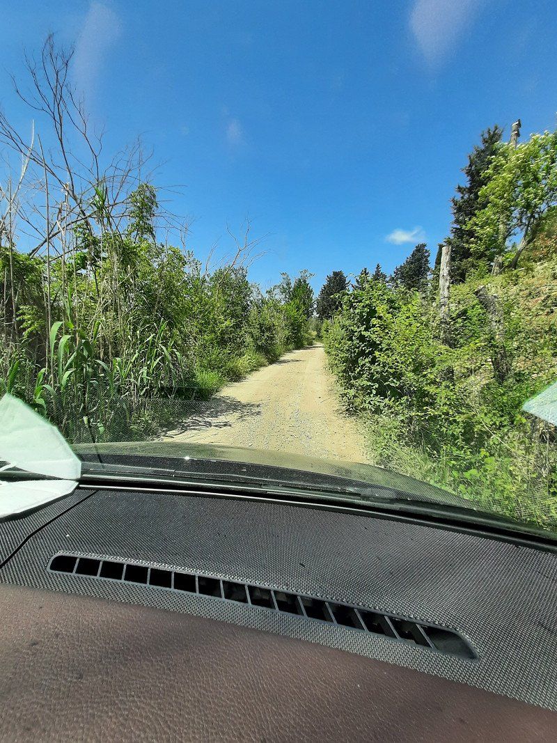
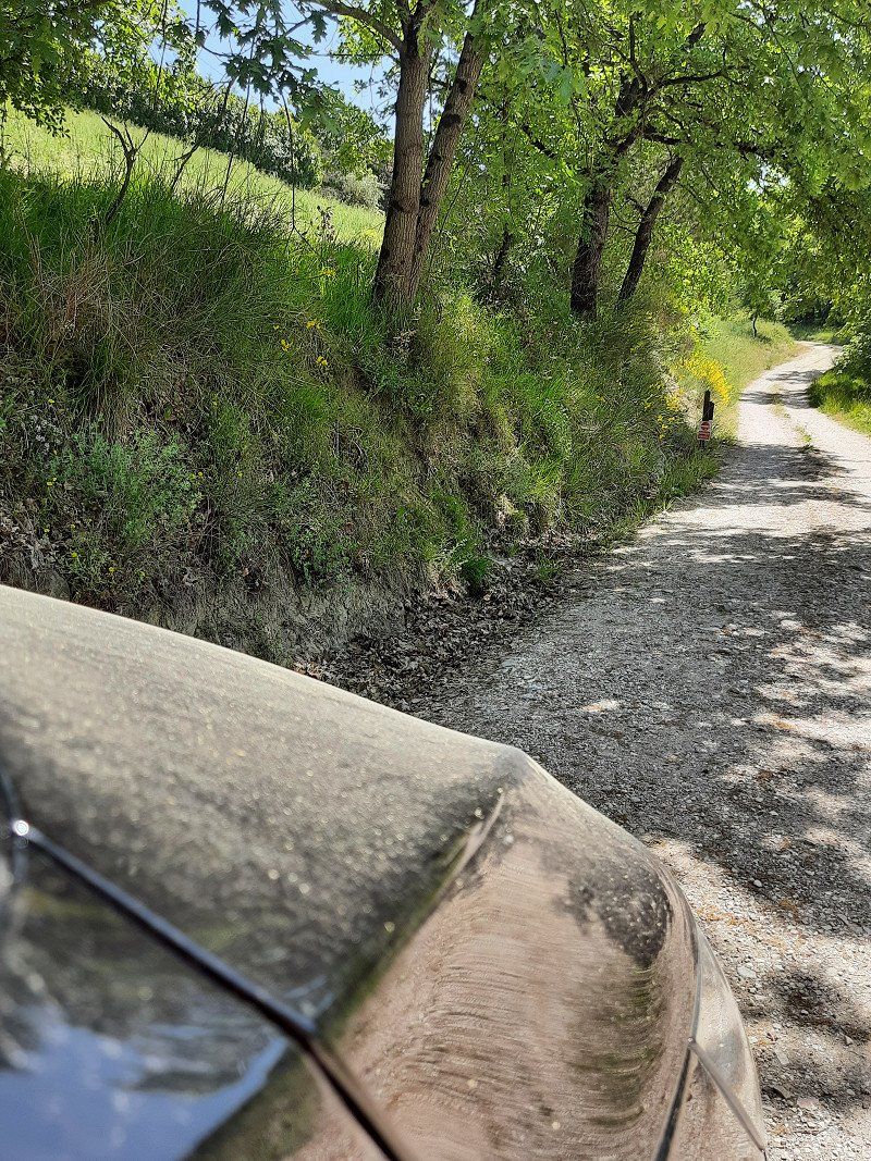
On the way to Volterra we discovered this beautiful "lost place".
The road there looked like a dirt road.
We would do it with a large caravan or team
don't risk driving there
it is better to leave the vehicle nearby and explore on foot or by bike.
50018 Scandicci, Metropolitan City of Florence, Italien
43° 42' 14.5" N 11° 6' 38.9" E
43.7040406 11.1108105
• Head southwest on Via del Lago. Go for 1.1 km.
• Turn right onto Via Empolese (SP12). Go for 1.4 km.
• Pass 3 roundabouts and continue on Via Chiantigiana (SP12). Go for 2.8 km.
• Turn left and take ramp onto Strada di Grande Comunicazione Fi-Pi-Li toward Pisa/Livorno. Go for 12.0 km.
• Take ramp toward Empoli. Go for 334 m.
• Take the 3rd exit from roundabout onto Strada Regionale di Val d'Elsa (SR429var) toward Firenze-Siena/Siena/Castelfiorentino. Go for 1.8 km.
• Pass 4 roundabouts and continue on SR429var. Go for 10.0 km.
• Continue on SR429var. Go for 4.9 km.
• Take the 1st exit from roundabout onto Via Rodolfo Morandi (SP4). Go for 430 m.
• Turn right onto Strada Provinciale delle Colline (SP26) toward Montaione/Castelfalfi. Go for 5.6 km.
• Keep left onto Strada Provinciale delle Colline (SP26) toward Volterra/S.Miniato/Montaione/Gambassi. Go for 3.0 km.
• Turn right onto Strada Provinciale Volterrana (SP4) toward Volterra/S. Gimignano/S.Vivaldo. Go for 15.8 km.
• Continue on Strada Regionale Sarzanese Valdera Diramazione (SR439dir). Go for 334 m.
• Turn left onto Strada Provinciale Volterrana (SP15). Go for 7.7 km.
• Turn right onto Via di Mandringa. Go for 111 m.
• Turn right onto Via di Mandringa. Go for 19 m.
• Arrive at Via di Mandringa. Your destination is on the right.
☍
67,2 km
(1 hrs. 6 min.)
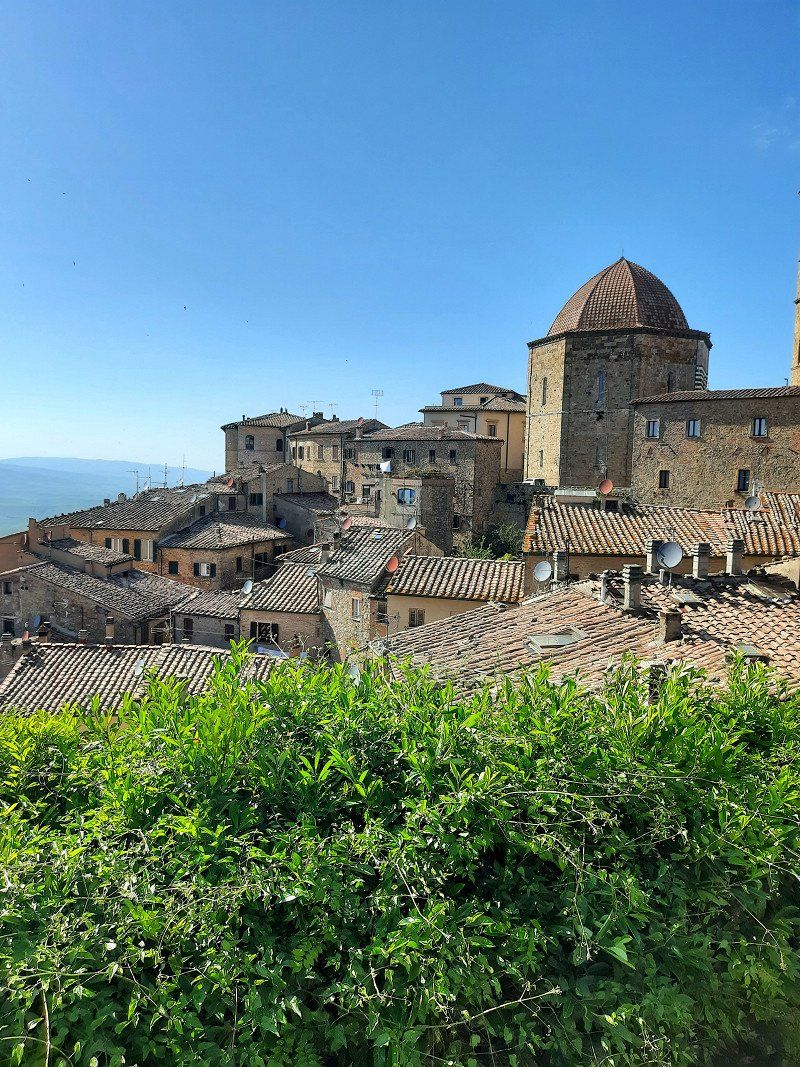
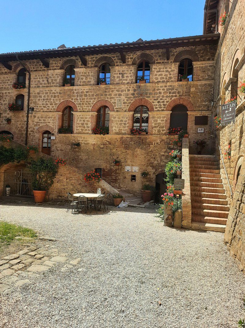
Camping Le Balze Volterra, Via di Mandringa, Volterra, Pisa, Italien
A terraced beautifully landscaped campsite within walking distance of medieval Volterra.
Nice reception and plenty of information from the lady at the reception.
You can also order paninis there.
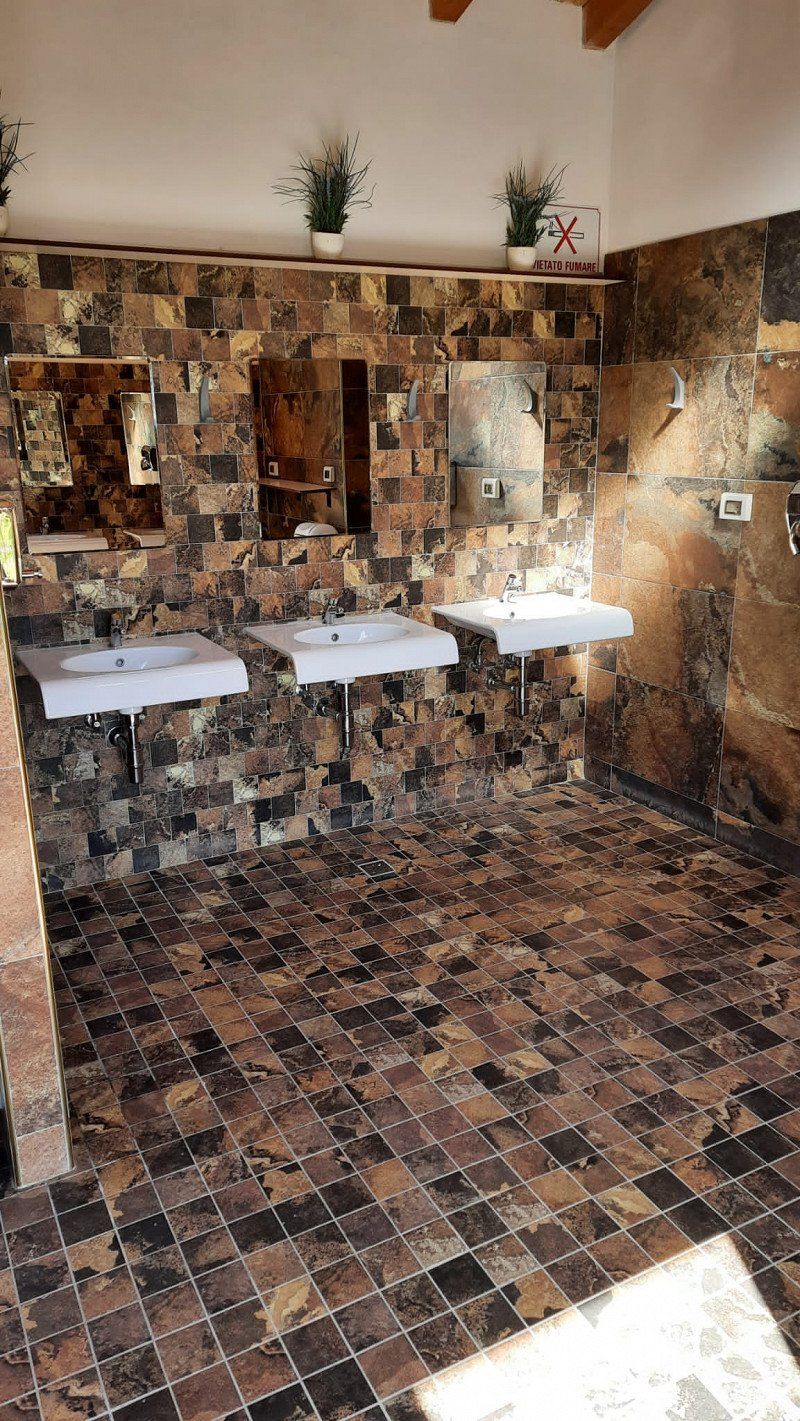
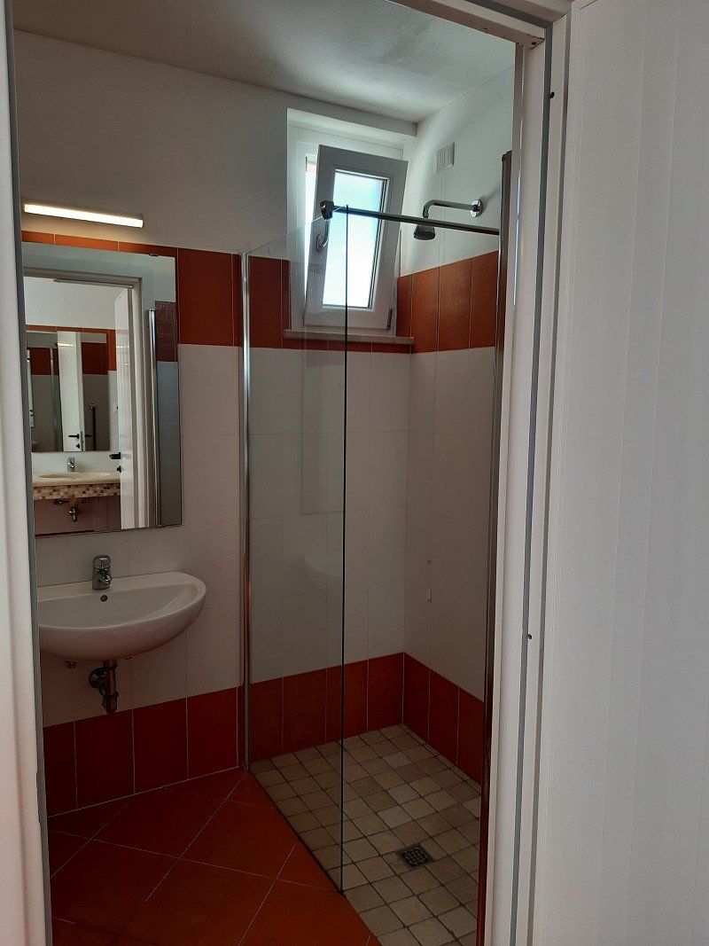
The sanitary facilities are a bit outdated but clean.
The WLAN coverage in the lower range (80s numbers) was good.
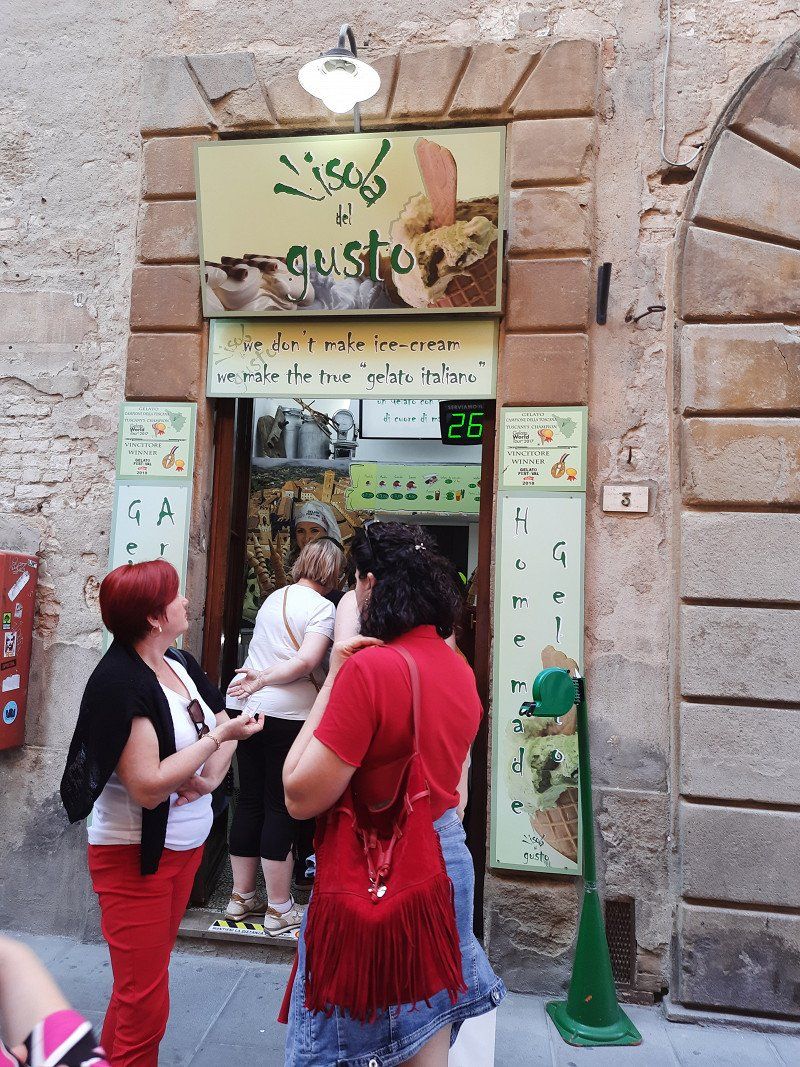
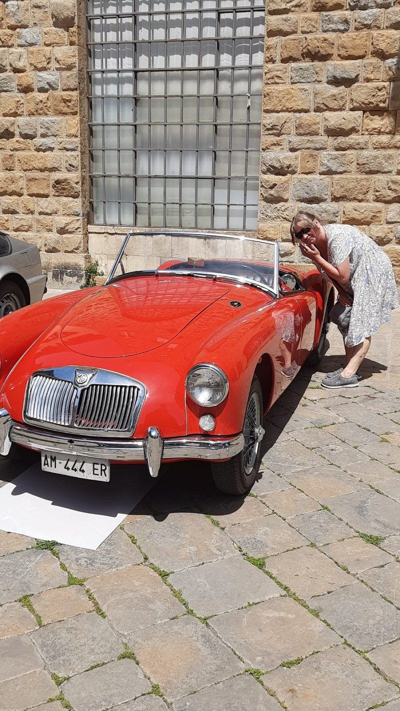
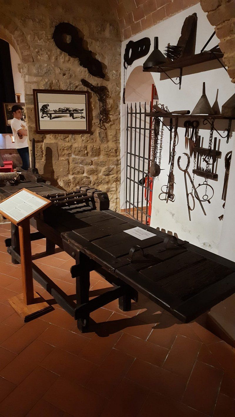
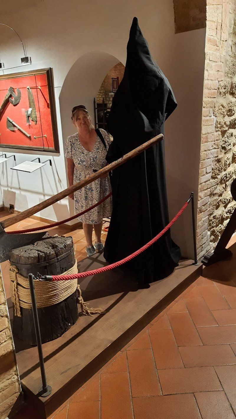
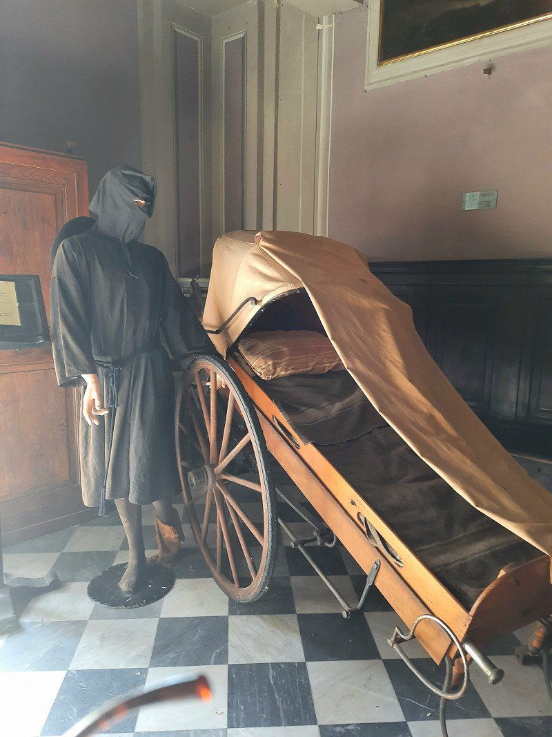
A good (actually the best) gelateria is on Via Antonio Gramsci le'isola del Gusto, and the Museo della Tortoura is also spectacular
2 nights
Via di Mandringa, 15, 56048 Volterra PI, Italien
43° 24' 43.9" N 10° 51' 3.3" E
43.4122059 10.8509206
• Head northwest on Via di Mandringa.
• Arrive at Via di Mandringa. Your destination is on the right.
☍
Distance not available
(Duration not available)
Day
Camping Le Balze Volterra, Via di Mandringa, Volterra, Pisa, Italien
Via di Mandringa, 15, 56048 Volterra PI, Italien
43° 24' 43.9" N 10° 51' 3.3" E
43.4122059 10.8509206
• Head southeast on Via di Mandringa. Go for 19 m.
• Turn left onto Via di Mandringa. Go for 111 m.
• Turn right onto Via Pisana (SP15). Go for 350 m.
• Take the 2nd exit from roundabout onto Via Pisana (SP15). Go for 1.1 km.
• Take the 3rd exit from roundabout onto Viale Giuseppe Garibaldi (SR68). Go for 24.8 km.
• Take the 2nd exit from roundabout onto Strada Regionale di Val di Cecina (SR68). Go for 839 m.
• Continue on Viale della Rimembranza. Go for 1.6 km.
• Continue on Via Ferdinando Livini. Go for 237 m.
• Take the 4th exit from roundabout onto Viale Antonio Gramsci (SR68). Go for 2.1 km.
• Take the 1st exit from roundabout toward Firenze. Go for 97 m.
• Take the 1st exit from roundabout onto Superstrada Firenze-Siena (RA3) toward Siena. Go for 25.4 km.
• Take ramp onto Strada di Grande Comunicazione Grosseto-Fano (SS223) toward Roma/A1/Arezzo. Go for 4.8 km.
• Take ramp onto Strada di Grande Comunicazione Grosseto-Fano (E78) toward Arezzo/Perugia/Roma/A1. Go for 43.1 km.
• Take ramp toward Firenze-Roma/A1/Bettolle. Go for 415 m.
• Take the 2nd exit from roundabout onto A1 (Autostrada del Sole) toward Autostrada/Firenze/Roma. Go for 66.2 km.
• Take the exit toward Orvieto onto SS205 (Strada Statale Amerina). Go for 1.0 km.
• Take the 2nd exit from roundabout onto Via Angelo Costanzi (SS205) toward Orvieto Centro/Viterbo. Go for 688 m.
• Continue toward Viterbo. Go for 36 m.
• Take the 3rd exit from roundabout toward Viterbo. Go for 148 m.
• Turn right onto Strada Statale Umbro Casentinese (SS71). Go for 3.5 km.
• Turn left onto Via della Gabelletta toward Viterbo. Go for 236 m.
• Continue on Strada Statale Umbro Casentinese (SS71). Go for 11.5 km.
• Turn right onto SP13 toward Bolsena. Go for 1.4 km.
• Continue on Strada Provinciale Bolsenese (SP53). Go for 6.0 km.
• Turn left onto Strada Regionale Cassia (SR2). Go for 1.6 km.
• Turn right onto Località Pietre Lanciate. Go for 237 m.
• Arrive at Località Pietre Lanciate. Your destination is on the right.
☍
197,6 km
(2 hrs. 28 min.)
Day
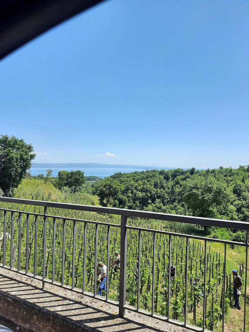
Mill Val d'Orcia
Actually, we wanted to see how pasta is made, but we only found a beautiful agriturismo, maybe we'll book there for one night.
The journey continued to Lago di Bolsena
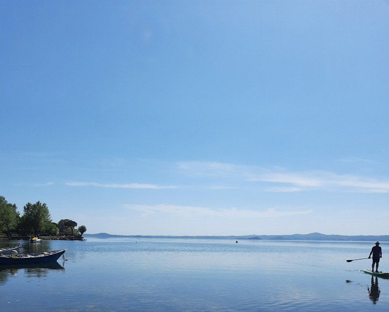
Blu International Camping Club
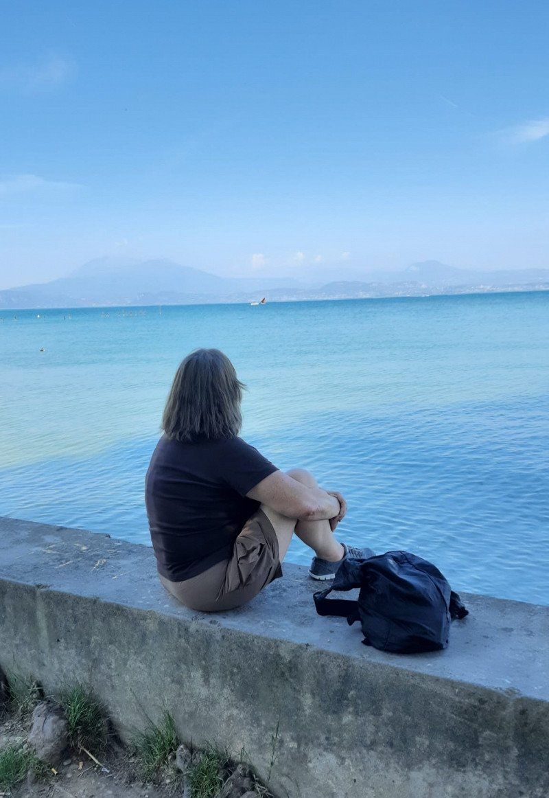
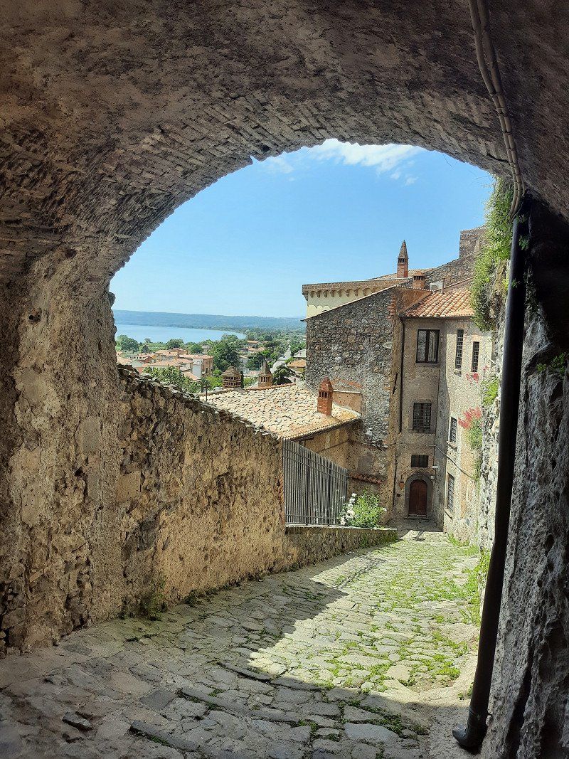
Lake Bolsena, our favorite lake with the surrounding villages and towns such as Montefiascone
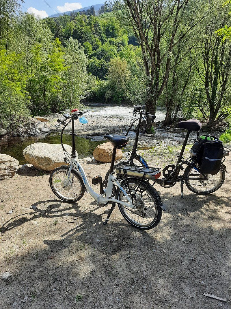
This time we were in Bolsena by bike,
about 2.5 km from the site.
The CP has its own beach access, site-specific WiFi and a very good restaurant
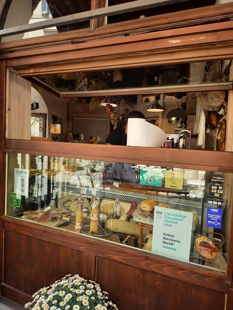
TIP: The Norcineria in Bolsena is really good
2 nights
via Cassia, 01023, Bolsena, Italy
42° 37' 54" N 11° 59' 39" E
42.6316600 11.9941600
• Head northeast on Località Pietre Lanciate. Go for 10 m.
• Arrive at Località Pietre Lanciate. Your destination is on the left.
☍
0,0 km
( )
Day
Blu International Camping, Via Cassia Km 111,650, Loc. Pietre Lanciate, Bolsena, Viterbo, Italien
Actually we wanted to go further south and then everything turned out completely differently.........
but read for yourself
Via Cassia Km 111,650, 01023 Loc. Pietre Lanciate, Bolsena VT, Italien
42° 37' 53" N 11° 59' 40.9" E
42.6314000 11.9946912
• Head toward Strada Regionale Cassia on Località Pietre Lanciate. Go for 227 m.
• Turn right onto Strada Regionale Cassia (SR2). Go for 12.0 km.
• Keep right onto Via Cassia toward Viterbo. Go for 1.0 km.
• Keep left onto Via Casa Vecchia. Go for 217 m.
• Turn right onto Strada Regionale Cassia (SR2). Go for 12.7 km.
• Take the 2nd exit from roundabout onto Via Cassia (SR2). Go for 503 m.
• Take ramp onto Strada Statale Umbro-Laziale (SS675) toward Orte/Milano-Napoli/A1. Go for 59.8 km.
• Continue on Strada Statale Flaminia (SS3) toward Spoleto. Go for 72 m.
• Pass 2 roundabouts and continue on Via Flaminia (SS3). Go for 25.5 km.
• Take ramp onto Strada Statale delle Tre Valli Umbre (SS685) toward Cascia/Norcia. Go for 6.8 km.
• Take ramp onto Strada Statale delle Tre Valli Umbre (SS685). Go for 14.5 km.
• Keep left toward Ascoli Piceno/Norcia/Cascia. Go for 71 m.
• Continue on Località Casentino (SS209). Go for 12.0 km.
• Turn right toward Località Case Sparse Castelvecchio. Go for 1.3 km.
• Continue on Località Case Sparse Castelvecchio. Go for 16 m.
• Turn right onto Località Case Sparse Castelvecchio. Go for 175 m.
• Turn right toward Località Collaccio. Go for 472 m.
• Turn left onto Località Collaccio. Go for 30 m.
• Turn left. Go for 120 m.
• Make a U-Turn. Go for 120 m.
• Turn left onto Località Collaccio. Go for 31 m.
• Arrive at Località Collaccio. Your destination is on the right.
☍
147,7 km
(2 hrs. 8 min.)
Software Problem müssen wir schon nach Hause?
Suddenly the complete command system in the Bruno failed.
The nearest Mercedes workshop was a few kilometers away in Viterbo.
I don't know if they couldn't or didn't want to help us, at least they said they didn't have any free capacity.
The Mercedes hotline was very friendly and a nice person gave us instructions on the phone on how to reset the system. Unfortunately didn't work.
Another technician called us back and gave us the advice to continue driving with the cell phone sat nav and to present the car in Germany.
We could have continued like this, but it's not nice if the system can't be switched off and drives up and down at full volume every 10 seconds.
This is annoying to no end.
We didn't even need to inform ADAC because the car was roadworthy.
No sooner said than done, we have decided to head towards home.
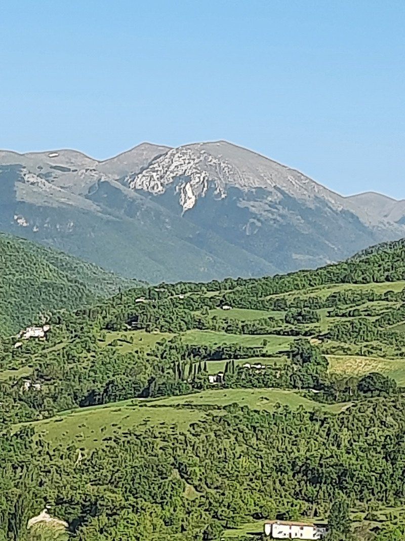
We drove via Narni and Termi to at least take the Monte Sibillini National Park with us on the tour.
More out of necessity, we looked for and found a campsite nearby.
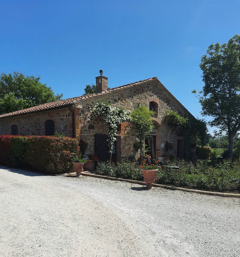
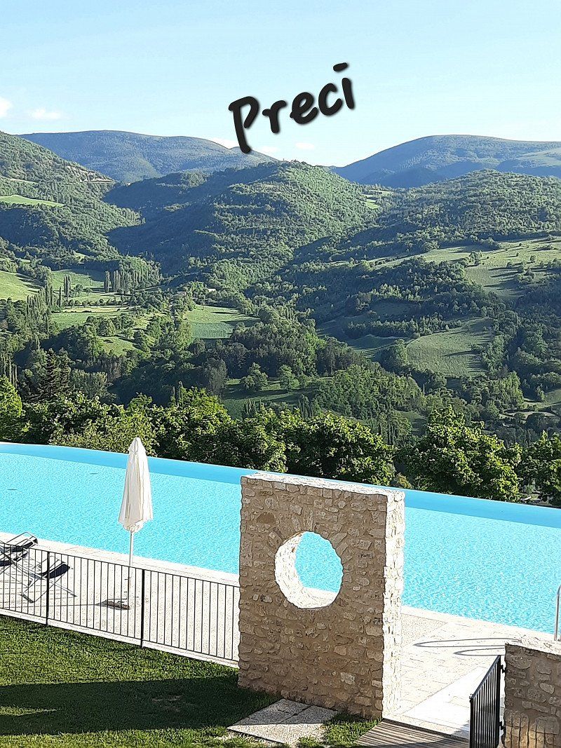
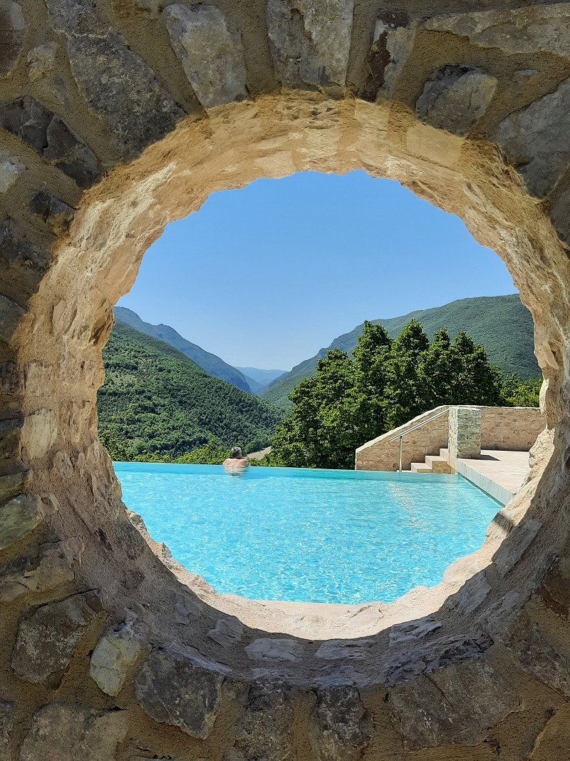
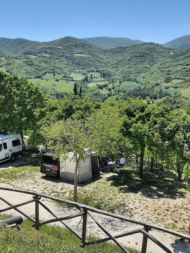
Agriturismo Campeggio Il Collaccio, Preci, Perugia, Italien
Località Collaccio, 06047 Preci PG, Italien
42° 53' 17.6" N 13° 0' 52.2" E
42.8882273 13.0145019
• Head south on Località Collaccio.
• Arrive at Località Collaccio. Your destination is on the right.
☍
Distance not available
(Duration not available)
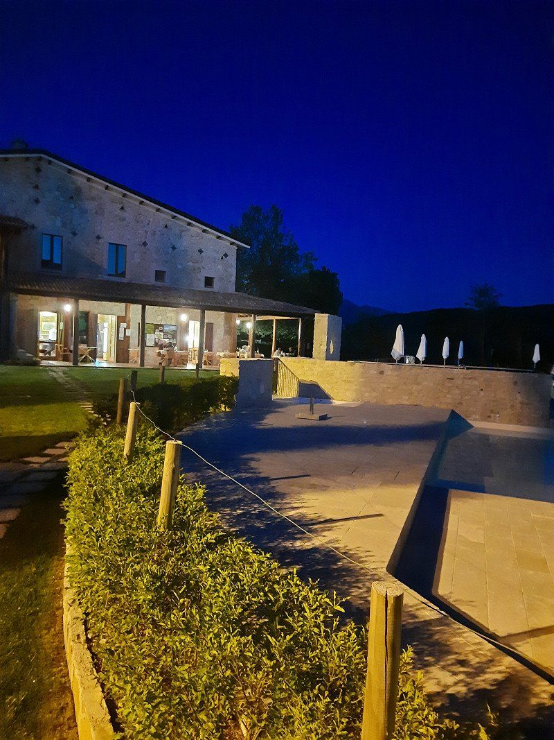
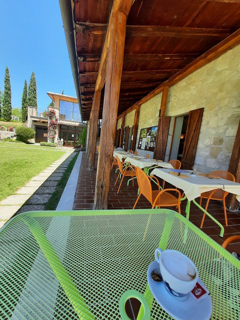
Das Beste was uns passieren konnte
This place is sheer madness something you have to have experienced
super clean
Friendly, helpful staff everywhere
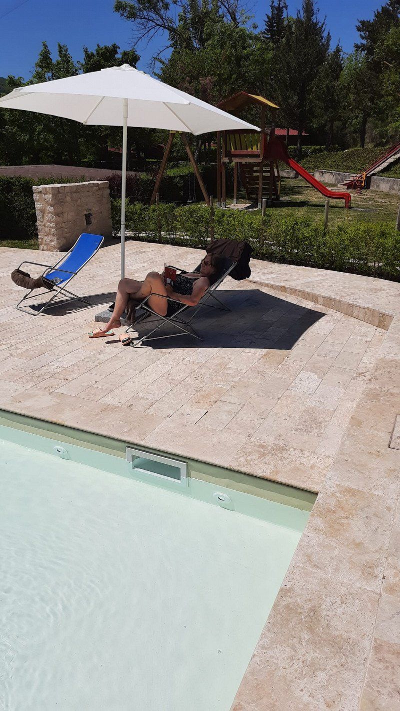
Great restaurant and not to forget the fantastic location, embedded in the mountains with an infinity pool that offers an amazing view.
The journey is a bit adventurous, but if you're in the corner, make a stop, it's worth it.
Day
Agriturismo Campeggio Il Collaccio, Preci, Perugia, Italien
Località Collaccio, 06047 Preci PG, Italien
42° 53' 17.6" N 13° 0' 52.2" E
42.8882273 13.0145019
• Head south on Località Collaccio.
• Arrive at Località Collaccio. Your destination is on the right.
☍
Distance not available
(Duration not available)
Fehler gefunden?
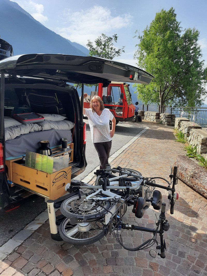
It was time to clean up the vehicle. We kept our laundry in two narrow plastic boxes on the footboard between the sliding door and the mattress, every centimeter was actually used, we've always had it that way.
We cleared everything out completely, I had a strange feeling and asked my husband to start the vehicle, lo and behold, the light at the front for the sliding door stopped flashing. Was "that" maybe related to the Comand system, actually that wasn't possible because the display didn't show an open door.
The command system started up normally again. What luck, there was probably so much pressure on the sliding door that caused the error.
Car admitted differently, runs 👍 INCREDIBLE,
it would have been very expensive. Thanks workshop that you didn't have time :)
Day
Agriturismo Campeggio Il Collaccio, Preci, Perugia, Italien
3 nights because it was so nice :)
Località Collaccio, 06047 Preci PG, Italien
42° 53' 17.6" N 13° 0' 52.2" E
42.8882273 13.0145019
• Head south on Località Collaccio. Go for 1.9 km.
• Turn right onto Strada Provinciale di Norcia (SP476). Go for 2.5 km.
• Turn left onto Strada Statale Valnerina (SS209). Go for 9.4 km.
• Continue on Strada Statale delle Tre Valli Umbre (SS685) toward Terni/Perugia. Go for 14.5 km.
• Take ramp onto Strada Statale delle Tre Valli Umbre (SS685). Go for 6.3 km.
• Take ramp onto Strada Statale Flaminia (SS3) toward Foligno/Perugia/Fano. Go for 24.5 km.
• Take ramp onto Strada Stratale Trasimeno (SS75) toward Foligno Nord/Perugia. Go for 25.3 km.
• Take ramp onto Strada Statale Tiberina (SS3bis) toward Ravenna/Ancona. Go for 176 km.
• Take left ramp onto Via Classicana (SS16) toward Ospedale/Ravenna Centro/Ferrara/Venezia/SS309. Go for 1.8 km.
• Take the 1st exit from roundabout onto Via Ravegnana. Go for 2.1 km.
• Pass 2 roundabouts and continue on Via Ravegnana. Go for 941 m.
• Continue on Via Castel San Pietro. Go for 139 m.
• Keep right onto Via Castel San Pietro. Go for 13 m.
• Turn right onto Via Renato Serra. Go for 160 m.
• Take the 3rd exit from roundabout onto Via Giovanni Pascoli. Go for 239 m.
• Continue on Via Alfredo Oriani. Go for 239 m.
• Continue on Vicolo Porziolino. Go for 93 m.
• Turn left onto Via Francesco Negri. Go for 72 m.
• Turn right onto Vicolo Corradini. Go for 90 m.
• Turn right onto Via Angelo Mariani. Go for 126 m.
• Turn left onto Via di Roma. Go for 72 m.
• Arrive at Via di Roma. Your destination is on the right.
☍
266,8 km
(2 hrs. 52 min.)
Day
Ravenna, Italien
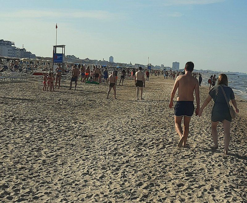
Italy without the sea is actually an absurdity.
We looked for a CP in Ravenna and were looking forward to spending a few days by the sea.
This project died with a visit to the square and the beach.
The normal places are so tiny that you have to ask yourself how a caravan with an awning fits in there,
Both the public and private beach were full.
The pool was chargeable and of course bathing caps required.
The staff was very nice and WiFi was good but somehow the feeling of well-being was missing.
1 night stay
44° 25' 6.1" N 12° 12' 12.7" E
44.4183598 12.2035294
• Head north on Via di Roma. Go for 20 m.
• Turn right onto Viale Carlo Luigi Farini. Go for 166 m.
• Turn left onto Piazza Goffredo Mameli. Go for 66 m.
• Turn slightly right onto Via Rocca Brancaleone. Go for 476 m.
• Turn slightly right onto Via Rocca Brancaleone. Go for 38 m.
• Turn slightly right. Go for 25 m.
• Turn left toward Circonvallazione Alla Rotonda dei Goti. Go for 20 m.
• Continue on Circonvallazione Alla Rotonda dei Goti. Go for 196 m.
• Turn right onto Via Sant'Alberto (SP1). Go for 461 m.
• Continue on Via Antica Popilia (SP1). Go for 415 m.
• Turn left onto Via Sant'Alberto (SP1). Go for 150 m.
• Turn right onto Via Guglielmo Brunelli. Go for 223 m.
• Continue on Via Giuseppe Zalamella. Go for 782 m.
• Turn right toward Viale Sergio Cavina. Go for 51 m.
• Continue on Viale Sergio Cavina. Go for 470 m.
• Take the 2nd exit from Rotonda Polonia roundabout onto Viale Sergio Cavina. Go for 224 m.
• Continue on Via Canalazzo. Go for 1.1 km.
• Turn left toward Via San Vitale Strada Statale. Go for 57 m.
• Continue on Via San Vitale Strada Statale. Go for 277 m.
• Turn right onto Via Canalazzo. Go for 22 m.
• Turn right onto Via San Vitale Strada Statale (SS309dir). Go for 1.3 km.
• Continue on A14dir. Go for 29.1 km.
• Take the exit toward Bologna onto A14 (Autostrada Adriatica). Go for 57.1 km.
• Continue on A1 (Autostrada del Sole). Go for 32.7 km.
• Take the exit toward Brennero onto A22 (Autostrada del Brennero). Go for 228 km.
• Take the exit toward Bolzano Sud/Bozen Süd/Merano/Trento/SS12/Laives/SS12/Aeroporto/Flughafen/Leifers/Meran onto SS38 (MeBo). Go for 22.8 km.
• Take ramp toward Sinich/Sinigo/Zona Industriale Lana. Go for 264 m.
• Turn right toward Strada Provinciale Zona Industriale di Lana/SP101. Go for 27 m.
• Continue on Strada Provinciale Zona Industriale di Lana (SP101). Go for 202 m.
• Continue on Via Nazionale. Go for 222 m.
• Take the 2nd exit from roundabout onto Via Nazionale. Go for 1.7 km.
• Continue toward Via Lungo Rio Nova/SP8. Go for 30 m.
• Take the 1st exit from roundabout onto Via Lungo Rio Nova (SP8) toward Schenna/Scena/Tirol/Tirolo/Hafling/Avelengo/Voran/Verano. Go for 877 m.
• Take the 2nd exit from roundabout onto Via San Valentino (SP8) toward Schenna/Hafling/Scena/Avelengo/Molten/Meltina/Voran/Verano. Go for 1.7 km.
• Take the 3rd exit from roundabout onto Via Scena toward Obermais/Maia Alta/Tirol/Tirolo. Go for 951 m.
• Turn right onto Via Virgilio toward Tirol/Tirolo. Go for 200 m.
• Continue on Via San Giorgio toward Tirol/Tirolo. Go for 218 m.
• Turn right onto Via San Giorgio (SS44) toward Tirol/Tirolo. Go for 4.7 km.
• Arrive at Via Passo Giovo (SS44). Your destination is on the left.
☍
386,9 km
(3 hrs. 25 min.)
Day
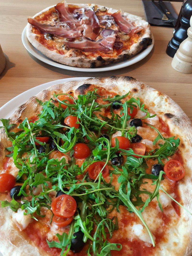
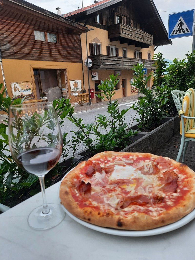
Riffian, Autonome Provinz Bozen - Südtirol, Italien
Somehow I felt the need not to spend the next few nights on a CP, so we spontaneously booked ourselves back into a hotel in the Passeier Valley.
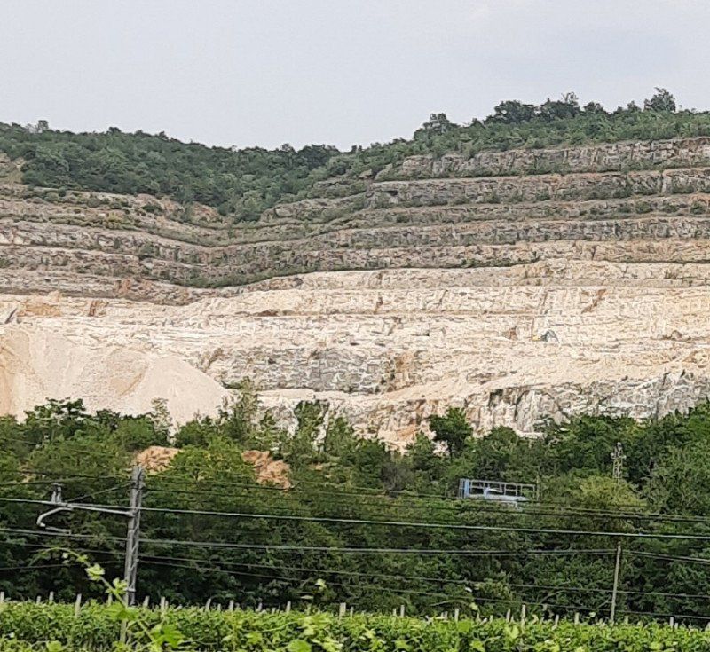
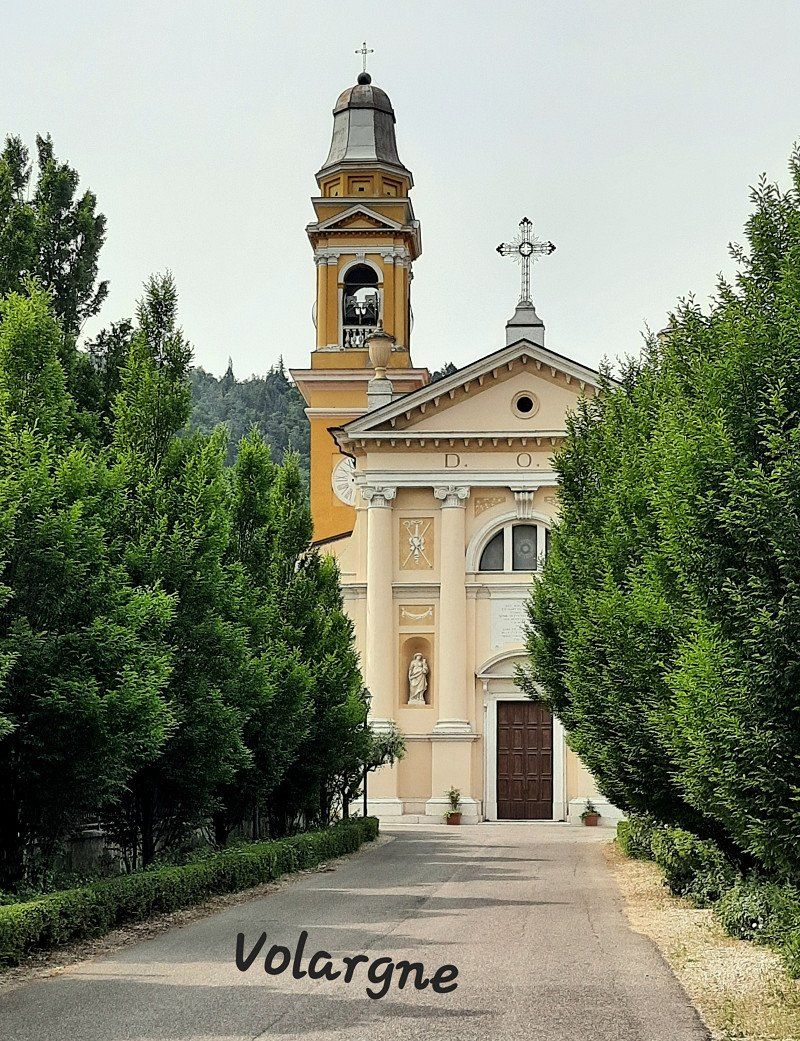
Our tour led past a large natural stone quarry near Volargne.
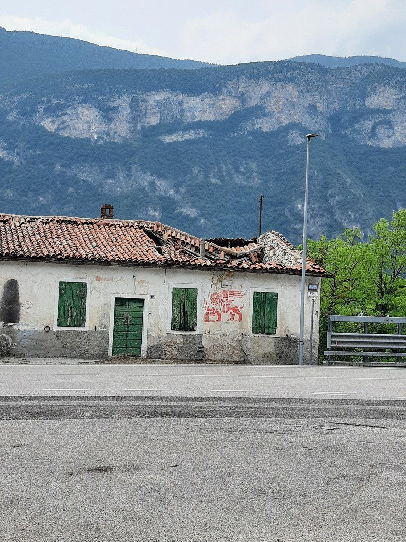
By the time we got to the hotel, we had seen so many broken houses that must have had better days, it's really a pity.
Pizza and Lagrein, that's a must :)
39010 Riffian, Autonome Provinz Bozen - Südtirol, Italien
46° 42' 11.2" N 11° 10' 50.4" E
46.7031005 11.1806751
• Head northeast on Via Passo Giovo (SS44). Go for 14.1 km.
• Turn right onto Via Passiria (SS44) toward S. Leonardo in P./Passo Giovo Centro/Walten/Valtina/St. Leonhard in P. Go for 685 m.
• Pass 5 roundabouts and continue on Strada Statale del Passo Giovo (SS44). Go for 36.7 km.
• Take the 1st exit from roundabout onto A22 (Autostrada del Brennero) toward Autobahn/Autostrada/Brennero/Brenner. Go for 16.9 km.
• Continue on A13 (Brennerpass). Go for 31.7 km.
• Keep right onto A13 (Knoten Innsbruck-Berg Isel) toward Bregenz/Garmisch/Innsbruck-West. Go for 2.0 km.
• Continue on A12 (Inntal Autobahn). Go for 35.0 km.
• Take exit 113 toward Mötz/Reutte/Fernpass. Go for 319 m.
• Turn right onto Mötzer Landesstraße (L236). Go for 4.8 km.
• Take the 2nd exit from roundabout onto Mieminger Bundesstraße (B189) toward Reutte/Fernpaß/Nassereith. Go for 13.4 km.
• Keep left onto Mieminger Bundesstraße (B189) toward Reutte/Garmisch. Go for 91 m.
• Continue on Fernpass Bundesstraße (B179). Go for 49.1 km.
• Continue on Grenztunnel Füssen (A7). Go for 126 km.
• Take exit 120 toward Stuttgart/Ulm onto A8. Go for 30.2 km.
• Take exit 61 toward Merklingen/Münsingen/Laichingen/Blaubeuren. Go for 394 m.
• Turn right onto L1230 toward Merklingen/Münsingen/Blaubeuren/Laichingen. Go for 4.1 km.
• Continue on L230. Go for 1.2 km.
• Turn right toward K7423. Go for 46 m.
• Continue on K7423. Go for 162 m.
• Take the 2nd exit from roundabout onto K7423 toward Wiesensteig/Westerheim/Laichingen. Go for 1.7 km.
• Turn right onto Wilhelmstraße. Go for 153 m.
• Arrive at Wilhelmstraße. Your destination is on the left.
☍
368,6 km
(4 hrs. 23 min.)
Day
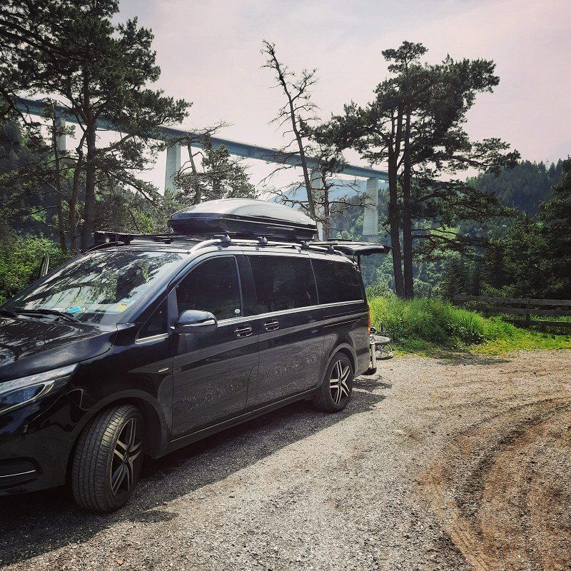
Europabrücke Schönberg im Stubaital
Over the Jaufpass we went back towards Austria
parallel to the Brenner motorway because we still drive without tolls and traffic jams.
At the gas station we bought the vignette for Austria.
A WOMO driver was told he was not allowed to drive this route, but he had to drive on the Brenner Autobahn, which was probably due to the weight.
89150 Laichingen, Deutschland
48° 29' 28.1" N 9° 41' 24.6" E
48.4911417 9.6901562
• Head toward Pfeiferstraße on Wilhelmstraße. Go for 153 m.
• Turn right onto Bahnhofstraße (K7423). Go for 367 m.
• Take the 3rd exit from roundabout onto Im Bussen (L1236) toward Heroldstatt/Suppingen. Go for 4.0 km.
• Continue toward Ulm/Blaubeuren. Go for 167 m.
• Take ramp. Go for 222 m.
• Turn right onto B28. Go for 10.3 km.
• Turn left onto Karlstraße. Go for 341 m.
• Turn left onto Zeppelinstraße. Go for 80 m.
• Turn left onto Weilersteig. Go for 232 m.
• Turn right onto Gottlieb-Haug-Straße. Go for 113 m.
• Turn left onto Reichlensbergweg. Go for 39 m.
• Turn slightly right onto Matthäus-Hipp-Weg. Go for 166 m.
• Continue on Auf dem Barmen. Go for 519 m.
• Arrive at Auf dem Barmen. Your destination is on the right.
☍
16,7 km
( 18 min.)
Blaubeuren, Deutschland ( Blautopf )
Do you know the Blautopf in Blaubeuren?
If you see the pictures on Instagram & Co you want to go there.
Of course I wanted too :)
... and was megaaaa disappointed.
Photo yes, but nothing else :)
89143 Blaubeuren, Deutschland
48° 24' 26.3" N 9° 47' 0.8" E
48.4073041 9.7835451
• Head toward Matthäus-Hipp-Weg on Auf dem Barmen. Go for 519 m.
• Turn right onto Matthäus-Hipp-Weg. Go for 18 m.
• Continue on Reichlensbergweg. Go for 104 m.
• Turn right toward Weilersteig. Go for 106 m.
• Continue on Weilersteig. Go for 311 m.
• Turn right onto Zeppelinstraße. Go for 80 m.
• Turn right onto Karlstraße. Go for 341 m.
• Turn right onto Bahnhofstraße (B28). Go for 10.3 km.
• Take ramp toward Laichingen/Suppingen. Go for 248 m.
• Turn left onto L1236. Go for 3.9 km.
• Take the 1st exit from roundabout onto Marktplatz (K7423). Go for 386 m.
• Turn left onto Wilhelmstraße. Go for 153 m.
• Arrive at Wilhelmstraße. Your destination is on the left.
☍
16,5 km
( 17 min.)
Laichingen, Deutschland
Our last night before everyday life has us again.
89150 Laichingen, Deutschland
48° 29' 28.1" N 9° 41' 24.6" E
48.4911417 9.6901562
• Head toward Kirchstraße on Wilhelmstraße. Go for 142 m.
• Turn left onto Hirschstraße. Go for 280 m.
• Take the 2nd exit from roundabout onto Olgastraße (L1236). Go for 395 m.
• Turn right onto Hohenstadter Weg (K7325). Go for 395 m.
• Continue on Stahler (K7325). Go for 548 m.
• Continue on K7325. Go for 553 m.
• Continue on Hohenstadter Weg (K7325). Go for 156 m.
• Continue on Horn (K7325). Go for 2.3 km.
• Continue on K1433. Go for 2.0 km.
• Continue on Weilersteigstraße (K1433). Go for 573 m.
• Turn left onto Wiesensteiger Straße (K1431). Go for 284 m.
• Continue on K1431. Go for 873 m.
• Turn left and take ramp onto A8 toward Stuttgart. Go for 61.3 km.
• Continue on A8 toward Karlsruhe/Basel/Leonberg-West. Go for 53.8 km.
• Take the exit toward Frankfurt a.M./Mannheim/Karlsruhe/Landau (Pfalz) onto A5 (Autobahndreieck Karlsruhe). Go for 37.6 km.
• Take exit 40 toward Mannheim/Koblenz/Saarbrücken/A61 onto A6. Go for 7.7 km.
• Take exit 30 toward Koblenz/Saarbrücken/Ludwigshafen/Speyer onto A61. Go for 245 km.
• Keep right onto A61 (Autobahndreieck Erfttal) toward Venlo/Mönchengladbach/Aachen. Go for 34.2 km.
• Take left exit 16 toward Venlo/Düsseldorf/Mönchengladbach/A61 onto A44. Go for 7.5 km.
• Take the exit toward Heinsberg/Venlo/Mönchengladbach/A61 onto A46. Go for 4.0 km.
• Take exit 10 toward Venlo/Mönchengladbach onto A61. Go for 27.0 km.
• Take exit 5 toward Grefrath/Lobberich. Go for 366 m.
• Turn left onto Dyck (B509) toward Grefrath/Lobberich. Go for 3.5 km.
• Continue on L373 toward Straelen/Industriegebiet Lobberich-Nord. Go for 2.1 km.
• Turn left onto Landstraße (K1) toward Nettetal-Lobberich/Gewerbegebiet Lobberich-Nord. Go for 1.1 km.
• Turn right onto Wevelinghoven. Go for 934 m.
• Arrive at Wevelinghoven.
☍
494,9 km
(4 hrs. 47 min.)
Nettetal, Deutschland
Bruno is looking forward to a wash :)
41334 Nettetal, Deutschland
51° 19' 34.6" N 6° 16' 19.6" E
51.3262794 6.2721001