Duration: 7 days
Date: 07/06/22-14/06/22
Vehicle: Renault Megan SE rental car
Accommodations:
-3 nights vacation rental
-1 night hotel
-3 nights vacation rental
The complete program in 7 days
Day
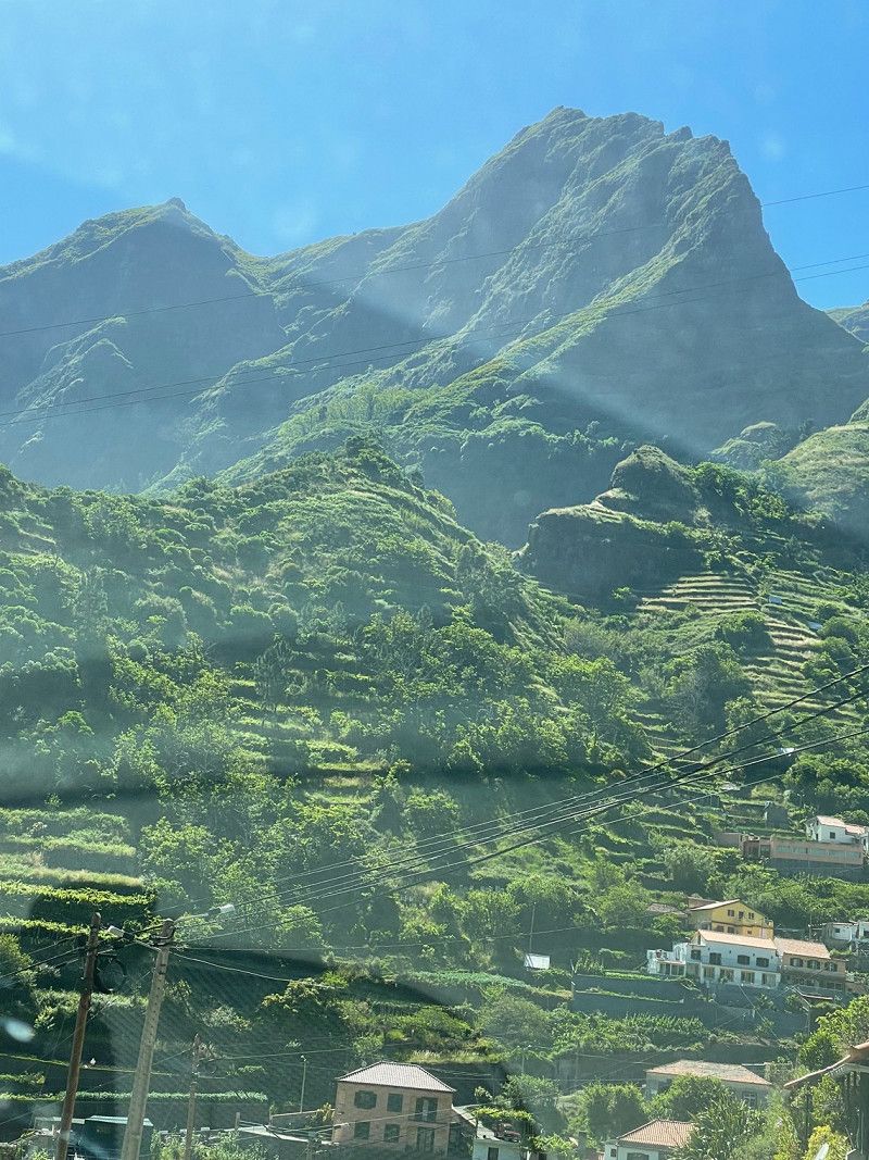
Flughafen Madeira, Santa Cruz, Madeira, Portugal
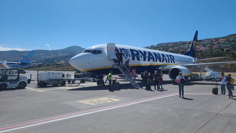
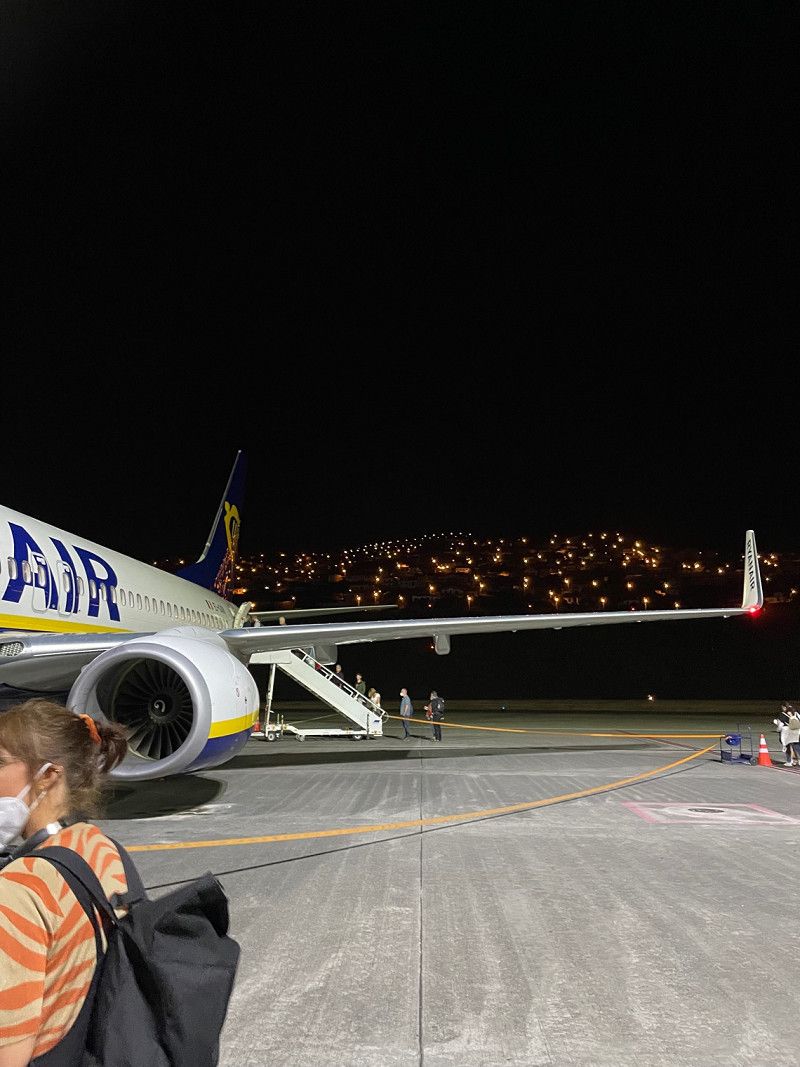
Outward flight: Nuremberg-Funchal
9100-105 Santa Cruz, Madeira, Portugal
32° 41' 44.9" N 16° 46' 33.1" W
32.6957983 -16.7758737
• Head southwest on VR1. Go for 20.1 km.
• Keep right onto Via Cota 200 (VR1) toward R.ra Brava/Câm.ra de Lobos/Cam.nho do Pilar/Pico dos Barcelos. Go for 14.5 km.
• Take ramp onto VE3 toward Rib.ra Brava/Ponta do Sol. Go for 401 m.
• Take the 1st exit from roundabout onto VE3. Go for 1.4 km.
• Take the 1st exit from roundabout onto VE3. Go for 1.4 km.
• Pass 2 roundabouts and continue on VE3. Go for 5.3 km.
• Take the 1st exit from roundabout onto VE3. Go for 1.5 km.
• Take the 2nd exit from roundabout onto R101. Go for 97 m.
• Continue on Estrada do Torreão (R101). Go for 359 m.
• Turn left onto Estrada do IV Centenário. Go for 50 m.
• Turn right onto Vereda da Vargem. Go for 65 m.
• Arrive at Vereda da Vargem. Your destination is on the left.
☍
45,2 km
( 38 min.)
Modelo Continente Machico, Machico, Portugal
Business: Purchasing
Sitio da Queimada de Baixo, 9200-017 Machico, Portugal
32° 42' 24.3" N 16° 46' 6" W
32.7067415 -16.7683431
• Head toward Travessa das Freiras on Vereda da Vargem. Go for 65 m.
• Turn left onto Estrada do IV Centenário. Go for 50 m.
• Turn right onto Estrada do Torreão (R101). Go for 359 m.
• Continue on R101. Go for 41 m.
• Take the 2nd exit from roundabout onto VE3. Go for 2.0 km.
• Pass 2 roundabouts and continue on Túnel da Calheta (VE3). Go for 4.9 km.
• Take the 2nd exit from roundabout toward Ponta do Pargo/Prazeres. Go for 75 m.
• Continue on VE3. Go for 3.7 km.
• Pass 6 roundabouts and continue on Variante Expresso Fajã da Ovelha (VE3). Go for 8.6 km.
• Take the 2nd exit from roundabout onto Rua Dr. Vasco Augusto de França. Go for 155 m.
• Turn slightly right onto Rua César Augusto Pestana. Go for 321 m.
• Continue on Rua do Farol. Go for 243 m.
• Continue on Rua do Farol. Go for 1.1 km.
• Turn slightly right. Go for 55 m.
• Arrive at your destination on the right.
☍
21,8 km
( 23 min.)
Madalena do Mar, Portugal
Company: view
9360 Madalena do Mar, Portugal
32° 42' 3.9" N 17° 8' 2.6" W
32.7010866 -17.1340519
• Head southeast. Go for 37 m.
• Turn slightly left onto Rua do Farol. Go for 845 m.
• Turn slightly right onto Rua do Farol. Go for 544 m.
• Continue on Rua César Augusto Pestana. Go for 321 m.
• Turn slightly left onto Rua Dr. Vasco Augusto de França. Go for 110 m.
• Take the 3rd exit from roundabout onto R101. Go for 17.1 km.
• Take the 2nd exit from roundabout onto R101. Go for 3.1 km.
• Turn sharp left onto Rua Moniz-o-Velho. Go for 358 m.
• Turn left onto Rua das Alfarrobeiras. Go for 62 m.
• Continue on Rua Engenheiro Américo. Go for 86 m.
• Continue on Rua dos Emigrantes. Go for 93 m.
• Take the 2nd exit from Rotunda da Piscina roundabout onto Rua do Lugar. Go for 92 m.
• Turn slightly right onto Rua do Lugar. Go for 44 m.
• Arrive at Rua do Lugar. Your destination is on the right.
☍
22,8 km
( 34 min.)
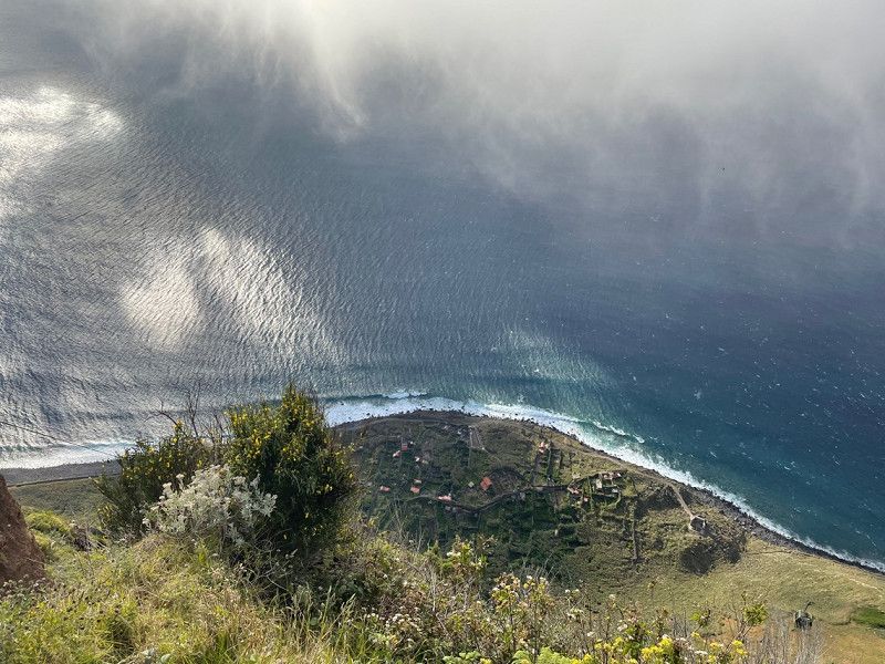
Farol da Ponta do Pargo, Ponta do Pargo, Portugal
Company: view
Ponta da Vigia, 9385 Ponta do Pargo, Portugal
32° 48' 50" N 17° 15' 47.1" W
32.8139006 -17.2630711
• Head southeast on Rua do Lugar. Go for 44 m.
• Turn right onto Rua do Lugar. Go for 201 m.
• Turn right onto Rua Moniz-o-Velho. Go for 246 m.
• Turn sharp right onto R101. Go for 3.0 km.
• Take the 1st exit from roundabout onto R101. Go for 3.8 km.
• Turn left onto R105. Go for 16.2 km.
• Turn sharp right onto R211. Go for 1.9 km.
• Arrive at R211.
☍
25,5 km
( 33 min.)
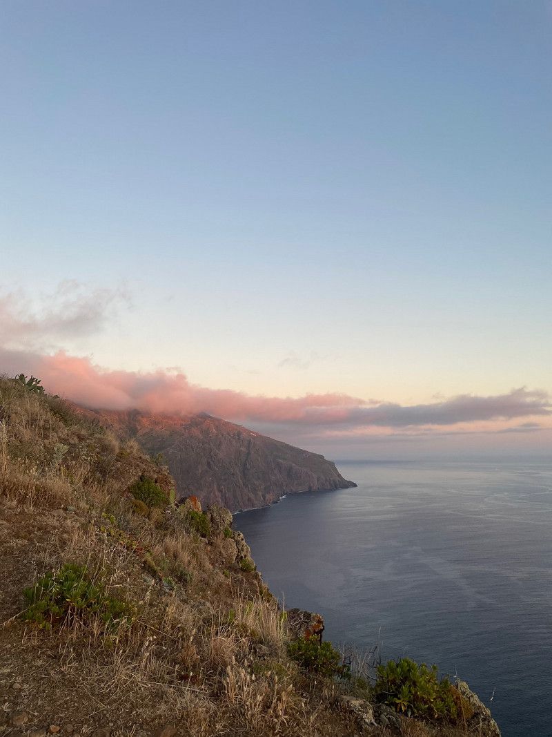
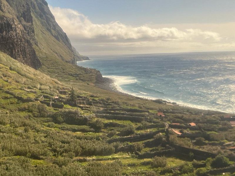
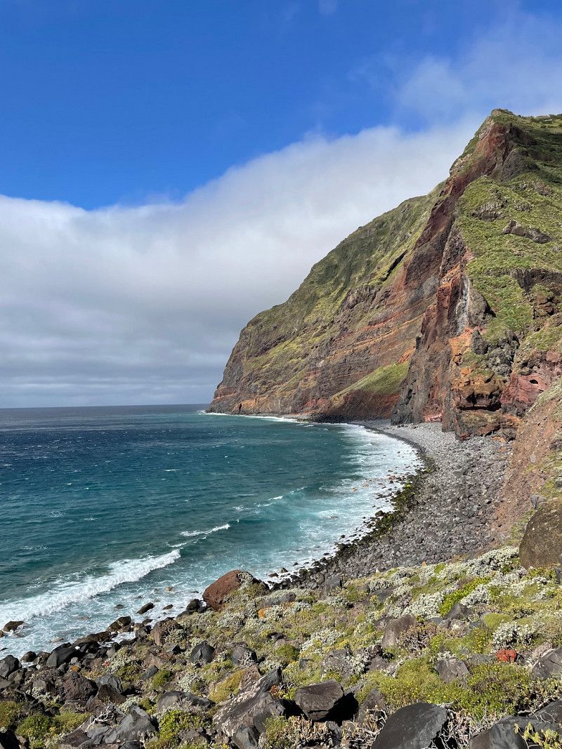
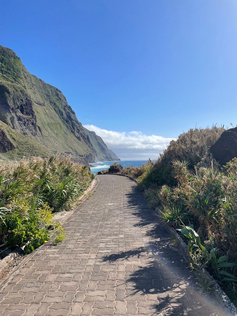
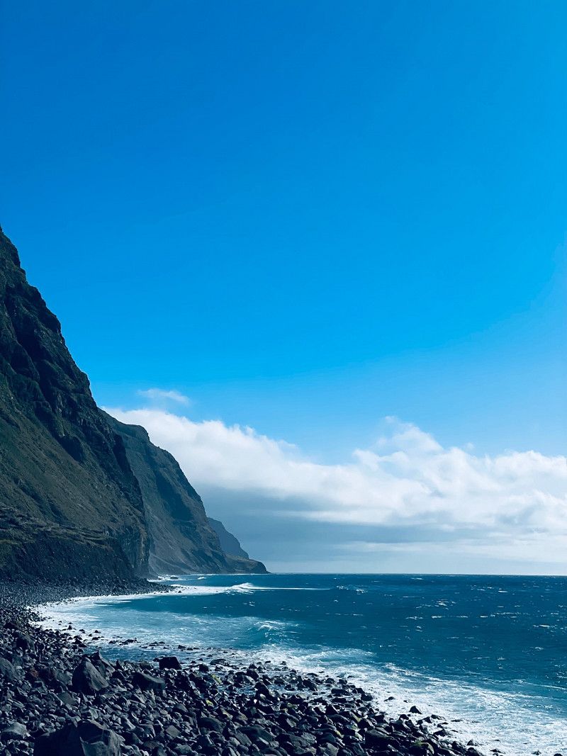
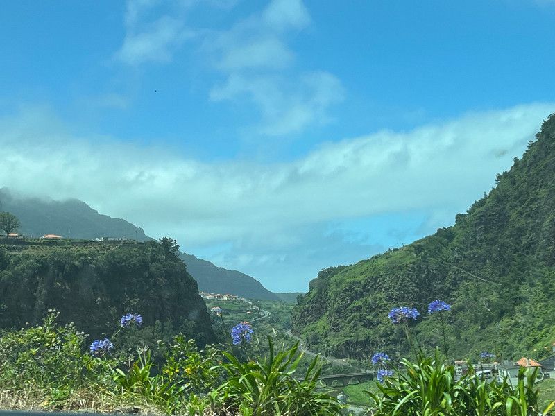
Madeira Island
Location: Porto Moniz
Type: Vacation rental
32° 52' 2.8" N 17° 10' 16.2" W
32.8674335 -17.1711697
• Head southeast on R211. Go for 1.9 km.
• Turn right onto R105. Go for 12.5 km.
• Arrive at R105.
☍
14,4 km
( 17 min.)
Day
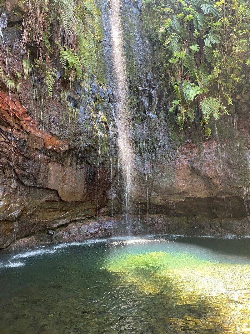
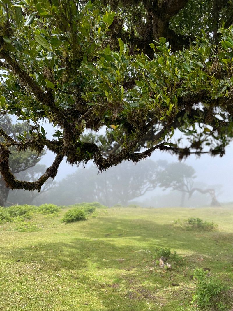
Levada das 25 Fontes (rear exit / tunnel), Portugal
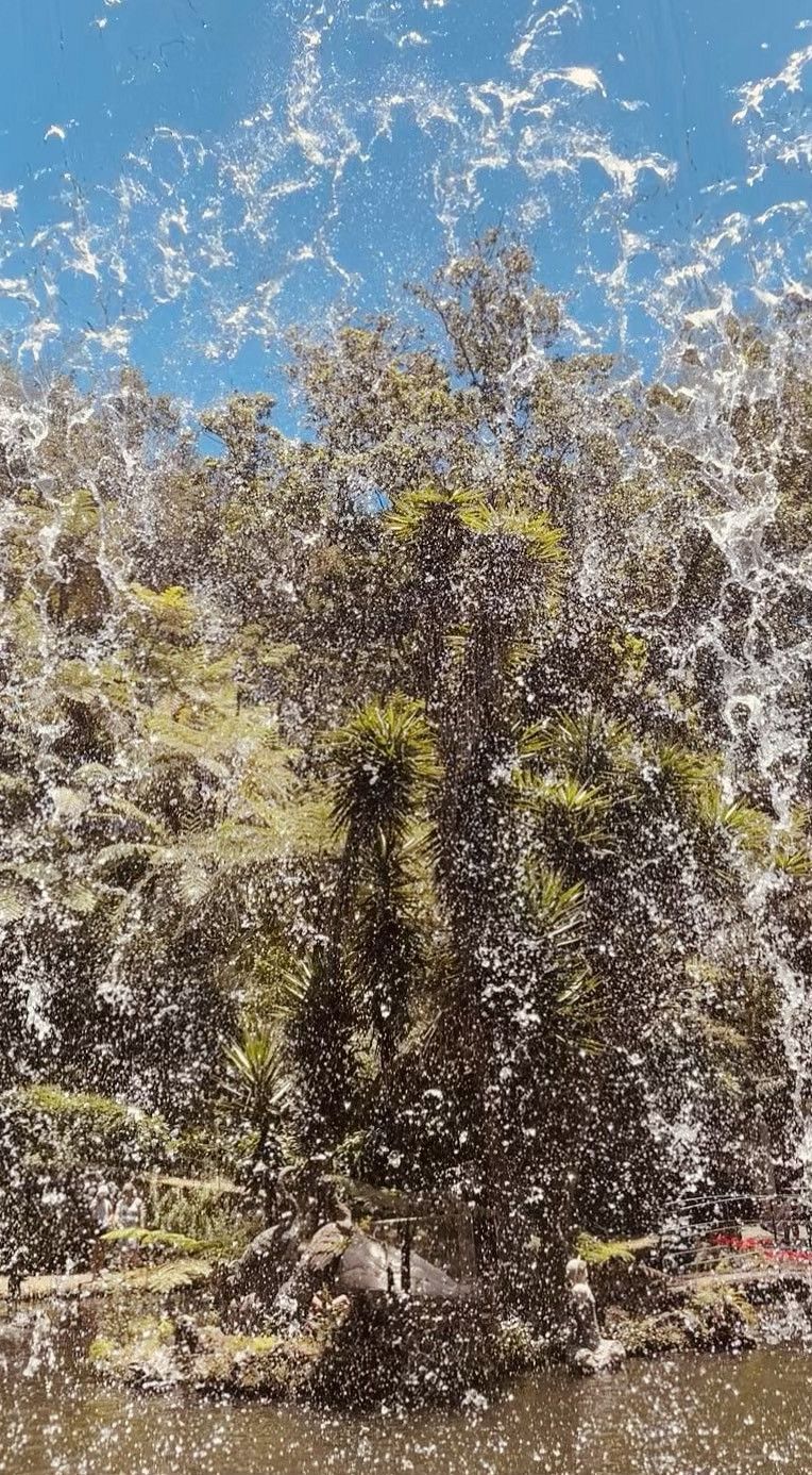
Activities: hiking
9370, Portugal
32° 45' 20.3" N 17° 8' 33.3" W
32.7556314 -17.1425945
• Head east on R105. Go for 4.8 km.
• Turn right onto R105. Go for 4.1 km.
• Arrive at R105. Your destination is on the right.
☍
8,9 km
( 14 min.)
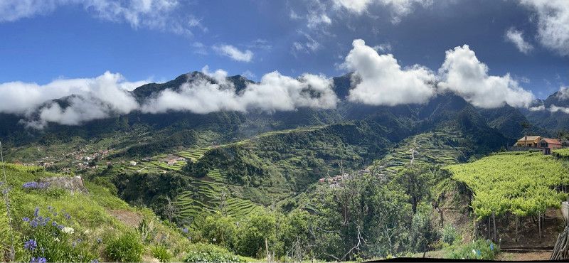
Ribeira Brava - Serra de Água
Company: view
Madeira Natural Park
32° 43' 58.7" N 17° 3' 9.5" W
32.7329588 -17.0526326
• Head toward Estrada da Eira da Moura on R105. Go for 1.2 km.
• Continue on Estrada Regional da Encumeada (R105). Go for 224 m.
• Continue on R105. Go for 144 m.
• Turn right onto R104 toward Ribeira Brava. Go for 4.5 km.
• Continue on VR1. Go for 298 m.
• Take ramp onto VE3 toward Rib.ra Brava/Ponta do Sol/Funchal/R229. Go for 244 m.
• Take the 1st exit from roundabout onto VE3. Go for 1.4 km.
• Take the 1st exit from roundabout onto VE3. Go for 1.4 km.
• Pass 2 roundabouts and continue on VE3. Go for 5.3 km.
• Take the 1st exit from roundabout onto VE3. Go for 1.5 km.
• Pass 2 roundabouts and continue on VE3. Go for 4.6 km.
• Take the 4th exit from roundabout onto Variante À Vila de Calheta. Go for 1.3 km.
• Arrive at Variante À Vila de Calheta. Your destination is on the right.
☍
22,2 km
( 22 min.)
Ribeira Brava - Serra da Água
Company: view
Madeira Natural Park
32° 43' 55.6" N 17° 1' 32.4" W
32.7321249 -17.0256757
• Head toward Travessa Nossa Senhora dos Bons Caminhos on Variante À Vila de Calheta. Go for 1.2 km.
• Take the 3rd exit from roundabout onto Túnel da Calheta (VE3). Go for 2.3 km.
• Take the 2nd exit from roundabout toward Ponta do Pargo/Prazeres. Go for 75 m.
• Continue on VE3. Go for 3.7 km.
• Take the 2nd exit from roundabout onto VE3. Go for 758 m.
• Turn right onto Antiga R101. Go for 196 m.
• Turn right onto Estrada dos Prazeres. Go for 25 m.
• Turn right onto Estrada dos Prazeres (R222). Go for 117 m.
• Turn left onto Estrada das Eiras (R210). Go for 2.6 km.
• Continue on R210. Go for 3.9 km.
• Turn right toward R105. Go for 427 m.
• Turn sharp left onto R105. Go for 10.6 km.
• Turn right onto R101. Go for 3.8 km.
• Take the 2nd exit from roundabout onto R101. Go for 3.1 km.
• Turn sharp left onto Rua Moniz-o-Velho. Go for 358 m.
• Turn left onto Rua das Alfarrobeiras. Go for 62 m.
• Continue on Rua Engenheiro Américo. Go for 86 m.
• Continue on Rua dos Emigrantes. Go for 93 m.
• Take the 2nd exit from Rotunda da Piscina roundabout onto Rua do Lugar. Go for 92 m.
• Turn slightly right onto Rua do Lugar. Go for 40 m.
• Arrive at Rua do Lugar.
☍
33,6 km
( 40 min.)
Calheta Beach - All-inclusive, Avenida Dom Manuel I, Estreito da Calheta, Portugal
Activities: bathing
Av. D. Manuel I 3, 9370-133 Estreito da Calheta, Portugal
32° 43' 9.3" N 17° 10' 25.7" W
32.7192535 -17.1738148
• Head southeast on Rua do Lugar. Go for 40 m.
• Turn right onto Rua do Lugar. Go for 201 m.
• Continue on Rua do Serrado. Go for 170 m.
• Take the 2nd exit from roundabout onto VE2. Go for 14.9 km.
• Take the 2nd exit from roundabout onto Variante à R104 (VE4). Go for 566 m.
• Pass 3 roundabouts and continue on VE4. Go for 3.9 km.
• Turn left onto R228 toward Rosário/Ribeira Brava-Via Encumeada. Go for 1.0 km.
• Arrive at R228. Your destination is on the left.
☍
20,8 km
( 21 min.)
Madeira Island
Location: Porto Moniz
Type: Vacation rental
32° 52' 2.6" N 17° 10' 16.2" W
32.8673999 -17.1711635
• Head toward Caminho da Ribeira Grande on R228. Go for 5.6 km.
• Turn right onto R105. Go for 12.7 km.
• Turn right onto R209. Go for 8.6 km.
• Turn right. Go for 173 m.
• Arrive at your destination on the right.
☍
27,2 km
( 33 min.)
Day
Madeira Island
Business: view
32° 46' 47.5" N 17° 1' 45.3" W
32.7798544 -17.0292472
• Head south. Go for 173 m.
• Turn right onto R209. Go for 10.0 km.
• Continue on Caminho do Piquinho (R209). Go for 1.3 km.
• Turn left onto R209. Go for 44 m.
• Take ramp onto Túnel dos Casais (VE2) toward S. Vicente. Go for 7.3 km.
• Turn right onto Caminho Agrícola da Fonte Seixal (R221). Go for 2.9 km.
• Arrive at Caminho Agrícola da Fonte Seixal (R221). Your destination is on the right.
☍
21,7 km
( 29 min.)
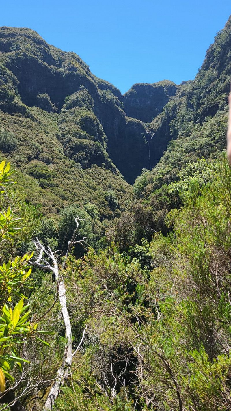
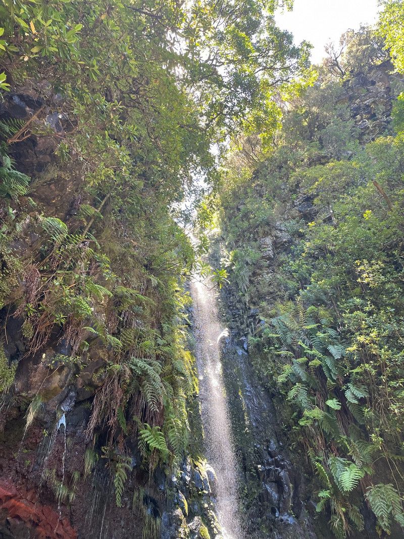
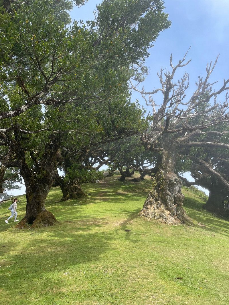
Zauberwald „Caldeirão Verde“
Activities: hiking
Madeira Natural Park
32° 48' 34" N 17° 8' 28.2" W
32.8094408 -17.1411550
• Head north on Caminho Agrícola da Fonte Seixal (R221). Go for 842 m.
• Turn left onto Caminho Mun. Manuel Ildefonso de Castro. Go for 2.3 km.
• Turn left onto Caminho João de Azevedo. Go for 264 m.
• Turn slightly right onto Estrada de Santo Antão. Go for 334 m.
• Continue on Estrada Eng. Jorge Manuel Jrd. Fernandes. Go for 147 m.
• Turn left onto Estrada Eng. Jorge Manuel Jrd. Fernandes. Go for 289 m.
• Turn left toward Caminho João Fernandes Correia. Go for 248 m.
• Turn right onto Caminho João Fernandes Correia. Go for 369 m.
• Arrive at Caminho João Fernandes Correia. Your destination is on the right.
☍
4,8 km
( 11 min.)
Casa de Pasto Justiniano, Estr. Regional 221, Seixal, Portugal
Things to do: eat
Estr. Regional 221 Nº 1, 9270-134 Seixal, Portugal
32° 48' 34.3" N 17° 6' 54" W
32.8095288 -17.1150135
• Head southwest on Caminho João Fernandes Correia. Go for 753 m.
• Turn right onto Estrada Eng. Jorge Manuel Jrd. Fernandes. Go for 34 m.
• Turn right onto Estrada Eng. Jorge Manuel Jrd. Fernandes. Go for 147 m.
• Continue on Estrada de Santo Antão. Go for 334 m.
• Continue on Estrada de Santo Antão. Go for 7.9 km.
• Take the 3rd exit from roundabout onto R101. Go for 3.4 km.
• Take the 1st exit from roundabout onto R101. Go for 6.7 km.
• Turn right onto Caminho do Teleférico. Go for 418 m.
• Turn slightly right onto Caminho do Teleférico. Go for 1.6 km.
• Arrive at Caminho do Teleférico. Your destination is on the right.
☍
21,2 km
( 30 min.)
Seixal beach, Portugal
Activities: bathing
ER101, 9270, Portugal
32° 49' 20.2" N 17° 6' 11.2" W
32.8222844 -17.1031012
• Head toward Rua Juvenal Isidoro de Carvalho on Caminho do Teleférico. Go for 2.0 km.
• Turn right onto Caminho da Eirinha. Go for 24 m.
• Turn left onto Caminho da Eirinha. Go for 23 m.
• Continue on Caminho do Teleférico. Go for 8 m.
• Turn left onto R101. Go for 6.7 km.
• Take the 2nd exit from roundabout onto R101. Go for 3.1 km.
• Turn sharp left onto Rua Moniz-o-Velho. Go for 358 m.
• Turn left onto Rua das Alfarrobeiras. Go for 62 m.
• Continue on Rua Engenheiro Américo. Go for 86 m.
• Continue on Rua dos Emigrantes. Go for 93 m.
• Take the 2nd exit from Rotunda da Piscina roundabout onto Rua do Lugar. Go for 92 m.
• Turn slightly right onto Rua do Lugar. Go for 36 m.
• Arrive at Rua do Lugar.
☍
12,5 km
( 20 min.)
Verlassenes Dorf „Vereda do Calhau“
Activities: cable car ride
(Hike also possible)
Madeira Island
32° 51' 9.8" N 17° 12' 35.1" W
32.8527297 -17.2097611
• Head southeast on Rua do Lugar. Go for 36 m.
• Turn right onto Rua do Lugar. Go for 201 m.
• Turn left onto Rua Moniz-o-Velho. Go for 112 m.
• Turn left onto Rua das Alfarrobeiras. Go for 62 m.
• Continue on Rua Engenheiro Américo. Go for 86 m.
• Continue on Rua dos Emigrantes. Go for 71 m.
• Arrive at Rua dos Emigrantes.
☍
0,6 km
( 1 min.)
Madeira Island
Location: Porto Moniz
Type: Vacation rental
32° 52' 2.6" N 17° 10' 16.1" W
32.8673879 -17.1711319
• Head toward Rotunda da Piscina on Rua dos Emigrantes. Go for 22 m.
• Take the 2nd exit from Rotunda da Piscina roundabout onto Rua do Lugar. Go for 92 m.
• Turn slightly left onto Rua do Lugar. Go for 201 m.
• Continue on Rua do Serrado. Go for 170 m.
• Take the 2nd exit from roundabout onto VE2. Go for 14.9 km.
• Take the 2nd exit from roundabout onto Variante à R104 (VE4). Go for 566 m.
• Take the 4th exit from roundabout onto VE1. Go for 2.7 km.
• Pass 2 roundabouts and continue on VE1. Go for 4.7 km.
• Take the 1st exit from roundabout onto R211. Go for 3.3 km.
• Arrive at R211.
☍
26,6 km
( 27 min.)
Day
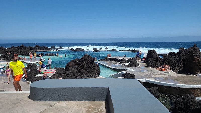
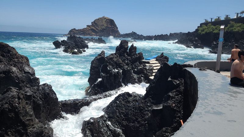
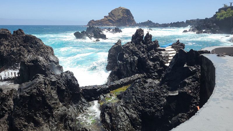
Porto Moniz Natural Swimming Pools, Porto Moniz, Portugal
Activities: bathing
Praça Do Lyra Vila De Porto Moniz, 9270-053 Porto Moniz, Portugal
32° 52' 6.9" N 17° 10' 14.3" W
32.8685878 -17.1706270
• Head toward Caminho Municipal do Ribeirinho on R211. Go for 4.9 km.
• Turn left onto Estrada dos Poços. Go for 172 m.
• Take the 1st exit from roundabout onto Estrada dos Poços. Go for 296 m.
• Continue on Túnel Arco de São Jorge. Go for 1.3 km.
• Continue on Estrada Municipal do Farrobo. Go for 204 m.
• Continue on Túnel Arco de São Jorge. Go for 1.5 km.
• Continue on Estrada Municipal do Farrobo. Go for 500 m.
• Take the 2nd exit from roundabout onto Estrada Municipal do Farrobo (R219). Go for 124 m.
• Continue on Ponte de Ribeira de São Jorge (R219). Go for 1.9 km.
• Take the 2nd exit from roundabout onto R101. Go for 3.1 km.
• Take the 2nd exit from roundabout onto VE1. Go for 4.2 km.
• Take the 1st exit from roundabout onto VE1. Go for 11.1 km.
• Take the 2nd exit from roundabout onto VR1 toward Caniçal (Via Rápida). Go for 632 m.
• Continue on Túnel da Fazenda (VR1). Go for 225 m.
• Continue on VR1. Go for 323 m.
• Continue on Túnel do Duplo Caniçal (VR1). Go for 2.1 km.
• Keep left onto VR1. Go for 214 m.
• Continue on Túnel dos Portais (VR1). Go for 1.0 km.
• Continue on Túnel das Palmeiras (VR1). Go for 1.0 km.
• Take the 2nd exit from roundabout onto Estrada de São Lourenço (R214). Go for 641 m.
• Take the 2nd exit from roundabout onto Estrada de São Lourenço (R214). Go for 535 m.
• Turn left onto Estrada de São Lourenço (R214). Go for 1.1 km.
• Arrive at Estrada de São Lourenço (R214).
☍
37,2 km
( 41 min.)
Madeira Island
Business: view
32° 48' 23" N 16° 57' 53.1" W
32.8064006 -16.9647504
• Head south on Estrada de São Lourenço (R214). Go for 1.6 km.
• Take the 1st exit from roundabout onto Estrada de São Lourenço (R214). Go for 593 m.
• Take the 1st exit from roundabout onto VR1 toward Funchal/Machico/Aeroporto. Go for 86 m.
• Continue on Túnel das Palmeiras (VR1). Go for 1.0 km.
• Continue on Túnel dos Portais (VR1). Go for 1.0 km.
• Continue on VR1. Go for 221 m.
• Continue on Túnel do Duplo Caniçal (VR1). Go for 2.1 km.
• Continue on VR1. Go for 345 m.
• Continue on Túnel da Fazenda (VR1). Go for 227 m.
• Continue on VR1. Go for 13.6 km.
• Take ramp toward Caniço/C.ço de Baixo. Go for 128 m.
• Take the 3rd exit from roundabout onto Rua João Gonçalves Zarco. Go for 906 m.
• Continue on Estrada Avelino Pinto. Go for 703 m.
• Take the 1st exit from roundabout onto Caminho Velho dos Reis Magos. Go for 116 m.
• Turn slightly right onto Caminho Velho dos Reis Magos. Go for 35 m.
• Turn right onto Caminho Velho dos Reis Magos. Go for 26 m.
• Turn left. Go for 40 m.
• Arrive at your destination.
☍
22,8 km
( 22 min.)
Prainha do Caniçal, Caniçal, Portugal
Activities: bathing
Prainha do Caniçal, 9200 Caniçal, Portugal
32° 44' 34.3" N 16° 42' 57.8" W
32.7428703 -16.7160549
• Head northeast. Go for 22 m.
• Turn left toward Caminho Velho dos Reis Magos. Go for 62 m.
• Turn right onto Caminho Velho dos Reis Magos. Go for 26 m.
• Turn right onto Caminho Velho dos Reis Magos. Go for 33 m.
• Turn left onto Caminho Velho dos Reis Magos. Go for 154 m.
• Take the 2nd exit from roundabout onto Estrada Avelino Pinto. Go for 770 m.
• Continue on Rua João Gonçalves Zarco. Go for 122 m.
• Continue on Rua João Gonçalves Zarco. Go for 731 m.
• Take the 2nd exit from roundabout onto VR1 toward Funchal/R.a Brava. Go for 7.2 km.
• Take ramp toward Funchal/C. da Barca. Go for 319 m.
• Turn left onto Rua da Ribeira de João Gomes (R118) toward Funchal/Pena/C. da Barca. Go for 2.1 km.
• Keep left onto Rua da Ribeira de João Gomes toward Funchal. Go for 162 m.
• Continue on Rua Visconde de Anadia. Go for 471 m.
• Take the 3rd exit from Praça da Autonomia roundabout onto Avenida do Mar e das Comunidades Madeirenses. Go for 342 m.
• Turn left onto Rua José da Silva. Go for 58 m.
• Turn right. Go for 57 m.
• Turn right. Go for 25 m.
• Arrive at your destination on the left.
☍
12,7 km
( 16 min.)
The Views Oasis, Caniço, Portugal
Location: Caniço
Type: Hotel
Praia Dos Reis Magos, 9125-024 Caniço, Portugal
32° 38' 46.9" N 16° 49' 33.3" W
32.6463638 -16.8259189
• Head northeast. Go for 25 m.
• Turn slightly left toward Rua Dom Carlos I. Go for 44 m.
• Turn left onto Rua Dom Carlos I. Go for 121 m.
• Turn left onto Rua Artur de Sousa Pinga. Go for 83 m.
• Turn right onto Avenida do Mar e das Comunidades Madeirenses. Go for 90 m.
• Take the 2nd exit from Praça da Autonomia roundabout onto Rua 31 de Janeiro. Go for 787 m.
• Turn right onto Rua das Dificuldades. Go for 111 m.
• Continue on Caminho do Comboio. Go for 1.3 km.
• Continue on Caminho de Ferro. Go for 824 m.
• Turn right onto Caminho da Confeiteira. Go for 198 m.
• Arrive at Caminho da Confeiteira. Your destination is on the left.
☍
3,6 km
( 8 min.)
Day
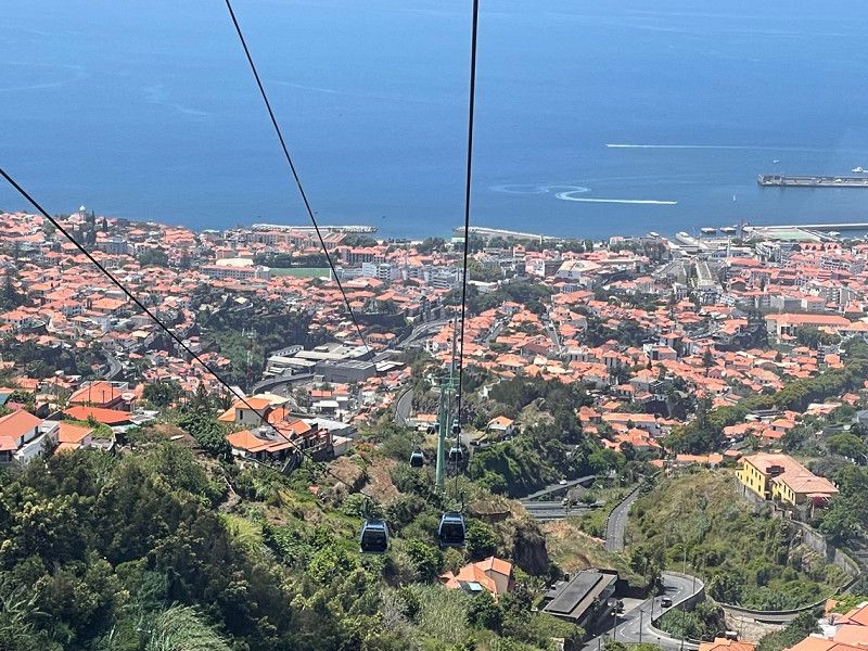
Seilbahn funchal, Rua Dom Carlos I, Funchal, Portugal
Activities: cable car ride
R. Dom Carlos I 33, 9060-051 Funchal, Portugal
32° 38' 49.8" N 16° 54' 8.7" W
32.6471618 -16.9024283
• Head toward Caminho do Desterro on Caminho da Confeiteira. Go for 98 m.
• Turn right onto Caminho do Desterro. Go for 327 m.
• Turn right onto Caminho da Portada de Santo António. Go for 379 m.
• Turn sharp left onto Caminho de Ferro. Go for 490 m.
• Continue on Caminho do Comboio. Go for 1.3 km.
• Continue on Rua das Dificuldades. Go for 111 m.
• Turn right onto Rua 31 de Janeiro. Go for 138 m.
• Turn left onto Rua do Torreão. Go for 22 m.
• Turn left onto Rua 5 de Outubro. Go for 383 m.
• Turn right onto Rua do Marquês do Funchal. Go for 96 m.
• Turn left onto Rua dos Ferreiros. Go for 14 m.
• Turn right onto Praça do Município. Go for 62 m.
• Continue on Rua Câmara Pestana. Go for 93 m.
• Turn left onto Avenida Zarco. Go for 131 m.
• Turn right onto Avenida Arriaga. Go for 84 m.
• Arrive at Avenida Arriaga. Your destination is on the left.
☍
3,8 km
( 9 min.)
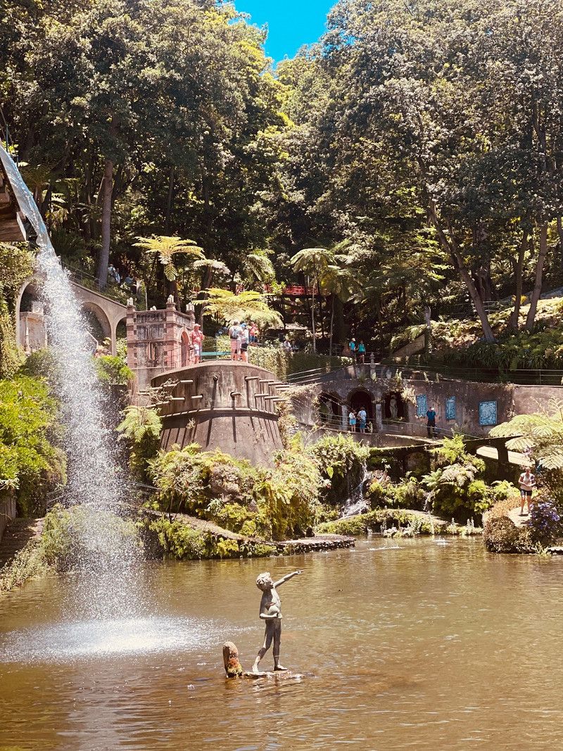
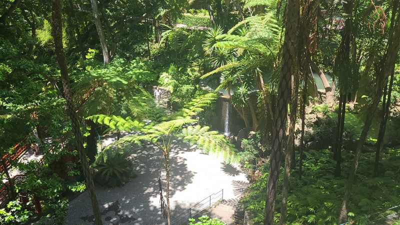
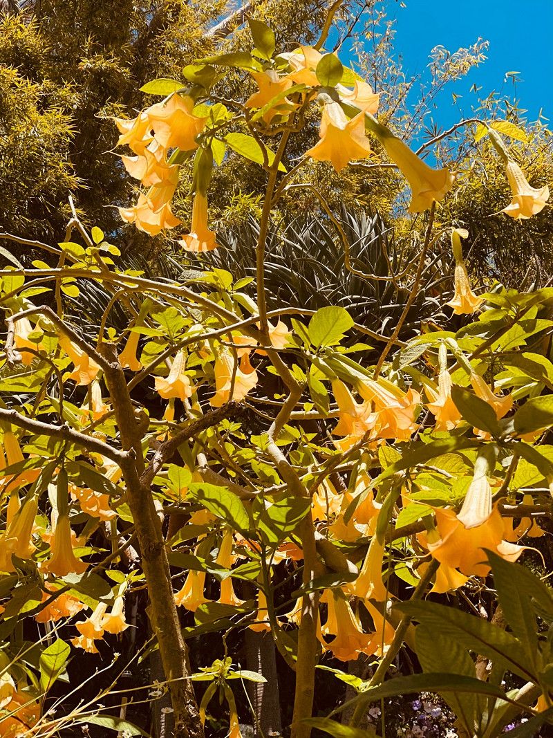
Botanischer Garten „O Jardim Japonês“
Activities: Sightseeing
Monte, 9050-288 Funchal, Portugal
32° 40' 23.8" N 16° 54' 10.1" W
32.6732845 -16.9027968
• Head toward Rua de São Francisco on Avenida Arriaga. Go for 139 m.
• Turn left onto Rua Conselheiro José Silvestre Ribeiro. Go for 101 m.
• Turn left onto Avenida do Mar e das Comunidades Madeirenses. Go for 569 m.
• Take the 2nd exit from Praça da Autonomia roundabout onto Rua dos Profetas. Go for 167 m.
• Continue on Largo do Poço. Go for 28 m.
• Continue on Larguinho da Feira. Go for 28 m.
• Continue on Rua Brigadeiro Oudinout. Go for 55 m.
• Continue on Largo dos Lavradores. Go for 23 m.
• Continue on Rua Brigadeiro Oudinout. Go for 285 m.
• Continue on Rua Dr. Pestana Júnior. Go for 267 m.
• Keep right onto Rua Dr. Pestana Júnior toward Ribeira Brava/Machico/Aeroporto. Go for 585 m.
• Keep left onto Rua da Ribeira de João Gomes. Go for 1.5 km.
• Take ramp onto Via Cota 200 (VR1) toward Machico/Aeroporto. Go for 21.1 km.
• Continue on Túnel da Fazenda (VR1). Go for 225 m.
• Continue on VR1. Go for 323 m.
• Continue on Túnel do Duplo Caniçal (VR1). Go for 2.1 km.
• Keep left onto VR1. Go for 214 m.
• Continue on Túnel dos Portais (VR1). Go for 1.0 km.
• Continue on Túnel das Palmeiras (VR1). Go for 1.0 km.
• Take the 2nd exit from roundabout onto Estrada de São Lourenço (R214). Go for 641 m.
• Take the 2nd exit from roundabout onto Estrada de São Lourenço (R214). Go for 535 m.
• Turn left onto Estrada de São Lourenço (R214). Go for 1.1 km.
• Arrive at Estrada de São Lourenço (R214).
☍
32,0 km
( 30 min.)
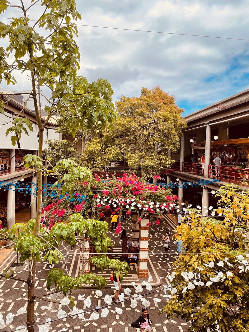
Funchal City Center, Avenida Arriaga, Funchal, Portugal
Activities: sightseeing
Av. Arriaga 30, 9000-064 Funchal, Portugal
32° 38' 51.3" N 16° 54' 37.7" W
32.6475841 -16.9104846
• Head south on Estrada de São Lourenço (R214). Go for 1.6 km.
• Take the 1st exit from roundabout onto Estrada de São Lourenço (R214). Go for 593 m.
• Take the 1st exit from roundabout onto VR1 toward Funchal/Machico/Aeroporto. Go for 86 m.
• Continue on Túnel das Palmeiras (VR1). Go for 1.0 km.
• Continue on Túnel dos Portais (VR1). Go for 1.0 km.
• Continue on VR1. Go for 221 m.
• Continue on Túnel do Duplo Caniçal (VR1). Go for 2.1 km.
• Continue on VR1. Go for 345 m.
• Continue on Túnel da Fazenda (VR1). Go for 227 m.
• Continue on VR1. Go for 1.6 km.
• Take ramp toward Machico Sul. Go for 296 m.
• Take the 2nd exit from roundabout onto Antiga R101. Go for 259 m.
• Take the 2nd exit from roundabout onto Antiga R101. Go for 931 m.
• Take the 1st exit from roundabout onto Estrada Francisco Alvares da Nobrega (R224). Go for 863 m.
• Turn right onto R224. Go for 5.0 km.
• Turn right onto Estrada Santo António da Serra (R207). Go for 1.4 km.
• Take the 1st exit from roundabout onto Estrada Santo António da Serra. Go for 394 m.
• Turn right onto R225. Go for 207 m.
• Arrive at R225. Your destination is on the right.
☍
18,2 km
( 23 min.)
Prainha beach Caniçal, Portugal
Activities: bathing
9200, Portugal
32° 44' 33.6" N 16° 42' 56.8" W
32.7426774 -16.7157745
• Head southwest on R225. Go for 207 m.
• Turn right onto Estrada Santo António da Serra. Go for 941 m.
• Take the 2nd exit from roundabout onto Estrada Santo António da Serra (R110). Go for 2.1 km.
• Keep right onto R202. Go for 4.0 km.
• Arrive at R202. Your destination is on the left.
☍
7,3 km
( 11 min.)
Bio Quinta do Pântano Agro- Turismo, Machico, Portugal
Location: Santo Antonio de Serra
Type: Vacation rental
Estrada da Fonte de Santo António 61, 9200-152 Machico, Portugal
32° 43' 30.2" N 16° 48' 57.3" W
32.7250596 -16.8159243
• Head west on R202. Go for 3.8 km.
• Continue on R202. Go for 6.5 km.
• Turn slightly left. Go for 137 m.
• Arrive at your destination on the left.
☍
10,4 km
( 20 min.)
Day
Madeira Natural Park
Business: view
32° 42' 58.3" N 16° 51' 35.8" W
32.7161857 -16.8599325
• Head north.
• Arrive at your destination.
☍
Distance not available
(Duration not available)
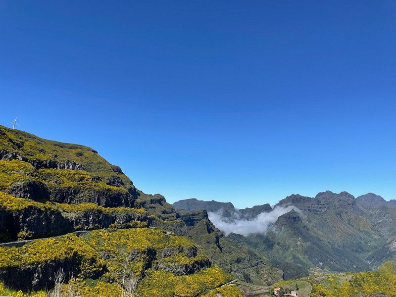
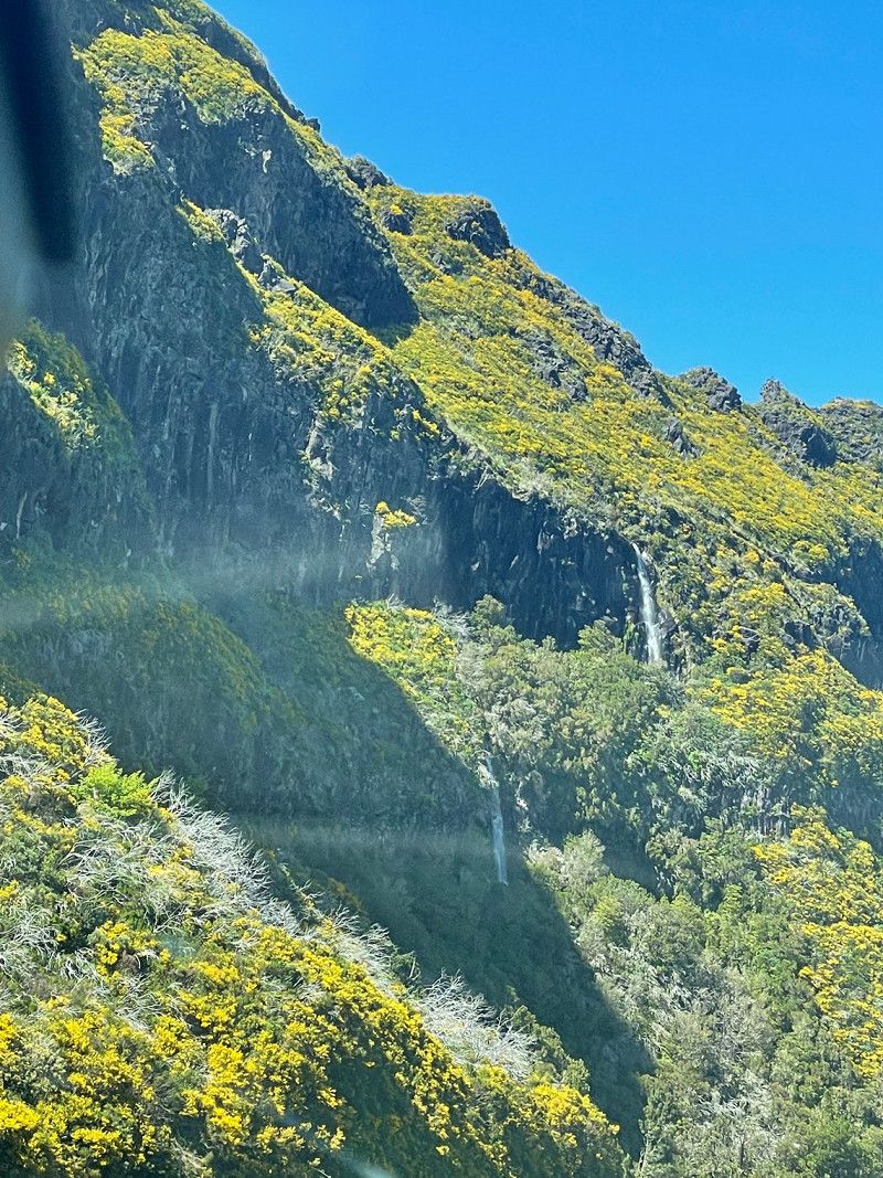
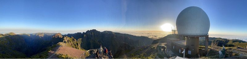
Pico del Arieiro zu Pico Ruvio
Activities: Summit hike
Pico do Arieiro, 9030, Portugal
32° 44' 8" N 16° 55' 44" W
32.7355560 -16.9288890
• Head south. Go for 137 m.
• Turn slightly right onto R202. Go for 6.5 km.
• Turn left onto R103. Go for 8.5 km.
• Turn left onto Estrada da Laurissilva. Go for 277 m.
• Turn left onto R103. Go for 7.2 km.
• Turn left onto VE1. Go for 598 m.
• Take the 2nd exit from roundabout onto Túnel do Faial-Cortado (VE1). Go for 4.2 km.
• Take the 3rd exit from roundabout onto Avenida 25 de Maio (R213). Go for 707 m.
• Take the 2nd exit from roundabout onto Avenida 25 de Maio (R213). Go for 361 m.
• Turn right onto Antiga R101 (R213). Go for 12 m.
• Turn right toward Rua do Til. Go for 20 m.
• Continue on Rua do Til. Go for 153 m.
• Turn left onto Estrada Padre Agostinho João Cardoso. Go for 613 m.
• Turn slightly right onto Estrada do Pico das Pedras. Go for 340 m.
• Continue on Estrada Padre Agostinho João Cardoso. Go for 286 m.
• Turn right onto Estrada do Pico das Pedras (R218). Go for 2.5 km.
• Turn right onto Estrada do Pico das Pedras (R218). Go for 5.7 km.
• Arrive at Estrada do Pico das Pedras (R218).
☍
38,1 km
(1 hrs. 13 min.)
Ninho da Manta viewpoint, R. do Arieiro, Funchal, Portugal
Business: view
R. do Arieiro, 9230 Funchal, Portugal
32° 44' 21.8" N 16° 56' 1.7" W
32.7393772 -16.9337927
• Head northwest on Estrada do Pico das Pedras (R218). Go for 5.1 km.
• Turn slightly right onto Estrada do Pico das Pedras (R218). Go for 608 m.
• Turn left onto Estrada do Pico das Pedras (R218). Go for 2.5 km.
• Turn left onto Estrada Padre Agostinho João Cardoso. Go for 286 m.
• Continue on Estrada do Pico das Pedras. Go for 340 m.
• Turn slightly left onto Estrada Padre Agostinho João Cardoso. Go for 613 m.
• Turn right onto Rua do Til. Go for 173 m.
• Turn left onto Antiga R101 (R213). Go for 12 m.
• Turn left onto Avenida 25 de Maio (R213). Go for 310 m.
• Take the 1st exit from roundabout onto Avenida 25 de Maio (R213). Go for 666 m.
• Take the 1st exit from roundabout onto VE1. Go for 4.2 km.
• Take the 1st exit from roundabout onto VE1. Go for 4.4 km.
• Turn left onto R108 toward Porto da Cruz (Este). Go for 64 m.
• Take the 1st exit from roundabout onto Estrada de Nossa Senhora de Guadalupe (R110). Go for 4.1 km.
• Turn left onto Estrada Nicolau Clementino Ferreira (R110). Go for 961 m.
• Continue on R110. Go for 3.7 km.
• Take the 2nd exit from roundabout onto R207. Go for 550 m.
• Continue on Túnel de Santo António da Serra (R207). Go for 118 m.
• Continue on R207. Go for 891 m.
• Take the 2nd exit from roundabout onto Estrada Santo António da Serra. Go for 426 m.
• Turn right onto R225. Go for 207 m.
• Arrive at R225. Your destination is on the right.
☍
30,2 km
( 51 min.)
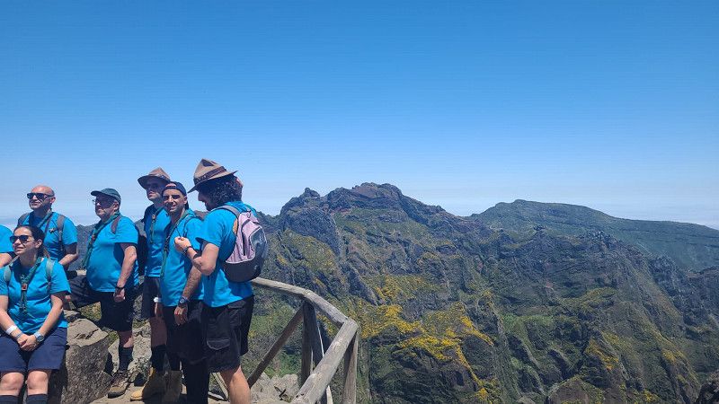
Pico Ruvio zu Pico del Arieiro
Activities: hiking
Madeira Natural Park
32° 45' 30.9" N 16° 56' 31.5" W
32.7585937 -16.9420928
• Head southwest on R225. Go for 207 m.
• Turn right onto Estrada Santo António da Serra. Go for 359 m.
• Turn left onto Rua Padre João Pedro Gomes Henriques. Go for 65 m.
• Turn right onto Rua Padre João Pedro Gomes Henriques. Go for 116 m.
• Turn left toward Caminho da Pedreira. Go for 133 m.
• Turn right onto Caminho da Pedreira. Go for 92 m.
• Turn left onto R207. Go for 836 m.
• Take the 1st exit from roundabout onto Estrada Santo António da Serra (R207). Go for 1.4 km.
• Turn left onto R224. Go for 5.0 km.
• Turn right toward Estrada Francisco Alvares da Nobrega. Go for 21 m.
• Turn right onto Estrada Francisco Alvares da Nobrega. Go for 20 m.
• Turn left onto Caminho da Queimada de Baixo. Go for 761 m.
• Turn right. Go for 34 m.
• Arrive at your destination on the left.
☍
9,0 km
( 15 min.)
Bio Quinta do Pântano Agro- Turismo, Machico, Portugal
Location: Santo Antonio da Serra
Type: Vacation rental
Estrada da Fonte de Santo António 61, 9200-152 Machico, Portugal
32° 43' 30.2" N 16° 48' 57.3" W
32.7250596 -16.8159243
• Head east. Go for 34 m.
• Turn right onto Caminho da Queimada de Baixo. Go for 46 m.
• Take the 4th exit from roundabout onto Antiga R101. Go for 763 m.
• Take the 2nd exit from roundabout onto Antiga R101. Go for 923 m.
• Take the 3rd exit from roundabout onto VR1 toward Caniçal/Santana/Porto da Cruz. Go for 2.2 km.
• Continue on Túnel da Fazenda (VR1). Go for 225 m.
• Continue on VR1. Go for 323 m.
• Continue on Túnel do Duplo Caniçal (VR1). Go for 2.1 km.
• Keep left onto VR1. Go for 214 m.
• Continue on Túnel dos Portais (VR1). Go for 1.0 km.
• Continue on Túnel das Palmeiras (VR1). Go for 1.0 km.
• Take the 2nd exit from roundabout onto Estrada de São Lourenço (R214). Go for 641 m.
• Take the 2nd exit from roundabout onto Estrada de São Lourenço (R214). Go for 535 m.
• Turn left onto Estrada de São Lourenço (R214). Go for 1.4 km.
• Take the 1st exit from roundabout onto Estrada de São Lourenço (R214). Go for 1.9 km.
• Arrive at Estrada de São Lourenço (R214). Your destination is on the right.
☍
13,4 km
( 17 min.)
Day
Modelo Continente Machico, Machico, Portugal
Business: Purchasing
Sitio da Queimada de Baixo, 9200-017 Machico, Portugal
32° 42' 24.3" N 16° 46' 6" W
32.7067415 -16.7683431
• Head northeast on Estrada de São Lourenço (R214). Go for 1.9 km.
• Take the 2nd exit from roundabout onto Estrada de São Lourenço (R214). Go for 2.0 km.
• Take the 1st exit from roundabout onto Estrada de São Lourenço (R214). Go for 593 m.
• Take the 1st exit from roundabout onto VR1 toward Funchal/Machico/Aeroporto. Go for 86 m.
• Continue on Túnel das Palmeiras (VR1). Go for 1.0 km.
• Continue on Túnel dos Portais (VR1). Go for 1.0 km.
• Continue on VR1. Go for 221 m.
• Continue on Túnel do Duplo Caniçal (VR1). Go for 2.1 km.
• Continue on VR1. Go for 345 m.
• Continue on Túnel da Fazenda (VR1). Go for 227 m.
• Continue on VR1. Go for 20.9 km.
• Take ramp toward Funchal/C. da Barca. Go for 319 m.
• Turn left onto Rua da Ribeira de João Gomes (R118) toward Funchal/Pena/C. da Barca. Go for 2.1 km.
• Keep left onto Rua da Ribeira de João Gomes toward Funchal. Go for 162 m.
• Continue on Rua Visconde de Anadia. Go for 471 m.
• Take the 2nd exit from Praça da Autonomia roundabout onto Avenida do Mar e das Comunidades Madeirenses. Go for 462 m.
• Arrive at Avenida do Mar e das Comunidades Madeirenses.
☍
33,9 km
( 34 min.)
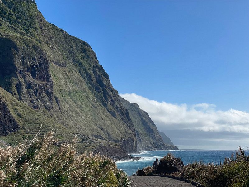
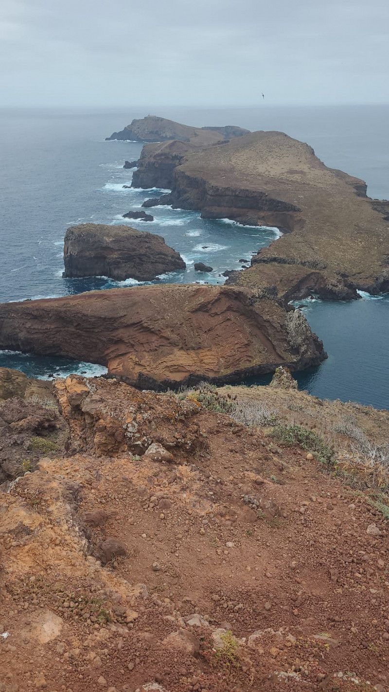
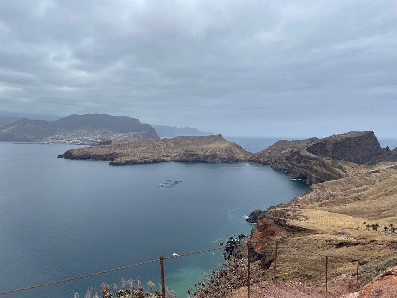
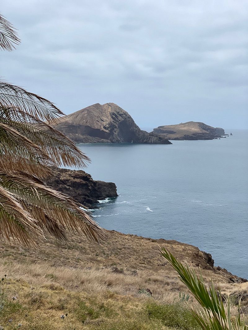
Ponta de São Lourenço, Estr. de São Lourenço, Caniçal, Portugal
Activities: Coastal walk
ER109, Estr. de São Lourenço, 9200-044 Caniçal, Portugal
32° 44' 34.9" N 16° 42' 3.1" W
32.7430249 -16.7008680
• Head west on Avenida do Mar e das Comunidades Madeirenses. Go for 311 m.
• Take the 2nd exit from Rotunda Sá Carneiro roundabout onto Avenida Francisco Sá Carneiro. Go for 658 m.
• Take the 1st exit from Rotunda Harvey Foster roundabout onto Túnel da Pontinha (R116). Go for 755 m.
• Take the 2nd exit from roundabout onto R116. Go for 626 m.
• Take ramp onto Estrada da Liberdade (R115). Go for 1.0 km.
• Take ramp onto Via Cota 200 (VR1) toward Funchal (Este)/Machico. Go for 18.3 km.
• Take ramp toward S.ta Cruz (Este)/S.to da Serra/A. de Pena. Go for 66 m.
• Take the 3rd exit from roundabout onto Estrada de Santa Catarina (R207). Go for 2.0 km.
• Turn left onto Estrada Santo António da Serra (R207). Go for 1.2 km.
• Turn left onto R207. Go for 3.4 km.
• Continue on Estrada Santo António da Serra (R207). Go for 1.4 km.
• Take the 1st exit from roundabout onto Estrada Santo António da Serra. Go for 394 m.
• Turn right onto R225. Go for 207 m.
• Arrive at R225. Your destination is on the right.
☍
30,4 km
( 29 min.)
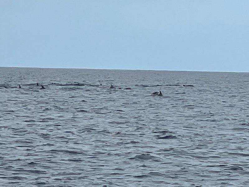
VipDolphins Catamaran Whale Watching, Praça do Povo, Funchal, Portugal
Activities: Catamaran dolphin watching
Praça do Povo, 9000-900 Funchal, Portugal
32° 38' 45.7" N 16° 54' 29.1" W
32.6460258 -16.9080941
• Head southwest on R225. Go for 207 m.
• Turn right onto Estrada Santo António da Serra. Go for 359 m.
• Turn left onto Rua Padre João Pedro Gomes Henriques. Go for 65 m.
• Turn right onto Rua Padre João Pedro Gomes Henriques. Go for 116 m.
• Turn left toward Caminho da Pedreira. Go for 133 m.
• Turn right onto Caminho da Pedreira. Go for 92 m.
• Turn left onto R207. Go for 836 m.
• Take the 1st exit from roundabout onto Estrada Santo António da Serra (R207). Go for 1.5 km.
• Continue on R207. Go for 3.4 km.
• Turn right onto Estrada Santo António da Serra (R207). Go for 1.2 km.
• Turn right onto Estrada de Santa Catarina (R207). Go for 237 m.
• Turn left onto Rua da Torre. Go for 164 m.
• Continue on Estrada do Seixo. Go for 734 m.
• Take the 1st exit from roundabout onto VR1 toward Funchal/Aeroporto. Go for 617 m.
• Arrive at VR1.
☍
9,6 km
( 14 min.)
Bio Quinta do Pântano Agro- Turismo, Machico, Portugal
Location: Santo Antonio de Serra
Type: Vacation rental
Estrada da Fonte de Santo António 61, 9200-152 Machico, Portugal
32° 43' 30.2" N 16° 48' 57.3" W
32.7250596 -16.8159243
Day
Flughafen Madeira, Santa Cruz, Madeira, Portugal
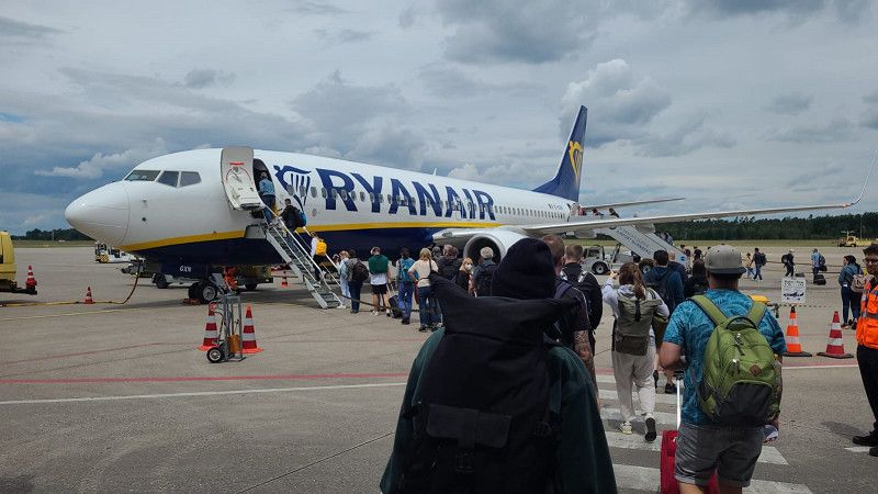
Return flight: Funchal-Nuremberg
9100-105 Santa Cruz, Madeira, Portugal
32° 41' 44.9" N 16° 46' 33.1" W
32.6957983 -16.7758737