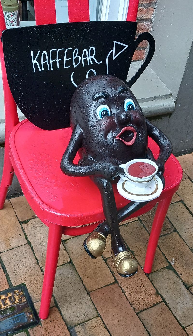
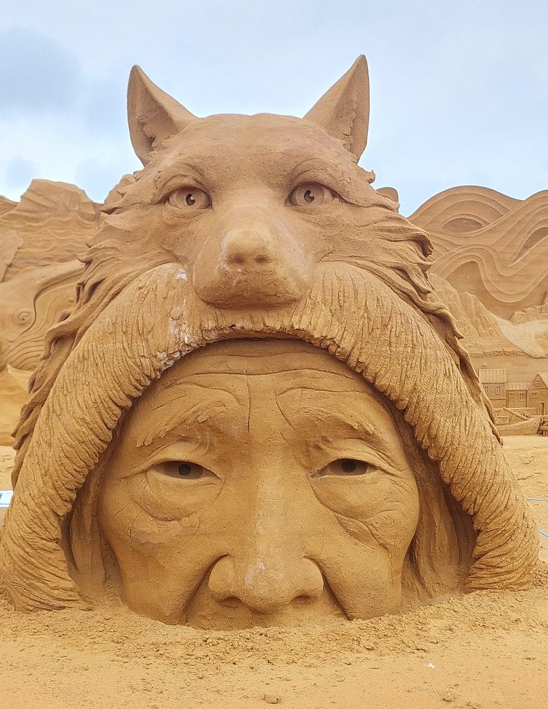
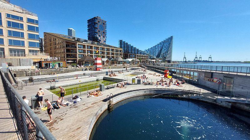
The route goes through the whole of Denmark, mostly along the coast. We visit a few trolls along the way.
St. Ingbert
Saarpfalz-Kreis, Saarland, Deutschland
49° 16' 43.8" N 7° 6' 56.4" E
49.2788378 7.1156707
• Head northwest. Go for 64 m.
• Turn right onto Poststraße. Go for 233 m.
• Turn left onto Theodor-Heuss-Platz (L119). Go for 235 m.
• Turn right onto Josefstaler Straße (L112) toward A1/A8/Neunkirchen/Sulzbach/Kreiskrankenhaus. Go for 259 m.
• Turn right onto Elversberger Straße (L112). Go for 4.3 km.
• Take the 3rd exit from roundabout onto Lindenstraße (L112) toward A8/Bildstock/Friedrichsthal. Go for 814 m.
• Continue on L282. Go for 192 m.
• Turn left and take ramp onto A8 toward Luxembourg/Saarlouis/Koblenz/Trier/A1/Saarbrücken/A623. Go for 8.7 km.
• Take exit 17 toward Köln/Koblenz/Trier onto A1. Go for 11.0 km.
• Keep left onto A1. Go for 104 km.
• Take exit 120 toward Koblenz/Köln onto A48. Go for 33.2 km.
• Take exit 6 toward Mayen/Mendig/Hatzenport/Münstermaifeld. Go for 311 m.
• Take the 2nd exit from roundabout onto B262 toward Köln/A61/Trier/A48/Mayen. Go for 3.6 km.
• Take ramp onto B262 toward Köln/A61/Mendig/MY-Hausen/MY-Katzenberg/MY-Gewerbegebiet. Go for 8.4 km.
• Turn right toward Laacher-See-Straße/L113. Go for 90 m.
• Continue on Laacher-See-Straße (L113). Go for 1.3 km.
• Turn left onto Brauerstraße. Go for 234 m.
• Turn right onto Brauerstraße. Go for 14 m.
• Turn right. Go for 46 m.
• Arrive at your destination on the left.
☍
177,1 km
(1 hrs. 41 min.)
Day
Leverkusen, Sportflugplatz
Parking at the sports airfield. Near the A3 motorway. Ideal overnight spot. Quiet at night, frequented by small private planes during the day. The very nice "Fliegerhütte" restaurant in the club building is open until 10 p.m. (closed on Thursdays). Sightseeing flights are possible on-site in good weather. Please keep the gated entrances clear. Parking is free, but a visit to the restaurant is welcome.
Brauerstraße 10, 56743, Mendig, Germany
50° 22' 35" N 7° 17' 3" E
50.3763889 7.2841667
• Head toward Brauerstraße. Go for 46 m.
• Turn left onto Brauerstraße. Go for 14 m.
• Turn left onto Brauerstraße. Go for 234 m.
• Turn right onto Laacher-See-Straße (L113). Go for 1.3 km.
• Turn right toward Köln/A61/Ludwigshafen/Brohl-Lützing. Go for 53 m.
• Continue on Laacher-See-Straße (B262). Go for 350 m.
• Take ramp onto A61 toward Köln/Bonn. Go for 32.7 km.
• Take exit 29 toward Flughafen Bonn/Meckenheim onto A565. Go for 24.8 km.
• Take the left exit onto A59. Go for 20.2 km.
• Take the exit onto A3/A4. Go for 4.0 km.
• Continue on A3. Go for 10.1 km.
• Take exit 23 toward Dortmund onto A1. Go for 303 km.
• Take exit 53 toward Cuxhaven/Bremen-Sebaldsbrück onto A27. Go for 3.3 km.
• Take exit 21 toward Oyten/Bremen-Sebaldsbrück/Bremen-Osterholz/Gewerbegebiet Mercedes-Benz/Gewerbegebiet Weserpark/Rotenburg. Go for 368 m.
• Turn left onto Oyterdamm (L168) toward Rotenburg. Go for 1.9 km.
• Turn right toward Am Berg. Go for 33 m.
• Turn right onto Am Berg. Go for 1.5 km.
• Turn right onto Oyter See. Go for 282 m.
• Turn right onto Oyter See. Go for 106 m.
• Arrive at Oyter See.
☍
404,0 km
(3 hrs. 49 min.)
Day
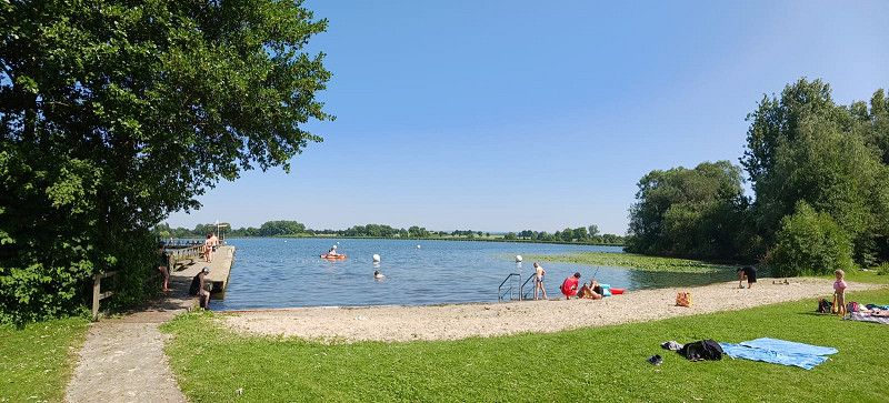
Oyten
Small campsite on a lake not far from the motorway. Overnight stay on June 2, 2025. Clean sanitary facilities. Waterskiing, children's playground, giant play area on the lake.
Oyter See 1, Oyten, Landkreis Verden, Niedersachsen, Deutschland
53° 2' 51.3" N 9° 0' 13.2" E
53.0475787 9.0036613
• Head southeast on Oyter See. Go for 106 m.
• Turn left onto Oyter See. Go for 282 m.
• Turn left onto Am Berg. Go for 1.5 km.
• Turn right onto Oyterdamm (L168). Go for 1.8 km.
• Turn right onto Achimer Straße (L167). Go for 1.1 km.
• Take the 3rd exit from roundabout onto A1. Go for 68.7 km.
• Take exit 43 toward Flensburg/Kiel/Hamburg-West/Tötensen/Flughafen onto A261 (Buchholzer Dreieck). Go for 10.3 km.
• Continue on A7. Go for 11.6 km.
• Keep left onto A7. Go for 119 km.
• Take exit 6 toward Schleswig/Jagel/Schloss Gottorf/B77. Go for 354 m.
• Turn right toward B77/Rendsburg/Jagel. Go for 390 m.
• Take ramp onto B77. Go for 1.3 km.
• Take the 2nd exit from roundabout onto B77 toward Flensburg/Schleswig/Schloss Gottorf. Go for 1.5 km.
• Continue on B76. Go for 1.1 km.
• Take ramp onto Gottorfer Damm (K1) toward Schleswig-Zentrum/Schloss Gottorf. Go for 385 m.
• Turn right onto Gottorfstraße (K1). Go for 98 m.
• Turn left onto Callisenstraße. Go for 353 m.
• Turn right onto Wikingeck. Go for 189 m.
• Arrive at your destination on the left.
☍
220,4 km
(2 hrs. 10 min.)
Day
Stellplatz am Wiking-Yachthafen
Viking Marina with a very friendly harbor master. Hidden in the harbor… a very exciting setting.
Supermarkets, Haithabu Viking Museum 5 minutes away.
You're right on the water, between the boats. Coffee and ice cream are available in the kitchen. Pedal boats and canoes are available for rental!
You can simply find a spot and park, and you can pay the next day! Or you can put money in an envelope at the office door, write your license plate number on it, and drop it in the mailbox. You don't need to call ahead! Just show up!
Everything was very relaxed!
Wikingeck 11, 24837, Schleswig, Germany
54° 30' 25" N 9° 32' 52" E
54.5069444 9.5477778
• Head west. Go for 18 m.
• Continue on Wikingeck. Go for 171 m.
• Turn left onto Callisenstraße. Go for 353 m.
• Turn right onto Gottorfstraße (K1). Go for 98 m.
• Turn left onto Gottorfer Damm (K1). Go for 82 m.
• Take left ramp onto B76 toward Flensburg/A7/Husum. Go for 3.9 km.
• Take ramp toward Kappeln/Husum/Gewerbegebiet Schleswig. Go for 309 m.
• Turn right onto B201 toward A7/Husum. Go for 1.5 km.
• Take the 1st exit from roundabout onto A7 toward Flensburg. Go for 24.4 km.
• Take exit 3 toward Kappeln/Glücksburg/Flensburg onto B200. Go for 6.3 km.
• Take ramp toward Dänemark/Niebüll/B199/FL-Zentrum. Go for 303 m.
• Continue on Am Friedenshügel. Go for 73 m.
• Turn left onto Am Friedenshügel (B199) toward Dänemark/Hamburg/Kiel/Kolding/Bundesgrenze/A7/Niebüll/P+R Citti-Park. Go for 4.4 km.
• Keep left onto B199 toward Niebüll/Leck. Go for 1.7 km.
• Turn right onto Ellunder Straße (K30) toward Ellund. Go for 2.3 km.
• Turn left onto Flensburger Straße (L192). Go for 29.9 km.
• Turn right onto Hauptstraße (B5). Go for 2.0 km.
• Continue on Sønderløgumlandevej (11). Go for 3.3 km.
• Take the 3rd exit from roundabout onto Sønderlandevej toward Tønder C. Go for 1.3 km.
• Turn left onto Kongevej. Go for 809 m.
• Turn left onto Vestergade. Go for 119 m.
• Continue on Strucksalle. Go for 777 m.
• Turn left onto Bargumsvej. Go for 284 m.
• Turn right onto Vester Omfartsvej. Go for 891 m.
• Take the 3rd exit from roundabout onto Møgeltønder Omfartsvej (419). Go for 770 m.
• Turn left onto Schackenborgvej. Go for 1.9 km.
• Continue on Slotsgaden. Go for 342 m.
• Turn right onto Møllevej. Go for 42 m.
• Turn right onto Møllevej. Go for 249 m.
• Arrive at Møllevej. Your destination is on the left.
☍
88,5 km
(1 hrs. 8 min.)
Day
Mögeltondern
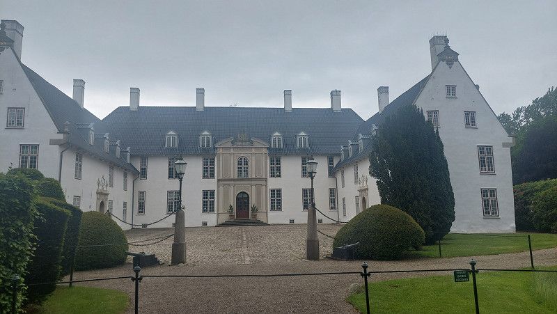
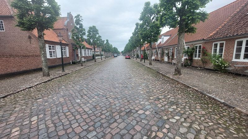
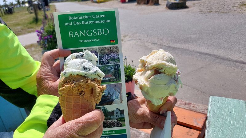
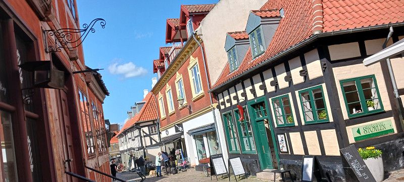
Møgeltønder is a Danish village west of Tønder near the German-Danish border. The 787 inhabitants are called Mögeltonderaner. The first gem at the start of the journey. A wide, straight cobblestone street, lined with typical holiday homes, some with thatched roofs, forms the picturesque center of the town. At the eastern end of the street (the most beautiful village street in the country), after a bumpy drive, there is a small forest behind the Schackenborg Slotskro inn. If you park the motorhome in the parking lot opposite, you have the opportunity to stroll past the houses and take a look at the church with its impressive frescoes or the antique shop opposite. Schackenborg Castle is somewhat hidden in the forest and open to the public at certain times. It was the residence of Prince Joachim, the youngest son of the Danish queen, and his family until 2014.
Region Süddänemark, Dänemark
54° 56' 36.1" N 8° 48' 8.9" E
54.9433547 8.8024693
• Head toward Hvedefennen on Møllevej. Go for 845 m.
• Turn left onto Møgeltønder Omfartsvej (419). Go for 6.7 km.
• Take the 1st exit from roundabout onto Højervej (419). Go for 6.1 km.
• Continue on Duborgvej. Go for 2.5 km.
• Continue on Skast. Go for 3.4 km.
• Continue on Ballum Hede. Go for 878 m.
• Continue on Højervej. Go for 495 m.
• Turn left onto Byvej. Go for 994 m.
• Turn right onto Kystvej (419). Go for 9.3 km.
• Turn left onto Rømøvej (175). Go for 10.0 km.
• Turn right onto Juvrevej. Go for 1.6 km.
• Arrive at Juvrevej. Your destination is on the right.
☍
42,8 km
( 38 min.)
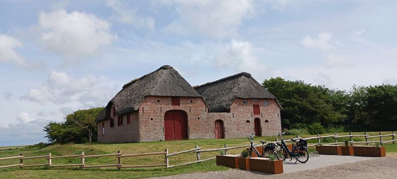
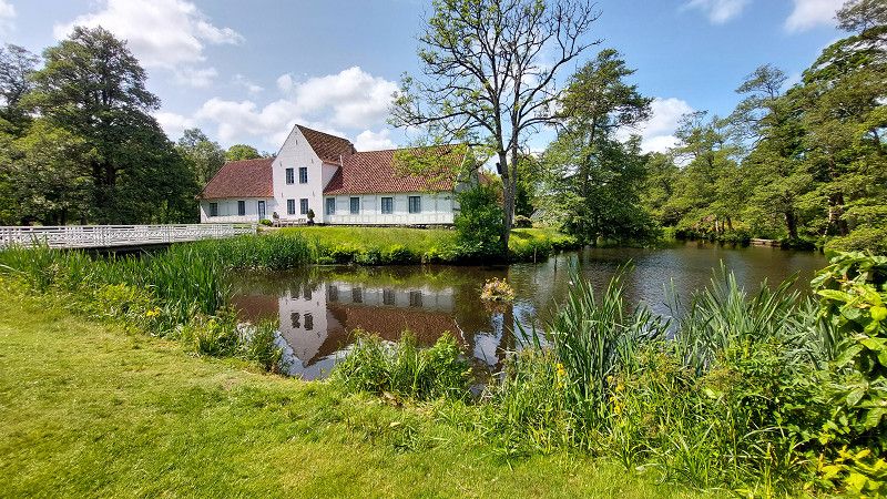
Kommandørgården
Kommandörgarden: Römö's Local History Museum
This wealthy hereditary farm was owned by the same family for 12 generations from 1600 onwards. The current building was constructed in 1749 and has been rebuilt and subdivided several times. In the 18th century, the family became extremely wealthy through seafaring and whaling, which is why farming played a secondary role. In 1708, for example, they only had a few horses and sheep.
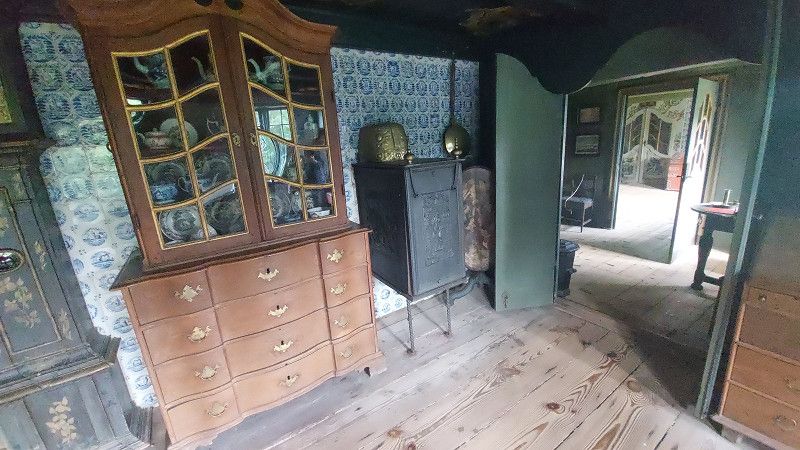
Painted ceilings and panels from the 18th century, hundreds of Dutch blue and white tiles, and elegantly furnished living rooms testify to the prosperity of those times . The parlor was used for parties and weddings, but as a heated room, it was also the largest living room. The stables provide an impression of the agricultural tradition.
The National Museum Kommandörgarden, with its fantastic view over the marsh landscape, exerts a special attraction and conveys a kind of personal satisfaction to its visitors .
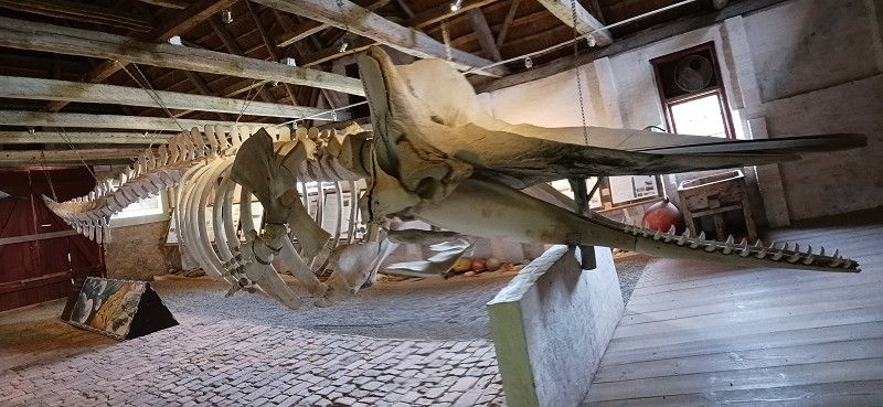
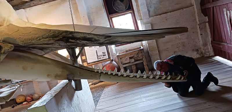
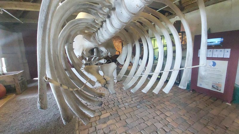
Permanent exhibition on whaling including a sperm whale skeleton
The museum's permanent exhibition documents the development of Rømø , particularly illustrating life on Rømø during the height of the Commander's era from 1669 to 1859. Rømø's inhabitants were in high demand as sailors, helmsmen, and captains and hunted the Bowhead whale. These whales grow up to 18 meters long. The original population of approximately 50,000 has been dramatically reduced. Today, the whales are strictly protected, but had already lost their economic value due to the availability of substitutes.
In the Kommandörgarden barn, you can see the skeleton of a sperm whale that stranded on Rømø on March 27, 1996. Sperm whales weigh up to 40 tons.
At the entrance there is a cozy café with delicious lunches and homemade cakes.
Juvrevej, Kommune Tondern, Region Süddänemark, Dänemark
55° 9' 58.6" N 8° 33' 20" E
55.1662752 8.5555448
• Head toward Thadesvej on Juvrevej. Go for 1.6 km.
• Turn right onto Vesterhavsvej. Go for 3.8 km.
• Arrive at Vesterhavsvej.
☍
5,5 km
( 8 min.)
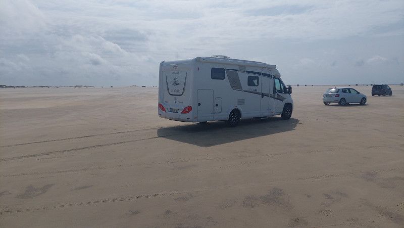
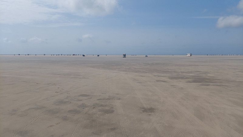
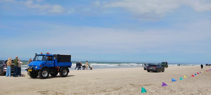
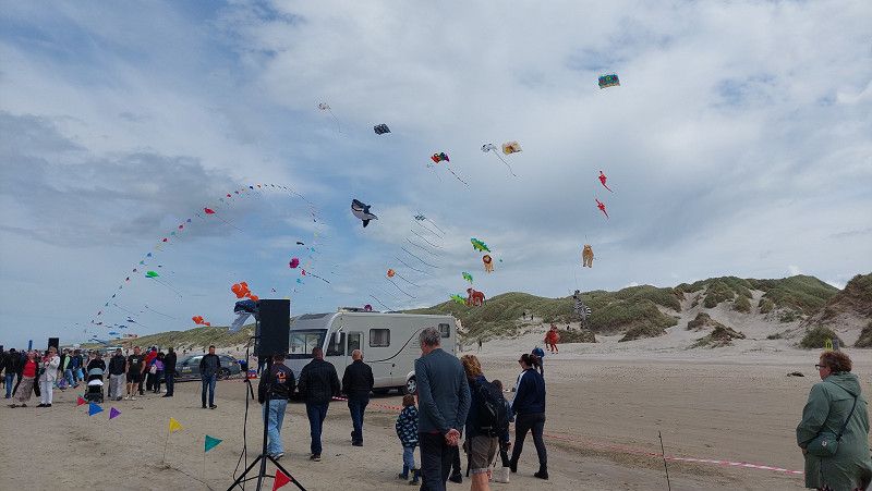
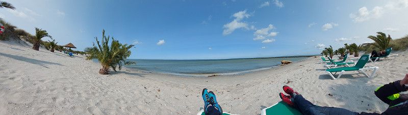
Lakolk Strand
Dänemark
55° 9' 5.8" N 8° 28' 52.5" E
55.1516179 8.4812604
• Head toward Lakolk on Vesterhavsvej. Go for 3.8 km.
• Turn right onto Havnebyvej (175). Go for 6.3 km.
• Turn right onto Langdalsvej. Go for 37 m.
• Turn left onto Sønderbyvej. Go for 270 m.
• Turn right onto Rømersvej. Go for 144 m.
• Arrive at Rømersvej. Your destination is on the left.
☍
10,6 km
( 12 min.)
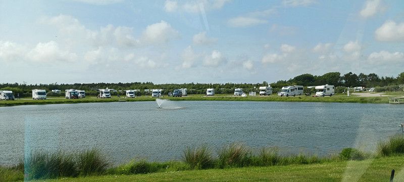
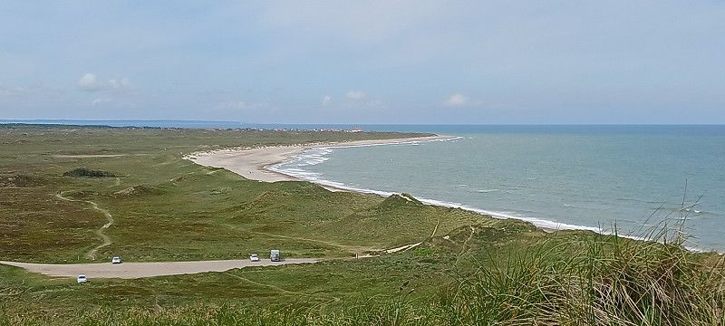
Oase Rømø
Oasen Rømø RV Park is a nearly newly built RV park for 218 RVs. Flat, gravel parking spaces with wide grass strips between them. All parking spaces have electricity and a total of four dump stations and water supply. A supermarket and bakery are 500 m away, Sønderstrand is 2.1 km away, Rømø Golf Club is 1.5 km away, and the ferry to Sylt is 2.5 km away. Lakolk Beach is 11 km away. Site 1 has 28 spaces and is open year-round. Sites 2 and 3, with a total of 172 spaces, have 86 spaces open from November 1 to March 1.
Rømersvej 9, 6792, Rømø, Dänemark
55° 5' 38.3" N 8° 32' 27.4" E
55.0939700 8.5409400
• Head toward Sønderbyvej on Rømersvej. Go for 144 m.
• Turn left onto Sønderbyvej. Go for 270 m.
• Turn right onto Langdalsvej. Go for 37 m.
• Turn left onto Havnebyvej (175). Go for 6.3 km.
• Turn right onto Vesterhavsvej (175). Go for 13.8 km.
• Take the 4th exit from roundabout onto Ribevej (11) toward Ribe. Go for 17.2 km.
• Take the 2nd exit from roundabout onto Tøndervej (11) toward Ribe. Go for 458 m.
• Turn right onto Haderslevvej (24) toward Haderslev/Ribe. Go for 499 m.
• Take the 3rd exit from roundabout onto Haulundvej toward Ribe. Go for 215 m.
• Take the 2nd exit from roundabout onto Stampemøllevej. Go for 499 m.
• Continue on Tøndervej. Go for 215 m.
• Continue on Sønderportsgade. Go for 112 m.
• Continue on Nygade. Go for 117 m.
• Continue on Grydergade. Go for 90 m.
• Continue on Torvet. Go for 87 m.
• Keep left onto Overdammen. Go for 127 m.
• Continue on Mellemdammen. Go for 91 m.
• Continue on Nederdammen. Go for 53 m.
• Arrive at Nederdammen. Your destination is on the right.
☍
40,3 km
( 37 min.)
Day
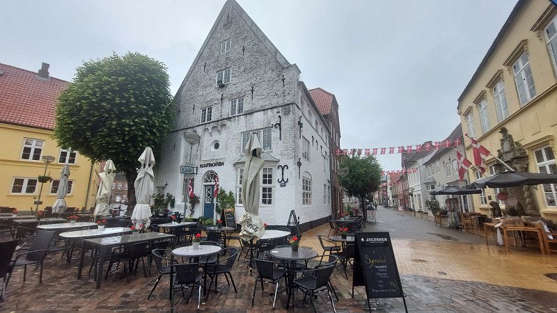
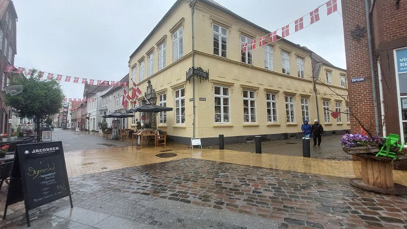
Ribe
Oldest and best preserved Viking city in Scandinavia.
Nederdammen 32B, Ripen, Region Süddänemark, Dänemark
55° 19' 46" N 8° 45' 56.2" E
55.3294376 8.7656046
• Head toward Sanct Nicolaj Gade on Nederdammen. Go for 69 m.
• Continue on Saltgade. Go for 429 m.
• Turn left onto Plantagevej. Go for 101 m.
• Keep right toward Varde/Esbjerg. Go for 232 m.
• Continue on Ringvejen (11/24). Go for 1.9 km.
• Take the 2nd exit from roundabout onto Varde Hovedvej (11/24) toward Varde/Esbjerg. Go for 9.3 km.
• Keep left onto Tjæreborgvej (24) toward Esbjerg. Go for 10.7 km.
• Take the 2nd exit from roundabout onto Tjæreborgvej (24). Go for 3.3 km.
• Take the 2nd exit from roundabout onto Tjæreborgvej (E20) toward Esbjerg Centrum/Havn. Go for 1.1 km.
• Take the 2nd exit from roundabout onto Gammelby Ringvej (E20). Go for 685 m.
• Keep right onto Gammelby Ringvej. Go for 2.0 km.
• Continue on Østre Havnevej (447). Go for 899 m.
• Turn right onto Stormgade. Go for 163 m.
• Turn left onto Strandbygade. Go for 940 m.
• Take the 3rd exit from Strandby Plads roundabout onto Hjertingvej (447). Go for 1.8 km.
• Take the 1st exit from roundabout onto Hjertingvej (447). Go for 450 m.
• Arrive at Hjertingvej (447). Your destination is on the right.
☍
34,0 km
( 33 min.)
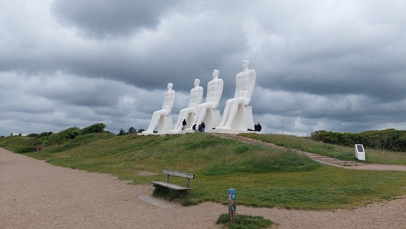
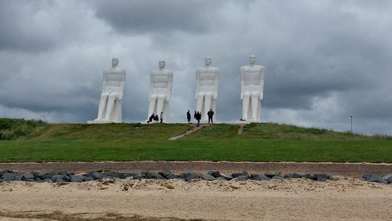
Der Mensch am Meer
Man by the Sea (Danish: Mennesket ved Havet) is a nine-metre-high sculpture group made of white concrete, created by the sculptor, painter and graphic artist Svend Wiig Hansen.
The sculpture is located in Sædding Strand, northwest of Esbjerg city centre, near the Fisheries and Maritime Museum. The sculpture was commissioned in 1994 to mark Esbjerg's 100th anniversary as an independent rural municipality ( sognekommune ). It was opened to the public on 28 October 1995. It has become a symbol of the city and can be seen from the sea ten kilometres away in good weather.
Hjertingvej, Esberg, Region Süddänemark, Dänemark
55° 29' 14.3" N 8° 24' 46.5" E
55.4873171 8.4129233
• Head toward Sædding Strandvej on Hjertingvej (447). Go for 5 m.
• Turn right onto Tarphagevej (447). Go for 2.6 km.
• Pass 2 roundabouts and continue on Tarphagevej (447). Go for 3.0 km.
• Turn left onto Vestkystvej (463). Go for 11.6 km.
• Take the 1st exit from roundabout onto Vesterhavsvej (431). Go for 3.0 km.
• Turn left onto Nybrovej. Go for 5.9 km.
• Turn left onto Nymindegabvej (181). Go for 12.3 km.
• Pass 3 roundabouts and continue on Søndergade (181). Go for 30.9 km.
• Turn right onto Beddingsvej. Go for 20 m.
• Turn slightly left onto Beddingsvej. Go for 80 m.
• Turn slightly left onto Beddingsvej. Go for 92 m.
• Arrive at Beddingsvej. Your destination is on the right.
☍
69,6 km
(1 hrs. 3 min.)
Hvide Sande
Parking space by the fjord, Beddingsvej 55, 6960 Havide Sande. Great parking space right by the water, short distance to town. Also suitable for large vehicles. Price is OK. Great place with lots of space. Great view of the fjord. Now 3 toilet/shower cabins.
Restaurant Tip: Cafe Marina (Reservation)
Beddingsvej 47, Hvide Sande, Region Mitteljütland, Dänemark
56° 0' 6.9" N 8° 8' 1.3" E
56.0019255 8.1337063
• Head east on Beddingsvej. Go for 54 m.
• Turn right onto Beddingsvej. Go for 204 m.
• Turn right onto Søndergade (181). Go for 245 m.
• Pass 2 roundabouts and continue on Holmsland Klitvej (181). Go for 13.2 km.
• Take the 1st exit from roundabout onto Søndervig Landevej (15). Go for 3.5 km.
• Pass 2 roundabouts and continue on Søndervig Landevej. Go for 4.3 km.
• Continue on Søndervigvej. Go for 715 m.
• Turn left onto Enghavevej. Go for 659 m.
• Continue on Nørredige. Go for 139 m.
• Turn right onto I. C. Chr. Alle. Go for 117 m.
• Turn right onto Nygade. Go for 84 m.
• Continue on Holstebrovej. Go for 271 m.
• Turn right onto Byskellet. Go for 617 m.
• Turn right onto Byskellet. Go for 34 m.
• Arrive at Byskellet. Your destination is on the right.
☍
24,2 km
( 24 min.)
Ringkøbing
Region Mitteljütland, Dänemark
56° 5' 26.1" N 8° 15' 14.6" E
56.0905708 8.2540637
• Head northeast on Byskellet. Go for 34 m.
• Turn left onto Byskellet. Go for 617 m.
• Turn right onto Holstebrovej. Go for 1.2 km.
• Pass 2 roundabouts and continue on Holstebrovej (16/28). Go for 19.2 km.
• Turn left onto Harbogade (537) toward Husby/Thorsminde/181. Go for 357 m.
• Turn right onto Niels Buggesvej. Go for 101 m.
• Turn right onto Ulfkjærvej. Go for 102 m.
• Arrive at Ulfkjærvej. Your destination is on the right.
☍
21,6 km
( 19 min.)
Ulfborg
Region Mitteljütland, Dänemark
56° 16' 20.5" N 8° 18' 59.9" E
56.2723603 8.3166504
• Head toward Ove Krarupsvej on Ulfkjærvej. Go for 279 m.
• Turn right onto Ole Chr. Kirksvej. Go for 66 m.
• Turn left onto Holmegade (16/28). Go for 20.0 km.
• Turn left onto Kasernevej toward Lemvig/521. Go for 378 m.
• Continue on Vesterbrogade. Go for 886 m.
• Turn right onto Frøjkvej (521). Go for 84 m.
• Turn right onto Sønderbrogade. Go for 303 m.
• Turn left onto Kirkestræde. Go for 36 m.
• Turn left onto Kirkestræde. Go for 186 m.
• Arrive at Kirkestræde. Your destination is on the right.
☍
22,2 km
( 19 min.)
Day
Holstebro
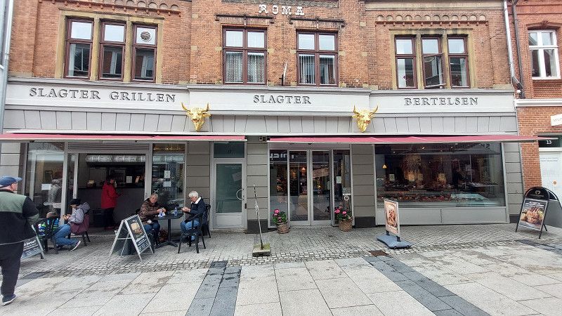
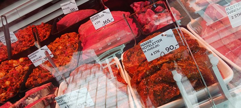
Parking: Sonderbrogarde 7500, 4 free parking spaces next to the supermarket. In the city center, Slagter Bertelsen (great grilled meat). Delicious burgers.
Nørregade 11, Holstebro, Region Mitteljütland, Dänemark
56° 21' 33.6" N 8° 37' 1.4" E
56.3593217 8.6170487
• Head south on Kirkestræde. Go for 186 m.
• Turn right onto Kirkestræde. Go for 36 m.
• Turn left onto Sønderbrogade. Go for 550 m.
• Take the 3rd exit from Sønderport roundabout onto Sønderbrogade. Go for 656 m.
• Turn right onto Viborgvej. Go for 3.3 km.
• Take the 2nd exit from roundabout onto Viborgvej (16/185) toward Viborg/Ikast/Lufthavn. Go for 1.5 km.
• Take the 2nd exit from roundabout onto Viborgvej (16/185) toward Viborg/Ikast/Lufthavn Karup. Go for 1.2 km.
• Take the 3rd exit from roundabout onto Viborgvej (16). Go for 220 m.
• Take the 1st exit from roundabout onto Viborgvej (16). Go for 7.8 km.
• Turn right. Go for 64 m.
• Arrive at your destination on the right.
☍
15,5 km
( 16 min.)
Viborgvej
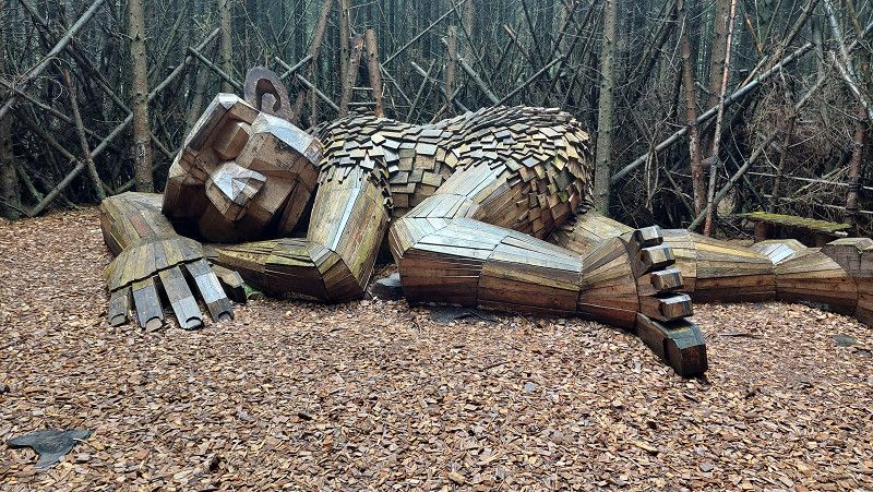
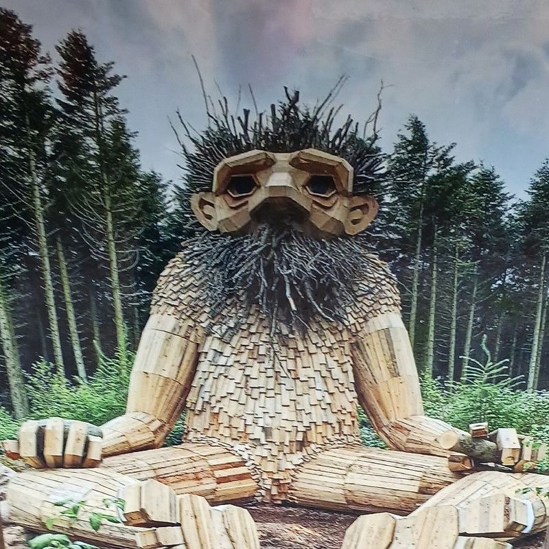
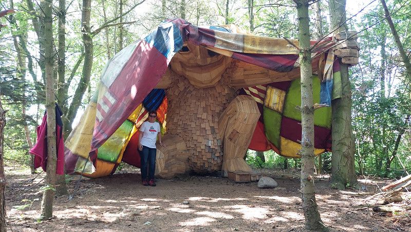
Troll Wild Emil,
Take the whole family on a troll hunt for the troll WildEmil, who is taking a nap in Tinkerdal Skov near Skave outside Holstebro.
You have to look closely - because despite its impressive size of 2x7 meters, the troll fell asleep in a nest made of spruce trees and branches, so it can be difficult to find in the forest.
Longitude: 8.866182379424574
Latitude: 56.39508623503532
Viborgvej 290, Holstebro, Region Mitteljütland, Dänemark
56° 23' 35.8" N 8° 50' 21.4" E
56.3932710 8.8392680
• Head toward Viborgvej. Go for 44 m.
• Turn left onto Viborgvej (16). Go for 7.9 km.
• Take the 1st exit from roundabout onto 18 (Holstebromotorvejen) toward Holstebro N. Go for 7.3 km.
• Turn right onto Struer Landevej (11) toward Thisted/Struer. Go for 9.5 km.
• Take the 2nd exit from roundabout onto Holstebrovej (11/513) toward Thisted/Lemvig/Struer. Go for 879 m.
• Continue on Holstebrovej (11/513). Go for 3.9 km.
• Take the 1st exit from roundabout onto Oddesundvej (11) toward Thisted. Go for 30.2 km.
• Turn left onto Gammel Refsvej toward Refs. Go for 2.3 km.
• Continue on Søndergade. Go for 513 m.
• Turn left onto Nygade. Go for 347 m.
• Continue on Bredgade. Go for 243 m.
• Turn right onto Idrætsvej. Go for 57 m.
• Turn left onto Ashøjgade. Go for 1.7 km.
• Turn left onto Ashøjgade. Go for 141 m.
• Arrive at Ashøjgade. Your destination is on the left.
☍
65,0 km
( 53 min.)
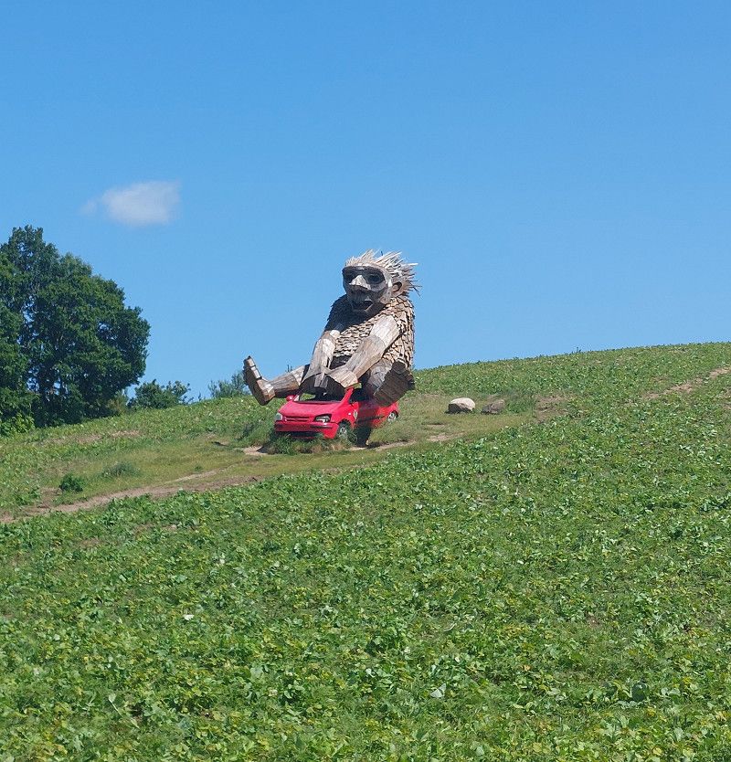
Ashøjgade
Troll Ask visited on 06.06.2025
At the top of Ashøj Hill, which at 93 meters is Thy's highest point, a troll is hiding in the forest.
In a secret spot, in the middle of a clearing, sits the troll Ask from Ashøj with a stone in one hand and a stick in the other. You can find out where Ash is sitting by searching for clues in the forest.
Ashøjgade 47, Hurup Thy, Region Nordjütland, Dänemark
56° 45' 24.2" N 8° 23' 23.5" E
56.7567220 8.3898540
• Head northwest on Ashøjgade. Go for 141 m.
• Turn left onto Ashøjgade. Go for 193 m.
• Turn left onto Ashøjvej (545). Go for 4.8 km.
• Turn right onto Vestervigvej (181/527). Go for 774 m.
• Turn left onto Kystvejen (181). Go for 16.6 km.
• Take the 2nd exit from roundabout onto Kystvejen (181). Go for 4.3 km.
• Turn left onto Hawblink. Go for 1.8 km.
• Turn right onto Vesterhavsgade. Go for 51 m.
• Arrive at Vesterhavsgade. Your destination is on the left.
☍
28,7 km
( 24 min.)
Nørre Vorupør
Vesterhavsgade, Nørre Vorupør, Region Nordjütland, Dänemark
56° 57' 31" N 8° 22' 2" E
56.9586148 8.3672145
• Head northwest on Vesterhavsgade. Go for 65 m.
• Continue on Havstokken. Go for 289 m.
• Turn left onto Vesterhavsgade. Go for 38 m.
• Turn right onto Hawblink. Go for 1.8 km.
• Turn left onto Kystvejen (181). Go for 12.8 km.
• Turn right onto Klitmøllervej (557). Go for 6.3 km.
• Turn left onto Egshvilevej. Go for 103 m.
• Turn slightly left onto Lien. Go for 146 m.
• Arrive at Lien. Your destination is on the left.
☍
21,6 km
( 18 min.)
Stellplatz auf dem Bauernhof
Lien, Region Nordjütland, Dänemark
57° 0' 36.5" N 8° 35' 28.9" E
57.0101488 8.5913663
• Head toward Egshvilevej on Lien. Go for 146 m.
• Turn slightly right onto Egshvilevej. Go for 103 m.
• Turn left onto Klitmøllervej (557). Go for 5.9 km.
• Turn right onto Hanstholmvej (26). Go for 1.0 km.
• Take the 3rd exit from roundabout onto Aalborgvej (11) toward Fjerritslev. Go for 21.0 km.
• Take the 2nd exit from roundabout onto Aalborgvej (11/29) toward Fjerritslev. Go for 19.7 km.
• Continue on Bygholmvejlevej (11) toward Aabybro/Aalborg. Go for 9.3 km.
• Turn left onto Mellemmøllevej toward Tranum/Lerup K. Go for 841 m.
• Continue on Bonderupvej. Go for 2.0 km.
• Turn right onto Hjortdalvej. Go for 3.5 km.
• Take the 2nd exit from roundabout onto Dybdalsvej. Go for 951 m.
• Continue on Drosselvej. Go for 12 m.
• Continue on Dybdalsvej. Go for 1.3 km.
• Continue on Tranum Engevej. Go for 5.0 km.
• Take the 3rd exit from roundabout onto Udholmvej. Go for 3.8 km.
• Continue on Halvrimmenvej. Go for 933 m.
• Turn left onto Rødhusvej. Go for 3.4 km.
• Turn right onto Kystvejen. Go for 4.8 km.
• Continue on Hunetorpvej. Go for 3.0 km.
• Turn left onto Vesterhavsvej (559). Go for 163 m.
• Continue on Aalborgvej (559). Go for 1.7 km.
• Turn right onto Aalborgvej (559). Go for 84 m.
• Turn slightly left onto Strandvejen. Go for 115 m.
• Arrive at Strandvejen. Your destination is on the left.
☍
88,8 km
(1 hrs. 11 min.)
Day
Blokhus
Region Nordjütland, Dänemark
57° 15' 8.5" N 9° 35' 3.2" E
57.2523474 9.5842346
• Head west on Strandvejen. Go for 59 m.
• Turn left onto Støvesvej. Go for 38 m.
• Continue on Høkervej. Go for 64 m.
• Turn left onto Høkervej. Go for 104 m.
• Continue on Torvet. Go for 122 m.
• Continue on Aalborgvej (559). Go for 1.7 km.
• Continue on Vesterhavsvej (559). Go for 163 m.
• Turn right onto Hunetorpvej. Go for 3.0 km.
• Continue on Kystvejen. Go for 4.8 km.
• Turn left onto Rødhusvej. Go for 3.4 km.
• Turn right onto Halvrimmenvej. Go for 933 m.
• Continue on Udholmvej. Go for 3.7 km.
• Take the 1st exit from roundabout onto Tranum Engevej. Go for 5.0 km.
• Continue on Dybdalsvej. Go for 1.3 km.
• Continue on Drosselvej. Go for 12 m.
• Continue on Dybdalsvej. Go for 898 m.
• Take the 2nd exit from roundabout onto Hjortdalvej. Go for 3.5 km.
• Turn left onto Bonderupvej. Go for 2.0 km.
• Continue on Mellemmøllevej. Go for 792 m.
• Turn right onto Ålborgvej (11). Go for 7.5 km.
• Turn right onto Lejrmarksvej (569) toward Fjerritslev/Slette Strand/Svinkløv/Kollerup. Go for 76 m.
• Continue on Østergade (569). Go for 992 m.
• Turn left onto Østergade (569). Go for 205 m.
• Continue on Vestergade (569). Go for 853 m.
• Continue on Thistedvej (569). Go for 13.4 km.
• Turn right onto Ellidsbølvej. Go for 2.1 km.
• Turn left onto Bulbjergvej. Go for 2.1 km.
• Arrive at Bulbjergvej.
☍
58,8 km
( 58 min.)
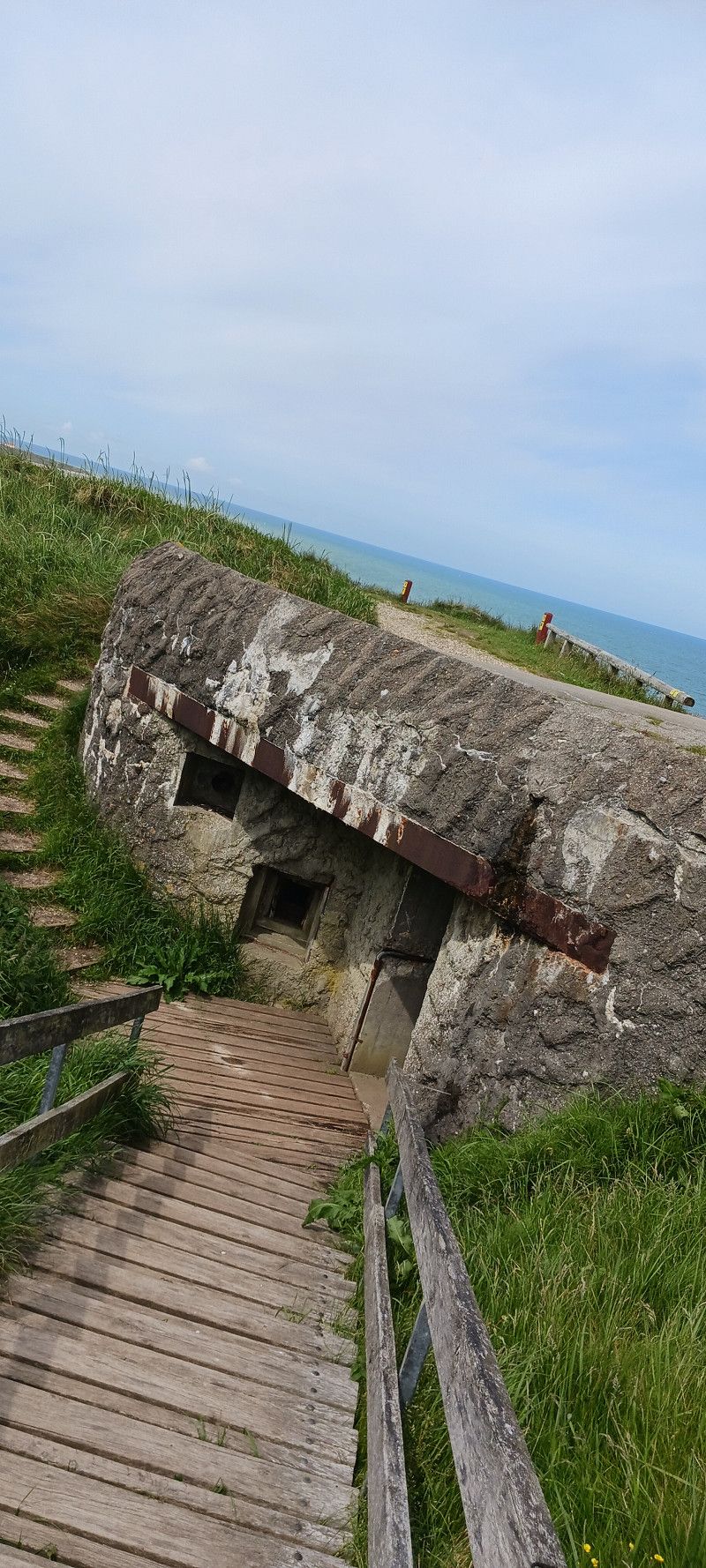
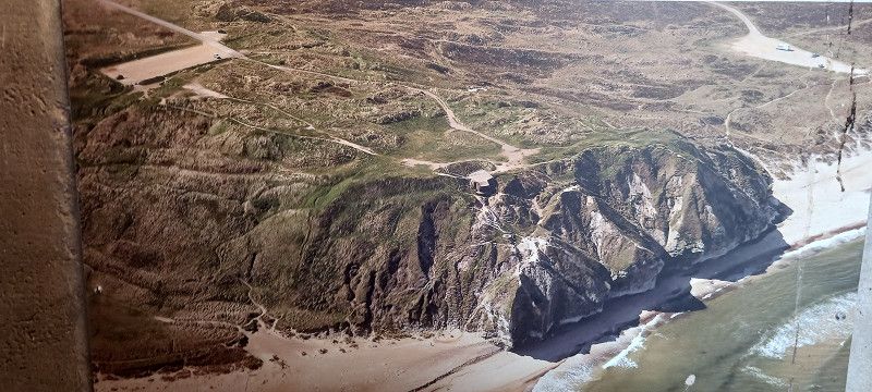
Bulbjergvej, Region Nordjütland, Dänemark
Visit to the bird cliffs and bunker
57° 9' 22.7" N 9° 1' 35.2" E
57.1562987 9.0264422
• Head southeast on Bulbjergvej. Go for 362 m.
• Turn left onto Bulbjergvej. Go for 1.7 km.
• Turn right onto Ellidsbølvej. Go for 2.1 km.
• Turn left onto Thistedvej (569). Go for 13.4 km.
• Continue on Vestergade (569). Go for 744 m.
• Turn right onto Vestergade (569). Go for 109 m.
• Continue on Østergade (569). Go for 1.2 km.
• Continue on Lejrmarksvej (569). Go for 72 m.
• Turn left onto Ålborgvej (11). Go for 7.4 km.
• Turn left onto Mellemmøllevej toward Tranum/Lerup K. Go for 841 m.
• Continue on Bonderupvej. Go for 2.0 km.
• Turn right onto Hjortdalvej. Go for 3.5 km.
• Take the 2nd exit from roundabout onto Dybdalsvej. Go for 951 m.
• Continue on Drosselvej. Go for 12 m.
• Continue on Dybdalsvej. Go for 1.3 km.
• Continue on Tranum Engevej. Go for 5.0 km.
• Take the 3rd exit from roundabout onto Udholmvej. Go for 3.8 km.
• Continue on Halvrimmenvej. Go for 933 m.
• Turn right onto Rødhusvej. Go for 6.4 km.
• Turn right onto Brogaardsgade. Go for 590 m.
• Turn left onto Omfartsvejen (55). Go for 5.9 km.
• Pass 4 roundabouts and continue on Løkkensvej (55). Go for 16.8 km.
• Continue on Løkkensvej (55) toward Hjørring. Go for 4.8 km.
• Turn left onto Lønstrupvej toward Lønstrup/Nr. Rubjerg. Go for 4.1 km.
• Continue on Rubjergvej. Go for 2.3 km.
• Turn left. Go for 22 m.
• Turn left. Go for 65 m.
• Arrive at your destination.
☍
86,2 km
(1 hrs. 18 min.)
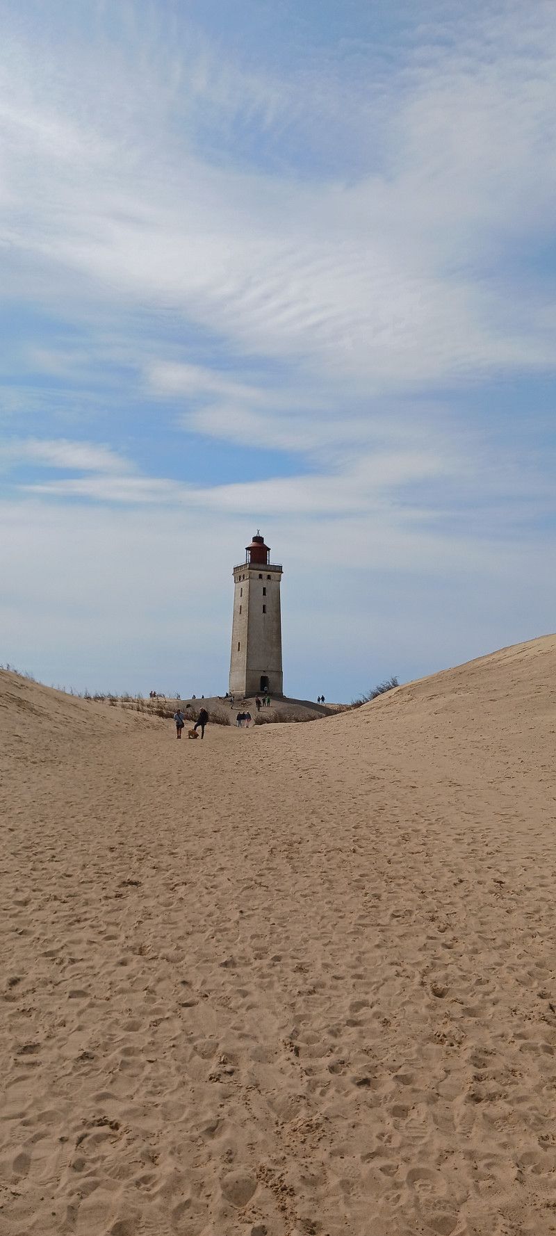
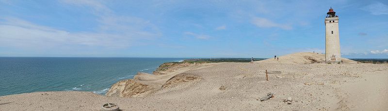
Vester Vidstrup
Fyrvejen, Vester Vidstrup, Region Nordjütland, Dänemark
57° 26' 57.3" N 9° 46' 32.1" E
57.4492396 9.7755741
• Head toward Rubjergvej. Go for 65 m.
• Turn right toward Rubjergvej. Go for 22 m.
• Turn left onto Rubjergvej. Go for 2.0 km.
• Turn right onto Strandvejen. Go for 562 m.
• Continue on Lønstrupvej. Go for 1.5 km.
• Turn left onto Skallerupvej. Go for 8.4 km.
• Turn left onto Krustrupvej (55) toward Hirtshals. Go for 10.4 km.
• Turn right onto Søndre Ringvej (55) toward Hirtshals S. Go for 2.5 km.
• Turn left onto Dalsagervej (55) toward Hirtshals. Go for 935 m.
• Take the 4th exit from roundabout onto Aalborgvej (E39) toward Hirtshals/Havn. Go for 1.5 km.
• Keep left onto E39 toward Color Line/Check-in. Go for 753 m.
• Arrive at E39.
☍
28,6 km
( 29 min.)
Hirtshals
Trailerkajen, Hirtshals, Region Nordjütland, Dänemark
57° 35' 35.7" N 9° 58' 7.1" E
57.5932624 9.9686267
• Head southeast on E39. Go for 2.1 km.
• Take the 3rd exit from roundabout onto Aalborgvej (E39) toward Aalborg/Skagen/597. Go for 2.3 km.
• Take the 3rd exit from roundabout onto Tverstedvej (597) toward Skagen/Tversted. Go for 10.7 km.
• Take the 2nd exit from roundabout onto Skagensvej (597). Go for 6.7 km.
• Turn left onto Skiverenvej. Go for 3.4 km.
• Turn left onto Råbjergvej. Go for 1.4 km.
• Continue on Niels Skiverens Vej. Go for 74 m.
• Turn left onto Plutovej. Go for 144 m.
• Arrive at Plutovej. Your destination is on the left.
☍
26,8 km
( 22 min.)
Skiveren Camping
Niels Skiverensvej 5-7, 9982, Ålbæk, Denmark
57° 36' 57" N 10° 16' 50" E
57.6158300 10.2805500
• Head south on Plutovej. Go for 25 m.
• Turn left onto Plutovej. Go for 124 m.
• Turn left onto Helenavej. Go for 166 m.
• Turn right onto Råbjergvej. Go for 10.5 km.
• Turn left onto Ålbækvej (40). Go for 3.3 km.
• Take the 2nd exit from roundabout onto Ålbækvej (40). Go for 9.3 km.
• Continue on Frederikshavnsvej (40). Go for 1.7 km.
• Take the 2nd exit from roundabout onto Kattegatvej. Go for 651 m.
• Turn left onto Buttervej. Go for 365 m.
• Take the 2nd exit from roundabout onto Bøjlevejen. Go for 3.3 km.
• Take the 2nd exit from roundabout onto Fyrvej (40). Go for 1.8 km.
• Take the 2nd exit from roundabout onto Åkandevej. Go for 143 m.
• Turn right. Go for 52 m.
• Arrive at your destination on the left.
☍
31,3 km
( 31 min.)
Day
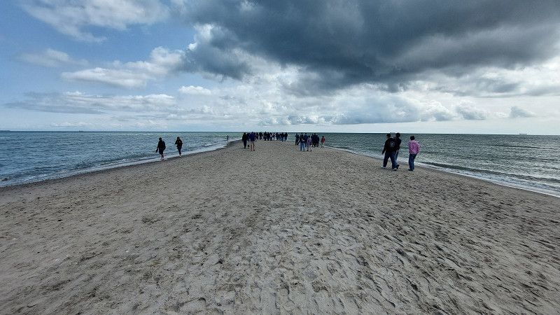
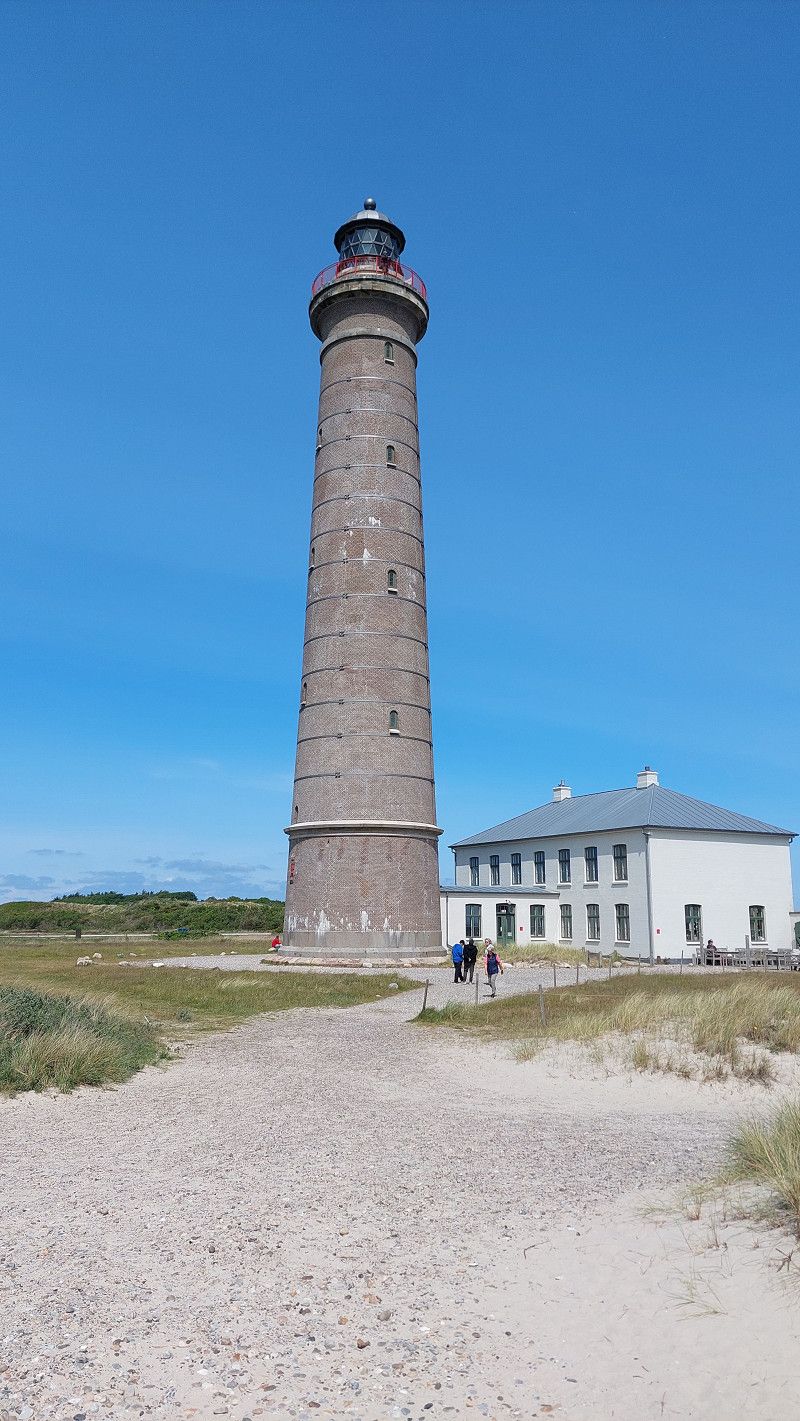
Grenen Parking
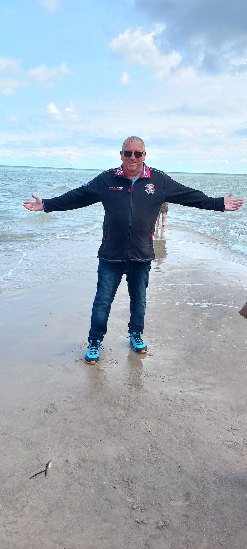
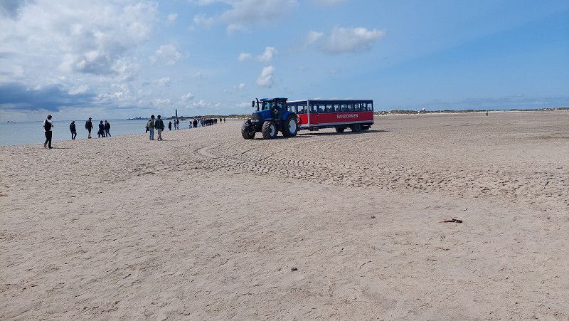
Excursion with tourist tractor to the Cap, 08.06.2025, left North Sea...right Baltic Sea
Fyrvej, 9990, Skagen, Dänemark
57° 44' 21" N 10° 37' 59" E
57.7391667 10.6330556
• Head southeast. Go for 96 m.
• Turn left toward Åkandevej. Go for 13 m.
• Turn left onto Åkandevej. Go for 54 m.
• Take the 1st exit from roundabout onto Fyrvej (40). Go for 1.8 km.
• Take the 1st exit from roundabout onto Bøjlevejen. Go for 3.3 km.
• Take the 3rd exit from roundabout onto Buttervej. Go for 430 m.
• Turn right onto Kattegatvej. Go for 562 m.
• Take the 1st exit from roundabout onto Frederikshavnsvej (40). Go for 10.9 km.
• Pass 5 roundabouts and continue on Skagensvej (40). Go for 24.9 km.
• Take the 3rd exit from roundabout onto Skagensvej. Go for 69 m.
• Continue on Apholmenvej. Go for 667 m.
• Arrive at Apholmenvej. Your destination is on the right.
☍
42,8 km
( 39 min.)
Frederikshavn
Apholmenvej, Frederikshavn, Region Nordjütland, Dänemark
57° 27' 52.5" N 10° 31' 39.7" E
57.4645719 10.5276810
• Head south on Apholmenvej. Go for 667 m.
• Continue on Skagensvej. Go for 5 m.
• Take the 3rd exit from roundabout onto Skagensvej (40). Go for 2.7 km.
• Turn left onto Skippergade. Go for 28 m.
• Turn right onto Skippergade. Go for 70 m.
• Arrive at Skippergade. Your destination is on the left.
☍
3,4 km
( 5 min.)
Day
Frederikshavn
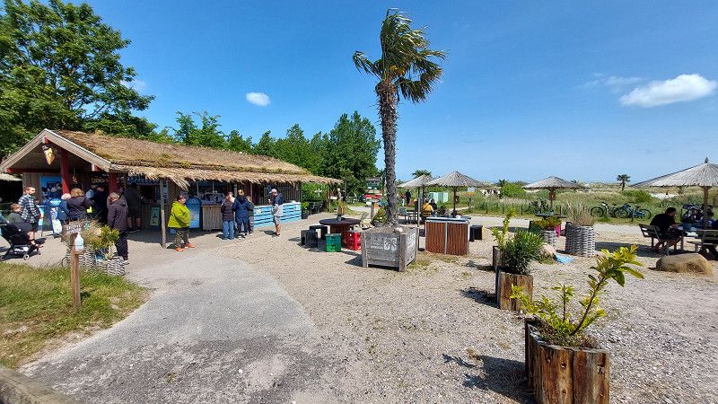
Frederikshavn offers everything you need for a wonderful holiday memory for young and old. The city is unique with its many opportunities for shopping and dining, bunkers, impressive nature and even Denmark's only palm beach.
Frederikshavn has a very special atmosphere thanks to its maritime history, its idyllic location and, not least, the ferry connections to Sweden, Norway and Læsø. The city's many visitors (around five million per year) have laid the foundation for a lively trade. Today, one of the country's longest pedestrian zones invites you to go shopping and nature offers a wealth of experiences and activities both on land and at sea.
The northernmost palm beach in the world
It all started in 2004 with 30 palm trees. Today, 100 of them decorate the white sand of Denmark's most exotic beach. On a summer's day, when the sun shines from a cloudless sky, you get the feeling you are in the Caribbean. But it is quite simply the Kattegat and Denmark at its very best.
Havnepladsen, Frederikshavn, Region Nordjütland, Dänemark
57° 26' 28.9" N 10° 32' 25.4" E
57.4413647 10.5403841
• Head north on Skippergade. Go for 70 m.
• Turn left onto Skippergade. Go for 28 m.
• Turn left onto Skippergade (35/40). Go for 962 m.
• Continue on Europavej (E45) toward Aalborg/Sæby/Brønderslev/585. Go for 58.1 km.
• Take exit 21 toward Nørresundby N/Nørresundby C/Lindholm. Go for 392 m.
• Turn right toward Nørresundby C. Go for 97 m.
• Continue on Sundsholmen. Go for 180 m.
• Turn left onto Hjørringvej (180) toward Nørresundby C. Go for 2.8 km.
• Turn right onto Gammel Strandvej (O1) toward Aalborg Ø/Aalborg V. Go for 160 m.
• Turn left onto Strandvejen. Go for 626 m.
• Continue on Peder Skrams Gade. Go for 811 m.
• Turn left onto Vestre Fjordvej. Go for 124 m.
• Turn right onto Skydebanevej. Go for 649 m.
• Turn right onto Egholm Færgevej. Go for 474 m.
• Take the Aalborg-Egholm Ferry. Stay on for 504 m.
• Head northwest. Go for 20 m.
• Continue on Egholm. Go for 2.7 km.
• Turn right onto Egholm. Go for 129 m.
• Turn left onto Egholm. Go for 94 m.
• Arrive at Egholm. Your destination is on the left.
☍
68,9 km
(1 hrs. 20 min.)
Day
Troll Tusindtunge
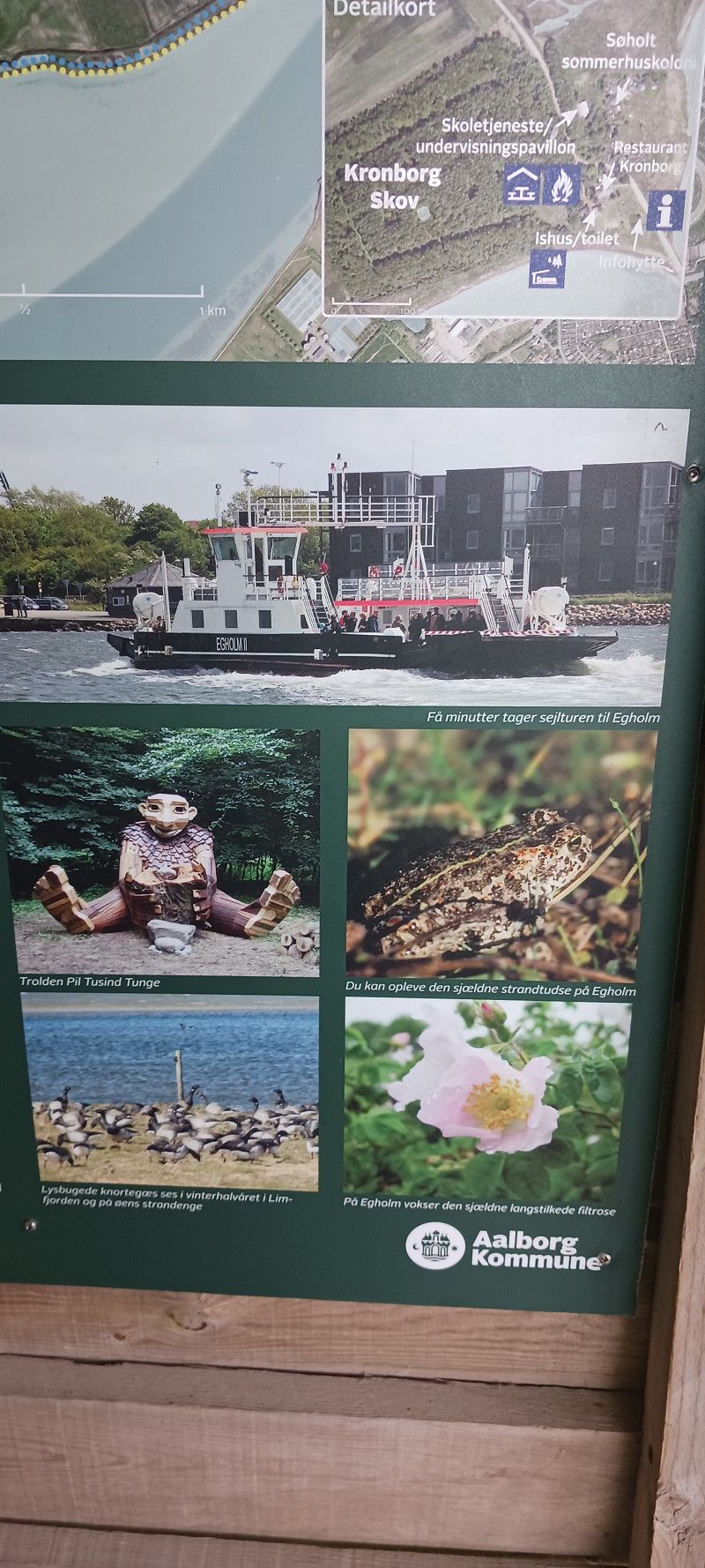
In addition to incredibly beautiful nature, Egholm is also hidden on one of the famous Thomas Dambo trolls.
Pil Tusindtunge is the name of the troll who moved to Egholm in the summer of 2020, where Dambo performed 10 of his famous trolls under the name "Den Store Troldefolkefest." If you want to find them, it's a good idea to wear sturdy hiking shoes, as Arrow is hidden about 4 km from the Egholm ferry terminal.
Egholm 60, Aalborg, Region Nordjütland, Dänemark
57° 4' 3.5" N 9° 50' 14.7" E
57.0676316 9.8374075
• Head west on Egholm. Go for 101 m.
• Turn left onto Egholm. Go for 160 m.
• Turn left onto Egholm. Go for 2.6 km.
• Turn slightly left onto Egholm. Go for 227 m.
• Take the Egholm-Aalborg Ferry. Stay on for 504 m.
• Head southwest. Go for 14 m.
• Continue on Egholm Færgevej. Go for 460 m.
• Turn left onto Skydebanevej. Go for 645 m.
• Turn right onto Vestre Fjordvej. Go for 127 m.
• Turn right onto Vestre Fjordvej. Go for 74 m.
• Turn left onto Vestre Fjordvej. Go for 215 m.
• Turn right onto Peder Skrams Gade. Go for 811 m.
• Continue on Strandvejen. Go for 626 m.
• Turn right onto Gammel Strandvej (O1). Go for 160 m.
• Turn right onto Vesterbro (O1). Go for 476 m.
• Turn left onto Vingårdsgade. Go for 282 m.
• Continue on Brandstrupsgade. Go for 137 m.
• Turn slightly left onto Møllegade. Go for 15 m.
• Arrive at Møllegade. Your destination is on the left.
☍
7,7 km
( 45 min.)
Aalborg
Region Nordjütland, Dänemark
57° 2' 46.5" N 9° 55' 17.5" E
57.0462626 9.9215263
• Head northeast on Møllegade.
• Turn slightly left onto Skipper Clements Gade. Go for 138 m.
• Turn right onto Boulevarden. Go for 46 m.
• Turn left onto Algade. Go for 299 m.
• Turn left onto Vesterbro (O1). Go for 3.1 km.
• Keep left onto Egnsplanvej toward E45/Frederikshavn/Århus/Hjørring/Viborg. Go for 2.4 km.
• Keep left onto Egnsplanvej toward 507/Hadsund/Gistrup. Go for 825 m.
• Turn right onto Vissevej. Go for 605 m.
• Continue on Brådalvej. Go for 3.4 km.
• Continue on Nøvlingvej. Go for 284 m.
• Continue on Oppelstrupvej. Go for 4.6 km.
• Turn left onto Gunderupvej. Go for 233 m.
• Turn right onto Hadsund Landevej (507). Go for 15.9 km.
• Pass 3 roundabouts and continue on Randersvej (507). Go for 12.0 km.
• Take the 1st exit from roundabout onto Mariagervej (555). Go for 4.7 km.
• Take the 1st exit from roundabout onto Hadsundvej (555). Go for 1.2 km.
• Turn right onto Daniavej. Go for 576 m.
• Turn right onto Kongsdal Havn. Go for 598 m.
• Arrive at Kongsdal Havn. Your destination is on the left.
☍
50,9 km
( 46 min.)
Kongsdal Havn Autocamperplads
Kongsdal Havn, Assens, Region Nordjütland, Dänemark
56° 41' 3.7" N 10° 4' 14.3" E
56.6843583 10.0706335
• Head toward Daniavej on Kongsdal Havn. Go for 598 m.
• Turn left onto Daniavej. Go for 576 m.
• Turn right onto Hadsundvej (555). Go for 6.2 km.
• Turn left onto Østergade. Go for 416 m.
• Continue on Torvet. Go for 39 m.
• Continue on Teglgade. Go for 88 m.
• Turn left onto Egepladsen. Go for 42 m.
• Continue on Kirkegyden. Go for 136 m.
• Turn slightly right onto Klostergade. Go for 138 m.
• Turn left onto Skovvej. Go for 270 m.
• Turn right onto Hybenvej. Go for 189 m.
• Arrive at Hybenvej. Your destination is on the right.
☍
8,7 km
( 11 min.)
Day
Mariager, Troll Evigvar
Skovvej 4, Marien Acker, Region Nordjütland, Dänemark
56° 38' 40.9" N 9° 58' 56.4" E
56.6447069 9.9823263
• Head south on Hybenvej. Go for 189 m.
• Turn left onto Skovvej. Go for 270 m.
• Turn left onto Klostergade. Go for 377 m.
• Take the 3rd exit from roundabout onto Randersvej (555). Go for 1.0 km.
• Turn right onto Hobrovej (555). Go for 1.5 km.
• Turn left onto Fjelstedvej. Go for 1.5 km.
• Turn left onto Fjelstedvej. Go for 2.6 km.
• Continue on Løkkemarksvej. Go for 7 m.
• Continue on Fjelstedvej. Go for 692 m.
• Continue on True Hovedgade. Go for 410 m.
• Turn left onto Truevej. Go for 3.4 km.
• Continue on Kåtrupvej. Go for 1.4 km.
• Continue on Nørregade. Go for 1.0 km.
• Continue on Søndergade. Go for 2.8 km.
• Turn left onto Hovedvejen (180) toward Randers. Go for 4.2 km.
• Turn right and take ramp onto E45 (Nordjyske Motorvej) toward Århus. Go for 11.0 km.
• Take exit 43 toward Sdr. Borup/Grenaa/21/Ebeltoft/Hadsten N. Go for 373 m.
• Turn left onto Tulipvej (16/511) toward Grenaa/21/Ebeltoft. Go for 1.9 km.
• Take ramp toward Randers/Paderup. Go for 272 m.
• Turn left onto Clausholmvej. Go for 8.2 km.
• Turn left onto Clausholmvej. Go for 253 m.
• Turn right onto Møllevænget. Go for 7 m.
• Arrive at Møllevænget.
☍
43,3 km
( 38 min.)
Troll Jeppe
Clausholmvej 347B, Hadsten, Region Mitteljütland, Dänemark
56° 22' 10.6" N 10° 10' 33.2" E
56.3696163 10.1758911
• Head south on Møllevænget. Go for 68 m.
• Turn right onto Møllevænget. Go for 59 m.
• Turn right onto Østervænget. Go for 141 m.
• Continue on Clausholmvej. Go for 63 m.
• Turn right onto Clausholmvej. Go for 1.7 km.
• Turn right onto Mygindvej. Go for 2.4 km.
• Continue on Smedebakken. Go for 754 m.
• Continue on Øksenhøjvej. Go for 1.5 km.
• Turn right onto Skovbakkevej. Go for 2.9 km.
• Turn right onto Randersvej (21) toward Ebeltoft/Lufthavn/Færge. Go for 4.8 km.
• Take the 2nd exit from roundabout onto Randersvej (21) toward Ebeltoft/Mørke/Færge/Lufthavn. Go for 3.4 km.
• Turn right onto Thorsagervej. Go for 57 m.
• Turn left onto Kildegårdsvej. Go for 608 m.
• Turn left onto Vesterskovgårdsvej. Go for 517 m.
• Arrive at Vesterskovgårdsvej. Your destination is on the left.
☍
18,9 km
( 21 min.)
Mørke
Bakkedraget, Mørke, Region Mitteljütland, Dänemark
56° 19' 31.4" N 10° 23' 1.5" E
56.3253831 10.3837369
• Head toward Balevej on Vesterskovgårdsvej. Go for 700 m.
• Turn left onto Balevej. Go for 831 m.
• Keep right onto Balevej. Go for 187 m.
• Turn right onto Ebeltoftvej (21). Go for 1.9 km.
• Take the 2nd exit from roundabout onto Randersvej (21) toward Ebeltoft/15/Lufthavn. Go for 442 m.
• Turn left and take ramp onto 15/21 toward Grenaa/Ebeltoft/Færge/Lufthavn. Go for 9.9 km.
• Turn right onto Ebeltoftvej (21) toward Ebeltoft/Færge. Go for 13.1 km.
• Arrive at Nordre Strandvej (21). Your destination is on the right.
☍
27,1 km
( 24 min.)
Ebeltoft
Parking space at the harbor with showers and toilets, visit to the fish restaurant Stockfleth, beautiful little pedestrian zone in the village
Strandvejen, Ebeltoft, Region Mitteljütland, Dänemark
56° 12' 0" N 10° 40' 36" E
56.2000057 10.6766735
• Head south on Nordre Strandvej (21).
• Turn left onto Jernbanegade. Go for 116 m.
• Turn left onto Adelgade. Go for 161 m.
• Turn slightly left onto Skindergade. Go for 101 m.
• Turn slightly left onto Maltvej. Go for 85 m.
• Turn right onto Nordre Strandvej (21). Go for 12.9 km.
• Turn left onto 15/21 toward Aarhus/Randers. Go for 21.9 km.
• Take exit 16 toward Skødstrup/505/Skæring. Go for 372 m.
• Take the 3rd exit from roundabout toward 505/Skæring. Go for 208 m.
• Continue toward Grenåvej/505. Go for 30 m.
• Take the 1st exit from roundabout onto Grenåvej (505) toward Skæring. Go for 10.4 km.
• Keep left onto Grenåvej. Go for 93 m.
• Continue on Dronning Margrethes Vej. Go for 1.0 km.
• Continue on Skovvejen. Go for 651 m.
• Continue on Kystvejen. Go for 348 m.
• Continue on Kystvejen (O1). Go for 1.4 km.
• Turn left onto Jægergårdsgade. Go for 201 m.
• Turn left onto Sydhavnsgade. Go for 280 m.
• Turn left onto Filmbyen. Go for 50 m.
• Arrive at Filmbyen. Your destination is on the left.
☍
50,3 km
( 48 min.)
Day
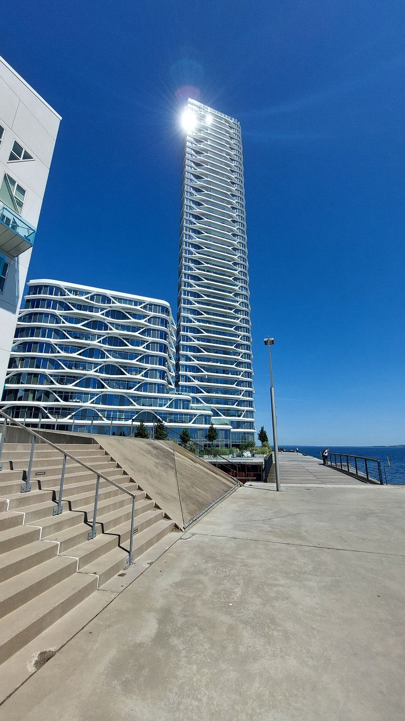
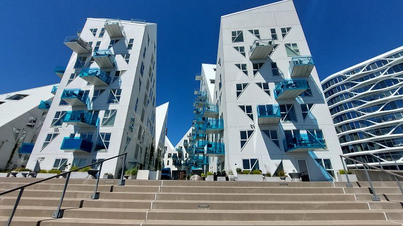
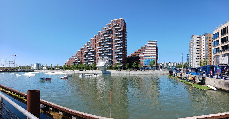
Aarhus
Region Mitteljütland, Dänemark
56° 8' 58.7" N 10° 12' 48.3" E
56.1496278 10.2134046
• Head toward Sydhavnsgade on Filmbyen. Go for 50 m.
• Turn right onto Sydhavnsgade. Go for 280 m.
• Turn right onto Jægergårdsgade. Go for 201 m.
• Turn left onto Strandvejen (O1). Go for 583 m.
• Turn right onto Marselis Boulevard (O1). Go for 895 m.
• Continue on Marselis Boulevard toward E45/170/180. Go for 1.3 km.
• Continue on Åhavevej. Go for 907 m.
• Keep left onto 501 (Århus Syd Motorvejen). Go for 9.9 km.
• Continue on E45 (Østjyske Motorvej). Go for 81.6 km.
• Continue on E45 (Sønderjyske Motorvej) toward Flensborg. Go for 52.4 km.
• Take exit 70B toward Aabenraa N/Rødekro/Hospital. Go for 378 m.
• Take the 4th exit from roundabout onto Løgumklostervej (24) toward Aabenraa. Go for 313 m.
• Take the 1st exit from roundabout onto Løgumklostervej (24) toward Aabenraa. Go for 3.0 km.
• Turn right onto Vestvejen (24). Go for 2.1 km.
• Continue on Rugkobbel (24). Go for 1.2 km.
• Turn left onto Sønderskovvej. Go for 166 m.
• Turn left. Go for 46 m.
• Arrive at your destination on the left.
☍
155,3 km
(1 hrs. 41 min.)
Aabenraa Citycamping
Sønderskovvej 100, 6200, Aabenraa, Denmark
55° 1' 30.1" N 9° 24' 51.2" E
55.0250200 9.4142100
• Head toward Sønderskovvej. Go for 46 m.
• Turn right onto Sønderskovvej. Go for 166 m.
• Turn left onto Rugkobbel (24). Go for 922 m.
• Turn right onto Tinglevvej (42) toward Flensborg/E45s/Tinglev/Sønderborg/8. Go for 2.3 km.
• Take the 2nd exit from roundabout onto Tinglevvej (42) toward Tinglev/E45/Flenseborg. Go for 3.6 km.
• Turn right and take ramp onto E45 (Sønderjyske Motorvej) toward Flensborg/Sønderborg/8. Go for 20.9 km.
• Continue on A7. Go for 156 km.
• Keep left onto A7. Go for 14.7 km.
• Keep right onto A261 (Autobahndreieck Hamburg-Südwest) toward Bremen/Tötensen. Go for 9.0 km.
• Take exit 4 toward Osnabrück/Bremen/Rade onto A1. Go for 56.0 km.
• Take exit 50 toward Stuckenborstel/Sottrum/Ottersberg. Go for 370 m.
• Turn left onto Bremer Straße (B75) toward Rotenburg/Sottrum. Go for 5.5 km.
• Arrive at Rotenburger Straße (B75).
☍
269,4 km
(2 hrs. 34 min.)
Day
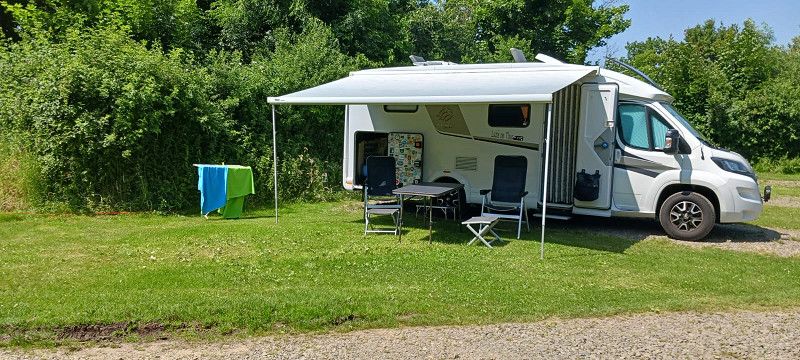
CAMPINGPARK STÜRBERG
Rotenburger Str. 45, 27367, Hassendorf, Germany
53° 7' 12.5" N 9° 16' 40.8" E
53.1201412 9.2780002
• Head toward Zum Steingrund on Rotenburger Straße (B75). Go for 5.5 km.
• Take ramp onto A1 toward Bremen. Go for 4.4 km.
• Take exit 51 toward Posthausen. Go for 286 m.
• Turn left onto Wümmingen (L155) toward Verden/Posthausen/Dodenhof. Go for 4.5 km.
• Turn right onto Hintzendorfer Damm (K7) toward Etelsen/Grasdorf. Go for 1.0 km.
• Continue on Grasdorfer Straße (K7). Go for 956 m.
• Turn left onto Grasdorfer Schuldamm (K9). Go for 846 m.
• Continue on K9. Go for 1.2 km.
• Continue on Grasdorfer Straße (K9). Go for 1.9 km.
• Take the 2nd exit from roundabout onto Grasdorfer Straße (K9). Go for 429 m.
• Continue on Feldstraße (K9). Go for 77 m.
• Turn right and take ramp onto A27 toward Hannover/Verden-Nord. Go for 41.7 km.
• Take the exit onto A7. Go for 152 km.
• Take exit 71 toward Nörten-Hardenberg/Uslar/Solling/Hardegsen. Go for 326 m.
• Turn right onto B446 toward Duderstadt/Nörten-Hardenberg. Go for 268 m.
• Take the 2nd exit from roundabout onto B446. Go for 1.1 km.
• Turn right onto Göttinger Straße (B446) toward Angerstein/Duderstadt/Ebergötzen/Gewerbegebiet Ost u. West. Go for 79 m.
• Turn left onto Reyershäuser Straße (B446) toward Duderstadt/Ebergötzen. Go for 15.3 km.
• Take ramp onto B27/B446 toward Braunlage/Gieboldehausen/Duderstadt/Seeburger See. Go for 1.9 km.
• Take ramp toward Duderstadt/Ebergötzen. Go for 346 m.
• Turn right onto Seeburger Straße (B446) toward Duderstadt. Go for 2.8 km.
• Turn left onto Eichsfeldstraße (K114) toward Seeburg. Go for 651 m.
• Turn right onto Seestraße. Go for 11 m.
• Continue on Seestraße. Go for 294 m.
• Turn sharp right. Go for 48 m.
• Arrive at your destination on the left.
☍
237,7 km
(2 hrs. 26 min.)
Day
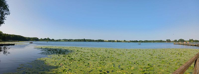
Comfort-Camping Seeburger See
Seestraße 20, 37136, Seeburg, Germany
51° 33' 48.6" N 10° 9' 15.5" E
51.5635000 10.1543100
• Head toward Seestraße. Go for 48 m.
• Turn left onto Seestraße. Go for 305 m.
• Turn right onto Eichsfeldstraße (K114). Go for 1.3 km.
• Turn right onto B446. Go for 1.5 km.
• Take ramp onto B27/B446. Go for 1.5 km.
• Keep left onto B27/B446 toward A7/Hannover/Kassel/Göttingen. Go for 16.8 km.
• Take the 2nd exit from roundabout onto A7 toward Kassel. Go for 48.5 km.
• Take the exit toward Dortmund/Paderborn/Kreuz Kassel-West onto A44. Go for 4.3 km.
• Take exit 69 toward Marburg/Fritzlar/Baunatal onto A49 (Südtangente). Go for 80.0 km.
• Take the left exit toward Basel/Frankfurt/Wiesbaden/Gießen onto A5. Go for 88.5 km.
• Take the exit toward Köln/Wiesbaden/Mainz onto A3. Go for 8.9 km.
• Take exit 48 toward Darmstadt/Mainz/Rüsselsheim onto A67. Go for 6.4 km.
• Take exit 3 toward Mainz/Wiesbaden/Rüsselsheim/Rüdesheim onto A60. Go for 17.6 km.
• Take exit 21 toward Kaiserslautern/Ludwigshafen/Alzey onto A63. Go for 70.5 km.
• Continue on Dreieck Kaiserslautern. Go for 343 m.
• Continue on A6. Go for 54.1 km.
• Take exit 6 toward St. Ingbert-Mitte/Spiesen-Elversberg/Niederwürzbach/Hassel. Go for 220 m.
• Take the 2nd exit from roundabout onto Oststraße (L111) toward Spiesen-Elversberg/Sankt Ingbert-Stadtmitte/Gewerbegebiet Mitte-Oststraße. Go for 756 m.
• Take the 1st exit from roundabout onto Oststraße (L111). Go for 181 m.
• Turn left onto Blieskasteler Straße (L111). Go for 766 m.
• Turn right onto Wollbachstraße (L111). Go for 356 m.
• Turn left onto Maxplatz (L119) toward Saarbrücken/Sulzbach. Go for 614 m.
• Turn left onto Rickertstraße. Go for 244 m.
• Turn left onto Poststraße. Go for 80 m.
• Turn right. Go for 64 m.
• Arrive at your destination on the right.
☍
403,9 km
(4 hrs. )
Day
St. Ingbert
Saarpfalz-Kreis, Saarland, Deutschland
49° 16' 43.8" N 7° 6' 56.4" E
49.2788378 7.1156707