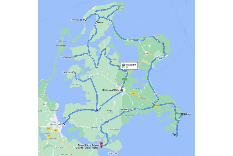
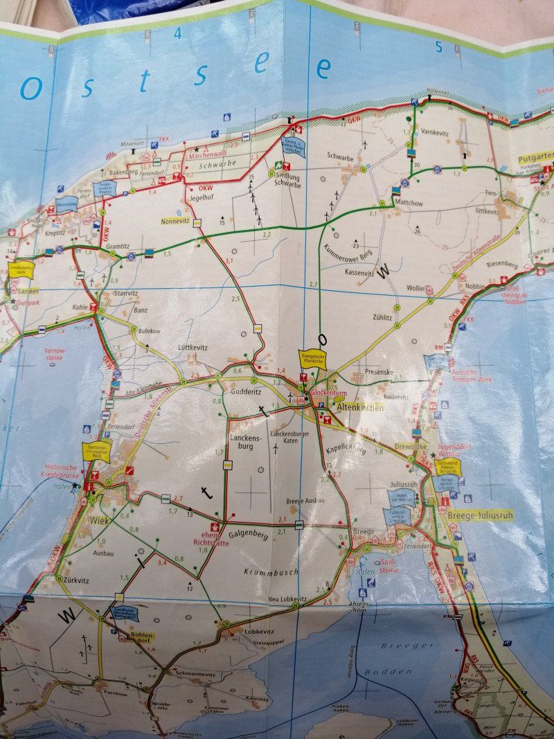
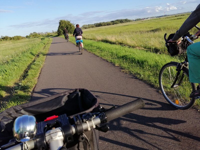
Round trip over Germany's largest island Rügen. * Rügen West - Gingst, Ummanz Island, Schaprode, Trent, Neuenkirchen, Rappin. * Central Rügen - Bergen. * Wittow peninsula - Cape Arkona, Vitt, Wiek, Dranske, Altenkirchen, Breege, Putgarten. * Jasmund peninsula - Glowe, Lohme, Königsstuhl, Sassnitz, Neu Mukran, Sagard. * Rügen South West - Binz, Sellin, Baabe, Göhren. * Möchgut peninsula - Middelhagen, Thiessow, Gager. * South Rügen - Altefähr, Gustow, Garz, Putbus, Lauterbach.
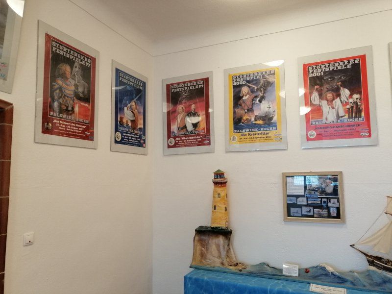
Schon immer auf Rügen
Since 1995 I have been to Germany's largest island "Rügen" every summer.
Always on the same campsite at the northernmost tip of the Wittow peninsula.
Formerly with my parents, since 2010 with my husband and in recent years united with parents and husband :-)
Why the same every year? It's getting boring!
Oh no ! I haven't seen this island for a long time - it is now like a second home and I look forward to discovering another unknown corner of it every year.
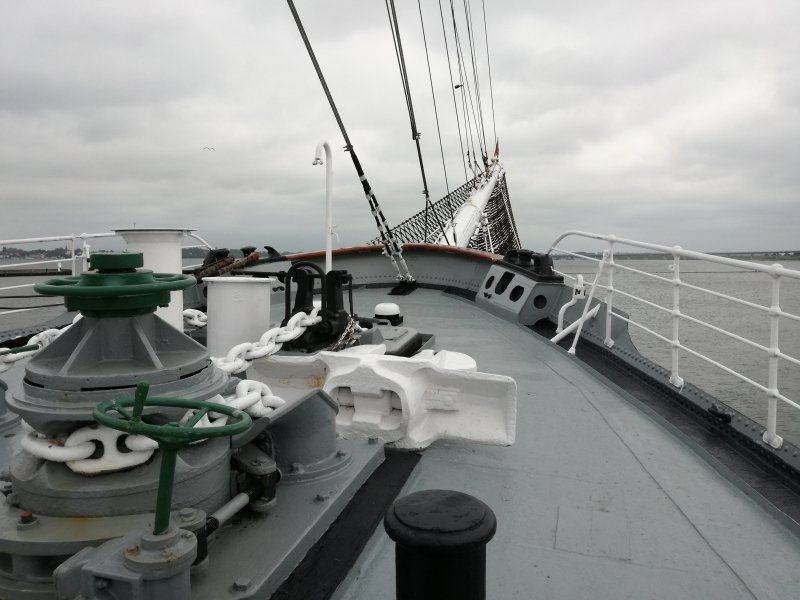
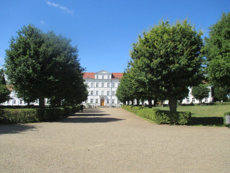
Gorch Fock, An der Fährbrücke, Stralsund, Deutschland
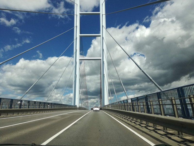
The journey begins on the Rügen Bridge / Rügen Dam Bridge
Anyone who decides to travel to Rügen for the new Rügen Bridge will get a great view of Stralsund and the harbor
An der Fährbrücke, 18439 Stralsund, Deutschland
54° 19' 0.2" N 13° 5' 53.4" E
54.3167170 13.0981652
• Head toward Am Fährkanal on Neue Semlowerstraße. Go for 86 m.
• Continue on Semlower Straße. Go for 79 m.
• Turn left onto Wasserstraße. Go for 258 m.
• Turn left onto Langenstraße. Go for 118 m.
• Turn right onto Am Langenkanal. Go for 71 m.
• Turn slightly right onto Am Langenkanal. Go for 438 m.
• Continue on An der Hafenbahn. Go for 574 m.
• Turn left onto Platz des 17. Juni (L296). Go for 2.0 km.
• Arrive at Rügendamm (L296). Your destination is on the left.
☍
3,6 km
( 6 min.)
Rügendammbrücke, Stralsund, Deutschland
Stralsund, Deutschland
54° 18' 59.7" N 13° 7' 43.9" E
54.3165812 13.1288540
• Head toward Liebitzweg on Rügendamm (L296). Go for 1.2 km.
• Turn left onto Zum Kleinen Dänholm. Go for 173 m.
• Turn left onto Zur Sternschanze. Go for 112 m.
• Arrive at Zur Sternschanze. Your destination is on the right.
☍
1,5 km
( 2 min.)
Dänholm, Stralsund, Deutschland
54° 18' 29.8" N 13° 7' 8.8" E
54.3082648 13.1191074
• Head toward Zum Kleinen Dänholm on Zur Sternschanze. Go for 112 m.
• Turn right onto Zum Kleinen Dänholm. Go for 173 m.
• Turn right onto Rügendamm (L296). Go for 2.8 km.
• Take ramp onto B96 toward Sassnitz/Bergen. Go for 11.6 km.
• Take ramp toward Garz/Putbus/Gewerbegebiet Muhlitz. Go for 310 m.
• Turn left onto L30. Go for 725 m.
• Turn left onto Stralsunder Straße (L296) toward Stralsund. Go for 182 m.
• Turn right onto Poststraße. Go for 80 m.
• Turn left onto Poststraße. Go for 25 m.
• Arrive at Poststraße.
☍
16,0 km
( 12 min.)
Samtens, Deutschland
54° 21' 19.1" N 13° 17' 22.9" E
54.3553070 13.2896824
• Head east on Poststraße. Go for 25 m.
• Turn left onto Poststraße. Go for 130 m.
• Turn right onto Querweg. Go for 173 m.
• Turn left onto Gingster Straße (L30). Go for 11.7 km.
• Turn left onto Markt. Go for 89 m.
• Continue on Mühlenstraße. Go for 97 m.
• Arrive at Mühlenstraße. Your destination is on the left.
☍
12,2 km
( 11 min.)
Gingst, Deutschland
18569 Gingst, Deutschland
54° 27' 24.4" N 13° 15' 22.4" E
54.4567741 13.2562103
• Head west on Mühlenstraße. Go for 135 m.
• Turn left onto Hermann-Matern-Straße. Go for 38 m.
• Turn right toward Ummanzer Chaussee/K9. Go for 534 m.
• Turn right onto Ummanzer Chaussee (K9). Go for 51 m.
• Continue on K9. Go for 1.8 km.
• Continue on Dubkevitz (K9). Go for 495 m.
• Continue on K9. Go for 663 m.
• Continue on Varbelvitz (K9). Go for 1.1 km.
• Continue on K9. Go for 597 m.
• Continue on Mursewiek (K9). Go for 468 m.
• Turn right onto K9. Go for 482 m.
• Continue on Mursewiek (K9). Go for 249 m.
• Continue on K9. Go for 346 m.
• Continue on Neue Straße. Go for 1.2 km.
• Turn slightly left. Go for 835 m.
• Arrive at your destination on the left.
☍
9,0 km
( 17 min.)
Ummanz, Ummanz, Deutschland
18569 Ummanz, Deutschland
54° 28' 6.5" N 13° 10' 3.2" E
54.4684754 13.1675462
• Head toward Neue Straße. Go for 835 m.
• Turn slightly right onto Neue Straße. Go for 1.2 km.
• Continue on K9. Go for 346 m.
• Continue on Mursewiek (K9). Go for 249 m.
• Continue on K9. Go for 482 m.
• Turn left onto Mursewiek (K9). Go for 468 m.
• Continue on K9. Go for 597 m.
• Continue on Varbelvitz (K9). Go for 1.1 km.
• Continue on K9. Go for 663 m.
• Continue on Dubkevitz (K9). Go for 495 m.
• Continue on K9. Go for 1.8 km.
• Continue on Ummanzer Chaussee (K9). Go for 410 m.
• Turn left onto Karl-Marx-Straße (L30). Go for 3.0 km.
• Continue on L301. Go for 9.0 km.
• Take the 2nd exit from roundabout onto Gingster Chaussee. Go for 291 m.
• Turn left onto Ringstraße. Go for 555 m.
• Take the 2nd exit from roundabout onto Graskammer. Go for 632 m.
• Turn right onto Sassnitzer Chaussee. Go for 133 m.
• Continue on Raddasstraße. Go for 128 m.
• Turn left onto Rugardstraße. Go for 566 m.
• Turn left onto Rugardweg. Go for 191 m.
• Turn right onto Rugardweg. Go for 34 m.
• Arrive at Rugardweg. Your destination is on the left.
☍
23,2 km
( 34 min.)
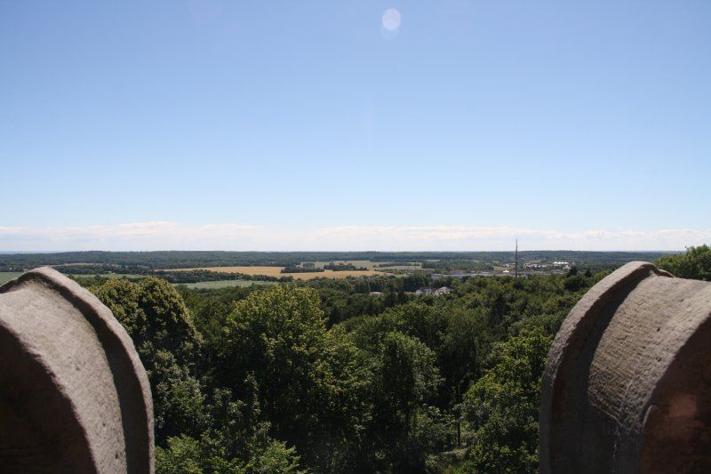
Ernst-Moritz-Arndt Turm, Bergen auf Rügen, Deutschland
18528 Bergen, Deutschland
54° 25' 18.4" N 13° 26' 41.3" E
54.4217766 13.4448174
• Head northwest on Rugardweg. Go for 34 m.
• Turn left onto Rugardweg. Go for 191 m.
• Turn right onto Rugardstraße. Go for 566 m.
• Turn right onto Raddasstraße. Go for 128 m.
• Continue on Sassnitzer Chaussee. Go for 1.2 km.
• Continue on Bahnwärterhaus. Go for 609 m.
• Turn right onto B96. Go for 3.1 km.
• Turn left toward Ralswiek Hafen. Go for 684 m.
• Continue on Unter den Linden. Go for 77 m.
• Continue on Dorfstraße. Go for 639 m.
• Continue on Dorfstraße. Go for 39 m.
• Turn slightly right onto Am Bodden. Go for 11 m.
• Turn left. Go for 38 m.
• Arrive at your destination on the left.
☍
7,3 km
( 12 min.)
Ralswiek, Deutschland
18528 Ralswiek, Deutschland
54° 28' 28.3" N 13° 26' 44.3" E
54.4745171 13.4456502
• Head toward Am Bodden. Go for 26 m.
• Turn right onto Am Bodden. Go for 37 m.
• Turn slightly left onto Dorfstraße. Go for 39 m.
• Turn right onto Parkstraße. Go for 88 m.
• Continue on K7. Go for 1.5 km.
• Continue on Gnieser Straße (K7). Go for 632 m.
• Turn right onto Gnieser Straße (K7). Go for 74 m.
• Continue on Gnies (K7). Go for 39 m.
• Continue on K7. Go for 1.1 km.
• Continue on Quellgrund (K7). Go for 268 m.
• Continue on K7. Go for 3.1 km.
• Turn right onto K6. Go for 411 m.
• Turn slightly right onto K6. Go for 809 m.
• Continue on Dorfstraße (K6). Go for 777 m.
• Continue on Dorfstraße. Go for 211 m.
• Turn left onto Dorfstraße. Go for 1.6 km.
• Continue on Am Berg. Go for 58 m.
• Turn left onto Am Berg. Go for 94 m.
• Arrive at Am Berg.
☍
10,9 km
( 12 min.)
Groß Banzelvitz, Rappin, Deutschland
Groß Banzelvitz, 18528 Rappin, Deutschland
54° 31' 12.4" N 13° 24' 25" E
54.5201160 13.4069400
• Head southeast on Am Berg. Go for 94 m.
• Turn right onto Am Berg. Go for 1.5 km.
• Continue on Dorfstraße. Go for 142 m.
• Turn right onto Dorfstraße. Go for 211 m.
• Continue on Dorfstraße (K6). Go for 777 m.
• Continue on K6. Go for 427 m.
• Turn right toward Kastanienallee. Go for 700 m.
• Turn slightly left onto Kastanienallee. Go for 281 m.
• Turn slightly left toward Tribbevitz. Go for 1.8 km.
• Continue on Tribbevitz. Go for 186 m.
• Turn right onto Tribbevitz. Go for 214 m.
• Turn left onto Dorfstraße. Go for 2.3 km.
• Continue on Dorfstraße (K5). Go for 790 m.
• Continue on K5. Go for 359 m.
• Continue on Moor (K5). Go for 42 m.
• Continue on K5. Go for 564 m.
• Arrive at K5. Your destination is on the right.
☍
10,5 km
( 17 min.)
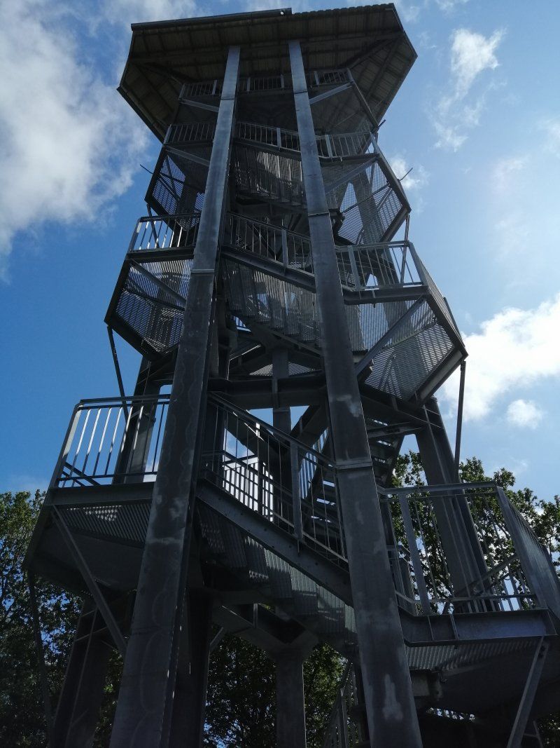
Johann-Jacob-Grümbke-Aussichtsturm auf dem Hoch Hilgor, Grubnow, Neuenkirchen, Deutschland
Grubnow, 18569 Neuenkirchen, Deutschland
54° 33' 13.5" N 13° 20' 9" E
54.5537387 13.3358440
• Head south on K5. Go for 564 m.
• Continue on Moor (K5). Go for 42 m.
• Continue on K5. Go for 359 m.
• Continue on Dorfstraße (K5). Go for 790 m.
• Turn right onto K5. Go for 6.9 km.
• Continue on Silenz (K5). Go for 471 m.
• Continue on K5. Go for 168 m.
• Turn right onto L30. Go for 5.1 km.
• Continue on Dorfstraße (L302). Go for 580 m.
• Continue on L302. Go for 1.4 km.
• Continue on Granskevitz (L302). Go for 315 m.
• Continue on L302. Go for 3.6 km.
• Continue on Lange Straße (L302). Go for 566 m.
• Turn left onto Lange Straße. Go for 41 m.
• Arrive at Lange Straße. Your destination is on the left.
☍
20,8 km
( 30 min.)
Schaprode, Deutschland
54° 30' 51.8" N 13° 10' 2" E
54.5143987 13.1672132
• Head toward Streuer Weg on Lange Straße. Go for 41 m.
• Turn right onto Lange Straße (L302). Go for 425 m.
• Turn slightly right onto Lange Straße (L302). Go for 141 m.
• Continue on L302. Go for 3.6 km.
• Continue on Granskevitz (L302). Go for 315 m.
• Continue on L302. Go for 1.4 km.
• Continue on Dorfstraße (L302). Go for 580 m.
• Turn left onto Dorfstraße (L30). Go for 3.8 km.
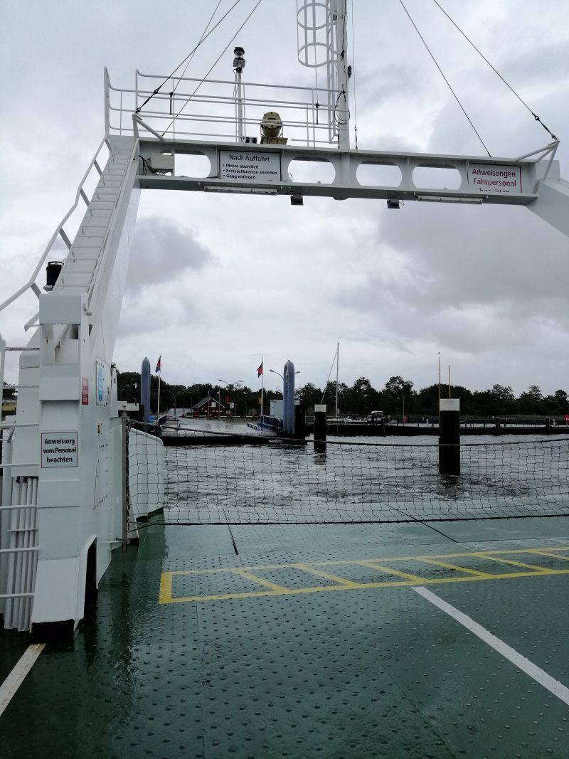
• Take the Wittower Fähre Ferry. Stay on for 421 m.
• Head toward Wittower Fähre on L30. Go for 16 m.
• Turn left onto Wittower Fähre. Go for 142 m.
• Arrive at Wittower Fähre. Your destination is on the left.
☍
10,8 km
( 46 min.)
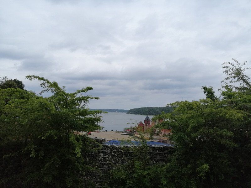
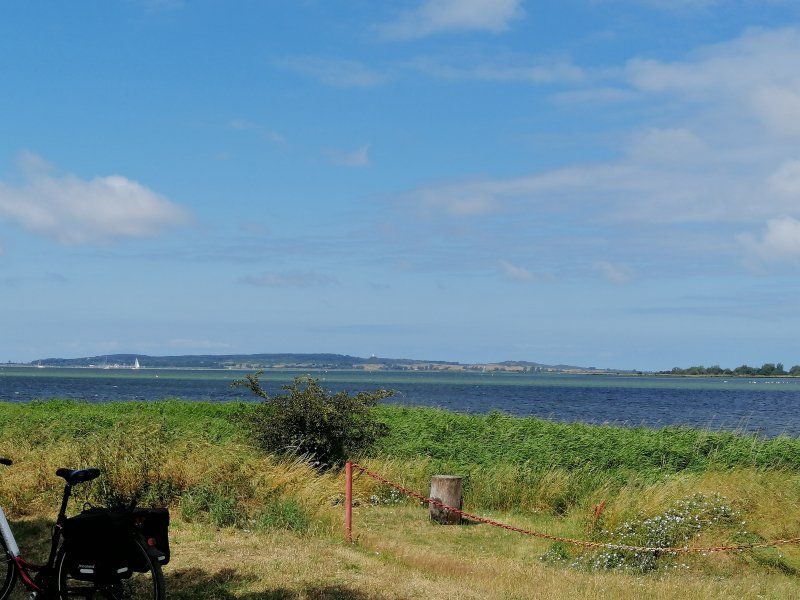
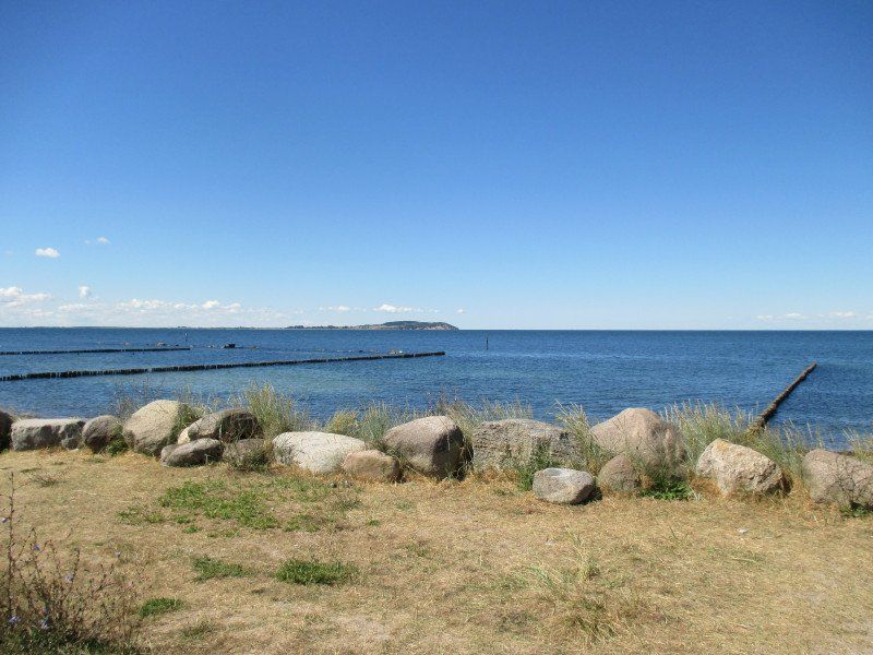
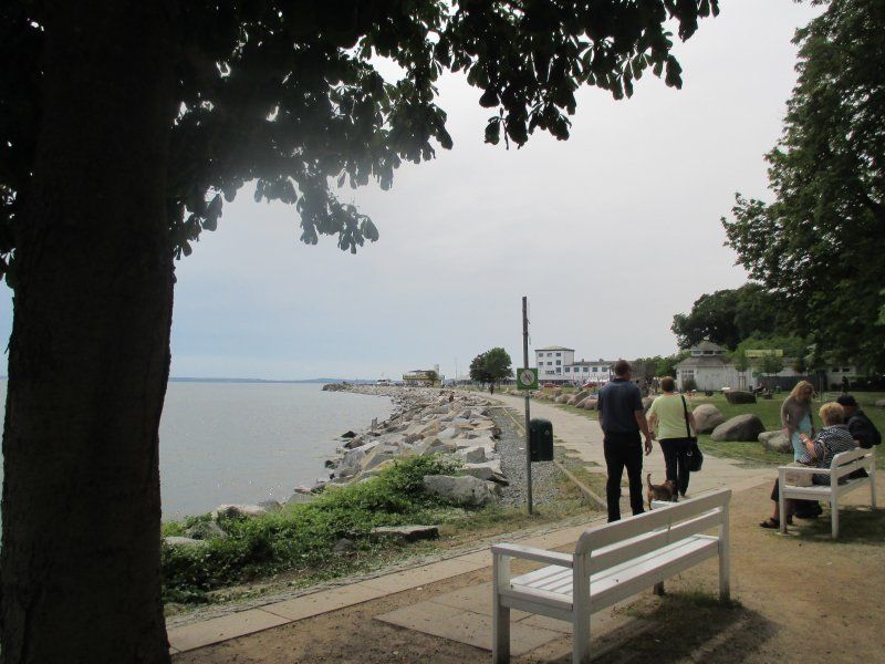
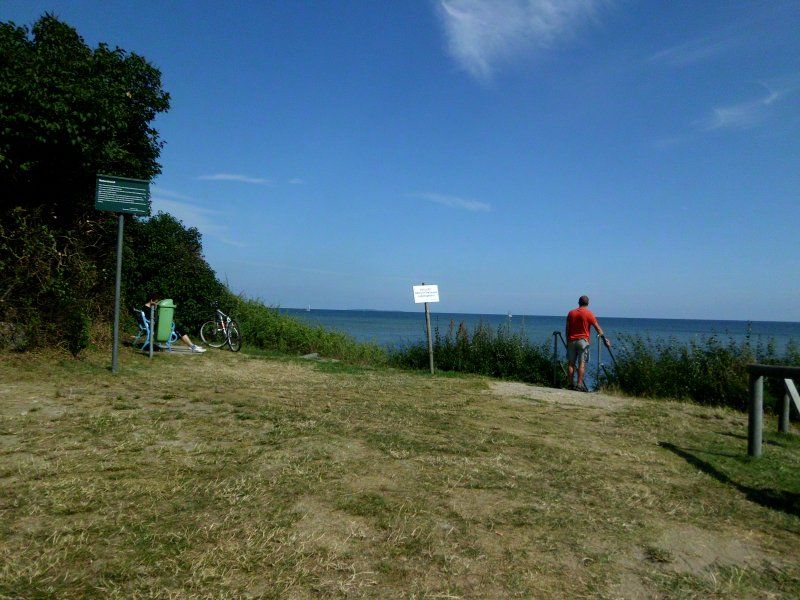
Halbinsel Wittow
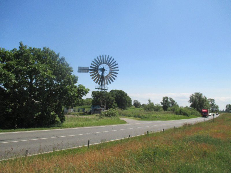
Wind from all sides - also means windland!
Wittower Fähre, Wiek, Deutschland
54° 33' 29.8" N 13° 14' 43.4" E
54.5582856 13.2453799
• Head southeast on Wittower Fähre. Go for 142 m.
• Turn left onto Wittower Fähre (L30). Go for 8.7 km.
• Turn left onto Am Markt. Go for 22 m.
• Keep left onto Am Markt. Go for 18 m.
• Continue on Bahnhofstraße. Go for 123 m.
• Turn right onto Am Hafen. Go for 66 m.
• Turn left. Go for 75 m.
• Arrive at your destination on the left.
☍
9,1 km
( 9 min.)
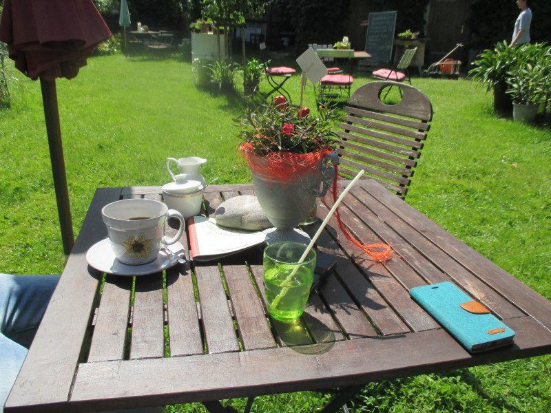
Kreidebrücke Wiek, Hafenstraße, Wiek, Deutschland
Fish sandwiches at the harbor
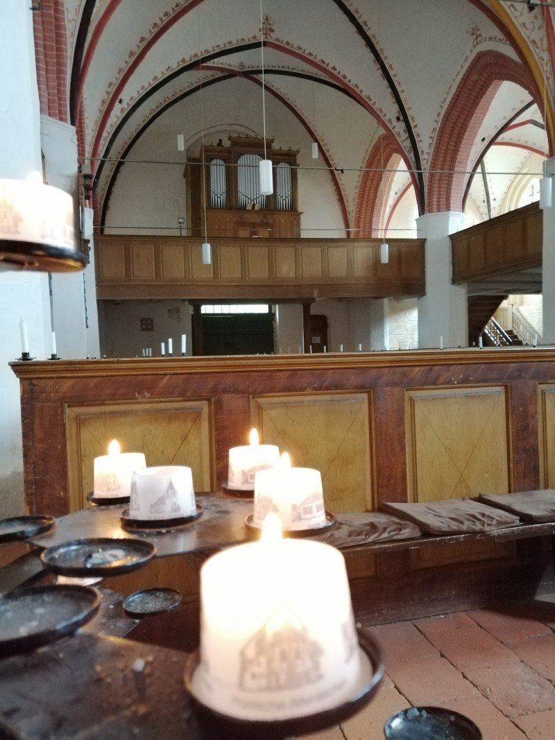
Rest or music in St. George's Church
Flowers, coffee / cake and antiques in the flower café
Hafenstraße 6, 18556 Wiek, Deutschland
54° 37' 20.3" N 13° 17' 6.3" E
54.6222920 13.2850723
• Head toward Am Hafen. Go for 75 m.
• Turn right onto Am Hafen. Go for 66 m.
• Turn left onto Bahnhofstraße. Go for 123 m.
• Continue on Am Markt. Go for 40 m.
• Turn left onto Am Markt (L30). Go for 164 m.
• Turn left onto Hauptstraße (L30). Go for 524 m.
• Turn left onto Hauptstraße (L30). Go for 1.7 km.
• Turn left onto K2. Go for 1.2 km.
• Continue on Buhrkow (K2). Go for 378 m.
• Continue on K2. Go for 529 m.
• Continue on Kuhle (K2). Go for 129 m.
• Continue on Starrvitz (K2). Go for 162 m.
• Arrive at Starrvitz (K2). Your destination is on the left.
☍
5,0 km
( 6 min.)
Schreiber´s Fisch, Am Hafen, Dranske, Deutschland
Anyone traveling to Dranske cannot pass Kuhle.
In the harbor there is delicious fish and anglers
Am Hafen, 18556 Dranske, Deutschland
54° 38' 48.9" N 13° 16' 53.4" E
54.6469217 13.2815048
• Head toward Lancken on Starrvitz (K2). Go for 128 m.
• Continue on K2. Go for 3.0 km.
• Continue on Karl-Liebknecht-Straße (K2). Go for 780 m.
• Turn left onto Hafenstraße. Go for 148 m.
• Turn right onto Am Ufer. Go for 10 m.
• Arrive at Am Ufer. Your destination is on the left.
☍
4,1 km
( 3 min.)
Seebrücke Dranske, Dranske, Deutschland
Unnamed Road, 18556 Dranske, Deutschland
54° 37' 40.9" N 13° 13' 58.9" E
54.6280347 13.2330290
• Head northeast on Am Ufer. Go for 10 m.
• Turn left onto Hafenstraße. Go for 148 m.
• Turn right onto Karl-Liebknecht-Straße (K2). Go for 780 m.
• Continue on K2. Go for 3.0 km.
• Continue on Starrvitz (K2). Go for 290 m.
• Turn left onto Kuhle. Go for 80 m.
• Continue on Starrvitz. Go for 90 m.
• Turn left. Go for 1.2 km.
• Turn right. Go for 444 m.
• Turn left toward Bakenberg. Go for 879 m.
• Continue on Bakenberg. Go for 233 m.
• Arrive at Bakenberg. Your destination is on the right.
☍
7,2 km
( 10 min.)
Eis am Bakenberg, Bakenberg, Dranske, Deutschland
Bakenberg 15, 18556 Dranske, Deutschland
54° 40' 4.6" N 13° 16' 56.7" E
54.6679458 13.2824091
• Head toward Nonnevitz on Bakenberg. Go for 1.1 km.
• Turn right. Go for 444 m.
• Turn left toward Starrvitz. Go for 1.2 km.
• Turn right onto Starrvitz. Go for 90 m.
• Continue on Kuhle. Go for 80 m.
• Turn left onto Kuhle (K2). Go for 129 m.
• Continue on K2. Go for 529 m.
• Continue on Buhrkow (K2). Go for 378 m.
• Continue on K2. Go for 1.2 km.
• Turn left onto L30. Go for 2.0 km.
• Turn left onto An der Kirche. Go for 311 m.
• Continue on Karl-Marx-Platz (K1). Go for 191 m.
• Turn slightly right onto Max-Reimann-Straße (K1). Go for 1.1 km.
• Continue on K1. Go for 5.1 km.
• Turn right onto Varnkevitzer Weg. Go for 380 m.
• Turn slightly left onto Dorfstraße. Go for 121 m.
• Turn right. Go for 32 m.
• Arrive at your destination on the left.
☍
14,3 km
( 21 min.)
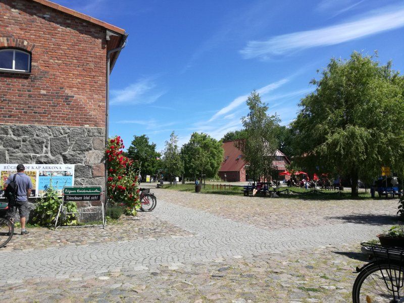
Rügenhof Kap Arkona, Dorfstraße, Putgarten, Deutschland
Dorfstraße 22, 18556 Putgarten, Deutschland
54° 40' 21.3" N 13° 24' 56.3" E
54.6725886 13.4156364
• Head east. Go for 44 m.
• Turn left toward Dorfstraße. Go for 22 m.
• Turn right onto Dorfstraße. Go for 448 m.
• Turn left onto Dorfstraße. Go for 140 m.
• Arrive at Schulweg.
☍
0,7 km
( 2 min.)
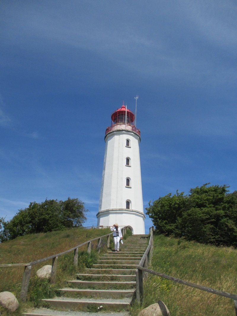
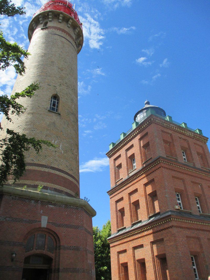
Kap Arkona, Putgarten, Deutschland
Kap Arkona, 18556 Putgarten, Deutschland
54° 40' 41.2" N 13° 25' 35.9" E
54.6781137 13.4266313
• Head toward Dorfstraße on Schulweg. Go for 124 m.
• Turn right onto Dorfstraße. Go for 339 m.
• Turn left onto Vitter Weg. Go for 1.0 km.
• Continue on Vitt. Go for 29 m.
• Arrive at Vitt. Your destination is on the right.
☍
1,5 km
( 4 min.)
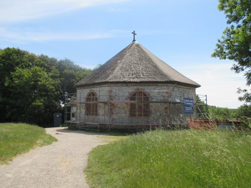
Vitter Kapelle, Vitt, Putgarten, Deutschland
Vitt, 18556 Putgarten, Deutschland
54° 40' 0.6" N 13° 25' 46.8" E
54.6668371 13.4296766
• Head southeast on Vitt. Go for 153 m.
• Turn right onto Vitt. Go for 29 m.
• Turn slightly right onto Vitt. Go for 1.0 km.
• Continue on Goor. Go for 426 m.
• Turn left toward Goor. Go for 760 m.
• Turn left onto Goor. Go for 955 m.
• Continue straight ahead. Go for 259 m.
• Turn slightly right toward K1. Go for 925 m.
• Turn left onto K1. Go for 1.8 km.
• Continue on Max-Reimann-Straße (K1). Go for 1.1 km.
• Turn left onto Werner-Seelenbinder-Straße. Go for 9 m.
• Turn right onto Werner-Seelenbinder-Straße. Go for 71 m.
• Arrive at Werner-Seelenbinder-Straße. Your destination is on the left.
☍
7,5 km
( 13 min.)
Evangelische Kirchengemeinden Altenkirchen & Wiek, An der Kirche, Altenkirchen, Deutschland
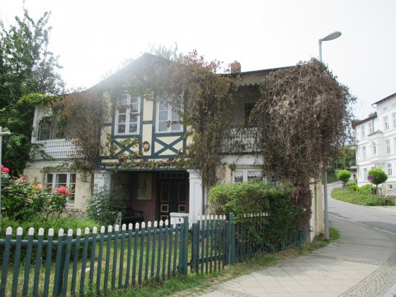
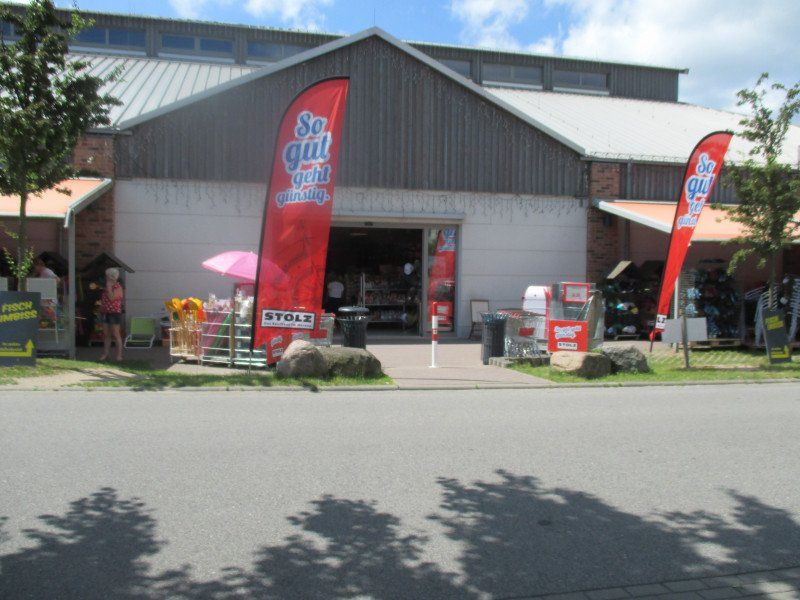
The center of the Wittow peninsula is Altenkirchen, where you can usually get EVERYTHING ;-) Kaufhaus Stolz makes it possible.
The Altenkirchen parish church is the oldest village church on the island of Rügen and shows sculptures in the church garden from time to time.
An der Kirche 1, 18556 Altenkirchen, Deutschland
54° 38' 6.1" N 13° 20' 28.4" E
54.6350141 13.3412326
• Head southwest on Werner-Seelenbinder-Straße. Go for 31 m.
• Turn left onto An der Kirche. Go for 187 m.
• Turn right onto An der Kirche. Go for 67 m.
• Turn left onto L30. Go for 3.8 km.
• Turn right toward Dorfstraße. Go for 256 m.
• Continue on Dorfstraße. Go for 426 m.
• Turn left onto Dorfstraße. Go for 297 m.
• Turn left onto Dorfstraße. Go for 923 m.
• Turn left onto Boddenweg. Go for 103 m.
• Turn left. Go for 20 m.
• Turn left. Go for 75 m.
• Arrive at your destination on the right.
☍
6,2 km
( 9 min.)
Hafen Breege, Hochzeitsberg, Breege, Deutschland
Hochzeitsberg 16A, 18556 Breege, Deutschland
54° 36' 44.4" N 13° 21' 24.7" E
54.6123262 13.3568612
• Head southwest. Go for 75 m.
• Turn right toward Boddenweg. Go for 20 m.
• Turn right onto Boddenweg. Go for 103 m.
• Turn right onto Dorfstraße. Go for 923 m.
• Turn right onto Dorfstraße. Go for 766 m.
• Turn left. Go for 127 m.
• Arrive at your destination.
☍
2,0 km
( 4 min.)
Park Juliusruh, Hochzeitsberg, Breege, Deutschland
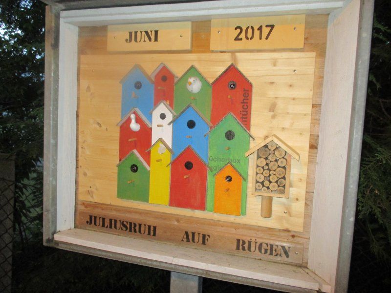
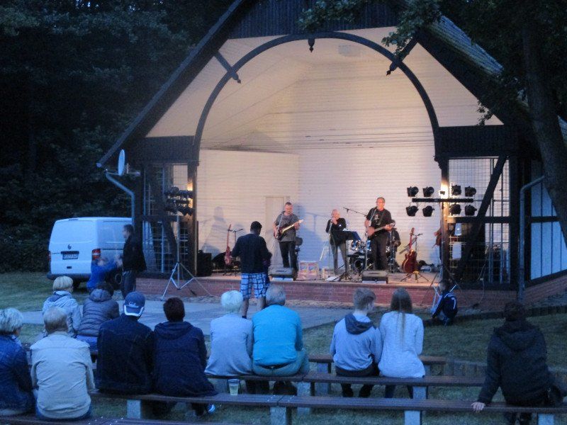
Music in Juliusruh
There is something going on here almost every evening, especially in the high summer season.
You can take shady walks in Julius von der Lancken's park.
Hochzeitsberg 4, 18556 Breege, Deutschland
54° 37' 16.6" N 13° 22' 20.9" E
54.6212682 13.3724825
• Head toward Ringstraße.
• Turn right onto Wittower Straße. Go for 73 m.
• Turn right onto Wittower Straße (L30). Go for 9.6 km.
• Turn left onto Am Königshörn. Go for 232 m.
• Turn right onto Am Hafen. Go for 42 m.
• Keep left onto Am Hafen. Go for 188 m.
• Arrive at Am Hafen.
☍
10,1 km
( 9 min.)
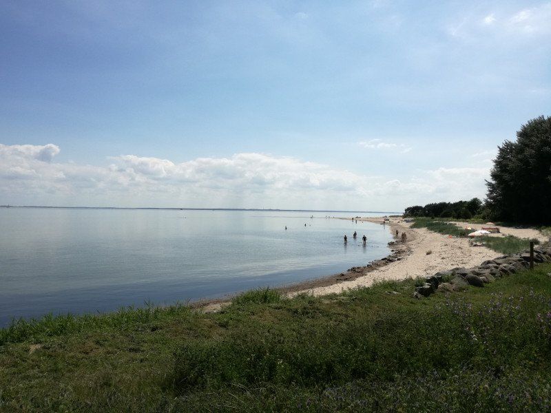
Halbinsel Jasmund
Welcome to the national park
Hafen Glowe, Am Königshörn, Glowe, Deutschland
Am Königshörn 1, 18551 Glowe, Deutschland
54° 34' 25" N 13° 28' 4.9" E
54.5736192 13.4680242
• Head southeast on Am Hafen. Go for 230 m.
• Turn left onto Am Königshörn. Go for 232 m.
• Turn left onto Hauptstraße (L30). Go for 2.9 km.
• Turn left onto Am Camper Bach (L303). Go for 567 m.
• Continue on L303. Go for 2.5 km.
• Continue on Bisdamitz (L303). Go for 137 m.
• Continue on L303. Go for 485 m.
• Continue on Kastanienallee (L303). Go for 422 m.
• Continue on L303. Go for 704 m.
• Continue on Blandow (L303). Go for 273 m.
• Continue on L303. Go for 265 m.
• Continue on Blandow (L303). Go for 195 m.
• Turn left toward Salsitz. Go for 873 m.
• Continue on Salsitz. Go for 400 m.
• Turn slightly right onto Arkonastraße. Go for 430 m.
• Turn sharp left onto Zum Hafen. Go for 129 m.
• Arrive at Zum Hafen. Your destination is on the right.
☍
10,8 km
( 13 min.)
Café Niedlich, Zum Hafen, Lohme, Deutschland
Zum Hafen 8, 18551 Lohme, Deutschland
54° 35' 3.1" N 13° 36' 33.3" E
54.5842056 13.6092404
• Head toward An der Steilküste on Zum Hafen. Go for 129 m.
• Turn slightly left onto Arkonastraße. Go for 1.2 km.
• Continue on Giegnitz. Go for 616 m.
• Continue on Jasmunder Straße. Go for 118 m.
• Turn left onto L303. Go for 422 m.
• Continue on Stubbenkammerstraße (L303). Go for 1.1 km.
• Continue on Zum Försterberg (L303). Go for 150 m.
• Continue on L303. Go for 660 m.
• Turn slightly left toward Stubbenkammer. Go for 1.9 km.
• Continue on Stubbenkammer. Go for 271 m.
• Turn slightly right onto Stubbenkammer. Go for 46 m.
• Arrive at Stubbenkammer.
☍
6,6 km
( 10 min.)
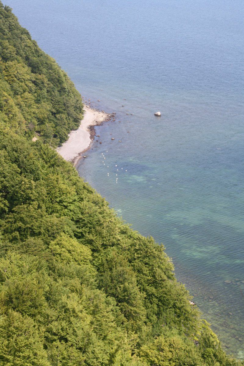
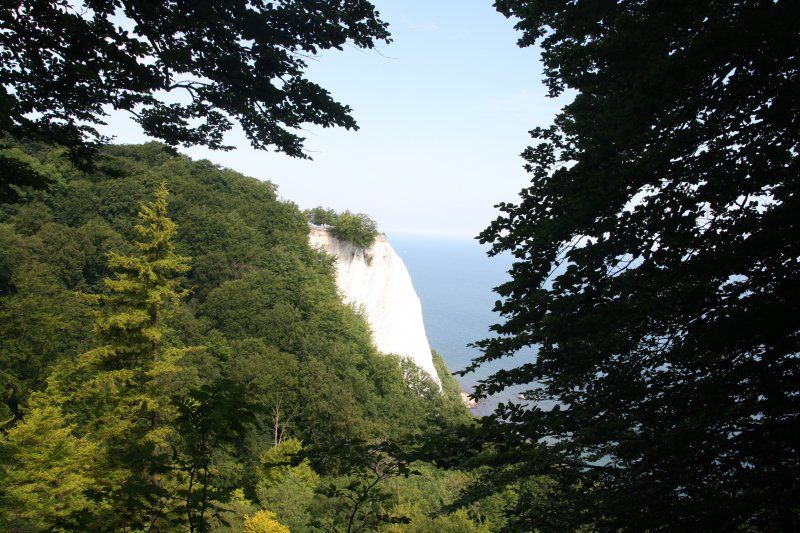
Königsstuhl, Sassnitz, Deutschland
Königsstuhl, 18546 Sassnitz, Deutschland
54° 34' 23" N 13° 39' 45" E
54.5730600 13.6625000
• Head southwest on Stubbenkammer. Go for 2.2 km.
• Turn left onto L303. Go for 3.4 km.
• Continue on Stubbenkammerstraße (L303). Go for 2.0 km.
• Turn left onto Hauptstraße. Go for 328 m.
• Continue on Bergstraße. Go for 186 m.
• Turn right onto Marktstraße. Go for 97 m.
• Continue on Böttcherstraße. Go for 75 m.
• Arrive at Böttcherstraße.
☍
8,2 km
( 11 min.)
Strandpromenade 6, 18546 Sassnitz, Deutschland
54° 31' 3.3" N 13° 39' 33.7" E
54.5175900 13.6593500
• Head toward Karlstraße on Böttcherstraße. Go for 17 m.
• Turn slightly left onto Böttcherstraße. Go for 58 m.
• Continue on Marktstraße. Go for 97 m.
• Turn left onto Bergstraße. Go for 186 m.
• Continue on Hauptstraße. Go for 1.1 km.
• Take the 2nd exit from roundabout onto Stralsunder Straße (L303). Go for 910 m.
• Turn left onto Straße der Jugend. Go for 295 m.
• Turn left onto Straße der Jugend. Go for 568 m.
• Arrive at Straße der Jugend. Your destination is on the left.
☍
3,2 km
( 8 min.)
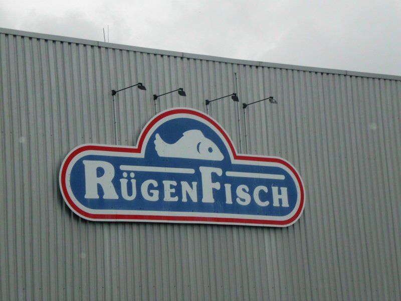
Rügen Fisch AG, Straße der Jugend, Sassnitz, Deutschland
Str. der Jugend 10, 18546 Sassnitz, Deutschland
54° 30' 30.8" N 13° 37' 56.4" E
54.5085586 13.6323258
• Head southwest on Straße der Jugend. Go for 568 m.
• Turn right onto Straße der Jugend. Go for 295 m.
• Turn left onto Stralsunder Straße (B96). Go for 1.5 km.
• Continue on B96. Go for 4.3 km.
• Turn sharp right onto L30. Go for 1.1 km.
• Turn right onto Schulstraße. Go for 428 m.
• Turn right onto Töpferberg. Go for 105 m.
• Turn slightly left onto Töpferberg. Go for 17 m.
• Turn left onto Töpferberg. Go for 48 m.
• Turn right. Go for 13 m.
• Arrive at your destination on the left.
☍
8,3 km
( 11 min.)
Sagard, Deutschland
54° 31' 40" N 13° 33' 12.5" E
54.5277768 13.5534800
• Head toward Töpferberg. Go for 13 m.
• Turn left onto Töpferberg. Go for 48 m.
• Turn left onto Töpferberg. Go for 14 m.
• Turn right onto Töpferberg. Go for 40 m.
• Turn slightly left onto Töpferberg. Go for 196 m.
• Turn slightly right onto Capellerstraße. Go for 299 m.
• Turn left onto Glower Straße (L30). Go for 747 m.
• Turn right onto B96. Go for 1.3 km.
• Turn left onto B96B. Go for 3.5 km.
• Turn right onto L29 toward Binz/Neu Mukran. Go for 6.1 km.
• Turn left toward Proraer Allee. Go for 87 m.
• Turn right onto Proraer Allee. Go for 389 m.
• Arrive at Proraer Allee. Your destination is on the right.
☍
12,7 km
( 14 min.)
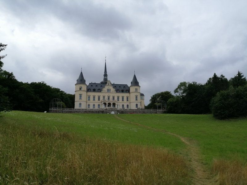
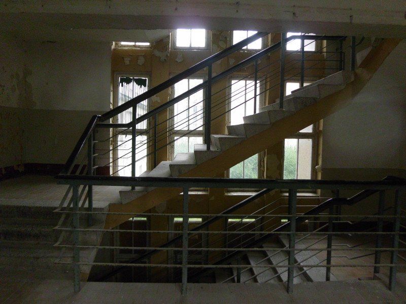
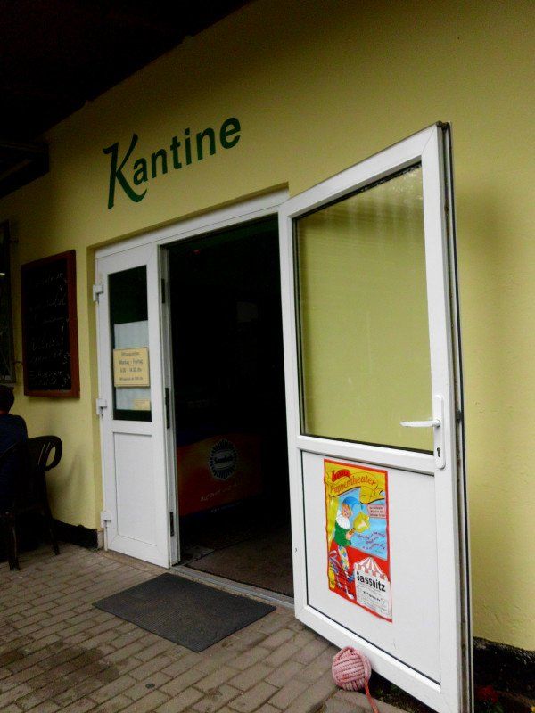
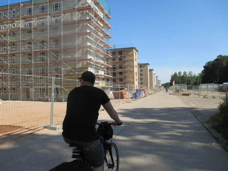
Kantine Prora, Proraer Allee, Binz, Deutschland
Prora what do you have to offer? SOME!
First and foremost, of course, a very imposing building, the treetop path, a lot of beach, railway museum, documentation center and a real CANTINE, where the food tastes as it does at home.
Proraer Allee 106, 18609 Binz, Deutschland
54° 26' 21.6" N 13° 34' 4.6" E
54.4393426 13.5679387
• Head north on Proraer Allee. Go for 389 m.
• Turn left toward L29. Go for 87 m.
• Turn left onto L29. Go for 307 m.
• Turn left onto L29. Go for 3.7 km.
• Continue on Proraer Chaussee (L29). Go for 1.2 km.
• Take the 2nd exit from roundabout onto Jasmunder Straße (L29). Go for 496 m.
• Continue on Bahnhofstraße (L29). Go for 836 m.
• Arrive at Bahnhofstraße (L29). Your destination is on the right.
☍
7,1 km
( 8 min.)
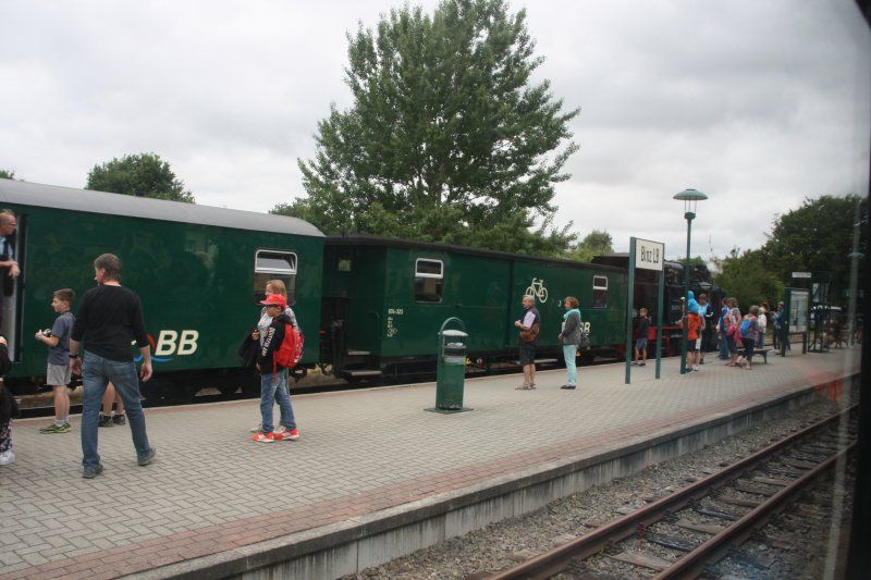
Restaurant Rasender Roland, Bahnhofstraße, Binz, Deutschland
The Rasende Roland moves puffing and tinkling over the south-east of Rügen and stops at all important places - Binz, Putbus, Sellin, Baabe, Göhren.
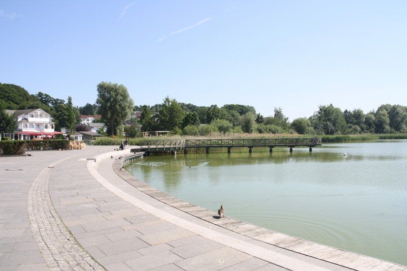
Schmachter See on the other side of Binz.
Bahnhofstraße 54, 18609 Binz, Deutschland
54° 23' 34.5" N 13° 36' 36.1" E
54.3929100 13.6100200
• Head toward Am Kleinbahnhof on Bahnhofstraße (L29). Go for 512 m.
• Continue on L29. Go for 264 m.
• Continue on Kleingartenanlage Granitz (L29). Go for 150 m.
• Continue on L29. Go for 2.4 km.
• Take the 2nd exit from roundabout onto B196 toward Thiessow/Göhren. Go for 7.2 km.
• Turn left onto Hauptstraße toward Seebrücke/Wilhelmstraße. Go for 502 m.
• Turn right onto Granitzer Straße. Go for 484 m.
• Turn left onto Ostbahnstraße. Go for 102 m.
• Turn slightly right onto Waldweg. Go for 468 m.
• Turn left onto Bergstraße. Go for 217 m.
• Turn right onto Wilhelmstraße. Go for 217 m.
• Arrive at Wilhelmstraße.
☍
12,6 km
( 17 min.)
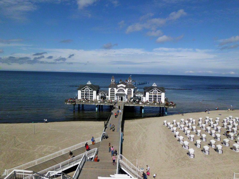
Sellin Pier, Seebrücke, Sellin, Deutschland
Seebrücke, 18586 Sellin, Deutschland
54° 23' 3.2" N 13° 42' 0.2" E
54.3842085 13.7000587
• Head south on Wilhelmstraße. Go for 89 m.
• Turn right onto Warmbadstraße. Go for 188 m.
• Turn left onto August-Bebel-Straße. Go for 663 m.
• Continue on Hauptstraße. Go for 502 m.
• Turn left onto Seestraße (B196). Go for 859 m.
• Take the 1st exit from roundabout onto B196 toward Thiessow/Göhren. Go for 3.2 km.
• Take the 2nd exit from roundabout onto B196. Go for 1.9 km.
• Take the 3rd exit from roundabout onto Poststraße toward Zentrum. Go for 267 m.
• Arrive at Poststraße. Your destination is on the right.
☍
7,7 km
( 15 min.)
Göhren, Deutschland
18586 Göhren, Deutschland
54° 20' 29.7" N 13° 44' 27.3" E
54.3415908 13.7409077
• Head toward Waldstraße on Poststraße. Go for 243 m.
• Take the 2nd exit from roundabout onto Berliner Straße toward Bergen/Sellin. Go for 1.9 km.
• Take the 2nd exit from roundabout onto L292. Go for 1.4 km.
• Continue on Dorfstraße (L292). Go for 257 m.
• Arrive at Dorfstraße (L292). Your destination is on the right.
☍
3,8 km
( 5 min.)
Middelhagen, Deutschland
Lots of nature, an interesting school museum in Mittelhagen and one of the oldest brewery inns - this is where the beer tastes good.
18586 Middelhagen, Deutschland
54° 19' 49.7" N 13° 42' 15.8" E
54.3304709 13.7043822
• Head south on Dorfstraße (L292). Go for 49 m.
• Turn right onto Dorfstraße. Go for 628 m.
• Turn right onto Dorfstraße. Go for 301 m.
• Turn slightly left onto Mariendorf. Go for 336 m.
• Turn right. Go for 715 m.
• Turn left toward Zeltplatz. Go for 282 m.
• Continue on Zeltplatz. Go for 59 m.
• Continue on Alt Reddevitz. Go for 782 m.
• Take the 1st exit from roundabout onto Alt Reddevitz. Go for 2.3 km.
• Arrive at Alt Reddevitz. Your destination is on the right.
☍
5,4 km
( 12 min.)
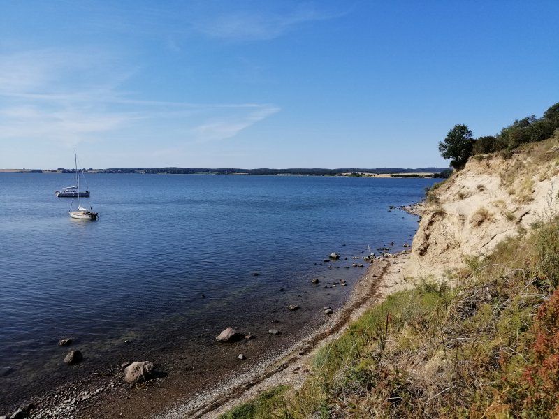
Halbinsel Reddevitz, Middelhagen, Deutschland
It's getting quieter on Mönchgut ...
Halbinsel Reddevitz, 18586 Middelhagen, Deutschland
54° 19' 23.9" N 13° 38' 35.6" E
54.3233076 13.6432138
• Head east on Alt Reddevitz. Go for 2.2 km.
• Take the 2nd exit from roundabout onto Alt Reddevitz. Go for 116 m.
• Turn right onto Alt Reddevitz. Go for 498 m.
• Turn slightly left onto Mariendorf. Go for 1.3 km.
• Continue on Dorfstraße. Go for 321 m.
• Turn right onto Dorfstraße (L292). Go for 295 m.
• Continue on L292. Go for 1.3 km.
• Continue on Lobbe (L292). Go for 702 m.
• Continue on L292. Go for 1.5 km.
• Turn right onto Boddenstraße (K8). Go for 658 m.
• Continue on K8. Go for 139 m.
• Turn right onto K8. Go for 328 m.
• Turn left onto Zum Höft. Go for 894 m.
• Continue on Zum Höft. Go for 354 m.
• Arrive at Zum Höft. Your destination is on the right.
☍
10,7 km
( 20 min.)
Gager, Deutschland
54° 18' 26.2" N 13° 40' 52.4" E
54.3072877 13.6812160
• Head west on Zum Höft. Go for 86 m.
• Turn right onto Zum Höft. Go for 97 m.
• Turn right onto Zum Höft (K8). Go for 233 m.
• Take the 2nd exit from roundabout onto Zum Höft (K8). Go for 1.2 km.
• Continue on K8. Go for 362 m.
• Turn right toward Boddenstraße. Go for 222 m.
• Continue on Boddenstraße. Go for 1.3 km.
• Arrive at Boddenstraße. Your destination is on the right.
☍
3,5 km
( 6 min.)
Pfarrwitwenhaus, Boddenstraße, Gager, Deutschland
Boddenstraße 37, 18586 Gager, Deutschland
54° 17' 48.4" N 13° 41' 3.8" E
54.2967727 13.6843984
• Head east on Boddenstraße. Go for 1.5 km.
• Turn slightly right onto K8. Go for 139 m.
• Continue on Boddenstraße (K8). Go for 658 m.
• Turn right onto L292. Go for 1.6 km.
• Continue on Hauptstraße (L292). Go for 1.1 km.
• Turn left onto Waldweg. Go for 17 m.
• Arrive at Waldweg. Your destination is on the left.
☍
5,0 km
( 8 min.)
Thiessow, Deutschland
54° 16' 43.2" N 13° 42' 52.8" E
54.2786657 13.7146700
• Head east on Waldweg. Go for 115 m.
• Turn right onto Rotdornweg. Go for 141 m.
• Turn right onto Strandstraße. Go for 128 m.
• Turn left onto Hauptstraße (L292). Go for 1.2 km.
• Continue on Dörpstrat. Go for 1.1 km.
• Arrive at Dörpstrat. Your destination is on the right.
☍
2,7 km
( 5 min.)
Klein Zicker, Thiessow, Deutschland
Klein Zicker, 18586 Thiessow, Deutschland
54° 16' 53" N 13° 41' 37" E
54.2813792 13.6935998
• Head west on Dörpstrat.
• Turn left onto Dörpstrat. Go for 1.1 km.
• Continue on Hauptstraße. Go for 2.5 km.
• Continue on L292. Go for 3.1 km.
• Continue on Lobbe (L292). Go for 132 m.
• Turn right onto Göhrener Weg. Go for 1.0 km.
• Continue on Südstrand. Go for 1.3 km.
• Turn right onto Thiessower Straße. Go for 40 m.
• Turn right onto Südstrand. Go for 95 m.
• Arrive at Südstrand. Your destination is on the right.
☍
9,3 km
( 15 min.)
Südstrand 4, 18586 Göhren, Deutschland
54° 20' 2" N 13° 44' 7.2" E
54.3338900 13.7353400
• Head northwest on Südstrand. Go for 95 m.
• Turn left onto Thiessower Straße. Go for 40 m.
• Turn right onto Wasserwerk Försterei. Go for 58 m.
• Continue on Am Törf. Go for 726 m.
• Turn left onto Wasserwerk Försterei. Go for 158 m.
• Turn slightly right onto Wasserwerk Försterei. Go for 355 m.
• Turn left onto B196. Go for 942 m.
• Take the 1st exit from roundabout. Go for 47 m.
• Continue on B196. Go for 3.2 km.
• Take the 2nd exit from roundabout onto An der B196 (B196) toward Bergen auf Rügen/Binz. Go for 7.1 km.
• Turn left onto L29 toward Garz/Rügen/Putbus/Fähre Glewitz. Go for 5.5 km.
• Turn left onto Vilmnitzer Dorfstraße. Go for 60 m.
• Turn right onto Vilmnitzer Dorfstraße. Go for 230 m.
• Continue on Vilmnitzer Dorfstraße. Go for 83 m.
• Turn left onto Vilmnitzer Dorfstraße. Go for 1.2 km.
• Continue on Vilmnitzer Weg. Go for 166 m.
• Turn left onto Fürst-Malte-Allee. Go for 202 m.
• Turn right onto Am Yachthafen. Go for 236 m.
• Continue toward Vilmnitzer Weg. Go for 75 m.
• Turn right onto Vilmnitzer Weg. Go for 11 m.
• Arrive at Vilmnitzer Weg. Your destination is on the left.
☍
20,4 km
( 31 min.)
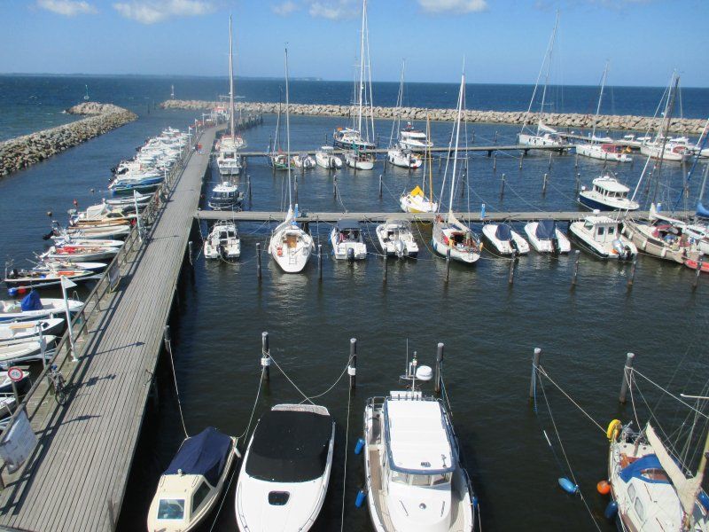
Hafen-Lauterbach-Apartment GmbH, Vilmnitzer Weg, Putbus, Deutschland
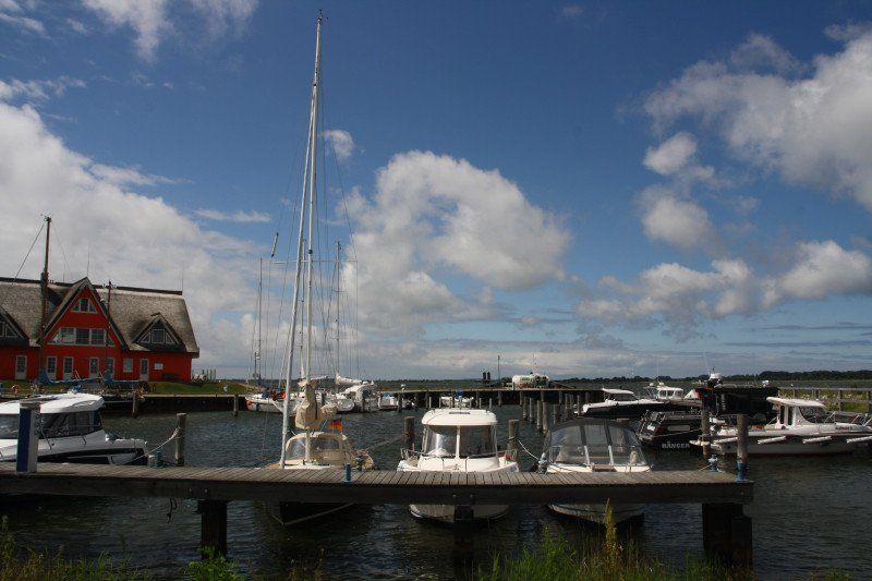
The route from the Rasender Roland ends on the pier in Lauterbach am Hafen - that means "Please get off everything" or change to a boat on the island of Vilm (listen to GDR stories).
Lauterbach also offers the Goor bathhouse to all luxury holidaymakers.
Vilmnitzer Weg 19, 18581 Putbus, Deutschland
54° 20' 37.7" N 13° 30' 8.8" E
54.3438139 13.5024387
• Head southeast on Vilmnitzer Weg. Go for 11 m.
• Turn left toward Am Yachthafen. Go for 75 m.
• Continue on Am Yachthafen. Go for 236 m.
• Turn left onto Fürst-Malte-Allee. Go for 503 m.
• Continue on Chausseestraße (K10). Go for 501 m.
• Continue on Lauterbacher Straße (K10). Go for 1.2 km.
• Turn left onto Bahnhofstraße (L29). Go for 162 m.
• Turn right onto Circus (L301). Go for 74 m.
• Arrive at Circus (L301).
☍
2,8 km
( 9 min.)
Obelisk am Circus, Putbus, Deutschland
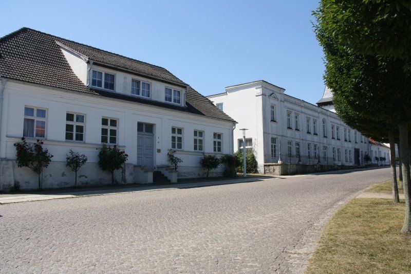
Oh you beautiful Putbus, a snow-white city with a circus and a rose stem blooms in front of every house.
Probably the most graceful town on Rügen with a castle park (game reserve), orangery and castle church.
18581 Putbus, Deutschland
54° 21' 16.2" N 13° 28' 29.9" E
54.3545062 13.4749663
• Head southwest on Circus (L301). Go for 74 m.
• Turn right onto Bahnhofstraße (L29). Go for 9.1 km.
• Turn left onto Lindenstraße (L29). Go for 220 m.
• Arrive at Lindenstraße (L29). Your destination is on the left.
☍
9,4 km
( 9 min.)
Garz Rathaus, Lindenstraße, Garz/Rügen, Deutschland
Lindenstraße 30-31, 18574 Garz/Rügen, Deutschland
54° 19' 3.3" N 13° 21' 7.1" E
54.3175770 13.3519792
• Head south on Lindenstraße (L29). Go for 88 m.
• Turn right onto Lange Straße (L29). Go for 83 m.
• Turn left onto Wendorfer Straße (L30). Go for 539 m.
• Continue on Wendorfer Chaussee (L30). Go for 523 m.
• Continue on Wendorf (L30). Go for 246 m.
• Continue on L30. Go for 1.5 km.
• Continue on Poltenbusch (L30). Go for 1.2 km.
• Continue on L30. Go for 2.2 km.
• Continue on Hauptstraße (L30). Go for 288 m.
• Take the 1st exit from roundabout onto Hauptstraße (L30). Go for 736 m.
• Continue on L30. Go for 19 m.
• Turn left onto Maltzien. Go for 819 m.
• Turn right toward Losentitz. Go for 696 m.
• Continue on Losentitz. Go for 188 m.
• Turn left onto L30. Go for 52 m.
• Continue on Losentitz (L30). Go for 285 m.
• Continue on L30. Go for 747 m.
• Continue on Garz (L30). Go for 585 m.
• Continue on Garz. Go for 193 m.
• Arrive at Garz. Your destination is on the left.
☍
11,0 km
( 16 min.)
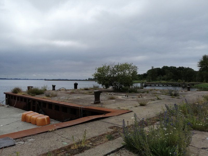
Rügen-Fähre Anleger Glewitz | Weiße Flotte GmbH, L30, Garz/Rügen, Deutschland
L30, 18574 Garz/Rügen, Deutschland
54° 14' 28.7" N 13° 18' 57.3" E
54.2413071 13.3159232
• Head southwest on Garz. Go for 62 m.
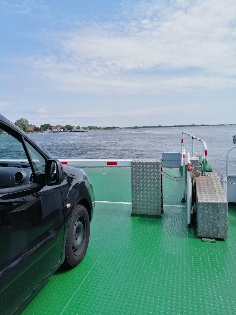
• Take the Fähre Glewitz - Stahlbrode Ferry. Stay on for 1.7 km.
• Head southwest. Go for 201 m.
• Turn right onto Am Sund. Go for 159 m.
• Take the 3rd exit from roundabout onto Zum Hafen. Go for 269 m.
• Turn right onto Küstenweg. Go for 137 m.
• Continue on Ferienhaussiedlung. Go for 12 m.
• Turn right onto Ferienhaussiedlung. Go for 35 m.
• Arrive at Ferienhaussiedlung. Your destination is on the right.
☍
2,6 km
( 34 min.)
Stahlbrode, Sundhagen, Deutschland
Stahlbrode, 18519 Sundhagen, Deutschland
54° 14' 2.3" N 13° 17' 3.1" E
54.2339809 13.2841937