We've planned 6 weeks to explore one of our dream destinations...
Discover new things, revisit familiar ones, and deepen our understanding...🚐
Lübbecke
Kreis Minden-Lübbecke, Nordrhein-Westfalen, Deutschland
52° 18' 9.8" N 8° 37' 5.9" E
52.3027209 8.6183054
• Head toward Geistwall on Am Markt. Go for 130 m.
• Continue on Franz-Welschof-Straße. Go for 60 m.
• Turn right onto Berliner Straße (B239). Go for 3.4 km.
• Continue on Niedringhausener Straße (B239). Go for 11.0 km.
• Turn right onto Löhner Straße (B61) toward Dortmund/A2/Herford/Gewerbegebiet Kirchlengern Süd/Gewerbegebiet Oberbehme. Go for 431 m.
• Pass 2 roundabouts and continue on Herforder Straße (B61). Go for 6.4 km.
• Turn right onto Umgehungsstraße (B61) toward A2/Hannover/Dortmund/Bielefeld/Detmold. Go for 4.4 km.
• Continue on B239. Go for 3.6 km.
• Take ramp onto A2 toward Dortmund. Go for 20.2 km.
• Take exit 25 toward Paderborn onto A33. Go for 46.8 km.
• Take exit 31 toward Kassel onto A44. Go for 72.7 km.
• Take exit 70 toward Frankfurt/Würzburg/Erfurt onto A7. Go for 59.0 km.
• Keep right onto A7 (Hattenbacher Dreieck) toward München/Stuttgart/Würzburg/Fulda/Basel/Frankfurt/Wiesbaden/Gießen. Go for 111 km.
• Take exit 99 toward Bamberg/Schweinfurt/Werneck/Erfurt onto A70. Go for 12.6 km.
• Take exit 7 toward Gerolzhofen onto B286. Go for 8.8 km.
• Take ramp onto St2271 toward Volkach/Kolitzheim/Unterspiesheim. Go for 11.2 km.
• Take the 2nd exit from roundabout onto Umgehungsstraße (St2260). Go for 1.3 km.
• Take the 1st exit from roundabout onto St2271. Go for 274 m.
• Turn right onto KT29. Go for 2.8 km.
• Continue on Volkacher Straße (KT29). Go for 433 m.
• Continue on Raiffeisenstraße (KT29). Go for 740 m.
• Turn right onto Sommeracher Straße (KT30). Go for 216 m.
• Continue on Zehnthofstraße (KT30). Go for 106 m.
• Continue on KT30. Go for 124 m.
• Arrive at KT30. Your destination is on the right.
☍
377,9 km
(3 hrs. 35 min.)
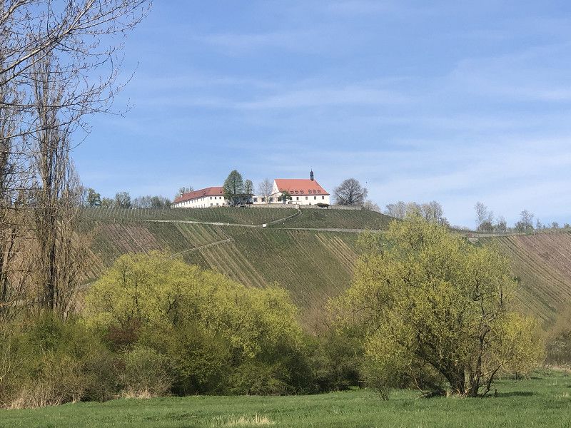
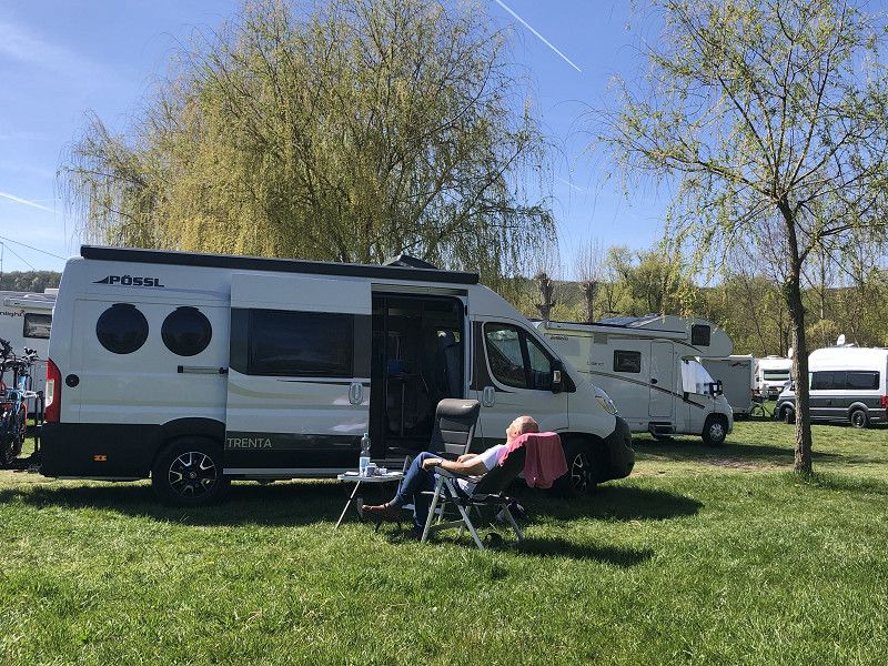
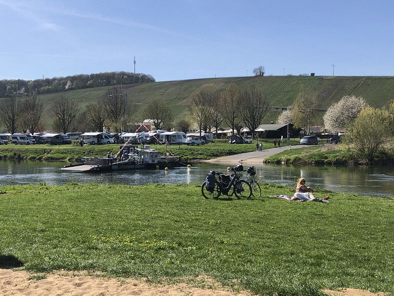
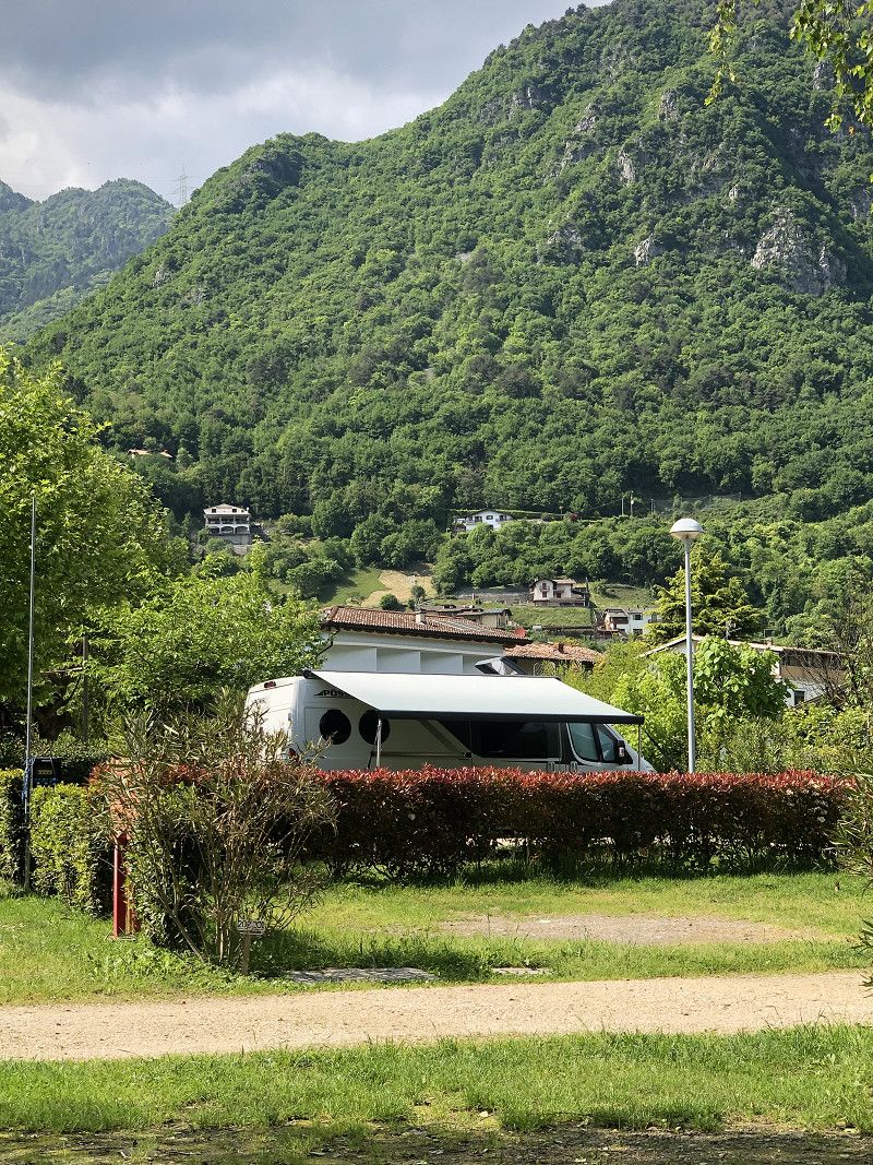
Mainfähre Nordheim
As always, a great stopover on our journey south. With a bit of luck, we managed to find a nice spot around midday—unfortunately, without electricity.
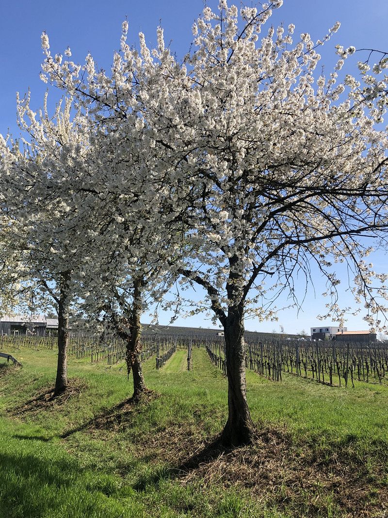
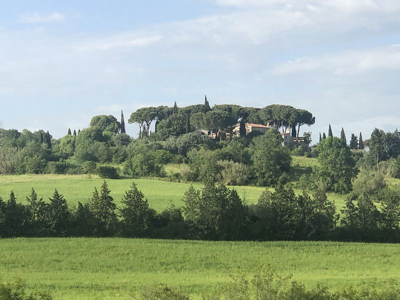
Nordheim is also ideal for a longer stay. Its wonderful location amidst vineyards invites you to enjoy long bike rides. A stop at one of the cozy wine taverns or a rustic inn rounds off any day.
Pitch costs € 12.00/night plus electricity.
Escherndorfer Weg, Nordheim a.Main, Landkreis Kitzingen, Bayern, Deutschland
49° 51' 34.6" N 10° 10' 42.9" E
49.8596047 10.1785779
• Head east on KT30. Go for 124 m.
• Continue on Zehnthofstraße (KT30). Go for 106 m.
• Continue on Sommeracher Straße (KT30). Go for 216 m.
• Turn left onto Raiffeisenstraße (KT29). Go for 740 m.
• Continue on Volkacher Straße (KT29). Go for 433 m.
• Continue on KT29. Go for 2.8 km.
• Turn right onto St2271 toward Kitzingen/A3/Schwarzach/Sommerach. Go for 6.4 km.
• Continue on B22. Go for 2.1 km.
• Continue on St2271. Go for 15.6 km.
• Take the 1st exit from roundabout onto St2271. Go for 2.3 km.
• Take ramp onto A7. Go for 278 km.
• Continue on Grenztunnel Füssen (B179). Go for 28.9 km.
• Take ramp toward Garmisch/Ehrwald/Lermoos/Biberwier. Go for 517 m.
• Turn right onto Ehrwalder Bundesstraße (B187) toward Garmisch/Ehrwald/Lermoos. Go for 1.7 km.
• Turn right onto Innsbrucker Straße (L71). Go for 2.3 km.
• Turn right onto Fernpass Straße (L391). Go for 555 m.
• Turn left onto Mösle. Go for 21 m.
• Arrive at Mösle. Your destination is on the left.
☍
342,6 km
(3 hrs. 12 min.)
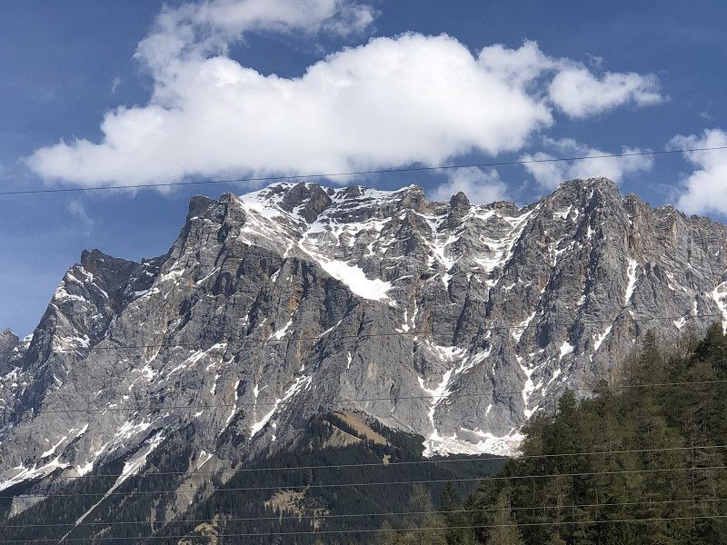
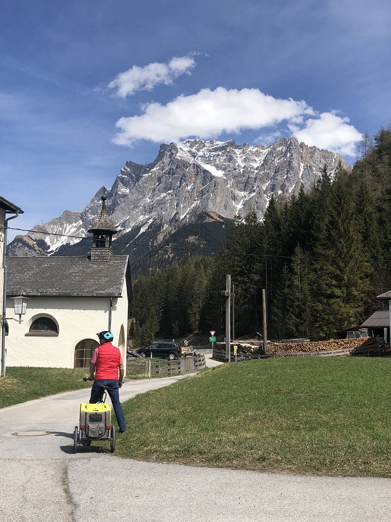
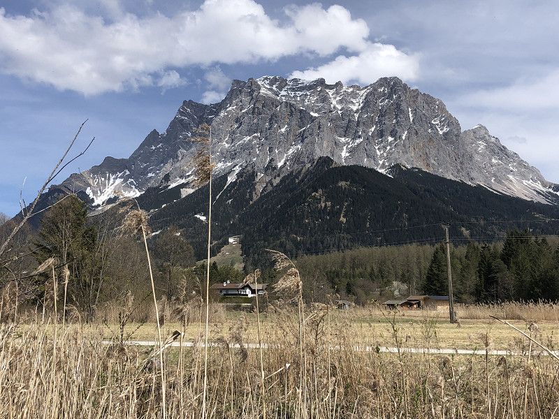
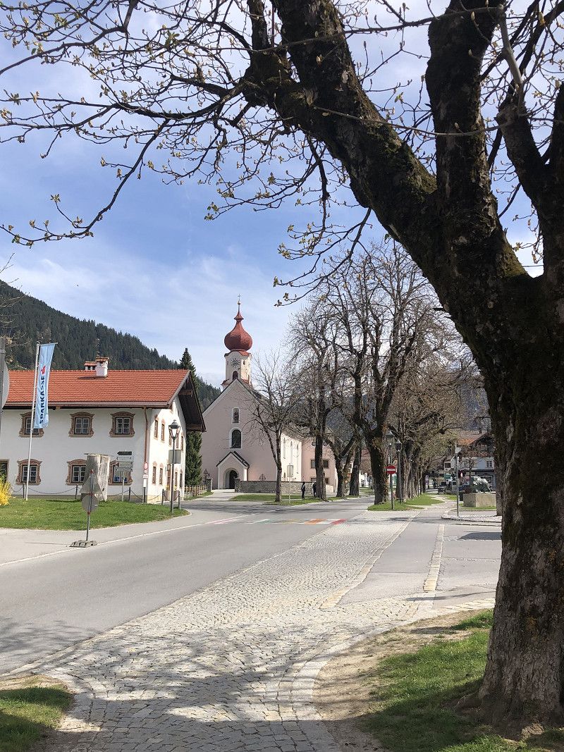
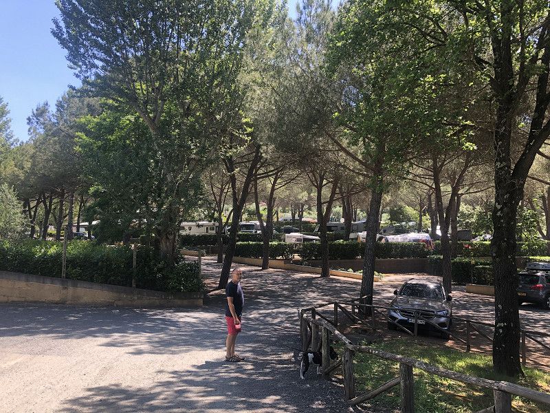
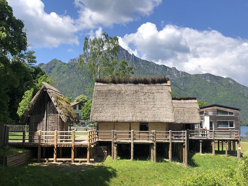
Biberwier
Biberhof campsite
Schmitte 8, 6633 Biberwier
The place is quietly located and is ideal for a stopover on the way south.
The entire complex was somewhat neglected,
However, we had a very pleasant pitch. The sanitary building was very clean and well heated.
Costs with ACSI card € 90.00 for 3 days including tourist tax and environmental contribution.
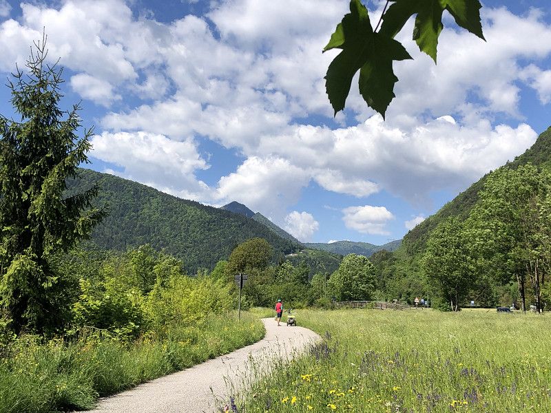
There are many opportunities to explore the region by bike. Ehrwald, Lermoos, and various lakes are all worth a visit. The Tyrolean Zugspitz Arena offers hikes of varying difficulty levels.
With the guest card you can use the local buses for free.
The surrounding mountains are impressive and the cycle paths in the valley are easy to ride.
An apple strudel with cream at THEOS in Ehrwald was delicious!
Bezirk Reutte, Tirol, Österreich
47° 22' 56.5" N 10° 53' 29.4" E
47.3823667 10.8915055
• Head toward Fernpass Straße on Mösle. Go for 21 m.
• Turn right onto Fernpass Straße (L391). Go for 547 m.
• Turn left onto Römerstraße (L71). Go for 2.4 km.
• Turn left onto Unterdorf (B187). Go for 1.7 km.
• Take ramp onto Fernpass Bundesstraße (B179). Go for 29.2 km.
• Continue on Grenztunnel Füssen (A7). Go for 18.0 km.
• Take exit 138 toward Nesselwang/Marktoberdorf/Seeg/Rückholz. Go for 286 m.
• Turn right onto OAL23 toward Seeg/Nesselwang. Go for 2.1 km.
• Take the 2nd exit from roundabout onto OAL23. Go for 1.3 km.
• Turn right onto Hauptstraße (St2520). Go for 60 m.
• Turn left onto An der Riese. Go for 56 m.
• Turn left onto Maria-Trost-Allee. Go for 48 m.
• Turn right onto Maria-Trost-Allee. Go for 135 m.
• Turn left onto An der Riese. Go for 72 m.
• Turn left onto An der Riese. Go for 26 m.
• Arrive at An der Riese. Your destination is on the left.
☍
56,0 km
( 43 min.)
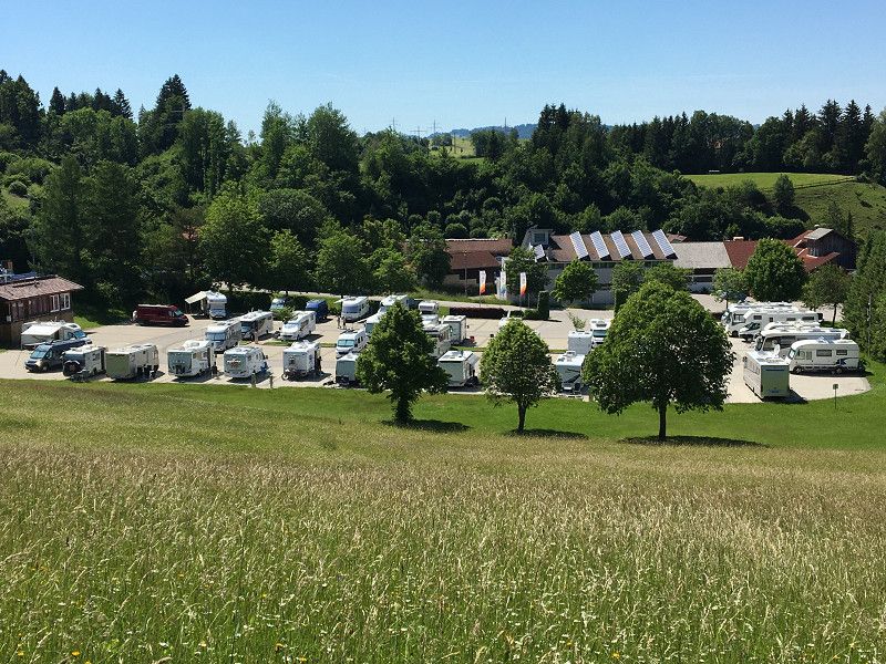
Wohnmobilstellplatz Nesselwang
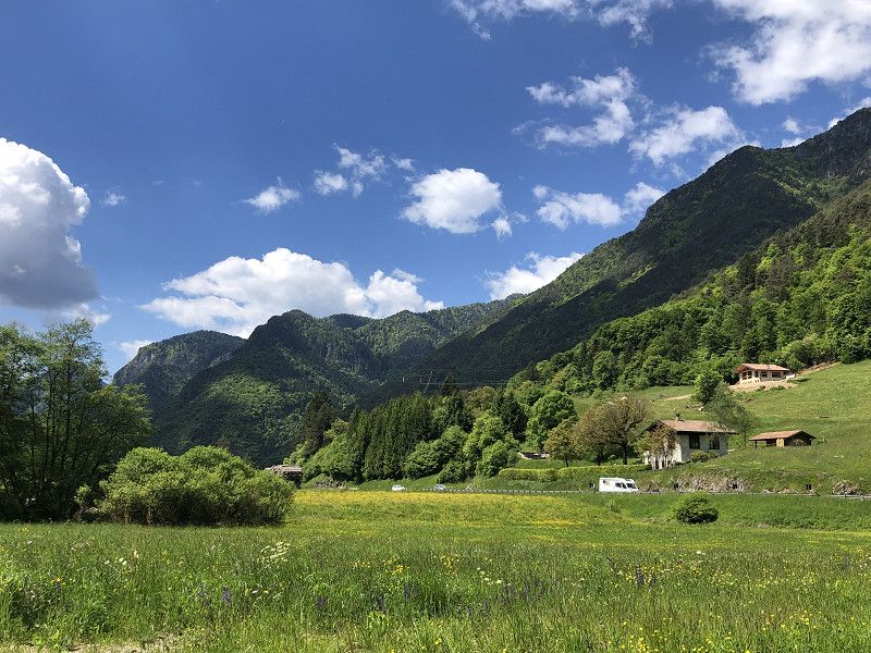
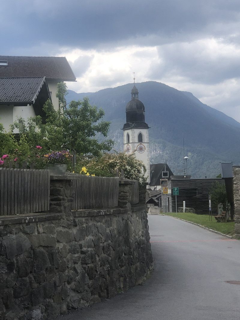
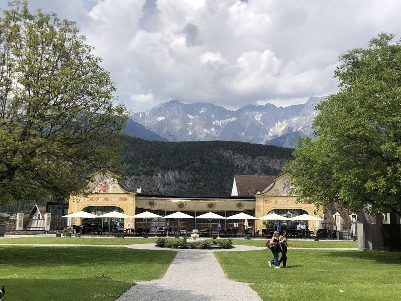
Nesselwang welcomes us with sunshine. The campsite below the Alpspitzbahn cable car is one of the top spots in Germany.
The tranquil village is within walking distance, and several cafés and restaurants invite you to visit.
Pitch costs €17.00/night plus electricity.
An der Riese, 87484, Nesselwang, Germany
47° 37' 12" N 10° 29' 54.4" E
47.6199940 10.4984428
• Head west on An der Riese. Go for 26 m.
• Turn right onto An der Riese. Go for 145 m.
• Turn right onto An der Riese. Go for 150 m.
• Turn right onto Hauptstraße (St2520). Go for 60 m.
• Turn left onto Von-Lingg-Straße (OAL23) toward Roßhaupten/Seeg/Bahnhof/Marktoberdorf/Rückholz. Go for 1.3 km.
• Take the 2nd exit from roundabout onto Thal (OAL23). Go for 1.9 km.
• Turn left and take ramp onto A7 toward Innsbruck/Reutte/Füssen. Go for 18.2 km.
• Continue on Grenztunnel Füssen (B179). Go for 49.1 km.
• Continue on Mieminger Bundesstraße (B189). Go for 13.4 km.
• Take the 1st exit from roundabout onto Krebsbach (L236) toward Innsbruck/Bregenz/Mötz. Go for 5.0 km.
• Turn right and take ramp onto A12 (Inntal Autobahn) toward Innsbruck. Go for 35.6 km.
• Keep right onto A13 (Knoten Innsbruck-Wilten) toward E45/Bozen/Brenner/Innsbruck-Süd. Go for 33.5 km.
• Continue on A22 (Autostrada del Brennero). Go for 131 km.
• Take the exit toward Trento Nord/Centro. Go for 745 m.
• Take the 1st exit from roundabout onto Strada dell'Interporto (SP235) toward Trento Centro/Arco-Riva D/G/Verona/Padova. Go for 2.8 km.
• Keep left toward Trento Nord/Trento Est/Padova/SS47/Gardolo. Go for 74 m.
• Take ramp onto Strada Statale dell'Abetone e del Brennero (SS12). Go for 14.1 km.
• Take ramp toward Pergine V/S. Cristoforo/Calceranica. Go for 174 m.
• Take the 2nd exit from roundabout toward S. Cristoforo al Lago/Calceranica/Caldonazzo/Levico. Go for 69 m.
• Continue toward Viale Europa/SP1. Go for 428 m.
• Continue on Viale Europa (SP1). Go for 4.6 km.
• Take the 3rd exit from roundabout onto Via al Lago (SP1). Go for 122 m.
• Turn right onto Via delle Scuole. Go for 11 m.
• Arrive at Via delle Scuole. Your destination is on the left.
☍
312,8 km
(3 hrs. 30 min.)
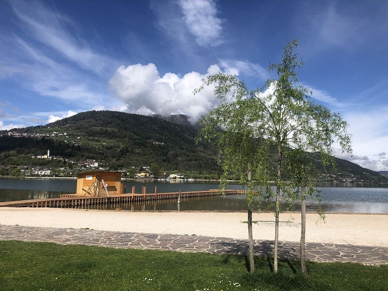
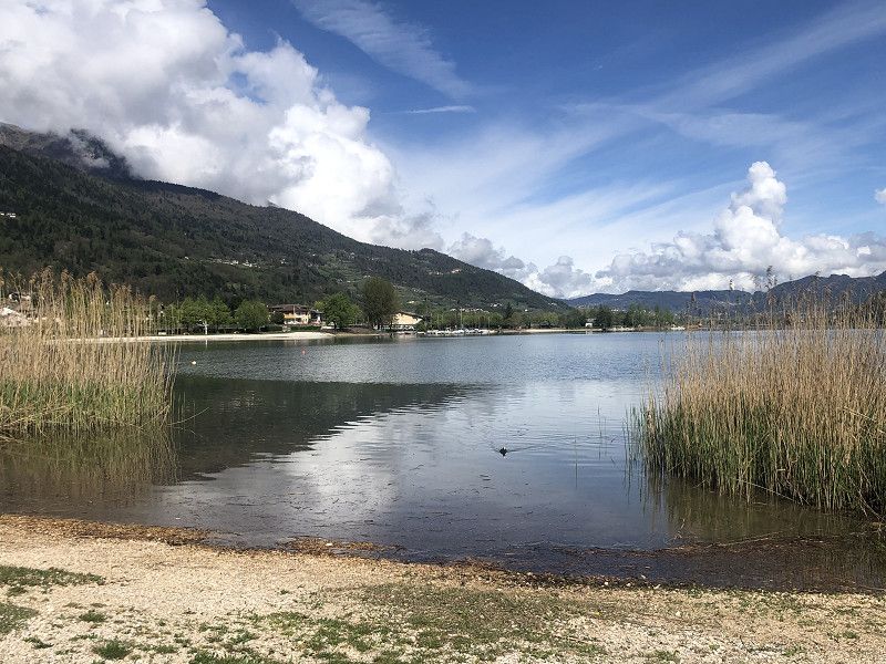
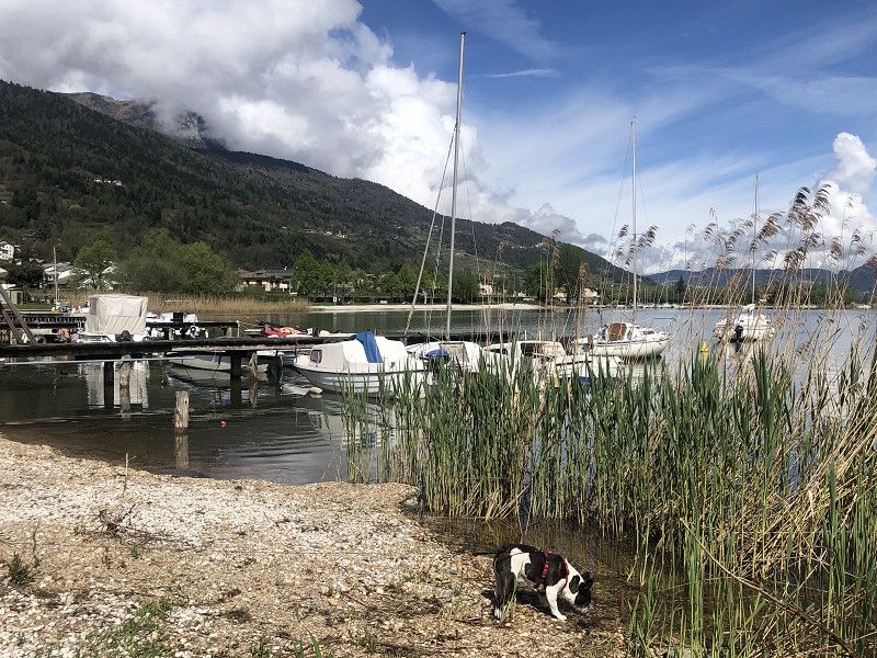
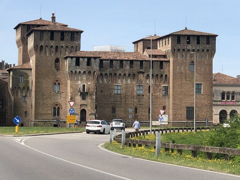
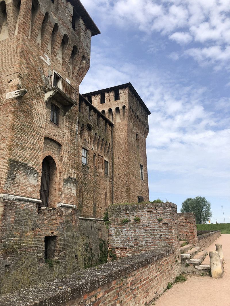
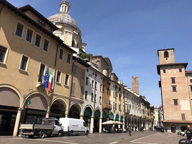
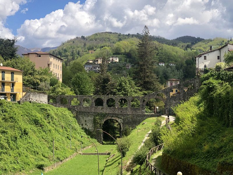
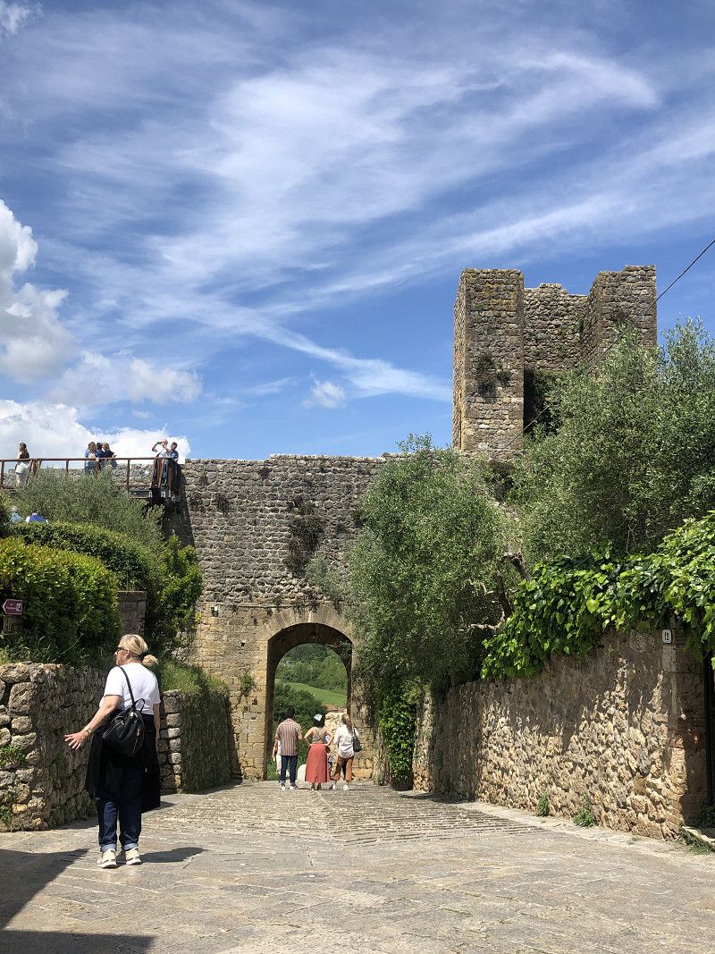
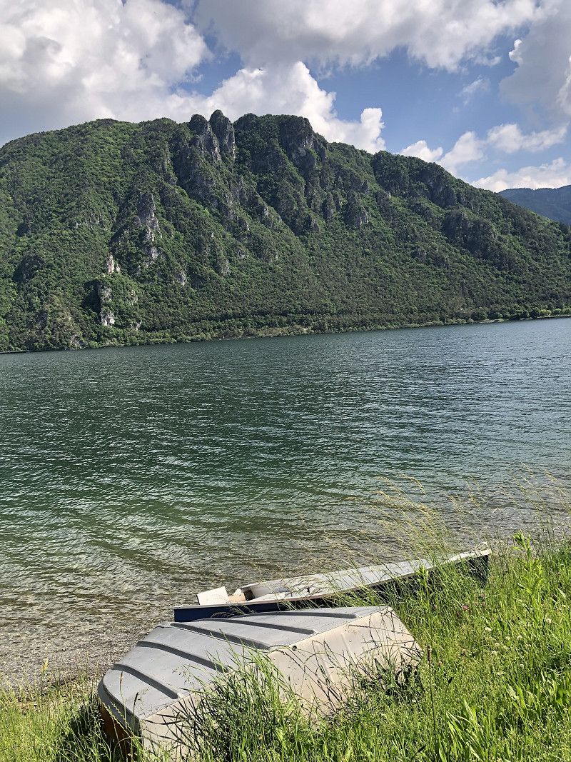
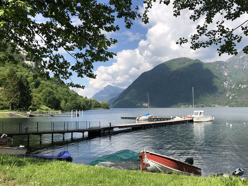
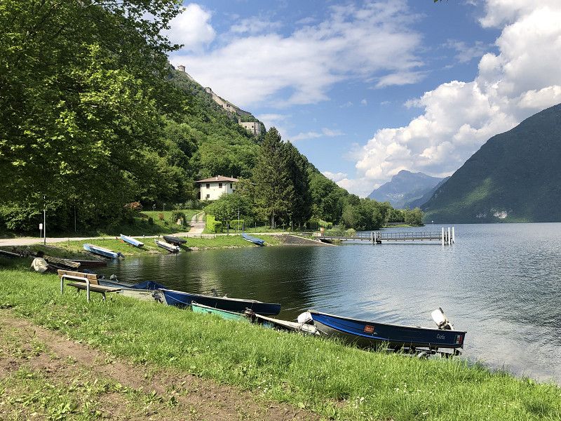
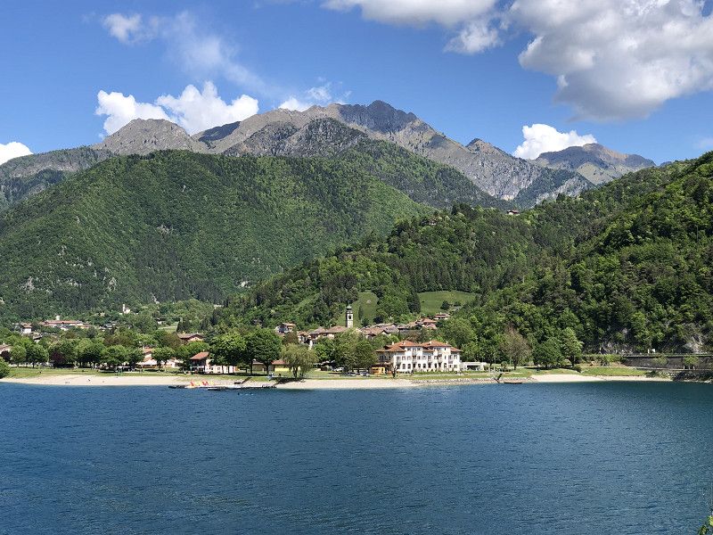
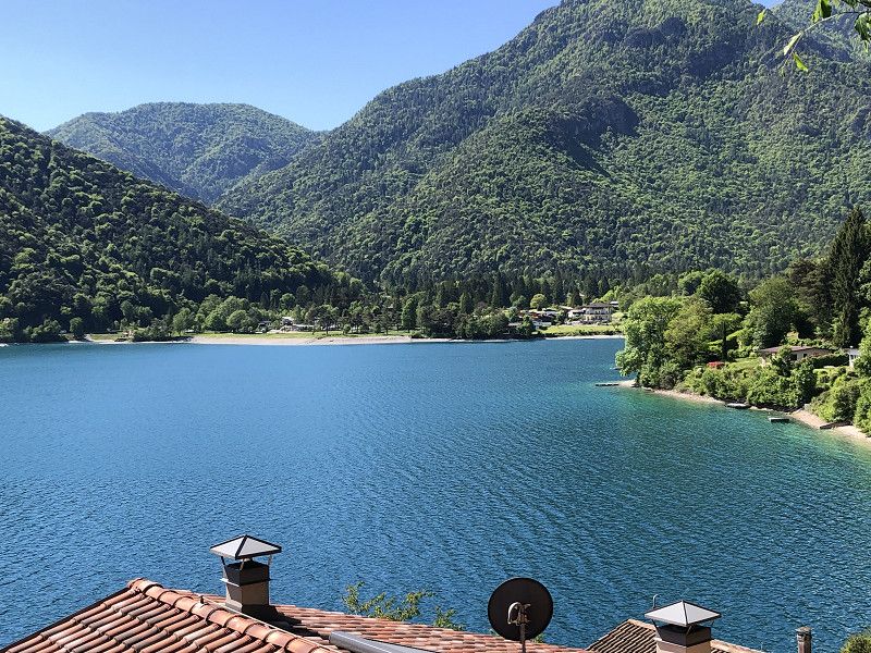
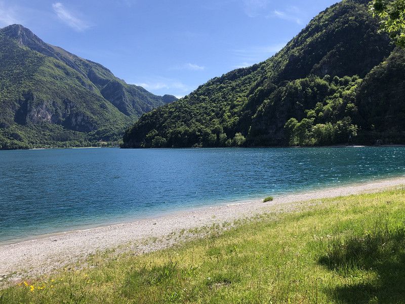
Calceranica al Lago
Camping Riviera, Viale venezia 10
The site is well-maintained, and the restrooms are clean and tidy. We already know the facility from last year.
A visit to the attached restaurant Riviera is recommended,
The ice cream at Gelateria Bellavista is divine!
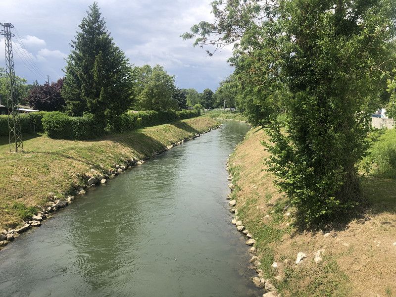
Separated from the lake only by a quiet road, a promenade runs directly along the unspoiled shore, ideal for walks with the dog.
We arrived around midday in pouring rain. The second day was sunny, allowing us to take longer walks.
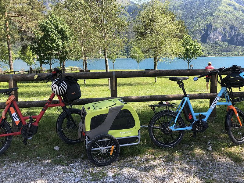
A bike ride through the apple orchards to Levico Terme is always on the agenda. The small Lake Levico attracts many day visitors in warm weather.
A bike ride towards San Cristoforo and Pergine Valsugana is also a good option.
Costs €115.00 with ACSI card plus €15.00 tourist tax
Autonome Provinz Trient, Trentino-Südtirol, Italien
46° 0' 15.3" N 11° 14' 34.4" E
46.0042410 11.2428830
• Head toward Via Antonio Tartarotti on Via delle Scuole. Go for 81 m.
• Turn right onto Via Antonio Tartarotti. Go for 49 m.
• Take the 1st exit from Piazza Graziadei roundabout onto Piazza Graziadei. Go for 76 m.
• Keep left onto Piazza Graziadei. Go for 26 m.
• Take the 4th exit from roundabout onto Via Bosentino (SP1). Go for 4.3 km.
• Take the 1st exit from roundabout onto SS349. Go for 8.0 km.
• Take the 1st exit from roundabout onto Strada della Fricca (SS349). Go for 1.1 km.
• Turn left onto Via Vittorio de Riccabona toward Autostrada/A22. Go for 295 m.
• Turn slightly left onto Via Enrico Conci. Go for 608 m.
• Continue on Via Clorinda Menguzzato Veglia. Go for 274 m.
• Take the 2nd exit from roundabout onto Via Edmund Mach. Go for 575 m.
• Take the 2nd exit from Via di Madonna Bianca roundabout onto Via dei Marinai d'Italia toward Brennero-Modena/A22/Rovereto/Bolzano/Verona. Go for 572 m.
• Take the 2nd exit from roundabout onto Raccordo Casello Sud toward Brennero/A22/Modena/Zona Industriale Ravina. Go for 354 m.
• Take the 3rd exit from roundabout onto A22 (Autostrada del Brennero) toward Modena. Go for 115 km.
• Take the exit toward Mantova Nord. Go for 742 m.
• Take the 2nd exit from roundabout onto SP28 toward Mantova Centro/Nogara/Verona/Padova. Go for 351 m.
• Take the 4th exit from roundabout onto Via Legnaghese (SPEXSS10) toward Mantova/Brescia. Go for 416 m.
• Pass 3 roundabouts and continue on Via Legnago (SPEXSS10). Go for 2.3 km.
• Turn slightly left onto Strada Lunetta. Go for 305 m.
• Turn right onto Strada Cipata. Go for 323 m.
• Turn left. Go for 69 m.
• Arrive at your destination on the left.
☍
135,8 km
(1 hrs. 28 min.)
Area di Sosta Sparafucile
The Sparafucile campsite is located in a park-like area and offers electricity, toilets and showers.
Cost €26.50 - not exactly cheap.
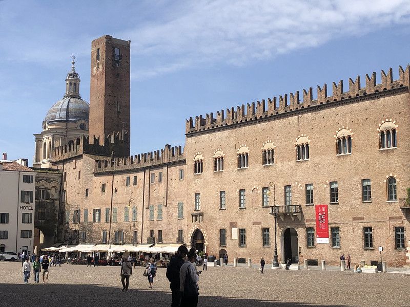
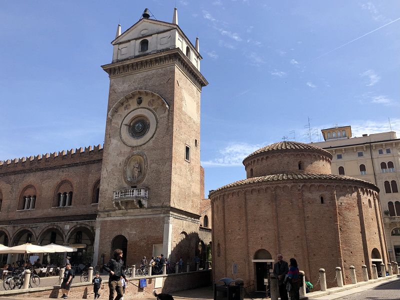
The culturally rich city in Lombardy can be reached on foot or by bike via excellent routes.
We really enjoyed it here. The city is
It's pleasantly laid-back and not too touristy. Beautiful squares with inviting cafés and restaurants are worth a visit.
In addition to the Ducal Palace and the Cathedral, a visit to the Palazzo Ducale and its museum is worthwhile. A boat trip on the Minicio River and the adjacent lakes is also recommended.
Via Legnago, 46100, Mantova, Italy
45° 9' 43" N 10° 48' 42" E
45.1619444 10.8116667
• Head southwest. Go for 310 m.
• Turn right onto Via Legnago (SPEXSS10). Go for 1.3 km.
• Pass 3 roundabouts and continue on Via Legnaghese (SPEXSS10). Go for 1.9 km.
• Take the 1st exit from roundabout onto SP28 toward Modena/A22. Go for 344 m.
• Take the 4th exit from roundabout toward Ospedale/Ostiglia/Ferrara/Bologna/A1/Roma/Milano/A4/Venezia/Brennero/A22/Modena. Go for 681 m.
• Take ramp onto A22 (Autostrada del Brennero) toward Modena/Bologna/A1/Roma. Go for 56.6 km.
• Take the left exit toward Bologna/Roma/Modena onto A1 (Autostrada del Sole). Go for 51.7 km.
• Continue on SS64var. Go for 927 m.
• Continue on Raccordo Autostradale Sasso Marconi SS64 Porretana. Go for 2.4 km.
• Continue on A1 (Autostrada del Sole). Go for 10.6 km.
• Keep right onto A1var (Variante di Valico) toward Direttissima/A1/Firenze/Badia. Go for 34.8 km.
• Continue on A1 (Viadotto Lora). Go for 91 m.
• Continue on A1var (Variante di Valico). Go for 32 m.
• Continue on A1 (Galleria Manganaccia). Go for 434 m.
• Continue on A1var (Galleria Manganaccia). Go for 1.9 km.
• Continue on A1 (Viadotto Sieve). Go for 139 m.
• Continue on A1var (Viadotto Sieve). Go for 216 m.
• Continue on A1 (Autostrada del Sole). Go for 19 m.
• Continue on A1var (Variante di Valico). Go for 116 m.
• Continue on A1 (Autostrada del Sole). Go for 17.8 km.
• Take the exit toward Genova/A12/Firenze Centro/Firenze Aeroporto onto A11 (Autostrada Firenze Mare). Go for 62.5 km.
• Take the exit toward Lucca Est onto Viale Europa. Go for 841 m.
• Keep right onto Viale Europa toward Pescia/SS435/Camaiore/SP1/Castelnuovo Garfagnana/SP2/Abetone. Go for 778 m.
• Keep right onto Viale Giosuè Carducci toward Pescia. Go for 952 m.
• Turn left onto Piazzale Bettino Ricasoli. Go for 78 m.
• Continue on Sortita Baluardo San Colombano. Go for 183 m.
• Turn left onto Rampa Baluardo San Colombano. Go for 91 m.
• Turn sharp right onto Corso Giuseppe Garibaldi. Go for 140 m.
• Turn left onto Piazza della Rosa. Go for 25 m.
• Continue on Via della Rosa. Go for 239 m.
• Continue on Piazza Santa Maria Forisportam. Go for 16 m.
• Turn left onto Via Santa Croce. Go for 202 m.
• Continue on Via Santa Croce. Go for 100 m.
• Continue on Via Roma. Go for 81 m.
• Continue on Piazza San Michele. Go for 13 m.
• Arrive at Piazza San Michele. Your destination is on the right.
☍
248,5 km
(2 hrs. 26 min.)
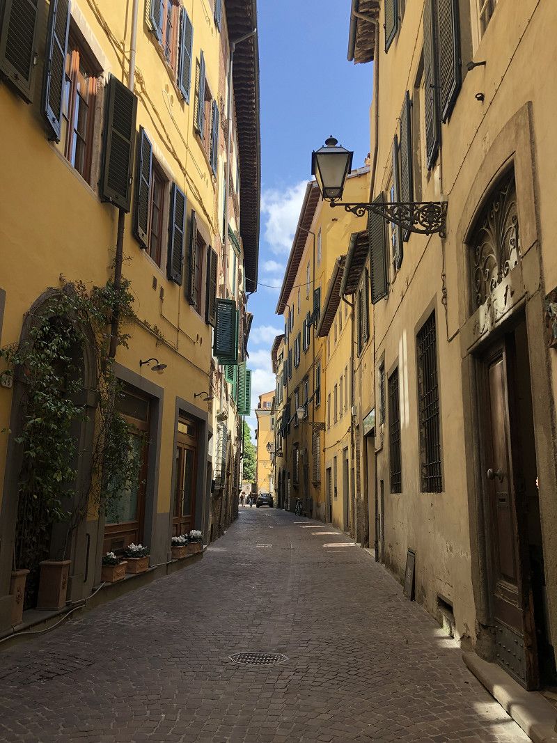
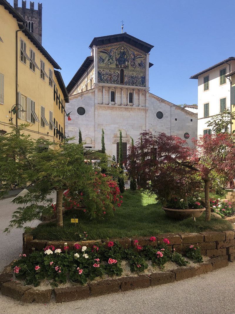
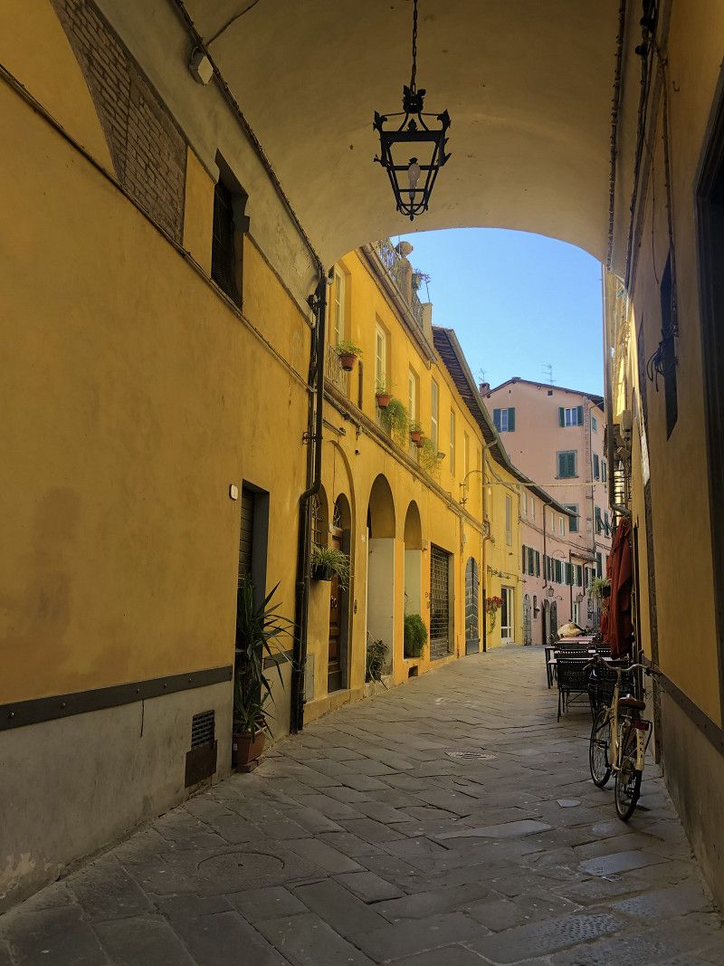
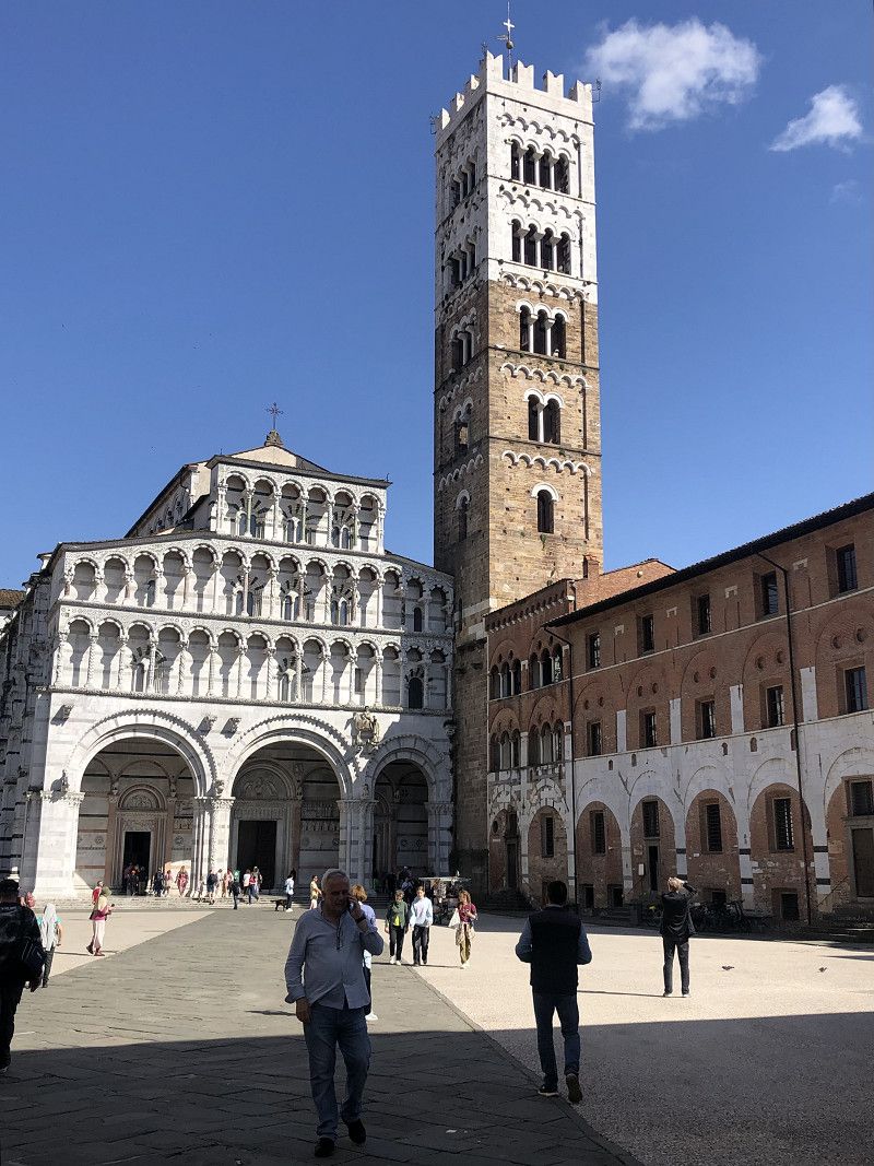
Lucca
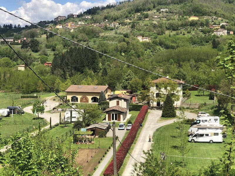
Agriturismo Ai Linchi,
Via del Caporale, Lucca
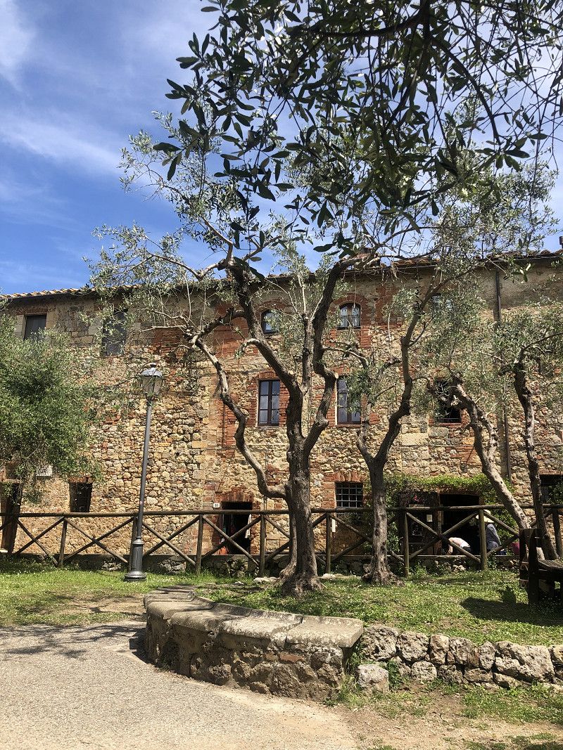
A wonderful little campsite about 5 km outside of Lucca, surrounded by countryside. We were here last year.
The site offers clean toilets and showers and is surrounded by vineyards and beautiful scenery.
We set off for Lucca by bike. On foot, we stroll through the alleys, visiting the Piazza dell'Anfiteatro, the Guinigi Tower, the cathedral, the Church of San Michele, and the magnificent wall that surrounds the entire old town.
Cost for 2 nights € 87.00.
Lucca, Toskana, Italien
43° 50' 34.2" N 10° 30' 10.4" E
43.8428381 10.5028760
• Head west on Piazza San Michele. Go for 56 m.
• Turn left onto Via Vittorio Veneto. Go for 97 m.
• Turn right onto Via Vittorio Emanuele. Go for 406 m.
• Turn right onto Piazzale Giuseppe Verdi. Go for 99 m.
• Make a U-Turn at Via San Paolino onto Piazzale Giuseppe Verdi. Go for 95 m.
• Turn slightly right onto Piazzale Giuseppe Verdi. Go for 51 m.
• Continue on Piazzale Luigi Boccherini. Go for 100 m.
• Take the 1st exit from roundabout onto Piazzale Luigi Boccherini. Go for 69 m.
• Continue on Viale Lazzaro Papi (SS12). Go for 1.1 km.
• Keep right onto Strada Statale dell'Abetone e del Brennero (SS12) toward Ospedale/Abetone/Castelnuovo G./SP2/Pontedera/SR435/Pescia. Go for 385 m.
• Pass 2 roundabouts and continue on Via Matteo Civitali (SS12). Go for 770 m.
• Continue on Strada Statale dell'Abetone e del Brennero (SS12). Go for 1.4 km.
• Take the 2nd exit from roundabout onto Strada Statale dell'Abetone e del Brennero (SS12). Go for 3.9 km.
• Take the 3rd exit from roundabout onto Variante di Ponte a Moriano (SS12). Go for 4.2 km.
• Continue on Strada Statale dell'Abetone e del Brennero (SS12). Go for 837 m.
• Keep right onto Via del Brennero Nord. Go for 343 m.
• Continue on Strada Provinciale Lodovica. Go for 139 m.
• Continue on Strada Provinciale Lodovica (SP2). Go for 1.8 km.
• Pass 3 roundabouts and continue on Via 1 Maggio (SP2). Go for 11.5 km.
• Continue on Strada Provinciale Ludovica (SP20). Go for 4.2 km.
• Turn right toward Ponte Guglielmo Lera/SP37. Go for 54 m.
• Continue on Ponte Guglielmo Lera (SP37). Go for 412 m.
• Turn left onto Via Nazionale (SR445). Go for 1.8 km.
• Turn right onto Via Guido Rossa. Go for 579 m.
• Turn right onto Via Provinciale (SP7). Go for 3.8 km.
• Turn right onto Via di Mezzo. Go for 22 m.
• Turn slightly left onto Via di Mezzo. Go for 255 m.
• Arrive at Via di Mezzo. Your destination is on the left.
☍
38,4 km
( 47 min.)
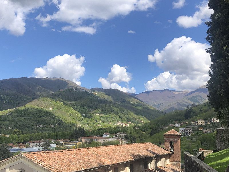
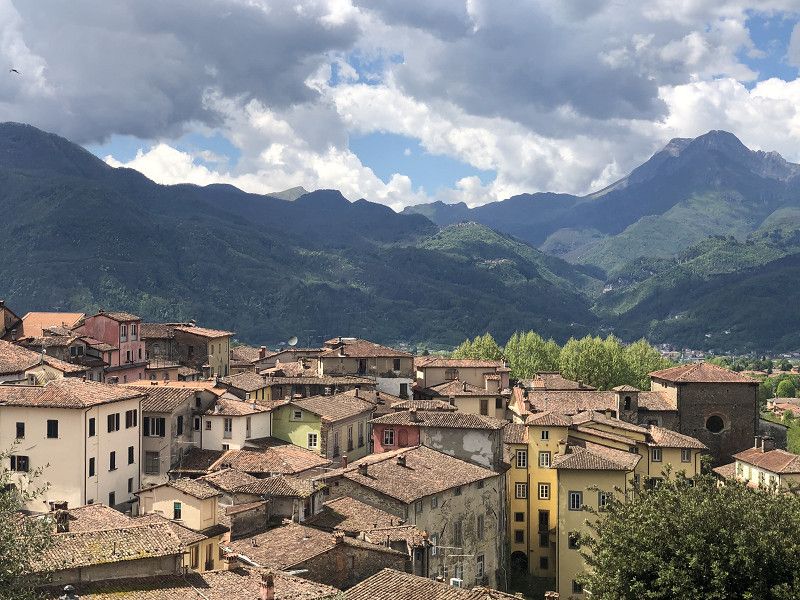
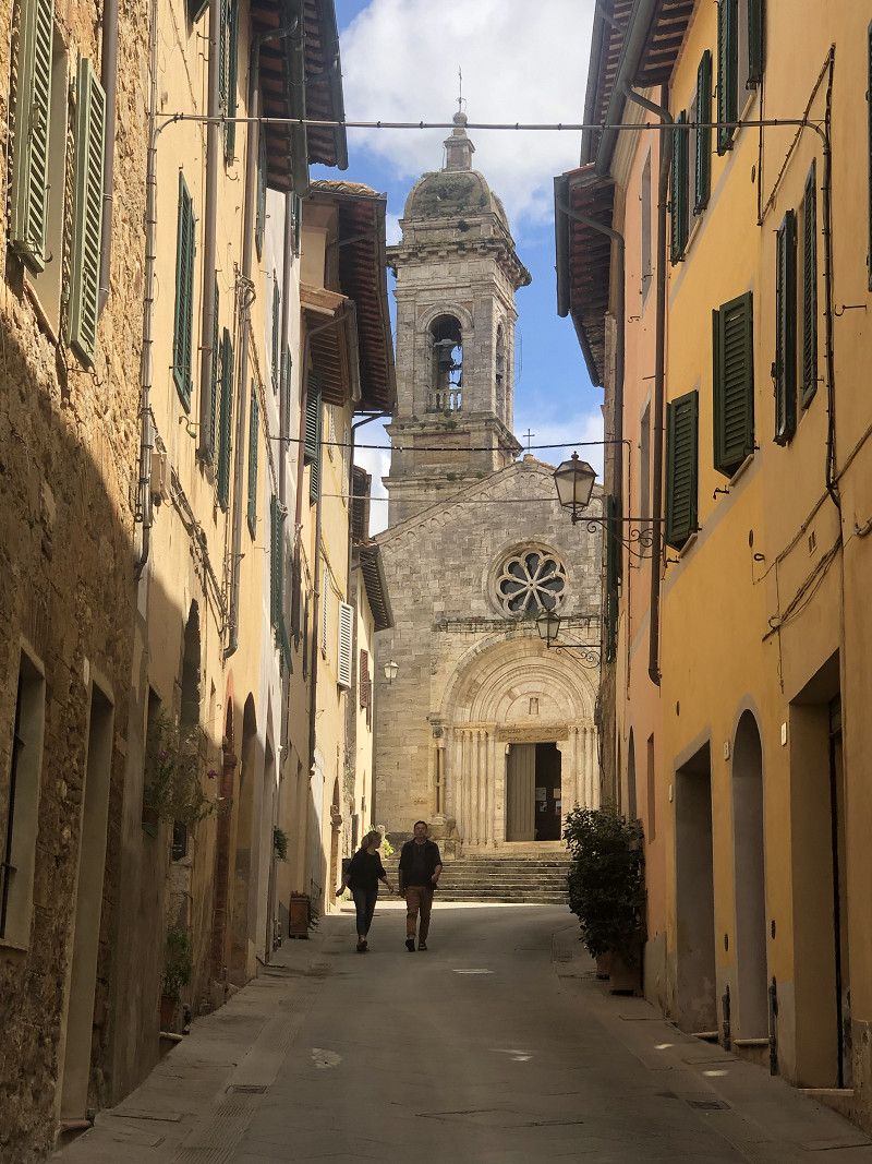
Barga
La Cantina del vino - located on a winery.
We have discovered another little gem!
The campsite is located below the ancient town of Barga and boasts well-maintained pitches, clean restrooms, and showers. Wine tastings are held on certain days. Of course, you can also purchase wine and other delicacies in the small shop.
We reach the hilltop town on foot, which gives us a somewhat sleepy impression. We were expecting a bit more flair, but the view is definitely amazing.
Apparently, today is an Italian holiday, so the shops are closed. However, the small ice cream parlor is open, and the ice cream is delicious.
Pitch costs € 15.00 + electricity € 5.00 + € 3.00 for the dog plus tourist tax € 2.00.
Lucca, Toskana, Italien
44° 4' 26.1" N 10° 29' 3.3" E
44.0739178 10.4842630
• Head toward Via di Solco on Via di Mezzo. Go for 277 m.
• Turn left onto Via Guglielmo Marconi (SP7). Go for 3.8 km.
• Turn left onto Via Guido Rossa. Go for 579 m.
• Turn left onto Strada Regionale della Garfagnana (SR445). Go for 1.7 km.
• Turn right onto Via del Serchio (SP37). Go for 456 m.
• Keep left onto Ponte Guglielmo Lera (SP37). Go for 27 m.
• Turn slightly left onto Strada Provinciale di Fondovalle (SP20). Go for 4.2 km.
• Continue on Strada Provinciale Lodovica (SP2). Go for 5.0 km.
• Take the 3rd exit from roundabout onto Viale Italia. Go for 176 m.
• Turn right onto Via Ponte Umberto I (SS12). Go for 2.4 km.
• Take the 1st exit from roundabout onto Strada Statale dell'Abetone e del Brennero (SS12). Go for 6.7 km.
• Continue on Variante di Ponte a Moriano (SS12var). Go for 4.1 km.
• Pass 2 roundabouts and continue on Strada Statale dell'Abetone e del Brennero (SS12). Go for 5.1 km.
• Turn right onto Via dei Salicchi toward Pisa/A11/A12/Viareggio/SS429. Go for 299 m.
• Take the 4th exit from roundabout onto Via Borgo Giannotti Traversa I. Go for 1.0 km.
• Continue on Via delle Tagliate Terza. Go for 195 m.
• Continue on Via delle Tagliate Traversa 2. Go for 735 m.
• Continue on Via dei Cavalletti. Go for 85 m.
• Keep right onto Viale Lazzaro Papi (SS12). Go for 332 m.
• Continue on Piazzale Luigi Boccherini. Go for 48 m.
• Take the 2nd exit from roundabout onto Piazzale Luigi Boccherini. Go for 80 m.
• Continue on Viale Giosuè Carducci. Go for 185 m.
• Take the 2nd exit from roundabout onto Viale Europa. Go for 844 m.
• Turn right toward Autostrada Firenze Mare/A11. Go for 119 m.
• Take left ramp onto A11 (Autostrada Firenze Mare) toward Pisa Nord/Livorno/A12. Go for 15.8 km.
• Take the exit toward E80/Genova/A12/Livorno/Rosignano M./Roma/Aeroporto G. Galilei onto Svincolo Pisa Nord. Go for 798 m.
• Take the left exit toward Rosignano M./Roma/Livorno onto A12 (Autostrada Azzurra). Go for 59.5 km.
• Continue on Strada Statale Aurelia (SS1). Go for 3.3 km.
• Take ramp toward Cecina Centro. Go for 199 m.
• Continue on Strada Provinciale del Paratino (SP14). Go for 196 m.
• Take the 3rd exit from roundabout onto Strada Provinciale del Paratino (SP14) toward Cecina Centro/Casale/Bibbona/Guardistallo. Go for 423 m.
• Take the 2nd exit from roundabout onto Strada Provinciale del Paratino (SP14). Go for 626 m.
• Take the 2nd exit from roundabout onto Strada Provinciale del Paratino (SP14). Go for 1.2 km.
• Turn left onto Strada Provinciale Cecina-Casale Marittimo (SP14b). Go for 3.9 km.
• Continue on Via Cecinese (SP28). Go for 2.6 km.
• Turn right toward Via della Madonna. Go for 17 m.
• Turn right onto Via della Madonna. Go for 383 m.
• Continue on Piazza della Chiesa. Go for 27 m.
• Keep right onto Piazza della Chiesa. Go for 60 m.
• Turn left onto Piazza della Chiesa. Go for 22 m.
• Turn slightly right onto Via del Castello. Go for 72 m.
• Arrive at Via del Castello. Your destination is on the left.
☍
127,5 km
(1 hrs. 41 min.)
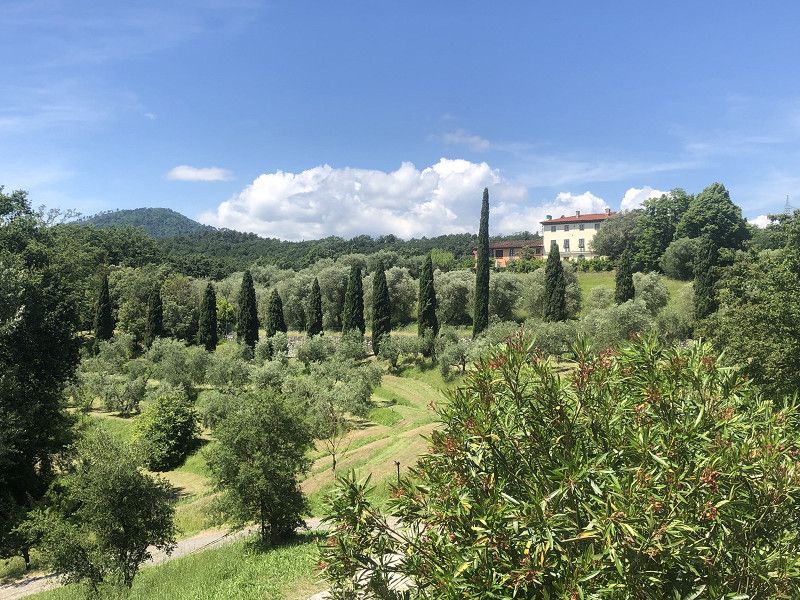
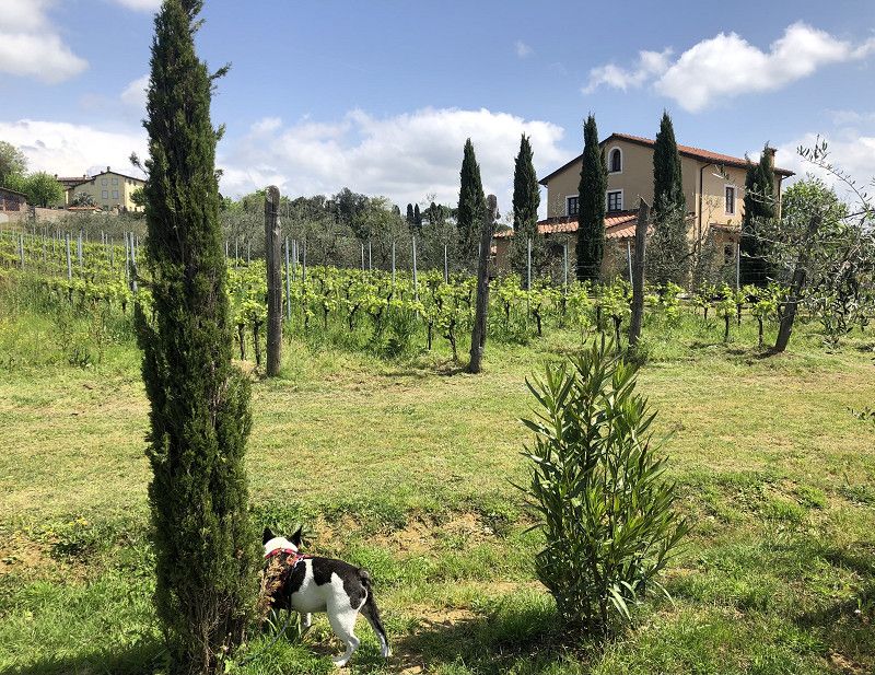
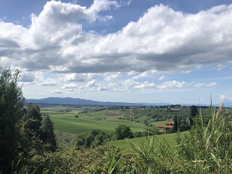
Casale Marittimo
Camping Valle Gaia, Via Cecinese 87
Beautifully situated between Cecina
and Casale Marittimo.
The site is well-maintained and has good, clean restroom facilities. The pitches are spacious and surrounded by hedges. We have a very sunny spot in the upper area, No. 335.
Costs with ACSI Card € 19.00/day plus tourist tax.
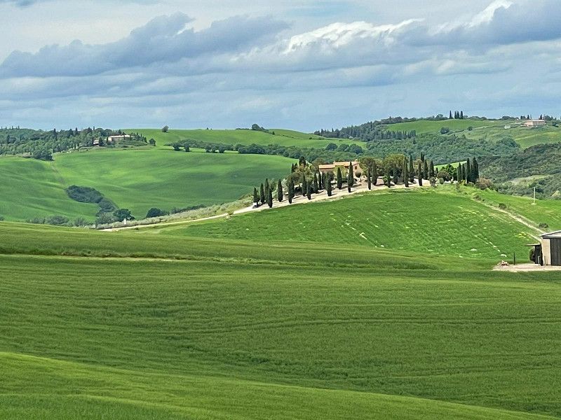
Day 1: Bike tour to Casale Marittimo, about 5 km away, along quiet roads. Stunning views, olive groves, cypresses, and umbrella pines line the route. A charming little
Location!
Pisa, Toskana, Italien
43° 17' 49.4" N 10° 36' 55.1" E
43.2970610 10.6153077
• Head northeast on Via del Castello. Go for 72 m.
• Turn slightly left onto Piazza della Chiesa. Go for 22 m.
• Turn right onto Piazza della Chiesa. Go for 87 m.
• Continue on Via della Madonna. Go for 391 m.
• Turn sharp left onto Via Cecinese (SP28). Go for 8.3 km.
• Take the 2nd exit from roundabout onto Via Aurelia Sud. Go for 2.1 km.
• Take ramp toward Grosseto/Roma. Go for 125 m.
• Take ramp onto Strada Statale Aurelia (SS1) toward Grosseto/Roma. Go for 43.1 km.
• Take ramp onto Via Aurelia (SP152) toward Follonica/Castiglione della Pescaia. Go for 1.0 km.
• Take the 3rd exit from roundabout onto Via Aurelia (SP152). Go for 3.0 km.
• Turn right onto Via Ugo Bassi. Go for 389 m.
• Take the 1st exit from roundabout onto Via Ugo Bassi. Go for 225 m.
• Take the 2nd exit from roundabout onto Via Giovanni Amendola. Go for 185 m.
• Pass 3 roundabouts and continue on Via Giovanni Amendola. Go for 668 m.
• Continue toward Via Giacomo Leopardi. Go for 35 m.
• Take the 1st exit from roundabout onto Via Giacomo Leopardi. Go for 435 m.
• Take the 1st exit from roundabout onto Via Litoranea. Go for 59 m.
• Take the 2nd exit from roundabout onto Viale Europa. Go for 324 m.
• Continue toward Viale Europa. Go for 39 m.
• Take the 1st exit from roundabout onto Viale Europa. Go for 677 m.
• Continue toward Via Cassarello. Go for 32 m.
• Take the 1st exit from roundabout onto Via Cassarello. Go for 184 m.
• Continue on Via delle Collacchie (SP158). Go for 9.5 km.
• Turn right onto Via di Punta Ala. Go for 88 m.
• Continue on Strada Provinciale Punta Ala (SP61). Go for 5.0 km.
• Turn left. Go for 159 m.
• Turn left. Go for 3.8 km.
• Turn left toward Località Serignano. Go for 4.2 km.
• Turn left onto Località Serignano. Go for 382 m.
• Turn left onto Strada Provinciale delle Rocchette (SP62). Go for 93 m.
• Turn left. Go for 28 m.
• Arrive at your destination on the left.
☍
84,7 km
(1 hrs. 28 min.)
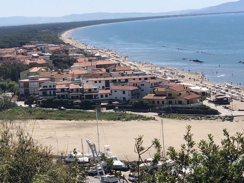
Castiglione della Pescaia
Camping Maremma Sans Souci
Location Casa Mora
The campsite is very spacious, and all pitches are located under pine trees. This is certainly good for the hot summer months, but it felt a bit dark during our visit. There are several restrooms scattered throughout the complex, which are only superficially clean.
By bike we reach Castiglione after about 4 km on decent cycle paths along the road.
We quite like the little town; there is a long beach promenade lined with bars.
In the town itself there is a lively pedestrian zone, nice little shops, restaurants and a few ice cream parlors.
The old town above, with its beautiful views over the bay and the remains of the old castle walls, is beautifully situated. We're absolutely thrilled!
Our campsite is located directly on the beach, which also has sun loungers and parasols.
Costs € 69.00/3 nights including tourist tax
Strada Provinciale 62 delle Rocchette, snc, 58043, Castiglione della Pescaia, Italy
42° 46' 46.9" N 10° 48' 5.2" E
42.7796819 10.8014387
• Head toward Strada Provinciale delle Rocchette. Go for 28 m.
• Turn right onto Strada Provinciale delle Rocchette (SP62). Go for 93 m.
• Turn right onto Località Serignano. Go for 382 m.
• Turn right. Go for 4.2 km.
• Turn left toward Via di Poggio alle Mandrie. Go for 623 m.
• Turn right onto Via di Poggio alle Mandrie. Go for 493 m.
• Turn right onto Via Le Mandrie. Go for 611 m.
• Turn slightly right toward Via del Gualdo. Go for 30 m.
• Turn right onto Via del Gualdo. Go for 292 m.
• Turn left onto Via del Gualdo. Go for 127 m.
• Take the 1st exit from roundabout onto Strada Provinciale Punta Ala (SP61). Go for 4.3 km.
• Turn left onto Località Pian d'Alma. Go for 3.0 km.
• Turn right onto Strada Provinciale delle Collacchie (SP158). Go for 12.3 km.
• Continue on Via Ponte Giorgini. Go for 159 m.
• Take the 1st exit from roundabout onto Via Porto Traiano (SP3). Go for 10.5 km.
• Take the 5th exit from roundabout onto Strada Provinciale delle Collacchie (SP158). Go for 5.6 km.
• Pass 3 roundabouts and continue on Via Andrea del Sarto (SP158). Go for 4.6 km.
• Take the 3rd exit from roundabout onto Viale Caravaggio. Go for 442 m.
• Turn right onto Strada Provinciale delle Collacchie (SP158). Go for 71 m.
• Take the 1st exit from roundabout onto Via Aurelia Sud. Go for 2.8 km.
• Take ramp toward Scansano/Istia d'Ombrone/Pratini. Go for 167 m.
• Continue on Strada Provinciale delle Sante Mariae. Go for 152 m.
• Turn right onto Strada Provinciale delle Sante Mariae (SP30) toward Scansano/Pratini a. Go for 7.4 km.
• Turn slightly right onto Strada Provinciale Scansanese (SP159). Go for 19.5 km.
• Continue on Via Scansanese. Go for 47 m.
• Take the 1st exit from roundabout onto Via Scansanese. Go for 78 m.
• Continue on Strada Provinciale Scansanese (SP159). Go for 2.7 km.
• Take the 1st exit from roundabout onto Strada Provinciale Scansanese (SP159). Go for 19.6 km.
• Turn left onto Strada Provinciale Follonata (SP10). Go for 6.6 km.
• Turn left toward Strada Comunale Saturnia la Croce. Go for 152 m.
• Turn right onto Strada Comunale Saturnia la Croce. Go for 938 m.
• Continue on Piazzale Benvenuto di Giovanni. Go for 9 m.
• Turn left. Go for 17 m.
• Arrive at your destination on the right.
☍
108,1 km
(2 hrs. 15 min.)
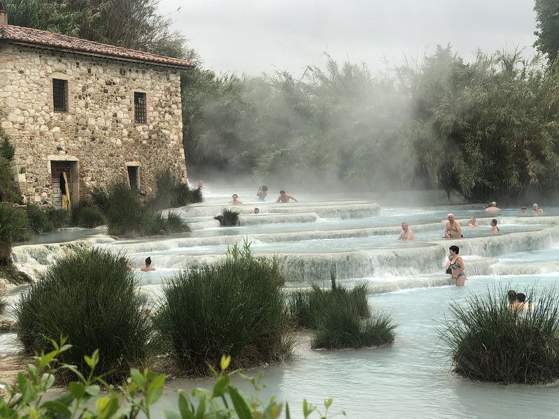
Saturnia
Parking space L'Aveare dei Pinzi
The town of Saturnia is famous for its hot thermal springs, so the campsite is always well attended on weekends.
One night, including electricity and tourist tax, costs €20.00. Restrooms and showers are available.
In the evening you can order pizza, which is delivered from the town - delicious.
After a walk, we explore the small town of Saturnia and drink an Aperol Spritz in a bar.
A visit to the thermal springs is definitely worth seeing and is free of charge.
Grosseto, Toskana, Italien
42° 39' 54.8" N 11° 30' 18" E
42.6652237 11.5049888
• Head east. Go for 101 m.
• Turn right toward Via Giuseppe Mazzini. Go for 38 m.
• Turn right onto Via Giuseppe Mazzini. Go for 128 m.
• Continue on Piazza Vittorio Veneto. Go for 34 m.
• Turn left onto Via della Chiesa. Go for 100 m.
• Turn slightly left onto Via Italia. Go for 314 m.
• Continue on Via Giuseppe Mazzini. Go for 286 m.
• Turn slightly right onto Strada Comunale Saturnia la Croce. Go for 172 m.
• Continue on Strada Provinciale Follonata (SP10). Go for 8.1 km.
• Turn right onto Via Aldo Moro (SP22). Go for 18.0 km.
• Turn right onto Strada Provinciale Pian della Madonna (SP46). Go for 4.6 km.
• Turn left onto Strada Regionale Maremmana (SR74). Go for 634 m.
• Turn right onto Strada Regionale Maremmana (SR74). Go for 354 m.
• Turn right onto Via Don Giuseppe Fabriziani. Go for 72 m.
• Arrive at Via Don Giuseppe Fabriziani. Your destination is on the right.
☍
33,0 km
( 41 min.)
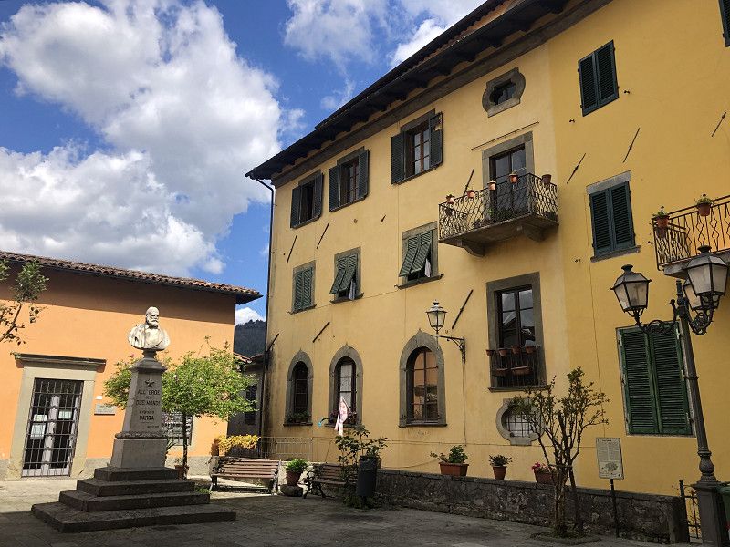
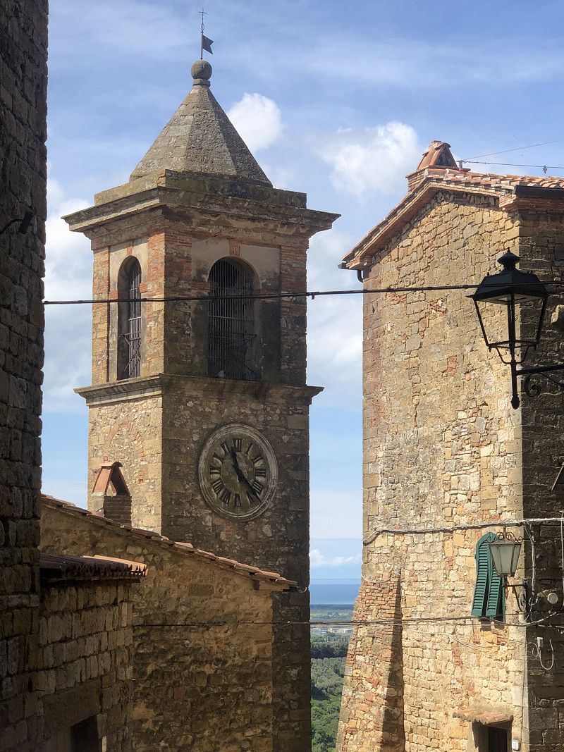
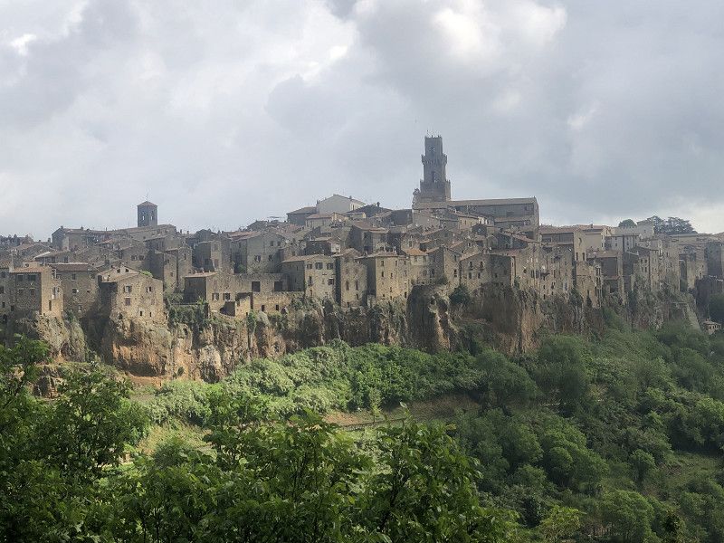
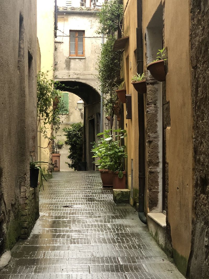
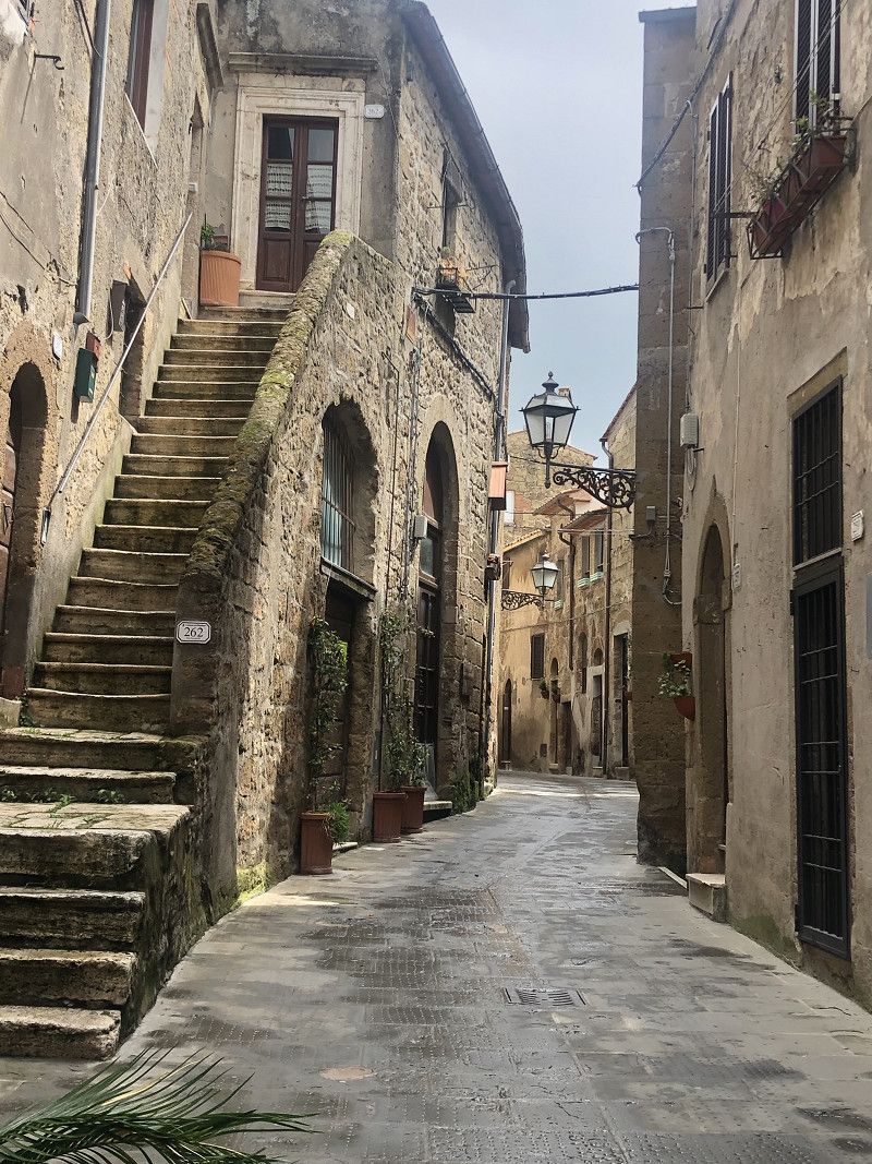
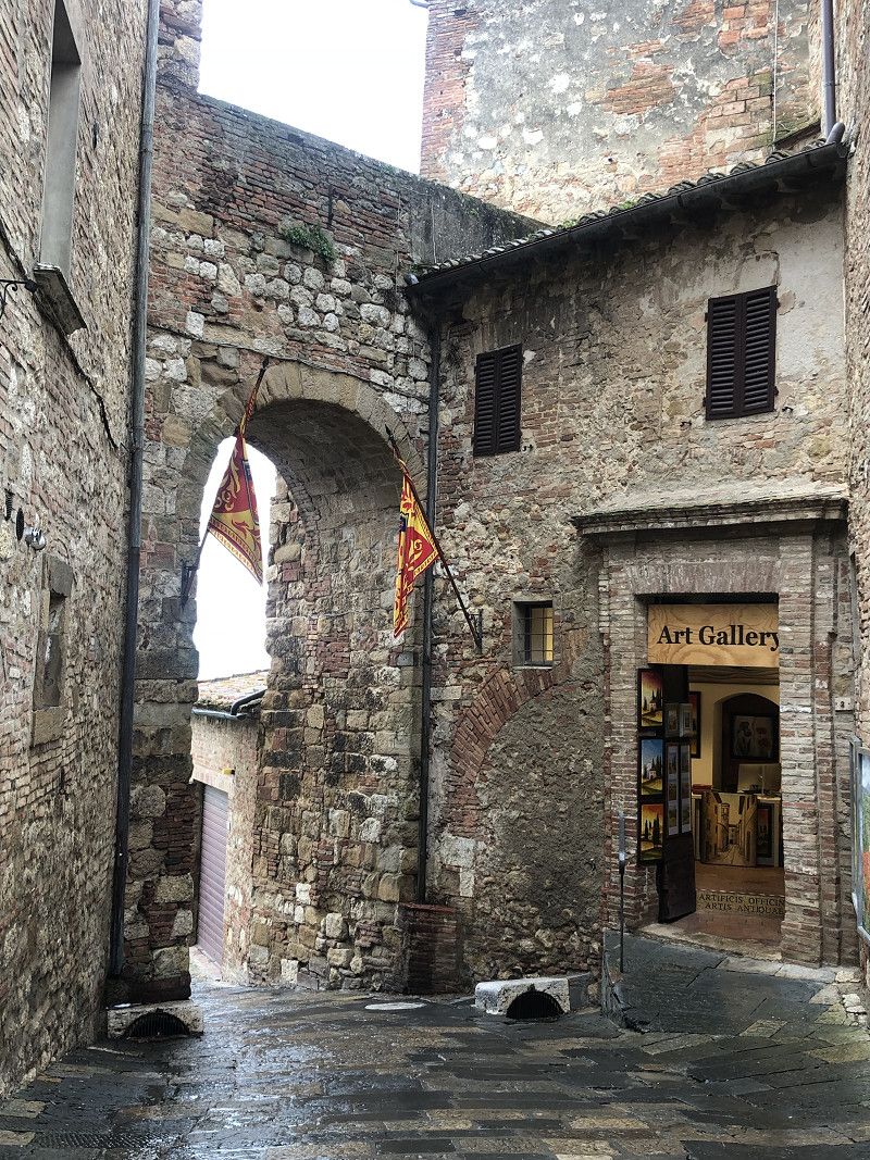
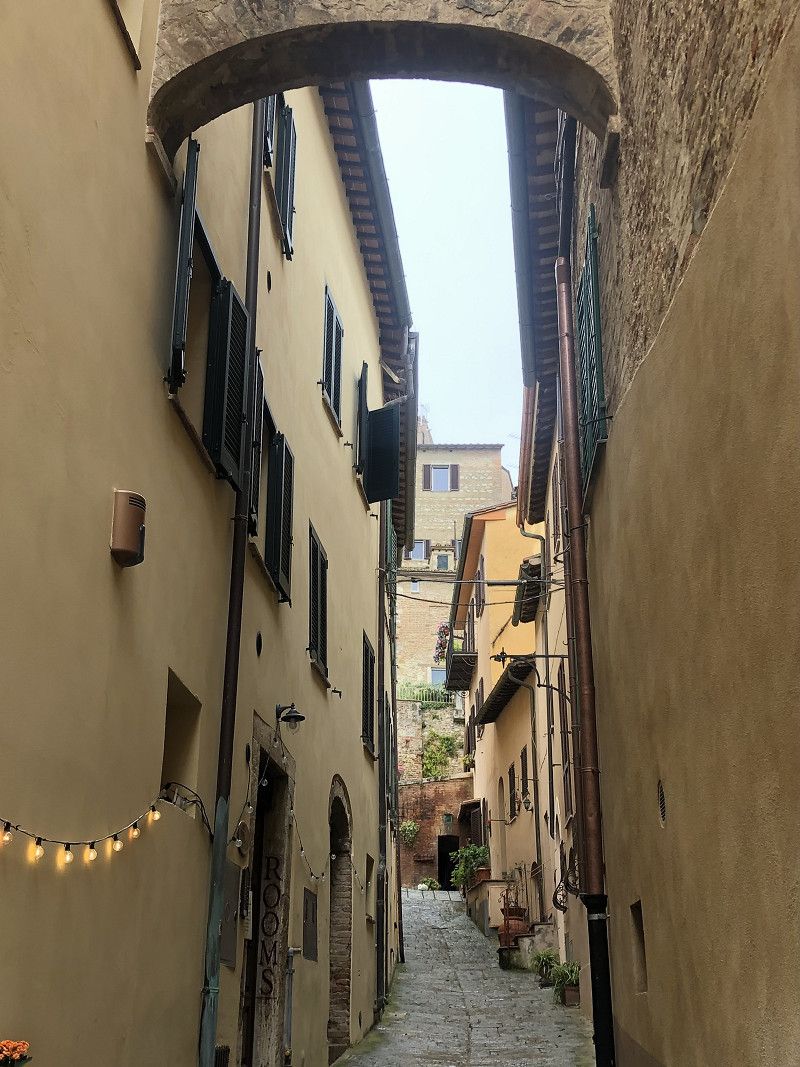
Pitigliano
We were lucky to find a parking space in the old town of Pitigliano, without any overnight accommodation.
The road to the medieval town itself is impressive and impressive. Traffic winds its way up the hill in sharp bends.
Along the way, there's an opportunity to stop for a photo. The whole place is picturesque, and I can hardly put the camera down. Unfortunately, the weather isn't great.
We endure a rain shower in a bar with cappuccino and delicious cakes.
Grosseto, Toskana, Italien
42° 38' 5.4" N 11° 40' 24.8" E
42.6348270 11.6735490
• Head toward Viale Santa Anna on Via Don Giuseppe Fabriziani. Go for 24 m.
• Turn right onto Viale Maddalena Ciacci. Go for 114 m.
• Turn right onto Via Evandro Baldini. Go for 71 m.
• Turn left onto Via Nicola Ciacci. Go for 239 m.
• Turn left onto Strada Regionale Maremmana (SR74). Go for 634 m.
• Turn right onto Via di Sovana (SP46). Go for 4.6 km.
• Turn slightly left onto Strada Provinciale Sovana (SP22). Go for 2.0 km.
• Turn left. Go for 102 m.
• Turn left toward Via del Pretorio. Go for 22 m.
• Turn right onto Via del Pretorio. Go for 176 m.
• Arrive at Via del Pretorio. Your destination is on the left.
☍
8,0 km
( 12 min.)
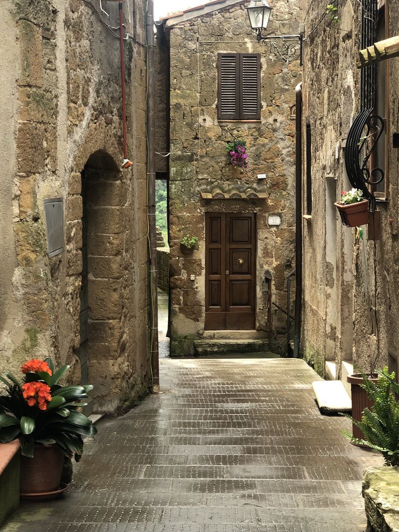
Sovana
Grosseto, Toskana, Italien
42° 39' 25.6" N 11° 38' 46.7" E
42.6571179 11.6463032
• Head east on Via del Pretorio. Go for 269 m.
• Turn right onto Strada Provinciale Sovana (SP22). Go for 9.1 km.
• Turn right onto Piazza del Municipio (SP22). Go for 66 m.
• Turn right onto Via della Madonnina (SP22). Go for 69 m.
• Turn left onto Via Finetti (SP4). Go for 14.6 km.
• Turn right onto Strada Provinciale Sforzesca (SP95). Go for 4.3 km.
• Continue on Strada Provinciale Pitiglianese (SP134). Go for 491 m.
• Continue on Traversa Cassia Aurelia (SP20). Go for 4.3 km.
• Turn slightly right onto Strada Provinciale del Monte Amiata (SP18) toward Roma/SR2/Siena/S. Casciano Bagni/A1/Chiusi. Go for 710 m.
• Turn left toward Strada Provinciale del Monte Amiata/SP18. Go for 42 m.
• Turn left onto Strada Regionale Cassia (SR2). Go for 5.9 km.
• Continue on Strada Provinciale di Radicofani (SP24) toward Abbadia S.S./Siena/Radicofani. Go for 7.2 km.
• Continue on Strada Statale di Sarteano. Go for 9.5 km.
• Turn right onto Strada Regionale Cassia (SR2). Go for 18.3 km.
• Turn left onto Via Dante Alighieri toward Firenze/S. Quirico d' Orcia. Go for 248 m.
• Turn left onto Via delle Scuole. Go for 34 m.
• Arrive at Via delle Scuole. Your destination is on the left.
☍
75,1 km
(1 hrs. 15 min.)
Area Sosta Campo Sportivo
Via delle Scuole, 53027, San Quirico dOrcia, Italy
43° 3' 25" N 11° 36' 27" E
43.0569444 11.6075000
• Head toward Via dei Pereti on Via delle Scuole. Go for 106 m.
• Continue on Viale Fratelli Rosselli. Go for 56 m.
• Turn right onto Piazza Antonio Gramsci. Go for 97 m.
• Turn left onto Via Dante Alighieri. Go for 24 m.
• Turn right onto Piazza 4 Novembre. Go for 45 m.
• Turn left onto Via dei Fossi. Go for 315 m.
• Turn right onto Strada Provinciale di Chianciano (SP146). Go for 8.5 km.
• Take the 2nd exit from roundabout onto Strada Provinciale di Chianciano (SP146). Go for 523 m.
• Take the 2nd exit from roundabout onto Strada Provinciale di Chianciano (SP146). Go for 11.6 km.
• Continue on Via della Circonvallazione (SP17). Go for 28 m.
• Turn left onto Via di San Pietro. Go for 648 m.
• Continue toward Via delle Case Nuove. Go for 126 m.
• Keep left onto Via delle Case Nuove. Go for 292 m.
• Arrive at Via delle Case Nuove. Your destination is on the left.
☍
22,4 km
( 26 min.)
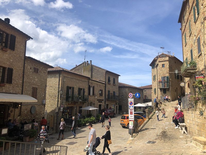
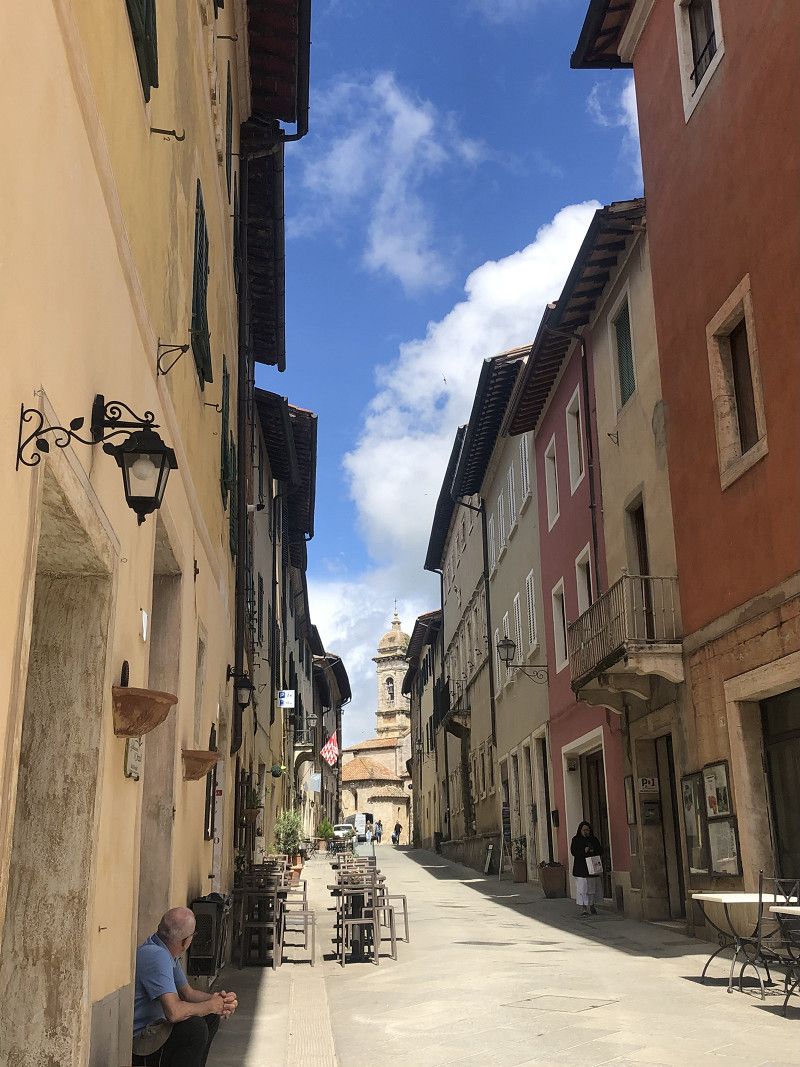
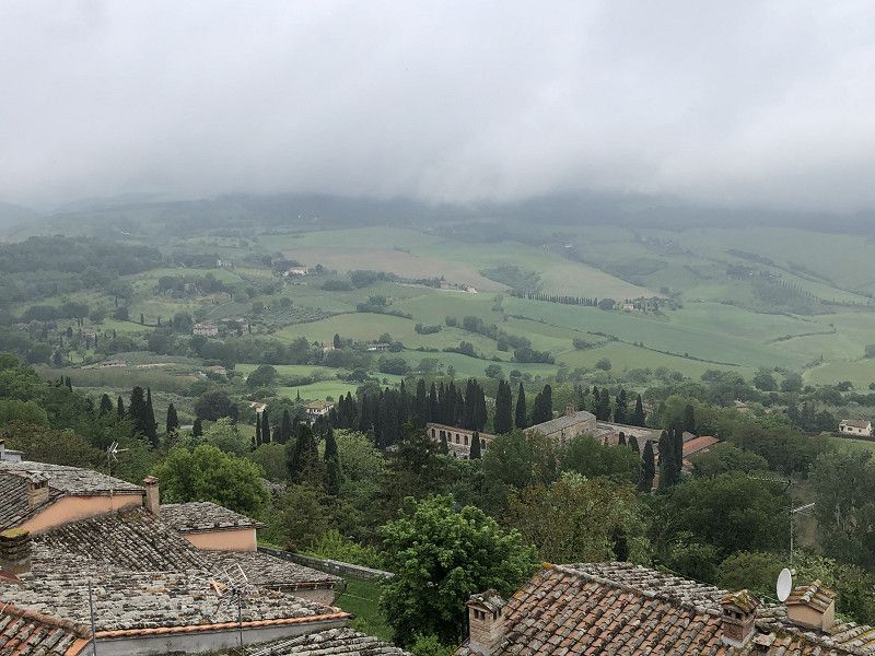
Montepulciano
I Chiari, Viadel Lago, 28 Acquaviva di Montepulciano
"Rural, comfortable, quiet location" – that was the description! Unfortunately, the entire site was very neglected. The restrooms also didn't make a good impression. For €30.00 per night off-season plus tourist tax, we expected more. We cannot recommend this campsite!
We stayed here once so we could visit Montepulciano the next morning. We parked in the large Nenni parking lot below the old town.
Costs € 5.00 for up to 6 hours.
The town of Montepulciano is especially known for its wine “Vino Nobile”.
It rains almost the entire time we're walking. I don't really like the city, as we constantly have to dodge the traffic snaking its way through the narrow streets.
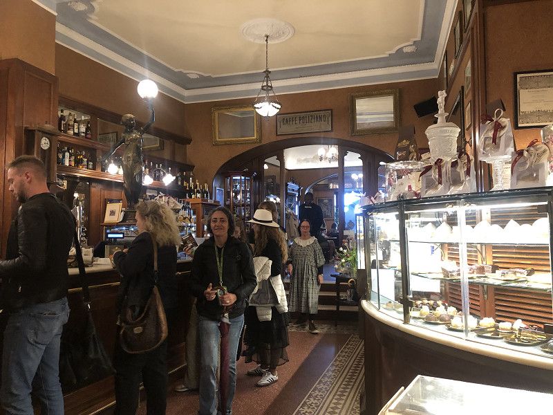
We enjoy a coffee break in the traditional café “Antico Poliziano” .
Siena, Toskana, Italien
43° 5' 40.3" N 11° 46' 57.6" E
43.0945279 11.7826795
• Head toward Località Borgo Buio on Via delle Case Nuove. Go for 40 m.
• Turn slightly right onto Via di Gozzano. Go for 90 m.
• Turn left onto Viale 1 Maggio (SP17). Go for 509 m.
• Turn right toward Via Elio Bernabei. Go for 8 m.
• Turn left onto Via Elio Bernabei. Go for 8 m.
• Turn right onto Viale Piero Calamandrei (SP17). Go for 1.4 km.
• Turn left onto Via di Torrita (SP135). Go for 60 m.
• Continue on SP135. Go for 2.1 km.
• Continue on Via di Torrita (SP135). Go for 1.2 km.
• Continue on SP135. Go for 35 m.
• Continue on Via di Torrita (SP135). Go for 1.8 km.
• Continue on SP135. Go for 858 m.
• Continue on Località Passaccio (SP135). Go for 218 m.
• Continue on SP135. Go for 1.0 km.
• Take the 2nd exit from roundabout toward Firenze-Roma/A1/Siena-Bettole/E70/Perugia/Arezzo/Foiano. Go for 1.0 km.
• Take the 2nd exit from roundabout. Go for 595 m.
• Take the 2nd exit from roundabout onto Via Basilicata toward Firenze-Roma/A1/Siena-Bettole/Perugia-Arezzo/Folano/SP327. Go for 255 m.
• Continue on Località Stradella. Go for 185 m.
• Continue on Via Basilicata. Go for 411 m.
• Take the 1st exit from roundabout onto Via Traversa Valdichiana Est (SP327) toward Firenze-Roma/A1/Bettolle. Go for 4.5 km.
• Take ramp onto A1 (Autostrada del Sole) toward Firenze. Go for 27.3 km.
• Take the exit toward Arezzo. Go for 384 m.
• Take the 2nd exit from roundabout toward Arezzo/Bibbiena/Sansepolcro/E78. Go for 122 m.
• Continue on Raccordo Arezzo-Battifolle. Go for 6.9 km.
• Keep left onto Viale Gaetano Salvemini. Go for 1.1 km.
• Continue toward La Verna/Camaldoli/Stia/Castiglion Fibocchi/Anghiari/Bibbiena/SS71. Go for 29 m.
• Take the 2nd exit from roundabout onto Viale Don Giovanni Minzoni toward La Verna/Camaldoli/Stia/Castiglion Fibocchi/Anghiari/Bibbiena/SS71. Go for 425 m.
• Continue on Via Fiorentina toward Bibbiena/Castiglion Fibocchi/Casentino. Go for 165 m.
• Continue on Viale Giovanni Amendola. Go for 705 m.
• Take the 3rd exit from roundabout onto Strada Provinciale Setteponti (SP1) toward Setteponti/Castiglion/Fibocchi/Castiglion Fibocchi/S.Giustino Valdarno/Ponte Buriano/Quarata/Rondine. Go for 1.8 km.
• Take the 2nd exit from roundabout onto Via Setteponti (SP1). Go for 4.5 km.
• Turn right toward Località Ponte a Buriano/SP56. Go for 674 m.
• Turn right onto Località Ponte a Buriano (SP56). Go for 142 m.
• Keep left onto Località Ponte a Buriano (SP1). Go for 4.1 km.
• Turn right onto Via Guglielmo Marconi. Go for 202 m.
• Turn left onto Costa Pampaloni. Go for 32 m.
• Continue on Piazza Olmo. Go for 11 m.
• Continue on Costa Pampaloni. Go for 25 m.
• Turn right onto Via Marchese Alessandro dal Borro. Go for 30 m.
• Arrive at Via Marchese Alessandro dal Borro. Your destination is on the left.
☍
65,0 km
( 55 min.)
Castiglion Fibocchi
Fattoria “La Vialla”
This winery with its farm shop and its own production of various specialties has now gained a good reputation in Germany.
Luckily we had pre-booked our pitch because when we arrived around 3 p.m. the motorhome site was full!
Wonderfully rustic food in the bodega – menu €13.00 per person. Accompanied by a good red wine – what more could you want!
Shopping in the shop - not cheap but excellent products.
The parking space is free!
Arezzo, Toskana, Italien
43° 31' 40.7" N 11° 45' 47.4" E
43.5279646 11.7631758
• Head toward Piazza della Chiesa on Via Marchese Alessandro dal Borro. Go for 38 m.
• Continue on Piazza Roma. Go for 42 m.
• Turn right onto Piazzetta dei Carabinieri. Go for 29 m.
• Turn right onto Via Guglielmo Marconi. Go for 358 m.
• Turn left onto Strada Provinciale Setteponti (SP1). Go for 4.2 km.
• Turn left toward Strada Provinciale Setteponti/SP1. Go for 5.2 km.
• Take the 1st exit from roundabout onto Via di Montione. Go for 1.2 km.
• Turn left onto Via Alessandro e Domenico Scarlatti. Go for 437 m.
• Continue on Via Samuel Morse. Go for 700 m.
• Take ramp onto Raccordo Arezzo-Battifolle toward Autostrada. Go for 1.5 km.
• Keep left onto Raccordo Arezzo-Battifolle toward Firenze/A1/Roma. Go for 5.0 km.
• Take the 2nd exit from roundabout toward Firenze/Roma. Go for 64 m.
• Take ramp onto A1 (Autostrada del Sole) toward Roma. Go for 27.1 km.
• Take the exit toward Valdichiana/Bettolle-Sinalunga/Bettolle/Pienza/Montepulciano/Ospedale Nottola/Torrita di Siena. Go for 419 m.
• Take the 3rd exit from roundabout onto SP327 toward Ospedale Nottola/Bettolle/Firenze/Roma. Go for 782 m.
• Turn right onto SP63/A. Go for 103 m.
• Continue on Via Siena (SP63/A). Go for 930 m.
• Continue on Via Antonio Gramsci (SP63/A). Go for 649 m.
• Continue on Via Trasimeno (SP63/A). Go for 484 m.
• Continue on Via Arrigo Boito (SP63/A). Go for 442 m.
• Continue on Località Busso (SP63/A). Go for 1.0 km.
• Continue on SP63/A. Go for 258 m.
• Take the 1st exit from roundabout onto Via Trento (SP11). Go for 265 m.
• Take the 2nd exit from roundabout onto Via Trento (SP63) toward Trequanda. Go for 71 m.
• Turn left onto Via della Prata toward Trequanda/Casabianca. Go for 1.2 km.
• Turn left onto Strada Statale Rapolano (SS326). Go for 882 m.
• Turn right onto Via di Rapolano (SP63d). Go for 647 m.
• Turn left onto Strada Provinciale Lauretana (SP10) toward Grosseto/Montalcino/Trequanda. Go for 80 m.
• Turn sharp right onto Strada Provinciale di Trequanda (SP38). Go for 5.4 km.
• Continue on SP38 toward Grosseto/Montalcino. Go for 56 m.
• Continue on SP38b. Go for 219 m.
• Continue on SP38. Go for 680 m.
• Continue on Strada Provinciale di Trequanda (SP38). Go for 4.2 km.
• Continue on Strada Provinciale Traversa dei Monti. Go for 790 m.
• Keep right onto Strada Provinciale Traversa dei Monti toward S.Giovanni d'Asso. Go for 6.2 km.
• Turn left onto Strada Provinciale Traversa dei Monti (SP14). Go for 8.8 km.
• Take ramp onto Strada Regionale Cassia (SR2) toward Montalcino/S.Quirico d'Orcia/Chiusi/A1/Grosseto/Roma. Go for 1.5 km.
• Take ramp toward Grosseto/Montalcino/Zona Industriale Bivio Asse. Go for 426 m.
• Turn right onto Località Bivio dell'Asso (SP14) toward Montalcino/Grosseto. Go for 5.1 km.
• Take the 2nd exit from roundabout onto Traversa dei Monti (SP14) toward Montalcino Centro/Grosseto. Go for 1.4 km.
• Turn right onto Vicolo Soccorso Saloni. Go for 253 m.
• Turn left onto Costa di Piazza Giuseppe Garibaldi. Go for 25 m.
• Turn right toward Piazza Giuseppe Garibaldi. Go for 44 m.
• Turn sharp left onto Piazza Giuseppe Garibaldi. Go for 24 m.
• Arrive at Piazza Giuseppe Garibaldi. Your destination is on the left.
☍
89,2 km
(1 hrs. 19 min.)
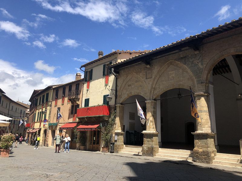
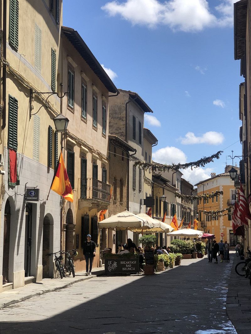
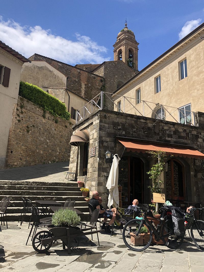
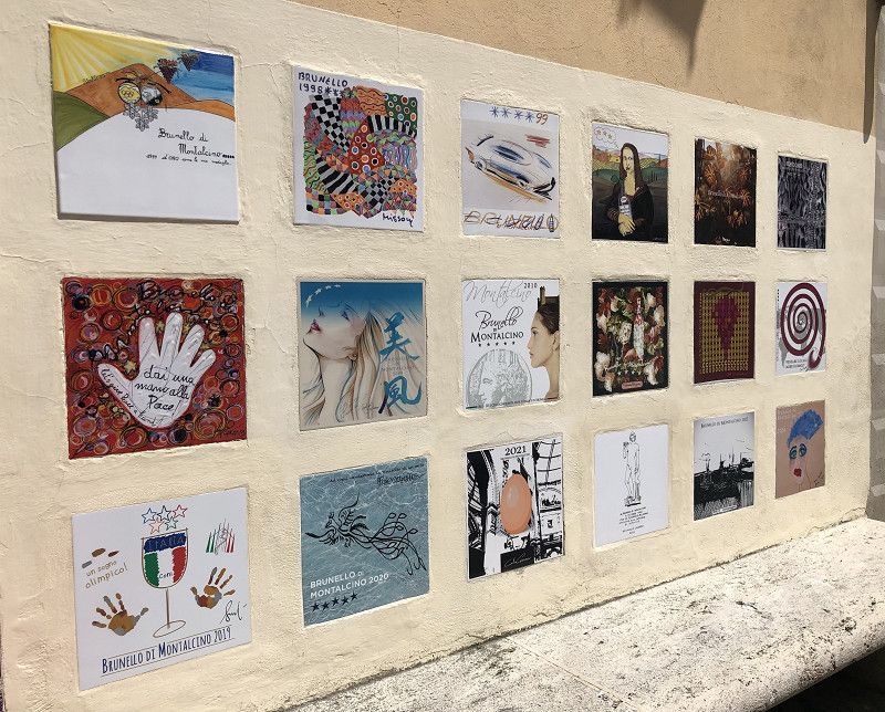
Montalcino
Siena, Toskana, Italien
43° 3' 27.2" N 11° 29' 25" E
43.0575578 11.4902818
• Head south on Piazza Giuseppe Garibaldi. Go for 17 m.
• Turn right onto Via Carlo Boldrini. Go for 65 m.
• Continue on Via Antonio Gramsci. Go for 73 m.
• Turn left onto Viale Pietro Strozzi. Go for 180 m.
• Take the 4th exit from roundabout onto Via Circonvallazione (SP14) toward Autostrada/A1/Roma/SR2/Siena/Torrenieri. Go for 1.8 km.
• Take the 2nd exit from roundabout onto Strada Provinciale del Brunello (SP45) toward Siena/SR2/Buonconvento. Go for 9.5 km.
• Turn left toward Strada Provinciale del Brunello/SP45. Go for 30 m.
• Turn left onto Strada Regionale Cassia (SR2). Go for 12.8 km.
• Take the 3rd exit from roundabout onto SR2 toward Firenze-Roma/A1/Arezzo-Perugia/E78/Siena/Grosseto/Arezzo/Firenze. Go for 4.4 km.
• Turn right onto Strada Regionale Cassia (SR2) toward Grosseto/Firenze/Siena/Monteroni d' Arbia Nord. Go for 3.3 km.
• Take the 2nd exit from roundabout onto Strada Regionale Cassia (SR2). Go for 5.3 km.
• Turn left onto Strada Massetana Romana (SP6) toward Porta S. Marco/Porta Tufi/A1. Go for 867 m.
• Take the 2nd exit from roundabout onto Strada Massetana Romana (SP6) toward Porta S.Marco/A1/Centro. Go for 714 m.
• Take the 2nd exit from Strada Massetana Romana roundabout onto Tangenziale Siena Ovest toward Firenze/A1. Go for 1.7 km.
• Take ramp toward Senese-Aretina/SS73/Massa Marittima. Go for 201 m.
• Continue on Strada Statale 73 Ponente toward Senese-Aretina/SS73/Massa Marittima. Go for 1.8 km.
• Take the 1st exit from roundabout onto Strada Provinciale Senese Aretina (SP73) toward Rosia/Roccastrada. Go for 4.1 km.
• Turn right onto Via Palmiro Togliatti (SP37). Go for 4.3 km.
• Take the 1st exit from roundabout onto Viale Giuseppe Mazzini. Go for 39 m.
• Turn left onto Viale Giuseppe Mazzini. Go for 12 m.
• Turn slightly right onto Viale Giuseppe Mazzini. Go for 201 m.
• Turn slightly right onto Via Stretta. Go for 65 m.
• Continue on Piazza Guglielmo Marconi. Go for 24 m.
• Arrive at Piazza Guglielmo Marconi. Your destination is on the right.
☍
51,4 km
( 52 min.)
Sovicille
Camping “La Montagnola”
Only 2 stars but well run and clean.
We were here last year.
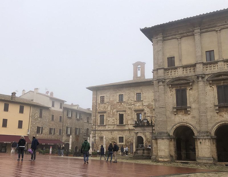
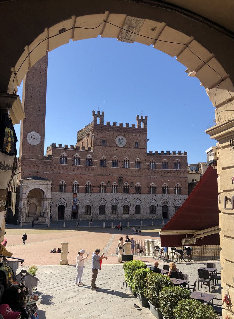
We'll take the bus to Siena , about 14 km away. The ticket costs €11.60 for two people. Bus tickets are available at reception.
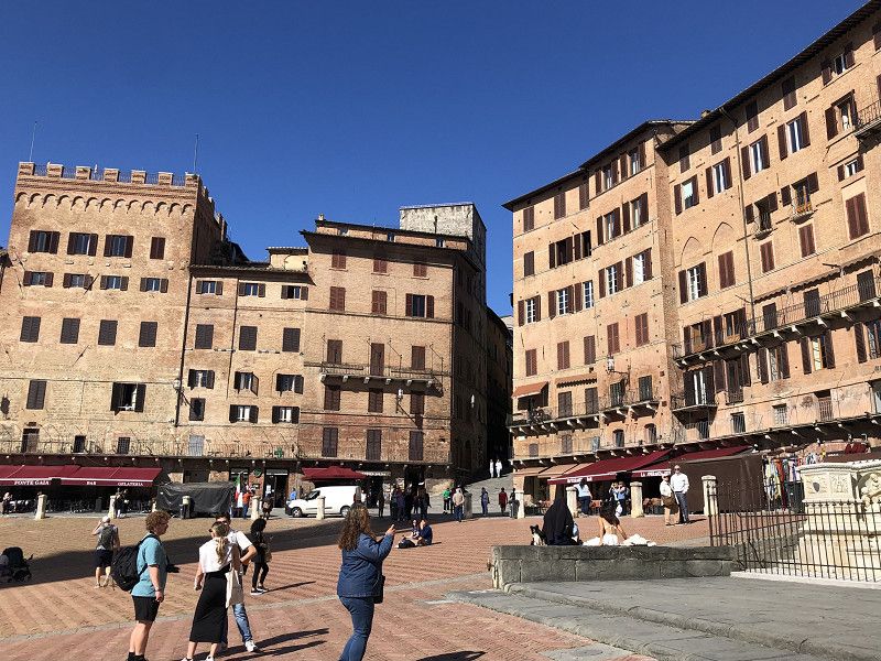
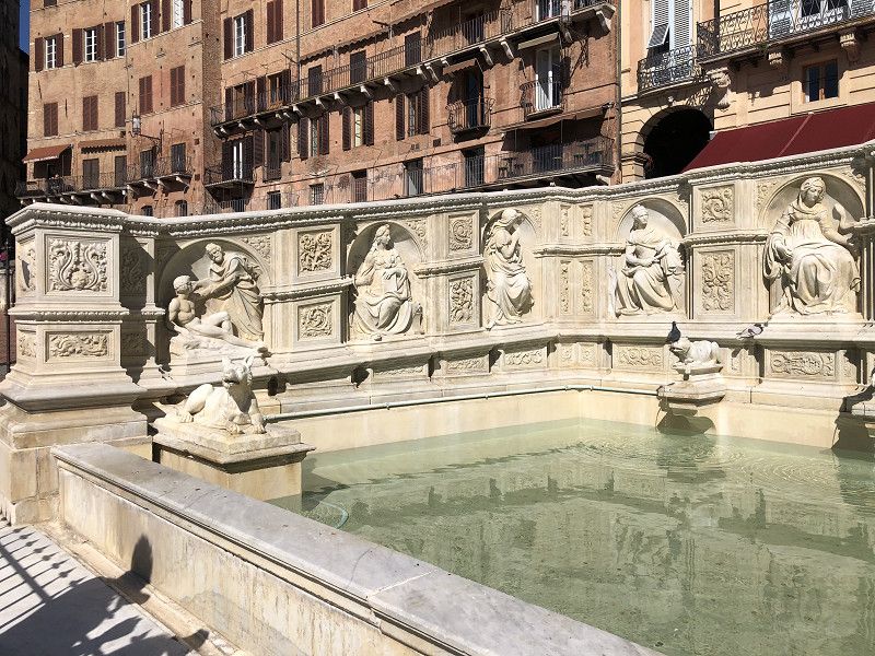
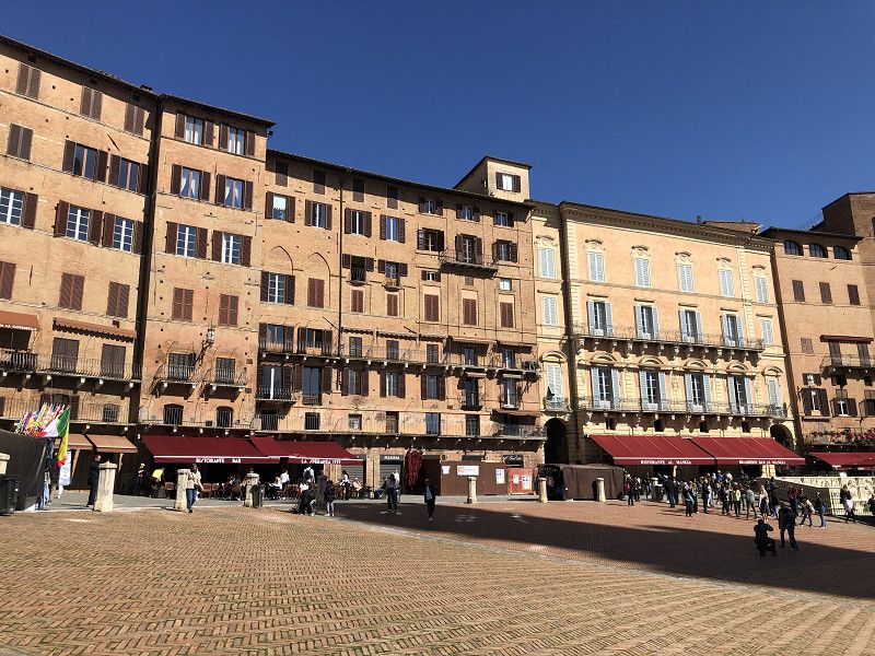
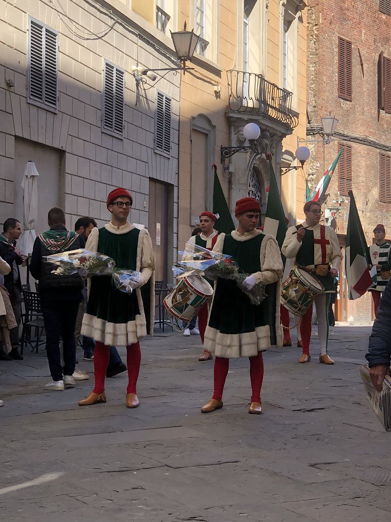
Siena is a beautiful, impressive city.
The Piazza del Campo, the magnificent cathedral with its confectionery facade, the Fartezza Medicea with magnificent views of the city. And the glorious sunshine – simply magnificent!
During a stroll through the small town of Sovicille, we discover photographic art in the historic center. Absolutely fascinating.
Siena, Toskana, Italien
43° 16' 50.2" N 11° 13' 41.4" E
43.2806018 11.2281756
• Head northwest on Piazza Guglielmo Marconi. Go for 17 m.
• Continue on Via Roma. Go for 169 m.
• Turn slightly right onto Viale Giuseppe Mazzini. Go for 213 m.
• Turn right onto Viale Giuseppe Mazzini. Go for 30 m.
• Take the 3rd exit from roundabout onto Viale Giuseppe Mazzini (SP37). Go for 4.3 km.
• Turn left onto Strada Provinciale Senese Aretina (SP73) toward Siena/Firenze. Go for 349 m.
• Turn left onto Strada del Ferratore (SP101) toward Firenze/SR2/Monteriggioni. Go for 3.0 km.
• Continue toward Monteriggioni. Go for 76 m.
• Continue on Strada di Montalbuccio (SP101). Go for 777 m.
• Continue on Strada del Pian del Lago (SP101). Go for 3.1 km.
• Turn left onto Strada del Pecorile (SP101) toward Firenze/Monteriggioni. Go for 994 m.
• Turn left onto Strada Regionale Cassia (SR2). Go for 5.8 km.
• Turn right onto Strada di Monteriggioni toward Monteriggioni Centro. Go for 560 m.
• Arrive at Strada di Monteriggioni. Your destination is on the left.
☍
19,5 km
( 20 min.)
Monteriggioni
Area Camper La Posta, Via Cassia Nord 142
Unfortunately, we miss the entrance to this overnight spot and end up in the parking lot directly below the small town of Monteriggioni , "Area del Cipressino." Parking costs €3.50.
It's Sunday, and many Italians are visiting the pretty historic village, enclosed by city walls. The main square in front of the church is bustling with activity. A stroll through this truly beautiful town takes place in glorious sunshine.
We spend the night at the “Area Sosta Parco Il Poggione” campsite in San Casciano/Val di Pesa.
Only one parking lot, unkempt but free.
Siena, Toskana, Italien
43° 23' 23.9" N 11° 13' 24.9" E
43.3899772 11.2235936
• Head southwest on Strada di Monteriggioni. Go for 82 m.
• Turn slightly right onto Strada di Monteriggioni. Go for 478 m.
• Turn sharp right onto Strada Regionale Cassia (SR2). Go for 1.1 km.
• Take the 1st exit from roundabout onto Strada Regionale Cassia (SR2). Go for 192 m.
• Take ramp onto Superstrada Firenze-Siena (RA3) toward Firenze. Go for 45.9 km.
• Take ramp onto Bypass del Galluzzo toward Firenze Centro/Nuovo Ospedale San Giovanni di Dio/Scandicci. Go for 3.3 km.
• Take the 1st exit from roundabout toward Firenze-Roma/A1/Cassia/SR2/Siena/Firenze/Galluzzo. Go for 70 m.
• Continue toward Galleria La Romita. Go for 59 m.
• Continue on Galleria La Romita. Go for 297 m.
• Continue toward Via Senese. Go for 38 m.
• Take the 2nd exit from roundabout onto Via Senese toward Firenze Centro. Go for 1.3 km.
• Keep right onto Via del Gelsomino toward Centro/Fiesole-Arezzo/Pisa. Go for 875 m.
• Continue on Viale Evangelista Torricelli toward Piazzale Michelangelo/Poggio Imperiale/Arcetri/Pisa/SS67/Fiesole/Gavinana/Ponte S.Niccolò/Arezzo. Go for 450 m.
• Continue on Piazzale Galileo. Go for 22 m.
• Turn right onto Viale Galileo toward Centro/Ponte San Niccolò/Arezzo/SS67. Go for 1.8 km.
• Continue on Piazzale Michelangiolo. Go for 129 m.
• Continue on Viale Michelangiolo toward Ponte San Nicolò/Centro/Autostrade/A1/A11/Fiesole. Go for 1.9 km.
• Continue on Piazza Francesco Ferrucci. Go for 47 m.
• Take the 1st exit from Piazza Francesco Ferrucci roundabout onto Piazza Francesco Ferrucci toward Centro/Piazza Beccaria/Fiesole/Viali di Circonvallazione/Aeroporto A. Vespucci. Go for 114 m.
• Continue on Ponte San Niccolò. Go for 177 m.
• Continue on Viale Giovanni Amendola. Go for 275 m.
• Turn left onto Viale Duca degli Abruzzi toward Centro/Lungarni/A1/Autostrade/A11/Roma. Go for 81 m.
• Keep left onto Viale della Giovine Italia toward Lungarni/Ponta San Niccolò/A1/Autostrade/A11. Go for 261 m.
• Keep right onto Viale della Giovine Italia. Go for 102 m.
• Continue on Lungarno della Zecca Vecchia. Go for 419 m.
• Turn slightly right onto Piazza dei Cavalleggeri. Go for 44 m.
• Continue on Corso dei Tintori. Go for 232 m.
• Turn right onto Via dei Benci. Go for 167 m.
• Continue on Piazza di Santa Croce. Go for 19 m.
• Turn left onto Via dell'Anguillara. Go for 261 m.
• Continue on Via della Condotta. Go for 135 m.
• Turn left onto Via delle Farine. Go for 29 m.
• Turn slightly right onto Piazza della Signoria. Go for 37 m.
• Arrive at Piazza della Signoria. Your destination is on the right.
☍
60,4 km
( 49 min.)
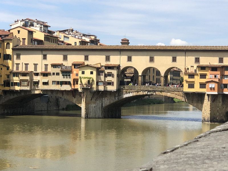
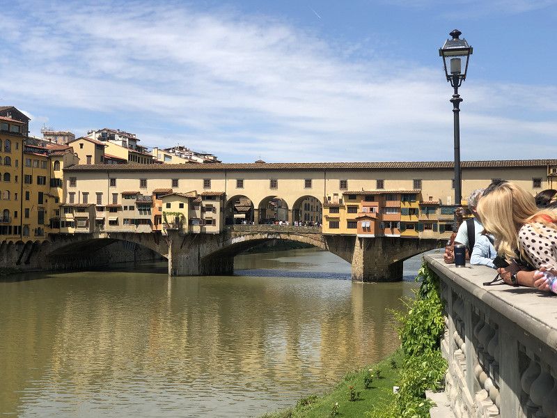
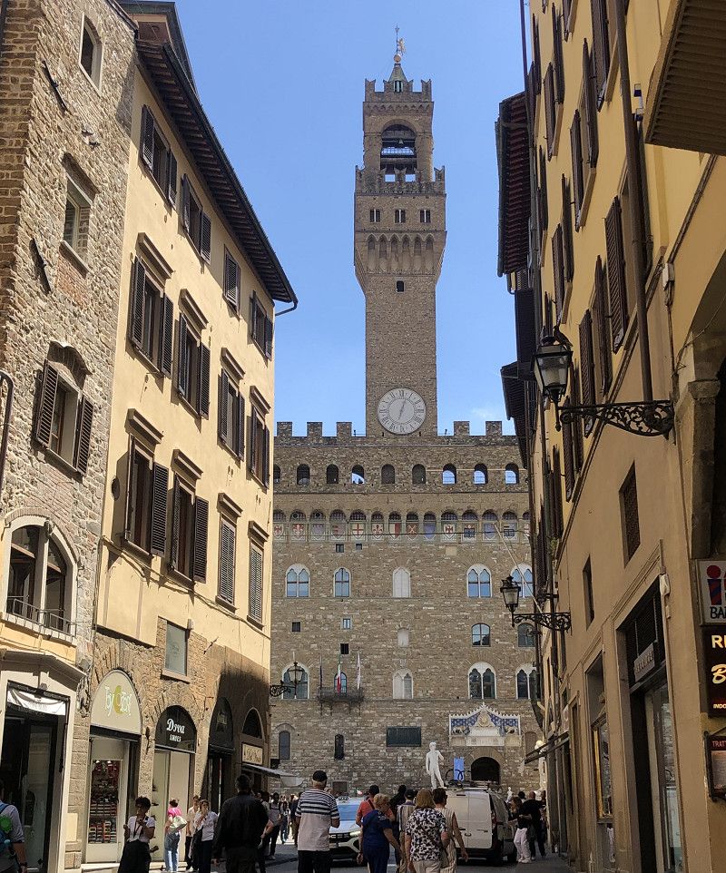
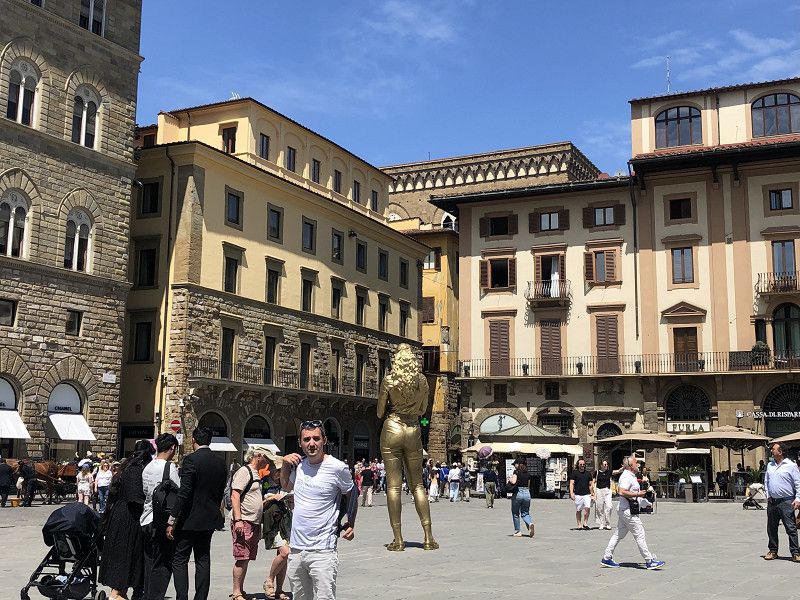
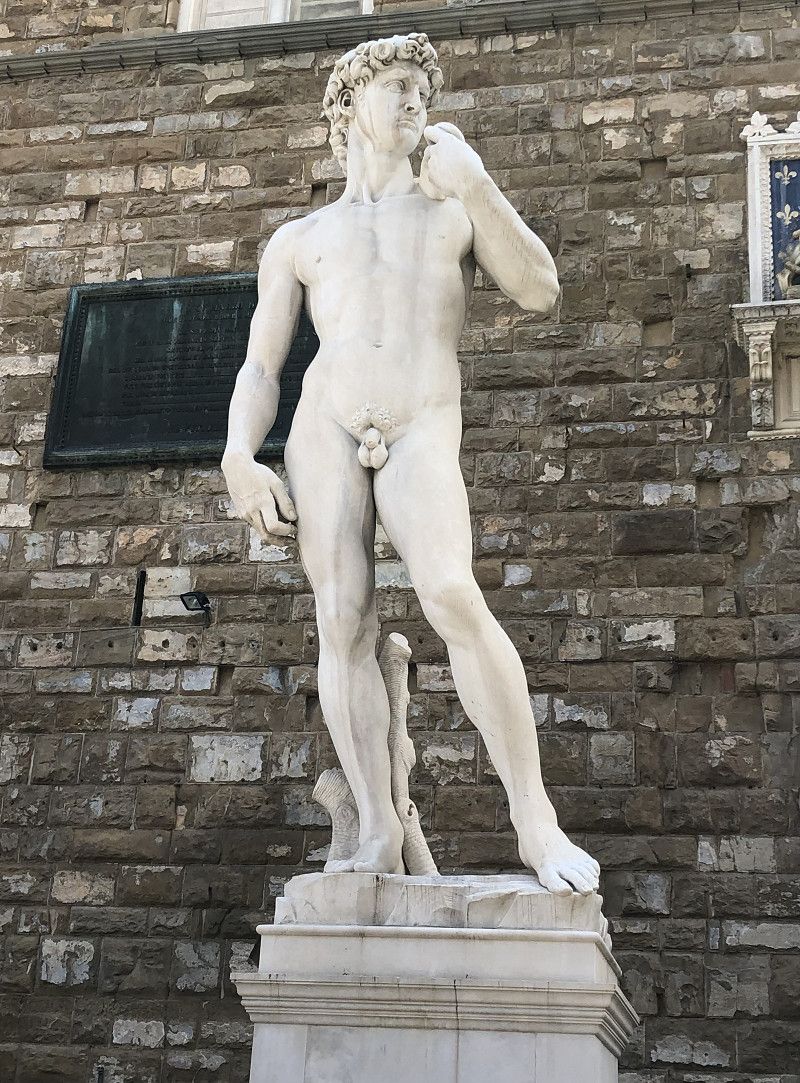
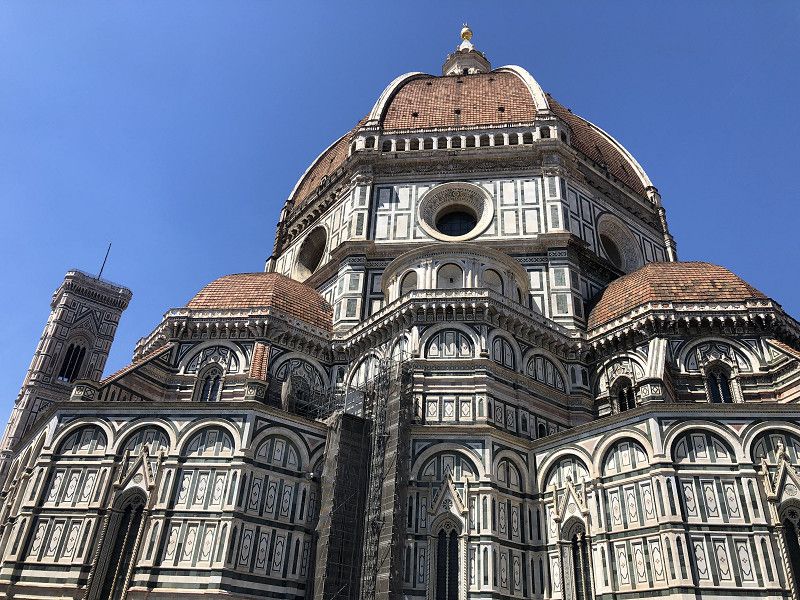
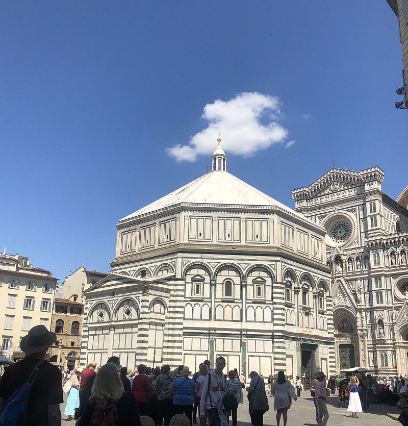
Florenz
Firenze, Toskana, Italien
43° 46' 11.3" N 11° 15' 20.3" E
43.7697955 11.2556404
• Head southwest on Piazza della Signoria. Go for 54 m.
• Turn left onto Piazza della Signoria. Go for 64 m.
• Continue on Via della Ninna. Go for 100 m.
• Turn slightly right onto Piazza del Grano. Go for 65 m.
• Continue on Via dei Castellani. Go for 75 m.
• Continue on Via dei Saponai. Go for 95 m.
• Continue on Piazza Mentana. Go for 27 m.
• Turn right onto Piazza Mentana. Go for 55 m.
• Turn left onto Lungarno Generale Armando Diaz. Go for 100 m.
• Continue on Lungarno delle Grazie. Go for 242 m.
• Continue on Piazza dei Cavalleggeri. Go for 33 m.
• Continue on Lungarno della Zecca Vecchia. Go for 419 m.
• Continue on Lungarno Guglielmo Pecori Giraldi. Go for 257 m.
• Keep middle onto Lungarno del Tempio toward A1/Autostrade/A11/Arezzo/SS69/Greve/SS222. Go for 448 m.
• Continue on Lungarno Cristoforo Colombo toward Gavinana/A1/Autostrade/A11/Arezzo-Siena. Go for 854 m.
• Continue on Lungarno Aldo Moro toward A1/Autostrade/A11. Go for 799 m.
• Take the 2nd exit from Largo Jean-Michel Folon roundabout onto Via Enrico De Nicola toward Ospedale S. M. Annunziata/Viale Europa/A1/Autostrade/A11/Bagno a Ripoli/Siena/SS222. Go for 552 m.
• Turn right onto Ponte Paolo Borsellino (SP127) toward Ospedale S. M. Annunziata/Viale Europa/Autostrade/A11/A1/Bagno a Ripoli/Siena/SS222. Go for 3.7 km.
• Take left ramp onto A1 (Autostrada del Sole) toward Bologna/Siena/Firenze/A11/Pisa Nord. Go for 38.8 km.
• Keep right onto A1var toward Bologna/Barberino. Go for 39.1 km.
• Continue on A1 (Autostrada del Sole). Go for 63.7 km.
• Take the exit toward Brennero onto A22 (Autostrada del Brennero). Go for 84.8 km.
• Take the exit toward Milano onto A4 (Autostrada della Serenissima). Go for 47.9 km.
• Take the exit toward Brescia Est onto Svincolo Brescia Est. Go for 698 m.
• Take the 2nd exit from roundabout toward Brescia. Go for 99 m.
• Take ramp onto Tangenziale Est. Go for 1.2 km.
• Continue on Strada Statale Gardesana Occidentale (SS45bis). Go for 17.8 km.
• Take ramp toward Trento/Madonna di Campiglio. Go for 483 m.
• Continue on Via Fibbia. Go for 369 m.
• Continue on Monte Castello. Go for 1.6 km.
• Continue on La Guarda. Go for 1.8 km.
• Keep left toward Trento/Madonna di Campiglio. Go for 248 m.
• Continue on Strada Provinciale del Caffaro (SPBS237dir). Go for 12.4 km.
• Pass 4 roundabouts and continue on Strada Provinciale del Caffaro (SPBS237). Go for 13.6 km.
• Arrive at Strada Provinciale del Caffaro (SPBS237).
☍
332,5 km
(3 hrs. 12 min.)
Lago Idro Glamping Boutique
Via Carlo Alberto dalla Chiesa 7-9, 25070, Anfo (BS), Italy
45° 46' 7.9" N 10° 29' 45.3" E
45.7688586 10.4959213
• Head northeast on Strada Provinciale del Caffaro (SPBS237). Go for 3.9 km.
• Take the 1st exit from roundabout onto Strada Provinciale del Caffaro (SPBS237) toward Ponte Caffaro/Trento/Madonna di Campiglio. Go for 3.7 km.
• Continue on Via 24 Maggio 1915 (SS237). Go for 3.9 km.
• Turn right onto Via Ca' Rossa (SS240) toward Storo/Riva del Garda. Go for 544 m.
• Turn right onto Via Giuseppe Garibaldi (SS240). Go for 18.5 km.
• Take the 3rd exit from roundabout onto Via Alzer. Go for 125 m.
• Continue on Via Capitano Rabaglia. Go for 97 m.
• Turn left onto Via Sant'Antonio. Go for 21 m.
• Arrive at Via Sant'Antonio. Your destination is on the right.
☍
30,7 km
( 31 min.)
Pieve di Ledro
Autonome Provinz Trient, Trentino-Südtirol, Italien
45° 53' 24.5" N 10° 43' 55.2" E
45.8901489 10.7319906
• Head toward Via Molini on Via Sant'Antonio. Go for 21 m.
• Turn right onto Via Capitano Rabaglia. Go for 97 m.
• Continue on Via Alzer. Go for 41 m.
• Take the 3rd exit from roundabout onto Strada Statale di Loppio e Val di Ledro (SS240). Go for 13.9 km.
• Continue on SS240. Go for 121 m.
• Continue on Strada Provinciale del Monte Tombio (SP37). Go for 836 m.
• Take the 3rd exit from roundabout onto Strada Provinciale del Monte Tombio (SP37) toward Rive del G. Centro. Go for 509 m.
• Take the 2nd exit from roundabout onto Viale dei Tigli (SS421) toward Viale Canella/Centro. Go for 596 m.
• Take the 3rd exit from roundabout onto Viale Baruffaldi toward Autostrada/A22/Torbole/Arco/Rovereto/Trento. Go for 92 m.
• Continue on Viale Luigi Antonio Baruffaldi toward Centro/Autostrada/A22/Torbole/Arco/Rovereto/Trento. Go for 82 m.
• Turn right onto Via Martiri 28 Giugno toward Roverto/Torbole/Centro. Go for 298 m.
• Turn left onto Viale Dante Alighieri. Go for 116 m.
• Take the 3rd exit from Largo Bensheim roundabout onto Viale Giosuè Carducci (SS240). Go for 820 m.
• Pass 2 roundabouts and continue on Via Gardesana (SS240). Go for 2.5 km.
• Take the 2nd exit from roundabout onto Strada Statale di Loppio e Val di Ledro (SS240) toward Autostrada/A22/Nago/Rovereto. Go for 1.9 km.
• Pass 3 roundabouts and continue on Località Loppio (SS240). Go for 11.4 km.
• Keep right toward Brennero/Modena. Go for 196 m.
• Take ramp onto A22 (Autostrada del Brennero) toward Brennero/Trento. Go for 167 km.
• Continue on A13 (Brennerpass). Go for 31.7 km.
• Keep right onto A13 (Knoten Innsbruck-Berg Isel) toward Bregenz/Garmisch/Innsbruck-West. Go for 2.0 km.
• Continue on A12 (Inntal Autobahn). Go for 35.0 km.
• Take exit 113 toward Mötz/Reutte/Fernpass/Haiming/B171/Stams Silz. Go for 350 m.
• Turn left onto Mötzer Landesstraße (L236) toward Haiming/B171/Stams Silz. Go for 526 m.
• Turn right onto Tiroler Bundesstraße (B171). Go for 1.4 km.
• Take the 1st exit from roundabout onto Wirtsgasse (L341). Go for 487 m.
• Turn left onto Thomas-Riß-Weg. Go for 225 m.
• Continue on Rinderweg. Go for 10 m.
• Turn right onto Schießstandweg. Go for 132 m.
• Turn slightly left onto Schießstandweg. Go for 93 m.
• Arrive at Schießstandweg. Your destination is on the right.
☍
272,7 km
(2 hrs. 58 min.)
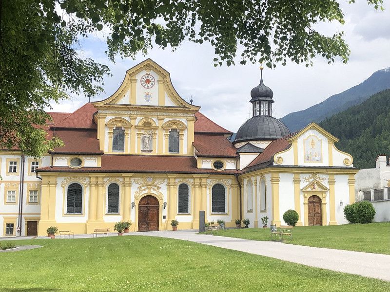
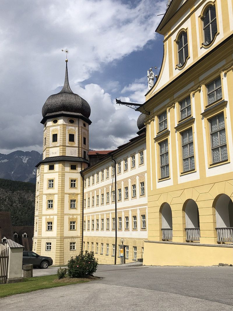
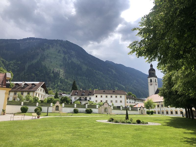
Camping Eichenwald
The Eichenwald campsite in Stams is a good place to stop overnight while passing through. There are several permanent campers and terraced pitches not far from the small town.
The showers and toilets are fine and clean but a bit outdated.
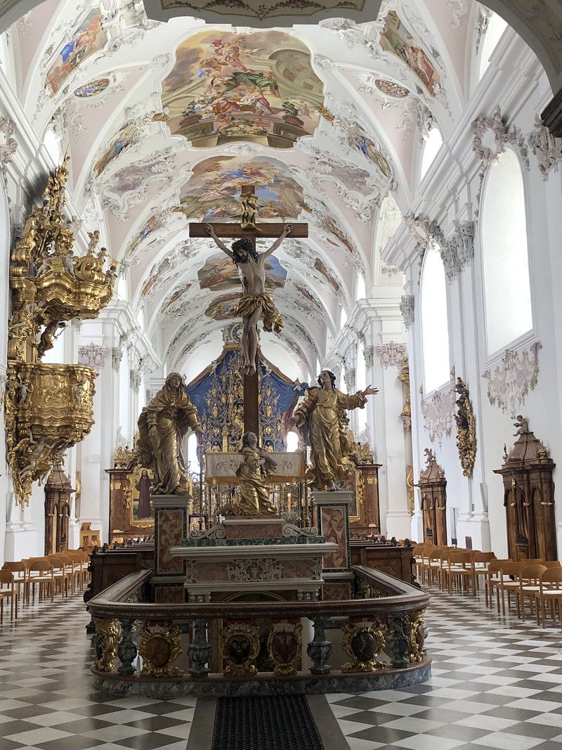
The Cistercian monastery with its basilica and orangery is very beautiful, although it is not open every day.
There is a shopping opportunity at the local Spar supermarket.
Cost for 1 night € 34,00 with ACSI card
including tourist tax and environmental tax.
- Cash payment only -
Schießstandweg 10, 6422, Stams, Austria
47° 16' 28" N 10° 59' 13" E
47.2744444 10.9869444
• Head north on Schießstandweg. Go for 193 m.
• Turn left onto Rinderweg. Go for 42 m.
• Continue on Thomas-Riß-Weg. Go for 225 m.
• Turn right onto Wirtsgasse (L341). Go for 471 m.
• Take the 3rd exit from roundabout onto Tiroler Bundesstraße (B171). Go for 1.5 km.
• Turn left onto Mötzer Landesstraße (L236) toward Fernpass/Innsbruck/Bregenz/Mieming/Mötz/Obsteig. Go for 5.3 km.
• Take the 2nd exit from roundabout onto Mieminger Bundesstraße (B189) toward Reutte/Fernpaß/Nassereith. Go for 13.4 km.
• Keep left onto Mieminger Bundesstraße (B189) toward Reutte/Garmisch. Go for 91 m.
• Continue on Fernpass Bundesstraße (B179). Go for 49.1 km.
• Continue on Grenztunnel Füssen (A7). Go for 110 km.
• Take exit 122 toward Ulm/Neu-Ulm/Senden onto B28. Go for 10.6 km.
• Take ramp toward Neu-Ulm/Gewerbegebiet Neu-Ulm. Go for 356 m.
• Turn right onto Europastraße (B10) toward Augsburg/Neu-Ulm/Gewerbegebiet Neu-Ulm. Go for 519 m.
• Take ramp toward Ludwigsfeld/Zentrum/Glacis-Galerie/Hochschule/Wiley. Go for 332 m.
• Turn left onto Memminger Straße. Go for 713 m.
• Take the 2nd exit from Allgäuer Ring roundabout onto Memminger Straße toward Stadtmitte. Go for 361 m.
• Continue on Hermann-Köhl-Straße. Go for 69 m.
• Take the 1st exit from roundabout onto Bahnhofstraße. Go for 217 m.
• Turn left onto Ludwigstraße. Go for 286 m.
• Arrive at Ludwigstraße. Your destination is on the right.
☍
193,8 km
(2 hrs. 14 min.)
Neu-Ulm
Parking space Am Donaubad - TOP spot ,
A great parking spot, very easily accessible from the A7. Upon arrival around midday, we were able to choose a nice spot. Everything was very tidy and well-organized. The free Wi-Fi worked well.
Good supply and disposal, electricity has to be paid at the machine.
Cost for 24 hours: €14.00.
You can take a shower at the Donaubad for €2.00.
Dog walk along the Iller Canal and through the Glacis facilities.
Landkreis Neu-Ulm, Bayern, Deutschland
48° 23' 43.3" N 10° 0' 1.9" E
48.3953489 10.0005211
• Head toward Augsburger Straße on Ludwigstraße. Go for 11 m.
• Turn right onto Augsburger Straße. Go for 444 m.
• Turn right onto Reuttier Straße (St2021). Go for 1.7 km.
• Take the 3rd exit from roundabout onto Europastraße (B10). Go for 6.7 km.
• Take ramp onto A7 toward Würzburg/München/Augsburg. Go for 243 km.
• Take exit 95 toward Bad Brückenau/Bischofsheim/Jossa/Wildflecken. Go for 553 m.
• Continue on B286 toward Bad Brückenau/Bischofsheim/Jossa/Wildflecken. Go for 6.1 km.
• Turn left onto Ancenis-Straße (St2790) toward Hammelburg/Jossa. Go for 1.6 km.
• Turn right onto Bahnhofstraße (St2289) toward Schlüchtern/Jossa. Go for 2.6 km.
• Turn right onto Amand-von-Buseck-Straße (St3180). Go for 1.0 km.
• Turn left. Go for 57 m.
• Arrive at your destination on the left.
☍
264,1 km
(2 hrs. 33 min.)
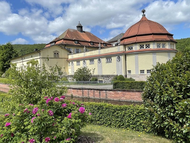
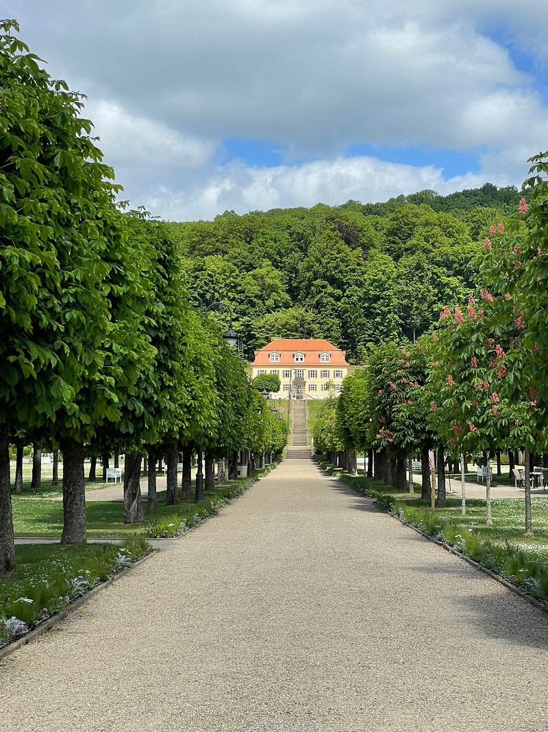
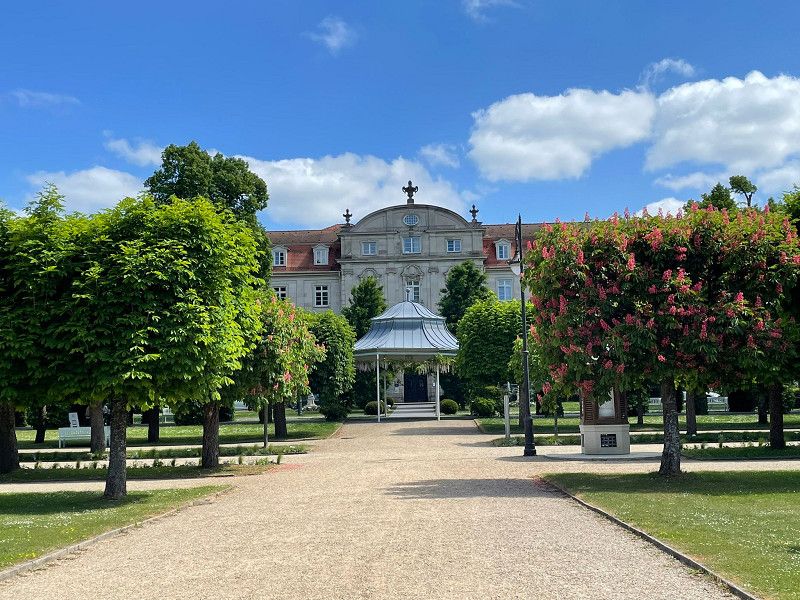
Stellplatz im Schlosspark
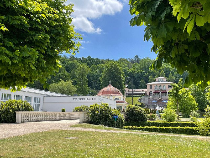
Schlüchterner Straße, 97769, Bad Brückenau, Germany
50° 18' 20" N 9° 44' 58" E
50.3055556 9.7494444
• Head toward Schlüchterner Straße. Go for 57 m.
• Turn right onto Schlüchterner Straße (St3180). Go for 1.0 km.
• Turn left onto Wernarzer Straße (St2289). Go for 2.6 km.
• Turn left onto Bahnhofstraße (St2790). Go for 1.6 km.
• Turn left onto Kissinger Straße (B286) toward Fulda. Go for 316 m.
• Turn right onto Altstadt (B286). Go for 4.2 km.
• Turn left and take ramp onto A7 toward Kassel. Go for 62.8 km.
• Continue on A7. Go for 57.3 km.
• Take exit 80 toward Dortmund/Paderborn/Kreuz Kassel-West onto A44. Go for 73.3 km.
• Take exit 61 toward Bielefeld/Paderborn onto A33. Go for 45.8 km.
• Take exit 21 toward Hannover/Bielefeld-Süd onto A2. Go for 20.2 km.
• Take exit 29 toward Herford/Lübbecke onto B239 (Am Zubringer). Go for 4.9 km.
• Keep left onto B61. Go for 4.4 km.
• Turn left onto Goebenstraße (B61) toward Osnabrück/A30/B239/Espelkamp/Lübbecke/Kirchlengern. Go for 3.2 km.
• Pass 2 roundabouts and continue on Löhner Straße (B61). Go for 3.5 km.
• Turn left onto Ostring (B61) toward Osnabrück/A30/Hannover/Espelkamp/Lübbecke/Kirchlengern/B239. Go for 14.4 km.
• Turn left onto Franz-Welschof-Straße. Go for 60 m.
• Continue on Am Markt. Go for 130 m.
• Arrive at Am Markt. Your destination is on the left.
☍
299,7 km
(3 hrs. 6 min.)
Lübbecke
Kreis Minden-Lübbecke, Nordrhein-Westfalen, Deutschland
52° 18' 9.8" N 8° 37' 5.9" E
52.3027209 8.6183054