Day
Kirchroth, Deutschland
Dekan-Seitz-Straße 13, 94356 Kirchroth, Deutschland
48° 57' 14.8" N 12° 32' 32.5" E
48.9541082 12.5423648
• Head toward Regensburger Straße on Dekan-Seitz-Straße (SR64). Go for 355 m.
• Turn left onto St2148. Go for 390 m.
• Take ramp onto A3 toward Nürnberg/Regensburg. Go for 147 km.
• Take the exit toward Suhl/Bamberg/Schweinfurt/Erlangen onto A73 (Frankenschnellweg). Go for 47.0 km.
• Take the exit toward Kassel/Schweinfurt/Bamberg Hafen onto A70. Go for 65.7 km.
• Take exit 2 toward Kassel/Fulda onto A7. Go for 112 km.
• Continue on A7. Go for 57.3 km.
• Take exit 80 toward Dortmund/Paderborn/Kreuz Kassel-West onto A44. Go for 73.3 km.
• Take exit 61 toward Bielefeld/Paderborn onto A33. Go for 97.2 km.
• Take exit 9 toward Amsterdam/Os.-Nahne onto A30. Go for 61.3 km.
• Take exit 5 toward Emden/Emsbüren onto A31. Go for 116 km.
• Take exit 9 toward Norddeich/Emden/Veenhusen onto A31. Go for 27.1 km.
• Take exit 3 toward Aurich/Norddeich. Go for 654 m.
• Turn right onto Auricher Straße (B210) toward Aurich/Nordhorn/Gewerbegebiet Nord II. Go for 1.3 km.
• Turn left onto L3 toward Pewsum/Greetsiel/Hinte. Go for 2.3 km.
• Turn right onto K229 toward Greetsiel/Cirkwehrum. Go for 1.1 km.
• Continue on Cirkwehrumer Straße (K229). Go for 2.8 km.
• Continue on K229. Go for 873 m.
• Continue on Cirkwehrumer Straße (K229). Go for 614 m.
• Continue on Jennelter Straße (K229). Go for 1.5 km.
• Continue on Uttumer Straße (K229). Go for 835 m.
• Turn right onto Eilsumer Straße (L4). Go for 929 m.
• Turn left onto Greetsieler Straße (L25). Go for 4.4 km.
• Continue on Mühlenstraße. Go for 56 m.
• Turn right. Go for 28 m.
• Turn slightly left. Go for 266 m.
• Arrive at your destination.
☍
821,7 km
(7 hrs. 21 min.)
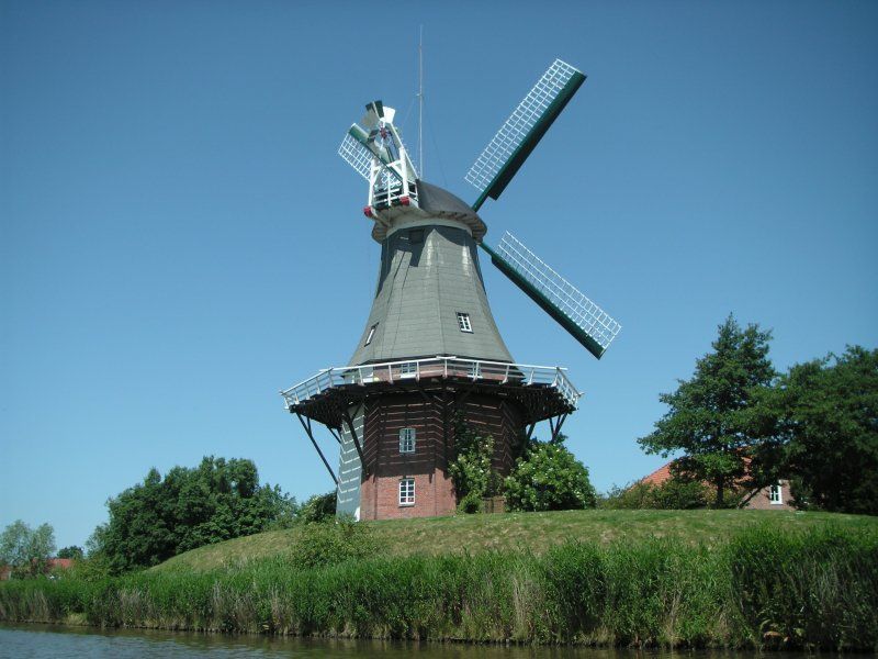
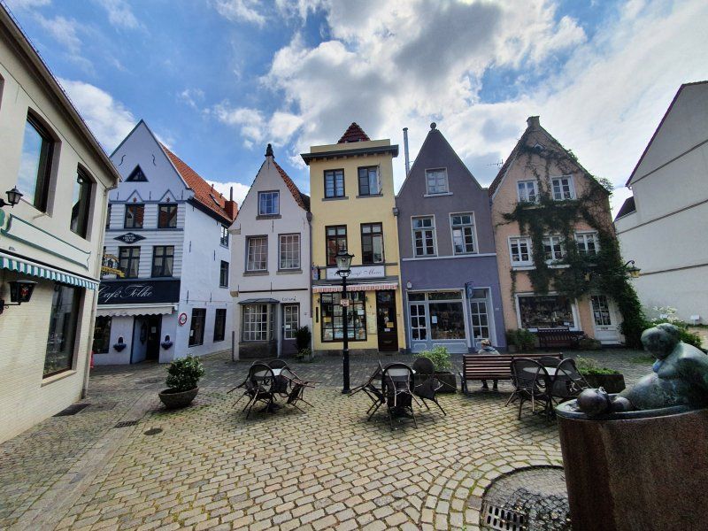
Wohnmobilstellplatz Greetsiel
Mühlenstraße, 26736 Krummhörn, Deutschland
53° 29' 54.4" N 7° 6' 18.8" E
53.4984367 7.1052361
• Head south. Go for 119 m.
• Turn left toward Mühlenstraße. Go for 190 m.
• Turn left onto Mühlenstraße. Go for 56 m.
• Turn left onto L27. Go for 5.4 km.
• Continue on Königsweg (K221). Go for 2.5 km.
• Continue on Neuwesteeler Straße (K221). Go for 1.9 km.
• Turn left onto L4 toward Norden/Süderneuland. Go for 4.4 km.
• Turn right onto Bahnhofstraße (L4). Go for 183 m.
• Turn left onto B72 toward Norddeich/Esens/Hage. Go for 591 m.
• Arrive at B72.
☍
15,3 km
( 14 min.)
Day
B72, 26524 Lütetsburg, Deutschland
53° 35' 18.3" N 7° 13' 54.4" E
53.5884072 7.2317902
• Head northeast on B72. Go for 1.4 km.
• Take the 1st exit from roundabout onto L6. Go for 4.4 km.
• Take the 2nd exit from roundabout onto Hagermarscher Straße (K210) toward Dornum/Hagermarsch/Gewerbegebiet Hage-Ost. Go for 2.8 km.
• Continue on Domumer Straße (K210). Go for 1.7 km.
• Continue on Cankebeerstraße (K210). Go for 6.3 km.
• Continue on Westerstraße (K210). Go for 1.0 km.
• Turn right onto Schatthauser Straße (L7). Go for 465 m.
• Turn left onto Alte-Post-Straße (K210). Go for 188 m.
• Continue on Accumer Riege (K210). Go for 4.4 km.
• Continue on Ziegeleistraße (K1). Go for 2.4 km.
• Continue on Am Bahnsteig (K1). Go for 504 m.
• Continue on Hartsgaster Straße (K1). Go for 2.7 km.
• Continue on Norder Landstraße (L6). Go for 15.0 km.
• Take the 3rd exit from roundabout onto Algershausener Straße (L10). Go for 1.1 km.
• Take the 2nd exit from roundabout onto B461. Go for 990 m.
• Pass 2 roundabouts and continue on B461. Go for 1.3 km.
• Turn right onto Jeverstraße (B210). Go for 16.6 km.
• Take ramp onto A29 toward Oldenburg. Go for 17.6 km.
• Take exit 8 toward Varel/Dangast/Nordenham/Bockhorn/Wesertunnel onto B437. Go for 3.0 km.
• Continue on Bürgermeister-Heidenreich-Straße (B437) toward Nordenham. Go for 723 m.
• Take the 2nd exit from roundabout onto Bürgermeister-Heidenreich-Straße (B437) toward Nordenham. Go for 20.9 km.
• Take ramp onto B212 toward Bremen/A27/Cuxhaven/Nordenham/Rodenkirchen. Go for 4.0 km.
• Take ramp onto B437 toward Bremen/A27/Cuxhaven/Stotel. Go for 9.9 km.
• Take ramp onto A27 toward Cuxhaven/Bremerhaven. Go for 28.5 km.
• Take exit 4 toward Neuenwalde/Otterndorf/Wanna/Dorum. Go for 297 m.
• Turn left onto L119 toward Otterndorf/Neuenwalde/Bederkesa/Wanna. Go for 1.4 km.
• Continue on Dorfmitte (L118). Go for 10.9 km.
• Turn left onto K5. Go for 311 m.
• Continue on Kirchweg (K5). Go for 466 m.
• Continue on Feuerstättenweg (K5). Go for 914 m.
• Turn right. Go for 1.3 km.
• Arrive at your destination.
☍
163,4 km
(2 hrs. 5 min.)
QQ7C+F2 Nordleda, Deutschland
53° 45' 49.4" N 8° 46' 12.4" E
53.7637361 8.7700989
• Head toward Feuerstättenweg. Go for 1.3 km.
• Turn left onto Feuerstättenweg (K5). Go for 914 m.
• Continue on Kirchweg (K5). Go for 466 m.
• Continue on K5. Go for 311 m.
• Turn right onto Landesstraße (L118) toward Bremerhaven/Krempel. Go for 10.9 km.
• Continue on Dorumer Straße (L119). Go for 1.7 km.
• Turn left and take ramp onto A27 toward Bremen/Bremerhaven. Go for 27.7 km.
• Take exit 11 toward Oldenburg/A29/Wilhelmshaven. Go for 506 m.
• Continue on B437. Go for 9.8 km.
• Take ramp onto B212. Go for 3.4 km.
• Take ramp onto B437 toward A29/Oldenburg/Wilhelmshaven/Varel. Go for 21.3 km.
• Take the 2nd exit from roundabout onto Bürgermeister-Heidenreich-Straße (B437) toward Oldenburg/Wilhelmshaven/Friedeburg/B436. Go for 3.1 km.
• Take ramp onto A29 toward Wilhelmshaven. Go for 16.8 km.
• Take exit 5 toward Wittmund/Jever/Schortens onto B210. Go for 12.5 km.
• Take ramp toward Wangerooge/Flughafen/Carolinensiel/Jever-West. Go for 348 m.
• Turn right onto L808 toward Wangerooge Flugplatz/Carolinensiel/Wiefels. Go for 15.6 km.
• Take the 1st exit from roundabout onto Bahnhofstraße (L808). Go for 576 m.
• Continue on Kirchstraße (B461). Go for 35 m.
• Turn right onto Kirchstraße (L6). Go for 136 m.
• Turn right onto Pumphusen. Go for 185 m.
• Arrive at Pumphusen. Your destination is on the left.
☍
127,8 km
(1 hrs. 36 min.)
Day
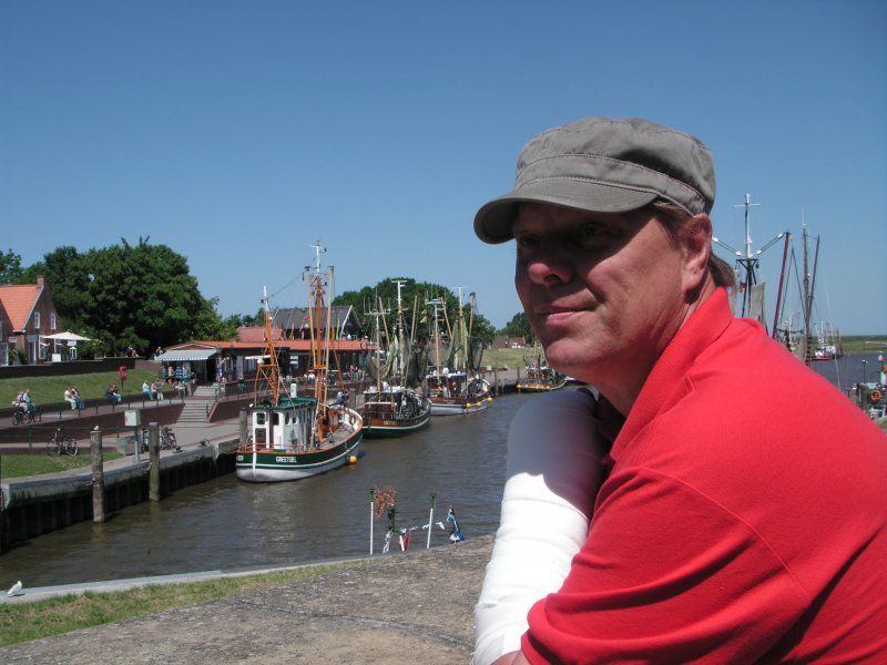
Nationalpark-Haus Carolinensiel
Pumphusen 3, 26409 Wittmund, Deutschland
53° 41' 32.2" N 7° 48' 8.6" E
53.6922693 7.8023905
• Head toward Mühlenstraße on Pumphusen. Go for 185 m.
• Turn left onto Kirchstraße (L6). Go for 136 m.
• Turn right onto Wittmunder Straße (B461). Go for 608 m.
• Take the 2nd exit from roundabout onto Wittmunder Straße (B461) toward Wittmund. Go for 5.0 km.
• Turn left onto Funnixerriege (K19). Go for 1.0 km.
• Continue on Berdumerriege (K19). Go for 1.9 km.
• Continue on K89. Go for 644 m.
• Continue on Häuptlingsstraße (K89). Go for 1.6 km.
• Turn right onto L808 toward Jever. Go for 6.5 km.
• Turn right and take ramp onto B210 toward A29/Oldenburg/Wilhelmshaven/Jever-Zentrum. Go for 11.6 km.
• Take ramp onto A29 toward Oldenburg. Go for 51.8 km.
• Take the exit toward Bremen onto A28. Go for 31.1 km.
• Take the exit toward Bremen/Delmenhorst-Stickgras onto B75 (Oldenburger Straße). Go for 10.0 km.
• Take ramp toward Woltmershausen/Hohentorshafen. Go for 296 m.
• Continue on Friesenwerder. Go for 249 m.
• Turn right onto Große Sortillienstraße. Go for 295 m.
• Continue on Westerstraße. Go for 576 m.
• Continue on Osterstraße. Go for 192 m.
• Turn left onto Friedrich-Ebert-Straße. Go for 64 m.
• Continue on Wilhelm-Kaisen-Brücke. Go for 90 m.
• Continue on Wilhelm-Kaisen-Brücke. Go for 87 m.
• Turn right onto Franziuseck. Go for 59 m.
• Continue on Werderstraße. Go for 754 m.
• Continue on Kuhhirtenweg. Go for 471 m.
• Turn left. Go for 11 m.
• Arrive at your destination on the left.
☍
125,3 km
(1 hrs. 26 min.)
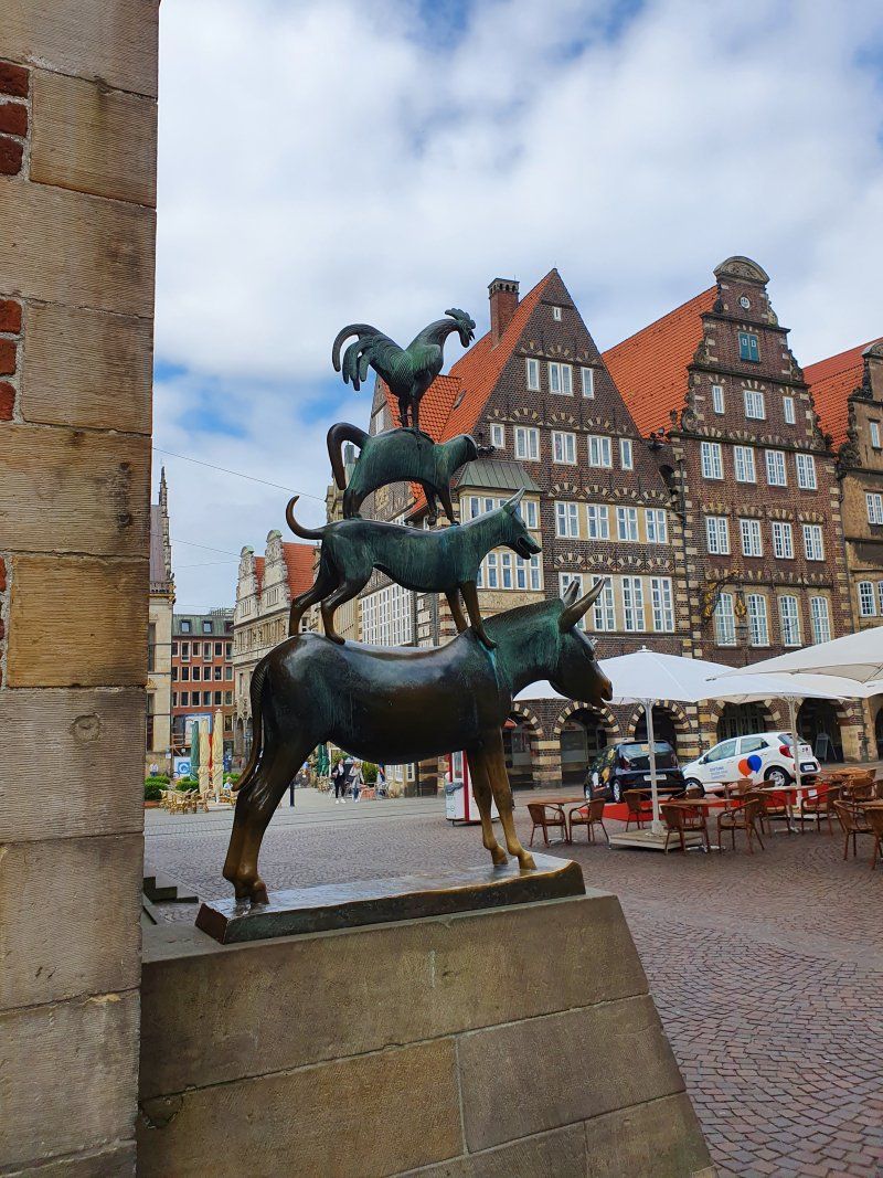
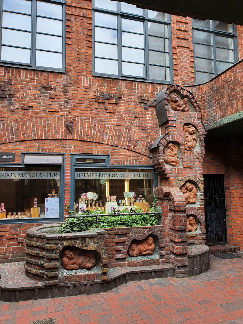
Reisemobil Stellplatz Am Kuhhirten
Kuhhirtenweg, 28201 Bremen, Deutschland
53° 3' 54.5" N 8° 49' 7.4" E
53.0651511 8.8187170
• Head toward Kuhhirtenweg. Go for 11 m.
• Turn right onto Kuhhirtenweg. Go for 471 m.
• Continue on Werderstraße. Go for 754 m.
• Continue on Franziuseck. Go for 59 m.
• Turn right onto Wilhelm-Kaisen-Brücke. Go for 157 m.
• Make a U-Turn onto Wilhelm-Kaisen-Brücke. Go for 367 m.
• Continue on Wilhelm-Kaisen-Brücke. Go for 81 m.
• Continue on Friedrich-Ebert-Straße. Go for 46 m.
• Turn right onto Osterstraße. Go for 197 m.
• Continue on Westerstraße. Go for 578 m.
• Continue on Große Sortillienstraße. Go for 295 m.
• Turn right and take ramp onto Oldenburger Straße (B6) toward Cuxhaven/A27/Bremerhaven/Bremen-Nord. Go for 576 m.
• Keep left onto Oldenburger Straße (B6) toward Cuxhaven/A27/Bremerhaven/Schwachhausen/Findorff. Go for 572 m.
• Keep left onto Oldenburger Straße (B6) toward Cuxhaven/A27/Bremerhaven/Schwachhausen. Go for 1.5 km.
• Keep left onto Autobahnzubringer Überseestadt (B6). Go for 2.4 km.
• Take ramp onto A27. Go for 64.3 km.
• Take exit 5 toward Debstedt/Langen/Wremen/Bad Bederkesa. Go for 389 m.
• Turn right onto L120 toward Bederkesa/Drangstedt. Go for 10.5 km.
• Take the 1st exit from roundabout onto L119 toward Bremervörde/Beverstedt. Go for 1.6 km.
• Pass 2 roundabouts and continue on L119. Go for 21.2 km.
• Turn left onto Große Straße (B495). Go for 19.7 km.
• Turn left onto Birkenstraße (K12) toward Oederquart/Neulandermoor. Go for 2.5 km.
• Turn right onto Moorchaussee (K13). Go for 1.6 km.
• Turn left onto Stader Straße (B495). Go for 1.2 km.
• Turn right onto Glückstädter Straße (B495) toward Glückstadt/Elbfähre. Go for 892 m.
• Arrive at Glückstädter Straße (B495).
☍
131,8 km
(1 hrs. 40 min.)
Day
Day
Wischhafen, Deutschland
Glückstädter Strasse, 21737 Wischhafen, Deutschland
53° 47' 18.4" N 9° 20' 42.6" E
53.7884351 9.3451697
• Head northeast on Glückstädter Straße (B495). Go for 483 m.
• Take the Glückstadt-Wischhafen Ferry. Stay on for 5.3 km.
• Head north on Op de Wurt. Go for 2.6 km.
• Turn left onto Am Altendeich (B431) toward Brunsbüttel/Brokdorf. Go for 8.5 km.
• Take the 2nd exit from roundabout onto Dorfstraße (B431) toward Brunsbüttel/St. Margarethen/Sportzentrum. Go for 6.8 km.
• Turn left onto Hauptstraße (B431). Go for 22 m.
• Turn right onto Bahnhofstraße (B431). Go for 3.3 km.
• Turn left and take ramp onto B5 toward Heide/Brunsbüttel. Go for 6.6 km.
• Take ramp toward Burg/St. Michaelisdonn/Brunsbüttel-Nord/Industriegebiet Nord. Go for 337 m.
• Turn right onto Fritz-Staiger-Straße (L138). Go for 794 m.
• Turn right onto Westerbütteler Straße. Go for 802 m.
• Arrive at Westerbütteler Straße.
☍
35,6 km
(1 hrs. 8 min.)
Brunsbüttel, Deutschland
Westerbütteler Str. 17, 25541 Brunsbüttel, Deutschland
53° 55' 4.7" N 9° 8' 50" E
53.9179713 9.1472123
• Head west on Westerbütteler Straße. Go for 206 m.
• Turn right onto Westerbütteler Straße. Go for 282 m.
• Continue on Eddelaker Straße. Go for 1.0 km.
• Turn right onto Schmiedestraße. Go for 685 m.
• Turn right onto Olof-Palme-Allee. Go for 791 m.
• Take ramp onto B5. Go for 3.2 km.
• Take the 2nd exit from roundabout onto Marner Chaussee (B5) toward Heide/Marne. Go for 7.2 km.
• Turn left onto Fahrstedterwesterdeich (K8). Go for 393 m.
• Turn right onto Claus-Harms-Weg (K9). Go for 687 m.
• Continue on Ölmühlenweg (K9). Go for 1.6 km.
• Continue on Süderquerweg (L143). Go for 557 m.
• Continue on Süderquerweg (K12). Go for 564 m.
• Continue on Süderstraße (K12). Go for 573 m.
• Turn right onto Sommerdeich (K10). Go for 2.6 km.
• Take the 2nd exit from roundabout onto Sommerdeich (L177). Go for 7.9 km.
• Turn left onto Schleusenweg. Go for 478 m.
• Turn left onto An der Seeschleuse. Go for 195 m.
• Arrive at An der Seeschleuse. Your destination is on the right.
☍
29,0 km
( 26 min.)
Seehundstation Friedrichskoog
An der Seeschleuse 4, 25718 Friedrichskoog, Deutschland
54° 0' 3.3" N 8° 52' 35.8" E
54.0009083 8.8766098
• Head west on An der Seeschleuse. Go for 138 m.
• Turn right onto An der Seeschleuse. Go for 259 m.
• Continue on Schleusenweg. Go for 478 m.
• Turn right onto Am Hafen (L177). Go for 5.3 km.
• Turn left onto Kirchenstraße (K13). Go for 890 m.
• Continue on Mittelstraße (K13). Go for 3.2 km.
• Turn left onto Helserdieker Strot (K20). Go for 1.1 km.
• Take the 2nd exit from roundabout onto Helserdieker Strot (K20). Go for 1.1 km.
• Continue on Trennewurtherneuendeich (K20). Go for 1.4 km.
• Turn right onto Trennewurtheraltendeich (L144). Go for 1.5 km.
• Continue on Op de Meent (L144). Go for 414 m.
• Turn left onto Bundesstraße (B5). Go for 11.1 km.
• Turn left onto Hafenchaussee (L153). Go for 11.2 km.
• Turn left onto Chausseestraße. Go for 284 m.
• Continue on Allee (L153). Go for 959 m.
• Pass 2 roundabouts and continue on Dohrnstraße (L305). Go for 14.6 km.
• Arrive at L305. Your destination is on the left.
☍
53,8 km
( 48 min.)
Eider-Sperrwerk
25764 Wesselburenerkoog, Deutschland
54° 15' 52.6" N 8° 50' 43.8" E
54.2645975 8.8454962
• Head north on L305. Go for 10.6 km.
• Turn right onto Süderdeich (L33). Go for 2.1 km.
• Turn left onto Osterende (B202). Go for 7.7 km.
• Turn right toward Utholmer Straße/K9. Go for 56 m.
• Continue on Utholmer Straße (K9). Go for 947 m.
• Turn right. Go for 31 m.
• Arrive at your destination on the right.
☍
21,5 km
( 18 min.)
Campingplatz Biehl
Utholmer Str. 1, 25826 St. Peter-Ording, Deutschland
54° 20' 10.6" N 8° 36' 16" E
54.3362788 8.6044514
• Head toward Utholmer Straße. Go for 31 m.
• Turn left onto Utholmer Straße (K9). Go for 947 m.
• Turn slightly right onto Utholmer Straße (K9). Go for 41 m.
• Turn left onto Brösumer Straße (B202). Go for 23.2 km.
• Take ramp onto B5. Go for 17.5 km.
• Continue on A23. Go for 95.0 km.
• Continue on A7 (Autobahndreieck Hamburg-Nordwest). Go for 7.0 km.
• Keep left onto A7. Go for 21.7 km.
• Keep right onto A39 (Maschener Kreuz) toward Lüneburg/Seevetal-Maschen/Lübeck/Berlin/Bremen/A1. Go for 31.8 km.
• Continue on B4. Go for 1.8 km.
• Take ramp toward Stadtmitte. Go for 316 m.
• Turn right onto Bockelmannstraße toward Lüneburg/Stadtmitte/Kloster Lüne. Go for 2.0 km.
• Continue on Am Schifferwall. Go for 169 m.
• Continue on Schießgrabenstraße. Go for 379 m.
• Continue on Willy-Brandt-Straße. Go for 459 m.
• Turn right onto Stresemannstraße. Go for 403 m.
• Turn right onto Rote Straße. Go for 219 m.
• Arrive at Rote Straße.
☍
202,8 km
(2 hrs. 6 min.)
Day
Day
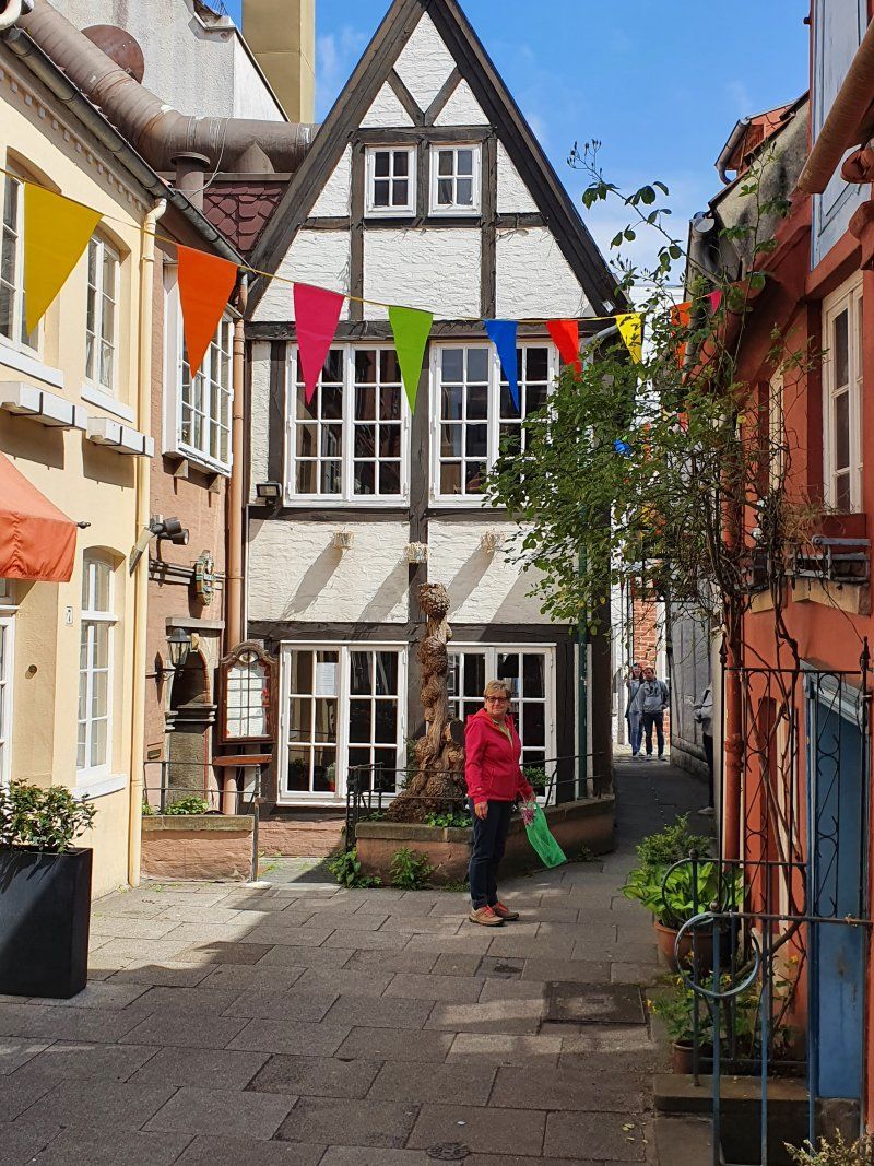
Lüneburg, Deutschland
Grapengießerstraße 7, 21335 Lüneburg, Deutschland
53° 14' 51.8" N 10° 24' 27.8" E
53.2477199 10.4077246
• Head toward Wallstraße on Rote Straße. Go for 219 m.
• Turn left onto Stresemannstraße. Go for 385 m.
• Turn right onto Willy-Brandt-Straße. Go for 1.7 km.
• Continue on Universitätsallee. Go for 828 m.
• Continue on Uelzener Straße. Go for 1.3 km.
• Continue on Harz-Heide Straße. Go for 86 m.
• Continue on Neu-Häcklingen. Go for 205 m.
• Continue on Harz-Heide Straße. Go for 99 m.
• Take the 2nd exit from roundabout onto Harz-Heide Straße. Go for 2.9 km.
• Continue on Uelzener Straße (B4) toward Braunschweig/Uelzen/Bad Bevensen/Bienenbüttel. Go for 24.0 km.
• Take the 3rd exit from roundabout onto B4 toward Braunschweig/Uelzen. Go for 1.9 km.
• Keep left onto B4 toward Braunschweig/B191/Hannover/B71/Salzwedel/Uelzen Gewerbegebiet/Stadtmitte. Go for 14.0 km.
• Pass 2 roundabouts and continue on An der Krümme (B4). Go for 64.0 km.
• Continue on A391. Go for 1.5 km.
• Take exit 2 toward Flughafen Berlin/Wolfsburg onto A2. Go for 74.9 km.
• Take exit 68 toward Leipzig/Dresden/Halle onto A14. Go for 107 km.
• Take exit 20 toward München/Erfurt onto A9. Go for 138 km.
• Take exit 33 toward Chemnitz/Regensburg/Hof-Nord onto A72. Go for 14.7 km.
• Take exit 4 toward Regensburg/Prag/Praha onto A93. Go for 178 km.
• Take exit 44 toward Passau onto A3. Go for 37.0 km.
• Take exit 105 toward Kirchroth/Straubing-Zentrum/P+R. Go for 339 m.
• Turn right onto St2148 toward Straubing-Zentrum/Kößnach/Kirchroth. Go for 219 m.
• Turn left onto Dekan-Seitz-Straße. Go for 15 m.
• Turn right onto Dekan-Seitz-Straße. Go for 572 m.
• Turn left onto Lindenstraße. Go for 103 m.
• Arrive at Lindenstraße. Your destination is on the right.
☍
663,6 km
(6 hrs. )
Day
Kirchroth, Deutschland
Lindenstraße 30, 94356 Kirchroth, Deutschland
48° 57' 9.4" N 12° 32' 58.7" E
48.9526124 12.5496459