A nice summer tour through northern Europe. We drove from Germany through Poland, Lithuania, Latvia and Estonia. On the way back, I took the ferry back to Kiel from Klaipeda. We have rarely had a more relaxed vacation, highly recommended.
Day
Bremen, Deutschland
53° 4' 45.5" N 8° 48' 6.1" E
53.0792962 8.8016937
• Head toward Am Brill on Bürgermeister-Smidt-Straße. Go for 95 m.
• Turn left onto Martinistraße. Go for 559 m.
• Keep left onto Martinistraße. Go for 335 m.
• Continue on Tiefer. Go for 145 m.
• Keep right onto Osterdeich. Go for 3.1 km.
• Continue on Hastedter Osterdeich toward A1/Hamburg/Hannover/Rotenburg/Sebaldsbrück/Hemelingen. Go for 994 m.
• Turn left toward Hamburg-Osnabrück/Rotenburg/Sebaldsbrück/Weserhafen/Hemelingen. Go for 27 m.
• Turn slightly left onto Malerstraße. Go for 262 m.
• Turn right onto Pfalzburger Straße. Go for 848 m.
• Keep left onto Autobahnzubringer Hemelingen toward A1/Mahndorf/Arbergen. Go for 2.5 km.
• Take ramp onto A1 toward Hamburg/Hannover. Go for 91.1 km.
• Take the exit toward Lübeck/Berlin/Hamburg onto A1. Go for 14.6 km.
• Take exit 36 toward Lübeck/Berlin/Hamburg-Südost onto A1. Go for 56.6 km.
• Take exit 24 toward Rostock/Lübeck-Genin/Flughafen Lübeck onto A20. Go for 217 km.
• Take exit 28 toward Jarmen/Dargun/Demmin/Anklam-Nord. Go for 329 m.
• Turn right onto B110 toward Anklam. Go for 5.4 km.
• Turn left onto An der Chaussee (K62) toward Kagenow. Go for 73 m.
• Continue on K62. Go for 1.7 km.
• Continue on Kagenow (K62). Go for 127 m.
• Turn left onto Kagenow. Go for 210 m.
• Turn slightly right onto Kagenow. Go for 1.4 km.
• Arrive at Kagenow. Your destination is on the left.
☍
397,4 km
(3 hrs. 39 min.)
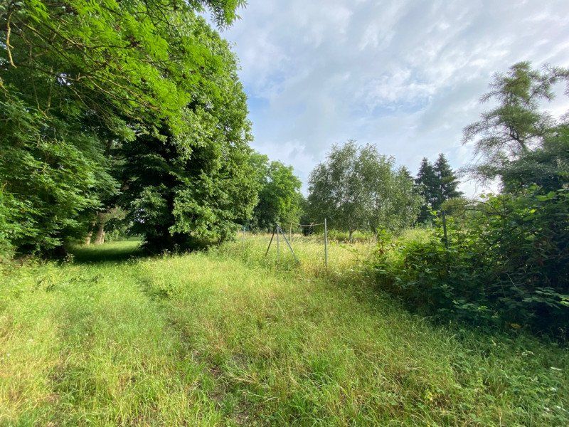
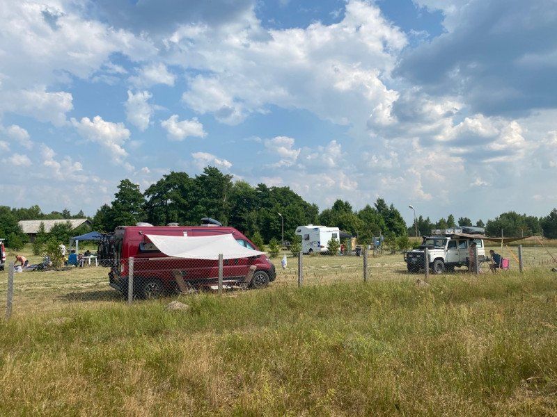
Kagenow
Just a short overnight stop on the Peene
Kagenow 29–30A
53° 54' 43.6" N 13° 25' 23.1" E
53.9121112 13.4230916
• Head south on Kagenow. Go for 1.4 km.
• Turn slightly left onto Kagenow. Go for 210 m.
• Turn right onto Kagenow (K62). Go for 127 m.
• Continue on K62. Go for 1.7 km.
• Continue on An der Chaussee (K62). Go for 73 m.
• Turn left onto An der Chaussee (B110) toward Anklam. Go for 17.4 km.
• Continue on Demminer Landstraße (B110) toward Anklam. Go for 251 m.
• Take the 1st exit from roundabout onto B109/B110 toward Greifswald/Insel Usedom. Go for 5.0 km.
• Take ramp onto B110 toward Insel Usedom/Swinemünde. Go for 4.5 km.
• Turn right onto Dorfstraße (B110). Go for 31.0 km.
• Turn right onto Schulstraße (B110) toward Swinemünde/Kamminke. Go for 5.4 km.
• Continue on 93. Go for 1.7 km.
• Turn right onto ulica Nowokarsiborska (93). Go for 3.9 km.
• Take the 3rd exit from roundabout onto S3. Go for 25.1 km.
• Turn right toward ulica Gryfitów. Go for 54 m.
• Continue on ulica Gryfitów. Go for 569 m.
• Continue on ulica Zamkowa. Go for 1.1 km.
• Turn left onto Recław (111). Go for 2.9 km.
• Continue on Laska. Go for 4.6 km.
• Continue on Sibin. Go for 2.0 km.
• Continue on Kukułowo. Go for 2.7 km.
• Continue on Dusin. Go for 2.0 km.
• Continue on Skarchowo. Go for 2.4 km.
• Continue on Jarszewo. Go for 297 m.
• Turn right onto ulica Ku Słońcu. Go for 1.8 km.
• Turn left onto 107. Go for 2.0 km.
• Turn sharp right onto 106. Go for 17.5 km.
• Pass 2 roundabouts and continue on 108. Go for 20.1 km.
• Take the 3rd exit from roundabout onto ulica Jagiellonów (109) toward Gryfice/Gdańsk/Szczecin. Go for 432 m.
• Take the 1st exit from roundabout onto E28 toward Gdańsk. Go for 97.7 km.
• Take ramp toward Sianów. Go for 287 m.
• Take the 1st exit from roundabout onto 6 toward Sianów. Go for 182 m.
• Continue on ulica Łużycka (6) toward S6/Sianów/Koszalin/Szczecin. Go for 1.3 km.
• Turn left onto ulica Lubuszan. Go for 7.1 km.
• Continue on Przytok. Go for 3.7 km.
• Continue on Ratajki. Go for 2.8 km.
• Turn left onto Sowieński Młyn. Go for 1.2 km.
• Continue on Sierakowo Sławieńskie. Go for 981 m.
• Continue on Sierakówko. Go for 301 m.
• Continue on Sierakowo Sławieńskie. Go for 848 m.
• Turn right onto Sierakowo Sławieńskie. Go for 343 m.
• Turn left toward Darskowo. Go for 3.5 km.
• Continue on Darskowo. Go for 1.5 km.
• Continue on Lejkowo. Go for 74 m.
• Turn left onto Lejkowo. Go for 924 m.
• Turn right toward Lejkowo. Go for 29 m.
• Continue on Lejkowo. Go for 1.8 km.
• Continue on Święcianowo. Go for 1.4 km.
• Continue on Żegocino. Go for 3.1 km.
• Continue on Smardzewo. Go for 557 m.
• Take the 2nd exit from roundabout onto Smardzewo. Go for 3.8 km.
• Turn right onto Bobrowice (E28). Go for 18.6 km.
• Take the 2nd exit from roundabout. Go for 403 m.
• Take the 1st exit from roundabout onto ulica Słupska (E28). Go for 4.7 km.
• Turn right onto E28. Go for 46 m.
• Turn left onto E28. Go for 27.6 km.
• Turn right onto 211 toward Kartuzy. Go for 20.5 km.
• Take the 3rd exit from rondo im. ks. Juliana Wójtowicza roundabout onto ulica Lęborska (212). Go for 16.7 km.
• Turn right onto ulica Wichrowa toward Łebunia. Go for 3.8 km.
• Continue on Łebunia. Go for 704 m.
• Turn left onto ulica Pomorska (214). Go for 309 m.
• Turn right onto ulica Kościelna. Go for 316 m.
• Continue on ulica Kościelna. Go for 2.4 km.
• Turn right onto Okalice. Go for 20 m.
• Continue on Popowo. Go for 587 m.
• Continue on Cewice. Go for 373 m.
• Continue on Popowo. Go for 629 m.
• Turn right toward Zakrzewo. Go for 1.3 km.
• Continue on Zakrzewo. Go for 3.0 km.
• Continue on Linia. Go for 402 m.
• Continue on ulica Długa. Go for 4.8 km.
• Continue on Tłuczewo. Go for 1.8 km.
• Continue on ulica Lipowa. Go for 2.4 km.
• Continue on ulica ks. Józefa Rotty. Go for 632 m.
• Turn left onto ulica ks. Józefa Rotty. Go for 1.5 km.
• Continue on ulica Wejherowska. Go for 889 m.
• Continue on Pobłocie. Go for 557 m.
• Continue on ulica Wejherowska. Go for 638 m.
• Continue on Pobłocie. Go for 178 m.
• Continue on ulica Wejherowska. Go for 1.1 km.
• Continue toward ulica Wejherowska. Go for 36 m.
• Take the 2nd exit from roundabout. Go for 49 m.
• Continue on ulica Wejherowska. Go for 712 m.
• Continue on Smażyno. Go for 796 m.
• Continue on Smażyno. Go for 1.2 km.
• Continue on ulica Wejherowska. Go for 2.2 km.
• Turn right onto ulica Szkolna. Go for 1.2 km.
• Continue on ulica Bór. Go for 874 m.
• Continue on ulica Szklana. Go for 1.3 km.
• Continue on ulica Mercerstwo. Go for 938 m.
• Take the 2nd exit from roundabout onto trasa Kaszubska (E28) toward Gdańsk. Go for 19.5 km.
• Keep left toward Gdynia/Sopot. Go for 995 m.
• Continue on ulica Chwaszczyńska. Go for 1.3 km.
• Continue on ulica Wielkopolska. Go for 594 m.
• Turn right onto ulica Sopocka. Go for 2.1 km.
• Continue on ulica Jacka Malczewskiego. Go for 2.5 km.
• Continue on aleja Niepodległości (468). Go for 1.8 km.
• Turn left onto ulica 3 Maja. Go for 469 m.
• Pass 2 roundabouts and continue on ulica 3 Maja. Go for 414 m.
• Turn right onto ulica Bitwy pod Płowcami. Go for 545 m.
• Take the 2nd exit from rondo marsz. Sejmu M. Płażyńskiego roundabout onto ulica Bitwy pod Płowcami. Go for 138 m.
• Arrive at ulica Bitwy pod Płowcami. Your destination is on the left.
☍
448,2 km
(6 hrs. 8 min.)
Day
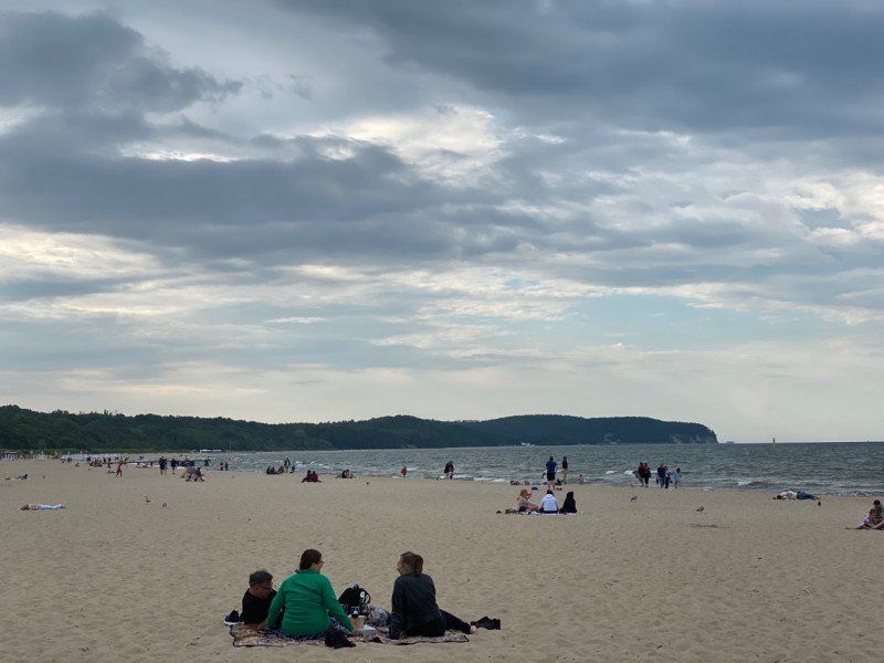
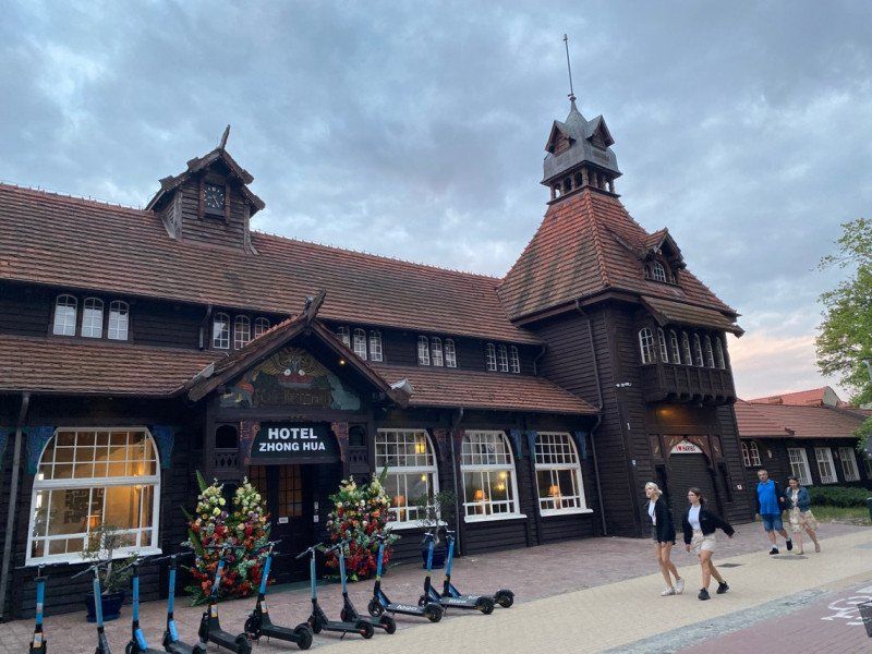
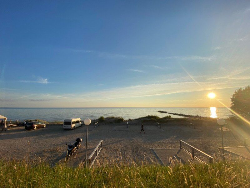
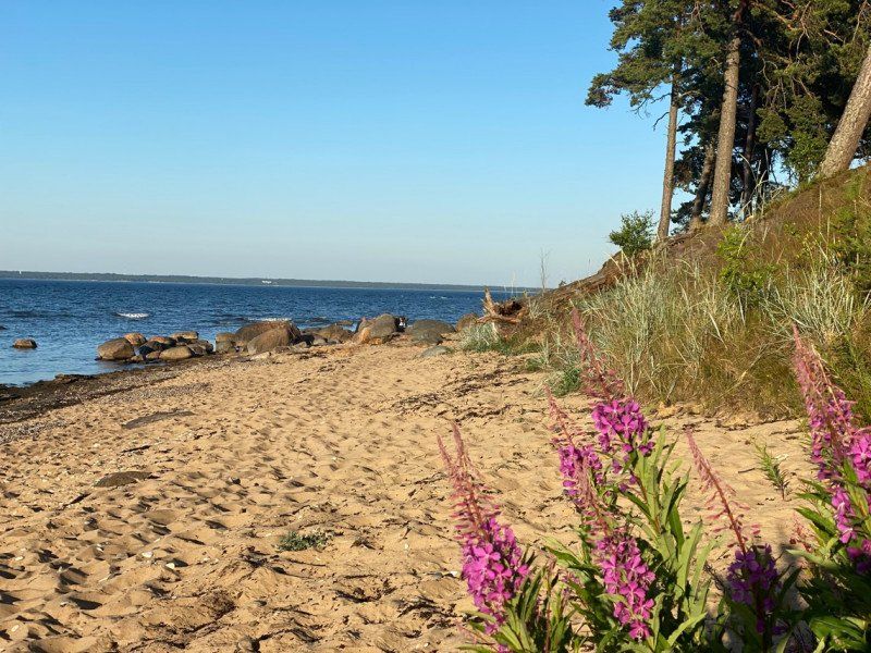
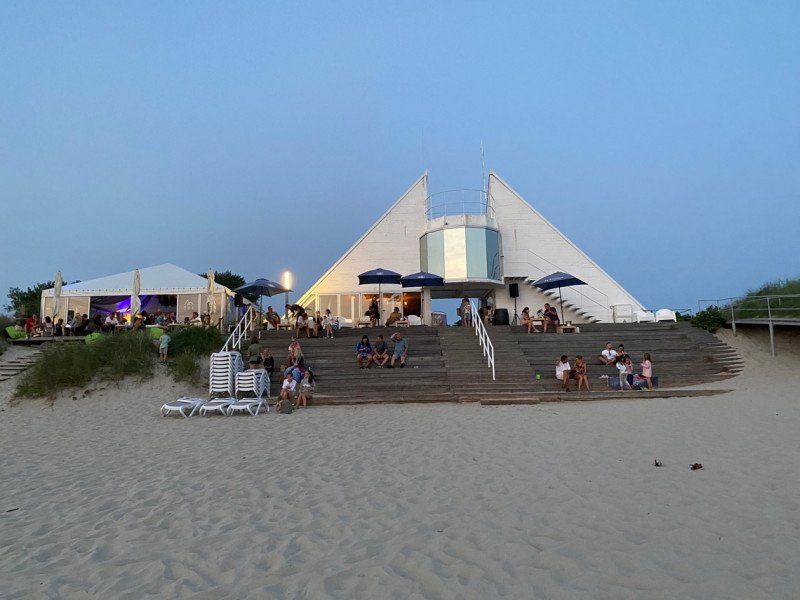
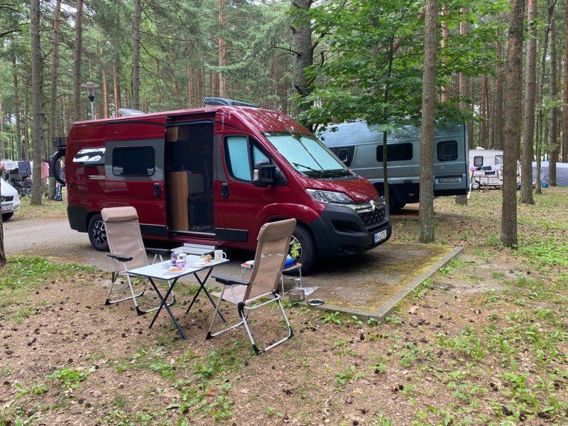
Sopot 34
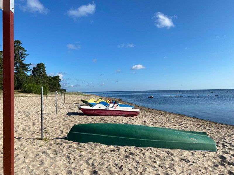
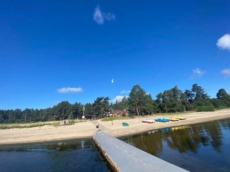
A beautiful seaside resort with a fantastic sandy beach z. B. Binz is in no way inferior.
From Sopot you can also cycle to the center of Gdańsk.
ul. Bitwy pod Plowcami 55, 81-731, Sopot, Polen
54° 26' 3.5" N 18° 34' 48.9" E
54.4343000 18.5802500
• Head southeast on ulica Bitwy pod Płowcami. Go for 227 m.
• Pass 2 roundabouts and continue on ulica Bitwy pod Płowcami. Go for 603 m.
• Continue on ulica Jelitkowska. Go for 670 m.
• Continue toward ulica Pomorska. Go for 31 m.
• Take the 1st exit from roundabout onto ulica Pomorska. Go for 880 m.
• Turn left onto ulica Chłopska. Go for 1.9 km.
• Continue on aleja Rzeczypospolitej. Go for 2.1 km.
• Continue on aleja Legionów. Go for 785 m.
• Turn left onto ulica Adama Mickiewicza. Go for 482 m.
• Turn right onto aleja gen. Józefa Hallera. Go for 852 m.
• Turn slightly right onto aleja gen. Józefa Hallera. Go for 411 m.
• Turn left onto aleja Zwycięstwa (468) toward Centrum. Go for 2.2 km.
• Continue on ulica Podwale Grodzkie (E75). Go for 951 m.
• Take ramp onto ulica Podwale Przedmiejskie (501) toward Warszawa/7/Stogi/E77/Sobieszewo/Świbno. Go for 948 m.
• Make a U-Turn at ulica Chmielna onto ulica Podwale Przedmiejskie (501). Go for 146 m.
• Turn right onto ulica Kotwiczników. Go for 114 m.
• Turn left onto ulica Ogarna. Go for 81 m.
• Turn right onto ulica Mieszczańska. Go for 115 m.
• Arrive at ulica Mieszczańska. Your destination is on the left.
☍
13,4 km
( 23 min.)
Day
Day
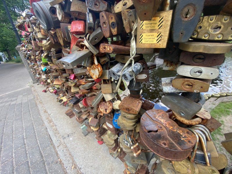
Langer Markt, Długa, Danzig, Polen
Długa, 80-831 Gdańsk, Polen
54° 20' 53.9" N 18° 39' 14.5" E
54.3482974 18.6540405
• Head toward ulica Długi Targ on ulica Mieszczańska. Go for 115 m.
• Turn right onto ulica Ogarna. Go for 112 m.
• Turn left onto ulica Słodowników. Go for 109 m.
• Turn right onto ulica Podwale Przedmiejskie (501). Go for 566 m.
• Make a U-Turn at ulica 3 Maja onto aleja Armii Krajowej (501). Go for 2.2 km.
• Keep right onto ulica Elbląska (501) toward Warszawa/7/Elbląg/E77/Stogi/Lotnisko/Westerplatte/Kopenhaga/Trelleborg. Go for 1.7 km.
• Take ramp onto 89 toward A1/Łódź/Warszawa/Szczecin. Go for 3.3 km.
• Take left ramp onto E77 toward Warszawa. Go for 32.4 km.
• Take ramp onto 55 toward Malbork/Kwidzyn. Go for 1.2 km.
• Take the 2nd exit from roundabout onto 55 toward Malbork/Kwidzyn. Go for 20.1 km.
• Turn left onto aleja Rodła (22/55) toward Elbląg/Grudziądz. Go for 948 m.
• Turn left onto ulica Adama Mickiewicza toward Centrum. Go for 151 m.
• Take the 1st exit from rondo im. Solidarności roundabout onto ulica Adama Mickiewicza. Go for 68 m.
• Turn slightly left onto ulica Tadeusza Kościuszki. Go for 74 m.
• Take the 3rd exit from rondo im. Kazimierza Jagiellończyka roundabout onto ulica Piastowska. Go for 236 m.
• Turn slightly right onto ulica Starościńska. Go for 201 m.
• Turn slightly left onto ulica Starościńska. Go for 176 m.
• Arrive at ulica Starościńska.
☍
63,6 km
( 50 min.)
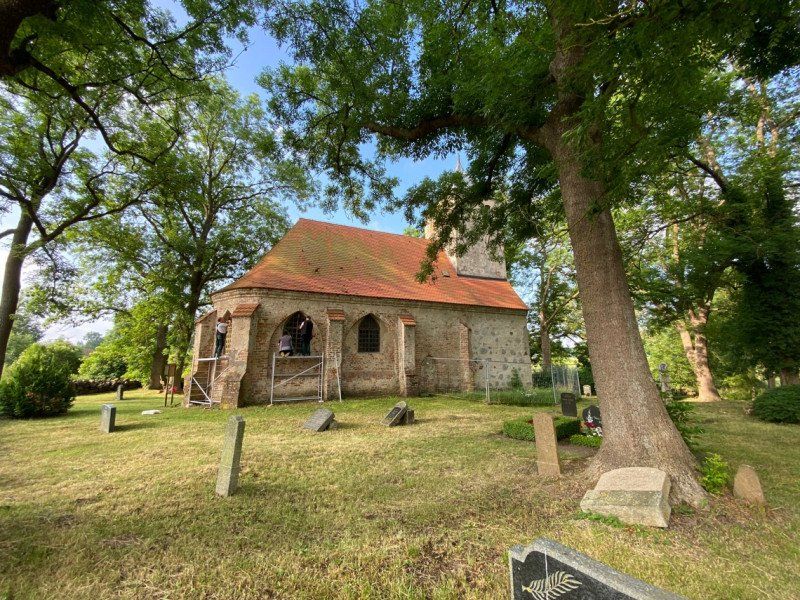
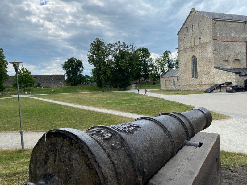
Marienburg (Ordensburg)
A must visit when you're in the corner. I was really enthusiastic about the reconstruction work of the Polish restorers.
54° 2' 22.8" N 19° 1' 39.7" E
54.0396781 19.0276950
• Head southwest on ulica Starościńska. Go for 273 m.
• Turn slightly left onto ulica Piastowska. Go for 100 m.
• Turn right onto ulica H. i S. Sierakowskich. Go for 189 m.
• Turn right onto ulica Józefa Piłsudskiego. Go for 46 m.
• Turn left onto ulica 17 Marca. Go for 207 m.
• Turn right onto aleja Rodła (22). Go for 586 m.
• Turn right onto ulica Wałowa (55) toward Nowy Dwór Gd. Go for 20.0 km.
• Take the 2nd exit from roundabout onto 55 toward S7/E77/Gdańsk/Warszawa. Go for 886 m.
• Take ramp onto E77 toward Warszawa. Go for 114 km.
• Take ramp onto S51 toward Olsztyn/Bezledy. Go for 19.9 km.
• Take ramp onto S16/S51 toward Augustów/Bartoszyce. Go for 53.1 km.
• Keep left onto S16 toward 16/Augustów. Go for 15.1 km.
• Keep right onto 16. Go for 723 m.
• Pass 2 roundabouts and continue on 16. Go for 56.7 km.
• Turn right onto ulica Giżycka (16/63) toward Augustów/Łomża. Go for 213 m.
• Continue on ulica Rynek (16) toward Ełk/Augustów. Go for 29.1 km.
• Take the 3rd exit from roundabout onto 16 toward Augustów/Gołdap/Białystok. Go for 7.0 km.
• Take ramp onto S61. Go for 31.3 km.
• Continue on E67. Go for 11.6 km.
• Take ramp toward Suwałki/Strefa SSSE/Olecko. Go for 328 m.
• Take the 2nd exit from roundabout onto 8 toward Płociczno. Go for 2.4 km.
• Turn right onto Dubowo Pierwsze. Go for 1.3 km.
• Arrive at Dubowo Pierwsze. Your destination is on the right.
☍
365,4 km
(4 hrs. 3 min.)
Parkplatz im Wald
16-413
54° 1' 55.1" N 22° 56' 0.1" E
54.0319808 22.9333681
• Head northwest on Dubowo Pierwsze. Go for 1.3 km.
• Turn left onto 8. Go for 2.3 km.
• Take the 2nd exit from roundabout onto E67 toward Kaunas. Go for 37.1 km.
• Continue on A5. Go for 186 m.
• Continue on Europos gatvė (A5). Go for 80.1 km.
• Take ramp onto A5 toward Kaunas/Vilnius/Klaipėda/A1/E85/Ryga/Rīga. Go for 16.5 km.
• Take left ramp onto A1/A5 toward Vilnius/Klaipėda/Ryga. Go for 467 m.
• Take the exit toward Klaipėda/Ryga/Rīga onto A1. Go for 13.0 km.
• Take the exit toward Panevėžys/Ryga/Rīga onto A8. Go for 11.8 km.
• Continue on A8. Go for 21.3 km.
• Take ramp onto J. Basanavičiaus gatvė (229) toward Kėdainiai. Go for 3.8 km.
• Turn right onto 2008. Go for 1.9 km.
• Continue on Melioratorių gatvė (2008). Go for 2.8 km.
• Continue on Lanko gatvė (2008). Go for 2.6 km.
• Continue on 2008. Go for 78 m.
• Continue on Repengių kaimas (2008). Go for 832 m.
• Continue on 2008. Go for 5.6 km.
• Continue on Šventybrastis (2008). Go for 852 m.
• Continue on 2008. Go for 578 m.
• Continue on Bažnyčios gatvė (2008). Go for 1.8 km.
• Continue on 2008. Go for 5.7 km.
• Continue on Barinės kaimas (2008). Go for 495 m.
• Continue on 2008. Go for 1.7 km.
• Continue on Pušyno gatvė (2008). Go for 3.9 km.
• Continue on 195. Go for 20.8 km.
• Take the 3rd exit from roundabout onto A17 toward Ryga/Rīga. Go for 9.3 km.
• Keep right toward Ryga/Riga/A10. Go for 35 m.
• Take the 2nd exit from roundabout onto A17 toward Ryga/Riga. Go for 6.7 km.
• Keep right toward Ryga/Rīga/Pasvalys. Go for 69 m.
• Take the 3rd exit from roundabout onto A10 toward Ryga/Rīga/Pasvalys. Go for 14.2 km.
• Continue on A10 toward Ryga/Riga. Go for 15.4 km.
• Take the 2nd exit from roundabout onto Baltijos Kelio gatvė (A10) toward Ryga. Go for 27.3 km.
• Continue on A7. Go for 19.4 km.
• Take the 1st exit from roundabout onto Kalna iela (A7) toward Iecava/Rīga. Go for 59.2 km.
• Turn slightly right toward Sigulda/A2/E77/Pleskava/A6/E22. Go for 80 m.
• Continue on Ūpju iela. Go for 708 m.
• Continue on Jāņa Čakstes gatve. Go for 495 m.
• Keep left onto Dienvidu tilts toward Sigulda/A2/E77/Pleskava/A6/E22. Go for 1.6 km.
• Keep left onto Dienvidu tilts toward Sigulda/A2/Pleskava/E77/A1/E67. Go for 1.9 km.
• Keep left onto Lubānas iela (P4) toward Sigulda/A2/E77/Pleskava/Pskov/A1/A3/E67/Lubānas iela. Go for 4.1 km.
• Keep left onto Lubānas iela (P4). Go for 44 m.
• Take the 2nd exit from roundabout toward A2. Go for 167 m.
• Continue on Juglas iela. Go for 1.4 km.
• Take the 2nd exit from roundabout onto Juglas iela toward Sigulda/Pleskava/A2/Pskov/E77/A1/A3/E67. Go for 3.9 km.
• Take ramp onto Brīvības gatve (A2). Go for 4.5 km.
• Take ramp onto Senču prospekts (A1) toward Ainaži/Tallina. Go for 6.1 km.
• Keep left onto Viļņu iela (A1) toward Ainaži/Tallina. Go for 52.0 km.
• Turn left onto P11 toward Tūja. Go for 2.3 km.
• Continue on Rīgas iela (P11). Go for 285 m.
• Continue on Liedaga iela (P11). Go for 49 m.
• Continue on Jūras iela (P11). Go for 198 m.
• Turn right onto Jūras iela. Go for 364 m.
• Arrive at Jūras iela.
☍
469,2 km
(5 hrs. 14 min.)
Day
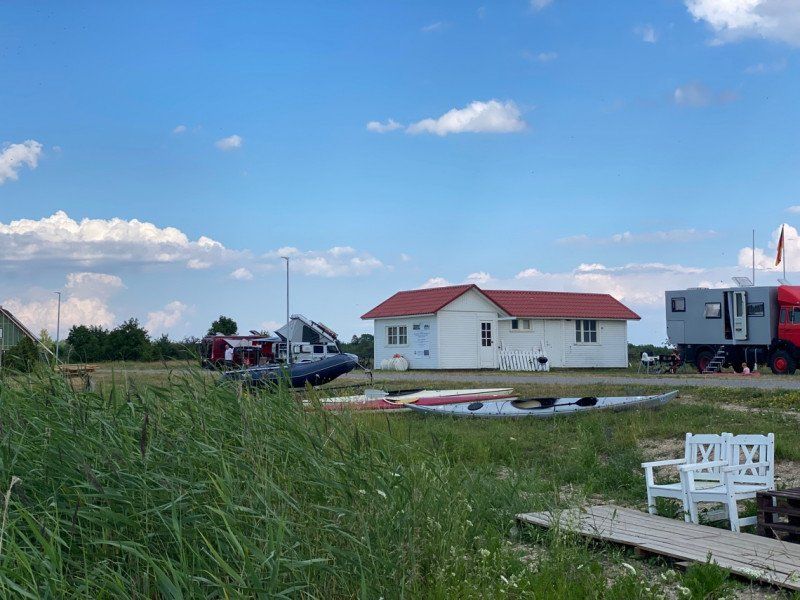
Camping "Jūrasdzeņi"
A really beautiful campsite right on the Gulf of Rigan with great sanitary facilities. There is also a small beach bar on the beach. What more do you want. :-)
Jūras str. 10, LV-4022, Tūja, Lettland
57° 29' 27.6" N 24° 22' 52.7" E
57.4910100 24.3813000
• Head southeast on Jūras iela. Go for 364 m.
• Turn left onto Jūras iela (P11). Go for 198 m.
• Continue on Liedaga iela (P11). Go for 49 m.
• Continue on Rīgas iela (P11). Go for 285 m.
• Continue on P11. Go for 2.3 km.
• Turn left onto A1. Go for 44.1 km.
• Continue on E67. Go for 59.1 km.
• Turn right onto Liivi tee (E67) toward Tallinn/Rakvere/5/60/Lihula/10. Go for 2.5 km.
• Continue on Ehitajate tee (E67) toward Tallinn/60/10/Lihula/Lennujaam. Go for 5.2 km.
• Continue on Lennuvälja tee (60) toward Lihula/10/Audru. Go for 984 m.
• Pass 3 roundabouts and continue on 60. Go for 2.2 km.
• Keep right onto 60. Go for 32.0 km.
• Turn left onto 180 toward 10/Virtsu/Karuse. Go for 19.6 km.
• Continue on Lihula metskond (180). Go for 55 m.
• Continue on 180. Go for 3.7 km.
• Turn left onto 10. Go for 12.8 km.
• Continue on Tallinna maantee. Go for 143 m.
• Continue on Tallinna maantee. Go for 173 m.
• Take the Virtsu-Kuivastu Ferry. Stay on for 6.7 km.
• Head west on 10. Go for 27.1 km.
• Turn left onto 132 toward Laimjala/Pöide. Go for 15.8 km.
• Turn left toward Kuressaare metskond. Go for 945 m.
• Continue on Kuressaare metskond. Go for 2.2 km.
• Arrive at your destination on the left.
☍
238,6 km
(3 hrs. 22 min.)
Day
Day
Day
Köiguste Camping
A really cool campsite with a 360 ° view of the water.
Kõiguste sadam, 94421, Kõiguste, Estland
58° 22' 17.2" N 22° 58' 47.6" E
58.3714350 22.9799010
• Head northeast. Go for 1.8 km.
• Continue on Kuressaare metskond. Go for 1.4 km.
• Turn right onto 132. Go for 15.8 km.
• Turn right onto 10. Go for 27.1 km.
• Take the Virtsu-Kuivastu Ferry. Stay on for 6.7 km.
• Head southeast. Go for 24 m.
• Continue on Tallinna maantee. Go for 215 m.
• Continue on Tallinna maantee. Go for 101 m.
• Continue on Tallinna maantee. Go for 67.3 km.
• Turn right onto 9. Go for 39.6 km.
• Keep right onto 110 toward Tallinn. Go for 478 m.
• Continue on E67. Go for 8.4 km.
• Take ramp onto E265 toward 1/Narva/E20/2/Tartu/E263/Maardu. Go for 18.9 km.
• Take the 2nd exit from roundabout onto E265 toward Maardu. Go for 11.2 km.
• Take the 2nd exit from roundabout onto Rahu tee toward Laagna Tee. Go for 895 m.
• Turn right onto Kristjan Kärberi. Go for 475 m.
• Turn right onto Ussimäe tee. Go for 768 m.
• Keep left onto Ussimäe tee. Go for 30 m.
• Turn left onto Narva maantee. Go for 1.3 km.
• Turn right onto Kose tee toward Pirita. Go for 1.8 km.
• Continue on Rummu tee. Go for 892 m.
• Turn right onto Pirita tee. Go for 119 m.
• Turn left onto Purje. Go for 224 m.
• Turn left onto Purje. Go for 150 m.
• Turn right onto Purje. Go for 131 m.
• Turn right. Go for 19 m.
• Arrive at your destination on the right.
☍
205,9 km
(2 hrs. 56 min.)
Day
Day
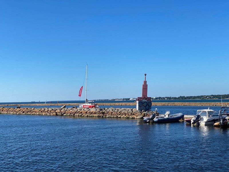
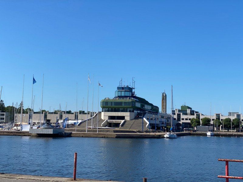
Pirita Harbor Camping
Here we stayed in the marina that hosted the sailing Olympic Games in 1980. Interesting historical place. We didn't expect that at all.
Purje 13, 11911, Tallin, Estland
59° 28' 1.6" N 24° 49' 28.3" E
59.4671234 24.8245220
• Head toward Purje. Go for 19 m.
• Turn left onto Purje. Go for 131 m.
• Turn left onto Purje. Go for 123 m.
• Turn right onto Regati puiestee. Go for 175 m.
• Turn left onto Toominga. Go for 215 m.
• Turn right onto Pirita tee. Go for 3.0 km.
• Continue on Narva maantee (E20/E67) toward Keskus,C/Mustamäe. Go for 242 m.
• Turn left onto Narva maantee toward Keskus,C. Go for 2.2 km.
• Take the 2nd exit from Viru väljak roundabout onto Viru väljak (4). Go for 424 m.
• Turn right onto Väike-Karja. Go for 181 m.
• Continue on Suur-Karja. Go for 38 m.
• Turn left onto Kuninga. Go for 77 m.
• Turn right onto Kullassepa. Go for 72 m.
• Continue on Raekoja plats. Go for 27 m.
• Arrive at Raekoja plats. Your destination is on the left.
☍
6,9 km
( 11 min.)
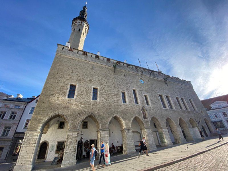
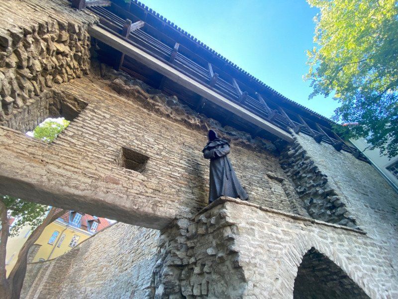
Altstadt von Tallinn
Tallinn really has an interesting old town, it is very touristy and a bit too boring for us.
59° 26' 14.2" N 24° 44' 42.6" E
59.4372894 24.7451780
• Head east on Raekoja plats. Go for 28 m.
• Turn right onto Vanaturu kael. Go for 65 m.
• Turn right onto Vana turg. Go for 42 m.
• Turn left onto Suur-Karja. Go for 38 m.
• Turn left onto Väike-Karja. Go for 181 m.
• Turn right onto Pärnu maantee (4). Go for 212 m.
• Turn right onto Vabaduse väljak. Go for 175 m.
• Continue on Kaarli puiestee. Go for 364 m.
• Turn slightly left onto Luise. Go for 777 m.
• Continue on Endla toward Mustamäe/Öismäe. Go for 1.3 km.
• Continue on Paldiski maantee (8). Go for 3.1 km.
• Keep left onto Paldiski maantee (8). Go for 18.6 km.
• Keep right toward 17/Paldiski/Keila. Go for 12 m.
• Take the 1st exit from roundabout onto E265 toward 17/Paldiski/Keila. Go for 192 m.
• Keep right toward Uus-Paldiski maantee. Go for 20 m.
• Pass 4 roundabouts and continue on Paldiski maantee (E265). Go for 20.3 km.
• Turn right onto Leetse tee toward Leetse. Go for 2.4 km.
• Turn left onto Kadaka tee. Go for 1.2 km.
• Continue straight ahead. Go for 383 m.
• Turn left. Go for 83 m.
• Arrive at your destination on the right.
☍
49,5 km
( 47 min.)
Day
RMK Leetse telkimisala
We really liked the RMK places. Certainly not suitable for large motorhomes.
76806
59° 22' 19.9" N 24° 7' 16.4" E
59.3722060 24.1212297
• Head toward Keila metskond. Go for 83 m.
• Turn right toward Kadaka tee. Go for 383 m.
• Continue on Kadaka tee. Go for 1.2 km.
• Turn right onto Leetse tee. Go for 2.4 km.
• Continue on Soomepoiste tee (E265). Go for 1.0 km.
• Turn left onto 174 toward Padise/Madise/17. Go for 680 m.
• Continue on Sarapuu (174). Go for 167 m.
• Continue on 174. Go for 5.9 km.
• Continue on Metsa tee (174). Go for 273 m.
• Continue on 174. Go for 6.9 km.
• Turn right onto 17. Go for 4.3 km.
• Turn right onto 230. Go for 3.2 km.
• Continue on Kõmmaste (230). Go for 45 m.
• Continue on 230. Go for 125 m.
• Continue on Alu (230). Go for 26 m.
• Continue on 230. Go for 2.3 km.
• Continue on Harju-Risti (230). Go for 17 m.
• Continue on 230. Go for 26.6 km.
• Turn right. Go for 853 m.
• Turn slightly right toward Peraküla. Go for 993 m.
• Continue on Peraküla. Go for 1.5 km.
• Turn left. Go for 1.7 km.
• Turn right. Go for 179 m.
• Turn right. Go for 141 m.
• Continue straight ahead. Go for 120 m.
• Arrive at your destination on the left.
☍
61,2 km
( 59 min.)
Day
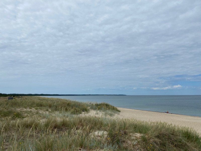
Strand
91220
59° 12' 49.1" N 23° 34' 36.2" E
59.2136498 23.5767120
• Head south. Go for 261 m.
• Turn left. Go for 179 m.
• Turn left. Go for 1.7 km.
• Turn right toward Peraküla. Go for 1.4 km.
• Continue on Peraküla. Go for 1.9 km.
• Turn right onto 230. Go for 8.9 km.
• Continue on Kokase (230). Go for 130 m.
• Continue on 230. Go for 4.4 km.
• Continue on Ees-Nurme tee (230). Go for 317 m.
• Continue on 230. Go for 7.2 km.
• Continue on Sutlepa keskus (230). Go for 57 m.
• Continue on 230. Go for 5.1 km.
• Continue on Vedra küla (230). Go for 167 m.
• Continue on 230. Go for 4.0 km.
• Turn right onto 17. Go for 5.0 km.
• Turn right onto 9. Go for 5.5 km.
• Take the 2nd exit from roundabout onto Tallinna maantee (9). Go for 576 m.
• Keep right toward Tallinna maantee. Go for 26 m.
• Pass 2 roundabouts and continue on Tallinna maantee (9). Go for 1.9 km.
• Turn right onto Posti. Go for 735 m.
• Continue on Karja. Go for 88 m.
• Turn right onto Karja. Go for 23 m.
• Arrive at Karja.
☍
49,7 km
( 50 min.)
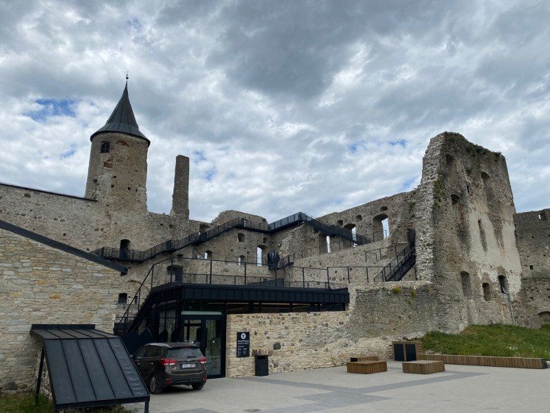
Bischofsburg Haapsalu, Lossiplats, Haapsalu, Kreis Lääne, Estland
Lossiplats 3, Haapsalu, 90502 Lääne maakond, Estland
58° 56' 49.9" N 23° 32' 19.2" E
58.9471919 23.5386747
• Head southwest on Karja. Go for 23 m.
• Turn left onto Karja. Go for 88 m.
• Continue on Posti. Go for 719 m.
• Continue on Lihula maantee (31). Go for 10.1 km.
• Turn right onto 111. Go for 8.1 km.
• Turn right onto 112. Go for 7.8 km.
• Continue on Taavi. Go for 63 m.
• Continue on Mereranna. Go for 183 m.
• Arrive at Mereranna.
☍
27,0 km
( 37 min.)
Day
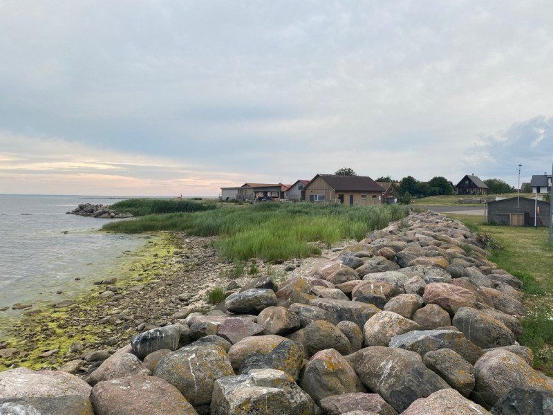
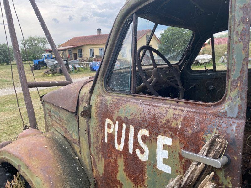
Puise Nina Camping
A very nice campsite at the end of the world. The operator family is very friendly and helpful, we would always come back.
Matsalu National Park
58° 45' 52.3" N 23° 26' 56.4" E
58.7645166 23.4490097
• Head southeast on Mereranna. Go for 183 m.
• Continue on Taavi. Go for 63 m.
• Continue on 112. Go for 1.8 km.
• Continue on 112. Go for 6.1 km.
• Turn left onto 111. Go for 8.1 km.
• Turn right onto 31. Go for 25.9 km.
• Turn right onto 10. Go for 16.0 km.
• Turn left onto Uus-Pärnu maantee (60). Go for 52.5 km.
• Take the 2nd exit from roundabout onto Haapsalu maantee (60). Go for 303 m.
• Keep left onto 60. Go for 121 m.
• Pass 3 roundabouts and continue on Lennuvälja tee (60). Go for 2.9 km.
• Continue on Ehitajate tee. Go for 5.7 km.
• Keep left onto Liivi tee (E67) toward Riia/Ikla/Valga/6. Go for 1.9 km.
• Turn left onto Riia maantee (E67) toward Riia/6/Ikla/Valga. Go for 523 m.
• Continue on Riia maantee (E67) toward Riia/6/Ikla/Valga. Go for 58.6 km.
• Continue on A1. Go for 44.0 km.
• Turn right onto P11 toward Tūja. Go for 2.4 km.
• Continue on Rīgas iela (P11). Go for 285 m.
• Continue on Liedaga iela (P11). Go for 49 m.
• Continue on Jūras iela (P11). Go for 198 m.
• Turn right onto Jūras iela. Go for 364 m.
• Arrive at Jūras iela.
☍
227,9 km
(2 hrs. 52 min.)
Camping "Jūrasdzeņi"
Jūras str. 10, LV-4022, Tūja, Lettland
57° 29' 27.6" N 24° 22' 52.7" E
57.4910100 24.3813000
• Head southeast on Jūras iela. Go for 364 m.
• Turn left onto Jūras iela (P11). Go for 198 m.
• Continue on Liedaga iela (P11). Go for 49 m.
• Continue on Rīgas iela (P11). Go for 285 m.
• Continue on P11. Go for 2.3 km.
• Turn right onto A1. Go for 57.1 km.
• Take ramp onto Siguldas šoseja (A2) toward Rīga. Go for 11.4 km.
• Turn right onto Cēsu iela. Go for 608 m.
• Turn right onto Tallinas iela. Go for 302 m.
• Continue on Aristida Briāna iela. Go for 657 m.
• Turn left onto Krišjāņa Valdemāra iela. Go for 2.6 km.
• Turn right onto Krišjāņa Valdemāra iela. Go for 279 m.
• Turn right onto Ķīpsalas iela. Go for 798 m.
• Continue on Zvejnieku iela. Go for 479 m.
• Turn left onto Tīklu iela. Go for 56 m.
• Continue on Matrožu iela. Go for 587 m.
• Arrive at Matrožu iela. Your destination is on the right.
☍
78,1 km
(1 hrs. 10 min.)
Day
Day
Riverside Camping
Matrozu 15, 1048, Riga, Lettland
56° 57' 56.8" N 24° 4' 49.2" E
56.9657700 24.0803300
• Head north on Matrožu iela. Go for 14 m.
• Turn right onto Matrožu iela. Go for 26 m.
• Make a U-Turn onto Matrožu iela. Go for 21 m.
• Turn left onto Matrožu iela. Go for 616 m.
• Continue on Tīklu iela. Go for 56 m.
• Turn right onto Zvejnieku iela. Go for 479 m.
• Continue on Ķīpsalas iela. Go for 798 m.
• Turn right onto Krišjāņa Valdemāra iela. Go for 67 m.
• Keep right onto Krišjāņa Valdemāra iela. Go for 219 m.
• Turn left onto Krišjāņa Valdemāra iela. Go for 92 m.
• Turn left onto Krišjāņa Valdemāra iela. Go for 432 m.
• Keep left onto Krišjāņa Valdemāra iela. Go for 975 m.
• Turn right onto Noliktavas iela. Go for 117 m.
• Turn left onto Torņa iela. Go for 76 m.
• Turn right onto Jēkaba iela. Go for 175 m.
• Arrive at Jēkaba iela. Your destination is on the right.
☍
4,2 km
( 9 min.)
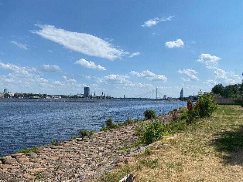
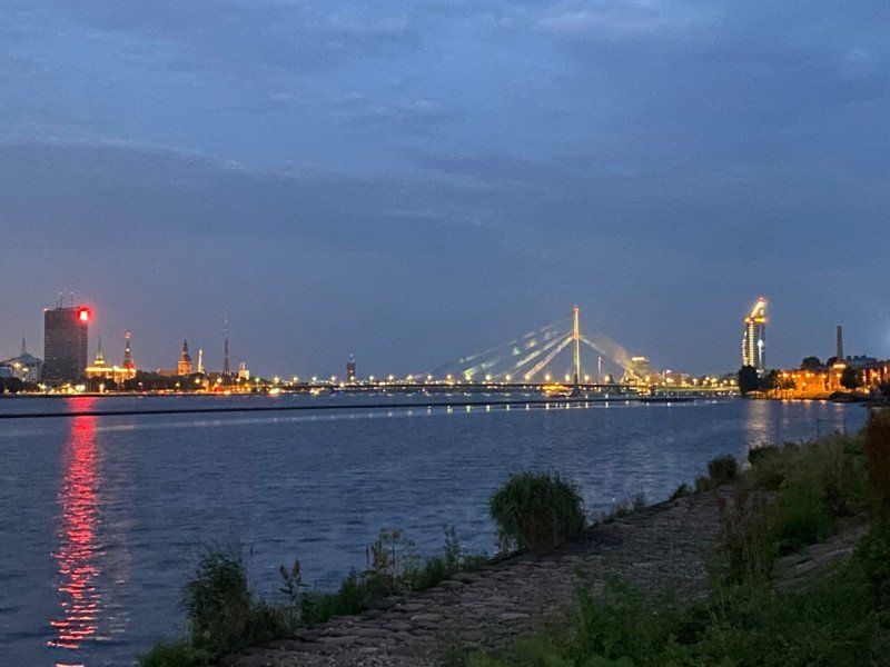
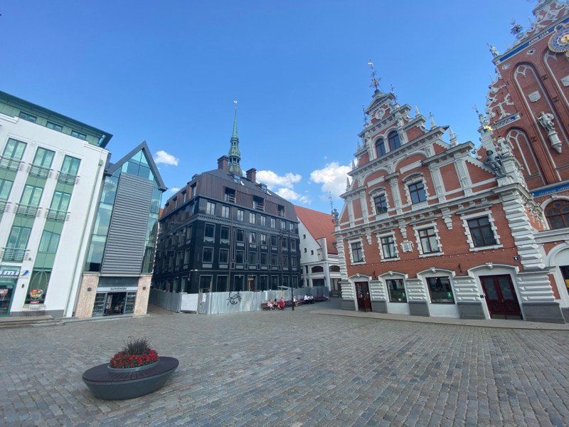
Riga, Lettland
We are impressed by Riga, a beautiful twin city of Bremen. We will definitely come back - more time with us to explore the great city more closely.
56° 56' 58.7" N 24° 6' 18.7" E
56.9496487 24.1051864
• Head south on Jēkaba iela.
• Turn left onto Smilšu iela. Go for 73 m.
• Turn left onto Aldaru iela. Go for 137 m.
• Turn left onto Torņa iela. Go for 68 m.
• Turn right onto Jēkaba iela. Go for 71 m.
• Continue on Jēkaba laukums. Go for 86 m.
• Turn left onto Krišjāņa Valdemāra iela. Go for 2.1 km.
• Continue on Kalnciema iela. Go for 1.9 km.
• Continue on Lielirbes iela. Go for 1.7 km.
• Continue on Kārļa Ulmaņa gatve (A10). Go for 132 m.
• Keep left onto Kārļa Ulmaņa gatve (A10). Go for 11.7 km.
• Continue on Rīgas iela. Go for 569 m.
• Continue on Pērkona iela. Go for 480 m.
• Continue on Rīgas iela. Go for 1.8 km.
• Continue on Meža prospekts. Go for 520 m.
• Continue on Lienes iela. Go for 1.2 km.
• Continue on Jomas iela. Go for 475 m.
• Continue on Zigfrīda Meierovica prospekts. Go for 979 m.
• Continue on Dubultu prospekts. Go for 183 m.
• Keep right onto Dubultu prospekts. Go for 2.6 km.
• Continue on Mellužu prospekts. Go for 2.2 km.
• Continue on Asaru prospekts. Go for 3.3 km.
• Continue on Ventspils šoseja toward Ķemeri/Talsi. Go for 40 m.
• Take the 1st exit from roundabout onto Talsu šoseja (P128) toward Ķemeri/Talsi. Go for 1.2 km.
• Pass 2 roundabouts and continue on Talsu šoseja (P128). Go for 4.2 km.
• Continue toward Talsi. Go for 33 m.
• Take the 1st exit from roundabout onto Kolkas iela (P128) toward Talsi. Go for 26.7 km.
• Take the 1st exit from roundabout onto P131 toward Kolka. Go for 11.7 km.
• Turn right. Go for 183 m.
• Arrive at your destination.
☍
76,1 km
(1 hrs. 11 min.)
Day
Camping Abragciems
Abragciems, 3113, Engure, Lettland
57° 11' 52" N 23° 12' 24" E
57.1977800 23.2066700
• Head west. Go for 183 m.
• Turn right onto P131. Go for 79.1 km.
• Take the 1st exit from roundabout toward Kolkasrags. Go for 412 m.
• Turn right. Go for 72 m.
• Arrive at your destination on the left.
☍
79,7 km
( 59 min.)
Day
Day
Kap Kolka
Unfortunately we had no peace to explore this national park as it is teeming with hoverflies.
Nationalpark Slītere
57° 45' 24" N 22° 36' 1.6" E
57.7566627 22.6004363
• Head northwest. Go for 77 m.
• Turn right toward P124. Go for 393 m.
• Take the 2nd exit from roundabout onto P124 toward Ventspils. Go for 75.1 km.
• Turn right onto Kurzemes iela (A10). Go for 2.7 km.
• Take the 2nd exit from roundabout onto P51. Go for 3.7 km.
• Keep left toward Kuldīga/P108/Centrs Ventspils/P111. Go for 35 m.
• Take the 2nd exit from roundabout onto A10 toward Kuldīga/P108/Centrs Ventspils/P111. Go for 427 m.
• Turn right onto Lielais prospekts (A10) toward Centrs/Konteineru Terminālis/Prāmju Terminālis. Go for 1.4 km.
• Continue on Lielais prospekts (V1308). Go for 345 m.
• Continue on Lielais prospekts. Go for 559 m.
• Turn right onto Lielais prospekts. Go for 161 m.
• Turn left onto Vasarnīcu iela. Go for 1.0 km.
• Turn right onto Vasarnīcu iela. Go for 22 m.
• Turn right onto Vasarnīcu iela. Go for 97 m.
• Turn right onto Vasarnīcu iela. Go for 20 m.
• Turn left onto Vasarnīcu iela. Go for 47 m.
• Turn left onto Vasarnīcu iela. Go for 49 m.
• Turn right onto Vasarnīcu iela. Go for 91 m.
• Arrive at Vasarnīcu iela. Your destination is on the left.
☍
86,2 km
(1 hrs. 5 min.)
Piejūras Kempings
57° 23' 2.2" N 21° 32' 3.8" E
57.3839332 21.5343859
• Head northwest on Vasarnīcu iela. Go for 30 m.
• Turn right onto Vasarnīcu iela. Go for 190 m.
• Turn right onto Vasarnīcu iela. Go for 20 m.
• Turn left onto Vasarnīcu iela. Go for 90 m.
• Turn slightly left onto Vasarnīcu iela. Go for 67 m.
• Turn left onto Vasarnīcu iela. Go for 556 m.
• Turn right onto Inženieru iela. Go for 1.6 km.
• Turn right onto Zvaigžņu iela (P108) toward Kuldīga/Liepāja/P111. Go for 12.4 km.
• Turn right onto P111 toward Liepāja. Go for 95.7 km.
• Turn right onto Lielā iela (A9) toward Liepāja. Go for 199 m.
• Turn left onto Bārtas iela (P113) toward Bārta/Rucava. Go for 613 m.
• Turn right onto M. Namiķa iela (V1222). Go for 619 m.
• Continue on V1222. Go for 2.2 km.
• Continue on Ālande (V1222). Go for 95 m.
• Continue on V1222. Go for 72 m.
• Turn left onto V1222. Go for 10.3 km.
• Continue on Poļi (V1222). Go for 1.2 km.
• Continue on V1222. Go for 9.9 km.
• Continue on Bārtas iela (V1222). Go for 1.4 km.
• Turn left onto A11 toward Klaipēda. Go for 22.5 km.
• Turn right onto V1221 toward Pape. Go for 7.7 km.
• Turn slightly right. Go for 297 m.
• Turn slightly left toward Pape. Go for 115 m.
• Turn slightly right onto Pape. Go for 645 m.
• Turn left. Go for 191 m.
• Arrive at your destination on the right.
☍
168,7 km
(2 hrs. 7 min.)
Day
Day
Camping Pukarags
After 10 km of arduous gravel road we landed on this beautiful campsite right by the sea. A beautiful place and definitely not overcrowded. If you want to have some peace and quiet, this is the right place for you.
Pape, 3477, Rucava, Lettland
56° 9' 33.5" N 21° 1' 32.8" E
56.1593100 21.0257700
• Head east. Go for 191 m.
• Turn right onto Pape. Go for 645 m.
• Turn slightly left toward V1221. Go for 1.0 km.
• Continue on V1221. Go for 7.1 km.
• Turn right onto A11. Go for 9.2 km.
• Continue on Liepojos plentas (A13). Go for 13.7 km.
• Take the 2nd exit from roundabout onto A13. Go for 29.8 km.
• Take ramp. Go for 347 m.
• Take the 2nd exit from roundabout onto Vilniaus plentas (A1) toward Klaipėda. Go for 1.5 km.
• Turn left toward Baltijos prospektas. Go for 908 m.
• Continue on Baltijos prospektas. Go for 785 m.
• Take the 1st exit from roundabout onto Taikos prospektas. Go for 874 m.
• Turn left onto Agluonos gatvė. Go for 640 m.
• Continue on Varnėnų gatvė toward Neringa/167. Go for 509 m.
• Turn right. Go for 76 m.
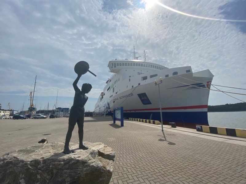
• Take the Kuršių-Klaipėda Ferry. Stay on for 539 m.
• Head toward Smiltynės gatvė on 2254. Go for 1.5 km.
• Take the 3rd exit from roundabout onto Smiltynės gatvė (167) toward Nida. Go for 5.6 km.
• Continue on 167. Go for 30.0 km.
• Turn right onto Nidos-Smiltynės plentas. Go for 153 m.
• Turn left onto Nidos-Smiltynės plentas. Go for 193 m.
• Arrive at Nidos-Smiltynės plentas. Your destination is on the left.
☍
105,4 km
(2 hrs. 3 min.)
Day
Day
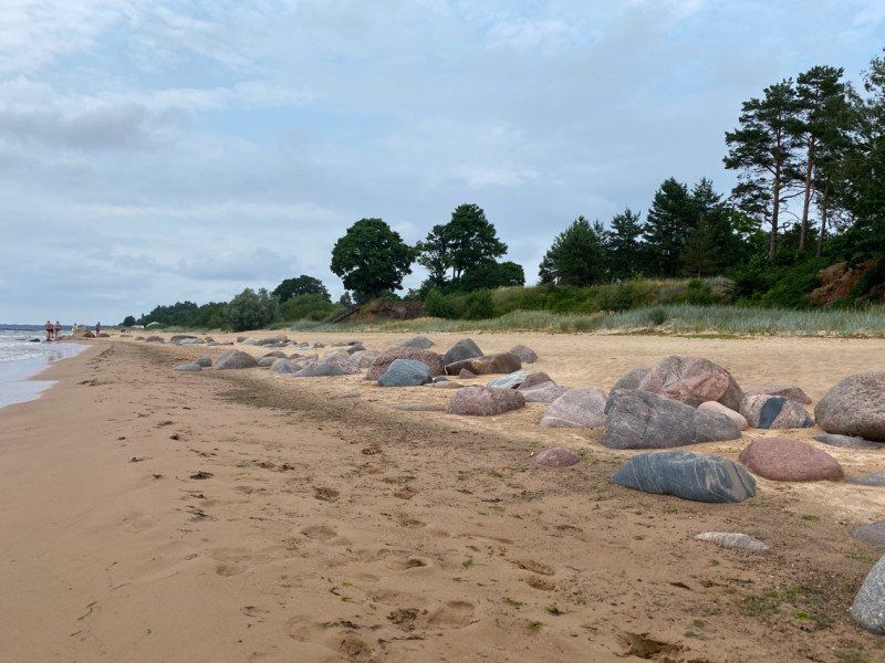
Kurische Nehrung
Modern buccaneers, we had to put € 26 for the ferry across the river on the table, then € 30 for entry to the national park, € 35 for a night at the campsite and then € 5 per person to get to the size of the dune To stroll. But okay, we're on vacation ;-)
PS The sandy beaches were really the most beautiful we have seen so far on the Baltic Sea.
55° 22' 36.9" N 21° 1' 50.5" E
55.3769191 21.0306942
• Head east on Nidos-Smiltynės plentas. Go for 193 m.
• Turn right onto Nidos-Smiltynės plentas. Go for 153 m.
• Turn left onto Nidos-Smiltynės plentas (167). Go for 35.6 km.
• Take the 1st exit from roundabout onto Smiltynės gatvė (2254). Go for 1.5 km.
• Take the Kuršių-Klaipėda Ferry. Stay on for 539 m.
• Head east. Go for 76 m.
• Continue on Varnėnų gatvė. Go for 470 m.
• Turn left onto Minijos gatvė. Go for 1.6 km.
• Turn left onto Pilies gatvė. Go for 829 m.
• Continue on Naujoji Uosto gatvė. Go for 677 m.
• Turn right onto Gegužės gatvė. Go for 118 m.
• Continue on S. Daukanto gatvė. Go for 315 m.
• Turn left onto H. Manto gatvė. Go for 1.8 km.
• Turn left onto P. Lideikio gatvė. Go for 1.9 km.
• Turn right onto Gvazdiku gatvė. Go for 2.8 km.
• Continue on Pamario gatvė. Go for 479 m.
• Turn right onto Šlaito gatvė. Go for 212 m.
• Turn right onto Šlaito gatvė. Go for 35 m.
• Arrive at Šlaito gatvė. Your destination is on the left.
☍
49,3 km
(1 hrs. 19 min.)
Day
Camping Pajūryje
Šlaito g. 3, 92281, Klaipėda, Litauen
55° 45' 58.5" N 21° 5' 25.2" E
55.7662500 21.0903300
• Head north on Šlaito gatvė. Go for 35 m.
• Turn left onto Šlaito gatvė. Go for 212 m.
• Turn left onto Pamario gatvė. Go for 479 m.
• Continue on Gvazdiku gatvė. Go for 2.7 km.
• Take the 3rd exit from roundabout onto P. Lideikio gatvė. Go for 2.0 km.
• Turn right onto H. Manto gatvė. Go for 1.8 km.
• Turn right onto S. Daukanto gatvė. Go for 315 m.
• Continue on Gegužės gatvė. Go for 118 m.
• Turn left onto Naujoji Uosto gatvė. Go for 677 m.
• Continue on Pilies gatvė. Go for 852 m.
• Continue on Sausio 15-osios gatvė. Go for 707 m.
• Turn right onto Rumpiškės gatvė. Go for 101 m.
• Turn right onto Taikos prospektas. Go for 73 m.
• Arrive at Taikos prospektas. Your destination is on the right.
☍
10,1 km
( 13 min.)
Day
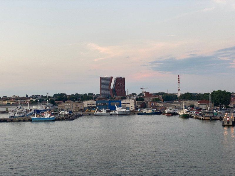
Klaipėda, Litauen
Sausio 15-osios g. 14A, Klaipėda 91139, Litauen
55° 42' 9.8" N 21° 8' 52.5" E
55.7027112 21.1479070
• Head east on Taikos prospektas. Go for 73 m.
• Turn left onto Rumpiškės gatvė. Go for 101 m.
• Turn right onto Sausio 15-osios gatvė. Go for 256 m.
• Turn right onto Tilžės gatvė. Go for 552 m.
• Turn right onto Šilutės plentas. Go for 1.7 km.
• Take the 3rd exit from roundabout onto Vilniaus plentas (A1) toward A13/E272/Palanga/141/Šilutė/Kaunas. Go for 204 km.
• Take the exit toward Marijampolė/Varšuva onto A5 (Vakarinis aplinkkelis). Go for 16.3 km.
• Take ramp onto Marijampolės gatvė (A5) toward Marijampolė/Varšuva/Warszawa. Go for 80.3 km.
• Continue on A5. Go for 188 m.
• Continue on E67. Go for 48.7 km.
• Keep left onto S61. Go for 164 km.
• Take left ramp onto trasa Bohaterów Bitwy Warszawskiej (E67). Go for 89.7 km.
• Keep left onto ulica Toruńska (E67) toward Wrocław/Centrum. Go for 800 m.
• Keep left onto trasa Bohaterów Bitwy Warszawskiej (E67) toward Poznań/A2/E30/Kraków/S7/E77/Lotnisko Chopina/Wrocław/Bemowo. Go for 16.9 km.
• Keep left onto Węzeł Konotopa toward Poznań/Łódź. Go for 113 m.
• Take ramp onto A2 (Autostrada Wolności). Go for 456 km.
• Continue on Autobahn der Freiheit (A12). Go for 57.6 km.
• Take exit 12 toward Hamburg/Prenzlau onto A10 (Autobahndreieck Spreeau). Go for 80.5 km.
• Continue on A24 (Autobahndreieck Havelland) toward Hamburg/Rostock. Go for 63.6 km.
• Take the exit toward Hamburg/Schwerin onto A24. Go for 152 km.
• Take exit 6 toward Lübeck/A1/Kiel/Grande. Go for 457 m.
• Continue on B404. Go for 18.8 km.
• Keep left onto A21 toward Kiel/Tremsbüttel. Go for 55.6 km.
• Continue on B404. Go for 16.8 km.
• Keep right onto Neue Hamburger Straße toward Plön/B76/Ostuferhafen/B502. Go for 204 m.
• Continue on Alte Lübecker Chaussee (K11). Go for 739 m.
• Turn slightly right onto Sophienblatt (K29). Go for 743 m.
• Turn left onto Ringstraße (K11/K29). Go for 1.2 km.
• Turn right onto Möllingstraße. Go for 201 m.
• Turn right onto Stiftstraße. Go for 114 m.
• Turn right onto Eckernförder Straße. Go for 208 m.
• Arrive at Eckernförder Straße. Your destination is on the left.
☍
1,529,1 km
(13 hrs. 38 min.)
Fähre
Ostsee
55° 27' 55.1" N 18° 29' 30.9" E
55.4652949 18.4919077
• Head toward Möllingstraße on Eckernförder Straße. Go for 14 m.
• Turn right onto Möllingstraße. Go for 281 m.
• Turn right onto Exerzierplatz (K12) toward Ostufer/Fähre. Go for 126 m.
• Continue on Schützenwall (L325). Go for 1.2 km.
• Continue on A215 toward Hamburg/A7/Flensburg/A210/Rendsburg/Ki-Mettenhof/Eckernförde/B76/Flughafen. Go for 23.0 km.
• Continue on A7. Go for 68.9 km.
• Keep left onto A7. Go for 14.7 km.
• Keep right onto A261 (Autobahndreieck Hamburg-Südwest) toward Bremen/Tötensen. Go for 9.0 km.
• Take exit 4 toward Osnabrück/Bremen/Rade onto A1. Go for 72.6 km.
• Take exit 53 toward Cuxhaven onto A27. Go for 15.9 km.
• Take exit 18 toward Bremen-Überseestadt/Bremen-Centrum/GVZ/Flughafen onto B6 (Autobahnzubringer Überseestadt). Go for 1.7 km.
• Keep left onto Autobahnzubringer Überseestadt (B6) toward Centrum/Überseestadt/GVZ. Go for 2.2 km.
• Take ramp onto Breitenweg toward Weserstadion/Centrum/Hauptbahnhof. Go for 907 m.
• Keep right onto Breitenweg toward Hauptbahnhof/Centrum. Go for 346 m.
• Turn right onto Bürgermeister-Smidt-Straße toward Neustadt. Go for 618 m.
• Arrive at Bürgermeister-Smidt-Straße. Your destination is on the left.
☍
211,4 km
(2 hrs. 2 min.)
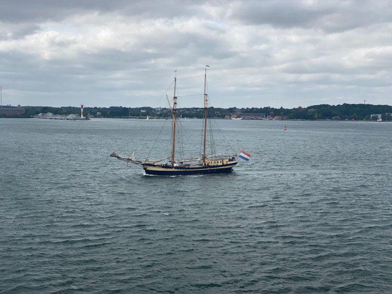
Fähre
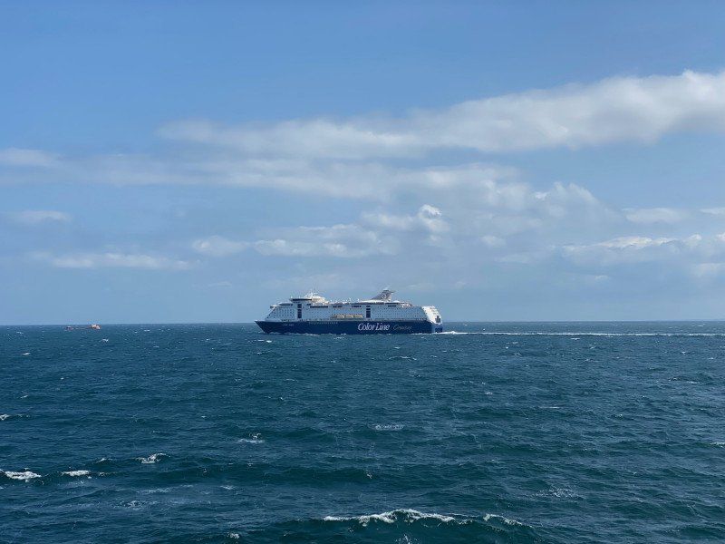
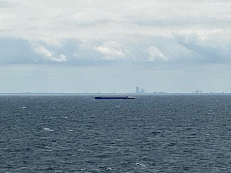
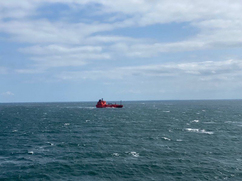
In wonderful weather with a little swell, we travel at 20 knots across the Baltic Sea. I am impressed how far you can see and how many ships are here.
Ostsee
54° 29' 18.3" N 10° 39' 19.5" E
54.4884240 10.6554047
Day
Kiel, Deutschland
Hello Kiel, Hello Germany, after a wonderful trip through the Baltic States, after a 20-hour ferry ride we are back home completely relaxed and rested, now another 2 hours on the motorway and we are at home. Originally we planned to take the ferry to the Baltic States and on the land way back we ultimately did it the other way around and it was exactly the right decision.
54° 19' 23.9" N 10° 7' 22" E
54.3232927 10.1227652
Bremen, Deutschland
53° 4' 45.5" N 8° 48' 6.1" E
53.0792962 8.8016937